NOTICE OF Local Planning
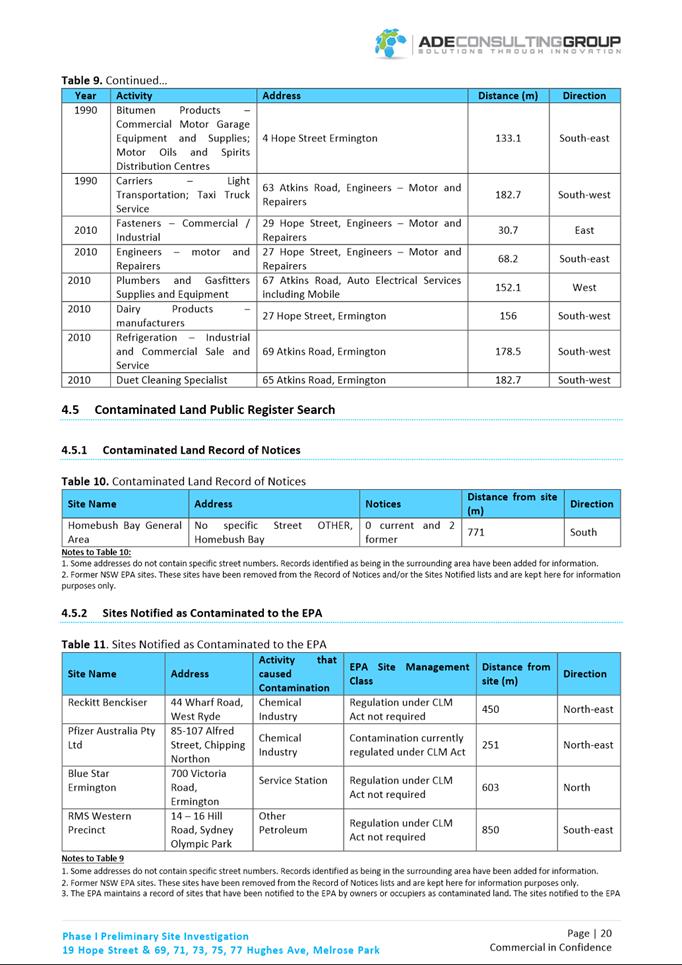
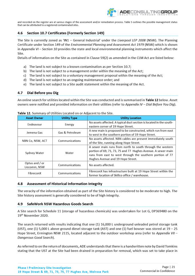
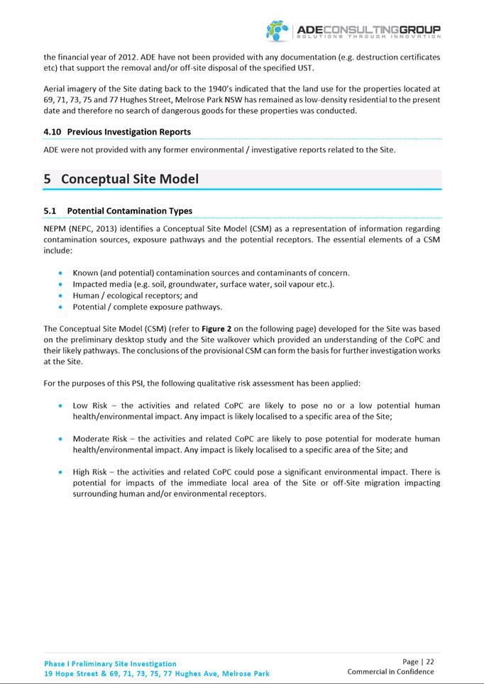
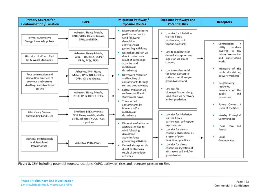
Panel MEETING
PUBLIC AGENDA
A Local Planning Panel meeting will be held via
audio-visual means Tuesday, 17 May 2022 at 3:30pm.
Brett Newman
CHIEF EXECUTIVE OFFICER
THIS PAGE LEFT BLANK INTENTIONALLY
Local Planning Panel 17
May 2022
TABLE OF CONTENTS
1 ACKNOWLEDGMENT
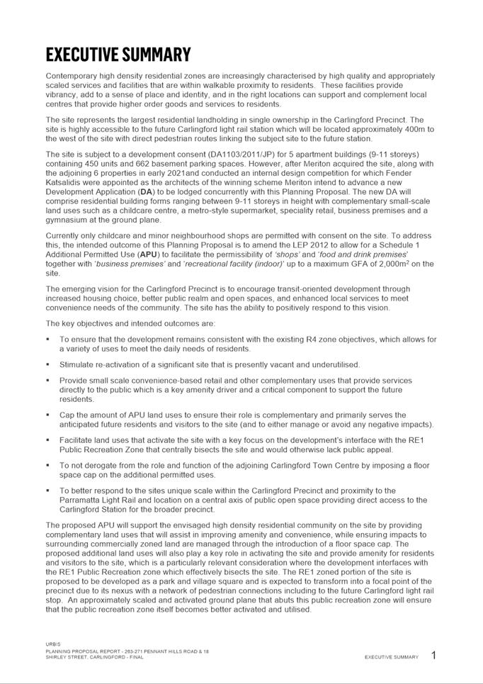
OF THE TRADITIONAL OWNERS OF LAND
The City of
Parramatta Council acknowledges the Burramattagal people of The Darug Nation as
the traditional owners of land in Parramatta and pays its respects to their
ancient culture and to their elders, past, present and emerging.
2 WEBCASTING
ANNOUNCEMENT
This public
meeting will be recorded. The recording will be archived and available on
Council’s website.
All care is taken to maintain your
privacy; however if you are in attendance in the public gallery, you should be
aware that your presence may be recorded.
3 APOLOGIES
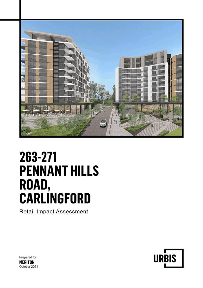
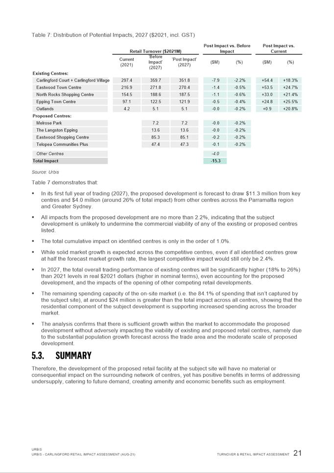
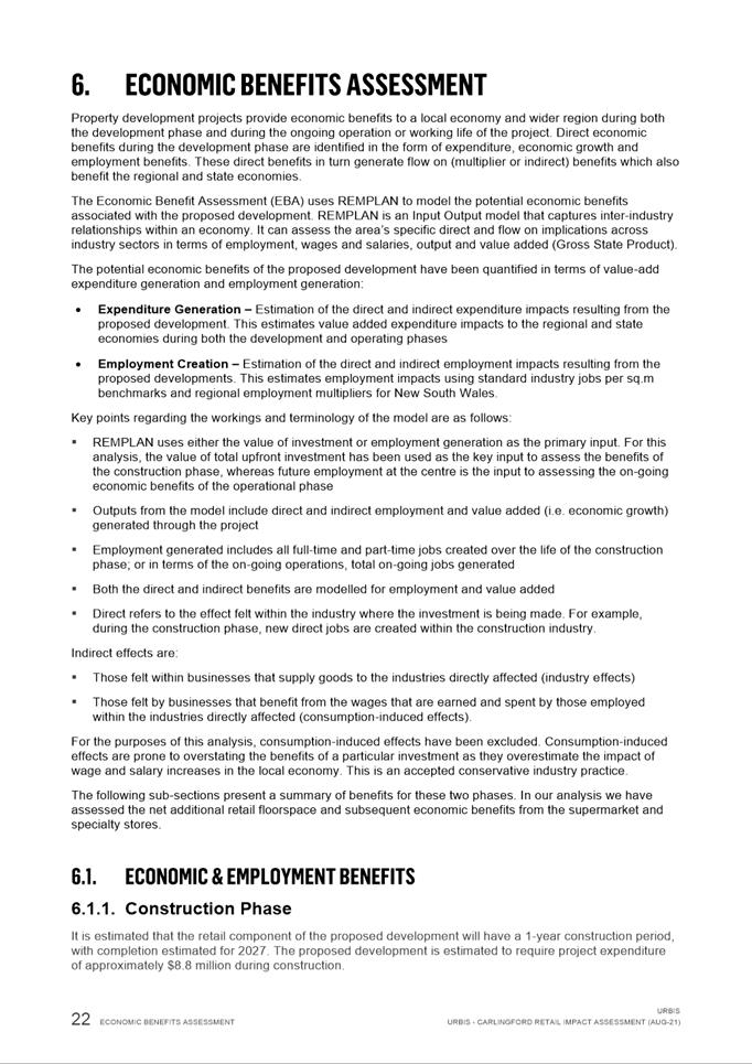
4 DECLARATIONS
OF INTEREST
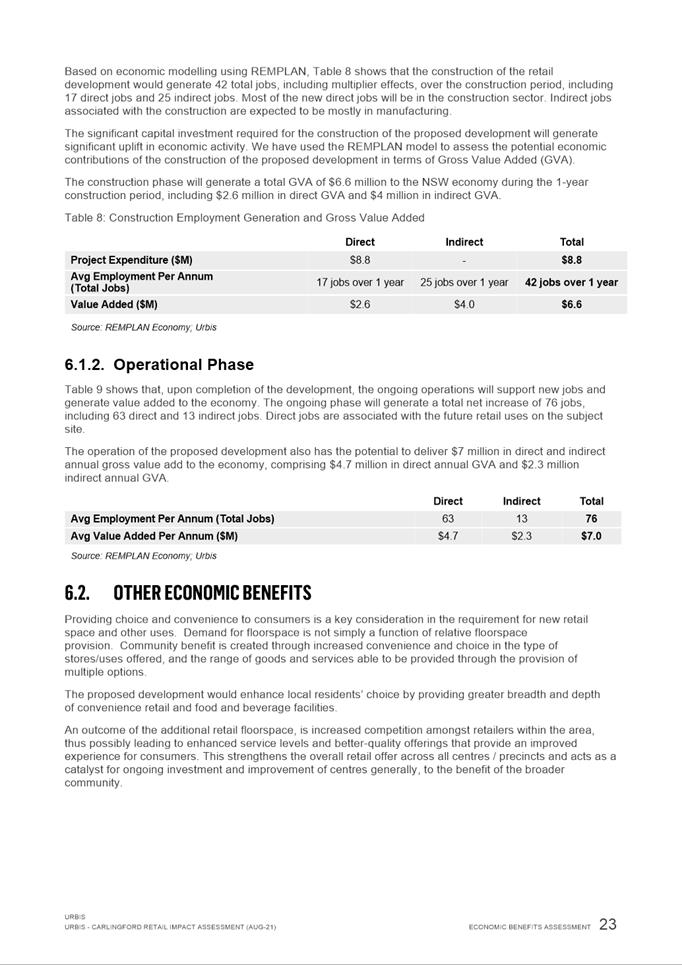
5 Reports - Development Applications
5.1 PUBLIC
MEETING:
21A Caloola Rd, CONSTITUTION HILL (Lot 101 DP 1220278)....... 6
5.2 OUTSIDE
PUBLIC MEETING:
10A Grand Avenue, ROSEHILL (Lot 101 DP 811924).................. 140
5.3 OUTSIDE
PUBLIC MEETING:
47 - 49 Park Road, RYDALMERE (Lot 5-6 DP 38557).................. 361
5.4 OUTSIDE
PUBLIC MEETING:
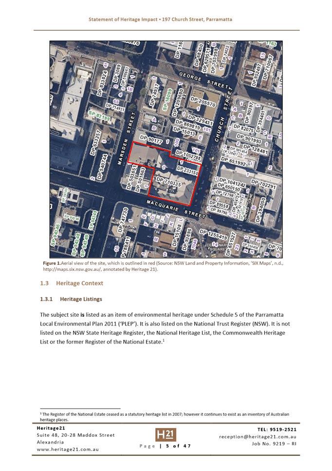
197 Church Street PARRAMATTA (Lot 1 DP 710335 and Lot 1 DP 233150) 434
6 Innovative
6.1 Pre-Gateway:
Planning Proposal for 263-273 & 279R Pennant Hills Road and 18 Shirley
Street, Carlingford...................................................... 622
6.2 Pre-Gateway:
Planning Proposal for 19 Hope Street, Melrose Park and 69-77 Hughes Avenue,
Ermington (Melrose Park North Precinct).... 743
Development Applications
17 May 2022
5.1 PUBLIC
MEETING:
21A Caloola Rd, CONSTITUTION HILL (Lot 101 DP 1220278)................ 6
5.2 OUTSIDE
PUBLIC MEETING:
10A Grand Avenue, ROSEHILL (Lot 101 DP 811924)............................ 140
5.3 OUTSIDE
PUBLIC MEETING:
47 - 49 Park Road, RYDALMERE (Lot 5-6 DP 38557)........................... 361
5.4 OUTSIDE
PUBLIC MEETING:
197 Church Street PARRAMATTA (Lot 1 DP 710335 and Lot 1 DP 233150) 434
Local Planning Panel 17 May 2022 Item
5.1
ITEM NUMBER 5.1
SUBJECT PUBLIC MEETING:
21A Caloola Rd, CONSTITUTION HILL (Lot 101 DP 1220278)
DESCRIPTION The construction of a telecommunications facility, incorporating a
monopole and headframe, antennas, equipment shelter and ancillary equipment.The
subject site is listed on the State Heritage Register. The application is
Integrated Development pursuant to the Heritage Act 1977
REFERENCE DA/1004/2021 - D08497401
APPLICANT/S Lendlease
OWNERS Sydney Water Corporation Limited
REPORT OF Group
Manager Development and Traffic Services
RECOMMENDED Approval
DATE OF REPORT 20/04/2022
REASON FOR
REFERRAL TO LPP
The application is being referred to the Local Planning
Panel as Council has received a clause 4.6 variation greater than 10%. The
proposal is for a 20.94m Telecommunications monopole which has a variance of
132% to the allowable 9m height limit. It is further noted that whilst 9 unique
submissions were received during the formal notification period, a further 11
were received outside of the formal notification period.
EXECUTIVE SUMMARY
Site & Proposal
The subject site is located within a Sydney Water owned
public open space in the form of Caloola Road Reserve. The site is zoned as R2
Low Density Residential under the Parramatta Local Environmental Plan 2011. The
subject site, although physically located on 21B Caloola Road, is listed to
contain the State Heritage item “Mount Dorothy Reservoir”.
The application seeks the construction of a
telecommunications facility, incorporating a monopole and headframe, antennas,
equipment shelter and ancillary equipment. It is noted that the application has
provided commentary on the selection process of the subject site as compared to
two other potential facilities. A clause 4.6 variation to vary the permissible
height is being proposed. The applicant has provided technical reasons as to
why the height proposed is required to achieve the intended outcome and the
redundancy of the proposal should the height be further reduced.
Telecommunications facilities are a permissible use under
clause 2.142 of the SEPP (Transport & Infrastructure) 2021.
Notification
The application was notified in accordance with Council’s
Consolidated Notification Requirements. In response 9 submissions were
received. It is noted that an additional 11 submissions were received after
Council’s formal notification period. The issues raised within those
submissions comprise the following:
· De-valuation
of homes
· Loss
of Green Space
· Impacts
on State Heritage Item
· EME
radiation
· Height
of the proposed monopole
· Acoustic
Impacts
· Possibility
of co-location to other facilities
· Permissibility
of the telecommunications facility
· Proximity
to Schools and Childcare Centres
· View
Obstruction
Assessment
The application is an integrated development application
pursuant to section 4.47 of the Heritage Act 1977. In this regard, the
application was referred to the Heritage Council of NSW, who raised no
objections to the proposal, and issued their General Terms of Approval.
The application was assessed against the relevant
environmental planning instruments including SEPP (Resilience and Hazards)
2021, SEPP (Transport and Infrastructure) 2021, and the Parramatta Local
Environmental Plan 2011. The development is considered to generally satisfy the
requirements of the planning instrument. Where non-compliances were found, a
merit approach was undertaken with consideration to other similar type
developments existing within the LGA.
RECOMMENDATION
(a) That
the Parramatta Local Planning Panel (PLPP) grant consent to DA/1004/2021 for
the construction of a telecommunications facility, incorporating a monopole and
headframe, antennas, equipment shelter and ancillary equipment on land at 21A
Caloola Road, Constitution Hill 2145.
(b) Further that,
objectors be advised of the Panel’s decision.
REASONS FOR APPROVAL
1. That
the Parramatta Local Planning Panel support a variation to Clause 4.3 –
Building Height of the Parramatta Local Environmental Plan for the following
reasons:
(a) A
written request to vary the building height has been received and is well
drafted; and
(b) The
applicant has provided sufficient environmental planning grounds to warrant
departure of the building height control in the circumstances of this case.
2. The
development is permissible in the R2 Low Density Residential zone
pursuant to the SEPP (Transport and Infrastructure) 2021 and satisfies the
requirements of all of the applicable planning controls with exception to the
maximum height under the Parramatta Local Environmental Plan 2011.
3. The
development will not create adverse impacts onto the locality and will be
sympathetic with the existing area.
4. The
proposed telecommunications facility will seek to provide the greater community
with essential telecommunication infrastructure.
5. For
the reasons given above, approval of the application is in the public interest.
Matthieu Santoso
Development Assessment Officer
Attachments:
|
1⇩ 
|
Assessment Report and draft conditions
for PLPP
|
27 Pages
|
|
|
2⇩ 
|
Arboricultural Report
|
30 Pages
|
|
|
3⇩ 
|
Site Landscape Plan
|
1 Page
|
|
|
4⇩ 
|
Plans used during assessment
|
4 Pages
|
|
|
5⇩ 
|
Statement of Environmental Impacts
|
69 Pages
|
|
REFERENCE MATERIAL
|
Item 5.1 - Attachment
1
|
Assessment Report and draft conditions for PLPP
|


|
Item 5.1 - Attachment 2
|
Arboricultural Report
|


|
Item 5.1 - Attachment 3
|
Site Landscape Plan
|

|
Item 5.1 - Attachment
4
|
Plans used during assessment
|


|
Item 5.1 - Attachment 5
|
Statement of Environmental Impacts
|


Local
Planning Panel 17 May 2022 Item
5.2
ITEM NUMBER 5.2
SUBJECT OUTSIDE PUBLIC MEETING:
10A Grand Avenue, ROSEHILL (Lot 101 DP 811924)
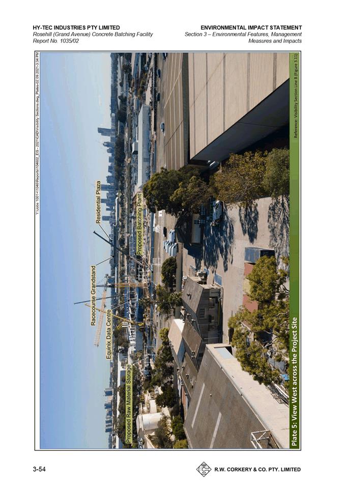
DESCRIPTION Construction of a concrete batching facility on the rear lot of an
approved subdivision. The development is Designated Development as defined by
Schedule 3 of the Environmental Planning and Assessment Regulation 2000.
REFERENCE DA/955/2021 - D08499638
APPLICANT/S Hy-tech Industries Pty Ltd
OWNERS N G P Investments No. 2 Pty Ltd
REPORT OF Group
Manager Development and Traffic Services
RECOMMENDED Approval
DATE OF REPORT 17 may 2022
REASON FOR
REFERRAL TO LPP
This application is referred to the Parramatta Local
Planning Panel as a variation greater than 10% to a development standard is
sought.
EXECUTIVE SUMMARY
This is a summary of the full assessment of the application
as outlined in Attachment 1, the Section 4.15 Assessment Report.
The Site
The
subject site is known as 10A Grand Avenue, Camellia (Lot 101 DP 811924).
The site located on the southern lot of Lot 101 DP 811924 which was approved
for subdivision on 2 August 2021 under development consent DA/17/2021.
The
site is currently vacant and comprises a hardstand area that covers the entire
southern lot. The site has an area of approximately 9,8630m2
including a 1,863m2 access handle. Vehicular access is off Grand
Avenue.
The site has been historically used for agriculture,
industrial and manufacturing uses, and has been more recently used for the
purposes of a container handling facility and vehicle storage.
The site is zoned IN3 – Heavy Industrial. Surrounding
properties are also zoned IN3 Heavy Industrial. The site is located within the
existing Camellia industrial precinct.
Proposed Development
The
proposed development includes the following components:
· 15 sand or coarse
aggregate drive over delivery storage bins within a shed structure.
· Concrete batching plant
with the capacity to produce and despatch up to 150,000m3 of pre-mix
concrete annual and comprising:
o Four silos for
cementitious materials e.g., cement, ground granulated blast furnace slag, and
fly ash (21m above ground level)
o Overhead storage bins
o Weigh hoppers
o Two agitator truck
loading stations with dust vacuum hood.
o Covered conveyor to
transfer raw materials from the drive over storage bins to the overhead storage
bins.
· Four covered slump
stands and four roofed wash-out bays.
· Ancillary equipment
such as water tanks, a diesel tank, liquid and solid additives storage to
support concrete production and despatch.
· 20 parking spaces for
agitators.
· 21 parking spaces for
light vehicles (15 for agitator drivers and six for staff and visitors).
· Office and amenities
building.
· Landscaped areas.
Concrete will be produced using a dry batching process. The
proposed hours of operation are 24 hours, 7 days excluding public holidays.
Core operating hours are between 5:00am and 6:00pm Monday to Friday and 5:00am
until 3:00pm Saturdays.
The application seeks to vary development standard Clause
4.3 – Height of Buildings, pursuant to Clause 4.6 of the Parramatta Local
Environmental Plan 2011 for a total variation of 75% to the development
standard. A written request was submitted by the applicant which is well
drafted and adequate in addressing the matters required to be demonstrated by
Clause 4.6(3) and the proposed development is in the public interest as it is
consistent with the objectives of the Height of Buildings Development Standard
and the objectives for development within the IN3 Heavy Industrial zone.
The proposal was referred to Council’s Development
Engineer, Tree and Landscape Officer, Traffic Engineer, and Environmental
Health Officer who raised no objections to the proposal subject to conditions
of consent. The proposal was also referred to Transport for NSW and the
pipeline operator who raised no concerns with the proposed development.
The application was advertised in accordance with
Council’s notification procedures. In response no submissions were
received.
The proposal has been assessed in accordance with Section
4.15(1) of the Environmental Planning and Assessment Act 1979. The proposed
development is consistent with the requirements of SEPP (Resilience and
Hazards) 2021, SEPP (Transport and Infrastructure) 2021, Parramatta Local
Environmental Plan 2011 and the Parramatta Development Control Plan 2011.
The proposal is permissible in the IN3 Heavy Industrial zone
and the development is suitable within the context of the future desired
character of this locality. A merit assessment of the proposal as a whole has
determined that the proposal is satisfactory. The proposal is suitable for the
site and is in the public interest.
RECOMMENDATION
(a) That the
Parramatta Local Planning Panel grant development consent to DA/955/2021 for Construction
of a concrete batching facility on the rear lot of an approved subdivision at
10A Grand Avenue, Rosehill for a period of five (5) years within which physical
commencement is to occur from the date on the Notice of Determination, subject
to conditions of consent.
(b) Further, that the Parramatta Local Planning
Panel support a variation to Clause 4.3 – Building Height of the
Parramatta Local Environmental Plan for the following reasons:
1. A
written request to vary the building height has been received and is well
drafted; and
2. The applicant has provided
sufficient environmental planning grounds to warrant departure of the building
height control in the circumstances of this case.
REASON FOR
APPROVAL
1. A
written request to vary the building height has been received. The variation
sought is minor and will not have any significant adverse impacts. As such,
compliance with the standard is unnecessary. Accordingly, Council believes that
there are sufficient environmental planning grounds to justify the variation
and finds that the application is satisfactory. Council is therefore satisfied
that the Applicant’s Clause 4.6 variation request has adequately
addressed the matters required to be demonstrated in Clause 4.6(3) of
Parramatta LEP 2011 and that the proposed development will be the public
interest because it is consistent with the objectives of the building height
control and the objectives for development within the IN3 zone in which the
development is proposed to be carried out.
2. The
development is permissible in the IN3 zone and satisfies the requirements of
all of the applicable planning controls with one exception being non-compliance
with Clause 4.3 – Building Height of the Parramatta Local Environmental
Plan 2011.
3. The
development will be compatible with the emerging and planned future character
of the area.
4. For
the reasons given above, approval of the application is in the public interest.
Sohini Sen
Senior Development Assessment Officer
Attachments:
|
1⇩ 
|
Assessment Report and draft conditions
|
45 Pages
|
|
|
2⇩ 
|
Locality Map
|
1 Page
|
|
|
3⇩ 
|
Plans used during assessment
|
10 Pages
|
|
|
4⇩ 
|
Clause 4.6 Variation Statement
|
10 Pages
|
|
|
5⇩ 
|
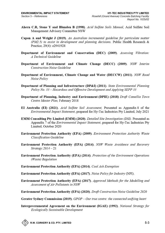
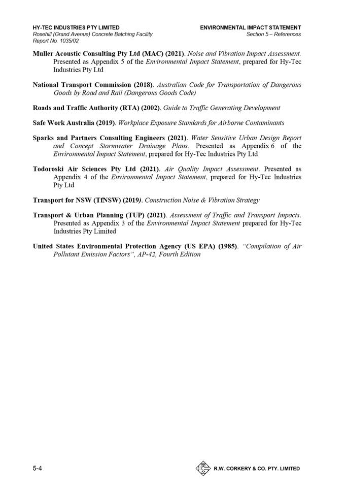
Environmental Impact Statement
|
152 Pages
|
|
REFERENCE MATERIAL
|
Item 5.2 - Attachment
1
|
Assessment Report and draft conditions
|


|
Item 5.2 - Attachment 2
|
Locality Map
|

|
Item 5.2 - Attachment
3
|
Plans used during assessment
|


|
Item 5.2 - Attachment 4
|
Clause 4.6 Variation Statement
|


|
Item 5.2 - Attachment 5
|
Environmental Impact Statement
|


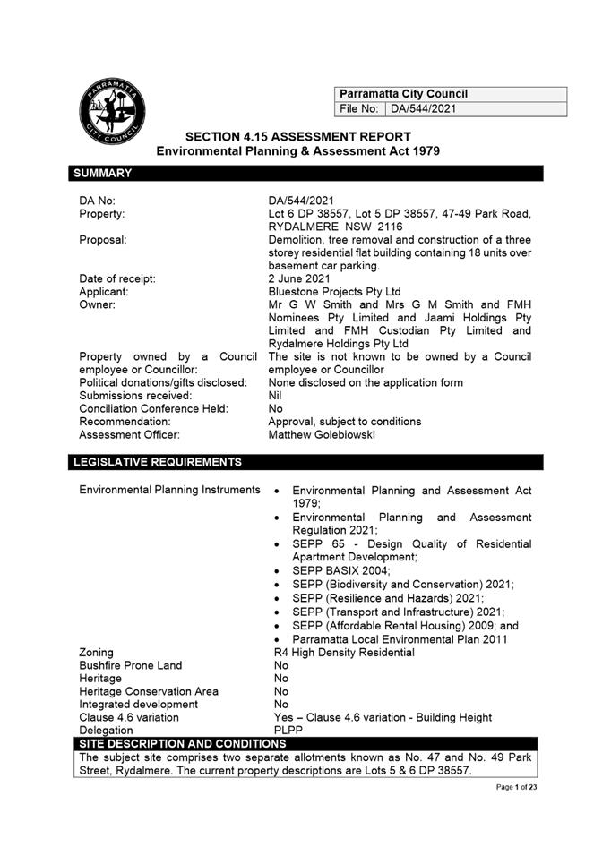
ITEM NUMBER 5.3
SUBJECT OUTSIDE PUBLIC MEETING:
47 - 49 Park Road, RYDALMERE (Lot 5-6 DP 38557)
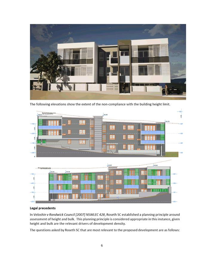
DESCRIPTION Demolition, tree removal and construction of a three storey
residential flat building containing 18 units over basement car parking.
REFERENCE DA/544/2021 - D08500152
APPLICANT/S Applicant - Bluestone Projects Pty Ltd
OWNERS Mr G W Smith & Est Late Mrs G M Smith & FMH Nominees Pty
Limited & Jaami Holdings Pty Limited & FMH Custodian Pty Limited &
Rydalmere Holdings Pty Ltd
REPORT OF Group
Manager Development and Traffic Services
RECOMMENDED Approval
DATE OF REPORT 19 April 2022
REASON FOR
REFERRAL TO LPP
This application is referred to the Parramatta Local
Planning Panel (PLPP) as the proposed development contravenes the maximum
height development standard by more than 10% prescribed under Clause 4.3 of the
Parramatta Local Environmental Plan 2011.
EXECUTIVE SUMMARY
The Site
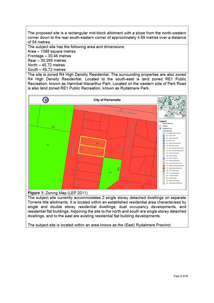
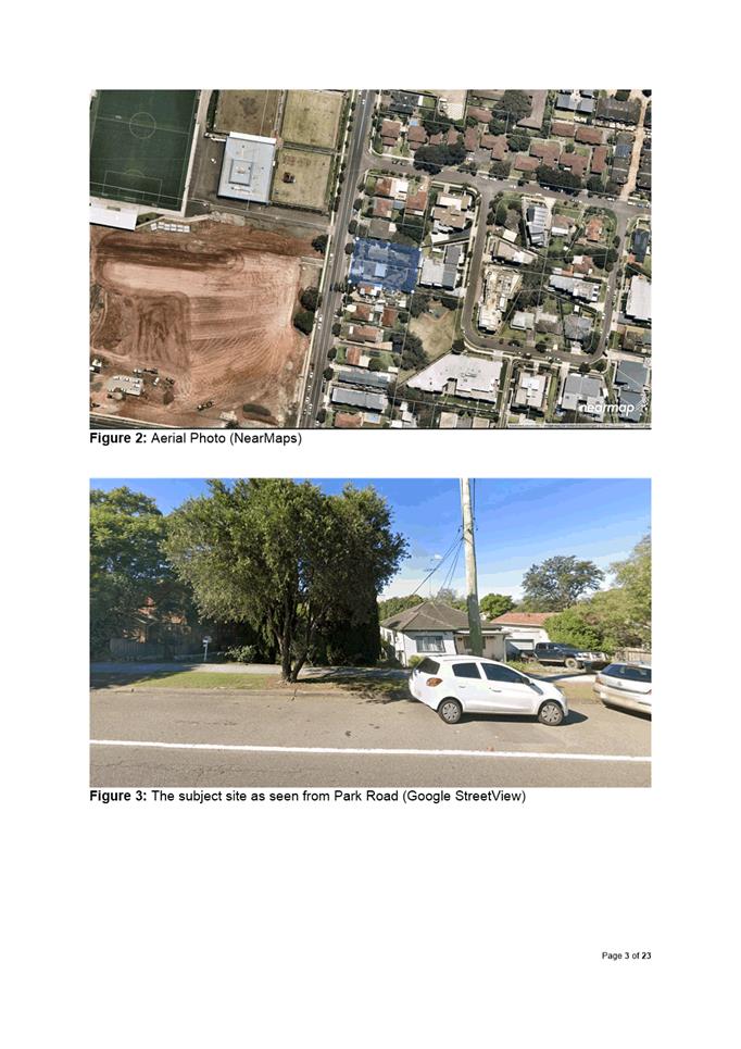
The subject Site comprises two lots, Lot 5-6 DP 38557, known
as 47- 49 Park Road, Rydalmere. The subject site is a regular-shaped
residential allotment with a total area of 1,388m2.
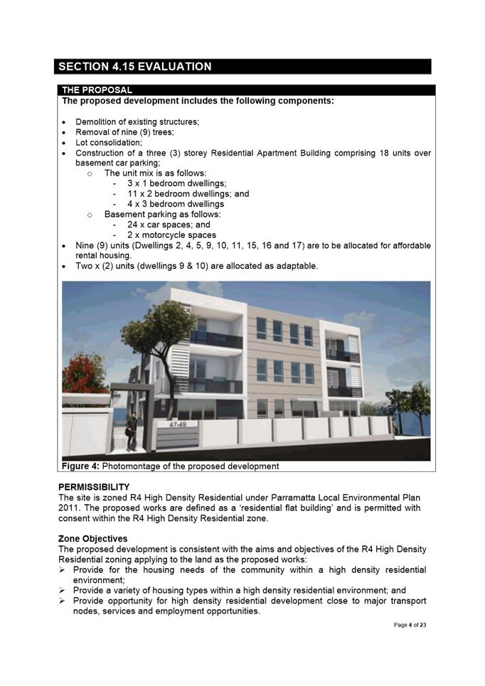
The subject site currently accommodates residential
dwellings. The subject site is located within a residential area in transition
from existing detached dwellings to higher density residential developments
including residential flat buildings.
Adjoining the subject site to the north and south are
detached single storey dwellings and to the east are 3-storey residential flat
buildings.
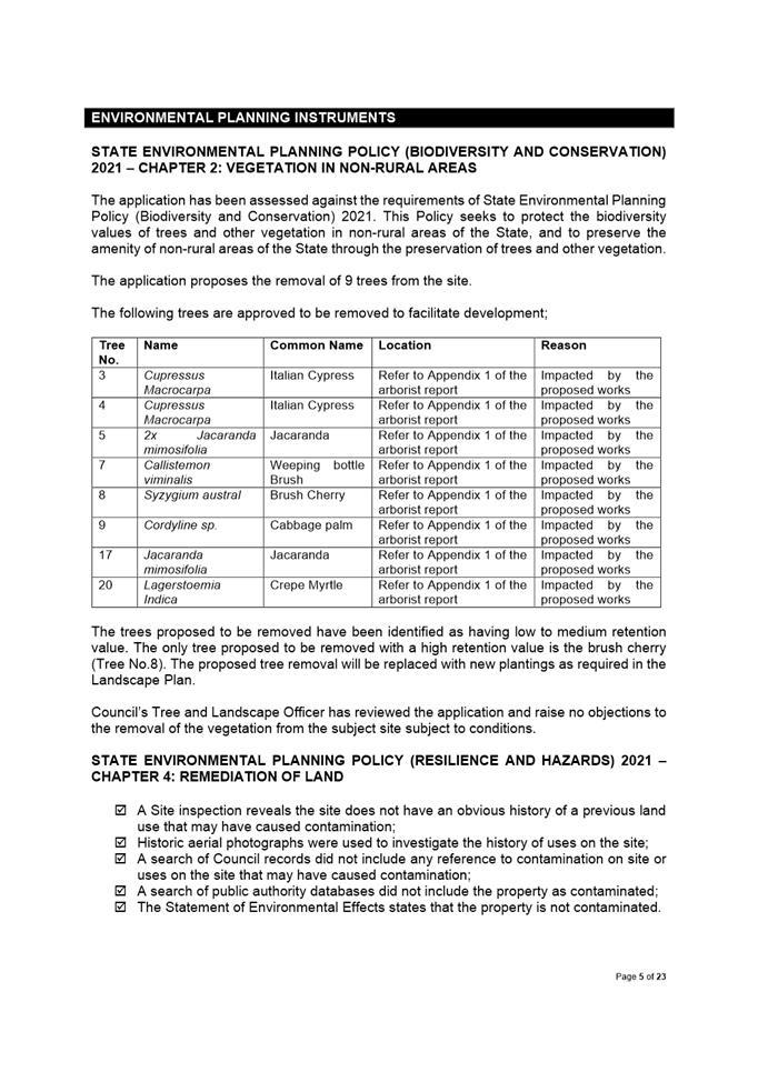
The proposal
· Demolition of all existing structures
· Removal of nine (9) trees;
· Lot consolidation
· Construction of a three (3) storey Residential Flat
Building comprising 18 units over basement car parking with 23 car spaces ;
A series of amended plans were received following
consultation between Councill officers, and the applicants, which required
renotification. The application was notified to the adjoining and nearby
properties from 2 July to 23 July 2021, 23 July to 13 August 2021, 11 January
to 2 February 2022 and 17 March 2022 to 7 April 2022. In response, no
submissions were received.
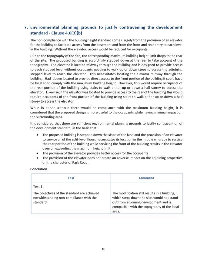
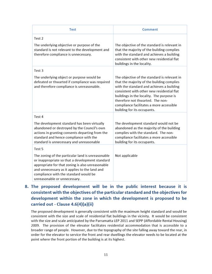
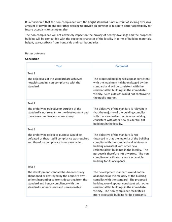
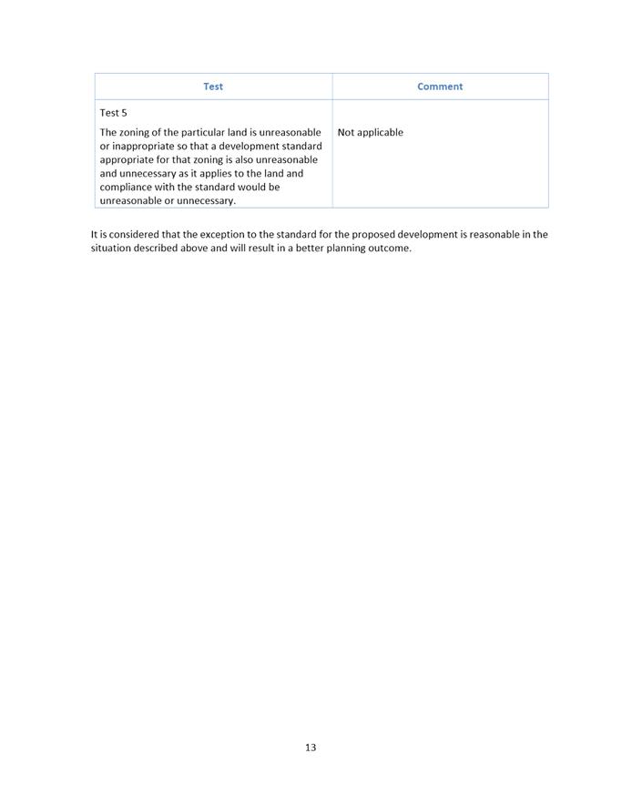
Clause 4.6
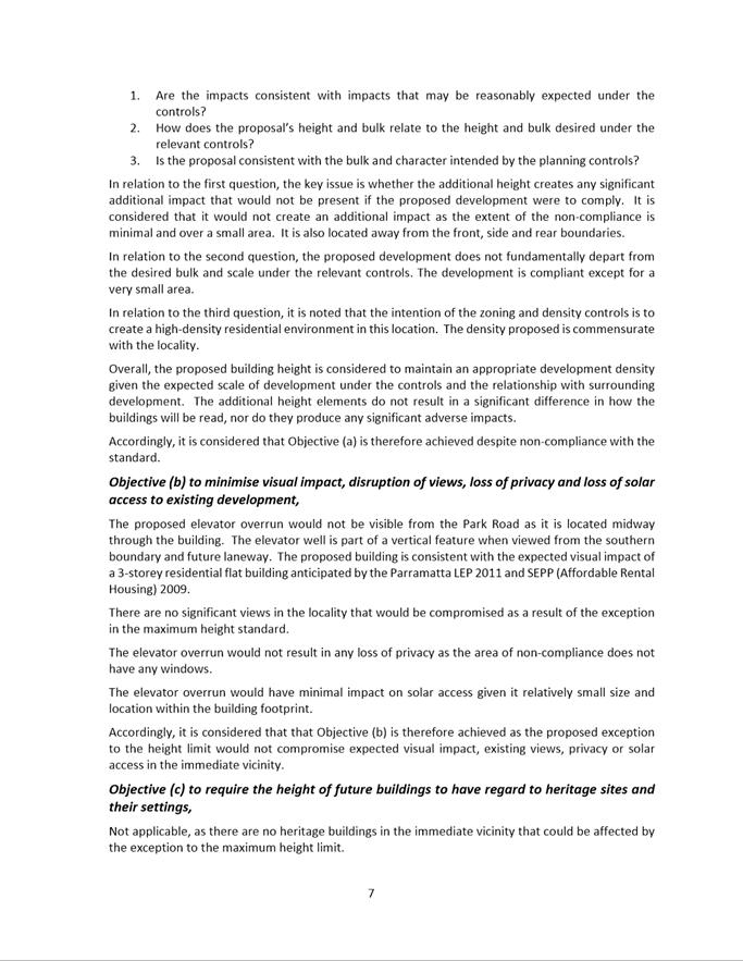
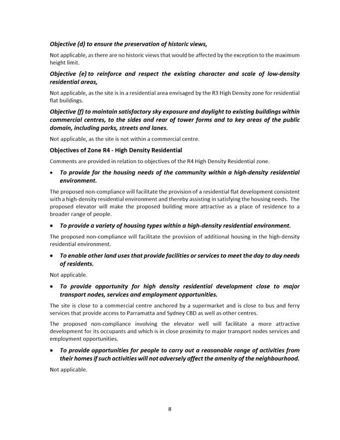
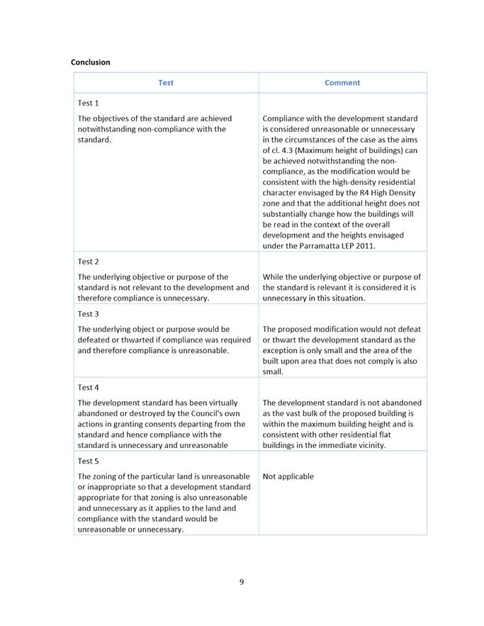
A clause 4.6 variation to vary the permissible height is
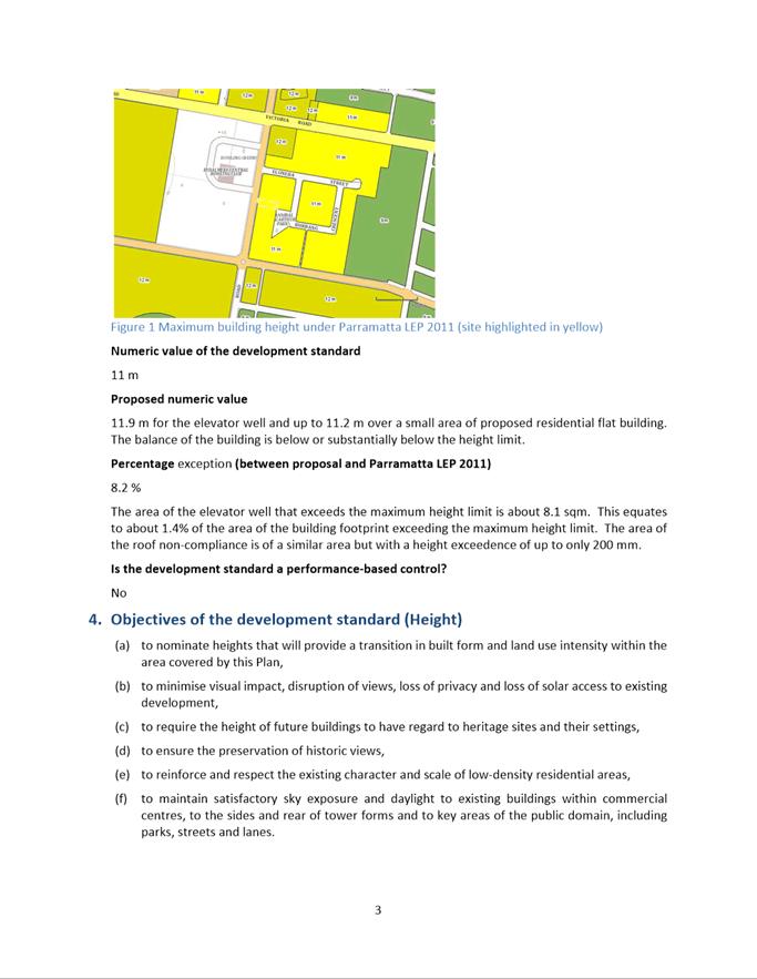
being proposed. The proposed building height is 12.5m and includes the central
portion of the building and the rooftop level amenities. The proposal seeks a
variation of 1.5m or 13.6%.
A written request to vary the building height has been
received and is well drafted. The applicant has provided sufficient
environmental planning grounds to warrant departure of the building height
control in the circumstances of this case.
After consideration of the development against Section 4.15
of the Environmental Planning and Assessment Act 1979, and the relevant
statutory and policy provisions, the proposal is suitable for the site and is
in the public interest.
RECOMMENDATION
(a) That
the Parramatta Local Planning Panel support a variation to Clause 4.3 –
Building Height of the Parramatta Local Environmental Plan for the following
reasons:
1. A
written request to vary the building height has been received and is well
drafted; and
2. The
applicant has provided sufficient environmental planning grounds to warrant
departure of the building height control in the circumstances of this case.
(b) That
the Parramatta Local Planning Panel (PLPP), exercising the functions of
Council, pursuant to Section 4.16(3) of the Environmental Planning and
Assessment Act 1979, grant development consent to DA/42/2021 for
a period of five (5) years within which physical commencement is to occur from
the date on the Notice of Determination, subject to conditions of consent.
(c) Further,
that objectors be advised of the Panel’s
decision.
REASONS
FOR APPROVAL
1. The
development is permissible in the R4 zone and satisfies the requirements of all
of the applicable planning controls with one exception being Clause 4.3 Height
of Building under Parramatta LEP 2011.
2. A
written request to vary the height of building has been received. Accordingly,
Council believes that there are sufficient environmental planning grounds to
justify the variation and finds that the application is satisfactory. Council
is therefore satisfied that the Applicant’s Clause 4.6 variation request
has adequately addressed the matters required to be demonstrated in Clause
4.6(3) of Parramatta LEP 2011 and that the proposed development will be the
public interest because it is consistent with the objectives of the height of
building control and the objectives for development within the R4 zone in which
the development is proposed to be carried out.
3. The
development will be compatible with the emerging and planned future character
of the area.
4. For
the reasons given above, approval of the application is in the public interest.
Matthew Golebiowski
Development Assessment
Attachments:
|
1⇩ 
|
Combined Assessment Report and Draft
Conditions for PLPP47-49 Park road Rydalmere DA/544/2021
|
50 Pages
|
|
|
2⇩ 
|
Locality Maps 47-49 Park road Rydalmere
|
2 Pages
|
|
|
3⇩ 
|
Plans used during assessment
|
5 Pages
|
|
|
4
|
Internal Architectural Plans used during
assessment (confidential)
|
5 Pages
|
|
|
5⇩ 
|
Clause 4.6 Exception
|
13 Pages
|
|
REFERENCE MATERIAL
|
Item 5.3 - Attachment
1
|
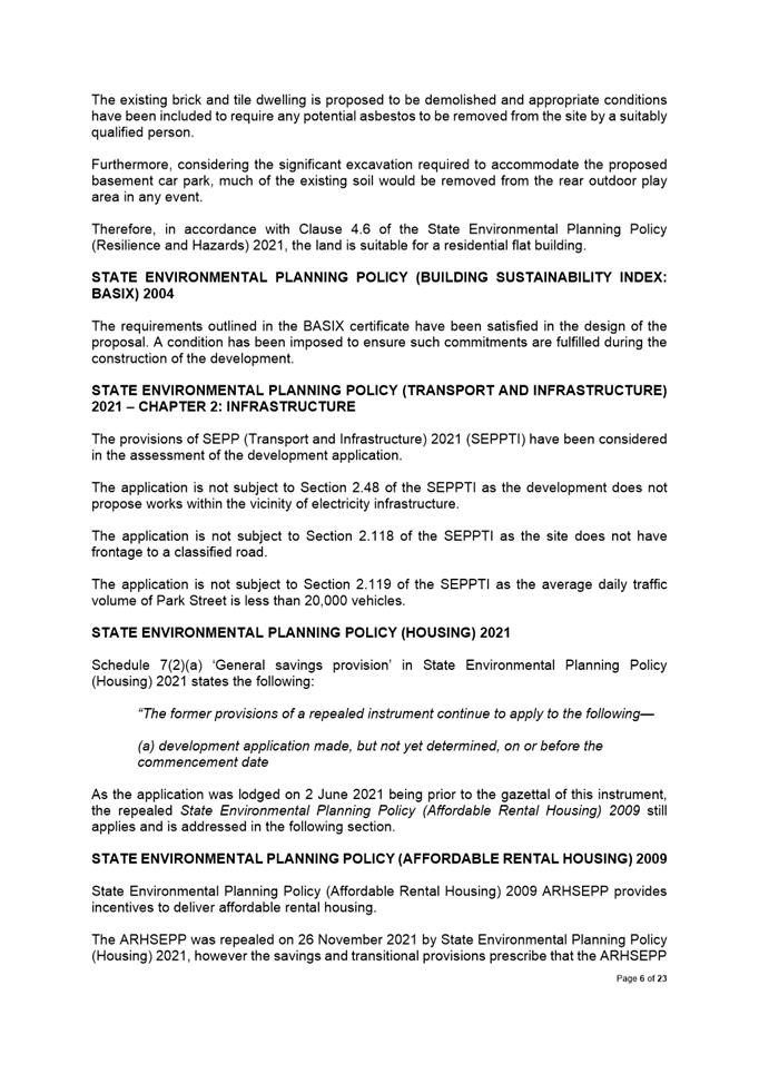
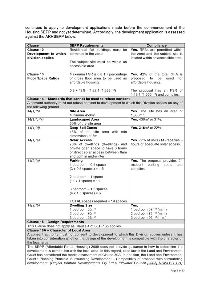
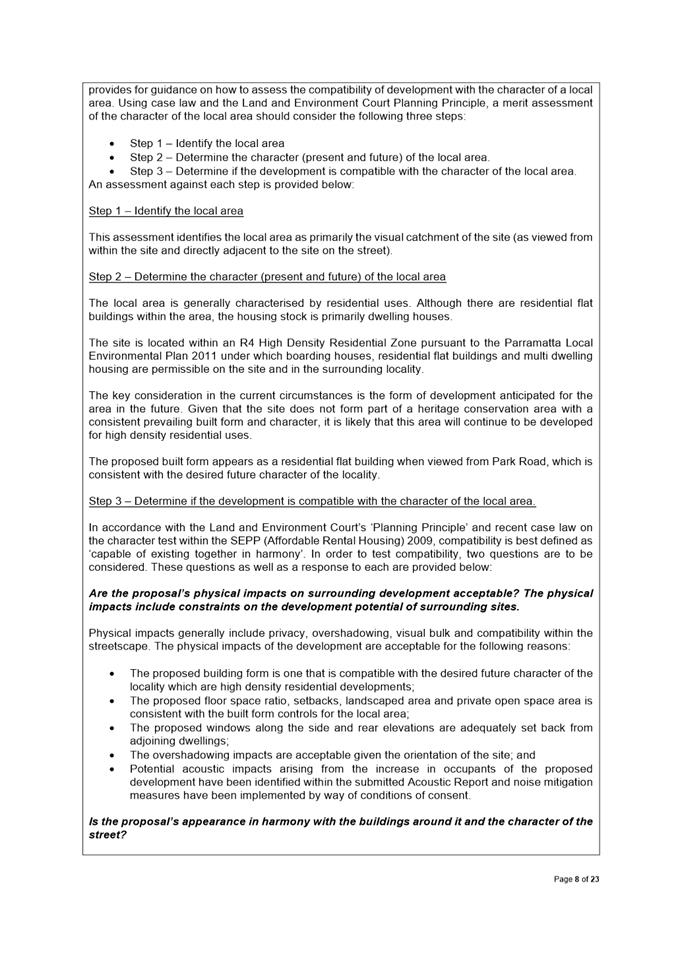
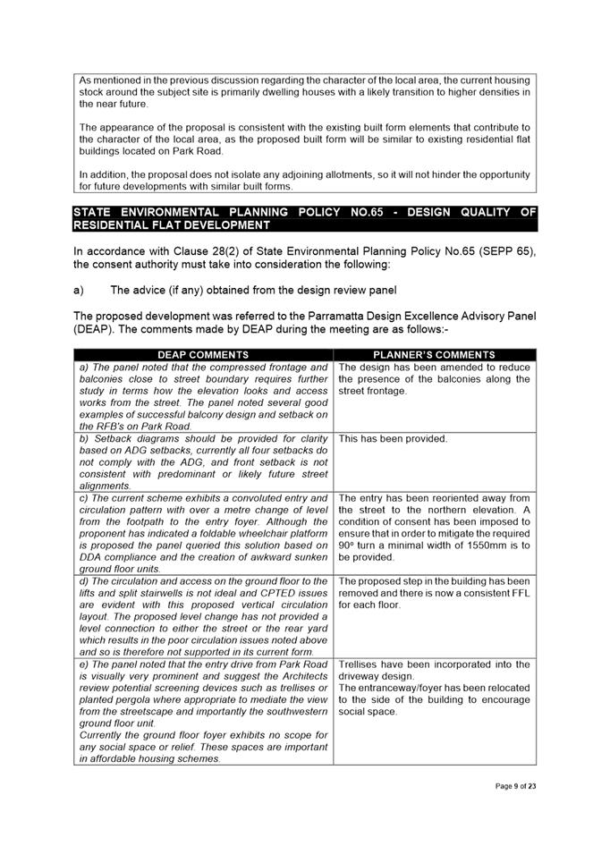
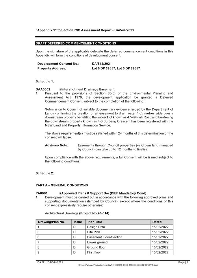
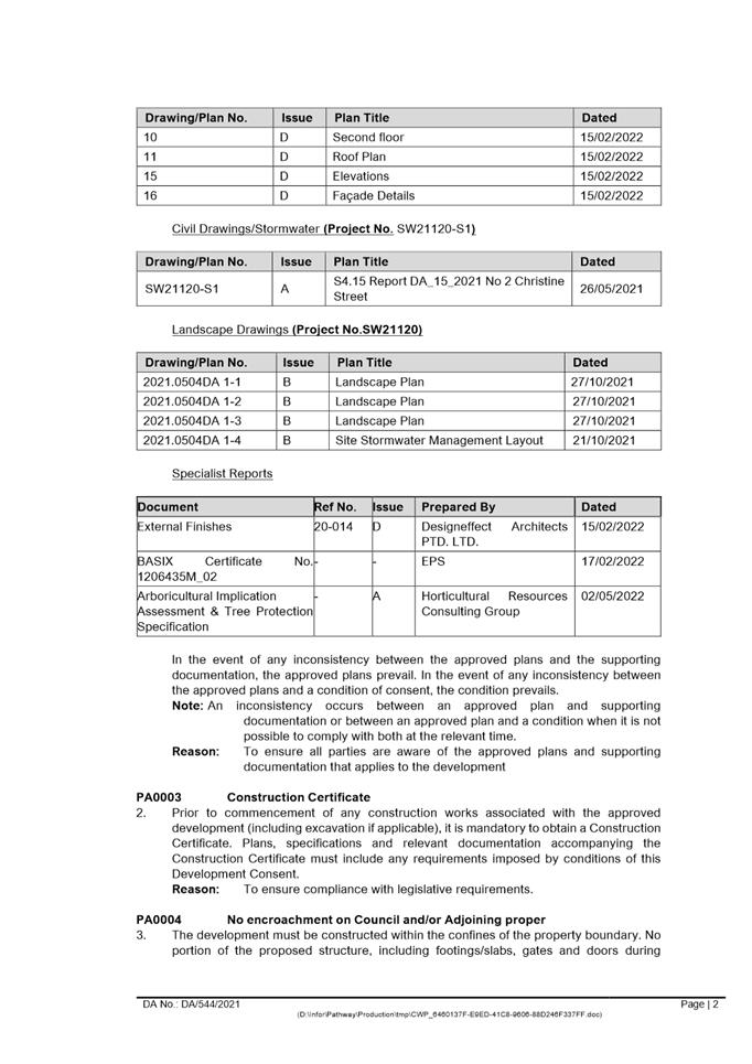
Combined Assessment Report and Draft Conditions for
PLPP47-49 Park road Rydalmere DA/544/2021
|
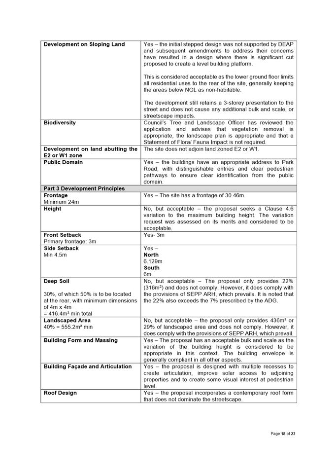
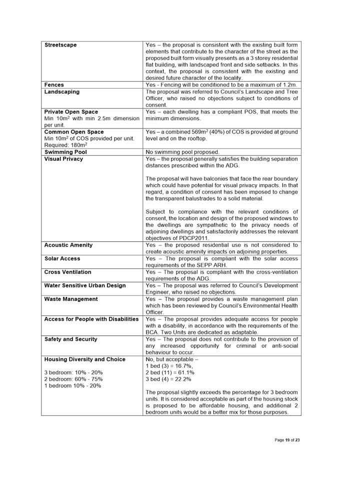
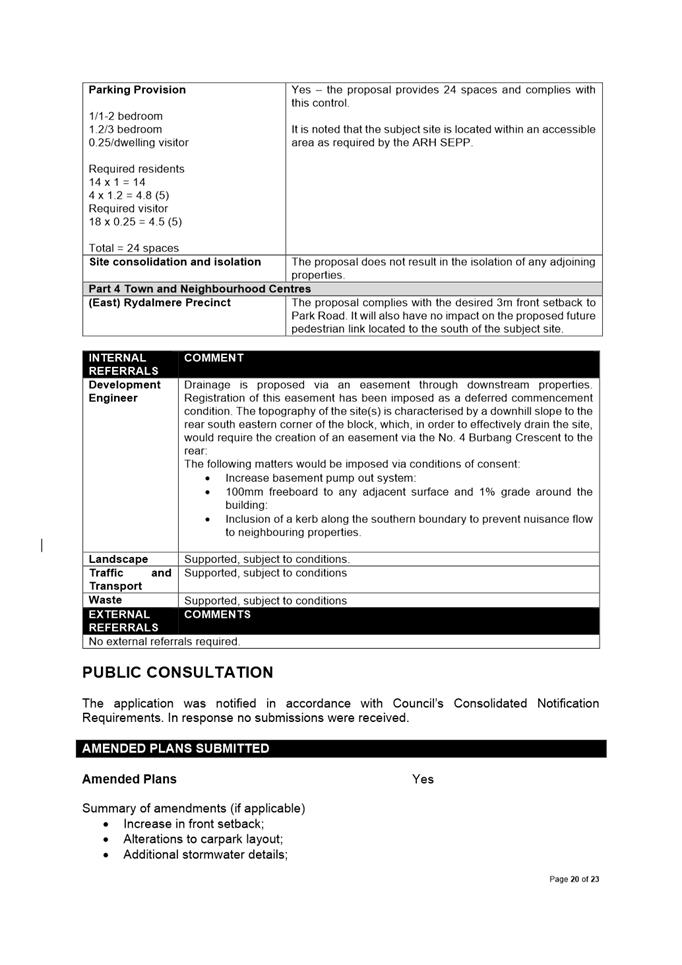
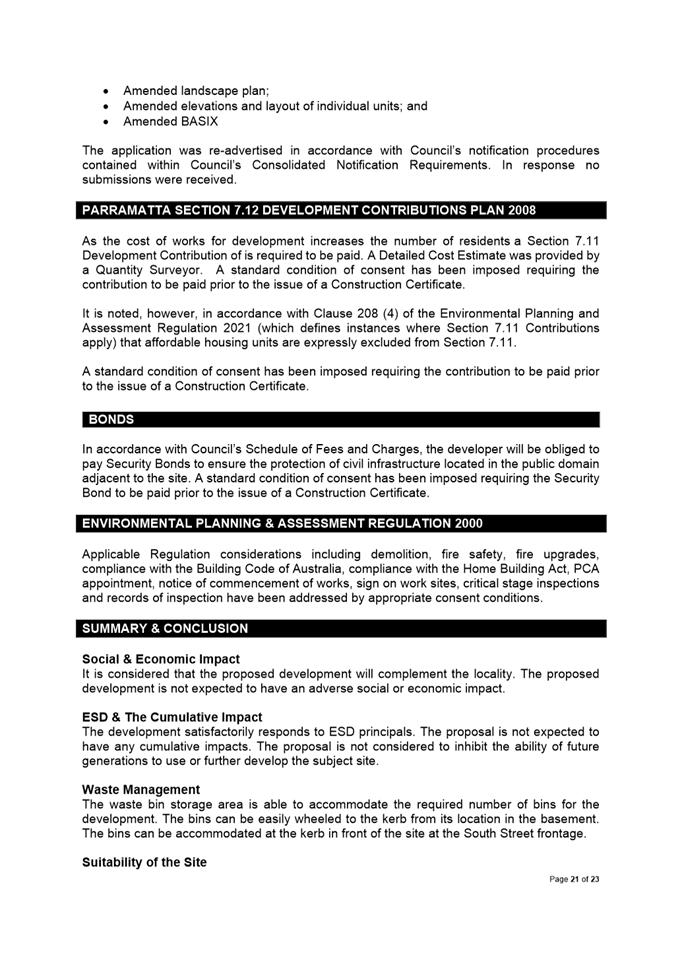

|
Item 5.3 - Attachment 2
|
Locality Maps 47-49 Park road Rydalmere
|
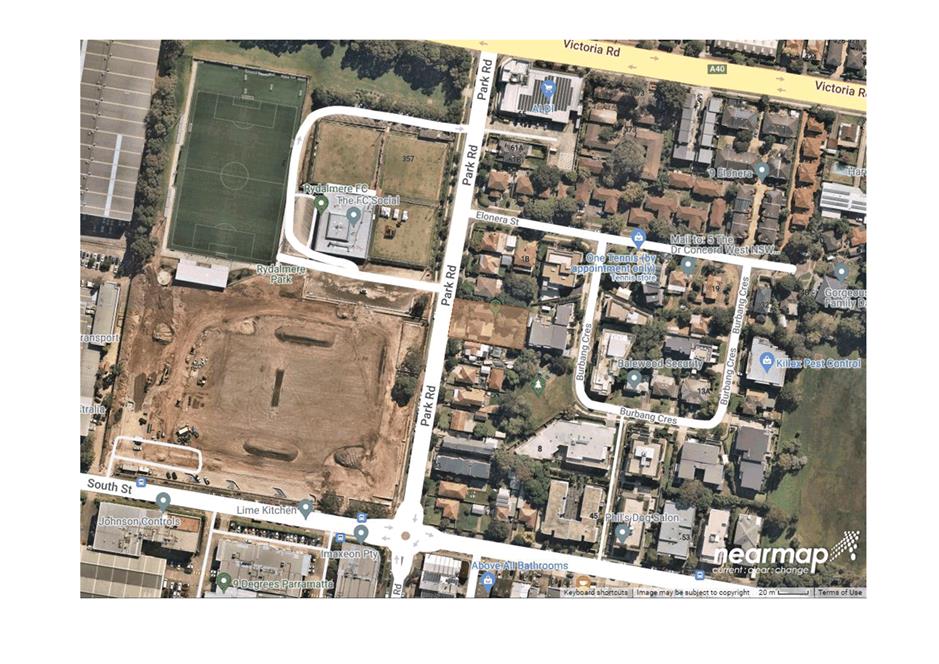
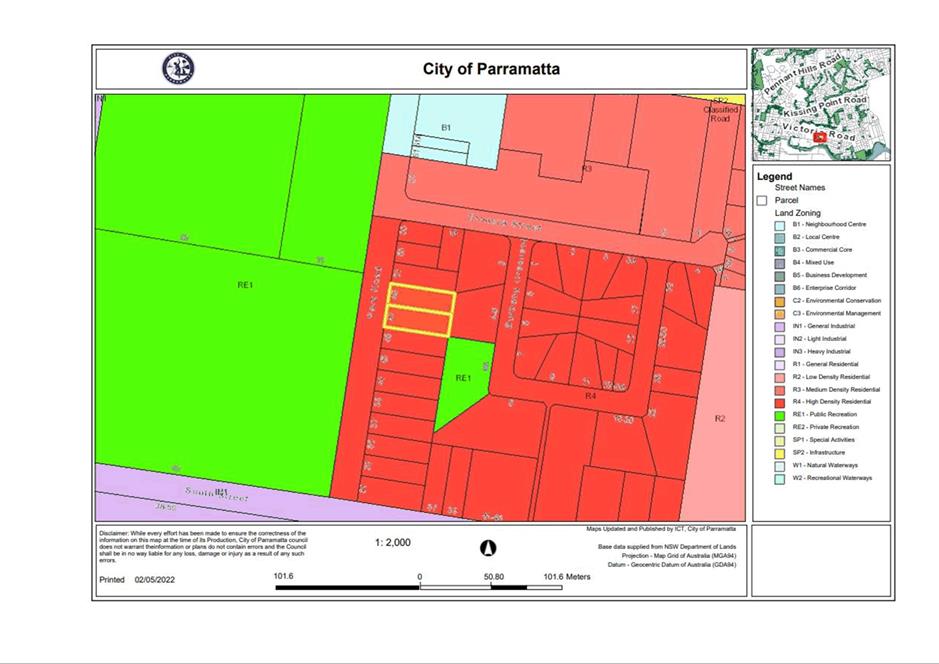
|
Item 5.3 - Attachment 3
|
Plans used during assessment
|
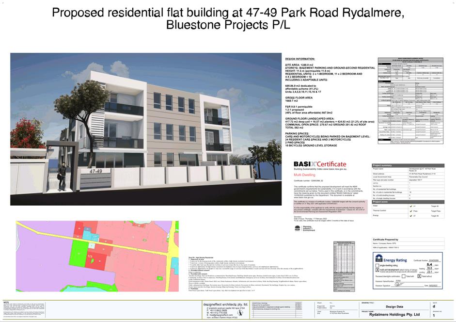
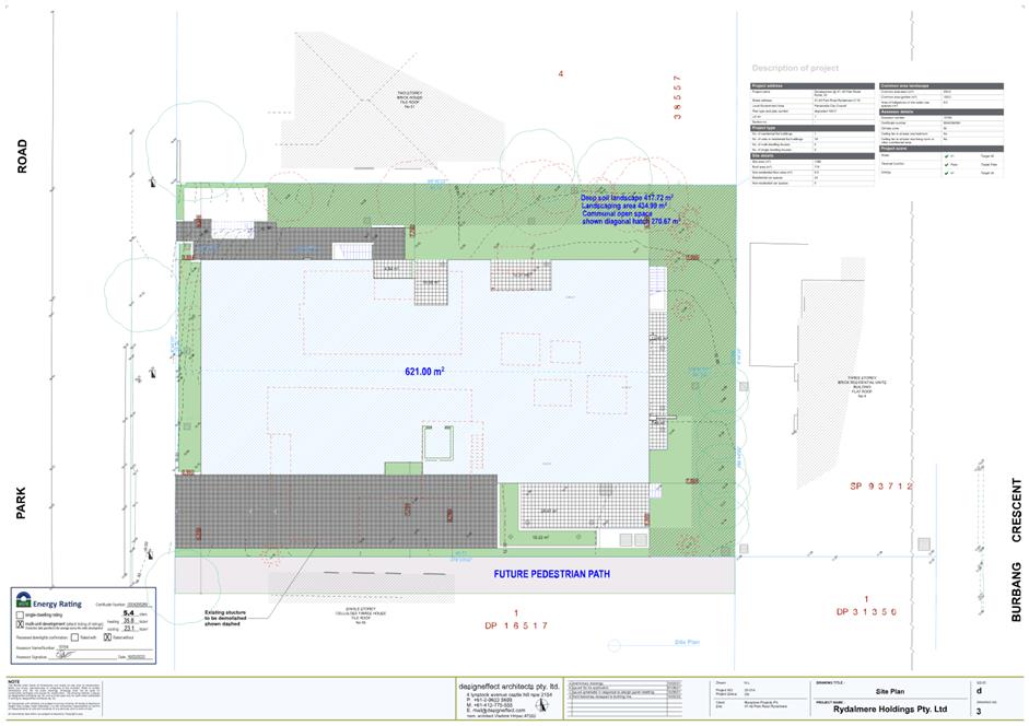
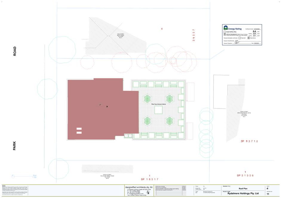
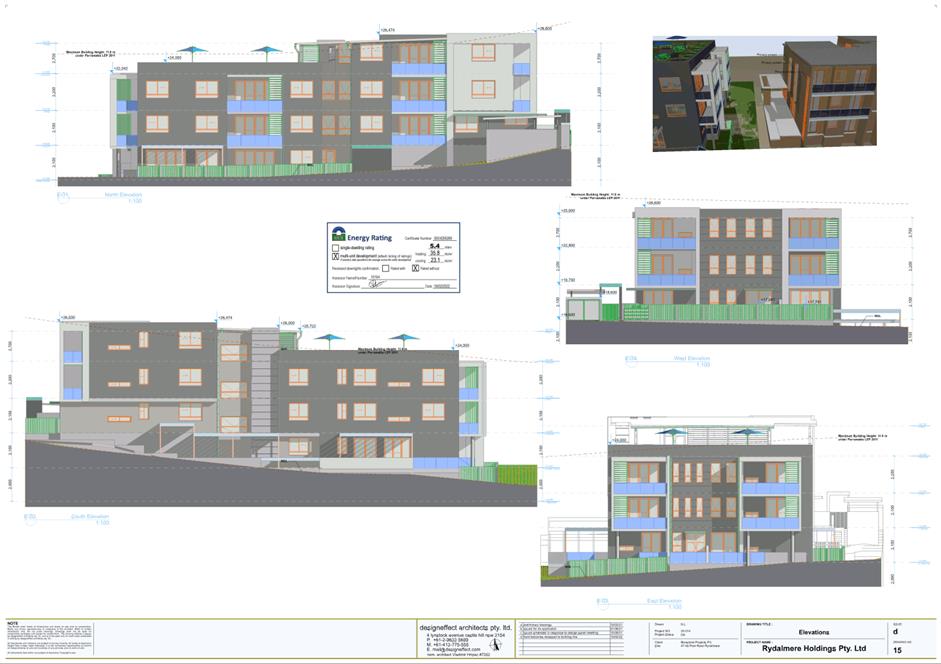
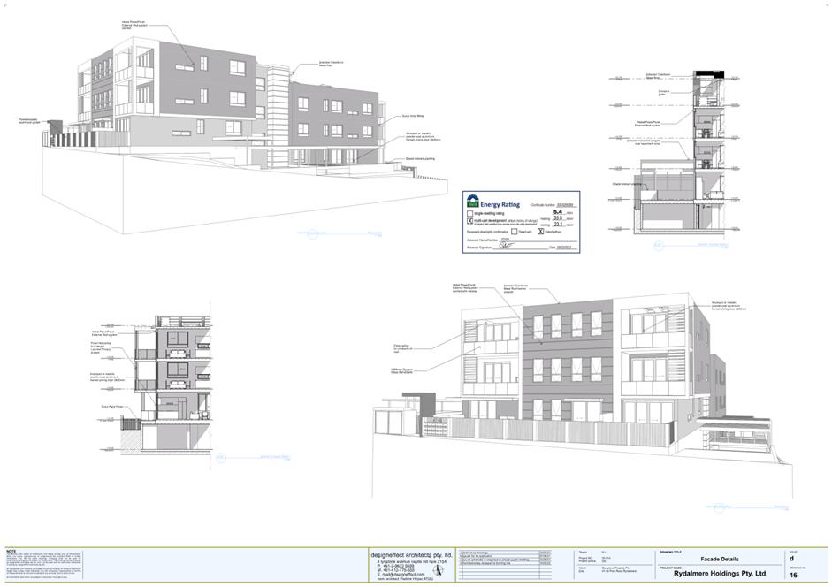
|
Item 5.3 - Attachment 5
|
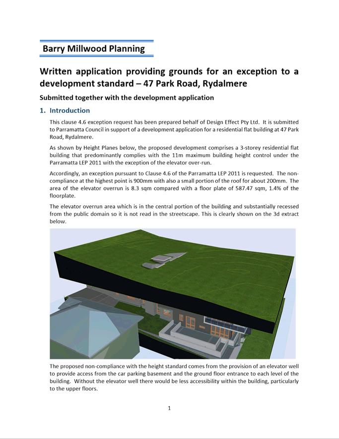
Clause 4.6 Exception
|
Local
Planning Panel 17 May 2022 Item
5.4
ITEM NUMBER 5.4
SUBJECT OUTSIDE PUBLIC MEETING:
197 Church Street PARRAMATTA (Lot 1 DP 710335 and Lot 1 DP 233150)
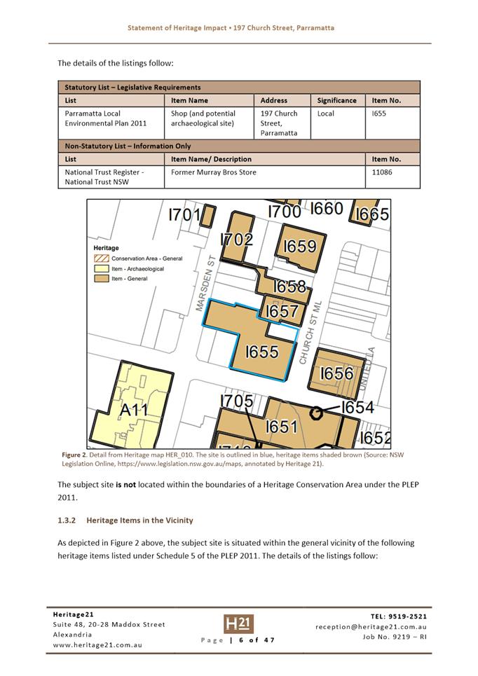
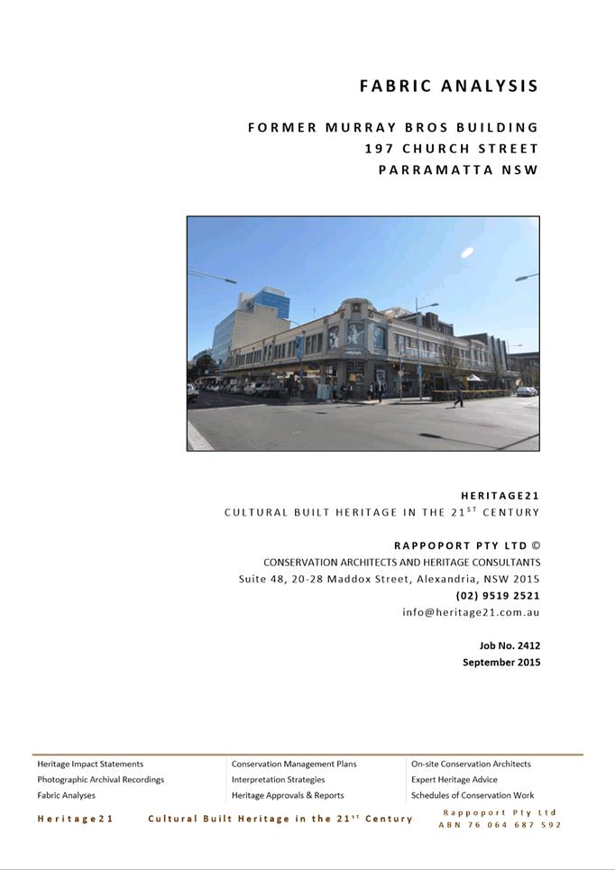
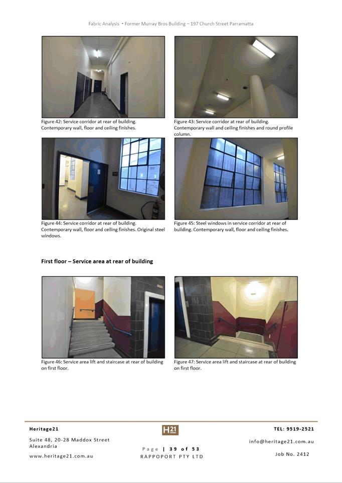
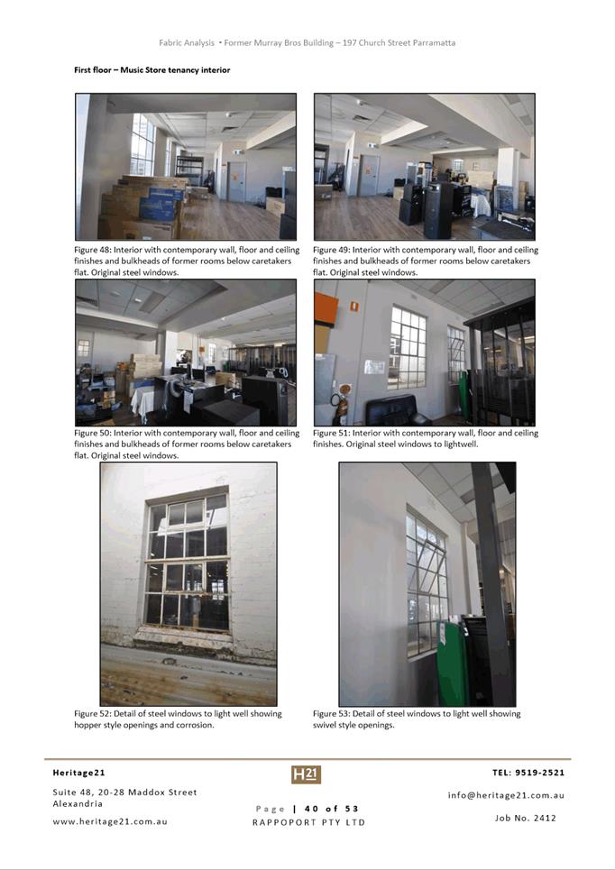
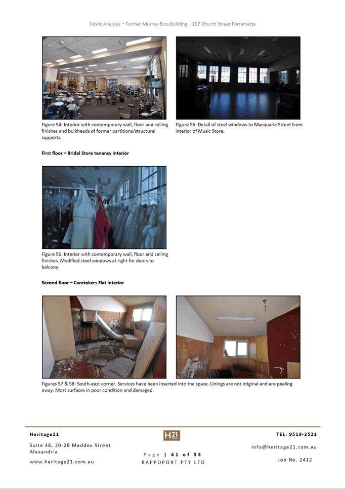
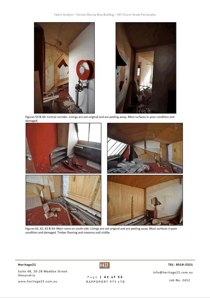
DESCRIPTION Demolition of Heritage Item
REFERENCE DA/802/2021 - D08488199
APPLICANT/S Holdmark NSW Pty Ltd
OWNERS Holdmark Properties Pty Ltd
REPORT OF Group
Manager Development and Traffic Services
RECOMMENDED Approval
DATE
OF REPORT 17 May 2022
REASON
FOR REFERRAL TO LPP
The application is
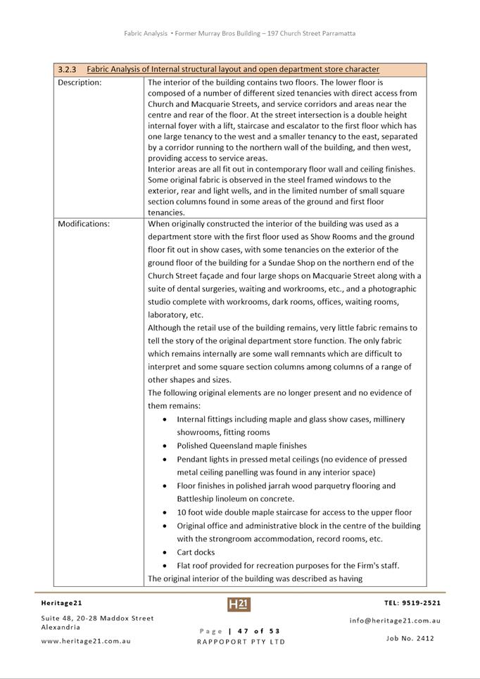
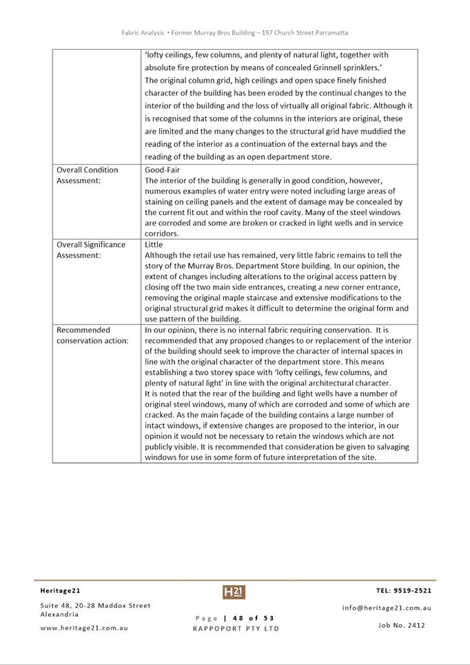
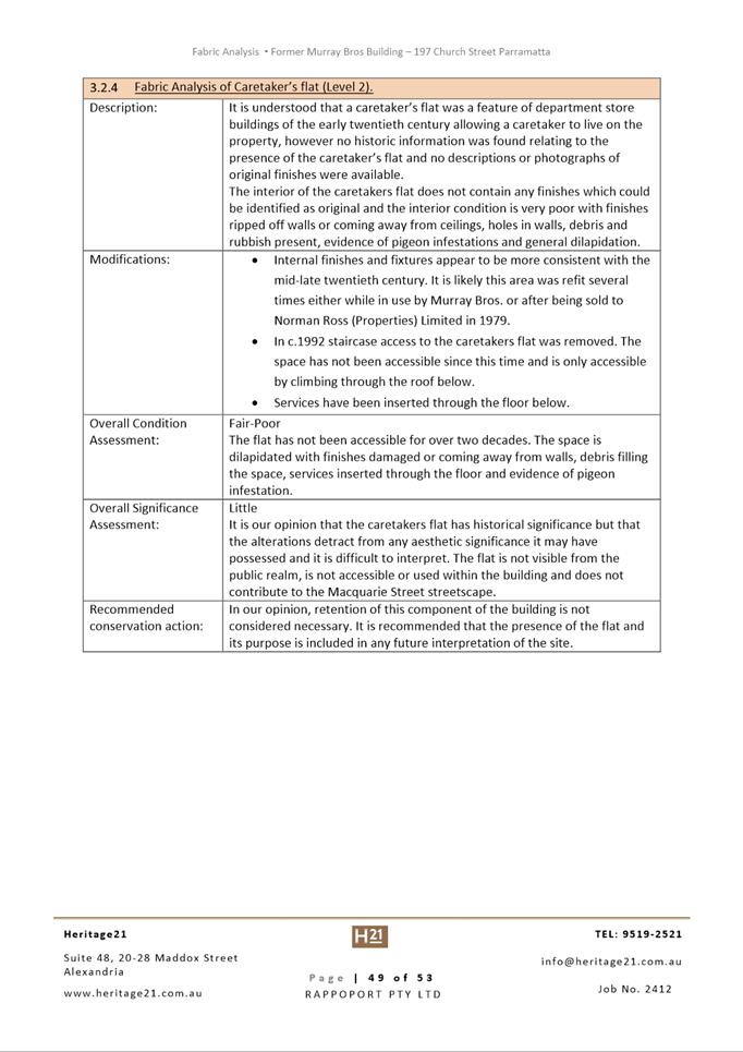
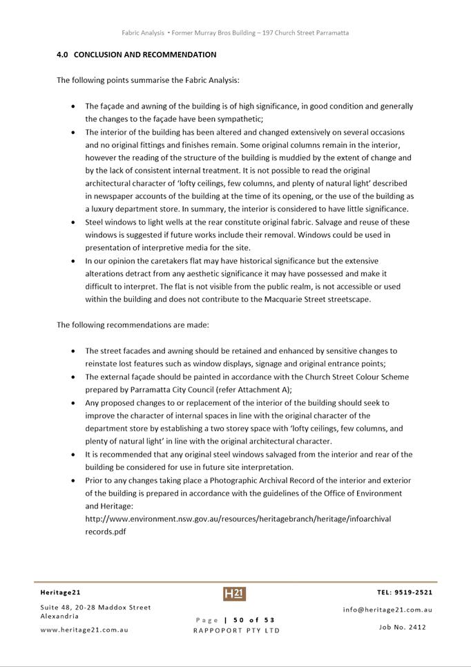
referred to the Parramatta Local Planning Panel (PLPP) as the proposal seeks
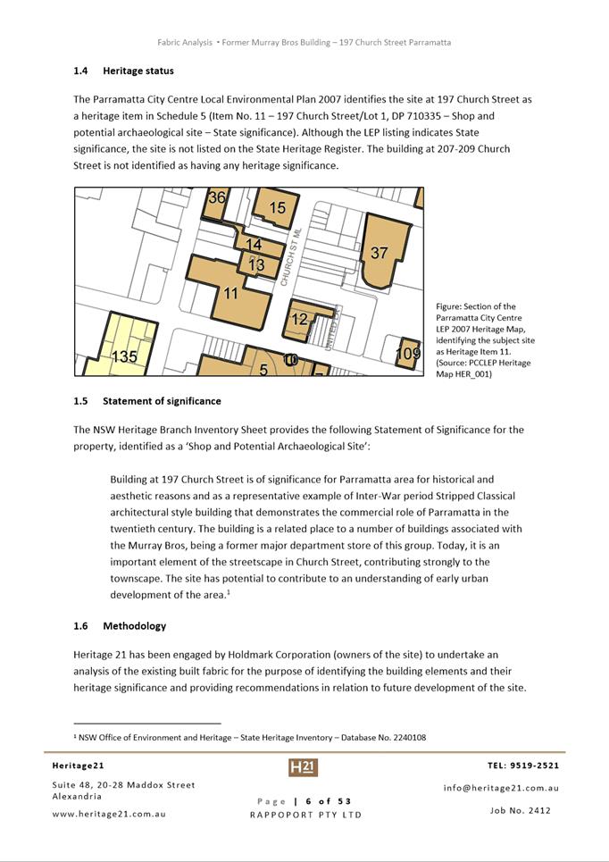
consent for demolition involving a site which is a local heritage item under
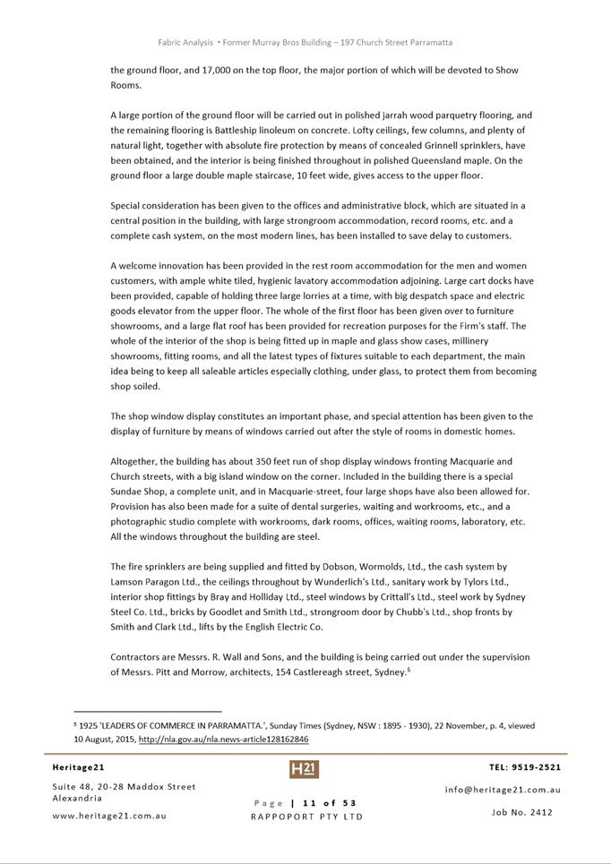
Parramatta LEP 2011. The scope of works limits demolition down to ground floor
slab, and the heritage facades of the former Murray Brothers building are
retained.
EXECUTIVE SUMMARY
This is a summary of the full assessment of
the application as outlined in Attachment 1 (Section 4.55 Assessment Report).
The Site
The site is legally described as Lot 1 DP
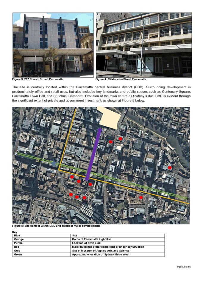
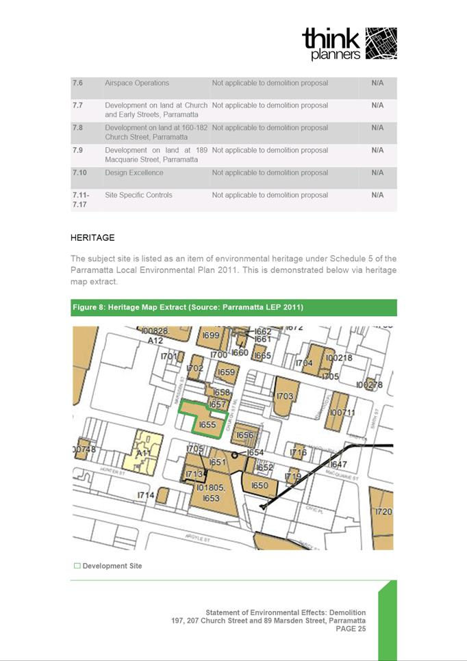
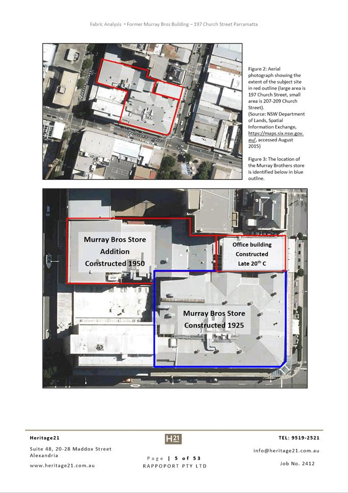
710335 and Lot 1 DP 233150, with street addresses of Nos. 197 and 207
Church Street and No. 89 Marsden Street, Parramatta. Total site area is
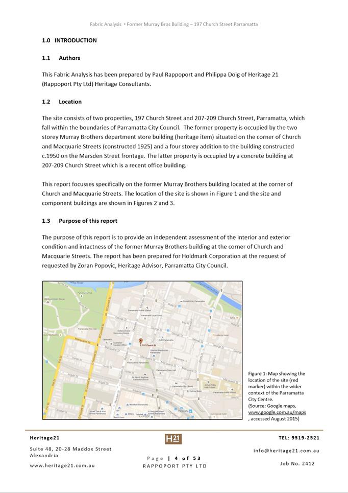
approximately 4,342m2. A mix of two and three storey retail and commercial
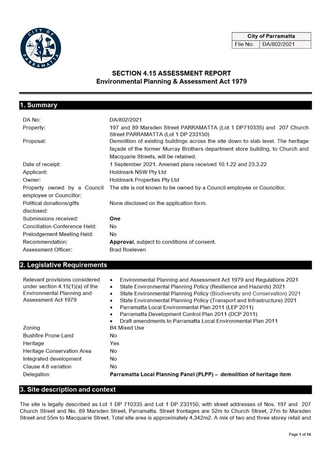
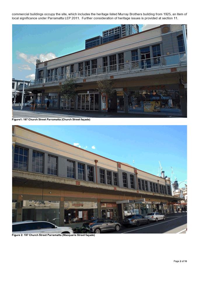
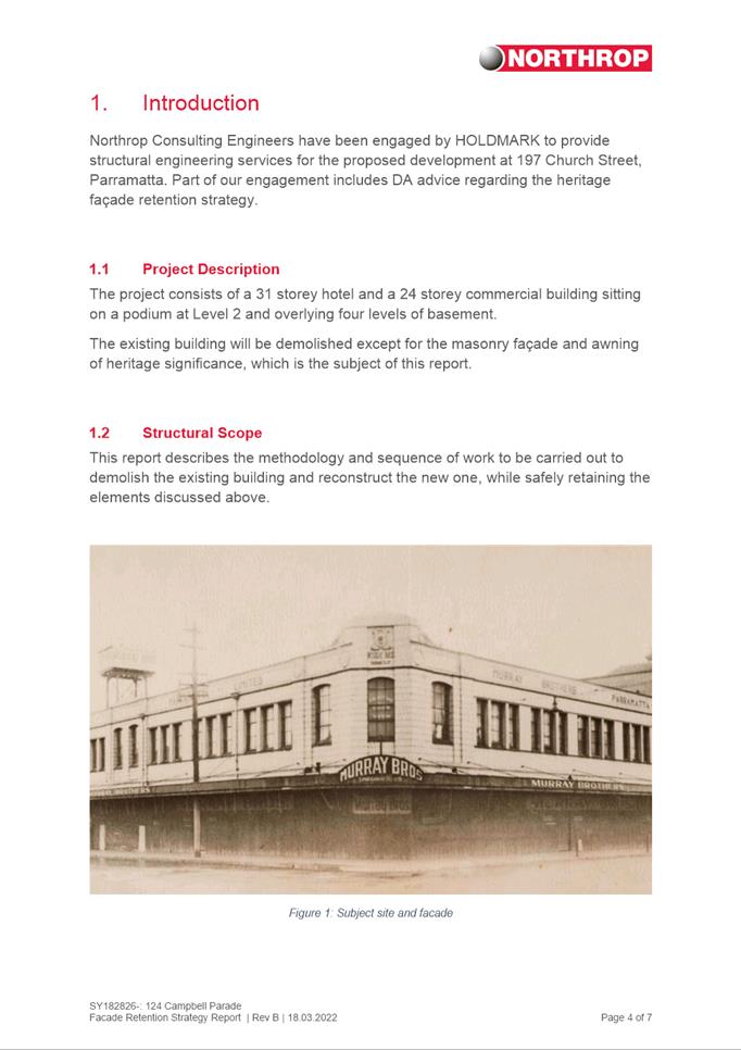
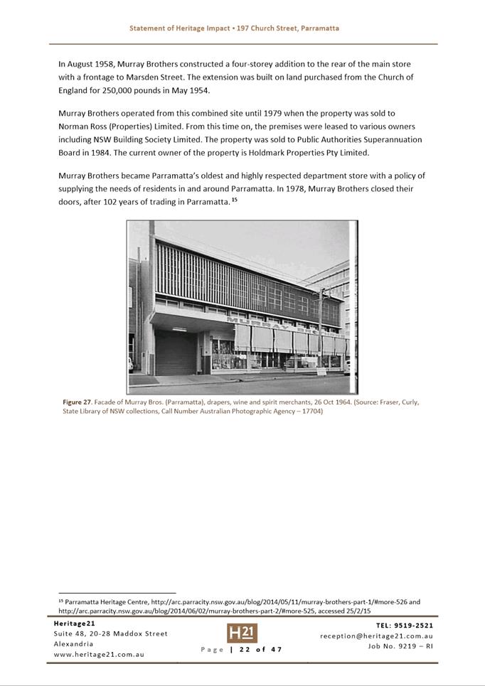
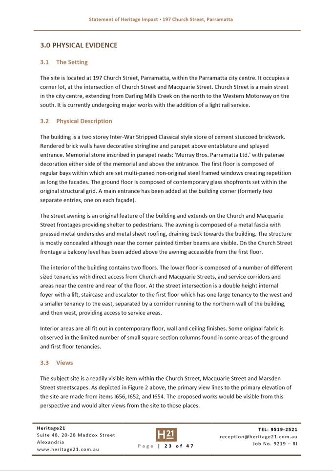
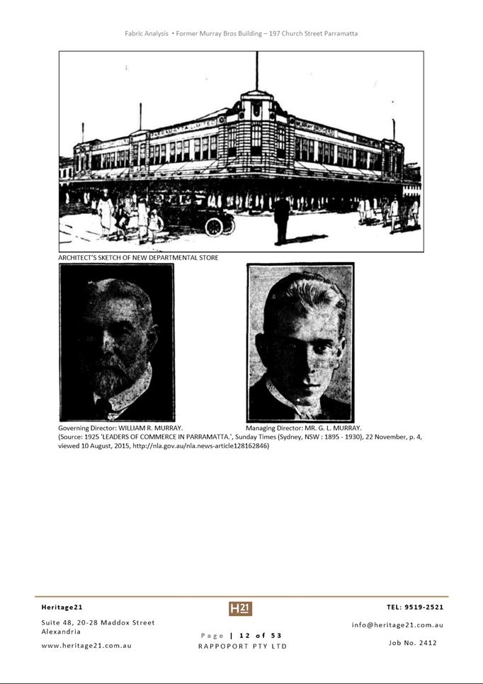
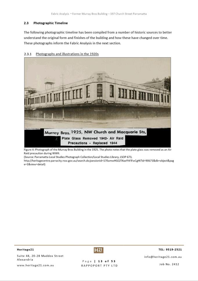
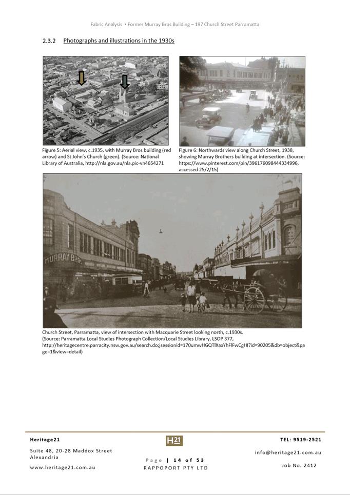
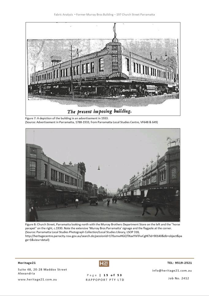
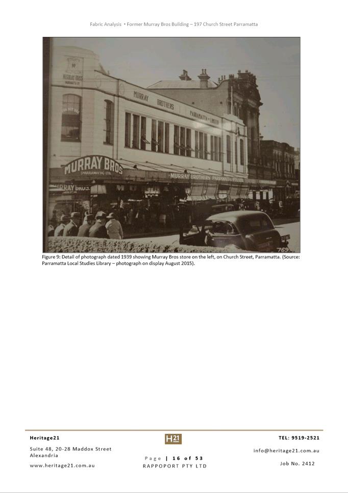
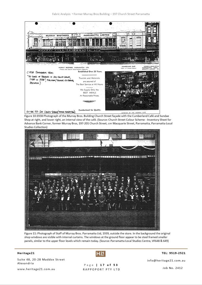
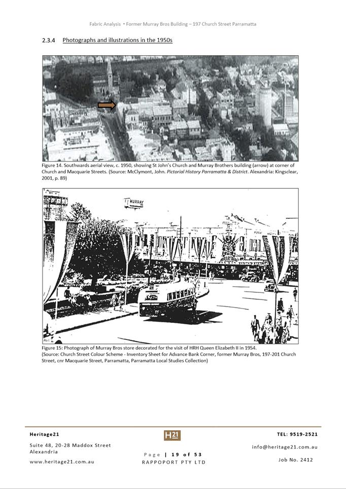
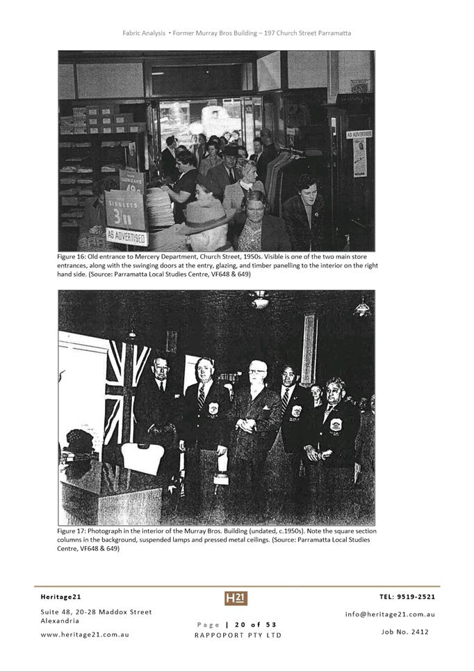
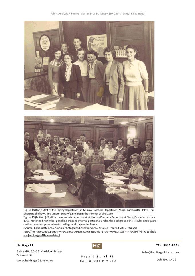
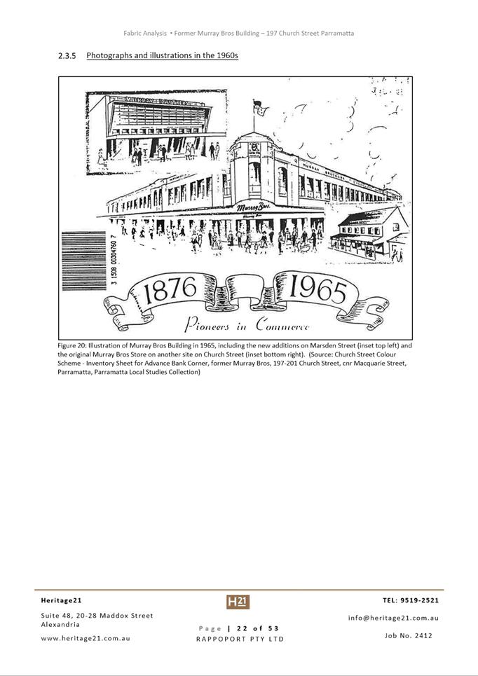
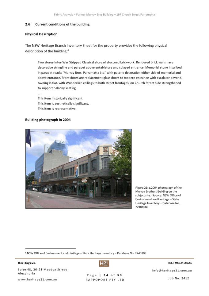
buildings occupy the site, which includes the heritage listed Murray Brothers
building from 1925, an item of local significance under Parramatta LEP 2011.
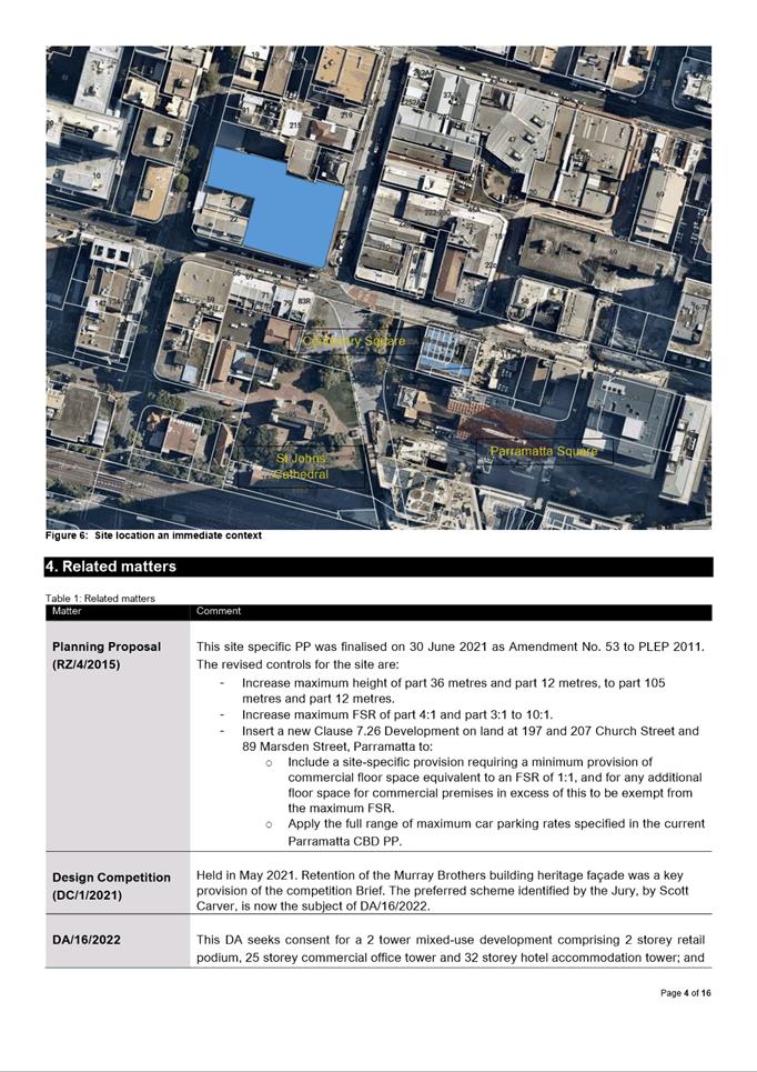
The site is centrally located within the
Parramatta central business district (CBD), occupying a prominent position at
the intersection of Church and Macquarie Streets. It is close to multiple key
landmarks and public spaces including Centenary Square, Parramatta Town Hall
and St Johns’ Cathedral, and is also on the route of Parramatta Light
Rail. Surrounding development is otherwise predominately office and retail
uses.
The Proposal
Consent is sought for the following:
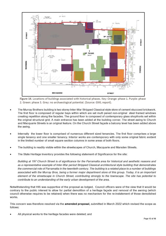
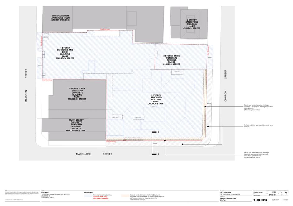
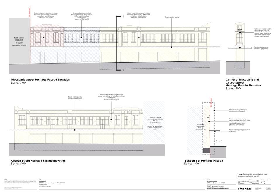
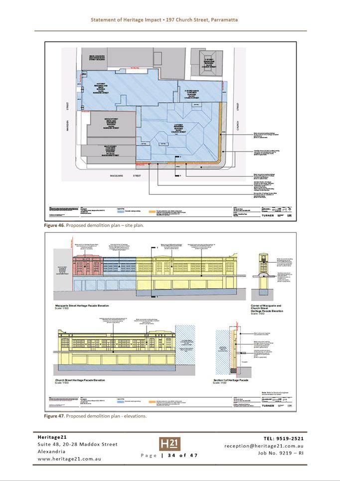
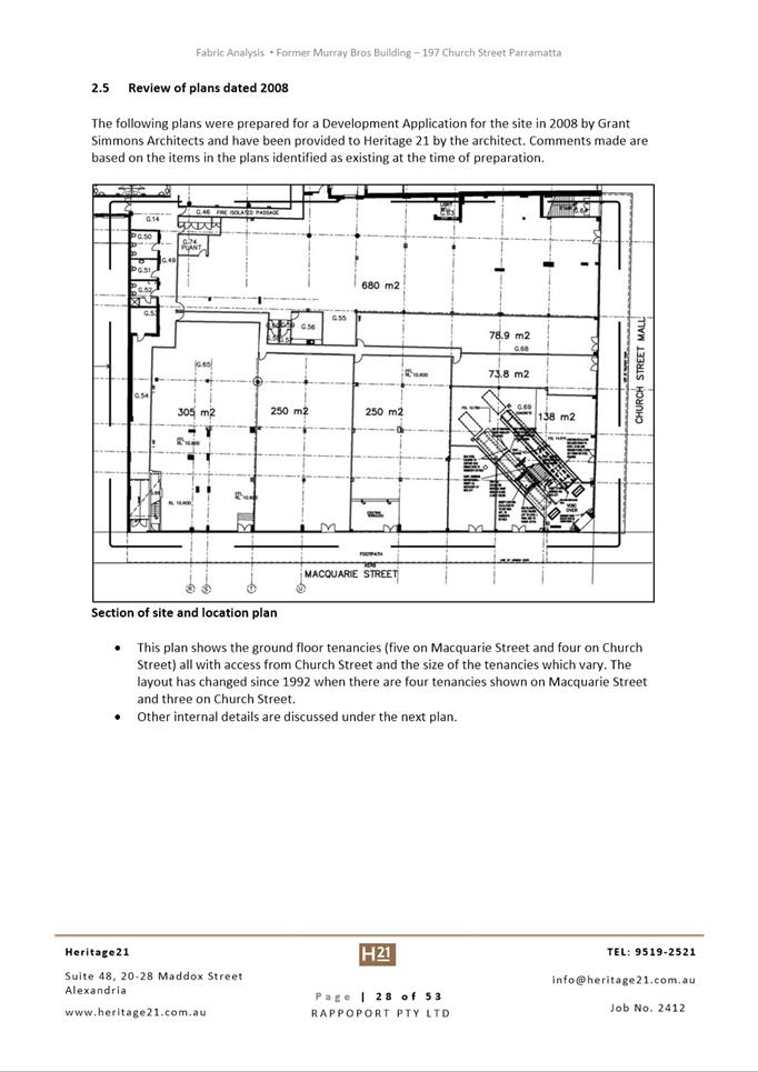
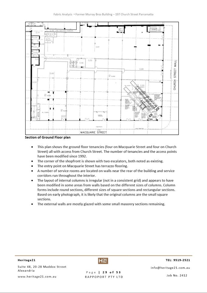
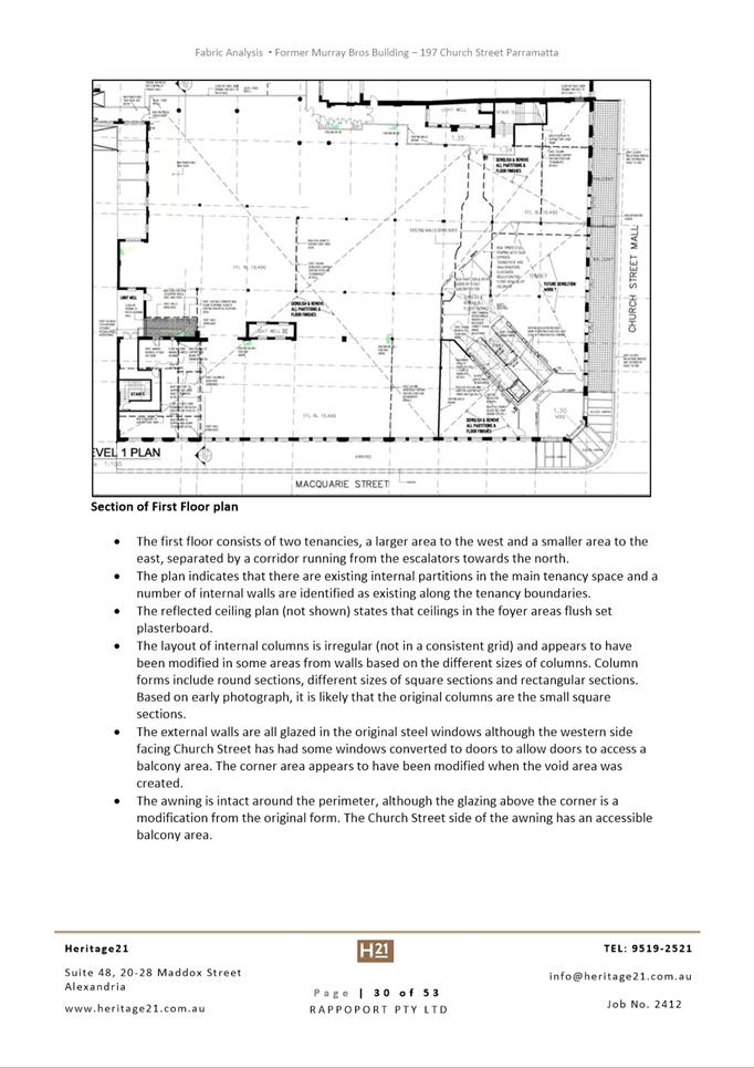
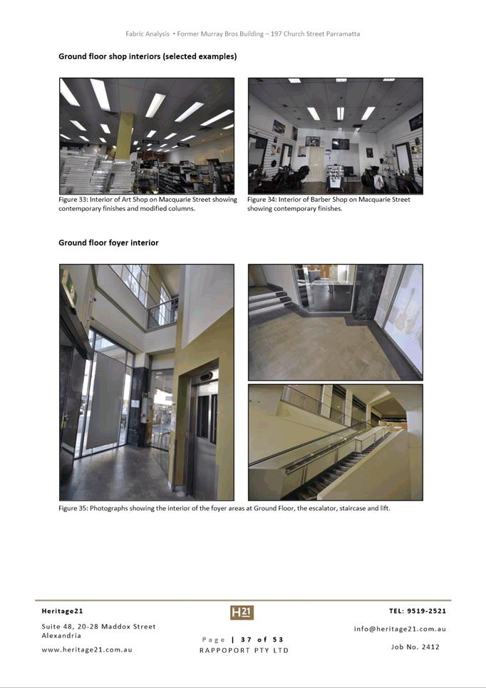
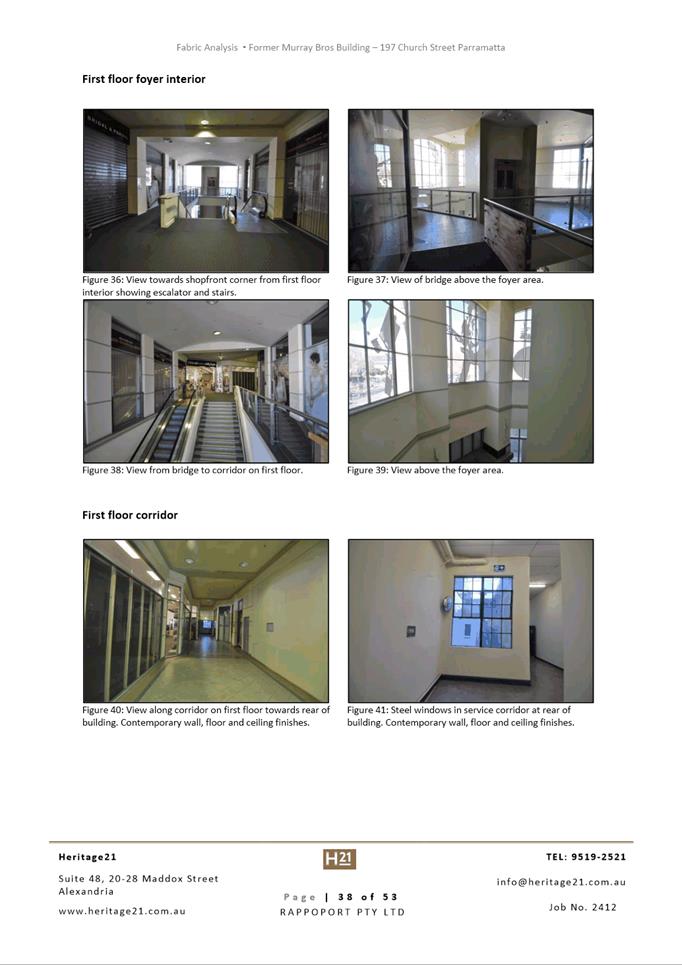
· Demolition of all buildings on the site down to slab level;
and
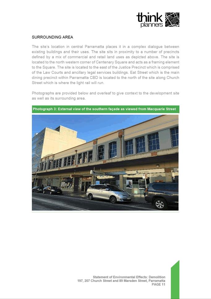
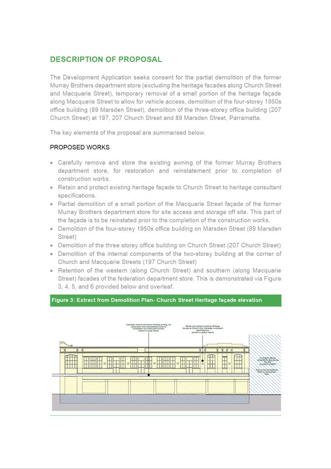
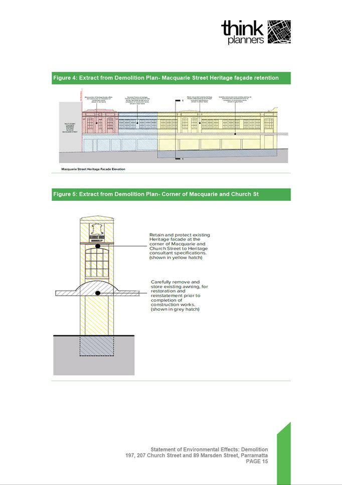
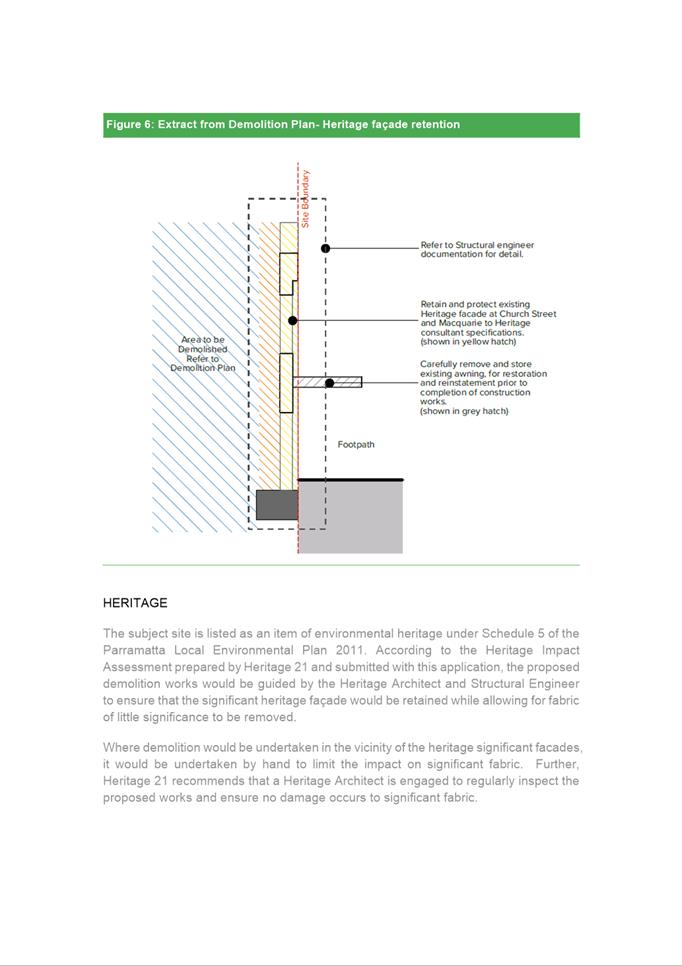
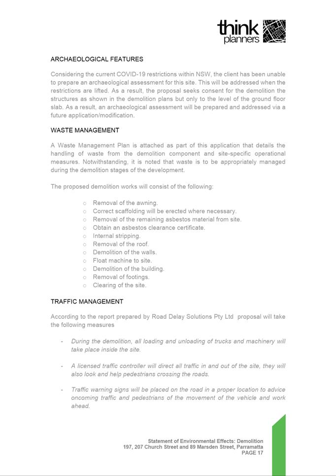
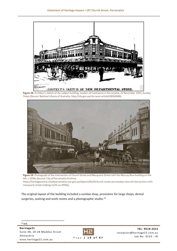
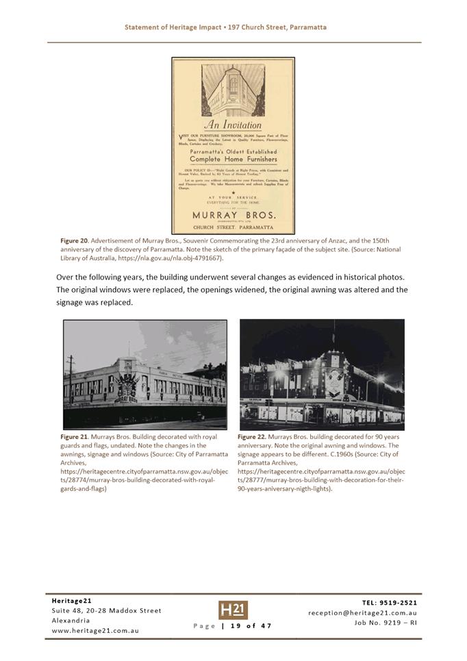
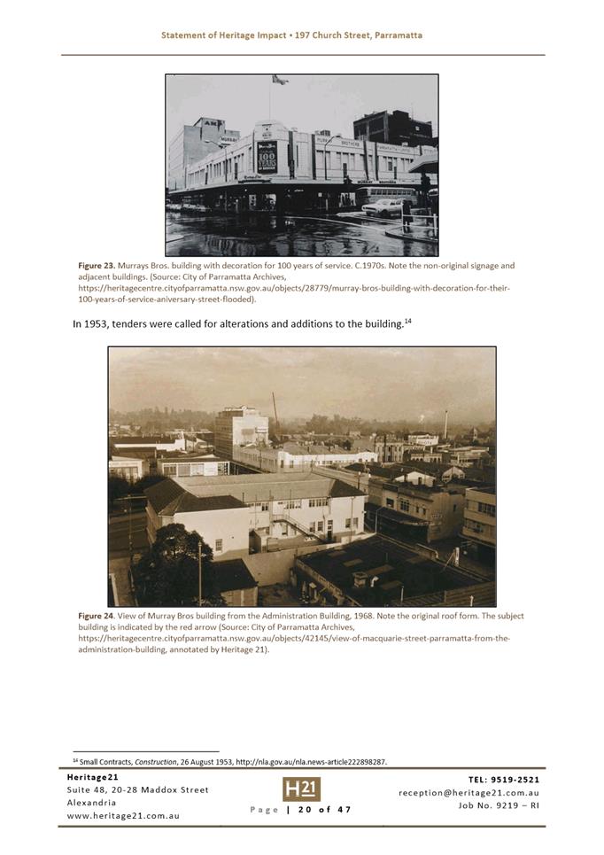
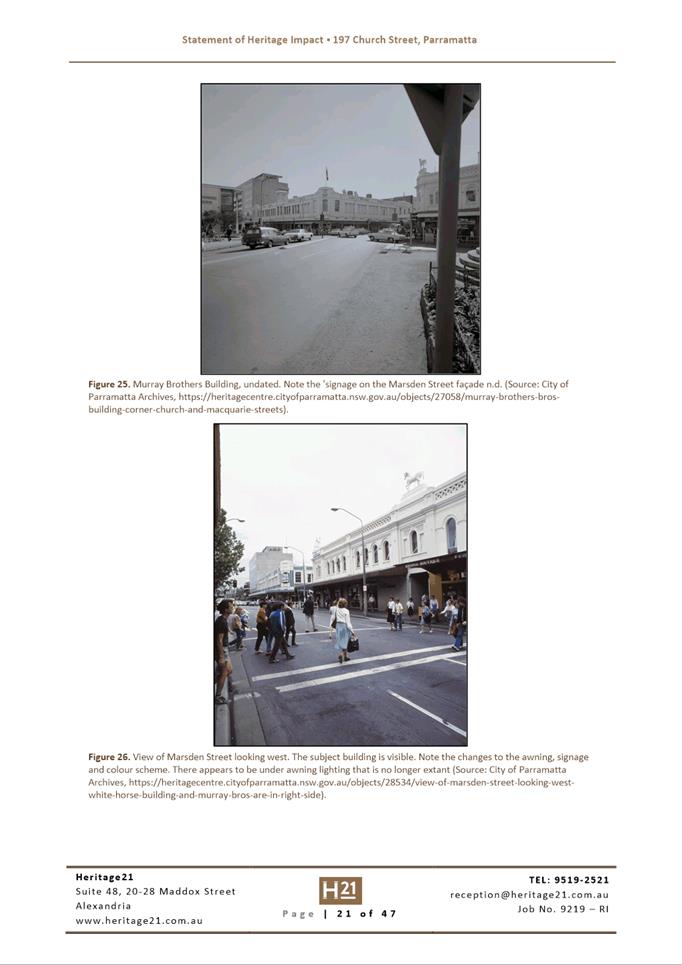
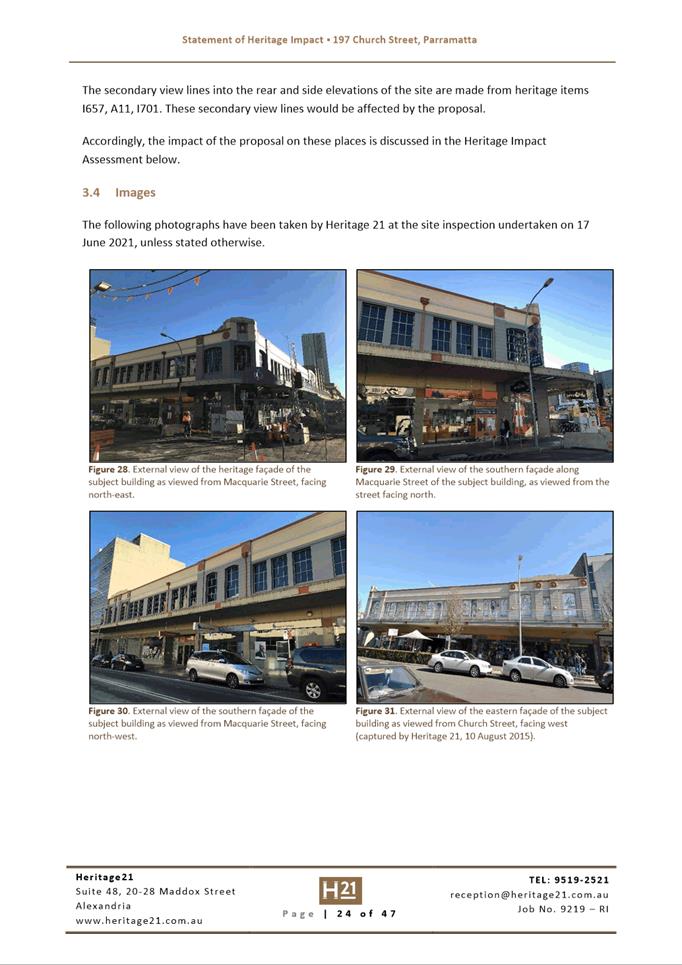
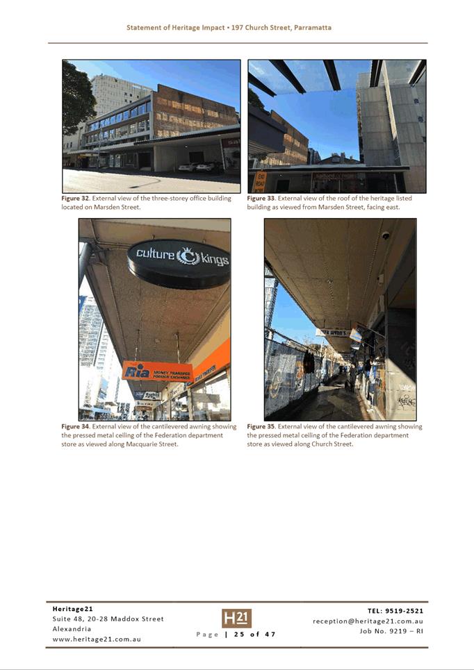
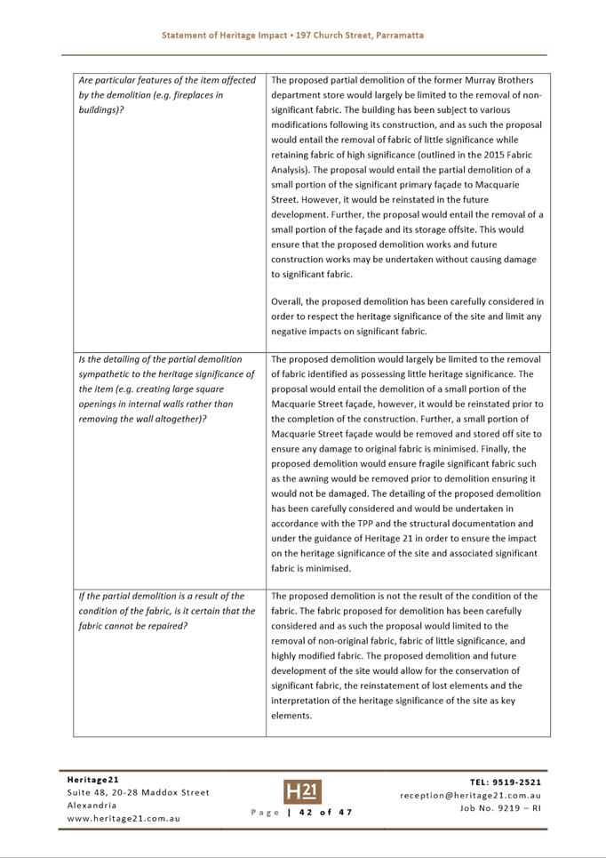
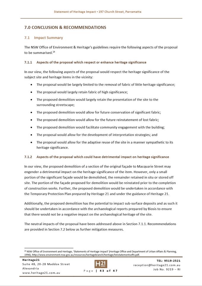
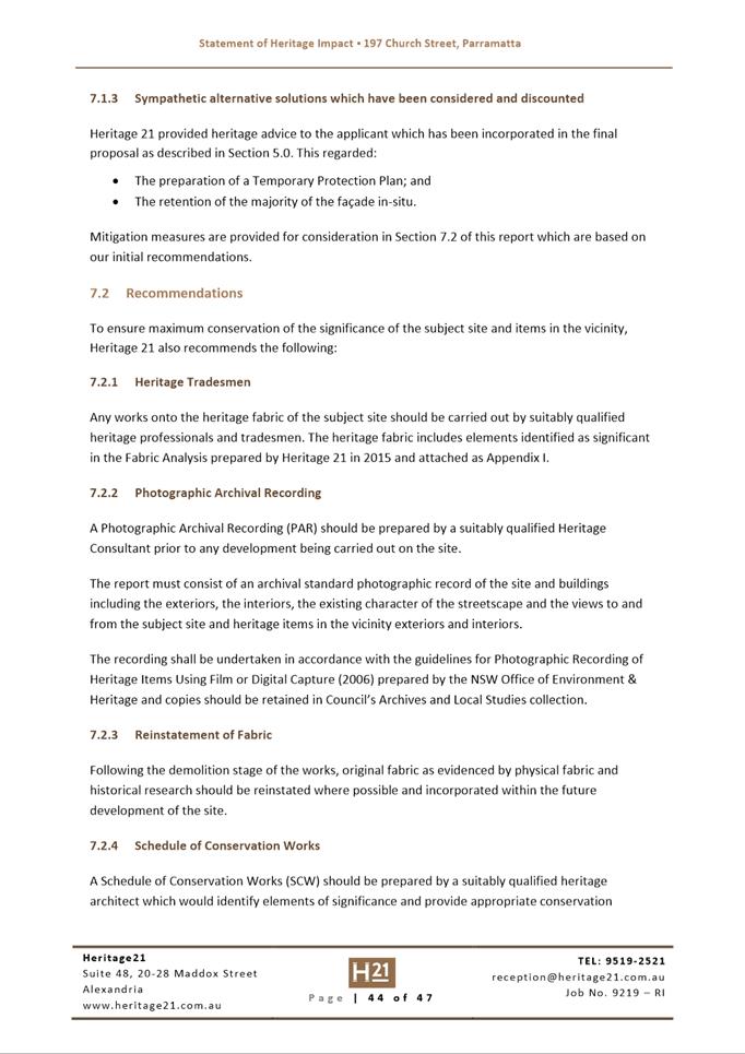
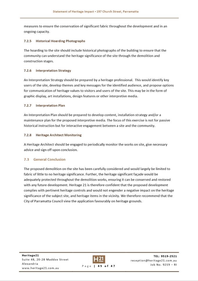
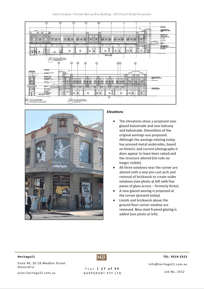
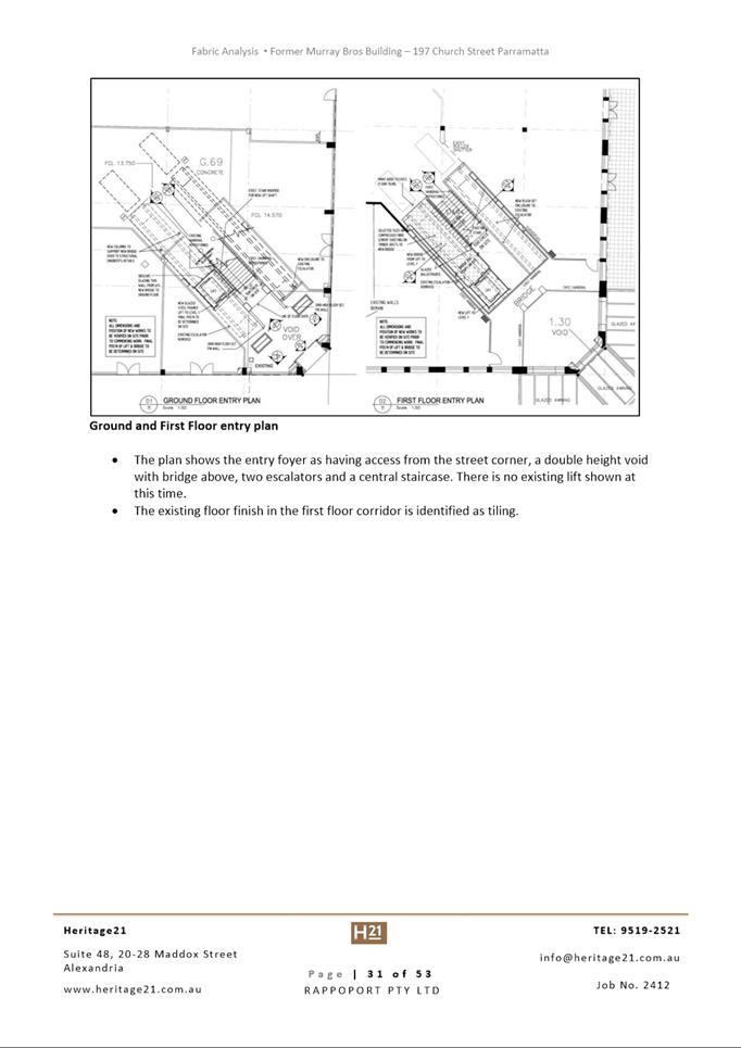
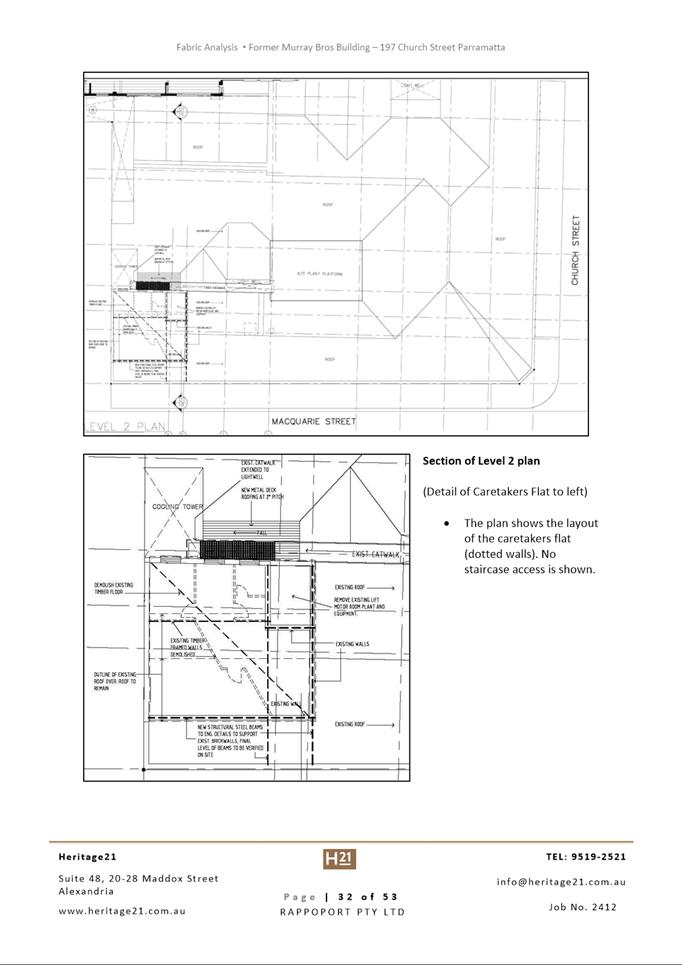
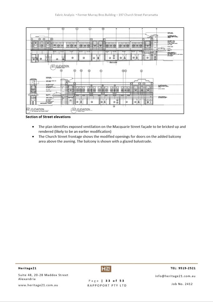
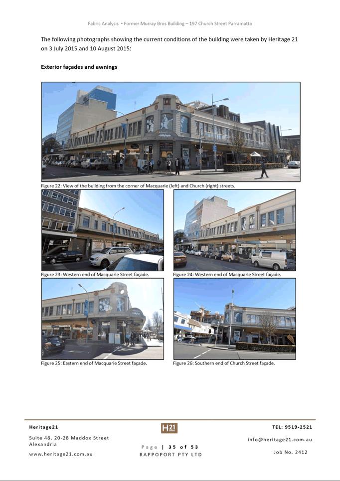
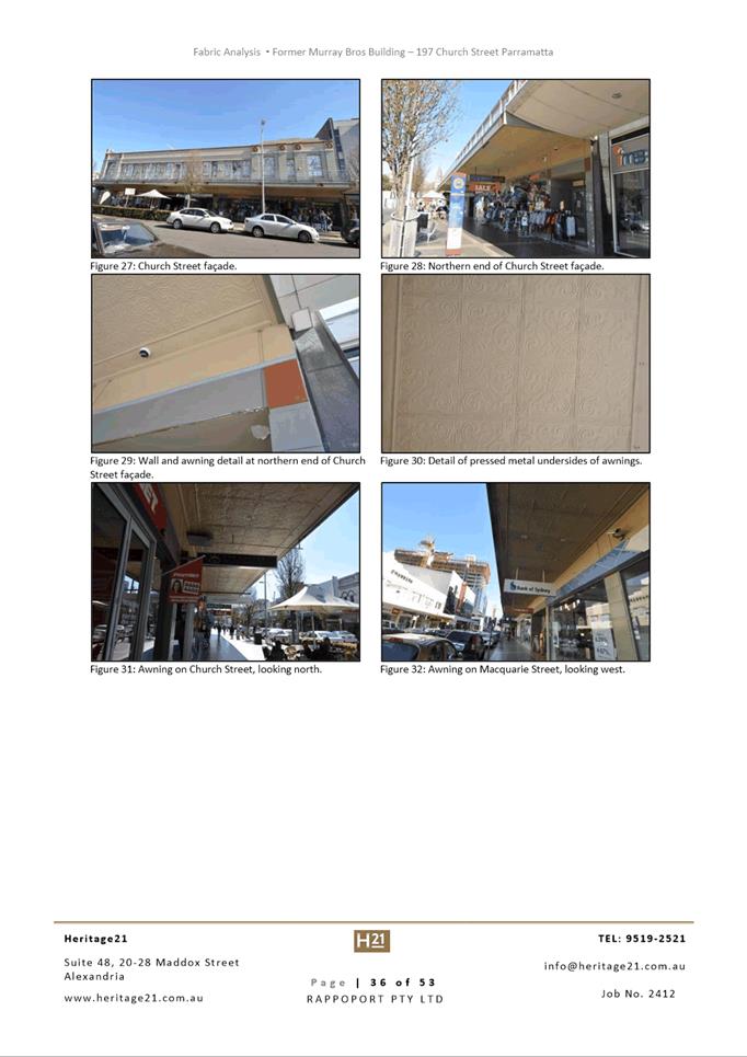
· Retention of the former Murray Brothers department store heritage
facades to Church and Macquarie Streets.
Background
The proposal is
essentially early works for related Development Application 16/2022, which
seeks consent to implement a scheme across this site which has been the subject
of a related site specific Planning Proposal, Development Control Plan and
Design Excellence competition. Broadly, DA 16/2022 seeks consent for a two tower mixed-use development comprising:
· A 2 storey retail podium, incorporating the retained heritage
facades from the Murray Brothers building;
· A 25 storey commercial office tower and 32 storey hotel
accommodation tower; and
· 4 basement levels for car parking and hotel ballroom.
That
application, lodged on 11 January 2022, is under assessment with several
fundamental concerns yet to be resolved.
Assessment
Since lodgment
the proposal has been amended to:
· Delete physical works to the retained heritage façade; and
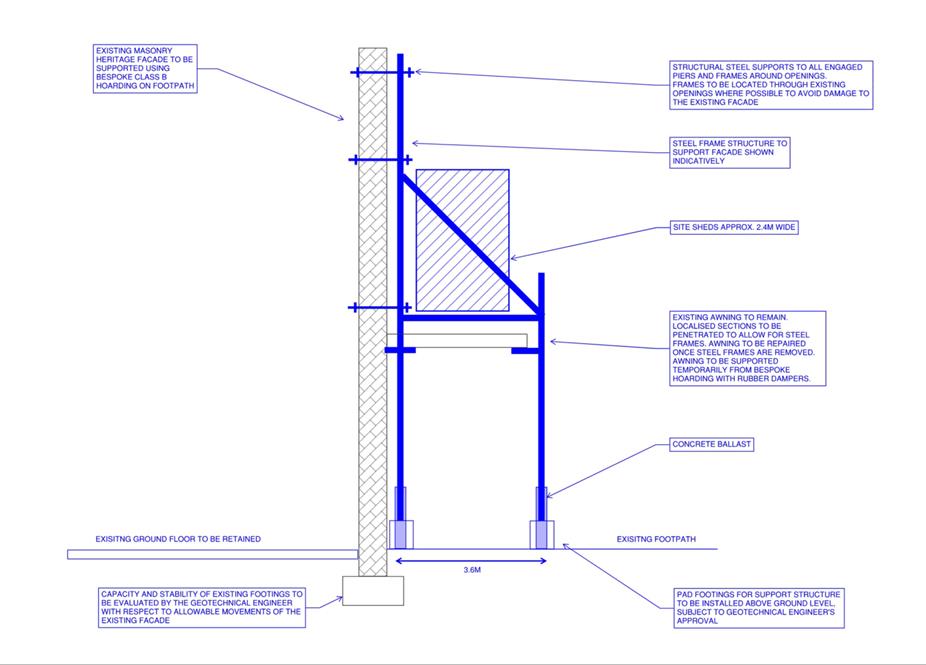
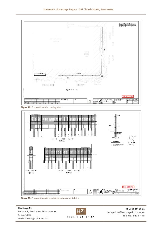
· Revise the system of temporary structural bracing to support the
retained facades in order to avoid impacts to potential archaeology on the
site, which is possibly of State or national significance.
Notification
The modification application was advertised
in accordance with Council’s Consolidated Notification Requirements
2020. One submission was received, raising objections based on concerns for
impacts on site archaeology.
Conclusion
After consideration of the development
against Section 4.55 of the Environmental Planning and Assessment Act 1979, and
the relevant statutory and policy provisions, the proposal is suitable for the
site and is in the public interest.
RECOMMENDATION
(a) That the Parramatta
Local Planning Panel (PLPP), exercising the functions of Council, pursuant to
Section 4.16 of the Environmental Planning and Assessment Act 1979, grant development
consent to DA/802/2021 for the demolition of existing buildings down to
ground floor slab, except for the facades of the former Murray Brothers
building to Church and Macquarie Streets which must be retained, at Lot 1 DP 710335 and Lot 1 DP 233150 being Nos. 197 and 207 Church
Street and No. 89 Marsden Street, Parramatta, for
a period of five (5) years within which physical commencement is to occur from
the date on the Notice of Determination, subject to attached conditions of
consent.
(b) Further
that, the objector be advised of the Panel’s decision.
REASONS FOR APPROVAL
1. To facilitate the orderly
implementation of the objectives of the Environmental Planning and Assessment
Act 1979 and the aims and objectives of the relevant Council Planning
instrument.
2. The proposal is
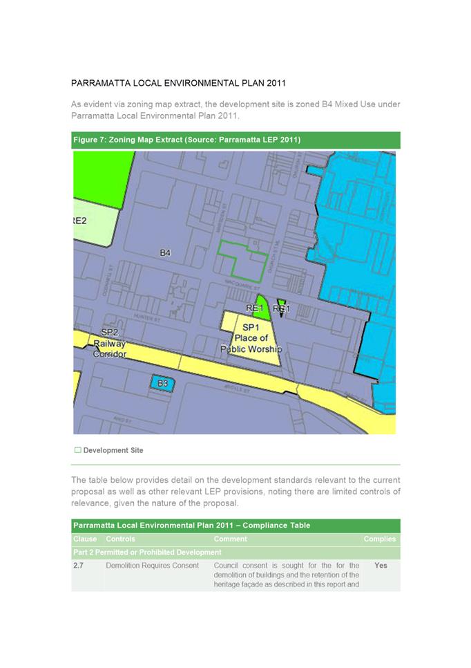
permissible in the B4 Mixed Use zone and is satisfactory when considered
against Section 4.15 of the Environmental Planning and Assessment Act 1979.
3. The proposal allows for the
heritage values the site to be retained with an expectation that the primary
façade will be incorporated into a future redevelopment of this site.
4. Approval
of the application is in the public interest.
Brad Roeleven
Executive Planner
Attachments:
|
1⇩ 
|
Assessment Report and Draft Conditions of
Consent
|
40 Pages
|
|
|
2⇩ 
|
Locality Map
|
1 Page
|
|
|
3⇩ 
|
Plans used during assessment
|
3 Pages
|
|
|
4⇩ 
|
Statement of Environmental Effects (as
lodged)
|
32 Pages
|
|
|
5⇩ 
|
Facade and Awning retention strategy
report
|
8 Pages
|
|
|
6⇩ 
|
Statement of Heritage Impact (as lodged)
|
100 Pages
|
|
REFERENCE MATERIAL
|
Item 5.4 - Attachment
1
|
Assessment Report and Draft Conditions of Consent
|

|
Item 5.4 - Attachment 2
|
Locality Map
|
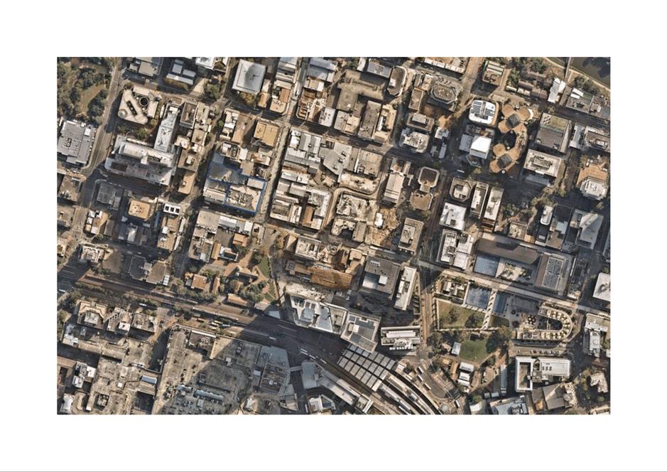
|
Item 5.4 - Attachment
3
|
Plans used during assessment
|
|
Item 5.4 - Attachment 4
|
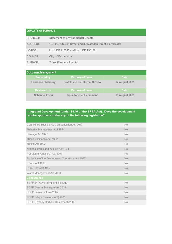
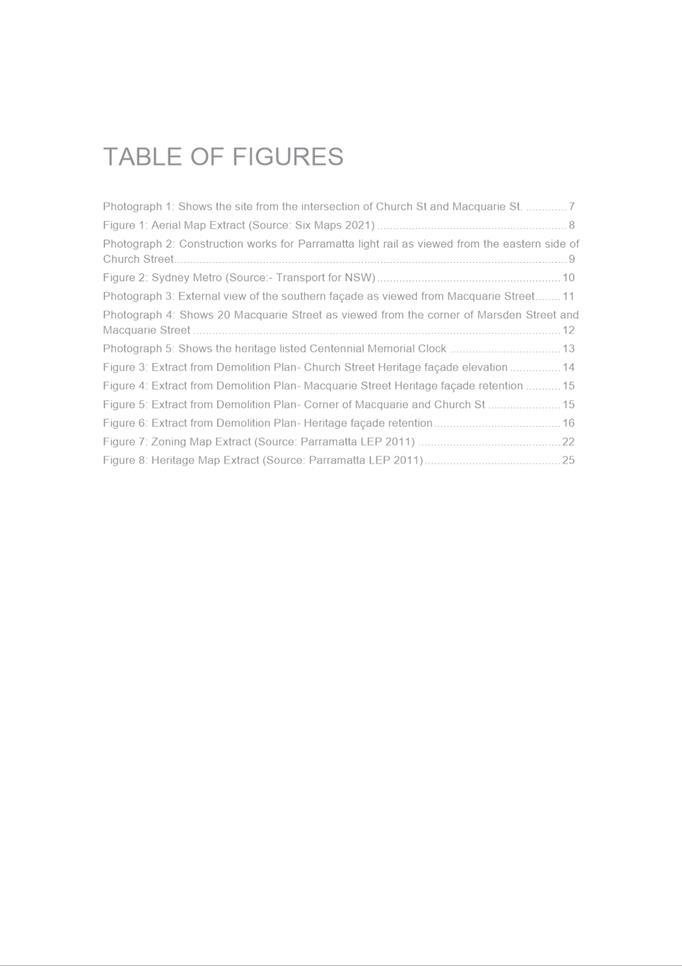
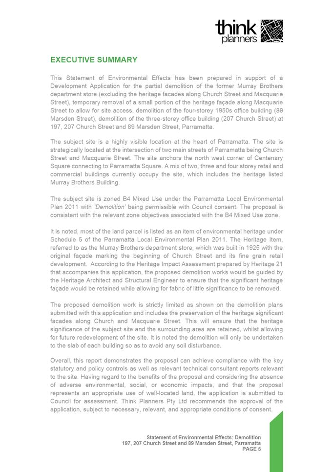
Statement of Environmental Effects (as lodged)
|
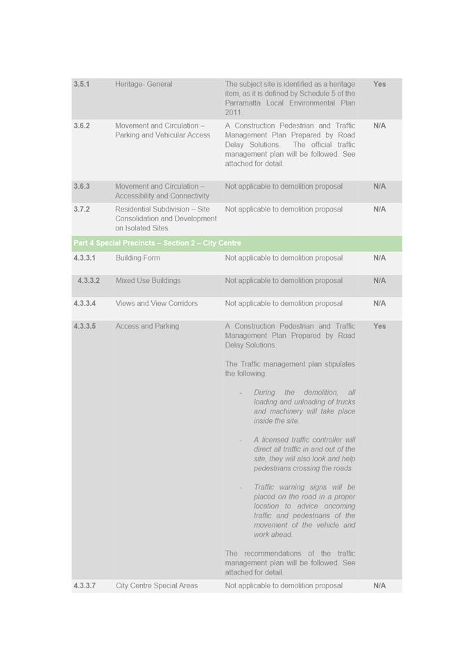
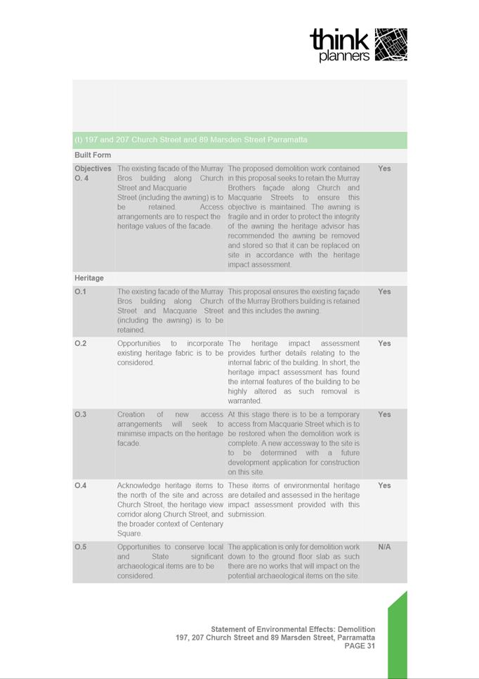
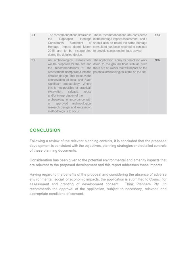
|
Item 5.4 - Attachment 5
|
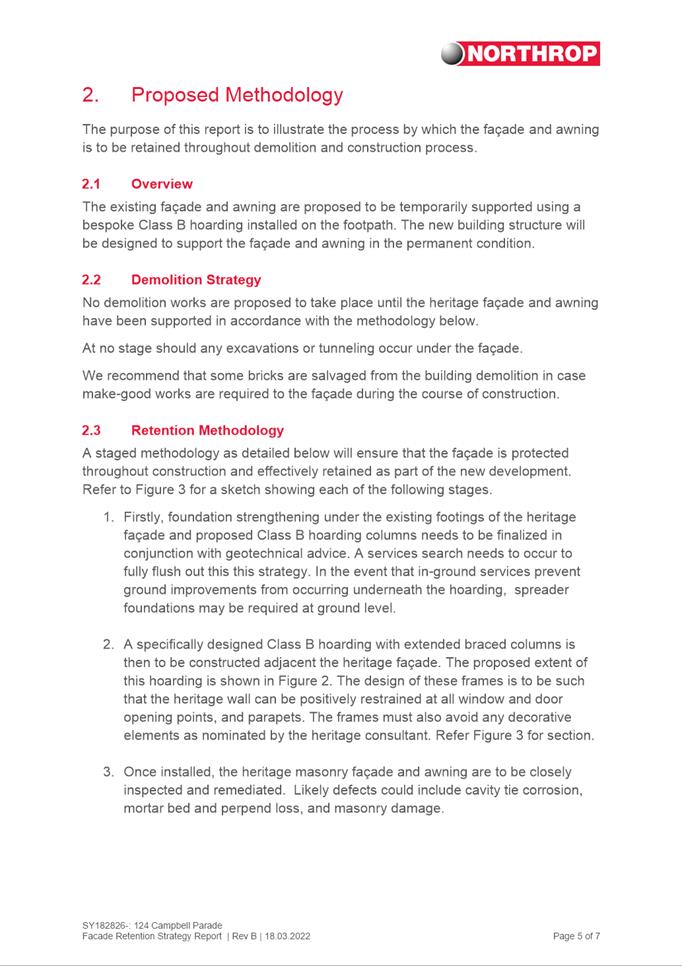
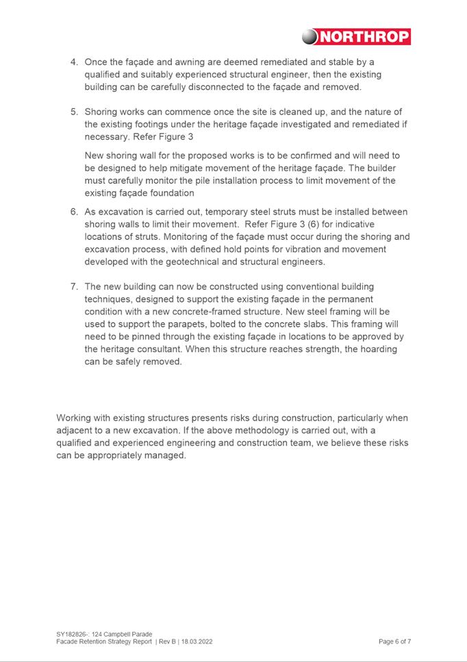
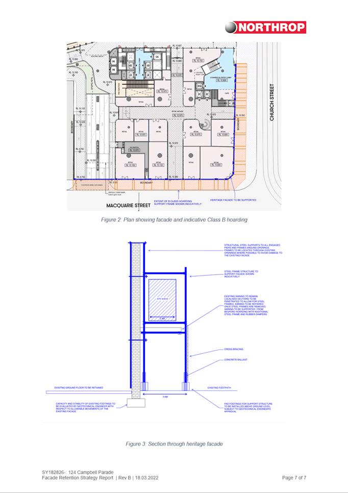
Facade and Awning retention strategy report
|
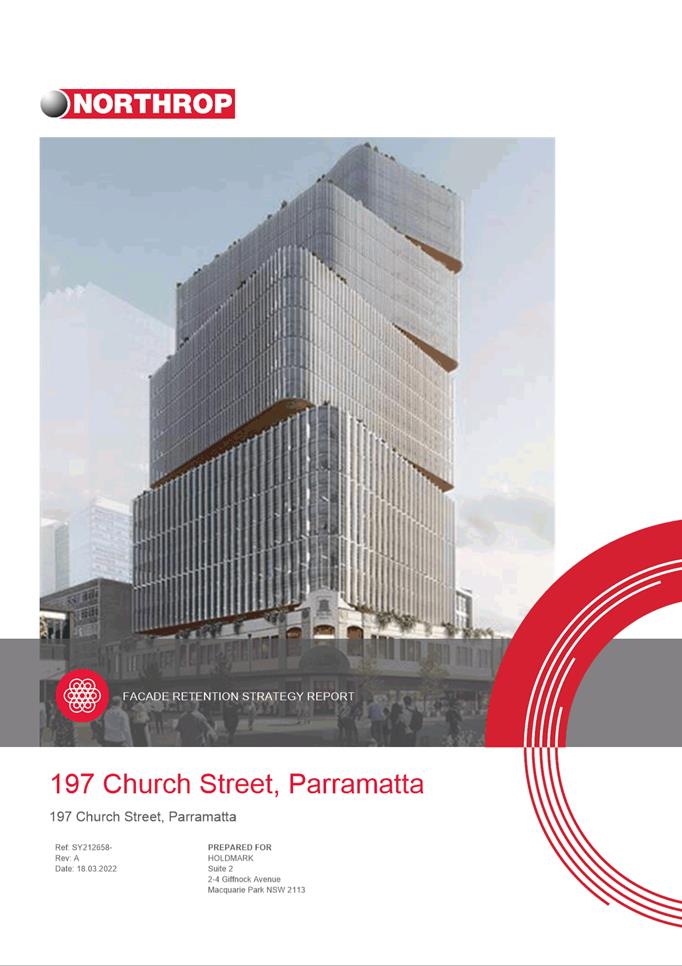
|
Item 5.4 - Attachment 6
|
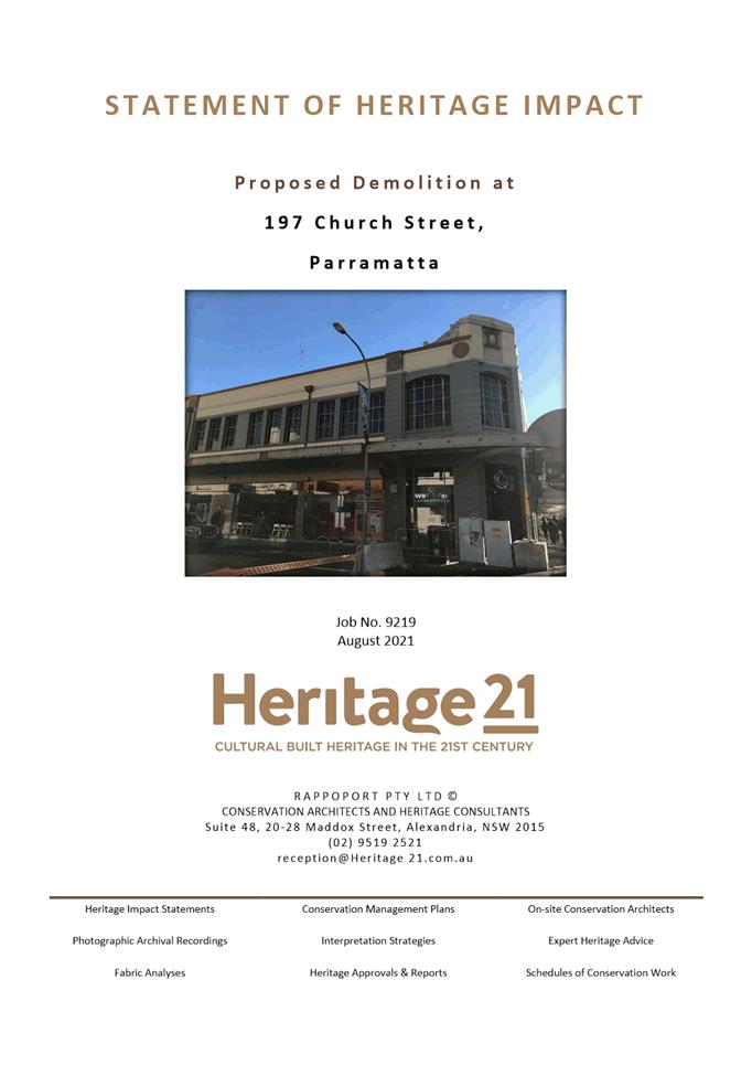
Statement of Heritage Impact (as lodged)
|
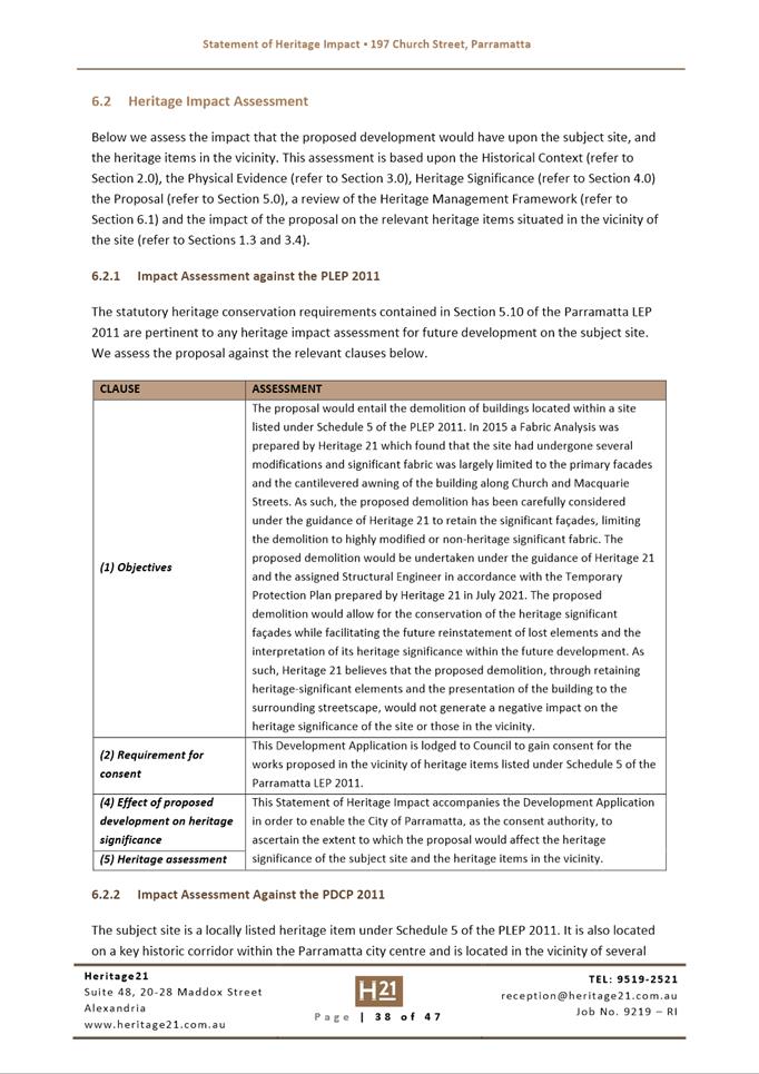
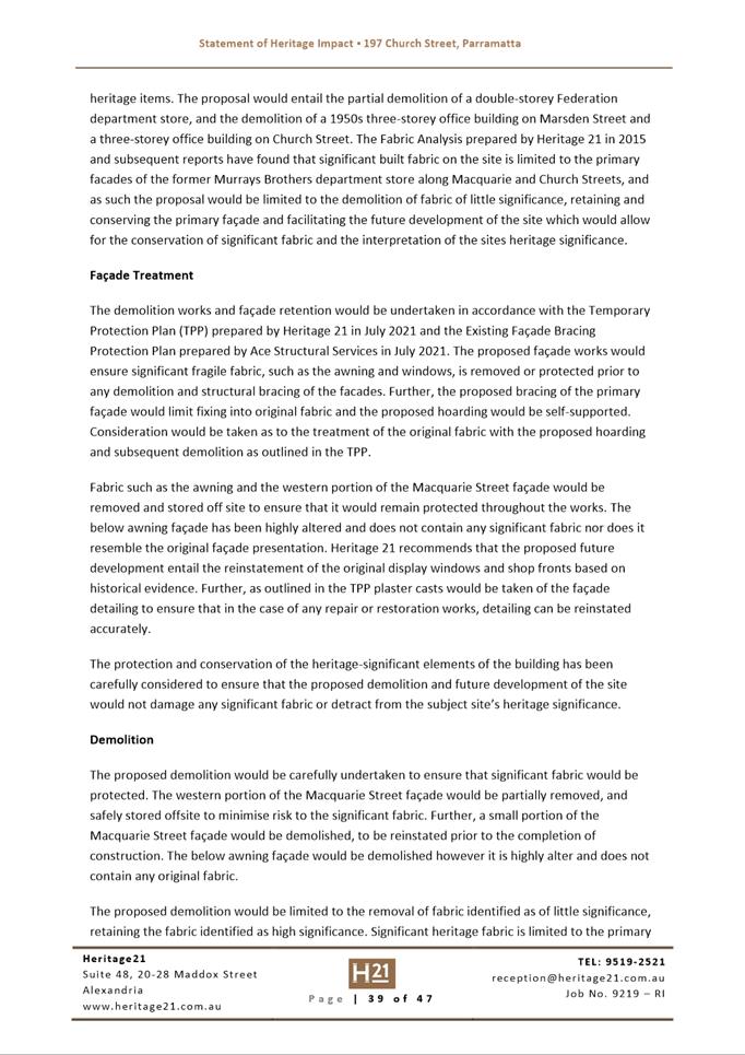
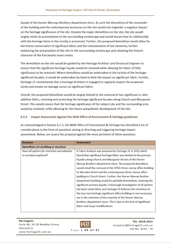
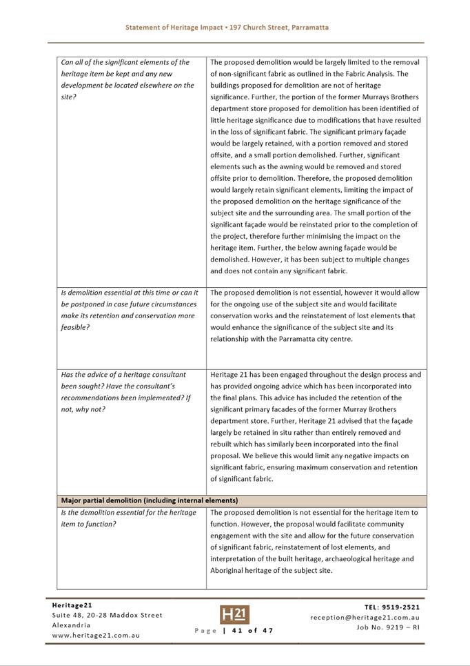
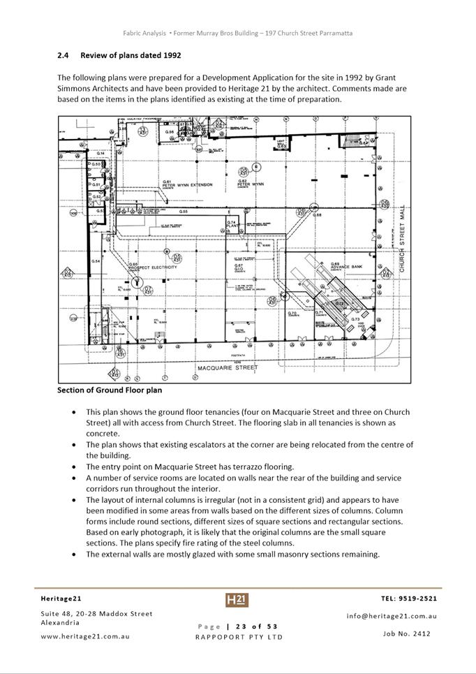
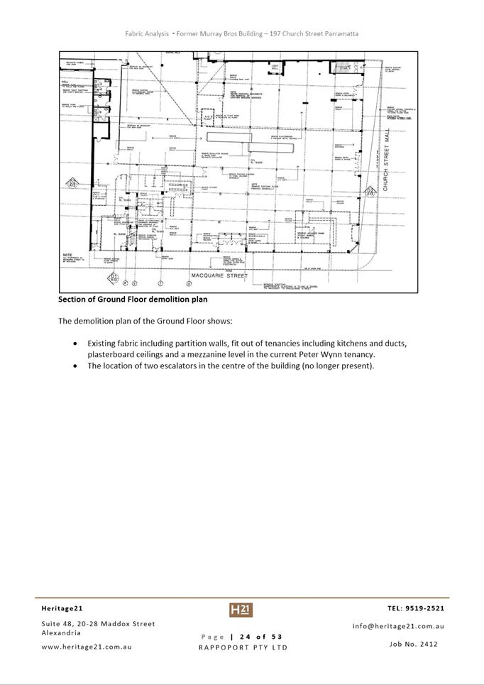
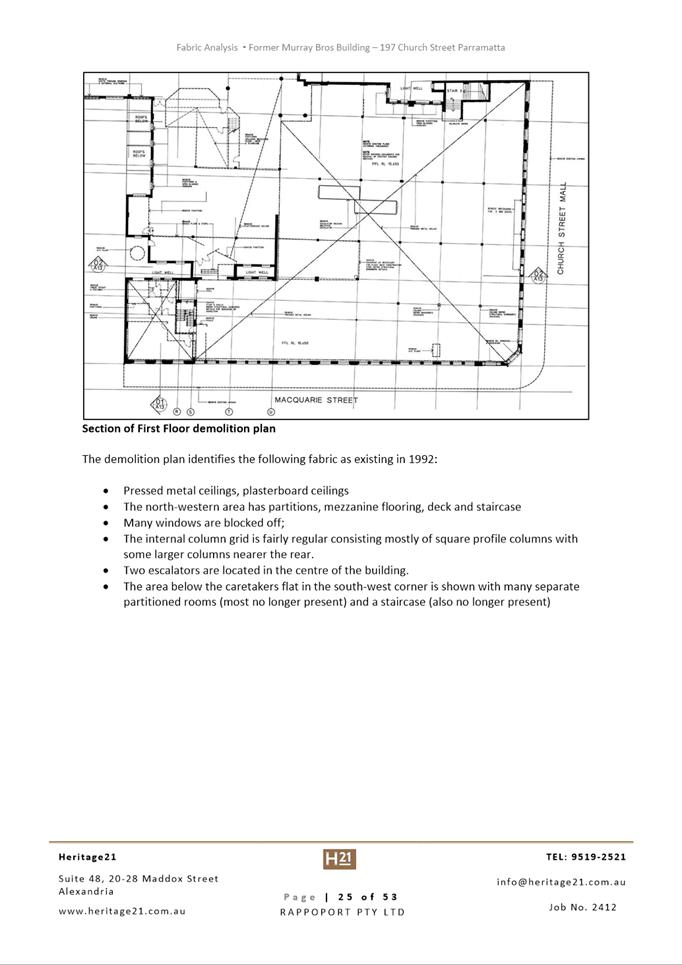
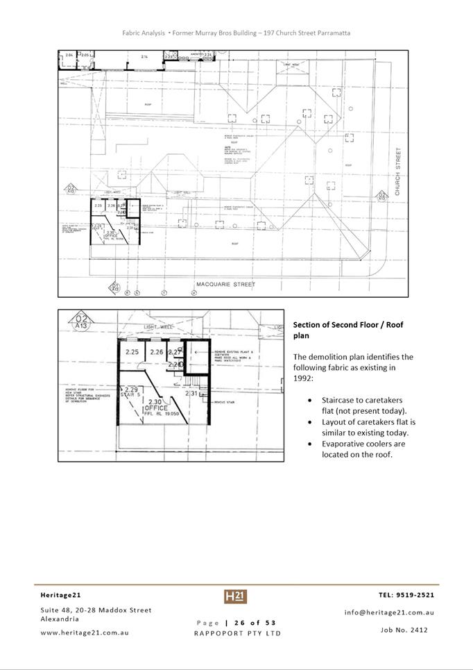
Innovative
17 May 2022
6.1 Pre-Gateway:
Planning Proposal for 263-273 & 279R Pennant Hills Road and 18 Shirley
Street, Carlingford............................................................................ 622
6.2 Pre-Gateway:
Planning Proposal for 19 Hope Street, Melrose Park and 69-77 Hughes Avenue,
Ermington (Melrose Park North Precinct)................... 743
Local Planning Panel 17 May 2022 Item
6.1
ITEM NUMBER 6.1
SUBJECT Pre-Gateway: Planning Proposal for 263-273 & 279R Pennant Hills
Road and 18 Shirley Street, Carlingford
REFERENCE RZ/4/2021 -
APPLICANT/S Karimbla Contsruction Services (NSW) Pty Ltd
OWNERS Karimbla Properties (No. 61) Pty Ltd
REPORT OF Project Officer Land Use
Development
applications considereD by Sydney central city planning panel
Deferred Commencement Development Consent
No.1103/2011/JP issued by the Joint Regional Planning Panel for demolition of
existing structures and associated construction of five apartment buildings
9-11 stories containing 450 units and basement parking for 662 cars (active
consent granted 21 July 2015).
A development application (DA/53/2022) was
lodged on 21 January for 6 x 10-12 storey buildings comprising 629 residential
units, childcare centre for 110 children, 17 neighbourhood retail shops and 1,146
basement car parking spaces; publicly accessible open spaces and through site
links; landscaping; tree removal; demolition of existing buildings. The application is
under assessment, with the applicant expected to submit amended plans to
address key issues in relation to traffic and parking, and design.
PURPOSE
To seek Local Planning Panel (LPP) advice on a Planning
Proposal for land at 263-273 & 279R Pennant Hills Road and 18 Shirley
Street, Carlingford for the purposes of seeking a Gateway Determination from
the Department of Planning and Environment.
RECOMMENDATION
That the Local Planning Panel
consider the following Council Officer recommendation in its advice to Council:
(a) That Council
approve the Planning Proposal for the purposes of seeking a Gateway
Determination from the Department of Planning and Environment (DPE) for land at
263-273 & 279R Pennant Hills Road and 18 Shirley Street, Carlingford which
seeks to amend the Parramatta (former The Hills) Local Environmental Plan 2012
as follows:
i. Addition of
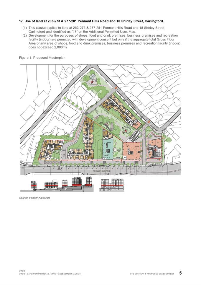
shops, food and drink premises, business premises and recreational facility (indoor) as additional
permitted uses (limited to a maximum of 2,000sqm) to Schedule 1; and
ii. Addition of 263-273 & 279R Pennant
Hills Road and 18 Shirley Street, Carlingford to the Additional Permitted Uses
Map.
to facilitate retail floor space, metro style supermarket along with
specialty retail, business, and recreational uses.
(b) That the Planning Proposal be forwarded
to the DPE for a Gateway Determination.
(c) That Council requests to DPE that it be authorised to exercise
its plan-making delegations for this Planning Proposal.
(d) That Council give delegation to the CEO
in relation to the draft Planning Agreement:
i. To draft the Planning Agreement based on
the submitted offer provided at Attachment 4;
ii. In the event that Gateway Determination is
issued by Department of Planning, that the Planning Agreement is placed on
public exhibition concurrently with the Planning Proposal.
iii. To correct any minor
anomalies of a non-policy and administrative nature.
(e) Further
that, Council authorise the CEO to correct any minor anomalies of a non-policy
and administrative nature that may arise during the plan-making process.
BACKGROUND
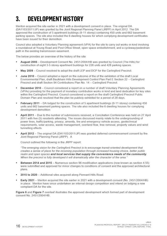
1. In
2007, the then Baulkham Hills Shire Council (now The Hills Shire Council)
rezoned the Carlingford Precinct to facilitate further growth in the Carlingford
Precinct. The subject site is located within the Carlingford Precinct.
2. Part
of the subject site was previously owned by Dyldam (18 Shirley Street and 279R
Pennant Hills Road) and in December 2020 was purchased by Meriton. It is
noted that the site is already subject to an existing Planning Agreement
relating to the dedication of land zoned RE1 Public Recreation to Council. This
is further detailed in the Planning Agreements section of this report.
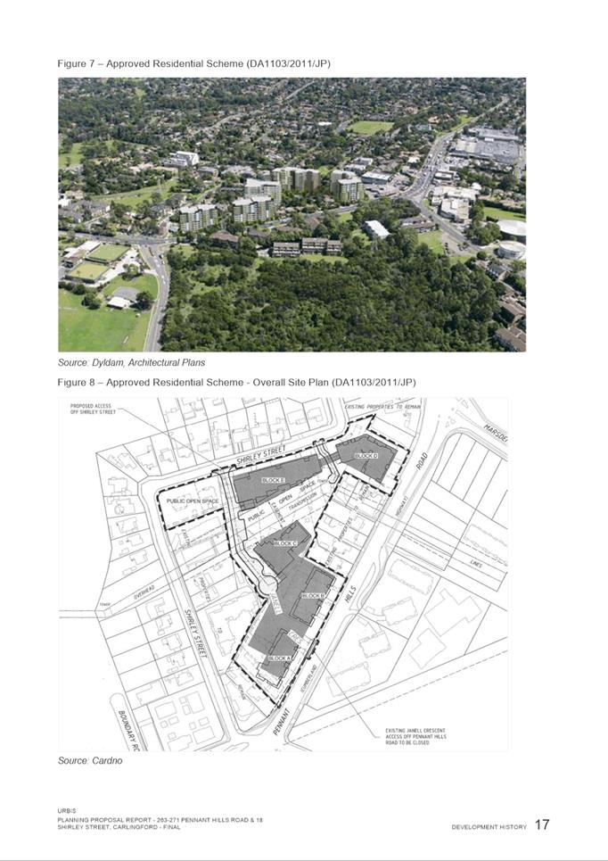
3. A development approval
(DA1103/2011/JP) was granted by the Joint Regional Planning Panel in April 2012
for the construction of 5 apartment buildings (9-11 storeys) containing 450
units and 662 basement parking spaces at 18 Shirley Street which is part of the
planning proposal subject site. The application was subsequently activated by
demolition and other early works. Subsequent to this approval, a further 6
properties at 263-273 Pennant Hills Road were acquired by the current owner
Meriton.
4. On 22 November 2021, the applicant, Karimbla Contsruction Services (NSW) Pty Ltd, on behalf of the landowner, Karimbla Properties (No. 61) Pty Ltd, lodged a Planning Proposal with the City of Parramatta
Council for land at 263-273 & 279R Pennant Hills Road and 18 Shirley
Street, Carlingford. The objective of the subject Planning Proposal is to
facilitate the additional permitted uses up to 2,000sqm of ‘shops’
and ‘food and drink premises’ being retail land uses along with
‘business premises’ and ‘recreational facility
(indoor)’.
5. In December 2021 the applicant lodged a development
application for the construction of six buildings up to 12 storeys in height,
containing 629 residential apartments, a childcare facility and neighbourhood
shops on the larger set of properties acquired by the current owner. It is
noted that the additional land uses sought under the subject Planning Proposal
are not included within the current development application. This application,
if approved, would need to be amended or superseded by another application in
order for the supermarket enabled by this planning proposal to be developed on
the site. The increase from 450 to 629 units is because the original approval
was under The Hills Development Control Plan 2012 controls, and complied with
the larger unit sizes that were required at the time. The current applicant has
proposed smaller Apartment Design Guide compliant unit sizes, which enables
more dwellings, there is also an increase in height above the initial approval.
However, the applicant is now proposing that they are going to change the unit
mix to provide more 3 and 4 bedroom apartments, so the total number of
dwellings could potentially reduce.
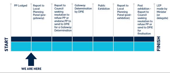
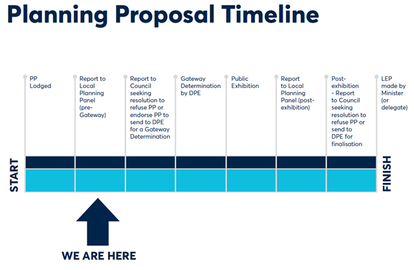
PLANNING PROPOSAL
TIMELINE
SITE DESCRIPTION
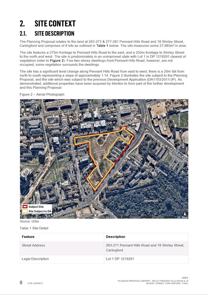
6. The subject site is located at 263-273 & 279R Pennant
Hills Road and 18 Shirley Street, Carlingford and comprises of 8 lots. The site
has a total area of approximately 27,985sqm (Figure 1).
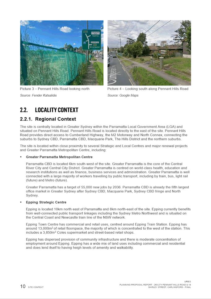
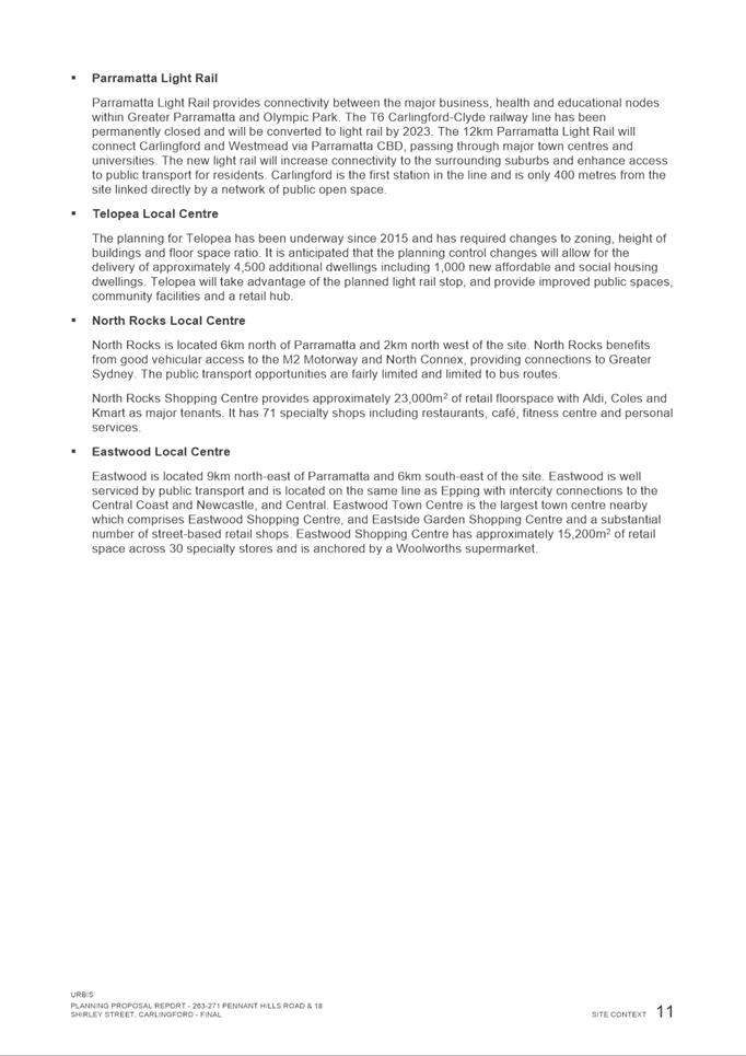
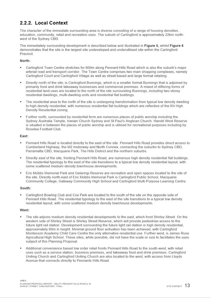
7. The site features a 275m frontage to Pennant Hills Road (a classified state main road) to the east, and a
255m frontage to Shirley Street (a local road) to the north and west. The site
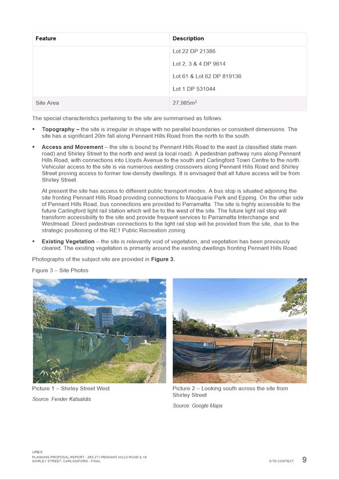
is predominately undeveloped and cleared of vegetation however there are five
two-storey unoccupied dwellings fronting Pennant Hills Road.
8. A pedestrian pathway runs along Pennant Hills
Road, with connections into Lloyds Avenue to the south and Carlingford Town
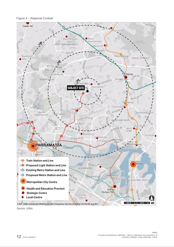
Centre to the north. The site is located approximately
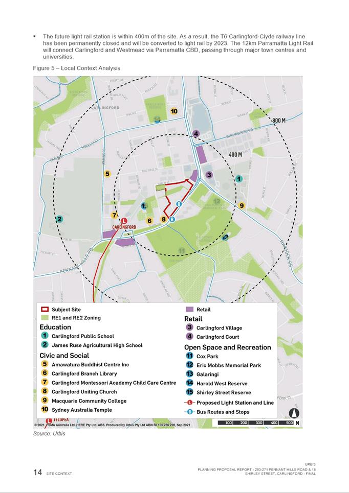
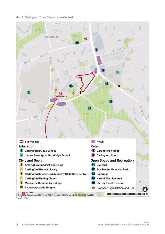
400 metres east from the planned Carlingford Light Rail stop.

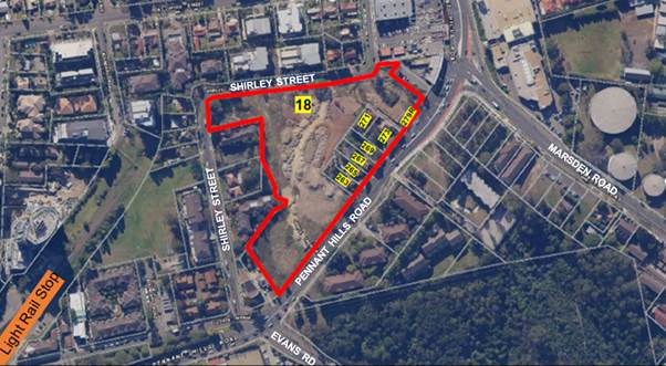
Figure
1 – Subject Site
CURRENT PLANNING
CONTROLS
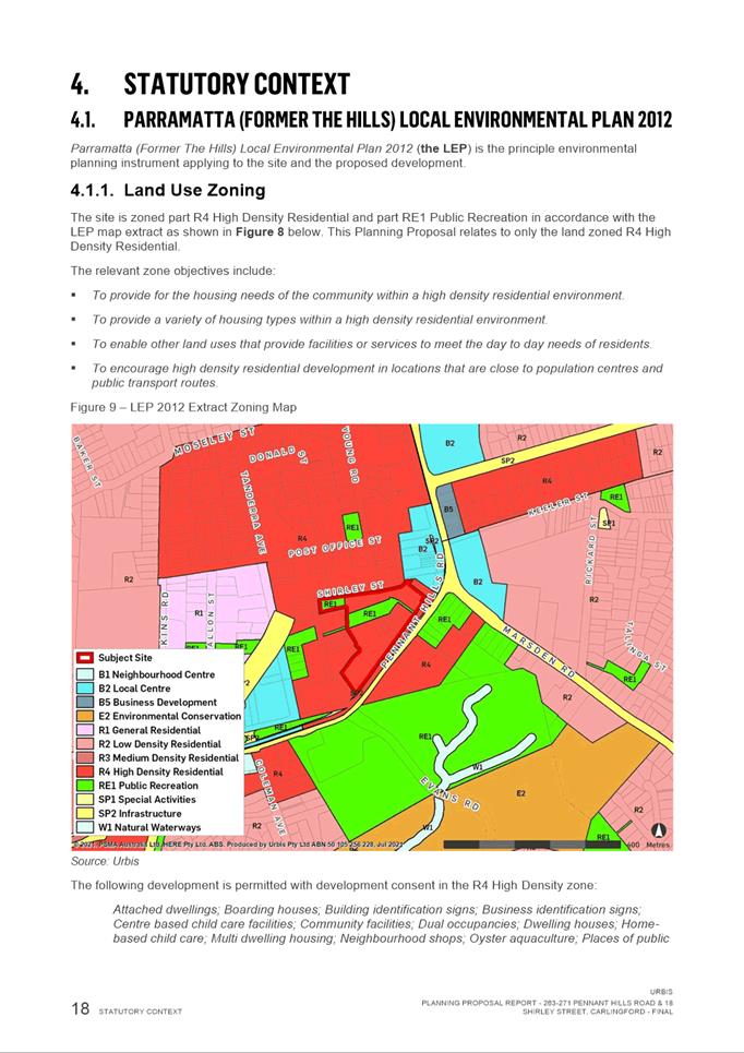
9. The subject site is zoned part R4 High Density
Residential and part RE1 Public Recreation under the provisions of the
Parramatta (former The Hills) Local Environmental Plan as shown in Figure 2. This Planning Proposal relates to only the land zoned R4
High Density Residential.
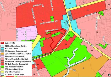
Figure 2 –
Current Zoning
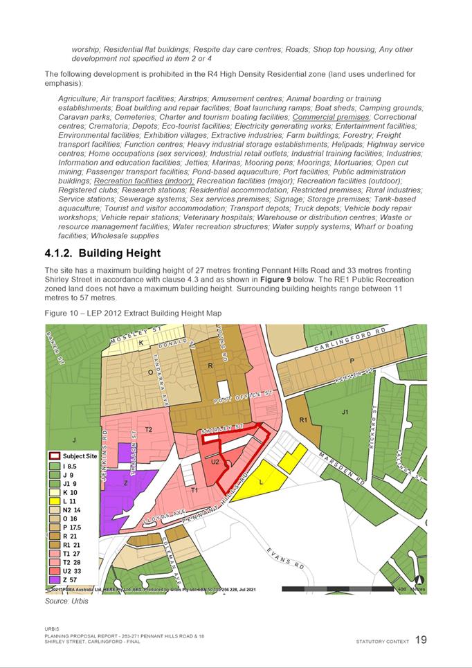
10. The site currently has a height limit of 27 metres (6
storeys) fronting Pennant Hills Road and 33 metres (9 storeys) fronting Shirley
Street under the Height of Buildings (HOB) map (refer to Figure 3).
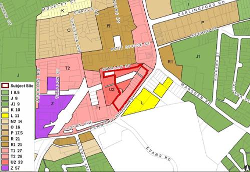
Figure 3 – Current Height of Buildings
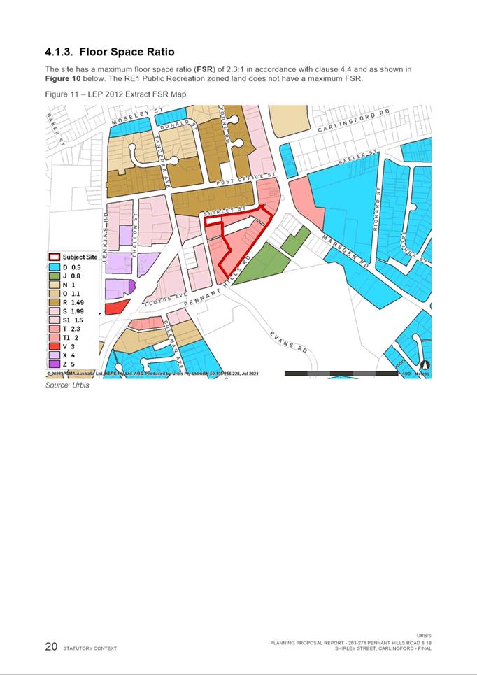
11. This site currently has a floor space ratio of 2.3:1 under
the Floor Space Ratio (FSR) map (refer to Figure 4). The RE1 Public
Recreation zoned land has no nominated FSR.
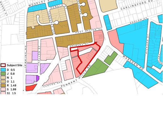
Figure 4 – Current Floor Space Ratio
PLANNING PROPOSAL
12. The objective of this Planning Proposal is to facilitate
the permissibility of ‘shops’ and ‘food and drink
premises’ along with ‘business premises’ and
‘recreational facility (indoor)’ up to a GFA of 2,000sqm on the
site.
13. Specifically, the Planning Proposal seeks to amend the
Parramatta (former The Hills) Local Environmental Plan 2012 as follows:
a. Amend
Schedule 1 to permit ‘shops’ and ‘food and drink
premises’, ‘business premises’ and ‘recreational
facility (indoor)’ up to a combined total GFA of 2,000sqm on the site.
b. Amend
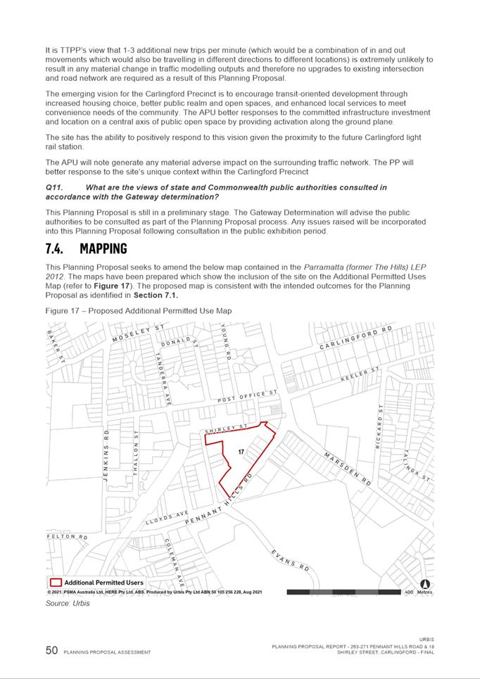
Additional Permitted Uses map to add the subject site (refer Figure 5).
A copy
of the Planning Proposal is included at Attachment 1.
14. The
site is within the R4 High Density Residential Zone which currently allows a
range of non-residential (and commercial) uses including childcare and minor
neighbourhood shops, but not uses which the planning proposal intends to
implement. Table 1 outlines the current non-residential uses permitted under
the Parramatta (Former The Hills) LEP 2012 on the site and what is sought under
the Planning Proposal.
Table
1 – Current and Proposed Permitted
Non-Residential Land Uses on the subject site
|
Currently
permitted non-residential land uses within the R4 High Density Residential zone
|
Proposed additional
permitted non-residential uses for the subject site under Planning Proposal
|
|
The Parramatta (former The Hills) LEP
2012 currently permits (with development consent) centre-based and home-based child care facilities; Community
facilities; neighbourhood shops; Places of public worship.
Specifically, ‘neighborhood
shops’ are defined under the Parramatta (former The Hills) LEP 2012 as
“premises used for the
purposes of selling general merchandise such as foodstuffs, personal care
products, newspapers and the like to provide for the day-to-day needs of
people who live or work in the local area, but does not include neighbourhood
supermarkets or restricted premises.” Under Clause 5.4 (7) of the LEP,
the retail floor area of neighbourhood shops must not exceed 100 square
metres.
|
Shops (smaller metro style supermarket), food and drink
premises, business premises and recreational facility (indoor)
up to a combined gross floor area of 2,000sqm on the site.
The Parramatta (former The Hills) LEP
2012 defines that “Shops” are premises that sell merchandise
such as groceries, personal care products, clothing, music, homewares,
stationery, electrical goods or the like or that hire any such merchandise
and includes a neighbourhood shop and neighbourhood supermarket.
|
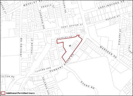
Figure 5 –
Proposed additional permitted
used map
LOCAL &
STRATEGIC PLANNING CONTEXT
State Planning
Policies
15. The Planning Proposal is generally consistent with the
relevant state policies and planning strategies including the Greater Sydney
Region Plan, Central City District Plan, and Ministerial Directions under
Clause 9.1 of the Environmental Planning and Assessment Act 1979.
16. The
Greater Sydney Region Plan: A Metropolis of Three Cities aims to rebalance
growth and deliver its benefits more equally and equitably to residents across
Greater Sydney. Objective 12 of the plan states: “Great places that
bring people together”. It recognises the key components which make a
city a great place. The objective encourages fine grain urban form and land use
mix through the co-location of schools, retail services and transport
infrastructure. This Planning Proposal will allow for the co-location of
retail, business, recreation, and residential uses, within an existing high
density precinct and in close proximity to the future Carlingford light rail
station. The co-location uses will enhance walkability as well as the viability
of, and access to, places, centres and public transport.
17. The
Central City District Plan (CCDP) identifies the need to accommodate a
significant amount of additional retail floorspace within the District over the
next 20 years. The Planning Proposal is in line with Objective 22 of the CCDP
as it will facilitate investment and business activity in centres. The Planning
Proposal will contribute to this objective.
Local Strategies
18. Councils are required to prepare a Local Strategic Planning
Statement (LSPS). It sets out the long-term vision for land use planning and
responds to broader priorities identified in the District Plans and integrates
with a Council’s Community Strategic Plan. The LSPS provides greater
weight to strategic planning in the broader plan making process and any new
planning proposal must justify any inconsistency with this framework and the
supporting Local Housing Strategy (LHS) and Employment Lands Strategy (ELS).
Council’s LSPS was published on 31 March 2020.
19. The
subject site is within the Carlingford Precinct, an existing area that is
identified for growth within the Council’s LSPS and LHS. The proposal is generally consistent with the LSPS as it is
in line with Planning Priority 11 which aims to “Build the capacity of the Parramatta CBD, Strategic Centres, Local
Centres and Employment Lands to be strong, competitive and productive”
as the proposal will help to facilitate “retail and
commercial floorspace within mixed use development of local centers”. Given there is
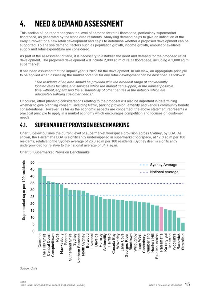
an existing undersupply of supermarket floorspace in the broader region as
identified in the supporting Retail Impact Assessment and the potential job
creation from the proposal, it is considered that the Proposal is generally
consistent with the LSPS.
ASSESSMENT OF KEY
ISSUES
Traffic and
Transport
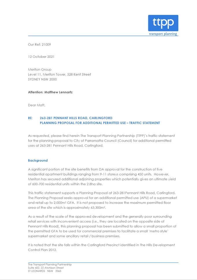
20. An
assessment of potential traffic and parking impacts has been prepared by the
applicant’s traffic consultant, The Transport Planning Partnership in
support of the Planning Proposal. A copy of the traffic assessment is included
at Attachment 2.
21. As
a result of the proposal, the expected additional trips on the main road
network would be limited to around 47 to 113 vehicles per hour (vph) during the
weekday AM peak period and around 92 to 152 vph in the PM peak periods, which
is equivalent to one to three additional vehicles per minute, which is
considered minor in the surrounding context. The traffic and parking assessment
also notes:
a) If there is no retail component within this precinct, then trips to
retail developments beyond the site by the approved residential component would
generate external trips to the road network to access other local retail
centres.
b) The site is within walking distance of the light rail station and
bus stops so many of the trips would be walk by trips from public transport
customers.
c) The site would accommodate a small metro style supermarket
(1,200sqm) which will provide limited day to day items and groceries so it will
not necessarily require or encourage access by cars unlike larger format
supermarkets.
22. Council
Officers have reviewed the applicant’s traffic assessment provide the
following comments in relation to traffic generation and parking.
23. Council’s
Traffic and Transport team raise no objection to the proposed additional uses
and concur with the traffic assessment report conclusion that the proposed
additional land uses will service local residents in the area and are therefore
likely to reduce vehicle trips to outside of the area. The Traffic and
Transport team recommend that a wider footpath connect the supermarket to the
Parramatta Light Rail shared path. This will be discussed further in the
Planning Agreement section of the report.
24. The
assessment report states the parking requirement of the proposal will be
provided in accordance with Part C of The Hills Development Control Plan 2012 -
a minimum car parking requirement of 1 space per 18.5m2 gross leasable floor
area (GLFA) for retail shops (including shopping centres and general business
retail). Assuming that GLFA is approximately 75% of GFA, the proposed retail
yield of 1,500sqm GLFA will require a total minimum car parking requirement of
81 spaces.
25. It is considered that the Planning
Proposal has appropriately considered the traffic and transport impacts. Should
Council endorse the Planning Proposal to proceed to Gateway Determination and
Gateway Determination is issued by DPE, it is expected that Transport for NSW
will be required to be consulted with in relation to the proposal.
Retail Impact
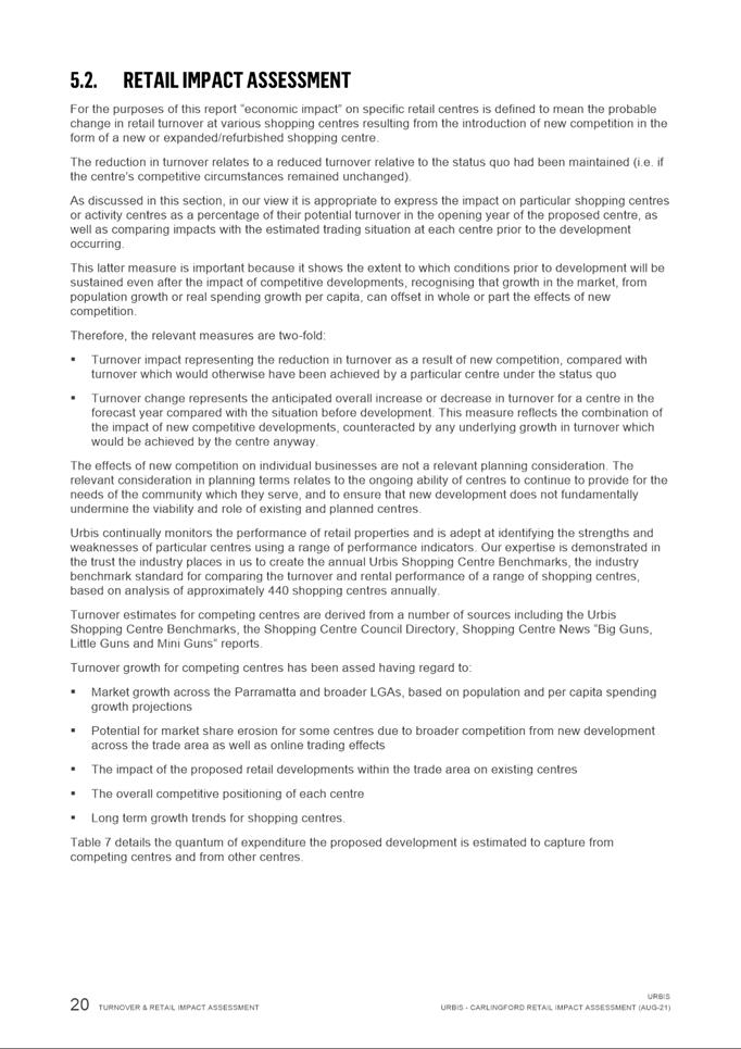
26. A Retail Impact Assessment prepared by Urbis has
also been provided in support of the Planning Proposal (refer Attachment 3).
The Retail Impact Assessment presents an analysis of the trade area,
competitive context, floor space demand, turnover potential and estimated
impacts, and economic benefit. Overall, the Assessment supports the viability
for the proposed land uses at the subject site.
27. The
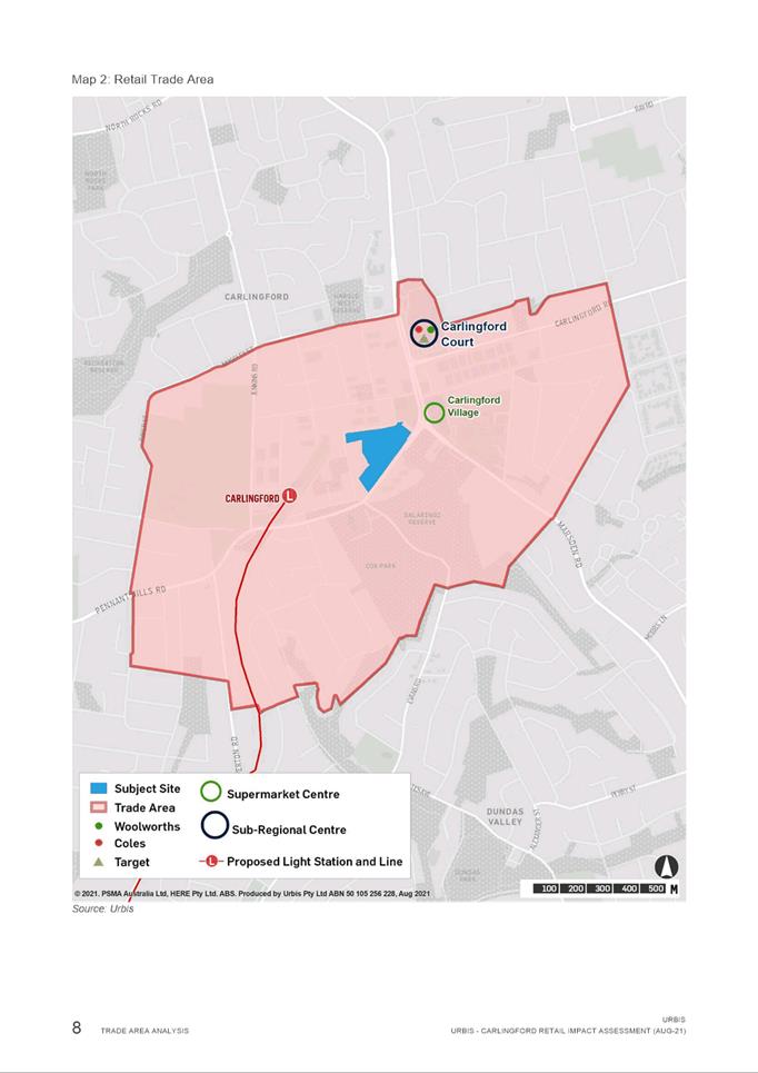
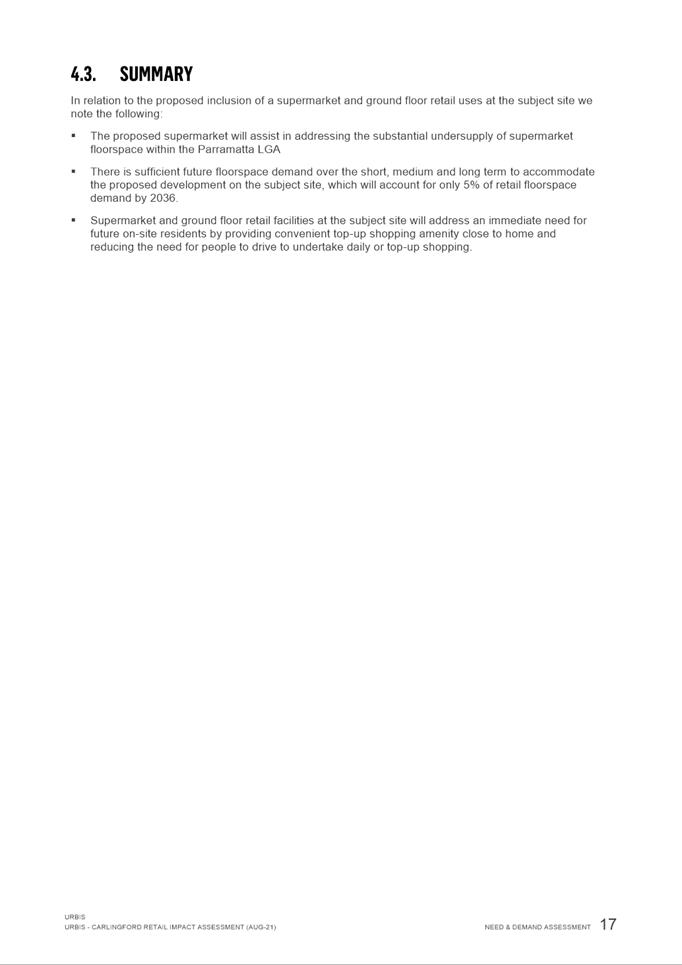
Retail Impact Assessment considers that the proposed supermarket will assist in
addressing the substantial undersupply of supermarket floorspace within the
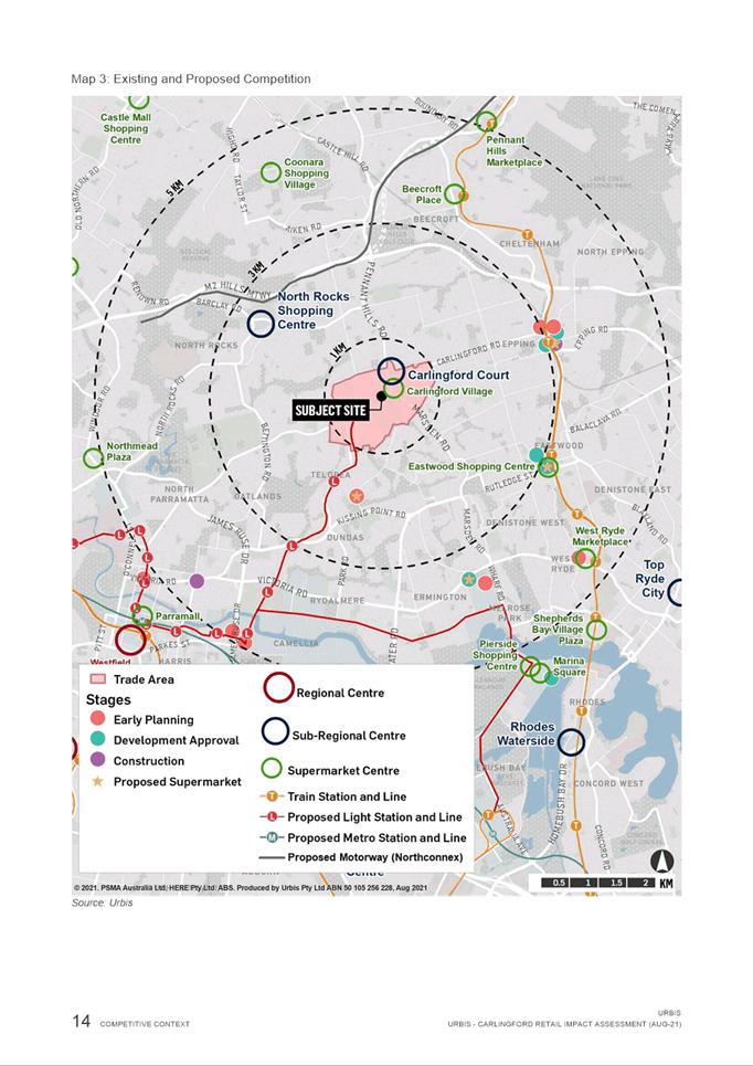
Carlingford area (refer Figure 6). The assessment notes there is
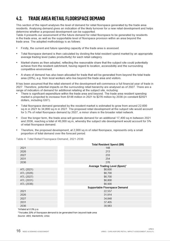
sufficient supermarket floorspace demand over the short to long term to justify
the proposed development on the subject site. The study also notes supermarket
and ground floor retail facilities at the subject site will address an
immediate need for future on-site residents by providing convenient top-up
shopping amenity close to home, and reducing the need for people to drive to
undertake daily or top-up shopping.
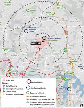
Figure 6 – Trade Area and
Competition
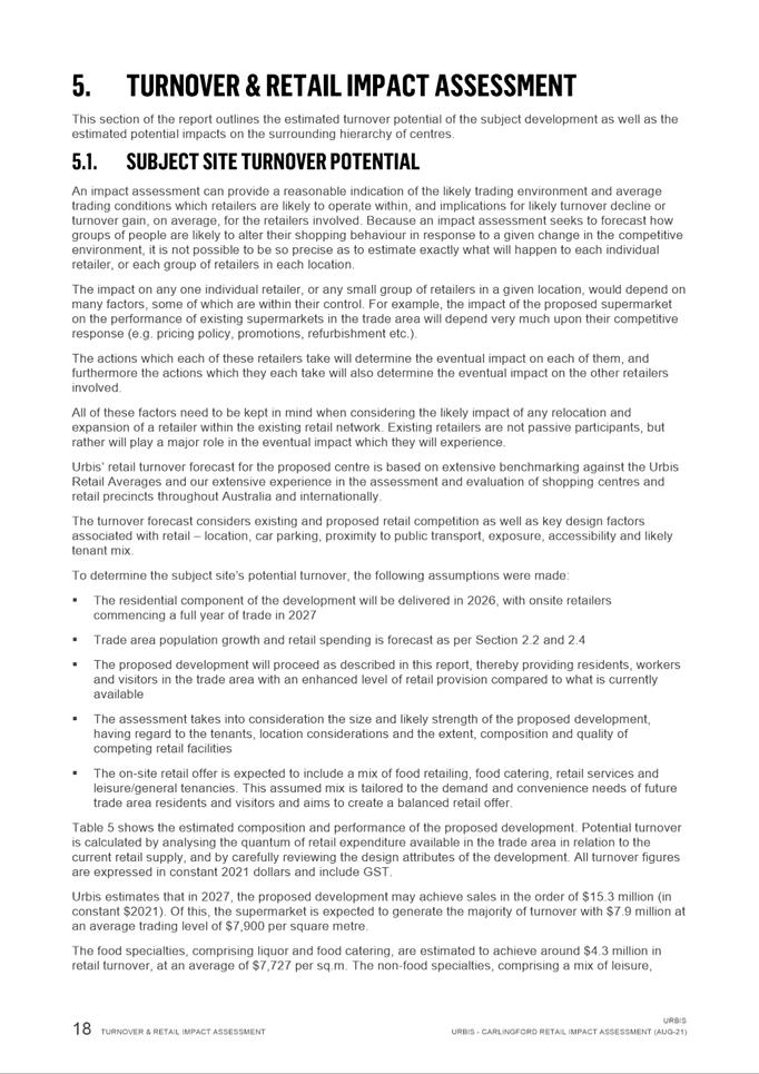
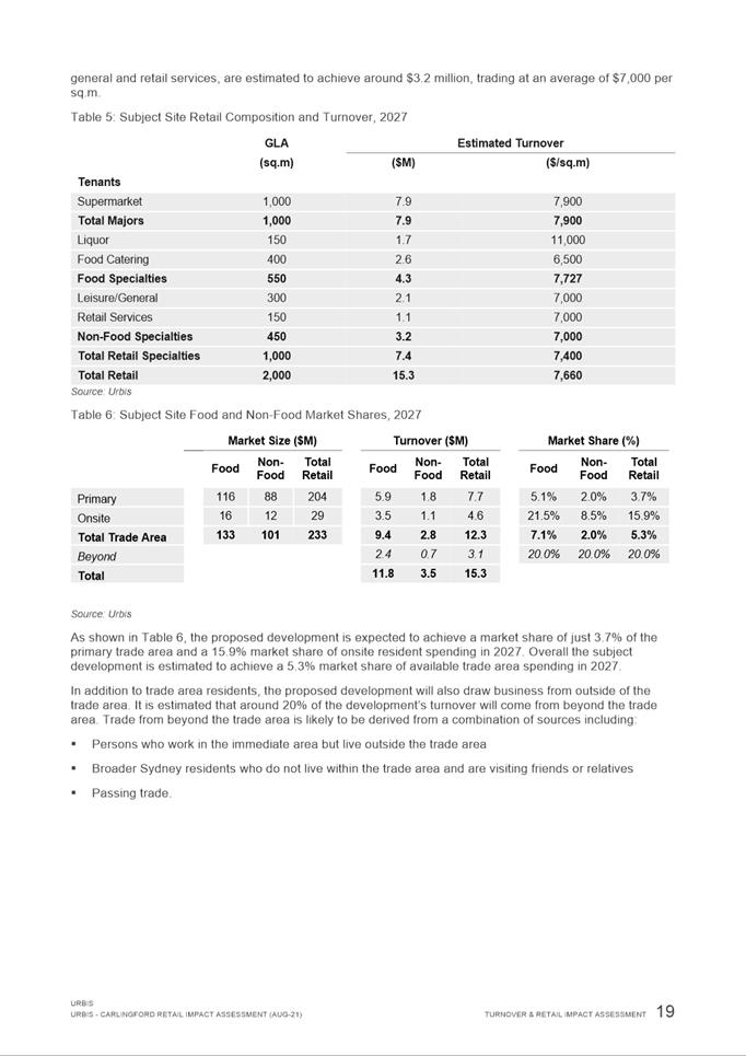
28. The Retail Impact Assessment considers that the proposed
supermarket at the subject site will have no significant impact on the
surrounding network of centres and will have positive benefits in terms of
addressing undersupply, catering to future demand, creating amenity and
economic benefits such as employment. Furthermore, the assessment report notes
upon completion of the development, the ongoing operational phase of the retail
uses would support a total of 76 additional jobs.
29. Council’s
City Strategy Unit has undertaken a
detailed review of the Retail Impact Assessment and agrees with its findings
and raises no objection to the Planning Proposal proceeding. It is noted that
the proposal aligns well with objectives at state, district and local level.
The scale and mix of non-residential uses are suitable for that of a local
centre. The ambition to re-activate the site and create a focal point for the
wider precinct is particularly supported.
30. On
this basis, the Planning Proposal is supported on retail grounds, particularly
given the potential job creation associated with the proposed development and
existing undersupply of supermarket space within the trade area as articulated
in the supporting assessment.
PLANNING
AGREEMENT
31. The submitted
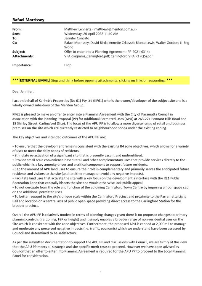
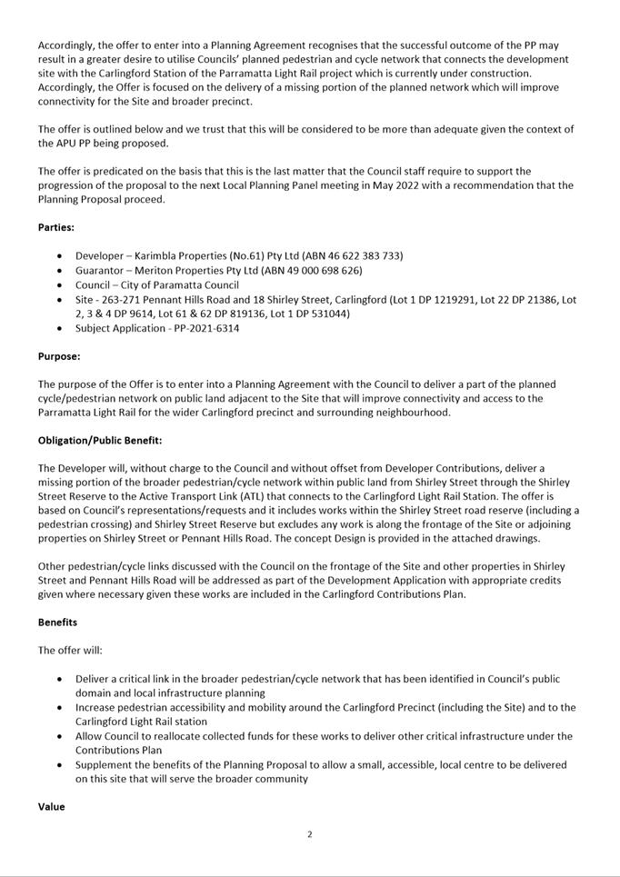
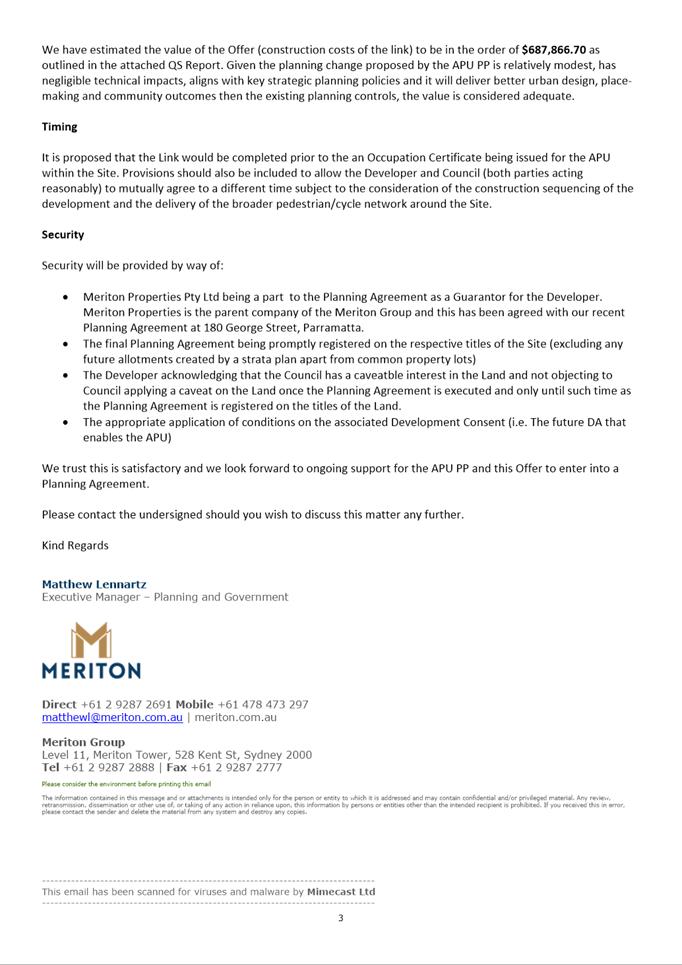
Planning Proposal is accompanied by a Letter of Offer (Attachment 4)
which proposes to deliver the
following public benefits:
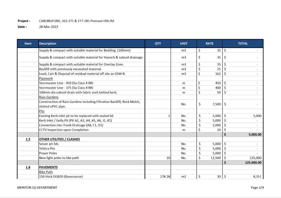
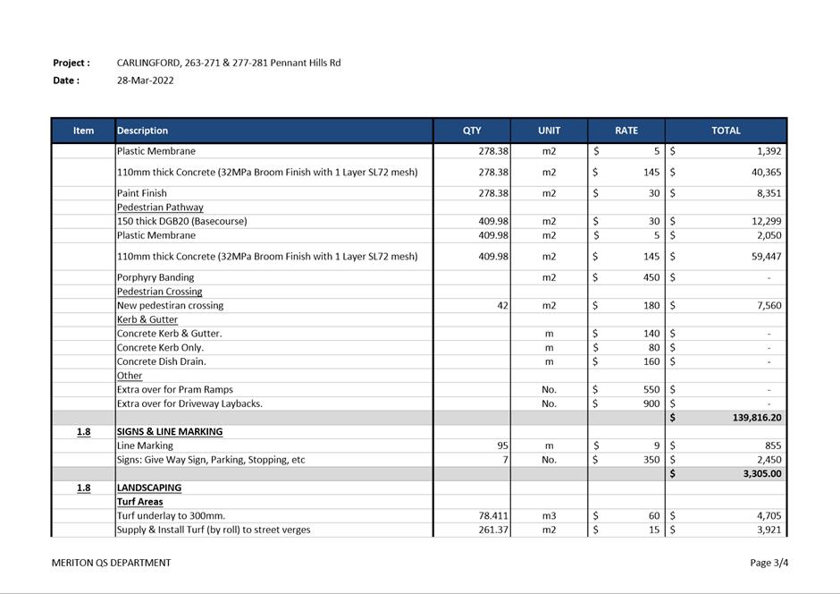
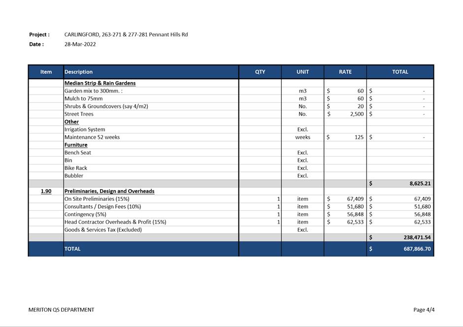
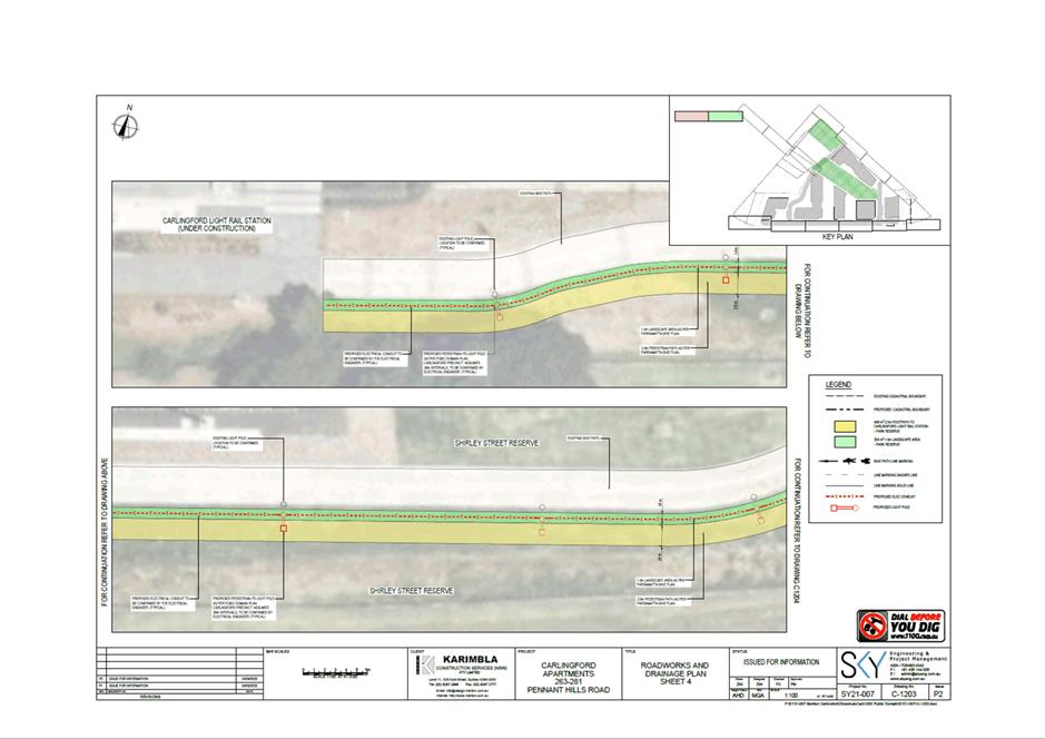
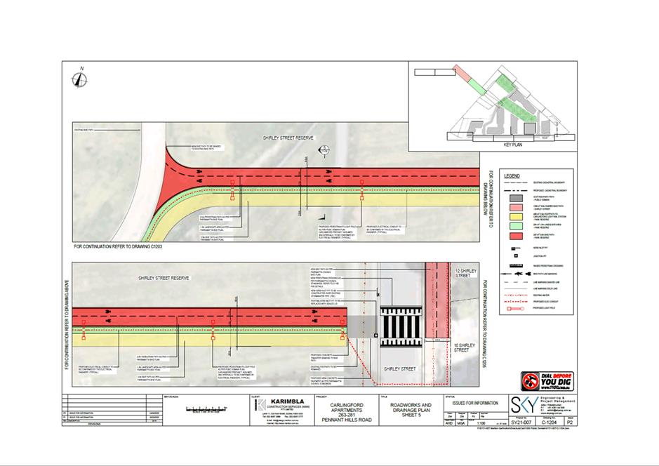
a) A shared pathway through Council owned Shirley Street Reserve which
connects Shirley Street with the Parramatta Light Rail stop; and
b) A raised pedestrian crossing accommodating both cyclists and
pedestrians on Shirley Street.
32. The Planning Agreement offers a link from the subject site
to deliver a part of the planned
cycle/pedestrian network on public land adjacent to the site that will improve
connectivity and access to the Parramatta Light Rail for the wider Carlingford
precinct and surrounding neighbourhood and a pedestrian crossing on Shirley
Street (Refer Figure 7).
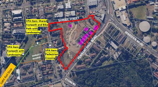
Figure 7 – Subject
Site and Planning Agreement Items
33. The
need for a Planning Agreement has been identified as an appropriate mechanism
to ensure the increase in demand for infrastructure due to the Planning
Proposal is satisfactorily addressed. The additional land uses sought by the
Planning Proposal will increase the land value as it will allow for a
supermarket facilitating higher rental value for the site (within a residential
zone) and further ongoing revenue as it brings more pedestrian traffic to the
site. The shared path and crossing from the site to the light rail noted in the
Letter of Offer relate to the provision of community infrastructure that will
directly benefit and service future development at the site given the likely
increase in demand for services and infrastructure arising from the Planning
Proposal.
34. A
preliminary assessment of the Letter of Offer by Council Officers concludes
that in principle the items offered are acceptable in terms of their nature and
total value, subject to design modifications.
35. Council
Officers are not seeking the Local Planning Panel’s advice on the Letter
of Offer and Planning Agreement associated with the Planning Proposal. Council
will consider the merits of the Letter of Offer when the Planning Proposal is
reported to Council for consideration.
36. It is noted that the recently released Planning Agreements
Practice Note (the then DPIE, February 2021) seeks to move away from value
capture towards an infrastructure needs approach to negotiating planning agreements.
Under the City of Parramatta Planning Agreements Policy (adopted 26 November
2018) “Council will consider, as a matter of public interest, whether
satisfactory arrangements have been or will be made for the provision of
community infrastructure, given the likely increase in demand for services and
infrastructure” (clause 2.5.2). The Letter of Offer is in line with
Councils’ Planning Agreements Policy and the DPE
practice note as it seeks to facilitate the provision of infrastructure.
37. It is noted that the site is already subject to an existing
Planning Agreement. That Planning Agreement was entered into in April 2015
between The Hills Shire Council and the then owners. The land subject to the
Planning Agreement originally comprised of various lots previously known as
14-30 Shirley Street and 2-10 Janell Crescent, Carlingford, which have since
been consolidated as 18 Shirley Street, Carlingford. In summary, this Planning
Agreement provided for the following to be provided to The Hills Shire Council:
· Dedication of land for public open space.
· Works in kind (including embellishment of public
open space) – estimated value $742,108.
· Monetary contribution (to be spent in
Carlingford Precinct) – estimated value $920,984 (subject to CPI
increases).
38. The Planning Agreement was transferred from The Hills Shire
Council to City of Parramatta Council on 12 May 2016, when the land subject to
this Planning Agreement moved into the City of Parramatta local government
area.
39. On 7 December 2020, Dyldam (and its subsidiaries) exchanged contracts for sale
with Karimbla Properties (No. 61) Pty Limited (a subsidiary of Meriton Group). The Deed of Novation included a contractual obligation that the
purchaser must re-execute the Planning Agreement with Council. This was
undertaken in 2021 once settlement of the land transfer had occurred. The land,
works and monetary contribution subject to the existing planning agreement have
not yet been delivered but will be required as part of the future development
application. The current DA under assessment makes no reference to dedication
of public open space or the monetary contribution required as part of the
exisitng DA. The DA only makes reference to Works in Kind by noting provision
of a park on the western corner of the site and general treatment of the
central park area. These items will need to be resolved further as part of the
DA.
SITE SPECIFIC DEVELOPMENT
CONTROL PLAN
40. It
is noted that the Planning Proposal is only seeking to include additional
permitted uses within Schedule 1 of the Parramatta (former The Hills) Local
Environmental Plan 2012. It is therefore not necessary to include a
site-specific DCP to support the proposal in this instance. The existing
provisions within The Hills Shire DCP 2012 are considered sufficient to manage
the assessment of any development application on the site should the proposal
proceed.
PLAN-MAKING DELEGATIONS
41. Revised
delegations were announced by the then Minister for Planning and Infrastructure
in October 2012, allowing councils to make LEPs of local significance. On 26
November 2012, Council resolved to accept the delegation for plan-making
functions. Council has resolved that these functions be delegated to the CEO.
42. Should
Council resolve to endorse the Planning Proposal to proceed, it is recommended
that Council request that it exercise its plan-making delegations. This means
that once the Planning Proposal has been to Gateway, undergone public
exhibition and been adopted by Council, Council officers will deal directly
with the Parliamentary Counsel Office on the legal drafting and mapping of the
amendment. The LEP amendment is then signed by the CEO before being notified on
the NSW Legislation website.
CONSULTATION & TIMING
43. The
Planning Proposal and supporting documents were referred internally to
Council’s Development and Traffic Services Unit and City Strategy Unit
for comment.
44. No
public consultation has yet been undertaken relating to this Planning Proposal.
Should Council resolve to proceed with the Planning Proposal, it (and all
related information) will be submitted to the DPE for Gateway Determination.
Community consultation will be undertaken as required by the Gateway
Determination.
FINANCIAL
IMPLICATIONS FOR COUNCIL
45. Should Council resolve to proceed with the
Planning Proposal, the costs incurred in conducting the community consultation
are covered by the fees associated with the submission of the Planning Proposal
request.
46. The Planning Proposal is accompanied by a Letter
of Offer which proposes a new shared pathway and raised pedestrian crossing.
The financial implications of the offer will be presented to
Council.
CONCLUSION AND NEXT STEPS
47. This
report recommends that the Planning Proposal for 263-273 & 279R Pennant Hills Road and 18 Shirley Street, Carlingford be submitted to DPE for Gateway assessment.
48. Following the Local
Planning Panel’s consideration of the proposal, the Planning Proposal and
Letter of Offer will be considered by Council. Should the proposal be supported
by Council it will be forwarded to DPE, and a Gateway Determination be issued
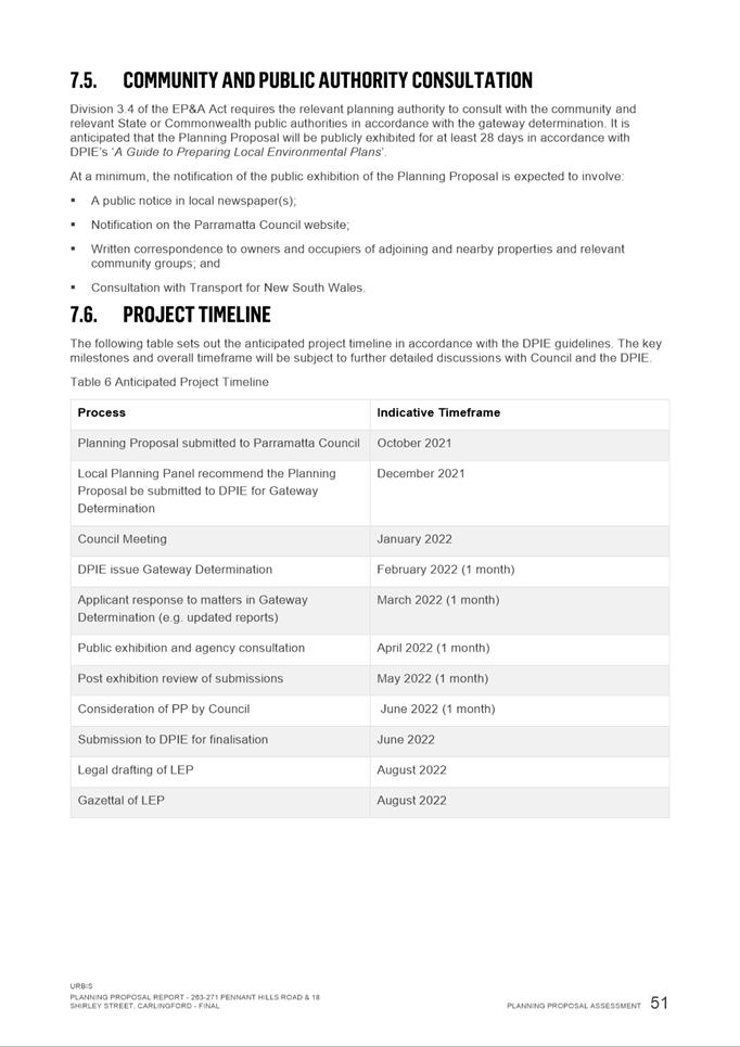
by DPE. It is proposed that the Planning Proposal will be placed on public
exhibition with a draft Planning Agreement.
Rafael Morrissey
Project Officer Land Use
Bianca Lewis
Team Leader Land Use Planning
David Birds
Group Manager, Major Projects and
Precincts
Robert Cologna
A/Executive Director, City Planning and
Design
Attachments:
|
1⇩ 
|
Planning Proposal
|
61 Pages
|
|
|
2⇩ 
|
Traffic & Transport Assessment
|
10 Pages
|
|
|
3⇩ 
|
Retail Impact Assessment
|
28 Pages
|
|
|
4⇩ 
|
Offer to Enter into a Planning Agreement
|
9 Pages
|
|
REFERENCE MATERIAL
|
Item 6.1 - Attachment
1
|
Planning Proposal
|
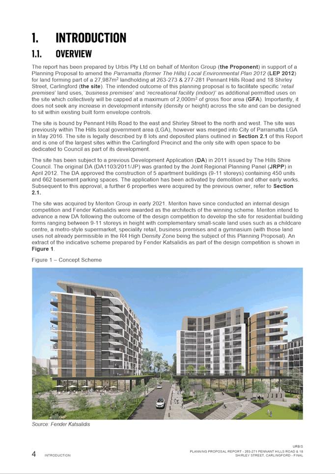
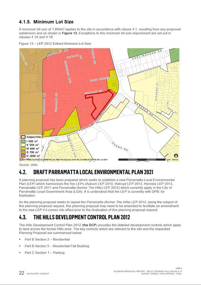
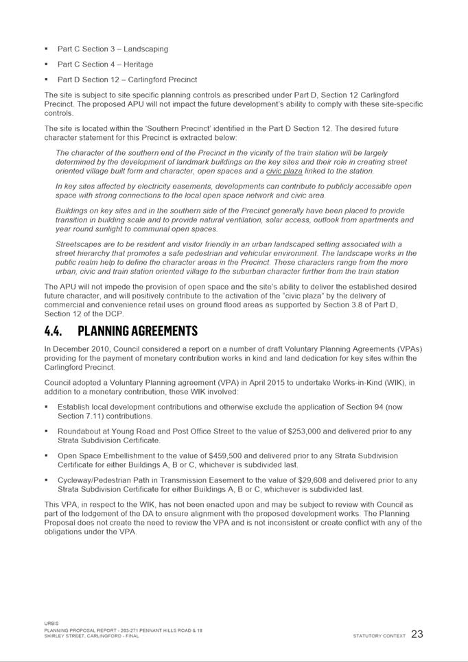
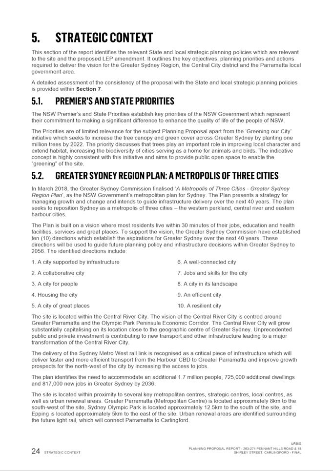
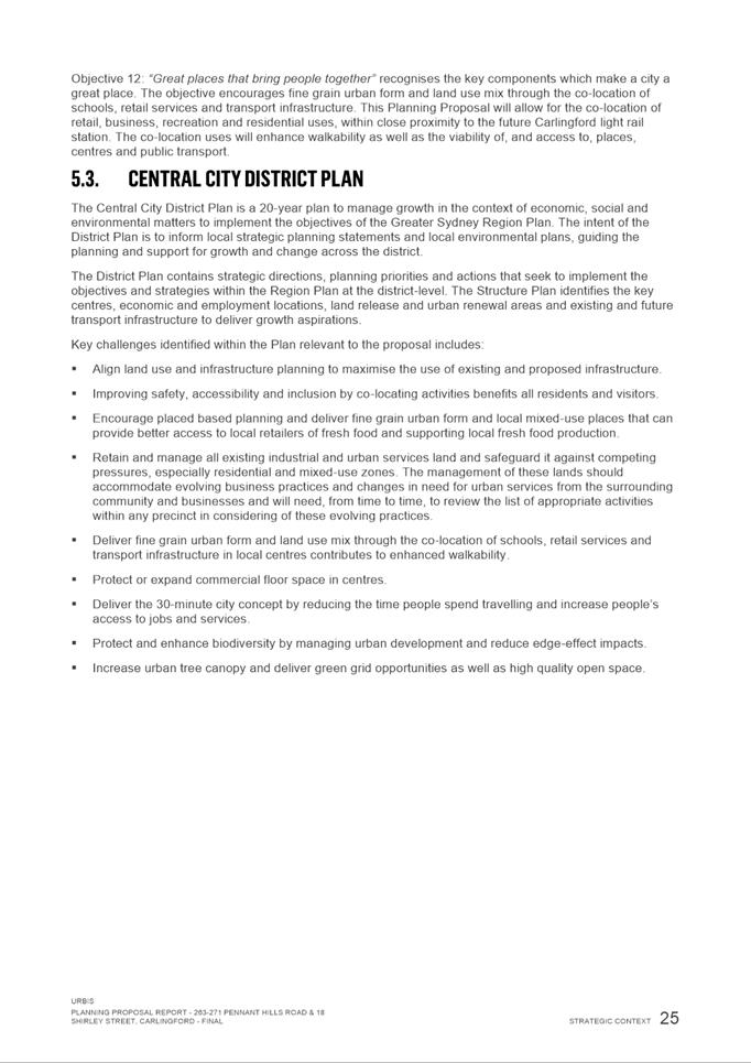
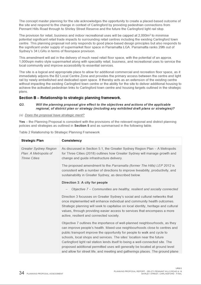
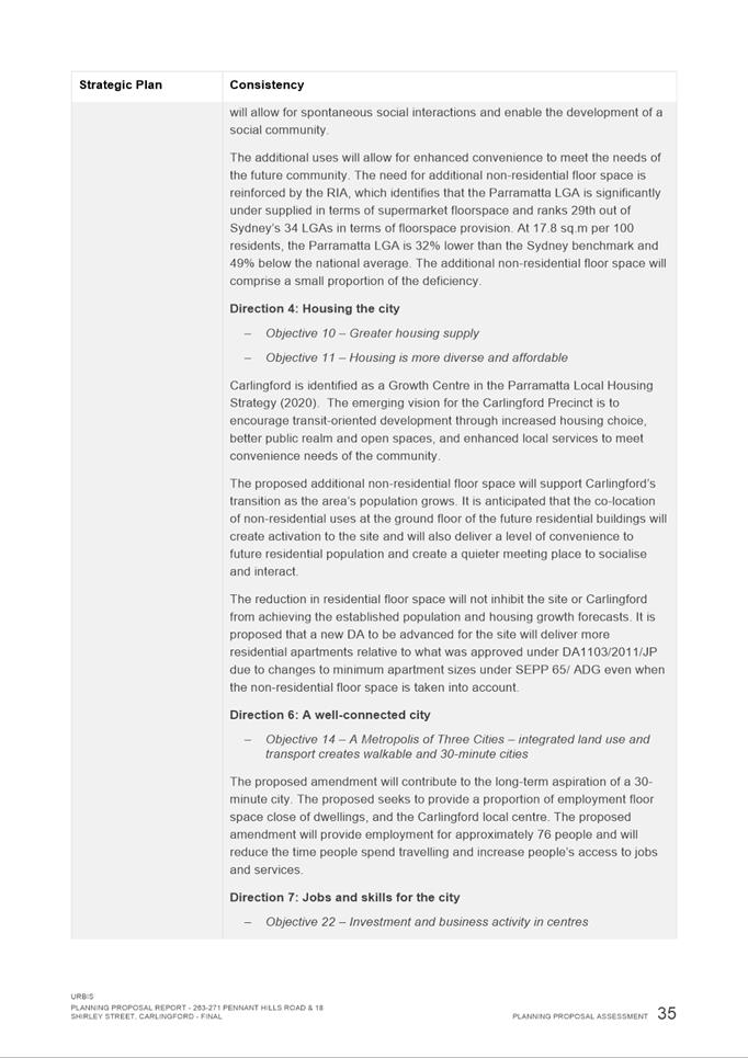
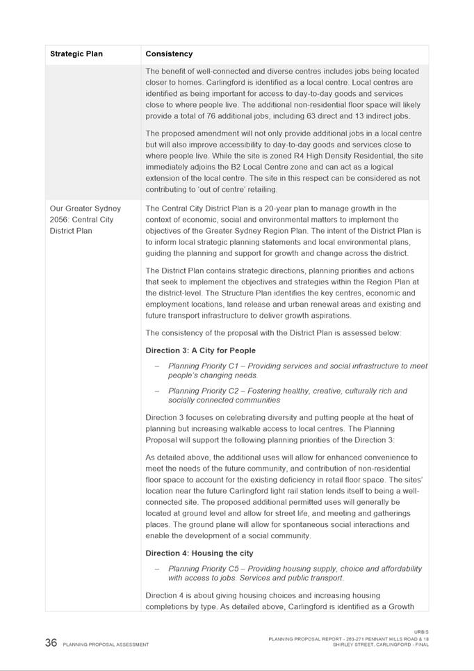
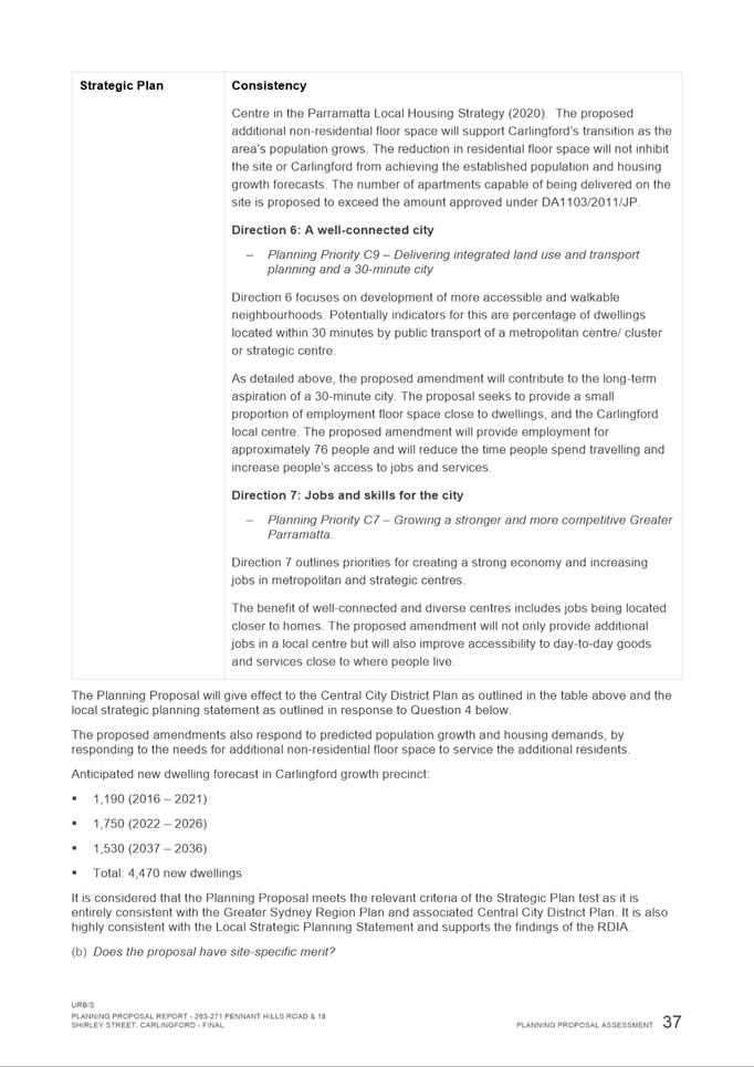
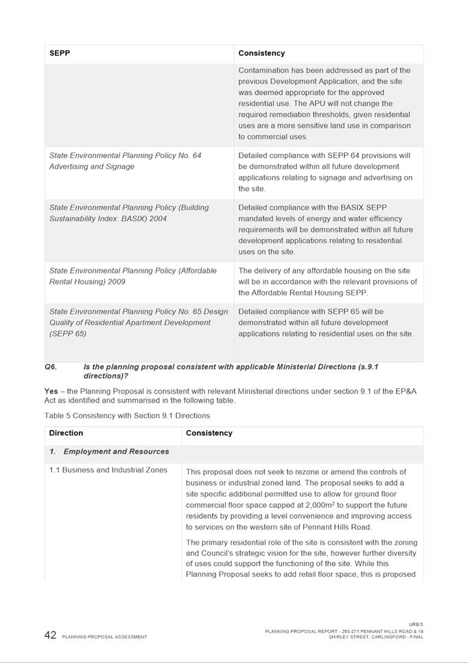
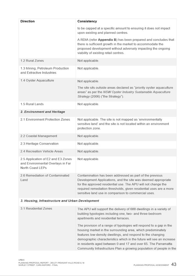
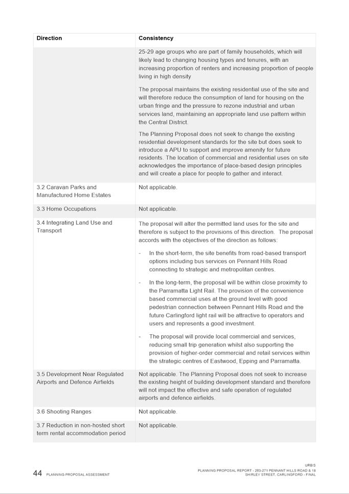
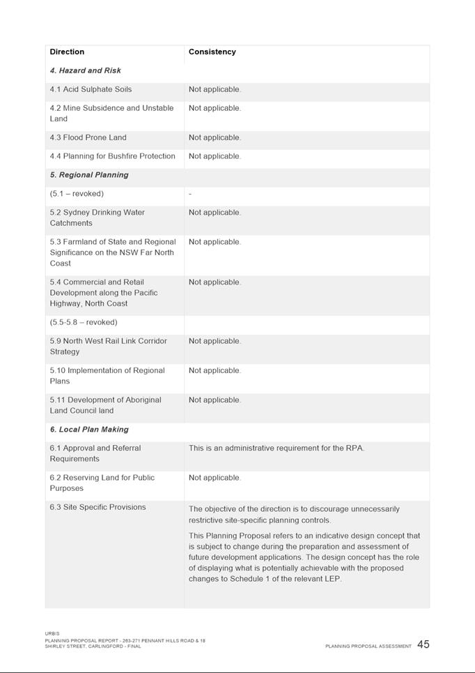

|
Item 6.1 - Attachment 2
|
Traffic & Transport Assessment
|
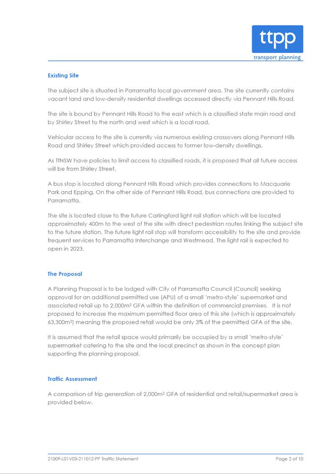
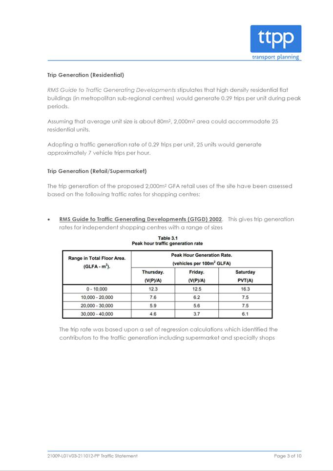
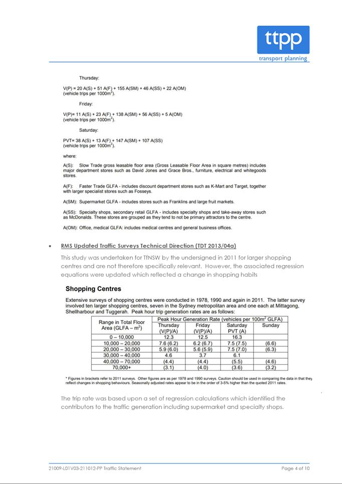
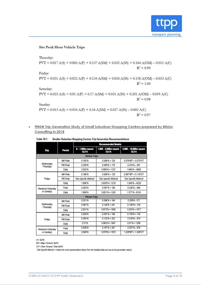
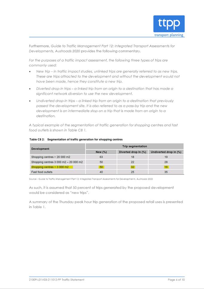
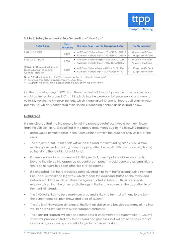
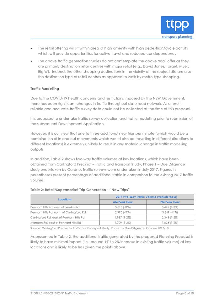
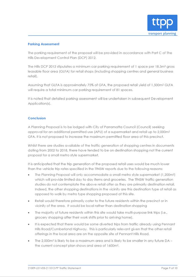
|
Item 6.1 - Attachment 3
|
Retail Impact Assessment
|
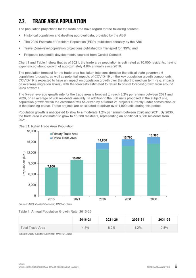
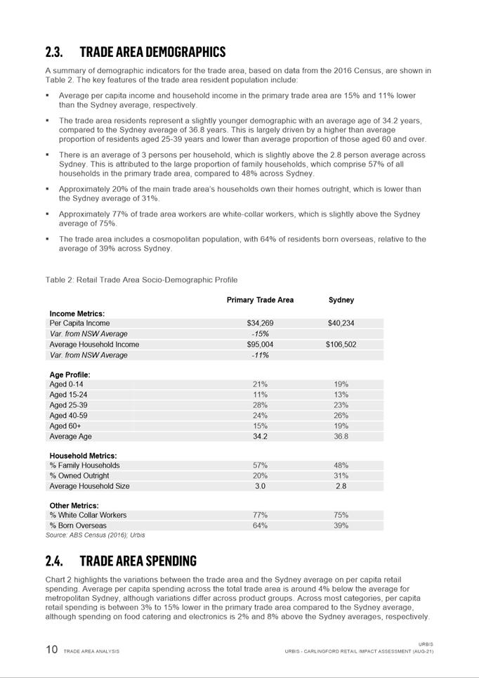
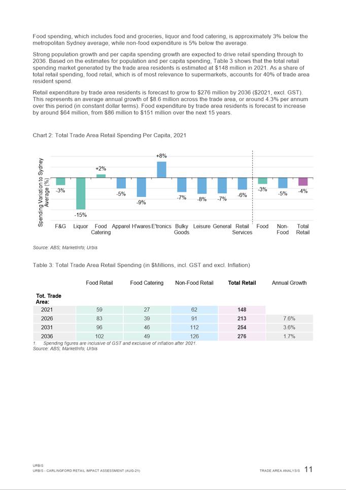
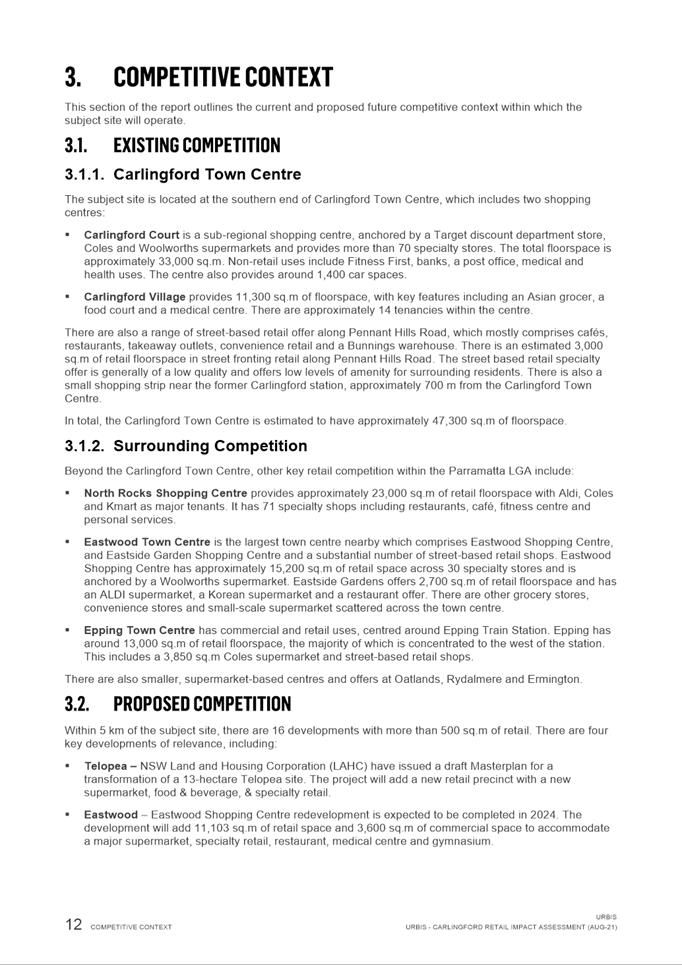

|
Item 6.1 - Attachment 4
|
Offer to Enter into a Planning Agreement
|
Local
Planning Panel 17 May 2022 Item
6.2
ITEM NUMBER 6.2
SUBJECT Pre-Gateway: Planning Proposal for 19 Hope Street, Melrose Park and
69-77 Hughes Avenue, Ermington (Melrose Park North Precinct)
REFERENCE RZ/1/2021 -
APPLICANT/S M Projects
OWNERS Payce MP DM Pty Ltd
REPORT OF Senior Project Officer
Development
applications considered by Sydney central city planning panel Nil
PURPOSE
The purpose of the report is to seek the
Local Planning Panel’s advice to Council on a request to the Department
of Planning and Environment (DPE) for a Gateway Determination for a Planning
Proposal for land at 19 Hope Street, Melrose Park and 69-77 Hughes Avenue,
Ermington.
RECOMMENDATION
The Local Planning Panel consider the following Council Officer
recommendation in its advice to Council:
(a) That
Council endorse for the purposes of seeking a Gateway Determination from the
Department of Planning and Environment (DPE), the Planning Proposal for land at
19 Hope Street, Melrose Park and 69-77 Hughes Avenue,
Ermington, which seeks to amend
Parramatta Local Environmental Plan 2011 (PLEP 2011) by:
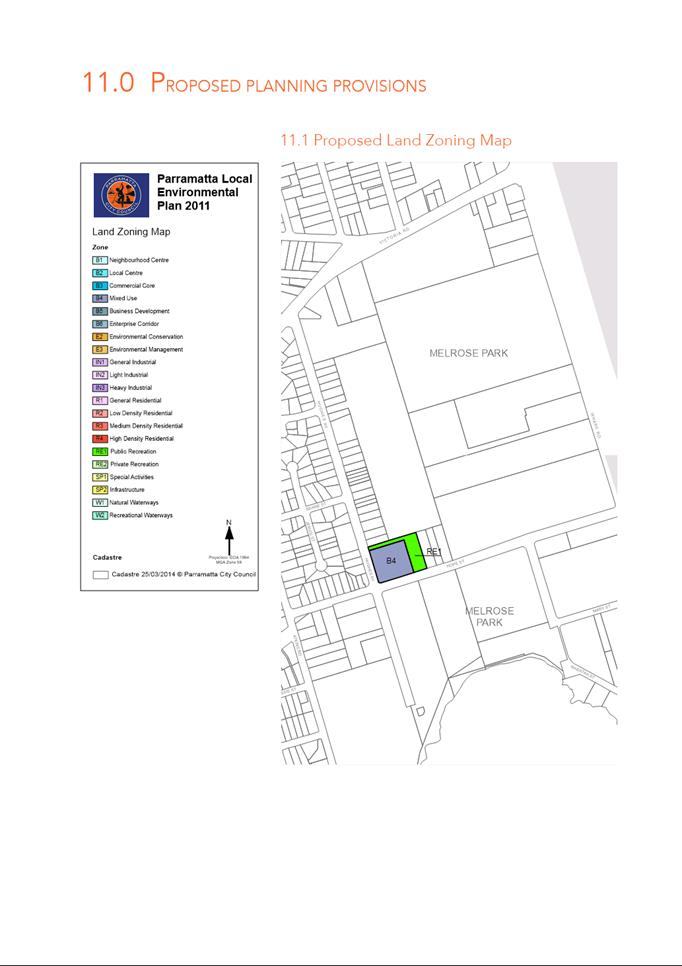
i. Rezoning 19 Hope Street from IN1
General Industrial to part B4 Mixed Use and part RE1 Public Recreation.
ii. Rezoning 69, 71, 73 and 75
Hughes Avenue from R2 Low Density Residential to B4 Mixed Use.
iii. Rezoning 77 Hughes Avenue from
R2 Low Density to part B4 Mixed Use and part RE1 Public Recreation.
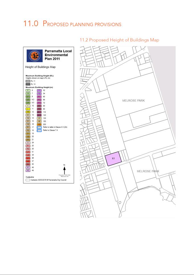
iv. Amending the maximum building
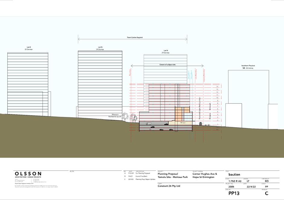
height across the site from part 9m and part 12m to a range between 13m and 48m
(approximately 4 – 14 storeys).
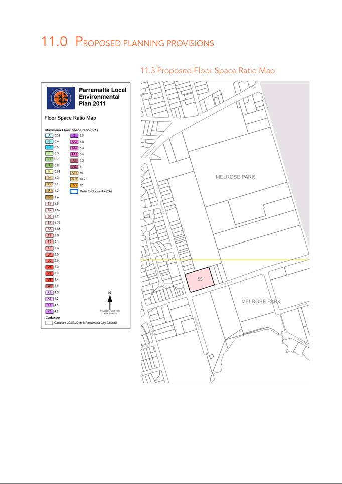
v. Amending the Floor Space Ratio
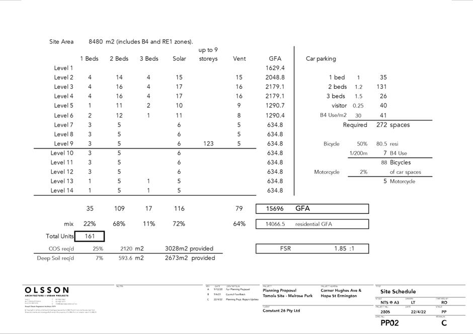
(FSR) from part 1:1 and part 0.5:1 to 1.85:1.
vi. Inserting a site-specific
provision in Part 6 Additional local provisions – generally of PLEP 2011
and amending the Additional Local Provisions map to include the land to ensure
a minimum of 1,400m2 of non-residential floor space is to be
provided within the site to serve the local retail and commercial needs of the
incoming population.
vii. Amending the Land Reservation
Acquisition map to reflect the areas of open space to be dedicated to Council.
(b) That the
Planning Proposal be forwarded to the Department of Planning and Environment
(DPE) for Gateway Determination.
(c) That the
draft site-specific Development Control Plan (DCP) for Melrose Park North be
amended to include the subject site and any necessary amendments to the DCP
provisions relating to this site be reported to Council for consideration for
exhibition with the Planning Proposal should Gateway determination be issued.
(d) That Council
delegate authority to the CEO to commence negotiations to enter into a Planning
Agreement with the proponent.
(e) That Council
advise the DPE that the CEO will be seeking to exercise its plan-making
delegations for this Planning Proposal, as authorised by Council on 26 November
2012.
(f) Further
that, Council delegates authority to the CEO to correct any minor anomalies
of a non-policy and administrative nature that arise during the plan-making
process.
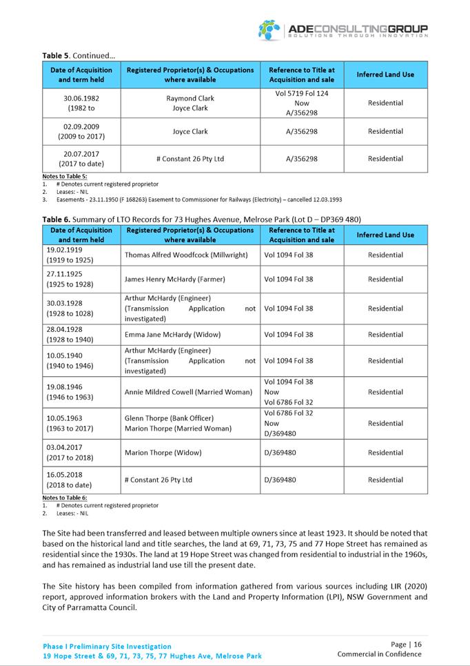
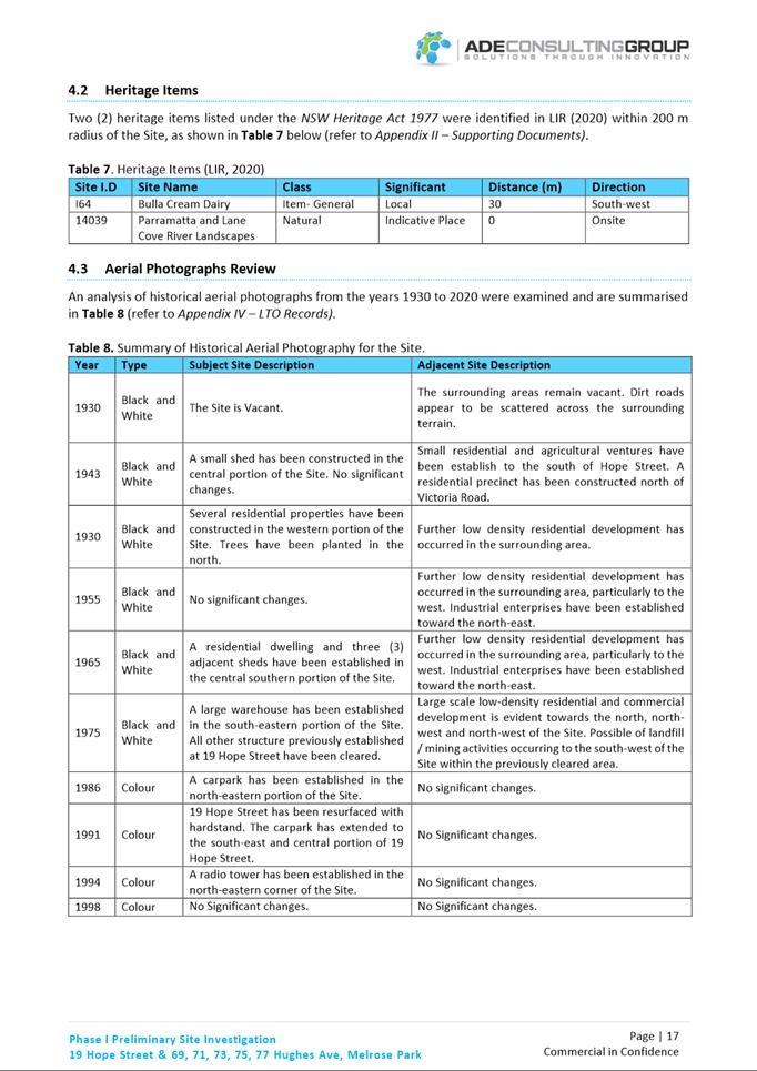
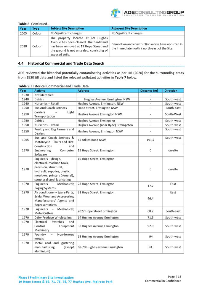
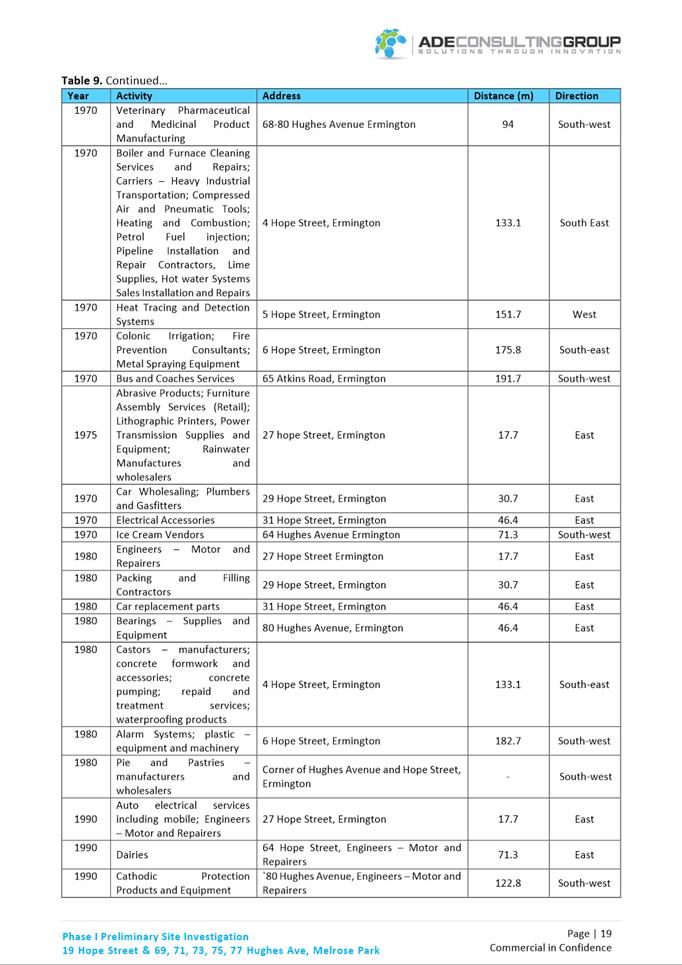
PLANNING PROPOSAL
TIMELINE
 SUMMARY
1. This report
seeks the Local Planning Panel’s (LPP) endorsement to forward a Planning
Proposal for land at 19 Hope Street, Melrose Park and 69-77 Hughes Avenue,
Ermington in accordance with the recommendations outlined in this report to DPE
for Gateway determination.
2. The Planning
Proposal seeks to amend Parramatta Local Environmental Plan (PLEP) 2011 to
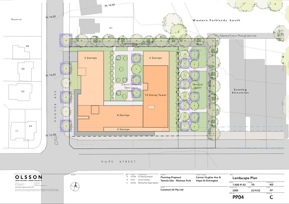
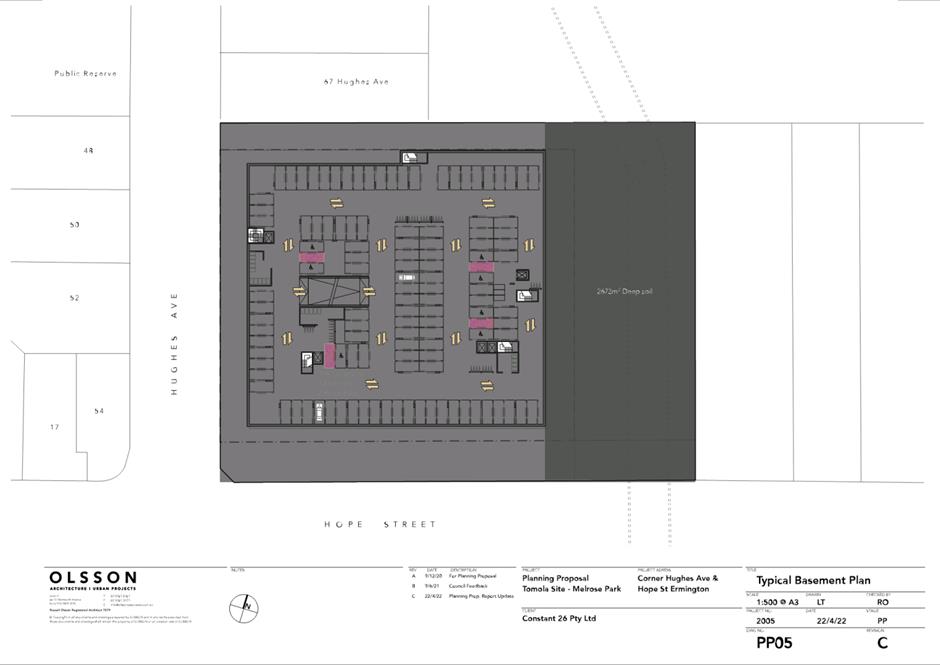
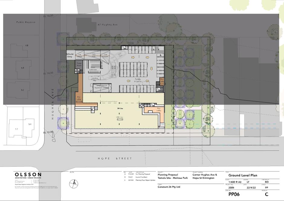
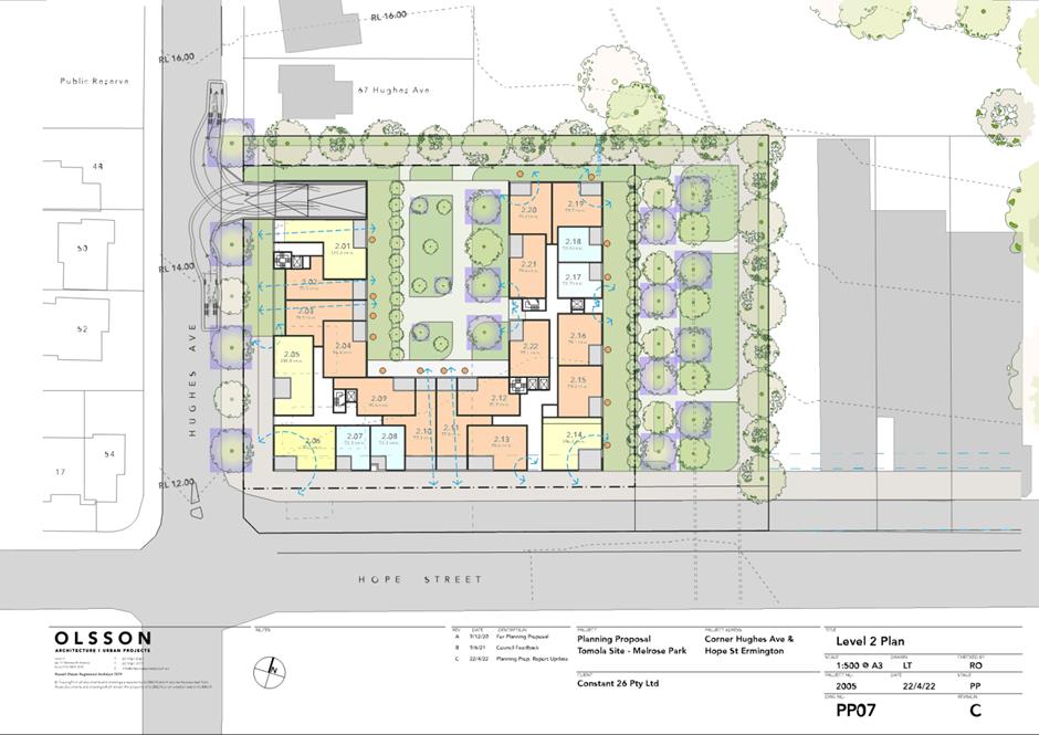
enable a combination of high-density residential development, public open space
and retail/commercial uses on 19 Hope Street and 69-77 Hughes Avenue, in
accordance with the Melrose Park Northern Structure Plan (Northern Structure
Plan) adopted by Council in December 2016. Should the Planning Proposal proceed
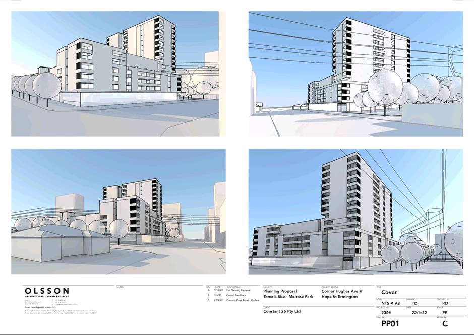
then approximately 161 additional dwellings could potentially be delivered on
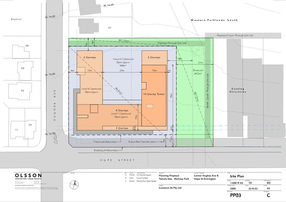
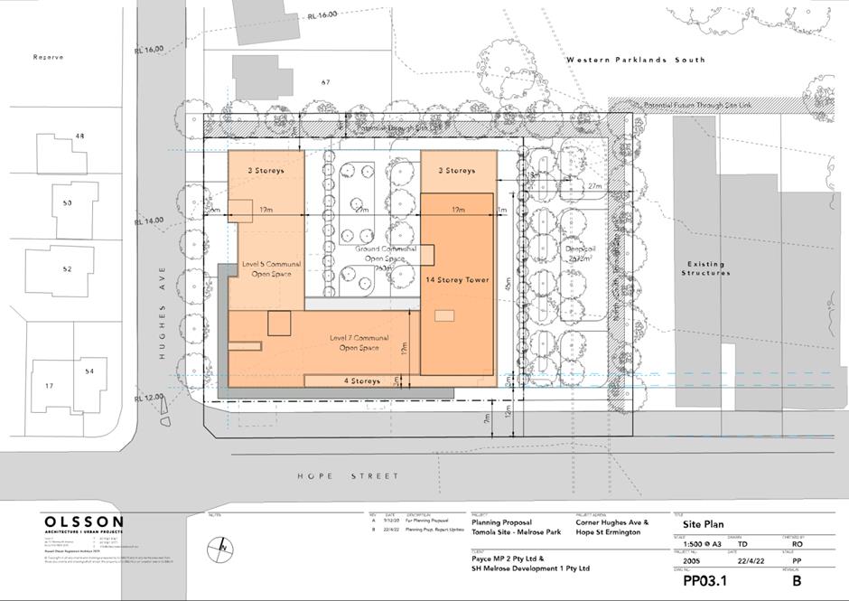
the site with building heights ranging from 4 to 14 storeys. The Planning
Proposal relates to properties currently zoned IN1 General Industrial and R2
Low Density Residential under PLEP 2011.
3. Although the
residential zoned properties at 69-77 Hughes Avenue were not included in the
original structure planning work undertaken for the precinct, these sites have
since been included with the industrial property at 19 Hope Street in the
Northern Structure Plan. These residential properties are considered
suitable for redevelopment as it will enable a better built form outcome to be
achieved than if 19 Hope Street were to be redeveloped on its own. Figure 2 shows the location of the Planning Proposal site within
the Northern Structure Plan.
4. The Planning
Proposal has been assessed against the adopted Northern Structure Plan and
Council-envisaged direction for this precinct under the Employment Lands
Strategy (ELS) (2016), Local Housing Strategy (LHS) (2020) and Local Strategic
Planning Statement (LSPS) (2020) and is considered acceptable by Council
officers to proceed to Gateway determination.
5. It is proposed
that the site-specific Melrose Park North DCP be amended to incorporate this
site and include any necessary provisions specific to this site. Necessary
changes proposed to the DCP will be reported to Council for consideration for
approval prior to exhibition.
6. Should Council
resolve for this matter to proceed, Council officers will commence negotiations
with the proponent for a planning agreement to be provided to deliver key
infrastructure to support the proposal. This will be reported to Council
separately and will be exhibited in conjunction with the Planning Proposal and
draft DCP should it progress.
SITE DESCRIPTION
7. The sites
subject to this Planning Proposal (refer Attachment 1) are located in
the south-western corner of the northern precinct of Melrose Park on the corner
of Hope Street and Hughes Avenue. Refer to Figure 1 for the location of
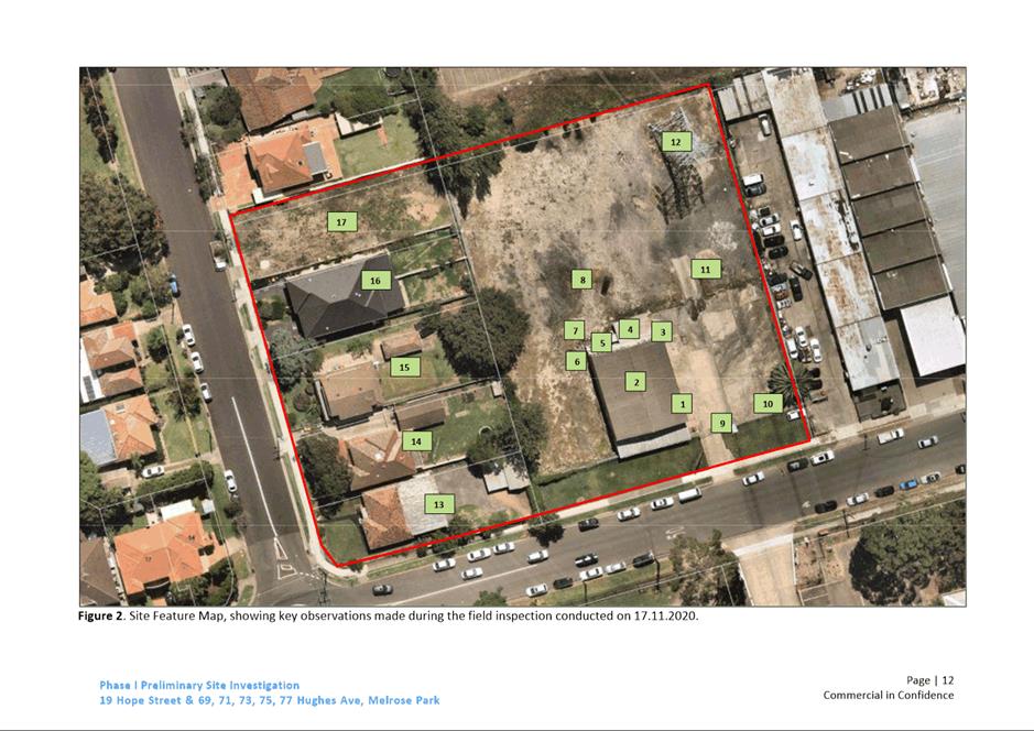
the subject site and Figure 2 showing the site the broader
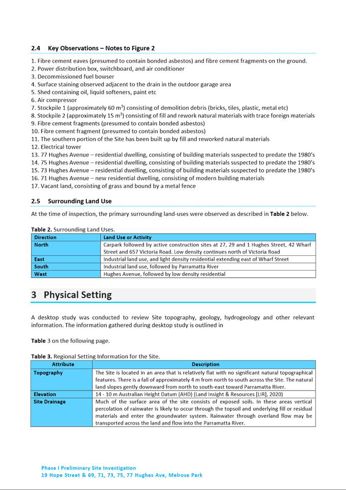
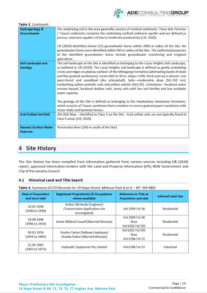
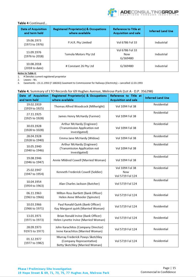
context. The total site area is approximately 8,485m2 and comprises
six (6) lots. The property at 19 Hope Street is currently zoned IN1 General
Industrial and the properties at 69-77 Hughes Avenue are zoned R2 Low Density
Residential under PLEP 2011.
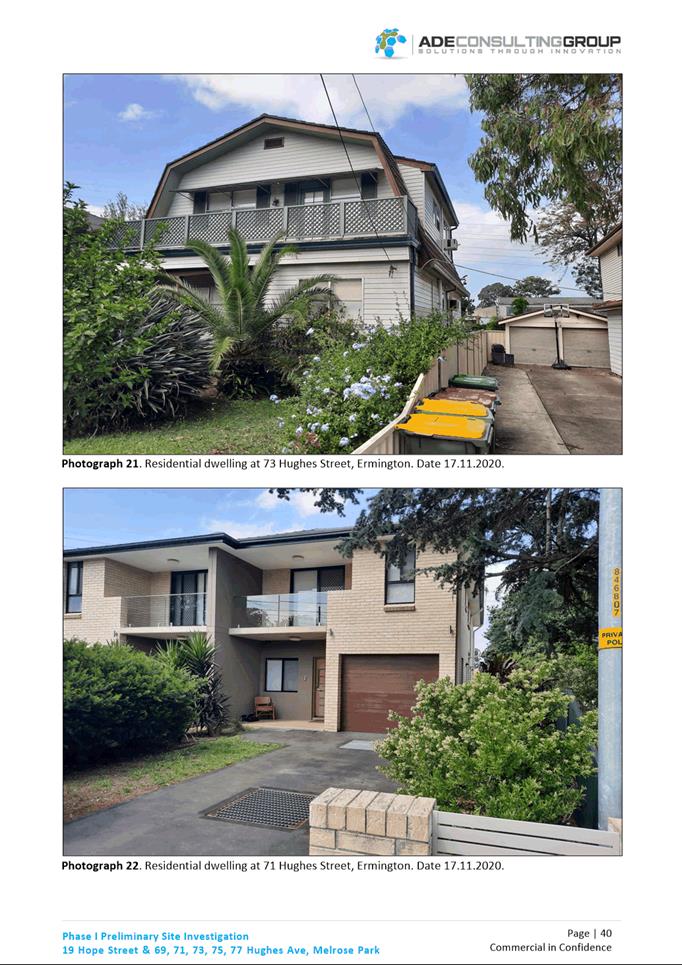
8. The sites are
currently developed and occupied by a former industrial premises at 19 Hope
Street which is disused. The properties at 71-77 Hughes Avenue are occupied by
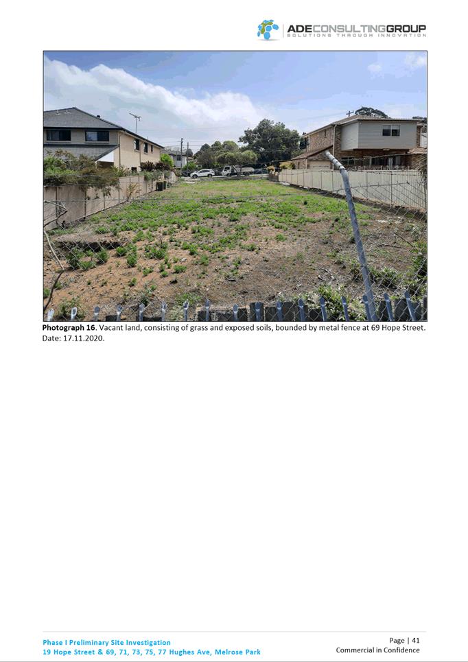
detached dwellings. The site at 69 Hughes Avenue is currently vacant.
9. Surrounding land
uses include low density residential on the western side of Hughes Avenue and
to part of the northern boundary, and industrial land to the remaining portion
of the northern boundary, east and south of the site. This site is within close
proximity to the recently adopted Melrose Park North Planning Proposal area
which will be redeveloped for high density residential, open space,
retail/commercial uses and a new school.
10. The sites have existing
water, sewer, telecommunications and gas trunk services. These services will
need to be augmented to service the proposed higher intensity development. An
underground high-pressure oil pipeline is also located near the southern
boundary of the sites along Hope Street.
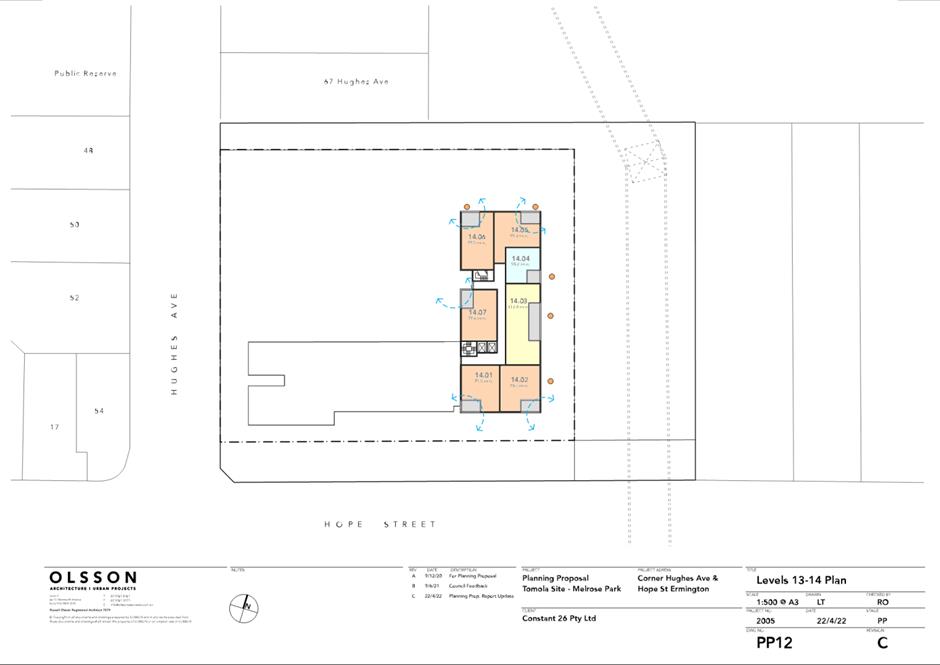
11. High voltage overhead
power lines traverse the Planning Proposal site in a north-east direction along
the eastern boundary of 19 Hope Street. Land within this corridor is proposed
to be used as open space and embellished in accordance with the requirements of
Ausgrid and Council.
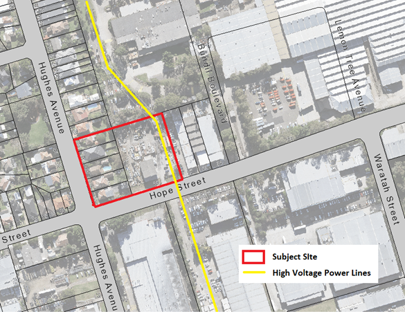
Figure
1. Planning Proposal site
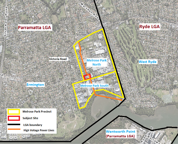
Figure 2.
Subject site in the broader context
BACKGROUND
12. Council adopted the
Parramatta Employment Lands Strategy (ELS) at its meeting of 11 July 2016,
which identified the Melrose Park industrial area precinct as being a Structure
Plan precinct suitable for redevelopment for non-industrial uses. This was
primarily due to the decline in the pharmaceutical manufacturing industry,
which has had a significant presence within the precinct.
13. It was initially intended that one structure plan would be
prepared for the whole Melrose Park precinct. However, in July 2016, Council
resolved to consider the structure planning of Melrose Park precinct in two
parts (a Northern Structure Plan and Southern Structure Plan) to enable
redevelopment of the precinct to be progressed in a timeframe that suited the
landowners in both the northern and southern precincts.
14. In
August 2016, Council resolved to exhibit the draft Northern Structure Plan and
supporting documents, and it was adopted by Council on 12 December 2016 (refer
to Figure 2).
15. The Melrose Park North
Planning Proposal, which applies to 25ha of land to the north and east of this
site and proposes to deliver approximately 5,500 dwellings is currently with
the DPE for finalisation.
16. In February 2021, a
Planning Proposal was lodged with Council relating to 19 Hope Street, Melrose
Park and 69-77 Hughes Avenue, Ermington. The Planning Proposal was lodged by
Payce, the owner of the majority of the land in the Northern Precinct, and has
been assessed by Council officers, including those within urban design, traffic
and transport, open space and natural resources and development services, who
raise no objection to the Planning Proposal proceeding for consideration by the
LPP or Council.
17. A site-specific
Development Control Plan (DCP) for Melrose Park North has been prepared and was
adopted by Council on 11 October 2021. Some refinements are required to this
DCP to include controls specific to this site which Council officers are in the
process of drafting. When complete, an amended version of the draft DCP and the
proposed changes will be reported to Council for endorsement to place on
exhibition with the Planning Proposal and draft Planning Agreement.
NORTHERN STRUCTURE
PLAN
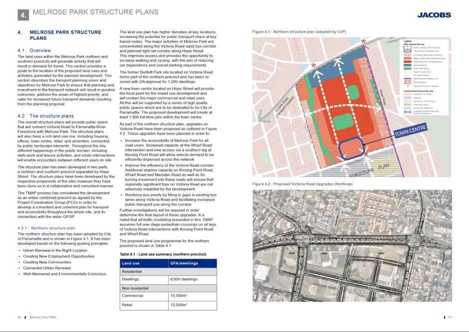
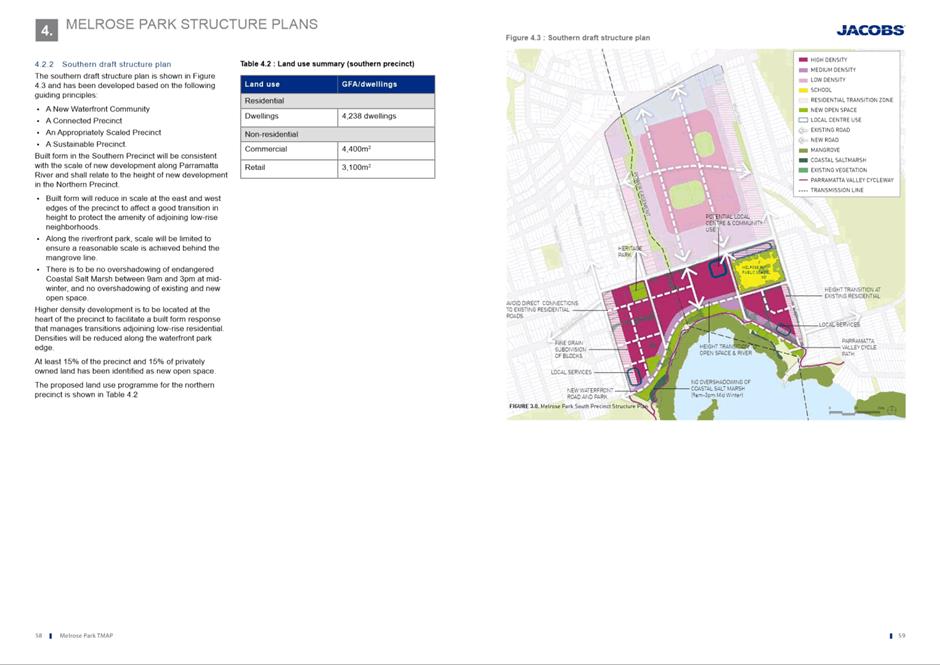
18. The
Northern Structure Plan (NSP) (Figure 3) is a high-level planning
document that was endorsed by Council, as part of the planning process that was
undertaken in association with the Melrose Park North Planning Proposal. The
NSP provides a framework for redevelopment within the precinct and an overview of
the intended redevelopment plan showing indicative locations for density,
proposed new roads and new public open space and retail/commercial areas.
19. The
NSP was adopted by Council in December 2016 and formed the basis of the Melrose
Park North Planning Proposal. Due to further urban design modelling, traffic
investigations and subsequent consultation with State Agencies, the Melrose
Park North Planning Proposal is inconsistent with the NSP to accommodate the
provision of a school site and relocation of the town centre; however, the
overarching principles were maintained.
20. This
Planning Proposal is largely consistent with the intent of the Northern
Structure Plan. The NSP indicates medium to low density development on the
subject sites by locating the tallest part of the development in the core of
the site away from the adjacent low-density development and providing a height
transition to the street.
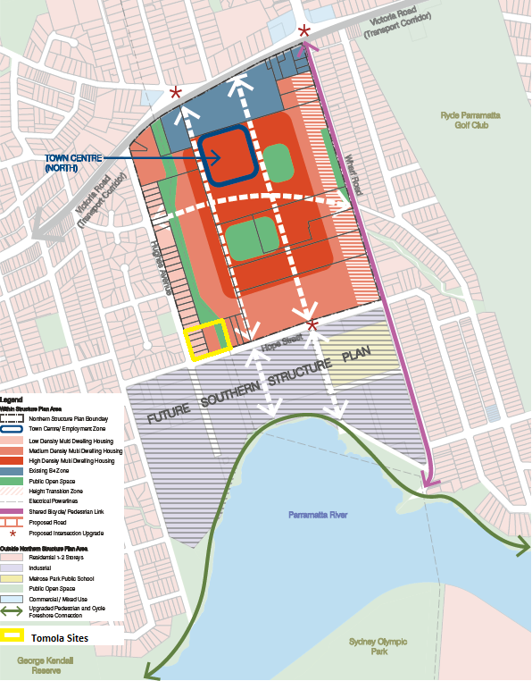
Figure 3. Northern Structure Plan showing the Tomola site outline
yellow
TRANSPORT MANAGEMENT
AND ACCESSIBILITY PLAN
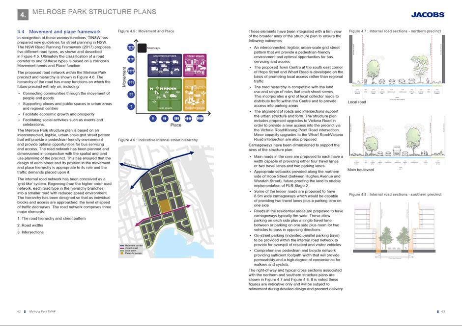
21. Traffic and transport issues were identified as a key
consideration early in the planning process for the entire precinct (both north
and south) and as a result, a Transport Management and Accessibility Plan
(TMAP) was commissioned by key northern precinct landowners, Payce, and a
reference group including stakeholders from Council State agencies (TfNSW and
DPE) and applicants from the northern (Payce) and southern (Holdmark and
Goodman) precincts to monitor and provide input into the TMAP process. The
preparation of the TMAP was also a condition of the Gateway determination
associated with the Melrose Park North Planning Proposal and will be used as a
supporting technical document for all future Planning Proposals within the
precinct. The TMAP is included at Attachment 2.
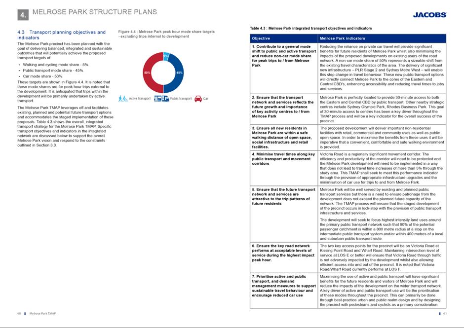
22. The TMAP tested an agreed FSR range from 1.6:1 to1.85:1
across the whole Melrose Park precinct to help determine the capacity of the
precinct from a traffic and transport perspective. This together with urban
design testing informed the appropriate density within the Melrose Park.
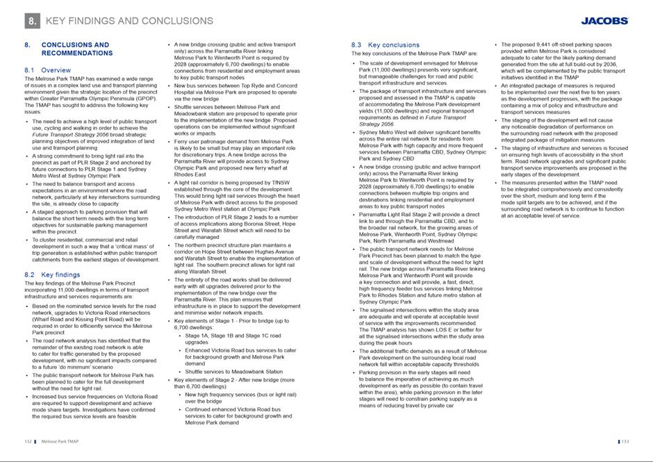
23. The TMAP was completed in
late 2018 and concluded that the precinct has the capacity to accommodate up to
11,000 dwellings from a traffic and transport perspective subject to the
identified road and public transport improvements and new infrastructure being
delivered at the appropriate stages. The TMAP has been endorsed by TfNSW, DPE
and Council for exhibition purposes and was publicly exhibited in conjunction
with the Melrose Park North Planning Proposal.
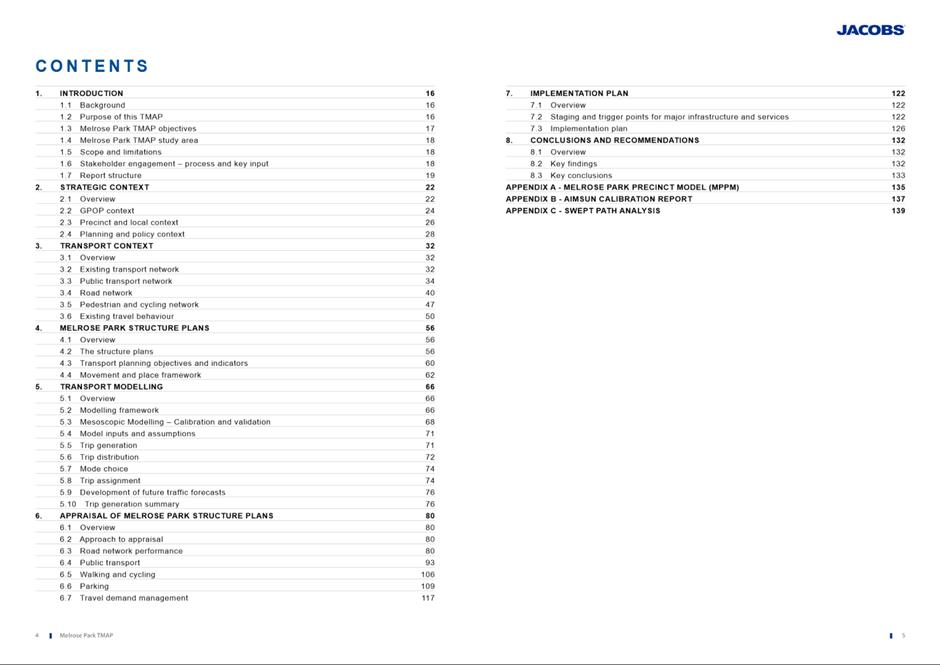
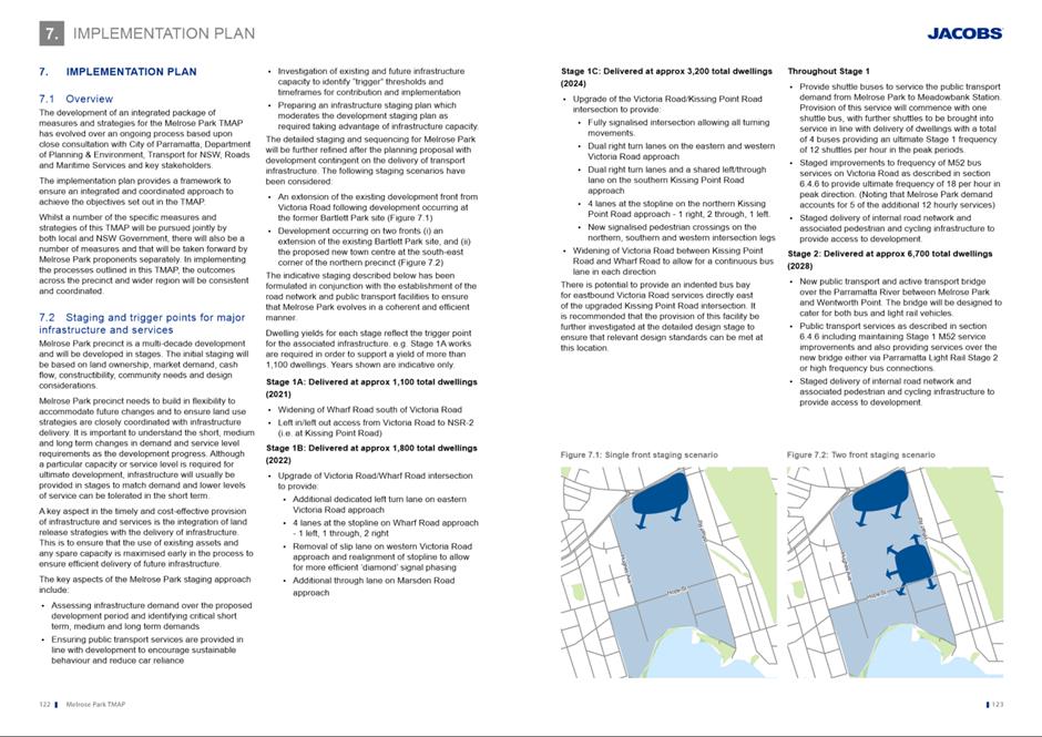
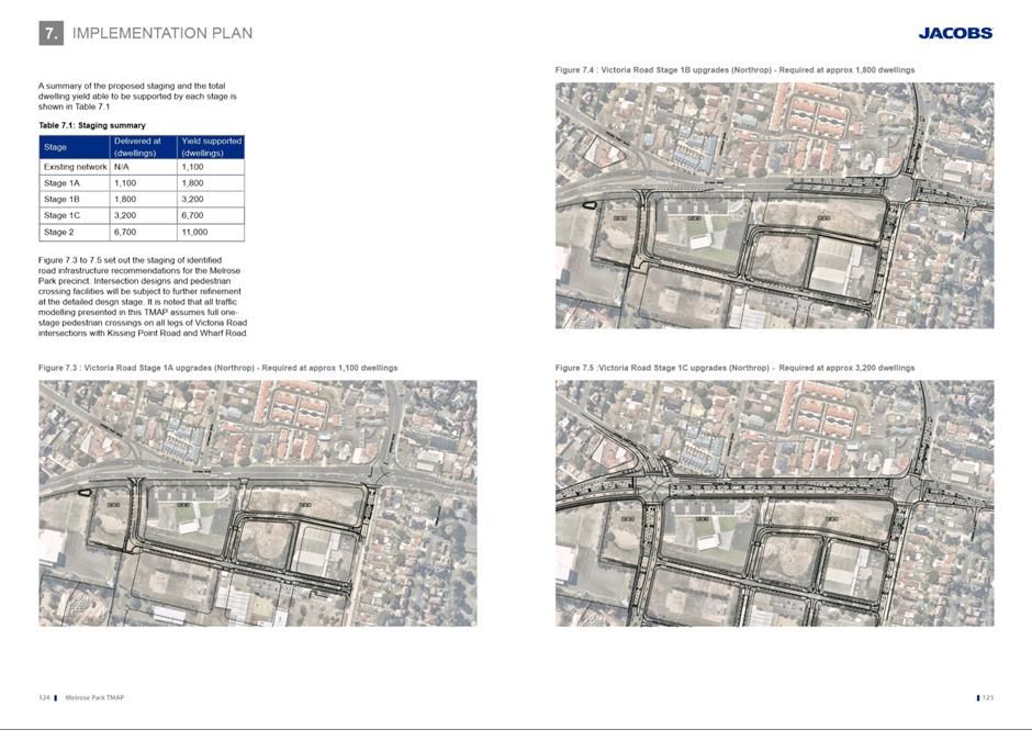
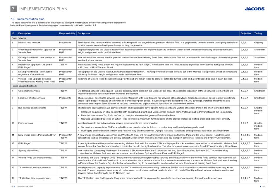
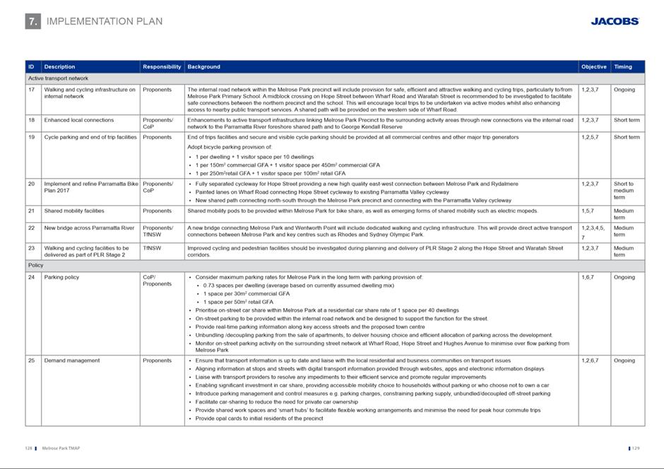
24. An Implementation Plan has been
developed and included in the TMAP (refer to Section 7 within the attached
TMAP) to ensure required infrastructure is delivered within and outside the
precinct at the appropriate stages of development to cater for the increase in
demand. The Implementation Plan included in the TMAP provides a framework to
ensure an integrated and coordinated approach in the delivery of this
infrastructure, and implementation of the measures identified in the TMAP will
be undertaken by Council, State agencies and developers within the precinct at
the appropriate stages via Local and State Planning Agreements.
25. The
TMAP’s Implementation Plan addresses the delivery of infrastructure to support
up to 11,000 dwellings across the precinct and notes the required transport
infrastructure referred to above. It will
facilitate a maximum overall FSR of 1.85:1 for the northern part of the
precinct and similarly appropriate development potential in the southern
precinct at a maximum overall FSR of 1.7:1. Appropriate provisions will be
inserted into the PLEP 2011 to ensure that the delivery of infrastructure is
undertaken in accordance with the rate of redevelopment. Provisions addressing
the coordination of redevelopment and infrastructure provision in accordance
with the thresholds in the TMAP are intended to be inserted into PLEP 2011.
This approach is intended for the northern precinct through Amendment No 59 to
PLEP 2011 which relates to all sites subject to the Melrose Park North Planning
Proposal which is currently with DPE for finalisation.
PLANNING PROPOSAL
ASSESSMENT
26. The Planning Proposal (Attachment
1) seeks to amend PLEP 2011 to enable redevelopment of the site for high
density residential development, public open space, and a small non-residential
component. A summary of the current and proposed planning controls and other
development detail on the site is provided in Table 1 below. Refer to Figures
4 to 9 showing the current and proposed mapped controls.
Table 1. Current and proposed planning controls and proposal detail
|
|
19 Hope Street
|
69-77 Hughes
Avenue
|
|
Site Area
|
8,486m2
|
|
Current Zone
|
IN1 General
Industrial
|
R2 Low Density
Residential
|
|
Proposed Zone
|
Part B4 Mixed Use and
part RE1 Public Recreation
|
|
Current Height
Limit
|
12m*
|
9m (approx. 2
storeys)
|
|
Proposed Height
Limit
|
13m – 48m
(approx. 4-14 storeys)
Note that the LEP
Height map in Figure 7 only shows the maximum building height proposed
to be permissible on the site
|
|
Current FSR
|
1:1
|
0.5:1
|
|
Proposed FSR
(gross)
|
1.85:1
|
|
Potential Dwelling
Yield (approx.)
|
161 units
|
|
Proposed
Residential GFA
|
14,066.5m2
|
|
Non-Residential
GFA
|
1,400m2
|
|
New Public Open
Space
|
2,600m2
|
|
Potential New Jobs
|
76
|
*Height limits in storeys are not applied to industrial zoned land
|
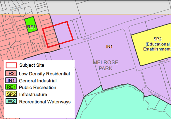
Figure 4. Currently applicable land use zones
|
|
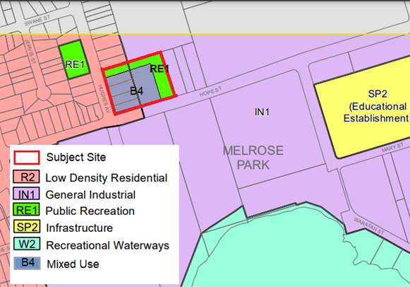
Figure 5. Proposed land use zones on the site
|
|
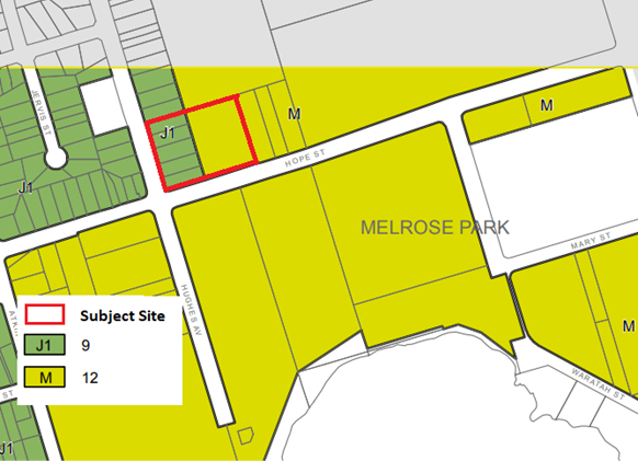
Figure 6. Currently appliable maximum building heights
in metres
|
|
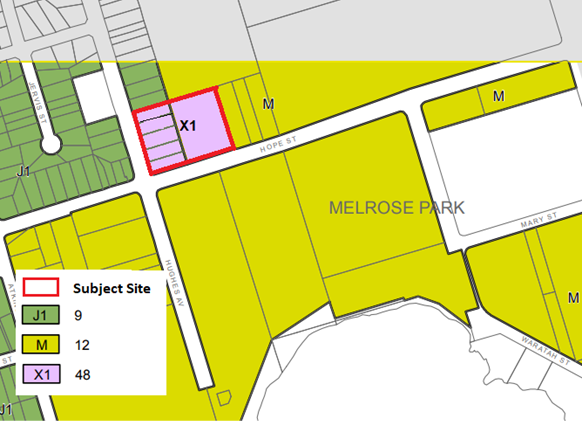
Figure 7. Proposed maximum building height on the site
in metres
|
|
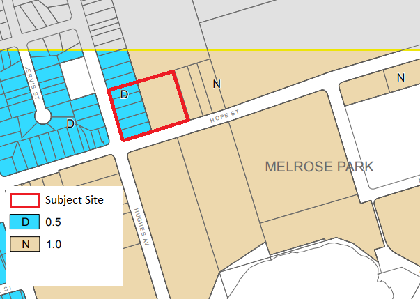
Figure 8. Currently applicable FSRs
|
|
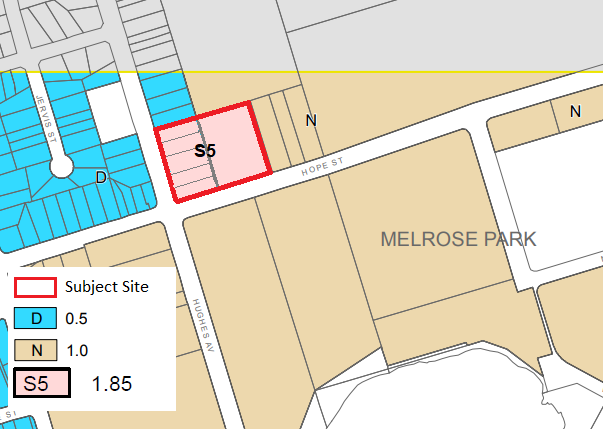
Figure 9. Proposed FSR on the site
|
27. The land proposed to be
rezoned RE1 Public Recreation will be dedicated to Council at no cost. The
management of the dedication will be undertaken via a Planning Agreement
between Council and the proponent.
28. As this site has a
frontage to Hope Street, it will be subject to the requirements of Parramatta
Light Rail (PLR) Stage 2 to facilitate the identified light rail corridor along
Hope Street. These requirements will be determined by Transport for New South
Wales (TfNSW) and any required adjustment to the site design will be undertaken
in consultation with TfNSW, Council and the proponent at the relevant stage.
The reference design submitted with the Planning Proposal provides a 12m
setback along Hope Street in accordance with the current Parramatta Light Rail
(PLR) Stage 2 requirements and is consistent with the adopted provisions for
the remainder of the northern precinct.
29. High voltage power lines
traverse the Planning Proposal site along the eastern boundary of 19 Hope
Street, and the development will need to comply with the requirements of
Ausgrid with regard to locating residential development within proximity to
these power lines. This includes the landscaping of the open space.
30. The site is also within
proximity to the high-pressure oil pipeline located along Hope Street. A Hazard
Analysis Report (Attachment
16) has been prepared for the
precinct and identifies that no immediate action is required at the Planning
Proposal stage; however, further investigations will be required as part of the
development application stage. This is consistent with the approach applied to
the Melrose Park North Planning Proposal.
Strategic Planning
Context
31. The Planning Proposal has
been prepared in accordance with the Environmental Planning and Assessment
Act 1097 (EP&A Act) and the DPE’s A Guide to Preparing
Planning Proposals and considers the State and
local planning strategies. It is consistent with Council’s adopted Local
Strategic Planning Statement (LSPS), Employment Lands Strategy (ELS) and Local
Housing Strategy (LHS).
Local Strategic
Planning Statement
32. Council’s
adopted Local Strategic Planning Statement (LSPS) provides strategic direction
on how the City of Parramatta is planning for the next 20 years and draws
together the needs and aspirations of the community. It identifies priorities
for jobs, home and infrastructure. The LSPS contains actions and priorities to
help Parramatta achieve the vision of the State Government’s Greater
Sydney Region Plan and Central City District Plan and highlights its important
role as the Central River City. The LSPS also identifies the need for improved
public transport through ‘Planning Priority 3’ which relates to
Council’s policy directions on improving connectivity to the Parramatta
CBD and surrounding district through staging of development in alignment with
delivery of PLR Stage 2 (or equivalent) and Sydney Metro West. As Melrose Park
is identified as a Growth Precinct and the Proposal will help delivery the
housing and infrastructure needed, it aligns with the vision of the LSPS.
Employment Lands
Strategy
33. The
Planning Proposal is consistent with both the adopted Employment Lands Strategy
(2016) and Employment Lands Strategy – Review and Update (2020) which
identifies the industrial lands within Melrose Park as a Structure Plan area
and being suitable for redevelopment for non-industrial uses. Previous uses had
begun to vacate the precinct and it is no longer considered suitable as an
industrial precinct as it is not located close to any major freight transport
corridors and is surrounded by residential development. Although only 19 Hope
Street is subject to the ELS, the inclusion of 69-77 Hughes Avenue in the
redevelopment proposal is considered appropriate as it will result in a better
development outcome than if 19 Hope Street was redeveloped in isolation.
Local Housing Strategy
34. The
Planning Proposal is consistent with the City of Parramatta Local Housing
Strategy (LHS), which provides direction at the local level regarding when and
where future housing growth will occur and how it aligns with the broader
NSW-government strategic planning framework. The LHS identifies Melrose Park as
a Growth Precinct and forecasts that approximately 6,330 new dwellings will
occupy the precinct by 2036 with a dwelling capacity of 10,680 beyond 2036. The
LHS also highlights the importance of ensuring that infrastructure delivery is
aligned with housing growth and that growth precincts are effectively sequenced
with the delivery of relevant infrastructure. The Proposal is consistent
with this approach in that it is located within the announced Parramatta Light
Rail (PLR) Stage 2 corridor and the TMAP for the precinct includes a staging
plan for the delivery of the necessary road upgrades and public transport to
support the future population of the precinct.
35. Full
details of this strategic planning assessment are contained within Part 3 of
the Planning Proposal at Attachment 1.
Land Use Planning Assessment
36. The
Planning Proposal is largely consistent with the adopted NSP. The NSP has
informed the proposed density on the site being multi-dwelling housing and with
lower scale development located on the perimeter of the precinct. However, some
inconsistencies between the Planning Proposal and NSP are present. These
include:
Density on
Hughes Avenue
37. The
NSP identifies the existing low-density residential properties along Hughes
Avenue as being retained as low-density multi-dwelling housing. However, the
Planning Proposal intends to rezone the part of this site fronting Hughes Ave
(ie 69-77 Hughes Avenue) to B4 Mixed Use and proposed building heights ranging
from 3 storeys to 5 and 6 storeys (refer to Figure 11) along the Hughes
Street frontage.
38.
To ameliorate any potential impacts on the adjacent low-density development to
the north, the following measures are proposed:
· New public open space incorporating a pedestrian/cycle link and
large canopy tree planting is proposed along the northern boundary of the site.
· The pedestrian/cycle link to the north will be 6m wide.
· A further 3m setback from the pedestrian cycle link to the building
line is proposed, providing a 9m separation from the boundary of 81 Hughes
Avenue to the north to the 3-storey building façade of the proposed
development.
39. This
inconsistency is considered acceptable given the intended development and
design outcome of the precinct has evolved since the NSP was adopted, the site
is under single ownership and the inclusion of these properties with 19 Hope
Street will produce a better design outcome than if either site were
redeveloped individually. In addition, the proposed separation, tree planting
and 3 storey height is deemed to provide an appropriate transition between the
existing low-density development and proposed development. This height transition is similar to the
approach taken in other parts of the precinct, including on the Holdmark-owned
site in the southern precinct.
Density on 19 Hope Street
40. As with the Hughes Avenue
properties above, the density proposed on this site differs to that identified
in the NSP that shows medium density multi-dwelling housing on this site.
The Planning Proposal intends to locate a range of heights on this site ranging
from 3, 4 6 storeys and a 14 storey component (refer to Figure 10).
41. Similar to Hughes Avenue,
the proposed design and location of the taller heights are located away from
the adjoining low-density residential development to the north.
· This site does not share a common boundary with
existing residential development, but rather public open space that will be
used as on-site stormwater detention and for recreation purposes as part of the
broader Melrose Park North Precinct.
· The portion of 19 Hope Street closest to the
existing low density residential development is proposed to contain the 3
storey part of the development.
· The 14 storey component is also located on this
site and will be visible form the existing Hughes Avenue properties, however
given the proposed separation of at least 18m and 3 storey component separating
the tower from the boundary it is not anticipated that it will result in
negative amenity impacts on these properties.
· The bulk of the 14-storey component is located
along the eastern edge of the site which is also adjacent to proposed public
open space.
42. Despite this inconsistency
in density with the NSP, given the density of the broader Melrose Park North
Precinct, the proposed density on this site is not considered to be
inappropriate or out of context. The design of the apartments facing the high
voltage power lines will be subject to refinement at the development
application stage to create an improved visual outlook for residents of these
apartments.
43. It
is considered that any potential impacts on the adjacent low density
residential development can be ameliorated through careful design, appropriate
setbacks, landscaping and the location of public open space. This will be
established as part of the associated DCP controls and further refined at the
development assessment stage.
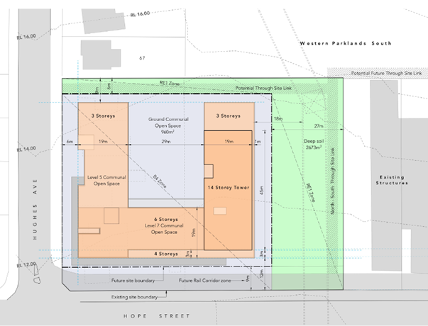
Figure 10. Tomola site concept design. The green areas are proposed new public
open space.
44. The
Planning Proposal was subject to internal feedback from a number of sections
within Council as part of the assessment process. Each section’s key
comments are detailed below.
Density Control
45. As with other sites in the
precinct that have been subject to Planning Proposals, it is intended that a
residential gross floor area (GFA) cap will be placed on this site and enforced
through PLEP 2011 and a future Planning Agreement. This will ensure that
additional density cannot be granted that seeks to fill the indicative building
envelope at the development application stage.
Urban Design
46. The
Proponent submitted an Urban Design and Landscape Report (Attachment
3) with the Proposal that was reviewed by Council’s Urban Design
section as part of the assessment process. It is considered that the concept
design (Figures 10 and 11) adequately demonstrates that an
appropriate built form can be achieved on the site within the planning controls
identified in the Planning Proposal and that an appropriate built form and
height transition between the site and surrounding development is proposed.
Notwithstanding, there are three (3) matters that will need to be given further
consideration and be subject to refinement at the development application
stage. These include the following principles which will be re-enforced as part
of the amendment to the Melrose Park North DCP:
· Location of the residential entry to the building. The entry should
be directly from the east side of the development and not the street. It is
considered that this will provide a better edge to the proposed open space,
improved internal space, and the opportunity for a pathway and canopy over the
entrance.
· Design of the proposed ground floor retail frontage.
· Refinement of the interface between the new development and existing
low density residential development to address any perceived privacy concerns.
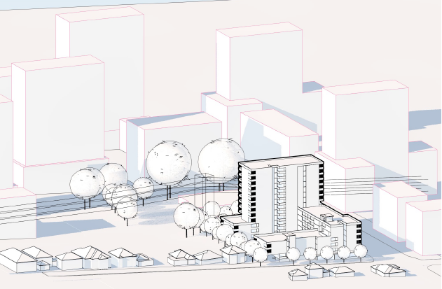
Figure 11. View of the site from the north-west
Open Space
47. Approximately
2,600m2 of new public open space is proposed to be delivered as part
of the Planning Proposal via a future Planning Agreement between Council and
the Proponent (refer to Figure 10 and Attachment 3). This space
will be utilised primarily as pedestrian/bicycle through-links along the
northern and eastern edges of the site. Council’s adopted Community
Infrastructure Strategy (July 2020) typically requires sites proposed for high
density residential uses provide a minimum 20% of the site area as open space.
However, given the subject site is adjacent to the main Melrose Park North
redevelopment area which will provide various large public open space areas for
active and passive recreational purposes, it is not considered necessary for
additional public open space to be required as part of this redevelopment.
48. The
proposed public open space area along the eastern boundary contains high
voltage power lines and is therefore limited in its function but is still able
to contribute as usable open space. The Proponent will need to demonstrate that
embellishment and use of this space in is accordance with the easement
conditions requirements and constraints of the power line operator. This will
be further refined as part of the Planning Agreement negotiations and be
subject to specific development controls as part of an amendment to the Melrose
Park North Site-Specific DCP which was adopted by Council on 11 October 2021.
Both the Planning Agreement and draft DCP will be reported separately to
Council prior to exhibition.
49. These
open space areas are required to be deep soil zones to enable large tree
plantings, where possible. However, as this land will eventually be
dedicated to Council and become public land, it is to be excluded from the deep
soil zone calculation that is required to be provided within the development
site itself. The development site will still be required to contain deep soil
zones separate to the public open space.
50. A Flora
and Fauna Assessment was also submitted (Attachment 4) with the
Planning Proposal and reviewed by Council officers. No concerns were raised as
a result of the assessment.
Traffic and Parking
51. The
Proponent submitted a Preliminary Traffic Impact Assessment (Attachment
5) which was reviewed by Council’s Traffic Services Team. No major
concerns have been raised regarding the anticipated combined residential and
commercial/retail trip generation rates (up to 69 trips in the AM peak and 83
trips in the PM) as it is not considered that these will have significant
implications on the broader Melrose Park Precinct.
52. The parking rates
referenced in the Traffic Impact Assessment are based on those required
by Table 3.6.2.3 of Part 3 within the PDCP 2011. As such, it is estimated that
a total of 203 new parking spaces will be required as part of the development.
These rates are considered appropriate in the current circumstances given the
unknown nature of the PLR2 stop locations.
53. Should
certainty be provided regarding the delivery of Parramatta Light Rail Stage 2
and stop locations prior to the lodgement of a development application on this
site (should the Planning Proposal be endorsed) then a reduction in the
required parking rates may be considered to align with Objective 3J-1 of the
Apartment Design Guide which enables flexibility in parking provision for a
development based on the context of the site and availability and frequency of
public transport, at the time of the development application being lodged and
assessed. A detailed Traffic and Transport Assessment will also be required
from the proponent to accompany any development application.
54. This
Planning Proposal is also required to consider the findings of the Transport
Management and Accessibility Plan (TMAP) that was prepared as part of the
Melrose Park North Planning Proposal in 2018. Based on the currently active
Planning Proposals in the precinct, this proposed development will not result
in the total dwelling yield identified in the TMAP for the precinct being
exceeded.
Flooding
55. The subject site is
located approximately 300m north of a tidal reach of Parramatta River but is
not affected by mainstream flooding from the main Parramatta River
channel. A Concept Stormwater Strategy and
supporting information showing how this site integrates
with (and does not act against) the Master Plan, DCP and Water Management
Strategy that has been prepared for the whole northern precinct with regard to
overland flow flooding, piped stormwater drainage, on site and public
stormwater detention and water sensitive urban design (WSUD) (Attachment 6) was submitted with the Planning Proposal.
This information was assessed by Council’s Senior Catchment and
Development Engineer who considered it sufficient for this stage in the
planning process.
56. The
key findings of the subsequent assessment identified the following:
· The provision of a 6m wide overland flow path around the northern
and eastern perimeter of the proposed B4 Mixed Use zoned land would prevent adverse
impacts from being experienced in adjacent development.
· The depth of flow in the designated overland flow path is no greater
than 0.3m in a 1% Annual Exceedance Probability (AEP) storm event and is considered
acceptable.
· The proposed development would not result in adverse flooding
conditions being experienced in adjacent development, noting the impacts that are
shown to the south of Hope Street are a function of changes in the road configuration
associated with development in the Planning Proposal site and the fact that the
results are based on 100% blocked conditions. The developer will be required implement a system to
Council’s satisfaction that can be maintained to ensure no major
blockages are present that will prevent the efficient drainage of water.
· The resulting velocity-depth product and flood hazard vulnerability
classifications confirm that conditions would be safe along the full length of the overland
flow path during a 1% AEP storm event.
· The peak 1% AEP water surface elevation contours should be used to set the minimum
habitable floor levels in the proposed development.
· On-site detention will be required within the new development to
manage internal stormwater run-off.
· It is envisaged that stormwater runoff from the subject site will be
treated by the use rainwater tanks, stormfilter cartridges and bioretention
areas as part of WSUD measures.
57. This
information was prepared using the extensive modelling that was undertaken as
part of the Melrose Park North Planning Proposal as a base. It has been
assessed by Council officers and considered to be sufficient for this stage in
the process. No significant concerns were raised that cannot be addressed at
the development assessment stage, noting that controls within the Melrose Park
North Site-Specific DCP and the Stormwater Management Strategy will apply to
any future development application. Any required changes to the DCP as a result
of the inclusion of this site will be reported separately to Council prior to
exhibition.
Heritage
58. The
site is located within proximity to the Bulla Cream Dairy at 64 Hughes
Avenue, Ermington which is a locally significant item identified as I64 within
Schedule 5 of PLEP 2011. This item is a bungalow residence surrounded by
significant planting. It is diagonally opposite the subject site on the corner
of Hope Street and Hughes Avenue on the southern side of Hope Street. Refer to Figure
12 for the location of the heritage item (I64 coloured brown) to the
subject site (outlined red).
59. The
Proponent did not submit a Heritage Impact Assessment or Study; however, the
Planning Proposal was referred to Council’s Heritage Advisor who raised
no concerns.
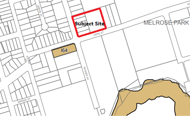
Figure 12. Location
of local heritage item I64 to the subject site
Contamination
60. The
Proponent submitted a Phase 1 Preliminary Site Investigation Report (Attachment
7) as part of the Planning Proposal’s supporting documents. The
report identified several potential contamination issues, including the
presence of hazardous material such as asbestos and/or lead containing
products, heavy metals, contaminated fill and traces of chemical waste. The
report also noted that contamination of nearby ground a surface water is also
possible.
61. It is considered that
there is a moderate potential for contamination to have occurred on the site as
a result of past and present land uses. As a result, a Phase 2 Detailed Site
Investigation including soil and groundwater sampling will be required to be
undertaken as part of any future development application. Notwithstanding, it
is not considered that the contamination issues identified in the Preliminary
Site Investigation Report are of such significance to prevent the Planning
Proposal from progressing to Gateway.
Social Outcomes
62. A Social
Impact Assessment (SIA) was submitted with the Planning Proposal (refer Attachment
8) and reviewed by Council officers who have raised no concerns regarding
the Planning Proposal. However, it is noted that this is contingent upon
the dwelling mix being achieved as per those specified in the Melrose Park
North Site-Specific DCP. The required dwelling mix is identified in Table 2:
Table 2. Required dwelling mix
|
Dwelling Type
|
Dwelling Mix
|
|
1 Bedroom
|
10 – 20% of total
dwellings
|
|
2 Bedroom
|
60 - 75% of total
dwellings
|
|
3 Bedrooms
|
10 - 20% of total
dwellings
|
63. The
SIA identifies that the number of incoming potential new residents that could
be generated by this site in isolation is not significant but combined with the
estimated incoming population associated with the Melrose Park North Planning Proposal,
could place pressure on existing community facilities. This is not considered
to be a significant issue given the proposed upgrades to existing community
facilities such as the Ermington Community Hub and additional services that
will be provided within the new town centre in the main part of the northern
precinct.
64.
In relation to disturbance to local residents during construction, it is
considered this will be offset by the overall improved amenity that will result
from the removal of the industrial uses and replaced with residential and open
space uses. Further, a
construction management plan will be required at the development application
stage demonstrating how the potential negative amenity impacts will be
mitigated.
65. The
Planning Proposal currently make no provision for Affordable Rental Housing on
the site. This matter will form part of future Planning Agreement negotiations
should Council resolve to progress the Planning Proposal as it is considered
important for some contribution to affordable housing to be made as part of
this proposal.
Employment
66. A key consideration in the
redevelopment of the precinct as a whole is the retention of employment
generating land uses to ensure a sufficient number of jobs are able to be
provided on-site. A requirement of the ELS is that
there be no net job loss on site as a result of redevelopment. At the time of
finalising the ELS in 2016, there were approximately 2,546 employees in the
precinct in total, however this has subsequently reduced as a result of further
relocations of tenants. The ELS does not provide a breakdown of the number of
employees in the northern and southern precincts individually. Refer to Table
3 for a distribution of employment numbers between the ELS and northern and
southern precincts based on the known job numbers included in previous and active
Planning Proposals in the precinct. These approximate figures have been
allocated on a pro-rata basis and are subject to refinement as Planning
Proposals are submitted for the undeveloped sites.
Table 3.
Job number comparison
|
|
Job Number (long term)
|
% of Total Jobs Compared to
ELS Requirement
|
|
ELS Requirement
|
2,546 (as at 2016)
|
-
|
|
Northern Precinct (Payce
site)
|
1,538-1,932
|
60%-76%
|
|
Northern Precinct (Tomola
site)
|
76
|
2.9%
|
|
Southern Precinct
(Holdmark)
|
160
|
6.3%
|
|
Southern Precinct (remaining
sites)
|
454-848
|
18%-33%
|
67. The
Planning Proposal proposes to include a minimum of 1,400m2 of
non-residential floor space that could potentially generate 76 new jobs. The Economic
Impact Assessment (Attachment 9) submitted with the Planning
Proposal does not provide significant detail about the subject site. However,
as only a portion of the subject site (19 Hope Street) was previously occupied
by an employment generating land use (industrial) with the remainder currently
low density residential, the economic impacts on existing retail and commercial
areas within proximity to the precinct are unlikely to be significant in the
context of the overall precinct. The ELS does not provide a breakdown of
employment numbers on a site-by-site basis and therefore it is difficult to
determine the number of jobs that should be created by the Planning Proposal.
As a result, given the relatively small size of the site, and that it is
intended to be, in part, employment generating once redeveloped, then the
proposed job number is considered appropriate. The retail/commercial component proposed as part of the Planning
Proposal is intended to support, not interfere with, the new town centre within
the larger Melrose Park North precinct which will be located on Hope Street
east of the Tomola site.
Environmental Outcomes
68. The Planning Proposal and Sustainability
Statement (Attachment 10) were reviewed by Council’s Environmental
Outcomes team who consider the proponent’s approach to meeting the
required sustainability targets appropriate.
Other
69. The submitted Acoustic
Report (Attachment 11), Preliminary Geotechnical Assessment (Attachment 12), Engineering Services Report (Attachment 13),
Site Survey (Attachment 14) and Community Engagement Strategy (Attachment 15) were also reviewed by a number of internal sections. The
Community Engagement Strategy will require some minor changes prior to
reporting to Council; however, is sufficient for this stage in the reporting
phase given the small scale of the site. Otherwise, no concerns were raised
regarding the submitted material for the purposes of progressing the Planning Proposal
to Gateway.
DEVELOPMENT CONTROL
PLAN
70. The Site-Specific DCP for
Melrose Park North was adopted by Council on 11 October 2021. It currently only
applies to sites that are within the Melrose Park North Planning Proposal area,
however, it was always intended to be updated as Planning Proposals were lodged
for the remaining sites in the northern precinct. As such, the DCP will be
updated to include the subject site and any controls added as deemed necessary
by Council officers. The amended DCP will be reported to Council separately and
if endorsed, will be placed on exhibition with the Planning Proposal. The
proposed amendments to the DCP will be generally reflective of the concept
design submitted with the Planning Proposal and will ensure that appropriate
controls are included that reflect to intended outcome of the precinct.
PLANNING AGREEMENT
71. A Planning Agreement can be made under Subdivision 2 of the
EP&A Act and is a voluntary agreement between Council and the developer,
under which the developer may agree to dedicate land free of cost, pay a
monetary contribution or provide other material public benefit, or a
combination of these, to be used towards a public purpose.
72. The Act specifies that a public purpose includes the provision of
public amenities or public services, the provision of affordable housing, the
provision of transport or other infrastructure relating to the land, the
funding of recurrent expenditure relating to any of these, the monitoring of
the planning impacts of a development and the conservation or enhancement of
the natural environment.
73. Council has an adopted Planning Agreement Policy (2018) which sets
out the principles governing such agreements, matters that Council will
consider in negotiating agreements, steps in the negotiating process, public
probity, notification requirements and implementation. The EP&A Act and
Regulation sets out the legal and procedural framework for planning agreements.
74. Key principles of Council’s policy are that:
· planning decisions will not be bought or sold through planning
agreements,
· development that is unacceptable on planning grounds will not be
permitted because of the benefits of a planning agreement,
· the benefits of the planning agreement will bear a relationship to
the application,
· Council will not give undue weight to a planning agreement when
making a decision on a development application, and
· Council will not improperly rely on its position in order to extract
unreasonable public benefits under planning agreements.
75. The applicant has indicated a willingness to contribute towards
infrastructure provision within the precinct, including the dedication of land
at no cost to Council for the purposes of public open space, however a Letter
of Offer was not submitted with the Planning Proposal. It is essential that all
developers make a fair and equitable contribution to the infrastructure needs
associated with the future growth in Melrose Park. It is not entirely incumbent
upon the Council to fund the provision of key infrastructure directly
attributable to new development of this scale, therefore it is considered
necessary that a planning agreement be negotiated with the developer to ensure
a reasonable contribution is made to support the development needs. Council
officers will continue to work with the applicant regarding this matter, and
the Planning Agreement required will be subject to detailed analysis in keeping
with Council’s Planning Agreements Policy and be reported to Council for
endorsement for concurrent public exhibition with the Planning Proposal and a
site specific DCP if a Gateway determination is received.
76. The Planning Agreement adopted by Council for the northern precinct
in October 2021 includes a per-dwelling contribution amount of $19,349. This
amount has been calculated based on the anticipated dwelling yield in the
precinct and the cost of the required infrastructure to support the incoming
population. An identical approach is intended to be taken with all landowners
within the precinct and forms the basis of Planning Agreement negotiations.
This approach ensures that an equitable contribution is made by all landowners
to funding the required infrastructure and that the funding is directed solely
towards improving the precinct.
77. Due to the significant increase in density that is proposed by the
Planning Proposal and broader Melrose Park Precinct, it is anticipated that a
contribution towards State infrastructure will be required and that a separate
Planning Agreement will be entered into between the developer and State
agencies. This Planning Agreement is intended to relate to infrastructure such
as the proposed new school and upgrades to State-owned roads. This process is
managed by the State Government.
PLAN MAKING
DELEGATIONS
78. New delegations
were announced by the then Minister for Planning and Infrastructure in October
2012, allowing councils to make LEPs of local significance. On 26 November
2012, Council resolved to accept the delegation for plan-making functions.
Council has resolved that these functions be delegated to the CEO. It is noted
that delegations were not granted to the CEO for the Melrose Park North
Planning Proposal due to the size and complexity of the redevelopment and for
this reason. However, as the scale of this Planning Proposal is significantly
smaller it is considered appropriate to seek delegation.
79. It is
recommended that Council request that delegation be granted to the CEO by DPE
on this occasion. When a council is not granted plan-making delegations then
DPE is responsible for liaising with Parliamentary Counsel to finalise the LEP
amendment should it be adopted by Council for completion post-exhibition.
FINANCIAL
IMPLICATIONS FOR COUNCIL
80. Should Council
resolve to proceed with the Planning Proposal, the financial implications for
Council include costs associated with the exhibition process, which include
advertising and landowner notification by mail out. These costs will be funded
from the City Planning and Design budget.
81. As recommended, a Planning
Agreement to support the Planning Proposal to facilitate infrastructure
provision and delivery will be the subject of a separate Council report which
will outline all financial implications associated with that agreement.
CONCLUSION AND NEXT
STEPS
82. The Planning Proposal
seeks to rezone 19 Hope Street, Melrose Park and 69-77 Hughes Avenue, Ermington
and increase the maximum building height and FSR in a manner considered acceptable
by Council officers. It is recommended that the LPP recommend to Council that
the Planning Proposal provided at Attachment 1 be endorsed and forwarded
to the Department of Planning and Environment for Gateway determination.
Amberley Moore
Senior Project Officer
Michael Rogers
Land Use Planning Manager
David Birds
Group Manager, Major Projects and
Precincts
Robert Cologna
A/Executive Director City Planning and
Design
Attachments:
|
1⇩ 
|
Draft Planning Proposal
|
76 Pages
|
|
|
2⇩ 
|
Melrose Park TMAP
|
117 Pages
|
|
|
3⇩ 
|
Urban Design and Landscaping Report
|
50 Pages
|
|
|
4⇩ 
|
Flora and Fauna Report
|
4 Pages
|
|
|
5⇩ 
|
Preliminary Traffic Impact Assessment
|
6 Pages
|
|
|
6⇩ 
|
Concept Stormwater Strategy
|
24 Pages
|
|
|
7⇩ 
|
Preliminary Site Investigation
(Contamination)
|
47 Pages
|
|
|
8⇩ 
|
Social Impact Assessment
|
55 Pages
|
|
|
9⇩ 
|
Economic Impact Assessment
|
2 Pages
|
|
|
10⇩ 
|
Sustainability Statement
|
3 Pages
|
|
|
11⇩ 
|
Acoustic Report
|
8 Pages
|
|
|
12⇩ 
|
Preliminary Geotechnical Assessment
|
10 Pages
|
|
|
13⇩ 
|
Engineering Services Report
|
21 Pages
|
|
|
14⇩ 
|
Site Survey
|
5 Pages
|
|
|
15⇩ 
|
Community Engagement Strategy
|
14 Pages
|
|
|
16⇩ 
|
Hazard Analysis Report
|
107 Pages
|
|
REFERENCE MATERIAL
|
Item 6.2 - Attachment
1
|
Draft Planning Proposal
|
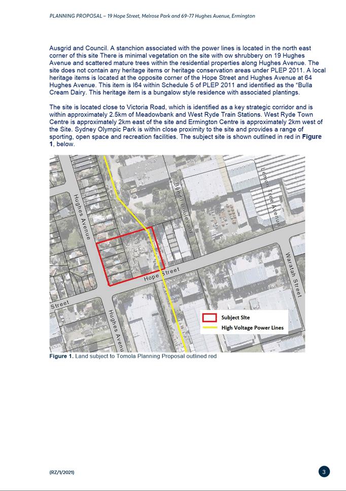
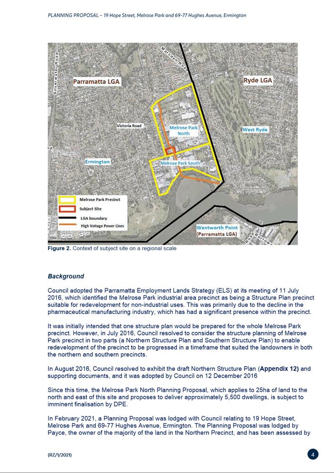
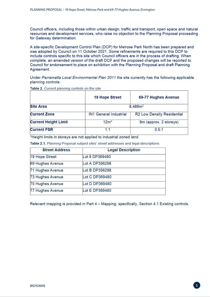
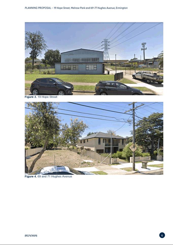
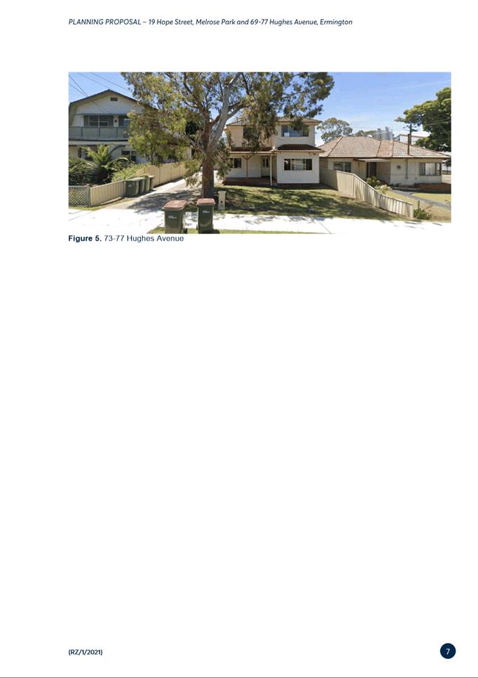
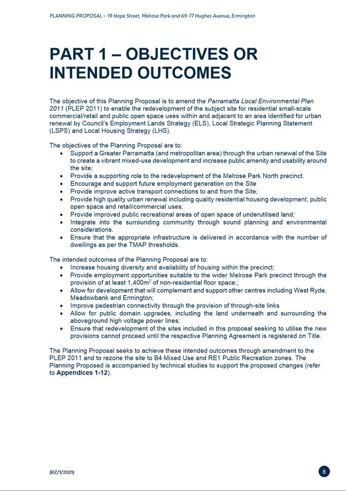
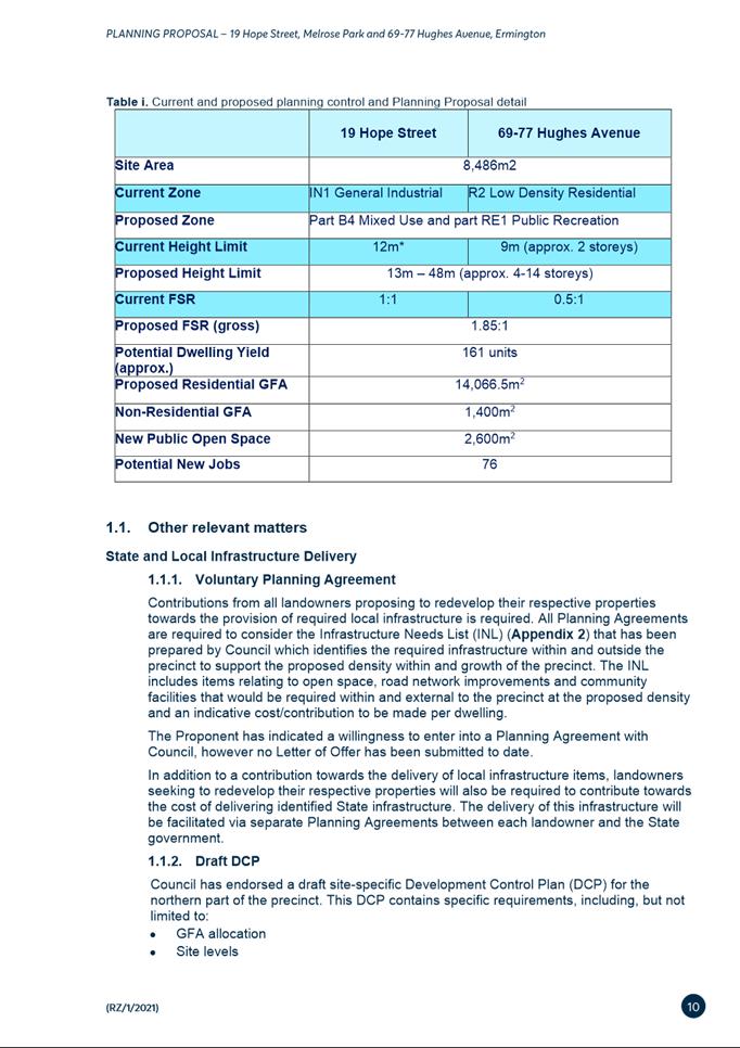
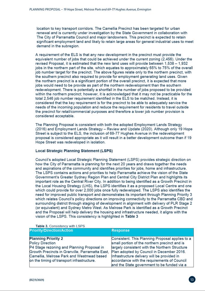
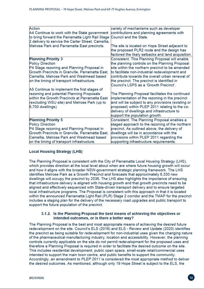
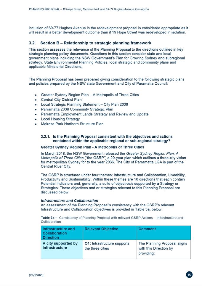
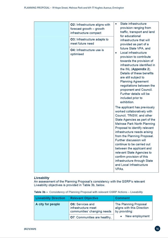
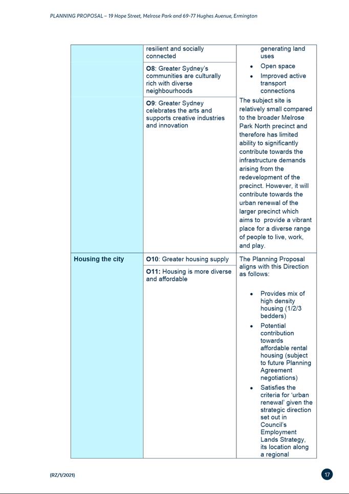
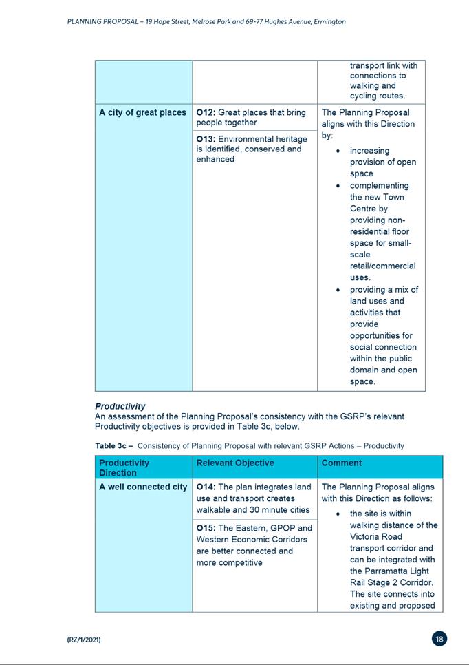
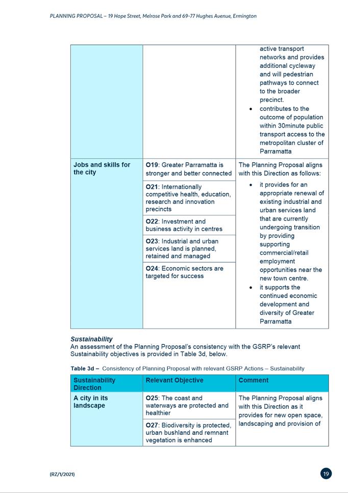
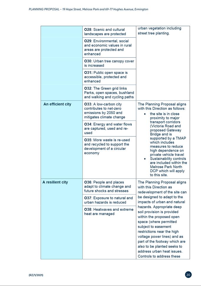
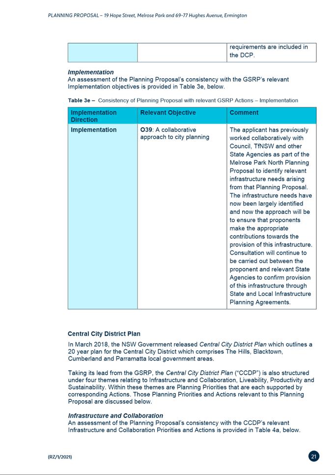
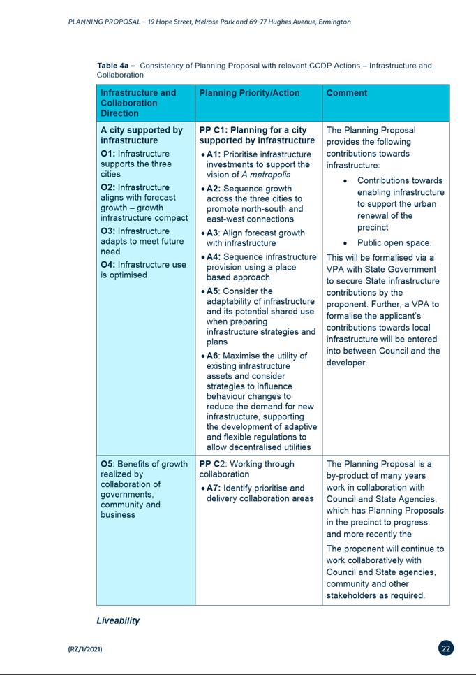
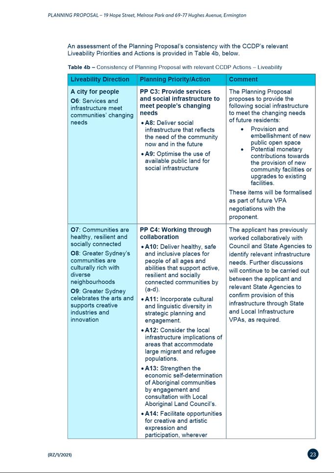
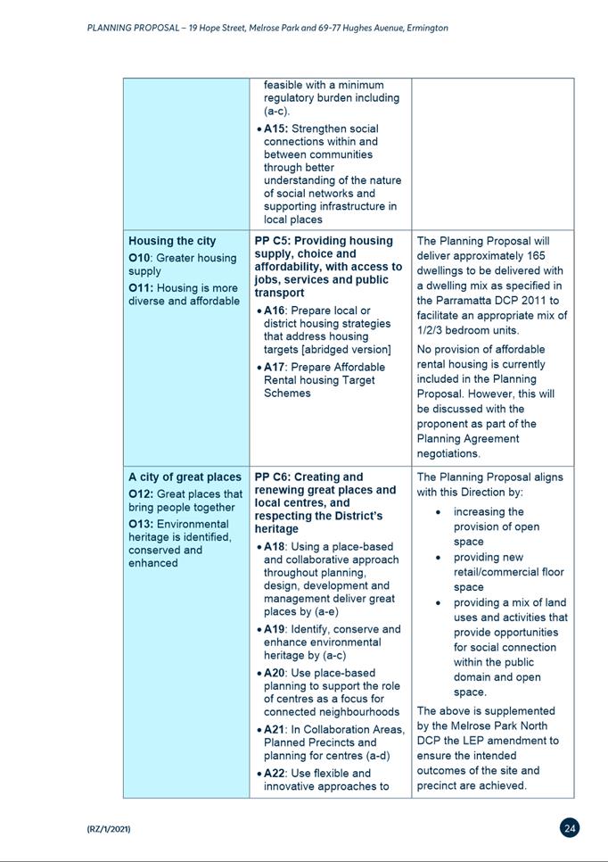
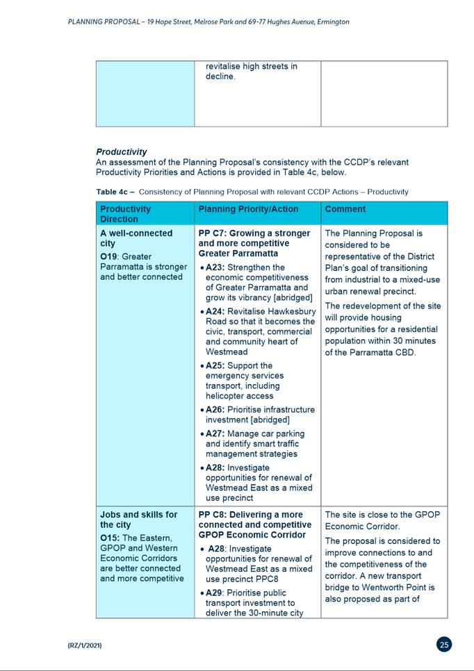
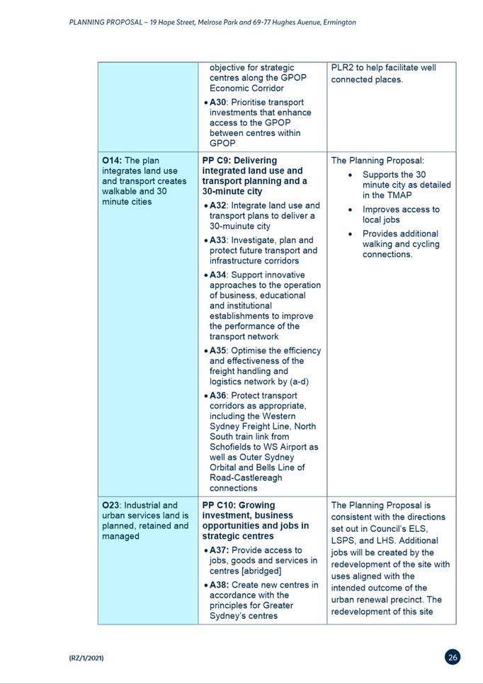
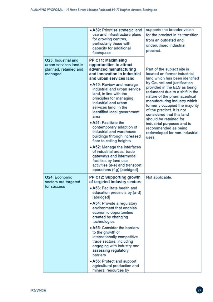
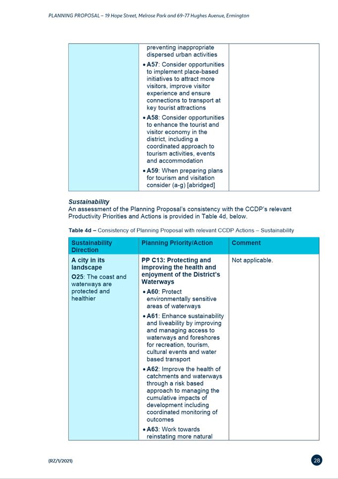
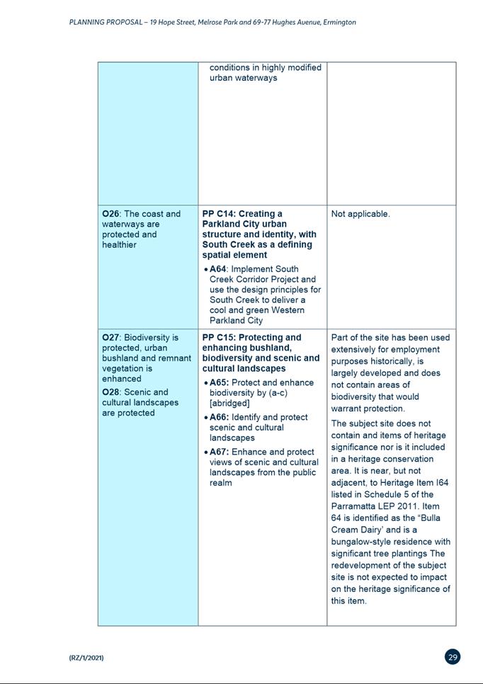
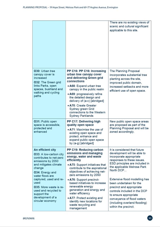
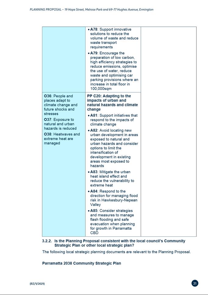
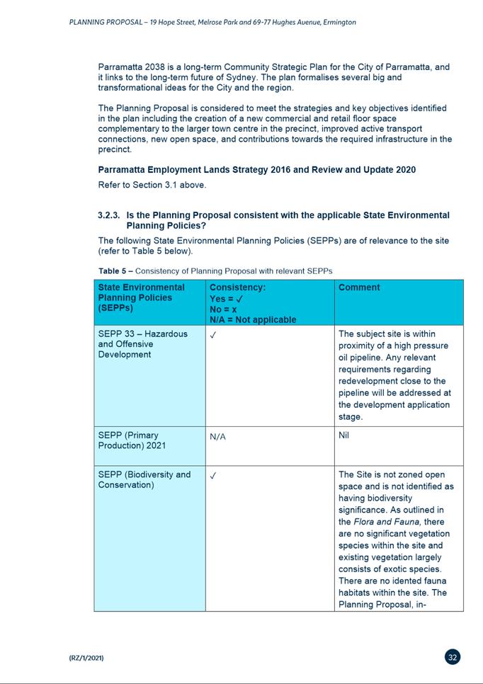
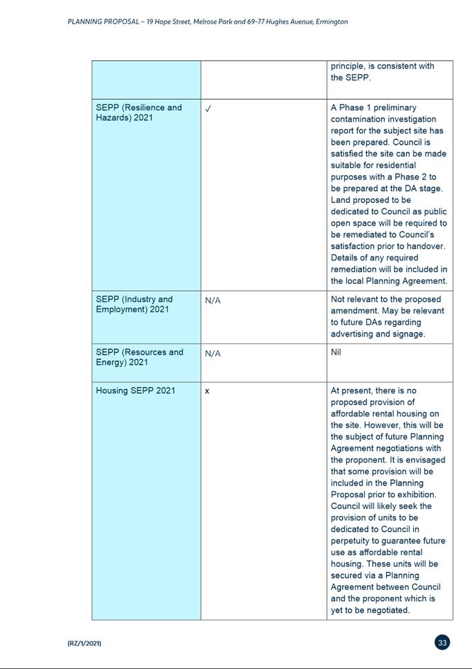
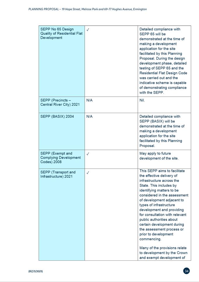
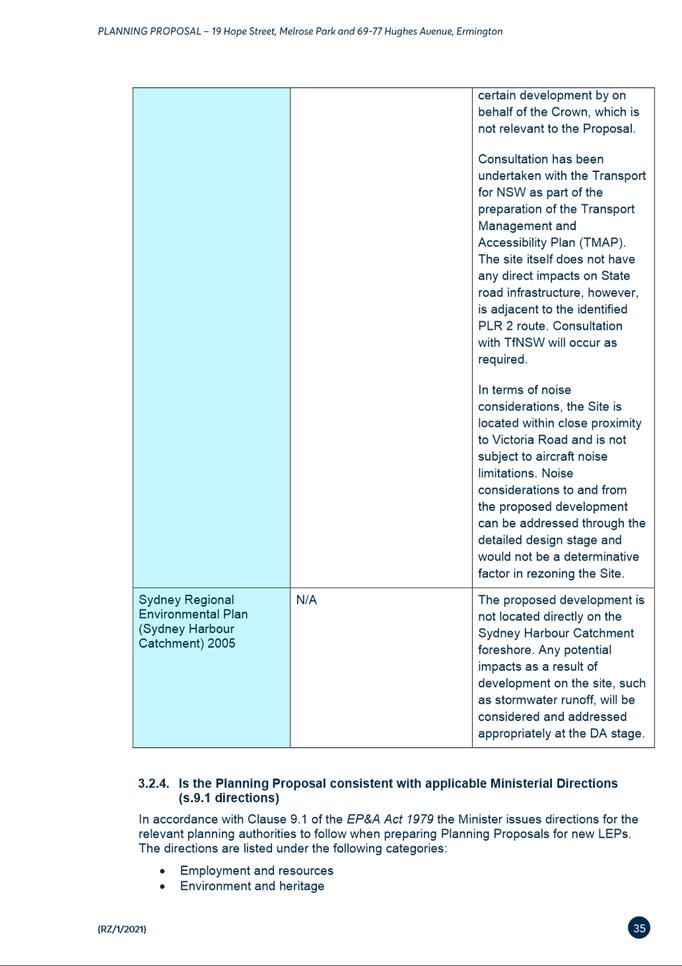
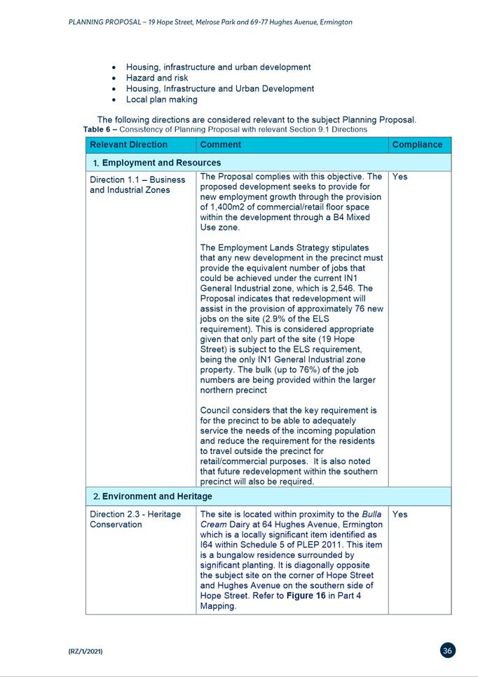
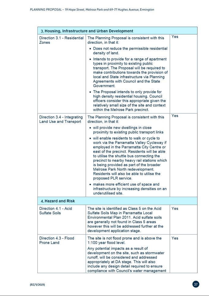
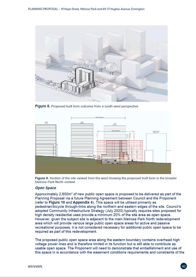
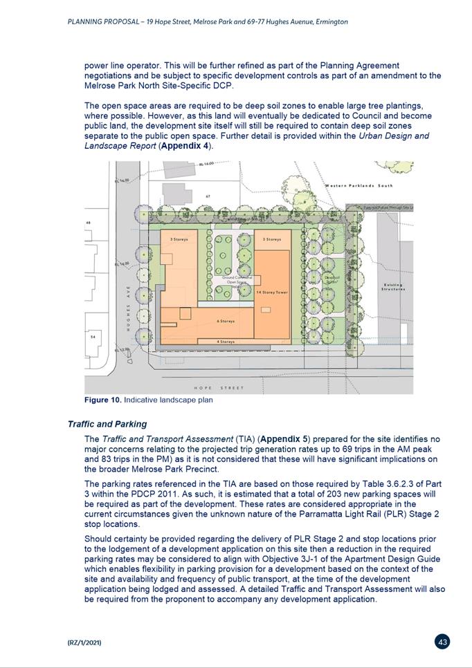
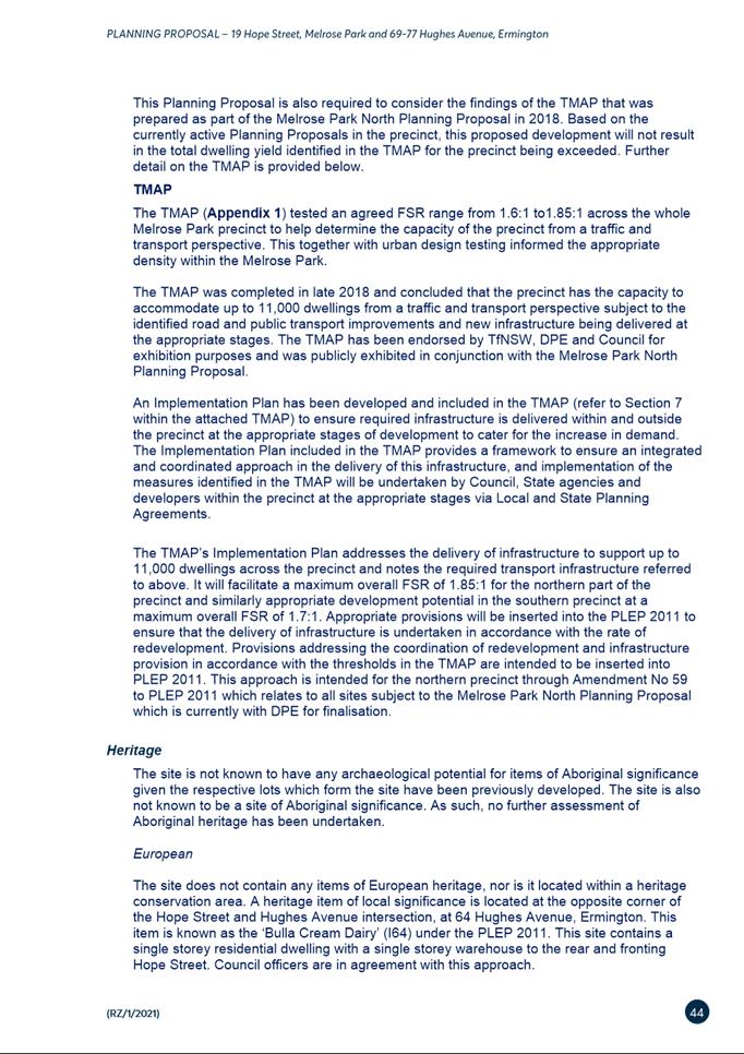
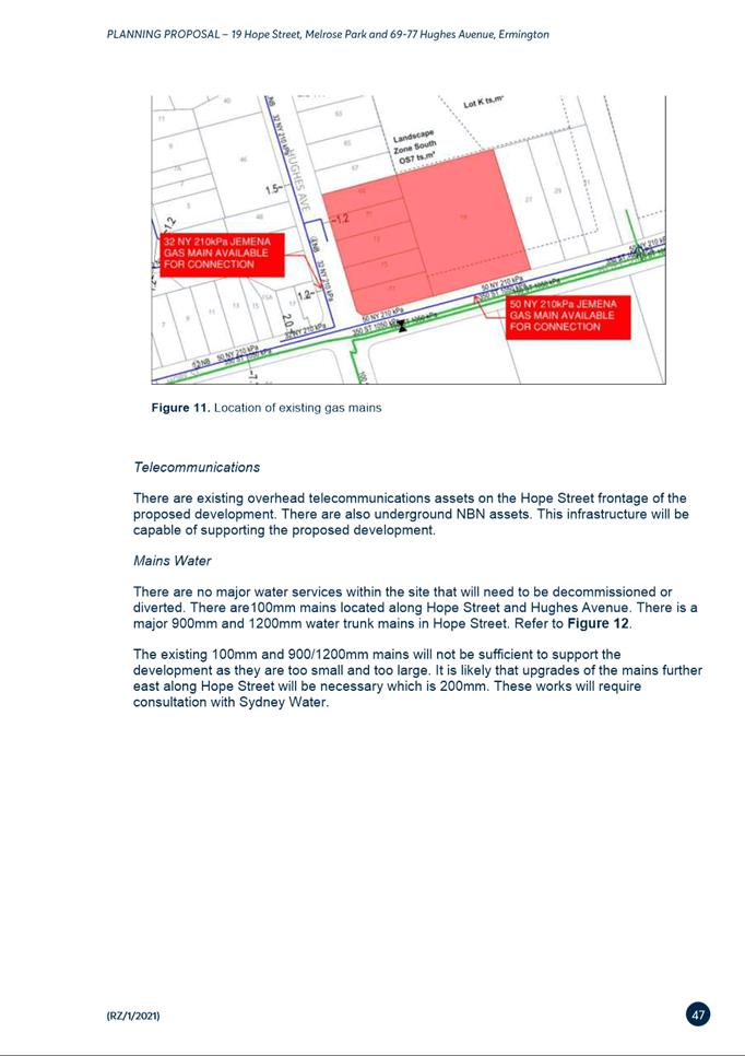
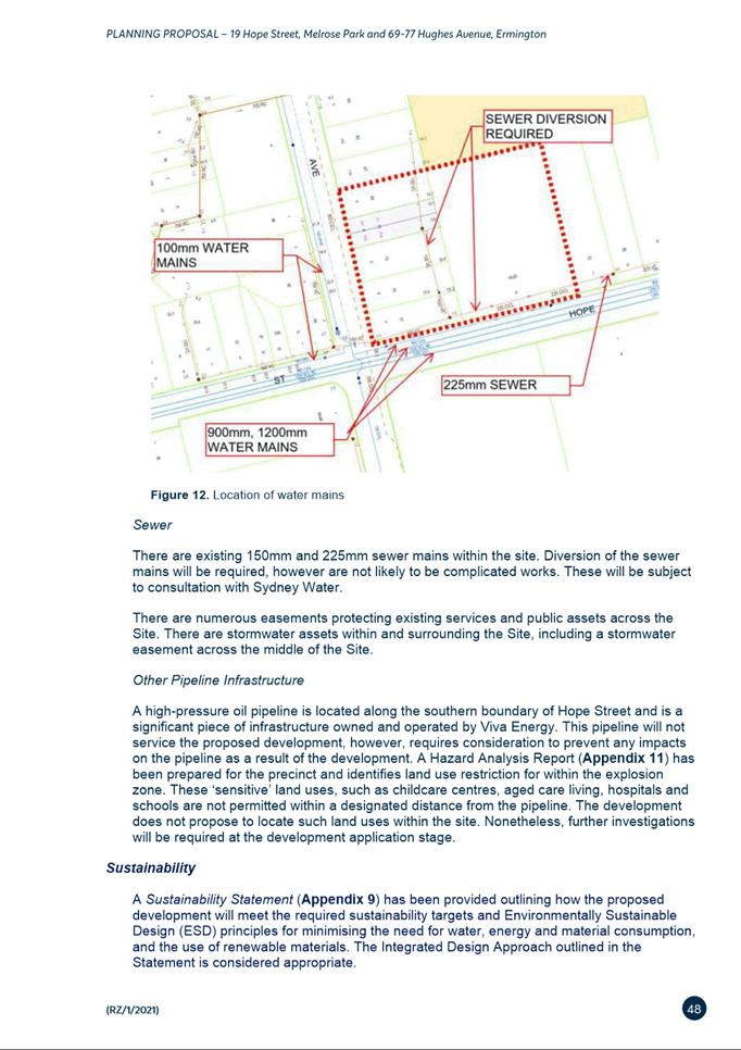
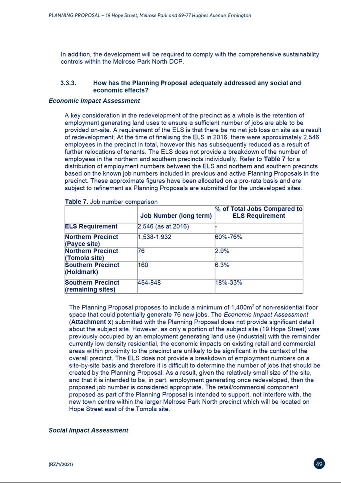
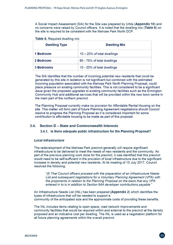
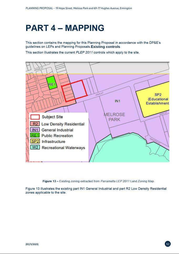
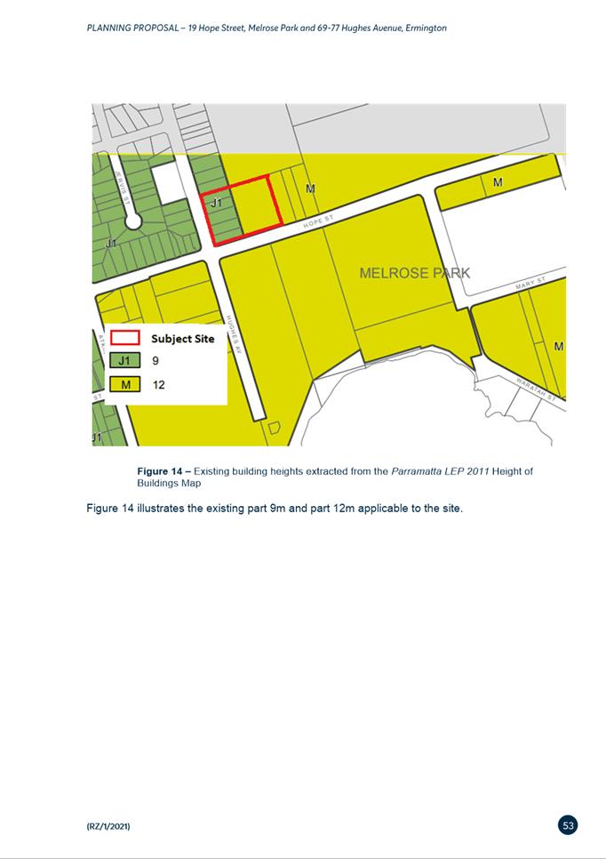
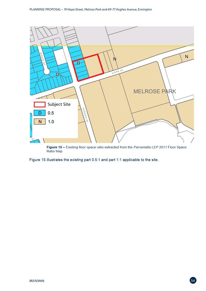
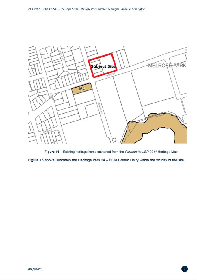
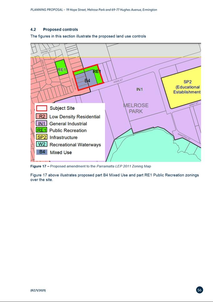
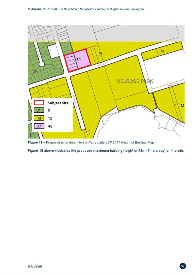
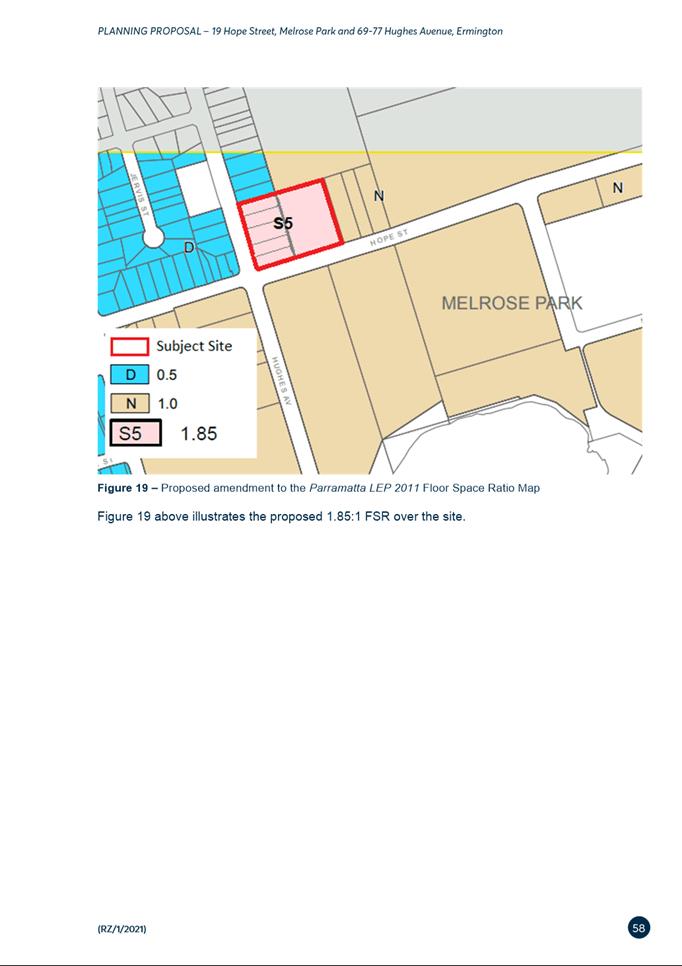
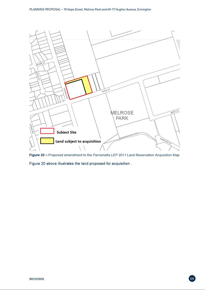
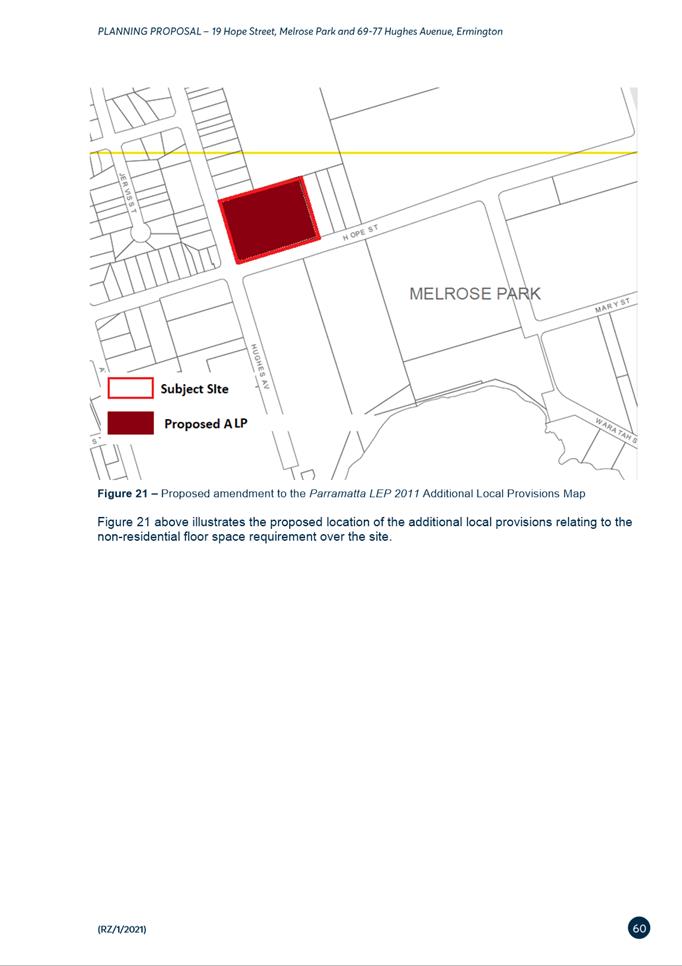
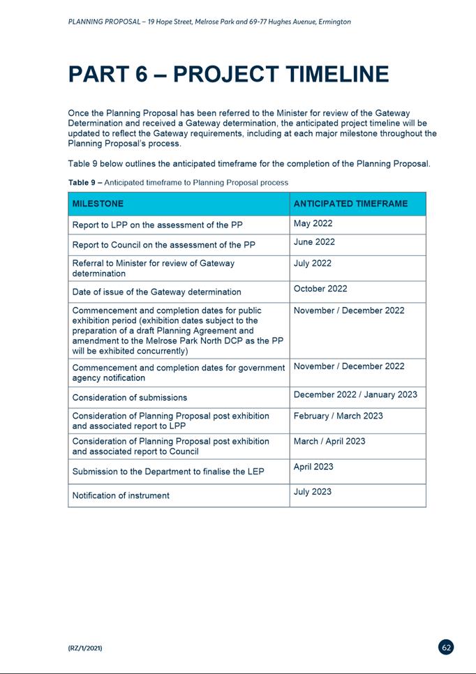

|
Item 6.2 - Attachment 2
|
Melrose Park TMAP
|
|
Item 6.2 - Attachment
3
|
Urban Design and Landscaping Report
|
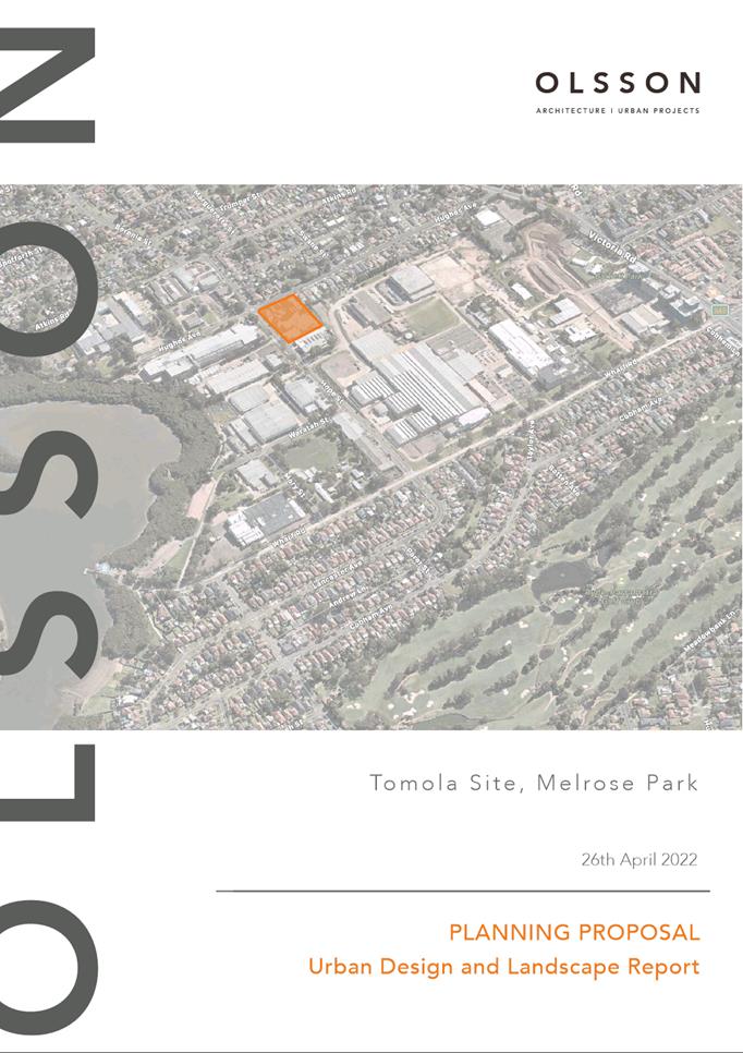
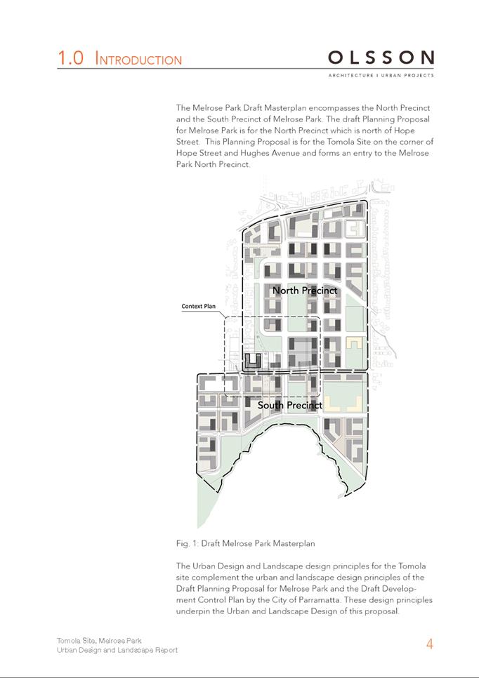
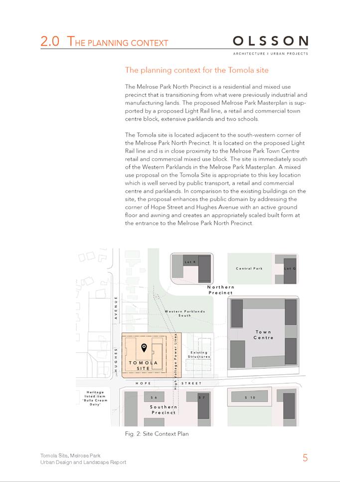
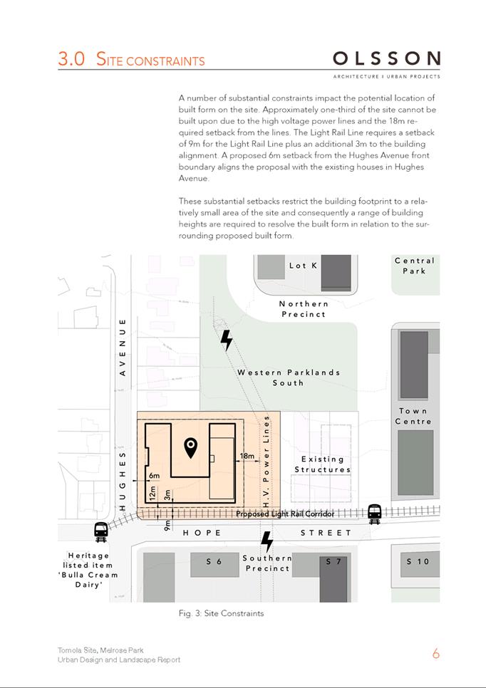
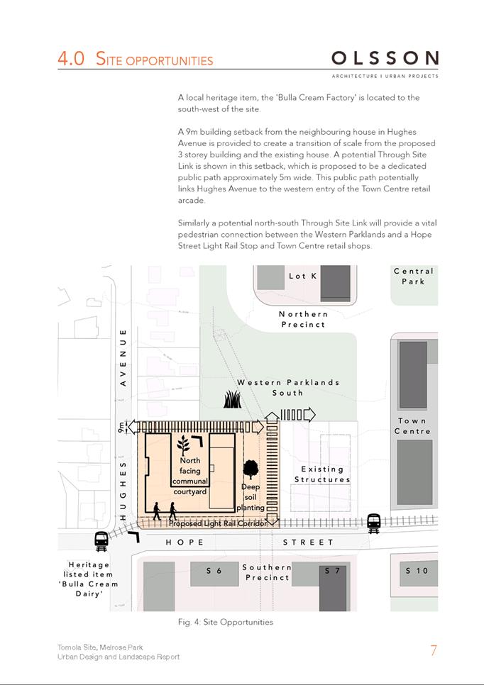
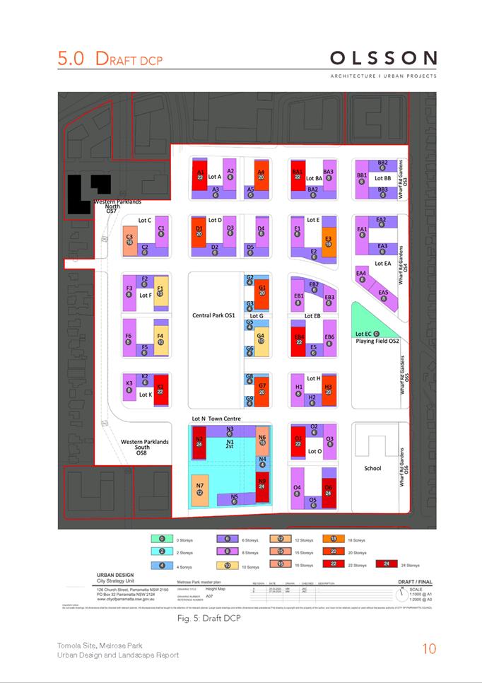
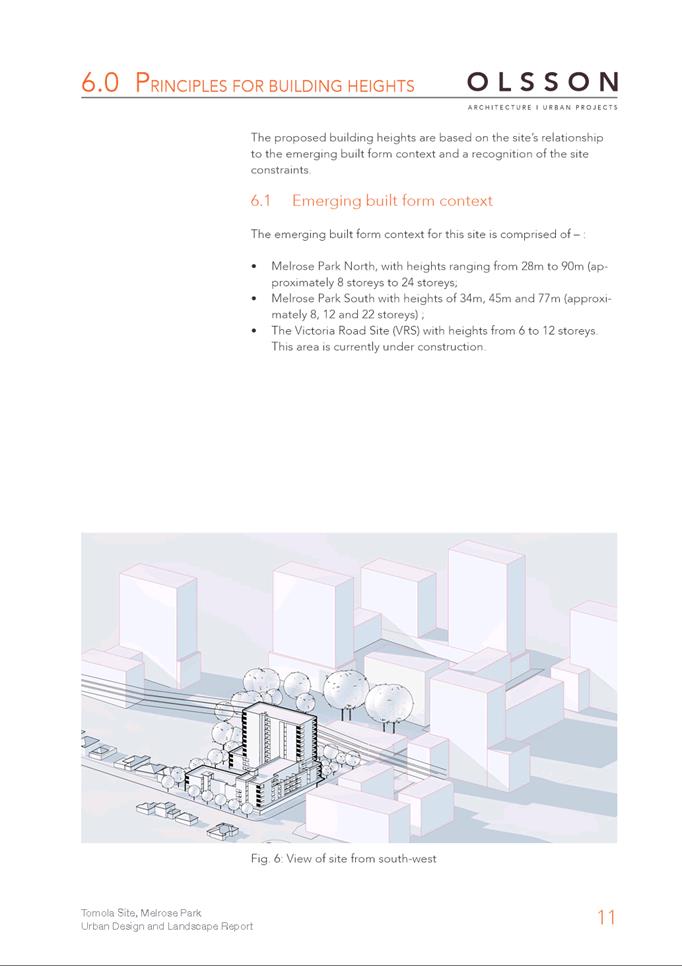
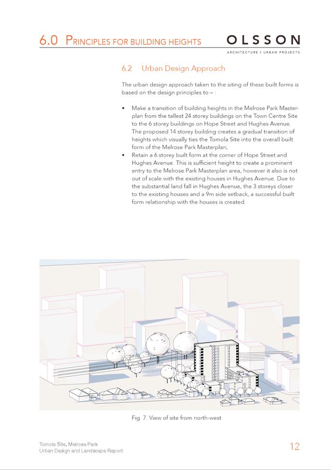
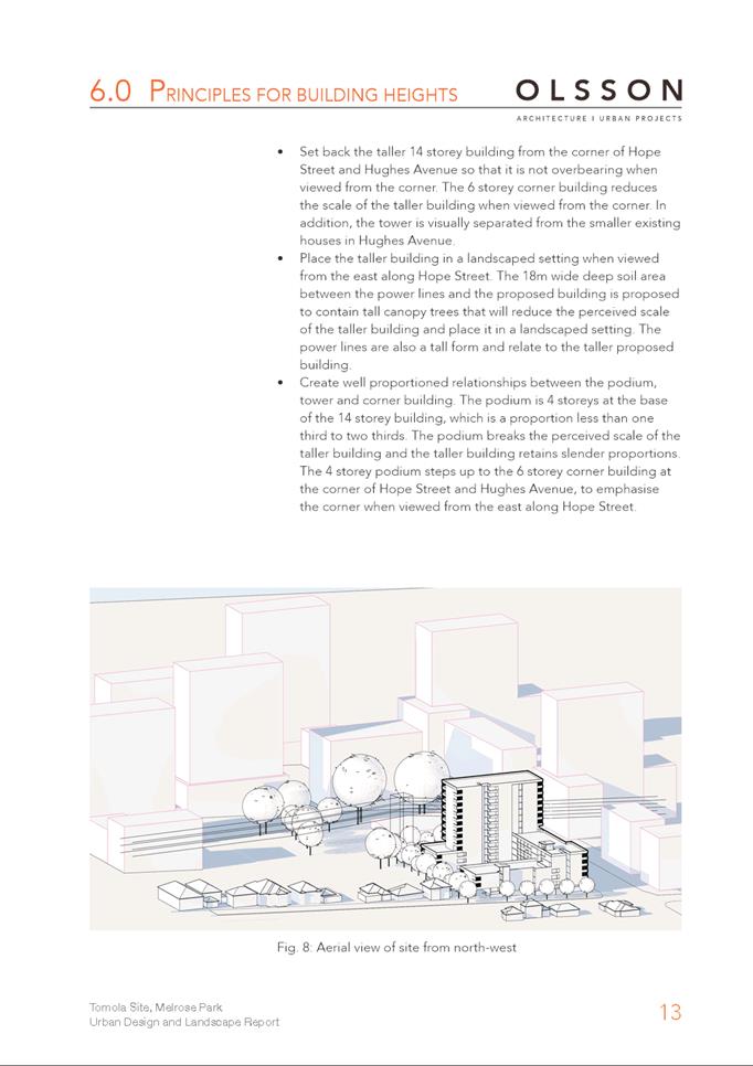
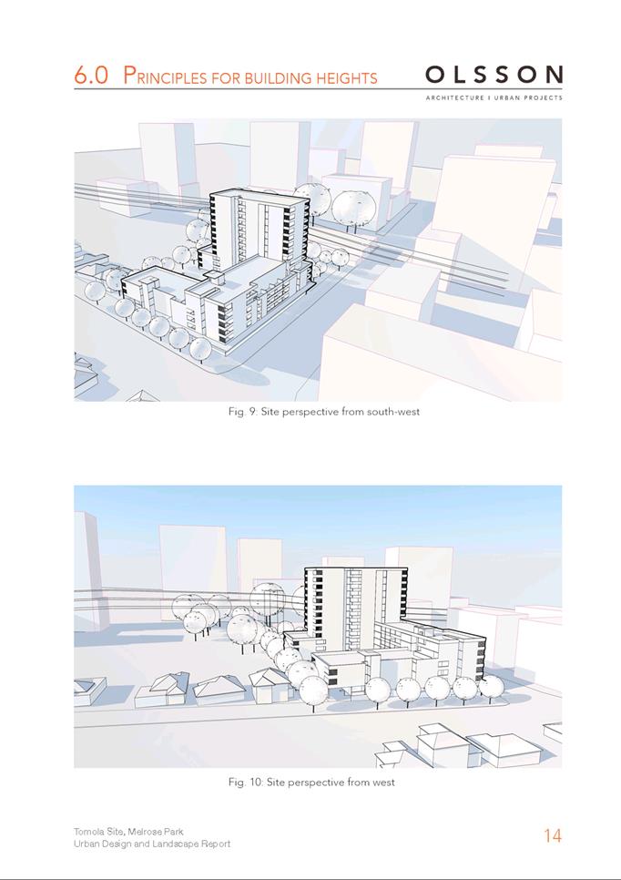
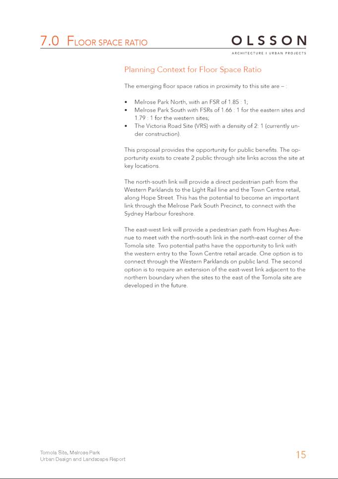
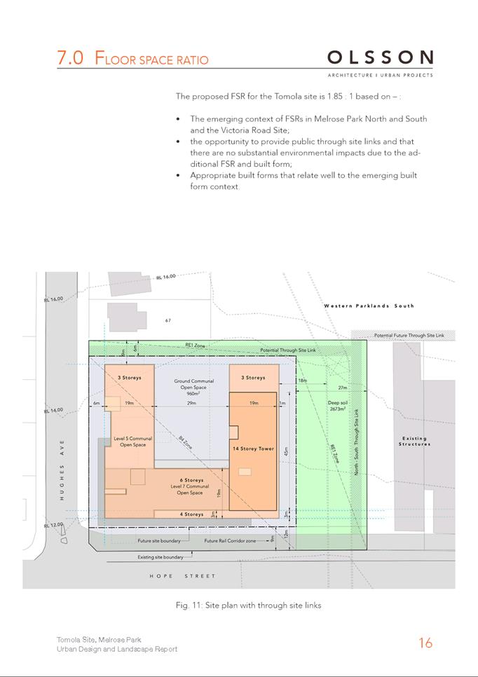
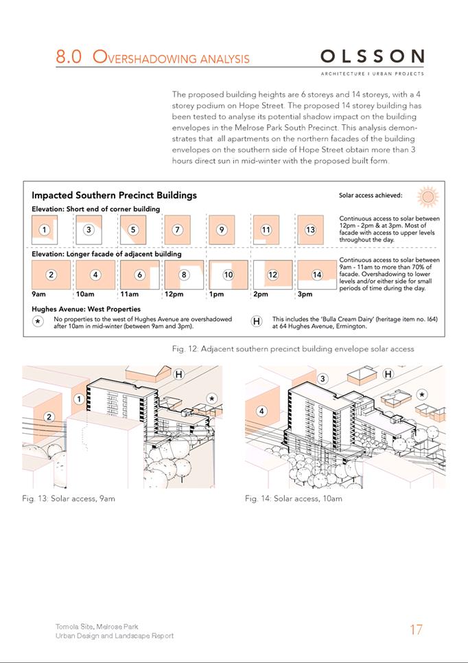
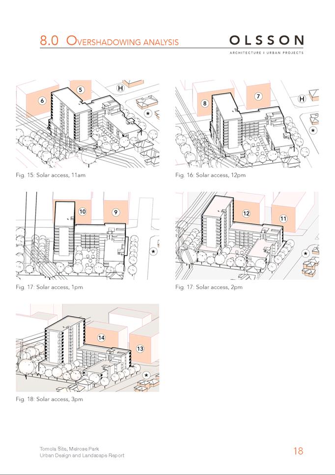
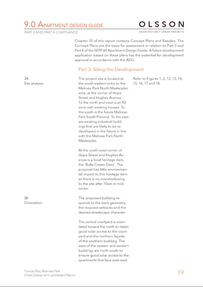
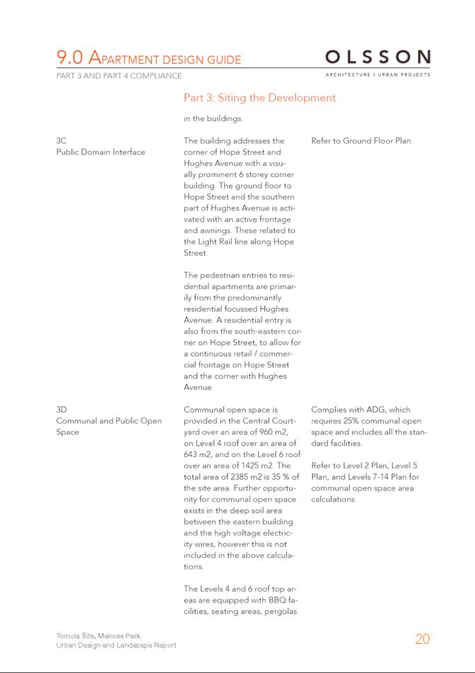
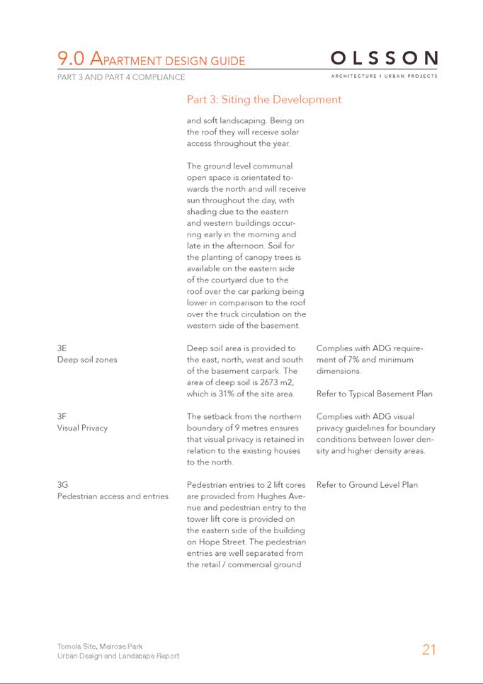
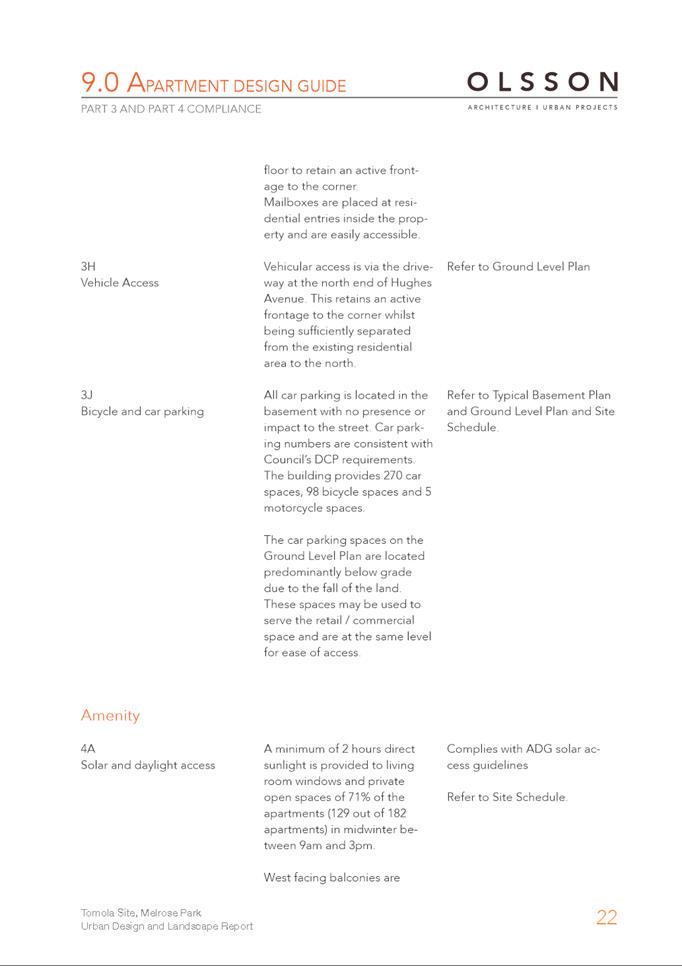
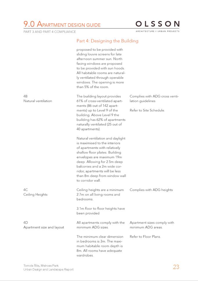
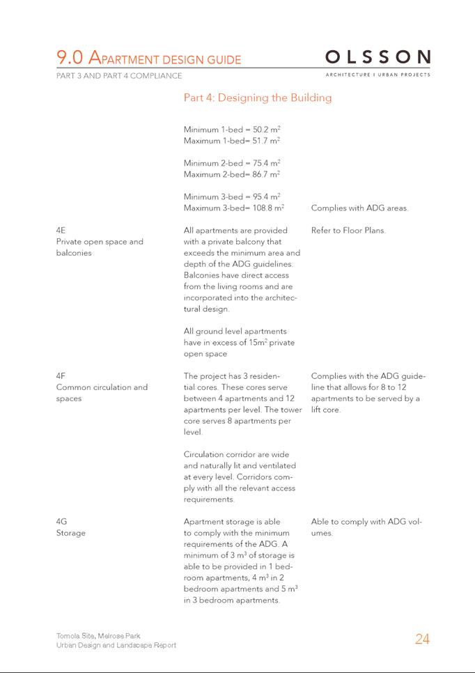
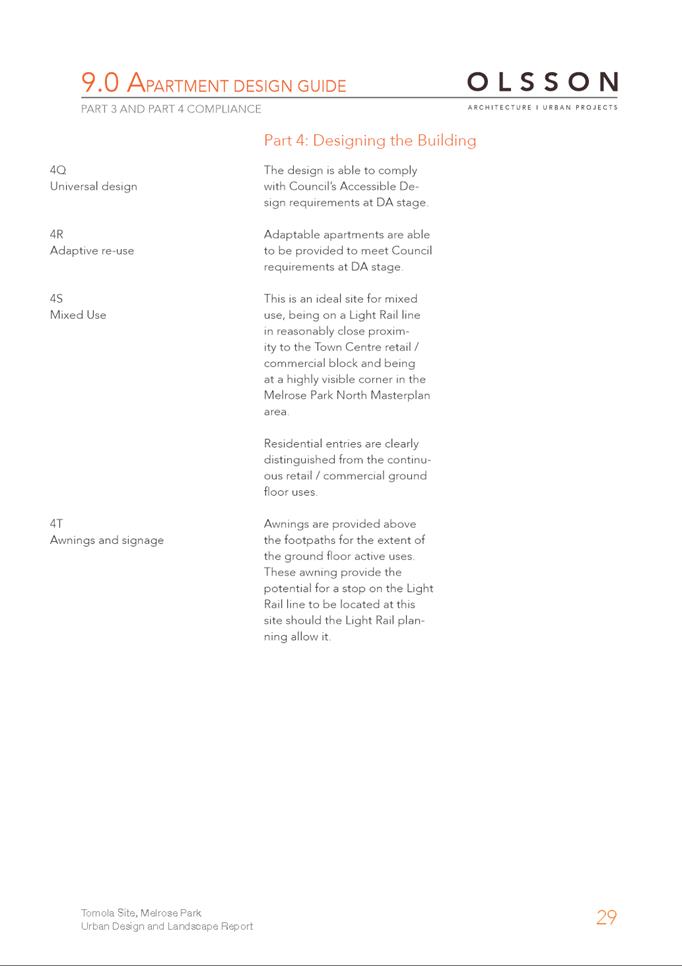
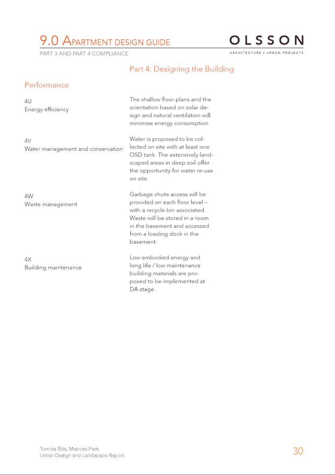

|
Item 6.2 - Attachment 4
|
Flora and Fauna Report
|
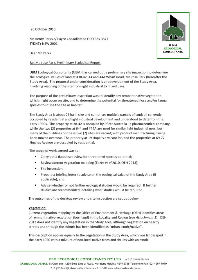
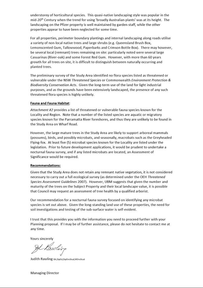
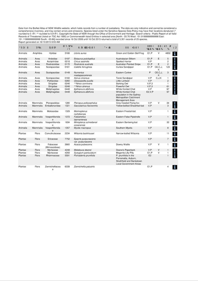
|
Item 6.2 - Attachment
5
|
Preliminary Traffic Impact Assessment
|
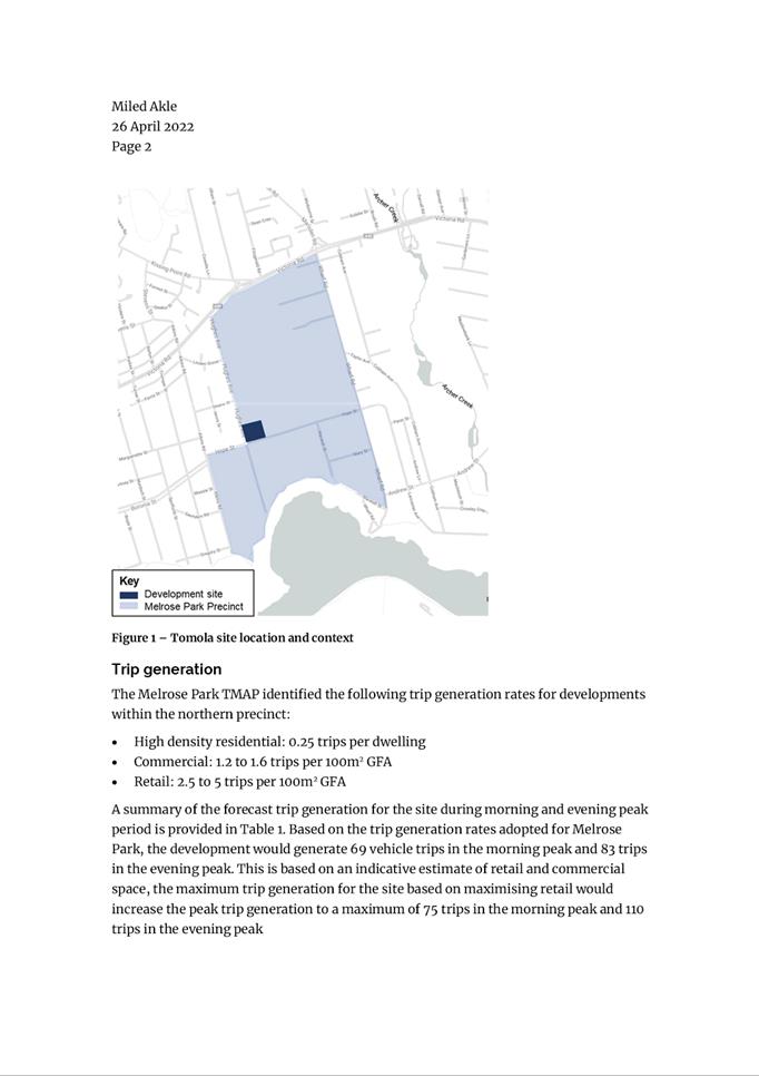
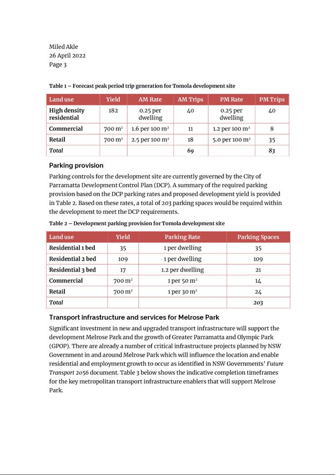
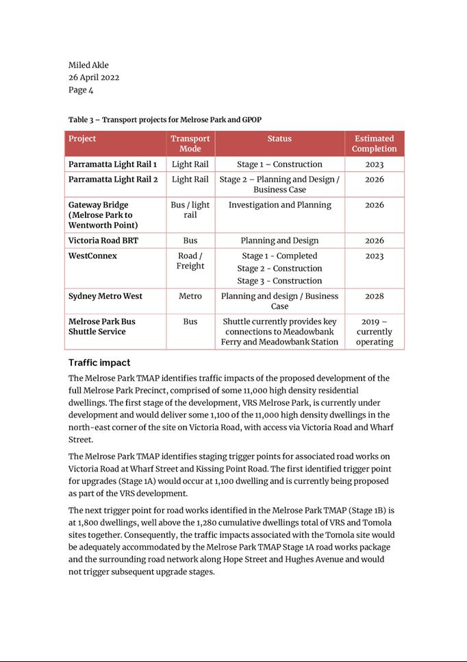
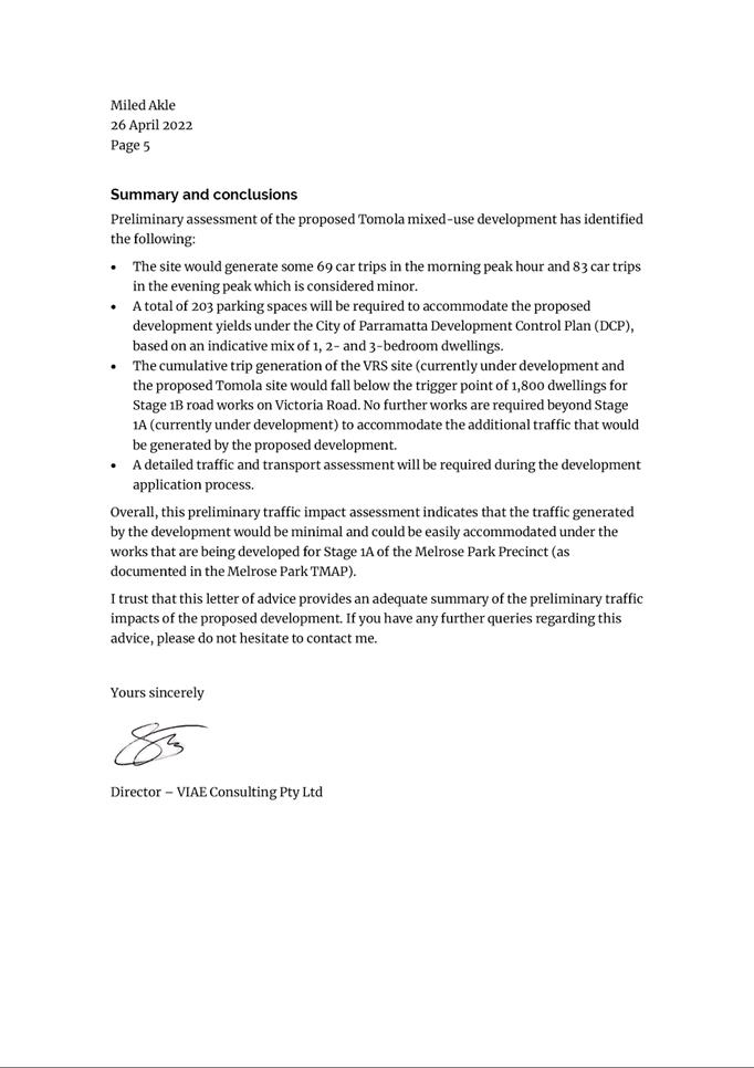
|
Item 6.2 - Attachment 6
|
Concept Stormwater Strategy
|
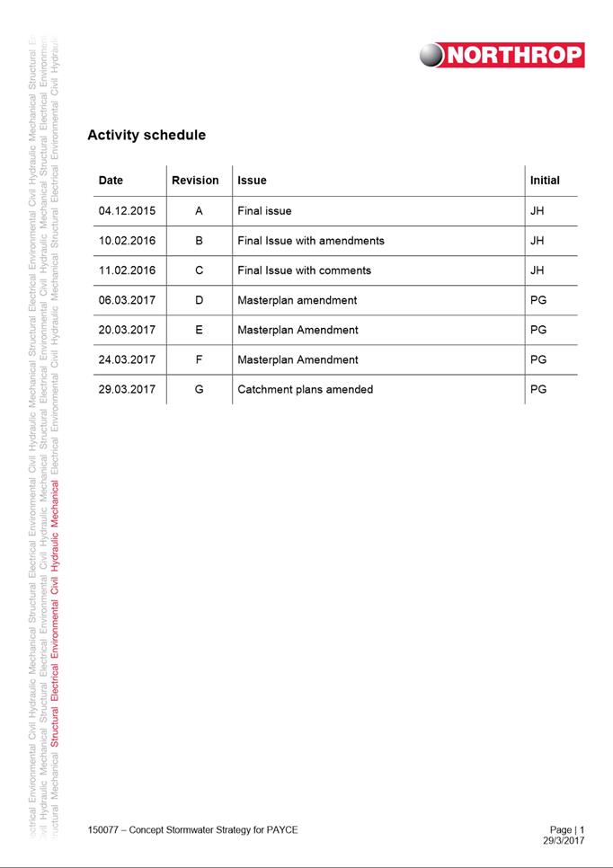
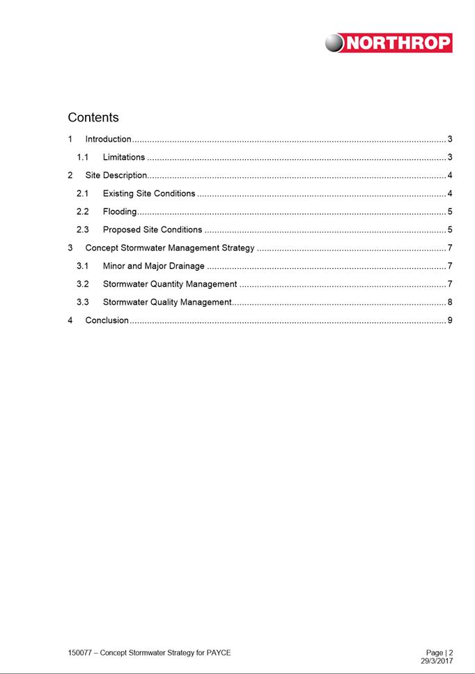
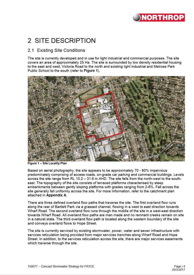
|
Item 6.2 - Attachment 7
|
Preliminary Site Investigation (Contamination)
|
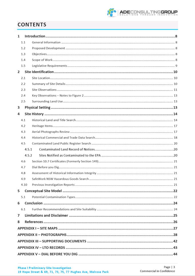
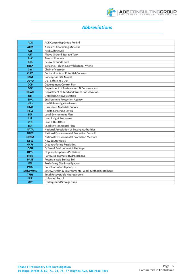
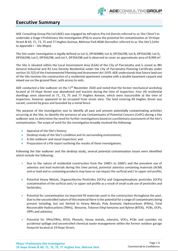
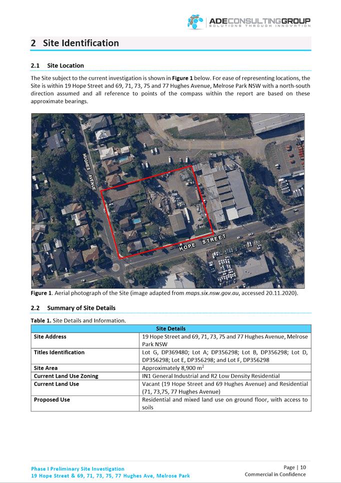
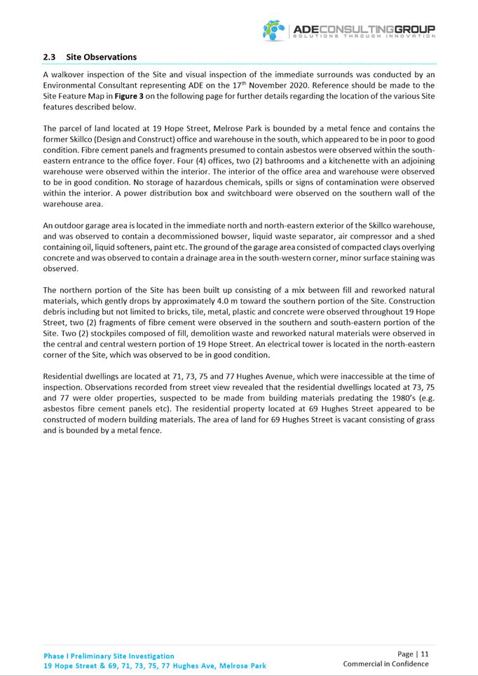
|
Item 6.2 - Attachment 8
|
Social Impact Assessment
|

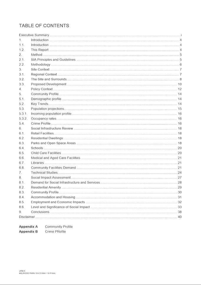

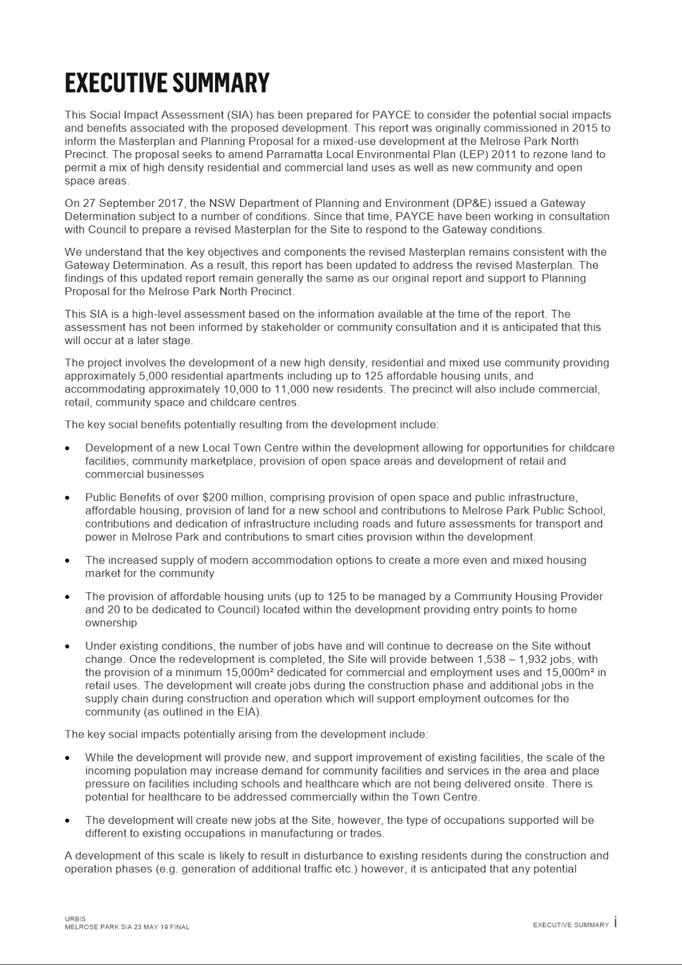

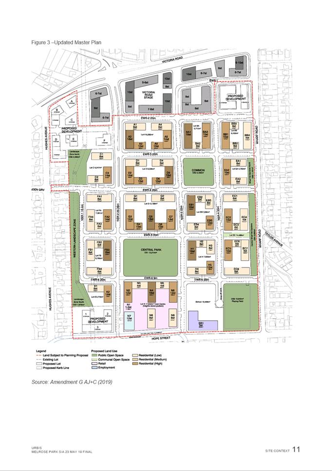
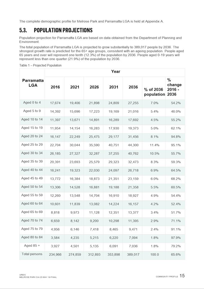
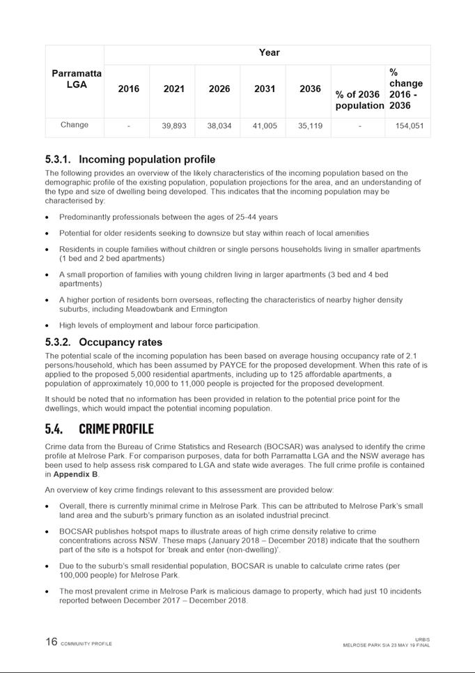

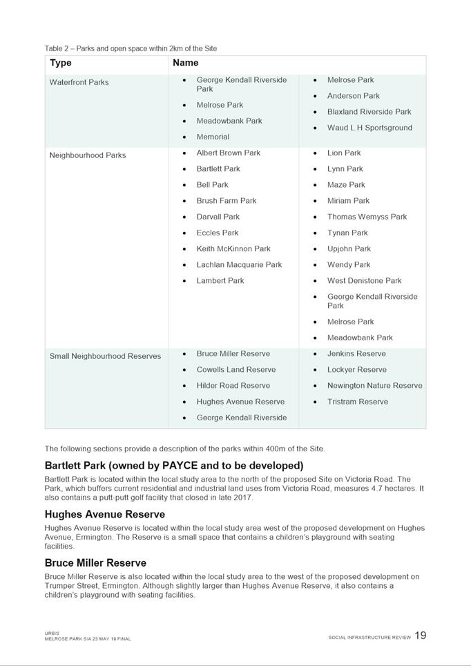
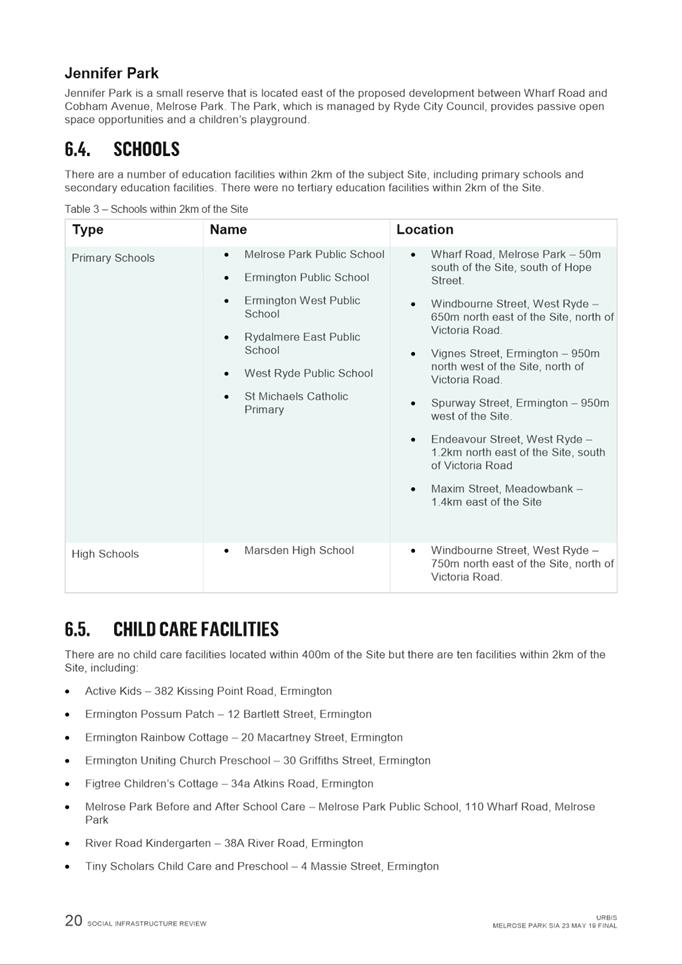
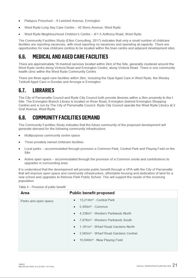
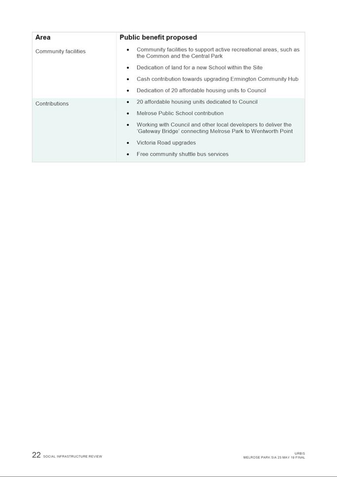
|
Item 6.2 - Attachment 9
|
Economic Impact Assessment
|
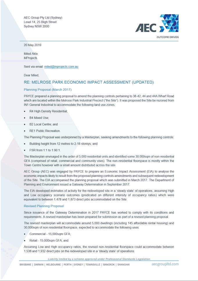
|
Item 6.2 - Attachment 10
|
Sustainability Statement
|
|
Item 6.2 - Attachment 11
|
Acoustic Report
|
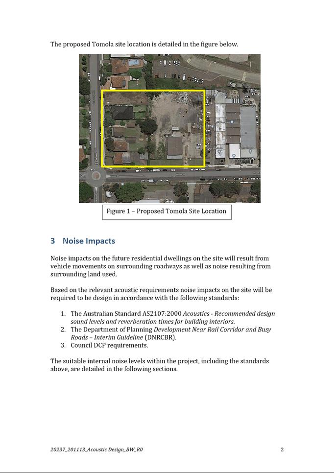
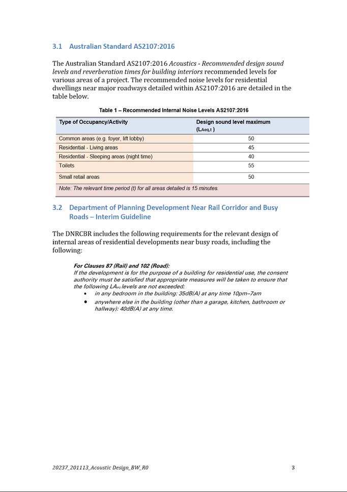
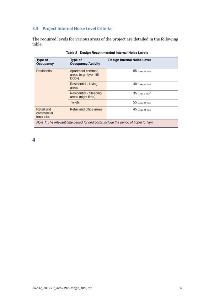
|
Item 6.2 - Attachment 12
|
Preliminary Geotechnical Assessment
|
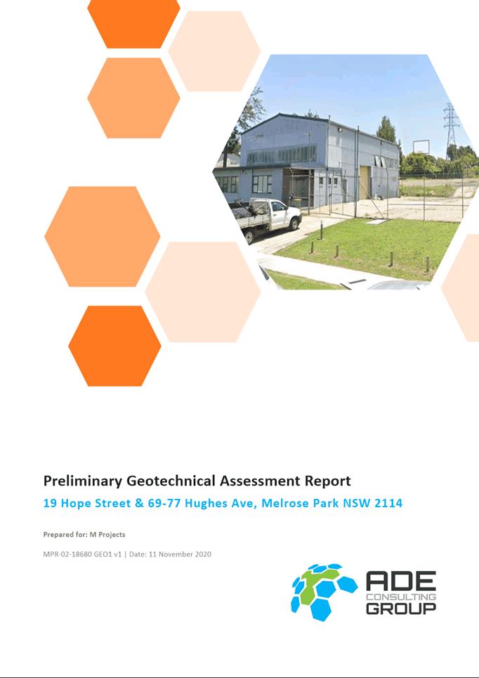
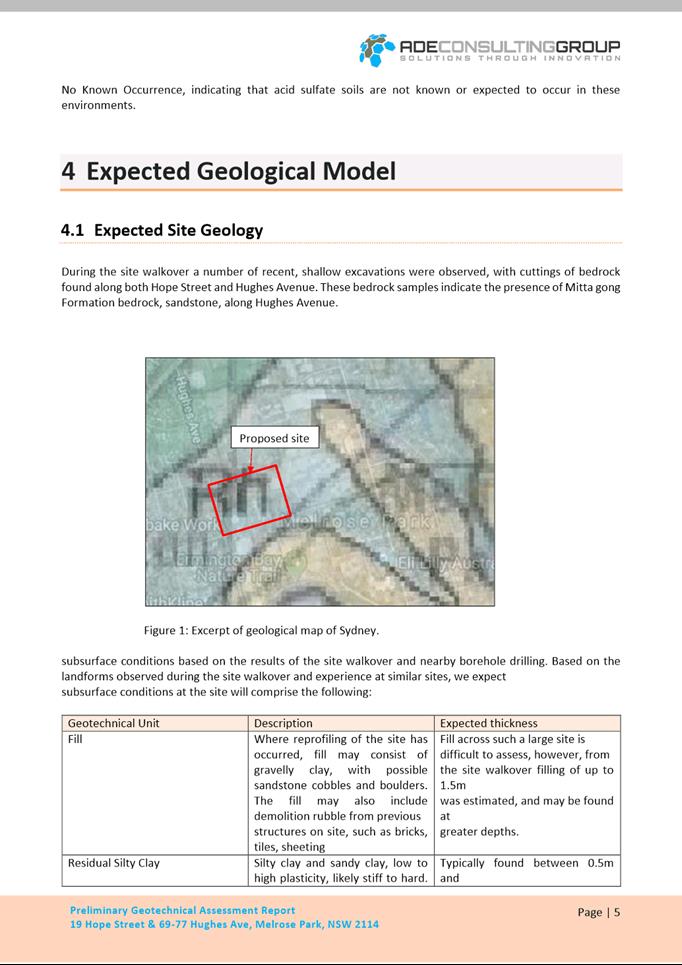
|
Item 6.2 - Attachment 13
|
Engineering Services Report
|
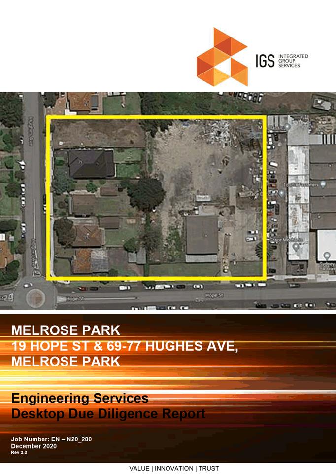
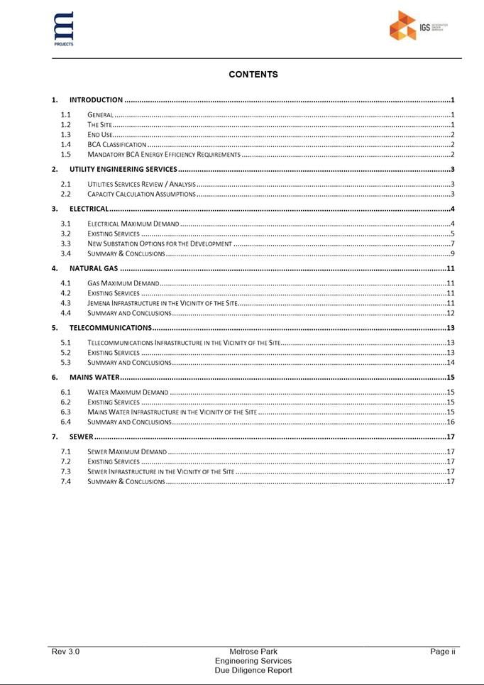
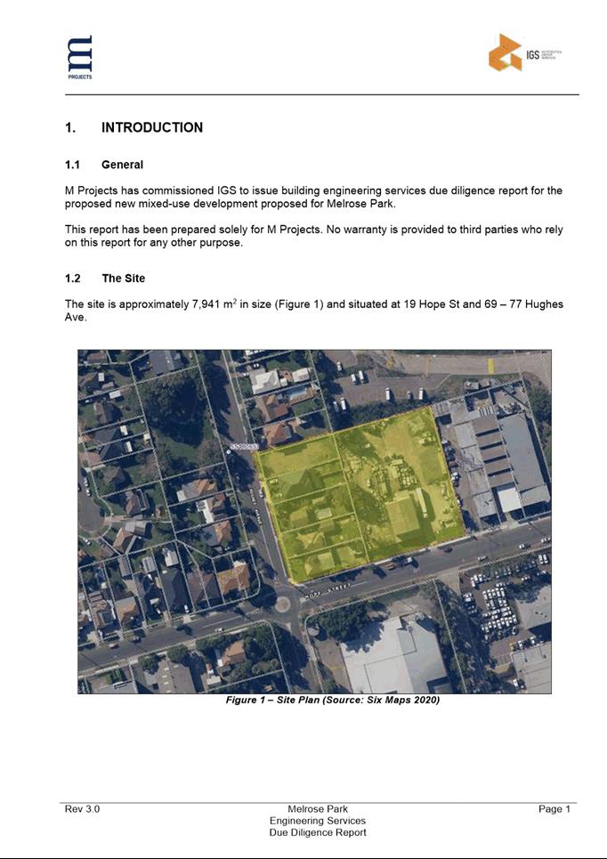
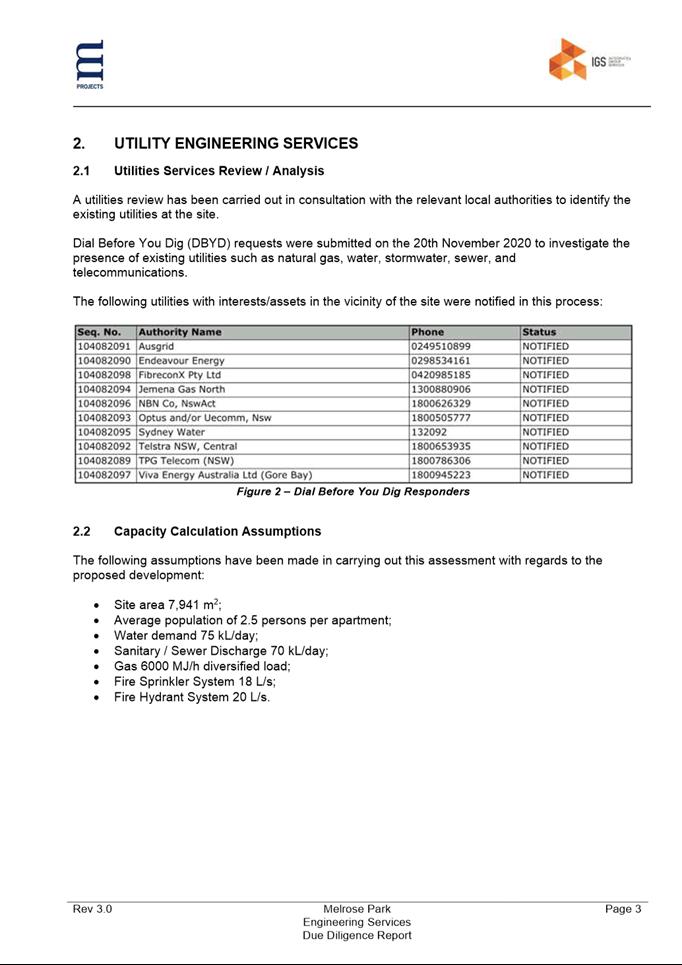
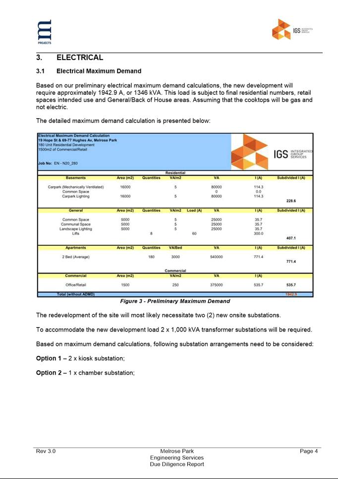
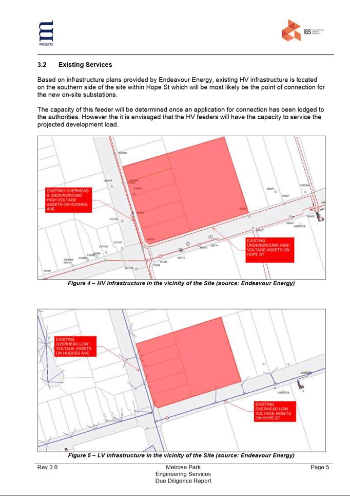
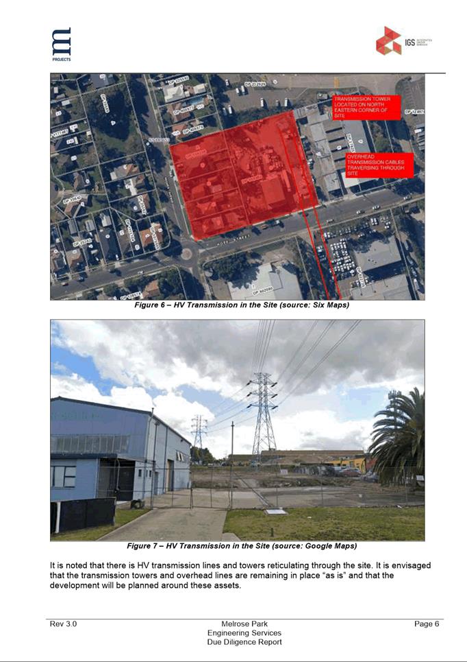
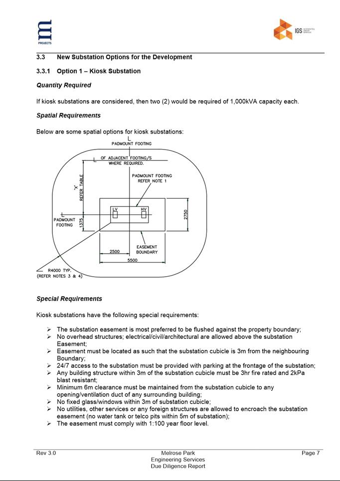
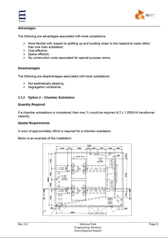
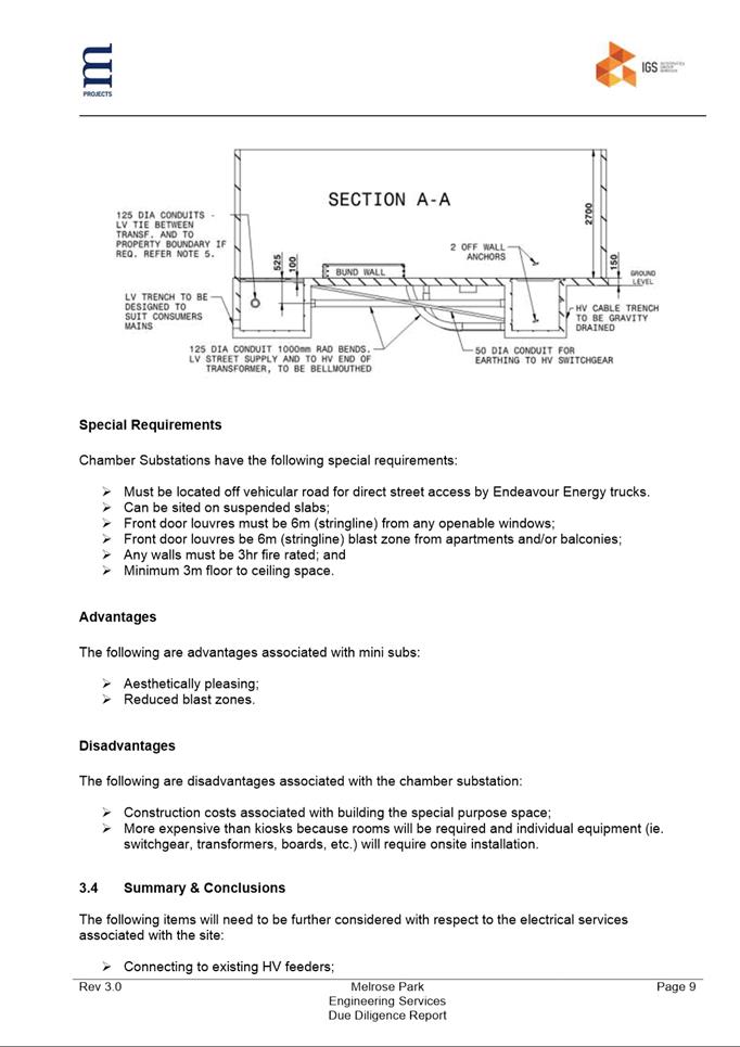
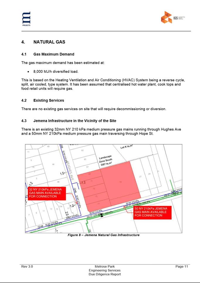
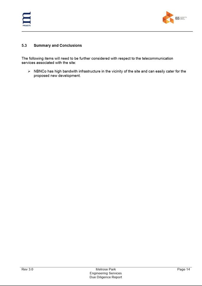
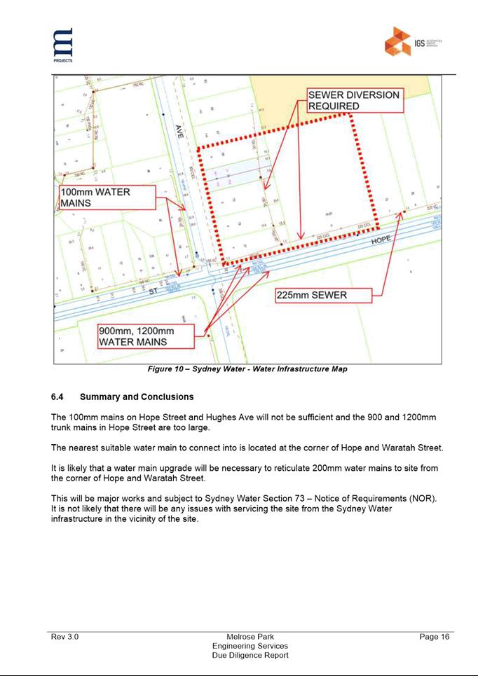
|
Item 6.2 - Attachment 14
|
Site Survey
|
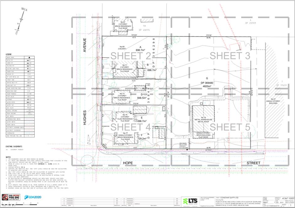
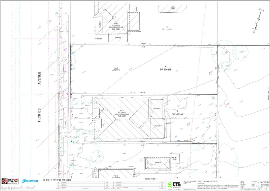
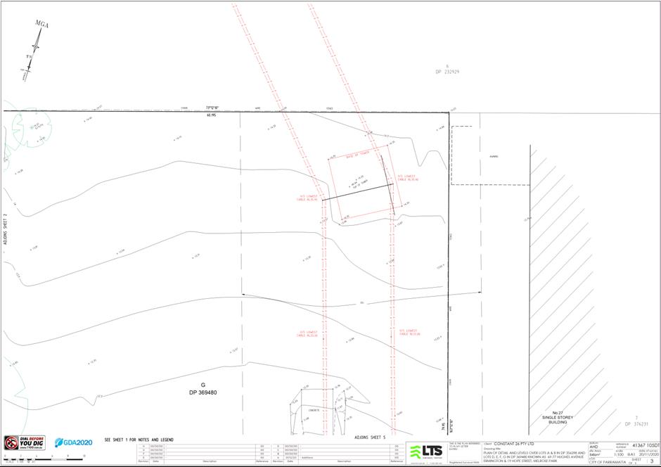
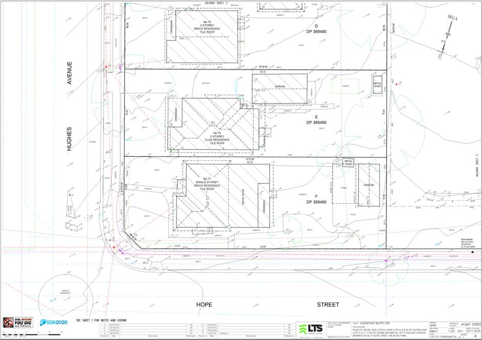
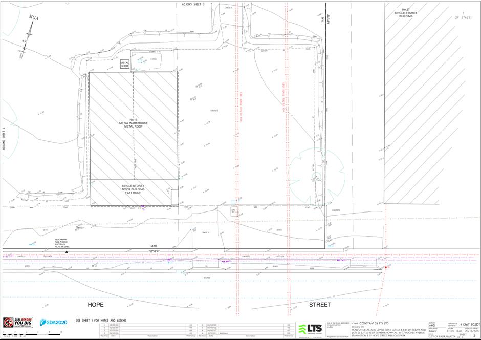
|
Item 6.2 - Attachment 15
|
Community Engagement Strategy
|
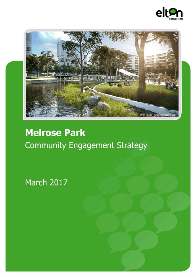
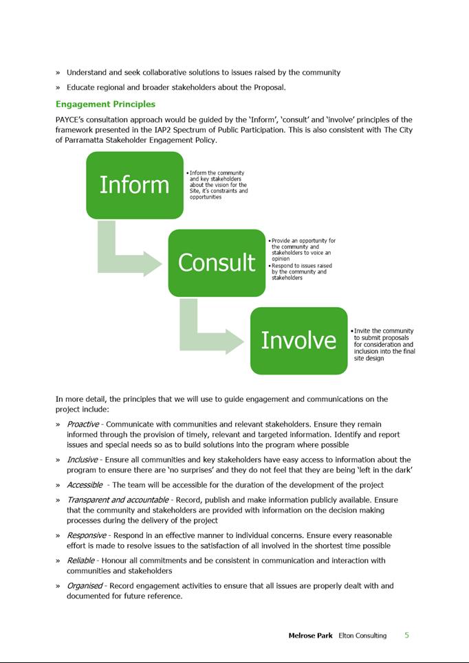
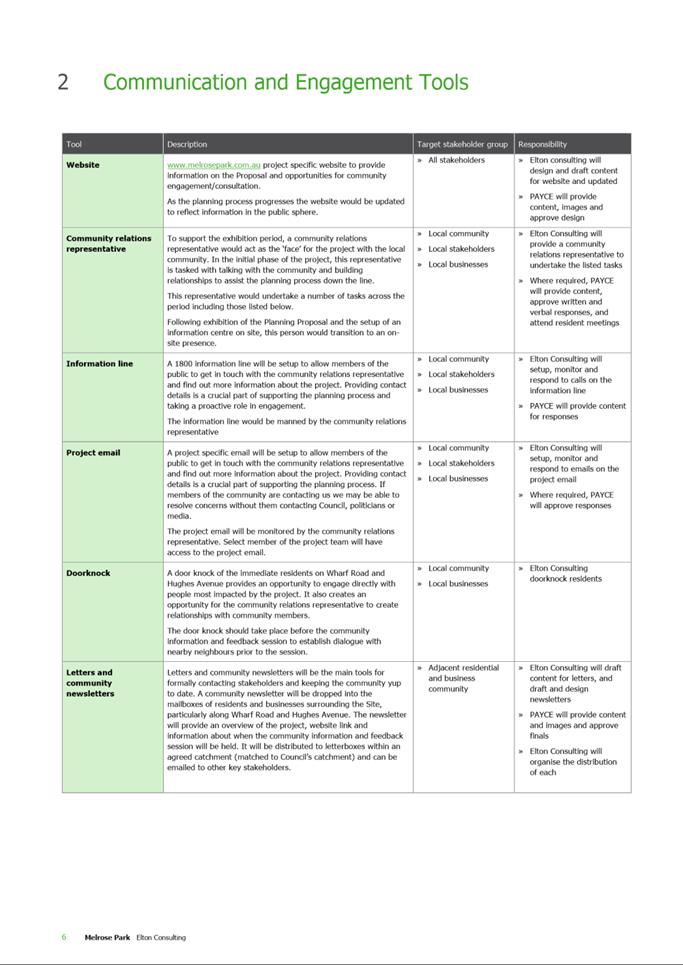
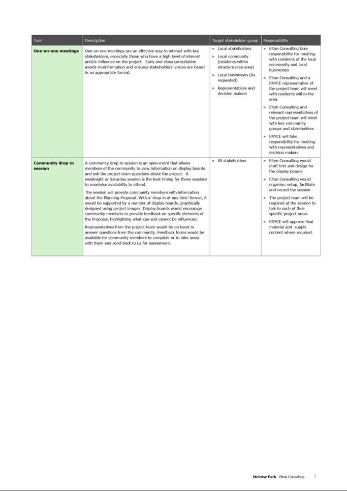
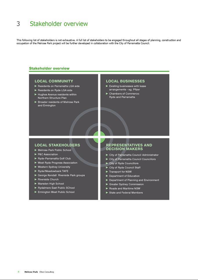
|
Item 6.2 - Attachment
16
|
Hazard Analysis Report
|
