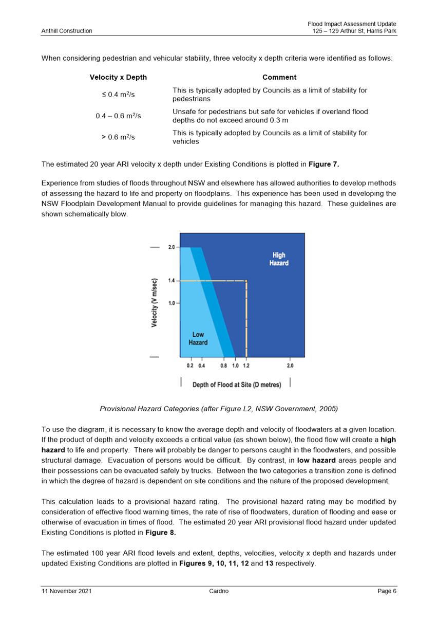
NOTICE OF Local Planning
Panel MEETING
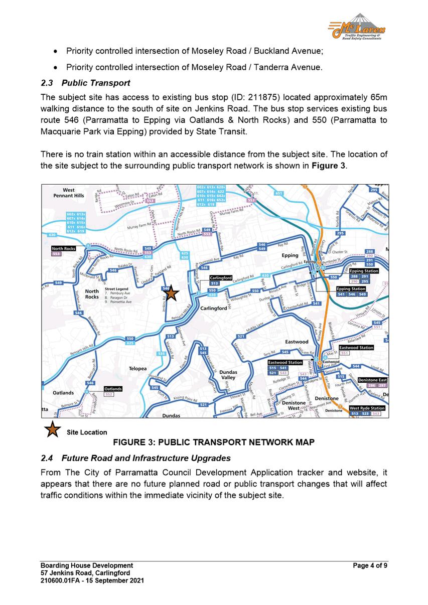
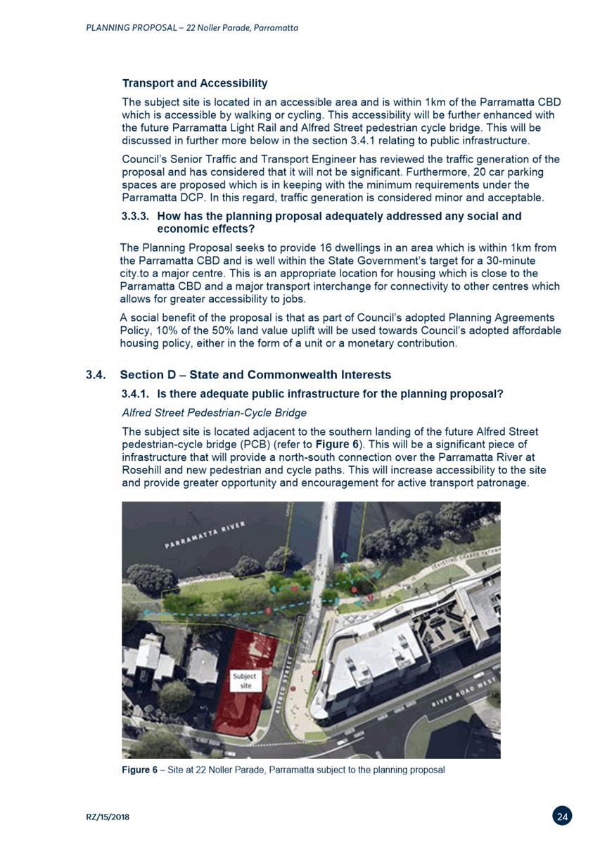
PUBLIC AGENDA
A Local Planning Panel meeting will be held via
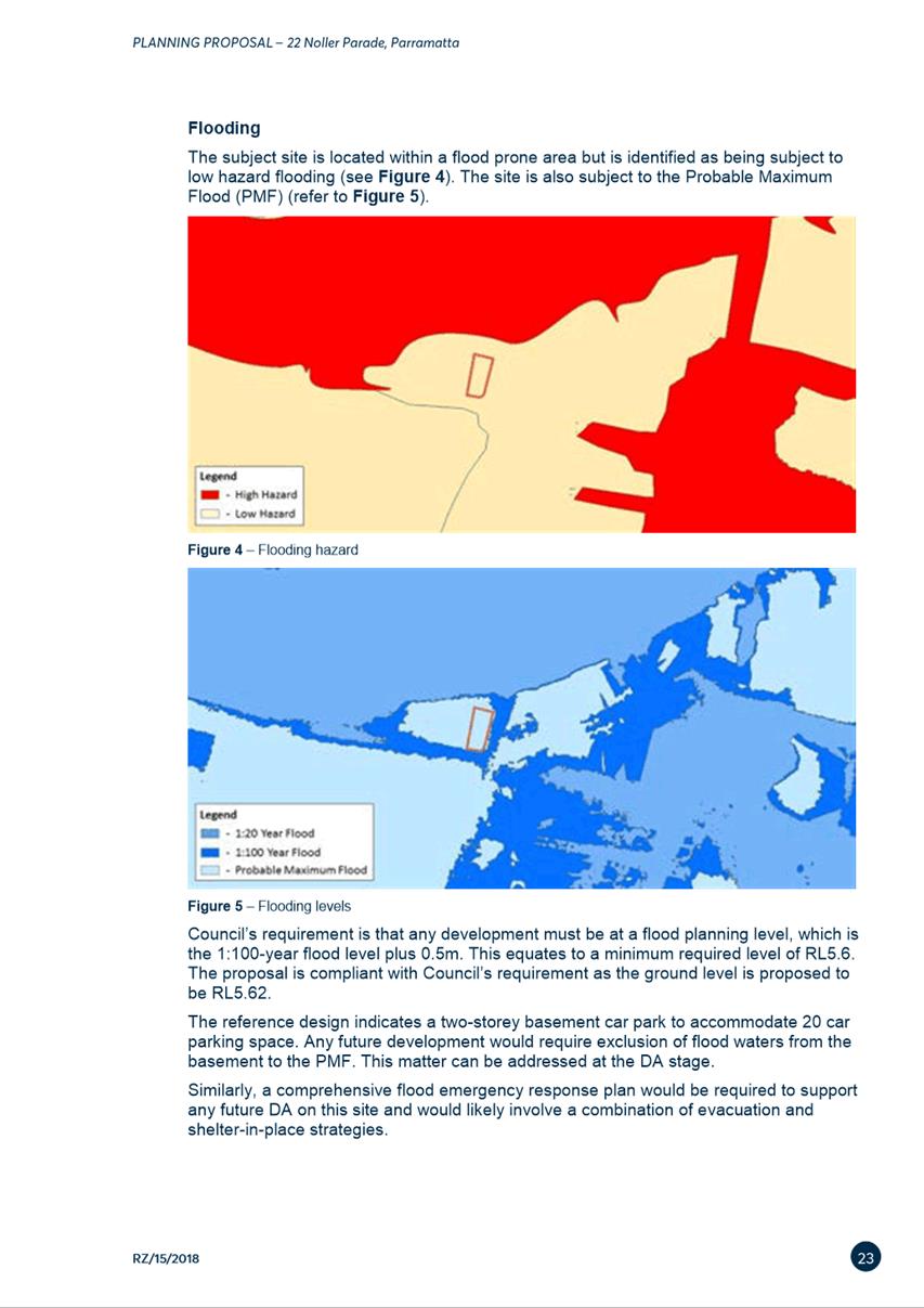
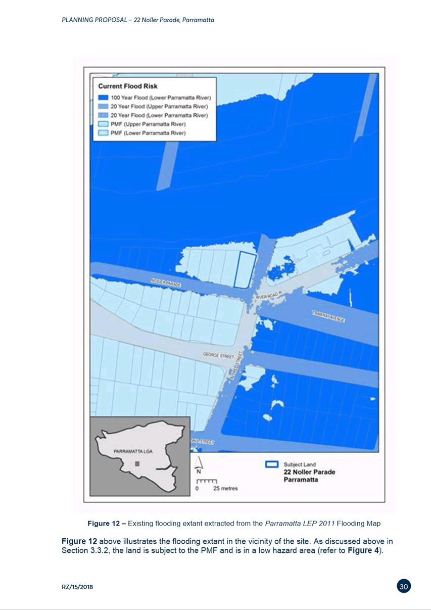
audio-visual means on Tuesday, 19 April 2022 at 3:30pm.
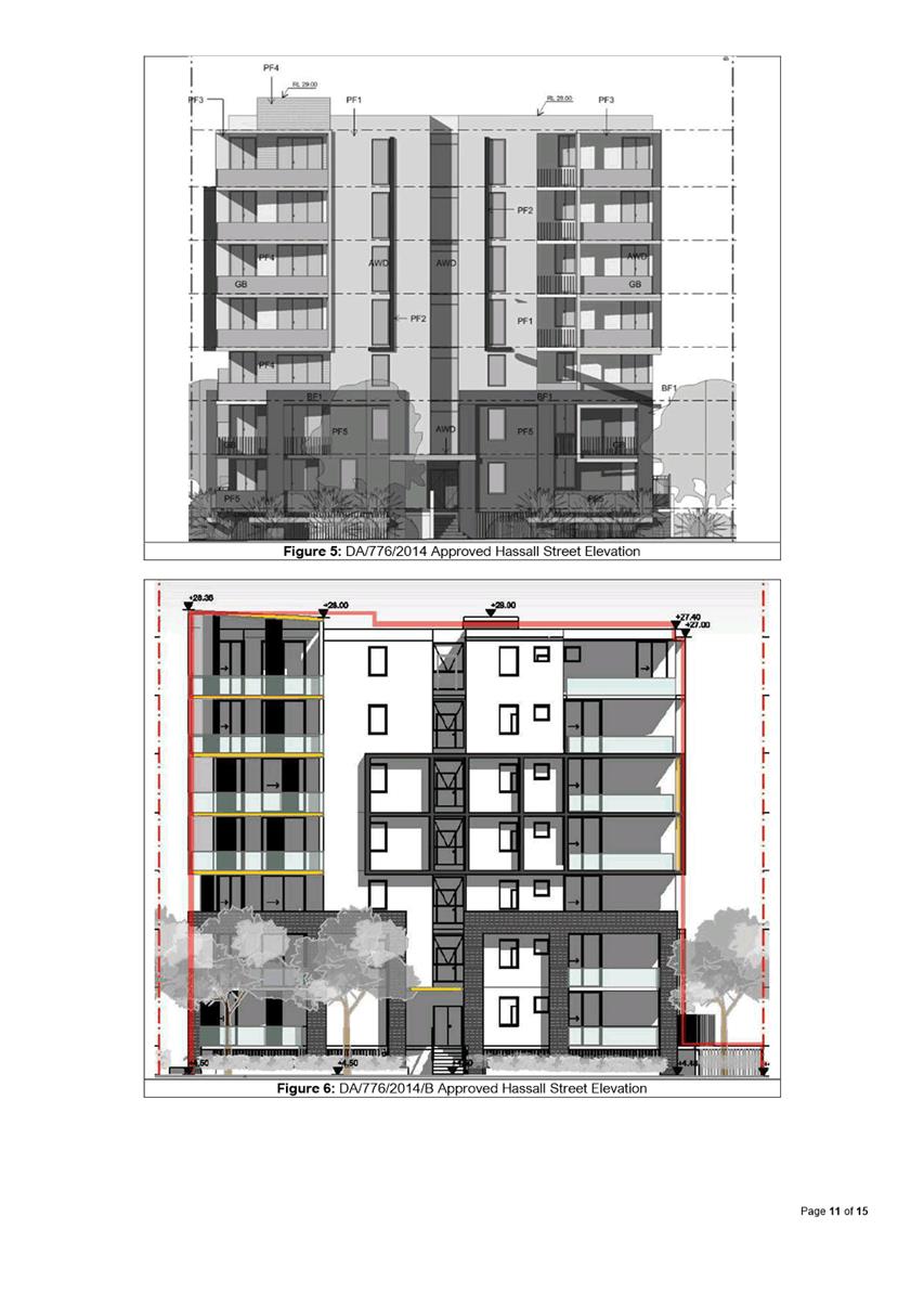
Brett Newman
CHIEF EXECUTIVE OFFICER
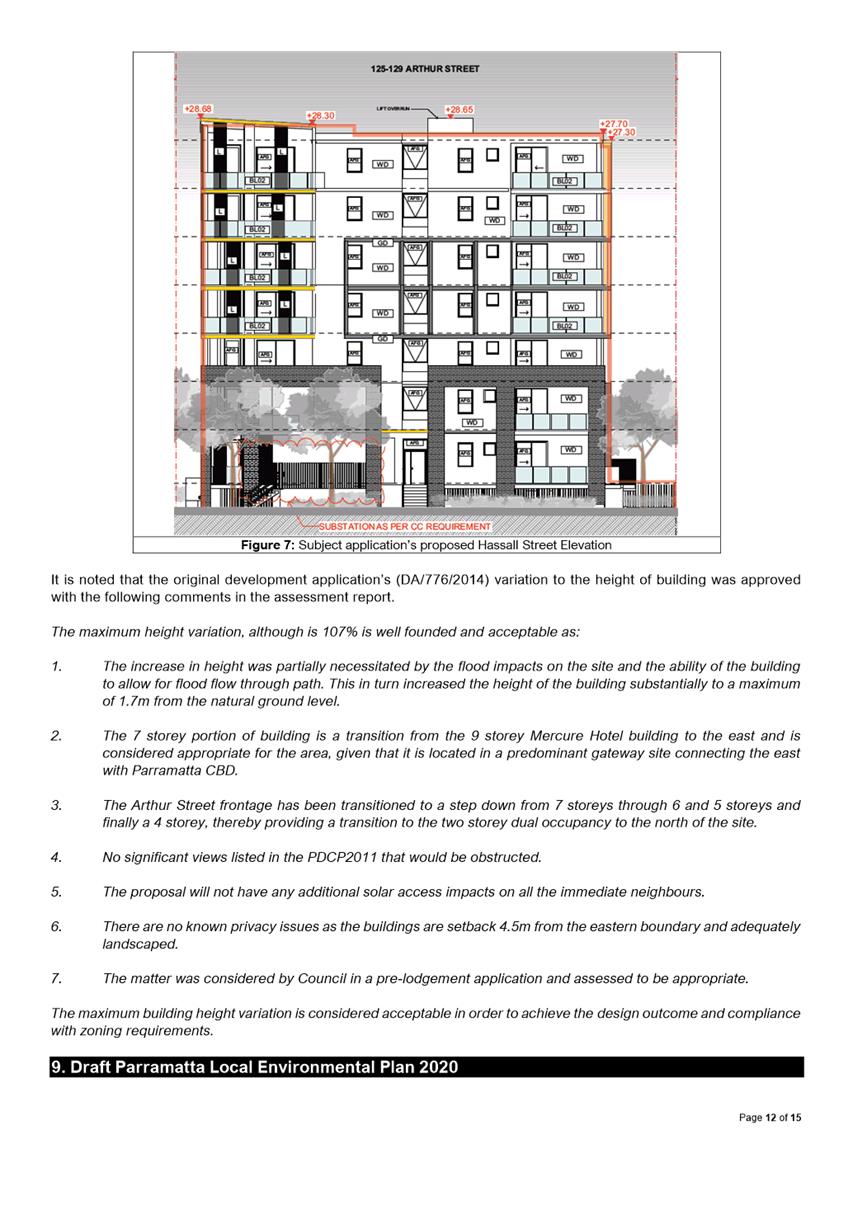
THIS PAGE LEFT BLANK INTENTIONALLY
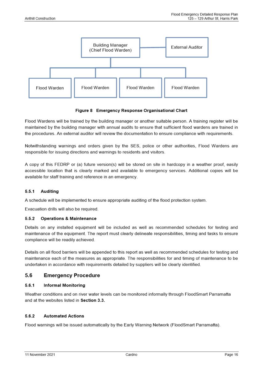
Local Planning Panel 19
April 2022
TABLE OF CONTENTS
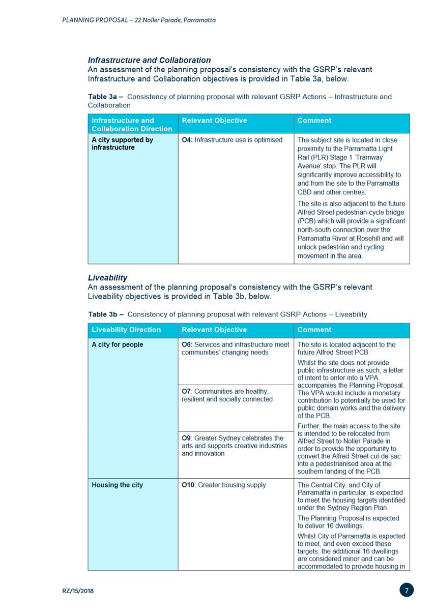
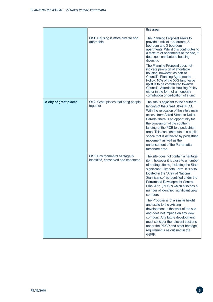
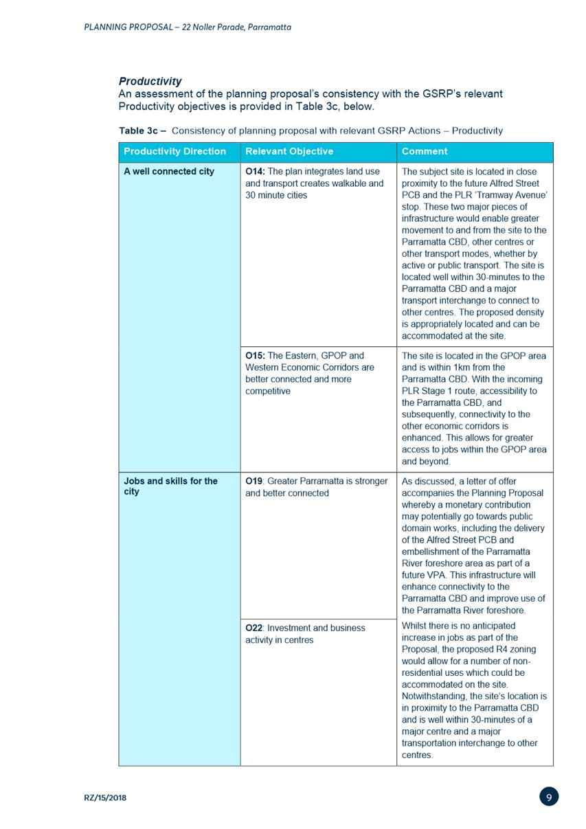
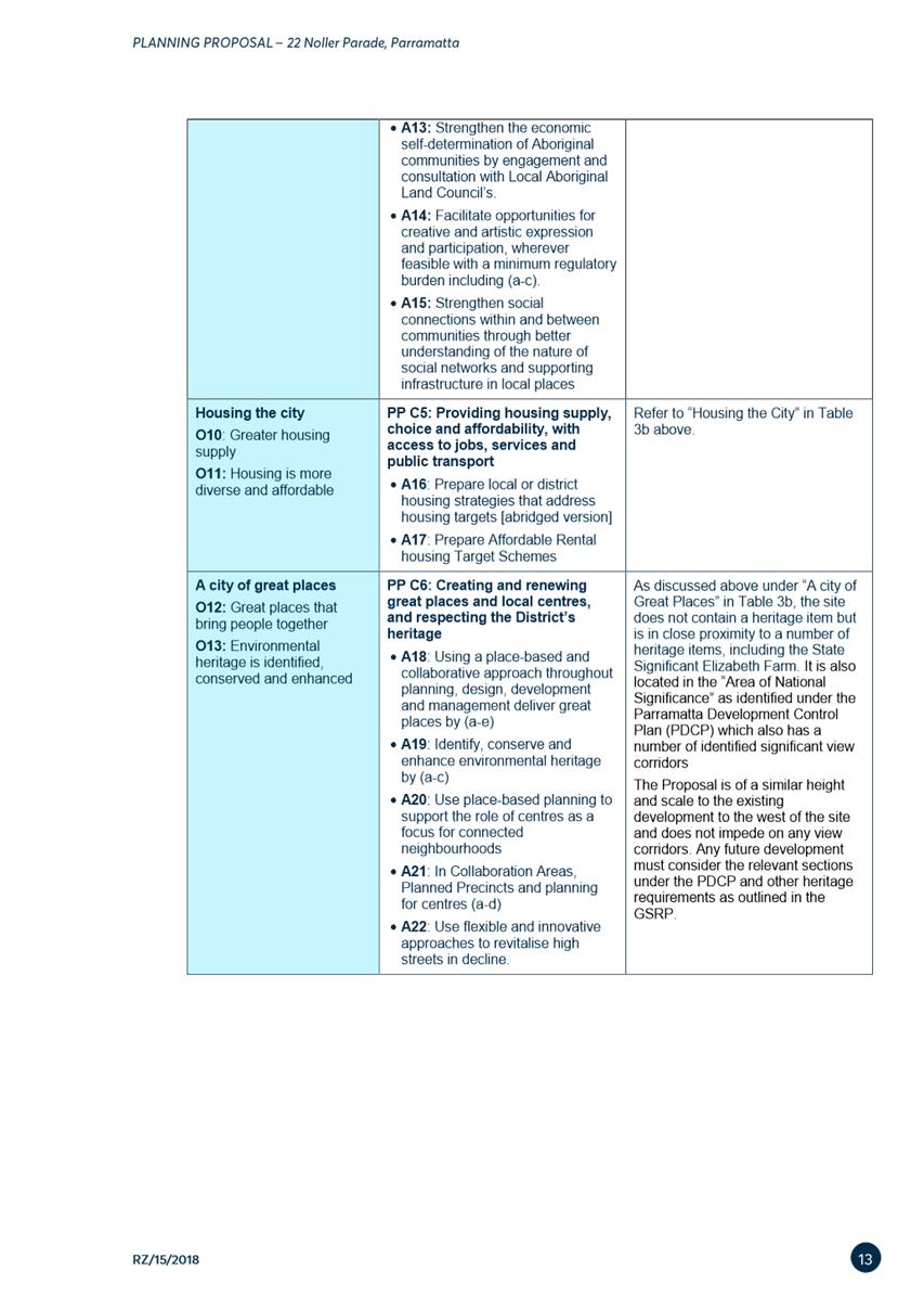
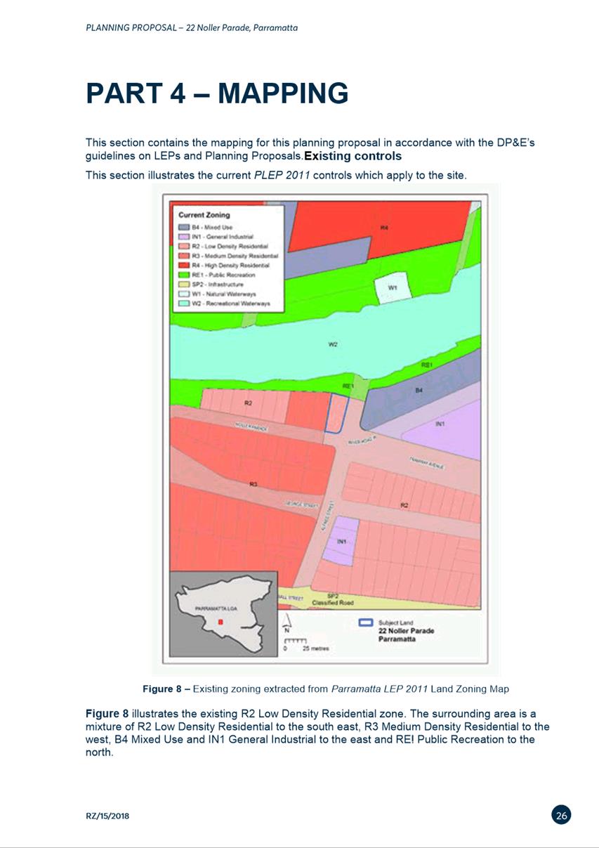
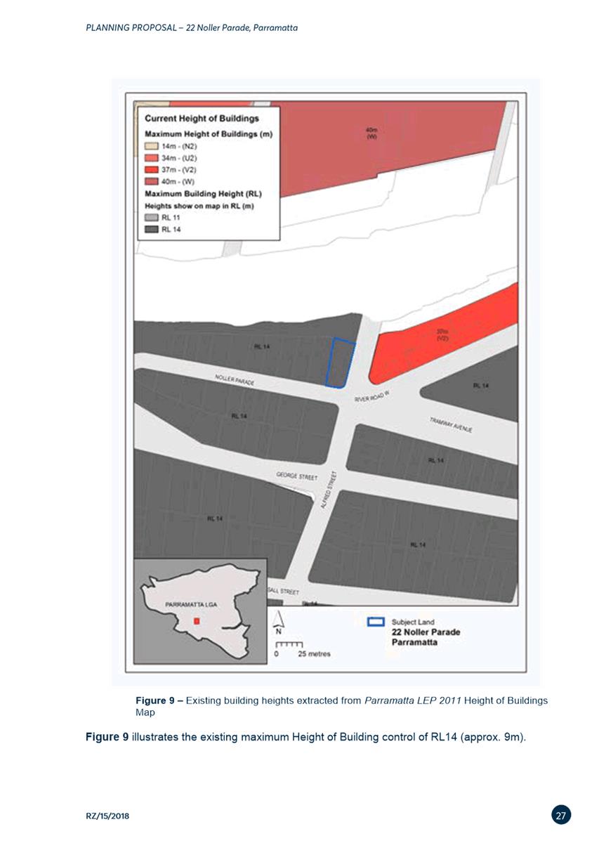
1 ACKNOWLEDGMENT
OF TRADITIONAL OWNERS OF LAND
The City of
Parramatta Council acknowledges the Burramattagal Clan of The Darug, the
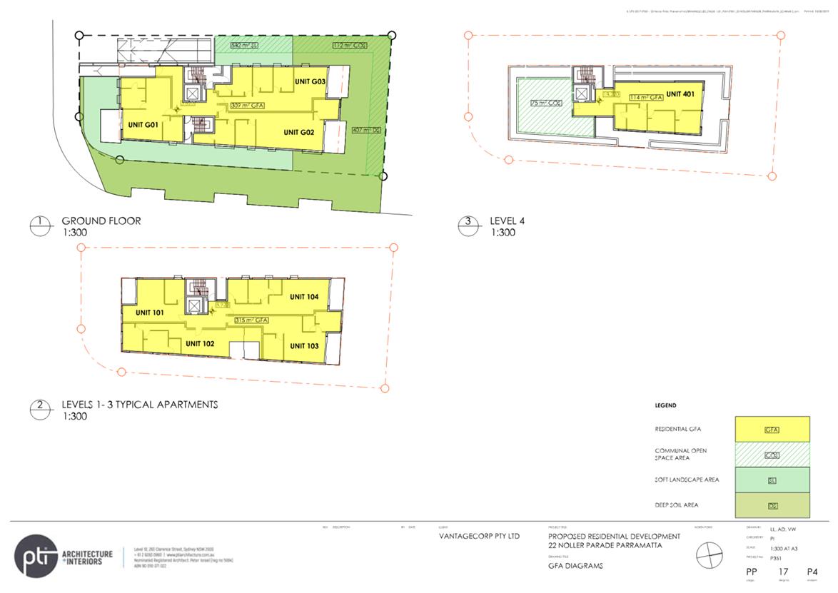
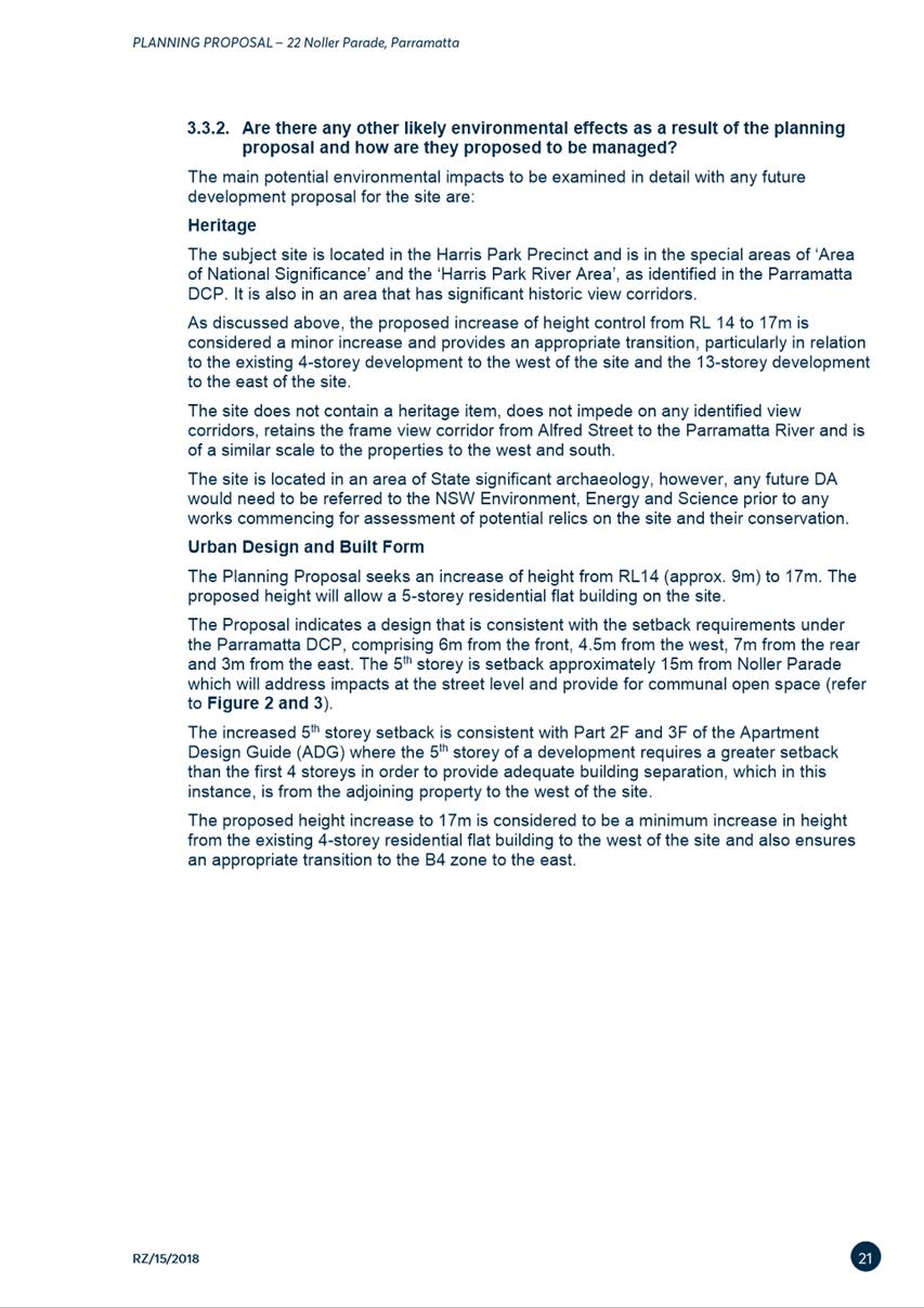
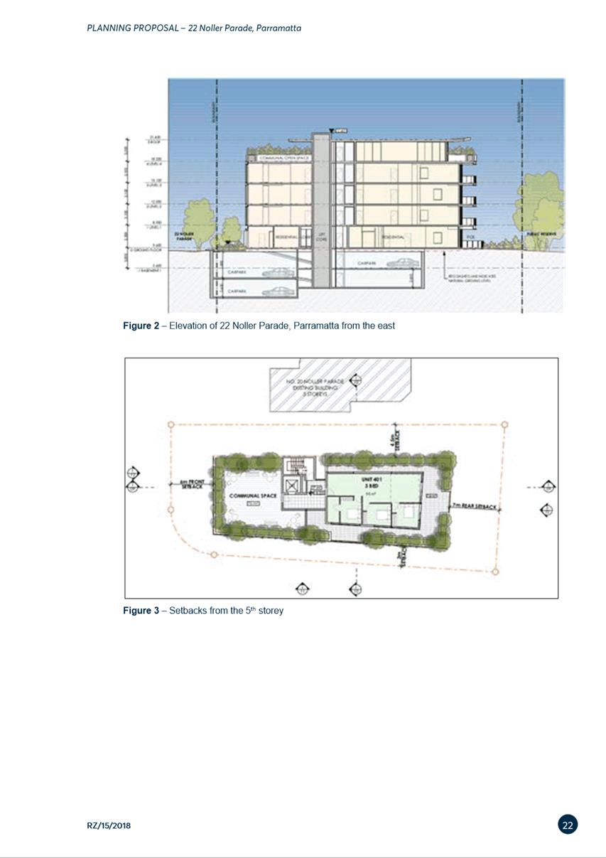
traditional custodians of Parramatta and pays its respects to the elders past,
and emerging.
2 WEBCASTING
ANNOUNCEMENT
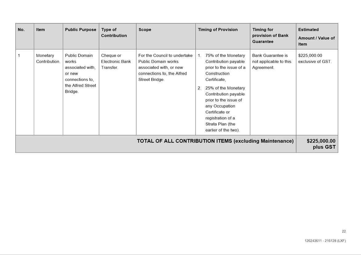
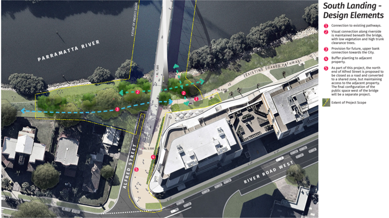
This public
meeting will be recorded. The recording will be archived and available on
Council’s website.
All care is taken to maintain your
privacy; however if you are in attendance in the public gallery, you should be
aware that your presence may be recorded.
3 APOLOGIES
4 DECLARATIONS
OF INTEREST
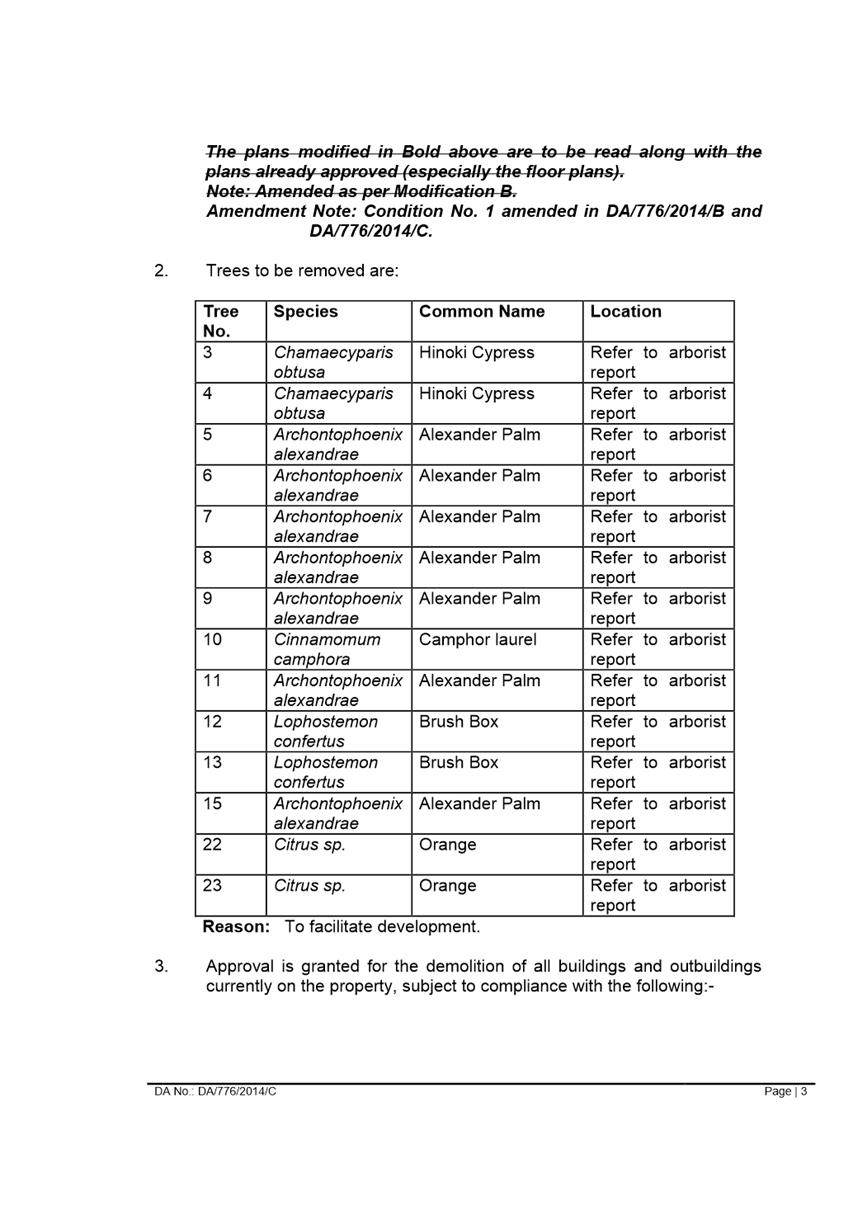
5 Reports - Development Applications
5.1 PUBLIC
MEETING:
57 Jenkins Road, CARLINGFORD (Lot 4 DP 663067)............................................................................. 6
5.2 OUTSIDE
PUBLIC MEETING:
125-129 Arthur Street, PARRAMATTA (Lots 5, 6 & 7 DP 27997).......................................................... 181
6 Innovative
6.1 Post
Exhibition report - Planning Proposal and draft Planning Agreement for land at
22 Noller Parade, Parramatta......................................................... 414
Development Applications
19 April 2022
5.1 PUBLIC
MEETING:
57 Jenkins Road, CARLINGFORD (Lot 4 DP 663067).......... 6
5.2 OUTSIDE
PUBLIC MEETING:
125-129 Arthur Street, PARRAMATTA (Lots 5, 6 & 7 DP 27997)........................................................................... 181
Local Planning Panel 19 April 2022 Item
5.1
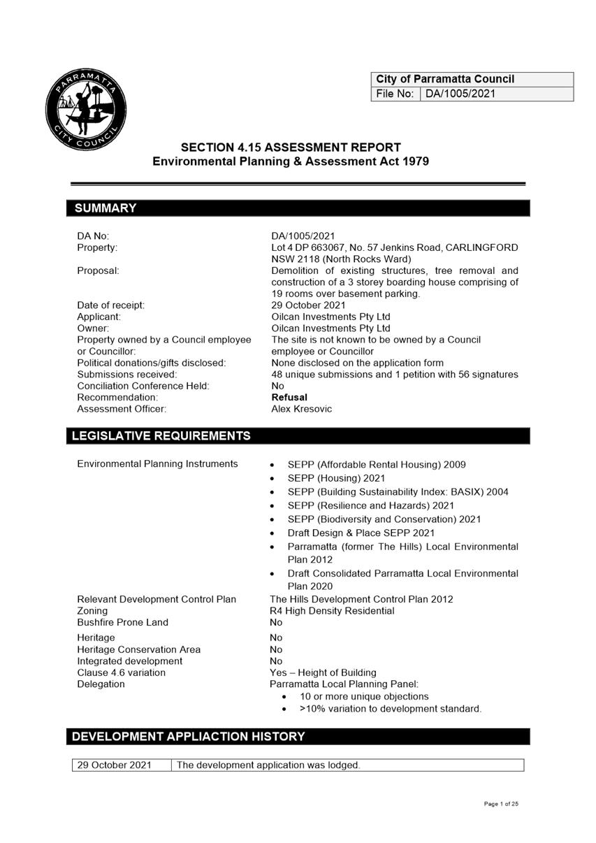
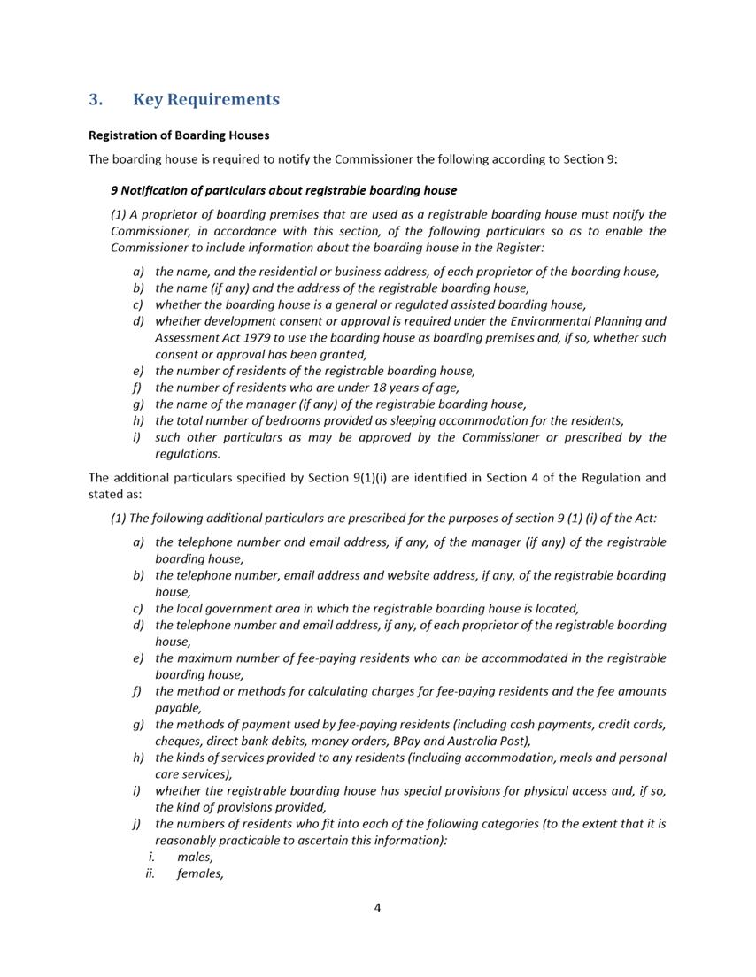
ITEM NUMBER 5.1
SUBJECT PUBLIC MEETING:
57 Jenkins Road, CARLINGFORD (Lot 4 DP 663067)
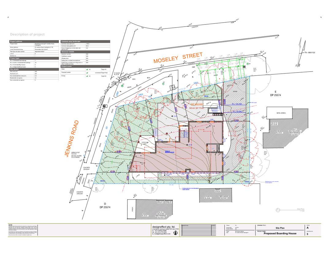
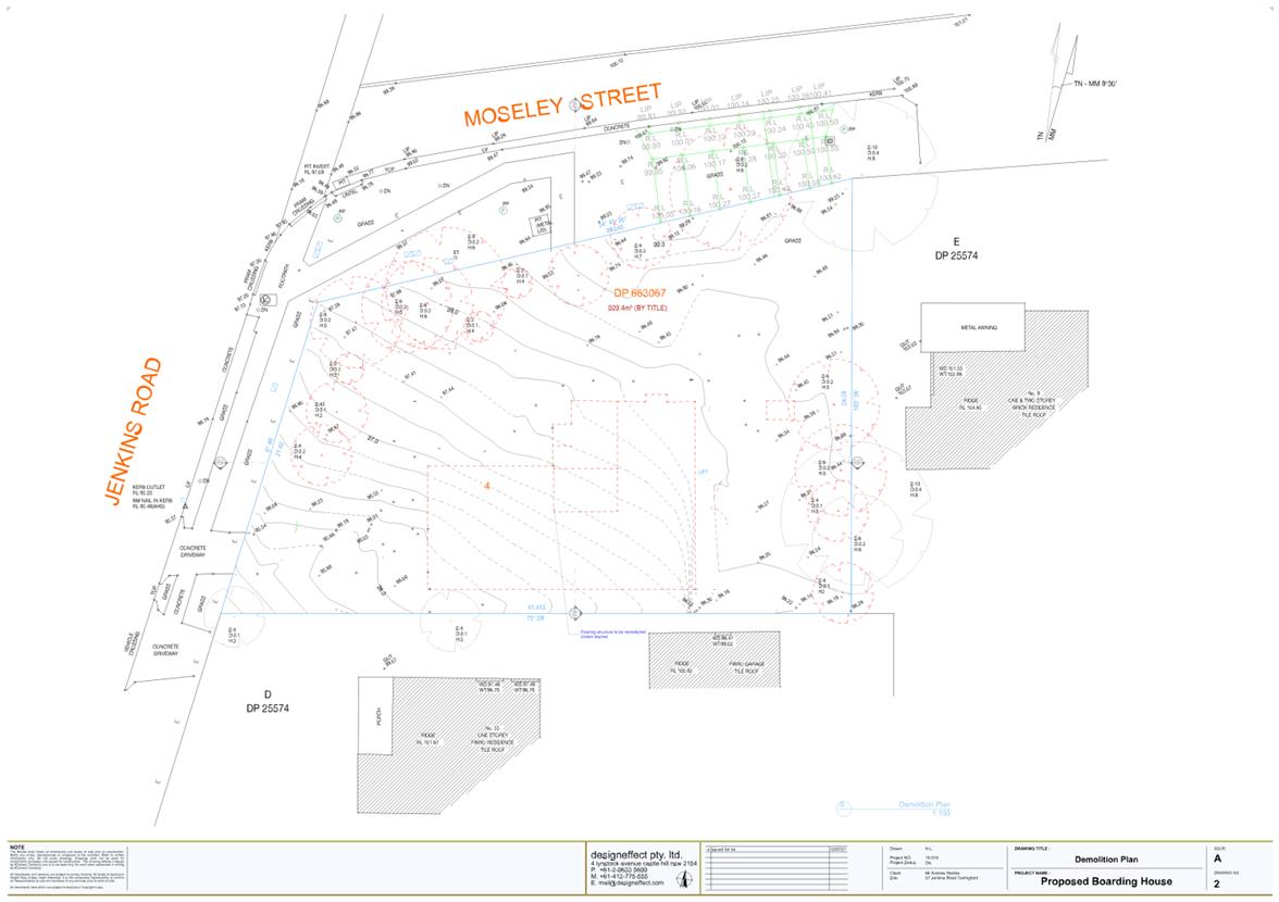
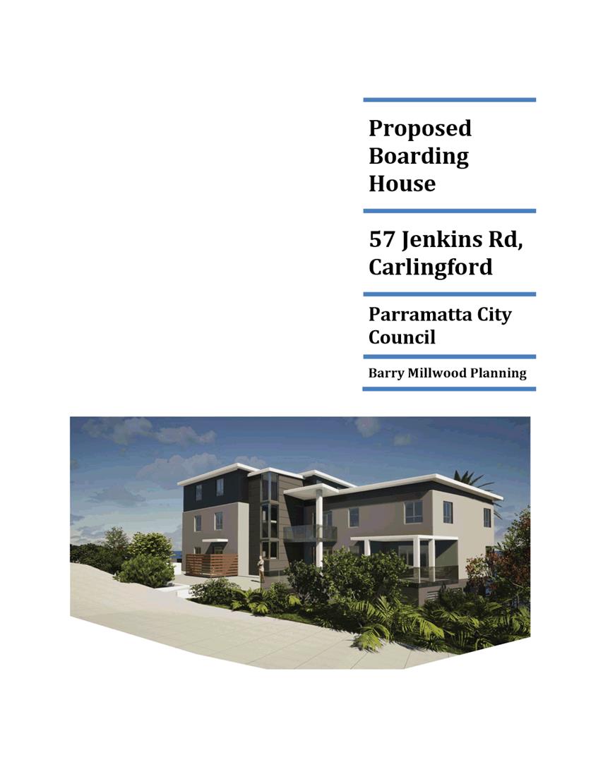
DESCRIPTION Demolition of existing structures, tree removal and construction of
a 3 storey boarding house comprising of 19 rooms over basement parking.
REFERENCE DA/1005/2021 - D08443246
APPLICANT/S Oilcan Investments Pty Ltd
OWNERS Oilcan Investments Pty Ltd
REPORT OF Group
Manager Development and Traffic Services
RECOMMENDED Refusal
DATE OF REPORT 23 MARCH 2022
REASON FOR
REFERRAL TO LPP
The application must be determined by the Parramatta Local
Planning Panel (PLPP) due to:
a) More
than 10% breach in Clause 4.3 Height of Building development standard; and
b) More
than 10 unique submissions by way of objection.
EXECUTIVE SUMMARY
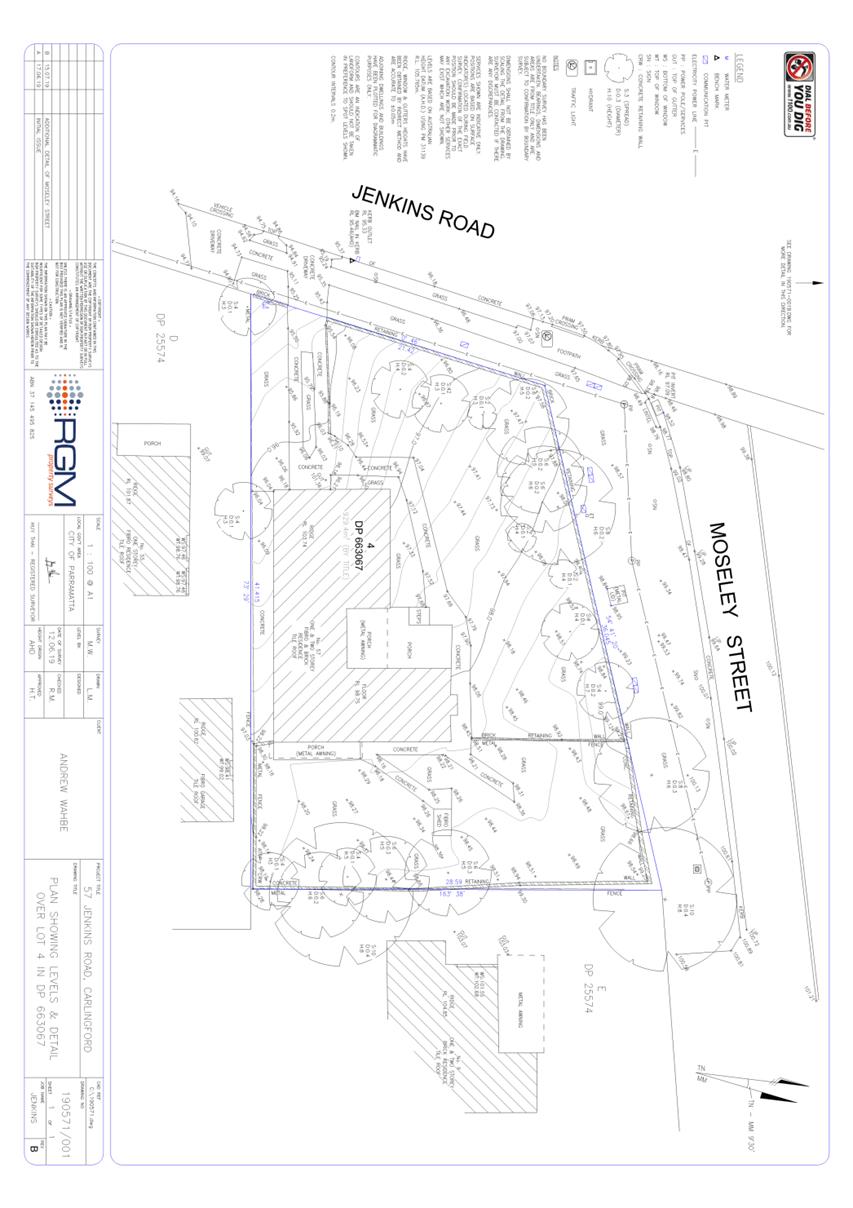
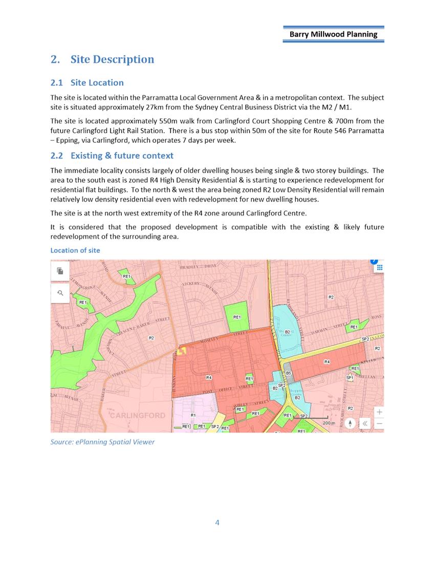
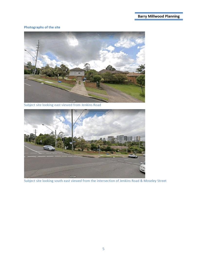
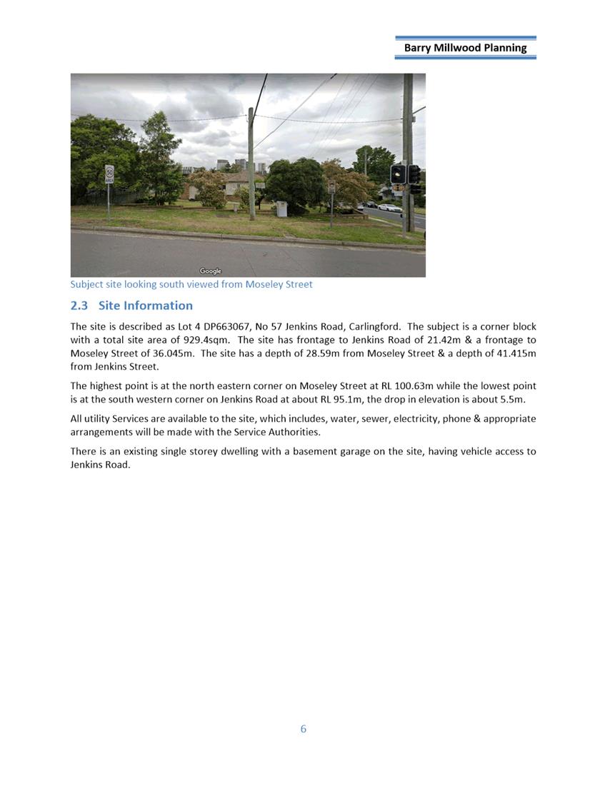
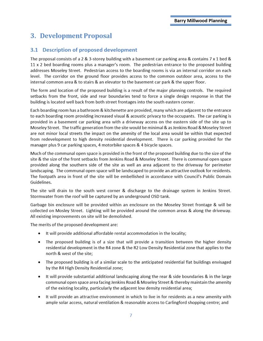
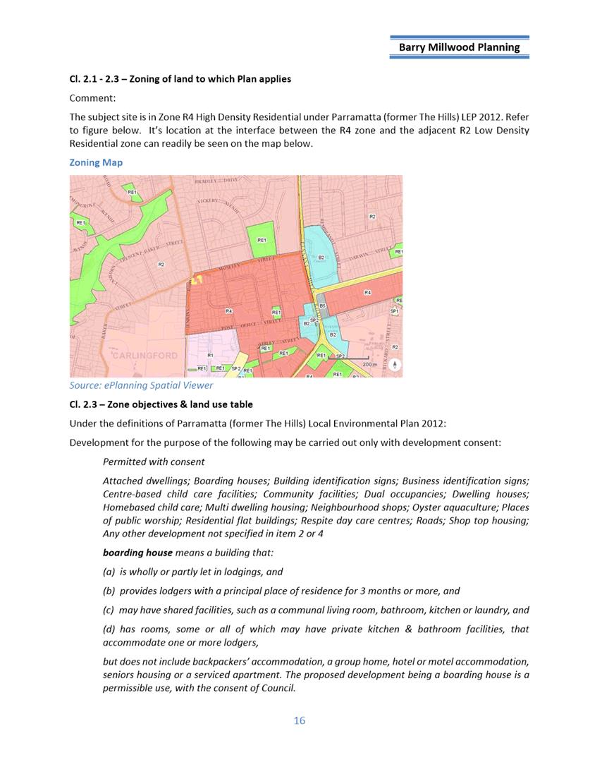
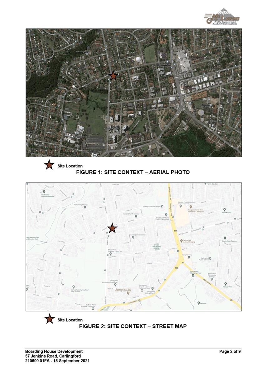
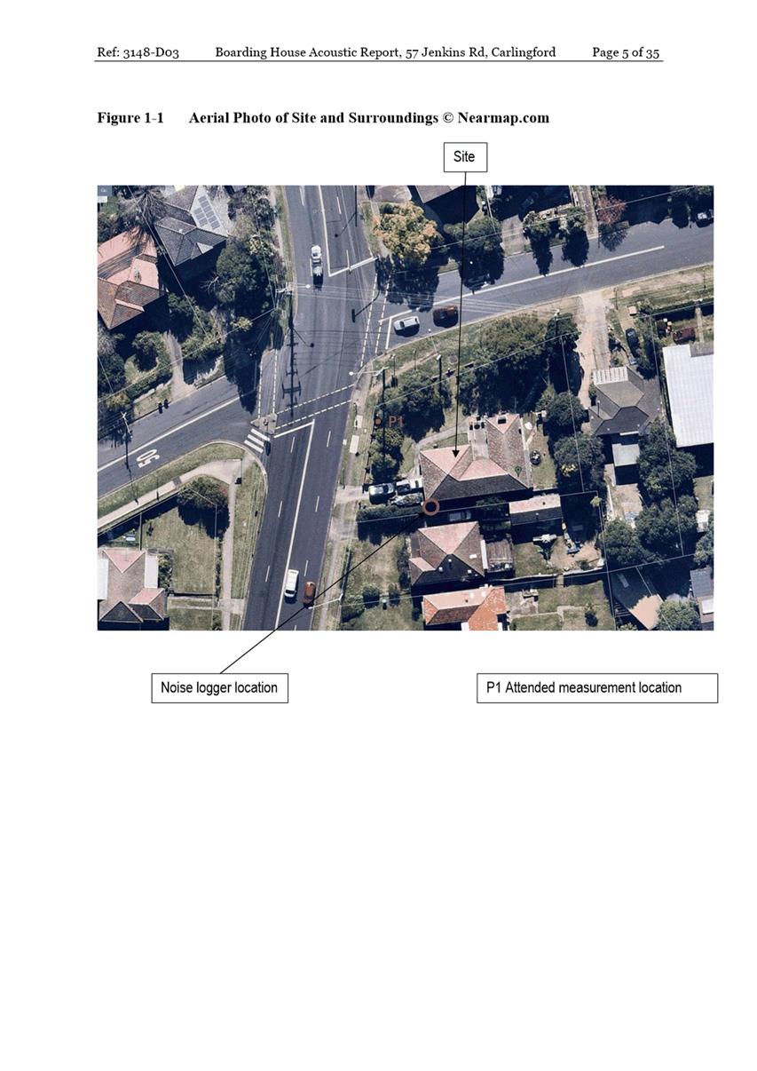
The Site
The subject site is legally identified as Lot 4 DP 663067
and is known as 57 Jenkins Road, Carlingford. The subject site is a corner
block with a total site area of 929.4sqm. The site has frontage to Jenkins Road
of 21.42m & a frontage to Moseley Street of 36.045m. The site has a depth
of 28.59m from Moseley Street & a depth of 41.415m from Jenkins Street.
The highest point is at the north-eastern corner on Moseley
Street at RL 100.63m while the lowest point is at the south-western corner on
Jenkins Road at about RL 95.1m, the drop in elevation is about 5.5m.
The subject site currently accommodates a single storey
weatherboard dwelling house with a basement garage with access off Moseley
Street. The subject site is located within an established residential area in
transition from existing detached dwellings to higher density residential
developments including residential flat buildings. Adjoining the subject site
to the north and south are single storey residential dwellings.
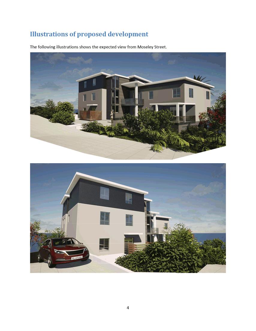
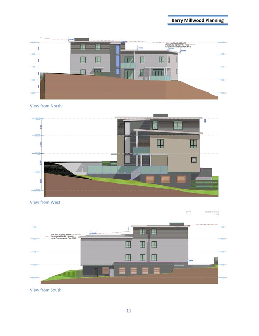
The Proposal
The proposal seeks consent for demolition of existing
structures, tree removal and construction of a three (3) storey boarding house
comprising of nineteen (19) rooms (twenty-nine (29) lodgers) over basement
parking.
The application was notified and advertised to the adjoining
and nearby properties from 10 November 2021 and 5 December 2021. In response,
48 unique submissions and 1 petition with 56 signatures were received.
Amended architectural plans were submitted to Council via
the NSW Planning Portal as per Section 37 of the EP&A Regulations 2021.
However, due to the amended architectural plans being holistically different to
what was originally submitted to Council, the plans were rejected as per
Section 38 of the EP&A Regulations 2021.
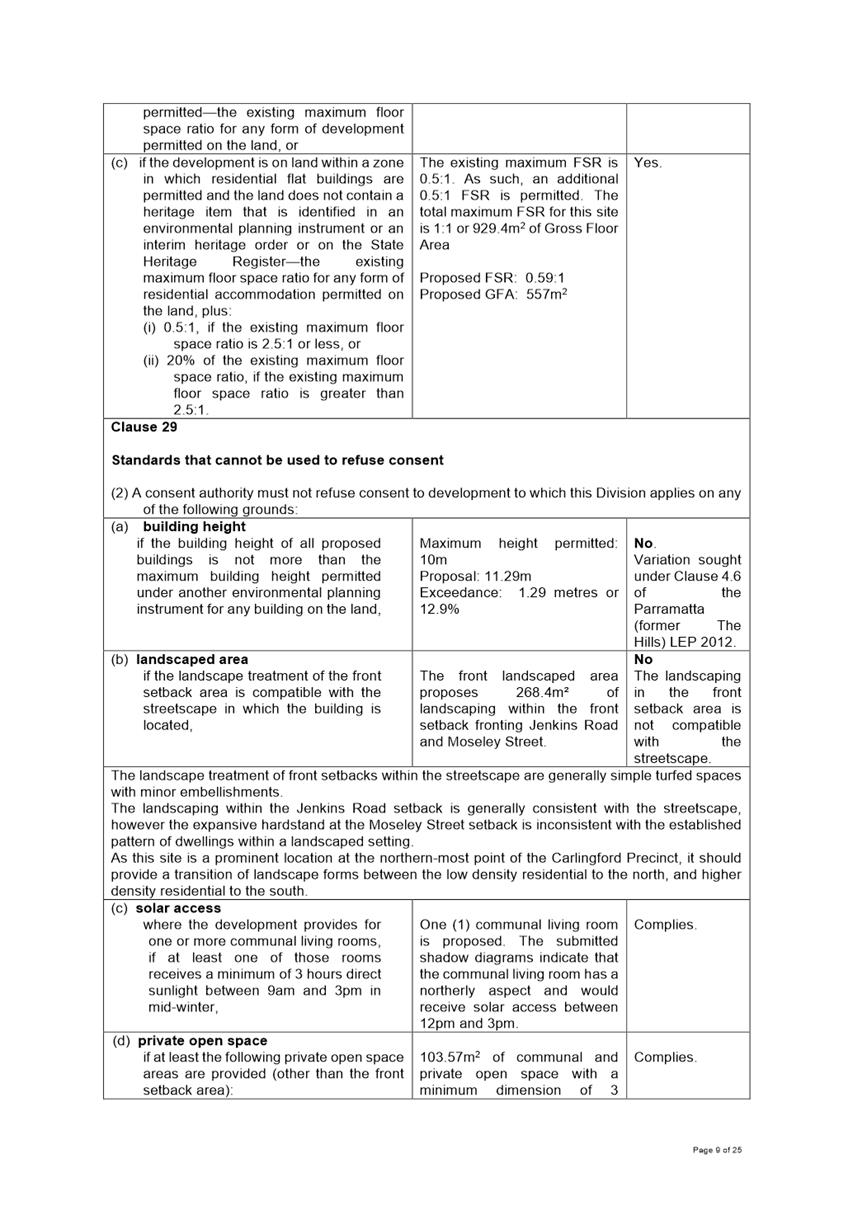
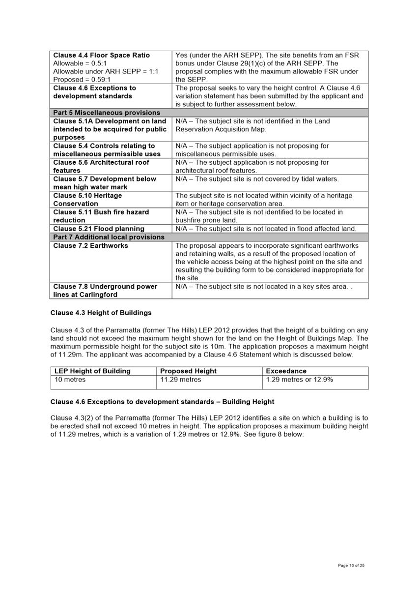
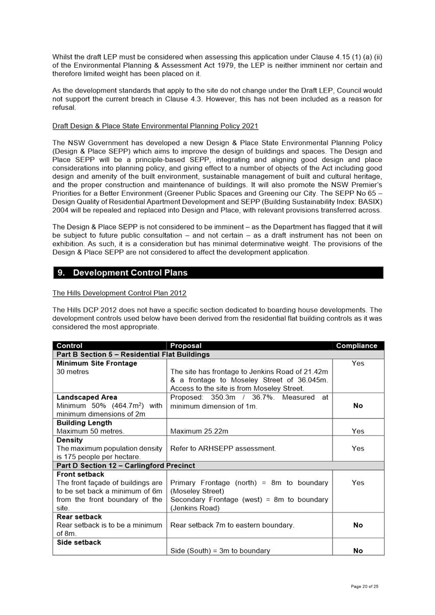
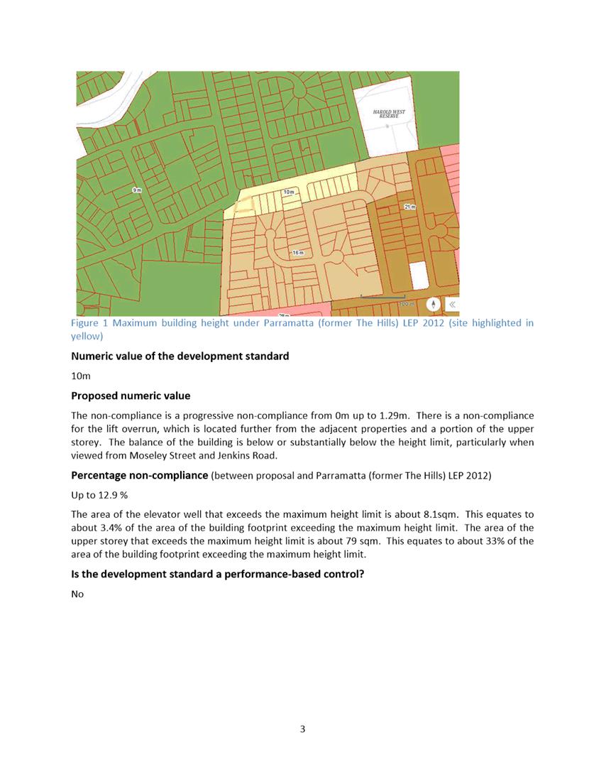
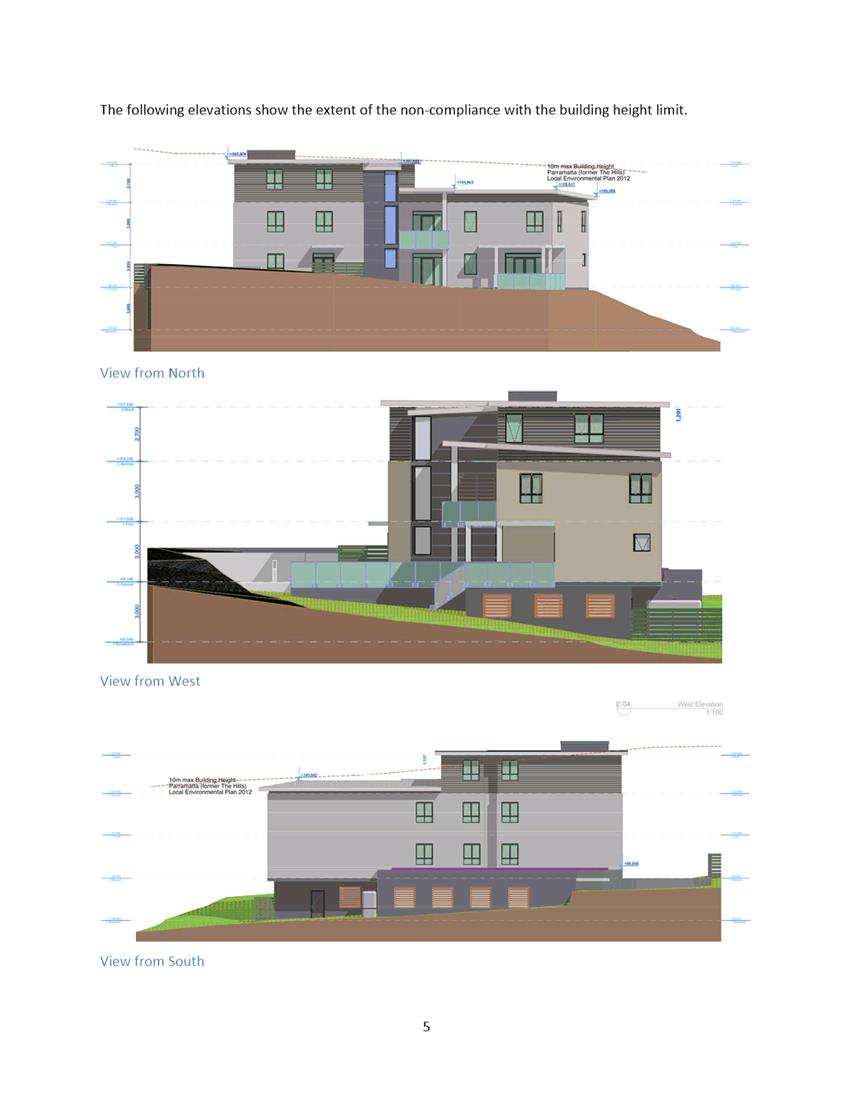
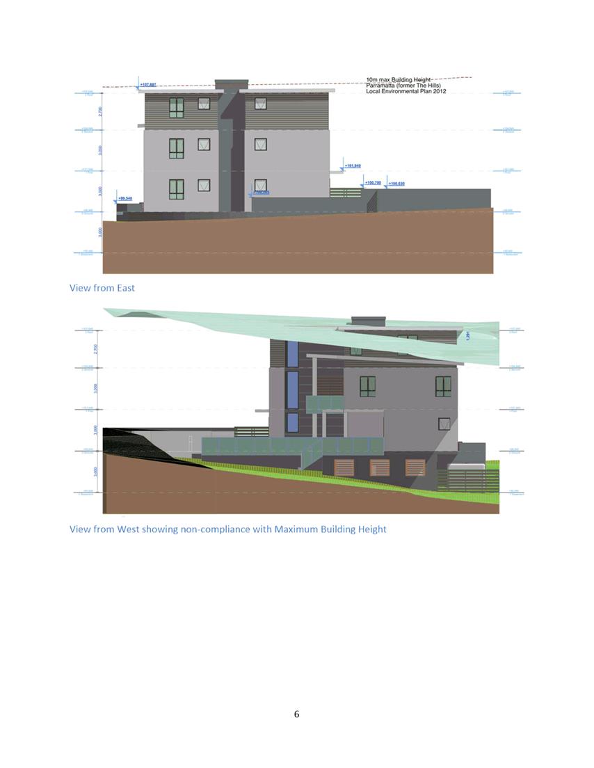
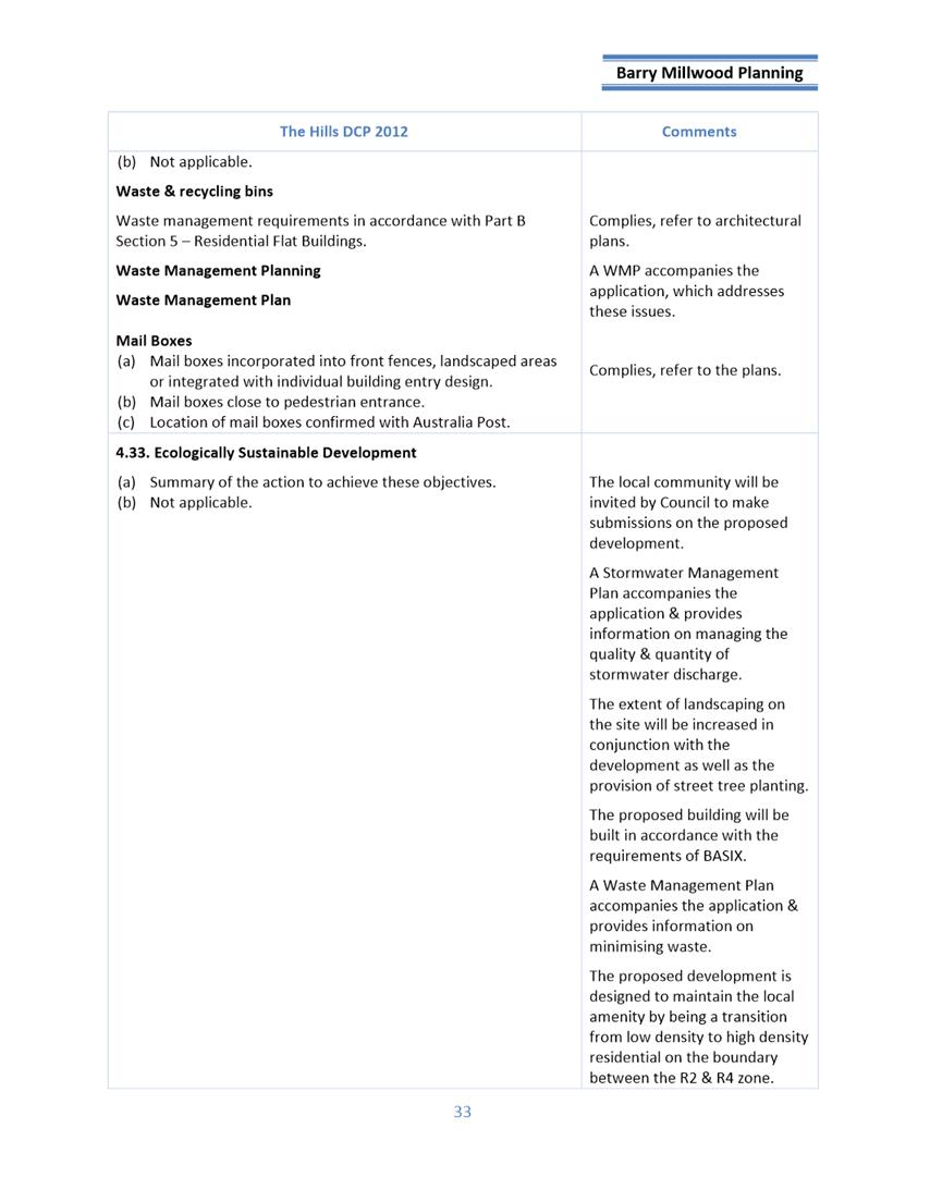
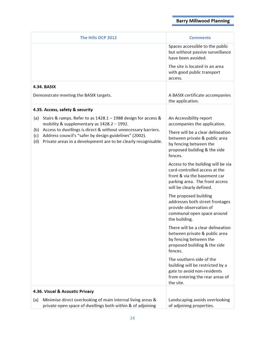
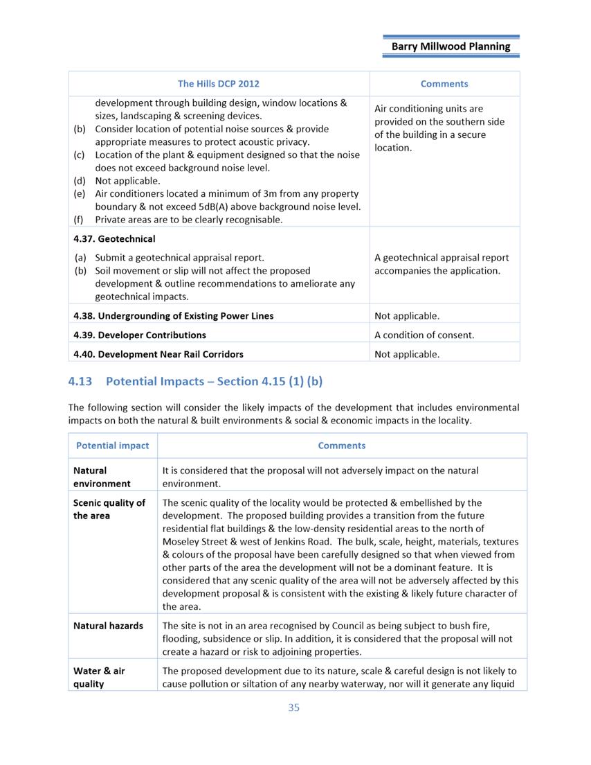
Clause 4.6
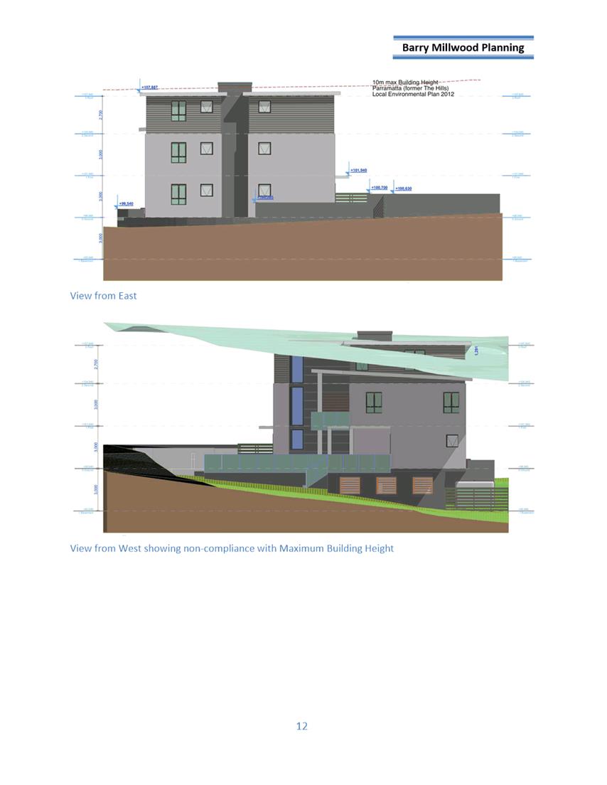
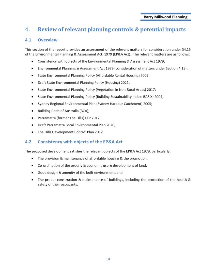
Clause 4.3 of the Parramatta (former The Hills) LEP 2011
provides that the height of a building on this site must not exceed 10m. The
proposed building height is 11.29m and seeks a variation of 1.29m or 12.9%.
Assessment
The application has been assessed against sections 4.15 of
the Environmental Planning and Assessment Act 1979, taking into consideration
all relevant state and local planning controls.
Having regard to the assessment of the proposal from a merit
perspective, Council officers do not have sufficient information to be
satisfied that the development is capable of compliance with the applicable
statutory planning framework.
It is considered that the proposal is preliminary and does
not adequately resolve site planning issues related to earthworks and built
form.
The proposal does not adequately respond to the site
constraints and does not satisfy statutory requirements for development consent
to be granted.
For these reasons, it is considered that the proposal is not
satisfactory having regard to the matters of consideration under Section 4.15
of the Environmental Planning and Assessment Act 1979 and is recommended for
refusal.
RECOMMENDATION
(a) That the Parramatta Local
Planning Panel, exercising the function as the consent authority pursuant to
Section 4.16 of the Environmental Planning and Assessment Act 1979, refuse
consent to Development Application No. DA/1005/2021 for Demolition of existing
structures, tree removal and construction of a 3-storey boarding house
comprising of 19 rooms over basement parking for the site at 57 Jenkins Road,
CARLINGFORD.
(b) Further, that submitters be
notified of the decision.
REASONS FOR REFUSAL
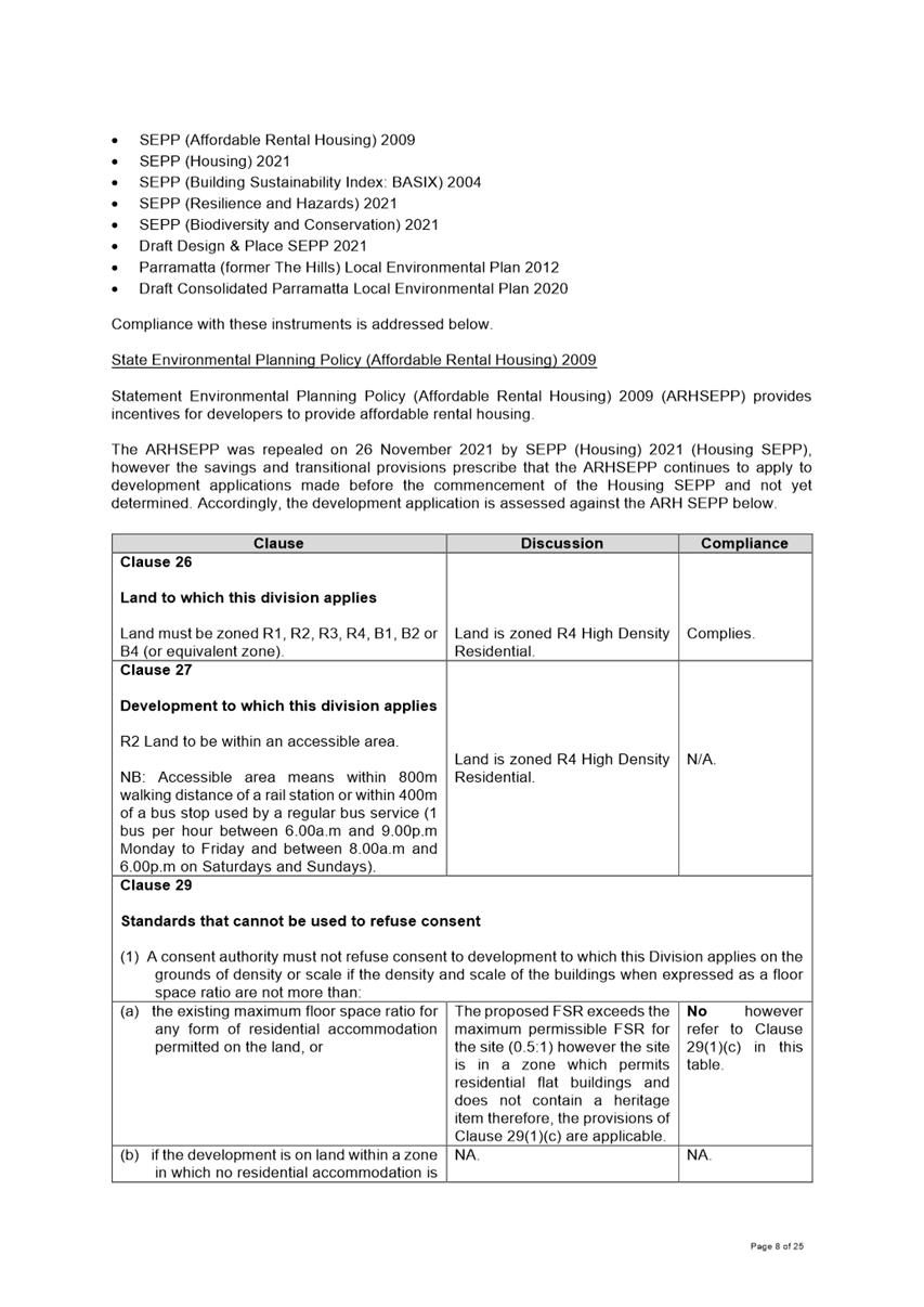
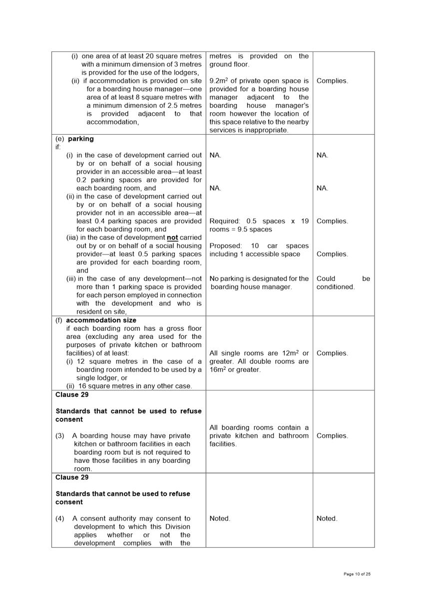
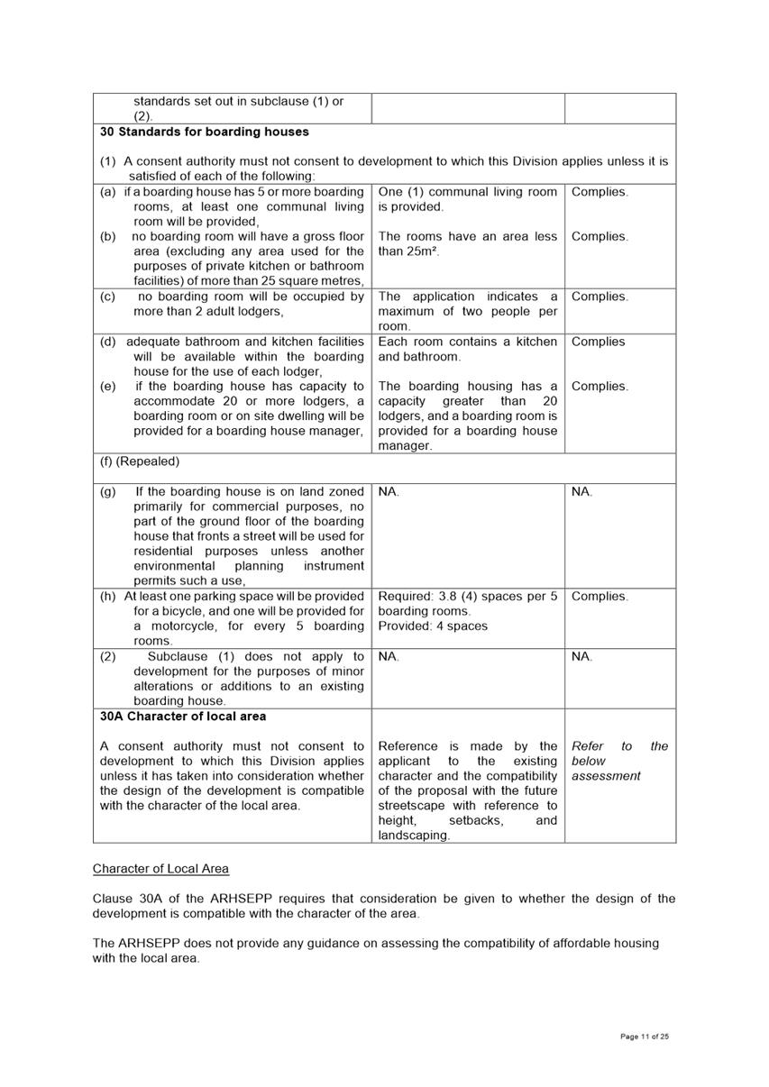
1. State Environmental
Planning Policy (Affordable Rental Housing) 2009
a) Clause 29(2)(a) - The
proposal exceeds the maximum Building Height onsite
b) Clause 29(2)(b) - The
proposed landscape treatment of the front setback area is compatible with the
streetscape in which the building is located
c) Clause 30A – The
development is not in keeping with the desired future character of the area
2. Parramatta Local
Environmental Plan 2011
a) Clause 4.3 – The
proposed development exceeds the 10m building height development standard
b) Clause 4.6 – The
written request to vary Clause 4.3 has not adequately demonstrated that
compliance with the development standard is unreasonable and unnecessary nor
has it provided sufficient environmental planning grounds to justify
contravening the development standard.
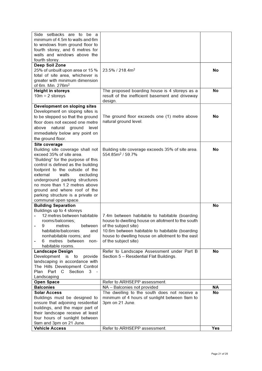
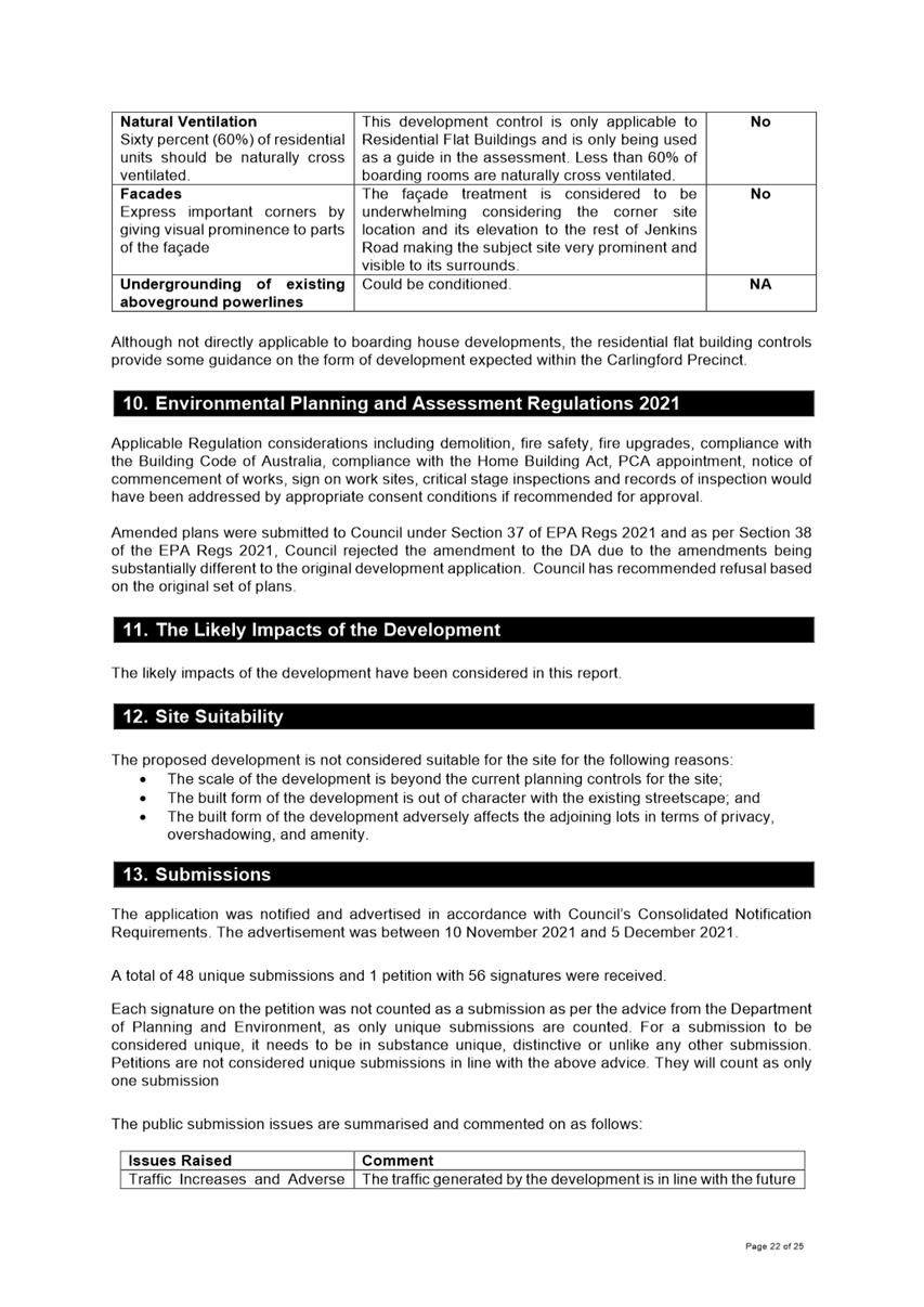
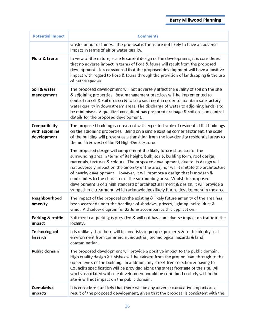
3. The Hills Development
Control Plan 2012
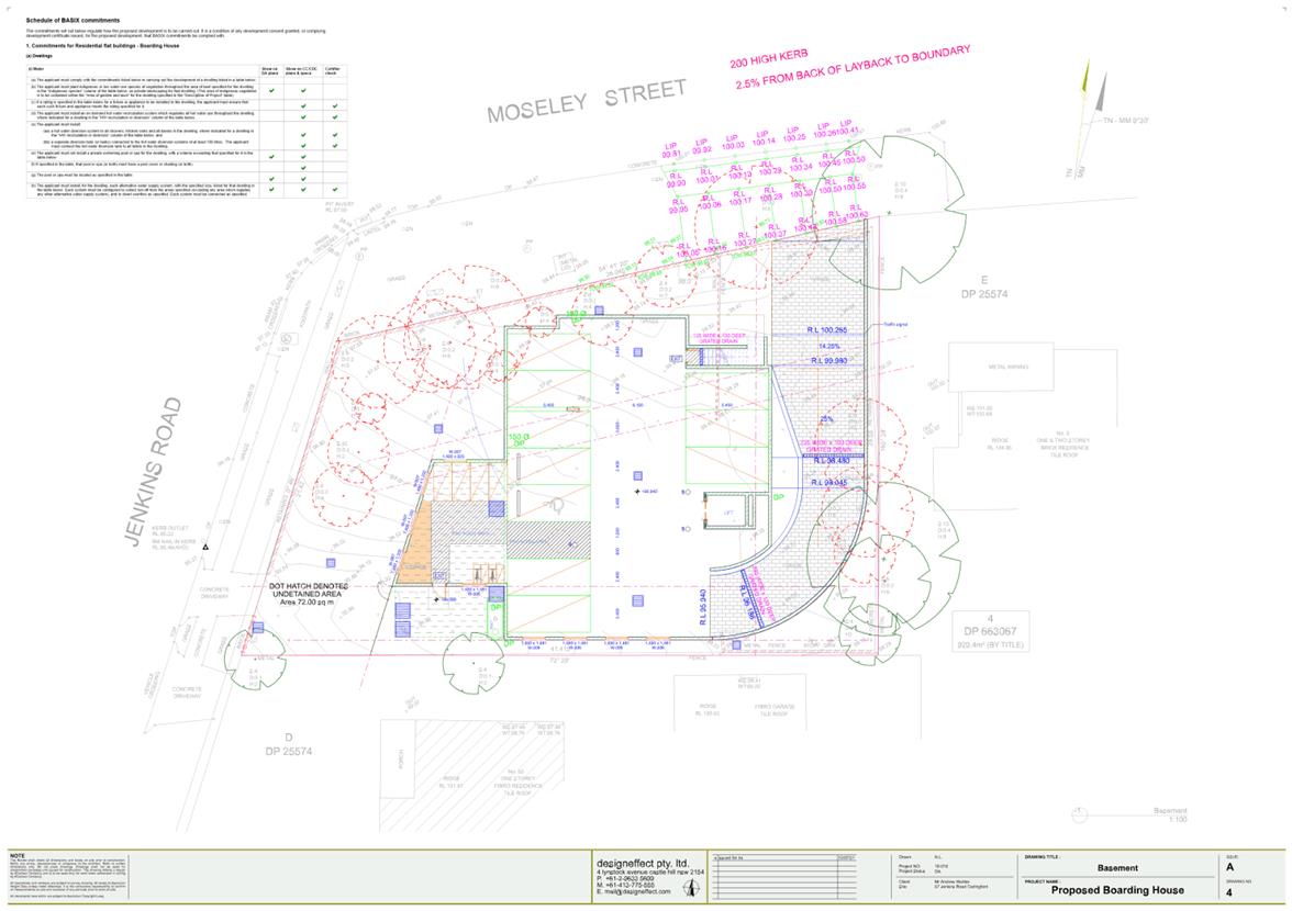
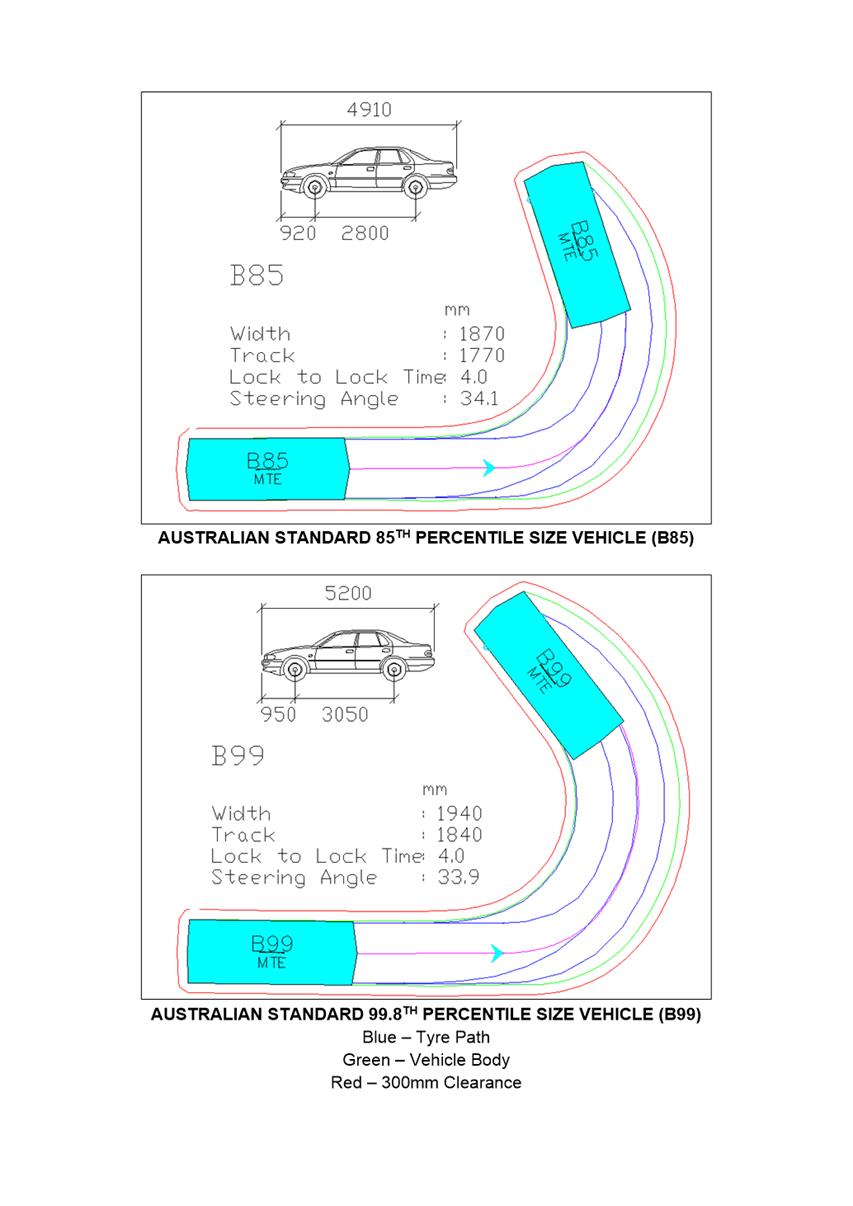
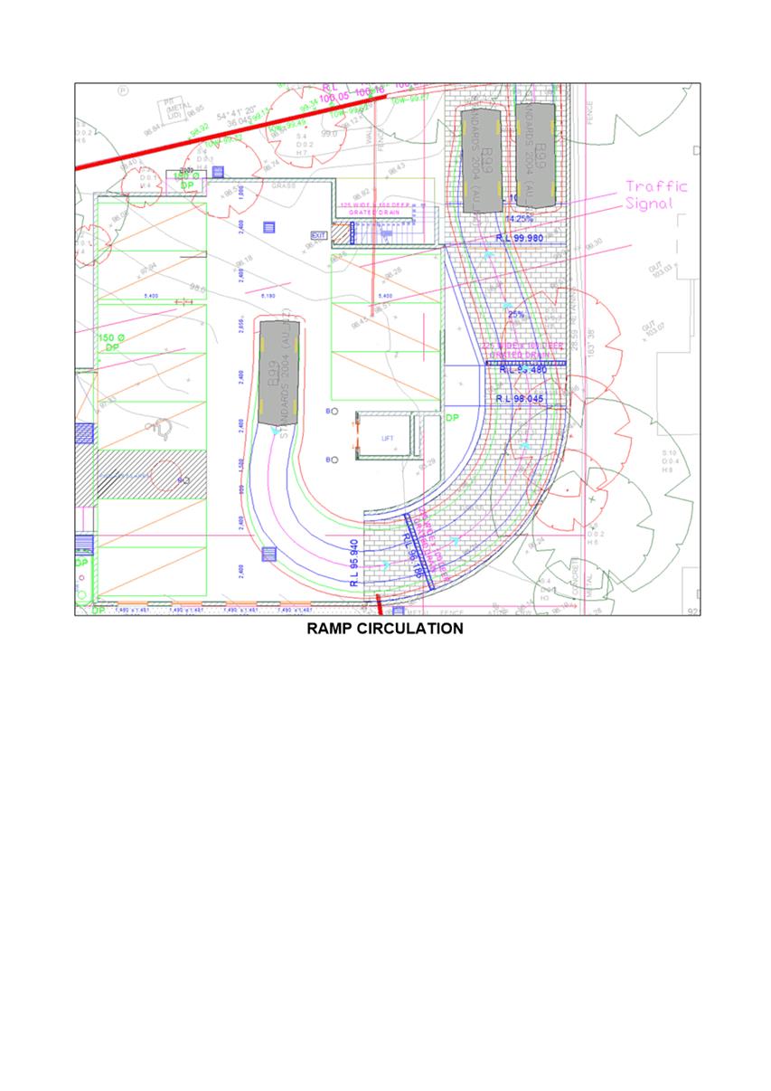
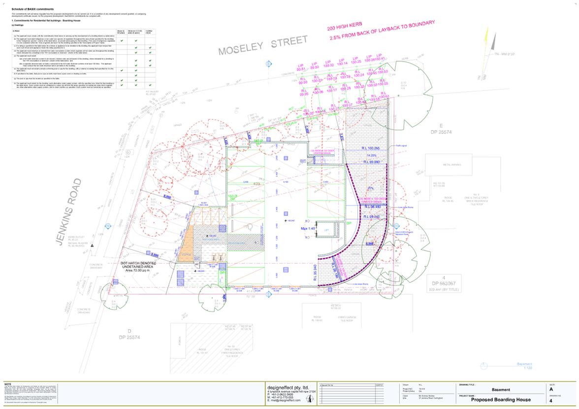
a) The proposed basement carpark
does not sufficiently demonstrate that vehicles are able to enter and exit in a
forward direction in the scenario when all car parking spaces are occupied.
b) The proposed development is
excessive in scale when considered against the current height of building and
amenity controls.
c) The proposed development
would result in an increase in shadows cast over adjoining properties, in
particular the southern dwelling.
d) The motorcycle parking
arrangement is poorly configured that it has made it inaccessible.
e) The ground floor exceeds one
(1) metre above natural ground level as a result of the inefficient driveway
and basement design.
f) Insufficient side
setback provided.
g) Insufficient landscaping and
deep soil zones provided.
h) Access for people with
disabilities is not adequately addressed.
4. Public Interest
a) The development is not in the
public interest.
Alex Kresovic
Development Assessment Officer
Sarah Irani
Team Leader Development Support
Attachments:
|
1⇩ 
|
Draft Assessment Report - 57 Jenkins Rd
CARLINGFORD - DA/1005/2021
|
25 Pages
|
|
|
2⇩
|
Locality Map - 57 Jenkins Rd CARLINGFORD
- DA/1005/2021
|
1 Page
|
|
|
3⇩
|
Architectural and Landscape Plans used
during assessment - 57 Jenkins Rd CARLINGFORD - DA/1005/2021
|
12 Pages
|
|
|
4
|
Internal Plans used during assessment -
57 Jenkins Rd CARLINGFORD - DA/1005/2021 (confidential)
|
3 Pages
|
|
|
5⇩
|
Clause 4.6 Statement used during
assessment - 57 Jenkins Rd CARLINGFORD - DA/1005/2021
|
17 Pages
|
|
|
6⇩
|
Statement of Environmental Effects used
during assessment - 57 Jenkins Rd CARLINGFORD - DA/1005/2021
|
44 Pages
|
|
|
7⇩
|
Social Impact Assessment used during
assessment - 57 Jenkins Rd CARLINGFORD - DA/1005/2021
|
7 Pages
|
|
|
8⇩
|
Plan of Management used during assessment
- 57 Jenkins Rd CARLINGFORD - DA/1005/2021
|
14 Pages
|
|
|
9⇩
|
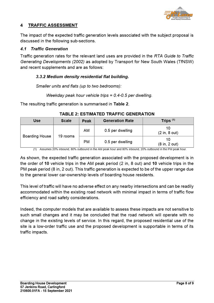
Traffic Report used during assessment -
57 Jenkins Rd CARLINGFORD - DA/1005/2021
|
18 Pages
|
|
|
10⇩
|
Acoustic Report used during assessment -
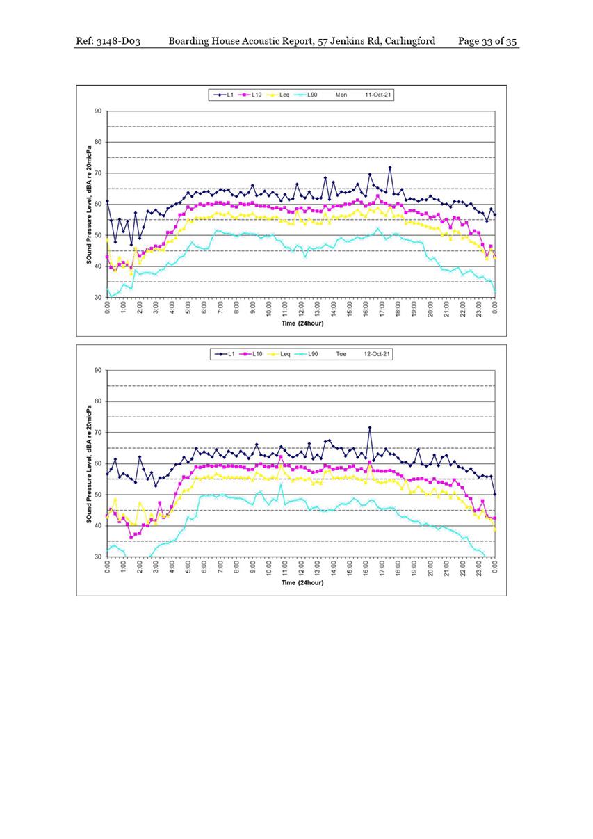
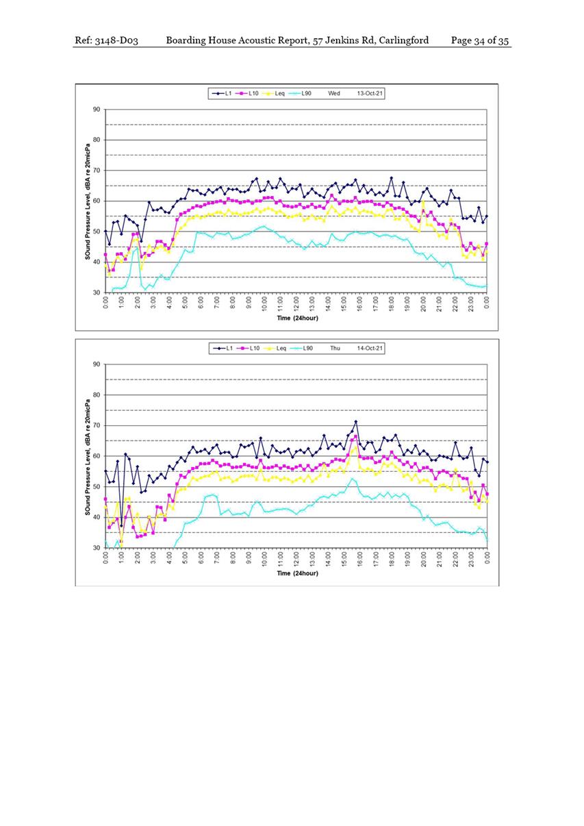
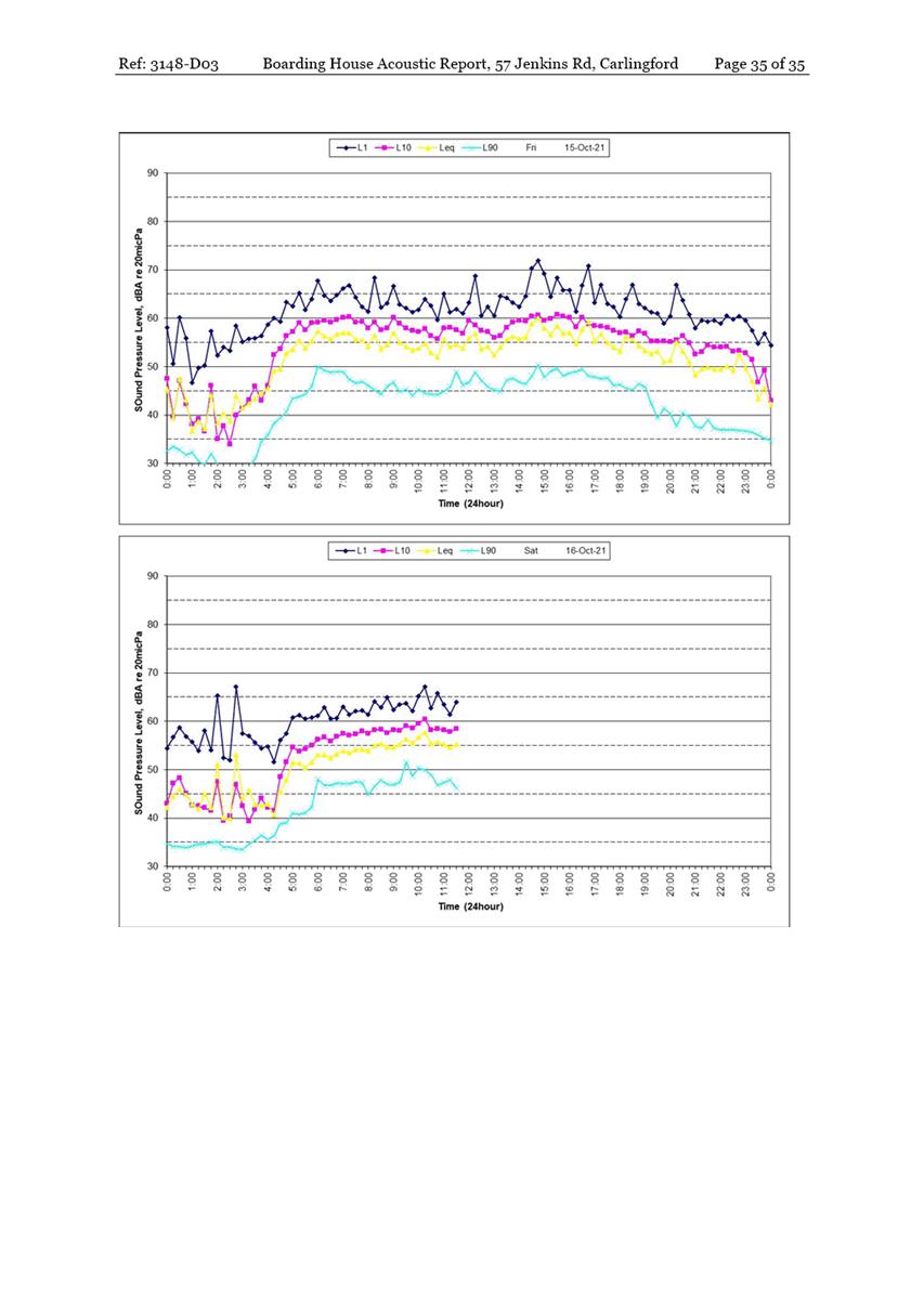
57 Jenkins Rd CARLINGFORD - DA/1005/2021
|
33 Pages
|
|
REFERENCE MATERIAL
|
Item 5.1 - Attachment
1
|
Draft Assessment Report - 57 Jenkins Rd CARLINGFORD
- DA/1005/2021
|
|
Item 5.1 - Attachment 2
|
Locality Map - 57 Jenkins Rd CARLINGFORD -
DA/1005/2021
|
|
Item 5.1 - Attachment
3
|
Architectural and Landscape Plans used during
assessment - 57 Jenkins Rd CARLINGFORD - DA/1005/2021
|
|
Item 5.1 - Attachment
5
|
Clause 4.6 Statement used during assessment - 57
Jenkins Rd CARLINGFORD - DA/1005/2021
|
|
Item 5.1 - Attachment 6
|
Statement of Environmental Effects used during
assessment - 57 Jenkins Rd CARLINGFORD - DA/1005/2021
|

|
Item 5.1 - Attachment 7
|
Social Impact Assessment used during assessment - 57
Jenkins Rd CARLINGFORD - DA/1005/2021
|
|
Item 5.1 - Attachment 8
|
Plan of Management used during assessment - 57
Jenkins Rd CARLINGFORD - DA/1005/2021
|
|
Item 5.1 - Attachment 9
|
Traffic Report used during assessment - 57 Jenkins
Rd CARLINGFORD - DA/1005/2021
|

|
Item 5.1 - Attachment 10
|
Acoustic Report used during assessment - 57 Jenkins
Rd CARLINGFORD - DA/1005/2021
|

Local
Planning Panel 19 April 2022 Item
5.2
ITEM NUMBER 5.2
SUBJECT OUTSIDE PUBLIC MEETING:
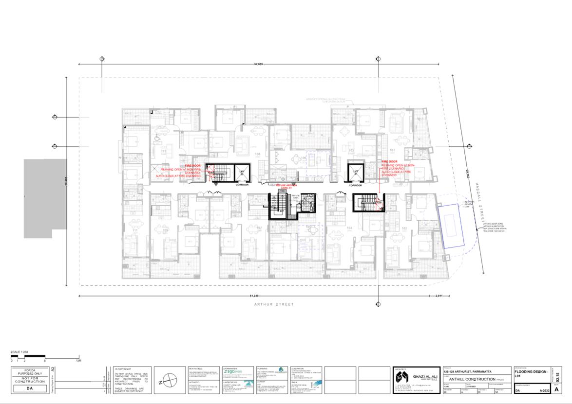
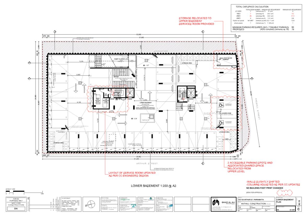
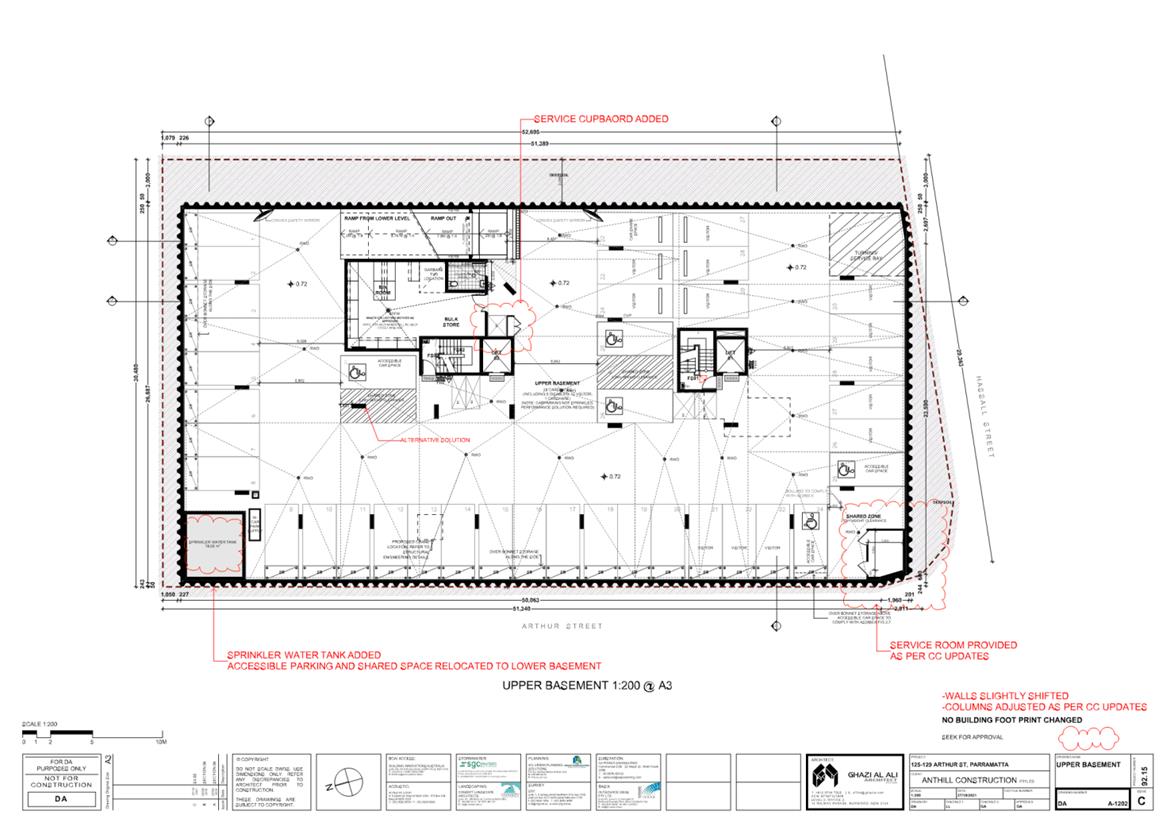
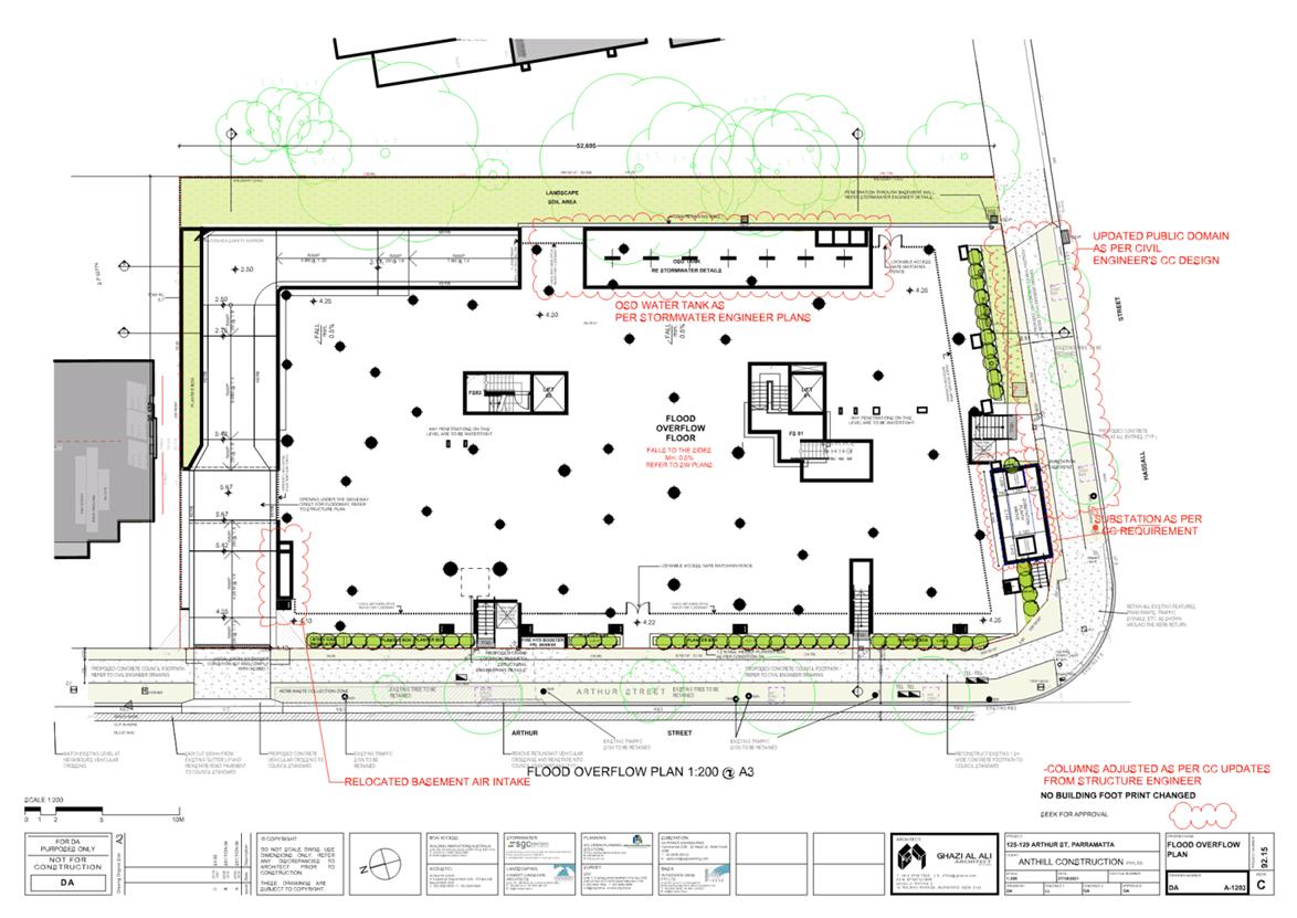
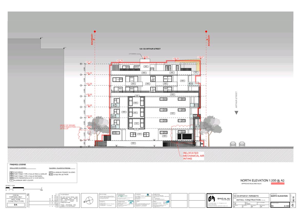
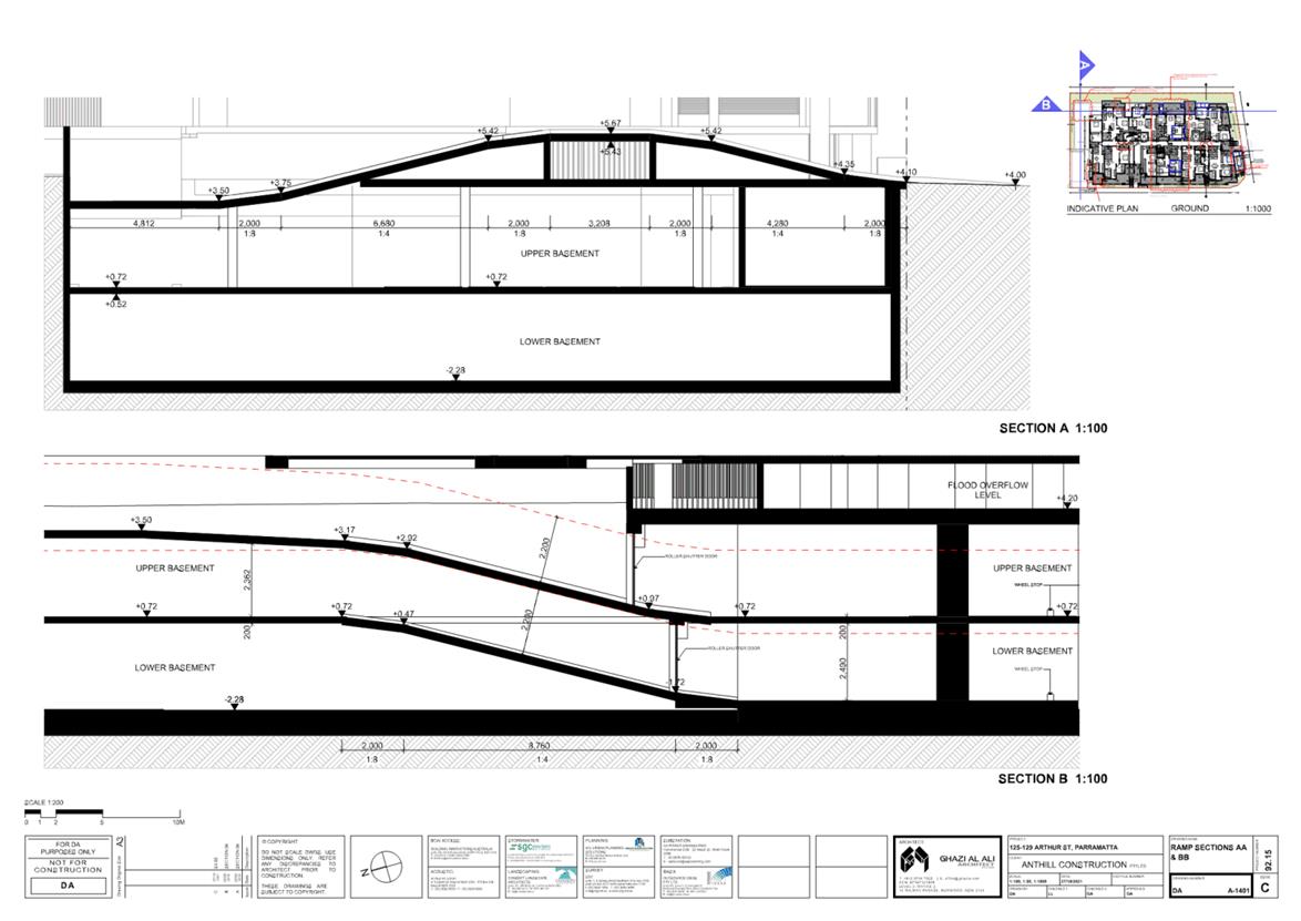
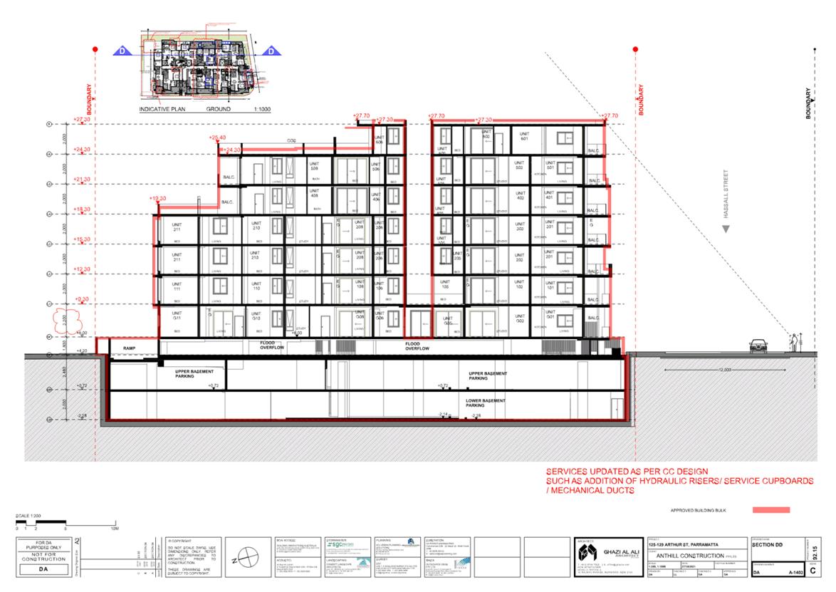
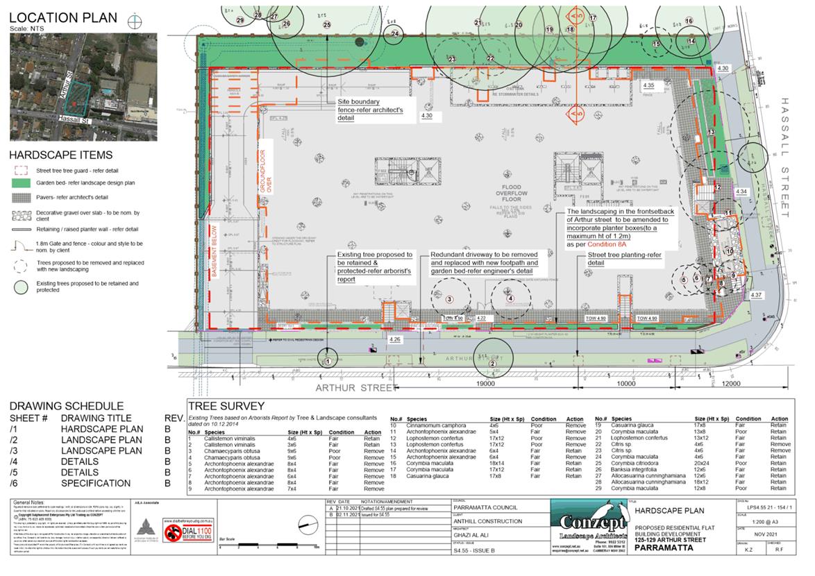
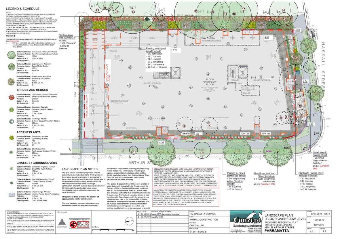
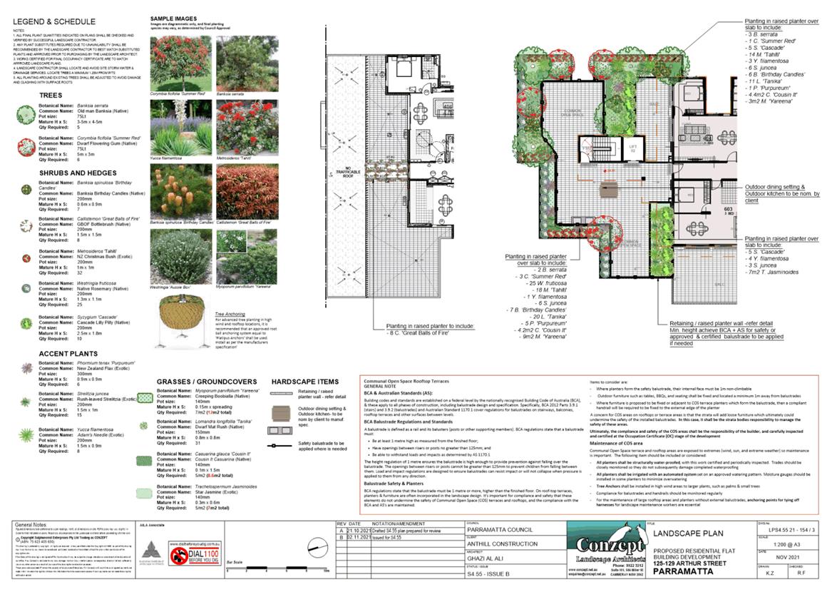
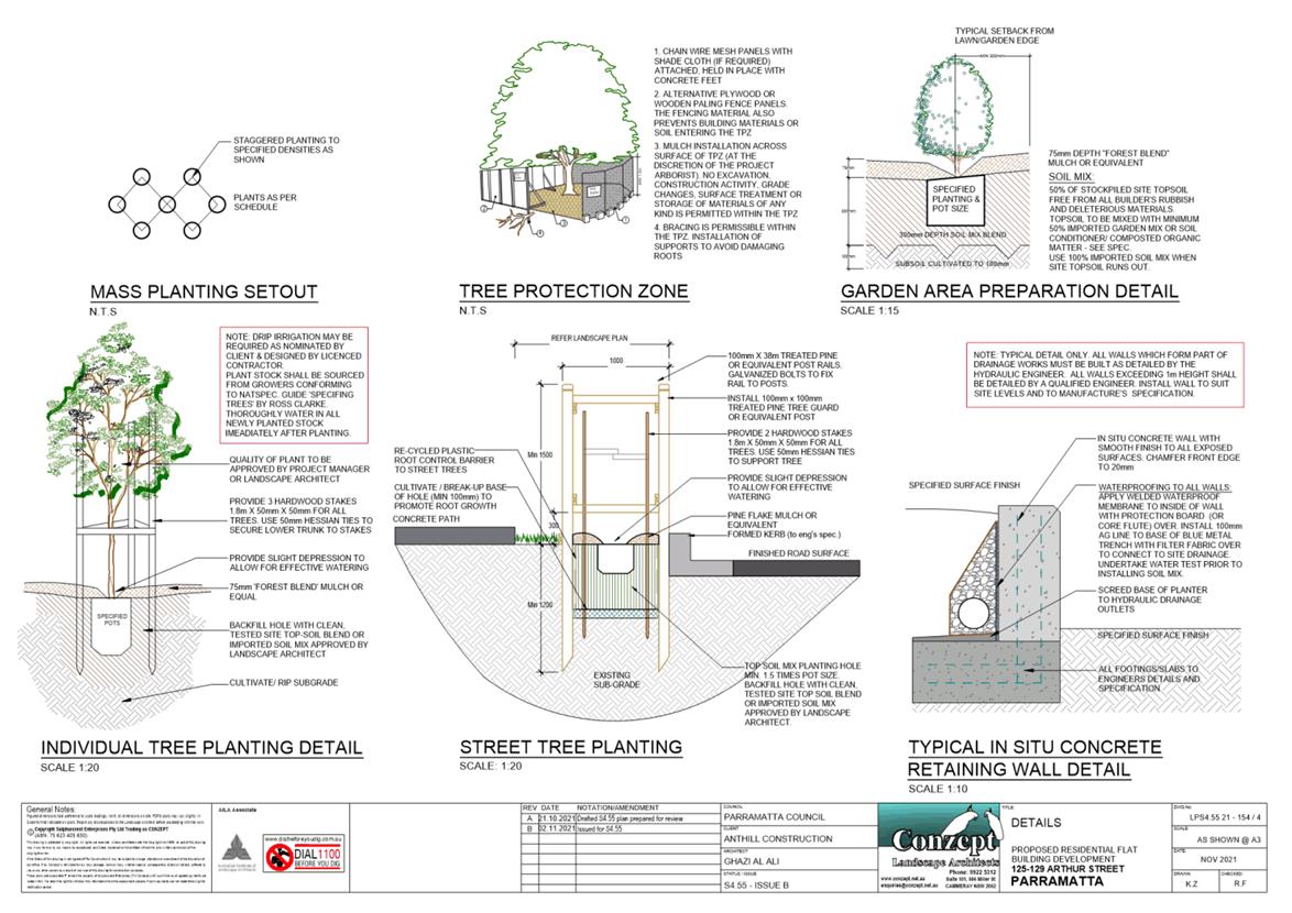
125-129 Arthur Street, PARRAMATTA (Lots 5, 6 & 7 DP 27997)
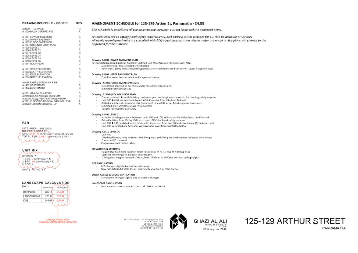
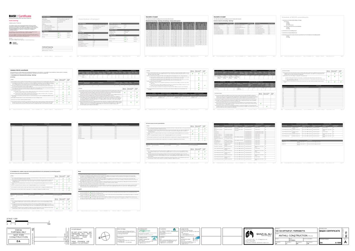
DESCRIPTION Section 4.55(2) Modification to DA/776/2014 for the demolition of
existing buildings, tree removal and construction of a Part 4, 6 and 7 storey
residential flat building comprising 64 dwellings and basement car parking.
The modification seeks to increase the building height by 300mm, amend the
layout of the basement, ground floor and first floors, changes to the unit mix,
provision of a padmount substation, and amendments to services.
REFERENCE DA/776/2014/C - D08408061
APPLICANT/S Ghazi Al Ali Architect
OWNERS S & A Property Holdings Pty Ltd
REPORT OF Group
Manager Development and Traffic Services
RECOMMENDED Approval
DATE OF
REPORT 19 April 2022
REASON
FOR REFERRAL TO LPP
The application is referred to the
Parramatta Local Planning Panel (PLPP) as the proposal relates to a Section
4.55(2) where there is a further variation of greater than 10% sought Clause
4.3 Height of buildings under the Parramatta Local Environmental Plan 2011.
EXECUTIVE SUMMARY
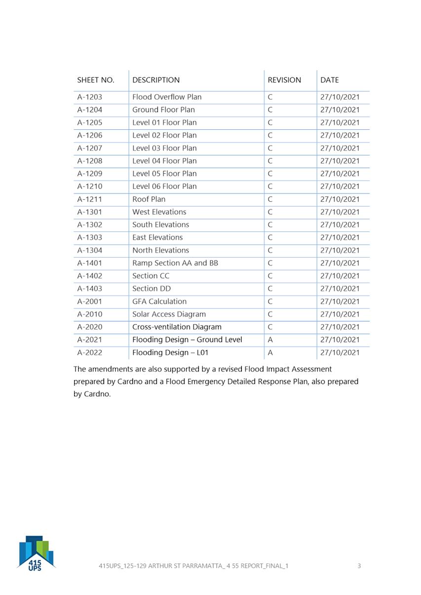
This is a summary of the full assessment of
the application as outlined in Attachment 1, the Section 4.55 Assessment
Report.
The Site
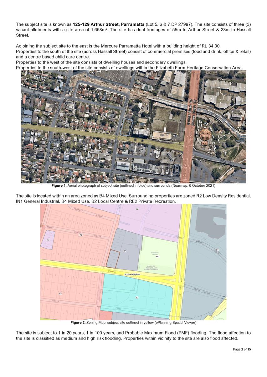
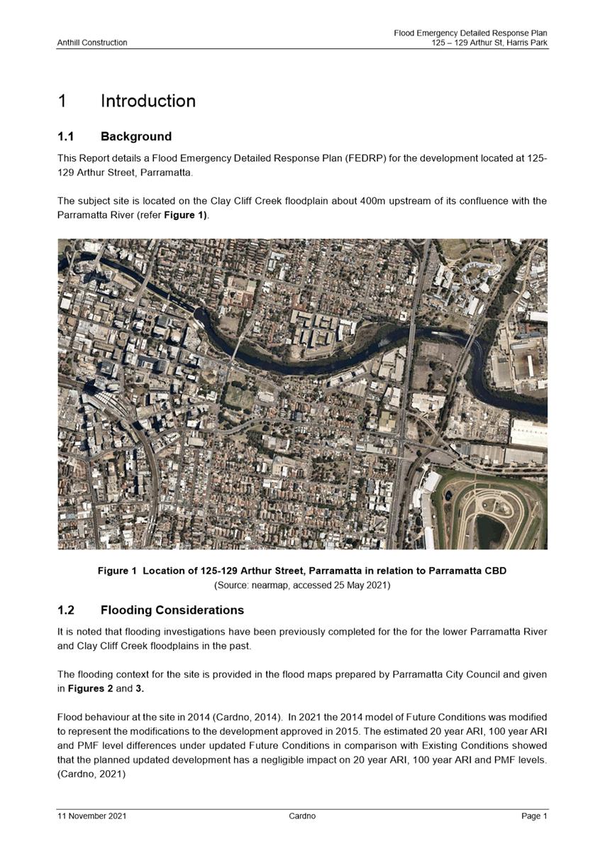
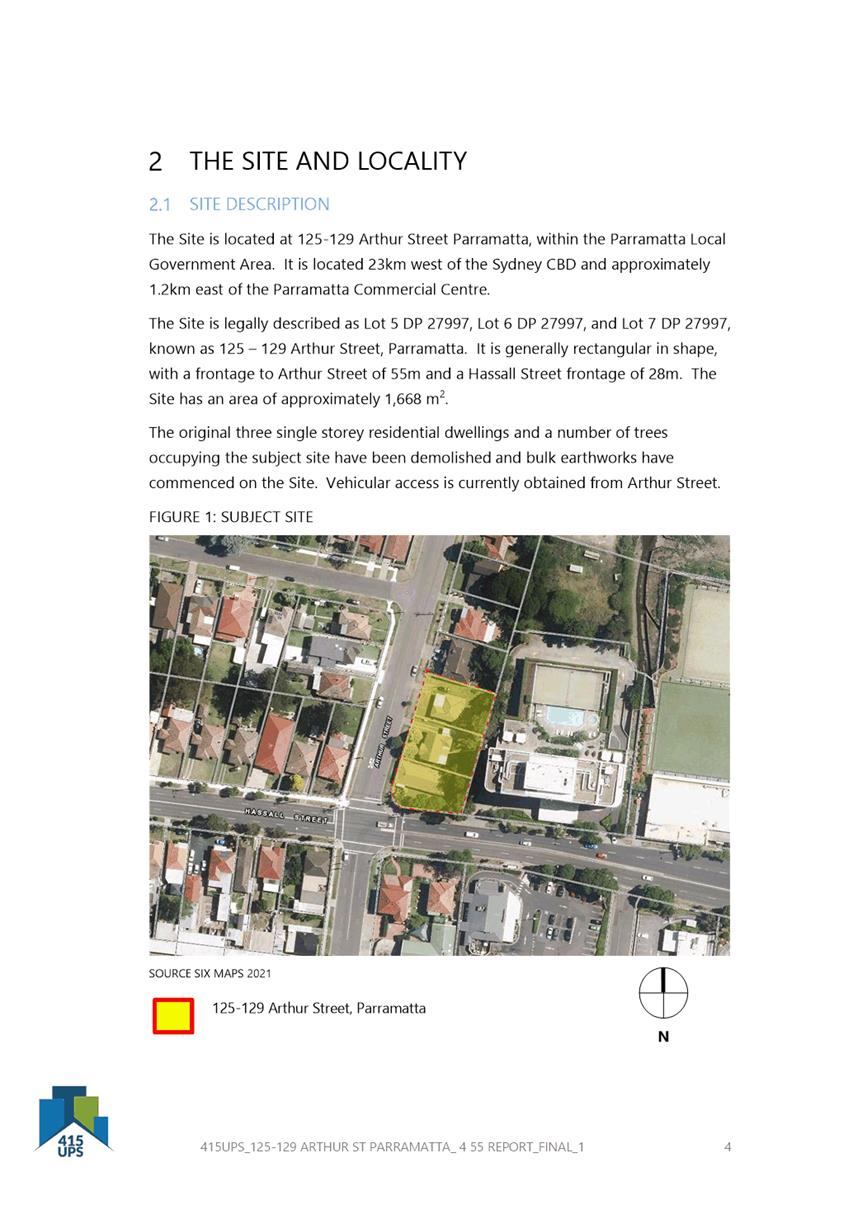
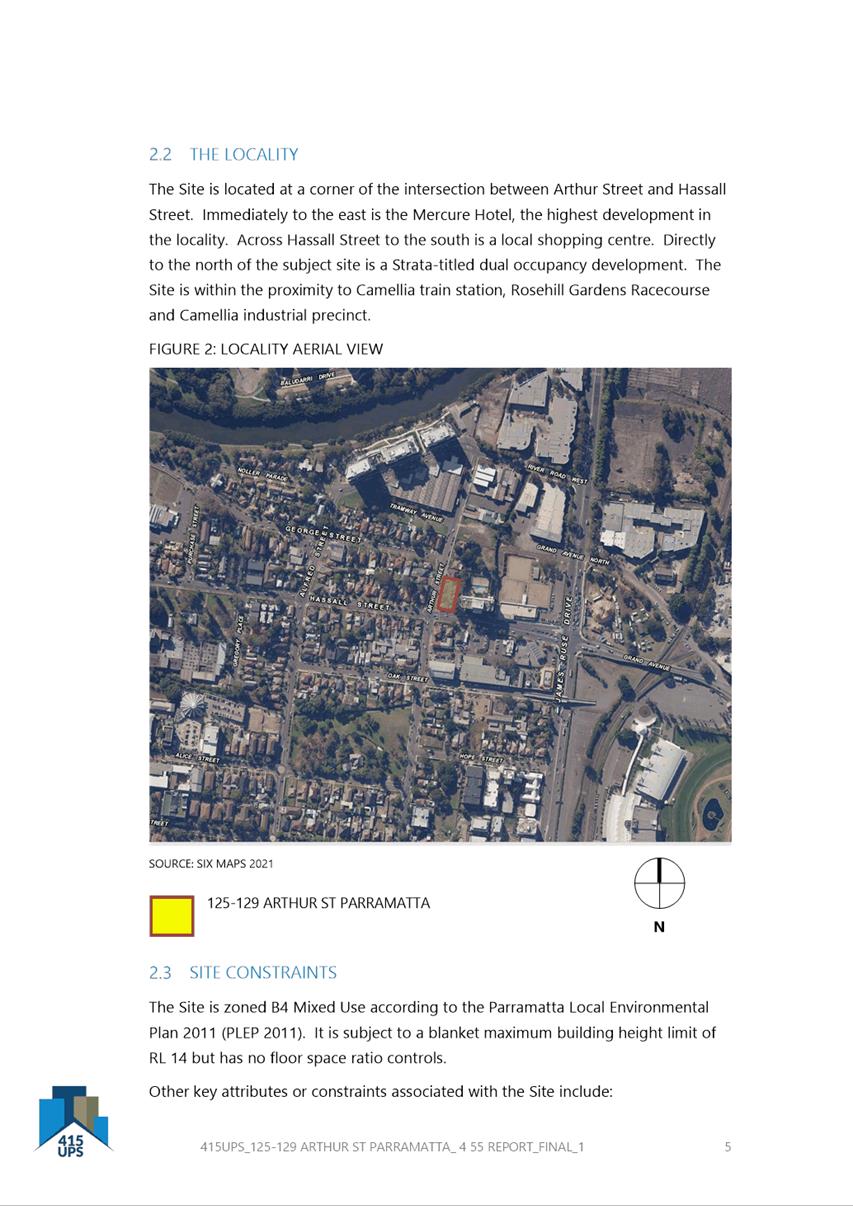
The subject site is known as 125-129 Arthur
Street, Parramatta (Lot 5, 6 & 7 DP 27997). The site consists of three (3)
vacant allotments with a site area of 1,668m2. The site has dual
frontages of 55m to Arthur Street & 28m to Hassall Street.
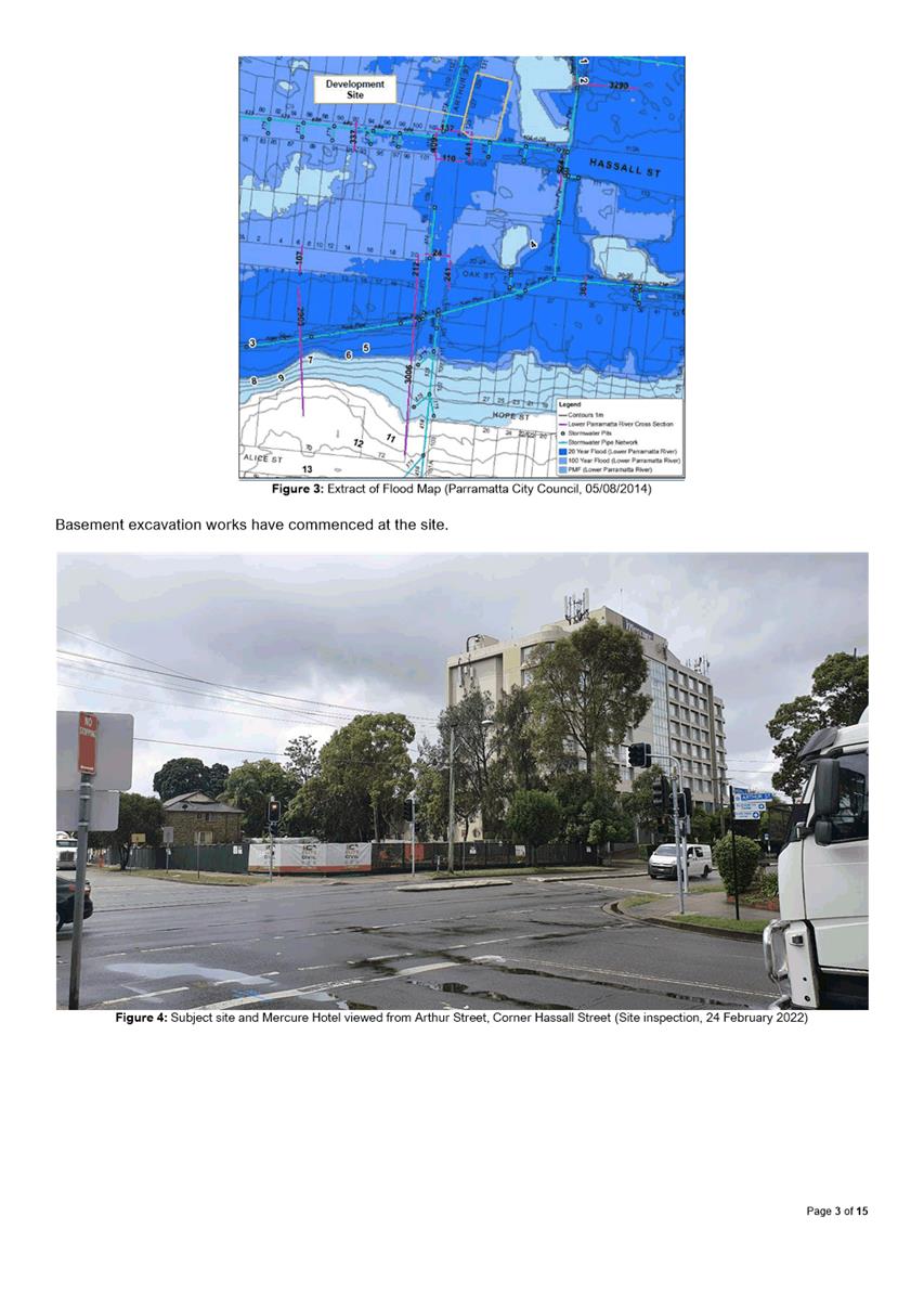
The site is located within vicinity to
commercial, industrial and residential properties.
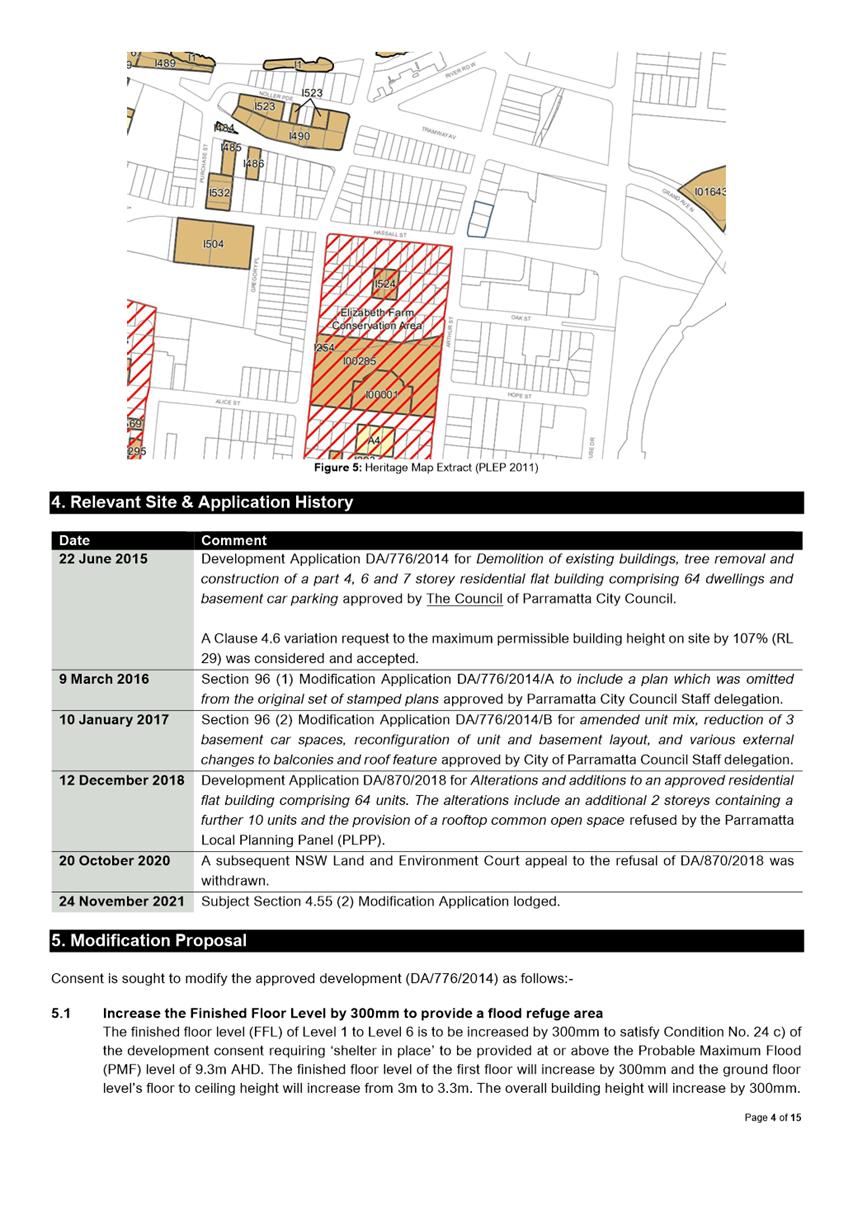
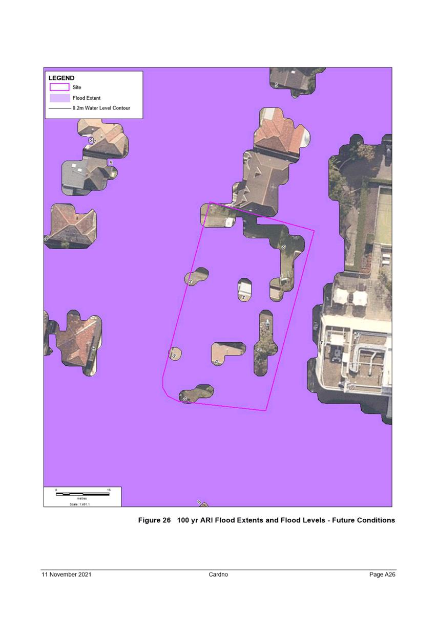
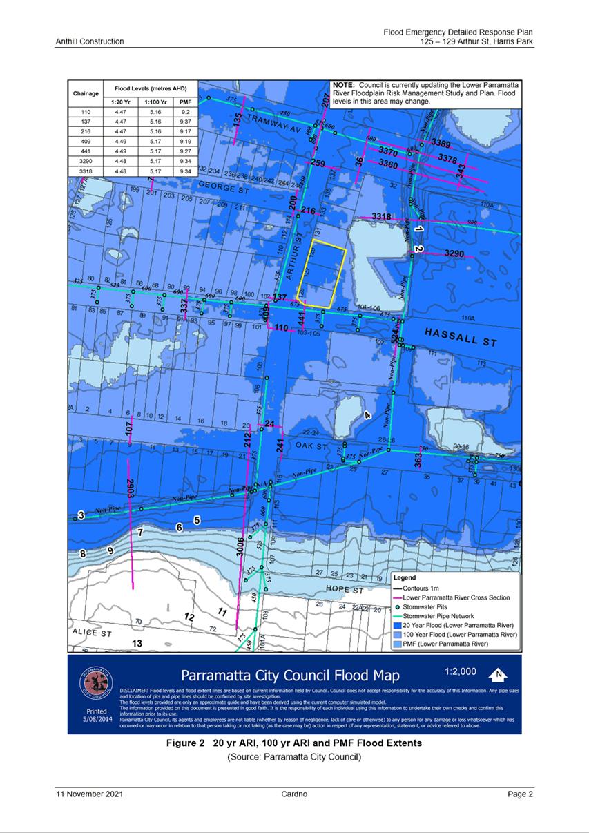
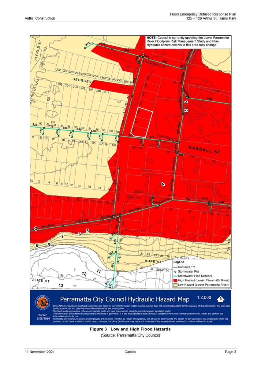
The site is subject to 1 in 20 years, 1 in
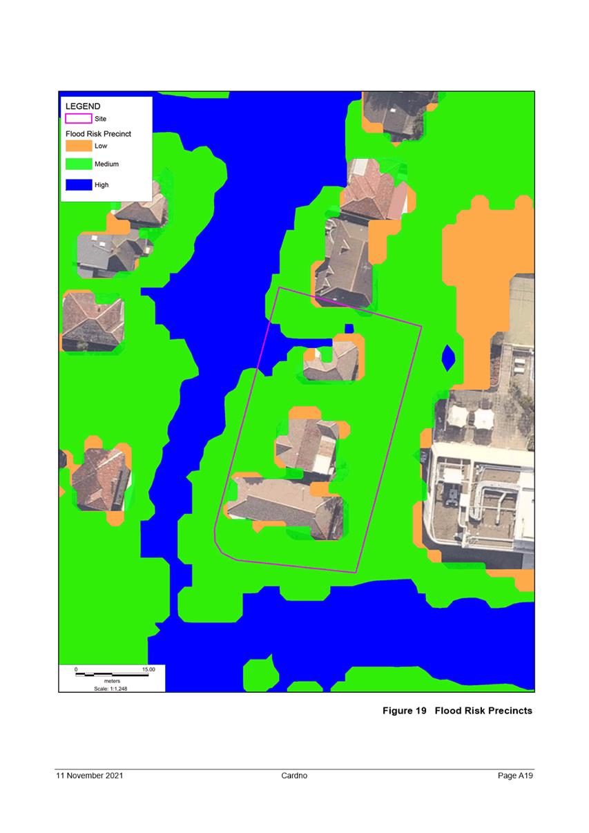
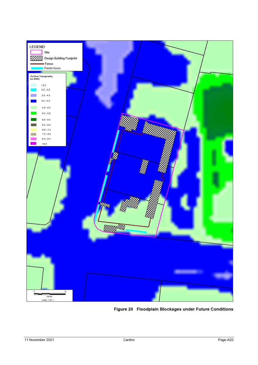
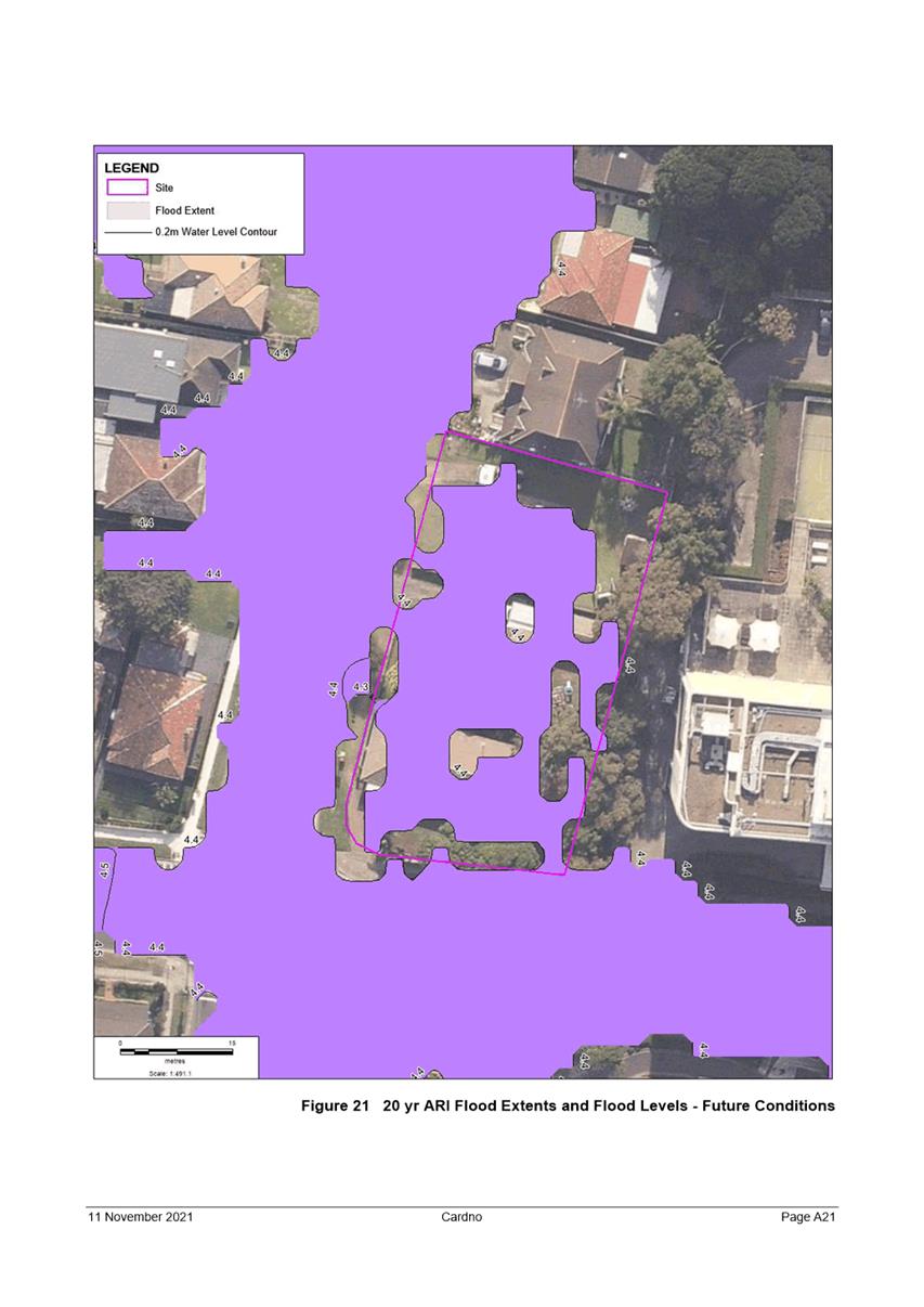
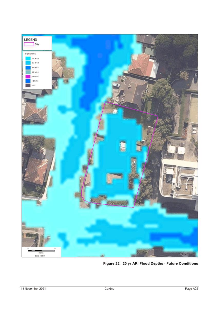
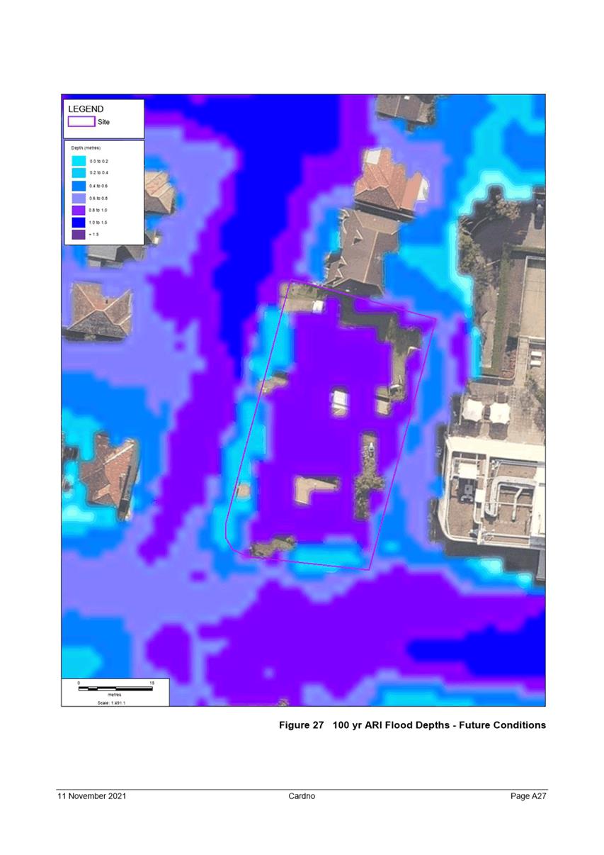
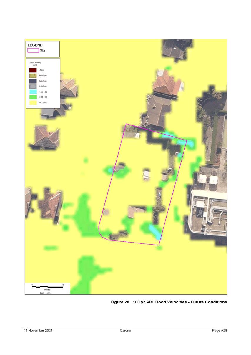
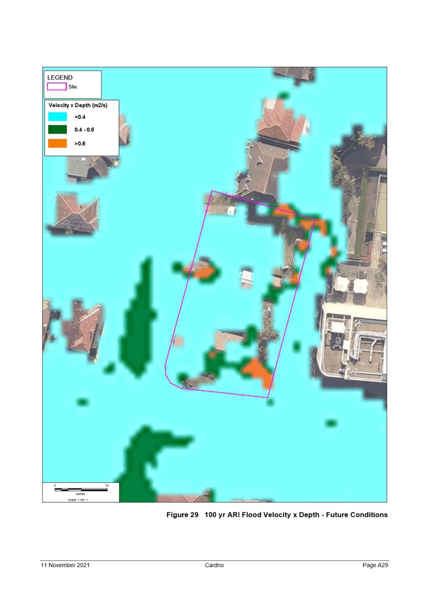
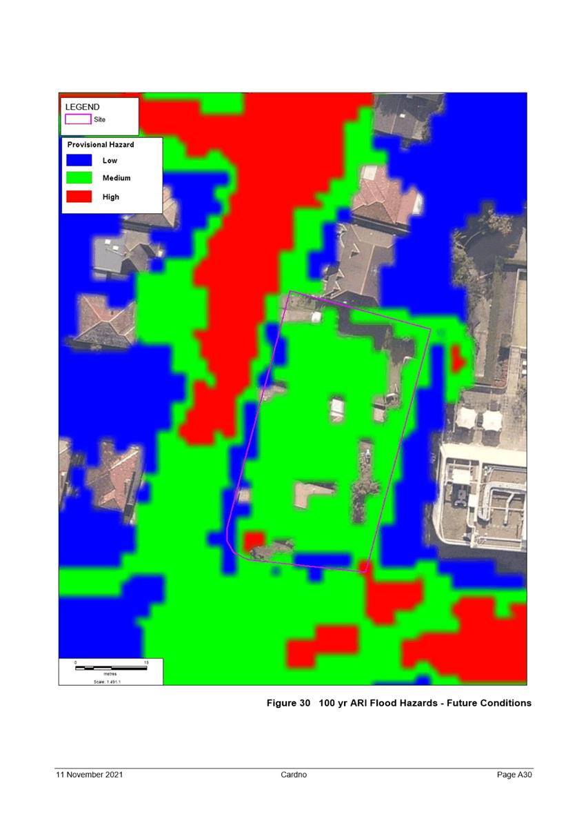
100 years, and Probable Maximum Flood (PMF) flooding. The flood affection to
the site is classified as medium and high-risk flooding. Properties within
vicinity to the site are also flood affected.
The Proposal
Consent is sought to modify the approved
demolition of existing buildings, tree removal and construction of a Part 4, 6
and 7 storey residential flat building comprising 64 dwellings and basement car
parking.
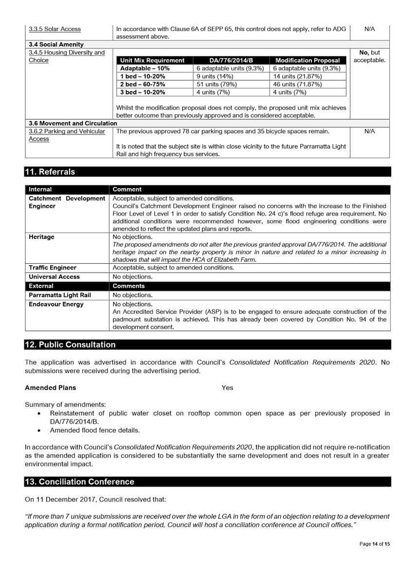
The proposed modifications include:
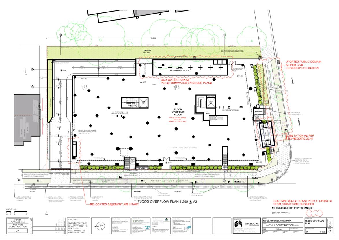
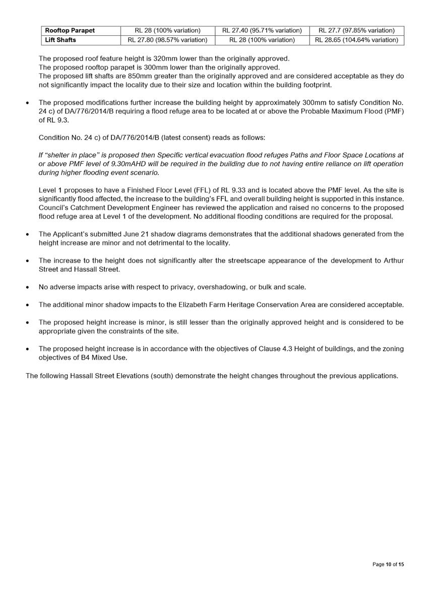
· Increase the overall building height by 300mm from RL 28.38 to RL
28.68 (104.85% variation) in order to provide a flood refuge area within Level
1 of the development.
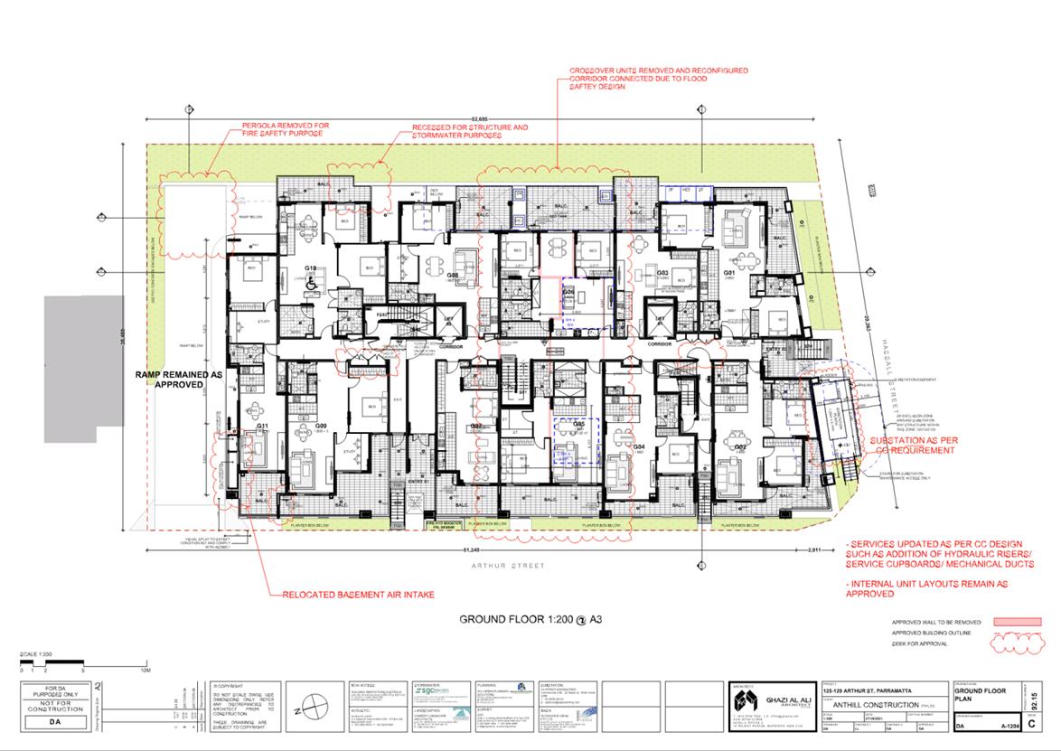
· Amend the ground floor and first floor layout, and unit mix as a
result of the provision for a flood refuge area.
· Amendments to the approved plans to satisfy Construction Certificate
requirements including the provision for hydraulic boosters, additional services
and a padmount substation.
The maximum permissible building height on
site is RL 14 and the proposed modifications result in a building height of RL
28.68 with a variation of 104.85%. This variation is considered acceptable as
it is not considered to create further adverse impacts than the original scheme
approved under DA/776/2014 which had an approved building height of RL 29 and a
107.14% variation. The requirement to increase Level 1’s finished floor
level is acceptable in order to provide a flood refuge area at or above the
Probable Maximum Flood (PMF) event of RL 9.3.
The modification application was advertised
in accordance with Council’s Consolidated Notification Requirements
2020. No submissions were received during the advertisement period.
After consideration of the development
against Section 4.55 of the Environmental Planning and Assessment Act 1979, and
the relevant statutory and policy provisions, the proposal is suitable for the
site and is in the public interest.
RECOMMENDATION
(a) That the Parramatta Local Planning Panel
exercising the functions of Council as the consent authority pursuant to
Section 4.16 and Section 4.55, modify development consent DA/776/2014 on land
at 125-129 Arthur Street, Parramatta, for a period of five (5) years from the
date on the original
Notice of Determination, subject to the following modifications:
1. Amend Condition
Nos. 1, 23, 27, 33, 35 & 80 to reflect the updated plans and documents.
2. Delete Condition
No. 90 as it is a duplication of Condition No. 88.
3. All other
conditions of DA/776/2014 remain unchanged.
(b) Further,
that the Parramatta
Local Planning Panel approve the proposal notwithstanding the non-compliance
with the building height standard in Clause 4.3 Height of buildings of the
Parramatta Local Environmental Plan 2011 as there are sufficient environmental
grounds to justify the variation.
REASONS FOR APPROVAL
1. The proposed
modification is substantially the same development which has been approved.
2. The proposed modification
is permissible within the B4 Mixed Use zone and results in a development which
is suitable for the context of the site and locality.
3. The proposed
modification to increase the height is supported in order to provide an
adequate flood refuge area due to the significant flood constraints on site.
4. The proposed modification results in reasonable impacts to adjoining
and surrounding properties, is suitable for the site, and is in the public
interest.
John Martinez
Senior Development Assessment Officer
Attachments:
|
1⇩
|
Draft Assessment Report and Conditions -
125-129 Arthur Street, Parramatta - DA/776/2014/C
|
52 Pages
|
|
|
2⇩
|
Plans used during assessment - 125-129
Arthur Street, Parramatta - DA/776/2014/C
|
23 Pages
|
|
|
3
|
Internal plans used during assessment -
125-129 Arthur Street, Parramatta - DA/776/2014/C (confidential)
|
31 Pages
|
|
|
4⇩
|
Flood Impact Assessment Update Report -
125-129 Arthur Street, Parramatta - DA/776/2014/C
|
83 Pages
|
|
|
5⇩
|
Flood Emergency Detailed Response Plan -
125-129 Arthur Street, Parramatta - DA/776/2014/C
|
31 Pages
|
|
|
6⇩
|
Statement of Environmental Effects -
125-129 Arthur Street, Parramatta - DA/776/2014/C
|
39 Pages
|
|
REFERENCE MATERIAL
|
Item 5.2 - Attachment
1
|
Draft Assessment Report and Conditions - 125-129
Arthur Street, Parramatta - DA/776/2014/C
|
|
Item 5.2 - Attachment 2
|
Plans used during assessment - 125-129 Arthur
Street, Parramatta - DA/776/2014/C
|
|
Item 5.2 - Attachment 4
|
Flood Impact Assessment Update Report - 125-129
Arthur Street, Parramatta - DA/776/2014/C
|
|
Item 5.2 - Attachment 5
|
Flood Emergency Detailed Response Plan - 125-129
Arthur Street, Parramatta - DA/776/2014/C
|

|
Item 5.2 - Attachment 6
|
Statement of Environmental Effects - 125-129 Arthur
Street, Parramatta - DA/776/2014/C
|
Innovative
19 April 2022
6.1 Post
Exhibition report - Planning Proposal and draft Planning Agreement for land at
22 Noller Parade, Parramatta......... 414
Local Planning Panel 19 April 2022 Item
6.1
ITEM NUMBER 6.1
SUBJECT Post Exhibition report - Planning Proposal and draft Planning
Agreement for land at 22 Noller Parade, Parramatta
REFERENCE RZ/15/2018 -
APPLICANT/S Hamptons Property Services
OWNERS Jimstam Holdings
REPORT OF
Project Officer
Development
applications considered by Sydney central city planning panel Nil
RECOMMENDATION
The Local Planning Panel support
the following Council Officer recommendations in the Panel’s advice to
Council:
(a) That
Council receives and notes submissions made during the public exhibition of the
Planning Proposal and draft Planning Agreement for 22 Noller Parade,
Parramatta.
(b) That
Council approve the Planning Proposal (at Attachment 1) for land at 22
Noller Parade, Parramatta for finalisation that seeks the following amendments to the Parramatta Local
Environmental Plan 2011 (PLEP 2011):
i. Amend the Land Zoning Map
from R2 Low Density Residential to R4 High Density Residential.
ii. Amend the maximum building
height on the Height of Buildings Map from RL 14 metres (4 storeys) to RL 17
metres (5 storeys).
iii. Amend
the maximum Floor Space Ratio (FSR) on the FSR Map from zero (nil) FSR, to
1.5:1.
(c) That
Council approve the draft Planning Agreement (at Attachment 2) for
finalisation, that proposes a monetary contribution to undertake public domain
works associated with, and new connections to, the Alfred Street Bridge.
(d) That the
Planning Agreement be executed and registered on title before the Planning
Proposal is sent to the Department of Planning and Environment for
finalisation.
(e) That Council
authorise the Chief Executive Officer to exercise the plan making delegations
as granted by the Gateway determination for this Planning Proposal.
(f) Further,
that Council delegates authority to the Chief Executive Officer to make any
minor amendments and corrections of a non-policy and administrative nature that
may arise during the finalisation process relating to the Planning Proposal and
Planning Agreement.
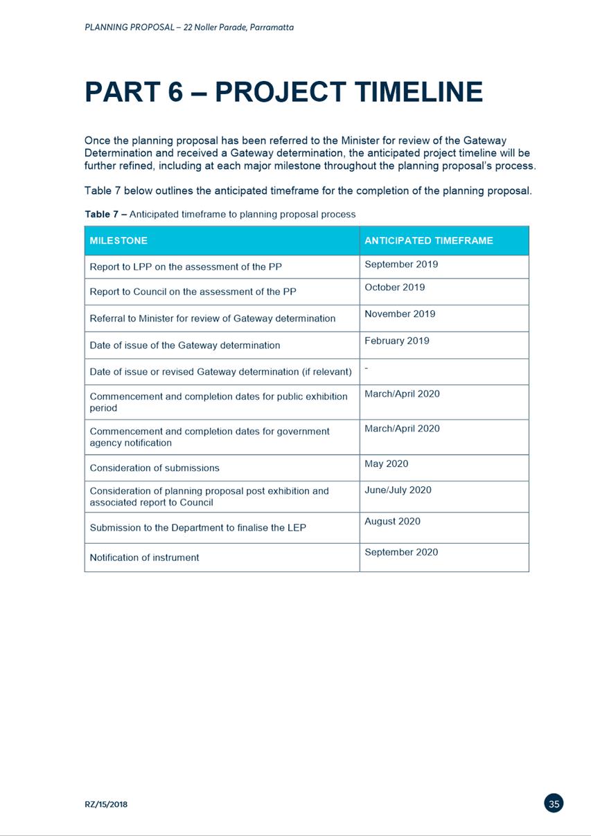
PLANNING PROPOSAL TIMELINE
SITE DESCRIPTION
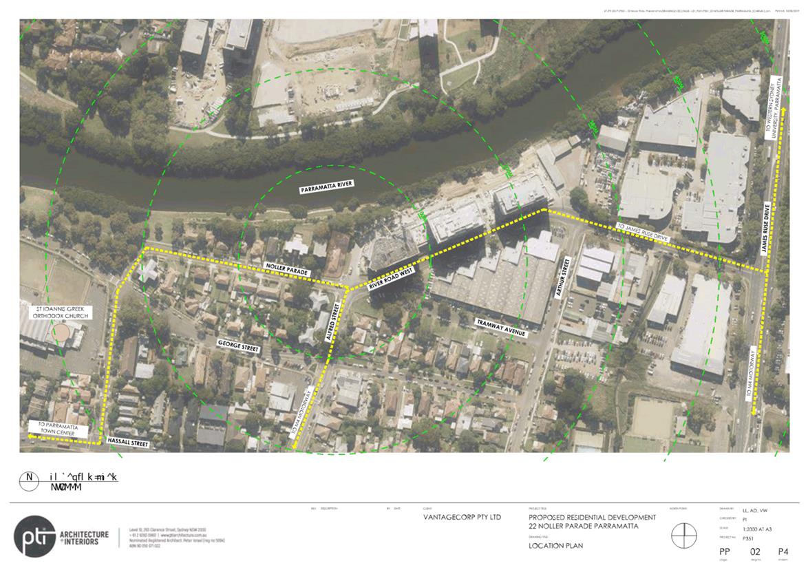
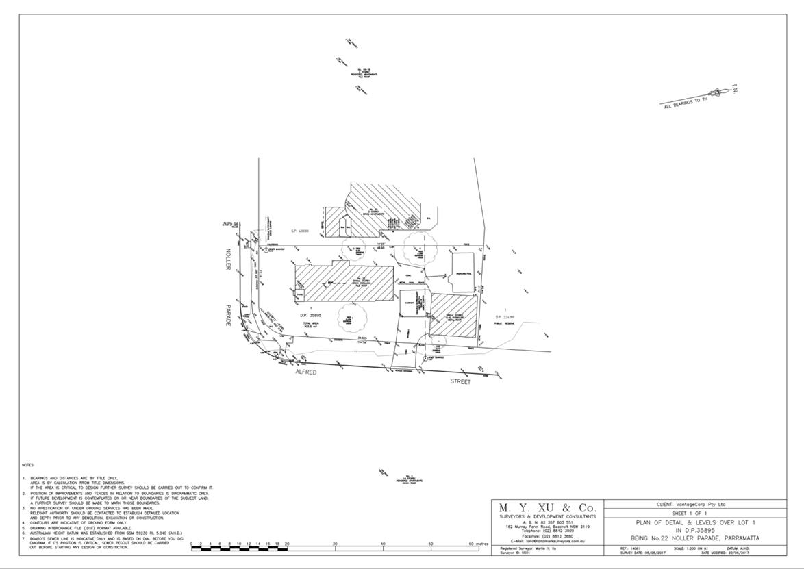
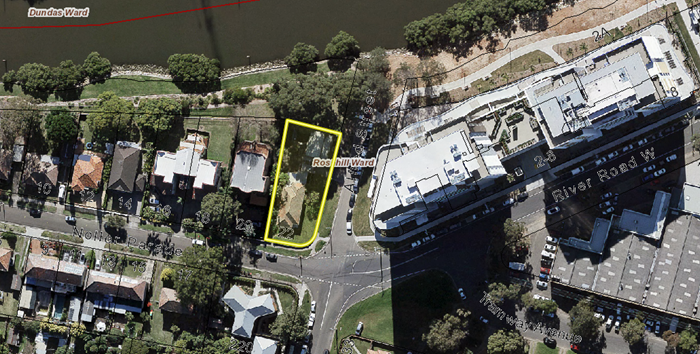
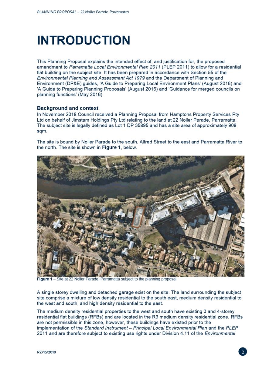
1. The subject site is located on a
single lot at 22 Noller Parade, Parramatta and is shown in Figure 1 below. It
has an approximate site area of 908m2 and has a legal description of
Lot 1 DP 35895. The site is bounded by Noller Parade to the south, Alfred
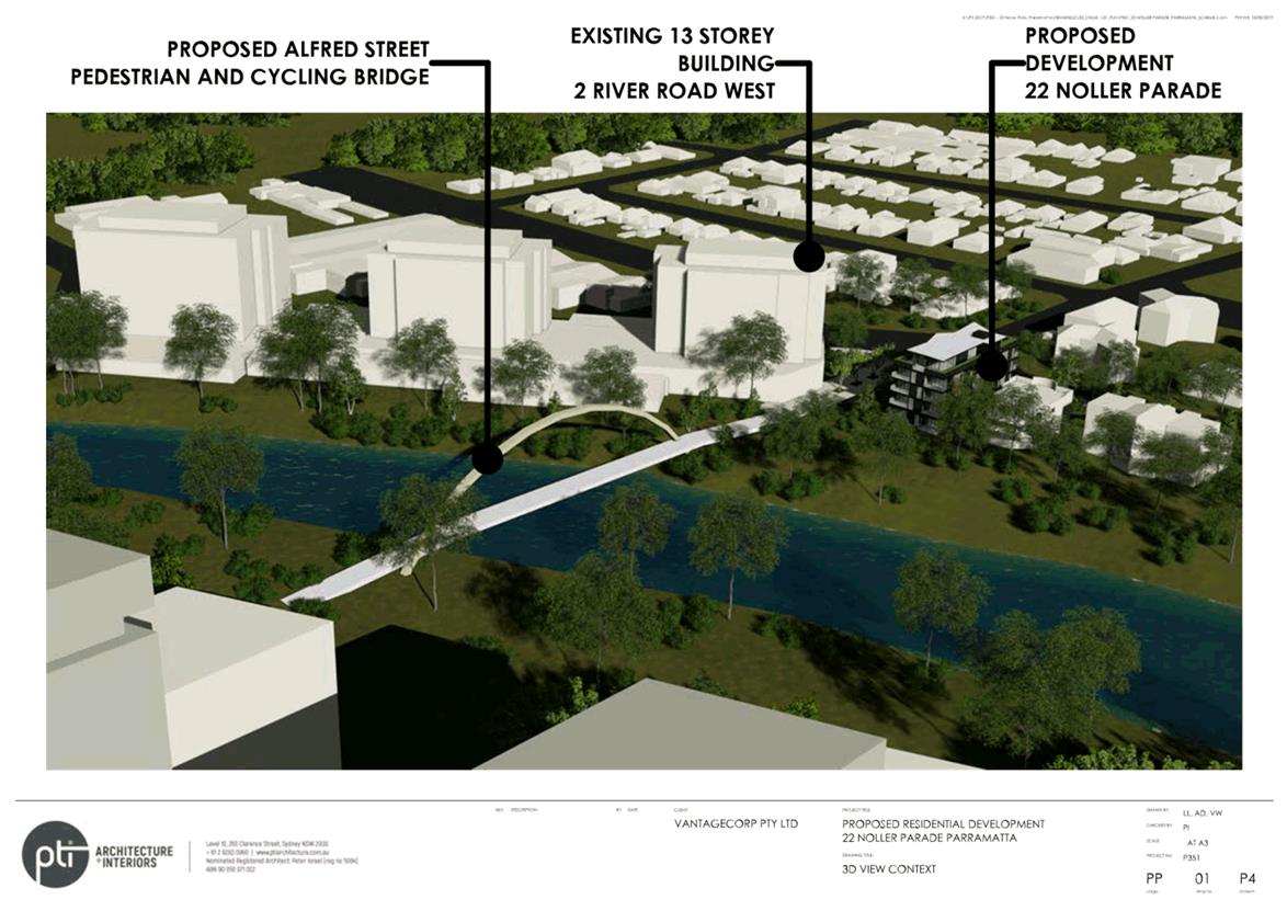
Street to the east and the Parramatta River to the north.
2. The site has access to future,
high quality active and public transport connections. The site adjoins the
under-construction Alfred Street pedestrian and cycle bridge and associated
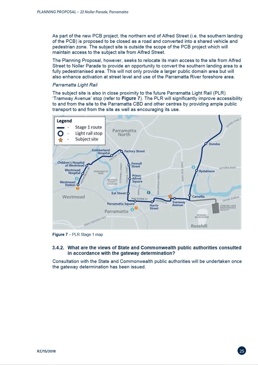
public domain and is within 200m of the Parramatta Light Rail stop being
constructed on Tramway Avenue.
3. A single storey dwelling with a
detached garage is currently located on the site. The land surrounding the site
comprises a mixture of low density residential to the south east, medium
density residential to the west and south, and high density residential to the
east.
Figure
1 – Site at 22 Noller Parade, Parramatta
subject to the Planning Proposal
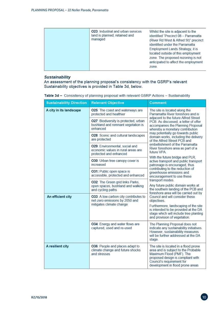
4. The site is located in a flood prone area and is subject to
the Probable Maximum Flood (PMF) (Figure 2 below). Council requires any
new development to be constructed to the flood planning level, which is the
1:100 year flood level plus 0.5m. Council’s Flood Engineers have identified
that Noller Parade and Alfred Street are important flow paths for potential
floodwaters to find their way to the Parramatta River. Future detailed design
for the site, and its interface with public areas, must enable any overland
flows to access both Noller Parade and Alfred Street. Additionally, any
development application for this site will require detailed flood management
planning, and detailed strategies for evacuation and/or shelter in place flood
response planning.
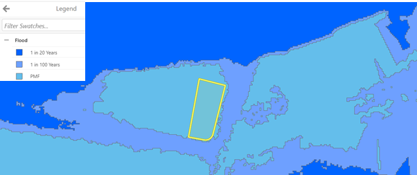
Figure 2 – Flood prone area map for the subject
site at 22 Noller Parade, Parramatta.
BACKGROUND
5. At
its meeting on 17 September 2019, the Local Planning Panel (LPP) considered a report on a Planning Proposal for the subject
site and recommended to Council that the matter proceed for a Gateway
determination and that a Planning Agreement be negotiated.
6. At its meeting on 8 October 2019, Council considered
this matter, and resolved to endorse seeking a Gateway determination for
the Planning Proposal (Attachment 1).
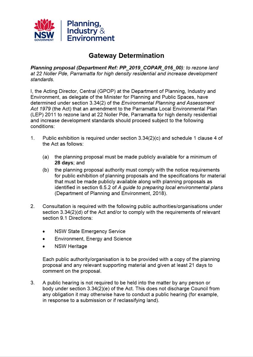
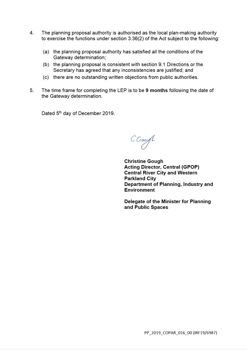
7. A Gateway Determination was issued by the then DPIE on 5
December 2019 (Attachment 3). As part of this determination, the DPIE
authorised Council as the local plan-making authority, which means that should
the matter proceed, Council officers will deal directly with the Parliamentary
Counsel Office on the legal drafting and mapping of the amendment. The LEP
amendment will then be signed by the CEO before being notified on the NSW
Legislation website.
8. On
12 July 2021, Council resolved to endorse the legal drafting of a Planning Agreement to
facilitate a monetary contribution of $225,000 to Council for the purposes of
contributing towards the delivery of public domain works associated with, or
new connections to, the Alfred Street Bridge. Council
also resolved that the draft Planning Agreement be placed on exhibition
concurrently with the Planning Proposal.
9. On
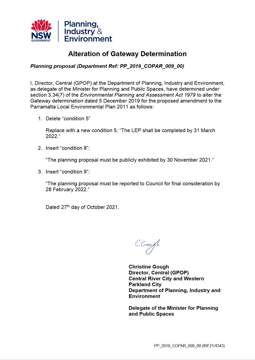
27 October 2021, DPIE (former) issued a revised Gateway determination (Attachment
4) stating the timeframe for completing the LEP is 31 March 2022. The
Department of Planning and Environment (DPE) has advised that a further
extension to the Gateway timeframe will be provided to allow the Planning
Proposal to be finalised.
10. The
Planning Proposal, draft Planning Agreement and supporting documentation were
publicly exhibited for 28 days from 2 February 2022 to 2 March 2022.
PLANNING PROPOSAL
11. The
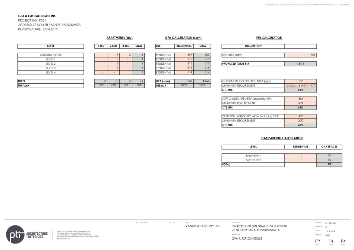
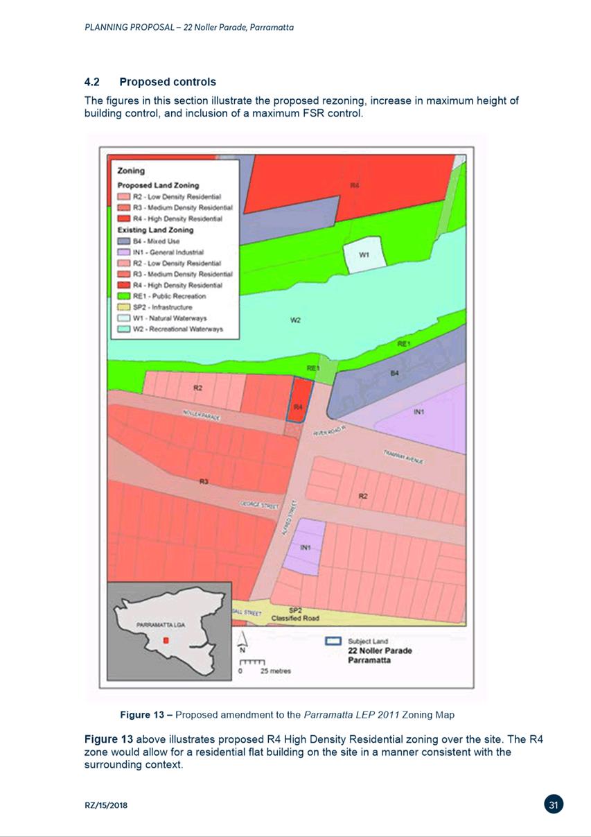
Planning Proposal seeks to amend the PLEP 2011 to allow for increased density
as follows:
|
|
Existing
|
Proposed
|
|
Land
Use Zoning
|
R2 Low Density Residential
|
R4 High Density Residential
|
|
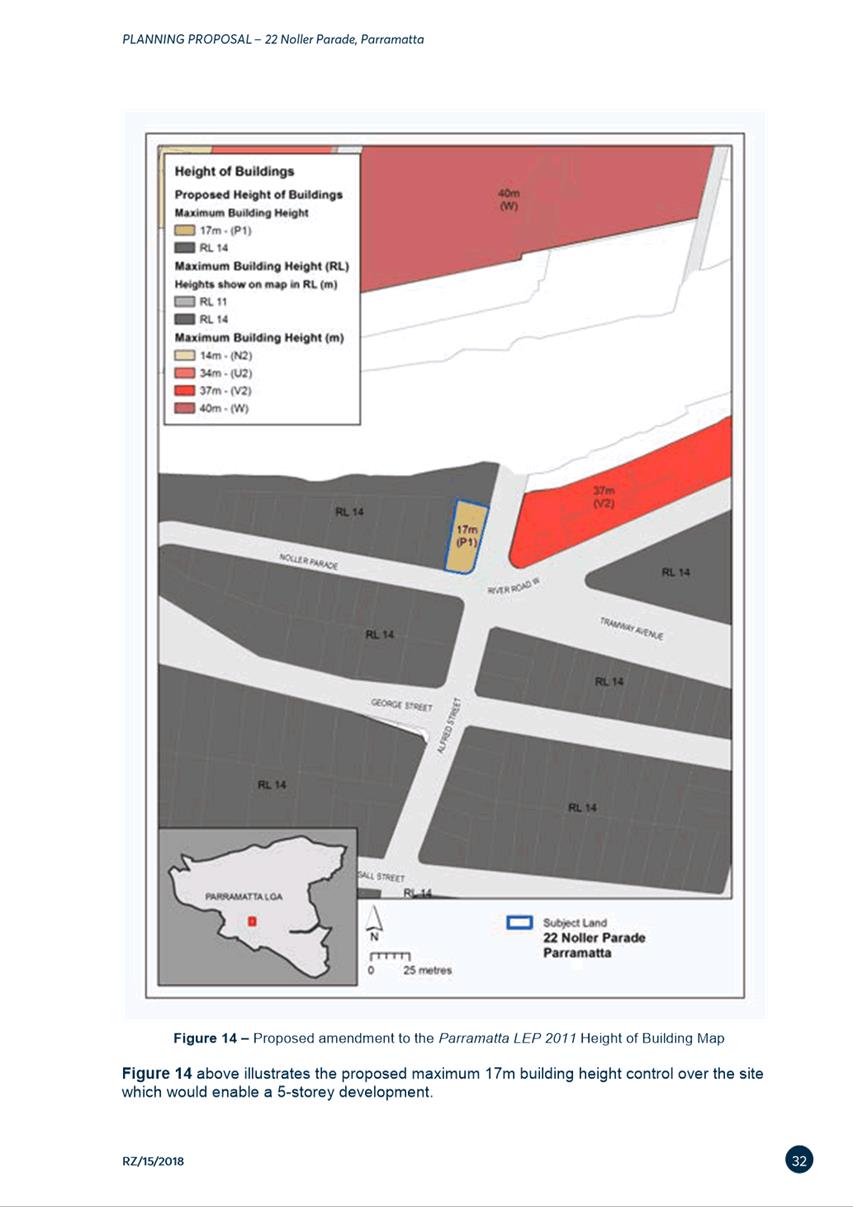
Height
of Buildings
|
RL14m (up to 4 storeys)
|
RL17m (up to 5 storeys)
|
|
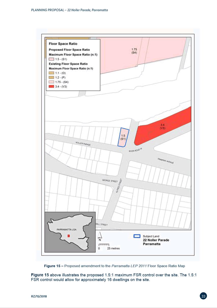
Floor
Space Ratio
|
No FSR
|
1.5:1
|
|
Number
of Dwellings
|
2 (dual occupancy)
|
Up to 16 apartments.
|
12. The
site is subject to Reduced Level (RL) height measurements with regard to Height
of Buildings. RLs are an exact building height measurement where zero (0)
metres approximates the mean sea level using the Australian Height Datum and
was adopted by the National Mapping Council of Australia in May 1971. RL
heights have been implemented in areas of the LGA, such as this site, which are
subject to heritage view lines and flooding.
13. As
noted above, the site is located within a flood prone area and is therefore be
subject to specific flood related planning controls. In order to meet these
controls, development must be raised above a minimum required level of RL5.6m.
The reference design included in the Planning Proposal (included in Attachment
1) demonstrates compliance with Council’s requirement as the ground
level is proposed to be RL5.62m.
14. The
preparation of a site specific DCP is not required. Development on this site
will be assessed under existing provisions of the Parramatta DCP 2011.
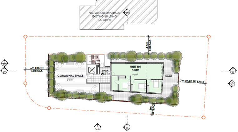
15. The
reference design accompanying the Planning Proposal shows a 4/5 storey
apartment building of 16 apartments consistent with the Parramatta DCP 2011
with setbacks comprising 6m from the front, 4.5m from the west, 7m from the
rear and 3m from the east. The reference design proposes to set back the
apartment on the 5th storey 15m from the building edge facing Noller Parade
which will give the appearance of a 4 storey building at the street level and
provide for a roof-top communal open space (see Figures 3 and 4 below).
Additionally, the increased setback to the 5th storey will help to mitigate
impacts in relation to visual bulk and scale and overshadowing to adjoining
properties and will be subject to further assessment at DA stage.
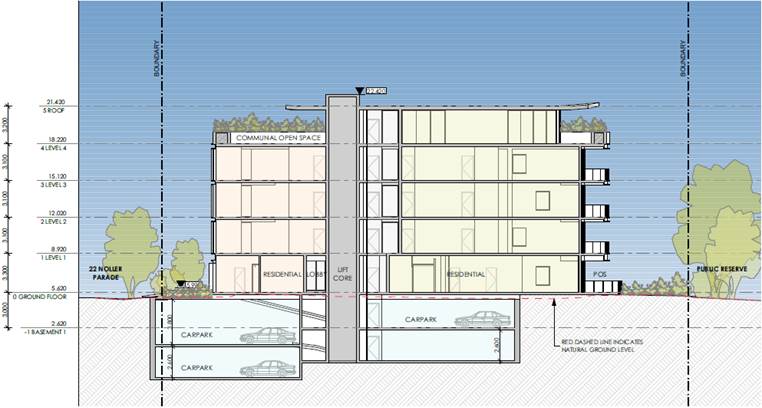
Figure
3 – Indicative design elevation of 22 Noller
Parade, Parramatta from the east
Figure
4 – Indicative design setbacks from the 5th
storey
16. The
proposed height increase from RL14m to RL17m is considered to be a minimum
increase in height from the existing four storey residential flat building to
the west of the site and also ensures an appropriate transition to the B4 zone
to the east (Figure 5 below).
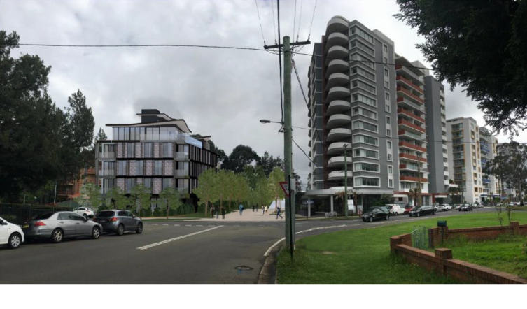
Figure 5 – Reference design bulk
and scale in situation (to the left).
PLANNING AGREEMENT
17. At
its meeting on 8 October 2019, Council resolved the following in relation to
the draft Planning Agreement:
“(c) That the CEO be
authorised to negotiate a Voluntary Planning Agreement on behalf of Council to the
land value of 50% of the value uplift as per Council’s Planning
Agreements Policy 2018 in addition to any development contributions
payable…”
18. It
is noted that subsequent to the above resolution, DPE released a Planning
Agreements Practice Note (February 2021) that seeks to move away from value
capture (as referred to in the above Council resolution and Planning Agreements
Policy 2018) towards an infrastructure needs approach to negotiating planning
agreements. It is acknowledged that while negotiations have occurred prior to
the practice note being issued, a value uplift analysis was undertaken and used
as a secondary check for the purposes of ensuring that an appropriate monetary
contribution is provided towards infrastructure that will directly benefit and
service the future development at the site. This approach was adopted when the
Planning Agreement was reported to Council for the purposes of public
exhibition on 12 July 2021.
19. A
draft Planning Agreement that provides Council with additional
funding/resourcing to deliver public domain works associated with, and
facilitating new connections to, the future Alfred Street Bridge, which adjoins
the subject site, was subsequently negotiated and is included at Attachment
2. More specifically, the financial contribution under the draft Planning
Agreement will provide additional funding for Council to undertake public
domain works, post bridge construction, which will include upgrades to the
southern entry of the Bridge at the junction of Noller Parade/Alfred Street, as
well as facilitating a foreshore connection between the Alfred Street Bridge
and Gasworks Bridge (south side of Parramatta River). The construction of the
Alfred Street Bridge does not form part of this Planning Agreement, rather the
financial contributions will be used to support public domain upgrades to
further improve pedestrian connections on the south side of the bridge (Figure
6 below).
Figure
6 – Artist impression of south landing of the
Alfred Street Bridge design elements, which would be supported by funding
received as a result of the draft Planning Agreement.
20. The
key elements of the draft Planning Agreement are detailed in Table 1 below:
Table 1: Summary of draft Planning Agreement
|
|
Item
|
Costs
for Planning Agreement
|
Value
attributing public benefit
|
|
1.
|
Monetary
contribution towards Public Domain works associated with, or new connections
to, the Alfred Street Bridge
|
$225,000
|
$225,000
|
|
2.
|
Relinquishment
of access (at the Alfred Street frontage to facilitate public domain works
associated with the Alfred Street Bridge)
|
Nil
cost attributed in draft Planning Agreement
|
Nil
cost attributed in draft Planning Agreement
|
|
Staging
|
75%
of the monetary contribution prior to the issue of a Construction Certificate
(CC)
25%
of the monetary contribution prior to the issue of any Occupation Certificate
(OC)
|
Yes
|
Yes
|
|
Security
|
Bank
Guarantees could be alternatively provided
|
Yes
|
Yes
|
|
Costs
|
Applicant
agrees to pay Council’s legal costs
|
Yes
|
N/A
|
|
Other
|
Section
7.11, 7.12, and 7.24 contributions apply
|
Yes
|
N/A
|
|
|
Total
|
$225,000
|
$225,000
|
21. Items
relating to monetary contributions (or alternative bank guarantees) will be
subject to indexation to reflect increases in the Consumer Price Index between
the execution of the agreement and timing payments as required by Part 5.11 of
Council’s Planning Agreements Policy.
22. A
requirement of the finalisation of the instrument change requires the Planning
Agreement to be executed in full. This includes the payment of legal fees
incurred in the negotiation of a Planning Agreement and the registration of the
Planning Agreement on the property title. Part 3.7, step 9, of Councils
Planning Agreement Policy states that:
“(zz)
A planning agreement must be executed before Council will finalise any
instrument change associated with an accompanying planning proposal
application. If the Developer refuses to execute a planning agreement offered
in connection with a planning proposal, the Council will ask the Minister not
to proceed with the relevant instrument change under section 3.35(4) of the
Act.”
23. In conclusion, the draft Planning
Agreement will see a financial contribution of $225,000 paid to Council as
additional funding for Council-led delivery of future public domain upgrades to
facilitate improved pedestrian connections on the southern side of the
under-construction Alfred Street Bridge. These proposed public domain works
at the southern entry of the Alfred Street Bridge, including facilitating
future connections to the bridge, have been designed as a part of the Alfred
Street Bridge project. The proposed monetary contribution is preferred by
Council officers as it supports the coordinated delivery of the bridge
construction and public domain upgrades.
EXHIBITION OUTCOMES
24. The
Planning Proposal, draft Planning Agreement and supporting documentation were
publicly exhibited for 28 days from 2 February 2022 to 2 March 2022 as required
by the Gateway determination. Notification methods
used in the exhibition included:
· Letters to surrounding landowners
· Dedicated exhibition page on Council’s Participate
Parramatta website
· Advertisement on Council’s website
· Exhibition folders in Council’s customer service and
Parramatta CBD library.
25. Public agencies were also notified in
accordance with the Gateway determination, with the following agencies
consulted:
· Environment, Energy and Science, DPE (EES)
· Heritage NSW
· NSW State Emergency Service (NSW SES).
26. A
total of three 3 submissions were received comprising two (2) from public
agencies and one (1) from the local community. Of the submissions received, one
(1) objected to the Planning Proposal in full.
COUNCIL OFFICER RESPONSE TO KEY
ISSUES RAISED IN SUBMISSIONS
27. Table
3 below summarises the key issues raised in the community submission and
Council officer responses.
Table 3 - Summary of issues raised by the community during public
exhibition
|
Consultation Issues
|
Council Officer Response
|
|
1. Character and Amenity
|
Raised in 1 submission
|
|
1. Impact of the proposal on local heritage items.
2. Raised concern regarding impact to sunlight and
vistas for neighbouring residents.
3. Proposed height and bulk of building out of
character for the street, and may set precedent for future developments.
|
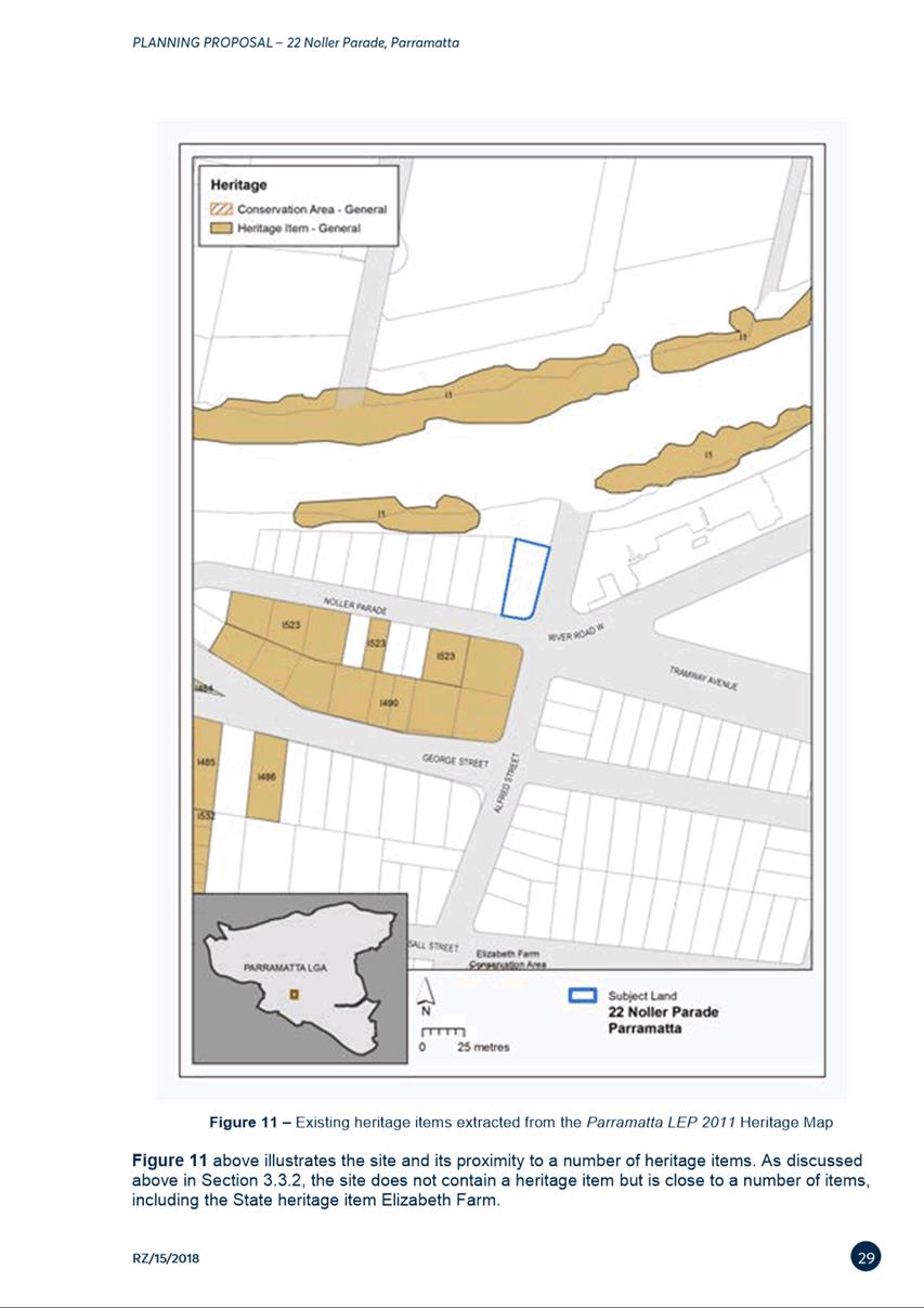
1. The
site is not within a heritage conservation area, nor does it contain a
heritage item. Council’s Heritage Officer advises that the Planning
Proposal is in keeping with the surrounding built form and does not impede
any significant view corridors and retains views from Alfred Street to the
Parramatta River. Future development will therefore not adversely impact the
heritage qualities of the surrounding area. Future development applications
will also be separately assessed against relevant heritage controls.
2. (a)
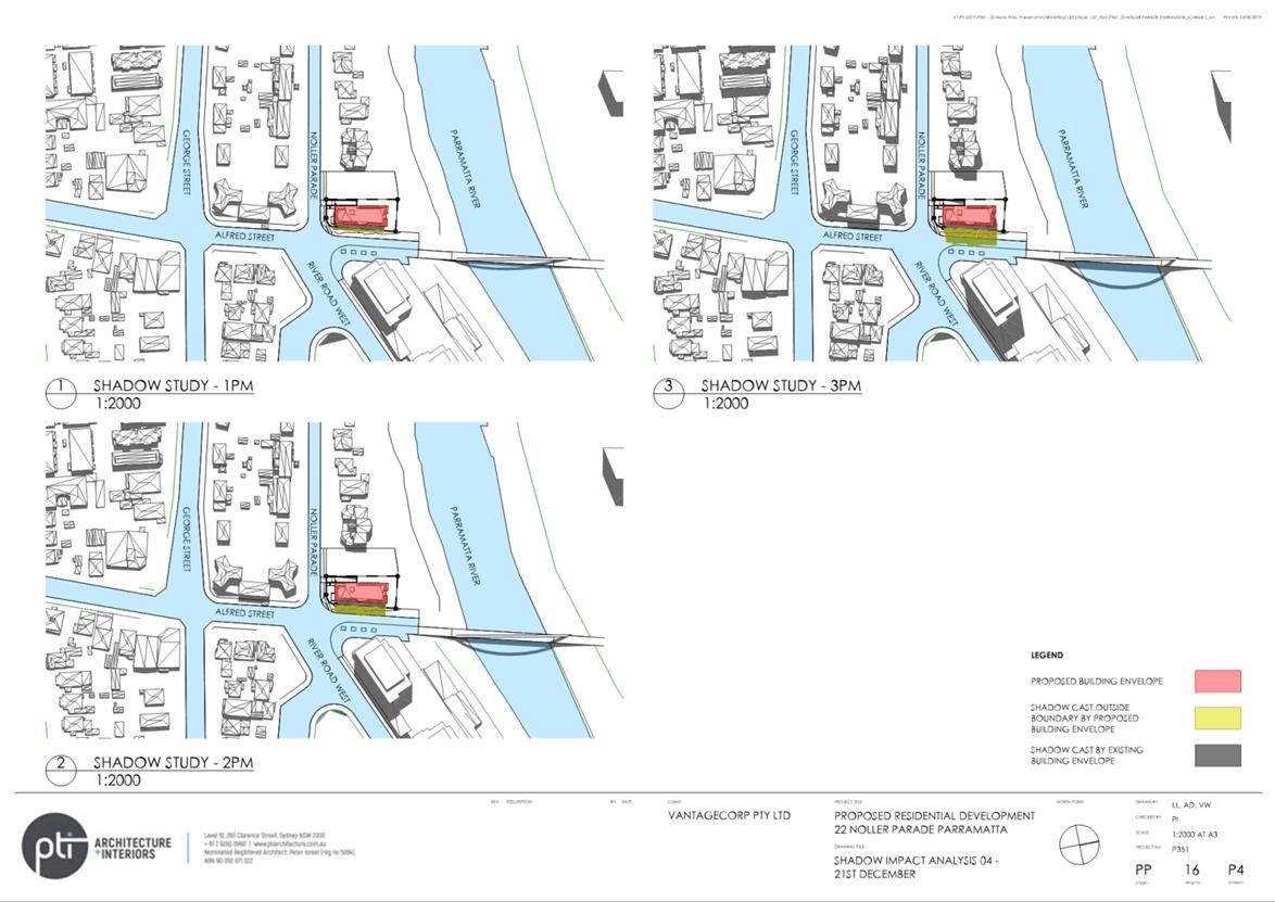
Shadow studies undertaken by the proponent indicates that neighbouring
properties will continue to receive adequate solar access. Additional shadow
studies will be required at the development assessment stage, which will
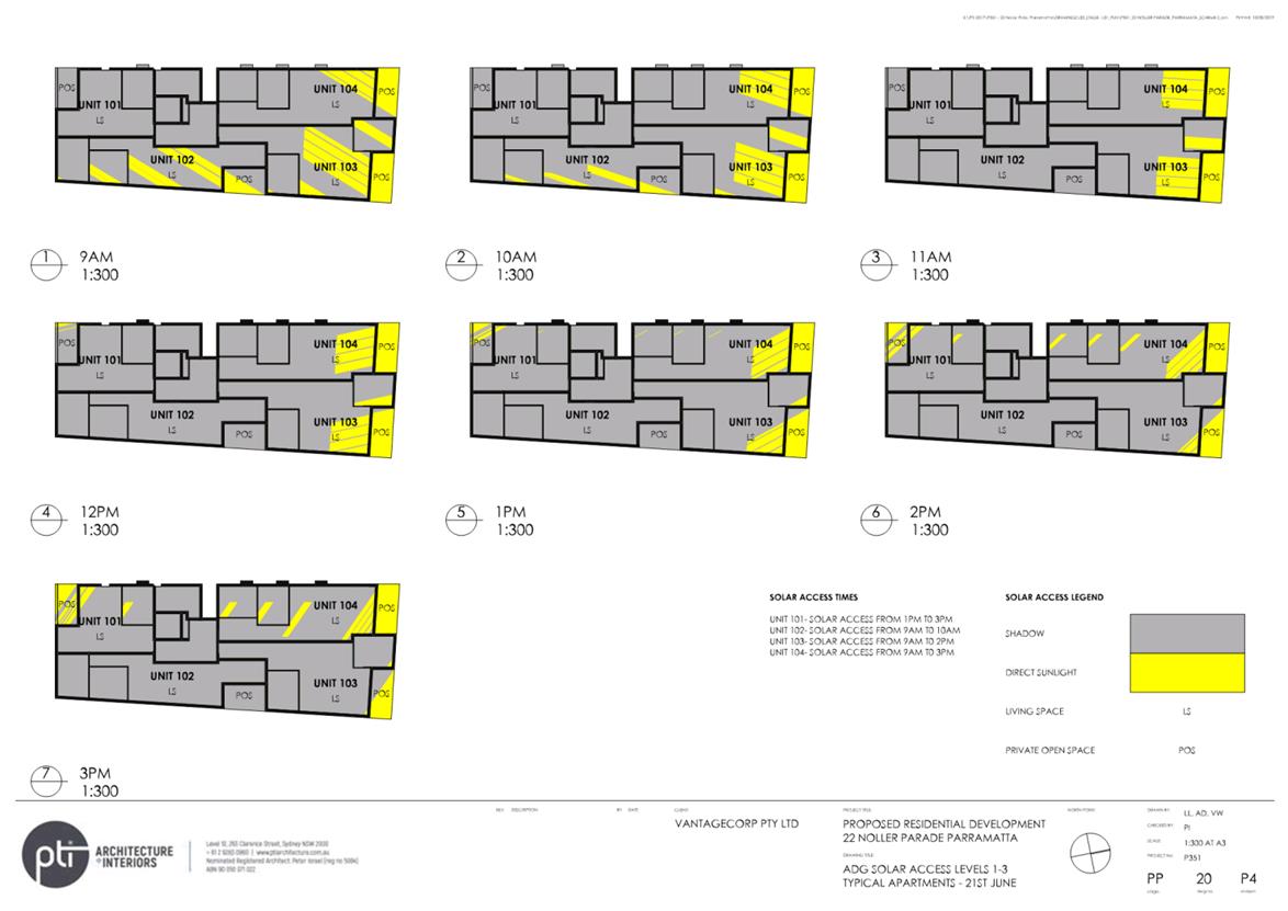
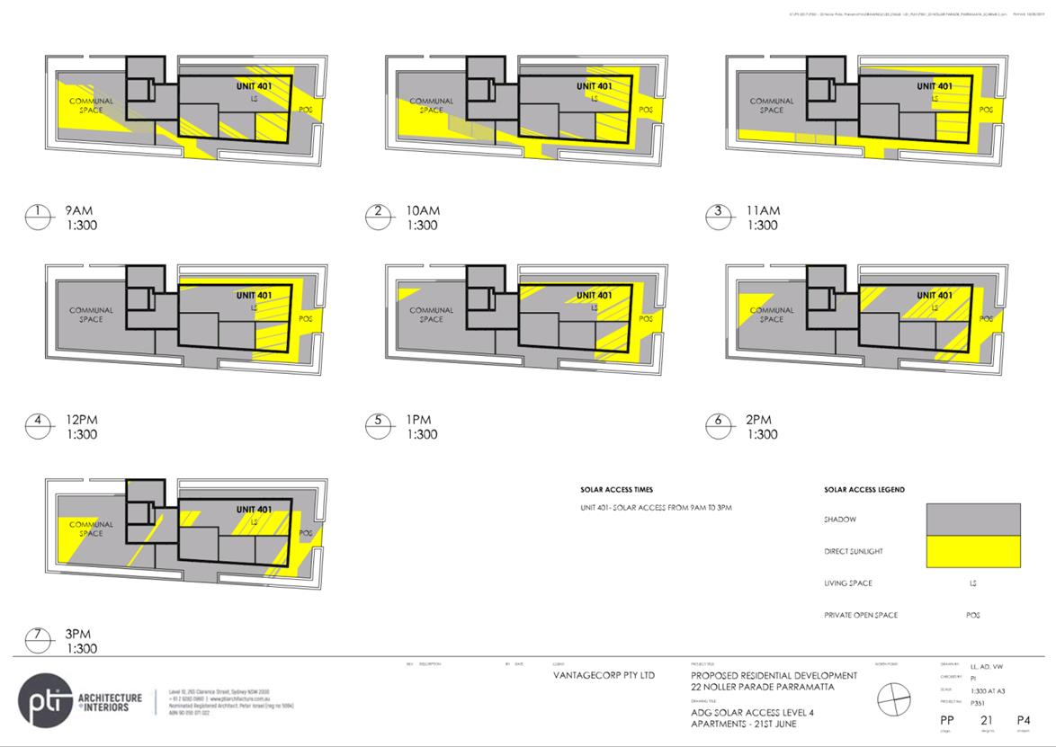
require an assessment against solar access controls.
(b) The current building on the
site is single storey. The current planning controls for the site permit a
four (4) storey building, in line with the neighbouring buildings to the
west, and to the south of the site. The Planning Proposal seeks to permit up
to a five (5) storey building and is significantly lower than the existing 12
storey development to the east of the site. Noting surrounding 4 storey
development, the proposed height that will allow up to five storeys will not
result in significant impacts on vistas beyond what is possible under current
controls.
3. (a)
The proposed height and density are consistent with the immediate character
of the area. Existing zoning of the adjoining and surrounding developments
has resulted in the site becoming isolated. This proposal will provide an
appropriate transition between the B4 zoning to the east, and the R3 zone to
the west and south of the site.
(b) The bulk and scale of any
future proposed building is required to be consistent with relevant standards
and controls. Any residential flat building will be required to be consistent
with the relevant requirements of the Apartment Design Guide.
(c) The Planning Proposal has
been assessed as meeting the strategic merit of State and Council planning
policies.
|
|
2. Site accessibility/Safety
access
|
Raised in 1 submission
|
|
1. Concerns
raised regarding queuing traffic at the light rail signalised intersection.
2. Concerns
raised about Noller Parade being used as overflow parking for residents and
visitors to the neighbouring River Road West development.
|
1. Council's Senior Traffic and Transport Engineer
considers the existing road network has capacity and generation of traffic
from this proposal is not considered to be significant. Therefore, the
Planning Proposal will not exacerbate existing traffic conditions and does
not trigger the need for intersection upgrades.
Future
intersection upgrades relating to the PLR are outside the scope of this
proposal.
2. The site is suitably sized to accommodate
compliant basement car parking to service future residential development,
which will be considered further at the Development Application phase.
Therefore, overflow parking is not expected to be a significant issue as a
result of this Planning Proposal.
Further,
the location will have high public transport accessibility through the close
location of the future Tramway Avenue Parramatta Light Rail stop, and
pedestrian and cycling connections via Alfred Street Bridge.
|
|
3. Flooding
|
Raised in 1 submission
|
|
1. Concerns
that this proposal could bring significant increase in flood risk for
residents of the site, and neighbouring sites.
|
Council’s Flood Engineers have identified that
Noller Parade and Alfred Street are important flow paths for potential
floodwaters to find their way to the Parramatta River.
Future development on the site can be appropriately
designed at the development application (DA) stage.
|
AGENCY SUBMISSIONS
Environment, Energy and
Science (EES), DPE
28. The Planning Proposal was referred to EES
for comment. EES do not object to the Planning Proposal but raised some
matters for consideration. Table 4 below summarises the key issues including Council officer
responses.
Table 4 - Summary of
Issues raised by EES during public exhibition period
|
Consultation
Issues
|
Council Officer Response
|
|
1. Consideration of current and
future impacts of flooding for the site.
2. Consideration
and management of future and residual impacts of climate change to the site.
3. Consideration
of impacts to the Parramatta River Riparian Corridor related to the building
of the Alfred Street Bridge.
|
Council’s Flood Engineers have identified that
Noller Parade and Alfred Street are important flow paths for potential
floodwaters to find their way to the Parramatta River. The design of the site
and its interface with public areas must enable any overland flows to access
both Noller Parade and Alfred Street. Additionally, any development
application for this site will require detailed flood management planning,
and detailed strategies for evacuation and/or shelter in place flood response
planning.
Responding to residual risks and future impacts relating to
climate change for this site will be addressed at the DA stage through the
development controls including energy and water efficient buildings,
responses to flooding and deep soil/landscape requirements.
This Planning Proposal does not relate to the development
of the Alfred Street Bridge. Impacts to the riparian corridor relating to the
Alfred Street Bridge construction have been addressed in the Vegetation
Management Plan (2021) developed for the Alfred Street Bridge project.
|
Heritage NSW
29. The Planning Proposal was
referred to Heritage NSW. No response was received.
NSW State Emergency Services
30. The Planning Proposal was referred to NSW State
Emergency Services for comment. Table 5 below summarises the key
issue raised, including a Council officer response.
Table 5 - Summary of
issues raised by NSW SES during public exhibition period
|
Consultation
Issues
|
Council Officer Response
|
|
1. Consideration
to be given to Ministerial Section 9.1 Directions relating to flood prone
land which is consistent with the NSW Flood Prone Land Policy found in the
NSW Floodplain Development Manual (2005).
|
Council’s Flood Engineers have identified that
Noller Parade and Alfred Street are important flow paths for potential
floodwaters to find their way to the Parramatta River. The design of the site
and its interface with public areas must enable any overland flows to access
both Noller Parade and Alfred Street. Additionally, any development
application for this site will require detailed flood management planning,
and detailed strategies for evacuation and/or shelter in place flood response
planning.
Risk and Emergency
Management policies can be prepared to NSW Hazard Management and the NSW
Floodplain Development Manual requirements.
|
FINANCIAL IMPLICATIONS FOR
COUNCIL
31. Any work to progress the
finalisation of the Planning Proposal would be prepared by Council Officers and
within the existing City Planning and Design budget. Should this matter
progress, a Planning Agreement will be entered into between the applicant and Council
which will deliver Council a financial payment of $225,000 to support the delivery
of public domain works associated with, and facilitating connections to, the
under-construction Alfred Street Bridge.
CONCLUSION AND NEXT STEPS
32. Following consideration of all
issues raised during the public exhibition of the Planning Proposal and draft
Planning Agreement for the site, as outlined in this report, it is recommended
that the Planning Proposal be endorsed to proceed to finalisation with no
changes to the exhibited documentation.
33. It is therefore recommended that the
Local Planning Panel supports the Council Officer recommendation for Council to
endorse the exhibited Planning Proposal and exercise its plan-making
delegations as granted by the Gateway Determination.
34. It
is also recommended that the draft Planning Agreement that
provides Council with additional funding/resourcing to deliver public domain
works associated with, and facilitating new connections to, the future Alfred
Street Bridge be endorsed by Council.
Dot Hepburn
Project Officer
Michael Rogers
Land Use Planning Manager
David Birds
Group Manager, Major Projects and
Precincts
Jennifer Concato
Executive Director City Planning and
Design
Attachments:
|
1⇩ 
|
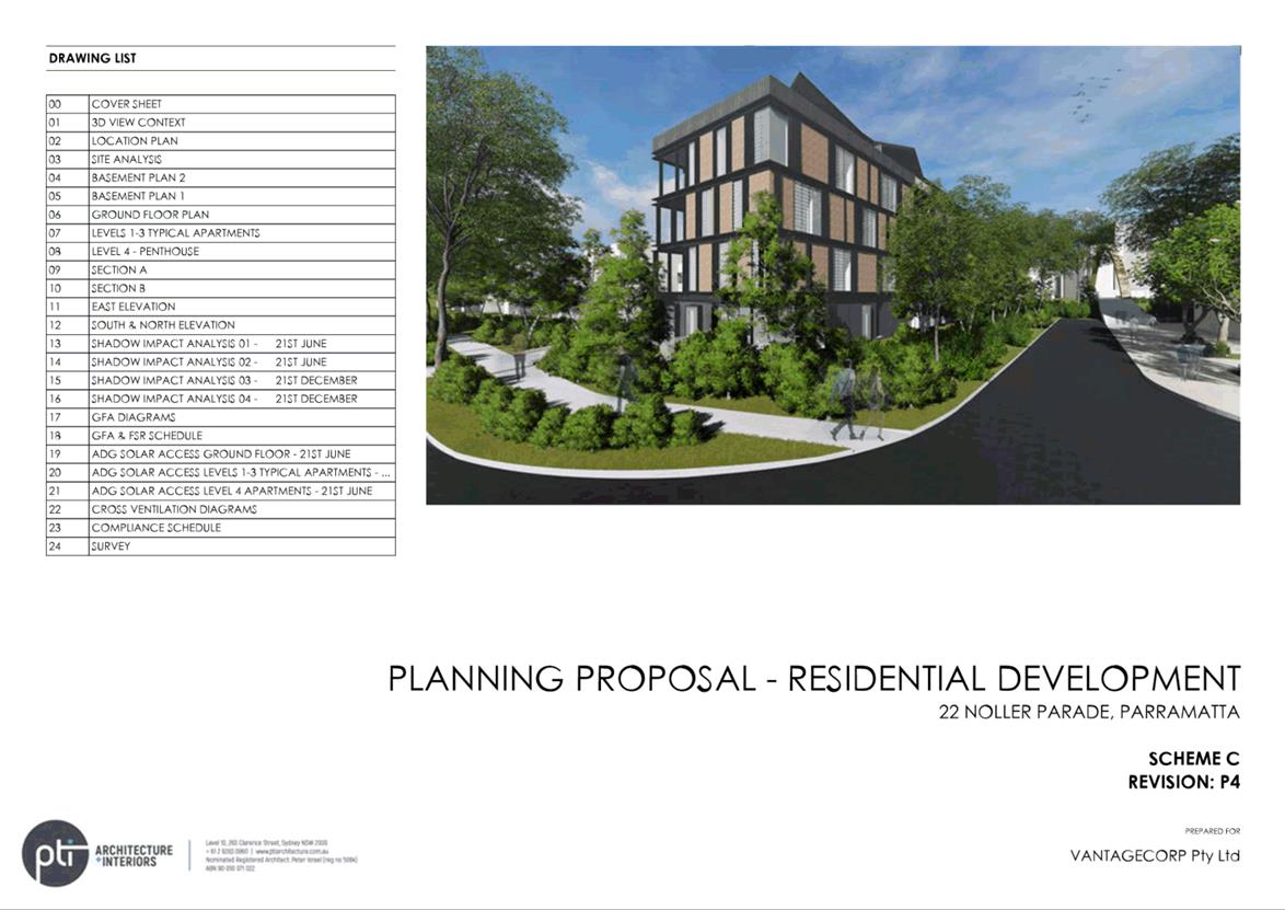
Planning Proposal - 22 Noller Parade,
Parramatta
|
63 Pages
|
|
|
2⇩
|
Draft Planning Agreement as exhibited
|
28 Pages
|
|
|
3⇩
|
Gateway determination - 5 December 2019
|
2 Pages
|
|
|
4⇩
|
Gateway alteration - 27 October 2021
|
1 Page
|
|
REFERENCE MATERIAL
|
Item 6.1 - Attachment
1
|
Planning Proposal - 22 Noller Parade, Parramatta
|

|
Item 6.1 - Attachment 2
|
Draft Planning Agreement as exhibited
|

|
Item 6.1 - Attachment 3
|
Gateway determination - 5 December 2019
|
|
Item 6.1 - Attachment 4
|
Gateway alteration - 27 October 2021
|