Local Planning Panel 4 June 2024 Item 5.1
ITEM NUMBER 5.1
SUBJECT Gateway Request: Planning Proposal for land at 90-94 Phillip Street, Parramatta
REFERENCE RZ/12/2018 -
APPLICANT/S Think Planners
OWNERS Buildup Phillip Pty Ltd (90 Phillip St) and Academy Parramatta Pty Ltd (94 Phillip St)
REPORT OF Group Manager, Major Projects and Precincts
Development applications considered by Sydney central city planning panel Nil
PURPOSE
To seek the Local Planning Panel advice on a Planning Proposal for land at 90-94 Phillip Street, Parramatta for the purpose of seeking a Gateway determination from the Department of Planning, Housing and Infrastructure (DPHI).
That the Local Planning Panel consider the following Council Officer recommendation in its advice to Council:
(a) That Council approve, for the purpose of seeking a Gateway determination from the Department of Planning, Housing and Infrastructure (DPHI), the Planning Proposal for land at 90-94 Phillip Street, Parramatta (Attachment 1), which seeks to amend the Parramatta Local Environmental Plan 2023 (Parramatta LEP 2023) in relation to the subject site by:
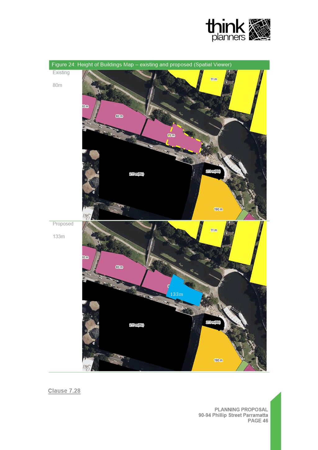
i. Increasing the maximum Height of Buildings control on the map from 80 metres (105 metres when including all bonuses) to part 133 metres (153 metres when including all bonuses) and part 0 metres;
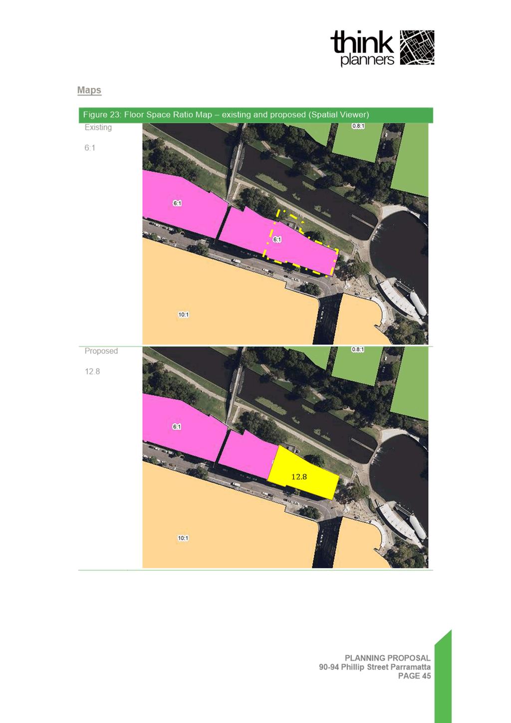
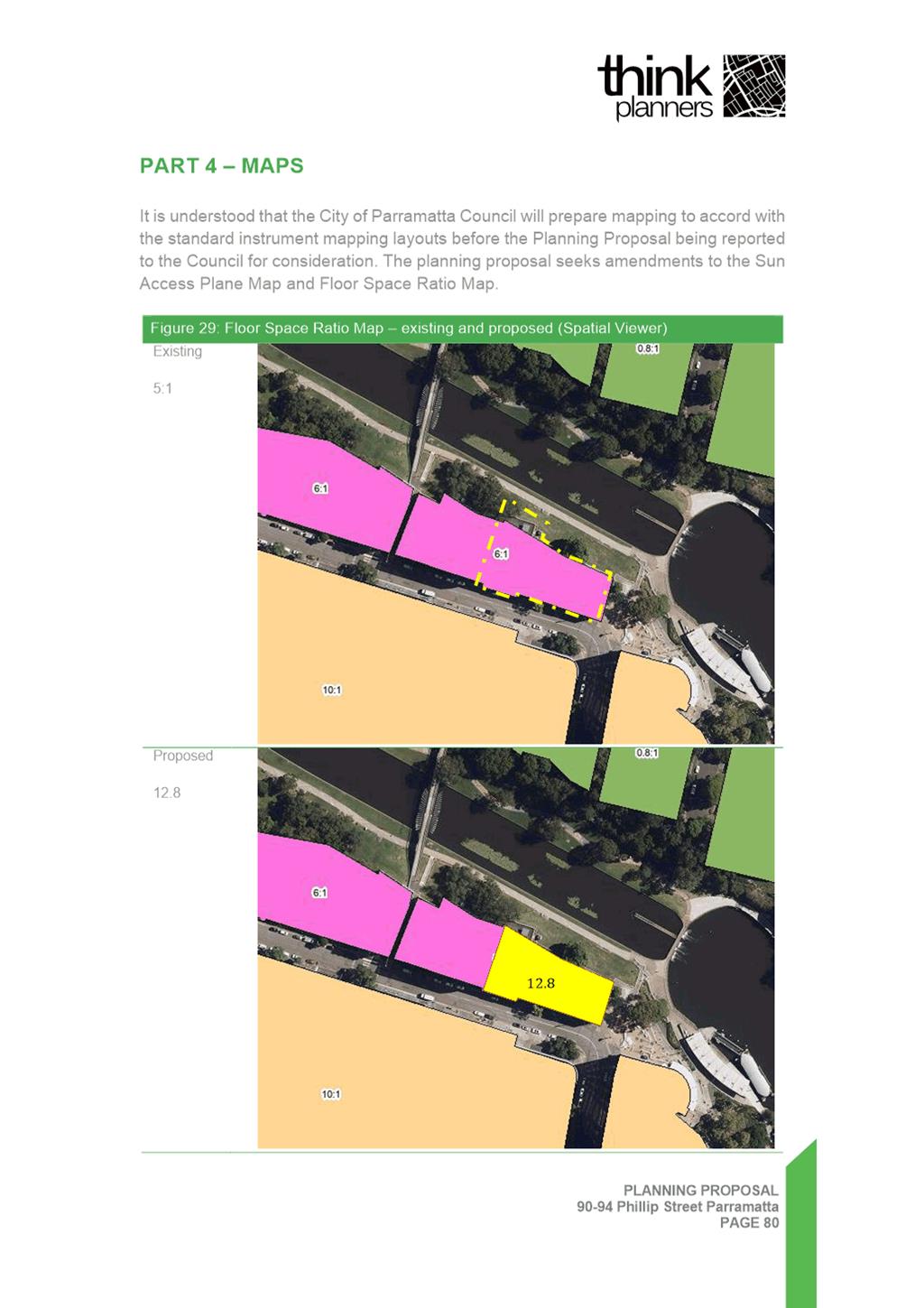
ii. Increasing the Floor Space Ratio control on the map from 6:1 (9.7:1 when including all bonuses) to 12.8:1 (15.36:1 when including all bonuses); and
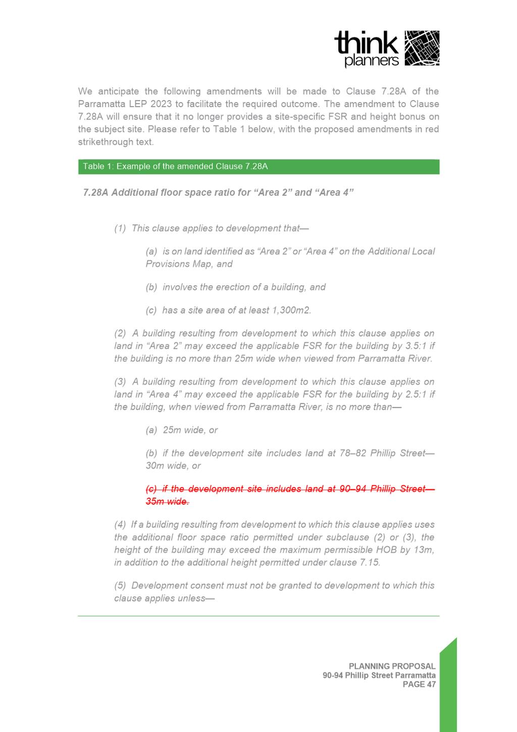
iii. Amending Clause 7.28A so that it no longer provides a site-specific FSR and height bonus for the subject site.
(b) That the Gateway request referred to above in recommendation (a) be submitted to the DPHI after the Applicant’s Flood Report has been updated to reflect the Parramatta River Flood Study 2024.
(c) That Council request the DPHI to provide Council with the authorisation to exercise its plan-making delegations for this Planning Proposal.
(d) That Council authorise the CEO:
i. To amend the Parramatta Development Control Plan 2023 (PDCP 2023) in relation to the subject site as described in this report;
ii. To draft a Planning Agreement subject to the details within the submitted Letter of Offer provided at Attachment 2 which address the matters described in this report; and
iii. If a Gateway Determination is
issued by the DPHI, the draft Planning Agreement and draft amendment to
the PDCP 2023 are placed on public exhibition concurrently with the Planning
Proposal.
(d) That Council authorise the CEO to correct any minor anomalies of a non-policy and administrative nature that may arise during the plan-making process of the documents.
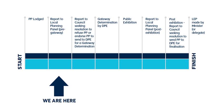
PLANNING PROPOSAL TIMELINE
SUMMARY
1. This report seeks the advice of the Local Planning Panel on a Planning Proposal for land at 90-94 Phillip Street, Parramatta for the purpose of seeking a Gateway determination from the DPHI.
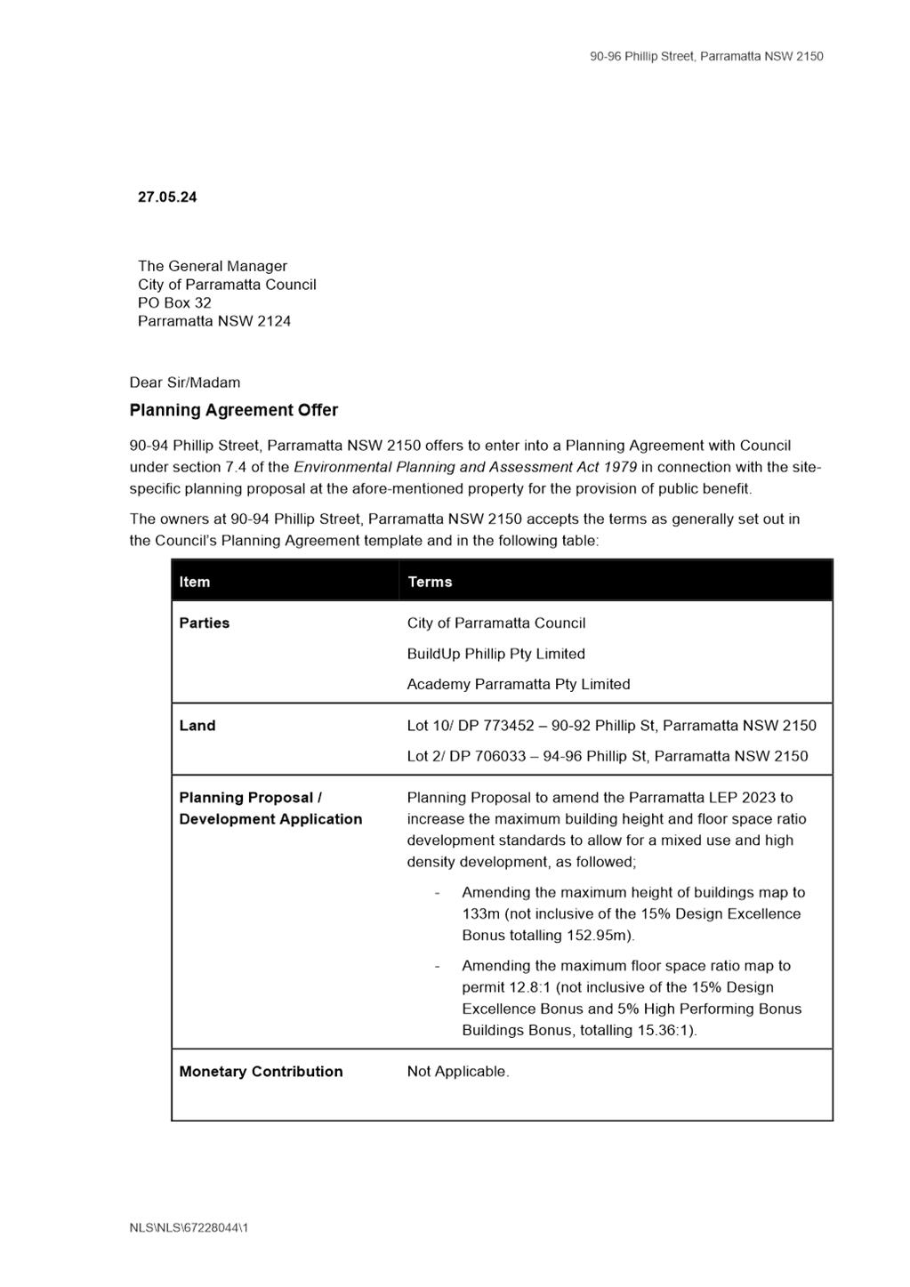
2. The Planning Proposal seeks to amend Parramatta Local Environmental Plan 2023 (Parramatta LEP 2023) as shown in Table 1 below:
Table 1: Existing and proposed controls
|
Control |
Current control |
Proposed control |
|
Height of Buildings (Mapped) |
80m
|
133m |
|
Height of Buildings (Total including 15% Design Excellence bonus) |
105m* (31 storeys mixed use) |
153m (47 mixed use storeys) |
|
Floor Space Ratio (Mapped) |
6:1 |
12.8:1 |
|
Floor Space Ratio (Total including 15% Design Excellence bonus and 5% High Performing Buildings bonus) |
9.7:1* |
15.36:1 |
* The current height and FSR controls are also subject to a 13 metre and a 2.5:1 site-specific bonus under the controls introduced by SEPP 2. These are included in the total figures for these controls.
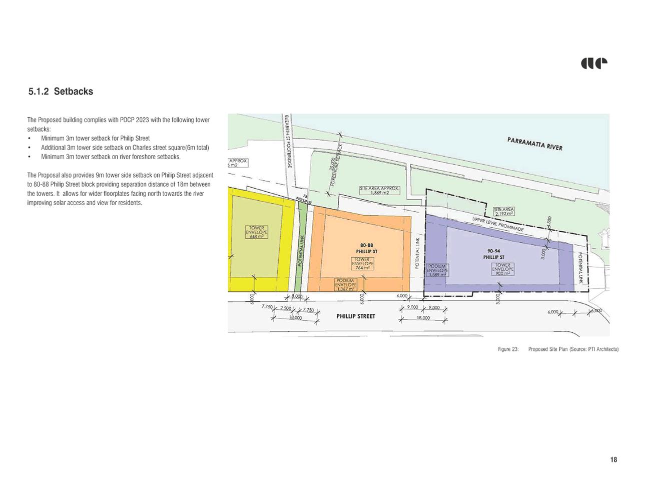
3. The Planning Proposal necessitates amendment of the Parramatta Development Control Plan (DCP) 2023 to increase the eastern tower setback and align with the reference scheme.
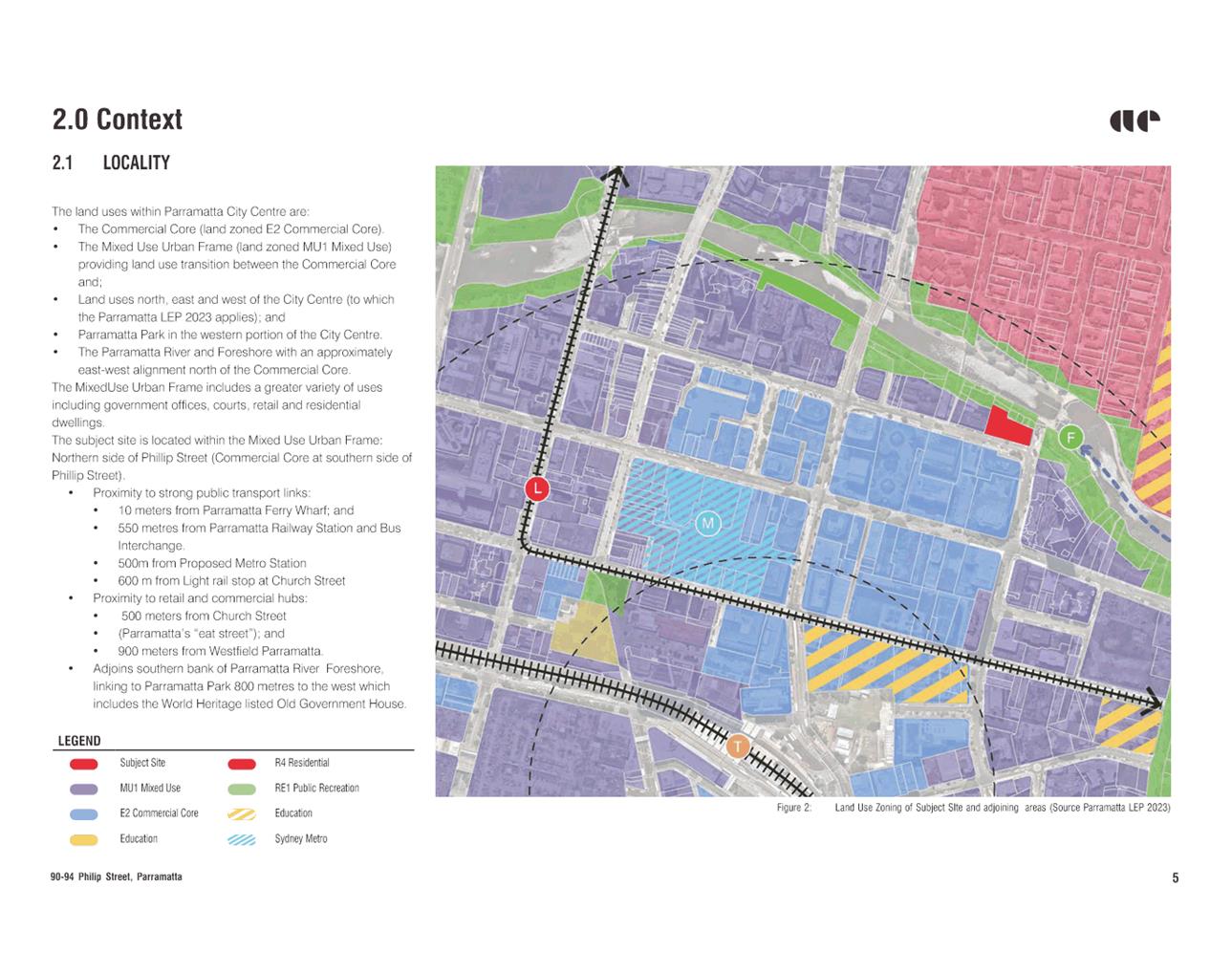
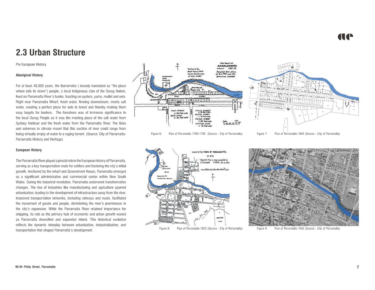
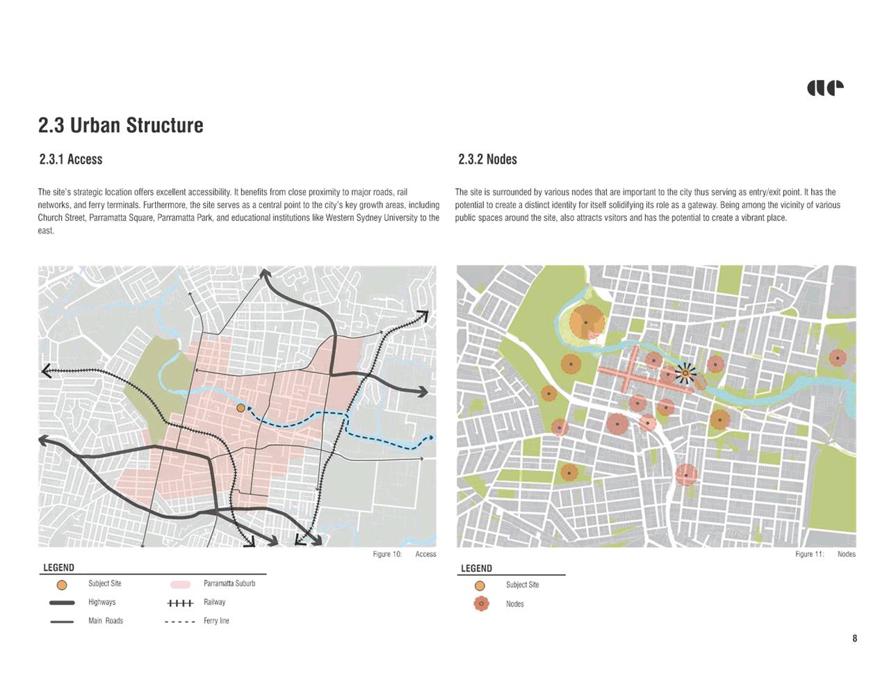
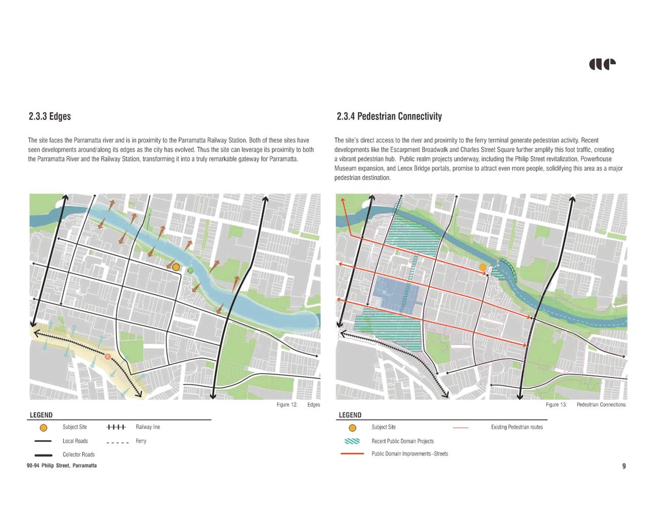
SITE DESCRIPTION
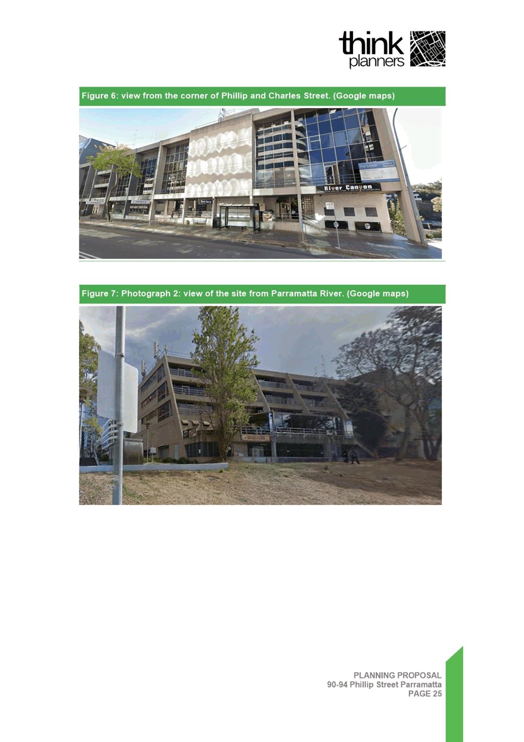
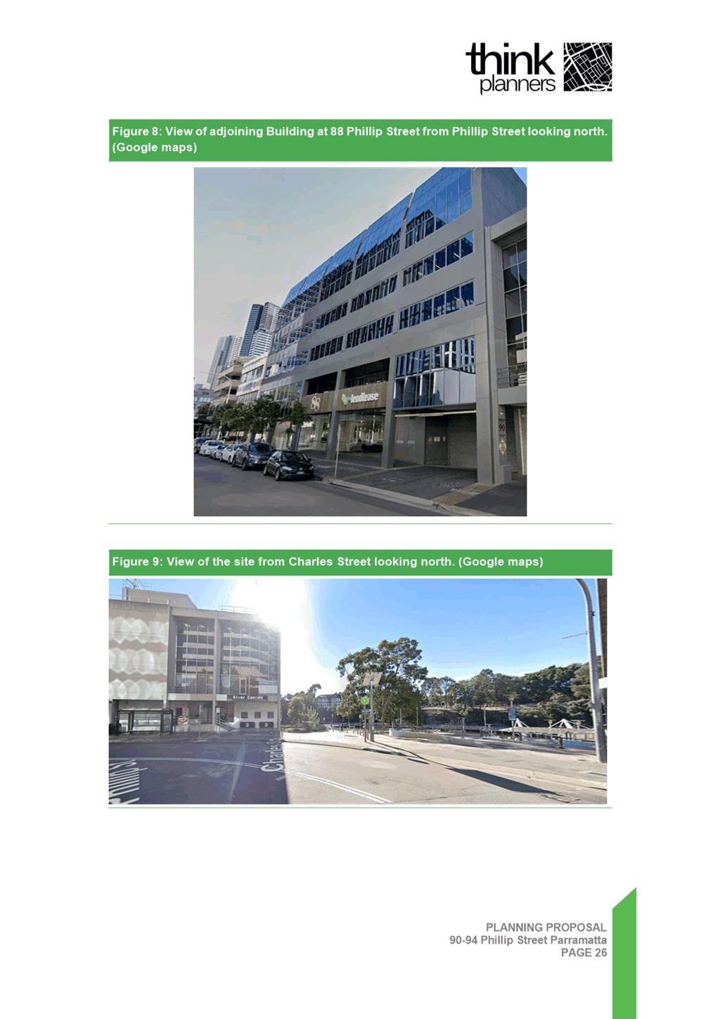
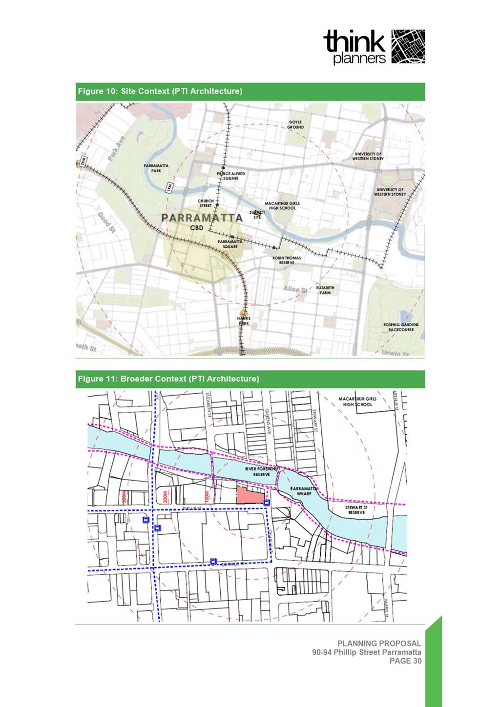
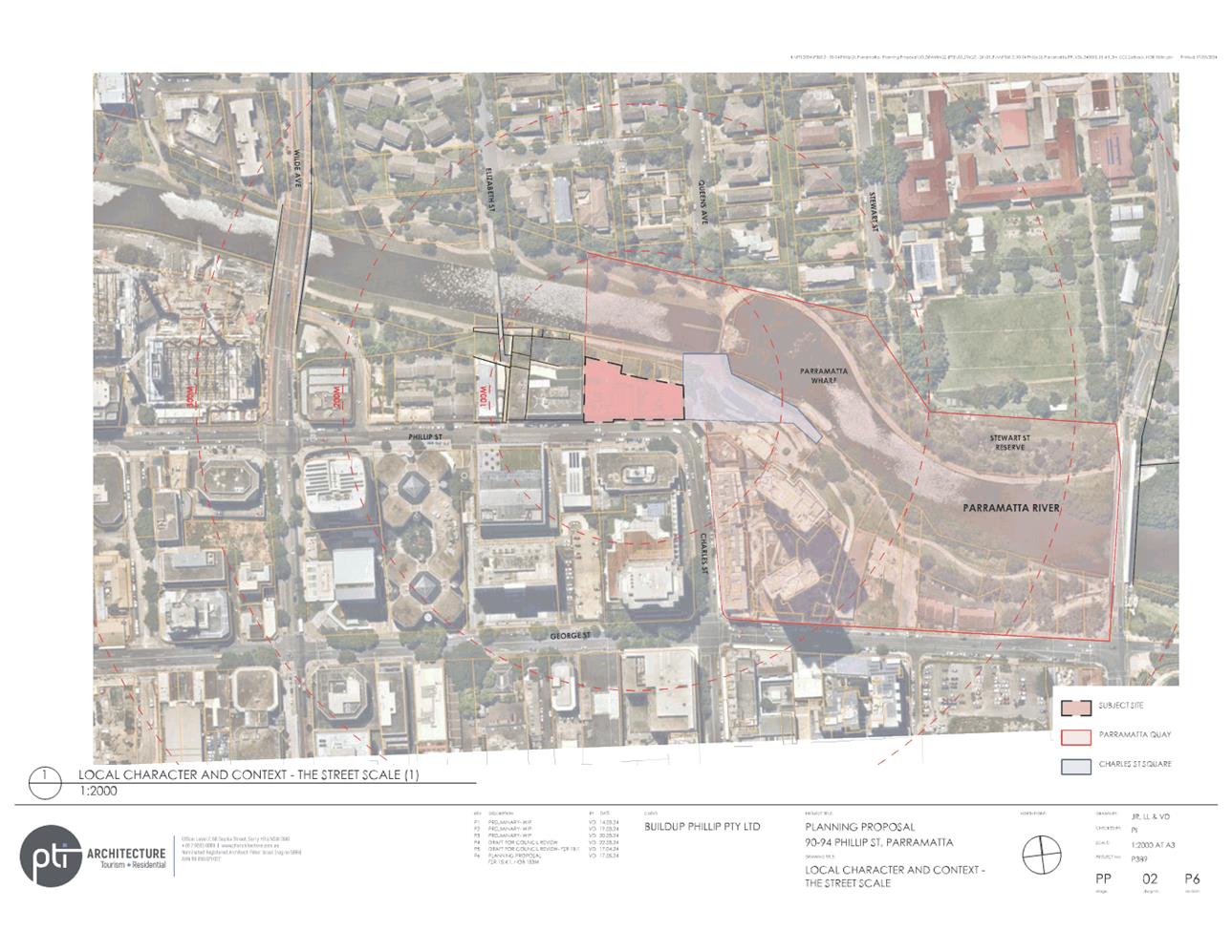
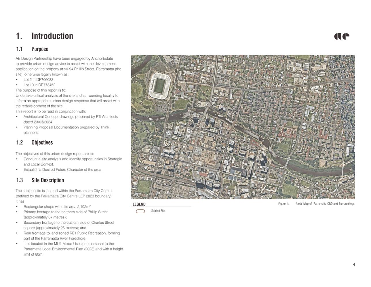
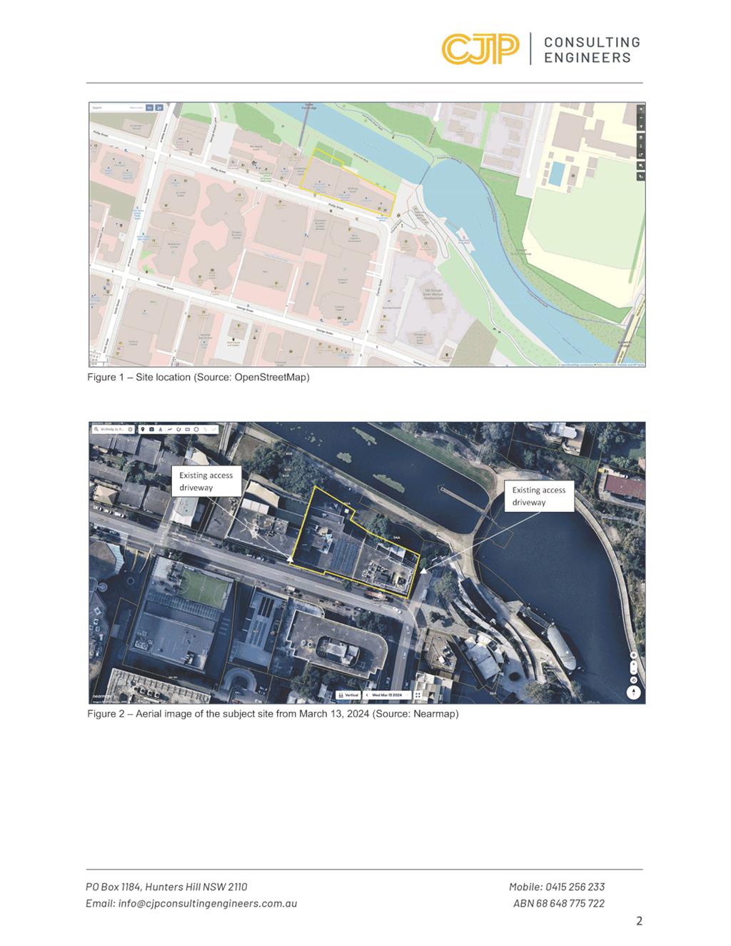
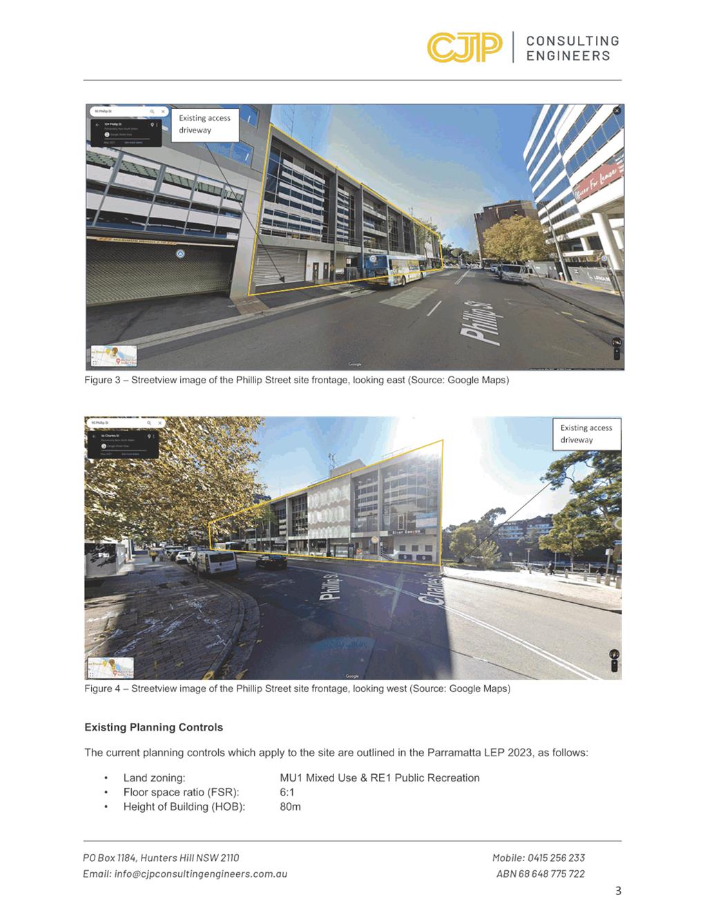
4. The subject site is located at 90 and 94 Phillip Street, Parramatta and has a legal description of Lot 10 DP 773452 (90 Phillip St) and Lot 2 DP 706033 (94 Phillip Street) (see Figure 1). The site is on the southern bank of the Parramatta River and is to the west of the Ferry Wharf known as “Parramatta Quay” and the recently completed Charles Street Square. The total site area is 2,192 sqm.
5. Both 90 and 94 Phillip Street contain existing four storey commercial buildings with four storeys above ground floor level car parking. Vehicular access is provided to 90 Phillip Street directly from Phillip Street. Vehicular access is provided to 94 Phillip Street from a driveway over an unmade part of Charles Street directly to the east of the site (refer to Figure 2 below). This arrangement is under an existing right of carriageway over Council owned land that benefits No. 94 Phillip Street.
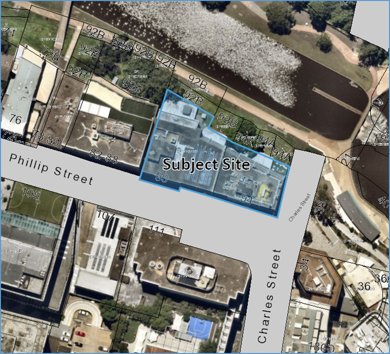
Figure 1: Site location (City of Parramatta GIS)
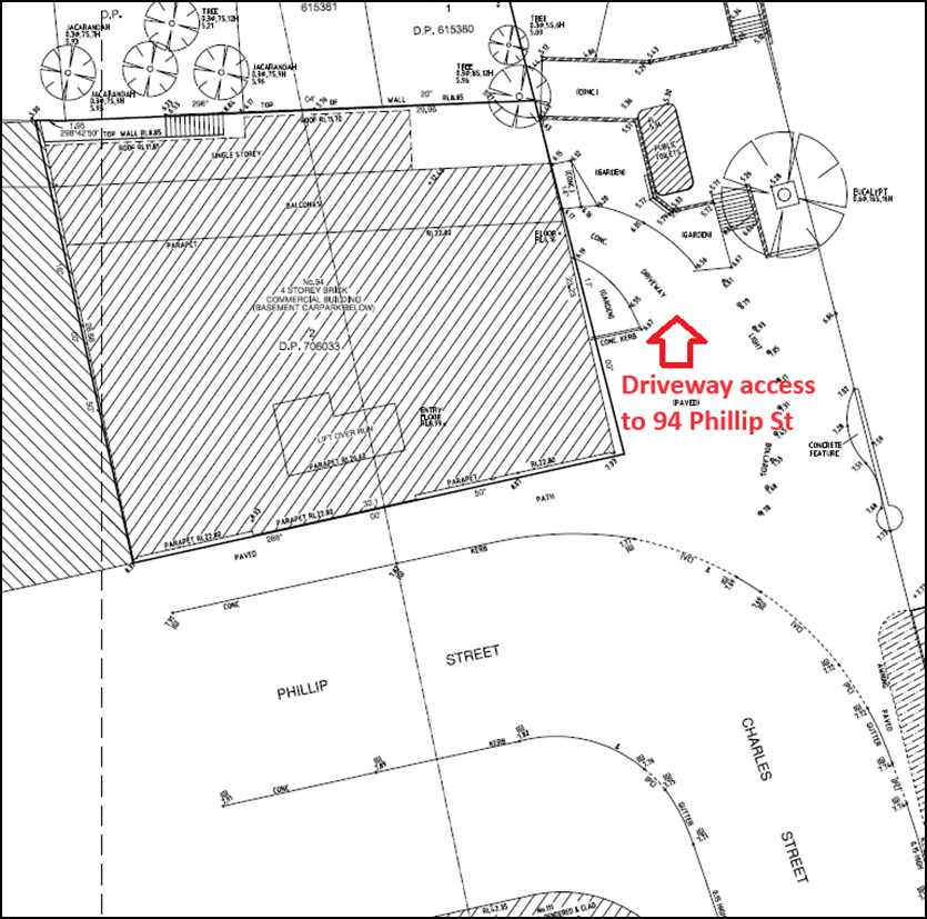 Figure 2: Extract from site survey
indicating location of current driveway access to 94 Phillip St over unmade
portion of Charles Street (Source Applicant’s site survey – Norton
Survey Partners)
Figure 2: Extract from site survey
indicating location of current driveway access to 94 Phillip St over unmade
portion of Charles Street (Source Applicant’s site survey – Norton
Survey Partners)
BACKGROUND
6. In October 2018, the applicant (at that time, Hamptons Property Services, now Think Planners) lodged a Planning Proposal with the City of Parramatta Council for land at 90 to 94 Phillip Street, Parramatta seeking to increase the density of development permitted within the MU1 Mixed Use zoning of the site. The Planning Proposal sought to increase the floor space ratio (FSR) from 6:1 to 21:1 (including the 15% design excellence bonus). It also sought to increase the height control from 80 metres (92 metres including 15% Design Excellence bonus) to 210 metres (including 15% Design Excellence Bonus).
7. Initial assessment by Council Officers raised concerns regarding the density and scale of the proposal considering the prominence of the site on the Parramatta River adjoining Charles Street Square, and its high visibility from the ferry approach to the CBD. The applicant’s Planning Proposal submitted that it was consistent with the draft Parramatta CBD Planning Proposal on the basis that it reflected the draft planning controls at that time including unlimited commercial floor space. The applicant also argued that the site was subject to the draft Opportunity Site provisions. The Opportunity Site provisions provided for a bonus FSR of 3:1 for certain sites that were considered of sufficient size and location to accommodate higher densities with minimal impacts on surrounding development. However, it is noted that the subject site did not meet the relevant site depth requirement to use this draft provision.
8. Several revised reference designs were submitted by the applicant in 2019, which proposed a total FSR of 21:1. Noting the significance of the site on the river foreshore addressing Charles Street Square and a site-specific Planning Proposal for 66 Phillip Street within the same street block, Council staff conducted urban design analysis of these two sites in context of the broader street block. This preliminary urban design work identified potential unsatisfactory outcomes from such building heights along the river and the report to Council dated 15 June 2021 relating to the post-exhibition of the CBD Planning Proposal recommended that this area be removed from the proposed amendment to allow further analysis. Notwithstanding, at the 15 June 2021 meeting Council resolved to proceed with the draft controls for the Phillip Street block under the Parramatta CBD Planning Proposal including incentive building heights and FSR, minimum commercial provisions and the Opportunity Site bonus.
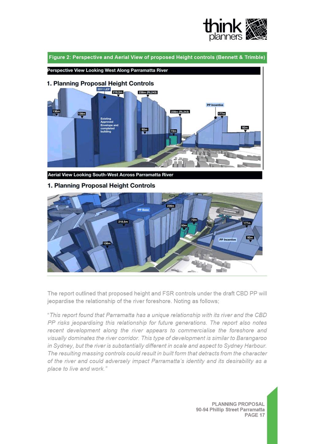
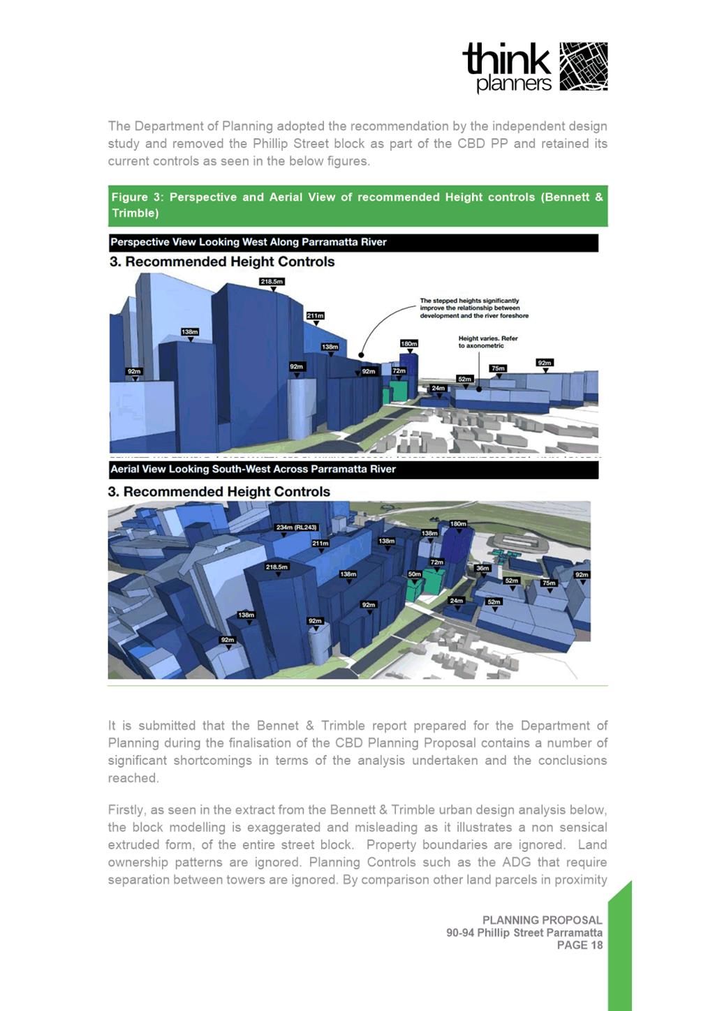
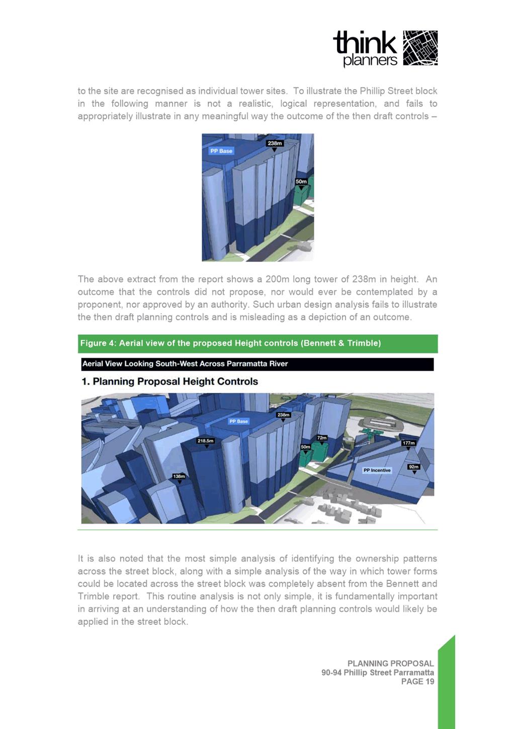
9. The Parramatta CBD Planning Proposal was implemented by Parramatta Local Environmental Plan 2011 (Amendment 56) which was notified on 6 May 2022 and took effect on 14 October 2022. The then DPE finalisation report recommended that the Phillip Street Block not progress as part of the CBD PP and that the block retain its current controls. The DPE’s finalisation report was informed by the Department’s built form modelling and the findings of an Independent Rapid Assessment of the Parramatta CBD Planning Proposal. The Independent Rapid Assessment was prepared by Bennett and Trimble on behalf of the then DPE and is discussed below under the heading of Urban Design. Based on these considerations, the then DPE excluded the Phillip Street block from the new controls and the existing density controls remained for the site at a FSR of 6:1 and HOB of 80 metres.
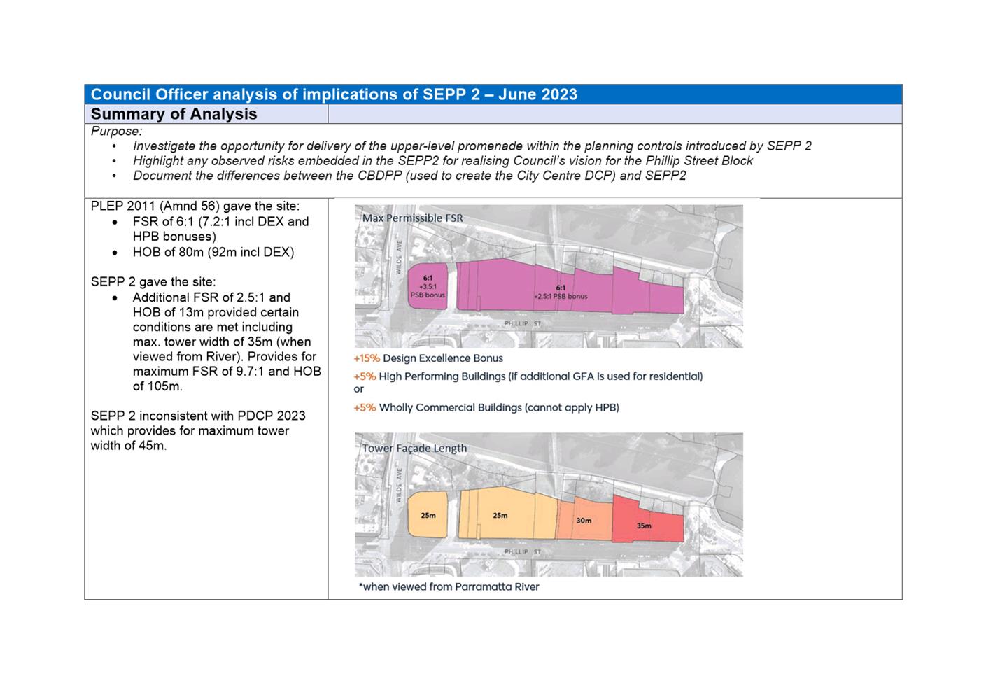
10. The, then DPE made further changes to the Parramatta CBD planning controls through State Environmental Planning Policy Amendment (Parramatta CBD) (no. 2) on 16 December 2022. This introduced controls to facilitate growth in employment uses within certain B3 Commercial Core and B4 Mixed Use zone sites within the Parramatta CBD as well as uplift for the Phillip Street Block, subject to certain provisions being met. In this regard, Clause 7.28A permits development in the Phillip Street block (including the subject site) to exceed the floor space ratio limit by 2.5:1 subject to conditions.
11. The density bonuses now applicable to the site under Clause 7.28A provide the site with the potential for a total FSR of 9.7:1 which is less than that sought by the applicant’s Planning Proposal.
CURRENT PLANNING CONTROLS
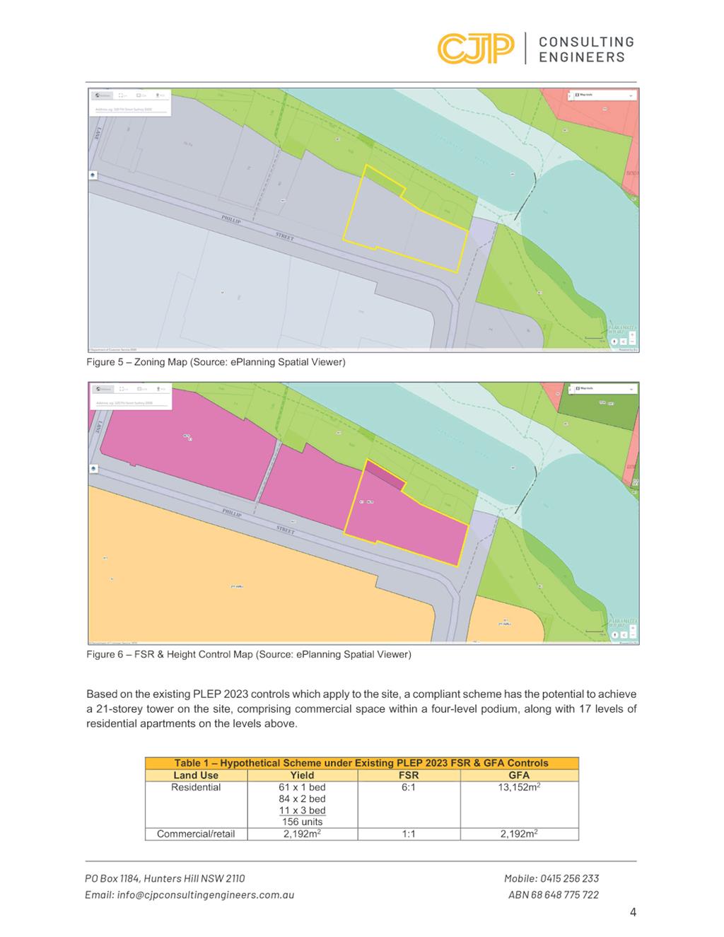
12. Under the provisions of the Parramatta LEP 2023, as introduced by SEPP 2, the following planning controls apply to the subject site:
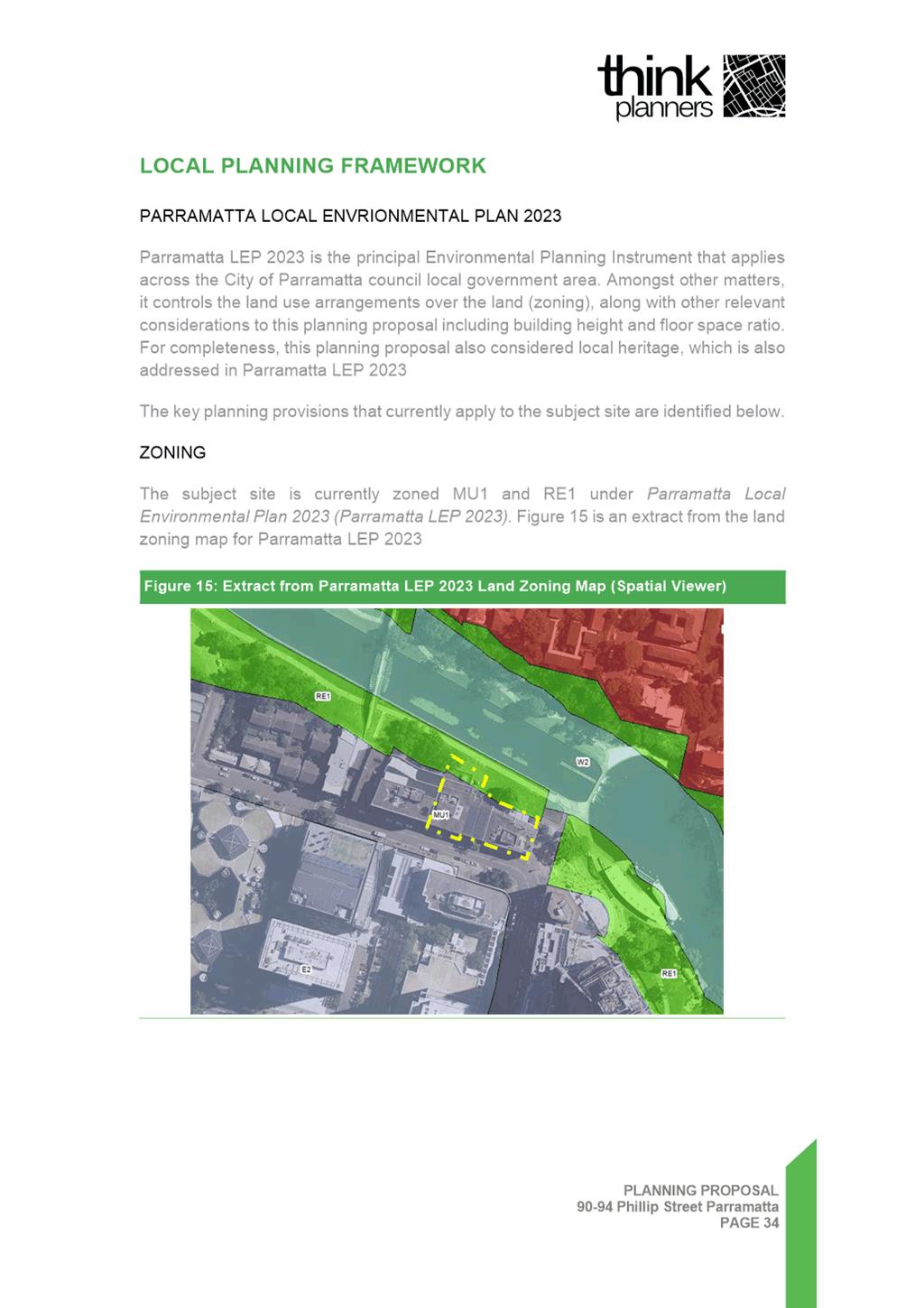
a. Land Use zoning: MU1 Mixed Use.
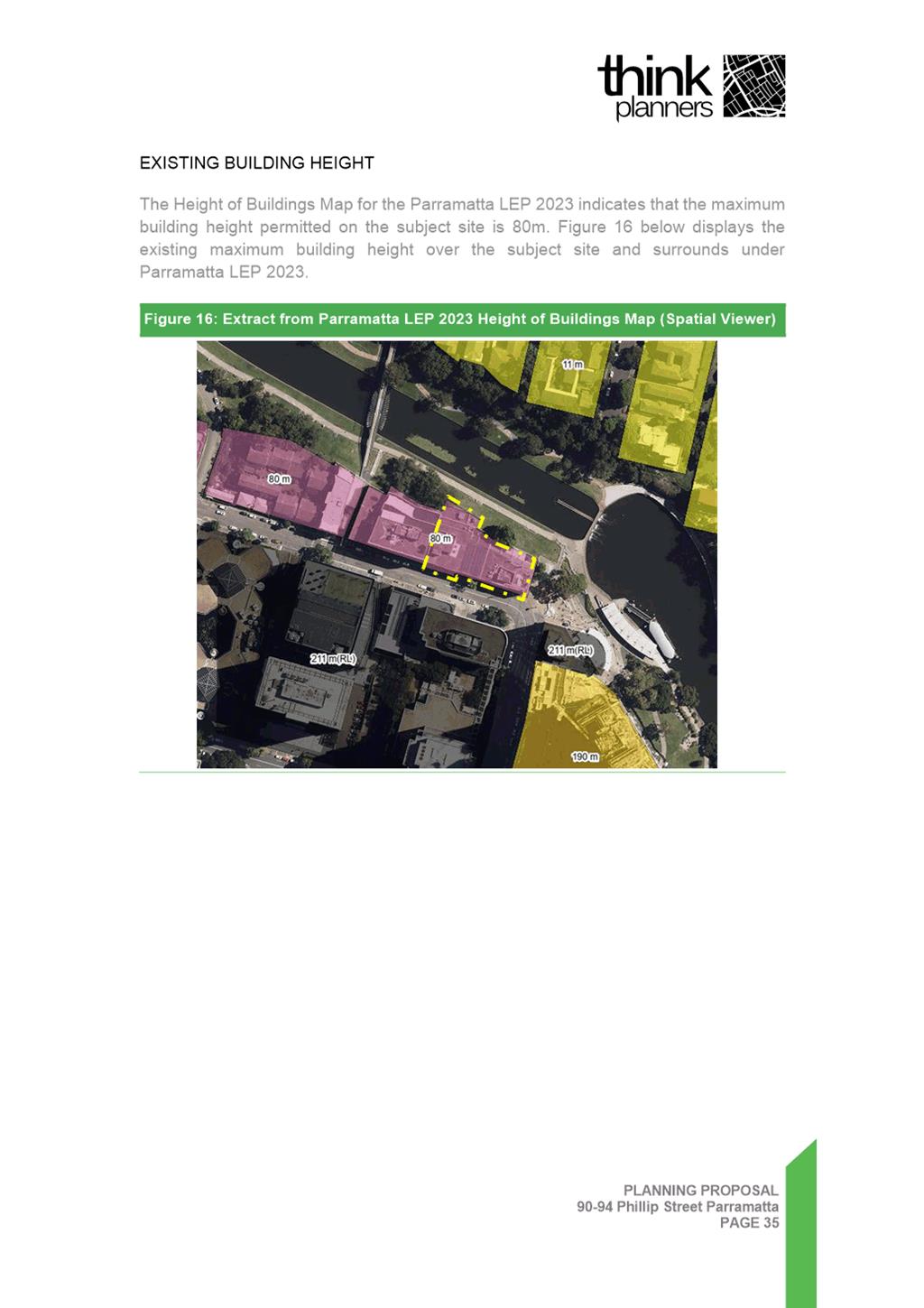
b. Maximum Height of Buildings across the majority of the site: 80 metres (105 metres including 15% Design Excellence bonus and 13 metre bonus under Clause 7.28A).
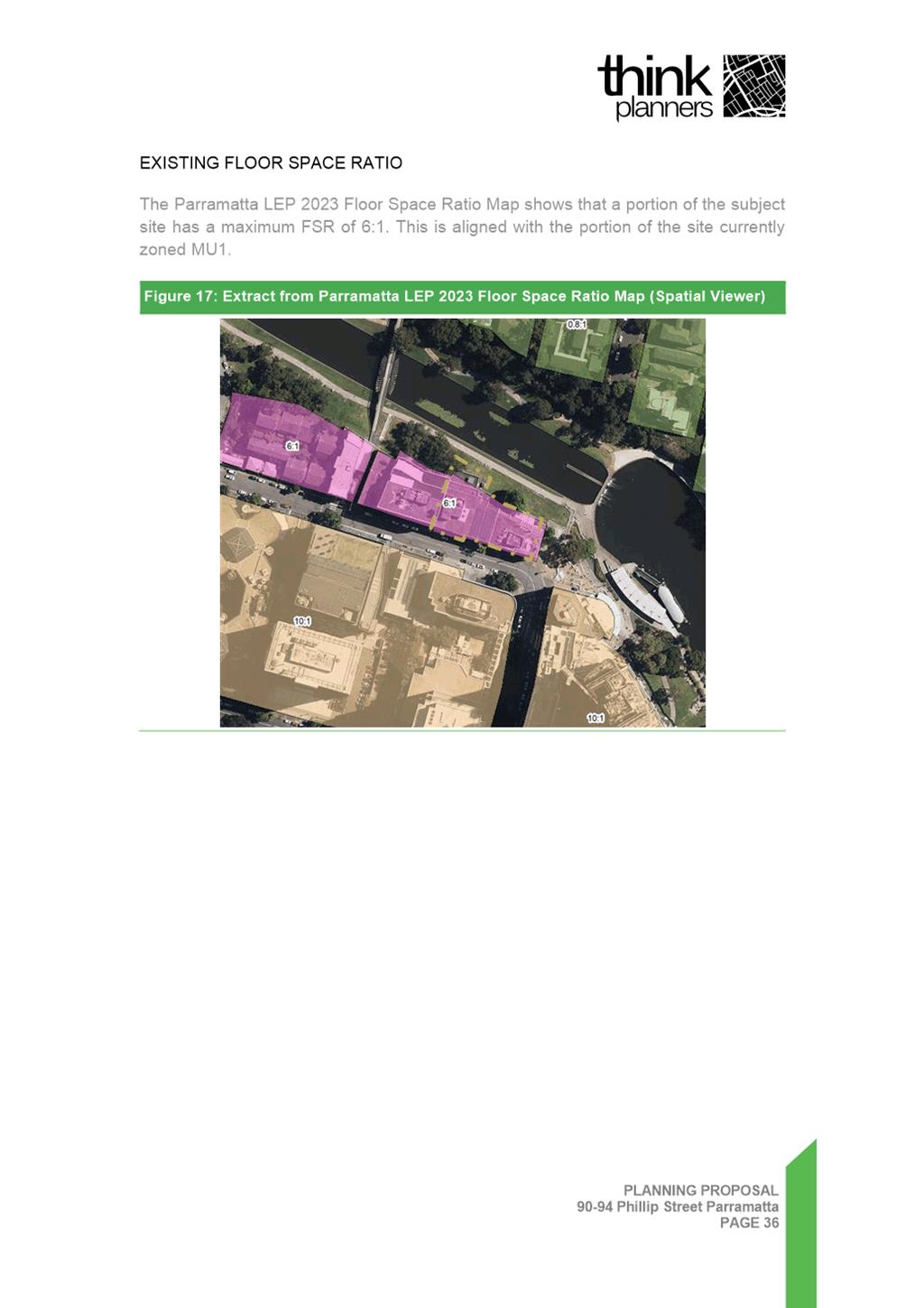
c. Maximum floor space ratio (FSR) of 6:1 mapped (9.7:1 including 15% Design Excellence bonus and 2.5:1 bonus under Clause 7.28A).
d. Maximum tower width of 35 metres when viewed from the Parramatta River in order to use the 2.5:1 bonus FSR.
e. Local Road Widening Reservation under the Land Reservation Acquisition Map. This applies to a narrow strip of land approximately 2 metres wide on part of the Phillip Street frontage of 90 Phillip Street.
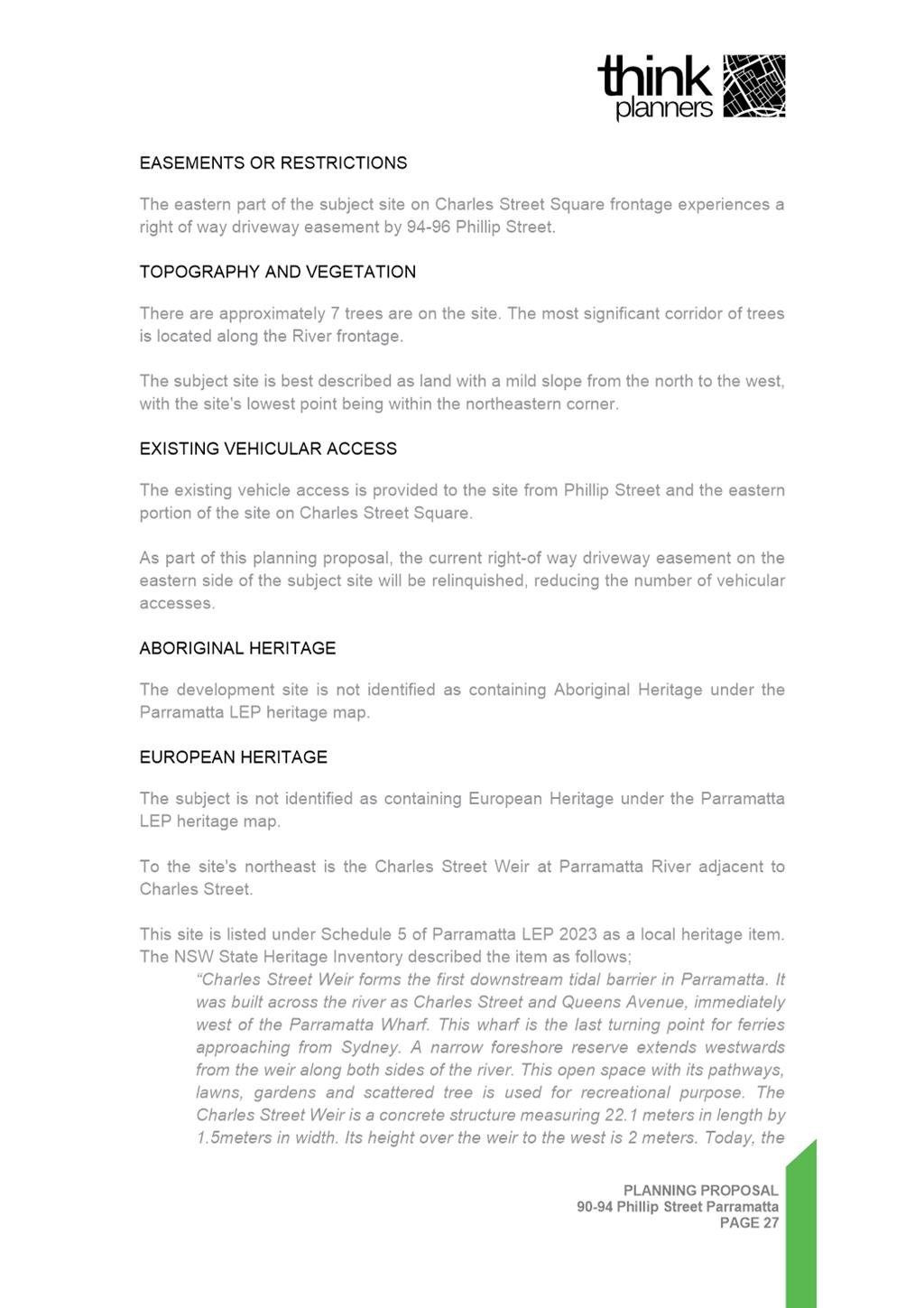
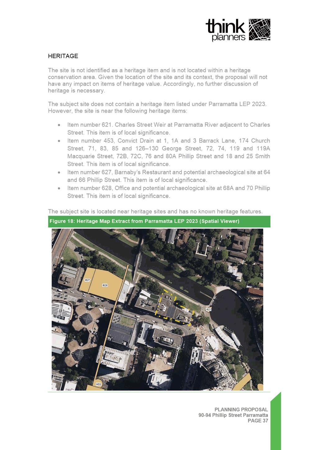
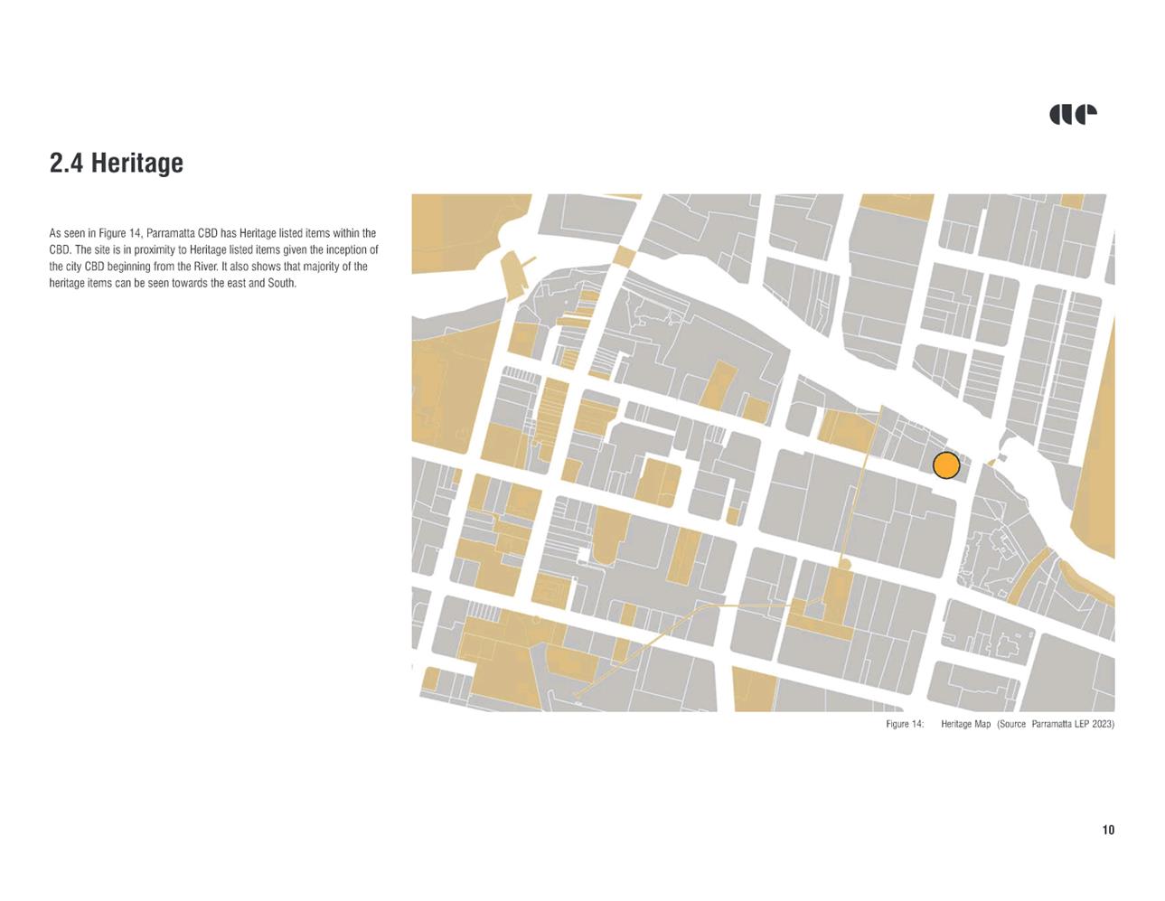
13. The site is not heritage listed. However, there are several items within proximity to the site that are identified as items of local heritage significance under Parramatta LEP 2023 (Refer to Figure 3 below). Approximately 40 metres to the north-east of the site is “Charles Street Weir”. Approximately 70 metres to the west of the site is the “Convict Drain”, further to the west is “Barnaby’s Restaurant and potential archaeological site” at 70 Phillip Street and there is the item named “Office and potential archaeological site” at 66 Phillip Street.
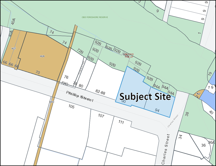
Figure 3: Heritage items within proximity of the subject site (shown in brown shading)
14. The site is also subject to the Parramatta Development Control Plan (DCP) 2023, specifically, Section 9.5.1.2 which contains controls relating to the City East Block. The City East Block includes the subject site and is bound by Wilde Avenue, Phillip Street, Charles Street Square and the north bank river foreshore open space (see Figure 4 below). The reference scheme submitted with the Planning Proposal does not comply fully with the DCP controls and an assessment against the DCP controls and discussion regarding appropriate DCP amendments is discussed further below.
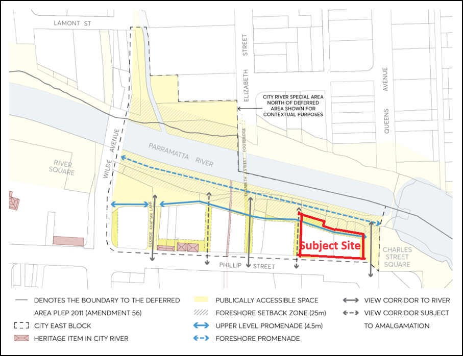
Figure 4: Extract from Parramatta DCP 2023 - City East Block Framework
DESCRIPTION OF PLANNING PROPOSAL
15. The Planning Proposal seeks to amend Parramatta Local Environmental Plan 2023 (Parramatta LEP 2023) as shown in Table 2 below:
Table 2: Existing and proposed controls
|
Control |
Current control |
Proposed control |
|
Height of Buildings (Mapped) |
80m
|
133m |
|
Height of Buildings (Total including 15% Design Excellence bonus) |
105m* (31 storeys mixed use) |
153m (47 mixed use storeys) |
|
Floor Space Ratio (Mapped) |
6:1 |
12.8:1 |
|
Floor Space Ratio (Total including 15% Design Excellence bonus and 5% High Performing Buildings bonus) |
9.7:1* |
15.36:1 |
|
Clause 7.28A |
2.5:1 FSR bonus and 13m height bonus subject to conditions including maximum tower width of 35m. |
Amendment of clause to remove its application to 90-94 Phillip Street. |
* The current height and FSR controls are also subject to a 13 metres and a 2.5:1 site-specific bonus under the controls introduced by SEPP 2 these are included in the total figures for these controls.
16. The change to Clause 7.28A referred to in Table 2 above is proposed as the site will no longer require the currently available site-specific FSR bonus of 2.5:1 and height bonus of 13 metres. Development of the site can achieve the full FSR and height included in the Planning Proposal using the mapped controls plus bonuses applicable under other provisions within the Parramatta LEP 2023.
17. Table 3 below provides the floor areas and indicative dwelling count outlined in the Reference Scheme under the proposed height control included in the Planning Proposal. The actual quantum of development provided will be subject to a design excellence competition and assessment at the DA stage.
Table 3: Floor Area and Dwelling Count Comparison Between Existing and Proposed Controls
|
Controls |
Floor Area |
Mix |
FSR |
|
Existing controls |
21,262sqm* |
280 dwellings 4,577 sqm commercial |
9.7:1 |
|
Planning Proposal Reference Scheme |
33,669 sqm* |
405 dwellings 4,577 sqm commercial |
15.33:1 |
*Subject to a design excellence competition and assessment at DA stage
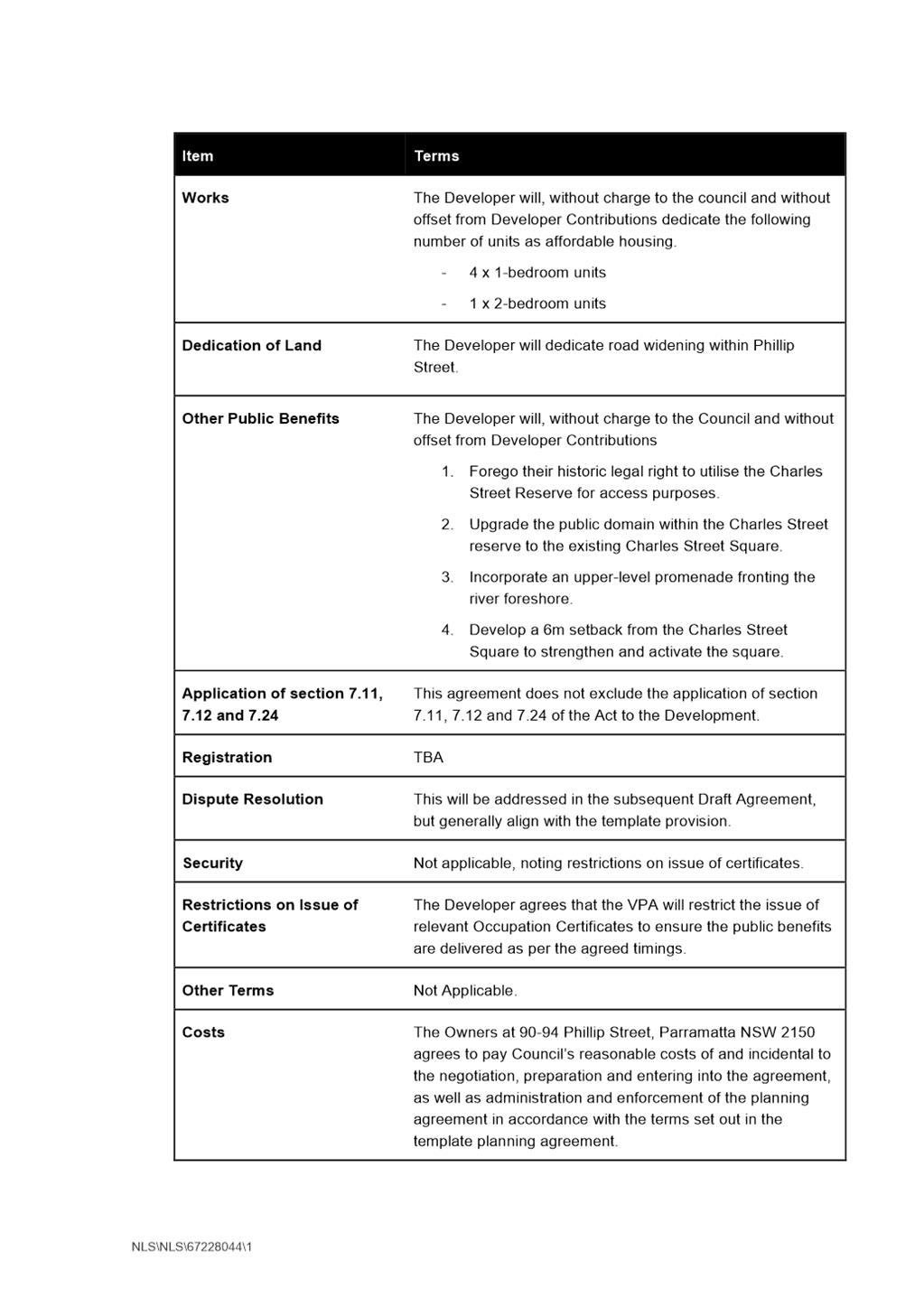
18. The Planning Proposal is accompanied by a draft Planning Agreement Letter of Offer seeking to secure:
a. 5 x affordable housing units (a mixture of four (4) x one bedroom apartments and one (1) x two bedroom apartment);
b. Dedication of road widening within Phillip Street;
c. Forego their historic legal right to utilise the Charles Street Reserve for access purposes;
d. Upgrade of the public domain within Charles Street reserve to the existing Charles Street Square;
e. Incorporation of an upper-level promenade fronting the river foreshore; and
f. Development of a 6 metre setback from the Charles Street Square to strengthen and activate the square.
19. The Planning Proposal is accompanied by the following supporting documentation submitted by the applicant:
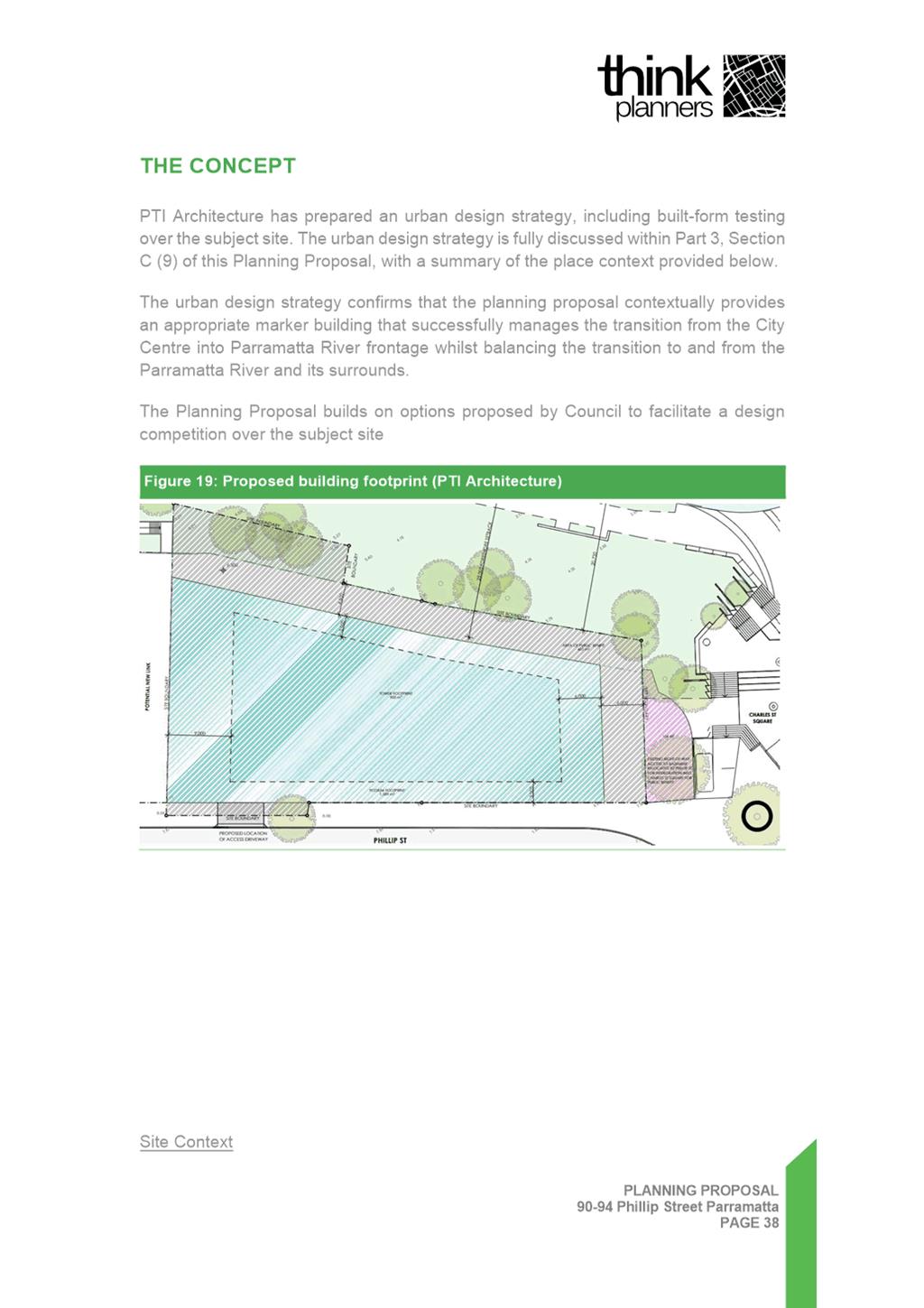
a. Planning Proposal document prepared by Think Planners (see Attachment 1).
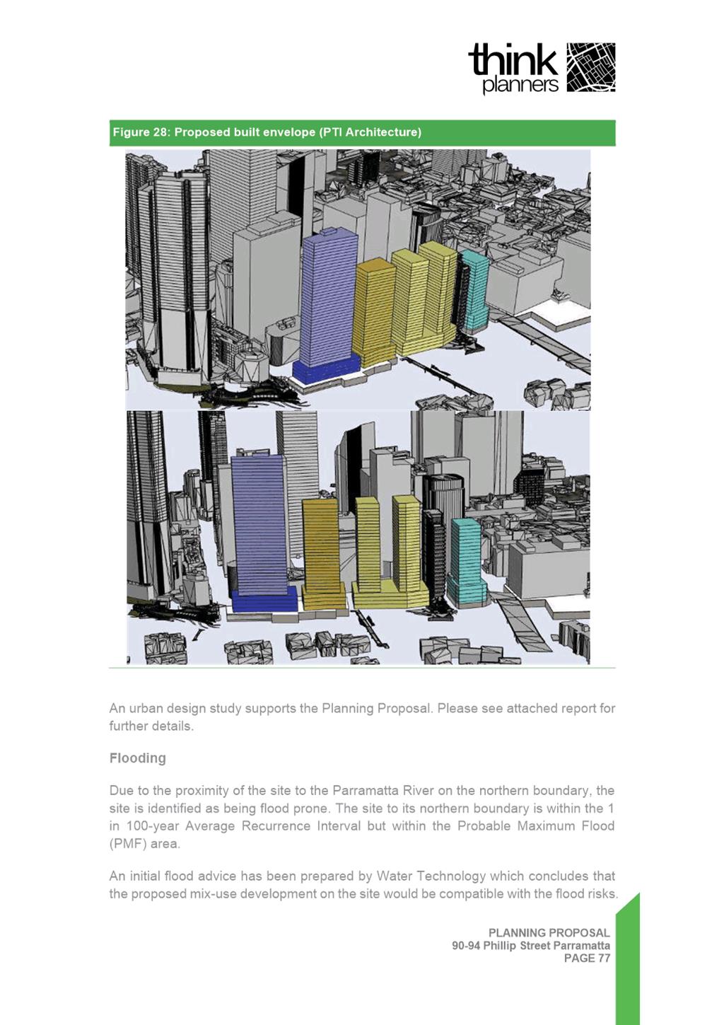
b. Reference Design prepared by PTI Architecture for a mixed use scheme (see Attachment 3).
c. Urban Design Report prepared by AE Design Partnership (Attachment 4).
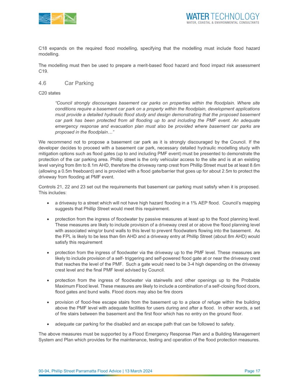
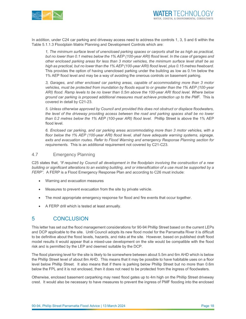
d. Flooding Report prepared by Water Technology (Attachment 5).
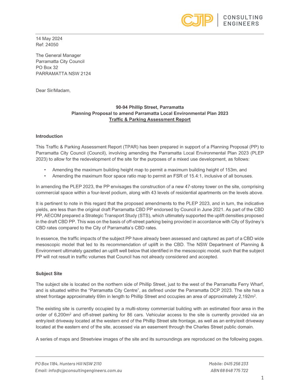
e. Traffic and Parking Assessment Report prepared by CJP Consulting Engineers (Attachment 6).
PLANNING PROPOSAL ASSESSMENT
20. The NSW Government Local Environmental Plan Making Guideline 2022 provides that for a Planning Proposal to proceed through Gateway determination, the Minister (or their delegate) must be satisfied that the proposal has strategic and site-specific merit and that identified potential impacts can be readily addressed during the subsequent plan making stages.
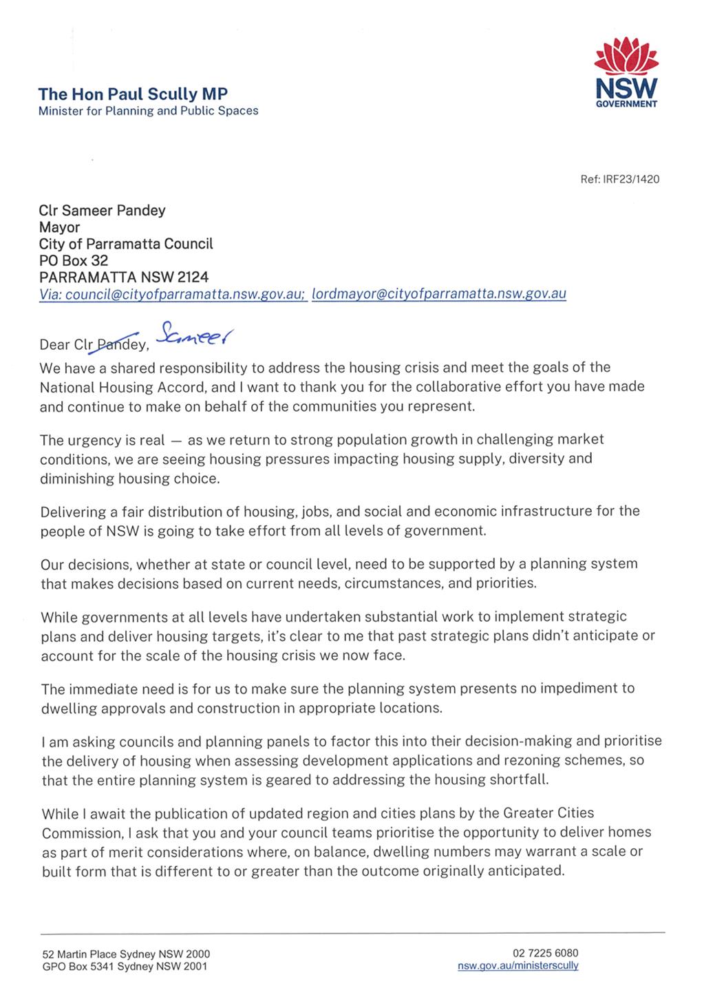
21. Recently, the Minister for Planning has written to all councils and planning panels (see Attachment 7) asking them to ‘prioritise the delivery of housing when assessing development applications and rezoning schemes, so that the entire planning system is geared to addressing the housing shortfall’. The Minister further asks that ‘...council teams prioritise the opportunity to deliver homes as part of merit considerations where, on balance, dwelling numbers may warrant a scale or built form that is different to or greater than the outcome originally anticipated’.
22. The Minister also advises in his letter that updated region and cities plans are being prepared by the Greater Cities Commission, and that in the meantime a strategic merit assessment should be applied to Planning Proposals which will be used to confirm if the proposal can satisfy relevant regional, district, and local strategies.
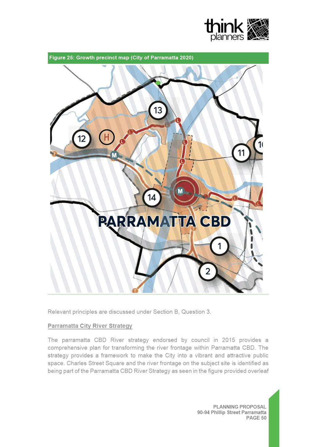
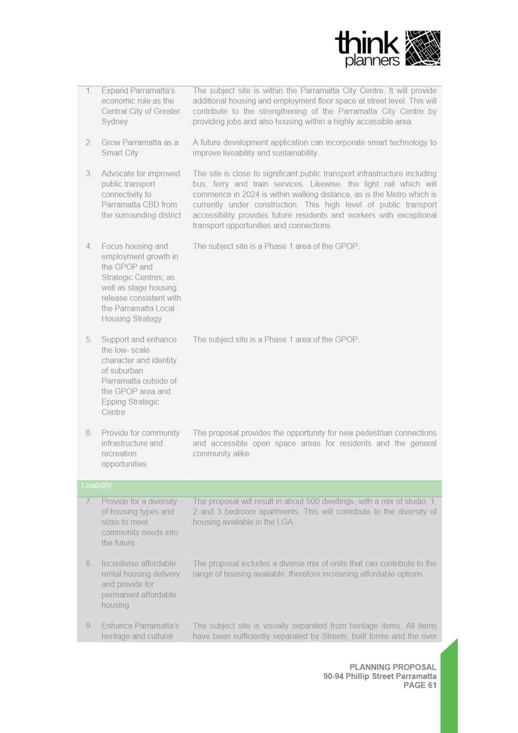
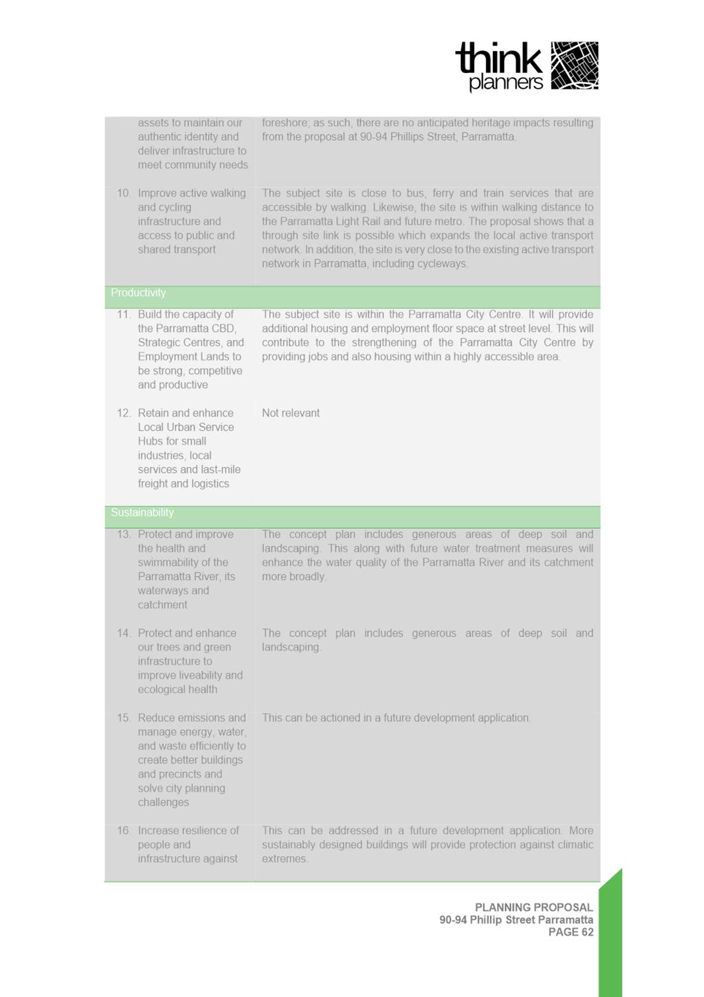
23. The Planning Proposal presents the opportunity to accommodate more housing growth in an already identified Growth Precinct in accordance with Council’s Local Strategic Planning Statement (LSPS) and Local Housing Strategy (LHS). The outcome will generate greater public benefits than the existing development controls for the site and provide an opportunity to improve the relationship of the site to the public domain of Charles Street Square and the Parramatta River Foreshore. A summary of how the subject Planning Proposal is consistent with all relevant policies is provided in the Planning Proposal at Attachment 1.
24. The following sections detail Council Officer assessment of the Planning Proposal based on strategic merit and site-specific planning issues.
Strategic Merit
25. Council Officers consider that the Planning Proposal is aligned with key state policies including the Greater Sydney Region Plan, the Central City District Plan and key local policies including the Local Strategic Planning Statement and Local Housing Strategy. This alignment is discussed below.
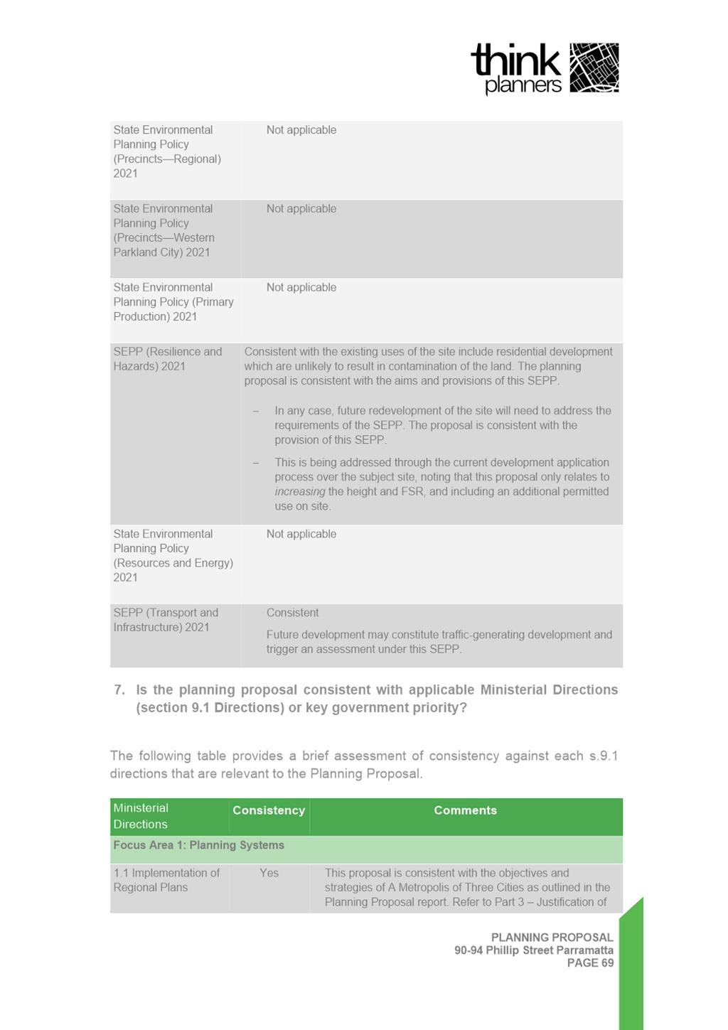
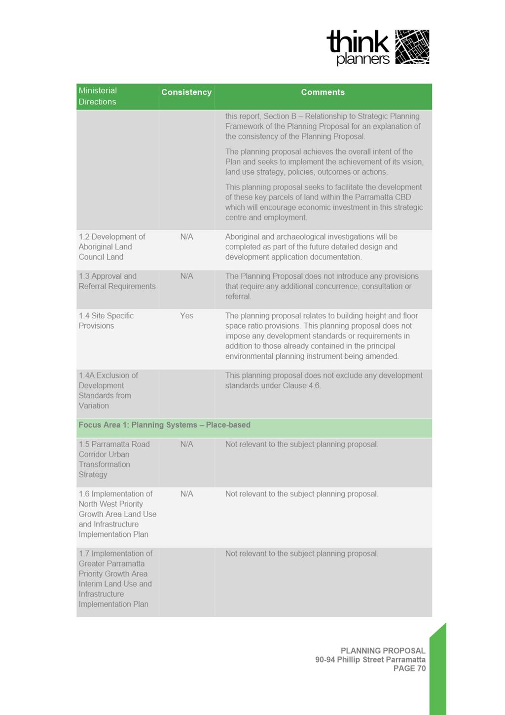
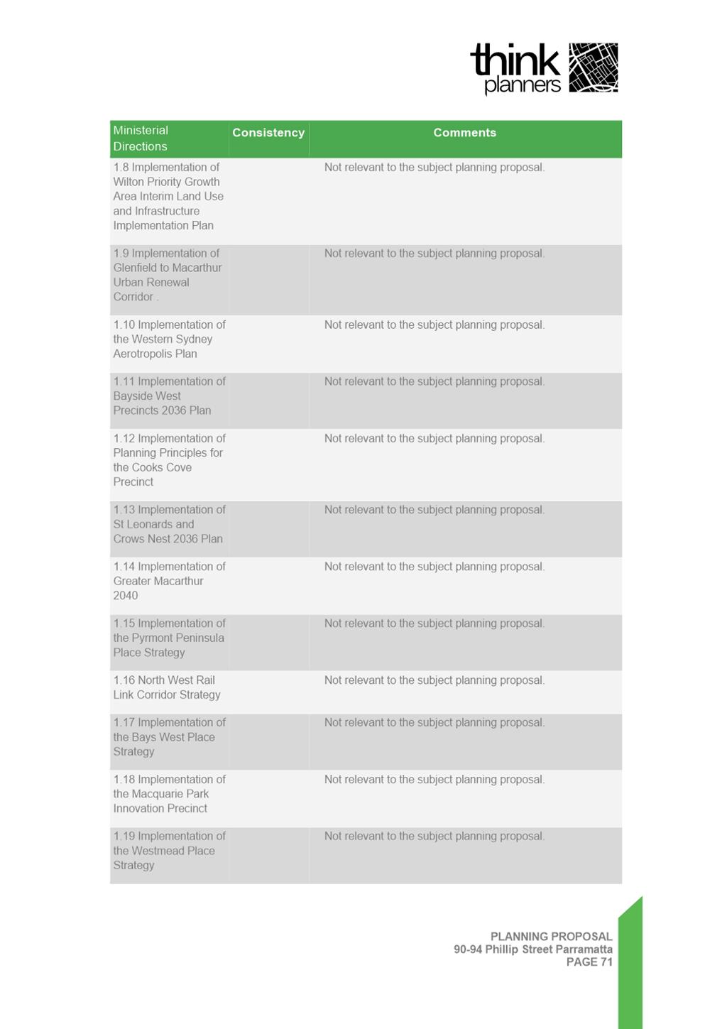
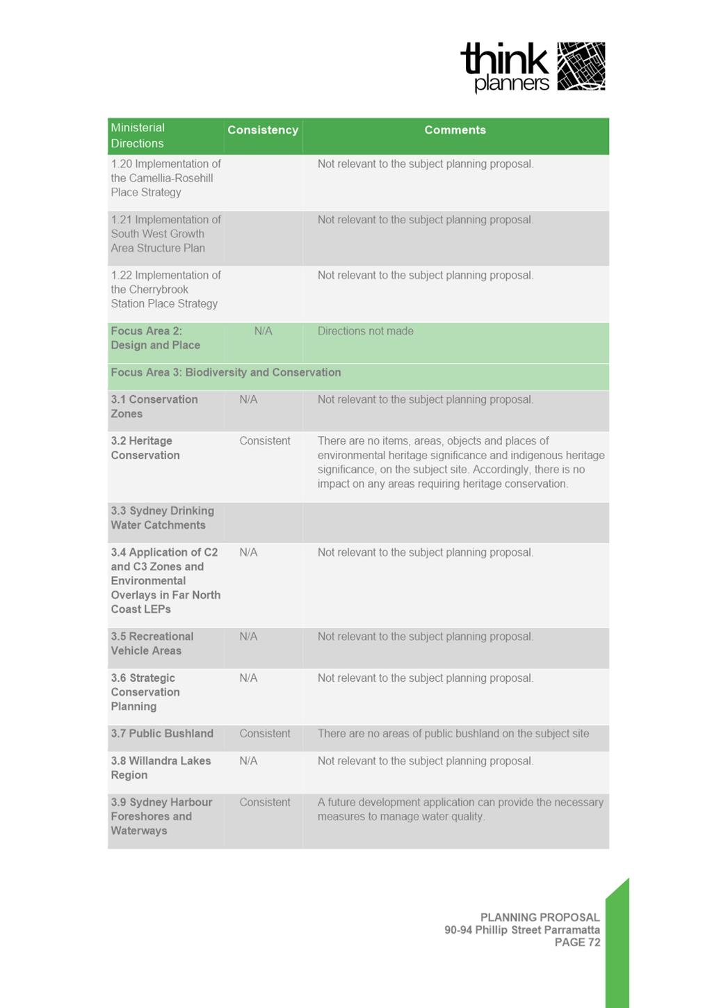
26. The Planning Proposal detailed in Attachment 1 provides a full assessment of the Proposal’s consistency against relevant State Planning Policies and Ministerial Directions under Clause 9.1 of the Environmental Planning and Assessment Act 1979. Ministerial Direction 4.1 Flooding is of specific relevance to the site and is discussed below.
Greater Sydney Region Plan and Central City District Plan
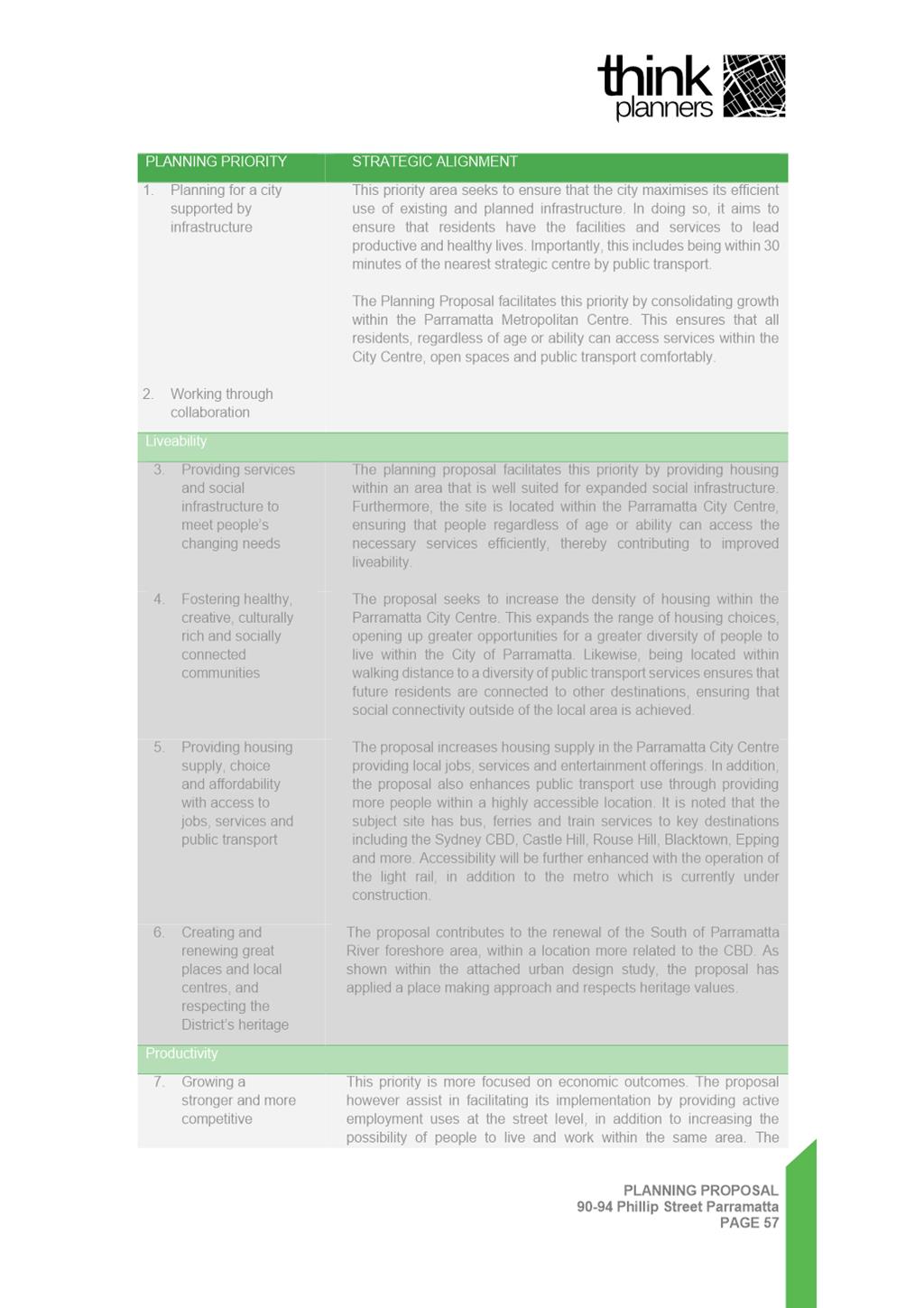
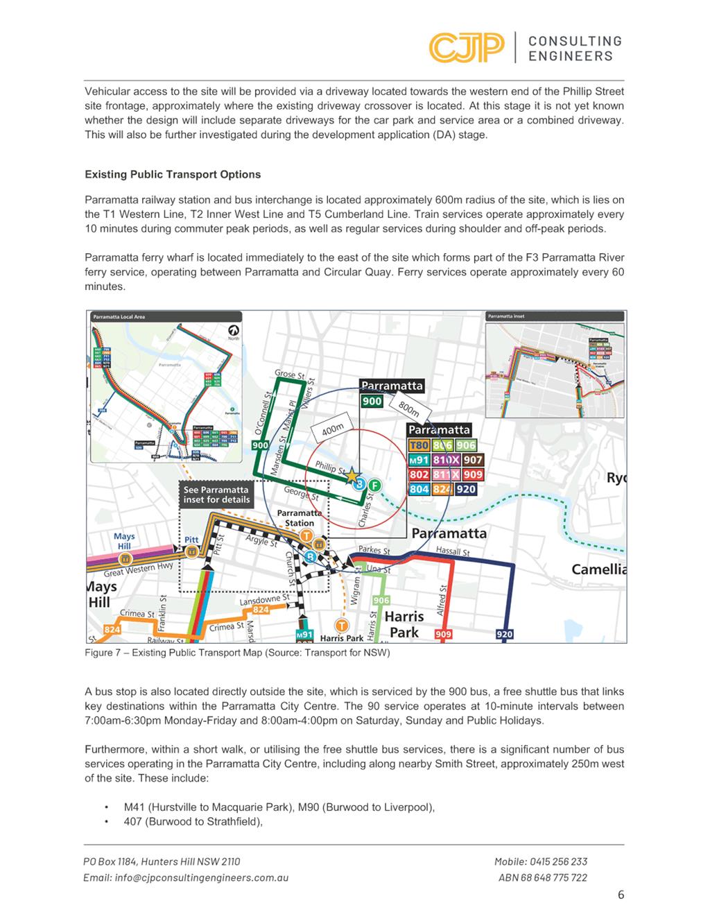
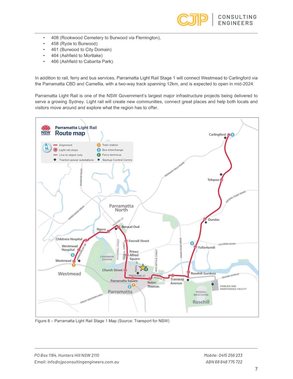
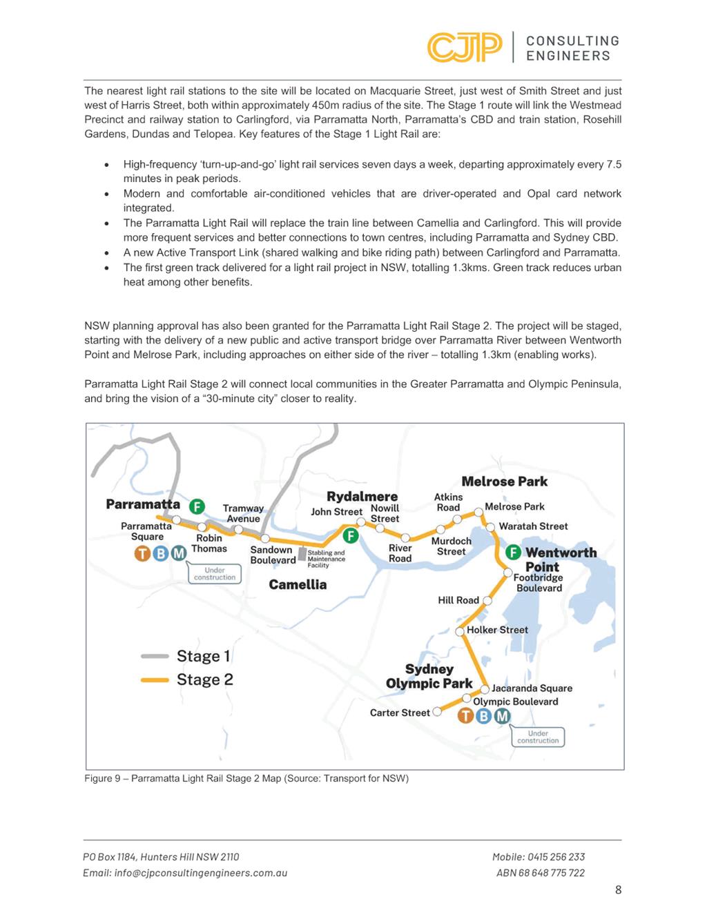
27. The Greater Sydney Region Plan: A Metropolis of Three Cities outlines the 10 Directions established with an aim of delivering a sustainable city supported by adequate and well-developed infrastructure. The Planning Proposal is aligned with the four key directions - Infrastructure and collaboration: Liveability, Productivity and Sustainability. The subject site being located within the Parramatta CBD facilitates access to an array of public transport options, including trains, buses, and ferries, with the added benefit of an upcoming metro line and light rail service. Anticipating a 30-minute connection to the Sydney CBD via the prospective metro line, this integration fits with the existing infrastructure.
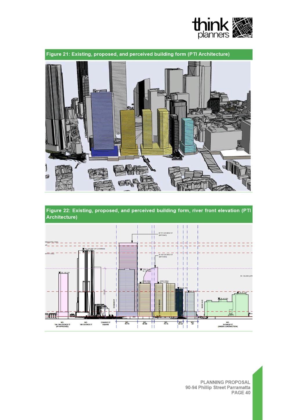
28. Under Direction 2 – Liveability, Objectives 3, 4 and 5, this Planning Proposal aims to increase walkability by concentrating population around the metropolitan centre, while also meeting housing targets. It promotes accessibility to amenities and open spaces through active transport modes, enhancing equity and infrastructure efficiency. The proposal also provides the opportunity for public domain upgrades, especially along the Parramatta River foreshore, improving the city's appeal and functionality for residents and visitors.
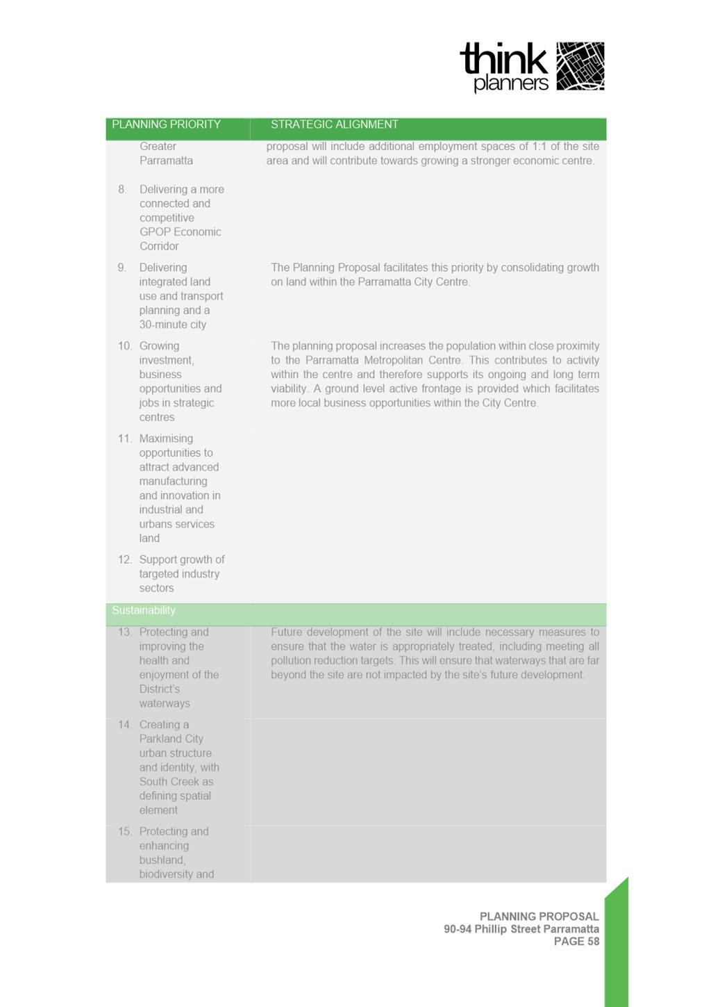
29. The Central City District Plan (CCDP) identifies the importance of growth within the strategic centres in terms of housing and employment opportunities. Emphasising economic outcomes, the scheme assists by incorporating street level employment spaces, promoting a live-work environment with a potential for individuals to reside and work in the same place. Further, the scheme also helps address the current housing crisis, by offering new housing in a highly liveable location offering a diverse range of housing options.
Local Strategies
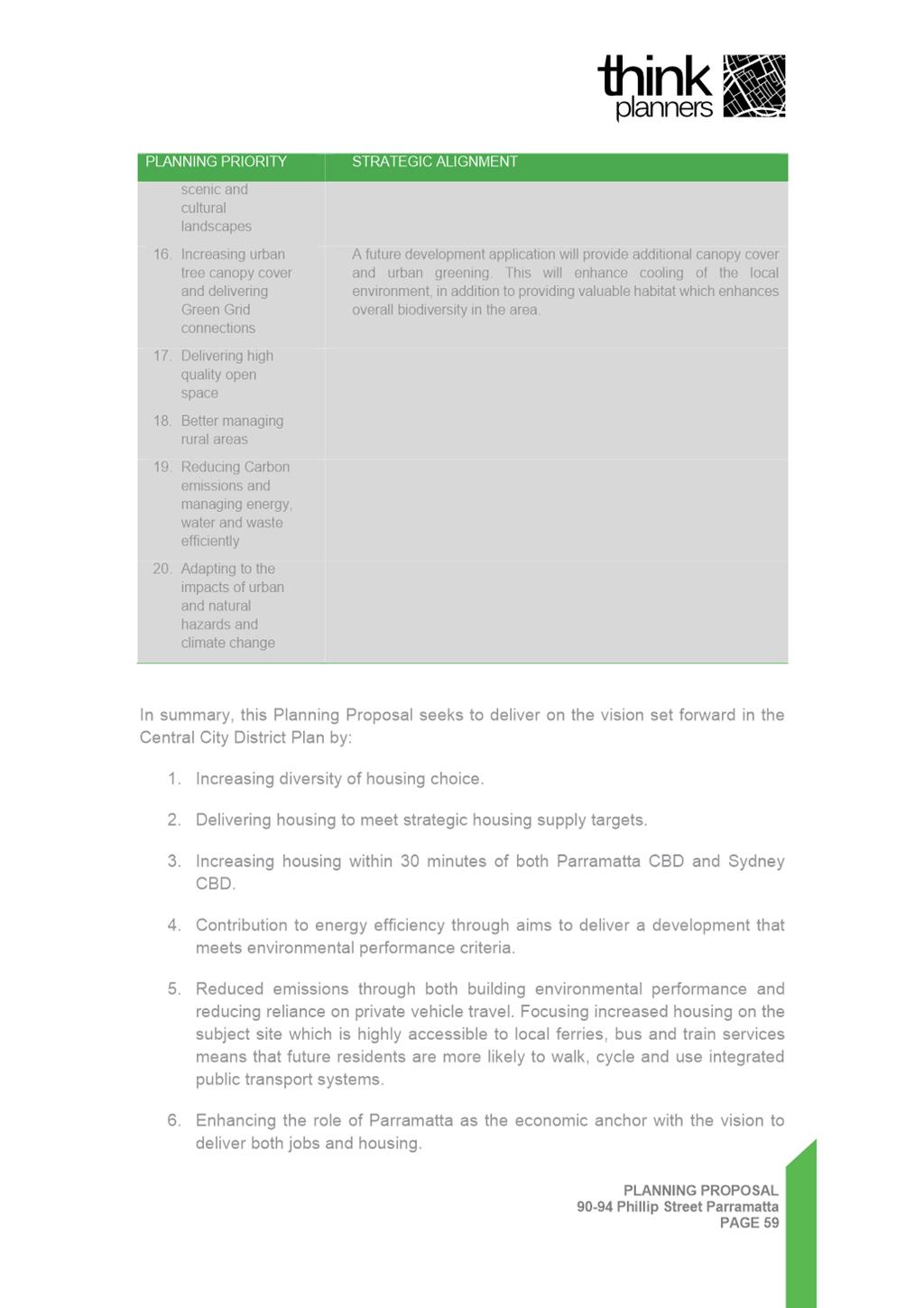
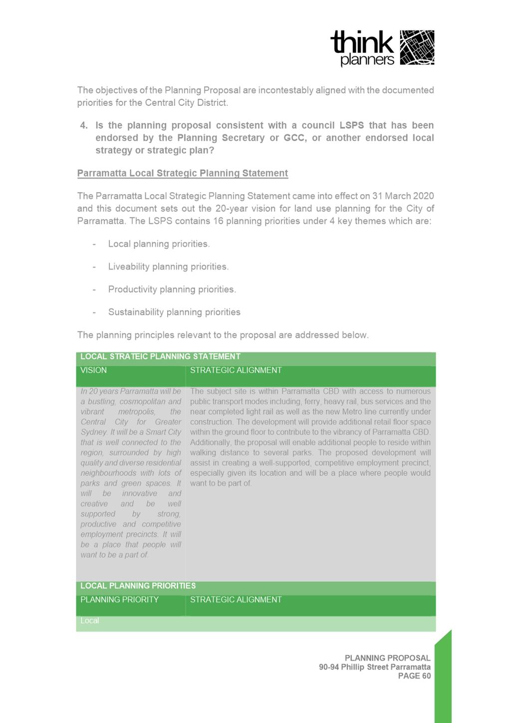
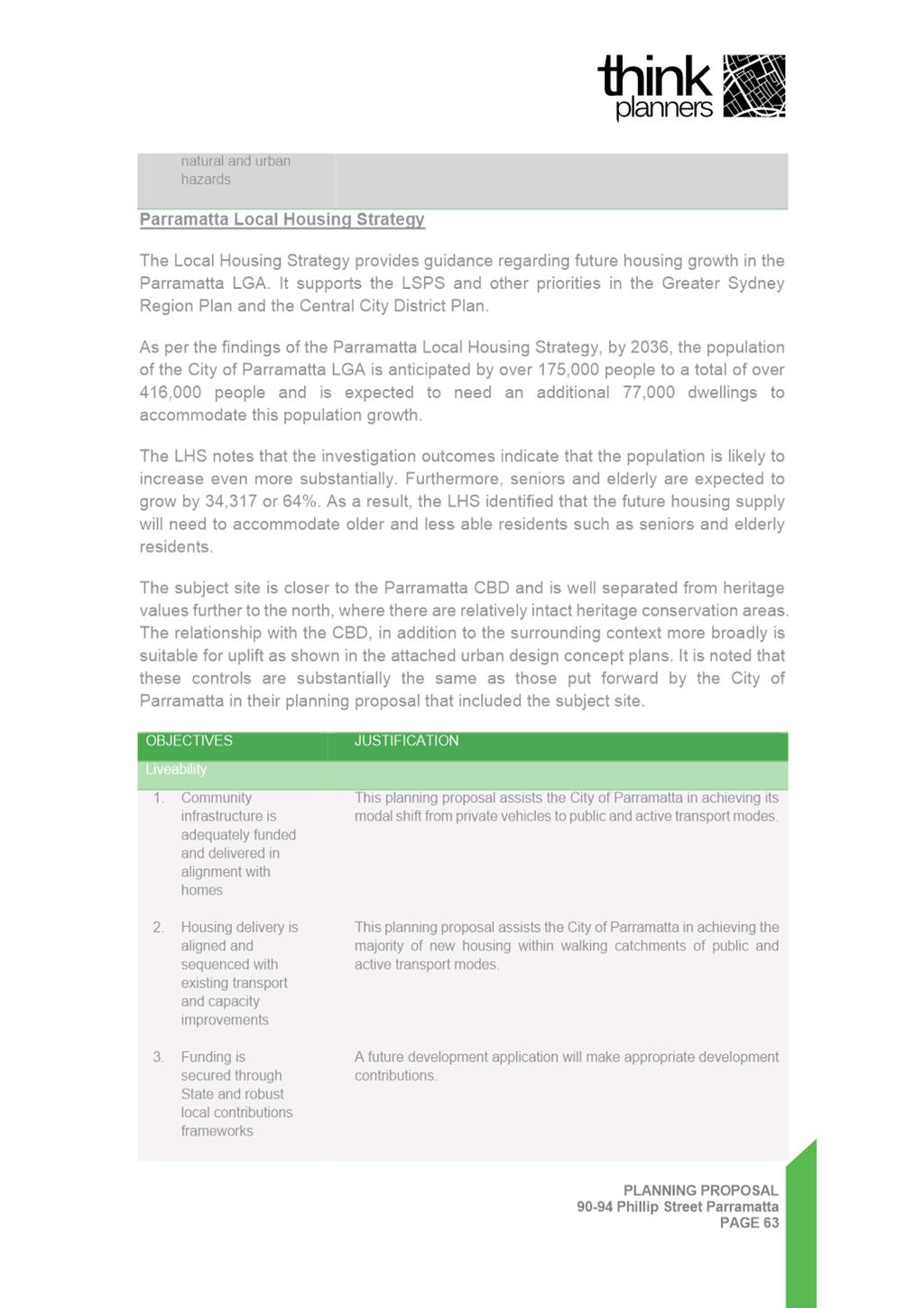
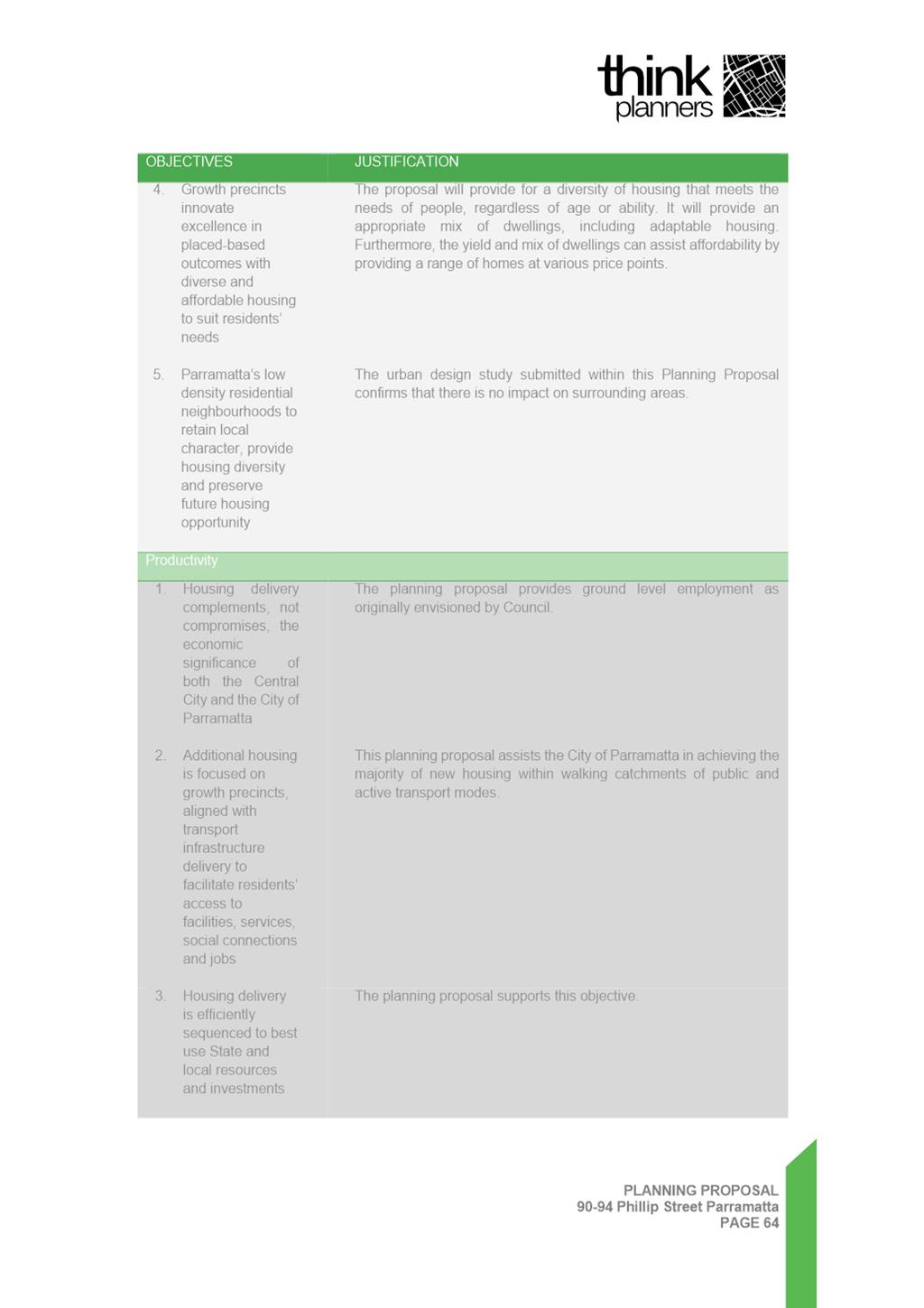
30. The Local Strategic Planning Statement (LSPS) and the Local Housing Strategy (LHS) provide a strategic direction for shaping the City’s future planning controls identifying Parramatta CBD as a Metropolitan Centre, a growing district with an increasing range of jobs and services. The LSPS and LHS anticipate an additional 7,180 dwellings and 34,500 jobs by 2036 in the precinct. The Planning Proposal would contribute towards meeting these targets through the provision of modern employment floorspace, and additional dwellings.
31. The Parramatta Community Strategic Plan is a 25-year plan with strategic objectives for the local government area. It seeks to formalise ideas that will shape and transform the area by 2038 and provide a pathway to manage growth and liveability, whilst providing additional jobs for residents. The Planning Proposal is consistent with this, facilitating jobs through commercial floorspace and an activated street frontage. The mixed use scheme is consistent with the Plan as it would result in jobs and housing concentrated in an area close to public transport infrastructure.
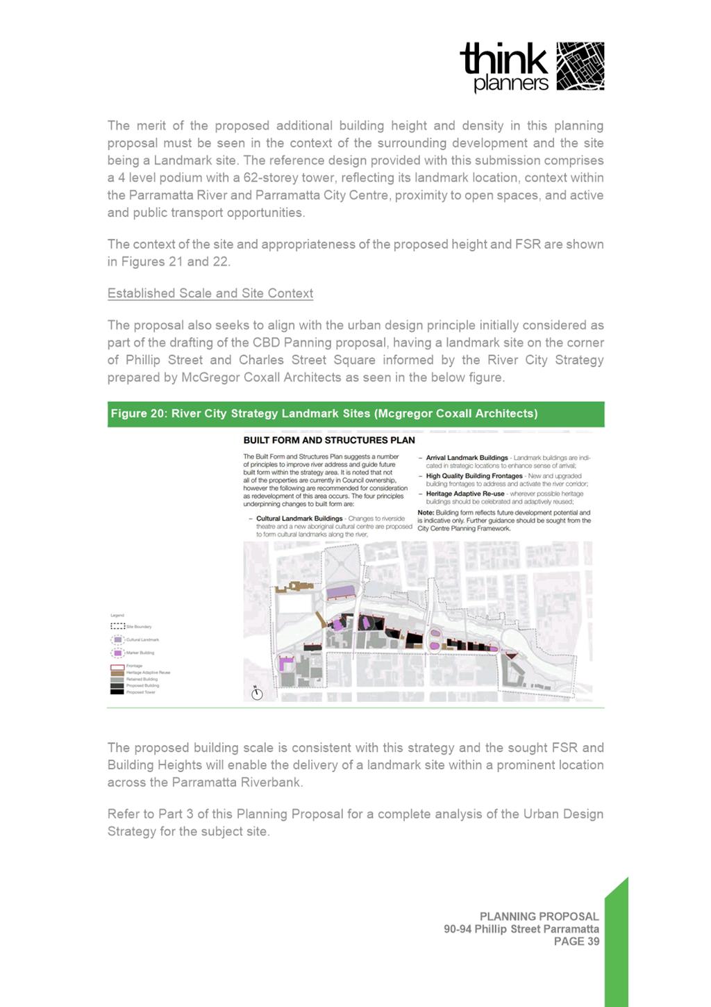
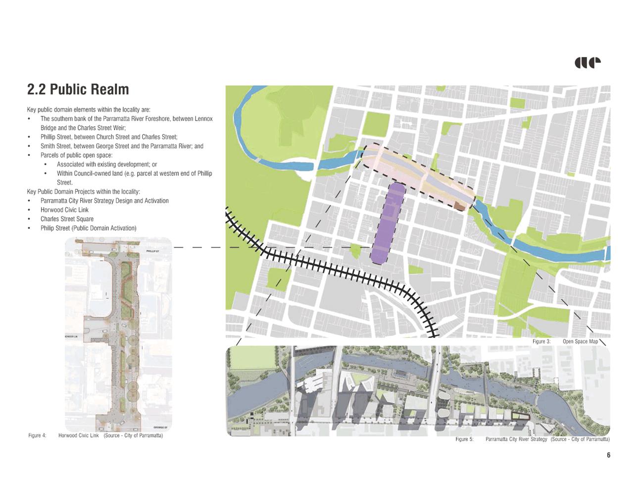
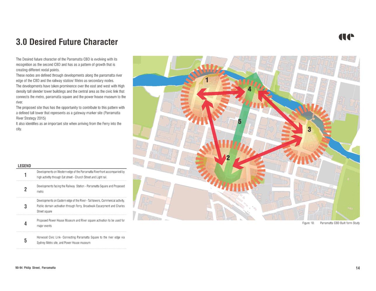
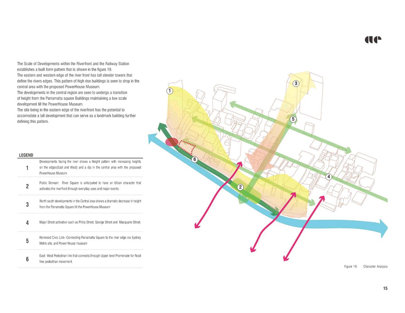
Parramatta River Strategy
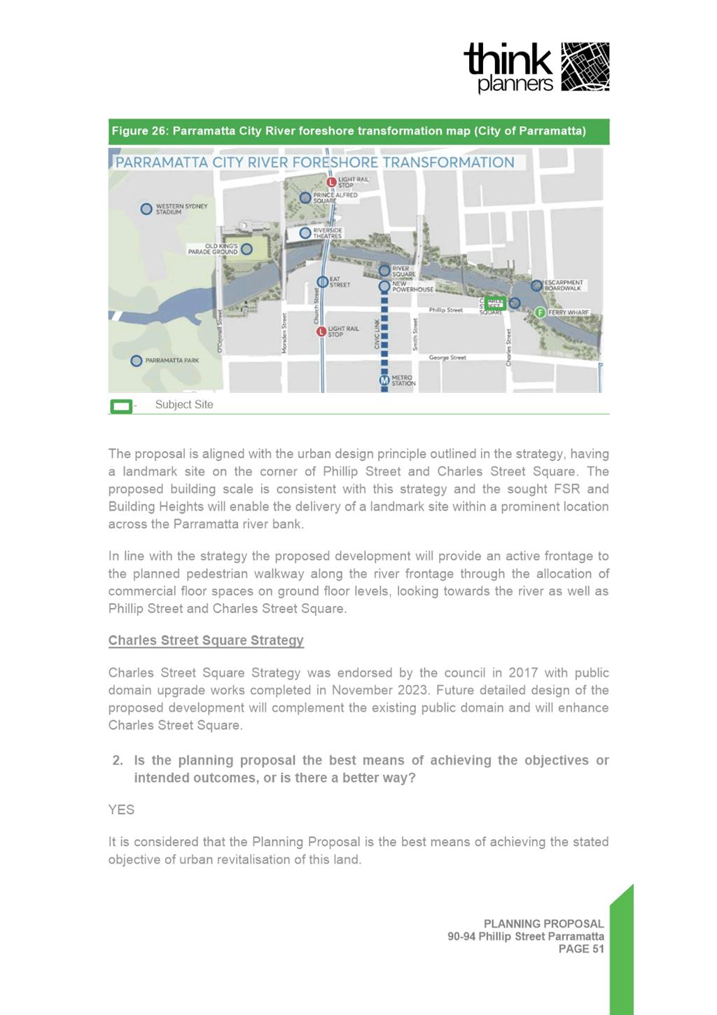
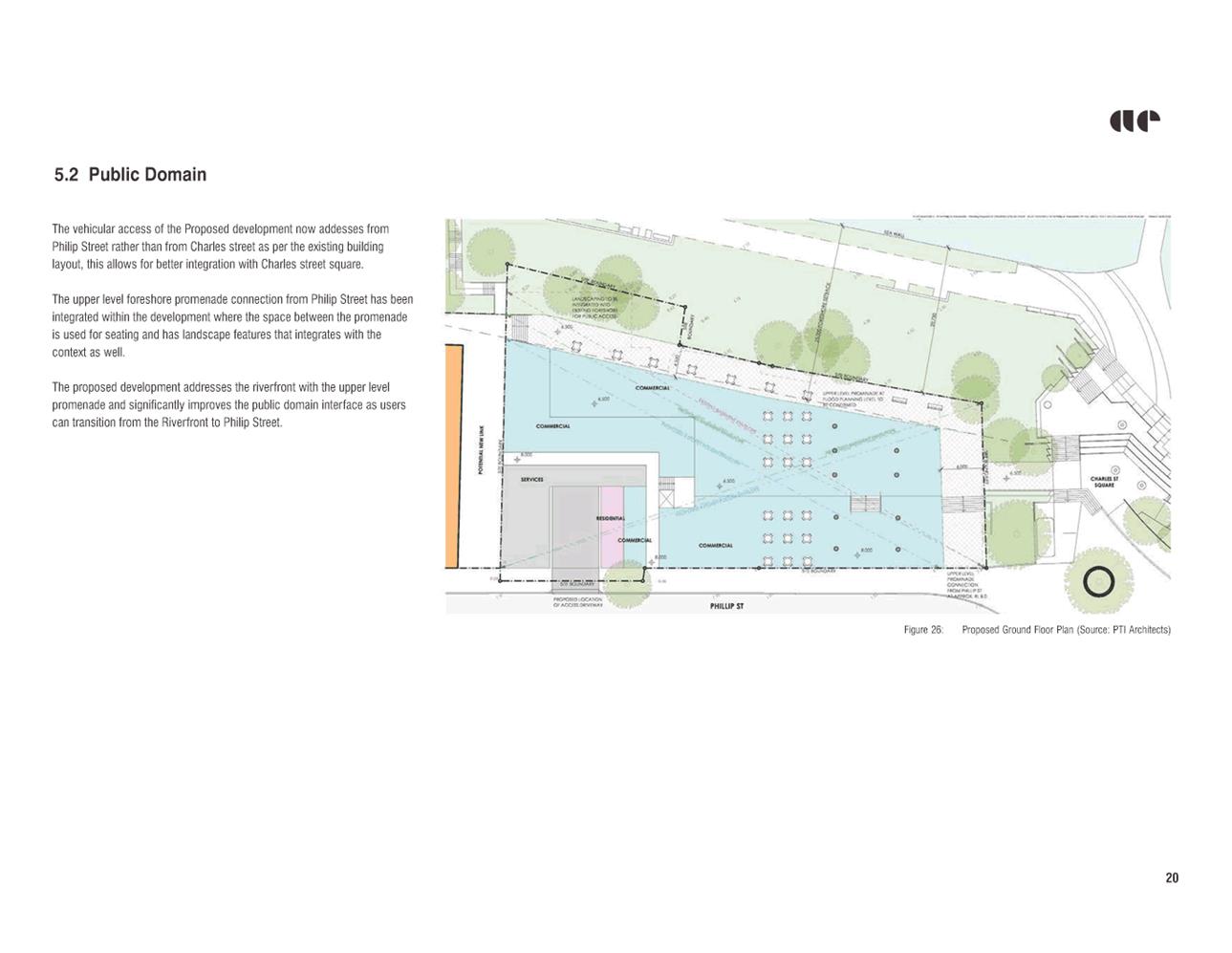
32. The Parramatta CBD River Strategy, endorsed by Council in 2015, outlines a comprehensive vision for revitalising the riverfront areas. The proposed development at the corner of Phillip Street and Charles Street Square aligns with this strategy, aiming to create a positive interface with the public domain consistent with the urban design principles it sets forth. The inclusion of commercial spaces on the ground floor, facing the river, Phillip Street, and Charles Street Square, reflects the strategy's goal of fostering an active and inviting pedestrian environment along the riverfront.
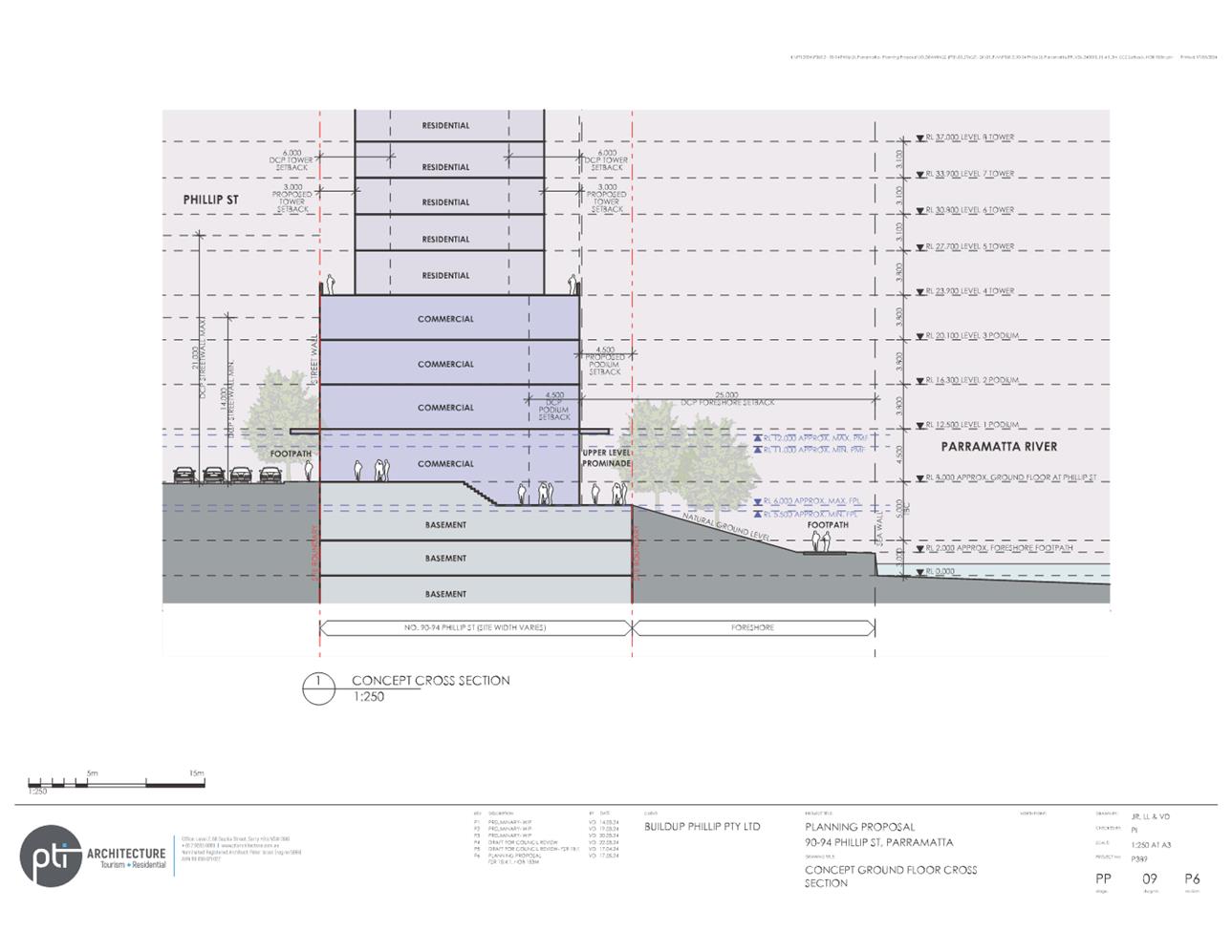
33. A key feature of the CBD River Strategy is a proposed upper level promenade. Under the Strategy, the upper level promenade and south bank terraces would mediate between the level of the river and the city to create new spaces for both daily and event use. The upper level promenade will provide:
a. A new pedestrian pathway with opportunities for retail/commercial tenancies and building addresses along the river;
b. A continuous upper level public walkway which connects Charles Street Square to the Wilde Avenue Bridge;
c. Accessible and safe egress from the river corridor during flood events; and
d. Level access and continuity between Phillip Street and the River Foreshore.
34. Figure 5 below shows the proposed upper level promenade and its relationship with the river, the flood planning level and the foreshore.
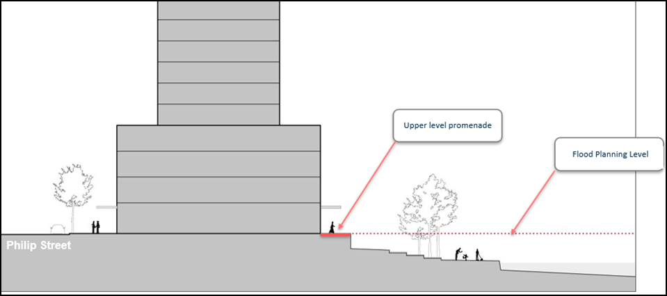
Figure 5: Relationship of proposed Upper Level Promenade with Parramatta River and the flood planning level. (Source: City of Parramatta)
Site-specific Merit
Urban Design
Urban Design Principles
35. The site has been subject to previous urban design analysis and built form testing by DPHI and Council Officers. The testing was done as part of the preparation and finalisation of the Parramatta CBD Planning Proposal and focussed on the entire street block bounded by Wilde Avenue, Phillip Street, Charles Street Square and the north bank river foreshore open space. A chronology of the urban design analysis is outlined below:
36. November 2020:-
Council Officers analysis of the Phillip Street River Block informed Council Officer recommendations on the finalisation of the Parramatta CBD Planning Proposal.
37. March 2022:-
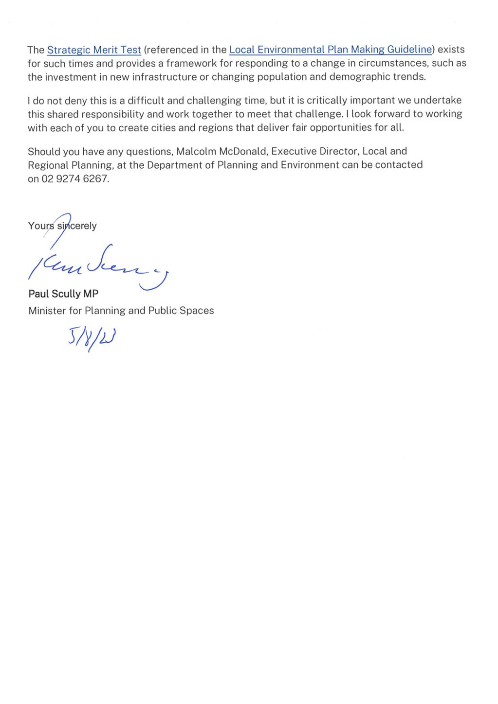
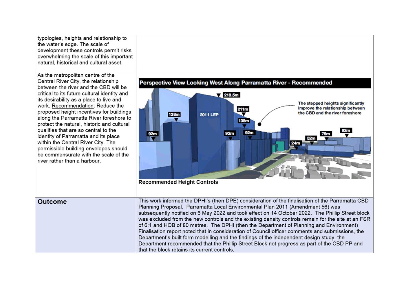
The DPHI prepared an “Independent Rapid Assessment of the Parramatta CBD Planning Proposal” to determine whether the proposed controls in the Parramatta CBD Planning Proposal result in appropriate built form outcomes and should proceed to finalisation. This work informed the DPHI’s finalisation of the Parramatta CBD Planning Proposal and subsequently Parramatta LEP 2011 (Amendment 56).
38. December 2022:-
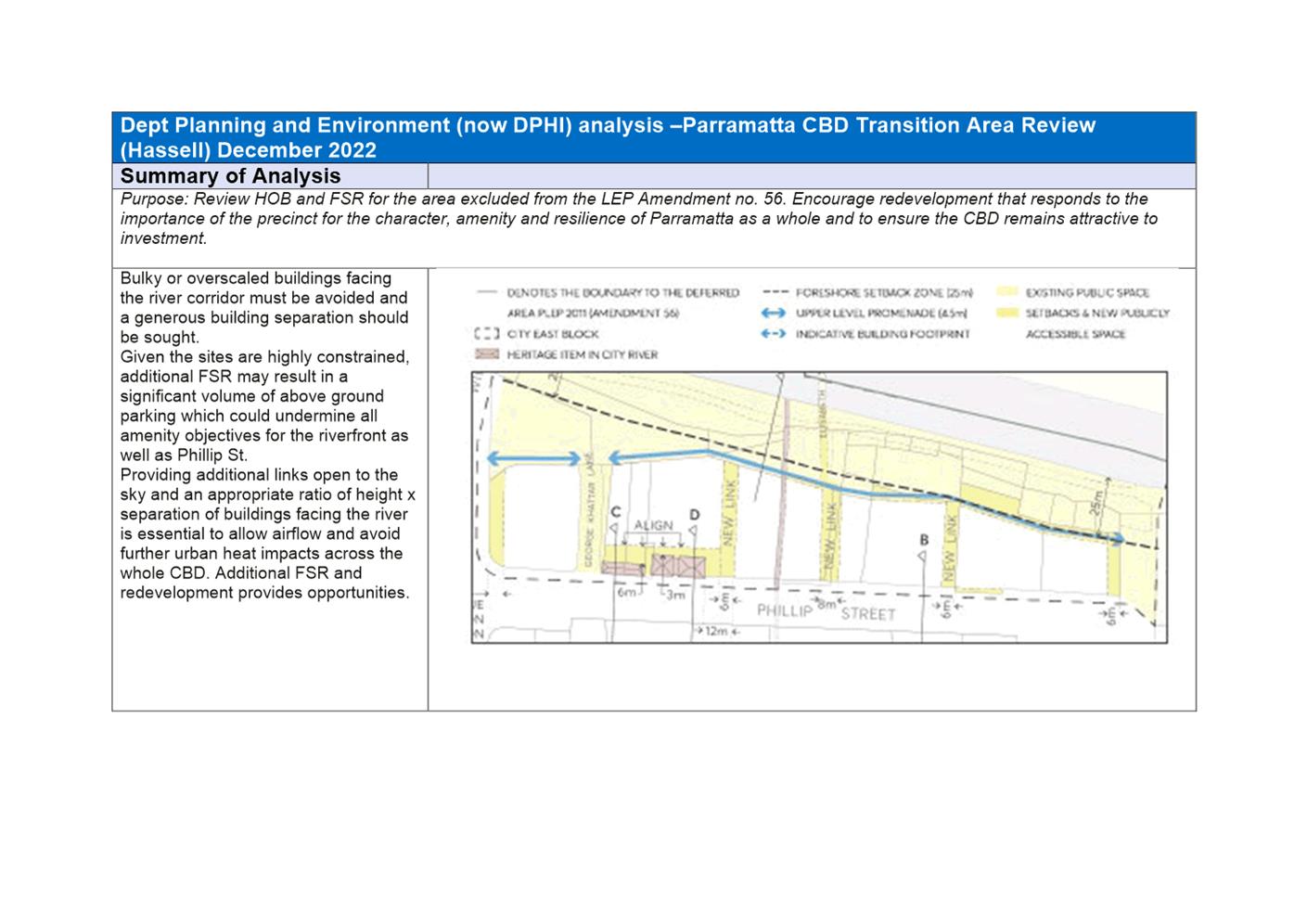
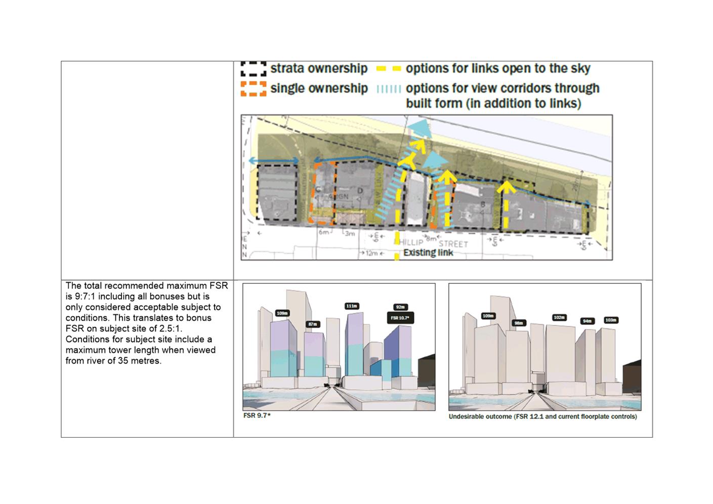
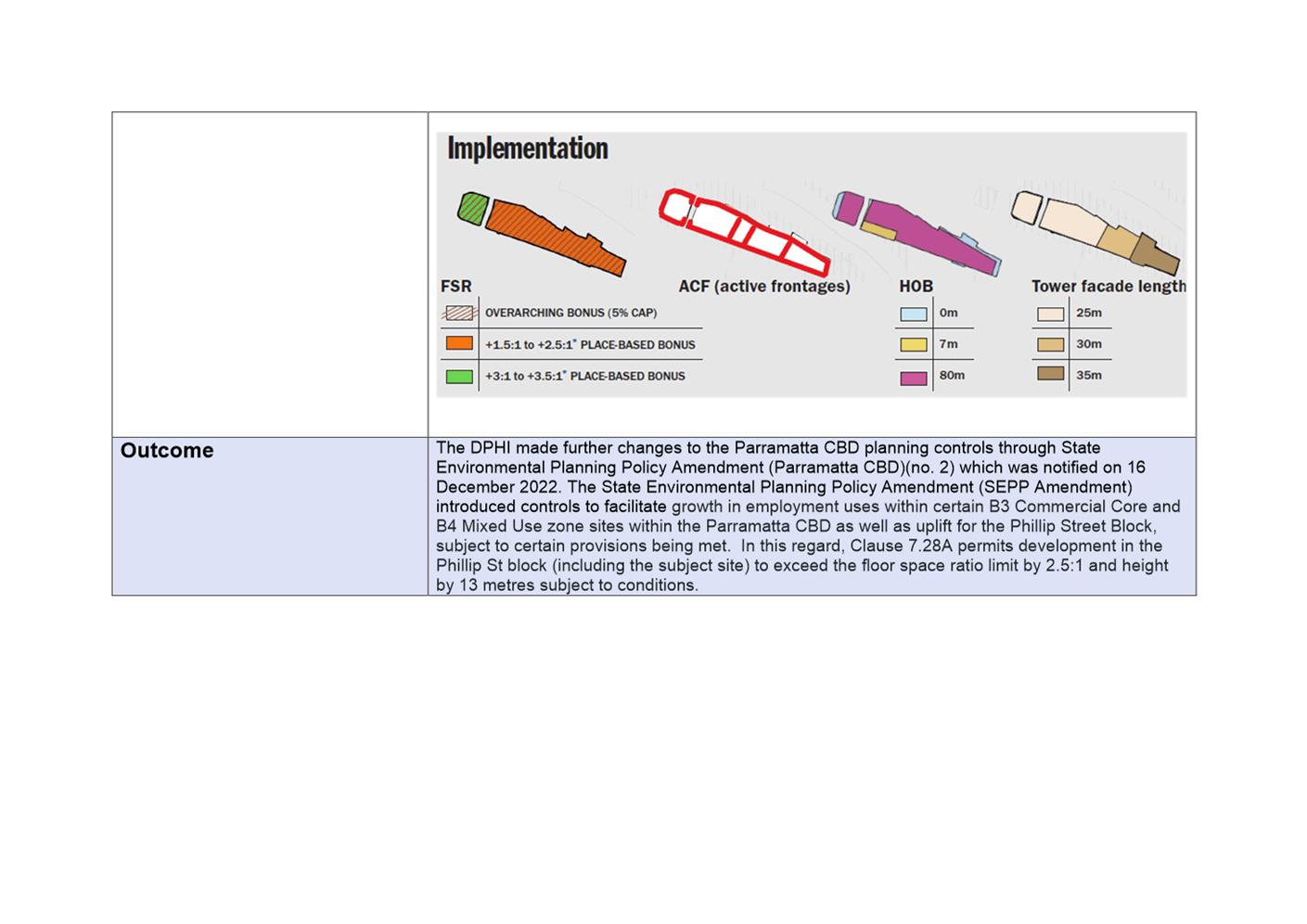
The DPHI prepared the “Parramatta CBD Transition Area Review” which resulted in the DPHI making further changes to the Parramatta CBD planning controls through State Environmental Planning Policy Amendment (Parramatta CBD) (No. 2) which was notified on 16 December 2022. The State Environmental Planning Policy Amendment (SEPP Amendment) introduced controls to facilitate growth in employment uses within certain B3 Commercial Core and B4 Mixed Use zoned sites within the Parramatta CBD as well as uplift for the Phillip Street Block, subject to certain provisions being met. In this regard, Clause 7.28A permits development in the Phillip Street block (including the subject site) to exceed the floor space ratio limit by 2.5:1 and height by 13 metres subject to conditions. A key condition for the use of this bonus FSR and height is a maximum tower width of 35 metres when viewed from the Parramatta River.
39. A detailed description of the urban design analysis studies outlined above is provided in Attachment 8. In summary, the primary urban design principles identified for the Phillip Street block in the above studies which are relevant to the subject site include:
a. Delivery of Upper Level Promenade:-
Redevelopment of the site provides an opportunity to provide an upper-level promenade and provide new and enhanced views towards the river from the city centre. Noting that DPHI acknowledge that additional FSR is required to encourage redevelopment.
b. Enhancement of relationship of city with Parramatta River:-
Redevelopment of the site must be balanced with the need to protect and enhance the relationship of the city with the Parramatta River and the scale of redevelopment should have parity with the scale of the River. Towers should help define the river as a key public space and not dominate the riverfront.
c. Enhancement of views of Parramatta River:-
The amendments under SEPP 2 have sought to strike a balance by providing additional bonus FSR subject to conditions including a maximum tower width of 35m when viewed from the river. This aims to contribute towards maintaining and enhancing views of the river from the City Centre, and new ground floor pedestrian laneways will open the physical relationship with the river.
d. Reinforcement of commercial core to the south:-
Buildings on the southern river foreshore should have heights that step down from the building heights in the core of the Parramatta CBD to reinforce the commercial core of the City and to avoid visually dominating the river corridor.
Analysis of implications of SEPP 2 controls
40. Council Officers have conducted an analysis of the controls currently permitted for the site as introduced by SEPP 2. The analysis sought to identify risks embedded in the SEPP 2 controls to delivering Council’s vision for the Phillip Street block. It also sought to identify differences between the SEPP 2 controls and the nature of development reflected in the current Parramatta DCP 2023 controls.
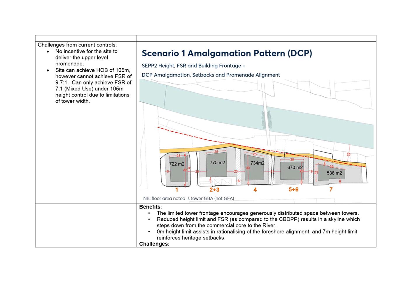
41. The analysis found that the controls will achieve generously distributed space between towers, will provide for a skyline which steps down towards the river and the 0-metre height limit along the perimeter of the site will help rationalise the foreshore alignment.
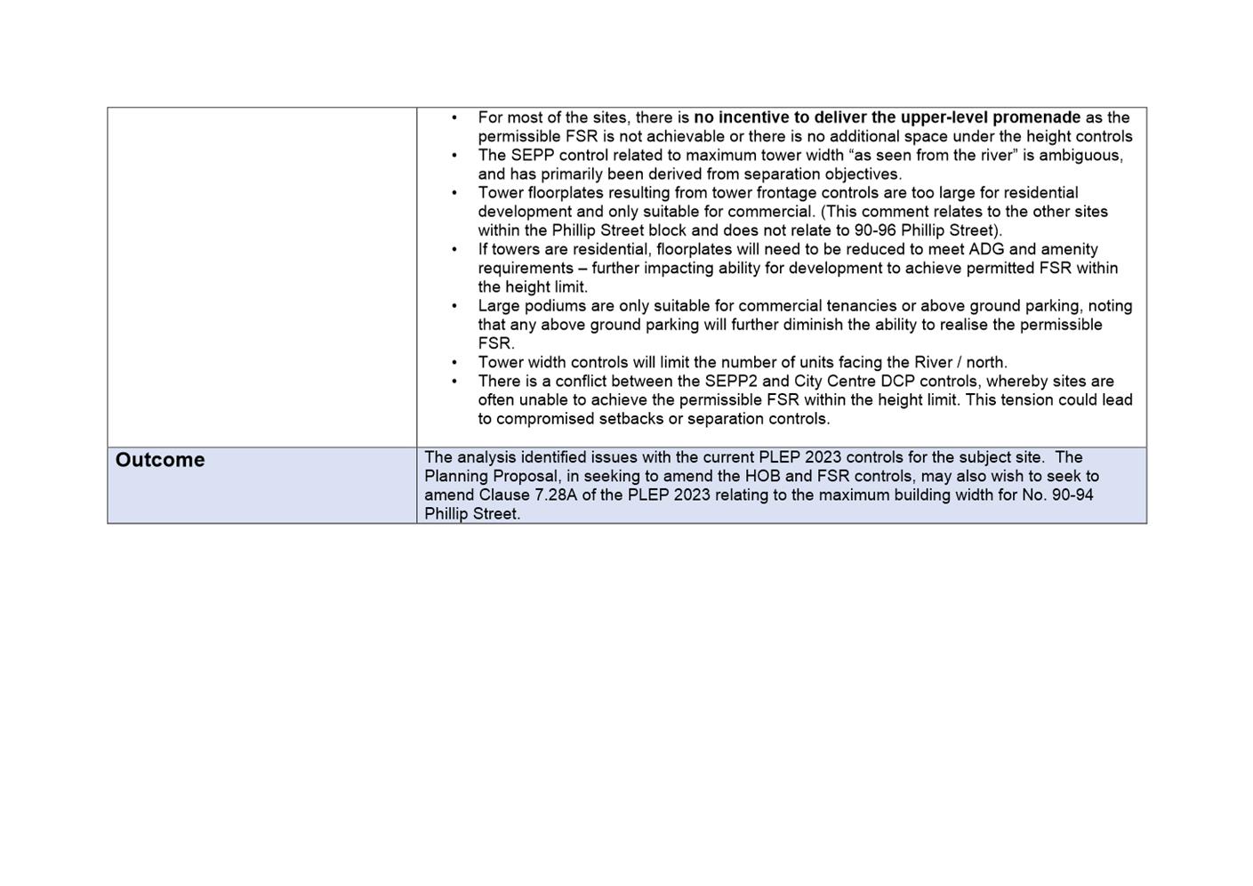
42. However, the current controls provide little incentive for the site to deliver the upper-level promenade. In this regard, including bonuses, the site can achieve a height of 105 metres but can only achieve a FSR of approximately 7:1 (mixed use) within the current height control due to the tower width control, which results in a tower floorplate of 536sqm Gross Building Area (GBA). Further, the description of tower maximum width control of 35 metres within Parramatta LEP 2023 Clause 7.28A “as seen from the river” is ambiguous wording which is open to interpretation. The control itself also appears to have been developed with building separation objectives as the primary goal without consideration of workable floorplates or achievable floor space area.
43. Should Council resolve to support the Planning Proposal, the tower maximum width control of 35 metres within Parramatta LEP 2023 Clause 7.28A would not need to be utilised by the site to achieve the new density control. As such, the tower width of 35m would not apply and the clause would become redundant. It is therefore recommended that the parts of Clause 7.28A that apply to the subject site be removed.
Implications for wider Phillip Street block
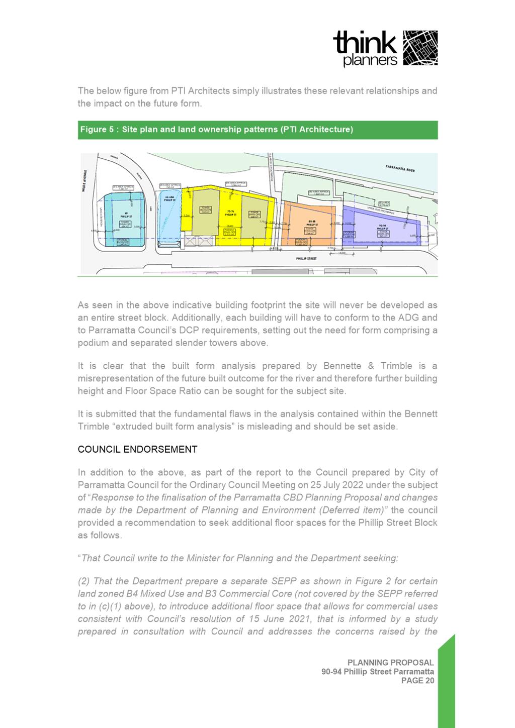
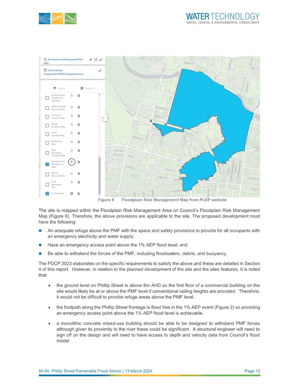
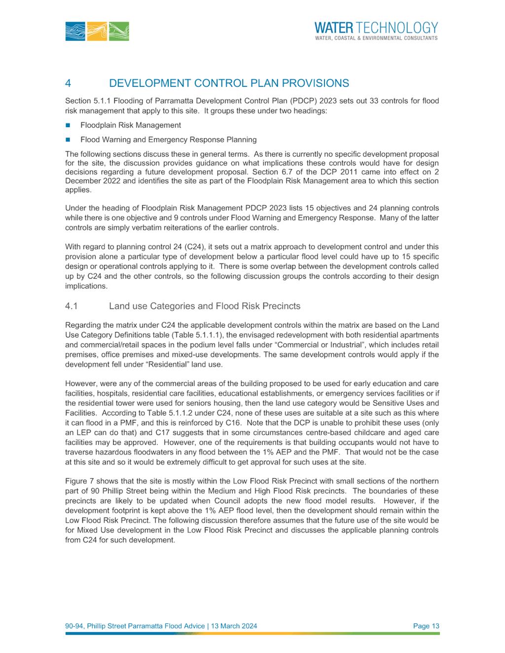
44. Clause 7.28A allows for bonus FSR (subject to conditions) for the other remaining sites within the Phillip Street block. Figure 6 below shows the sites affected by the clause and the relevant maximum tower widths.
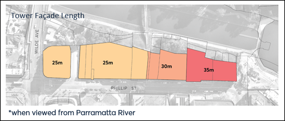
Figure 6: Sites affected by Clause 7.28A and the maximum tower widths applicable under the clause. Subject site is the eastern most site.
45. The Planning Proposal raises the issue of these remaining sites within the Phillip Street block and whether it is appropriate to consider similar amendments to the controls to ensure cohesive development along the foreshore and delivery of the upper-level promenade.
46. Council has recently appointed a consultant to consider the realisation of the future upper-level promenade at the interface of the Parramatta River foreshore and the future built form edge in the Phillip Street block between Charles Street Square and Wilde Avenue. A flood consultant has also been engaged to provide advice and inform the development of a reference design. This work will evaluate the impacts of the promenade alignment (within or adjacent a site) on individual property area and built form outcomes. Any recommendations arising from this work will be considered in a future report to Council and may result in a need to revisit the planning controls on the remaining sites in a similar manner to facilitate the delivery of the public domain outcomes.
47. In the meantime, for the subject site, the applicant has indicated an intention to move forward with development of the site. This would provide a catalyst for the redevelopment of the remaining sites within the Phillip Street block and delivery of the adjoining sections of the upper-level promenade. As such it is important that Council consider the subject planning proposal in the context of the work already carried out on enabling the development of the subject site, and in doing so examine if the proposal can facilitate the delivery of the public domain improvements being sought in a suitable manner. Clause 7.28A will continue to apply to the other sites within the Phillip Street block as shown in Figure 6.
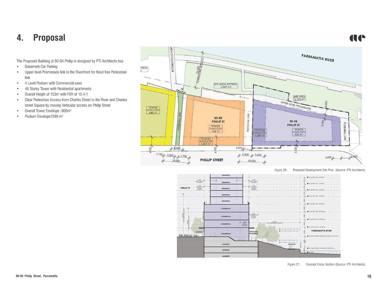
Assessment of Reference Design
48. The reference design submitted by the applicant (see Attachment 3) supporting the Planning Proposal has been reviewed by Council Officers. The assessment has considered the Urban Design Principles summarised above and the controls for the broader street block within the Parramatta DCP 2023 noting the constraints of the site.
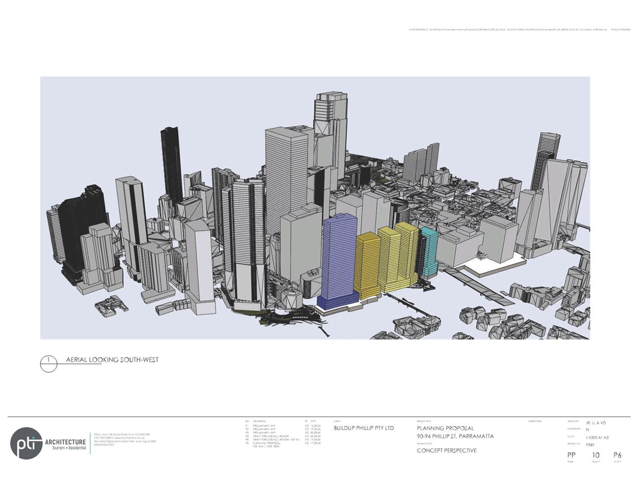
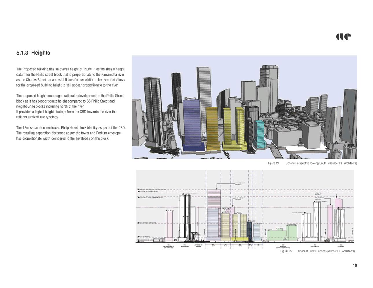
49. Figure 7 below shows the built form massing of an indicative mixed use building that could be achieved under the proposed controls in context of surrounding development. The subject site is shown in blue and the grey buildings are existing or approved. The orange, yellow and light blue buildings indicate a hypothetical built form under existing controls for the remainder of the Phillip Street block which reflects a total height of 105 metres.
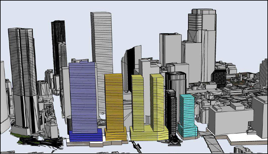
Figure 7: Proposed Building Massing for 90-94 Phillip Street – subject site shown in blue. (Source: Applicant’s Urban Design Report – AE Design Partnership)
50. The following comments are made in relation to the Urban Design Principles for the Phillip Street block described above:
a. Delivery of Upper-Level Promenade
The increase in overall density is significant compared with that permissible at present. A move away from the maximum tower width control of 35 metres has also provided for a larger tower floorplate of approximately 900 sqm in gross building area compared with a tower floorplate of approximately 536 sqm which would be permissible under the current tower width control. The Planning Proposal provides greater incentive for the redevelopment of the site and as such an opportunity for the delivery of the upper-level promenade.
b. Enhancement of relationship of city with Parramatta River
Figure 8 below is extracted from Part 9.5.1.2 (City East Block) within Parramatta DCP 2023 and demonstrates Council’s intention for the public domain and river foreshore in this locality. The reference scheme is able to facilitate the required ground floor setbacks and upper level promenade.
This Part within the Parramatta DCP 2023 provides for a 6 metre podium setback from the boundary on the eastern side of the site to extend the public domain of Charles Street Square and align the visual connections north-south down Charles Street. This setback area is to be a publicly accessible space. This part of the site is currently built up with part of the existing commercial building, and the site achieves vehicular access over Council owned land within the unmade section of Charles Street immediately to the east. The reference scheme indicates that the driveway location will be relinquished and the area integrated with Charles Street Square. As such, redevelopment of the site will facilitate the expansion of the area of Charles Street Square and an improvement in the relationship of the site with the public domain as envisioned within the Parramatta DCP 2023.
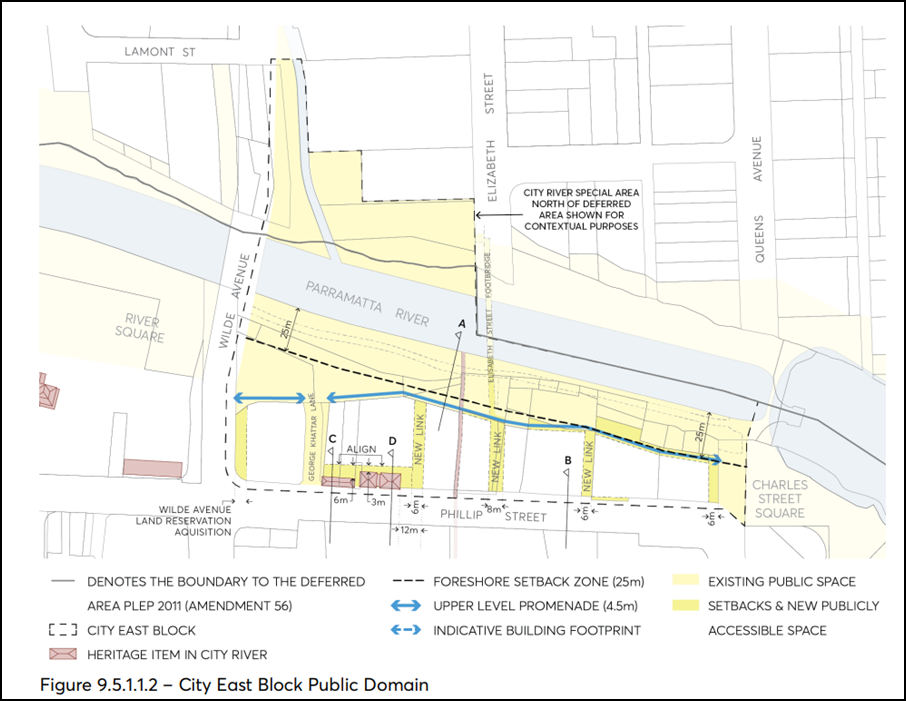
Figure 8: Public Domain framework extracted from Parramatta DCP 2023
c. Enhancement of views of Parramatta River
The reference scheme indicates a western tower setback of 9 metres which will provide separation from any future tower on the site to the west and improve views to the river. The proposed eastern upper-level tower setback of 6 metres from the podium (12 metres from the eastern boundary) is in excess of the minimum tower setback of 3 metres prescribed under the Parramatta DCP 2023. This increase in tower setback is proposed for this site in order to mitigate the increased height, bulk, scale and wind impacts to and from the public domain from the increased height of the building and will also help increase views of the river.
Part 9.3.3.3 (Tower Slenderness) of the Parramatta DCP 2023 applies to the Parramatta City Centre generally and prescribes a maximum tower floorplate length of 45 metres for buildings in the MU1 zone. The reference scheme includes a tower floorplate length of 47.4 metres and is therefore marginally in excess of the control. A variation of this nature is appropriate for consideration in the assessment of a development application for the site.
d. Reinforcement of commercial core to the south
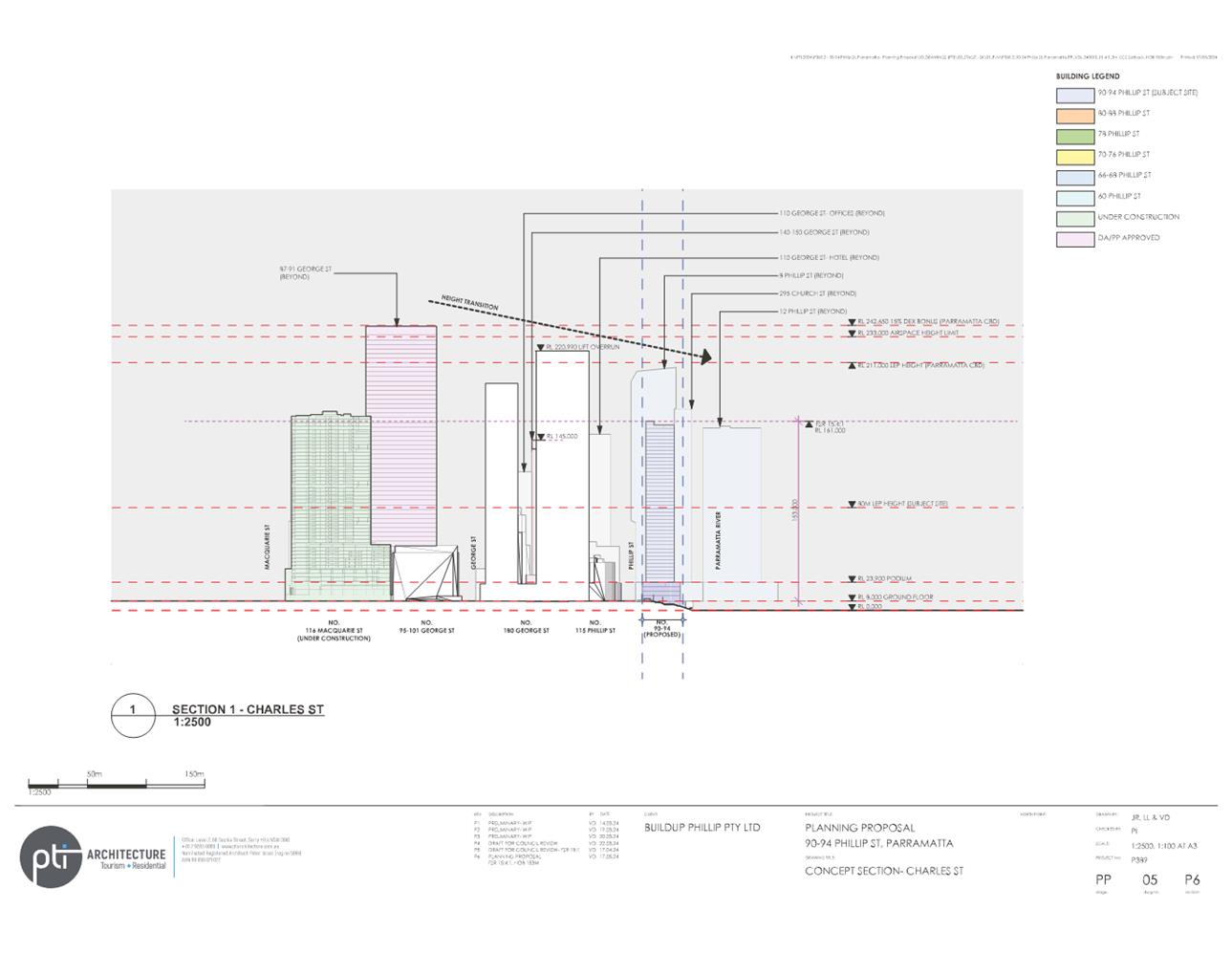
![]() The
proposed height of 133 metres (15 metres including Design Excellence bonus)
complies with the principle of providing a stepping down of the height from the
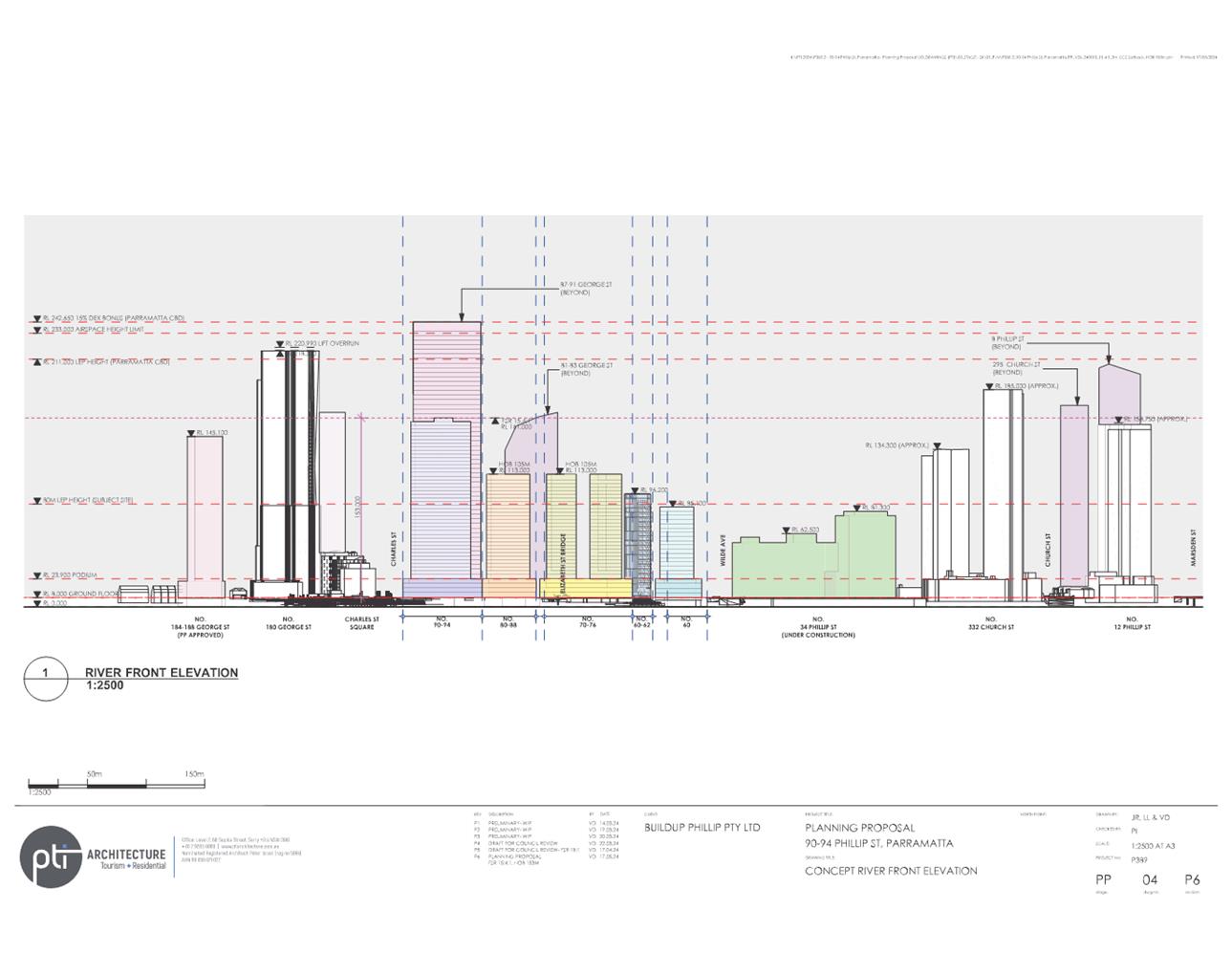
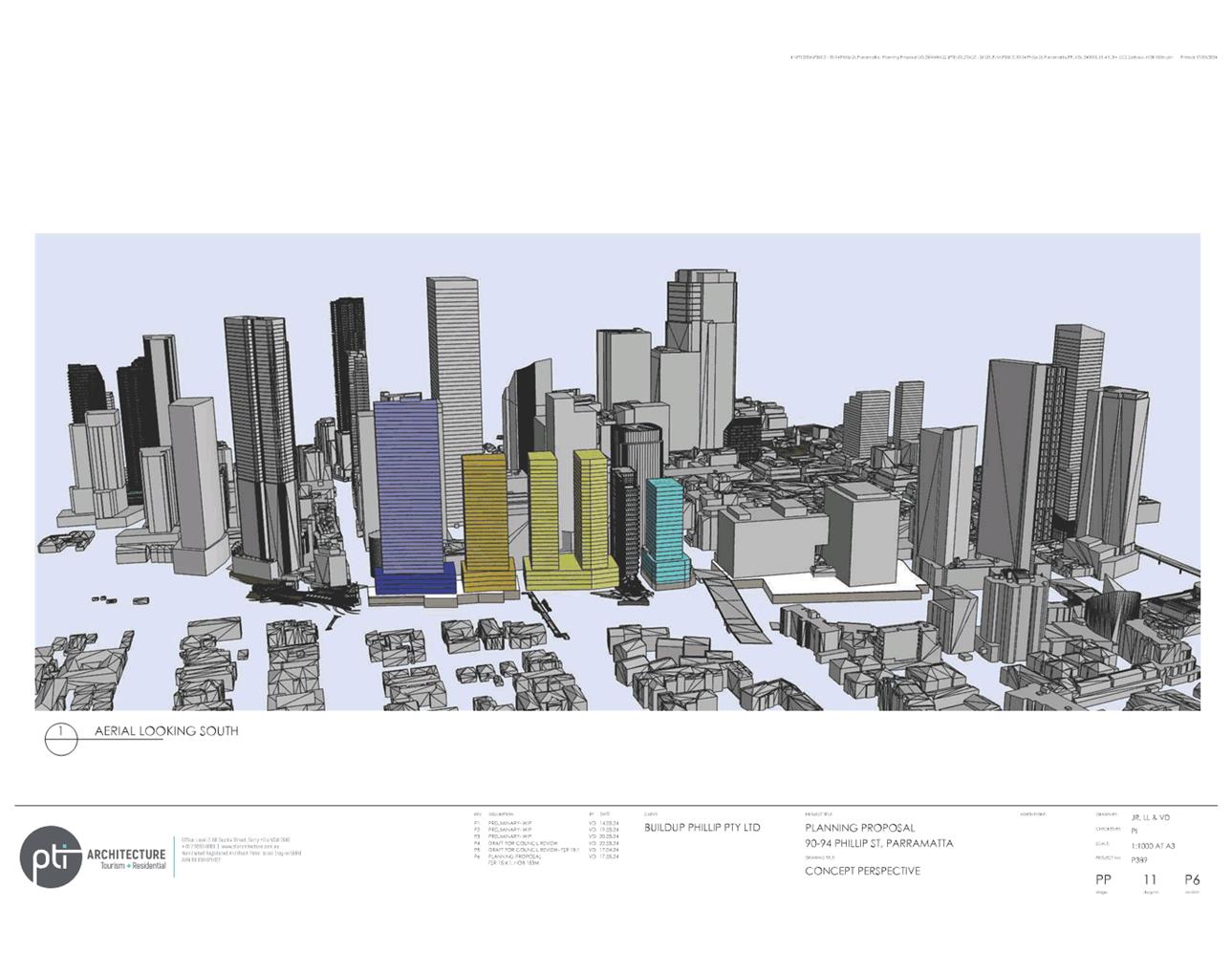
commercial core of the city towards the river. Figure 9 below demonstrates
a built form diagram of the stepping down in height controls based on existing
and approved developments. Immediately to the south-east of the subject site at
180 George Street is a recently developed tower at a total height of 210
metres. While this is 57 metres greater than the height being sought by
the Planning Proposal, the circumstances of this site are different in that it
benefits from a large site area as such, the floor space ratio achieved on this
site was lower at 11.49:1. Other circumstances that differ from the
subject site are the context of the site which is setback further from the
river particularly when viewed from the ferry approach to the ferry wharf. As
such, it is appropriate for the subject site to step down in height from the
existing building at 180 George Street which the Planning Proposal achieves.
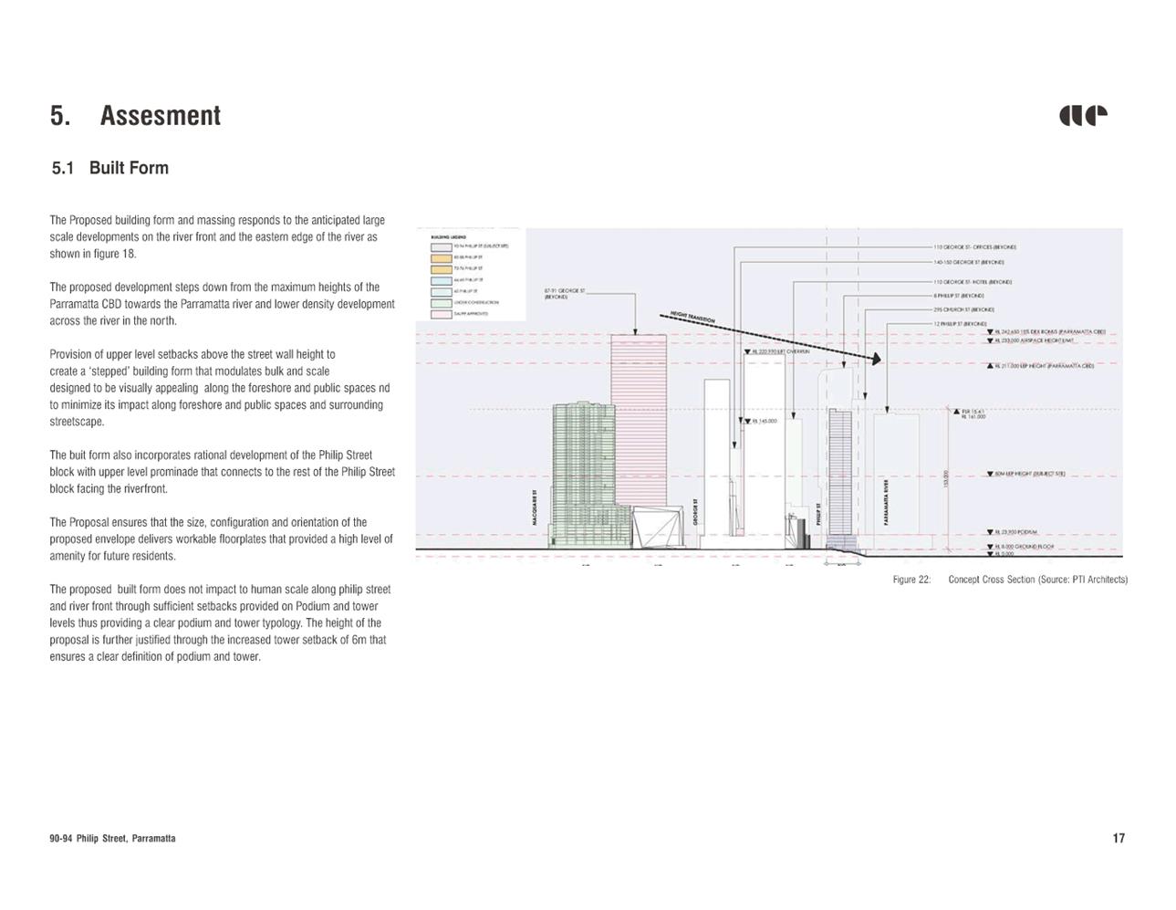
The
proposed height of 133 metres (15 metres including Design Excellence bonus)
complies with the principle of providing a stepping down of the height from the
commercial core of the city towards the river. Figure 9 below demonstrates
a built form diagram of the stepping down in height controls based on existing
and approved developments. Immediately to the south-east of the subject site at
180 George Street is a recently developed tower at a total height of 210
metres. While this is 57 metres greater than the height being sought by
the Planning Proposal, the circumstances of this site are different in that it
benefits from a large site area as such, the floor space ratio achieved on this
site was lower at 11.49:1. Other circumstances that differ from the
subject site are the context of the site which is setback further from the
river particularly when viewed from the ferry approach to the ferry wharf. As
such, it is appropriate for the subject site to step down in height from the
existing building at 180 George Street which the Planning Proposal achieves.
Figure 9: Built form diagram showing stepping down in height reflecting existing and approved developments. Subject site shown in blue (Source: Applicant’s Reference Scheme – PTI Architecture)
d. Reinforcement of commercial core to the south (continued…)
Future development will likely further reinforce this pattern due to the height control currently applicable to the south of the site. Figure 10 below shows an extract from the Parramatta LEP 2023 Height of Buildings map demonstrating the existing height controls in the proximity of the subject site. The area immediately to the south is subject to a Reduced Level (RL) height control of 211 metres (243m RL including Design Excellence bonus). This RL height control translates to various heights when measured in metres above ground level. The parcels immediately to the south of the subject site would equate to a height control in metres above ground of approximately 235 metres. As such, the proposed height control for the subject site is approximately 82 metres less than the control applicable to sites to the south, providing a significant step down in height towards the river foreshore.
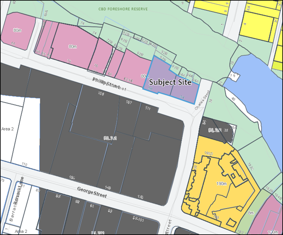
Figure 10: Existing height controls in proximity of subject site under Parramatta LEP 2023 (Source: City of Parramatta GIS)
Assessment of Overshadowing
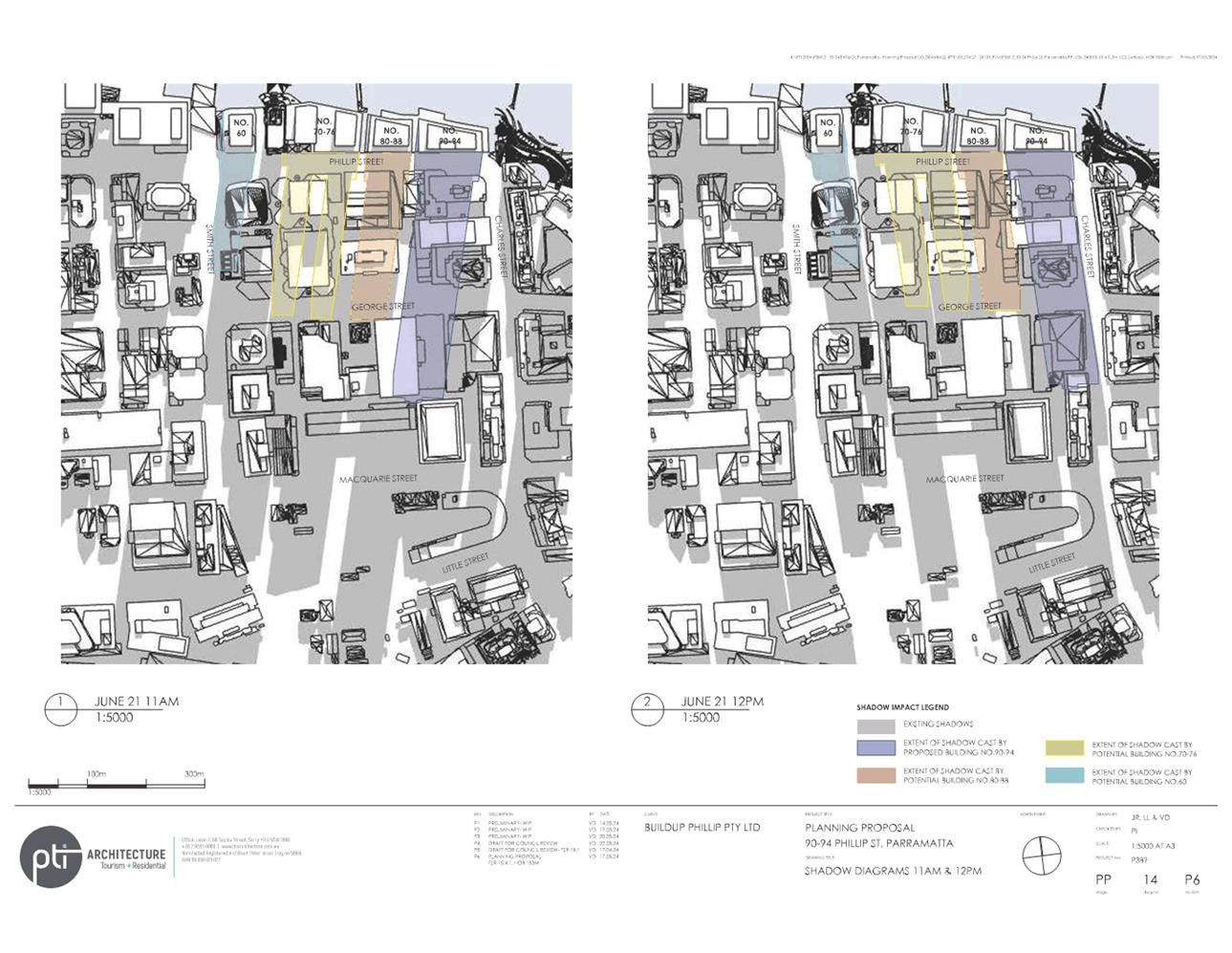
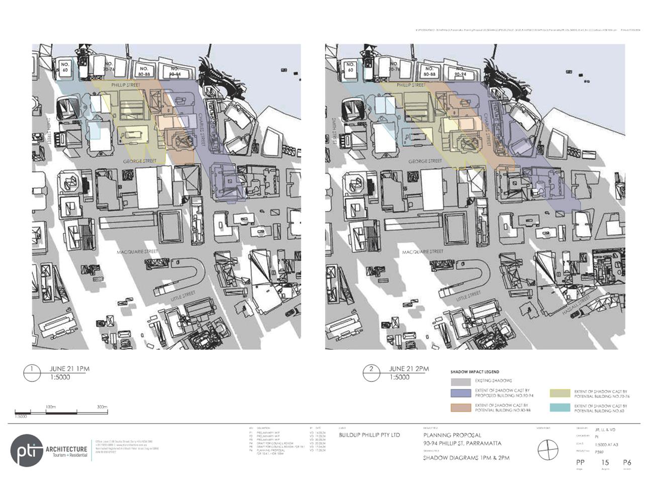
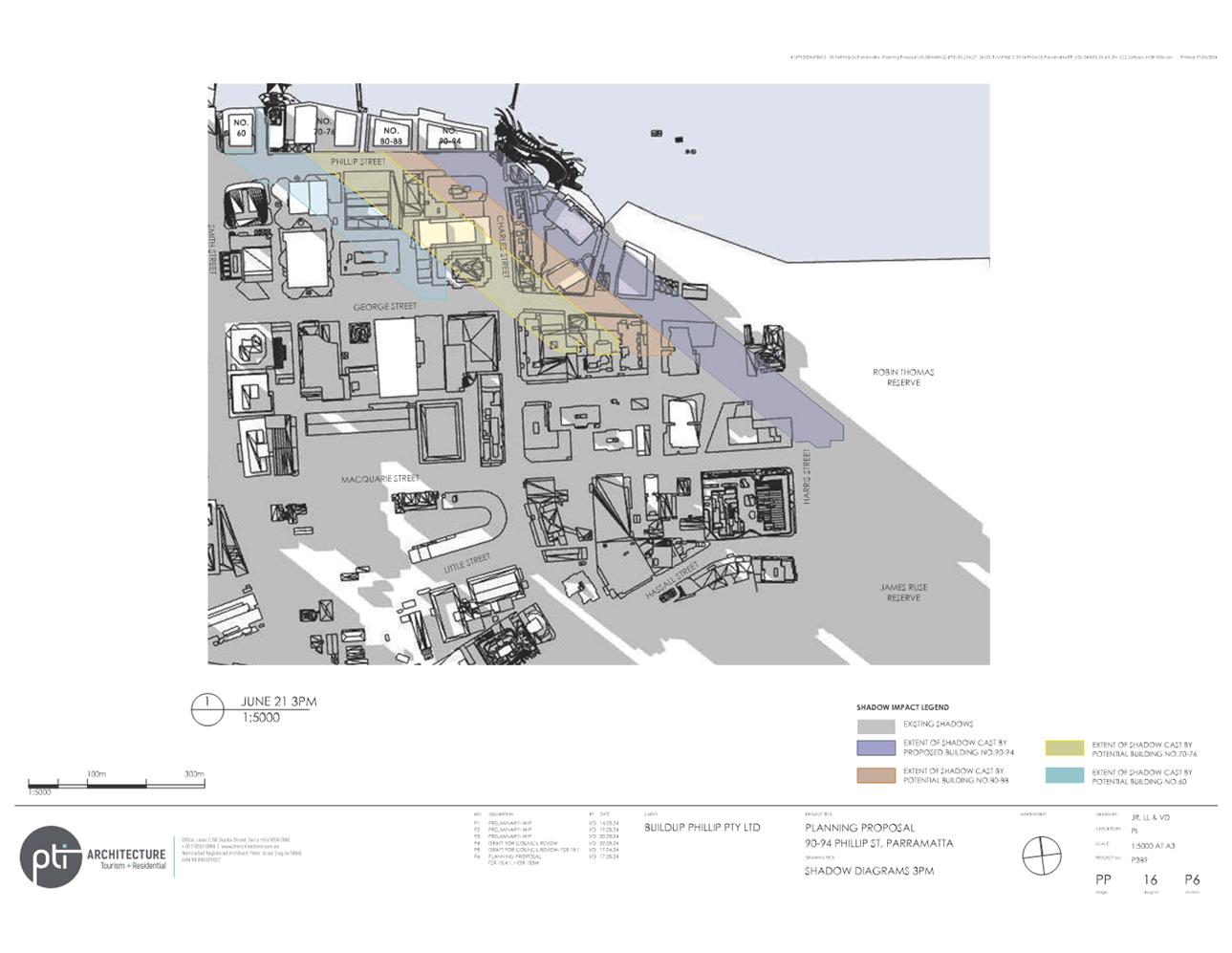
51. The applicant’s reference scheme (see Attachment 3) includes shadow diagrams indicating the overshadowing caused by the proposed building height at hourly intervals from 9.00am to 3.00pm on 21 June. The diagrams indicate no overshadowing of Robin Thomas Reserve before 3.00pm (refer to Figure 11 below). The diagrams indicate a small portion of Robin Thomas Reserve being overshadowed at 3.00pm, however, this overshadowing is within the shadows cast currently by existing development. The overshadowing from existing development is indicated in grey shading.
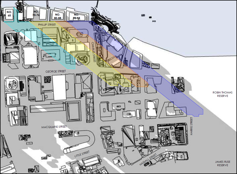
Figure 11: Extract from shadow diagrams showing shadows cast at 3.00pm on 21 June (Source: Applicant’s Reference Scheme – PTI Architecture). Shadow from subject site is shown in dark blue. Shadows from currently permissible development shown in grey shading.
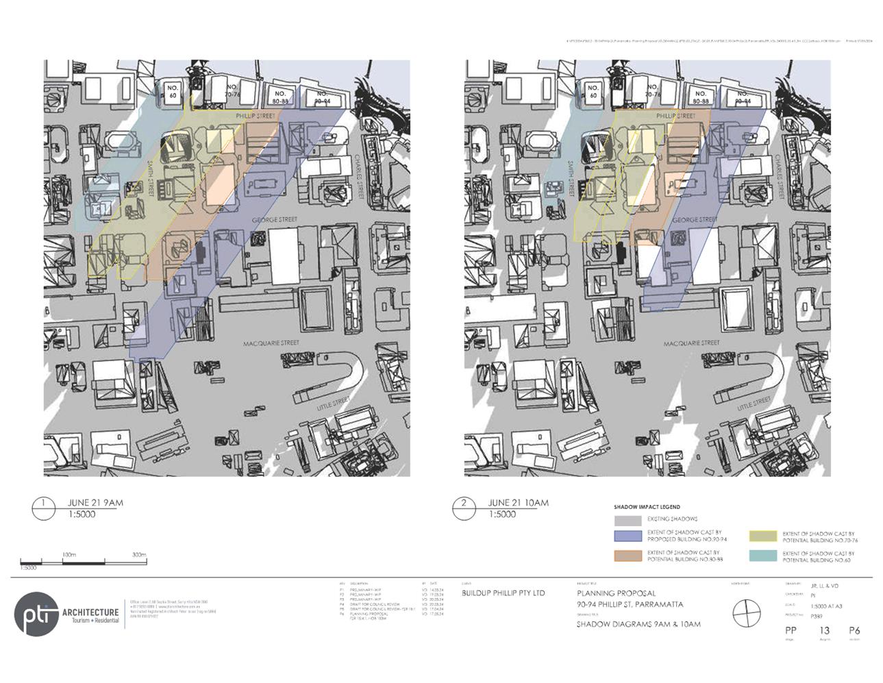
52. The shadow diagrams indicate overshadowing of the heritage item known as “Perth House” at 10.00am (see Figure 12 below). “Perth House” is an item of State heritage significance under the Parramatta LEP 2023 and is listed on the State Heritage Register. However, this overshadowing is within the shadows cast currently by existing development.
![]()
![]()
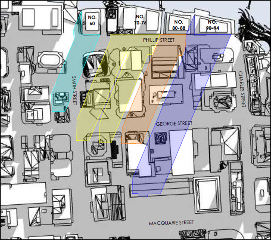
Figure 12: Extract from shadow diagrams showing shadows cast at 10.00am on 21 June (Source: Applicant’s Reference Scheme – PTI Architecture). Shadow from subject site is shown in dark blue. Shadows from currently permissible development shown in grey shading.
Summary
53. In summary, the reference scheme is considered to represent a significant increase in density for the site and an improvement in the viability of the tower floorplate. This will assist in encouraging redevelopment of the site and will stimulate the commencement of the delivery of the upper-level promenade and an improved relationship with the public domain of Charles Street Square and the Parramatta River foreshore. The Planning Proposal has been considered in relation to the urban design principles identified for the Phillip Street block which are based on the analysis of various studies carried out earlier and will provide for buildings that allow for a transition in height from the core of the city centre to the river and will enhance opportunities for views of the river. Impacts from the increase in tower height are managed through an increase in the eastern setback which will help to mitigate the bulk and scale while reducing wind impacts on the public domain.
Flooding
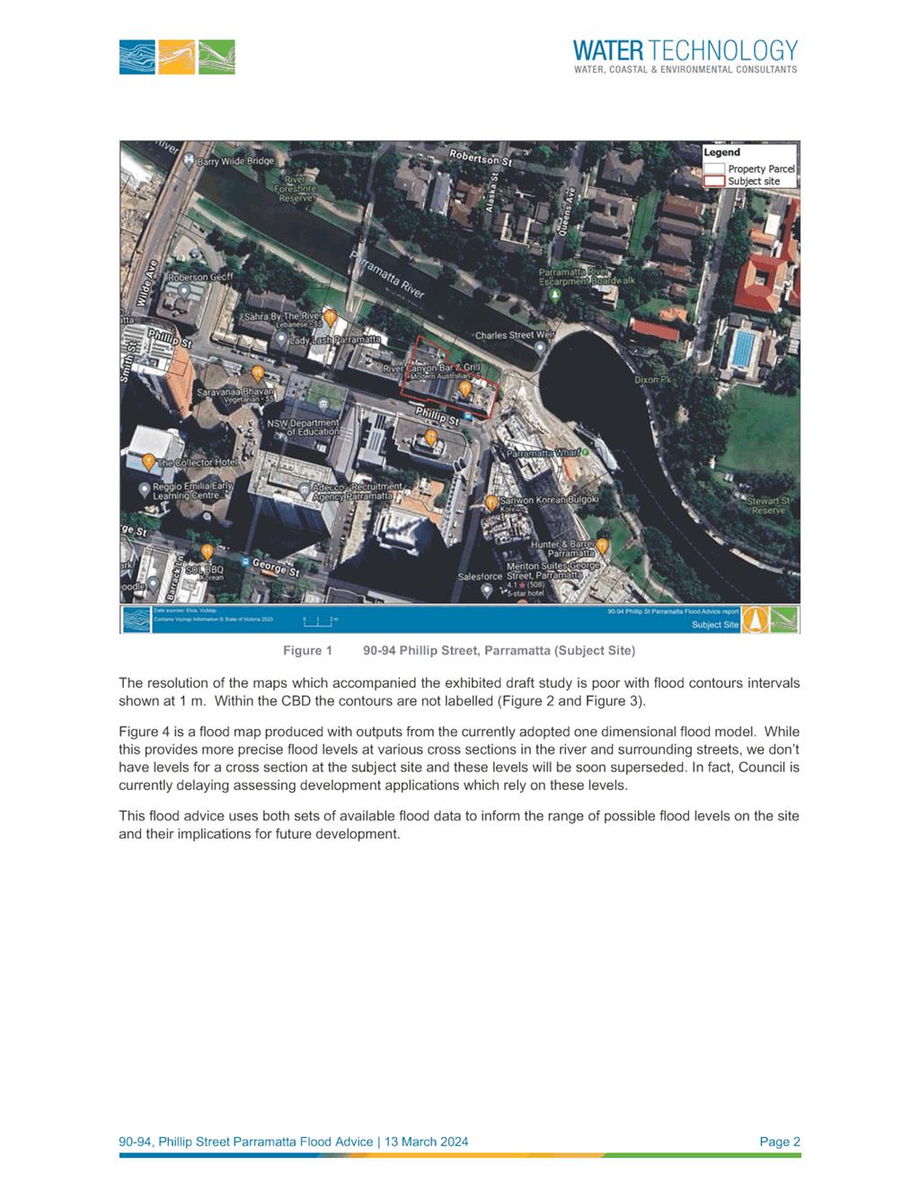
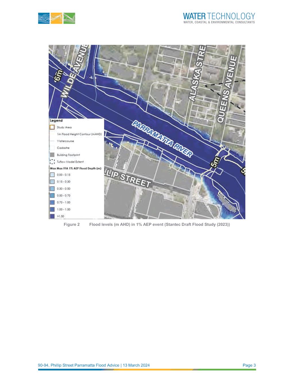
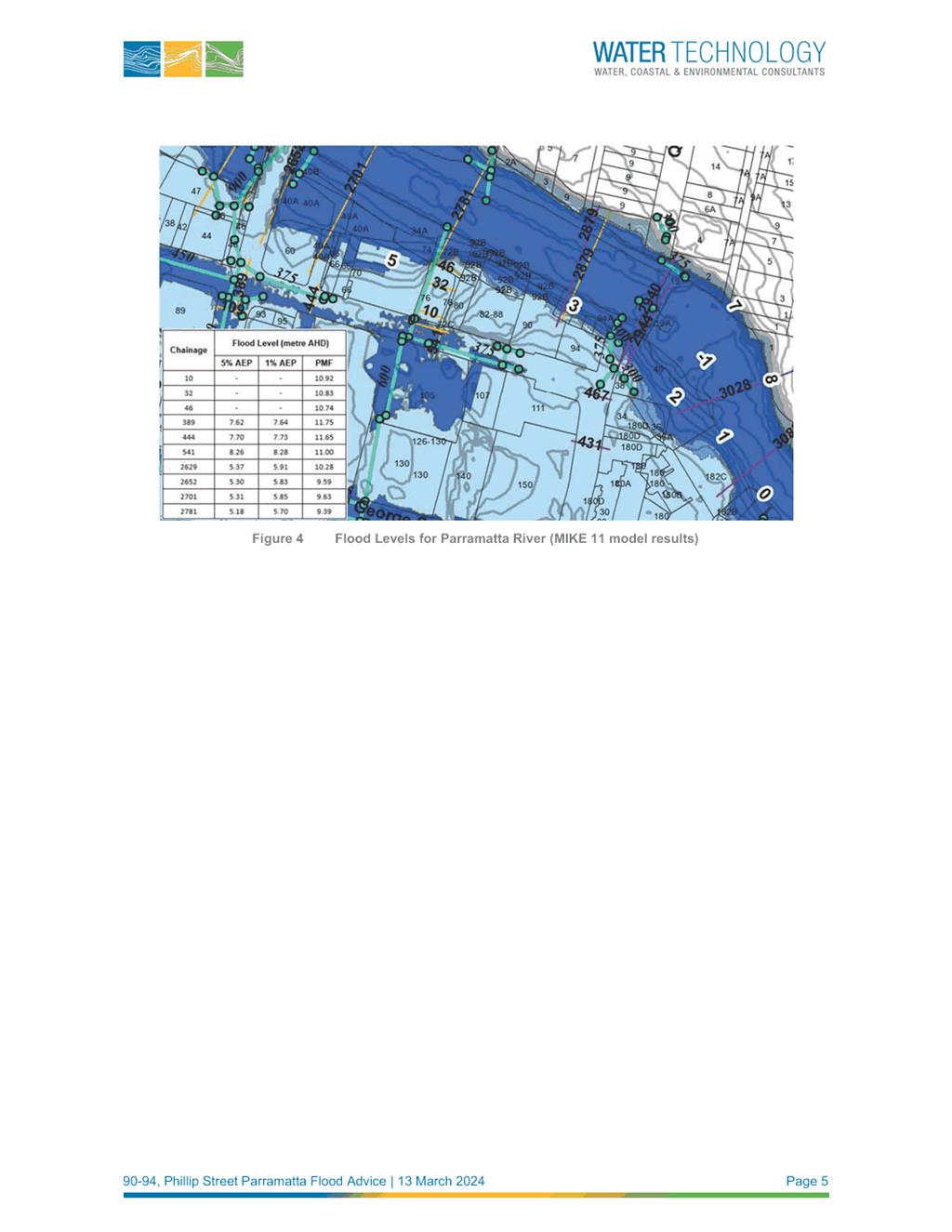
54. The site is located on the southern foreshore of the Parramatta River and as such, is subject to riverine flooding and overland flows. The applicant has submitted a Flood Report prepared by Water Technology (see Attachment 5). The Report sets out preliminary findings of how flooding may dictate building design features. The Report notes that the advice is broad in nature and specific advice cannot be provided until Council adopts the draft Parramatta River Flood Study 2023 at which time precise flood levels will become available.
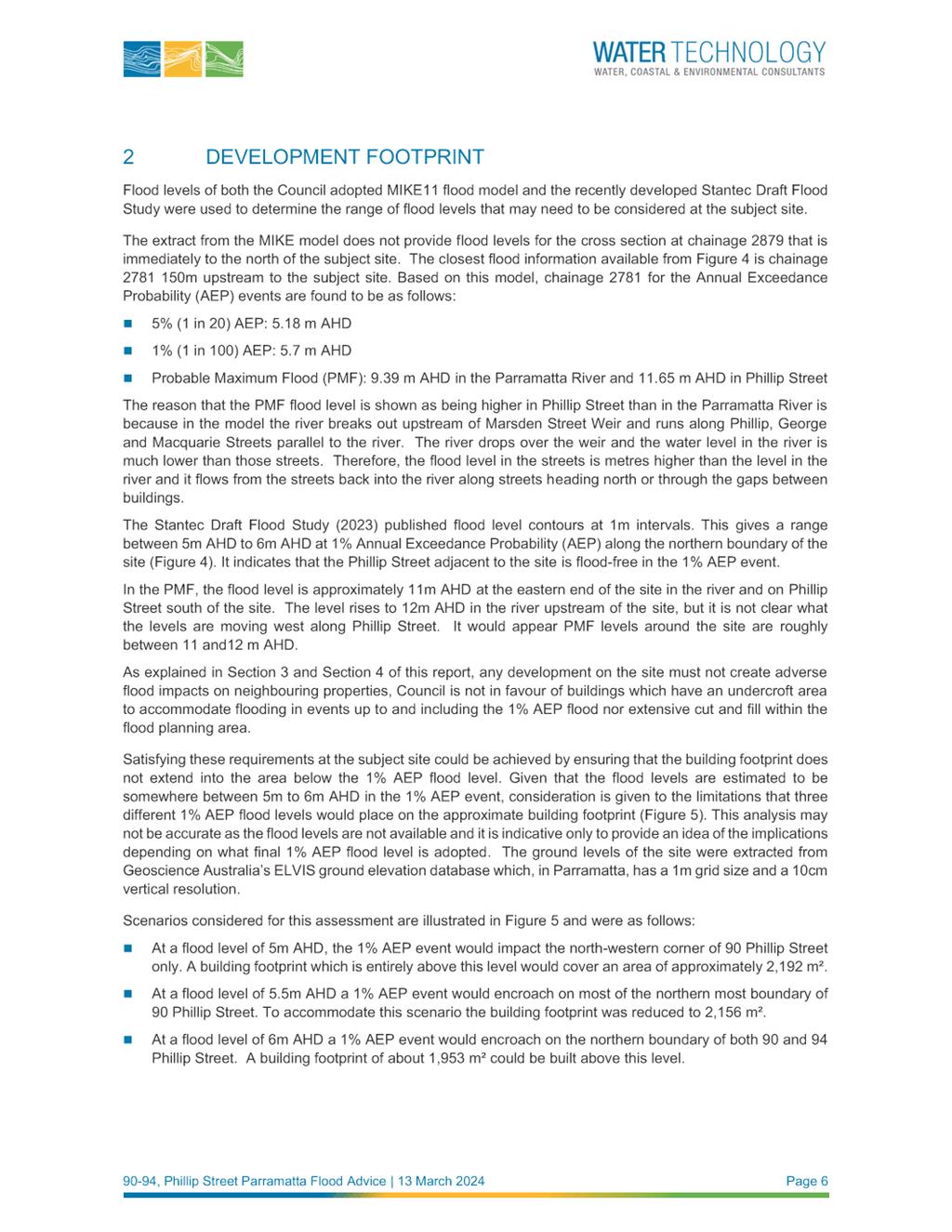
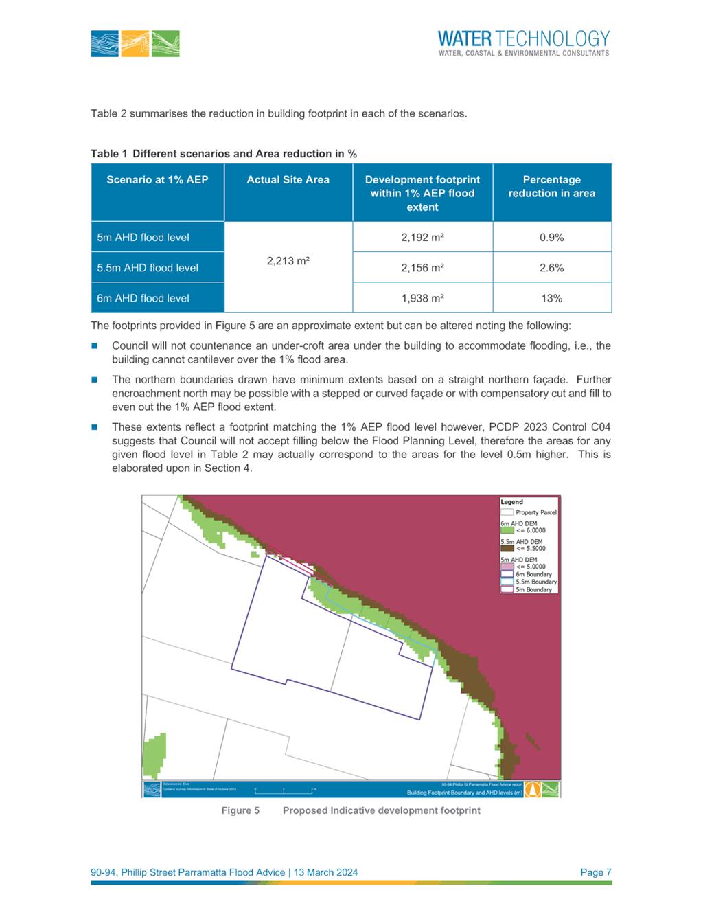
55. In summary, the report advises that based on the current published flood data, a mixed use development on the site would be compatible with flood risks. The flood planning level for the site would be identified based on the 1% Annual Exceedance Probability (AEP) plus a 500mm freeboard. On this basis, the flood planning level for this site is likely to be between 5.5 metres and 6 metres AHD. The Report demonstrates that the site can accommodate a building footprint at the current flood planning level. Figure 13 below shows a hypothetical building footprint can be accommodated assuming the current worst case scenario of a flood planning level at 6 metres.
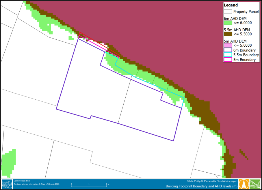
Figure 13: Indicative building footprint clear of an assumed Flood Planning Level of 6 metres AHD (Source: Water Technology)
56. Once the draft Parramatta River Flood Study 2023 is adopted by Council (see later in this report for timing of adoption), the new flood planning level will need to be considered and it would also need to be demonstrated through flood modelling that redevelopment of the site would not increase flooding on neighbouring properties. The applicant’s Flood Report advises that, providing the building has no larger footprint than the existing building this should be able to be demonstrated.
57. Council’s Senior Catchment and Development Engineer has reviewed the Flood Report and concurs with its recommendations subject to the inclusion of specific reference to Local Planning Direction 4.1 Flooding issued by the Minister for Planning under section 9.1(2) of the Environmental Planning and Assessment Act 1979.
58. The reference design submitted by the applicant demonstrates compliance with Local Planning Direction 4.1 (Flooding), however this is in relation to the flood levels identified under the Upper Parramatta River Flood Study 2005. Council will consider adoption of the draft Parramatta River Flood Study 2023 at its meeting on 11 June 2024. Subsequent to Council’s upcoming consideration of the draft Parramatta River Flood Study 2023, the applicant’s Flood Report should be revised and updated to reflect any change in the identified flood planning level.
59. Should Council resolve to submit the Planning Proposal to the DPHI to seek a Gateway determination, any submission should occur after the Applicant’s Flood Report has been updated to reflect the Parramatta River Flood Study 2024 and the corresponding revision of the Applicant’s Flood Report and refence scheme if required to take account of the Study. Any such revision is also required to address Local Planning Direction 4.1 Flooding issued by the Minister for Planning under section 9.1(2) of the Environmental Planning and Assessment Act 1979.
Traffic and Transport
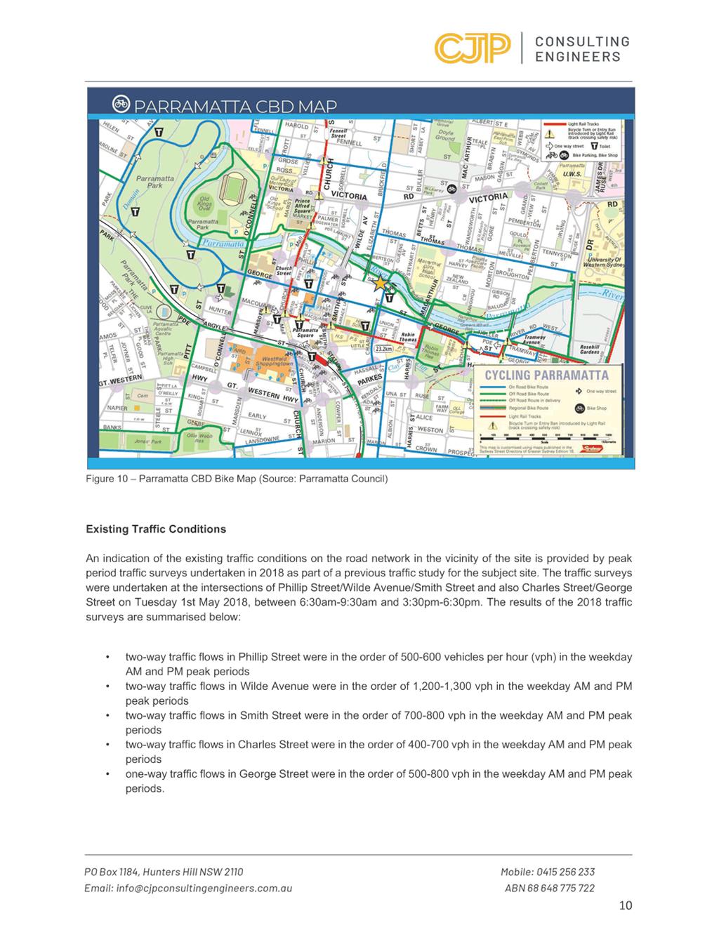
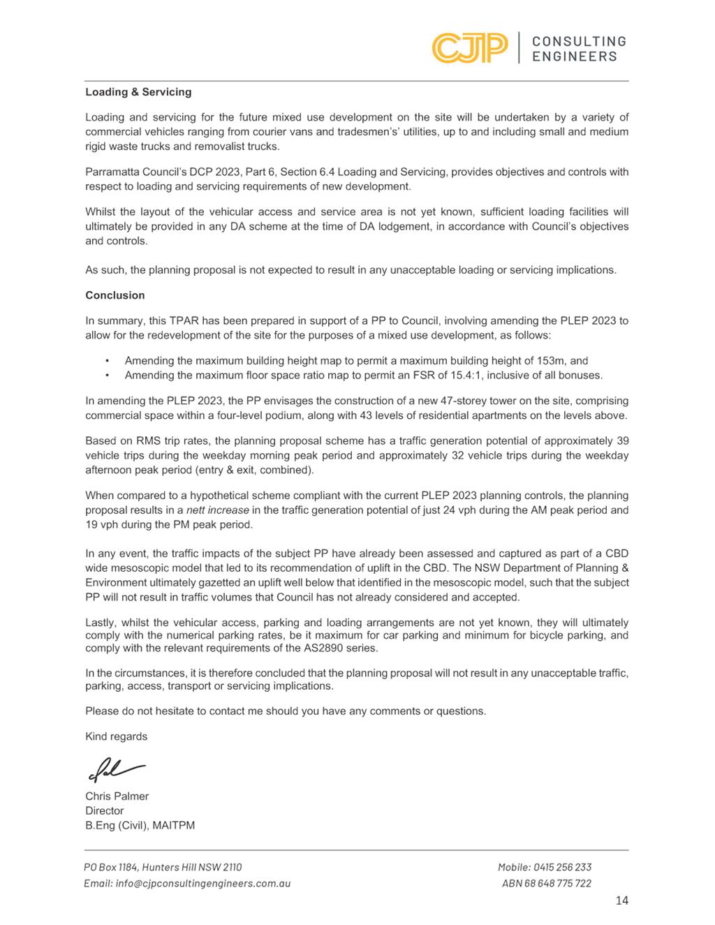
60. The applicant has included a Traffic Report (see Attachment 6) to support the Planning Proposal. The Traffic Report concludes that the Planning Proposal will not result in any unacceptable traffic, parking, access, transport or servicing implications. Specifically, it states:
“It is pertinent to note in this regard that the proposed amendments to the PLEP 2023, and in turn, the indicative yields, are consistent with the original draft Parramatta CBD PP endorsed by Council in June 2021. As part of the CBD PP, AECOM prepared a Strategic Transport Study (STS), which ultimately supported the uplift densities proposed in the draft CBD PP. This was on the basis of off-street parking being provided in accordance with City of Sydney’s CBD rates compared to the City of Parramatta’s CBD rates.”
61. The traffic modelling prepared by AECOM which underpinned the CBD Strategic Transport Study, was predicated on the assumption of an FSR of 10:1 across the Parramatta CBD with some small increases on individual sites depending on individual site characteristics.
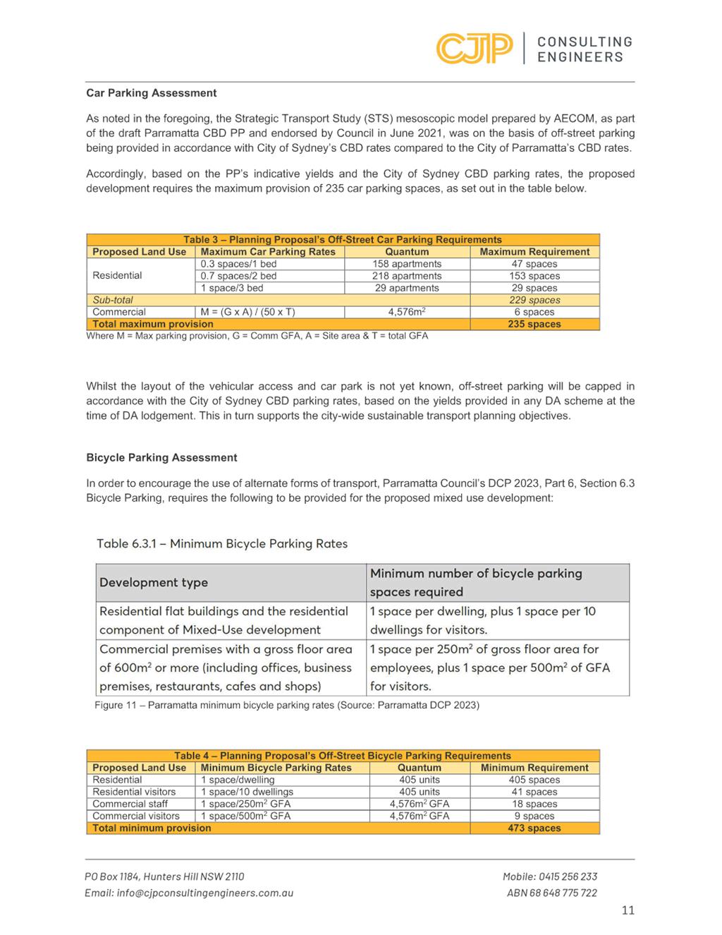
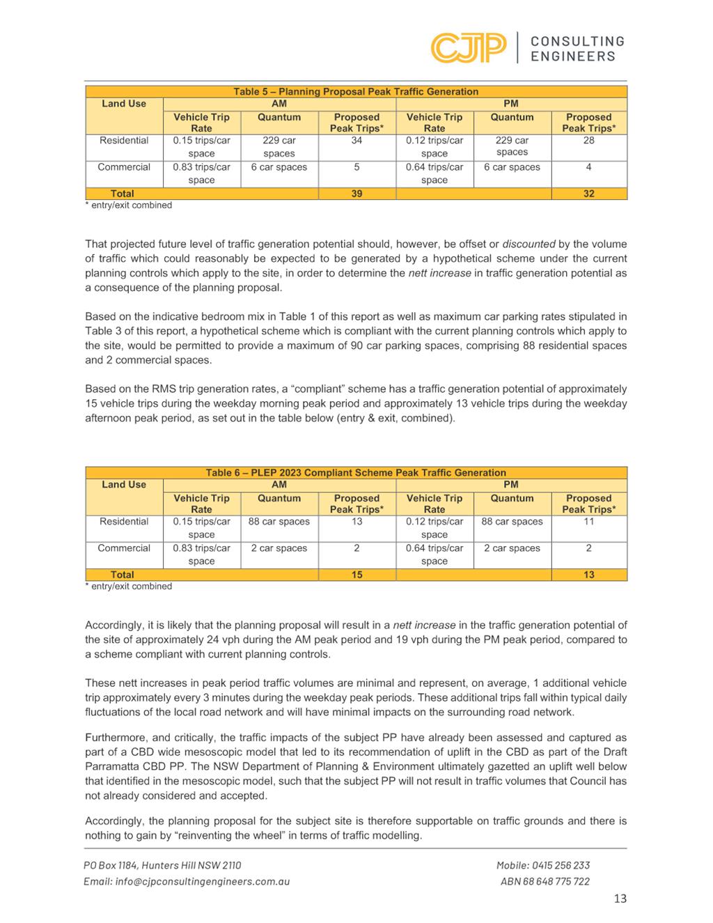
62. As the increase in floorspace permitted by the subject proposal would potentially generate a need for approximately 70 more carparking spaces at the site, it is considered that the incremental impact of the traffic that would be generated by the use of these additional carparking spaces on traffic movements in the CBD would be acceptable, noting also that in the case of the subject site the Parramatta CBD Planning Proposal endorsed by Council also took into account the potential development of the subject site for unlimited commercial floorspace to a potential density of commercial development at an FSR of 21:1.
Heritage
63. As discussed above, the site is not heritage listed or within a Heritage Conservation Area. There are several items within proximity to the site that are identified as items of local heritage significance under Parramatta LEP 2023. (Refer to Figure 3 above). Approximately 40 metres towards the north-east of the corner of the site is the “Charles Street Weir”. Approximately 70 metres to the west of the western edge of the site is the “Convict Drain” and further to the west is “Barnaby’s Restaurant and potential archaeological site” at 70 Phillip Street and “Office and potential archaeological site at 66 Phillip Street.”
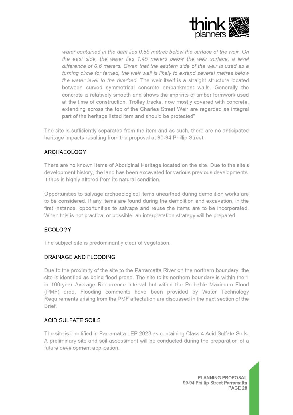
64. The applicant’s Planning Proposal has noted the heritage listing on the Charles Street Weir and considers it to be sufficiently separated from the subject site to conclude that there will be minimal impacts on the heritage significance of the weir.
65. Council’s Senior Heritage Specialist has raised no objection to the Planning Proposal and agrees that the site is sufficiently separated from the item and there are likely to be no heritage impacts resulting from the proposal. Further, assessment of a future development application will require due diligence reports that address the impacts on built heritage and archaeology including the imposition of appropriate conditions of consent relating to unexpected findings and specific protocols to be followed in the event any archaeological items are found during the demolition and excavation.
66. Further, any development application for redevelopment of the site will be assessed having regard to the heritage provisions within Clause 5.10 of Parramatta LEP 2023 and Part 9.6 of the Parramatta DCP 2023.
67. At the time of the preparation of this report, the matter was scheduled to be considered by Council’s Heritage Advisory Committee on 13 June 2024. The advice of the Committee will be noted and considered when the matter is reported to Council, which is anticipated to occur in July 2024.
Infrastructure, Social and Economic Impacts
68. The delivery of the Planning Proposal within the Parramatta CBD will achieve a positive social outcome, being well serviced by existing infrastructure. Residents and workers will be able access necessary transport, education services, open space, health services, community services, employment, and recreation facilities.
69. As discussed above in the strategic merit section, the Proposal will also facilitate development that will assist in the emergence of Parramatta as Sydney’s Central City which will in turn contribute to continued economic growth.
70. The associated draft Planning Agreement will facilitate the delivery of infrastructure as follows:
a. 5 x affordable housing units (a mixture of four (4) x one bedroom apartments and one (1) x two bedroom apartment);
b. Dedication of road widening within Phillip Street;
c. Forego their historic legal right to utilise the Charles Street Reserve for access purposes;
d. Upgrade of the public domain within Charles Street reserve to the existing Charles Street Square;
e. Incorporation of an upper-level promenade fronting the river foreshore; and
f. Development of a 6 metre setback from the Charles Street Square to strengthen and activate the square.
71. Any development application will also require the developer to make a monetary contribution as a condition of consent in accordance with the Parramatta City Centre Local Infrastructure Contributions Plan 2022 (Amendment 2). This will ensure the development contributes towards the provision of funding for additional infrastructure required to support the increase in population.
Environment
72. The site does not contain any habitat and therefore there is little likelihood that critical habitat or threatened species, populations or ecological communities, or their habitats could be adversely affected by the Planning Proposal.
73. Other environmental impacts, including sustainability, will be addressed as part of any future development proposal, including a design excellence competition.
Parramatta Development Control Plan 2023 – Draft Amendment
74. The site is subject to the Parramatta Development Control Plan (DCP) 2023, specifically, Part 9.5.1.2 which contains controls relating to the City East Block. The City East Block includes the subject site and is bound by Wilde Avenue, Phillip Street, Charles Street Square and the north bank river foreshore open space. Part 9.5.1.2 requires towers to be set back 6 metres from the street wall. A concession is given to the subject site under the existing DCP controls which provide that:
“At 90-96 Phillip Street, noting the lot configuration and land commitments for public purposes, development must provide a minimum 3 metre tower setback along the Phillip Street, Charles Street and River foreshore frontage that addresses wind, solar access and design objectives.”
75. As discussed above, the applicant’s reference scheme proposes an eastern tower setback of 6 metres from the podium (12 metres from the eastern boundary) which is in excess of the minimum tower setback of 3 metres prescribed under the Parramatta DCP 2023. This increase in tower setback is proposed for this site in order to mitigate the increased height, bulk, scale and wind impacts from the increased height of the building.
76. Should Council support the Planning Proposal, it is considered appropriate that Council prepare a draft amendment to the Parramatta DCP 2023 to increase the tower setback from 3 metres to 6 metres on the Charles Street side. Such draft amendment should be publicly exhibited concurrently with the Planning Proposal.
Draft Planning Agreement
77. The Planning Proposal is accompanied by a draft Planning Agreement Letter of Offer submitted to Council by the applicant under Section 7.4 of the Environmental Planning and Assessment Act 1979 (refer to Attachment 2).
The Letter of Offer provides for the following:
a. 5 x affordable housing units (a mixture of four (4) x one bedroom apartments and one (1) x two bedroom apartment);
b. Dedication of road widening within Phillip Street;
c. Forego their historic legal right to utilise the Charles Street Reserve for access purposes;
d. Upgrade of the public domain within Charles Street reserve to the existing Charles Street Square;
e. Incorporation of an upper-level promenade fronting the river foreshore; and
f. Development of a 6 metre setback from the Charles Street Square to strengthen and activate the square.
78. Council officers support the provision and dedication of the proposed ARH dwellings which is in accordance with the requirements of Council’s Affordable Housing Action Plan and draft Affordable Rental Housing Policy. The monetary contribution towards Parramatta River foreshore works is also supported.
79. The provision of the area set aside for the upper level promenade is supported as a key element of Council’s Parramatta CBD River Strategy endorsed by Council in 2015. The benefits of the promenade are discussed above under the heading “Parramatta River Strategy”.
80. The future development application for redevelopment of the site will also be subject to Section 7.12 development contributions in accordance with the Parramatta City Centre Local Infrastructure Contributions Plan 2022 (Amendment 2). This contribution is in addition to the draft Planning Agreement.
81. It is proposed that a draft Planning Agreement be prepared based on the applicant’s Letter of Offer and exhibited concurrently with the Planning Proposal and draft DCP amendment.
PLAN MAKING DELEGATIONS
82. Should Council resolve to endorse the Planning Proposal to proceed, it is recommended that Council request that it exercise its plan-making delegations. This means that once the Planning Proposal has been to Gateway, undergone public exhibition and been adopted by Council, Council officers will deal directly with the Parliamentary Counsel Office on the legal drafting and mapping of the amendment. The LEP amendment is then signed by the CEO before being notified on the NSW Legislation website.
FINANCIAL IMPLICATIONS FOR COUNCIL
83. Should Council resolve to proceed with the Planning Proposal and amendment to the DCP, the costs incurred in conducting the public exhibition will be covered by the fees associated with the submission of the Planning Proposal.
CONCLUSION AND NEXT STEPS
84. Council officers have assessed the Planning Proposal and consider that the Planning Proposal has strategic and site specific merit and should proceed to a Gateway determination.
85. It is recommended the Parramatta Local Planning Panel support the Council Officer recommendation that the Planning Proposal (Attachment 1) be supported for the purposes of seeking a Gateway Determination.
86. Following the Parramatta Local Planning Panel’s consideration of the recommendations of this report, the matter will be reported to an upcoming Council meeting along with the Panel’s advice.
David Birds
Group Manager, Major Projects and Precincts
Jennifer Concato
Executive Director City Planning and Design
|
1⇩ |
Applicant's Planning Proposal document |
83 Pages |
|
|
2⇩ |
Planning Agreement Letter of Offer |
3 Pages |
|
|
3⇩ |
Applicant's Reference Design |
16 Pages |
|
|
4⇩ |
Applicant's Urban Design Report |
21 Pages |
|
|
5⇩ |
Applicant's Flooding Report |
19 Pages |
|
|
6⇩ |
Applicant's Traffic and Parking Assessment Report |
14 Pages |
|
|
7⇩ |
Letter from Minister for Planning and Public Spaces |
2 Pages |
|
|
8⇩ |
Previous Urban Design Analysis |
8 Pages |
|
REFERENCE MATERIAL