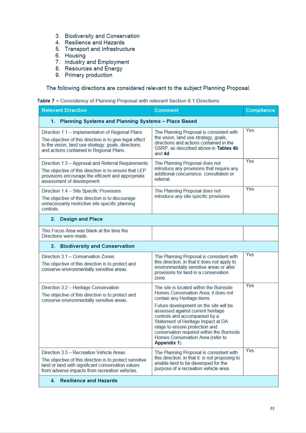
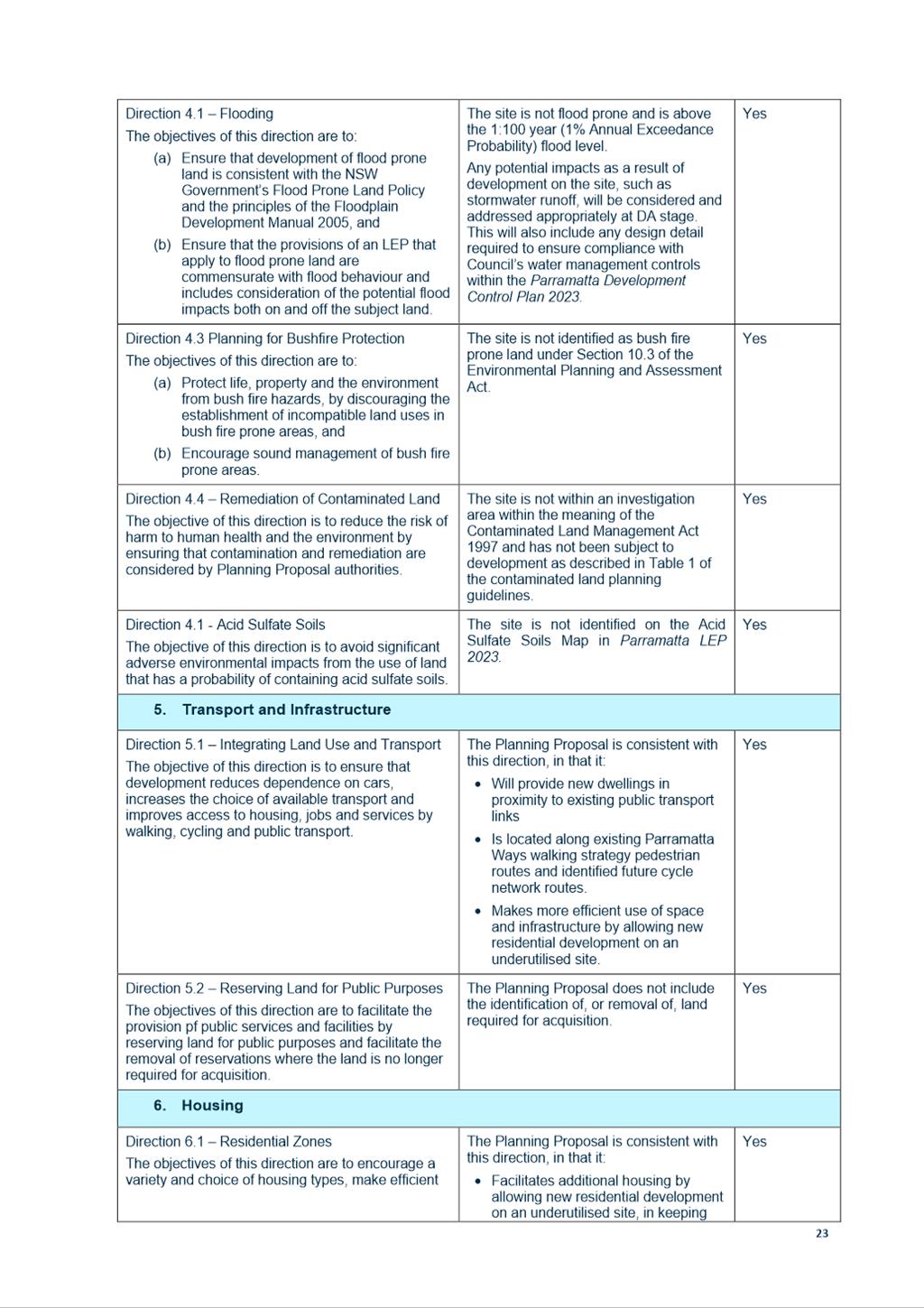
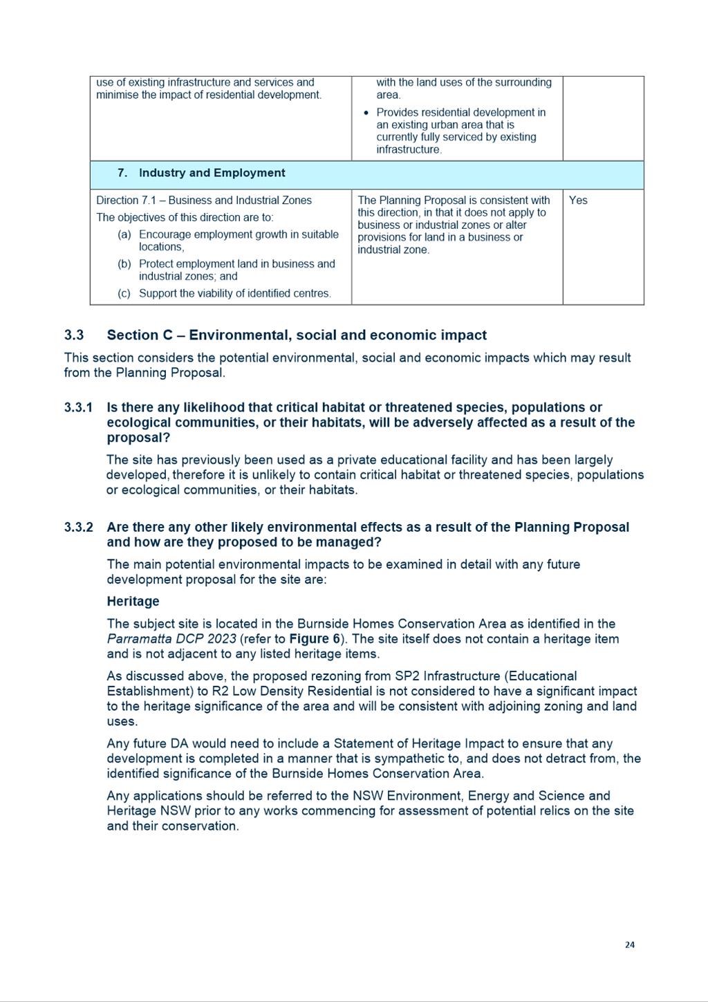
NOTICE OF Local Planning
Panel MEETING
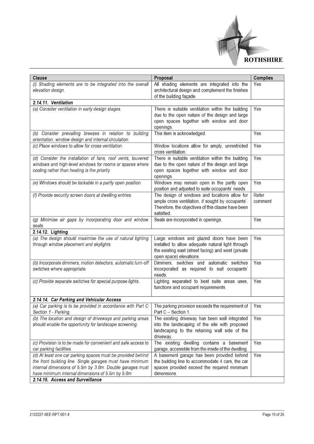
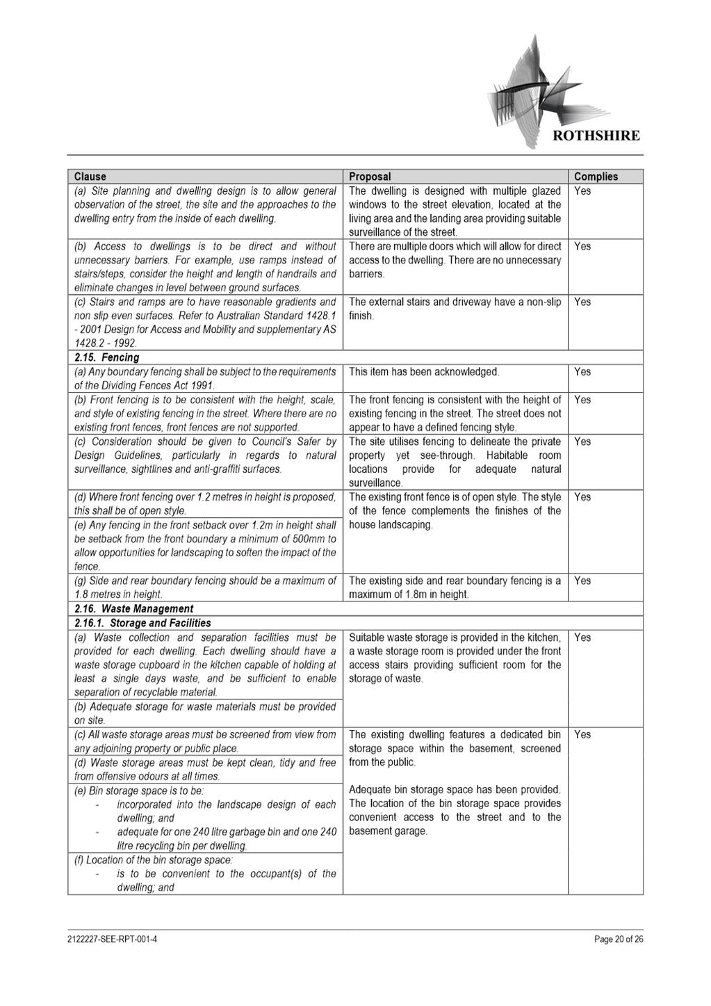
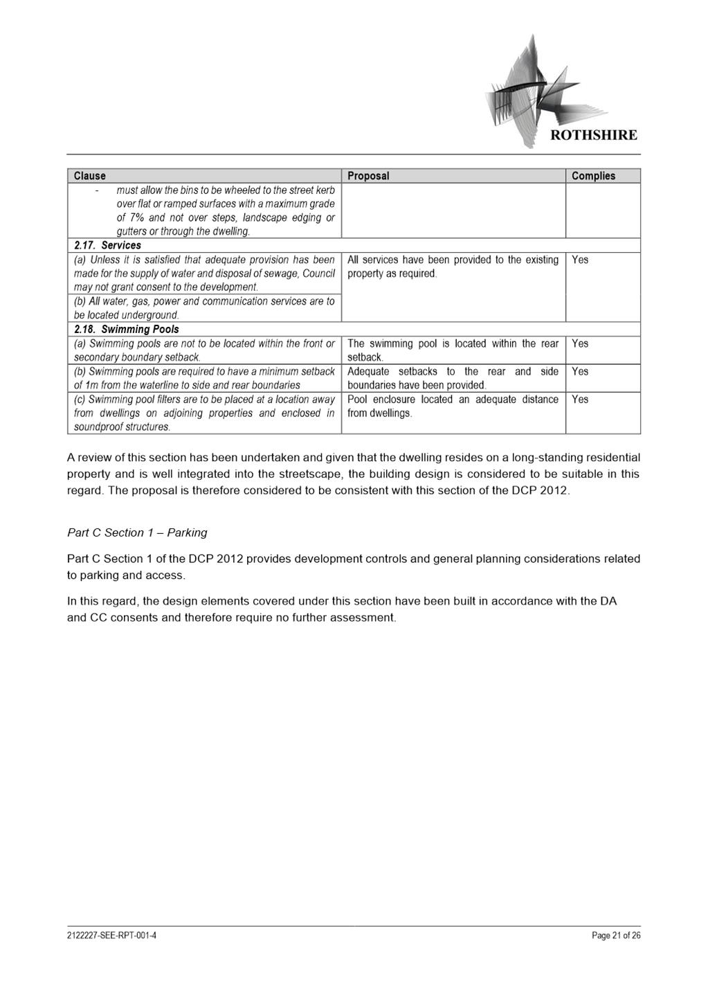
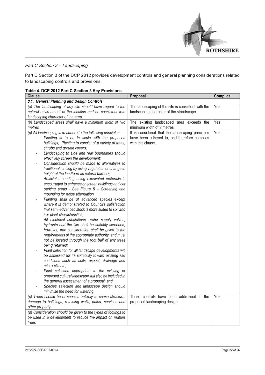
PUBLIC AGENDA
A Local Planning Panel meeting will be held in PHIVE
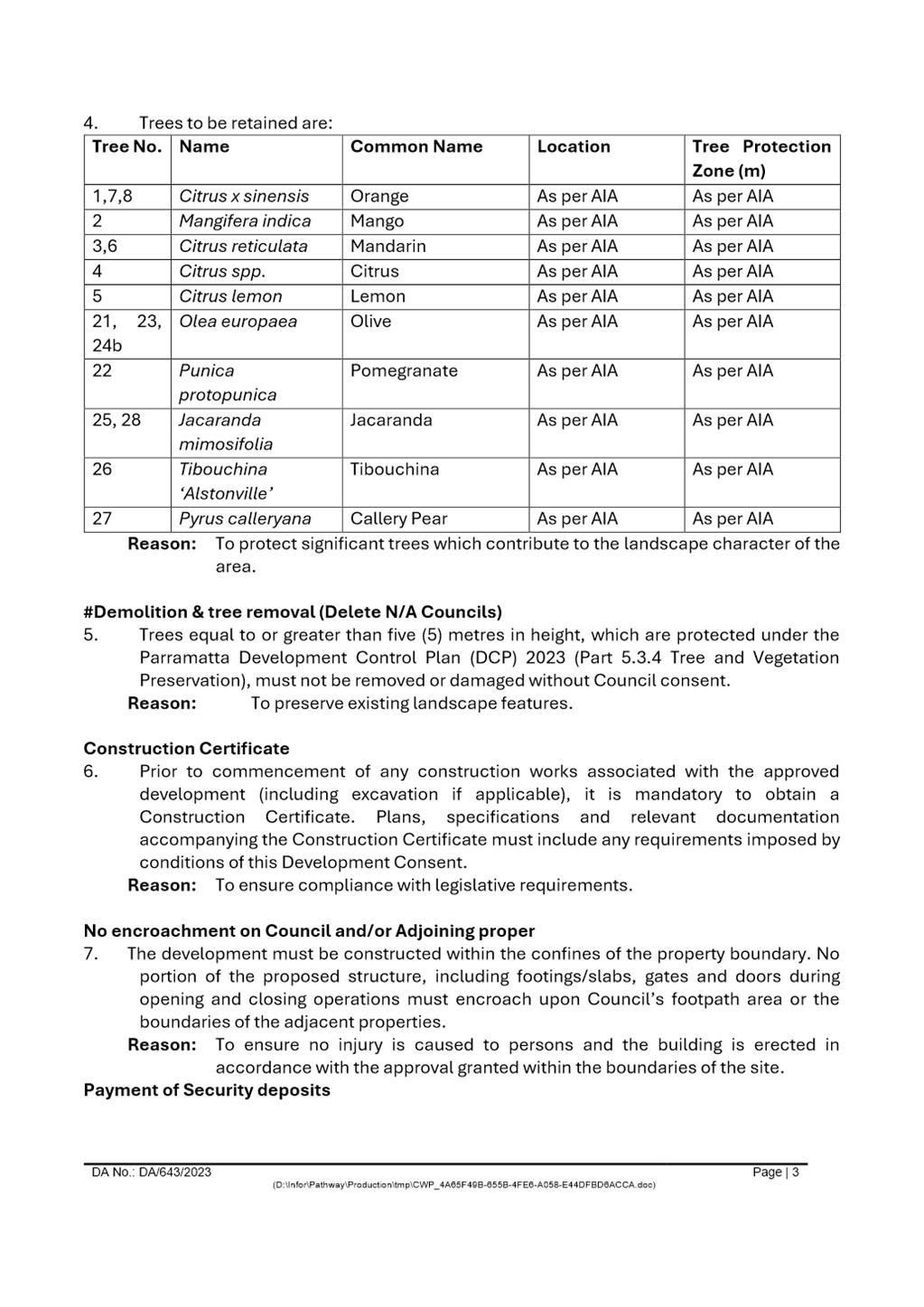
2 Civic Place, Parramatta at 5 Parramatta Square on Tuesday, 16 April 2024 at 3.30pm.
Gail Connolly PSM
CHIEF EXECUTIVE OFFICER
THIS PAGE LEFT BLANK INTENTIONALLY
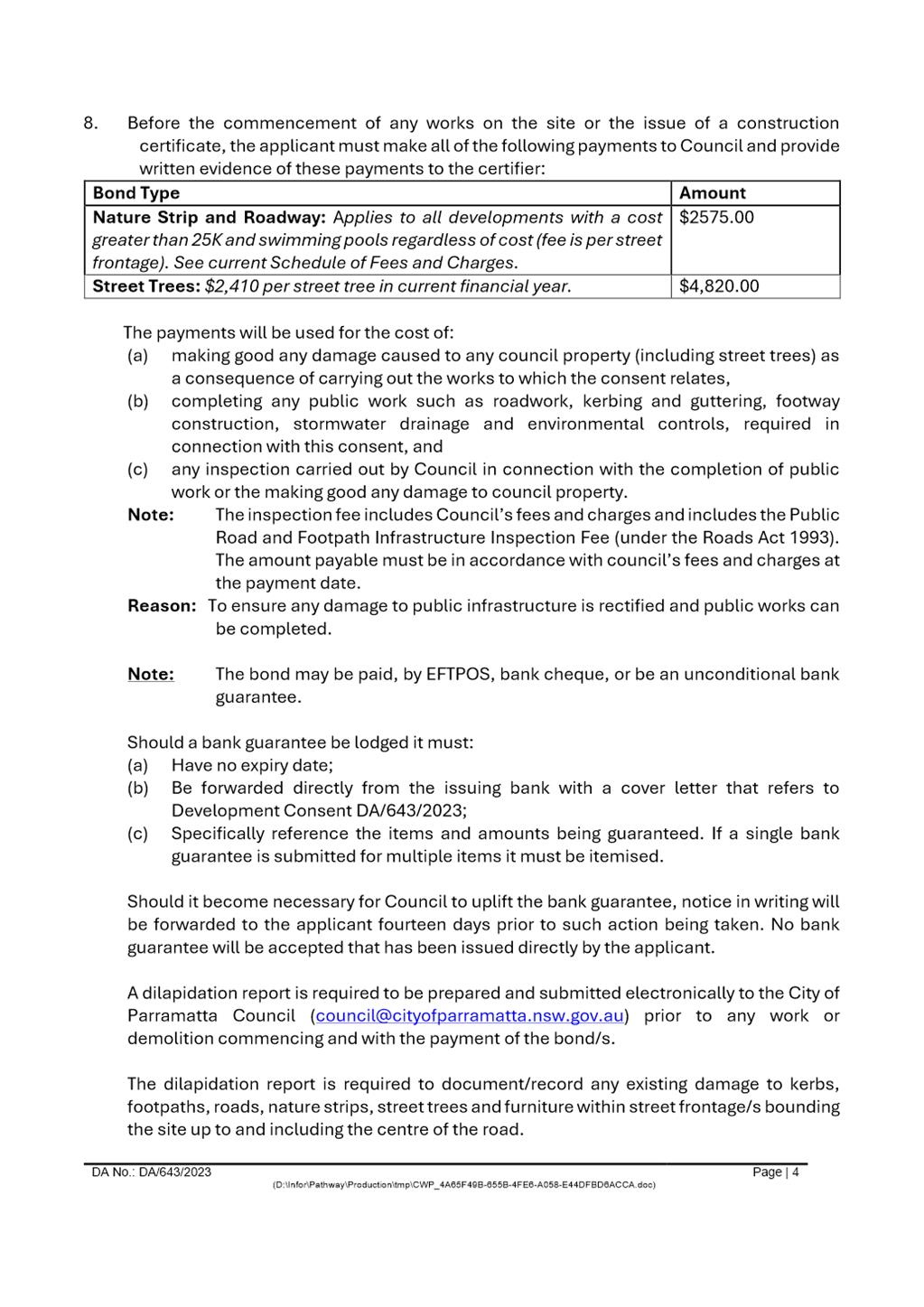
Local Planning Panel 16
April 2024
TABLE OF CONTENTS
1 ACKNOWLEDGMENT
OF THE TRADITIONAL OWNERS OF LAND
The City of
Parramatta Council acknowledges the Burramattagal people of The Darug Nation as
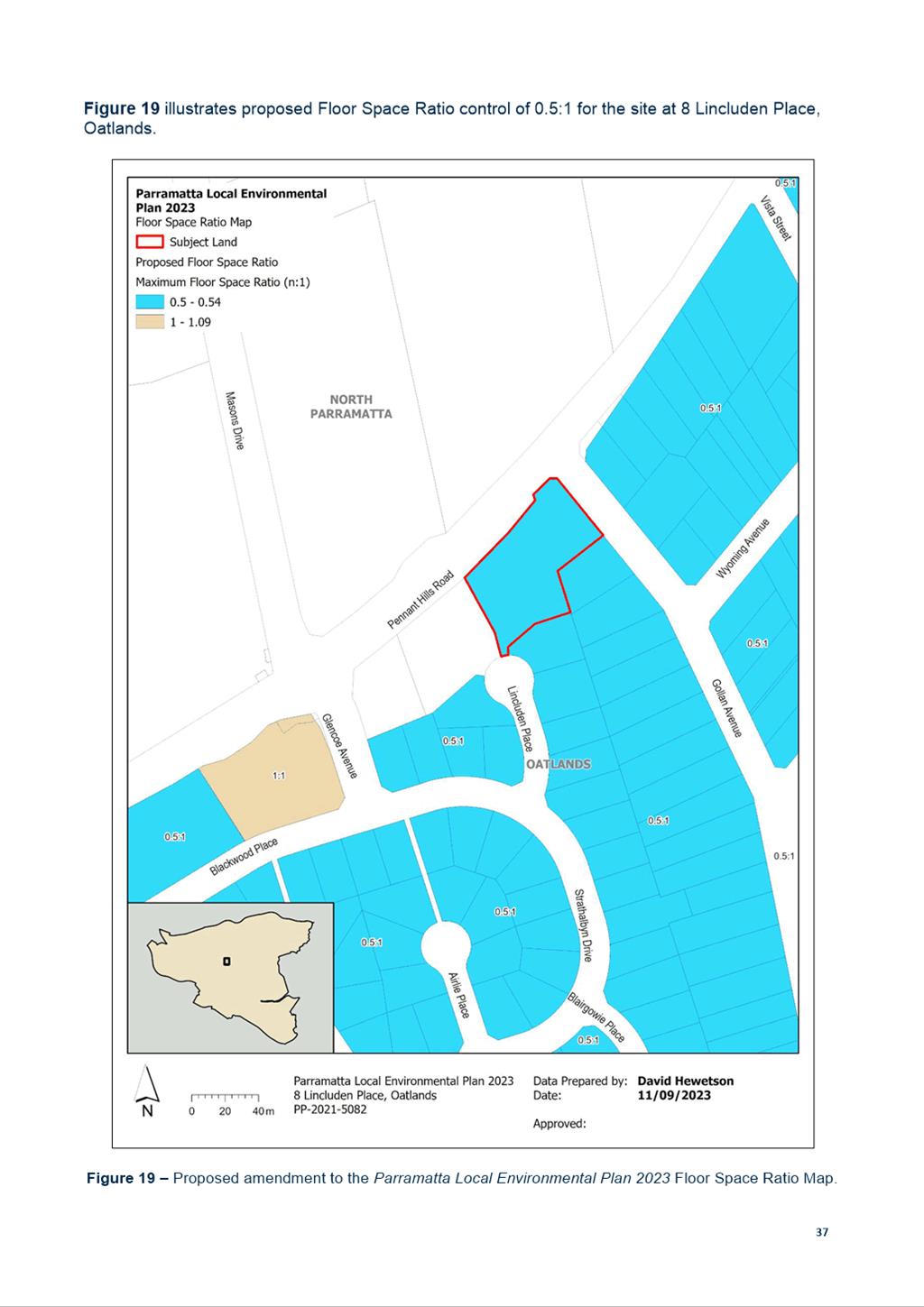
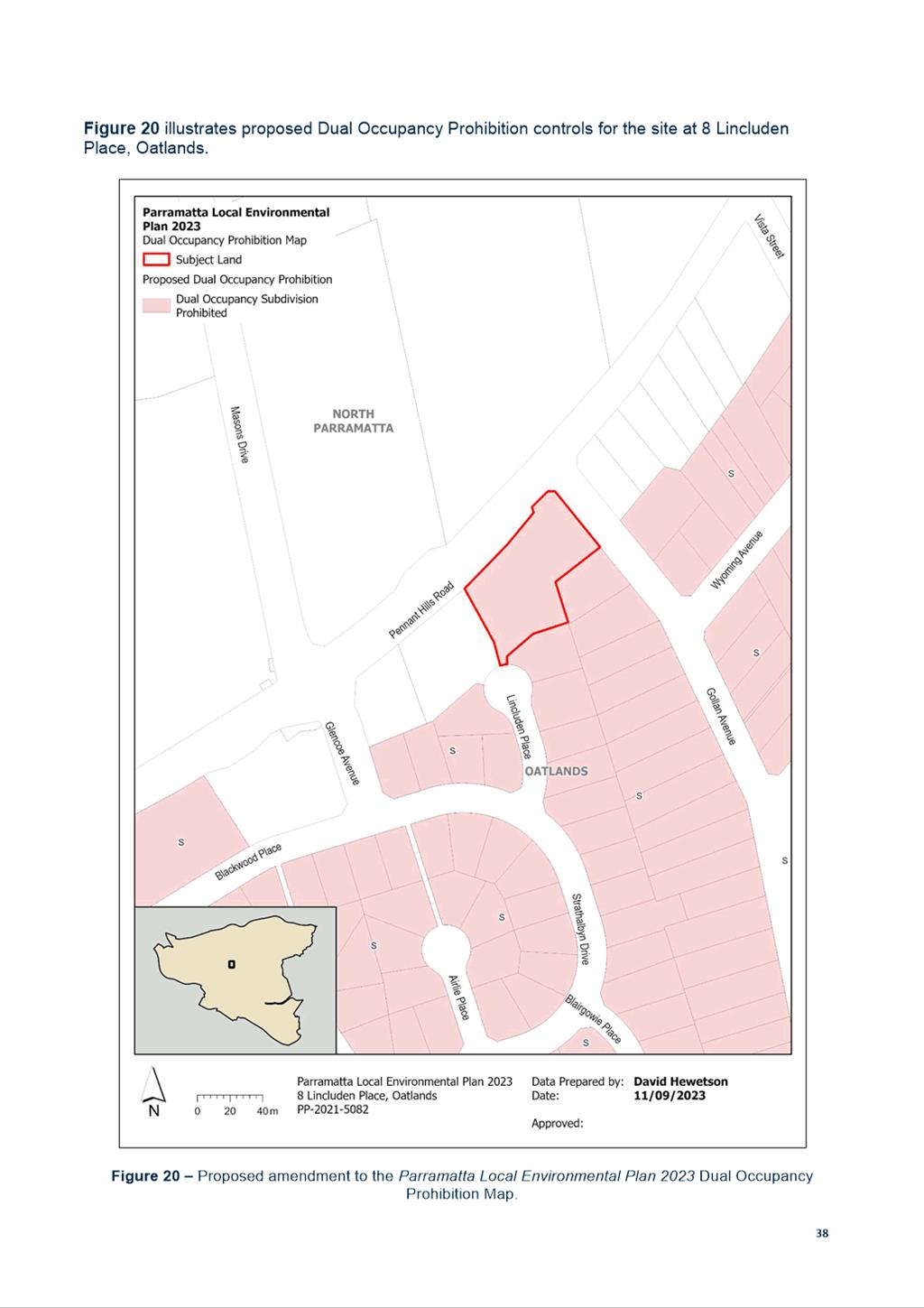
the traditional owners of land in Parramatta and pays its respects to their ancient
culture and to their elders, past, present and emerging.
2 WEBCASTING
ANNOUNCEMENT
This public
meeting will be recorded. The recording will be archived and available on
Council’s website.
All care is taken to maintain your
privacy; however if you are in attendance in the public gallery, you should be
aware that your presence may be recorded.
3 APOLOGIES
4 DECLARATIONS
OF INTEREST
5 Reports - Development Applications
5.1 47-49
Park Road RYDALMERE NSW 2116 (Lot 5 DP 38557, Lot 6 DP 38557)............................................... 6
5.2 16
Gowan Brae Avenue, OATLANDS NSW 2117 (Lot 10 DP 396505)........ 98
5.3 25
Chester Street, EPPING NSW 2121 (Lot 22, DP 262348)....................... 194
6 Reports -
Planning Proposals
6.1 Post
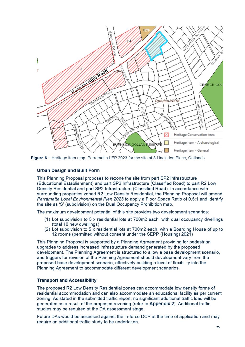
Exhibition Report - Planning Proposal for land at 8 Lincluden Place, Oatlands........................................ 336
6.2 Request
for Gateway and public exhibition: Planning Proposal for North-East Planning
Investigation Area.... 440
Development Applications
16 April 2024
5.1 47-49
Park Road RYDALMERE NSW 2116 (Lot 5 DP 38557, Lot 6 DP 38557).................. 6
5.2 16
Gowan Brae Avenue, OATLANDS NSW 2117 (Lot 10 DP 396505)............................. 98
5.3 25
Chester Street, EPPING NSW 2121 (Lot 22, DP 262348)................................................ 194
Local Planning Panel 16 April 2024 Item
5.1
ITEM NUMBER 5.1
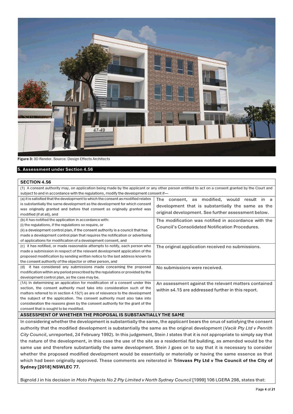
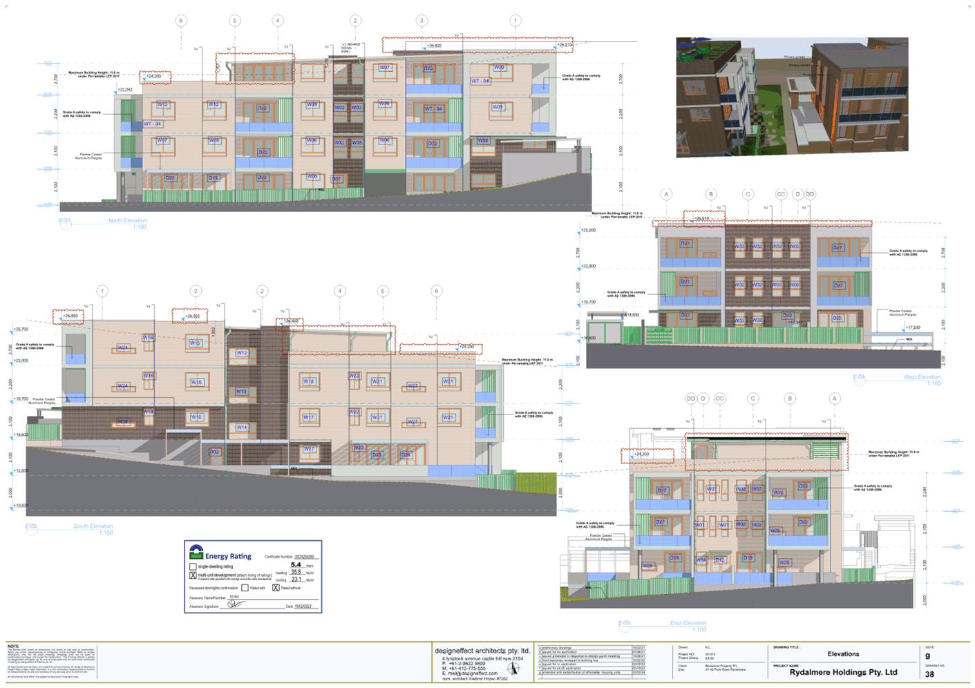
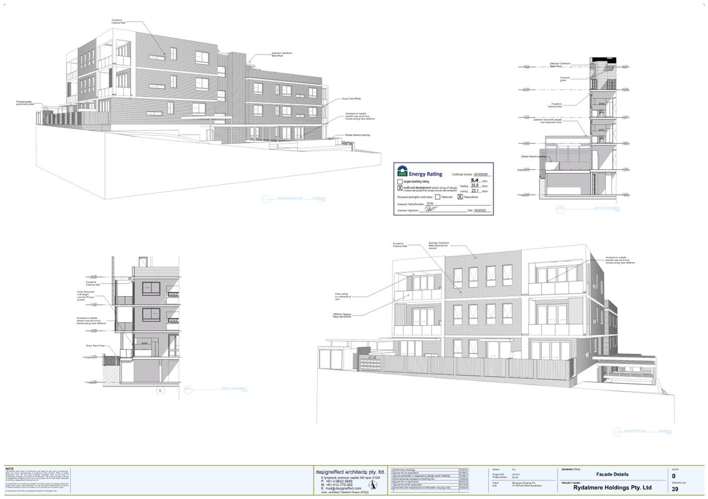
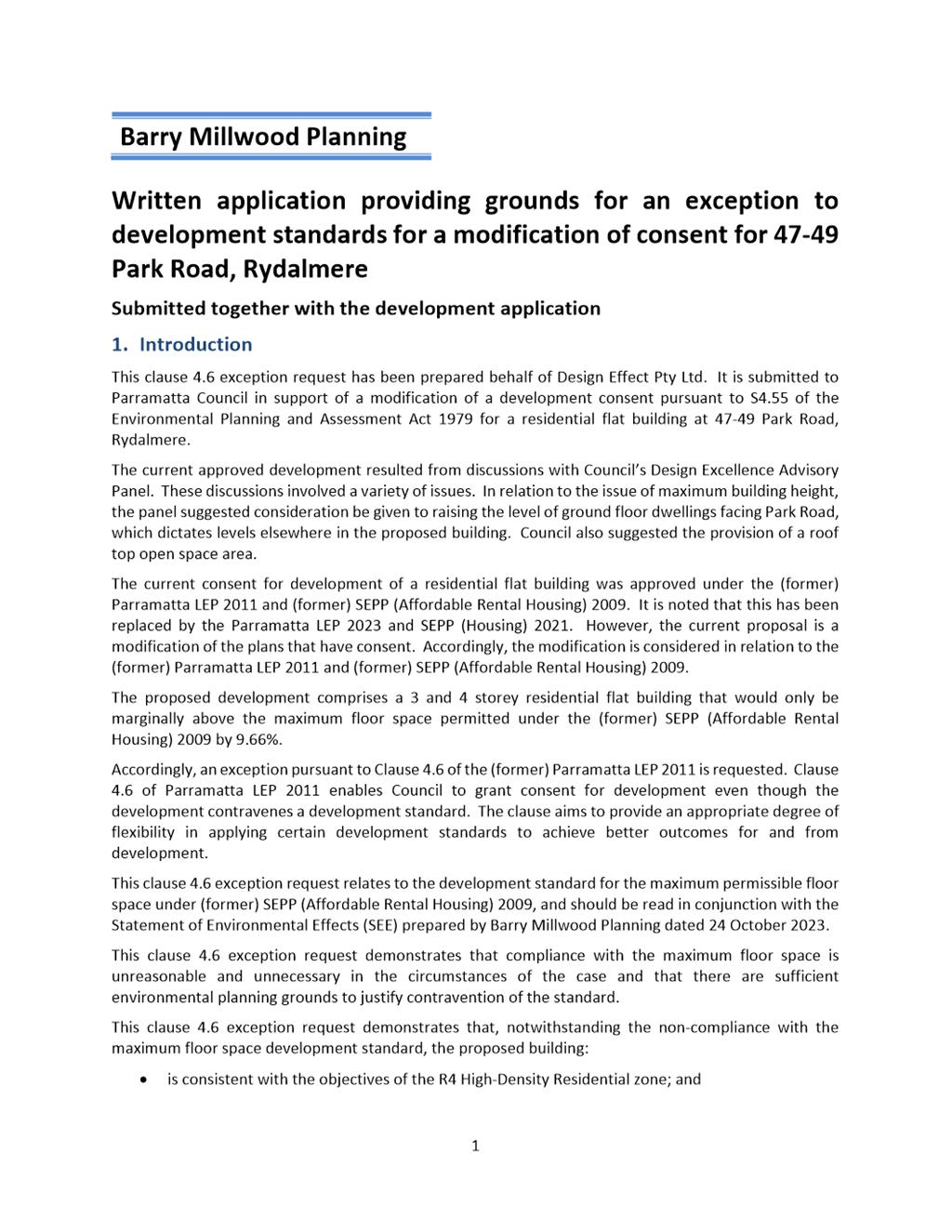
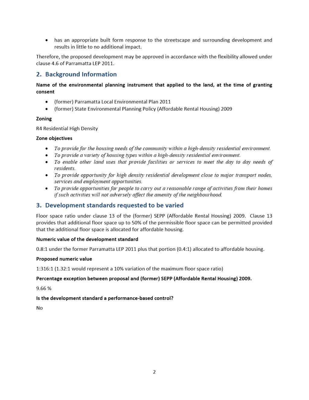
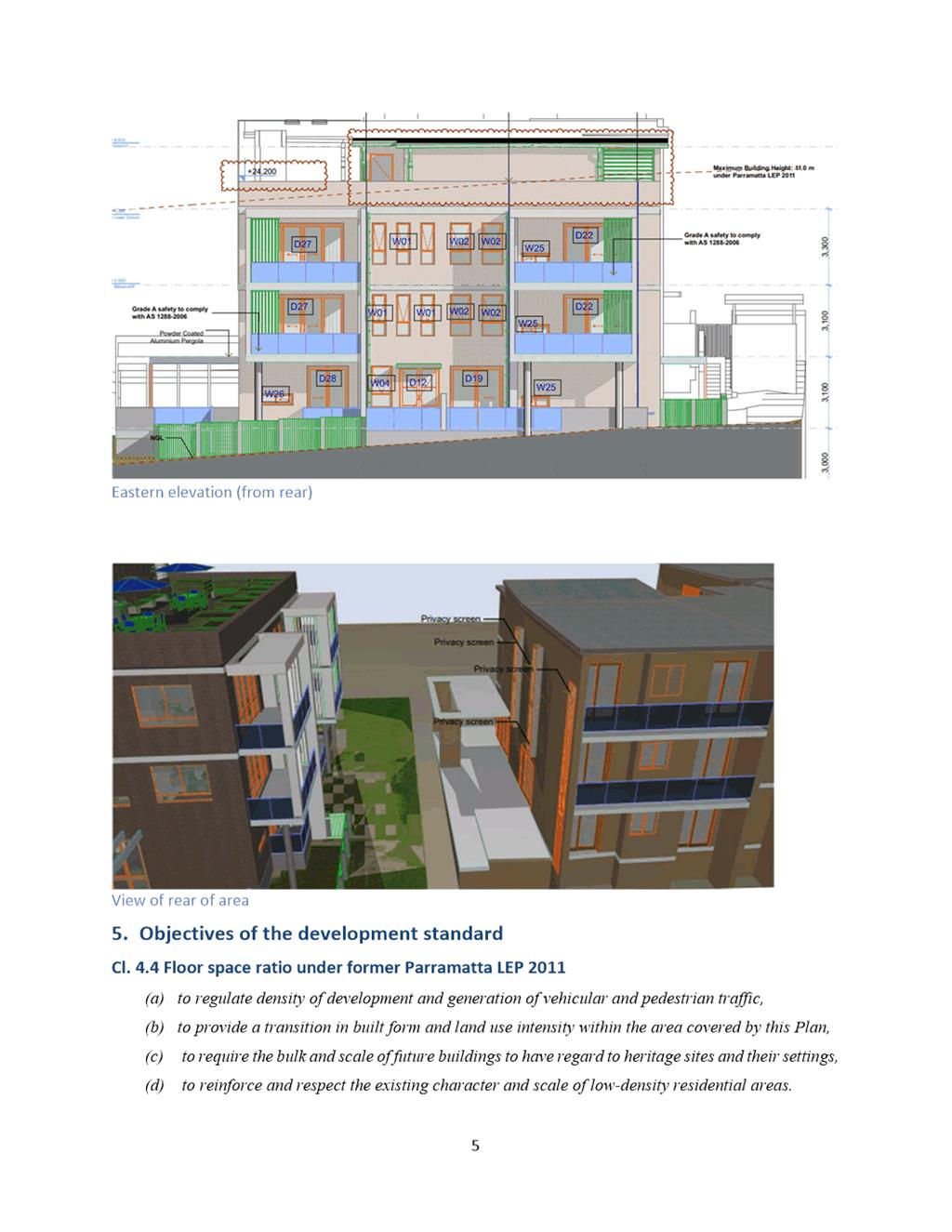
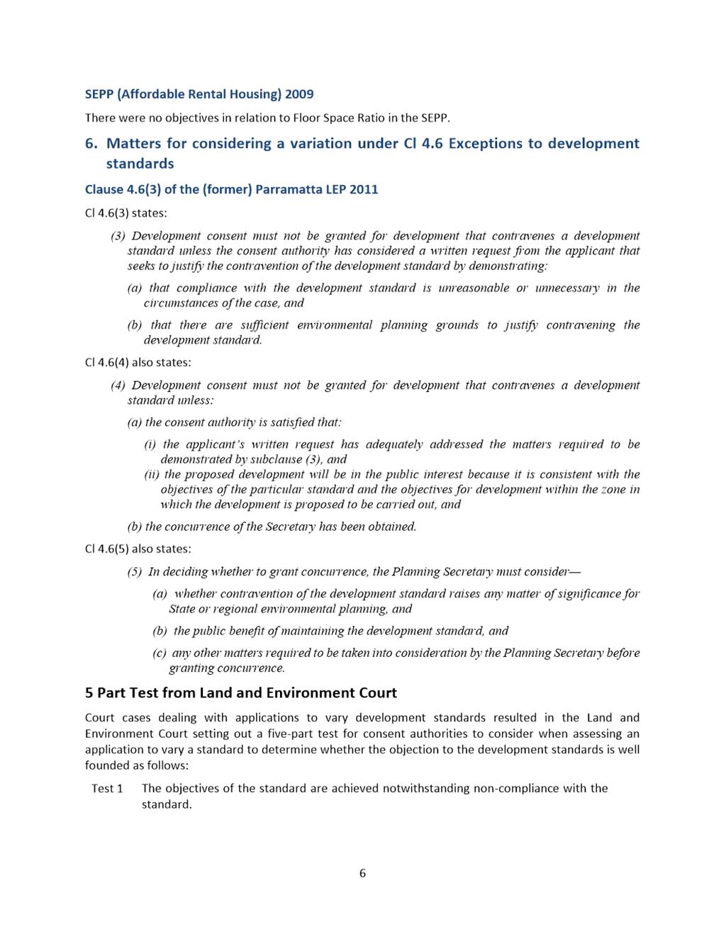
SUBJECT 47-49 Park Road RYDALMERE NSW 2116 (Lot 5 DP 38557, Lot 6 DP 38557).
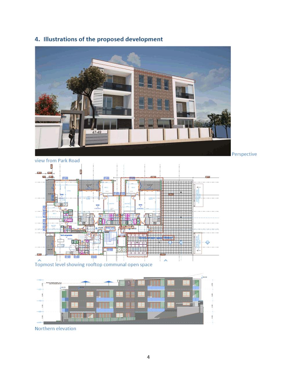
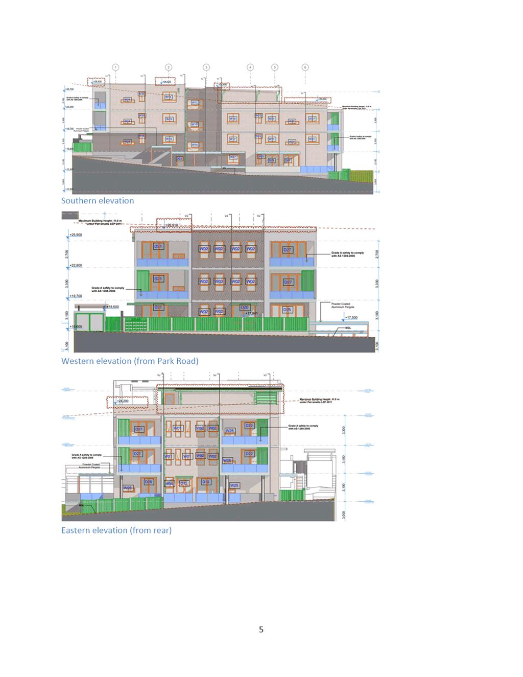
DESCRIPTION Section 4.55(2) Modification to the approved DA/544/2021 for
Demolition, tree removal and construction of a three storey residential flat
building containing 18 units over basement car parking. Modifications include
proposed addition of lower ground 1 bedroom apartment within built envelope and
second floor apartment over part of roof top terrace.
REFERENCE DA/544/2021/B - D09359116
APPLICANT/S A Scotti
OWNERS Rydalmere Holdings Pty LTD; FMH Custodians Pty Ltd; FMH Nominees Pty
Ltd; Jaami Holdings Pty Ltd
REPORT OF Group
Manager Development and Traffic Services
RECOMMENDED Approval
DATE OF REPORT 02 April 2024
REASON FOR REFERRAL TO LPP
The proposal is being referred to
the Parramatta Local Planning Panel (PLPP) due to a further variation to
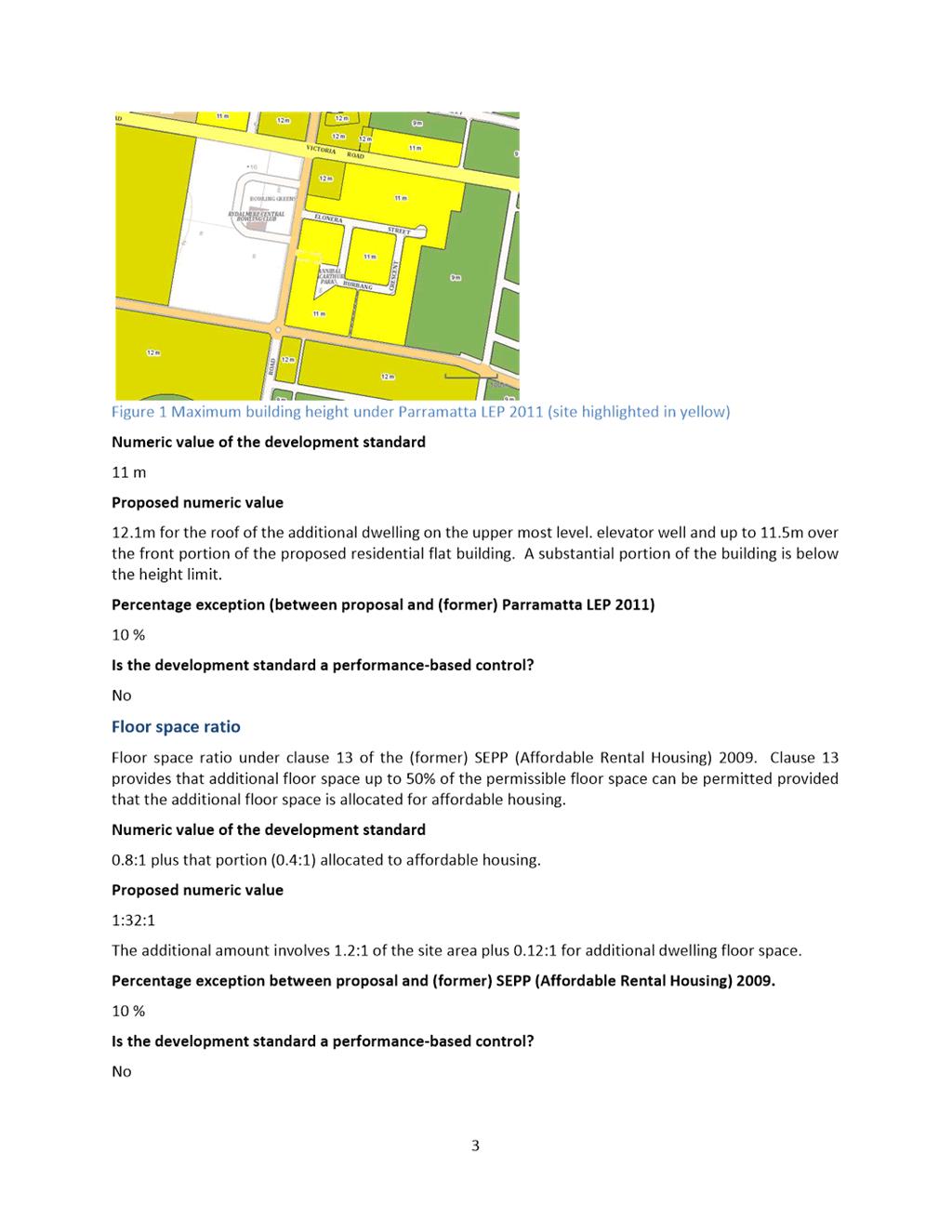
height of buildings development standard greater than 10%.
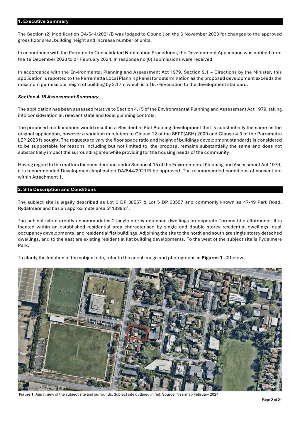
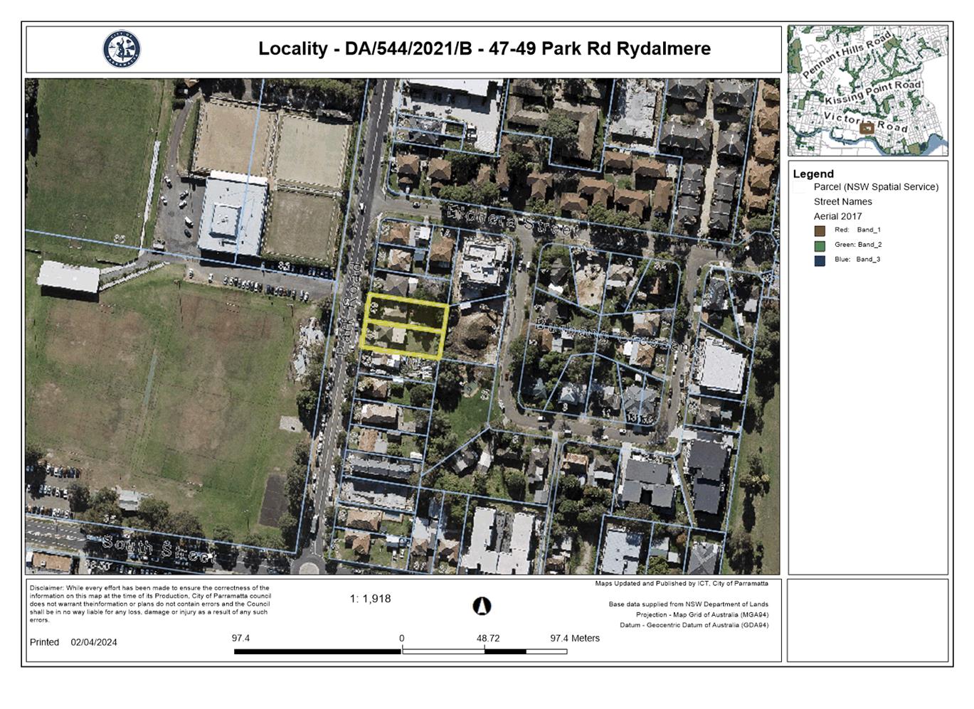
SITE & LOCALITY
The
subject site is legally described as Lot 6 DP 38557 & Lot 5 DP 38557 and
commonly known as 47-49 Park Road, Rydalmere and has an approximate area of
1388m2.
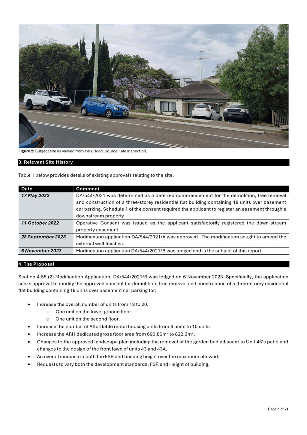
The
subject site currently accommodates 2 single storey detached dwellings on
separate Torrens title allotments. It is located within an established
residential area characterised by single and double storey residential
dwellings, dual occupancy developments, and residential flat buildings.
Adjoining the site to the north and south are single storey detached dwellings,
and to the east are existing residential flat building developments. To the
west of the subject site is Rydalmere Park.
STATUTORY
CONTROLS
The instruments applicable to
this application are:
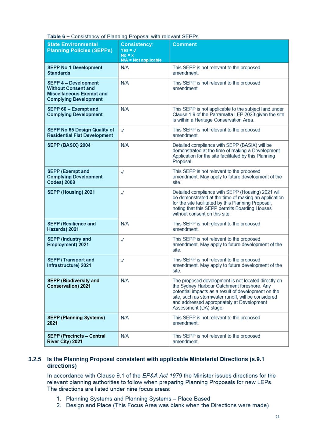
· State
Environmental Planning Policy (Biodiversity and Conservation) 2021
· State
Environmental Planning Policy (Resilience and Hazards) 2021
· State
Environmental Planning Policy (Transport and Infrastructure) 2021
· State
Environmental Planning Policy (Building Sustainability) 2022
· State
Environmental Planning Policy (Housing) 2021
· State
Environmental Planning Policy (Affordable Rental Housing) 2009
· State
Environmental Planning Policy No 65 – Design Quality of Residential
Apartment Development
· Parramatta
Local Environmental Plan 2023 (PLEP 2023)
· Parramatta
Development Control Plan 2023 (PDCP 2023)
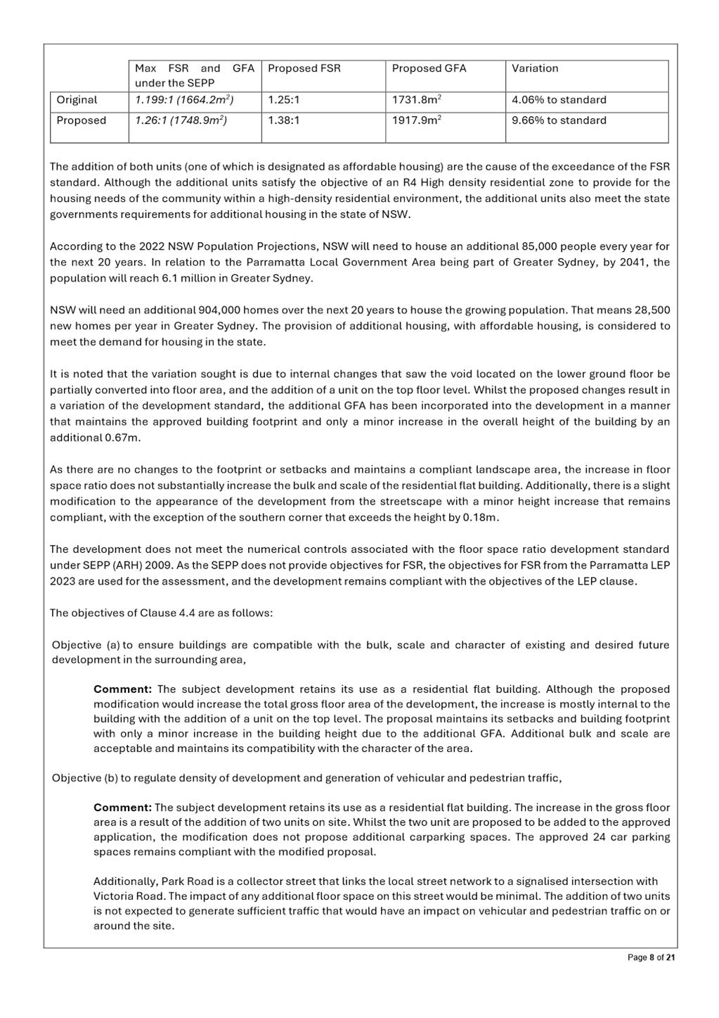
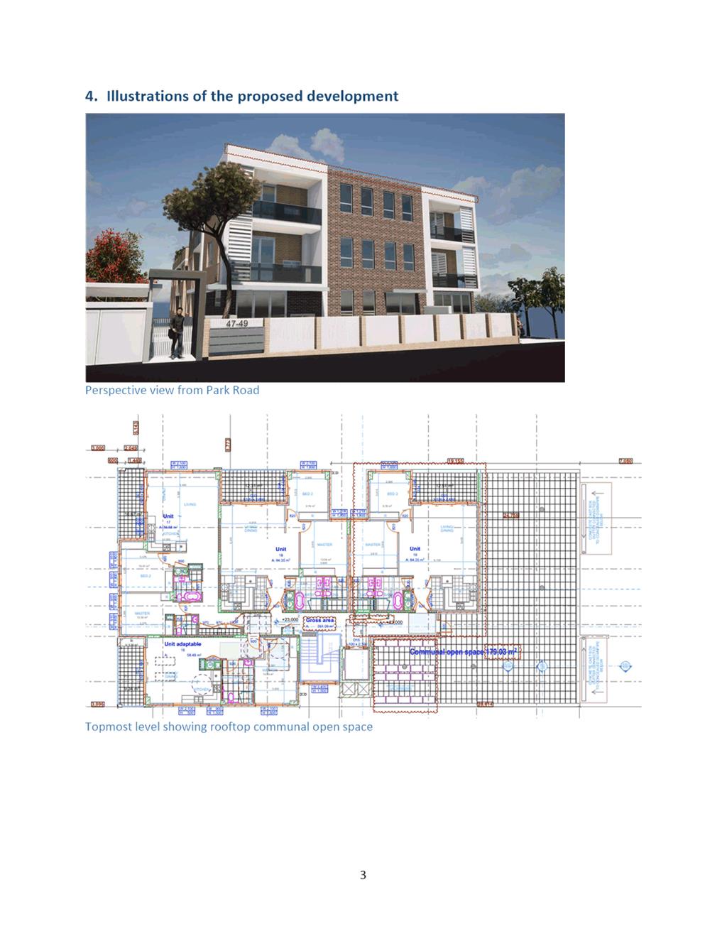
EXECUTIVE SUMMARY
The Section (2) Modification
DA/544/2021/B was lodged to Council on the 6 November 2023 for changes
to the approved gross floor area, building height and increase number of units.
In accordance with the Parramatta Consolidated Notification
Procedures, the Development Application was notified from the 19 December 2023
to 01 February 2024. In response no (0) submissions were received.
In accordance with the Environmental
Planning and Assessment Act 1979, Section 9.1 – Directions by the
Minister, this application is reported to the Parramatta Local Planning Panel
for determination as the proposed development exceeds the maximum permissible
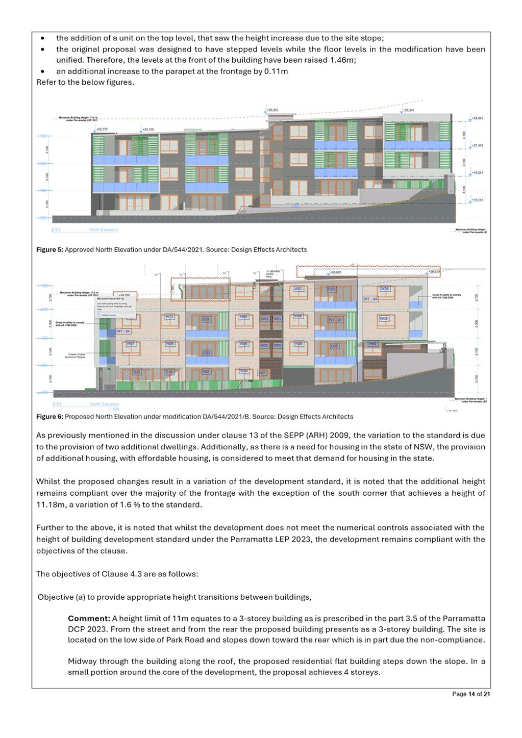
height of building by 2.17m which is a 19.7% variation to the
development standard.
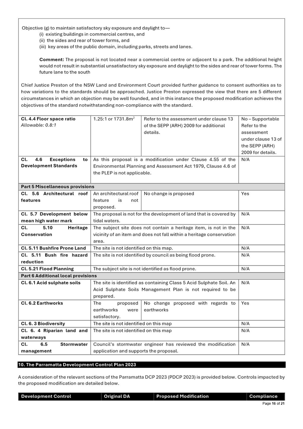
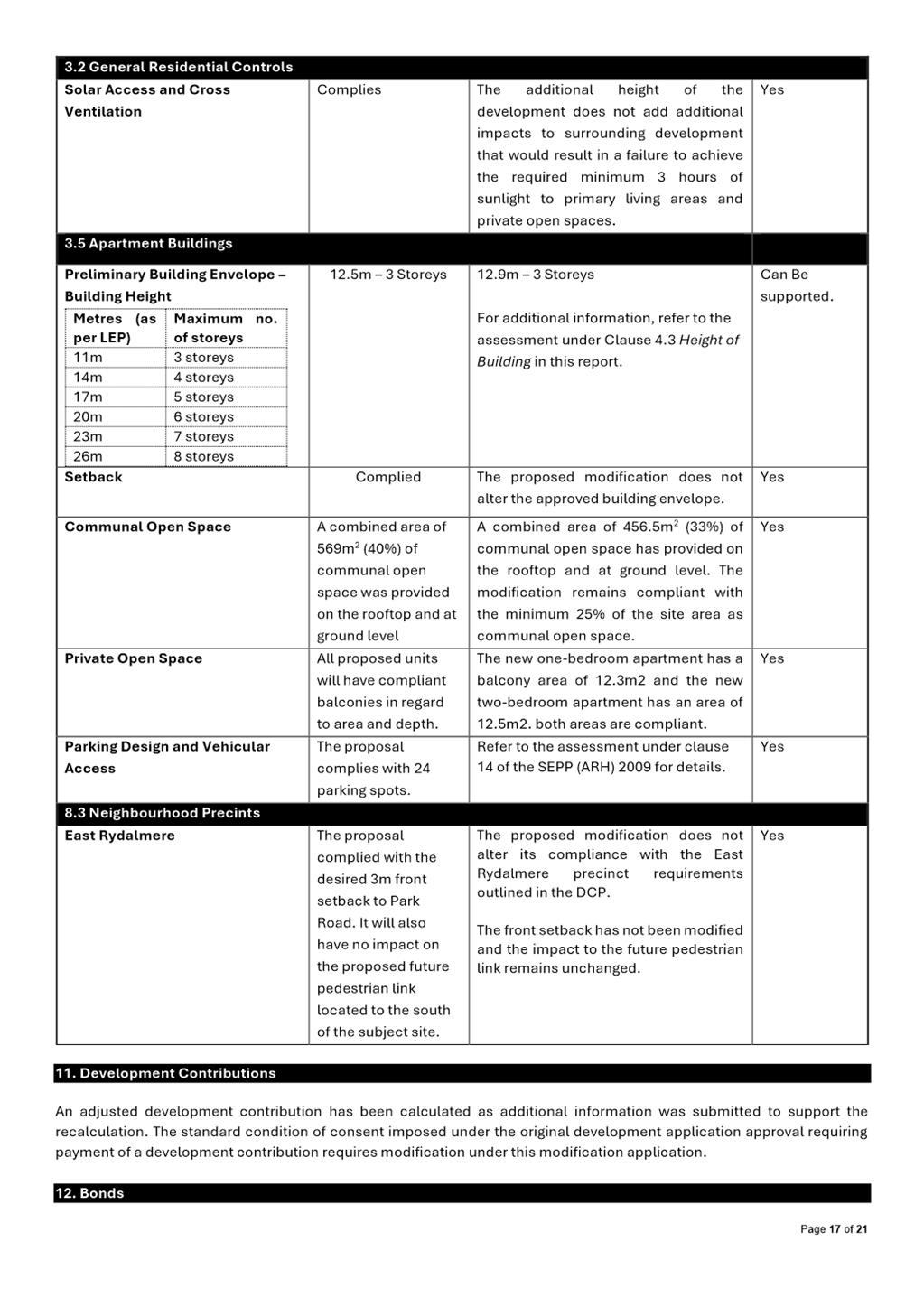
Section 4.15 Assessment Summary
The application has been assessed
relative to Section 4.15 of the Environmental Planning and Assessment Act
1979, taking into consideration all relevant state and local planning
controls.
The proposed modifications would
result in a Residential Flat Building development that is substantially the
same as the original application, however a variation in relation to Clause 12
of the SEPP(ARH) 2009 and Clause 4.3 of the Parramatta LEP 2023 is sought.
The requests to vary the floor
space ratio and height of buildings development standards is considered to be
supportable for reasons including but not limited to, the proposal remains
substantially the same and does not substantially impact the surrounding area
while providing for the housing needs of the community.
Having regard to the matters for
consideration under Section 4.15 of the Environmental Planning and
Assessment Act 1979, it is recommended Development Application
DA/544/2021/B be approved. The recommended conditions of consent are within Attachment
1.
RECOMMENDATION
(a) That the
Parramatta Local Planning Panel exercising the functions of Council as the
consent authority, modify development consent DA/544/2021 on land at 47-49 Park
Road Rydalmere, for a period of five (5) years from the date on the original
Notice of Determination, subject to the following modifications:
1. Amend Condition Nos. 1, 14, 81 & 100 to reflect the
updated plans and documents.
2. All other conditions of DA/544/2021 remain unchanged.
(b) That the
Parramatta Local Planning Panel approve
the proposal notwithstanding the non-compliance with the floor space ratio
control in Clause 13 Floor Space Ratio of the State Environmental
Planning Policy (Affordable rental Housing) 2009 as there are sufficient
environmental grounds to justify the variation.
(c) That the
Parramatta Local Planning Panel approve
the proposal notwithstanding the non-compliance with the height of building
control in Clause 4.3 Height of Buildings of the Parramatta Local Environmental Plan 2023 as
there are sufficient environmental grounds to justify the variation.
REASONS FOR
APPROVAL
1. The proposed modification is substantially the same
development which has been approved.
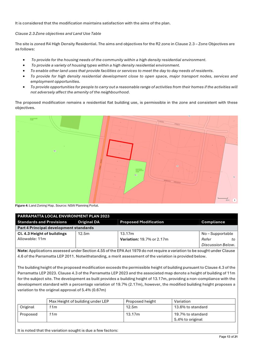
2. The proposed modification is permissible within the R4 High
Density Residential zone and results in a development which is suitable for the
context of the site and locality.
3. The proposed modification to increase the building height and
floor space of the site is supported as there is no substantial change in the
bulk and scale of the building and the changes are not discernible from the
streetscape.
4. The proposed modification results in reasonable impacts to
adjoining and surrounding properties, is suitable for the site, and is in the
public interest.
Najeeb Kobeissi
Development Assessment Officer
Attachments:
|
1⇩ 
|
Assessment Report and Draft Conditions
|
54 Pages
|
|
|
2⇩
|
Locality Map
|
1 Page
|
|
|
3⇩
|
Zoning Map
|
1 Page
|
|
|
4⇩
|
Architectural Plans
|
5 Pages
|
|
|
5
|
Internal Plans (confidential)
|
5 Pages
|
|
|
6⇩
|
Section 4.6 Variation Height of Building
|
15 Pages
|
|
|
7⇩
|
Section 4.6 Variation Floor Space Ratio
(FSR)
|
12 Pages
|
|
REFERENCE MATERIAL
|
Item 5.1 - Attachment
1
|
Assessment Report and Draft Conditions
|
|
Item 5.1 - Attachment 2
|
Locality Map
|
|
Item 5.1 - Attachment
3
|
Zoning Map
|

|
Item 5.1 - Attachment
4
|
Architectural Plans
|
|
Item 5.1 - Attachment 6
|
Section 4.6 Variation Height of Building
|

|
Item 5.1 - Attachment 7
|
Section 4.6 Variation Floor Space Ratio (FSR)
|
Local
Planning Panel 16 April 2024 Item
5.2
ITEM NUMBER 5.2
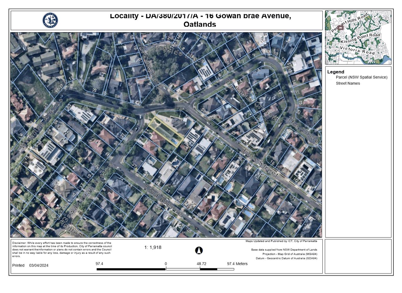
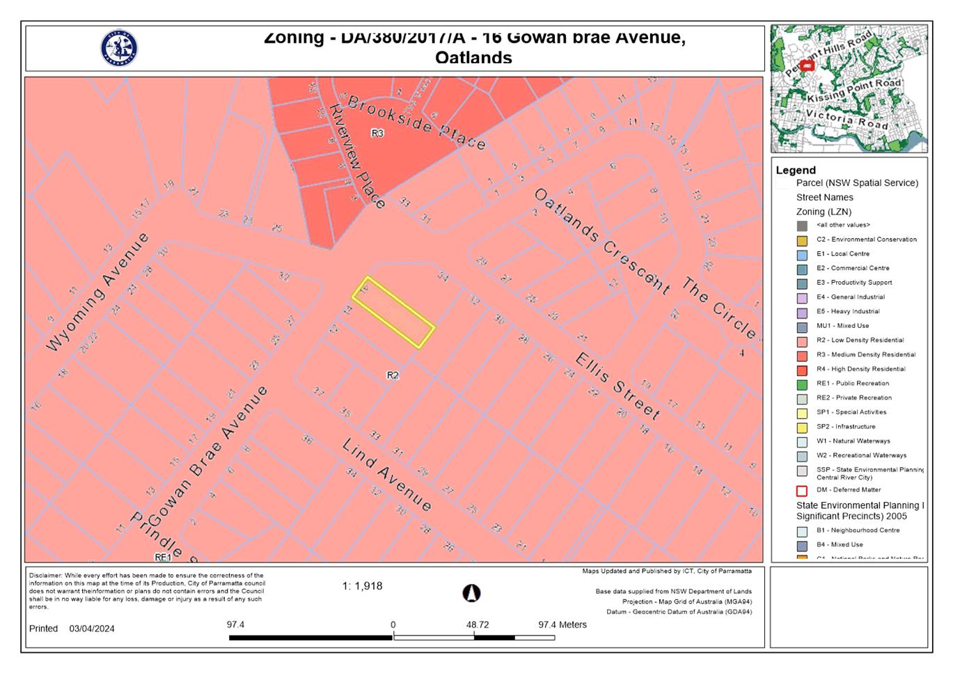
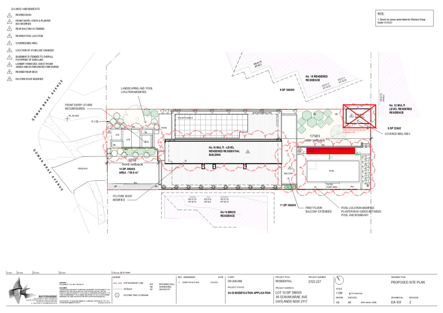
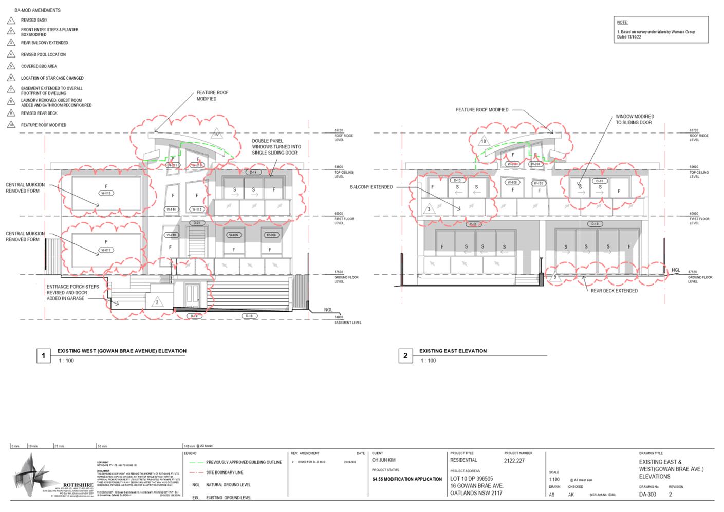
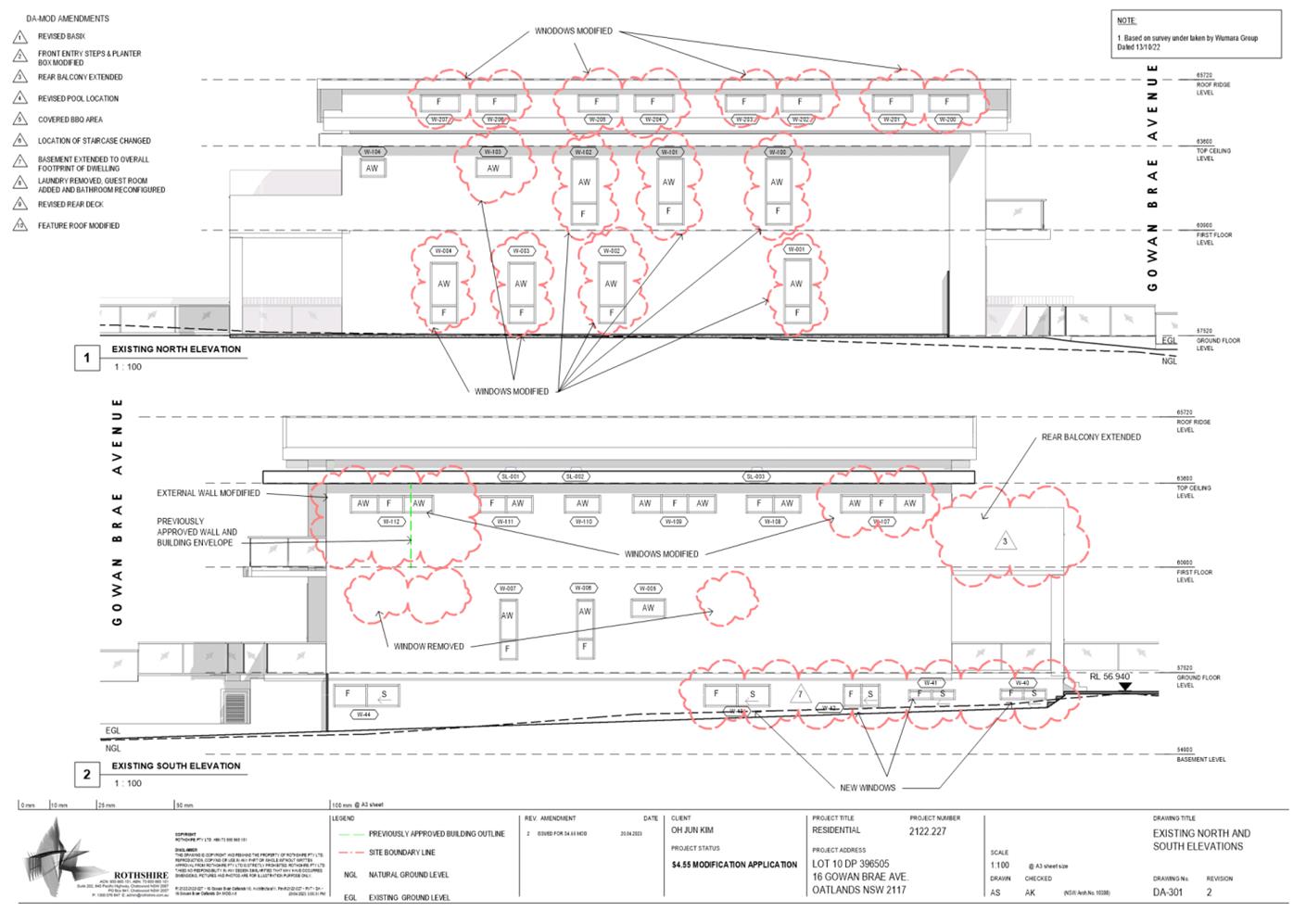
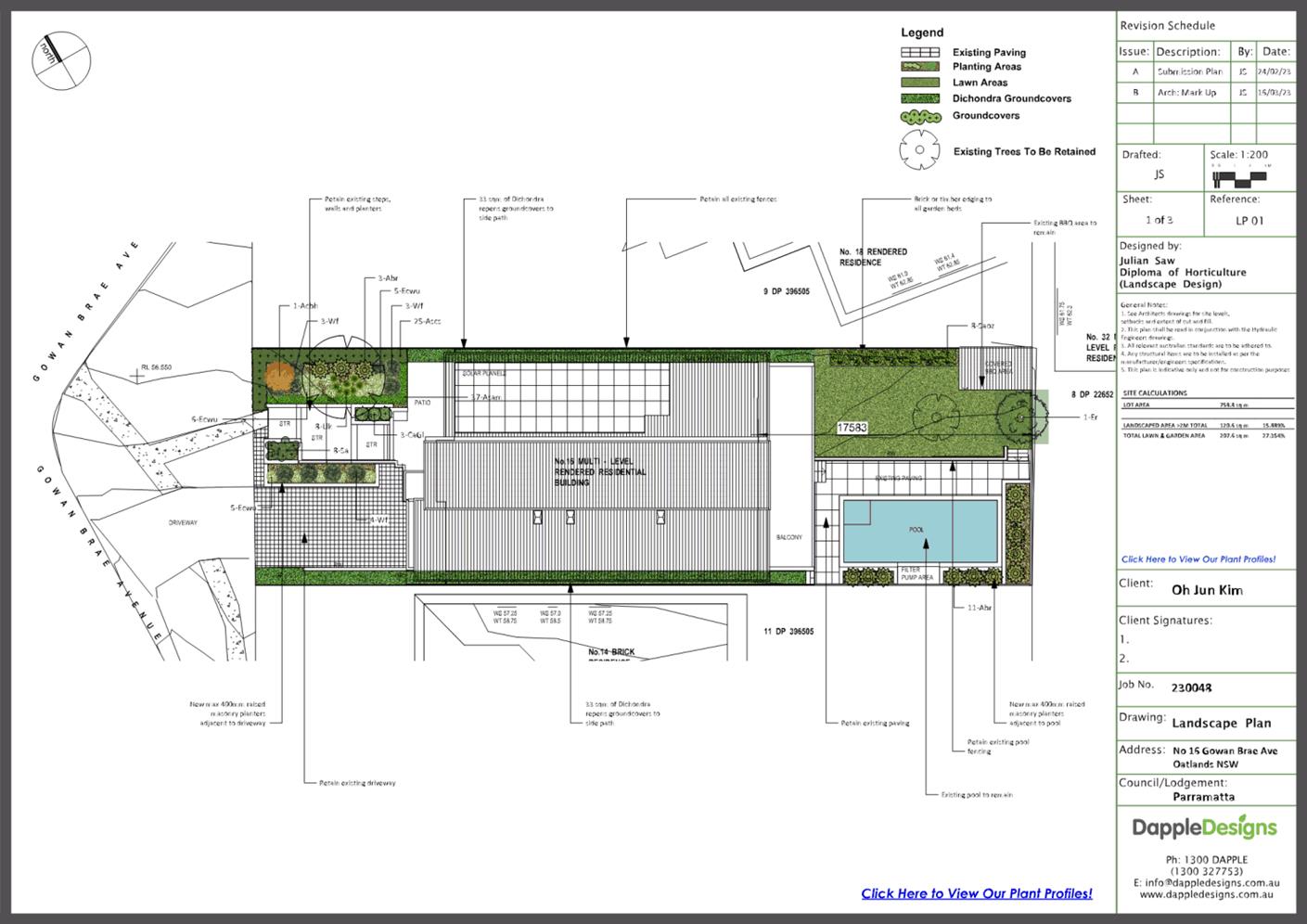
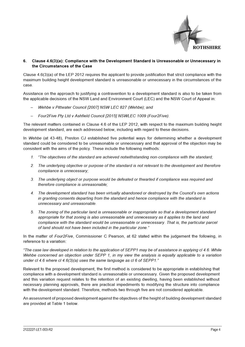
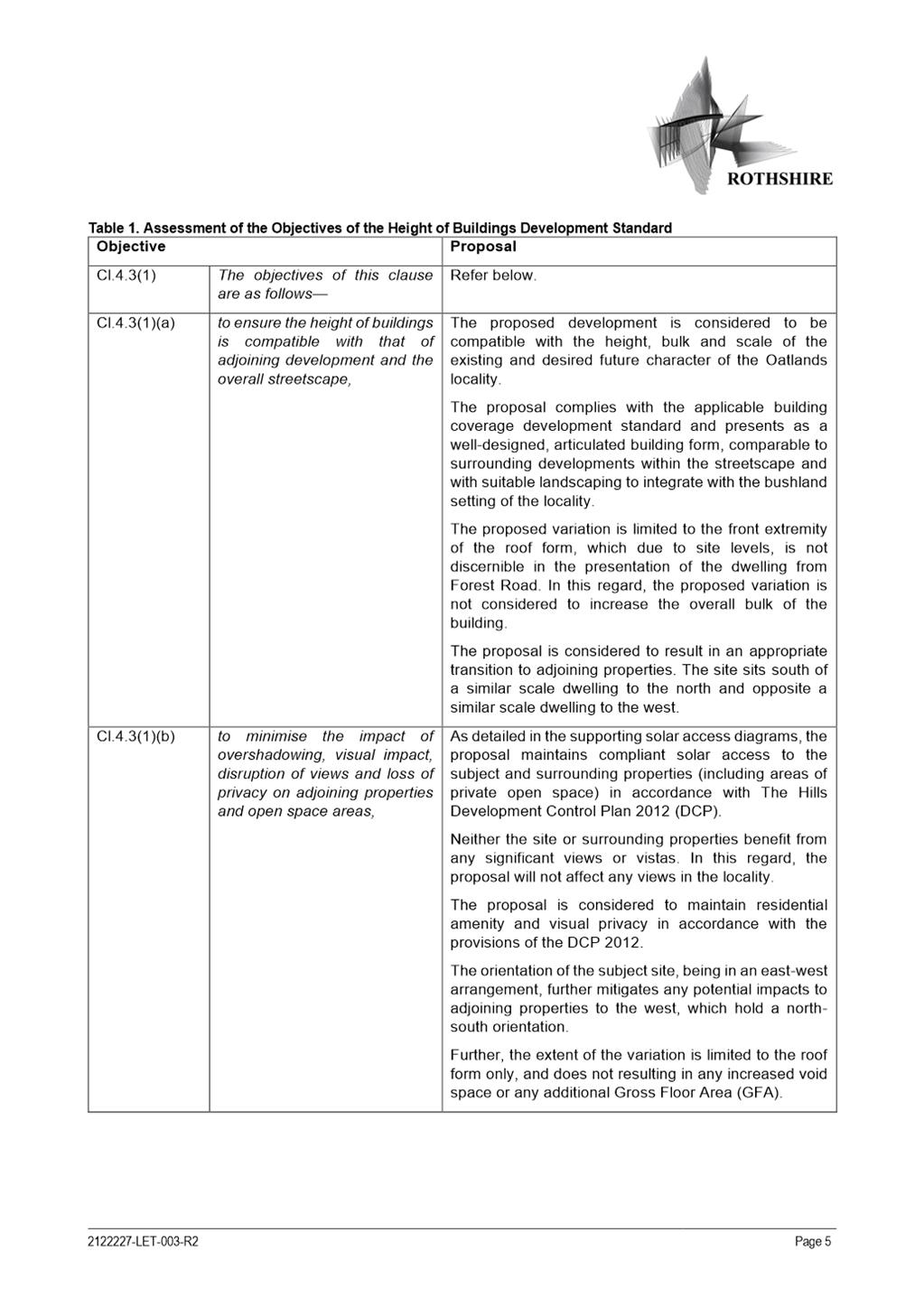
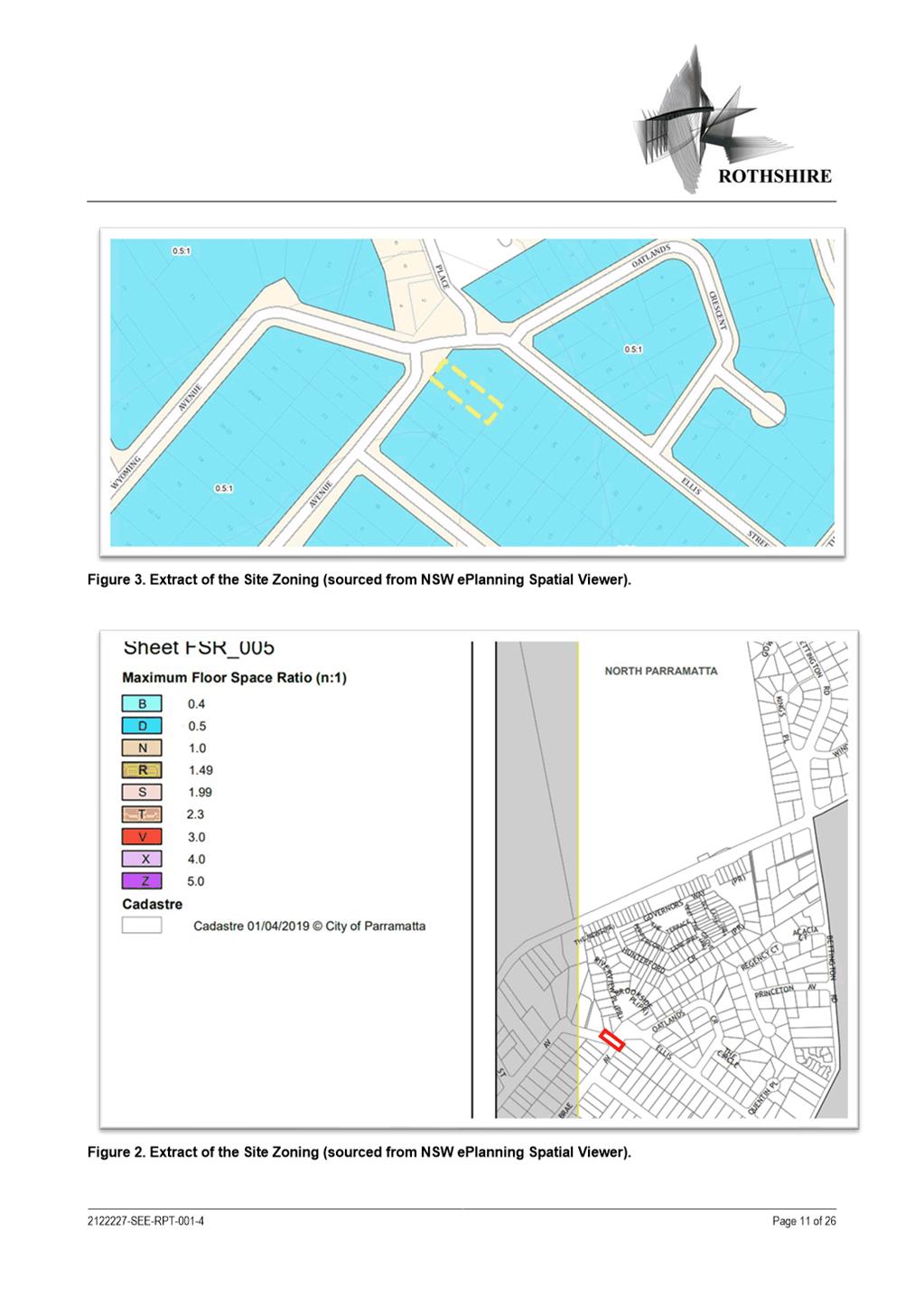
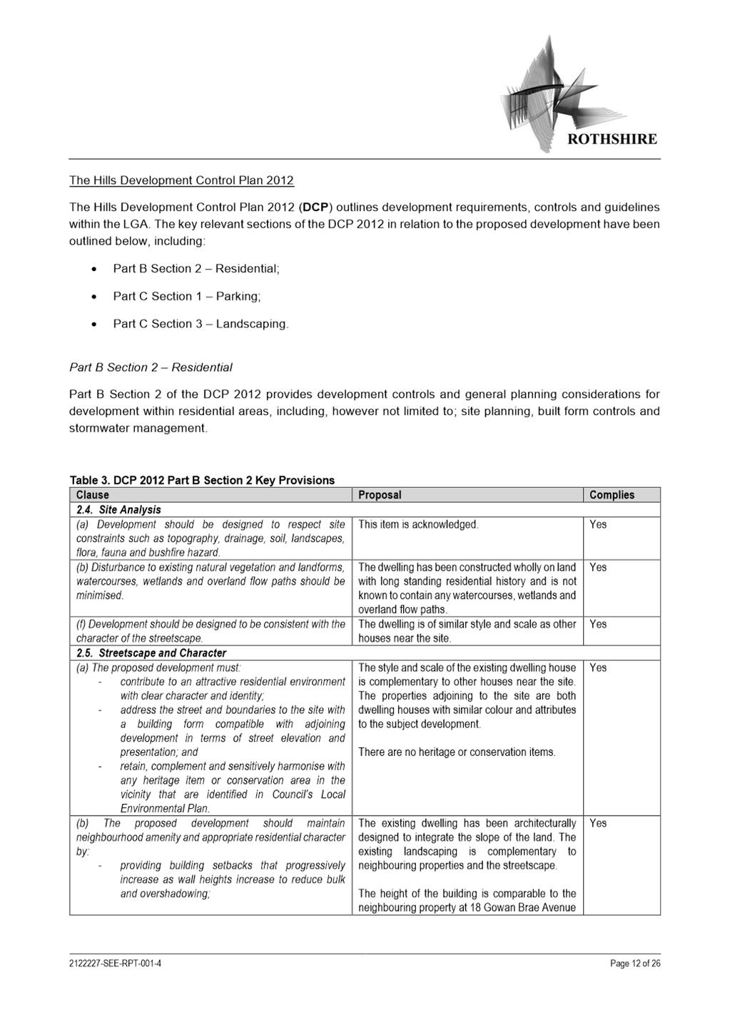
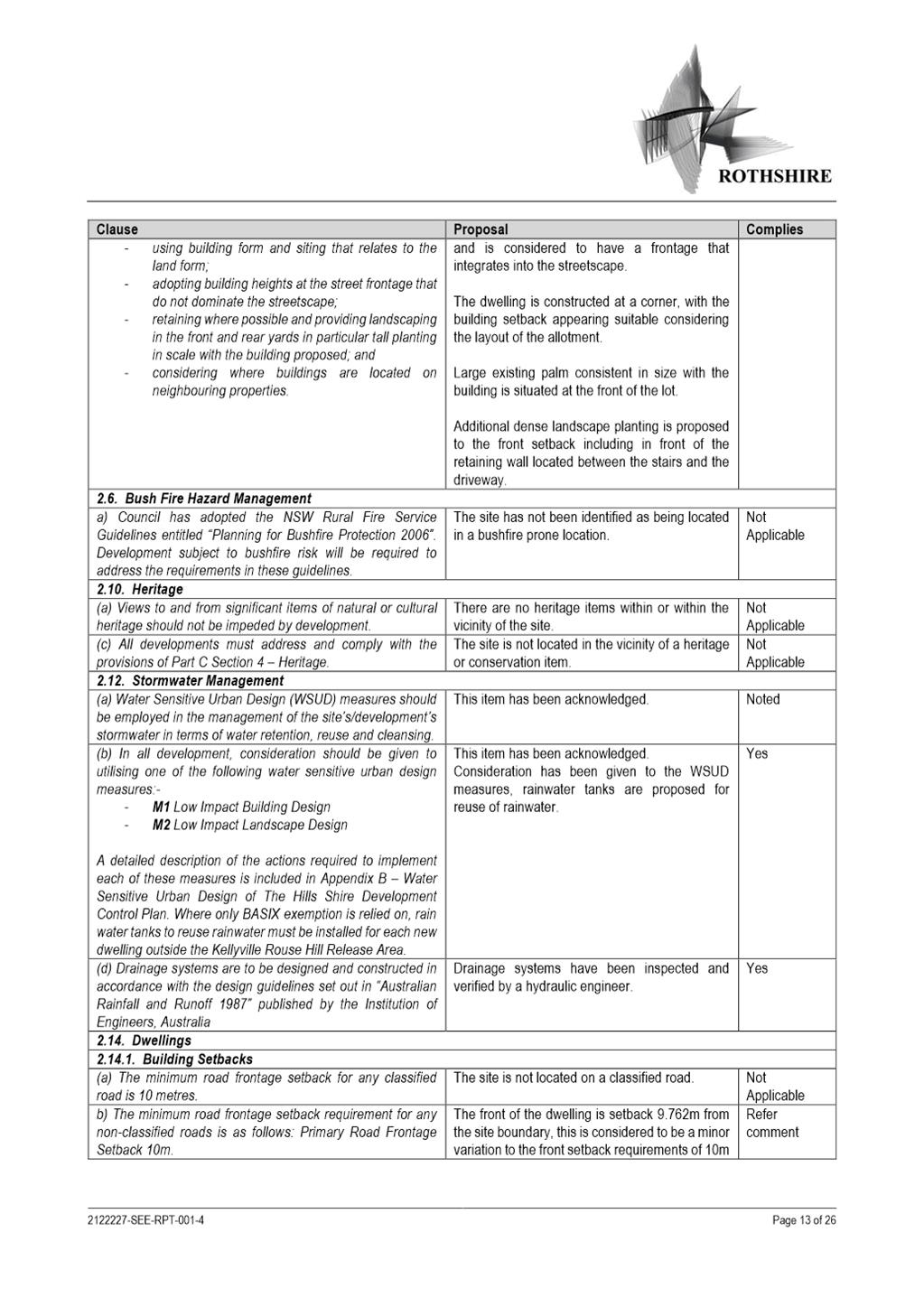
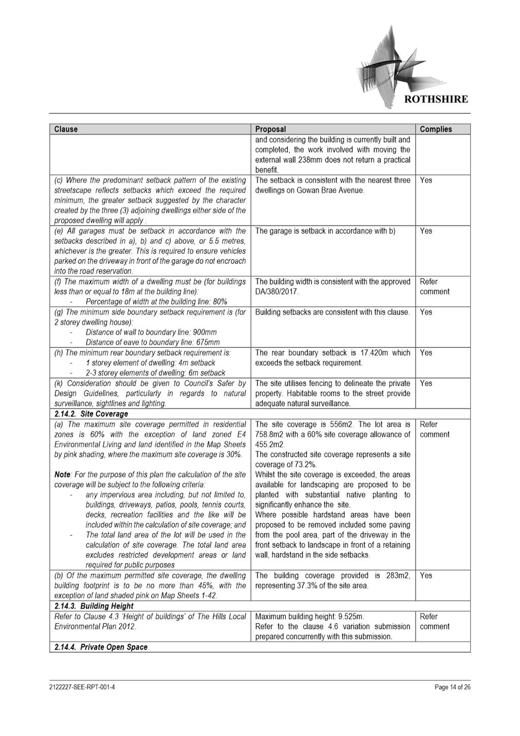
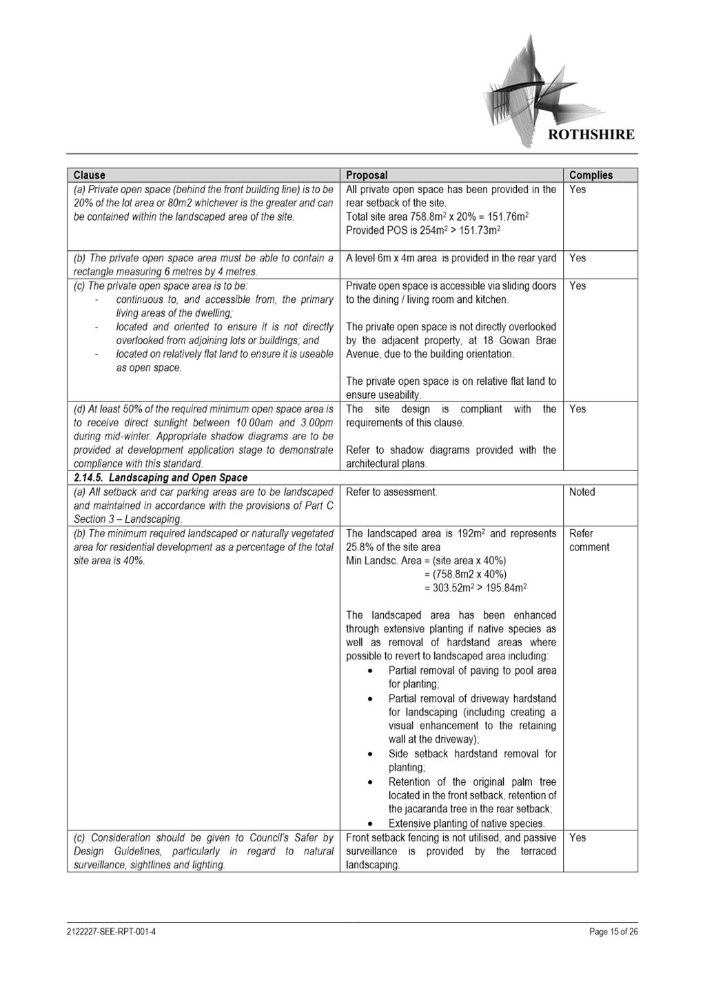
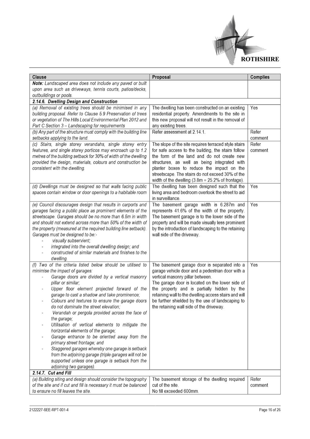
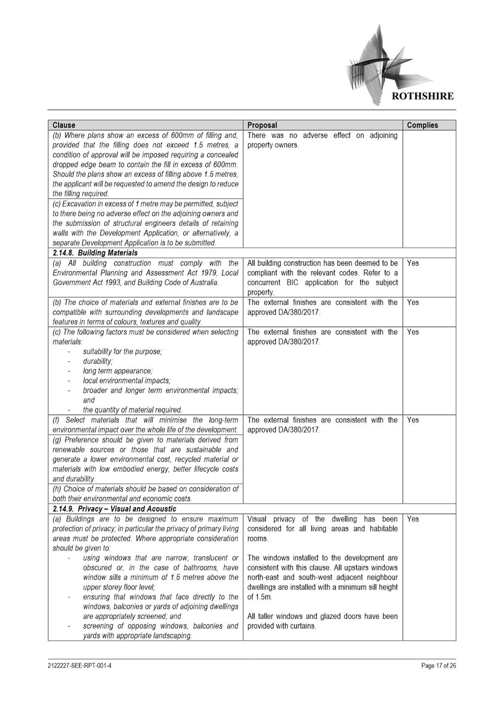
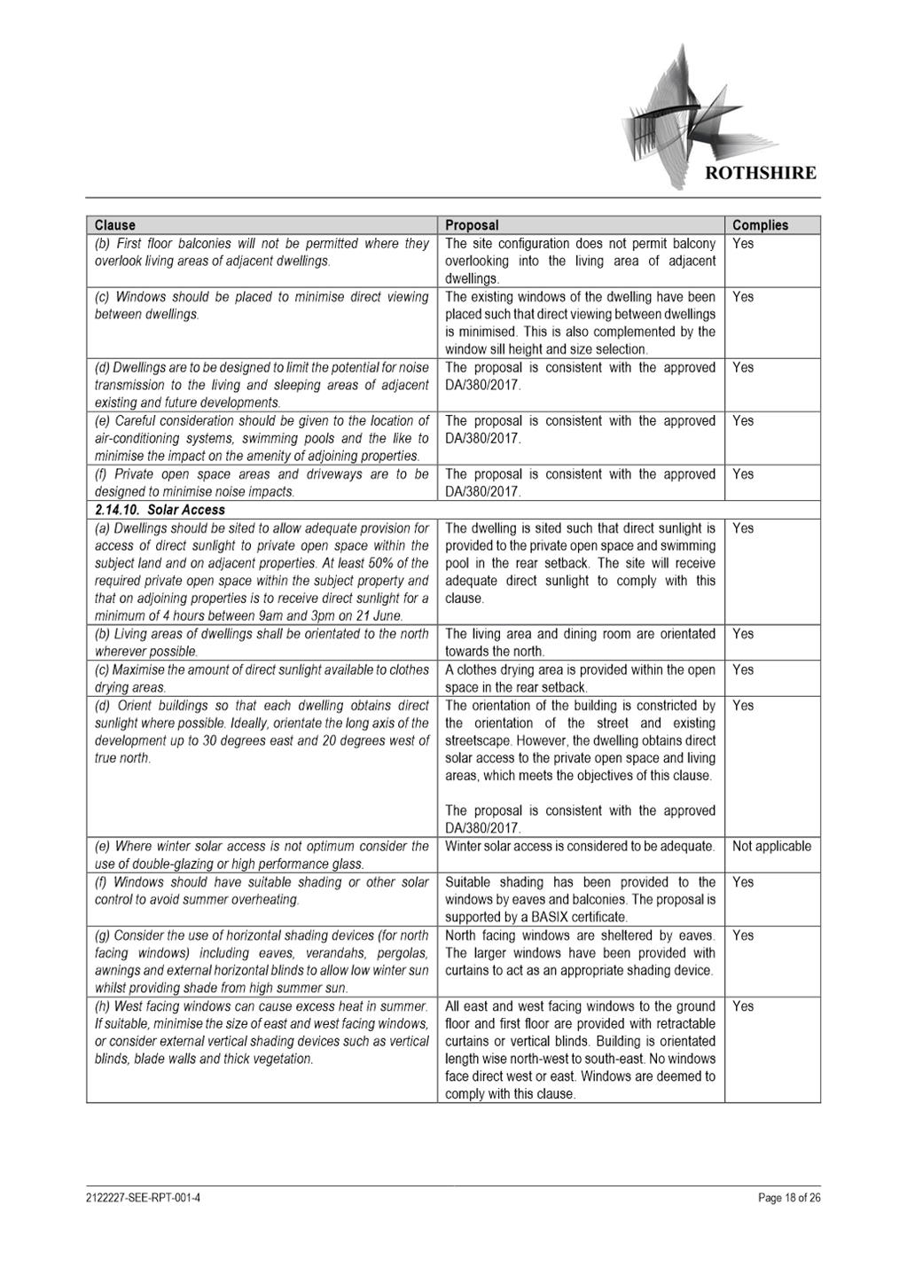
SUBJECT 16 Gowan Brae Avenue, OATLANDS NSW 2117 (Lot 10 DP 396505)
DESCRIPTION Section 4.55(2) Modification to DA/380/2017 for the tree removal and
construction of a part 2 and part 3 storey dwelling and swimming pool. The
modification is for the reconfiguration of the front entry, internal layouts,
balconies, window placement, pool location, feature roof form and basement
extent.
REFERENCE DA/380/2017/A - D09368714
APPLICANT/S Rothshire Pty Ltd
OWNERS O J Kim, E J Kim
REPORT OF Group
Manager Development and Traffic Services
RECOMMENDED Approval
DATE OF REPORT 02 April 2024
REASON FOR
REFERRAL TO LPP
The proposal is referred to the Parramatta
Local Planning Panel (PLPP) due to variation to Floor Space Ratio development
standard greater than 10%.
EXECUTIVE SUMMARY
The Section 4.55(2) Modification
DA/380/2017/A was lodged to Council on the 1 June 2023 for changes to
the approved gross floor area and building height. Additionally, approval is
sought for unauthorised works on site for both internal and external changes.
In accordance with the Parramatta Consolidated Notification
Procedures, the Development Application was notified from the 13 June 2023 to
27 June 2023. In response no (0) submissions were received.
In accordance with the
Environmental Planning and Assessment Act 1979, Section 9.1 – Directions
by the Minister, this application is reported to the Parramatta Local Planning
Panel for determination as the proposed development exceeds the maximum permissible
floor space ratio by 144.3m2 which is a 35.3% variation to
the development standard.
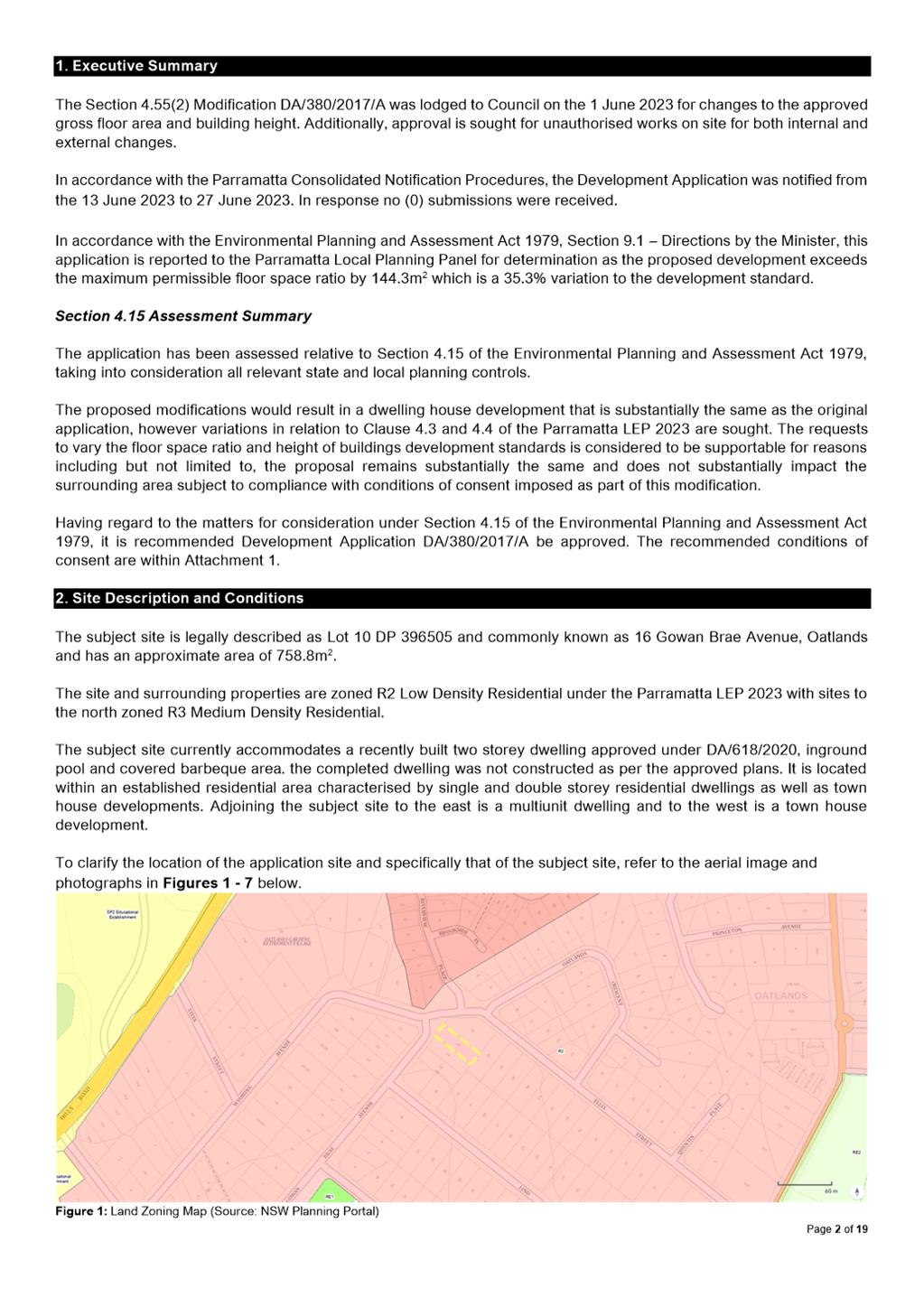
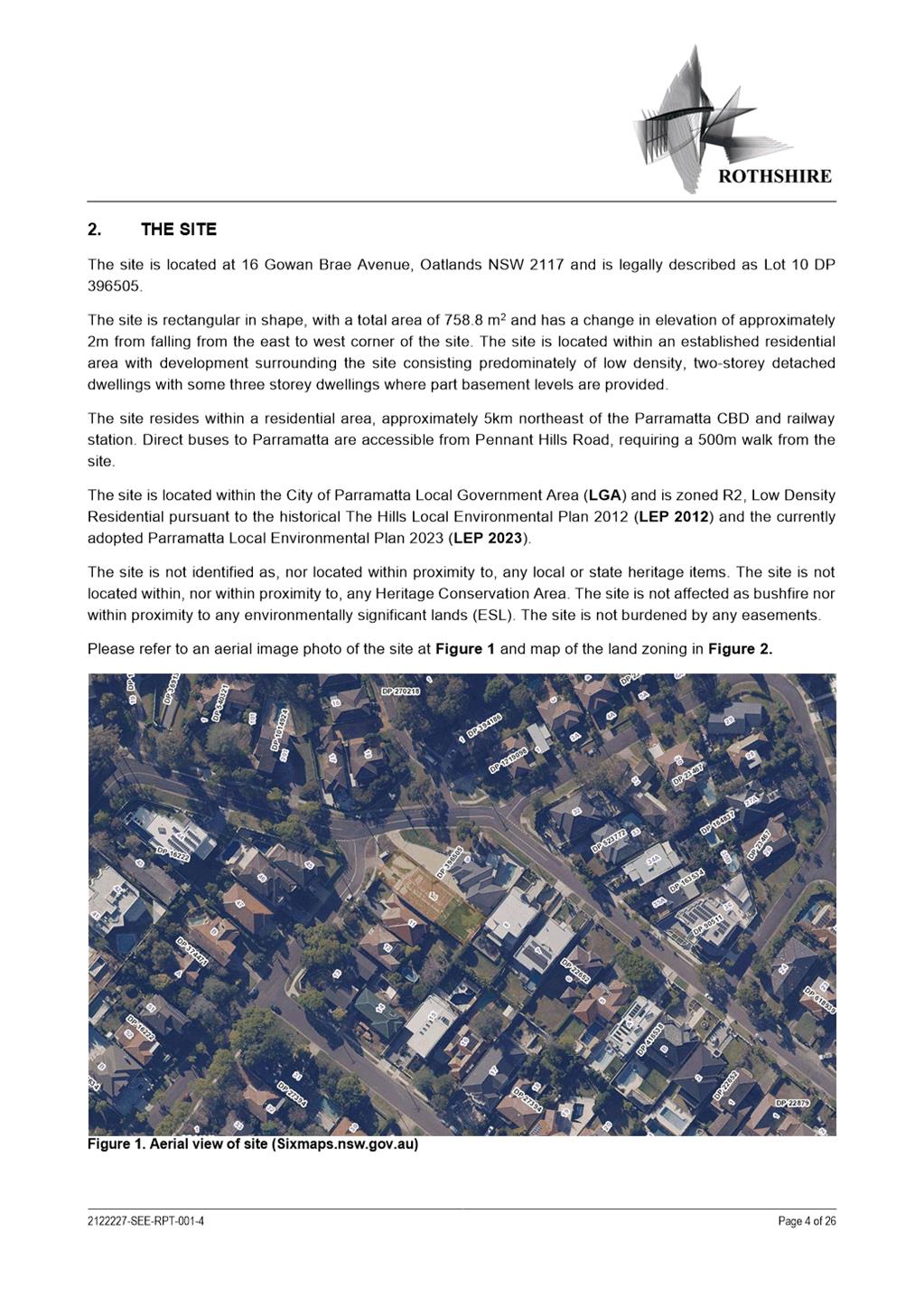
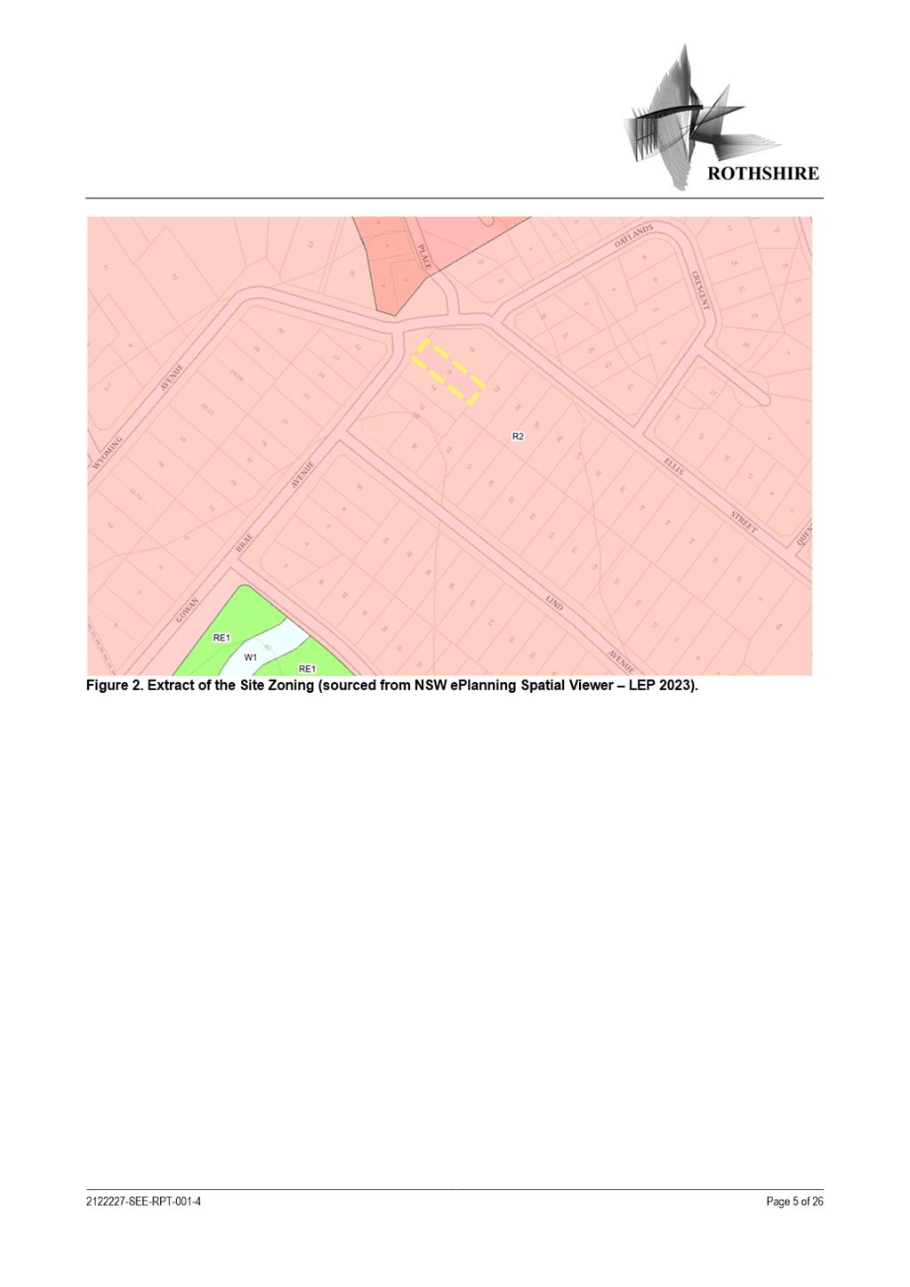
SITE
& LOCALITY
The
subject site is legally described as Lot 10 DP 396505 and commonly known as 16
Gowan Brae Avenue, Oatlands and has an approximate area of 758.8m2.
The
site and surrounding properties are zoned R2 Low Density Residential under the
Parramatta LEP 2023 with sites to the north zoned R3 Medium Density
Residential.
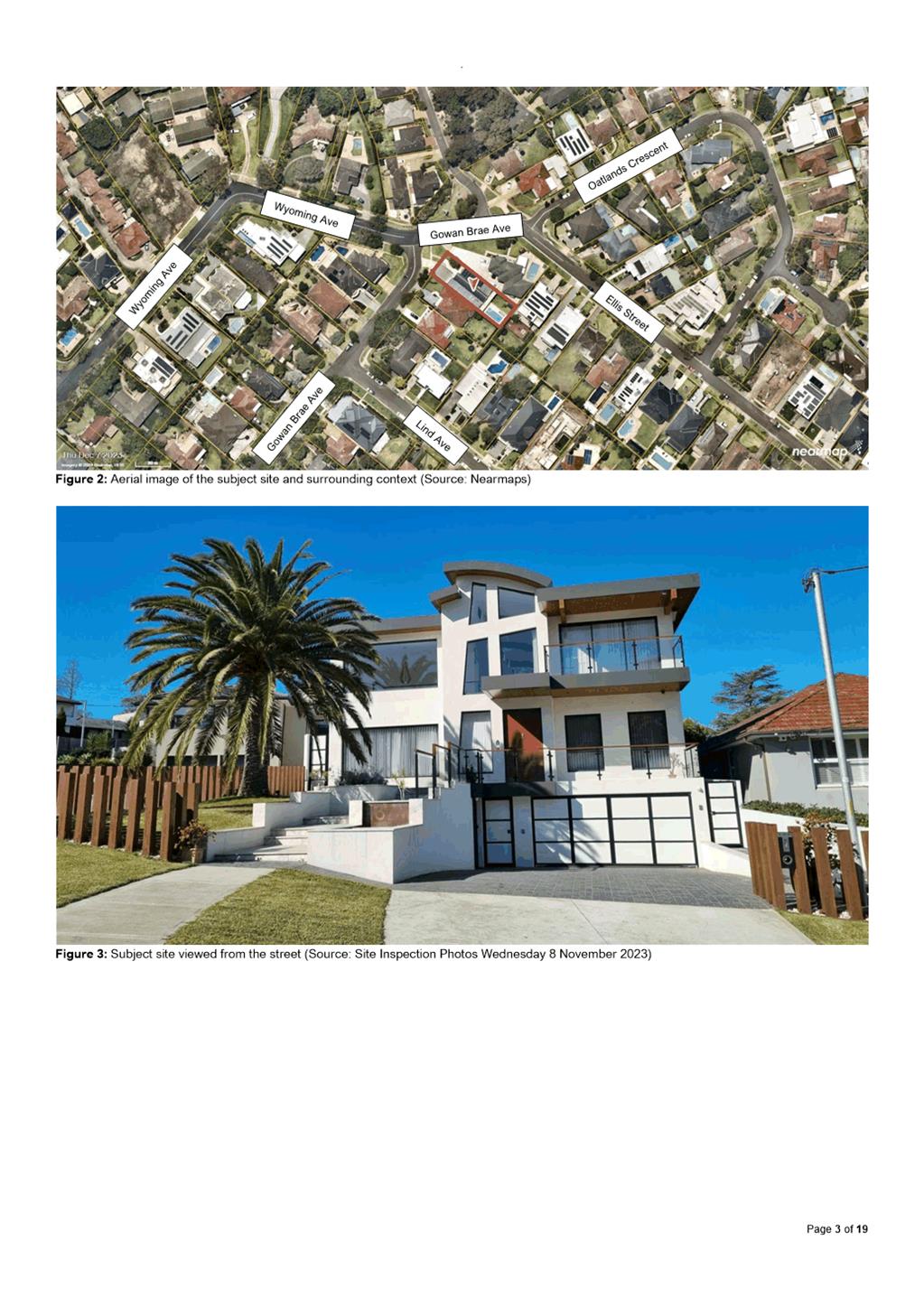
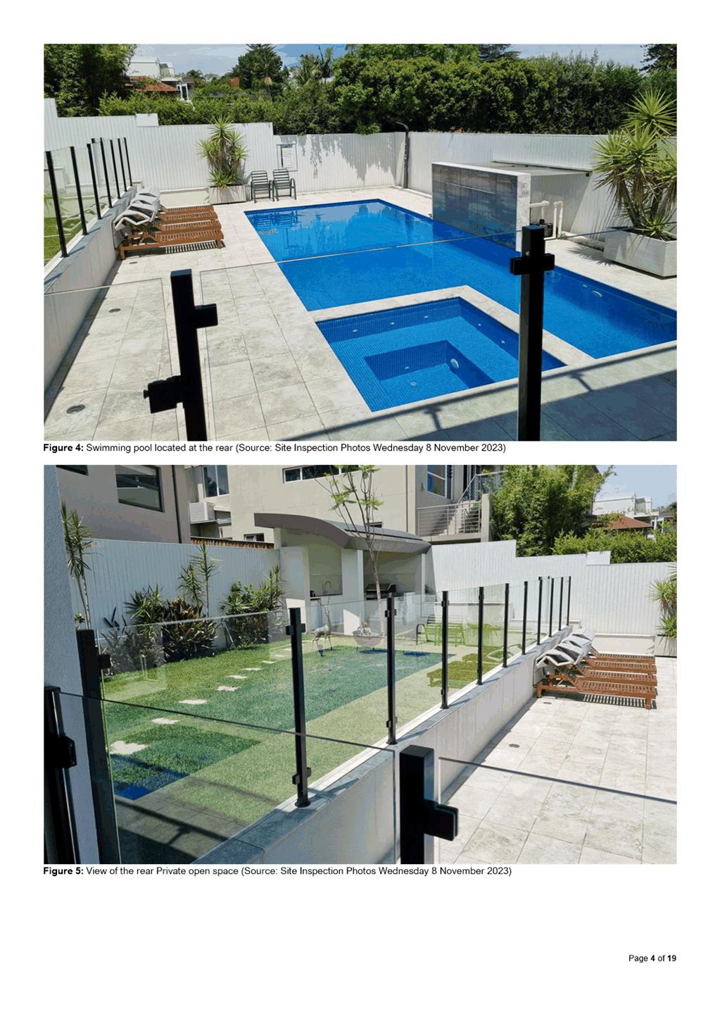
The
subject site currently accommodates a recently built two storey dwelling
approved under DA/618/2020, inground pool and covered barbeque area. the
completed dwelling was not constructed as per the approved plans. It is located
within an established residential area characterised by single and double
storey residential dwellings as well as town house developments. Adjoining the
subject site to the east is a multiunit dwelling and to the west is a town
house development.
STATUTORY
CONTROLS
The
instruments applicable to this application are:
• State
Environmental Planning Policy (SEPP) – (Resilience and Hazards) 2021
• State
Environmental Planning Policy (Building Sustainability) 2022
• State
Environmental Planning Policy (Transport and Infrastructure) 2021
• State
Environmental Planning Policy (Biodiversity and Conservation) 2021
• Parramatta
Local Environmental Plan 2023 (PLEP 2023)
• Parramatta
Development Control Plan 2023
• The
Hills Development Control Plan 2012.
CONSULTATION
In
accordance with the City of Parramatta Notification Requirements, the
Development Application was notified from 13 June 2023 to 27 June 2023. In
response, no submissions were received.
Section 4.15 Assessment Summary
The application has been assessed
relative to Section 4.15 of the Environmental Planning and Assessment Act 1979,
taking into consideration all relevant state and local planning controls.
The proposed modifications would
result in a dwelling house development that is substantially the same as the
original application, however variations in relation to Clause 4.3 and 4.4 of
the Parramatta LEP 2023 are sought. The requests to vary the floor space ratio
and height of buildings development standards is considered to be supportable
for reasons including but not limited to, the proposal remains substantially
the same and does not substantially impact the surrounding area subject to
compliance with conditions of consent imposed as part of this modification.
Having regard to the matters for
consideration under Section 4.15 of the Environmental Planning and Assessment
Act 1979, it is recommended Development Application DA/380/2017/A be approved.
The recommended conditions of consent are within Attachment 1.
RECOMMENDATION
Pursuant to
Section 4.16 of the Environmental Planning and Assessment Act, 1979:
(a) That the Parramatta Local Planning Panel exercising
the functions of Council as the consent authority, modify development consent
DA/380/2017 on land at 16 Gowan Brae Avenue, Oatlands, for a period of five (5)
years from the date on the original Notice of Determination, subject to
the following modifications:
a. Amend Condition Nos. 1, 45, and 51 to reflect the updated
plans and documents.
b. After condition 1, insert Conditions 1A and 1B.
c. All other conditions of DA/380/2017 remain unchanged.
(b) That the Parramatta Local Planning Panel
approve the proposal notwithstanding the non-compliance with the height of
building control in Clause 4.3 Height of Buildings of the Parramatta Local
Environmental Plan 2023 as there are sufficient environmental grounds to
justify the variation.
(c) That the Parramatta Local Planning Panel
approve the proposal notwithstanding the non-compliance with the floor space ratio
control in Clause 4.4 Floor Space Ratio of the Parramatta Local Environmental
Plan 2023 as there are sufficient environmental grounds to justify the
variation.
REASONS FOR
APPROVAL
1. The proposed modification is substantially the same development
which has been approved.
2. The proposed modification is permissible within the R2 low
Density Residential zone and results in a development which is suitable for the
context of the site and locality.
3. The proposed modification to increase the building height and
floor space of the site is supported as there is no substantial change in the
bulk and scale of the building.
4. The proposed modification results in reasonable impacts to
adjoining and surrounding properties, is suitable for the site, and is not
contrary to the public interest.
Najeeb Kobeissi
Development Assessment Officer
Attachments:
|
1⇩
|
Combined Assessment Report and Draft
Conditions
|
46 Pages
|
|
|
2⇩
|
Locality map
|
1 Page
|
|
|
3⇩
|
Zoning map
|
1 Page
|
|
|
4⇩
|
Architectural Plans
|
8 Pages
|
|
|
5
|
Internal Plans (confidential)
|
5 Pages
|
|
|
6⇩
|
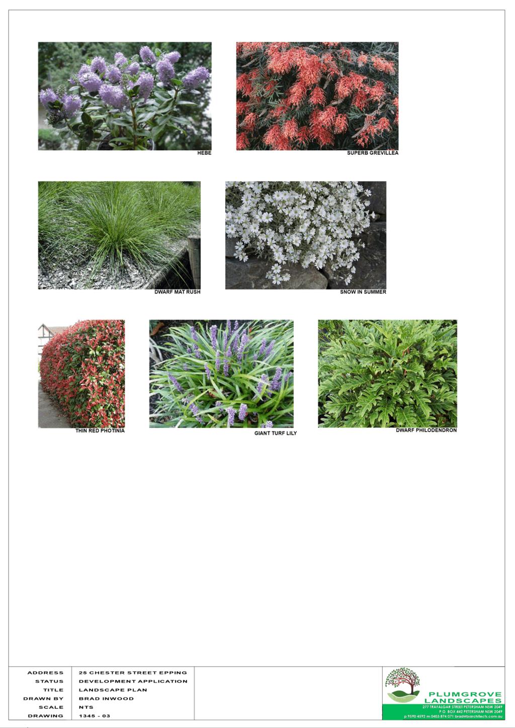
Landscape Plans
|
3 Pages
|
|
|
7⇩
|
Complete Clause 4.6 Variation
|
8 Pages
|
|
|
8⇩
|
Statement of Environmental Effects
|
26 Pages
|
|
REFERENCE MATERIAL
|
Item 5.2 - Attachment
1
|
Combined Assessment Report and Draft Conditions
|
|
Item 5.2 - Attachment 2
|
Locality map
|
|
Item 5.2 - Attachment
3
|
Zoning map
|
|
Item 5.2 - Attachment
4
|
Architectural Plans
|
|
Item 5.2 - Attachment 6
|
Landscape Plans
|
|
Item 5.2 - Attachment 7
|
Complete Clause 4.6 Variation
|
|
Item 5.2 - Attachment 8
|
Statement of Environmental Effects
|

Local
Planning Panel 16 April 2024 Item
5.3
ITEM NUMBER 5.3
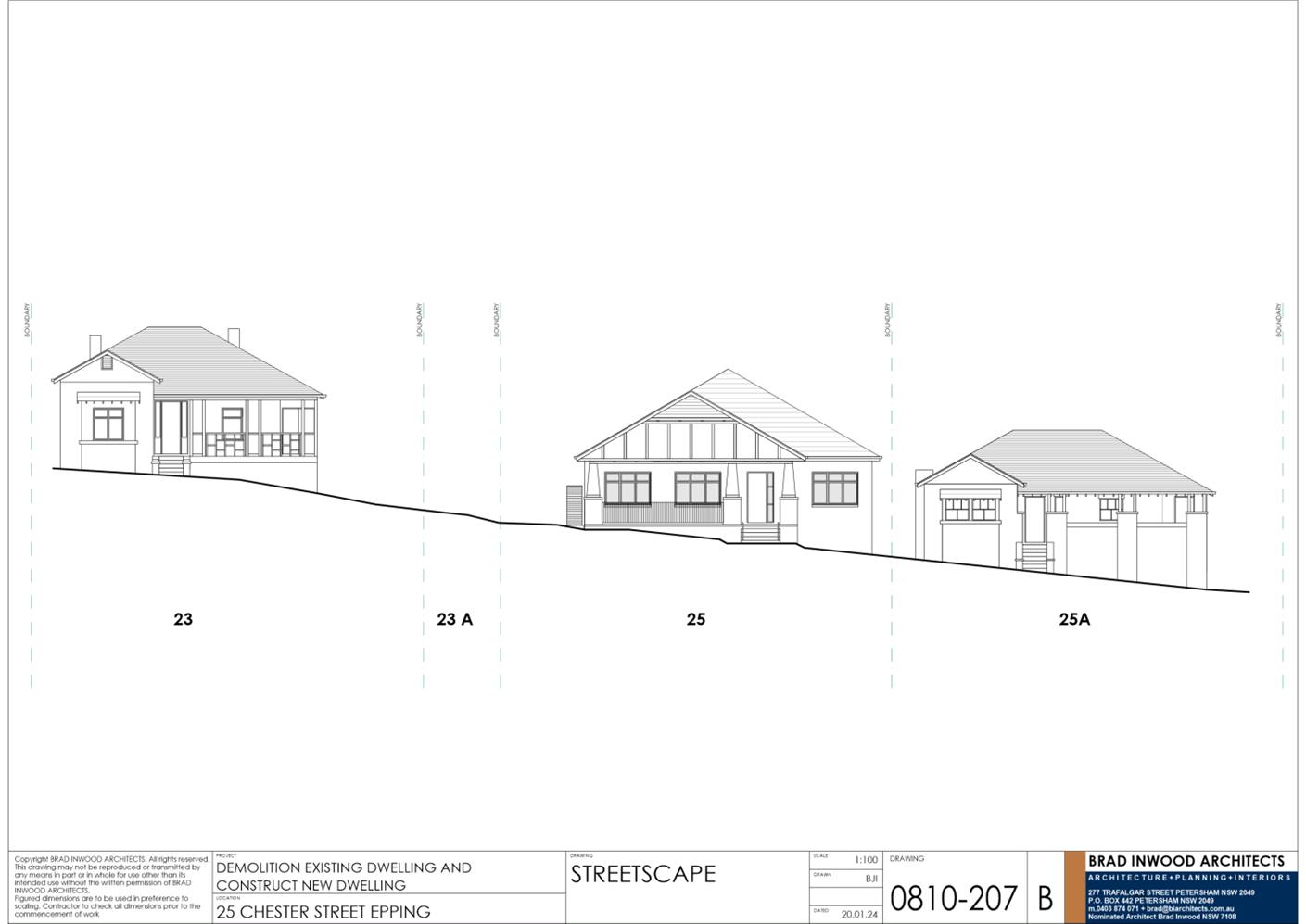
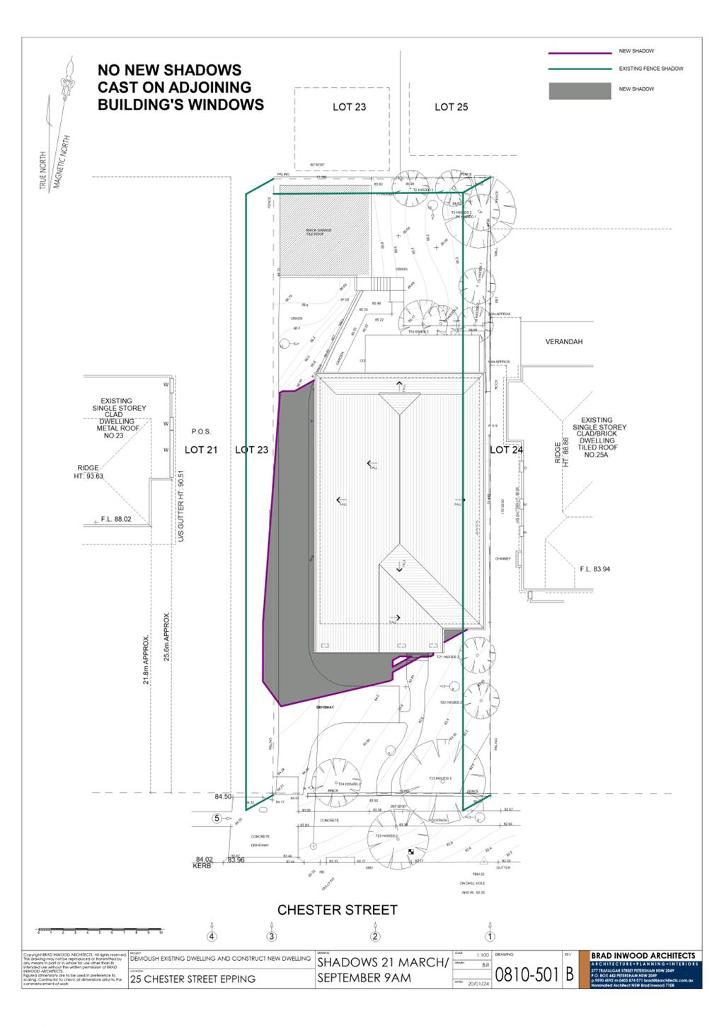
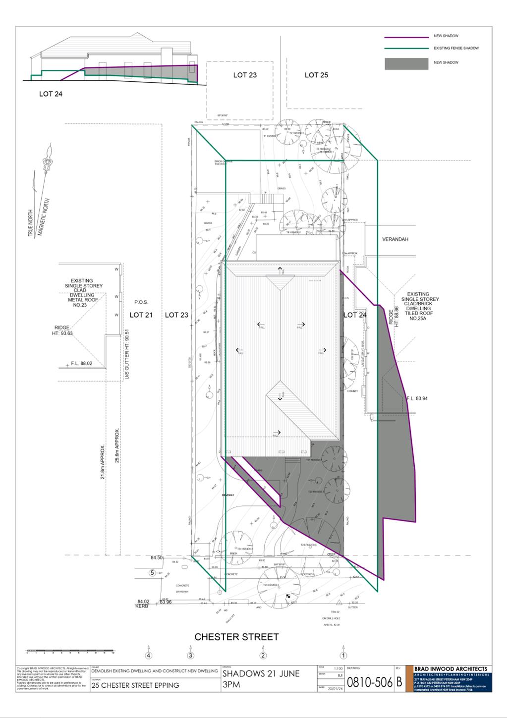
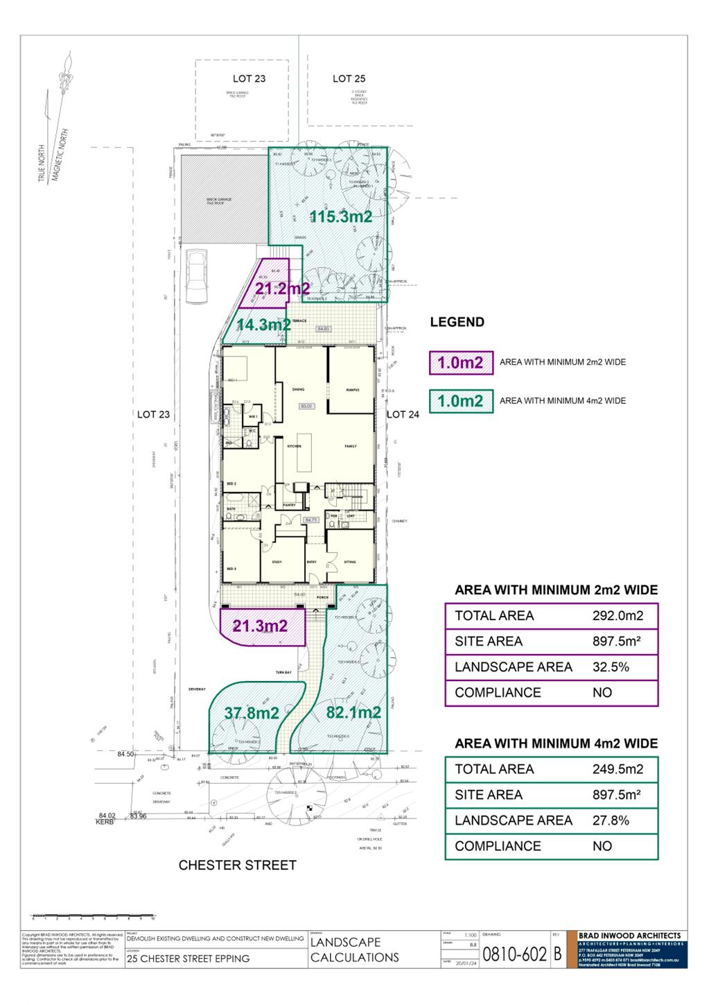
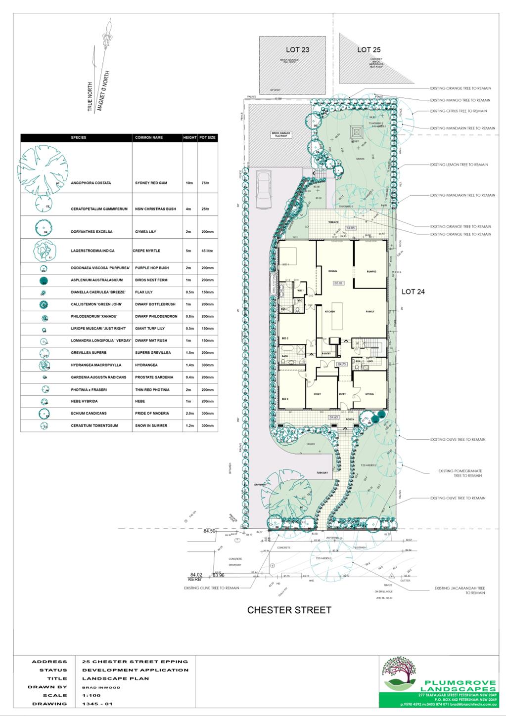
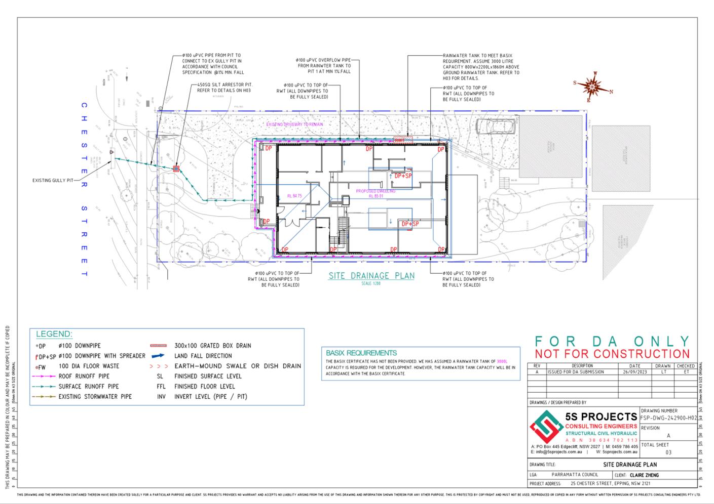
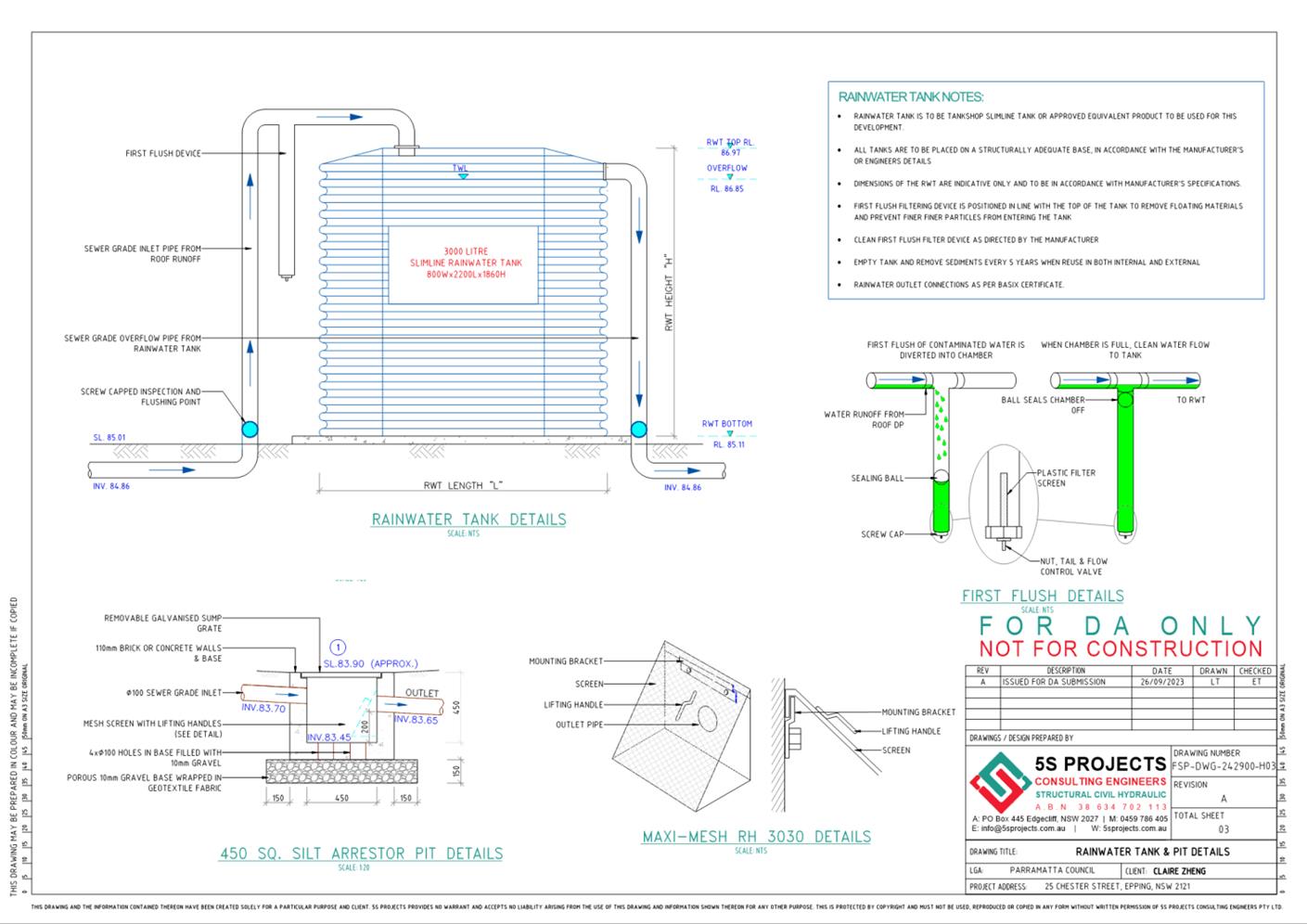
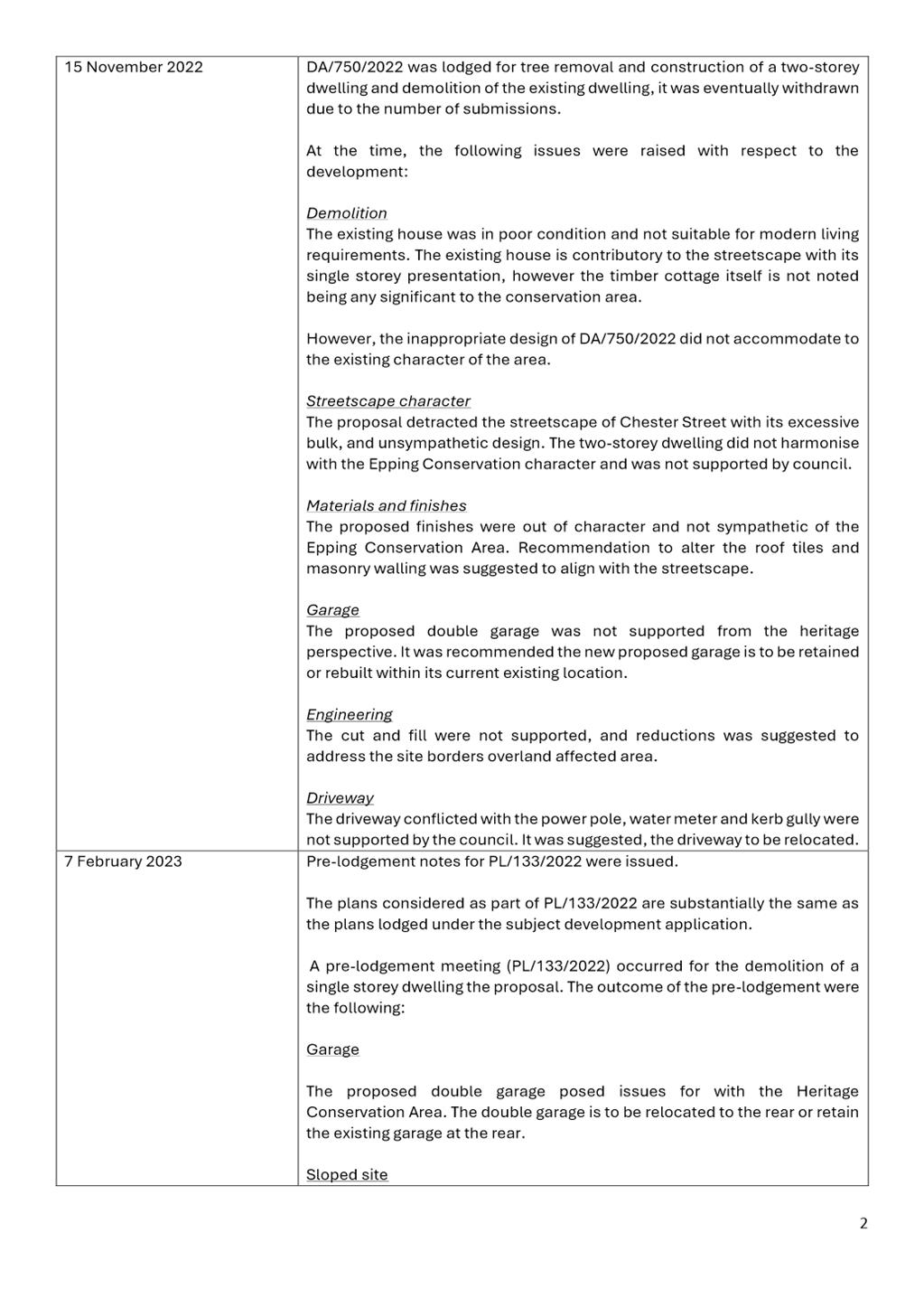
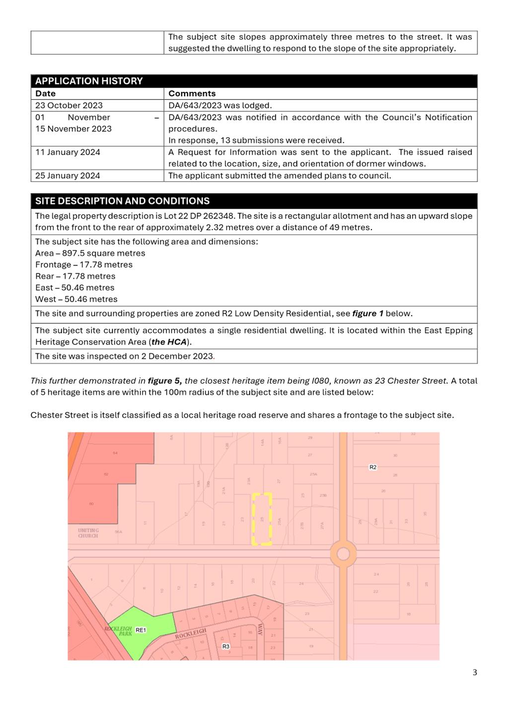
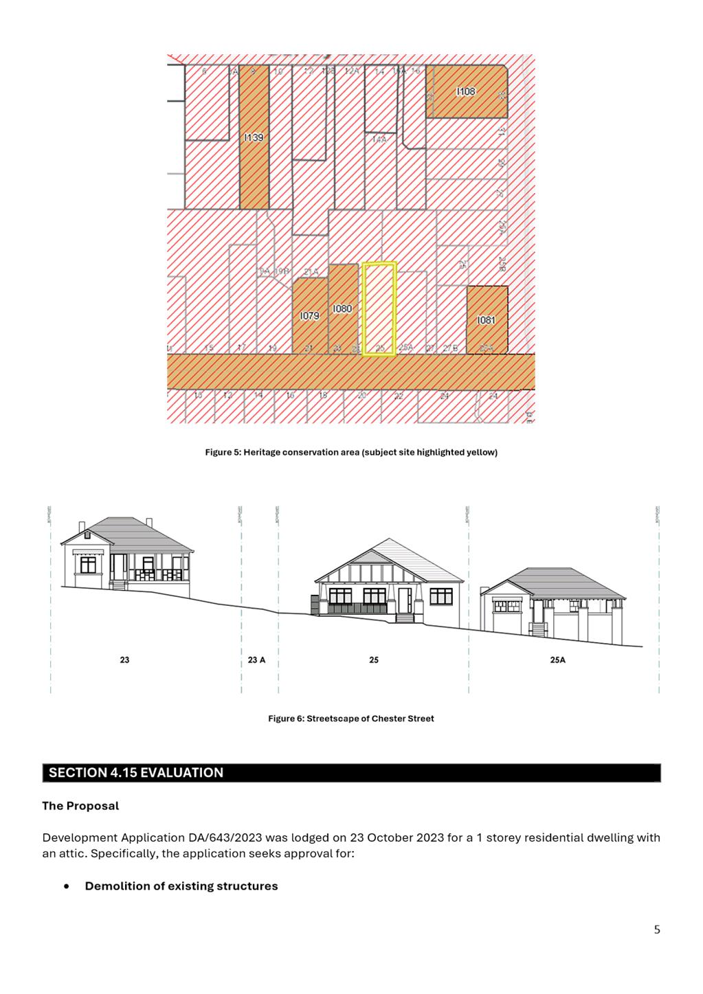
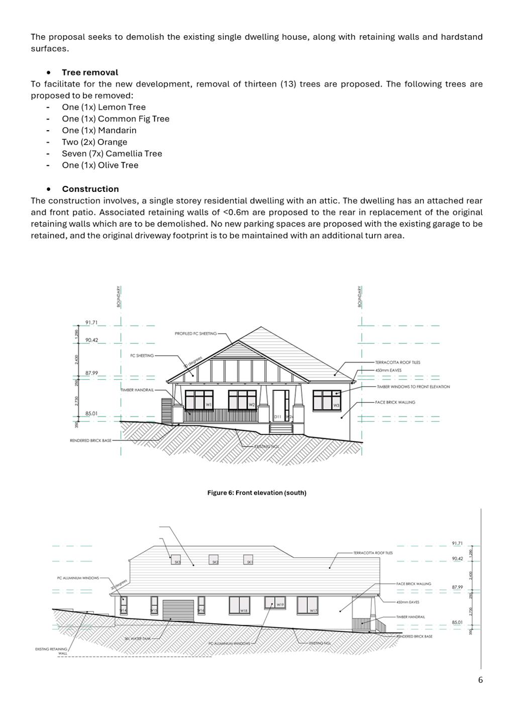
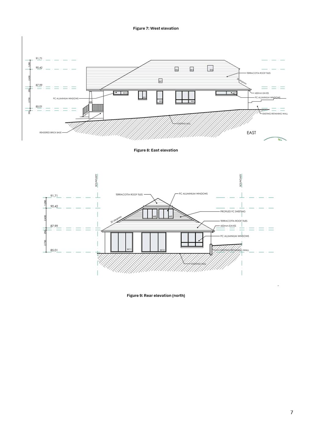
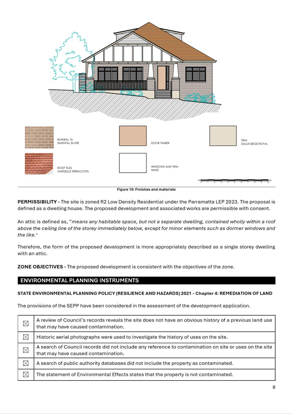
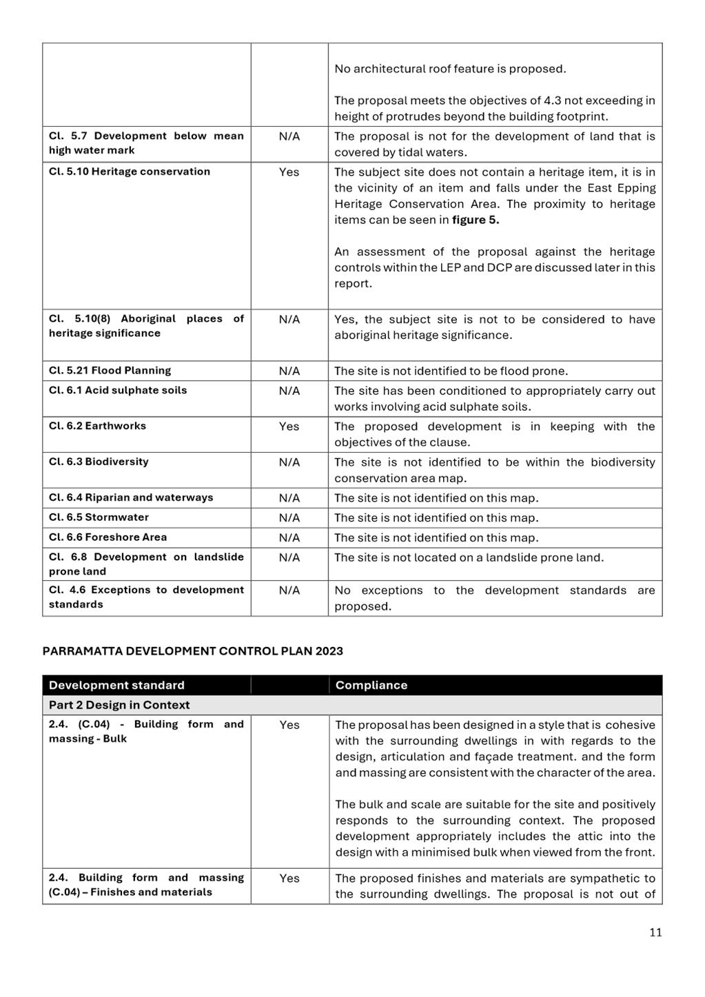
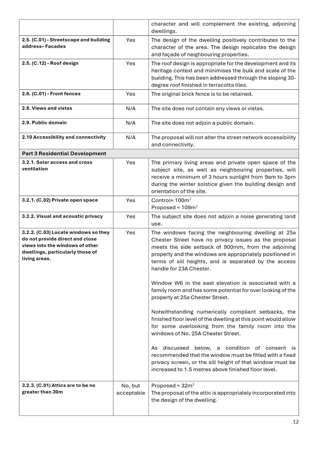
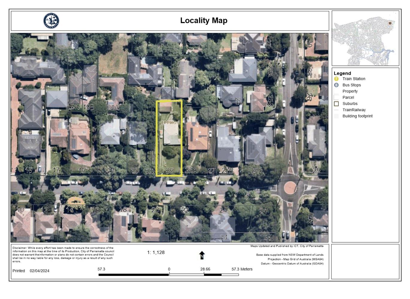
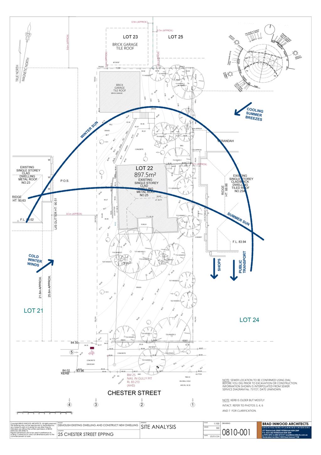
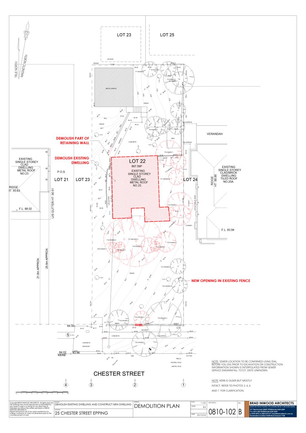
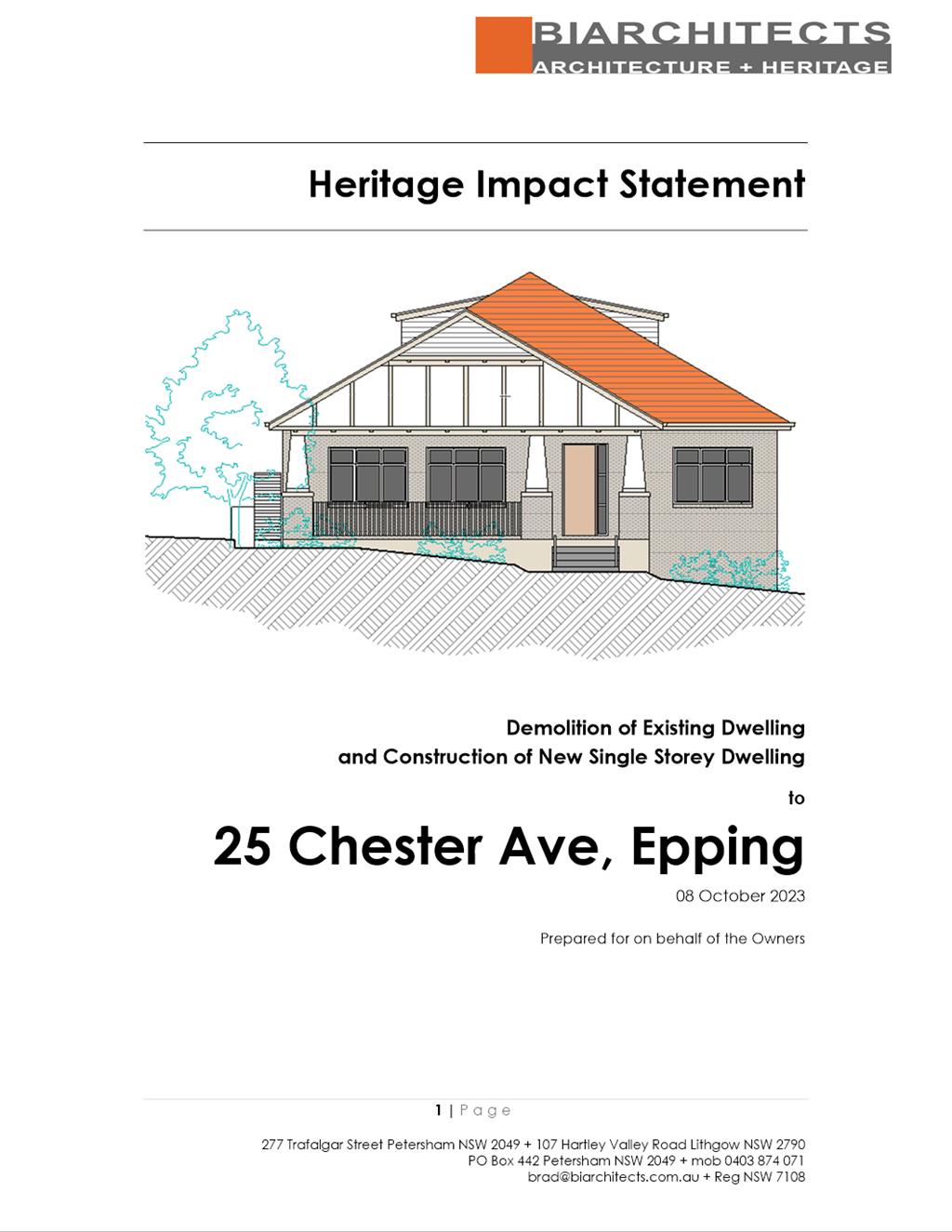
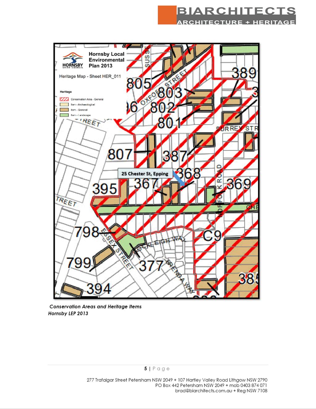
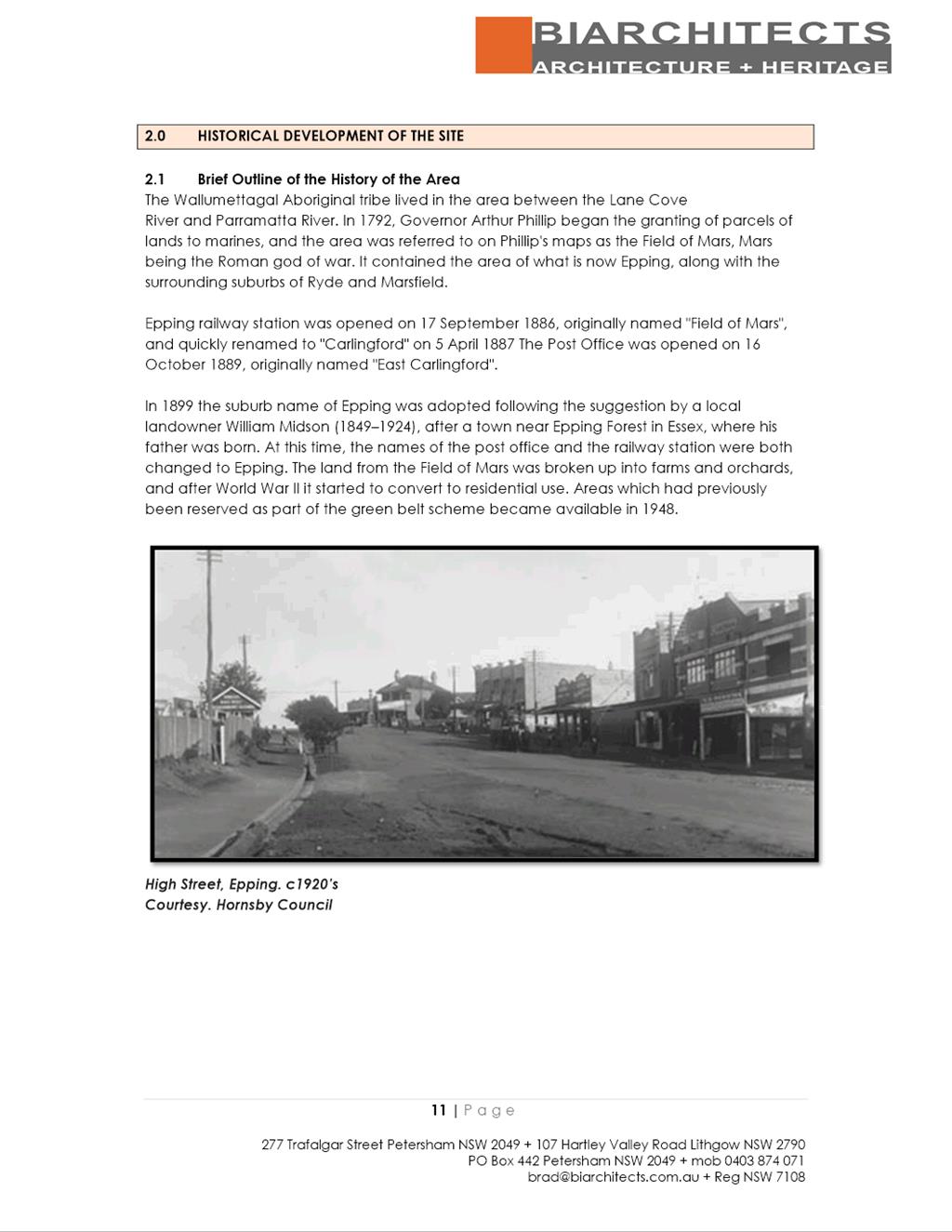
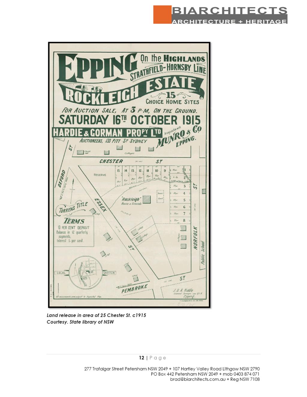
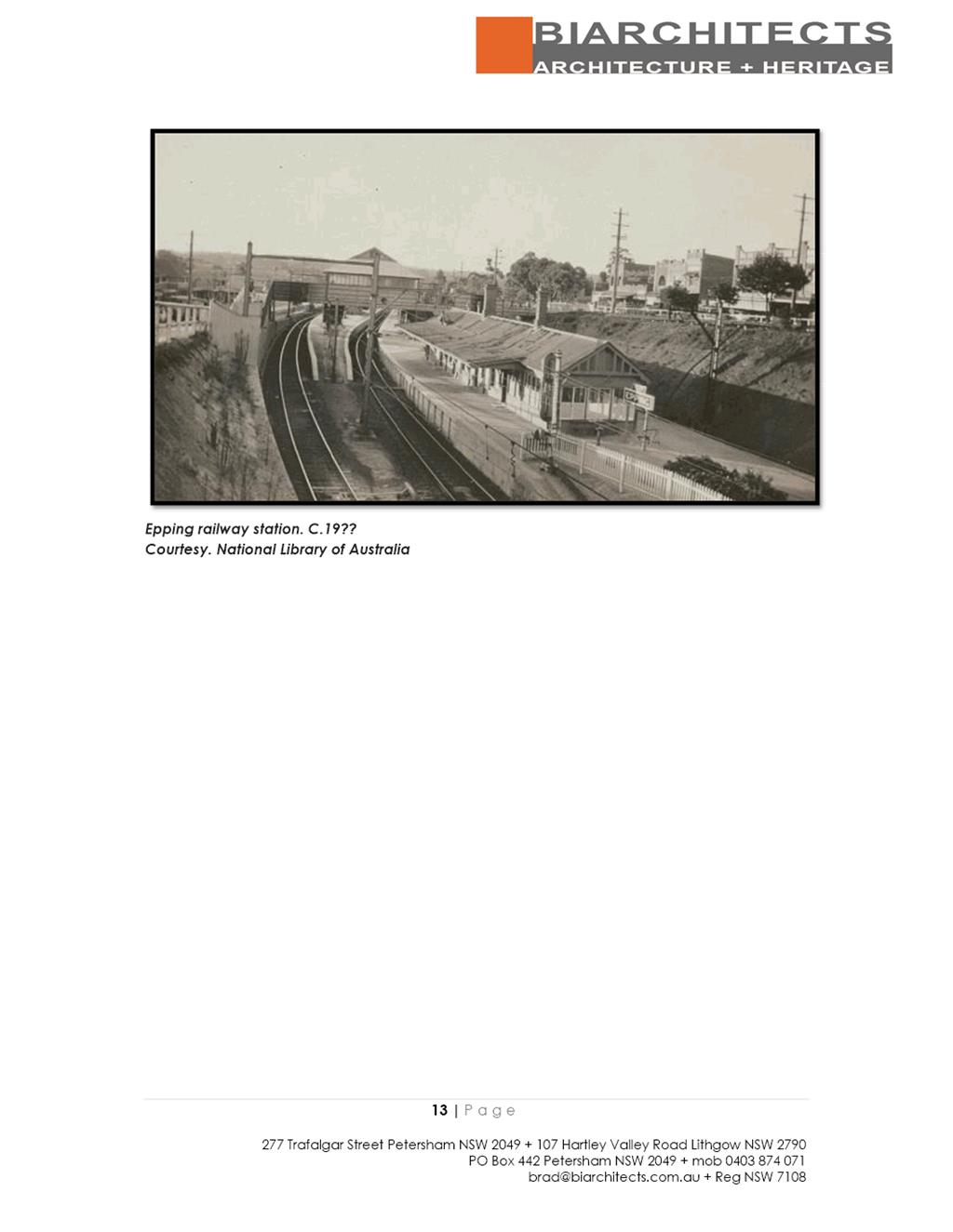
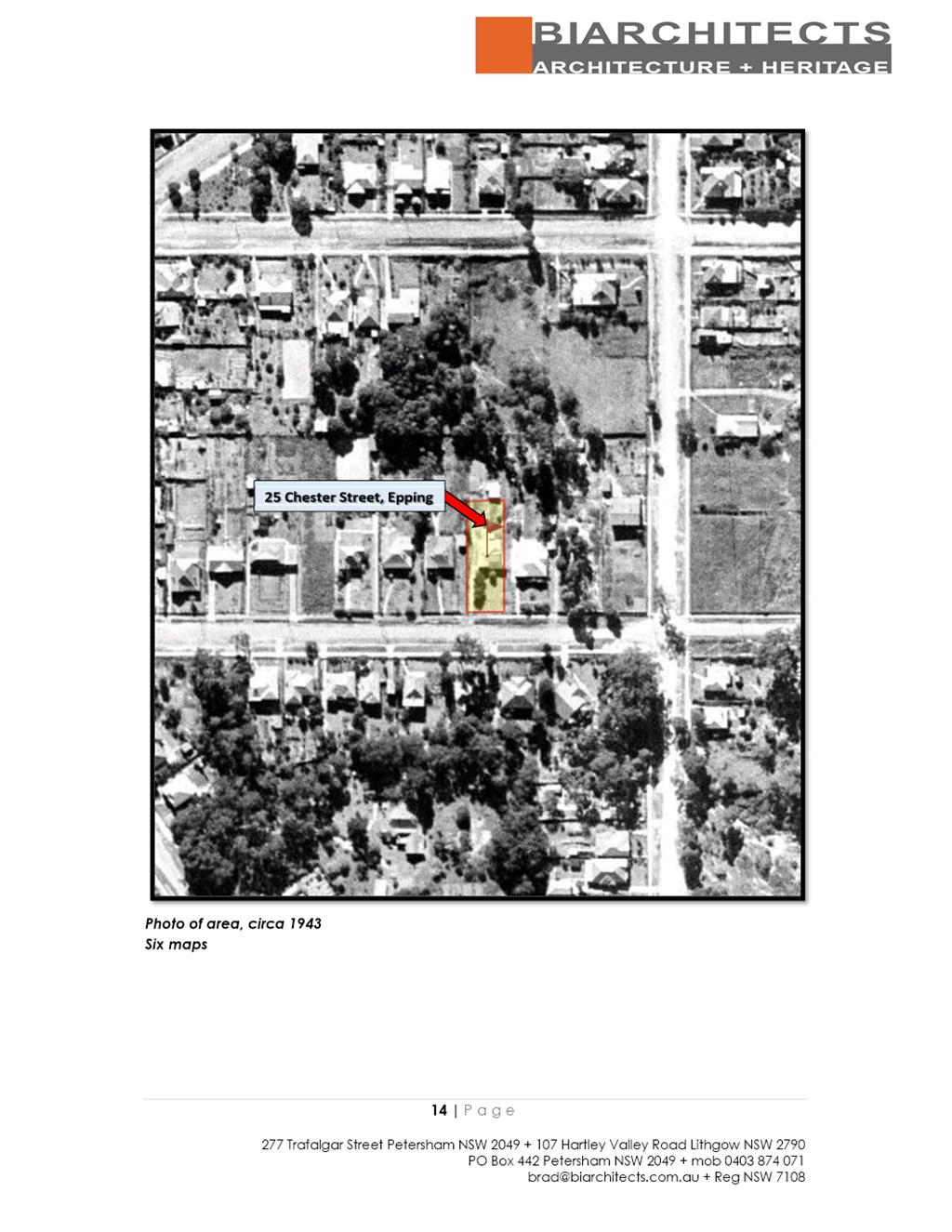
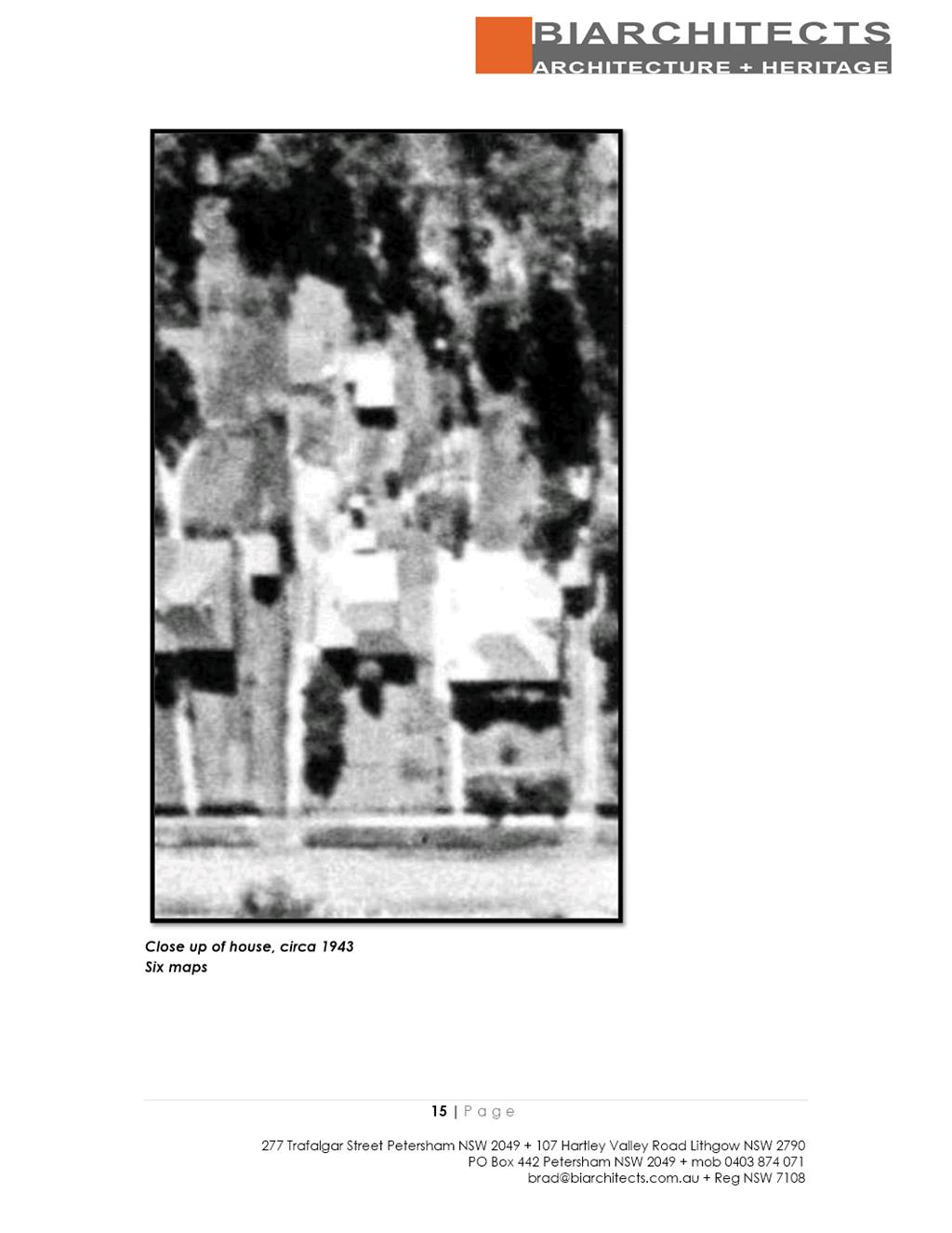
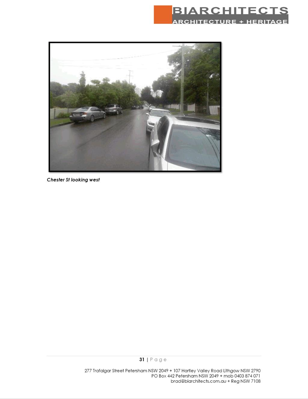
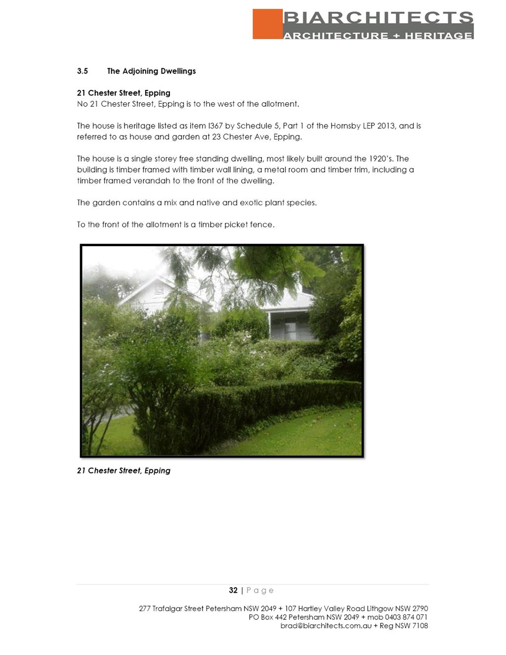
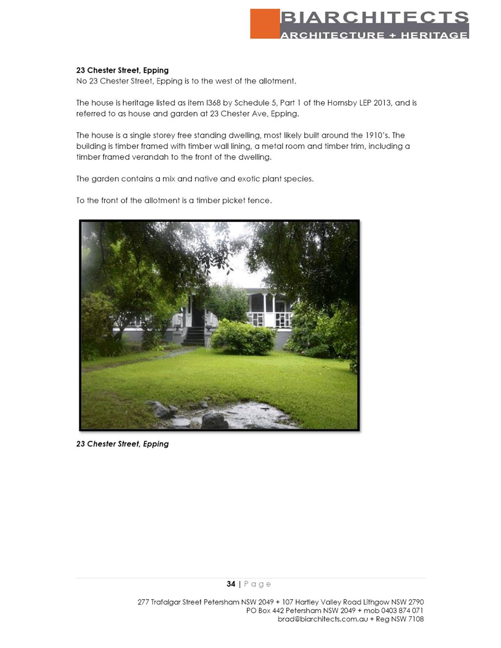
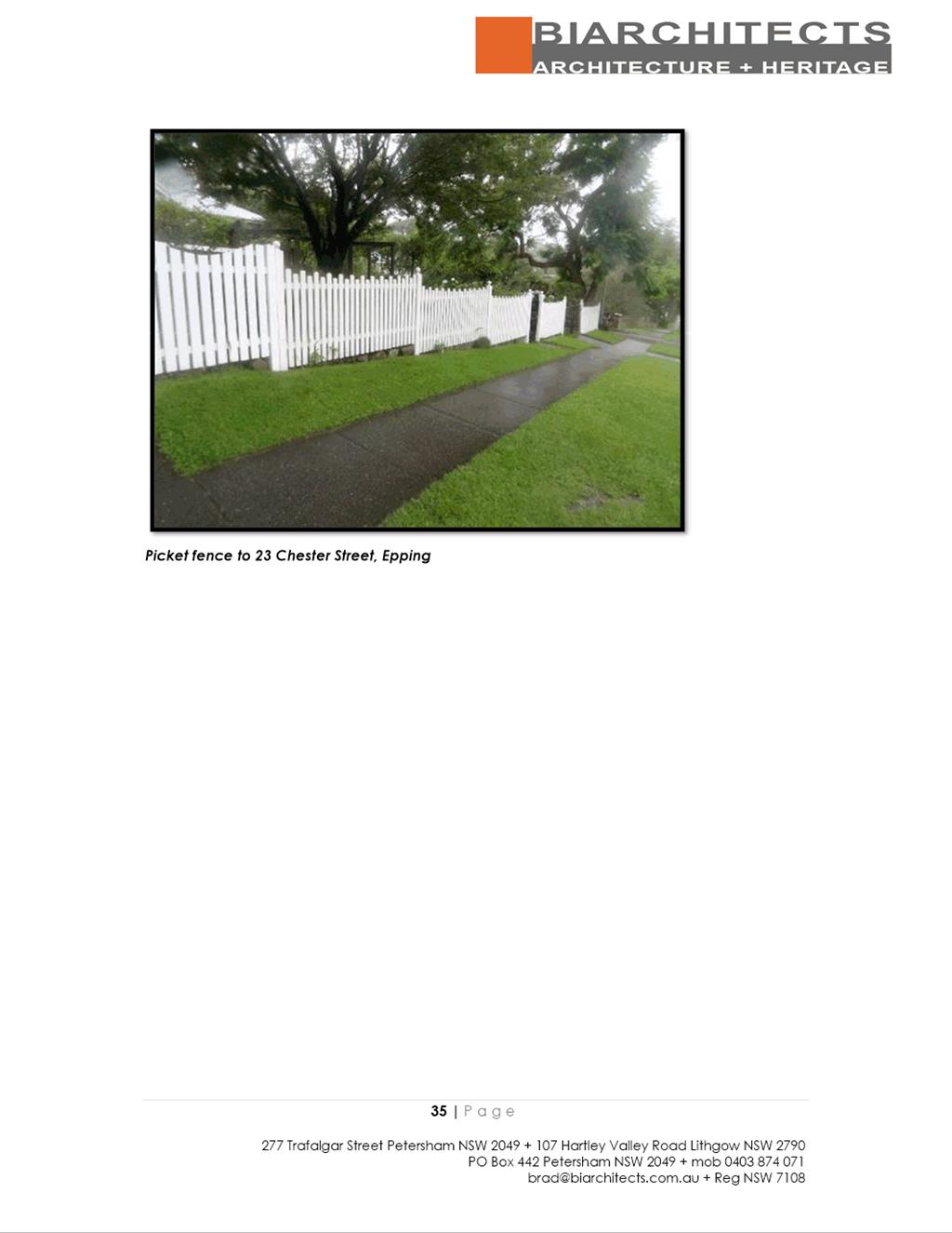
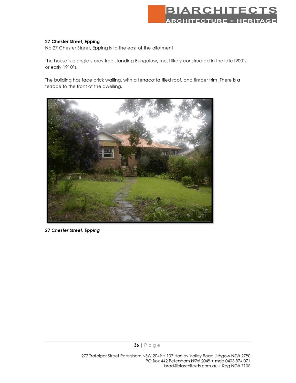
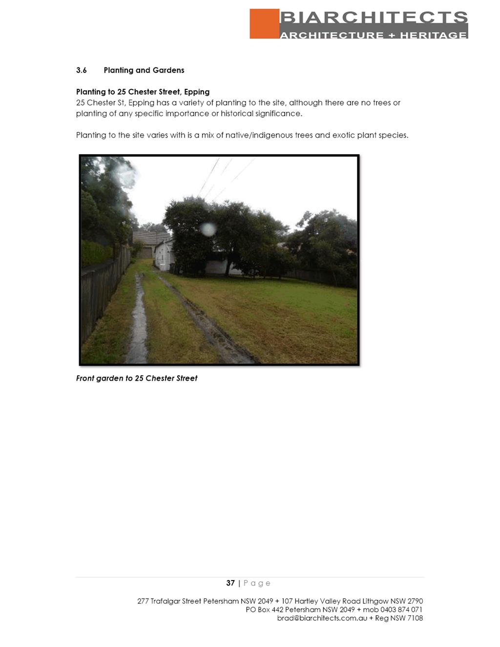
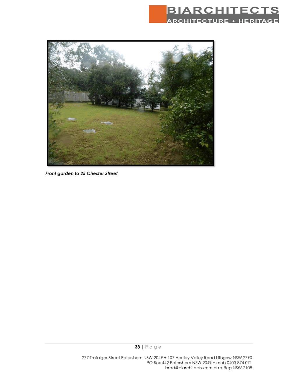
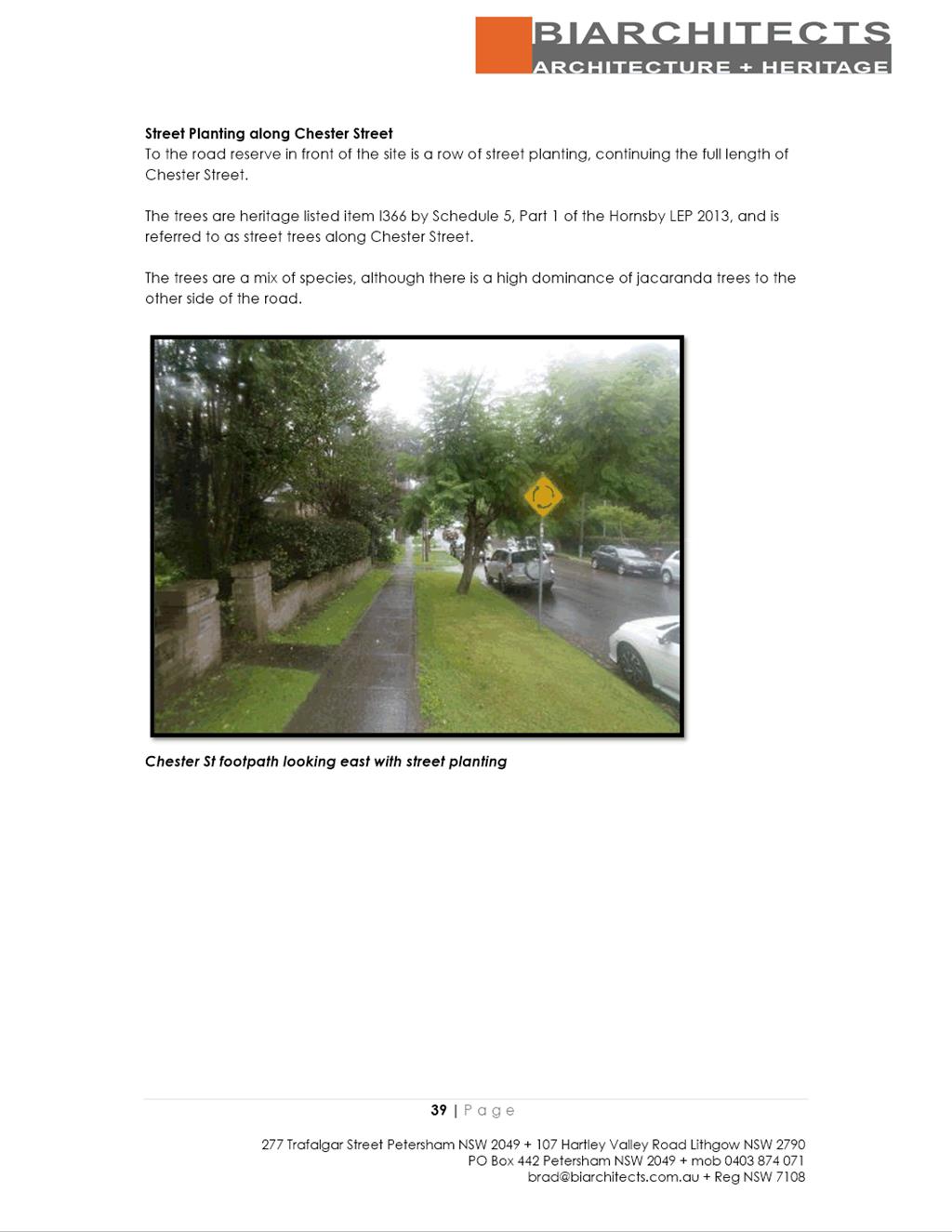
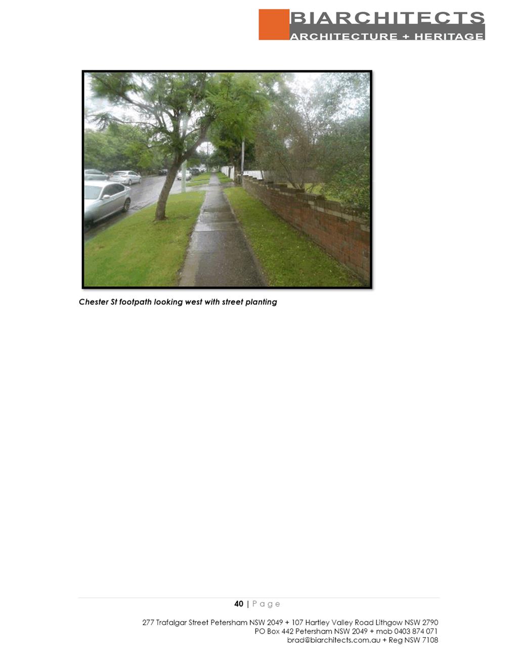
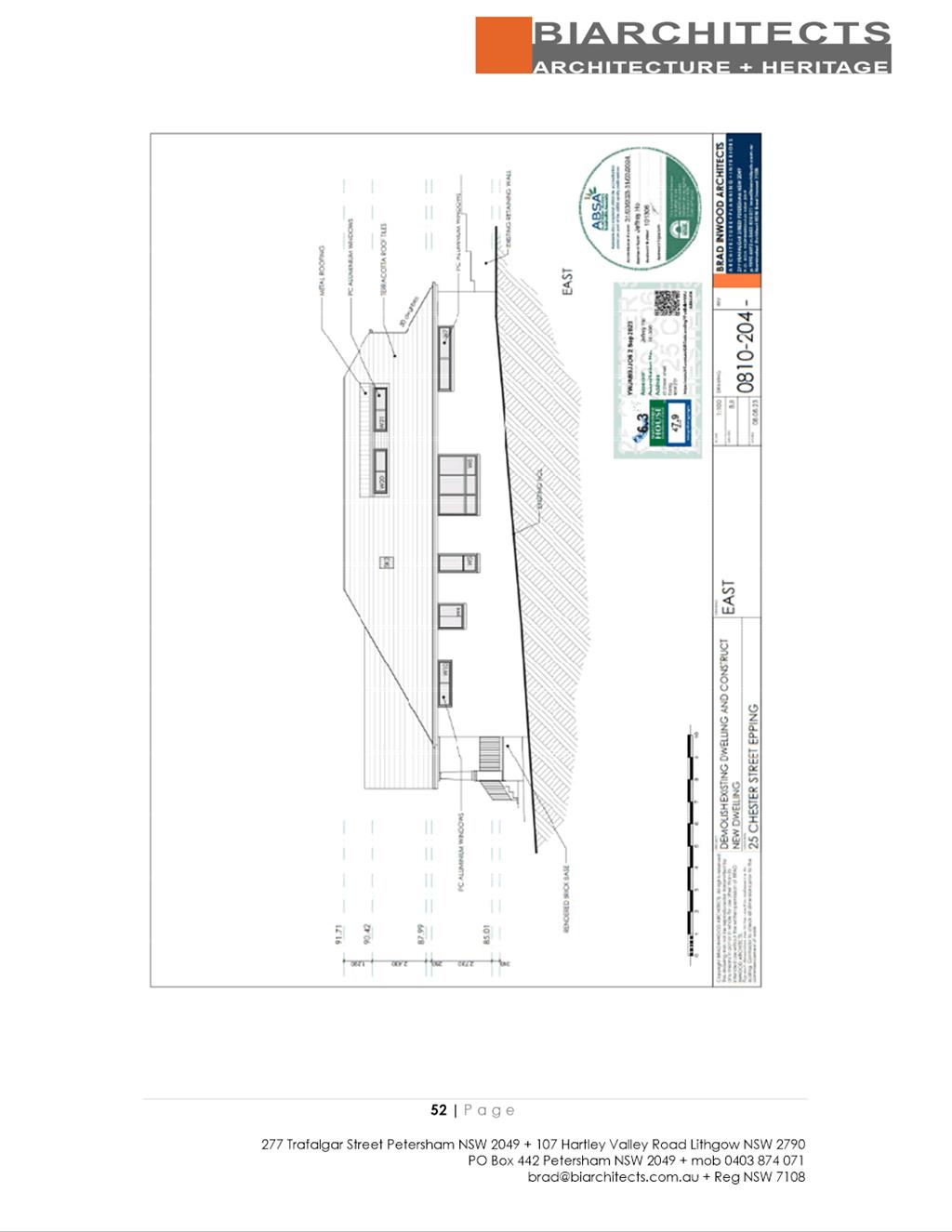
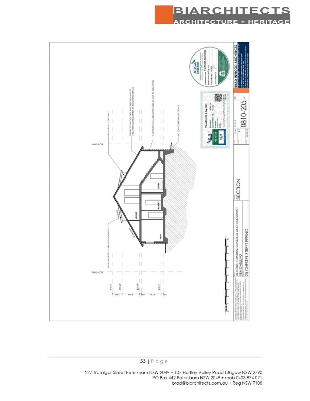
SUBJECT 25 Chester Street, EPPING NSW 2121 (Lot 22, DP 262348)
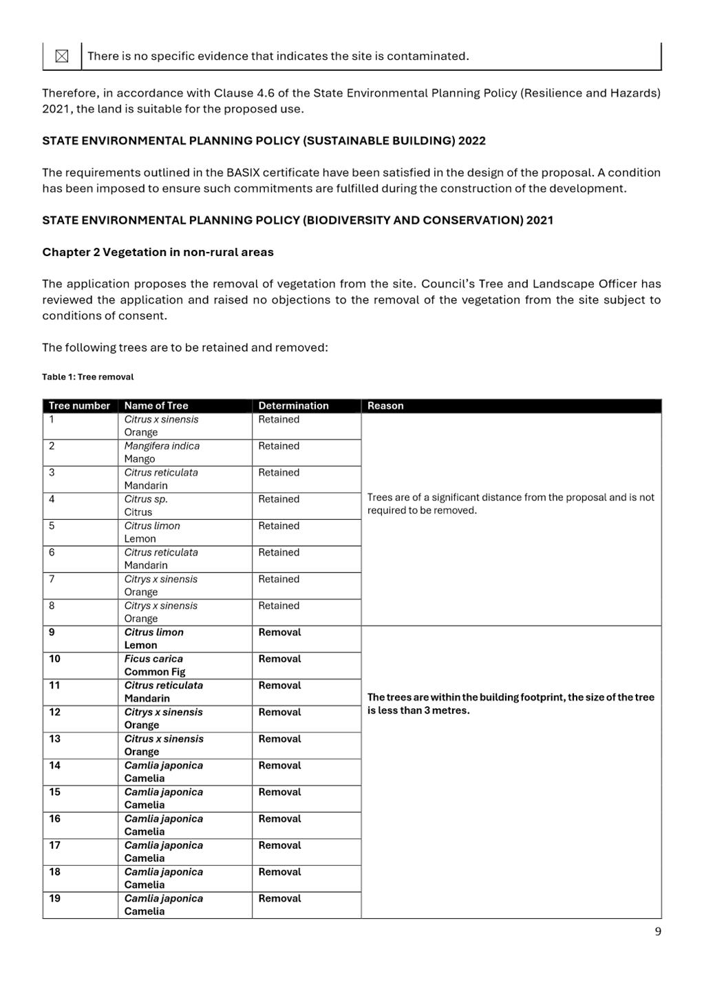
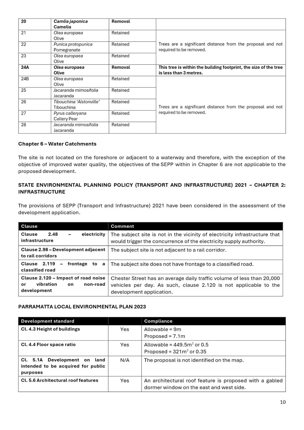
DESCRIPTION Demolition of existing dwelling including tree removal and
construction of single storey dwelling with attic. The site is within East
Epping Conservation Area pursuant to clause 5.10 of the Parramatta Local
Environmental Plan 2023.
REFERENCE DA/643/2023 - D09384864
APPLICANT/S Planning Solutions
OWNERS F Xue & Ms W C Zheng
REPORT OF Group
Manager Development and Traffic Services
RECOMMENDED Approval
DATE OF REPORT 02 April 2024
REASON FOR REFERRAL TO LPP
This development
application is being referred to Parramatta Local Planning Panel as the
application received more than 10 unique objections.
EXECUTIVE
SUMMARY
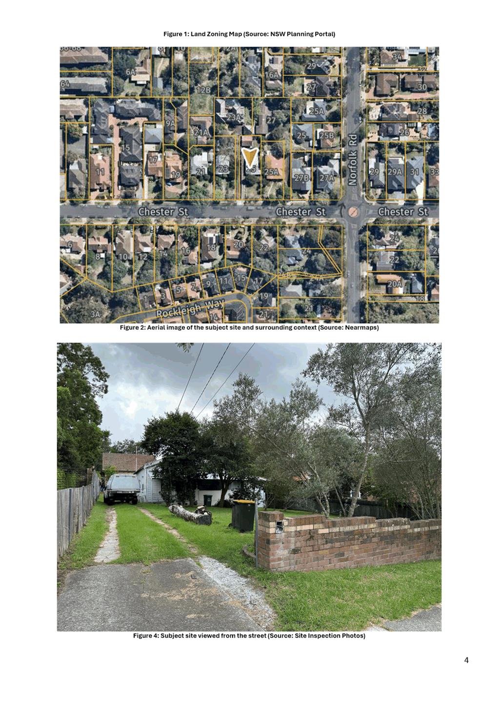
The Development
Application, DA/603/2023 was lodged to Council on 24 October 2023 for the demolition of the existing
dwelling, retention of the existing detached garage, and construction of a
single storey dwelling with an attic on land at 25 Chester Street, Epping
The Site and surrounding
properties are zoned R2 Low Density Residential. The Site is located within the
East Epping Hertiage Conservation Area and several heritage items are located
within 50 metres of the site, namely the dwellings at No. 21, 23, and 27A
Chester Street, and the street trees within Chester Street.
In accordance with the Parramatta
Consolidated Notification Procedures, the Development Application was notified
from the 1 November 2023 and 15 November 2023. In response thirteen (13)
submissions were received generally raising the following concerns:
Demolition of a dwelling within a heritage conservation area, non-compliance
with landscaping and deep soil areas, tree removal, setbacks, dwelling design,
privacy, bulk and scale, height, finishes, driveway design, presence of
asbestos, and heritage impacts.
In accordance with the Environmental Planning and Assessment Act
1979, Section 9.1 – Directions by the Minister, this application is
reported to the Parramatta Local Planning Panel for determination as the
development received 10 or more unique submissions by way of objection.
Council’s Senior Heritage
Advisor has reviewed the development and supports the demolition of the
existing dwelling as an appropriate replacement dwelling is proposed.
The development responds to the
constraints of the site and is generally in keeping with the established
pattern of development within the East Epping Heritage Conservation Area.
Having regard to
the matters for consideration under Section 4.15 of the Environmental
Planning and Assessment Act 1979, it is recommended Development Application
DA/643/2023 be approved subject to conditions of consent.
RECOMMENDATION
(a) That the Parramatta Local Planning Panel exercising the functions of
Council as the consent authority, grant development consent to DA/643/2023 on
land at 25 Chester Street Epping, for a period of five (5) years within which
physical commencement is to occur from the date on the Notice of Determination,
subject to conditions of consent in Attachment 1.
(b) That submitters are advised of the decision.
REASONS FOR
APPROVAL
1. The
development is permissible in the R2 Low Density Residential zone and generally
satisfies the requirements of the applicable planning provisions.
2. The development will be compatible
with the East Epping Hertiage Conservation Area and will not detract from the
nearby heritage items.
3. For the reasons given above, approval
of the application is in the public interest.
Nina Salvador
Development Assessment Officer
Attachments:
|
1⇩ 
|
Combined Assessment Report and draft
conditions
|
43 Pages
|
|
|
2⇩
|
Locality Map
|
1 Page
|
|
|
3⇩
|
Plans used during assessment
|
34 Pages
|
|
|
4
|
Internal Plans used during assessment
(confidential)
|
18 Pages
|
|
|
5⇩
|
Complete Heritage impact
|
61 Pages
|
|
REFERENCE MATERIAL
|
Item 5.3 - Attachment
1
|
Combined Assessment Report and draft conditions
|
|
Item 5.3 - Attachment 2
|
Locality Map
|
|
Item 5.3 - Attachment
3
|
Plans used during assessment
|
|
Item 5.3 - Attachment 5
|
Complete Heritage impact
|

Planning Proposals
16 April 2024
6.1 Post
Exhibition Report - Planning Proposal for land at 8 Lincluden Place, Oatlands............ 336
6.2 Request
for Gateway and public exhibition: Planning Proposal for North-East Planning Investigation
Area...................................... 440
Local Planning Panel 16 April 2024 Item
6.1
ITEM NUMBER 6.1
SUBJECT Post Exhibition Report - Planning Proposal for land at 8 Lincluden
Place, Oatlands
REFERENCE RZ/3/2021 -
APPLICANT/S Think Planners
OWNERS Zaki Property Pty Ltd as Trustee For Zaki Property Trust
REPORT OF Project Officer
Development
applications considered by Sydney central city planning panel Nil
PURPOSE
The purpose
of this report is to seek Local Planning Panel advice to Council on a recommendation to support
finalisation of a Planning Proposal for land at 8 Lincluden Place, Oatlands.
RECOMMENDATION
The Parramatta Local Planning
Panel consider the following
Council Officer recommendation in its advice to Council:
(a) That Council receives and notes the
submissions made during the exhibition period.
(b) That Council approve the finalisation of the Planning
Proposal, provided at Attachment 1 for
land at 8 Lincluden Place, Oatlands.
(c) That Council enters into the Planning
Agreement at Attachment 2 and delegates authority to the Chief Executive Officer
to sign it on behalf of Council.
(d) That Council delegate authority
to the Chief Executive Officer
to make any minor amendments and corrections of a non-policy and
administrative nature that may arise during the plan finalisation process
relating to the Planning Proposal and Planning Agreement.
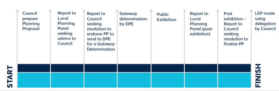
PLANNING PROPOSAL
TIMELINE
SITE DESCRIPTION
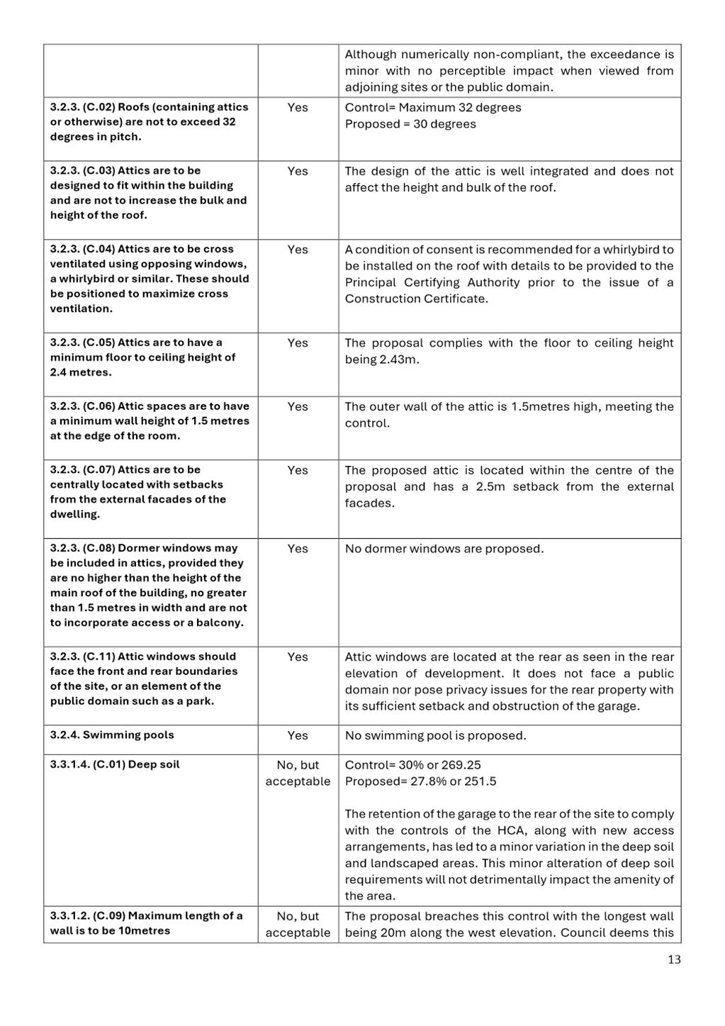
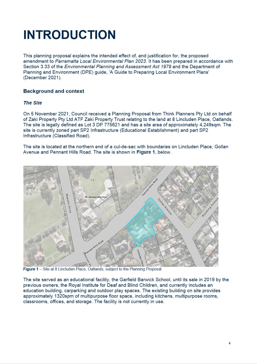
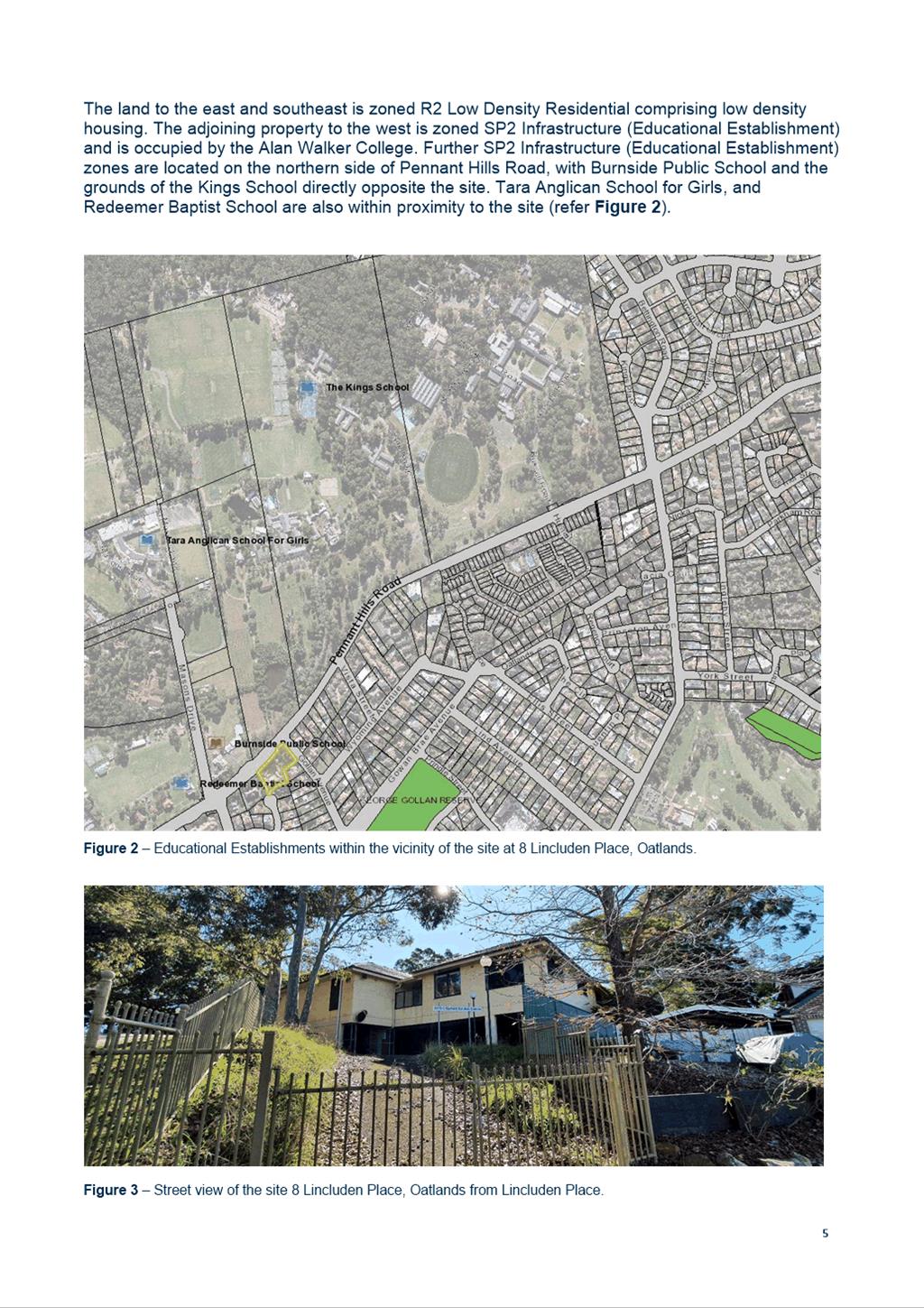
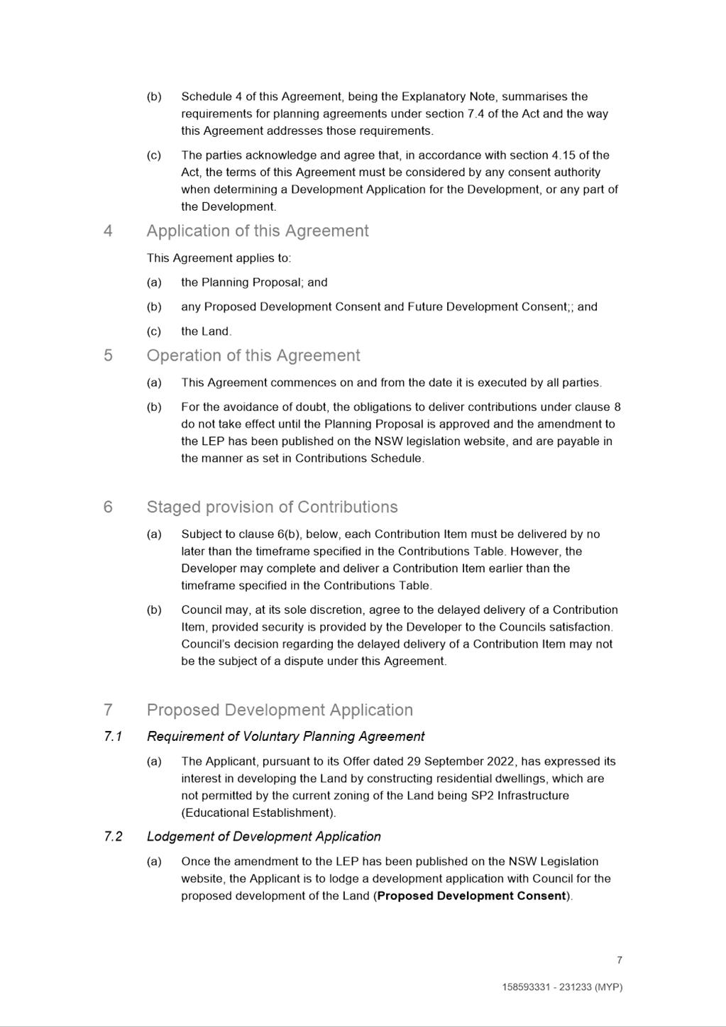
1. The Planning
Proposal applies to the land at 8 Lincluden Place,
Oatlands (the site). The site
is bound by Gollan Avenue to the north-east, Pennant Hills Road to the
north-west and neighbouring properties at 6 and 9 Lincluden Place and 2 Gollan
Avenue (refer to Figure 1). Current vehicular access to the site is via
Gollan Avenue and Lincluden Place to the south. The site has an area of
approximately 4,249sqm.
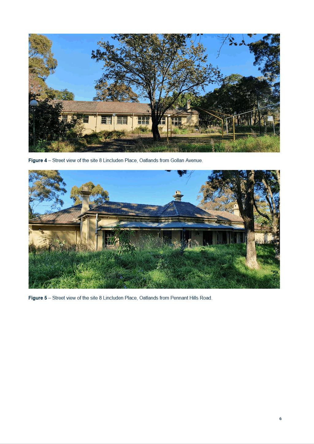
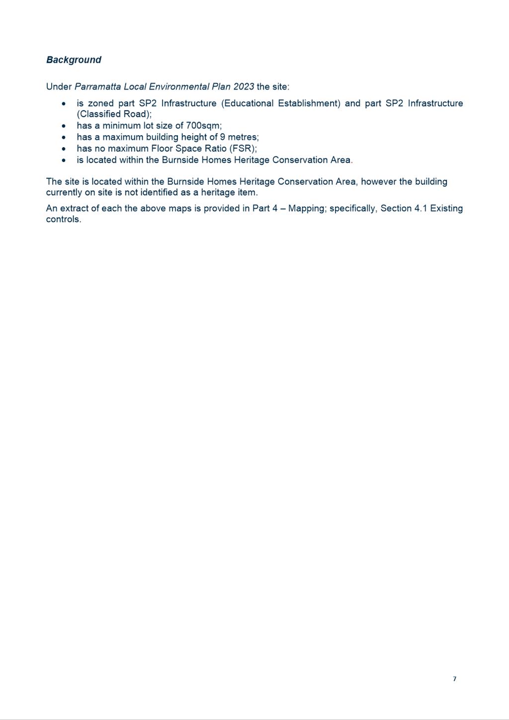
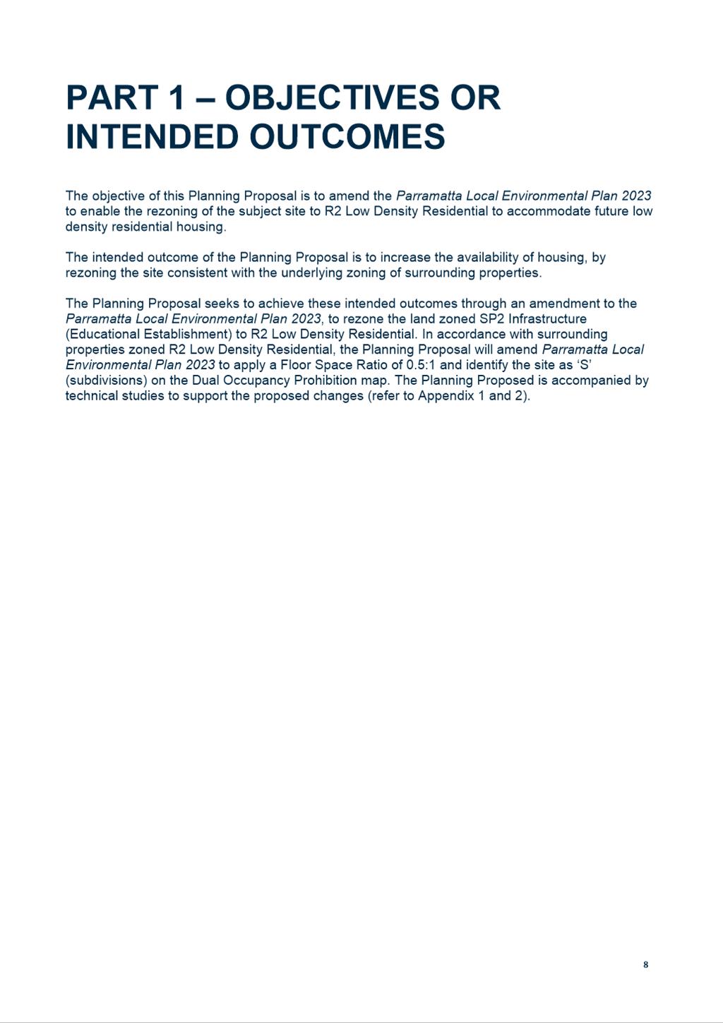
2. The
site contains several existing buildings previously used as a Royal Institute for the Deaf and Blind school (Garfield Barwick School
– private). The site is not currently in use as a school and has
been vacant since its sale in 2019.
3. The adjacent
site to the west (Alan Walker College)
is attached to the United Theological College. The remaining
sites on Lincluden Place, and the neighbouring sites on Gollan Avenue comprise
low density dwellings.
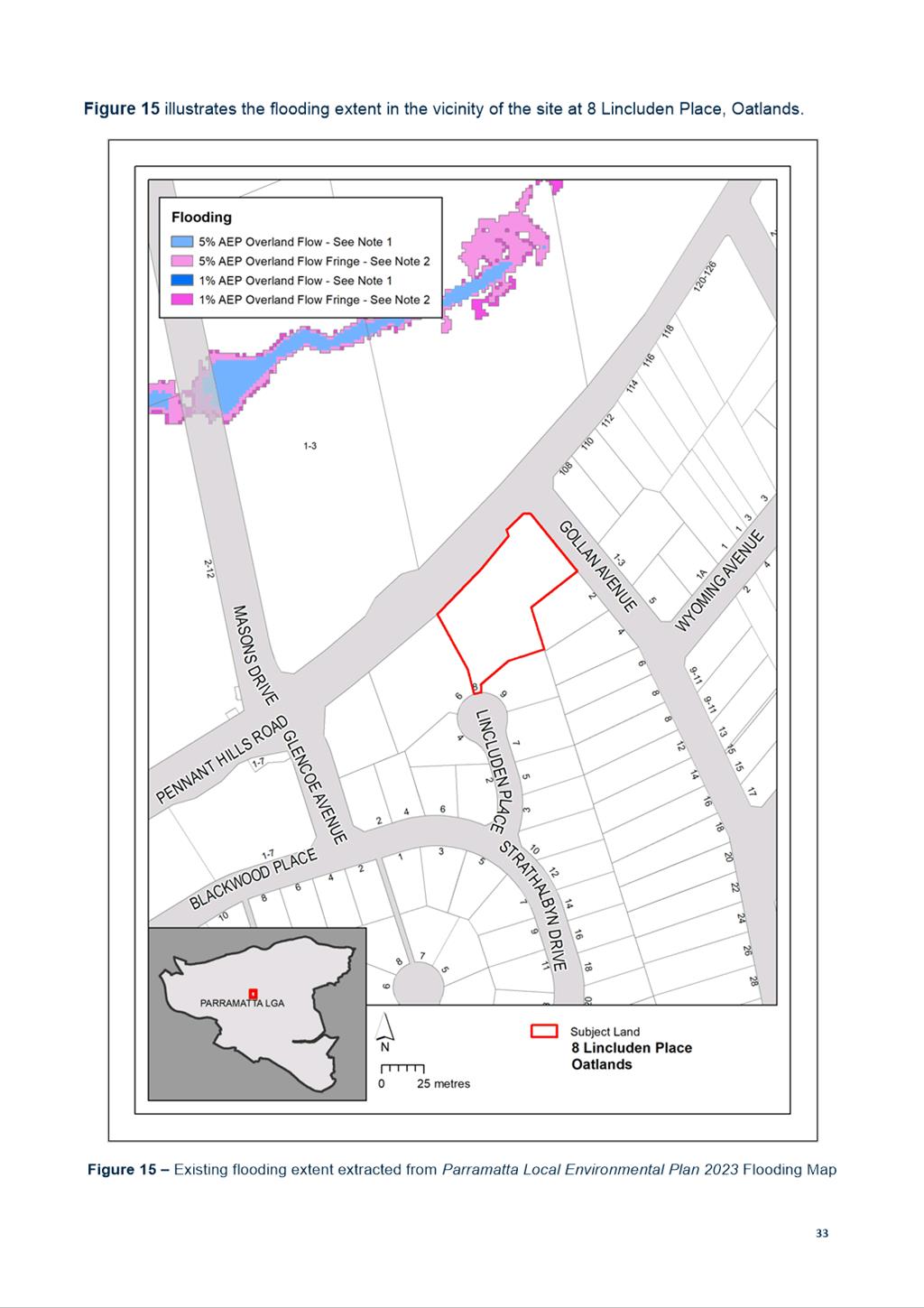
Figure 1 – Site at 8 Lincluden Place,
Oatlands, subject to the Planning
Proposal
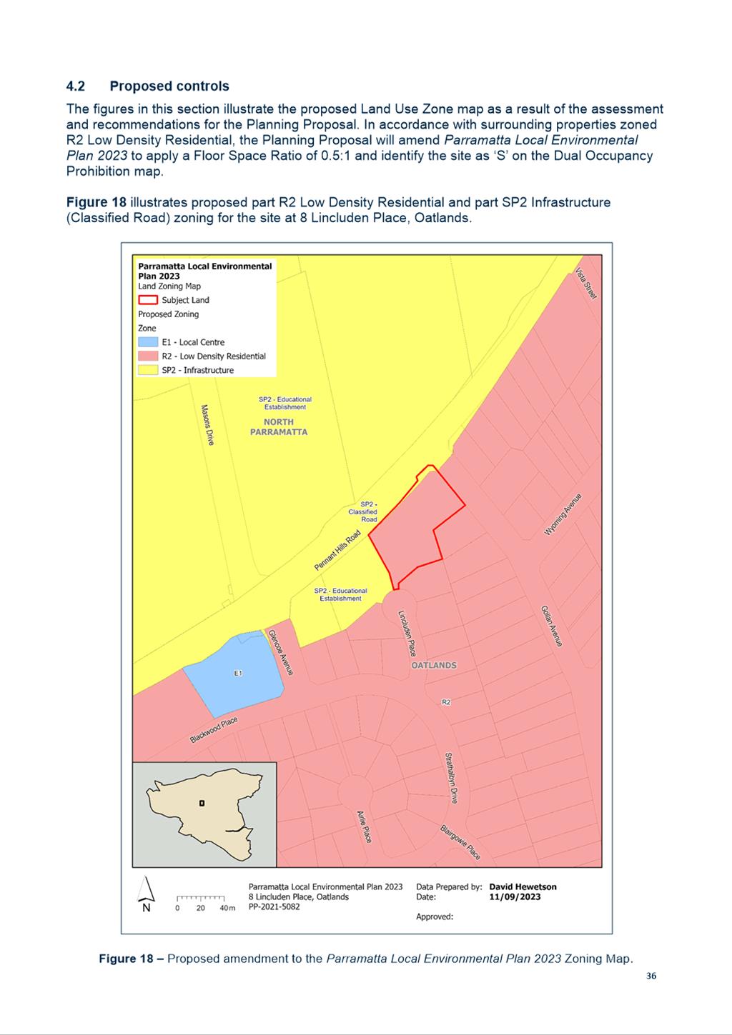
4. Under
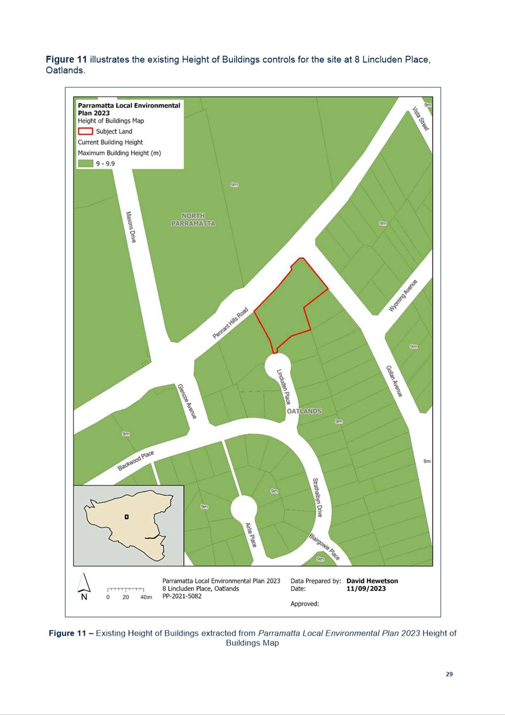
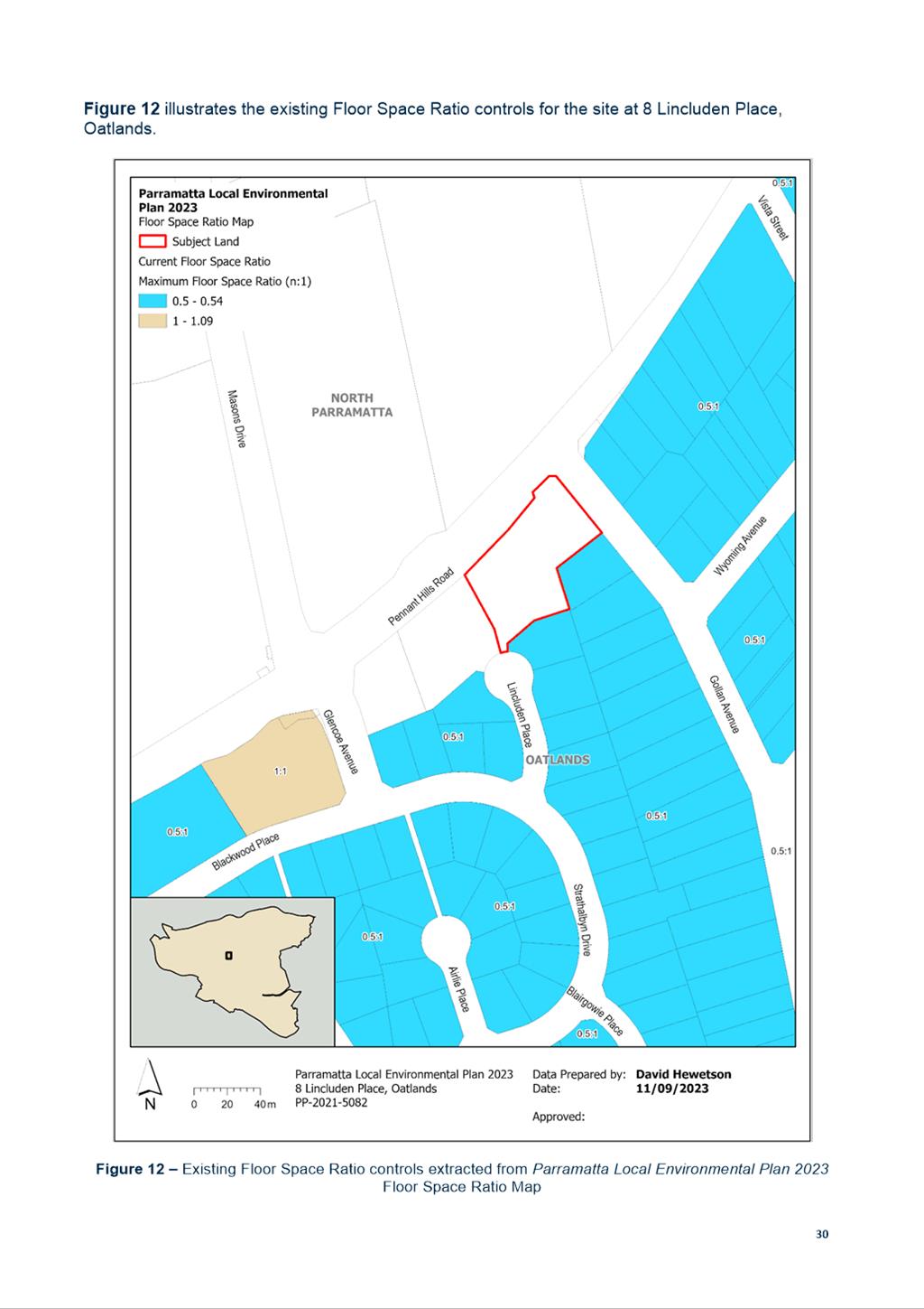
the Parramatta Local Environment Plan (PLEP) 2023, the site is subject to the following controls:
· Zoned part SP2 Infrastructure (Educational Establishment) and part SP2 Infrastructure (Classified
Road);
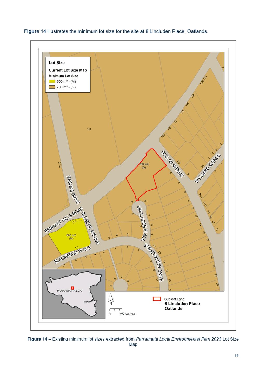
· Minimum lot size of 700sqm;
· Maximum building height of 9
metres;
· No maximum Floor Space
Ratio (FSR);
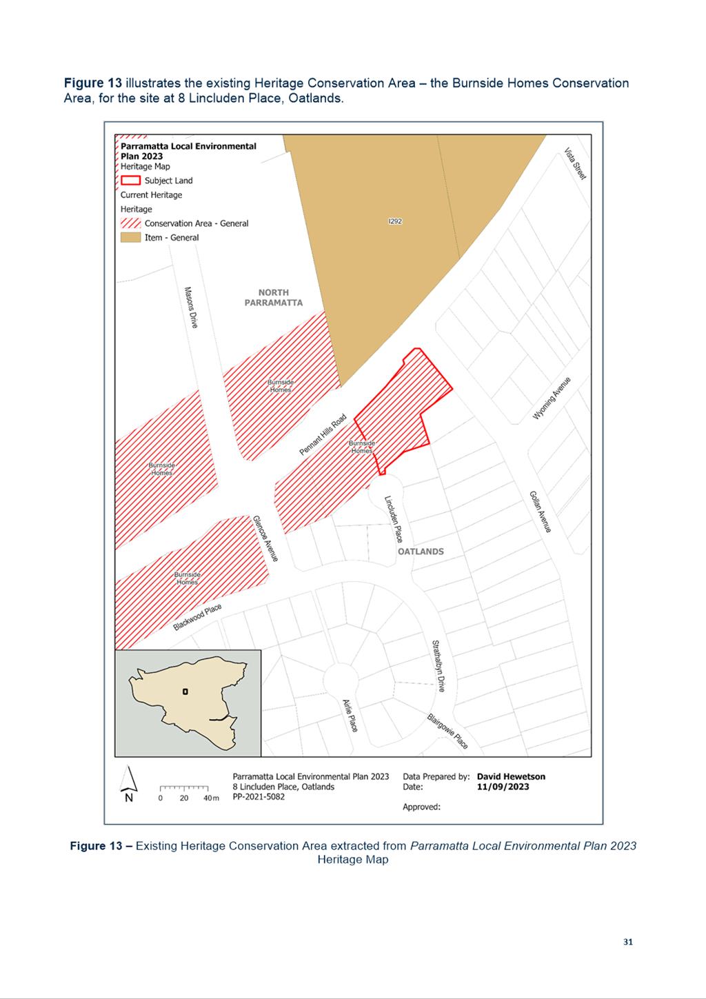
· Located within the Burnside Homes Heritage Conservation Area.
5. The site does not contain a local or State heritage item.
PLANNING PROPOSAL
6. On 5
November 2021, Council received a Planning Proposal for the site.
7. The
Planning Proposal previously sought to amend the Parramatta (former The
Hills) LEP 2012, since superseded by the Parramatta LEP 2023 (PLEP
2023), to rezone the site from SP2 Infrastructure (Educational Establishment)
to R2 Low Density Residential. Further detail outlining the proposed changes to
planning controls can be found at Table 1 below.
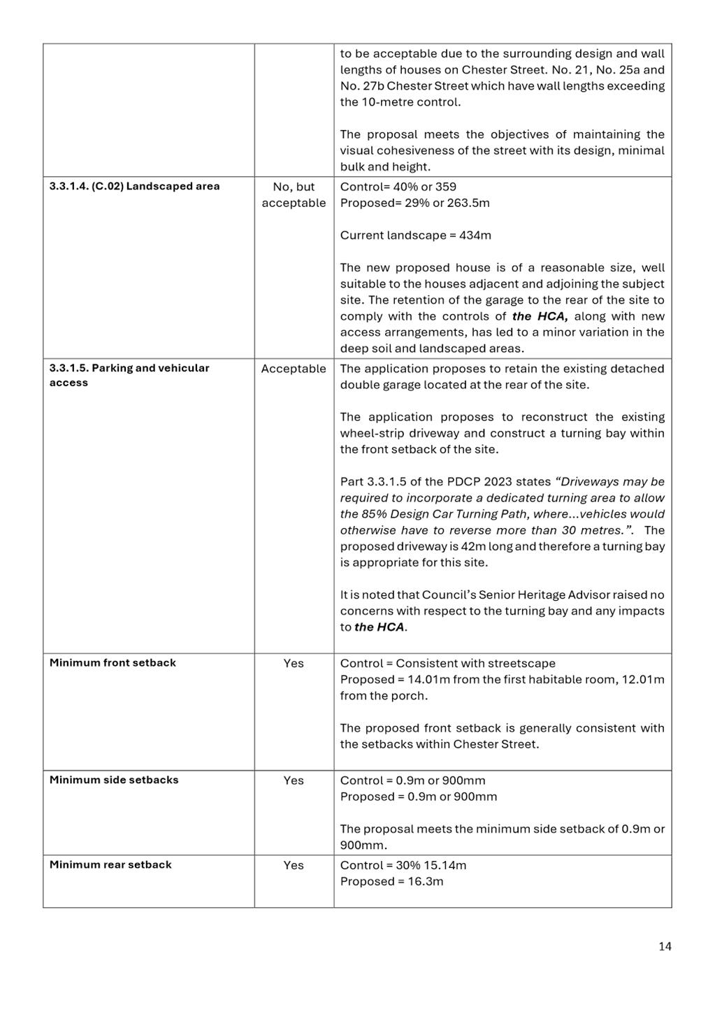
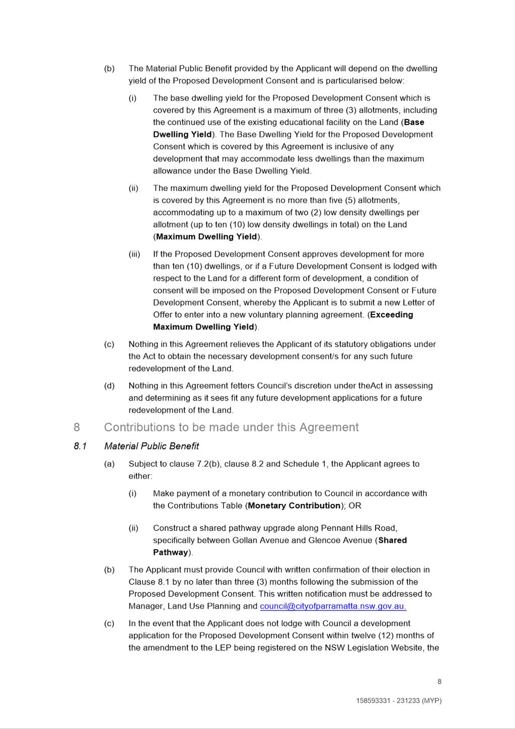
8. The
Planning Proposal application includes an indicative potential subdivision
layout for the site that could be lodged under
a future development application for subdivision to create two new residential allotments
facing Gollan Avenue, in addition to reusing the existing building as a future
Educational Establishment (refer to Figure 2). It is noted that an
Educational Establishment (school) use is also permitted with consent in the R2
Low Density Residential zone and therefore the existing building could still be
used for that purpose subject to relevant approvals.
9. The
applicant has indicated to Council officers that they are considering various
options to develop the site under the proposed zoning but have not yet decided
what option to pursue. The indicative subdivision layout has been provided by the applicant
to demonstrate a possible future scenario that could be pursued following
rezoning of the land.

Figure 2 – Indicative subdivision plan for the site at 8 Lincluden Place, Oatlands
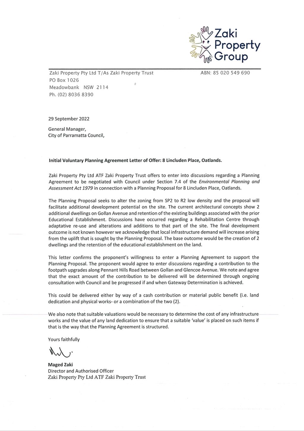
10. On 29 September
2022, the Proponent provided a Letter of Offer outlining willingness to enter
into a Planning Agreement associated with the Planning Proposal.
11. The Planning
Proposal was considered and unanimously supported by the LPP at the meeting of
18 October 2022. The LPP advice was that Council approve the Planning Proposal
for the purposes of seeking a Gateway determination from the (then) Department
of Planning and Environment (DPE).
12. At its meeting on
28 November 2022, Council endorsed the Planning Proposal for submission to the
DPE to seek a Gateway determination to place the Planning Proposal on public
exhibition. Council also resolved to request the former DPE grant the CEO
plan-making delegations.
13. On 31 January
2023, the DPE issued a Gateway Determination for the Planning Proposal which
authorised Council as the local plan-making authority and allowed the public
exhibition of the Planning Proposal to proceed.
14. The Gateway
Determination required that prior to public exhibition the Planning Proposal
be updated to include discussion and review of the
alignment with proposed controls for the new Parramatta LEP 2023 (PLEP
2023) that was being finalised at the time.
15. The PLEP 2023 came
into effect on 2 March 2023. Therefore, in addition to the proposed
rezoning of the site
to R2 Low Density Residential, the Planning Proposal was updated to align with
the PLEP 2023 in accordance with the Gateway determination to:
· apply a maximum Floor Space Ratio (FSR) control of 0.5:1
consistent with surrounding R2 Low Density
Residential land; and
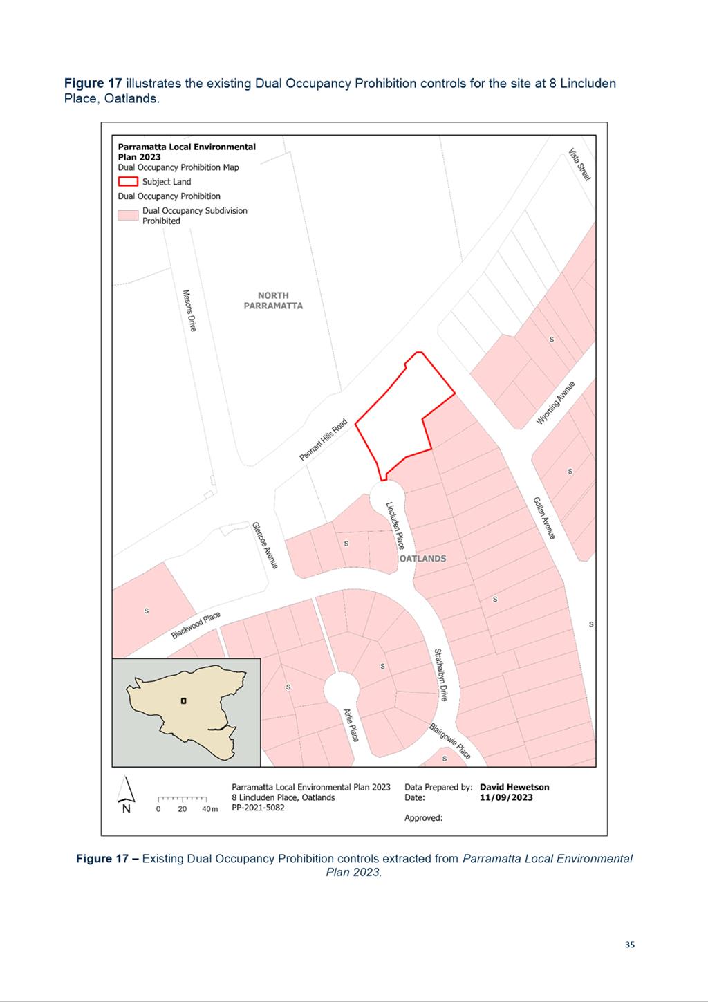
· include the site on the
PLEP Dual Occupancy Prohibition Map to be consistent
with the surrounding R2 Low Density Residential land by prohibiting the
subdivision of dual occupancies on the Planning Proposal site.
|
|
Existing
|
Proposed
|
|
Land Use
Zoning
|
Part SP2
Infrastructure
(Educational Establishment) and part SP2 Infrastructure (Classified Road)
|
Part R2 Low Density
Residential and part SP2
Infrastructure (Classified Road)
|
|
Height of Buildings
|
9m (2-3 storeys)
|
No change
|
|
Floor Space Ratio
|
No FSR
|
0.5:1 consistent with surrounding
R2 Low Density Residential land.
|
|
Dual Occupancy
Subdivision Prohibition
|
None
|
Include the site in the Dual Occupancy Prohibition Map
(subdivisions) consistent with surrounding
R2 Low Density Residential land. It is noted
that whilst Dual Occupancies can be developed, this control prohibits the
subdivision of such dwellings.
|
|
Minimum Lot Size
for subdivision
|
700sqm
|
No change. The site could potentially accommodate up to 5
residential allotments plus access road with up to 2 low density dwellings
per allotment, noting that subdivision of dual occupancy dwellings is
prohibited.
|
|
Number of Dwellings to be
accommodated based upon applicant’s indicative scheme
|
None (prohibited
within existing zoning)
|
Potentially 4 x low density residential dwellings
based upon the applicant’s indicative scheme (2 x dual occupancies or 2 x dwelling houses with
granny flats), noting that subdivision of dual occupancy dwellings is
prohibited.
|
Table 1 – Current and proposed planning controls for the site at 8 Lincluden Place, Oatlands
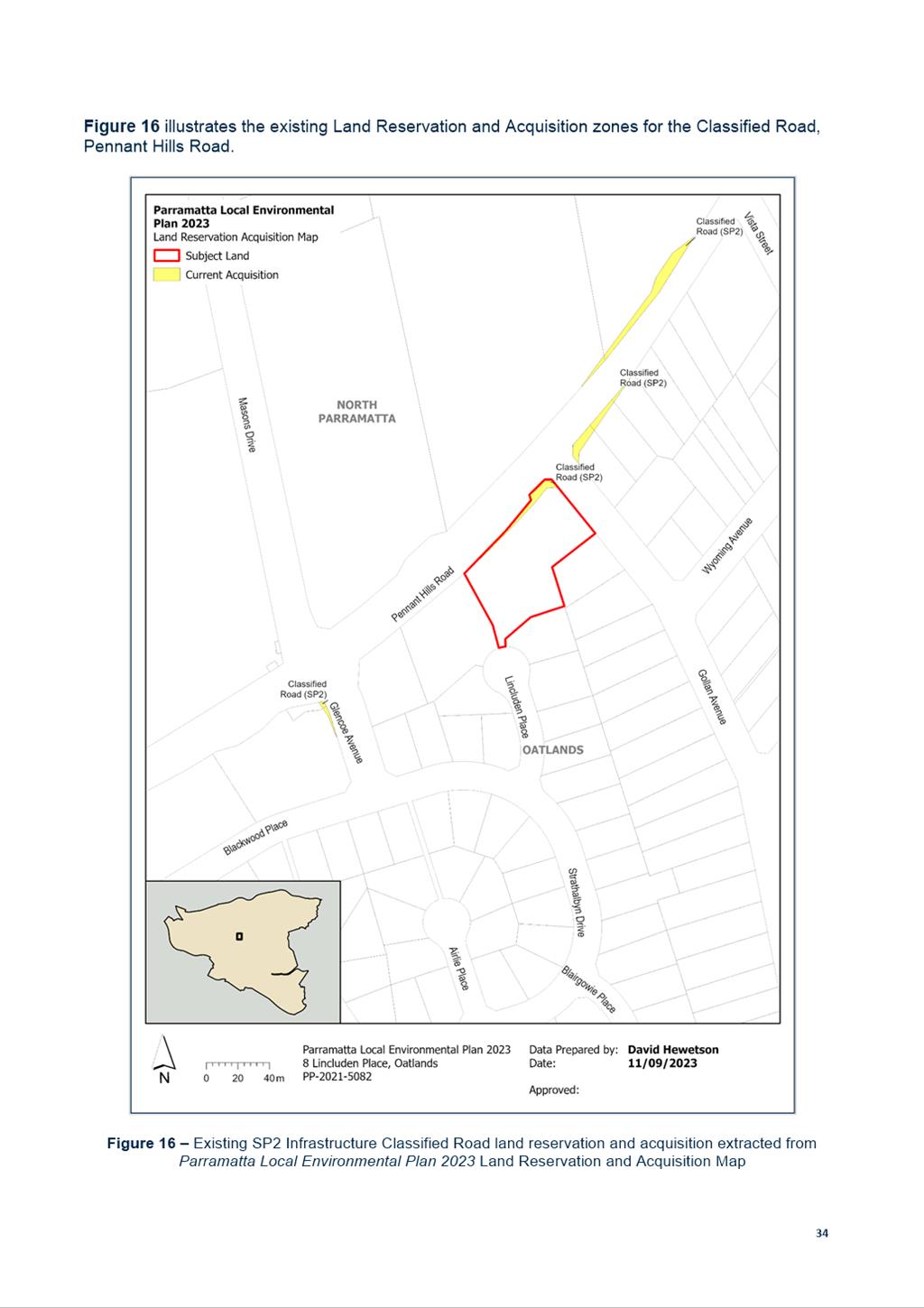
16. The northern portion of the site is currently zoned SP2 Infrastructure
(Classified Road) and is identified on the Land Reservation Acquisition (LRA)
Map. This Planning Proposal seeks to retain the land zoned SP2 Infrastructure (Classified Road) and does not propose changes to the LRA Map. As
per Parramatta Local Environmental Plan 2023, land zoned SP2
Infrastructure and marked Classified Road identifies Transport for NSW as the
relevant authority to acquire the land.
17. A
Gateway extension has been issued for the Planning Proposal by the Department
of Planning, Housing and Infrastructure (DPHI) requiring the LEP to be
completed by 1 August 2024.
DRAFT
PLANNING AGREEMENT
18. The
draft Planning Agreement has been structured to allow a base development
scenario (which is based upon the applicant’s indicative
subdivision layout – refer to Site Description section above), and a
maximum potential dwelling yield scenario (five residential allotments plus
access road accommodating up to a maximum of two low density dwellings per
allotment), to allow for flexibility depending
on the development scenario pursued.
It is noted that whilst Dual Occupancies can be developed, the subdivision of
them would be prohibited.
19. The
draft Planning Agreement provides for the following public benefits in
accordance with the base development scenario. This public benefit will still
be provided should a lesser number of
dwellings be accommodated than the base development scenario (e.g. one residential allotment
comprising a single dwelling):
a) Construction of a shared
footpath along Pennant Hills Road, specifically between Gollan Avenue and
Glencoe Avenue; or
b) A monetary contribution paid by the applicant to deliver this upgrade.
20. The
total value of the monetary contribution payable under the base development
scenario (or less) is estimated at $300,000. The Planning Agreement addresses
the infrastructure demand generated by the Planning Proposal and benefits the
community by improving public amenity within the vicinity of the proposed
development.
21. The
draft Planning Agreement has been structured so that any development scenario that is over and above the base scenario
that introduces additional dwellings (up to the potential maximum of five
residential allotments plus access road accommodating up to a maximum of two
low density dwellings per allotment) will require a monetary contribution of
$37,500 per additional dwelling, in addition to the $300,000 monetary
contribution or construction of the shared pathway. The monetary contribution
would be utilised for the embellishment of public amenity within the vicinity
of the proposed development.
22. The
draft Planning Agreement has been structured so that if a Development Consent
is granted for more than 10 dwellings, or if a future development application
is lodged with respect to the land for a different form of development, the
applicant is required to submit a new Letter of Offer to enter into a new
Planning Agreement with Council.
23. The
portion of land currently zoned SP2 Infrastructure (Classified Road) is to be retained.
Should the portion
of land identified in the Land Reservation Acquisition map be
proposed to be acquired, this will be subject to a separate process and is not
address within the draft Planning Agreement.
24. The
Planning Agreement will not exempt the Applicant from payment of applicable
Section 7.11 development contributions in accordance with the Outside CBD
Contributions Plan and will be levied at the development application stage.
EXHIBITION OF THE PLANNING
PROPOSAL
25. The Planning
Proposal and draft Planning Agreement were publicly exhibited from Monday 11
December 2023 to Friday 9 February 2024. Stakeholders and community
members were notified
through the following engagement mechanisms:
a. Letters to neighbouring landowners and occupiers;
b. A notice in Parra News published on Tuesday 23 January 2024;
c. Relevant material
shared on City of Parramatta's corporate website and
community engagement platform, Participate Parramatta; and
d. Hard copy materials distributed at PHIVE, Dundas
Library, and Carlingford
Library.
26. A total of 10
submissions were received, six (6) from individual community members. Four (4)
submissions were received from the following State Agencies and service
providers:
a. Transport for NSW (TfNSW);
b. School Infrastructure NSW (SINSW);
c. Sydney Water;
and
d. Endeavour Energy.
27. Of the six
community submissions, four raised objections and two supported the proposal to an extent. The following concerns were raised:
a. Unknown built
form outcome;
b. Traffic
impacts;
c. Parking congestion;
d. Safety concerns; and
e. Negative impacts on residents during
construction.
28. The built form
outcome will need to be consistent with what is achievable on the surrounding
R2 Low Density Residential land and to be compliant with related local planning
controls. Council’s Traffic Engineers do not raise concerns regarding the
traffic impacts of the Planning Proposal, noting that the surrounding road
network has capacity to accommodate additional low-density dwellings on the
land. The concerns raised in the community submissions can be addressed at the
Development Application stage and therefore do not require changes to the
Planning Proposal.
29. No State Agency or
Service Provider submissions raised objections or significant concerns.
Comments from State Agencies and Service Providers included:
a. Recommendations against
the planting of deep-rooted trees near electricity infrastructure;
b. That future access from
Pennant Hills Road will not be permitted, and for all new access to the site be
from Lincluden Place only;
c. That adjustments may be
required regarding water and wastewater servicing; and
d. That consideration be
given to potential future impacts in relation to traffic management and active
transport for future usage of the site.
30. The comments
received from State agencies does not require changes to the Planning Proposal
and can be addressed at the Development Application stage.
31. A detailed
summary of the submissions received
and Council officer responses to the issues raised
are provided at Attachment 3.
32. Council previously
resolved to allow the CEO to exercise plan-making delegations for this Planning
Proposal, as authorised by Council on 26 November 2012. Plan-making delegation
means that the CEO is responsible for the finalisation of the Local Environment
Plan amendment, rather than the DPHI. It should be noted that councils are
unable to exercise plan-making delegations in the case that there is an
unresolved objection from a public authority. In this instance, no State Agency
or Service Provider submissions raised objections to the Planning Proposal.
FINANCIAL IMPLICATIONS FOR COUNCIL
33. The finalisation
of the Planning Proposal would be undertaken by Council officers and therefore
within the existing City Planning and Design budget. Should this matter
progress, a Planning Agreement delivering the public benefits outlined above
will be entered into between Council and the applicant.
CONCLUSION AND NEXT STEPS
34. It is recommended
that the Local Planning Panel support the Council officer recommendation for
Council to approve the finalisation of the Planning Proposal, provided at
Attachment 1 for land at 8 Lincluden Place, Oatlands.
35. Following Local
Planning Panel consideration of the recommendations of this report, the matter
will be reported to an upcoming Council meeting.
Grace Haydon
Project
Officer
Michael Rogers
Land Use
Planning Manager
David Birds
Group
Manager, Major Projects and Precincts
Jennifer Concato
Executive
Director City Planning and Design
Attachments:
|
1⇩
|
Planning Proposal
|
42 Pages
|
|
|
2⇩
|
Planning Agreement
|
40 Pages
|
|
|
3⇩
|
Submission Summary Table
|
12 Pages
|
|
REFERENCE MATERIAL
|
Item 6.1 - Attachment
1
|
Planning Proposal
|
|
Item 6.1 - Attachment 2
|
Planning Agreement
|
ATTACHMENT
3 – 8 LINCLUDEN PLACE, OATLANDS
SUBMISSION SUMMARY TABLE AND OFFICER
RESPONSES
STATE AGENCY AND SERVICE PROVIDER
SUBMISSIONS
|
Submission Summary
|
Officer Response
|
|
1. Endeavour Energy
|
|
· Submission notes that the applicant will need to engage an
Accredited Service Provider (ASP) of an appropriate level and class of accreditation
to assess the electricity load and the proposed method of supply for the
development, to ensure an ade0quate connection.
· Submission notes that an extension or augmentation of the existing
electricity distribution network may be required.
· Submission states that all new cabling/reticulation infrastructure
must be of an underground construction type.
· Submission states that the low voltage service conductor and
customer connection point must comply with the ‘Service and
Installation Rules of NSW’.
· Submission notes that the planning proposal shows a future
subdivision application to create two (2) residential allotments facing
Gollan Avenue and that there is currently no existing low voltage electricity
connection to the Gollan Avenue frontage of the site.
· Submission opposes the planting of deep rooted trees near
electricity infrastructure and recommends that existing trees of low
ecological significance in proximity of electrical infrastructure be removed
and, if necessary, replaced by an alternative smaller planting.
· Submission notes that the landscape designer will need to ensure
any planting near electricity infrastructure achieves Endeavour
Energy’s vegetation management requirements.
|
Submission providing comments on the proposal is noted.
· No built form is proposed as part of the Planning Proposal. At
this stage, Council officers are assessing the proposed change in land
zoning, from SP2 Infrastructure (Educational Establishment) to R2 Low Density
Residential. The Planning Proposal seeks to align the zoning of the site with
the surrounding R2 Low Density Residential zone so that residential uses
might then be considered on the site.
· Should the rezoning be supported, any future residential land use
that is permitted in the R2 Low Density Residential zone might then be
proposed. Any such future use will require a separate Development Application
to be prepared and lodged with Council for detailed assessment to ensure that
the future development complies with applicable planning controls.
· Matters relating to electricity distribution and load shall be
addressed at the Development Application(s) stage.
|
|
2. Transport for NSW (TfNSW)
|
|
· Submission requests that TfNSW’s comments are satisfactorily
addressed prior to Council finalising the planning proposal.
· Submission notes that if the Applicant continues with the
indicative subdivision consent for an Educational Establishment will have to
be relinquished prior to the development consent being granted for the
subdivision. Therefore, an updated Traffic Impact Assessment will be required
to be undertaken and submitted with any future development applications.
· Submission states that any shared pathway, as well as active
transport facilities, are to be designed according to Australian Standards
and Guidelines and submitted to TfNSW for review prior to any work being
undertaken.
· Submission states that any request for future access from Pennant
Hills Road will not be permitted and all new access to the site is to be from
Lincluden Place only.
· Submission notes that the subject property is affected by a road
proposal (approved 21/06/1989) and, therefore, there should be no building on
any SP2 land that is dedicated or reserved for roads.
|
Submission providing comments on the proposal is noted.
· Traffic impacts associated with the Planning Proposal have been
assessed by Council’s Traffic and Transport Engineers, who have
indicated that the potential traffic impacts of the rezoning can be
accommodated within the existing road network, subject to further detailed
analysis should a Development Application(s) be submitted.
· Detailed matters relating to traffic shall be considered should a
future Development Application be lodged for this site. It is noted that an
updated Traffic Impact Assessment will be required to be undertaken and
submitted with any future Development Application(s) on this site, in
accordance with TfNSW’s recommendation.
· Should a future Development Application(s) for this site propose
an Educational Establishment, an updated Traffic Impact Assessment would be
required to ensure access to the site is manageable. It is noted that no
built form is proposed as part of the Planning Proposal and that an
Educational Establishment is already permissible on the site.
· To support the Planning Proposal (which only seeks to rezone the
site to allow what is also permissible within the adjoining R2 Low Density
Residential zone), the Applicant submitted an indicative subdivision plan as
an example to illustrate what a possible future Development Application could
propose, should the land be rezoned.
· The indicative subdivision plan does not propose access vehicular
from Pennant Hills Road.
· The northern portion of the site is currently zoned SP2
Infrastructure (Classified Road) and is identified on the Land Reservation
Acquisition (LRA) Map. This Planning Proposal seeks to retain the land zoned
SP2 Infrastructure (Classified Road) and does not propose changes to the LRA
Map.
· As per Parramatta Local Environmental Plan 2023, land zoned
SP2 Infrastructure and marked Classified Road identifies Transport for NSW as
the relevant authority to acquire the land. Should the portion of land
identified as per the Land Reservation Acquisition map be acquired, this
acquisition will be subject to a separate process.
|
|
3. School Infrastructure NSW (SINSW)
|
|
· Submission considers that there is minimal impact from the subject
proposal.
· Submission requests that consideration be given to potential
future impacts in relation to traffic management and active transport for
future usage of the site.
· Submission requests that transport planning for the proposal be
guided by the NSW Government’s Movement and Place Framework (MAPF) and
Built Environment Performance Indicators, as these indicators are based on
qualities that contribute to a well-designed built environment and should
therefore be used by proponents in the formulation of transport concepts.
· Submission identifies the following as examples of effective
transport planning measures which address the above indicators:
o Provision
of active and public transport infrastructure
o Physical
separation between pedestrian, cyclists and heavy vehicles
o Access
for all ages and abilities such as ambulant disabilities and prams
o Kerb
outstands and refuges crossings (particularly around schools).
o Pedestrian
legs on all approach to intersections.
o Weather-
protected bus departure zones
o For
local roads: lower vehicle speeds to 15km/h in High Pedestrian Activity Areas
or 40km/h within School Zones.
|
Submission providing comments on the proposal is noted.
· Traffic impacts associated with the Planning Proposal have been
assessed by Council’s Traffic and Transport Engineers, who have
indicated that the potential traffic impacts of the rezoning can be
accommodated within the existing road network, subject to further detailed
analysis should a Development Application(s) be submitted.
· Detailed matters relating to traffic shall be considered should a
future Development Application be lodged for this site. It is noted that an
updated Traffic Impact Assessment will be required to be undertaken and
submitted with any future Development Application(s) on this site, in
accordance with TfNSW’s recommendation.
· Should a future Development Application(s) for this site propose
an Educational Establishment, an updated Traffic Impact Assessment would be
required to ensure access to the site is manageable. It is noted that no
built form is proposed as part of the Planning Proposal and that an
Educational Establishment is already permissible on the site.
|
|
4. Sydney
Water
|
|
· Submission states that drinking water and wastewater servicing
should be available to the site.
· Submission states that amplifications, adjustments, and/or minor
extensions may be required regarding water and wastewater servicing.
· Submission notes that Sydney Water does not reserve or hold
capacity for proposed developments, regardless of whether the area has been
rezoned or not, and it is best to approach Sydney Water for an updated
capacity assessment, especially if the approval letter is over 12 months old.
|
Submission providing comments on the proposal is noted.
· No built form is proposed as part of the Planning Proposal. At
this stage, Council officers are assessing the proposed change in land
zoning, from SP2 Infrastructure (Educational Establishment) to R2 Low Density
Residential. The Planning Proposal seeks to align the zoning of the site with
the surrounding R2 Low Density Residential zone so that residential uses
might then be considered on the site.
· Should the rezoning be supported, any future residential land use
that is permitted in the R2 Low Density Residential zone might then be
proposed. Any such future use will require a separate Development Application
to be prepared and lodged with Council for detailed assessment to ensure that
the future development complies with applicable planning controls.
· Matters relating to water and wastewater servicing shall be
addressed at the Development Application(s) stage.
|
INDIVIDUAL COMMUNITY MEMBER SUBMISSIONS
|
No.
|
Submission Summary
|
Officer Response
|
|
1.
Submitter from Strathalbyn Drive,
Oatlands
|
Submitter objects the proposal.
· Submitter opposes the planning proposal and draft planning
agreement.
· Submitter raises concerns about not being able to ascertain what
structures are planned and their proposed occupancy.
· Submitter raises concerns that if entry to the site is via
Lincluden Place and not Gollan Ave, the proposal will make movement in and
out of Strathalbyn Drive and Lincluden Place ‘extremely
difficult’, not only during construction, but upon completion due to
increased traffic flow.
· Submitter states that there is only one entry and exit to Pennant
Hills Road, which, with additional traffic, would make their home and all the
others in Burnside Gardens ‘virtually land locked’.
· Submitter notes that on mornings and afternoons on school days
parking is allowed on Glencoe Avenue, reducing the two lanes to one.
· Submitter notes that despite clear signage forbidding it, cars
frequently make illegal U-turns at the corner of Glencoe Avenue, Strathalbyn
Drive and Blackwood Place making it dangerous not only for motorists but also
pedestrians, many of whom are school children or local residents going on
their daily walk.
· Submitter raises concerns about not knowing the size, type of
buildings and occupancy of proposed structures as they strongly feel that any
proposed structures should be sympathetic to the heritage building currently
on the site, and to those on Pennant Hills Road between Glencoe Avenue and
James Ruse Drive.
· Submitter requests details regarding the proposed structures and
occupancy.
|
Submission objecting the proposal is noted.
· No built form is proposed as part of the Planning Proposal. At
this stage, Council officers are assessing the proposed change in land
zoning, from SP2 Infrastructure (Educational Establishment) to R2 Low Density
Residential. The Planning Proposal seeks to align the zoning of the site with
the surrounding R2 Low Density Residential zone so that residential uses
might then be considered on the site.
· Should the rezoning be supported, any future residential land use
that is permitted in the R2 Low Density Residential zone might then be
proposed. Any such future use will require a separate Development Application
to be prepared and lodged with Council for detailed assessment to ensure that
the future development complies with applicable planning controls.
· Any future Development Application will also be publicly exhibited
and therefore, surrounding residents will have an opportunity to review any
plans for the site and make a submission for consideration.
· To support the Planning Proposal (which only seeks to rezone the
site to allow what is also permissible within the adjoining R2 Low Density
Residential zone), the Applicant submitted an indicative subdivision plan as
an example to illustrate what a possible future Development Application could
propose, should the land be rezoned.
· The future land use for this site would need to comply with
applicable development controls and will be subject to a future detailed
planning assessment process.
· Traffic impacts associated with the Planning Proposal have been
assessed by Council’s Traffic and Transport Engineers, who have
indicated that the potential traffic impacts of the rezoning can be
accommodated within the existing road network, subject to further detailed
analysis should a Development Application(s) be submitted.
· Detailed matters relating to traffic shall be considered should a
future Development Application be lodged for this site. It is noted that an
updated Traffic Impact Assessment will be required to be undertaken and
submitted with any future Development Application(s) on this site, in
accordance with TfNSW’s recommendation.
· Should a future Development Application(s) for this site propose
an Educational Establishment, an updated Traffic Impact Assessment would be
required to ensure access to the site is manageable. It is noted that no
built form is proposed as part of the Planning Proposal and that an
Educational Establishment is already permissible on the site.
|
|
2.
Submitter from Lincluden Place,
Oatlands
|
Submitter objects the proposal.
· Submitter considers that the proposal offers ‘a smorgasbord
of options’ to residents without any clarity of what may be approved.
· Submitter notes that a school and two houses is completely
different to a boarding house, a group home, four or five residences, some
with granny flats, and dual occupancy, which each having unique benefits and
drawbacks.
· Submitter is concerned about not knowing which possible option to
comment on.
· Submitter raises concerns that the original letter appeared to
imply a 2-3 storey building would occupy the site, Council’s website
did not provide significant detail on the full implications of the proposal,
and information provided at the library was not made more widely available.
· Submitter questions whether the whole site is being rezoned or
only a part of it.
· Submitter is concerned about increased traffic and reduced safety
in Lincluden Place, a short, narrow cul-de-sac.
· Submitter notes that motorists travelling south on Pennant Hills
Road who wish to turn right at Masons Drive use Lincluden Place as a turning
circle during school pick up and drop off times, for the three schools
located along Mason Drive.
· Submitter objectisto the conclusion in the traffic section that
there would be a ‘negligible’ effect on traffic in the area if a
school with 104 students and two houses are allowed on Gollan Avenue without
access to the school from Gollan Avenue.
· Submitter notes that previously, only staff at the school used
Lincluden Place to access the parking area under the building, and parents
and students utilised Gollan Avenue. Submitter raises concerns that if the
site becomes a school and two houses, traffic and parking would be
‘chaotic’ in Lincluden Place.
· Submitter queries whether cars would be allowed to park on both
sides of the street, noting it is narrow at the bottom of the hill and there
have been many near-miss accidents.
· Submitter notes that the building is in a heritage conservation
area. Submitter requests to be kept informed about the impact that may have
on the design of the site.
|
Submission objecting the proposal is noted.
· No built form is proposed as part of the Planning Proposal. At
this stage, Council officers are assessing the proposed change in land
zoning, from SP2 Infrastructure (Educational Establishment) to R2 Low Density
Residential. The Planning Proposal seeks to align the zoning of the site with
the surrounding R2 Low Density Residential zone so that residential uses
might then be considered on the site.
· Should the rezoning be supported, any future residential land use
that is permitted in the R2 Low Density Residential zone might then be
proposed. Any such future use will require a separate Development Application
to be prepared and lodged with Council for detailed assessment to ensure that
the future development complies with applicable planning controls.
· Any future Development Application will also be publicly exhibited
and therefore, surrounding residents will have an opportunity to review any
plans for the site and make a submission for consideration.
· To support the Planning Proposal (which only seeks to rezone the
site to allow what is also permissible within the adjoining R2 Low Density
Residential zone), the Applicant submitted an indicative subdivision plan as
an example to illustrate what a possible future Development Application could
propose, should the land be rezoned.
· The future land use for this site would need to comply with
applicable development controls and will be subject to a future detailed
planning assessment process.
· The Planning Proposal and draft Planning Agreement were publicly
exhibited from Monday, 11 December 2023 to Friday, 9 February 2024.
Stakeholders were notified through letters, a notice in Parra News, relevant
material shared on City of Parramatta’s corporate website and
Participate Parramatta, and hard copy materials were available at PHIVE,
Dundas Library and Carlingford Library. All information that was available at
the libraries in hard copy was accessible for online access.
· The Planning Proposal does not propose to amend the height of
buildings control applying to the site.
· The northern portion of the site is currently zoned SP2
Infrastructure (Classified Road) and is identified on the Land Reservation
Acquisition (LRA) Map. This Planning Proposal seeks to retain the land zoned
SP2 Infrastructure (Classified Road) and does not propose changes to the LRA
Map.
· Traffic impacts associated with the Planning Proposal have been
assessed by Council’s Traffic and Transport Engineers, who have
indicated that the potential traffic impacts of the rezoning can be
accommodated within the existing road network, subject to further detailed
analysis should a Development Application(s) be submitted.
· Detailed matters relating to traffic shall be considered should a
future Development Application be lodged for this site. It is noted that an
updated Traffic Impact Assessment will be required to be undertaken and
submitted with any future Development Application(s) on this site, in
accordance with TfNSW’s recommendation.
· Should a future Development Application(s) for this site propose
an Educational Establishment, an updated Traffic Impact Assessment would be
required to ensure access to the site is manageable. It is noted that no
built form is proposed as part of the Planning Proposal and that an
Educational Establishment is already permissible on the site.
· The Planning Proposal does not seek to alter any heritage
provisions applying to the site. Any future Development Application (DA) for
the site will be assessed against the applicable planning controls including
Parramatta DCP 2023, and be accompanied by suitable justification (e.g. a
Statement of Heritage Impact) to ensure any future development is respectful
of the Burnside Homes Conservation Area.
|
|
3.
Submitter from Lincluden Place,
Oatlands
|
Submitter objects the proposal.
· Submitter identifies several areas of concern to be carefully
considered prior to approval being granted.
· Submitter states that the details on Council’s website about
this proposal are unclear and more information is needed before residents can
make an informed decision about whether or not the proposal is acceptable.
· Submitter raises particular concerns about the potential impact of
traffic on Lincluden Place, stating is it crucial to understand how the
proposed development may alter traffic patterns and access points in order to
ensure the safety and convenience of the local community.
· Submitter raises concerns that Lincluden Place already experiences
traffic congestion around school hours and that this would be exacerbated
with the addition of more cars and/or construction vehicles, creating further
challenges for residents.
· Submitter raises concerns that details on access to the proposed
three dwellings are not clearly outlined and further information is needed
before residents can evaluate the potential impacts on their neighbourhood.
· Submitter raises concerns that the documentation provided does not
clearly define the types of dwellings proposed for the development and
further information is required before residents can decide whether the
proposal is acceptable.
· Submitter raises significant concerns about access to existing
residences during construction as it is unclear whether construction vehicles
would be using Lincluden Place as an entry point to the proposed development
during construction, which would make it difficult for residents to access
their homes. Submitter requests clarity on this issue.
· Submitter suggests that concerns be addressed and reviewed.
· Submitter considers that it would be beneficial for the community,
especially direct neighbours, to have the opportunity to provide feedback and
comments before any building works commence.
|
Submission objecting the proposal is noted.
· The Planning Proposal and draft Planning Agreement were publicly
exhibited from Monday, 11 December 2023 to Friday, 9 February 2024.
Stakeholders were notified through letters, a notice in Parra News, relevant
material shared on City of Parramatta’s corporate website and
Participate Parramatta, and hard copy materials were available at PHIVE,
Dundas Library and Carlingford Library. All information that was available at
the libraries in hard copy was accessible for online access.
· Traffic impacts associated with the Planning Proposal have been
assessed by Council’s Traffic and Transport Engineers, who have
indicated that the potential traffic impacts of the rezoning can be
accommodated within the existing road network, subject to further detailed
analysis should a Development Application(s) be submitted.
· Detailed matters relating to traffic shall be considered should a
future Development Application be lodged for this site. It is noted that an
updated Traffic Impact Assessment will be required to be undertaken and
submitted with any future Development Application(s) on this site, in
accordance with TfNSW’s recommendation.
· Should a future Development Application(s) for this site propose
an Educational Establishment, an updated Traffic Impact Assessment would be
required to ensure access to the site is manageable. It is noted that no
built form is proposed as part of the Planning Proposal and that an
Educational Establishment is already permissible on the site.
· No built form is proposed as part of the Planning Proposal. At
this stage, Council officers are assessing the proposed change in land
zoning, from SP2 Infrastructure (Educational Establishment) to R2 Low Density
Residential. The Planning Proposal seeks to align the zoning of the site with
the surrounding R2 Low Density Residential zone so that residential uses
might then be considered on the site.
· Should the rezoning be supported, any future residential land use
that is permitted in the R2 Low Density Residential zone might then be
proposed. Any such future use will require a separate Development Application
to be prepared and lodged with Council for detailed assessment to ensure that
the future development complies with applicable planning controls.
· Any future Development Application will also be publicly exhibited
and therefore, surrounding residents will have an opportunity to review any
plans for the site and make a submission for consideration.
· To support the Planning Proposal (which only seeks to rezone the
site to allow what is also permissible within the adjoining R2 Low Density
Residential zone), the Applicant submitted an indicative subdivision plan as
an example to illustrate what a possible future Development Application could
propose, should the land be rezoned.
· The future land use for this site would need to comply with
applicable development controls and will be subject to a future detailed
planning assessment process.
· Any matters relating to construction shall be addressed at the
Development Application(s) stage.
· The Planning Proposal does not seek to alter any heritage
provisions applying to the site. Any future Development Application (DA) for
the site will be assessed against the applicable planning controls including
Parramatta DCP 2023 and be accompanied by suitable justification (e.g. a
Statement of Heritage Impact) to ensure any future development is respectful
of the Burnside Homes Conservation Area.
|
|
4.
Submitter from Lincluden Place,
Oatlands
|
Submitter supports the proposal, to an extent.
· Submitter requests for cars to not be permitted to park along the
kerb of Lincluden Place and should only park in the parking area of the
building, with drop-offs to occur at Gollan Avenue.
· Submitter notes that the residents in Burnside Garden only have
one exit, via Glencoe Avenue.
|
Submission supporting the proposal to an extent is noted.
· Traffic impacts associated with the Planning Proposal have been
assessed by Council’s Traffic and Transport Engineers, who have
indicated that the potential traffic impacts of the rezoning can be
accommodated within the existing road network, subject to further detailed
analysis should a Development Application(s) be submitted.
· Detailed matters relating to traffic shall be considered should a
future Development Application be lodged for this site. It is noted that an
updated Traffic Impact Assessment will be required to be undertaken and
submitted with any future Development Application(s) on this site, in
accordance with TfNSW’s recommendation.
|
|
5.
Submitter from Lincluden Place,
Oatlands
|
Submitter supports the proposal, to an extent.
· Submitter requests that traffic for construction, deliveries,
residents and staff are to be from Gollan Avenue, with no parking of workmen
and staff vehicles to be allowed in Lincluden Place at any time.
|
Submission supporting the proposal to an extent is noted.
· Traffic impacts associated with the Planning Proposal have been
assessed by Council’s Traffic and Transport Engineers, who have
indicated that the potential traffic impacts of the rezoning can be
accommodated within the existing road network, subject to further detailed
analysis should a Development Application(s) be submitted.
· Detailed matters relating to traffic shall be considered should a
future Development Application be lodged for this site. It is noted that an
updated Traffic Impact Assessment will be required to be undertaken and
submitted with any future Development Application(s) on this site, in
accordance with TfNSW’s recommendation.
|
|
6.
Submitter from Strathalbyn Drive,
Oatlands
|
Submitter objects the proposal.
· Submitter states that a development of this nature would increase
traffic flow in and out of Lincluden Place significantly.
· Submitter notes that there are already a number of drivers making
illegal U-turns at the corner of Lincluden Place and Strathalbyn Drive during
school pick up and drop off times and signage should be put in place to ban
this.
· Submitter states it is unclear what the rezoning would permit the
developer to achieve on the site and whether an amendment could be submitted
for increased density.
· Submitter states there is currently traffic congestion at the
entrance to Burnside Estate, on Glencoe Avenue, with parents parking on the
lefthand side of the entry to the estate, which would be exacerbated with the
proposed development, presenting traffic hazards and potentially causing
accidents.
· Submitter notes that currently many drivers disregard the
‘no U-turn’ signage at the end of ‘Glencoe Place’,
resulting in traffic congestion and safety hazards to pedestrians in the
area.
· Submitter states that the existing heritage building along Pennant
Hills Road should remain in its location.
· Submitter reiterates opposition to this proposal but suggests, if
it were to go ahead, that all traffic be redirected via Gollan Avenue and not
Lincluden Place.
|
Submission objecting the proposal is noted.
· Traffic impacts associated with the Planning Proposal have been
assessed by Council’s Traffic and Transport Engineers, who have
indicated that the potential traffic impacts of the rezoning can be accommodated
within the existing road network, subject to further detailed analysis should
a Development Application(s) be submitted.
· Detailed matters relating to traffic shall be considered should a
future Development Application be lodged for this site. It is noted that an
updated Traffic Impact Assessment will be required to be undertaken and
submitted with any future Development Application(s) on this site, in
accordance with TfNSW’s recommendation.
· Should a future Development Application(s) for this site propose
an Educational Establishment, an updated Traffic Impact Assessment would be
required to ensure access to the site is manageable. It is noted that no
built form is proposed as part of the Planning Proposal and that an
Educational Establishment is already permissible on the site.
· No built form is proposed as part of the Planning Proposal. At
this stage, Council officers are assessing the proposed change in land
zoning, from SP2 Infrastructure (Educational Establishment) to R2 Low Density
Residential. The Planning Proposal seeks to align the zoning of the site with
the surrounding R2 Low Density Residential zone so that residential uses
might then be considered on the site.
· Should the rezoning be supported, any future residential land use
that is permitted in the R2 Low Density Residential zone might then be
proposed. Any such future use will require a separate Development Application
to be prepared and lodged with Council for detailed assessment to ensure that
the future development complies with applicable planning controls.
|
Local
Planning Panel 16 April 2024 Item
6.2
ITEM NUMBER 6.2
SUBJECT Request for Gateway and public exhibition: Planning Proposal for
North-East Planning Investigation Area
REFERENCE F2022/03176 -
APPLICANT/S City of Parramatta
OWNERS N/A
REPORT OF Team Leader Land Use Planning
PURPOSE
The purpose of
this report is to seek the Parramatta Local Planning
Panel’s advice to Council on a request to the Department of Planning,
Housing and Infrastructure for a Gateway Determination for a Planning Proposal
for the land identified as the North-East Planning
Investigation Area.
RECOMMENDATION
The Parramatta Local Planning Panel consider the
following Council Officer recommendation in its advice to Council:
(a) That Council approve:
i) The Planning Proposal at Attachment 1 for
the purposes of seeking a Gateway Determination from the Department of
Planning, Housing and Infrastructure, for the land identified as the North East
Planning Investigation Area which seeks the following changes to the Parramatta
Local Environmental Plan 2011:
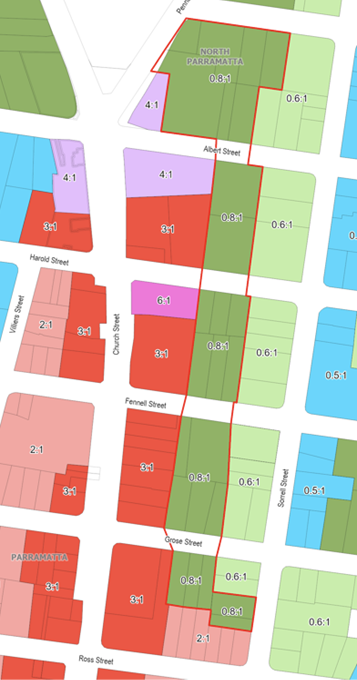
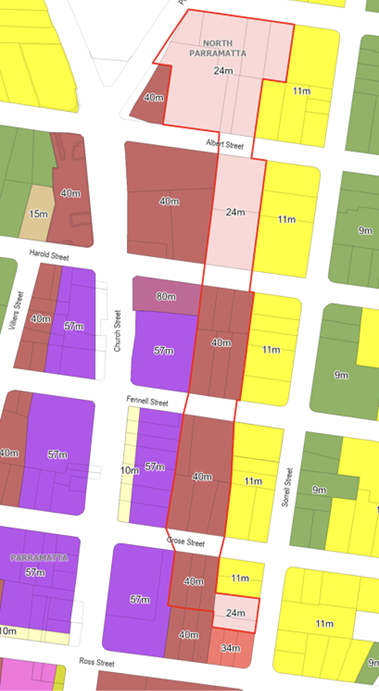
a. Increase the Maximum Floor Space Ratio from
0.8:1 to a range between 2:1 and 3.6:1.
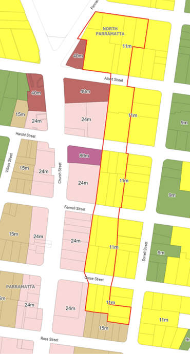
b. Increase the Maximum Height of Building from 11m
to a range between 24m and 40m (approximately 6 – 12 storeys).
ii) The supporting draft DCP amendments at Attachment
2 applying to the land in the North East Planning Investigation Area for
the purposes of public exhibition.
(b) That Council advise the Department of
Planning, Housing and Infrastructure that the CEO will be seeking to exercise
its plan-making delegations for this Planning Proposal, as authorised by
Council on 26 November 2012.
(c) That Council authorise the CEO if the Gateway
determination is issued by the Department, that the draft DCP amendments are
placed on public exhibition concurrently with the Planning Proposal.
(e) That Council
delegates authority to the CEO to correct any minor anomalies of a non-policy
and administrative nature that arise during the plan-making process.
PLANNING PROPOSAL TIMELINE

SUMMARY
1. This report seeks the
advice of the Parramatta Local Planning Panel on a Planning Proposal for land
identified as the North-East Planning Investigation Area for the purposes of seeking a Gateway
Determination from the Department Planning, Housing and Infrastructure.
2. The Planning Proposal
seeks to amend Parramatta Local Environmental Plan (LEP) 2023 and Parramatta
Development Control Plan (DCP) 2023 to enable an appropriate response to the
changes to the planning controls that come into effect on 1 July 2024 for the Church
Street North Precinct that were made by the State Government through a State
Environmental Planning Policy (SEPP).
3. The proposed LEP and
DCP amendments for the North-East Planning Investigation Area respond to
matters raised in the Church Street North SEPP Finalisation Report and the
outcomes from the NEPIA Planning Strategy exhibition providing a transition in
heights and density from the Church Street North Precinct to the Sorrell Street
Heritage Conservation Area to the east.
4. The Planning Proposal
forms part of ‘Phase 1’ of the work program endorsed by Council on 20 November 2023 to review the planning controls for the ‘Planning
Investigation Areas’ adjacent to the Parramatta City Centre.
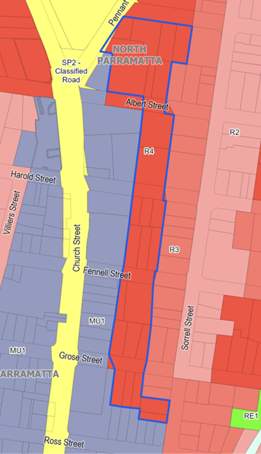
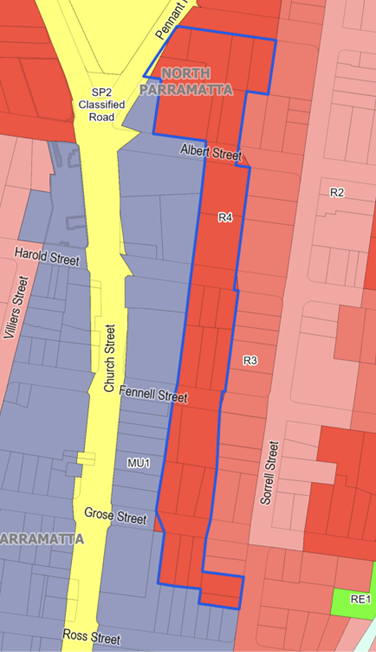
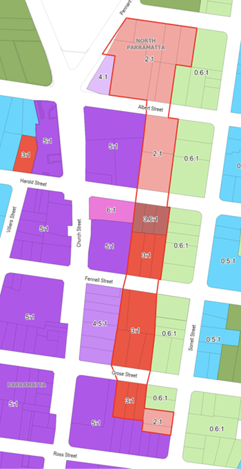
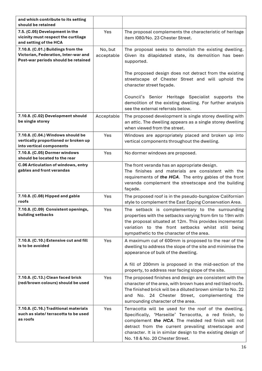
SITE DESCRIPTION
5. The
North-East Planning Investigation Area (NEPIA) is a collection of 25 sites in
the suburb of Parramatta adjacent to the east of the City Centre boundary as
shown in Figure 1 below.
 Figure 1: Parramatta City Centre (left)
and the North-East Planning Investigation Area Boundaries (right)
Figure 1: Parramatta City Centre (left)
and the North-East Planning Investigation Area Boundaries (right)
6. The sites included
are:
· 17, and 36, 38 and 40 Albert Street
· 1, 9, 11 and 17 Isabella Street
· 20, 23, 25 and 27 Harold Street
· 32, 33, 34, 34A and 37 Fennell Street
· 35, 36, 37, 38, 39 and 40 Grose Street
· 25 and 29 Sorrell Street
CURRENT PLANNING CONTROLS
7. The current Parramatta LEP
2023 controls that apply to the NEPIA are:
· Zoning R4 High Density Residential
· Maximum Height of Building control of 11 metres;
and
· Maximum Floor Space Ratio (FSR) of 0.8:1.
8. No
sites within the NEPIA are heritage listed; however, as shown in Figure 2 below,
the NEPIA is adjacent to several heritage items and the Sorrell Street Heritage
Conservation Area under Schedule 5 of the PLEP 2023.
9. The general DCP controls that
apply to all R4 High Density Residential precincts in the LGA apply to this
Precinct. There are no precinct specific controls.
Figure 2: Relevant planning and heritage
considerations within proximity of the NEPIA.
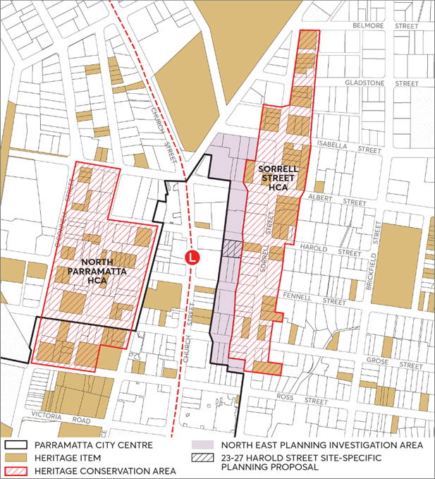
OTHER
RELEVANT PLANNING MATTERS
10. The western boundary of the NEPIA
adjoins the Church Street North Precinct. The Department prepared SEPP (Church Street North Precinct) 2023 which introduces new planning controls for the
land north of the river (refer to Figure 4) and is set to commence on 1 July 2024. A separate process is currently underway
to progress amendments to Parramatta DCP 2023 to provide appropriate DCP
controls that respond to, and correlate with, the Church Street North SEPP
amendments, and anticipated to be reported to Council
in the coming weeks.
11. Additionally, a proponent led
site-specific planning proposal located within the NEPIA at 23-27 Harold
Street, Parramatta (see black hatched area in Figure 2) is currently
subject to a rezoning review. At the time of writing this report, the outcome
of this review was not known to Council Officers.
BACKGROUND
12. On
20 November 2019, Council considered a report on the Parramatta CBD Planning
Proposal (CBD PP) and resolved to defer a number of areas, including an area
known as the North-East Planning Investigation Area from the broader CBD PP
Planning Proposal it was considering at that time. This precinct was deferred
to allow further options to be considered.
13. In
June 2020, Council resolved to prepare a Planning Strategy for the NEPIA in
response to a number of planning proposals that were submitted for parcels in
the area. Public exhibition of the Planning Strategy occurred from March to
April in 2021 and an overview of submissions received, and Council’s
response is detailed further below in this report and in Attachment 3.
14. In
finalising the CBD Planning Proposal (CBD PP) now formally known as Parramatta
Local Environmental Plan 2011 (Amendment No 56), the Department removed the
area north of the Parramatta River (known as the Church Street North Parramatta
(refer to Figure 4)) from the CBD PP to undertake a State-led planning
process.
15. In
December 2023, the Department finalised a State Environmental Planning Policy
(Church Street North Precinct) (‘CSN SEPP’) for the land north of
the river that was previously removed from the CBD PP. As shown in Figure 3,
the NEPIA is not subject to planning work by the State Government and thus
Council can re-commence planning and technical investigation for the NEPIA.
Figure 3: Relationship between the forthcoming
Parramatta City Centre boundary, the Department’s Church Street
North Precinct (as per the SEPP); as well as the North East Planning
Investigation Area.
NEPIA Planning Strategy
16. As
discussed above Council endorsed a Planning Strategy for the NEPIA which sought
feedback from the community on six built form options. A total of 194
submissions were received in response to the public exhibition with a
stakeholder breakdown of:
· Landowners, Residents and Individuals: 181
Submissions
· Planning Consultants: 5 Submissions
· Public Authorities, Institutions and Interest Groups: 8 Submissions
17. Table 1 below displays a breakdown of the options preferred by submitters:
Table 1: Submitter preferred NEPIA Planning Strategy Options
|
Option
|
FSR and height proposed in
Option for the entire NEPIA
|
Number in support
|
Percentage
|
|
Option 1
|
(0.8:1, 11m)
|
94
|
46.1%
|
|
Option 2
|
(2:1, 28m)
|
17
|
8.3%
|
|
Option 3
|
(3:1, 40m)
|
6
|
2.9%
|
|
Option 4
|
(4:1, 54m)
|
1
|
0.5%
|
|
Option 5
|
(5:1, 67m)
|
4
|
2.0%
|
|
Option 6
|
(6:1, 80m)
|
34
|
16.7%
|
|
Not Indicated
|
N/A
|
48
|
23.5%
|
|
Total
|
|
204
|
100%
|
Note: The
total number of preferred options (204) is larger than the number of
submissions (194) due to recording submitters who expressed their support for
more than one option.
18. Key themes in
the submissions included heritage impacts, scale and density, infrastructure
pressures, traffic/ parking, character and overshadowing. Attachment 3
provides an analysis of the submissions and Council officer responses to
the key themes.
19. The themes and
issues raised in the submissions were used to inform the key design aspects of
the proposed changes to the NEPIA.
DESCRIPTION OF THE PLANNING PROPOSAL
20. The Planning
Proposal for the NEPIA seeks to amend the FSR and HOB Maps of the Parramatta
LEP 2023 as per Table 2 below. Supporting DCP controls are also proposed
as outlined below and detailed in Attachment 2. The proposed controls for the NEPIA consider the CSN SEPP
and feedback from community submissions made to the exhibition of the NEPIA
Planning Strategy in 2021.
Table 2: Existing and proposed LEP
controls for the NEPIA
|
Controls
|
Current
|
Proposed
|
|
Land Zoning
|
R4
|
No Change (R4)
|
|
Floor Space Ratio
|
0.8:1
|
2:1, 3:1, 3.6:1
|
|
Height of Buildings
|
11m
|
24m (6 storeys), 40m (12 storeys)
|
The following section details the mapped changes between existing
and proposed PLEP 2023 controls for the NEPIA.
Figure 4: Current and proposed amendments to PLEP 2023 maps
Determining the height of building control and
FSR for the NEPIA
21. The
recommended height of building controls for the NEPIA are based on:
· the ‘viewshed’ approach detailed in
the Department-commissioned consultant study that informed mapped building
heights in the CSN SEPP. Applying a 60-degree
field of view sightline, views to sky
are maintained above buildings providing a transition in height and protecting
the setting of the heritage conservation area. An extract from the consultant
study on the viewshed approach is provided in Figure 5.
· creating a mapped skyline strategy which steps
down from the concentrated height on Church Street towards the Sorrell Street
HCA, but also northwards towards the surrounding low-scale residential areas of
North Parramatta, as per Figures 6 and 7.
· an acknowledgement of sites within the CSN
precinct north of Harold Street that are unlikely to redevelop due to large, 6-
to 8-storey residential strata subdivisions.
Figure 5: Extract from the consultant report explaning
the field of view sightline application (Source: Church Street North Urban
Design Study)
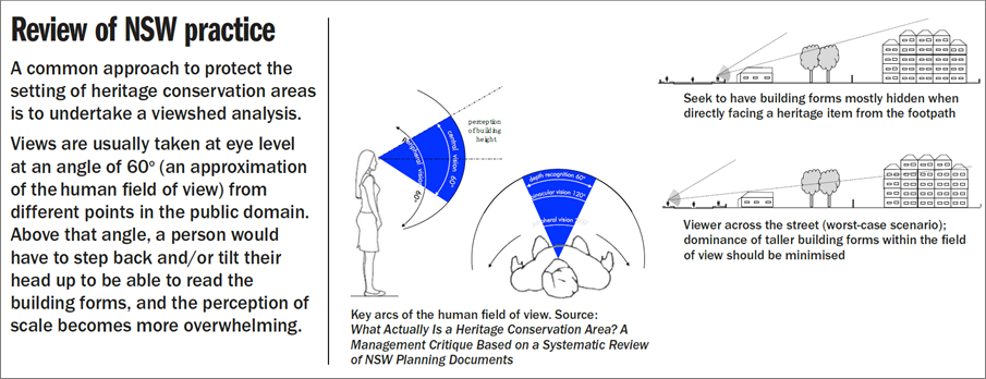
22. The
recommended FSR controls for the NEPIA are based on:
· Achieving workable FSRs that align with the
proposed height of building controls.
· Reinforcing the height transition through inter
building setbacks, street setbacks, building orientation, and location of
landscape areas (see Figure 8).
· Creating workable residential floor plates
within a slender tower form and podium, with space for deep soil and communal
open space.
23. The recommended FSR and height limit for the site at 23-27 Harold Street, Parramatta (which is also currently subject to
a rezoning review), was determined using the same built form principles and
outcomes-based approach for the NEPIA. The maximum FSR of 3.6:1 and a 40m height limit is proposed
for site noting this slightly higher FSR reflects the efficiencies of a smaller
sized site (see Figure 4). Further details are contained in Attachment
1.
Figure 6: Council
officer modelling showing how the stepped height of buildings as well as the
inter building seperation with views to sky creates the transition between the
Church Street North precinct and the sites within the NEPIA. Note that sites on
Church Street North have been modelled to include potenial design excellence
and place based bonuses. View 1 and 2 are taken from the public domain using 60
degree human view cone and illustrate that when bonuses are applied, the tops
of towers can no longer be percieved. This reinforces the importance of
combining principles of height transition with other methods of transition in
the NEPIA.
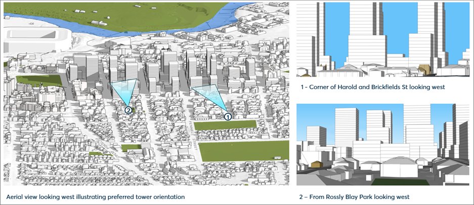
Amendments to the Parramatta DCP 2023
24. To
support the proposed amendments to the LEP outlined above, amendments are
proposed to Part 8, Section 8.3 Neighbourhood Precincts in Parramatta DCP
2023.
25. Area
specific DCP controls are considered necessary for the NEPIA primarily due to
the heritage sensitivities and need to provide transition between the HCA and
forthcoming new LEP controls for the Church Street North precinct. This new
section of the Parramatta DCP will include objectives and controls for:
· The desired future character of the area, with
consideration for existing context and how this precinct will redevelop
incrementally over time,
· Minimum site requirements and preferred site
amalgamation to ensure the objectives of future development in the area can be
met,
· Heritage transition achieved through specified
setbacks, street wall heights and building orientation,
· Deep soil and landscaping requirements for
future amenity and to create a vegetated heritage setting,
· Consistent street setbacks that maintain
heritage items as the dominant features of the streetscape and enable large
canopy tree planting within the front setback zone,
· Tower separation to enable views to sky when
observed from the Sorrell Street HCA (east), and
· Bespoke car parking rates that respond to the
proximity to the City Centre and light rail infrastructure (see further
discussion below).
Figure 7: Area specific DCP controls are proposed to achieve the
Structure Plan for the North East PIA (buildings coloured red) and part of the
Church Street North precinct (buildings coloured yellow).
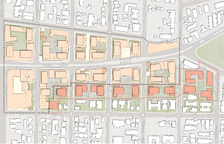
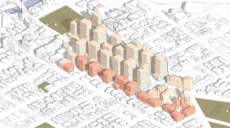
26. Given
the NEPIA consists only of R4 High Density Residential zoned land, the
following Parts of the DCP will continue to apply in addition to the new site
specific provisions proposed in Part 8: Part 2: Design in Context, Part 3:
Residential Development, Part 5: Environmental Management, Part 6: Traffic and
Transport and Part 7: Heritage and Archaeology. The details of these changes
can be found in Attachment 2.
PLANNING PROPOSAL ASSESSMENT
Strategic Merit
27. A summary of how
the subject Planning Proposal is consistent with the relevant policies is
provided below, with Attachment 1 providing a full assessment of the
Proposal’s consistency against relevant State Planning Policies and
Ministerial Directions.
Greater Sydney Region Plan
(GSRP) and Central City District Plan (CCDP)
28. The Planning
Proposal is generally consistent with relevant state policies and planning
strategies including the Greater Sydney Region Plan, Central City District
Plan, and Ministerial Directions under Clause 9.1 of the Environmental Planning
and Assessment Act 1979.
Local Strategies
29. The NEPIA
falls just outside of the Parramatta CBD growth precinct identified within the LSPS
and the LHS. The LSPS aims to encourage a more diverse range of housing,
focusing on medium density housing for new growth and defining areas that meet
the criteria to be a Housing Diversity Precinct. The NEPIA satisfies this
diversity criteria and, with the proposed LEP controls in this Planning
Proposal, can contribute to the delivery of a diversity of housing within
Parramatta.
Site-Specific Merit
Urban design and heritage matters
30. Previous Council commissioned
heritage studies (as discussed in the NEPIA Planning Strategy) are superseded by the SEPP process for the Church Street North
precinct and the recommended principles and strategies in the
Department’s Finalisation Report 2023 developed by specialist
urban design and heritage input. For the NEPIA the relevant principles
and strategies include responding to the adjoining HCAs and low scale
residential uses by transitioning building heights downwards towards them and
protecting view corridors.
31. The
design process for the NEPIA has been carried out concurrent with the drafting
of the Church Street North DCP. Consequently, these precincts and their
surrounds have been treated as a whole to determine a recommended outcome.
Based on a spatial analysis of the area, several key design objectives have
been established to guide the design approach. These are related to:
· Creating continuity between the City Centre from
south of the river, northwards along the Church.
· Considering a more residential focus for future
development outcomes in North Parramatta.
· Providing transition to heritage conservation
areas to be achieved through both stepped building heights and space between buildings
through setbacks and building separation.
· Maintaining the highly vegetated character of
North Parramatta for tree canopy within street setbacks and rear gardens at
mid-block.
· Establishing building alignments that respond to
the prevailing alignment of heritage items in the area.
· Responding to the landscape and river setting
with a skyline that follows the topography along the ridge.
Although
the design objectives and principles were developed for the whole area, the
proposed LEP and DCP controls for the NEPIA are drafted so that they apply
independently of the CSN SEPP area.
32. The
recommendations for NEPIA are based on comprehensive approach to transition
as required by the Department that includes a combination of both building
height and site planning. The method for transition includes stepping in
building height from Church Street properties to the Sorrell Street HCA, but
also includes:
· Utilising detached buildings to mediate between perimeter
block, podium tower development along Church Street and existing apartments and
houses within the HCA,
· Locate vegetated setbacks and communal open space on the
ground to provide landscape space as a frame/backdrop to heritage buildings and
the HCA,
· Supporting deep soil zones on development sites, which
enables canopy tree planting to be a setting to heritage,
· Ensuring any future development is setback from the
prevailing heritage alignment on the street and that front setback zones
support large canopy tree planting,
· Orientating the short edge of towers towards the HCA to
minimise the bulk of towers perceived from the HCA,
· Maximising separation between towers where it can increase
views to sky when observed from the HCA, and
· Encouraging slender tower forms and finer grain street wall
typologies to tie into the surrounding lower scale context of North Parramatta.
This multifaceted approach to transition that has been
applied to NEPIA sites is illustrated in Figure 8 below.
Figure 8: Methods for achieving transition and
unifying development across the precinct through building heights and
setbacks between Church Street and the Sorrell Street HCA.
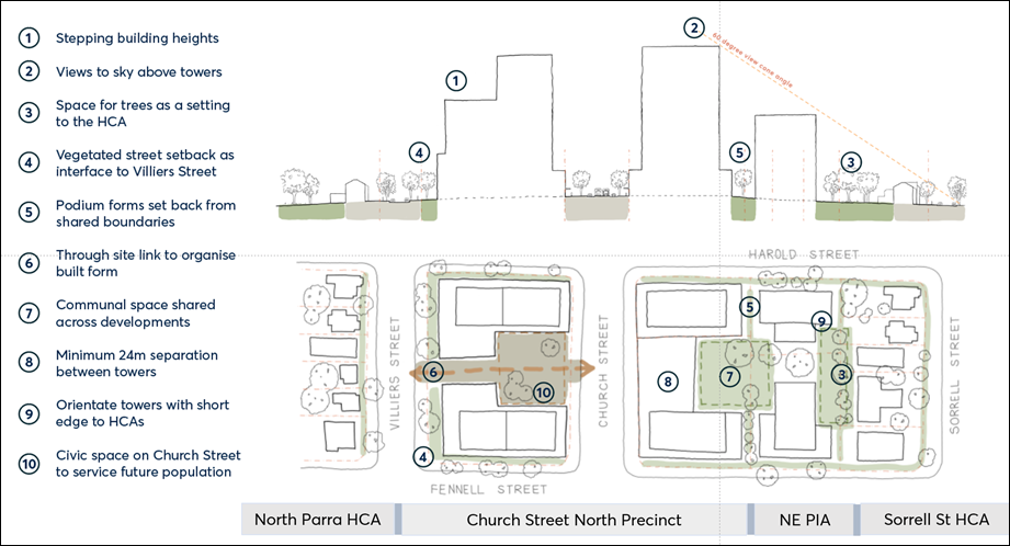
Potential impacts from State
Government Reforms
33. If the Department’s proposed Low- and Mid-Rise
Housing Reforms exhibited in late 2023 were to come into effect, the FSR
and height of building control that would apply to the NEPIA and the Sorrell
Street HCA are 3:1 and 21m, as both areas are within 400 metres of a transport
node.
34. This does not include any additional density possible under
the Housing SEPP’s 30% FSR and height bonus for
affordable housing and was not factored into the Department’s Low-
and Mid-Rise Housing Reforms. The impact of this on the CSN precinct and NEPIA
is difficult to predict.
35. What is known is that for the NEPIA, the planning controls
under the Reforms and as recommended in this report, would both result in
approximately 500 dwellings; however, under the reforms because of the mismatch
between the proposed FSR and height as identified in Council’s 26
February 2024 submission on the reforms, the following impacts are likely: Buildings
will be bulky and setbacks to boundaries insufficient for the scale, with
significant impacts upon deep soil and tree canopy loss contributing to reduced
amenity and heat island effects.
36. In the Finalisation Report for CSN, the Department referred
to the housing crisis and the need to provide certainty and accelerate housing
delivery along the Parramatta light rail corridor. The proposed controls
recommended by this Planning Proposal for the NEPIA demonstrate to the
Department Council’s willingness to provide for additional density in
areas well serviced by public transport and in a way that can responds
sensitively to the heritage issues consistent with the principles and strategies in the
Department’s Finalisation Report 2023.
Transport
37. The NEPIA is considered suitable for higher density residential
development due to its proximity to the City Centre, accessibility to transport
and employment opportunities. The site is located within a range of 100m to 350
metres walking distance to the Parramatta Light Rail stop and existing bus
services; and highly accessible to pedestrian pathways and cycleways.
Traffic, Parking and Access
38. Council’s Integrated Transport Plan (ITP) considered growth as
a result of the CBD PP and modelled residential parking rates delineating the
difference between locations that are within 800m or a 10-minute walk
approximately from Parramatta train station (Category A) and other locations at
the CBD fringes considered remote from heavy rail (Category B) as shown in Figure
9.
39. Currently, Category A car parking rates apply to the City Centre
(including the Church Street North precinct) via the LEP and are a maximum.
Car parking rates for most areas outside the City Centre including the NEPIA
are contained in PDCP 2023 and are a minimum. See Table 3
for a comparison of the car parking rates.
40. Work is currently underway to implement recommendations of the ITP,
and Officers are recommending the ‘Category B’ ITP parking rates as
outlined in Figure 9 as part of progressing the CBD PP ‘orange
matters’. A separate LPP report on the CBD PP ‘orange
matters’, will soon be reported to the Local Planning Panel.
Figure 9: Parramatta Residential Parking Rate Categories (taken from
the Parramatta Integrated Transport Plan), the NEPIA is within the red
circle.
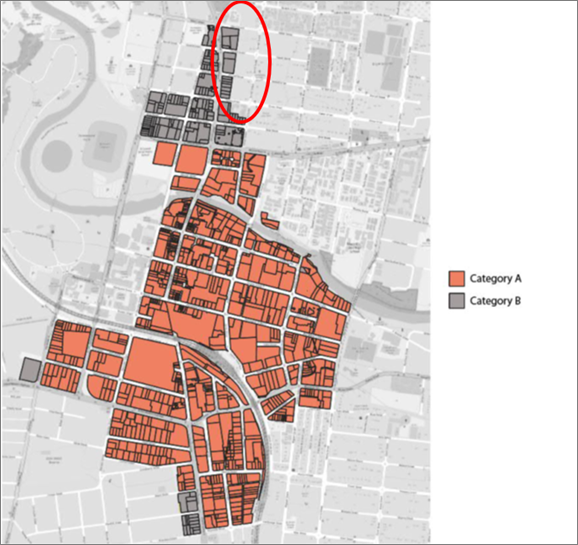
Table 3: Comparison of number of car parking
space requirements
|
Residential Parking Rate
|
Parramatta DCP current general controls that apply
to the NEPIA – Minimum required number of spaces
|
ITP ‘Category A’ controls in PLEP 2023
Part 7 City Centre – Maximum required number of spaces
|
ITP ‘Category B’ recommended controls
for inclusion in PDCP 2023 Part 8 precinct controls for the NEPIA–
Maximum required number of spaces (proposed)
|
|
Studio
|
0.6
|
0.1
|
0.2
|
|
1 bedroom
|
0.6
|
0.3
|
0.4
|
|
2 bedroom
|
0.9
|
0.7
|
0.8
|
|
3+ bedroom
|
1.4
|
1.0
|
1.1
|
41. This report recommends applying the Category B parking rates to the
NEPIA as a DCP control (see Attachment 2) for the following
reasons:
· proximate to the City Centre and light rail, and generally subject
to the same traffic conditions as the Church Street precinct, and
· the anticipated development typology (podium and tower) is the same
as Church Street.
Flooding
42. Council has more recently exhibited the draft Parramatta River Flood
Study 2023 and while the draft study is yet to be endorsed by Council, it is
prudent for Council to assess the Planning Proposal against this updated
Study. The Planning Proposal is also required to address Local Planning
Direction 4.1 – Flooding, issued by the Minister for Planning under
Section 9.1(2) of the EP&A Act 1979. Planning Proposals are required
to demonstrate that they are consistent with the Direction and any
inconsistency is required to be justified.
43. The draft Parramatta River Flood study shows that the majority of
the NEPIA is unaffected by flooding except for a part of Fennell Street and
Sorrell Street which are now subject to increased risk of Probable Maximum
Flood (PMF) and increased hazard risk (see Figure 10), compared to
current flood information.
44. For the affected sites in Fennell Street, the recommended pattern of
lot consolidation as proposed in the area specific DCP controls for the NEPIA (Attachment
2) means egress to an unaffected part of the street with rising road access
outside PMF is possible. For the affected sites in Sorrell Street, even with
the recommended pattern of lot consolidation, horizontal egress is not a safe
option. In this case, vertical evacuation would be required with the
specific requirements able to be managed at the Development Application stage.
45. Any future development on the site will need to respond to the Flood
Risk Development Manual and the relevant controls contained within the PLEP
2011 and the Parramatta Development Control Plan 2011.
Figure 10: Extract of the NEPIA
consolidation/ structure plan showing the sites under the draft Parramatta
Flood Study 2023 affected by the PMF and the hazard affectation.
|
PMF
|
Hazard
|
|
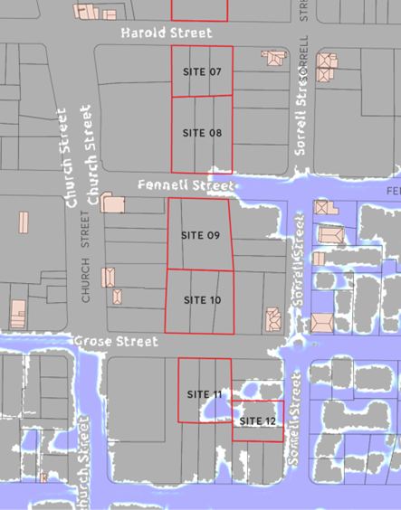
|
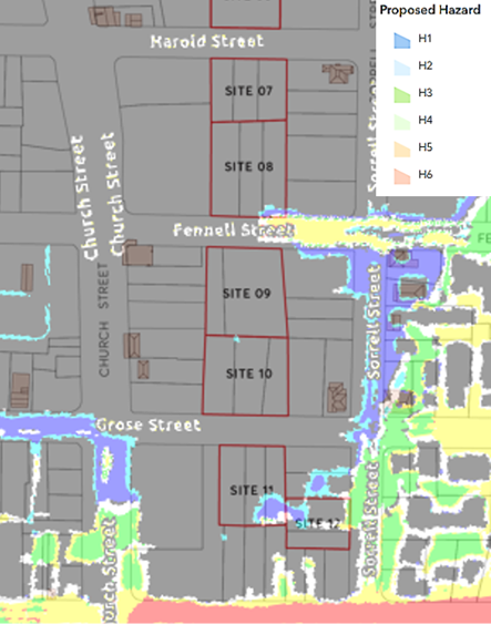
|
46. Infrastructure, social, economic and
environmental impacts are considered minimal and discussed in the Planning
Proposal at Attachment 1.
PLAN MAKING DELEGATIONS
47. Plan making delegations were announced by the then Minister for Planning
and Infrastructure in October 2012 allowing councils to make LEPs of local
significance. On 26 November 2012, Council resolved to accept the delegation
for plan making functions, and for these functions be delegated to the Chief
Executive Officer.
48. It
is recommended that Council request to the Department of Planning, Housing and Infrastructure to exercise its plan making delegations for this Planning Proposal.
This means that after the Planning Proposal has received a Gateway
Determination, complied with any conditions (including any requirements for
public exhibition), Council officers can deal directly with the Parliamentary
Counsel on the legal drafting and finalisation of the amendment to the LEP
facilitated by this Planning Proposal.
FINANCIAL IMPLICATIONS FOR COUNCIL
49. If Council resolves to endorse this report in
accordance with the recommendation, there are no unbudgeted financial
implications for Council’s budget. Costs associated with the public
exhibition of the Planning Proposal and the DCP will be funded from existing
Strategic Land Use Planning budget allocations.
50. The table below summarises the financial impacts on the budget
arising from approval of this report.
|
|
FY 22/23
|
FY 23/24
|
FY 24/25
|
FY 25/26
|
|
Revenue
|
|
|
|
|
|
Internal Revenue
|
|
|
|
|
|
External Revenue
|
|
|
|
|
|
Total Revenue
|
NIL
|
NIL
|
NIL
|
NIL
|
|
|
|
|
|
|
|
Funding Source
|
NIL
|
NIL
|
NIL
|
NIL
|
|
|
|
|
|
|
|
Operating Result
|
|
|
|
|
|
External Costs
|
|
|
|
|
|
Internal Costs
|
|
|
|
|
|
Depreciation
|
|
|
|
|
|
Other
|
|
|
|
|
|
Total Operating Result
|
NIL
|
NIL
|
NIL
|
NIL
|
|
|
|
|
|
|
|
Funding Source
|
NIL
|
NIL
|
NIL
|
NIL
|
|
|
|
|
|
|
|
CAPEX
|
|
|
|
|
|
CAPEX
|
|
|
|
|
|
External
|
|
|
|
|
|
Internal
|
|
|
|
|
|
Other
|
|
|
|
|
|
Total CAPEX
|
NIL
|
NIL
|
NIL
|
NIL
|
CONSULTATION AND TIMING
Councillor Consultation
51. The following Councillor consultation has been undertaken in
relation to this matter:
|
Date
|
Councillor
|
Councillor Comment
|
Council Officer Response
|
Responsibility
|
|
18 March 2024
|
Standard briefing session prior to
Council meeting
|
In relation to the NEPIA, include in the exhibition documentation
an explanation and visual representation of the height and FSR that may be
achieved under the State Government’s exhibited Low and Mid Rise
Housing Reforms.
|
Council’s website which includes
FAQs that form the NEPIA notification will include the required
information.
|
Group Manager – City Strategic
Planning
|
CONCLUSION AND NEXT STEPS
52. This report recommends Council endorse and forward the
Planning Proposal at Attachment 1 to the Department with a request for a
Gateway Determination, and that Council endorse the DCP amendment at Attachment
2 for public exhibition concurrently with the Planning Proposal.
53. Community consultation will be undertaken as required by
the Gateway Determination.
Issa Trad
Team Leader Land Use Planning
Janelle Scully
Land Use Planning Manager
Robert Cologna
Group Manager, Strategic Land Use
Planning
Jennifer Concato
Executive Director City Planning and
Design
Attachments:
|
1⇩ 
|
North-East Planning Investigation Area
Planning Proposal
|
47 Pages
|
|
|
2⇩
|
Proposed DCP Amendments
|
17 Pages
|
|
|
3⇩
|
NEPIA Planning Strategy Community
Engagement Report
|
11 Pages
|
|
REFERENCE MATERIAL
|
Item 6.2 - Attachment
1
|
North-East Planning Investigation Area Planning Proposal
|
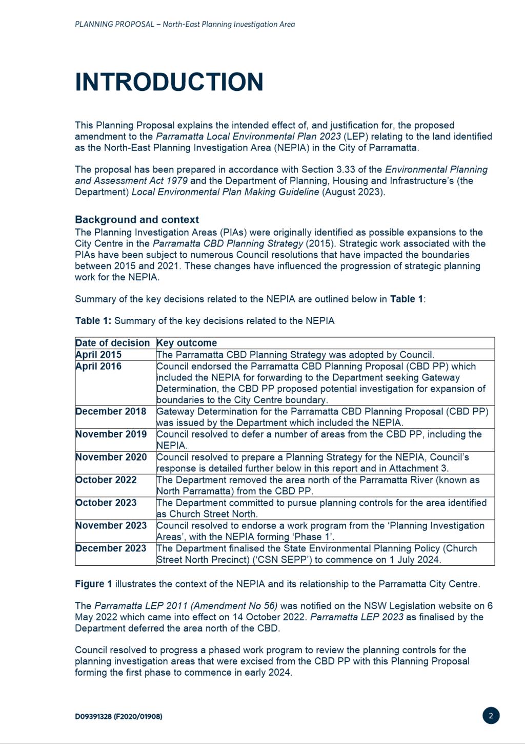
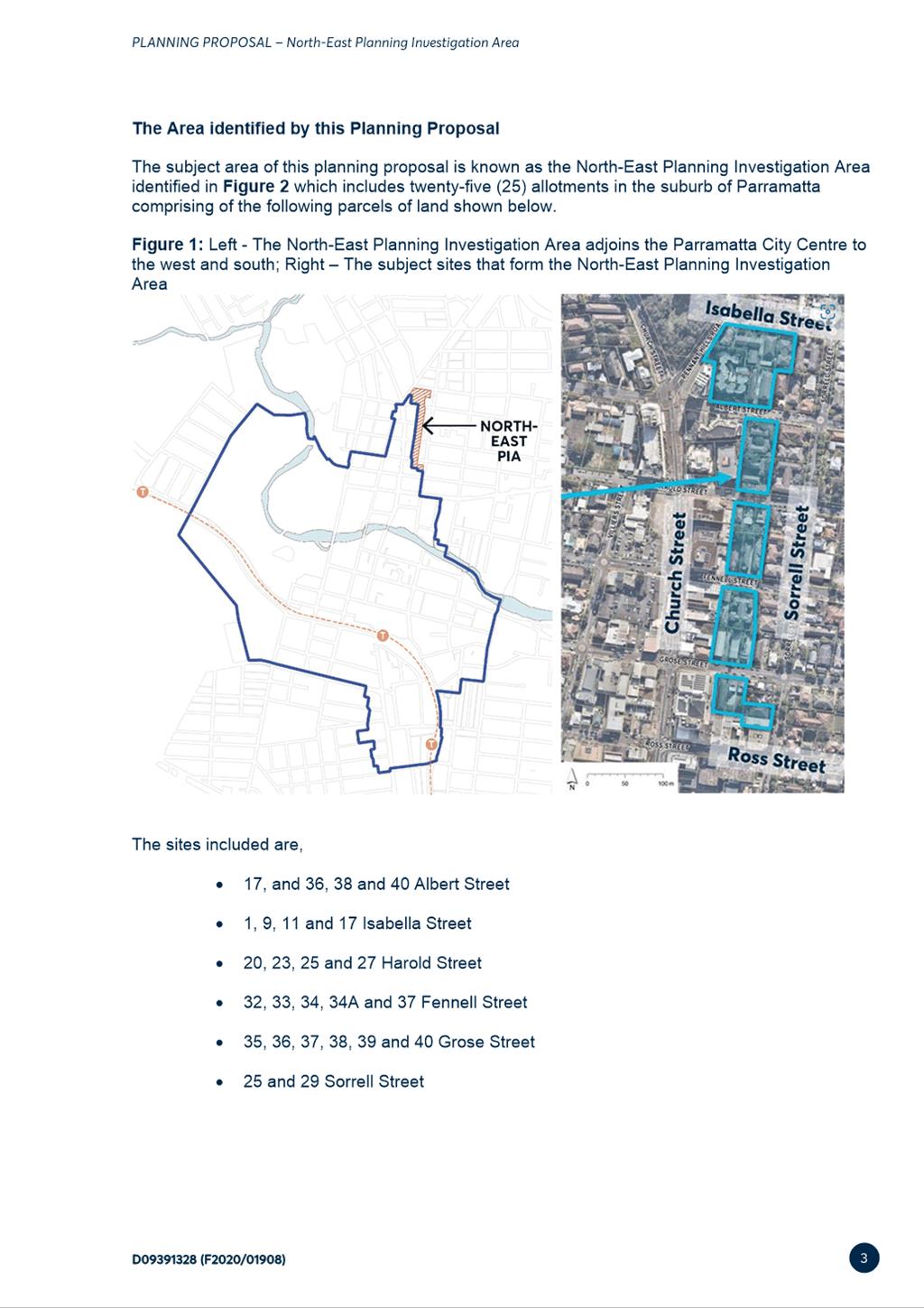
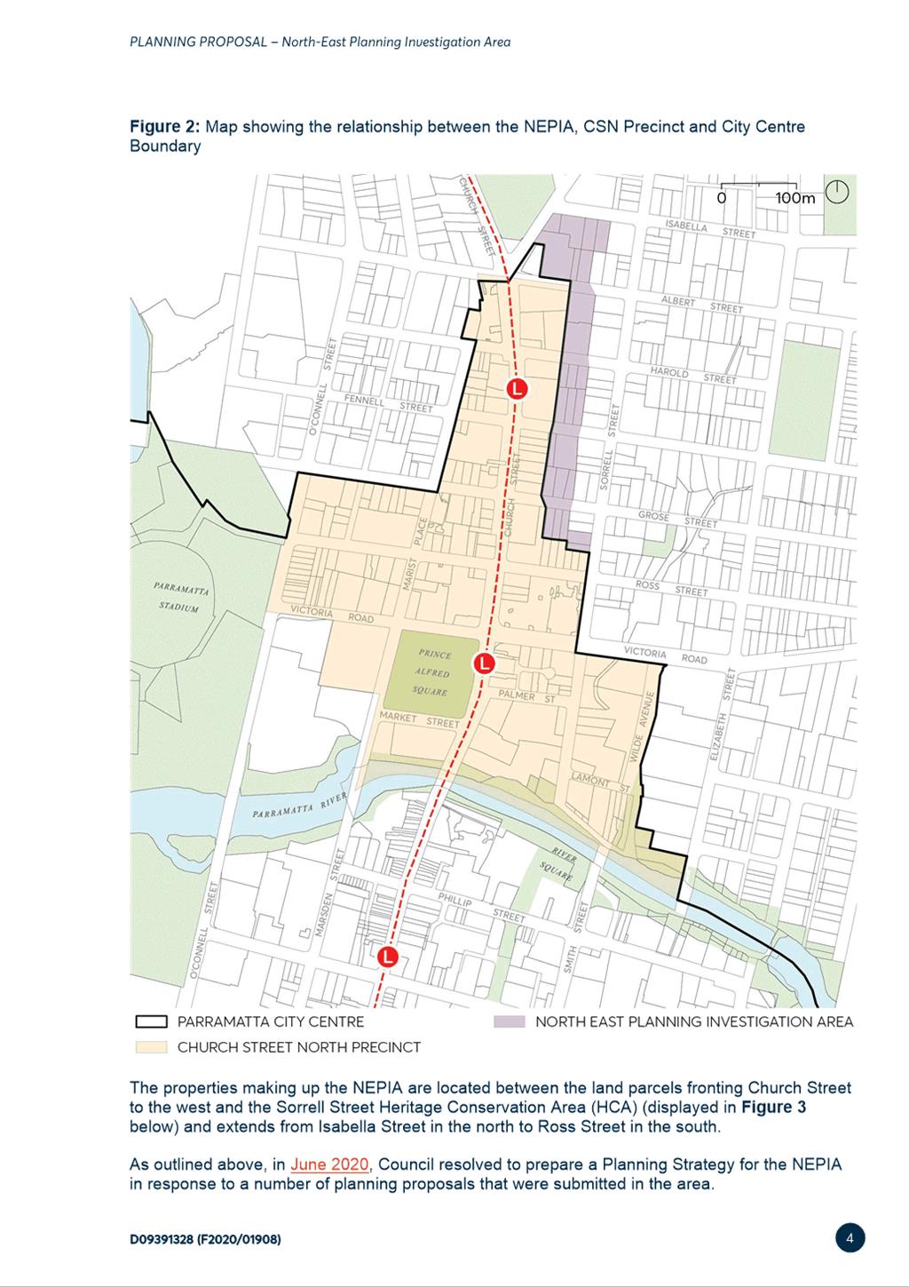
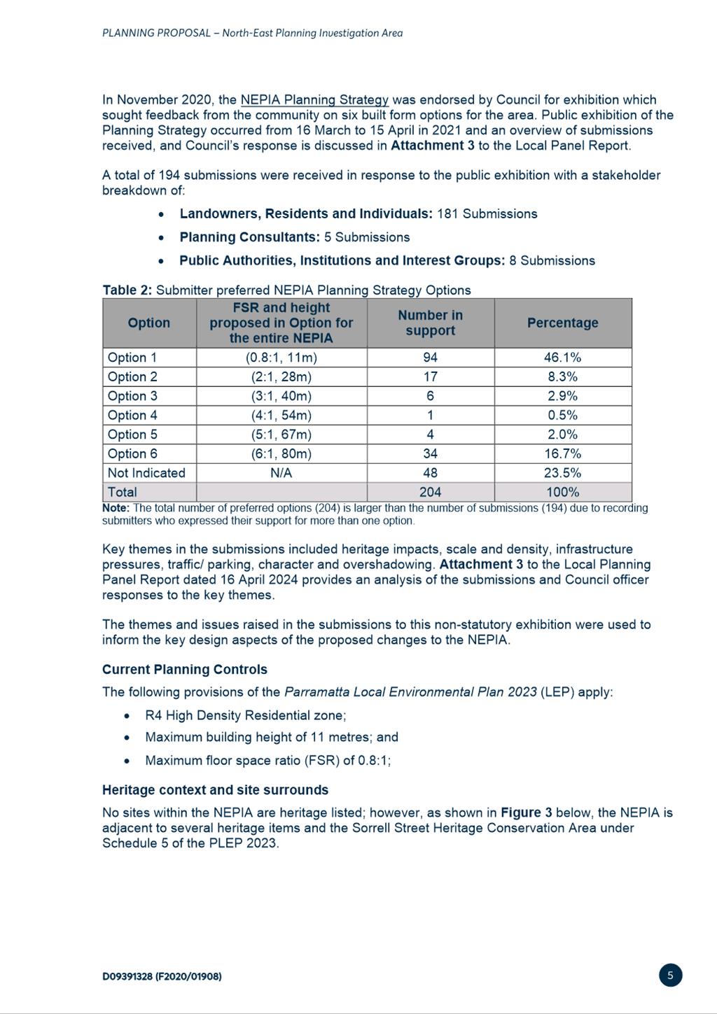
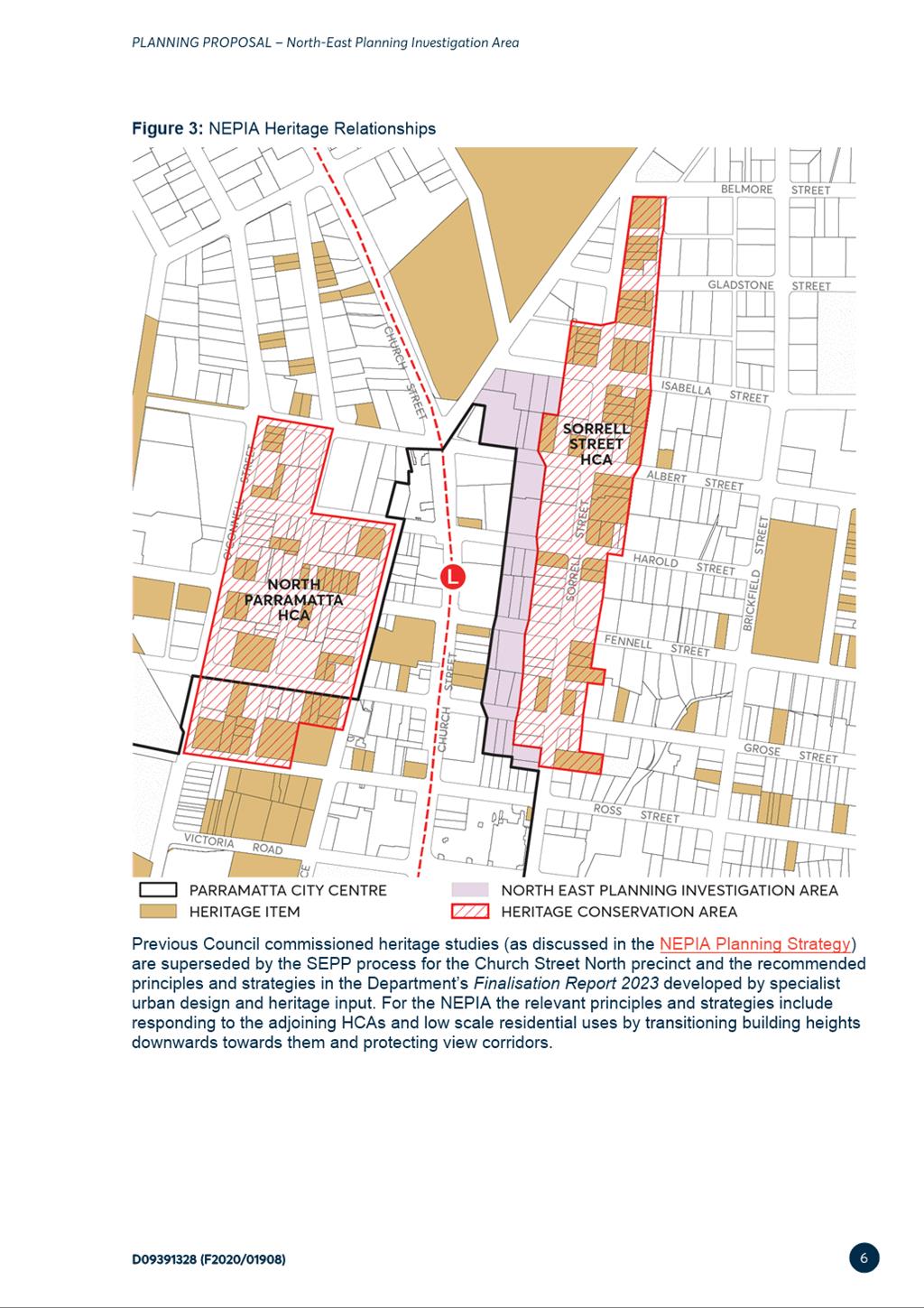
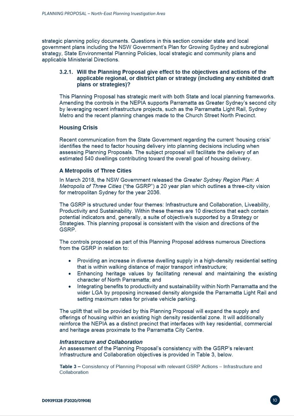
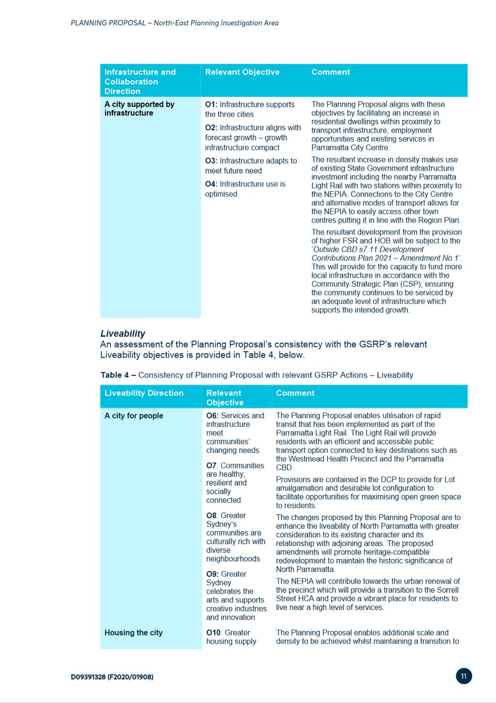
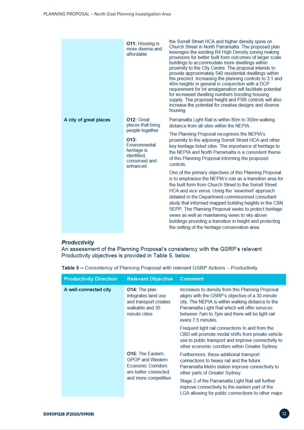
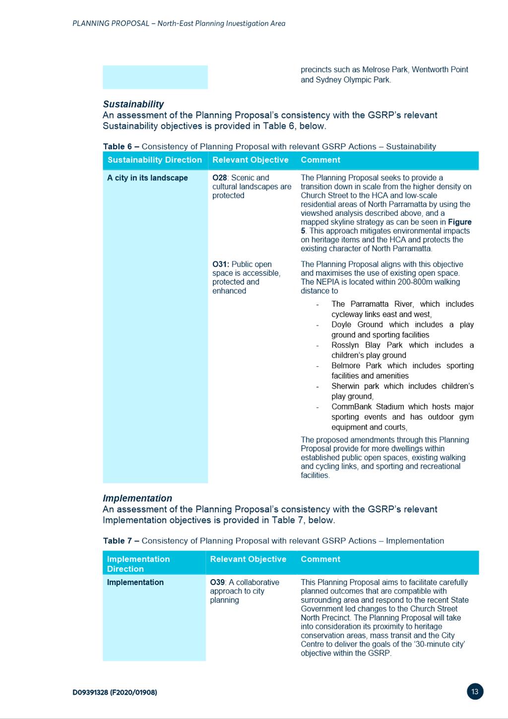
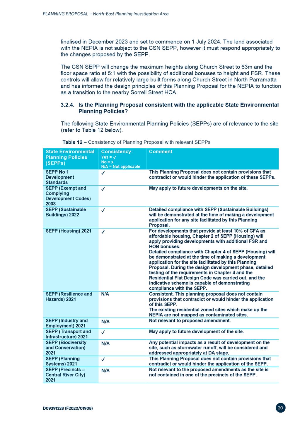
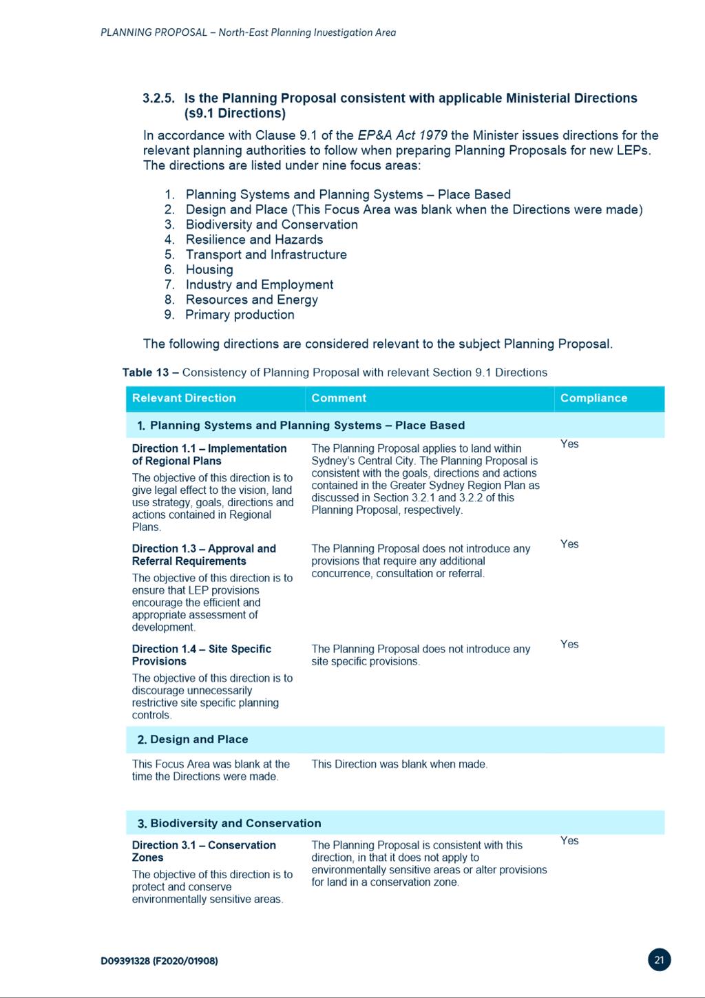
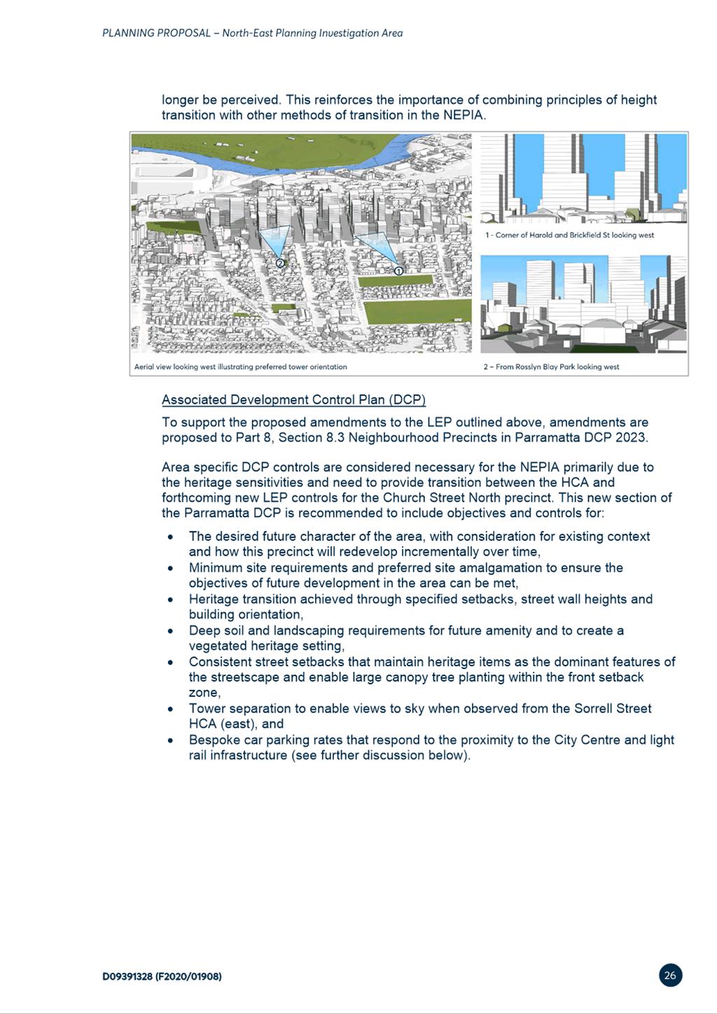
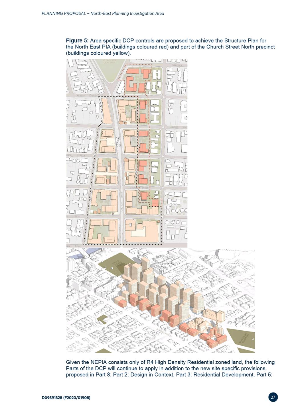
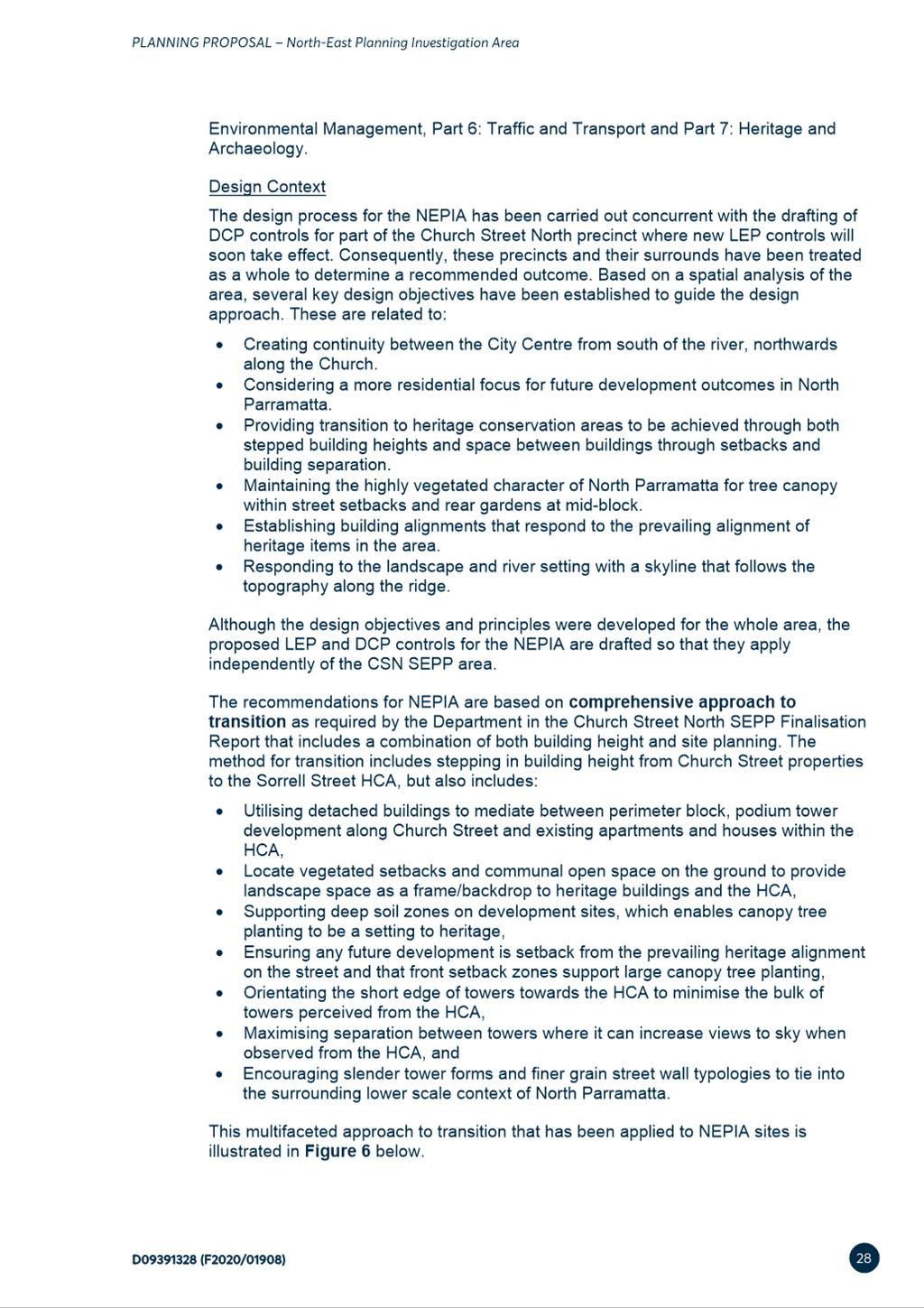
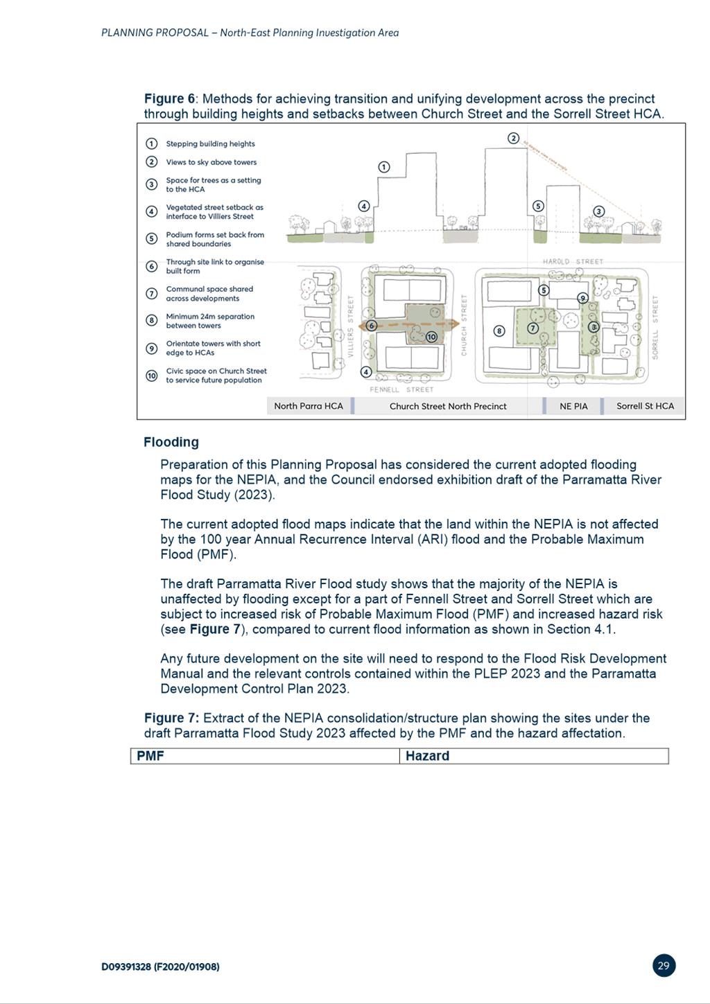
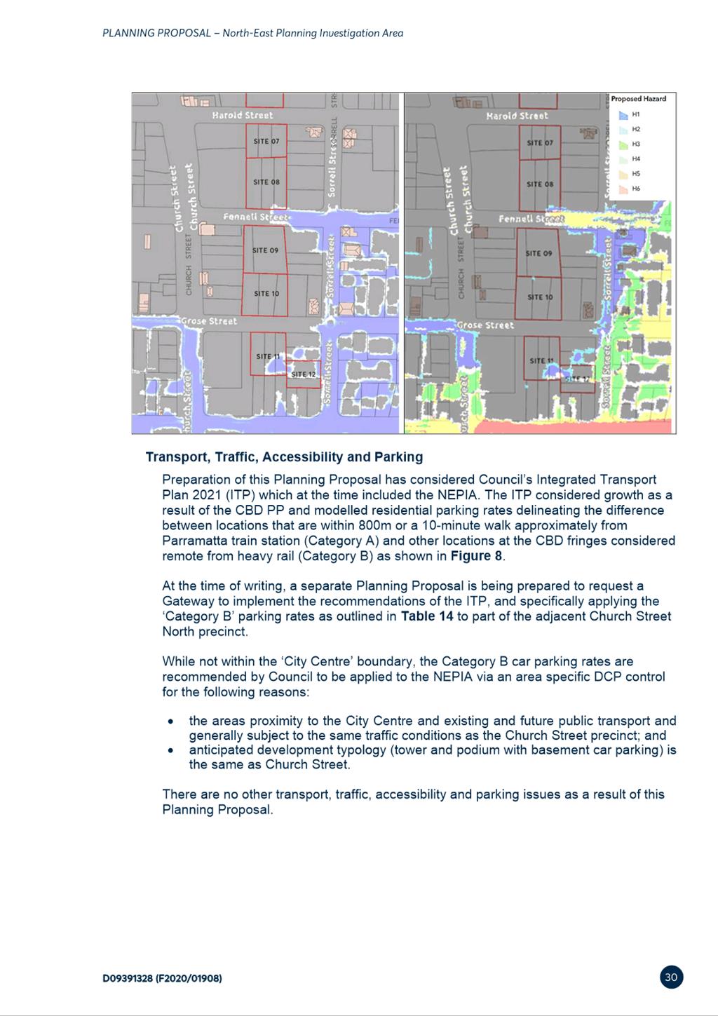
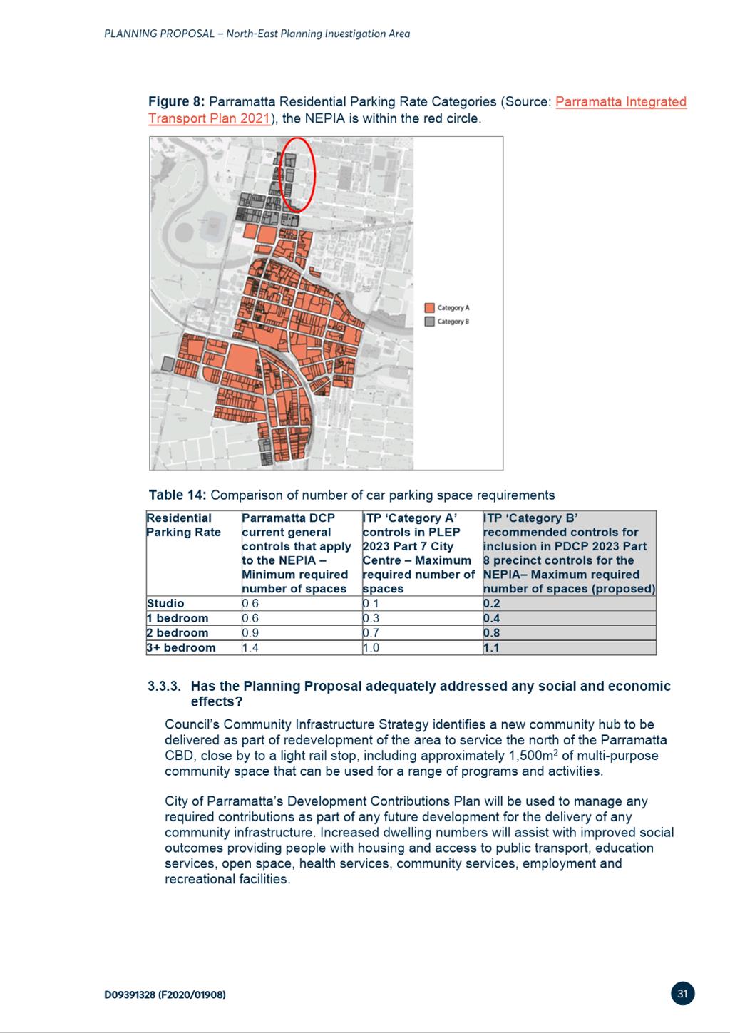
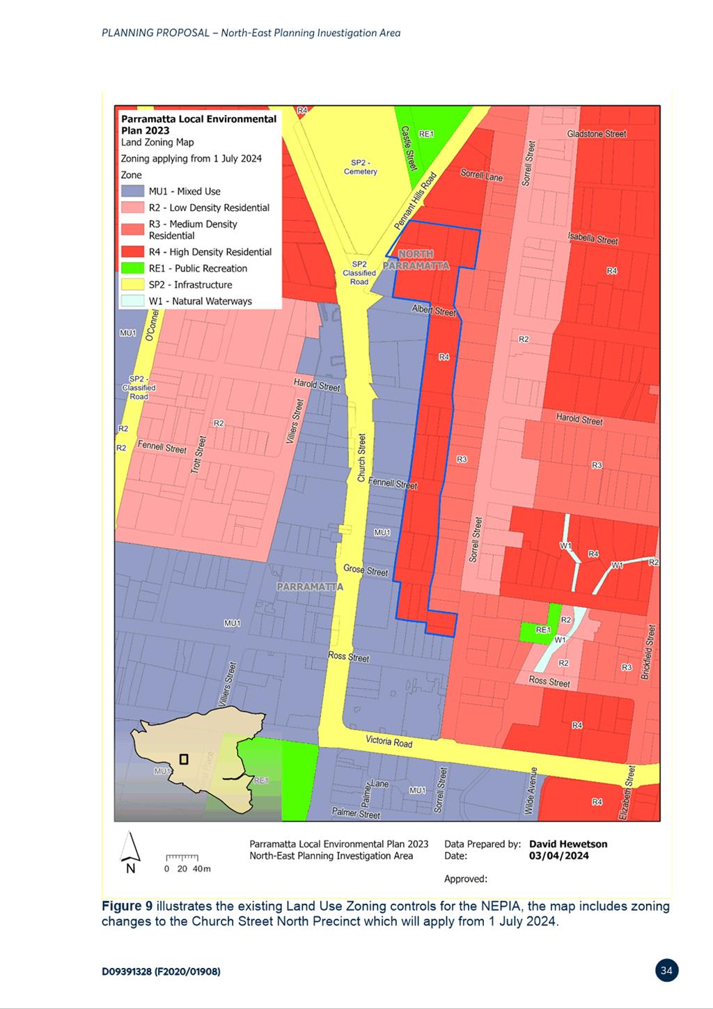
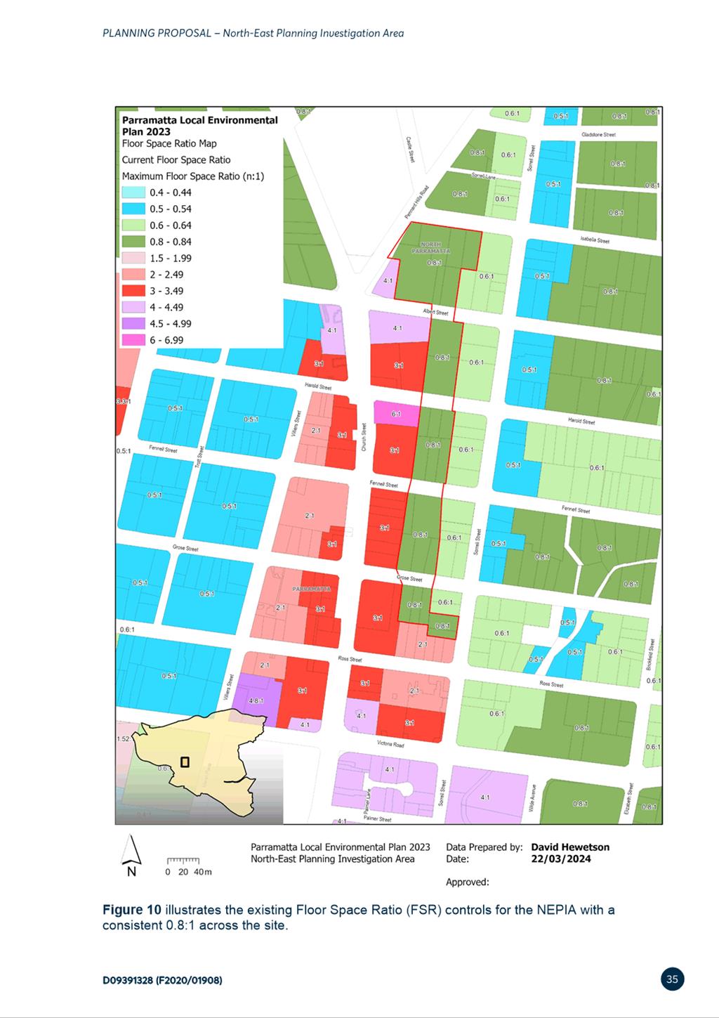
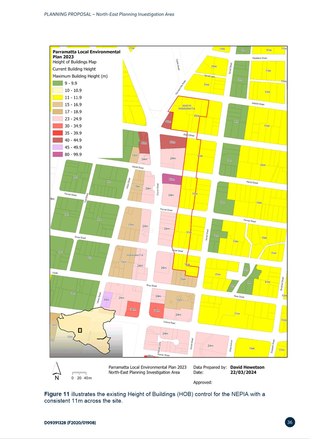
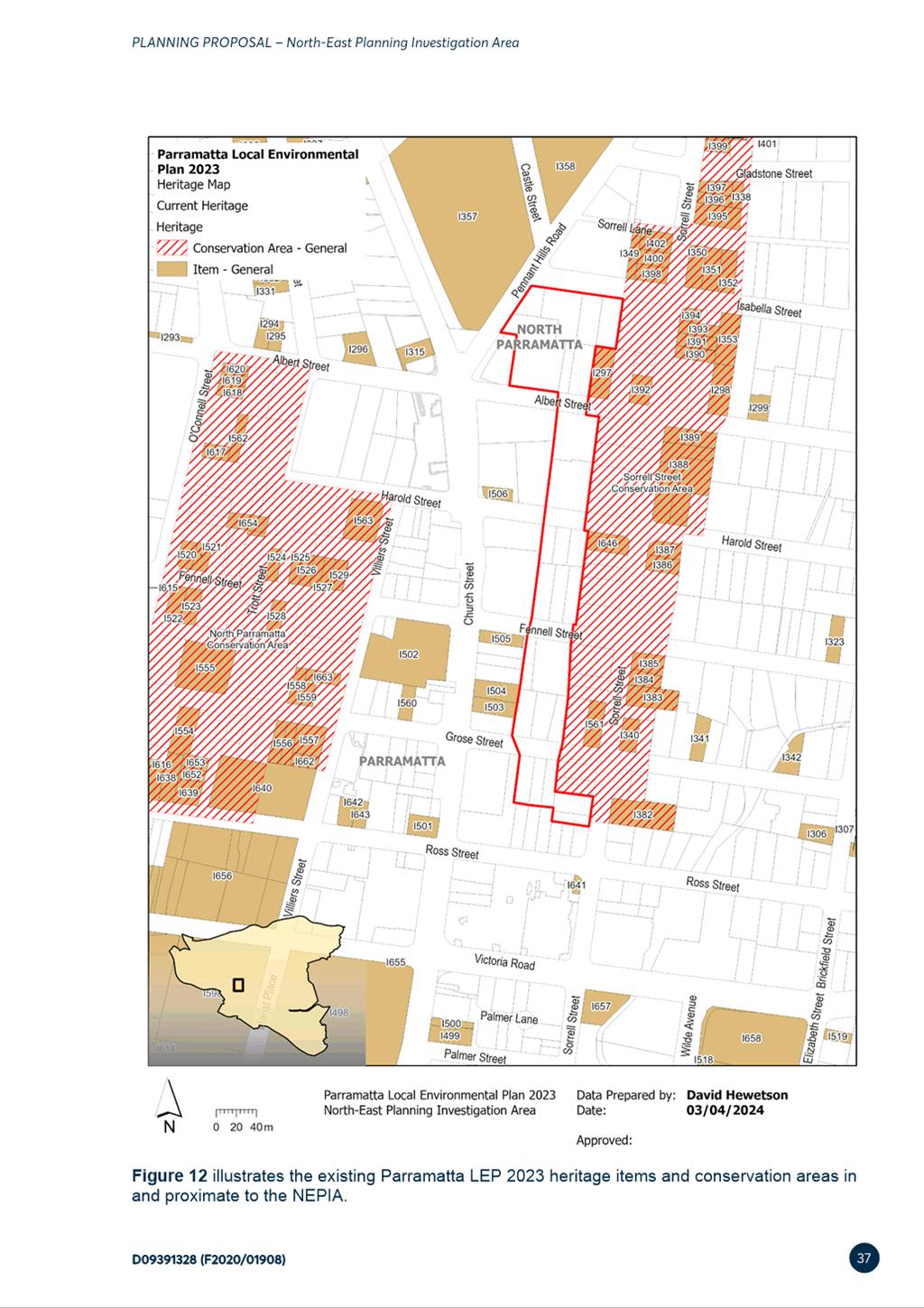
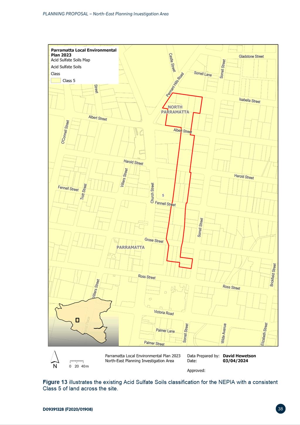
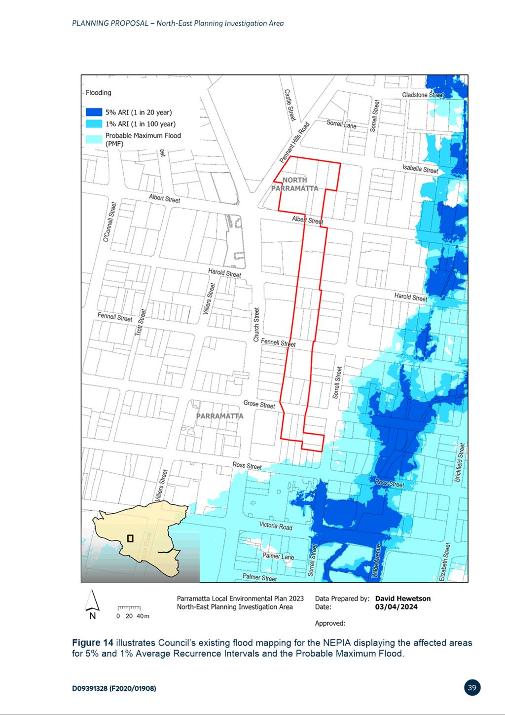
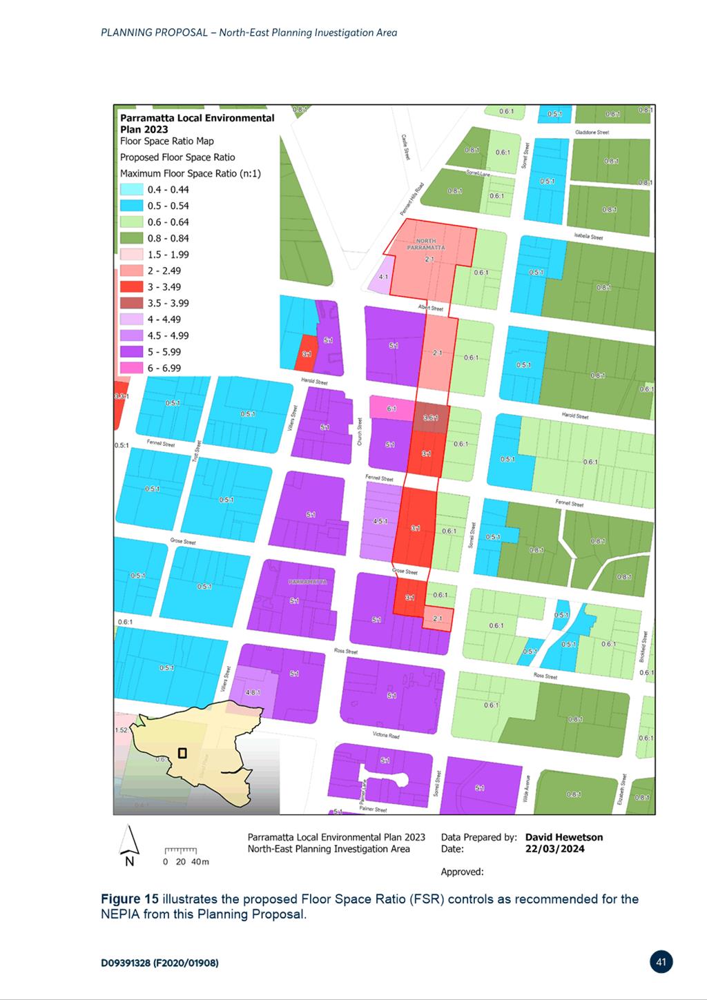
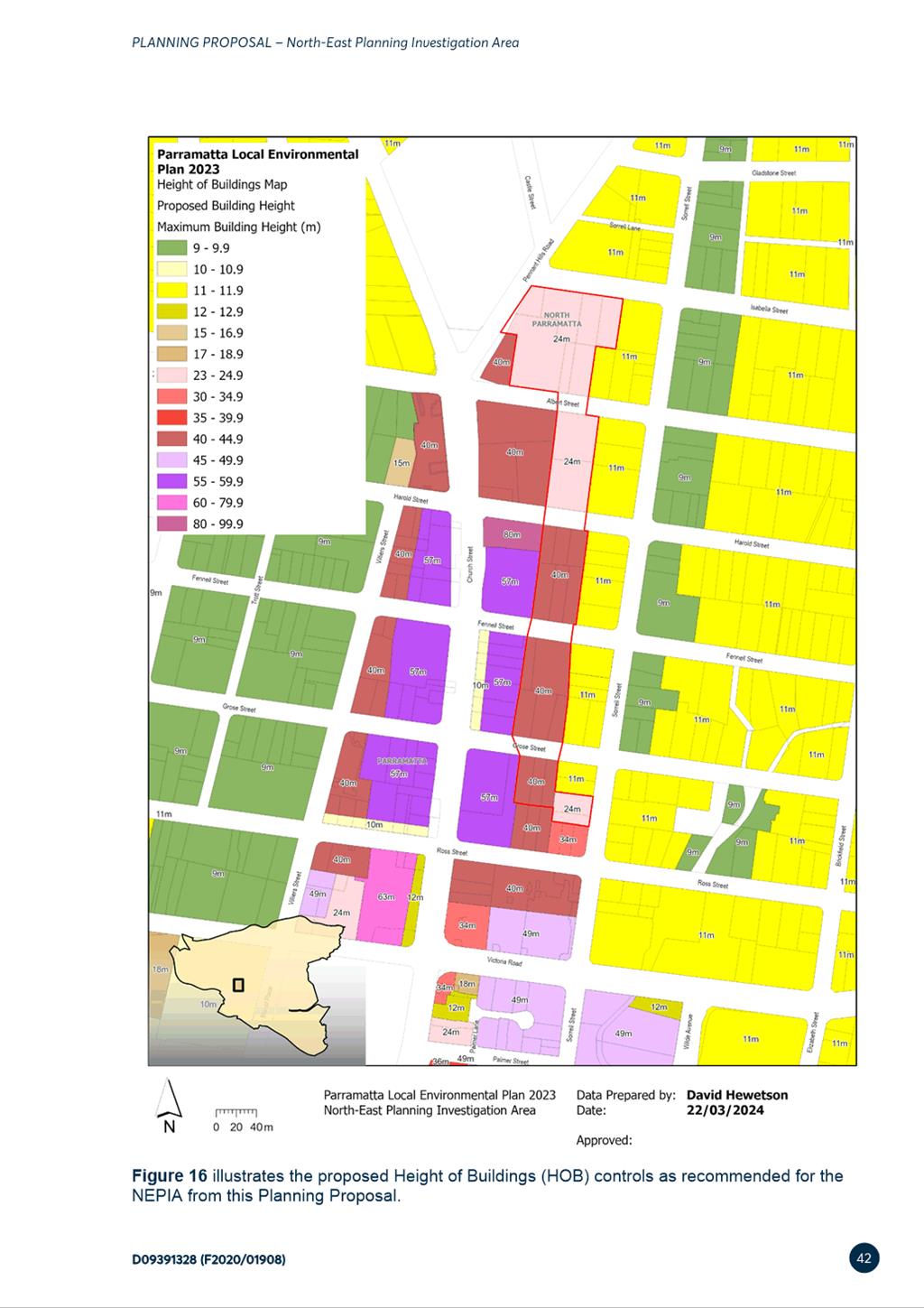
|
Item 6.2 - Attachment 2
|
Proposed DCP Amendments
|
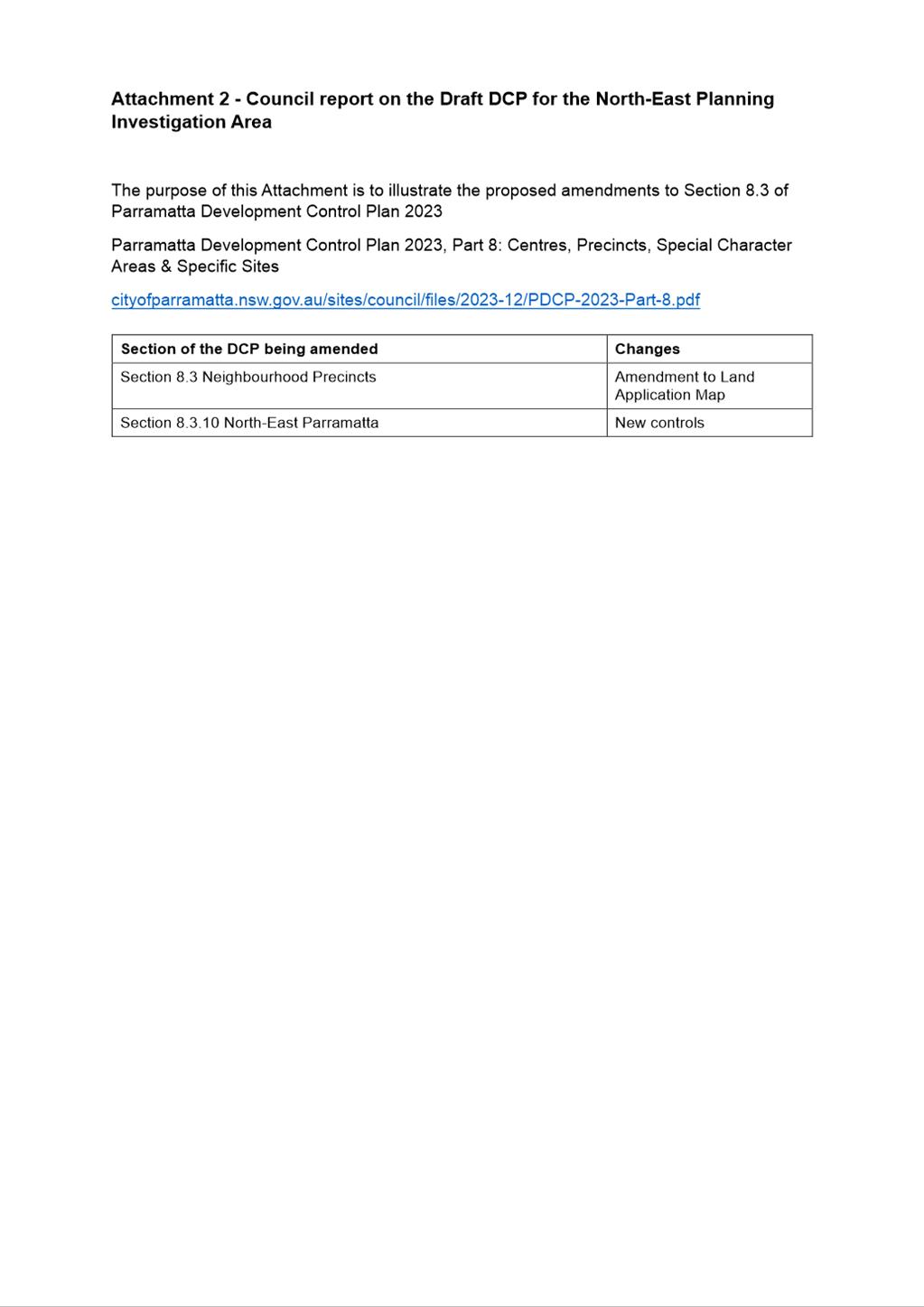
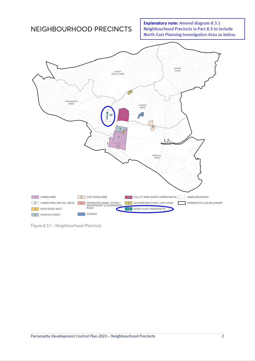
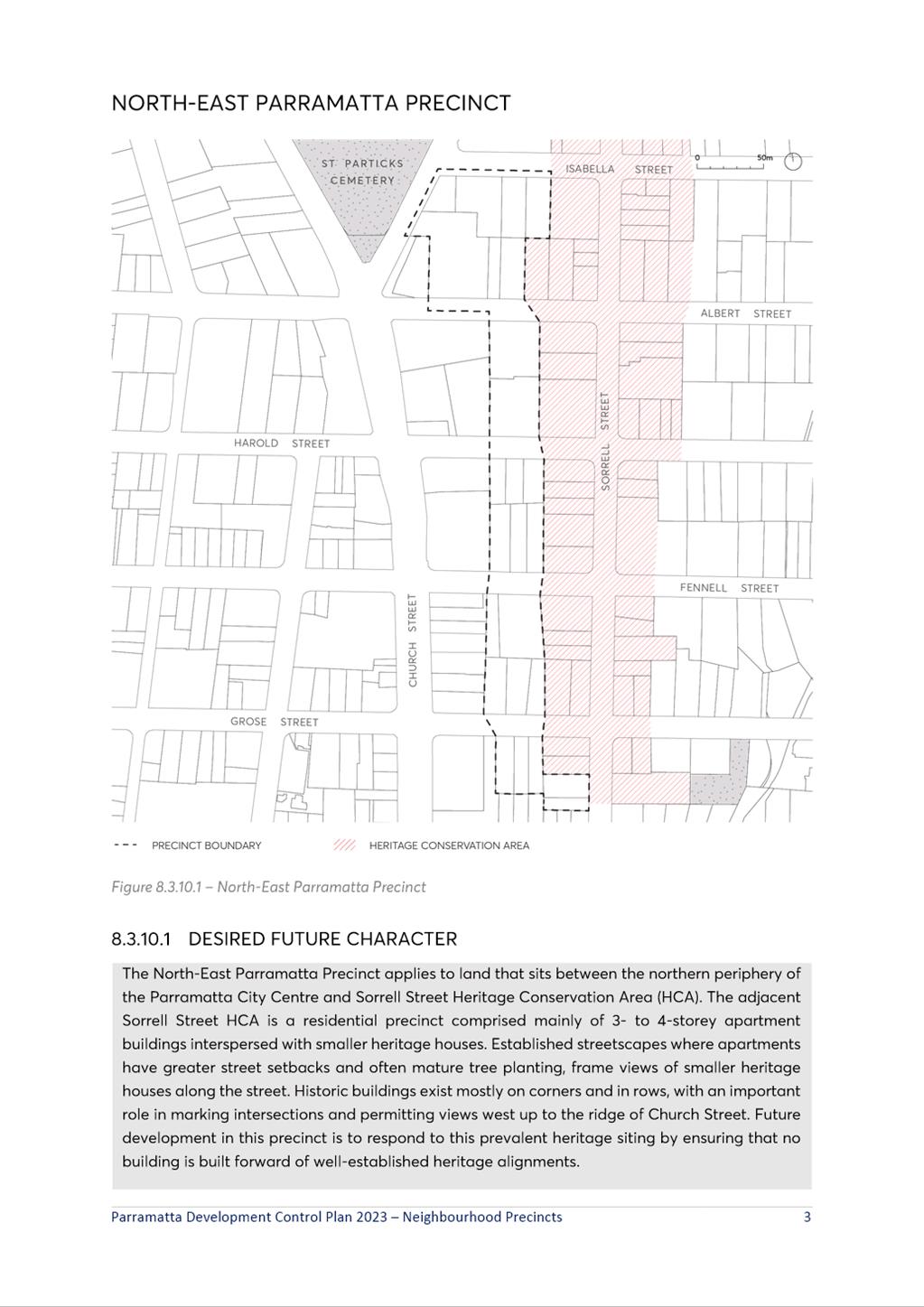
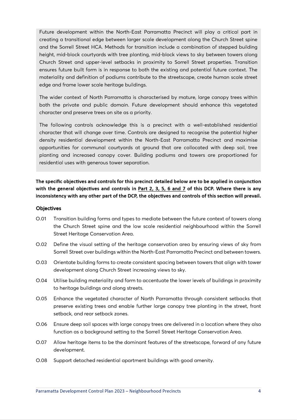
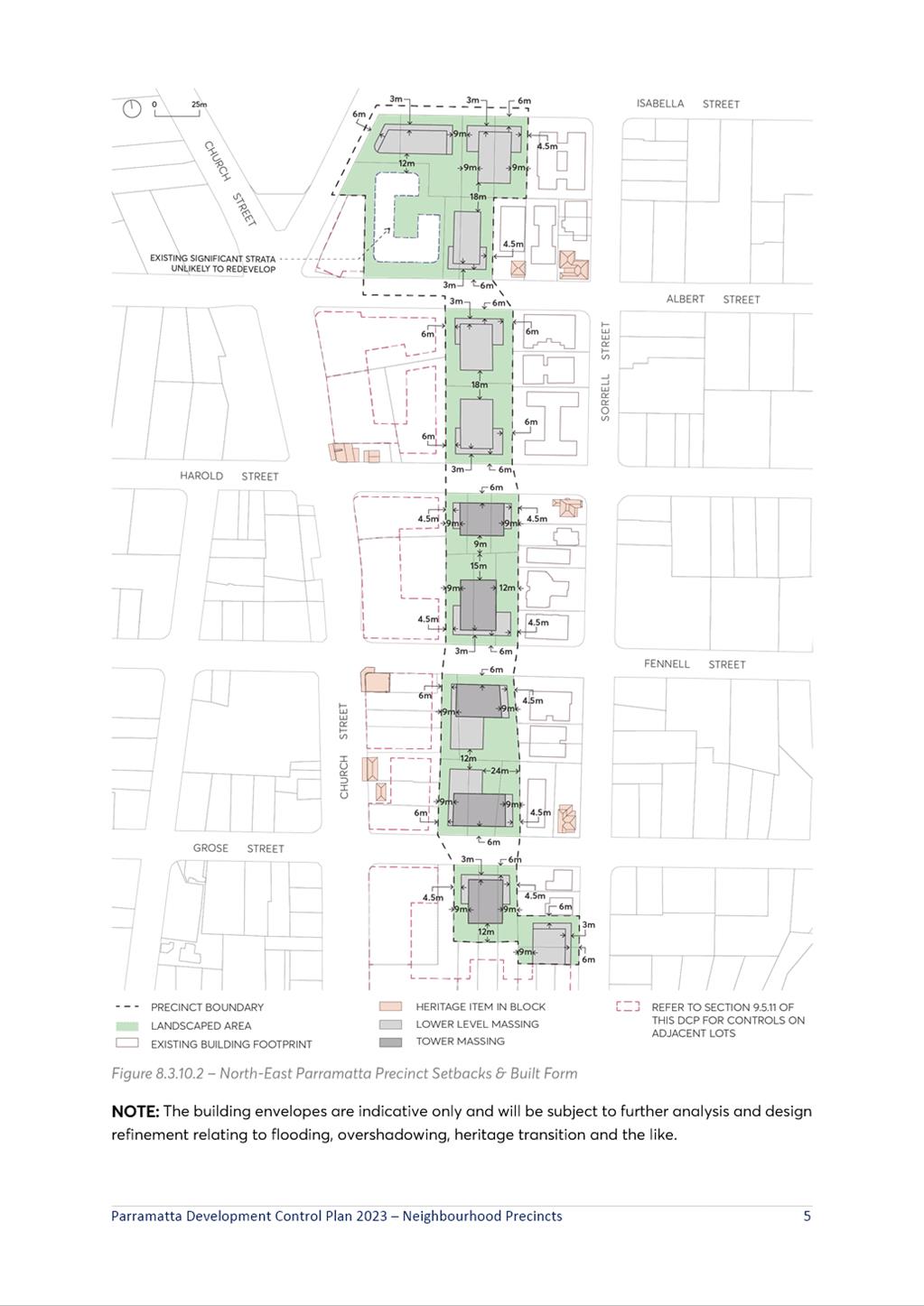
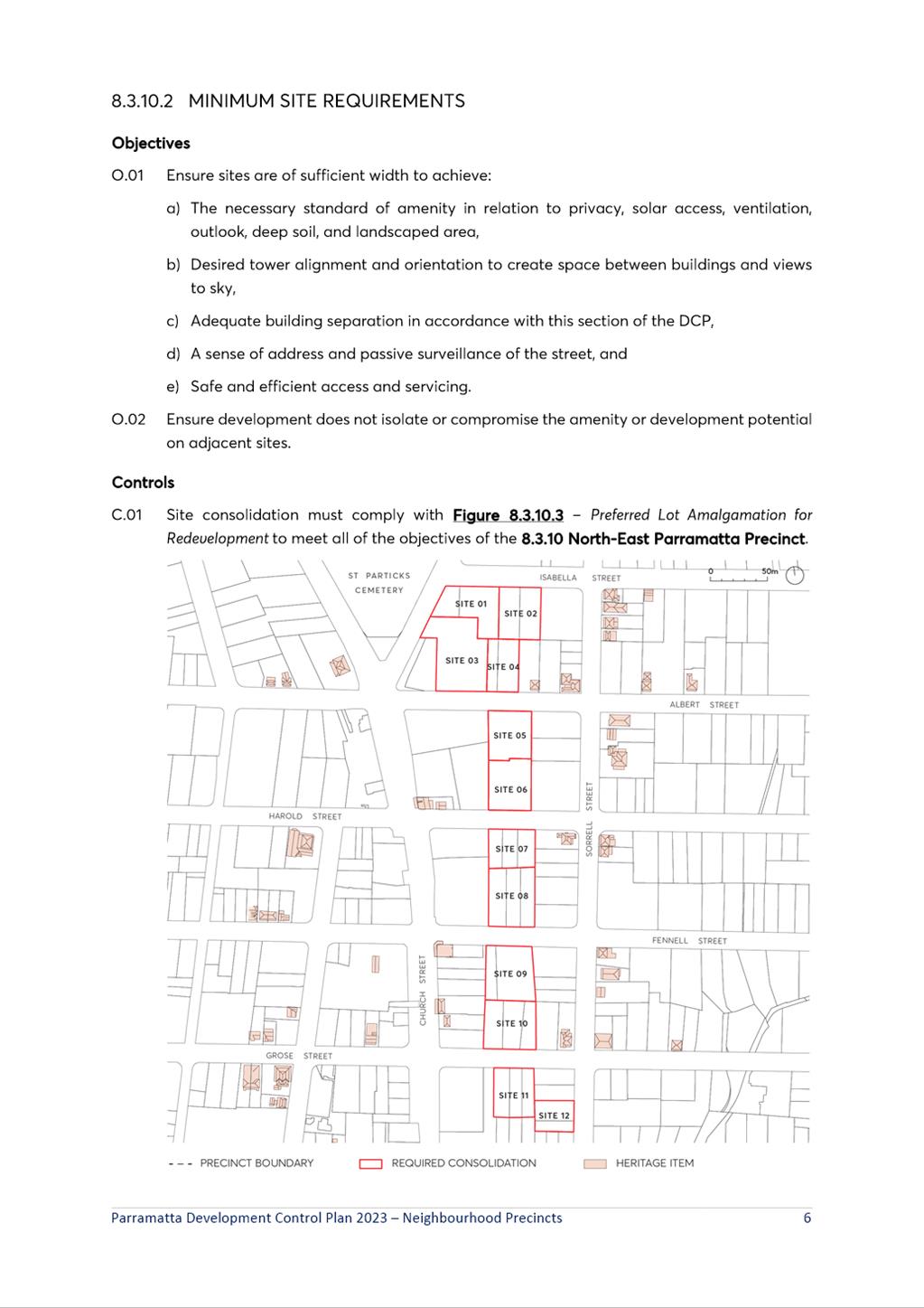
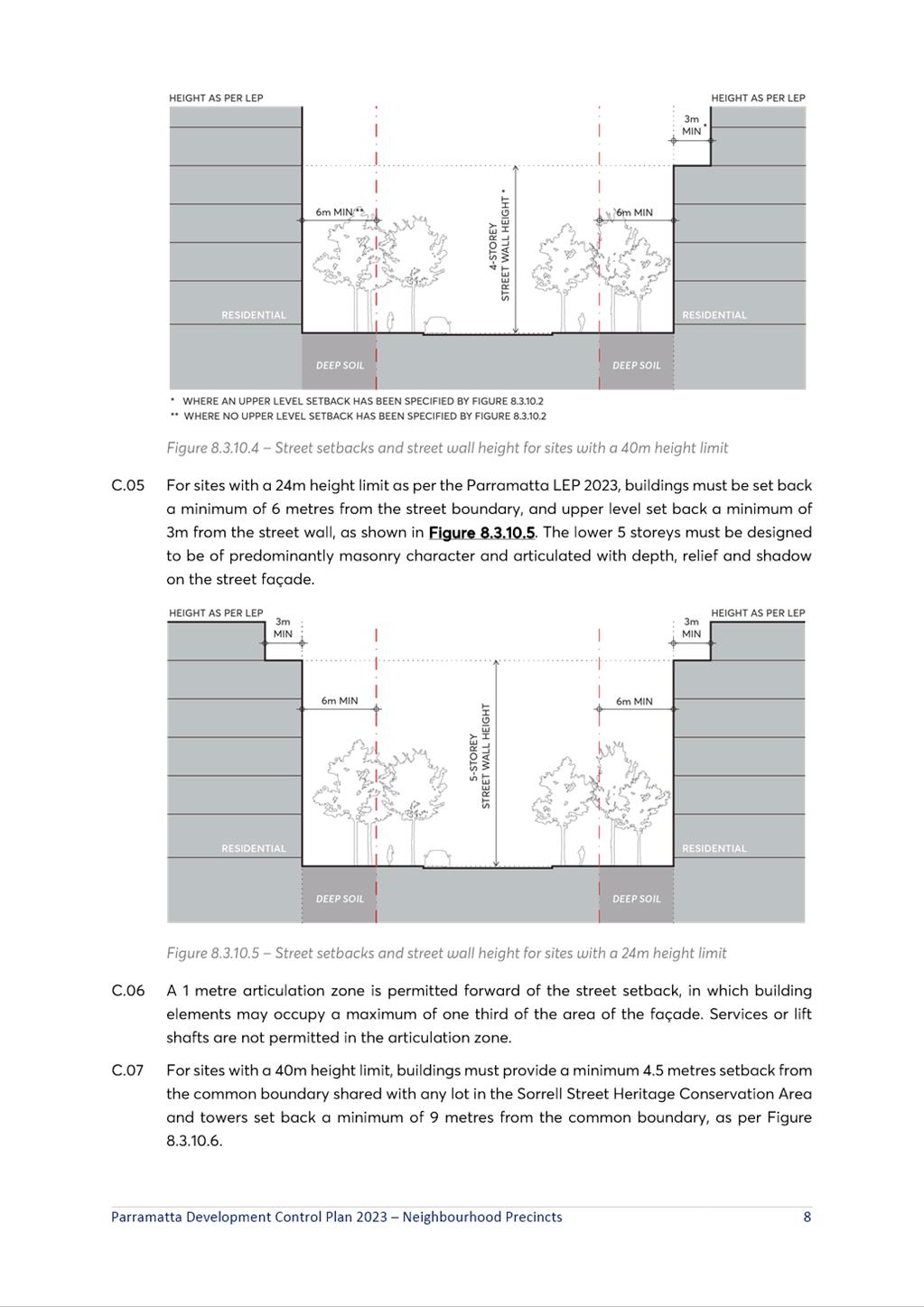
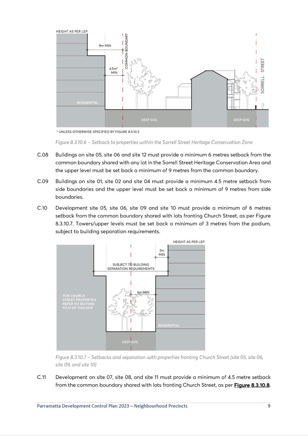
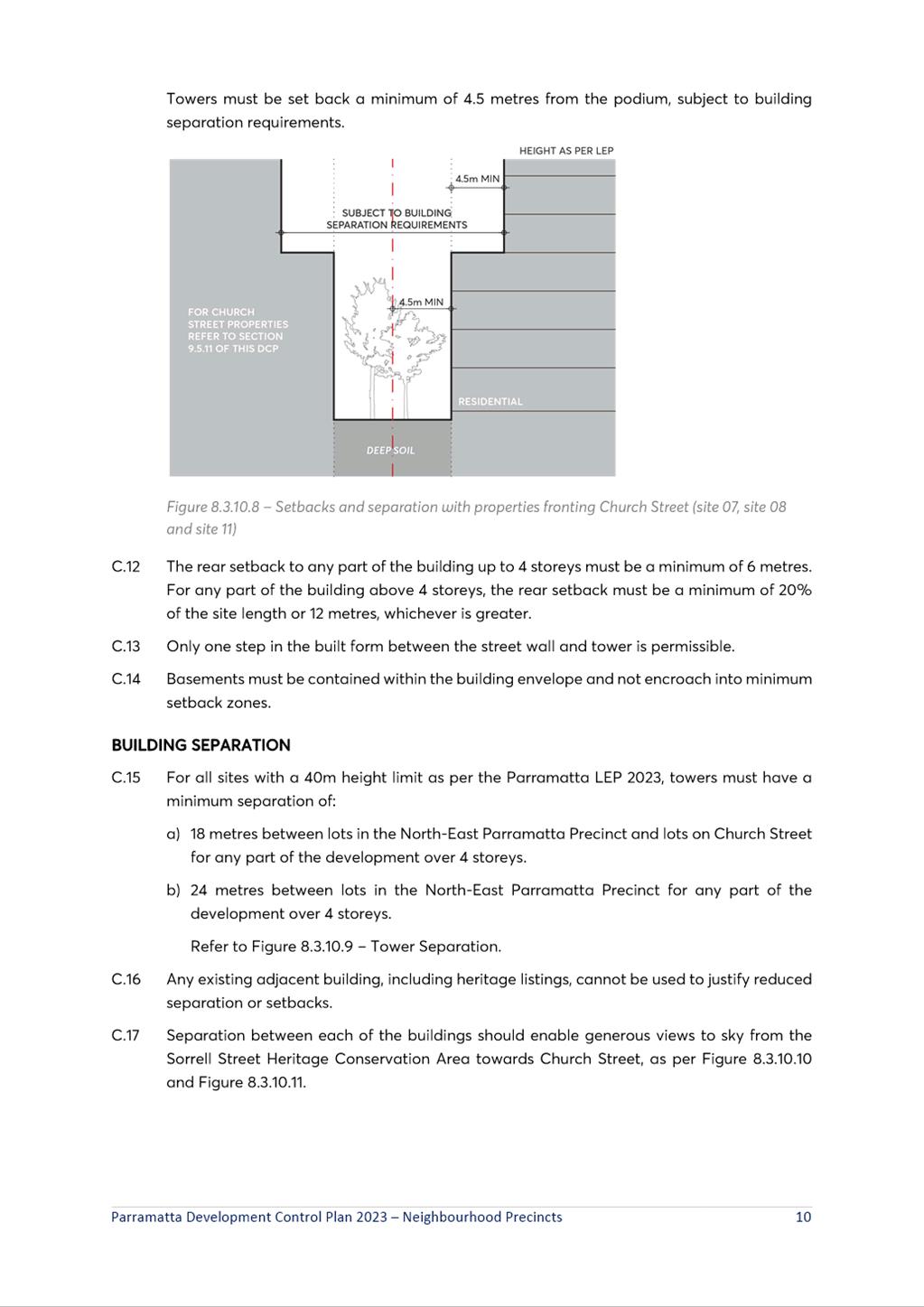
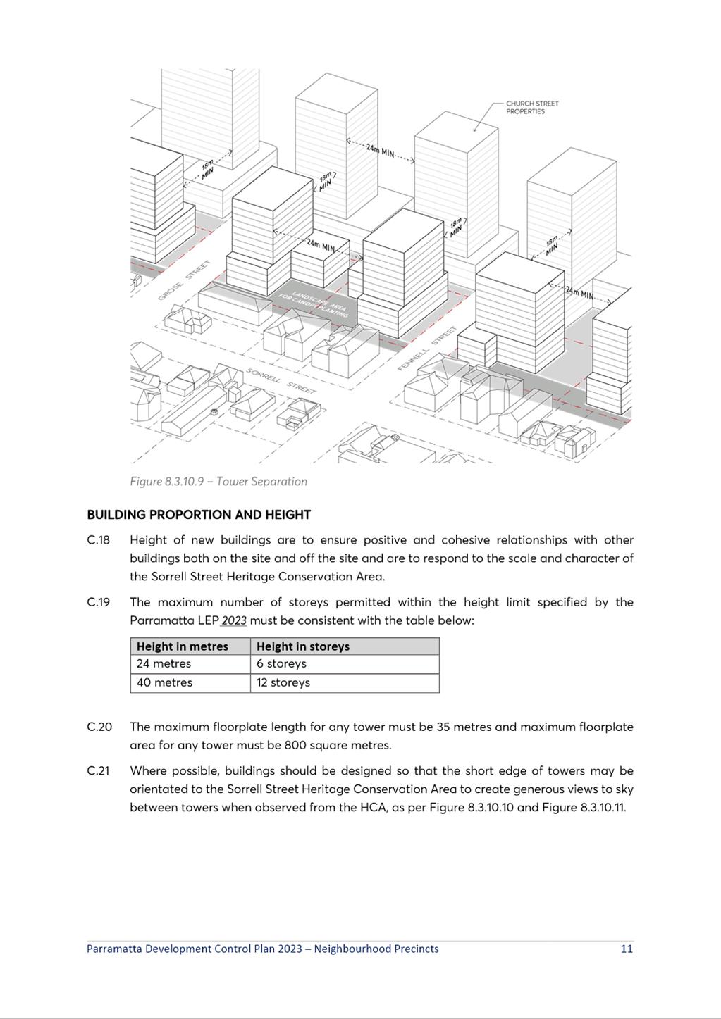
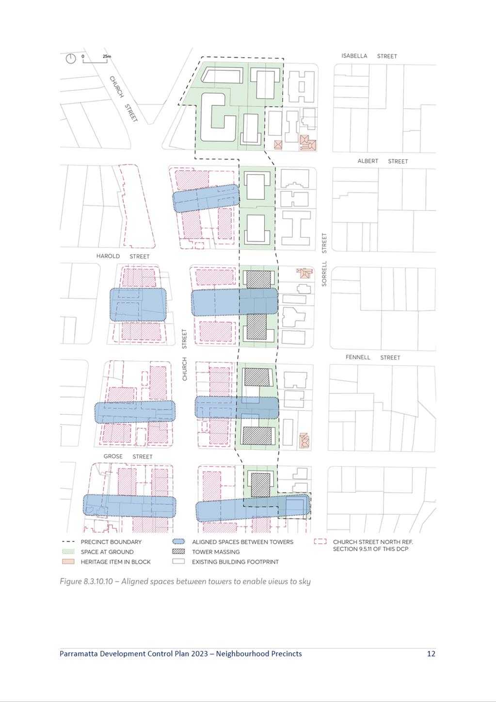
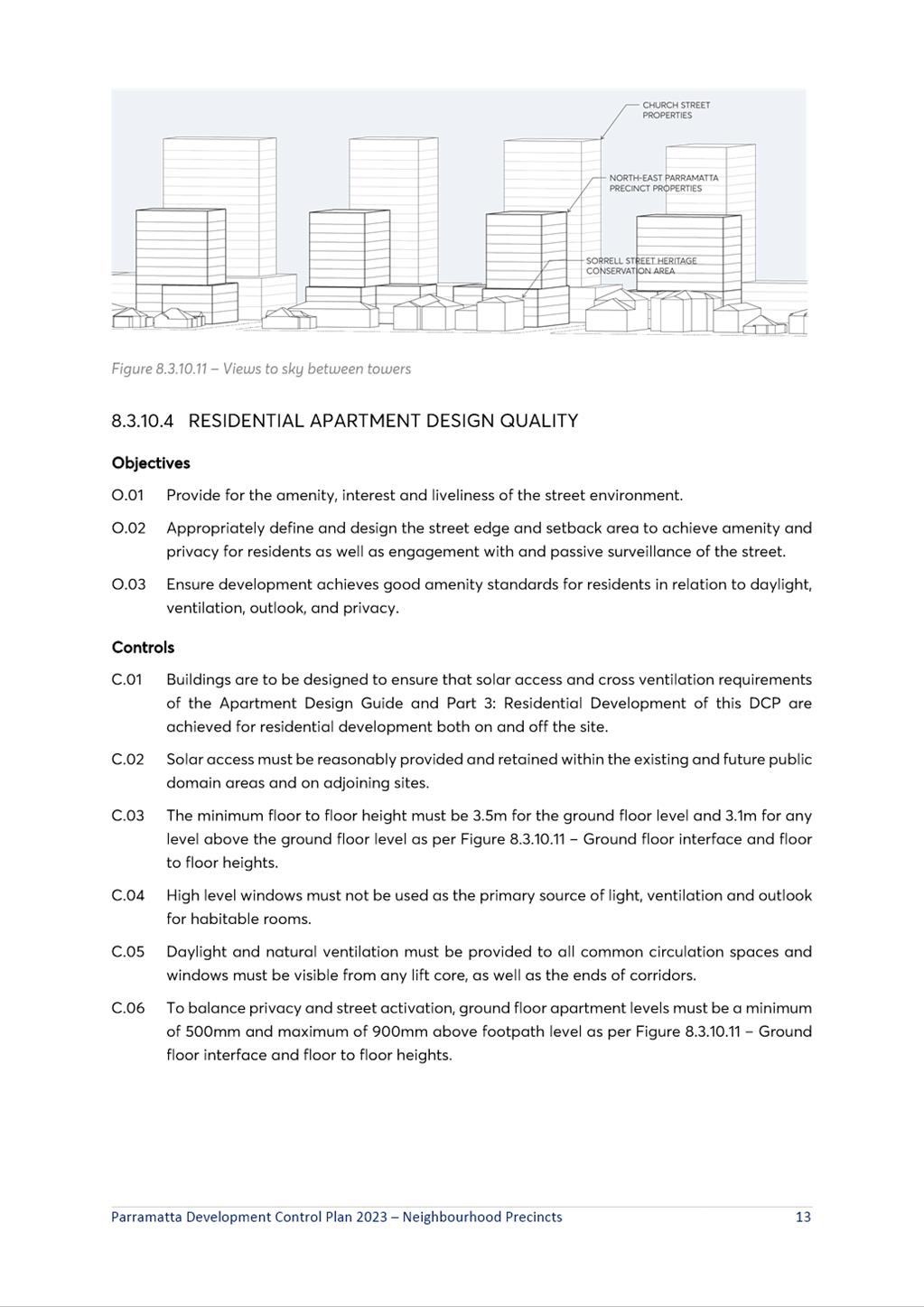
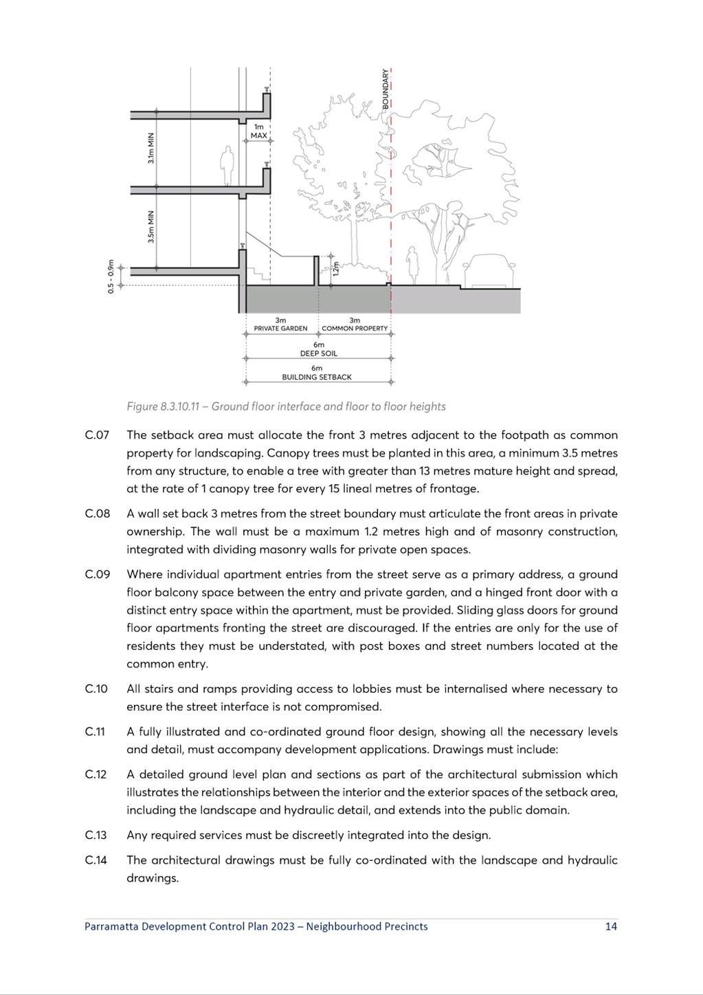
|
Item 6.2 - Attachment 3
|
NEPIA Planning Strategy Community Engagement Report
|