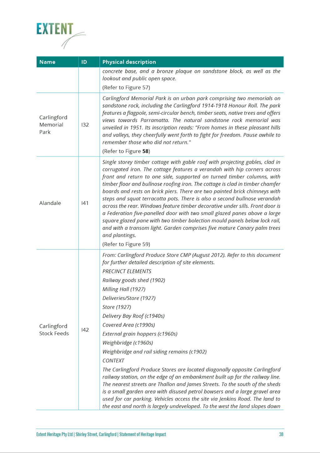
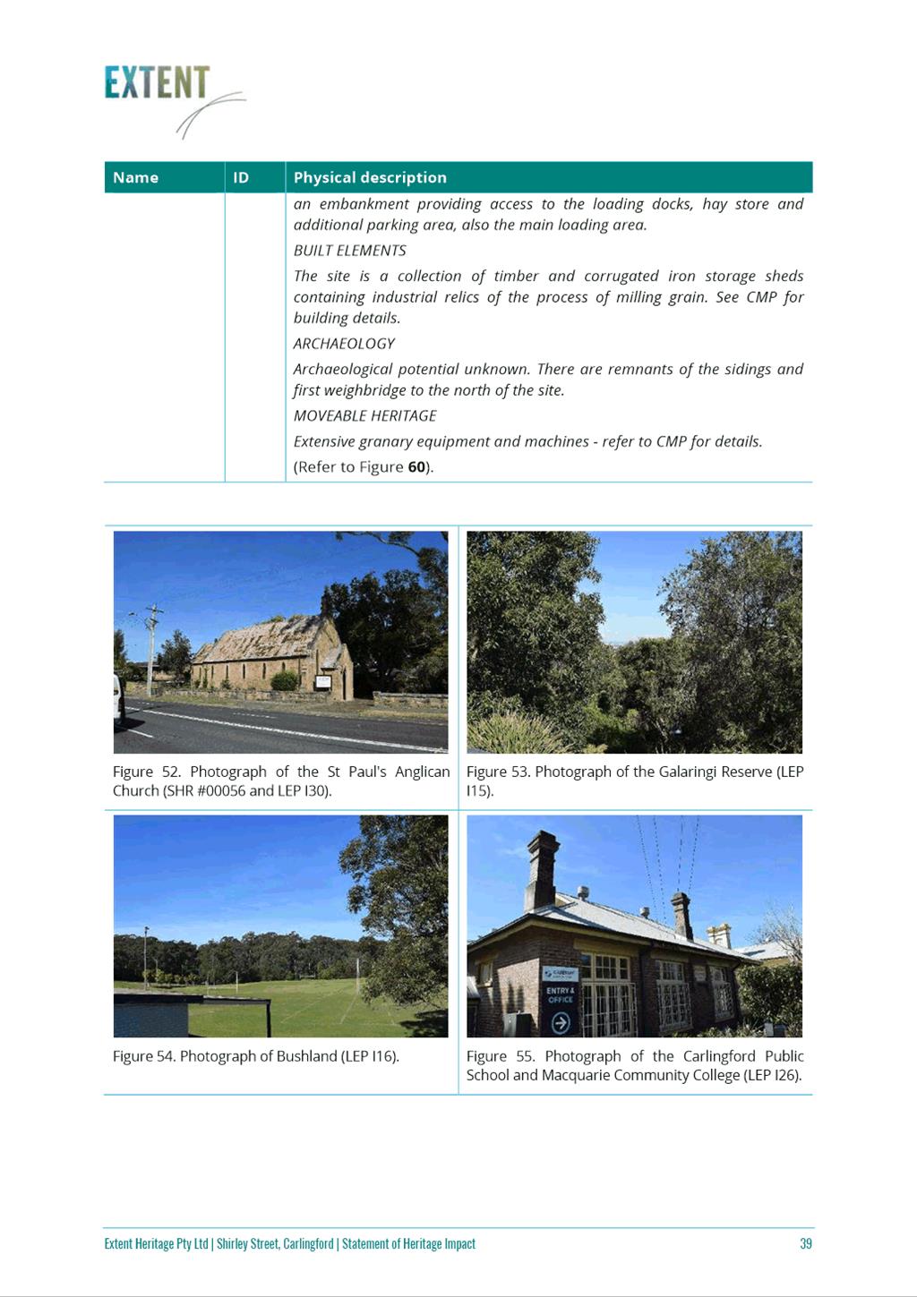
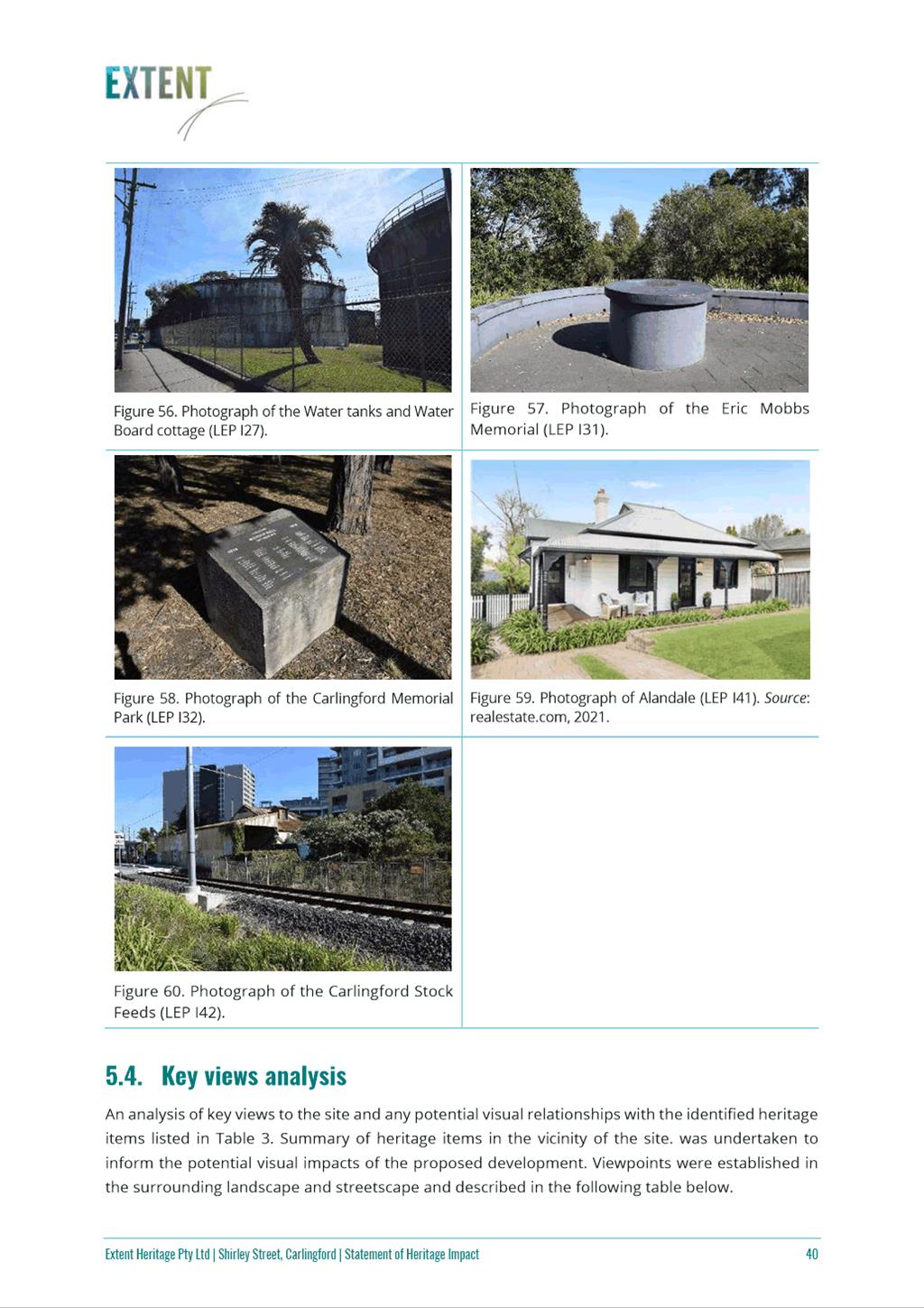
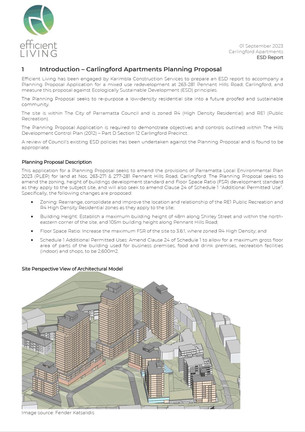
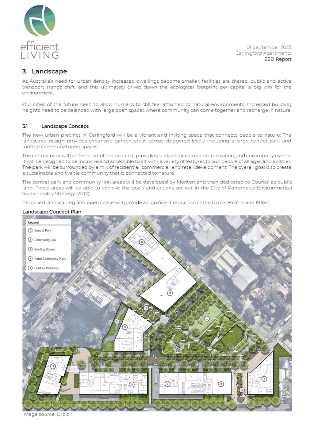
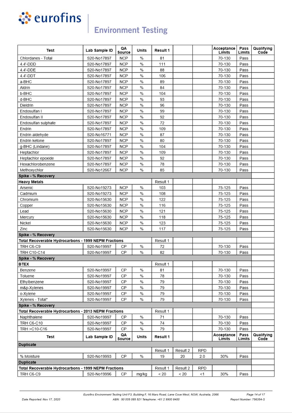
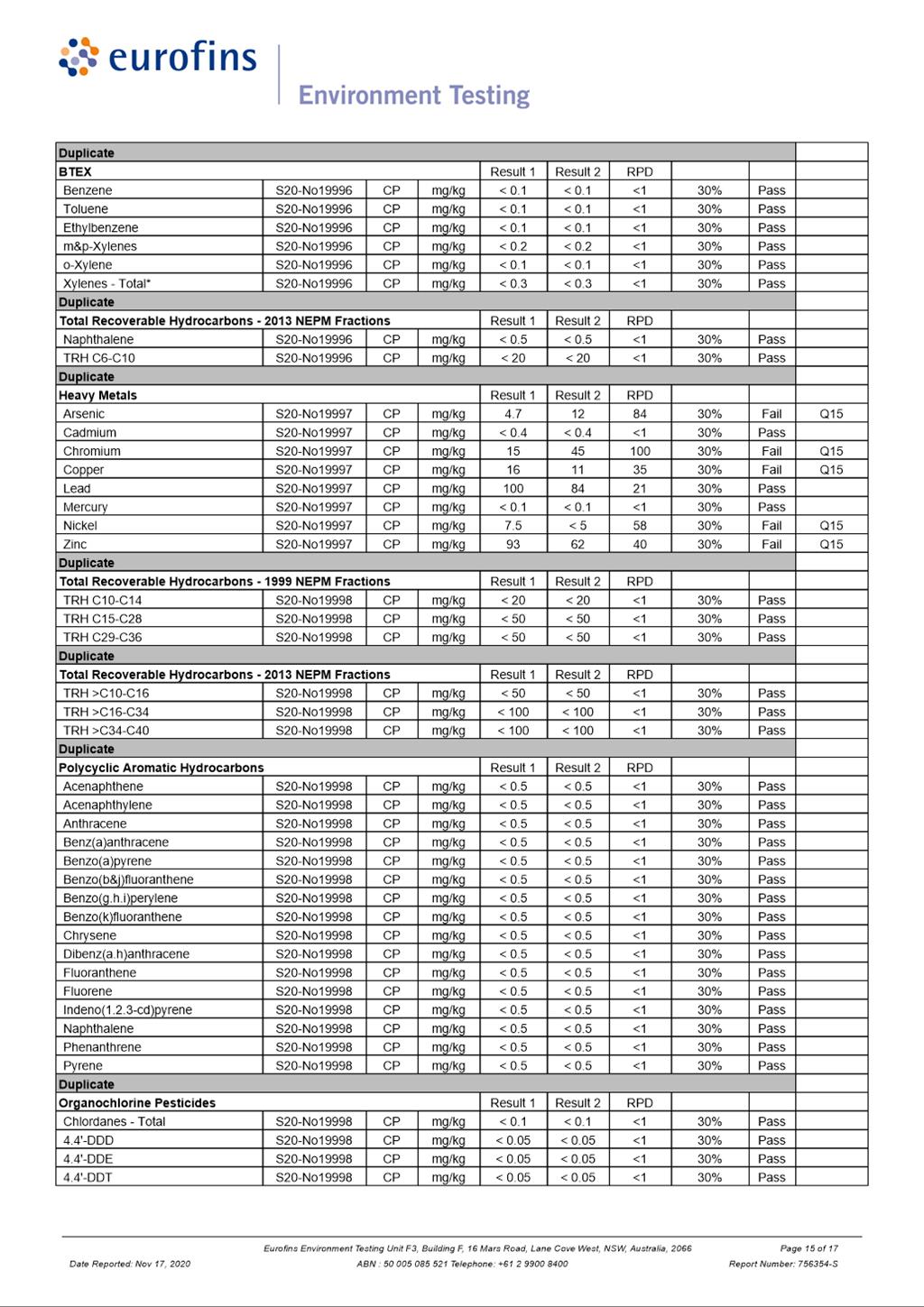
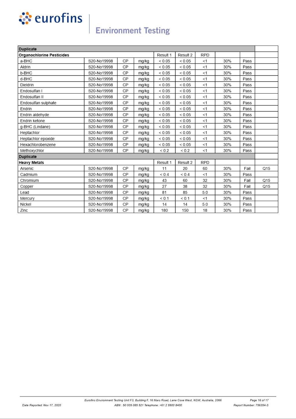
Local Planning Panel 8 November 2023 Item 5.1
ITEM NUMBER 5.1
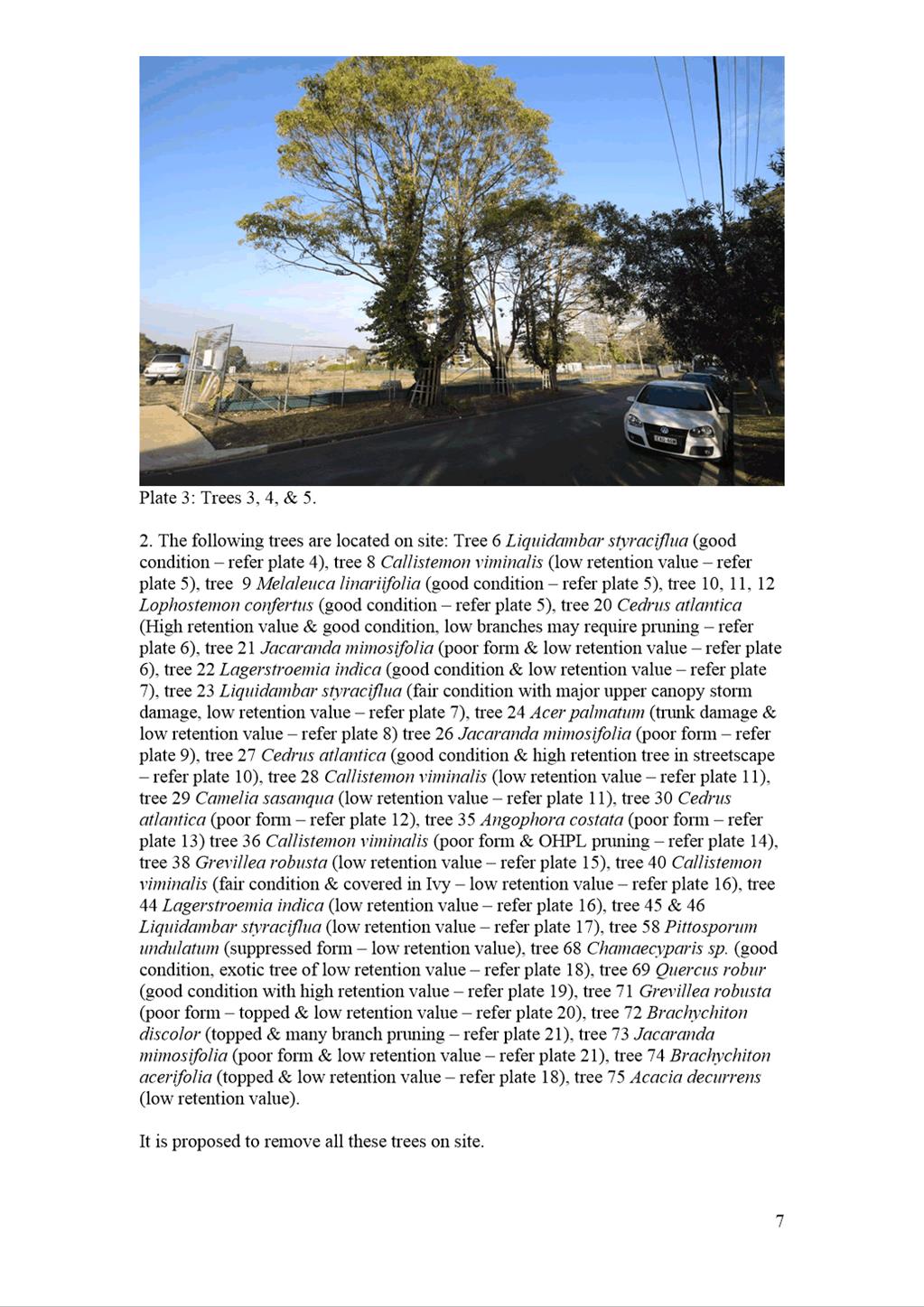
SUBJECT Gateway Request: Planning Proposal, draft Planning Agreement and draft Site-Specific Development Control Plan at 263-273 Pennant Hills Road and 18 Shirley Street, Carlingford
REFERENCE RZ/5/2023 -
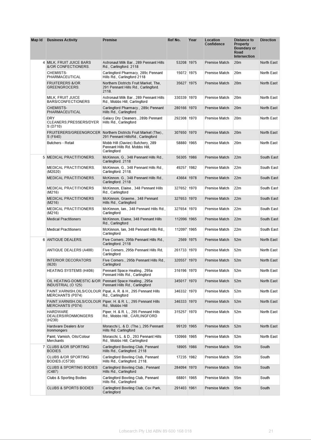
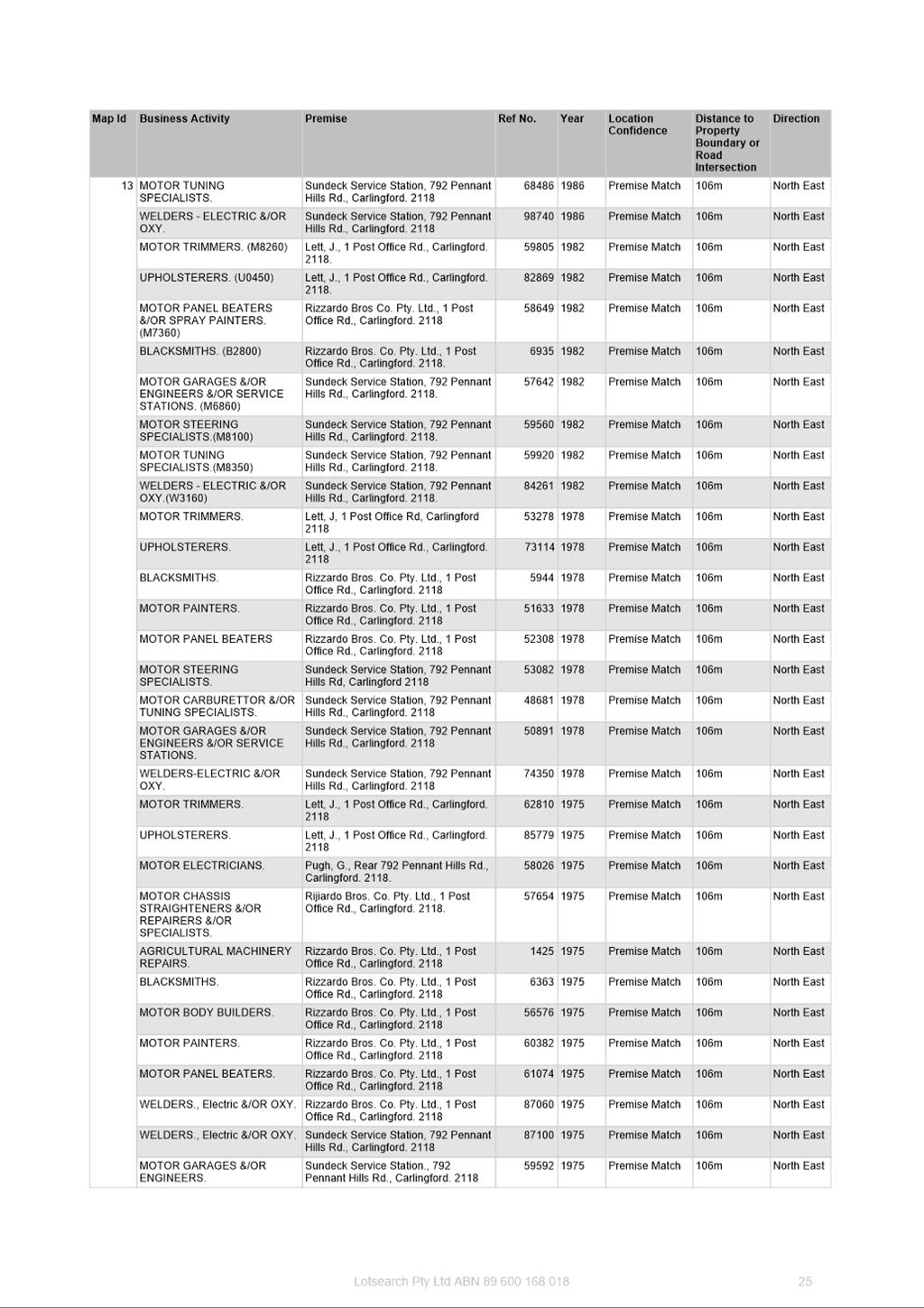
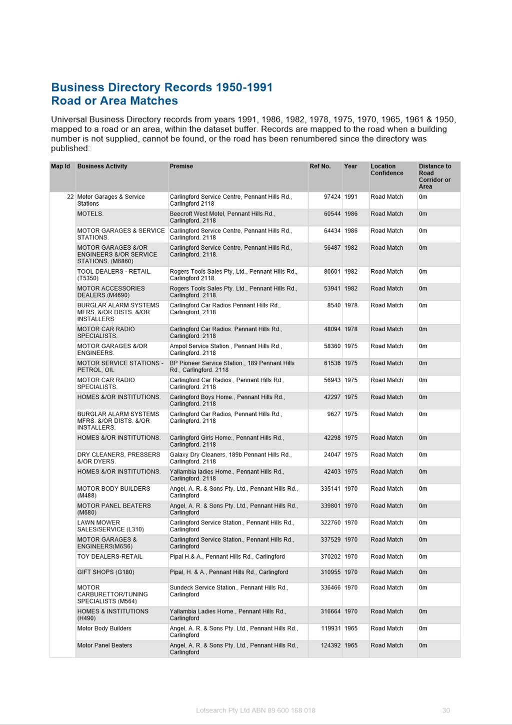
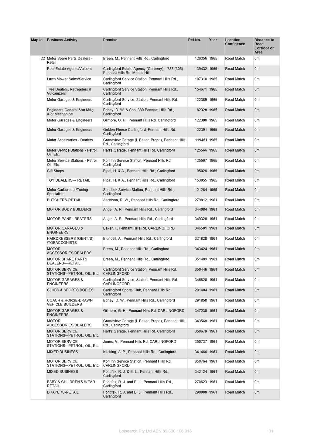
APPLICANT/S Karimbla Properties (No. 61) Pty Ltd
OWNERS Karimbla Properties (No. 61) Pty Ltd
REPORT OF Project Officer Land Use
Development applications considered by Sydney central city planning panel
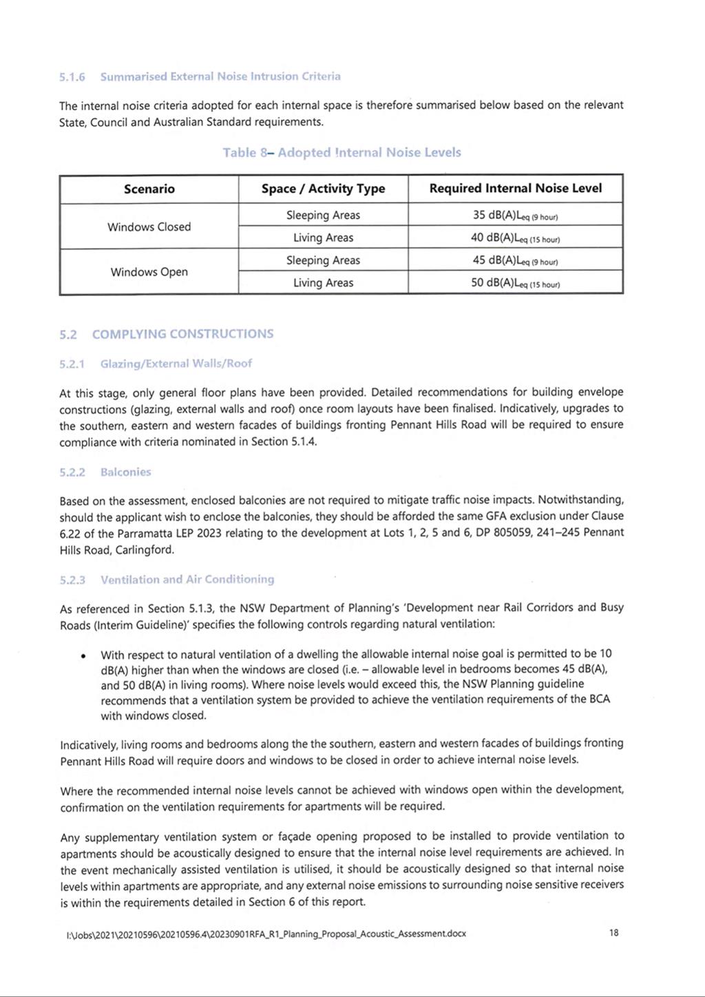
Deferred Commencement Development Consent No.1103/2011/JP issued by the Joint Regional Planning Panel for demolition of existing structures and associated construction of five apartment buildings 9-11 stories containing 450 units and basement parking for 662 cars (active consent granted 21 July 2015).
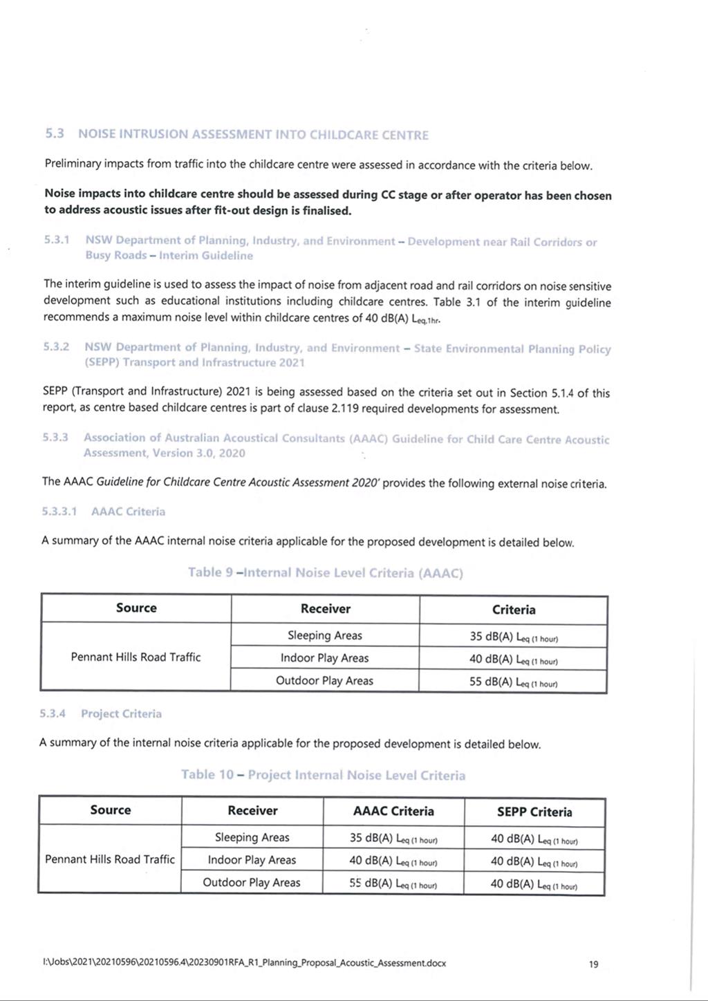
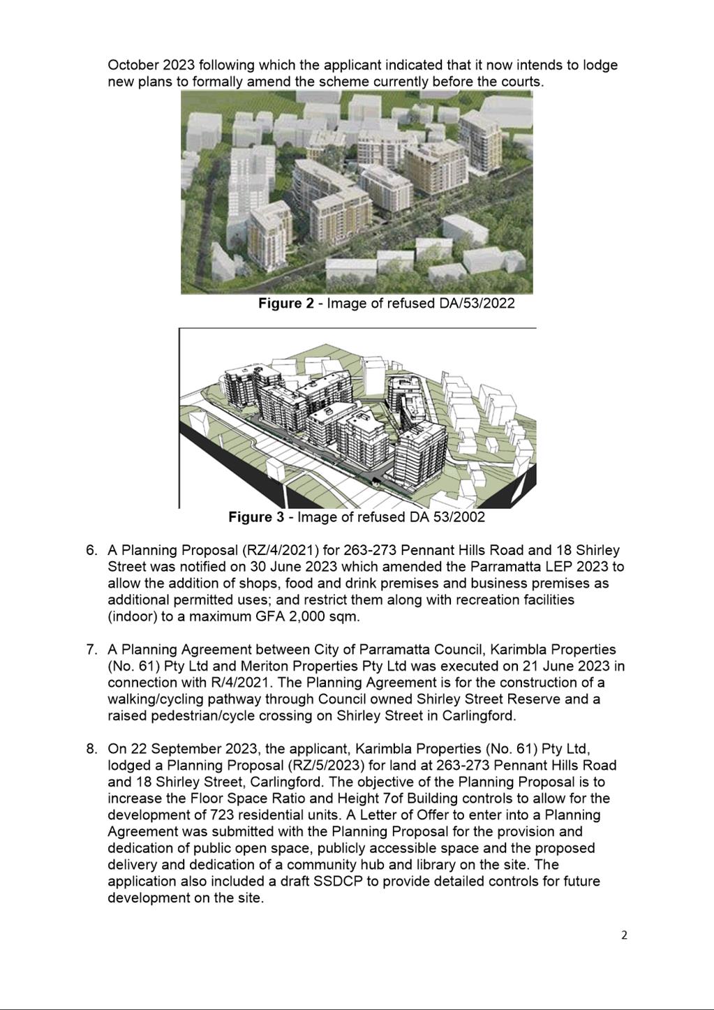
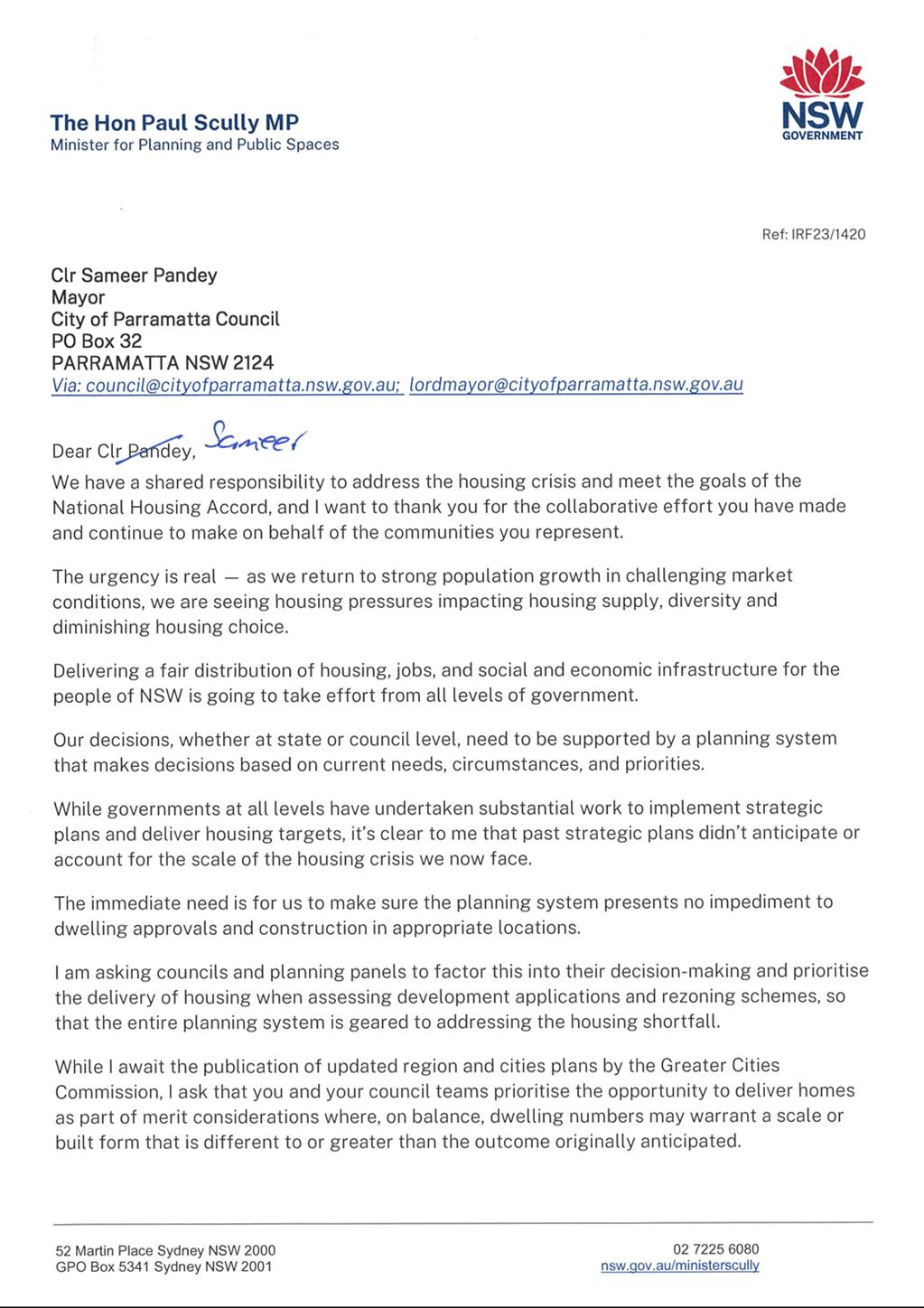
Development application (DA/53/2022) was lodged on 21 January for 6 x 10-12 storey buildings comprising 629 residential units, childcare centre for 110 children, 17 neighborhood retail shops and 1,146 basement car parking spaces; publicly accessible open spaces and through site links; landscaping; tree removal; demolition of existing buildings. The application was refused by the Sydney Central City Planning Panel on 7 December 2022. The DA is currently the subject of an appeal to the Land and Environment Court and a conciliation conference was held on 20 October 2023.
PURPOSE
To seek Local Planning Panel (LPP) advice on a Planning Proposal for land at 263-273 Pennant Hills Road and 18 Shirley Street, Carlingford for the purposes of seeking a Gateway Determination from the Department of Planning and Environment.
That the Local Planning Panel consider the following Council Officer recommendation in its advice to Council:
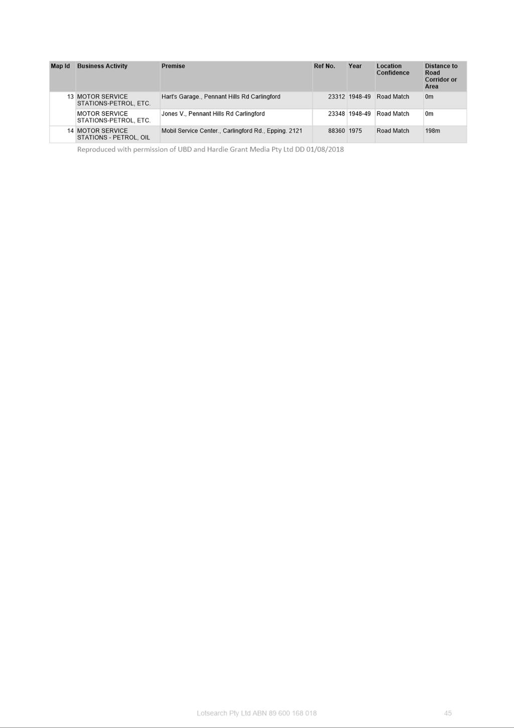
(a) That Council approve for the purposes of seeking a Gateway Determination from the Department of Planning and Environment (DPE), the Planning Proposal for land at 263-273 Pennant Hills Road and 18 Shirley Street, Carlingford (Attachment 1) which seeks to amend the Parramatta Local Environmental Plan 2023 (PLEP 2023) in relation to the subject site by:
i. Reconfiguring the existing R4 High Density Residential and RE1 Public Open Space zones.
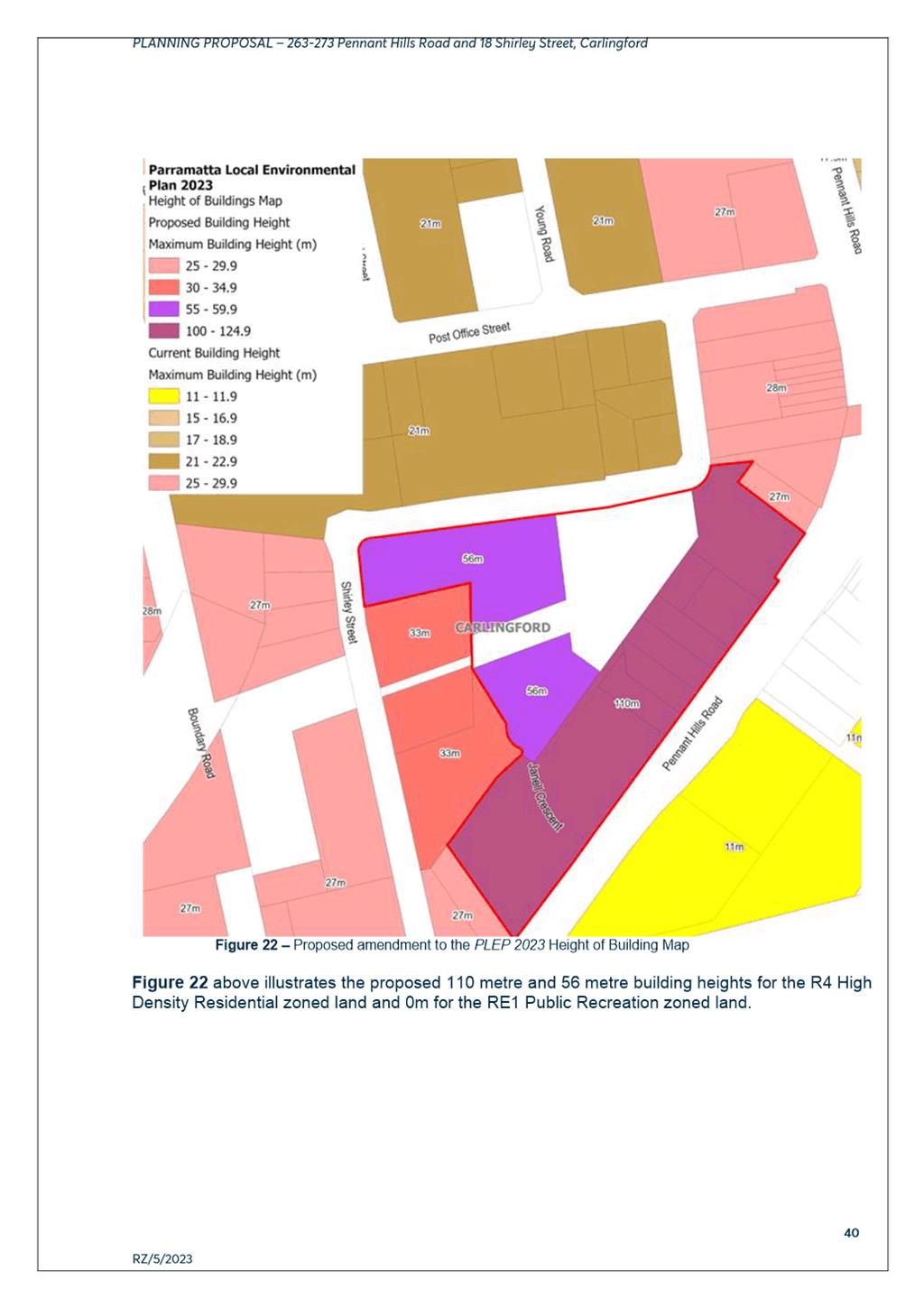
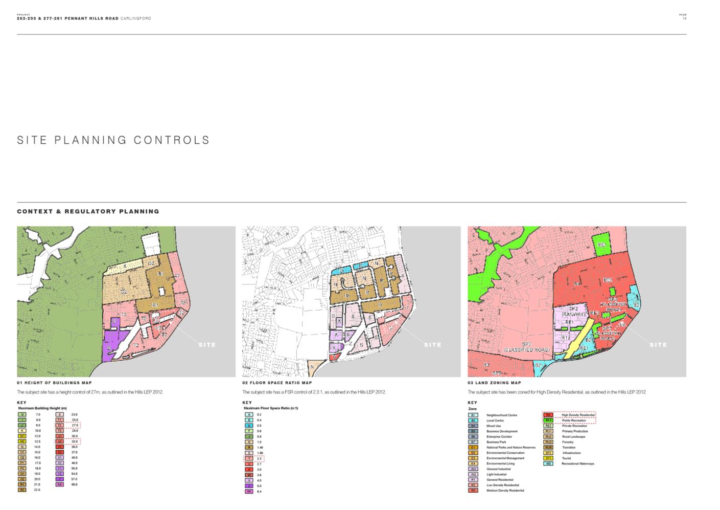
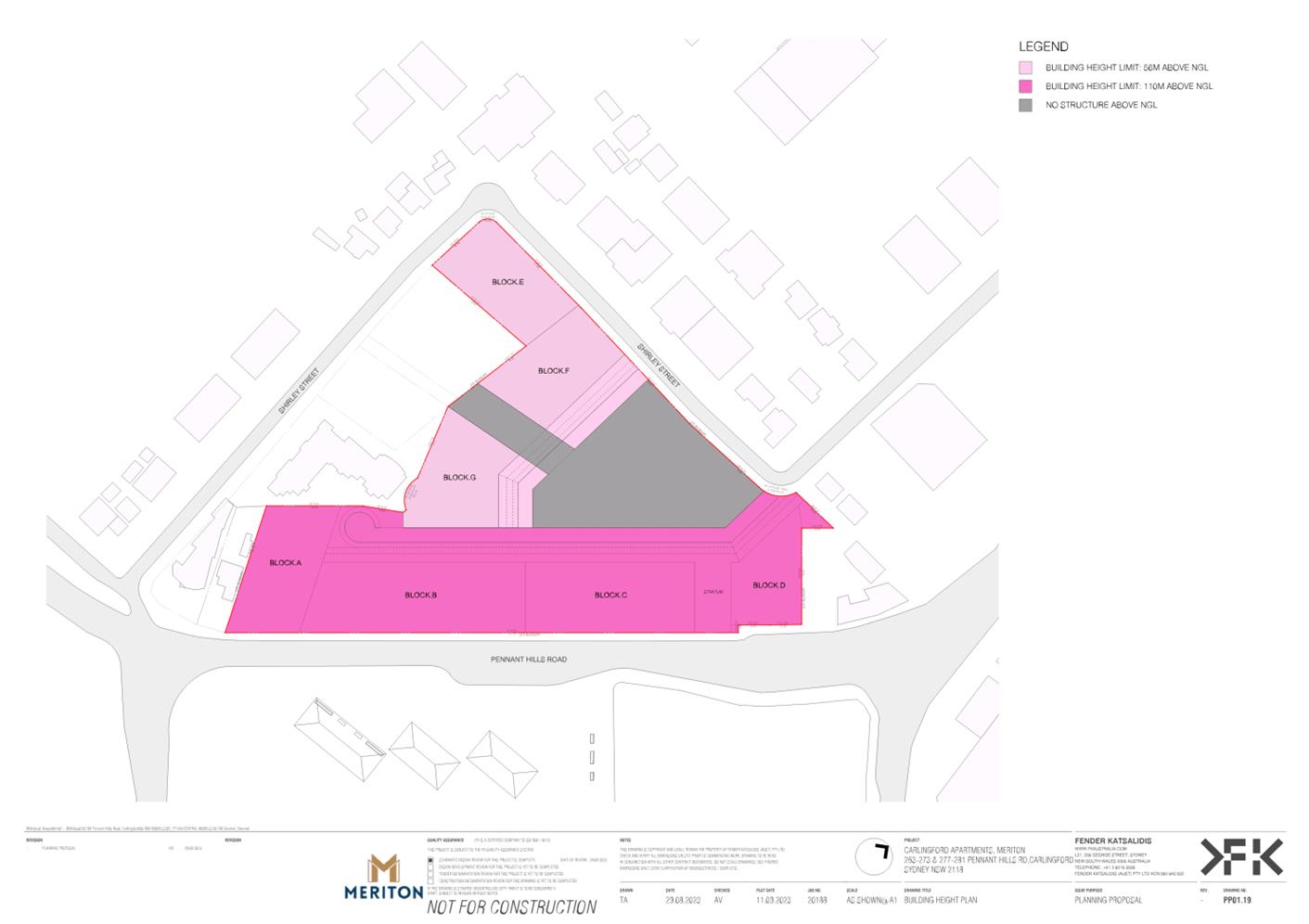
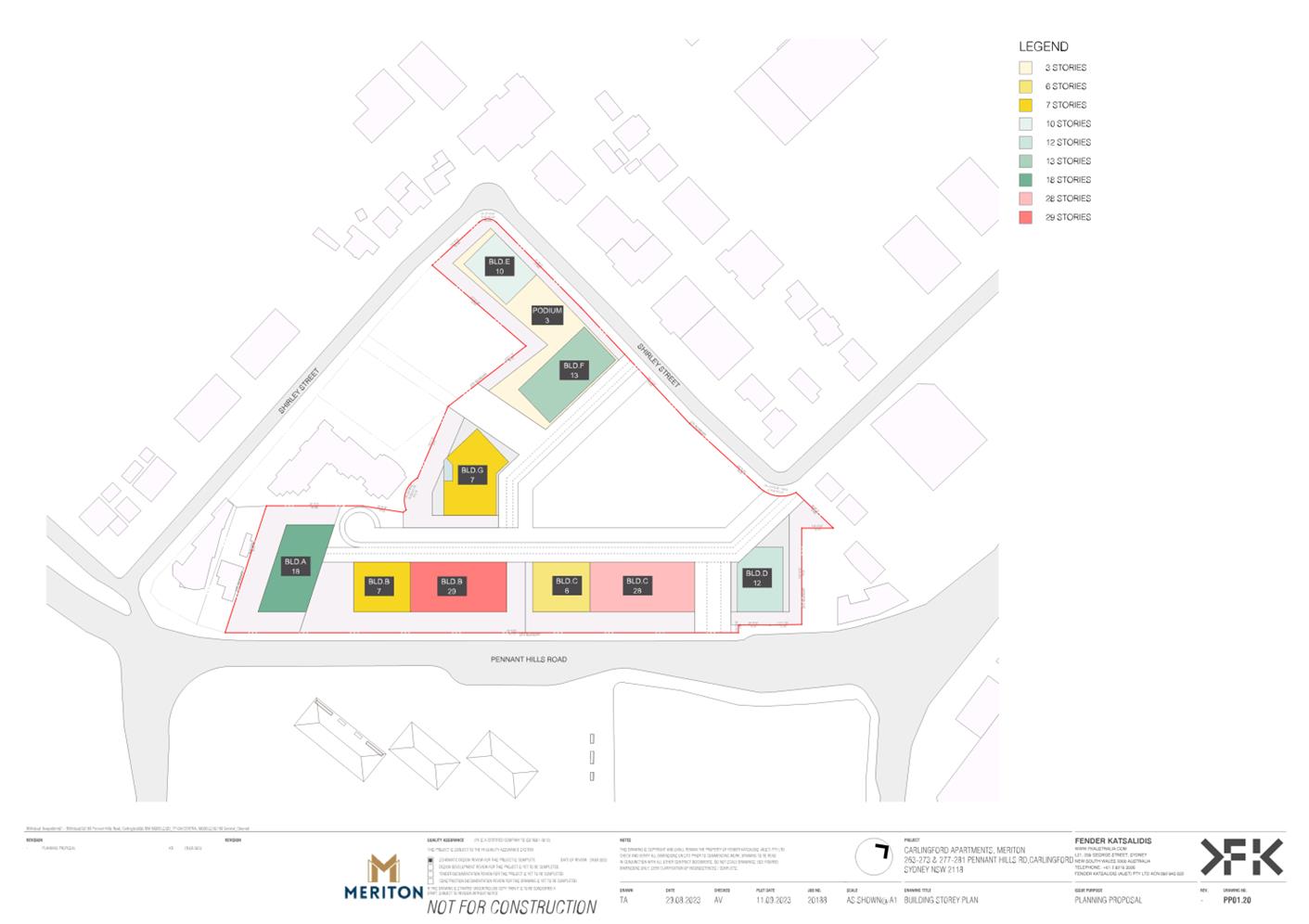
ii. Increasing the Maximum Height of Building control from 33m (11 storeys) on the Pennant Hills Road frontage to 110m (29 storeys) and from 27m (7 storeys) on the remainder of the R4 zoned portion of the site to 56m (13 storeys).
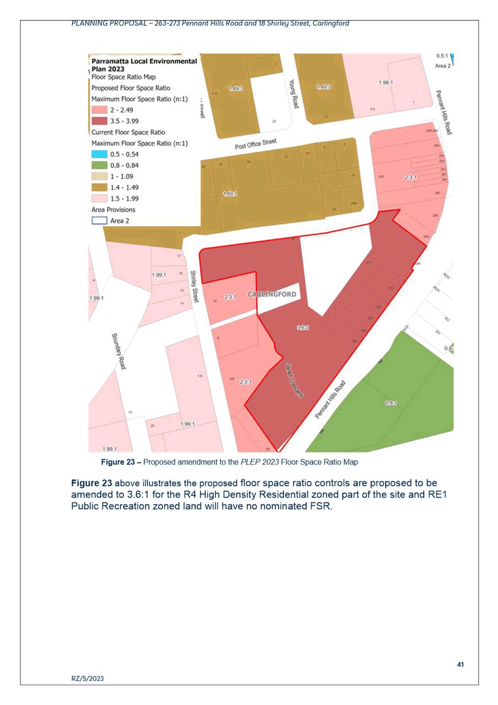
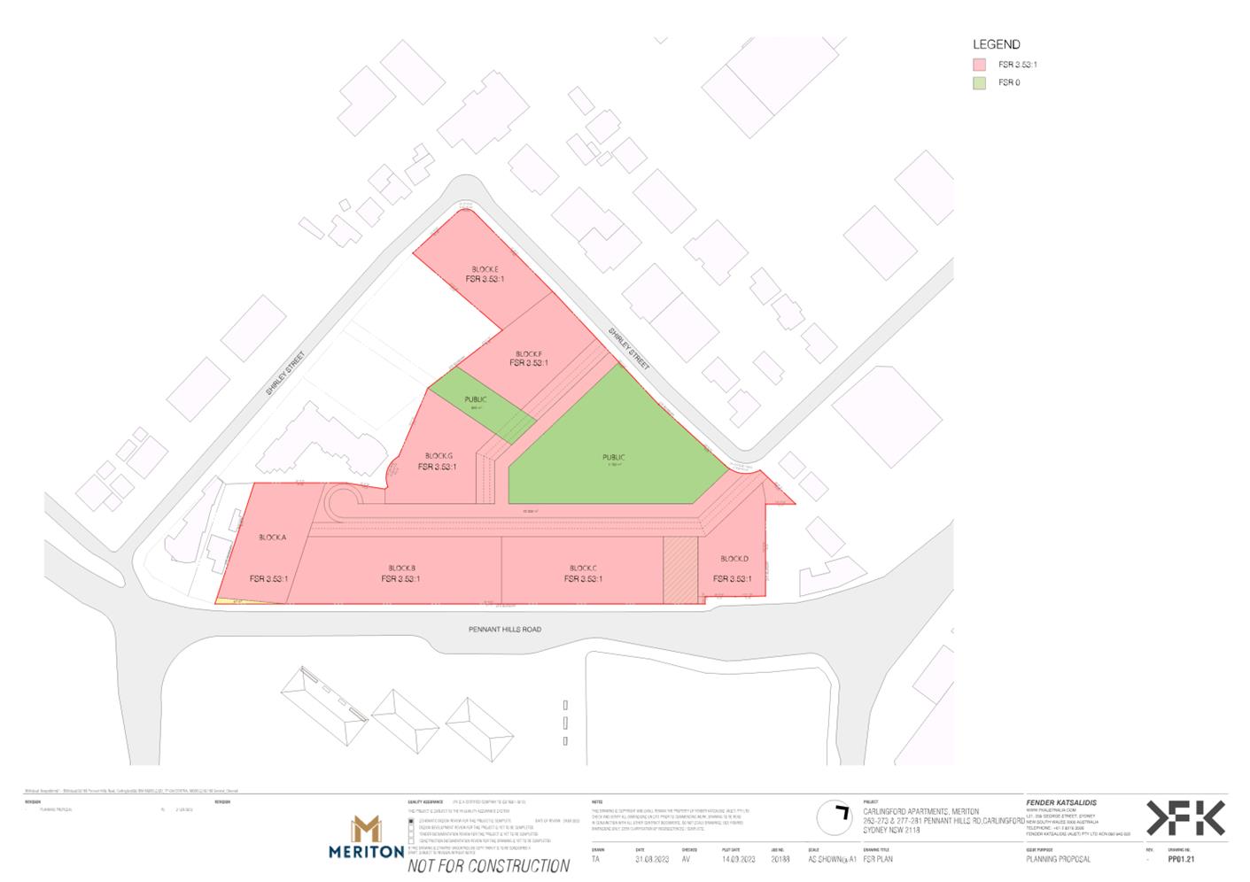
iii. Increasing the Maximum Floor Space Ratio control for the R4 High Density Residential zoned land from 2.3:1 to 3.6:1.
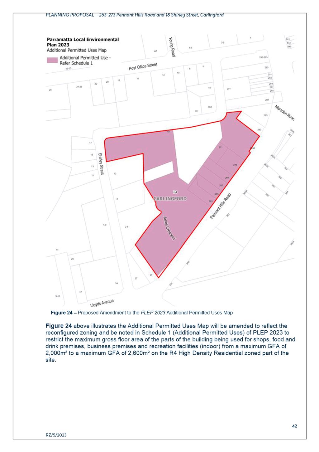
iv. Amending Schedule 1 Additional Permitted Uses to increase the maximum gross floor area of parts of the buildings used for business premises, food and drink premises, recreational facilities (indoor) and shops on the R4 High Density Residential zoned part of the site from 2,000 sqm to 2,600 sqm.
(b) That Council request the DPE to provide Council with the authorisation to exercise its plan-making delegations for this Planning Proposal.
(c) That Council authorise the CEO:
i. To amend the draft site-specific Development Control Plan (SSDCP) (Attachment 3) to align with the Planning Proposal and address the matters as described in this report;
ii. To draft the Planning Agreement subject to the details within the submitted Letter of Offer provided at Attachment 4 which address the matters described in this report; and
iii. If a Gateway Determination is issued by DPE, that the Planning Agreement and SSDCP are placed on public exhibition concurrently with the Planning Proposal.
(d) That Council authorise the CEO to correct any minor anomalies of a non-policy and administrative nature that may arise during the plan-making process and finalisation of the documents.
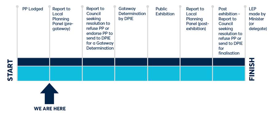
PLANNING PROPOSAL TIMELINE
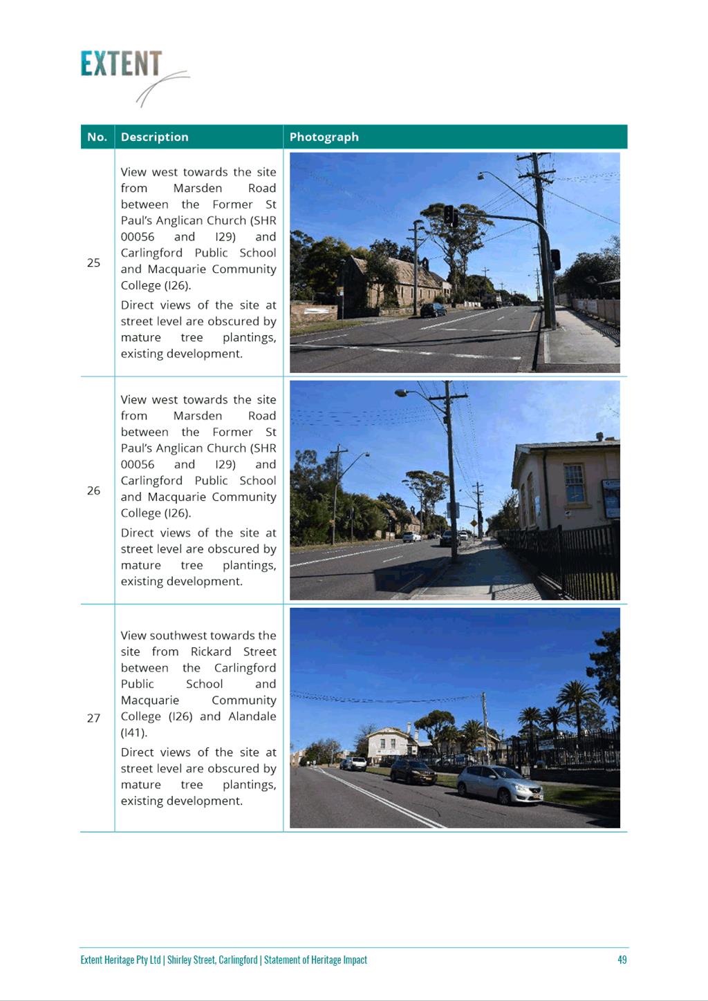
 SUMMARY
1. This report seeks the advice of the Local Planning Panel on a Planning Proposal for land at 18 Shirley Street and 263-273 Pennant Hills Road, Carlingford land for the purposes of seeking a Gateway Determination from the Department of Planning and Environment (DPE).
2. The Planning Proposal seeks to amend Parramatta Local Environmental Plan 2023 (PLEP 2023) in order to develop the site for high density residential development and commercial uses including reconfiguring the existing residential and open space zoning.
BACKGROUND
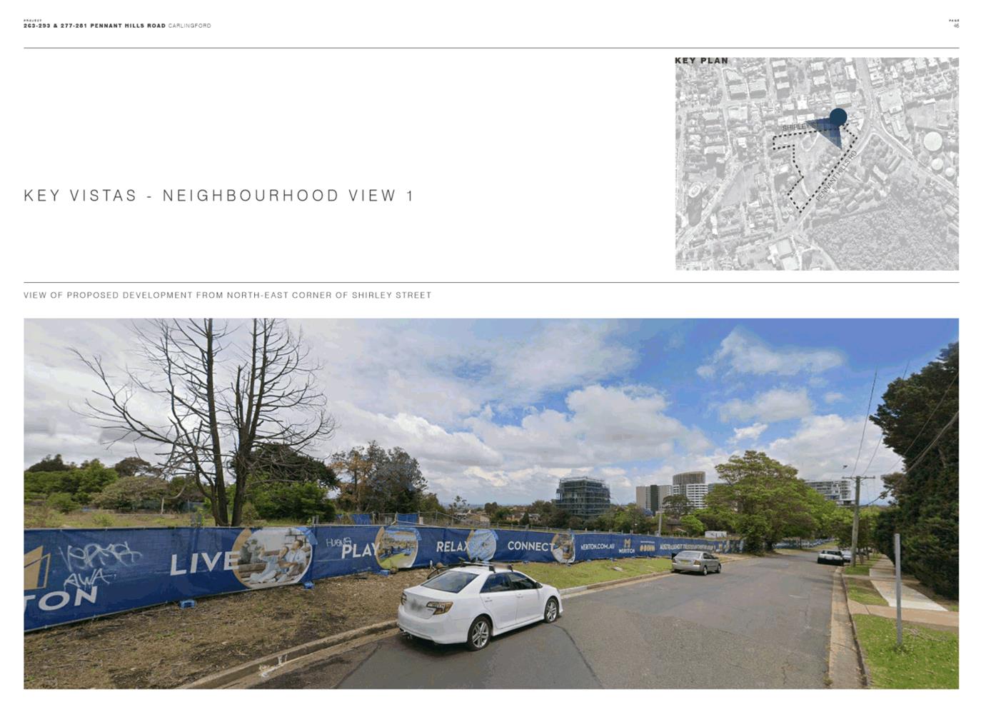
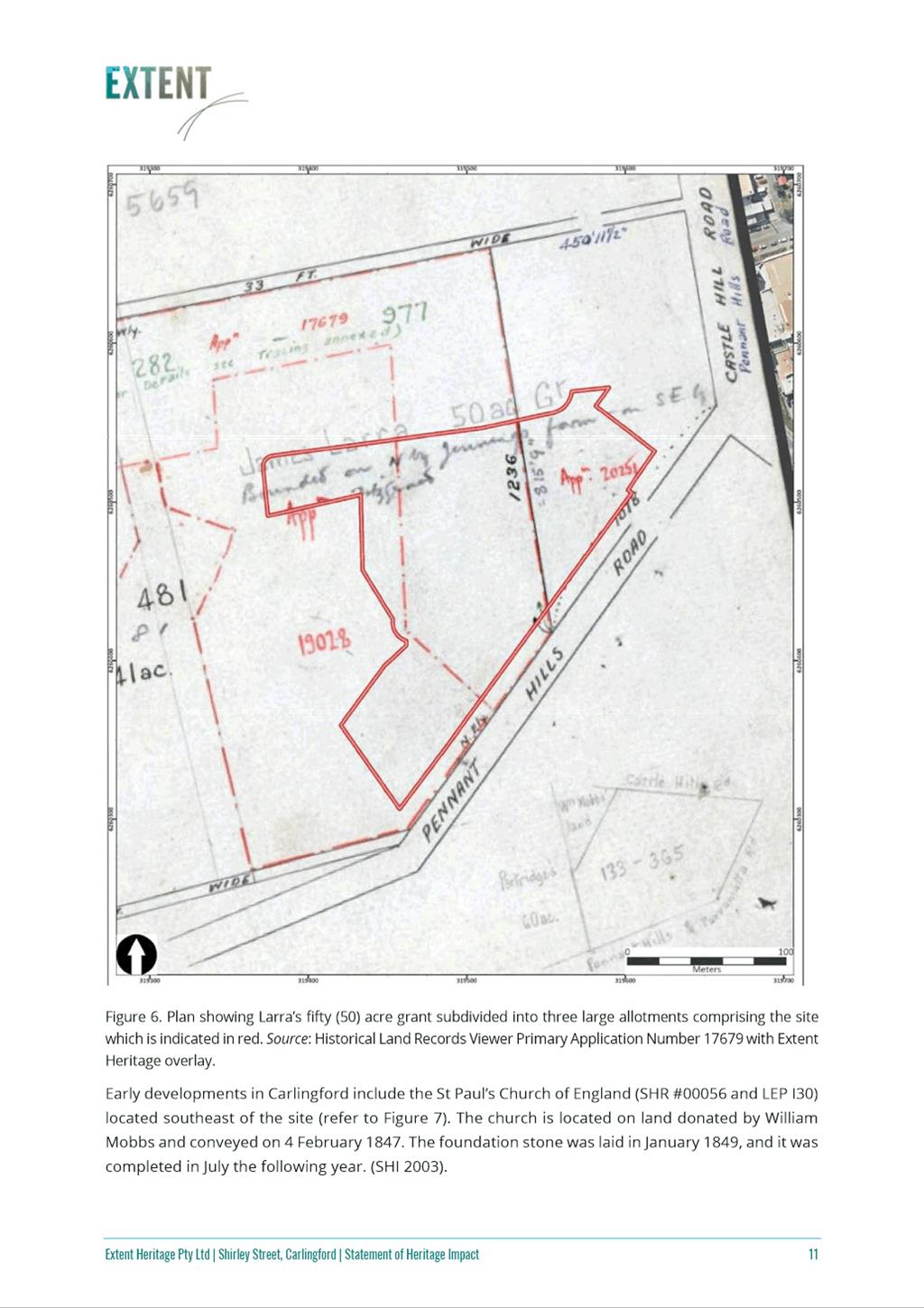
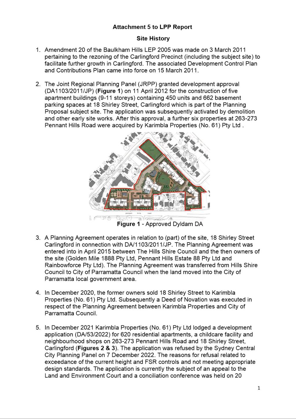
3. In September 2023, Karimbla Properties (No.61) Pty Ltd lodged a Planning Proposal with the City of Parramatta Council for land at 18 Shirley Street and 263-273 Pennant Hills Road, Carlingford to enable the development of the site for high density residential development and commercial uses including reconfiguring the existing residential and open space zoning.
4. The site has a complex planning history including an active development consent and associated Voluntary Planning Agreement that applies to the 18 Shirley Street portion of the site. A development application for 629 residential apartments, a childcare facility and neighbourhood shops on the subject site was refused by the Sydney Central City Planning Panel on 7 December 2022, and is subject to a current appeal to the Land and Environment Court. A detailed site planning history is provided at Attachment 5.
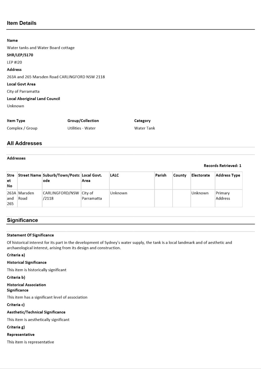
SITE DESCRIPTION
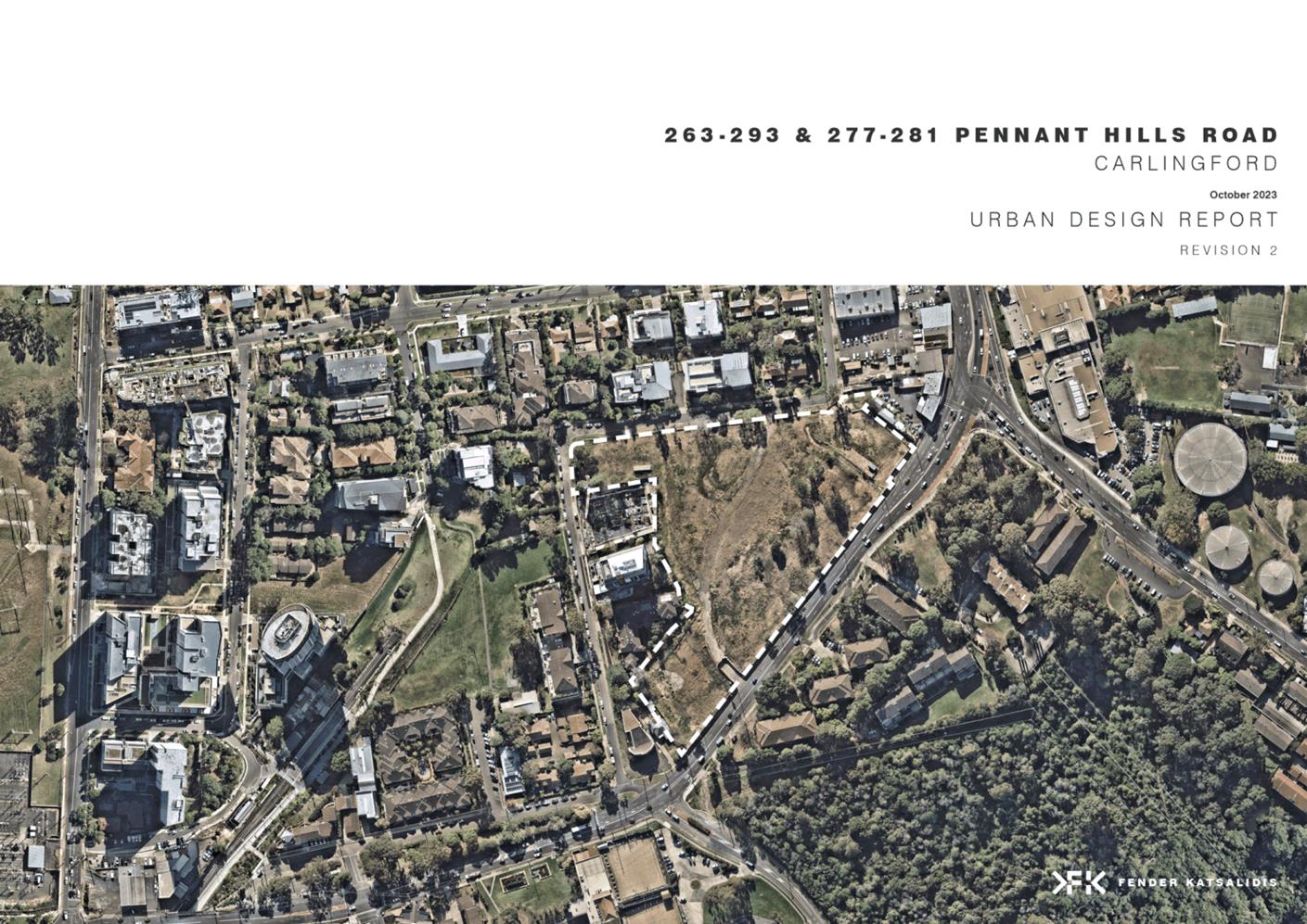
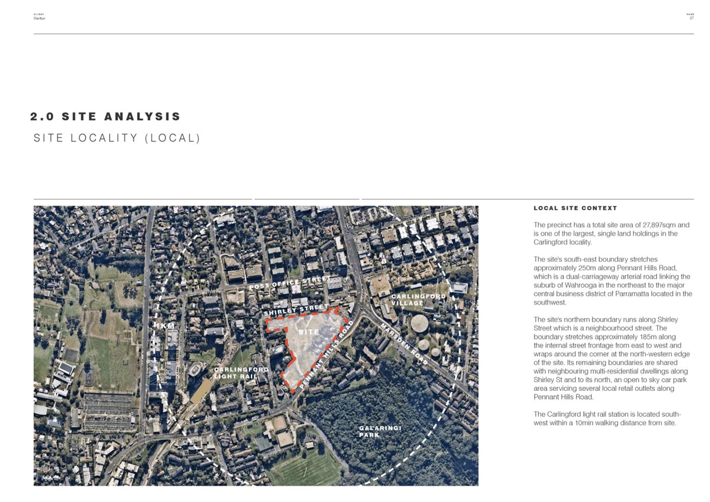
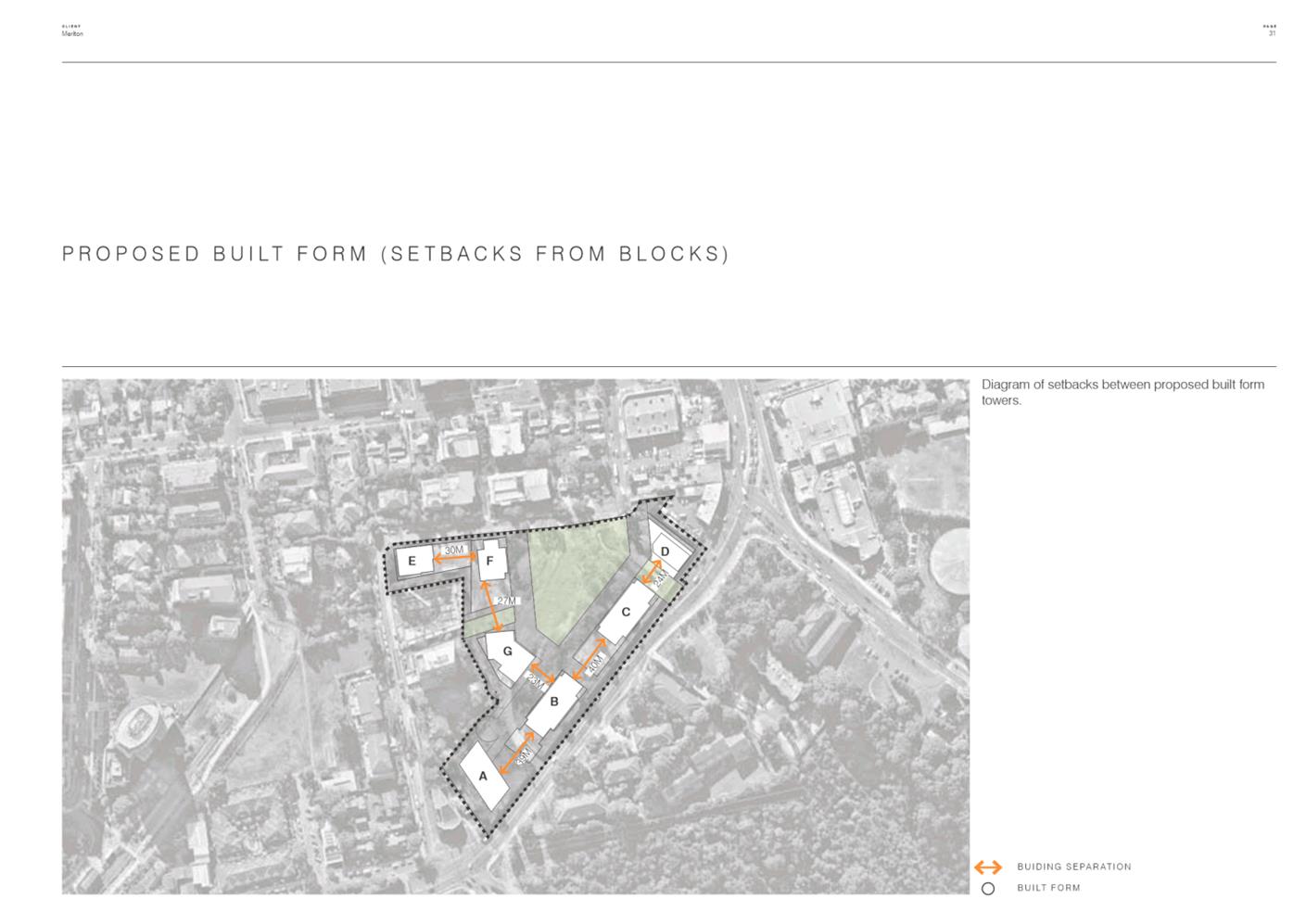
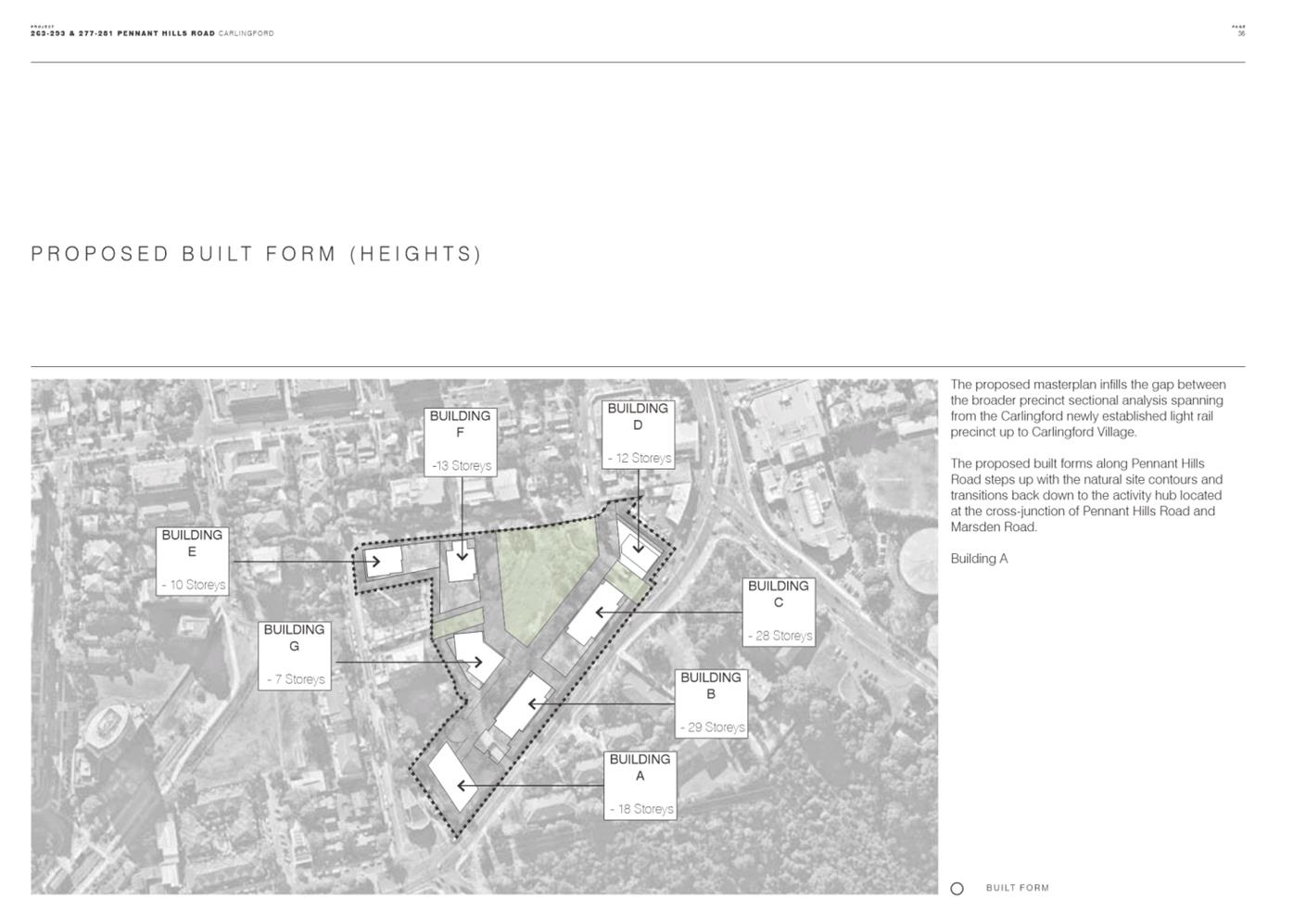
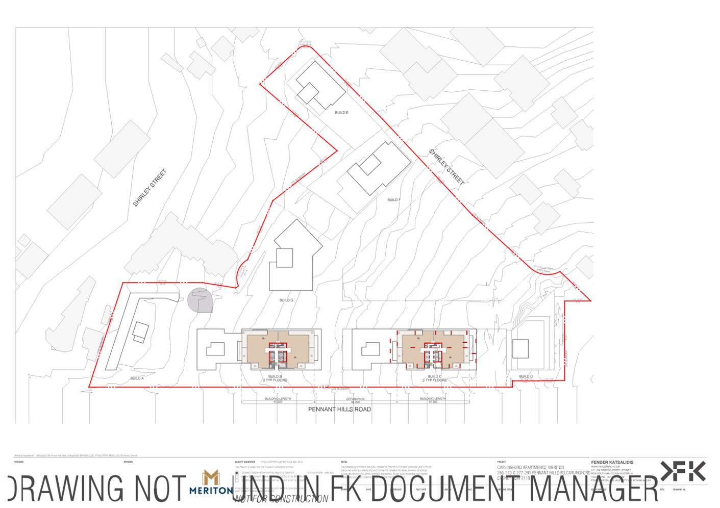
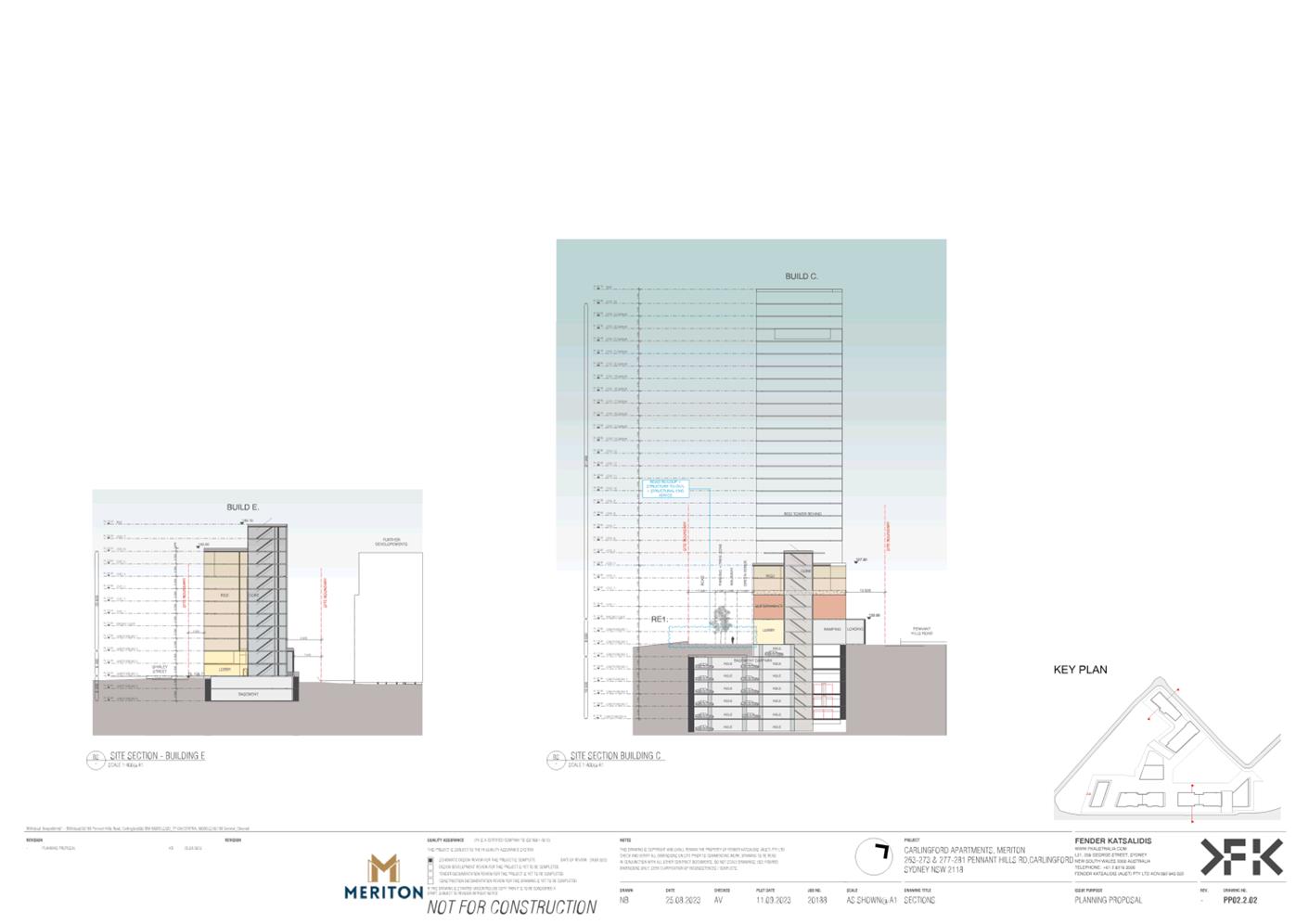
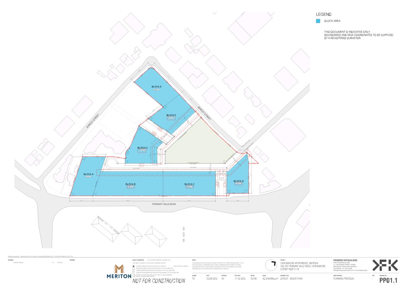
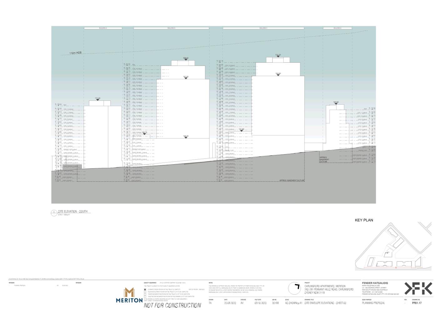
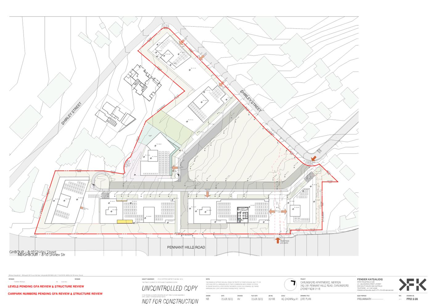
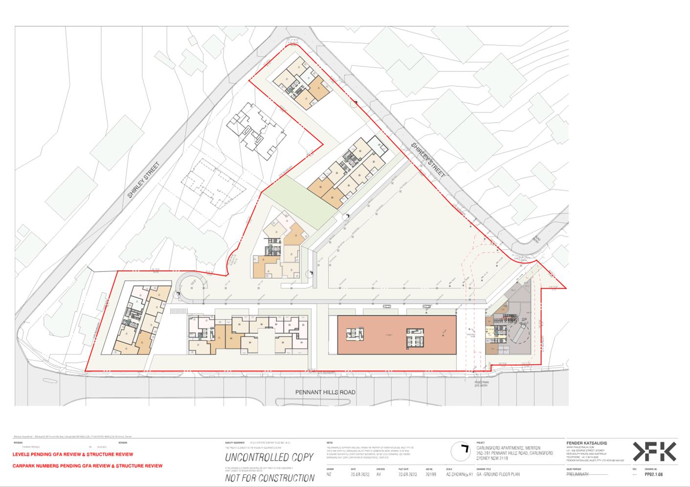
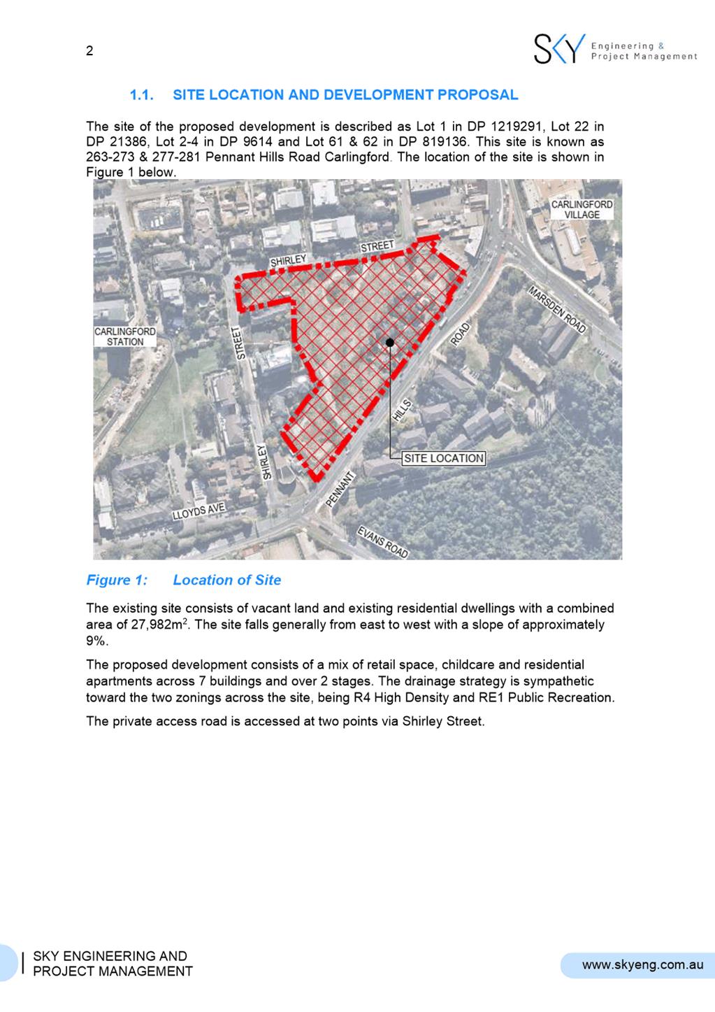
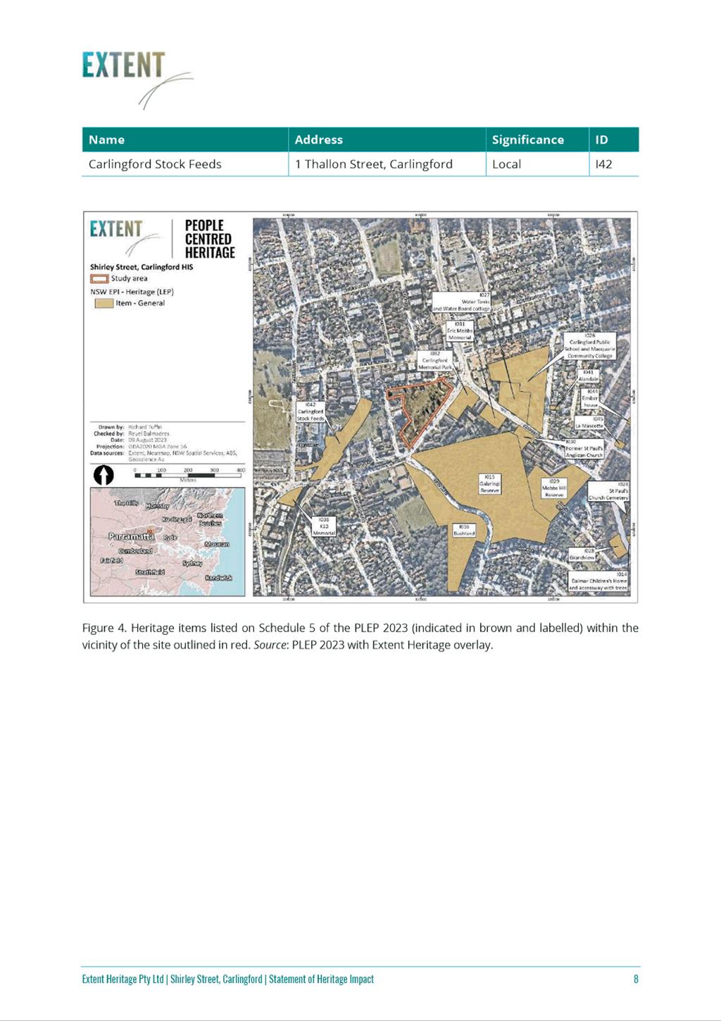
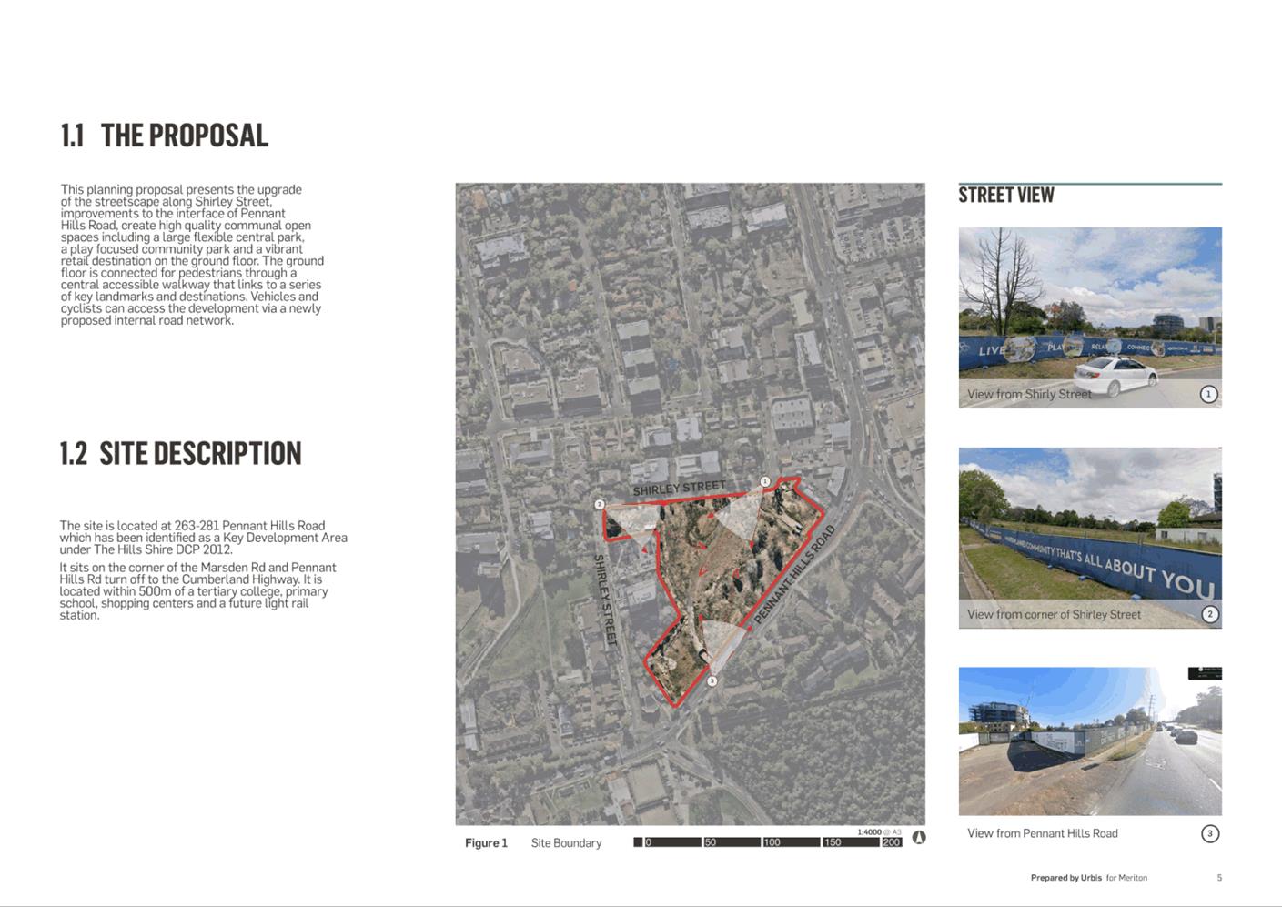
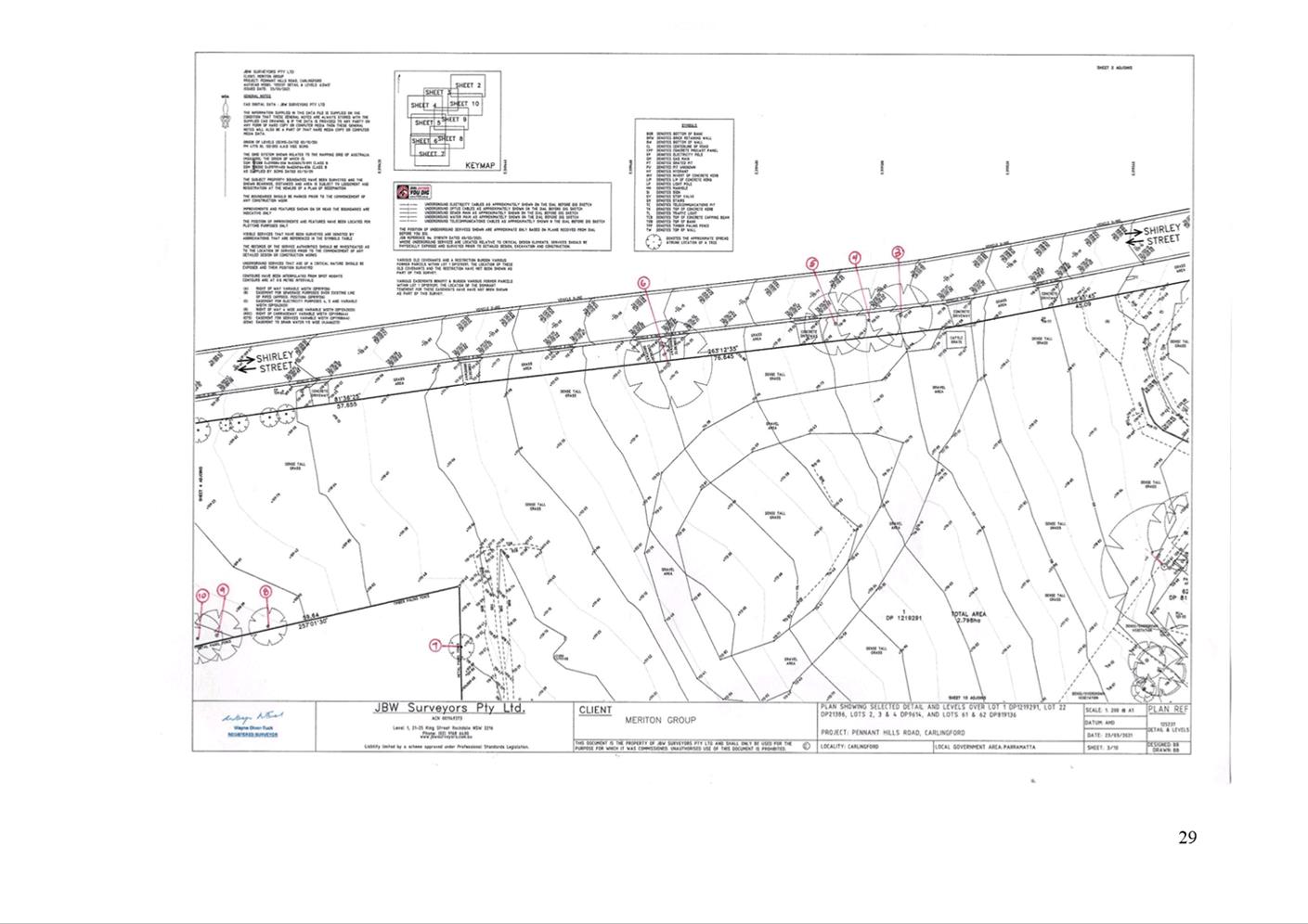
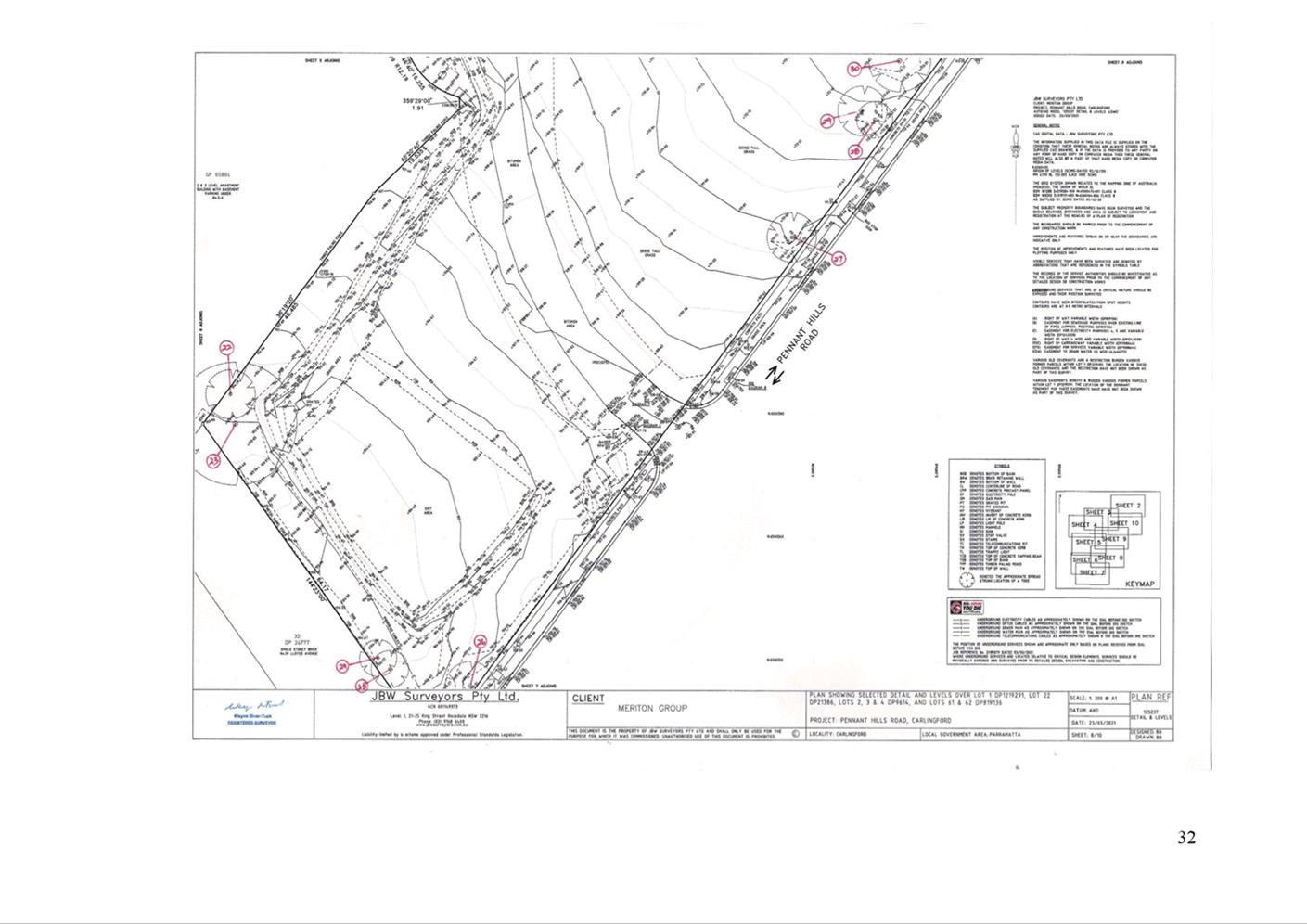
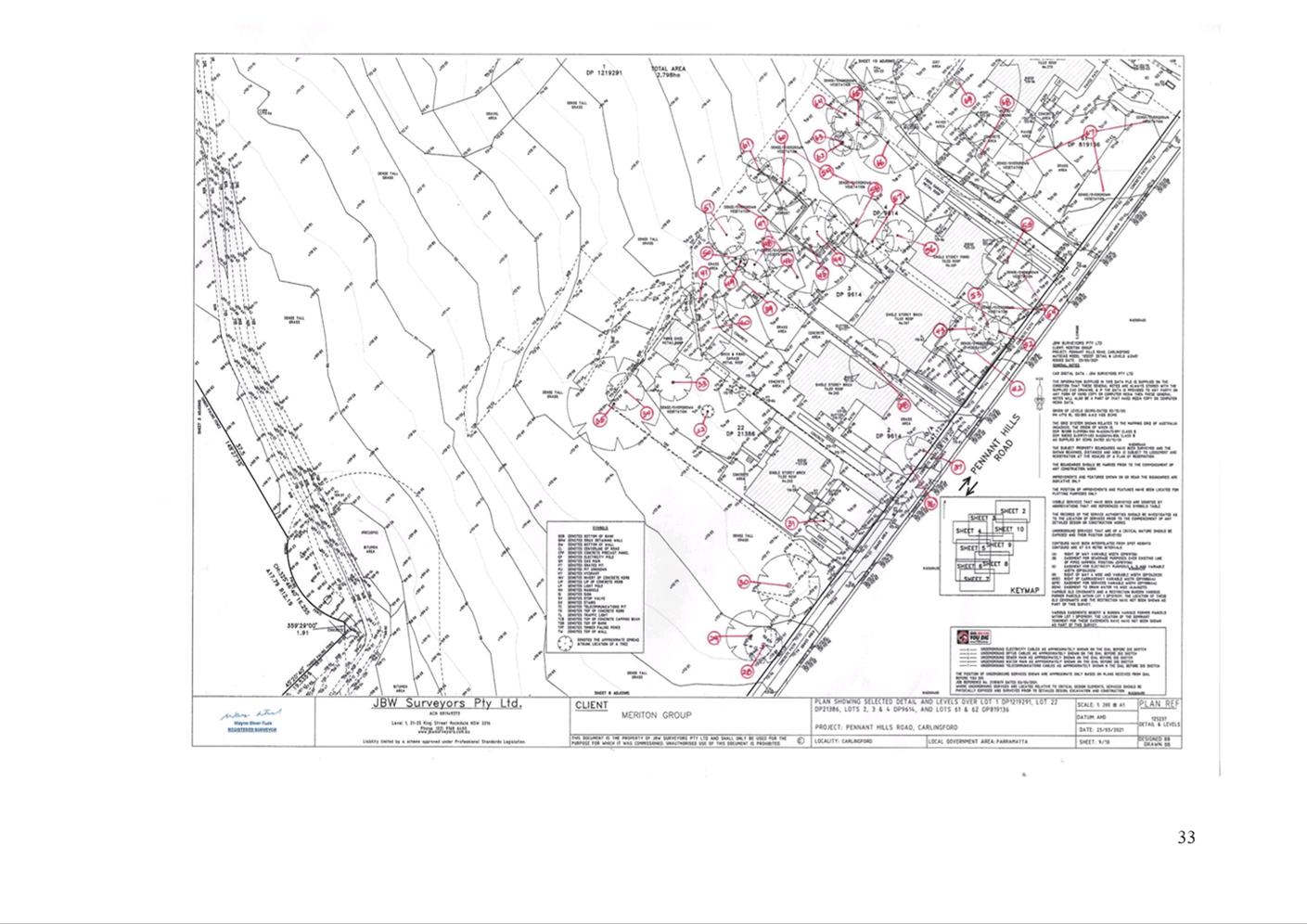
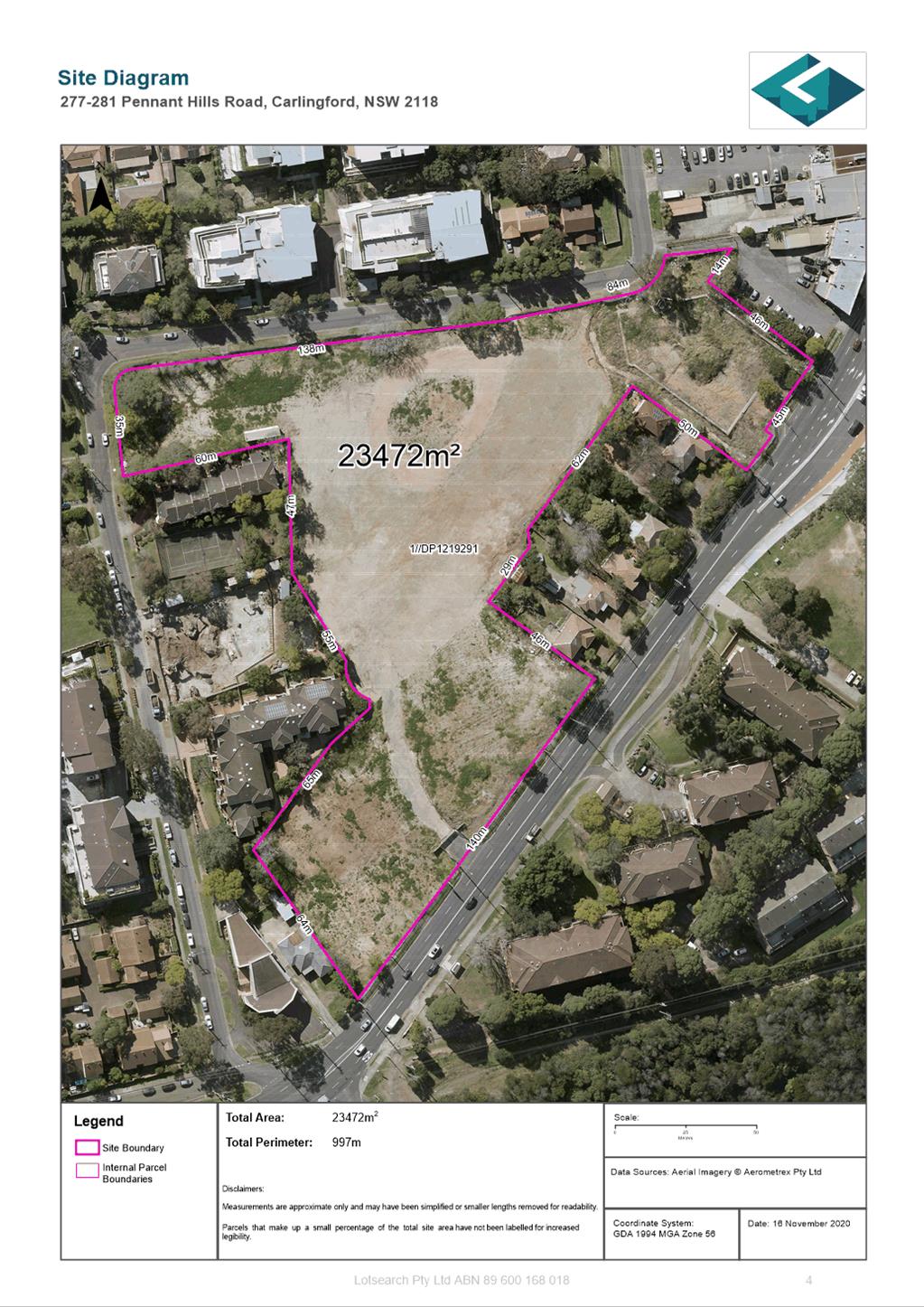
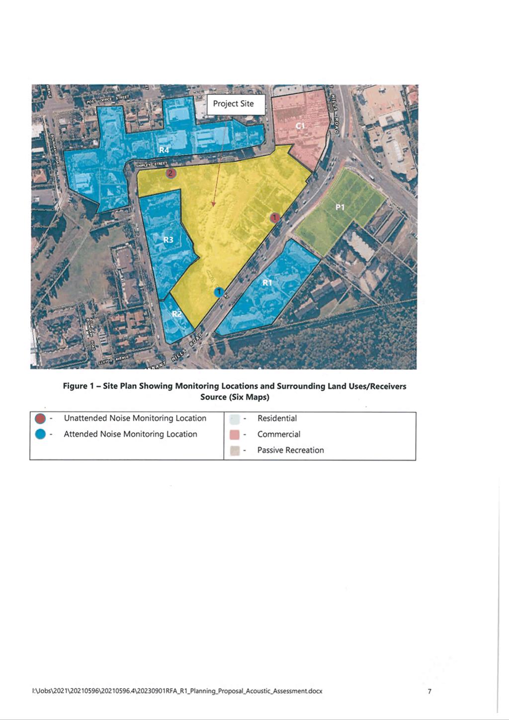
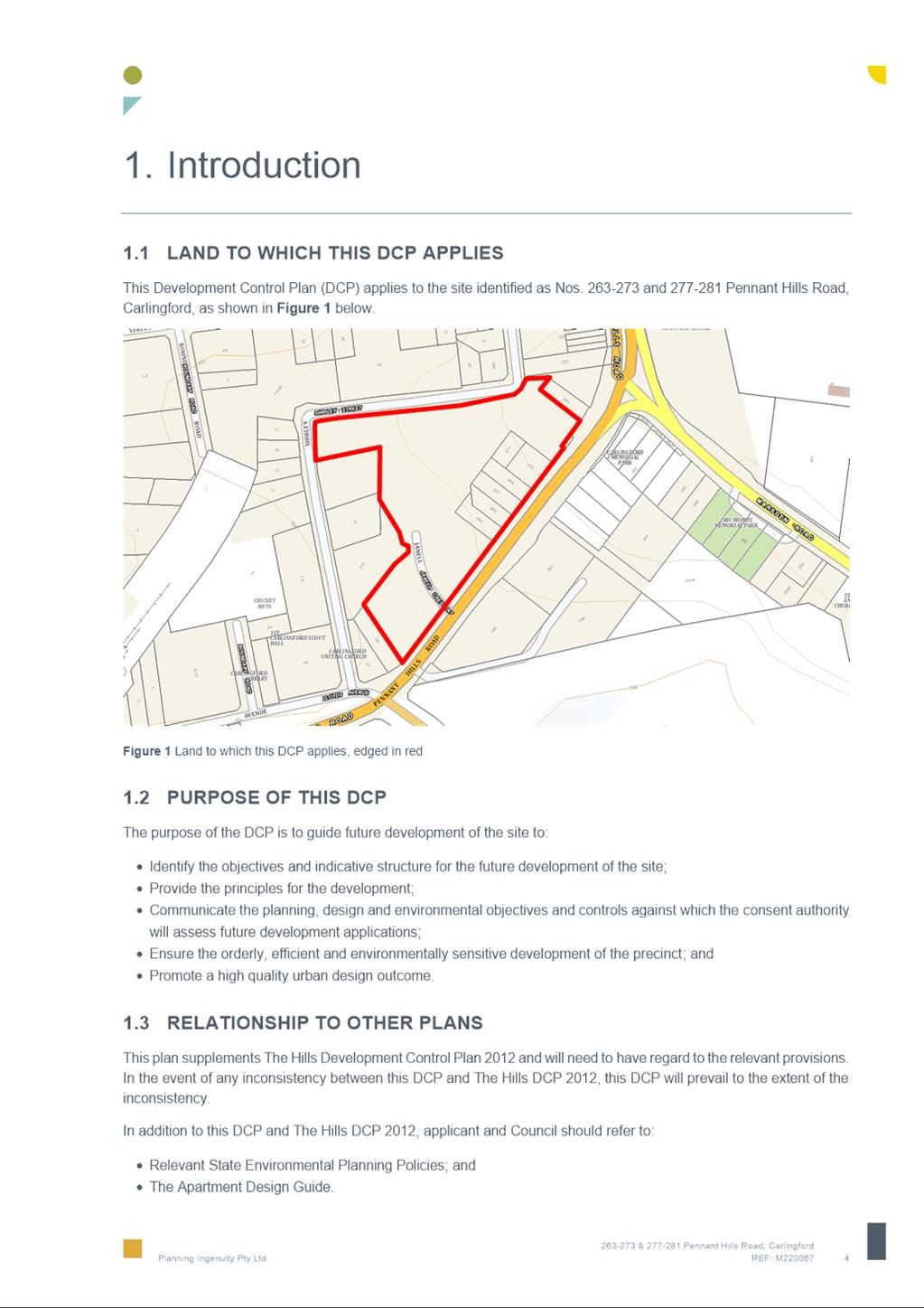
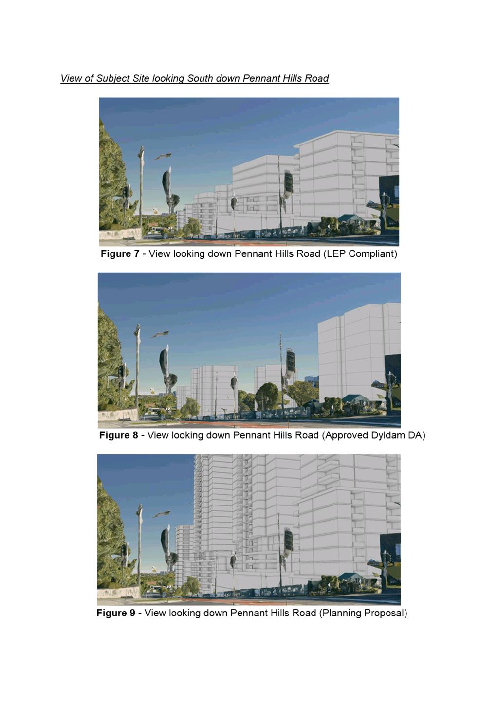
5. The subject site (Figure 1) is known as 263-273 Pennant Hills Road and 18 Shirley Street, Carlingford and comprises of seven lots which are legally described as follows in Table 1:
Table 1 – Property Address - Lots and DPs
|
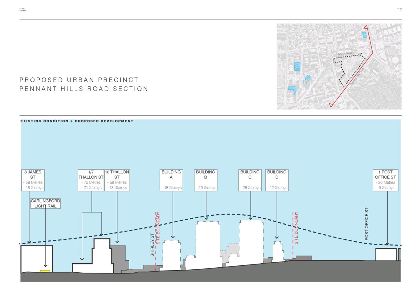
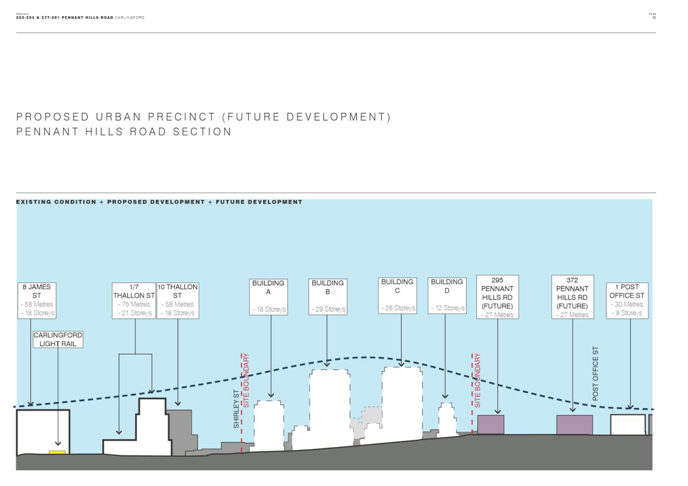
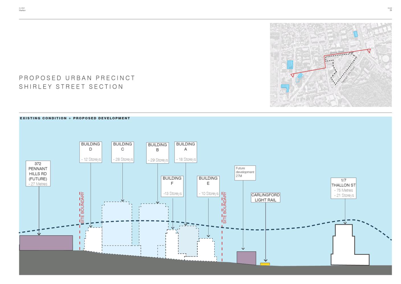
Property Address |
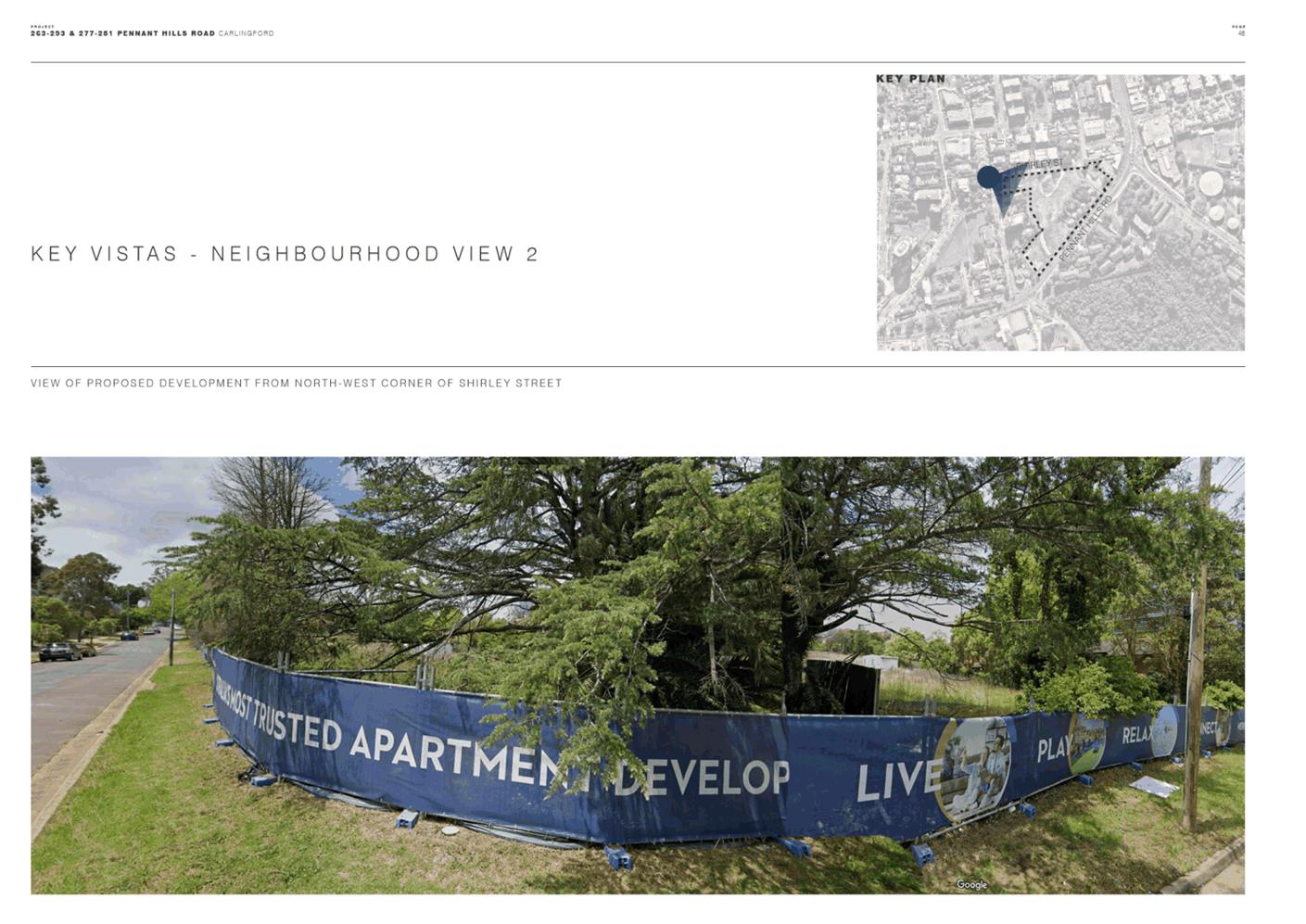
Lot & DP |
|
263 Pennant Hills Road |
Lot 22, DP 21386 |
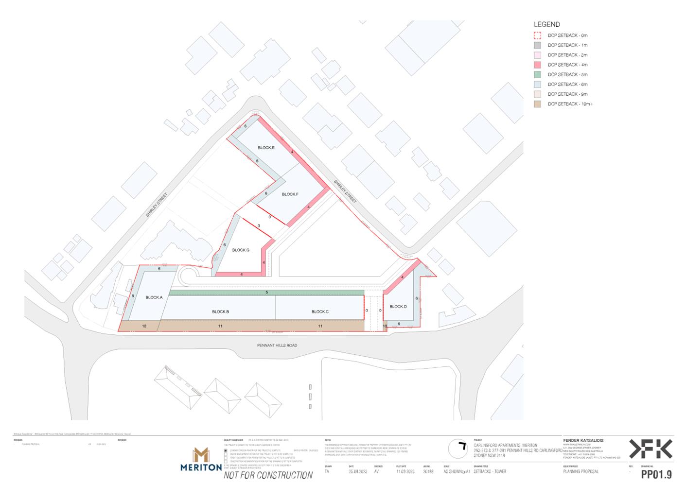
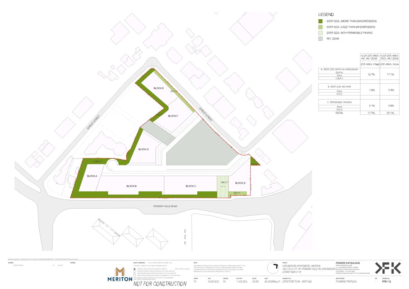
|
265 Pennant Hills Road |
Lot 2, DP 9614 |
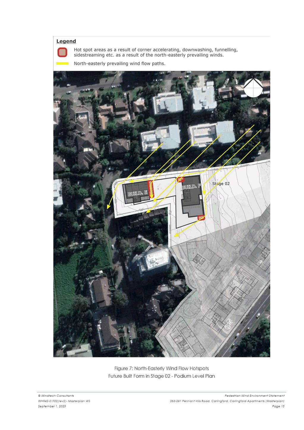
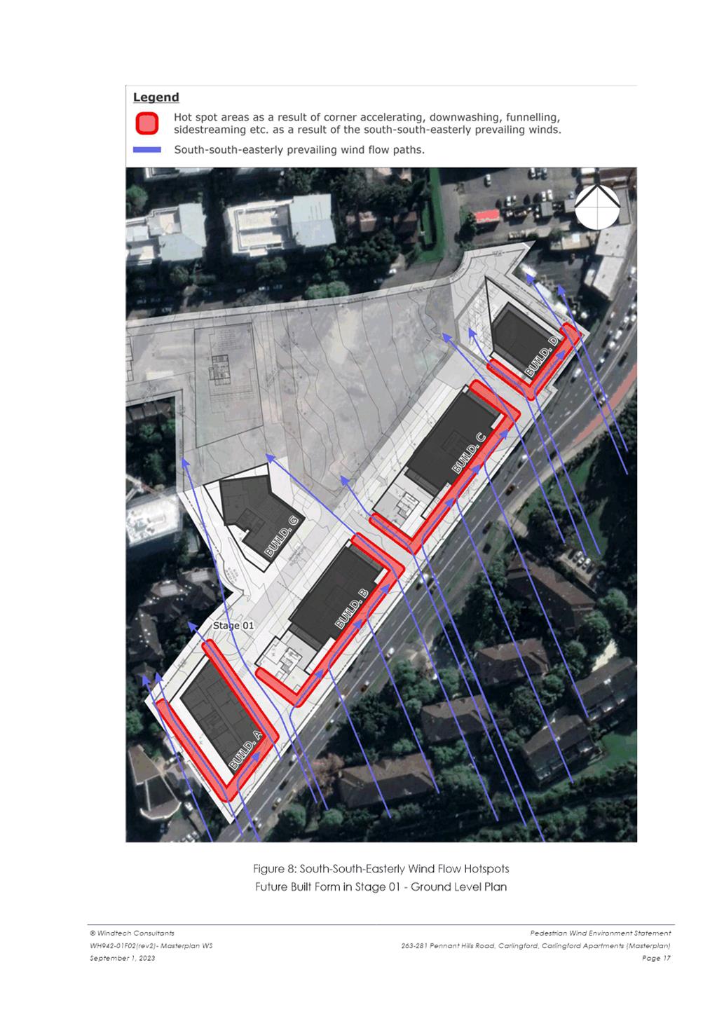
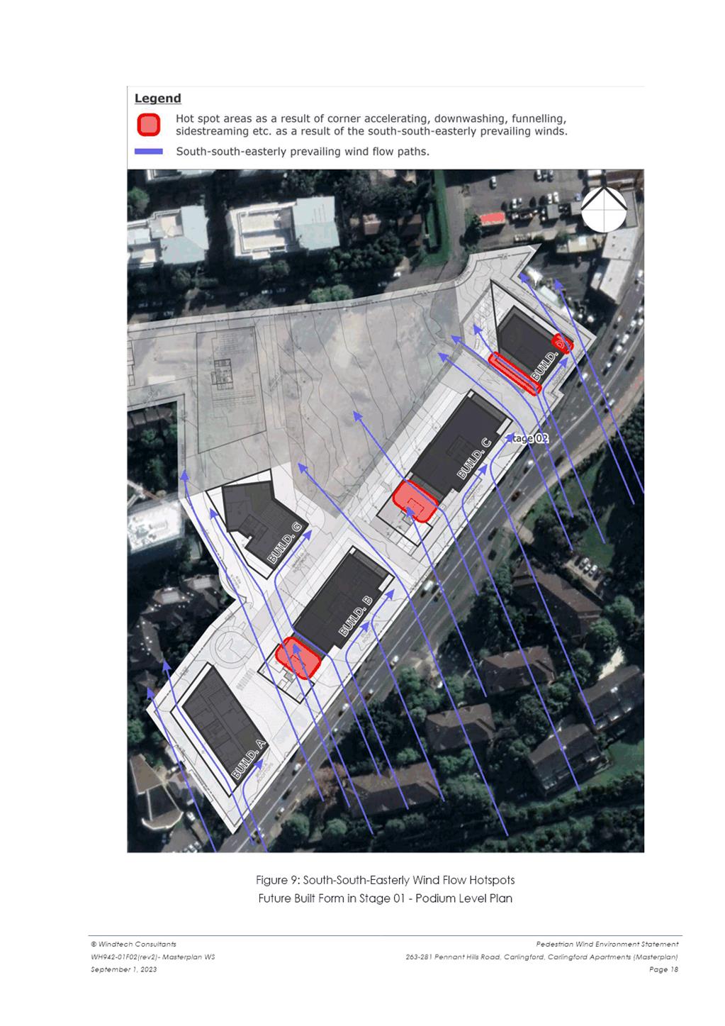
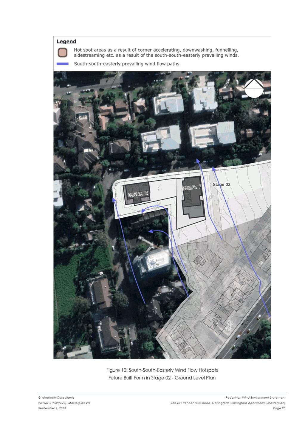
|
267 Pennant Hills Road |
Lot 3, DP 9614 |
|
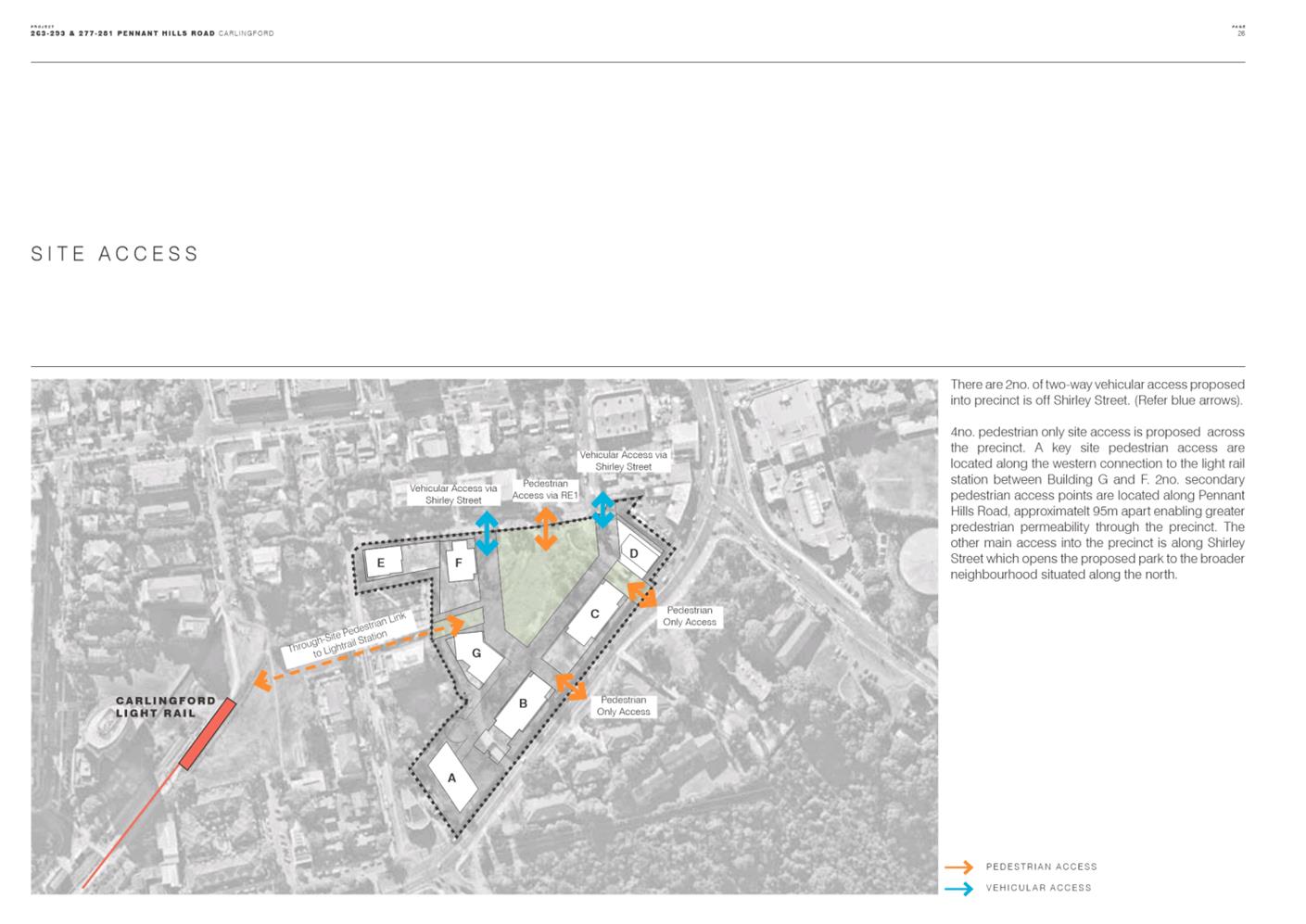
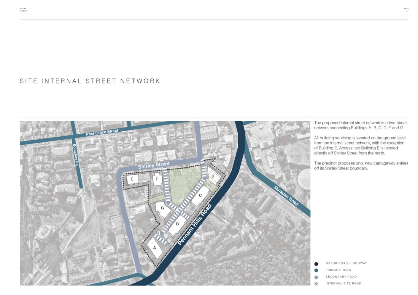
269 Pennant Hills Road |
Lot 4, DP 9614 |
|
271 Pennant Hills Road |
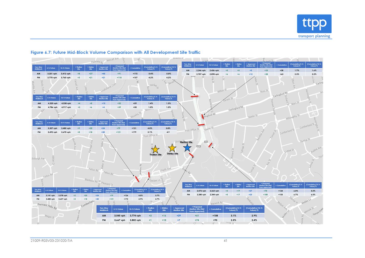
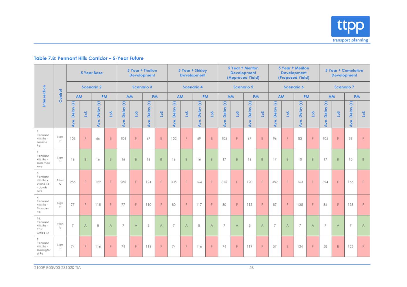
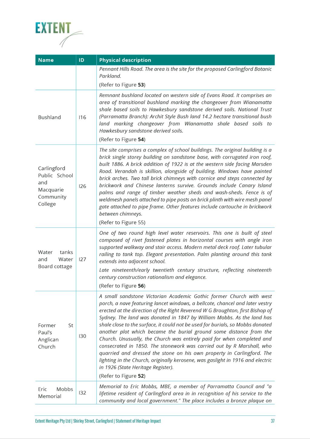
Lot 62, DP 819136 |
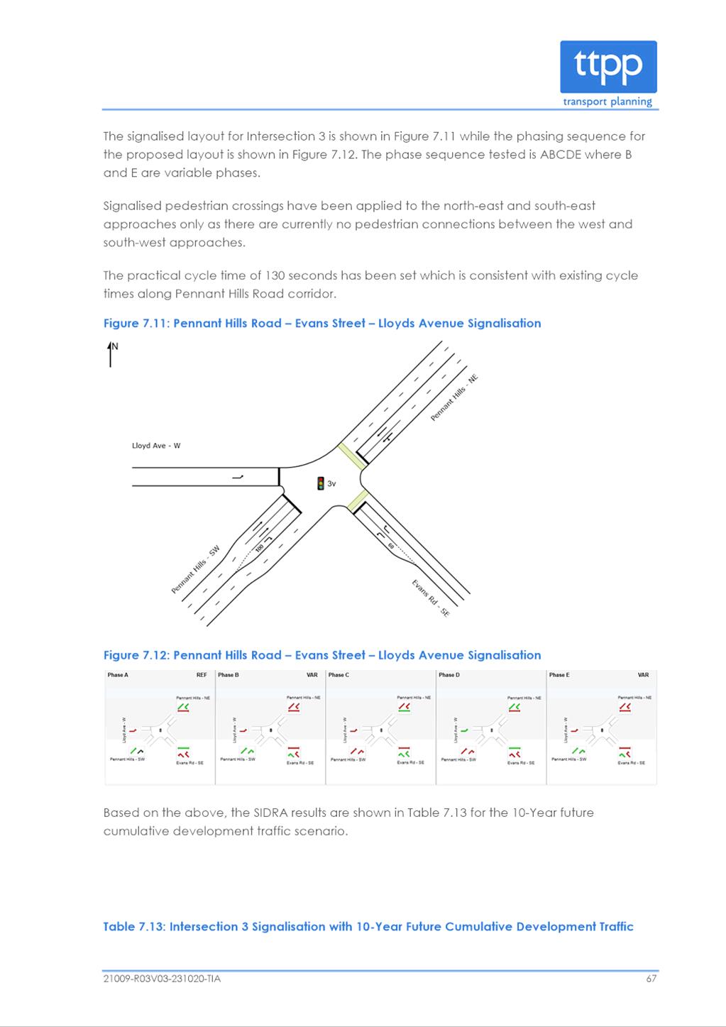
|
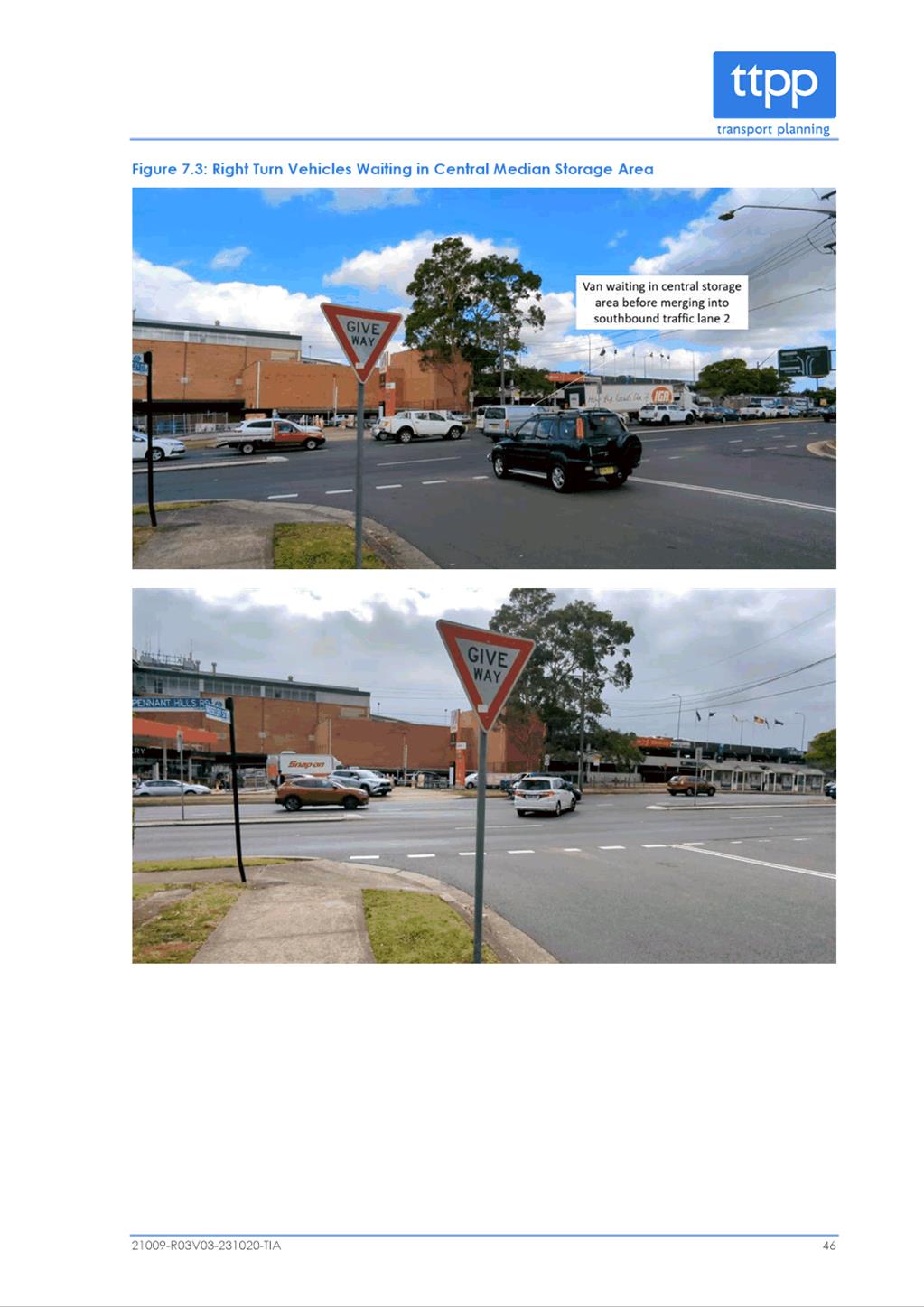
273 Pennant Hills Road |
Lot 61, DP 819163 |
|
18 Shirley Street |
Lot 1, DP 1219291 |
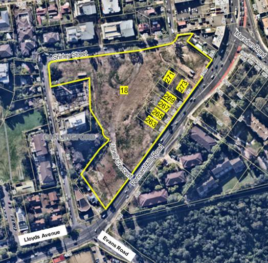
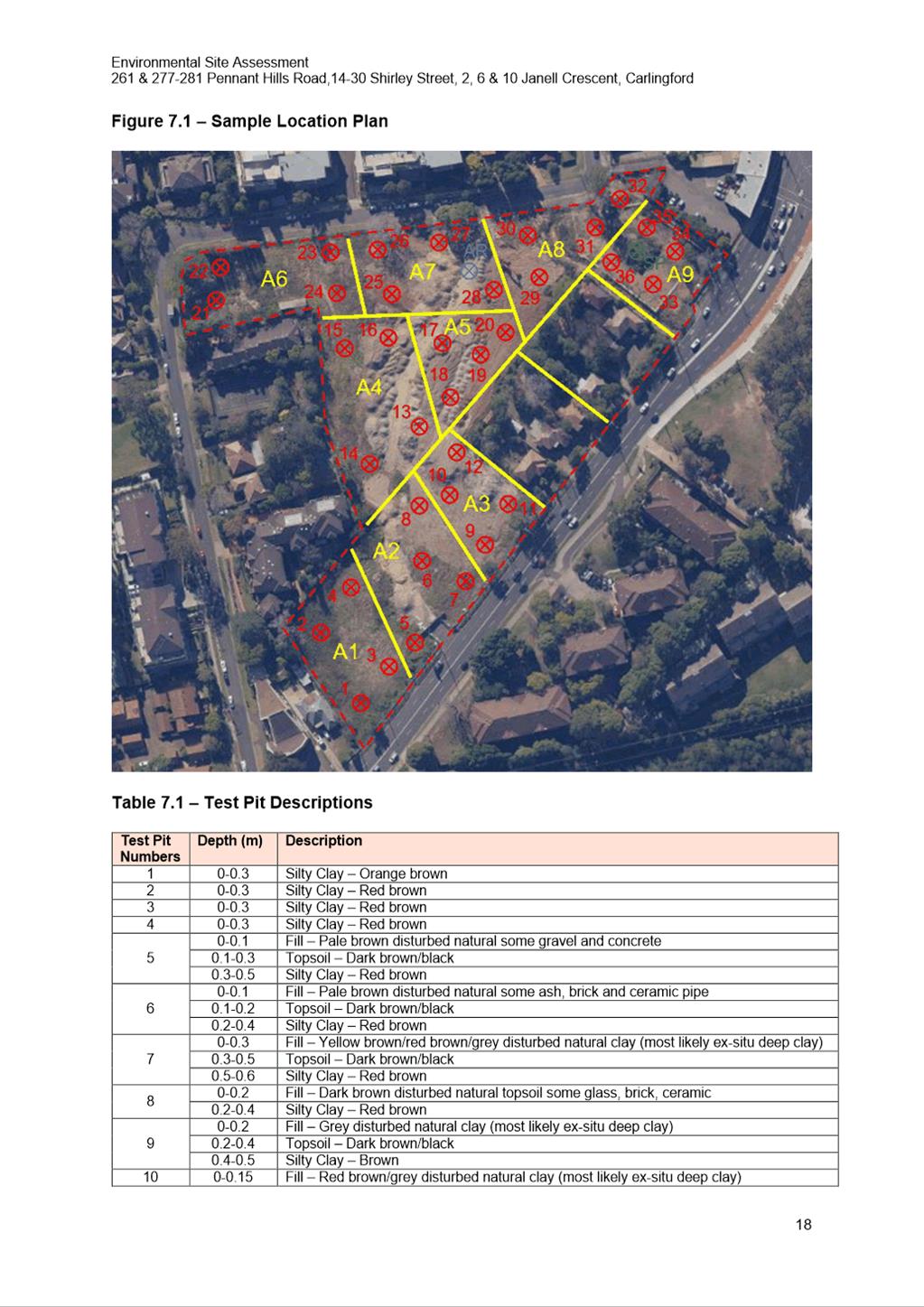
Figure 1 - Subject Site
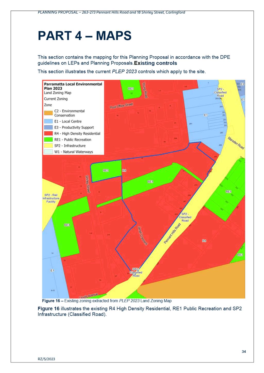
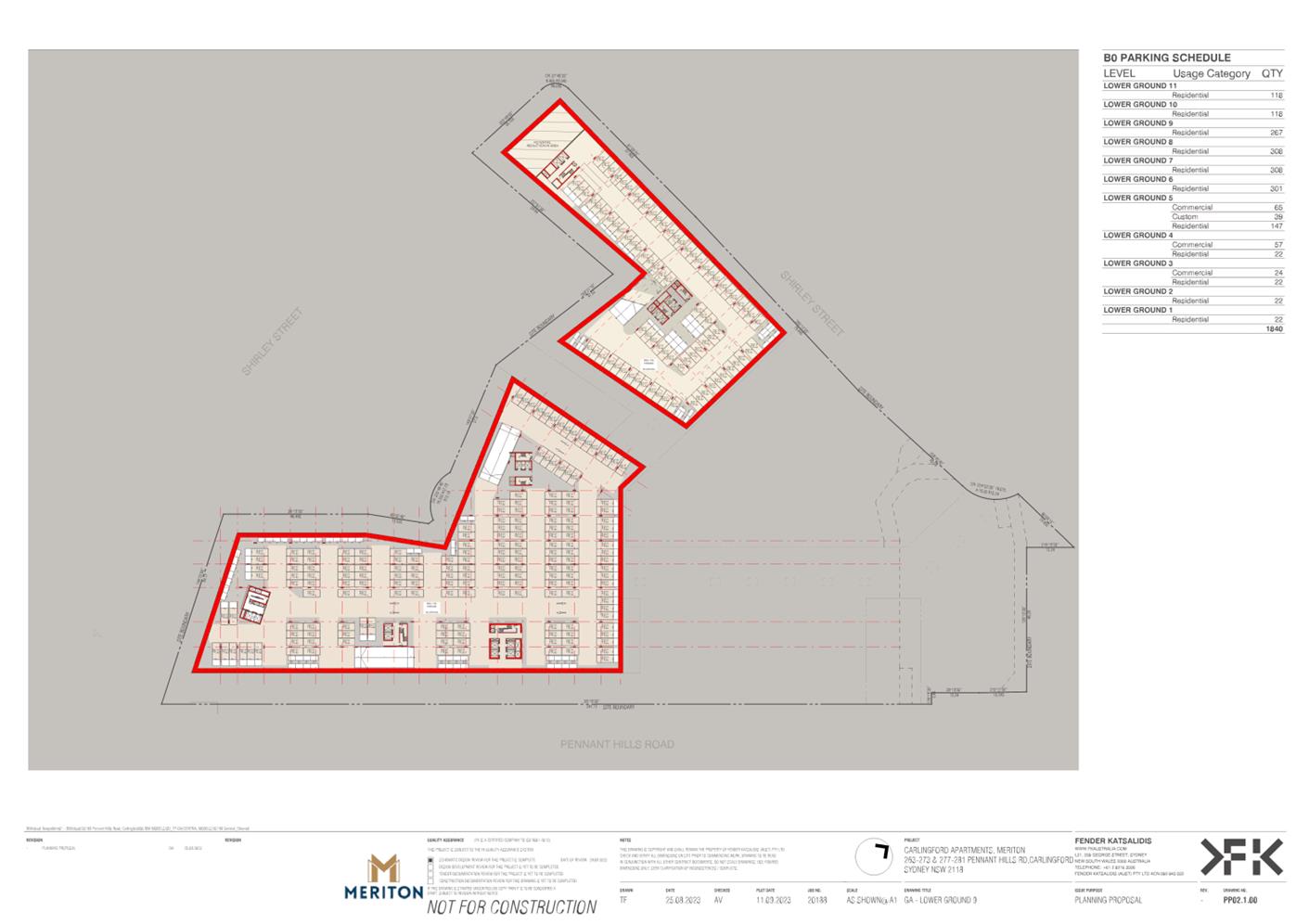
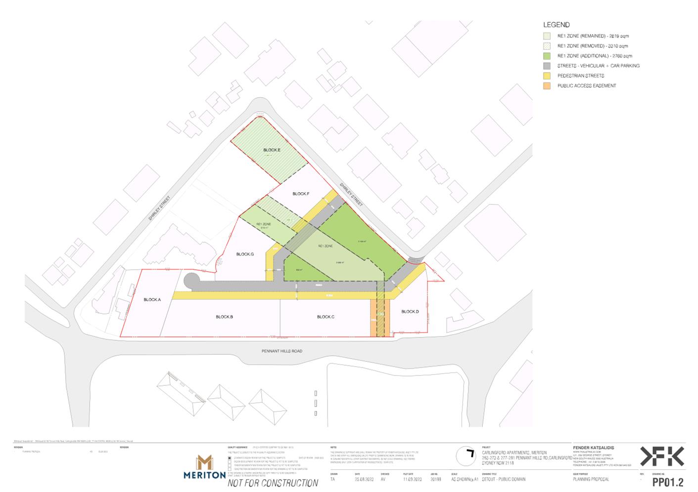
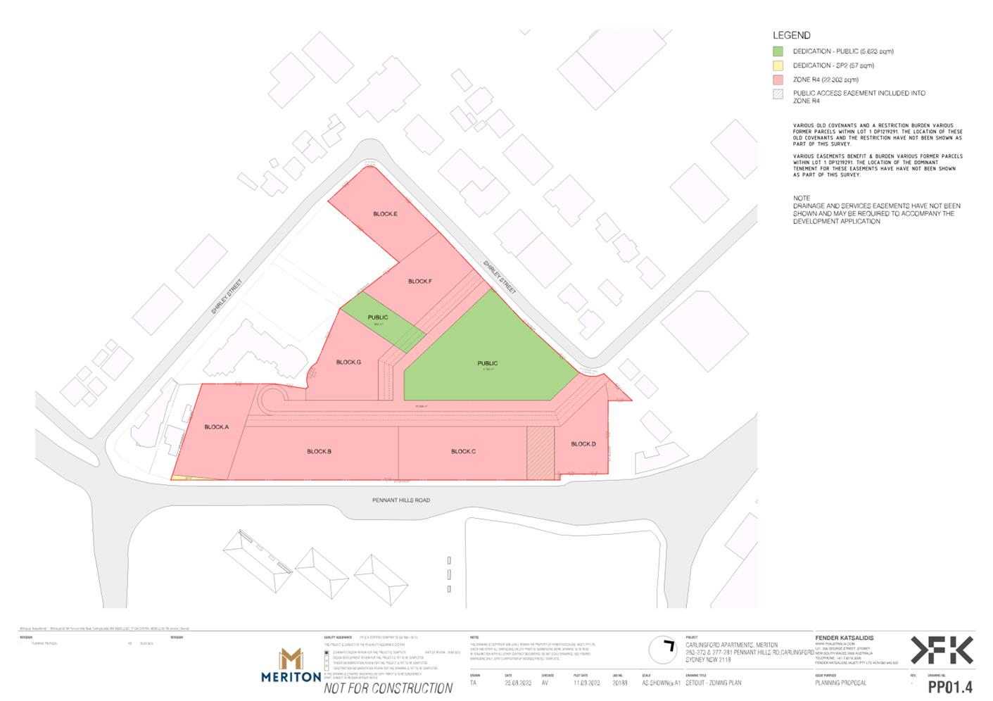
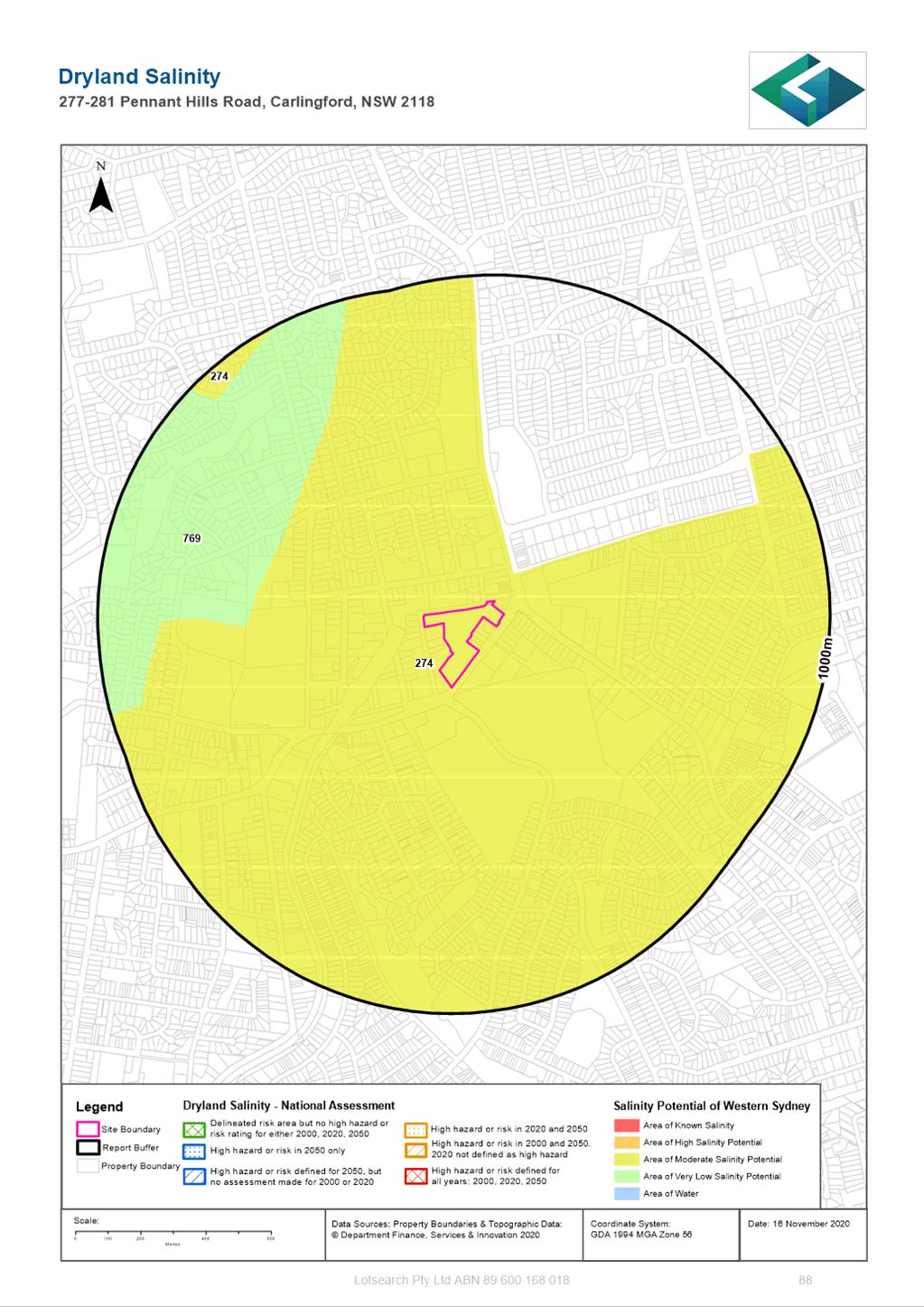
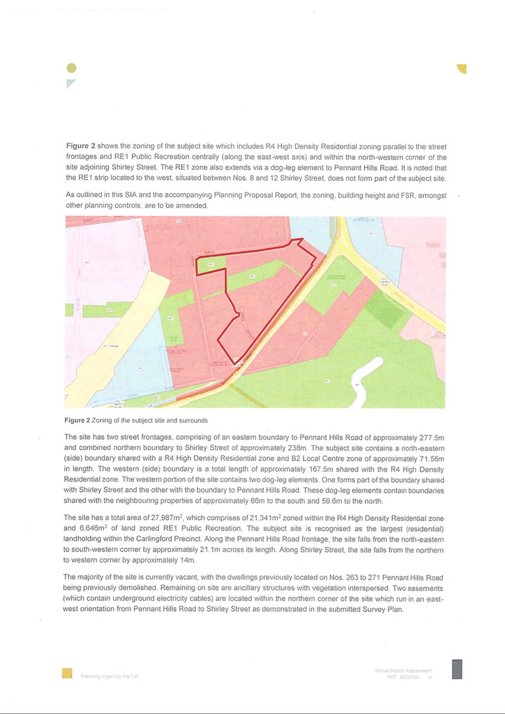
6. The site is irregular in shape and has a total area of approximately 27,987sqm, made up of 6,050 sqm of RE1 Public Recreation zoned land and 21,880 sqm of R4 High Density Residential zoned land and 57 sqm of SP2 Infrastructure zoned land.
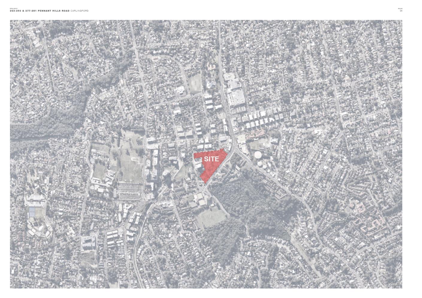
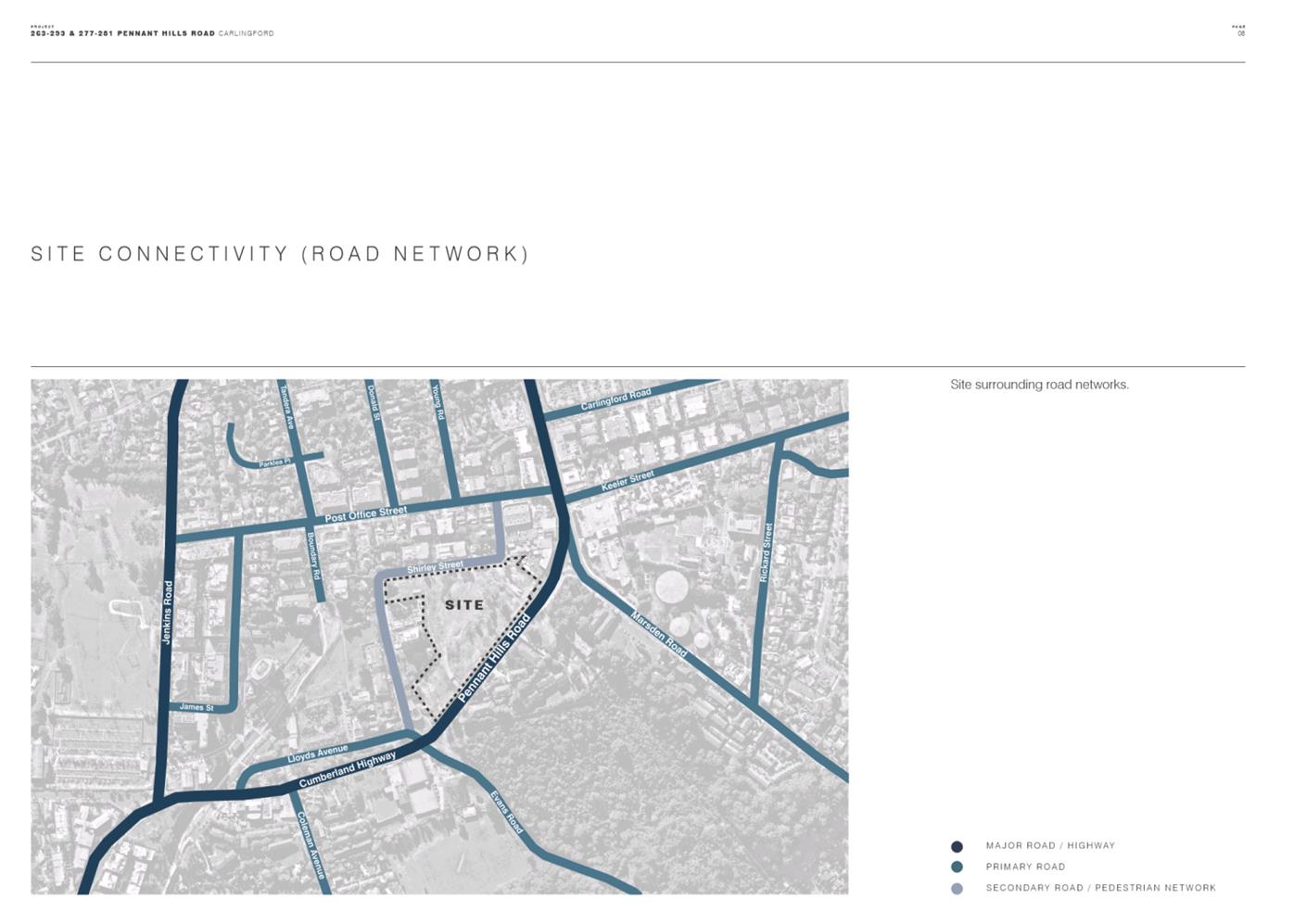
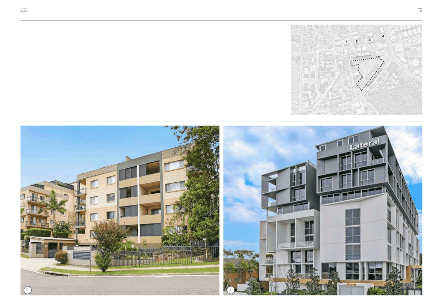
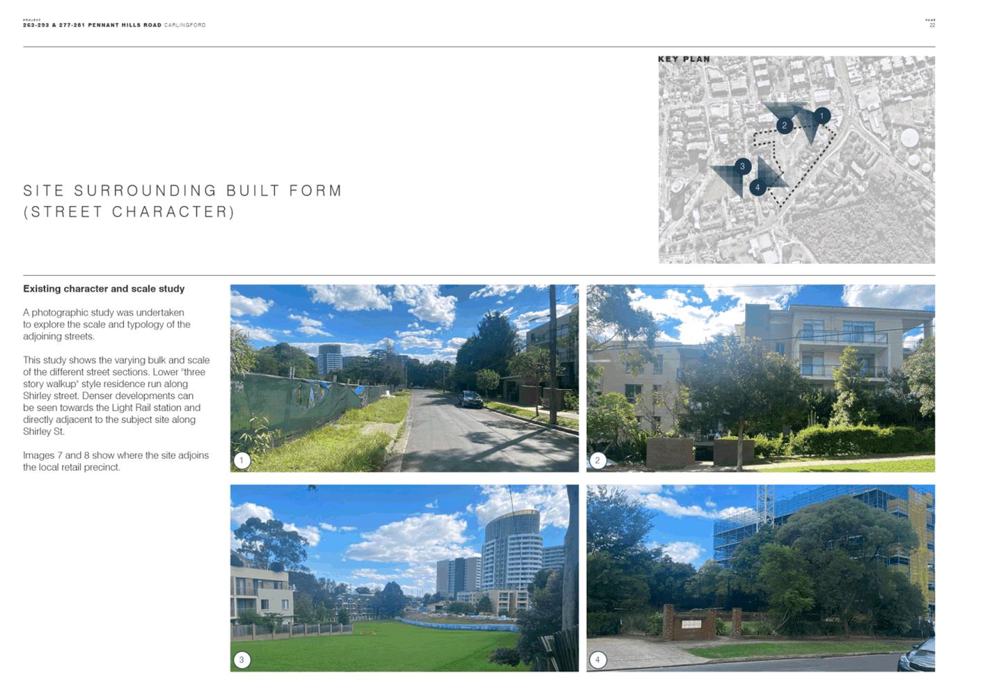
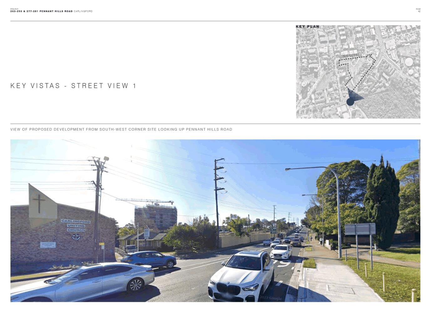
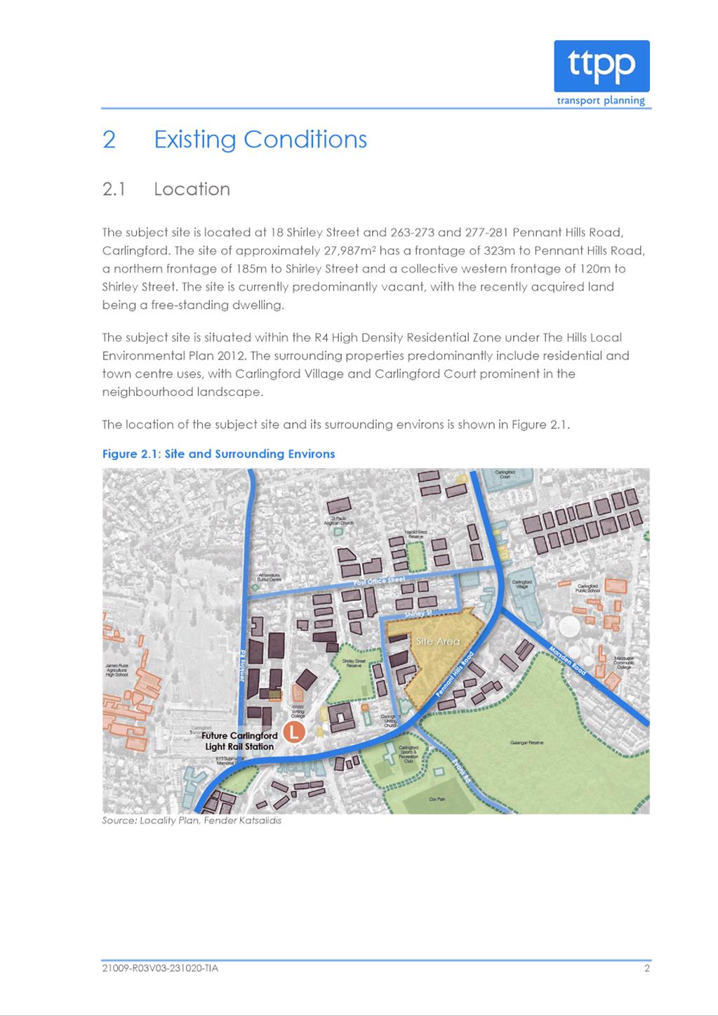
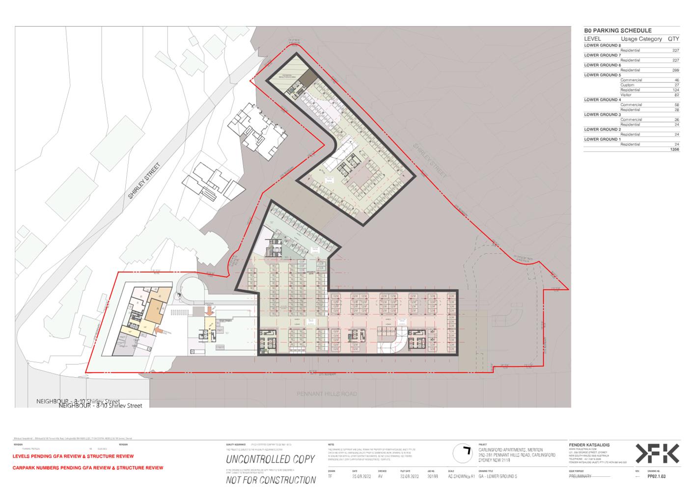
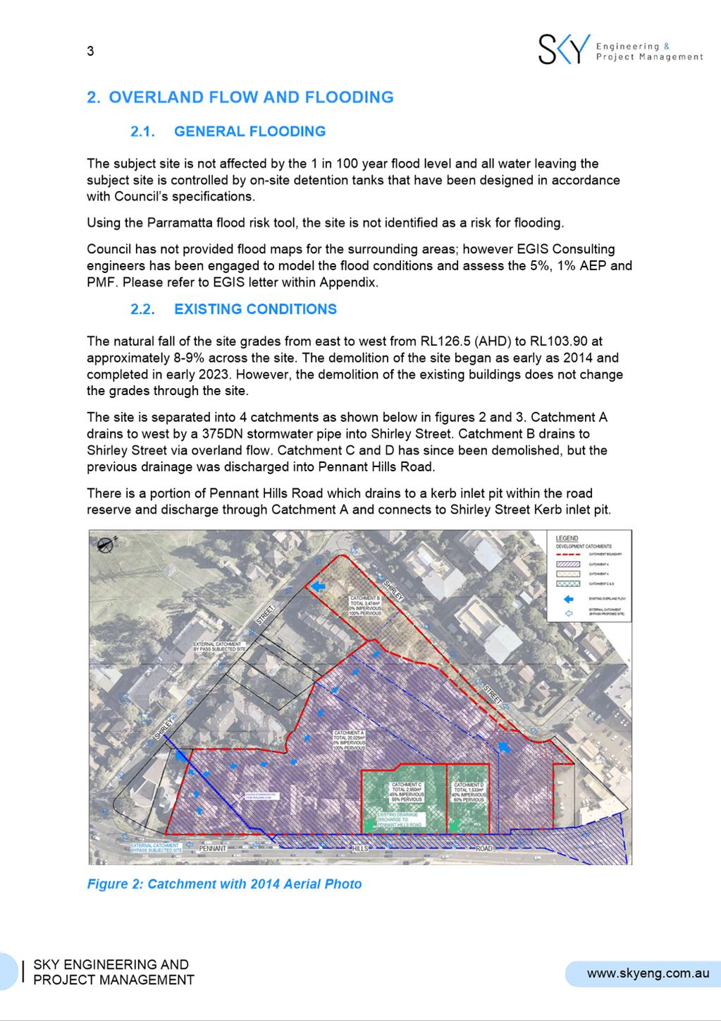
7. The site is located on the eastern side of Pennant Hills Road (classified road) and the northern and western sides of Shirley Street (local road). The site is predominately undeveloped and cleared of vegetation however there are five detached two-storey dwellings fronting Pennant Hills Road.
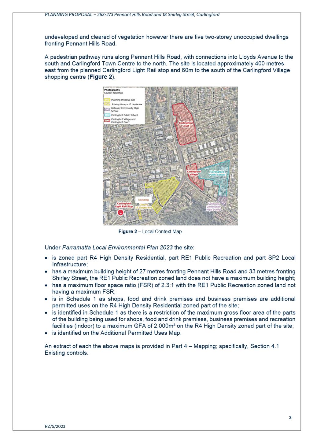
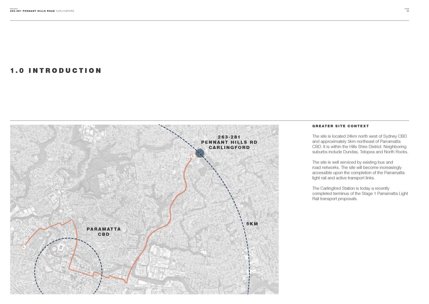
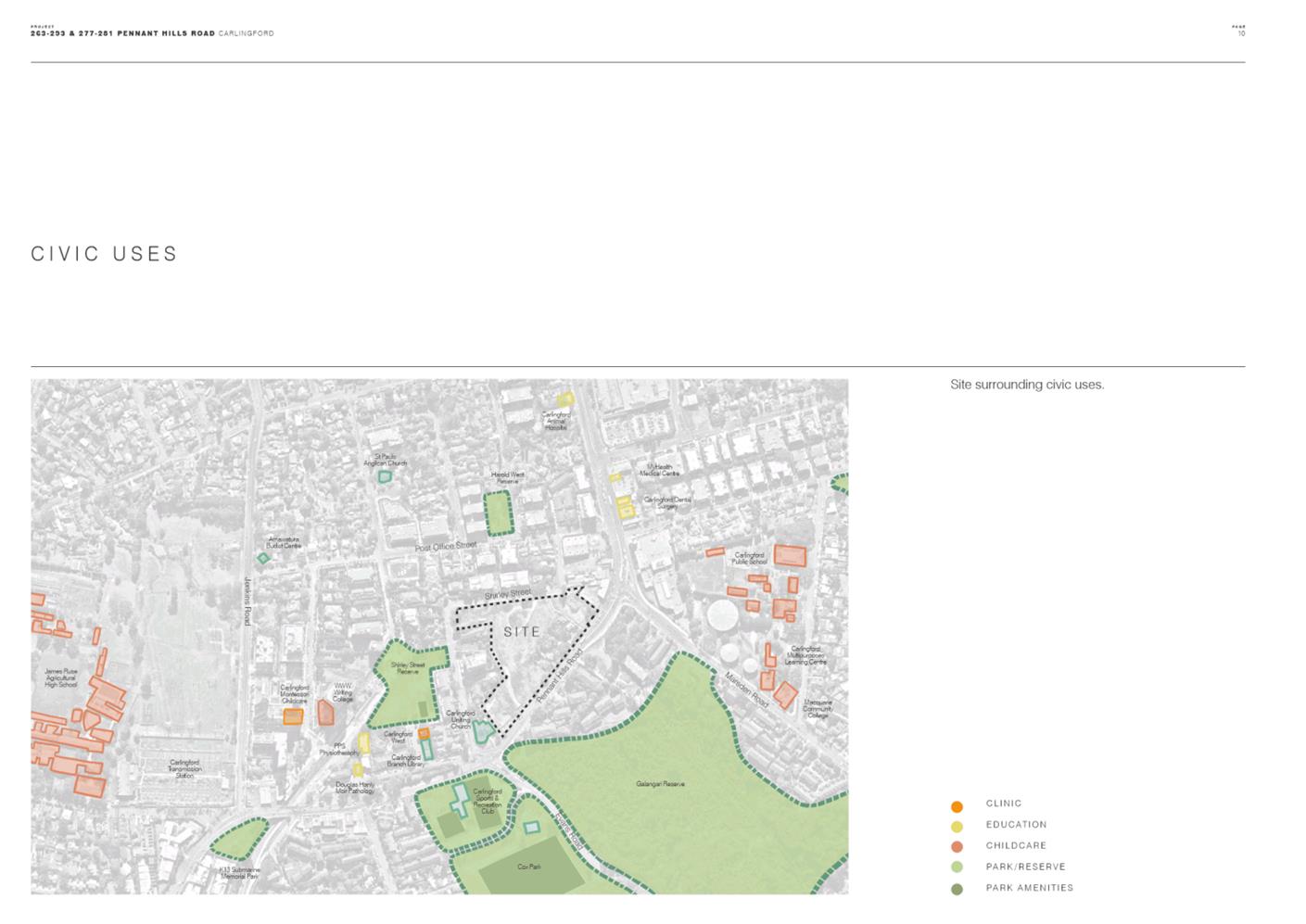
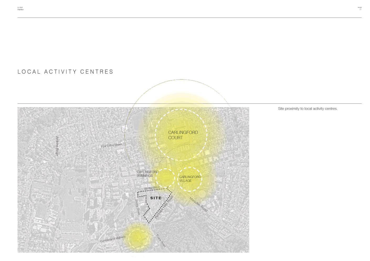
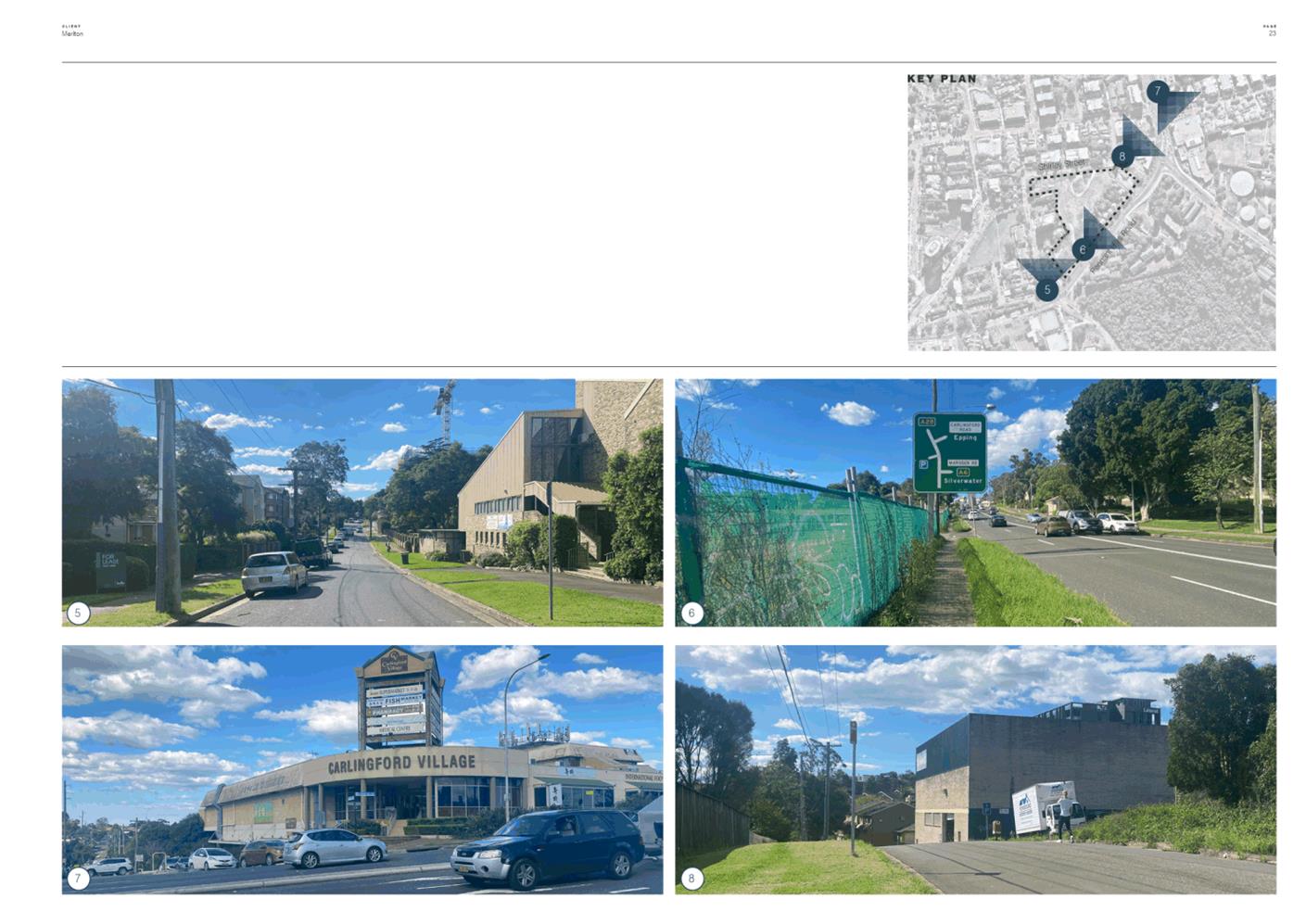
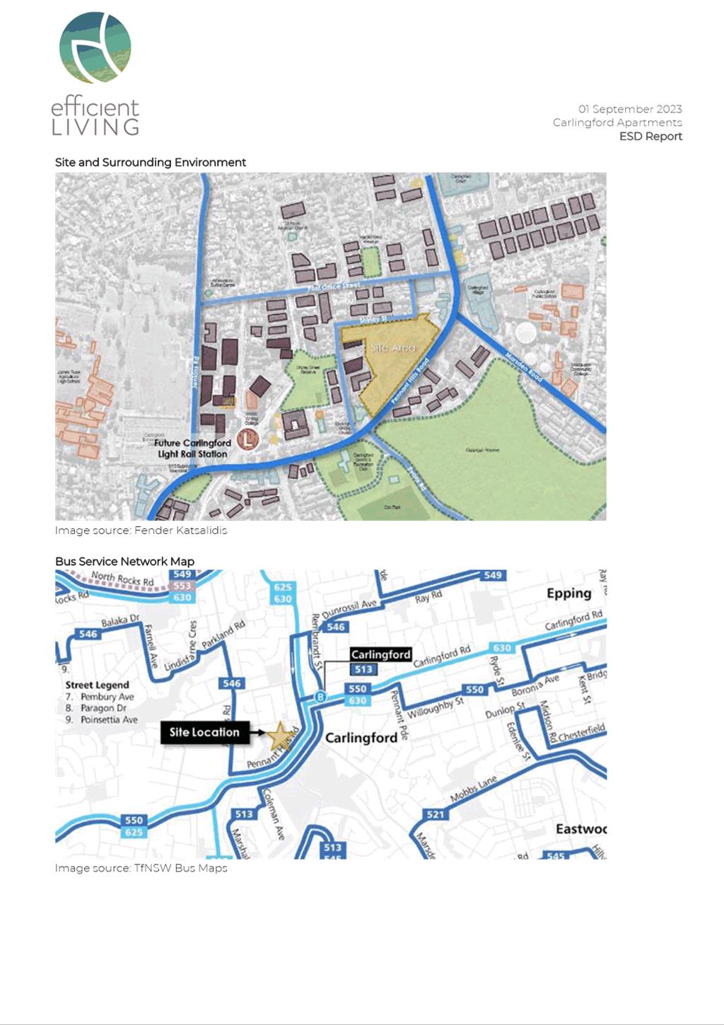
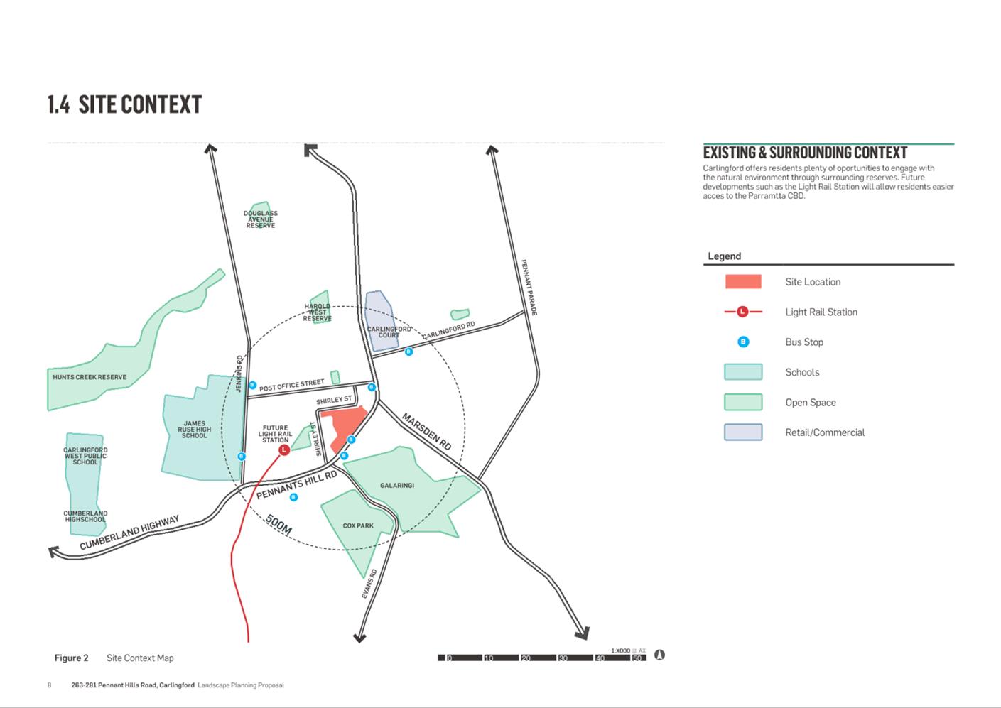
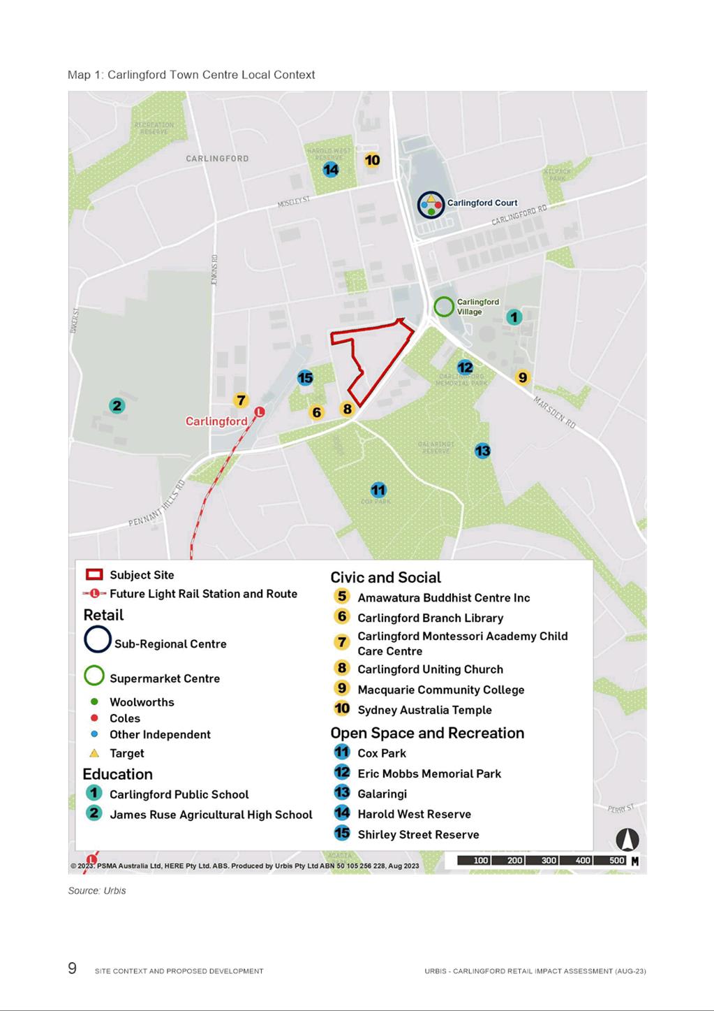
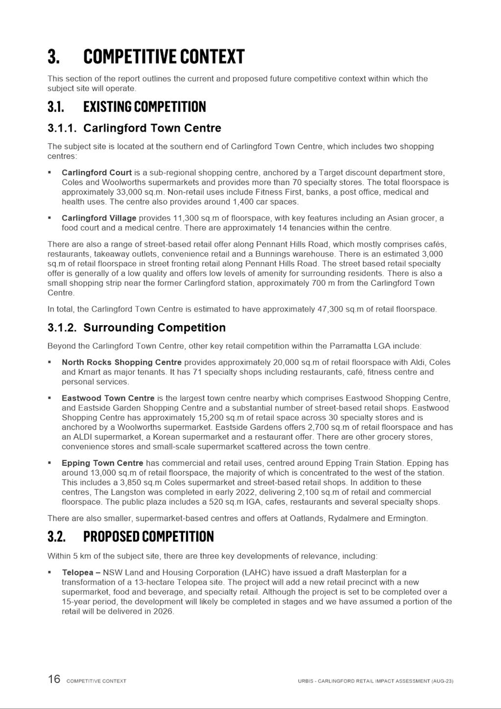
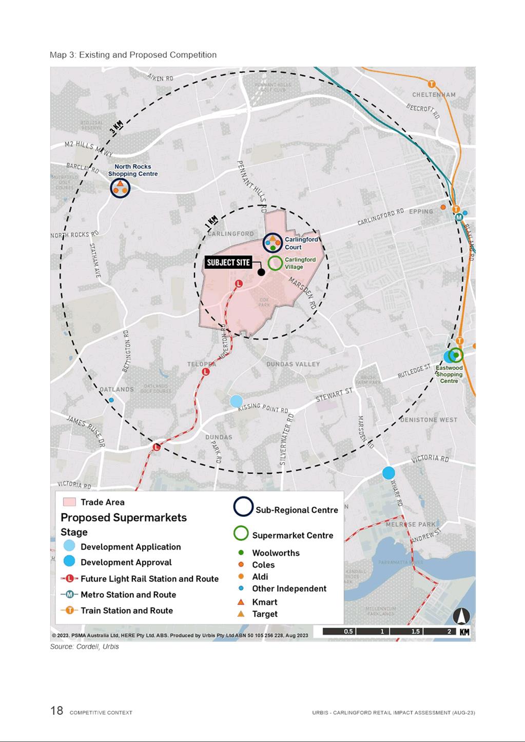
8. A pedestrian pathway runs along Pennant Hills Road, with connections into Lloyds Avenue to the south and Carlingford Town Centre to the north. The site is located approximately 400 metres east from the Carlingford Light Rail stop and 60m to the south of the Carlingford Village shopping centre (Figure 2).
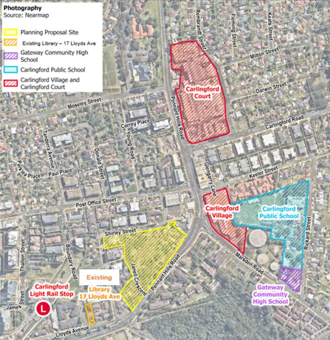
Figure 2 – Local Context Map
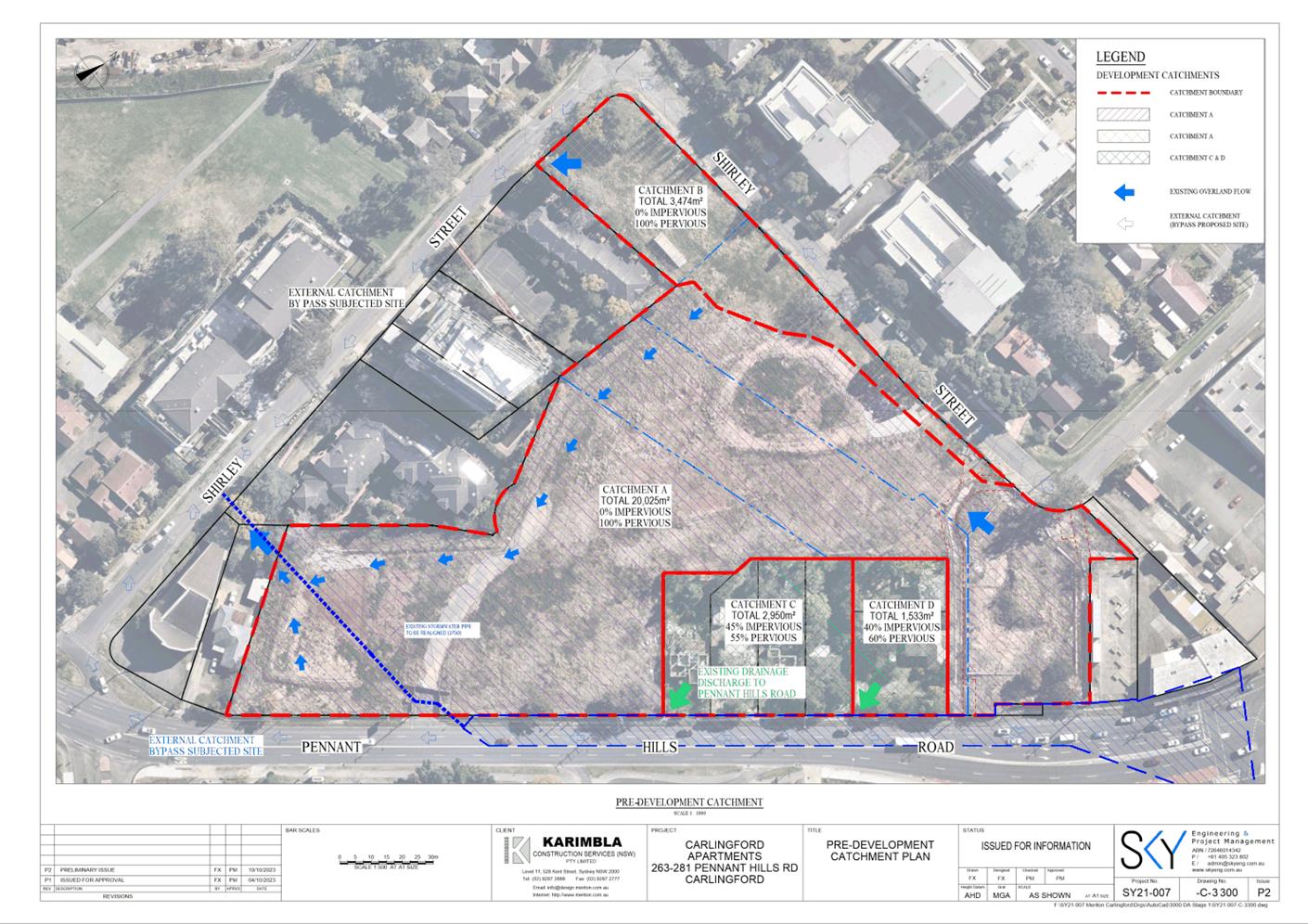
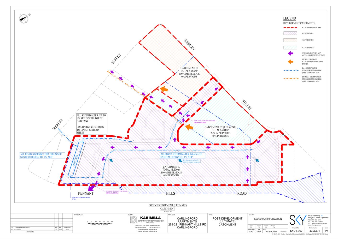
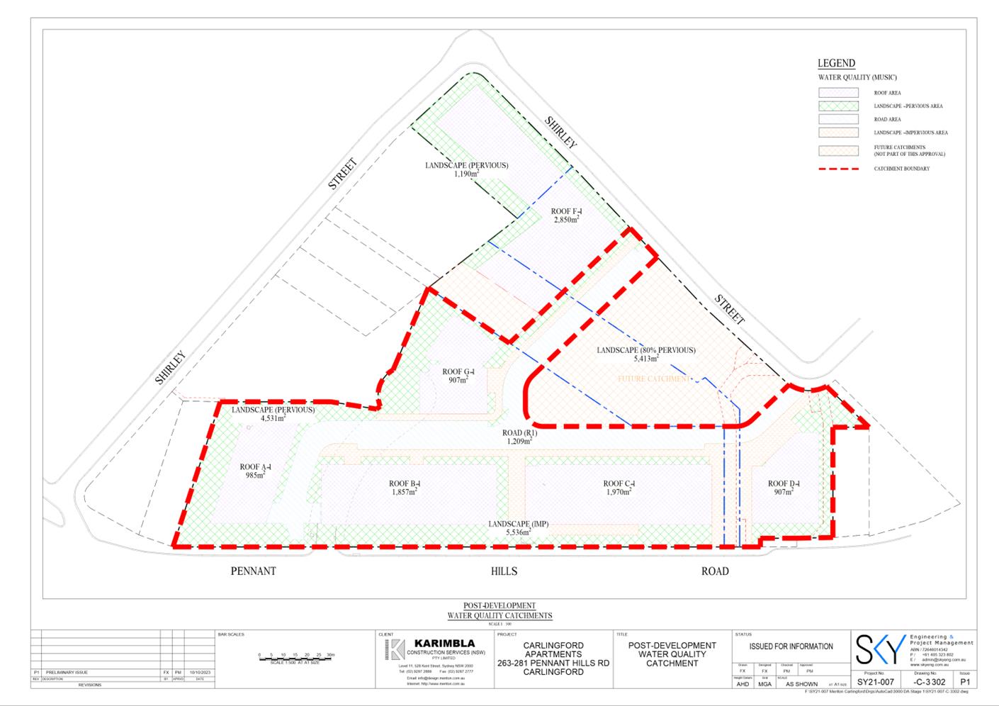
PLANNING PROPOSAL
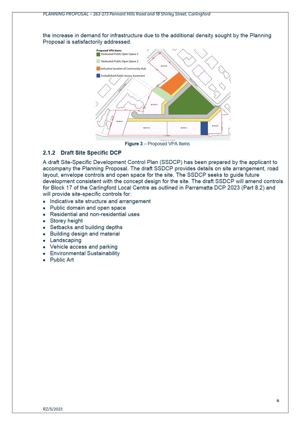
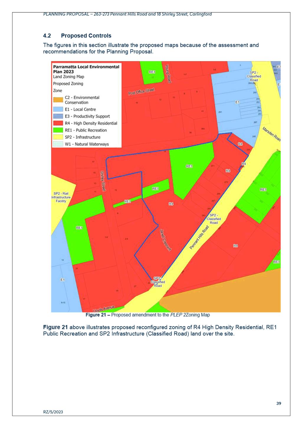
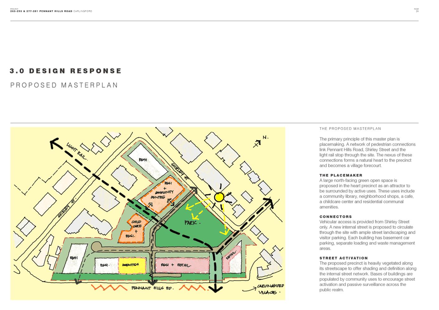
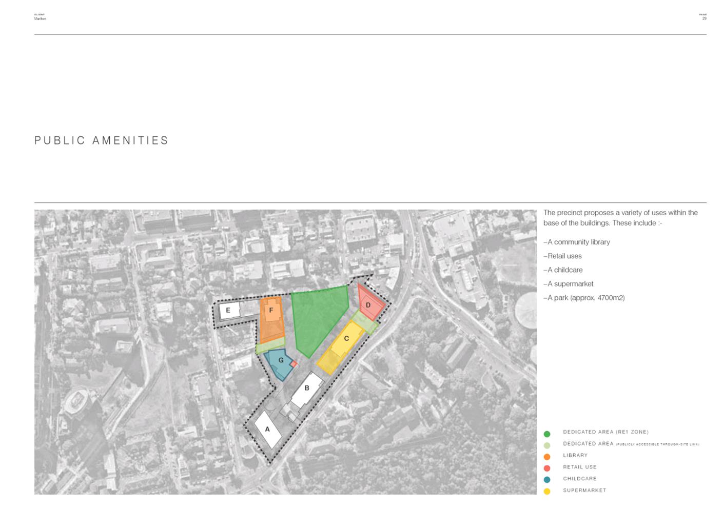
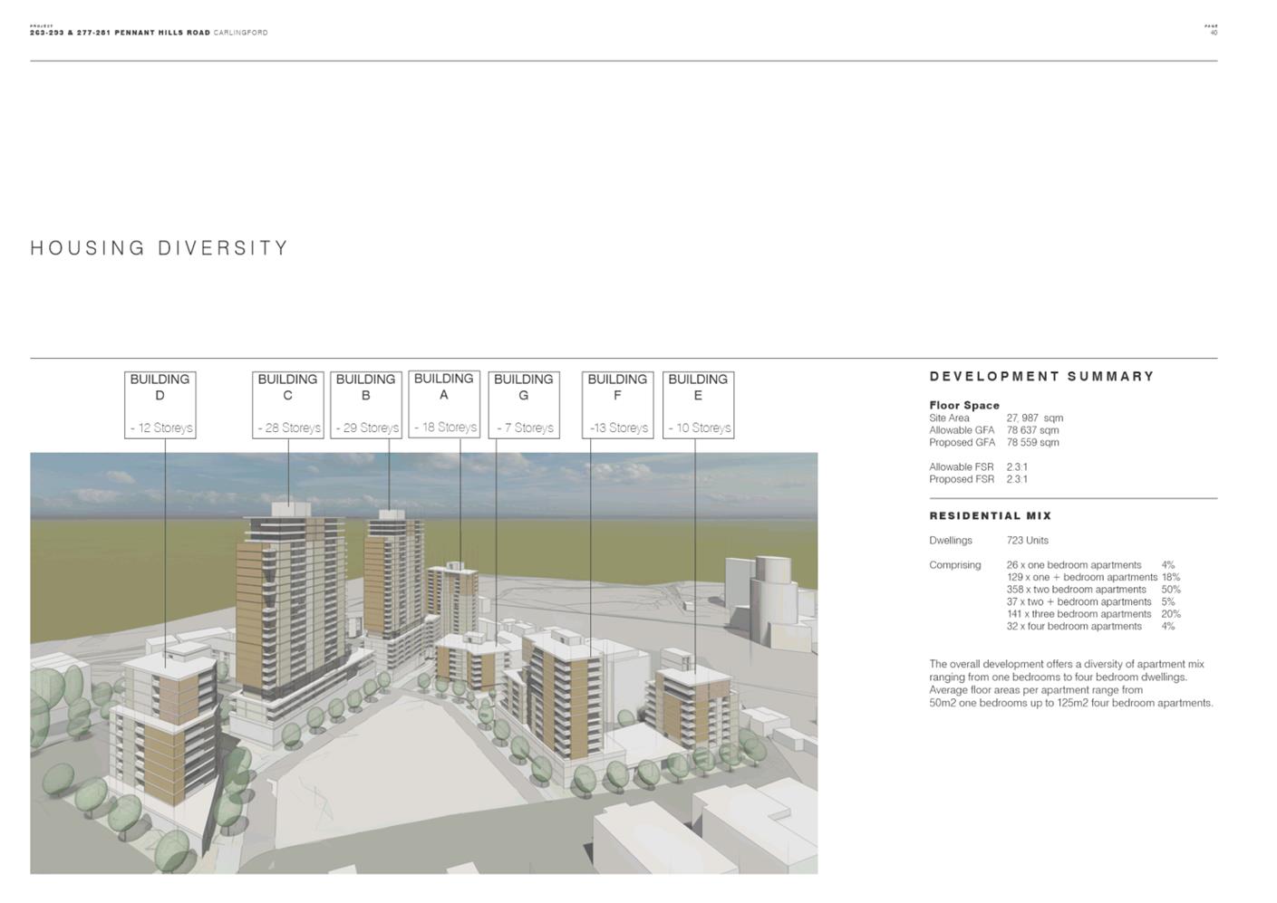
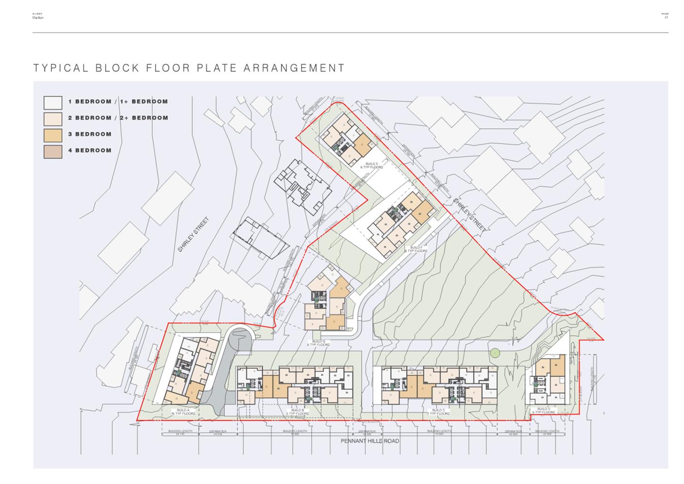
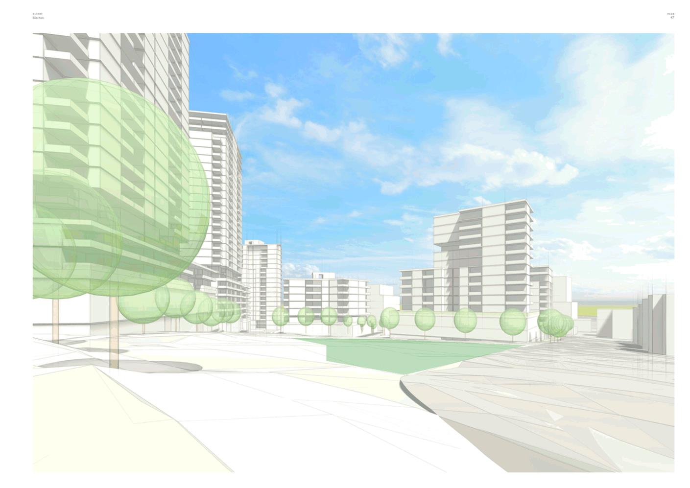
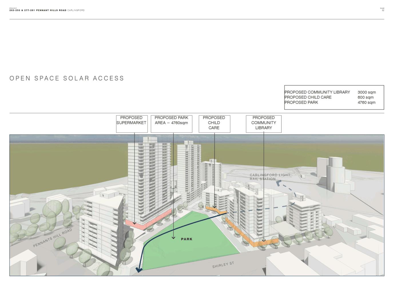
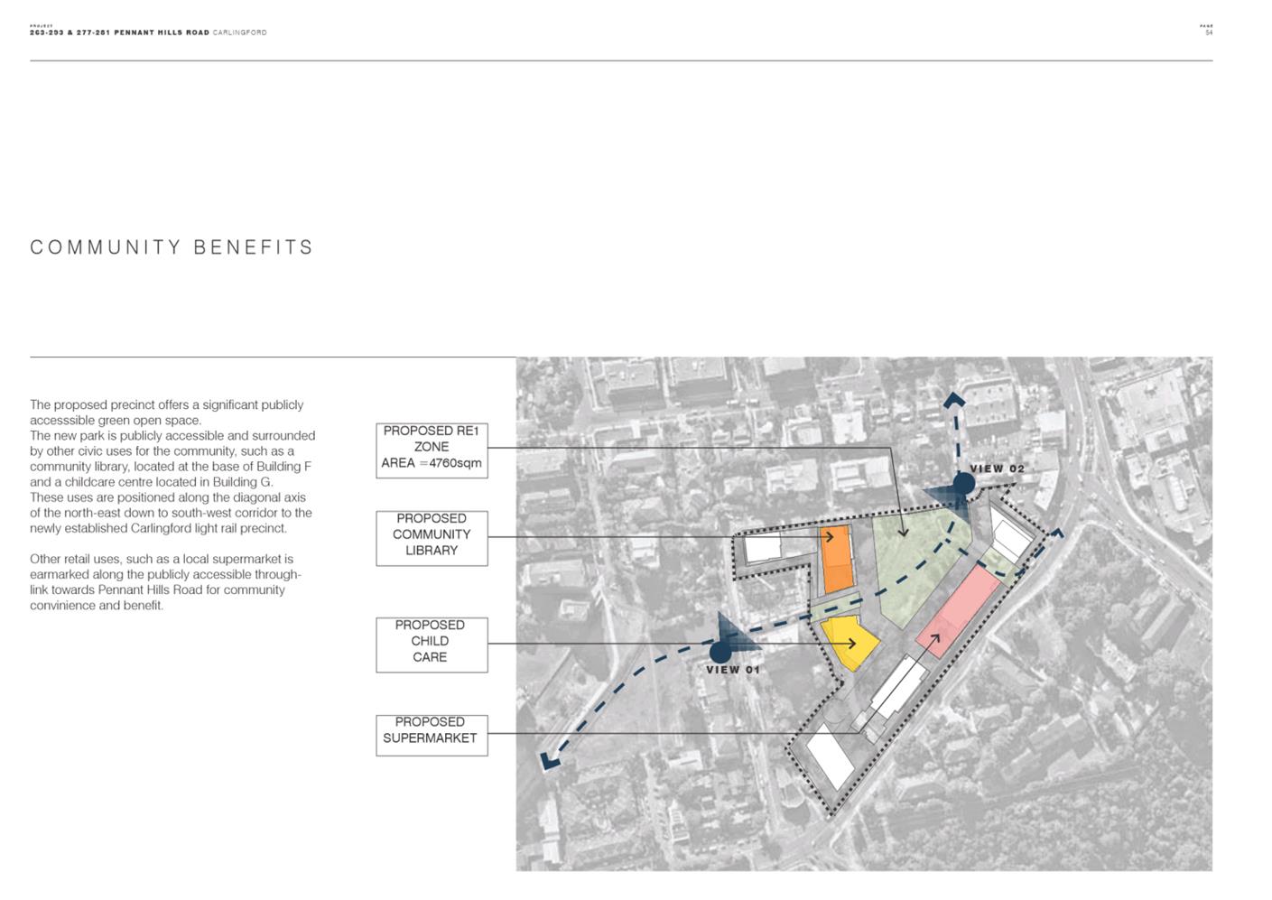
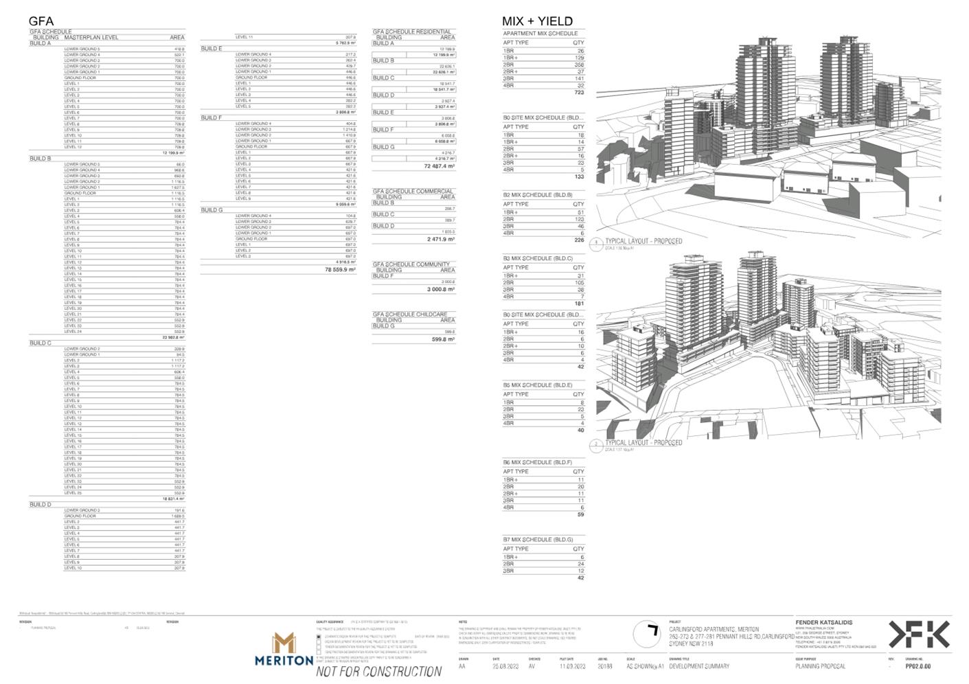
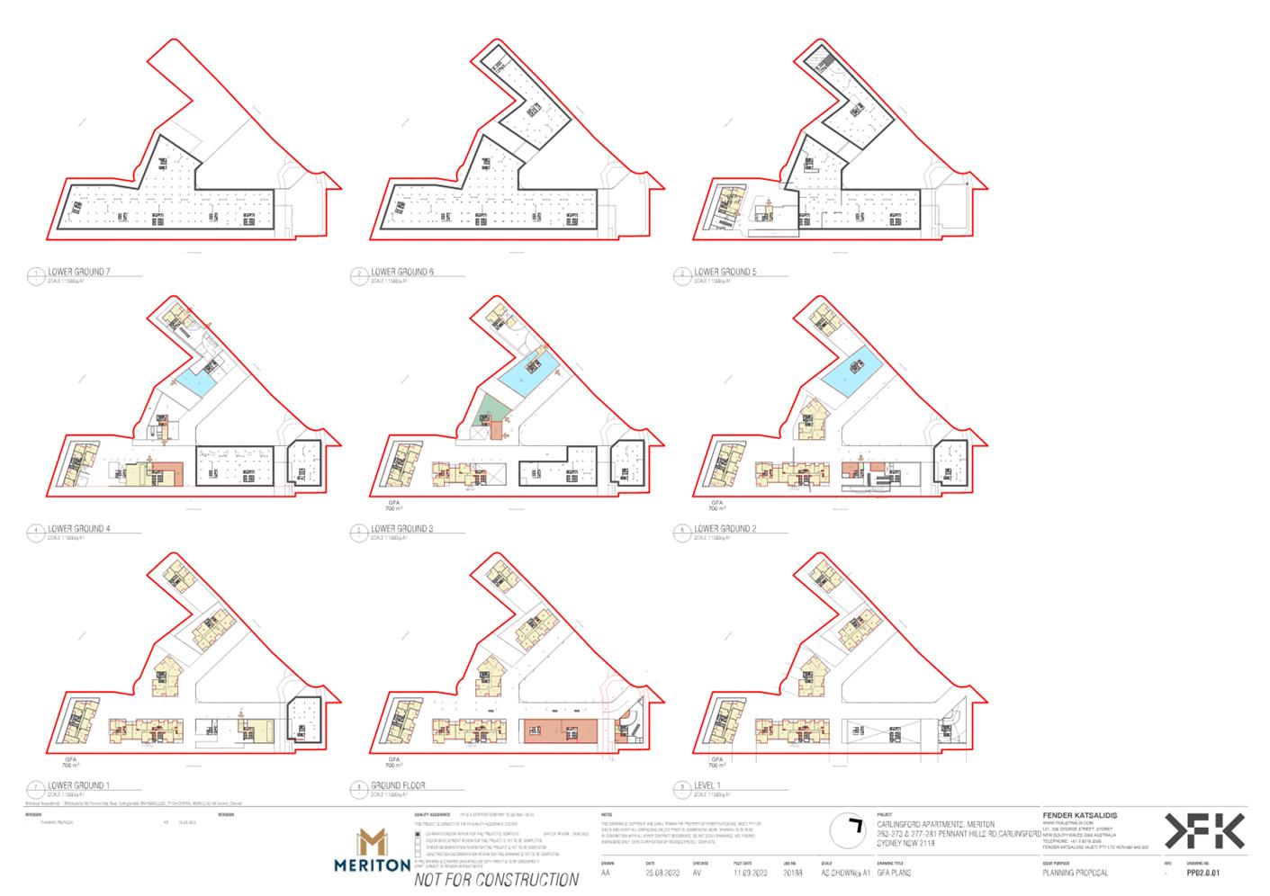
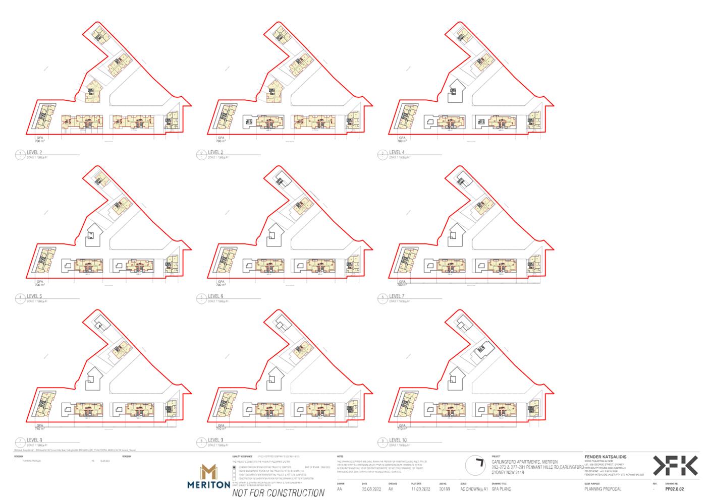
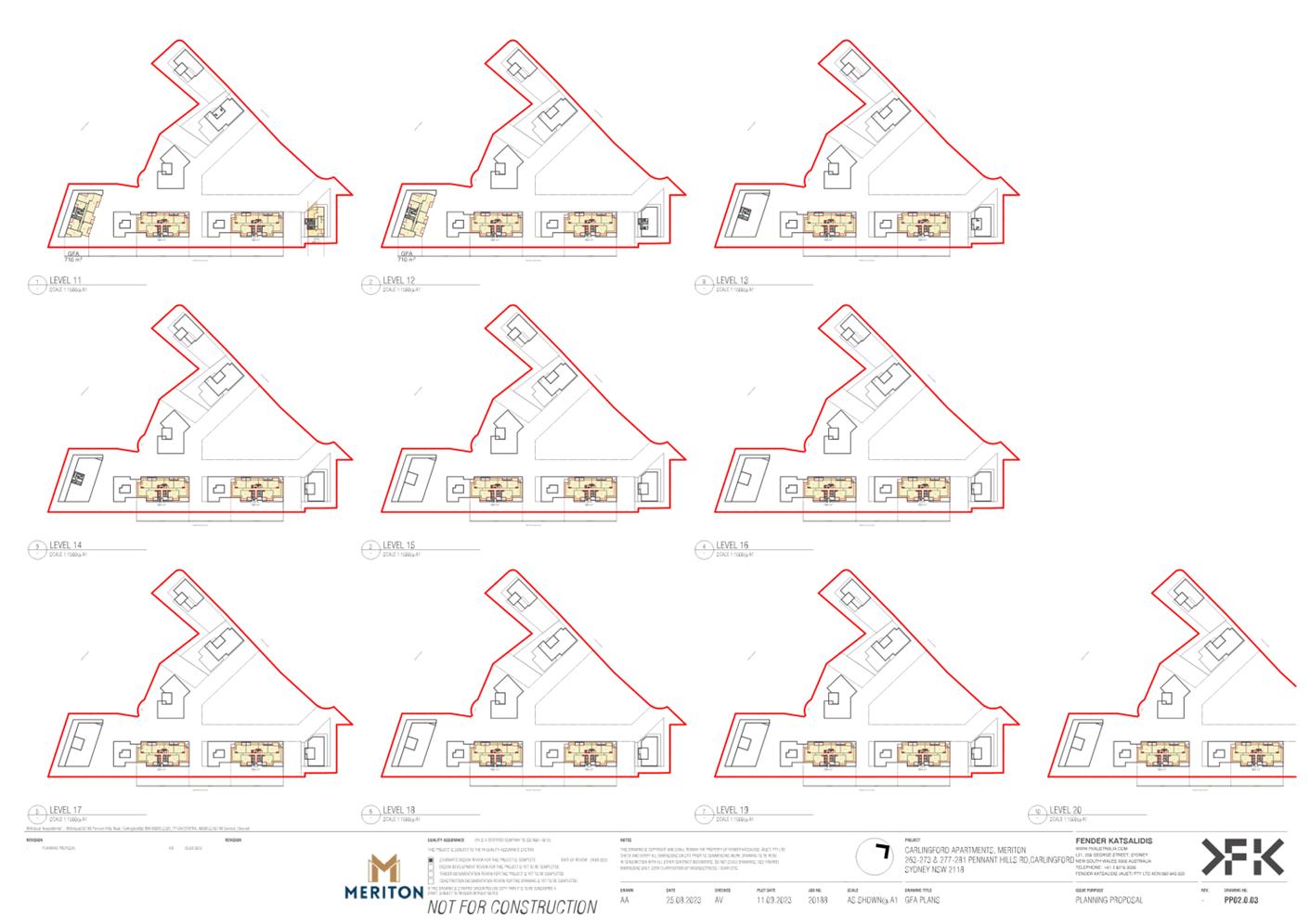
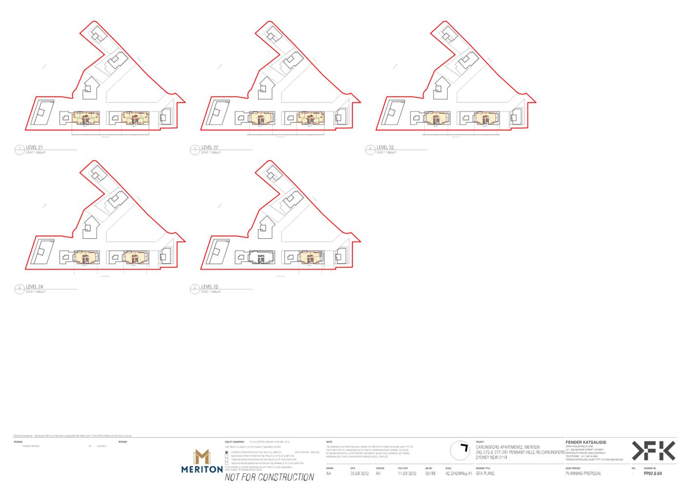
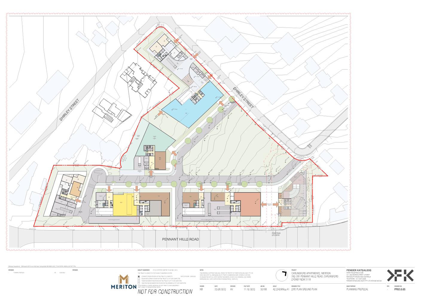
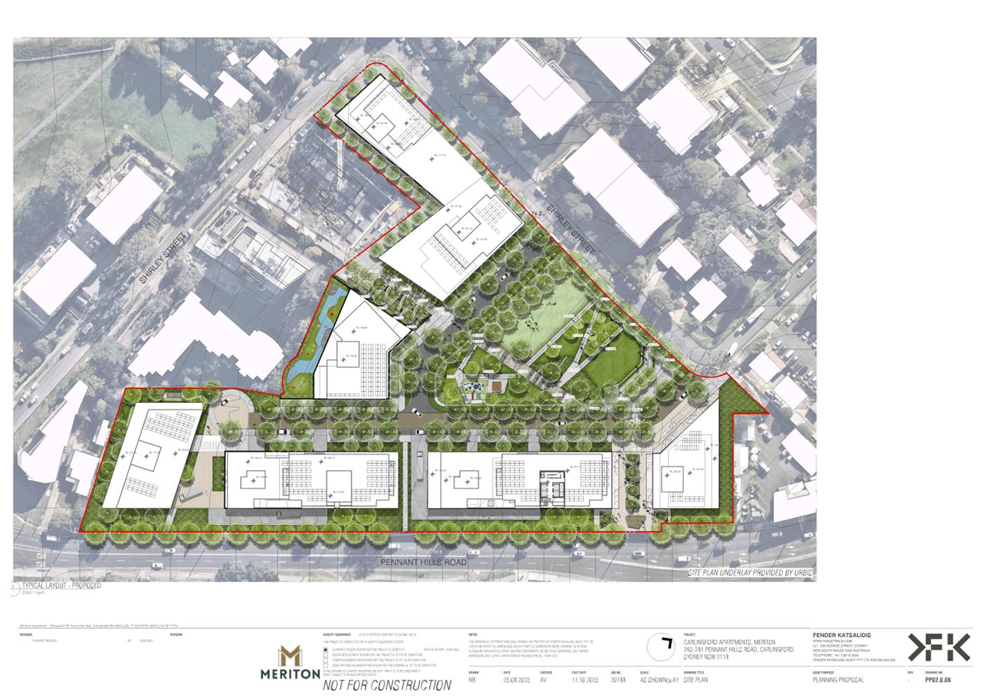
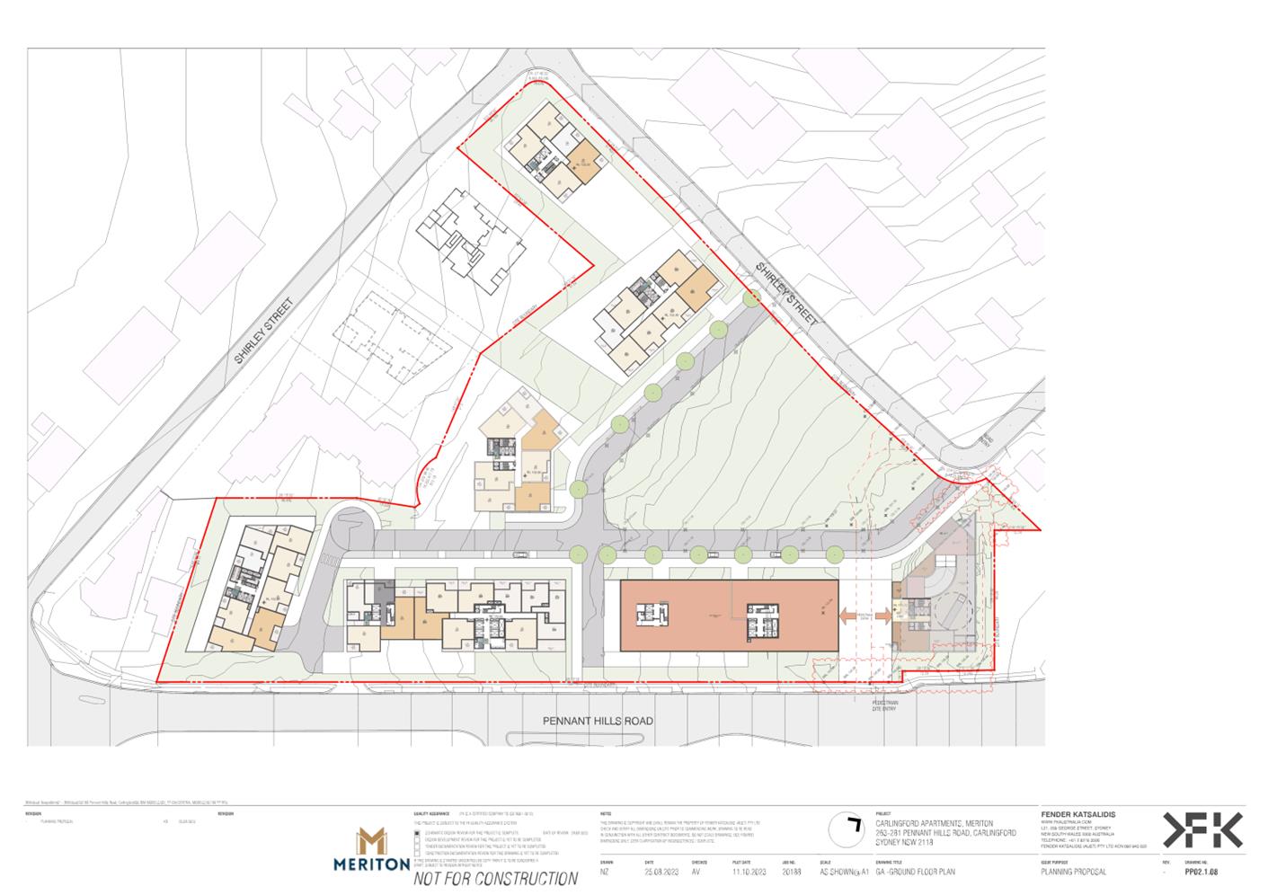
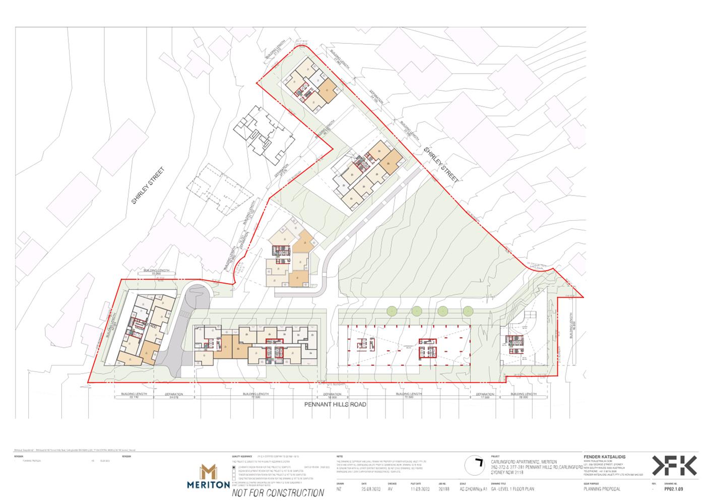
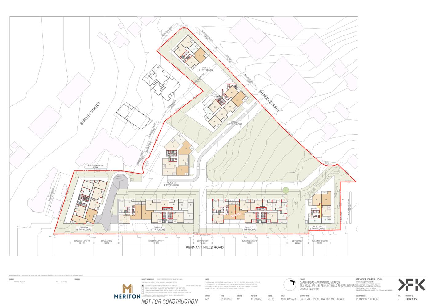
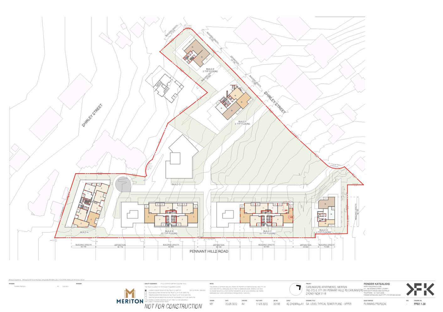
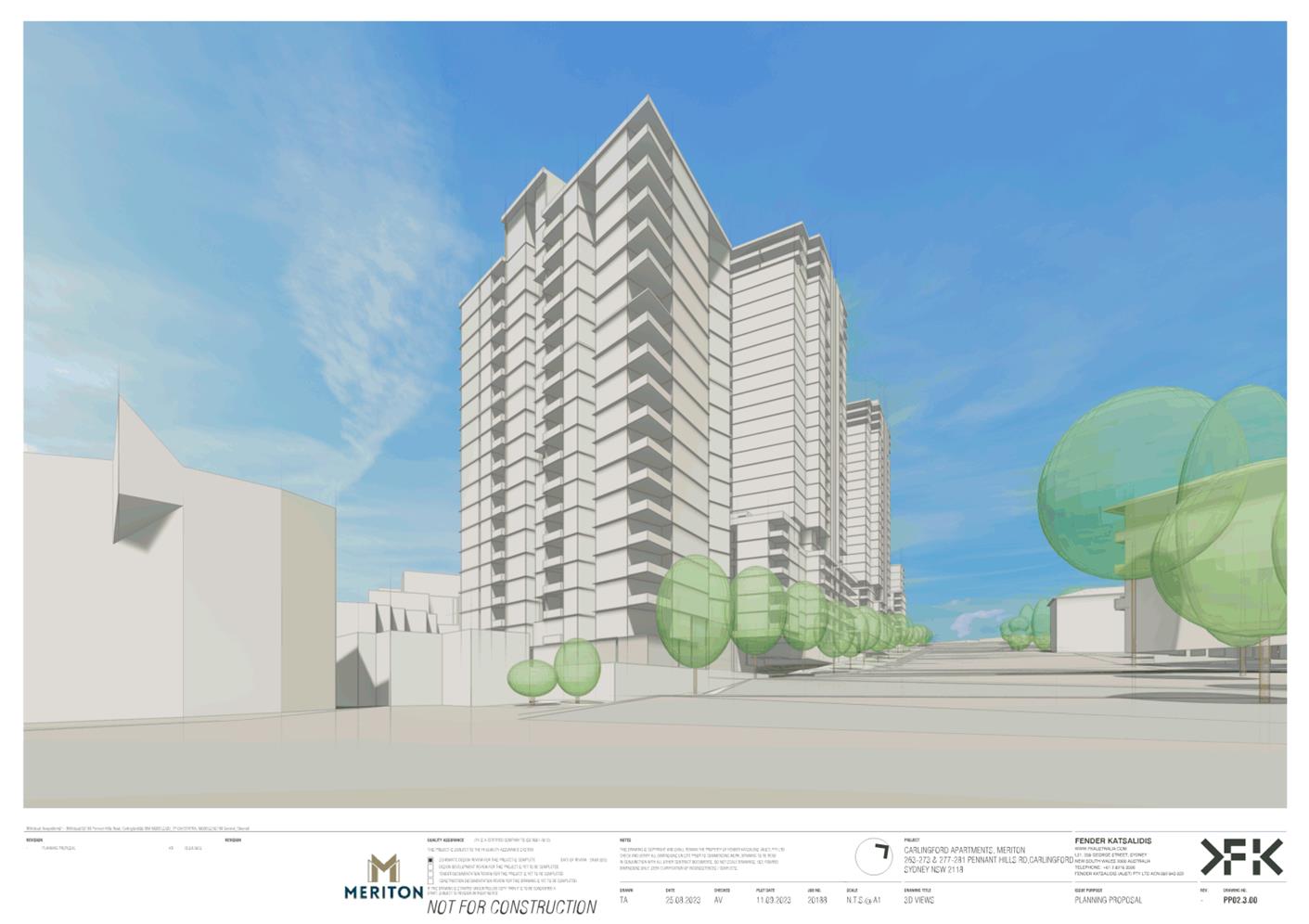
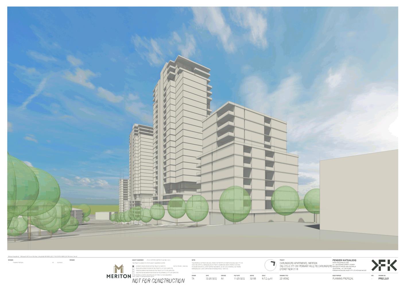
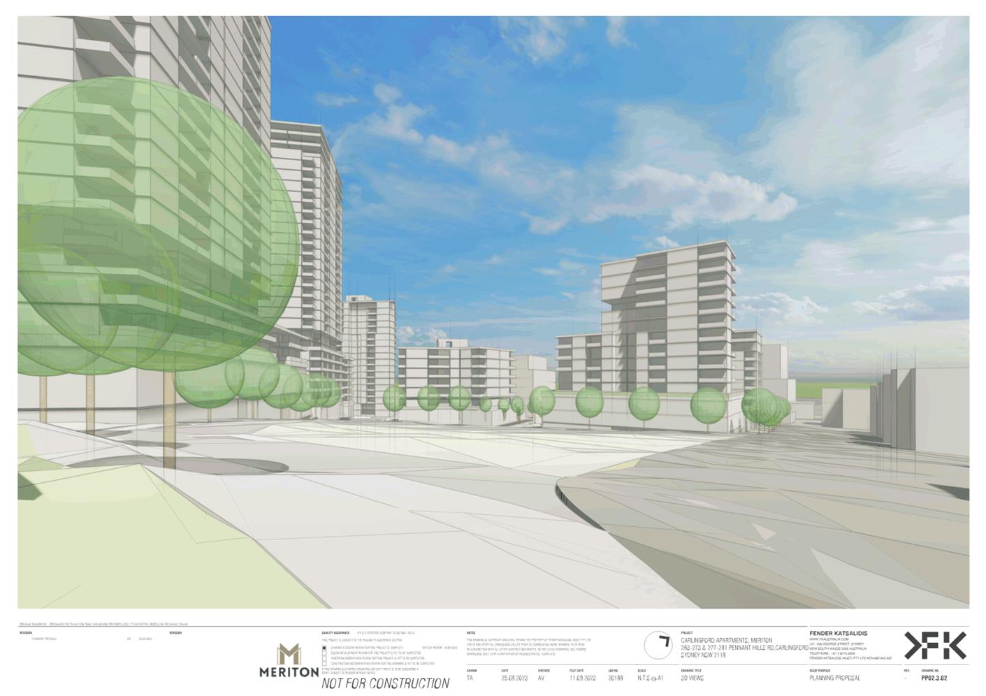
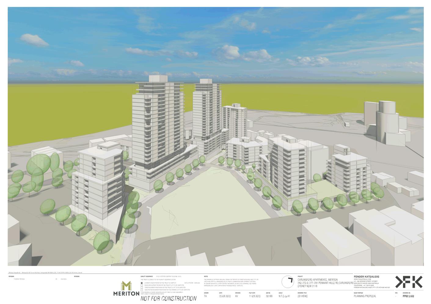
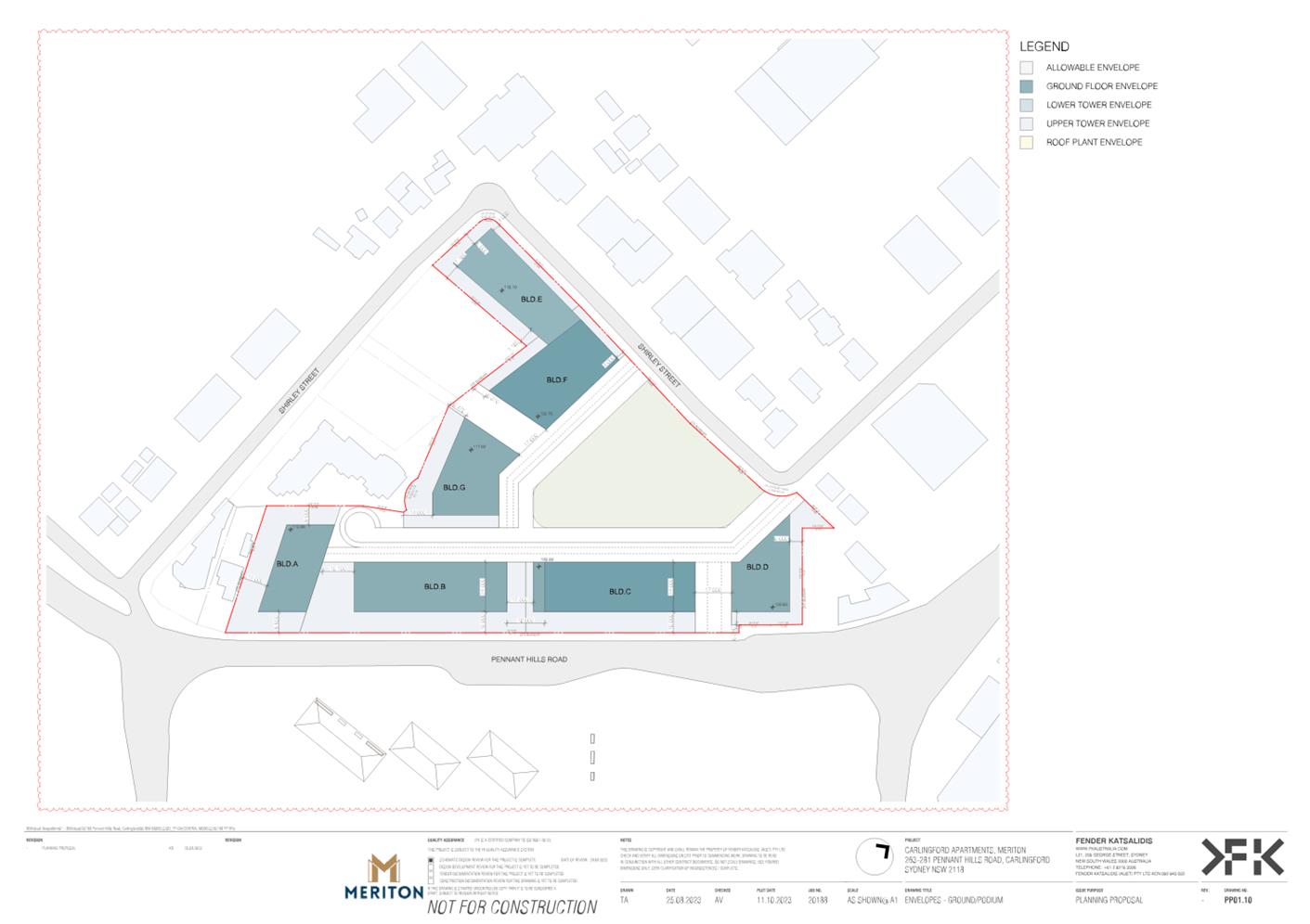
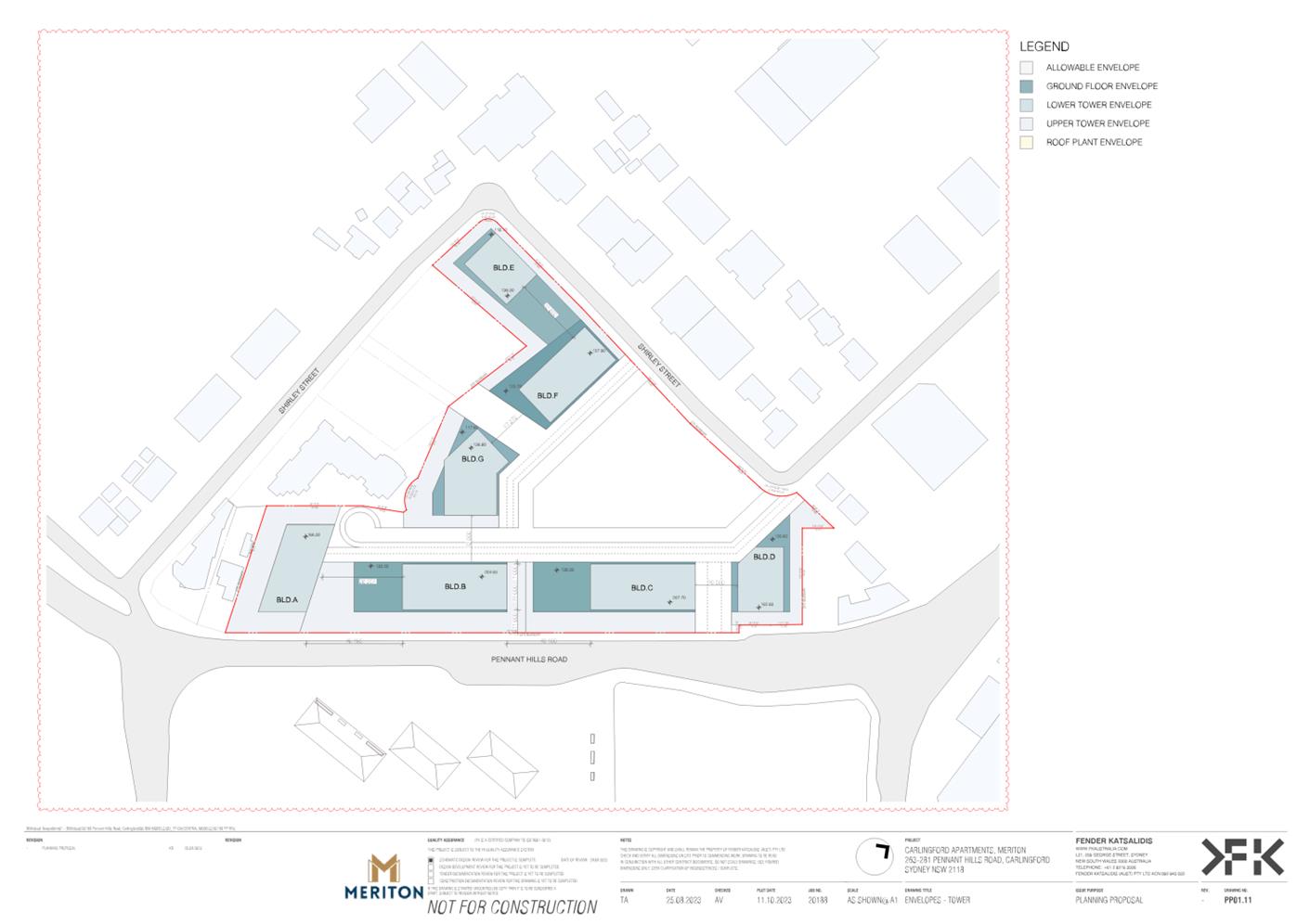
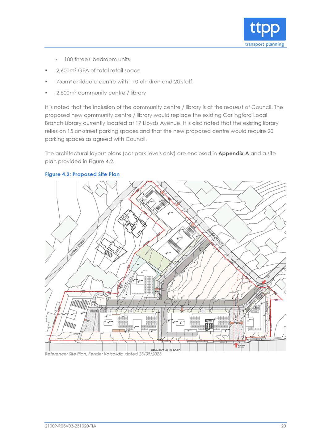
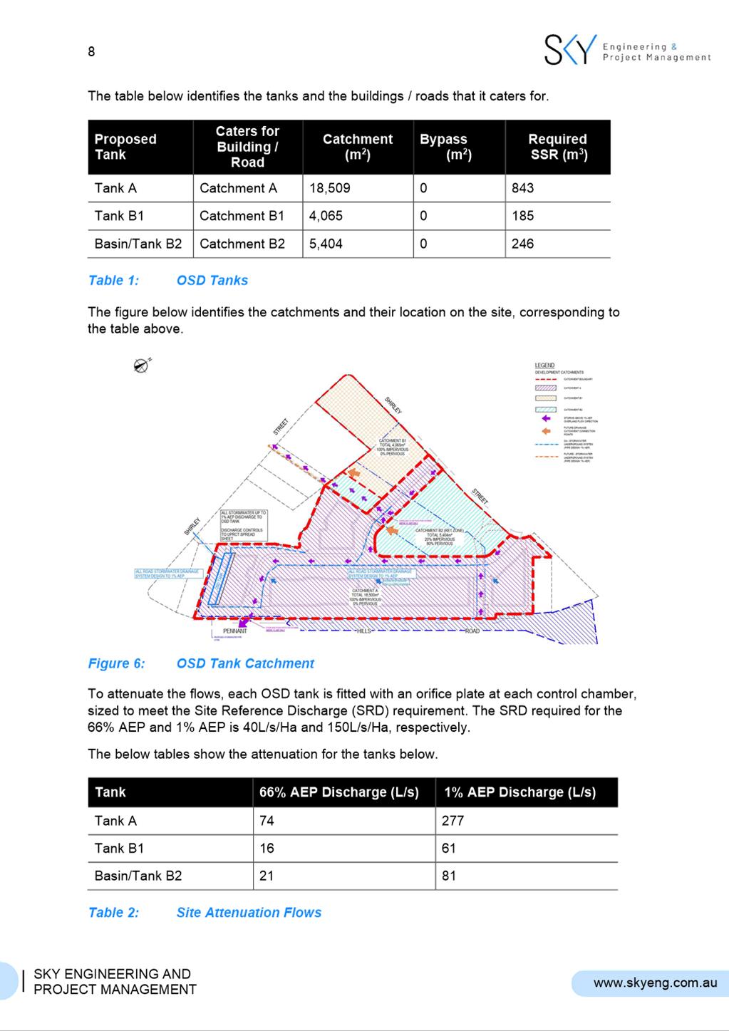
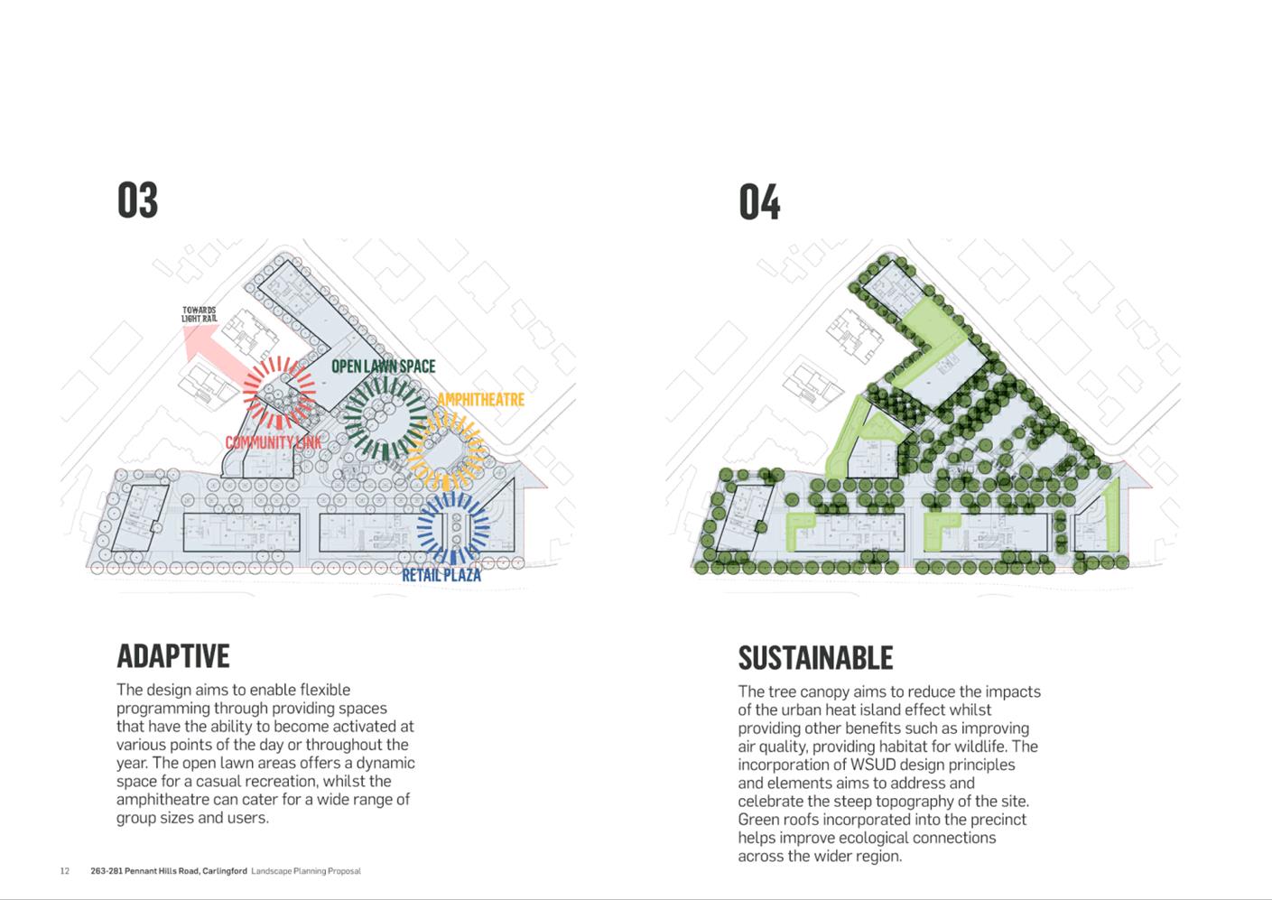
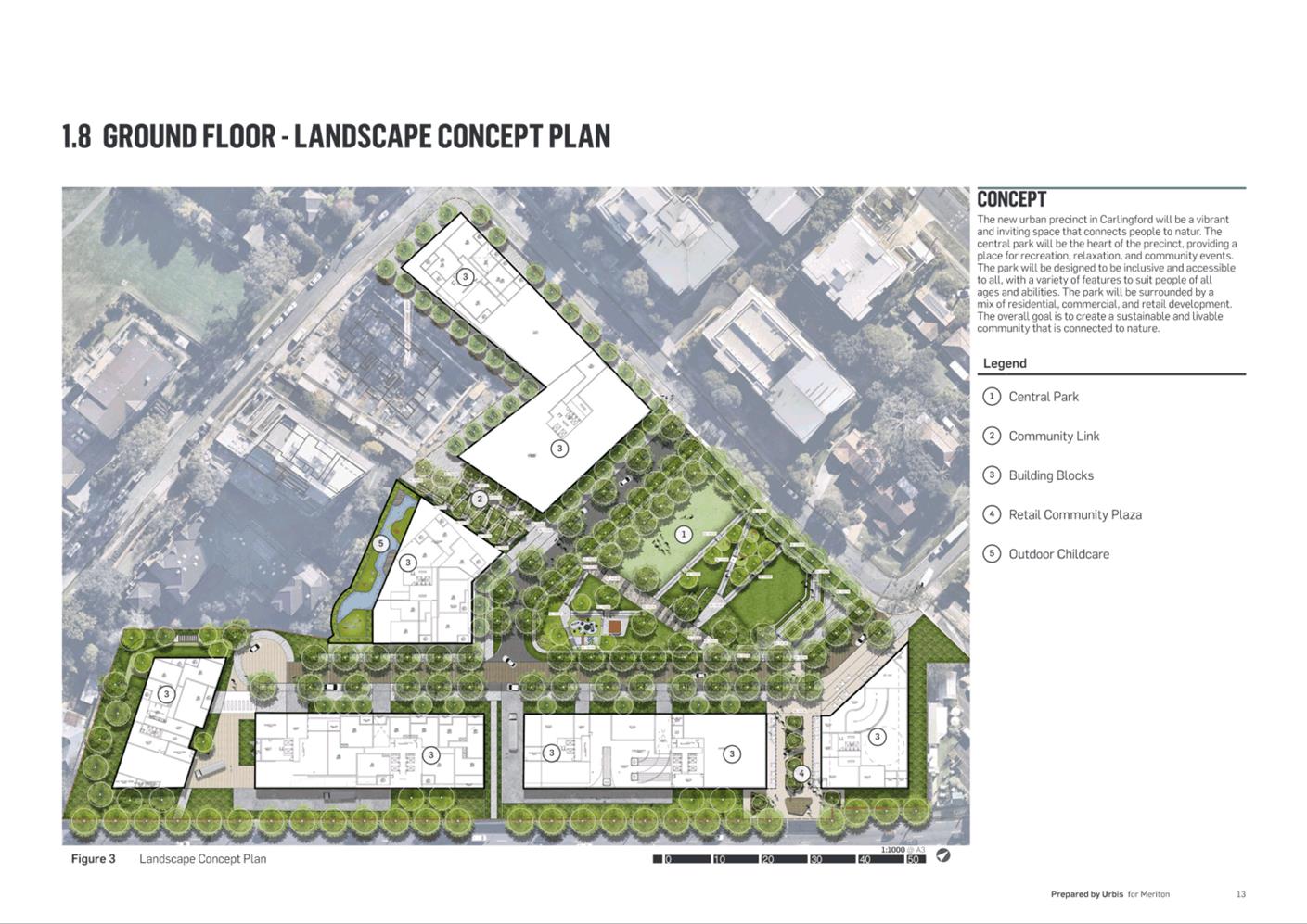
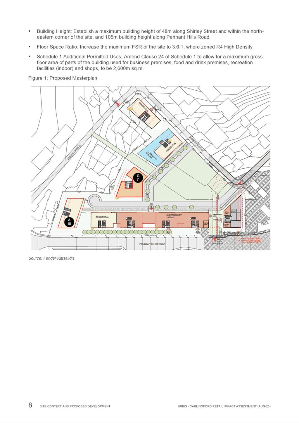
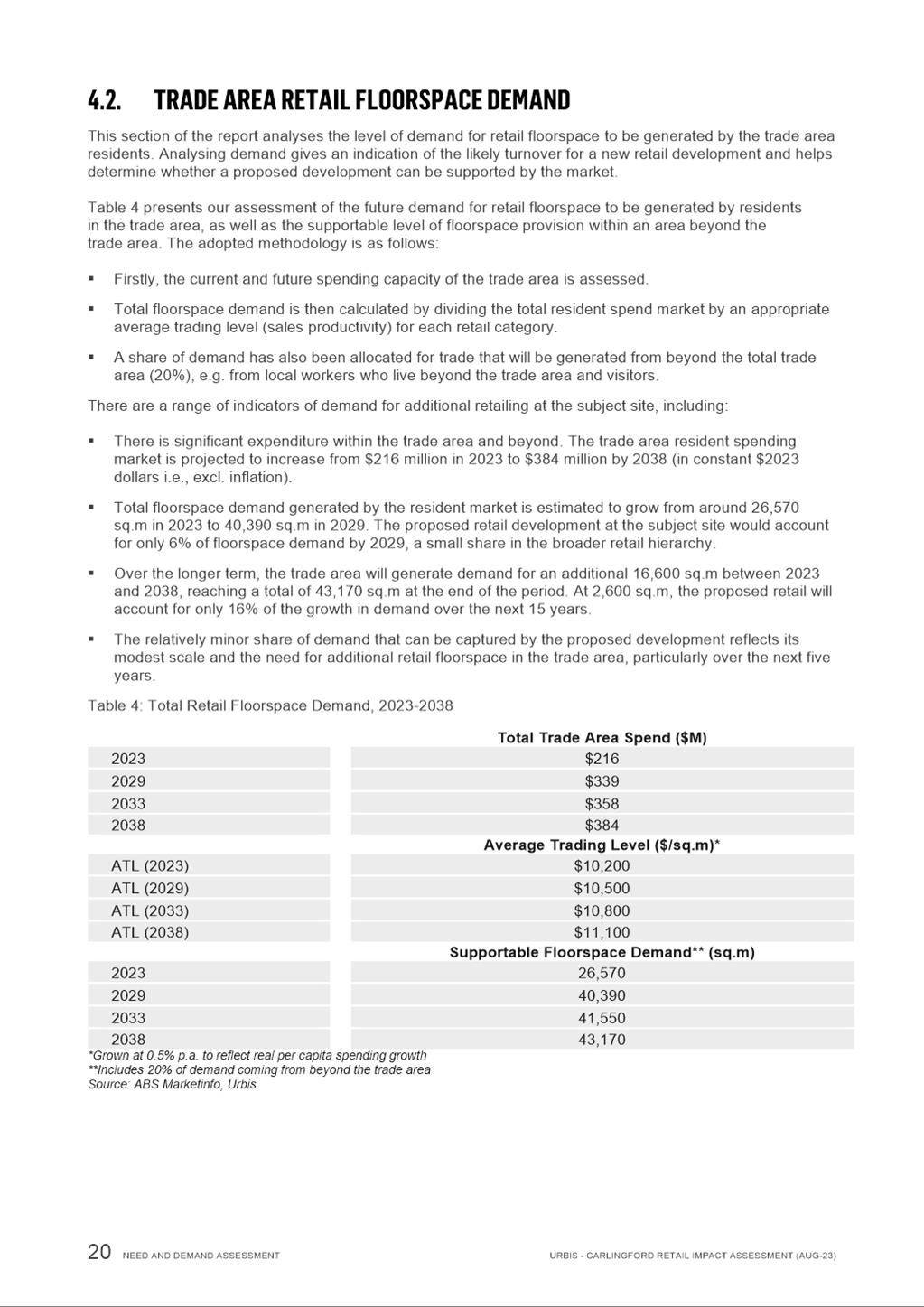
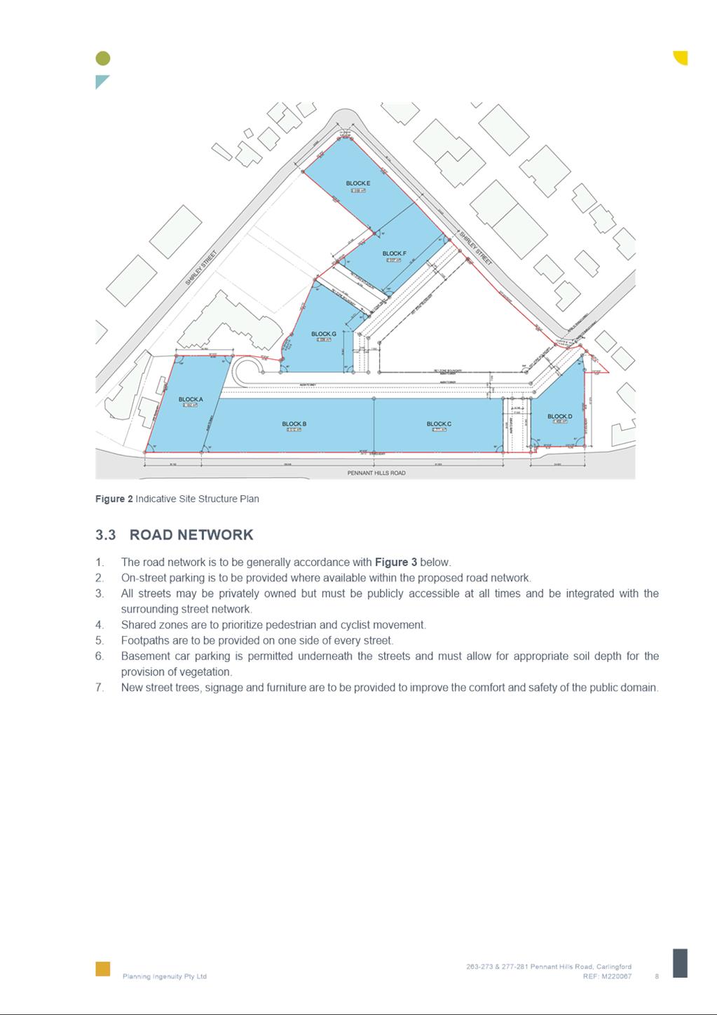
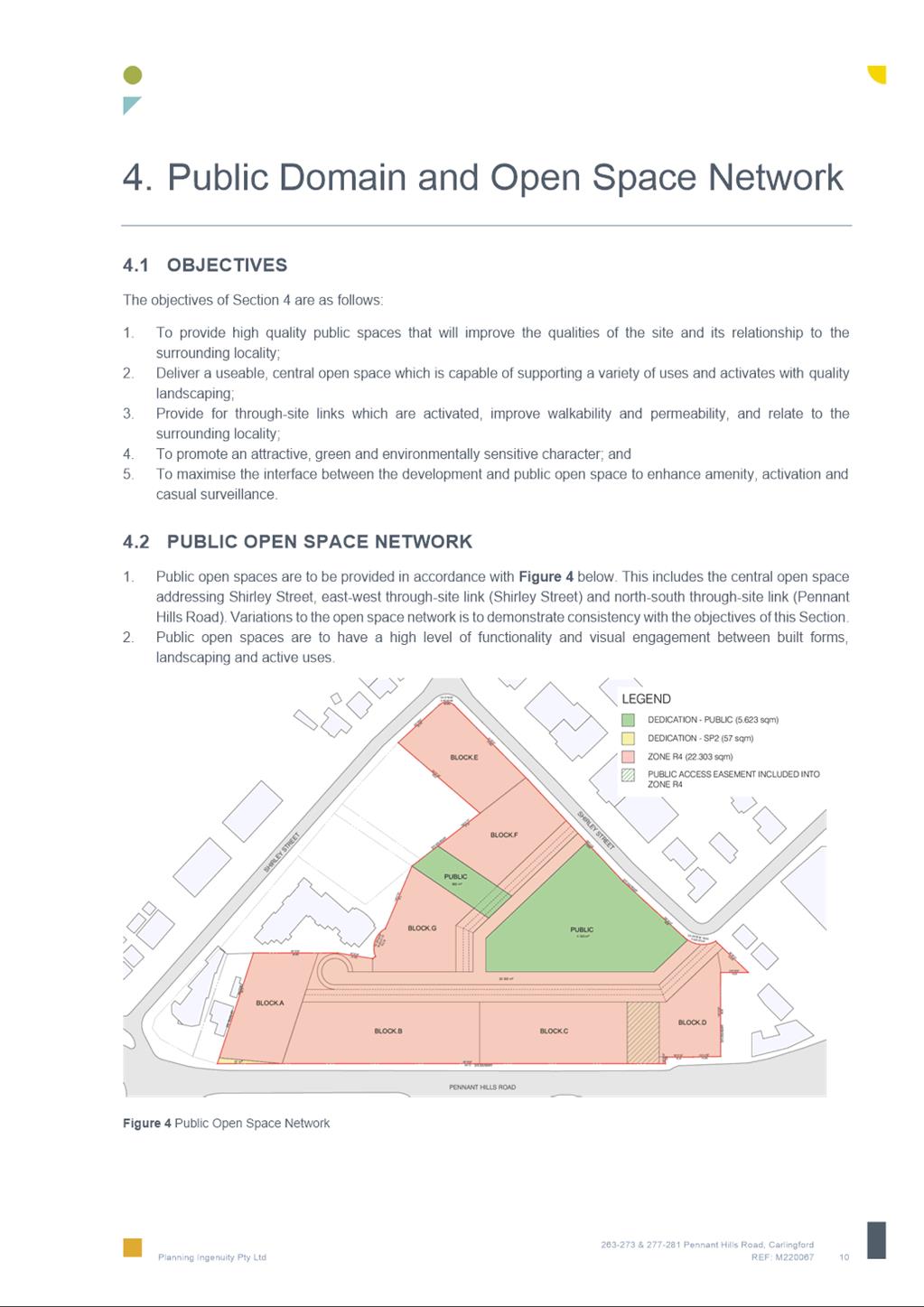
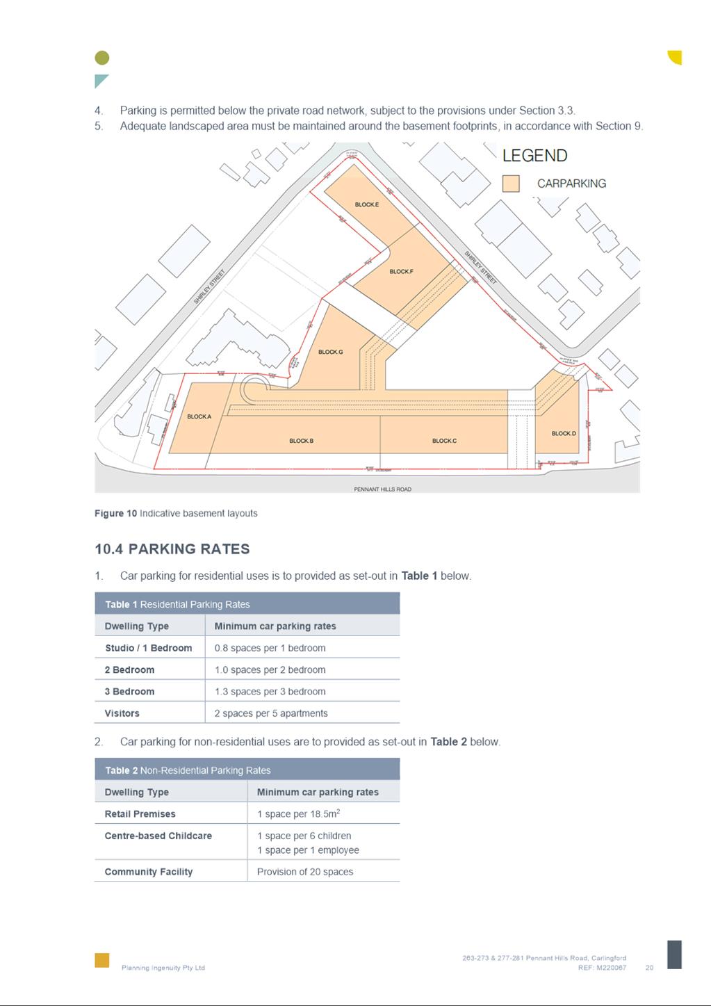
9. The Planning Proposal seeks to facilitate a higher density mixed use development scheme on the site than is allowed under the current planning controls by increasing the Floor Space Ratio and Height of Building controls and reconfiguring the layout of R4 High Density Residential and RE1 Public Recreation zoned land. The proposal also includes a substantial public benefit offering including a library, community space and consolidated open spaces as detailed in Table 2 and identified in Figures 3 & 4.
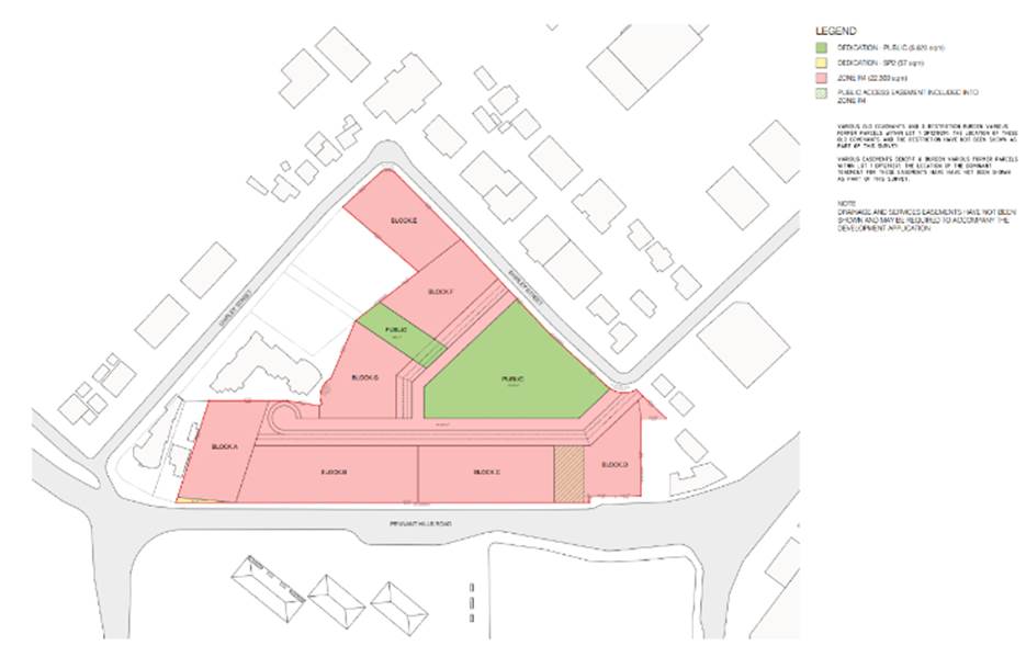
Figure 3 - Reference Scheme
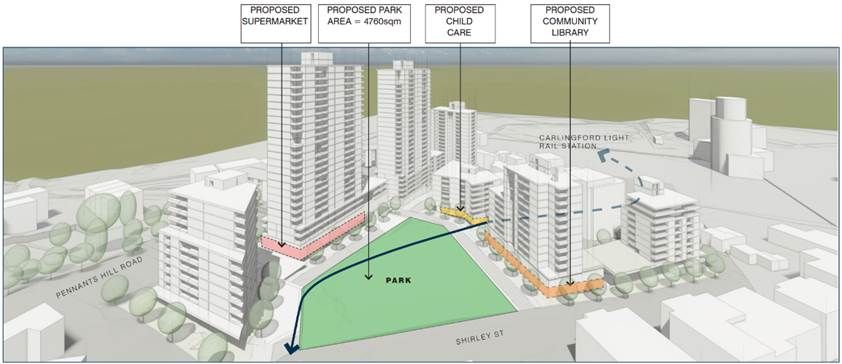
Figure 4 - 3D Reference Scheme
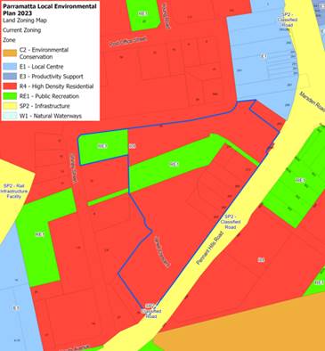
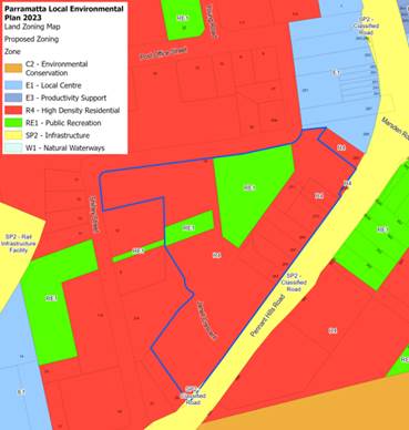
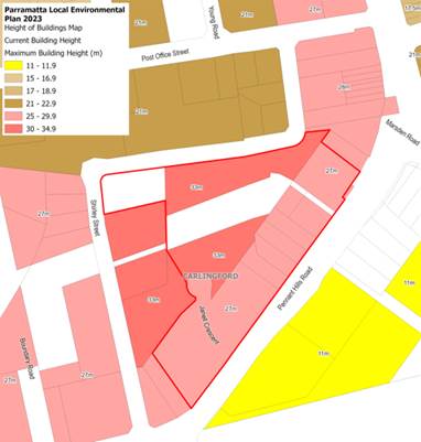
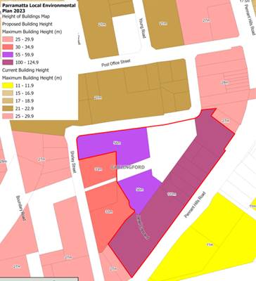
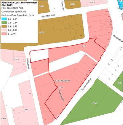
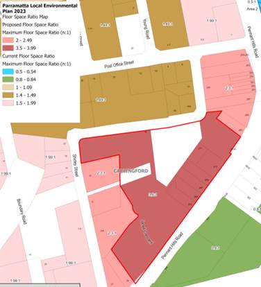
10. Table 2 shows the map changes being sought under the Planning Proposal compared with the current controls under PLEP 2023.
Table 2 - Current and Proposed Amendments to PLEP 2023 maps.
|
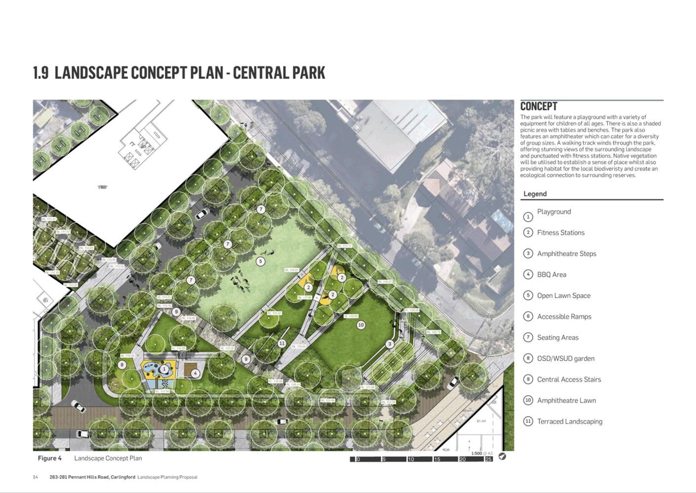
Current Controls PLEP 2023 |
Proposed Controls PLEP 2023 |
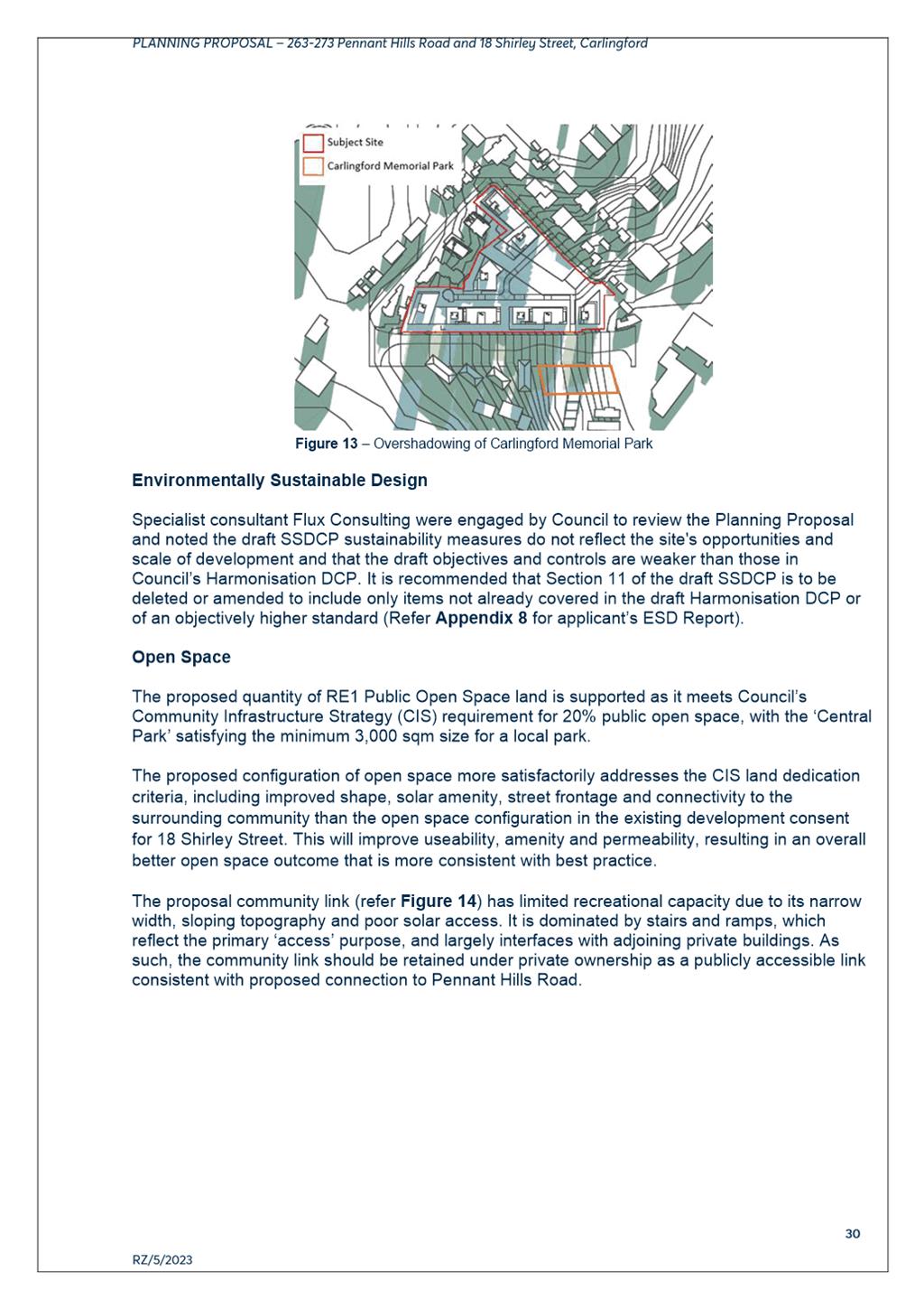
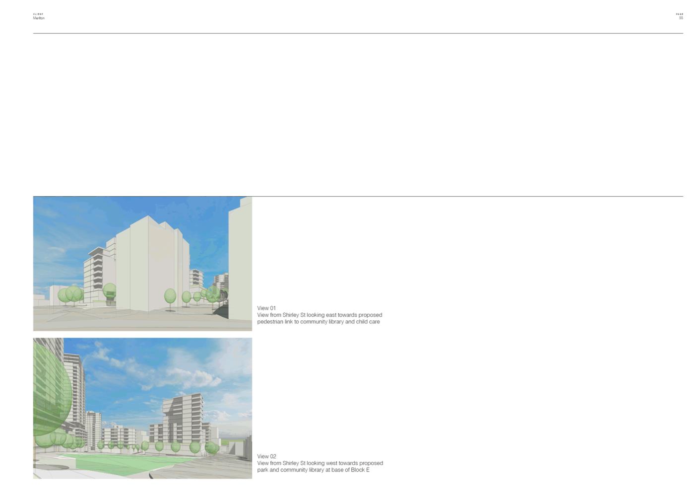
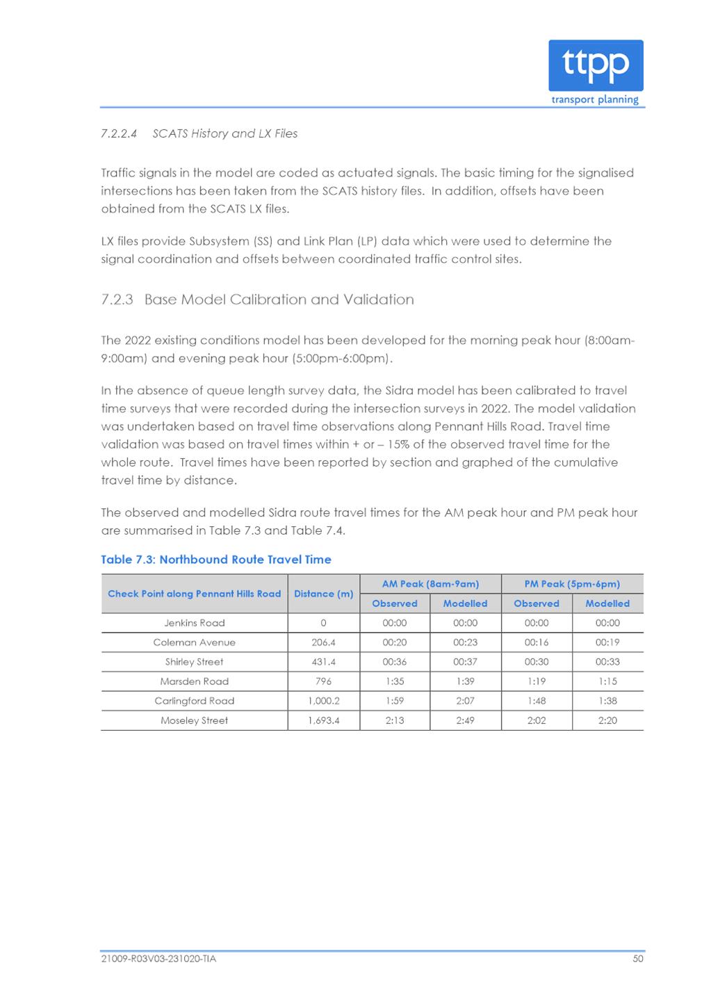
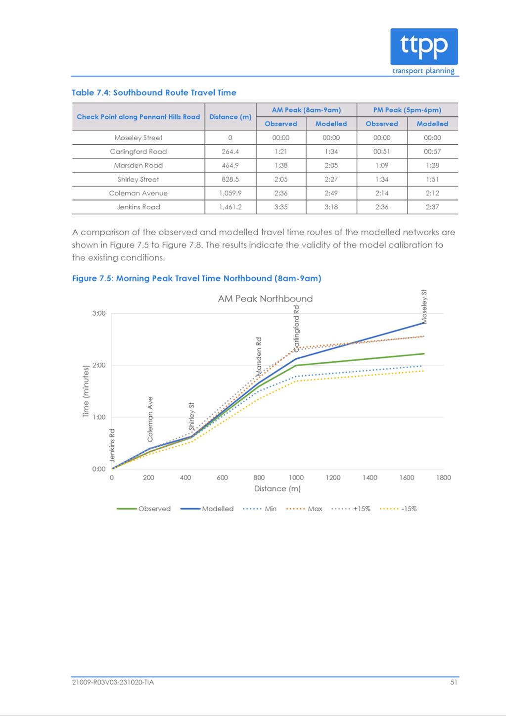
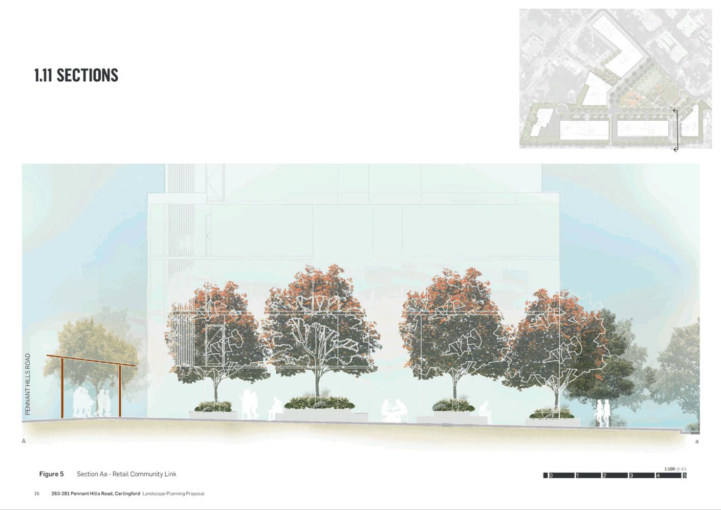
|
Current Land Use Zoning Map |
Proposed Land Use Zoning Map |
|
Current Height of Building Map |
Proposed Height of Building Map |
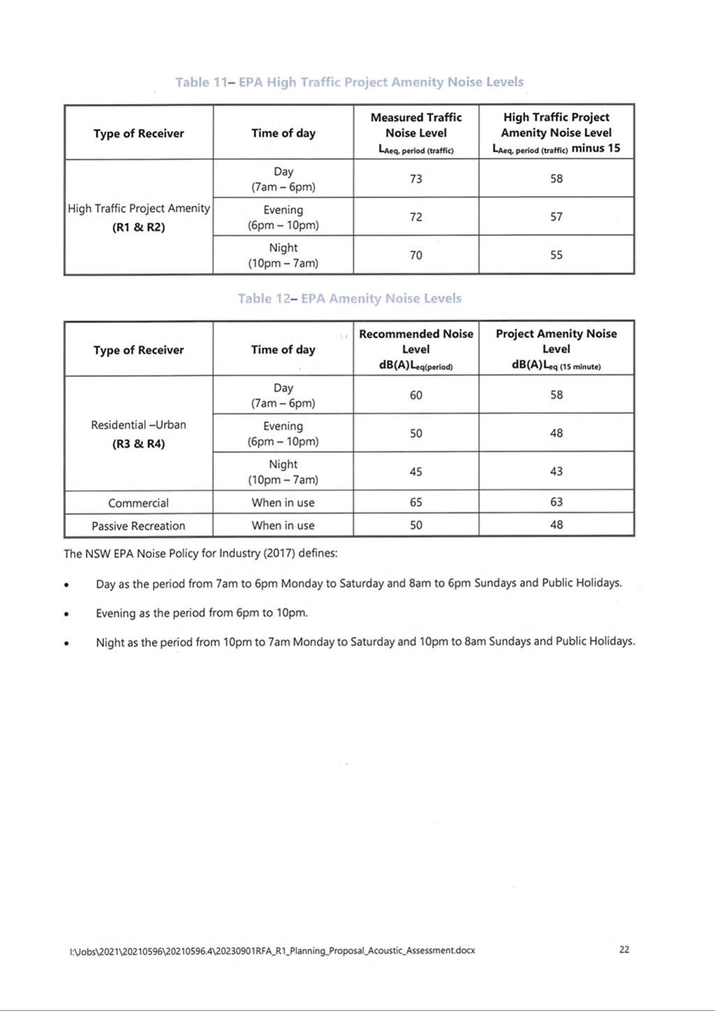
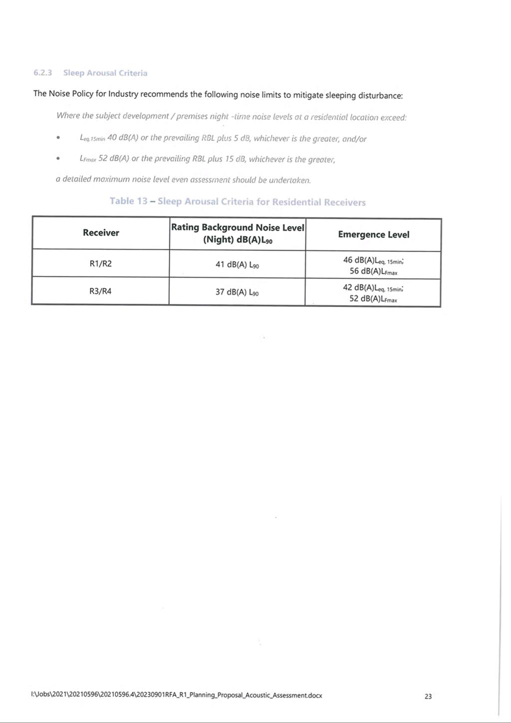
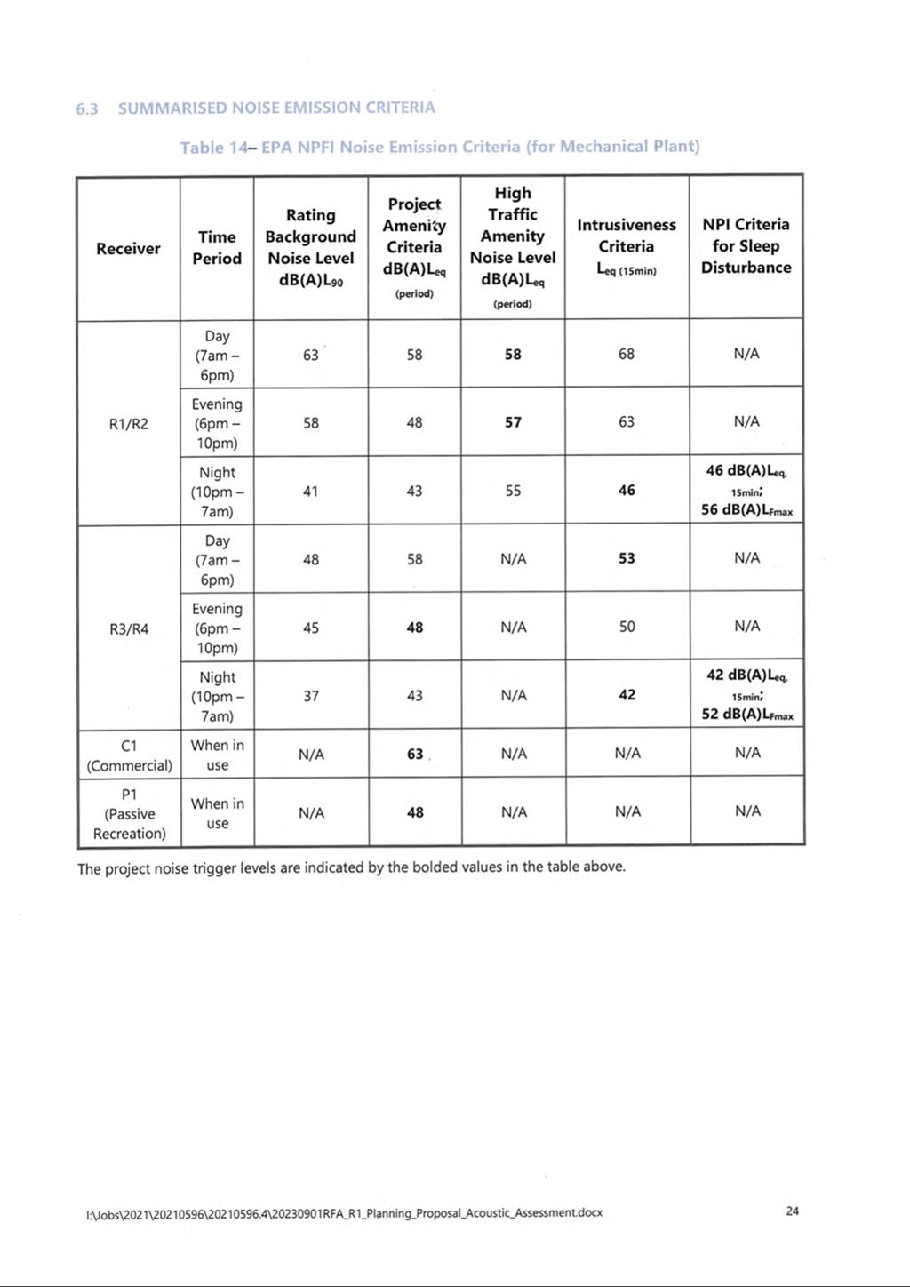
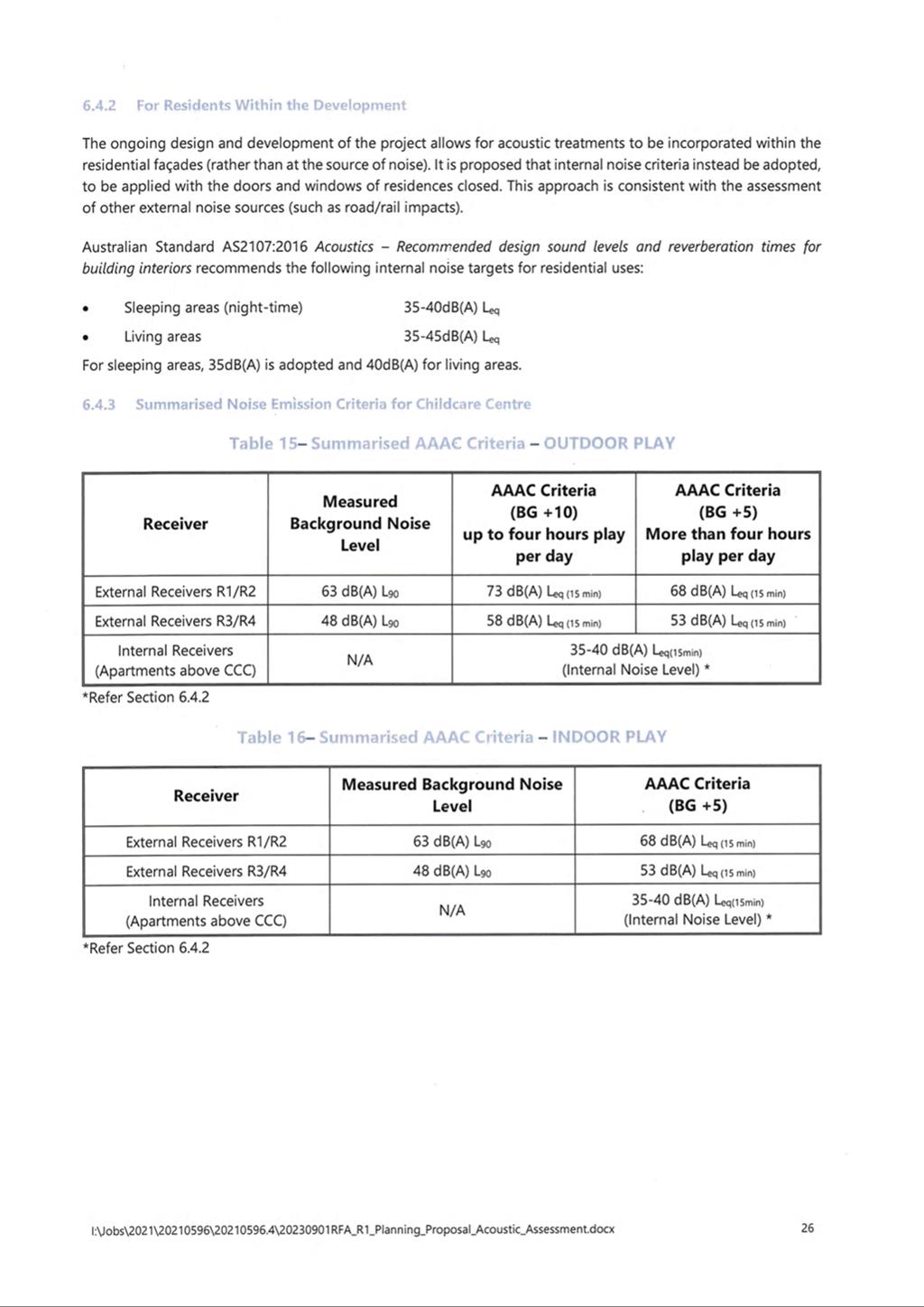
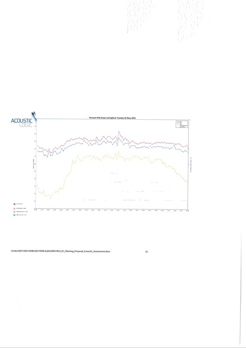
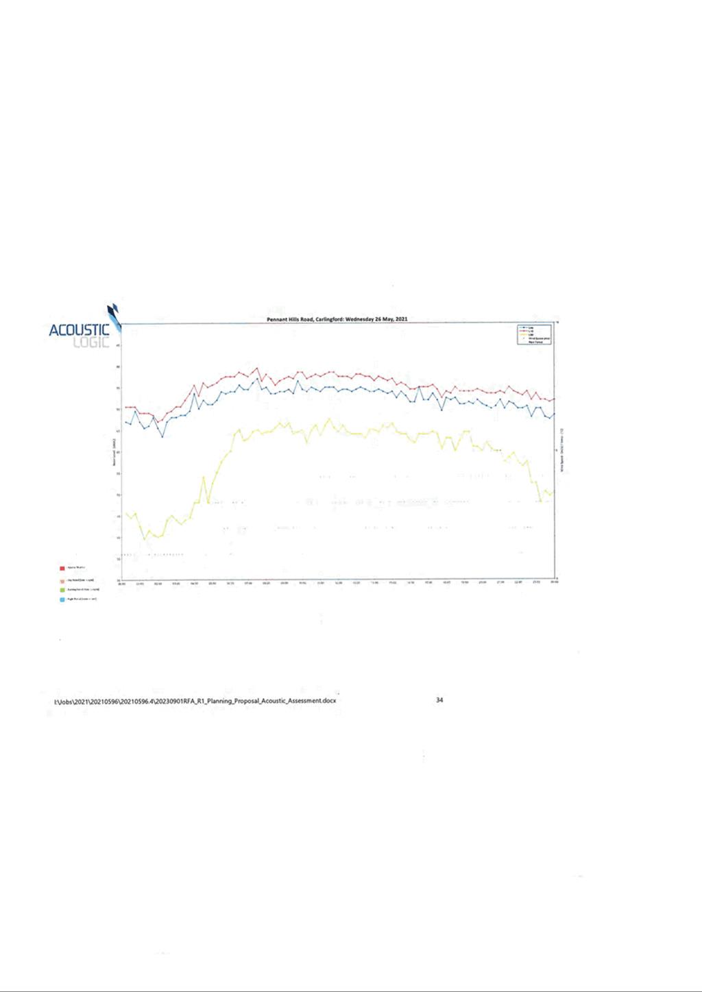
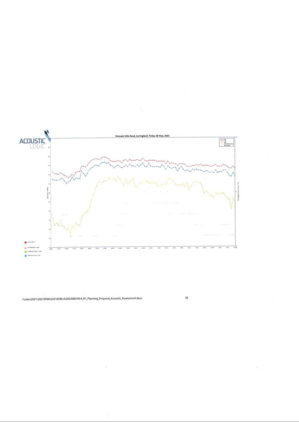
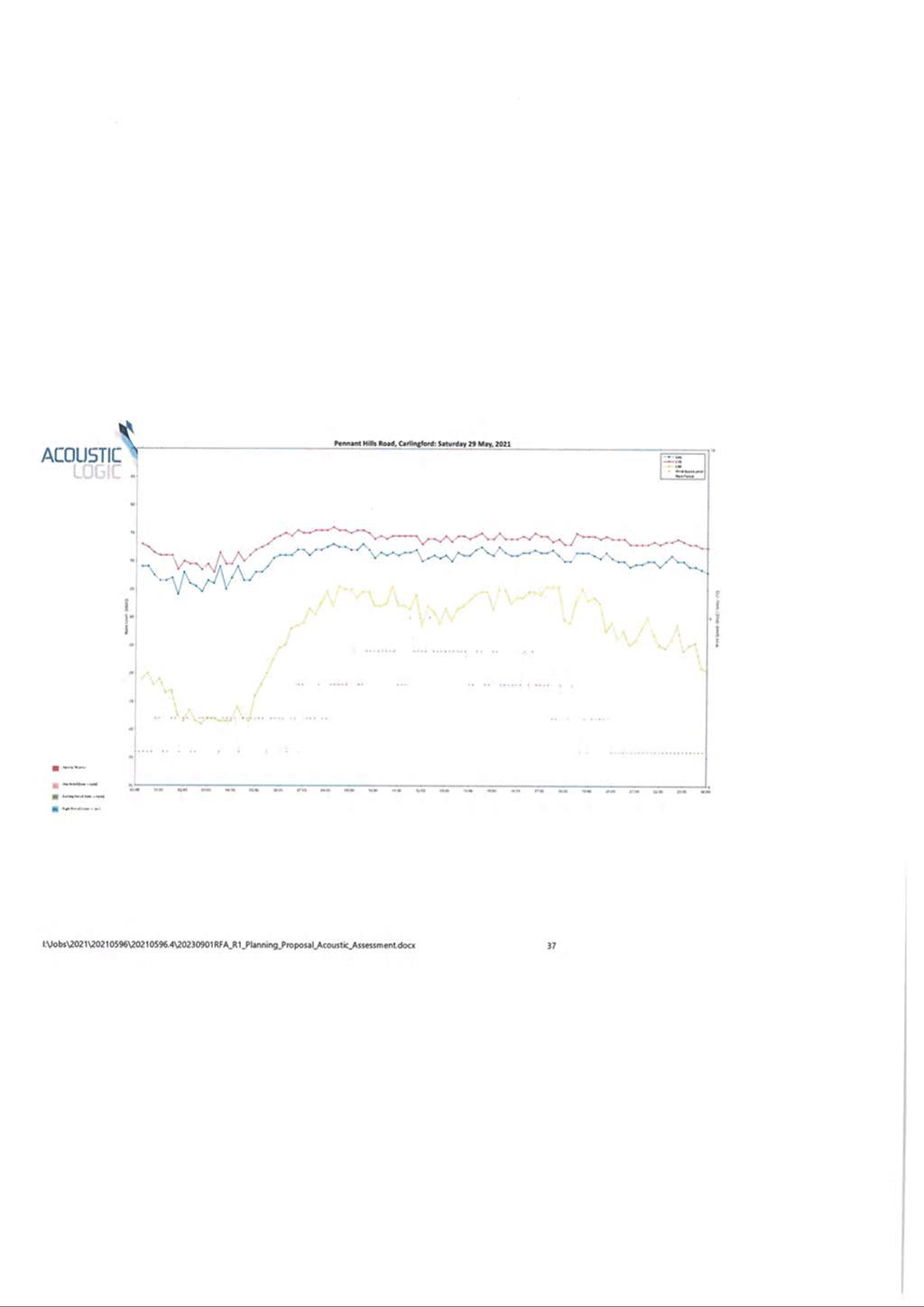
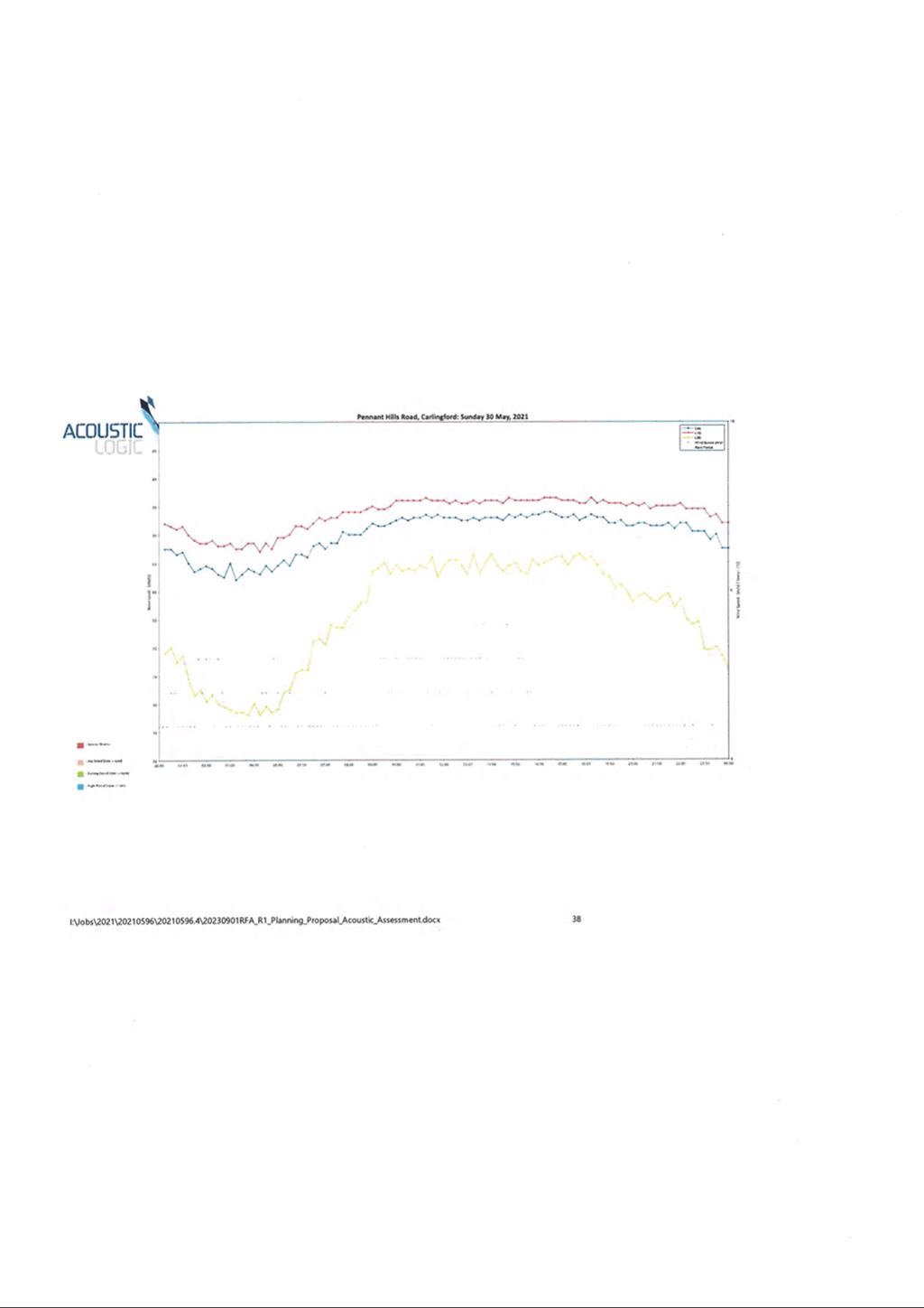
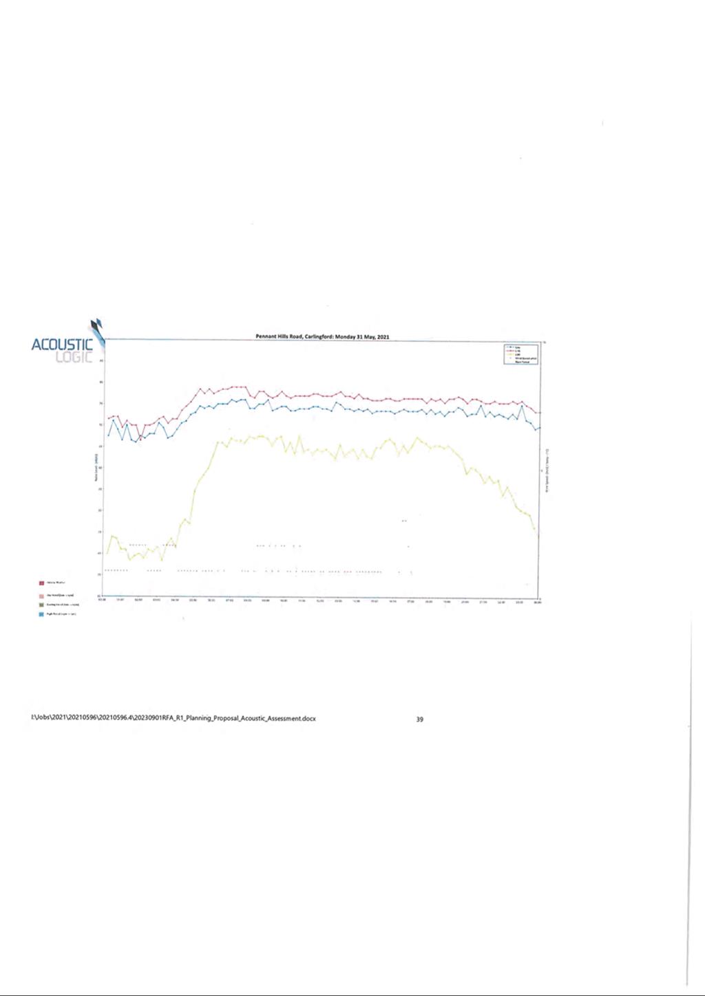
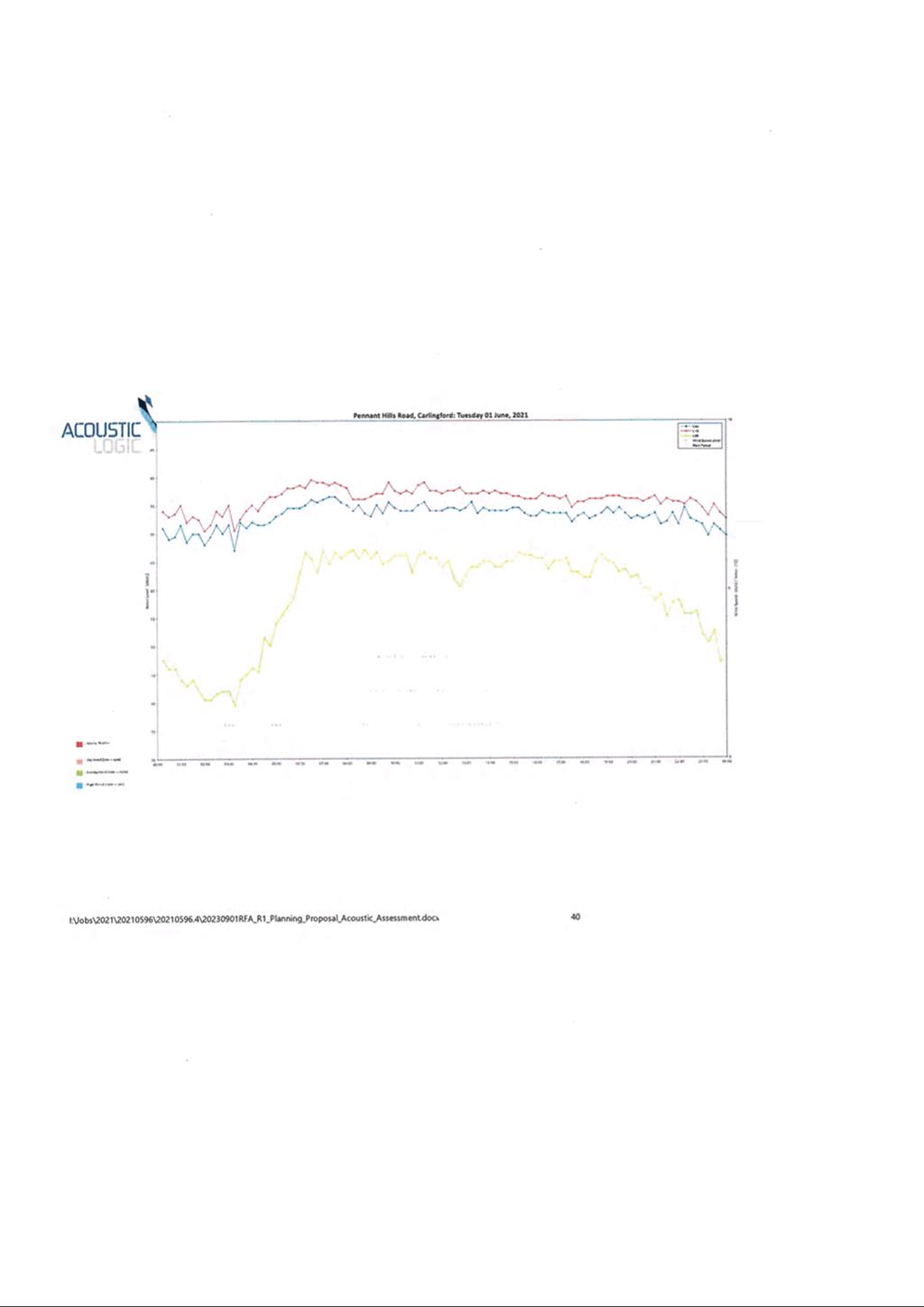
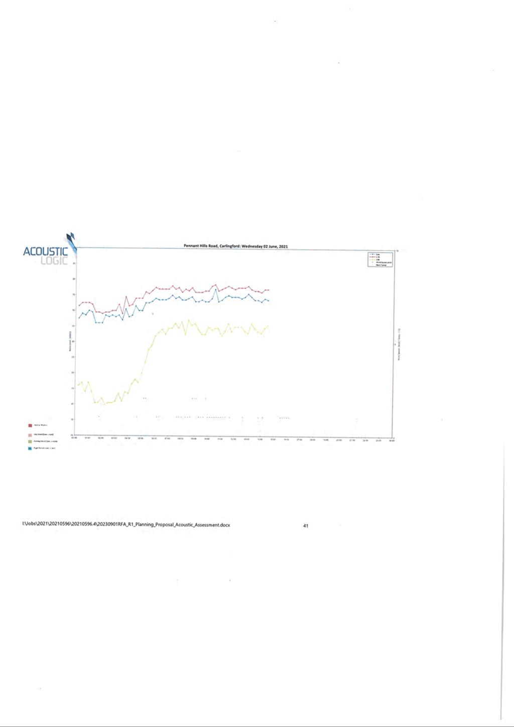
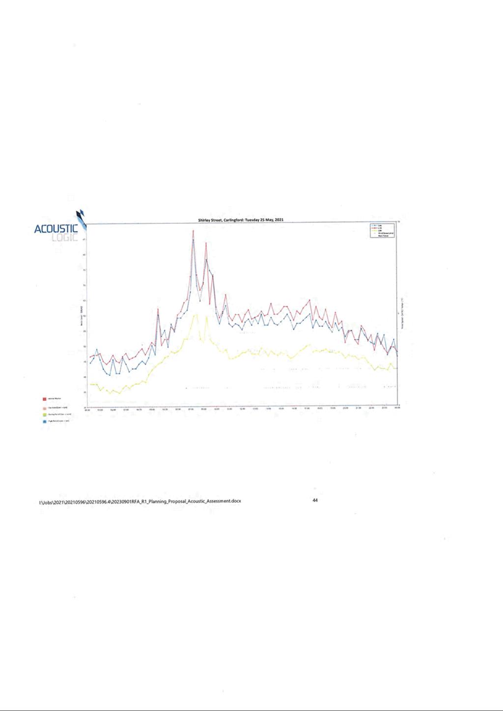
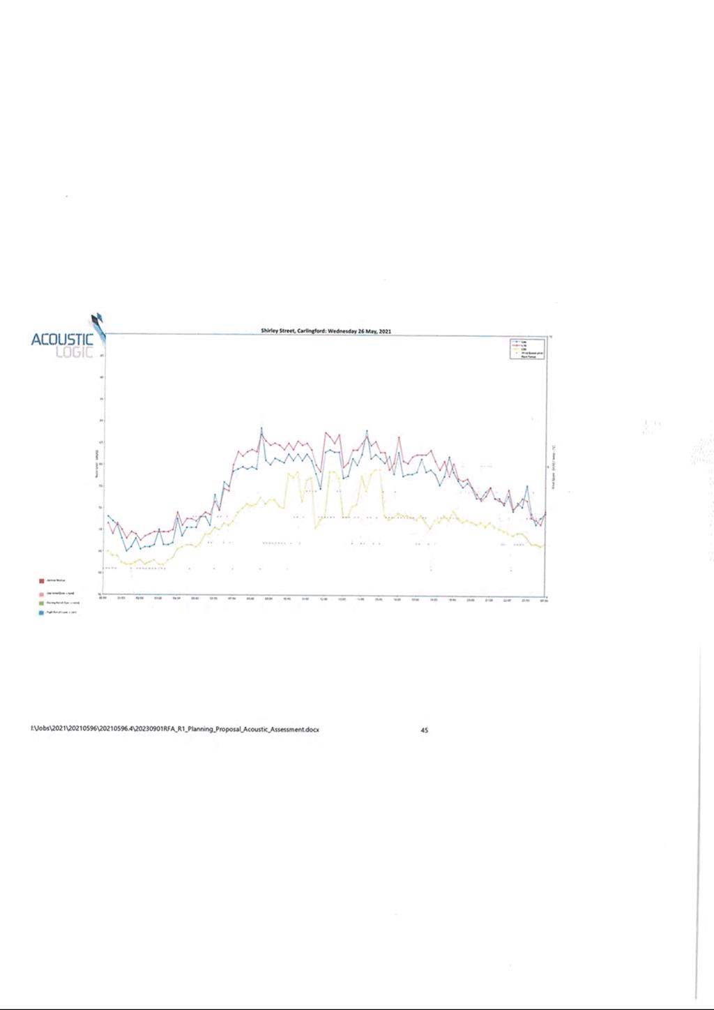
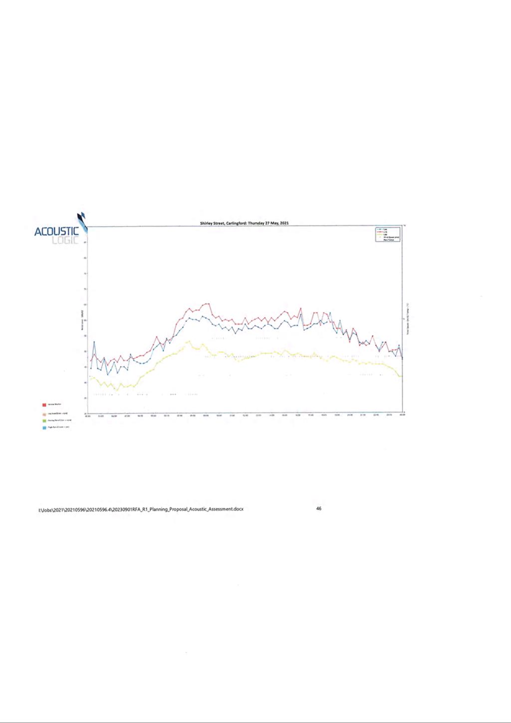
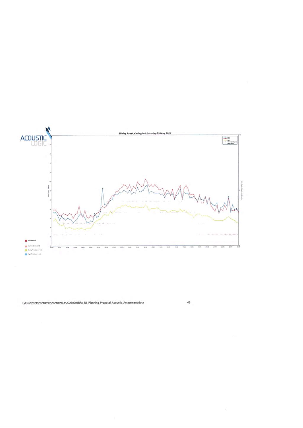
|
Current Floor Space Ratio Map |
Proposed Floor Space Ratio Map |
|
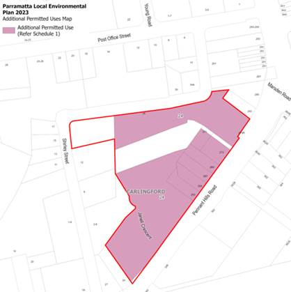
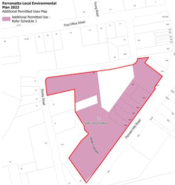
Current Additional Permitted Uses Map |
Proposed Additional Permitted Uses Map |
11. Table 3 describes the instrument changes being sought under the Planning Proposal compared with the current controls under PLEP 2023.
Table 3 - Proposed PLEP 2023 Amendments
|
|
Existing as per PLEP 2023 (18 Shirley Street and 263-273 Pennant Hills Road) |
Dyldam DA (Excludes 263-273 Pennant Hills Road) |
Proposed changes to PLEP 2023 (18 Shirley Street and 263-273 Pennant Hills Road) |
|
Zoning |
Part R4 High Density Residential, Part RE1 Public Recreation and Part SP2 Infrastructure. |
Part R4 High Density Residential Part RE1 Public Recreation Part SP2 Infrastructure |
Reconfigured part R4 High Density Residential and RE1 Public Recreation.
Existing SP2 Infrastructure to remain as is. |
|
Site Area |
27,987 sqm |
23,482 sqm |
27,987 sqm |
|
Dwelling Yield |
526 |
450 on Dyldam site plus 120 on 263-273 Pennant Hills Road = 570
|
723 |
|
GFA |
50,454 sqm residential |
Total GFA 53,069 sqm residential (Dyldam site only)
|
Total GFA 80,510 sqm - 74,655 sqm residential - 2,500 sqm Community Hub - 550 sqm childcare centre - 2,600 sqm non-residential - 5,585 sqm of RE1 Public Open Space - 4,760 sqm Central Park to be dedicated.
|
|
HoB |
Part 33m (11 storeys) and part 27m (7 storeys) |
Part 27m (9 storeys) on Pennant Hills Road and Part 33m (11 storeys) on the remainder of the site. |
Part 110m (29 storeys) and part 56m (13 storeys) |
|
FSR |
2.3:1 |
3:1 (excluding open space) |
3.6:1 |
|
Additional Permitted Uses |
As per Schedule 1 of PLEP 2023 shops, food and drink premises and business premises and recreation facilities (indoor) on the R4 High Density Residential zoned part of the site - maximum GFA of 2,000 sqm on the R4 High Density Residential zoned part of the site. |
NA |
Schedule 1 of PLEP 2023 to shops, food and drink premises, business premises and recreation facilities (indoor) on the R4 High Density Residential zoned part of the site - maximum GFA of 2,600 sqm on the R4 High Density Residential zoned part of the site. |
|
Additional Local Provisions |
Nil |
NA |
Amend Part 6 of PLEP by adding a clause which will exclude enclosed private balconies from the calculation of gross floor area, where impacted by aural intrusion from Pennant Hills Road.
Add the R4 High Density Residential section of the subject site to the Additional Local Provisions Map. |
12. It should be noted that the existing development consent that applies to the 18 Shirley Street portion of the site allows a 30% increase in floorspace permitted on that site (as the RE1 Public Open Space land was included in the calculations of floor space ratio) to 53,069 sqm which equates to an FSR of 3:1 for this site. The subject Planning Proposal seeks a total floorspace of 80,510 sqm which equates to an FSR of 3.6:1 when the 263-273 Pennant Hills Road properties are added to the site and public open space is excluded from the calculation of FSR.
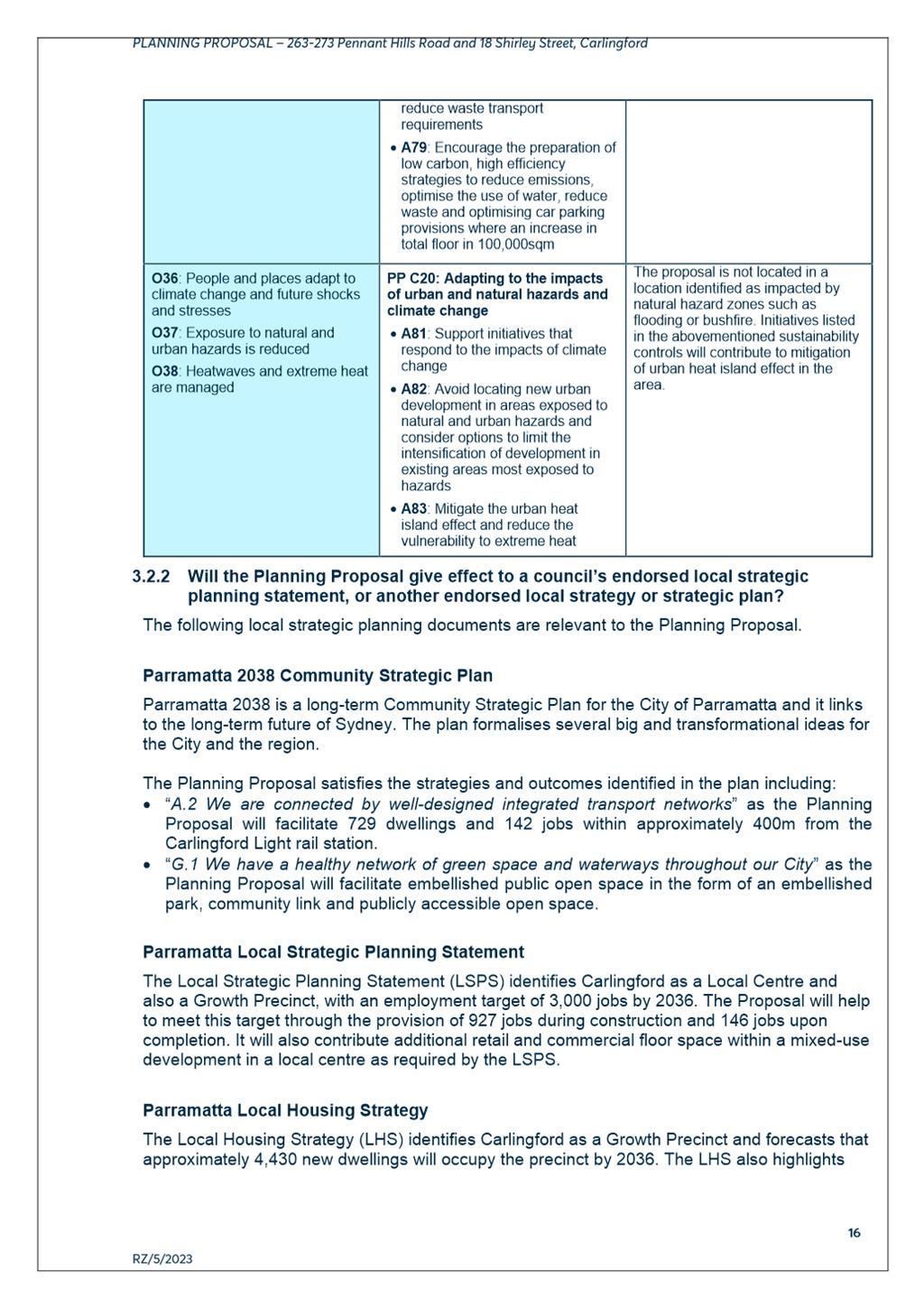
LOCAL AND STRATEGIC MERIT CONTEXT
State Planning Policies and Strategies
13. The Minister for Planning has recently written to all councils and planning panels asking them to ‘prioritise the delivery of housing when assessing development applications and rezoning schemes, so that the entire planning system is geared to addressing the housing shortfall’. The Minister further asks that ‘...council teams prioritise the opportunity to deliver homes as part of merit considerations where, on balance, dwelling numbers may warrant a scale or built form that is different to or greater than the outcome originally anticipated’ (see Attachment 6).
14. The Minister has further advised that updated region and cities plans are being prepared by the Greater Cities Commission, and that in the meantime a strategic merit assessment should be applied to Planning Proposals which will be used to confirm if the proposal can satisfy relevant regional, district, and local strategies. A summary of how the subject Planning Proposal is consistent with the relevant policies is provided below, with Attachment 1 providing a full assessment of the Proposal’s consistency against relevant State Planning Policies and Ministerial Directions.
Greater Sydney Region Plan and Central City District Plan
15. The Planning Proposal is generally consistent with relevant state policies and planning strategies including the Greater Sydney Region Plan, Central City District Plan, and Ministerial Directions under Clause 9.1 of the Environmental Planning and Assessment Act 1979.
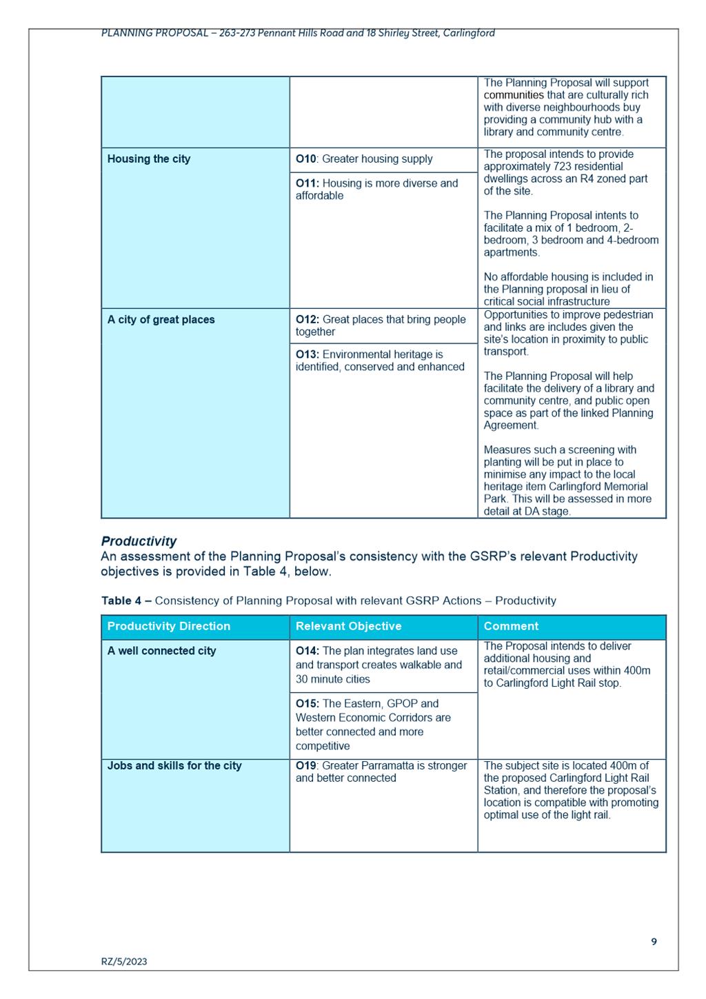
16. Objectives 3, 7 and 12 of The Greater Sydney Region Plan: A Metropolis of Three Cities include: “communities are healthy, resilient and socially connected” and “great places that bring people together”. The Planning Proposal satisfies these objectives as it will facilitate the delivery of community infrastructure and provide opportunities for social interaction and connection.
17. The Proposal aligns with Objectives 4 and 14 of the Greater Sydney Region Plan regarding the optimisation of infrastructure and integrated land use and transport. The site is located approximately 400m walking distance from the Carlingford Light Rail stop. The development of more than 700 dwellings will facilitate housing and the co-location of activities in a local centre to create a walkable, cycle-friendly neighbourhood and help to ‘deliver a 30-minute city’.
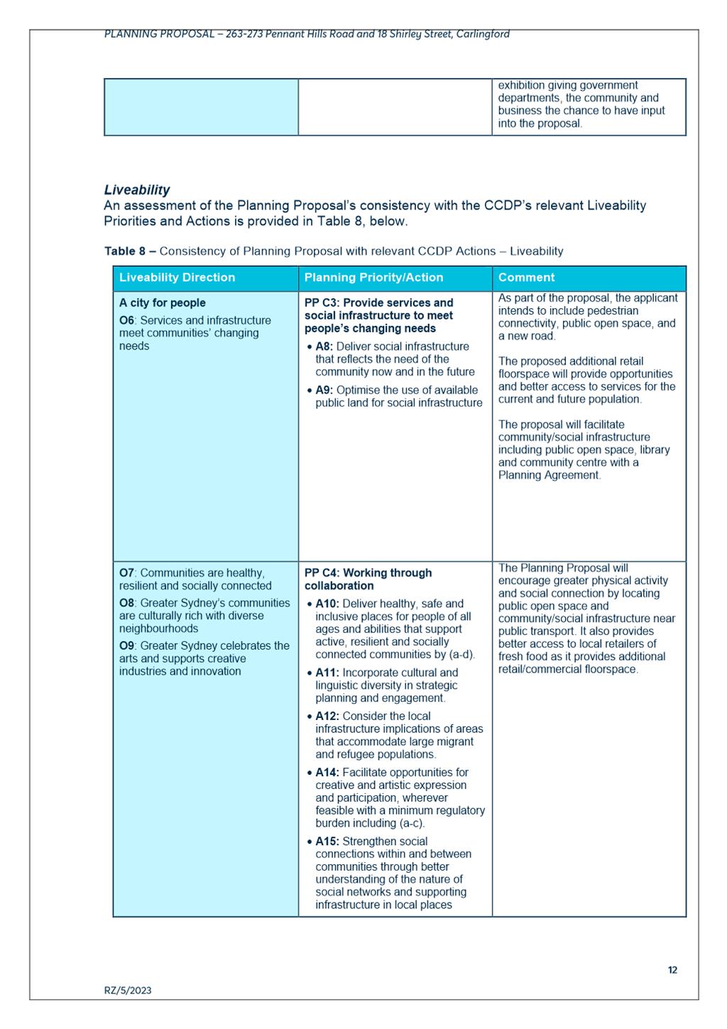
18. The Planning Proposal meets Planning Priorities C1 and C5 of the Central City District Plan which relate to the provision of services and social infrastructure and providing housing supply in the right locations. The Planning Proposal will ‘deliver social infrastructure that reflects the needs of the community’ in the form of a new community centre, library and embellished public open space. Additionally, the site is in close proximity to the Carlingford Light Rail stop and Carlingford Town Centre. As such, the proposal will optimise existing infrastructure and help maximise benefits from investment in new infrastructure.
Local Strategies
Local Strategic Planning Statement
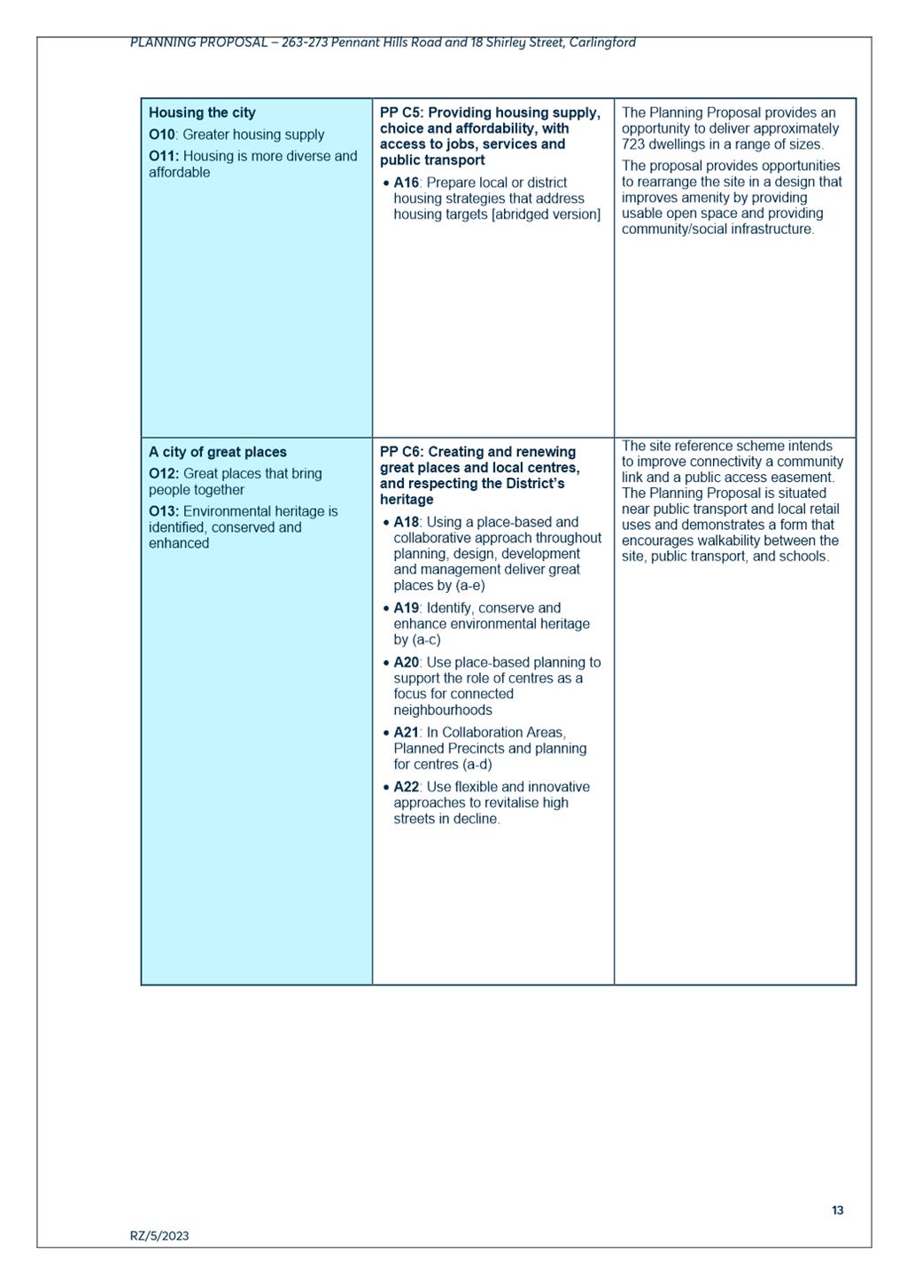
19. The Local Strategic Planning Statement (LSPS) identifies Carlingford as a Local Centre and a Growth Precinct, with an employment target of 3,000 jobs by 2036. The Proposal will help to meet this target through the provision of an estimated 927 jobs during construction and 146 jobs upon completion. It will also contribute additional retail and commercial floor space within a mixed-use development in a local centre as required by the LSPS.
Local Housing Strategy
20. The Local Housing Strategy (LHS) identifies Carlingford as a Growth Precinct and forecasts that approximately 4,430 new dwellings will occupy the precinct by 2036. The LHS also highlights the importance of ensuring alignment of infrastructure delivery with housing growth. The Proposal is consistent with this approach in that it is located within close proximity to the Carlingford Light Rail stop and provides much needed community infrastructure to support the future population of the precinct.
Community Infrastructure Strategy
21. Carlingford has experienced a significant increase in medium and high-density development in recent years, which is expected to continue under new development located in and around Carlingford Town Centre including at 9-11 Thallon Street and at 11-17 Shirley Street and around the new Parramatta Light Rail (PLR) stop. While there is an existing development consent that will enable 450 new dwellings on the 18 Shirley Street part of the subject site, this will only deliver limited community infrastructure in the form of a poorly oriented open space.
22. Council’s adopted Community Infrastructure Strategy (CIS) (2020) identifies that current community infrastructure in Carlingford is dispersed across the area, includes a mix of ageing and mostly low scale community facilities and that open space provision is low for the current population.
23. The CIS identifies the need for a new community hub comprising a community space and library within the Carlingford Town Centre close to the PLR stop as a priority. The Proposal will deliver the community hub and library along with embellished and dedicated public open space through the mechanism of the associated Planning Agreement.
ANALYSIS OF PLANNING PROPOSAL
Land Use and Zoning
24. The Planning Proposal seeks to amend PLEP 2023 to enable development of the site for a greater amount of high density residential and commercial development and the reconfiguration of the currently zoned open space.
25. The site’s proximity to Carlingford Light Rail, business zoned land and public open spaces, in conjunction with its considerable size and frontages, enables consideration of an increase in the currently permitted density without generating significant impact on the general character and amenity of the locality.
26. The Carlingford Precinct is an identified Growth Precinct in the Parramatta LSPS meaning that it is suitable for ‘higher density growth, usually in combination with some minor retail and business services and have supporting infrastructure and facilities’.
27. While the proposal will result in an increase in the density and built form permitted on the site that will generate additional amenity impacts on the immediate locality and surrounding area in comparison to the existing height and density controls, when considered in relation to the need to accommodate more housing growth and also provide for supporting community infrastructure to serve the wider area, the outcome will generate greater benefits than the existing development controls and consent, provide a much better distribution of open space and building layout, and deliver much greater community infrastructure benefit.
28. In this respect it is important to note that the site is the largest remaining privately owned residential site within the Carlingford Precinct. As a result, it presents a rare opportunity to deliver the much needed community hub identified in the CIS in a good location close to public transport and local shops and services. Analysis carried out by Council staff has shown that there is no other suitable site currently available to accommodate the community hub, nor is there sufficient funding available for Council to acquire and develop a new site for the hub in the foreseeable future.
29. A further important factor is that the existing open space zoning configuration is poor and would present a likely high financial burden to Council for ongoing maintenance with minimal benefit to the wider community outside the development site primarily due to its poor orientation, lack of accessibility and topographic constraints.
30. Carlingford is currently undergoing transformation with a growing number of medium and high-density developments; this trend is expected to continue as the State Government continues to strongly advocate for increased housing supply and for housing delivery to be a key factor in the merit assessment of any proposal (refer Attachment 6).
31. In this context it is important for Council to ensure that when proposals for new housing development come forward in areas identified in its LSPS to accommodate growth, such as Carlingford, proposals such as the current one are carefully evaluated for their potential to make greater contributions towards meeting local housing demand.
32. Given the proposed delivery of 723 dwellings on the site, the proposed community benefits including reconfigured public open space and the delivery of a much-needed community hub as identified in Council’s Community Infrastructure Strategy, it is considered that the housing and community infrastructure benefits of the proposal are important benefits to be considered in the assessment of the proposal.
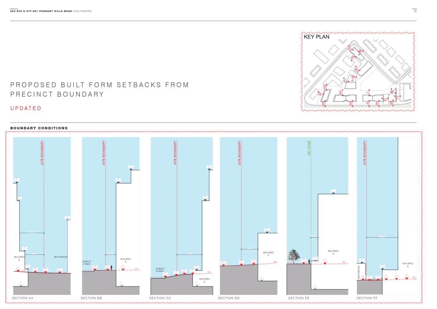
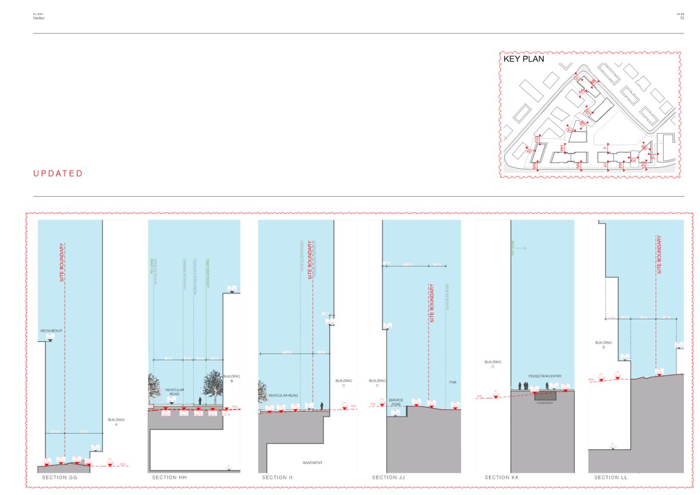
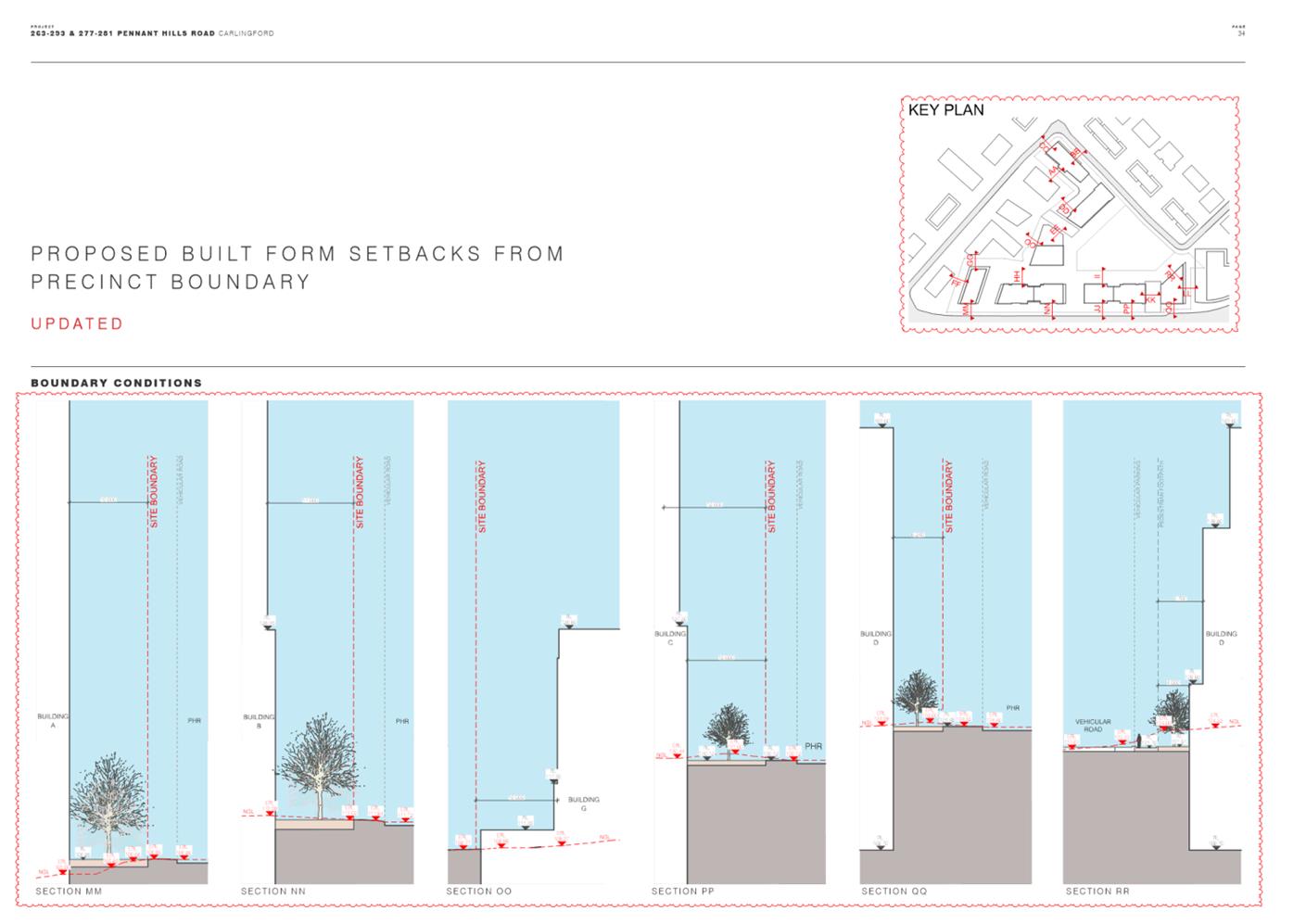
Urban Design, Built Form and Public Domain
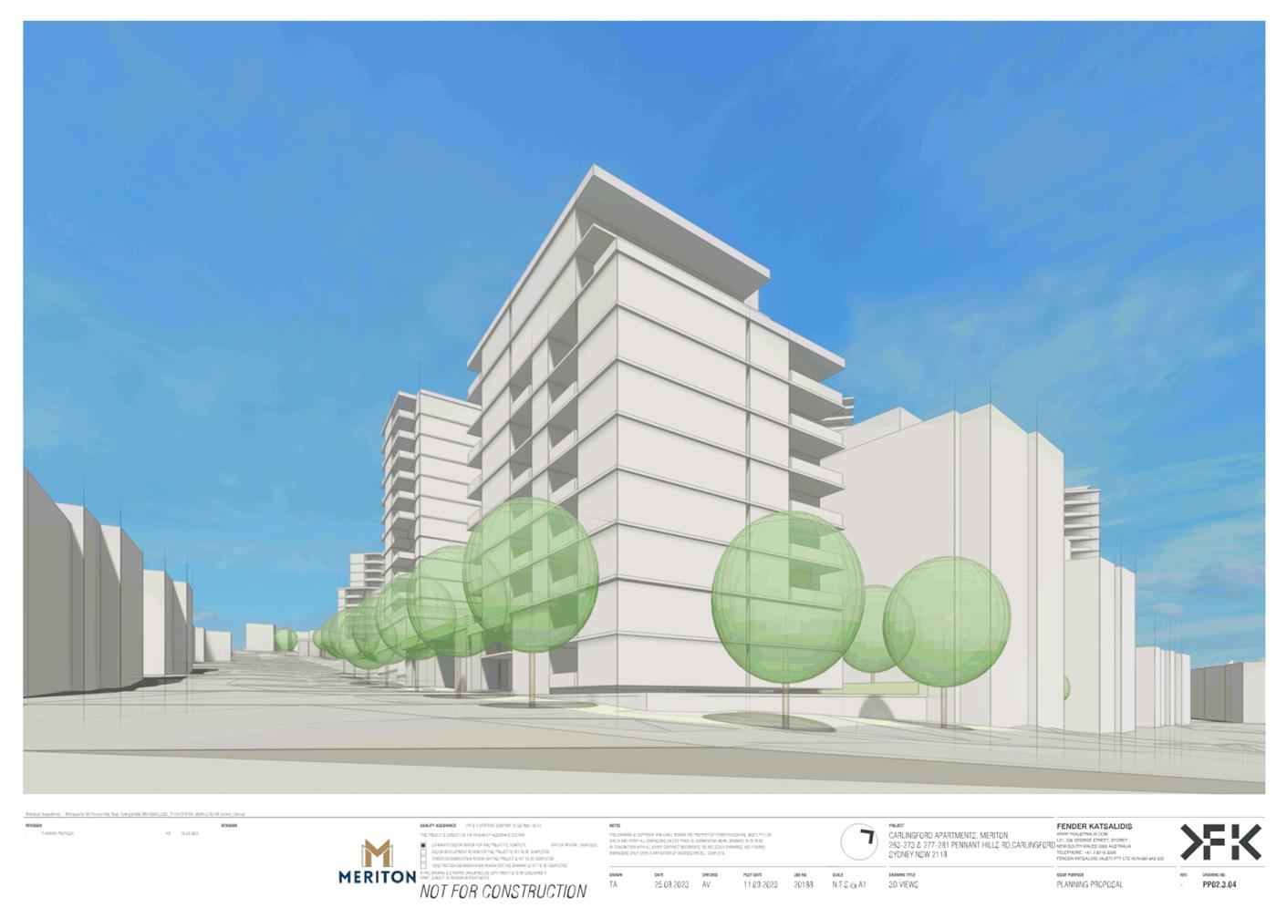
Scale and Density
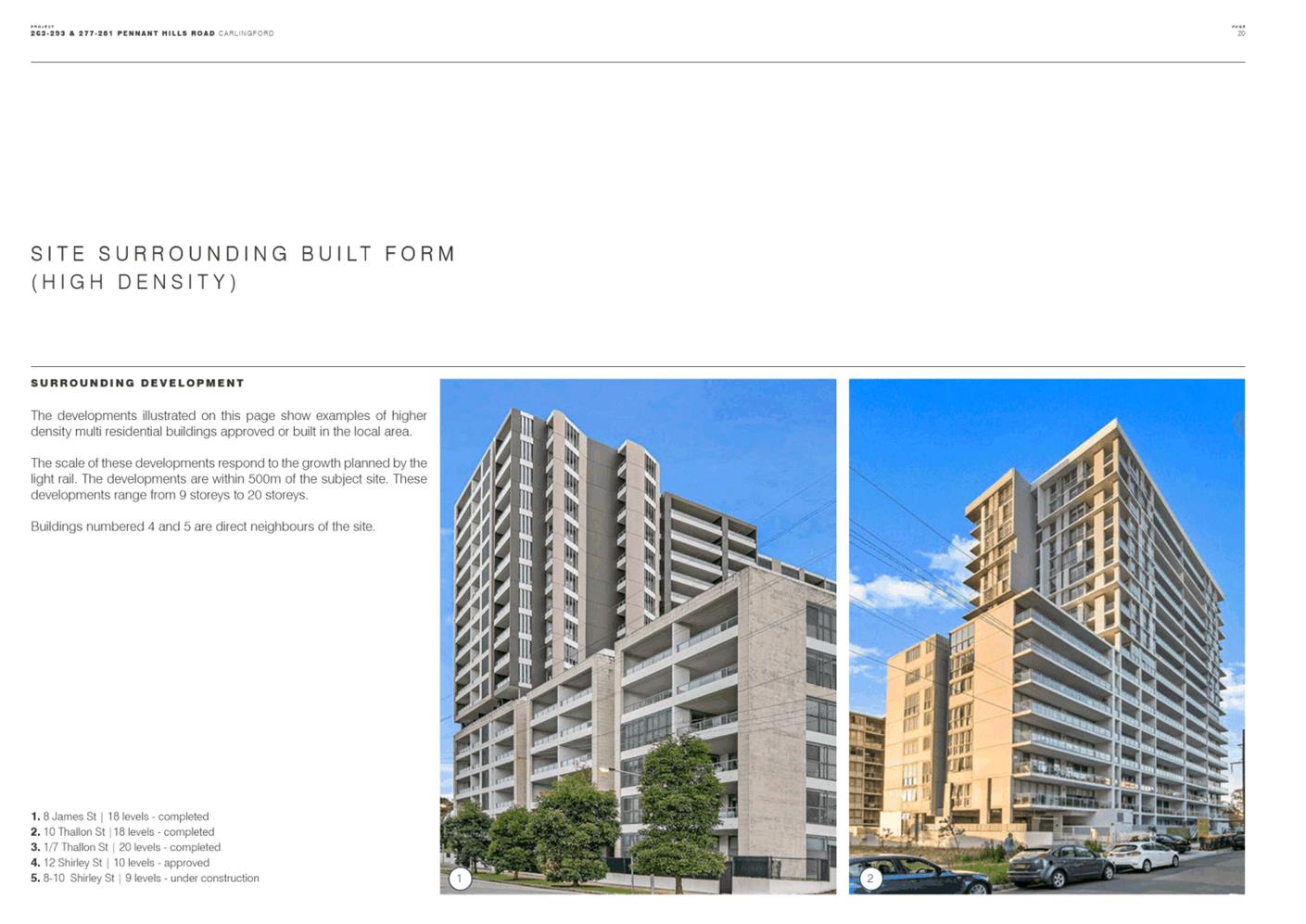
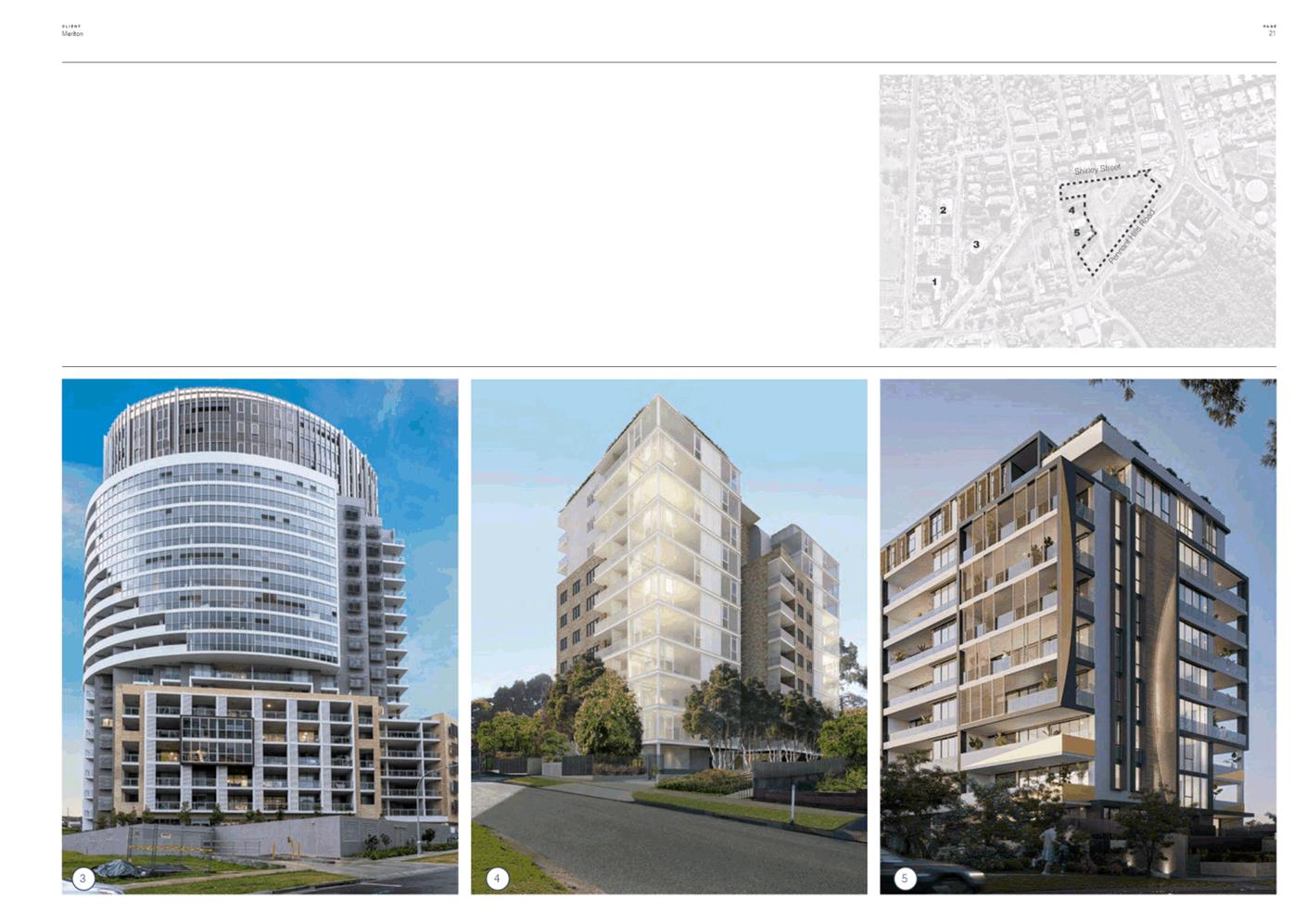
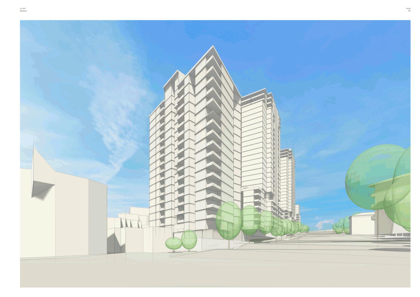
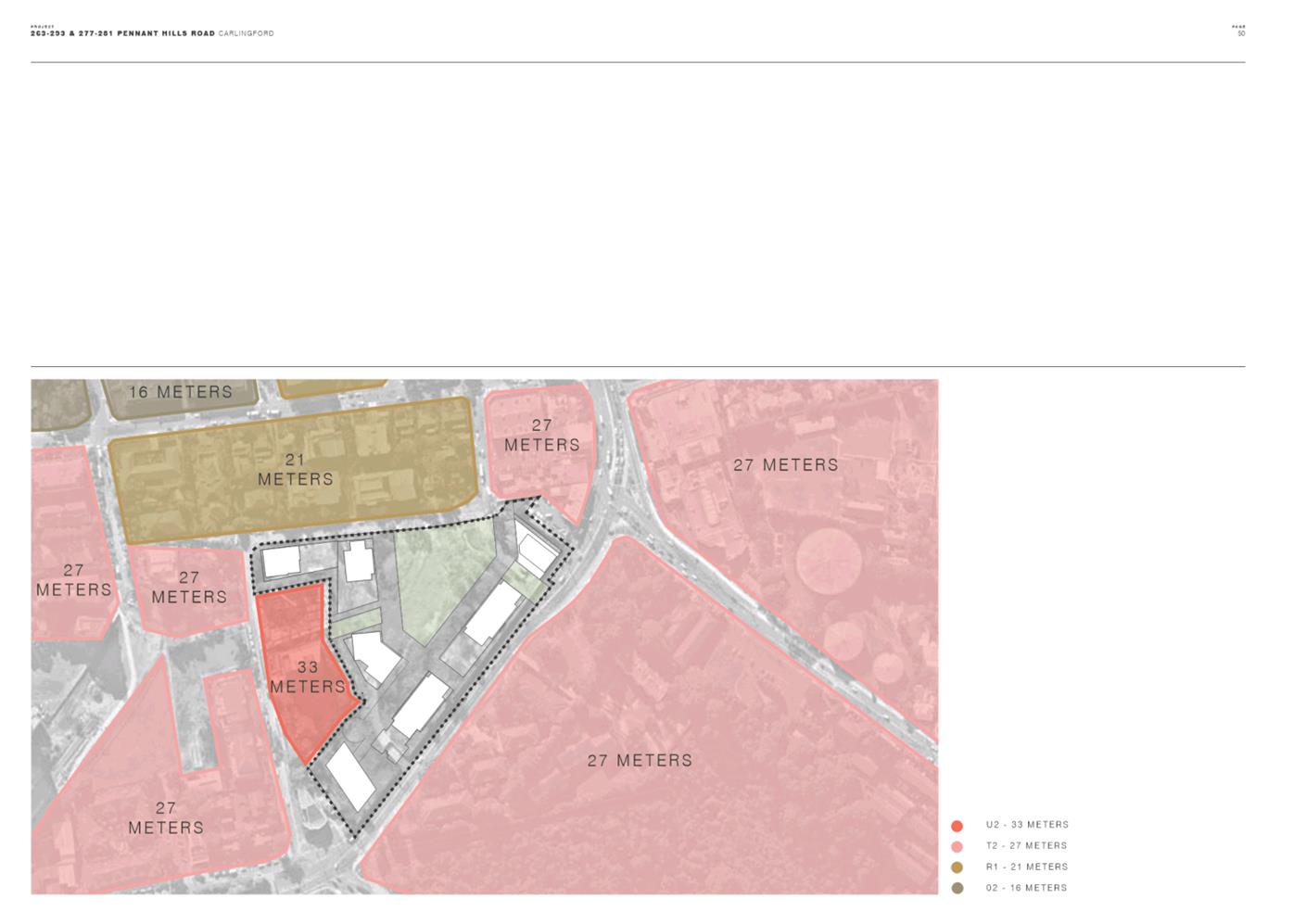
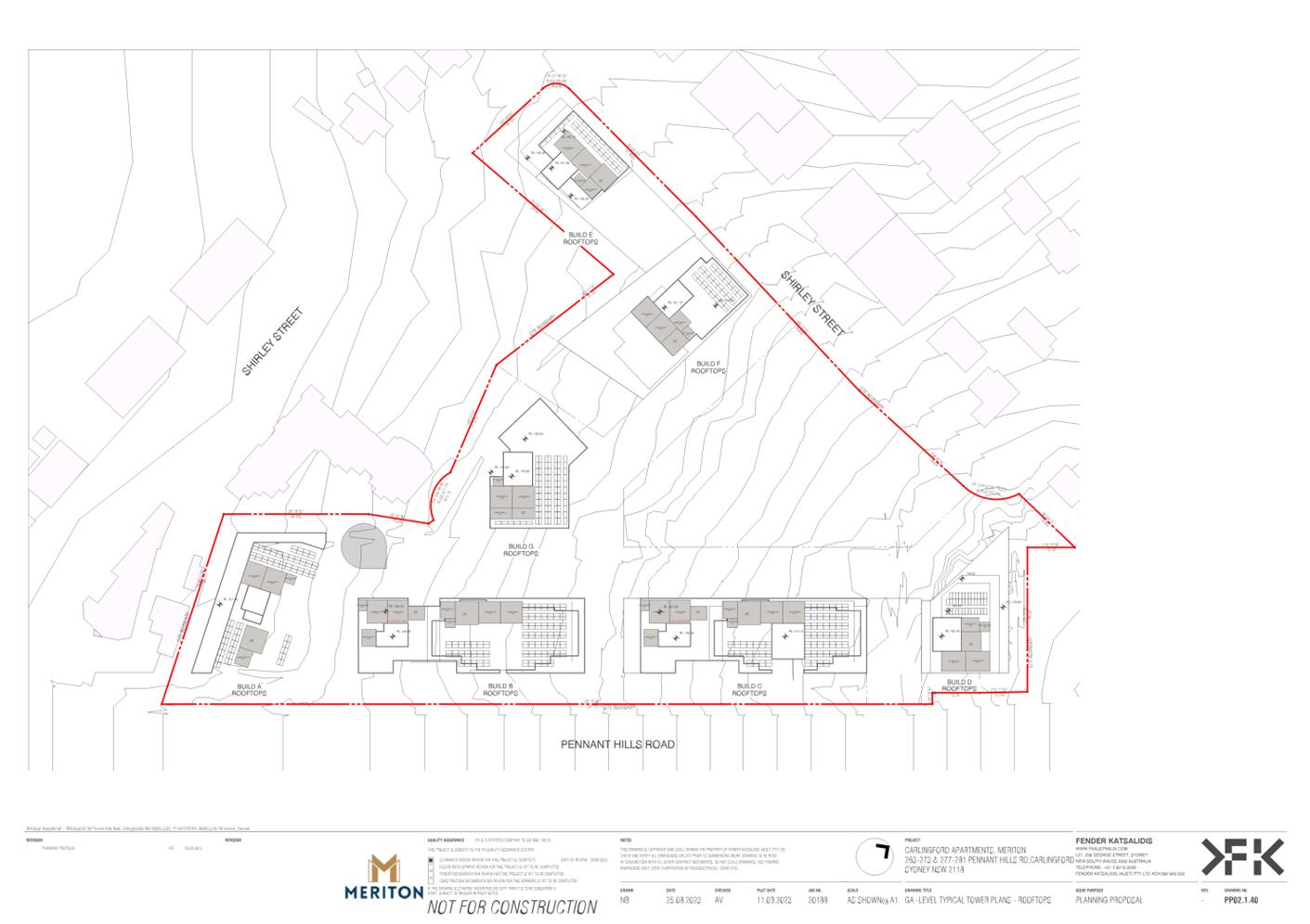
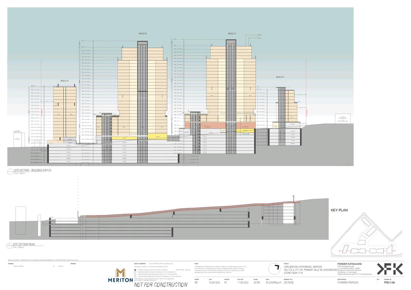
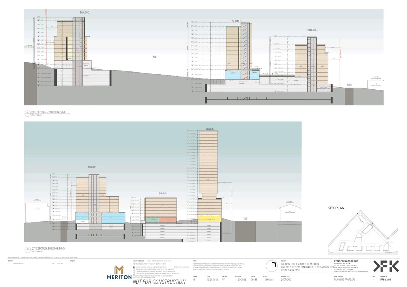
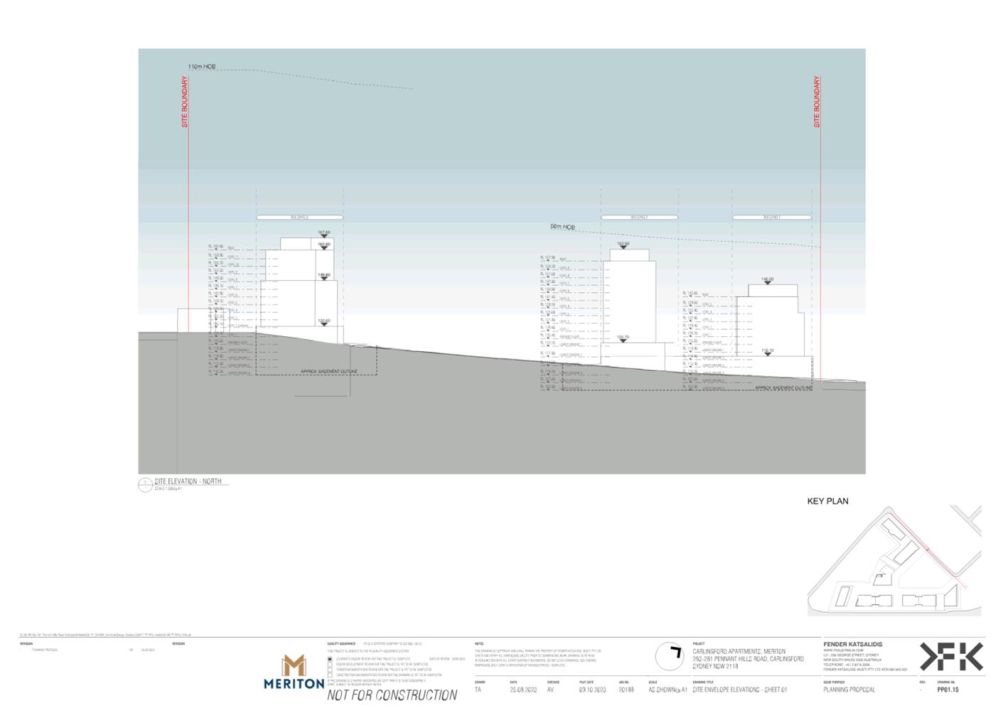
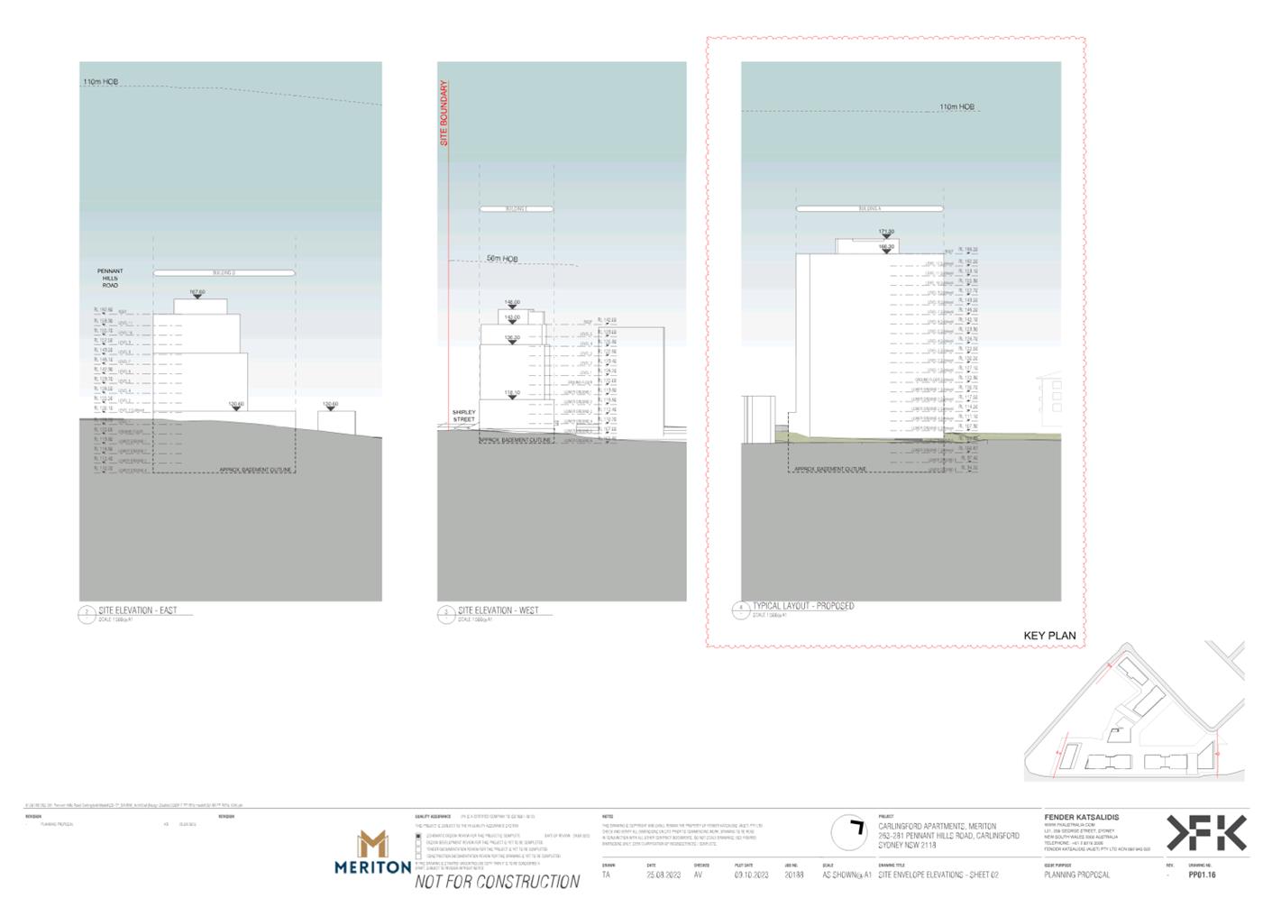
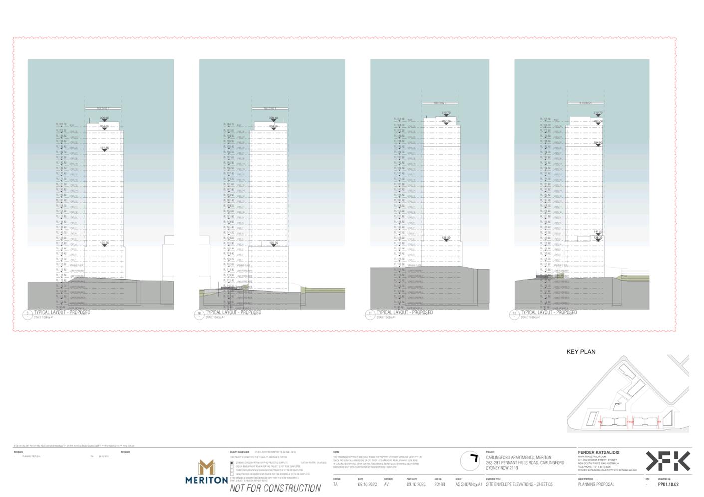
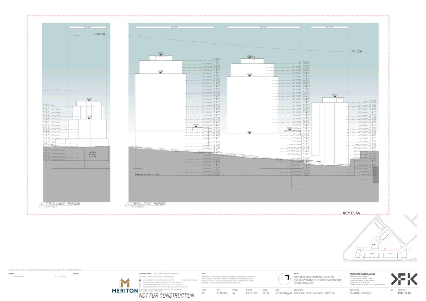
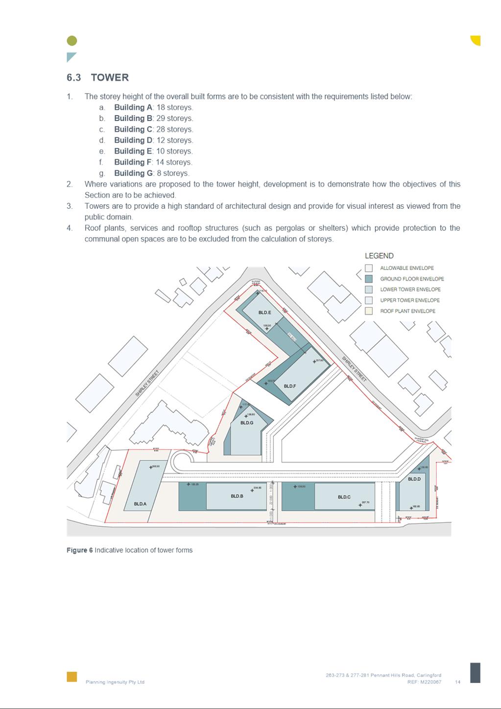
33. The Urban Design Report, Reference Scheme and Planning Proposal Drawings (refer Attachment 2) have been reviewed with a focus on the scale of the proposal and its impact on the immediate and surrounding areas. It is noted that the current Carlingford Precinct built form strategy that was developed in The Hills Development Control Plan 2012 and is outlined in Council’s recently adopted Harmonisation Development Control Plan (DCP), locates high density development at a maximum 18 storeys around the PLR stop.
34. The proposed density and building height (up to 110m) is significantly greater than other existing development adjacent to the Carlingford PLR stop (57m (15 storeys)). The increased bulk and height (from 33m (11 storeys)) to 56-110m (18 - 29 storeys)) is inconsistent with the desired future character set out in the DCP which was prepared in 2012. (Refer Figures 5 & 6).
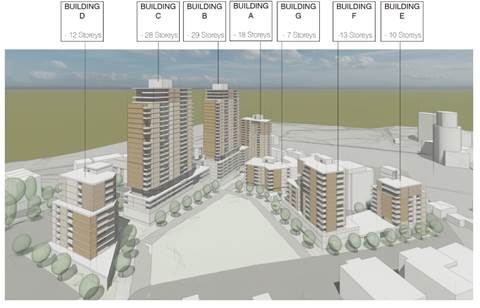
Figure 5 - Reference Design
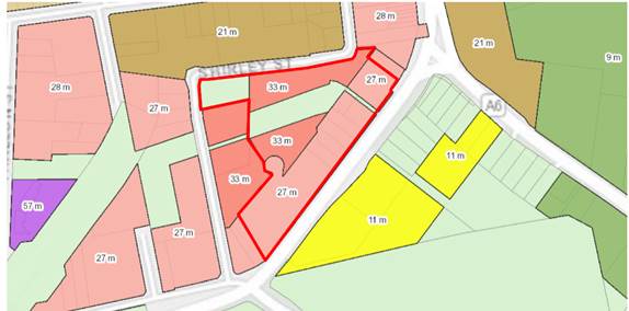
Figure 6 – Current Height of Building Map
35. The proposed development, would be positioned on a high topographic point, making it highly visible (Figure 7). This would not be consistent with the existing built form strategy outlined in the Harmonisation DCP (established by the 2012 Hills DCP) which locates high density development at a maximum of 18 storeys around the PLR stop.
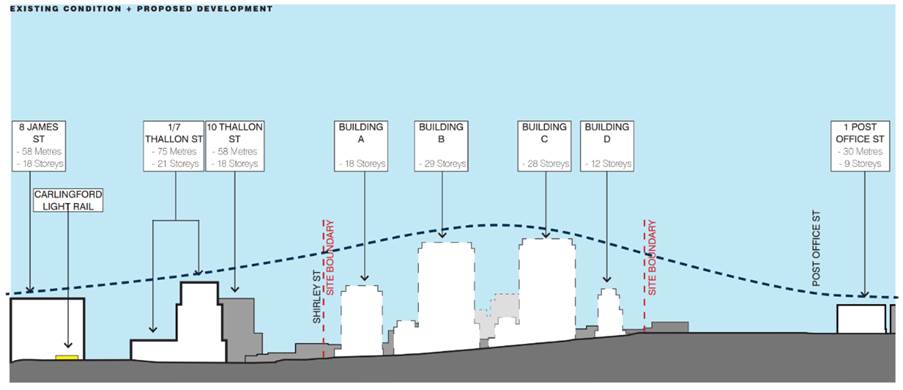
Figure 7 – Existing and Proposed Heights
36. The significantly increased height proposed along Pennant Hills Road has the potential to create an unbalanced street proportion in response to the surrounding low to mid-rise context (2-8 storeys) (Figure 7), and its location on higher topography would exacerbate the contrasting building bulk and would increase view impacts both on the regional views and on the surrounding neighbourhood.
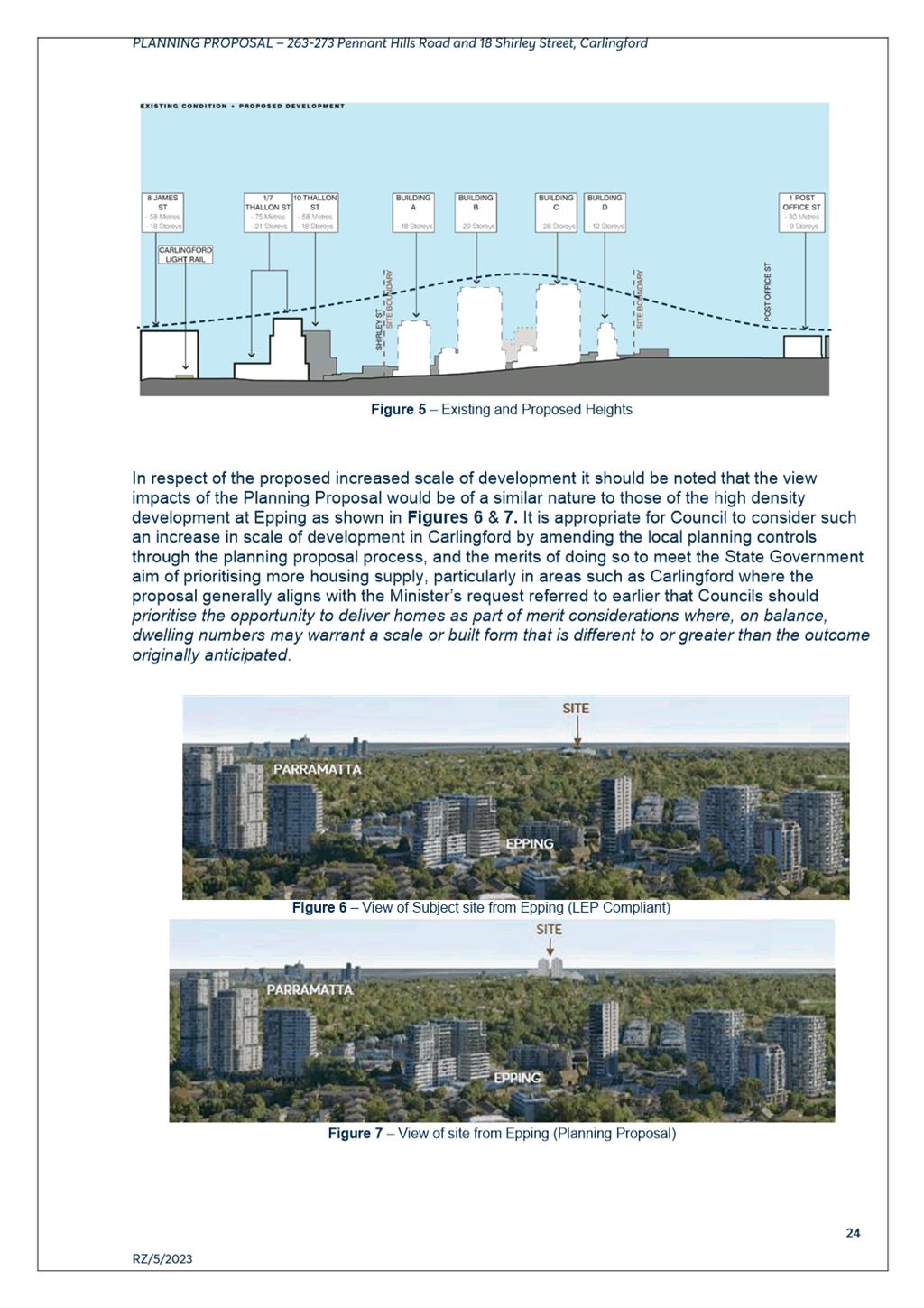
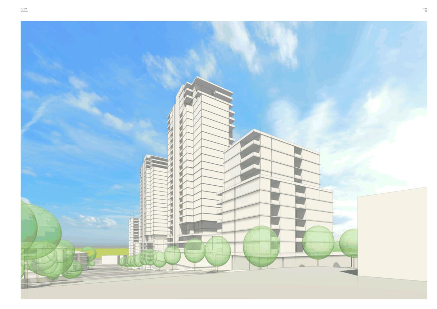
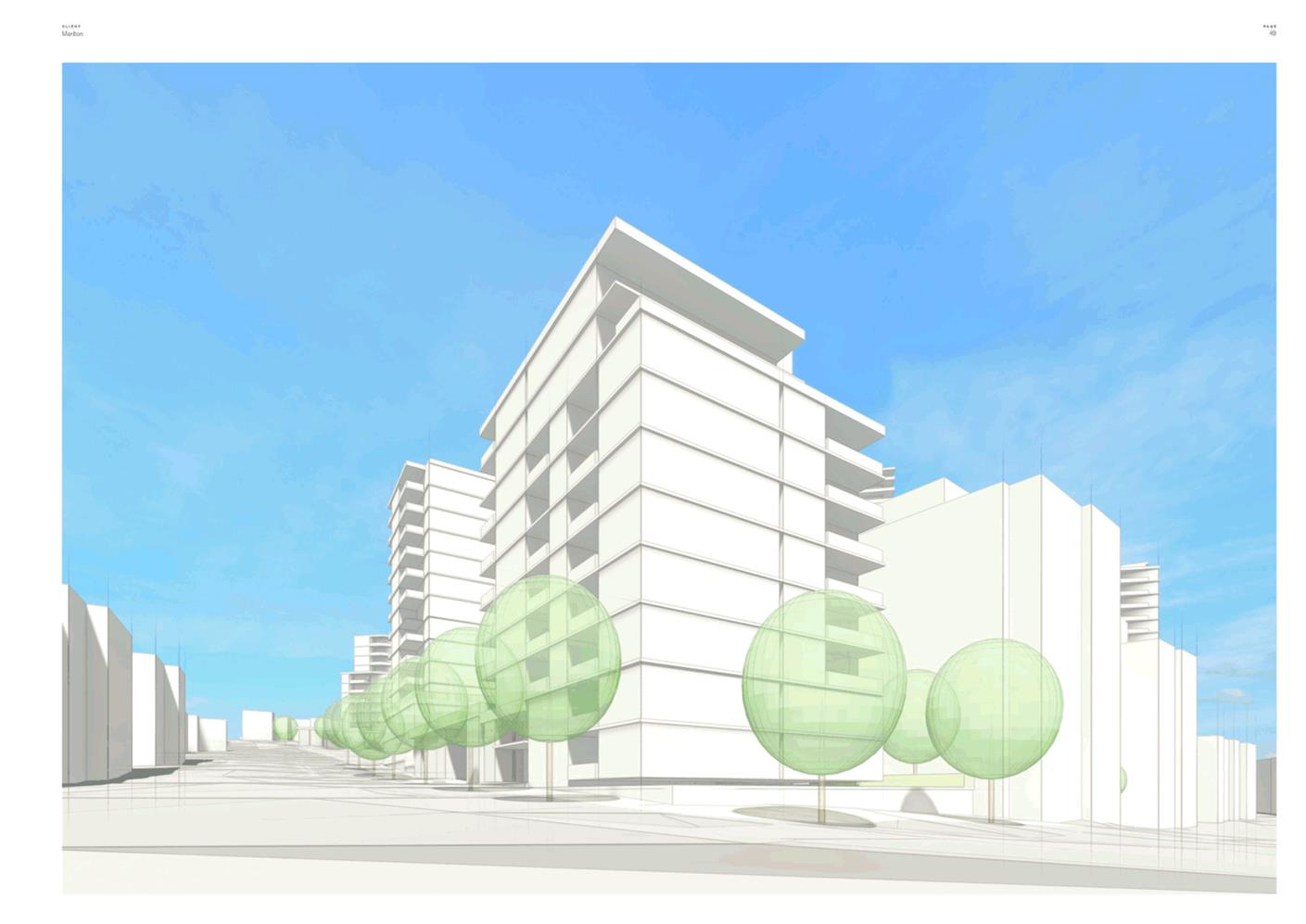
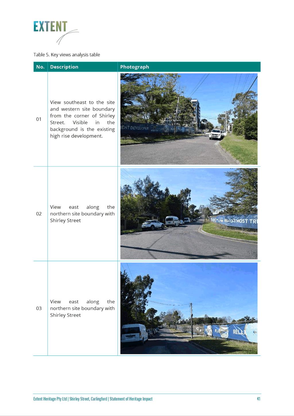
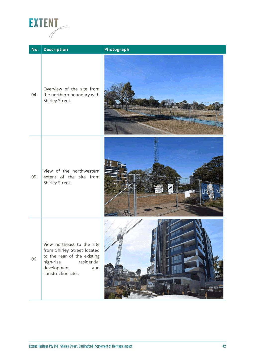
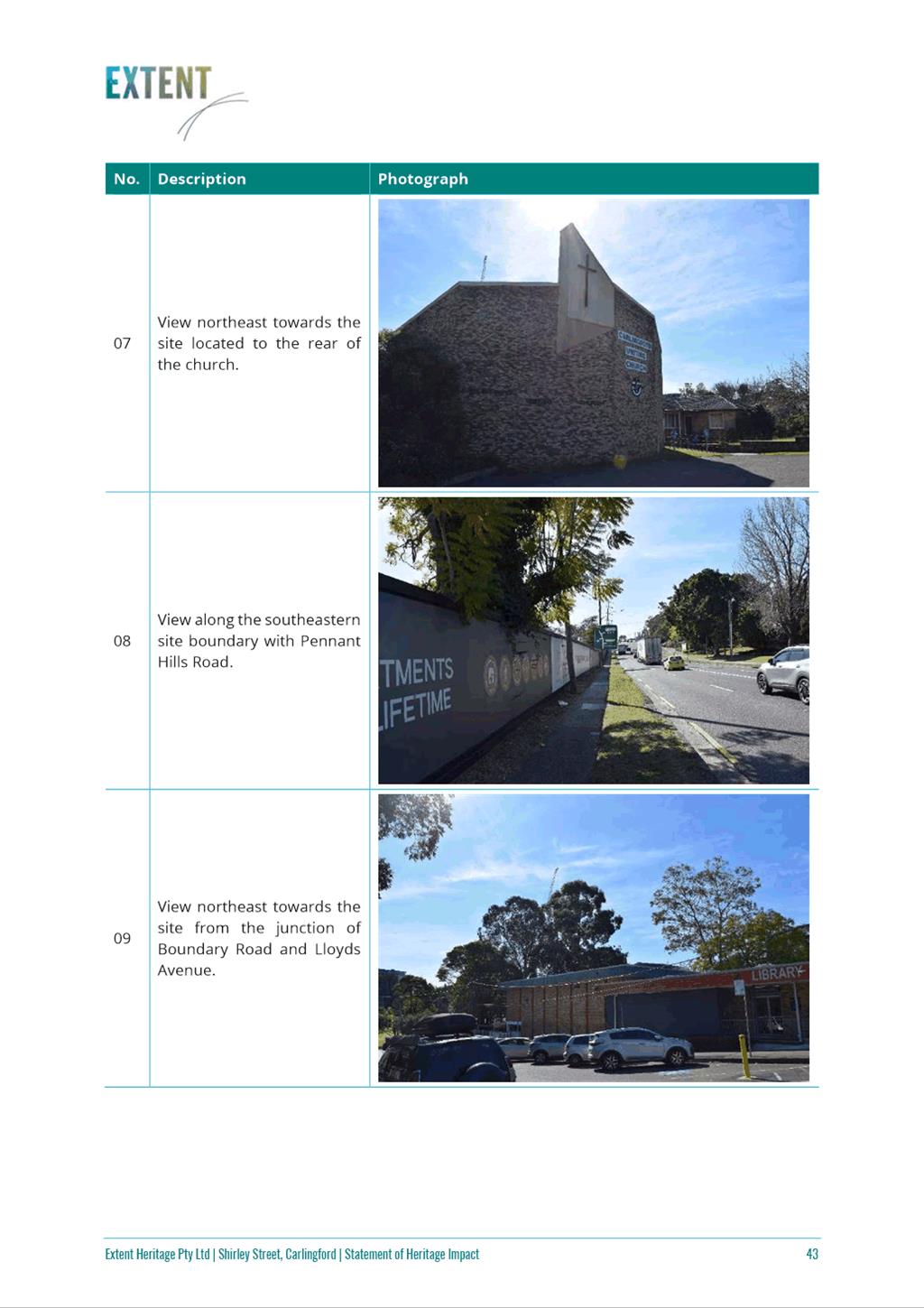
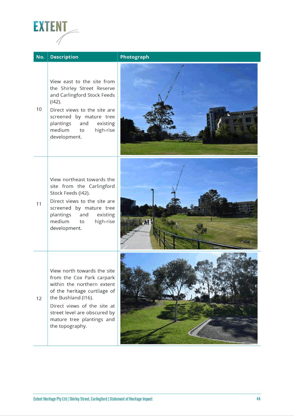
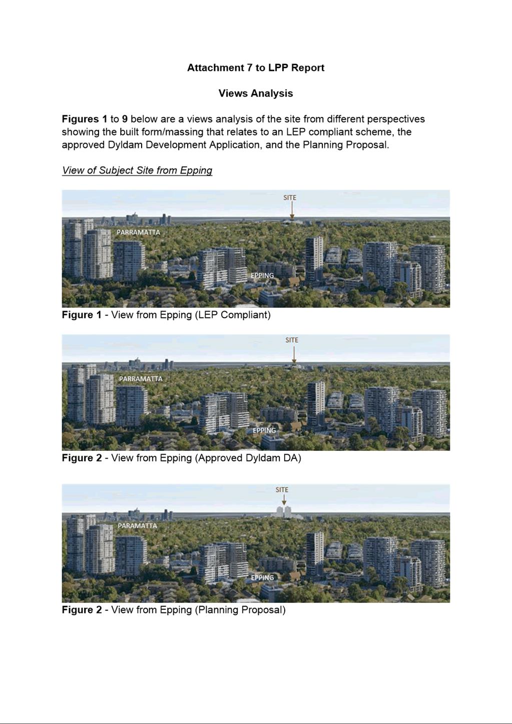
37. In respect of the proposed increased scale of development it should be noted that the view impacts of the Planning Proposal would be of a similar nature to those of the high-density development at Epping as shown in Figures 8 & 9. Views of the development that would be permitted at the site from local and neighbourhood perspectives have also been modelled and are shown at Attachment 7. It is appropriate for Council to consider such an increase in scale of development in Carlingford by amending the local planning controls through the planning proposal process, and the merits of doing so to meet the State Government aim of prioritising more housing supply, particularly in areas such as Carlingford where the proposal generally aligns with the Minister’s request referred to earlier that councils should prioritise the opportunity to deliver homes as part of merit considerations where, on balance, dwelling numbers may warrant a scale or built form that is different to or greater than the outcome originally anticipated’.
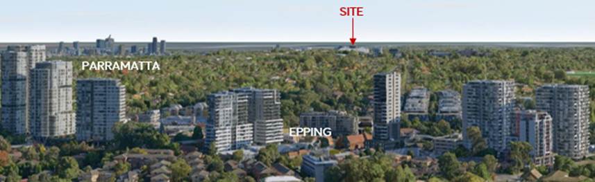
Figure 8 – View of Subject site from Epping (LEP Compliant)
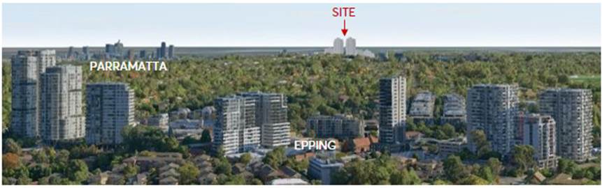
Figure 9 – View of site from Epping (Planning Proposal)
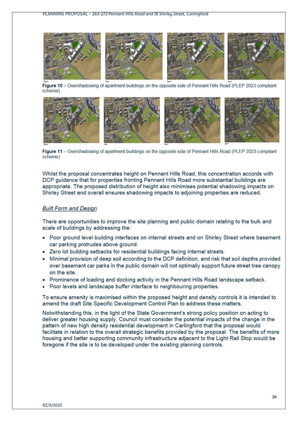
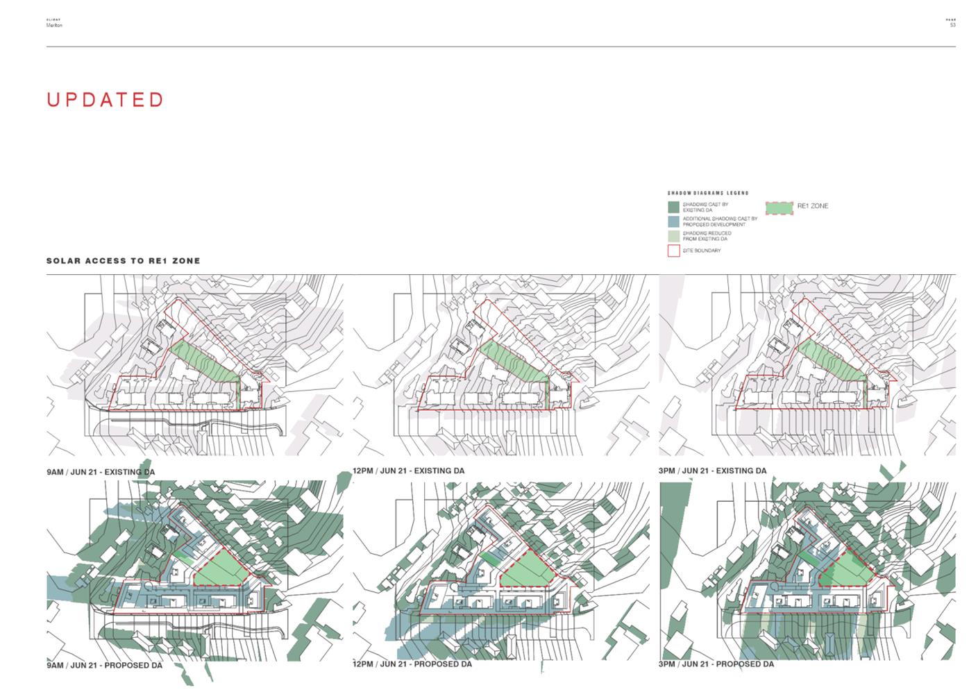
38. The impacts of the proposed increase in height along Pennant Hills Road on the site’s relationship with Carlingford Memorial Gardens on the opposite side of Pennant Hills Road (Figures 10 & 11) has been examined to understand the overshadowing of the proposal on the gardens and views from the park.
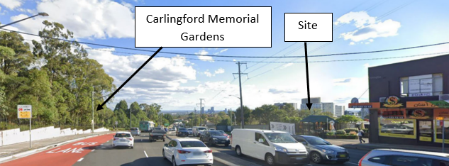
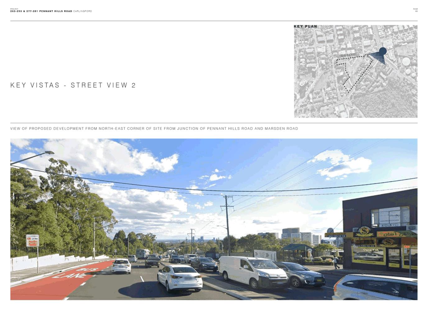
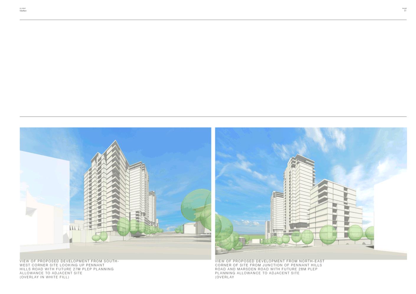
Figure 10 - View from north-east corner of site from Junction of Pennant Hills Road and Marsden Road.
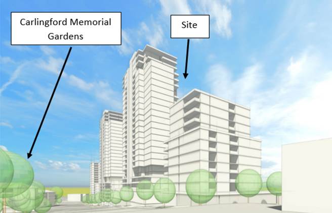
Figure 11 - View from north-east corner of the site with proposed development
39. The applicant’s shadow analysis indicates that the proposed development will only result in a minor overshadowing impact between 2:00pm – 3:00pm during mid-winter. Whilst this is considered to be a minor impact, it is recommended that DCP controls be prepared to help mitigate these impacts by addressing proposed building envelopes and landscaping.
40. Whilst the proposal concentrates height on Pennant Hills Road, this concentration accords with DCP guidance that more substantial buildings are appropriate for properties fronting Pennant Hills Road. The proposed distribution of height minimises potential shadowing impacts on the proposed open space and on Shirley Street properties. However, the applicant's shadow analysis shows that the proposed development will result in an increase in overshadowing of the apartment buildings on the opposite side of Pennant Hills Road between 12pm and 3pm during mid-winter (refer Attachment 8). While building envelope controls in the DCP can be used to seek to mitigate these impacts there is still likely to be a shadow impact on these properties due to the increased height of buildings proposed on the Pennant Hills Road frontage of the subject site.
Built Form and Design
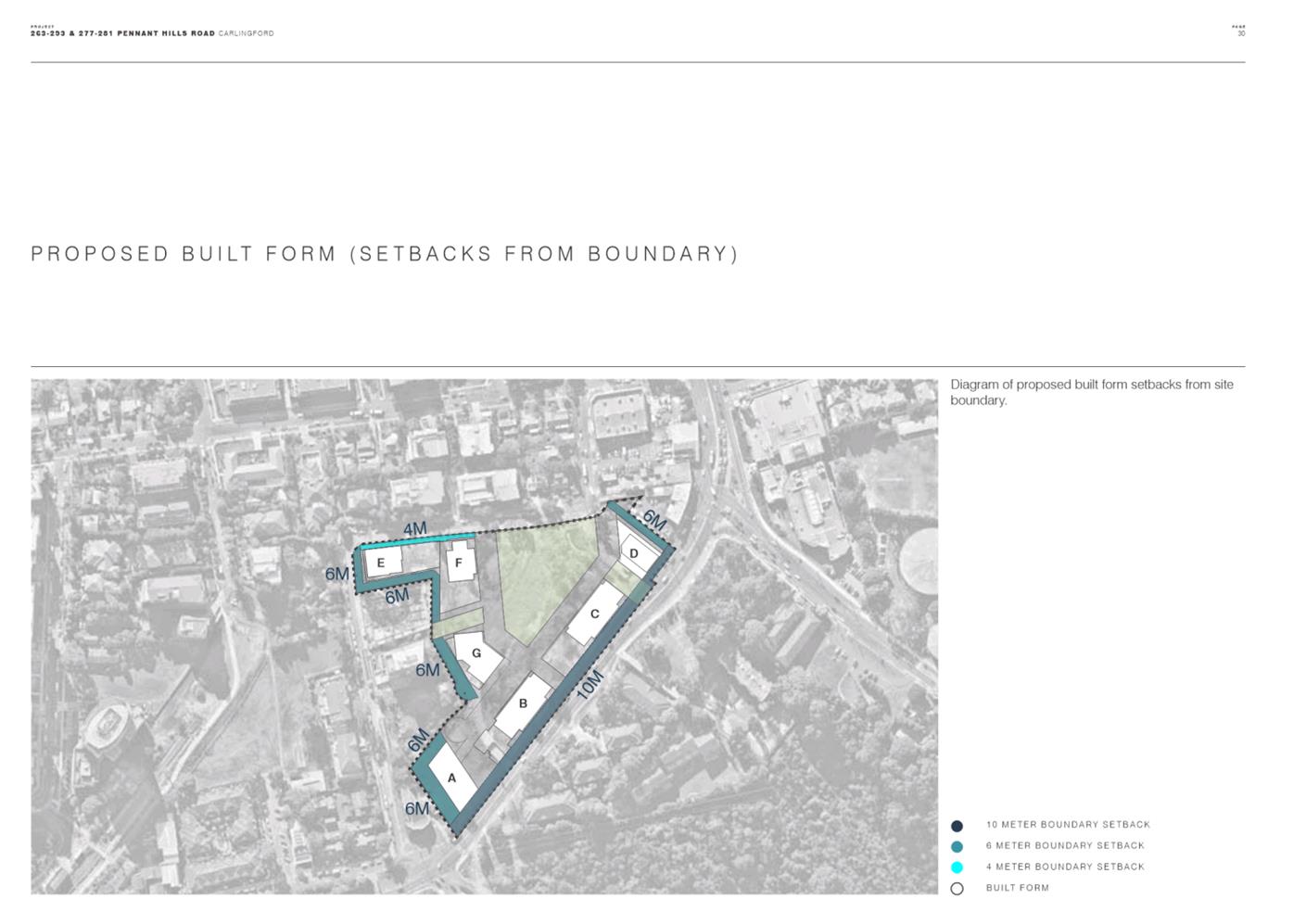
41. There are opportunities to improve the site planning and public domain relating to the bulk and scale of buildings by addressing the:
· Poor ground level building interfaces on internal streets and on Shirley Street where basement car parking protrudes above ground.
· Zero lot building setbacks for residential buildings facing internal streets.
· Minimal provision of deep soil according to the DCP definition, and risk that soil depths provided over basement car parks in the public domain will not optimally support future street tree canopy on the site.
· Prominence of loading and docking activity in the 10m Pennant Hills Road landscape setback.
· Poor levels and landscape buffer interface to neighbouring properties.
42. To ensure amenity is maximised within the proposed height and density controls, it is recommended that the draft SSDCP controls be amended to address these matters.
43. Notwithstanding this, in the light of the State Government’s strong policy position on acting to deliver greater housing supply, Council must consider the potential impacts of the change in the pattern of new high density residential development in Carlingford that the proposal would facilitate in relation to the overall strategic benefits provided by the proposal. The benefits of more housing and better supporting community infrastructure adjacent to the PLR stop would be foregone if the site is developed under the existing planning controls.
Wind Impacts
44. Specialist consultant assessment of the applicant’s wind assessment (Attachment 2) recommends that the applicant’s wind report be updated to address the adequacy of the landscape proposal as it relates to wind mitigation requirements and also solar access requirements for the childcare outdoor space.
45. It is recommended that these issues be addressed at the Development Application stage.
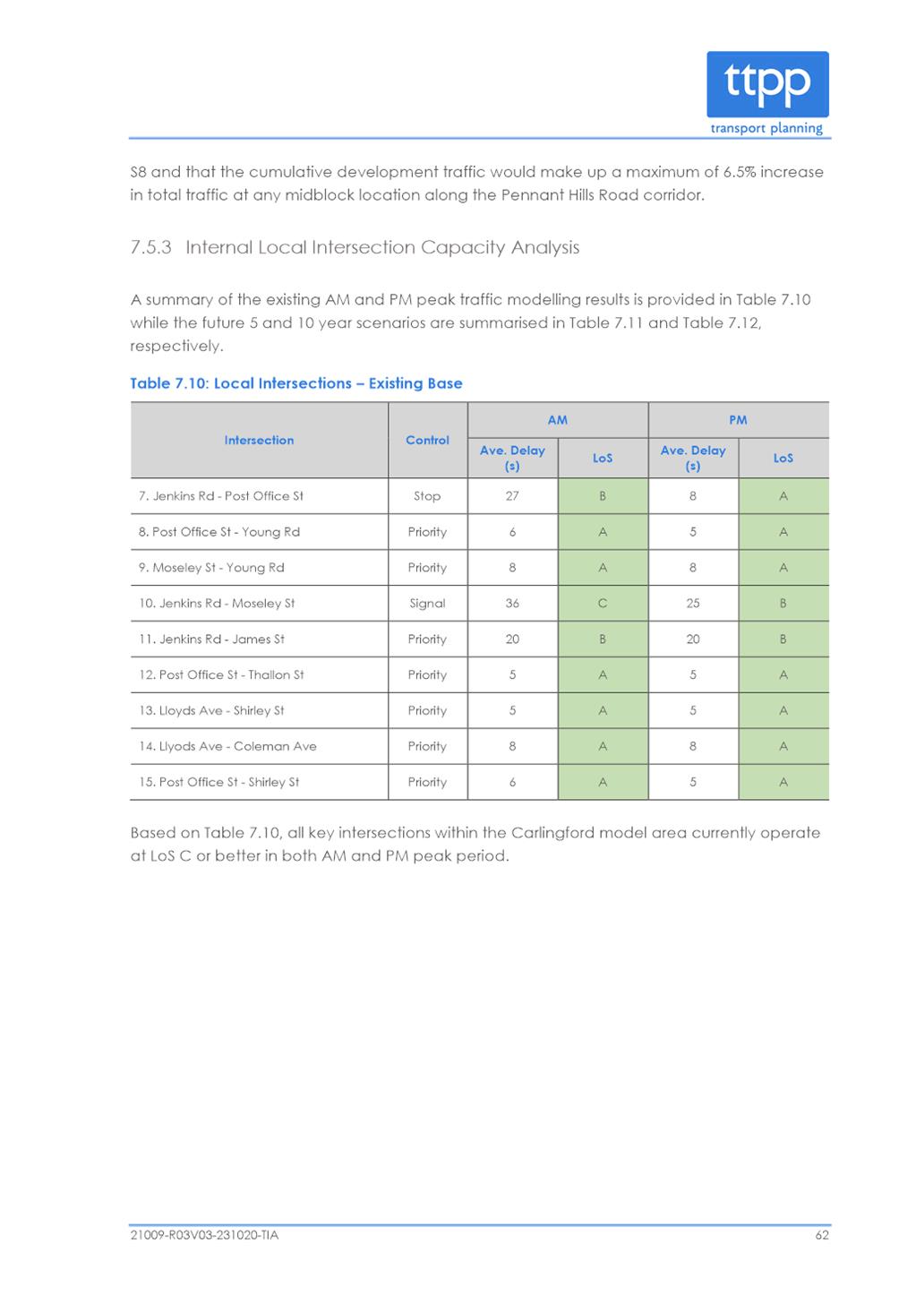
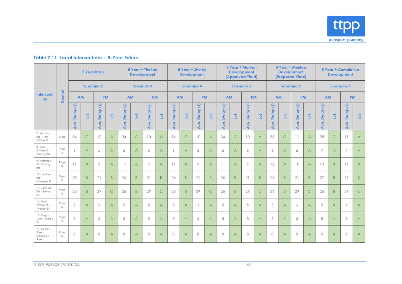
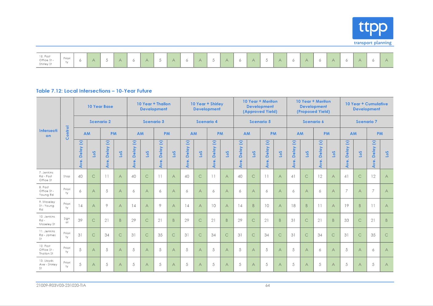
Traffic and Transport and Parking
Public Transport
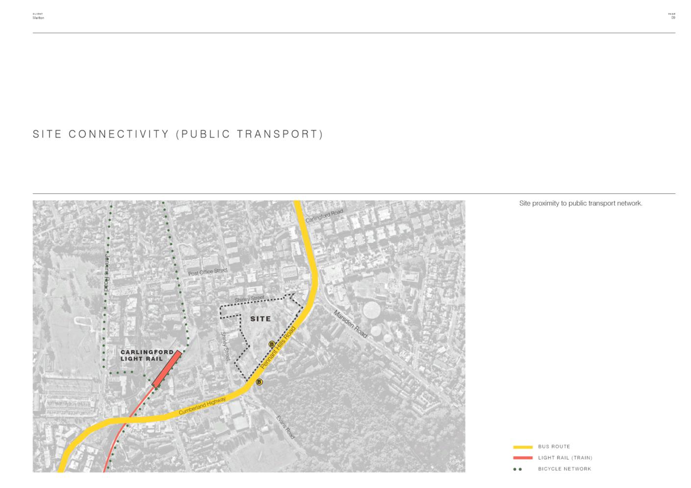
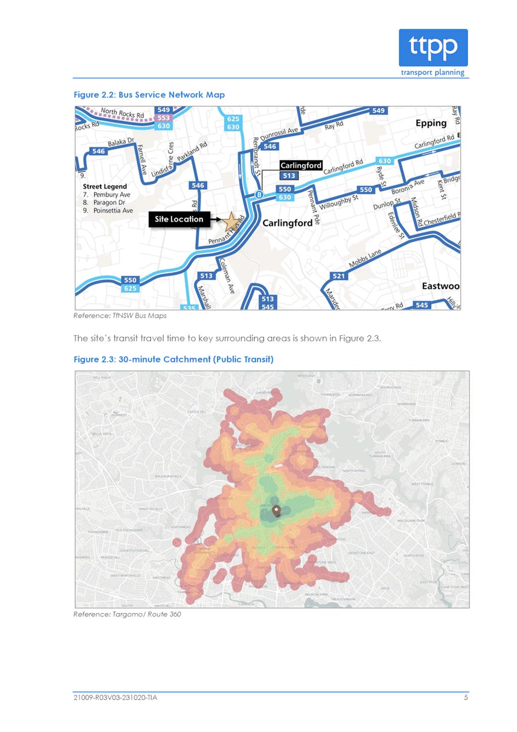
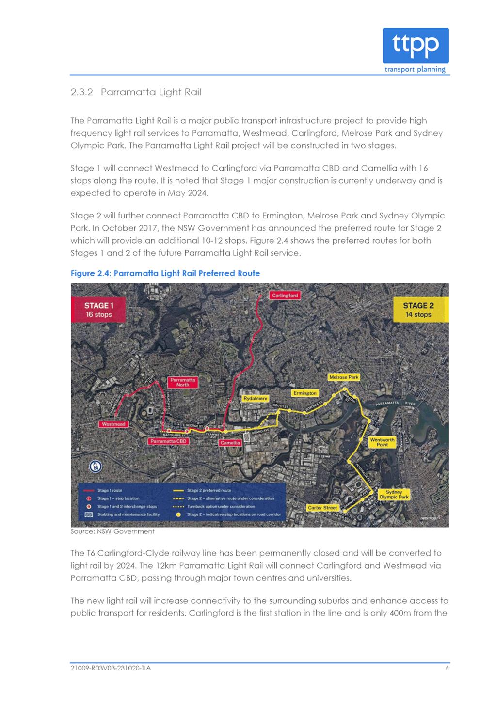
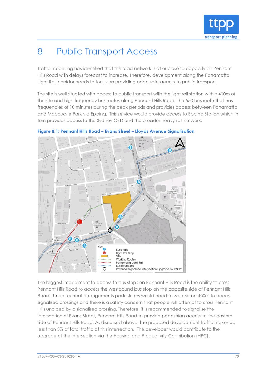
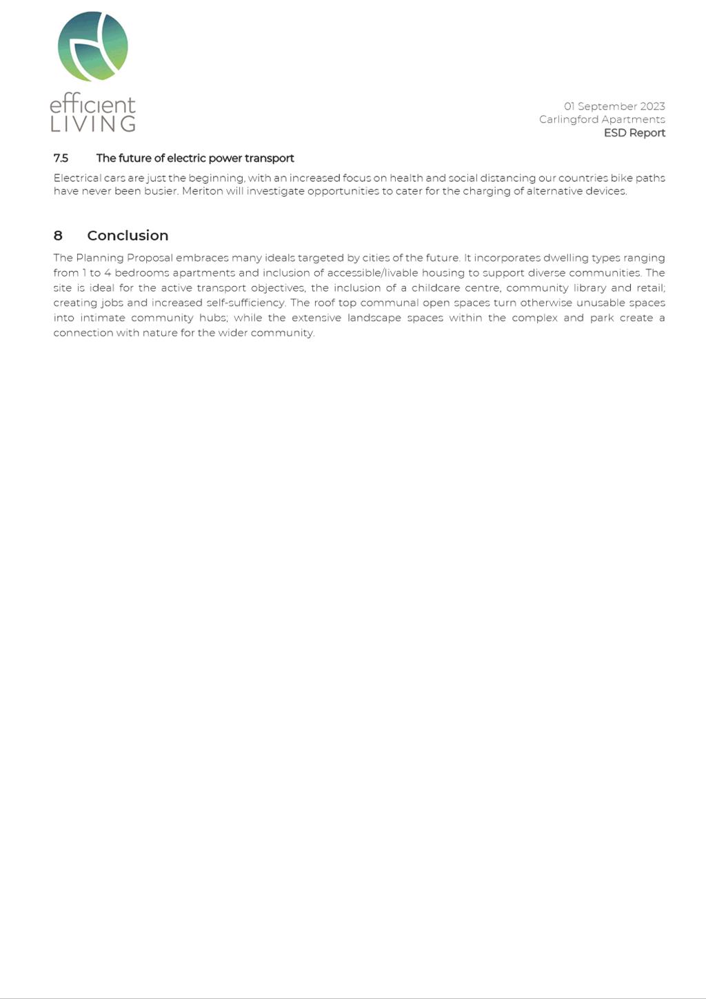
46. The subject site is within close proximity to the PLR Carlingford stop and also bus stops on Pennant Hills Road (Figure 12). The PLR will significantly improve accessibility to and from the site to the Parramatta CBD and other centres. The light rail is designed to provide a service of one tram every 7.5 minutes in peak periods. PLR is expected to commence operation in mid 2024.
47. The proposal is supported in this regard as the site is in a location that will be well served by public transport.
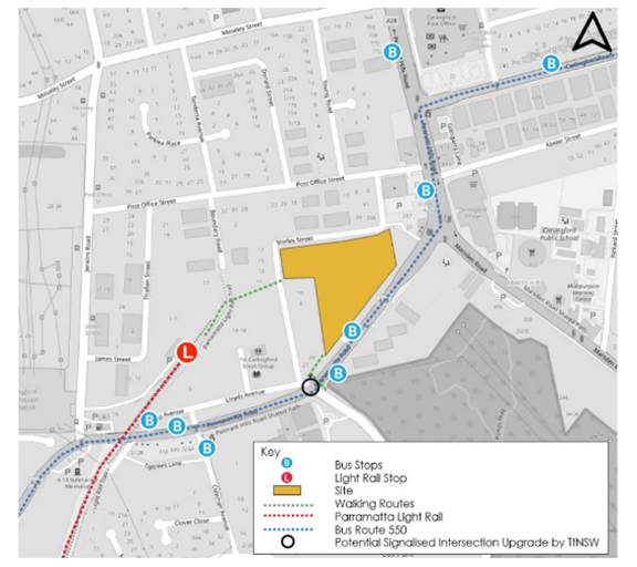
Figure 12 - The Site in relation to public transport
Access
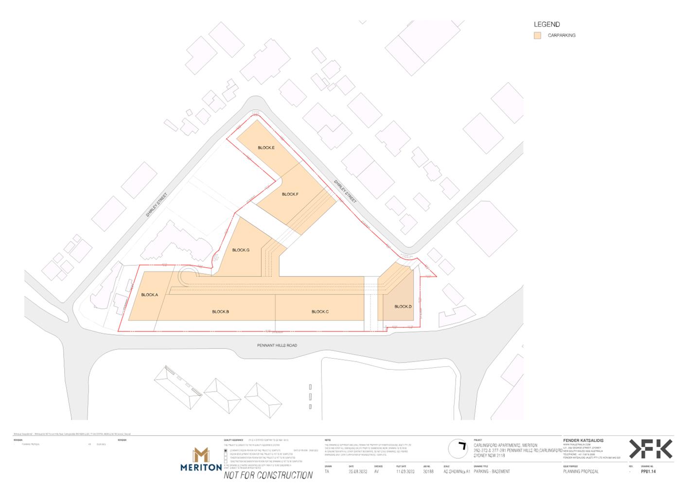
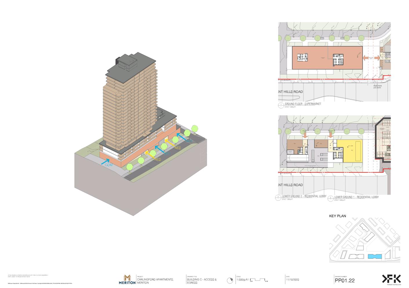
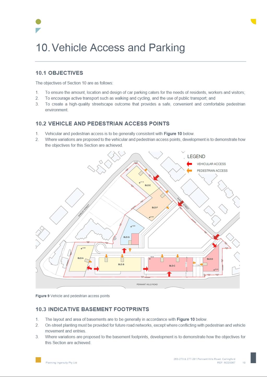
48. Vehicular access to the site will be via a two-way internal roadway that will connect to Shirley Street in two locations which are generally consistent with the design of the existing development consent scheme. Vehicular access to basement car parks is via the internal roadway.
49. The proposed access is generally supported. Whilst the proposed loading dock is located opposite the internal road intersection, given that the potential traffic volumes along the terminating road are expected to be low, this location of the proposed loading dock is acceptable.
Traffic Generation
50. 18 Shirley Street currently benefits from an active development consent. This approval permits the construction 450 of units on 18 Shirley Street and when combined with the development potential under existing planning controls of the adjoining 263-273 Pennant Hills Road, this would allow for a combined yield of 550 to 570 residential units which would generate between 132 and 137 vehicle trips in the AM and PM peaks.
51. Compared with the approved and permissible development potential of the site, the net increase in traffic of the proposal is expected to be 233 additional trips in the AM peak and 330 additional trips in the PM peak hour, or 4-6 additional vehicles per minute spread across the entire road network.
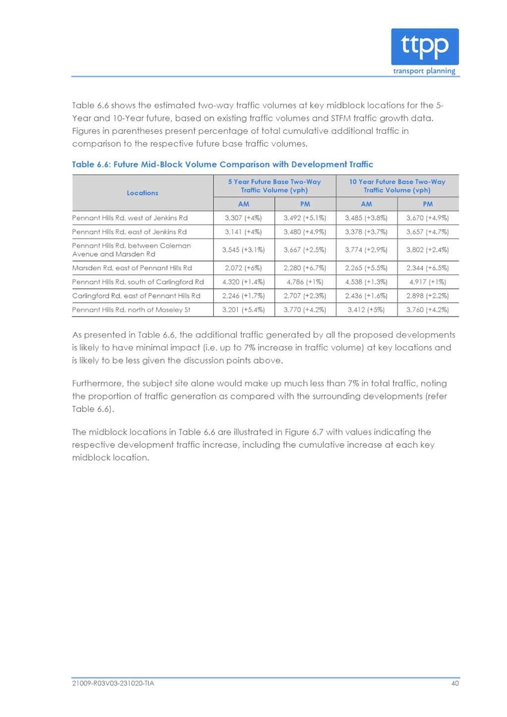
52. The applicant’s Transport Impact Assessment (TIA) (Attachment 2) found that additional traffic generated by the proposal and known proposed developments in 9-11 Thallon and 11-17 Shirley Streets is likely to have a relatively minor impact (around 7% increase) on overall traffic volumes at key locations along the Pennant Hills Road corridor.
53. The TIA identifies signalising of the Evans Street/Lloyds Avenue/Pennant Hills Road intersection and the Moseley Street/Pennant Hills Road intersection as key opportunities to improve the road network and provide better opportunities for vehicles to turn right into and from Pennant Hills Road and in the case of the Lloyds Road/Evans Street/Pennant Hills Road intersection improved pedestrian access to existing bus stops on Pennant Hills Road.
54. The TIA found that the cost of delivering the Mosely Street/Pennant Hills Road intersection, would be disproportionate to the amount of traffic generated by the proposal and as such it would be unreasonable to require the proposal to fund this upgrade.
55. Council traffic engineers have advised that as the proposed development will generate a need for pedestrians to safely access bus stops on the opposite side of Pennant Hills Road, the proposed signalisation of Pennant Hills Road and Evans/Lloyds Road by the applicant is supported. This signalisation is critical and should be operational prior to the occupancy of any future dwellings on the subject site.
56. In this regard, the applicant has suggested that this upgrade should be funded through the application of the Housing and Productivity Contribution (HPC). As this upgrade involves a State road, the applicant is in discussions with TfNSW in relation to this issue. In regard to the Mosely Street/Pennant Hills intersection, Council engineers are of the view that the proposal would not contribute a large proportion of traffic flows and pedestrian traffic to this intersection when compared with the Evans Street/Lloyd Street/Pennant Hills Road intersection.
57. Signalising the Pennant Hills Road/Moseley Street intersection is identified in the City of Parramatta Outside CBD Contributions Plan and funding is considered to be a Council responsibility. Whilst this upgrade requires TfNSW approval, TfNSW has advised that it does not support the upgrade of this intersection until Pennant Hills Road has been widened which is beyond the scope of Council’s contributions plan.
58. Council proposes to undertake initial concept design of traffic signals at the Mosely Street/Pennant Hills Road intersection in 2024 including determining the extent of road widening required on Pennant Hills Road. The traffic volumes from the planning proposal and other future development in the area will be considered in the concept design.
59. TfNSW prepared concept plans for several options for traffic signals at the Evans Street/Lloyds Avenue/Pennant Hills Road intersection approximately 5 years ago. As a result of the Planning Proposal, TfNSW has reviewed these plans and has recommended a preferred option. It is understood that TfNSW is undertaking further investigation to inform a cost estimate and will be discussing the preferred design with the applicant.
Road Design
60. Council’s Traffic Engineer notes that detailed civil plans for the road design will be provided at the DA stage and advised that Shirley Road will need to be widened in order to accommodate traffic from the proposal and that this can be addressed at the detailed design stage.
Parking Requirements
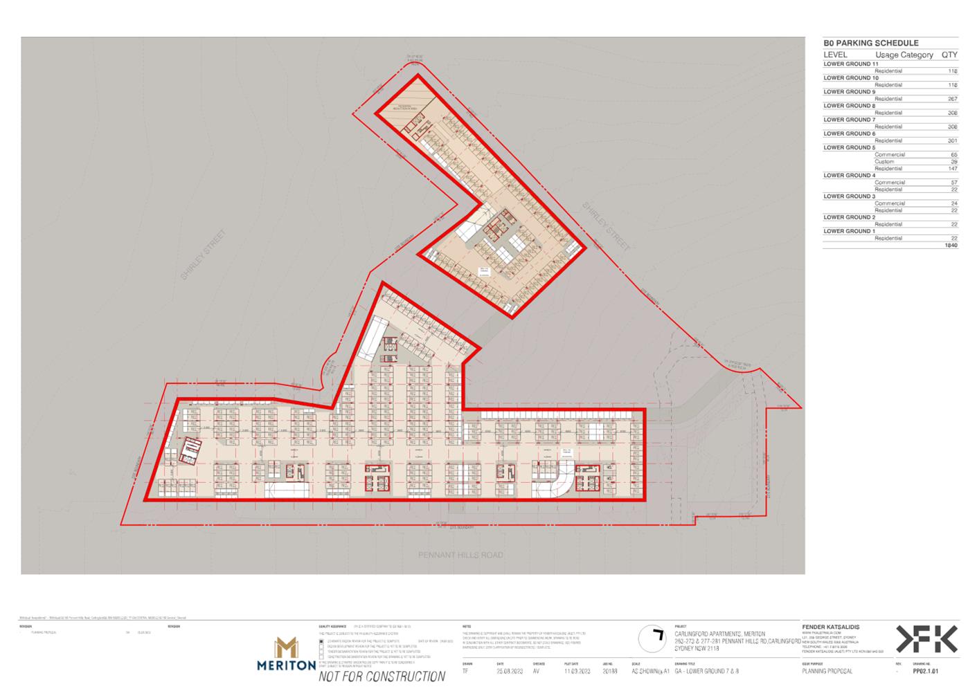
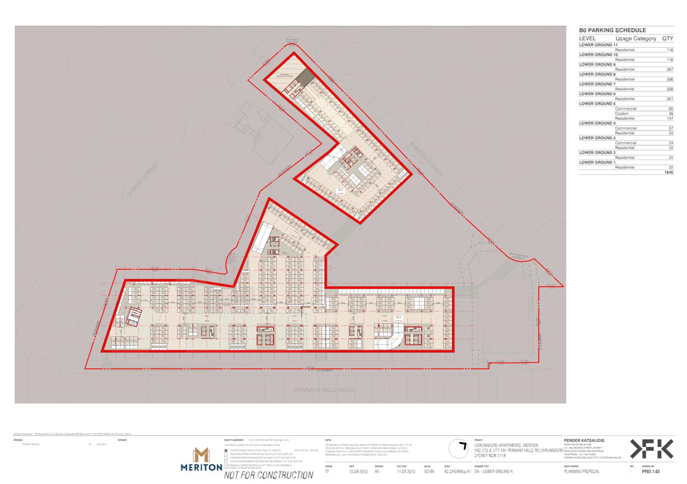
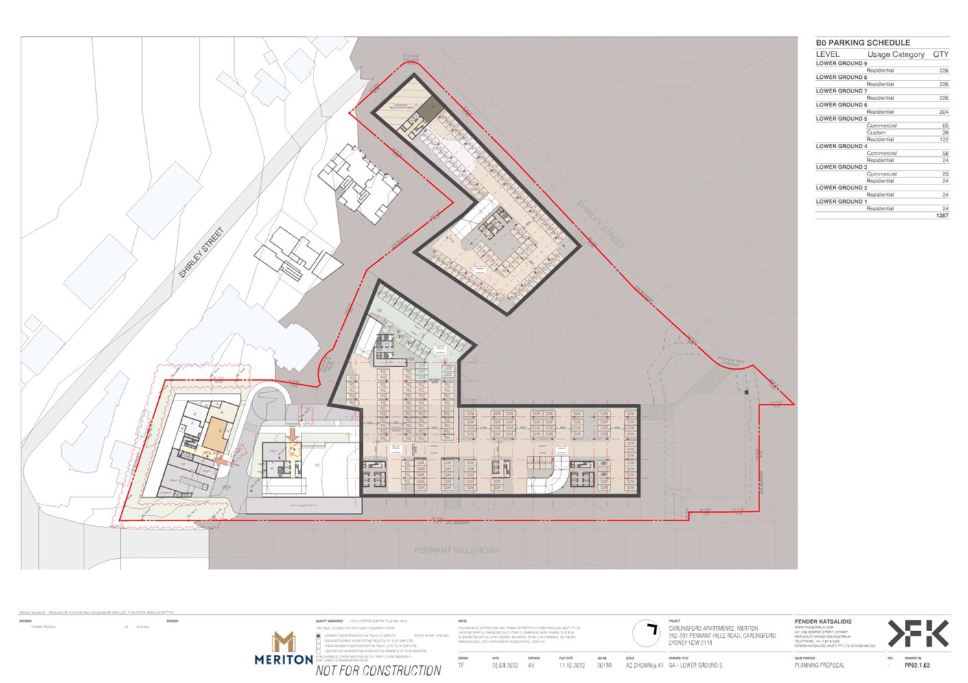
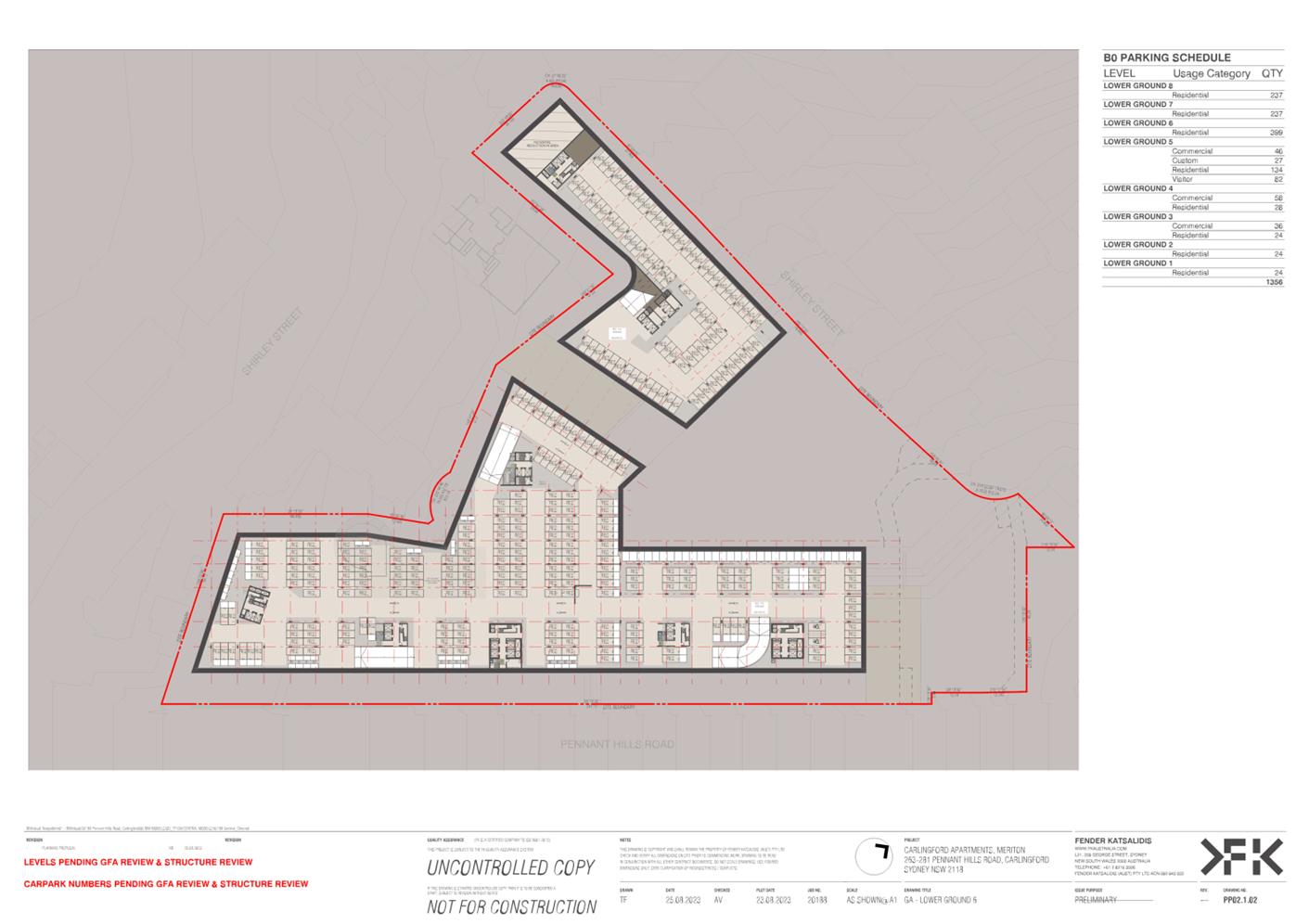
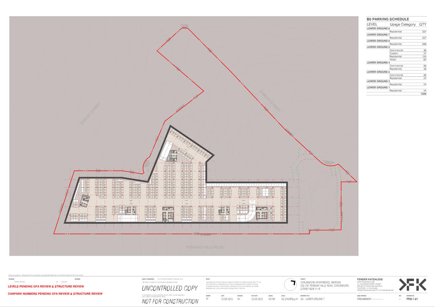
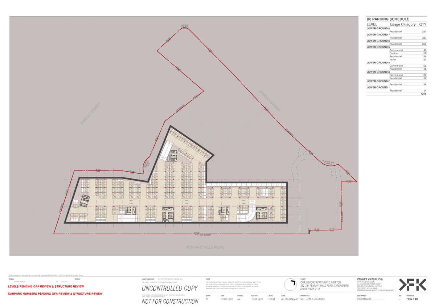
61. Provision of car parking for the residential component in accordance with the TfNSW Guide to Traffic Generating Developments is supported. For the childcare centre and retail components, the parking rates are to be as per the Parramatta DCP 2023 requirements. However, the applicant’s referral to The Hills DCP rates at the time of lodgment are supported given that The Hills DCP minimum requirements are higher than the Parramatta DCP minimum rates for the retail and childcare components.
62. The proposal includes 20 parking spaces for the Community Hub. As suggested by the applicant, a detailed assessment of parking provision for the Community Hub will be provided at the detailed design stage of the proposal.
Geotechnical
63. The proposed development involves the construction of a mixed-use development including below-ground basement parking and is also adjacent Pennant Hills Road. A geotechnical assessment of subsurface conditions including groundwater seepage will be addressed at the detailed design stage of the proposal. However, it is considered that the Planning Proposal should proceed to the Gateway Determination stage ahead of the detail design being undertaken.
Overland Flow
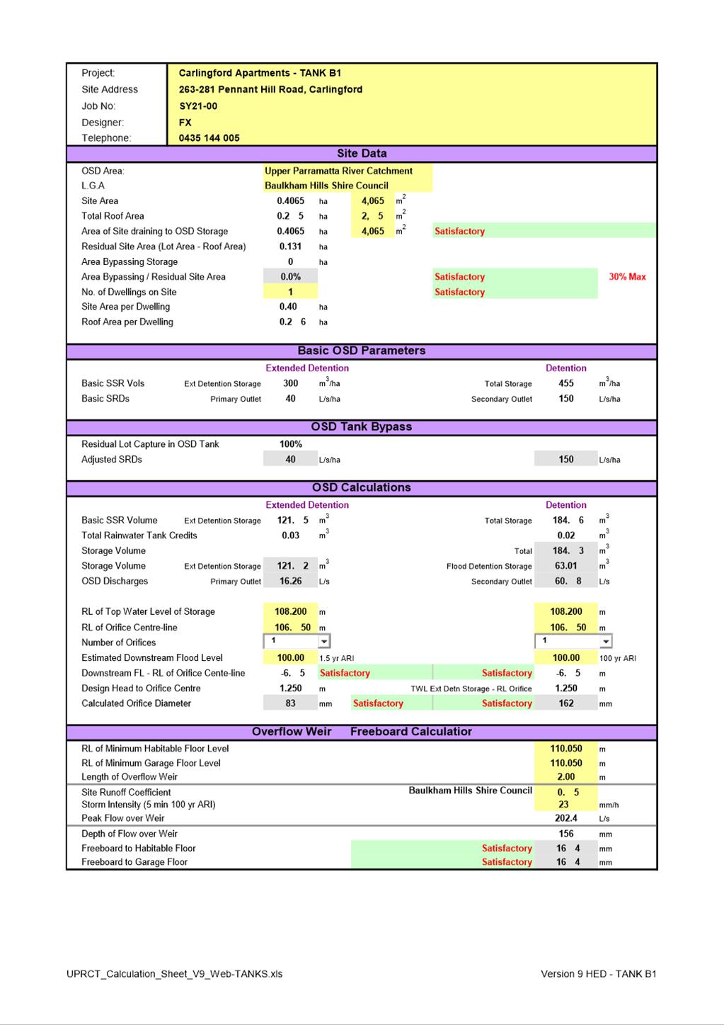
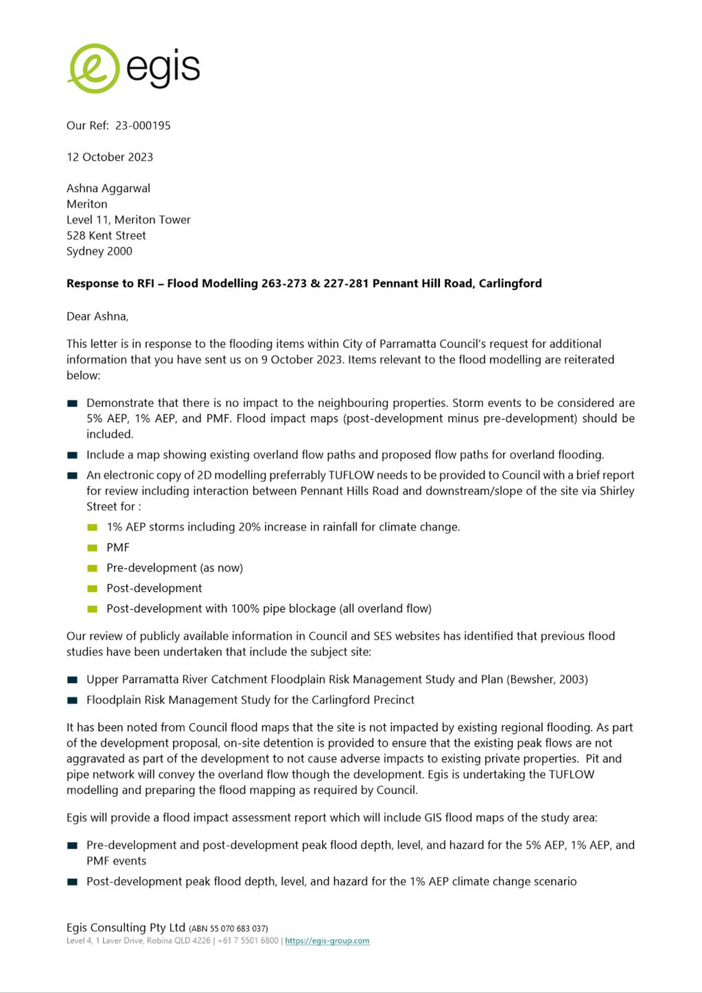
64. The site is not subject to flooding, however, as result of its size, it will generate its own overland flow. The applicant’s Overland Flow Study (Attachment 2) has suggested that in a 1% AEP event an Onsite Detention System (OSD) to limit post development flows can be used to ensure flows from the site will not exceed pre-development conditions.
65. Council will further review the proposed overland flow management following detailed design of the proposal. However, it is considered that the Planning Proposal should proceed to the Gateway Determination stage ahead of the detailed design being undertaken.
Heritage
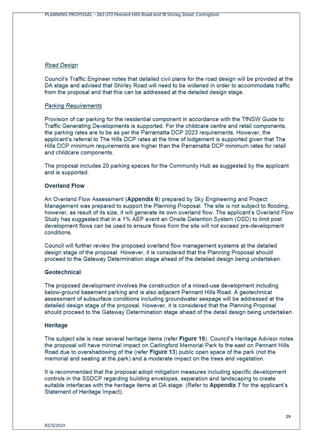
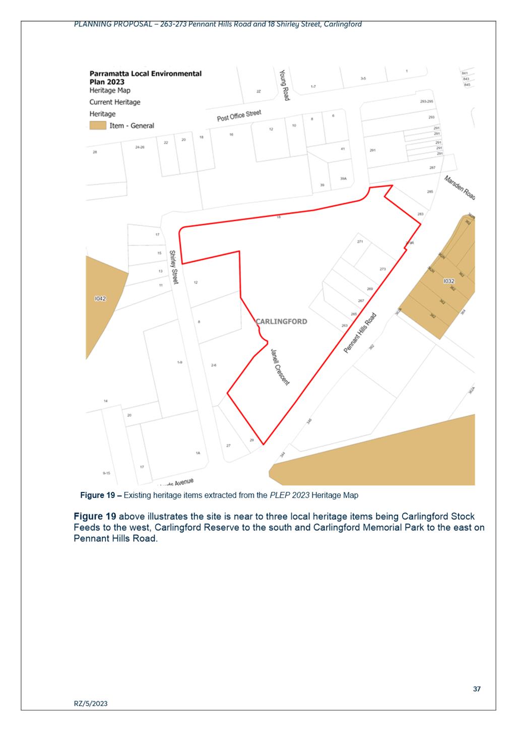
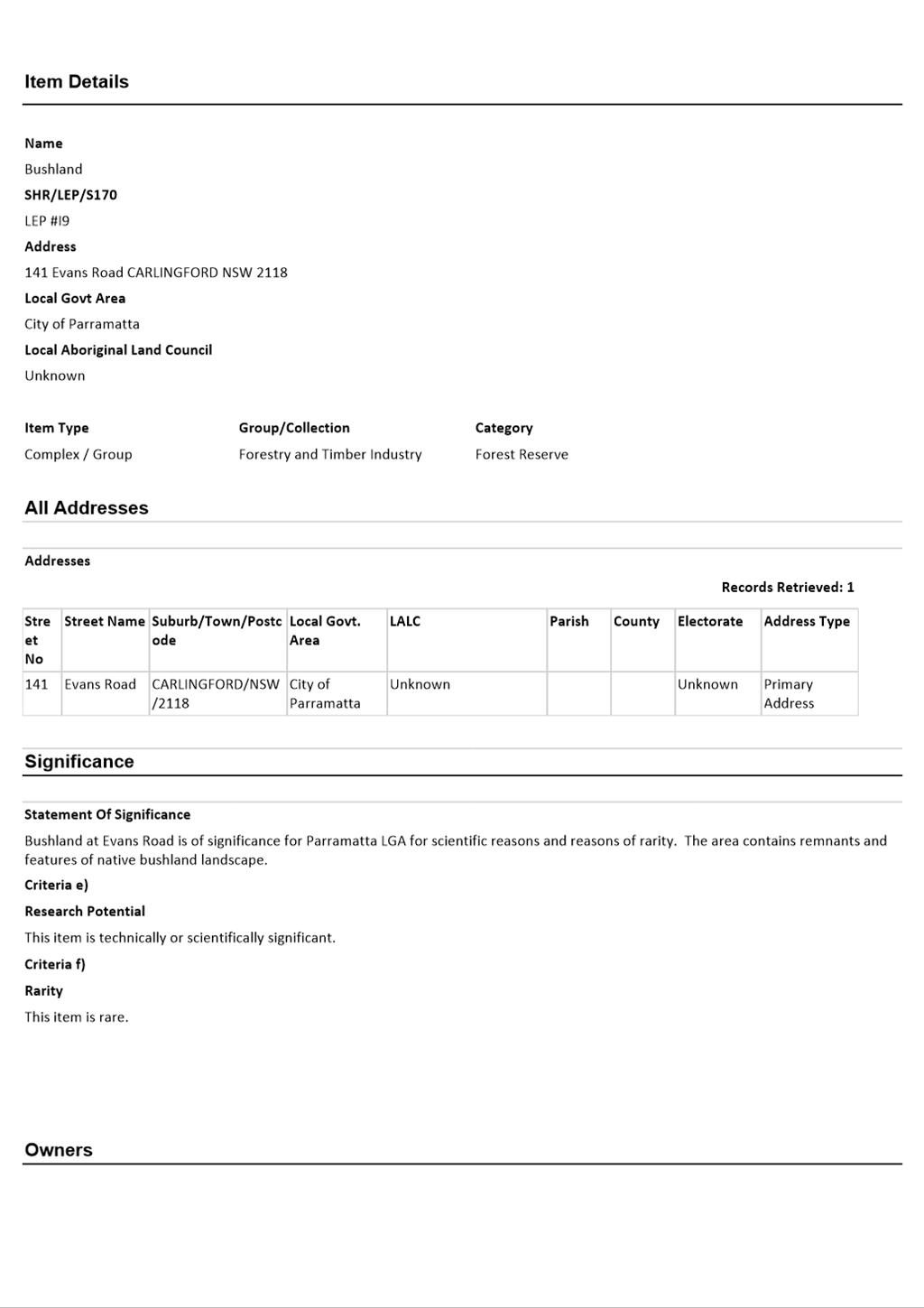
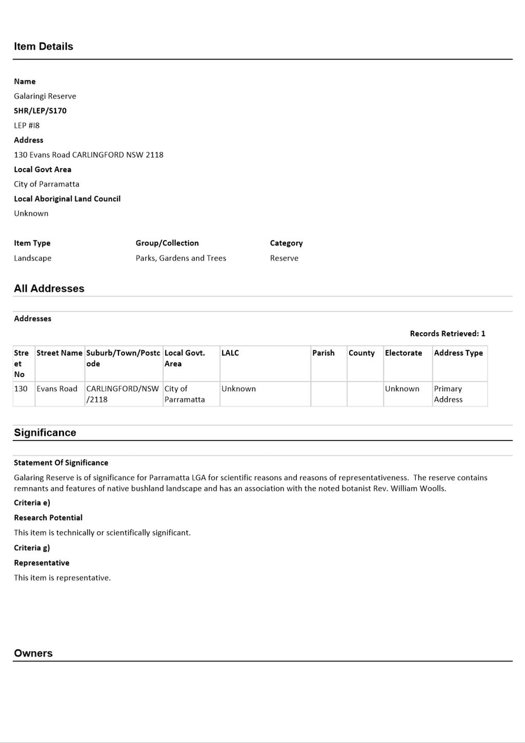
66. The subject site is near several heritage items (Figure 13). Council’s Heritage Advisor notes the proposal will have minimal impact on Carlingford Memorial Park to the east on Pennant Hills Road due to overshadowing of the (Figure 14) public open space of the park (not the memorial and seating at the park) and a moderate impact on the trees and vegetation.
67. It is recommended that the proposal adopt mitigation measures including specific development controls in the SSDCP regarding building envelopes, separation and landscaping to create suitable interfaces with the heritage items. Refer to Attachment 2 for the applicant’s Heritage Impact Assessment.
![]()
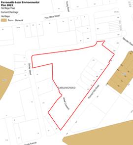
Figure 13 – Heritage Map Figure 14 – Overshadowing of Park
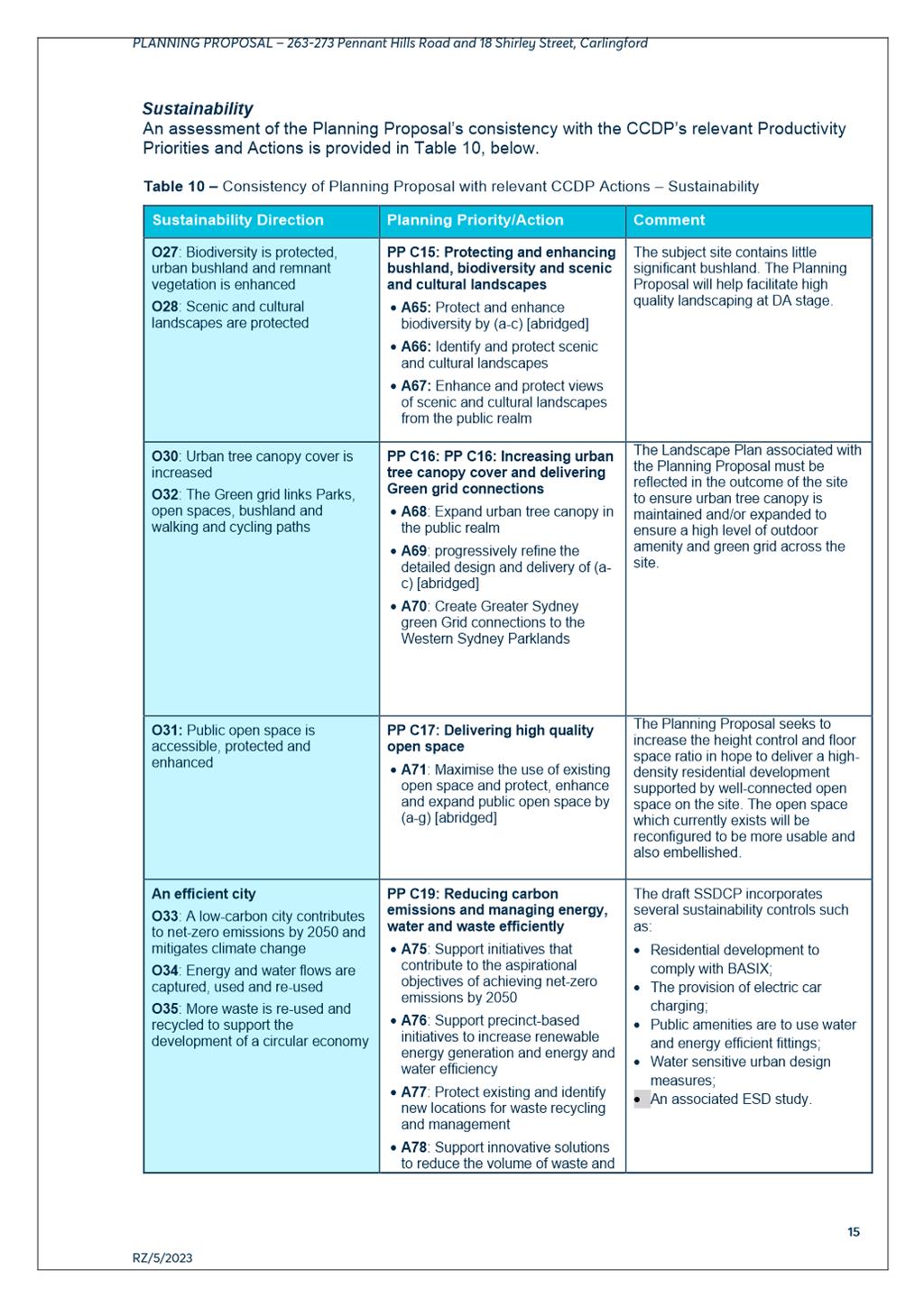
Environmentally Sustainable Design
68. Specialist consultant Flux Consulting were engaged by Council to review the Planning Proposal and noted the draft SSDCP sustainability measures do not reflect the site's opportunities and scale of development and that the draft objectives and controls are weaker than those in Council’s Harmonisation DCP. It is recommended that Section 11 of the draft SSDCP is to be deleted or amended to include only items not already covered in the draft Harmonisation DCP or of an objectively higher standard (Refer Attachment 2 for applicant’s ESD Report).
Social Impact
69. Council’s Social/Cultural Team has reviewed the Planning Proposal and Letter of Offer and supports the proposed provision and dedication of public open space, publicly accessible space, and a community hub/library that supports the increase in density as they align with need identified in Council’s CIS. (Refer Attachment 2 for applicant’s Social Impact Assessment).
70. Council staff investigations for a potential for alternative site for the Community Hub reveal the following:
· The Outside CBD Contributions Plan only apportions 40% of the cost of a new library/community open space to new development and there is currently no alternative funding source identified to assist in the acquisition and construction of a new facility.
· The existing library site is highly constrained and is not capable of accommodating significant development uplift and amalgamation with adjoining land is not considered feasible.
· There are no suitable alternative sites in Council ownership identified that are readily available for development for a new library.
· There are no other current or foreshadowed Site Specific Planning Proposals in the immediate area that would provide potential opportunities for the provision of a new library.
· The Planning Proposal site is located in a position close to the Carlingford Light Rail stop, Carlingford Shopping Village and would provide for adjacent public open space.
· Any alternative site that may arise in the future may not be as well located.
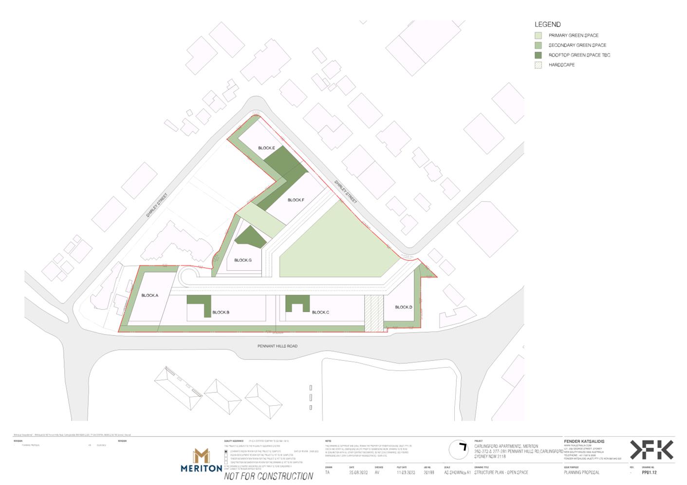
Open Space
71. The proposed quantity of RE1 Public Open Space land is supported as it meets Council’s Community Infrastructure Strategy (CIS) requirement for 20% public open space, with the ‘Central Park’ satisfying the minimum 3,000 sqm size for a local park.
72. The proposed configuration of open space more satisfactorily addresses the CIS land dedication criteria, including improved shape, solar amenity, street frontage and connectivity to the surrounding community than the open space configuration under the existing development consent for 18 Shirley Street. This will improve useability, amenity and permeability, resulting in an overall better open space outcome that is more consistent with best practice.
73. The proposed community link (refer to Figure 15) has limited recreational capacity due to its narrow width, sloping topography and poor solar access. It is dominated by stairs and ramps, which reflect the primary ‘access’ purpose, and largely interfaces with adjoining private buildings. As such, the community link should be retained under private ownership as a publicly accessible link consistent with the proposed connection to Pennant Hills Road.
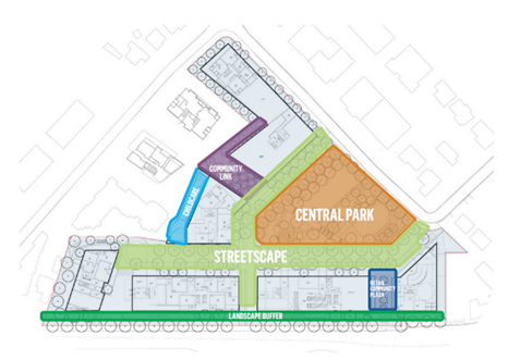
Figure 15 – Site layout showing the community link in purple
74. The northern orientation of the central open space facilitates mid-winter solar access to provide a potentially high amenity space that would be edged by streets to create clear delineation between public and private domains and minimise potential future use conflicts. The direct frontage to Shirley Street would improve permeability and accessibility by the wider surrounding community.
75. Solar access to the open space, in particular the Central Park is an important consideration and future development of the site must comply with DCP provisions regarding solar access to open space. The northern orientation of the central open space facilitates mid-winter solar access to provide a potentially high amenity space that improves permeability and accessibility by the wider surrounding community.
Landscaping and Arboriculture
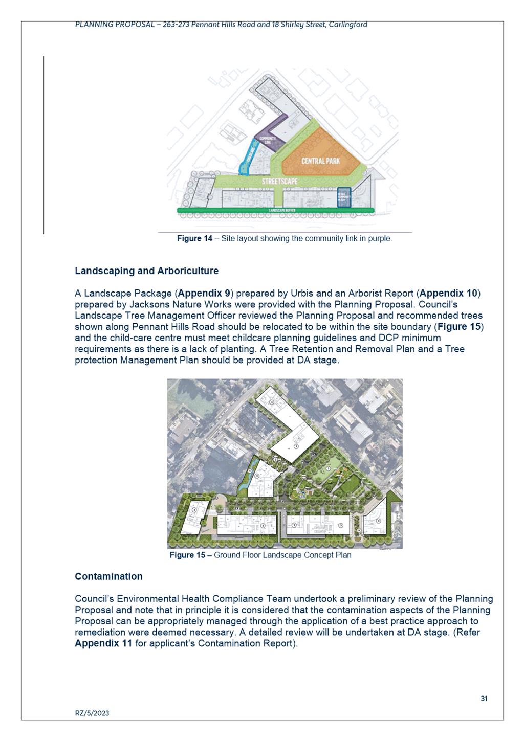
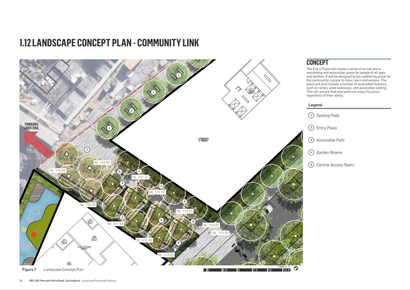
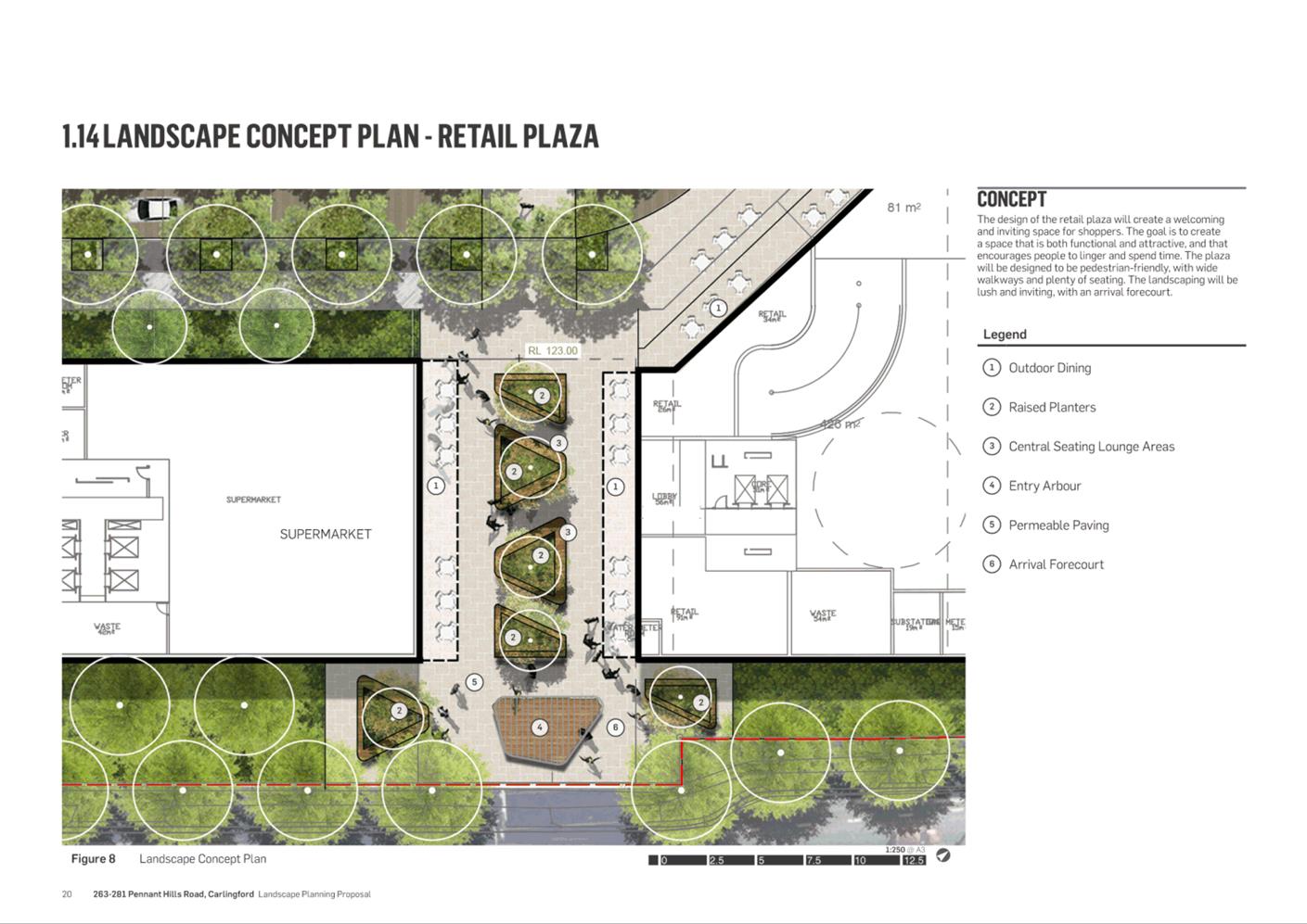
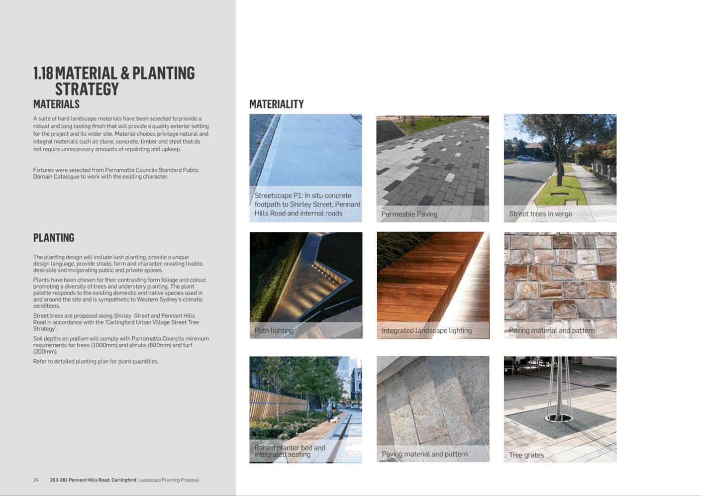
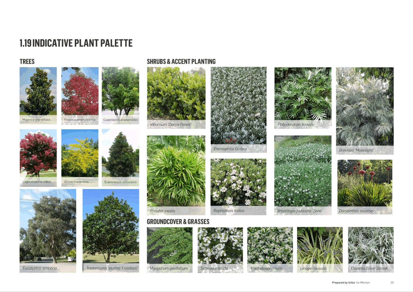
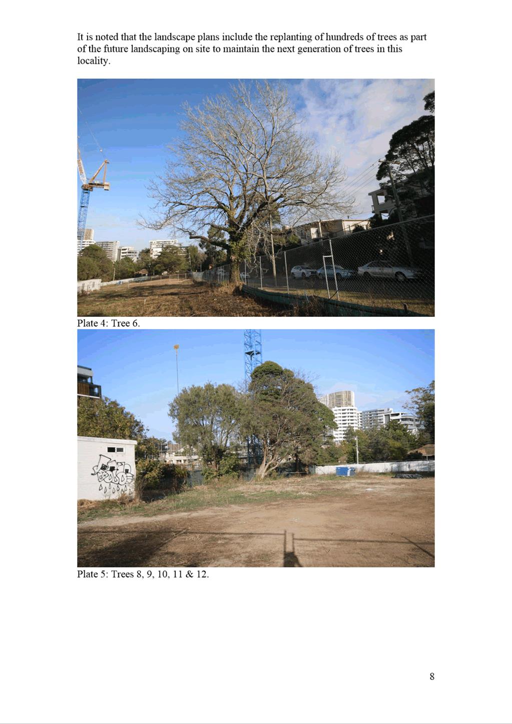
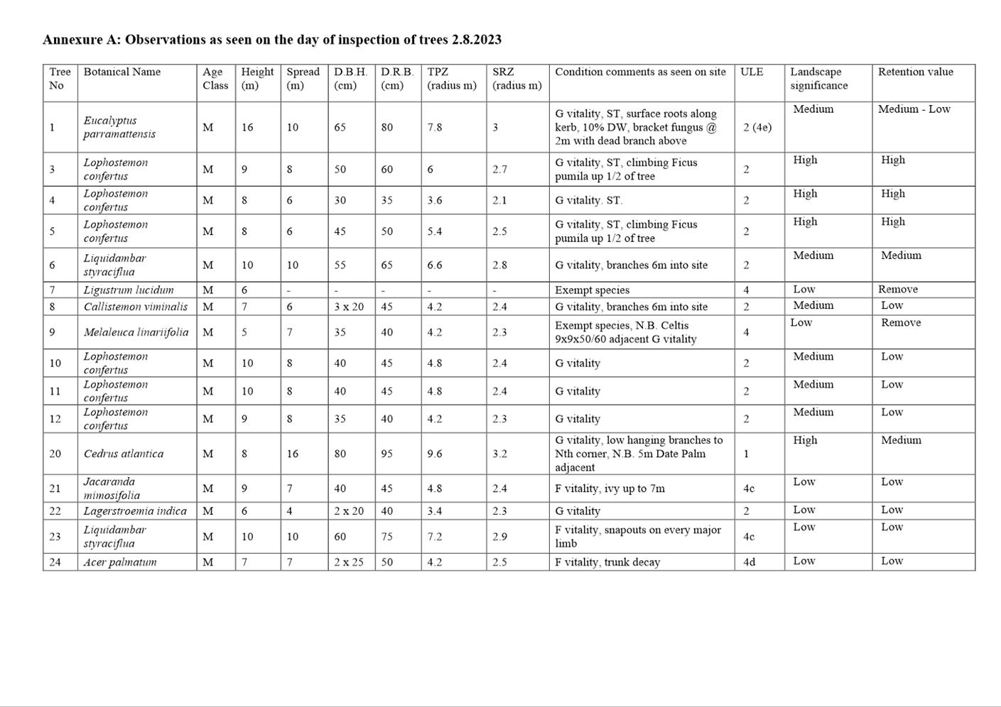
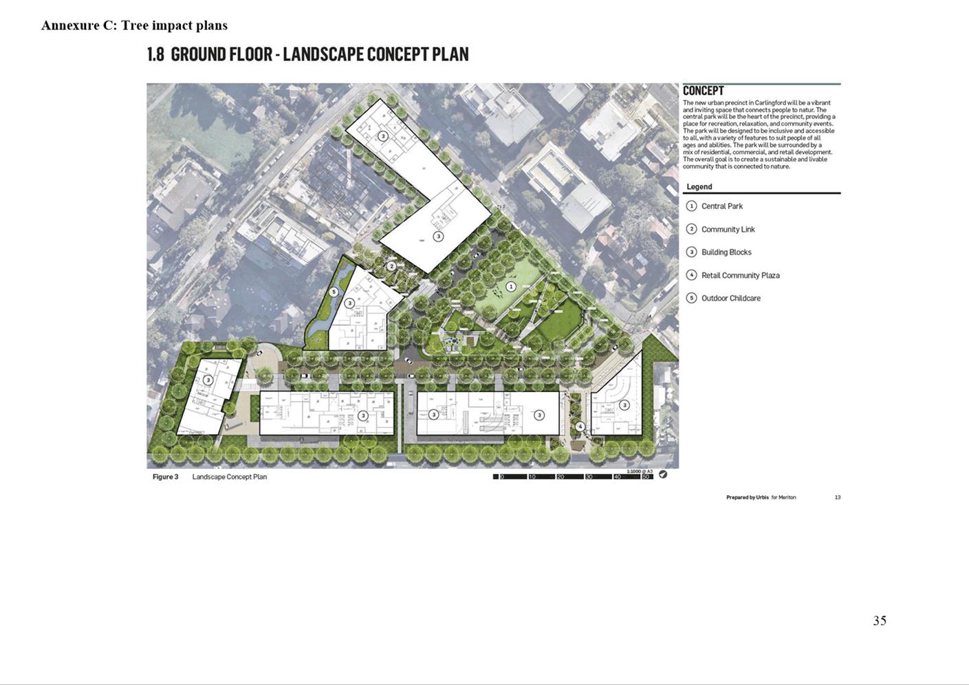
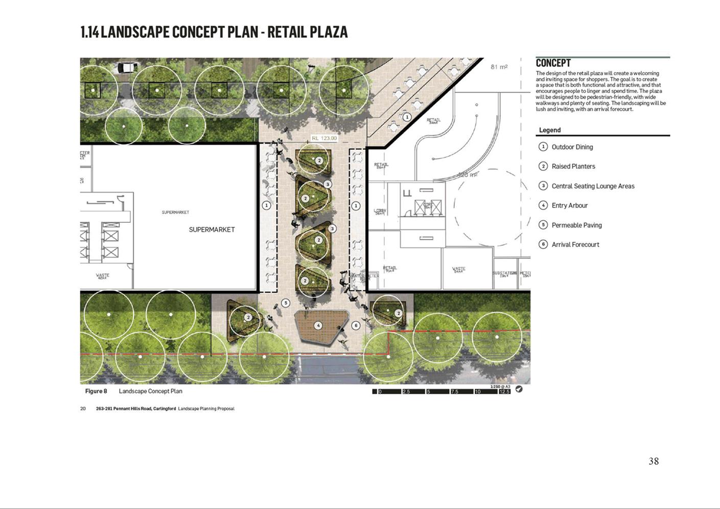
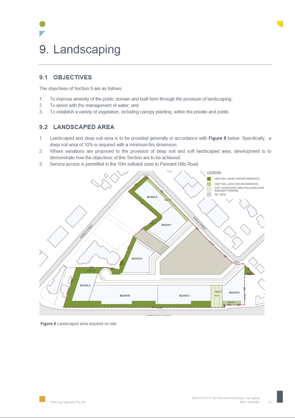
76. Council’s Landscape Tree Management Officer reviewed the Planning Proposal and recommends trees shown along Pennant Hills Road be relocated to be within the site boundary (refer Figure 16) and the child care centre must meet child- care planning guidelines and principles and also DCP minimum requirements. (Refer to Attachment 2 for the applicant’s Landscape Package and Arboriculture Impact Assessment).
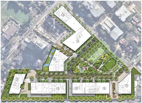
Figure 16 – Ground Floor Landscape Concept Plan
Retail and Economic Impact
77. Council’s Economic Development team has reviewed the Planning Proposal and considers the increase in the maximum GFA of business premises, food and drink premises, recreational facilities (indoor) shops to 2,600 sqm is reasonable given the subject site’s proximity to the Carlingford Town Centre and the proximity to the Carlingford Light Rail stop. (Refer to Attachment 2 for the applicant’s Retail Impact Assessment.
Contamination
78. Council’s Environmental Health Compliance Team undertook a preliminary review of the Planning Proposal and note that in principle it is considered that the contamination aspects of the Planning Proposal can be appropriately managed through the application of a best practice approach to remediation where deemed necessary. A detailed review will be undertaken at DA stage. (Refer to Attachment 2 for the applicant’s Preliminary Environmental Site Assessment).
Acoustic Impact
79. Council’s Environmental Health Compliance Team undertook a preliminary review of the of the Planning Proposal and determined that in principle it is considered that acoustic aspects of the Planning Proposal, including impacts on balconies fronting Pennant Hills Road, can be appropriately managed through application of a best practice approach to building design and treatment and also acoustic mitigation/attenuation at the detailed design stage. (Refer to Attachment 2 for the applicant’s Noise Impact Assessment).
80. Given the potential acoustic impacts on balconies fronting Pennant Hills Road, the applicant proposes that these balconies be enclosed, however that they be excluded from the calculation of Gross Floor Area (GFA). Council staff are not supportive of this approach.
81. Enclosing southern facing balconies will provide protection from amenity impacts as a result of their location on Pennant Hills Road, however if balconies are fully enclosed, they should count as GFA as is the approach taken for similar high-density proposals, such as in the Parramatta CBD. If enclosed balconies are excluded from the calculation of the GFA, it would result in an addition of approximately 5,184 sqm of GFA permitted on the site.
PLANNING PROPOSAL AND CONCURRENT DEVELOPMENT APPLICATION
82. A DA (DA/53/2022) for the construction of 620 residential units, childcare centre, retail shops, basement parking, open spaces, through site links and roads on the subject site, was refused by the Sydney Central Planning Panel in 2022 (Figure 17). The DA is currently the subject of an appeal to the Land and Environment Court and a conciliation conference was held on 20 October 2023. Following the conference the applicant indicated that it now intends to lodge new plans to formally amend the scheme currently before the courts.
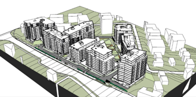
Figure 17 – DA/53/2022 Scheme
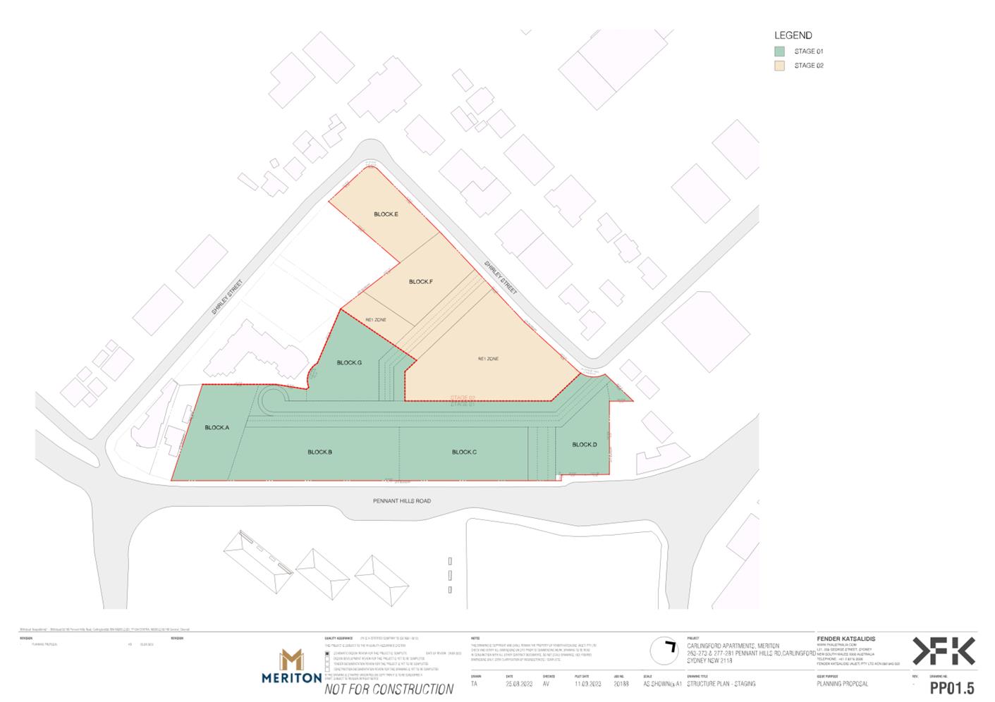
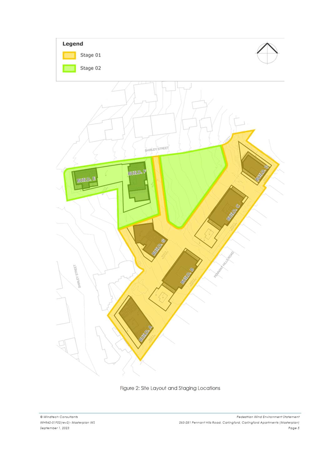
83. The DA Concept Proposal is illustrated in Figures 18 & 19 and will include blocks A, B, C, D and G and internal roads as part of the Stage 1 DA and will be consistent with the existing planning controls. The applicant proposes that upon finalisation of the Planning Proposal, a Stage 2 DA will be submitted that will seek approval for the reference scheme including enlarged blocks A, B, C, D and construction of blocks E and F as well as the internal road and open space (Figures 15 & 16).
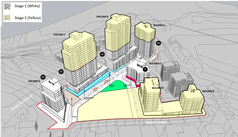
Figure 18 – Stage 1 DA and Stage 2 DA
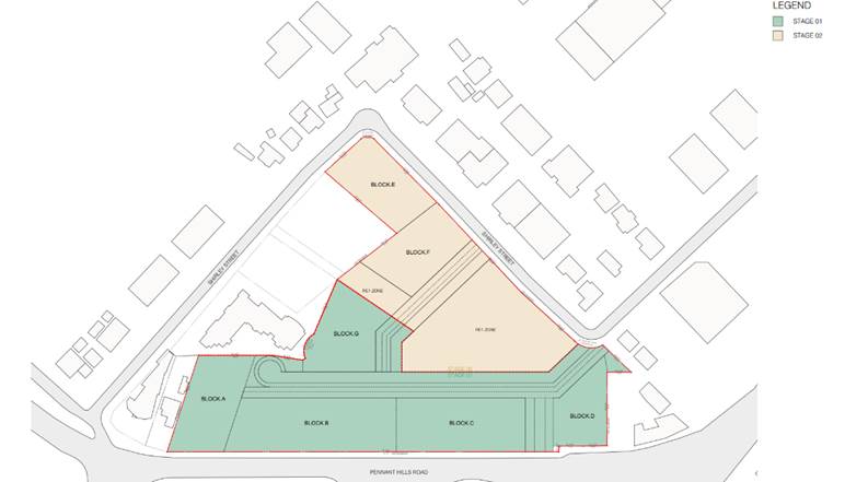
Figure 19 – Staging
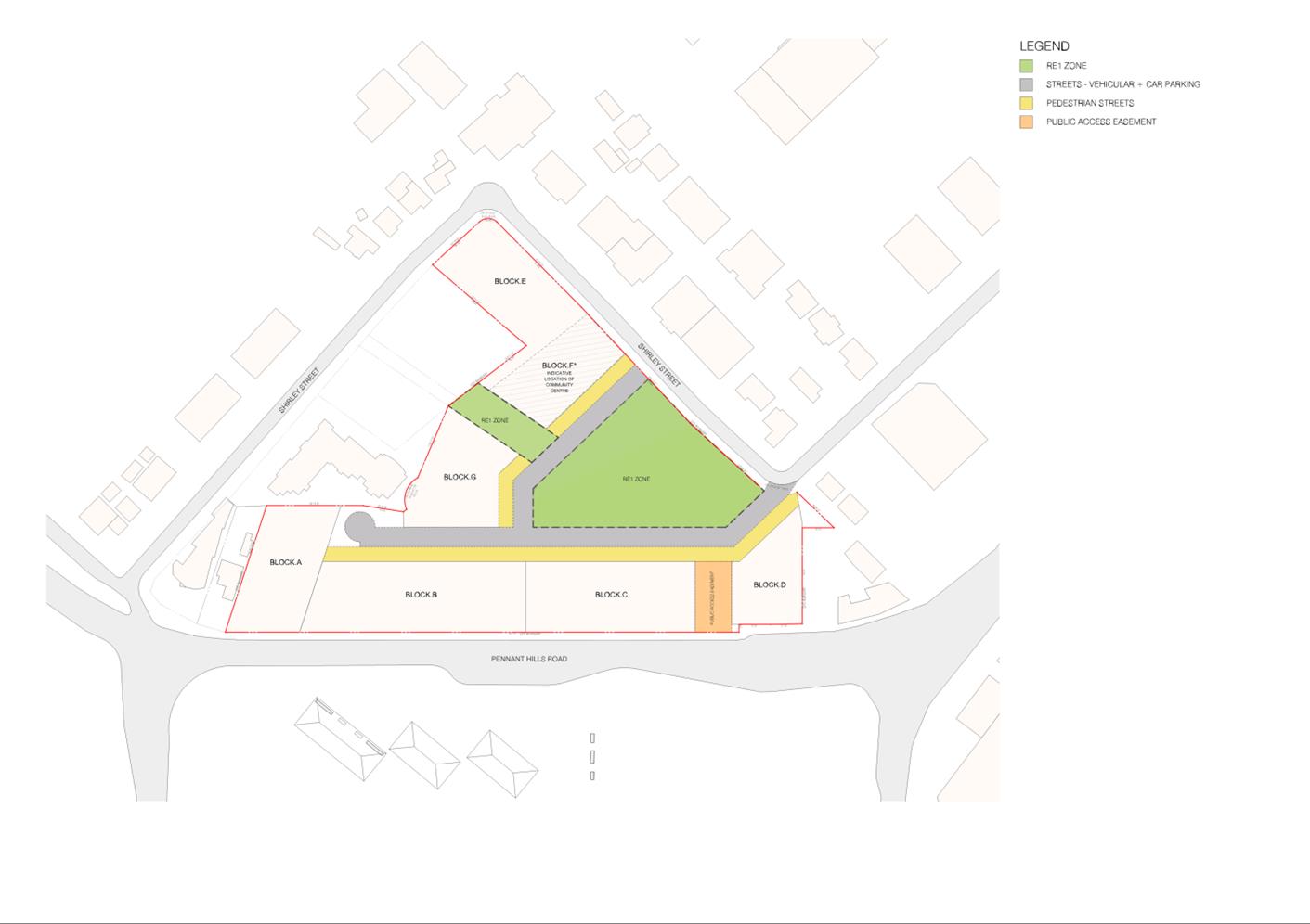
84. The Planning Proposal is accompanied by a Letter of Offer (Attachment 4) which proposes to deliver the following public benefits at a value estimated by the applicant to be $27.5 million:
· Dedicate a 2,500 sqm community hub to Council, including 1,800 sqm ‘warm shell’ library and 700 sqm ‘warm shell’ community centre with the provision of 20 parking spaces (refer to Figure 20);
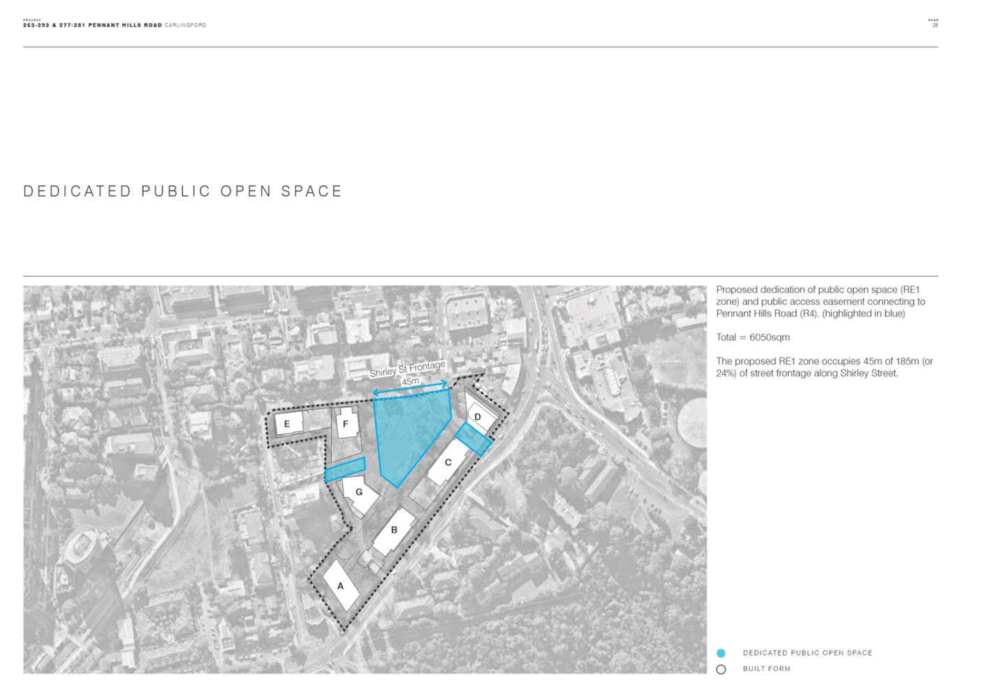
· Embellish and dedicate at least 5,585 sqm of public open space to Council, in the land proposed to be zoned RE1;
· Embellish and make accessible, via public easement, approximately 595 sqm of publicly accessible open space; and
· Include a monetary contribution equivalent to the Section 7.11 Contributions, enabling Council to directly allocate this funding to the fit-out of the community centre.
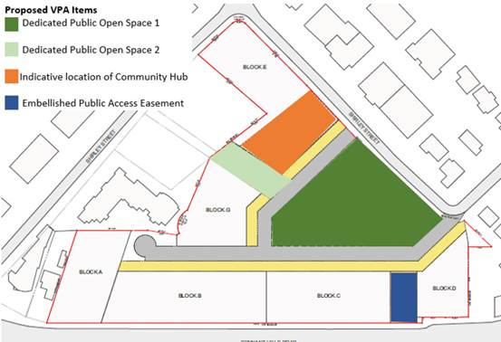
Figure 20 – Proposed VPA Items
85. A preliminary assessment of the Letter of Offer by Council Officers concludes that in principle the items offered are acceptable in terms of their nature, subject to design modifications with the only exception being the Community Link referred to as ‘Dedicated Public Open Space 2’ in Figure 17 for the reasons noted earlier in the Open Space section of this report.
86. The need for a Planning Agreement has been identified as an appropriate mechanism to ensure the proposal makes a suitable contribution towards meeting the increase in demand for infrastructure arising from the additional density that would be facilitated by the Planning Proposal.
87. Whilst the existing development consent for 18 Shirley Street includes an associated Planning Agreement it provides for a limited contribution toward community facilities in Carlingford with a total monetary contribution of only $908,499 and exemption from the requirement for the payment of development contributions. Under the City of Parramatta Outside CBD Contributions Plan, the same development application would require a total monetary contribution of approximately $8,758,350 (subject to indexation).
SITE SPECIFIC DEVELOPMENT CONTROL PLAN
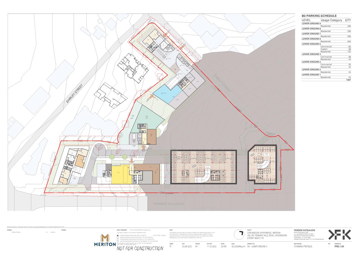
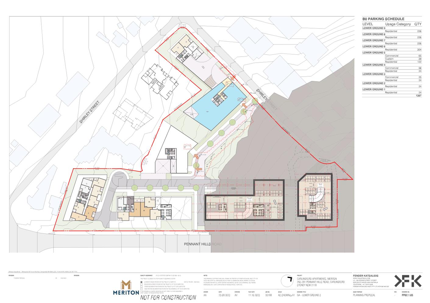
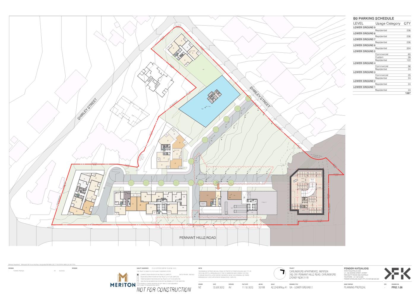
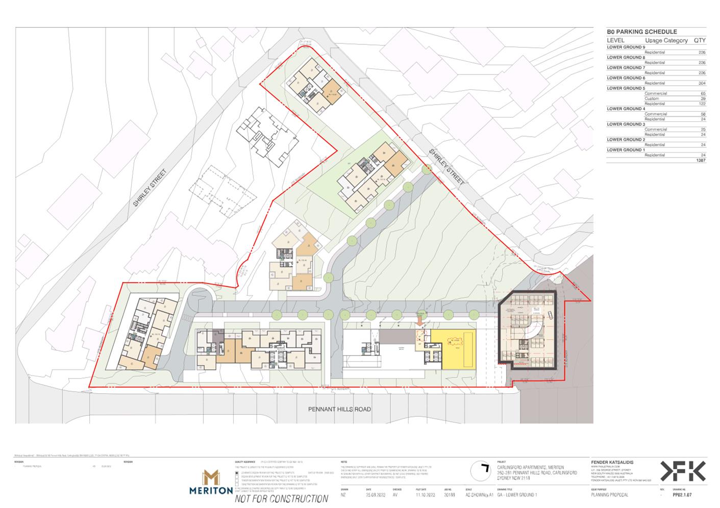
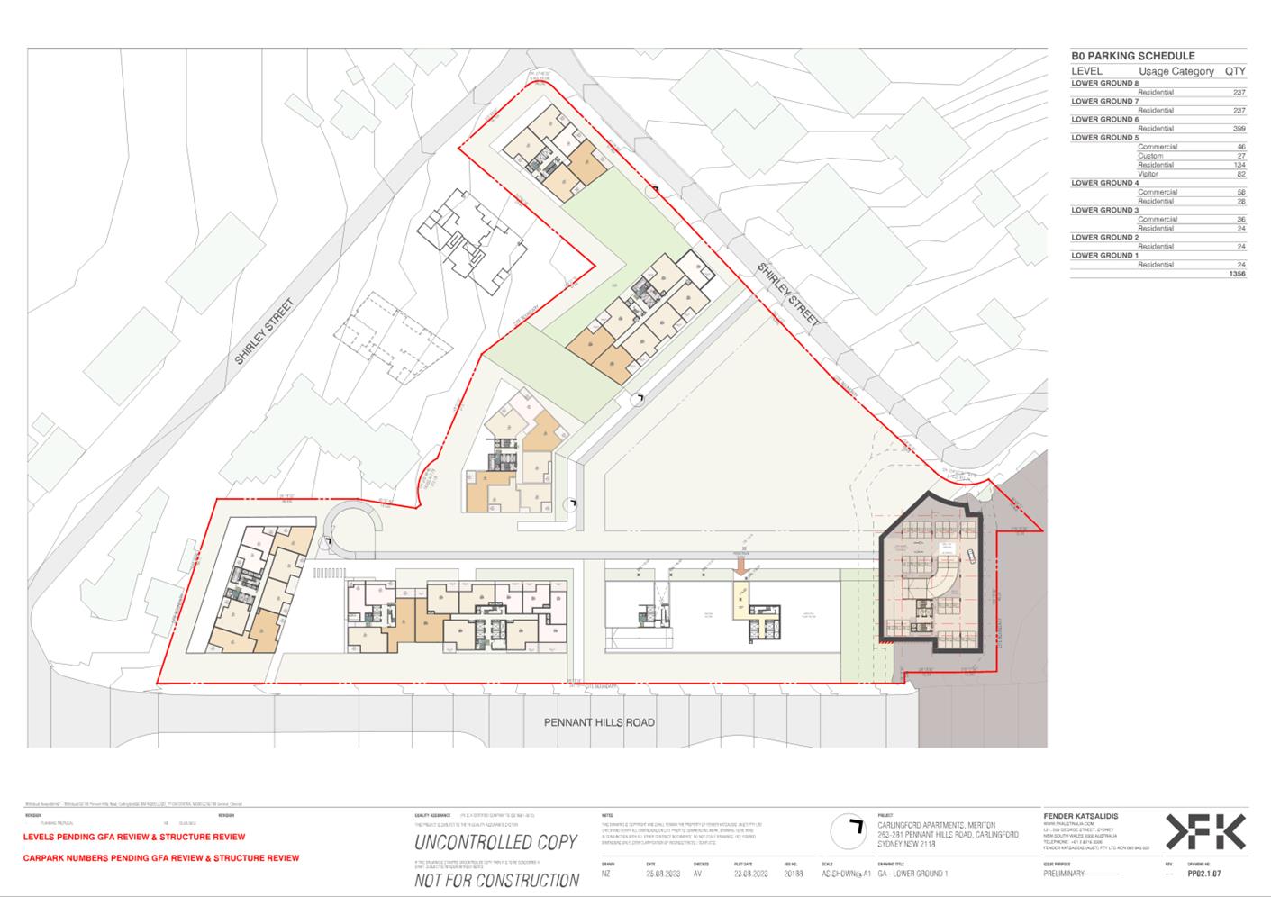
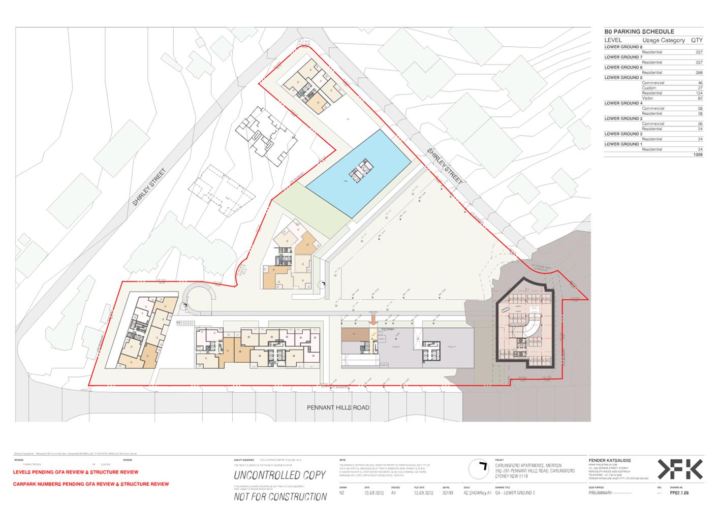
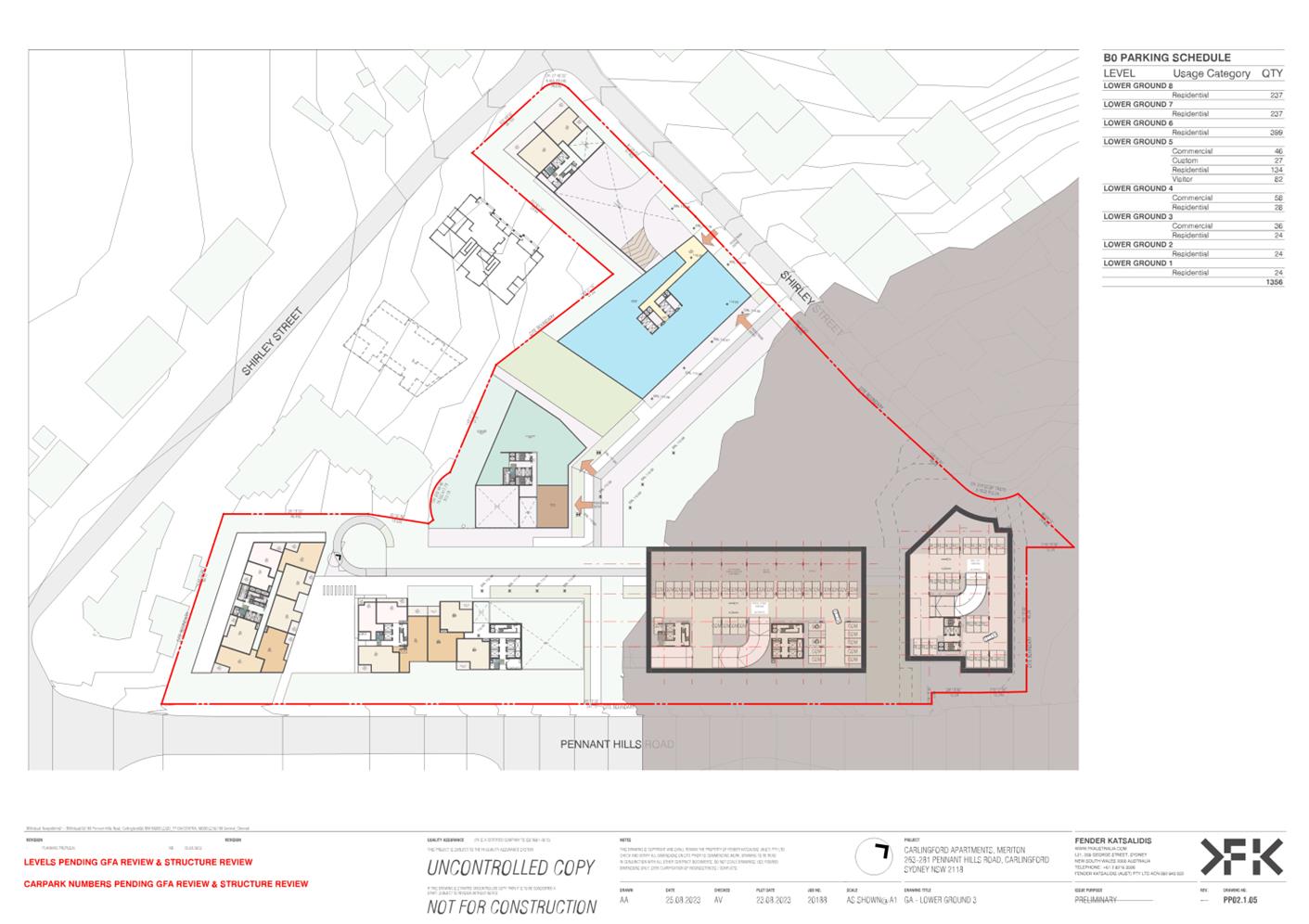
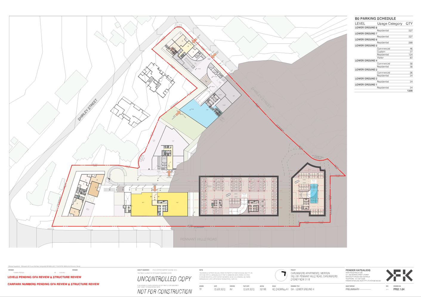
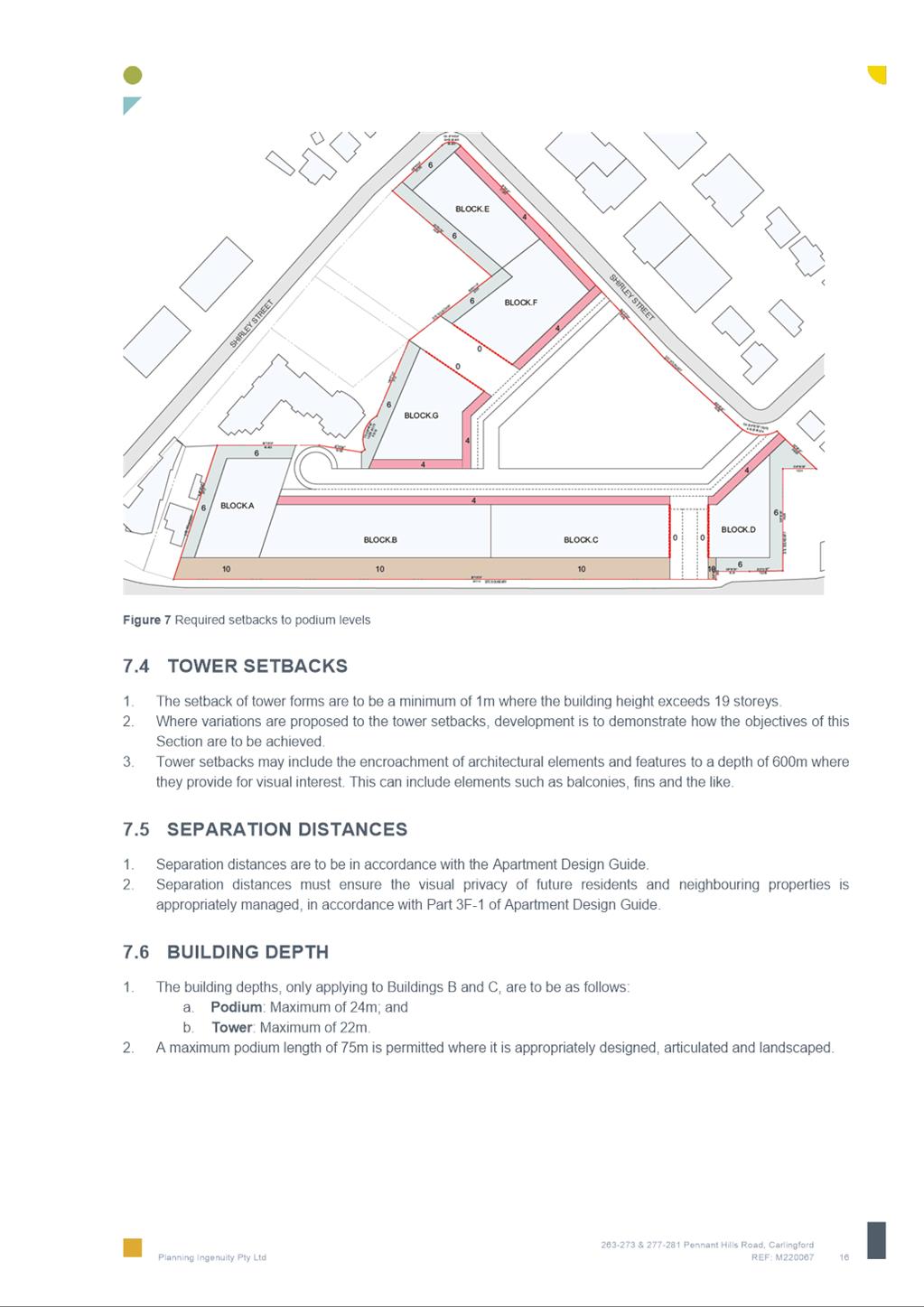
88. A draft Site-Specific Development Control Plan (SSDCP) (Attachment 3) has been prepared by the applicant to accompany the Planning Proposal. The draft SSDCP provides details on site arrangement, road layout, envelope controls and open space for the site. The SSDCP seeks to guide future development consistent with the concept design for the site. The draft SSDCP will amend controls for Block 17 of the Carlingford Local Centre as outlined in Parramatta DCP 2023 (Part 8.2) and will provide site-specific controls for:
· Indicative site structure and arrangement.
· Public domain and open space.
· Residential and non-residential uses.
· Storey height.
· Setbacks and building depths.
· Building design and material.
· Landscaping.
· Vehicle access and parking.
· Environmental Sustainability.
· Public Art.
89. Following staff review it is considered that the current draft SSDCP requires amendment. Key amendments need to be made to address future built form, the role of the central open space, landscaping and a range of clarifications. The amendments will include addressing the following matters, including those issues identified earlier in paragraph 41.
· Removal of objectives that are inconsistent with the Planning Proposal outcomes.
· Confirm relevant site specific built form objectives and controls.
· Provide objectives and controls relating to built form/public domain interface treatments.
· Confirm that boundary setbacks include basement car parking.
· Clarify green sustainability requirements.
· Clarify performance specifications for landscape setting.
· Clarify inconsistencies between DCP and ADG requirements.
· Clarify open space functionality/embellishment/quality and internal site circulation requirements.
· Confirm basement car park structure set down requirements.
· Confirm soil depth, volume and mass requirements over basement car parking and on podiums.
· Prominence of loading and docking activity and level changes in the Pennant Hills Road landscape setback.
· Poor levels and landscape buffer interface to neighbouring properties.
· Provide objectives and controls for the childcare centre.
90. It is proposed that the SSDCP will be updated to address these matters before it is placed on public exhibition with the Planning Proposal following the DPE issuing of a Gateway determination for the Planning Proposal.
PLAN-MAKING DELEGATIONS
91. Should Council resolve to endorse the Planning Proposal to proceed, it is recommended that Council request that it exercise its plan-making delegations. This means that once the Planning Proposal has been to Gateway, undergone public exhibition and been adopted by Council, Council officers will deal directly with the Parliamentary Counsel Office on the legal drafting and mapping of the amendment. The LEP amendment is then signed by the CEO before being notified on the NSW Legislation website.
CONSULTATION & TIMING
92. The Planning Proposal and supporting documents were referred internally to various Council staff/teams including:
· City Design Unit
· Public Domain Team
· City Significant Development Team
· Traffic and Transport Team
· Social/Cultural Team
· Parkes and Open Spaces Team
· Landscape and Tree Management Officer
· Flooding and Catchment Management Engineers
· Heritage Advisor
· Economic Development Team
· Environmental Health Compliance Team.
93. Preliminary consultation with TfNSW was also undertaken. Formal consultation will occur as part of the Gateway process.
94. The Planning Proposal was also reviewed by specialty consultants Flux Consulting to review matters related to ESD and Wind Impact.
95. No public consultation has yet been undertaken relating to this Planning Proposal. Should Council resolve to proceed with the Planning Proposal it, and all related information, will be submitted to the DPE for Gateway Determination. Community consultation will be undertaken as required by the Gateway Determination.
FINANCIAL IMPLICATIONS FOR COUNCIL
96. Should Council resolve to proceed with the Planning Proposal, the costs incurred in conducting the community consultation are covered by the fees associated with the submission of the Planning Proposal.
97. The Planning Proposal is accompanied by a Letter of Offer which proposes that the applicant enter into an agreement to deliver a range of community infrastructure (see paragraph 81). The financial implications of the offer will be presented to Council.
CONCLUSION AND NEXT STEPS
98. This report recommends that the Planning Proposal for 263-273 Pennant Hills Road and 18 Shirley Street, Carlingford be submitted to the DPE for Gateway assessment.
99. Council Officers are not seeking the Local Planning Panel’s advice on the Letter of Offer. Council will consider the merits of the Letter of Offer when the Planning Proposal is reported to Council for consideration.
Following the Local Planning Panel’s consideration of the proposal, the Planning Proposal and Letter of Offer will be considered by Council. Should the proposal be supported by Council it will be forwarded to the DPE with a request for a Gateway Determination.
Rafael Morrissey
Project Officer Land Use
Carmel O'Connor
Team Leader Land Use Planning
David Birds
Group Manager, Major Projects and Precincts
Jennifer Concato
Executive Director City Planning and Design
|
1⇩ |
Planning Proposal Report |
47 Pages |
|
|
2⇩ |
Planning Proposal Appendices |
790 Pages |
|
|
3⇩ |
Draft Site-Specific Development Control Plan |
25 Pages |
|
|
4⇩ |
Draft Letter of Offer to enter into a Planning Agreement |
5 Pages |
|
|
5⇩ |
Site History |
2 Pages |
|
|
6⇩ |
Letter from Minister of Planning & Public Spaces regarding the Housing Crisis |
2 Pages |
|
|
7⇩ |
Views Analysis |
3 Pages |
|
|
8⇩ |
Overshadowing |
1 Page |
|
REFERENCE MATERIAL