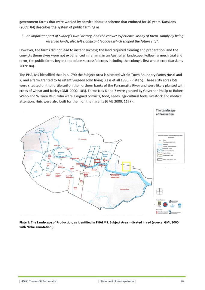
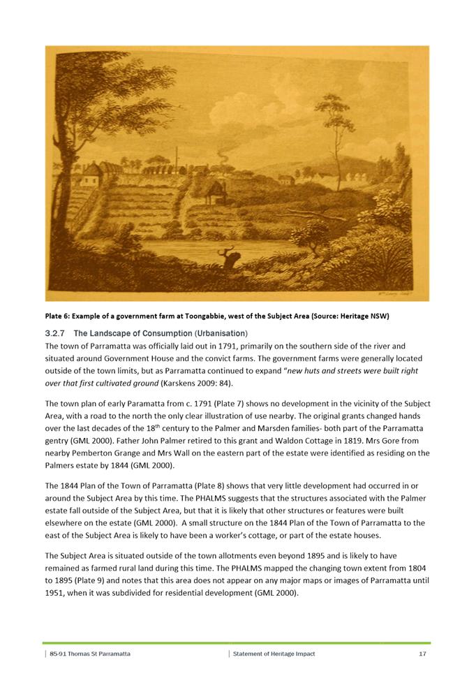
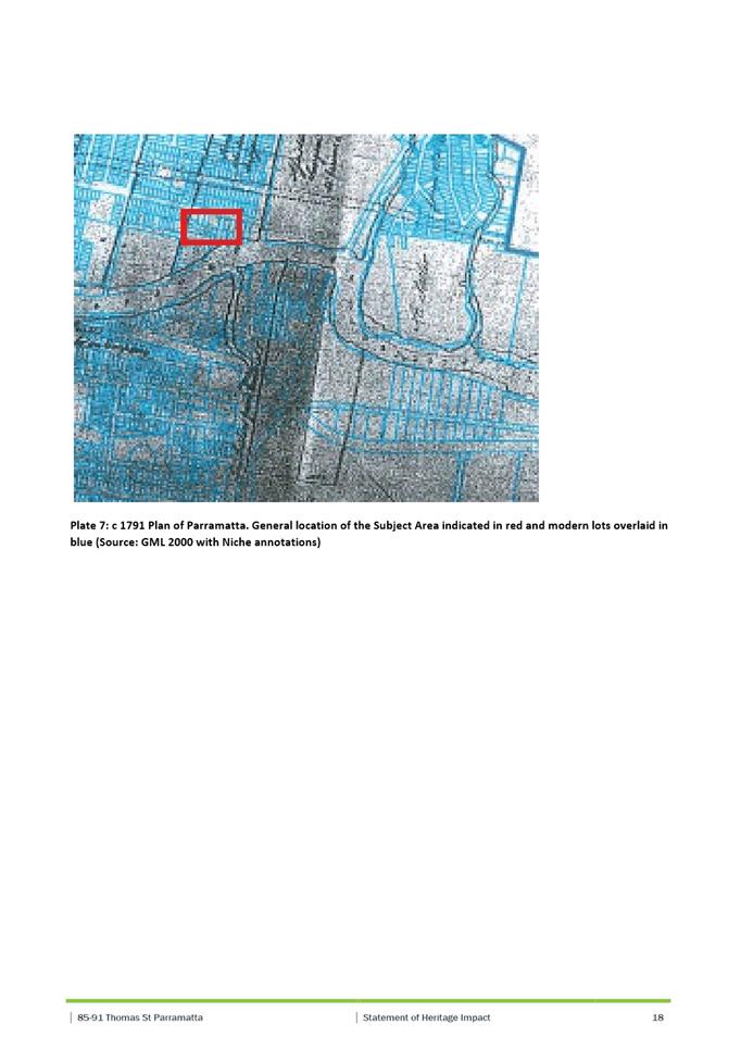
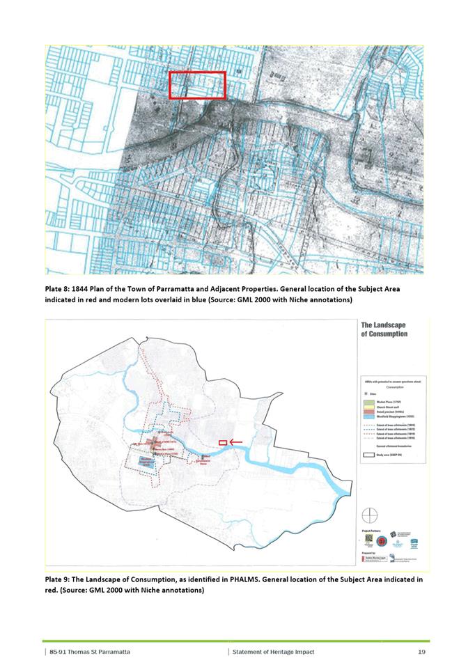
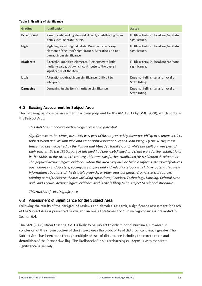
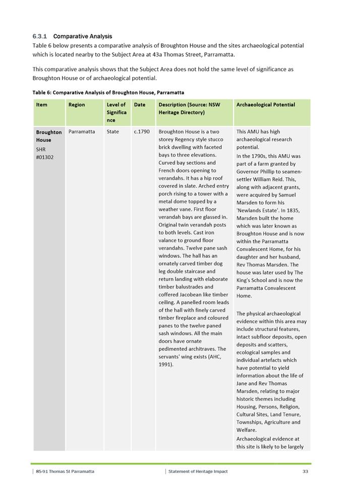
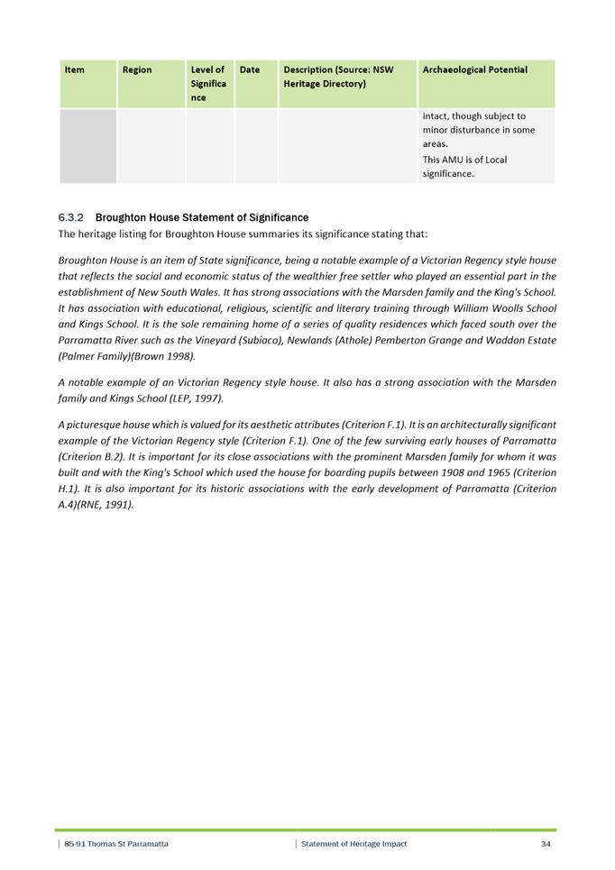
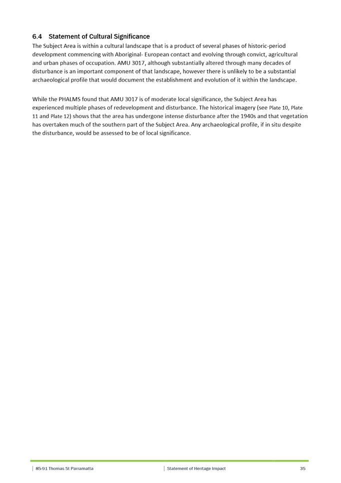
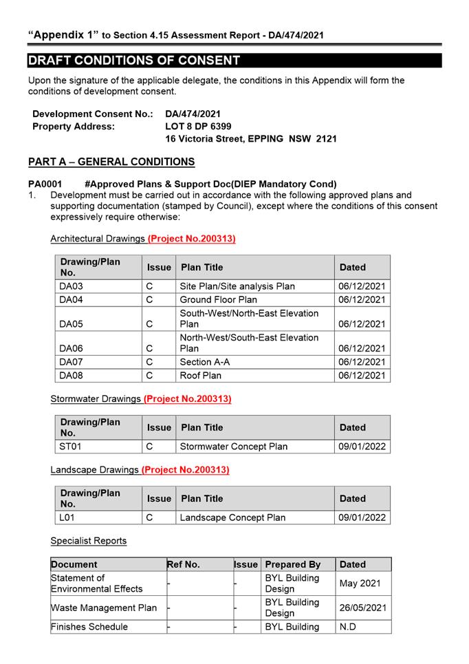
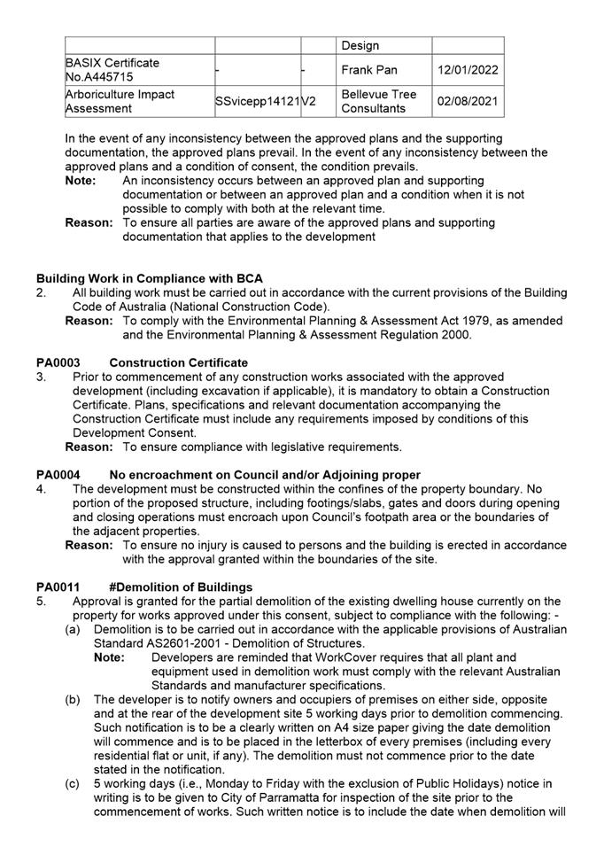
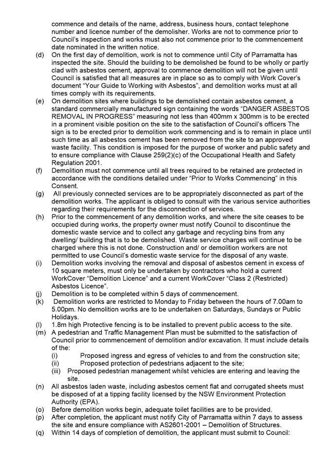
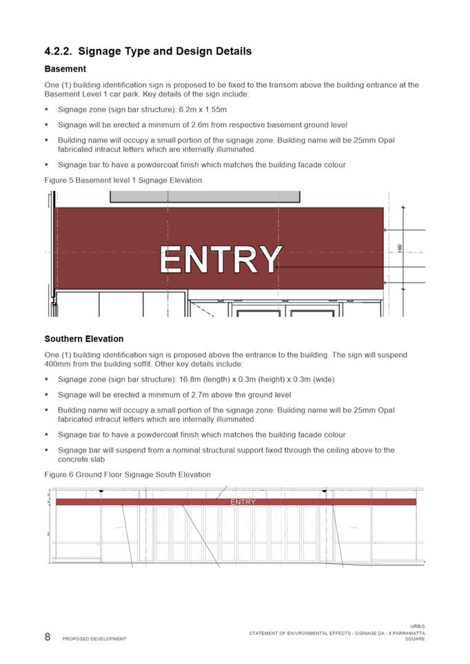
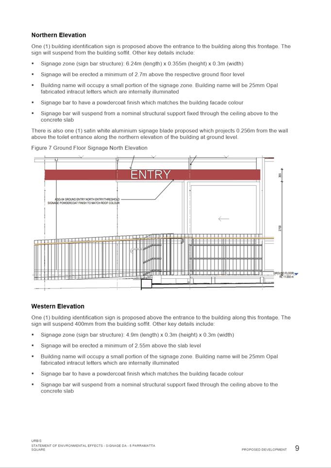
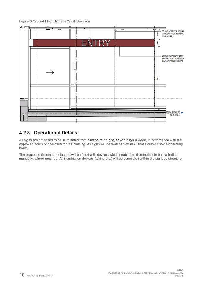
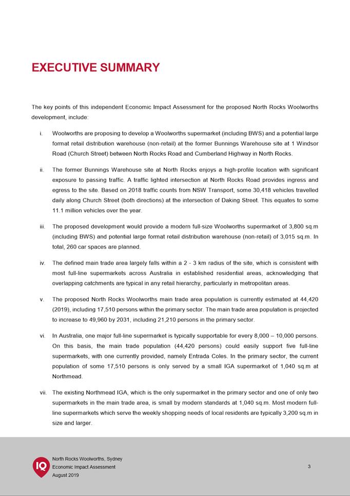
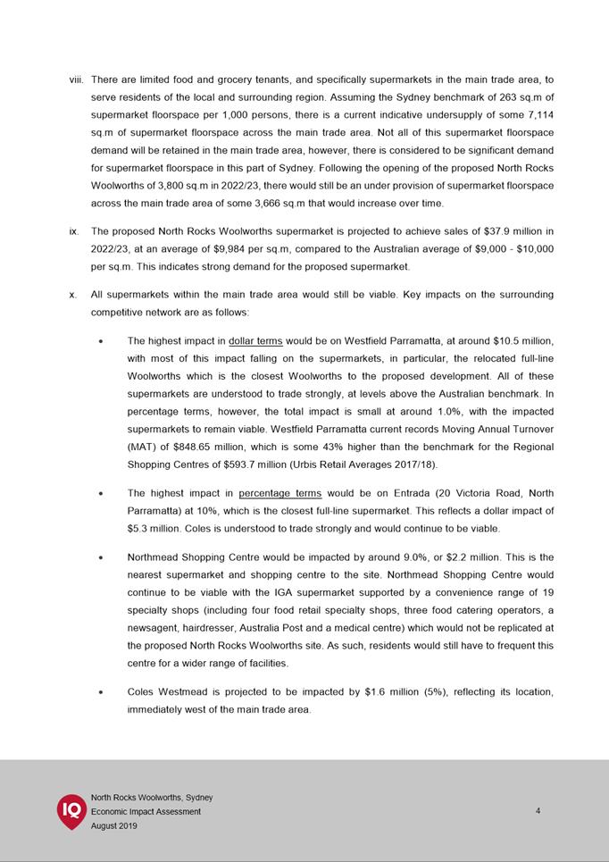
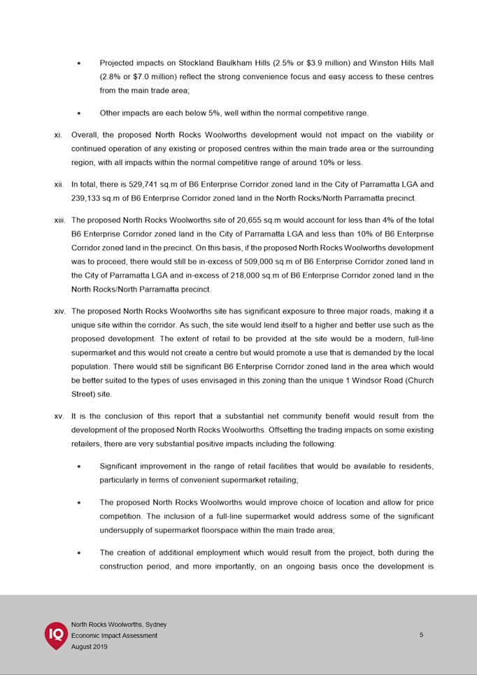
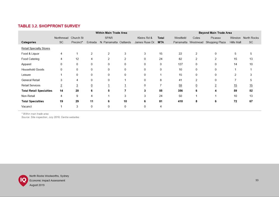
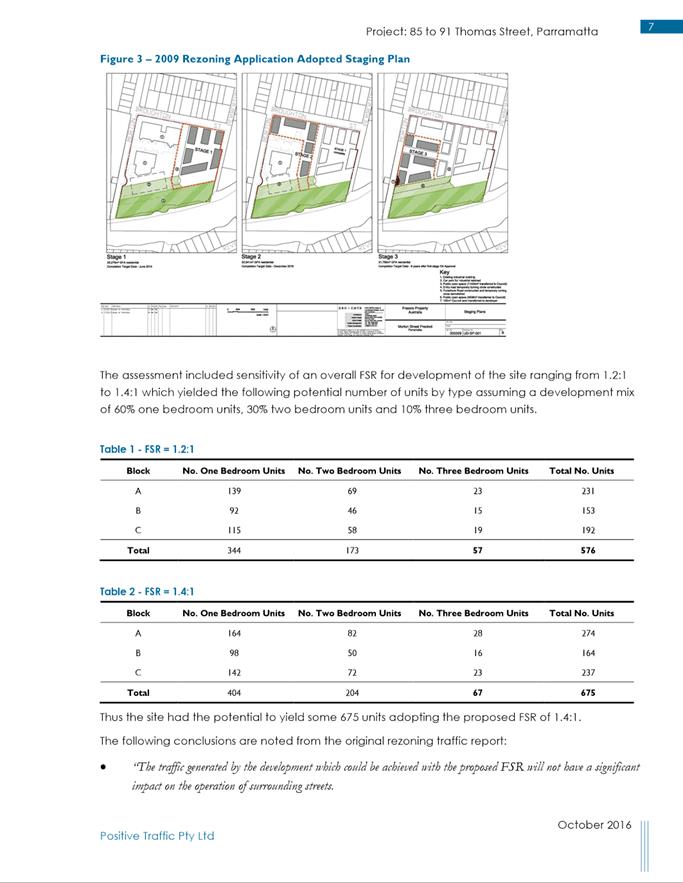
|
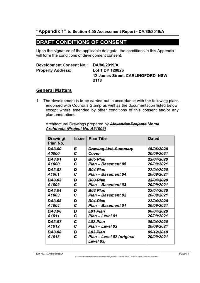
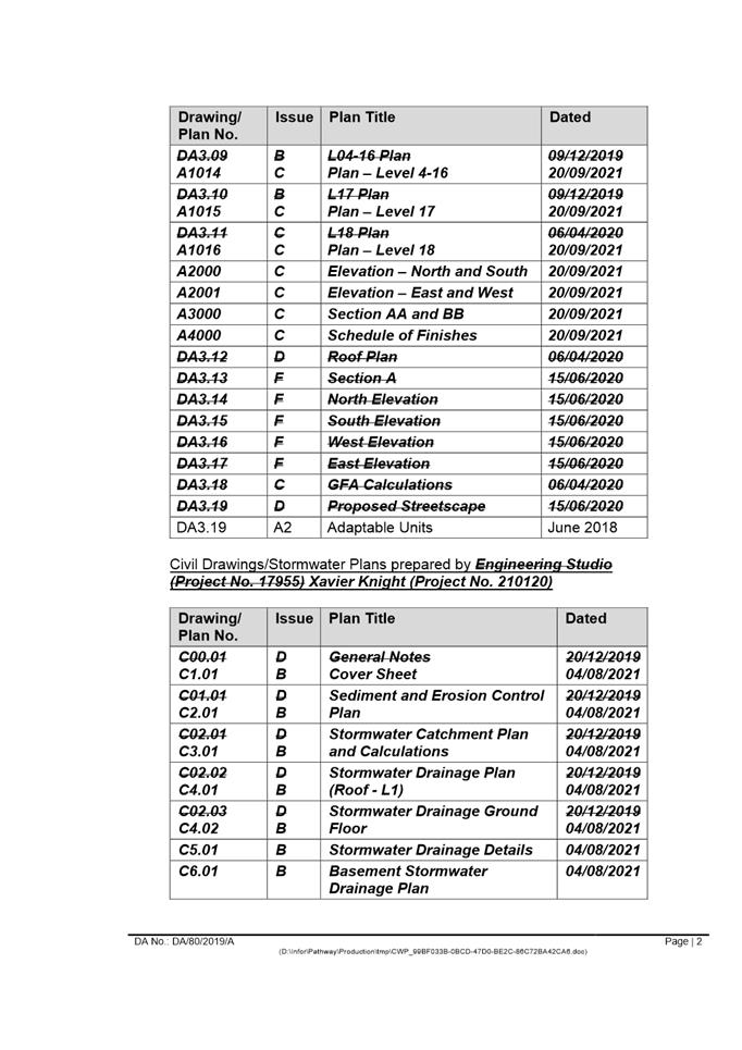
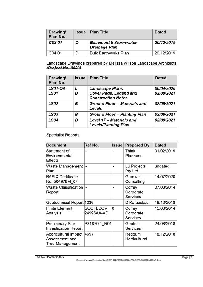
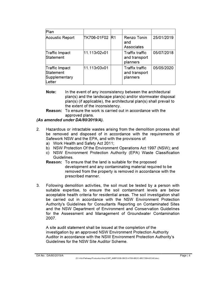
Item 5.1 - Attachment 1 |
Assessment Report |
NOTICE OF Local Planning Panel MEETING
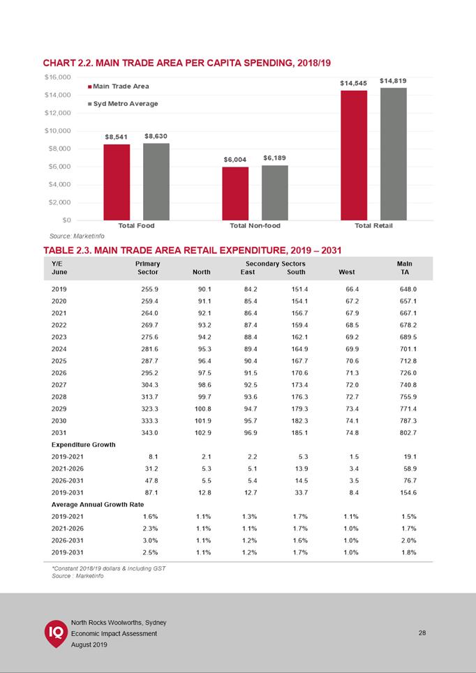
PUBLIC AGENDA
A Local Planning Panel Meeting will be held via audio-visual means on Tuesday, 15 February 2022 at 3:30pm.
Brett Newman
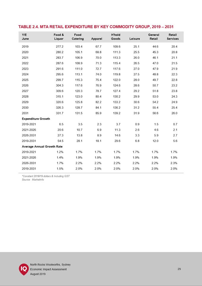
CHIEF EXECUTIVE OFFICER
THIS PAGE LEFT BLANK INTENTIONALLY
Local Planning Panel 15 February 2022
TABLE OF CONTENTS
ITEM SUBJECT PAGE NO
1 ACKNOWLEDGMENT OF THE TRADITIONAL LAND OWNERS
The City of Parramatta Council acknowledges the Burramattagal Clan of The Darug, the traditional land owners of Parramatta and pays its respects to the elders both past and present
2 WEBCASTING ANNOUNCEMENT
This public meeting will be recorded. The recording will be archived and available on Council’s website.
All care is taken to maintain your privacy; however if you are in attendance in the public gallery, you should be aware that your presence may be recorded.
3 APOLOGIES
4 DECLARATIONS OF INTEREST
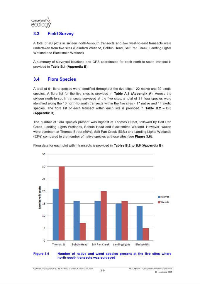
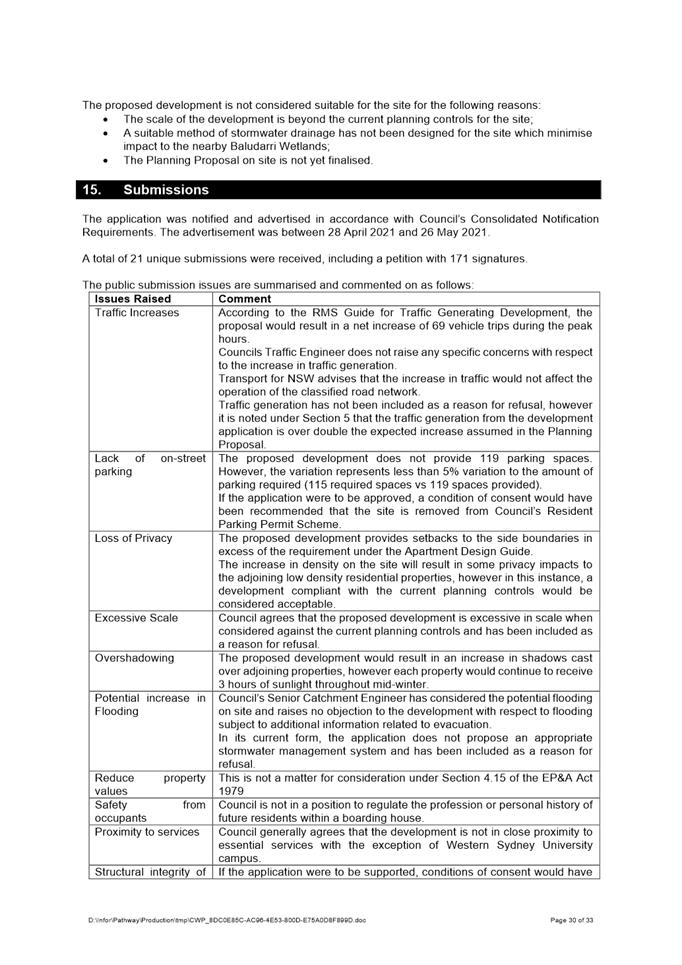
5 Reports - Development Applications
5.1 PUBLIC
MEETING:
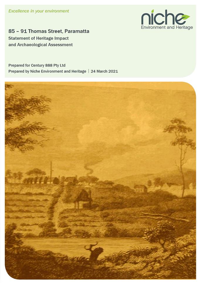
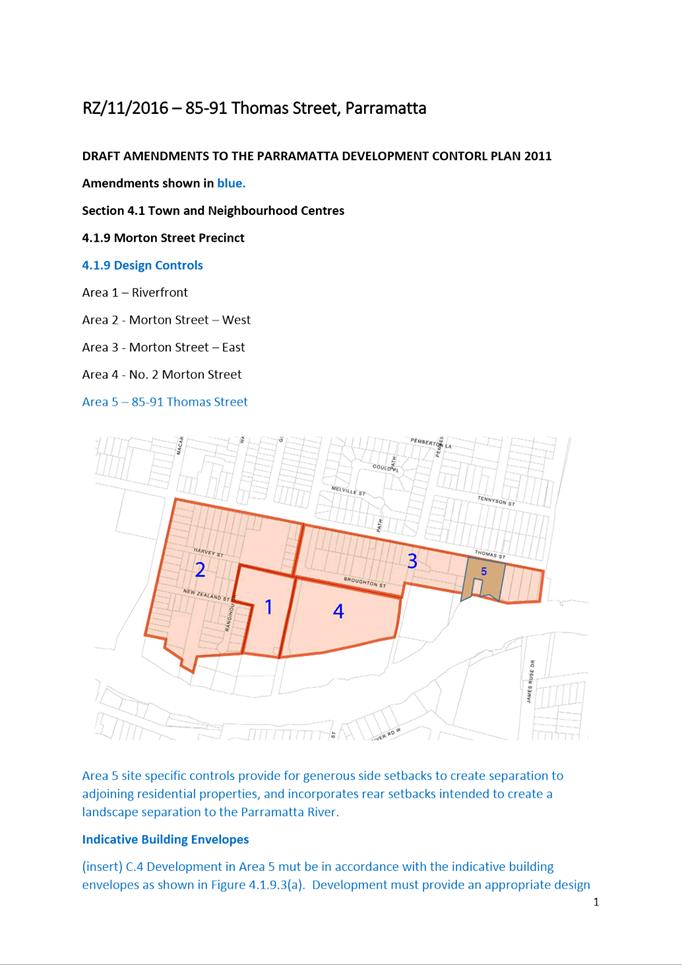
85-91 Thomas Street, PARRAMATTA
(Lot 12, 15, and Lot 16 in DP 1239 and Lot 142 DP 537053)........... 6
5.2 PUBLIC
MEETING:
16 Victoria Street, EPPING
(Lot 8 DP 6399)..................................................................................... 245
5.3 PUBLIC
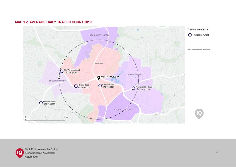
MEETING:
18-19 Ulandi Place, WINSTON HILLS
(Lot 18 and Lot 19 DP 241037).......................................................... 299
5.4 OUTSIDE
PUBLIC MEETING:
12 James Street, CARLINGFORD
(Lot 1 DP 120826)................................................................................ 427
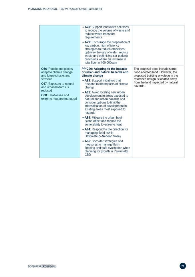
5.5 OUTSIDE
PUBLIC MEETING:
Civic Place PARRAMATTA (known as 5 Parramatta Square)
(Lot 14 DP 1255419)............................................................................ 564
5.6 OUTSIDE
PUBLIC MEETING:
334 Pennant Hills Road, CARLINGFORD
(Lot 10 DP 1216207)............................................................................ 633
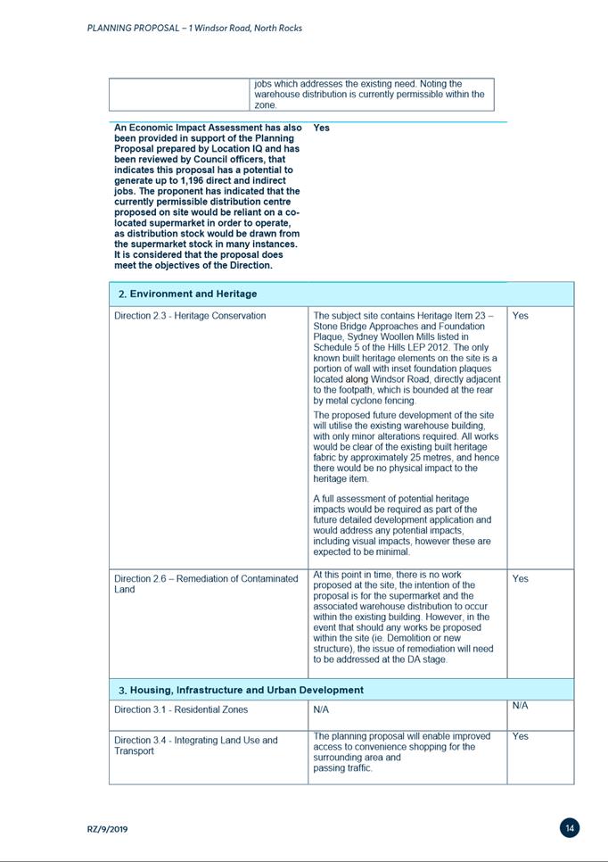
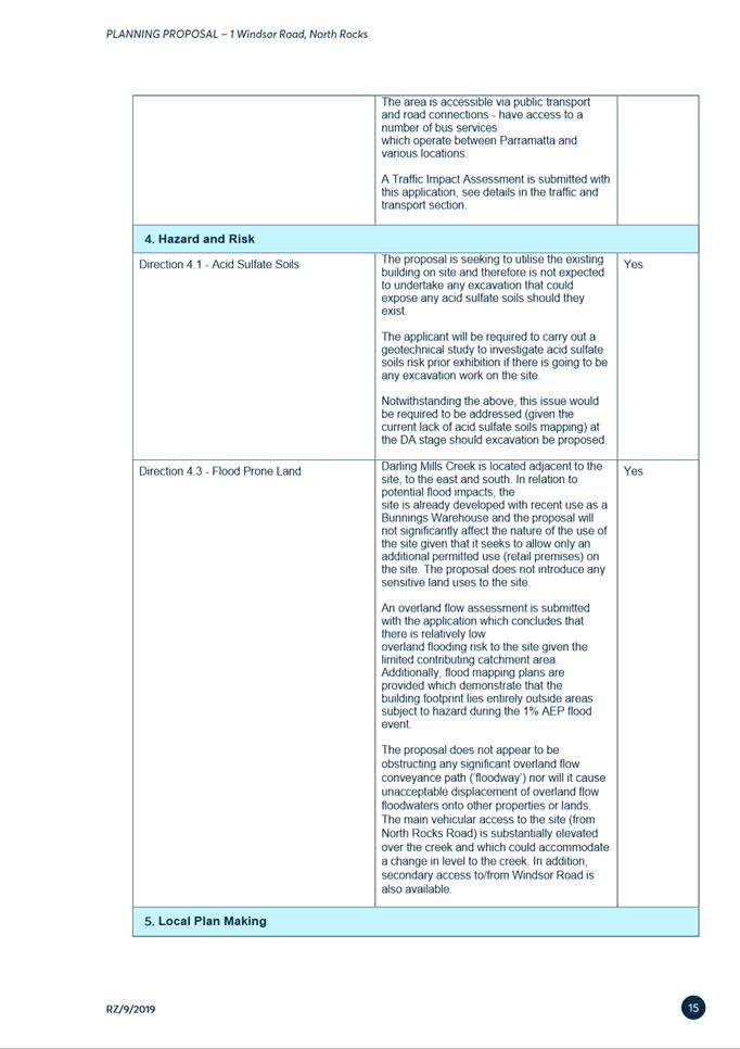
6.1 Post Exhibition: 1 Windsor Road, North Rocks - Planning Proposal and draft Planning Agreement................................................................... 666
6.2 Post-Exhibition:
85-91 Thomas Street,
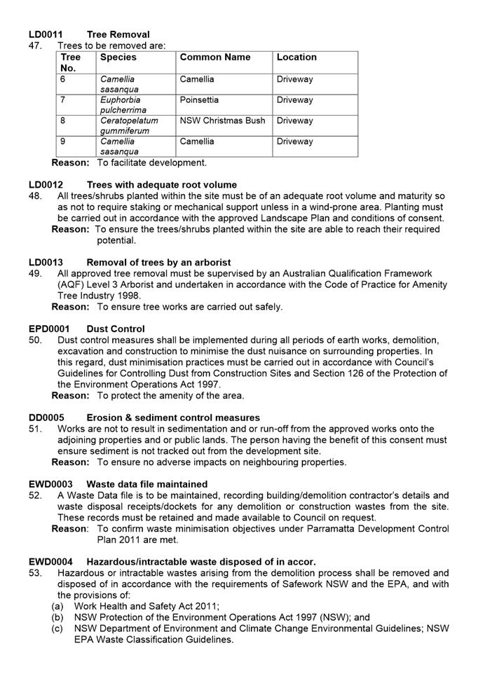
Parramatta - Planning Proposal, Draft Site-Specific
Development Control Plan and Draft Planning Agreement........... 817
Development Applications
15 February 2022
5.1 PUBLIC
MEETING:
85-91 Thomas Street, PARRAMATTA
(Lot 12, 15, and Lot 16 in DP 1239 and Lot 142 DP 537053).................... 6
5.2 PUBLIC
MEETING:
16 Victoria Street, EPPING
(Lot 8 DP 6399).............................................................................................. 245
5.3 PUBLIC
MEETING:
18-19 Ulandi Place, WINSTON HILLS
(Lot 18 and Lot 19 DP 241037)................................................................... 299
5.4 OUTSIDE
PUBLIC MEETING:
12 James Street, CARLINGFORD
(Lot 1 DP 120826)......................................................................................... 427
5.5 OUTSIDE
PUBLIC MEETING:
Civic Place PARRAMATTA (known as 5 Parramatta Square)
(Lot 14 DP 1255419)..................................................................................... 564
5.6 OUTSIDE
PUBLIC MEETING:
334 Pennant Hills Road, CARLINGFORD
(Lot 10 DP 1216207)..................................................................................... 633
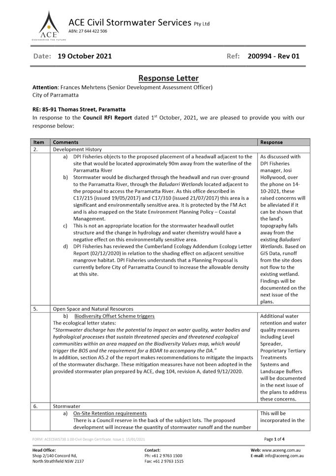
Local Planning Panel 15 February 2022 Item 5.1
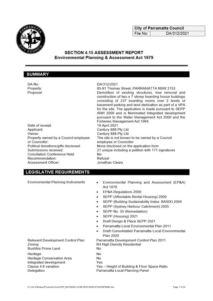
ITEM NUMBER 5.1
SUBJECT PUBLIC MEETING:
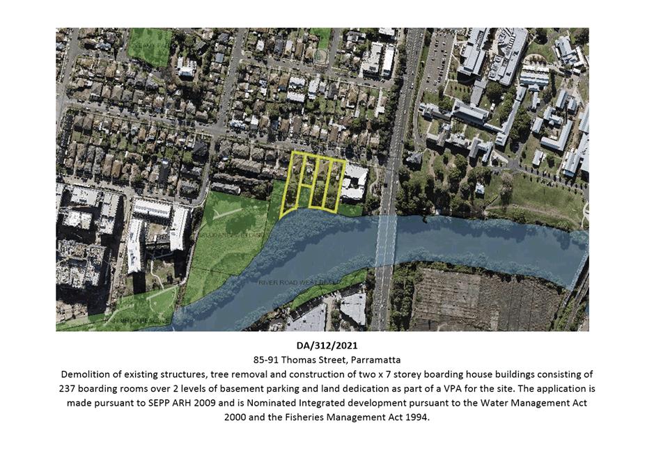
85-91 Thomas Street, PARRAMATTA
(Lot 12, 15, and Lot 16 in DP 1239 and Lot 142 DP 537053)
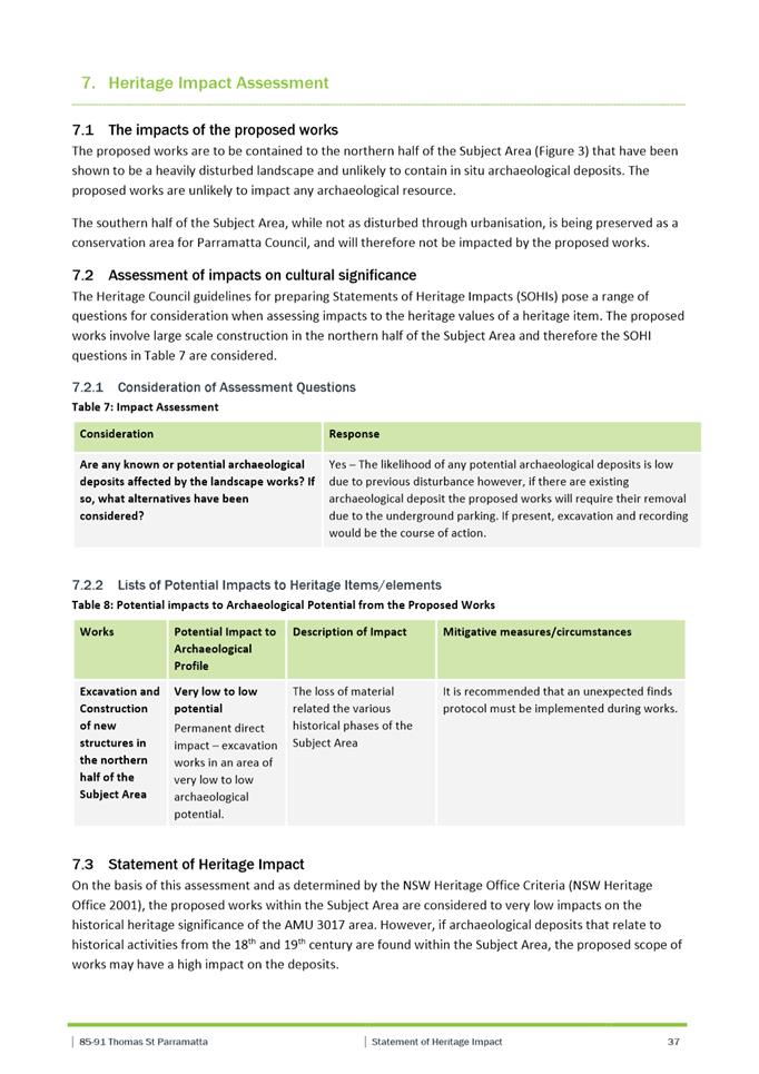
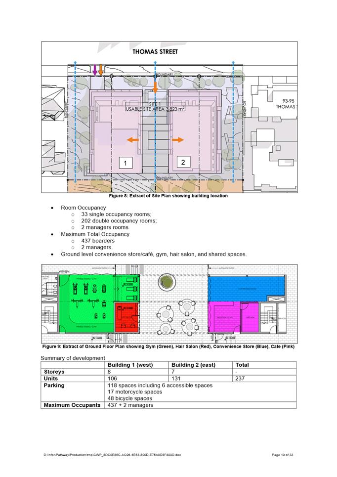
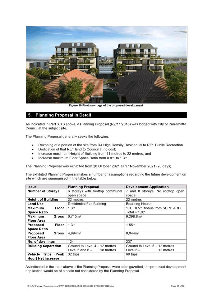
DESCRIPTION Demolition of existing structures, tree removal and construction of two x 7 storey boarding house buildings consisting of 237 boarding rooms over 2 levels of basement parking and land dedication as part of a VPA for the site. The application is made pursuant to SEPP ARH 2009 and is Nominated Integrated development pursuant to the Water Management Act 2000 and the Fisheries Management Act 1994.
REFERENCE DA/312/2021 - D08388300
APPLICANT/S Century 888 Pty Ltd
OWNERS Century 888 Pty Ltd
REPORT OF Group Manager Development and Traffic Services
RECOMMENDED REFUSAL
DATE OF REPORT
15 February 2021
REASON FOR REFERRAL TO LPP
The application must be determined by the Parramatta Local Planning Panel due to:
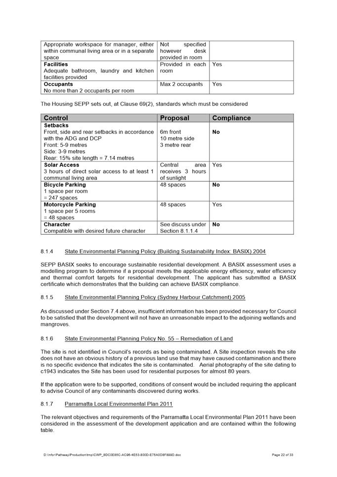
a) More than 10% breach in Clause 4.3 Height of Building development standard;
b) More than 10% breach in Clause 4.4 Floor Space Ratio development standard; and
c) More than 10 unique submissions by way of objection.
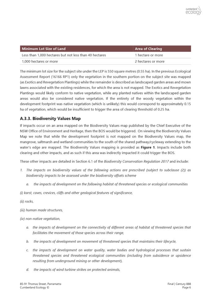
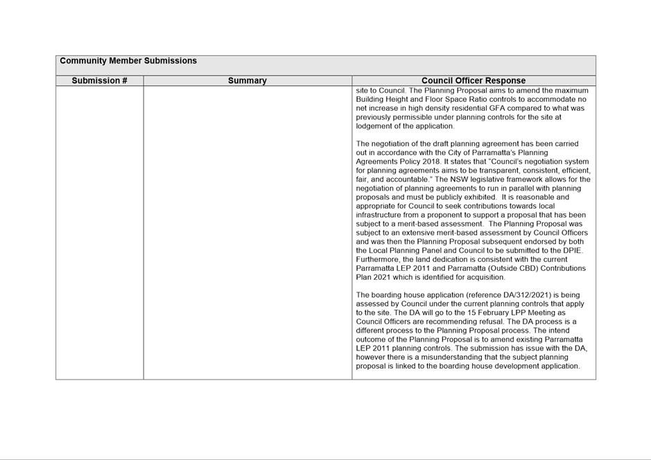
Despite the application being made under State Environmental Planning Policy (Affordable Rental Housing) 2009, the development is not for affordable housing and therefore does not trigger the delegation to the Regional Panel under Schedule 7 of SEPP (State and Regional Development) 2011.
EXECUTIVE SUMMARY
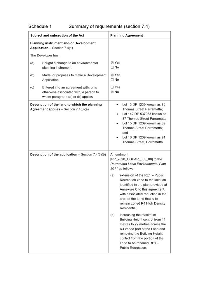
This is a summary of the full assessment of the application as outlined in Attachment 1, the Section 4.15 Assessment Report.
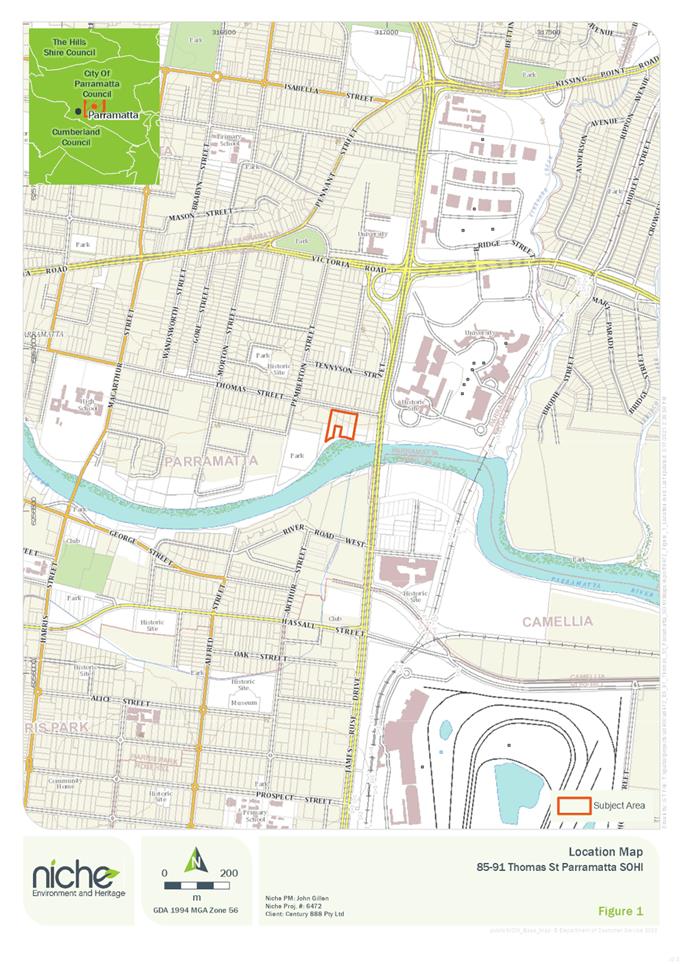
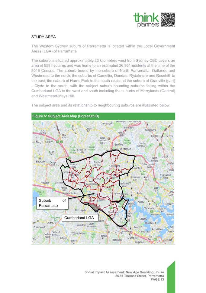
Site
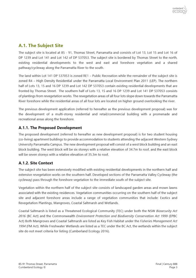
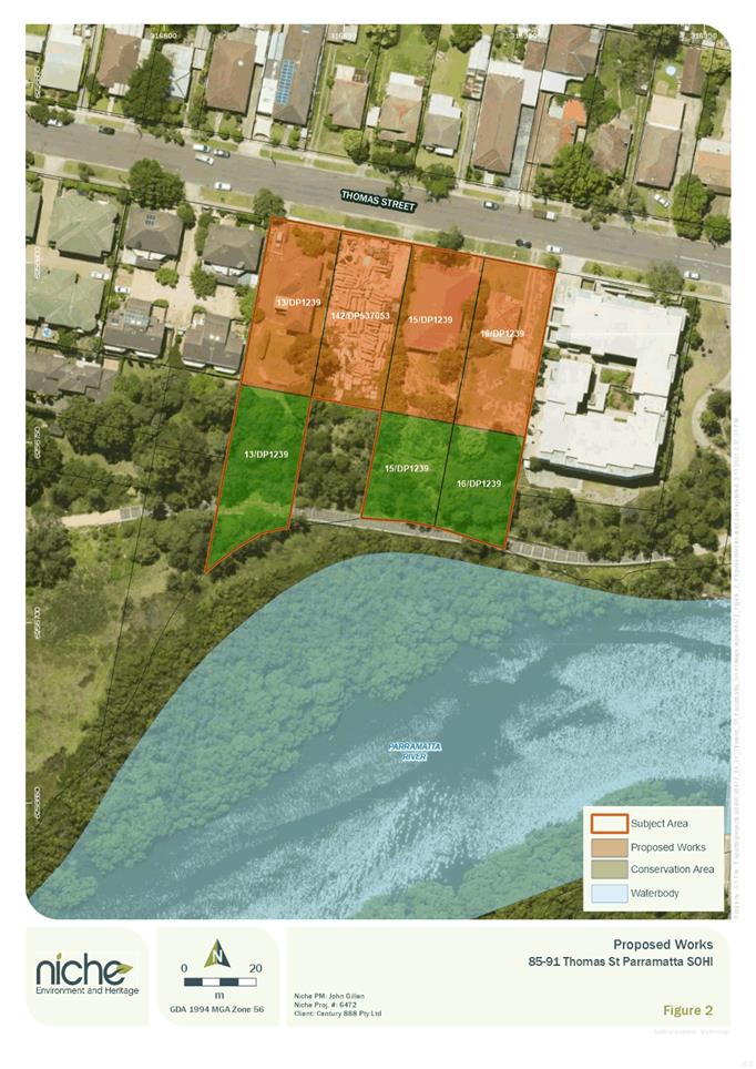
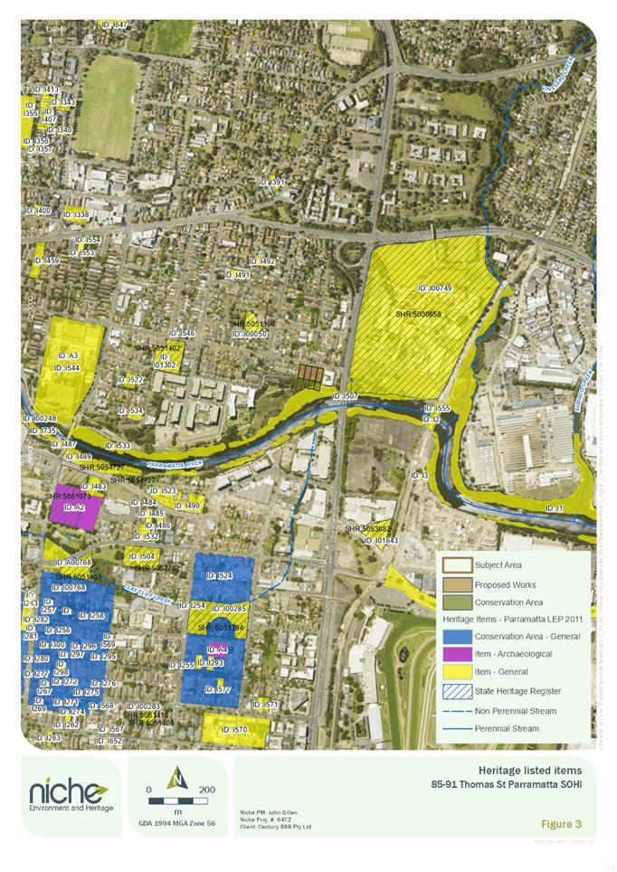
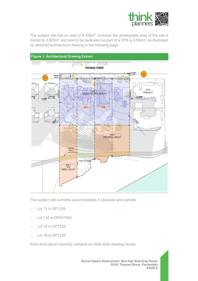
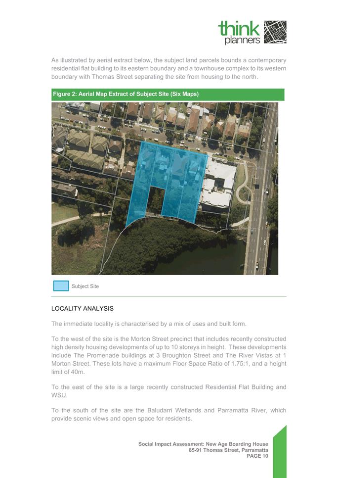
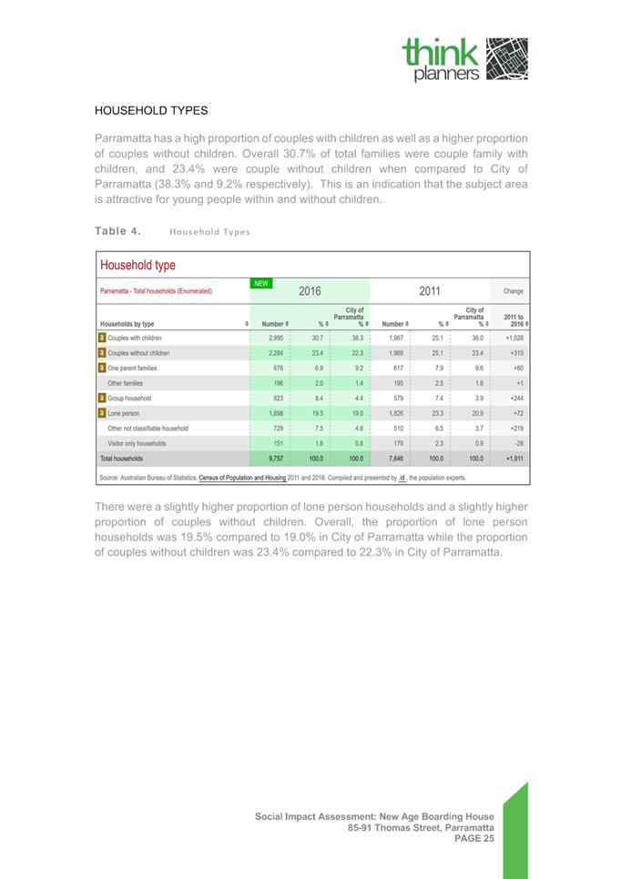
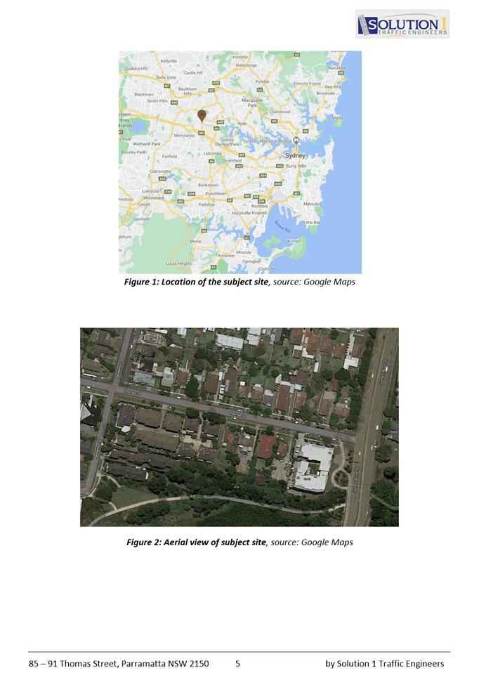
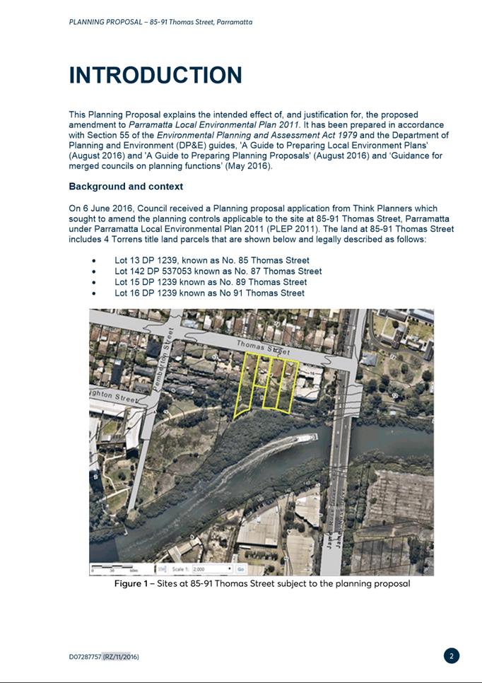
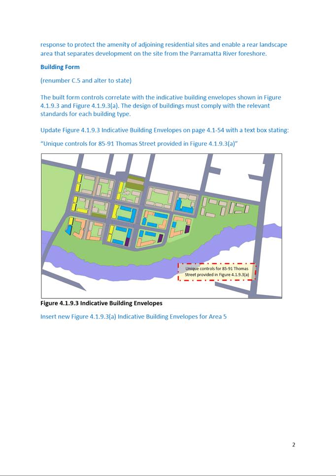
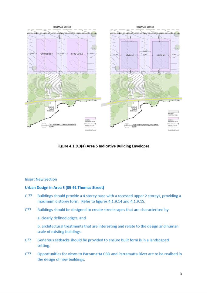
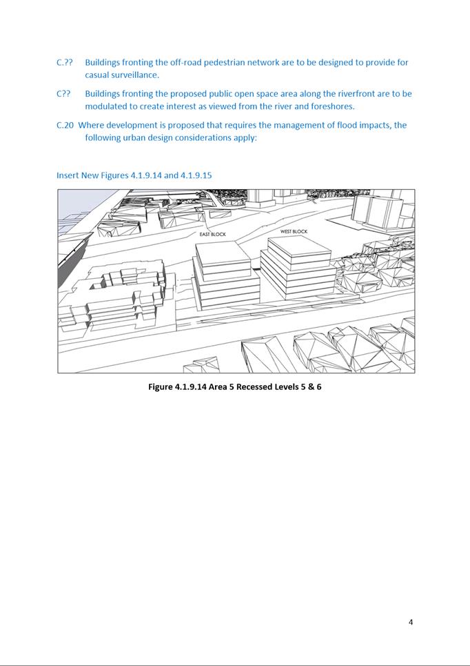
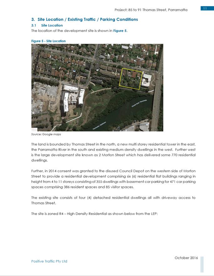
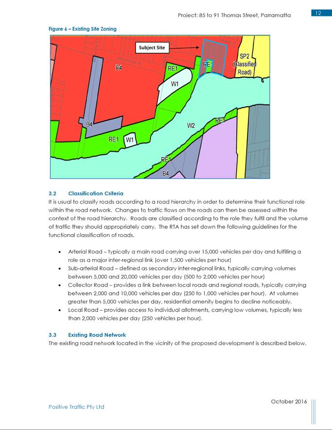
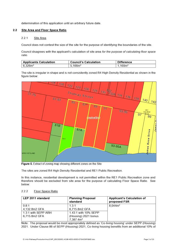
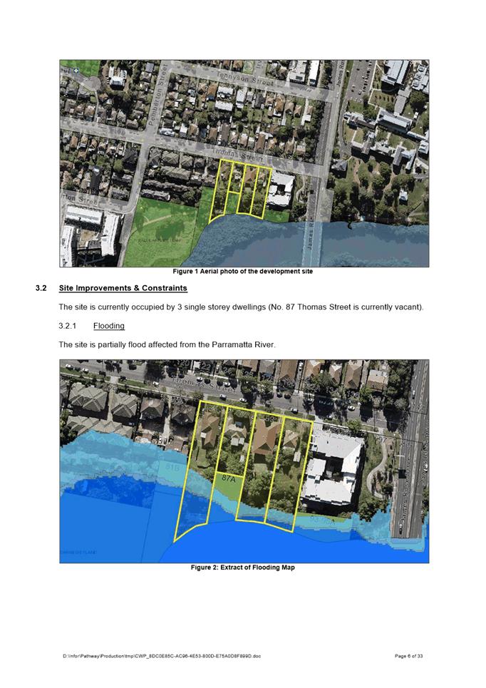
The Site is comprised of the 4 allotments, known as 85-91 Thomas Street, Parramatta NSW 2150.
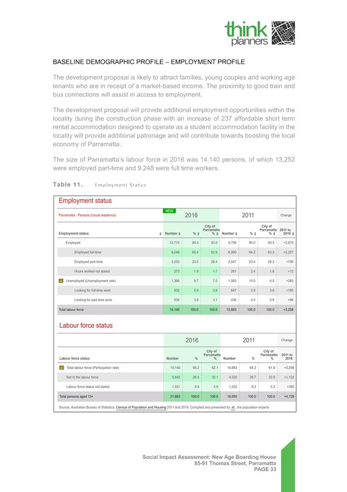
It as a total site area of 6,326m2 and a frontage of 60.46 metres to Thomas Street. The portion of the site being developed falls 7 metres from north-east to south-west towards Parramatta River.
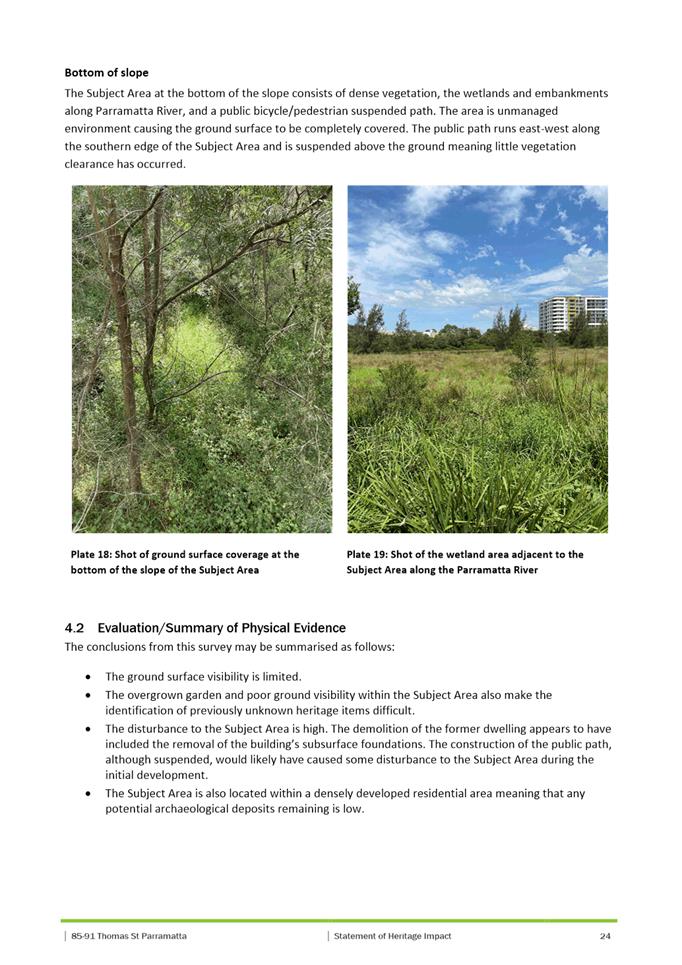
The site is currently occupied by three, single storey dwellings.
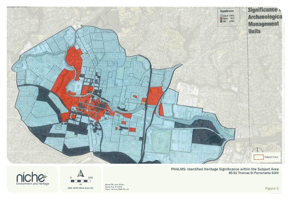
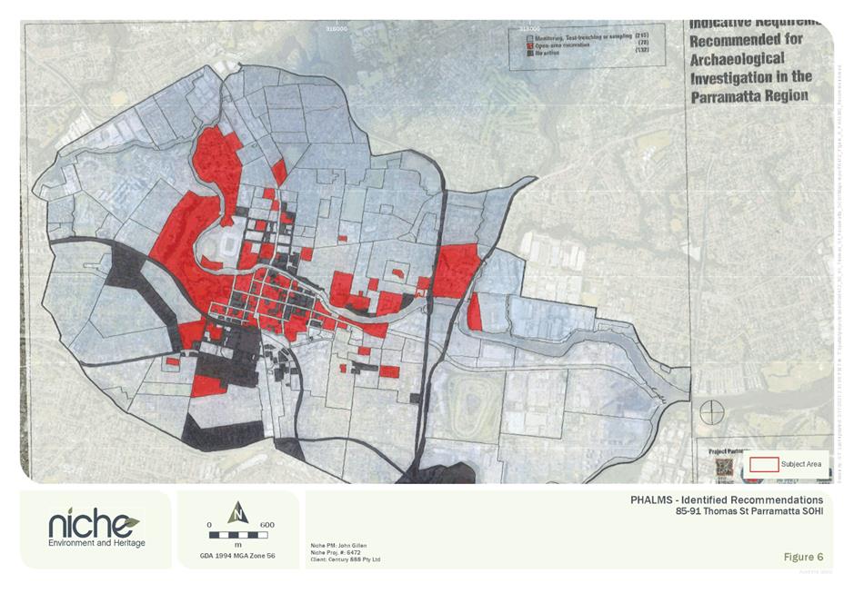
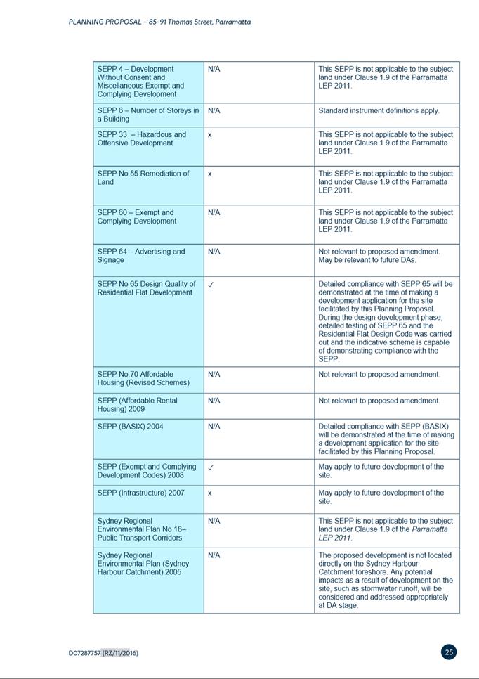
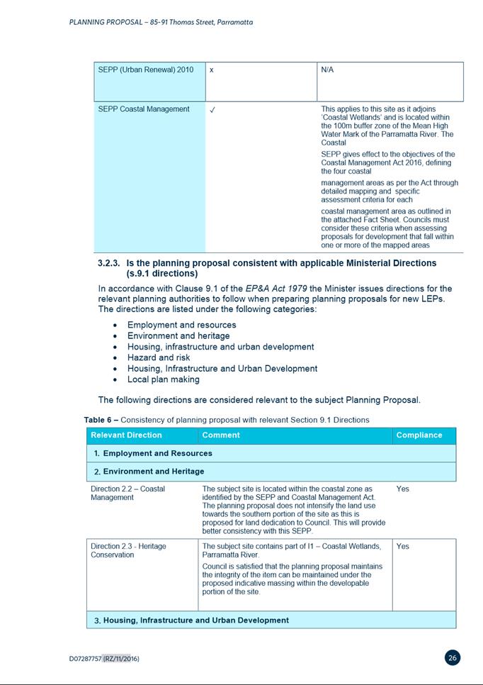
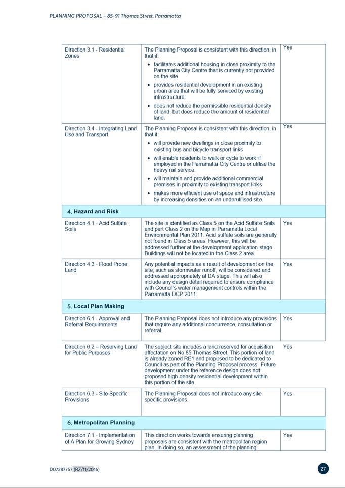
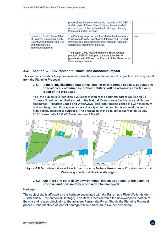
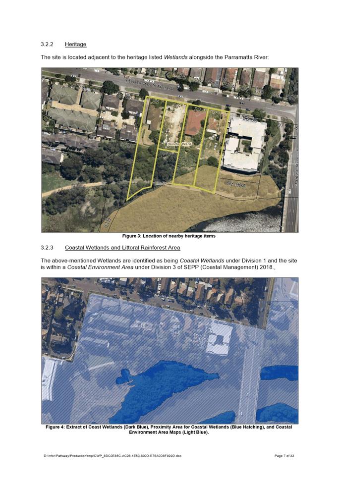
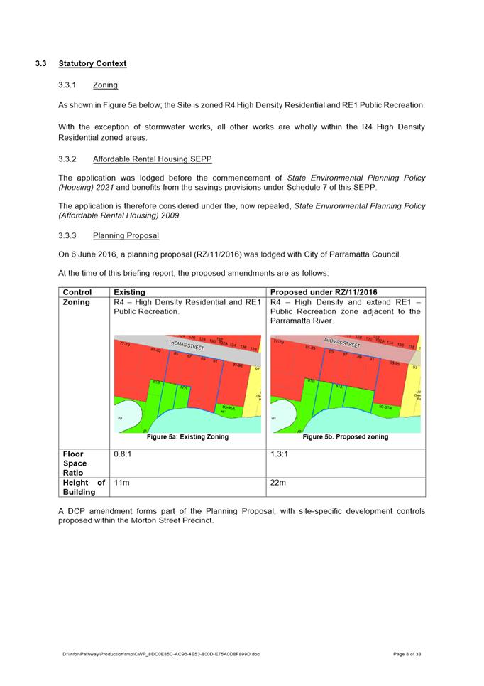
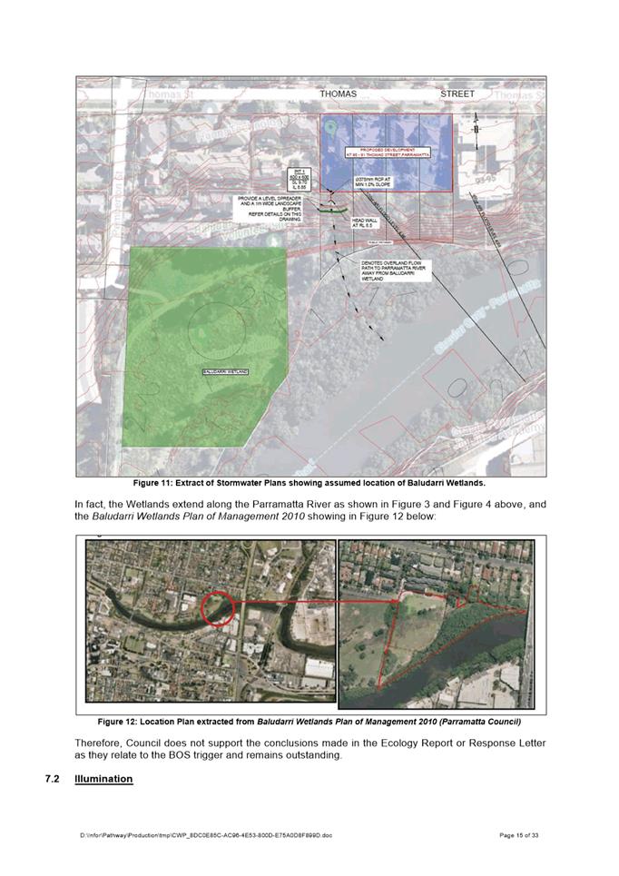
The site is identified as flood prone, adjacent to heritage listed Wetlands and within a Coastal Environment Area under Division 3 of SEPP (Coastal Management) 2008.
Proposal
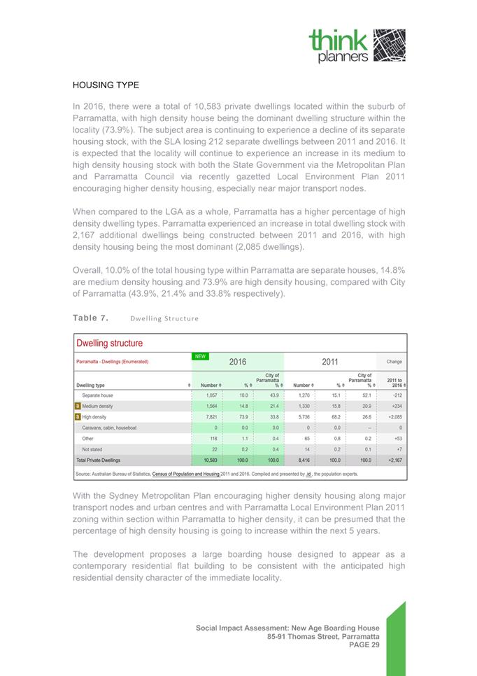
· The demolition of all existing structures and improvements within the northern portion of the site.
· Construction of a 7-storey and an 8-storey boarding house comprising 235 units + 2 managers rooms;
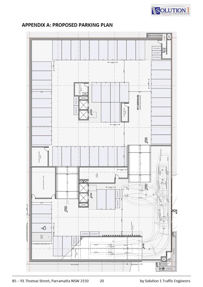
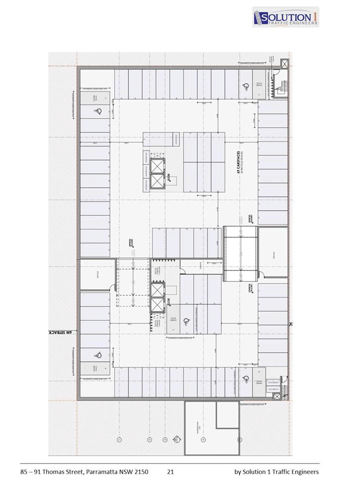
· Excavation for 2 levels of basement parking comprising 115 spaces, including 6 accessible spaces, 48 motorcycle spaces, and 48 bicycle spaces.
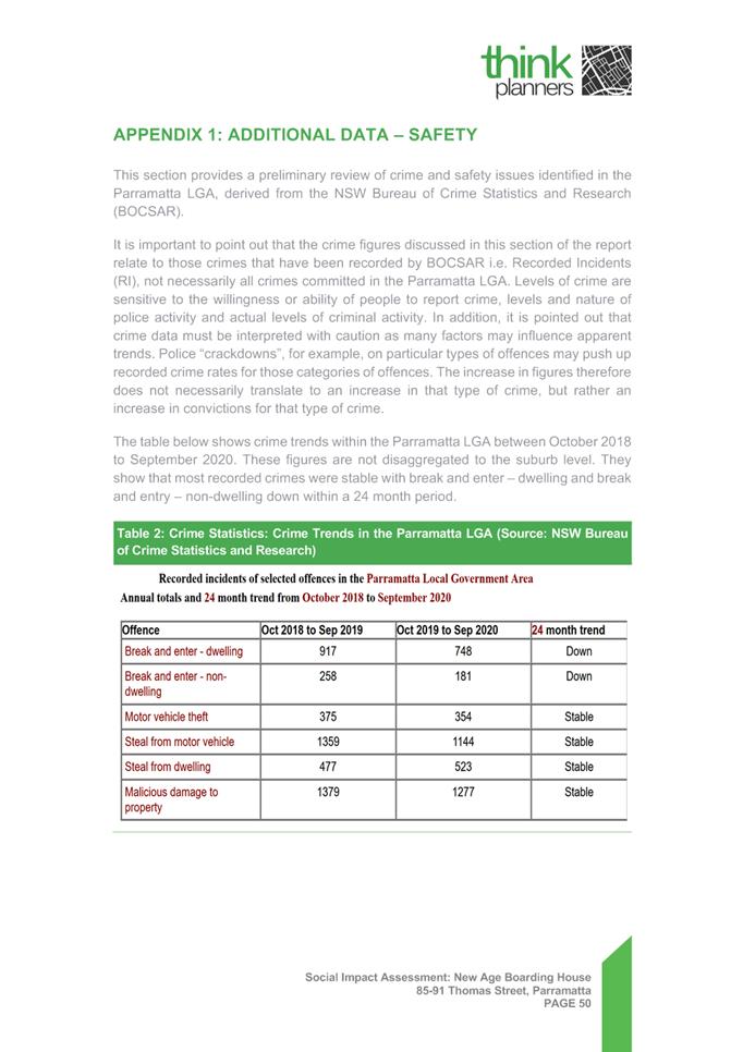
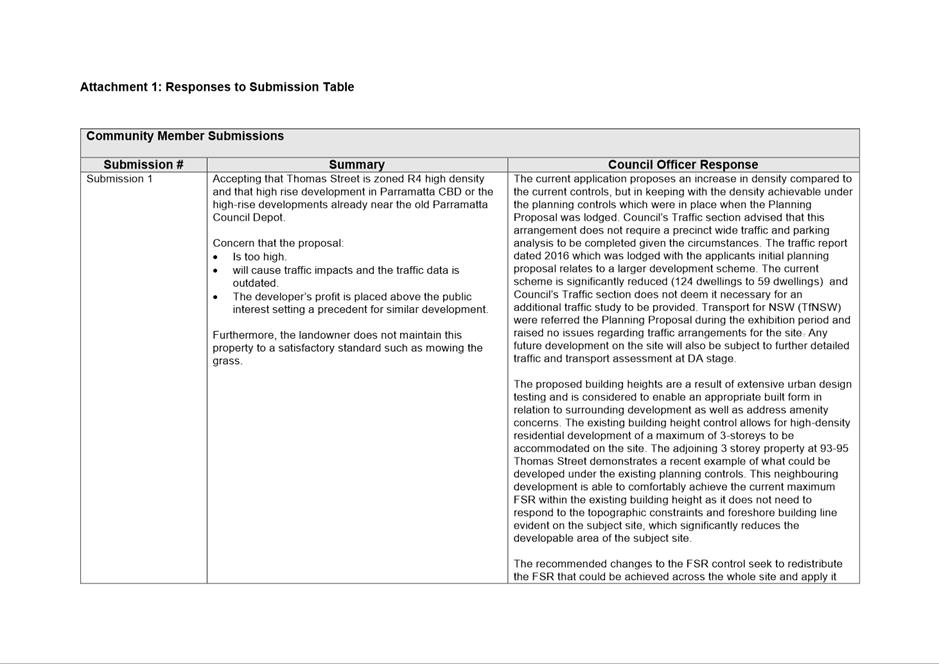
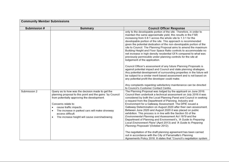
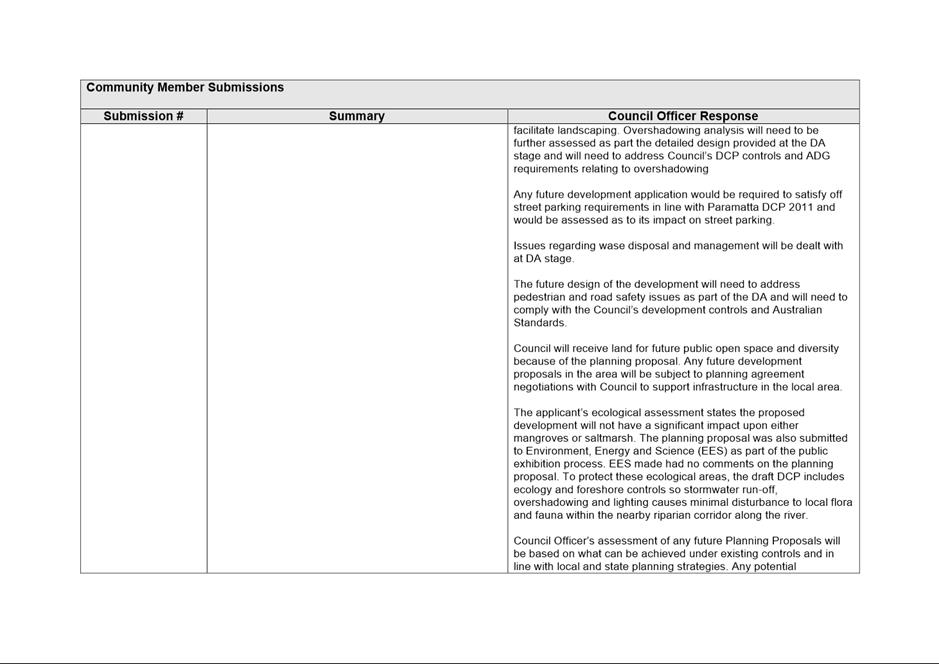
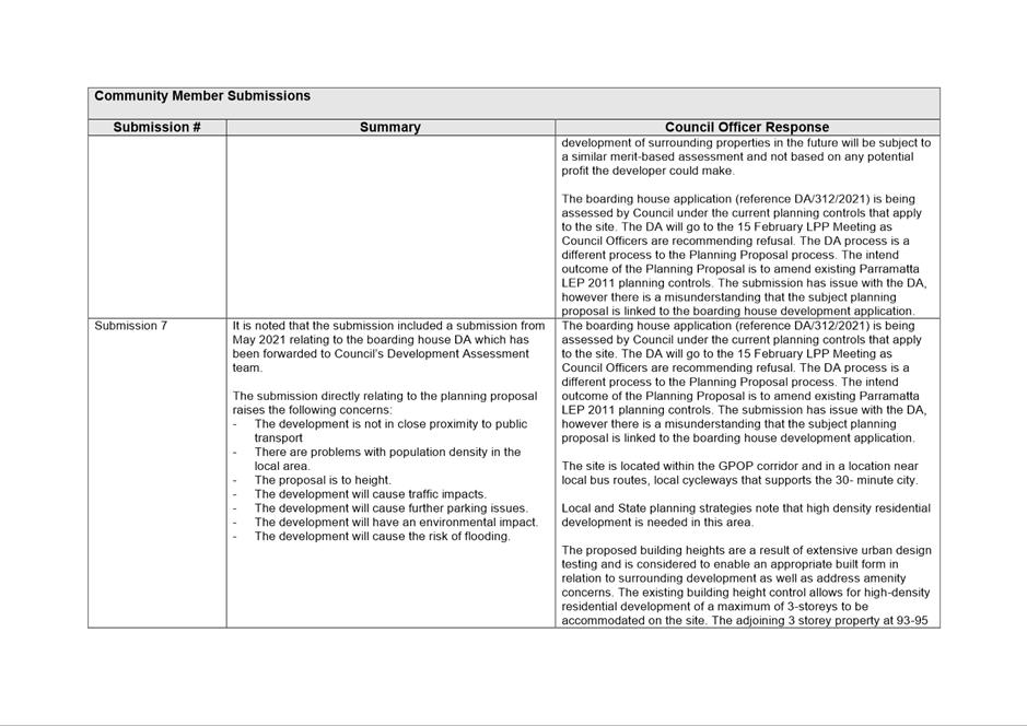
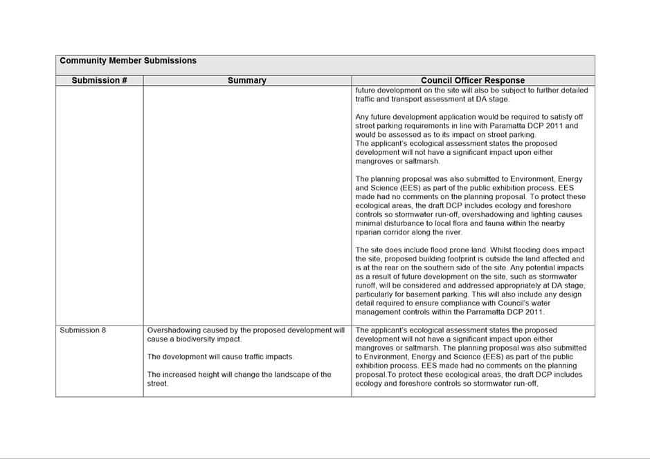
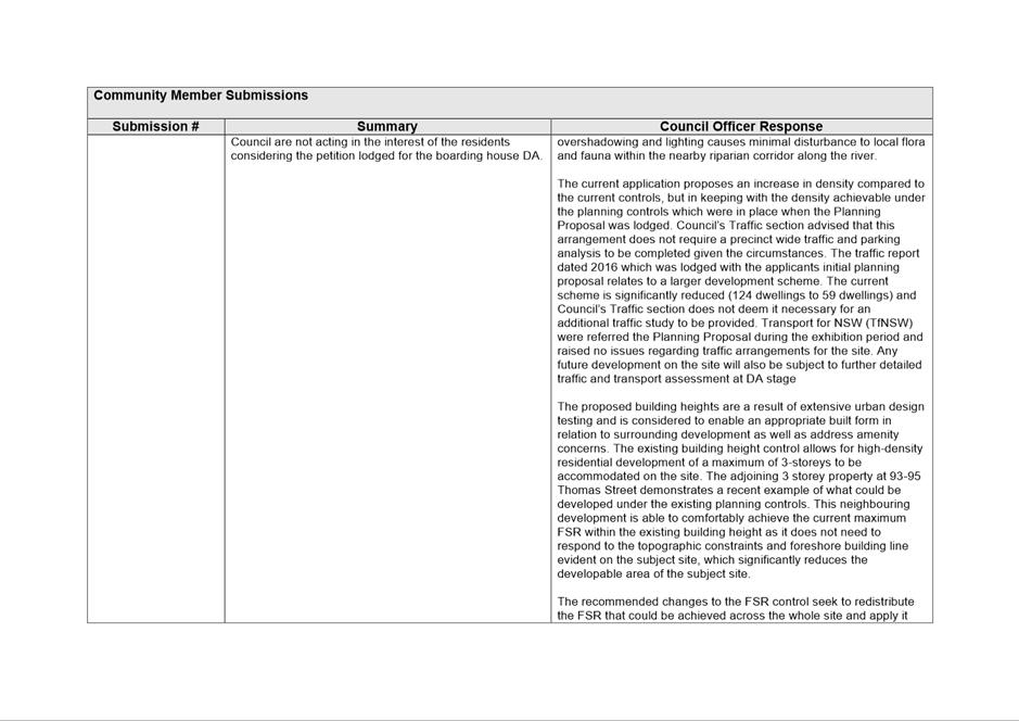
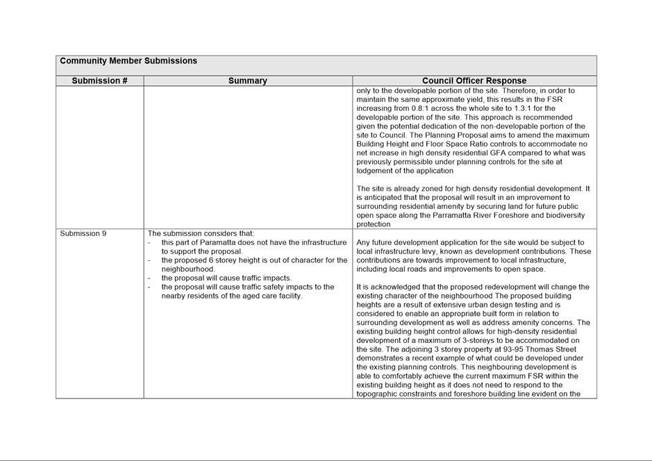
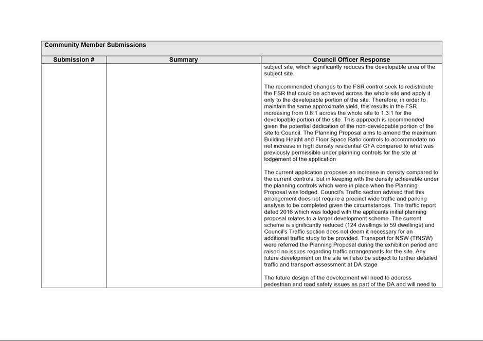
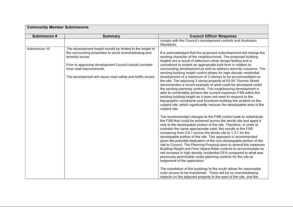
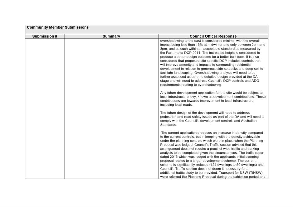
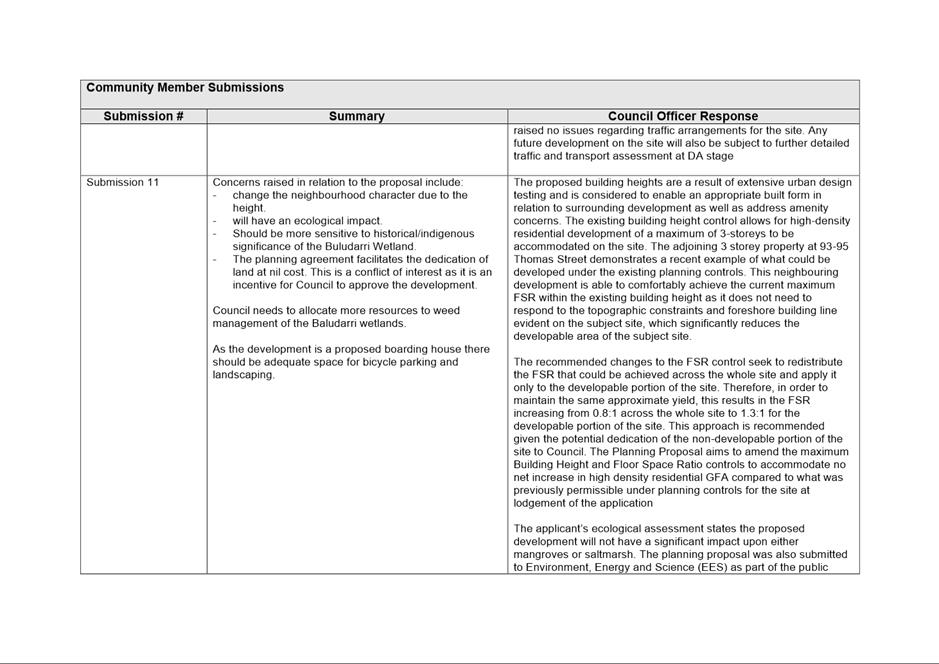
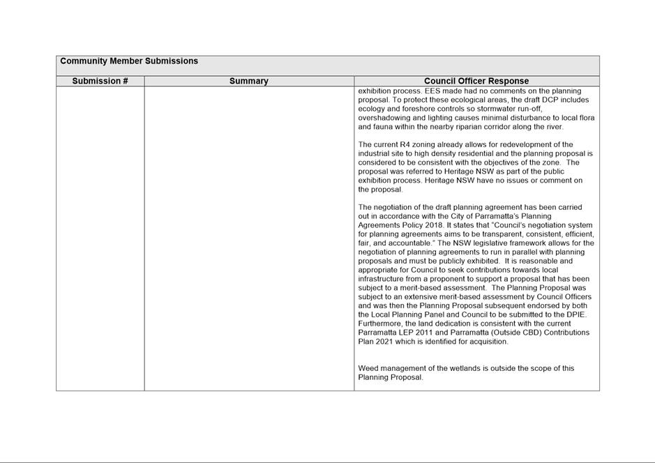
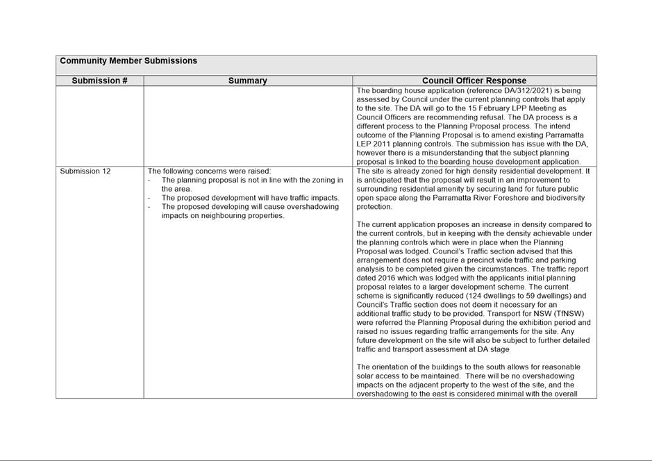
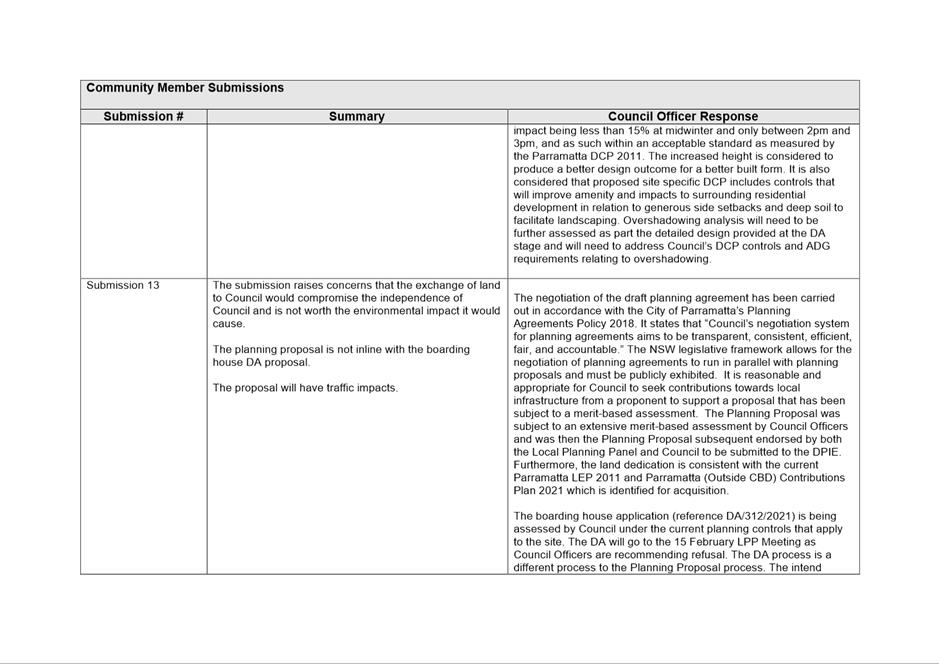
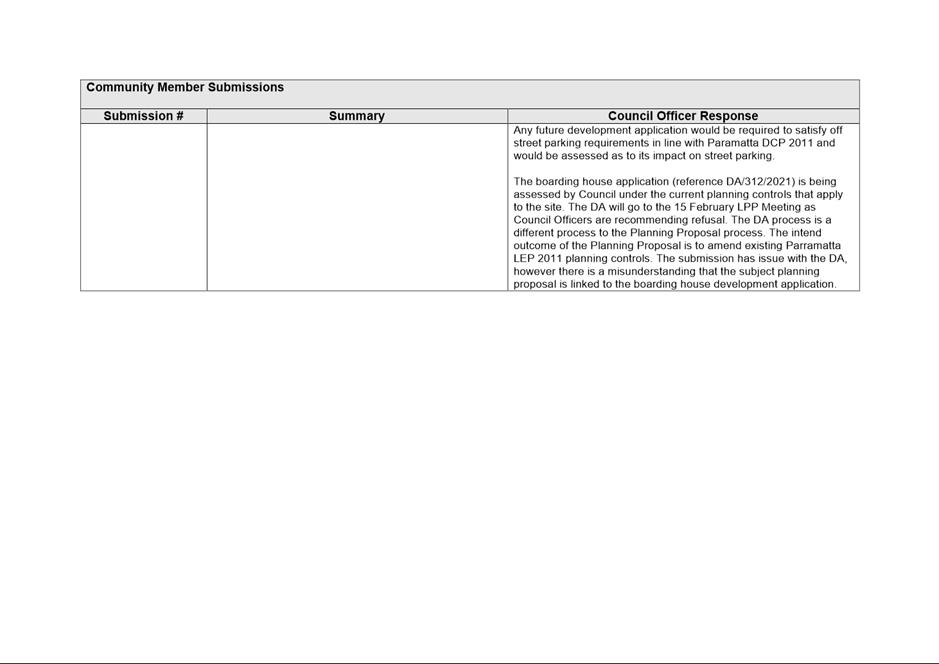
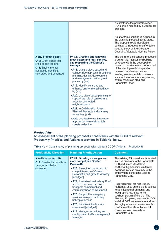
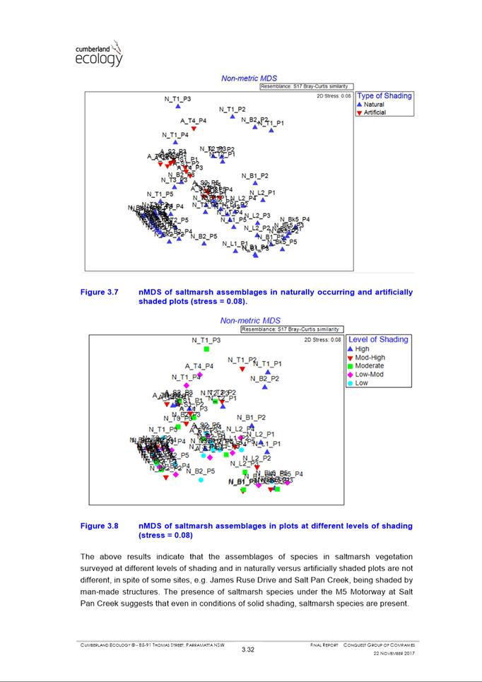
Following assessment of the application against the relevant statutory planning framework, and consideration of matters raised in referrals, it is deemed that the proposal is not satisfactory. Key reasons for refusal are:
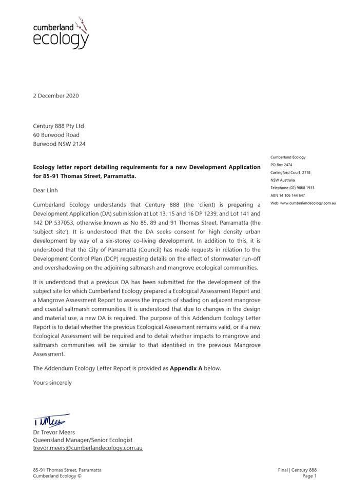
a) Insufficient information provided whether the Biodiversity Offset Scheme is triggered under the Biodiversity Conservation Act 2016 and potential impacts to nearby fauna as a result of the proposal;
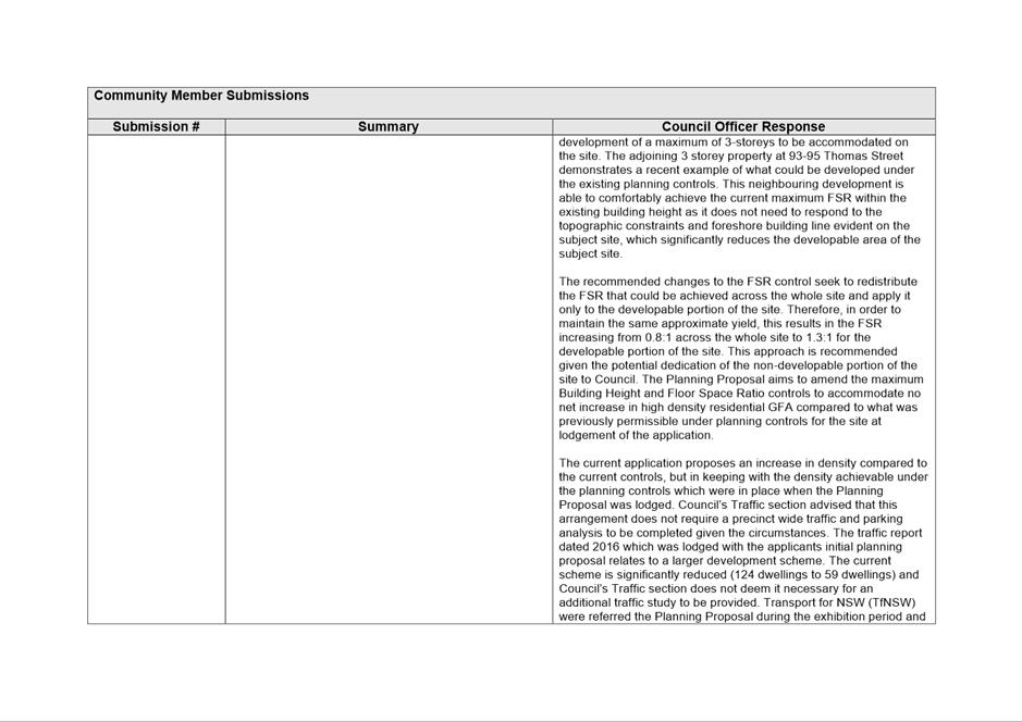
b) The proposal exceeds the expected scale of development on the site under current planning controls under State Environmental Planning Policy (Affordable Rental Housing) 2009, the Parramatta Local Environmental Plan 2011, and Parramatta Development Control Plan 2011;
c) The development fails to comply with the development standards under State Environmental Planning Policy (Affordable Rental Housing) 2009;
d) The proposed development is not in keeping with the desired future character of the area.
e) The development is not in the public interest.
The report recommends that the Panel refuse the application.
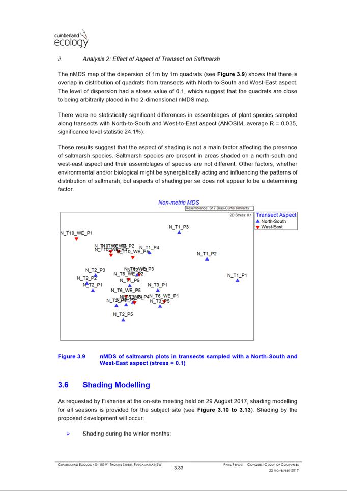
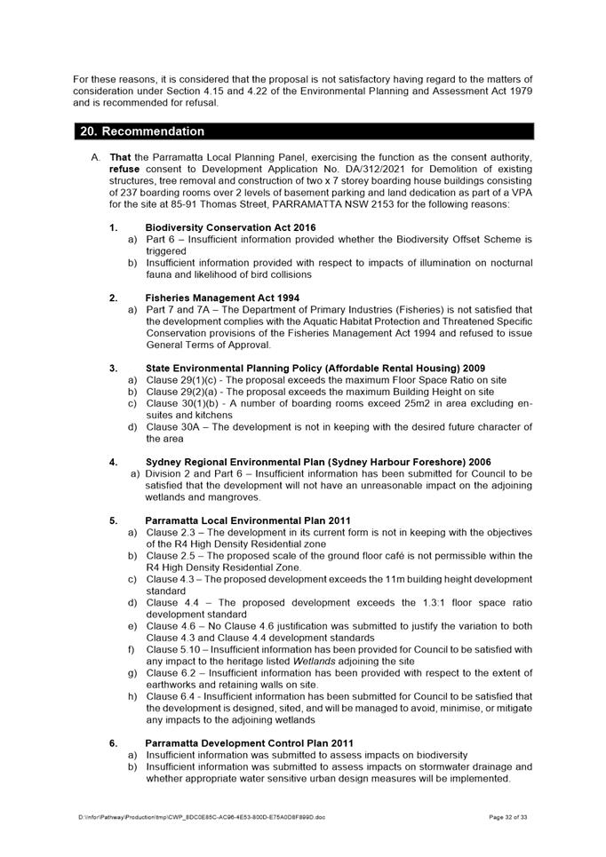
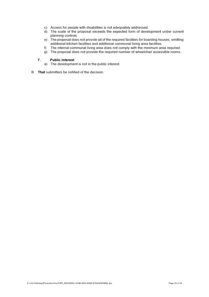
(a) That the Parramatta Local Planning Panel, exercising the function as the consent authority, refuse consent to Development Application No. DA/312/2021 for Demolition of existing structures, tree removal and construction of two x 7 storey boarding house buildings consisting of 237 boarding rooms over 2 levels of basement parking and land dedication as part of a VPA for the site at 85-91 Thomas Street, PARRAMATTA NSW 2153.
(b) Further, that submitters be notified of the decision.
REASONS FOR REFUSAL:
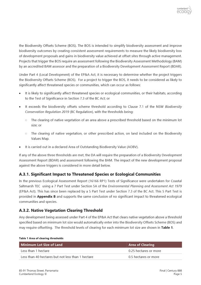
1. Biodiversity Conservation Act 2016
a) Part 6 – Insufficient information provided whether the Biodiversity Offset Scheme is triggered
b) Insufficient information provided with respect to impacts of illumination on nocturnal fauna and likelihood of bird collisions
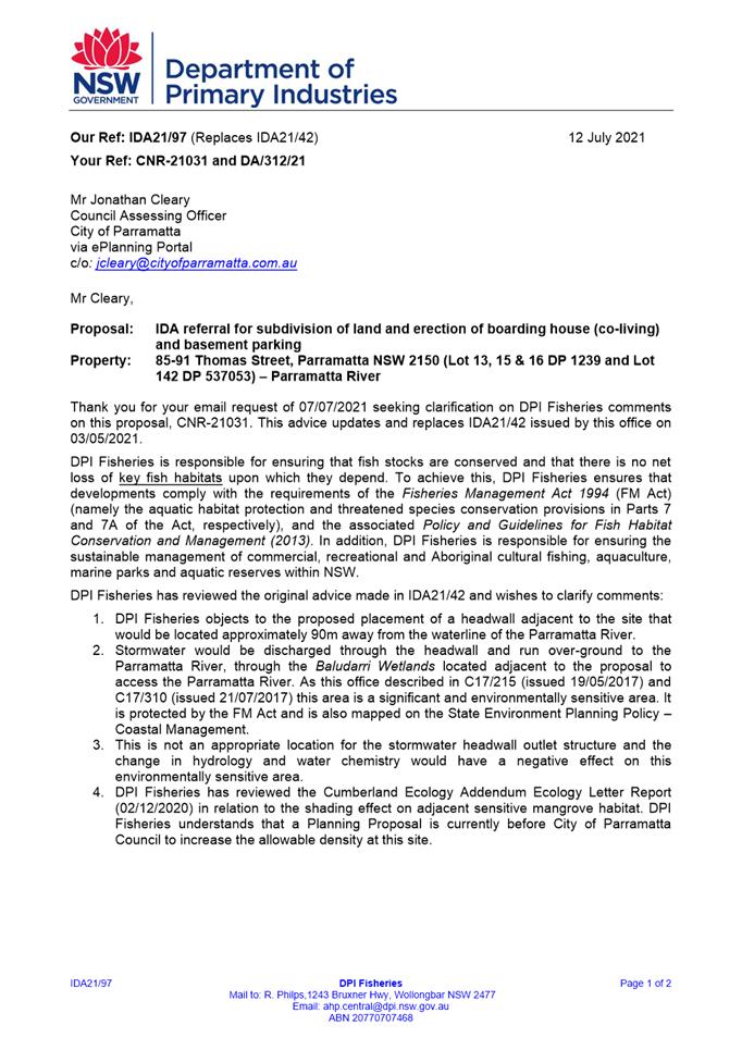
2. Fisheries Management Act 1994
a) Part 7 and 7A – The Department of Primary Industries (Fisheries) is not satisfied that the development complies with the Aquatic Habitat Protection and Threatened Specific Conservation provisions of the Fisheries Management Act 1994 and refused to issue General Terms of Approval.
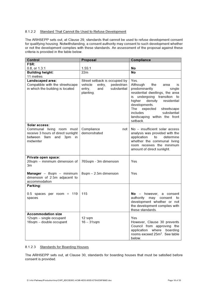
3. State Environmental Planning Policy (Affordable Rental Housing) 2009
a) Clause 29(1)(c) - The proposal exceeds the maximum Floor Space Ratio on site
b) Clause 29(2)(a) - The proposal exceeds the maximum Building Height on site
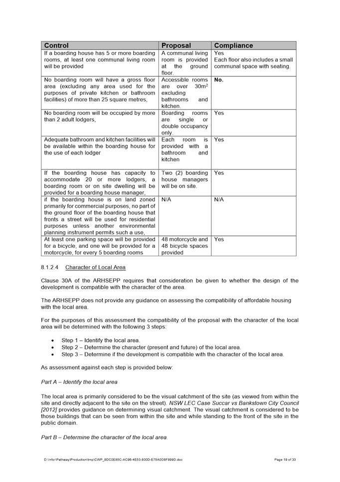
c) Clause 30(1)(b) - A number of boarding rooms exceed 25m2 in area excluding en-suites and kitchens
d) Clause 30A – The development is not in keeping with the desired future character of the area
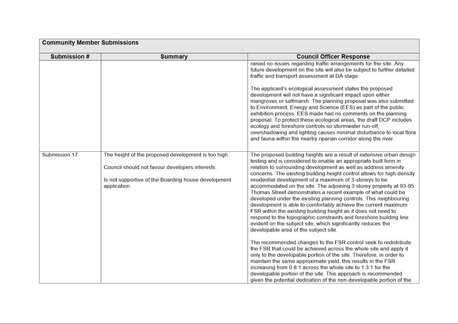
4. Sydney Regional Environmental Plan (Sydney Harbour Foreshore) 2006
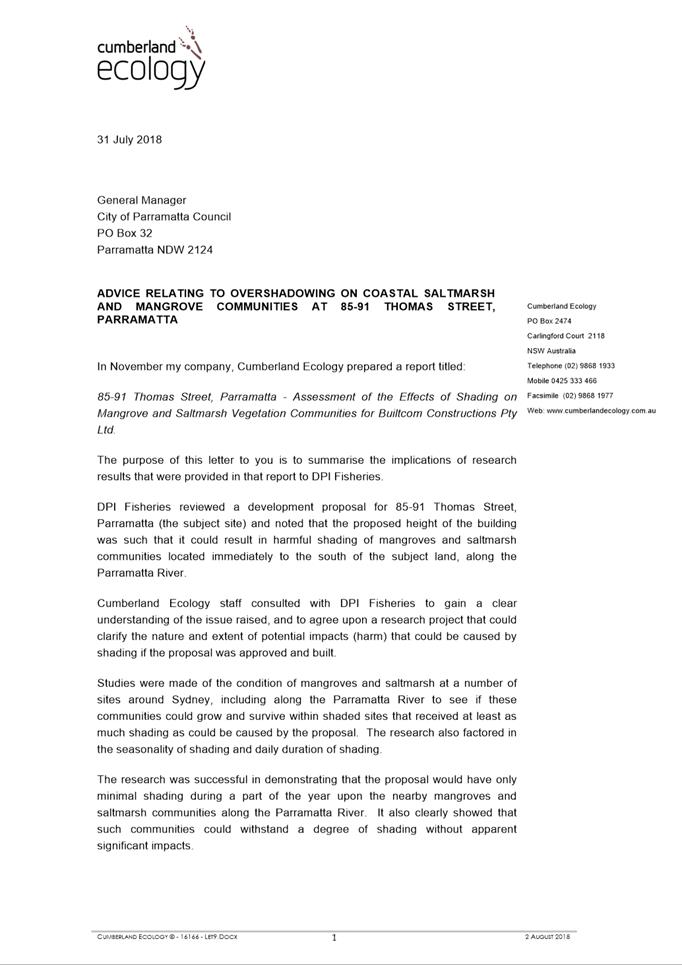
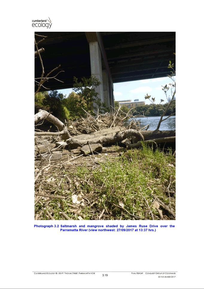
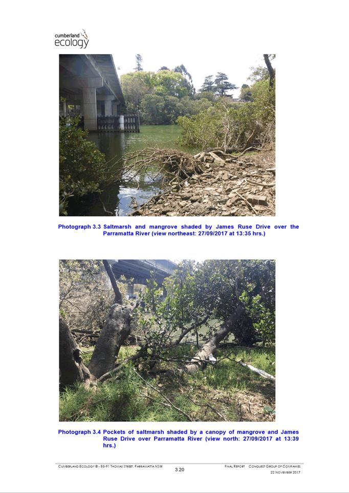
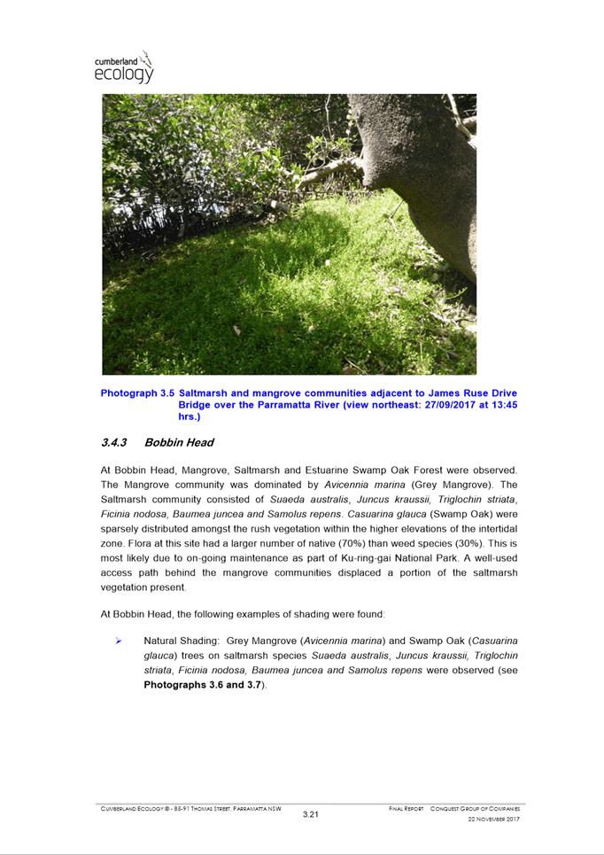
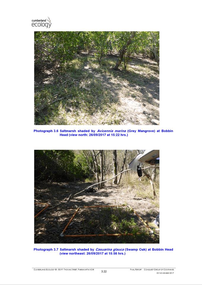
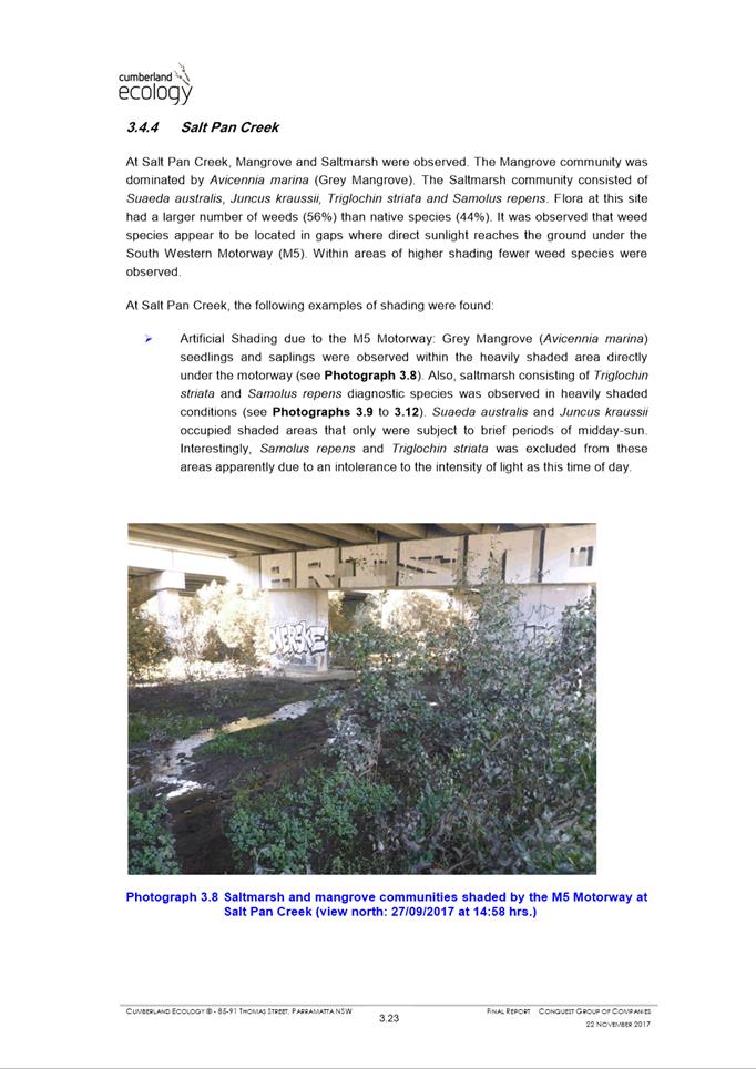
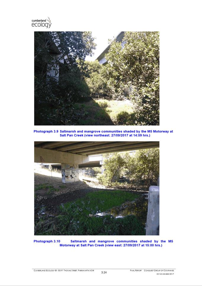
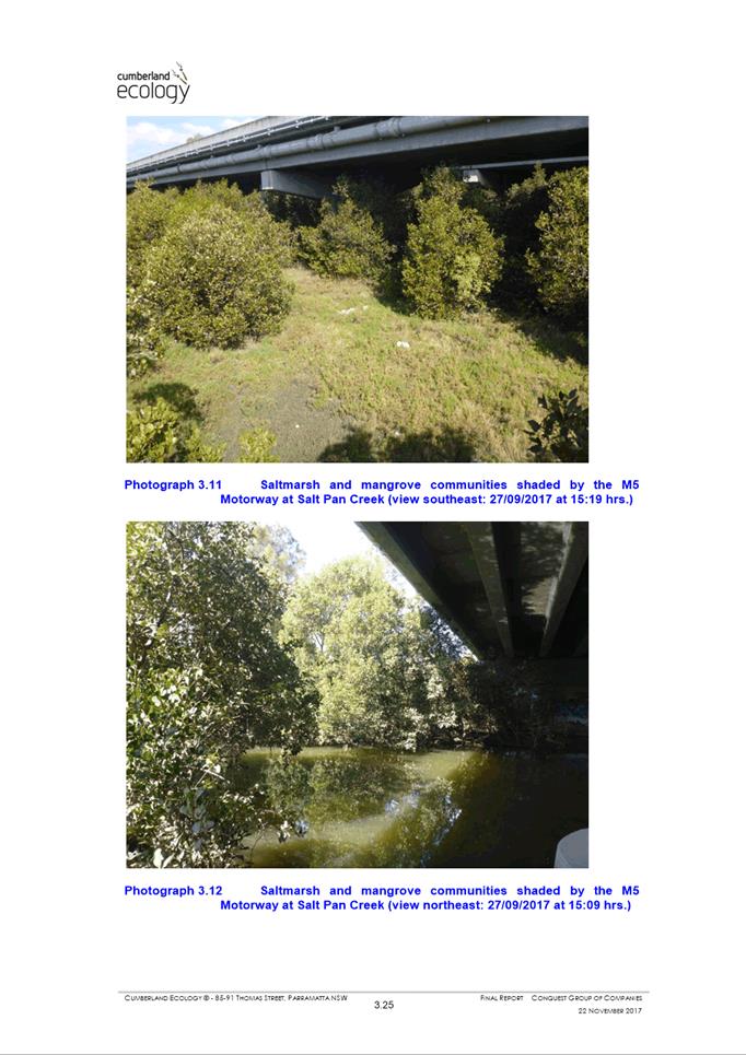
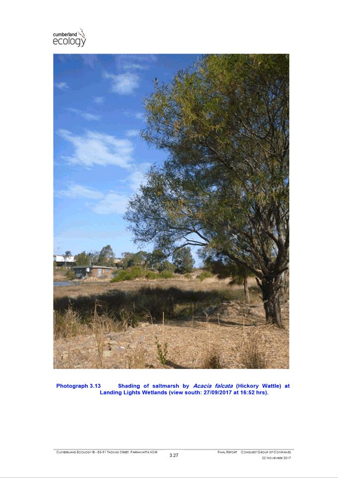
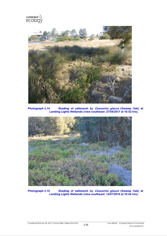
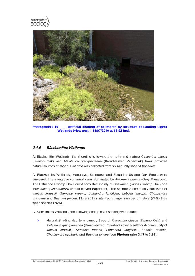
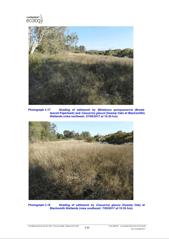
a) Division 2 and Part 6 – Insufficient information has been submitted for Council to be satisfied that the development will not have an unreasonable impact on the adjoining wetlands and mangroves.
5. Parramatta Local Environmental Plan 2011
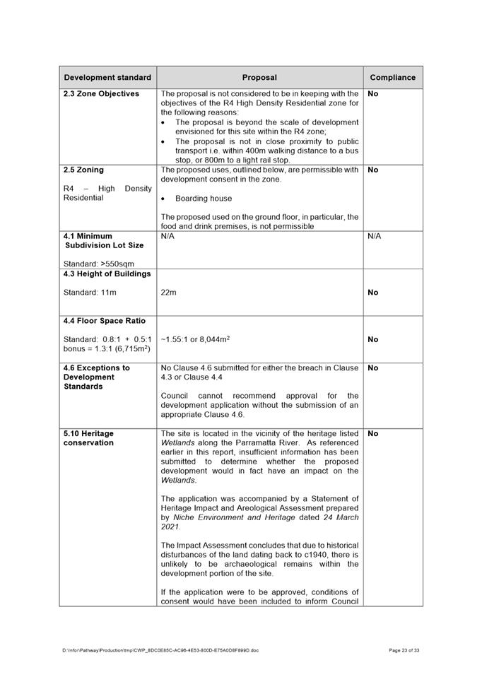
a) Clause 2.3 – The development in its current form is not in keeping with the objectives of the R4 High Density Residential zone
b) Clause 2.5 – The proposed scale of the ground floor café is not permissible within the R4 High Density Residential Zone.
c) Clause 4.3 – The proposed development exceeds the 11m building height development standard
d) Clause 4.4 – The proposed development exceeds the 1.3:1 floor space ratio development standard
e) Clause 4.6 – No Clause 4.6 justification was submitted to justify the variation to both Clause 4.3 and Clause 4.4 development standards
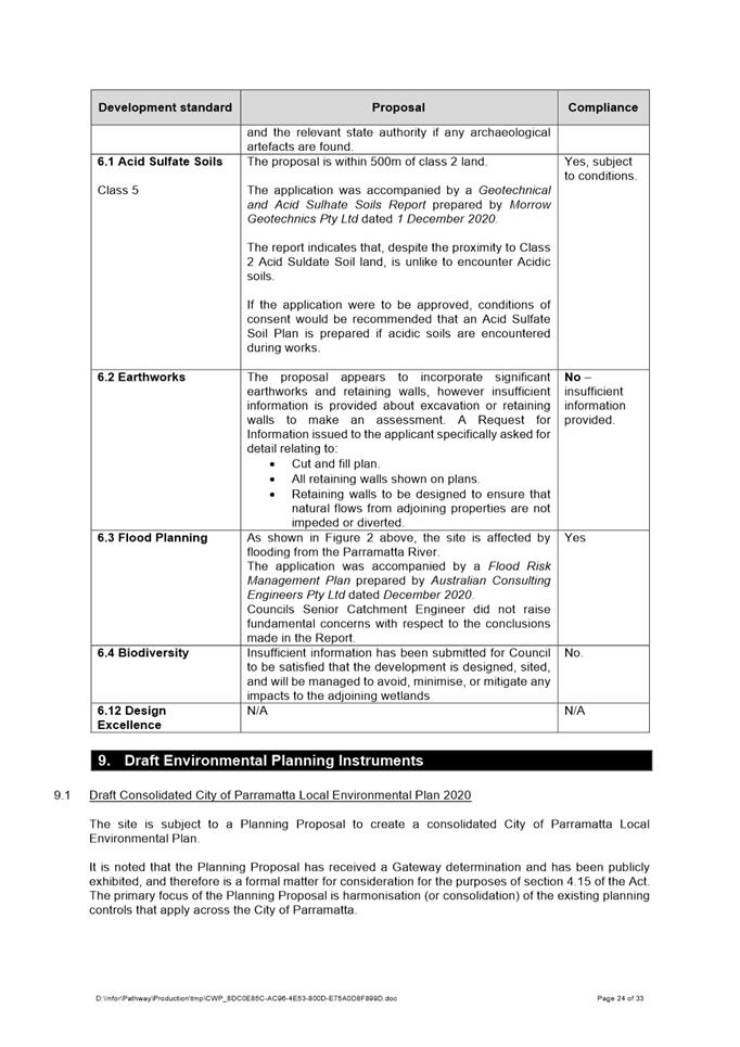
f) Clause 5.10 – Insufficient information has been provided for Council to be satisfied with any impact to the heritage listed Wetlands adjoining the site
g) Clause 6.2 – Insufficient information has been provided with respect to the extent of earthworks and retaining walls on site.
h) Clause 6.4 - Insufficient information has been submitted for Council to be satisfied that the development is designed, sited, and will be managed to avoid, minimise, or mitigate any impacts to the adjoining wetlands
6. Parramatta Development Control Plan 2011
a) Insufficient information was submitted to assess impacts on biodiversity
b) Insufficient information was submitted to assess impacts on stormwater drainage and whether appropriate water sensitive urban design measures will be implemented.
c) Access for people with disabilities is not adequately addressed.
d) The scale of the proposal exceeds the expected form of development under current planning controls
e) The proposal does not provide all of the required facilities for boarding houses, omitting additional kitchen facilities and additional communal living area facilities.
f) The internal communal living area does not comply with the minimum area required.
g) The proposal does not provide the required number of wheelchair accessible rooms.
7. Public Interest
a) The development is not in the public interest.
Jonathan Cleary
Team Leader Development Assessment
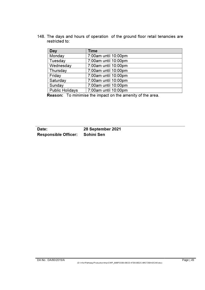
Sarah Irani
Team Leader Development Support
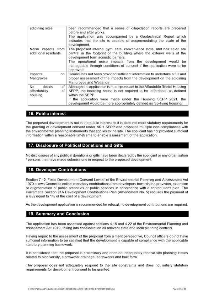
|
1⇩ |
Assessment Report |
33 Pages |
|
|
2⇩ |
Locality Map |
1 Page |
|
|
3⇩ |
Architectural plans used during assessment |
22 Pages |
|
|
Internal plans used during assessment (confidential) |
10 Pages |
|
|
|
5⇩ |
Landscape plans used during assessment |
9 Pages |
|
|
6⇩ |
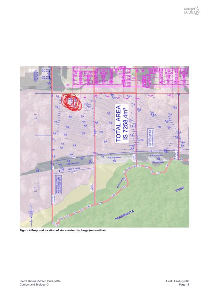
Stormwater Discharge Point Plan used during assessment |
1 Page |
|
|
7⇩ |
Department of Primary Industries (DPI) - Fisheries Refusal |
2 Pages |
|
|
8⇩ |
Supporting Documents |
167 Pages |
|
REFERENCE MATERIAL
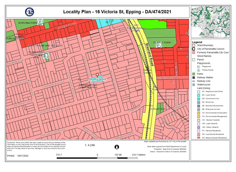
ITEM NUMBER 5.2
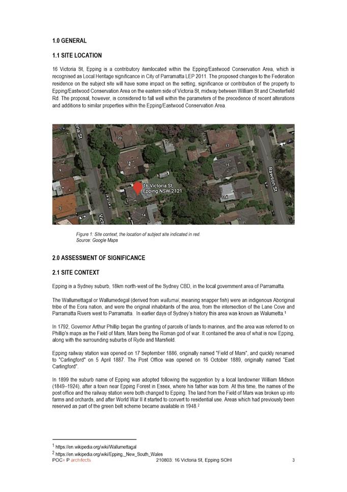
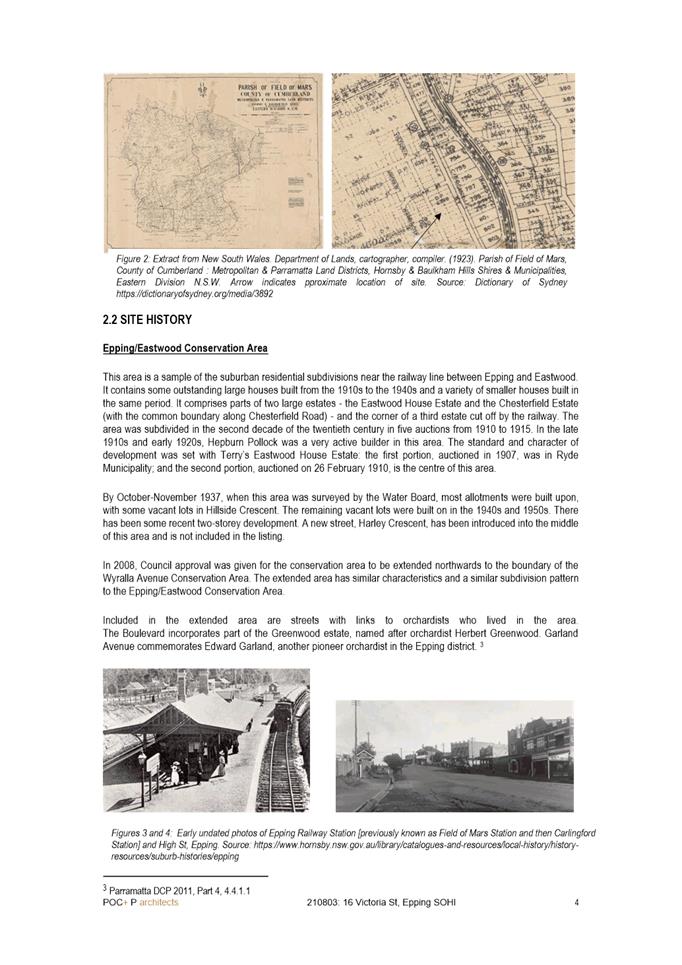
SUBJECT PUBLIC MEETING:
16 Victoria Street, EPPING
(Lot 8 DP 6399)
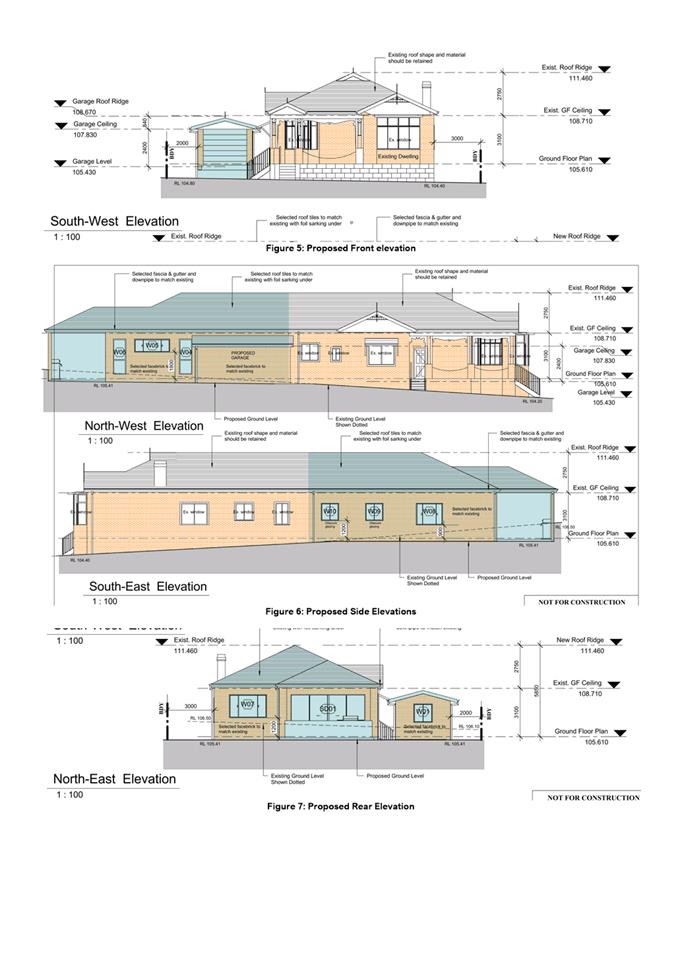
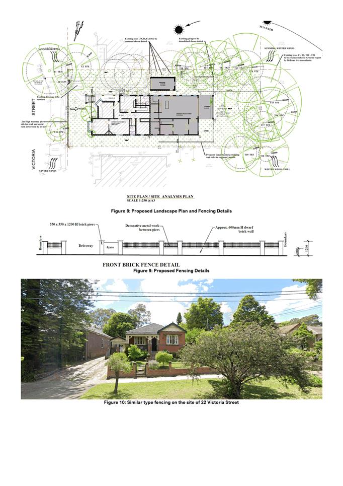
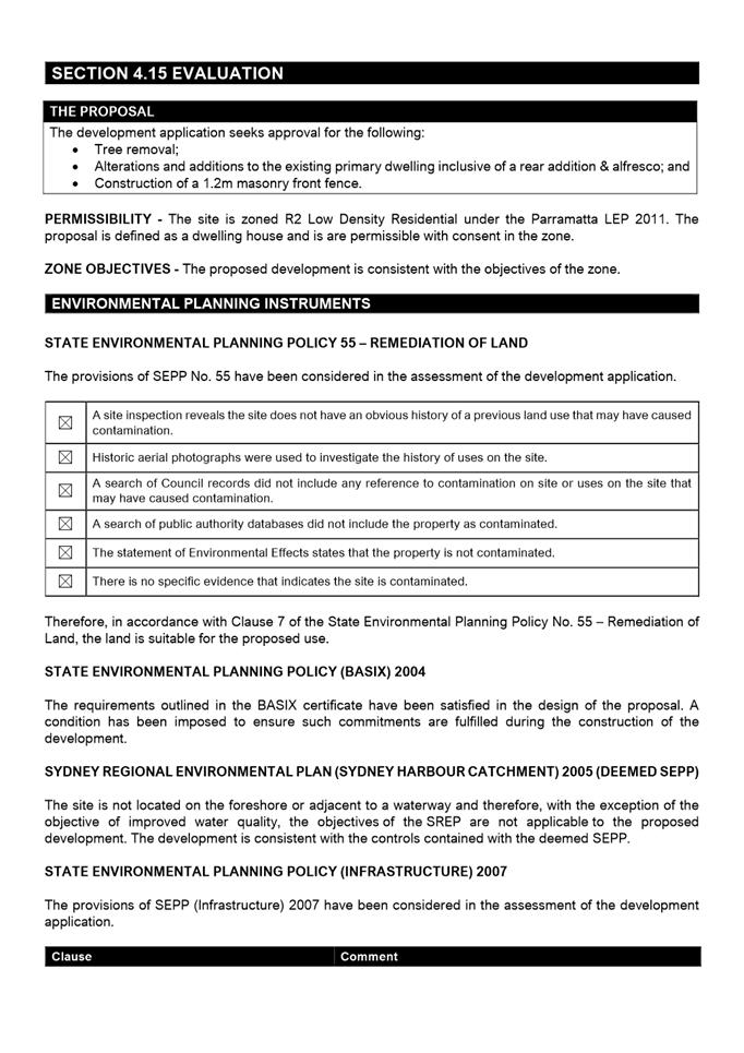
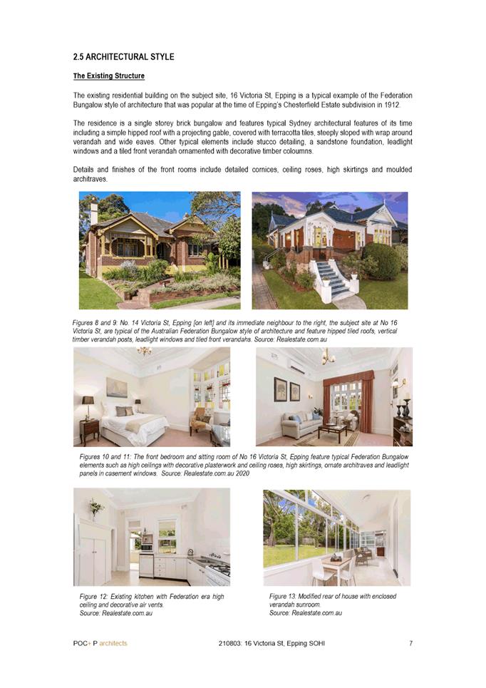
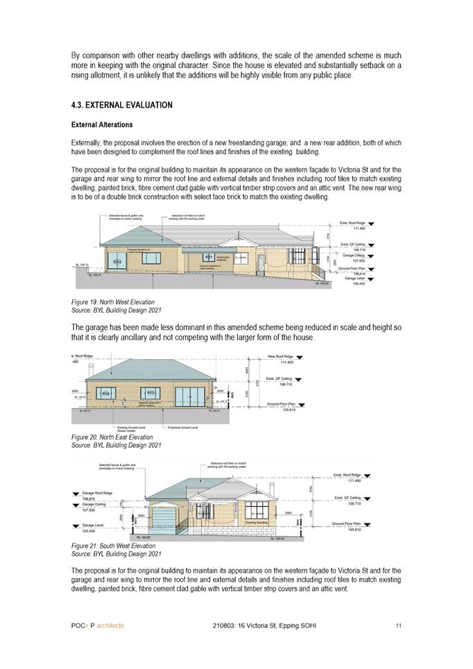
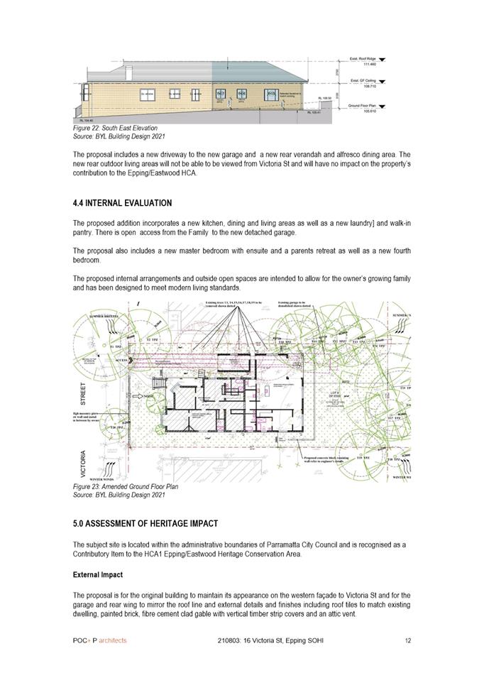
DESCRIPTION Tree removal and alterations & additions to the existing dwelling.
REFERENCE DA/474/2021 - D08388195
APPLICANT/S BYL Building Design
OWNERS Ms Ying Zhang
REPORT OF Group Manager Development and Traffic Services
RECOMMENDED APPROVAL
DATE OF REPORT – 11/01/2022
REASON FOR REFERRAL TO LPP
This item is being referred to the Parramatta Local Planning Panel as more than 10 submissions (17 unique submissions) were received during the formal notification period.
EXECUTIVE SUMMARY
The proposed development involves the alterations and additions to an existing dwelling house.
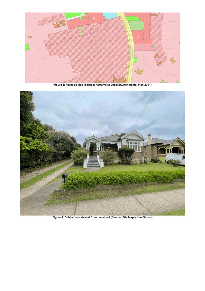
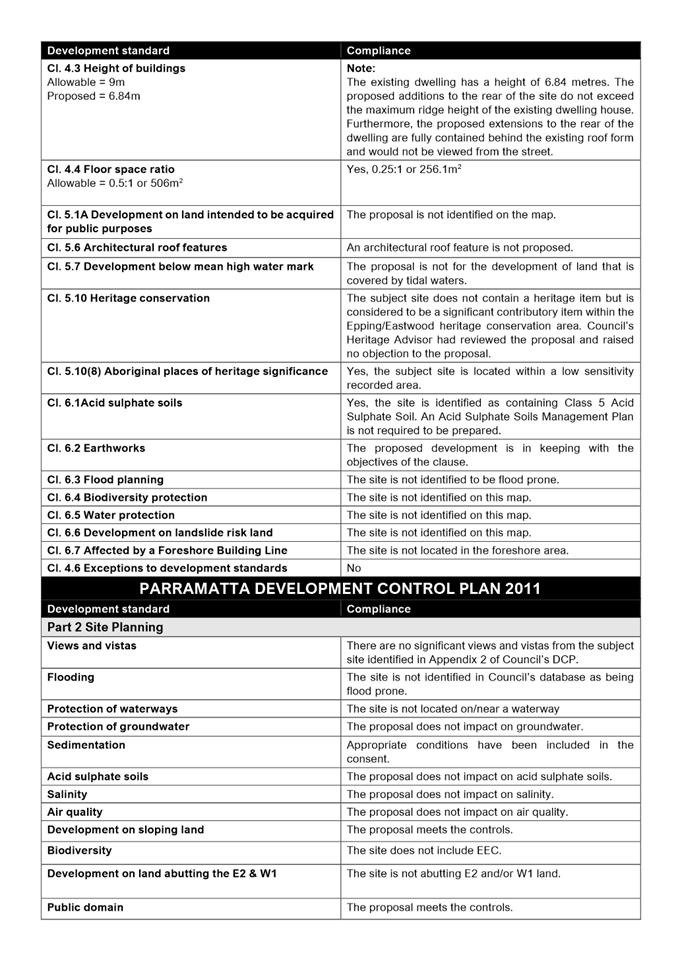
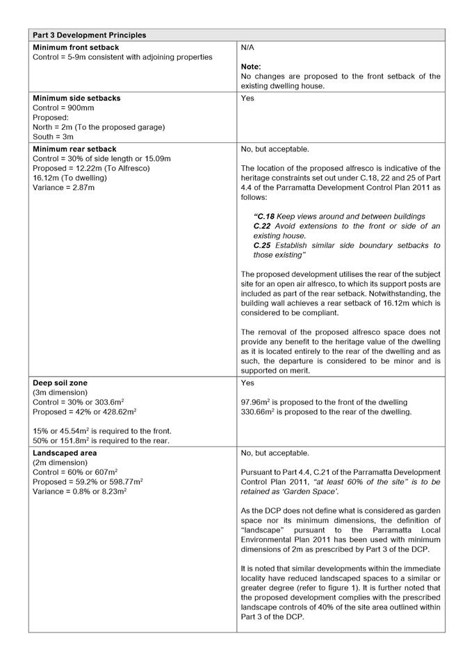
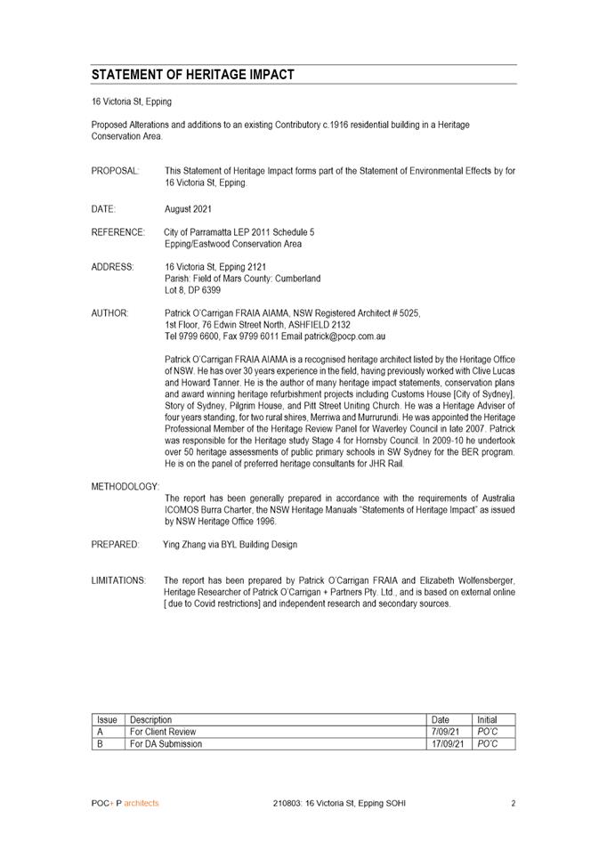
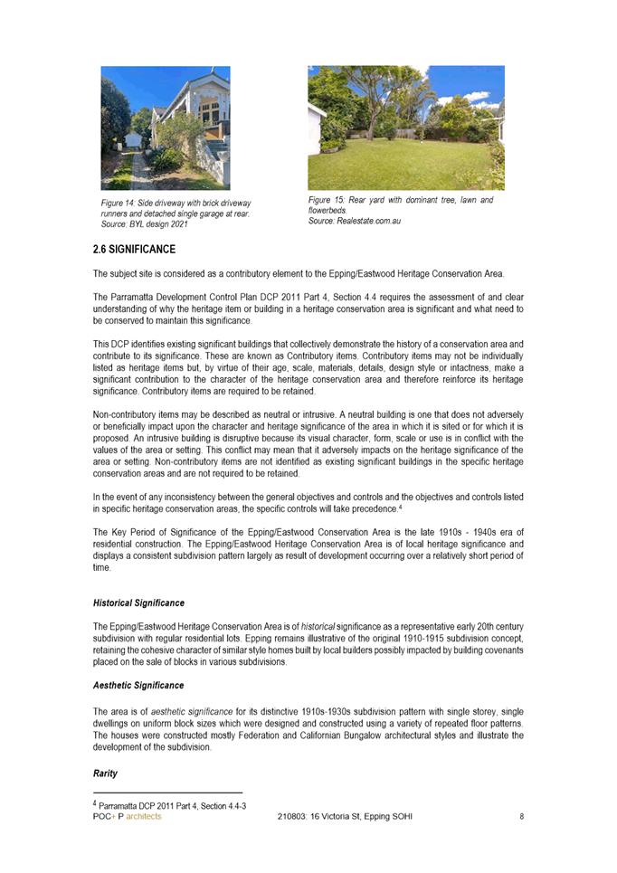
The subject site and its surrounds are zoned R2 Low Density Residential under the Parramatta Local Environmental Plan 2011 and located within the Epping/Eastwood Heritage Conservation Area pursuant to Part 4.4 of the Parramatta Development Control Plan 2011 (DCP). The dwelling house located on the subject site is considered to be a ‘significant contributory item’ to the heritage conservation area as prescribed in the DCP.
The proposed works are permissible under the Parramatta Local Environmental Plan 2011 and are generally consistent to the development controls and provisions prescribed for the Epping/Eastwood Heritage Conservation Area in the Parramatta Development Control Plan 2011.
The subject application was notified in accordance with Council’s Consolidated Notification Requirements. In response, 17 submissions were received. The key issues raised within the submissions are listed as follows:
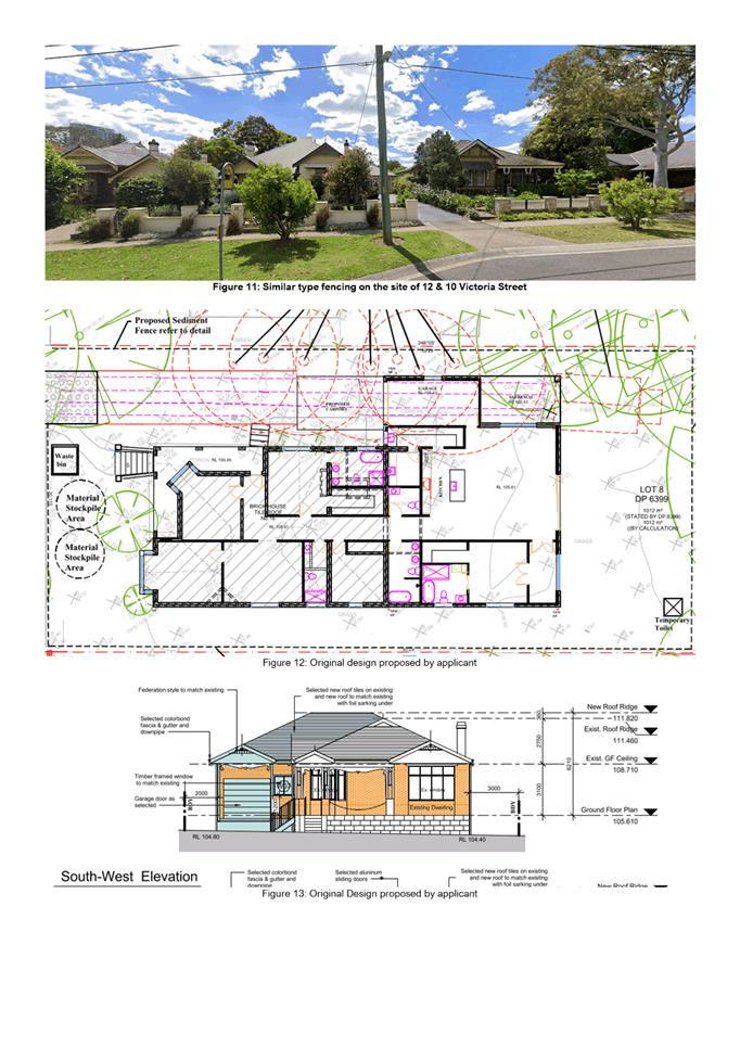
- Attachment of the garage/Carport;
- Tree removal;
- Roof Pitch;
- Window/skirting treatment;
- Fenestration design; and
- Roofing Material/Pitch
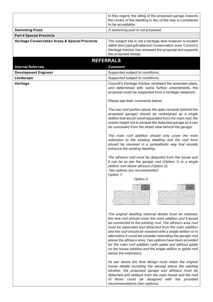
In response to the issues raised in the submissions, the original design of the proposed development had been reduced in scale and amended to ensure that the existing dwelling maintains its visual prominence when viewed from the street. Council’s Heritage Advisor had reviewed the proposal and raised no objection from a heritage viewpoint.
In accordance with Council’s consolidated notification procedures, the application did not require re-notification as the amended application was considered to be substantially the same development as originally submitted and would not result in a greater environmental impact.
The application was assessed having regard to the relevant environmental planning
Instruments including the Parramatta Local Environmental Plan 2011. The proposed development is considered to generally satisfy the requirements of the applicable planning instruments and the Parramatta Development Control Plan 2011 (DCP) including the provisions relating to the Epping/Eastwood Heritage Conservation Area. It is noted that there a number of minor departures in the DCP, however on its merits, the proposed development would be consistent with the surrounding residential context.
Having regard to the applicable planning provisions and notwithstanding the issues raised in the submissions, the proposal is considered satisfactory and is recommended for approval.
(a) That the Parramatta Local Planning Panel (PLPP), excising the functions of Council, pursuant to Section 4.16(1)(b) of the Environmental Planning and Assessment Act 1979, approve development consent to DA/474/2021 for the tree removal and alterations and additions to an existing dwelling house on land at Lot 8 DP 6399, 16 Victoria Street, Epping.
(b) Further, that the objectors be advised of the Panel’s decision.
REASONS FOR APPROVAL:
1. The proposed development is permissible in the R2 Low Density Residential zone and satisfies the requirements of all of the applicable planning controls.
2. The development will not create adverse impacts onto the locality and will be compatible with the existing area.
3. The proposed development ensures the conservation of the existing dwelling while maintaining its contribution to the Epping/Eastwood Heritage Conservation Area.
4. For the reasons given above, approval of the application is in the public interest.
Matthieu Santoso
Development Assessment Officer
Sarah Irani
Team Leader Development Support
|
1⇩ |
Assessment Report and draft Conditions |
31 Pages |
|
|
2⇩ |
Locality Plan |
1 Page |
|
|
3⇩ |
Plans used during assessment (LPP) |
5 Pages |
|
|
Internal Plans used during assessment (LPP) (confidential) |
5 Pages |
|
|
|
5⇩ |
Statement of Heritage Impact |
14 Pages |
|
REFERENCE MATERIAL
ITEM NUMBER 5.3
SUBJECT PUBLIC MEETING:
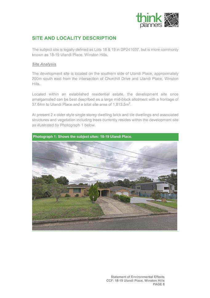
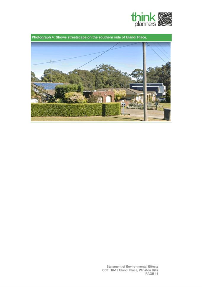
18-19 Ulandi Place, WINSTON HILLS
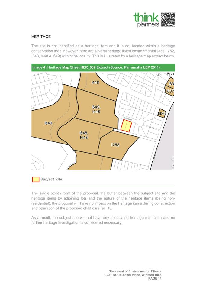
(Lot 18 and Lot 19 DP 241037)
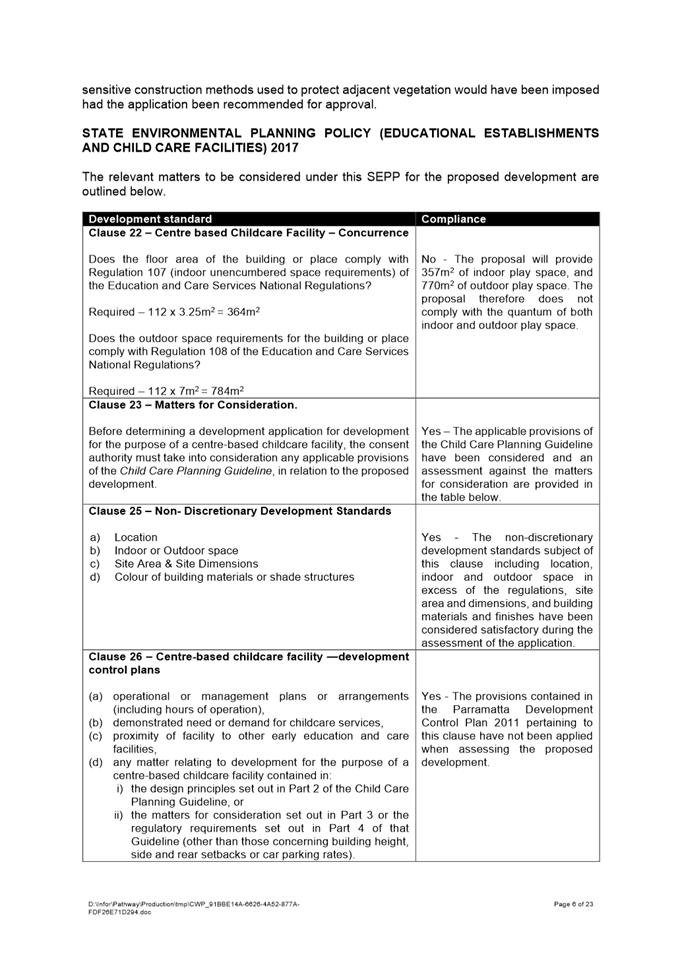
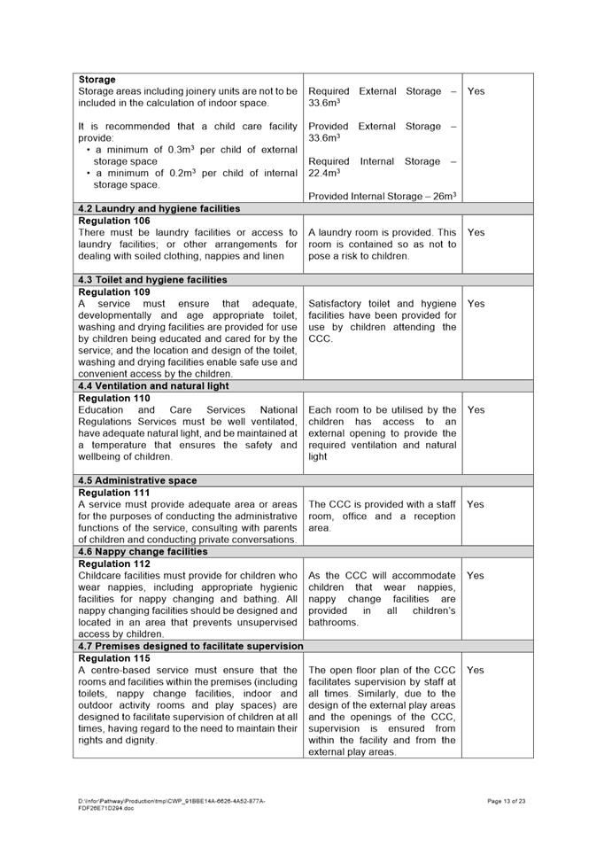
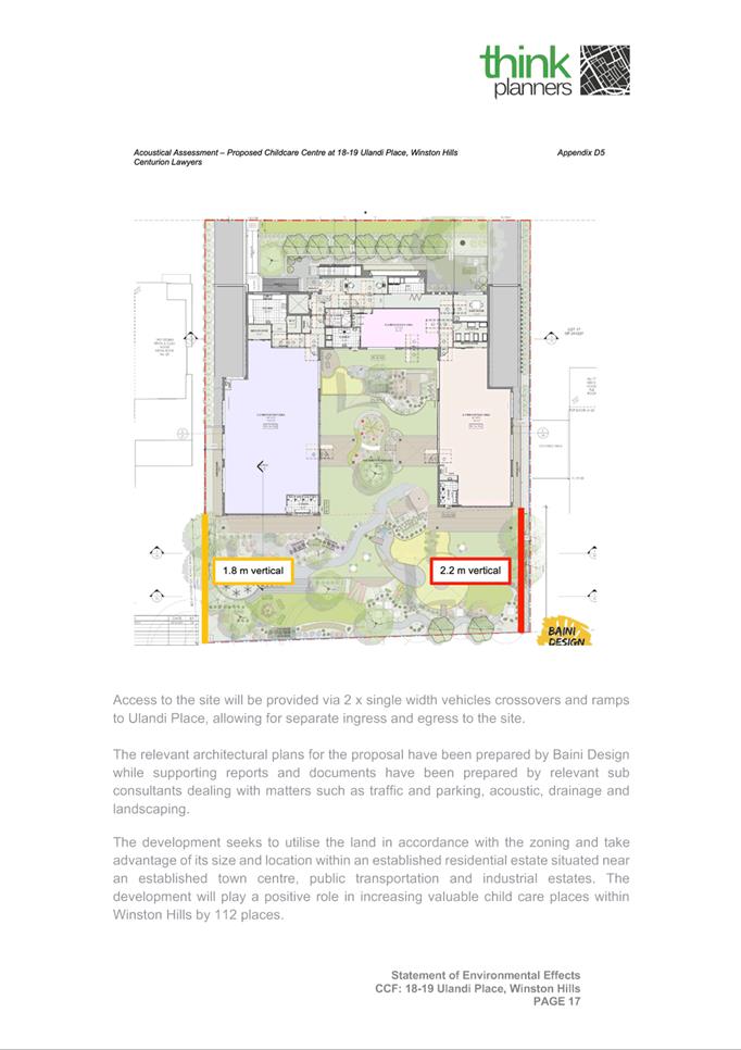
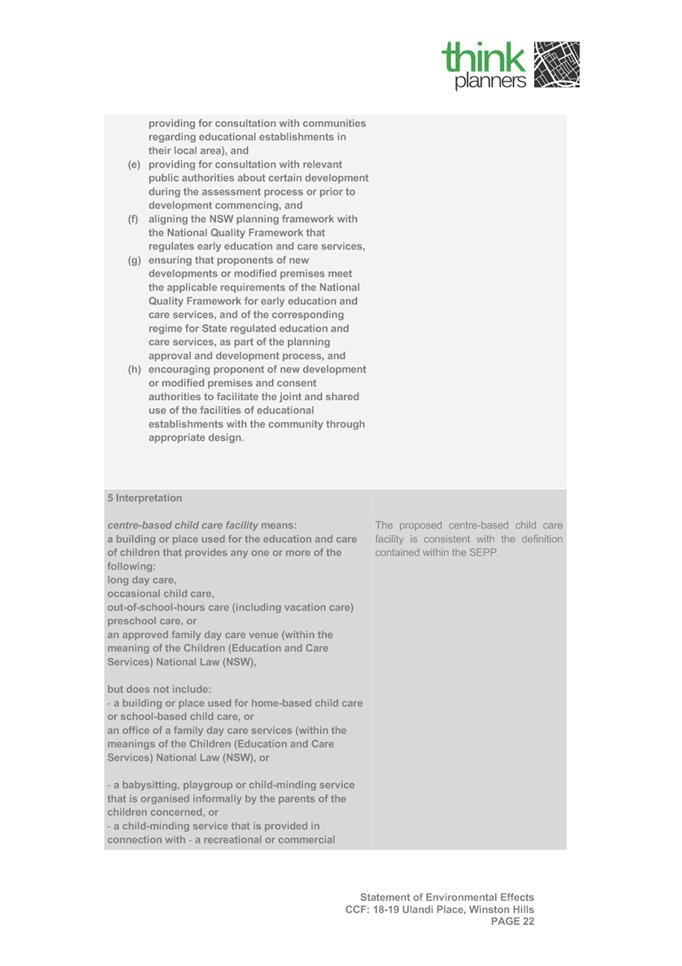
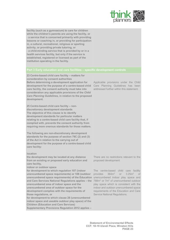
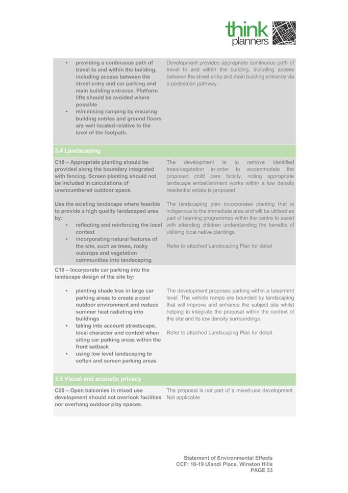
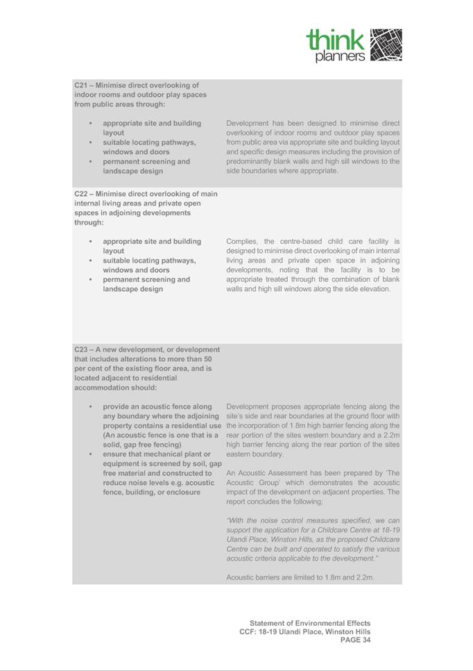
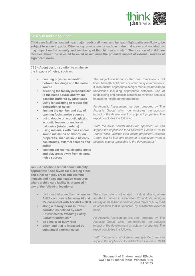
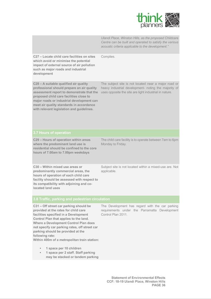
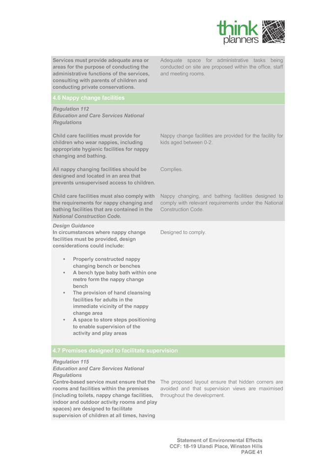
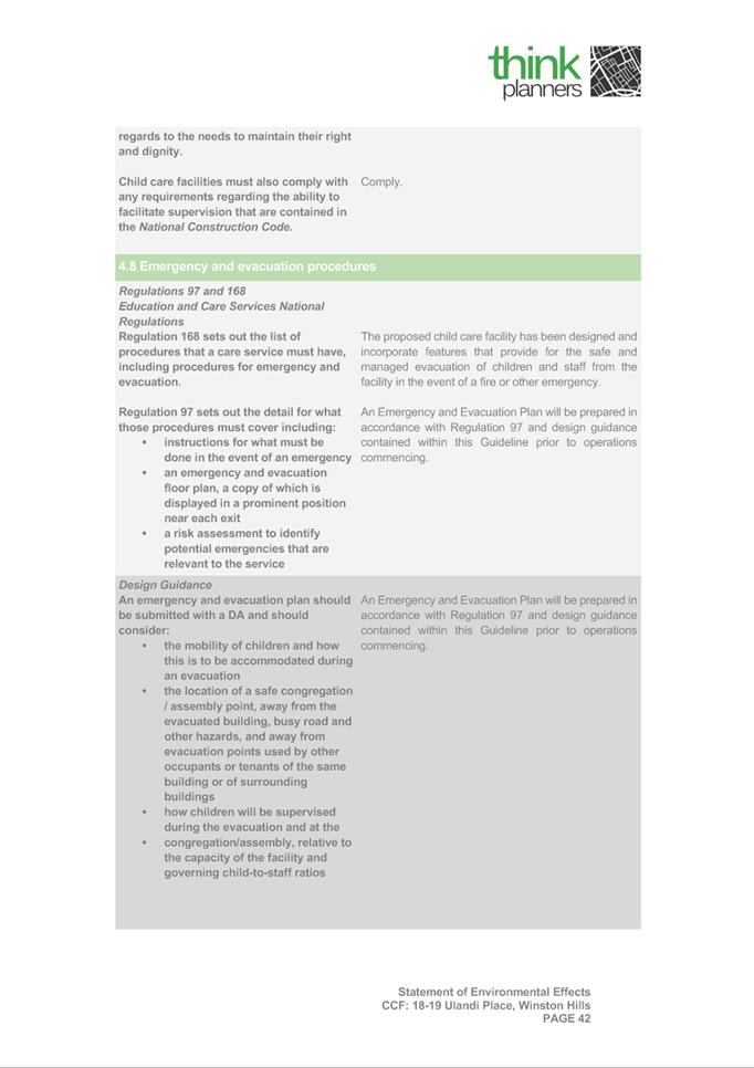
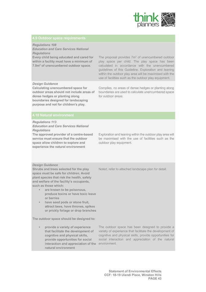
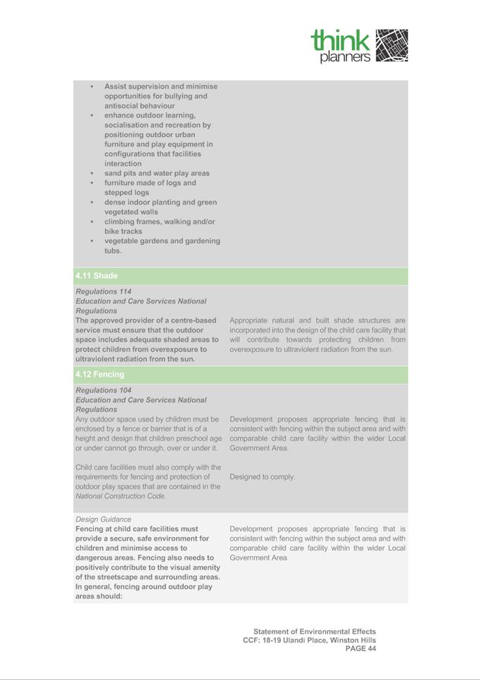
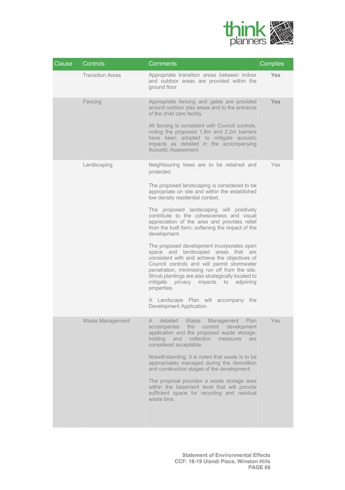
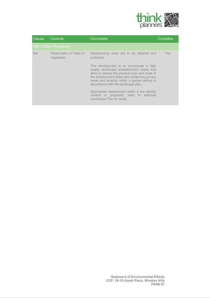
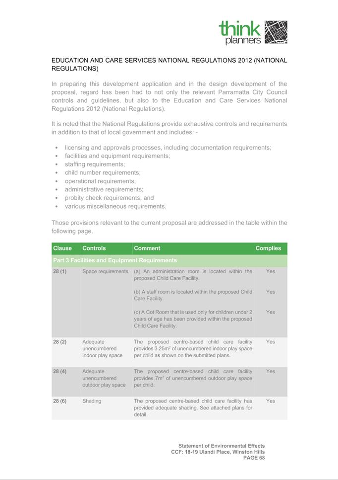
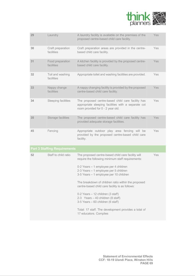
DESCRIPTION Demolition, tree removal and construction of a 112 place child care centre with basement carparking for 28 vehicles.
REFERENCE DA/1031/2021 - D08399245
APPLICANT/S Ulandi Kids Pty Ltd
OWNERS Mr M A Draybi
REPORT OF Group Manager Development and Traffic Services
RECOMMENDED REFUSAL
DATE OF REPORT – 1 February 2022
REASON FOR REFERRAL TO LPP
This item is being referred to Parramatta Local Planning Panel, as more than 10 unique submissions were received during the notification period (total of 25).
EXECUTIVE SUMMARY
This is a summary of the full assessment of the application as outlined in Attachment 1, the Section 4.15 Assessment Report.
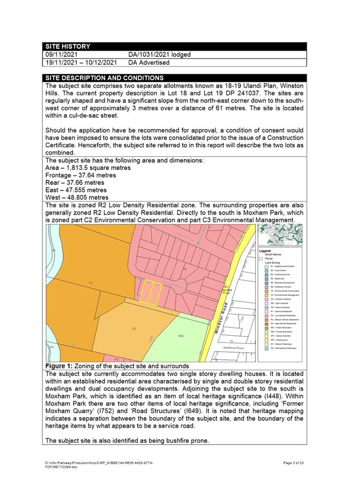
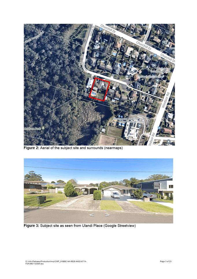
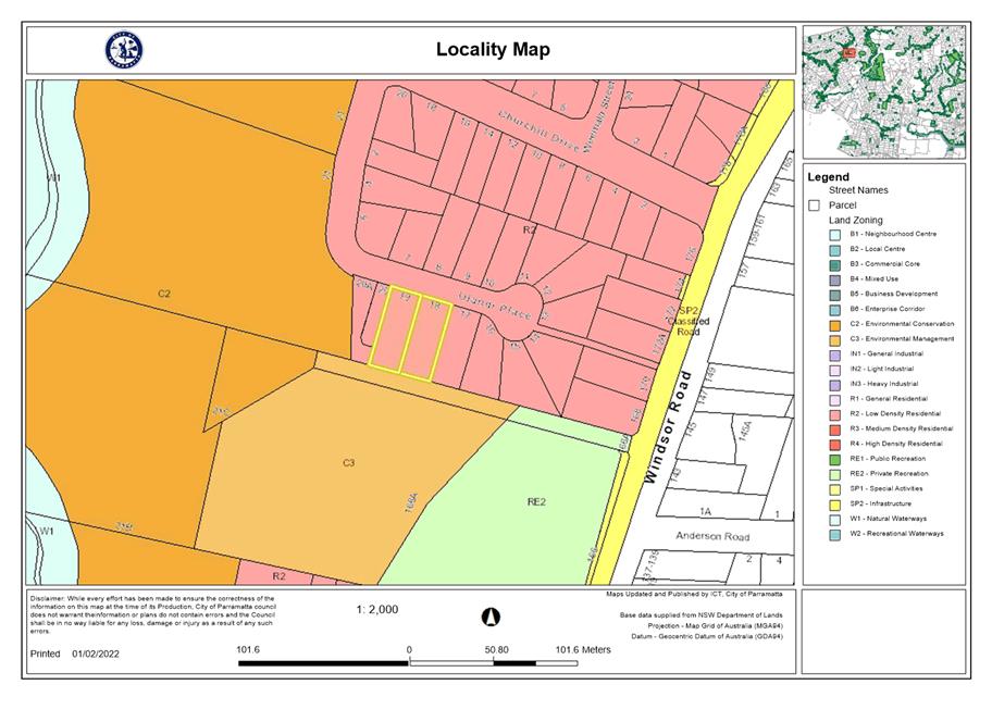
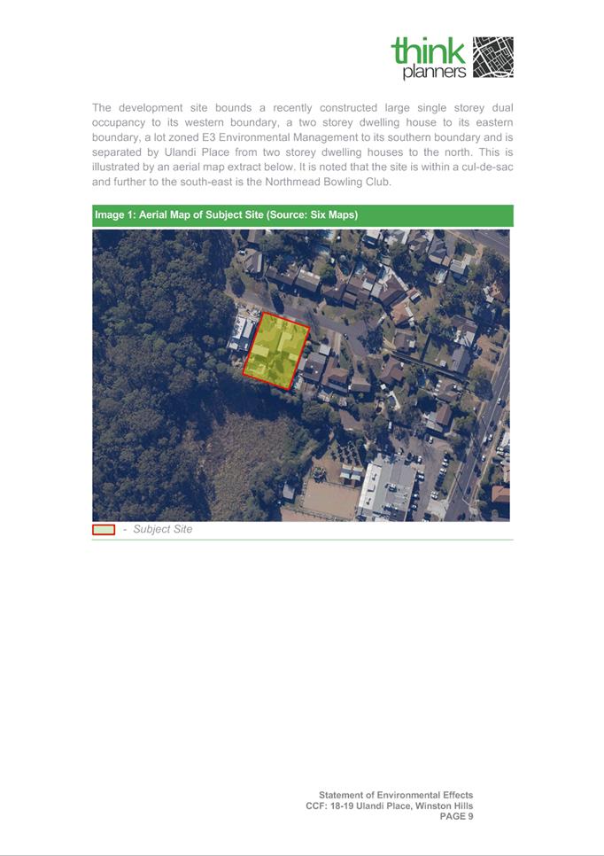
The subject site comprises two separate allotments known as 18-19 Ulandi Plan, Winston Hills. The current property description is Lot 18 and Lot 19 DP 241037.
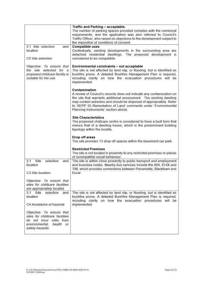
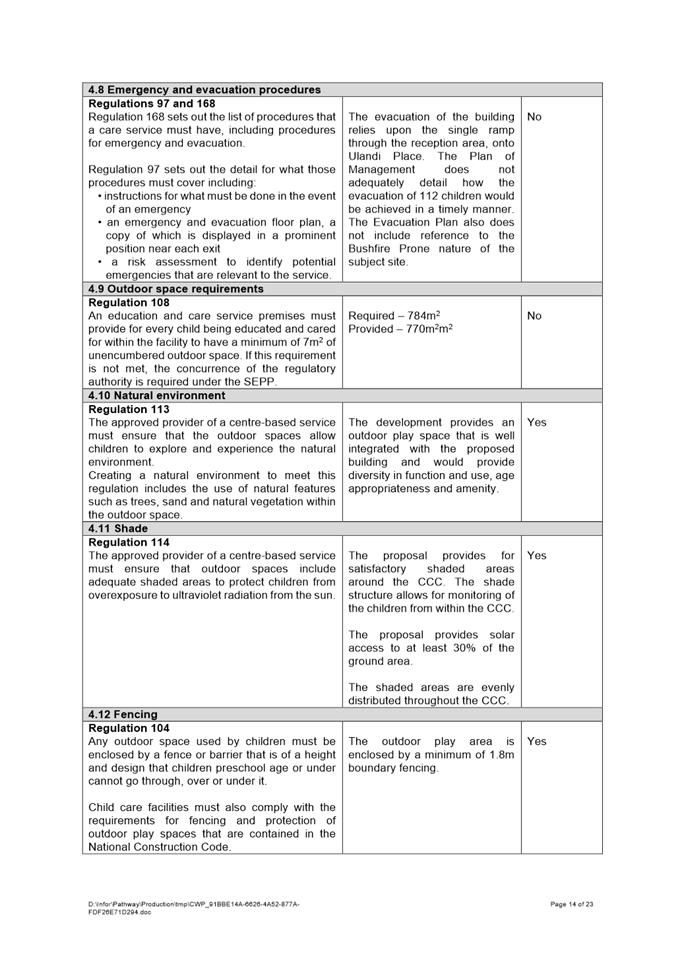
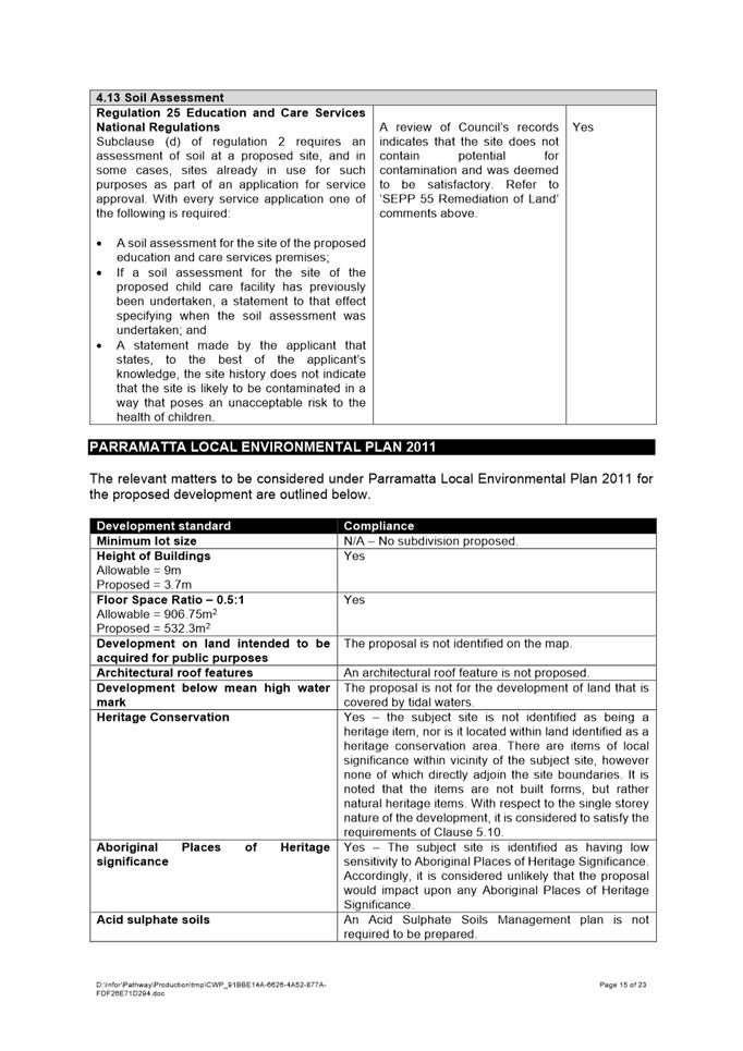
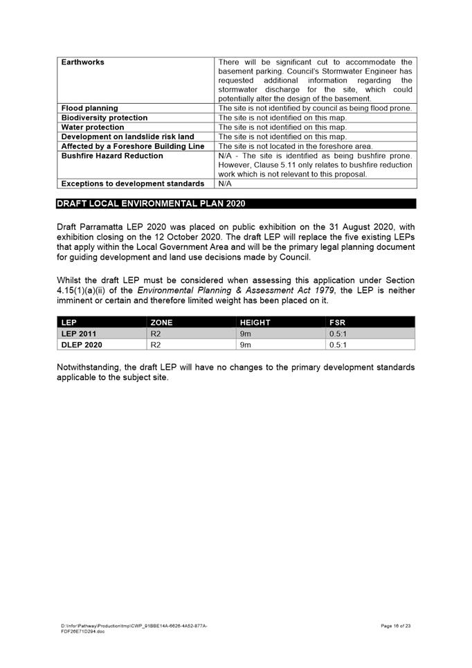
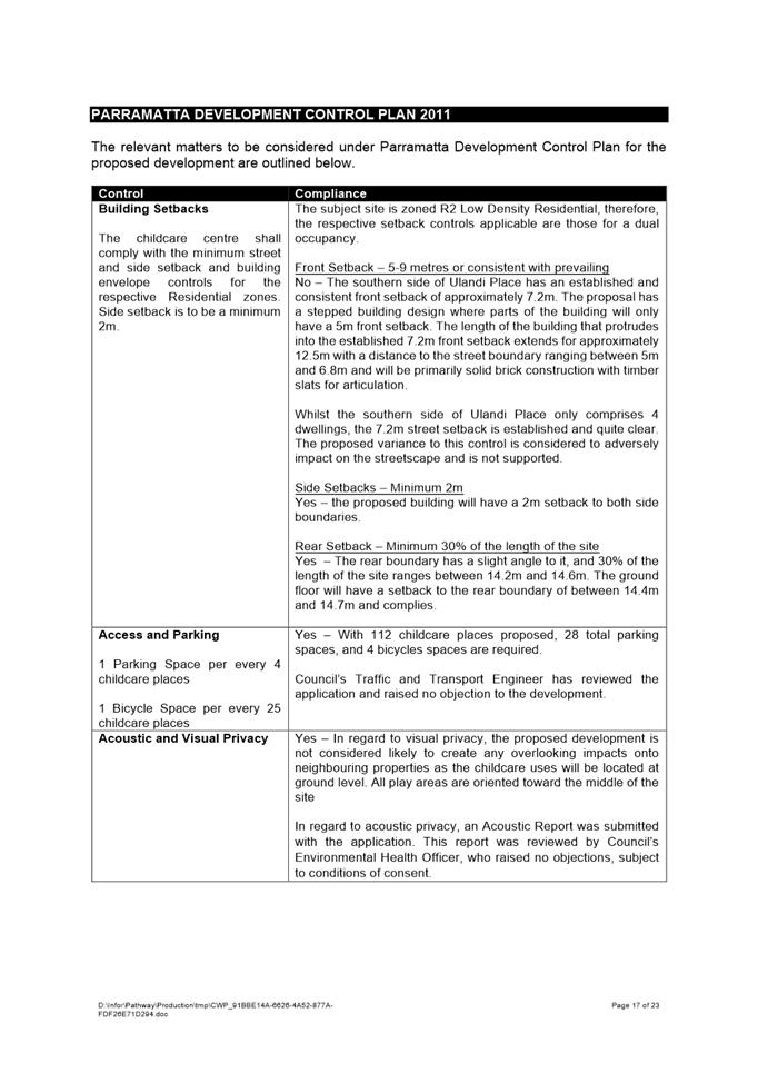
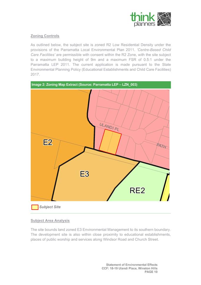
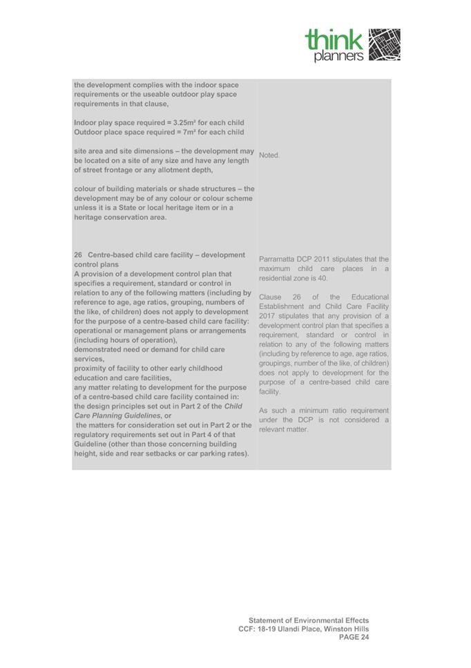
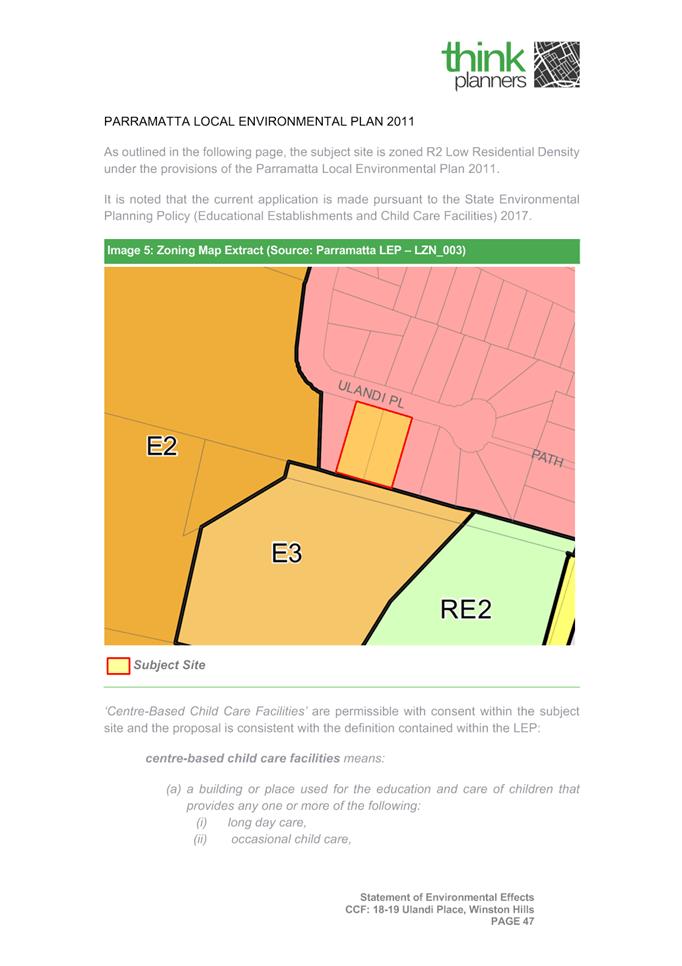
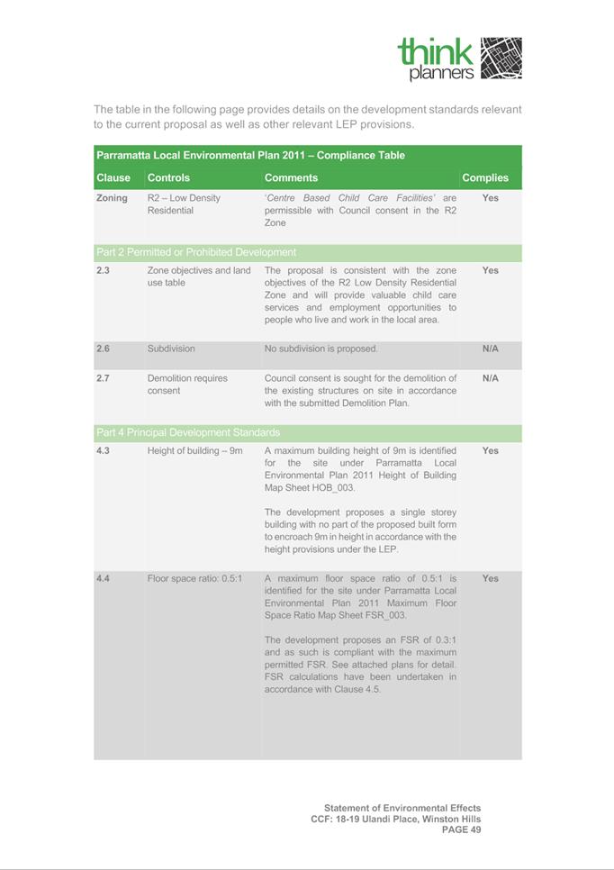
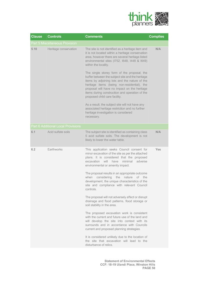
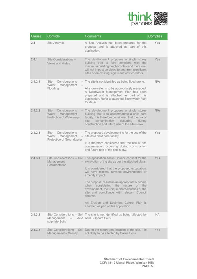
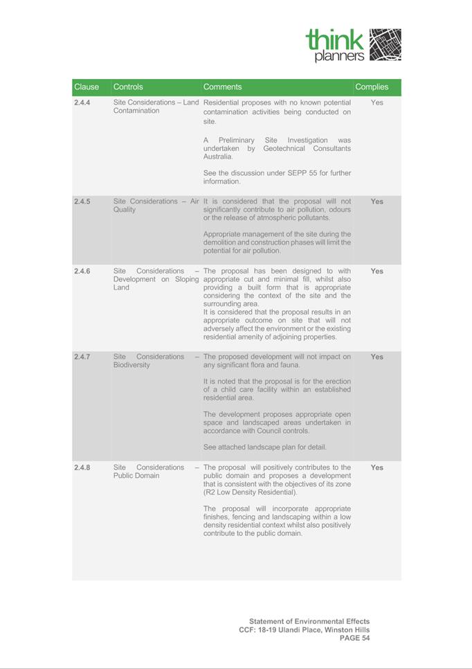
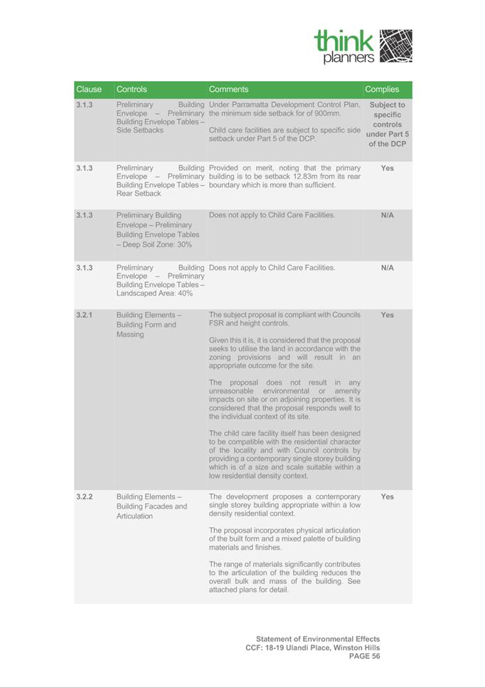
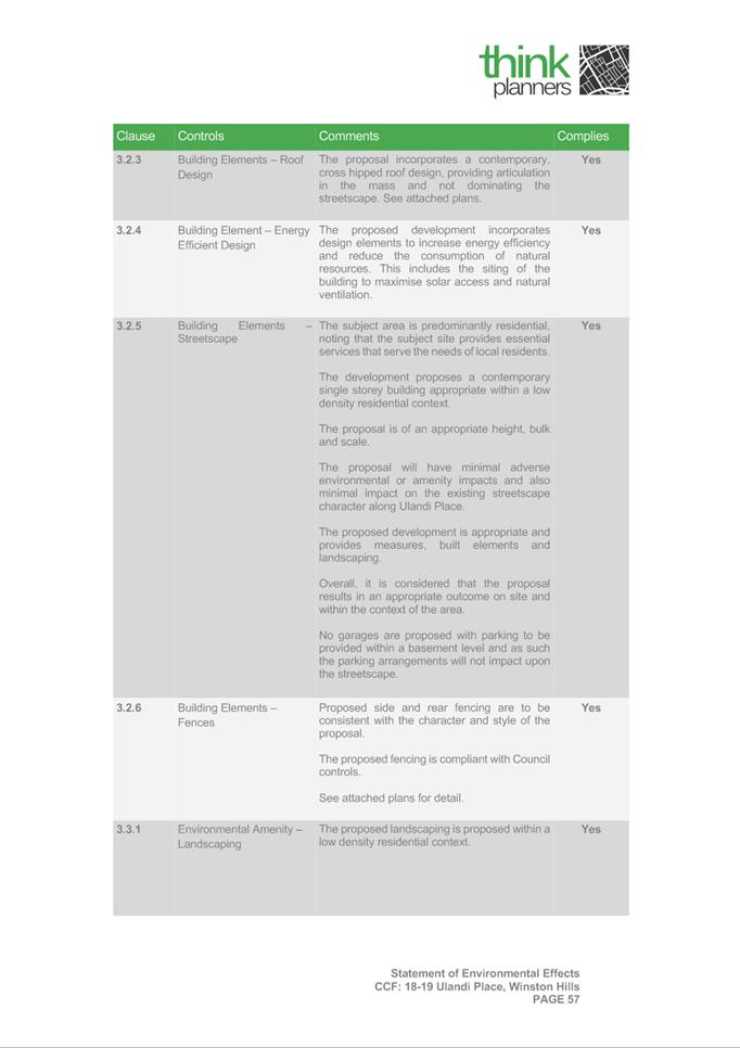
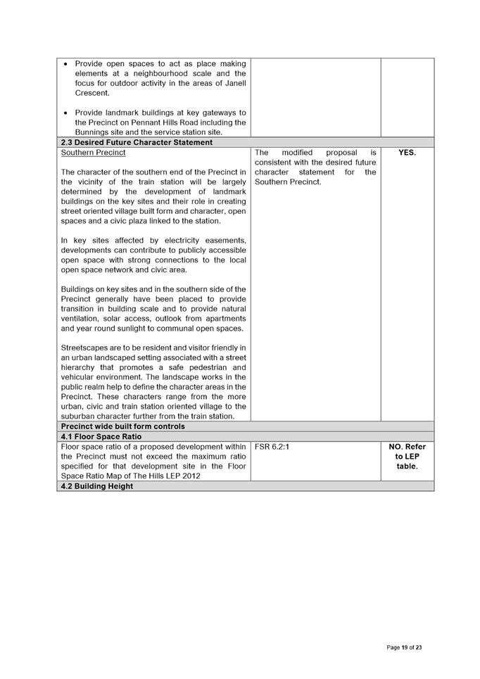
The site is zoned R2 Low Density Residential zone under which Centre Based Childcare Centres are a permitted use, with consent. The maximum building height is 9m and the maximum floor space ratio is 0.5:1. The subject site is also identified as being Bushfire Prone Land.
The proposal seeks to develop a single storey child care centre, with a maximum capacity of 112 children. The facility will have a basement parking level for 28 vehicles.
Notification
The application was notified in accordance with Council’s Consolidated Notification Requirements. In response, 25 submissions were received. The issues raised within those submissions comprise the following:
· Traffic Impacts;
· Regulatory Compliance;
· Stormwater Discharge;
· Tree Removal;
· Flora and Fauna Impacts.
· Amenity;
· Proposal out of character in R2 zone;
· Bushfire Prone Land;
· Local Need;
· Non-compliance with DCP;
· Evacuation Procedures;
· Overshadowing;
· Excavation;
· Decline in surrounding property values.
Assessment
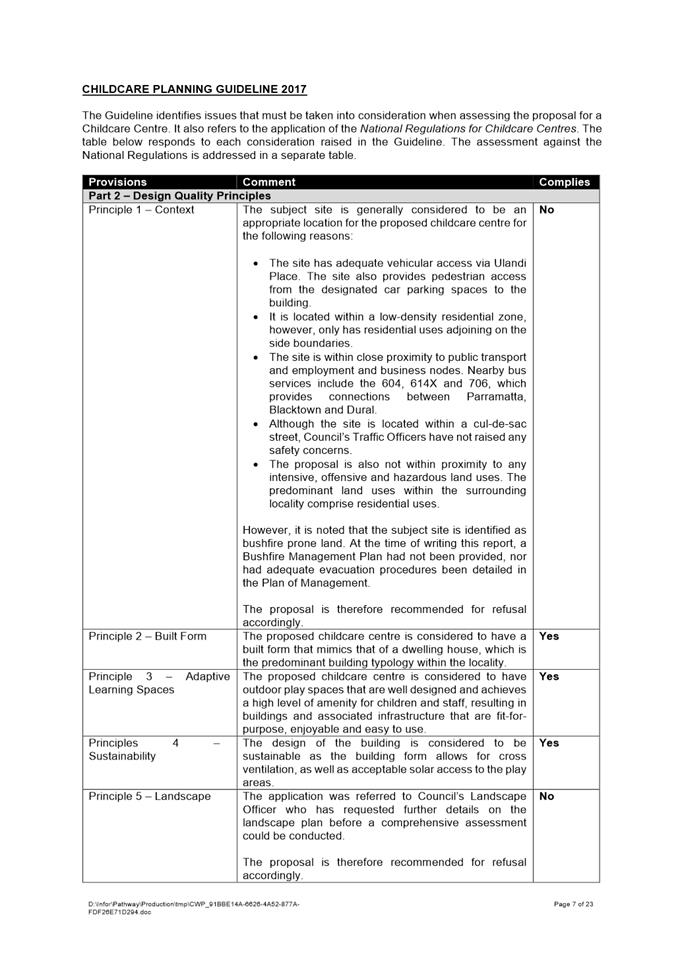
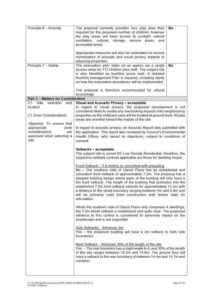
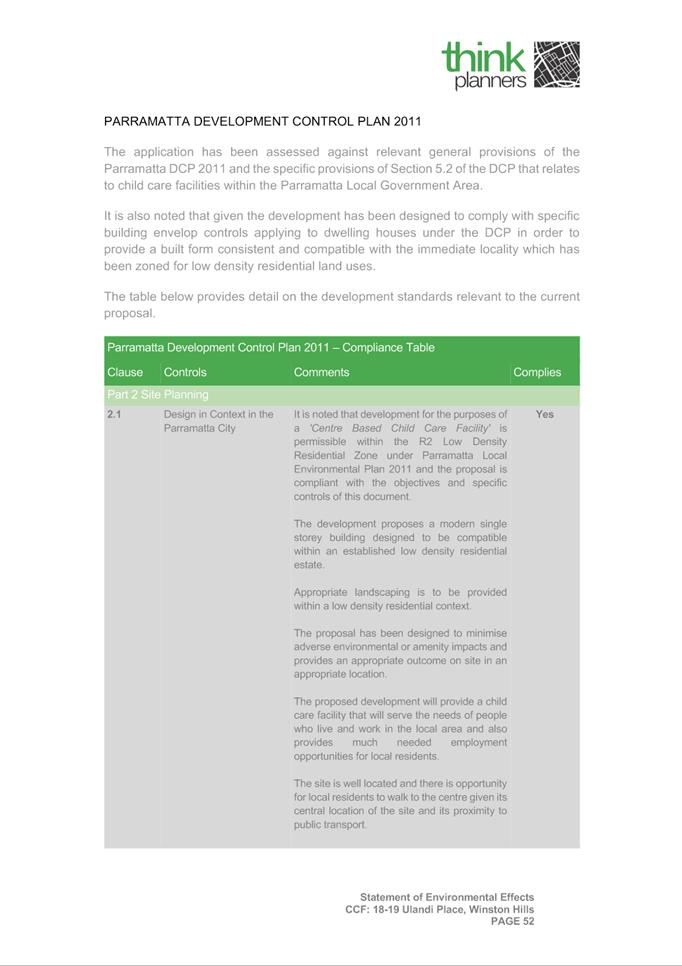
The application was assessed against the relevant environmental planning instruments, including SEPP (Infrastructure) 2007, SEPP (Vegetation in Non-Rural Areas) 2017, SEPP (Educational Establishments and Child Care Facilities) 2017, and Parramatta LEP 2011, as well as Parramatta DCP 2011. The proposal in its current form has several non-compliances with some of the above instruments.
The bushfire prone classification of the subject site had not been addressed in the supporting documentation submitted with the application. Further detail would be required to ensure the safety of the future occupants of the building, in the construction and operation of the facility.
Other Council Officers have requested amended documents including the following:
· Council’s Stormwater Engineer;
· Council’s Landscape Officer.
A deemed refusal appeal was lodged with the Land and Environment Court. In that regard, the application must be determined at the February Local Planning Panel meeting to meet the court mandated dates.
(a) That Parramatta Local Planning Panel refuse DA/1031/2021 18-19 Ulandi Place, Winston Hills.
(b) Further, that submitters are advised of the Panel’s decision.
REASONS FOR REFUSAL:
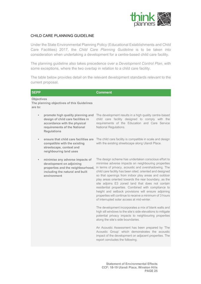
1. State Environmental Planning Policy (Educational Establishments & Child Care Facilities) 2017
a. The proposed development is inconsistent with the following Design Quality Principles prescribed under the Child Care Planning Guideline 2017:
· Principle 1 – Context;
· Principle 5 – Landscape;
· Principle 6 - Amenity
· Principle 7 – Safety;
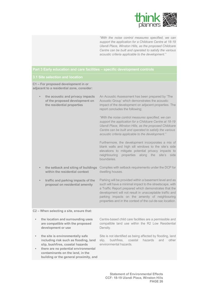
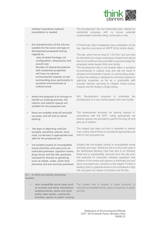
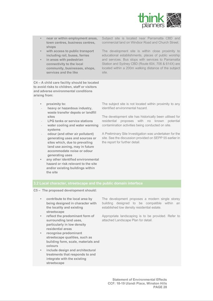
· Part 3.1 – Site selection and location;
· Part 3.2 – Local Character, streetscape and the public domain interface;
· Part 3.3 Building orientation, envelope, building design and accessibility
b. The proposed development is inconsistent with the following clauses under the Education and Care Services National Regulations:
· Regulation 97 & 168 – Emergency Evacuation;
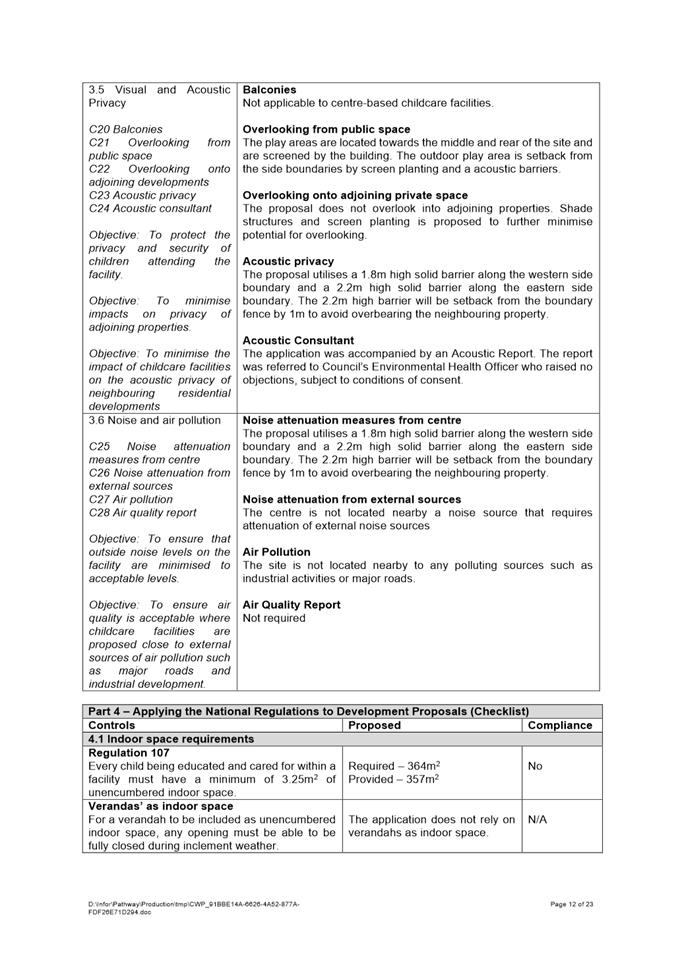
· Regulation 107 – Unencumbered Indoor Play Space; and
· Regulation 108 – Unencumbered Outdoor Play Space.
2. Parramatta Development Control Plan 2011
a. The proposed development is inconsistent with the following provisions of Parramatta Development Control Plan 2011:
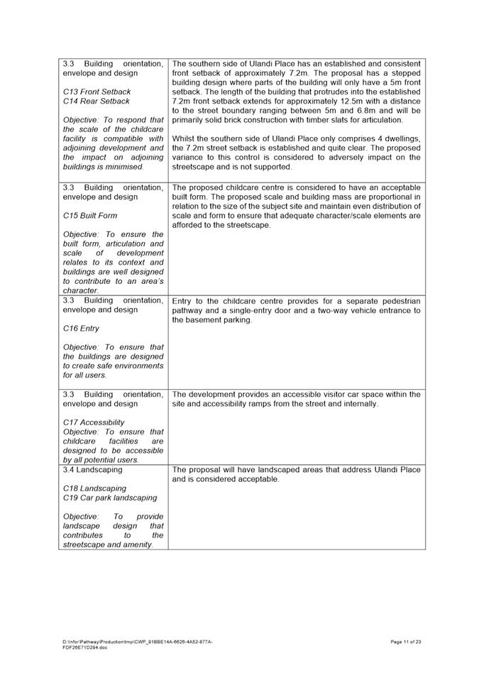
· Part 3.1.3 – Preliminary Building Envelopes – Front Setback
· Part 3.3.6.1 – Water Sensitive Urban Design
3. Environmental Planning and Assessment Act 1979
a. As highlighted above, the proposal has non-compliances with SEPP (Educational Establishments and Child Care Facilities) 2017, and Parramatta DCP 2011. Accordingly, the proposal fails to satisfy the matters of consideration prescribed under s4.15(1)(a)(i) and (iii) of the EP&A Act 1979.
b. As the proposed development inconsistent with critical provisions of child care centres required to ensure amenity of the children, staff and the surrounding locality, the proposal is not considered to be in the public interest and also fails to satisfy s4.15(1)(b), (d), and (e) of the EP&A Act 1979.
Darren Wan
Development Assessment
|
1⇩ |
Assessment Report |
23 Pages |
|
|
2⇩ |
Locality Map |
1 Page |
|
|
3⇩ |
Complete Architectural Plans |
31 Pages |
|
|
4⇩ |
Statement of Environmental Effects |
70 Pages |
|
REFERENCE MATERIAL
ITEM NUMBER 5.4
SUBJECT OUTSIDE PUBLIC MEETING:
12 James Street, CARLINGFORD
(Lot 1 DP 120826)
DESCRIPTION Section 4.55(1A) modification of DA/80/2019 for the demolition of existing structures, tree removal and the construction of an eighteen (18) storey mixed use development containing 64 apartments and ground floor retail space over 5 levels of basement parking. The modifications include the reconfiguration of the ground floor, increase to FSR and height, inclusion of a garbage chute and garbage room in the basement, and the relocation of the substation to the James Street frontage.
REFERENCE DA/80/2019/A - D08386535
APPLICANT/S Moma Architects
OWNERS Paramount Investments Pty Limited and Carlingford Investments Pty Limited
REPORT OF Group Manager Development and Traffic Services
RECOMMENDED APPROVAL
DATE OF REPORT 15 february 2022
REASON FOR REFERRAL TO LPP
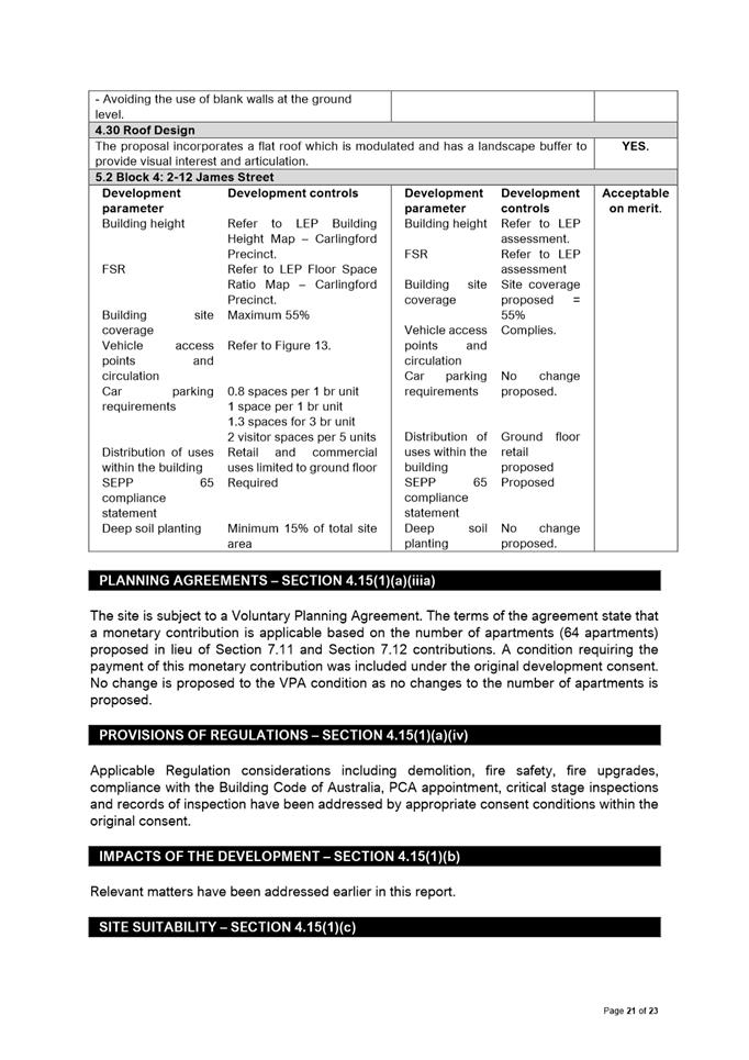
This application is referred to the Parramatta Local Planning Panel as a variation of greater than 10% is sought to Clause 4.4 – Floor Space Ratio under the Parramatta (former The Hills) Local Environmental Plan 2012.
EXECUTIVE SUMMARY
This is a summary of the full assessment of the application as outlined in Attachment 1, the Section 4.55 Assessment Report.
The Site
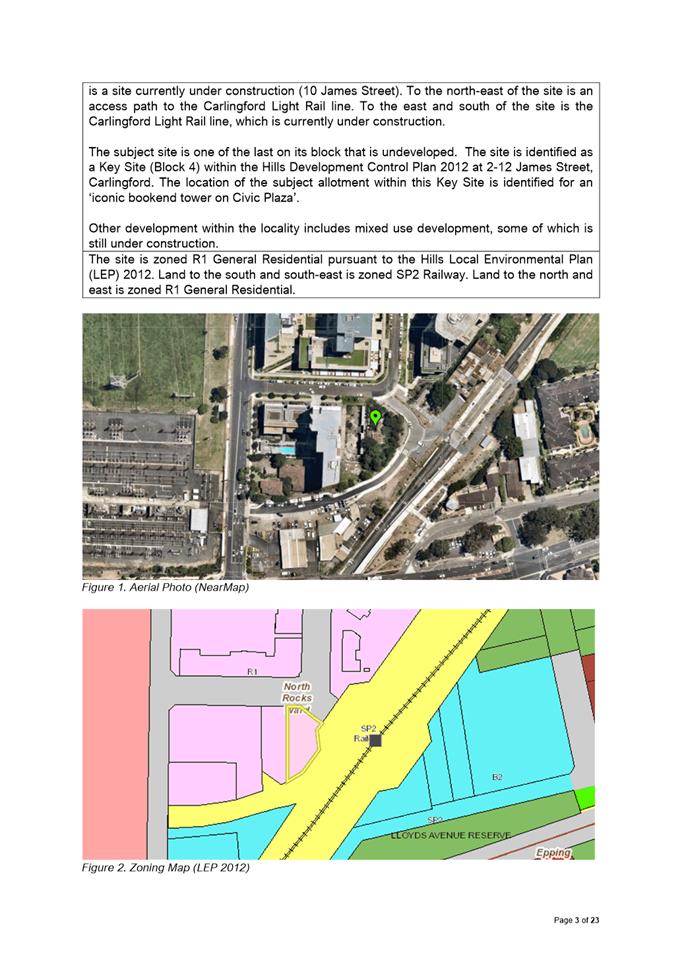
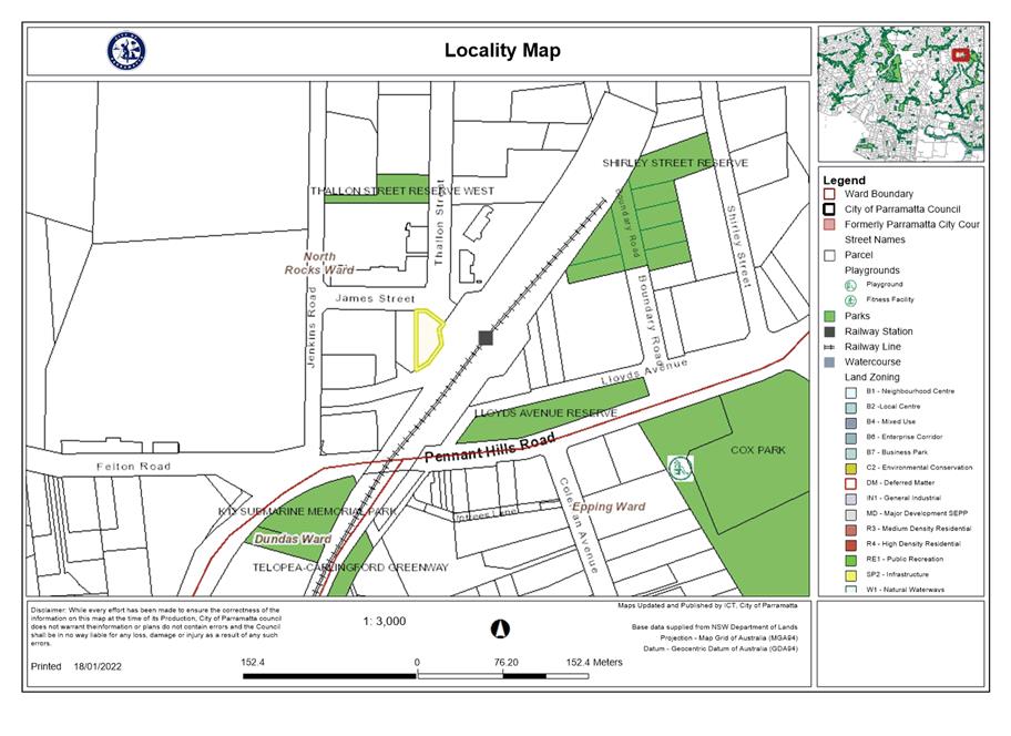
The site is known as 12 James Street, Carlingford (Lot 1 DP 120826). The site is an irregular shaped allotment with a total area of 925.7m2 and has an 8.7m frontage to Jenkins Road, 19.8m frontage to the existing pathway adjacent to Carlingford Railway Station and a western boundary of 32m. The site currently contains an existing single storey dwelling and a number of trees.
The site is adjoining Carlingford Railway Station and is proximity to nearby shops at Carlingford Village. Adjoining the site to the west is a site currently under construction (10 James Street). To the north-east of the site is an access path to the Carlingford Light Rail. To the east and south of the site is the Carlingford Light Rail line, which is currently under construction.
The subject site is one of the last on its block that is undeveloped. The site is identified as a Key Site (Block 4) within the Hills Development Control Plan 2012 at 2-12 James Street, Carlingford. The location of the subject allotment within this Key Site is identified for an ‘iconic bookend tower on Civic Plaza’. Other development within the locality includes mixed use development, some of which is still under construction.
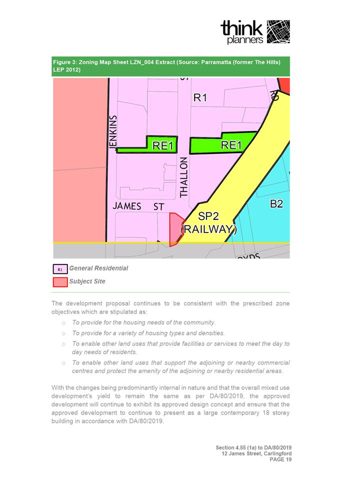
The site is zoned R1 General Residential pursuant to the Hills Local Environmental Plan (LEP) 2012. Land to the south and south-east is zoned SP2 Railway. Land to the north and east is zoned R1 General Residential.
The Proposal
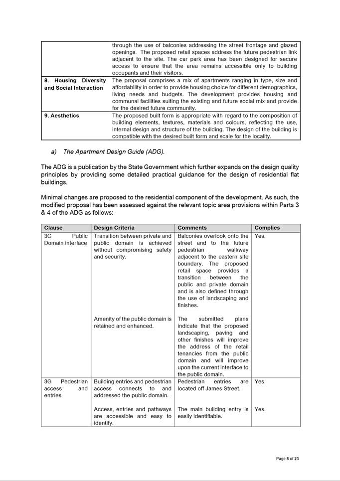
Consent is sought to modify the approved demolition of existing structures, tree removal and the construction of an eighteen (18) storey mixed use development containing 64 apartments and ground floor retail space over 5 levels of basement parking.
The proposed modifications include:
· Reconfiguration of the ground floor to allow the retail premises to better front and address Carlingford Light Rail Plaza.
· Minor increase to the FSR, mainly due to converting existing approved services areas into retail space which will result in an increase to the overall retail GFA from 111m2 to 281m2, an increase of 170m2.
· Increase in the approved height limit to allow for the mechanical ducts on the roof
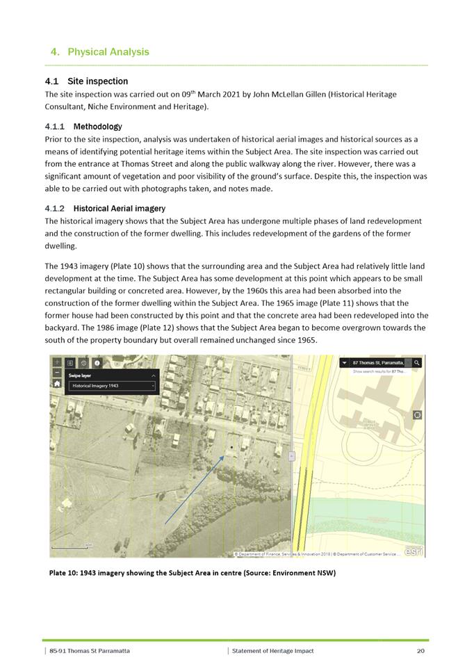
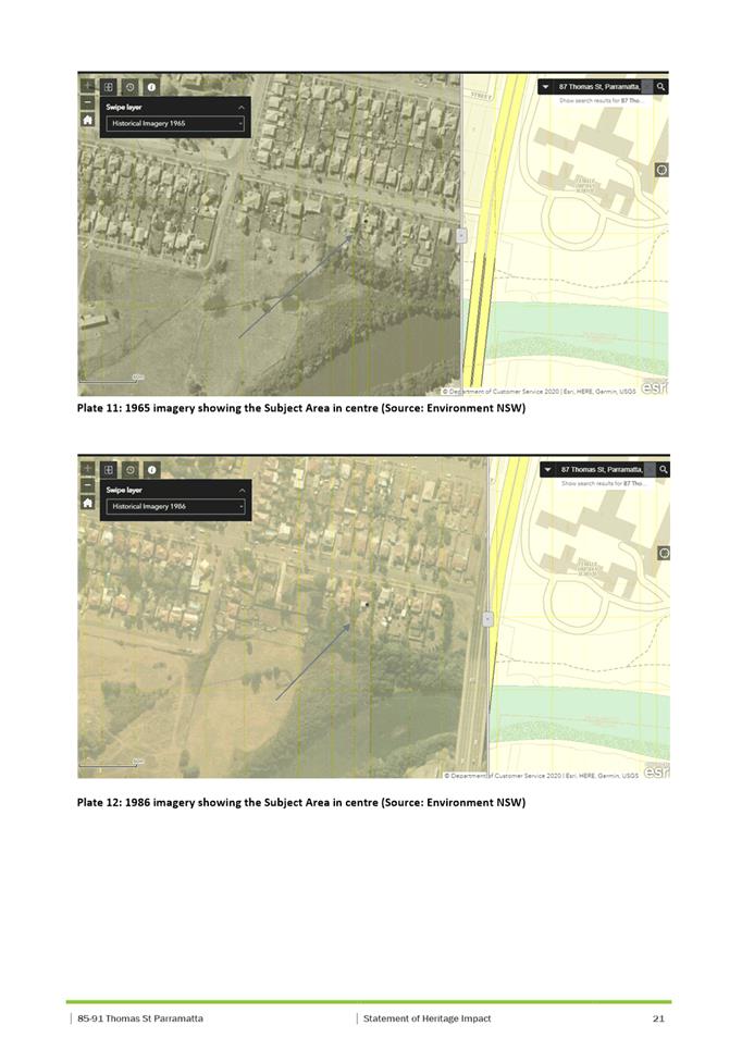
· Inclusion of services ducts and risers as required.
· Inclusion of a garbage chute and garbage room in the basement.
· Relocation of the substation to the front of the site in a Padmount configuration, with subsequent reconfiguration of Unit on Level 1 next to the existing internal double height substation space.
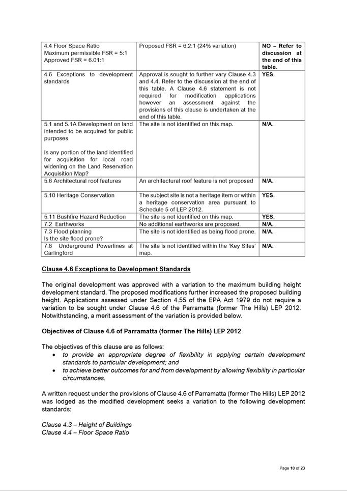
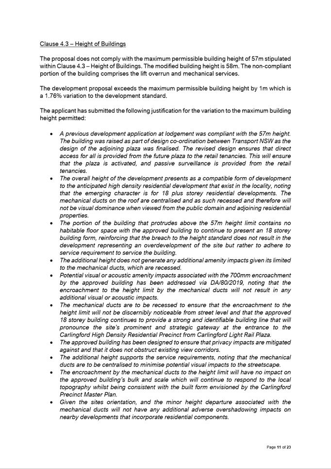
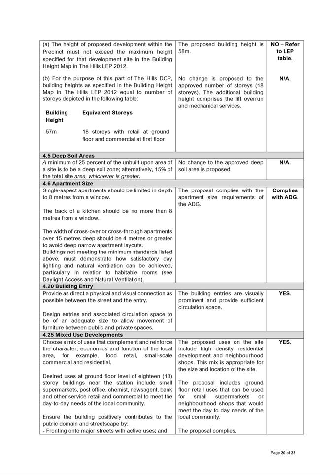
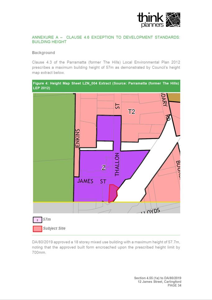
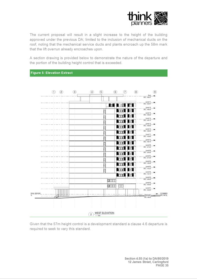
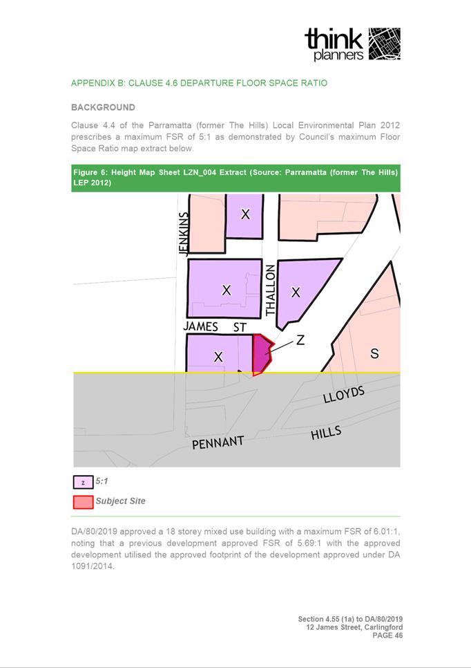
The modification application proposes to exceed the 57m maximum building height control by 1m (1.75% variation), resulting in a maximum height of 58m above natural ground level. The non-compliant portion of the building comprises the lift overrun and mechanical services. The application was accompanied by a Clause 4.6 Statement, which is considered well founded.
The approved floor space ratio for the development is 6.01:1. The application proposes to exceed the 5:1 maximum floor space ratio control resulting in a total floor space ratio of 6.2:1 (24% variation). The application was accompanied by a Clause 4.6 Statement, which is considered well founded.
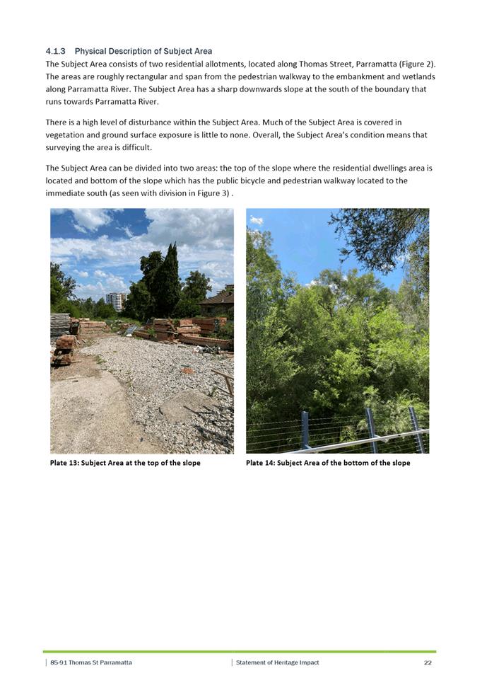
The application was referred to Endeavour Energy. No objections were raised to the proposed modifications.
The application was notified in accordance with Council’s notification procedures contained within DCP 2012. In response two submissions were received which are addressed within the Section 4.55 assessment report.
After consideration of the development against Section 4.55 of the Environmental Planning and Assessment Act 1979, and the relevant statutory and policy provisions, the proposal is suitable for the site and is in the public interest.
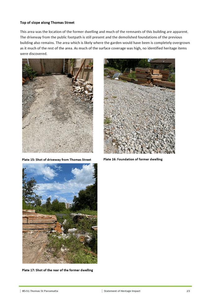
(a) That the Parramatta Local Planning Panel exercising the functions of Council as the consent authority pursuant to Section 4.55 of the Environmental Planning and Assessment Act 1979, modify development consent DA/80/2019 to include modifications to the approved demolition of existing structures, tree removal and the construction of an eighteen (18) storey mixed use development containing 64 apartments and ground floor retail space over 5 levels of basement parking at 12 James Street, Carlingford, as shown on the plans submitted with the modification application, for a period of five (5) years from the date on the original Notice of Determination, subject to the following amendments:
1. Amend Condition No. 1 to reflect the updated plans and documents.
2. All other conditions of DA/80/2019 remain unchanged.
(b) That Parramatta Local Planning Panel approve a variation to the building height control prescribed in Clause 4.3 – Building Height in Parramatta (former The Hills) Local Environmental Plan 2012, as it satisfies the objectives of the control and the R1 General Residential zone, and there are sufficient environmental planning grounds to justify the variation.
(c) That Parramatta Local Planning Panel approve a variation to the building height control prescribed in Clause 4.4 – Floor Space Ratio in Parramatta (former The Hills) Local Environmental Plan 2012, as it satisfies the objectives of the control and the R1 General Residential zone, and there are sufficient environmental planning grounds to justify the variation.
(d) Further, that submitters are advised of the decision.
REASONS FOR APPROVAL:
1. The proposed development is substantially the same as the development which has been approved.
2. The proposed development is permissible within the R1 General Residential zone and results in a development which is suitable within the context of the future desired character of this locality.
3. The proposed development results in reasonable impacts to adjoining properties and the locality and is suitable for the site and is in the public interest.
Sohini Sen
Senior Development Assessment Officer
Sarah Irani
Team Leader Development Support
|
1⇩ |
Assessment Report and draft Conditions |
72 Pages |
|
|
2⇩ |
Locality Map used during assessment |
1 Page |
|
|
3⇩ |
Plans used during assessment |
5 Pages |
|
|
Internal plans used during assessment (confidential) |
13 Pages |
|
|
|
5⇩ |
Statement of Environmental Effects used during assessment |
55 Pages |
|
REFERENCE MATERIAL
ITEM NUMBER 5.5
SUBJECT OUTSIDE PUBLIC MEETING:
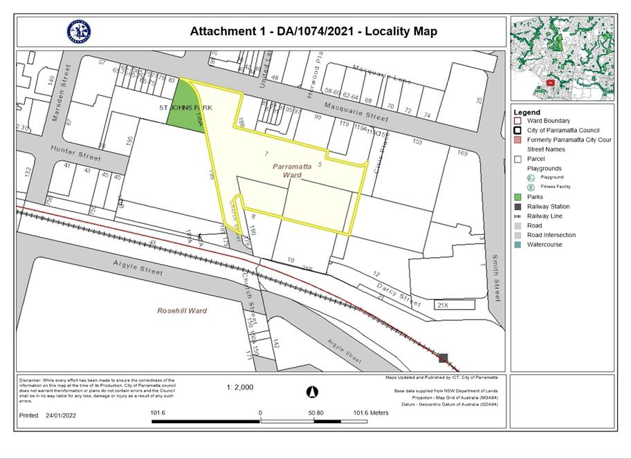
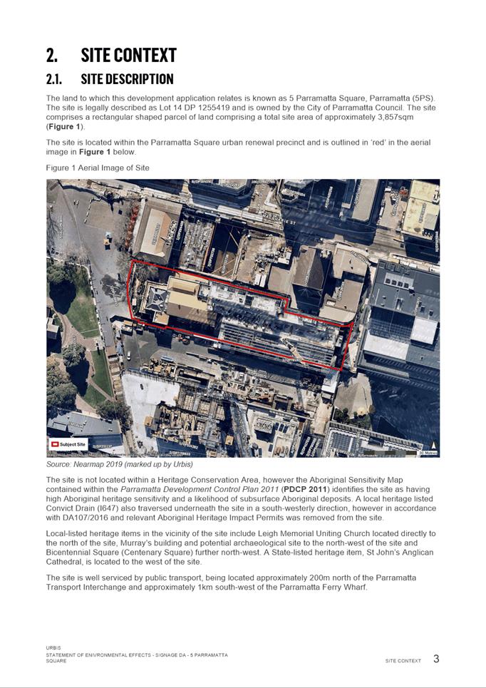
Civic Place PARRAMATTA (known as 5 Parramatta Square)
(Lot 14 DP 1255419)
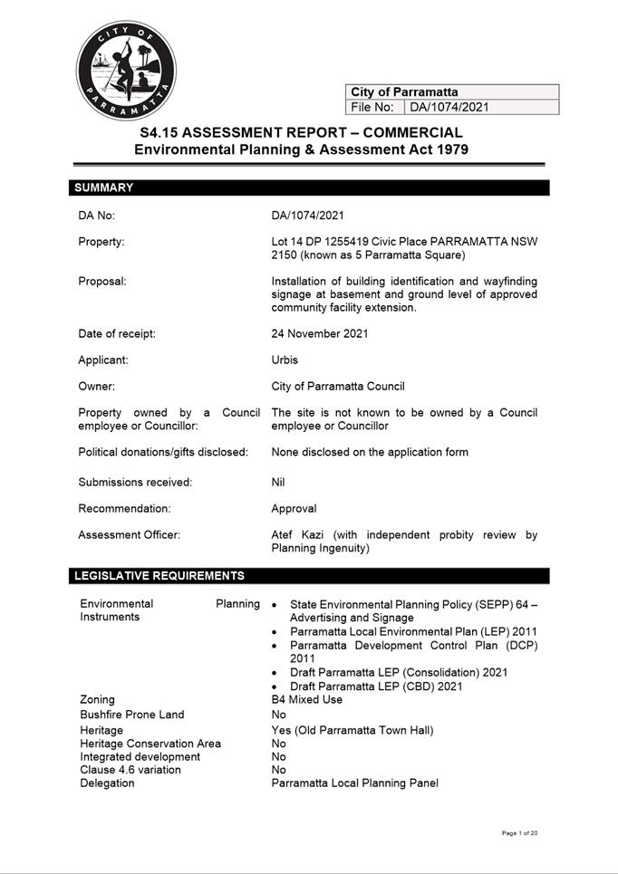
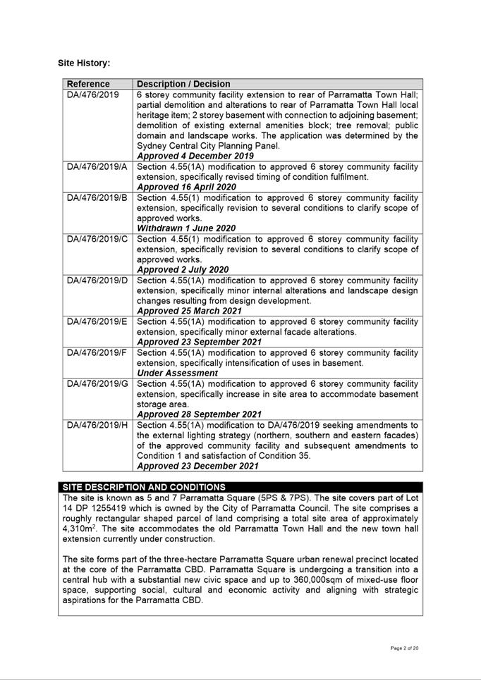
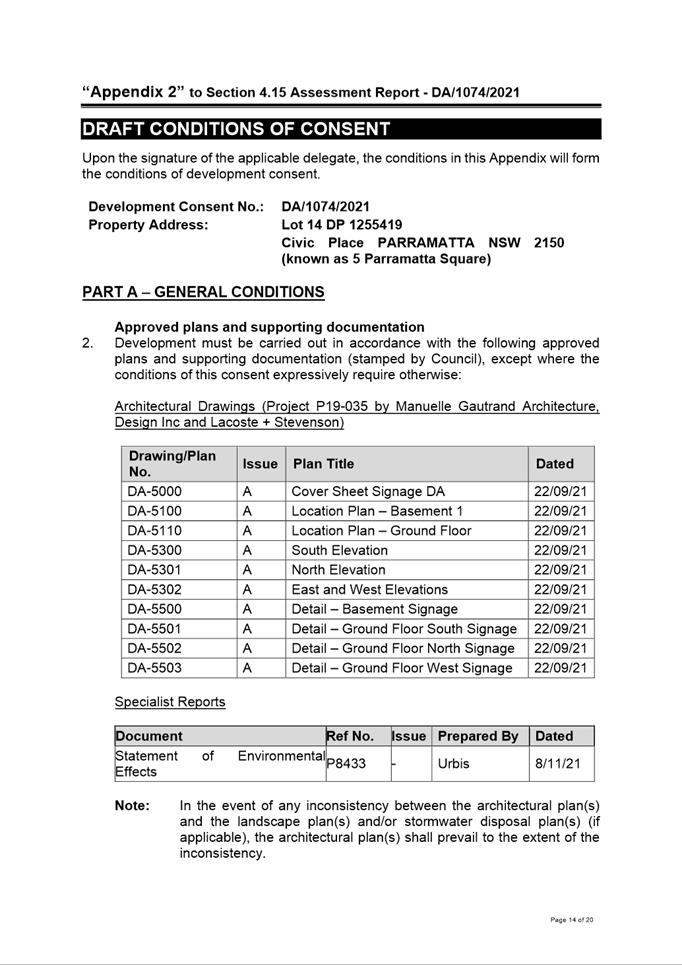
DESCRIPTION Installation of building identification and wayfinding signage at basement and ground level of approved community facility extension.
REFERENCE DA/1074/2021 - D08393271
APPLICANT/S Urbis
OWNERS City of Parramatta
REPORT OF Group Manager Development and Traffic Services
RECOMMENDED APPROVAL
DATE OF REPORT 24 January 2022
REASON FOR REFERRAL TO LPP
The property is owned by City of Parramatta Council.
EXECUTIVE SUMMARY
Subject Site
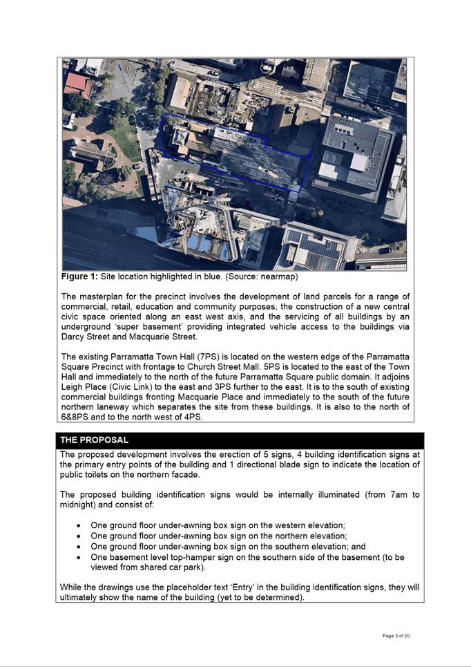
The site is known as 5 and 7 Parramatta Square (5PS & 7PS). The site covers part of Lot 14 DP 1255419 which is owned by the City of Parramatta Council. The site comprises a roughly rectangular shaped parcel of land comprising a total site area of approximately 4,310m2. The site accommodates the old Parramatta Town Hall and the new town hall extension currently under construction.
The site forms part of the three-hectare Parramatta Square urban renewal precinct located at the core of the Parramatta CBD. Parramatta Square is undergoing a transition into a central hub with a substantial new civic space and up to 360,000sqm of mixed-use floor space, supporting social, cultural and economic activity and aligning with strategic aspirations for the Parramatta CBD.
The existing Parramatta Town Hall (7PS) is located on the western edge of the Parramatta Square Precinct with frontage to Church Street Mall. 5PS is located to the east of the Town Hall and immediately to the north of the future Parramatta Square public domain. It adjoins Leigh Place (Civic Link) to the east and 3PS further to the east. It is to the south of existing commercial buildings fronting Macquarie Place and immediately to the south of the future northern laneway which separates the site from these buildings. It is also to the north of 6&8PS and to the north west of 4PS.
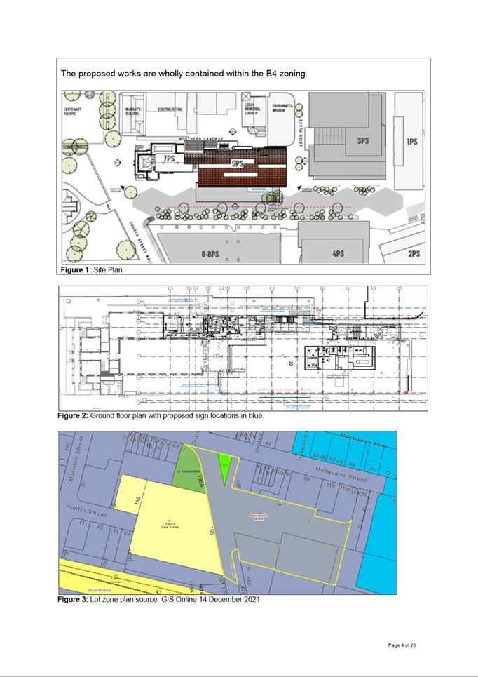
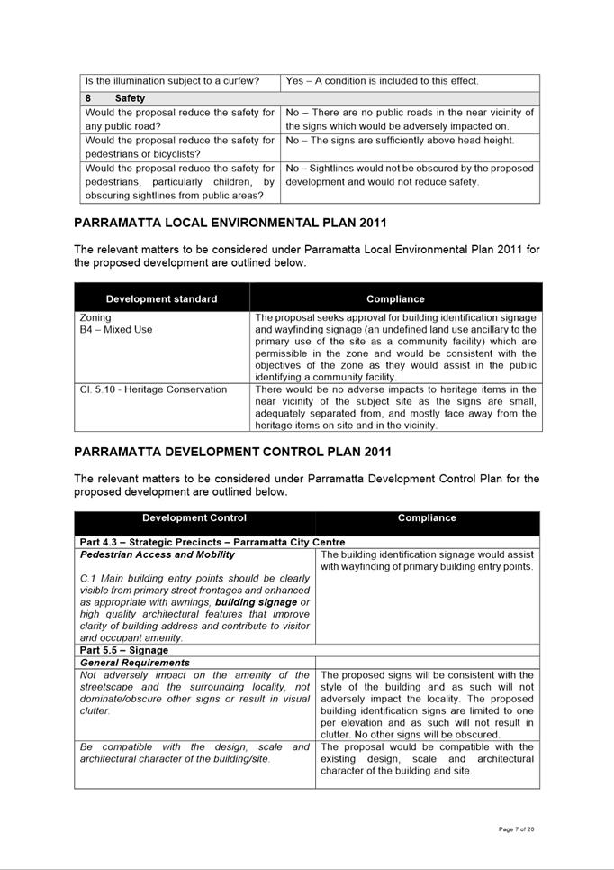
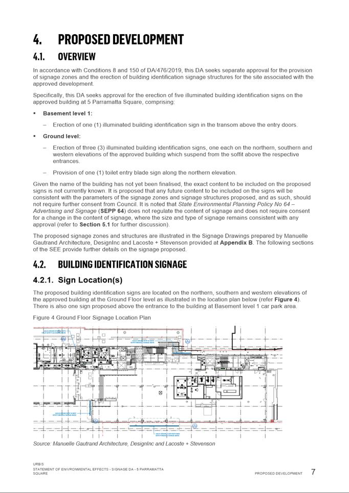
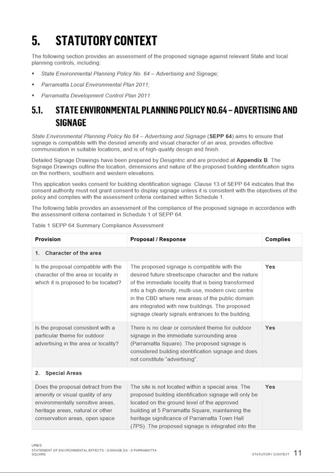
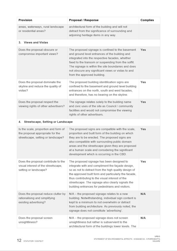
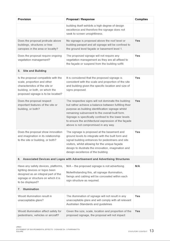
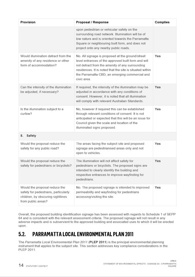
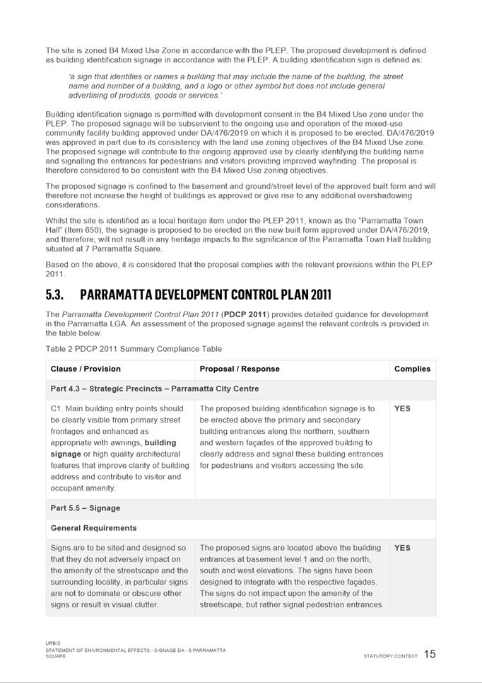
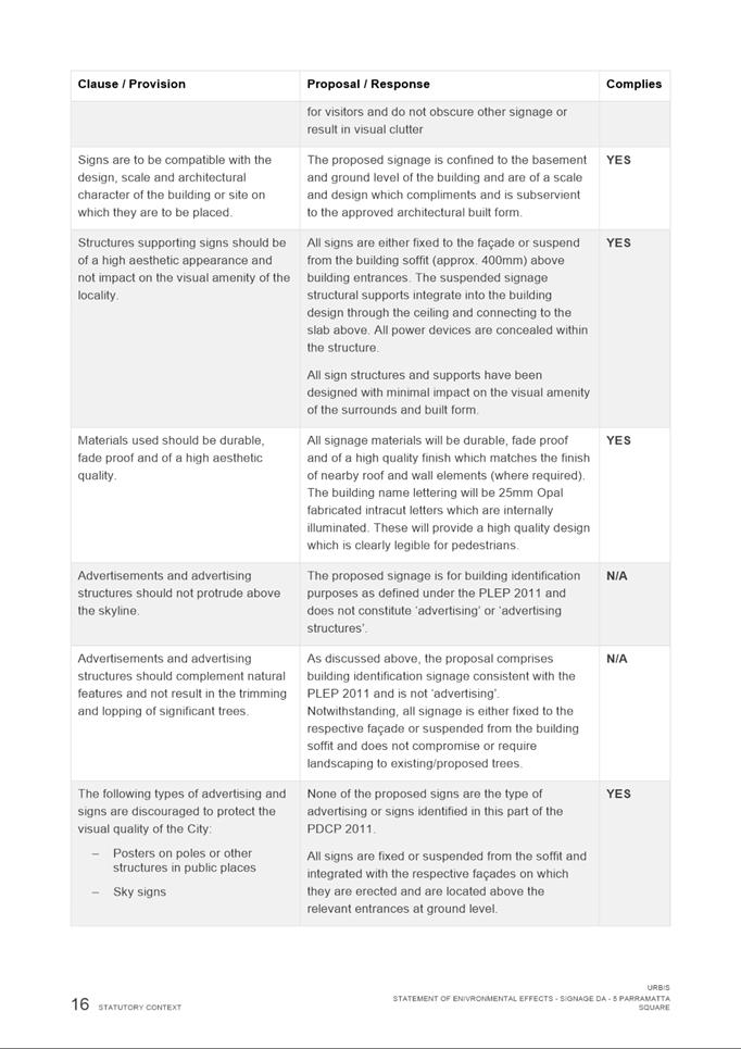
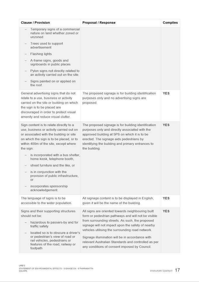
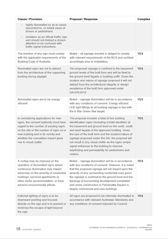
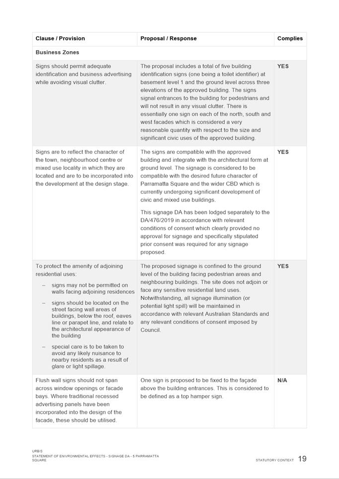
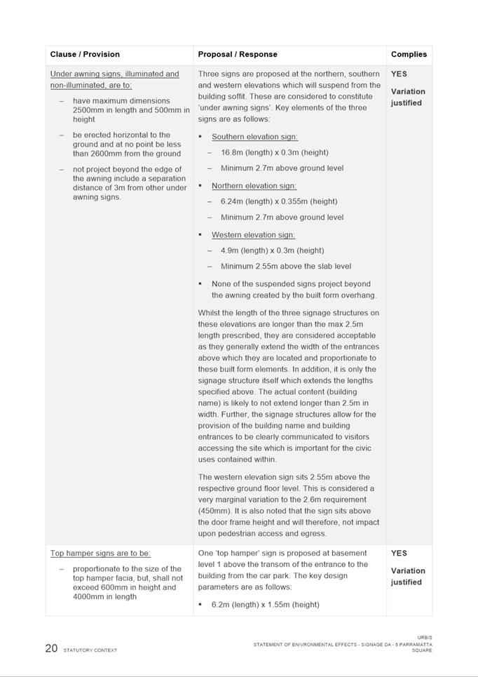
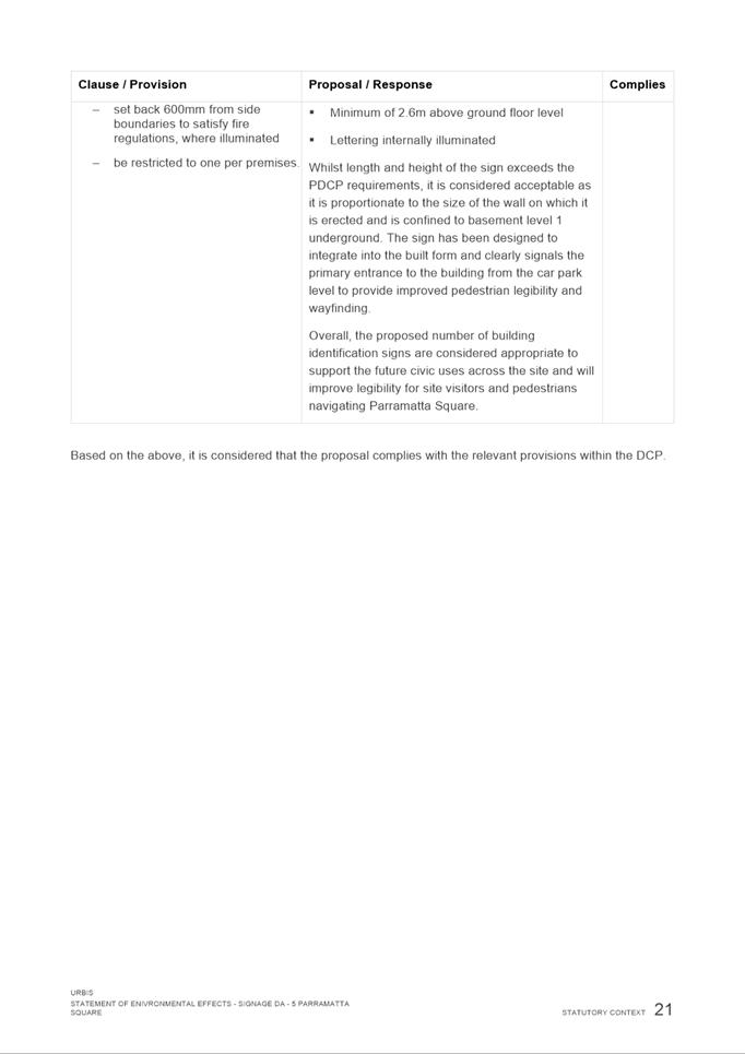
The Proposal
The proposed development involves the erection of 5 signs, 4 building identification signs at the primary entry points of the building and 1 directional blade sign to indicate the location of public toilets on the northern facade.
The proposed building identification signs would be internally illuminated (from 7am to midnight) and consist of:
· One ground floor under-awning box sign on the western elevation;
· One ground floor under-awning box sign on the northern elevation;
· One ground floor under-awning box sign on the southern elevation; and
· One basement level top-hamper sign on the southern side of the basement (to be viewed from shared car park).
While the drawings use the placeholder text ‘Entry’ in the building identification signs, they will ultimately show the name of the building (yet to be determined).
The proposed works are wholly contained within the B4 zoning.
That pursuant to section 4.16 of the Environmental Planning and Assessment Act, 1979, Council grant development consent to DA/1074/2021 for a period of five (5) years within which physical commencement is to occur from the date on the Notice of Determination, subject to conditions of consent.
REASONS FOR APPROVAL:
1. To facilitate the orderly implementation of the objectives of the Environmental Planning and Assessment Act 1979 and the aims and objectives of the relevant Council Planning instrument.
2. To ensure that the local amenity is maintained and is not adversely affected and that adequate safeguards are incorporated into the development.
3. To ensure the development does not hinder the proper and orderly development of the subject land and its surrounds.
4. To ensure the relevant matters for consideration under section 4.15 of the Environmental Planning and Assessment Act 1979 are maintained.
Atef Kazi
Development Assessment Officer
Sarah Irani
Team Leader Development Support
|
1⇩ |
Assessment Report and Draft Conditions |
20 Pages |
|
|
2⇩ |
Locality Map |
1 Page |
|
|
3⇩ |
Plans used during assessment |
10 Pages |
|
|
4⇩ |
Statement of Environmental Effects used during assessment |
33 Pages |
|
|
5⇩ |
Probity Review Assessment |
2 Pages |
|
REFERENCE MATERIAL
ITEM NUMBER 5.6
SUBJECT OUTSIDE PUBLIC MEETING:
334 Pennant Hills Road, CARLINGFORD
(Lot 10 DP 1216207)
DESCRIPTION Section 4.15 Application seeking consent for the Construction of a marquee over an existing bowling green at the Carlingford Sports and Recreation club to be used as badminton courts, and construction of new lift access and parking.
REFERENCE DA/701/2021 - D08399868
APPLICANT/S Think Planners
OWNERS City of Parramatta Council
REPORT OF Group Manager Development and Traffic Services
RECOMMENDED REFUSAL
DATE OF REPORT - 15 February 2022
REASON FOR REFERRAL TO LPP
This item is being referred to the Parramatta Local Planning Panel as the owner of the subject site is The City of Parramatta Council.
EXECUTIVE SUMMARY
This is a summary of the full assessment of the application as outlined in Attachment 1, the Section 4.15 Assessment Report.
Site & Proposal
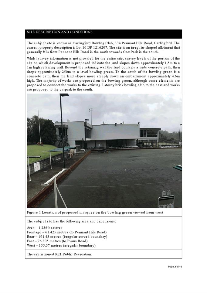
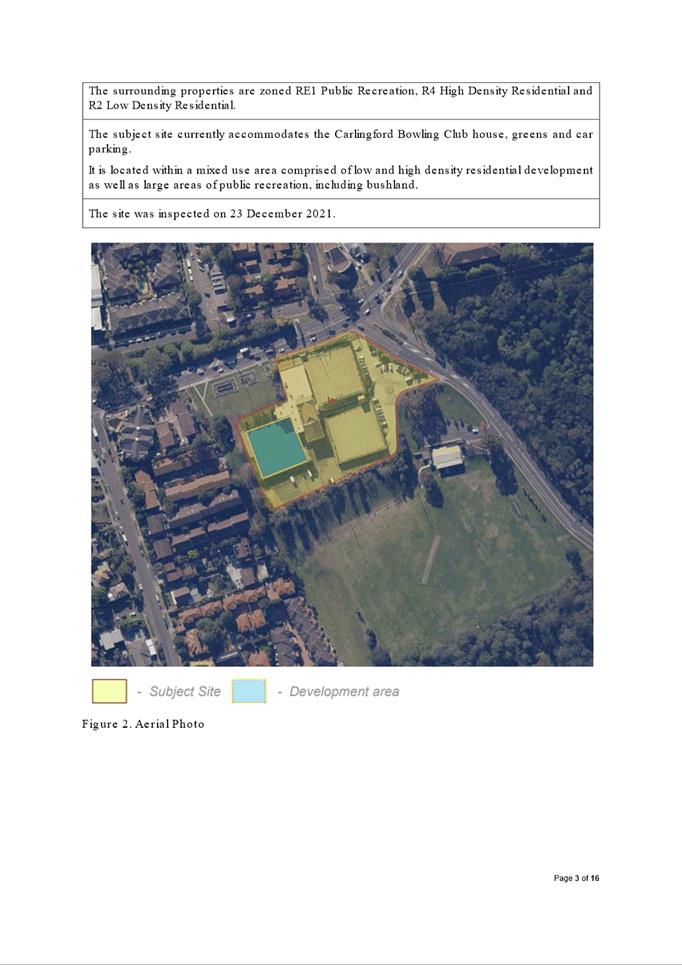
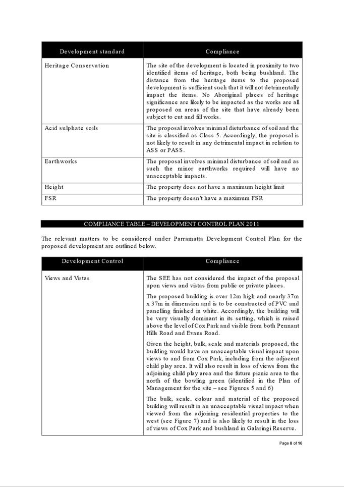
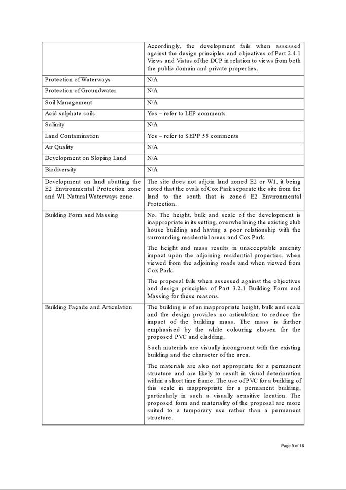
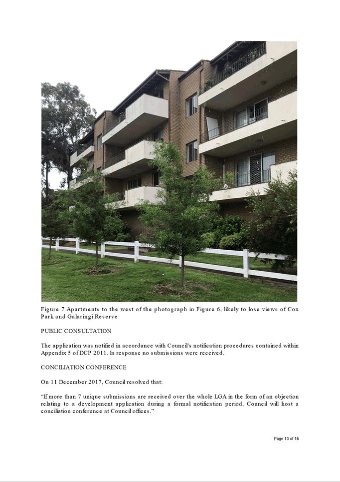
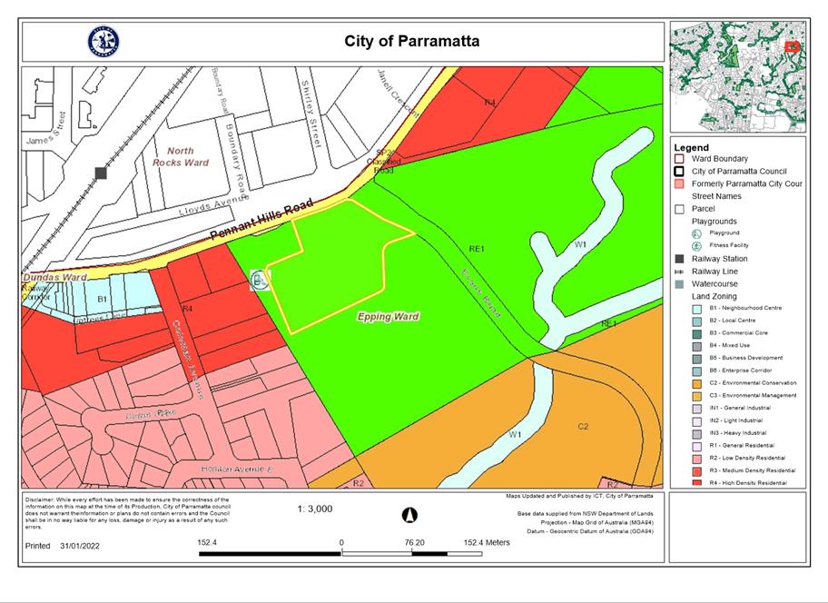
The subject site is known as Carlingford Bowling Club, 334 Pennant Hills Road, Carlingford. The current property description is Lot 10 DP 1216207. The site is an irregular shaped allotment that generally falls from Pennant Hills Road in the north towards Cox Park in the south. The subject site is a large, regularly shaped corner allotment with a significant slope from the eastern street boundary to the western rear boundary of approximately 7 metres over a distance of 70 metres.
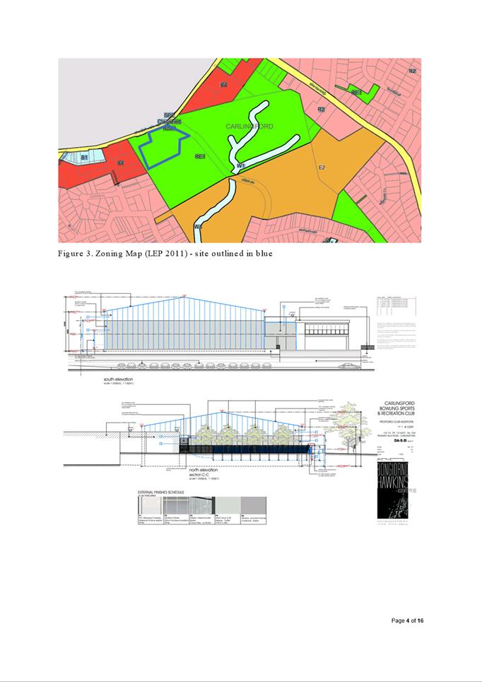
The site is located within an RE1 Public Recreation zone pursuant to Parramatta Local Environmental Plan 2011 under which a recreation facility (indoor), as follows, which is a permissible use with consent in the zone.
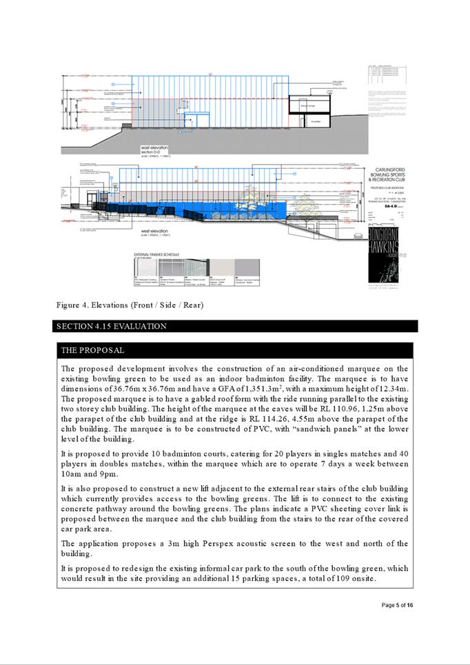
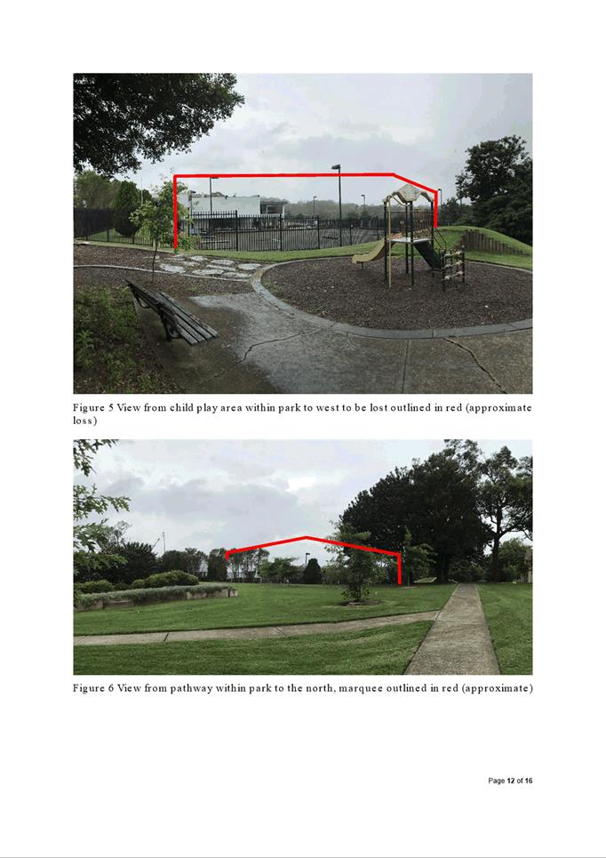
The proposed development involves the construction of an air-conditioned marquee , with dimensions of 36.76m x 36.76m, with maximum height of 12.34m and with a GFA of 1,351.3m2 on the existing bowling green to be used as an indoor badminton facility.
It is proposed to provide 10 badminton courts, catering for 20 players in singles matches and 40 players in doubles matches, within the marquee which are to operate 7 days a week between 10am and 9pm.
It is also proposed to construct a new lift adjacent to the external rear stairs of the club building connecting to the existing car park/concrete pathway around the bowling greens with a PVC sheeting cover link between the marquee and the club building from the stairs to the rear of the covered car park area.
The application proposes a 3m high Perspex acoustic screen to the west and north of the building.
It is proposed to redesign the existing informal car park to the south of the bowling green, which would result in the site providing an additional 15 parking spaces, a total of 109 onsite.
A ramp is proposed to provide access to WC and change rooms. No detail is provided of the WC or change room to allow an assessment of their suitability.
The proposal does not seek approval for the removal of vegetation.
Assessment
The application was assessed against the relevant environmental planning instruments, the proposal in its current form exhibits several non-compliances.
The applicant was requested to provide amended documentation from 1 October 2021 to address the non-compliances, however, at the time of writing the report (dated 24 December 2021), no documentation has been received. Accordingly, the application is recommended for refusal based on insufficient information preventing a complete assessment to be undertaken.
Information still required to undertake a complete assessment include:
· Lighting for the use of the marquee at night
· Shadow diagrams as requested since the Pre-DA minutes dated 1 April 2021
· Details of amenities are shown for the lower floor suggested to be used for persons playing badminton. Inadequate information has been provided showing an adequate accessible path of travel.
· Separation between the court and court walls are narrow (1m) and therefore unclear as to whether an accessible path of travel can be provided for spectators.
· Accessibility report as requested since the Pre-DA minutes dated 1 April 2021
· How the enclosure of the south-western side of the building, which provides connection between the marquee and the building, will impact other uses on the site and their accessibility
· Concern is raised that the proposed accessible ramp to amenities may reduce the size of the existing loading bay and result in conflicts between pedestrians and loading operations.
(a) That the Parramatta Local Planning Panel exercising the functions of Council pursuant to Section 4.17 of the Environmental Planning and Assessment Act 1979 refuse DA/701/2021 for the following reasons.
REASONS FOR REFUSAL:
1. Parramatta Development Control Plan 2011
(a) The proposed development is inconsistent with the following provisions of Parramatta Development Control Plan 2011:
· Part 3.2.1 Building Form and Massing
· Part 3.2.3 Roof Design
· Part 2.4.1 Views and Vistas
· Part 3.2.2 Building Facades and Articulation
· Part 3.3.1 Landscaping
· Part 3.4.2 Access for People with Disabilities
2. Environmental Planning and Assessment Act 1979
(a) As highlighted above, the proposal has non-compliances with Parramatta LEP 2011 and Parramatta DCP 2011. Accordingly, the proposal fails to satisfy the matters of consideration prescribed under s4.15(1)(a)(iii) of the EP&A Act 1979.
(b) As the proposed development does not show consistency with critical provisions of the above instruments, the proposal is not considered to be in the public interest and also fails to satisfy s4.15(1)(b) and (e) of the EP&A Act 1979.
Albert Dzang
Development Assessment Officer
Sarah Irani
Team Leader Development Support
|
1⇩ |
Section 4.15 Assessment Report |
16 Pages |
|
|
2⇩ |
Locality Map |
1 Page |
|
|
3⇩ |
Complete Architectural Plans used during assessment |
32 Pages |
|
REFERENCE MATERIAL
Innovative
15 February 2022
6.1 Post Exhibition: 1 Windsor Road, North Rocks - Planning Proposal and draft Planning Agreement...................................................................................... 666
6.2 Post-Exhibition:
85-91 Thomas Street,
Parramatta - Planning Proposal, Draft Site-Specific
Development Control Plan and Draft Planning Agreement.................... 817
Local Planning Panel 15 February 2022 Item 6.1
ITEM NUMBER 6.1
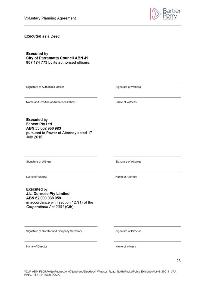
SUBJECT Post Exhibition: 1 Windsor Road, North Rocks - Planning Proposal and draft Planning Agreement
REFERENCE RZ/9/2019 -
APPLICANT/S Fabcot Pty Ltd
OWNERS J L Dunrose Pty Ltd
REPORT OF Project Officer
Development applications considered by Sydney central city planning panel Nil
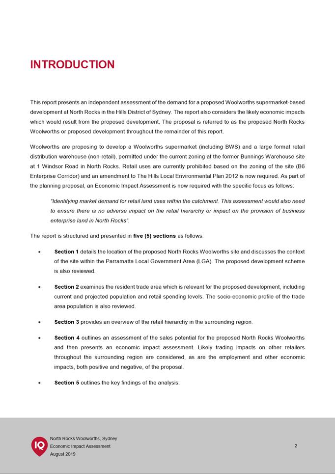
The purpose of this report is to seek the Local Planning Panel’s advice to Council on the outcome of the public exhibition of the Planning Proposal and draft Planning Agreement for land at 1 Windsor Road, North Rocks.
RECOMMENDATION
The Local Planning Panel support the following Council Officer recommendations in the Panel’s advice to Council:
(a) That Council receives and notes submissions made during the public exhibition of the Planning Proposal and draft Planning Agreement for 1 Windsor Road, North Rocks.
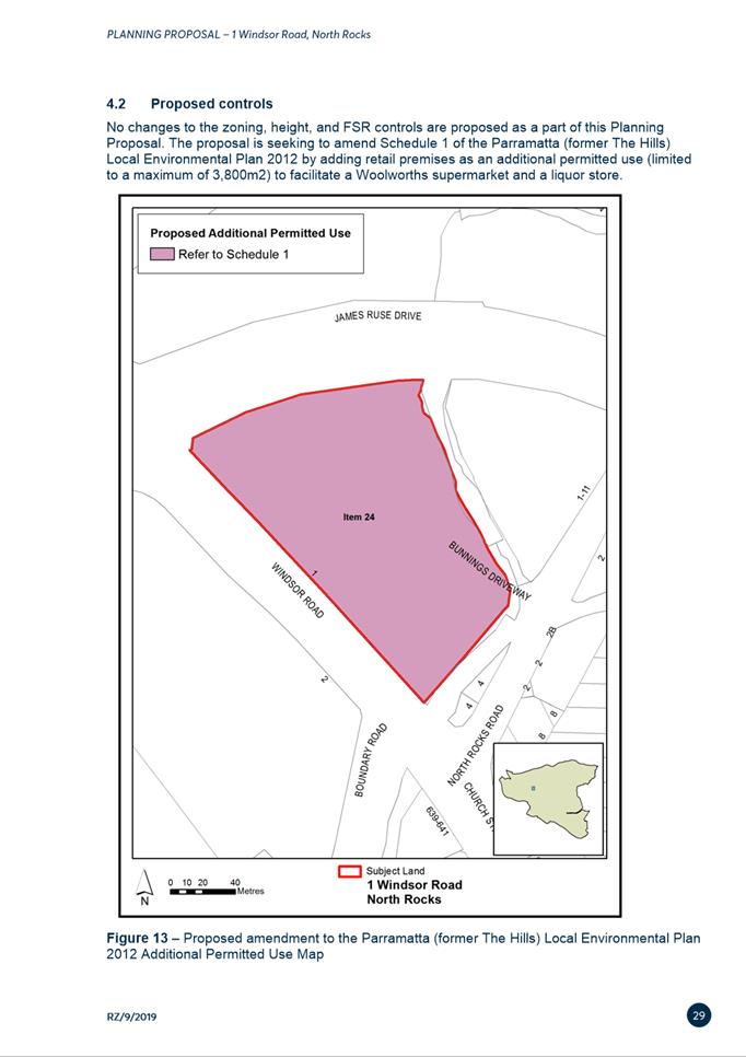
(b) That Council approve the Planning Proposal (at Attachment 1) for land at 1 Windsor Road, North Parramatta for finalisation that seeks to amend Schedule 1 in Parramatta (former The Hills) Local Environmental Plan (LEP) 2012 by adding ‘retail premises’ as an additional permitted use (limited to a maximum of 3,800 m2) to facilitate a supermarket and liquor store.
(c) That Council approve the draft Planning Agreement for finalisation (at Attachment 2), that proposes to:
1. Dedicate a portion of
the and to Council free of cost (the Dedication of Land) for the purpose
of a possible future road widening of James Ruse Drive; and
2. Register a public access easement at no cost to Council, over that part of the Land on which the Bridge Works and the Council Works will be located, in favour of Council (the Easement).
3. That upon receipt of development consent for the site, the developer construct a lightweight steel bridge structure (3m wide) that is to provide further pedestrian access to the Land from North Rocks Road (the Works).
4. That upon receipt of development consent for the site, the developer pay a monetary contribution of $500,000 to Council (the Contribution) to facilitate the construction of a future footbridge connection.
(d) That Council authorise the Chief Executive Officer to exercise the plan making delegations as granted by the Gateway Determination for this Planning Proposal.
(e) Further, that Council delegates authority to the Chief Executive Officer to make any minor amendments and corrections of a non-policy and administrative nature that may arise during the plan amendment process relating to the Planning Proposal.

SITE DESCRIPTION
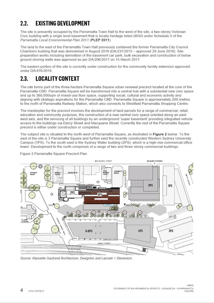
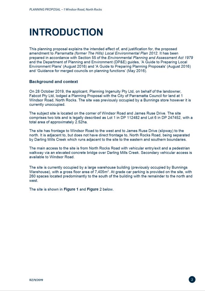
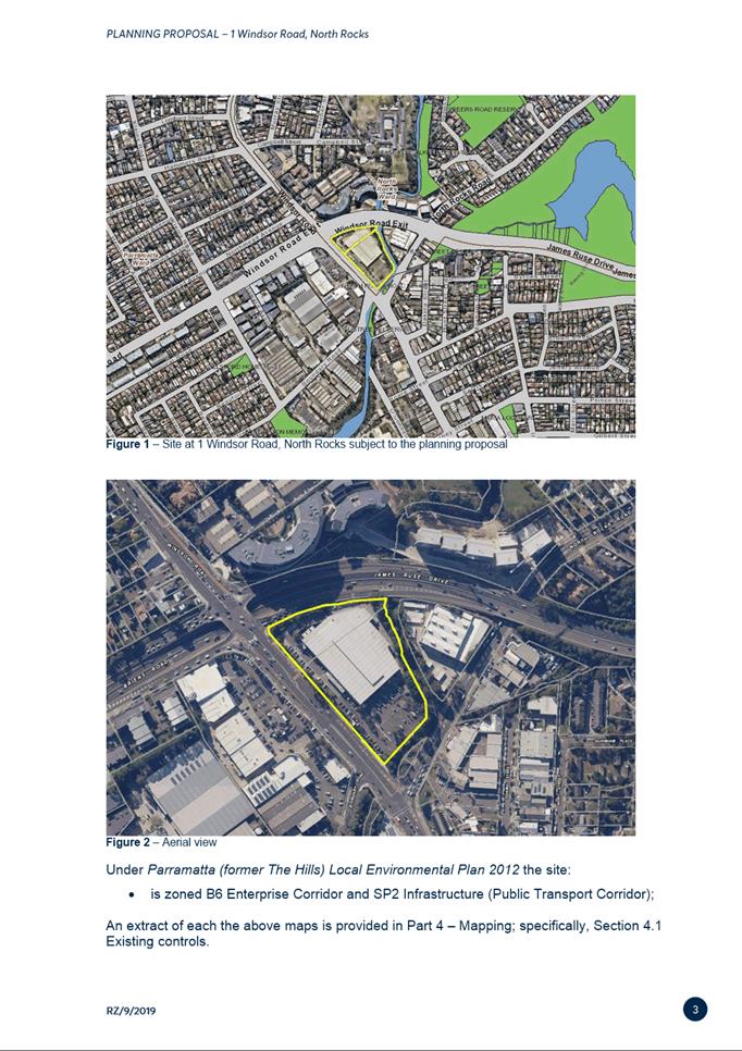
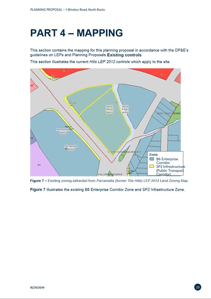
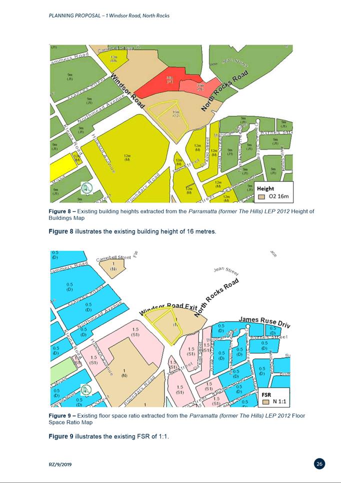
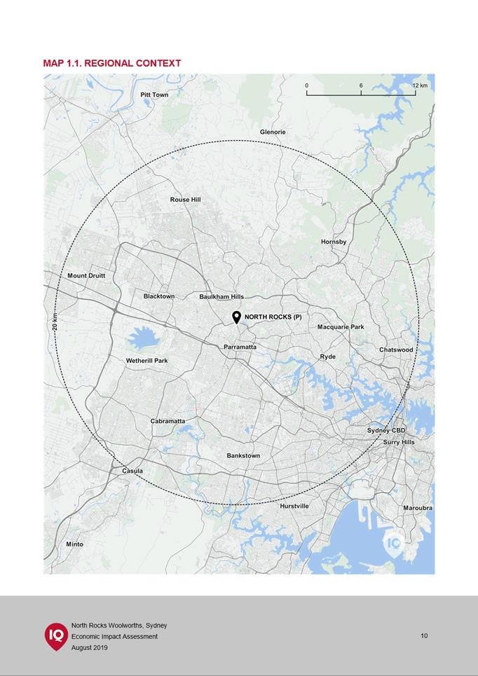
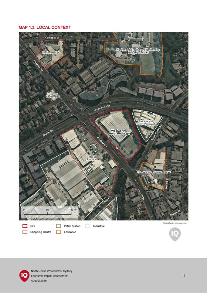
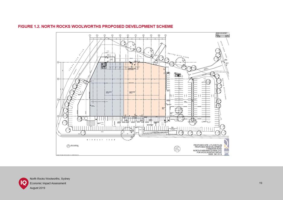
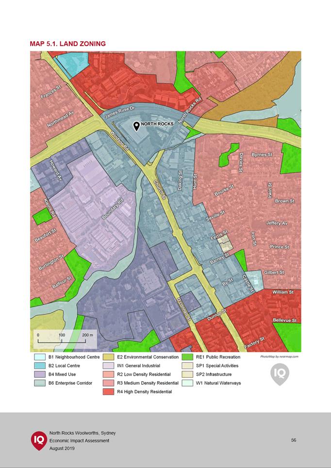
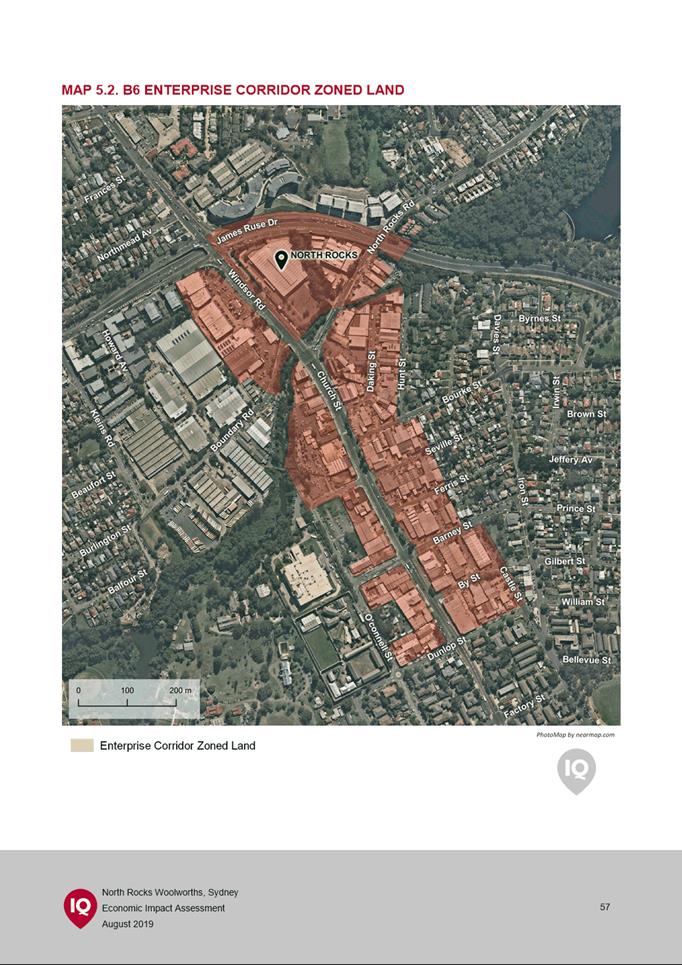
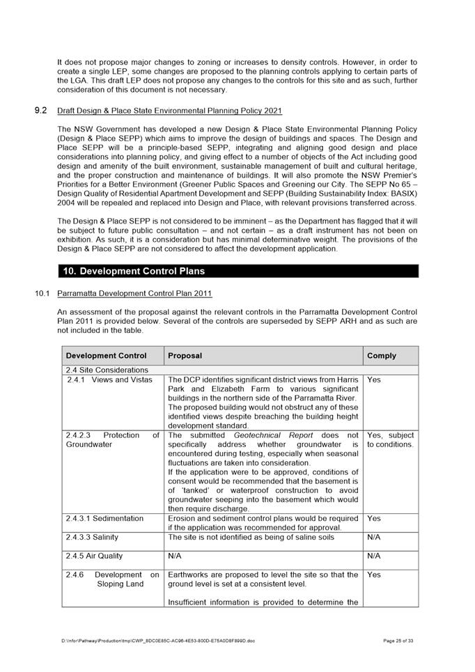
1. The subject site is located on the corner of Windsor Road and James Ruse Drive. The site comprises two lots and is legally described as Lot 1 in DP 112482 and Lot 6 in DP 247452, with a total area of approximately 2.52ha. See Figure 1 and 2 below.
2. The site is currently occupied by a large warehouse building (previously occupied by Bunnings Warehouse), with a gross floor area of 7,405m2. At grade car parking is provided on the site, with 260 spaces located predominantly to the south of the building with the remainder to the north and west.

Figure 1 – Site at 1 Windsor Road, North Rocks subject to the planning proposal

Figure 2 – Aerial view 1 Windsor Road, North Rocks subject to the Planning Proposal
3. At its meeting on 16 June 2020, the Local Planning Panel (LPP) considered a report on a Planning Proposal for the subject site and recommended: that the planning proposal not proceed for the reason that retail premises such as a Woolworths supermarket and liquor store should not be permitted at an isolated site but should be located in or attached to existing town or village centres, in line with sound strategic land use planning. In response to this recommendation, the applicant prepared and submitted further analysis to Council to “demonstrate that the development of a supermarket on the site is entirely appropriate and consistent with the strategic planning framework” (Attachment 3).
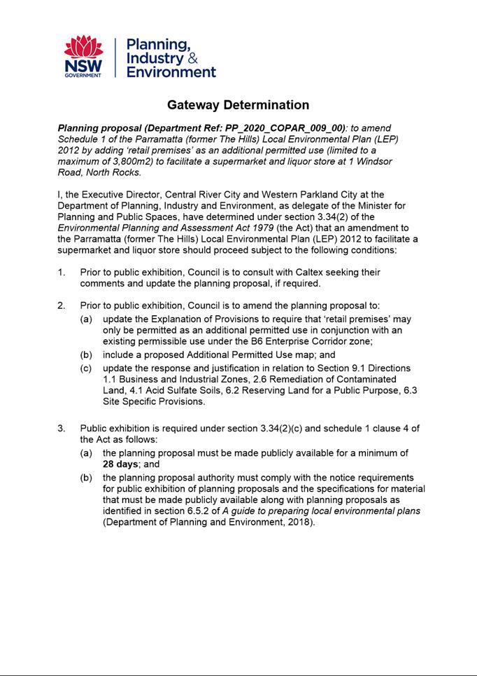
4. At its meeting on 27 July 2020, Council considered this matter, including the additional material that had been supplied by the applicant to address the LPP concerns (Attachment 3), and resolved to endorse the Planning Proposal (Attachment 1), which seeks to amend Schedule 1 of the Parramatta (former The Hills) Local Environmental Plan 2012 by adding retail premises as an additional permitted use (limited to a maximum of 3,800 m2) to facilitate a Woolworths supermarket and a liquor store. In its resolution, Council noted that the original LPP recommendation was to not proceed with the Planning Proposal. The additional information supplied by the applicant to address the matters raised by the LPP are considered later in this report at paragraphs 20 to 24. Consequently, Council resolved to endorse seeking a Gateway Determination for the Planning Proposal.
5. A Gateway Determination was issued by the then Department of Planning, Industry and Environment (DPIE) on 3 November 2020 (refer to Attachment 4). As part of this determination, DPIE authorised Council as the local plan-making authority, which means that should the matter proceed, Council officers will deal directly with the Parliamentary Counsel Office on the legal drafting and mapping of the amendment. The LEP amendment will then be signed by the CEO before being notified on the NSW Legislation website.
6. On 9 August 2021, Council resolved to authorise the CEO to finalise for public exhibition purposes the draft Planning Agreement in order to provide the required infrastructure to support the proposed development in accordance with a submitted Letter of Offer. Council also resolved that the draft Planning Agreement be placed on exhibition concurrently with the Planning Proposal.
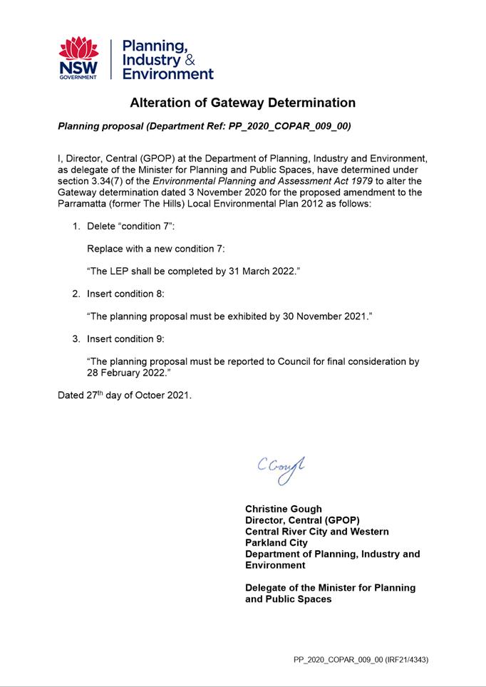
7. On 27 October 2021, DPIE issued a revised Gateway determination (Attachment 5) stating the timeframe for completing the LEP is 31 March 2022.
8. The Planning Proposal, draft Planning Agreement and supporting documentation were publicly exhibited for 28 days from 19 November 2021 to 17 December 2021.
PLANNING PROPOSAL
9. The Planning Proposal seeks to amend The Hills Local Environmental Plan 2012 (Hills LEP 2012) to allow for an additional permissible use (‘retail premises’) at No.1 Windsor Road, North Rocks.
10. The planning proposal will seek approval to permit ‘retail premises’ in the form of a supermarket and liquor shop on the site, to a maximum of 3,800m2. The site is within the B6 Enterprise Corridor Zone, which currently allows a range of non-residential (and commercial) uses but not ‘commercial premises’, of which ‘retail premises’ are a type of ‘commercial premises’ use. The remaining 3,015m2 of the site will be used as a non-retail warehouse and distribution centre, which is permitted with consent in the B6 Enterprise Corridor Zone.
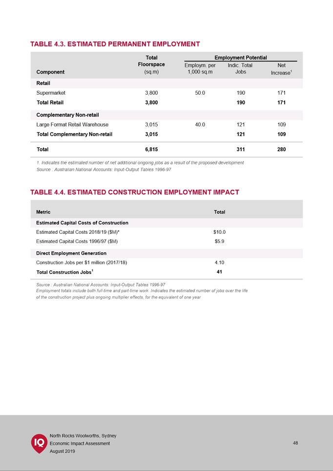
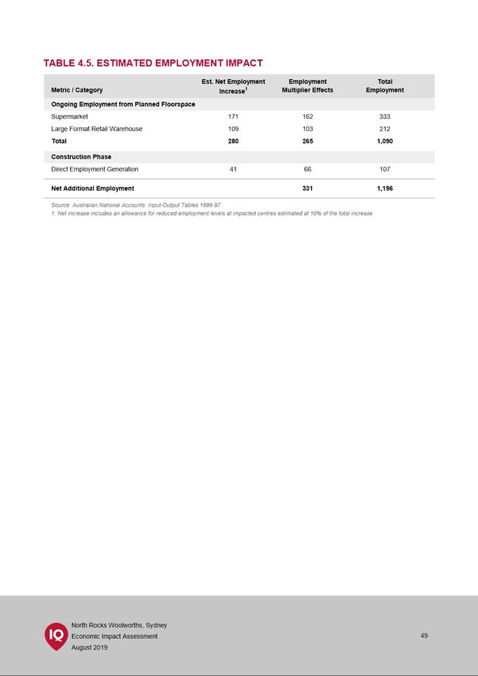
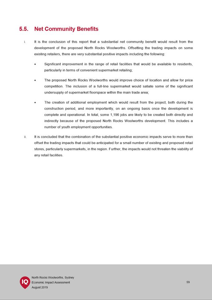
11. The planning proposal demonstrates that allowing the proposed supermarket use on the site would address some of the significant undersupply of supermarket floor space within the local area. It is anticipated that supporting this planning proposal would result in additional employment with a total of 1,196 jobs likely to be created both directly and indirectly.
PLANNNG AGREEMENT
12. The exhibited draft Planning Agreement (Attachment 2) includes the following key elements:
|
Items |
Value for Planning Agreement |
|
|
Local Items |
||
|
1. |
Construction of a lightweight, steel bridge structure 3m wide that provides pedestrian access to the site from North Rocks Road (shaded in green and red in (Figure 3).) - prior to the issue of the final Occupation Certificate |
$640,000 (estimate) |
|
2. |
Registration of an easement for public access in favour of Council for proposed footpath connection (in the location hatched in red labelled “Easement dedicated to Council for proposed footpath connection” in (Figure 3).) - prior to the issue of the final Occupation Certificate |
$75,000 (estimate) |
|
3. |
Monetary Contribution towards construction of the proposed footpath connection prior to the issue of the first Construction Certificate |
$500,000
|
|
Total value of local items |
$1.215 million |
|
|
State Items |
||
|
4. |
Dedication to Council of approximately 515 sqm of land to facilitate James Ruse Drive widening (being the land marked “Land to facilitate possible future James Ruse Drive widening” in (Figure 3)) - prior to the issue of the first Construction Certificate. Until such time as Transport for NSW advises, there is no current plan for the widening of the James Ruse Drive off ramp to Windsor Road. Dedication to Council ensures the land is available for future widening. |
$370,000 (estimate) |
|
Total Value |
$1.585 million |
|

|
|
Previously proposed footbridge |
|
|
Minimum extent of footbridge required |
|
|
Additional extent of footbridge required |
|
|
Easement dedicated to Council for proposed footbridge |
|
|
Future footbridge connection |
|
|
Easement dedicated to Council for potential future widening of James Ruse Drive |
Figure 3 – Map showing items included in the planning agreement.
13. It is noted that the DPIE Planning Agreements Practice Note (February 2021) seeks to move away from value capture (as referred to in Council’s Planning Agreements Policy 2018) towards an infrastructure needs approach to negotiating planning agreements.
14. The purpose of the Planning Agreement is to provide for both local and state infrastructure works required to be delivered as a result of the proposed redevelopment of the site and therefore is consistent with the objectives of the Practice Note.
15. The draft Planning Agreement assists in delivering active transport and Green Grid links along Darling Mills Creek, as identified in the Parramatta Ways Walking Strategy. Additionally, the development of pedestrian facilities will provide direct access to the supermarket for residents on the northern side of James Ruse Drive.
16. The dedication of land to Council for potential future widening of James Ruse Drive is of great value to the community as it negates the need for future land acquisitions should such a project be undertaken. According to TfNSW this is likely to occur.
17. In conclusion, the draft planning agreement provides high value social infrastructure in the short-term, and the potential to address traffic congestion in the long-term.
EXHIBITION OUTCOMES
18. The Planning Proposal, draft Planning Agreement and supporting documentation were publicly exhibited for 28 days from 19 November 2021 to 17 December 2021 as required by the Gateway Determination. Notification methods used in the exhibition included:
· Letters to surrounding landowners
· Dedicated exhibition page on Council’s Participate Parramatta website
· Advertisement on Council’s website
· Exhibition folders in Council’s customer service and Parramatta CBD library.
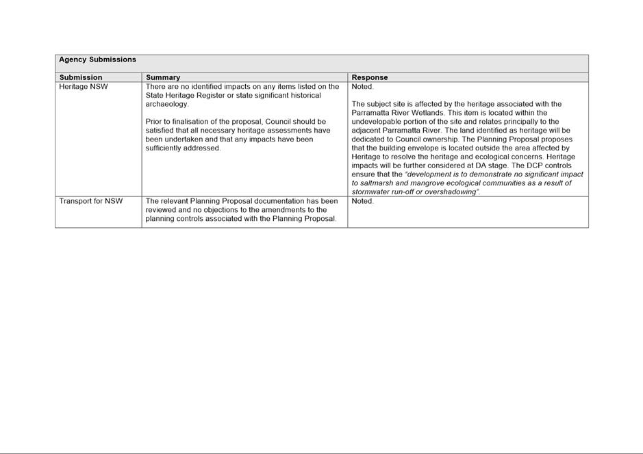
19. Public agencies were also notified in writing of the public exhibition in accordance with the Gateway determination, with the following agencies consulted:
· Heritage NSW
· NSW State Emergency Services
· Transport for NSW.
20. A total of nine (9) submissions were received comprising six (6) from the community, with the remaining three (3) from public agencies (breakdown provided in Table 1). Overall, one submission supported the proposal and the draft Planning Agreement in full, two objected in full, and three raised comments suggesting changes without expressing support or objection to the Proposal.
Table 1 - Breakdown of submissions received
|
|
Number |
Breakdown |
|
Community/landowners |
6 |
Various landowners |
|
Public Agencies |
3 |
Transport for NSW, NSW State Emergency Services, NSW Heritage |
|
Total |
9 |
|
COUNCIL OFFICER RESPONSE TO KEY ISSUES RAISED IN SUBMISSIONS
21. Table 2 summarises the key issues raised in the community submissions including a Council officer’s response.
Table 2 - Summary of issues raised by the community during public exhibition period
|
Consultation Issues |
Council Officer Response |
|
1.Traffic & Parking |
Raised in 2 out of 9 submissions
|
|
1. Raised concern regarding the current busy traffic generation on Windsor Road, James Ruse Drive and North Rocks Road and the intersections, also the potential traffic impacts on the existing road network during peak hours.
2. Traffic issues require further consideration including redesign and build of intersections and lights.
|
Council’s Traffic and Transport officers have reviewed the application and support the Proposal. They consider that the trip generation from the site is likely to be lower than similar supermarkets in the afternoon peak due to the prevailing traffic conditions within the area. Therefore, the traffic generated from the proposed supermarket use would not be significantly different from the traffic generation from other uses permissible on the site under the existing zoning in the afternoon peak.
A supermarket located in a residential area with low traffic congestion is likely to have significantly higher vehicle trip generation in the afternoon peak due the practicality of being able to access the site in a timelier manner rather than within an area with higher underlying traffic congestion. It is considered that customers are more likely to travel to other supermarkets that will be comparatively easier to access during peak periods or may also travel to the site outside of these peak times to take advantage of the extended trading hours of supermarkets. For this reason, Council officers consider that the proposed supermarket use is not likely to contribute to additional traffic as much as may occur were it to be located elsewhere.
Council officers and the applicant’s traffic consultant acknowledge that the adjacent road network is currently operating at capacity in the weekday afternoon peak. Notwithstanding, the site is well located to deliver improvements to the surrounding traffic network while also improving access to and from the site.
The draft Planning Agreement proposes to deliver: - Access improvements from North Rocks Road – augmenting the existing access bridge into the site to facilitate safe access (at least 3m wide) for pedestrians and cyclists entering and leaving the site.
- Dedication of land to Council to facilitate a possible future additional third lane on the westbound off-ramp of James Ruse Drive onto Windsor Road.
It is considered that the traffic related issues can be addressed through delivery of traffic and transport infrastructure upgrades and pedestrian and cyclist access to and from the site.
|
|
2.Site accessibility/Safety access |
Raised in 2 out of 9 submissions
|
|
1. Need for adequate cycleways to provide safe access to the supermarket proposed.
2. Pedestrian bridge to be suitably designed for a shared path structure and well separated from the traffic and parking.
3. Request the provision of safe storage of bicycles is needed to be a part of the design.
4. Request for a pedestrian access bridge across Church St/ Windsor Rd.
|
With regards to 1 and 2, the draft Planning Agreement proposes to deliver: - Access improvements from North Rocks Road – augmenting the existing access bridge into the site to facilitate safe access (at least 3m wide) for pedestrians and cyclists entering and leaving the site. - Cycleway/pedestrian bridge upgrade will be in accordance with Council’s guideline for a minimum of 3m wide (lightweight, steel bridge) and will be constructed in accordance with Council's future pathway plan. The design will also be required to meet the relevant standards within the “Austroad Guides”.
The proposed access footpath/cycleways and the bridge augmentation are specifically designed to ensure that active transport by pedestrians and cyclists are suitable and safe and has been verified by Council’s senior Transport Planner.
With regards to 3 and 4:
Storage of bicycles will be a matter for consideration at the DA stage. There is no identified infrastructure need for a pedestrian access bridge across Church St / Windsor Rd specifically to support this development. The identified infrastructure needed to support the proposal has been addressed as part of the draft Planning Agreement.
|
|
1. Need to increase the walkability between Northmead, North Rocks and North Parramatta without using Windsor Road.
2. Need for a walkway along Darling Mills Creek from the publicly owned land at Northmead Creative and Performing Arts High School to the 1 Windsor Road site to allow Northmead residents to easily access the proposed supermarket. |
The draft Planning Agreement proposes to deliver a pedestrian through-site link adjacent to Darling Mills Creek (public access easement through and along the eastern boundary of the site connecting the rear of the site with North Rocks Road via the proposed pedestrian bridge). This connection will provide a north/south public access easement through the site providing a broader north/south connection to connect the high-density development to the north of James Ruse Drive to the future supermarket, as well as facilitating improved connectivity to Northmead High School (Figure 3).
This link is also identified as one of the major routes in Council’s Parramatta Ways Walking Strategy. Parramatta Ways is City of Parramatta’s plan for supporting the implementation of the Sydney Green Grid. Prepared by the Government Architect NSW, the Sydney Green Grid sets the framework for delivering an interconnected network of public and open spaces via transport routes, creek corridors, streets and cycleways.
Pedestrian connectivity will therefore be improved as a result of the proposal.
|
|
Other |
Raised in 1 out of 9 submissions |
|
1. Do not support the addition of residential or commercial development on this land. 2. The land should be converted to a green space. |
The site is zoned B6 Enterprise Corridor. The Planning Proposal introduces an additional permitted use to the B6 zone and is therefore not considered to be a significant intensification of use of the site. The proposal will not facilitate any residential development and will not result in an increase in density for commercial development on the site.
The site is not an open space zone and neither has it been identified as being required as such by Council.
|
|
Support with no comment
|
Raised in 1 out of 9 submissions
|
AGENCY SUBMISSIONS
NSW State Emergency Services
22. The planning proposal was referred to NSW State Emergency Services for comment. Table 3 below summarises the key issues raised, including a Council officer’s response.
Table 3 - Summary of issues raised by NSW SES during public exhibition period
|
Consultation Issues |
Council Officer Response |
|
1. Under the Flood Prone Land Policy, evacuation routes should avoid floodwater. 2. Evacuation and secondary risk emergency strategies should not rely on the assumption that emergency services can attend. 3. Building safety for occupation in flood events.
|
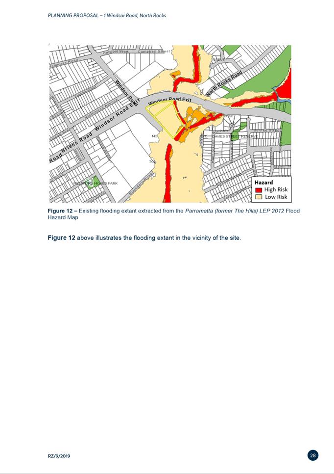
Flood modelling suggests that the key entrance/exit to the site (onto North Rocks Road) is rated at H1 – benign flows with no development restrictions.
Risk and Emergency Management policies can be prepared to NSW Hazard management requirements.
Any potential flood impacts would be further considered and addressed as a part of the future detailed development application (DA). |
23. The planning proposal was referred to TfNSW for comment. TfNSW do not object to the Planning Proposal but raised a few matters for consideration. Table 4 below summarises the key issues including a Council officer’s response.
Table 4 - Summary of Issues raised by TfNSW during public exhibition period
|
Consultation Issues |
Council Officer Response |
|
2. Suggestion for any future DA that a Plan of Management be prepared, and a condition be added prior to issue of an OC for construction of a roundabout on North Rocks Road. |
Noted, and amendments made.
Noted. Development and Traffic Services has advised that the construction of a roundabout at Speers Road/North Rocks Road is sufficient to support left-turning traffic. This work is scheduled to be undertaken in 2022. |
Heritage NSW
24. The planning proposal was referred to Heritage NSW. Table 5 below summarises the key issues raised, including a Council officer’s response.
Table 5 - Summary of issues raised by Heritage NSW during public exhibition period
|
Consultation Issues |
Council Officer Response |
|
The proposal will not impact upon any State Heritage items. |
Noted. |
|
Recommends the proponent undertake an investigation to assess the likelihood of ‘relics’ and any subsequent management required under the Heritage Act. |
This shall occur at the DA stage. |
|
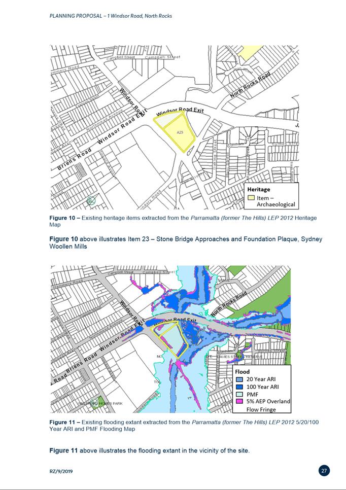
Council is responsible for the heritage assessment and consideration of any impacts on the Local Heritage Item ‘Stone Bridge Approaches and Foundation Plaque, Sydney Woollen Mills’ (A23). |
Noted, significant impacts are not expected to occur and can be appropriately managed at the DA stage.
|
25. Following consideration of all issues raised during the public exhibition of the Planning Proposal and draft Planning Agreement for the site, it is recommended that the Proposal be endorsed to proceed to finalisation with no changes to the exhibited documentation.
COUNCIL OFFICER RESPONSE TO LOCAL PLANNING PANEL CONCERNS
26. The Local Planning Panel considered this matter at its meeting of 16 June 2020 and recommended the following to Council:
That the planning proposal not proceed for the reason that retail premises such as a Woolworths supermarket and liquor store should not be permitted at an isolated site but should be located in or attached to existing town or village centres, in line with sound strategic land use planning.
27. In response to this recommendation, the proponent prepared further analysis to “demonstrate that the development of a supermarket on the site is entirely appropriate and consistent with the strategic planning framework.” A copy of this additional information is included at Attachment 3.
28. The additional information provides a detailed analysis of existing centres and land zoned to permit a supermarket development within the proposed trade area. The analysis identifies that there is an undersupply of supermarket floorspace in the trading area of over 7,000m2, and concludes there are no other sites within or adjoining an existing centre or on appropriately zoned land within the trade area that can reasonably accommodate a substantial supermarket.
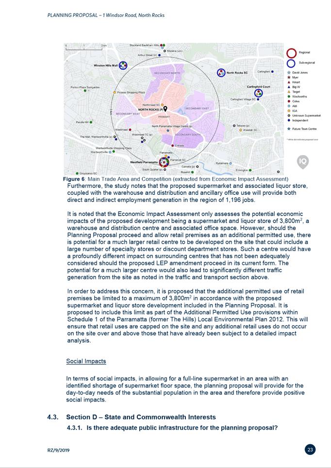
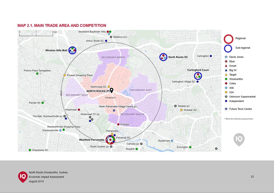
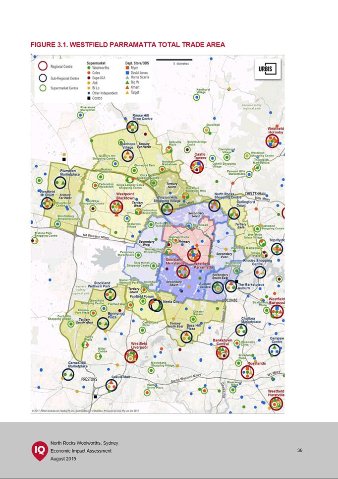
29. A map detailing the main trade area of the proposed supermarket and nearby competition is shown in Figure 4 below.

Figure 4 – Main trade area and existing retail servicing the area (extracted from Economic Impact Assessment)
30. Given that the trade area is within an established urban area, a site of sufficient size to accommodate a supermarket of the nature being proposed is not available within the parameters recommended by the Local Planning Panel. The economic impact assessment provided by the proponent establishes that there is an existing undersupply of supermarket floorspace in the trade area of approximately 7,114m2, and that any impacts on nearby centres such as Northmead will not affect their economic viability. In addition, any such impacts will be offset over time due to underlying population growth in the region.
31. Furthermore, the economic impact analysis notes that the proposed supermarket, coupled with the warehouse and distribution and ancillary office use, will provide both direct and indirect employment generation in the region of 1,196 jobs. Also, the warehouse and distribution component of the proposed development is intended to provide improved online supermarket delivery services for the local community. Given the demonstrated need and lack of a viable alternative site, it is therefore considered reasonable to permit a supermarket of 3,800m2 on the subject site in this instance to contribute towards the identified shortfall of supermarket floor area.
FINANCIAL IMPLICATIONS FOR COUNCIL
32. Any work to progress the finalisation of the Planning Proposal would be prepared by Council Officers and within the existing City Planning budget. Should this matter progress, a Planning Agreement will be entered into between the applicant and Council. Further, at development application stage, any applicable development contributions in keeping with the current rates will be applied to the development.
CONCLUSION AND NEXT STEPS
33. It is recommended that the Local Planning Panel supports the Council Officer recommendation for Council to endorse the exhibited Planning Proposal and exercise its plan-making delegations as granted by the Gateway Determination. The LEP amendment will then be signed by the CEO before being notified on the NSW Legislation website.
34. Following Local Planning Panel consideration of the recommendations of this report, the outcomes of the exhibition period for the Planning Proposal and draft Planning Agreement will be reported to an upcoming Council meeting along with the Panel’s advice.
Dot Hepburn
Project Officer
Michael Rogers
Land Use Planning Manager
David Birds
Group Manager, Major Projects and Precincts
Jennifer Concato
Executive Director City Planning and Design
|
1⇩ |
Planning Proposal (as exhibited) |
39 Pages |
|
|
2⇩ |
Draft Planning Agreement |
35 Pages |
|
|
3⇩ |
Economic Impact Assessment |
61 Pages |
|
|
4⇩ |
Gateway determination |
2 Pages |
|
|
5⇩ |
Alteration of Gateway determination |
1 Page |
|
REFERENCE MATERIAL
Local Planning Panel 15 February 2022 Item 6.2
ITEM NUMBER 6.2
SUBJECT Post-Exhibition: 85-91 Thomas Street,
Parramatta - Planning Proposal, Draft Site-Specific
Development Control Plan and Draft Planning Agreement
REFERENCE RZ/11/2016 -
APPLICANT/S Think Planners
OWNERS Century 888 Pty Ltd
REPORT OF Project Officer Land Use Planning
PURPOSE
The purpose of this report is to seek the Local Planning Panel’s advice to Council on the outcome of the public exhibition of a Planning Proposal, draft site-specific Development Control Plan and draft Planning Agreement for land at 85-91 Thomas Street, Parramatta.
The Local Planning Panel, support the following Council Officer recommendations in the Panel’s advice to Council:
(a) That Council receives and notes the submissions made during the public exhibition of the Planning Proposal, draft site-specific Development Control Plan (DCP) and draft Planning Agreement for 85-91 Thomas Street, Parramatta. A summary of submissions is provided at Attachment 1.
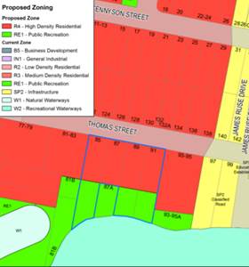
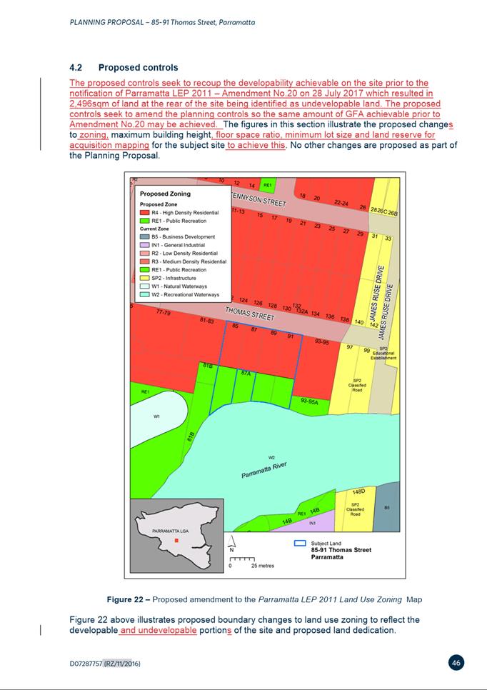
(b) That Council approve for finalisation the Planning Proposal for land at 85-91 Thomas Street, Parramatta (provided at Attachment 2), which seeks to amend Parramatta Local Environmental Plan 2011 as follows:
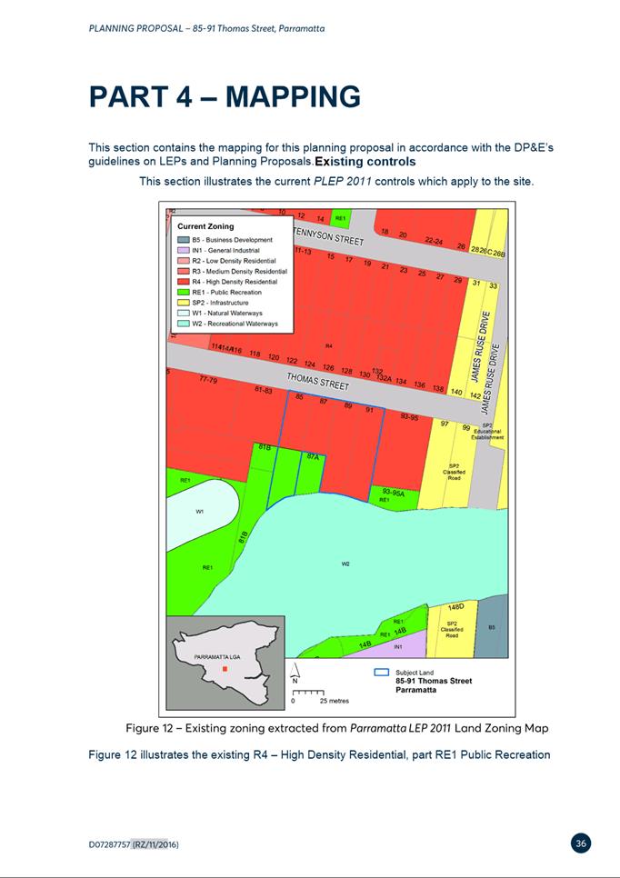
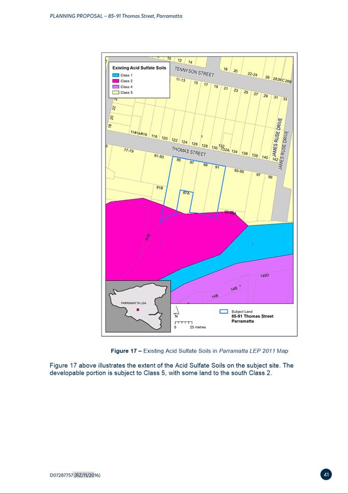
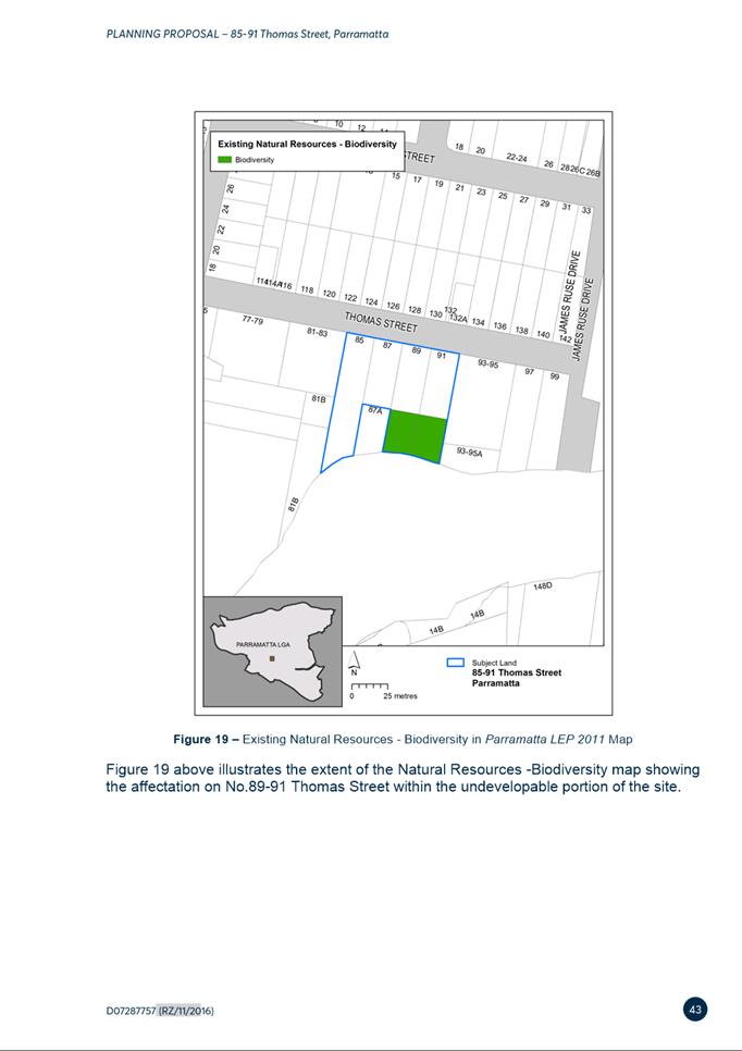
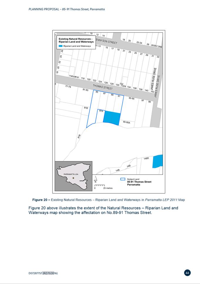
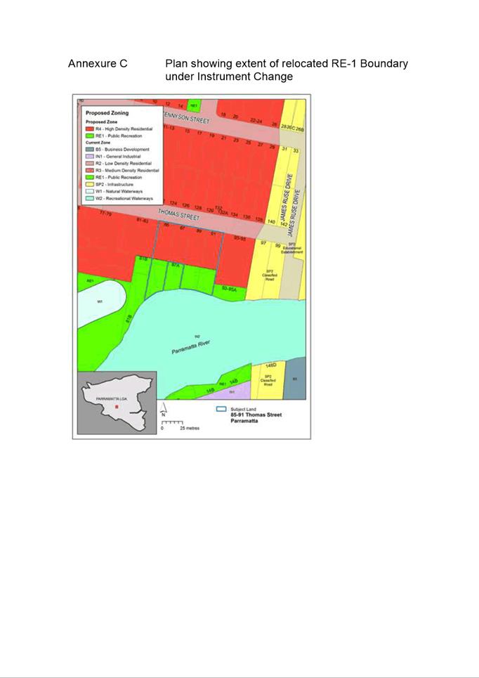
i. Maintaining the R4 High Density Residential zone for the developable part of the site (3,825sqm) and extending the RE1 Public Recreation zone for the undevelopable land (1,200sqm) affected by the Natural Resources - Biodiversity control;
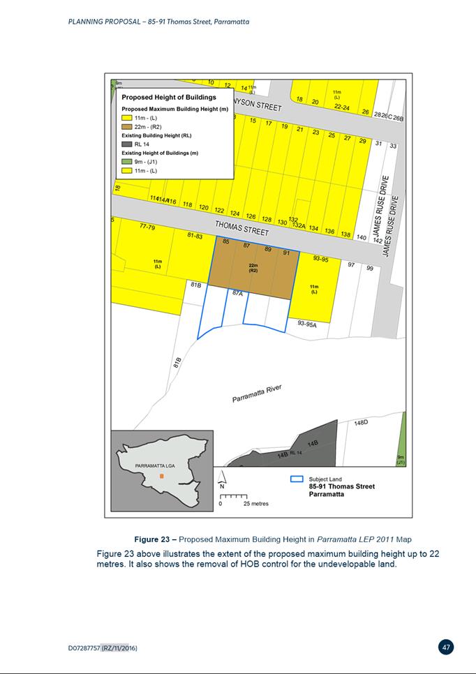
ii. Increasing the maximum Height of Building (HOB) control from 11 metres to 22 metres across the R4 High Density Residential zoned part of the site, and removing the HOB control from the RE1 Public Recreation zoned part of the site;
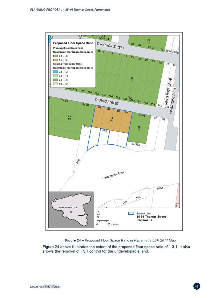
iii. Increasing the Floor Space Ratio (FSR) control from 0.8:1 to 1.3:1 across the R4 High Density Residential zoned part of the site, and removing the FSR control from the RE1 Public Recreation zoned part of the site;
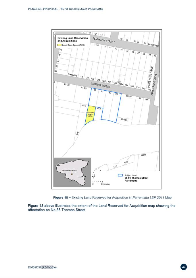
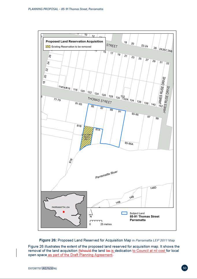
iv. Removing No.85 Thomas Street from the Land Reserved for Acquisition Map, subject to execution of the Planning Agreement; and
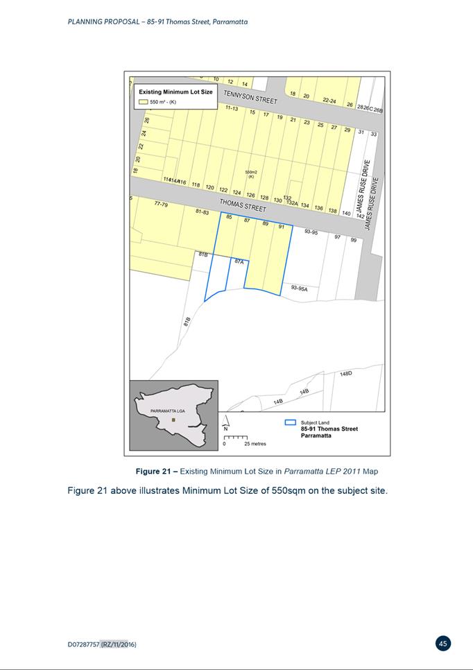
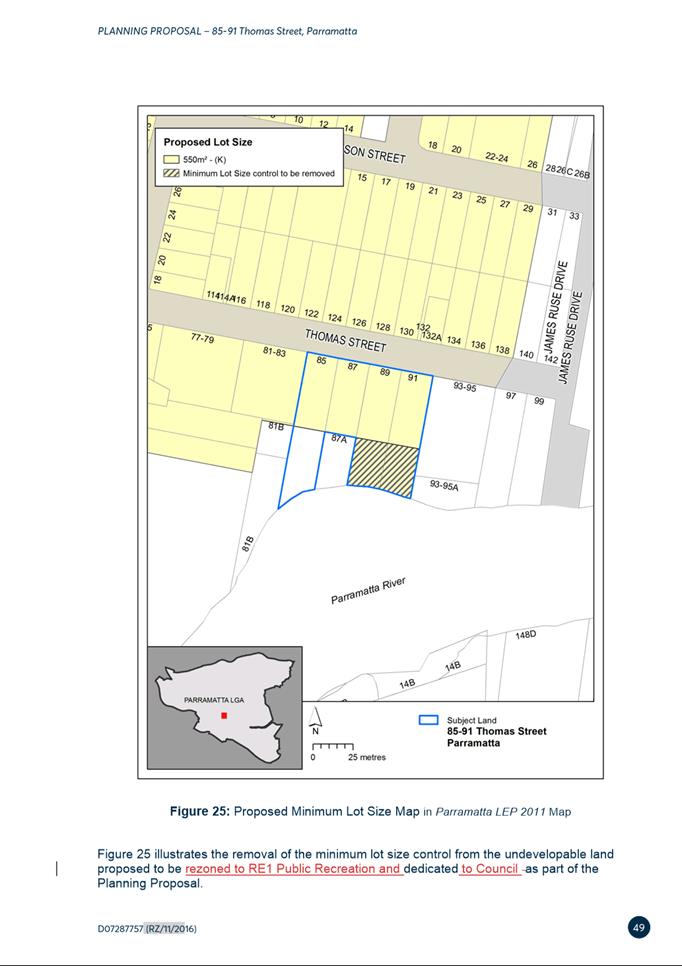
v. Amending the Minimum Lot Size control to apply to the proposed R4 High Density Residential land only and remove this control from the proposed RE1 Public Recreation zoned land.
(c) That Council approve the site-specific Development Control Plan (DCP) at Attachment 3 for finalisation and insertion into the Parramatta Development Control Plan (PDCP) 2011.
(d) That Council delegate authority to the Chief Executive Officer to finalise the draft Planning Agreement at Attachment 4, and to sign the Planning Agreement on Council’s behalf.
(e) That Council authorise the Chief Executive Officer to exercise the plan-making delegations as granted by the Gateway Determination for this Planning Proposal once the Planning Agreement has been executed by Council.
(f) Further, that Council delegate authority to the Chief Executive Officer to make any minor, administrative and/or non-policy amendments to the Planning Proposal, site specific DCP and Planning Agreement.
PLANNING PROPOSAL TIMELINE
![]()
SUMMARY
1. This report seeks the Local Planning Panel’s (LPP) advice to Council when it considers the outcomes of the public exhibition of a Planning Proposal, draft Site-Specific DCP and draft Planning Agreement 85-91 Thomas Street, Parramatta.
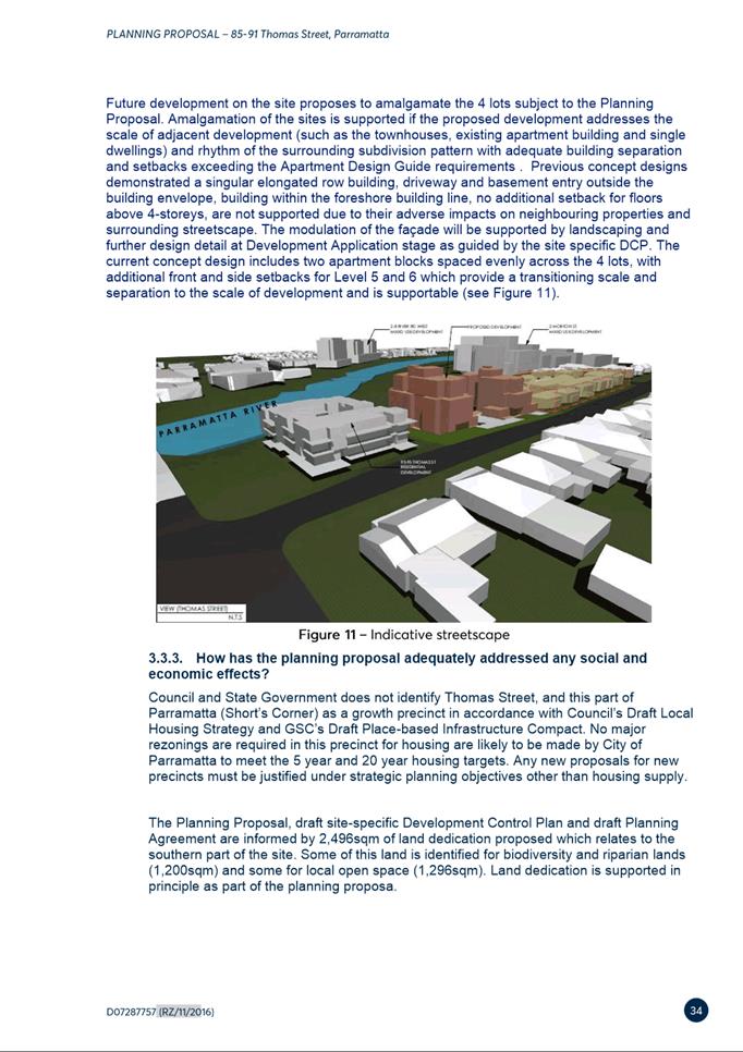
2. The Planning Proposal seeks to amend the Parramatta Local Environmental Plan (LEP) 2011 to amend the zoning, height, and floor space ratio controls on the site to facilitate development of two 6-storey apartment buildings, including land dedication of environmentally sensitive land along the river foreshore to Council at nil cost.
3. The Planning Proposal, draft DCP and Planning Agreement were placed on public exhibition from 26 August 2021 to 23 September 2021 during which time twenty-three (23) submissions were received comprising twenty-one (21) from the community, with the remaining two (2) from public agencies. A summary of the key issues raised in the submission is provided in this report, with further details and responses provided at Attachment 1 to this report. In summary, all of the 21 resident submissions objected to the proposal and the two agency submissions raised no objection.
SITE DESCRIPTION
4. The site at 85-91 Thomas Street, Parramatta is 6,321sqm in area and contains four separate lots (85, 87, 89 and 91 Thomas Streets). The site currently contains detached single dwelling houses facing Thomas Street and bushland to the rear. The site is shown below in Figure 1.

Figure 1 – Location Map - Subject site outlined in yellow
5. The site is situated within a currently zoned R4 High Density Residential zoned area between Parramatta River, Macarthur Street, Victoria Road and James Ruse Drive. The surrounding area currently has a mix of low-rise residential flat buildings and detached single dwelling houses, but this is expected to change over time considering the high-density residential zoning.
BACKGROUND
6. On 19 May 2020, the Local Planning Panel provided advice to Council recommending it endorse a Planning Proposal for the purposes of requesting a Gateway Determination for the site with a maximum floor space ratio of 1.3:1, a maximum height control of 22 metres, land use zoning and land acquisition map changes.
7. At its meeting on 9 June 2020, Council resolved to endorse the Planning Proposal for the purpose of requesting a Gateway Determination and to amend the height of buildings and floor space ratio controls, land use zoning and land acquisition map consistent with the recommendation of the Council officers and Local Planning Panel. Council also resolved to prepare a draft site-specific Development Control Plan (DCP) and draft Planning Agreement to be exhibited with the Planning Proposal. A more detailed summary of the Planning Proposal is provided in the following section of this report.
8. On 18 August 2020, the Department of Planning and Environment (DPE) issued a Gateway Determination which allowed the Planning Proposal to proceed to public exhibition. The Gateway determination stipulated an expiry date of 18 August 2021, and requested the Planning Proposal be amended to update the explanation of provisions to outline the intended outcomes regarding the proposed changes to the minimum lot sizes. The Gateway determination authorises Council’s Chief Executive Officer to exercise the plan-making delegations for this Planning Proposal.
9. On 15 June 2021, Council resolved to endorse for the purposes of public exhibition the draft site-specific DCP for the site and authorised the commencement of the legal drafting of the Planning Agreement. Council also resolved that the draft DCP and draft Planning Agreement be placed on exhibition concurrently with the Planning Proposal. A more detailed summary of the draft DCP and draft Planning Agreement is provided in the following section of this report.
10. The Planning Proposal, draft site specific DCP and Planning Agreement were publicly exhibited from 26 August 2021 to 23 September 2021. This report addresses the outcomes of that exhibition and makes recommendations for progressing the matter.
11. On 27 October 2021, the DPE issued a revised Gateway determination extending the timeframe for completing the LEP to 28 February 2022.
PLANNING PROPOSAL
12. The Planning Proposal seeks to amend the planning controls in the Parramatta Local Environmental Plan (LEP) 2011 for 85-91 Thomas Street as described below in Table 1.
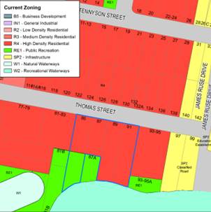
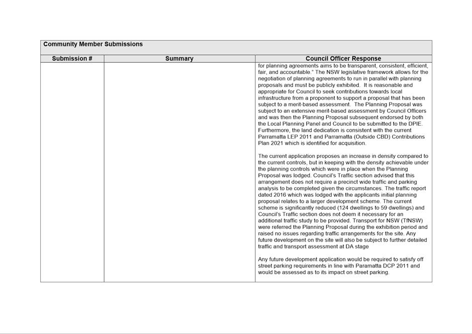
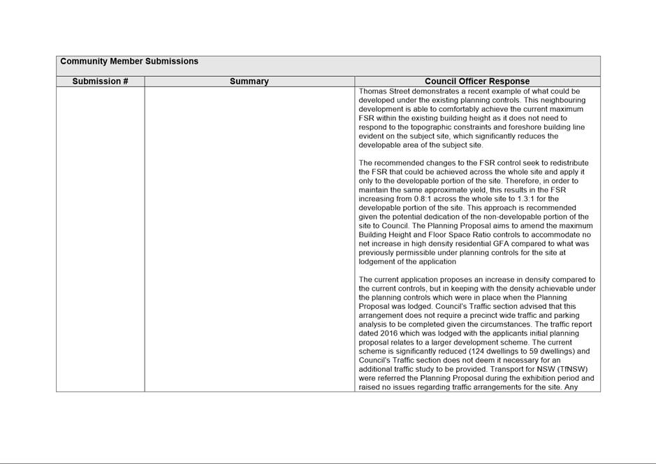
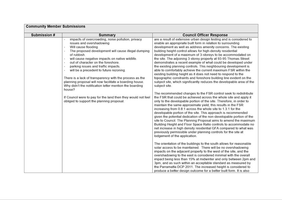
13. A key outcome of the Planning Proposal is to adjust the land use zoning boundaries, reduce the developable portion of the land and increase the land dedicated to public recreation. As such the maximum building height and floor space ratio within the proposed R4 High Density Residential portion for the site are proposed to increase to the same densities as what was allowable under the planning controls that were in place when the Planning Proposal was lodged in June 2016 as noted in Table 1.
14. The Council initiated Planning Proposal to amend the Land Reservations Acquisition and Natural Resources Maps to various properties across the LGA known as ‘Parramatta LEP 2011 - Amendment 20’, introduced RE1 zoning, land acquisition and riparian and biodiversity controls on the site. The gazettal of Amendment 20 on 28 July 2017 reduced the development potential on the site and as such, the subject Planning Proposal is seeking to redistribute the FSR that could be achieved across the whole site and apply it only to the developable portion of the site. Therefore, in order to maintain the same approximate yield, this results in the FSR increasing from 0.8:1 across the whole site to 1.3:1 for the developable portion of the site.
Table 1 – Current and proposed controls
|
Parramatta LEP 2011 |
Planning Controls before 28 July 2017 (before ‘Amendment 20’) |
Current Controls |
Planning Proposal Recommendation |
|
Land Use Zoning |
R4 – High Density Residential (6,321sqm) |
Part R4 High Density Residential (5,025sqm), Part RE1 Public Recreation (1,296sqm) |
Part R4 High Density (developable portion approx. 3,825sqm), Part RE1 Public Recreation (undevelopable portion approx. 2,496sqm) |
|
Maximum HOB |
11 metres (3 storeys) |
Part 11 metres (3 storeys) (R4 land) and part no HoB (RE1 land) |
22 metres (6 storeys) (R4 land only) and part no HoB (RE1 land) |
|
Maximum FSR |
0.8:1 (entire site area) |
0.8:1 (R4 land only) and part no FSR (RE1 land) |
1.3:1 on R4 land (with land dedication) and part no FSR (RE1 land) |
|
Maximum GFA |
5,057sqm (based on the total site area) |
4,020sqm (based on R4 High Density Residential only) |
Approx. 4,973sqm (based on developable site area) |
|
FSR on Developable Portion |
1.32:1 |
1.05:1 |
1.3:1 |
|
Maximum Dwelling yield Council Calculation= (Maximum GFA / 85sqm for high density dwellings) |
59 dwellings |
47 dwellings |
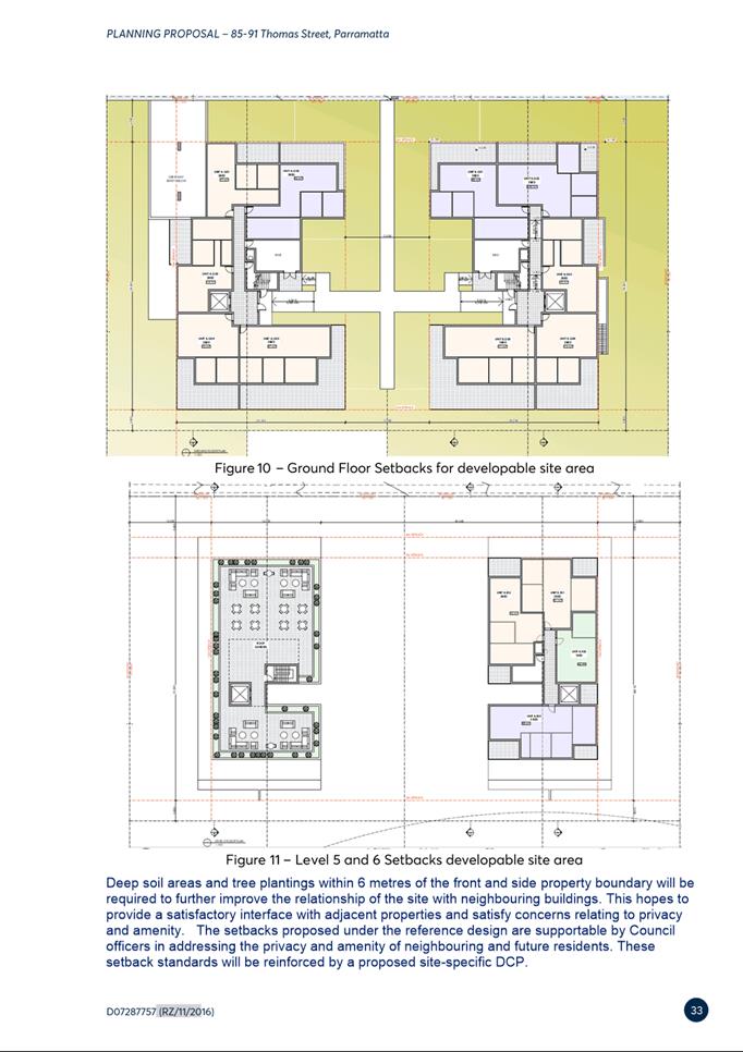
59 dwellings |
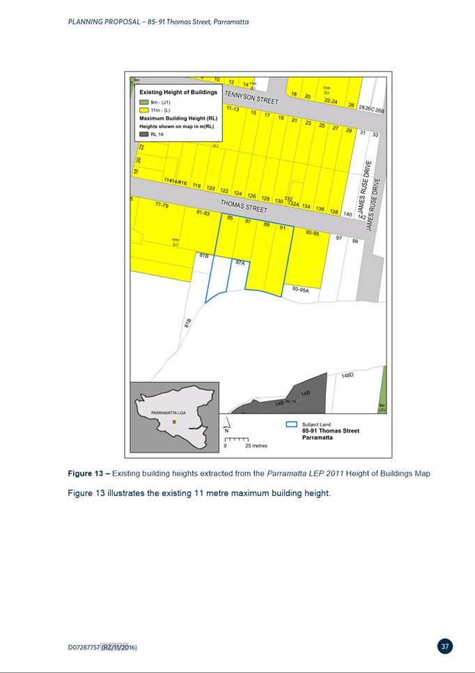
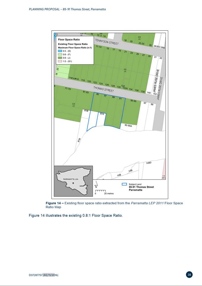
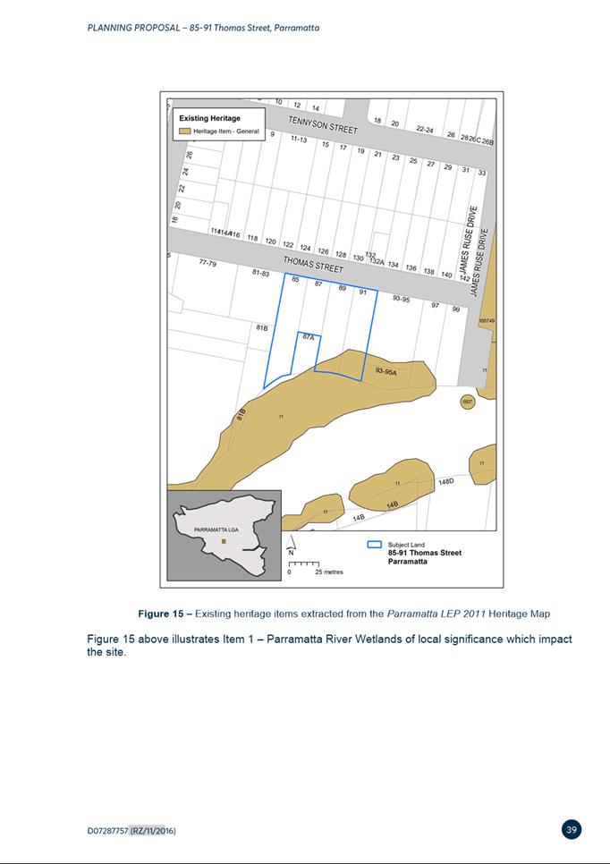
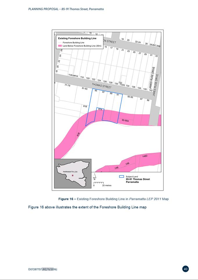
15. Figures 2 to 13 illustrate the current controls and proposed amendments to height of buildings, floor space ratio and additional local provisions as part of this Planning Proposal.
|
|
|
|
Figure 2 – Current Land Zoning Map
|
Figure 3 – Proposed Land Use Zoning Map
|
|
|
|
|
Figure 4 – Existing Maximum Building Heights
|
Figure 5: Proposed Maximum Building Heights |
|
|
|
|
Figure 6 – Existing Maximum Floor Space Ratio
|
Figure 7 – Proposed Maximum Floor Space Ratio
|
|
|
|
|
Figure 8 – Existing Minimum Lot Size Map
|
Figure 9 – Proposed Minimum Lot Size Map
|
|
|
|
|
|
|
|
Figure 10 – Existing Land Reservation Map
|
Figure 11 – Proposed Land Reservation Map
|
|
|
|
|
Figure 12 – Existing Natural Resources Biodiversity Map |
Figure 13 – Proposed Natural Resources Biodiversity Map |
![]()
![]()
![]()
DEVELOPMENT CONTROL PLAN
16. The Planning Proposal is accompanied by a site-specific DCP which is a draft amendment to the Morton Street section of Parramatta DCP 2011 as shown in Attachment 3. The draft amendment proposes to include a new “Area 5 – 85- 91 Thomas Street” as shown in Figure 14 below. This section includes specific controls in relation to:
· Building height and massing
· Streetscape, building setbacks and separation
· Deep soil, landscaping and future open space
· Ecology and river foreshore.
![]()
Figure 14 - Map of Morton Street Precinct DCP and Indicative Building Envelope for ‘Area 5’
17. The draft DCP details controls that ensure that any increases in height or density facilitated by the Planning Proposal can be properly managed and future development appropriately considers its surrounding context.
18. A key objective of the proposed built form controls contained in the draft DCP is that the building envelope and footprint appropriately distributes the residential floorspace generated from the undevelopable land in a sensitive manner. Building footprints have also been reduced resulting in greater setbacks and separation distances to neighbouring development (Figure 15).
![]()
Figure 15 – Area 5 Indicative building footprints (Extract from draft DCP)
19. Furthermore the proposed draft DCP controls require basement car parking access to be located wholly within the building footprint. Therefore, maximising deep soil provisions to allow for landscaping.
20. Saltmarshes and wetlands are located in close proximity to the site and are protected by the proposed amendments to the PLEP 2011 controls relating to the Foreshore Building Line, Natural Resources – Biodiversity and local heritage listing of Parramatta River (Wetlands). To further protect these ecological areas, the draft DCP includes ecology and foreshore controls so stormwater run-off, overshadowing and lighting causes minimal disturbance to local flora and fauna within the nearby riparian corridor along the river.
PLANNING AGREEMENT
21. The Draft Planning Agreement is for the dedication to Council at no cost a total of 2,496sqm (approximately 0.25 hectares) of open space and ecologically sensitive land. The land dedication is in connection with the proposed Parramatta LEP 2011 amendments under the Planning Proposal and comprises of two parts (refer Figure 16).
i. 1,296sqm of land at the rear of No.85 currently zoned RE1 Public Recreation and shown as land reserved for acquisition for local open space, and
ii. 1,200sqm of land at the rear of Nos.89-91 currently zoned R4 High Density Residential identified to be zoned RE1 Public Recreation with associated natural resources - biodiversity provisions.
![]()
Figure 16 – Land dedication in Planning Agreement
22. The draft Planning Agreement also includes the erection of residential fencing, to a height of no more than 1.5 metres, between the developable (zoned R4 High Density Residential) and dedication (zoned RE1 Public Recreation) areas of the land prior to the issue of an occupation certificate on the developable land.
23. The proposed land dedication allows Council to offer better protection of the biodiversity land and to potentially ensure the river foreshore land is publicly accessible at nil cost to Council. The proposed land dedication reflects the intended use of the site by clearly delineating the developable portion of the site from the portion of the site that is currently zoned open space or has been identified as having ecological value.
24. The land dedication is provided on the basis that there is no decrease in density within the proposed R4 High Density Residential portion for the site compared to the density allowable under the planning controls when the Planning Proposal was lodged in 2016, that is prior to Parramatta LEP 2011- Amendment 20 coming into force (as detailed in paragraph 14 above).
25. Under Council’s Planning Agreements Policy (2018), planning proposals outside the CBD seeking uplift in density need to be supported by a planning agreement that is valued at 50% of the resulting land value uplift. At the 9 June 2020 Council Meeting, Council endorsed the officer recommendation which varies Council’s planning agreements policy for this Planning Agreement which means the Planning Agreement is line with the DPE infrastructure provision approach precluding Council supporting a value capture approach and as such the parameters for negotiating the land dedication offer for the reasons set out below:
a) The planning proposal is only seeking to recoup the residential density potential which may have been able to be achieved under the planning controls in place on the site when the Planning Proposal was lodged in June 2016.
b) The Draft Planning Agreement Offer moves away from a value capture approach and towards an infrastructure needs approach as required by the Planning Agreements Practice Note (the then Department of Planning, Industry and Environment, February 2021).
c) Furthermore, Council’s City Planning & Design and Property & Place directorates are satisfied that the draft Planning Agreement does not require a land value uplift assessment given there is no uplift being sought by the Planning Proposal (as per PLEP 2011 controls as they applied when the Planning Proposal was lodged) and that the undevelopable land is being dedicated at no cost.
CONSULTATION
26. The Planning Proposal, draft DCP and draft Planning Agreement and supporting documents were publicly exhibited from 20 October 2021 to 17 November 2021. Notification methods used in the exhibition included:
• Letters to surrounding landowners;
• Dedicated exhibition page on Council’s Participate Parramatta website;
• Advertisement on Council’s website; and
• Posting on City of Parramatta Facebook page.
27. Public agencies were also notified in writing of the public exhibition in accordance with the Gateway determination, with the following agencies consulted:
• Heritage NSW;
• Environment, Energy and Science Group of DPE; and
• Transport for NSW.
28. A total of twenty-three (23) submissions were received comprising twenty-one (21) from the community and two (2) from public agencies (details in provided in Attachment 1). All twenty-one (21) community submissions objected to the proposal, and the agency submissions raised some issues, however neither stated objection nor support.
KEY ISSUES RAISED IN SUBMISSIONS
29. Below are the key issues raised in the submission and a brief Council Officer response is provided. A more detail assessment of all the issues raised in submissions, and officer responses are provided in Attachment 1 to this report.
Building Heights and Overshadowing
30. Twelve of the submissions raised concern over the proposed building heights being excessive and impacts on local character. In addition, the potential overshadowing impacts of increased height on the neighbourhood and foreshore.
31. The proposed building heights are a result of extensive urban design testing and are considered to enable an appropriate built form in relation to surrounding development as well as to address amenity concerns. The existing building height control allows for high-density residential development of a maximum of 3 storeys to be accommodated on the site. The adjoining 3 storey property at 93-95 Thomas Street demonstrates a recent example of what could be developed under the existing planning controls. This neighbouring development is able to comfortably achieve the current maximum FSR within the existing building height as it does not need to respond to the topographic constraints and foreshore building line evident on the subject site, which significantly reduces the developable area of the subject site.
32. The recommended changes to the FSR control seek to redistribute the FSR that could be achieved across the whole site and apply it only to the developable portion of the site. Therefore, in order to maintain the same approximate yield, this results in the FSR increasing from 0.8:1 across the whole site to 1.3:1 for the developable portion of the site. This approach is recommended given the potential dedication of the non-developable portion of the site to Council. The Planning Proposal aims to amend the maximum Building Height and Floor Space Ratio controls to accommodate no net increase in high density residential GFA compared to what was previously permissible under planning controls for the site at lodgment of the application (and prior to Amendment 20 coming into force).
33. The proposed orientation of the buildings to the south as per the controls under the draft site-specific DCP, allows for reasonable solar access to be maintained. There will be no overshadowing impacts on the adjacent property as seen in the concept plans (Attachment 5) to the west of the site, and the overshadowing to the east is considered minimal with the overall impact being less than 14% at midwinter and only between 2pm and 3pm (see Figure 15 and 16), and as such within an acceptable standard as measured by the Parramatta DCP 2011. The increased height is considered to produce a better design outcome for a better built form.
34. It is also considered that the proposed site specific DCP includes controls that will improve amenity and impacts to surrounding residential development in relation to generous side setbacks and deep soil to facilitate landscaping. Overshadowing analysis will need to be further assessed as part the detailed design provided at the DA stage and will need to address Council’s DCP controls and Apartment Design Guide requirements relating to overshadowing.
35. The NSW Government’s Apartment Design Guide (ADG) and State Environment Planning Policy 65 (SEPP 65) sets the minimum standards for building separation and setbacks for any residential flat building development on the site. Currently, the ADG would require a minimum of 9 metres separation between habitable and non-habitable rooms for buildings up to 4 storeys however the draft DCP increases this by requiring a 10m minimum side setback and 12m building separation. The ADG requires a minimum of 12m for buildings 5 to 8 storeys and the draft DCP meets this requirement for side setbacks and exceeds this with an 18m building separation. Although the upper levels will be visible from the street the modulation of the facade will also be supported by landscaping and further design detail at Development Application stage.
36. Although the proposed 6 storey building heights are not consistent with the 1 to 3 storey residential building heights that currently exist on Thomas Street, extensive urban design testing indicates that the proposed heights enable an appropriate built form in relation to surrounding development as well as address amenity concerns. This subject site is not able to achieve the proposed FSR within the existing building height as it needs to respond to the topographic constraints and foreshore building line evident on the subject site, which significantly reduces the developable area.
![]()
![]()
![]()
![]()
37. As such, no amendments are proposed to the proposed maximum heights in the Planning Proposal or the Draft DCP controls.
Amenity and Privacy
38. A number of submissions raised concerns over the impact of future development on privacy, potential safety issues and waste and impact on local character.
39. The proposed site specific DCP includes controls that will maintain a 10m setback from the existing neighbouring properties on both sides. Landscaping controls will also help to create a buffer between the development and neighboring properties. Further, privacy and amenity issues will be a matter that will also be addressed as part of detailed design at the DA stage.
40. It is acknowledged that the proposed redevelopment will change the existing character of the neighborhood, however the proposed building heights are a result of extensive urban design testing and is considered to enable an appropriate built form in relation to surrounding development as well as address amenity concerns.
41. Issues relating to waste and safety and design of the development will be considered as part of the development application and be assessed in accordance with Parramatta DCP 2011.
Traffic and Parking Impacts
42. Multiple submissions raised concern regarding the potential traffic impacts on the existing road network and questioned if the development would generate too much traffic and add additional pressure on on-street parking. Further concerns were raised around traffic safety from an increase in cars.
43. The planning proposal seeks an increase in density compared to the current controls, but is in line with the density achievable under the planning controls which were in place when the Planning Proposal was lodged (prior to Amendment 20 coming into force). Council’s Development and Traffic unit advised that this arrangement does not require a precinct wide traffic and parking analysis to be completed given the circumstances.
44. The traffic report dated 2016 (Attachment 6) which was lodged with the applicants initial planning proposal relates to a larger development scheme. The current scheme is significantly reduced (124 dwellings to 59 dwellings) and Council officers do not deem it necessary for an additional traffic study to be provided. The Planning Proposal was referred to Transport for NSW (TfNSW) during the exhibition period and TfNSW raised no issues regarding traffic arrangements for the site. Any future development on the site will also be subject to further detailed traffic and transport assessment at the development application stage.
45. Any future development application would be required to satisfy off street parking and traffic safety requirements in line with Parramatta DCP 2011 and relevant traffic regulations, and would be assessed as to its impact on street parking and traffic safety.
46. As such, no amendments are proposed to the controls proposed in the Draft DCP and the Planning Proposal.
Impacts on Biodiversity
47. Several submissions raised concern over the impacts of any future development on the adjacent natural area and biodiversity.
48. The applicant’s ecological assessment (Attachment 7) states the proposed development will not have a significant impact upon either mangroves or saltmarsh. The Planning Proposal was also provided to Environment, Energy and Science (EES) which is part of the DPE as part of the public exhibition process. EES had no comments on the Planning Proposal.
49. To protect these ecological areas, the draft DCP includes ecology and foreshore controls so stormwater run-off, overshadowing and lighting causes minimal disturbance to local flora and fauna within the nearby riparian corridor along the river.
50. As such, no amendments are proposed to the controls proposed in the draft DCP and the Planning Proposal.
Boarding House Development Application
51. Several submissions raised concern over approval of a boarding house development application which has been lodged on the site (DA/312/2021). These include concerns relation to population density, height, health and safety, development precedent.
52. The boarding house application (reference DA/312/2021) is being assessed by Council under the current planning controls that apply to the site. The development application is also being reported to the 15 February 2022 LPP meeting for determination, the same meeting this report is being put to the LPP. However, the development application process is different to and separate from the Planning Proposal process. The intended outcome of the Planning Proposal is to amend the existing Parramatta LEP 2011 planning controls. The boarding house development application does not rely on the Planning Proposal and is not connected to it. The boarding house application does not include building on the proposed RE1 land.
Flooding Impacts
53. Several submissions raised concerns that future development will increase the risk of flooding impacts on adjacent properties.
54. The site does include flood prone land. Whilst flooding does impact the site, the proposed building footprint is outside the land affected at the rear on the southern side of the site. Any potential impacts as a result of development on the site, such as stormwater runoff, will be considered and addressed appropriately at DA stage, particularly for basement parking. This will also include any design detail required to ensure compliance with Council’s water management controls within the Parramatta DCP 2011.
Planning Agreement
55. Several submissions raised concerns in relation to the draft planning agreement and its relationship to the Planning Proposal, some submissions asserting that “the planning agreement facilitates the dedication of land at nil cost. This is a conflict of interest as it is an incentive for Council to approve the development.”
56. The negotiation of the draft planning agreement has been carried out in accordance with the City of Parramatta’s Planning Agreements Policy 2018. It states that “Council’s negotiation system for planning agreements aims to be transparent, consistent, efficient, fair, and accountable.” The NSW legislative framework allows for the negotiation of planning agreements to run in parallel with planning proposals and that they must be publicly exhibited.
57. It is reasonable and appropriate for Council to seek contributions towards local infrastructure from a proponent to support a proposal that has been subject to a merit-based assessment. The Planning Proposal was subject to an extensive merit-based assessment by Council Officers and was subsequently endorsed by both the Local Planning Panel and Council to be submitted to the DPE for a Gateway determination. Furthermore, the land dedication is consistent with the current Parramatta LEP 2011 and Parramatta (Outside CBD) Contributions Plan 2021 which is identified for acquisition.
AGENCY SUBMISSIONS
Heritage NSW
58. Heritage NSW believe that there are no identified impacts on any items listed on the State Heritage Register or state significant historical archaeology. They requested prior to finalisation of the proposal, Council should be satisfied that all necessary heritage assessments have been undertaken and that any impacts have been sufficiently addressed.
59. The subject site is affected by the heritage associated with the Parramatta River Wetlands. This item is located within the undevelopable portion of the site and relates principally to the adjacent Parramatta River. The land identified as heritage will be dedicated to Council ownership. The Planning Proposal seeks that the building envelope is located outside the area affected by heritage to resolve the heritage and ecological concerns. Heritage impacts will be further considered at development application stage. The DCP controls ensure that the “development is to demonstrate no significant impact to saltmarsh and mangrove ecological communities as a result of stormwater run-off or overshadowing”.
Transport for NSW
60. Transport for NSW raised no objections to the abovementioned amendments to the planning controls associated with the Planning Proposal.
FINANCIAL IMPLICATIONS FOR COUNCIL
61. Any work to progress the finalisation of the Planning Proposal would be prepared by Council Officers and therefore within the existing City Planning budget. Should this matter progress, a Planning Agreement will be entered into between the applicant and Council.
62. The planning agreement will facilitate the proposed land dedication at nil cost to Council. The future maintenance will be budgeted through Council’s Operational Plan and Budget and the Parramatta River Foreshore Contract.
63. If the 1,296sqm of privately owned RE1 zoned, affected by the land acquisitions at No.85 Thomas Street is not dedicated at no cost as part of Planning Agreement negotiations, Council officers estimate this land could cost approximately $1.3 million. If the remaining 1,200sqm of privately owned, R4 zoned land affected by the Natural Resources – Biodiversity control, at numbers 89 and 91 Thomas Street is not dedicated to Council, given that the current proposal seeks to extract the FSR from this portion of the site and redistribute it on the developable site area, it is estimated that this land holds nominal to no monetary value as a result.
CONCLUSION AND NEXT STEPS
64. It is recommended that the Local Planning Panel support the Council Officer recommendation that Council approve the Planning Proposal for 85-91 Thomas Street Parramatta as exhibited and for Council to exercise its plan-making delegations as granted by the Gateway Determination and work with Parliamentary Counsel Office on the legal drafting and mapping of the amendment. The LEP amendment will then be signed by the CEO before being notified on the NSW Legislation website.
65. Council officers recommend that the Local Planning Panel support the Council officer recommendation to finalise the draft site-specific DCP which provide detailed design controls in support of the Planning Proposal and are intended to improve interpretation of controls and better reflect the intended outcomes detailed in the objectives.
66. Council officers recommend that the Local Planning Panel support the Council officer recommendation to delegate authority to the Chief Executive Officer to finalise the draft Planning Agreement which is the mechanism for Council to acquire the subject land for future open space and biodiversity protection at nil cost.
67. Following Local Planning Panel consideration of the recommendations of this report, the outcomes of the exhibition period for the Planning Proposal, draft DCP and the Planning Agreement will be reported to an upcoming Council meeting along with the Panel’s advice.
Rafael Morrissey
Project Officer Land Use
Bianca Lewis
Team Leader Land Use Planning
David Birds
Group Manager, Major Projects and Precincts
Jennifer Concato
Executive Director City Planning and Design
|
1⇩ |
Submissions Table |
37 Pages |
|
|
2⇩ |
Planning Proposal |
59 Pages |
|
|
3⇩ |
Draft Site-Specific DCP |
7 Pages |
|
|
4⇩ |
Draft Planning Agreement |
33 Pages |
|
|
5⇩ |
Concept Plans |
27 Pages |
|
|
6⇩ |
Traffic Report |
47 Pages |
|
|
7⇩ |
Ecological Report |
97 Pages |
|
REFERENCE MATERIAL