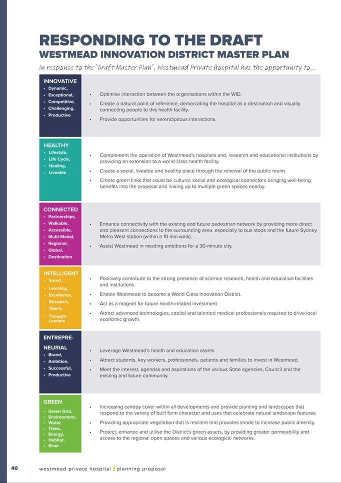
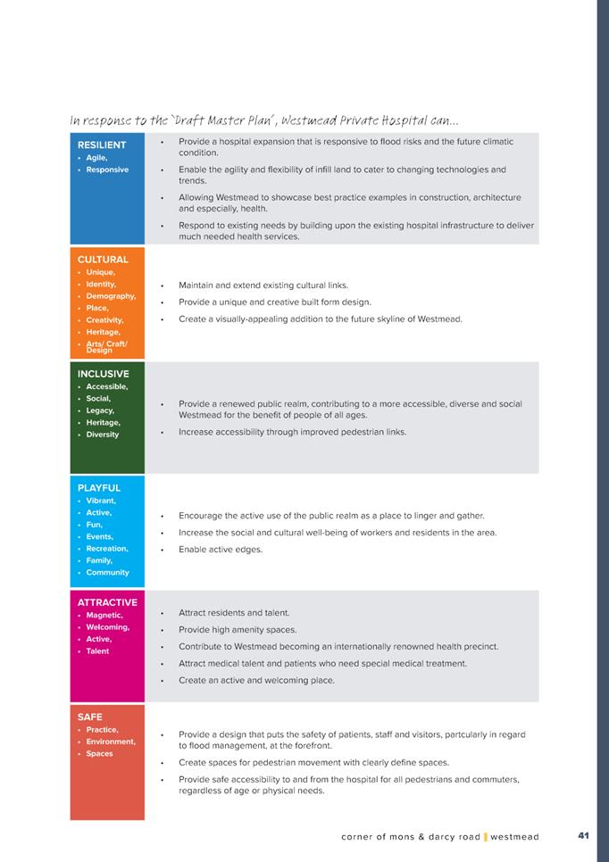
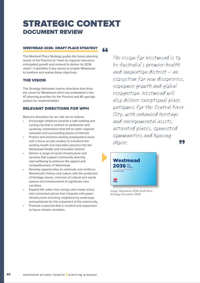
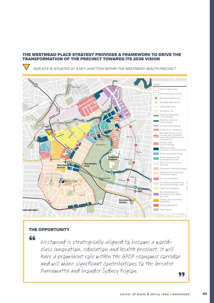
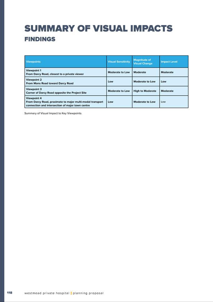
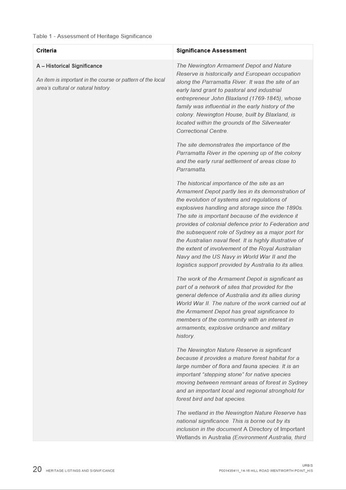
|
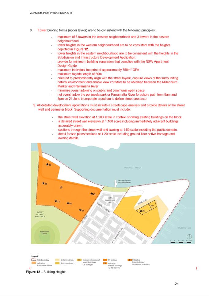
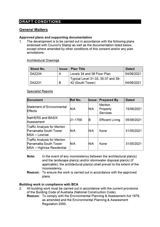
Item 5.1 - Attachment 1 |
Assessment Report & Conditions |


NOTICE OF Local Planning Panel MEETING
PUBLIC AGENDA
An Ordinary Local Planning Panel will be held via audio-visual means on Tuesday, 21 September 2021 at 3:30PM.
Brett Newman
CHIEF EXECUTIVE OFFICER
THIS PAGE LEFT BLANK INTENTIONALLY
Local Planning Panel 21 September 2021
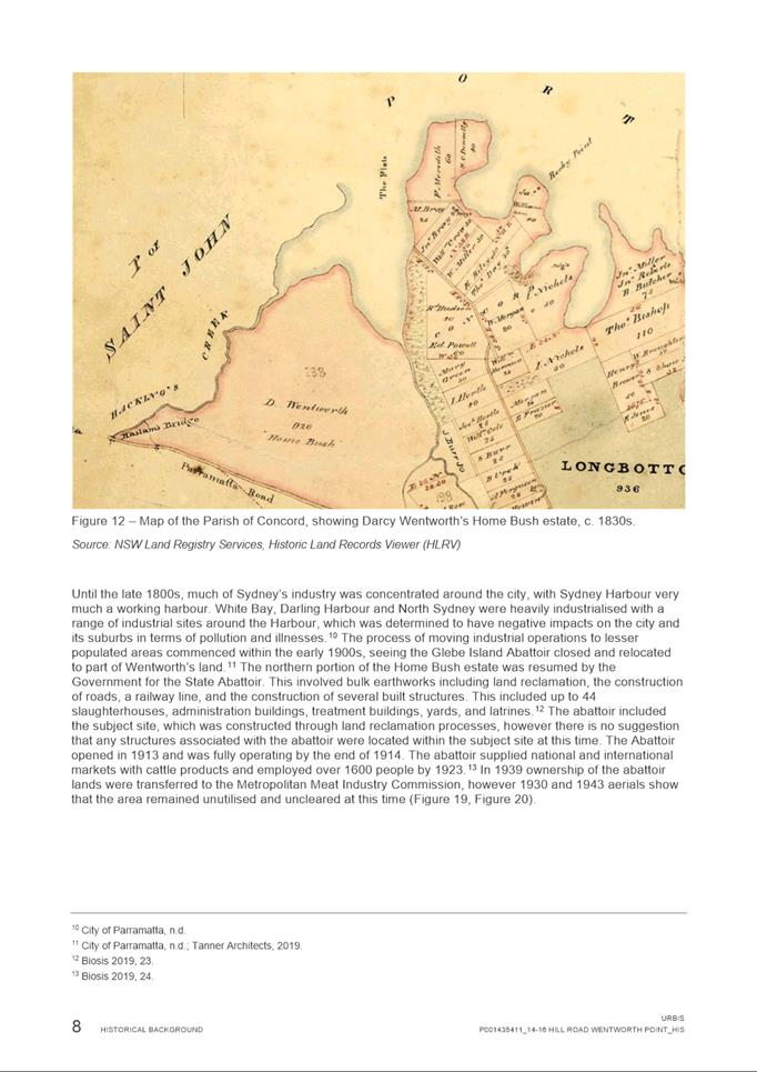
TABLE OF CONTENTS
ITEM SUBJECT PAGE NO
1 ACKNOWLEDGMENT OF THE TRADITIONAL LAND OWNERS
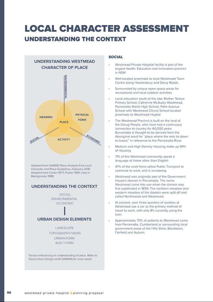
The City of Parramatta Council acknowledges the Burramattagal Clan of The Darug, the traditional land owners of Parramatta and pays its respects to the elders both past and present
2 WEBCASTING ANNOUNCEMENT
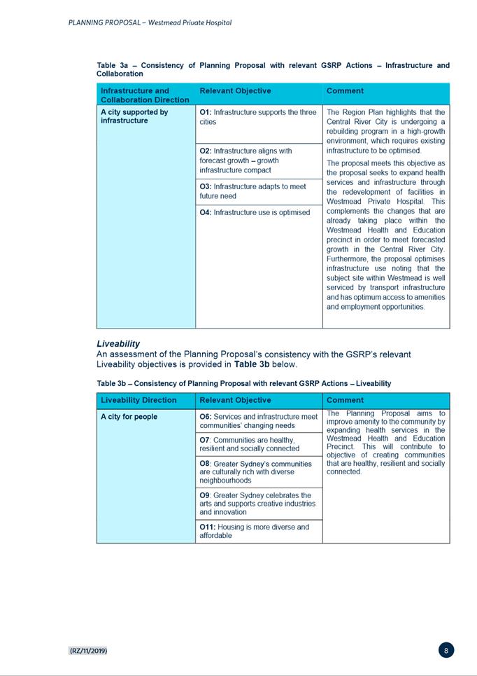
This public meeting will be recorded. The recording will be archived and available on Council’s website.
All care is taken to maintain your privacy; however if you are in attendance in the public gallery, you should be aware that your presence may be recorded.
3 APOLOGIES
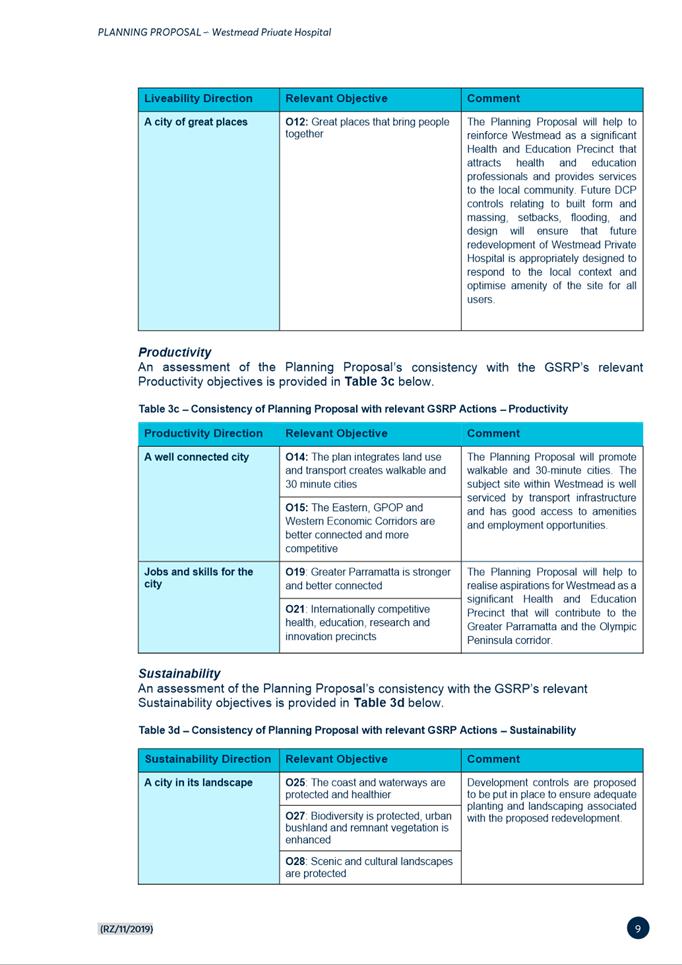
4 DECLARATIONS OF INTEREST
5 Reports - Development Applications
5.1 OUTSIDE
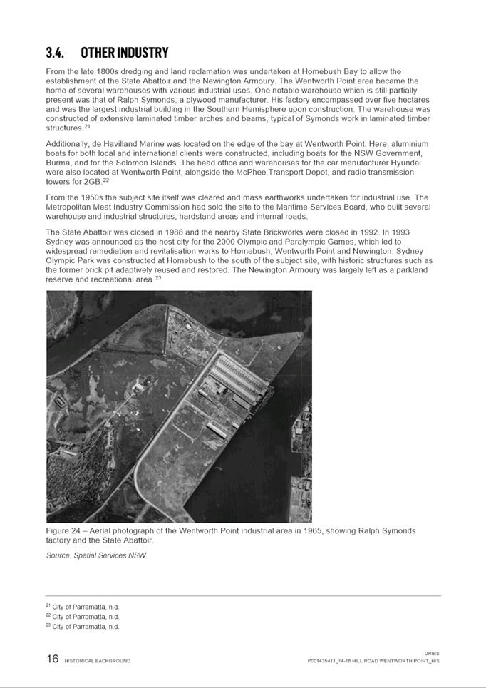
PUBLIC MEETING:
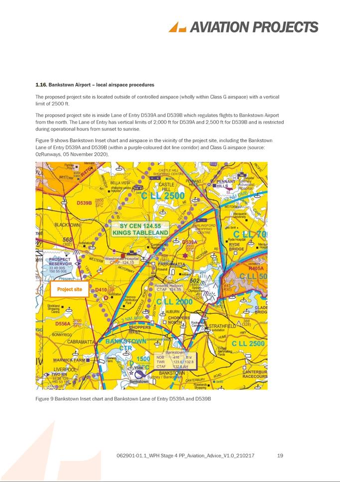
180 George Street, PARRAMATTA (Lot 302 DP 1250440).............. 6
5.2 OUTSIDE
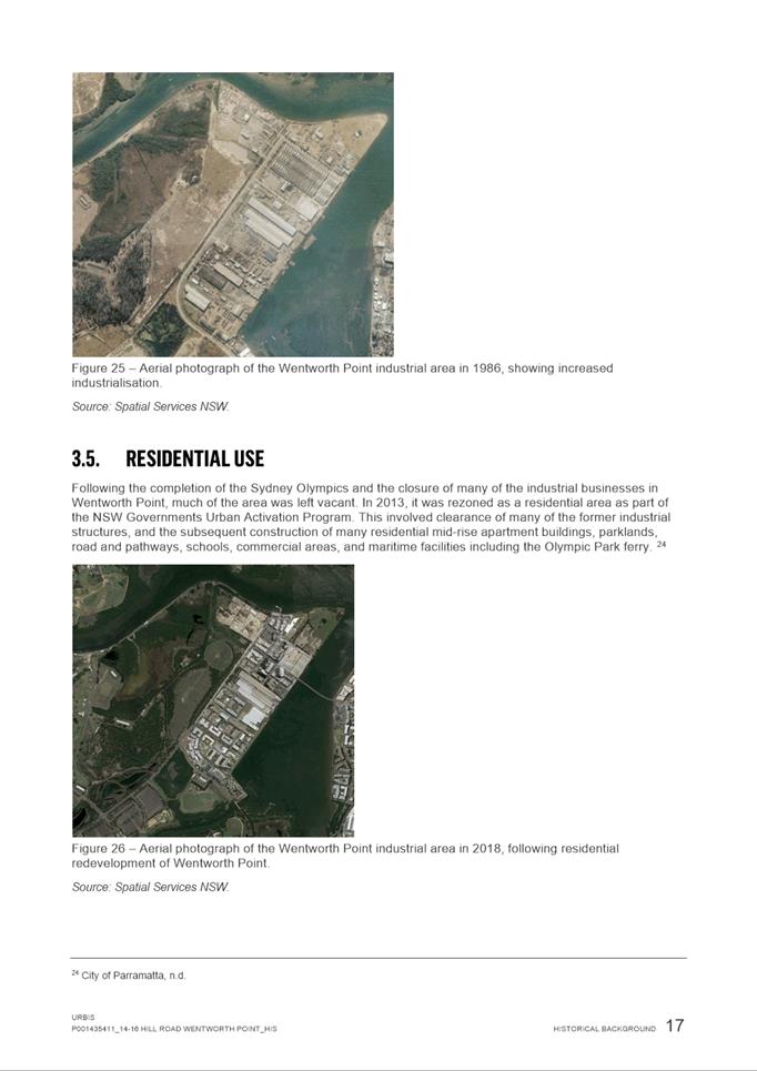
PUBLIC MEETING:
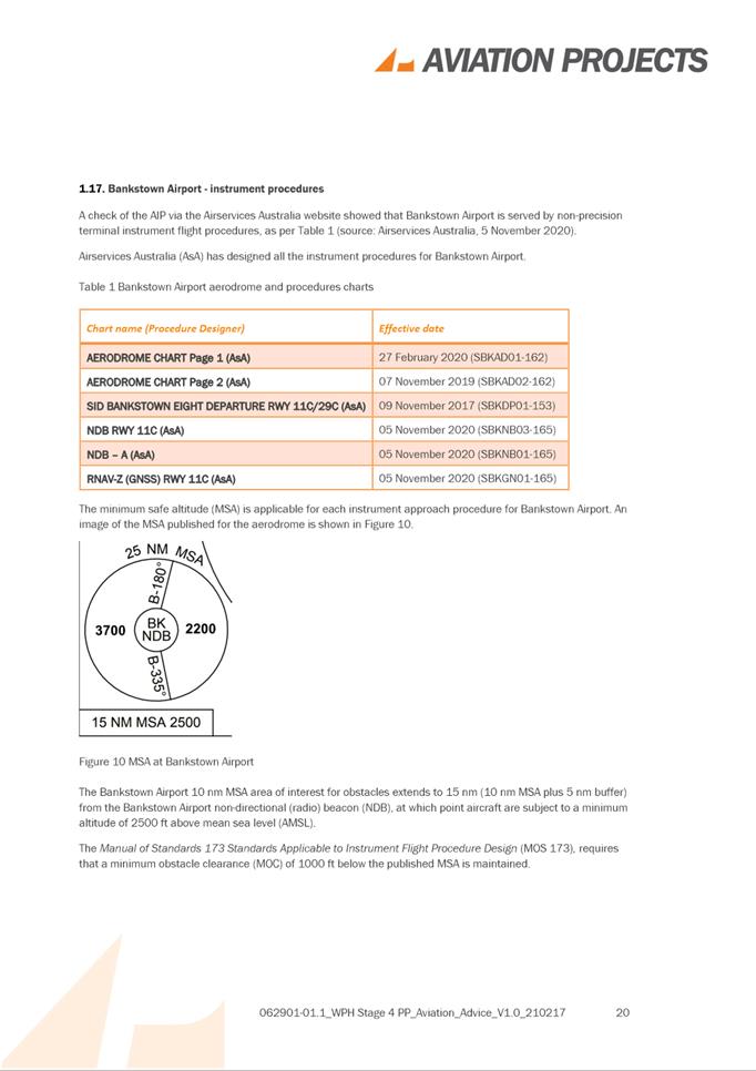
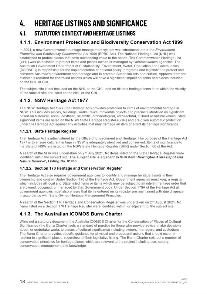
3 Burnham Place, NORTH PARRAMATTA (Lot 5 DP 531741)...... 70
5.3 OUTSIDE
PUBLIC MEETING:
128A Alfred Street and 40-46 Alice Street, HARRIS PARK (Lot 2 DP 209226 and Lot
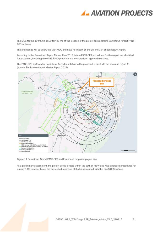
212 DP 1117339).................................................... 123
5.4 PUBLIC MEETING: 21 Bellevue Street, NORTH PARRAMATTA (Lot 16 DP 5211)....................................................................................................... 251
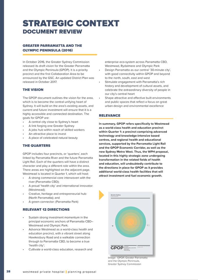
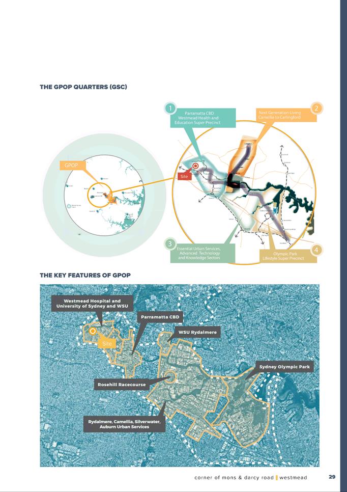
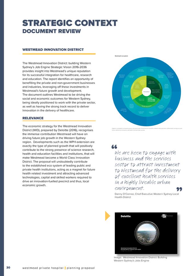
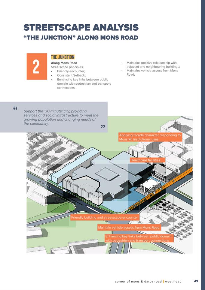
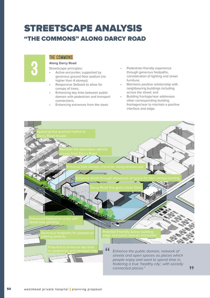
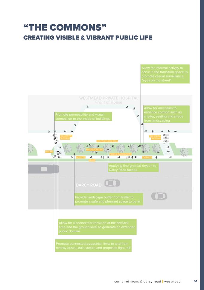
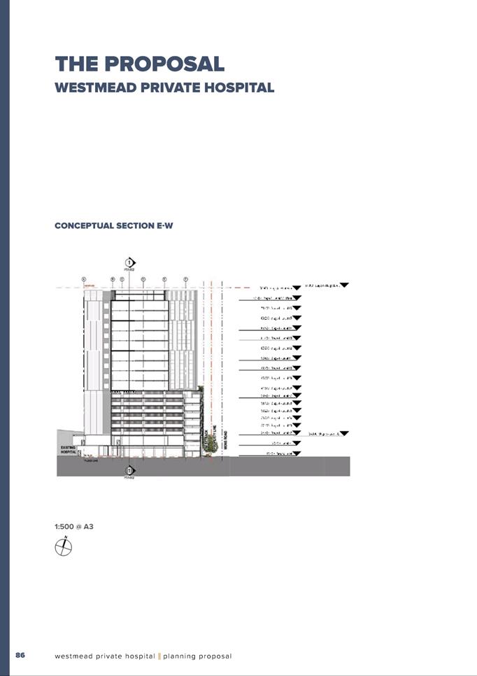
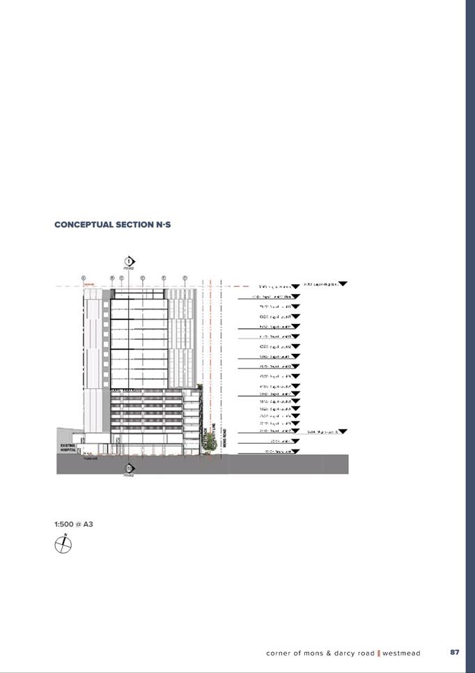
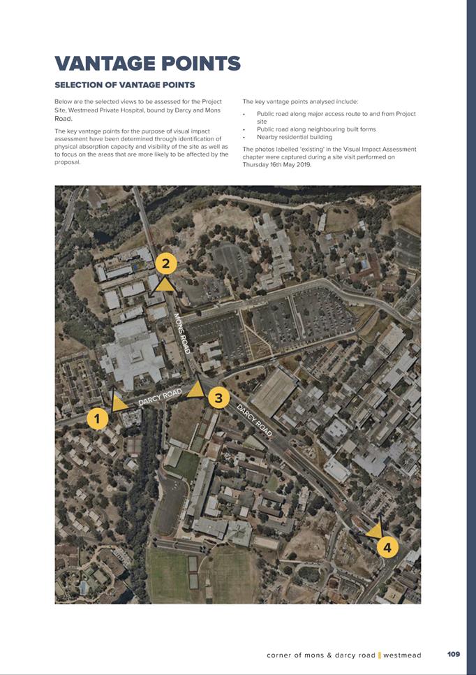
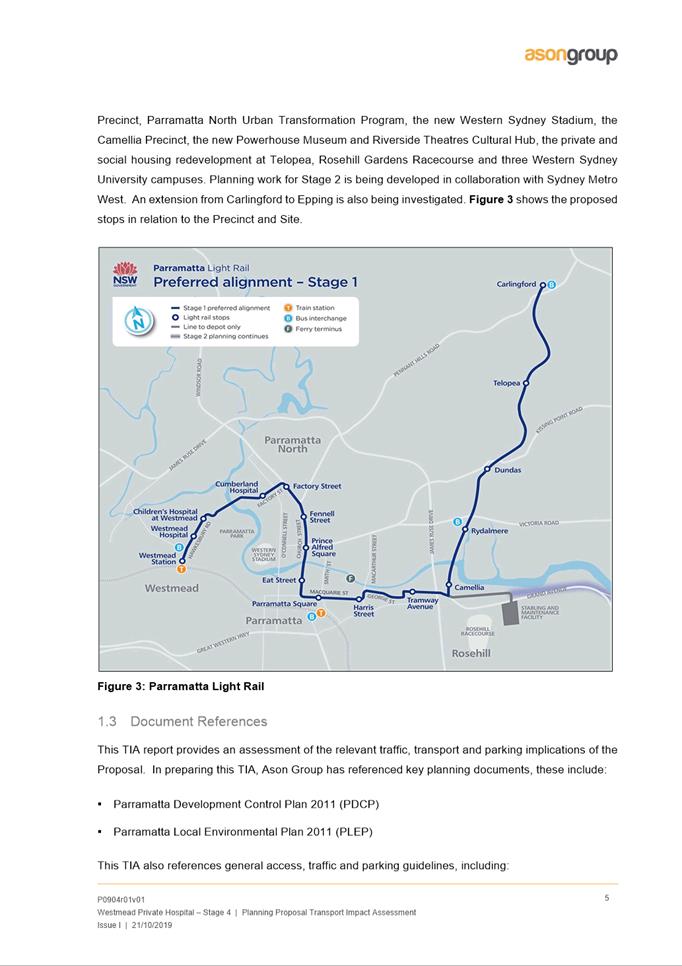
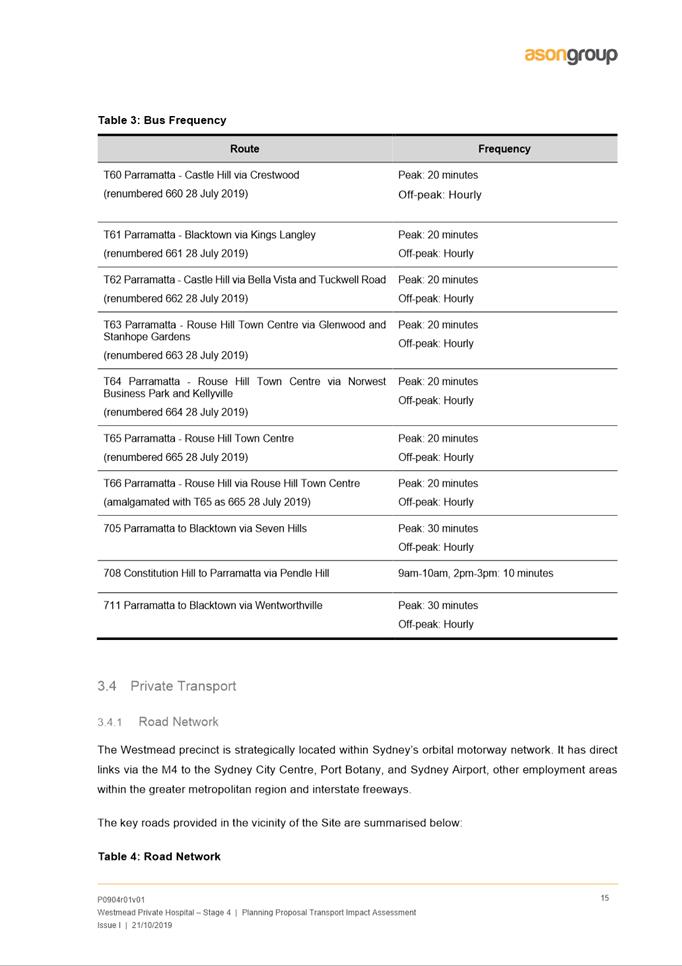
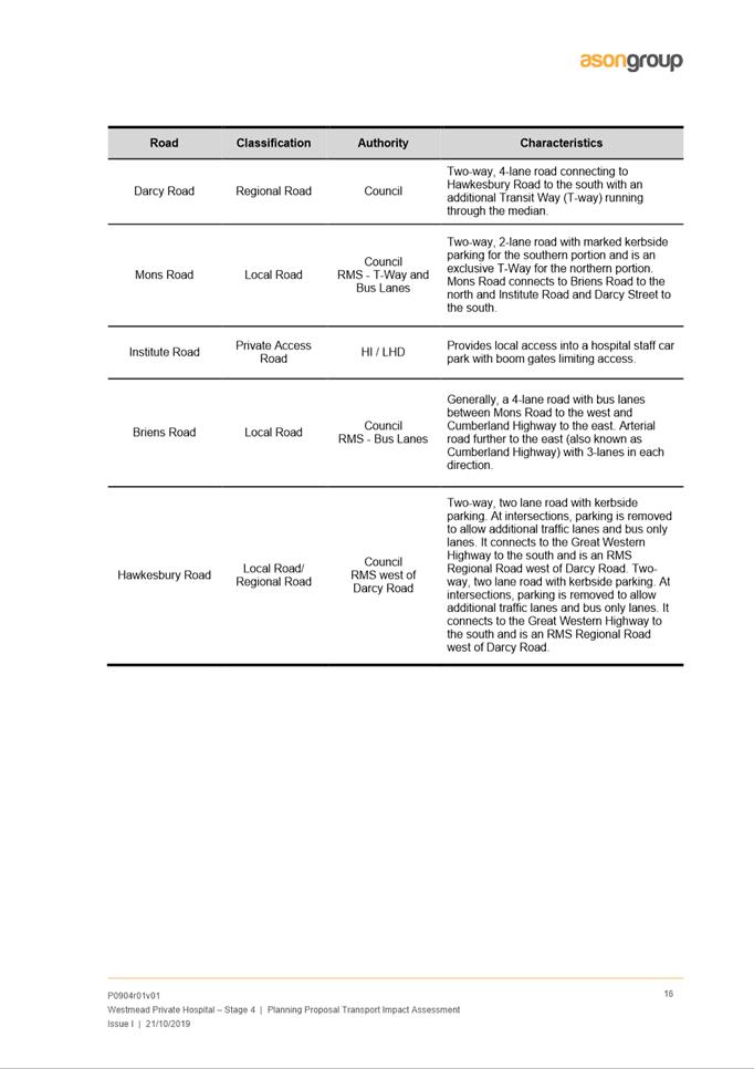
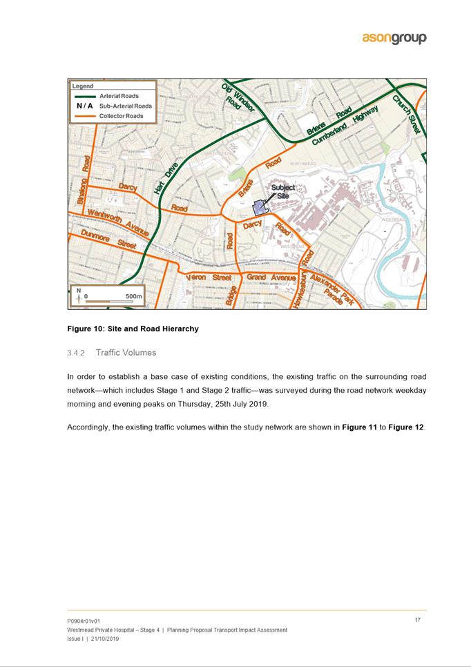
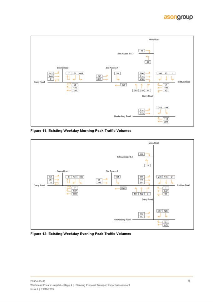
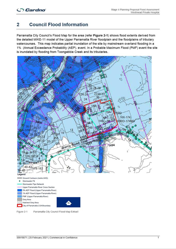
6.1 PUBLIC MEETING: Gateway Request: Planning Proposal at 12-12A, 14 & 14B Mons Road, WESTMEAD (Westmead Private Hospital)....... 428
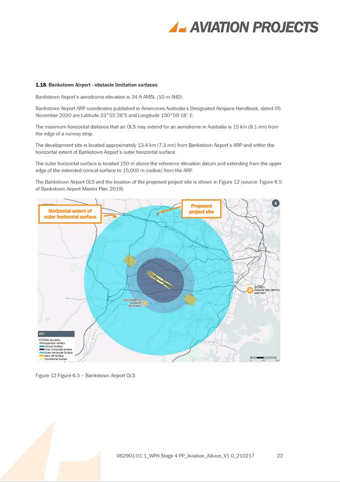
6.2 PUBLIC MEETING: Post-Exhibition: Planning Proposal for land at 163-165 George Street and 1 Purchase Street, PARRAMATTA (St Ioannis Greek Orthodox Church)................................................................................. 755
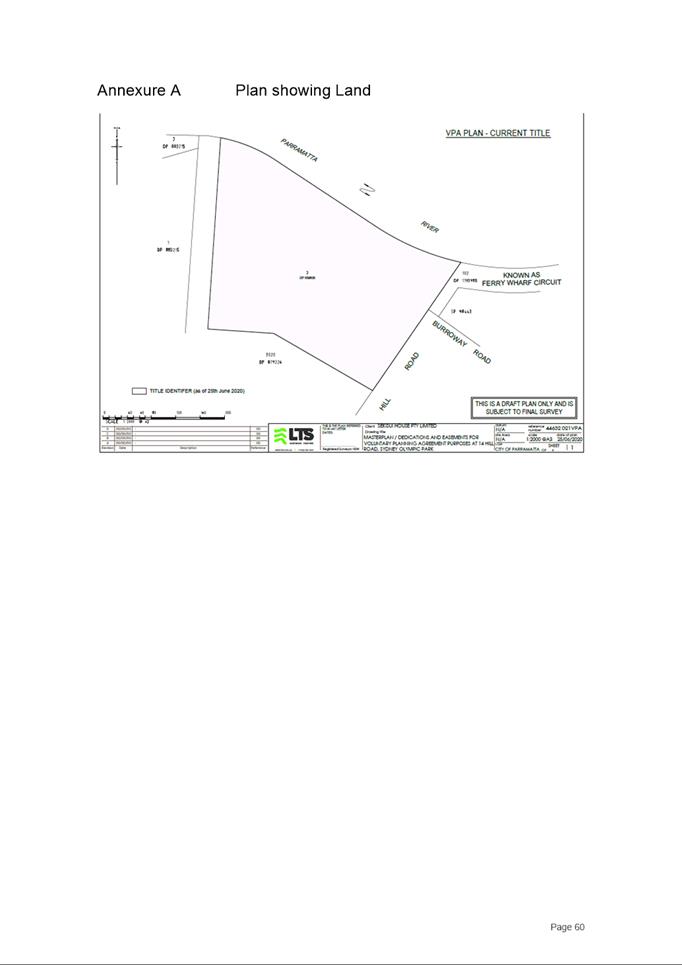
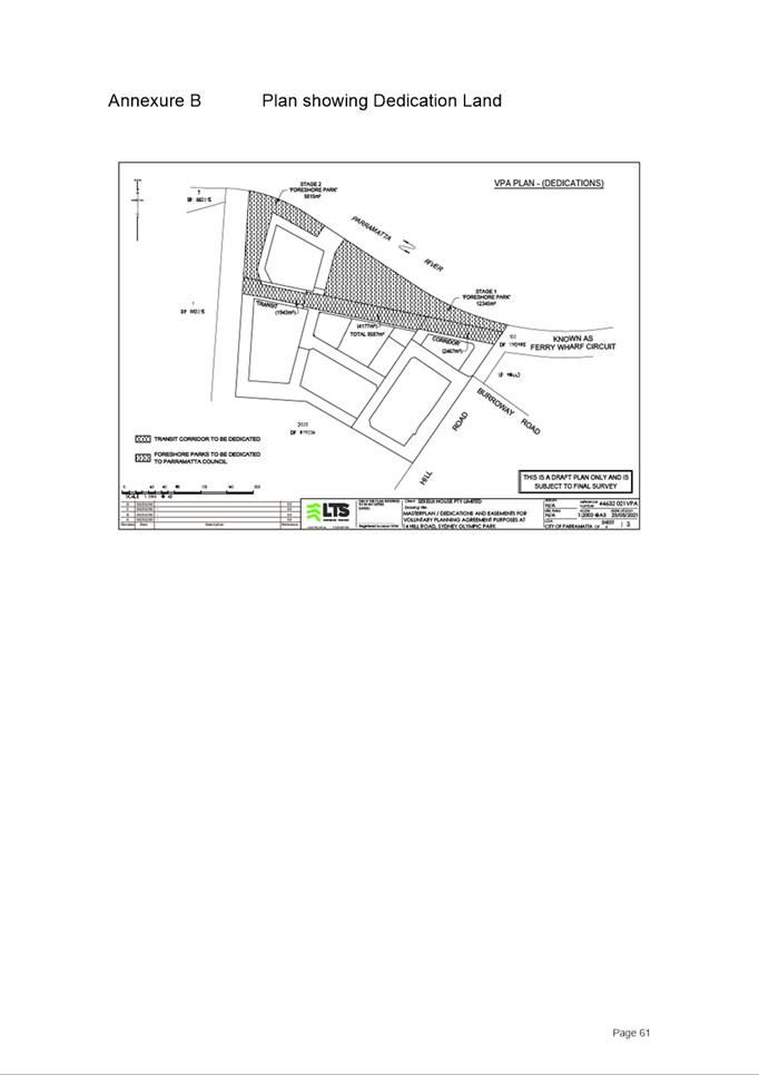
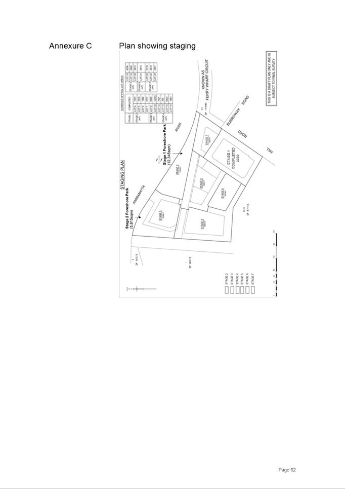
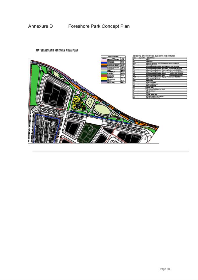
6.3 PUBLIC MEETING: Post-Exhibition - Planning Proposal for land at 14-16 Hill Road, SYDNEY OLYMPIC PARK (Sekisui Site)...................... 800
Development Applications
21 September 2021
5.1 OUTSIDE
PUBLIC MEETING:
180 George Street, PARRAMATTA (Lot 302 DP 1250440)....................... 6
5.2 OUTSIDE
PUBLIC MEETING:
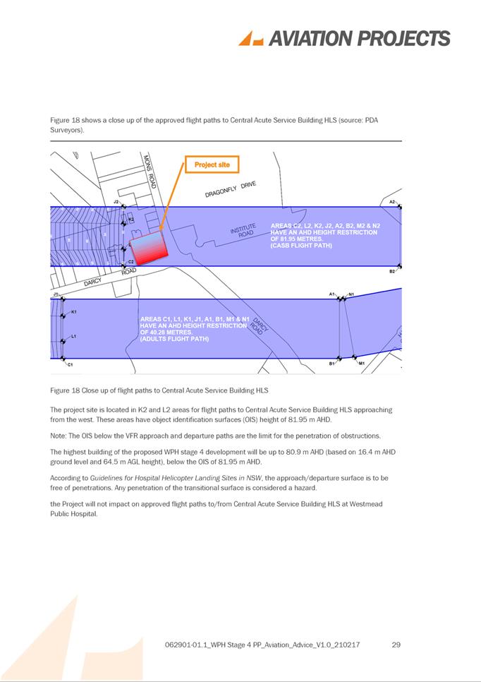
3 Burnham Place, NORTH PARRAMATTA (Lot 5 DP 531741)............... 70
5.3 OUTSIDE
PUBLIC MEETING:
128A Alfred Street and 40-46 Alice Street, HARRIS PARK (Lot 2 DP 209226 and Lot
212 DP 1117339).................................................................................... 123
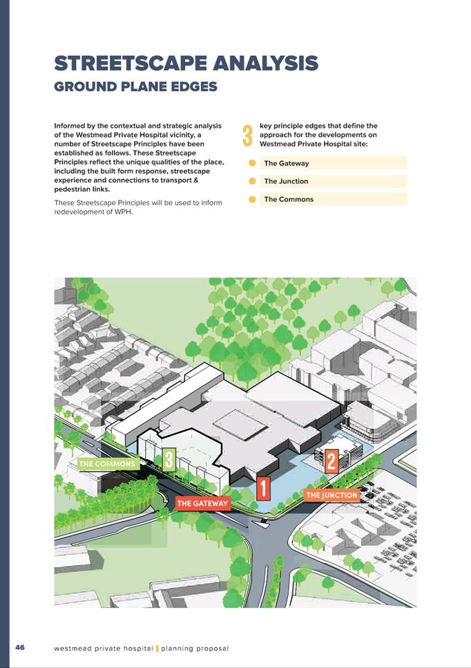
5.4 PUBLIC MEETING: 21 Bellevue Street, NORTH PARRAMATTA (Lot 16 DP 5211).......................................................................................................................... 251
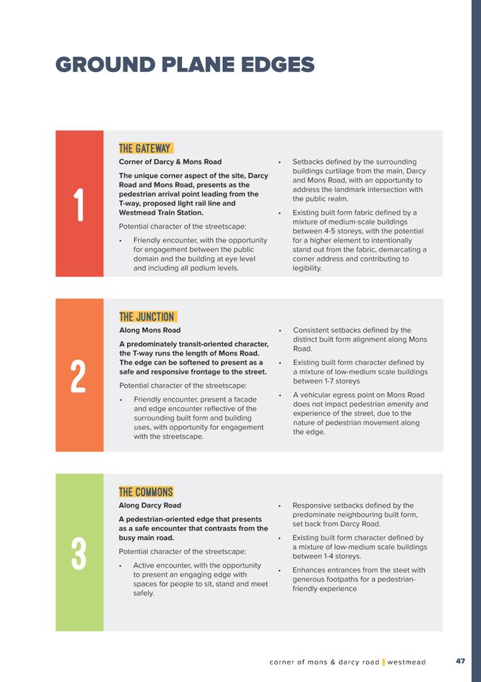
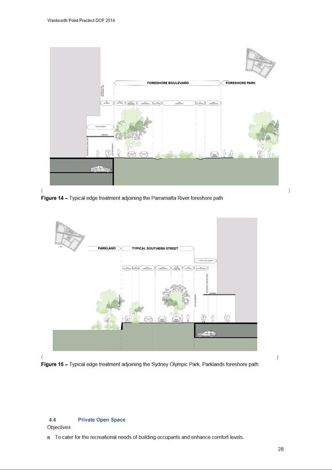
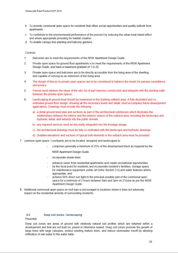
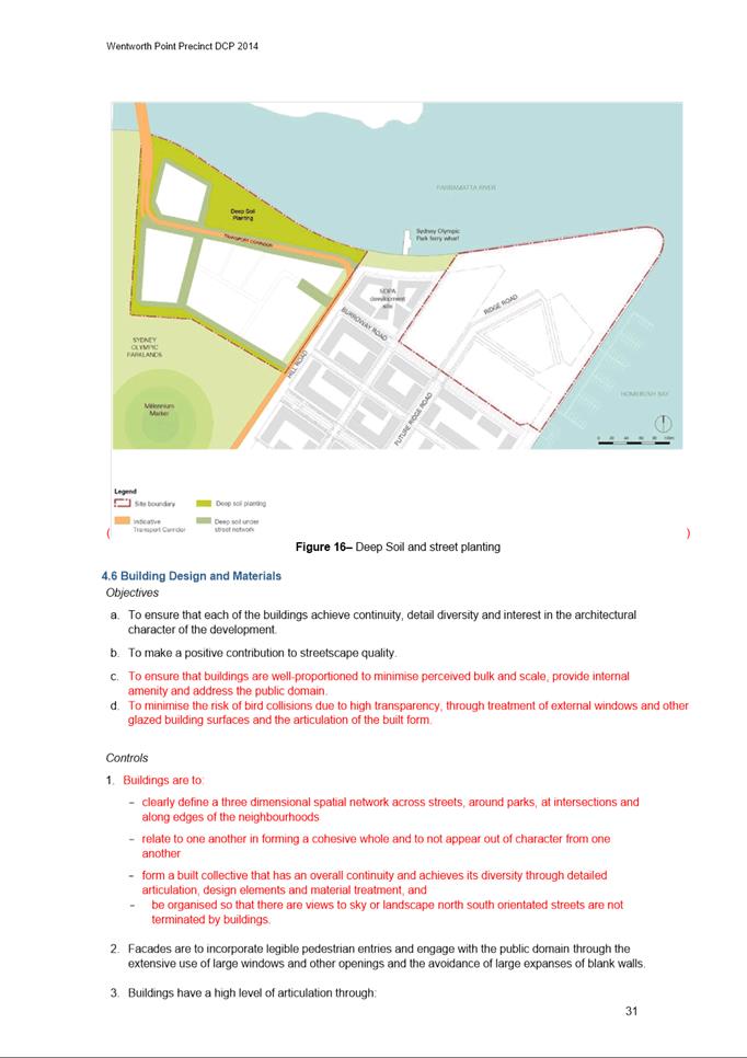
Local Planning Panel 21 September 2021 Item 5.1
ITEM NUMBER 5.1
SUBJECT OUTSIDE PUBLIC MEETING:
180 George Street, PARRAMATTA (Lot 302 DP 1250440)
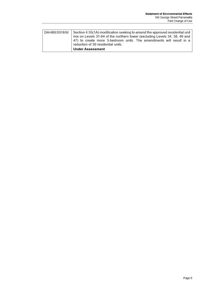
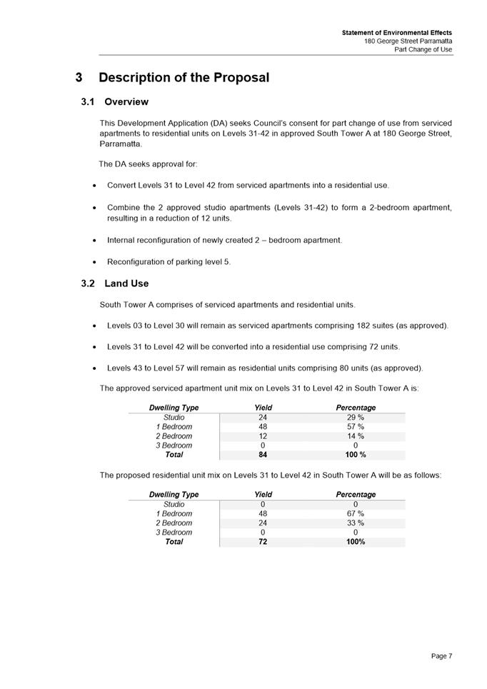
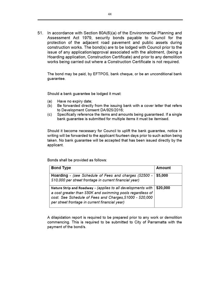
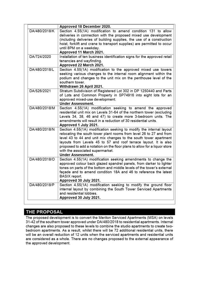
DESCRIPTION Part change of use from serviced apartments to residential units on level 31-42 in the approved South Tower, resulting in a reduction of 12 units. Internal configuration changes to apartments on levels 31-42 in the south tower
REFERENCE DA/513/2021 - D08170845
APPLICANT/S Karimbla Construction Services (NSW) PTY LTD
OWNERS Karimbla Properties (No13) PTY LTD
REPORT OF Group Manager Development and Traffic Services
RECOMMENDED Approval
DATE OF REPORT 21 september 2021
REASON FOR REFERRAL TO LPP
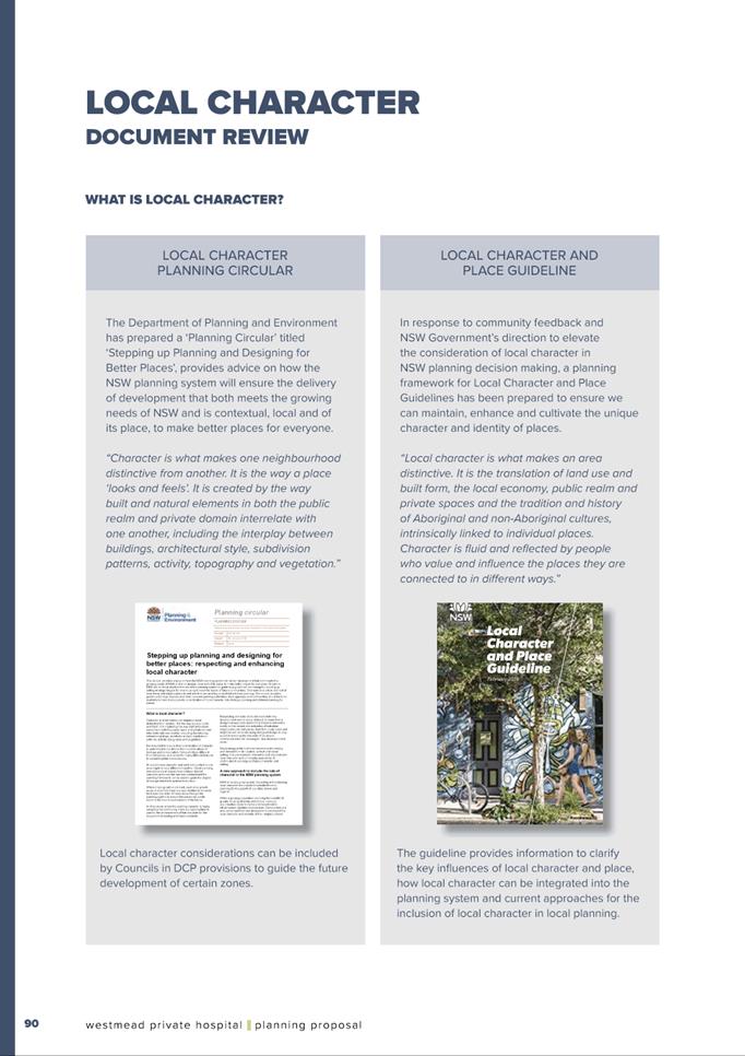
This application is referred to the Parramatta Local Planning Panel under Schedule 2 of the Local Planning Panel Directions as it is development to which State Environmental Planning Policy No. 65 – Design Quality of Residential Apartment Development applies and is 4 or more storeys in height.
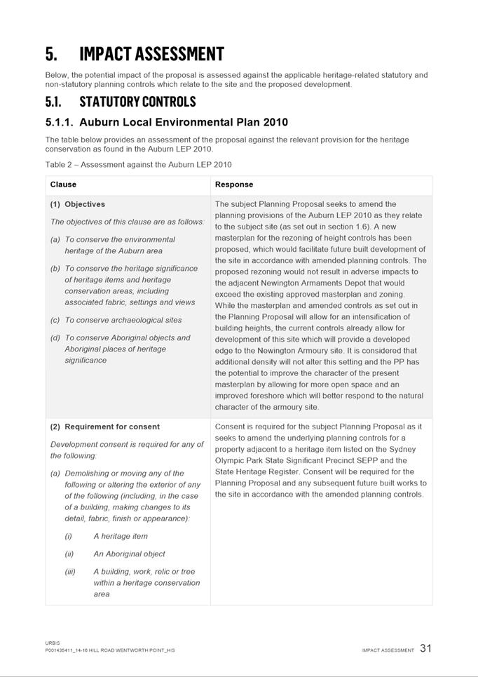
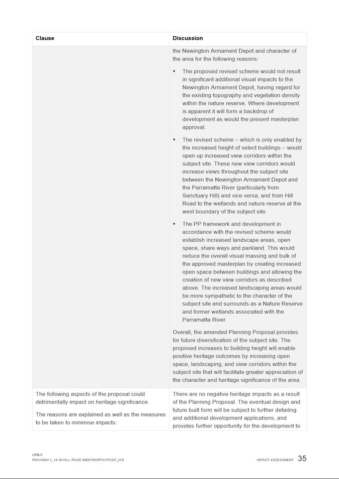
EXECUTIVE SUMMARY
This is a summary of the full assessment of the application as outlined in Attachment 1, the Section 4.15 Assessment Report.
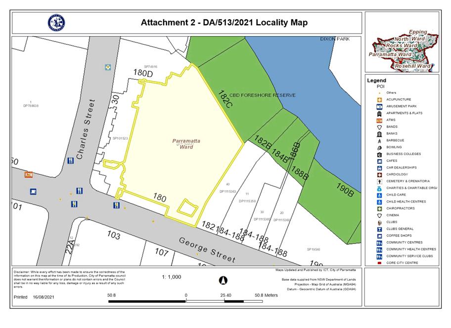
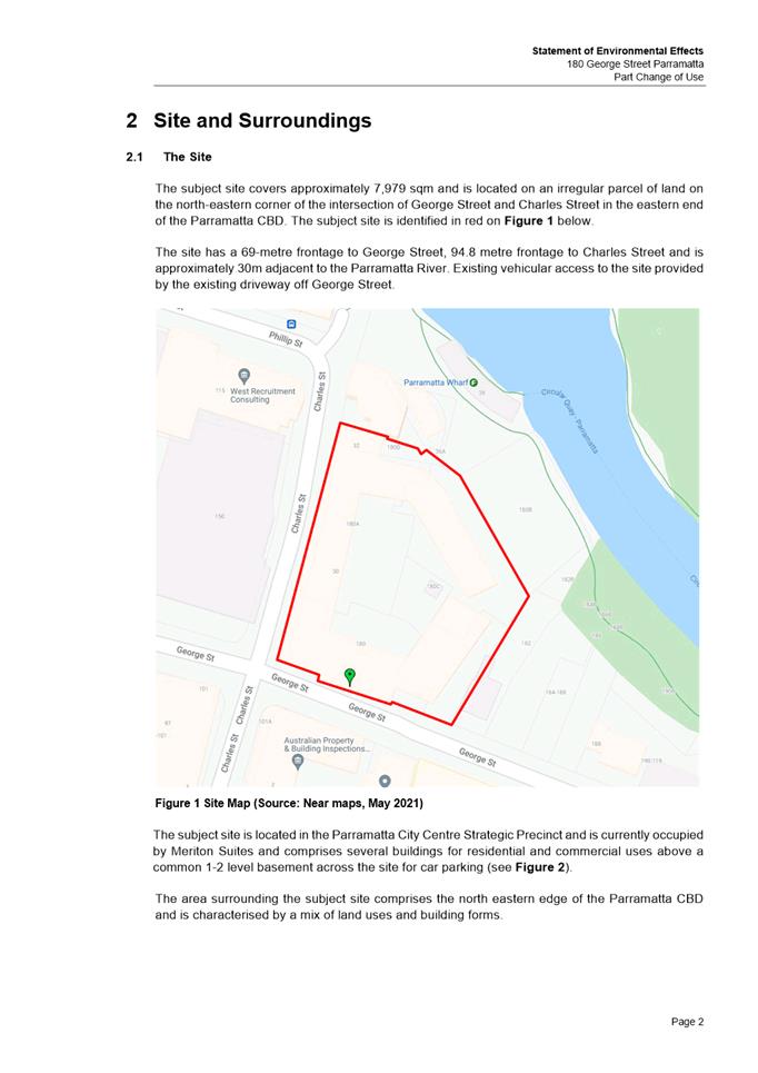
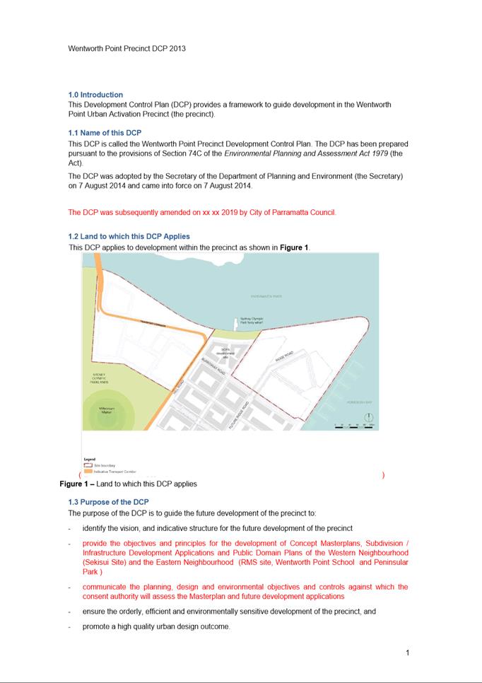
SITE
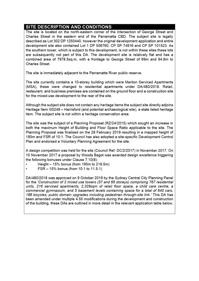
The site is located on the north-eastern corner of the intersection of George Street and Charles Street in the eastern end of the Parramatta CBD. The subject site is legally described as Lot 302 DP 1250440. The development site is relatively flat and has a combined area of 7978.5sq.m, with a frontage to George Street of 69m and 94.8m to Charles Street.
The site is immediately adjacent to the Parramatta River public reserve.
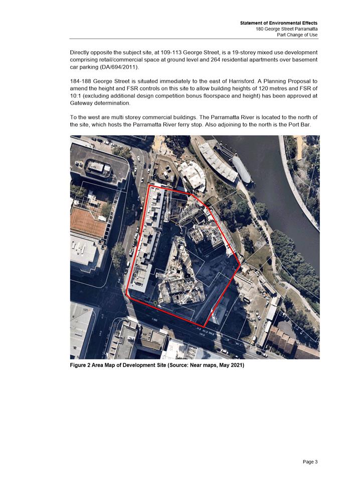
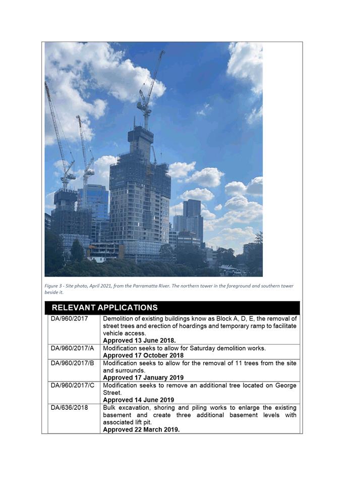
The site currently contains a 10-storey building which were Meriton Serviced Apartments (MSA), these were changed to residential apartments under DA/480/2018. Retail, restaurant, and business premises are contained on the ground floor and a construction site for the mixed-use development to the rear of the site.
Although the subject site does not contain any heritage items the subject site directly adjoins Heritage Item I00248 – Harrisford (and potential archaeological site), a state listed heritage item. The subject site is not within a heritage conservation area.
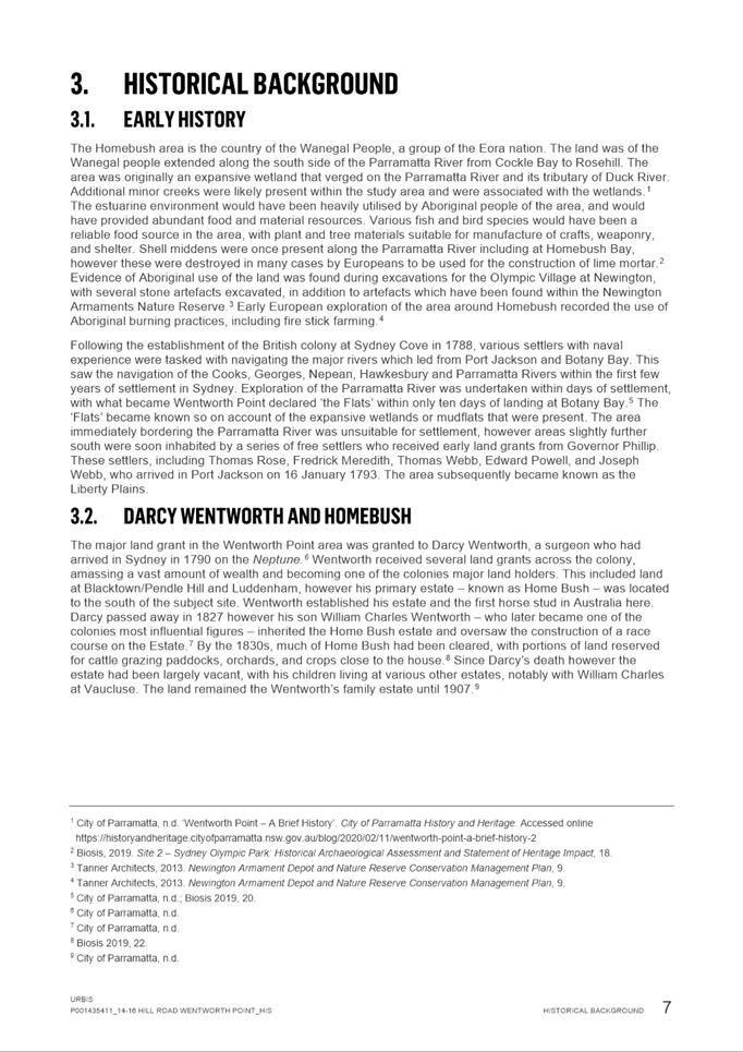
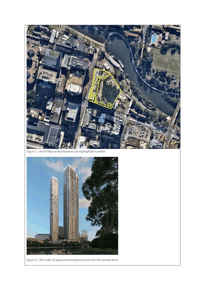
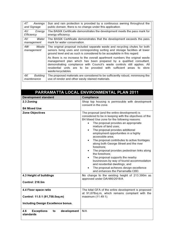
The site was the subject of a Planning Proposal (RZ/24/2015) which sought an increase in both the maximum Height of Building and Floor Space Ratio applicable to the site. The Planning Proposal was finalised on the 28 February 2019 resulting in a mapped height of 190m and FSR of 10:1. The Council has also adopted a site-specific Development Control Plan and endorsed a Voluntary Planning Agreement for the site.
A design competition was held for the site (DC/2/2017) in November 2017. On 15 November 2017 a proposal by Woods Bagot was awarded design excellence triggering the following bonuses under Clause 7.10(8):
• Height – 15% bonus (from 190m to 218.5m)
• FSR – 15% bonus (from 10:1 to 11.5:1)
DA/480/2018 was approved on 9 October 2019 by the Sydney Central City Planning Panel for the ‘Construction of 2 mixed use towers (57 and 66 storeys) comprising 767 residential units, 216 serviced apartments, 2,329sqm of retail floor space, a child care centre, a commercial gymnasium, and 5 basement levels containing space for a total of 640 cars, 188 bicycles; public domain upgrades including pedestrian through-site link.’ This DA has been amended under multiple 4.55 modifications during the development and construction of the building, these DAs are outlined in more detail in the relevant application table below.
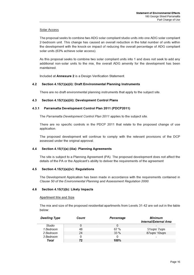
PROPOSED DEVELOPMENT
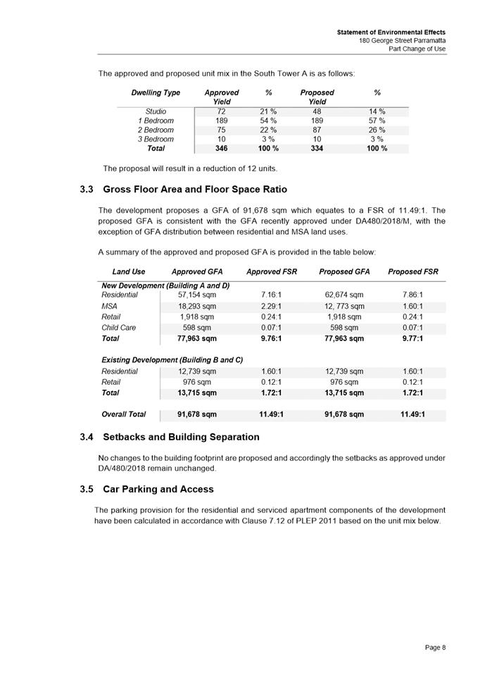
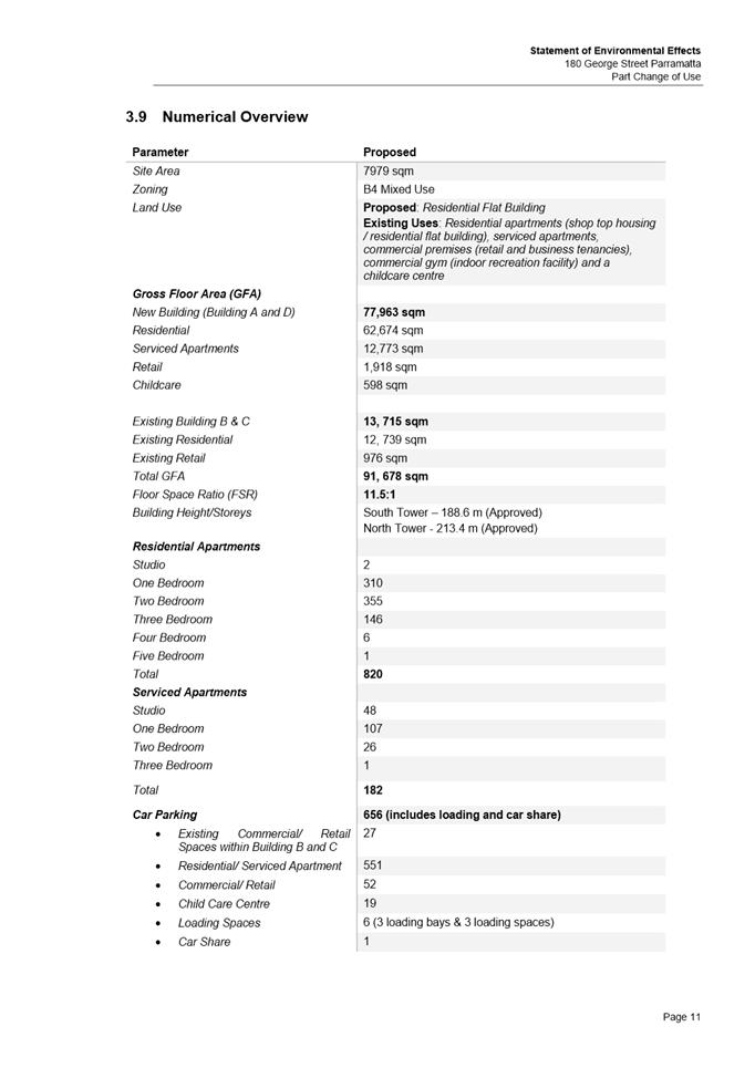
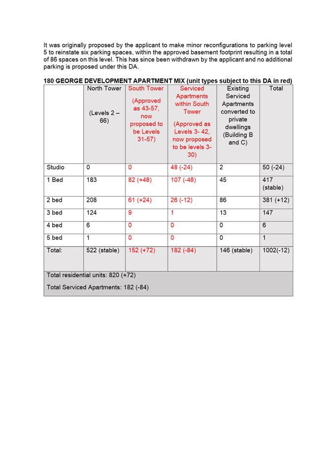
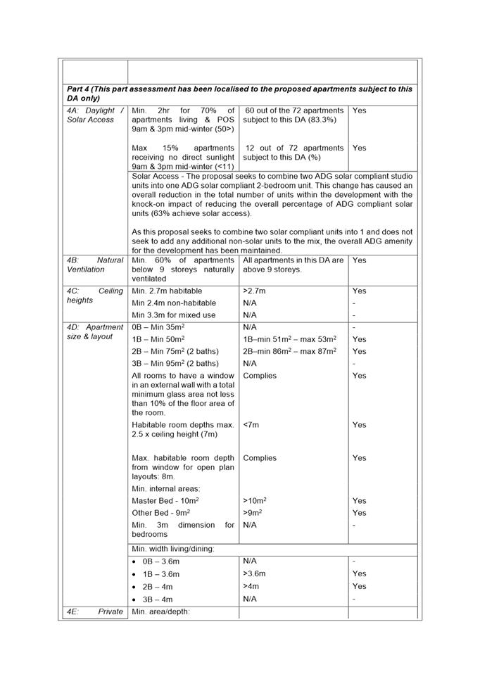
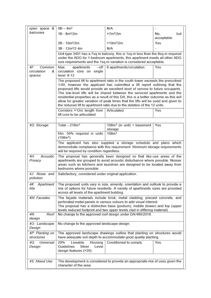
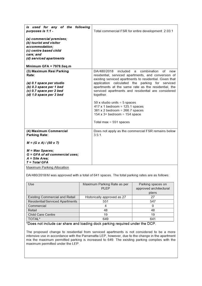
The proposed development is to convert part of the Meriton Serviced Apartments (MSA) on levels 31-42 of the southern tower approved under DA/480/2018 to residential apartments. Internal changes are also proposed to these levels to combine the studio apartments to create two-bedroom apartments, this will result in a reduction of 12 units. There are no changes proposed to the external appearance of the approved development.
It was originally proposed by the applicant to make minor reconfigurations to parking level 5 to reinstate six parking spaces, within the approved basement footprint resulting in a total of 86 spaces on this level. This has since been withdrawn by the applicant and no additional parking is proposed under this DA.
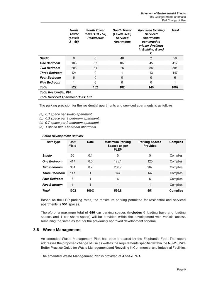
This will result in a total of 820 (+72) residential apartments and 182 (-84) serviced apartments in the entire 180 George St development.
After consideration of the development against Section 4.15 of the Environmental Planning and Assessment Act 1979, and the relevant statutory and policy provisions, the proposal is suitable for the site and is in the public interest. The proposal is recommended for approval subject to conditions for the following reasons:
1. To facilitate the orderly implementation of the objectives of the Environmental Planning and Assessment Act 1979 and the aims and objectives of the relevant Council Planning instrument.
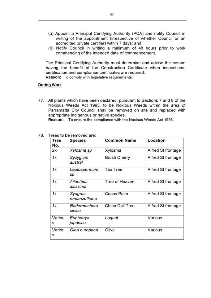
2. To ensure that the local amenity is maintained and is not adversely affected and that adequate safeguards are incorporated into the development.
3. To ensure the development does not hinder the proper and orderly development of the subject land and its surrounds.
4. To ensure the relevant matters for consideration under section 4.15 of Environmental Planning and Assessment Act 1979 are maintained.
RECOMMENDATION
That the Parramatta Local Planning Panel (PLPP), exercising the functions of Council, pursuant to Section 4.16 of the Environmental Planning and Assessment Act 1979, grant development consent to DA/513/2021 for a period of five (5) years within which physical commencement is to occur from the date on the Notice of Determination, subject to conditions of consent and for the following reasons:
REASONS FOR APPROVAL:
1. To facilitate the orderly implementation of the objectives of the Environmental Planning and Assessment Act 1979 and the aims and objectives of the relevant Council Planning instrument.
2. To ensure that the local amenity is maintained and is not adversely affected and that adequate safeguards are incorporated into the development.
3. To ensure the development does not hinder the proper and orderly development of the subject land and its surrounds.
4. To ensure the relevant matters for consideration under section 4.15 of Environmental Planning and Assessment Act 1979 are maintained.
Paul Sartor
Development Assessment Officer
Sarah Irani
Development Support Officer Personal Assistant
|
1⇩ |
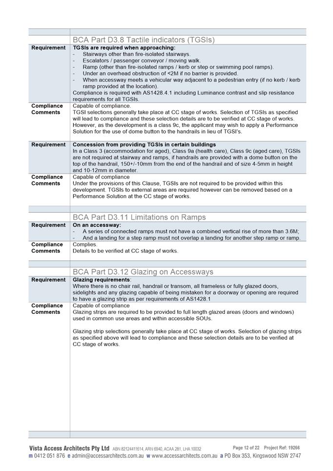
Assessment Report & Conditions |
33 Pages |
|
|
2⇩ |
Locality Map |
1 Page |
|
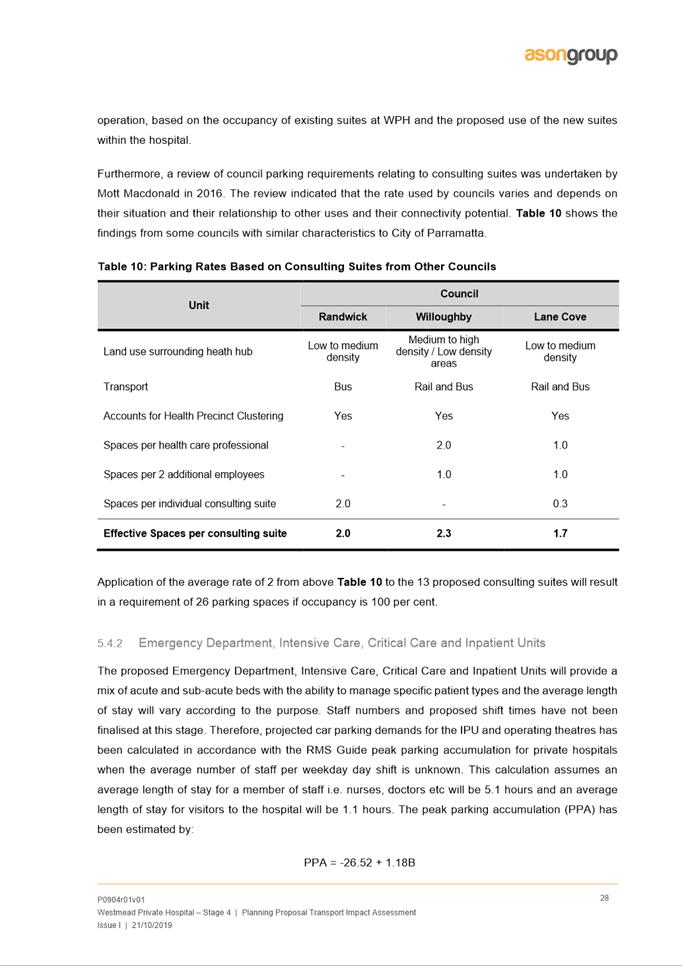
|
3⇩ |
Statement of Environmental Effects |
27 Pages |
|
|
Internal Plans used during Assessment (confidential) |
6 Pages |
|
REFERENCE MATERIAL
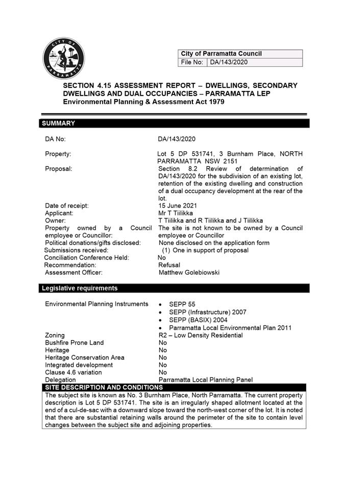
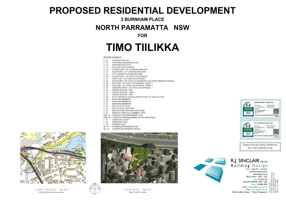
ITEM NUMBER 5.2
SUBJECT OUTSIDE PUBLIC MEETING:
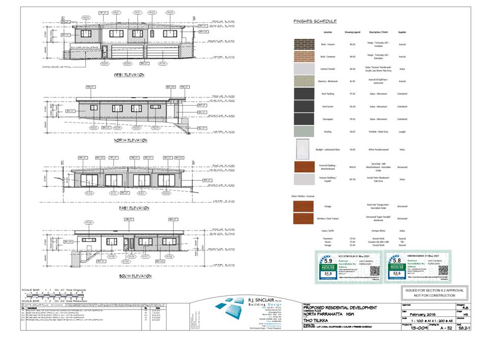
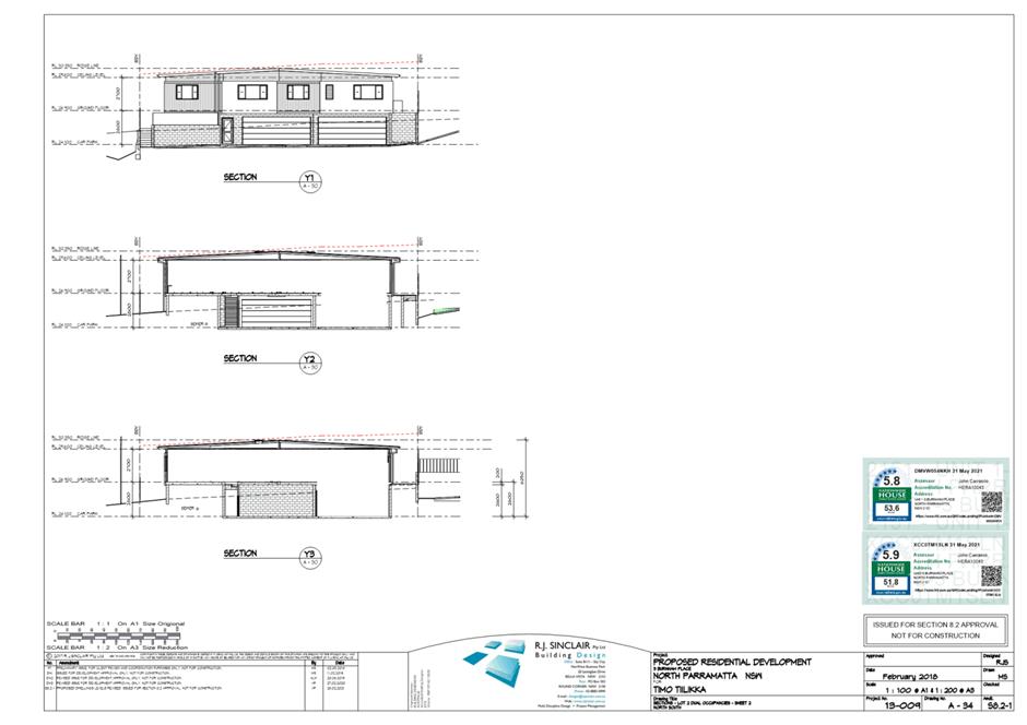
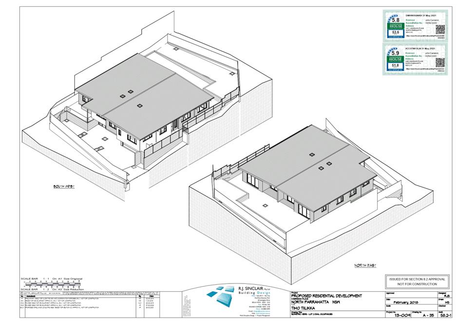
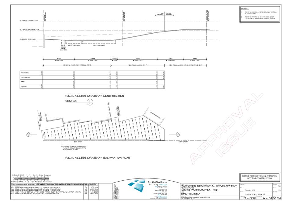
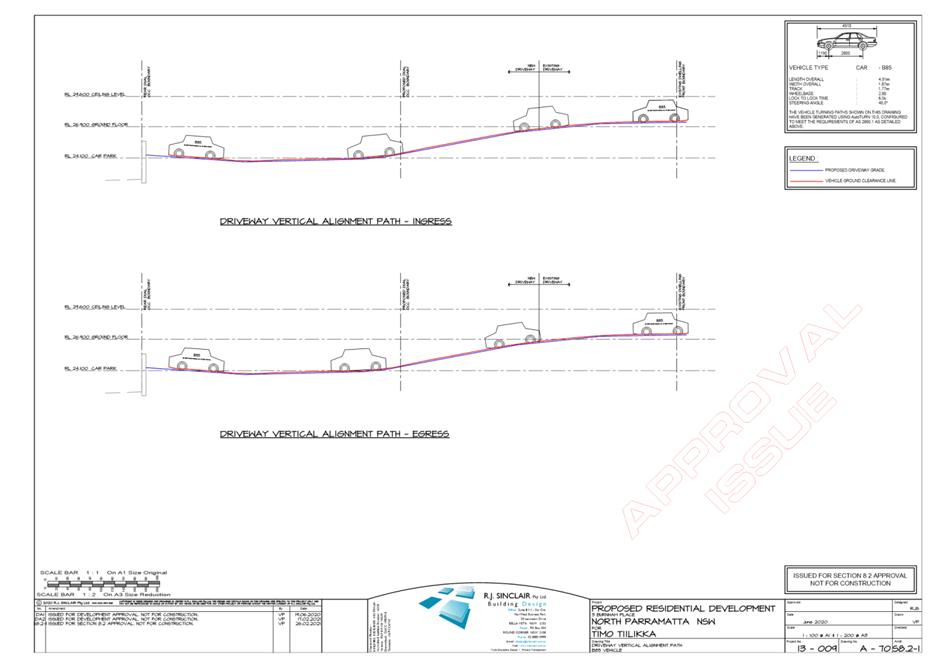
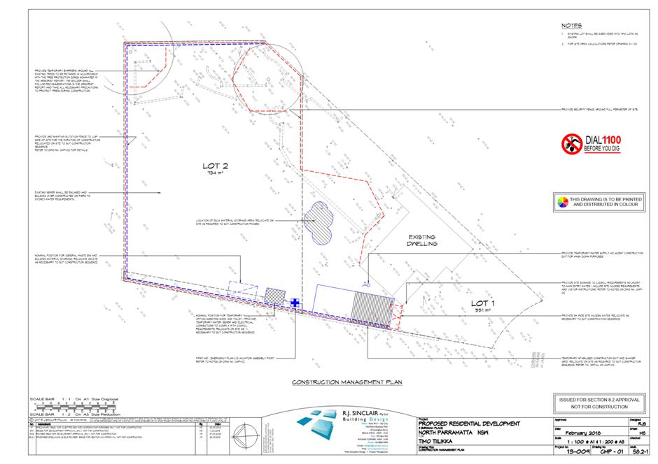
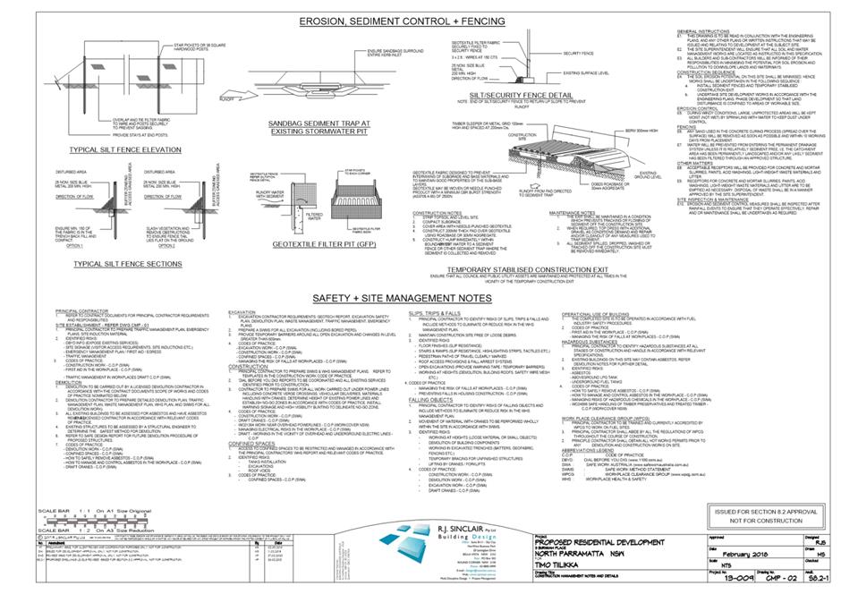
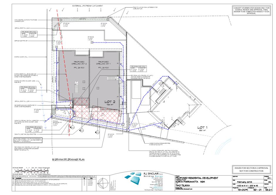
3 Burnham Place, NORTH PARRAMATTA (Lot 5 DP 531741)
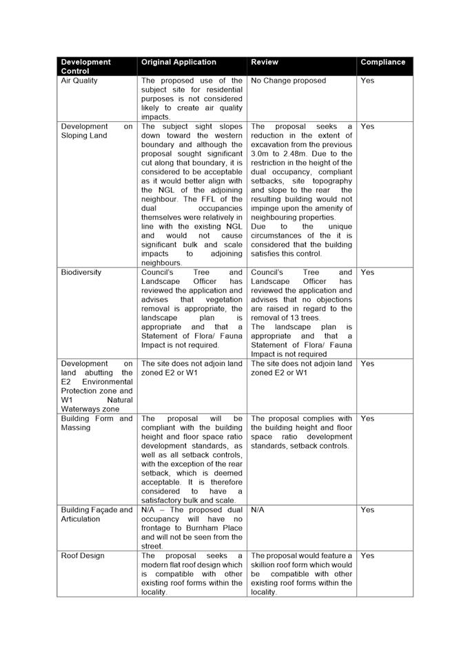
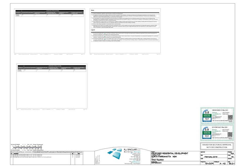
DESCRIPTION Section 8.3 Review of determination of DA/143/2020 for the subdivision of an existing lot, retention of the existing dwelling and construction of a dual occupancy development at the rear of the lot
REFERENCE DA/143/2020 - D08193338
APPLICANT/S Mr T Tiilikka
OWNERS T Tiilikka, R Tiilikka & J Tiilikka
REPORT OF Group Manager Development and Traffic Services
RECOMMENDED Refusal
DATE OF REPORT 21 SEPTEMBER 2021
REASON FOR REFERRAL TO LPP
Pursuant to Section 8.2 of the Environmental Planning and assessment Act 1979 the application has been referred to Parramatta Local Planning Panel due to a request for the review of Council’s determination.
EXECUTIVE SUMMARY
This is a summary of the full assessment of the application as outlined in Attachment 1, the Section 4.15 Assessment Report.
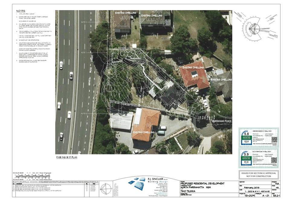
Site Context
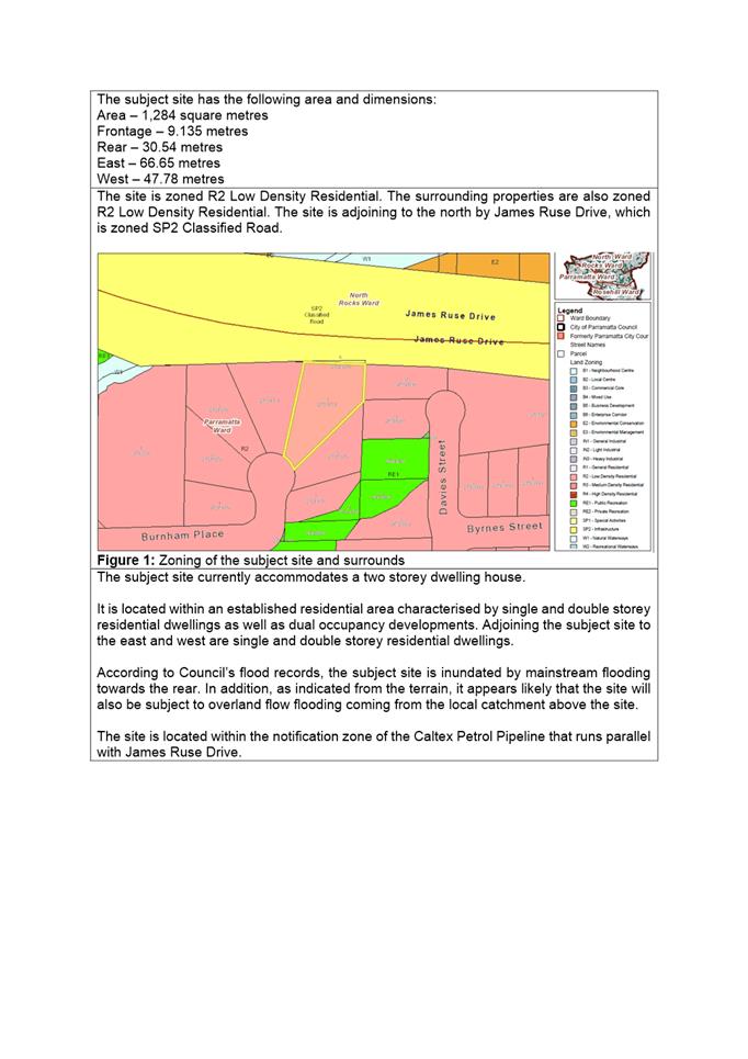
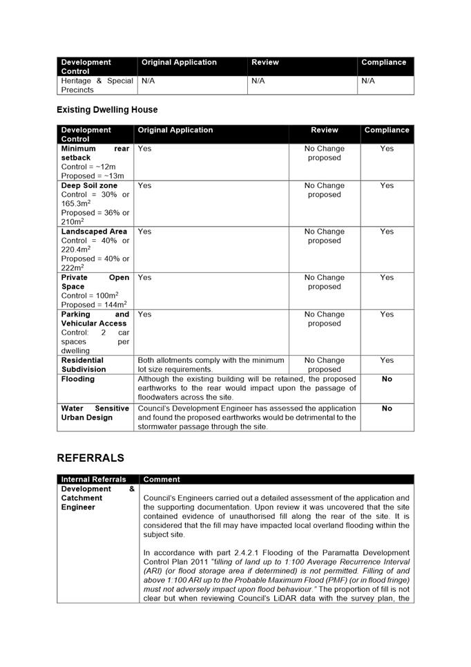
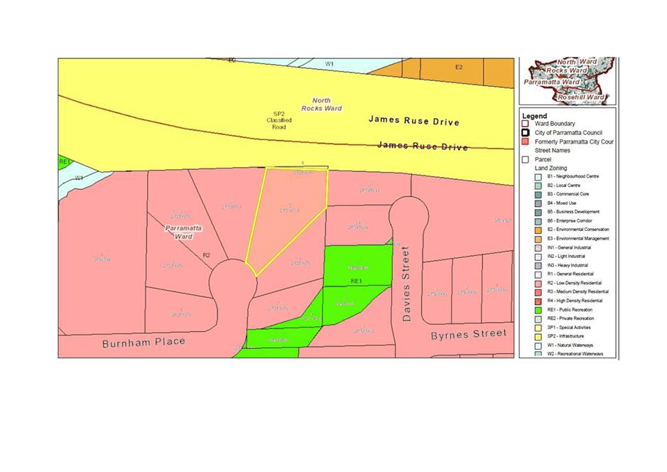
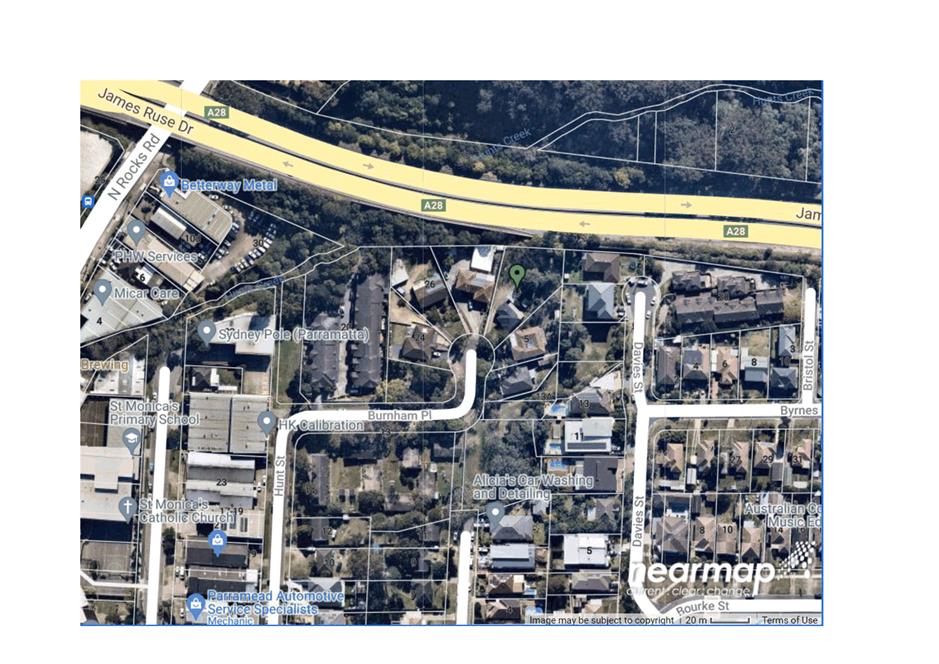
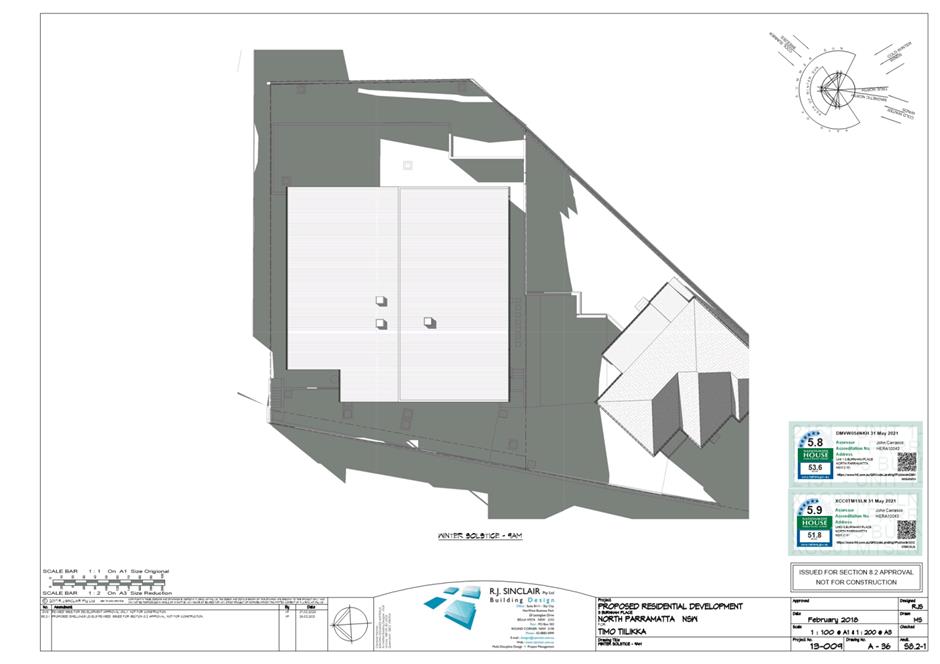
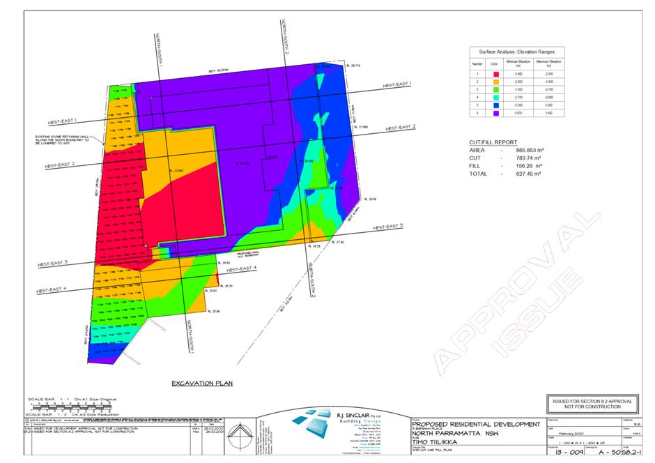
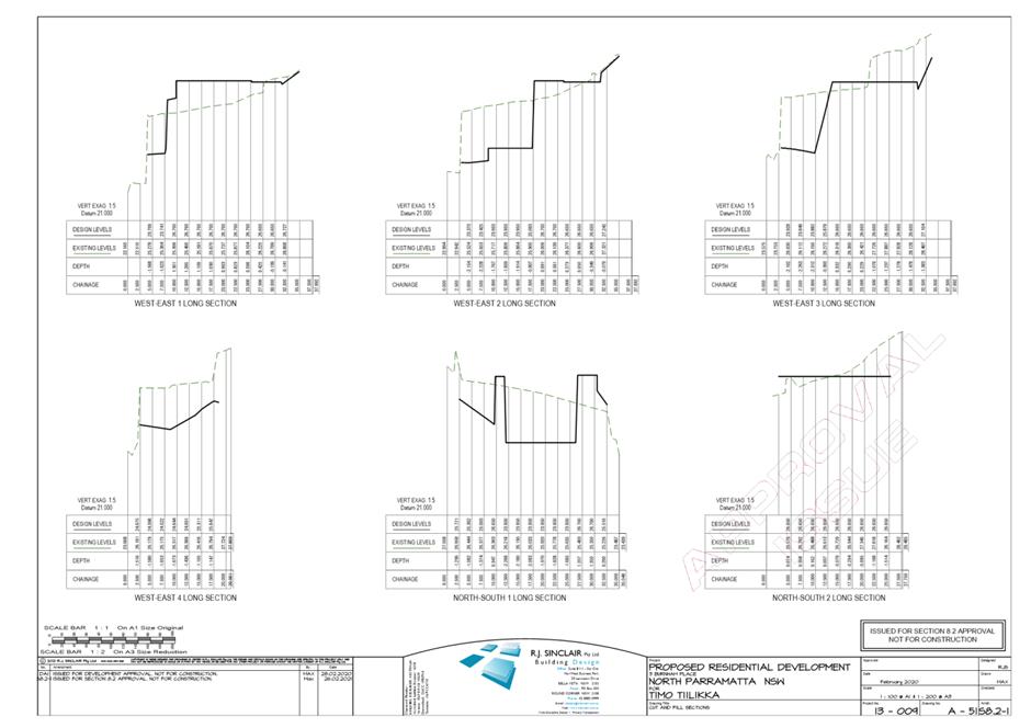
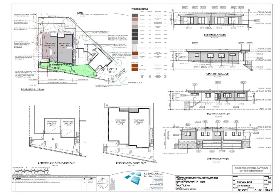
The subject site is known as No. 3 Burnham Place, North Parramatta. The current property description is Lot 5 DP 531741. The site is an irregularly shaped allotment located at the end of a cul-de-sac with a downward slope toward the north-west corner of the lot.
The subject site has an area of 1,284m2 and is zoned R2 Low Density Residential. The surrounding properties are also zoned R2 Low Density Residential. The site is adjoining to the north by James Ruse Drive, which is zoned SP2 Classified Road.
The subject site currently accommodates a two storey dwelling house.
It is located within an established residential area characterised by single and double storey residential dwellings as well as dual occupancy developments. Adjoining the subject site to the east and west are single and double storey residential dwellings.
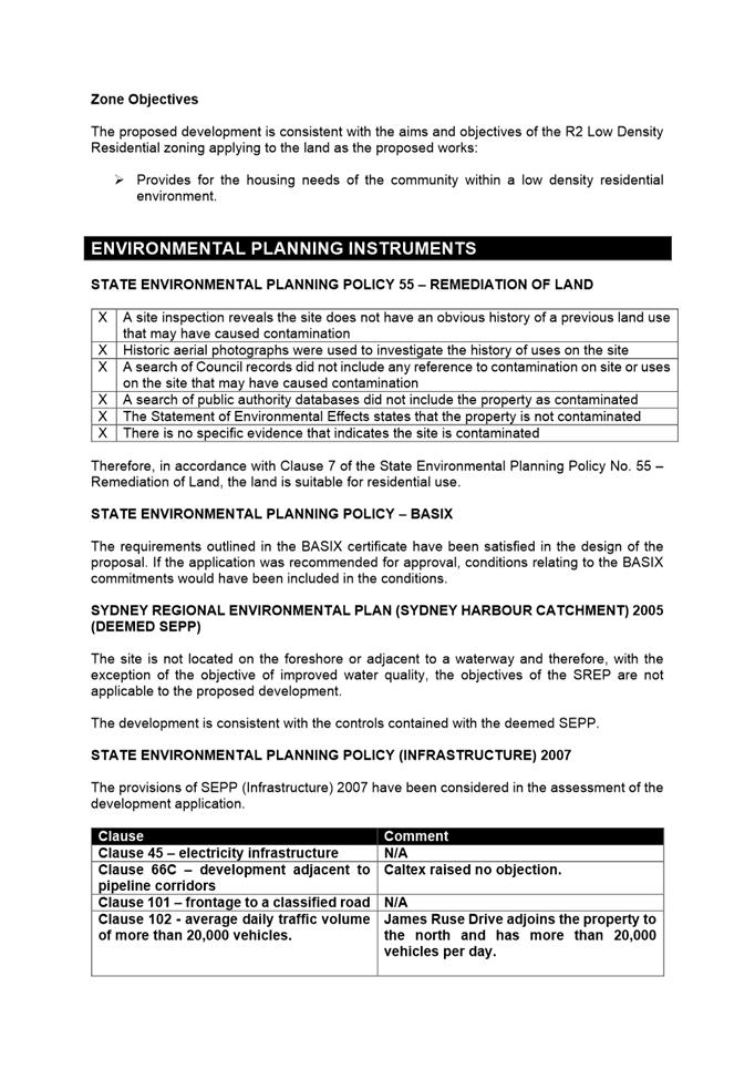
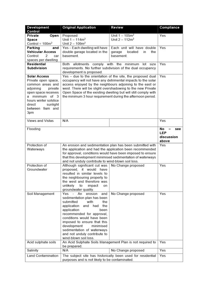
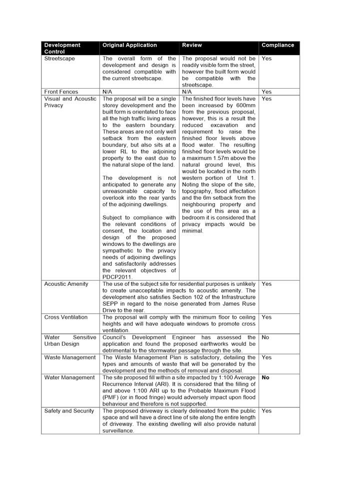
According to Council’s flood records, the subject site is inundated by mainstream flooding towards the rear. In addition, as indicated from the terrain, it appears likely that the site will also be subject to overland flow flooding coming from the local catchment above the site.
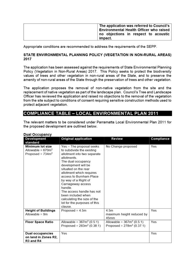
The site is located within the notification zone of the Caltex Petrol Pipeline that runs parallel with James Ruse Drive.
Proposed development
The proposed development includes the following components:
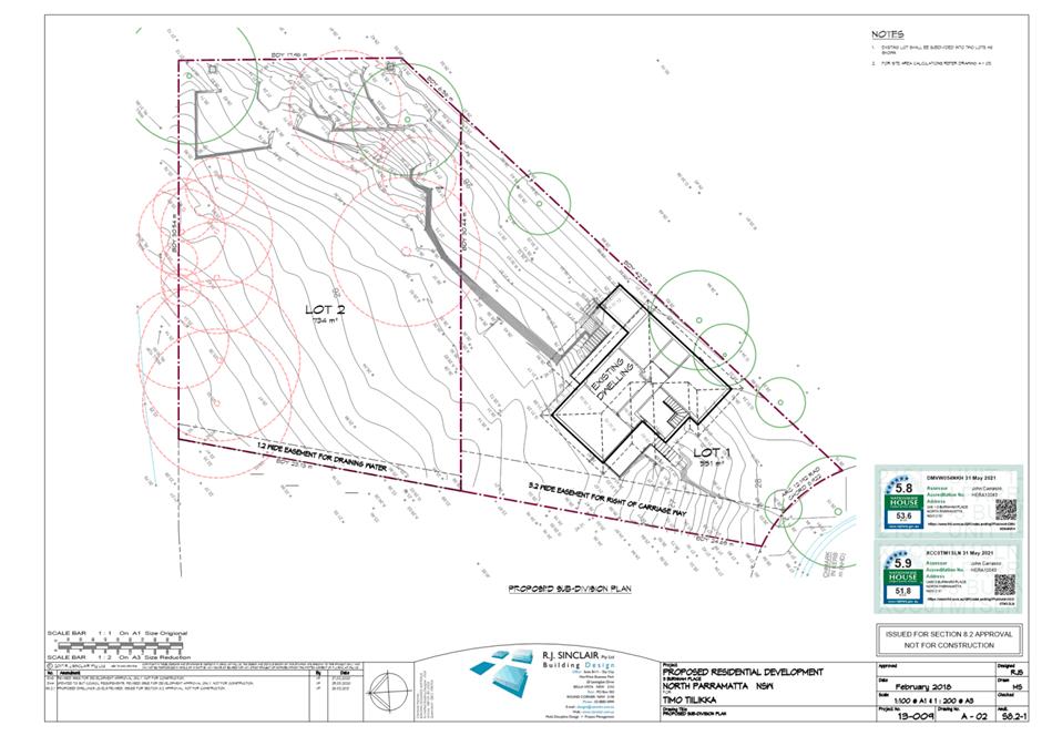
Subdivision
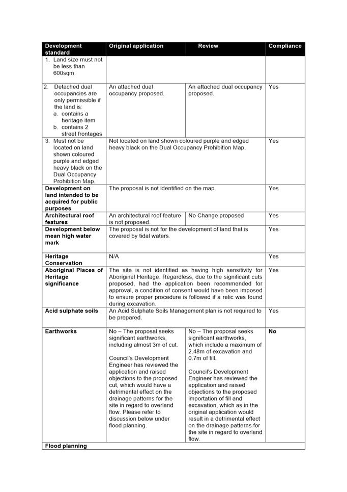
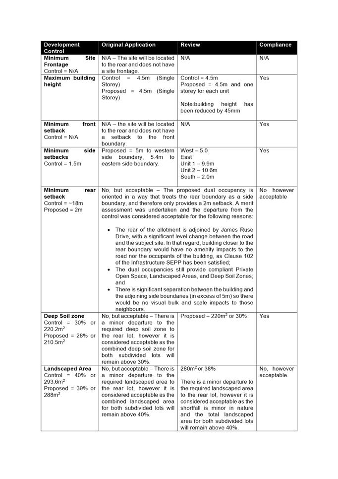
Subdivision of the subject site into two (2) separate allotments with the following areas:
· Lot 1(front lot) – 551m2 including a 3.2m wide Right of Carriageway Easement to Lot 2 in the rear (Lot 1 will also retain the existing dwelling); and
· Lot 2 (rear lot) – 734m2 including a 1.2m wide Drainage Easement benefitting the proposed Lot 1.
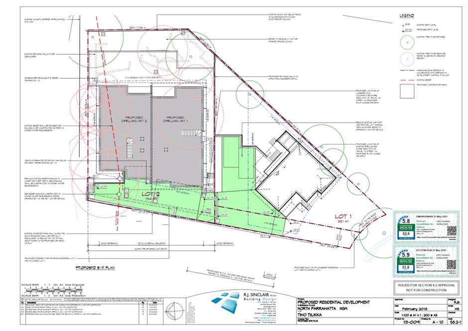
Construction of Dual Occupancy
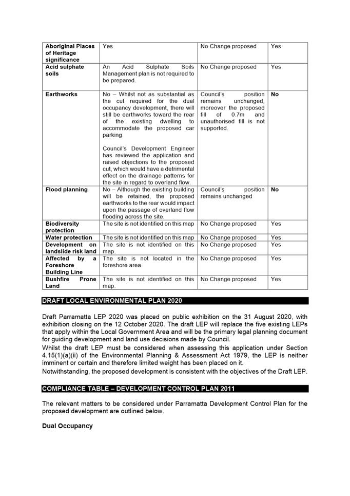
· Demolition of existing carport structure;
· Removal of 13 trees;
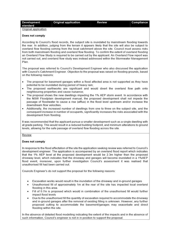
· Significant earthworks consisting of a maximum 0.7m of fill and 2.48m of excavation;
· Construction of external car parking for 2 vehicles to the rear of the existing dwelling on Lot 1;
· Construction of a single storey attached dual occupancy on proposed Lot 2 comprising the following:
Ø Unit 1 (Basement): Double car garage and laundry;
Ø Unit 1 (Ground Floor): Four (4) bedrooms, and bathroom. The master bedroom will have an ensuite bathroom. Combined kitchen/living/dining area with rear deck.
Ø Unit 2 (Basement): Double car garage and laundry;
Ø Unit 2 (Ground Floor): Four (4) bedrooms, and bathroom. The master bedroom will have an ensuite bathroom. Combined kitchen/living/dining area with rear deck.
Note:
If the application were recommended for approval, the consent would require staging to ensure that the subdivision certificate was issued prior to the construction of the dual occupancies. This would ensure that the existing dwelling is situated within a separate allotment.
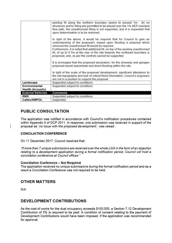
The application was notified and advertised to the adjoining and nearby properties from 29 June to 13 July 2021 in accordance with Council’s notification procedures. A total of one (1) unique submissions from individual properties were received in support of the proposal.
The proposal has been assessed in accordance with the matters for consideration outlined in Section 4.15(1) of the Environmental Planning and Assessment Act 1979. The proposed Dual occupancy and associated works would be inconsistent with the Aims objectives and controls of Parramatta Local Environmental Plan 2011 and Parramatta Development Control Plan 2011.
The proposal would result in a development which would be unsuitable for a site which is impacted by 1% AEP storm event. The proposed dual occupancy, associated earthworks and the existing unauthorised fill, of approximately 1m along the northern boundary, would impede the 1% AEP storm event. Therefore the proposal would not comply with NSW Floodplain development manual, which stipulates that proposed developments shall not impede the passage of floodwater to cause a rise (afflux) in the flood level upstream and/or increase the downstream flow velocities. Council is not in a position to support the unauthored earthworks and as such the submitted flood report which relies upon the unauthorised fill cannot be taken into consideration.
A comprehensive merit assessment of the proposal has been undertaken and it has been determined that the proposal is unsatisfactory and in light of the impacts of the proposal upon adjoining properties and the locality. The proposal is unsuitable for the site and is not in the public interest.
RECOMMENDATION
(a) That, pursuant to Section 4.16(1)(b) of the Environmental Planning and Assessment Act, 1979 that the Parramatta Local Planning Panel (PLPP) as the consent authority refuse development consent to DA/143/2020 for the subdivision of an existing lot, retention of the existing dwelling and construction of a dual occupancy development at the rear of the lot at No. 3 Burnham Place, North Parramatta for the following reasons:
REASONS FOR REFUSAL:
1. Parramatta Local Environmental Plan 2011
The proposed building envelope and earthworks required for the development would impact upon flood waters traversing the subject site and is inconsistent with the following provisions of Parramatta Local Environmental Plan 2011:
a. Clause 5.21 – Flood Planning
b. Clause 6.2 – Earthworks
2. Parramatta Development Control Plan 2011
The proposed building envelope and earthworks required for the development would impact upon flood waters traversing the subject site and is inconsistent with the following provisions of Parramatta DCP 2011:
a. Part 2.4.2.1 – Flooding
b. Part 3.3.5 – Water Sensitive Urban Design
3. Environmental Planning and Assessment Act 1979
a. The proposal has inconsistencies with Parramatta Local Environmental Plan 2011. Accordingly, the proposal fails to satisfy the matters of consideration prescribed under s4.15(1)(a)(i) of the EP&A Act 1979.
b. The proposal has inconsistencies with Parramatta Development Control Plan 2011. Accordingly, the proposal fails to satisfy the matters of consideration prescribed under s4.15(1)(a)(iii) of the EP&A Act 1979.
c. As the proposed development is not consistent with critical provisions of earthworks and flooding required to ensure amenity for future occupants, and the surrounding locality, the proposal is not considered to be in the public interest and also fails to satisfy s4.15(1)(b), (c), and (e) of the EP&A Act 1979.
4. Public Interest
Pursuant to Section 4.15(1)(e) of the Environmental Planning and Assessment Act 1979, the development would not be in the public interest as the proposal is contrary to the local planning controls.
Matthew Golebiowski
Development Assessment Officer
Sarah Irani
Development Support Officer Personal Assistant
|
1⇩ |
Assessment Report |
21 Pages |
|
|
2⇩ |
Locality Map |
2 Pages |
|
|
3⇩ |
Plans used during assessment |
26 Pages |
|
|
Internal Plans used during assessment (confidential) |
29 Pages |
|
REFERENCE MATERIAL
ITEM NUMBER 5.3
SUBJECT OUTSIDE PUBLIC MEETING:
128A Alfred Street and 40-46 Alice Street, HARRIS PARK (Lot 2 DP 209226 and Lot
212 DP 1117339)
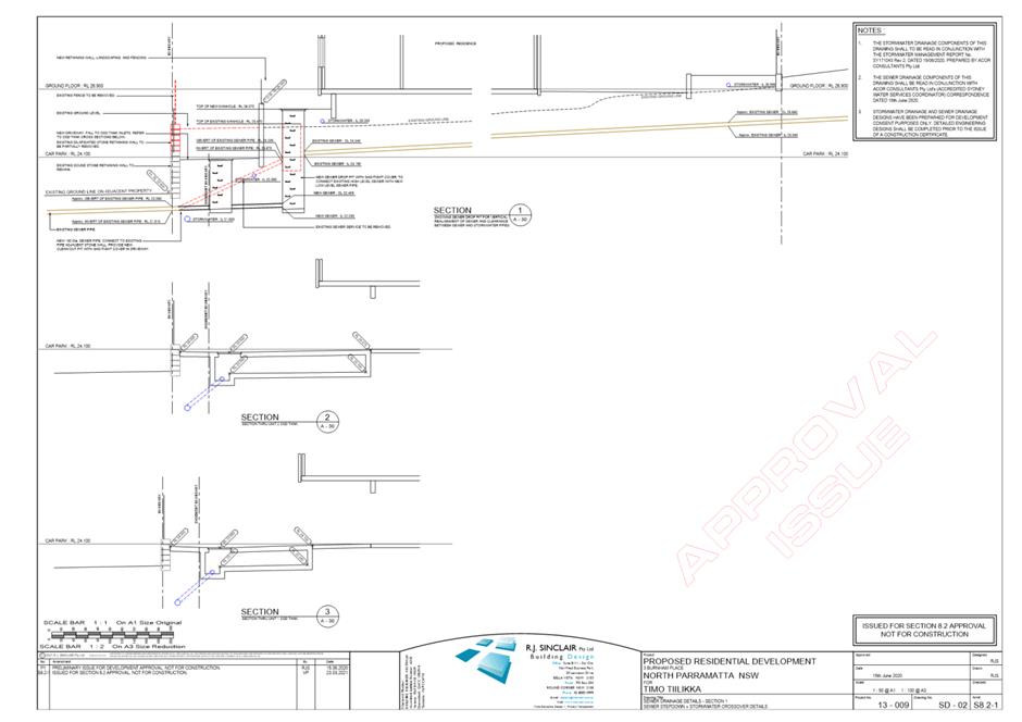
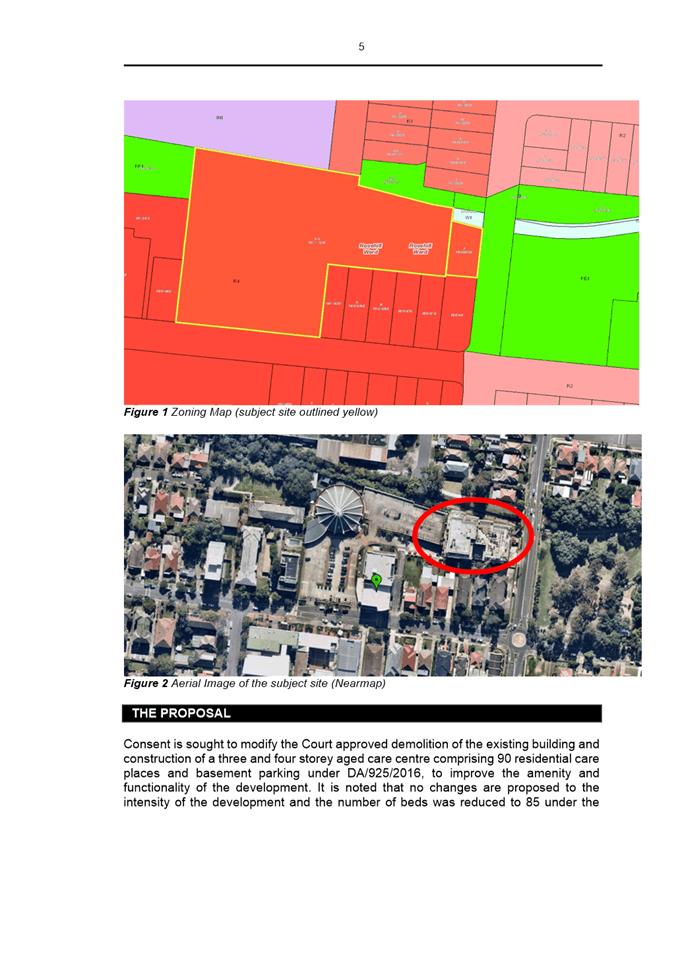
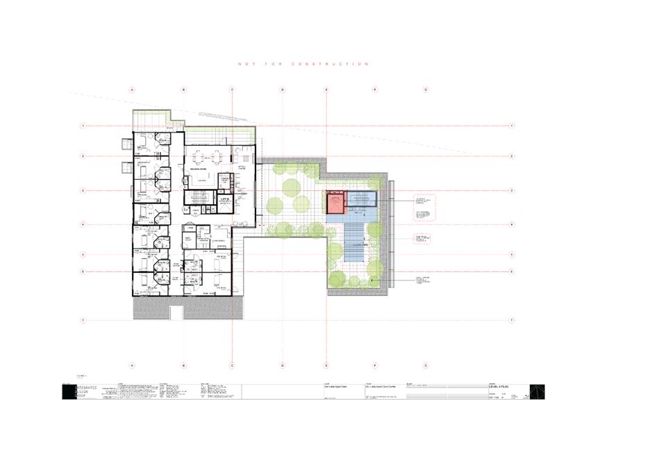
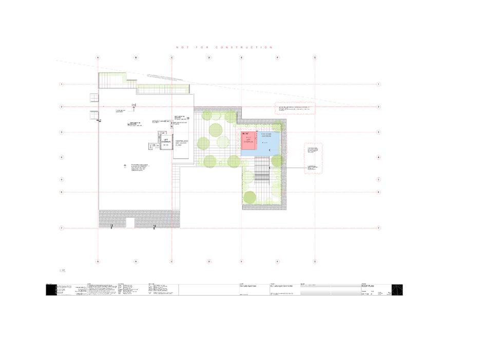
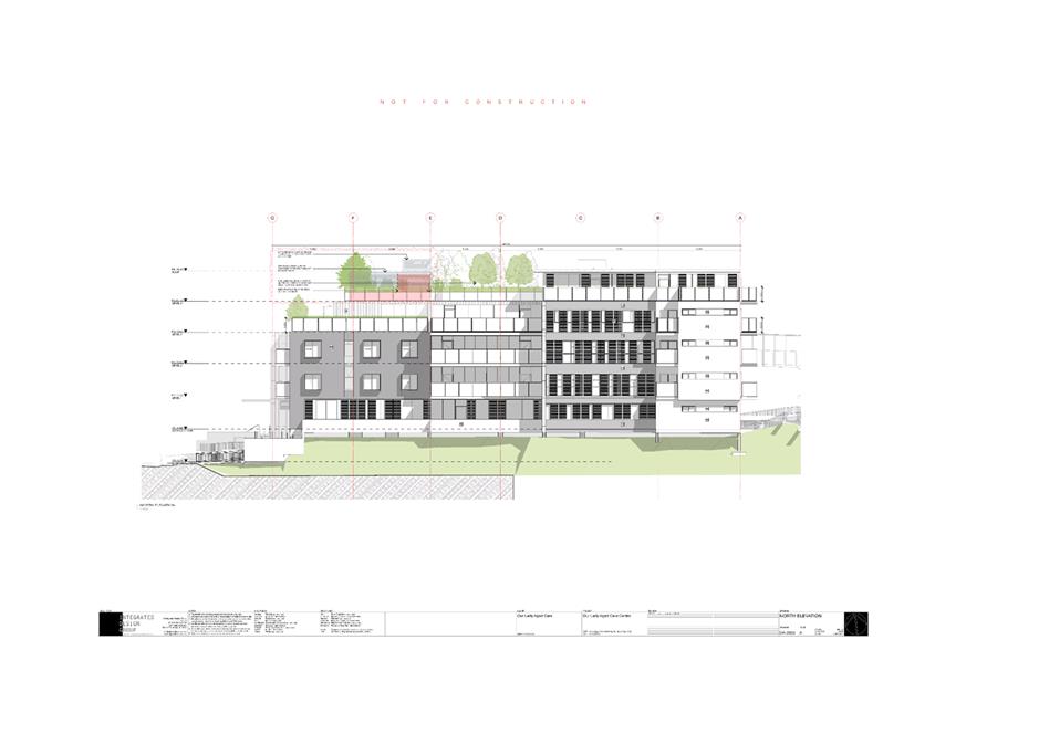
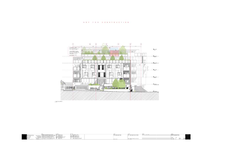
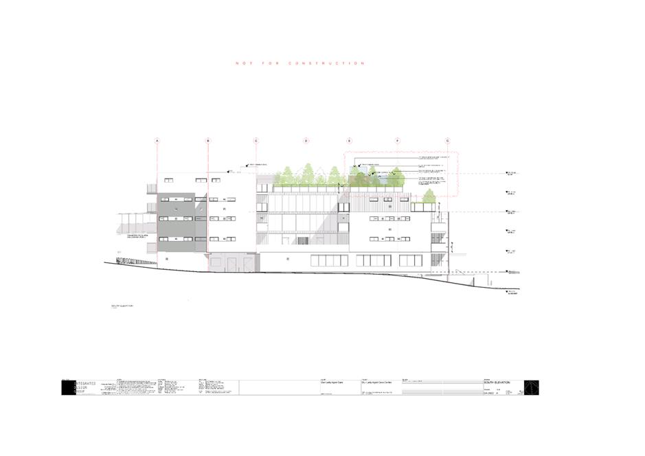
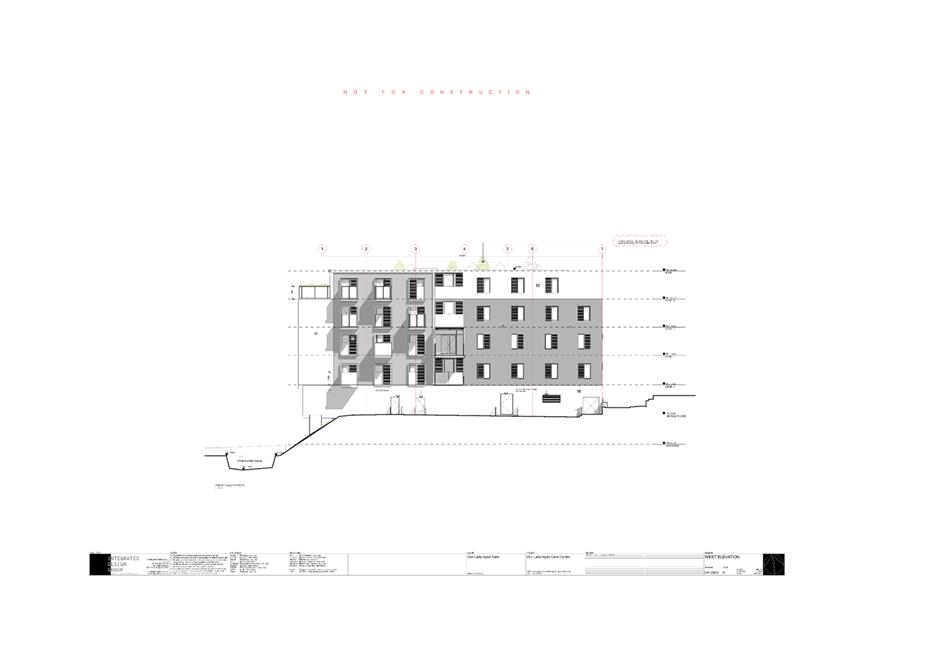
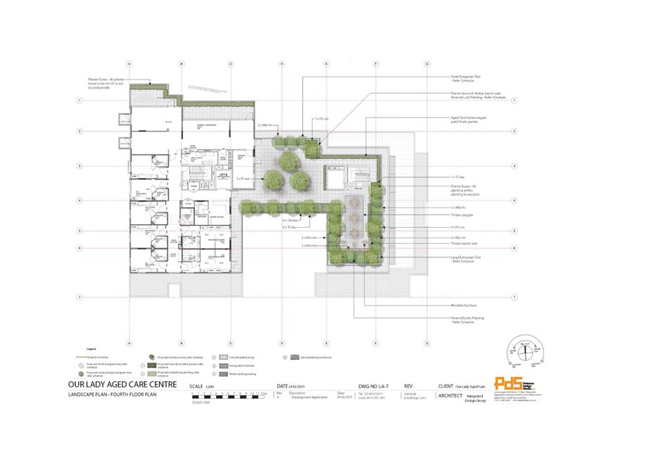
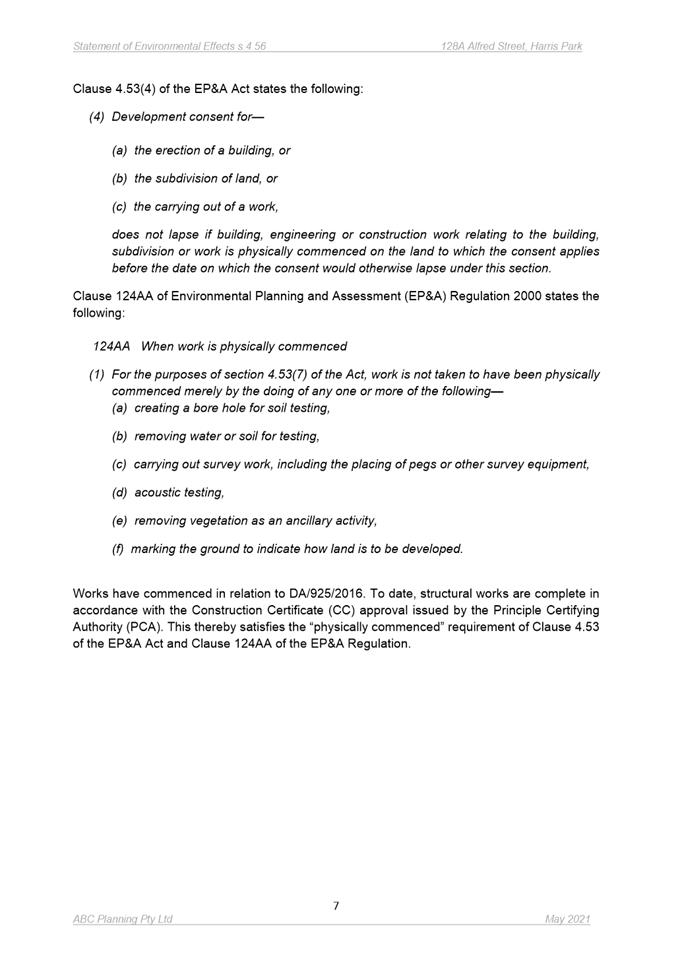
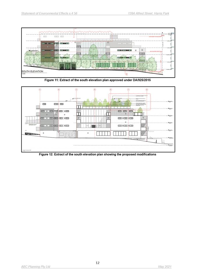
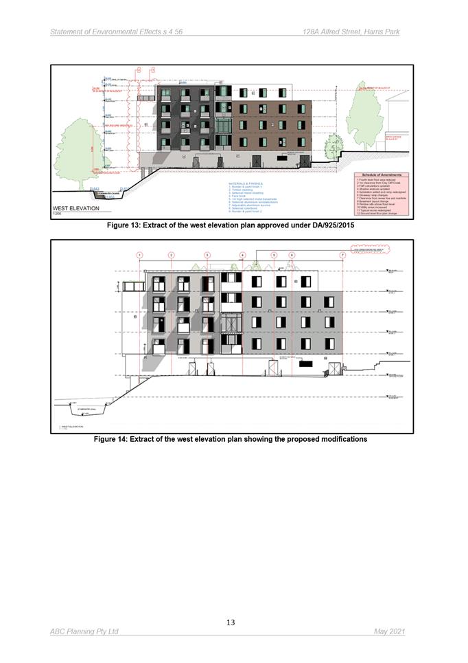
DESCRIPTION Section 4.56 modification to DA/925/2016 for demolition of the existing building and the construction of an aged care centre comprising 85 residential care places and basement parking for 39 vehicles with associated facilities. The modifications include increasing the lift overrun to provide access to the Level 4 courtyard; increasing the fire stair overrun height; providing weather protection to fire stairs; extending the fire stair overrun slab over the BBQ area on the Level 4 courtyard; constructing a new timber pergola on the Level 4 courtyard; and providing landscaping on Level 4
REFERENCE DA/925/2016/D - D08198834
APPLICANT/S Our Lady Aged Care Centre
OWNERS Trustees of the Roman Catholic Church
REPORT OF Group Manager Development and Traffic Services
RECOMMENDED Approval
DATE OF REPORT 21 september 2021
REASON FOR REFERRAL TO LPP
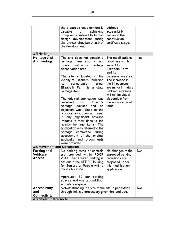
This application is referred to the Parramatta Local Planning Panel as the proposal exceeds the maximum building height development standard by more than 10%.
EXECUTIVE SUMMARY
This is a summary of the full assessment of the application as outlined in Attachment 1, the Section 4.55 Assessment Report.
The Site
The subject site is known as 128A Alfred Street and 40-46 Alice Street, Harris Park. The site is an irregular-shaped allotment with an area of 1.49 hectares. The site is zoned R4 High Density Residential and is bound by land zoned:
· R3 Medium Density Residential,
· R4 High Density Residential,
· RE1 Public Recreation,
· W1 Natural Waterways, and
· IN1 General Industrial.
Further southeast of the site is land zoned R2 Low Density Residential.
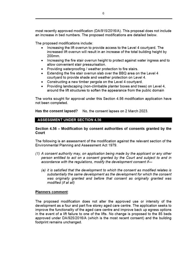
The site currently comprises of a church, three storey carpark and community centre/pastoral centre fronting Alice Street. The portion of the site subject of this development is currently under construction with the previous aged care building having been demolished.
The Proposal
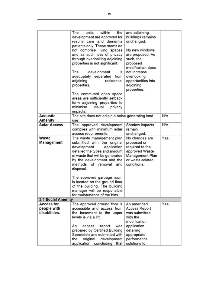
Consent is sought to modify the Land and Environment Court approved demolition of the existing building and construction of a three and four storey aged care centre comprising 90 residential care places and basement parking under DA/925/2016, to improve the amenity and functionality of the development. It is noted that no changes are proposed to the intensity of the development and the number of beds was reduced to 85 under the most recently approved modification. This proposal does not include an increase in bed numbers.
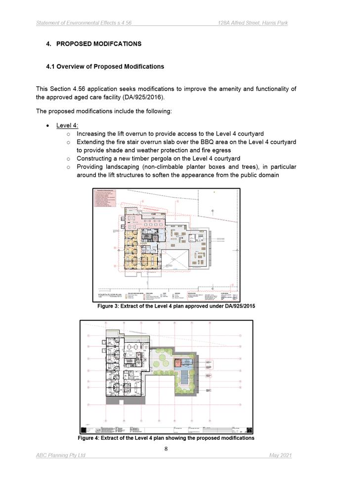
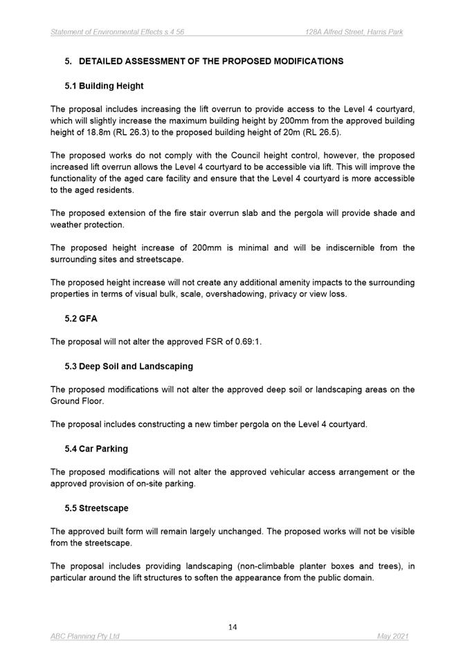
The proposed modifications include:
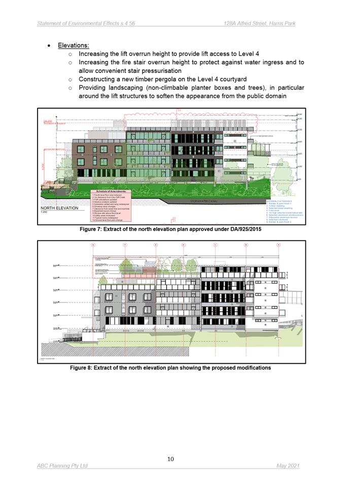
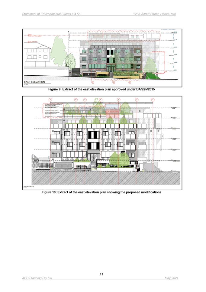
· Increasing the lift overrun to provide access to the Level 4 courtyard. The increased lift overrun will result in an increase of the total building height by 200mm.
· Increasing the fire stair overrun height to protect against water ingress and to allow convenient stair pressurisation.
· Providing waterproofing / weather protection to fire stairs.
· Extending the fire stair overrun slab over the BBQ area on the Level 4 courtyard to provide shade and weather protection on Level 4.
· Constructing a new timber pergola on the Level 4 courtyard.
· Providing landscaping (non-climbable planter boxes and trees) on Level 4, around the lift structures to soften the appearance from the public domain.
The original development was approved with a building height of 15.5m, exceeding the maximum permissible building height (a variation of 6.3m / 68%). A clause 4.6 variation statement was submitted and supported under the parent consent. The height was further increased under DA/925/2016/A to a total building height of 18.8m which was approved by the NSW Land and Environment Court.
The subject modification application seeks to increase the building height by 200mm to a total building height of 20m. The non-compliance arises from the proposed increase to the lift overrun. The proposal results in an additional variation of 1.064% and a total variation of 117.4% to the development standard.
Compliance with the development standard is considered to be unreasonable in the circumstances of the case for the following reasons:
· Strict compliance with the development standard has already been abandoned through the approval of the original development and modification approved by the NSW Land and Environment Court.
· The variation is a result of the increased lift overrun which is required to provide accessibility to the Level 4 rooftop and communal open space area.
· The modified proposal does not result in additional overshadowing or adverse overlooking impacts to adjoining properties; and
· The modified proposal does not further detract from nearby areas of heritage significance.
The application was advertised from 7 July to 28 July 2021 in accordance with Council’s consolidated notification procedures. No submissions were received during the notification period.
The proposal has been assessed in accordance with the matters for consideration outlined in Section 4.55 and Section 4.15(1) of the Environmental Planning and Assessment Act 1979. The modified development is generally consistent with the aims, objectives controls of SEPP (BASIX) 2004; SEPP 65; Parramatta Local Environmental Plan 2011 and Parramatta Development Control Plan 2011.
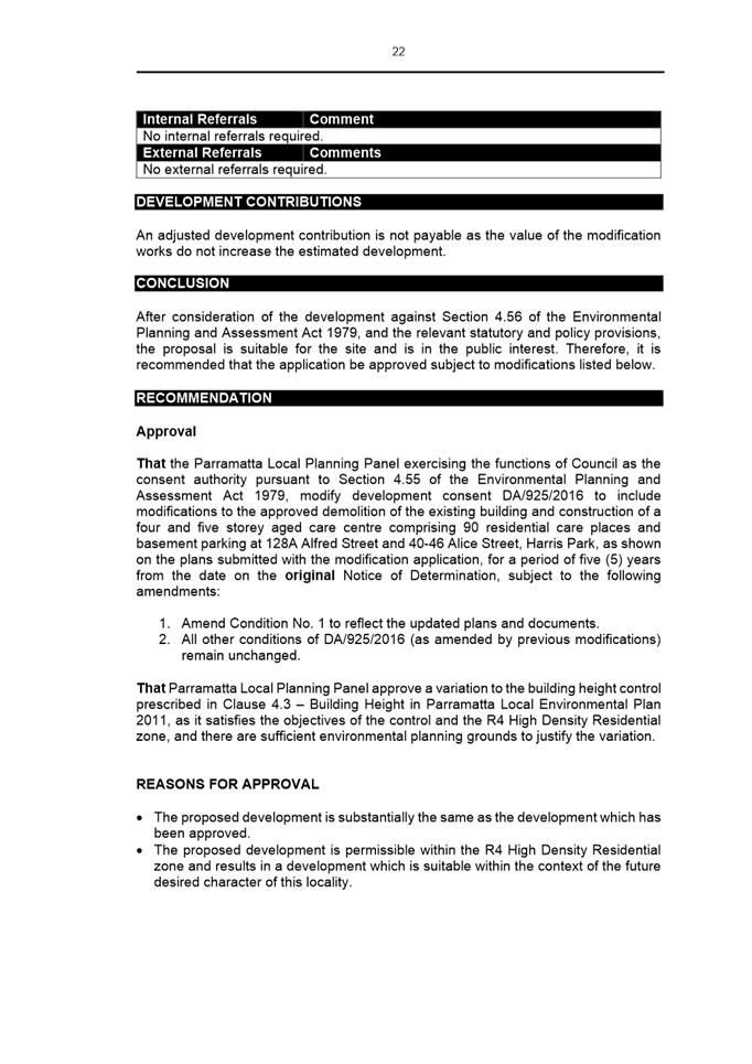
(a) That the Parramatta Local Planning Panel exercising the functions of Council as the consent authority pursuant to Section 4.55 of the Environmental Planning and Assessment Act 1979, modify development consent DA/925/2016 to include modifications to the approved demolition of the existing building and construction of a four and five storey aged care centre comprising 90 residential care places and basement parking at 128A Alfred Street and 40-46 Alice Street, Harris Park, as shown on the plans submitted with the modification application, for a period of five (5) years from the date on the original Notice of Determination, subject to the following amendments:
1. Amend Condition No. 1 to reflect the updated plans and documents.
2. All other conditions of DA/925/2016 (as amended by previous modifications) remain unchanged.
(b) Further, that Parramatta Local Planning Panel approve a variation to the building height control prescribed in Clause 4.3 – Building Height in Parramatta Local Environmental Plan 2011, as it satisfies the objectives of the control and the R4 High Density Residential zone, and there are sufficient environmental planning grounds to justify the variation.
REASONS FOR APPROVAL:
1. The proposed development is substantially the same as the development which has been approved.
2. The proposed development is permissible within the R4 High Density Residential zone and results in a development which is suitable within the context of the future desired character of this locality.
3. The proposed development results in reasonable impacts to adjoining properties and the locality and is suitable for the site and is in the public interest.
Sohini Sen
Senior Development Assessment Officer
Sarah Irani
Development Support Officer Personal Assistant
|
1⇩ |
Assessment Report & Conditions |
75 Pages |
|
|
2⇩ |
Locality Map |
1 Page |
|
|
3⇩ |
Plans used during assessment |
7 Pages |
|
|
4⇩ |
Access Report |
22 Pages |
|
|
5⇩ |
Statement of Environmental Effects |
18 Pages |
|
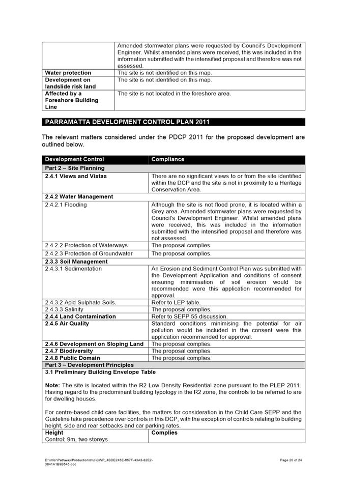
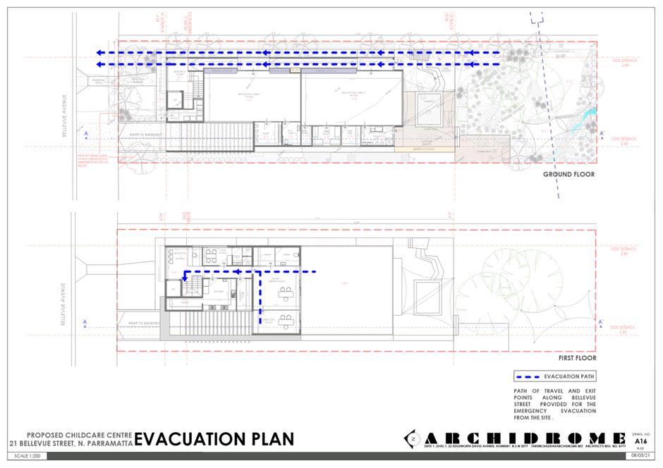
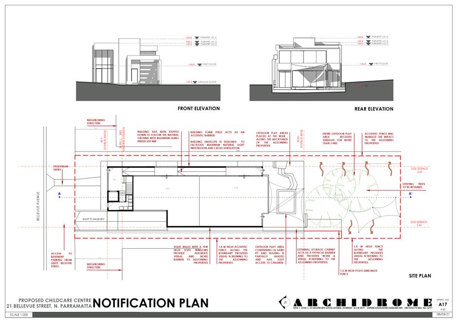
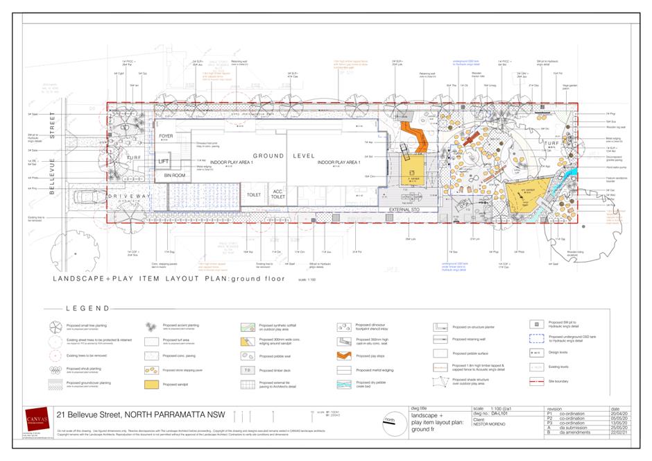
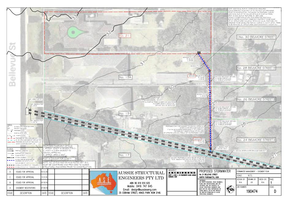
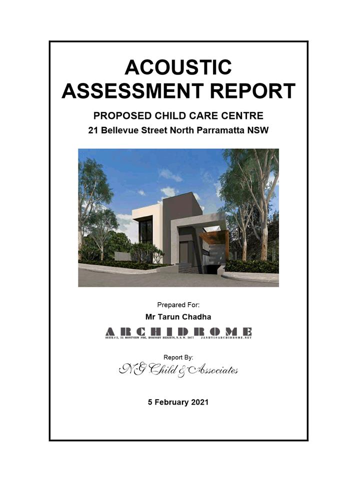
ITEM NUMBER 5.4
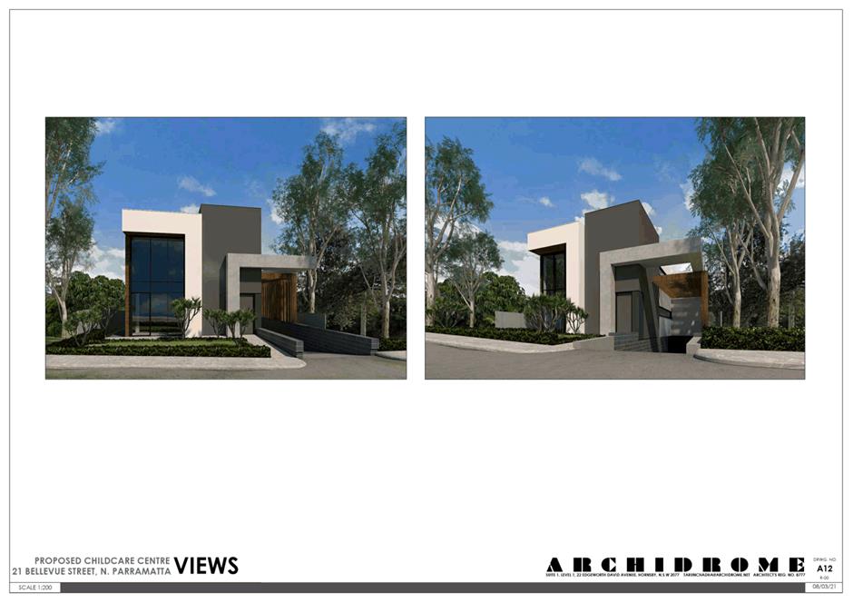
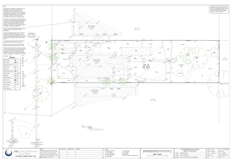
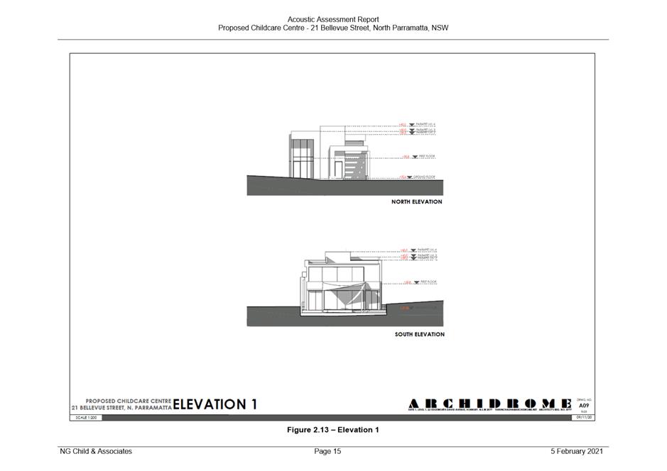
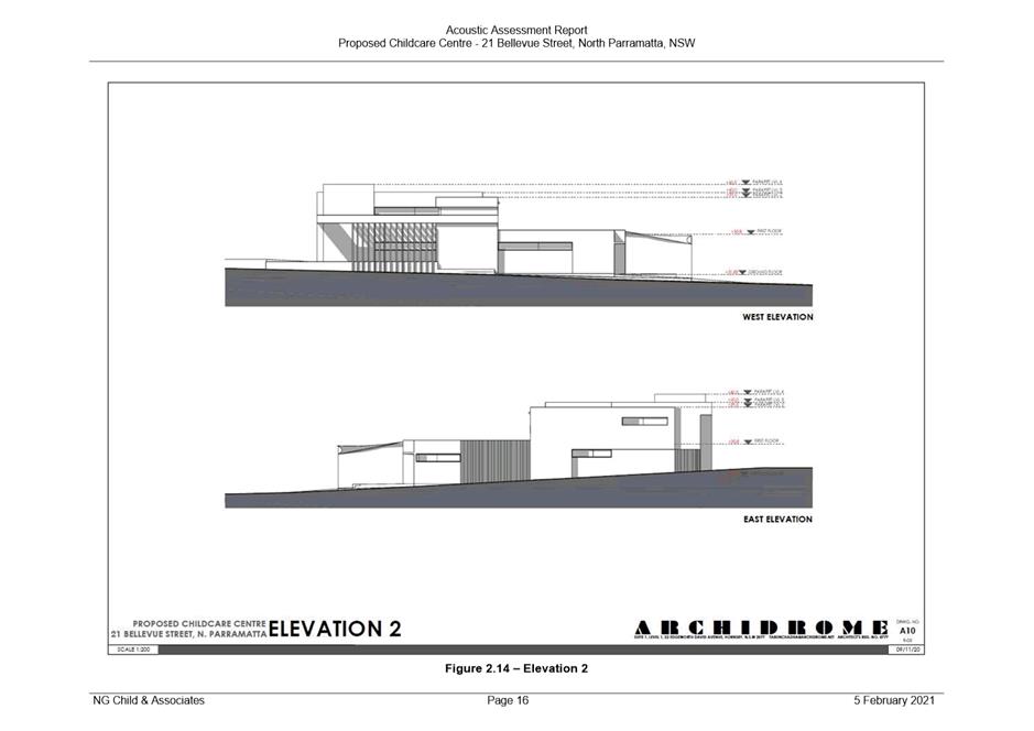
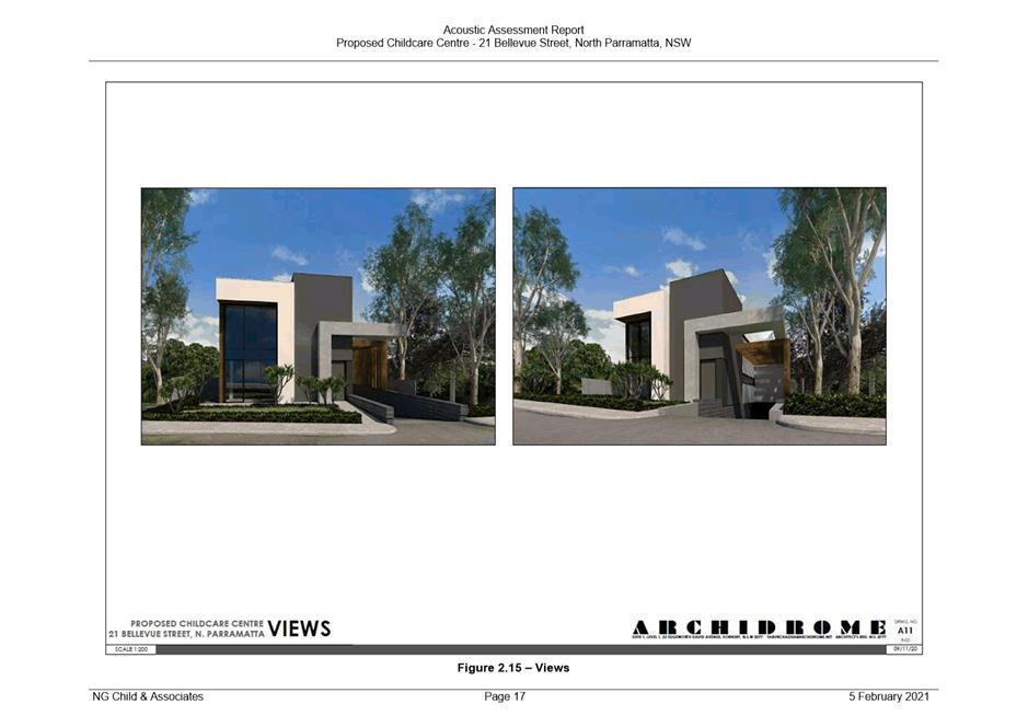
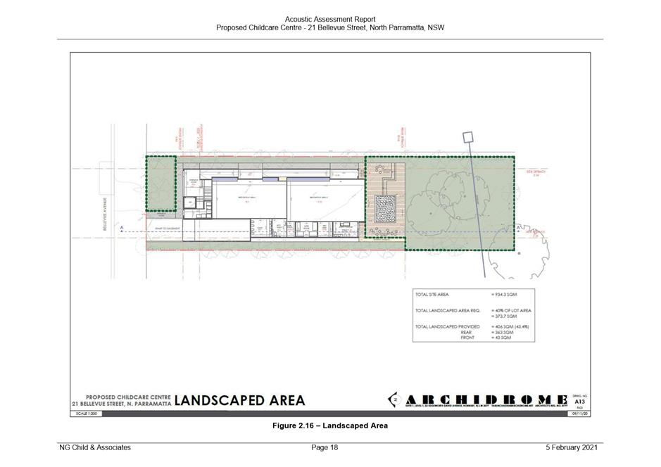
SUBJECT PUBLIC MEETING: 21 Bellevue Street, NORTH PARRAMATTA (Lot 16 DP 5211)
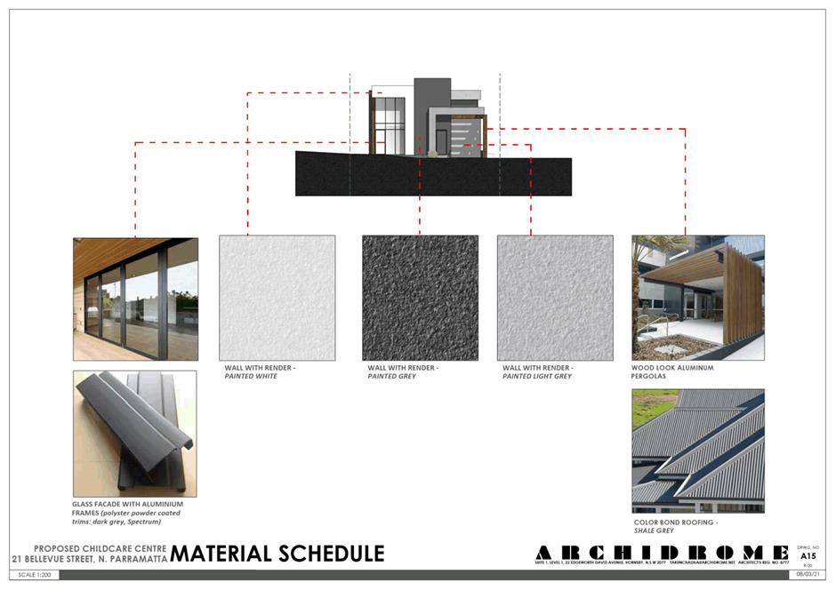
DESCRIPTION Demolition of existing structures, tree removal and construction of a two-storey 46-place child care centre with basement parking
REFERENCE DA/410/2021 - D08202512
APPLICANT/S Archidrome Pty Ltd
OWNERS Ms M A Patel and Mr A J Patel
REPORT OF Group Manager Development and Traffic Services
RECOMMENDED Refusal
DATE OF REPORT 21 SEPTEMBER 2021
REASON FOR REFERRAL TO LPP
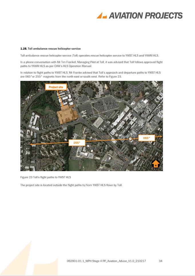
The application is referred to Parramatta Local Planning Panel due to the number of submissions (12 unique submissions).
EXECUTIVE SUMMARY
This is a summary of the full assessment of the application as outlined in Attachment 1, the Section 4.15 Assessment Report.
Site Context
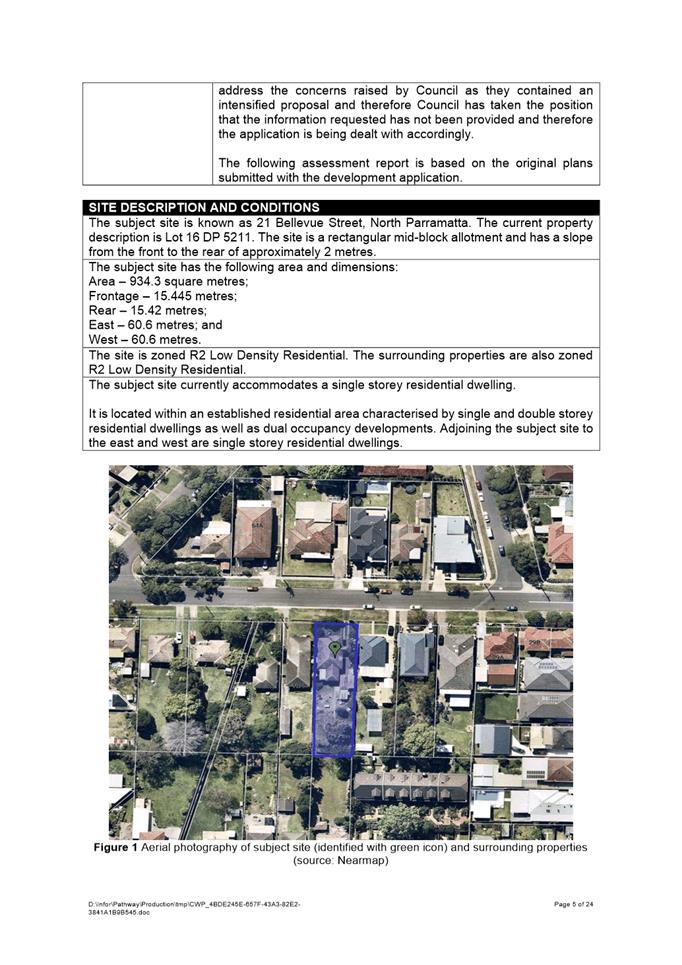
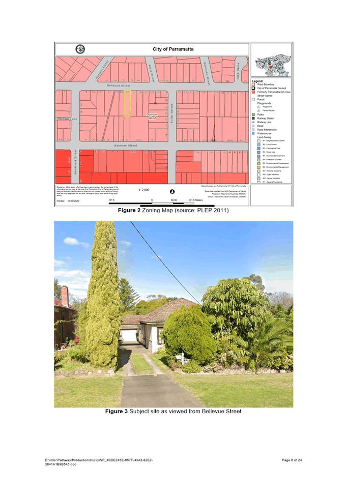
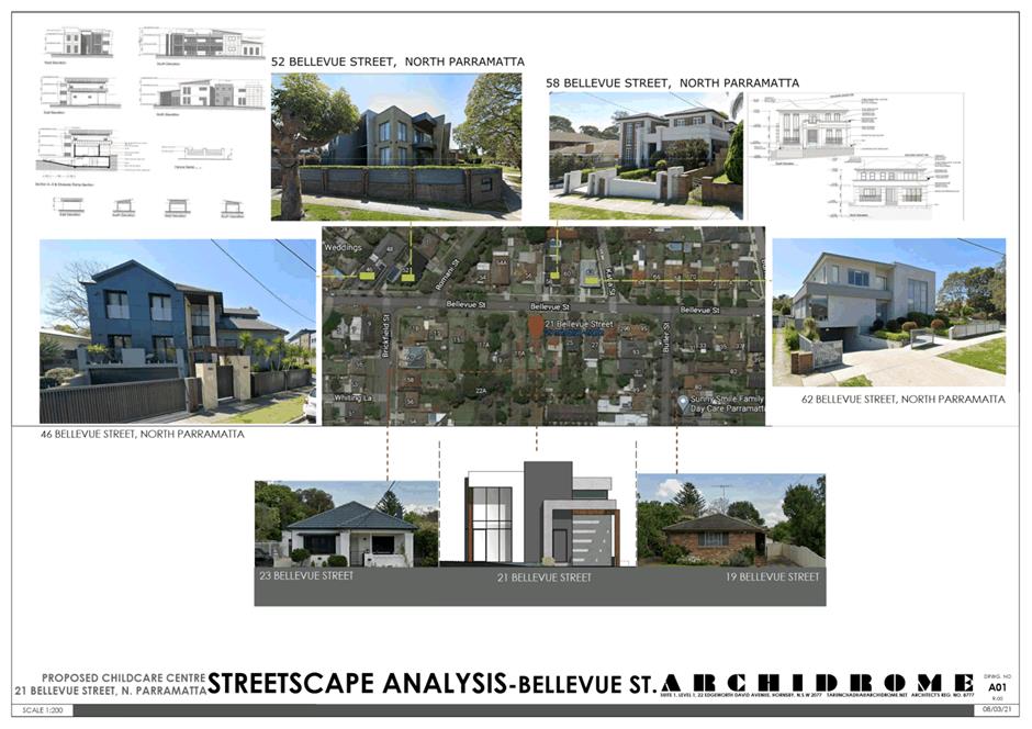
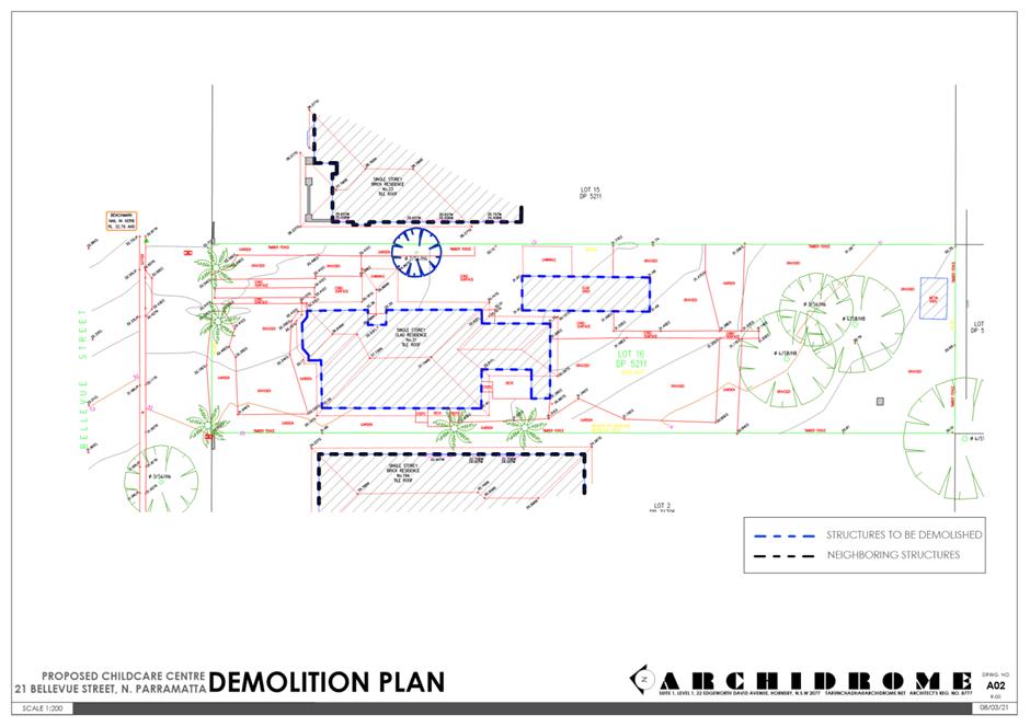
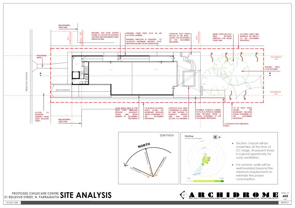
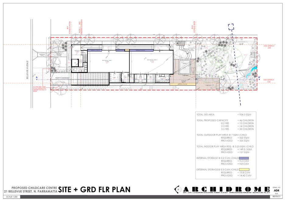
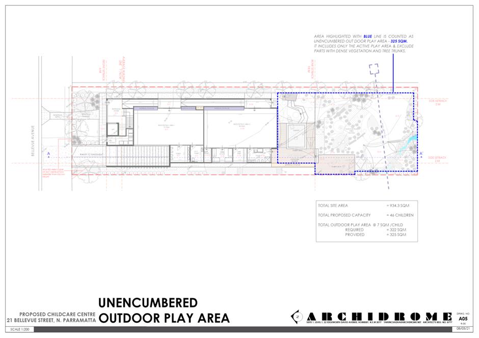
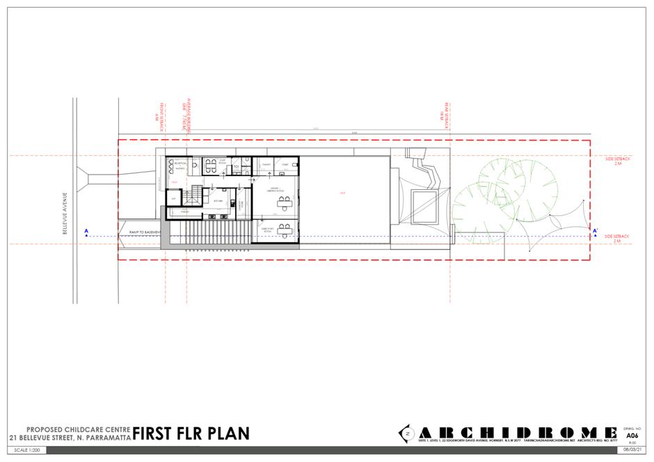
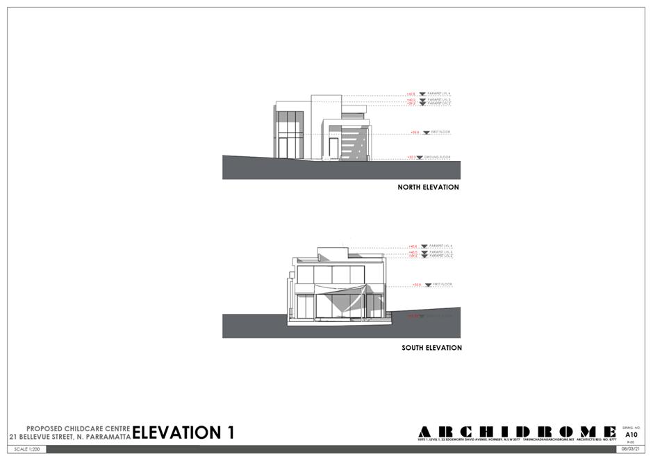
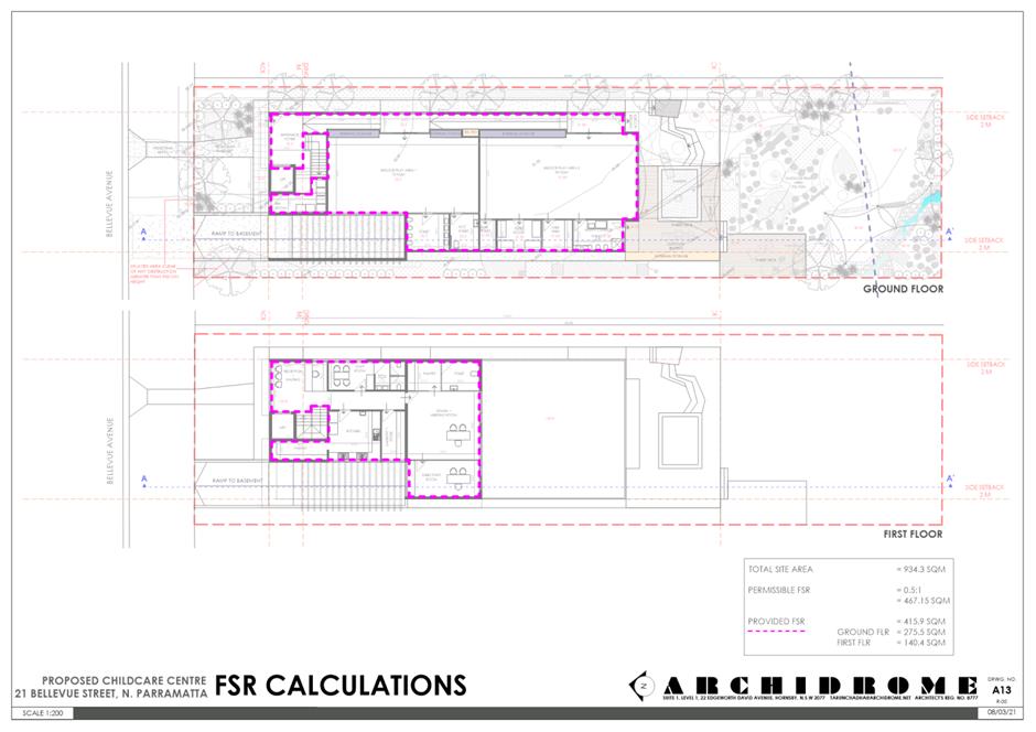
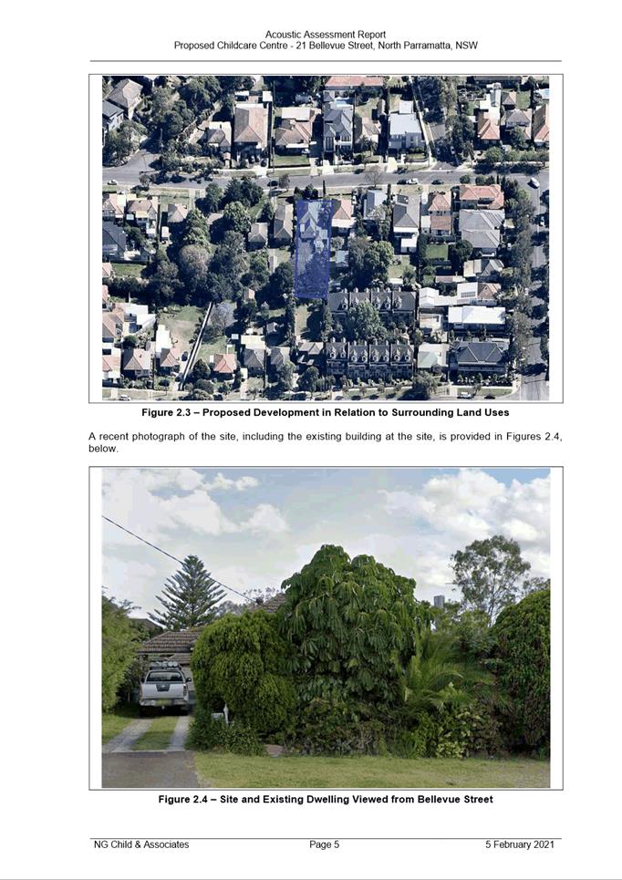
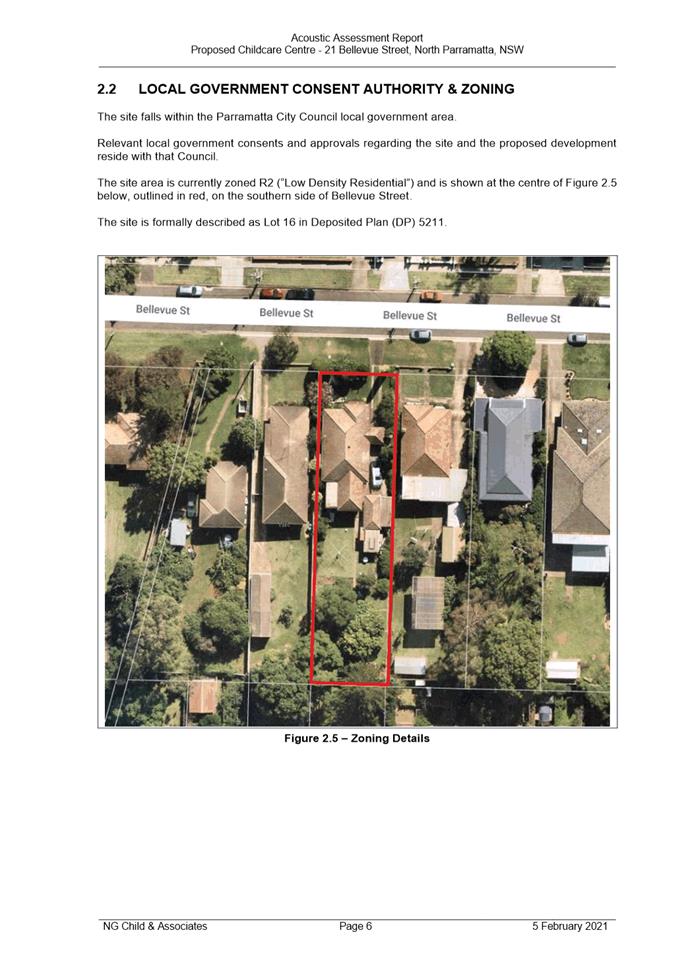
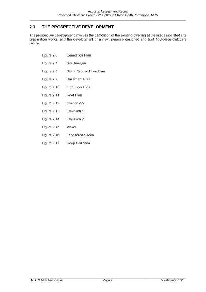
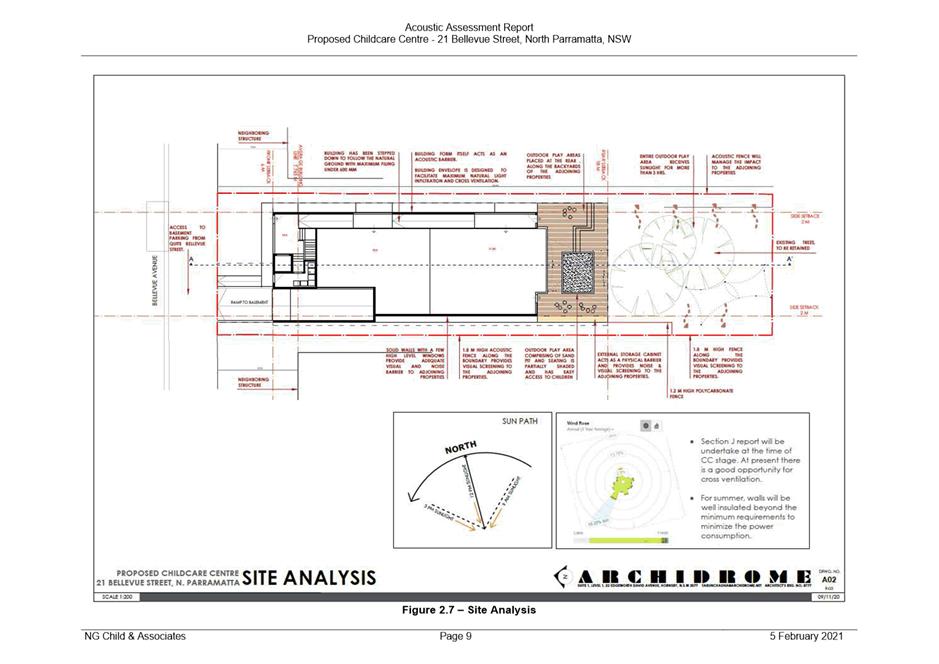
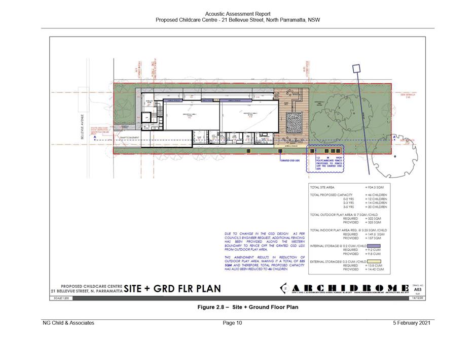
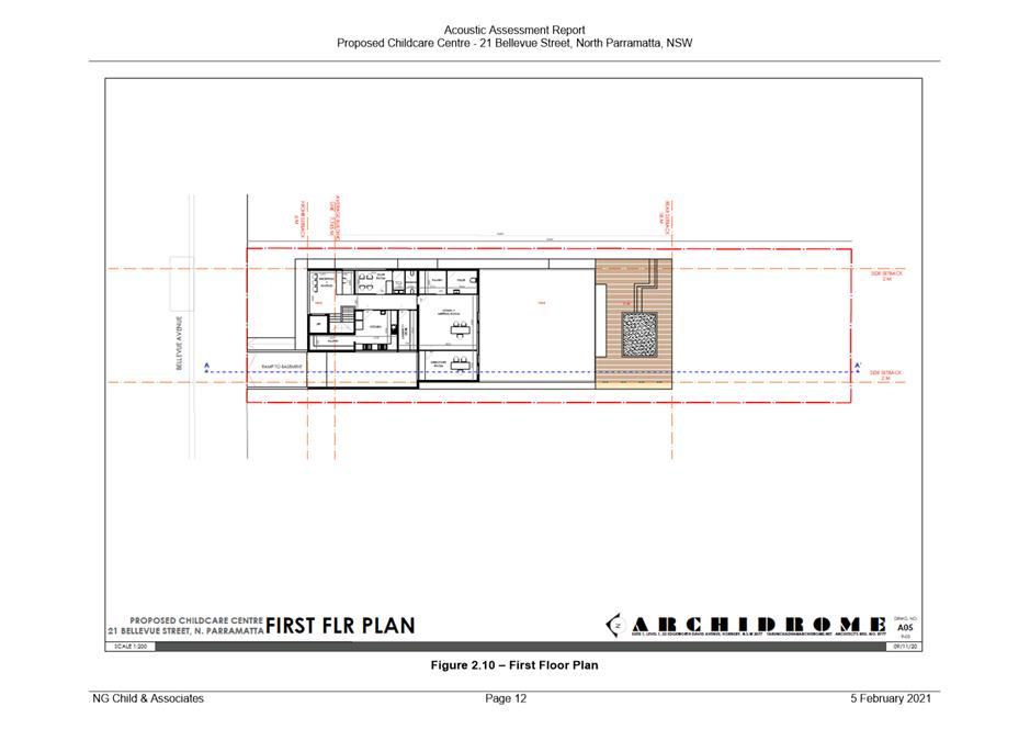
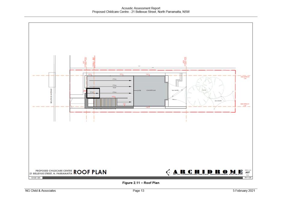
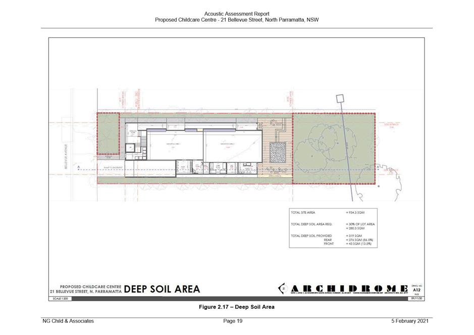
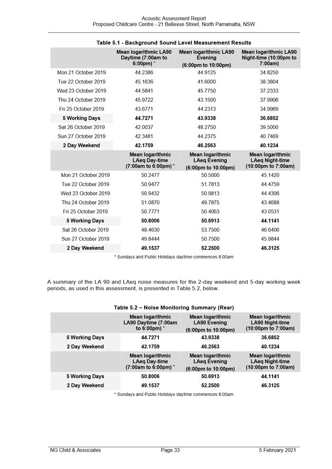
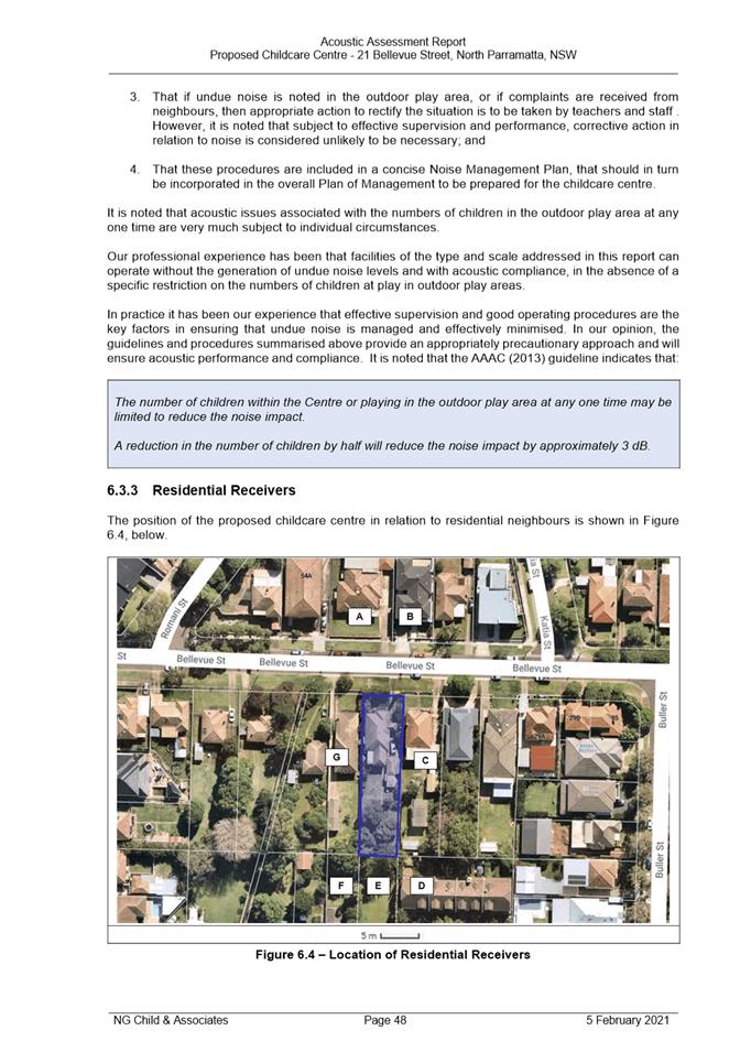
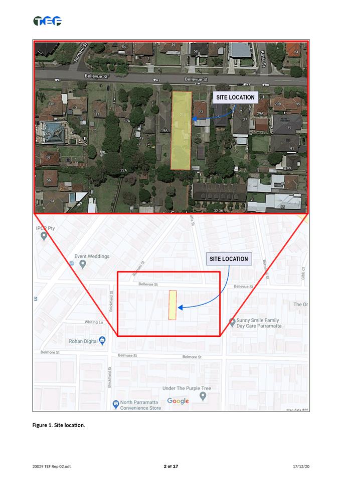
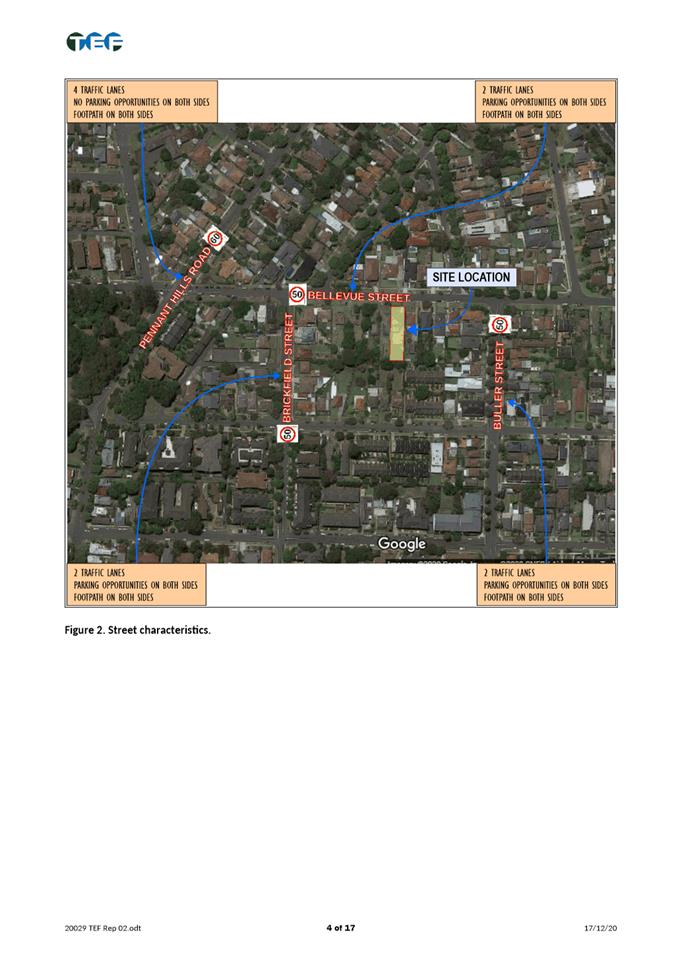
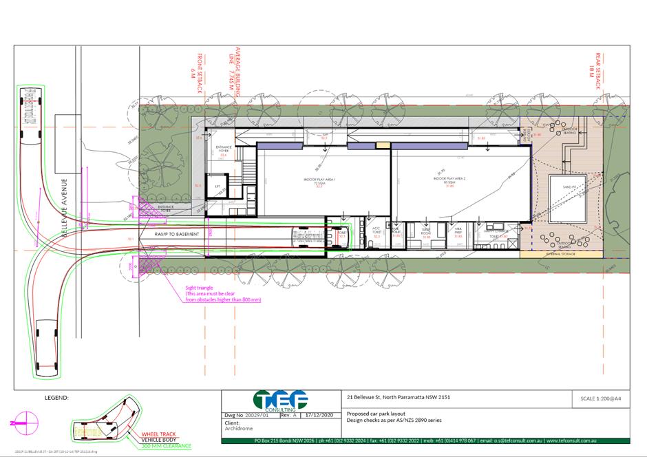
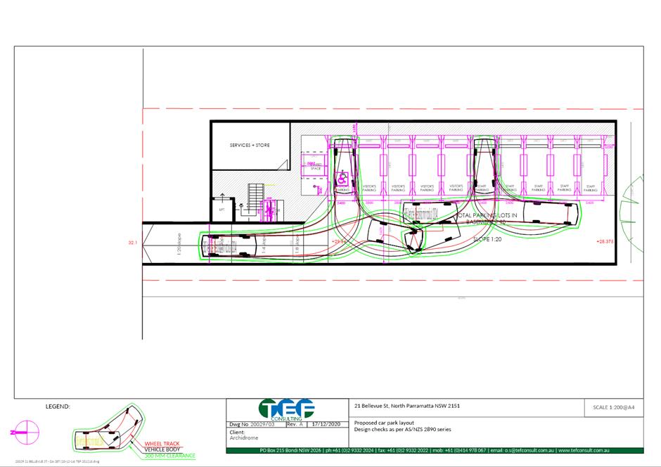
The subject site is known as 21 Bellevue Street, North Parramatta. The current property description is Lot 16 DP 5211. The site is a rectangular mid-block allotment and has a slope from the front to the rear of approximately 2 metres. The subject site has an area of 934.3m2. The site is zoned R2 Low Density Residential. The surrounding properties are also zoned R2 Low Density Residential. The subject site currently accommodates a single storey residential dwelling. It is located within an established residential area characterised by single and double storey residential dwellings as well as dual occupancy developments. Adjoining the subject site to the east and west are single storey residential dwellings.
Proposed development
The proposed development includes the following components:
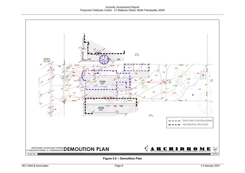
· Demolition of existing structures; and
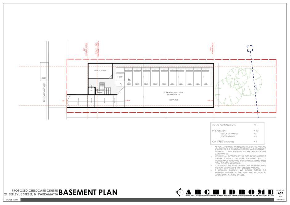
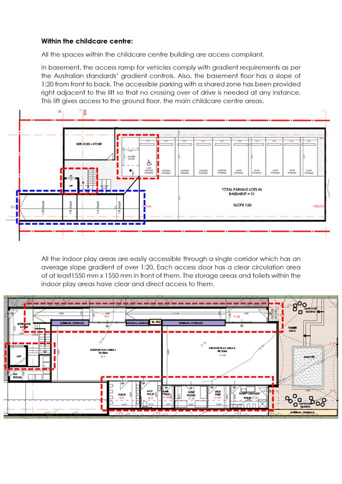
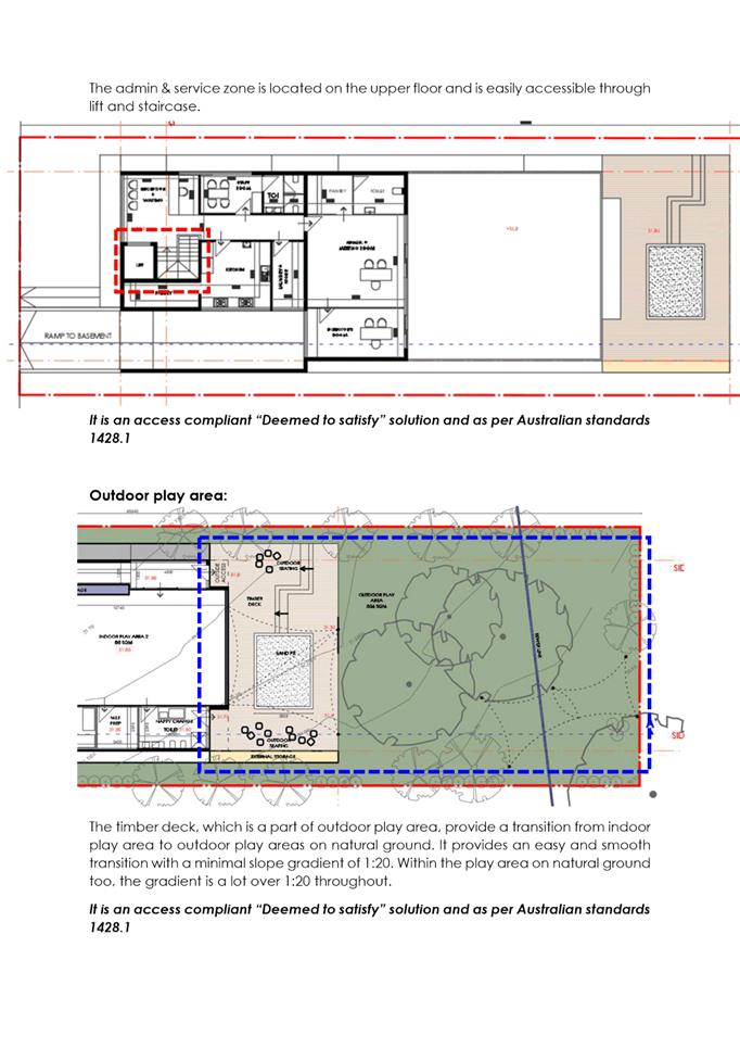
· Construction of a double storey childcare centre with basement car parking for 10 vehicles including 1 accessible space.
The centre is proposed to cater for a maximum of 46 children and 9 staff. The proposed hours of operation are 7:00am until 7:00pm, Monday to Friday.
The proposal was referred to Council’s Development Engineer, Traffic Engineer, Landscape and Tree Officer, Social Outcomes Officer and Environmental Health Officer for review.
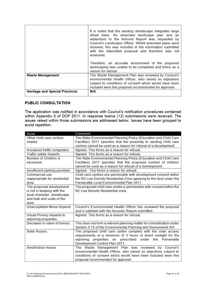
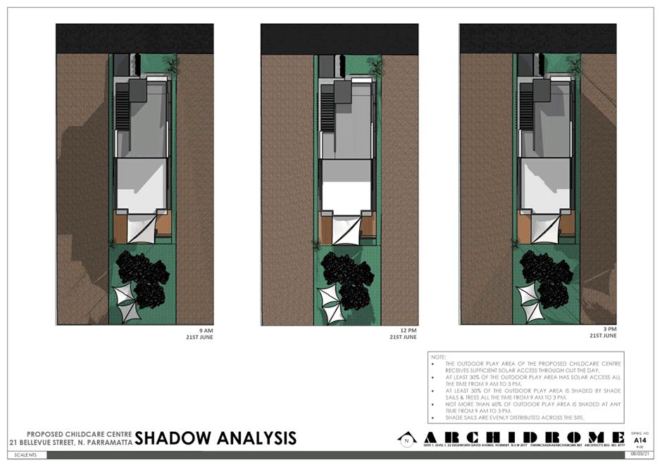
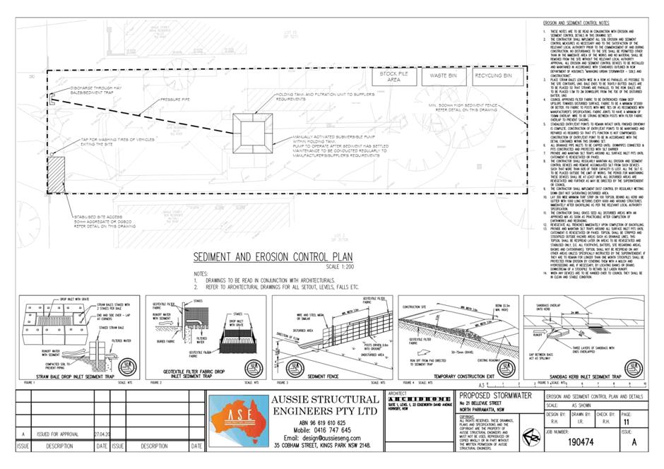
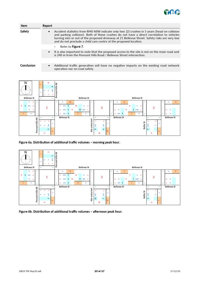
The application was notified and advertised to the adjoining and nearby properties from 26 May to 16 June 2021 in accordance with Council’s notification procedures. A total of twelve (12) unique submissions from individual properties were received in response. Issues raised in the submission relate to increased traffic congestion and safety of pedestrians and motorists, noise pollution, decrease in value of homes, other child care centres nearby, out of character with the streetscape, excessive number of children, insufficient on-site parking provision, overdevelopment of the site and inappropriate change of use from residential to commercial use
The proposal has been assessed in accordance with the matters for consideration outlined in Section 4.15(1) of the Environmental Planning and Assessment Act 1979. The proposed child care center is inconsistent with the aims, objectives and controls of the Child Care Guidelines 2017, Parramatta Local Environmental Plan 2011 and Parramatta Development Control Plan 2011.
Whilst purpose-built child care centers are permissible with consent within the R2 Low Density Residential zoning that applies to the site, the proposal results in a development which is unsuitable within the context of the future desired character of this locality. A comprehensive merit assessment of the proposal has been undertaken and it has been determined that the proposal is unsatisfactory and results in unreasonable impacts to adjoining properties and the locality. The proposal is unsuitable for the site and is not in the public interest.
(a) That, pursuant to Section 4.16(1)(b) of the Environmental Planning and Assessment Act, 1979 the Parramatta Local Planning Panel (PLPP) as the consent authority refuse development consent to DA/410/2021 for Demolition of existing structures, tree removal and construction of a two storey 46-place child care centre with basement parking at 21 Bellevue Street, Parramatta for the following reasons:
REASONS FOR REFUSAL:
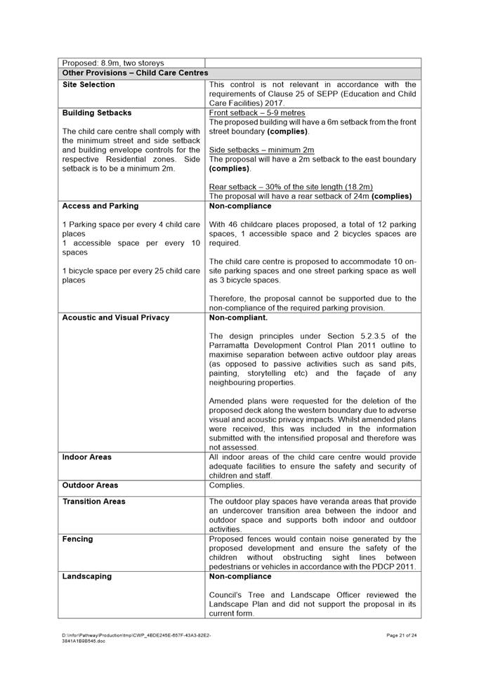
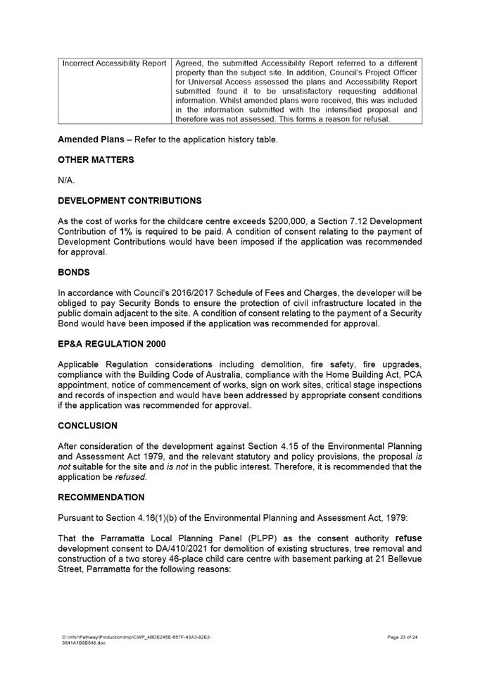
Insufficient Information
1. Pursuant to Section 4.15(1)(a)(i) of the Environmental Planning and Assessment Act 1979, the proposal fails to comply with Clause 23 of State Environmental Planning Policy (Educational Establishments and Childcare Facilities) 2017 and the Child Care Planning Guideline 2017 as the proposal is contrary to the Part 3 considerations of the guideline with respect to:
a. Part 3.1 (C1) – Visual and Acoustic Privacy with regards to the timber deck located along the western boundary of the subject site.
b. Part 3.3 (C17) – Accessibility;
c. Part 3.3 (C31, C33, C36, and C38) – Traffic and Safety; and
d. Part 3.4 (C18) – Landscape.
2. Pursuant to Section 4.15(1)(a)(i) of the Environmental Planning and Assessment Act 1979 the proposal does not meet the objectives of Section 3.3.1 Landscaping Control under the Parramatta Development Control Plan 2011 as the proposal fails to address the additional information requested by Council’s Landscape Officer to provide an amended landscape plan and an addendum to the Arborist Report demonstrating the retention or protection of trees located on the adjoining properties impacted by the proposed drainage easement required for the proposal;
3. Pursuant to Section 4.15(1)(a)(i) of the Environmental Planning and Assessment Act 1979 the proposal does not meet the objectives of Section 3.3.6.1 Stormwater Drainage Control under the Parramatta Development Control Plan 2011 as the proposal fails to address the additional information requested by Council’s Development Engineer to provide amended stormwater plans;
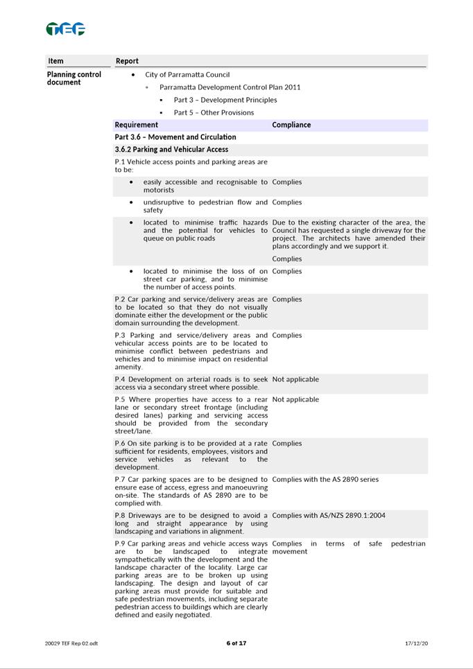
4. Pursuant to Section 4.15(1)(a)(i) of the Environmental Planning and Assessment Act 1979 the proposal does not meet the objectives of Section 3.6.2 Parking and Vehicular Access under the Parramatta Development Control Plan 2011 as the proposal fails to address the additional information requested by Council’s Traffic Engineer to address the parking shortfall within the subject site for the number of children proposed.
Public Interest
5. Pursuant to Section 4.15(1)(e) of the Environmental Planning and Assessment Act 1979, the development would not be in the public interest as the proposal is contrary to the local planning controls.
Apoorva Chikkerur
Development Assessment Officer
Sarah Irani
Development Support Officer Personal Assistant
|
1⇩ |
Assessment Report |
24 Pages |
|
|
2⇩ |
Locality Map |
1 Page |
|
|
3⇩ |
Plans used during assessment |
31 Pages |
|
|
4⇩ |
Accessibility Report |
5 Pages |
|
|
5⇩ |
Acoustic Report |
88 Pages |
|
|
6⇩ |
Traffic Report |
23 Pages |
|
REFERENCE MATERIAL
Innovative
21 September 2021
6.1 PUBLIC MEETING: Gateway Request: Planning Proposal at 12-12A, 14 & 14B Mons Road, WESTMEAD (Westmead Private Hospital)........................ 428
6.2 PUBLIC MEETING: Post-Exhibition: Planning Proposal for land at 163-165 George Street and 1 Purchase Street, PARRAMATTA (St Ioannis Greek Orthodox Church).......................................................................................................................... 755
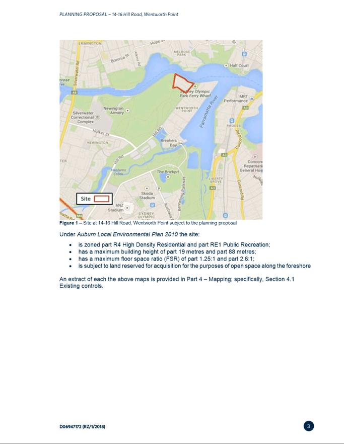
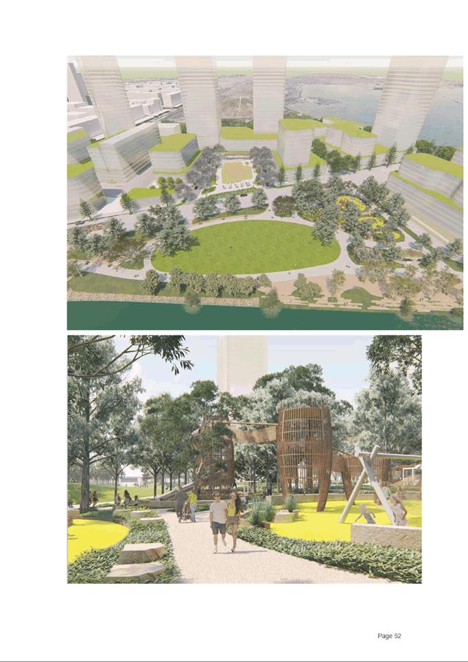
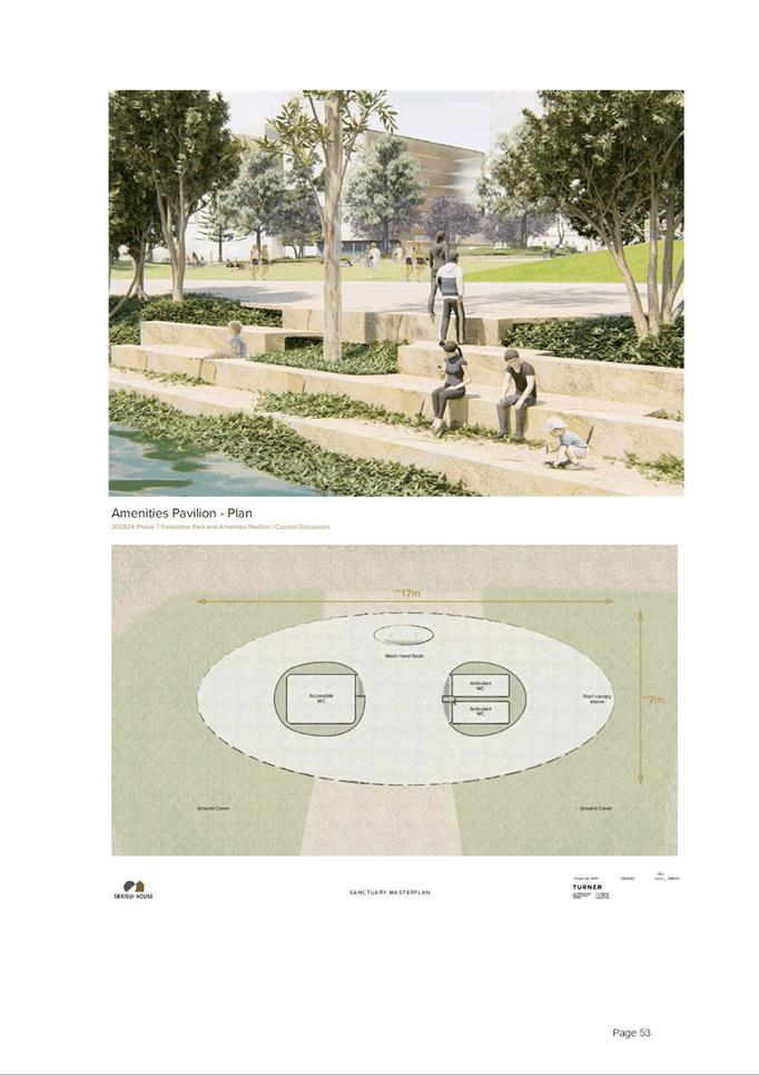
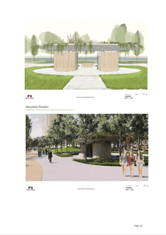
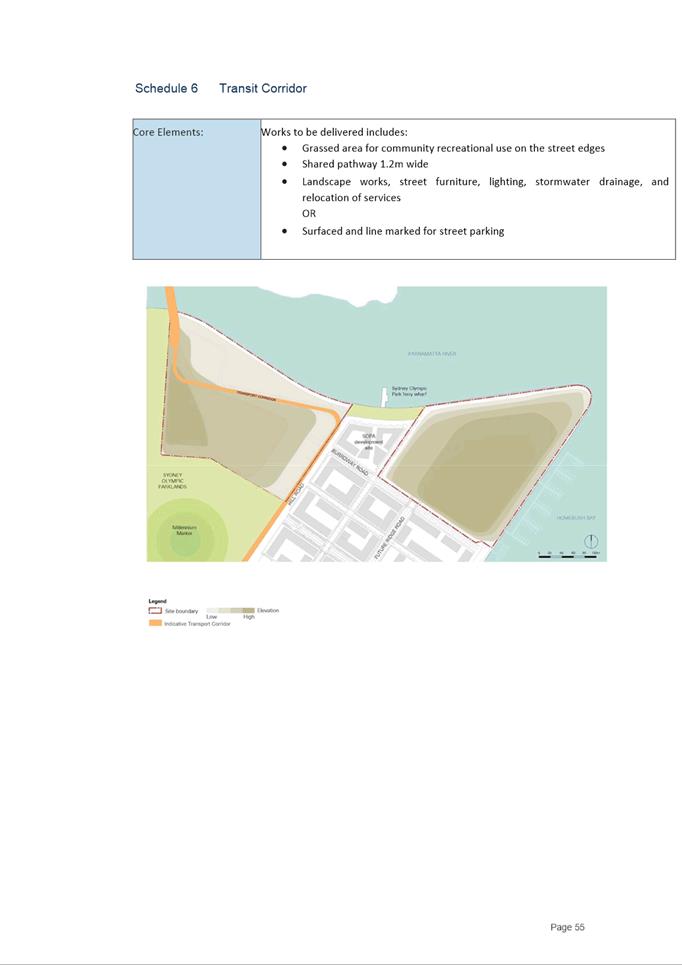
6.3 PUBLIC MEETING: Post-Exhibition - Planning Proposal for land at 14-16 Hill Road, SYDNEY OLYMPIC PARK (Sekisui Site).................................................. 800
Local Planning Panel 21 September 2021 Item 6.1
ITEM NUMBER 6.1
SUBJECT PUBLIC MEETING: Gateway Request: Planning Proposal at 12-12A, 14 & 14B Mons Road, WESTMEAD (Westmead Private Hospital)
REFERENCE RZ/11/2019 - D07235094
REPORT OF Project Officer Land Use
|
Landowner Alpha Westmead Private Hospital Pty Ltd applicant Willowtree Planning
PURPOSE: To seek the Local Planning Panel’s advice on a Planning Proposal for land at 12-12A, 14 & 14B Mons Road, Westmead. It is recommended that the proposal be submitted to the Department of Planning, Industry and Environment (DPIE) for the purposes of requesting a Gateway Determination.
|
|
That the Local Planning Panel, consider the following Council Officer recommendation in the Panel’s advice to Council:
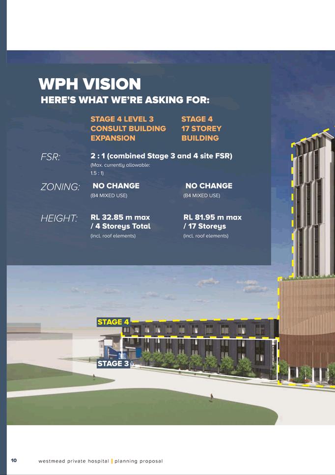
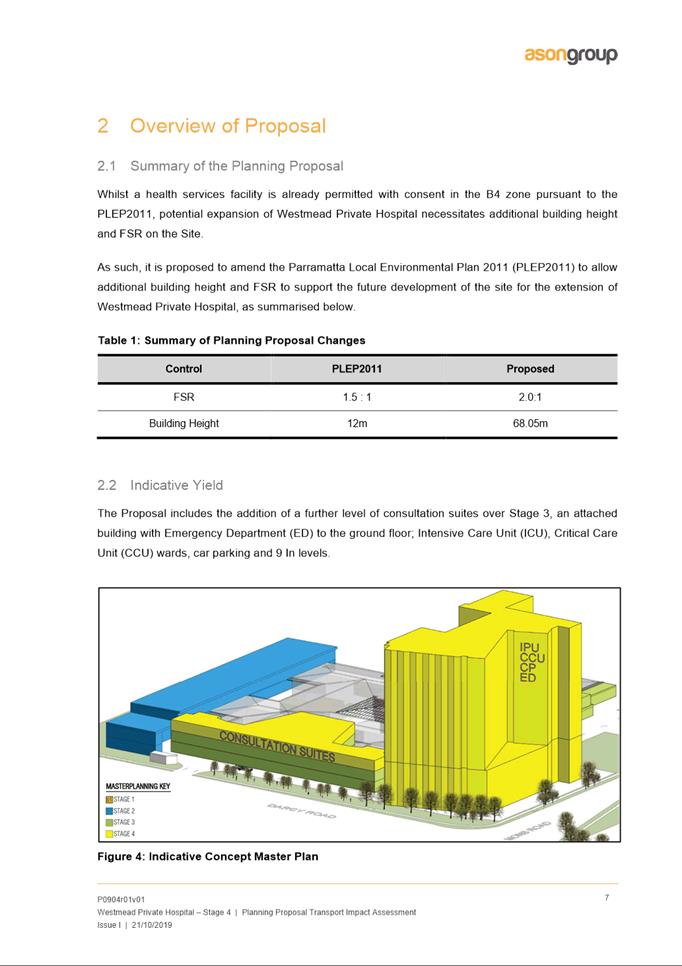
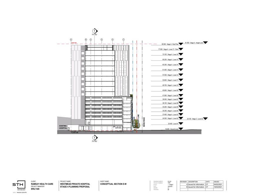
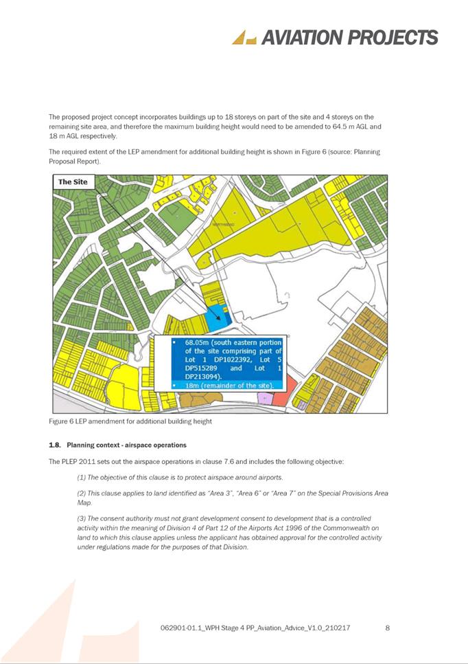
(a) That Council approve, for the purposes of seeking a Gateway Determination, the Planning Proposal at Attachment 1 for land at 12-12A, 14 & 14B Mons Road, Westmead, which seeks to amend the Parramatta Local Environmental Plan 2011 to: · Increase the floor space ratio (FSR) from 1.5:1 to 2:1; and · Increase the height of building (HOB) from 12m to 68m for the south eastern portion of the site and 18m for the remainder of the site.
(b) That Council forward the Planning Proposal at Attachment 1 to the Department of Planning, Industry and Environment with a request for a Gateway Determination.
(c) That a site-specific Development Control Plan (DCP) be prepared and reported to Council separately prior to public exhibition with the Planning Proposal. The site-specific DCP should address, at a minimum, the following: i. Built form and massing; ii. Building setbacks; iii. Flooding; and iv. Other design controls to inform the future detailed design of the Westmead Private Hospital redevelopment.
(d) That the Chief Executive Officer be delegated authority to negotiate a Planning Agreement on behalf of Council in addition to any development contributions payable, and that the outcome of negotiations be reported back to Council prior to its concurrent exhibition with the Planning Proposal and DCP.
(e) That Council delegate authority to the Chief Executive Officer to endorse the Westmead Private Hospital Flood Study (following completion) for the purposes of submission to the Department of Planning, Industry and Environment to be considered as part of the Gateway Determination process.
(f) That Council advise the Department of Planning, Industry and Environment that the Chief Executive Officer will be exercising the plan-making delegations for this Planning Proposal as authorised by Council.
(g) Further, that Council authorise the Chief Executive Officer to correct any minor anomalies of a non-policy and administrative nature that may arise during the plan-making process.
|
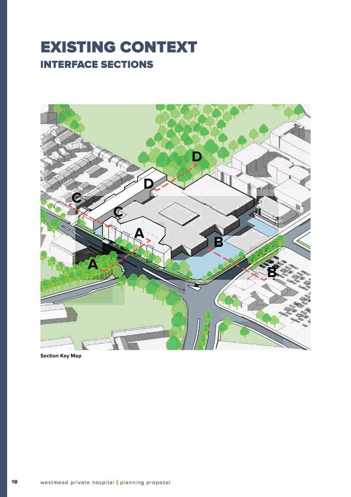
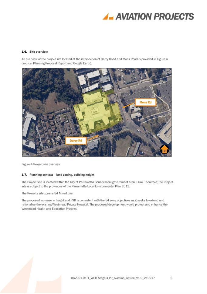
SITE DESCRIPTION
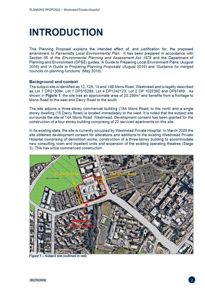
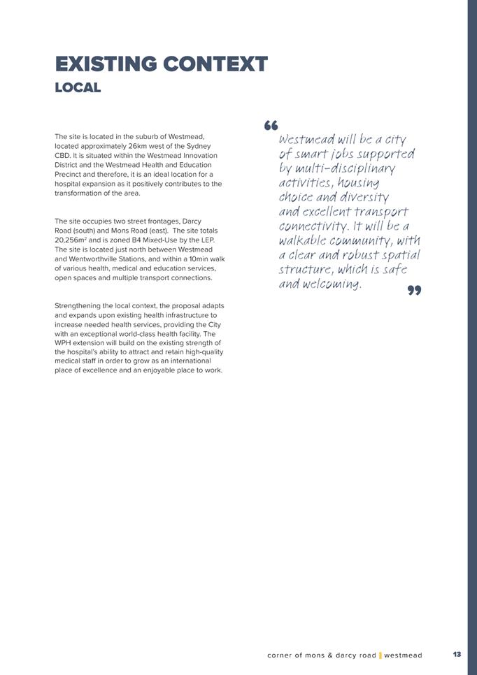
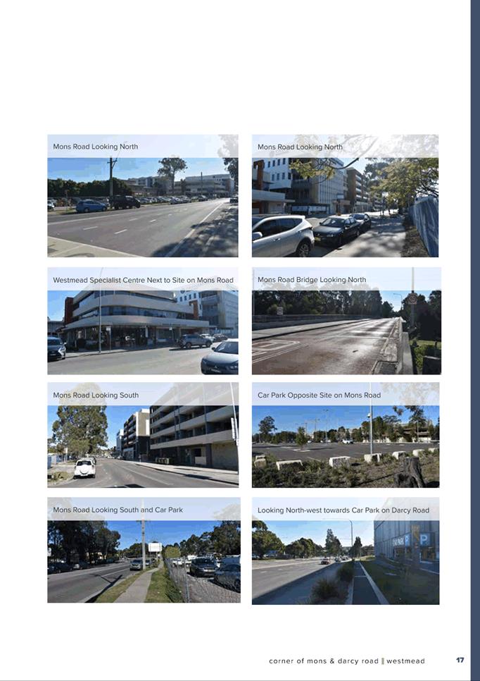
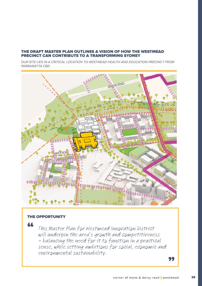
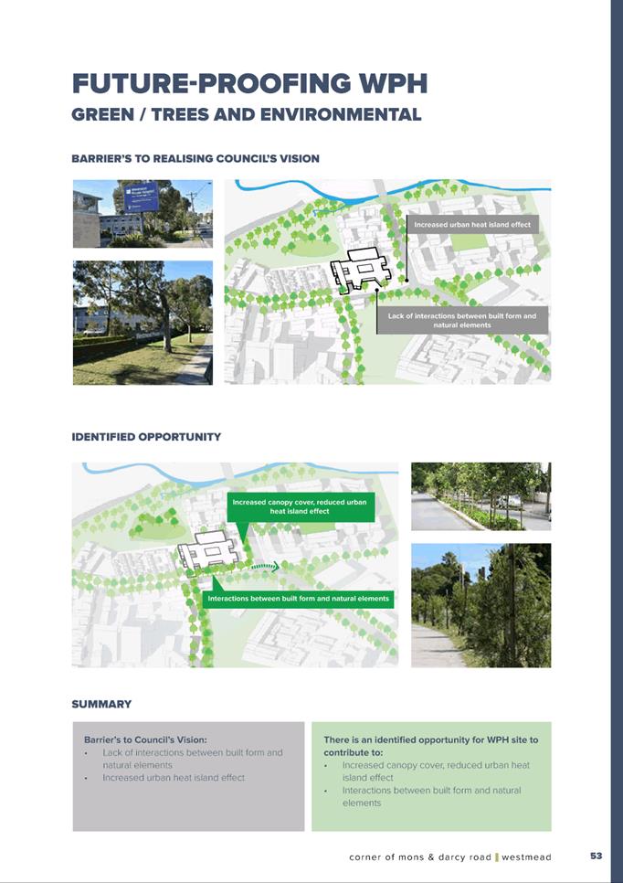
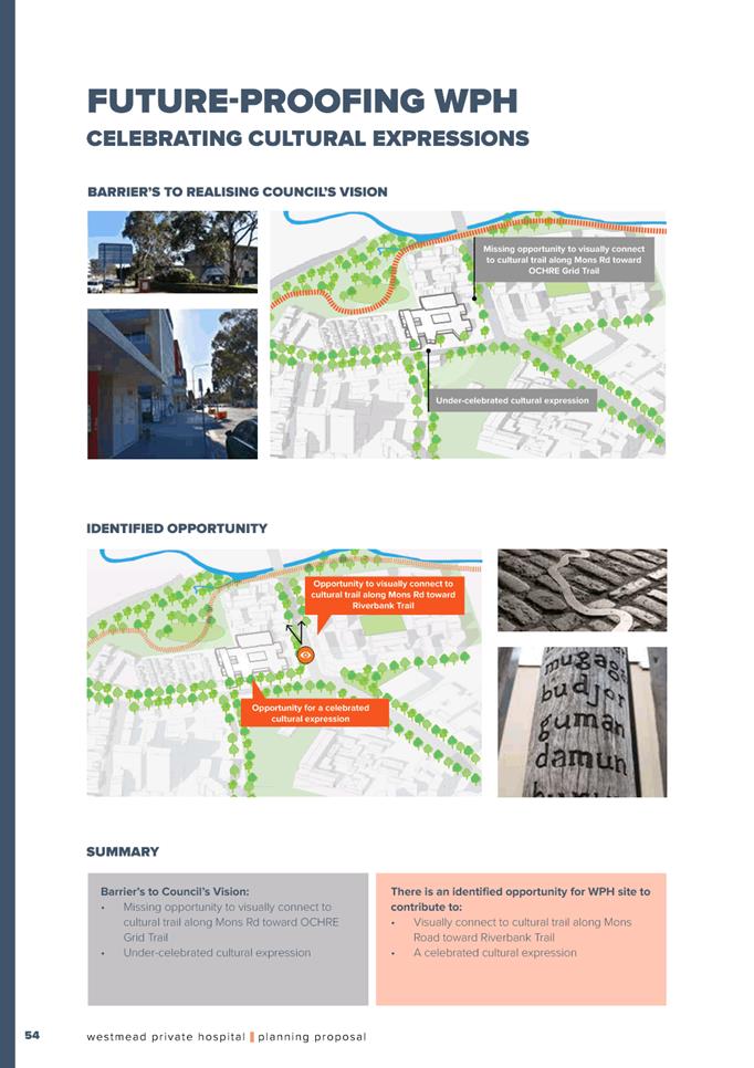
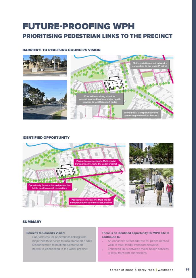
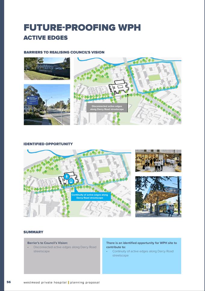
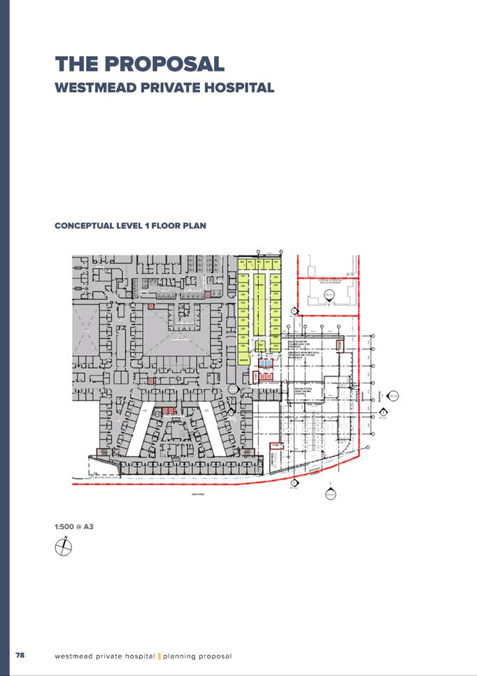
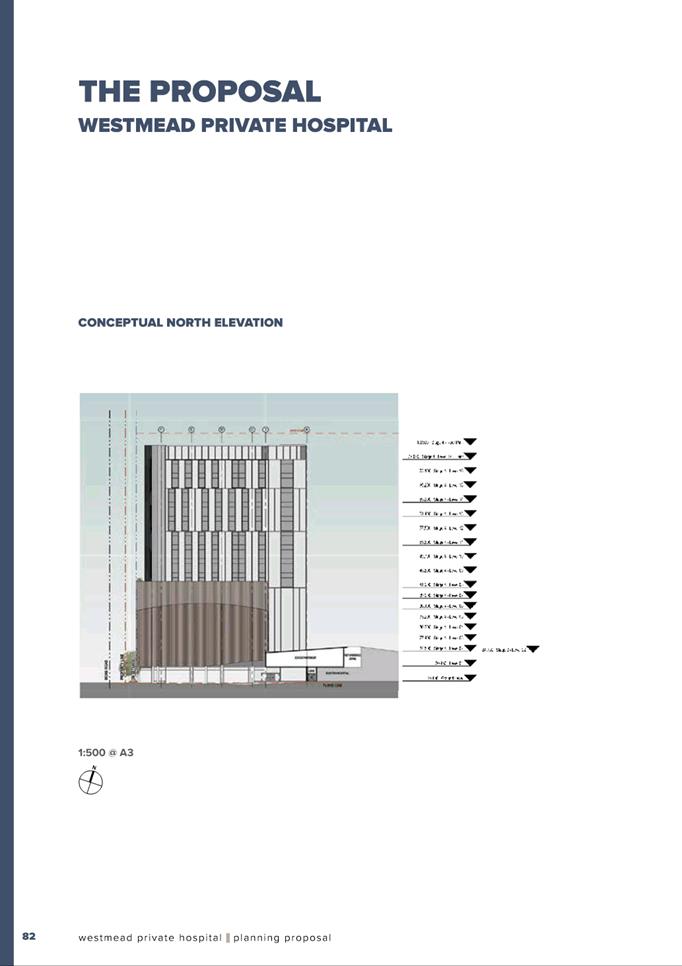
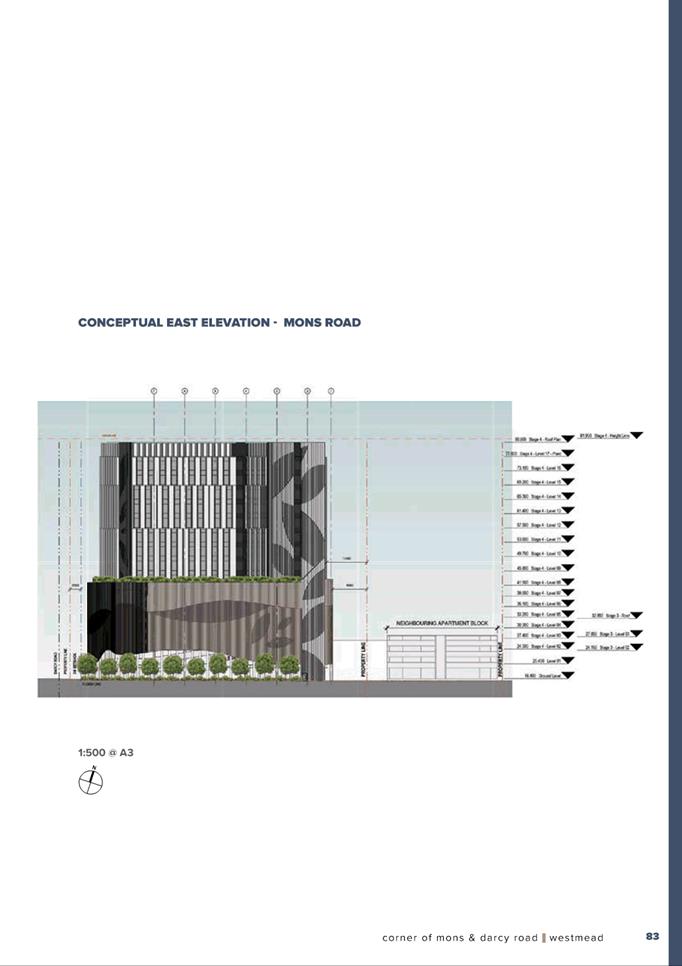
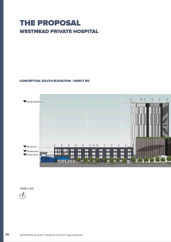
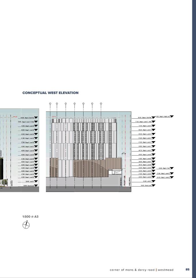
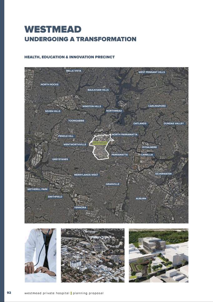
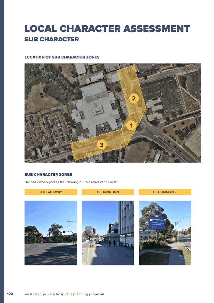
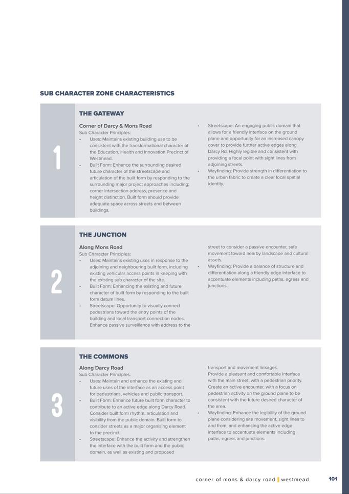
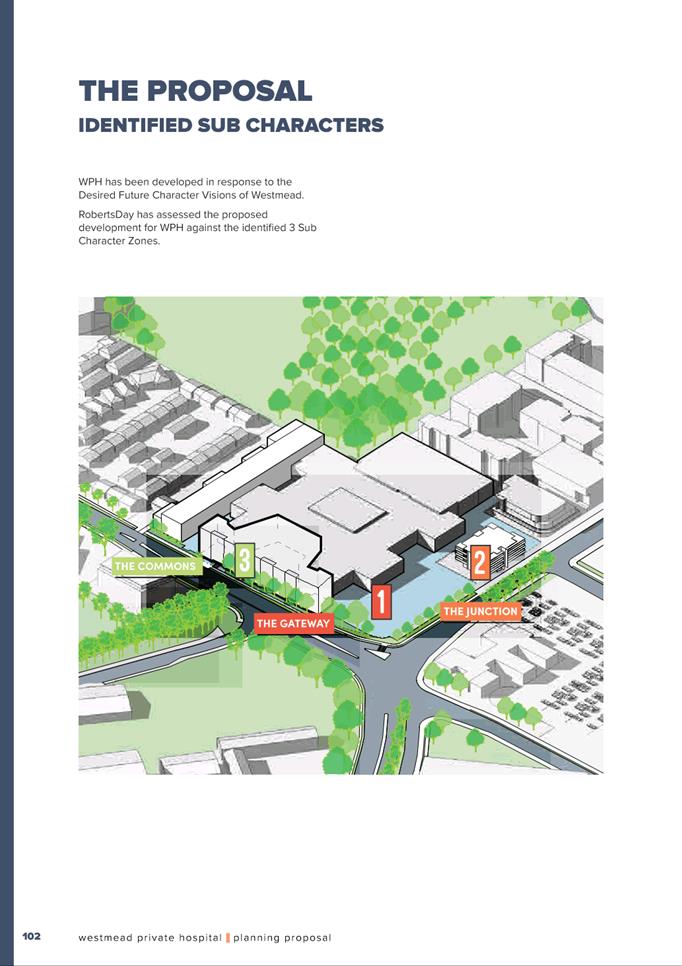
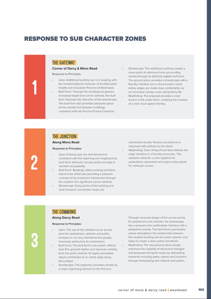
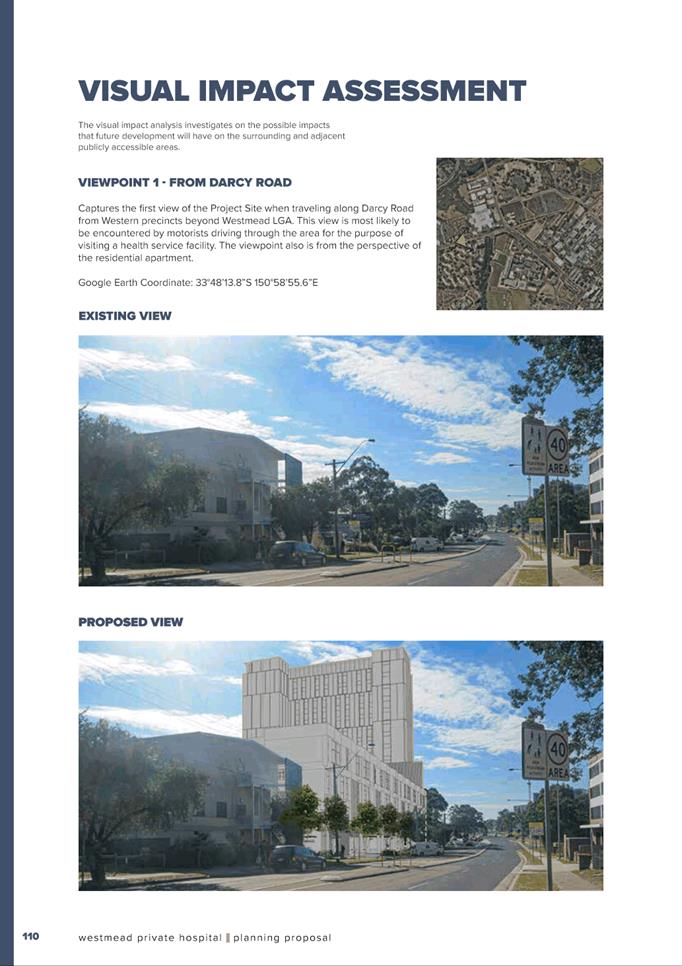
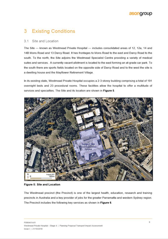
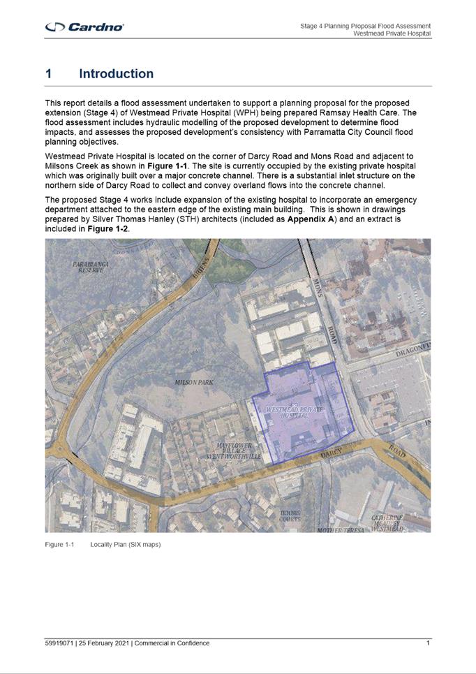
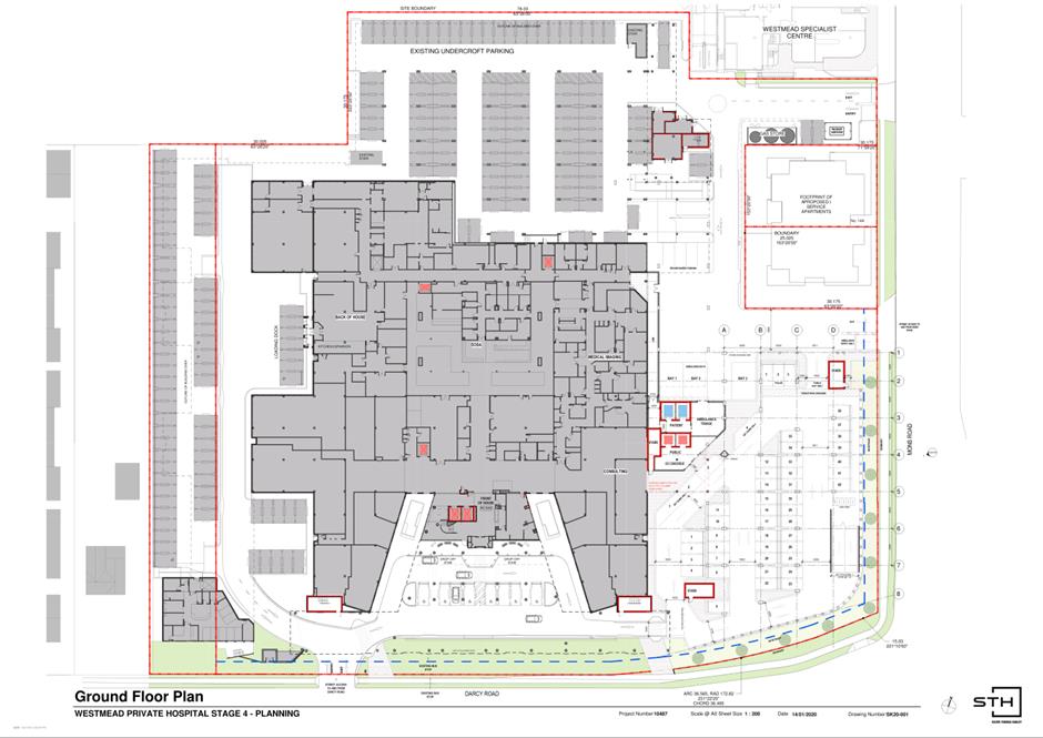
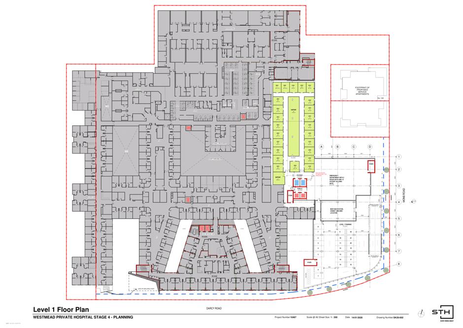
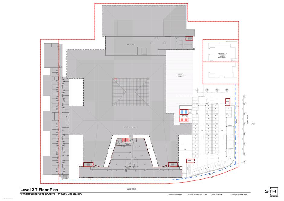
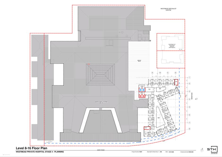
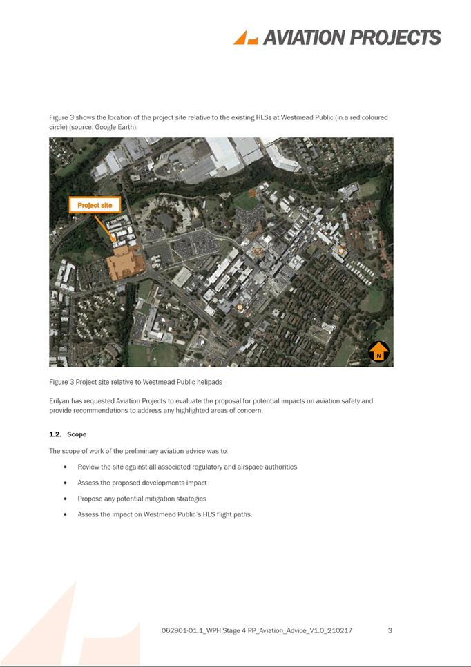
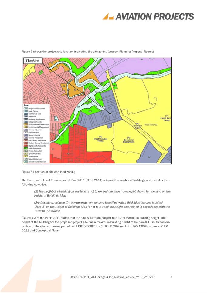
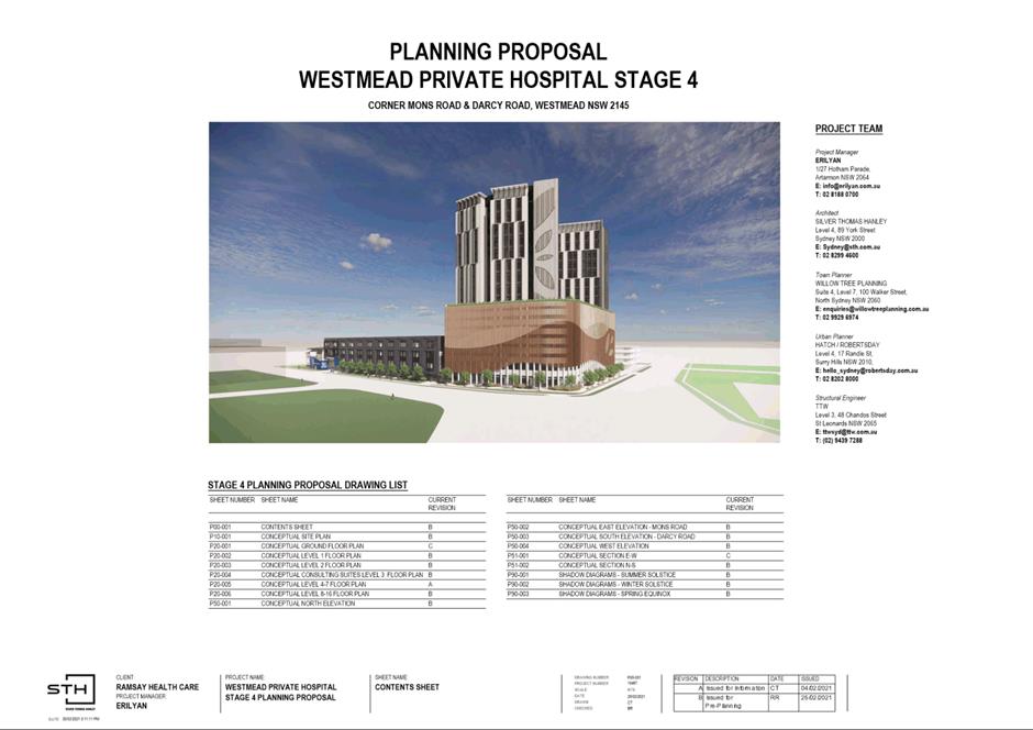
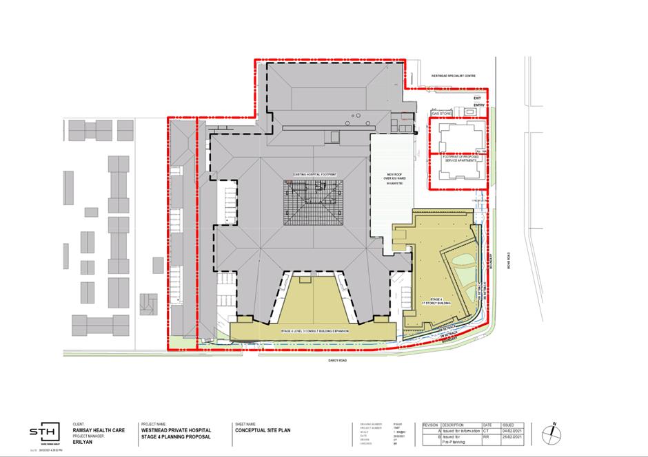
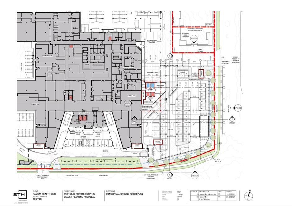
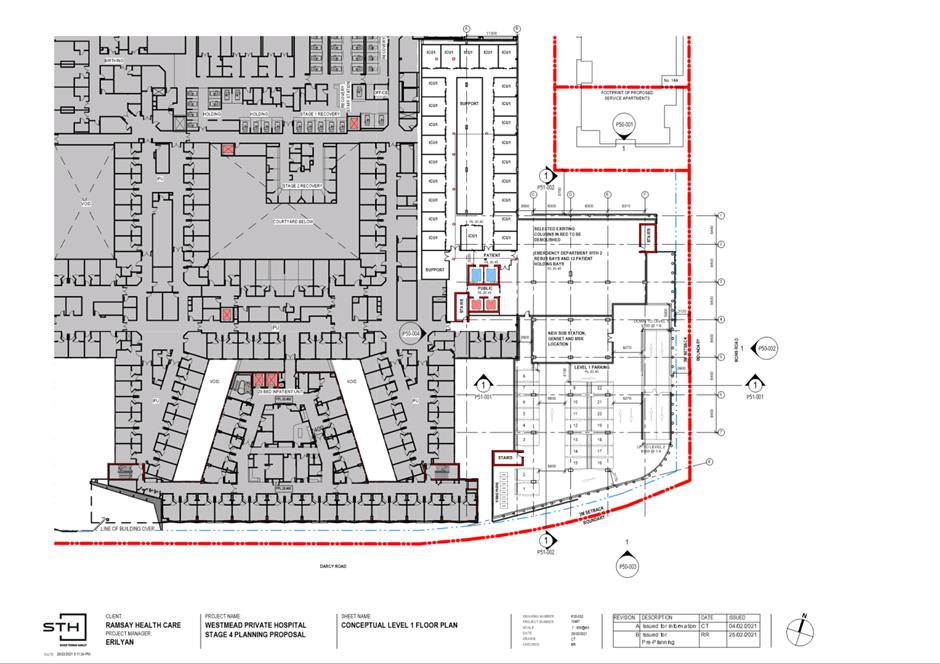
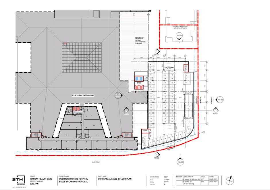
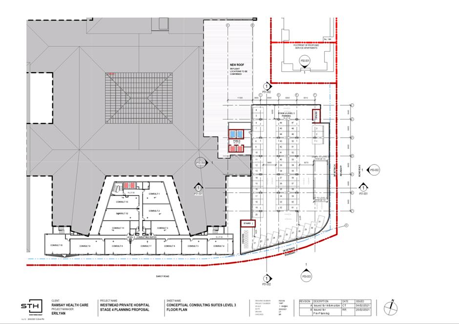
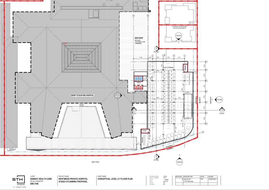
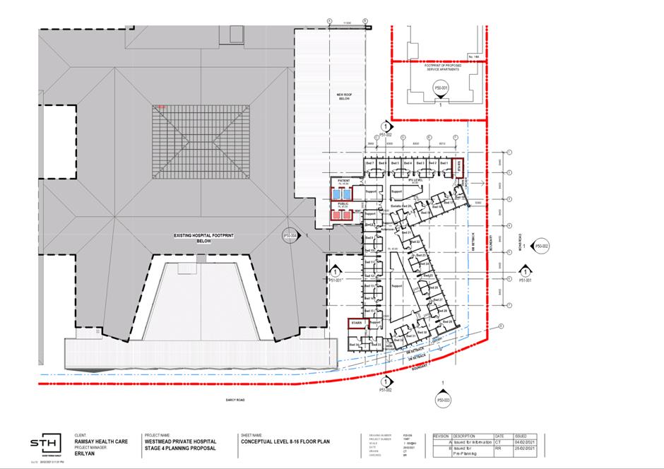
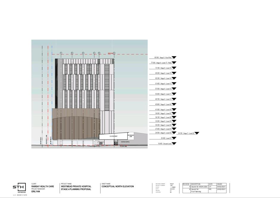
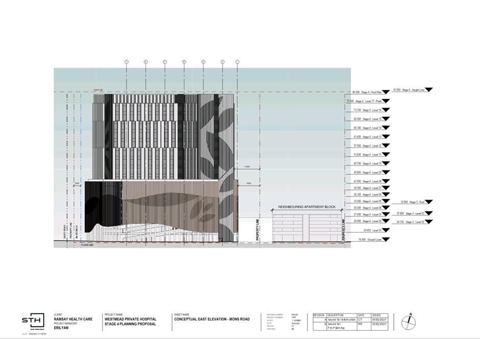
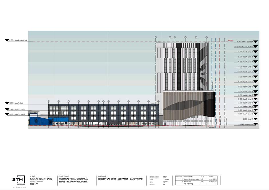
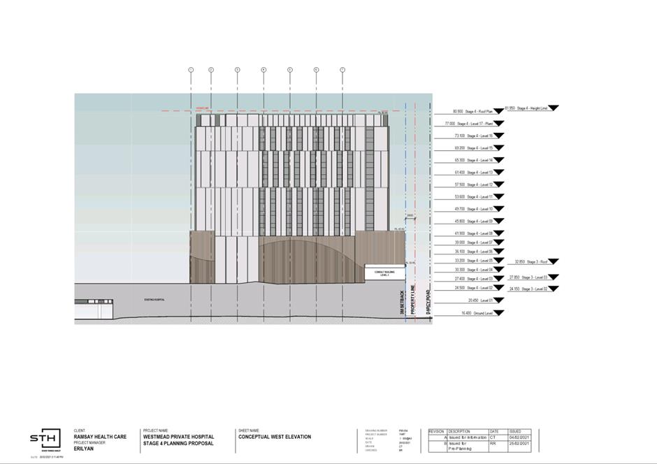
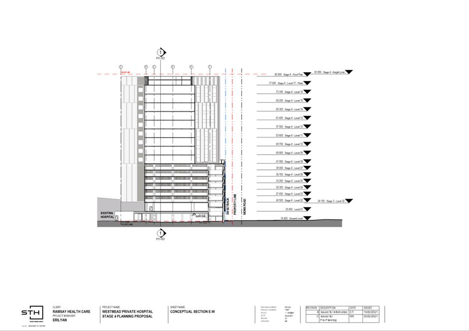
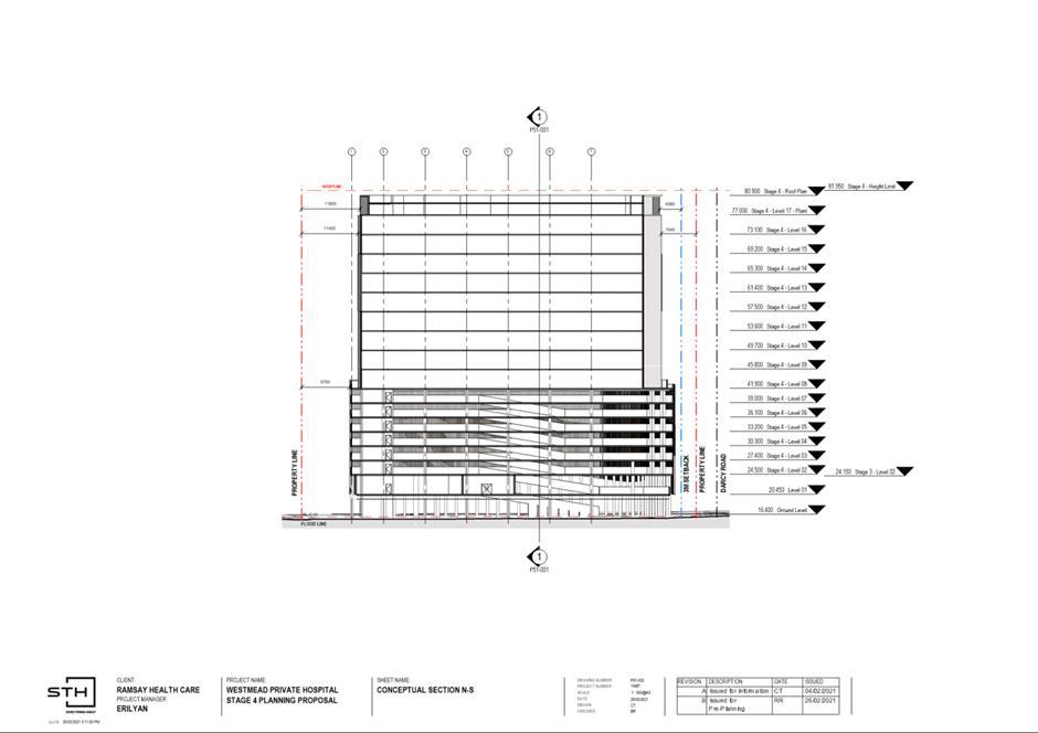
1. The subject site is at 12-12A, 14 & 14B Mons Road, Westmead and has an area of approximately 20,256 square metres (Refer to Figure 1). This site is currently occupied by Westmead Private Hospital and contains a two-storey health services facility and associated at-grade car parking.
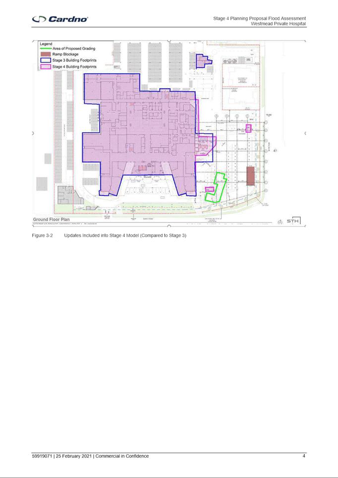
2. The site is a corner lot and fronts Mons Road to the east and Darcy Road to the south. Vehicular access to the Hospital is currently provided on both roads. A single-storey dwelling (15 Darcy Road) is located to the west and a three-storey commercial building (14A Mons Road) is located to the north.
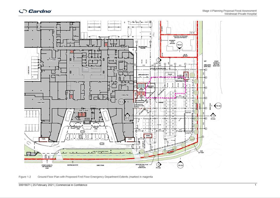
3. In March 2020 the site obtained development consent for alterations and additions to the existing Westmead Private Hospital comprising of demolition works, construction of a three-storey building to accommodate new consulting room and inpatient units and expansion of the existing operating theatres (Stage 3). This has since commenced construction.
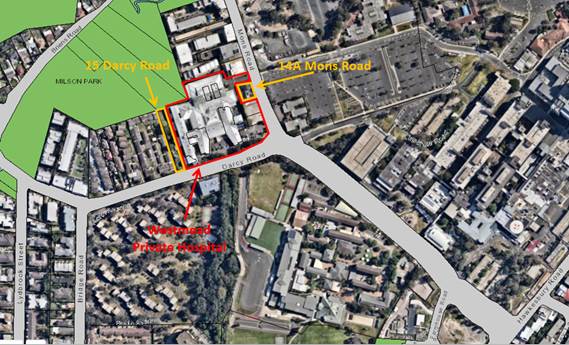
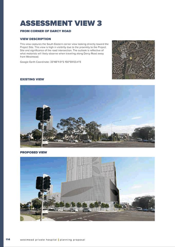
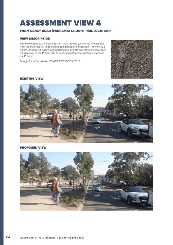
Figure 1: An aerial image of the site and surrounds (subject site outlined in red)
CURRENT PLANNING CONTROLS
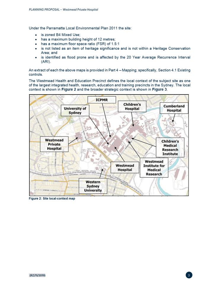
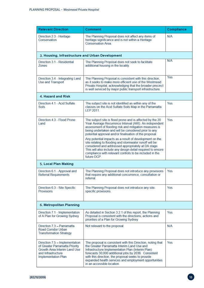
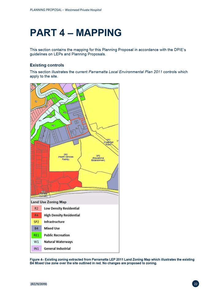
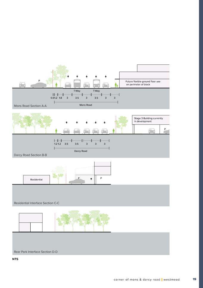
4. Under the Parramatta Local Environmental Plan 2011, the site is subject to the following controls:
a. Land Use Zoning is B4 Mixed Use;
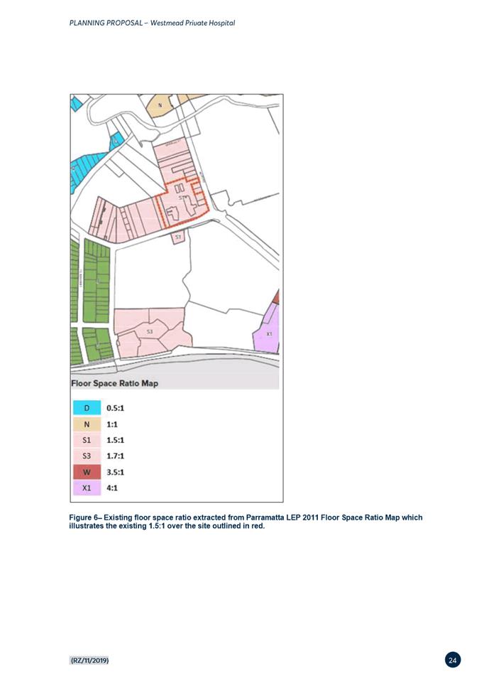
b. Floor Space Ratio (FSR) is 1.5:1;
c. Height of Buildings is 12 metres;
d. The site is not listed as an item of heritage significance and is not within a Heritage Conservation Area; and
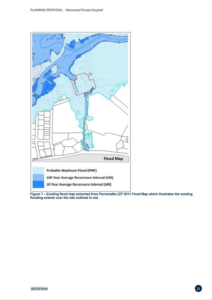
e. This site is flood prone and is affected by the 20 Year Average Recurrence Interval (ARI).
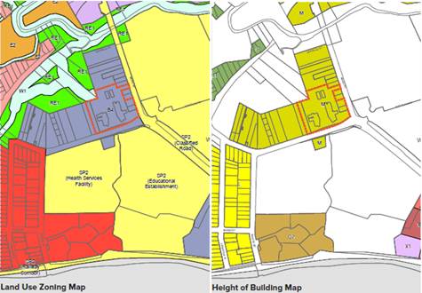
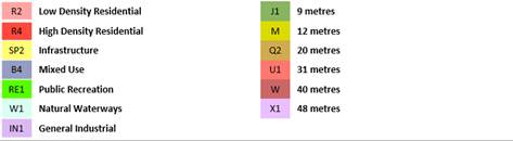

Figure 2: Parramatta LEP 2011 Maps (subject site outlined in red)
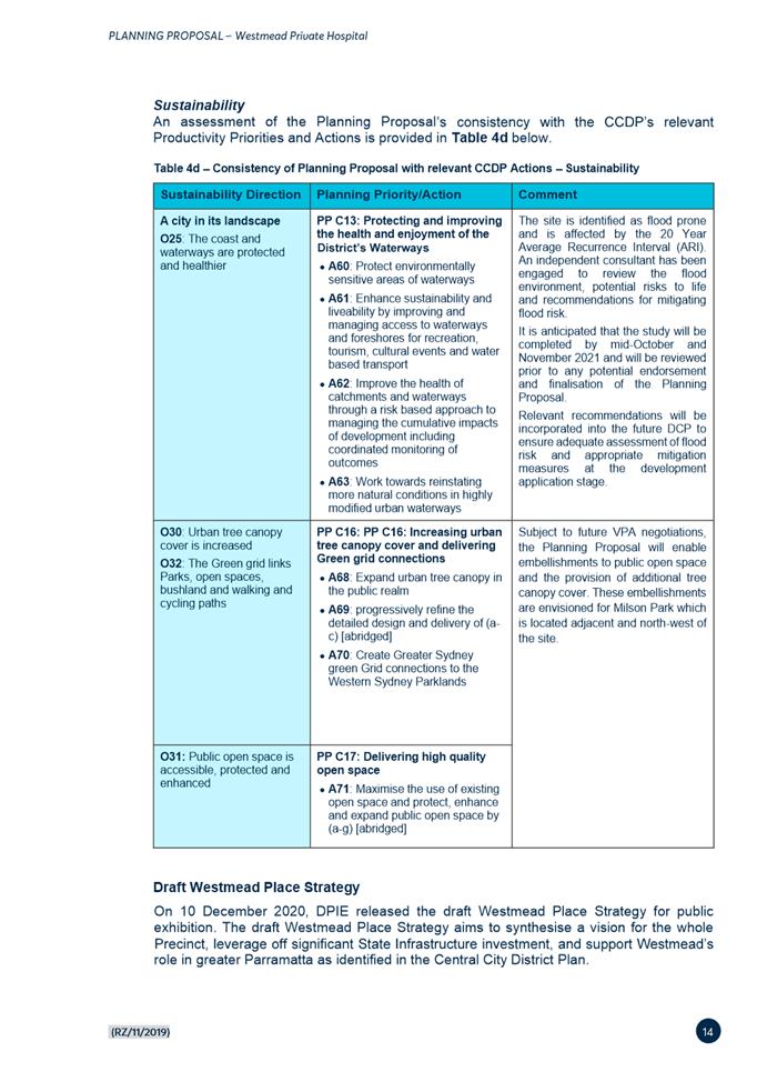
PLANNING PROPOSAL SUMMARY
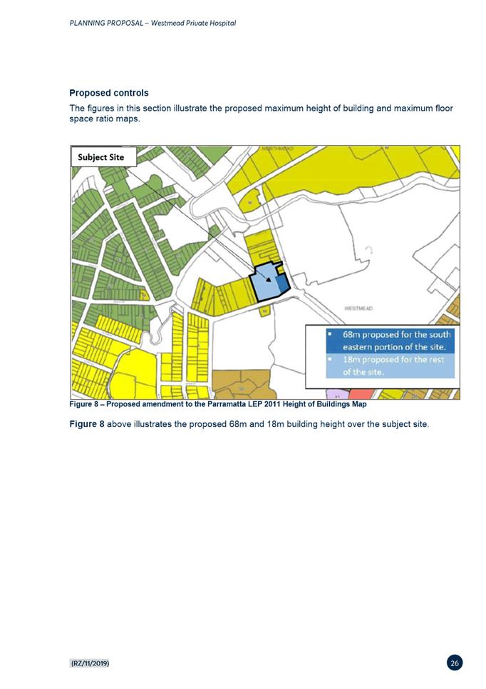
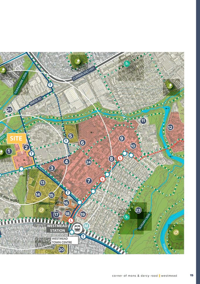
5. On 1 November 2019, a Planning Proposal (Attachment 1) was lodged with Council on behalf of Westmead Private Hospital to amend the planning controls applicable to 12-12A, 14 & 14B Mons Road, Westmead under Parramatta LEP 2011. The proposed changes included:
· Increasing the floor-space ratio control from 1.5:1 to 2:1; and
· Increasing the height of buildings control from 12 metres to part 18 metres and part 68 metres.
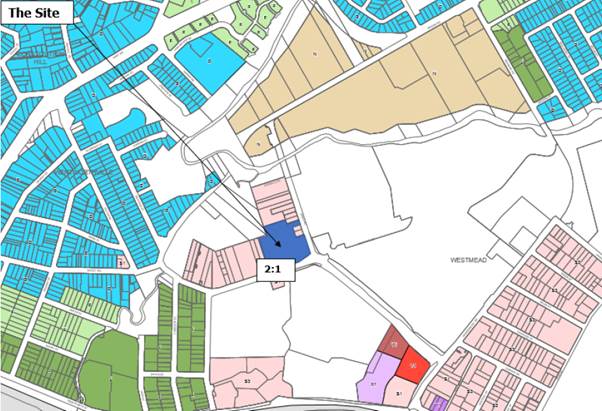
Figure 3: Proposed FSR map (source: Willow Tree Planning 2021)
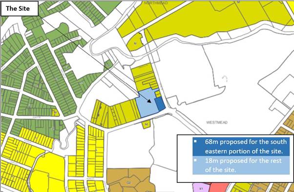
Figure 4: Proposed HOB map (source: Willow Tree Planning 2021)
6. No changes to the zoning are proposed.
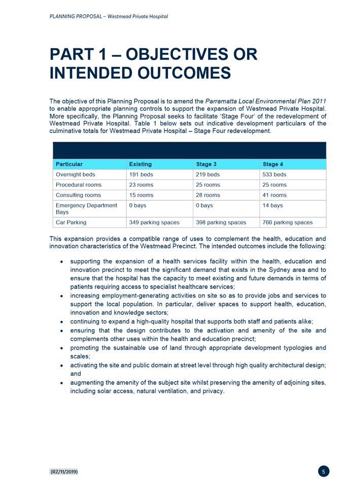
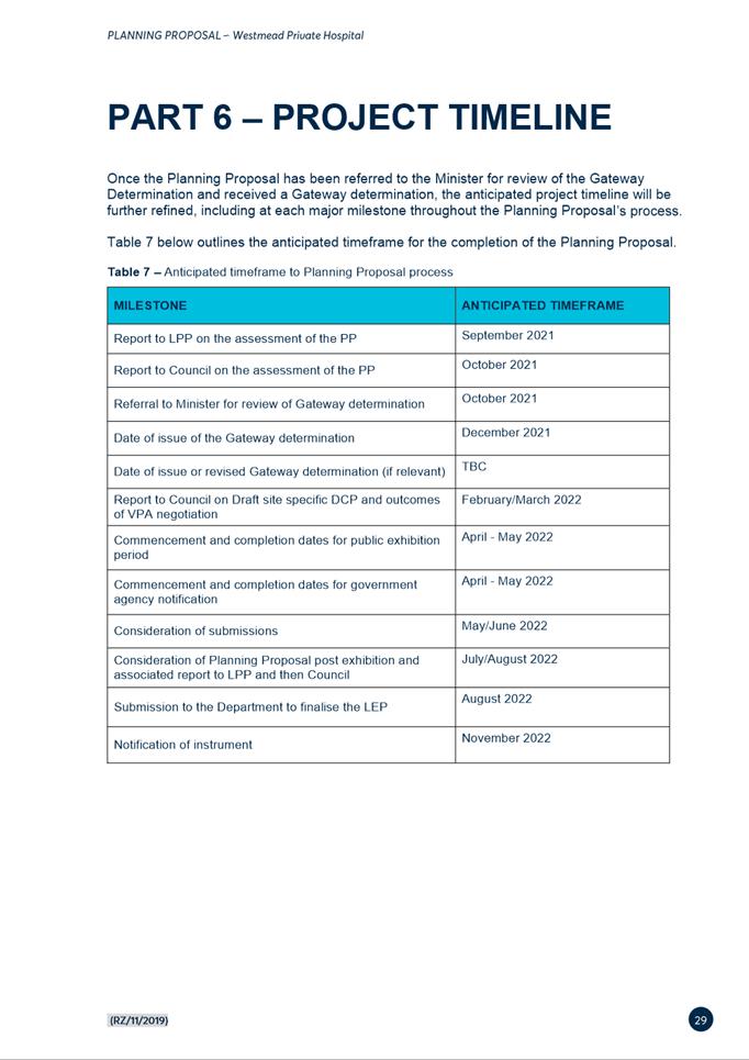
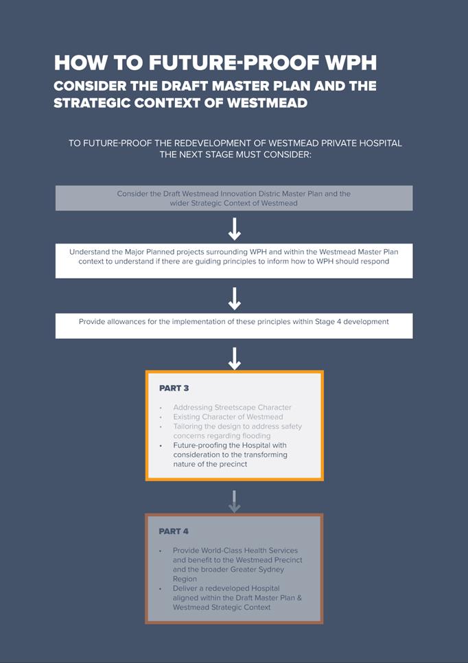
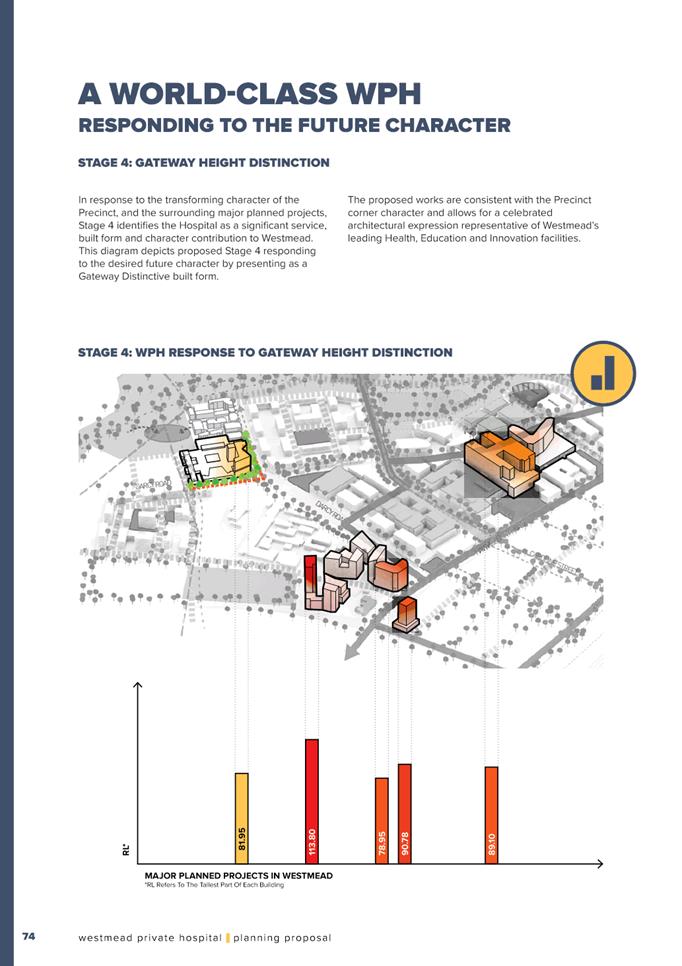
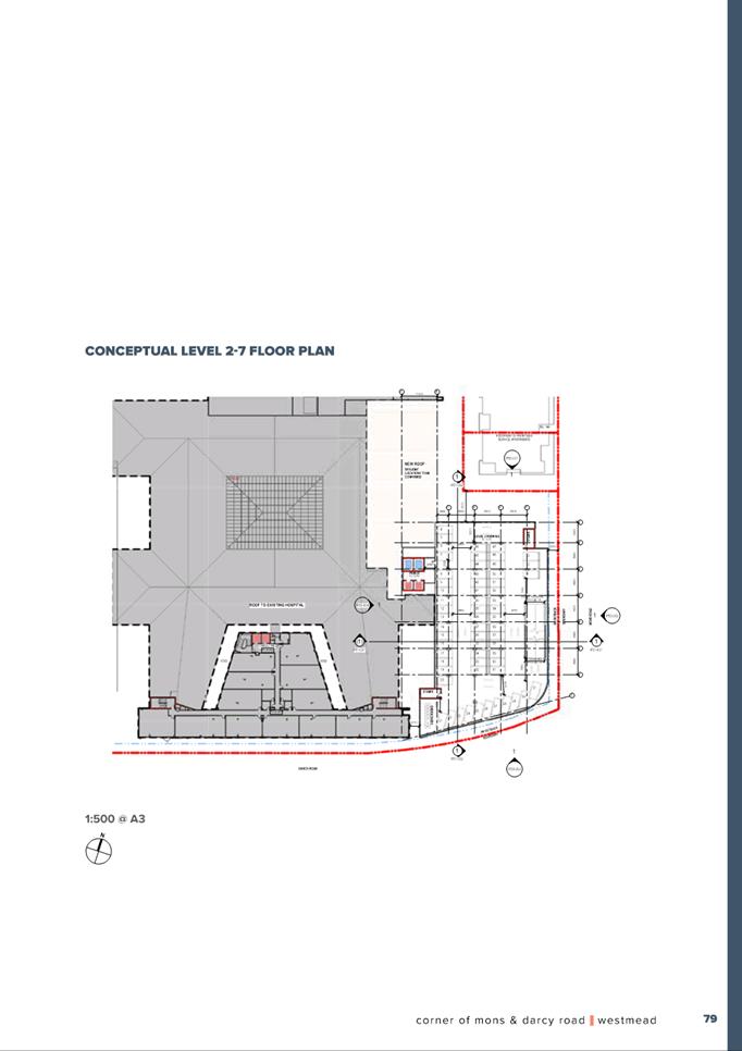
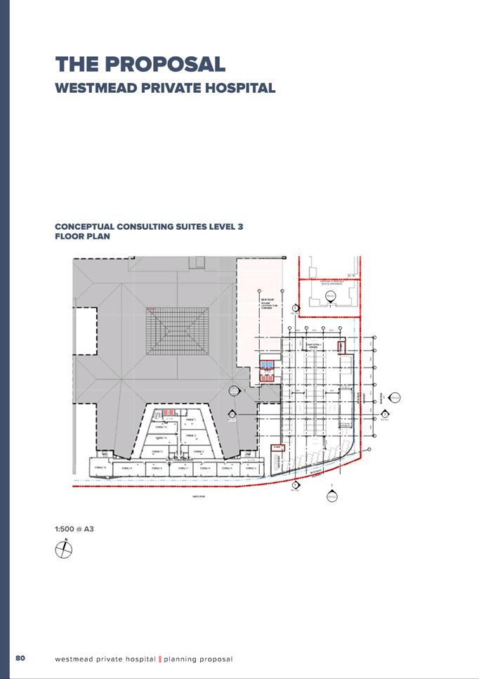
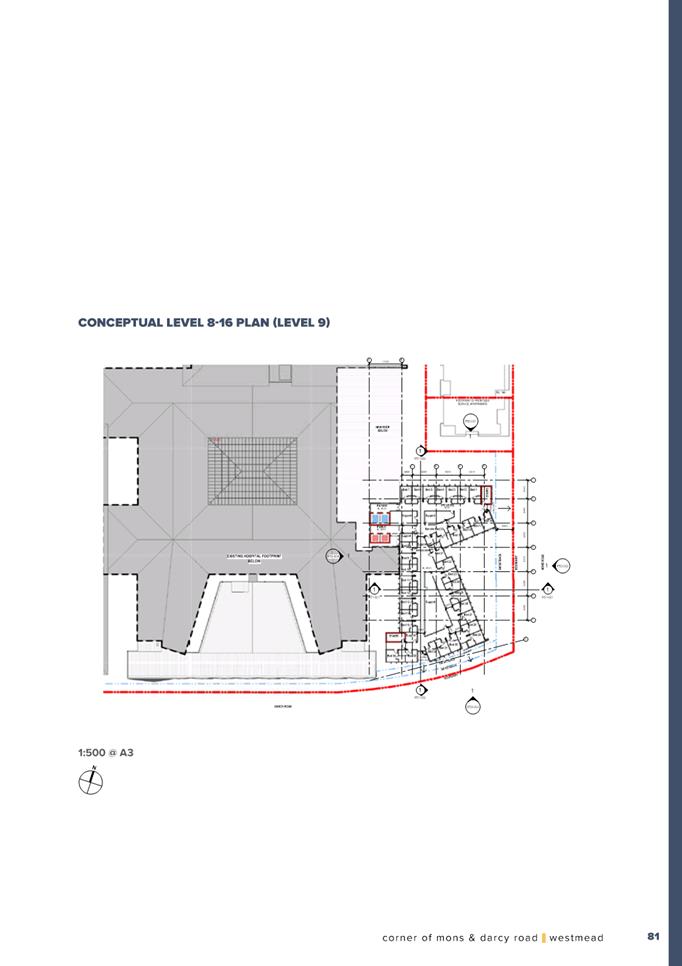
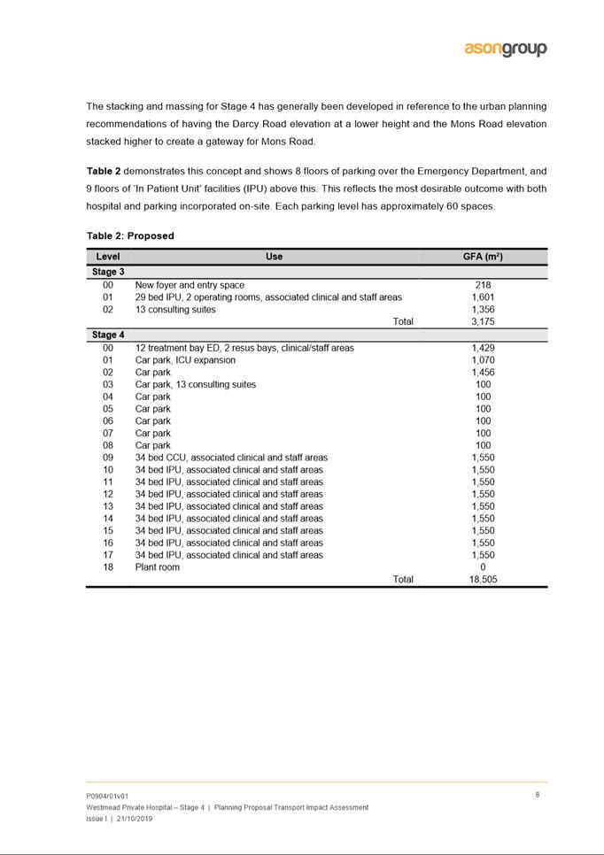
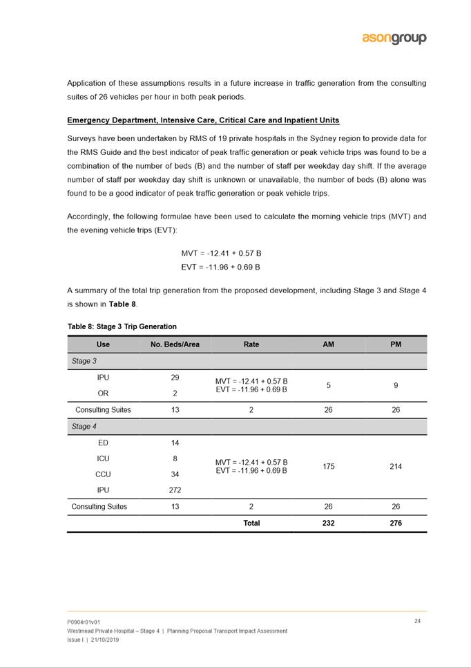
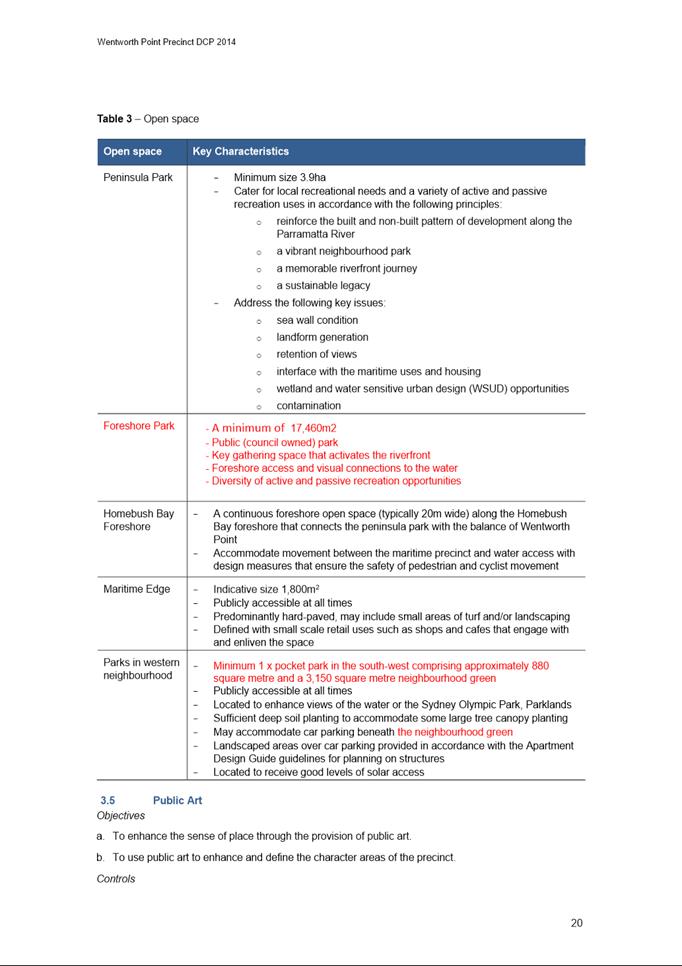
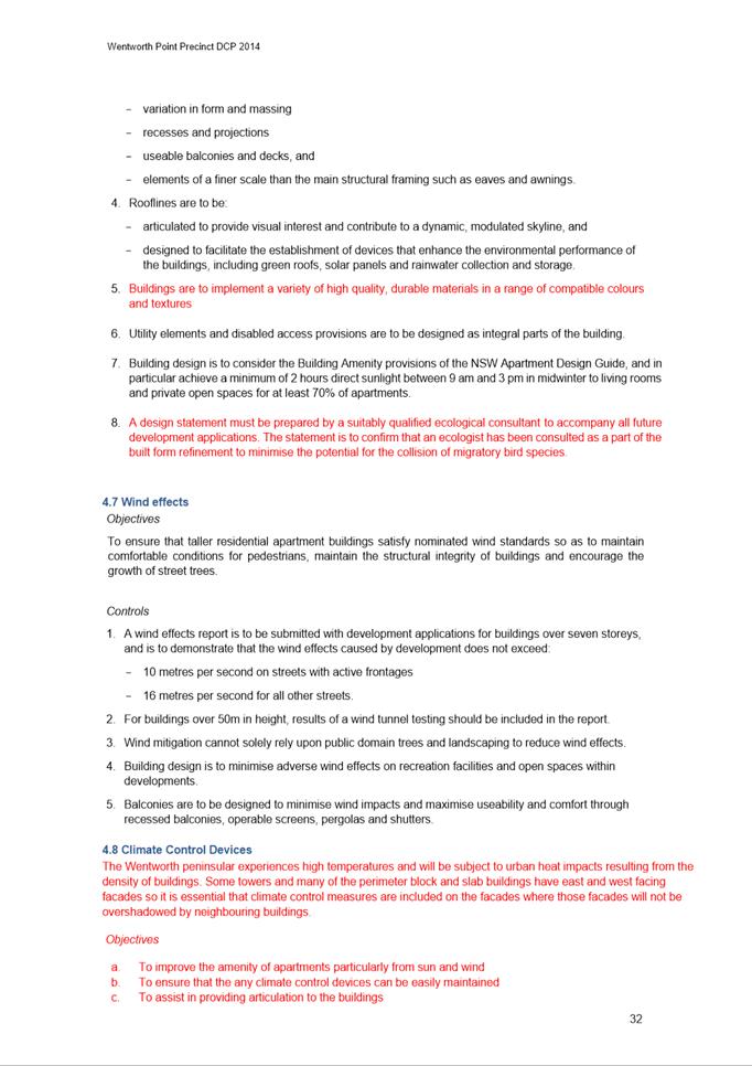
7. The Planning Proposal seeks to facilitate ‘Stage Four’ of the Westmead Private Hospital redevelopment. Table 1 below, as provided by the applicant, sets out the indicative development parameters for ‘Stage Four’ redevelopment.
Table 1: Indicative development parameters (Note: Beds, Rooms and Parking figures referred to in the below table are cumulative totals for the whole site)
|
Particular |
Existing |
Stage 3 |
Stage 4/Planning Proposal scheme |
|
Overnight beds |
191 beds |
219 beds |
533 beds |
|
Procedural rooms |
23 rooms |
25 rooms |
25 rooms |
|
Consulting rooms |
15 rooms |
28 rooms |
41 rooms |
|
Emergency Department bays |
0 bays |
0 bays |
14 bays |
|
Car parking |
349 spaces |
398 spaces |
766 spaces |
8. It is noted that a Development Application for ‘Stage Three’ was approved by Sydney Central Planning Panel on 12 March 2020. Stage Three is currently under construction.
9. A separate Development Application will need to be submitted for ‘Stage Four’ and development consent can only be granted once the planning controls under the Parramatta LEP 2011 have been formally amended via the subject Planning Proposal.
10. The Planning Proposal is accompanied by the following supporting documents:
· Urban Design Report prepared by Roberts Day;
· Transport Impact Statement prepared by Ason Group;
· Flood Report completed by Cardno;
· Aviation Advice issued by Aviation Projects; and
· A Strategic Merit Test prepared by Willowtree Planning.
11. Following internal assessment in January 2020, Council Officers wrote to the applicant detailing several concerns with the Proposal, particularly those relating to flooding and broader urban design issues. Council officers advised that a master plan was necessary for the site so that the final built-form outcome and integration between ‘Stage Three’ and ‘Stage Four’ is better resolved.
12. On 23 March 2021, the applicant revised their Planning Proposal and included a site-specific DCP. The revised scheme including the draft DCP has since been reviewed by Council Officers who have confirmed that while some of the issues raised previously have been resolved, there are still a number of issues relating to the proposed reference design. The proposed changes to FSR and Building Height remains unchanged. These outstanding design issues are discussed in detail further in this report.
ASSESSMENT
13. The following section details Council’s assessment of the proposal based on strategic merit and site specific planning issues. The Planning Proposal detailed in Attachment 1 provides a full assessment of the proposal’s consistency against relevant State Planning Policies and Ministerial Directions.
Strategic Merit
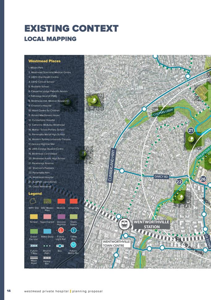
14. Council Officers consider this Planning Proposal to have strategic merit in relation to redeveloping the site to provide additional health service facilities in the Westmead Innovation Precinct.
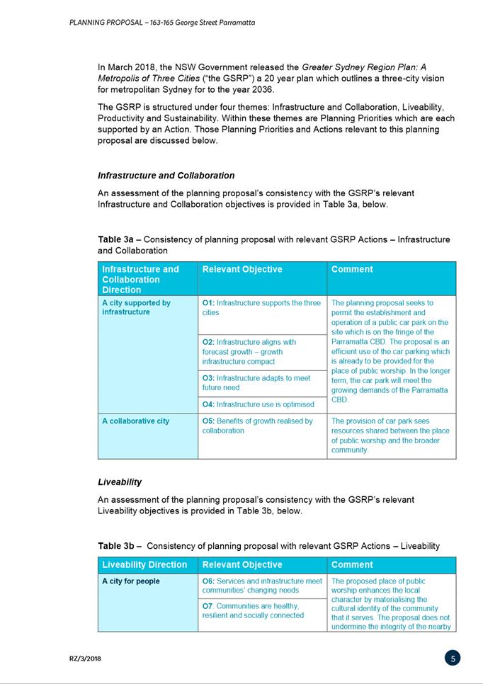
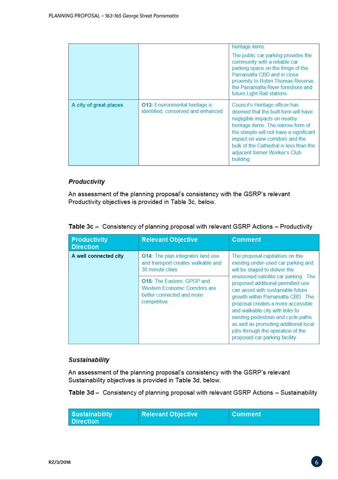
Greater Sydney Region Plan
15. In March 2018, the Greater Sydney Commission released the Greater Sydney Region Plan: A Metropolis of Three Cities (“the GSRP”) a 20-year plan which outlines a three-city vision for metropolitan Sydney to the year 2036. The site is identified as a part of the Greater Parramatta growth area, with the Westmead Precinct in particular being recognised as Greater Parramatta’s internationally significant health and education precinct.
16. The Plan indicates that a range of activities are already underway which will boost the role of the Westmead health and education precinct as an economic catalyst for Greater Parramatta, including;
· Stage One of Westmead Hospital Upgrade including a new acute services building
· Improved metropolitan accessibility from the delivery of Sydney Metro West
· Enhanced local accessibility with Parramatta Light Rail
· The attraction of private sector investment and business to the precinct, with a focus on Western Sydney University’s Westmead Campus redevelopment and the planned University of Sydney campus.
17. The redevelopment of Westmead Private Hospital, as facilitated by this site-specific Planning Proposal, aligns with the objectives of the Greater Sydney Region Plan and complements the changes that are already taking place within the Westmead health and education precinct.
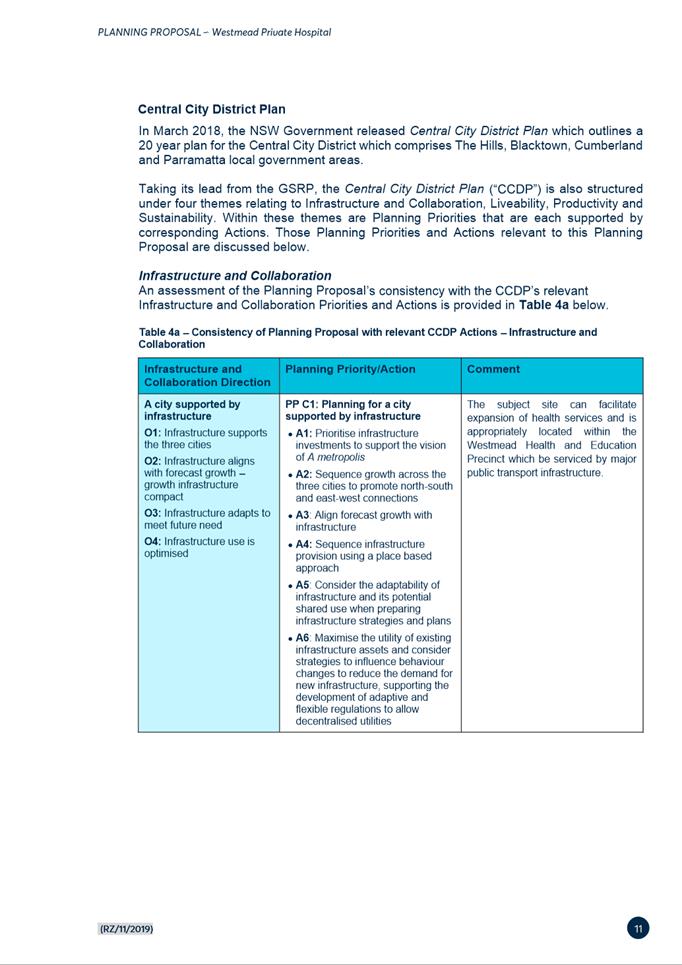
Central City District Plan
18. Released in March 2018 by the Greater Sydney Commission as part of implementing the vision of the Greater Sydney Region Plan, the Central City District Plan seeks to transform Westmead Health and Education Precinct to an innovation district with greater diversity of knowledge-intensive jobs. Specifically, Action no. 23 of the District Plan seeks the following:
“23. Strengthen the economic competitiveness of Greater Parramatta and grow its vibrancy by:
a. Enabling the development of an internationally competitive health and education precinct at Westmead”
19. The proposed intensification of the Westmead Private Hospital site that will be facilitated by the planning proposal is consistent with the directions of the Central City District Plan.
Draft Westmead Place Strategy
20. On 10 December 2020, DPIE released a draft Westmead Place Strategy for public exhibition. The draft Westmead Place Strategy aims to synthesise a vision for the whole Precinct, leverage off significant State Infrastructure investment, and support Westmead’s role in Greater Parramatta as identified in the Central City District Plan.
21. Council endorsed a submission on the draft Place Strategy at its meeting on 22 March 2021 which reinforced the need for DPIE to complete a comprehensive Traffic and Transport Study prior to it being endorsed by the Minister. Transport for NSW (TfNSW) has advised that Stage 1 of the Westmead Traffic and Transport Study is expected to be completed by the end of October 2021 whilst scoping and funding for Stage 2 is yet to be confirmed.
22. Further, Council also resolved to consider a further “report on the risks and benefits of Council suspending consideration of Planning Proposals and assessment of Development Applications, unless the proposals or applications relate solely to increasing and/or supporting community health services, until the Minister for Planning and Public Spaces has approved the Strategy based on a comprehensive traffic and transport study, and Council has completed the analysis and consultation required to determine land use and density controls that are consistent with the Strategy”.
23. It is noted that while the report referred to in the above resolution is yet to be prepared, the resolution does not preclude the progress of the Planning Proposal (which seeks expansion of health/hospital uses) ahead of the Westmead traffic and transport study being completed. A report addressing the above resolution will be provided to Council in 2022.
24. Further, the Planning Proposal is in line with the Draft Westmead Place Strategy, specifically Direction 5;
Protect and enhance existing employment areas with a focus on job creation to transform the existing health and education precinct into the Westmead Health and Innovation District.
Planning Priority 1: Continue to advance the growth of the health core with the expansion of existing education, research and health facilities.
25. The proposed increase in HOB and FSR allows the expansion of the health facility consistent with the priorities of the strategy on land which the strategy identifies as suitable for Infrastructure (Health and Education), see Figure 5.
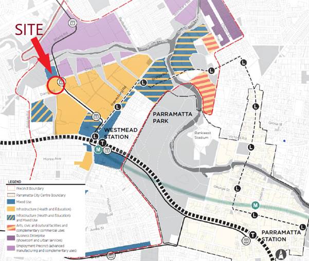
Figure 5: Plan of Employment Areas (Draft Westmead Place Strategy 2020)
Local Strategic Planning Statement
26. The Local Strategic Planning Statement (LSPS) is Council’s 20 year vision for land use and infrastructure in the City of Parramatta. The draft LSPS was publicly exhibited from 30 September 2019 to 11 November 2019 and the final LSPS was adopted by Council on 24 February 2020. The LSPS identifies priorities that seek to reinforce Westmead’s role as a Health and Education Precinct. These include collaborating with State Agencies and other stakeholders to develop and implement the Westmead Place Strategy/Masterplan (Action 70 and 80). The LSPS also includes priorities which seek to limit residential development within Westmead while encouraging health, education development (Planning Priority 38).
27. The Planning Proposal is consistent with the priorities identified in the LSPS and enhances the agglomeration of Westmead Health Precinct through the intensification of hospital use on site.
Site Specific Assessment Issues
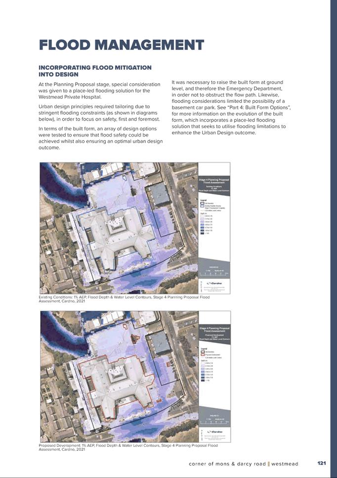
Flooding
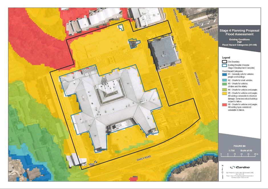
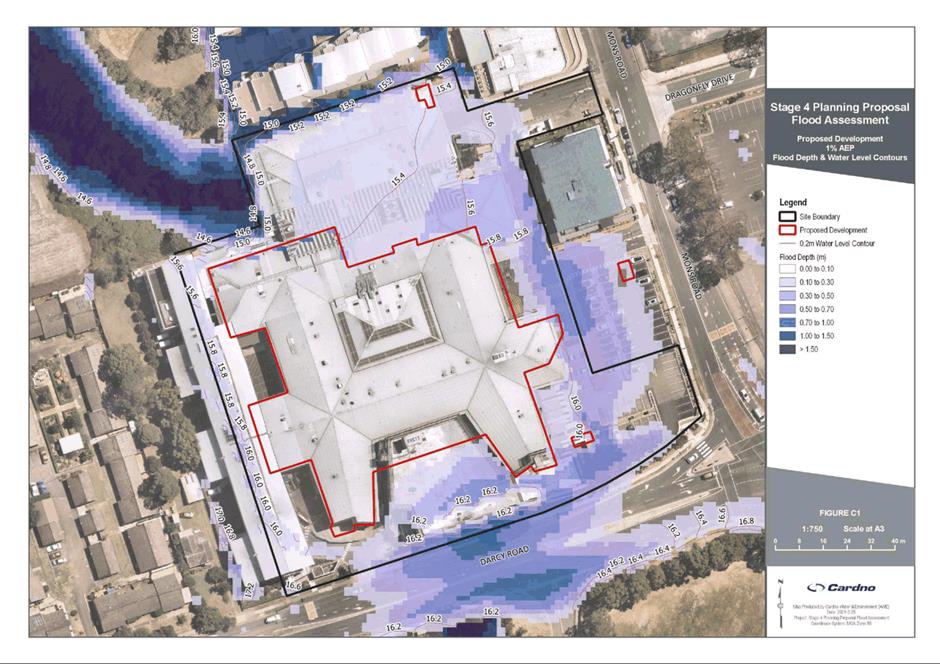
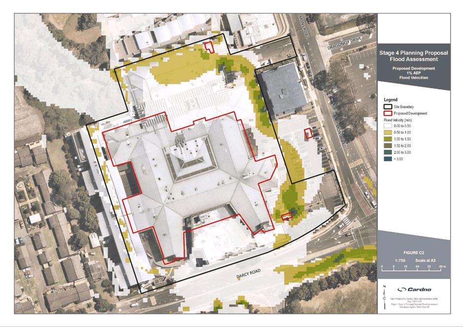
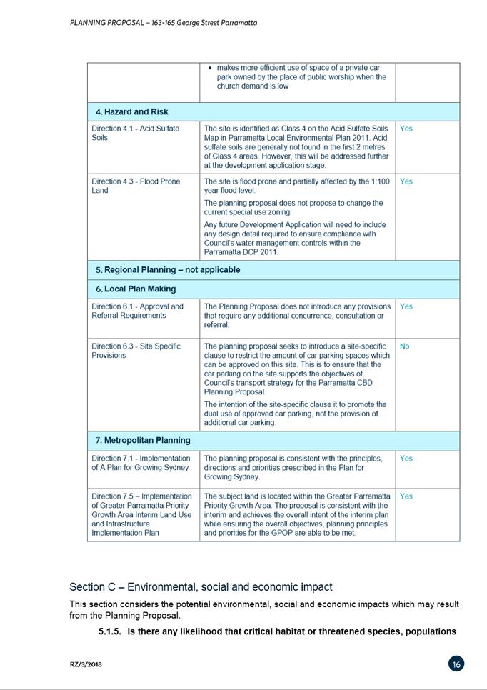
28. The subject site is flood affected both by rising floodwaters from Toongabbie Creek from the north and by floodwaters from Milson’s Creek to the south which traverse the site in at least two pathways.
29. The site is affected by the Probable Maximum Flood (PMF) and part of the site is affected by the 100 and 20 year ARI.
30. Following assessment of the proposal by Council’s Senior Development Engineer, the issues below require further independent assessment:
a. Flooding Environment – Milson’s Creek
The Westmead Private Hospital building has been constructed over the channelised floodway of Milson’s Creek. Milson’s Creek was contained in an open concrete channel approximately 40m wide and 130m long. The hospital building was built directly above this channel
The location of the existing hospital across the floodway is shown in various flood maps by Council and the applicant’s Engineer – Cardno, however, these maps do not map or model the flow in the 40m wide channel that runs under the hospital.
b. Floodways surround the development in 1% AEP events
The current hospital including the proposed redevelopment to be facilitated by the Planning Proposal is located across the whole floodway of Milson’s Creek. As noted above, flow in the Milson’s Creek concrete channel has not been modelled by Council or by Cardno and therefore analysis is required to determine if this floodway is high hazard, noting the high hazard conditions existing in Milson’s Creek immediately upstream and downstream of the site.
c. Flooding from Toongabbie Creek
Water in Toongabbie Creek also has the potential to rise up and flood the Westmead Private Hospital site to a significant extent with the site fully inundated during a Probable Maximum Flooding (PMF) event. This includes Darcy Road and Mons Road which results in loss of road access to and from the site.
31. Based on the above issues, Council Officers have engaged a flooding consultant, Molino Stewart, to carry out an independent flooding assessment on the proposal. This will include reviewing and assessing the flood environment, potential risks to patients, staff and visitors as well as make recommendations on the Planning Proposal or site specific DCP to include controls to mitigate flood risk, manage site egress and evacuation. The independent assessment will also provide an assessment of the proposal against the Section 9.1 Ministerial Direction relating to Flood Prone Land which was recently amended in July 2021. It is anticipated that the independent Flood Study will be completed mid-October/November 2021.
32. Given the significance of the planning proposal to provide increased capacity for critical health infrastructure, it is considered that the planning proposal should proceed to the Gateway Determination process ahead of the above flooding work being completed. Should Council endorse the Planning Proposal to proceed, DPIE would be able to commence review of the Planning Proposal documentation in the first instance with the requisite independent flooding assessment to be forwarded to DPIE shortly after (by mid-October/November 2021) to inform the Gateway Determination process.
33. It is therefore recommended that Council authorise the Chief Executive Officer to endorse the flood study for the purposes of submission to the DPIE as part of the Gateway assessment process.
34. As Council would be considering the Planning Proposal ahead of formally reviewing the flood study, this approach was flagged with DPIE who have confirmed that this could be accommodated as part of the Gateway process subject to the above authorisation being provided. It is noted that the results of the flood study will also inform development controls in the site specific DCP which is required to be reported to Council separately.
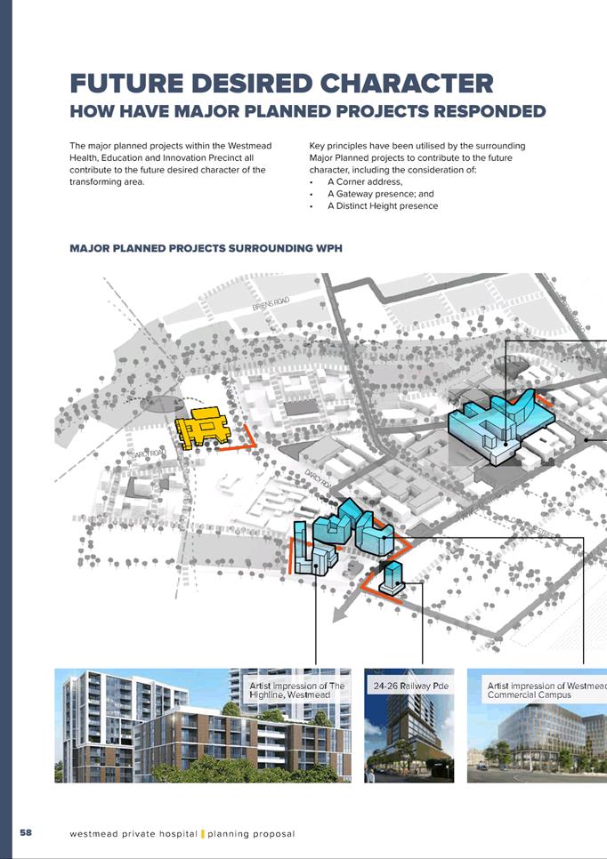
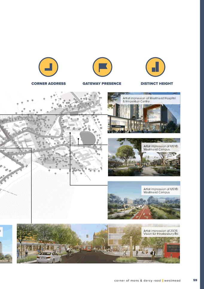
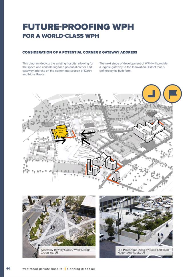
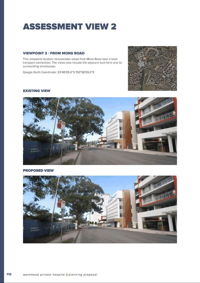
Urban Design
35. In 2019, initial feedback was provided to the applicant in relation to the following matters:
a. Built form
b. Street network and design
c. Car parking design
d. Request for an urban design analysis and a Reference Design
36. The applicant responded with further details and amendments which included a reference scheme (see Figure 6 below), urban design analysis and a site specific DCP.
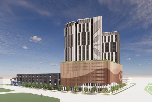
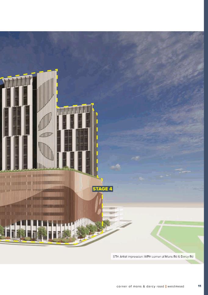
Figure 6: Reference scheme (source: STH 2021)
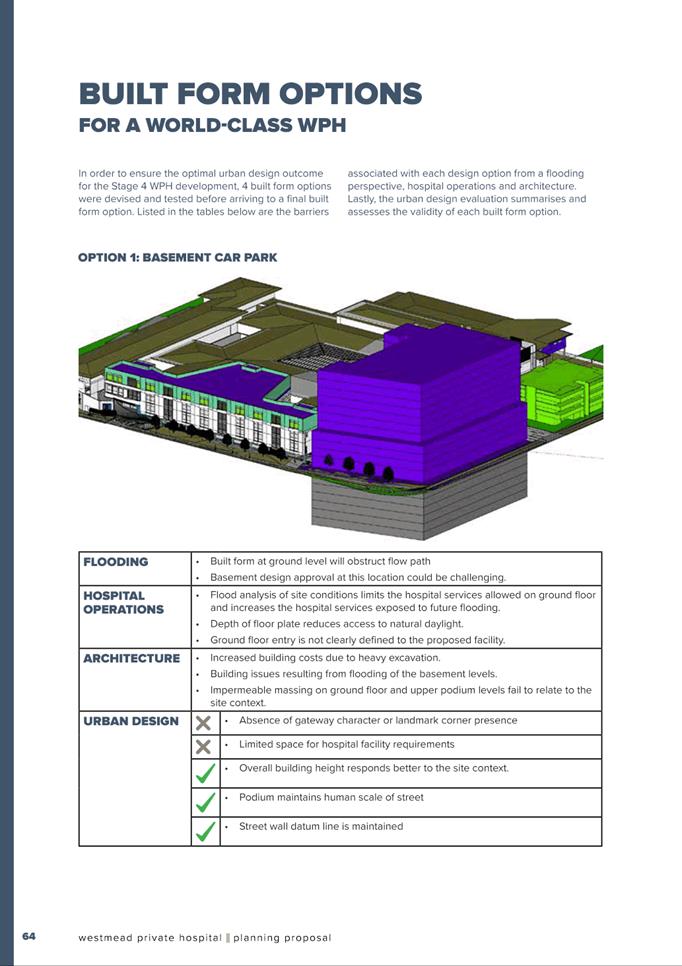
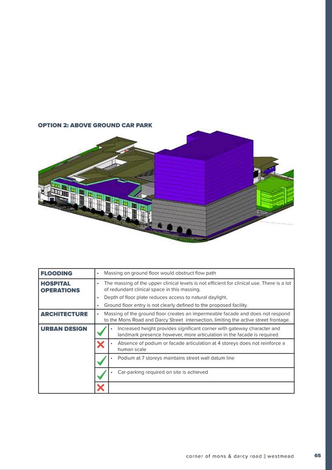
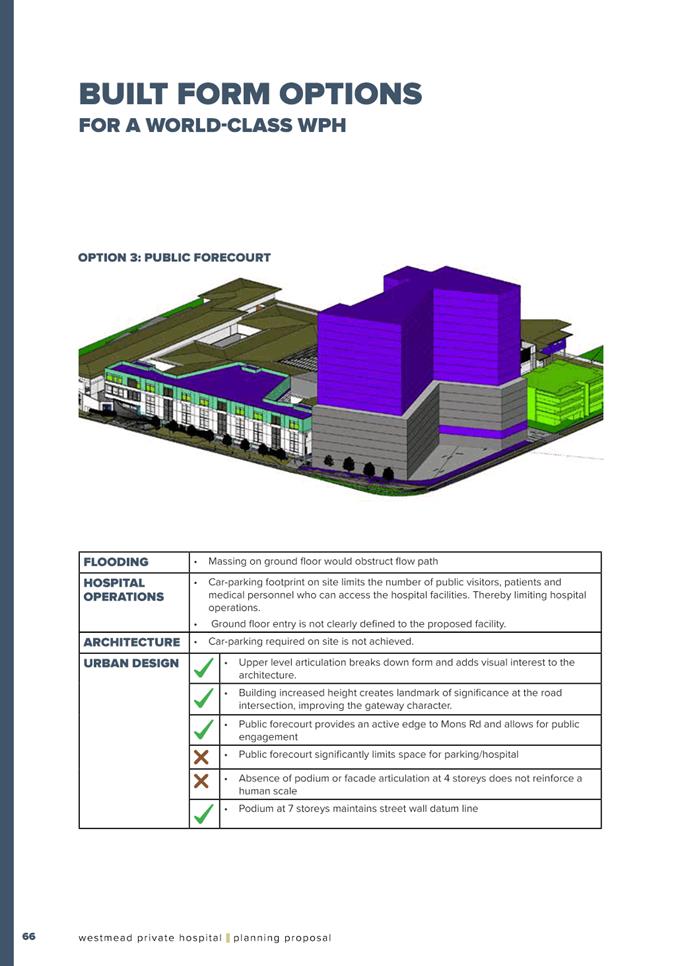
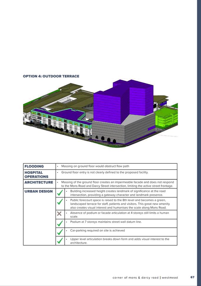
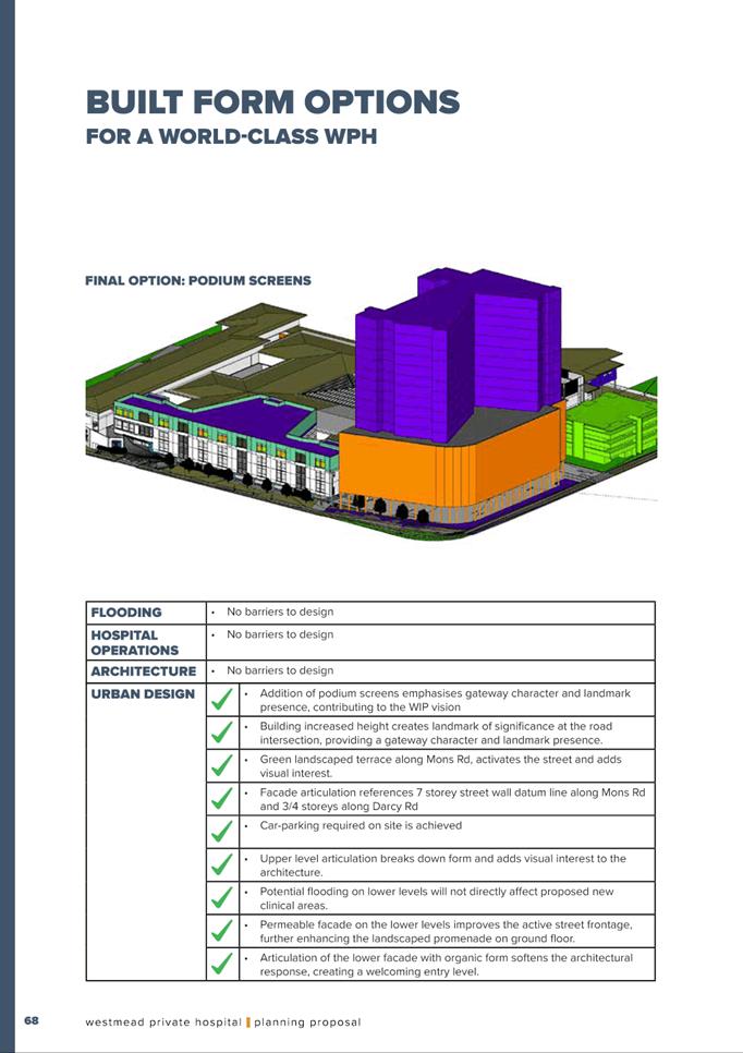
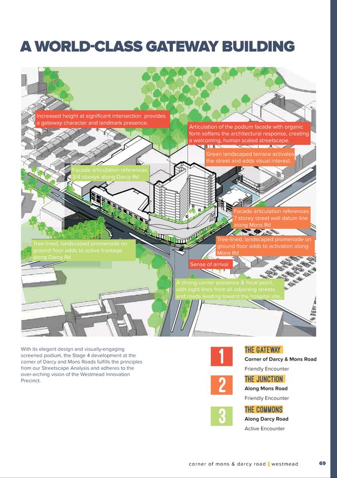
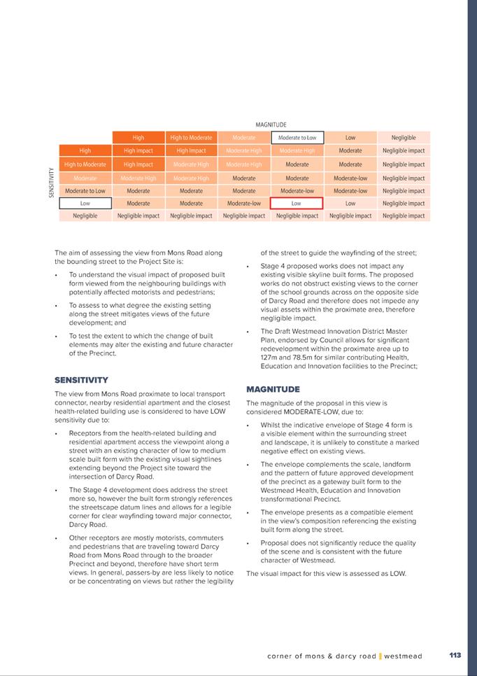
37. Council Officers have since reviewed the revised design package and do not raise any objections to the proposed height and FSR sought by the Planning Proposal in principle, subject to a number of detailed design measures being addressed as part of the draft site-specific DCP process. The following matters have been identified that can be resolved in collaboration with the applicant as part of refining the reference design and draft site-specific DCP:
a) Issues with the current reference design that need to be resolved such as the dominance of the above ground car parking, the massing and the façade design.
b) Reference design should be redesigned to improve the massing and reduce its visual dominance. Matters that could be considered to address this are as follows:
i. integrating the 8 upper levels of car parking with the 9 levels of tower into one slab building of 17 levels.
ii. extrapolating the plan form of the base for the full height of the building.
iii. aligning the building with Mons Road and Darcy Road on all levels .
iv. organising the structure and fenestration so that the 17 levels read as one building with subtle differences between the car parking and the hospital rooms. The 2 upper levels could be recessed enabling proportions of 15 levels to 2 levels. Other modulation methods that address the proportions could be considered.
v. articulating the building with vertical and horizontal elements, with a balance of openings and solids that address the street, and relate to the internal uses and orientation. A horizontal plinth would assist in seating the building and revealing the topography.
vi. ensuring that the base of the building has depth, solidity and employs robust sustainable materials.
c) Consideration of planting on the lower levels to screen the car parking as the car parking levels are the most dominant part of the building at street level. Due to the building being within a dominant location, the presentation of the lower levels needs to be carefully considered.
d) If a terrace area is required for the hospital levels, introduce a regular shaped courtyard into the upper levels along Mons Road but ensure that the building turns into Mons Road for a reasonable length so that the corner is defined and not cut away as it is in the present design.
e) Provide clear safe pedestrian direct pedestrian entrances to the ground floor facilities from Darcy Road and from Mons Road.
f) Highlight the pedestrian entrances into the building.
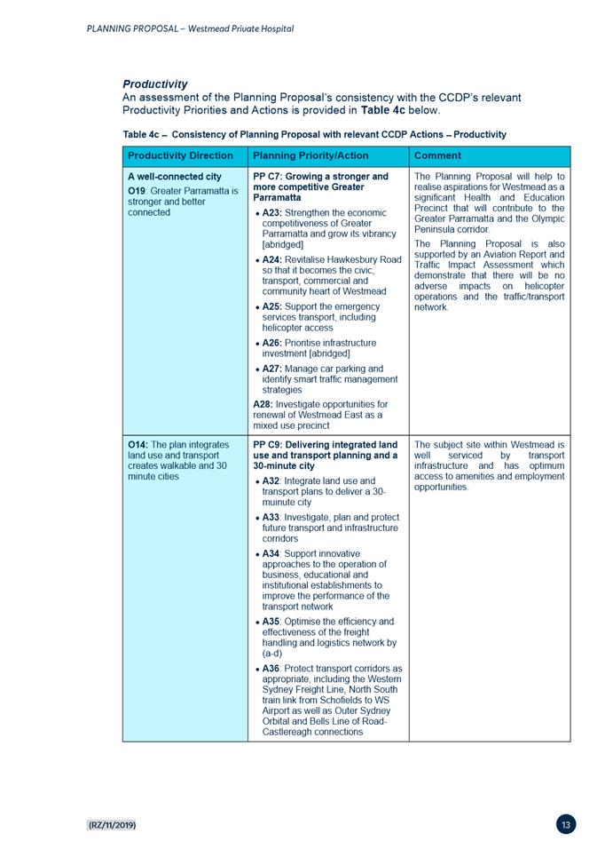
Traffic and Transport
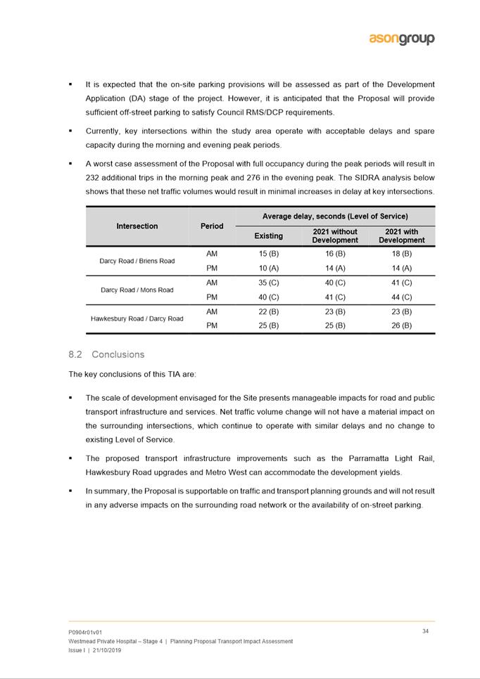
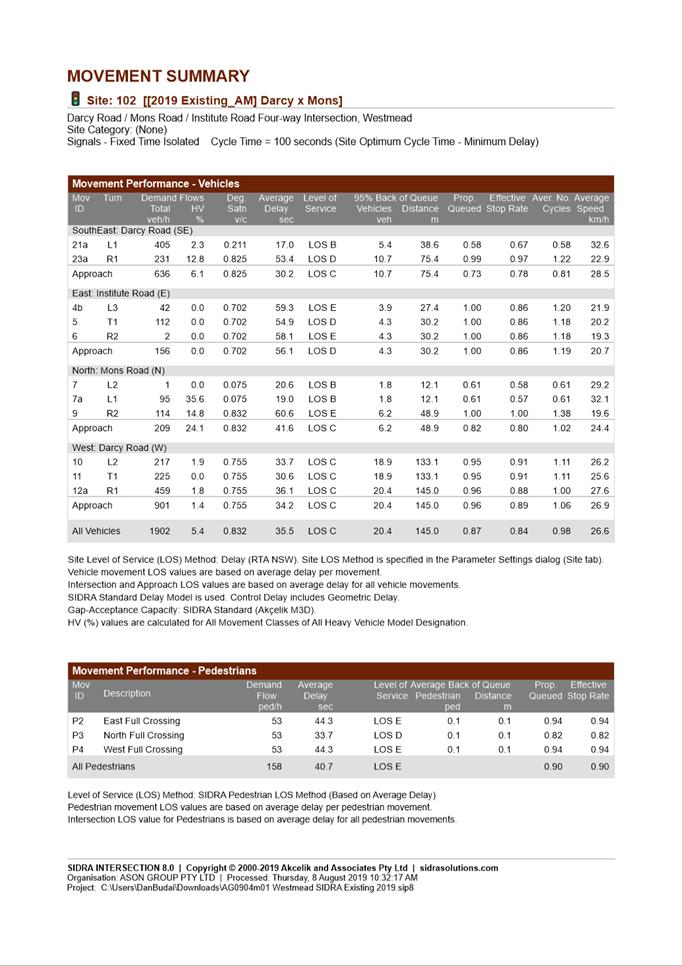
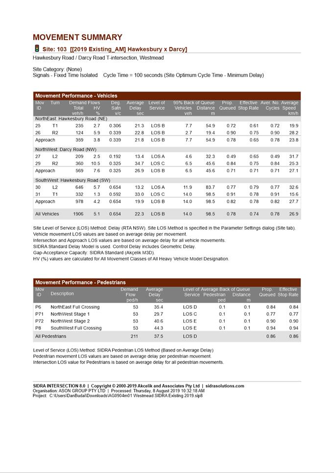
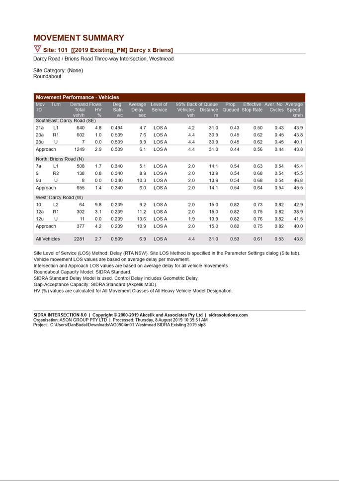
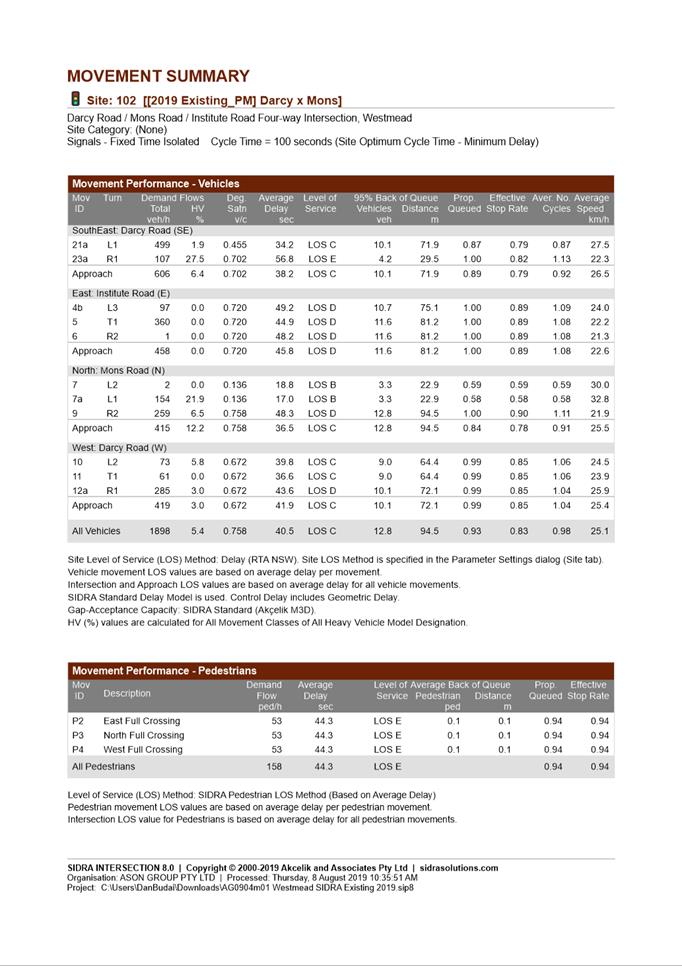
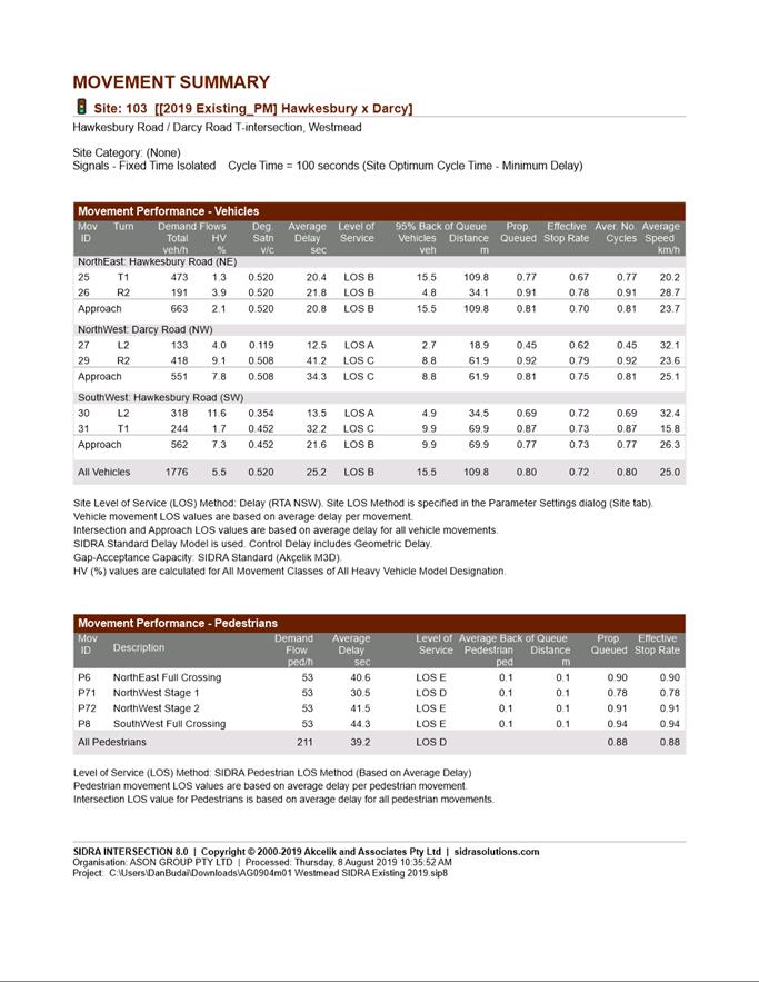
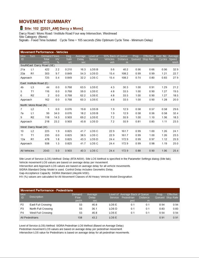
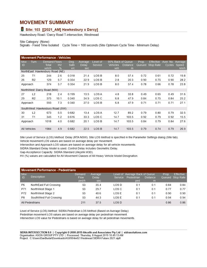
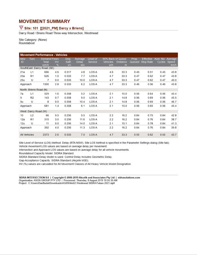
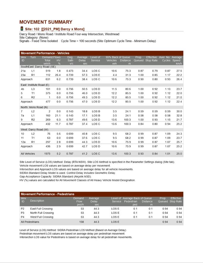
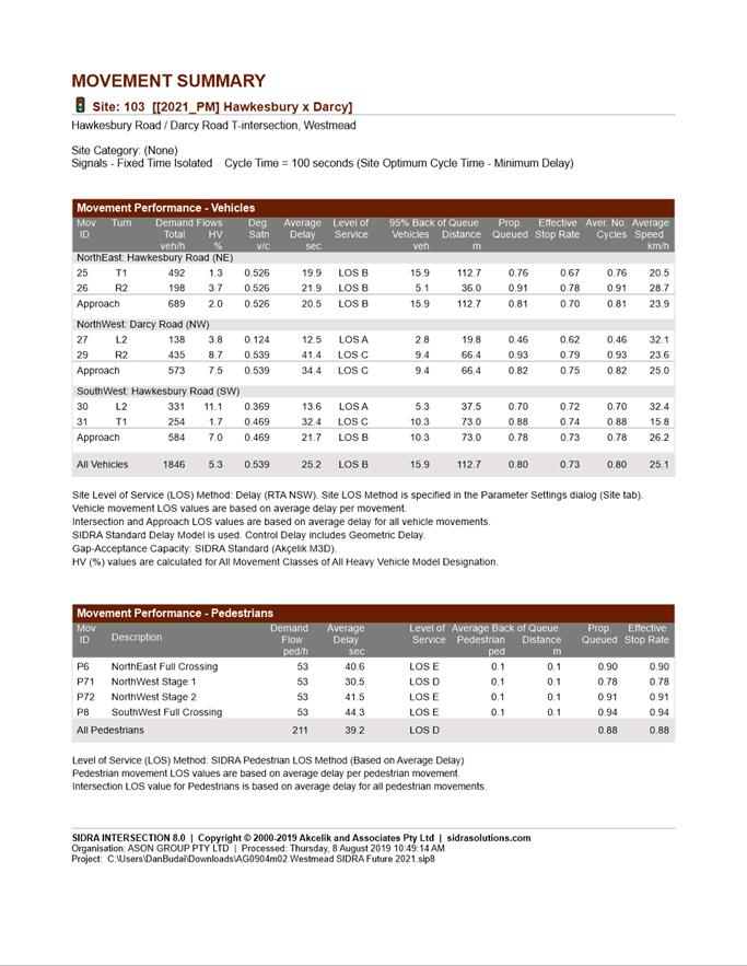
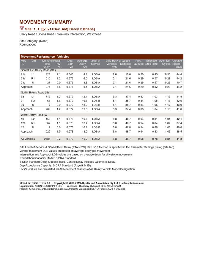
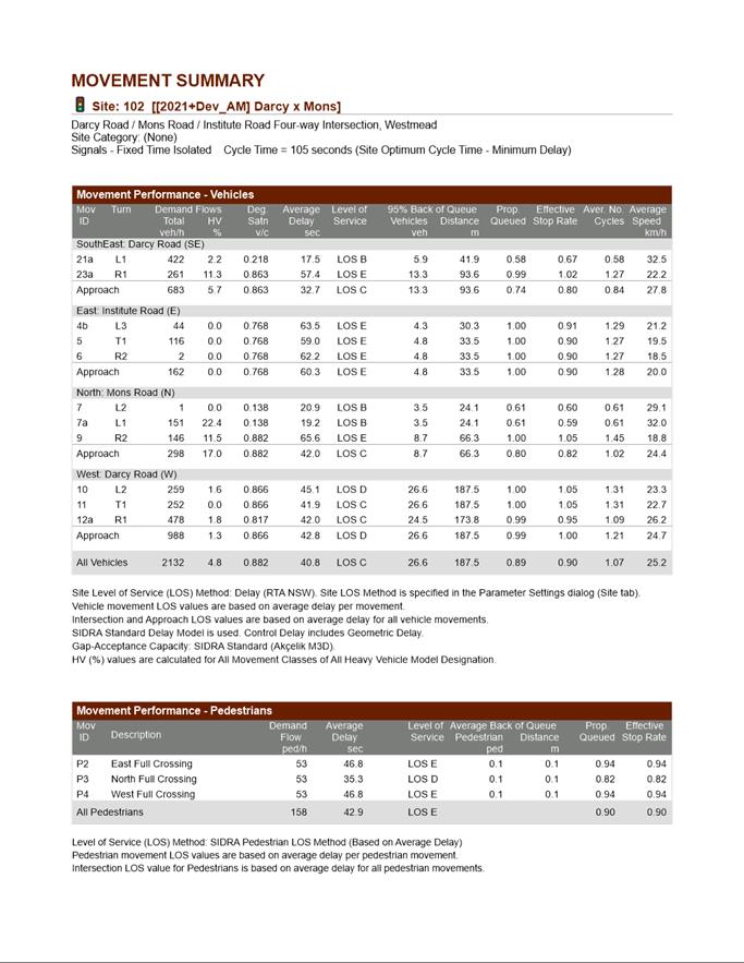
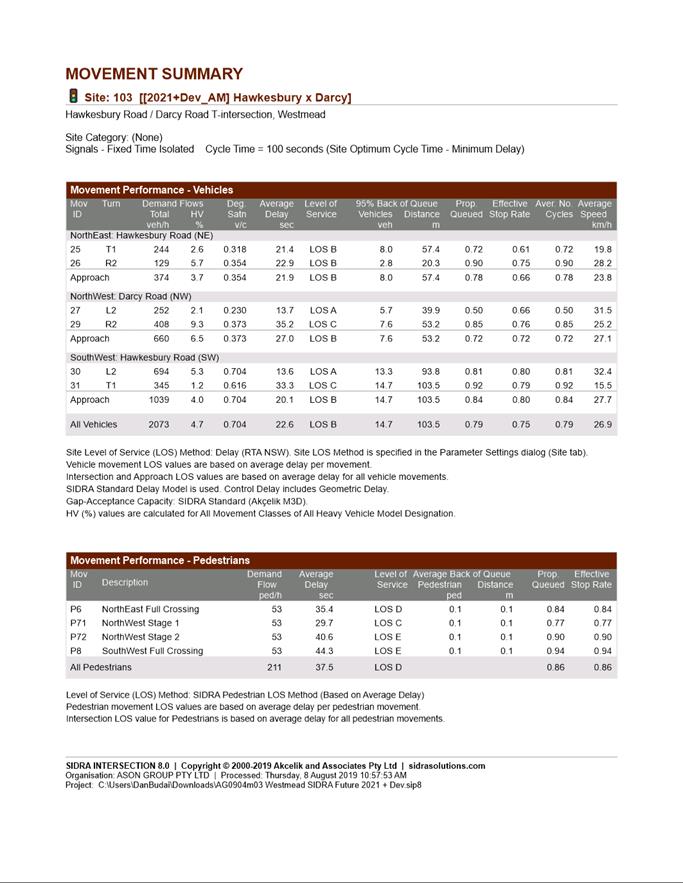
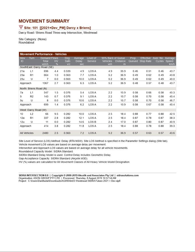
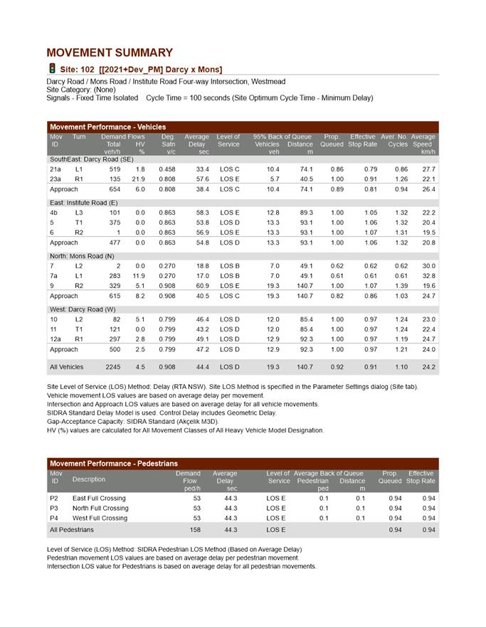
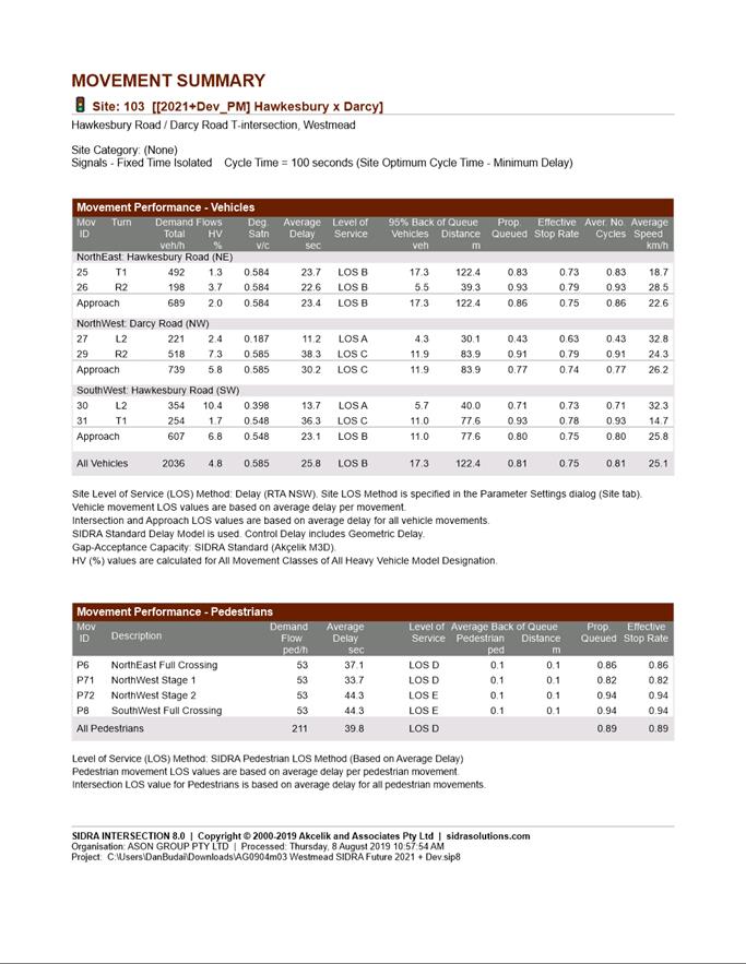
38. The Planning Proposal and associated Traffic Impact Assessment (TIA) report (prepared by Ason Group) has been reviewed by Council’s Traffic and Transport team. The TIA report assessed the performance of the key intersections within the area for the future scenario with the Proposal using the SIDRA Intersection software. The results of the modelling show that the net increase in traffic volumes would result in minimal increases in delay at all key intersections in the study area with no change in Level of Service.
39. Further, the TIA report indicates that Stage 4 will increase the overall parking numbers provided on site by 368 spaces. This exceeds the minimum car parking spaces required as set out in the Parramatta DCP which requires 352 spaces be provided (an increase of 16 spaces). The required parking provision will be determined as part of any future Development Application.
40. Following review of the Planning Proposal and associated TIA report, Council’s Traffic and Transport Team confirm that the proposal can be supported on traffic and parking grounds.
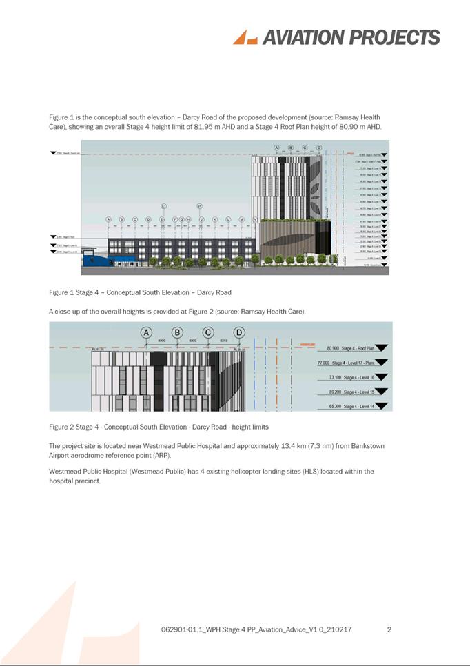
Impact of proposal on Helicopter Operations
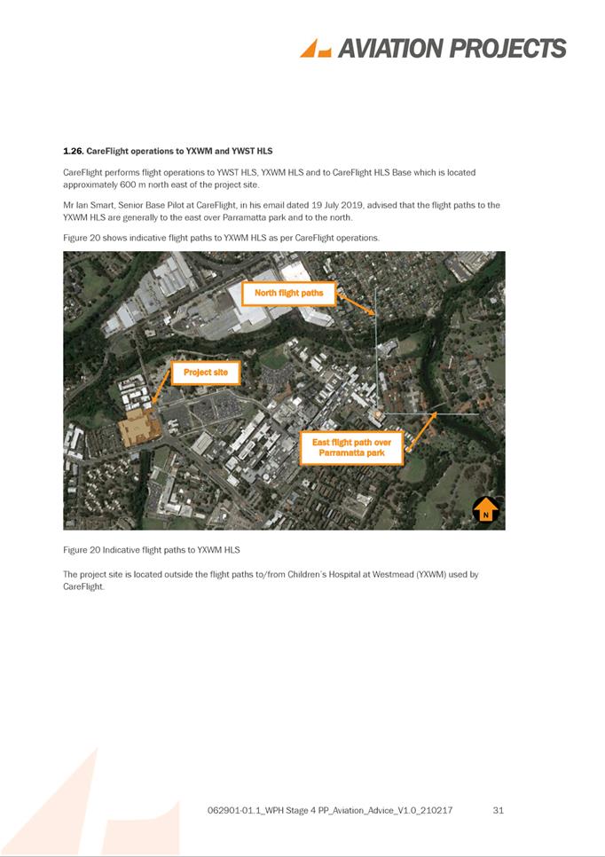
41. Preliminary consultation with the Western Sydney Local Health District (WSLHD) was undertaken regarding the proposed building height and potential impacts on Westmead Public Hospital’s helicopter operations. Advice received from WSLHD in December 2019 indicated that despite the flight path data in the applicant’s Aviation Report being outdated, the proposed building height is unlikely to affect helicopter operations.
42. The applicant has since submitted a revised Aviation Report in March 2021 (using updated flight path data) which has been provided to WSLHD for review, however a response had not been received at the time of finalising this report.
43. Should a Gateway Determination be issued by DPIE for the Planning Proposal, the WSLHD will be formally consulted with as part of the public exhibition process including seeking updated feedback on the revised aviation report.
Planning Agreement
44. Council’s Officers and the applicant have held preliminary discussions regarding the potential for a draft Planning Agreement to support the Planning Proposal.
45. These discussions flagged the opportunity for the developer to provide a contribution towards unfunded open space works identified in Council’s Community Infrastructure Strategy (CIS) and the Milson Park Masterplan (refer to Figure 7 below). The items and estimated costs referred to in Figure 7 are mapped out in Figure 8 – Milson Park Masterplan.
Figure 7: Opportunities Identified for Voluntary Planning Agreement
|
Description
Note: Location of Items shown in Figure 8 |
Works |
Estimated Cost |
Infrastructure Plan Reference |
|
19. Through site link – Darcy Road to new path through 15 Darcy Rd |
3m wide easement, 2.1m concrete path, P3 level lighting |
$155,000 + easement value over WPH land*
|
Milson Park Masterplan |
|
District playground at Shannon’s paddock |
Amenities block, regional scale play equipment area, access works |
$1,500,000
|
CIS |
|
15 & 20. Community Garden and community facilities |
Community shed, meeting rooms (serviced with power and water), bbq, shade structures, seating, potential contamination management. Initial scope identified under masterplan and CIS needs to be clarified based on site investigation and feasibility assessment |
$700,000 |
Milson Park Masterplan |
|
10. Bank Stabilisation and lookout |
30m-50m viewing deck on riverbank, seating, approximately 500m2 of bank stabilisation |
$250,000 |
Milson Park Masterplan |
|
22. New Creek Crossing and path upgrade |
2 x stone stairs, stepping stones and small sections of concrete paving |
$200,000
|
CIS and Milson Park Masterplan |
* Easement will need to be valued separately and is in addition to the $155,000
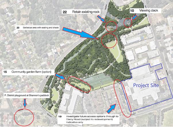
Figure 8: Milson Park Masterplan – Note: unfunded works identified in Red outline
46. It is noted that while the Planning Proposal seeks to increase capacity for Westmead Private Hospital which will provide additional health infrastructure within the Westmead Health Precinct, the location of Milson Park in close proximity to the Westmead Private Hospital would subsequently result in additional demand for use of Milson Park by patients, visitors and hospital employees.
47. It is therefore recommended that the Chief Executive Officer be authorised to negotiate a draft Planning Agreement with Westmead Private Hospital based on the works identified above as they relate to improving open space outcomes that will directly benefit the hospital as well as the broader Westmead Precinct. Further that the outcomes of the negotiation process be reported to Council to ensure that any Planning Agreement can be publicly exhibited concurrently with the Planning Proposal and draft DCP.
PLAN-MAKING DELEGATIONS
48. New delegations were announced by the then-Minister for Planning and Infrastructure in October 2012, allowing councils to make LEP amendments of local significance. On 26 November 2012, Council resolved to accept the delegation for plan-making functions and that these functions be delegated to the Chief Executive Officer.
49. Should Council resolve to proceed with the officer-recommended Planning Proposal, it is intended that Council issue a request to the Department that it be able to exercise its plan-making delegations for the Planning Proposal. If the Department agrees to this request, this means that once the Planning Proposal has been to Gateway, undergone public exhibition and been adopted by Council, Council Officers will liaise directly with the Parliamentary Counsel Office on the legal drafting and mapping of the LEP amendment. The LEP amendment is then signed by Council’s Chief Executive Officer before being notified on the NSW Legislation website.
CONSULTATION & TIMING
50. The Planning Proposal (original and revised versions) and supporting documents were referred internally to Council’s City Design, Social Outcomes, Traffic and Transport teams, and externally to Western Sydney Local Health District for comment and their feedback has informed this report.
51. At stage, no community consultation has been undertaken relating to this Planning Proposal.
52. Should Council resolve to proceed with the Planning Proposal, it will be submitted to DPIE for Gateway Determination. Community consultation will be undertaken as required by the Gateway Determination. The Planning Proposal will be placed on public exhibition in conjunction with the site-specific DCP and draft Planning Agreement.
FINANCIAL IMPLICATIONS FOR COUNCIL
53. Should Council resolve to proceed with the Planning Proposal, the costs incurred in conducting the community consultation will be covered by the Planning Proposal application fees.
54. Further, Council will be part paying for the cost of the independent flood study to a maximum of $10,000 as per Council’s Schedule of Fees and Charges. The remaining cost of the Flood Study (approximately $20,767) will be borne by the applicant.
CONCLUSION
55. This report recommends that the Planning Proposal for 12-12A, 14 & 14B Mons Road, Westmead proceed to Gateway Determination. Further that following completion of the independent flood study, that this be submitted separately to DPIE, subject to Chief Executive Officer sign off, to inform the Gateway Determination process.
56. Should the proposal proceed and a Gateway Determination be issued, the Planning Proposal will be placed on public exhibition with the site specific DCP and draft Planning Agreement (once both are reported to Council) and the outcomes of the exhibition will be reported to the Local Planning Panel if any objections are received. If no objections are received, the matter will be reported directly to Council post-exhibition.
Issa Trad
Project Officer Land Use
Michael Rogers
Land Use Planning Manager
David Birds
Group Manager, City Planning
Jennifer Concato
Executive Director City Planning & Design
|
1⇩ |
Planning Proposal - Westmead Private Hospital RZ/11/2019 |
310 Pages |
|
REFERENCE MATERIAL
ITEM NUMBER 6.2
SUBJECT PUBLIC MEETING: Post-Exhibition: Planning Proposal for land at 163-165 George Street and 1 Purchase Street, PARRAMATTA (St Ioannis Greek Orthodox Church)
REFERENCE RZ/3/2018 - D07481993
REPORT OF Project Officer Land Use
|
LANDOWNER The Hellenic Orthodox Community of Parramatta and Districts
APPLICANT Think Planners Pty Ltd
development applications considered by sydney central city planning panel
DA/469/2018 – Construction of a place of public worship comprising a Grand Cathedral, public forecourt space and associated basement parking. Approved on 6 November 2019 by the Sydney Central City Planning Panel.
PURPOSE:
The purpose of this report is to seek the Local Planning Panel’s advice to Council on the outcome of the public exhibition of the Planning Proposal for land at 163-165 George Street and 1 Purchase Street, Parramatta (St Ioannis Greek Orthodox Church).
|
|
(a) That Council notes the submissions made to the public exhibition of the Planning Proposal at 163-165 George Street and 1 Purchase Street, Parramatta, namely: i. One community submission in support of the proposal ii. One agency submission and supplementary responses objecting to the proposal (Transport for NSW) iii. One agency submission which did not object to the proposal, but did request additional work (Heritage NSW).
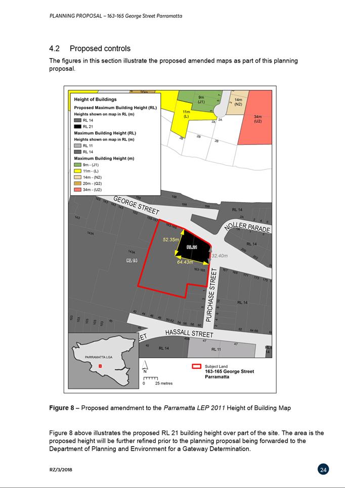
(b) That Council endorse for finalisation the Planning Proposal for land at 163-165 George Street and 1 Purchase Street (provided at Attachment 1) which amends Parramatta LEP 2011 as follows: i. amend the Height of Buildings Map from RL14m to RL21m only on the part of the site at which the proposed Cathedral is to be built, and insert provisions such that the Height of Buildings control for the part of the site with a mapped height of RL 21 can be exceeded for the purposes of a steeple or similar, but only subject to certain conditions; and ii. amend Schedule 1 subclause 10 of the Parramatta LEP 2011 to permit an additional permitted use for public car parking subject to ensuring that there is no vehicular access to this car park from George Street.
(c) That, in the event the Department of Planning Industry and Environment (DPIE) advises Council that the proposed requirement for the public carpark to only be accessed from Purchase Street cannot be included in the amendment without re-exhibition of the Planning Proposal, Council shall:- i. Advise DPIE that the amendment should proceed to be finalised without the Purchase Street access requirement being included; and ii. Delegate responsibility to the Chief Executive Officer to immediately prepare and endorse for exhibition a Draft Development Control Plan that mandates that all access for the public carpark to be from Purchase Street. The exhibition outcomes should be reported to Council to allow Council to endorse the finalisation of the Draft Development Control Plan.
(d) That, Council submit the Planning Proposal to the Department of Planning, Industry and Environment for finalisation.
(e) Further, that Council authorise the Chief Executive Officer to make any minor amendments and corrections of a non-policy and administrative nature that may arise during the plan amendment process.
|
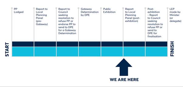
PLANNING PROPOSAL TIMELINE
THE SITE
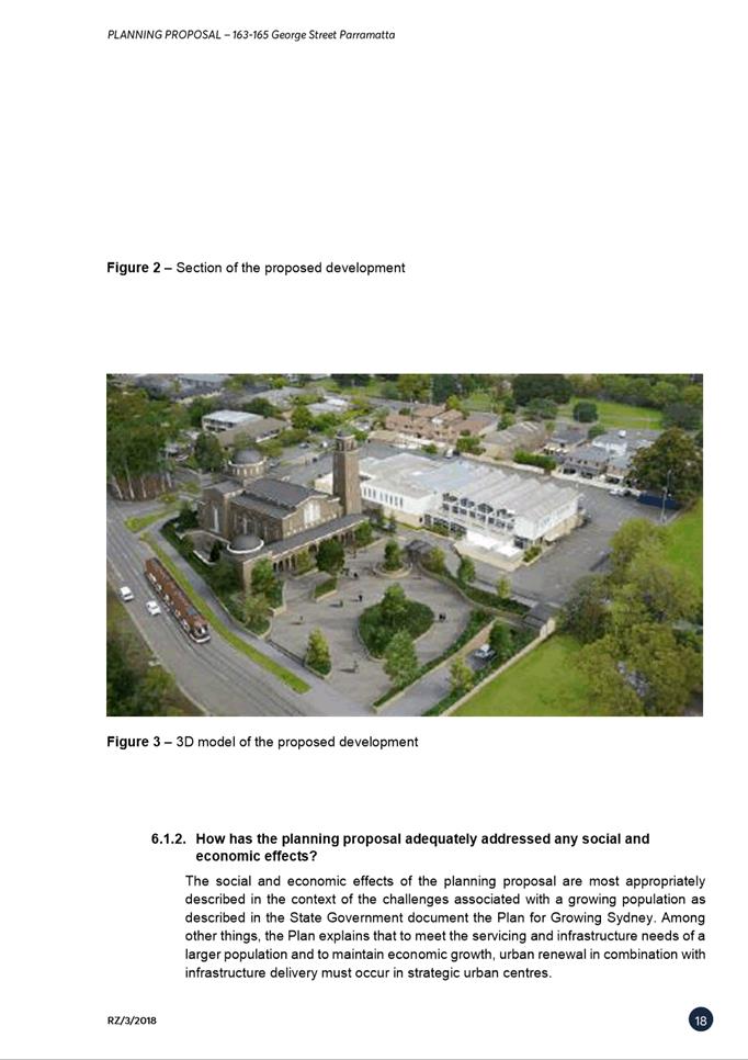
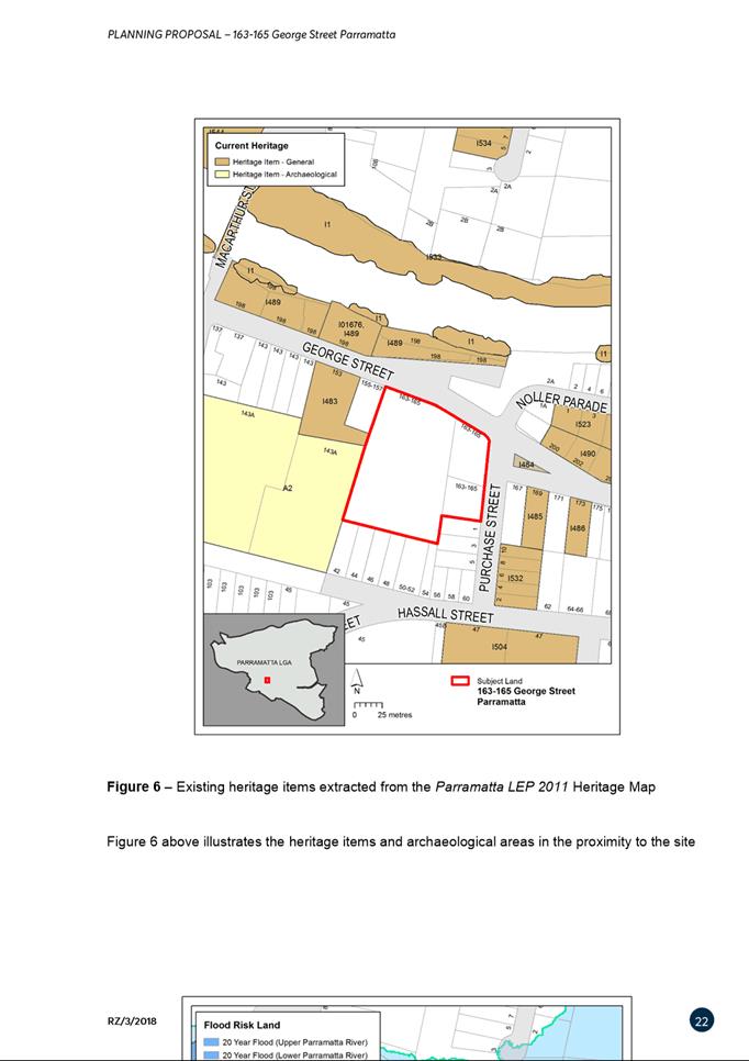
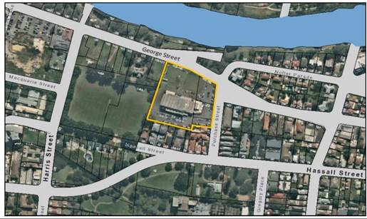
1. The site is legally described as Lot 1 in DP 78716, Lot 1 DP 113513, Lot 1 DP 650704, and Lot 3 in DP 10735. It is located at 163-165 George and 1 Purchase Streets, Parramatta and has an area of approximately 13,425 square metres (Refer to Figure 1 below). The site was formerly used as the Parramatta Workers Club and contains a large two-storey building and associated at-grade car parking. The site is currently owned by The Hellenic Orthodox Community of Parramatta and Districts and the existing building has recently been repurposed for use as a Place of Public Worship with associated community uses. A heritage listed dwelling and Robin Thomas Reserve adjoin the site to the west and 1-2 storey medium-density dwellings adjoin the site to the south.
Figure 1: Subject Site
COMPARISON OF PLANNING CONTROLS (EXISTING VS. SITE-SPECIFIC PLANNING PROPOSAL)
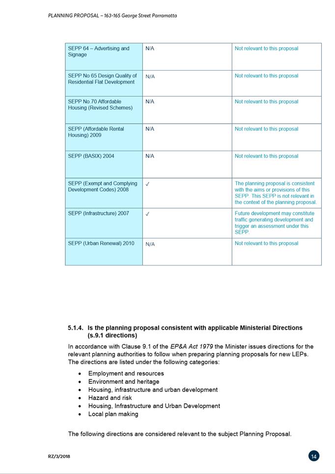
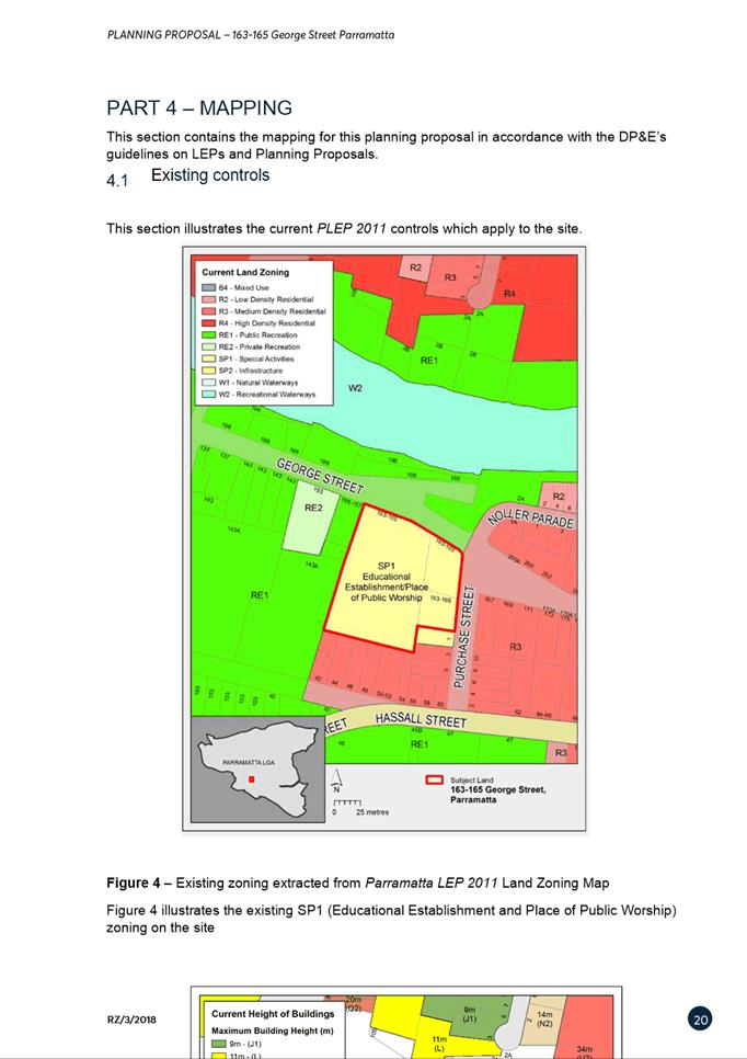
2. Table 1 outlines changes proposed under the site-specific Planning Proposal to the existing provisions of Parramatta LEP 2011. It is noted that the current zoning of the site, that is not proposed to be changed, is SP1 Educational Establishment/Place of Public Worship.
Table 1: Comparison of Planning Controls
|
|
Parramatta LEP 2011 |
Site-specific Planning Proposal |
|
Schedule 1: Additional Permitted Uses |
Centre-based child-care facilities, community facilities, function centres, office premises and restaurants or cafes. |
Amend Schedule 1 subclause 10 of the Parramatta LEP 2011 to permit an additional permitted use for public car parking.
This will be achieved via a site-specific clause which allows the car parking provided in association with any other approved use of the site to be used by other patrons as a public car park outside the peak car parking usage times for the church and ancillary uses.
This purpose of this site-specific clause is to not permit any additional car parking over and above the rates permitted for the other permissible uses. It promotes dual use of approved parking, not provision of additional parking. Please note that this Planning Proposal does not propose any change to existing parking rates.
A control is also proposed to ensure that there is no vehicular access to this public car park from George Street as a result of the submissions received.
|
|
Height of |
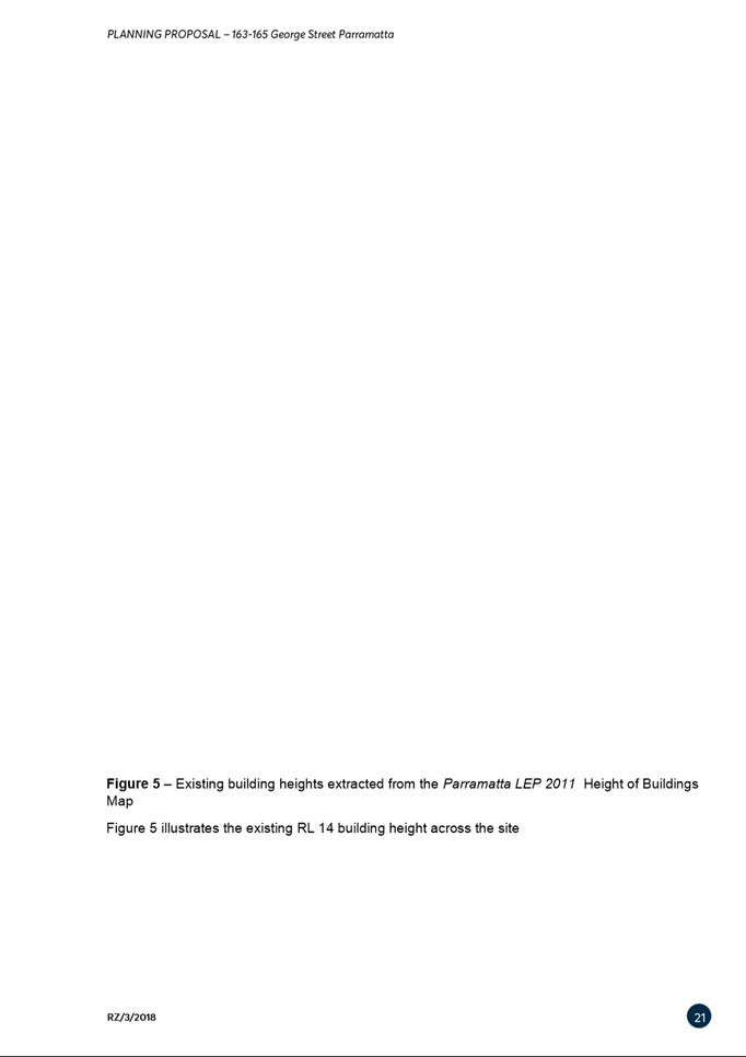
RL 14m across the whole site (noting that the height of the current building on the site is 18m, thus exceeding the existing height control by 4m or 29%).
|
Amend the Height of Buildings Map from RL 14m to RL 21m only on the part of the site at which the proposed Cathedral is to be built, and insert a sub-clause in Clause 4.3 so that the Height of Buildings control for the part of the site with a mapped height of RL 21m can be exceeded for the purposes of a steeple or similar, but only if the consent authority is satisfied that: · The part of any structure that exceeds RL 21m must relate to the use of the site as a Place of Public Worship · There is no detrimental impact on heritage items in the locality · Only comprises of decorative elements on the uppermost portion of the building including a steeple, dome and spire · Will cause minimal overshadowing · The height is no greater than RL 40m.
|
BACKGROUND
3. Since 2016, the Hellenic Orthodox Community of Parramatta and Districts has used the subject site as a place of public worship, childcare centre, school community hall and other ancillary community uses.
4. In March 2018, the Applicant lodged a Planning Proposal seeking to permit ‘car parking’ as an additional permitted use on the subject site. This would make permissible a commercial car park when the place of public worship experiences low parking demand (that is, mainly during weekdays).
5. In July 2018, a Development Application (DA/469/2018) was lodged for the construction of a Grand Cathedral, public forecourt space, multipurpose hall and associated basement car parking. Following concerns raised by the Sydney Central City Planning Panel with the height variation sought as part of the DA, the Applicant submitted:
· a revised DA which (amongst other things) removed the tallest element of the proposed development (the south-western tower), significantly reducing the overall height of the proposal; and
· an addendum to their original Planning Proposal which sought to vary the height controls as described in Table 1 of this report.
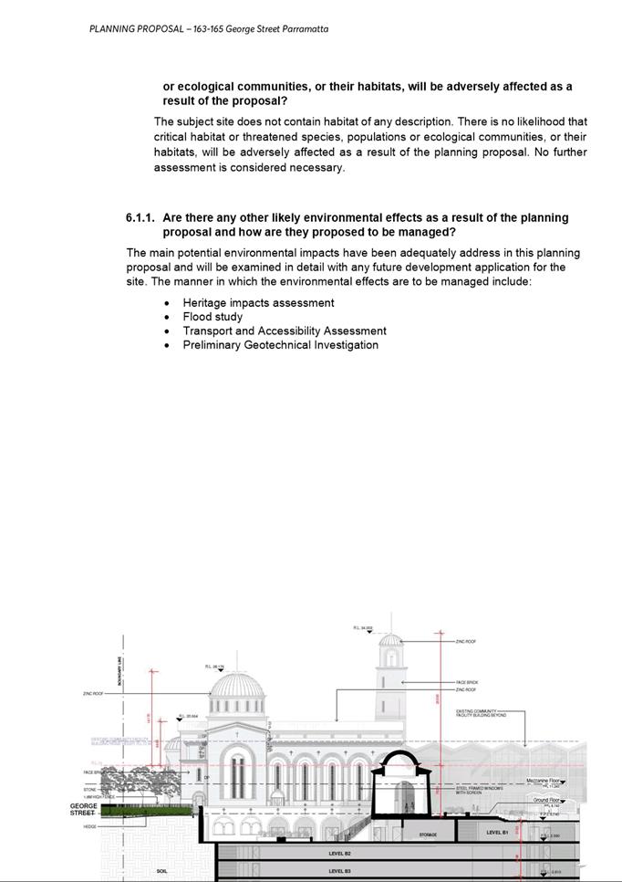
6. A comparison of the original and amended DA plans with deleted tallest tower is shown in Figure 1 and 2.
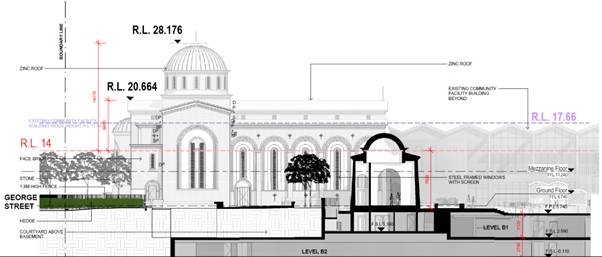
7. The amended DA/469/2018, was approved on 6 November 2019 by the Sydney Central City Planning Panel. It is noted that under the DA the majority of the approved cathedral was approved at a height just under RL 21m with part of the building, the north western tower, excluding the cross element, approved at RL 28.176m (refer to Figure 2). As a result the proposed increase in height from RL 14m to RL 21m in the Planning Proposal has become a less critical matter as approval of the DA with a height greater than the current height controls of RL 14m has already been approved. The approved DA also provides for a tower element that is consistent with the proposed clause that seeks to allow tower elements above RL 21m in certain circumstances.
8. Therefore the amended controls in the Planning Proposal will effectively allow for:-
· southwest tower element (proposed height of RL 34m) which was removed from the previous DA (included in Figure 1 but removed in the approved plans in Figure 2) to potentially be reintroduced via an amendment to the existing DA or a new DA.
· for the car parking (or some proportion of it) approved as part of this DA to be used as a public carpark in periods where the parking is not required to satisfy parking demand for existing approved uses of the site.
9. No commuter/public car parking was approved under the DA. The DA determination notice included a provision that required the submission of a car park management plan illustrating that the car park would be used exclusively for the development's occupants.
Figure 1: Extract of Northern Elevation (George Street) showing exceedance in building height (Original Plans) with
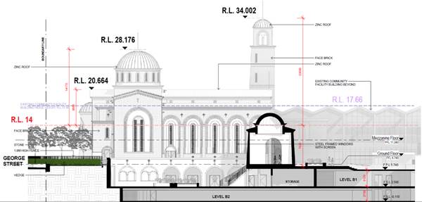
Figure 2: Extract of Northern Elevation (George Street) showing exceedance in building height (amended and approved DA Plans)
10. At its meeting of 12 August 2019, Council resolved to endorse the Planning Proposal which seeks to amend Parramatta Local Environmental Plan 2011 by:
i. Amending the Height of Buildings map from RL 14 metres to RL 21 metres, but only on the part of the site at which the proposed Cathedral is to be built;
ii. Inserting a clause so that the Height of Buildings control on the site can be exceeded for the purposes of a steeple or similar, but only if the consent authority is satisfied that the heritage impact is acceptable and the height is no greater than RL 40m; and
iii. Add car parking as an additional permitted use on the site.
11. The Planning Proposal was forwarded to the Department of Planning, Industry and Environment (DPIE) requesting a Gateway Determination. With the Applicant’s agreement, the Planning Proposal that was forwarded to DPIE included a clarification that the additional permitted use for ‘car parking’ is not to permit any car parking over and above the rates permitted for the other permissible uses. This is so the Planning Proposal can facilitate the dual-use of approved car parking, but not provide for any additional car parking.
12. DPIE issued a Gateway determination on 25 November 2019 that authorised Council to be the plan- making authority. The Planning Proposal was subsequently exhibited. This report addresses the outcomes of that public exhibition and makes recommendations about progressing this Planning Proposal.
PUBLIC EXHIBITION
13. The Planning Proposal was publicly exhibited from 22 January 2020 to 21 February 2020. The documents exhibited were:
· Planning Proposal
o Appendix 1: Traffic Statement
o Appendix 2: Heritage Referral
· Report and Minute: Council’s August 2019 Meeting
· Report and Minute: Local Planning Panel’s June 2019 Meeting
· Gateway Determination, November 2019.
14. The exhibition materials were available online at Council’s website, as well as in hard-copy at Council’s Customer Contact Centre at 126 Church St and Council’s main library at 1-3 Fitzwilliam Street.
15. Adjacent and nearby non-Council owned properties were advised of the exhibition.
16. Three submissions were received in response to the exhibition, comprising two from State agencies and one community response. A summary of submissions and Council officers’ response are provided in Table 2 below.
Table 2: Summary of submissions and Council officers’ response
|
Issues Raised |
Council Officer Response |
|
Transport for NSW |
|
|
Transport considers that the nature of this additional use is not an ancillary use to the dominant use of the site as the car parking will be predominantly commercially operated and provides parking beyond what is reasonably required to support the dominant use and principal purpose of the future development on site (place of worship). It is also noted from the indicative architectural drawings that the proposed car park would be intended to occupy a substantial proportion of the site. In such circumstances, the development could be described as a mixed use development which may not be aligned with the objectives of the zone. Council may wish to refer to practice note PS 13-001: How to characterise development issued by DPIE. |
The quantum of car parking has already been approved via a DA process associated solely with the already-permissible uses onsite. The car parking under the current approval cannot be used as a public car park because this is not currently a permitted use of the site.
The Planning Proposal allows for this parking to be made available to members of the public at times when demand for parking associated with the Place of Public Worship and related uses is low.
It is acknowledged that using the already-approved spaces on additional days of the week (i.e. weekdays) would introduce new traffic impacts. However, a future DA process will examine those impacts, and, therefore, the quantum of spaces which may be appropriately used in this dual manner.
It is acknowledged that the nature of this additional use for public car parking is not an ancillary use to the dominant use of the site. However, the Planning Proposal seeks an additional permitted use. It is not necessary with any additional permitted use that it be deemed ancillary. Instead the test is that the additional permitted use has strategic merit.
The use of parking that will exist to service peak demand for the cathedral at times where it is under utilised by the uses of the cathedral is an efficient use of the parking provided. One of the actions of Council’s Draft CBD Parking Strategy is to seek secondary car parking sites outside the CBD in locations with public transport links to the CBD. It is considered that this proposal is consistent with the principle that underpins this action and therefore is considered to have strategic merit.
Concern would be raised about the creation of a standalone commercial parking station on the site due to the precedent that could result in unsatisfactory amenity impacts in the form of increased noise and traffic. However, allowing dual use of church parking so it can be used by the public at times of low church demand (i.e. weekdays) is considered appropriate.
Maximising the efficiency of use of the car park is appropriate as the subject site is in close proximity to a future Parramatta Light Rail stop. Due to this, the public can avoid driving into the core of the CBD as the proposed public car park fosters park-and-ride options and helps to reduce congestion in the CBD core.
The use of the site for weekday car parking is not considered to be contrary to zone objectives. This use does not result in any increased parking space being provided on site. The proposed public carpark site will use only spaces approved for other permitted uses of the site. It will not conflict with the special character of the site or its intended special use. The scale at which the car park can operate will be determined after assessing the impacts on adjoining land and the local road network in a future DA process.
Given the strategic merit and the ability to determine the appropriate scale and impacts at DA stage the additional permitted use is considered appropriate in this case. |
|
The description of public car park does not reflect the intended nature of the car parking development. An accurate description of the proposed car parking is a commercial car park. |
Neither “public car park” or “commercial car park” are legally-defined land use terms in PLEP 2011. The exact language used in the amendment will be determined at drafting stage, and this drafting language should reflect the intent of the Planning Proposal. |
|
The proximity and configuration of the predominantly commercial car park that would be facilitated by the Planning Proposal would likely result in direct and potentially unmanageable impacts on the Parramatta Light Rail (PLR) operations, including safety.
The proposed additional use of a car park of this scale will fundamentally alter traffic and pedestrian activity in the vicinity of the PLR. There would be significant increases in flows of vehicular traffic adjacent to and across the PLR. This traffic is proposed to be uncontrolled at the George Street entry/exit. The traffic and parking assessment report has not taken into consideration the future road network changes and traffic condition changes – especially in relation to the PLR currently under construction.
Furthermore, proposed vehicular access will need to consider access management principles of ISEPP 2007; that is access should be from a road other than the classified road. It is noted that the architectural drawings, as an appendix to the traffic report accompanying the subject proposal, indicate a new vehicular access located at the northwest corner of the subject site on George Street which is in conflict with these principles. Should the planning proposal proceed, despite TfNSW’s concerns, we request a site specific Development Control Plan (DCP) is prepared to set out the access arrangements to align with ISEPP 2007; the vehicular access should be on Purchase Street towards the southern end of the site to prevent vehicles queuing back to the intersection with George Street. |
It is intended that this issue be addressed by imposing a requirement that all access for vehicles utilising the “public car park” can only be from Purchase Street to minimise the direct impact on light rail from the additional permitted use.
The remainder of the impacts on the road network surrounding the site and the operation of light rail needs to be properly assessed as part of a Development Assessment process. It is possible if the impacts are sufficient that the capacity of the public car park would be restricted to ensure the impacts of the public car park operation are appropriate.
The application of this control without re-exhibition of the Planning Proposal was discussed with Officers from the Department of Planning Industry and Environment who advised that this could be considered. In the circumstances that the Department consider this issue and determine that re-exhibition is necessary then Officers recommend that a Draft DCP be pursued to ensure the TfNSW request is ultimately pursued in some format.
With access limited to Purchase Street the suitability of the site to operate the public carpark to align with ISEPP 2007 can be considered as part of the DA. It is possible that in order to ensure the impacts on the road network and operation of the PLR that the number of spaces able to be used for public parking may be limited as part of that approval process.
An alteration to the Gateway determination issued by DPIE on 26 March 2021 requires the Planning Proposal to be finalised by 25 November 2021.
Council Officers support this amendment to the Planning Proposal, for further consideration by DPIE, without re-exhibition in this case given:-
|
|
The traffic and parking assessment has also not provided an adequate assessment on the local infrastructure requirements such as footpath widths, crossing points and increased waiting areas on footpaths at nearby intersections. It is important to understand these issues considering the future light rail and other enabling infrastructure works immediately adjacent to the subject proposal |
As above, these matters would need to be considered as part of a DA process associated with introducing the additional use.
|
|
The subject site fronts George Street that forms part of the PLR network. The subject section of George Street and a section of Purchase Street have been declared a Transitway under the Roads Act 1993. Any future development applications on the subject site, would need to take into account the construction and operational phase of the PLR project (particularly relating to vehicular access), as there will be intermittent, short and long term road closures and changes to the road network operation. |
Noted. As indicated previously a control is proposed to be included requiring access to any public car parking to be via Purchase Street to minimise impact on the PLR project from the proposed public car parking use. |
|
Transport for NSW objects to the subject proposal being finalised in its current form.
Subject to outstanding issues (addressed in a detailed attachment to the submission) being resolved, TfNSW would be willing to reconsider this position.
|
Noted. |
|
Supplementary 1: TfNSW and the proponent have discussed the proposal. The proponent has indicated an intention to continue discussion with Council pursuing the option of having the ceremonial vehicle entry via the proposed Robin Thomas Reserve car park. The option for all vehicles to access via Purchase Street was not considered acceptable by the proponent and the proponent has not agreed to the same. TfNSW’s objection remains unchanged. |
As indicated above, access for the use the subject of this Planning Proposal (ie the public carpark) will be limited to Purchase Street consistent with the TfNSW request.
TFNSW have made it clear they will not allow access from George Street to this site notwithstanding the Development Application Approval.
The applicant had suggested to Council that to satisfy TfNSW concerns there may be an option to access their site from George Street via the Council owned Robin Thomas reserve adjoining the site. This option has been unequivocally dismissed by senior Council Officers as it would be an inappropriate use of publicly owned land and for reasons outlined as follows:
· Loss of five spaces in what is already a small public car park · Not acceptable to have funeral vehicles and vehicular processions at Cathedral scale using and occupying the same space as reserve visitors. Informal, passive and family use of the park is not compatible with processional, Cathedral use. · The fixed phase of the PLR signals and proposed give way to Cathedral vehicles means that all other vehicle using a public car park will be delayed by Cathedral vehicles having first right turn egress. This is not acceptable. · The church is not a local parish church, it is a major cathedral of great importance. If permanent access is granted, there is likely to be significant growth in use, and continuing pressure for the Council to allow a higher intensity of access, exacerbating the matters raised here. · There is no broad public benefit in Council creating a permanent easement for Cathedral access over Robin Thomas Reserve. The reserve has been dedicated for public recreation and private access is not compatible with the reserve function or purpose.
|
|
Supplementary 2: TfNSW reconfirms the previous submission and reiterates their objections. The approved DA was not referred to Roads and Maritime Services (now TfNSW), nor were ISEPP matters applied. If this process had been followed, alternative access via the local road network (Purchase St) would have been identified and no concurrence would have been given.
The DA requires submission of a driveway crossing application, which would require concurrence. This is unlikely to be granted, so TfNSW suggests a modified DA is pursued that reflects revised access. TfNSW is concerned that the approval of the Planning Proposal would mean that the proponent could seek development approval for a change of use with minimal or no other changes to the approved DA, meaning that TfNSW would have little influence in the process.
If a DA (either a modification of existing or new) were approved, it would exacerbate matters to be considered under the ISEPP at the George St driveway where it impacts safety, efficiency and operation of the classified road associated with PLR.
|
Objection noted and DPIE will need to finalise plan. These concerns repeat those in previous submission and have been addressed in preceding sections. Note objection and that DPIE will need to finalise plan (i.e. we can’t even though the Gateway said we could be the plan making authority)
The statement that the approved DA was not referred to TfNSW is not considered correct. TfNSW in a letter dated 21 October 2019 advised that having undertaken an assessment of the information provided in accordance with the provisions outlined in the ISEPP had decided to grant concurrence to the subject development.
The letter of concurrence included the statement that:
The proposed development is located within 25m of the Parramatta Light Rail and includes excavation deeper than 2m, which requires concurrence from TfNSW in accordance with Clause 86 of the State Environmental Planning Policy (Infrastructure) 2007 (ISEPP). Clause 86 of the ISEPP requires TfNSW to take into consideration: (a) the potential effects of the development (whether alone or cumulatively with other development or proposed development) on: i. the safety or structural integrity of existing or proposed rail infrastructure facilities in the rail corridor, and ii. the safe and effective operation of existing or proposed rail infrastructure facilities in the rail corridor, and (b) what measures are proposed, or could reasonably be taken, to avoid or minimise those potential effects
The concurrence letter was one of the actions that led to finalising of the DA. TfNSW have since advised that their concurrence did not cover the PLR Transitway corridor. Notwithstanding TfNSW have not challenged the validity of the approval. TfNSW have however advised the applicant of the DA as well as Council that they will not be supporting the use of George Street for access to this site.
The newly expressed concern that a future Development Application for the public car parking could be approved without the matter having to be referred to TfNSW to allow them to assess the impact on PLR and the operation of the road network is not considered valid. It is the opinion of Council’s Development Assessment Planning team that the matter would be referred to TfNSW. Depending on the nature and the detail of the application ultimately lodged there may also be a concurrence role for TfNSW.
|
|
Heritage NSW (delegate of Heritage Council of NSW) |
|
|
Although there are no heritage items of State or Local significance on the subject site, the site is immediately adjacent to the State Heritage Register listed ‘Ancient Aboriginal and Early Colonial Landscape’ (SHR 01863) located at Robin Thomas Reserve. This site is a highly significant cultural landscape which has contributed to an understanding of pre-colonial Aboriginal occupation. |
Noted. |
|
The proposed use and increase in height on the site are likely to result in increased excavation, which is likely to cause disturbance and removal of any rare and significant archaeology which might survive at this location. While review of the Parramatta Historical Archaeological Landscape Management Study (PHALMS) indicates this land allotment has no archaeological potential, more recent findings at a nearby site showed both Aboriginal archaeological evidence and evidence of early colonial military occupation. This suggests that PHALMS may need to be updated. Heritage NSW requests that Council ask the proponent to prepare both historical and Aboriginal archaeological assessments at Planning Proposal stage. Heritage NSW also requests that the proposal be referred to the Greater Sydney Planning Team (DPIE) for review under the National Parks and Wildlife Act 1974 in relation to Aboriginal archaeology. |
The existing planning controls at this site already allow for significant ground excavation and, therefore, potential disturbance of archaeology. To illustrate, the approved DA for the Cathedral development allows for 6 levels of basement car parking to be constructed (approximately 17m depth from ground level on approved plans). It is also noted that this DA contains as a condition the following:
“89. If any European archaeological relics are discovered (or are believed to be discovered) during works, the works must cease and the NSW Office of Environment and Heritage must be notified, in accordance with the NSW Heritage Act.
If any Aboriginal archaeological relics are discovered (or are believed to be discovered) during works, the works must cease and the NSW Office of Environment and Heritage must be notified, in accordance with the NSW National Parks and Wildlife Service Act.”
The Planning Proposal facilitates two changes: firstly, dual-use of already permissible parking spaces, and secondly, an increase in height on a limited portion of the site.
To the first issue, making already-permissible parking spaces useable more of the time by facilitating dual-use is not considered to introduce any notable new impacts on archaeological matters. This is because construction of these parking spaces is already permissible under existing controls (and, as noted above, already approved via a DA process).
To the second issue, the additional height made possible by the proposal is only allowable on a limited portion of the site and only for decorative elements – i.e. no additional density is permissible. The area of the site on which the Applicant is seeking to build a taller tower (refer Figure 2 of this report) is situated above six levels of basement car parking which is already approved for construction. Therefore, it is not considered that this would introduce any notable new impacts on archaeological matters. While there is a chance that the building design could change such that the tower is not entirely situated above car parking, this would be examined through a new DA process which would consider any potential archaeological impacts in light of the specific development being proposed.
Due to the above considerations, it is considered that any archaeological impacts can be managed considered through a DA process, and the necessity of the additional reports and referrals requested by Heritage NSW can be considered at that stage. |
|
The proposed grand cathedral would occupy a prominent corner location along George and Purchase Streets, in the north-eastern corner of the site. The height increase would be limited to this portion of the site, which would minimise visual impacts to adjacent heritage items to the west. The current design scheme includes two steeples/domes with a maximum height of RL 34, excluding the spire on the dome. As cathedral steeples are typically narrow in form and do not dominate view corridors, we do not consider that this would have a significant heritage impact. However, further design refinement should aim to minimise overshadowing and visual impacts on nearby State and Local heritage items and Heritage Conservation Areas. |
As indicated previously in this report a Development Approval has been granted for a Cathedral at this site with one of the steeple structures removed.
The real impact of this Planning Proposal will be to guide the assessment of any application for the second steeple to be approved via an amendment to the existing approved DA or via a new DA.
As indicated in Table 1 the controls to be introduced to guide future decision making include criteria that will be used to assess future applications and the criteria include consideration of heritage impacts. |
|
Prior to finalisation of the planning proposal, Council should be satisfied that all necessary due diligence, assessments and notifications have been undertaken. |
Noted. |
|
Community Submission |
|
|
The submission supported the Planning Proposal, expressing the view that development in the area associated with community participation, inclusion and social value was preferred over a block or units or tower office block. |
Noted. |
17. While preparing this post-exhibition report, Council officers identified that they had previously given an undertaking to the National Trust to notify them of the exhibition of the Planning Proposal. Council officers wrote to the National Trust in June 2021 and provided them 28 days to comment on the exhibited materials. No response has been received from the National Trust.
OTHER ISSUES
Exhibition issue
18. The Gateway Determination required that prior to community consultation the Planning Proposal was to be amended to ensure two maps were legible. Due to an administrative oversight, this did not occur. Nonetheless, Council officers recommend this Planning Proposal for progression for the following reasons:
a. One map with visibility issues related to the existing PLEP 2011 Height of Buildings controls. The existing controls are described in the Planning Proposal document, and a map showing these controls was also included in the Local Planning Panel report exhibited alongside the Planning Proposal. In addition, PLEP 2011 maps are always available for public viewing via the NSW legislation website.
b. The other map with visibility issues related to a map illustrating the extent of flooding at this site. However, no changes to any flood-related controls or maps are proposed as part of this Planning Proposal. Furthermore, the flood affectation of the site was generally described in the Planning Proposal, and a map extracted from Council’s internal GIS system showing the flood affectation was also included in the Local Planning Panel report exhibited alongside the Planning Proposal.
c. None of the submissions raised any issues with mapping visibility.
d. As the Gateway condition relating to mapping visibility was not met, Council is not able to exercise its delegation for plan-making. Plan-making responsibility will lie with DPIE, and DPIE will need to consider this issue as part of its plan-making. However, Council officers have already consulted with DPIE officers relating to these issues, and DPIE officers have advised that in their view re-exhibition is not required.
Identification of potential drafting issue
19. The exhibited Planning Proposal’s Objectives or Intended Outcomes section states that the objective is to establish a “commercially operated car park”. The Planning Proposal’s Explanation of Provisions section includes a discussion of permitting an additional use for “public car parking”.
20. Parramatta LEP 2011 does not contain formal land use definitions for the terms “commercially operated car park” or “public car parking”. Therefore, appropriate drafting language that meets the objectives of the Planning Proposal will need to be resolved when that stage in the plan-making process is reached.
CONCLUSION AND NEXT STEPS
21. As discussed in this report, Council officers consider that Council cannot exercise its delegation for plan-making, due to the agency objection from TfNSW as well as the administrative error relating to map legibility in the exhibited Planning Proposal. Therefore, DPIE will be the plan-making authority.
22. It is recommended that the Local Planning Panel consider the Council officer recommendation to Council to endorse and forward the Planning Proposal to DPIE for finalisation in the Panel’s advice to Council.
CONSULTATION & TIMING
Stakeholder Consultation
23. The following stakeholder consultation has been undertaken in relation to this matter:
|
Date |
Stakeholder |
Stakeholder Comment |
Council Officer Response |
Responsibility |
|
22 January 2020 - 21 February 2020 |
Public and agency consultation |
As described in this report |
As described in this report |
City Planning |
|
Q2 2021 |
Follow-up consultation with TfNSW |
As described in this report |
As described in this report |
City Planning |
|
8 June 2021 (providing 28 days) |
National Trust |
As described in this report |
As described in this report |
City Planning |
Councillor Consultation
24. The following Councillor consultation has been (or will be) undertaken in relation to this matter:
|
Date |
Councillor |
Councillor Comment |
Council Officer Response |
Responsibility |
|
Standard briefing approx. one week prior to Council meeting |
TBD |
TBD |
TBD |
City Planning |
FINANCIAL IMPLICATION FOR COUNCIL
25. There is no accompanying Planning Agreement for this Planning Proposal, as it does not include an increase to permissible density at the subject site. There are no direct financial implications for Council as a result of this Planning Proposal.
Paul Kennedy
Project Officer Land Use
Robert Cologna
Land Use Planning Manager
David Birds
Group Manager, City Planning
Jennifer Concato
Executive Director City Planning and Design
|
1⇩ |
Planning Proposal |
27 Pages |
|
ITEM NUMBER 6.3
SUBJECT PUBLIC MEETING: Post-Exhibition - Planning Proposal for land at 14-16 Hill Road, SYDNEY OLYMPIC PARK (Sekisui Site)
REFERENCE F2016/02347 -
APPLICANT/S Sekisui House Pty Ltd; Sutherland & Associates Planning
OWNERS SH HOMEBUSH PENINSULA PTY LTD
REPORT OF Project Officer Land Use
Development applications considered by Sydney central city planning panel
2017SWC107 (DA/763/2017) Phase 1 Construction of three residential flat buildings for 362 dwellings above a residential podium sleeved with internal parking – approved 6 June 2018.
PURPOSE
To advise on submissions received during the public exhibition of the Sekisui Planning Proposal, Draft Amendment to Wentworth Point Development Control Plan (DCP) and Draft Planning Agreement and respond to the issues raised. The report recommends that the amended Planning Proposal and Amended DCP be forwarded for Council’s consideration. The Planning Agreement will be put directly to Council.
The Local Planning Panel, consider the following Council Officer recommendation in the Panel’s advice to Council:
(a) That Council endorse the Sekisui Planning Proposal for land at 14-16 Hill Road, Sydney Olympic Park finalisation (provided at Attachment 2 and referred to in this report as the Sekisui Planning Proposal) for finalisation that seeks to amend Auburn Local Environmental Plan (LEP) 2010 (or the Harmonised Parramatta LEP 2021 if notified) as follows:
i. Increasing the RE1 Public Recreation zone with a corresponding reduction of the R4 High Density Residential zone and introducing the B4 Mixed Use zone at the north-eastern corner of the site.
ii. Amending the Height of Buildings Map to provide a range of heights across the site from 44m to 134m (up to 40 storeys).
iii. Amending the FSR map to provide individual FSRs for the development parcels to reflect the previously approved gross floor area (GFA) of 188,800sqm.
iv. Amending the Land Reservation Acquisition Map to reflect the larger RE1 Public Recreation area and exclude the foreshore wharf from public acquisition to facilitate its refurbishment and operation as a café under the existing community title.
v. Introducing an additional local provision under Part 6 of the LEP to cap the overall floor space to a maximum of 188,800sqm and limit the amount of retail floor space to a maximum of 2,000sqm.
vi. Introducing an additional permitted use (APU) under Schedule 1 of the LEP to permit ‘food and drink premises’ as a permissible use in the RE1 Public Recreation zone where the café is located within the site.
(b) That Council forward the Sekisui Planning Proposal to the Department of Planning, Industry and Environment (DPIE) for finalisation.
(c) That Council approve for finalisation the amendments to the Wentworth Point Development Control Plan 2014 as exhibited and included at Attachment 3.
(d) That Council note that the Draft Planning Agreement at Attachment 4 requires execution by both parties and registration on the title of the land prior to the determination of Development Applications reflecting the proposed planning controls in the Planning Proposal and DCP Amendment.
(e) Further, that Council authorises the Chief Executive Officer to make any minor amendments and corrections of a non-policy and administrative nature that may arise during the plan amendment process relating to the Planning Proposal and DCP.
PLANNING PROPOSAL TIMELINE
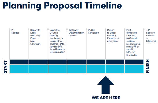
SUMMARY
1. This report seeks the Local Planning Panel’s (LPP’s) advice to Council when it considers the outcomes of the public exhibition of the Sekisui Planning Proposal and draft amendment to Wentworth Point Development Control Plan (DCP) 2014 in relation to the site at 14-16 Hill Road, Sydney Olympic Park. A draft Planning Agreement was also publicly exhibited in conjunction with the Planning Proposal and draft DCP and was recently subject to a re-exhibition, the outcomes of which will be reported separately to Council.
2. The Planning Proposal, draft DCP and draft Planning Agreement were placed on public exhibition from 7 June 2021 to 6 July 2021 during which time one-hundred and twenty-seven (127) submissions were received, comprising of one-hundred and twenty-three (123) from the community and the remaining four (4) from public agencies. A summary of the key issues raised in the submissions is provided in this report, with further details and responses provided in Attachment 1.
3. The draft Planning Agreement also exhibited with the Planning Proposal and draft DCP is discussed but is subject to a re-exhibition due to an amendment to the clauses in the Planning Agreement in relation to applicable development contributions. This is the result of a Council resolution related to the Parramatta (Outside CBD) Contributions Plan which was endorsed by Council in July 2021. As a result, the outcomes of the Planning Agreement re-exhibition will be considered by Council when the Planning Proposal and draft DCP is reported to Council following consideration by the Local Planning Panel. Notwithstanding, the deliverables included in the Planning Agreement have not changed as part of the re-exhibition and are detailed as part of this report.
SITE DESCRIPTION
4. The subject site is located at 14-16 Hill Road, Sydney Olympic Park as shown in Figure 1. It is legally described as Lot 3, DP 869608 and approximately 94,580sqm in area and owned by Sekisui House (the applicant). Sekisui have already part developed the site under the current planning controls in the south-eastern corner for 362 apartments in buildings up to 25-storeys, with the remainder of the site largely vacant.
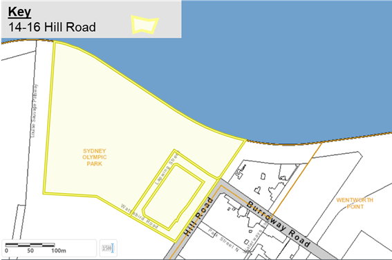
Figure 1 – Subject site at 14-16 Hill Road, Sydney Olympic Park
5. Figure 2 shows that the site is in a peninsula location bound by the Parramatta River to the north, Hill Road which is the main road access to the east, and open space in Newington Nature Reserve to the south and west which is part of Sydney Olympic Park Authority (SOPA) land. It is also surrounded by high-density growth precincts in Wentworth Point, and Melrose Park located across the river.
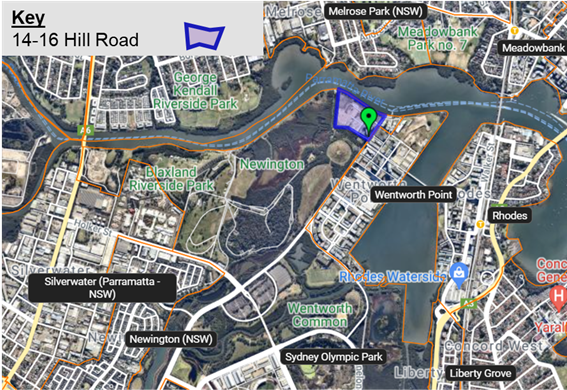
Figure 2- Site & surrounding area
BACKGROUND
6. In July 2014, the State Government introduced the current planning controls for 14-16 Hill Road, Sydney Olympic Park as part of the Wentworth Point Urban Activation Precinct to facilitate housing supply in this location for Greater Sydney. The current zoning permits the site’s redevelopment for high-density residential and public recreation uses.
7. Under these controls, there are already Development Application (DA) approvals which allow for the redevelopment of the site at the permissible density. These include:
· DA/41/2015 approved in February 2016 by former Auburn City Council for the distribution of gross floor area up to 188,800sqm for 2,300 apartments across seven (7) lots (see Figure 3). The approval also included demolition of existing buildings, tree removal, earthworks, site remediation, construction of roads, sea wall and public domain works.
· DA/763/2017 approved in June 2018 by the Sydney Central City Planning Panel for the construction of 362 apartments up to 25-storeys on Lot 101 in the south east corner of the site.
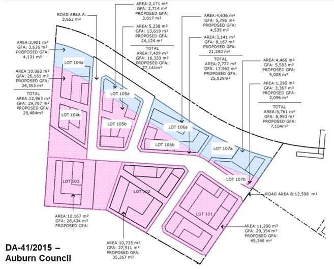
Figure 3 – Existing concept approval from Auburn Council
8. Since January 2018, Council has undertaken an assessment of a Planning Proposal for the subject site. The vision for the Planning Proposal is to redesign the masterplan in the existing concept approval shown in Figure 3 to reserve land for a potential future public transport corridor, more open space and six (6) taller residential towers up to 40-storeys so the same amount of residential density already approved in this location could be retained.
9. In 2019, the Local Planning Panel unanimously supported the Council Officer recommendation to proceed with the Planning Proposal which was then endorsed by Council to seek a Gateway determination. In March 2020, the Department of Planning, Industry & Environment (DPIE) granted a Gateway determination to allow the Planning Proposal to proceed to public exhibition. The Planning Proposal was updated to reflect the conditions of the Gateway for public exhibition.
10. There is also a Draft Amendment to Wentworth Point Development Control Plan 2014 (Amended DCP) to provide more detailed controls for buildings, streets, and open space on the site. The proposal also includes a Draft Planning Agreement valued at over $20 million. The Amended DCP and Draft Planning Agreement were endorsed to proceed to public exhibition by Council in early-2021.
PLANNING PROPOSAL
11. Table 1 below summarises the existing and proposed controls under the Auburn LEP 2010 that apply to the Sekisui site at 14-16 Hill Road.
Table 1 – Comparison of planning controls for 14-16 Hill Road, Sydney Olympic Park
|
LEP Controls |
Current Controls |
Proposed & Exhibited Controls |
|
Site Area |
94,580sqm |
|
|
Zoning |
Part R4 – High Density Residential (81,000sqm) Part RE1 – Public Recreation (13,580sqm) |
Part R4 – High Density Residential (71,950sqm) Part B4 – Mixed Use (4,630sqm) Part RE1 – Public Recreation (18,000sqm) |
|
Maximum Building Height (HOB) |
Part 88 metres (25 storeys) Part 19 metres (6 storeys) |
Ranging from part 44 metres (15 storeys) to part 134 metres (40 storeys) for six (6) sub-precincts |
|
Maximum Floor Space Ratio (FSR) |
Part 2.6:1 Part 1.25:1 |
Ranging from 1.9:1 to 6.72:1 for six (6) sub-precincts up to the maximum GFA limit for the site. |
|
Gross Floor Area (GFA) |
188,800sqm |
188,800sqm |
|
Land Reserved for Acquisition |
Yes – RE1 land |
Yes – RE1 land and Future Transport Corridor land |
|
Additional Local Provision |
N/A |
1. Overall GFA cap at 188,800sqm for across the site and limit the maximum amount of retail floor space to 2,000sqm 2. Additional permitted use (APU) to allow ‘food and drink premises’ as a permissible use in the RE1 Public Recreation zone near the existing location of the wharf to enable a café use |
|
Dwelling Yield |
2,300 across seven (7) sites |
2,300 across six (6) sites |
12. There is no increase in residential density proposed as part of the Planning Proposal compared to the existing approval. The maximum GFA on the site should not exceed 188,800sqm in accordance with the Additional Local Provision proposed in the LEP. The 6 sub-precinct lots each have an assigned FSR and HOB control and a maximum GFA per sub-precinct in the draft DCP that accord with the overall GFA limit.
13. The Planning Proposal provides the opportunity for a larger foreshore park (with additional pocket parks throughout the site) and a future public transport corridor that will facilitate a bridge over Parramatta River from Melrose Park to the north through the site to ultimately connect to the new Sydney West Metro stop at Sydney Olympic Park. The Proposal will also allow for retail and food and drink premises on the site up to 2,000sqm that is counted within the 188,800sqm GFA cap.
14. Figures 4 to 7 below illustrate the proposed changes to the zoning, height of buildings, floor space ratio, and land for acquisition maps as part of the LEP amendment.
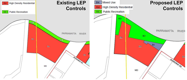
Figure 4 – Change in Zoning
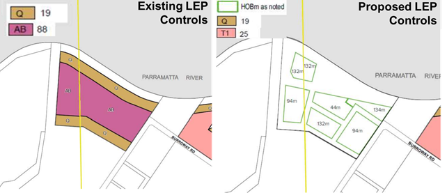
Figure 5 – Change in HOB
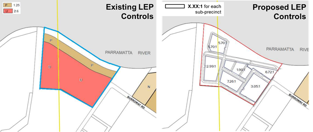
Figure 6 – Change in FSR
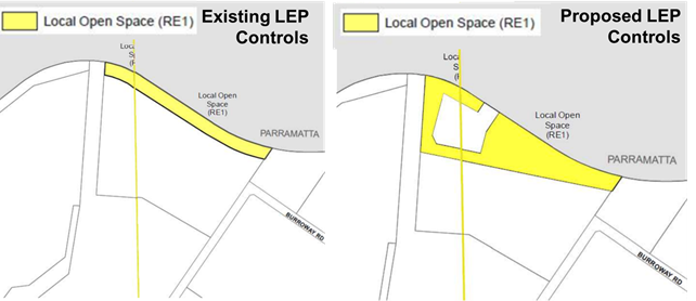
Figure 7 – Change in Land Reserved for Acquisition
15. Council endorsed the draft Development Control Plan and draft Planning Agreement to proceed to exhibition in conjunction with the adopted Planning Proposal on 22 March 2021 and it was publicly exhibited in accordance with the Gateway determination. The Response to Submissions section of this report outlines the feedback received during exhibition and is shown in detail in Attachment 1. No changes to the LEP provisions in the Planning Proposal are recommended following exhibition.
AMENDED DEVELOPMENT CONTROL PLAN
16. A draft amendment to the Wentworth Point Development Control Plan 2014 (DCP Amendment) for the subject site has been prepared to accompany the Planning Proposal. The DCP Amendment contains specific controls to facilitate the revised masterplan, revised streets, and open space network. It contains amended controls for building design, land use, floor space, parking, and updated sustainability and environmental management provisions and is included at Attachment 3. All provisions in the draft DCP amendment are consistent with the Planning Proposal.
17. The distribution of GFA into six separate sub-precincts is a key component of this DCP and is commensurate to the proposed LEP controls mapped across the site. The proposed DCP controls on floorspace guide how the total allocated GFA of 188,800sq.m is distributed to ensure no individual lot contains a greater proportion of floorspace needed to achieve the proposed built form (see Figure 7).
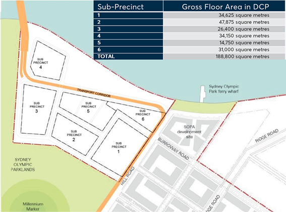
Figure 7 – Gross floor area across sub-precincts on the site
18. Figure 8 shows that the Draft DCP includes a maximum number of storeys control for each sub-precinct, ranging from 28 to 40-storeys. The Phase 1 DA has already constructed Sub-precinct 1 up to 25-storeys in accordance with the current 88 metre maximum building height control. However, the remainder of the site requires greater building heights to accommodate a redistribution of the approved GFA to facilitate the future transport corridor and land for a larger foreshore park. This is considered to be an improved outcome for the site as it accommodates improved public transport options for Wentworth Point and better open space without an increase in the already approved residential density on the site.
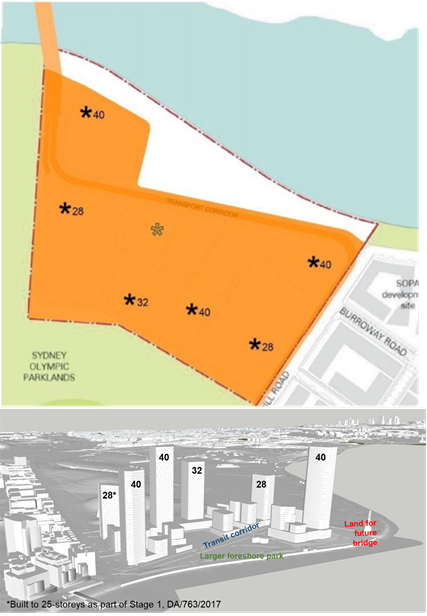
Figure 8 – Building height across DCP sub-precincts (top) as illustrated (below)
19. Key elements of the Amended DCP include extra land for the larger open space, public domain and the future transport corridor as shown together in Figure 9. These are essential components of the proposal and enable:
· A 23% increase in the open space network overall by increasing the foreshore park area from 1.35ha to 1.8ha with two pocket parks of equivalent area within the community title.
· Changes to street sections, setback and public domain between buildings that must be publicly accessible and function as a public street but may be privately owned in community title within the site.
· A new future transport corridor through the site that will facilitate the future Parramatta Light Rail Stage 2 or an equivalent bus service with an additional 7-metre width in the road reserve. This space has opportunities to deliver a linear park or additional parking prior to construction and operation of any future transport corridor.
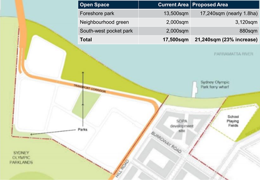
Figure 9 – Proposed transport corridor (in orange) and open space (in green)
20. Council endorsed the Amended DCP to proceed to exhibition on 22 March 2021 and it was exhibited in conjunction with the Planning Proposal and draft Planning Agreement. The Response to Submissions section of this report outlines the feedback received during exhibition and is shown in detail in Attachment 1. No changes to the DCP provisions in the Planning Proposal are recommended following exhibition.
DRAFT PLANNING AGREEMENT
21. A draft Planning Agreement between Sekisui and Council was exhibited concurrently with the Planning Proposal and Draft DCP. This planning Agreement was subject to Council’s Planning Agreements Policy adopted in November 2018.
22. An external valuer was jointly appointed by Council and Sekisui to determine the value uplift of the land owned by Sekisui and an appropriate planning agreement offer. As a result, a draft Planning Agreement with Sekisui was agreed and was concurrently exhibited with the Planning Proposal and draft DCP. The Planning Agreement has an estimated value of $20,000,000 and includes contribution items relating to larger open space, land for a future transport corridor, remediation of potential contamination, public domain, and intersection upgrades. A summary of the items proposed to be provided as part of the Planning Agreement is shown in Table 2.
Table 2 – Draft Planning Agreement for endorsement
|
Planning Agreement Item |
Estimate of Public Benefit/Value |
|
1. Dedication of future public transit corridor and foreshore reserve |
State Infrastructure – no local infrastructure contribution value attributed in VPA |
|
2. Embellishment of foreshore reserve |
$12,400,000 |
|
3. Community Infrastructure Maintenance agreement in relation to foreshore reserve (5 years) |
$600,000 |
|
4. Removal of requirement to acquire foreshore reserve under current zoning |
$7,000,000 |
|
5. Burroway Road/Hill Road intersection upgrade works |
Required to support proposed development – no local infrastructure contribution value attributed in VPA |
|
6. Section 7.11 development controls |
Yes, apply in accordance with Auburn Development Contributions Plan 2007 |
|
Total Monetary Value |
$20,000,000 |
23. The Schedules & Annexures of the Planning Agreement provide details on the contribution terms, scope of works, construction terms, level of embellishment and intending timing for these additional infrastructure contributions as shown in Attachment 4.
24. For the transport corridor land, if Council does not step in as a mediatory landowner between the developer and TfNSW, it will be transferred into private community title ownership, where it would be less feasible and cost prohibitive to reclaim ownership of any potential transport infrastructure in the future. It is considered the strategic benefits of taking public dedication will outweigh the associated costs, depreciation, and liabilities. The construction of road reserve and dedication of land is required prior to Occupation Certificate (OC) for sub-precinct 6.
25. For the foreshore park shown in Figure 10, there are provisions in relation to the timing and delivery of the park as part of two stages. These are:
· Stage 1 – Main eastern portion east of sub-precinct 4: Prior to the issue of OC for sub-precincts 3, 4 or 6 or within 3 years from the date of Development Consent for the Stage 1 Foreshore Park Work (whichever is earlier).
· Stage 2 – Secondary western portion north & west of sub-precinct 4: Prior to the issue of OC for sub-precinct 4.
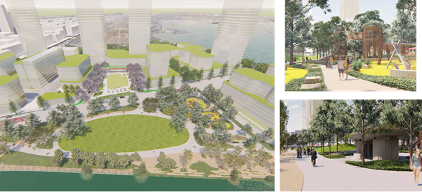
Figure 10 – Extract of concept designs for the proposed foreshore park
26. The Planning Agreement requires embellishment in accordance with the concept design and the remediation of any potential levels of contamination, so the land is fit for public recreation uses. After 5 years of maintenance by the developer, the applicant is required to provide evidence that the Remediation Action Plan, Site Audit Statement have been satisfied, and a Costs Report by a Quantity Surveyor with the Long-term Management Plan to inform Council’s decision on owning the future open space asset. If Council chooses not to take ownership of the land, then a public easement over the land will apply and the ownership and maintenance costs of the land will be held within community title.
27. The proposed delivery and embellishment of the larger foreshore park in this way provides a greatly superior outcome for public recreation compared to the existing approvals and secures a significant public benefit for the community. It achieves a new community facility principally funded by the developer without having to increase the permitted density on the site.
28. Furthermore, the City of Parramatta (Outside CBD) Development Contributions Plan has also recently been exhibited and endorsed by Council. This Plan brings together a number of separate contributions plans applicable to the Parramatta LGA following the local government amalgamations of 2016 and includes the Auburn Development Contributions Plan 2007 that applies to the subject site. Under the new Plan, the applicable contributions rates are significantly higher than those prescribed under the now superseded Auburn Contributions Plan. As a result, Sekisui made a submission during the exhibition of the draft City of Parramatta (Outside CBD) Development Contributions Plan seeking an exemption from the increased rates in the draft Plan being applied to their site citing the planning agreement negotiations were undertaken on the basis of the lower rates in the Auburn Contributions Plan applying to the site. This request was considered by Council at its meeting of 12 July 2021 and endorsed, as was the new City of Parramatta (Outside CBD) Development Contributions Plan.
29. As a result, Sekisui will, if the amended Planning Agreement is ultimately endorsed by Council, only be required to pay the contributions rate as prescribed under the former Auburn Development Contributions Plan 2007 (being equivalent to $5,085 per 2-bed apartment) which was in place at the time the draft Planning Agreement was negotiated instead of the higher rates prescribed in the recently adopted Outside CBD Development Contributions Plan (being equivalent to $17,051 per 2-bed apartment).
30. Were Council to not accept this change to the Planning Agreement it was likely the applicant would withdraw from their current Draft Planning Agreement offer. If the Planning Agreement were not to proceed Council would need to rely solely on contributions generated from application of the Outside CBD Contributions Plan. In this case the net contribution received from the developer would be less than that proposed to be contributed under the current Planning Agreement.
31. This change to the Planning Agreement has required its re-exhibition, however the specific items included in the Planning Agreement offer as prescribed in Table 2 above have not changed. Re-exhibition of the Draft Planning Agreement is from 12 August to 9 September 2021.
32. Feedback received during the first exhibition period is discussed in the Response to Submissions section of this report and Attachment 1. An assessment of the re-exhibited Planning Agreement will be included in the Council report seeking to finalise the Planning Proposal and DCP amendments for the site following consideration of this report by the Local Planning Panel.
EXHIBITION OUTCOMES
33. The Planning Proposal, Draft DCP and Planning Agreement and supporting documents were publicly exhibited from 7 June to 6 July 2021. Notification methods used in the exhibition included:
· Dedicated exhibition page on Council’s Participate Parramatta website via https://participate.cityofparramatta.nsw.gov.au/14-16-hill-road
· Approximately 7,000 letters to landowners in the Wentworth Point and Melrose Park area, including those within the Ryde LGA
· Letters to four (4) public agencies as required by the Gateway Determination
· Advertisement on Council’s website
· Hard copies of exhibition documents and supporting information at Council’s Customer Contact Centre, Parramatta Library and Wentworth Point Community Centre & Library
· Geo-targeted social media campaigns on Council’s social media platforms,
· Signage on perimeter fencing of the site
34. A total of one-hundred and twenty-seven (127) submissions were received, comprising of 123 from the community and 4 from public agencies. Of the 123 community responses, 9% supported the proposal in full, 13% conditional support and 78% of all submissions objected to the proposal in full. Below in Table 4 are the key issues raised in the community submissions. A more detailed response on these issues is provided in Attachment 1.
Table 4 - Summary of Issues raised by the community during the public exhibition period
|
Consultation Issues |
Council Officer Response |
|
1. Building Height |
Raised in 59 out of 123 Submissions |
|
1. Overshadowing of nearby properties or parkland 2. Privacy between residential units 3. Views and sightlines from existing development 4. Sub-precinct 6 / North-eastern building proposed for 40-storeys |
By increasing building height, the proposal can provide more land for open space and a future public transport corridor. The proposal redistributes the high-density residential development into taller slenderer buildings that will cast longer but faster-moving shadows, increase airflow between buildings and improving direct privacy impacts for residents compared to the existing approval as there will be less dwellings on each level. Whilst some existing views may be lost, these would also occur under the existing site approval, the proposal instead will provide more filtered views for all levels. Extensive urban design modelling and planning has been undertaken which considered the impacts of increasing height up to 40-storey building in this location which were considered acceptable by Council and DPIE officers. |
|
2. Density |
Raised in 61 out of 123 Submissions |
|
1. Concern about increasing density on the site 2. Wentworth Point peninsula is already overpopulated 3. Proposal could set precedent for other properties & developers 4. Proposed development should be staged 5. Impact on the local character and amenity of the area |
There is no increase in residential floorspace compared to the existing approval in DA-41/2015 which also approved 2,300 apartments across the site. The local character of Wentworth Point already includes numerous high-density residential and mixed-use sites and Sekisui will contribute 2,300 apartments to Council’s dwelling targets as identified by Council’s Local Strategic Planning Statement and Local Housing Strategy. The proposal is unlikely to set a precedent as the overall density does not change and includes a staging plan for the sub-precincts, so the proposed infrastructure and future buildings are delivered in a coordinated way as part of the development. |
|
3. Traffic & Parking |
Raised in 61 out of 123 Submissions |
|
1. Proposal will cause traffic congestion 2. Insufficient road access and streets 3. Needs more parking 4. Need a new traffic study |
The proposal is not anticipated to generate more traffic than the existing approval. The inclusion of 2,000sqm of retail floorspace and larger foreshore park are anticipated to service a local catchment and have nominal traffic impact, and could therefore in some instances reduce vehicle trips. Given that there is no increase in residential density compared to the existing approval, the exact traffic generation can be assessed in more detail as part of a future DA. The parking rates currently remain applicable and the amended DCP includes new streets and provision for additional on-street parking, and potential for further additional parking in the transit corridor until future public transport is operating and car dependency may be reduced. There are also intersection upgrades proposed as part of the Planning Agreement to support the proposed traffic generation. |
|
4. Public Transport |
Raised in 31 out of 123 Submissions |
|
1. Need more public transport 2. Inadequate transport services 3. Light rail is not guaranteed 4. Need for new bridge over Parramatta River 5. Need cycleway paths on the site |
Council, Sekisui, and the State Government all recognise the opportunity and need to provide more public transport in Wentworth Point. The proposal aims to future proof opportunities for future transport services like light-rail or an equivalent bus service by providing land dedication for a transport corridor through the site to Council at nil cost. If the redesign of streets and buildings does not occur and development proceeds as currently approved, future services may not be able to adequately access or service the area in the future. This land is important for accommodating public transport through the site and to the future Metro in nearby Sydney Olympic Park and neighbouring areas like Melrose Park in future. Transport for NSW advised that the development provides appropriate provisions for land dedication to accommodate Parramatta Light Rail Stage 2 should it proceed and will provide further detailed input on the corridor as part of any future public transport solution for the site. Further, the existing cycleway will be incorporated into the design of the foreshore park as part of the proposal. |
|
5. Open Space |
Raised in 27 out of 123 Submissions |
|
1. Needs more open space 2. Changes needed for the new park 3. Concern about safety in public domain, particularly at night |
The proposal increases open space areas by 23% with a larger foreshore park from 1.35ha to a minimum of 17,240sqm (up to 1.8ha). There remains 2 pocket parks equal to 4,000sqm within the community title. The Planning Agreement also includes detailed embellishment schedules and plans for how the park will be delivered. Council consulted with the community about the designs of the foreshore park, which indicated that the most popular features could be accommodated on the site, as discussed in the Foreshore Park section of this report. Safety within the parkland and council-owned streets are dealt with in the safety and security principles in the DCP. The park is recommended to proceed as exhibited to secure a significant public benefit for the community via the Planning Agreement. Alternatively, Council would need to fund the acquisition and embellishment of a smaller foreshore park via the Outside CBD Contributions Plan which would result in a poorer outcome for the community. |
|
6. Natural & Built Environment |
Raised in 17 out of 123 Submissions |
|
1. Impact on nearby plant biodiversity 2. Impact on nearby wildlife 3. Climate, heat & wind impacts by new buildings 4. Flooding impacts 5. Risks associated with Contamination 6. Need to focus on sustainability for development 7. Concern about soil and land’s ability to build apartments 8. Structural integrity of buildings 9. Nearby heritage impacts |
Council officers note the larger RE1 land provides opportunities for habitat to be expanded as part of a future landscape plan. The biodiversity impacts for nearby flora like the saltmarshes and turpentine forest and fauna like the white-bellied sea eagle and microbats and flying-foxes have been considered throughout the planning process and are considered acceptable from an overshadowing and habitat perspective based on information provided by the proponent’s ecologist. The DCP maintains ecological controls which consider migratory or threatened bird species and opportunities for habitat creation and includes controls for Climate Control Devices, Sustainability, Water Management and Ecology. The Planning Agreement includes clauses requiring Sekisui to adequately remediate levels of contamination on the site before the foreshore park is fit for public purpose. It is a legal requirement that the proposal meets soils and structural integrity standards as all new buildings are subject to compliance with the Building Code of Australia as part of Construction Certificate, these requirements remain regardless of any change in planning controls. There is no change to the proposed residential density so any flooding impacts will be considered at DA stage. The site does not contain any heritage items, the nearest of which is located as part of the adjacent parklands to the West. |
|
7. Community Infrastructure |
Raised in 30 out of 123 Submissions |
|
1. Needs more education facilities 2. Needs more emergency services 3. Needs more community facilities |
The proposal is unlikely to create an increase demand for community facilities and services due to the fact there is no increase in density. State agencies for Education, Health, Fire and Police undertake their own forecasting analysis for the community infrastructure needs of communities which already factor in the proposed demand that can be achieved under current controls. The proposal is subject to development contributions as well as a Planning Agreement valued at $20million which assists in funding infrastructure for the site and across the LGA. |
|
8. Economic Impacts |
Raised in 22 out of 123 Submissions |
|
1. Property value impacts by new development 2. Impact on nearby retail by new development |
Property value implications are outside the scope of the planning merit assessment that is undertaken as part of the planning proposal process, nevertheless it is considered that the proposal provides for an improved amenity outcome compared to the existing approved scheme applicable to the site. The proposed retail space has a maximum floorspace limit of 2,000sqm and is proposed to provide local retail services in a convenient location for future residents, which are unlikely to compete with larger commercial areas in Wentworth Point or Olympic Park. |
|
Support with no comment
|
Raised in 5 out of 123 Submissions |
|
Object with no comment
|
Raised in 10 out of 123 Submissions |
35. Public agencies were also notified in writing of the public exhibition, with the following agencies consulted in accordance with the Gateway Determination:
· Transport for NSW (TfNSW)
· Sydney Olympic Park Authority (SOPA)
· Energy, Environment & Science
· Heritage NSW
All four (4) public agencies provided a response, raising some issues for consideration, however none raised an objection to the proposal overall.
Transport for NSW
36. The submission from Transport for NSW raised no objection to the proposal but noted that the development must provide appropriate provisions to accommodate the potential Parramatta Light Rail Stage 2, including clearances for curvature and track geometry as part of future development applications.
37. In response, it is noted that all Development Applications will be referred to TfNSW in accordance with integrated development provisions where more detailed comment on the transport corridor may be provided once the proposal is finalised.
Sydney Olympic Park Authority
38. The submission from Sydney Olympic Park Authority raised no objection to the proposal but did raise matters for further consideration in accordance with Appendix 11 Sydney Olympic Park, of SEPP State Environmental Planning Policy (State Significant Precinct) 2005 (SSP SEPP). It mentions issues associated with the environmentally sensitive area shown in Figure 11 regarding the:
· Potentially significant overshadowing impacts for the adjacent parklands given the Management Principles of Nature Reserves in the National Parks & Wildlife Act 1974 and Contaminated Land Management Act 1997.
· Importance of solar access to the south of the subject site in the Wool-la-ra precinct containing bird habitat like the white-bellied sea eagle as well as other native flora and fauna habitat.
· Implications on biodiversity and ecology to the west of the subject site containing saltmarshes and mangroves.
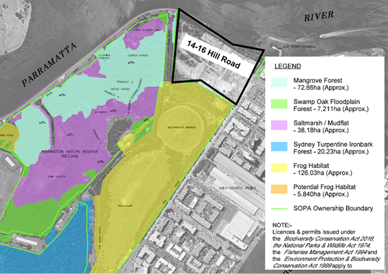
Figure 11 – Extract showing SOPA lands and adjacent natural environment
39. In response, Sekisui provided additional information in August 2021 which emphasises that overshadowing is redistributed and not increased overall compared to the existing approval and should not deteriorate the shading implications for the natural environment. Their ecologist concluded that overshadowing is not deemed to cause significant or irreparable damage to the adjoining natural environment. It also outlines the additional opportunity for complimentary plant and wildlife habitat on the site itself through the increased foreshore park area.
40. Council officers also note there are already Ecology controls in Part 5.3 of the existing DCP controls applicable to the site. Council officers exhibited in the Amended DCP a requirement for a suitably qualified ecological consultant to prepare a statement with all future development applications addressing building design, materials and construction phase impacts for the nearby natural habitat.
Energy, Environment & Science
41. The submission from Energy, Environment & Science also raised no objection to the proposal but did note that there should be no additional direct or indirect impacts from lighting or overshadowing on Newington Nature Reserve for the “purpose of protecting and conserving areas containing outstanding, unique, or representative ecosystems, species, communities, or natural phenomena”.
42. In response, Sekisui has provided additional information in August 2021 which included shadow diagrams comparing the impacts between the approved development and proposed masterplan (noting they are of equal density). The shadow analysis shown in Figure 12 demonstrates that over-shadowing shifts from shallow and bulky slower-moving shadows cast from up to 25-storey buildings under the existing approval change to deeper and thinner, faster-moving shadows cast from up to 40-storeys buildings providing for more filtered solar access throughout the day. The exhibited urban design and ecological report appendices find by mid-winter less than 5% of the saltmarsh is in shade by 10am and shadowing is gone by 11am. In summer less than 5% of the saltmarsh is in shade by 8am and shadowing is gone by 9am.
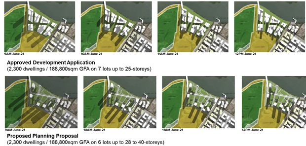
Figure 12 – Overshadowing analysis comparing current and proposed controls
43. Therefore, the changes to overshadowing are deemed not significant enough to cause irreparable damage to the structure, function, or distribution of ecologically sensitive communities in this area. It is also noted that a Construction Environmental Management Plan and Vegetation Management Plan would be prepared by a suitably qualified ecologist to further qualify this issue at Development Application stage.
44. It is noted that the DCP controls include a requirement for any development to not significantly impact on the ecological values of this area and therefore it is considered reasonable for the Planning Proposal to proceed. It would be unreasonable for Council to request a greater level of detail at this stage given the site is already zoned for high-density residential uses.
Heritage NSW
45. The submission from Heritage NSW raised no objection to the proposal but noted consideration would be required for nearby heritage items such as “Newington Armament Depot and Nature Reserve” (SHR 01850) and “Millennium Parklands Heritage Precinct” in Sydney Regional Environmental Plan no.24 – Homebush Bay Area. These heritage listings do not apply to the site but are located near the site to the west (see Figure 13).
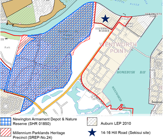
Figure 10 – Site and nearby heritage
46. In response, the applicant has provided a Heritage Impact Statement (HIS) in August 2021 which considers these nearby heritage listings and their significance against the proposal and its potential impacts in Attachment 5. The potential built forms are not located within the curtilage of any heritage item and would not be located directly adjacent to any built heritage fabric (approximately 250m away). The distribution of the same amount of approved density into taller buildings with increased landscaped areas enables greater view corridors throughout the site and to the natural environment curtilage. A detailed HIS will still be required as part of any future development application.
47. Council notes that the heritage interface impacts between the adjacent conservation area and high-density residential uses on the site were acceptable by the (then) Department of Planning & Infrastructure as part of rezoning the site in 2014, and acceptable from a DA perspective to former Auburn Council in February 2016 when approving construction of 2,300 apartments on the site. Therefore, the change in planning controls is considered acceptable from a heritage perspective and recommended to proceed.
Foreshore Park
48. Following a workshop with Councillors on 3 March 2021 regarding the proposal, Councillors recommended feedback be sought from the community regarding the nature of the proposed foreshore park. The foreshore park is a key contribution by Sekisui as part of the Planning Agreement and the community were invited to provide feedback on the park as part of their submission. The community were asked the following question in relation to the park: ““what features of this new park are important to you?” and were asked to pick three options.
49. Feedback on the proposed foreshore park was received from one-hundred and five (105) of the 123 community submissions. The remaining eighteen (18) of the 123 community submissions did not partake in the specific foreshore park consultation. The three most picked features of the park were outdoor seating, playground equipment and parking. Other suggestions included sunshades, bins, trees, natural vegetation, lighting, dog park/other pet facilities and a basketball court. A summary of the feedback is included in Table 5 below.
Table 5 – Community feedback on new facilities for proposed foreshore park
|
Foreshore park items |
Popularity of park items Ranked 1 (most popular) to 9 (least popular) |
|
|
1 |
||
|
Playground equipment |
2 |
|
|
Parking |
3 |
|
|
Cycle paths |
4 |
|
|
Fitness equipment |
5 |
|
|
BBQ area |
6 |
|
|
Drinking fountains (bubblers) |
=7 |
|
|
Other |
=7 |
|
|
Other - Dog Park/Pet facilities |
9 |
50. The foreshore park does provide for the preferred features of the park and this is included as part of the embellishment offer in the Planning Agreement. Other facilities such as a dog park and basketball court are not provided on the site but could be provided in future as part of other open space areas in nearby Wentworth Point or Sydney Olympic Park.
51. Council and Sekisui have negotiated the delivery of the foreshore park via the Planning Agreement in a way that achieves a higher-level of amenity and realises public benefit for the community in a more time-efficient and cost-effective manner. Should the proposal not proceed, Council would alternatively need to fund the acquisition and embellishment of a smaller foreshore park via the Outside CBD Contributions Plan. This is considered a poorer outcome than proceeding with the foreshore park as set out in the Planning Agreement as it would involve:
· Acquiring and embellishing a smaller foreshore park of 1.3ha to service the same amount of density on the site
· Funding the acquisition and embellishment items via the Section 7.11 Plan the costs of which will potentially be higher by the time the land is required
· Potentially delivering the foreshore park at a later date than could otherwise be delivered by the developer when developing the site.
52. Council officers consider the issues raised in the exhibition period have been addressed by the Planning Proposal, Amended DCP and Planning Agreement. It is recommended that the changes in planning controls proceed based upon the fact that they do not seek an increase in the already approved density of 188,800sqm GFA/2,300 apartments and intend to improve amenity issues for high-density development in Wentworth Point, particularly in relation to realising open space, future transport, public domain, and natural environment outcomes.
FINANCIAL IMPLICATIONS FOR COUNCIL
53. Any work to progress the finalisation of the Planning Proposal would be prepared by Council Officers and therefore within the existing City Planning budget. Should this matter progress, a Planning Agreement delivering open space, social and community infrastructure and road infrastructure and improvements to the value of $20 million will be entered into between Council and the applicant. Further, at development application stage, development contributions in keeping with the current rates contained in the Auburn Section 94 Development Contributions Plan (Amendment No.1) 2007 will be applied to the development should the outcomes of the re-exhibited Planning Agreement be accepted by Council.
CONCLUSION AND NEXT STEPS
54. It is recommended that the Local Planning Panel support the Council Officer recommendation that the Sekisui Planning Proposal (as exhibited) be referred to the Department of Planning, Industry and Environment for finalisation.
55. Council Officers recommend that the Local Planning Panel support the Council Officer recommendation to finalise the proposed DCP amendments which provide detailed design controls in support of the Planning Proposal.
56. Following Local Planning Panel consideration of the recommendations of this report, the outcomes of the exhibition period for the Planning Proposal and Draft DCP amendments, as well as the re-exhibited Planning Agreement will be reported to an upcoming Council meeting along with the Panel’s advice.
Kieren Lawson
Project Officer Land Use
Michael Rogers
Land Use Planning Manager
David Birds
Group Manager, City Planning
Jennifer Concato
Executive Director City Planning and Design
|
1⇩ |
Response to Submissions |
|
|
|
2⇩ |
Planning Proposal - 14-16 Hill Road (as exhibited) |
|
|
|
3⇩ |
Draft Amendment to Wentworth Point DCP 2014 (as exhibited) |
|
|
|
4⇩ |
Draft Planning Agreement (as re-exhibited) |
|
|
|
5⇩ |
Heritage Impact Statement |
|
|
REFERENCE MATERIAL
|
Item 6.3 - Attachment 1 |
Response to Submissions |
ATTACHMENT 1 – RESPONSE TO SUBMISSIONS FOR 14-16 HILL ROAD, SYDNEY OLYMPIC PARK
Exhibition material - Sekisui Planning Proposal, Draft Amendment to Wentworth Point DCP 2014, Draft Planning Agreement
Exhibition dates – 7 June 2021 to 6 July 2021
Submissions received - 127 submissions, 123 community submissions and 4 public agencies
Table 1 – Response to 123 community submissions
|
MATTERS RAISED |
COUNCIL OFFICER RESPONSE |
|
1. Building Height |
Raised in 59 out of 123 Submissions |
|
1. Overshadowing of nearby properties or parkland |
The overall impact of overshadowing will be similar to the existing approval (although, only part built) because there is already approval for 2,300 apartments on the site. The extent of shadowing will differ and changes from shallow slower-moving shadows into longer faster-moving shadows cast from a taller more slender built form. This will provide more permeable solar access for residential dwellings and surrounding parklands.
|
|
2. Privacy between residential units |
The privacy impacts will be assessed in accordance with the relevant Apartment Design Guide and Development Control Plan controls. By proceeding with the proposal which increases building height, the number of residential dwellings per floor will be reduced and potentially reducing direct privacy impacts between dwellings compared to the previous approval. They also accommodate greater separation distances between apartments which provides a better privacy outcome what could be achieved under the current approval. |
|
3. Views and sightlines from existing development |
Although some existing views may be lost, these impacts would occur even under the existing high-density zoning and current approvals applicable to the site. The proposal intends to redesign buildings to reduce view loss compared to the current approval through larger building separation and detailed setback controls that provide for more filtered views. |
|
4. Sub-precinct 6 / North-eastern building proposed for 40-storeys |
Extensive urban design modelling and planning has been undertaken which considered the impacts of a proposed 40-storey building in this location. Council officers and DPIE considered this as a suitable location based upon views and shadow analysis. By amending the building height, there will be a more slender built form which will reduce privacy and view impacts for existing properties up to 25-storeys. Apartment Design Guide compliance will still be required when considering the amenity interface between buildings. |
|
2. Density |
Raised in 61 out of 123 Submissions |
|
1. Concern about increasing density on the site |
The proposal seeks no increase in density compared to the approved floorspace which was achieved under the current planning controls and concept DA-41/2015 approved in February 2016. The issue of density is addressed throughout the planning controls with FSR & HOB controls for individual building envelopes, an additional local provision for a maximum of 188,800sqm for the entire site and a GFA maximum for each sub-precinct. |
|
2. Wentworth Point peninsula is already overpopulated |
The site already has approval as part of a DA for this number of dwellings and is already zoned for high-density residential and open space uses. Council's Local Strategic Planning Statement identifies Wentworth Point as zoned for high-density residential with nearly 9,000 proposed dwellings by 2036. The subject site will contribute 2,300 apartments towards this target. . |
|
3. Proposal could set precedent for other properties & developers |
The proposal is not expected to set a precedent because there is no net increase in density above the current DA for the site. If other sites wish to redevelop and redistribute existing density with revised building heights, they would be required to provide detailed urban design analysis and demonstrate the strategic merits of making the change to Council Officers and DPIE via a Planning Proposal process or a Clause 4.6 variation under Auburn Local Environmental Plan 2010 (or the Harmonised Parramatta LEP 2021 if notified). |
|
4. Proposed development should be staged |
The proposal includes a staging plan for the sub-precincts as part of the Planning Agreement. It identifies the intended order of each development lot and the proposed streets and open space. The Planning Agreement includes infrastructure items that are required to be delivered before Construction Certificate or Occupation Certificate for each stage. The proposal also provides opportunity to deliver public transport through the site in future. |
|
5. Impact on the local character and amenity of the area |
The surrounding Wentworth Point area includes numerous high-density residential and mixed-use buildings, and the proposed zoning is consistent with this character. By amending the controls in this way, some apartment buildings will be noticeably higher, however this will facilitate more public open space on site and the potential for a future public transport link to service the area in future. |
|
3. Traffic & Parking |
Raised in 61 out of 123 Submissions |
|
1. Proposal will cause traffic congestion
|
The proposal is not anticipated to generate more traffic than would occur under the existing approval as it maintains the same overall GFA under the current DA approval for the site. The traffic generation from the site has already been assessed as part of the zoning of the site in 2014, and as part of the subsequent DA assessment. As the proposal is not proposing to change the existing traffic generation from the site, it is considered acceptable by both Council and TfNSW officers. Notwithstanding, traffic impacts will be further reviewed as part of any future DA lodged for the site that seeks to utilise the revised planning provisions reflected in this Planning Proposal.. It should also be noted that the proposed Planning Agreement supporting the Planning Proposal provides for intersection upgrades and facilitates a future public transport connection through the site that will improve the traffic situation in Wentworth Point once delivered. |
|
2. Insufficient road access and streets |
The proposal includes new street sections in the DCP which include pathways, on-street parking, and traffic lanes to provide a public domain access and a street address to new buildings. The sections have been informed by Urban Design Analysis and review by Council’s Urban Design team. These include the Burroway Road extension and the increased width of a foreshore boulevard to accommodate a future transport corridor of 7m in width. Intersection upgrades at Burroway and Hill Roads are also proposed as part of the Planning Agreement. |
|
3. Needs more parking |
Parking rates for the development will be in accordance with the proposed provisions in the Development Control Plan.Table 4 of Wentworth Point Precinct DCP 2014 (Draft Amended 2020). Table 4 sets the minimum parking requirements for residential development of 1 x 1bed, 1.1 x2bed, 2 x 3bed, plus 0.1 x visitor per unit which will be required by the development. The proposed street network also includes on-street parking provision. |
|
4. Need a new traffic study |
There is no increase to the density compared to the existing approval in DA-41/2015 so the traffic impacts are considered appropriate. Although the proposal does include small scale retail as part of sub-precinct 6, this is intended to serve a local convenience function and will therefore reduce the potential for car trips to nearby commercial centres like Marina Square. |
|
4. Public Transport |
Raised in 31 out of 123 Submissions |
|
1. Need more public transport |
Public transport improvements should be investigated wherever possible within Wentworth Point.. To this end, the Planning Proposal provides land for dedication to Council at nil cost to include a public transport corridor through the site in future. This will facilitate a connection for Parramatta Light Rail Stage 2 or an equivalent bus service from Melrose Park through to the Metro stop and Sydney Olympic Park. |
|
2. Inadequate transport services |
As noted above, the proposal aims to future proof opportunities for improved future transport services like light-rail or an equivalent bus service by providing land dedication to Council. If the redesign of streets and buildings does not occur as per the proposal, new services may not be able to optimally access or service the area in future. Notwithstanding, the site is located in close proximity to the Sydney Olympic Park ferry wharf and future residents could use existing bus services already servicing Wentworth Point. |
|
3. Light rail is not guaranteed |
In June 2021, the NSW Government committed $50 million towards planning and development works of the second stage of the Parramatta Light Rail as part of the 2021-22 NSW Budget. The designation of land for a future transport corridor in this way assists in reducing costs for a future public transport project as part of a business case. Council acknowledges the future light rail is in the planning stage and its delivery will be subject to the NSW Government accepting the business case to proceed. Nevertheless, the public transport corridor provided through the site can also accommodate additional bus services from Melrose Park should the light rail project not proceed. |
|
4. Need for new bridge over Parramatta River |
The delivery of a new Parramatta River bridge which could facilitate a light rail corridor is being considered as part of the State Planning Agreements with other property owners/applicants for the proposed development areas within Melrose Park on the north side of Parramatta River. The Sekisui site provides land which may be used to facilitate the bridge in future and will assist in delivering a better public transport outcome for Wentworth Point residents in the future. |
|
5. Need cycleway paths on the site |
There is currently some cycleway infrastructure along the foreshore area of the site. This cycleway link will be retained and will be incorporated into the concept design of the foreshore park as part of the proposal. |
|
5. Open Space |
Raised in 27 out of 123 Submissions |
|
1. Needs more open space |
The proposal provides for an increase in open space of 23% compared to the existing approval for the site. The new foreshore park area expands the 1.35ha zoned area to a minimum of 1.72ha.. In addition, there will be 2 pocket parks within the site equal to 4,000sqm that will be held under community title but will be publicly accessible. Acquisition and embellishment of the foreshore park are included as part of the draft Planning Agreement with the applicant. |
|
2. Changes needed for the new park |
As part of the exhibition, Council specifically consulted about the concept designs of the foreshore park which are shown in detail as part of the DCP and Planning Agreement. Feedback received as part of this consultation indicated the three most popular features of the park that are outdoor seating and tables, playground equipment and parking would be accommodated on the site. It also indicated that there are opportunities elsewhere in Wentworth Point and Sydney Olympic Park to accommodate other features that were suggested on an individual basis by submitters. The park is recommended to proceed as exhibited to secure a significant public benefit for the community. |
|
3. Concern about safety in public domain, particularly at night |
Safety within the proposed and nearby parklands and Council-owned streets remains a consideration for the proposal. There are specific controls in the Wentworth Point DCP 2014 regarding safety and security which consider lighting, building entries and Crime Prevention through Environmental Design (CPTED) principles. |
|
6. Natural & Built Environment |
Raised in 17 out of 123 Submissions |
|
1. Impact on nearby plant biodiversity
|
The biodiversity impacts for nearby saltmarshes and turpentine forest have been considered throughout the planning proposal process. The Applicant’s ecologist has provided justification that the shading is similar to the already approved DA for the site. A difference being that the shadow is thinner and extends further into the saltmarsh. By 11am mid-winter, shadowing is minimised to less than 5%. The DCP includes a requirement for a suitably qualified ecological consultant to prepare a statement with all future development applications on building design and materials and construction phase impacts for the nearby natural habitat. There may be opportunities for plant habitat to be expanded as part of a future landscape plan as part of open space and public domain on the site. |
|
2. Impact on nearby wildlife
|
On-site landscaping will utilise locally native species and will see an overall increase in resilience opportunities for native species and wildlife. Building reflectivity is also considered and will have to be designed to minimise bird strike by white bellied sea eagles and will be managed in later detailed design stages and construction aspects before occupation of the buildings. There may be opportunities for plant habitat to be expanded as part of a future landscape plan as part of open space and public domain on the site to reflect the ecology controls in the DCP |
|
3. Climate, heat & wind impacts by new buildings
|
The climate impacts have been carefully considered as part of the Amended DCP which includes Part 4.8 Climate Control Devices and amendments to existing controls in Part 5 on Sustainability, Water Management and Ecology. |
|
4. Flooding impacts
|
The proposal reduces the number of lower-level apartments into a taller built form. Any potential flooding impacts as a result of development or below ground structures on the site, such as stormwater runoff- and basement parking, will be considered and addressed appropriately at DA stage. |
|
5. Risks associated with contamination
|
Any development occurring on the site must address contamination issues and the site must be remediated to the required standard to allow the particular type of development proposed. These requirements are mandated through the Contaminated Lands Management Act 1997. The Planning Agreement also includes clauses requiring Sekisui to adequately remediate levels of contamination on the site. |
|
6. Need to focus on sustainability for development
|
Redevelopment of the site will be consistent with the principles of ecologically sustainable design and the relevant BASIX requirements and incorporate any provisions towards sustainability required by Council’s policies for development. Council has also updated existing DCP controls in Part 5, Sustainability to address this issue. The Department of Energy, Environment & Science were also consulted and provided feedback as part of the proposal. |
|
7. Concern about soil and land’s ability to build apartments
|
The suitability of soils on the site is subject to compliance with the Building Code of Australia as part of Construction Certificate and detailed assessment of the site’s ability to accommodate large buildings will be required to be undertaken at this stage. The future DA also includes provision for a replacement seawall as part of redeveloping the foreshore park area to assist on this issue. |
|
8. Structural integrity of buildings |
Requirements on the structural integrity of buildings have not changed as a result of the planning proposal process. Compliance with building standards is an issue addressed as part of any Construction Certificate phase. It is a legal requirement that the proposal meets the structural requirements for any class of building proposed on the site. |
|
9. Nearby heritage impacts |
In response to heritage concerns Sekisui provided a Heritage Impact Statement (HIS) in August 2021 which considers nearby heritage listings such as for the “Newington Armament Depot and Nature Reserve” on the State Heritage Register (SHR 01850) and the “Millennium Parklands Heritage Precinct” in Sydney Regional Environmental Plan No.24 – Homebush Bay Area. This assessed their significance against the proposal and its potential impacts. The potential built forms are not located within the curtilage of any heritage item and would not be located directly adjacent to any built heritage fabric (approximately 250m away). Heritage impacts were also assessed as part of the current approval on the site (DA-41/2015) and did not prevent an approval from being issued. Notwithstanding, heritage impacts will be further addressed once the detailed designs are submitted with any revised DAs reflective of the proposal. |
|
7. Community Infrastructure |
Raised in 30 out of 123 Submissions |
|
1. Needs more education facilities |
Education facilities are subject to their own forecasting and analysis by the Department of Education and the current development potential on site has been considered as part of this analysis. The demand for education facilities is not expected to increase compared to the existing approval as there is no increase in density proposed. |
|
2. Needs more emergency services |
Emergency facilities are subject to their own forecasting and analysis by the relevant Government Departments. The demand for emergency services is not expected to increase compared to the existing approval as there is no increase in density proposed. Impacts on emergency services from increasing building height will be considered before Occupation Certificate in accordance with compliance requirements with the Building Code of Australia (BCA). |
|
3. Needs more community facilities |
The proposal will be subject to development contributions under the rates applicable in the Auburn Development Contributions Plan 2007 for each new dwelling as well as a Planning Agreement valued at $20million which funds community infrastructure for the site and nearby area. |
|
4. Council shouldn’t let the proposal happen |
The proposal has been assessed in accordance with the requirements of the Environmental Planning & Assessment Act 1979 and Local Government Act 1993. The proposal is also consistent with relevant Local and State Planning Strategies including the adopted Local Strategic Planning Statement and Local Housing Strategy. This matter will be reported to Council for finalisation and it will be a matter for Council to decide as to whether the proposal is submitted to the State Government for implementation. |
|
8. Economic Impacts |
Raised in 22 out of 123 Submissions |
|
1. Property value impacts by new development
|
Property value implications are outside the scope of the planning merit assessment that is undertaken as part of the planning proposal process, nevertheless it is considered that the proposal provides for an improved amenity outcome compared to the existing approved scheme applicable to the site. The site is already approved and zoned for the same quantum of high-density development as included in the Planning Proposal. |
|
2. Impact on nearby retail by new development |
The inclusion of B4 zoning for up to 2,000sqm of retail is small-scale and anticipated to service local needs only and not anticipated to impact on the economic viability of nearby retail east of Hill Road. |
|
Support – No additional comment |
Raised in 5 out of 123 Submissions |
|
Object – No additional comment |
Raised in 10 out of 123 Submissions |
Table 2 – Council Officer response to 4 Public Agency submissions
|
MATTERS RAISED |
COUNCIL OFFICER RESPONSE |
|
|
Transport for NSW (TfNSW) |
||
|
1. Engage with TfNSW so the development provides appropriate provisions for Parramatta Light Rail Stage 2 |
Development Applications will be referred to TfNSW in accordance with integrated development provisions for DAs. This referral will seek more detailed comment on the transport corridor including clearances for curvature and track geometry may be provided. The Draft DCP includes typical edge treatment and street sections, and the Planning Agreement includes the land dedication area for a future transport corridor at nil cost to Council as the interim landowner. If Council does not step in as a mediatory landowner between the developer and TfNSW, it will be transferred into private community title ownership, where it would be less feasible and cost prohibitive to reclaim ownership of any potential transport infrastructure in the future. |
|
|
Sydney Olympic Park Authority (SOPA) |
||
|
1. Environmental impacts on habitat in SOPA Parkland like Newington Nature Reserve and the Wool-la-ra precinct |
The redistribution of built form on the already zoned and approved (although only part constructed) high-density residential site are not deemed to cause significant impact or to cause irreparable damage to adjacent reserves compared to the existing approval. There are already Ecology controls in Part 5.3 of the DCP that were introduced as part of the 2014 rezoning as well as a new requirement for a suitably qualified ecological consultant to prepare a statement with all future development applications on building design and materials and construction phase impacts for the nearby natural habitat. |
|
|
2. Overshadowing impacts on adjacent lands |
Overshadowing is redistributed to provide longer-faster moving shadows as part of the proposal and the quantum of overshadowing is not increased overall compared to the existing approval. This should not reduce the shading implications for the natural environment. The applicant provided shadow diagrams in August 2021 which show at mid-winter less than 5% of the saltmarsh is shade by 10am and shadowing is gone by 11am. In Summer less than 5% of the saltmarsh is in shade by 8am and shadowing is gone by 9am. Given this situation, the overshadowing impacts are considered acceptable at equinox. This matter will be assessed further as part of the detailed design at development application stage. |
|
|
3. Traffic & Transport impacts from the introduction of Mixed-Use would have on the surrounding road network, as opposed to the assumed neighbourhood impact |
The traffic & transport report outlines that inclusion of approximately 2,000sqm of non-residential uses would have no material impact on the operation of the key signalised intersection of Hill Road with Burroway Road, nor the wider road network, during the commuter peak periods. It is expected that most customers to these uses would be residents from within or close to the development and would therefore not generate new vehicle trips to access them, with car trips made to retail further away. Given that there is no increase in residential density compared to the existing approval, the exact traffic generation can be assessed in more detail as part of a future DA. |
|
|
Energy, Environment & Science (EES) |
||
|
1. Biodiversity value of Newington Nature Reserve
|
The biodiversity value of Newington Nature Reserve for both flora like the saltmarshes and Sydney Turpentine Ironbark Forest for fauna like the white-bellied sea eagle and microbats and flying-foxes is significant and must be retained. It is noted that the larger RE1 land contained in the Planning Proposal provides opportunities for habitat to be expanded as part of a future landscape plan. Importantly, the DCP maintains ecological controls which consider migratory or threatened bird species and opportunities for habitat creation. These matters will be considered in detail at DA stage. |
|
|
2. Future landscape plan required for the site prepared by a suitably qualified ecologist/bush regenerator to include the use of a diversity of local native provenance plant species |
The proposal provides a greater opportunity for local native species by providing a larger open space area. A future landscape plan prepared by a suitably qualified ecologist or bush regenerator has the opportunity for complimentary plant and wildlife habitat on the site within the public domain on community title, and the larger RE1-zoned area for the foreshore park to reflect the Ecology objectives to protect and enhance the ecological values as part of Part 5.3 of DCP. The Draft Planning Agreement also includes embellishment and maintenance details for these areas which will be undertaken by the developer for the first 5 years. |
|
|
Heritage NSW |
||
|
1. Consider nearby heritage items like “Newington Armament Depot and Nature Reserve” (SHR 01850) and “Millennium Parklands Heritage Precinct” in Sydney Regional Environmental Plan No.24 – Homebush Bay Area |
These heritage listings do not apply to the site but do apply to the adjacent land to the west. It is noted that the heritage interface impacts between the adjacent conservation area and high-density residential uses on the site were acceptable by the (then) Department of Planning & Infrastructure as part of rezoning the site in 2014, and acceptable from a DA perspective by former Auburn Council in February 2016 when approving construction of 2,300 apartments on the site. |
|
|
2. A Heritage Impact Statement (HIS) be prepared to inform any future development application |
Sekisui provided a Heritage Impact Statement (HIS) in August 2021 which considers these nearby heritage listings and their significance against the proposal and its potential impacts. The potential built forms are not located within the curtilage of any heritage item and would not be located directly adjacent to any built heritage fabric (approximately 250m away). The proposal results in redistribution of the same amount of approved density into taller buildings with increased landscaped areas which enables greater view corridors throughout the site to provide increased appreciation of the natural environment curtilage of these nearby items. Heritage impacts will be required to be assessed in detail as part of any future DA on the site. |
|