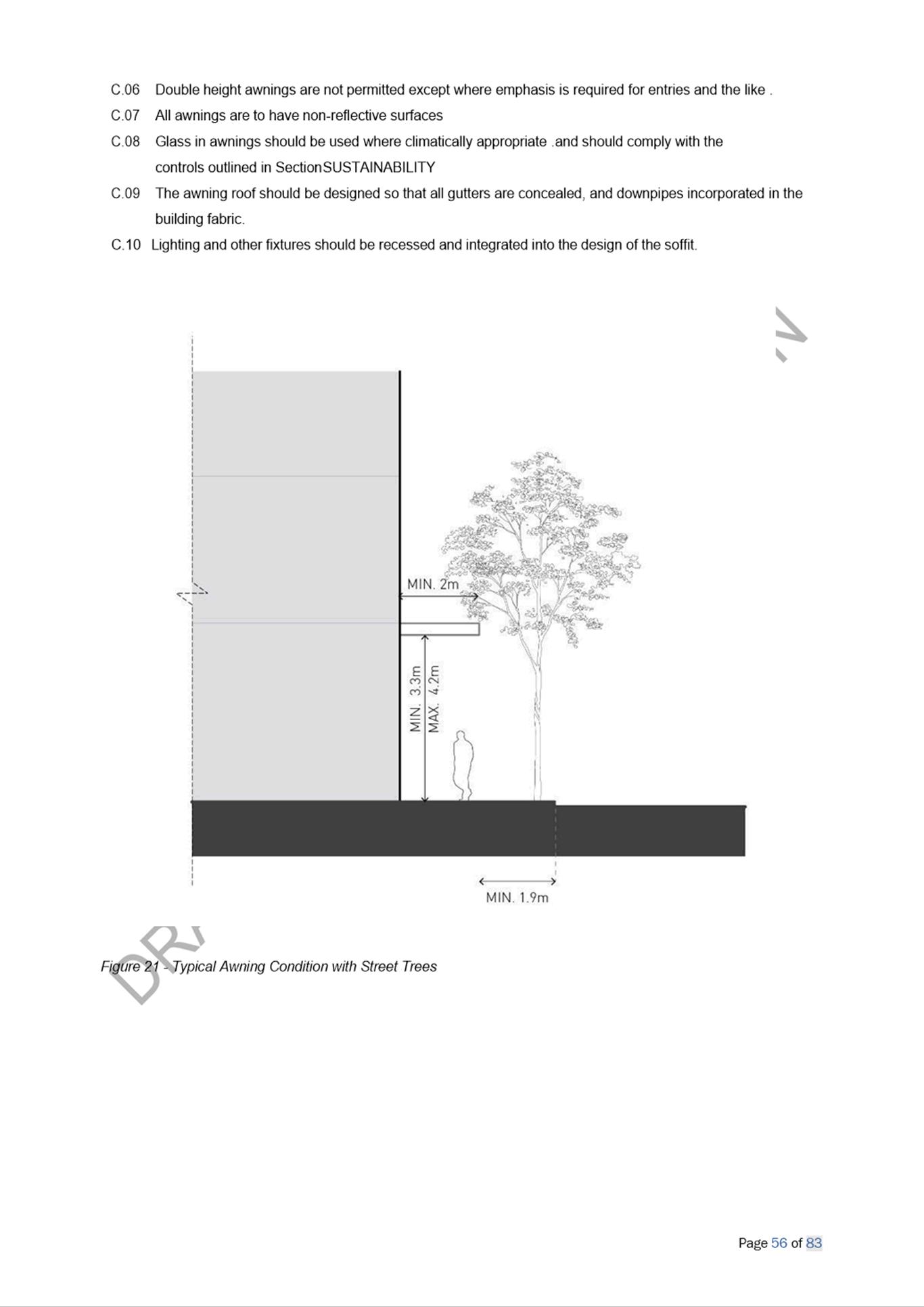
|
Item 5.1 - Attachment 1 |
Assessment Report |
NOTICE OF Local Planning Panel MEETING
PUBLIC AGENDA
An Ordinary Local Planning Panel will be via audio-visual link on Tuesday, 17 August 2021 at 3:30PM.
Brett Newman
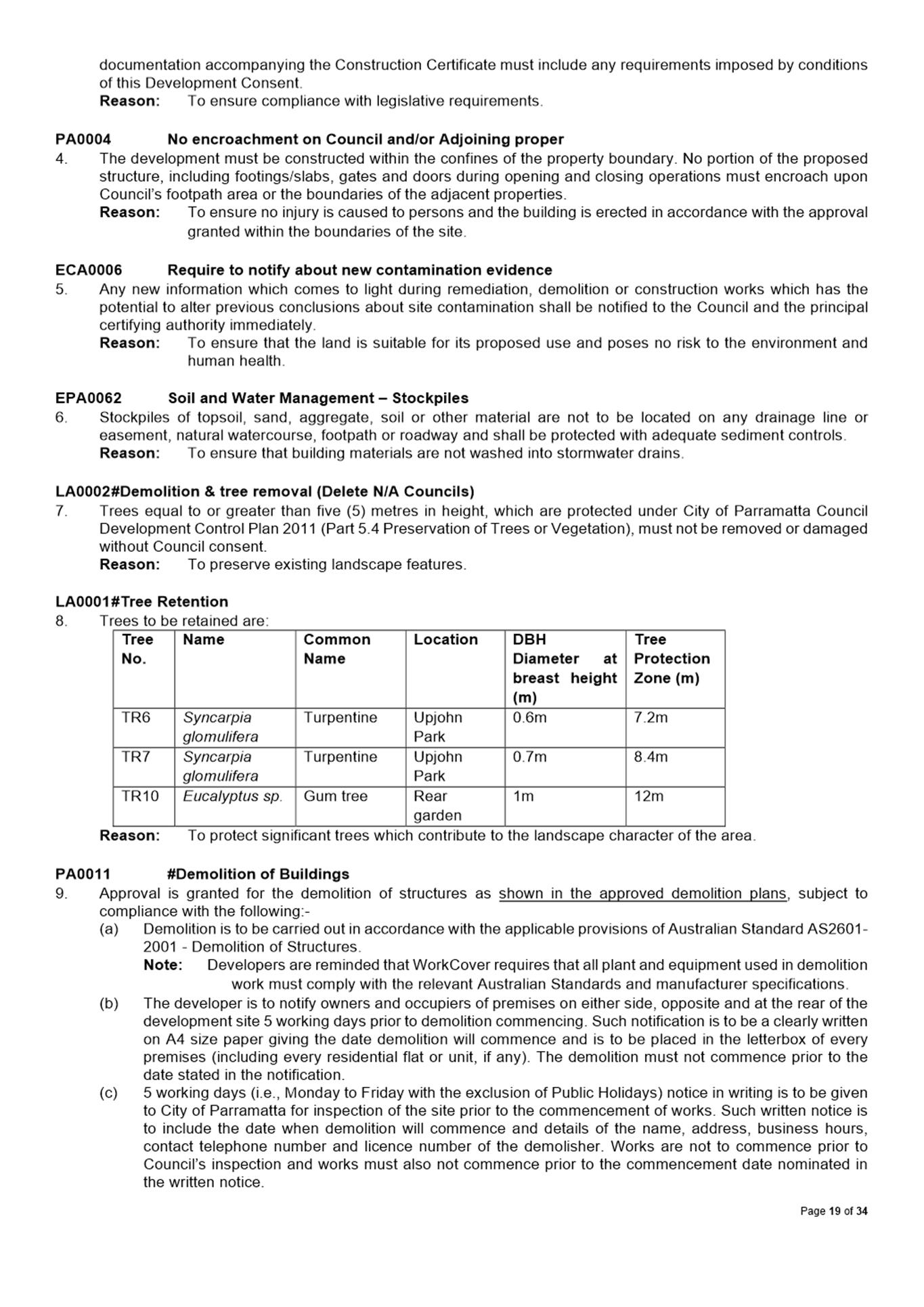
CHIEF EXECUTIVE OFFICER
THIS PAGE LEFT BLANK INTENTIONALLY
Local Planning Panel 17 August 2021
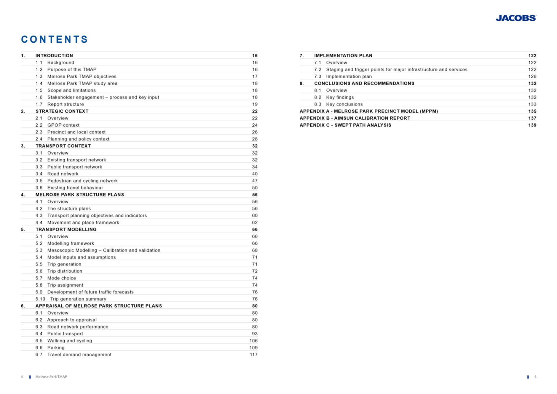
TABLE OF CONTENTS
ITEM SUBJECT PAGE NO
1 ACKNOWLEDGMENT OF THE TRADITIONAL LAND OWNERS
The City of Parramatta Council acknowledges the Burramattagal Clan of The Darug, the traditional land owners of Parramatta and pays its respects to the elders both past and present
2 WEBCASTING ANNOUNCEMENT
This public meeting will be recorded. The recording will be archived and available on Council’s website.
All care is taken to maintain your privacy; however if you are in attendance in the public gallery, you should be aware that your presence may be recorded.
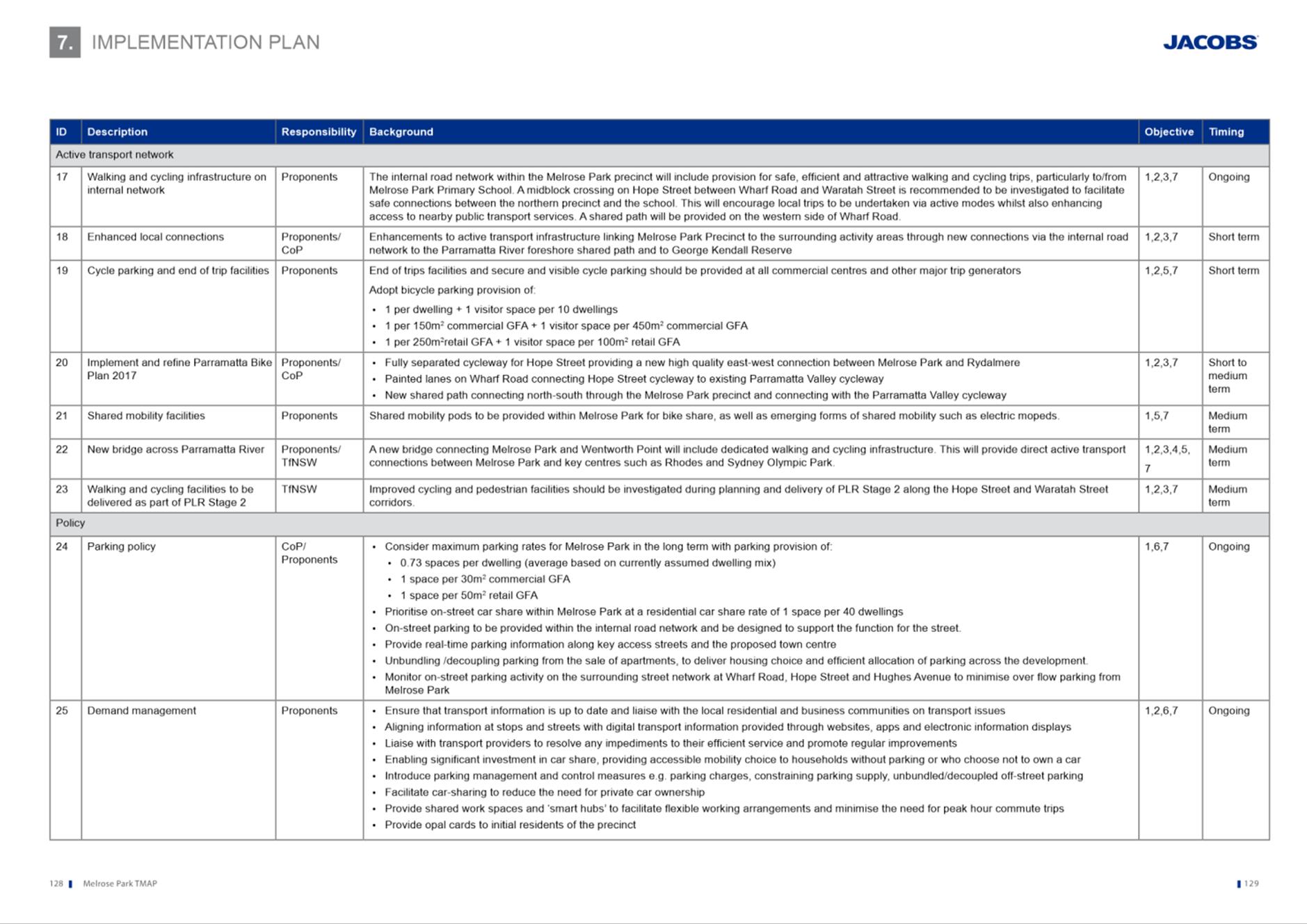
3 APOLOGIES
4 DECLARATIONS OF INTEREST
5 Reports - Development Applications
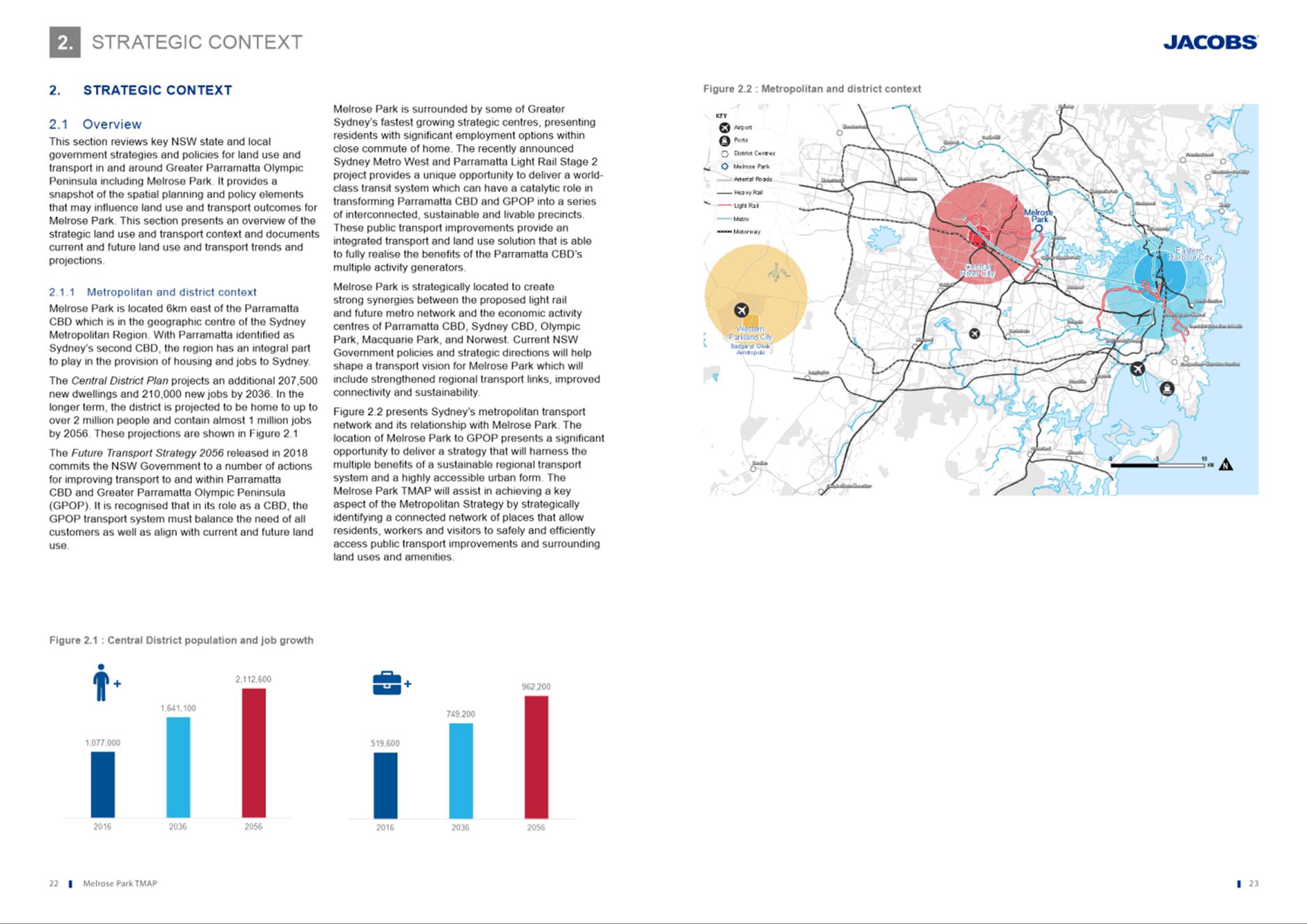
5.1 PUBLIC
MEETING:
32 Honiton Avenue, Carlingford (Lot 5 DP 205980).................. 6
5.2 OUTSIDE
PUBLIC MEETING:
131 Kirby Street, Rydalmere (Lot 3 DP 39296).................. 74
5.3 OUTSIDE
PUBLIC MEETING:
49-51 Albion St, Harris Park......... 174
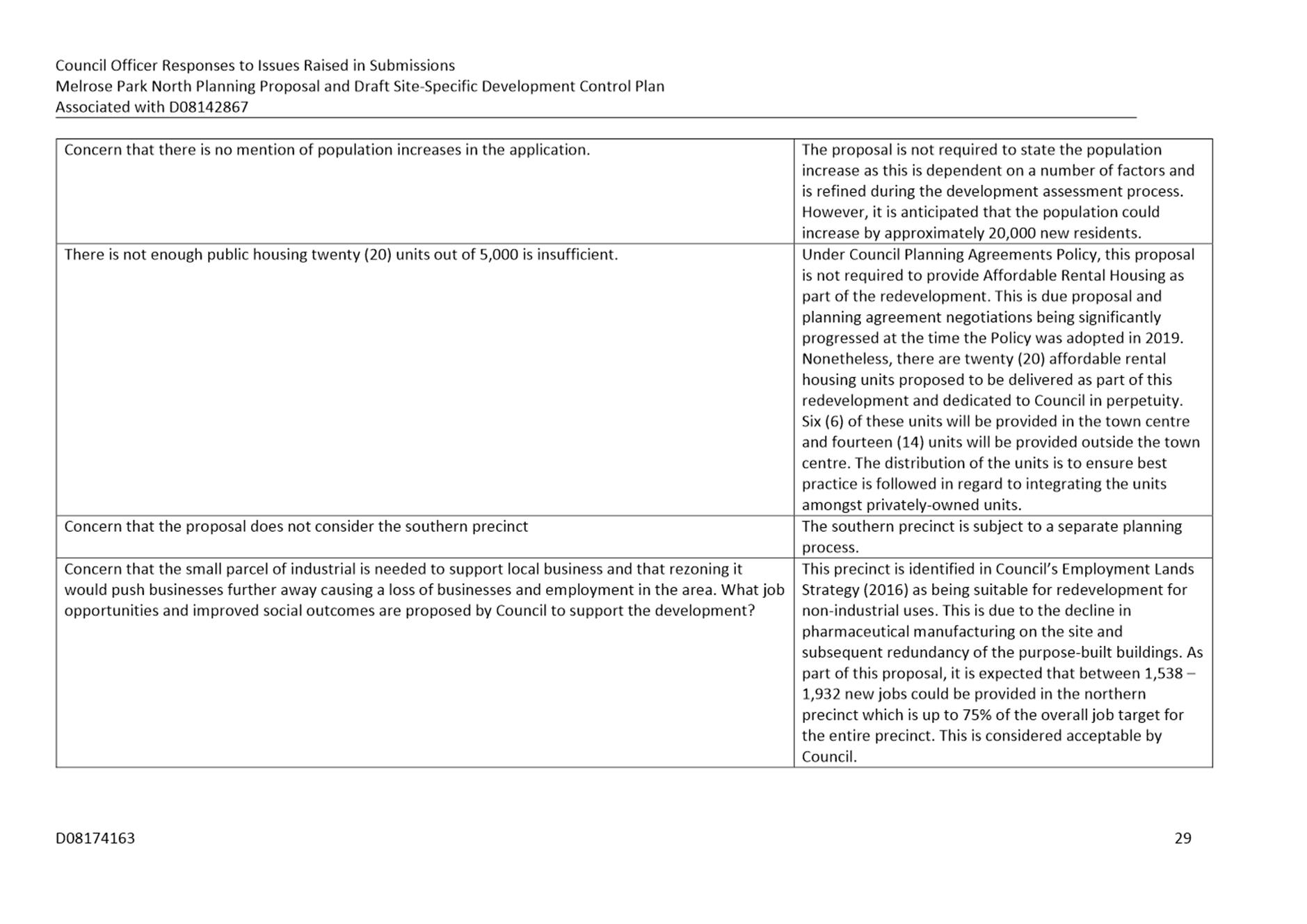
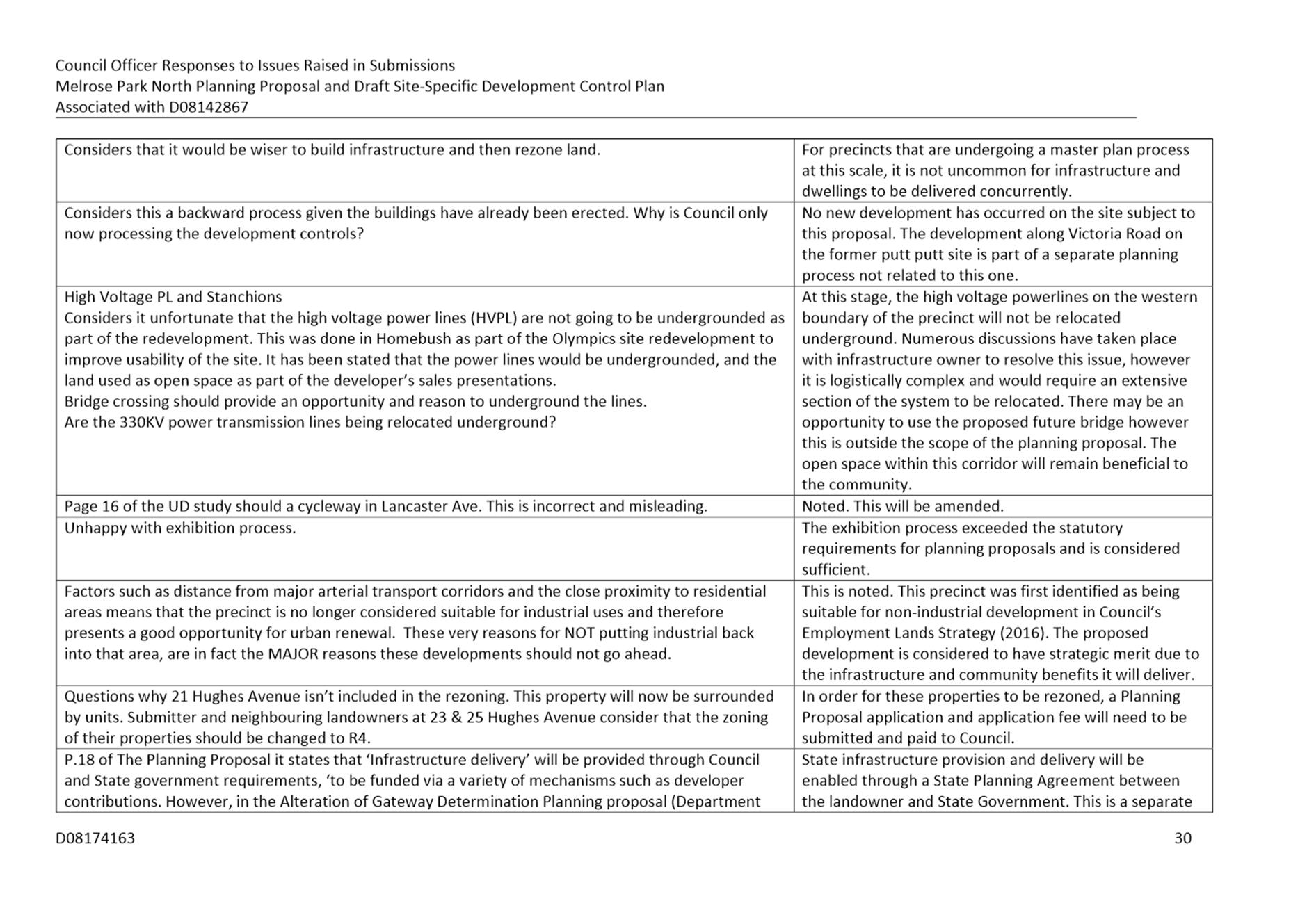
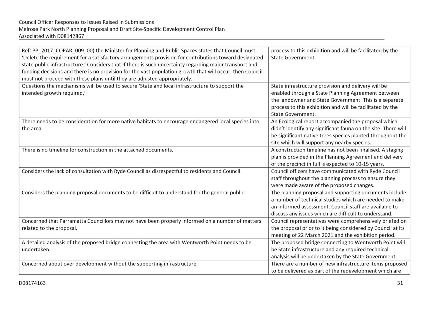
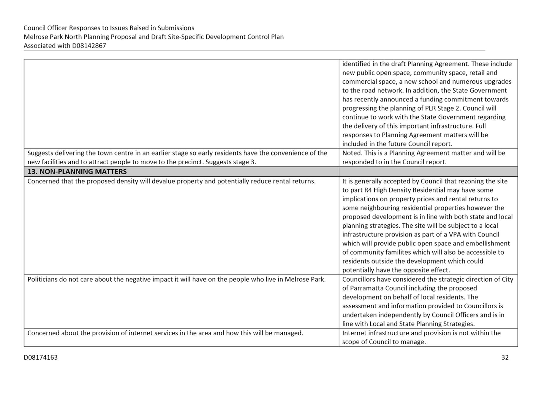
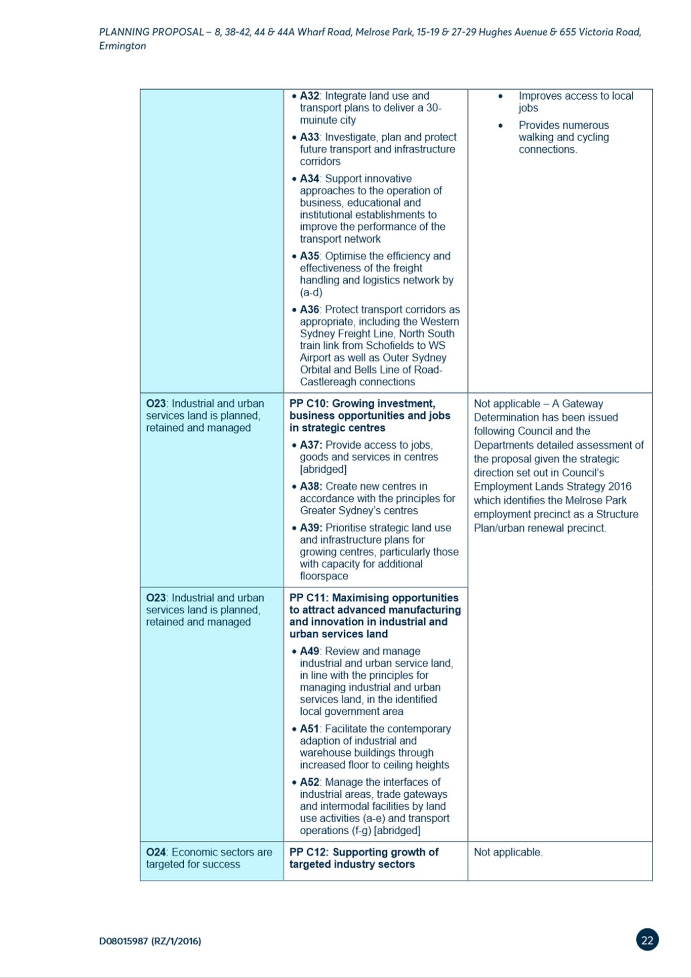
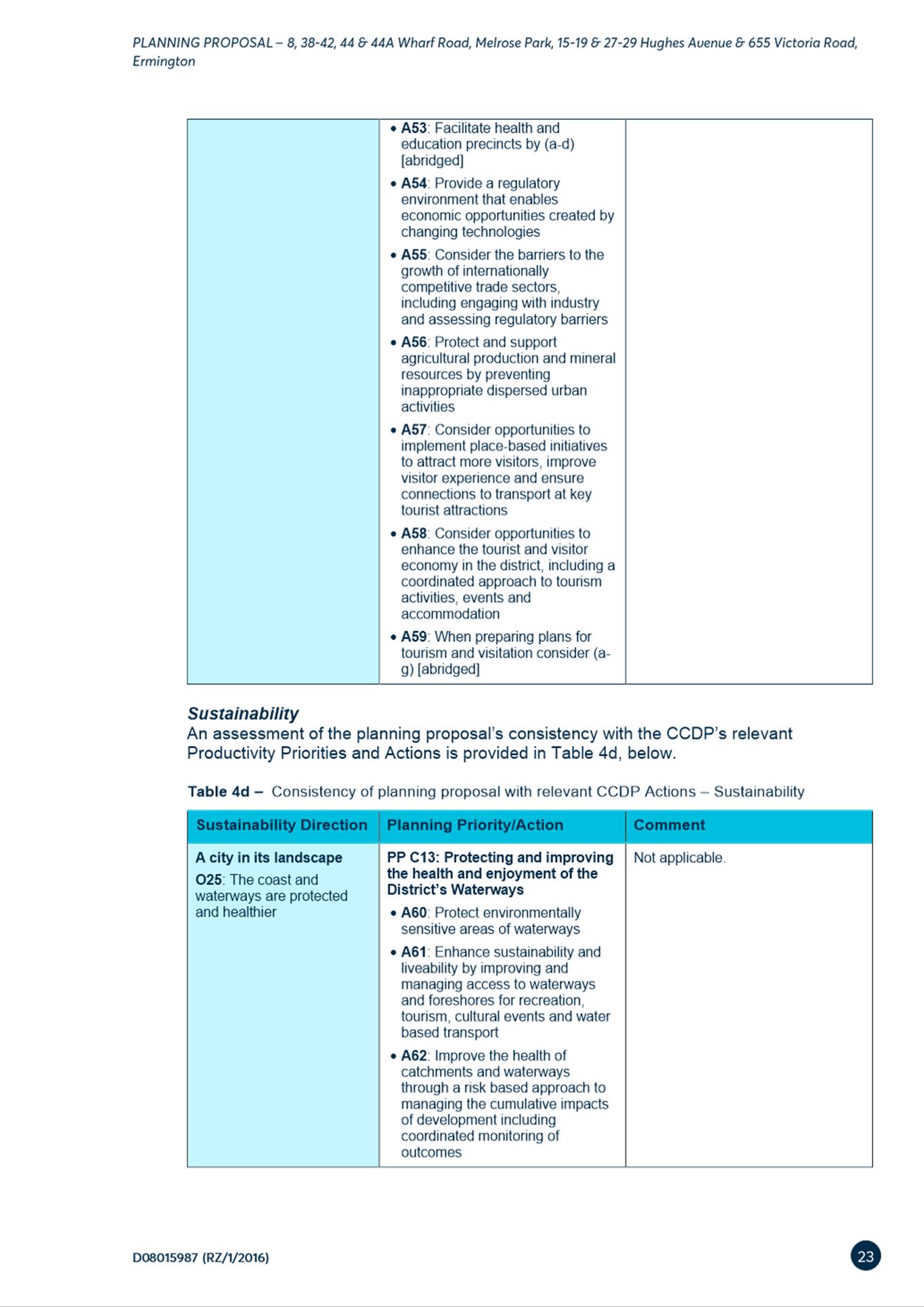
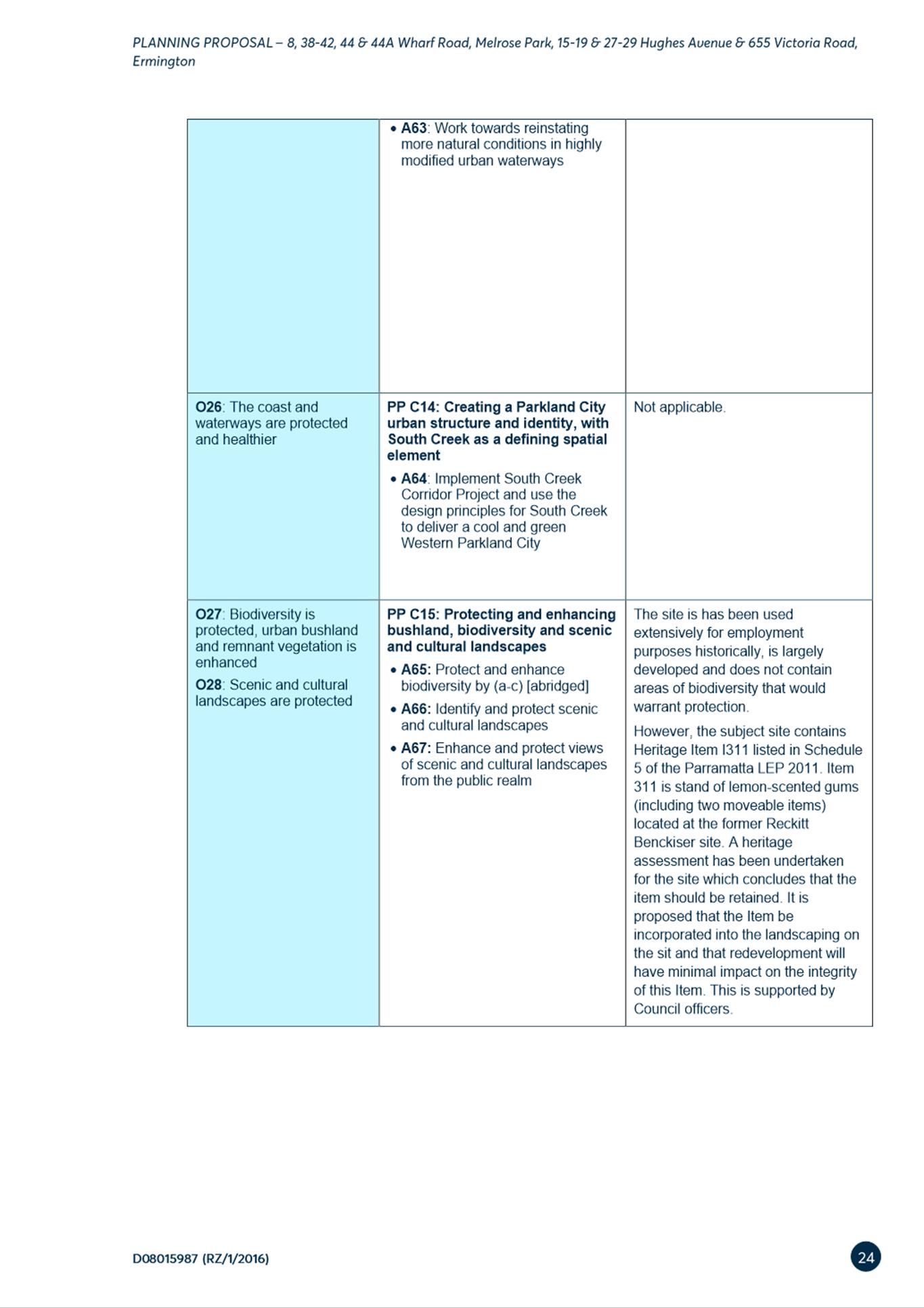
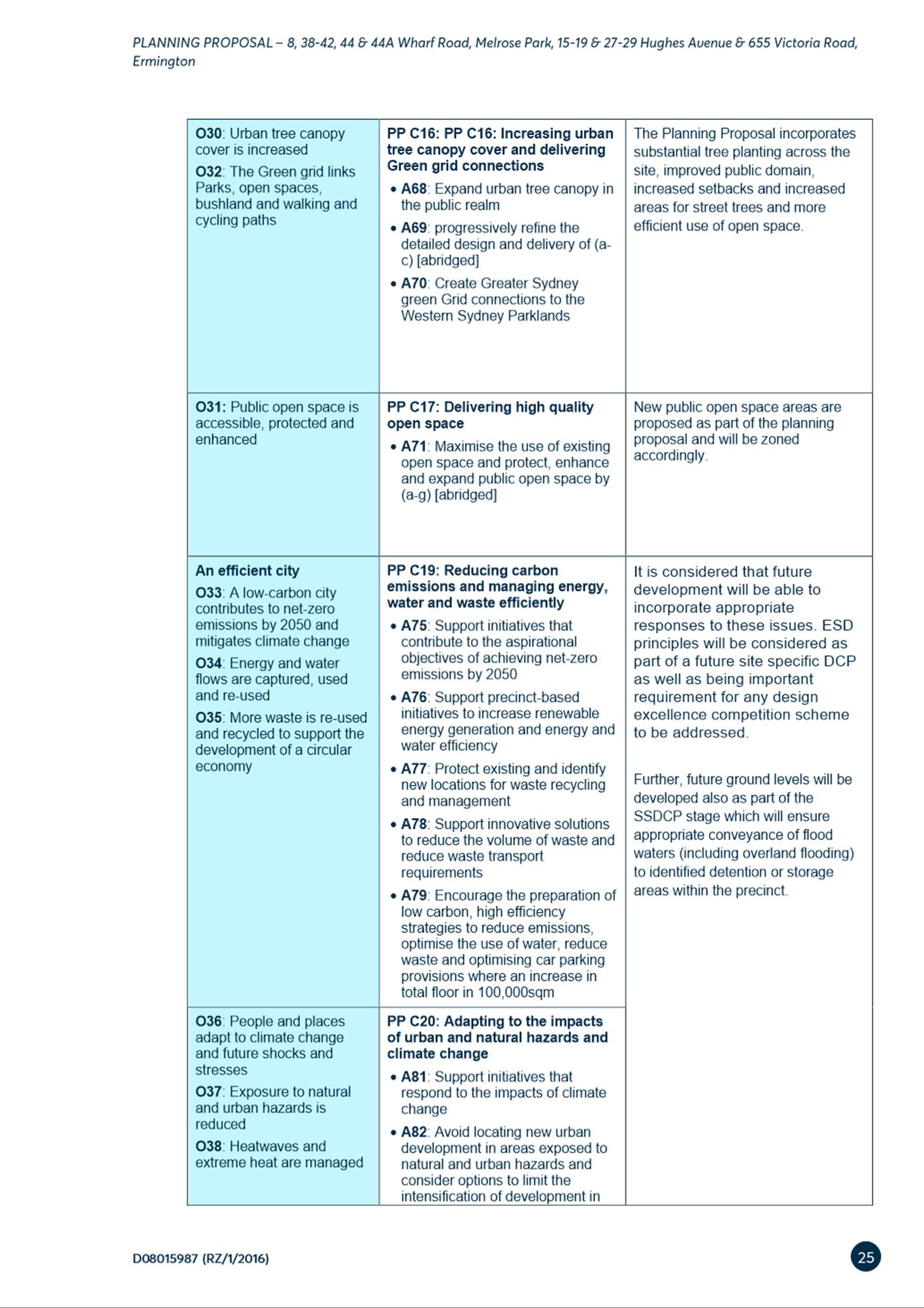
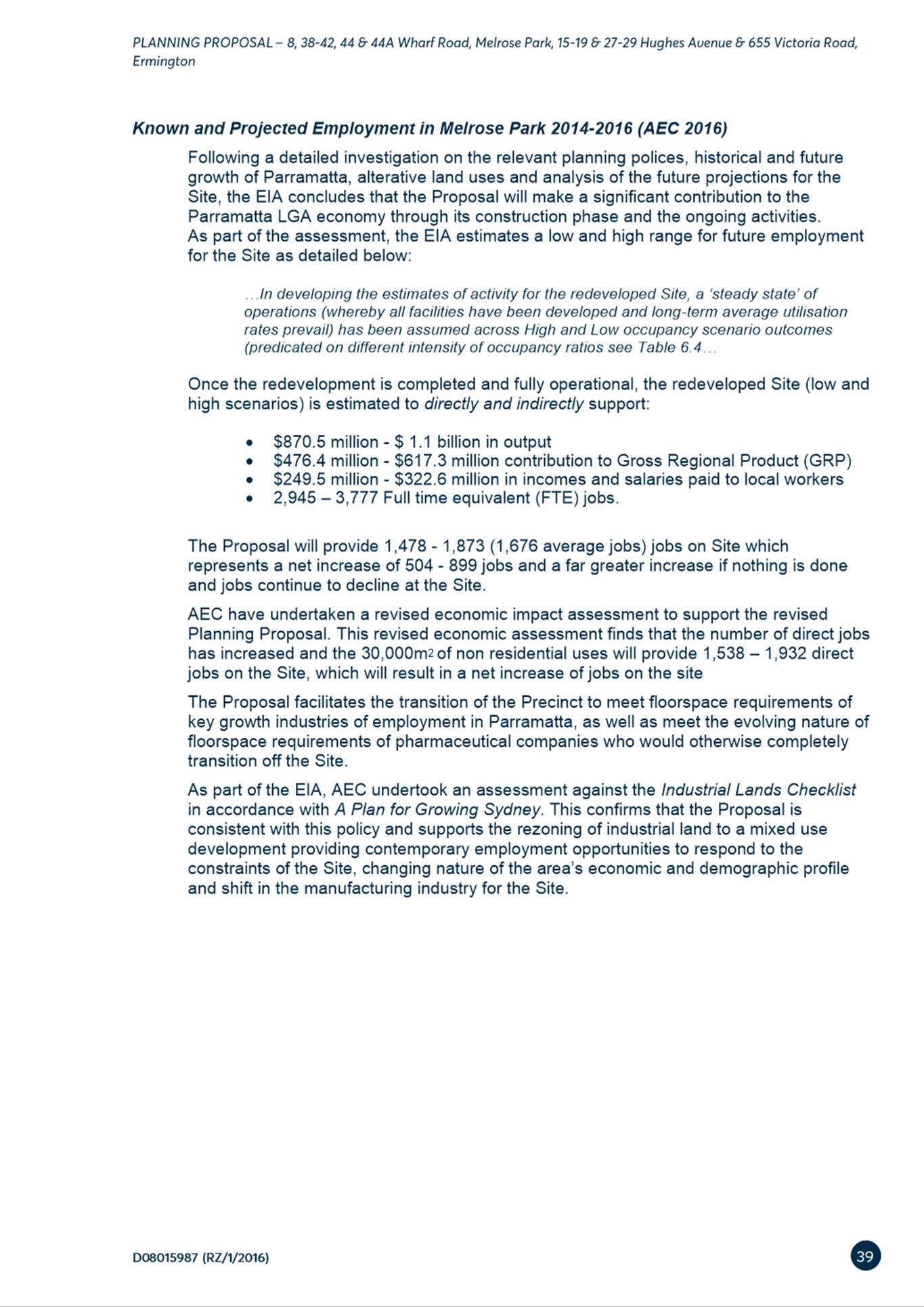
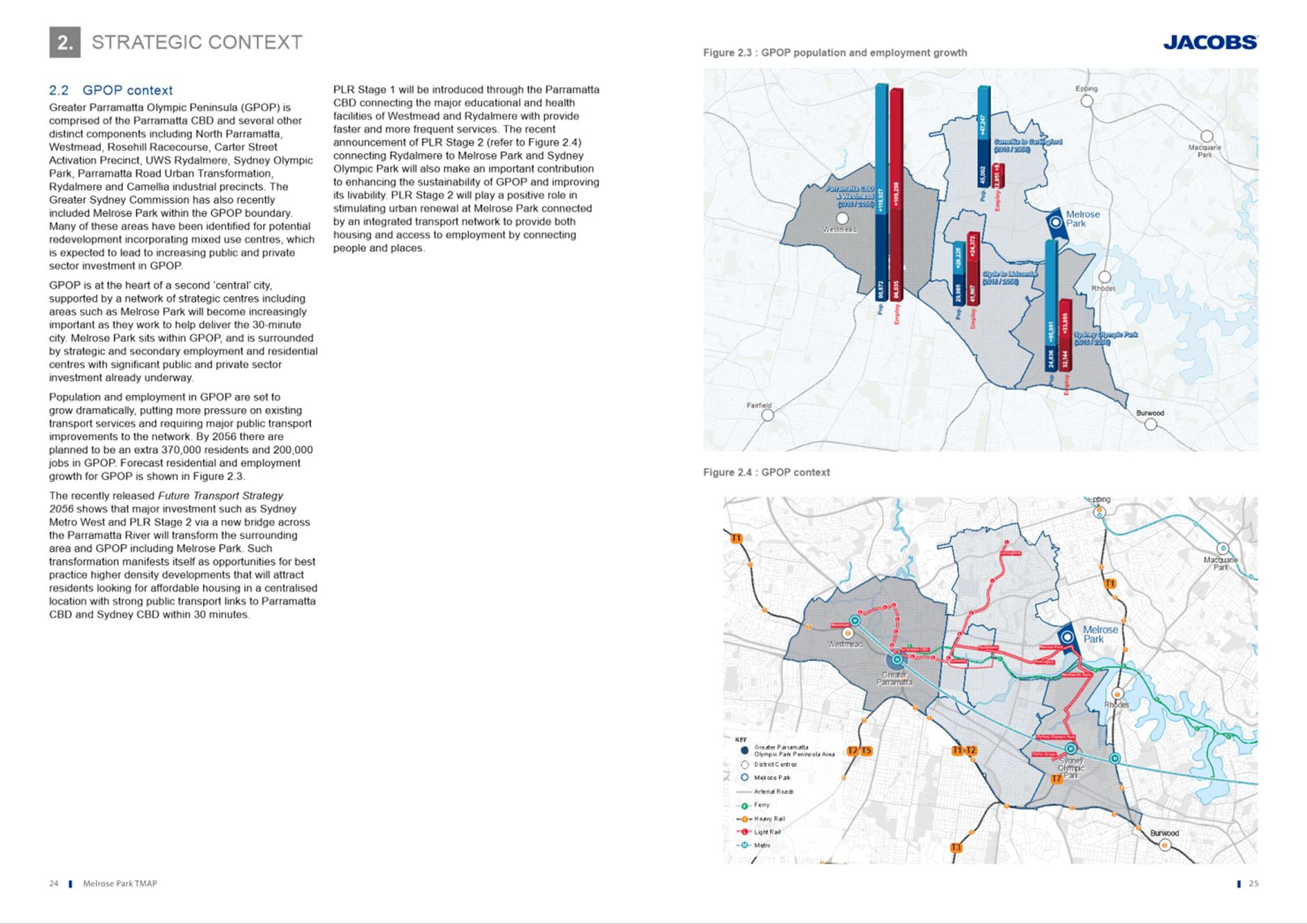
6.1 Exhibition Outcomes - Amended Melrose Park North Planning Proposal and Draft Site-Specific Development Control Plan.................... 220
Development Applications
17 August 2021
5.1 PUBLIC
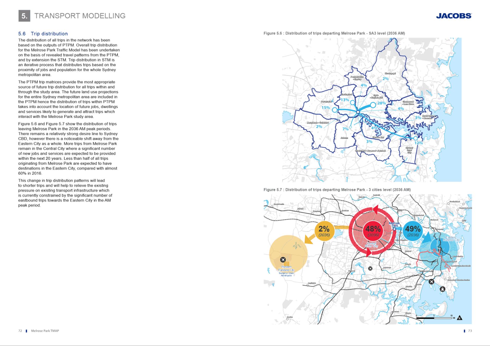
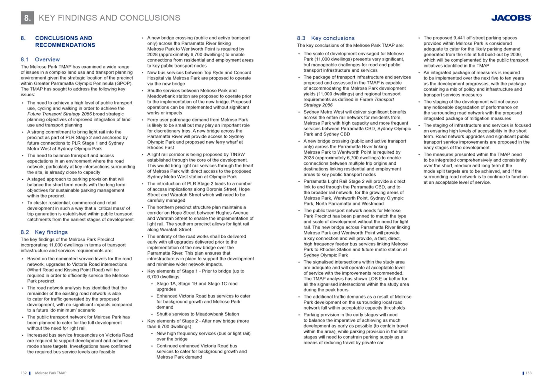
MEETING:
32 Honiton Avenue, Carlingford (Lot 5 DP 205980)............................... 6
5.2 OUTSIDE
PUBLIC MEETING:
131 Kirby Street, Rydalmere (Lot 3 DP 39296)............... 74
5.3 OUTSIDE
PUBLIC MEETING:
49-51 Albion St, Harris Park 174
Local Planning Panel 17 August 2021 Item 5.1
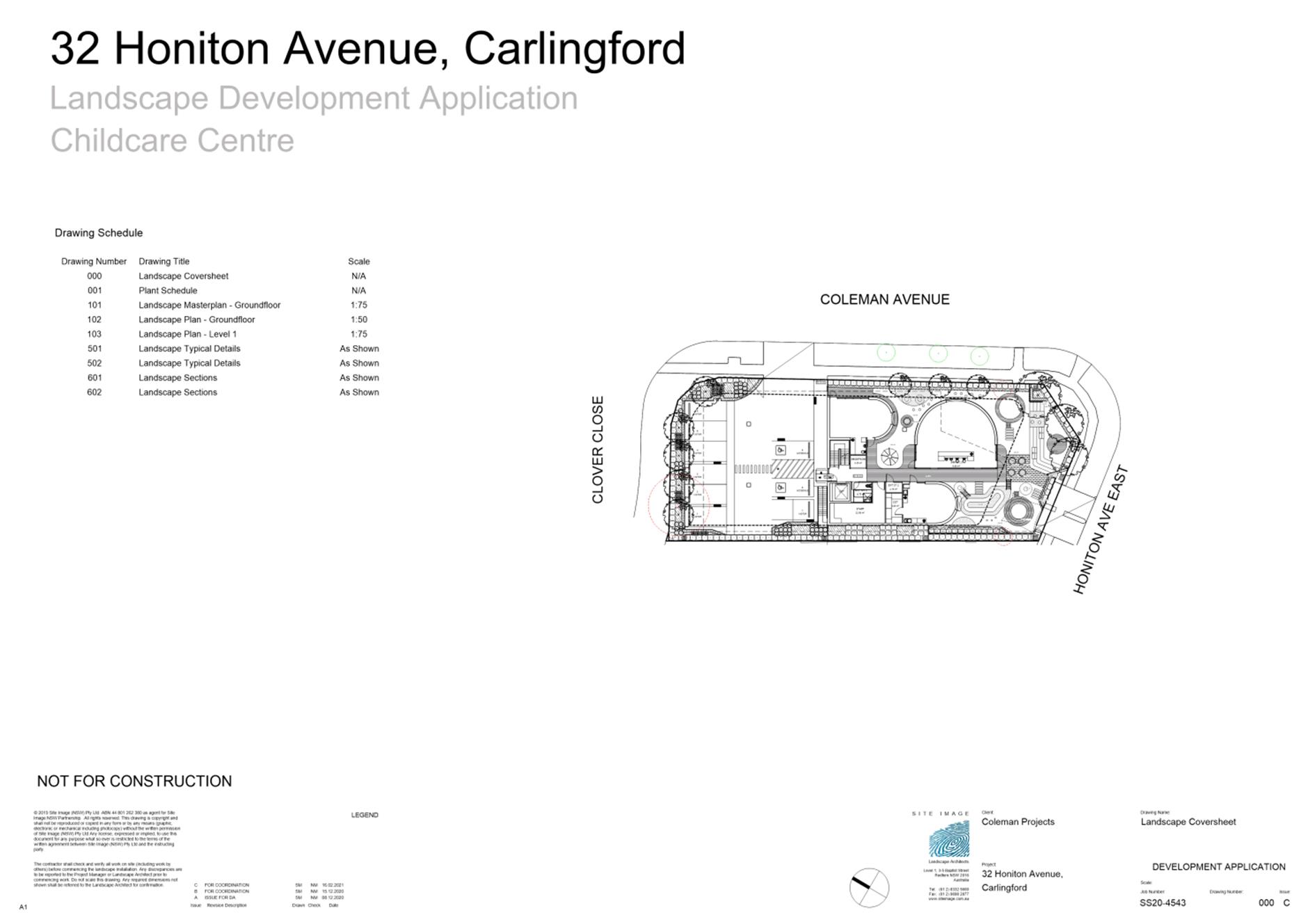
ITEM NUMBER 5.1
SUBJECT PUBLIC MEETING:
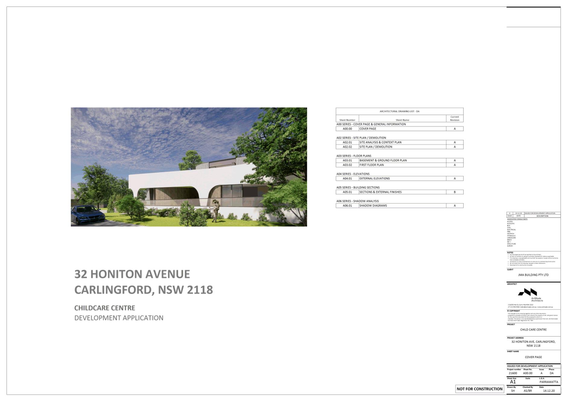
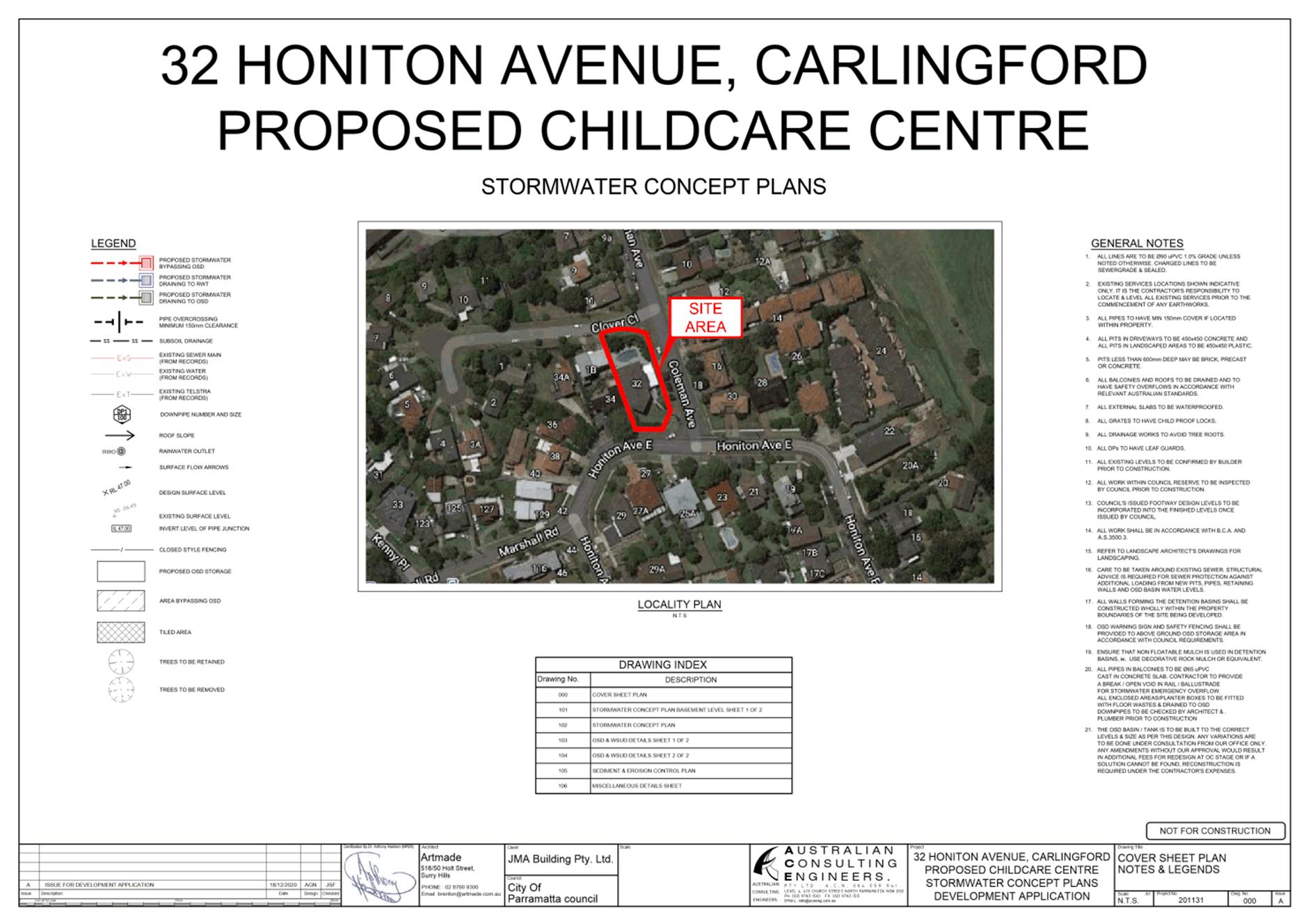
32 Honiton Avenue, Carlingford (Lot 5 DP 205980)
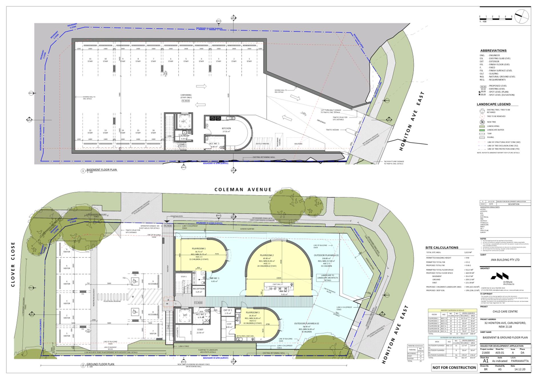
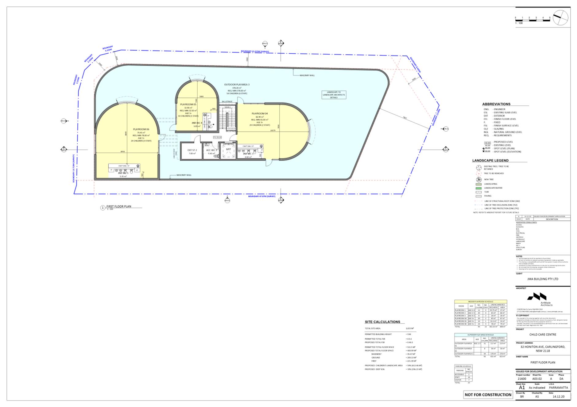
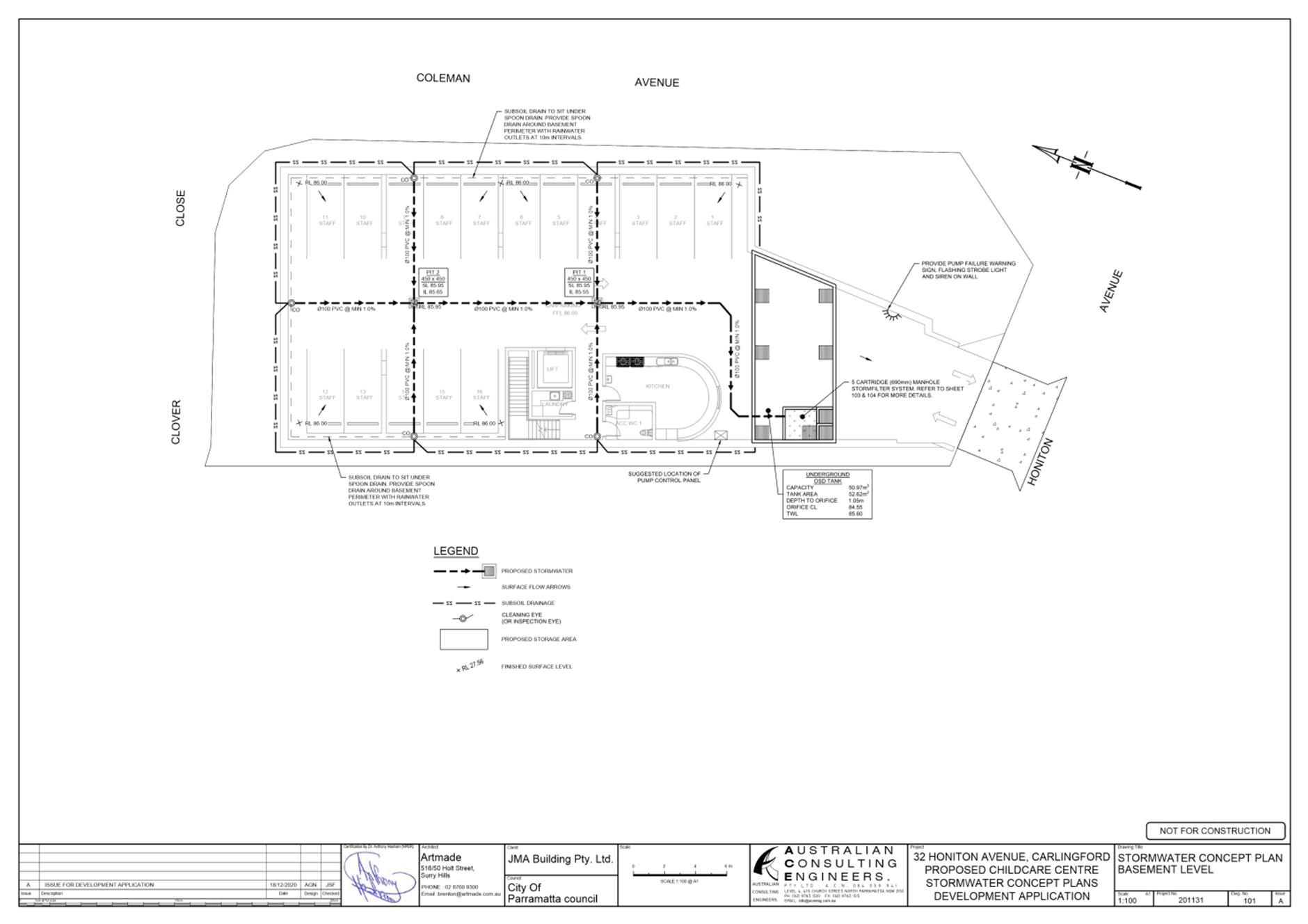
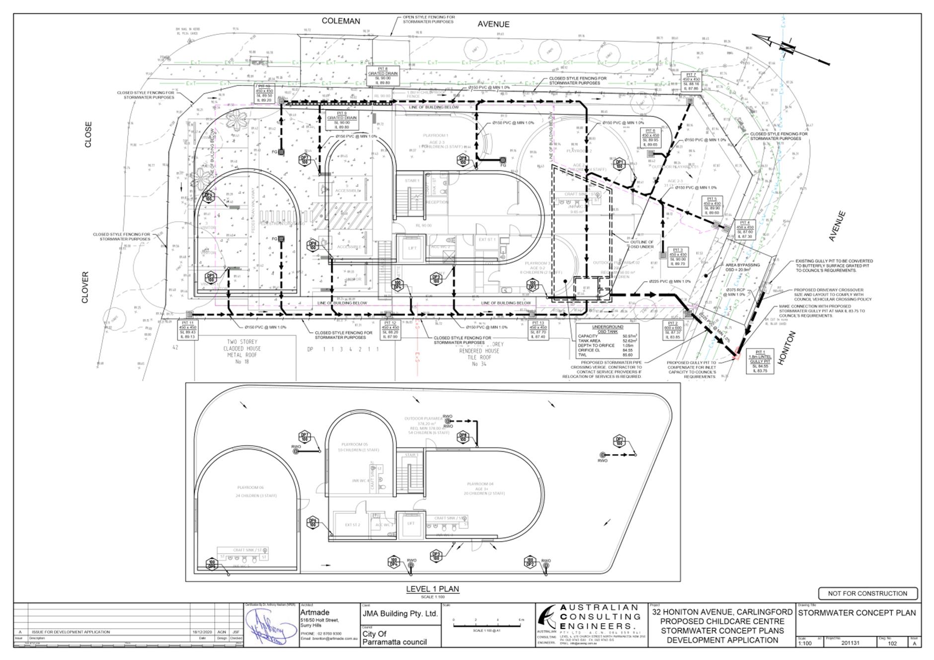
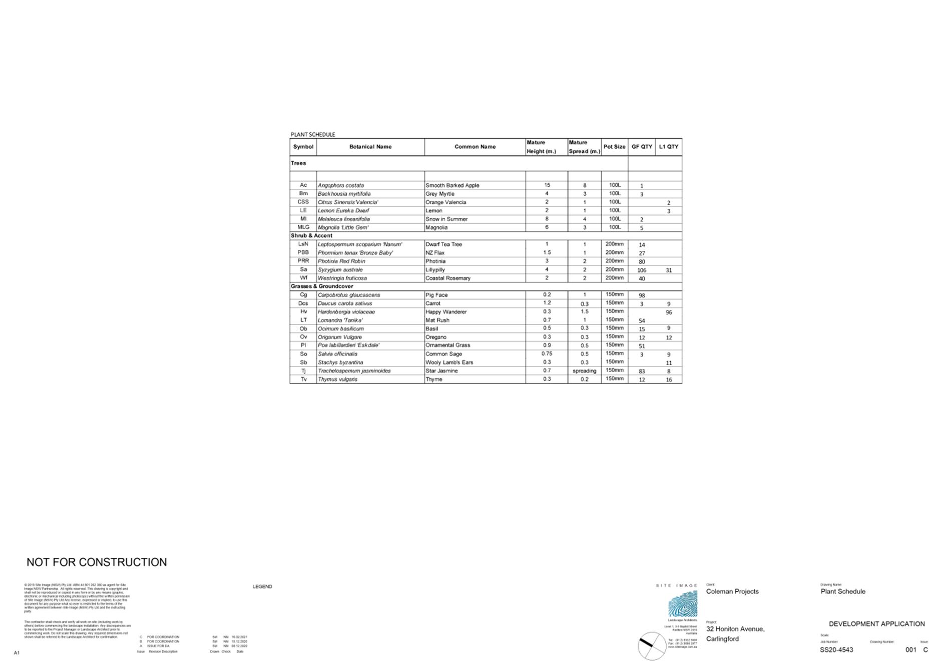
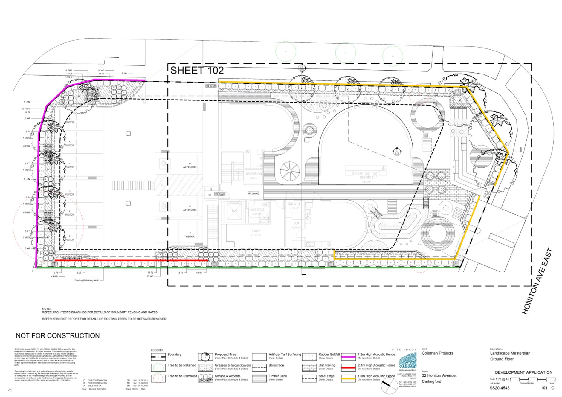
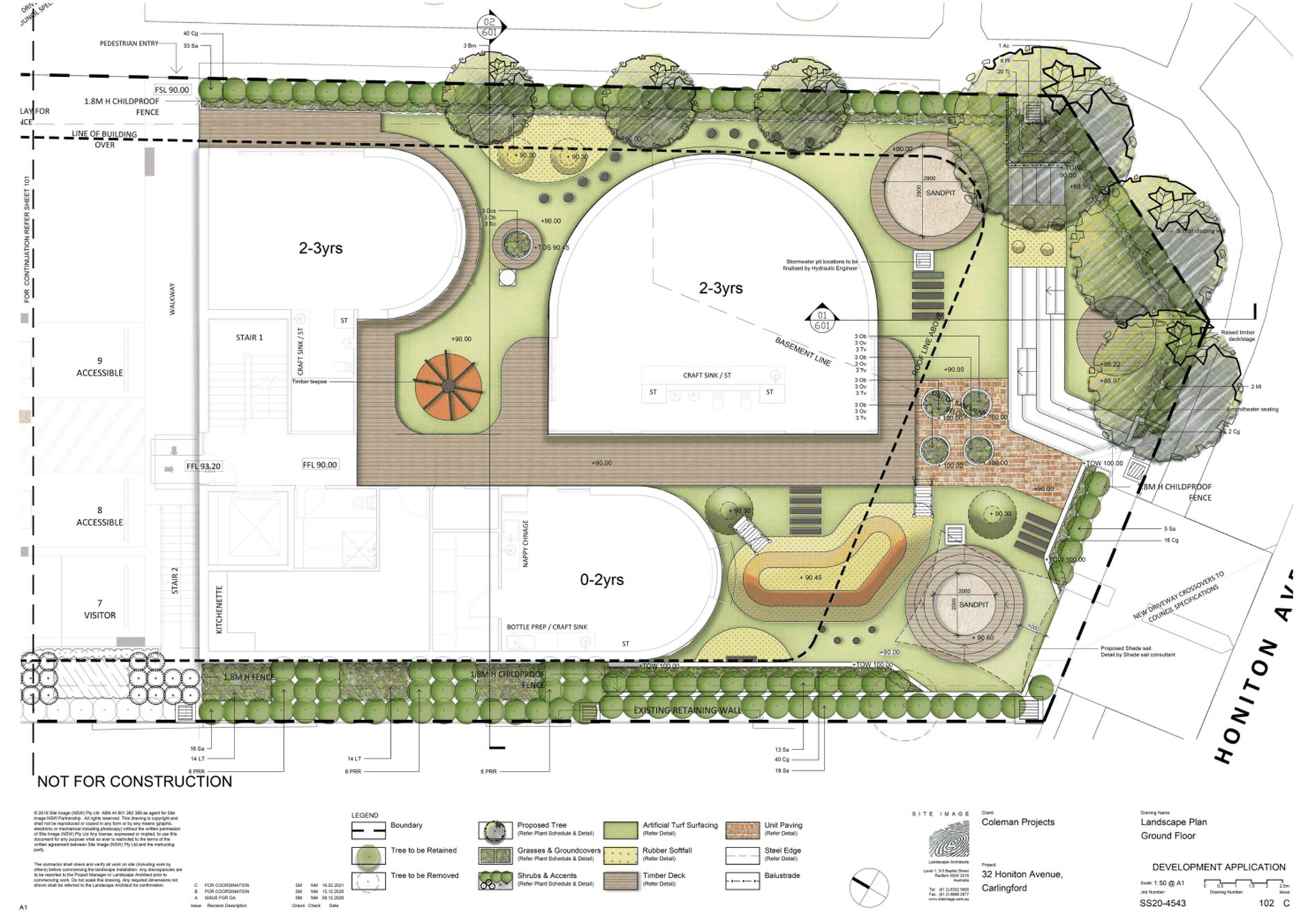
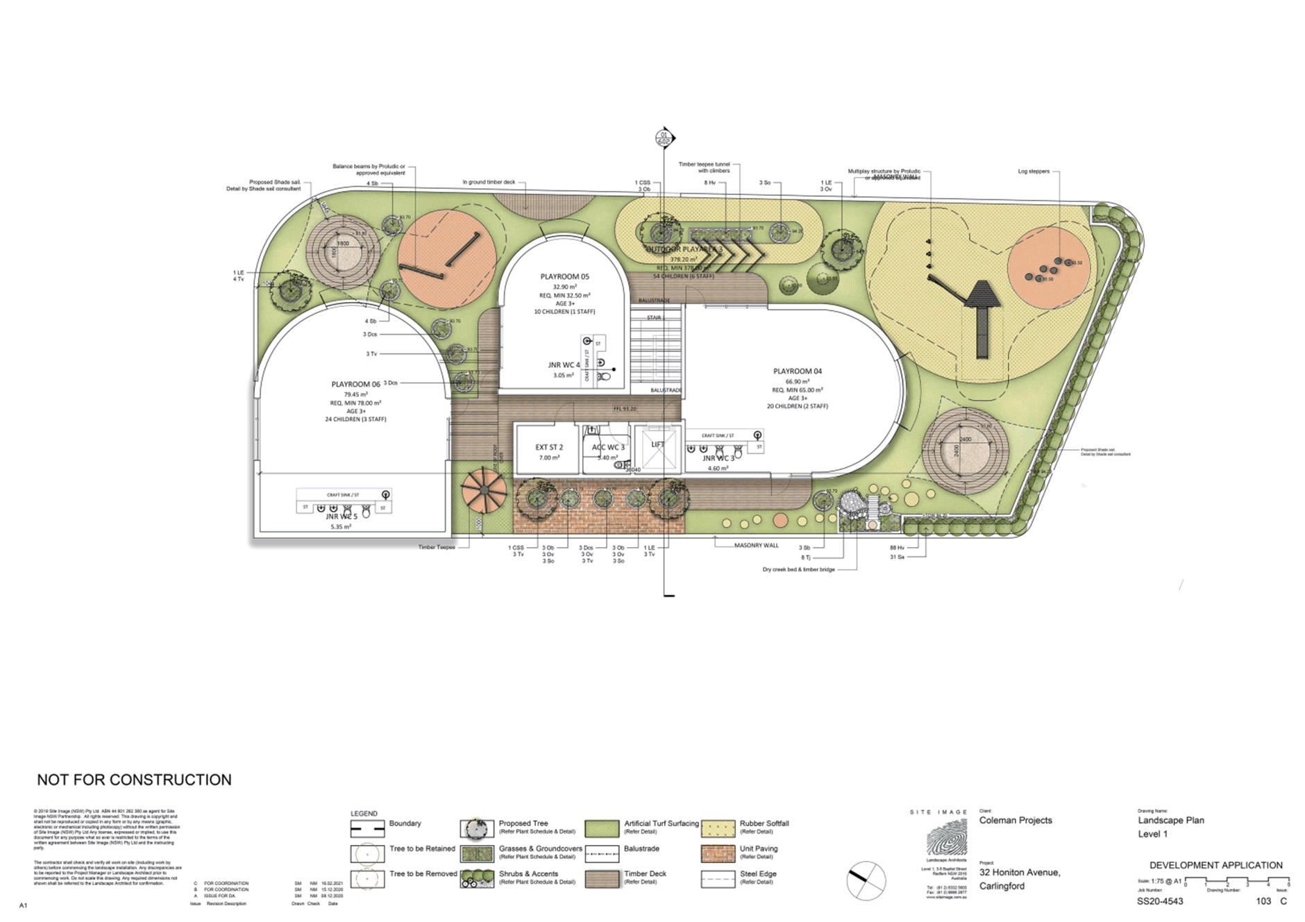
DESCRIPTION Demolition, tree removal and construction of a centre-based child care facility to accommodate 93 children with ground and basement level parking for 25 cars.
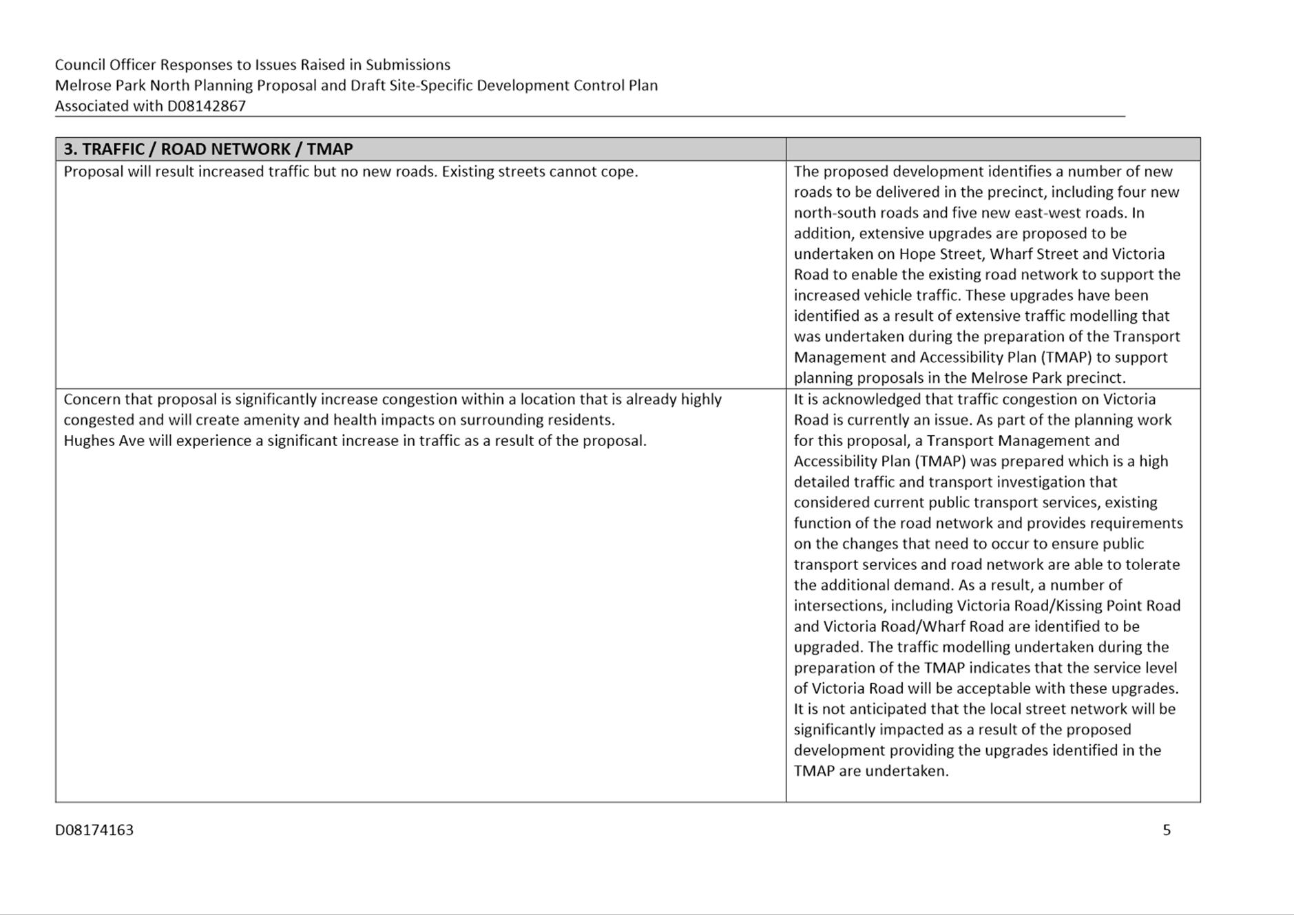
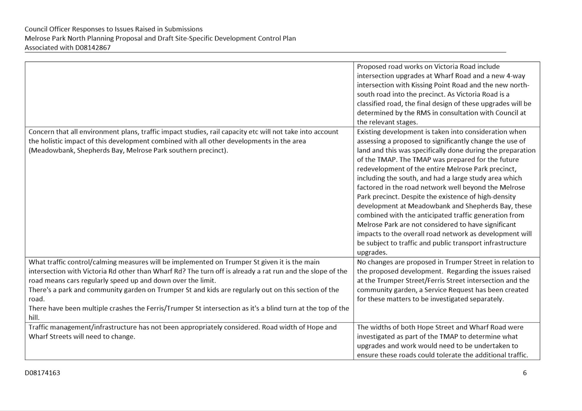
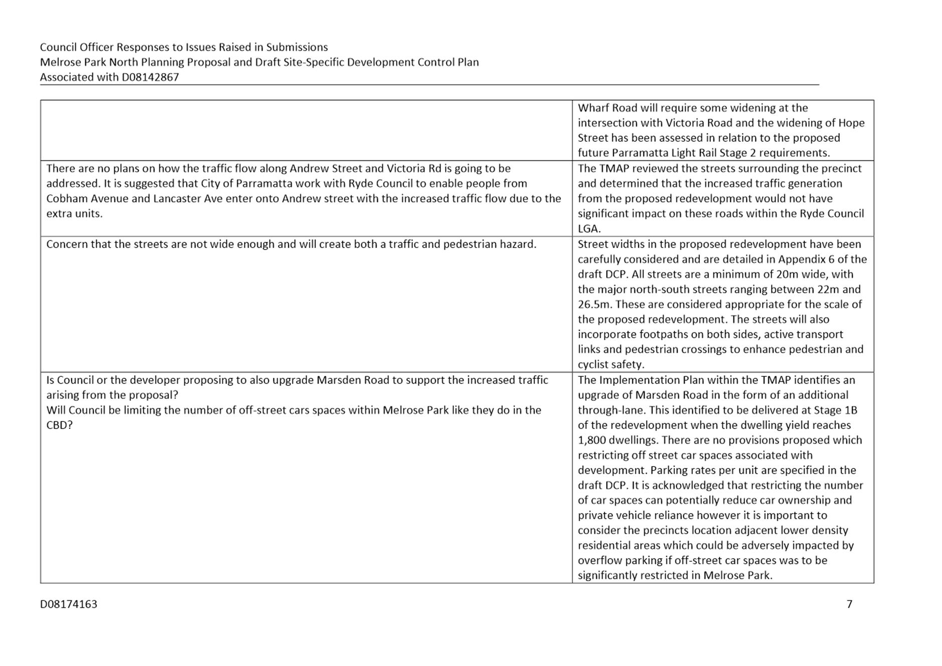
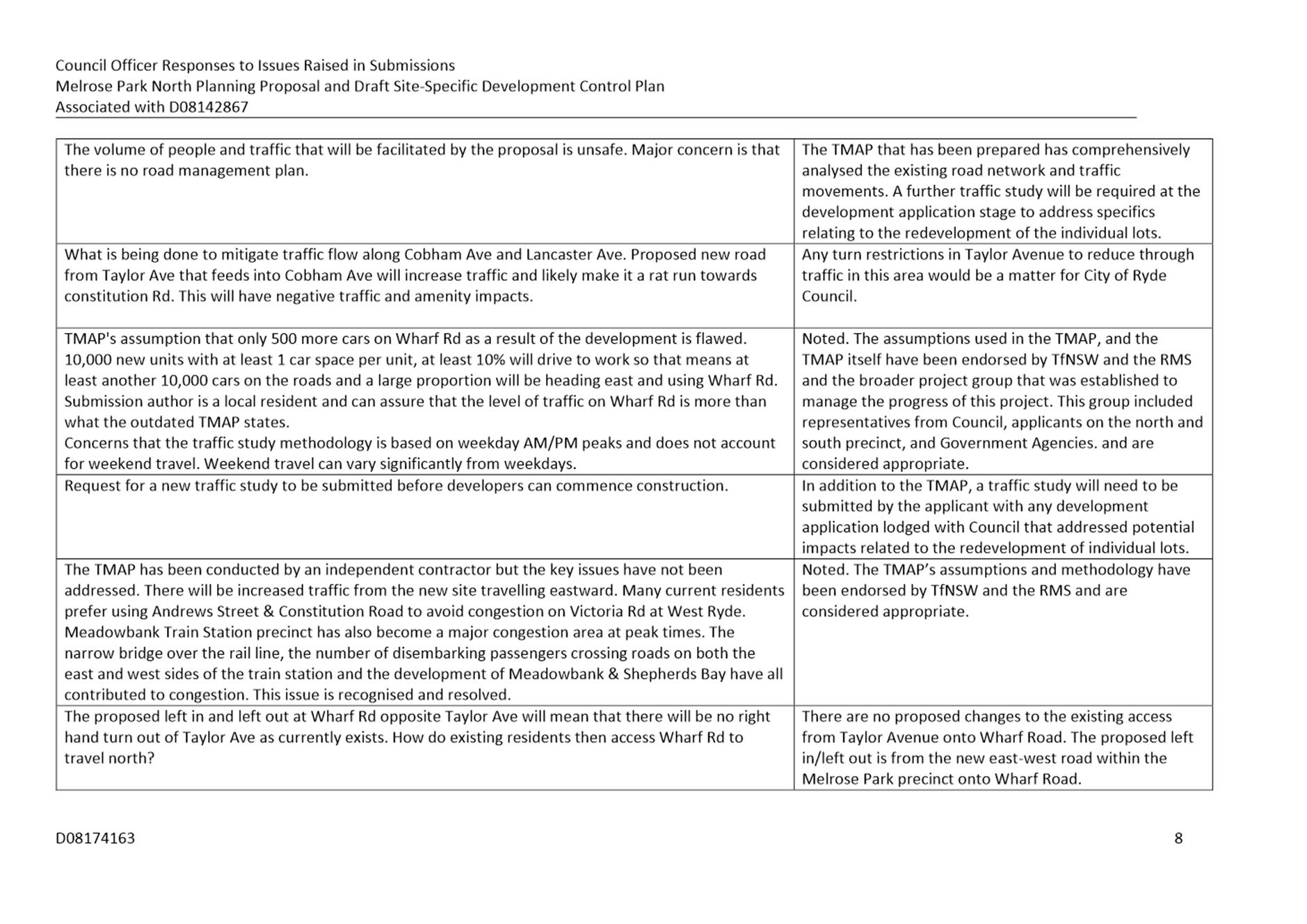
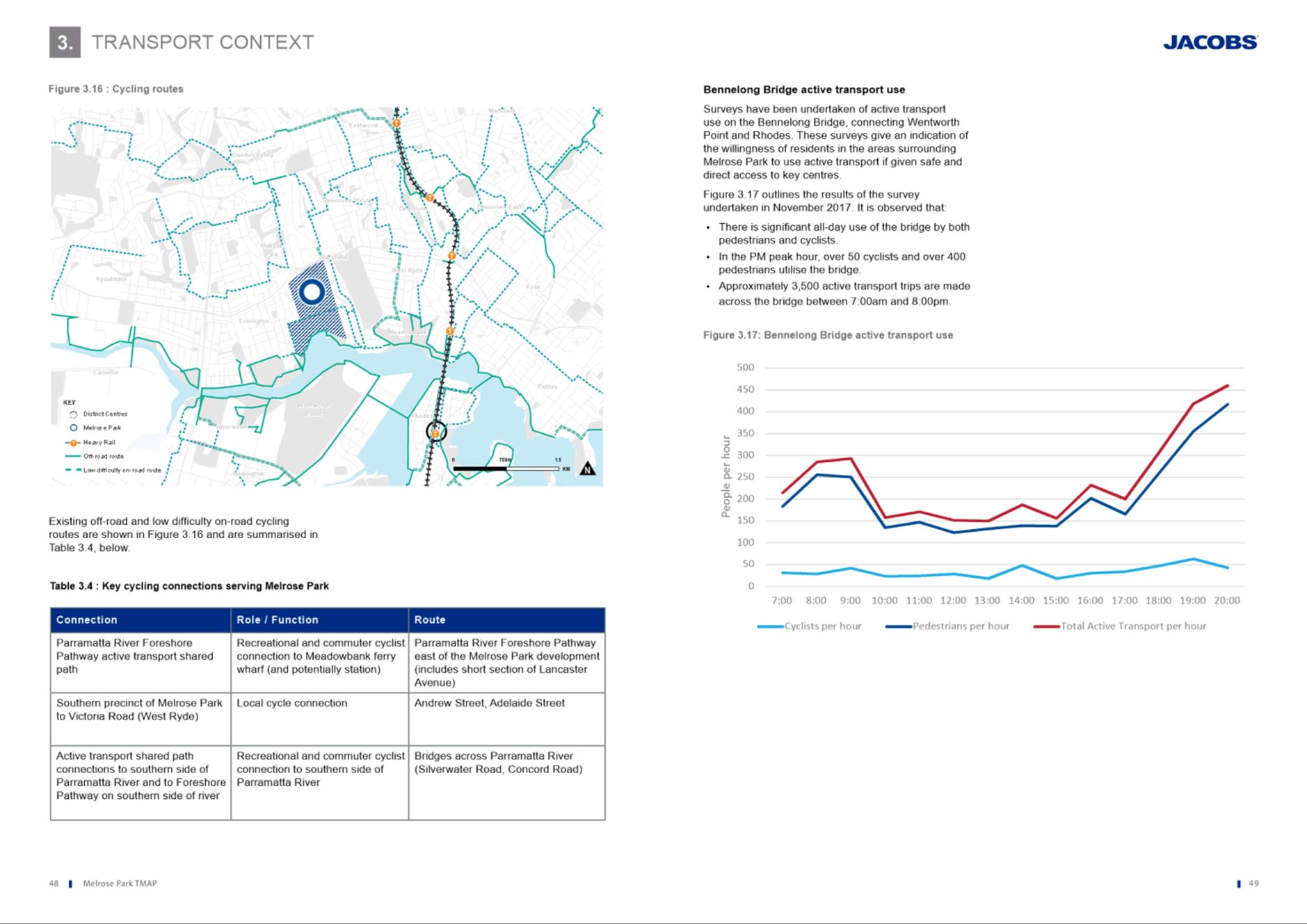
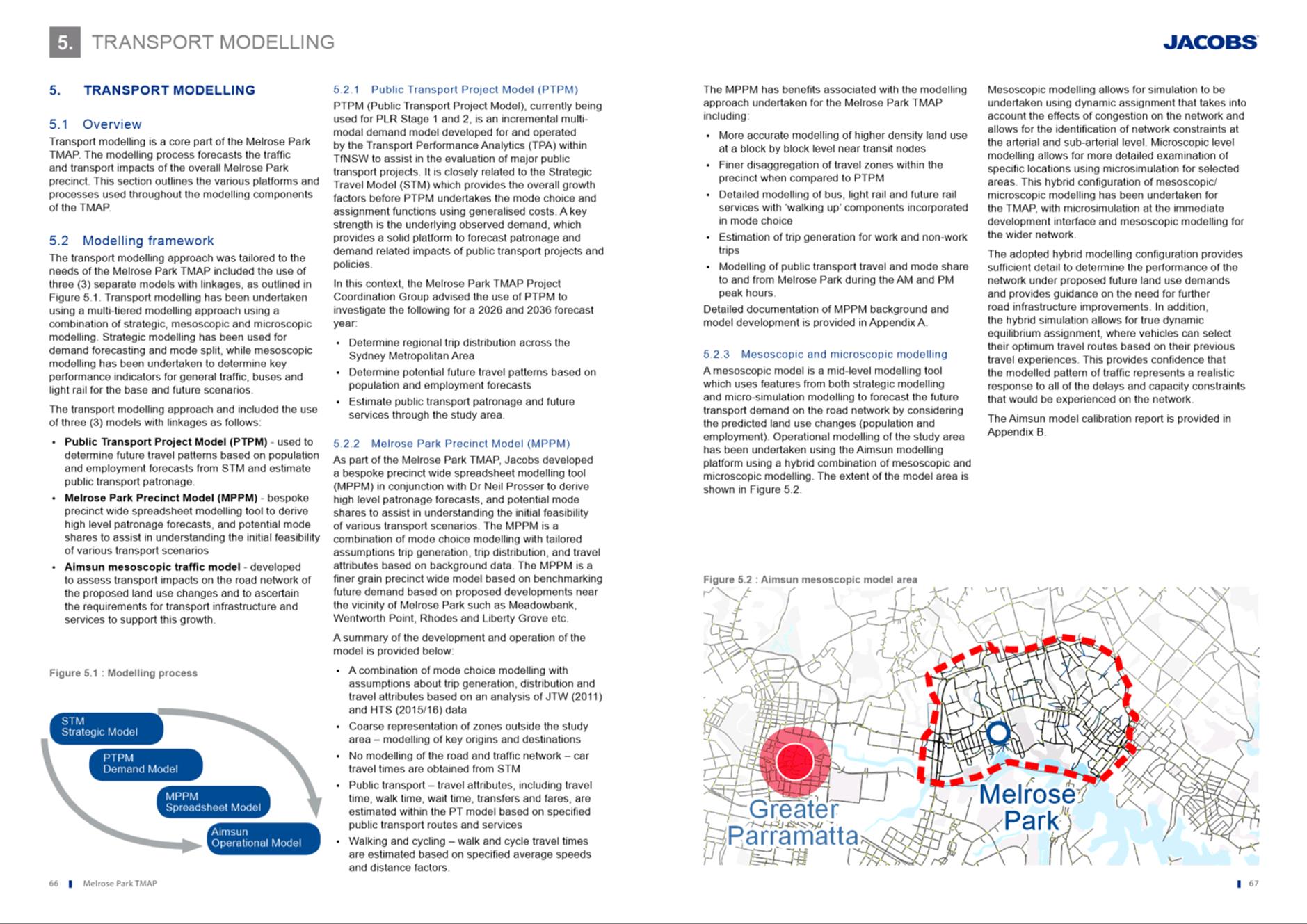
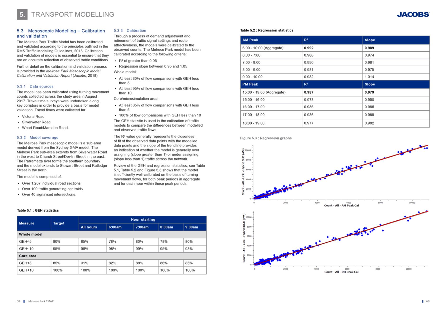
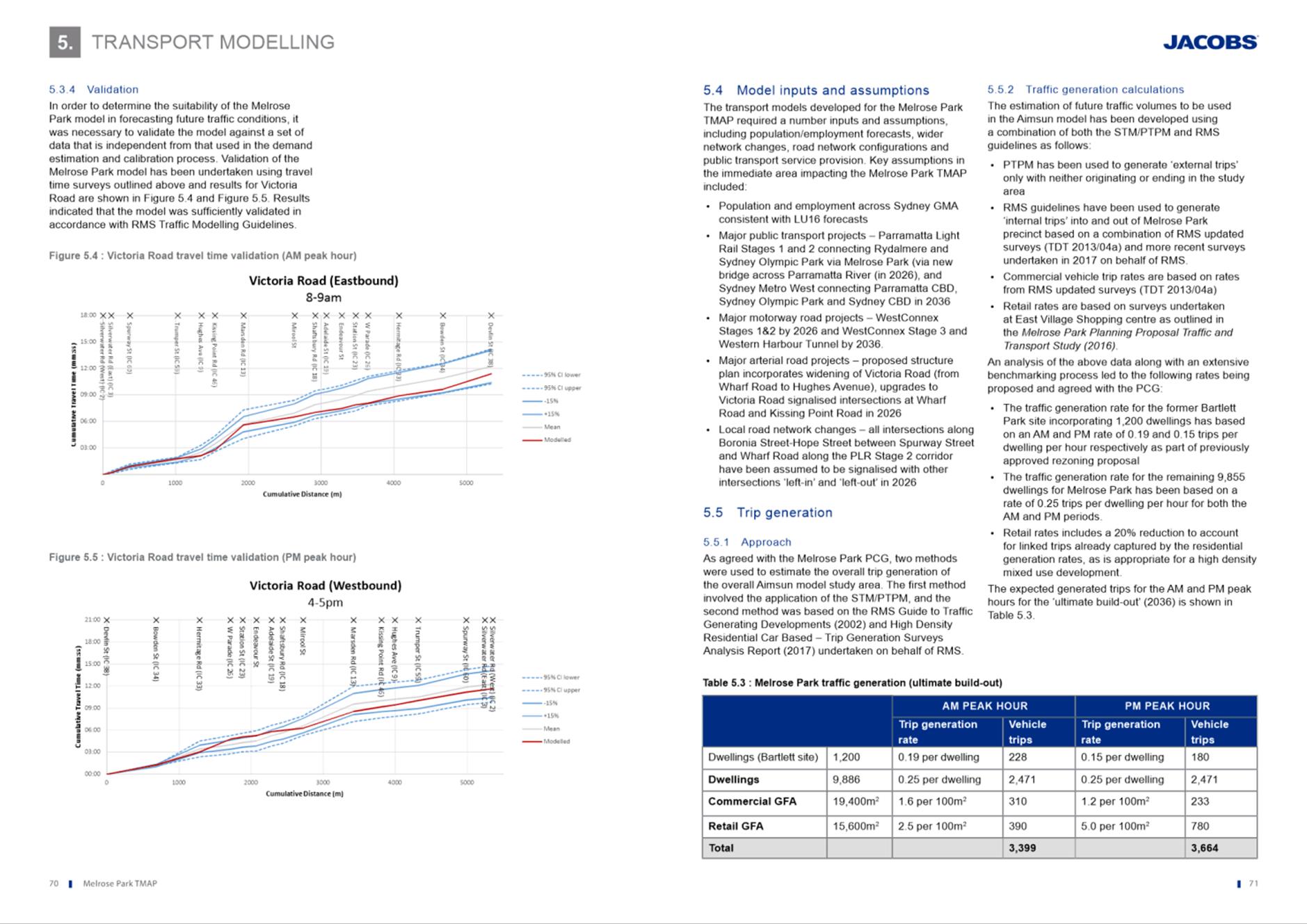
REFERENCE DA/63/2021 - D08138283
APPLICANT/S ArtMade Architects
OWNERS Mr A Abi-Khattar
REPORT OF Group Manager Development and Traffic Services
RECOMMENDED Refusal
REASON FOR REFERRAL TO LPP
This item is being referred to the Parramatta Local Planning Panel (PLPP) as more than ten (10) submissions (33 unique submissions) were received during the formal notification period.
EXECUTIVE SUMMARY
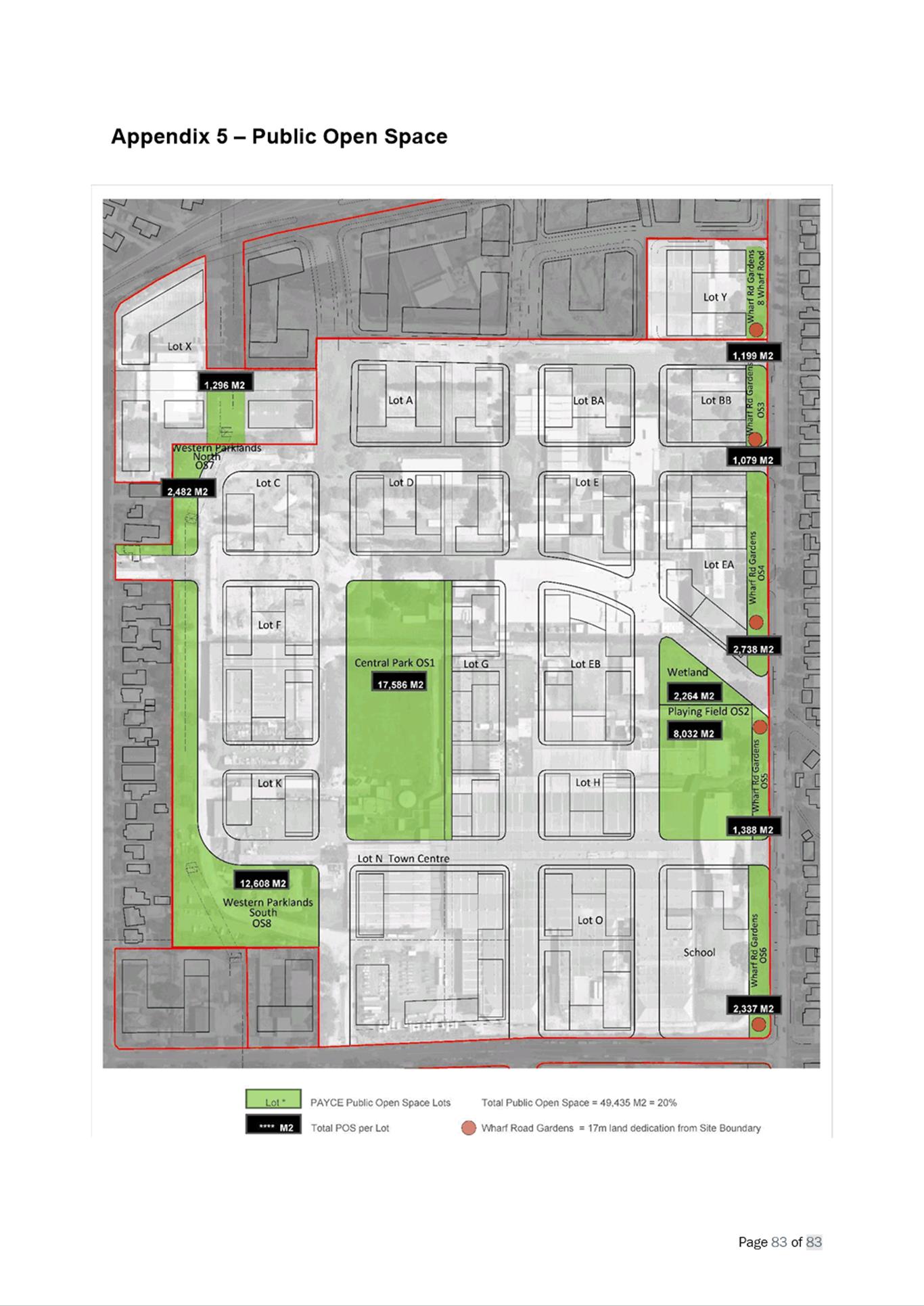
This is a summary of the full assessment of the application as outlined in Attachment 1, the Section 4.15 Assessment Report.
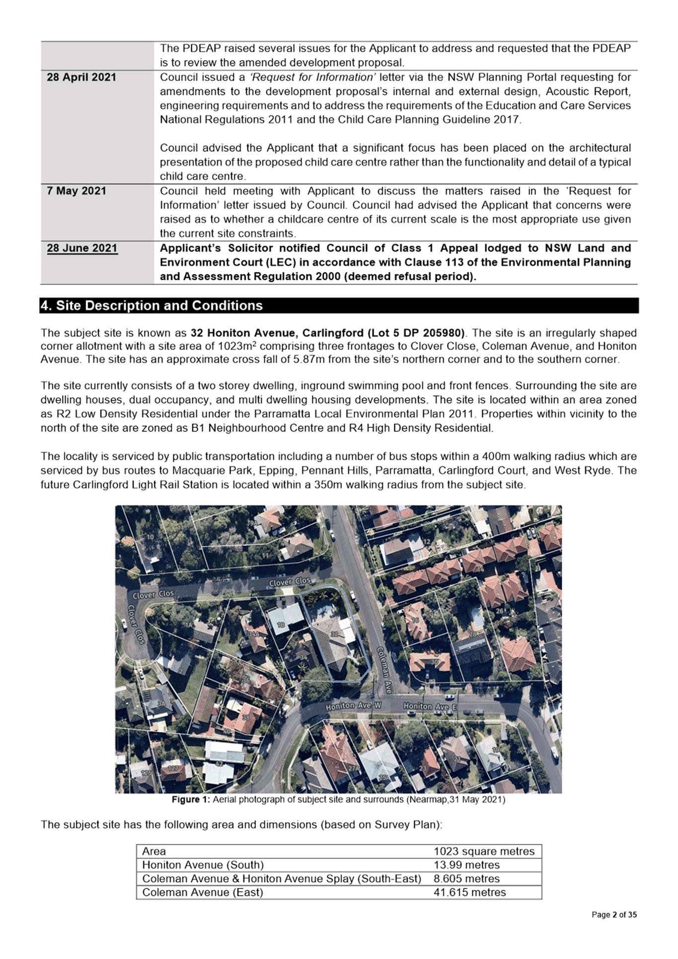
The Site
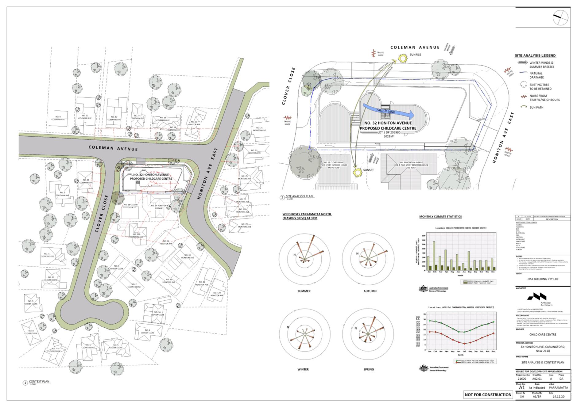
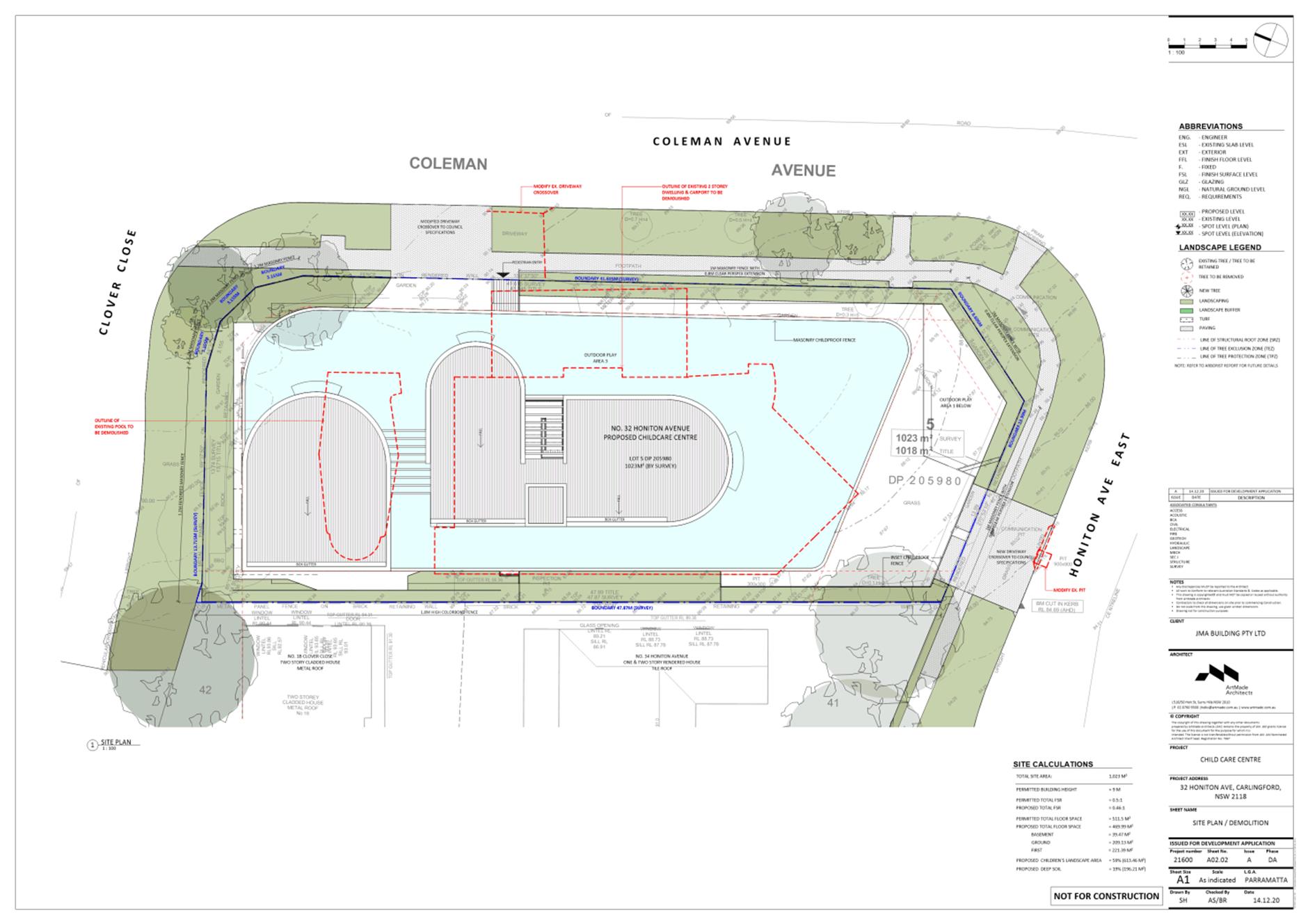
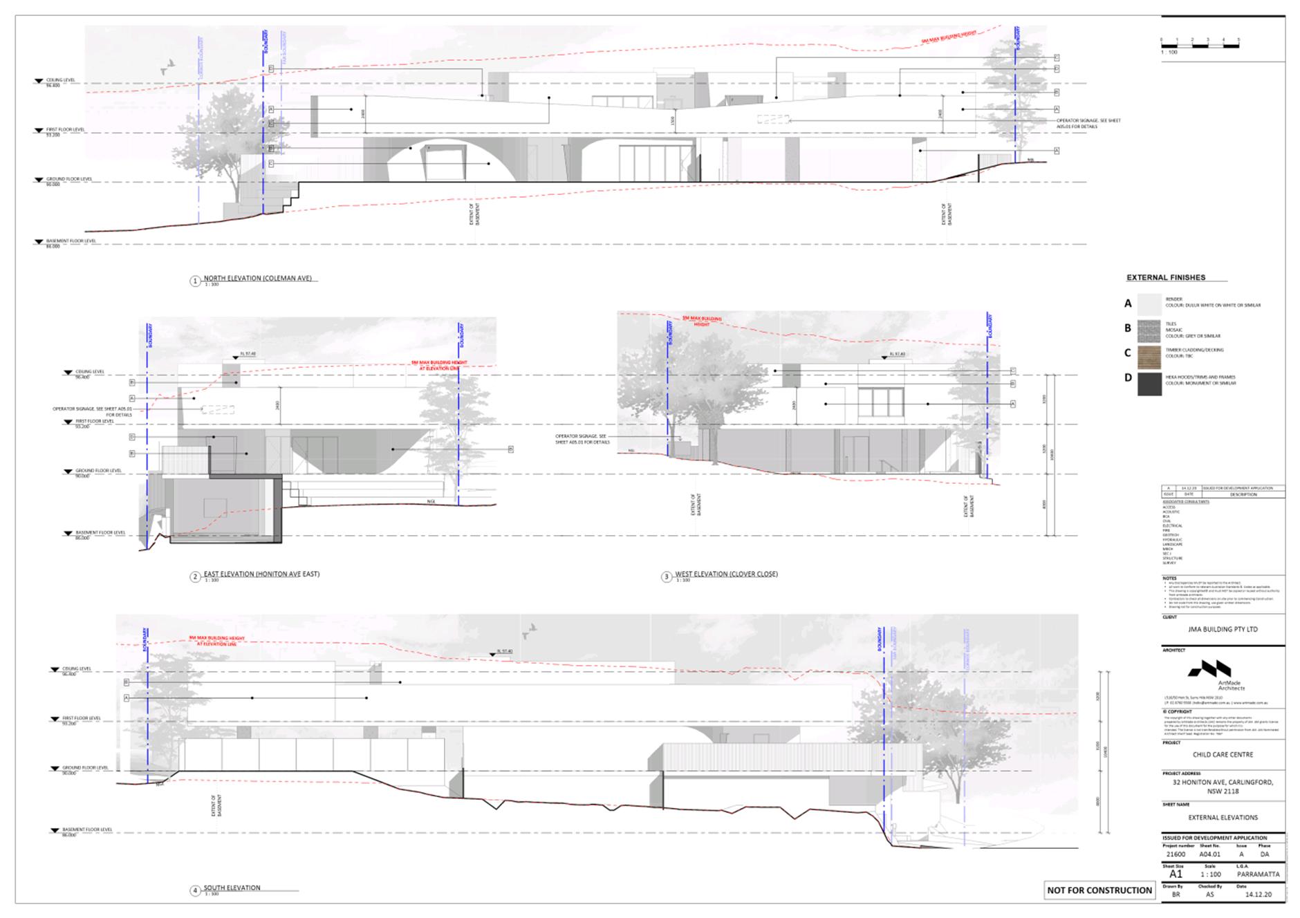
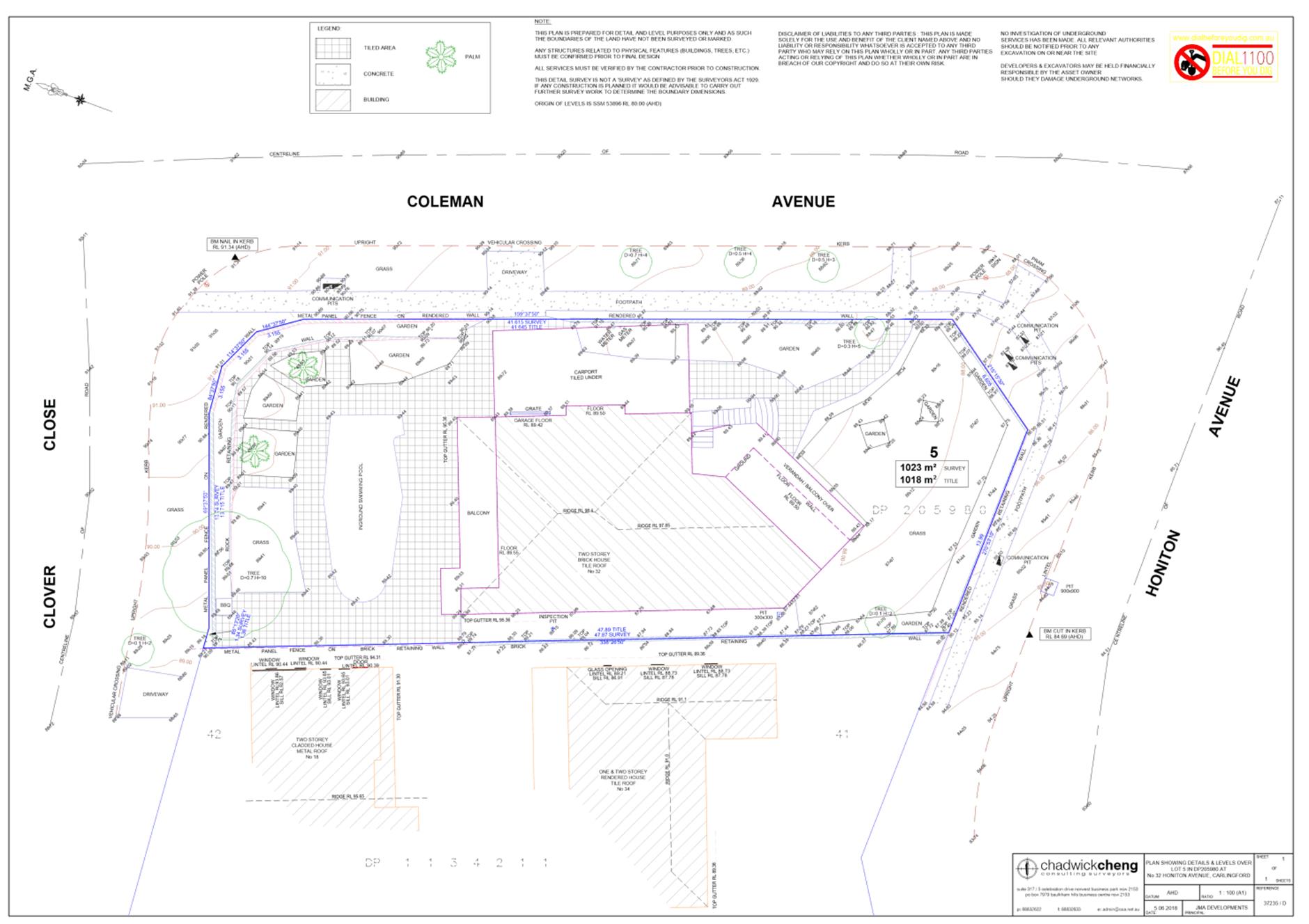
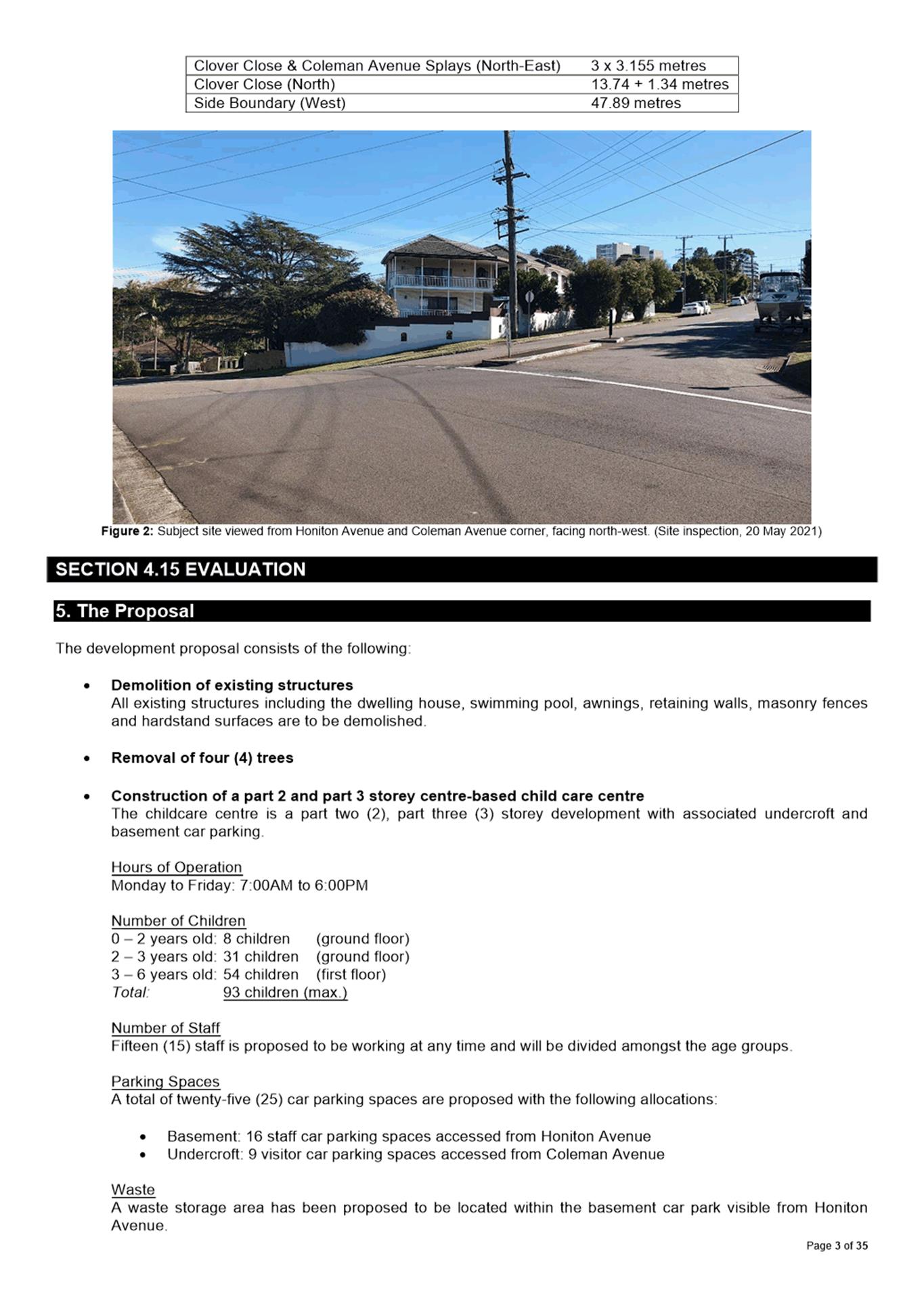
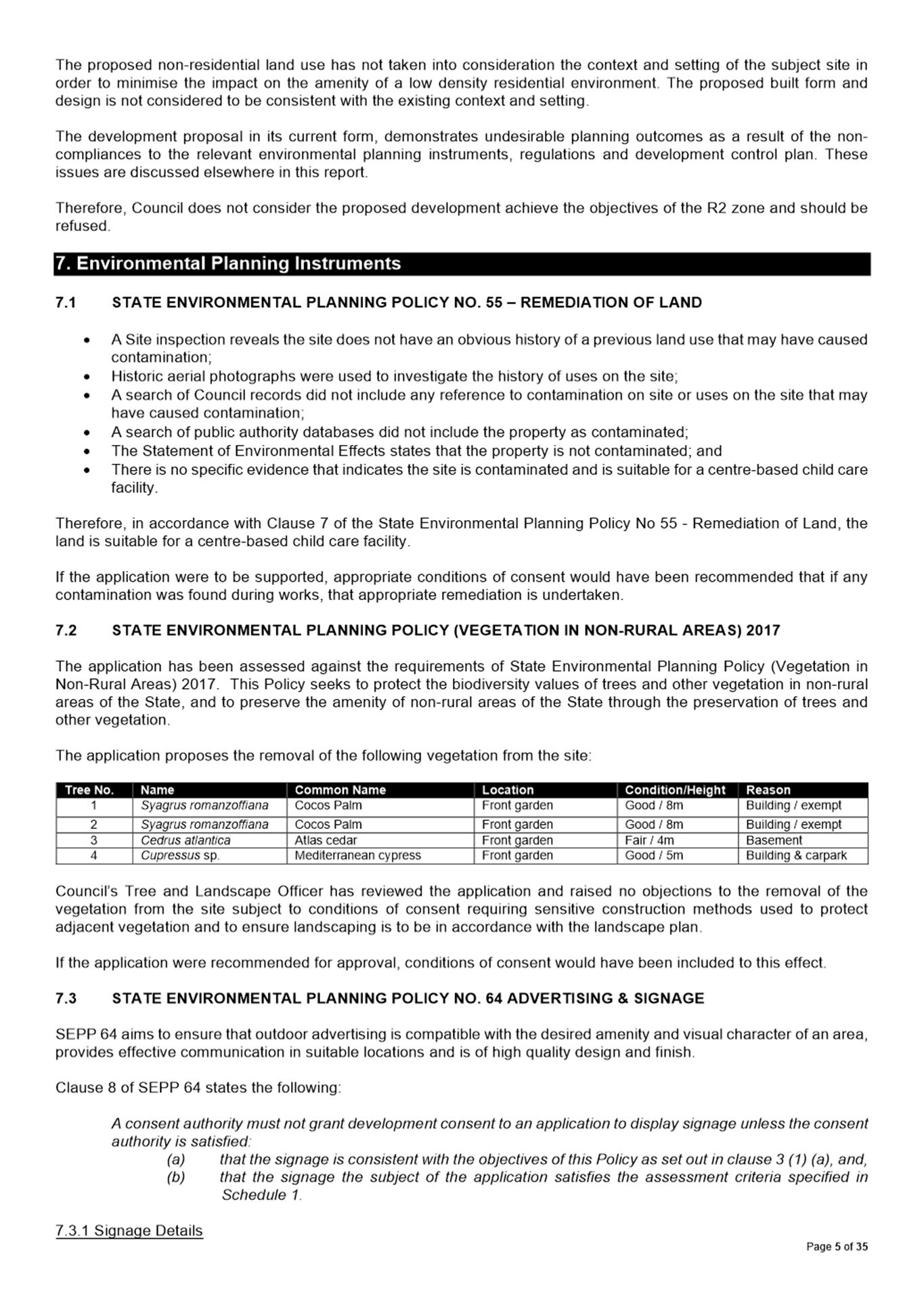
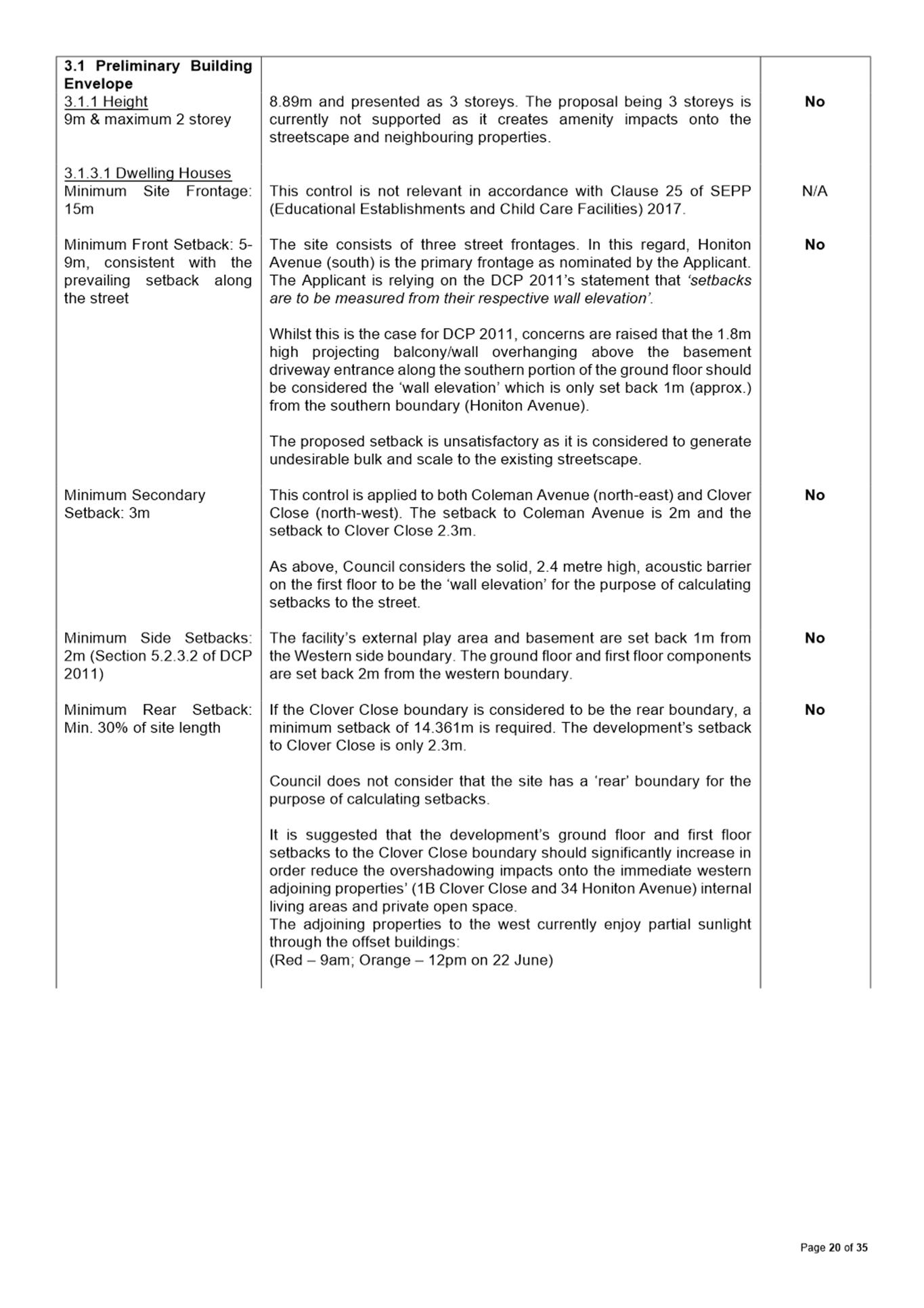
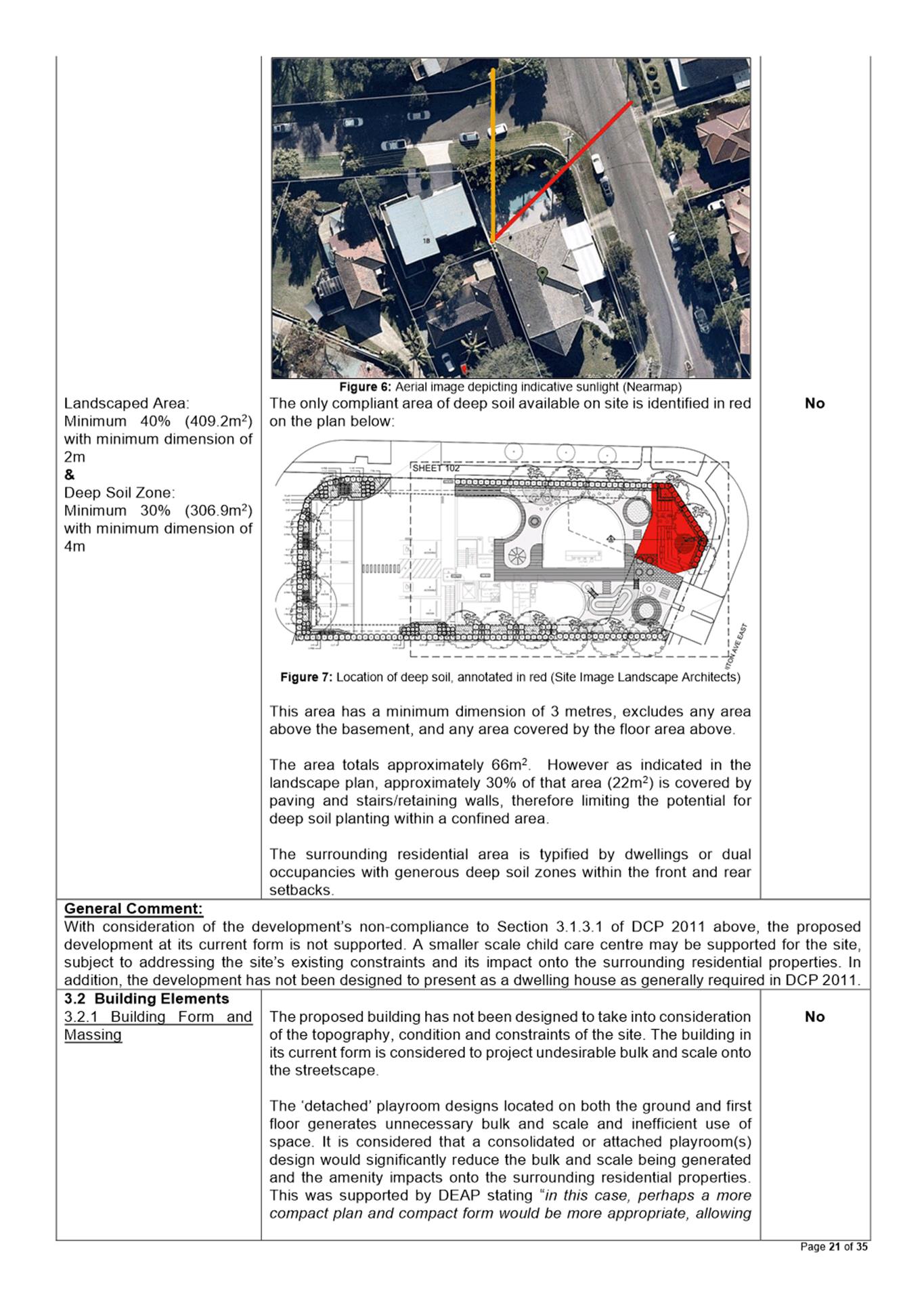
The subject site is known as 32 Honiton Avenue, Carlingford (Lot 5 DP 205980). The site is an irregularly shaped corner allotment with a site area of 1023m2 comprising three frontages to Clover Close, Coleman Avenue, and Honiton Avenue. The site has an approximate cross fall of 5.87m from the site’s northern corner and to the southern corner.
The site is located within an area zoned as R2 Low Density Residential under the Parramatta Local Environmental Plan 2011. Surrounding the site are dwelling houses, dual occupancy, and multi dwelling housing developments.
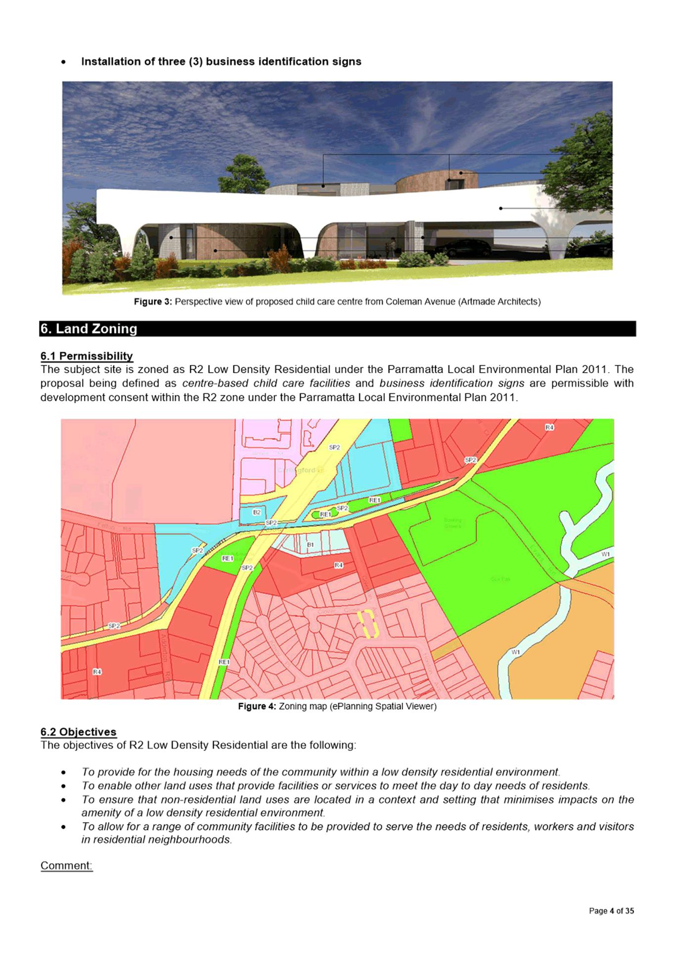
The Proposal
· Demolition of all existing structures
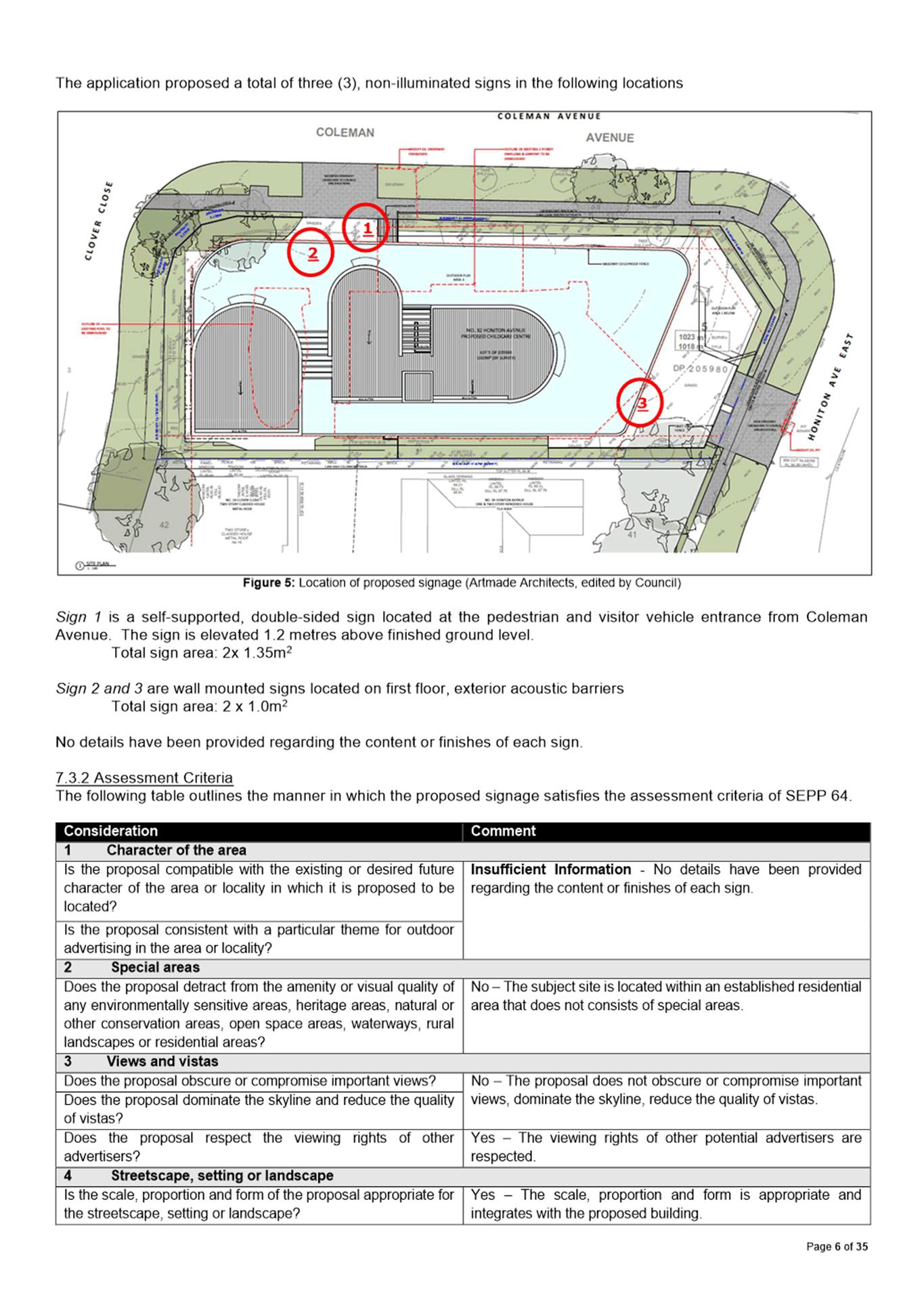
· Construction of a three storey centre-based child care centre with associated signage.
The centre is proposed to cater for a maximum of ninety-three (93) children and fifteen (15) staff. The proposed hours of operation are 7:00AM to 6:00PM, Monday to Friday.
Permissibility
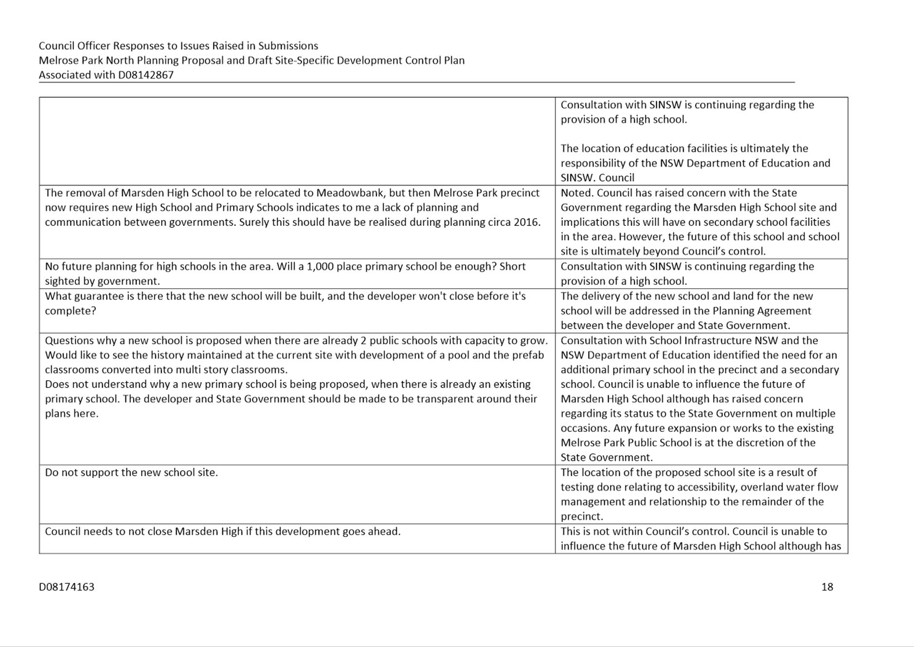
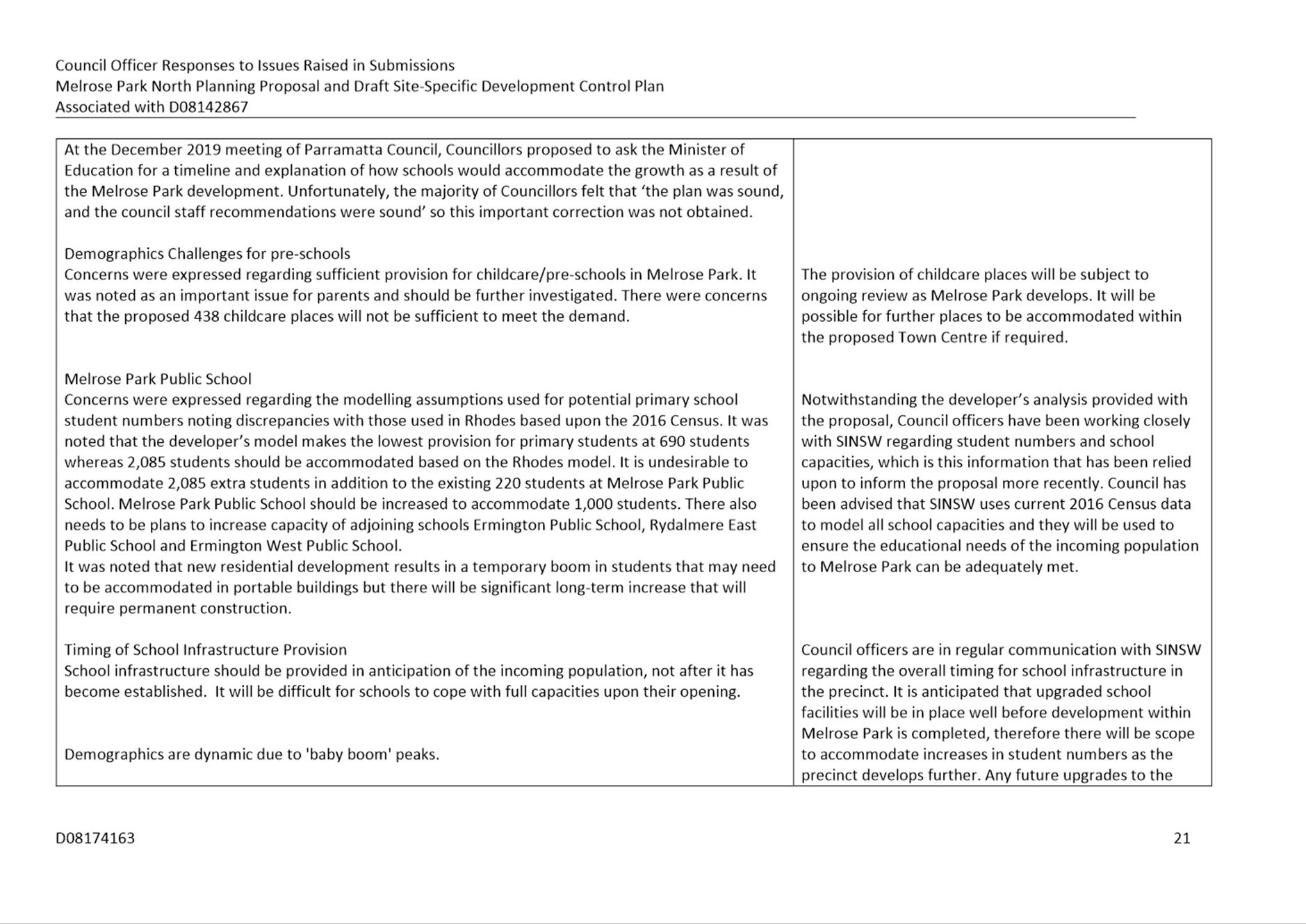
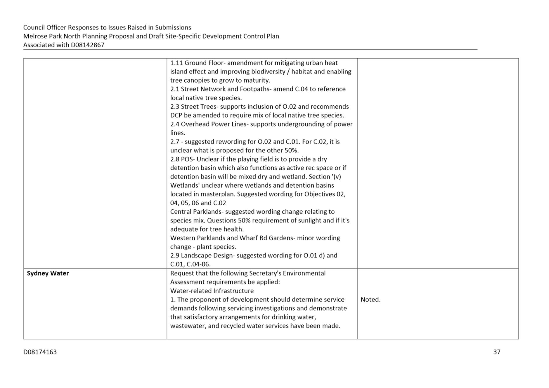
The subject site is zoned as R2 Low Density Residential under the Parramatta Local Environmental Plan 2011. The proposal being defined as centre-based child care facilities and business identification signs are permissible with development consent within the R2 zone under the Parramatta Local Environmental Plan 2011.
The proposed development is not consistent with the objectives of R2 Low Density Residential zoning.
Notification
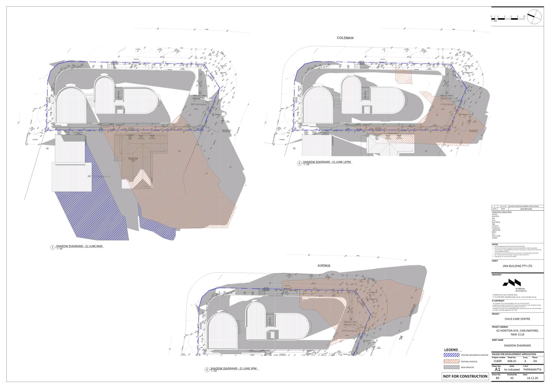
The subject application was notified and advertised in accordance with Council’s Consolidated Notification Requirements 2020 from 11 February 2021 to 4 March 2021. In response, thirty-three (33) unique submissions were received, including one (1) petition comprising 99 signatures. The issues primarily relate to the built form, bulk and scale, context, overshadowing, visual and acoustic privacy, construction, traffic and parking, permissibility and operational matters.
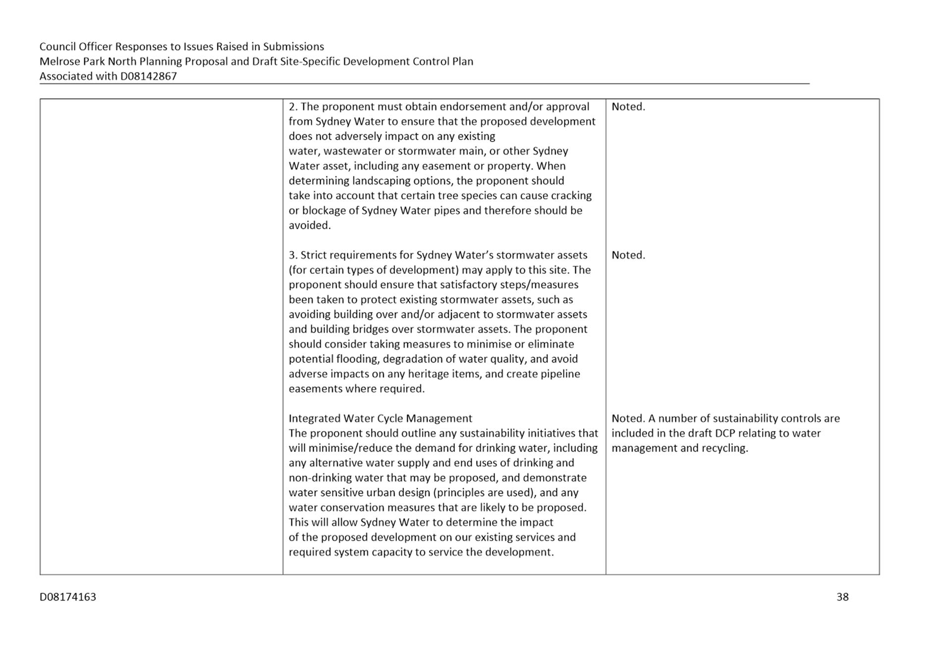
Assessment
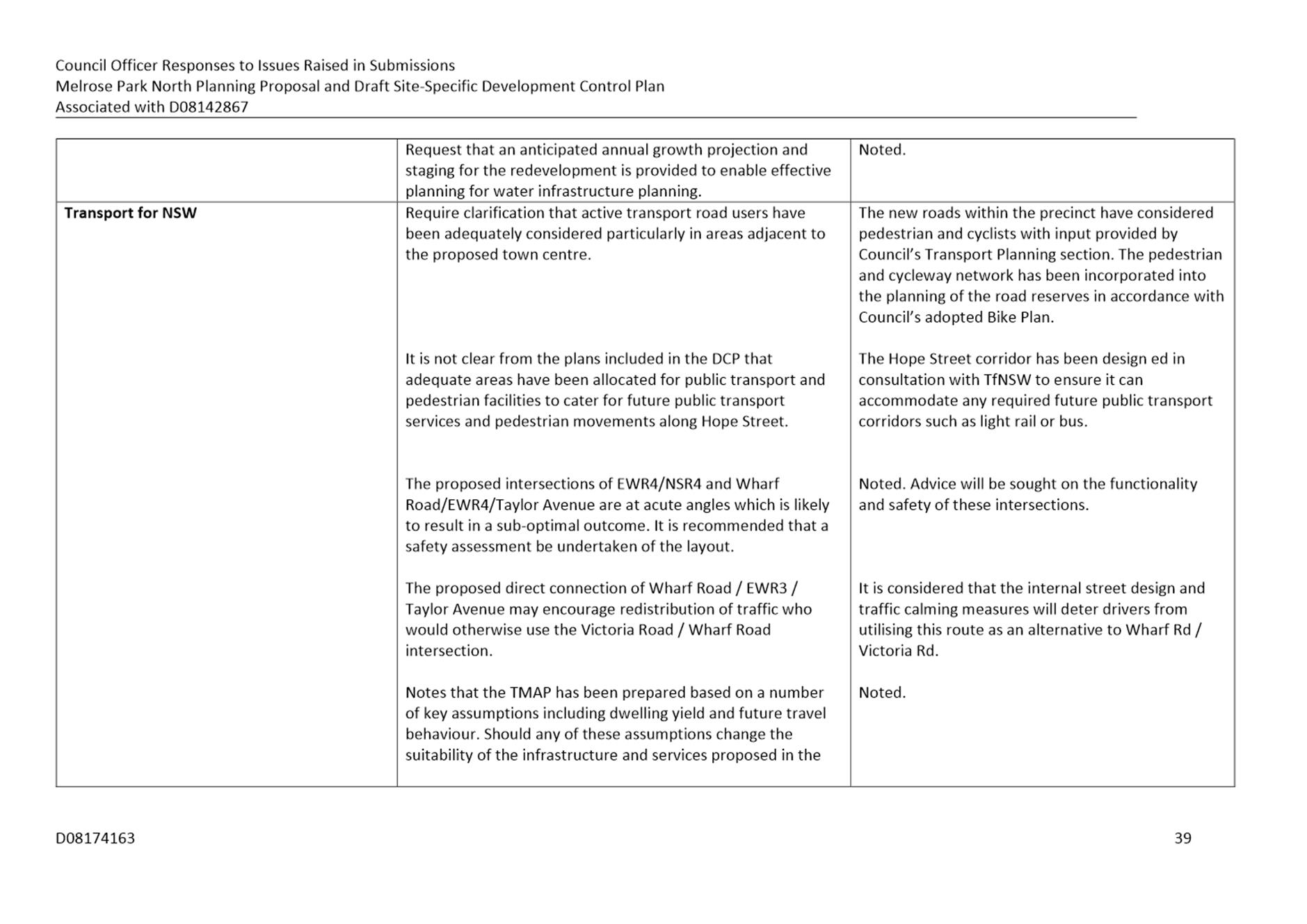
The application was assessed against the relevant environmental planning instruments including the State Environmental Planning Policy (Educational Establishments and Child Care Facilities) 2017 and the Parramatta Local Environmental Plan 2011 as well as the applicable Parramatta Development Control Plan 2011. The development proposal at its current form generally does not comply with the provisions within the environmental planning instruments and development control plan.
Where non-compliances were found, amended plans may likely be able to address
the issues. At the time of writing the report, amended plans and information have not been received to address the non-compliances identified and therefore the application is recommended for refusal on the basis of insufficient information preventing a complete assessment to be undertaken.
Deemed Refusal Appeal
It is also to be noted that a deemed refusal appeal has been lodged against the development application and it therefore must be determined at the August PLPP meeting in order to meet the dates set by the NSW Land and Environment Court.
(a) That the Parramatta Local Planning Panel (PLPP), exercising the functions of Council, pursuant to Section 4.16(1)(b) of the Environmental Planning and Assessment Act 1979, refuse development consent to DA/63/2021 for the demolition, tree removal and construction of a centre-based child care facility to accommodate 93 children with ground and basement level parking for 25 cars at Lot 5 DP 205980, 32 Honiton Avenue, Carlingford 2118 for the reasons outlined in the assessment report.
(b) Further, that the submitters are advised of the Panel’s decision.
John Martinez
Development Assessment Officer
|
1⇩ |
Assessment Report |
35 Pages |
|
|
2⇩ |
Locality Map |
1 Page |
|
|
3⇩ |
Plans used during assessment |
25 Pages |
|
|
4⇩ |
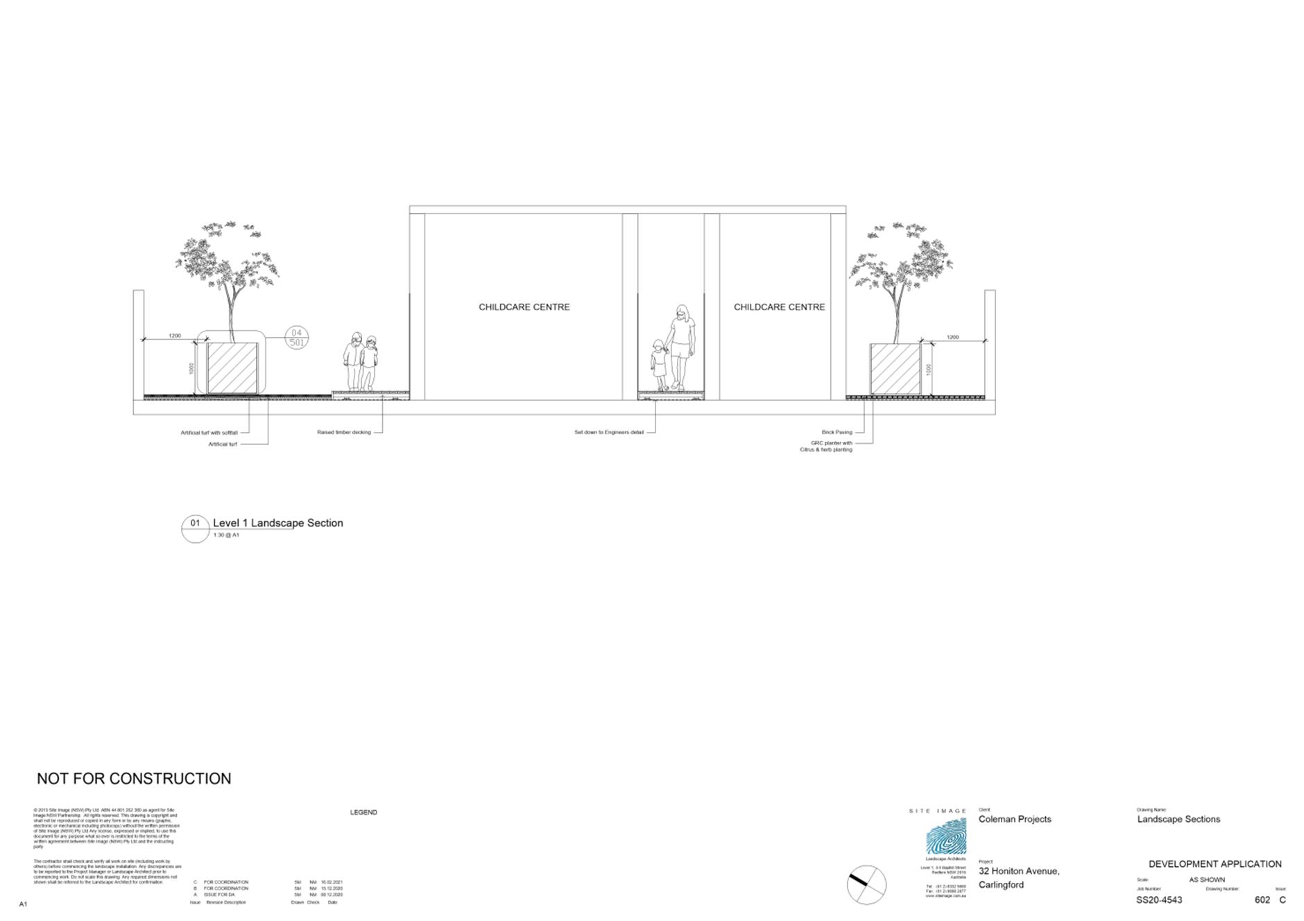
Plan of Management |
4 Pages |
|
REFERENCE MATERIAL
ITEM NUMBER 5.2
SUBJECT OUTSIDE PUBLIC MEETING:
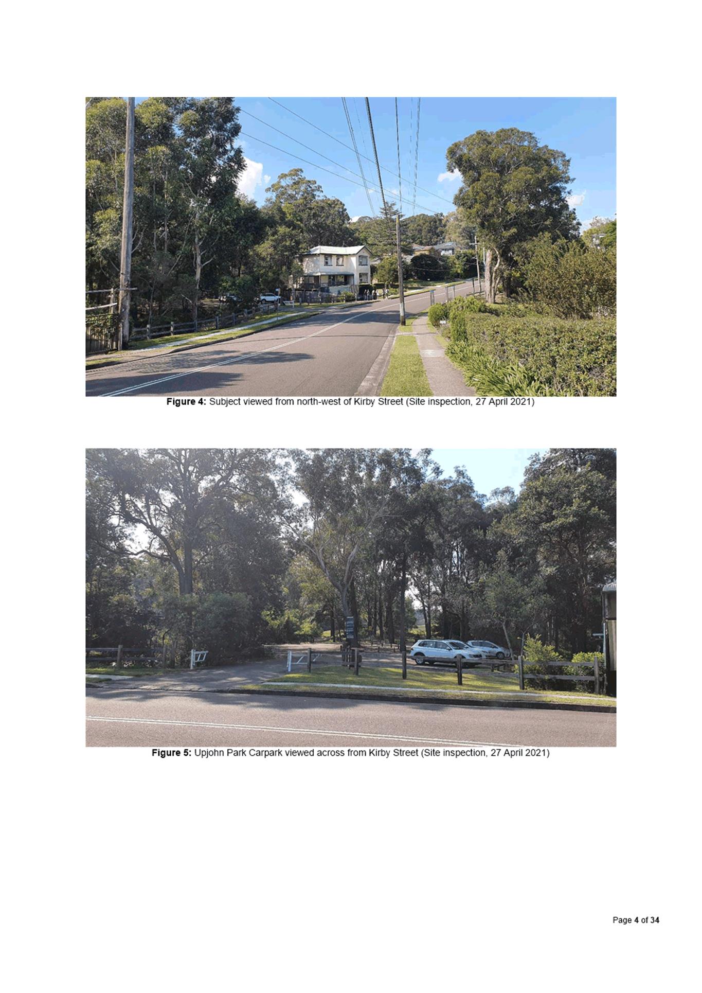
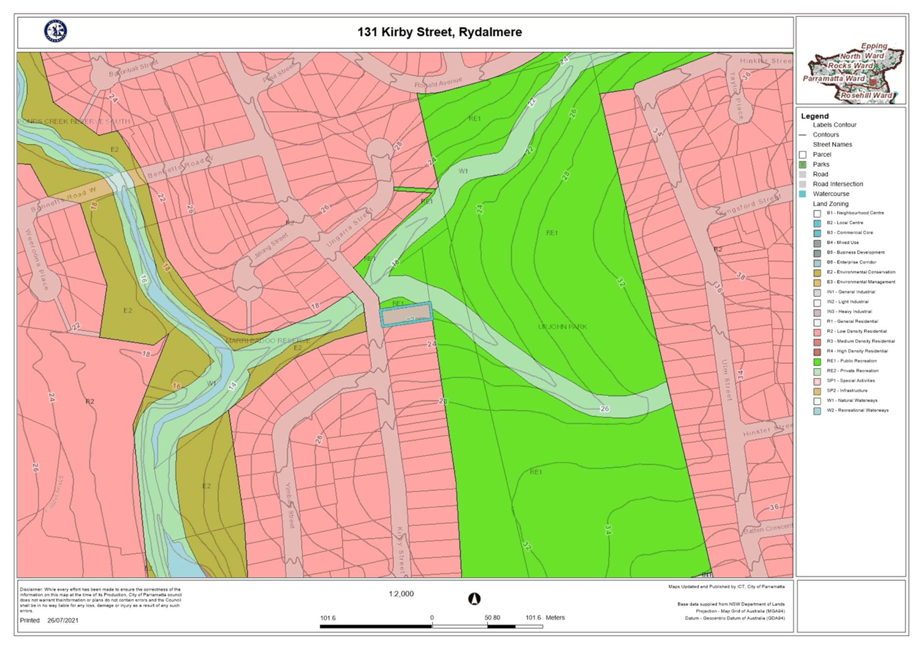
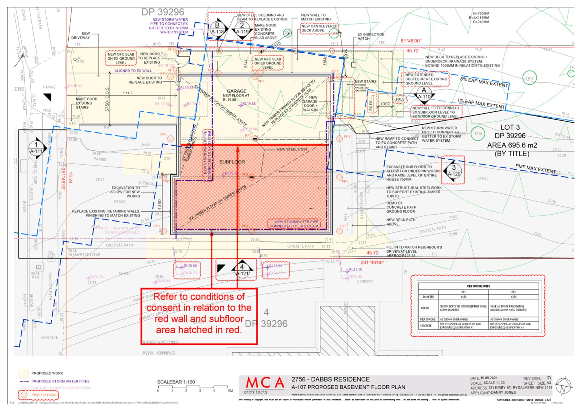
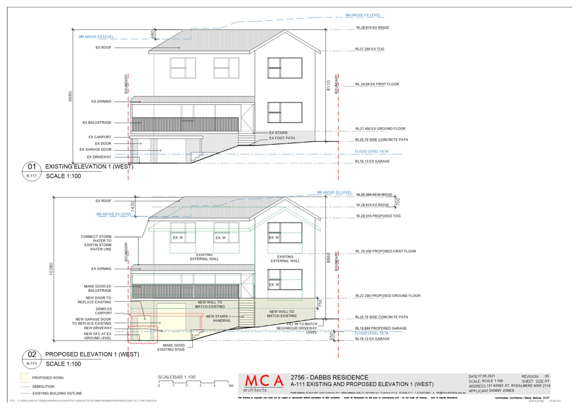
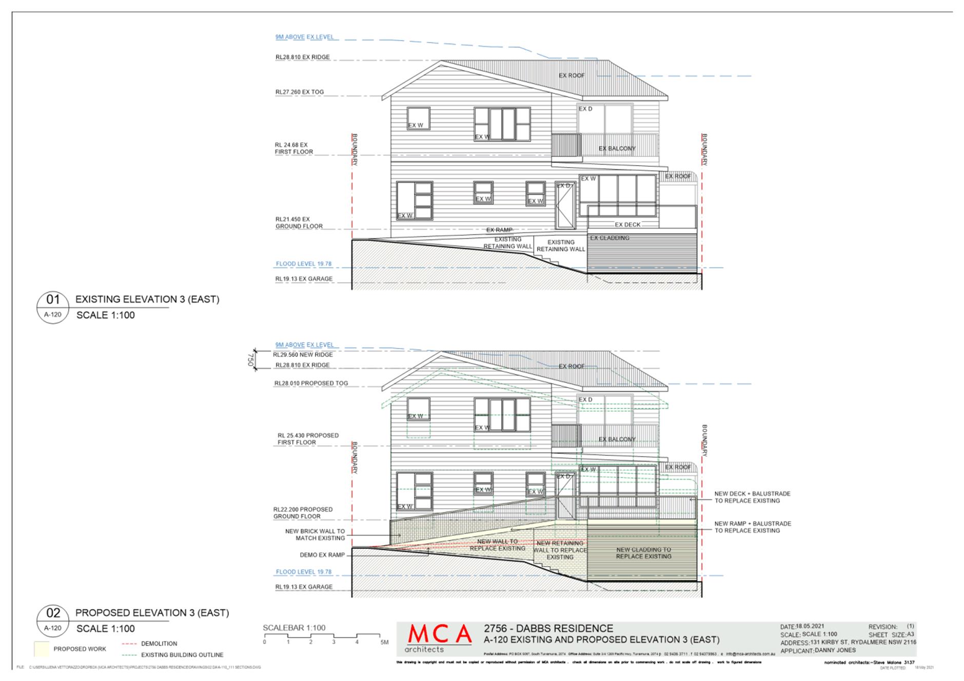
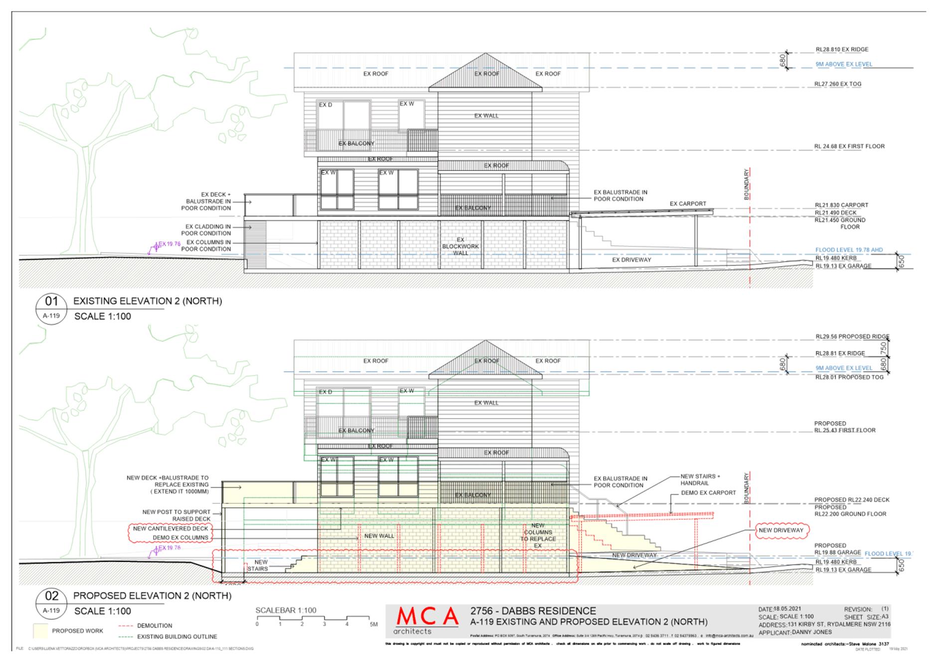
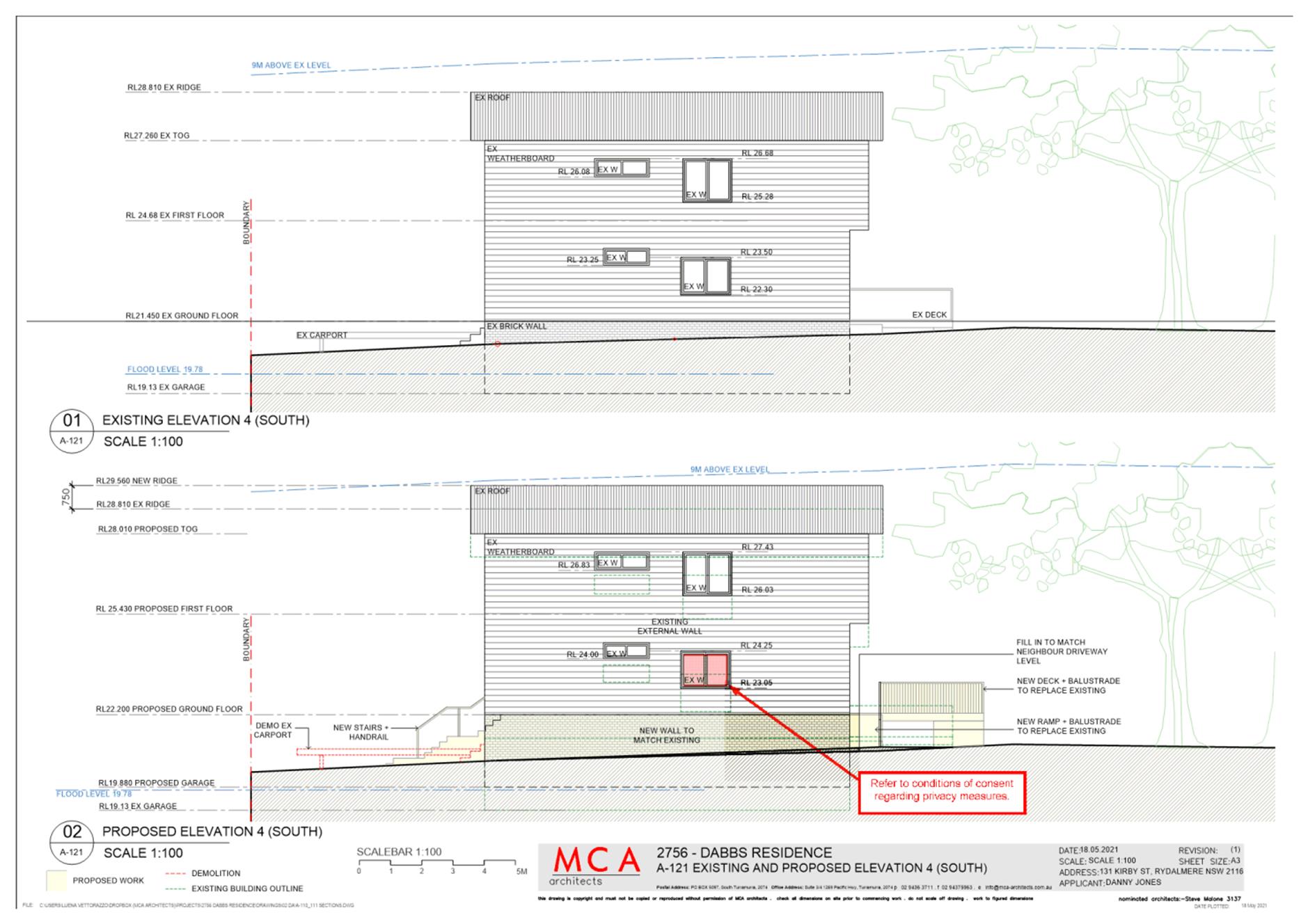
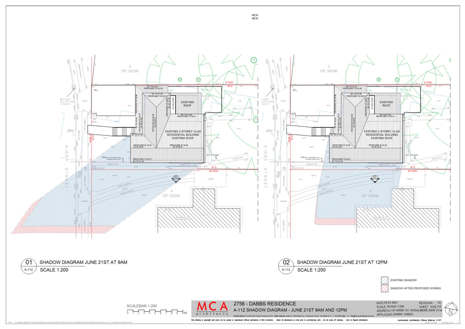
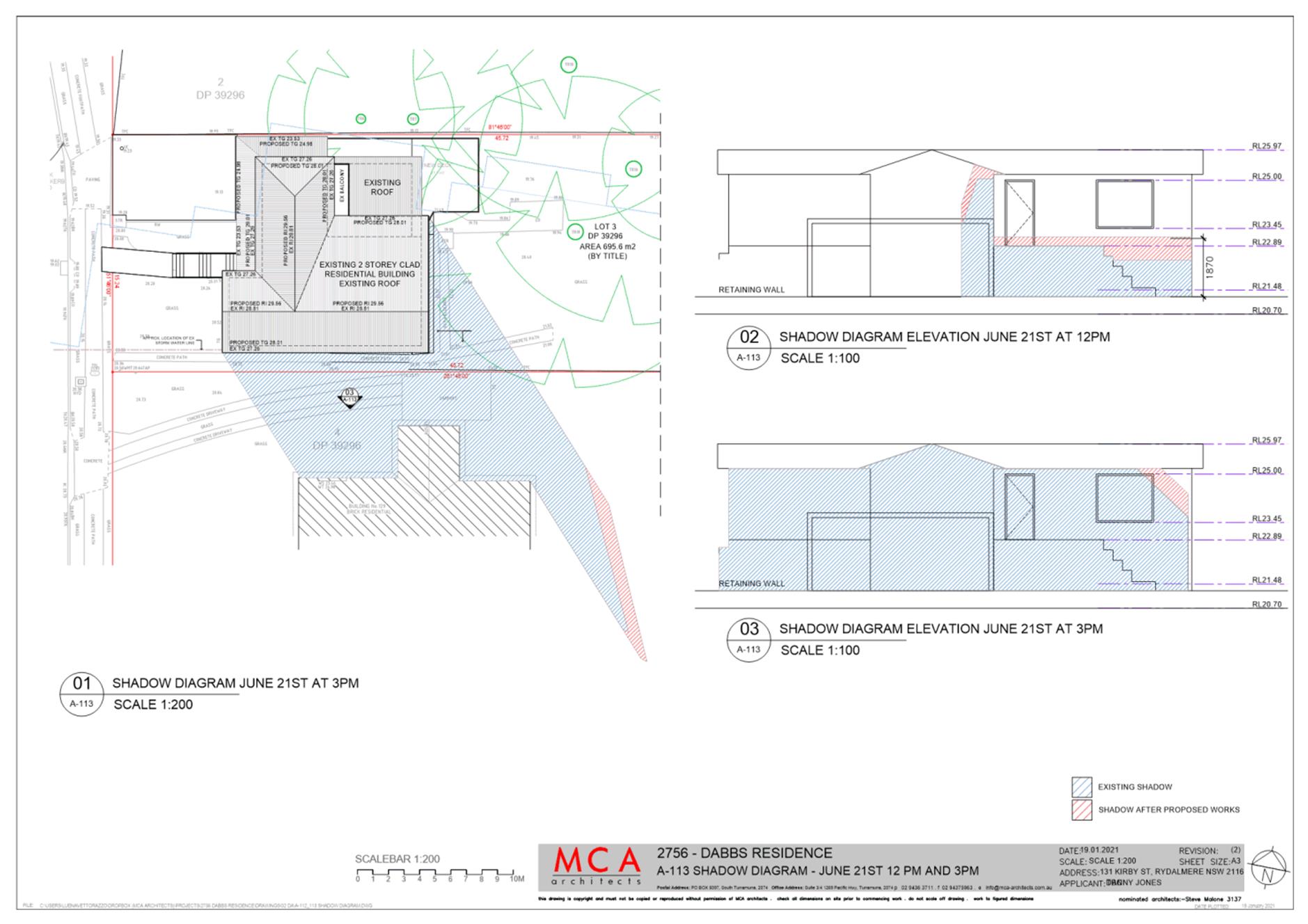
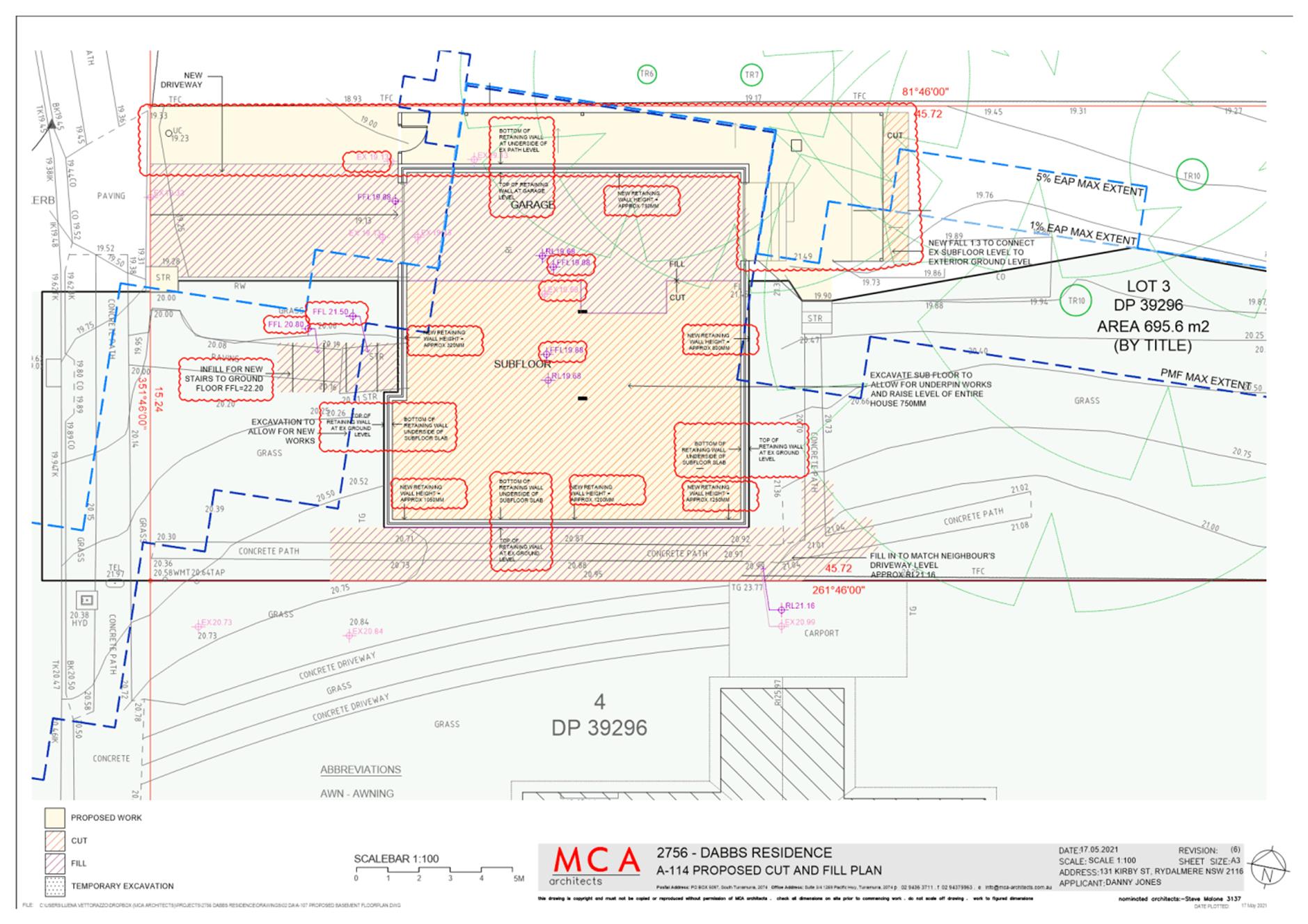
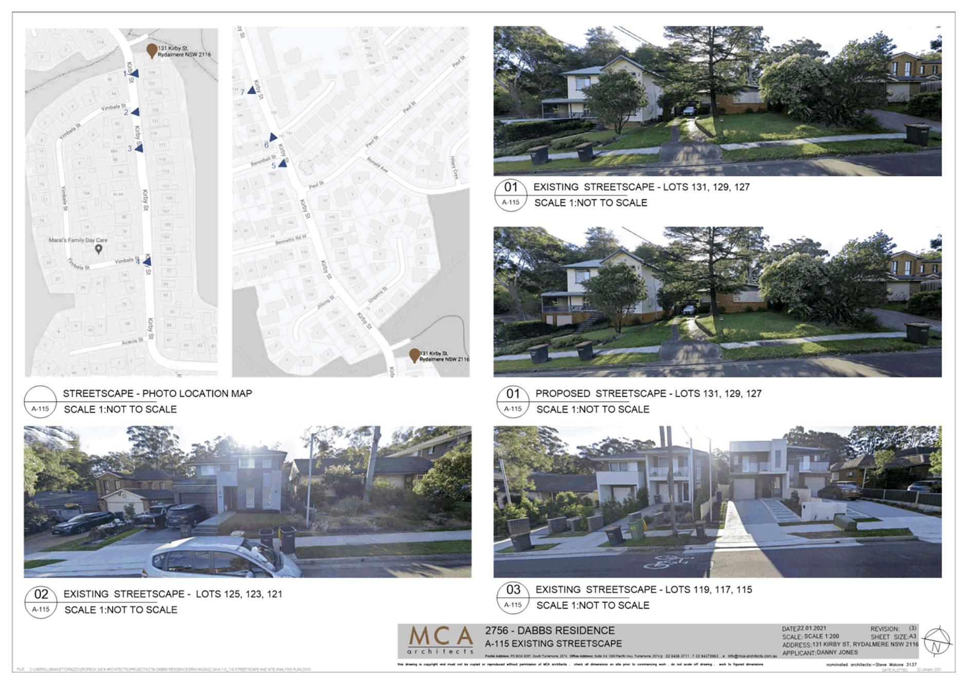
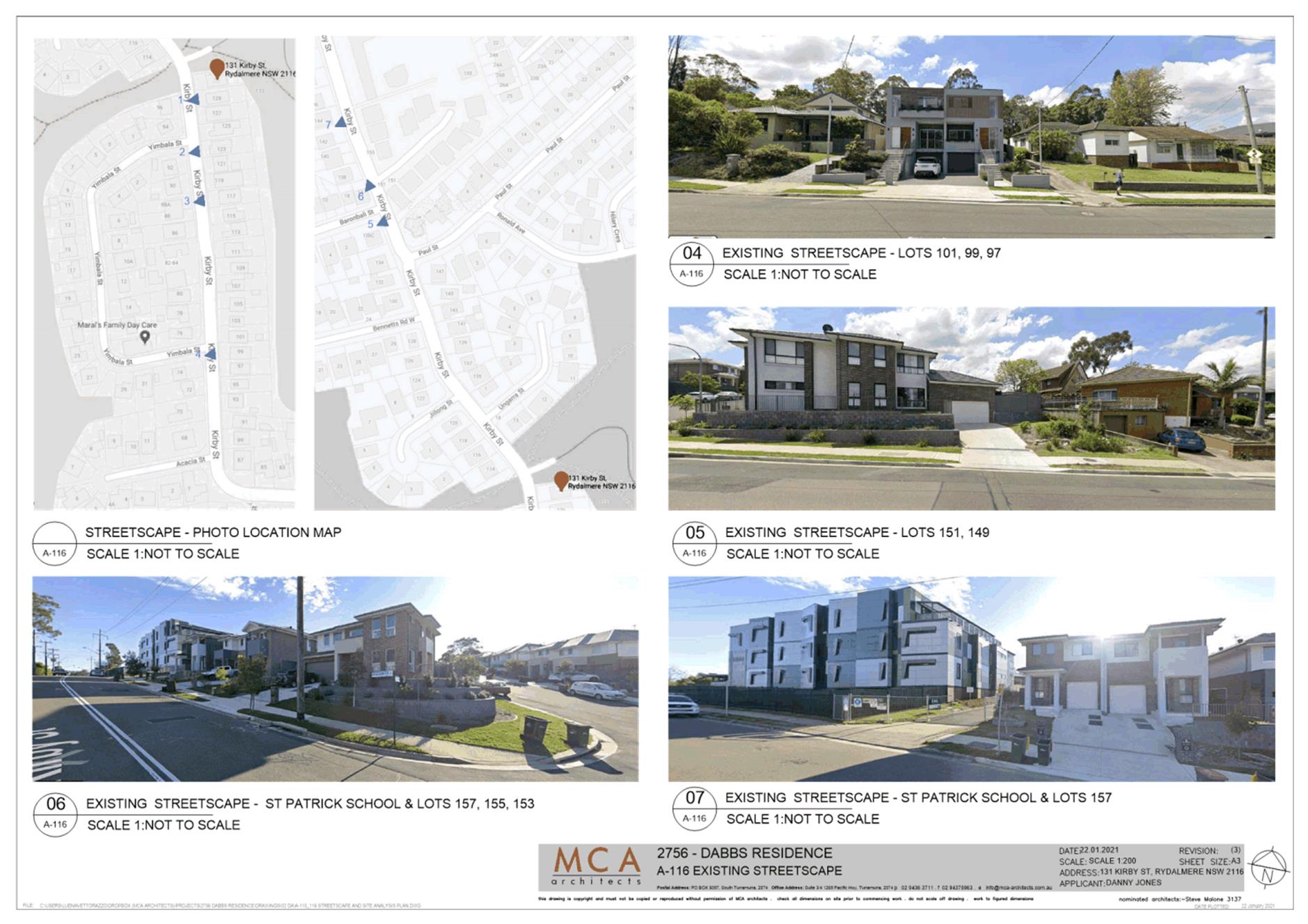
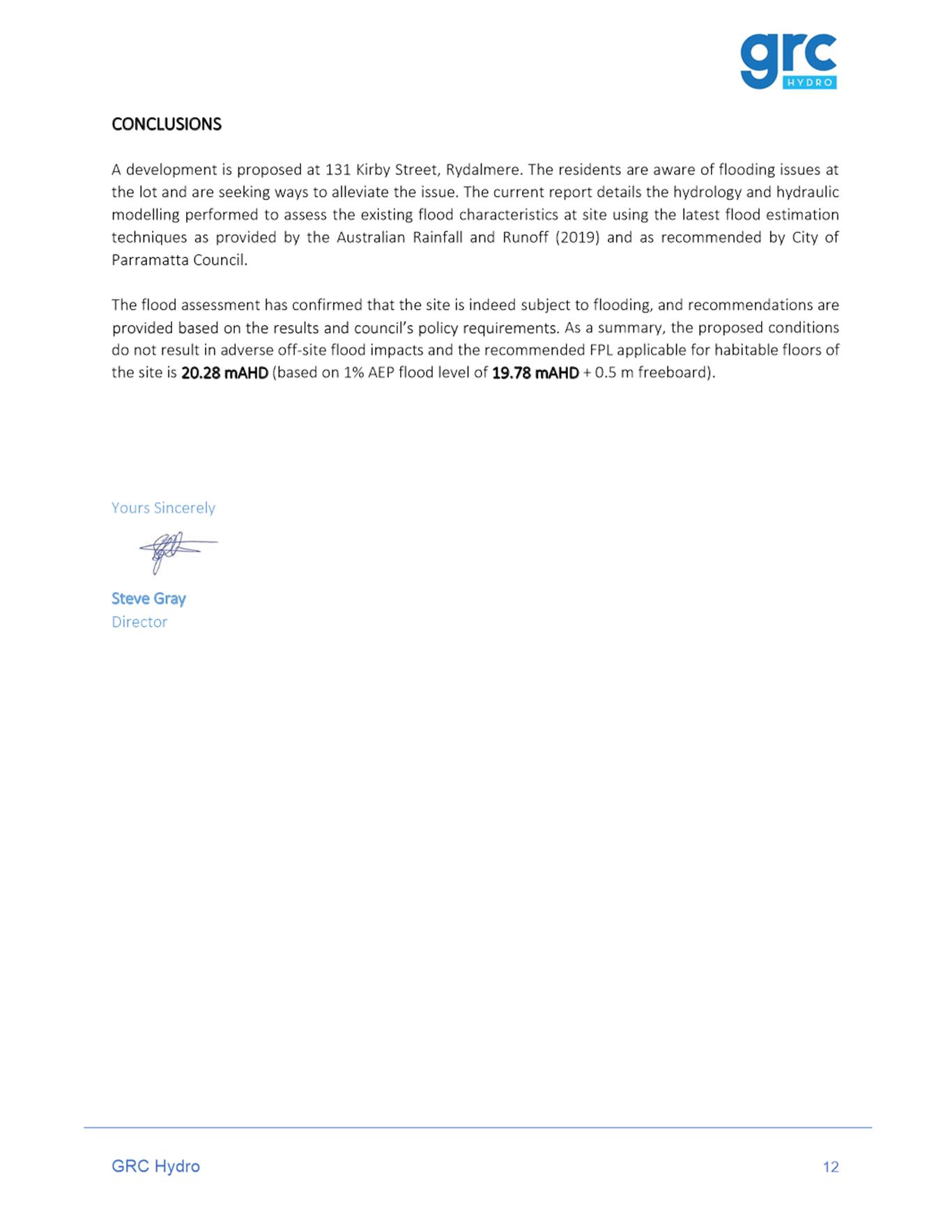
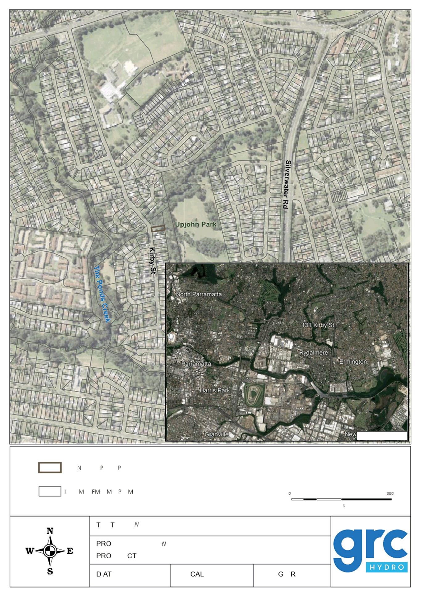
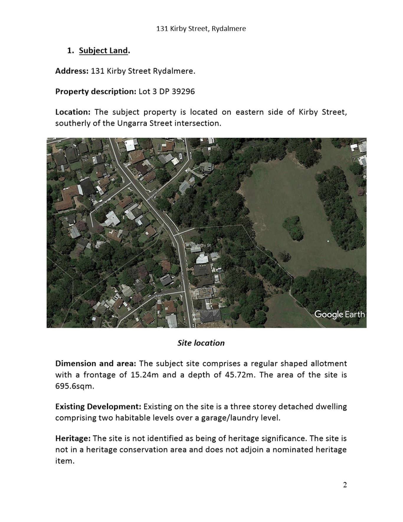
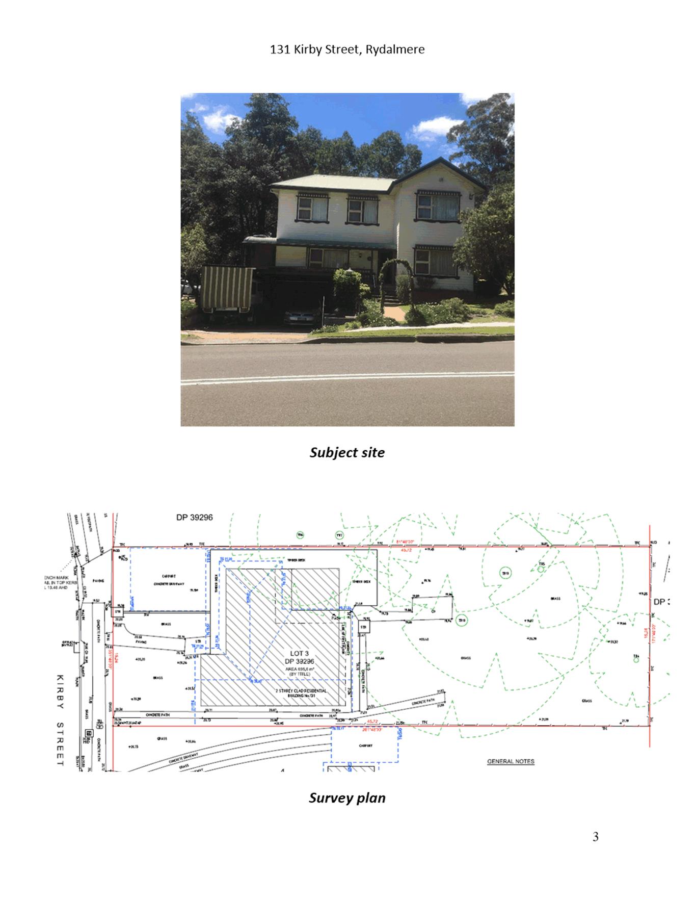
131 Kirby Street, Rydalmere (Lot 3 DP 39296)
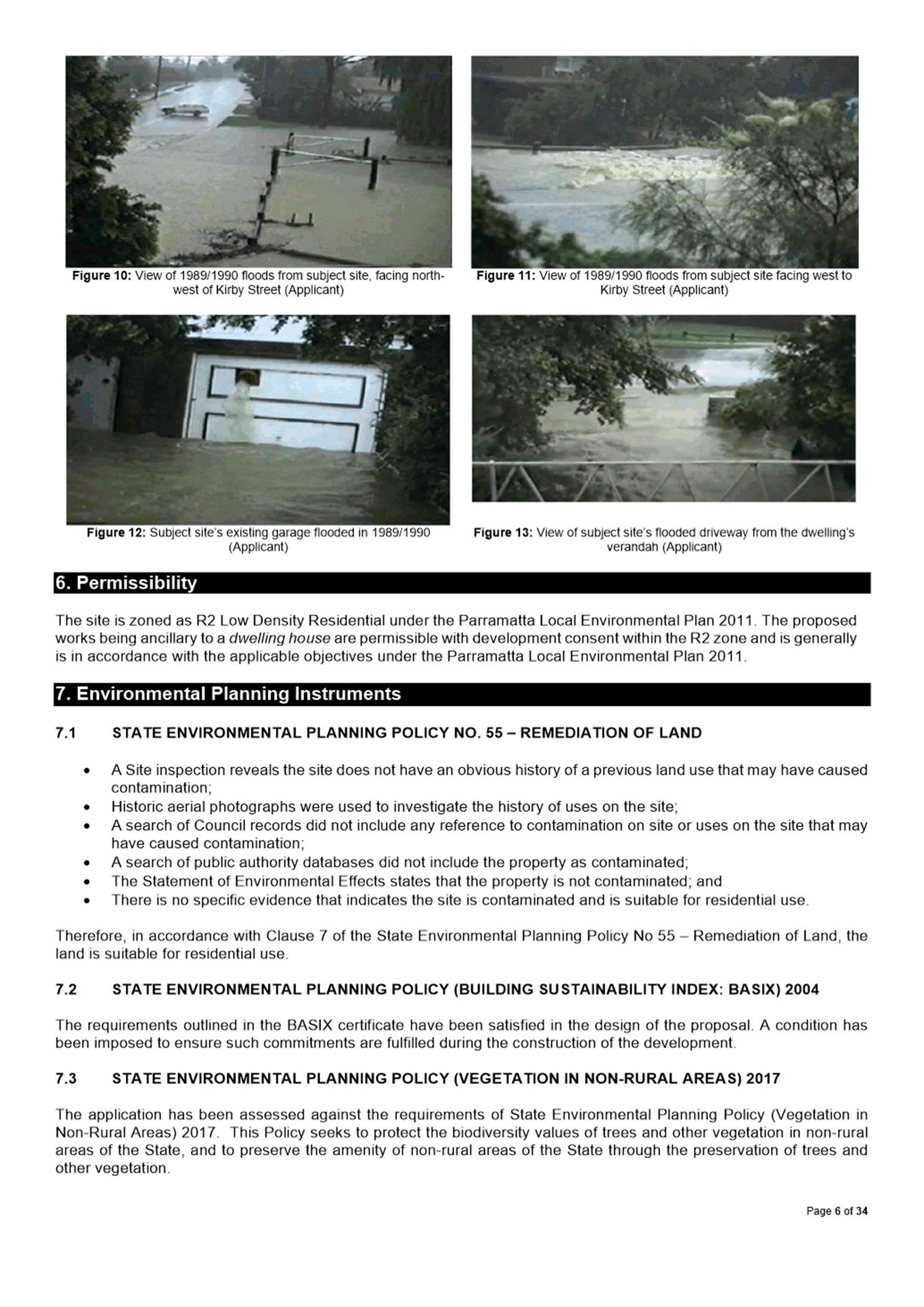
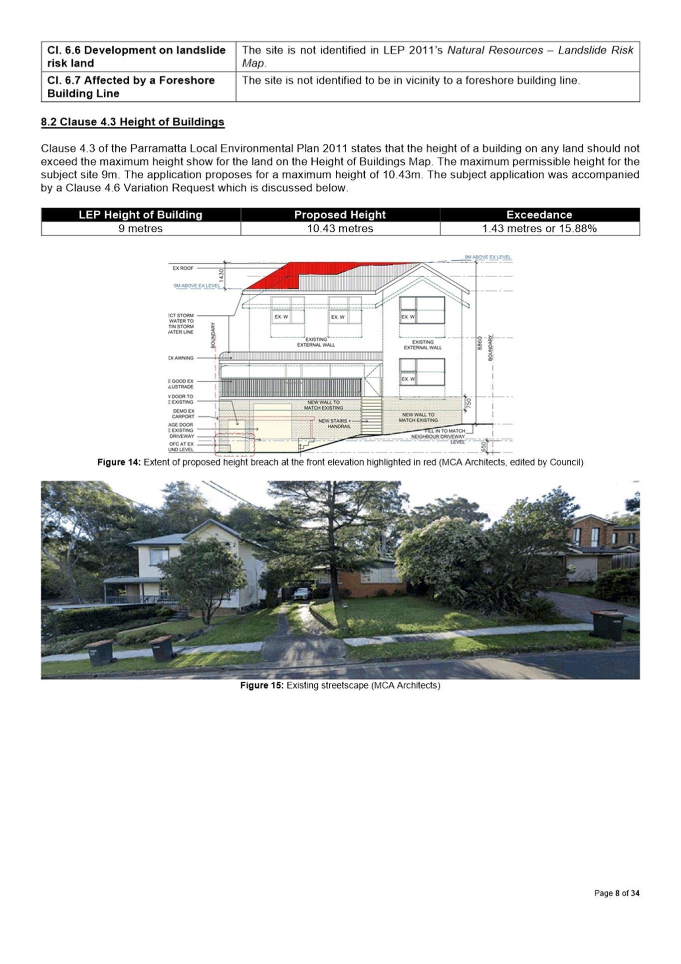
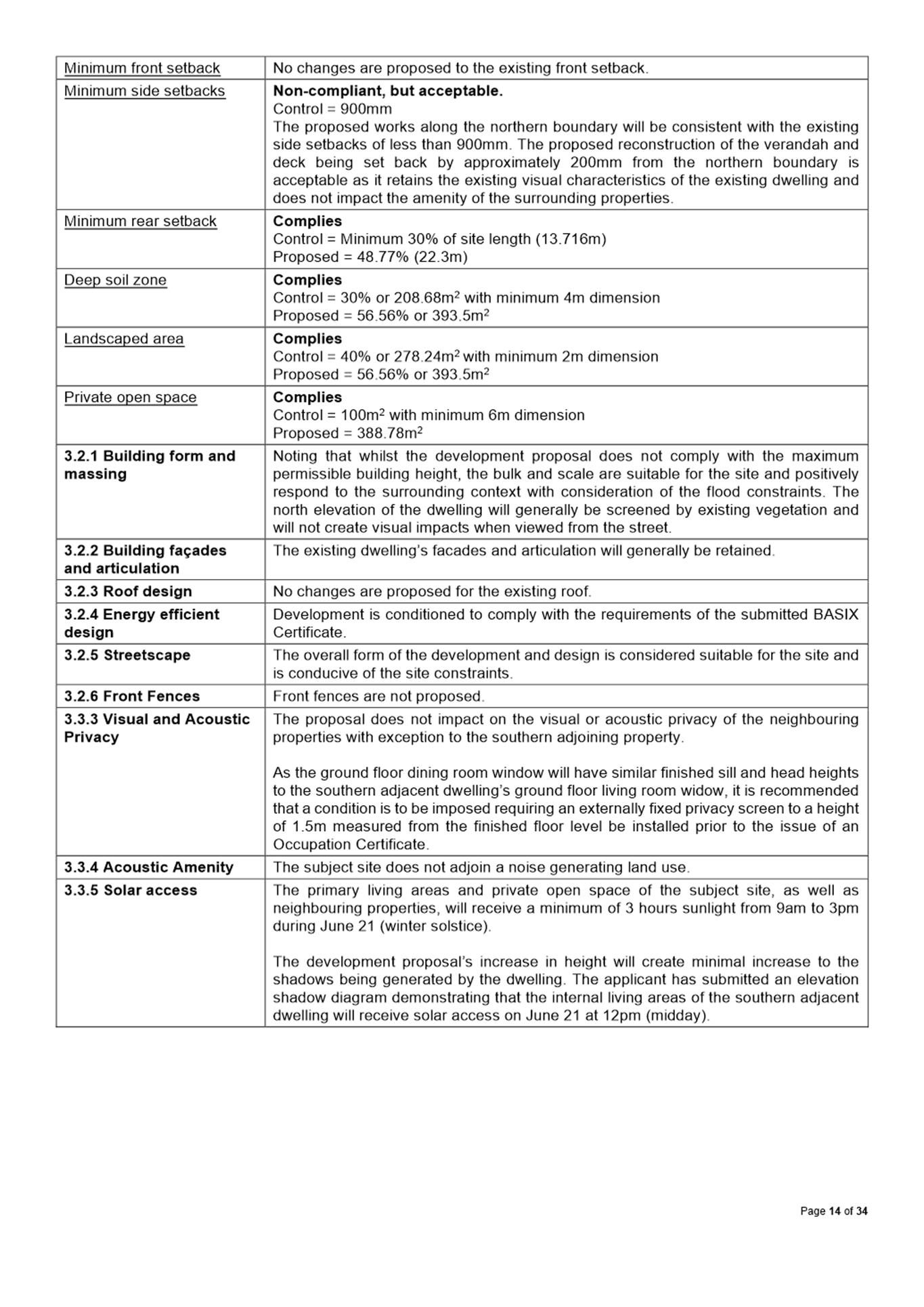
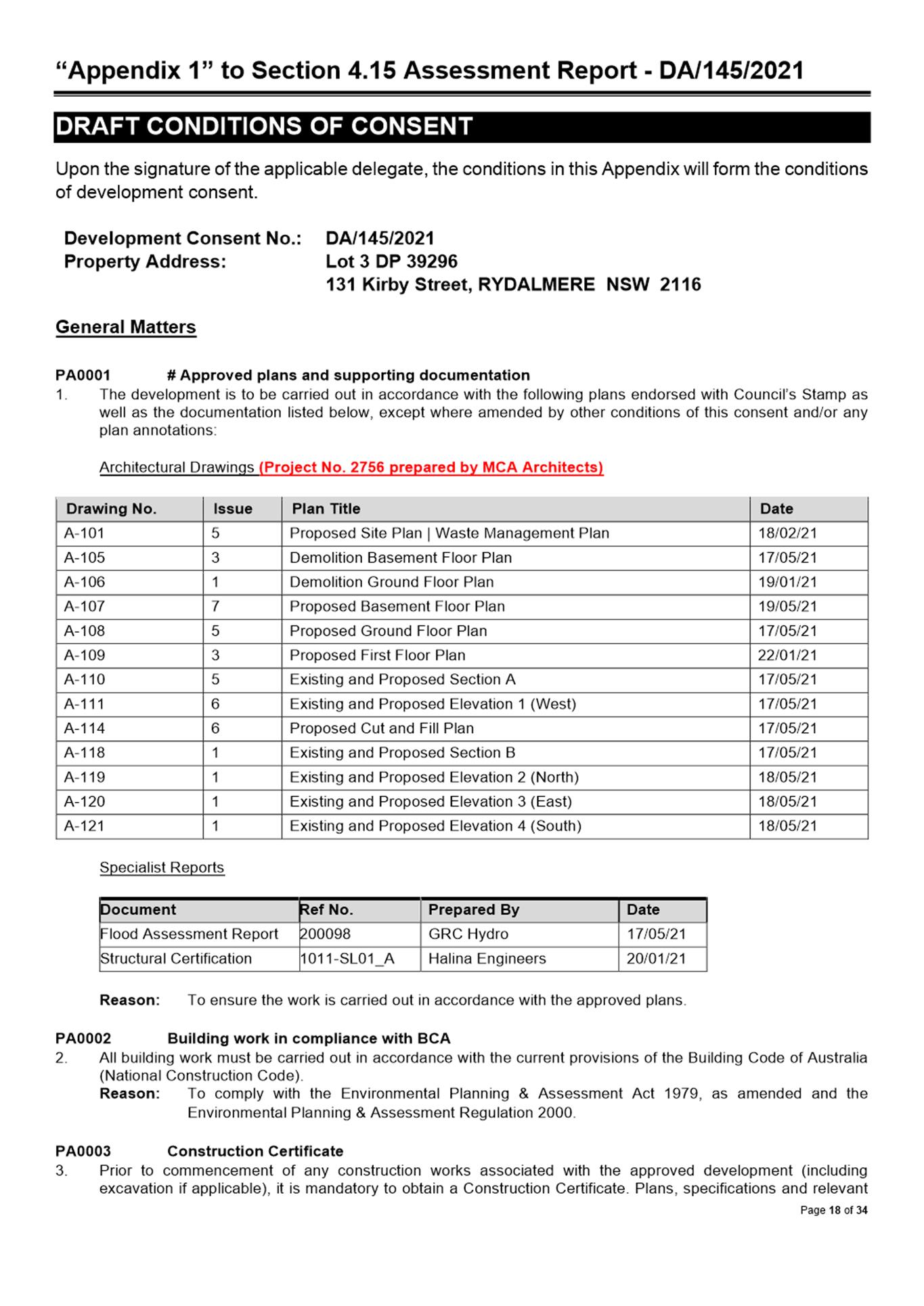
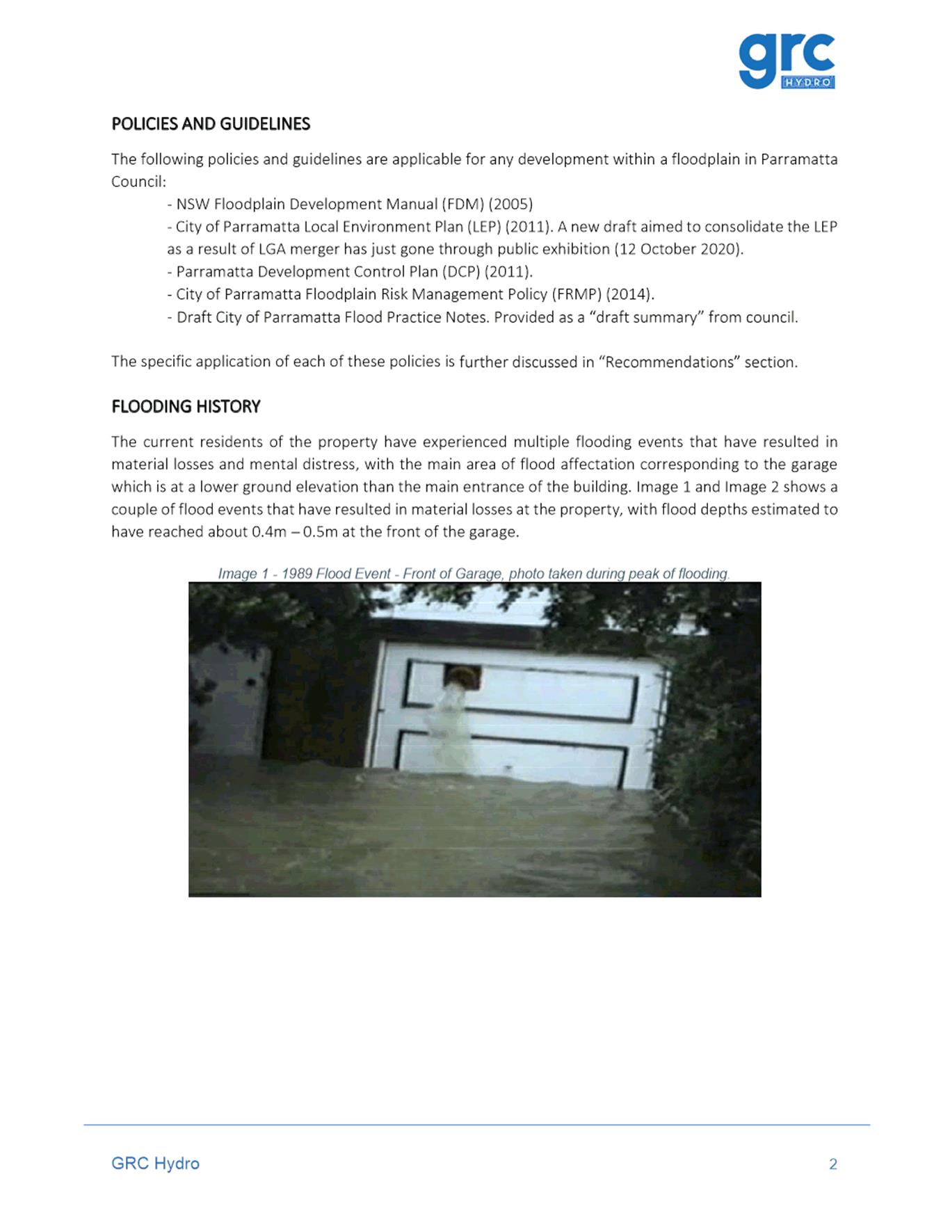
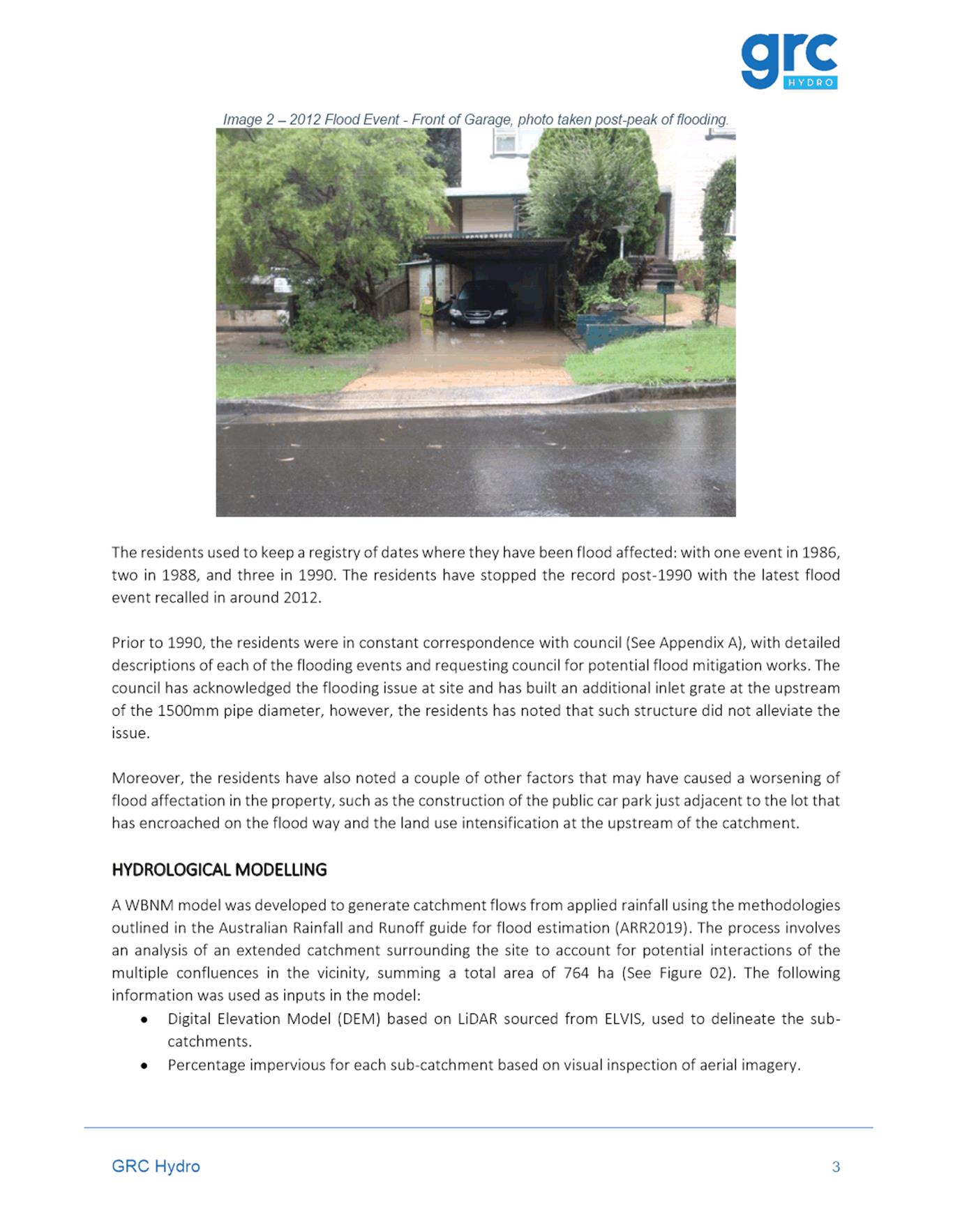
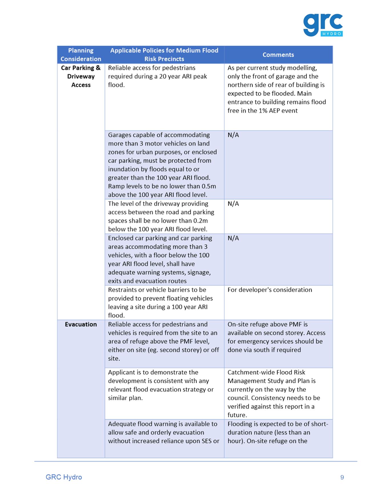
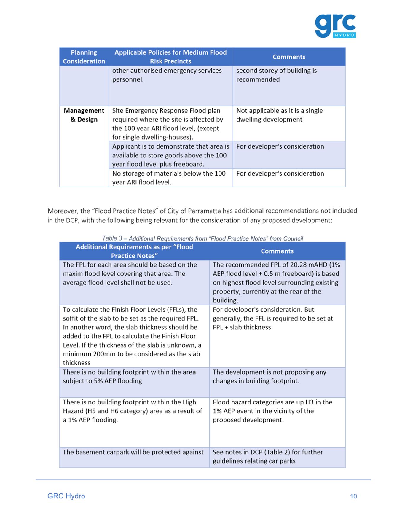
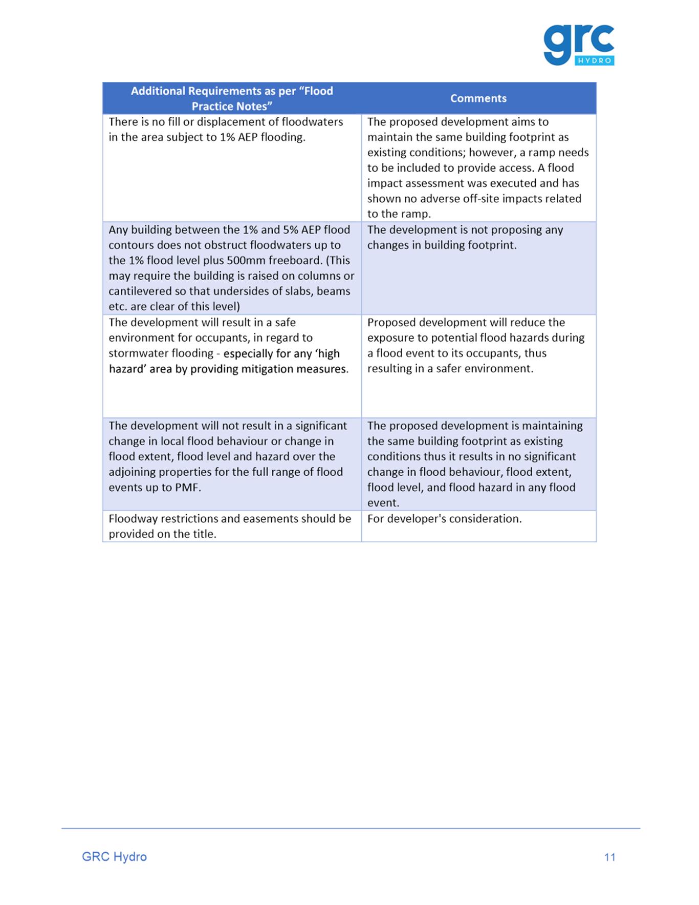
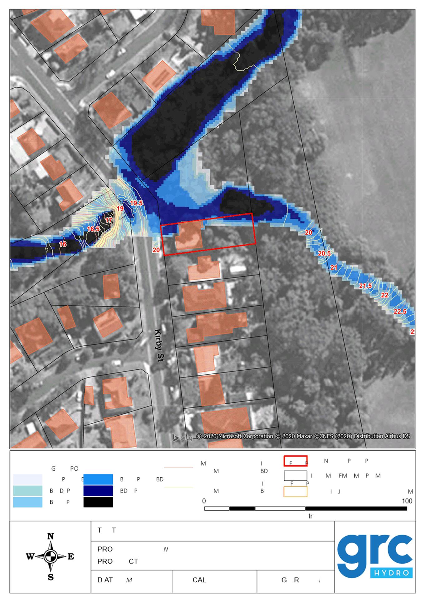
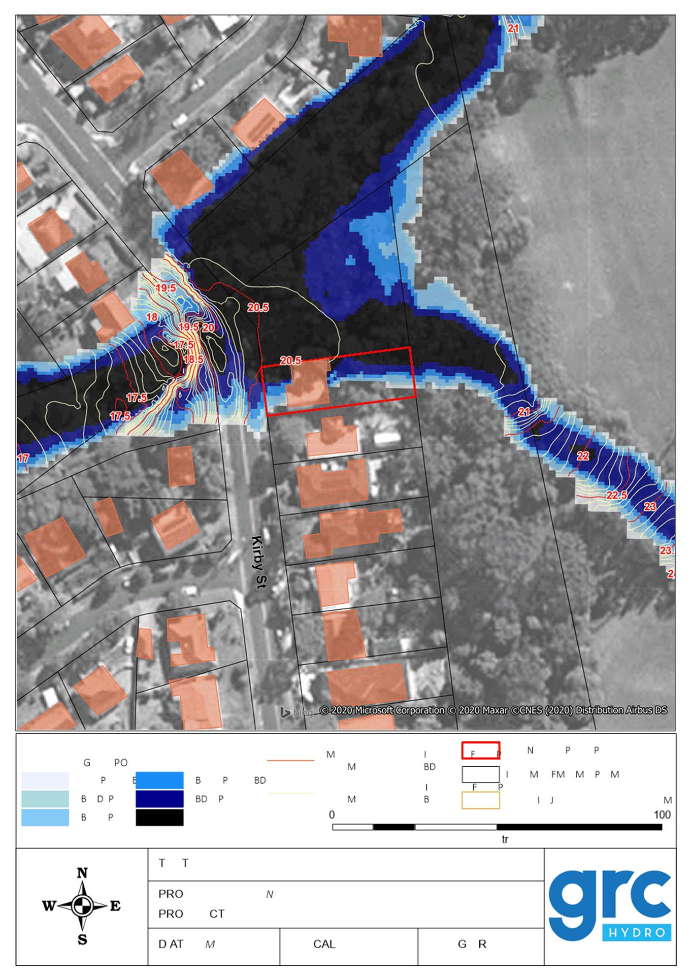
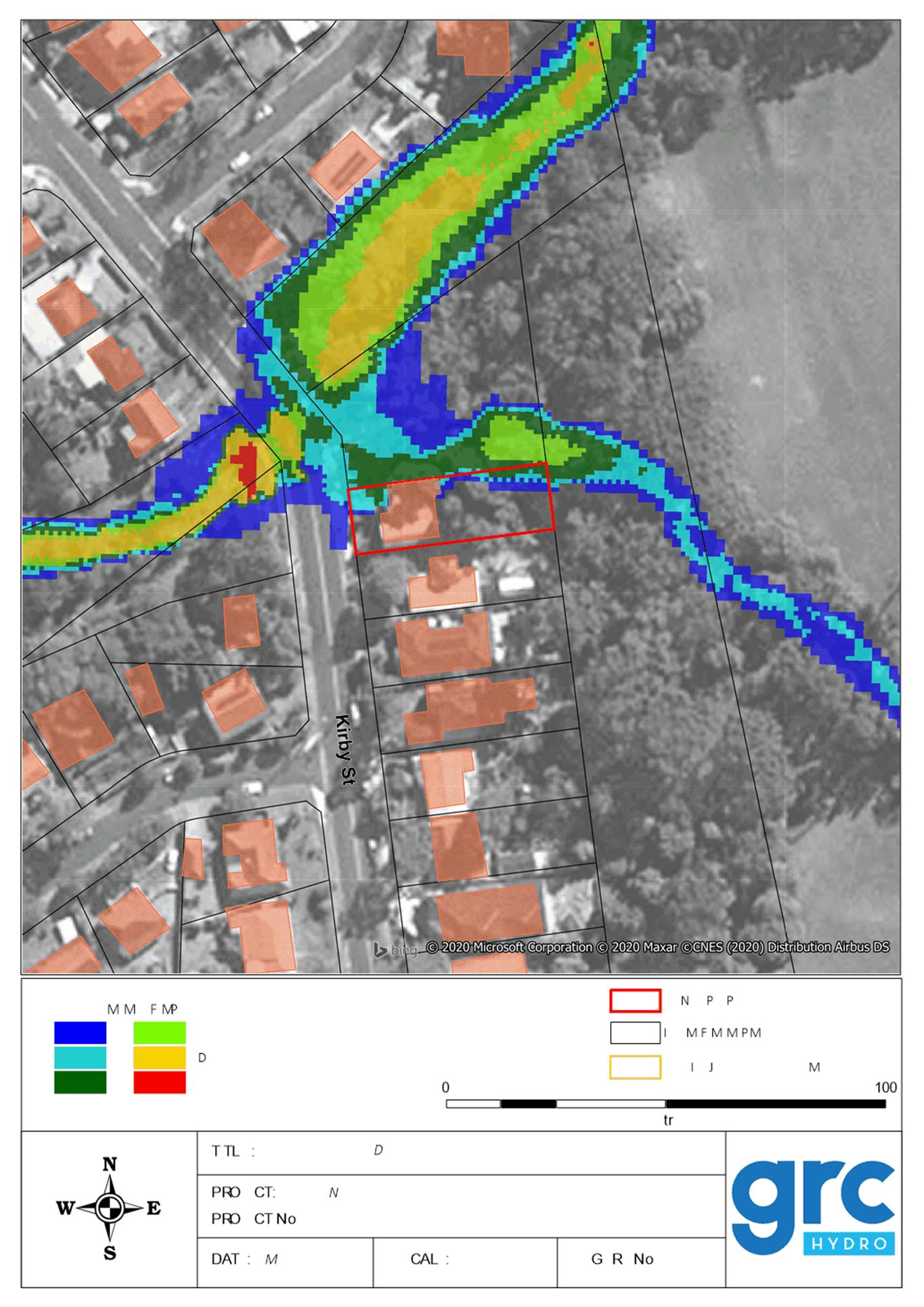
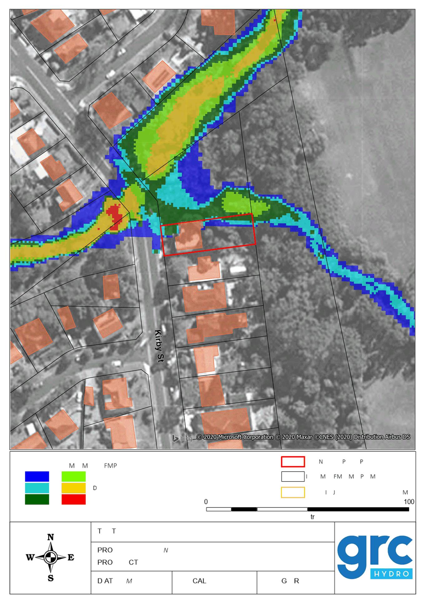
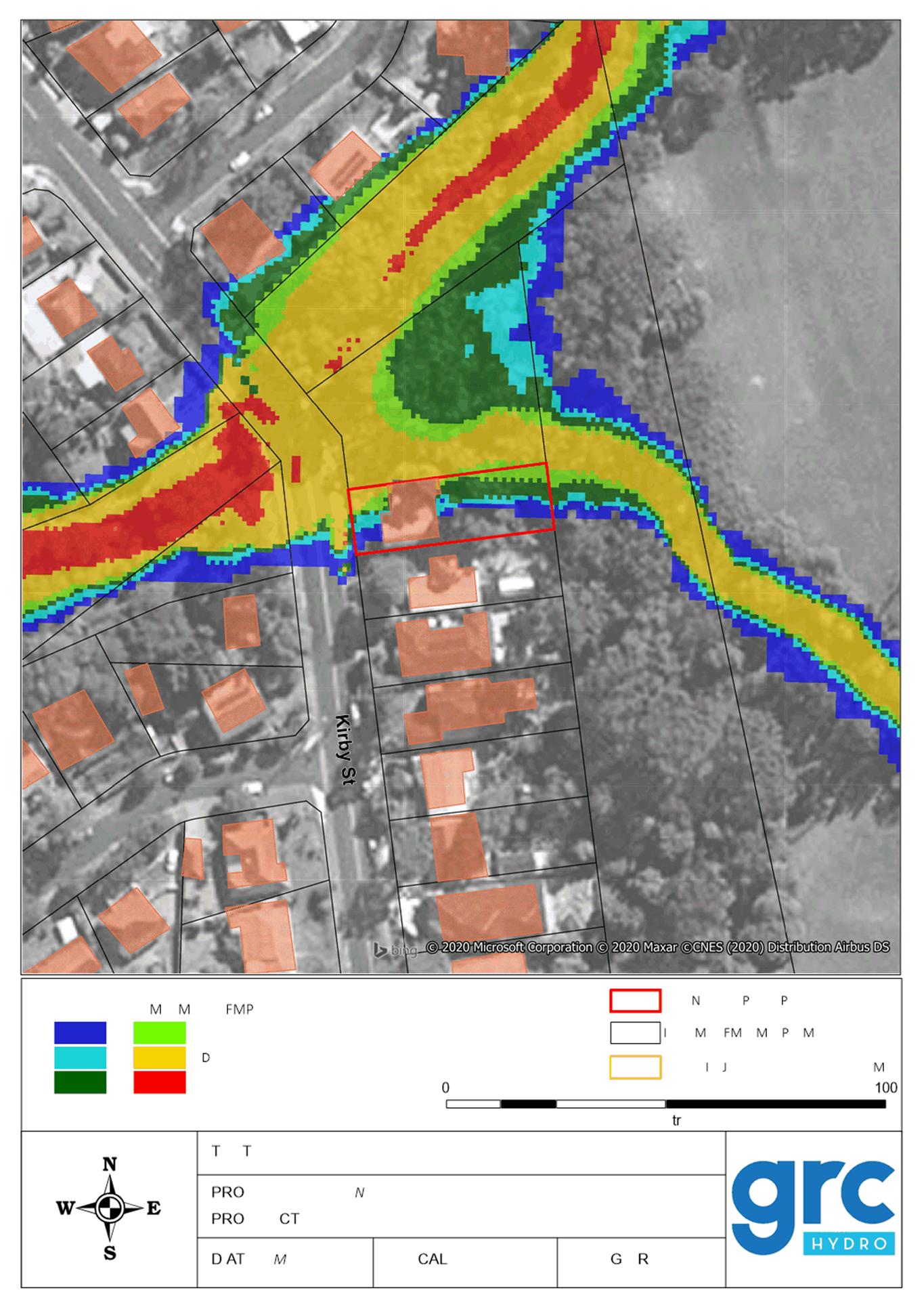
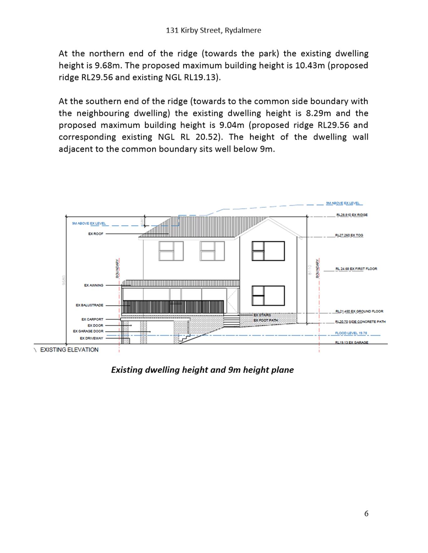
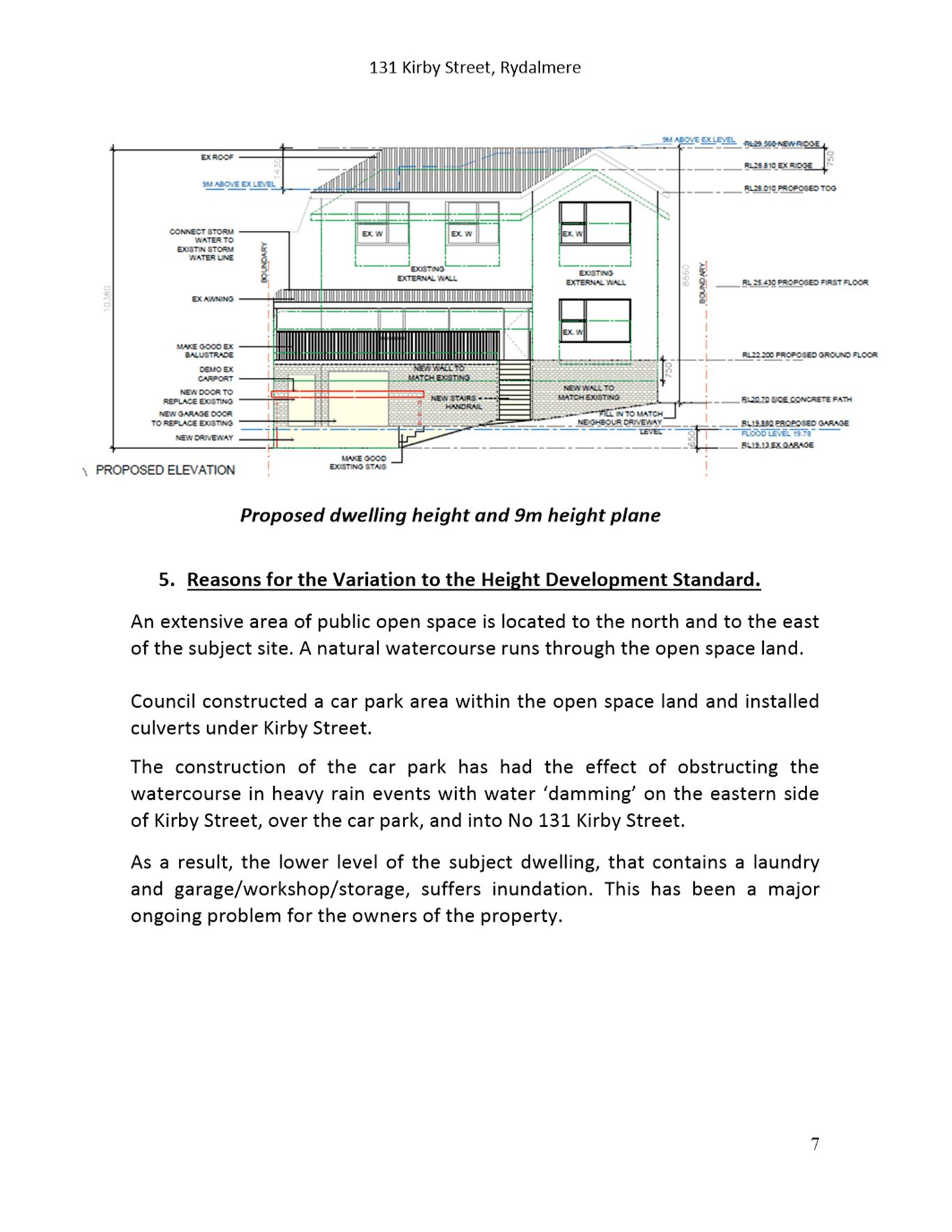
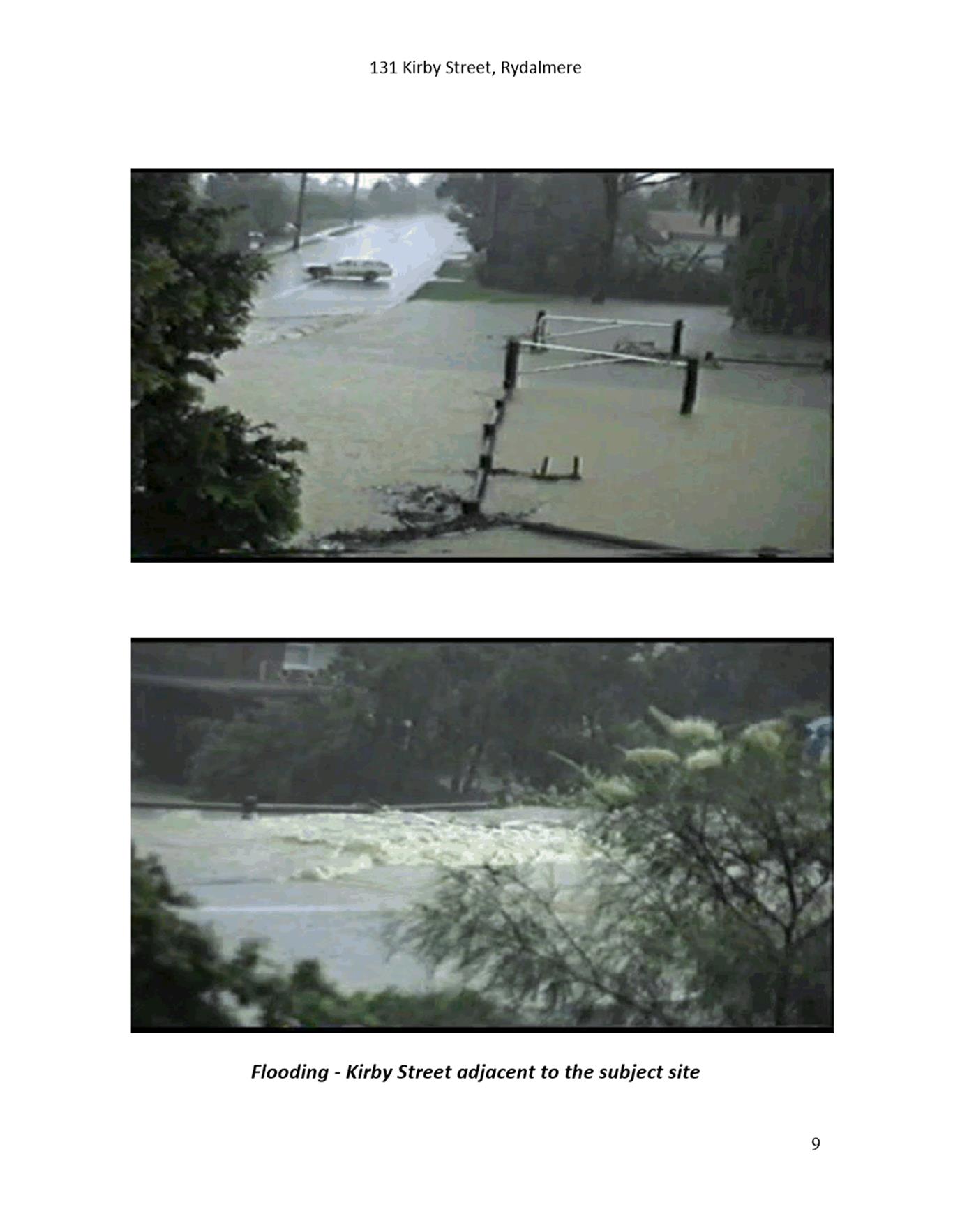
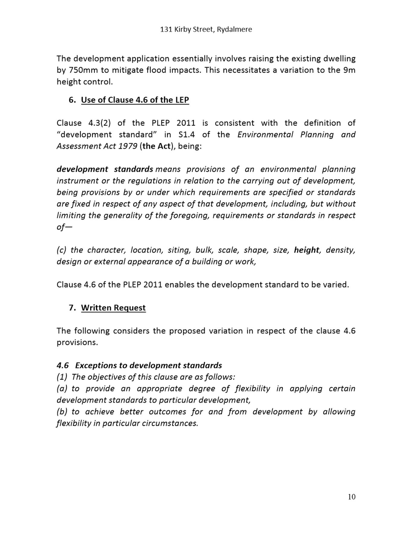
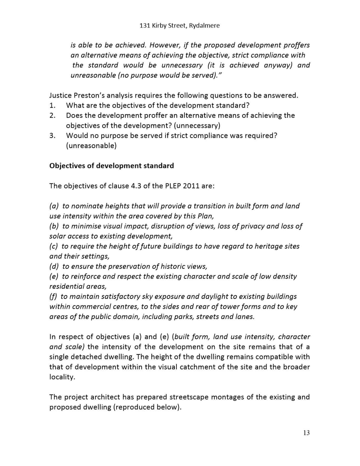
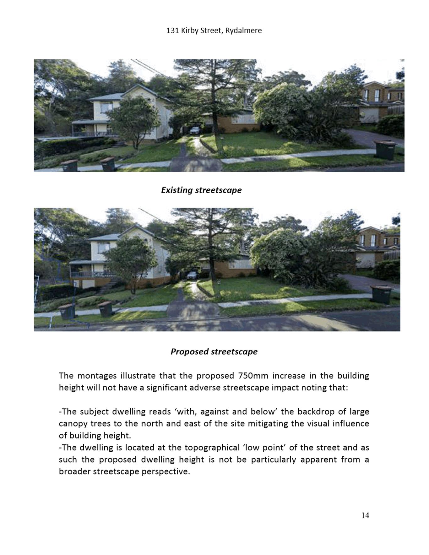
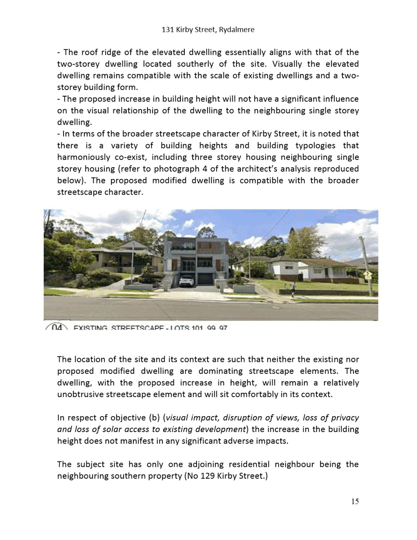
DESCRIPTION Alterations and additions to the existing dwelling involving the elevation of the existing dwelling by 750mm to alleviate flood impacts.
REFERENCE DA/145/2021 - D08138295
APPLICANT/S Planning Direction
OWNERS Mr M S F Dabbs
REPORT OF Group Manager Development and Traffic Services
RECOMMENDED Approval
REASON FOR REFERRAL TO LPP
This item is being referred to the Parramatta Local Planning Panel (PLPP) as a variation to a development standard exceeds 10%. A 15.88% variation to Clause 4.3 Height of Buildings of the Parramatta Local Environmental Plan 2011 is proposed.
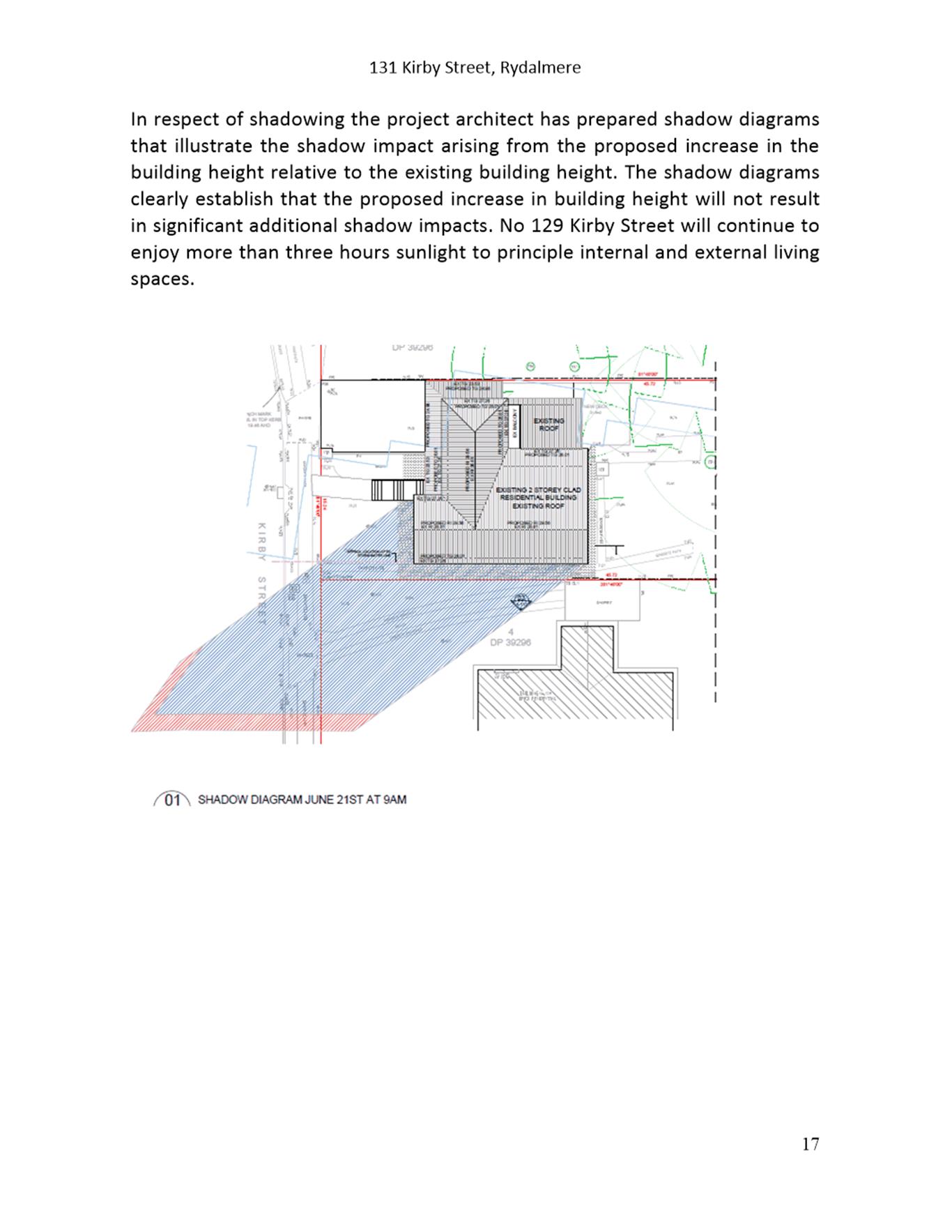
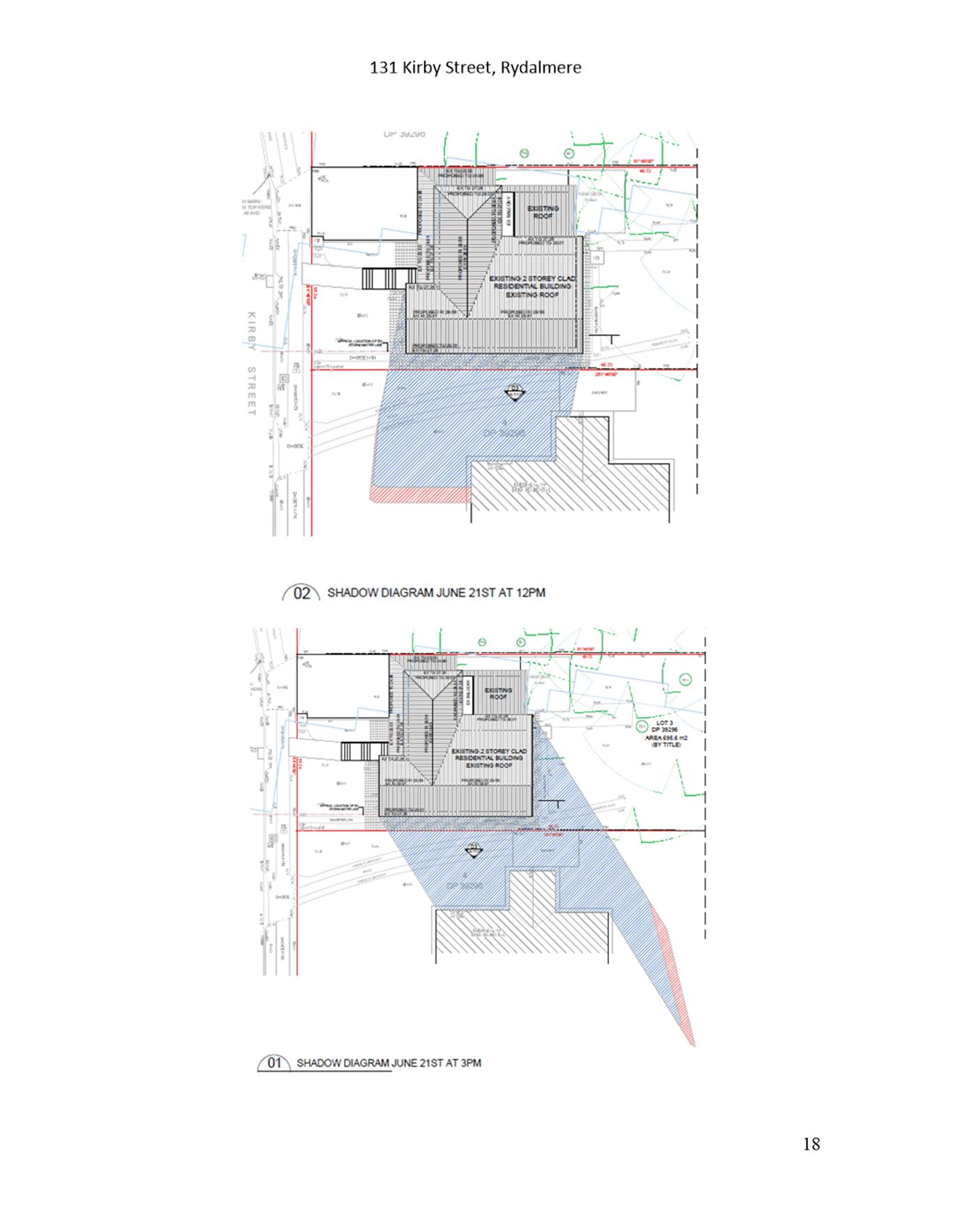
EXECUTIVE SUMMARY
This is a summary of the full assessment of the application as outlined in Attachment 1, the Section 4.15 Assessment Report.
The Site
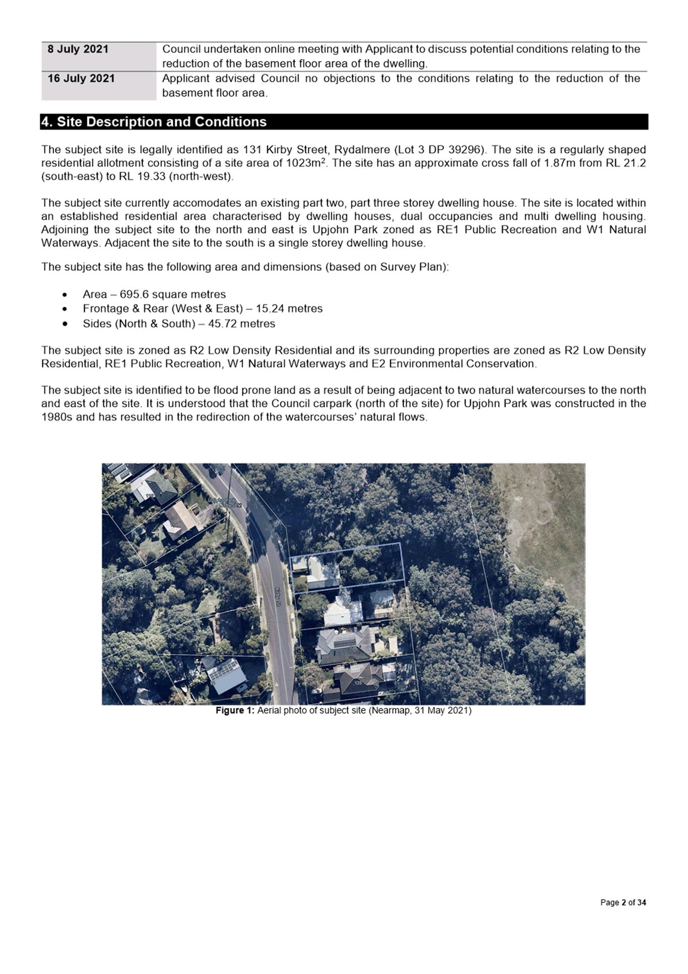
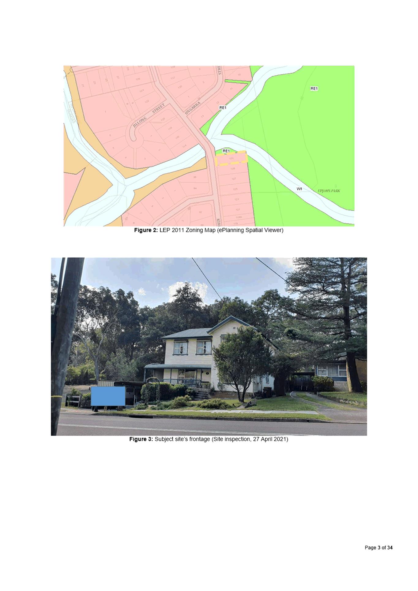
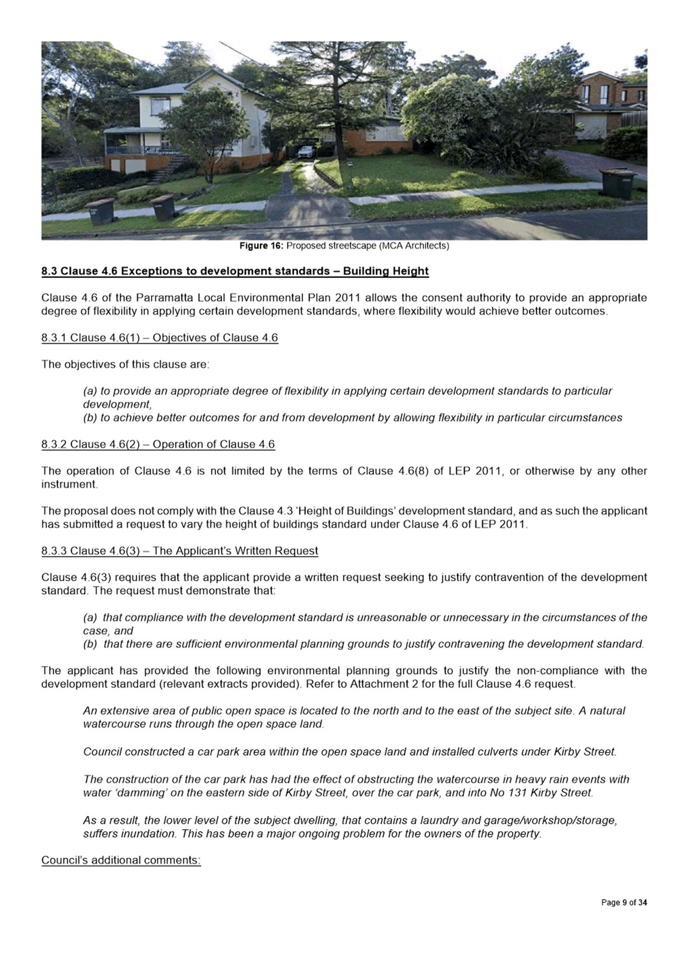
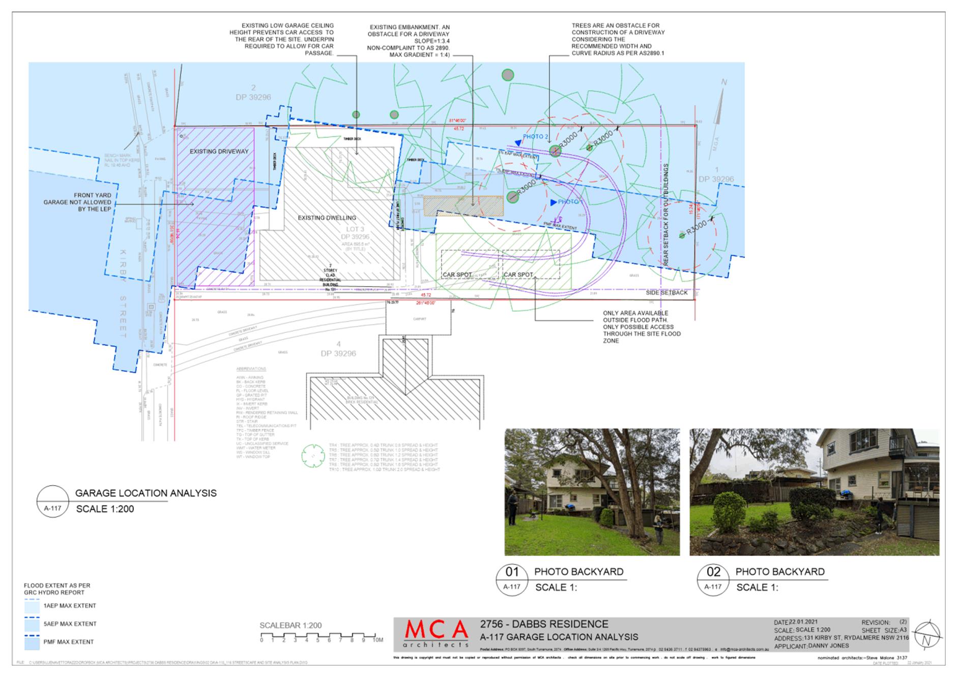
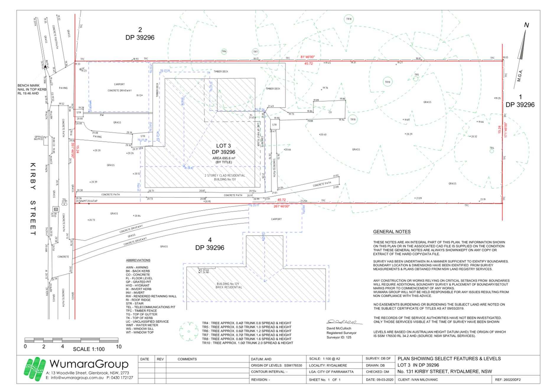
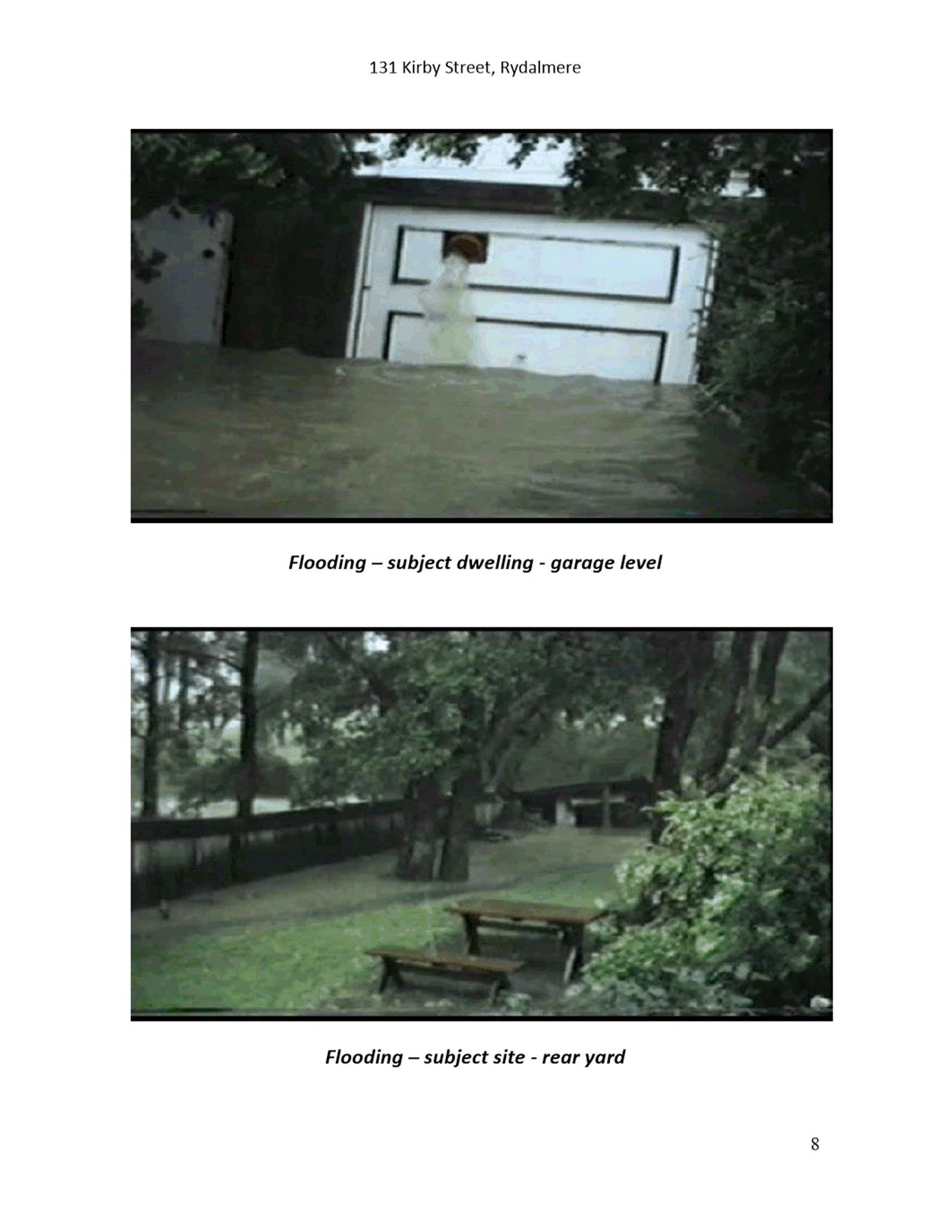
The subject site is legally identified as 131 Kirby Street, Rydalmere (Lot 3 DP 39296). The site is a regularly shaped residential allotment consisting of a site area of 1023m2. The site has an approximate cross fall of 1.87m from RL 21.2 (south-east) to RL 19.33 (north-west).
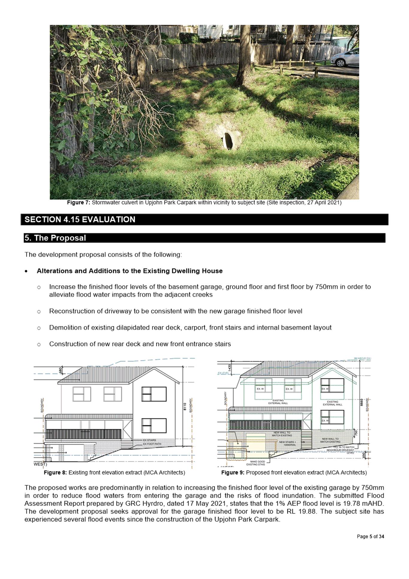
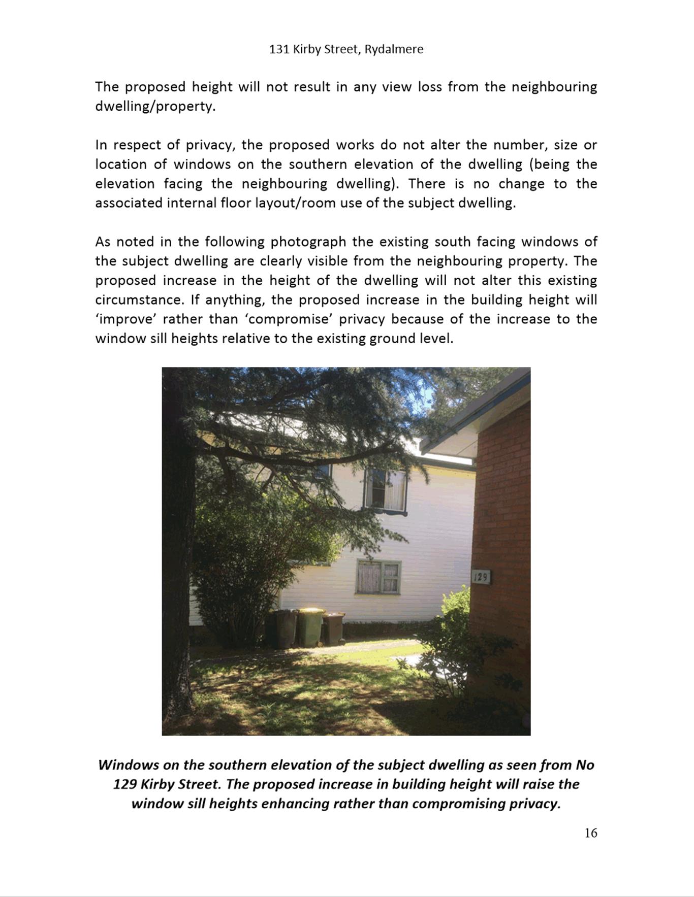
The subject site currently accomodates an existing part two, part three storey dwelling house. The site is located within an established residential area characterised by dwelling houses, dual occupancies and multi dwelling housing. Adjoining the subject site to the north and east is Upjohn Park zoned as RE1 Public Recreation and W1 Natural Waterways. Adjacent the site to the south is a single storey dwelling house.
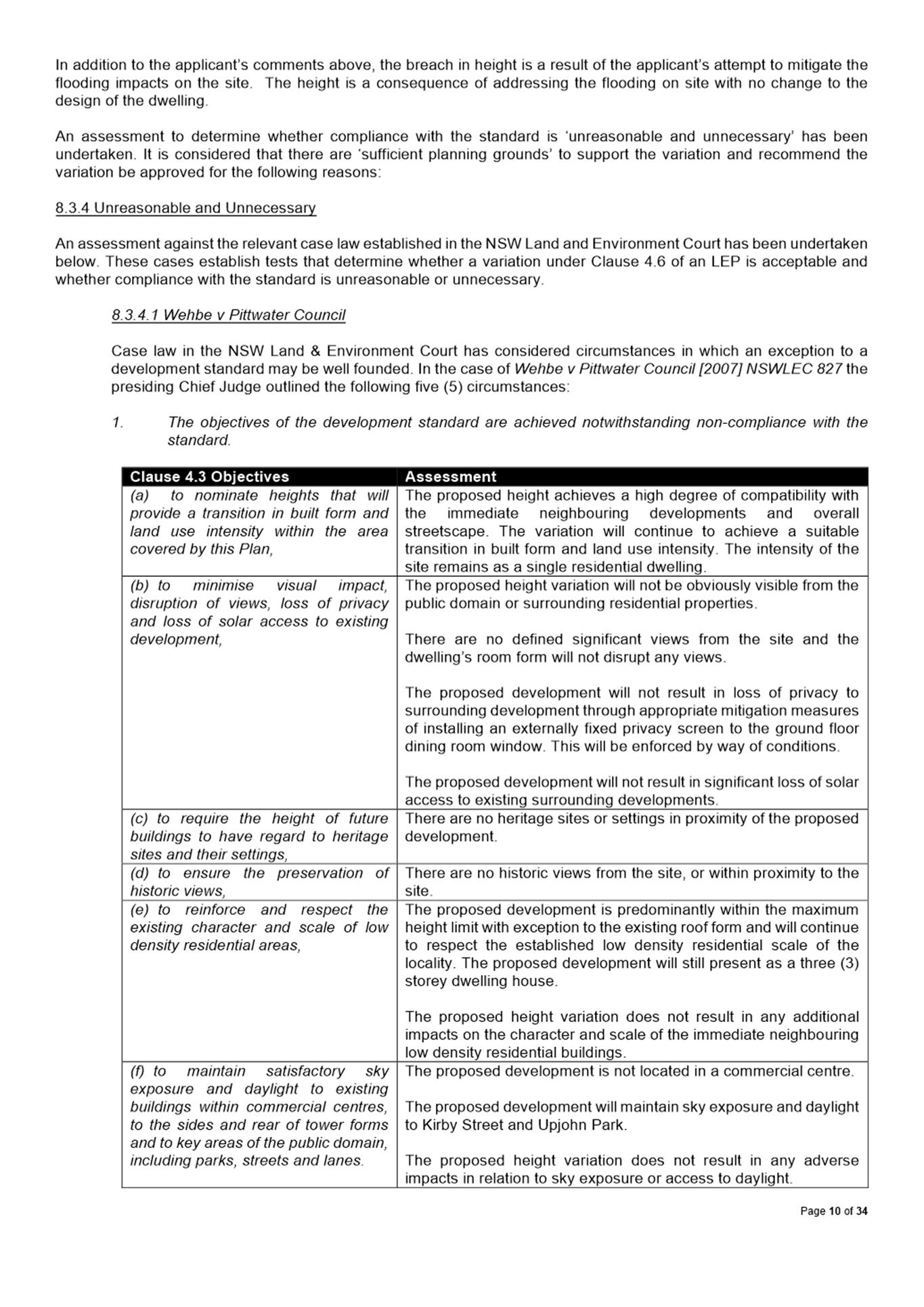
The Proposal
· Alterations and additions to the existing dwelling house
o Increase the finished floor levels of the basement garage, ground floor and first floor by 750mm in order to alleviate flood water impacts from the adjacent creeks
o Reconstruction of the driveway to be consistent with the new garage finished floor level
o Demolition of existing dilapidated rear deck, carport, front stairs and internal basement layout
o Construction of new rear deck and new front entrance stairs
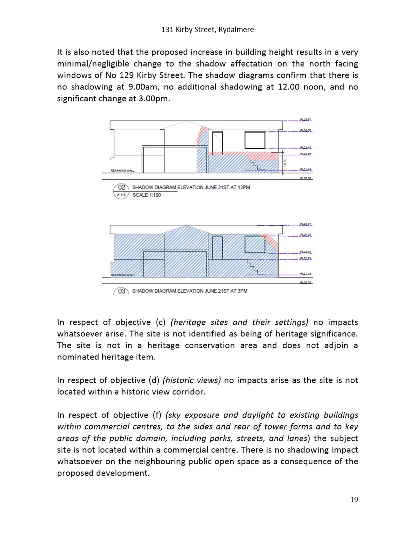
A 15.88% variation to Clause 4.3 Height of Buildings of the Parramatta Local Environmental Plan 2011 is proposed. The request to vary Clause 4.3 is supported as the proposal complies with the applicable planning objectives and does not have an unacceptable impact on the amenity of any adjoining and surrounding properties.
Permissibility
The site is zoned as R2 Low Density Residential under the Parramatta Local Environmental Plan 2011. The proposed works being ancillary to a dwelling house are permissible with development consent within the R2 zone and is generally is in accordance with the applicable objectives under the Parramatta Local Environmental Plan 2011.
Notification
The application was notified in accordance with Council’s Consolidated Notification Requirements 2020. No submissions were received during the application’s notification period.
With respect to the issues and matters addressed in detail within Attachment 1, the application is recommended for approval.
(a) That the Parramatta Local Planning Panel (PLPP), support the variation to Clause 4.3 of the Parramatta Local Environmental Plan 2011 under the provisions of Clause 4.6.
(b) Further, that the Parramatta Local Planning Panel (PLPP), exercising the functions of Council, pursuant to Section 4.16(1)(a) of the Environmental Planning and Assessment Act 1979, grant development consent to DA/145/2021 for a period of five (5) years within which physical commencement is to occur from the date on the Notice of Determination, subject to conditions of consent within Attachment 1.
The reasons for approval are:
1. The development is permissible in the R2 zone pursuant to the Parramatta Local Environmental Plan 2011 and generally satisfies the requirements of all of the applicable standards, provisions, and controls with exception to the height of building standard.
2. A written request to vary the height of building standard has been received. The variation sought will not have any adverse impacts. As such, compliance with the standard is unnecessary. Accordingly, Council believes that there are sufficient environmental planning grounds to justify the variation and finds that the application is satisfactory. Council is therefore satisfied that the Applicant’s Clause 4.6 variation request has adequately addressed the matters required to be demonstrated in Clause 4.6(3) of Parramatta LEP 2011 and that the proposed development will be the public interest because it is consistent with the objectives of the height of building standard and the objectives for development within the R2 zone in which the development is proposed to be carried out.
3. The development will be compatible with the emerging and planned future character of the area, in that the proposal will the retain the existing residential nature of the site.
4. For the reasons given above, approval of the application is in the public interest.
John Martinez
Development Assessment Officer
|
1⇩ |
Assessment Report & Conditions |
34 Pages |
|
|
2⇩ |
Locality Map |
1 Page |
|
|
3⇩ |
Plans used during assessment |
16 Pages |
|
|
Internal plans used during assessment (confidential) |
7 Pages |
|
|
|
5⇩ |
Flood Assessment Report |
22 Pages |
|
|
6⇩ |
Clause 4.6 Statement |
24 Pages |
|
REFERENCE MATERIAL
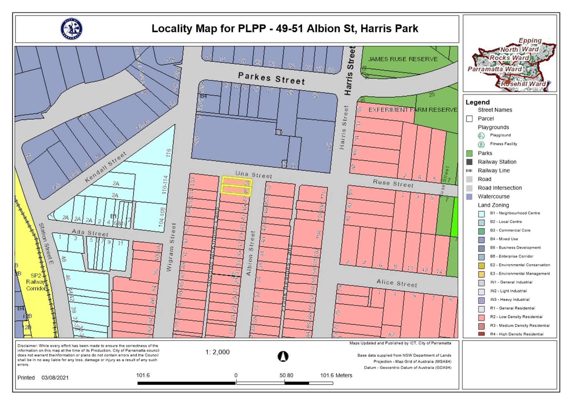
ITEM NUMBER 5.3
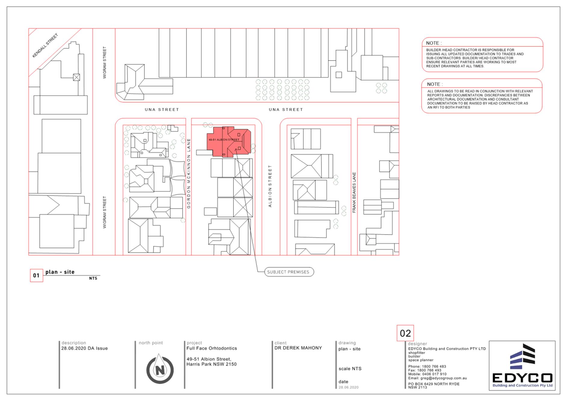
SUBJECT OUTSIDE PUBLIC MEETING:
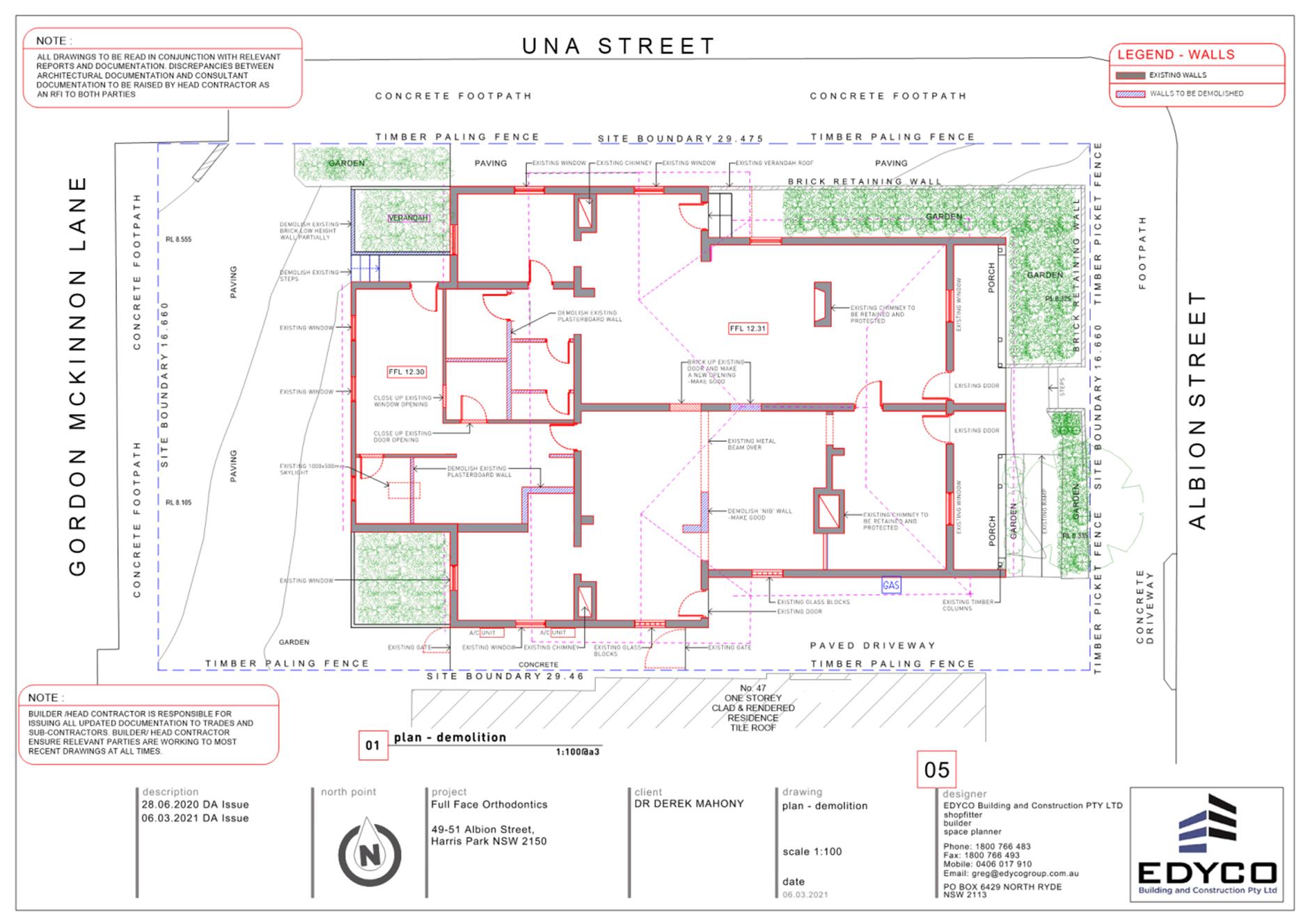
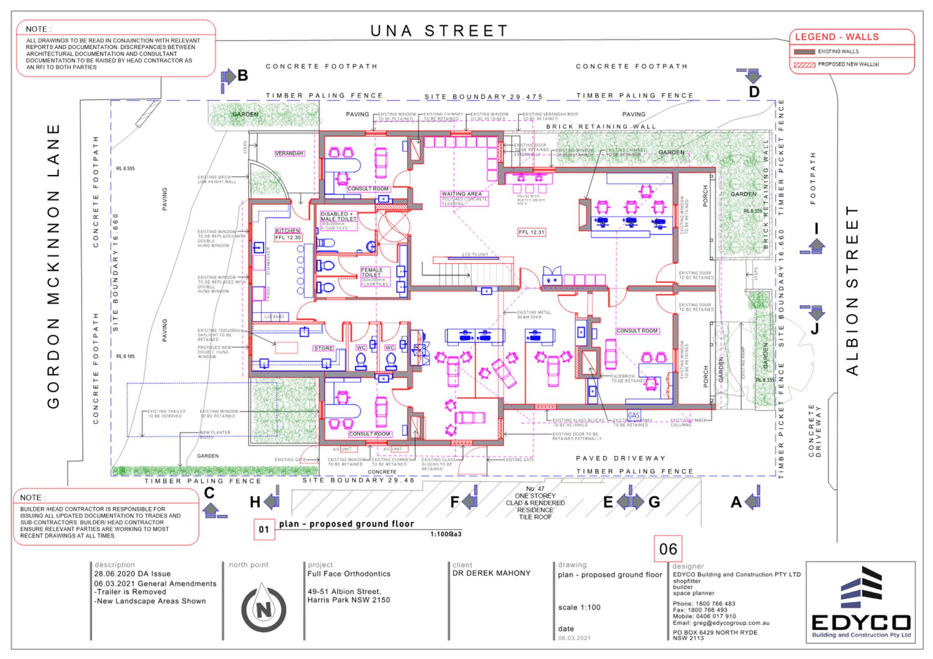
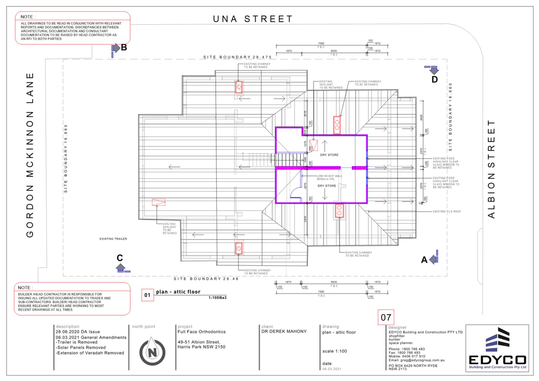
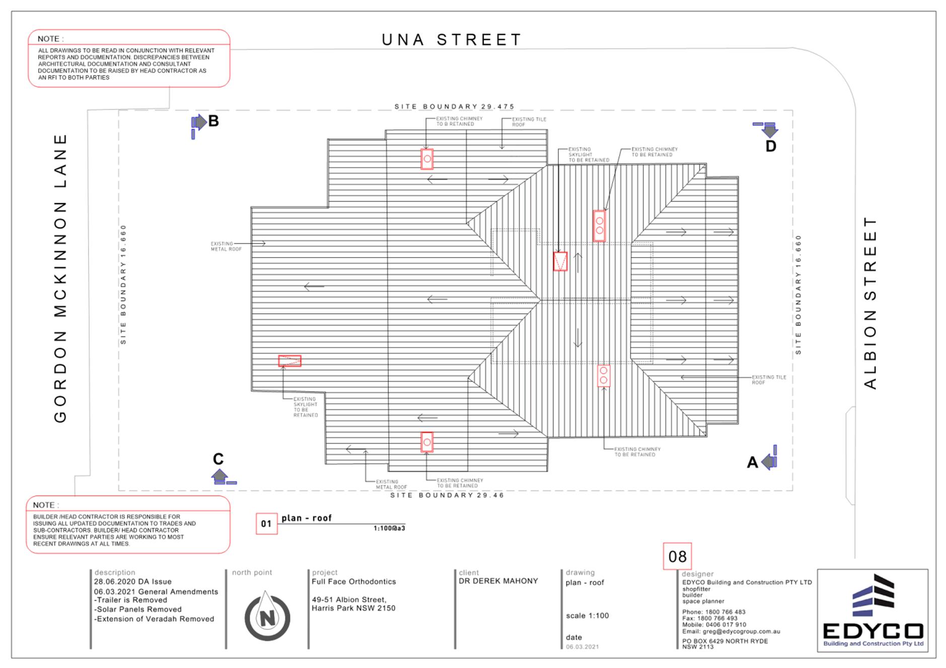
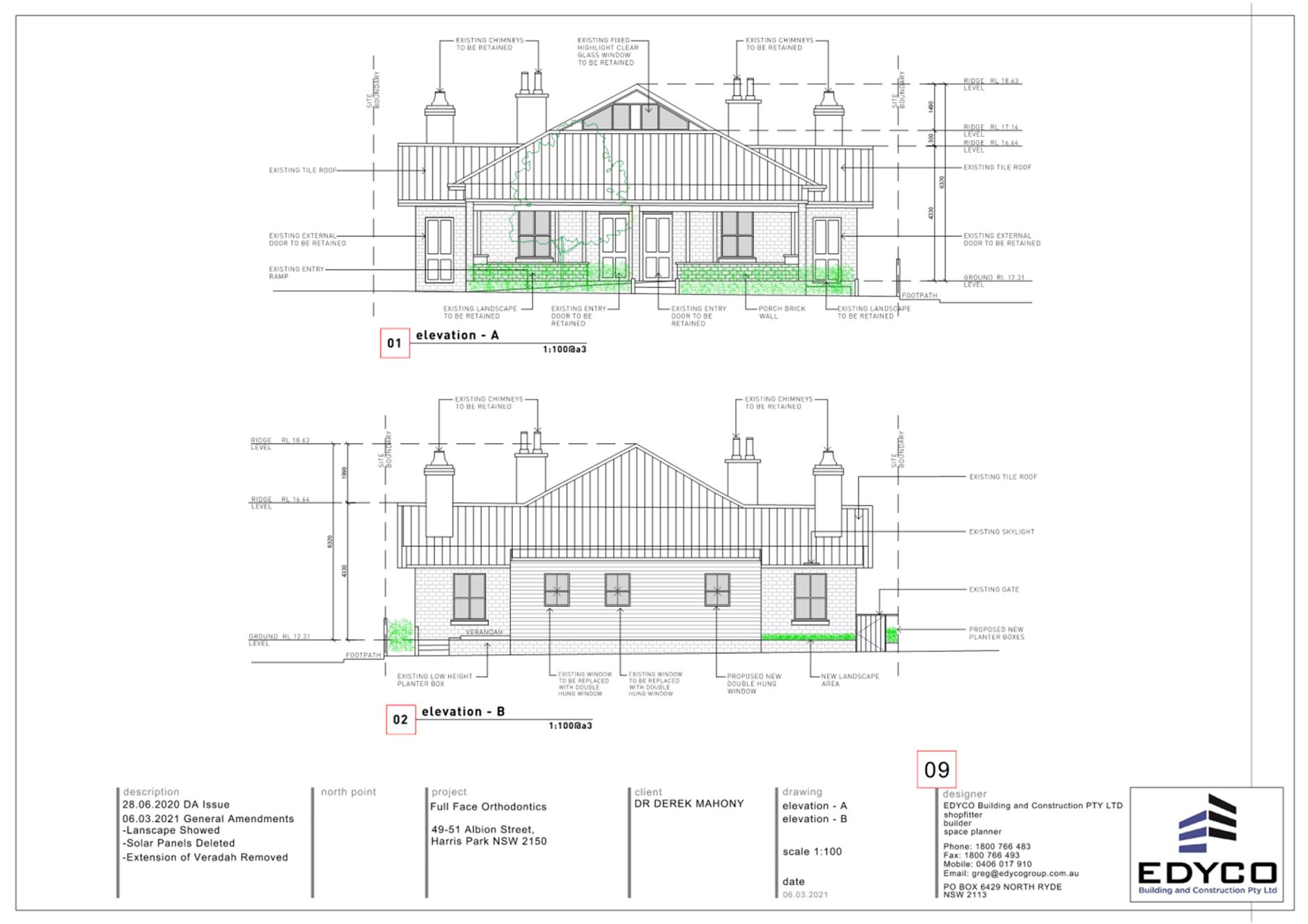
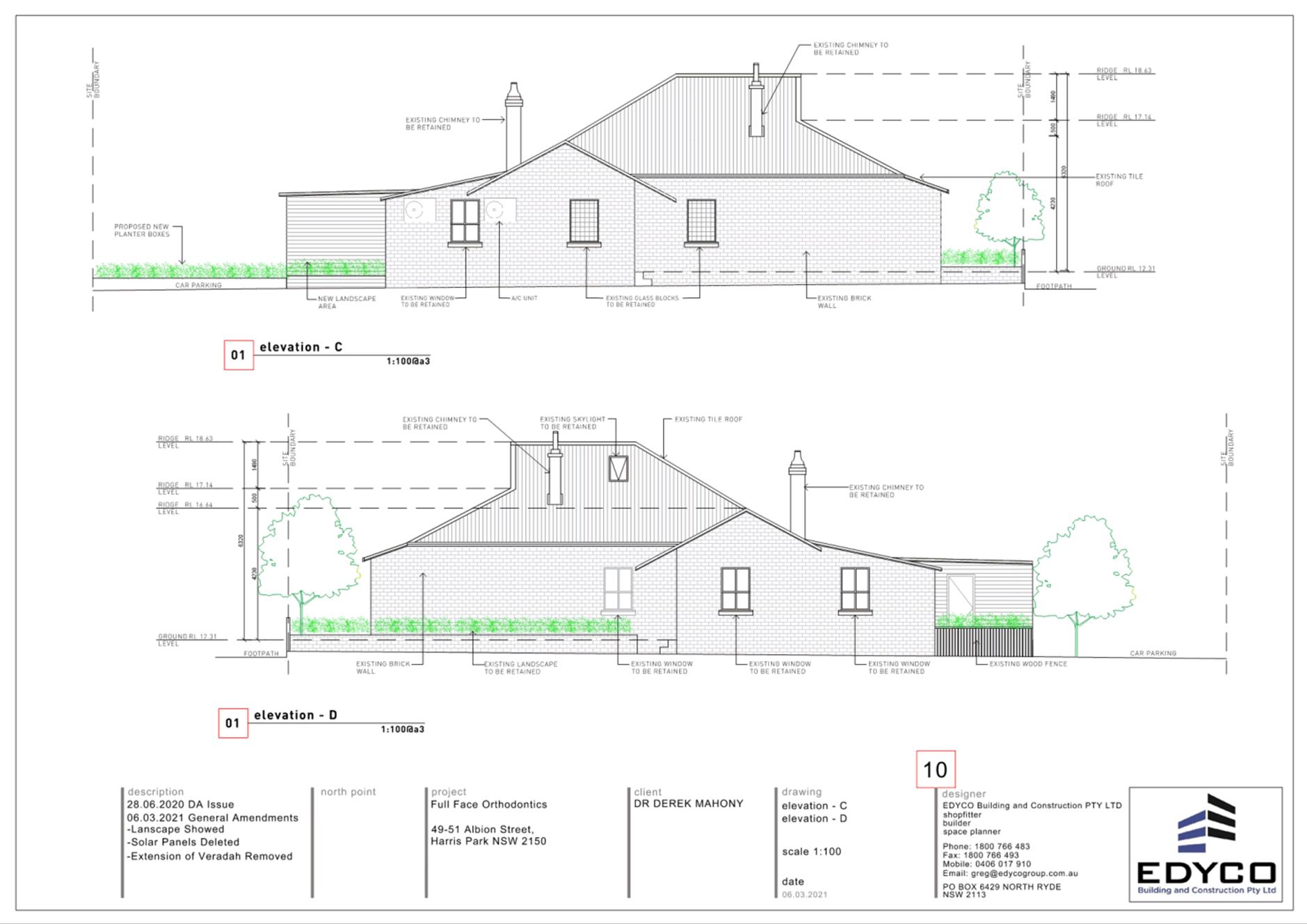
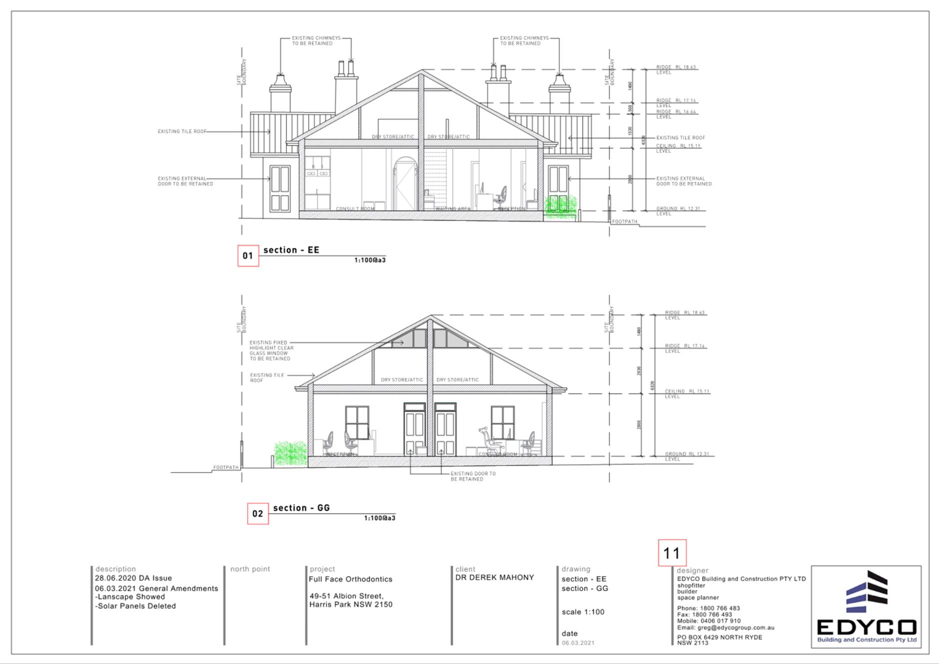
49-51 Albion St, Harris Park
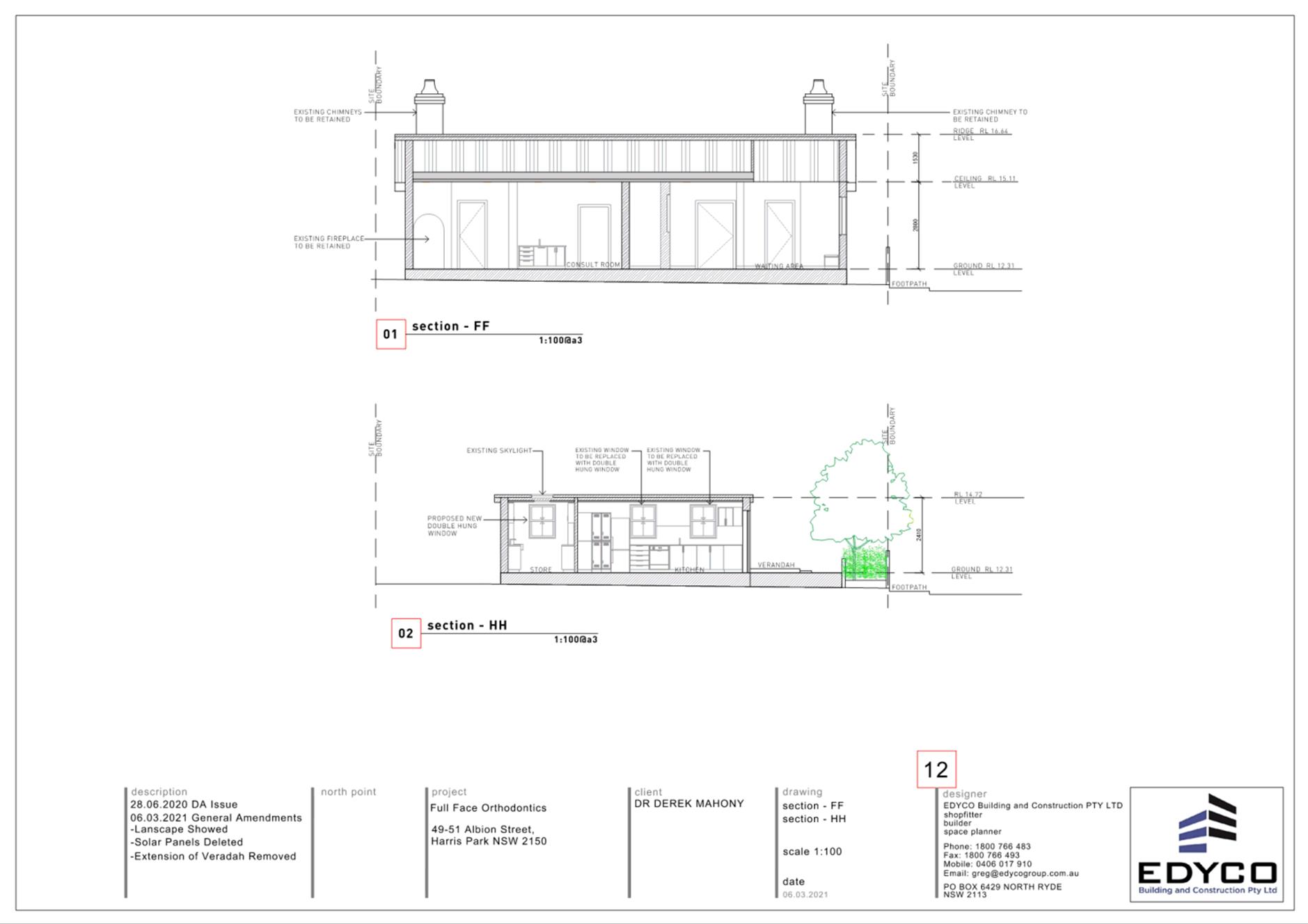
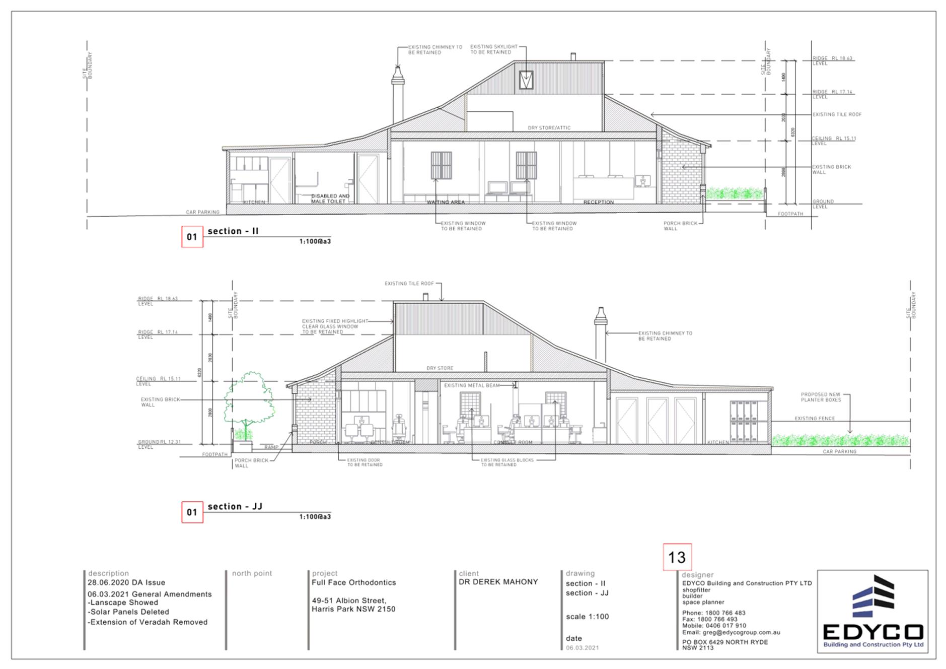
DESCRIPTION Section 8.3 Review of a determination for DA/391/2020 for change of use to an Orthodontist clinic and alterations & additions to a heritage dwelling.
REFERENCE DA/391/2020 - D08155307
APPLICANT/S Mr B Akpinar
OWNERS Mr D Mahoney
REPORT OF Group Manager Development and Traffic Services
RECOMMENDED Approval
REASON FOR REFERRAL TO LPP
The application involves a Review of Determination of DA/391/2020, pursuant to Section 8.3 of the Environmental Planning and Assessment Act, 1979.
EXECUTIVE SUMMARY
Site Details
The subject site is identified as 49-51 Albion Street, Harris Park.
The site is zoned R2 Low Density Residential under Parramatta Local Environmental Plan 2011. The proposed works are defined as ‘health consulting rooms’ which are permissible with consent upon land zoned R2. Further, the proposed development is consistent with the aims and objectives of the R2 zoning applying to the land, in particular:
· To ensure that non-residential land uses are located in a context and setting that minimises impacts on the amenity of a low density residential environment;
Background
The development application was refused under delegated authority on 27 November 2020. The reasons for refusal were as follows:
1. In accordance with Section 4.15(1)(a)(i) of the Environmental Planning and Assessment Act 1979, the application fails to satisfy Clause 1.2(2)(c) Aims of Plan of the Parramatta Local Environmental Plan 2011;
2. In accordance with Section 4.15(1)(a)(i) of the Environmental Planning and Assessment Act 1979, the application fails to achieve the objectives of the R2 Low Density Residential zone of the Parramatta Local Environmental Plan 2011;
3. In accordance with Section 4.15(1)(a)(i) of the Environmental Planning and Assessment Act 1979, the application fails to satisfy Clause 5.10 Heritage Conservation of the Parramatta Local Environmental Plan 2011 in particular the objectives of the clause and adversely impacting on the significance of both the heritage building and the heritage conservation area, and whereby detracting from the desired future character of the neighbourhood;
4. In accordance with Section 4.15(1)(a)(iii) of the Environmental Planning and Assessment Act 1979, the application fails to comply with the Parramatta Development Control Plan 2011 with respect to general heritage, strategic precinct and heritage conservation area;
5. In accordance with Section 4.15(1)(c) Environmental Planning and Assessment Act 1979, the site is not suitable for the proposed development; and
6. In accordance with Section 4.15(1)(e) Environmental Planning and Assessment Act 1979, the proposal fails to satisfy the relevant considerations in that the adverse impacts by the development due to non-compliances with the applicable planning controls are not beneficial for the local community and as such, are not in the wider public interest.
Pursuant to Section 8.3 of the Environmental Planning and Assessment Act 1979, a Review of Determination was submitted. A cover letter explaining changes to the proposal, as well as architectural plans reflective of these changes, were submitted with the application for review.
The Proposal
The development application seeks consent for:
· completion of the internal fit out as shown on the architectural drawings, and
· use of the premises as an orthodontist office only. The use has already commenced.
Note: Given a DA cannot authorise internal works already carried out, a condition has been imposed on the consent requiring the obtainment of a Building Information Certificate prior to the issue of a Construction Certificate
No advertising structures or signage is proposed.
The proposed hours of operation:
· Monday to Friday, 9am to 6pm.
· Saturday, 9am to 1pm.
Staffing:
· Three (3) health care professionals and one (1) to two (2) part time support staff are to be employed.
Car parking:
· No change to existing car parking proposed.
The site is zoned R2 Low Density Residential under Parramatta Local Environmental Plan 2011. The proposed works are defined as ‘health consulting rooms’ which are permissible with consent upon land zoned R2.
The development application was advertised between 22nd April and 13th May 2021 in accordance with the advertisement procedures contained within Appendix 1 of Council’s Community Engagement Strategy. No submissions were received.
The application was referred to Council’s Traffic Engineer and Environmental Health Officers, who support the proposed development subject to standard and special conditions of consent. Previous concerns raised by Council’s Heritage Advisor were resolved with the submission of amended plans.
The proposal has been assessed in accordance with Section 4.15 (1) of the Environmental Planning and Assessment Act, 1979. The application was accompanied by a revised Statement of Environmental Effects which sufficiently detailed how the revised proposal responds to the reasons for refusal. As detailed in the assessment report, the proposal is consistent with the requirements of both the Parramatta Local Environmental Plan 2011 and Parramatta Development Control Plan 2011.
The documentation submitted with the Section 8.3 Review is sufficient in addressing the reasons for refusal. Therefore, Council’s recommendation is to approve the application subject to conditions.
RECOMMENDATION
That the Parramatta Local Planning Panel (PLPP) exercising the functions of Council pursuant to Section 4.16 of the Environmental Planning and Assessment Act, 1979, grant development consent to DA/391/2020 for a period of five (5) years within which physical commencement is to occur from the date on the Notice of Determination, subject to conditions of consent within Attachment 1.
The reasons for the conditions imposed on this application are as follows:
1. To facilitate the orderly implementation of the objectives of the Environmental Planning and Assessment Act 1979 and the aims and objectives of the relevant Council Planning instrument.
2. To ensure that the local amenity is maintained and is not adversely affected and that adequate safeguards are incorporated into the development.
3. To ensure the development does not hinder the proper and orderly development of the subject land and its surrounds.
4. To ensure the relevant matters for consideration under Section 4.15 of Environmental Planning and Assessment Act 1979 are maintained.
Aaron Essenhigh
Development Assessment Officer
|
1⇩ |
Assessment Report |
15 Pages |
|
|
2⇩ |
Locality Map |
1 Page |
|
|
3⇩ |
Plans used during assessment |
10 Pages |
|
|
4⇩ |
Draft Conditions of Consent |
15 Pages |
|
REFERENCE MATERIAL
Innovative
17 August 2021
6.1 Exhibition Outcomes - Amended Melrose Park North Planning Proposal and Draft Site-Specific Development Control Plan 220
Local Planning Panel 17 August 2021 Item 6.1
ITEM NUMBER 6.1
SUBJECT Exhibition Outcomes - Amended Melrose Park North Planning Proposal and Draft Site-Specific Development Control Plan
REFERENCE RZ/1/2016 -
APPLICANT/S Payce MP DM Pty Ltd (38-42, 44 & 44A Wharf Road, Melrose Park and 27-29 Hughes Avenue, Ermington), Ermington Gospel Trust (15-19 Hughes Avenue & 655 Victoria Road, Ermington), Jae My Holdings Pty Ltd (8 Wharf Road, Melrose Park)
OWNERS Payce MP DM Pty Ltd, Ermington Gospel Trust, Jae My Holdings Pty Ltd
REPORT OF Senior Project Officer Land Use Planning
Development applications considered by Sydney central city planning panel Nil
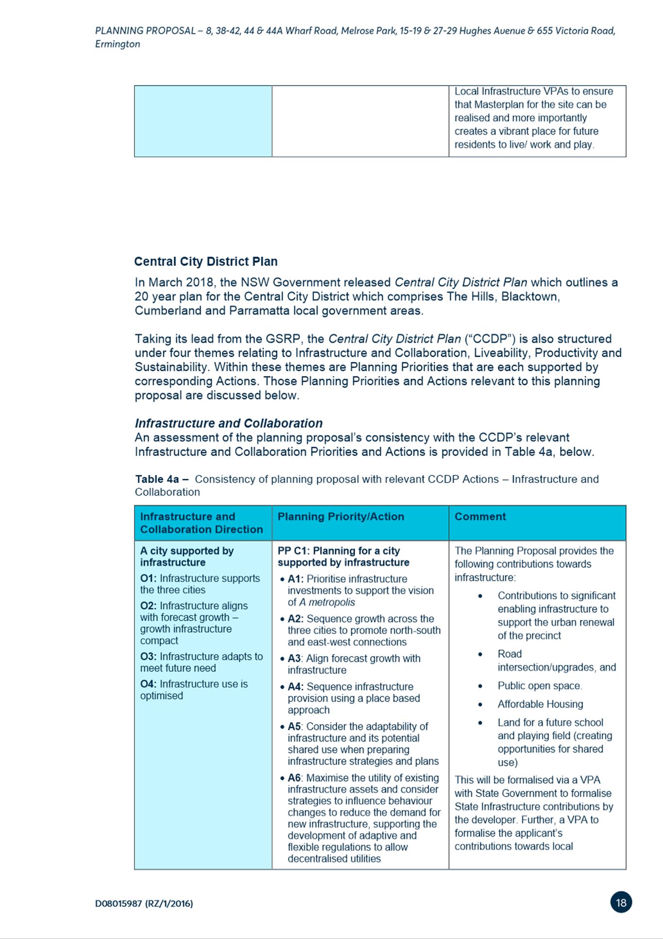
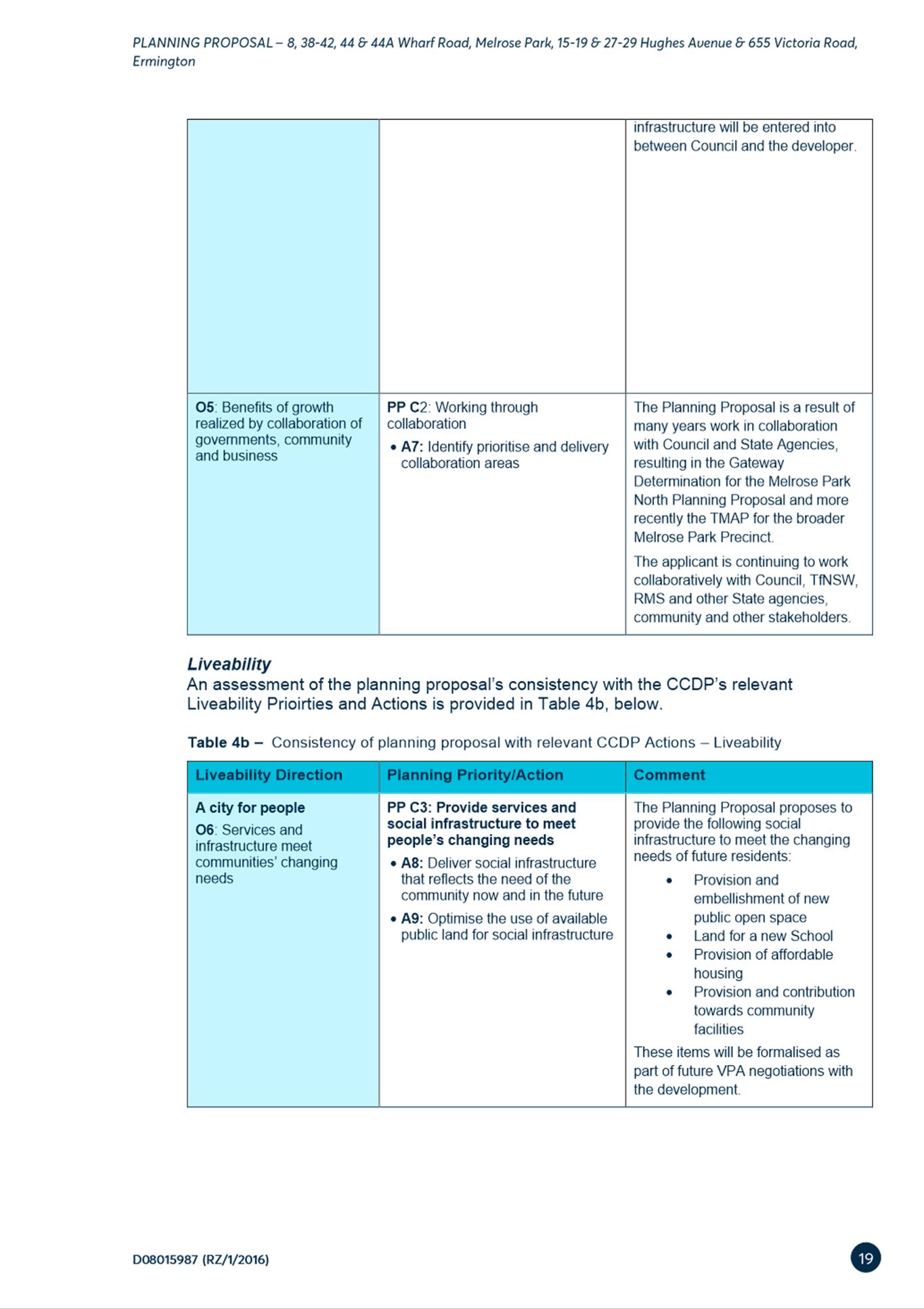
PURPOSE:
To detail submissions received during the public exhibition of the amended Melrose Park North Planning Proposal and draft Site-Specific Development Control Plan (DCP) and respond to issues raised. The report recommends that the amended Planning Proposal and draft Site Specific DCP be forwarded for Council’s consideration. The Planning Agreement will be considered by Council at a later date.
The Local Planning Panel recommend to Council:
(a) That Council receives and notes the submissions (summarised in Attachment 1) made during the concurrent public exhibition of:
· the Melrose Park North Planning Proposal.
· the proposed draft objectives and controls to be included the Parramatta Development Control Plan 2011, noting that further refinements will be made to the controls prior to reporting to Council relating to the management of development applications following finalisation of the Planning Proposal and requirements for the lodgement of a concept or infrastructure development application.
· the Draft Planning Agreement associated with the Planning Proposal.
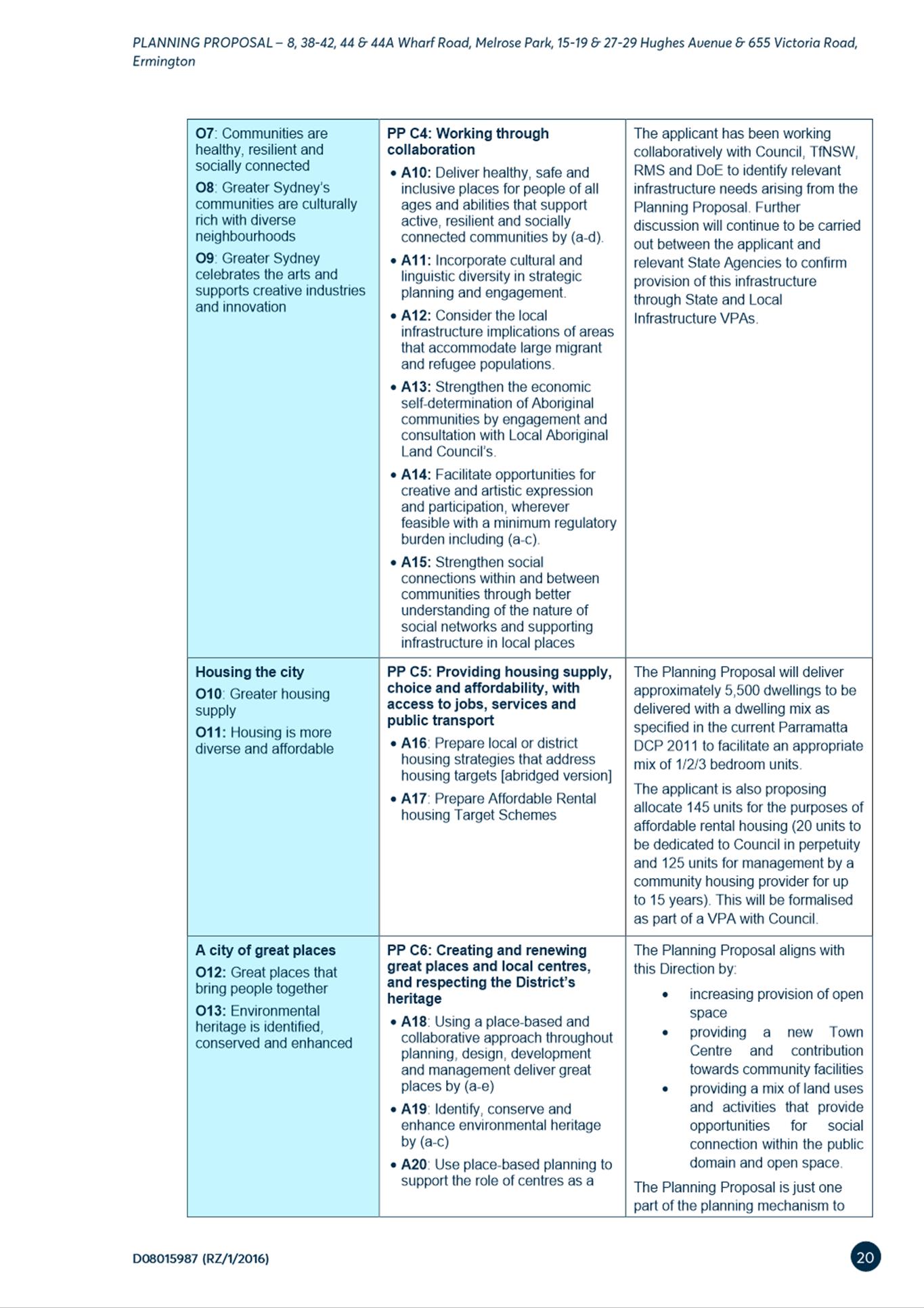
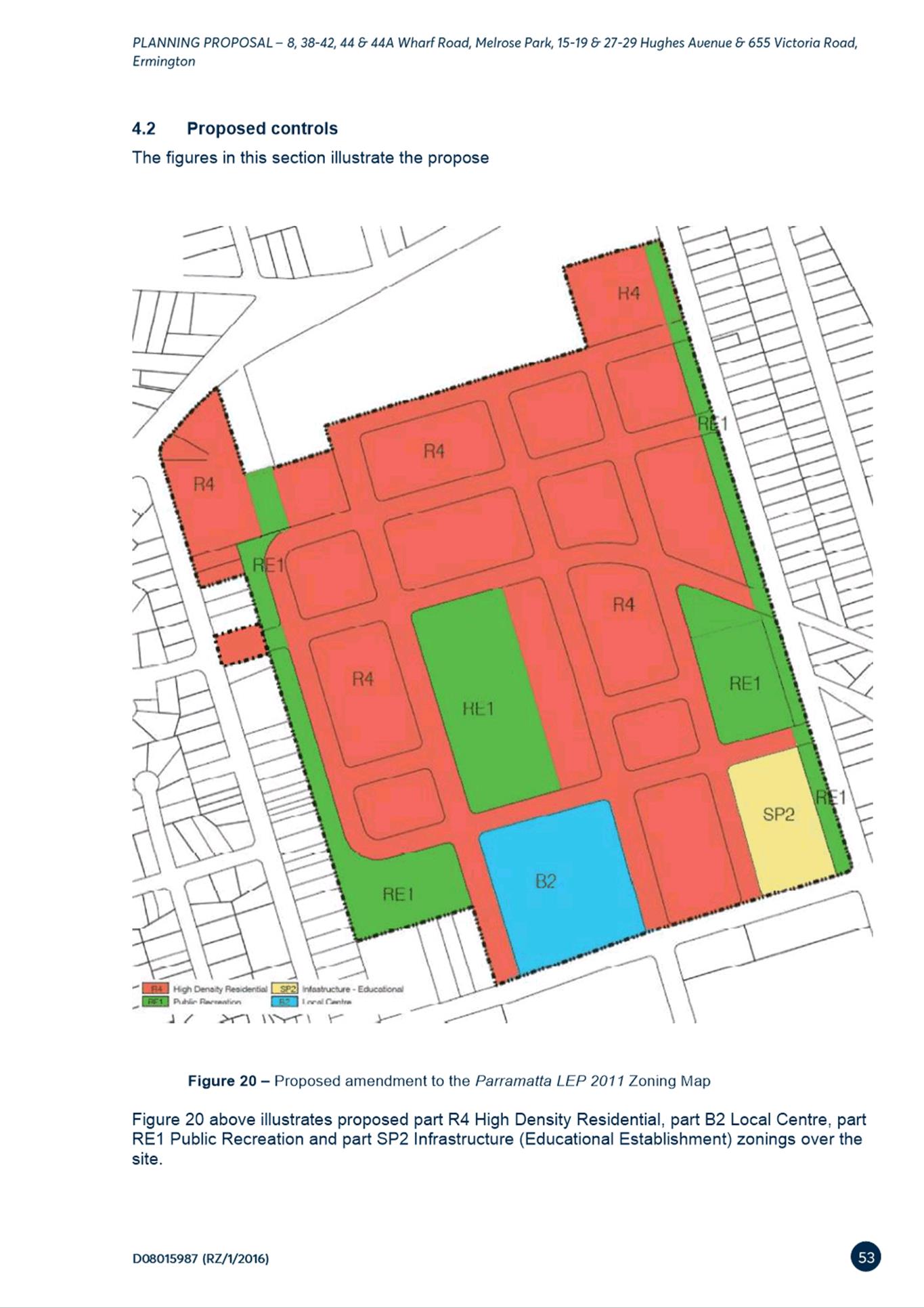
(b) That Council endorse the Melrose Park North Planning Proposal for finalisation (provided at Attachment 2) that seeks to amend Parramatta Local Environmental Plan 2011 as follows:
1) Rezone 38-42, 44 & 44a Wharf Road, Melrose Park Avenue from IN1 General Industrial to part R4 High Density Residential, part B2 Local Centre, part RE1 Public Recreation and part SP2 Infrastructure (Educational Establishment).
2) Rezone 27-29 Hughes Avenue, Ermington from R2 Low Density Residential to R4 High Density Residential.
3) Rezone 15-19 Hughes Avenue and 655 Victoria Road from part R2 Low Density Residential and part SP1 Special activities (Place of Public Worship) to part R4 High Density Residential and part RE1 Public Recreation.
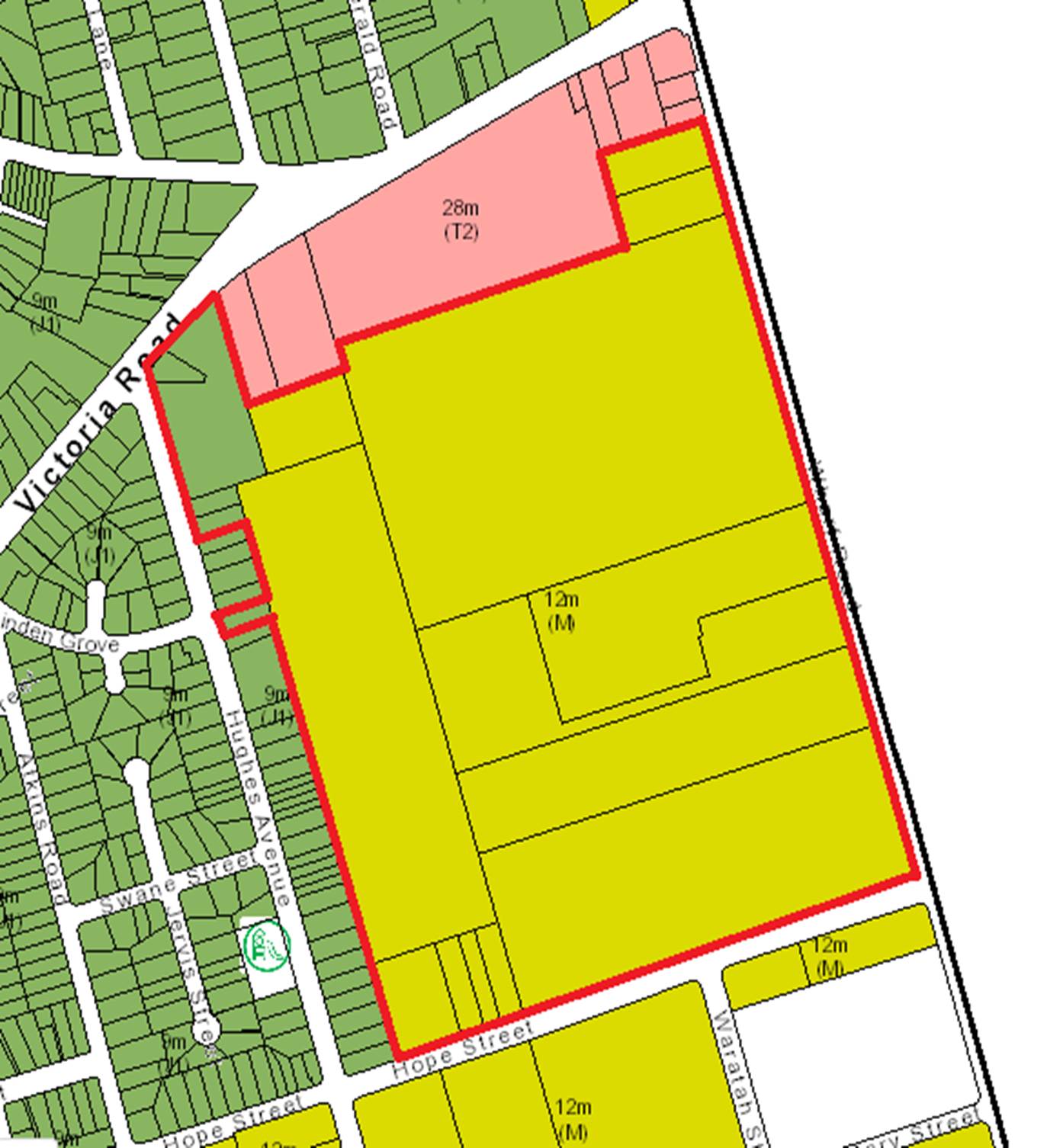
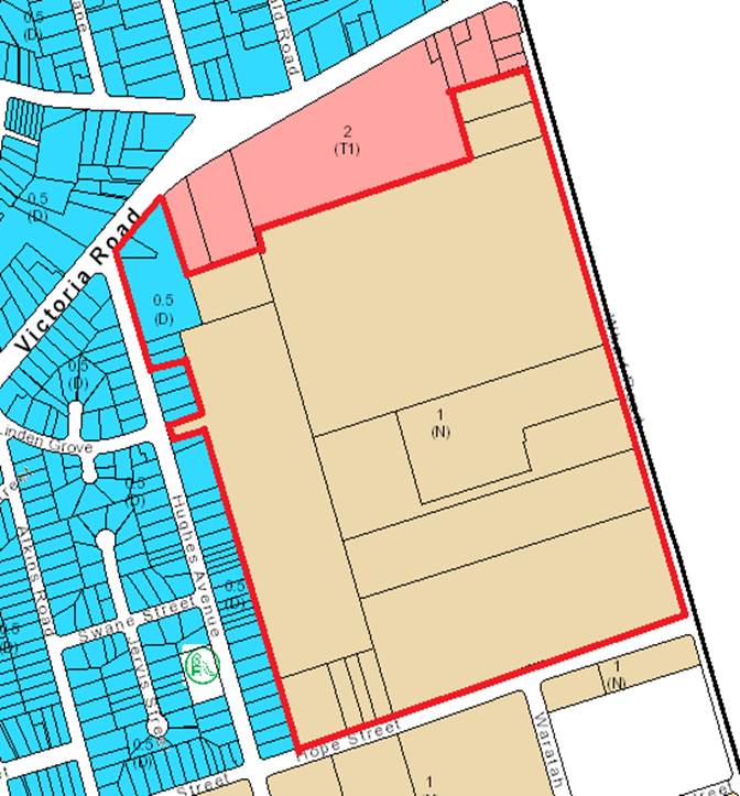
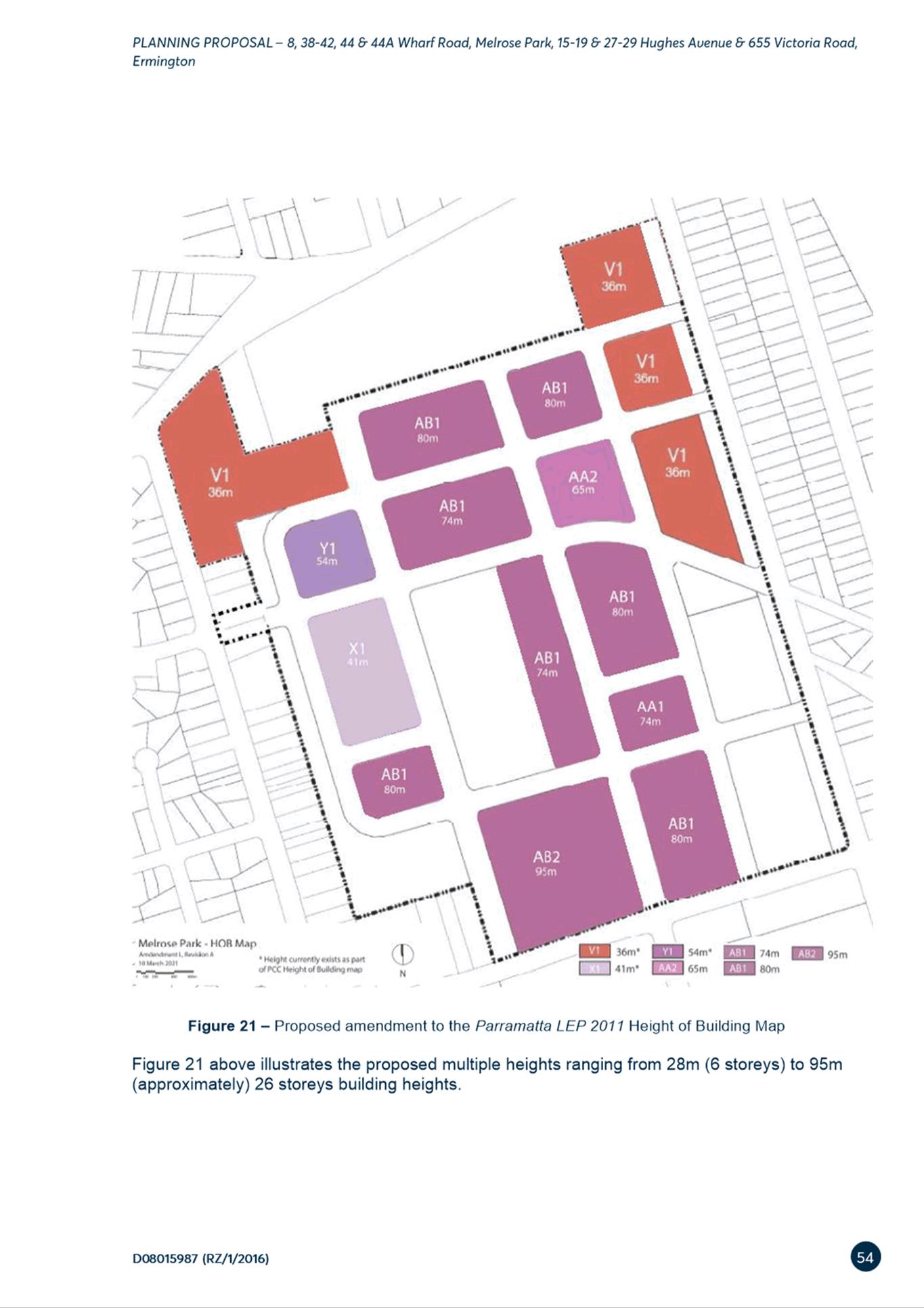
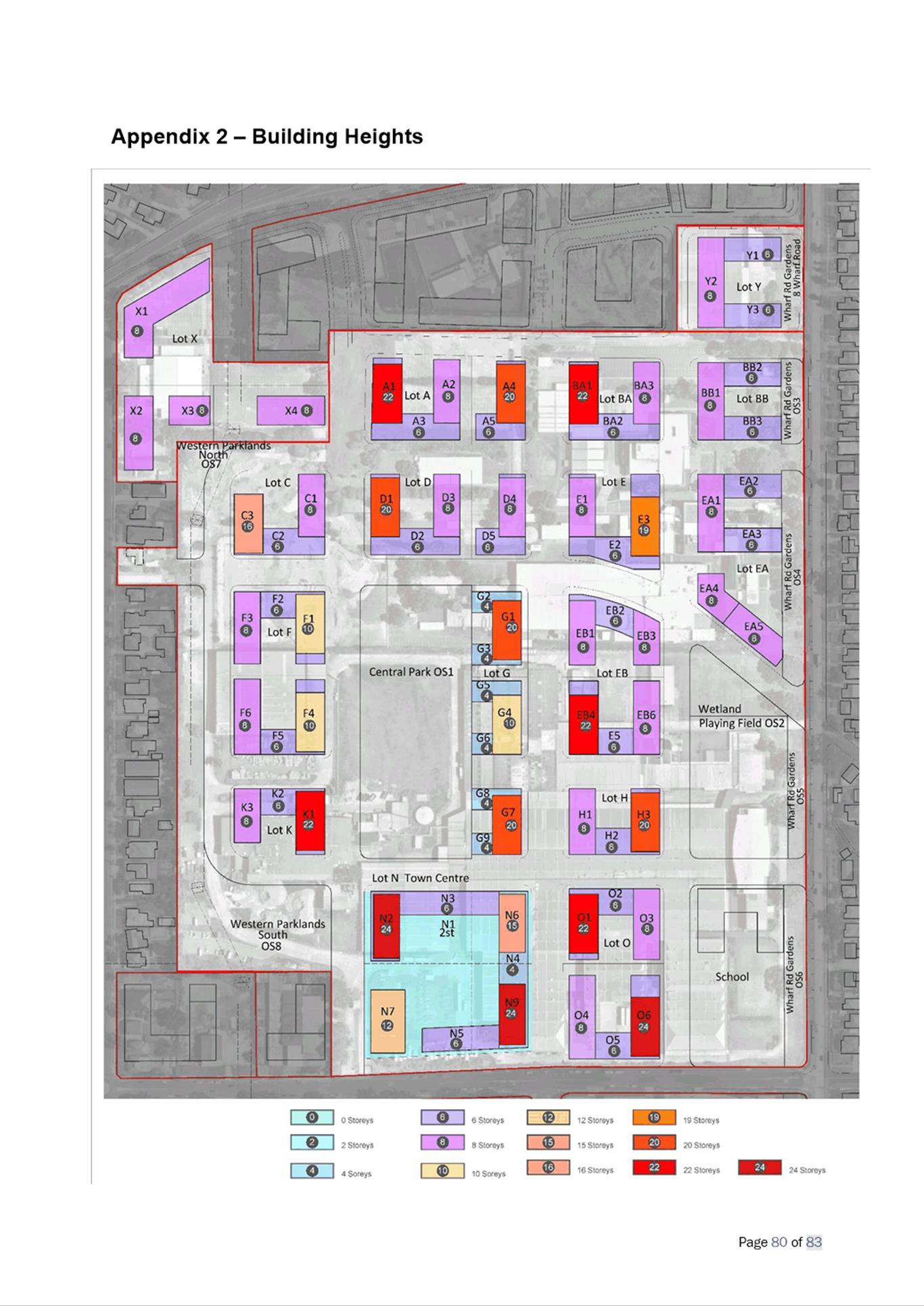
4) Amend the height of buildings map to increase the maximum building heights from part 9m and part 12m to multiple heights ranging from 36m to 95m (approx. 6-8 storeys to approx. 26 storeys).
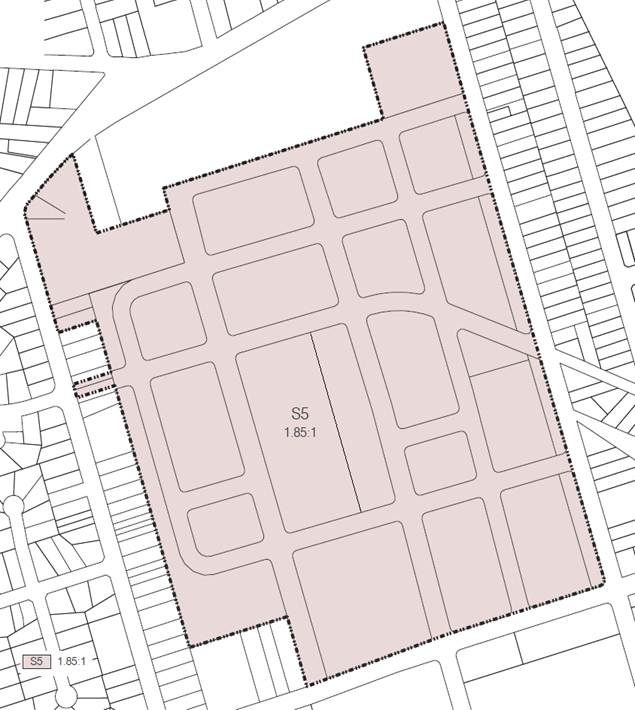
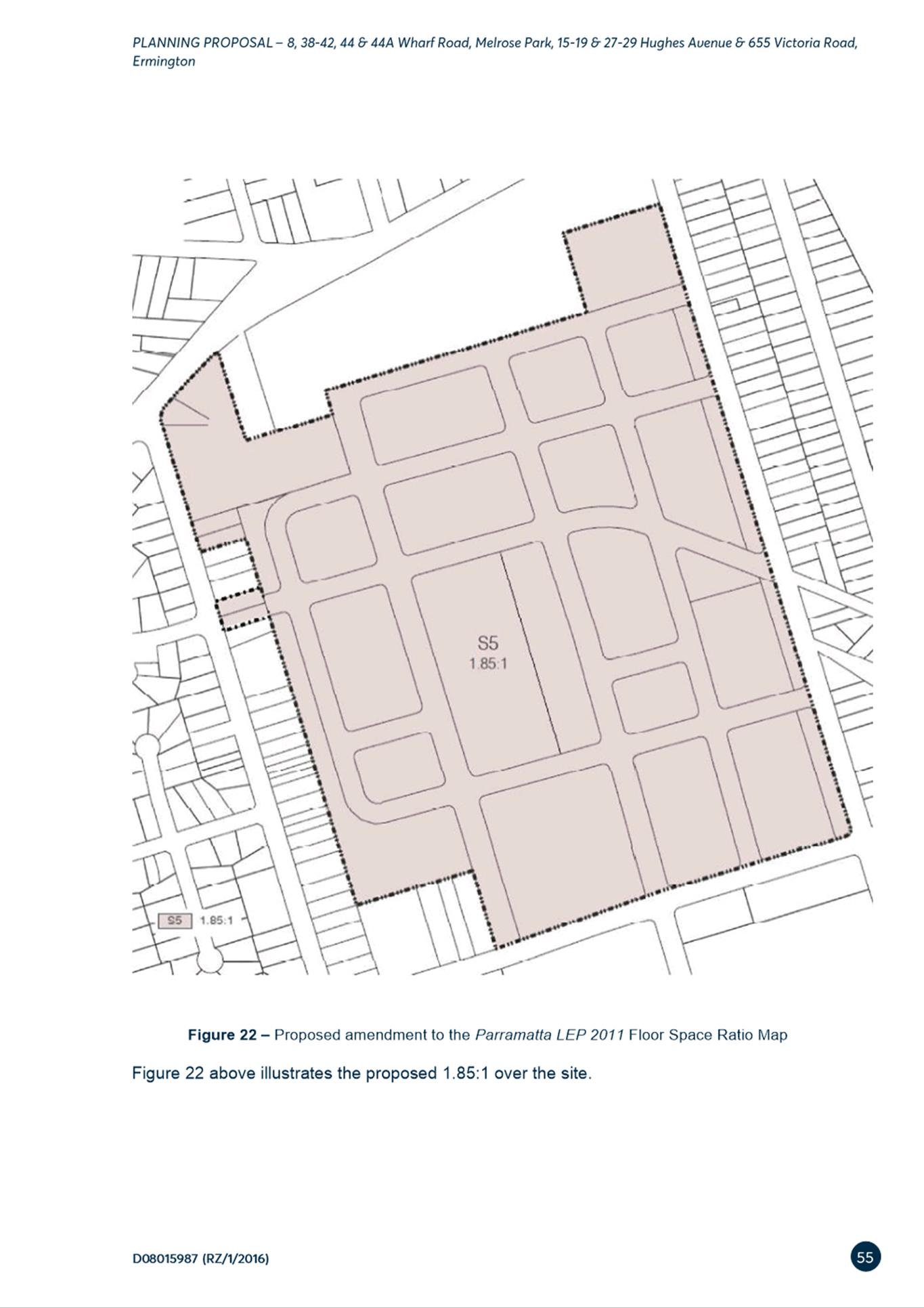
5) Amend the floor space ratio (FSR) from part 0.5:1 and part 1:1 to 1.85:1.
6) Amend the Land Reservation Acquisition Map to reflect areas of public open space to be dedicated to Council and land for the new school site to the State Government.
7) Amend Schedule 1- Additional Permitted Uses to permit ‘Residential flat buildings’ in the B2 Local Centre zone.
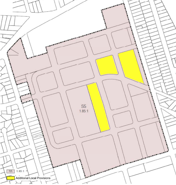
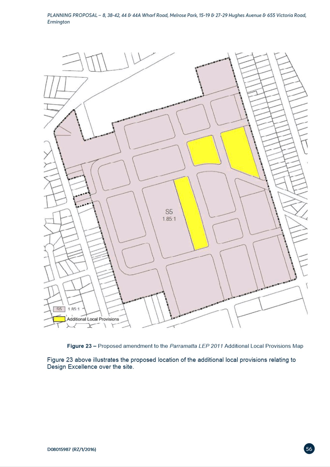
8) Amend the Additional Local Provisions map to include the site and insert a site-specific provision in Part 6 Additional local provisions – generally of PLEP 2011 to ensure:
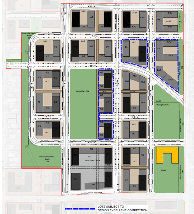
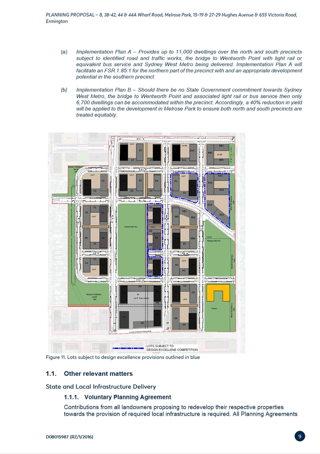
8.1) That Design Excellence Competition provisions be inserted applicable to development lots E, EA and G (identified in Figure 8) without the provision of floor space and height bonuses
8.2) Appoint a Design Excellence Panel to provide design advice for all development applications within the northern precinct. Floor space and height bonuses are not to be awarded on any development lot.
8.3) A total residential gross floor area within the planning proposal site does not exceed 508,768m2.
8.4) A minimum of 30,000m2 of non-residential floor space is to be provided within the site to serve the retail and commercial needs of the incoming population.
(c) That Council forward the Melrose Park North Planning Proposals to the Department of Planning, Industry and Environment for finalisation.
(d) That Council endorse for finalisation the exhibited amendments to the Parramatta Development Control Plan 2011 that are included at Attachment 3.
(e) Further, that Council authorises the Chief Executive Officer to make any minor amendments and corrections of a non-policy and administrative nature that may arise during the plan amendment process relating to the Planning Proposal and Development Control Plan.
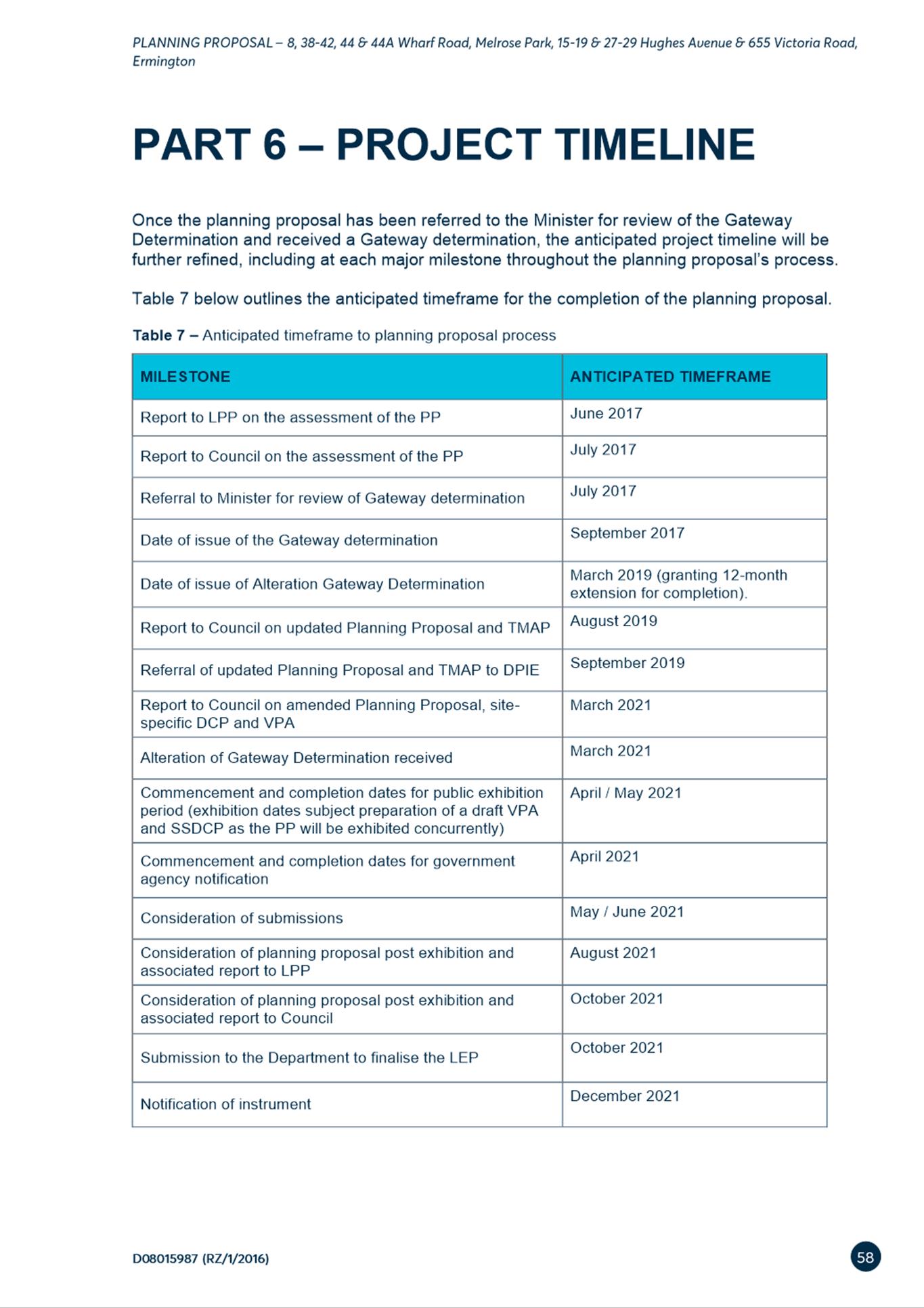
PLANNING PROPOSAL TIMELINE
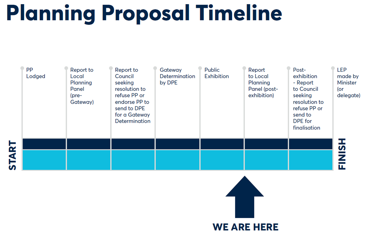
SUMMARY
1. This report seeks the Local Planning Panel’s (LPP) endorsement for Council to consider the outcomes of the public exhibition of the amended Melrose Park North Planning Proposal and draft Site-Specific DCP. A draft Planning Agreement was also publicly exhibited in conjunction with the Planning Proposal and draft DCP. The Planning Agreement is subject to a re-exhibition, the outcomes of which will be reported separately to Council.
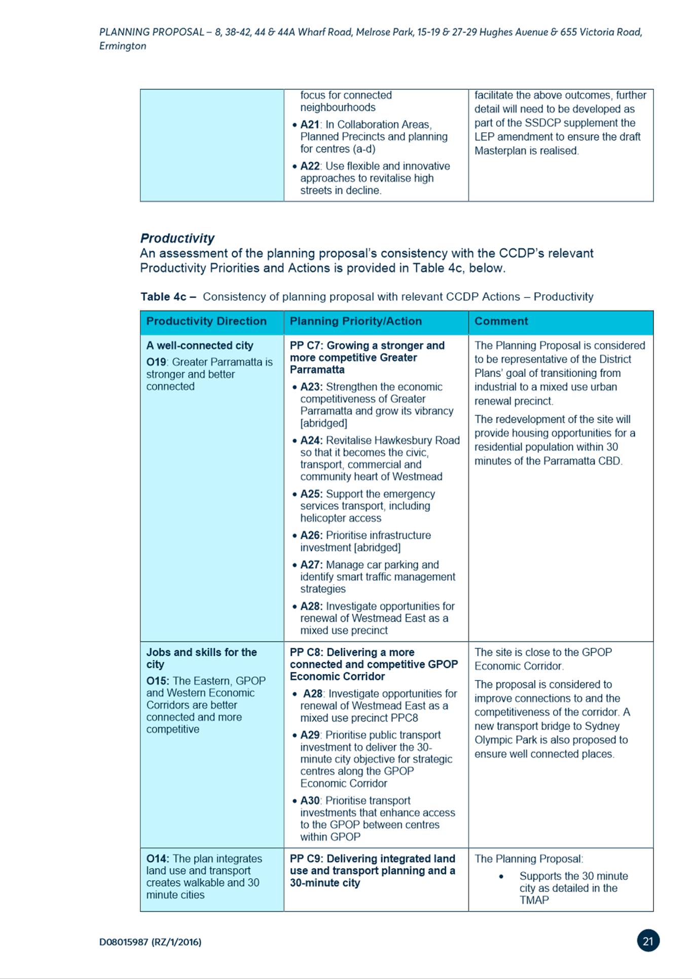
2. The Planning Proposal seeks to amend the Parramatta Local Environmental Plan (PLEP) 2011 to enable non-industrial development on the abovementioned sites in the form of high density residential, public open space, retail/commercial and education uses. This proposal is generally in accordance with the Northern Structure Plan adopted by Council in December 2016. Should the Planning Proposal and draft DCP be endorsed then approximately 5,500 new dwellings could be delivered on this site.
3. The Planning Proposal, draft DCP and Planning Agreement (the latter not subject to this report) were placed on public exhibition from 26 April 2021 to 25 May 2021during which time seventy-five (75) submissions were received comprising sixty-five (65) from the community, with the remaining ten(10) from public agencies and other organisations. A summary of the key issues raised in the submission is provided in this report, with further details and responses provided at Attachment 1 to this report. Overall, 11% of submissions supported the proposal in full, 68% of all submissions objected to the proposal in full. A total of 8% stated partial support or objection and the remaining 13% neither stated objection or support.
4. A number of changes are proposed to the draft DCP in response to a comprehensive review of the controls following the public exhibition period. These changes are detailed in Table 2 in this report. However, no changes to the exhibited Planning Proposal are proposed and it is recommended that it be forwarded to DPIE for finalisation.
5. The draft Planning Agreement also exhibited with the Planning Proposal and draft DCP is not subject to this report as it is required to be re-exhibited due to an amendment to the clauses in the Planning Agreement relating to the applicable development contributions. This is the result of a Council resolution related to the Parramatta (Outside CBD) Contributions Plan which was endorsed by Council in July 2021. As a result, the Planning Agreement will be considered by Council at a future Council meeting.
SITE DESCRIPTION
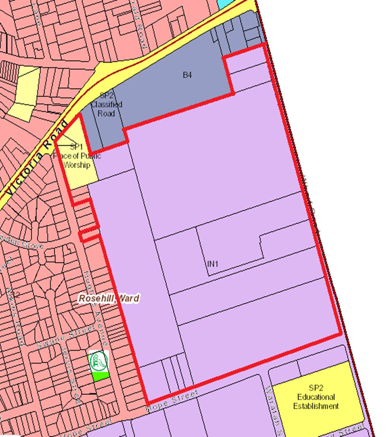
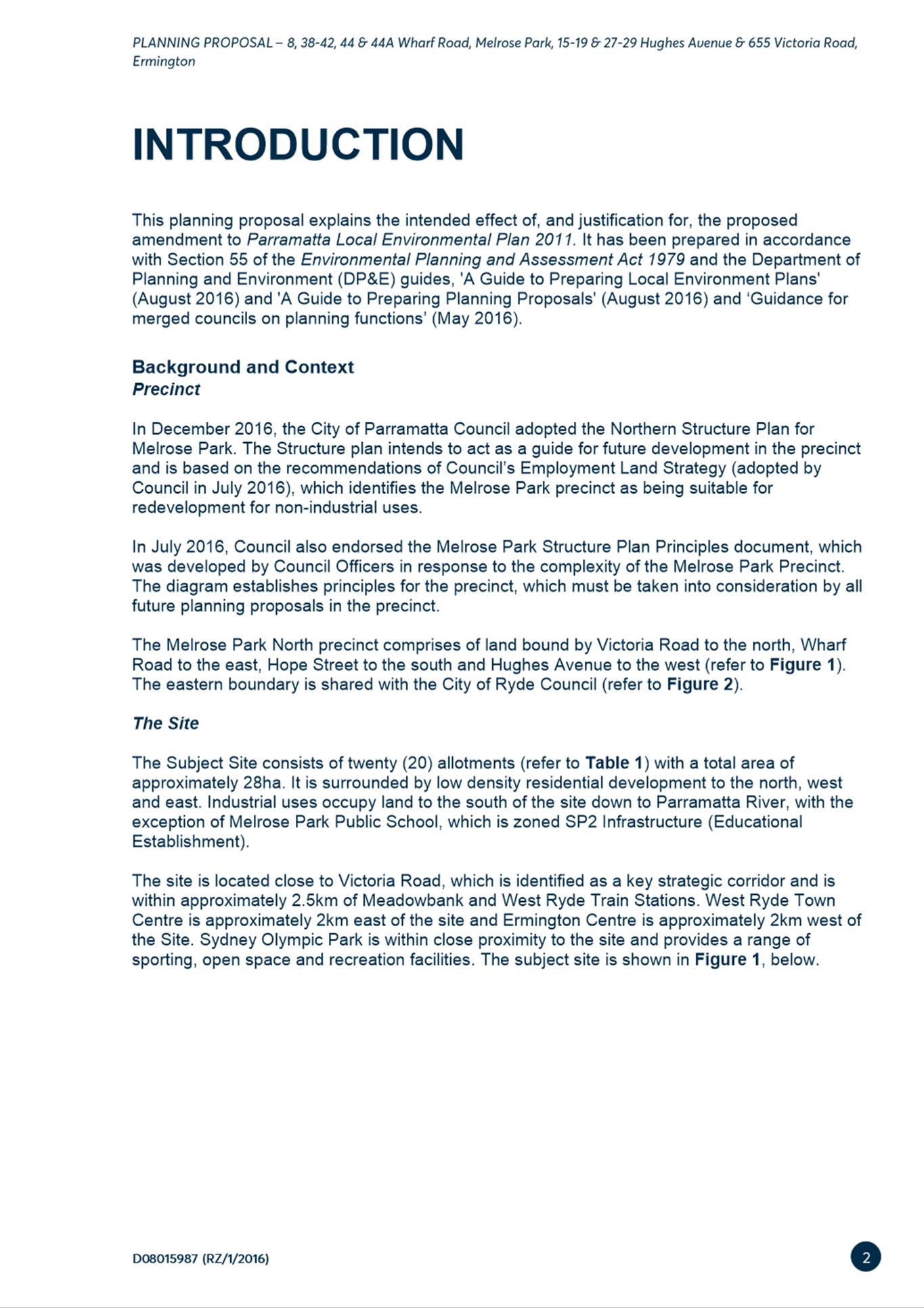
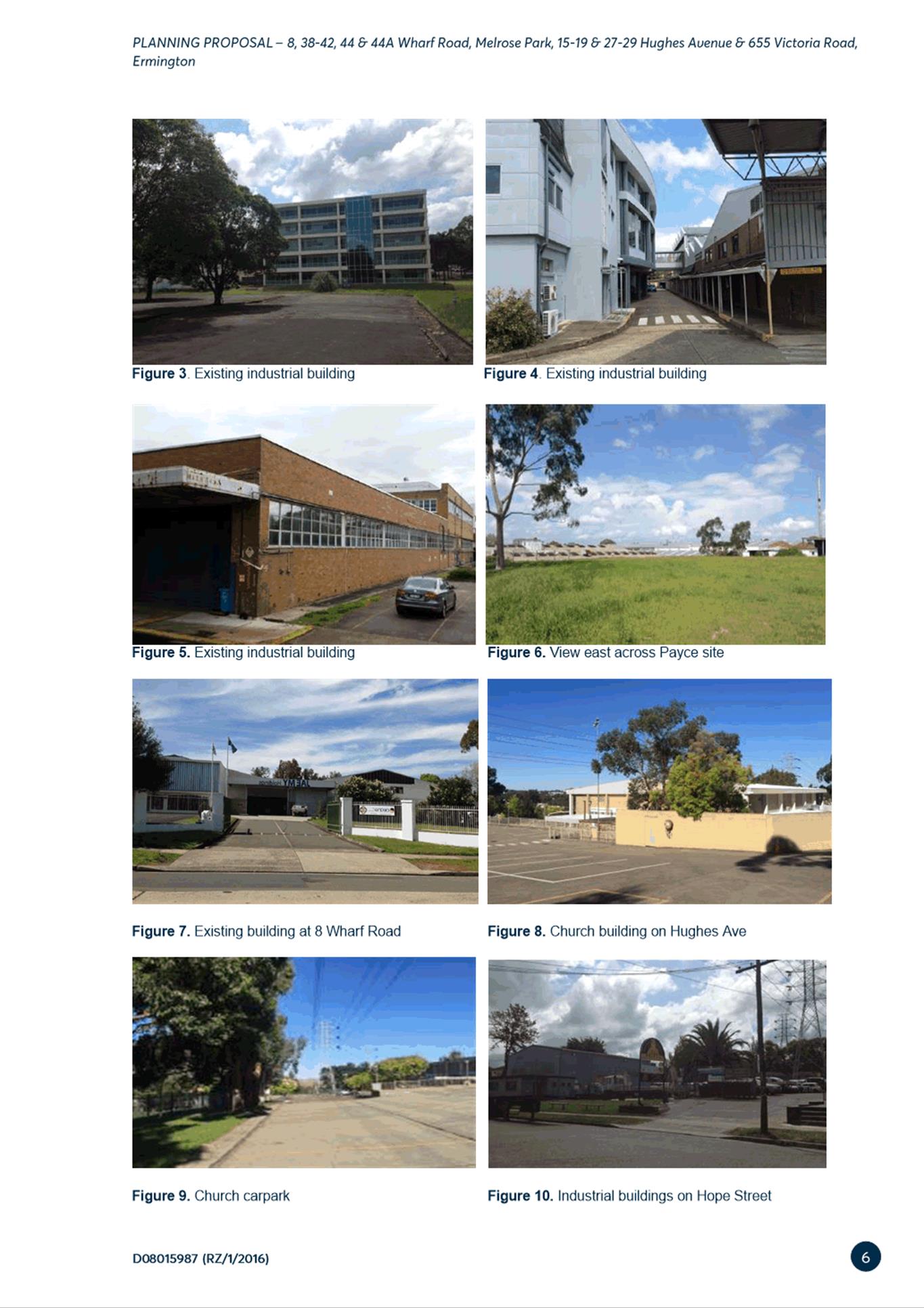
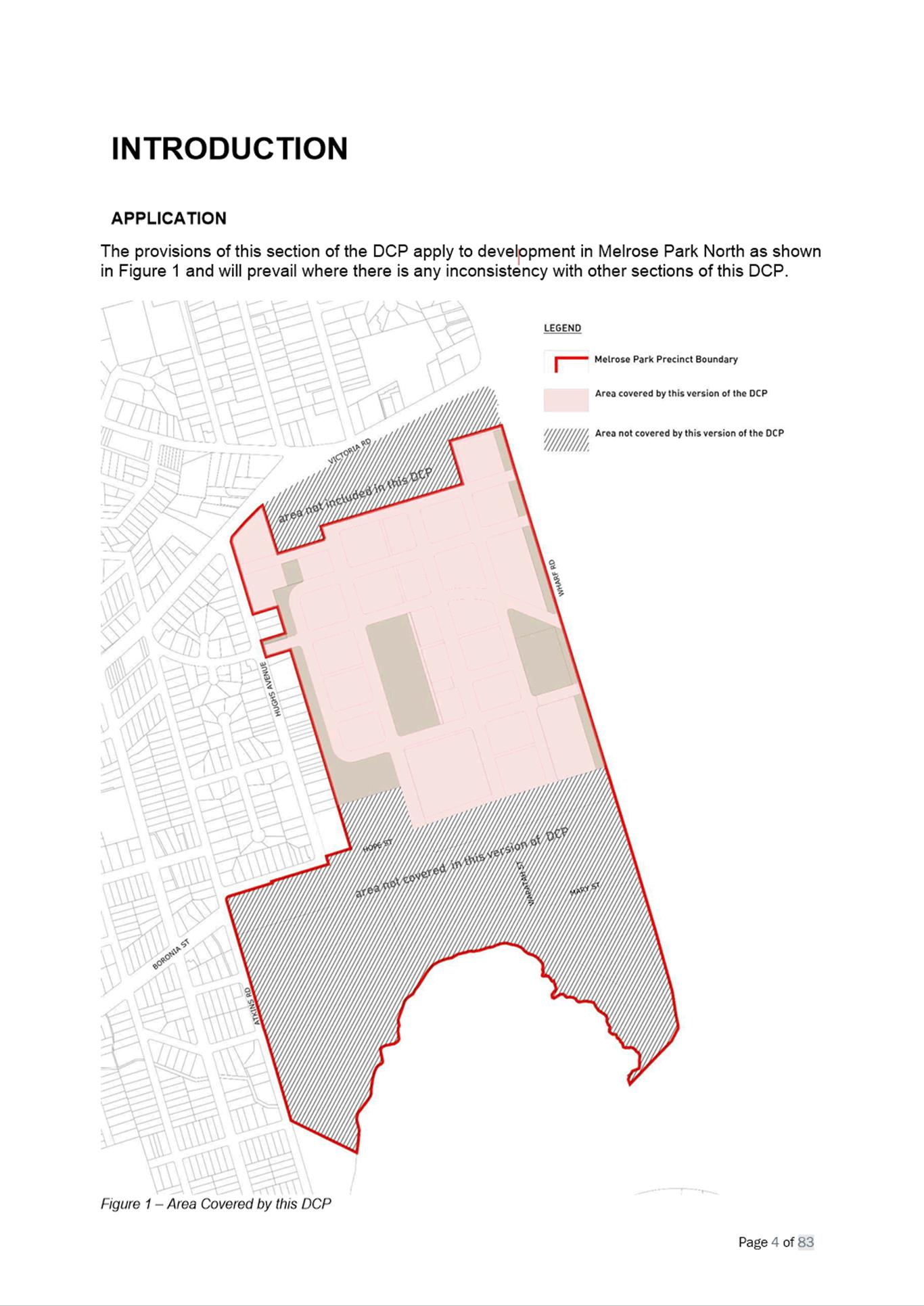
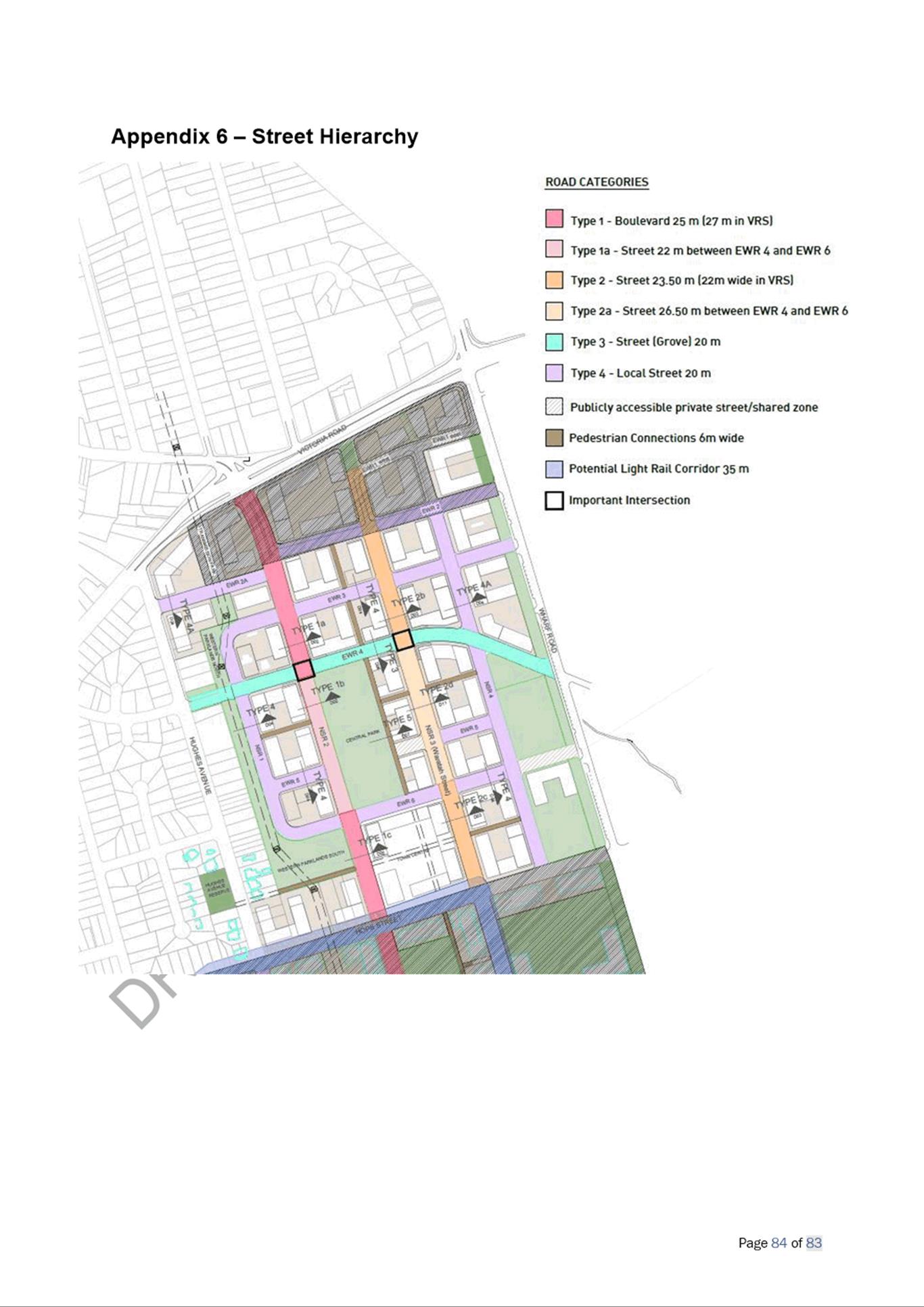
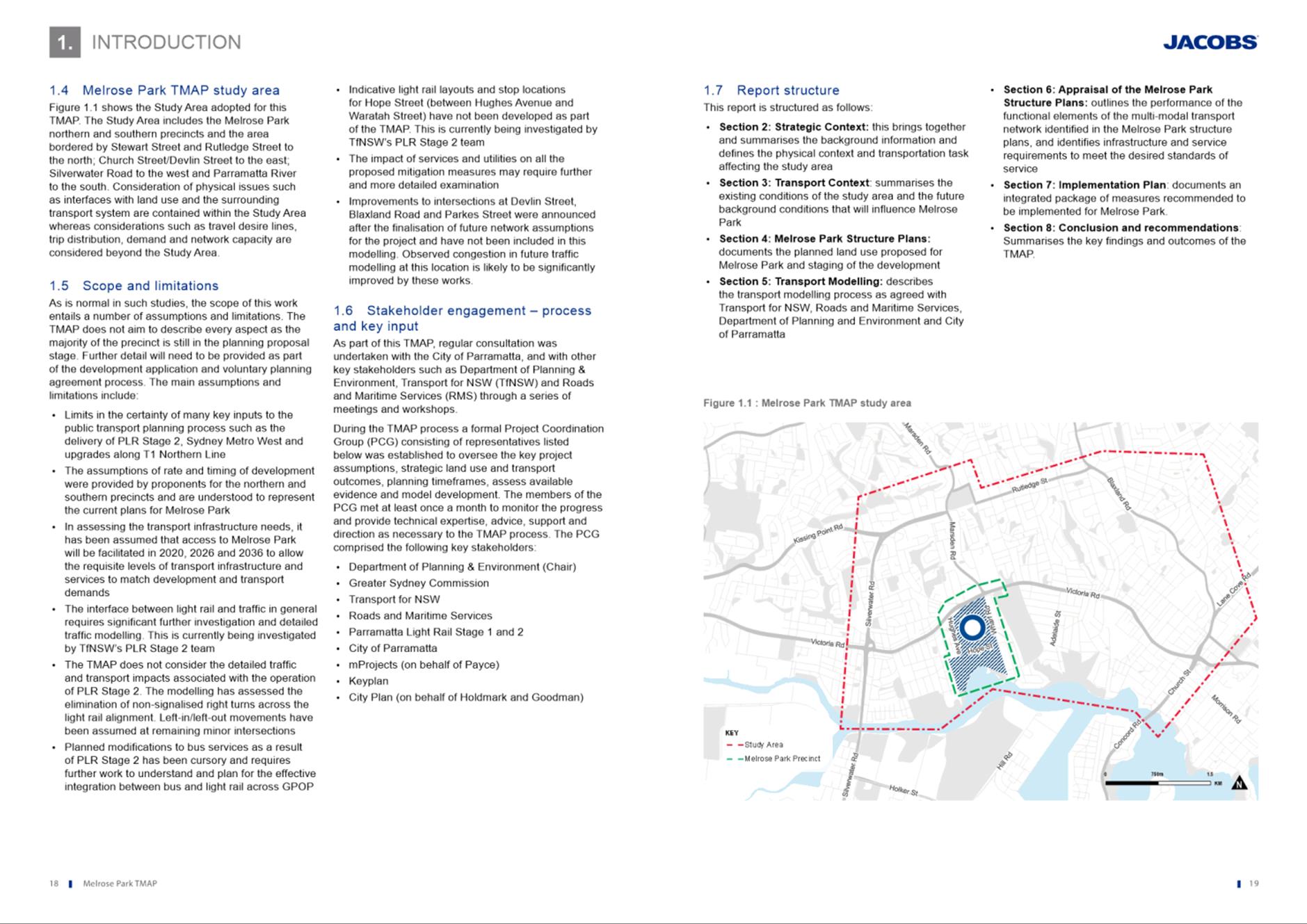
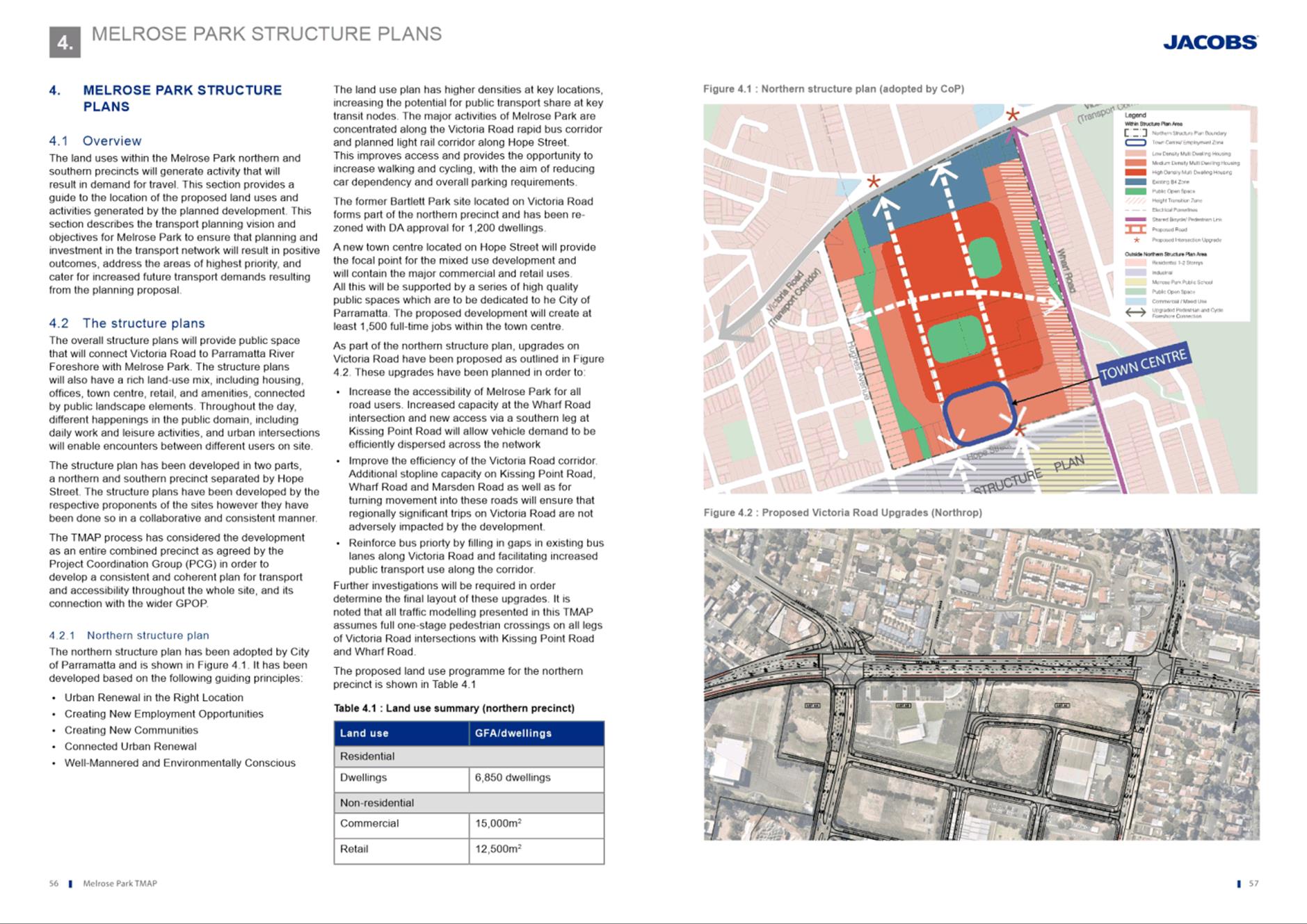
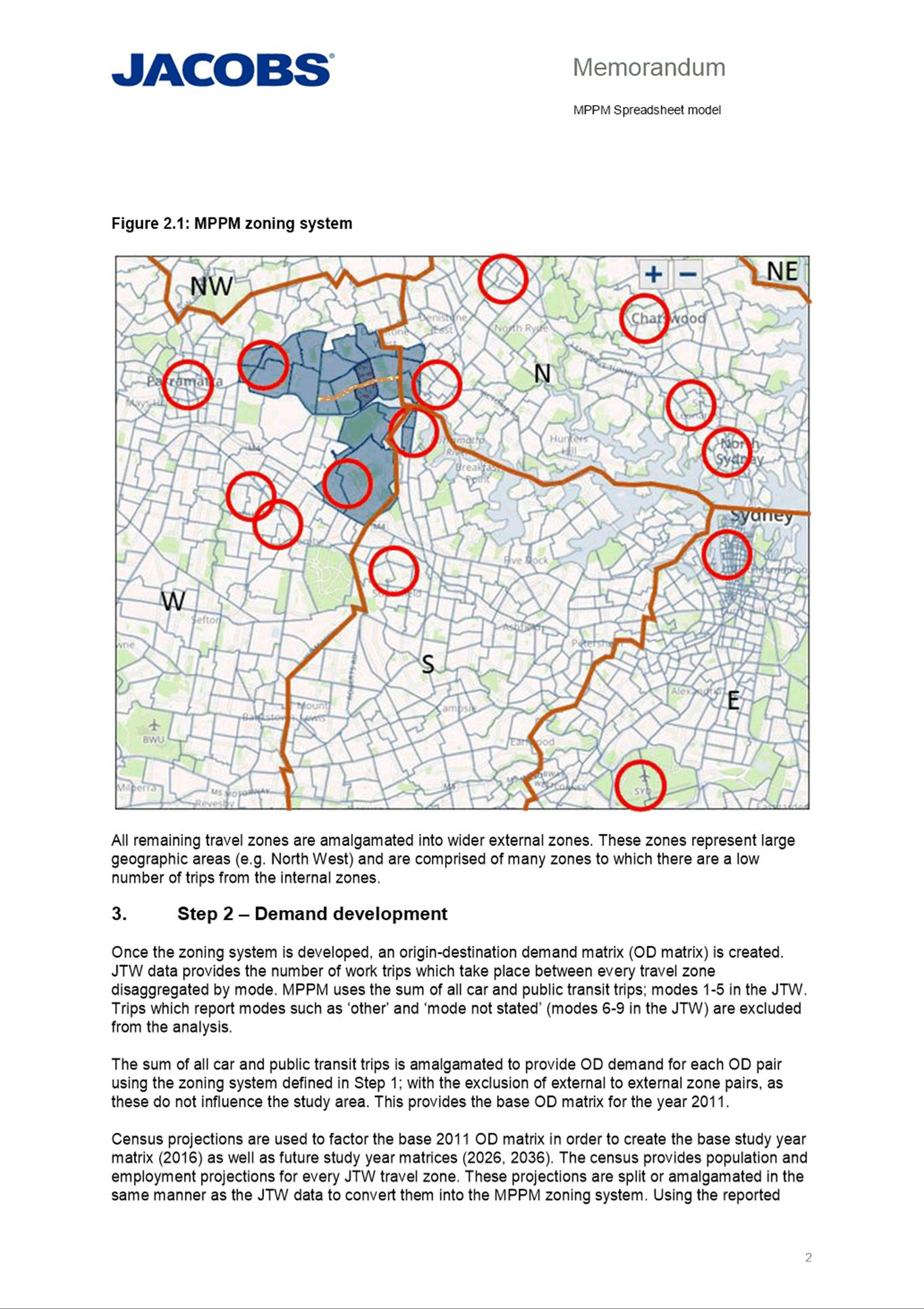
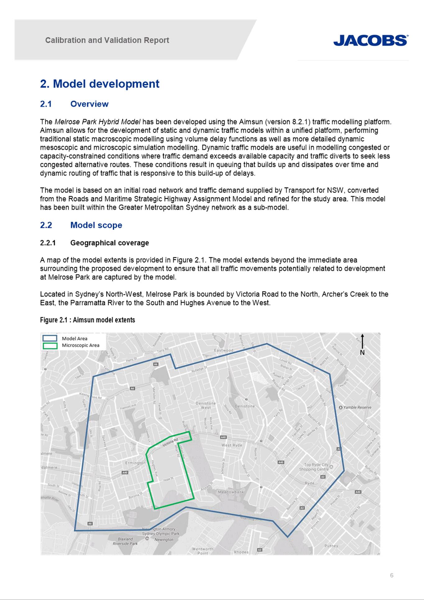
6. The Melrose Park North precinct identified by the yellow outline in Figure 1 is loosely bound by Wharf Road, Hope Street, Hughes Avenue and Victoria Road and surrounded by low density residential development to the east and west with industrial development to the south and the Victoria Road Site to the north, which is in the final stages of redevelopment for high density residential and mixed-use development.
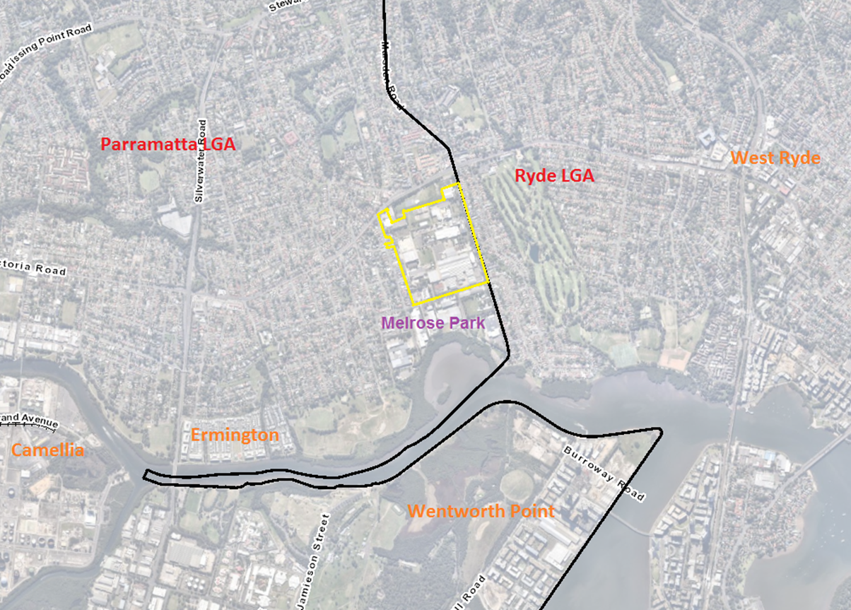
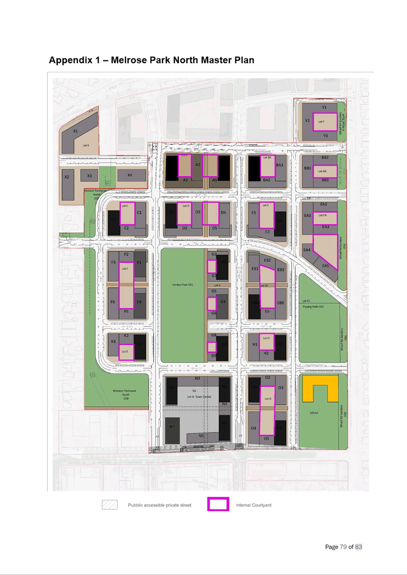
Figure 1. Melrose Park North precinct
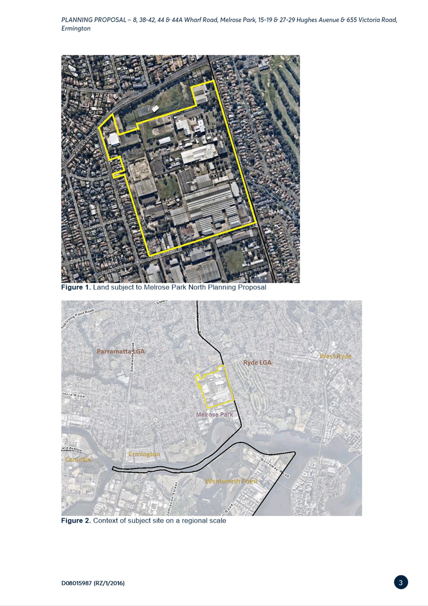
7. The land subject to the Melrose Park North Planning Proposal and draft site-specific DCP is outlined in Figure 2 and is approximately 28ha in size. It comprises three separately owned sites with Payce owning approximately 90% of the overall area covered by the draft DCP. The majority of the land is occupied by industrial uses with the exception of the north-west corner which is occupied by a place of public worship.
8. The site is adjacent to the City of Ryde Local Government Area (LGA), with Wharf Road on the eastern edge of the precinct being the boundary between the City of Parramatta and the City of Ryde LGAs.
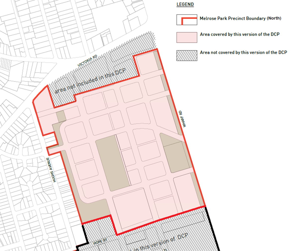
Figure 2. Land subject to this Planning Proposal and draft DCP bounded by red line and shaded pink
BACKGROUND
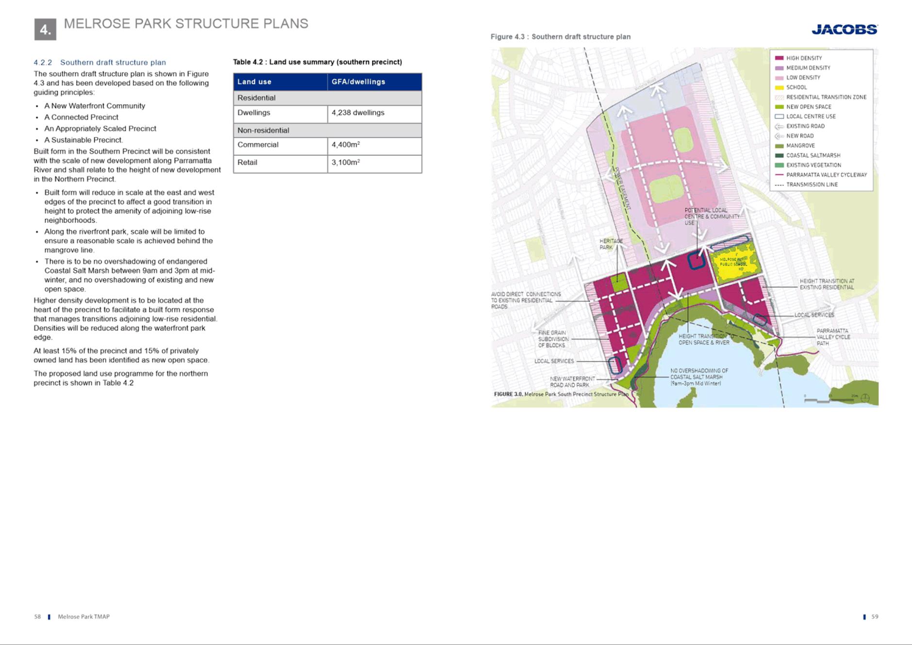
9. The Melrose Park Precinct is divided into northern and southern parts, with Hope Street the boundary between the two. To ensure compliance with the Parramatta Employment Lands Strategy, structure plans been prepared for both parts of the precinct, with the Northern Structure Plan adopted by Council December 2016 and the Southern Structure Plan adopted by Council in December 2019. The Northern Structure Plan provides a high-level guide for density, road network and open space, while the Southern Structure Plan provides floor space ratio (FSR) allocations and building heights for each development block in addition to identifying areas of new public open space and road network. The northern and southern parts are being progressed as part of separate planning processes. One Planning Proposal has been lodged with Council for two sites under single ownership within the southern precinct and is currently with the State Government for Gateway determination. Refer to Figure 3 for an image showing the two parts.
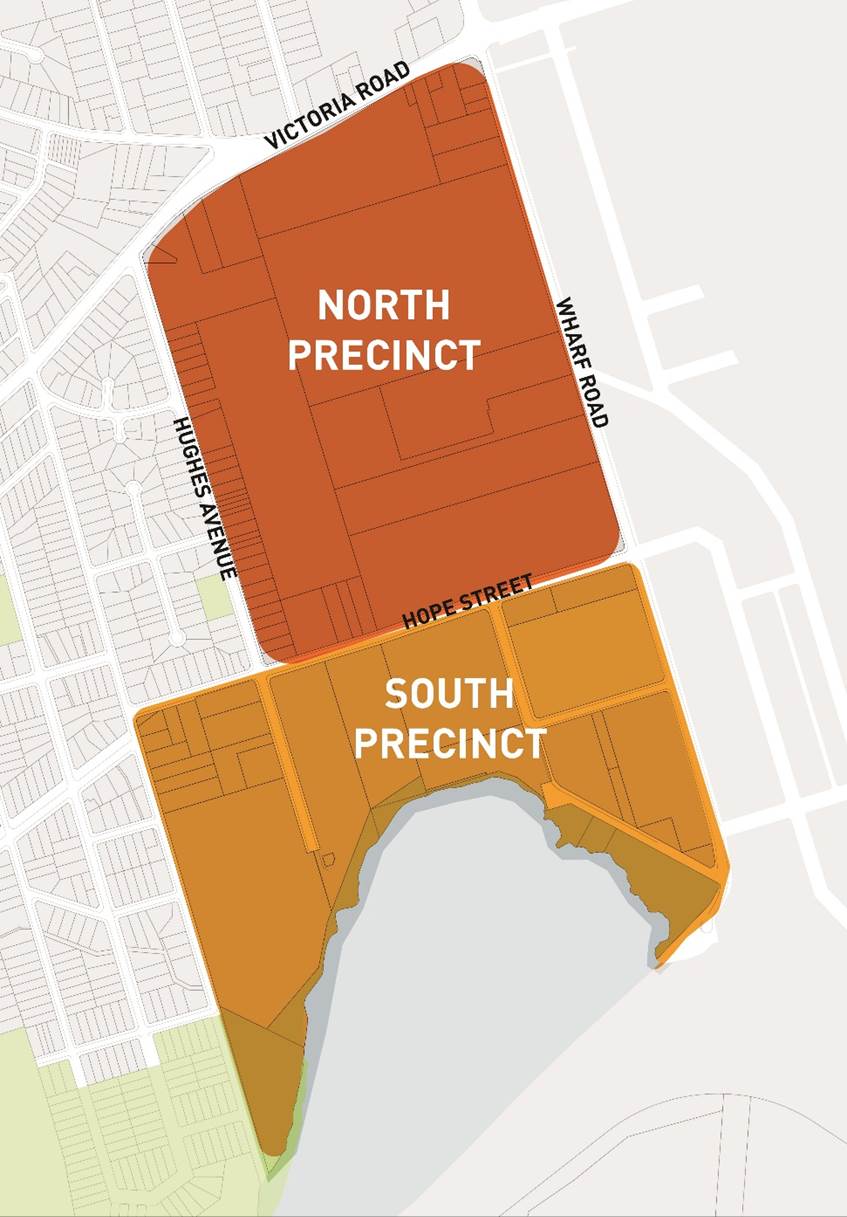
Figure 3. Map showing north and south parts of the precinct
10. The three separate planning proposals that were lodged for sites in the northern precinct were consolidated into one large planning proposal, the Melrose Park North Planning Proposal, in 2017 and is the subject of this report. This planning proposal was considered by the (then) Independent Hearing and Assessment Panel (IHAP) in June 2017, where the proposed zoning changes were endorsed to proceed to Council. Council considered this Planning Proposal in July 2017, where it was resolved to seek a Gateway determination. This Planning Proposal did not propose specific amendments to the building height and floor space ratio (FSR) provisions on the site.
11. A Gateway determination was issued by the (then) Department of Planning and Environment (DPE) on 27 September 2017, subject to a number of conditions including the preparation of a Transport Management and Accessibility Plan (TMAP) and further urban design testing, both of which would be used to inform the appropriate density for the precinct. The TMAP was completed in early 2019 and urban design testing in mid-2019.
12. A revised Melrose Park North Planning Proposal including proposed building heights ranging from 34m (approx. 6 storeys) to 90m (approx. 26 storeys) and a gross FSR of 1.85:1 across the site was considered by Council at its meeting of 12 August 2019. Council resolved to proceed with the revised Melrose Park North Planning Proposal and for it to be forwarded to the Department of Planning, Industry and Environment (DPIE) for approval for public exhibition. The revised Planning Proposal was forwarded to DPIE in September 2019.
13. During the course of the remaining year and throughout 2020, Council and the applicants progressed with the drafting of the site-specific DCP for the northern precinct to deliver the envisaged density and ensure appropriate built form outcomes would be achieved. Refer to Attachment 3 for the exhibited draft site-specific DCP.
14. In 2020, a Project Control Group (PCG) was formed by DPIE which included Council officers and representatives from multiple DPIE teams, Transport for NSW (TfNSW) and School Infrastructure NSW. The purpose of the PCG was to ensure that matters requiring State agency input such as infrastructure provision and the proposed new school could be addressed in an efficient manner.
15. During this time, an infrastructure needs list (INL) was prepared and identified the infrastructure requirements to support the proposed density of development within Melrose Park. This was used as a basis for the planning agreement negotiations between Council officers and the applicants. Conversations were also undertaken regarding the future State Planning Agreement to fund and deliver items identified as State infrastructure, such as the new school, Victoria Road upgrades and future bridge to Wentworth Point.
16. Given the size of the Melrose Park Precinct and the potential for it to deliver in the order of 11,000 dwellings (including both the north and south precinct), certain key infrastructure such as a new school site and bridge to Wentworth Point to link to the West Metro is required to be delivered as part of a State Planning Agreement. Negotiations with the applicant and State Government are continuing and any State Planning Agreement will be subject to a separate public consultation period. Notwithstanding, the maximum development potential of Melrose Park is contingent upon the provision of this key infrastructure.
17. The refinement of the built form controls as part of the development of the draft DCP led to the applicant requesting an amendment to the Design Excellence provisions contained in the Planning Proposal previously endorsed by Council for the purposes of public exhibition. In addition, the area subject to the Planning Proposal was amended to include an additional property on Hughes Avenue needed to facilitate a new road connection through the site, and the applicant also requested that residential flat buildings be included as an additional permitted use within the B2 Local Centre zone.
18. The Planning Proposal was amended to reflect these changes and, along with the draft Melrose Park DCP and Planning Agreement, and these documents were then endorsed by Council for exhibition at its meeting of 22 March 2021. The exhibited Planning Proposal document is contained at Attachment 2.
19. The Gateway determination also required DPIE concurrence for the exhibition to commence and this was received on 22 March 2021 and included a direction for the Planning Proposal to commence exhibition prior to the end of April 2021.
PLANNING PROPOSAL
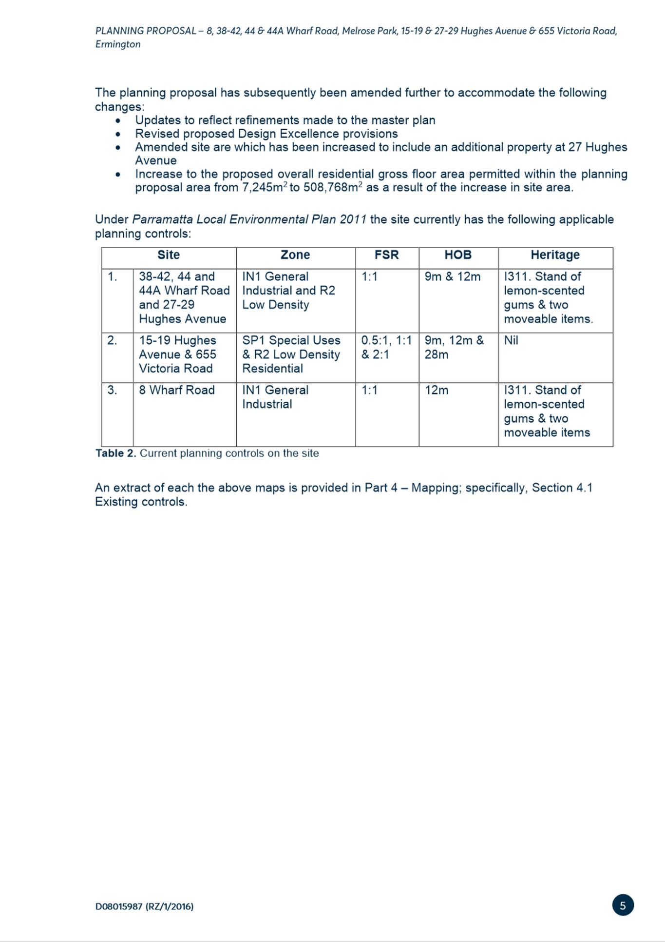
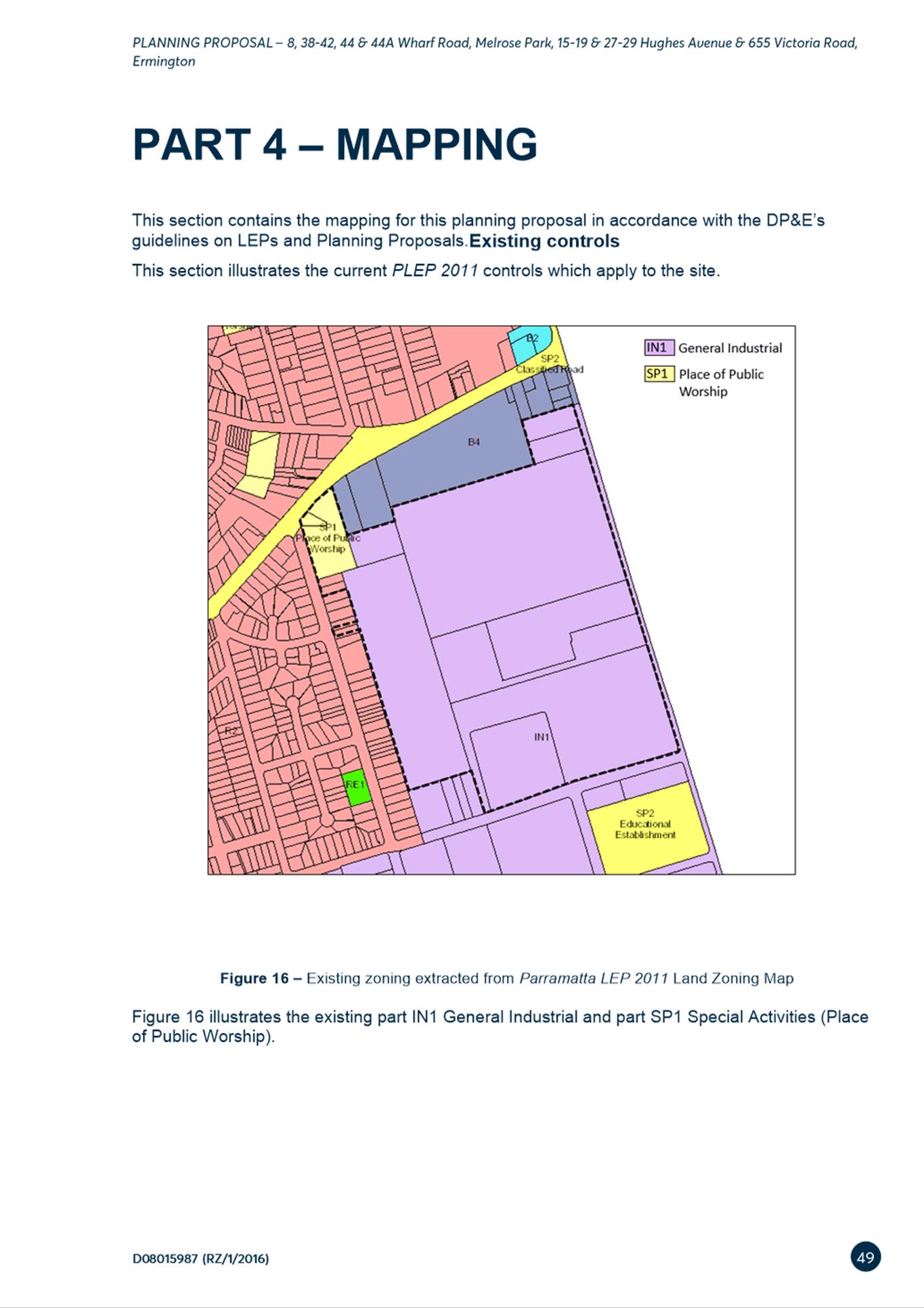
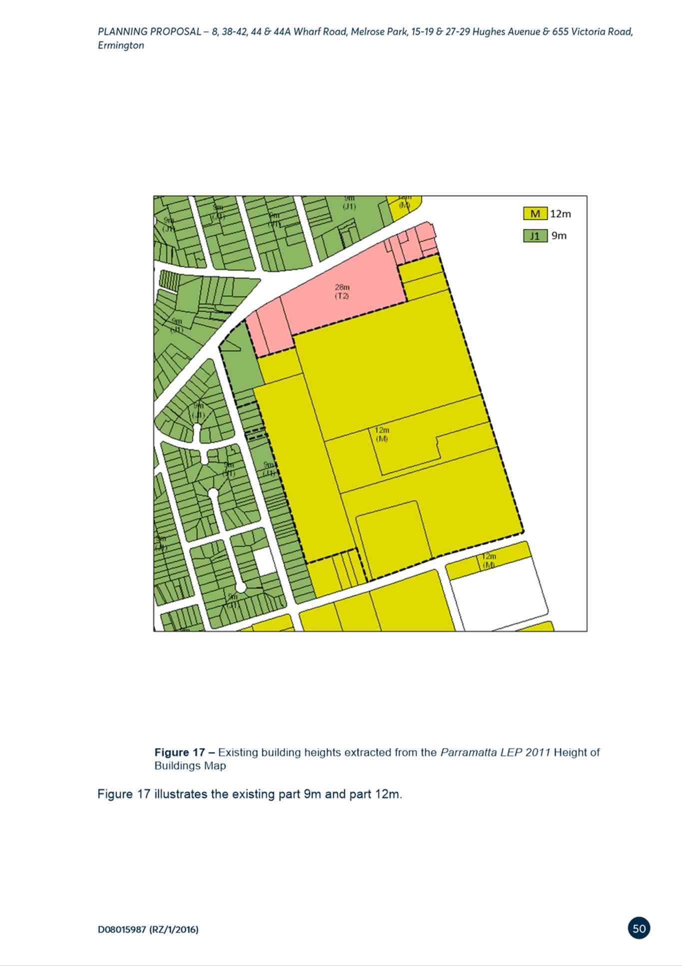
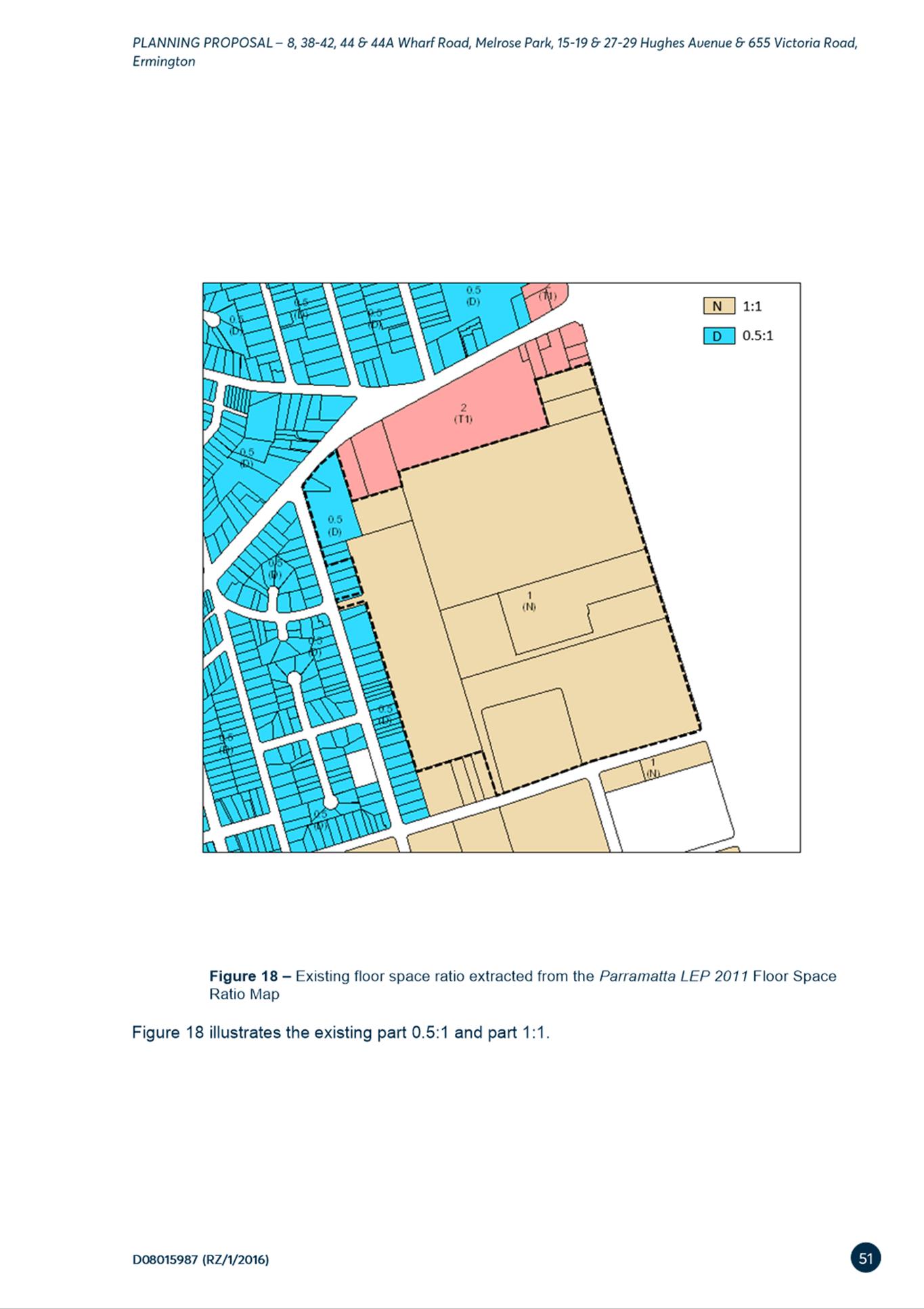
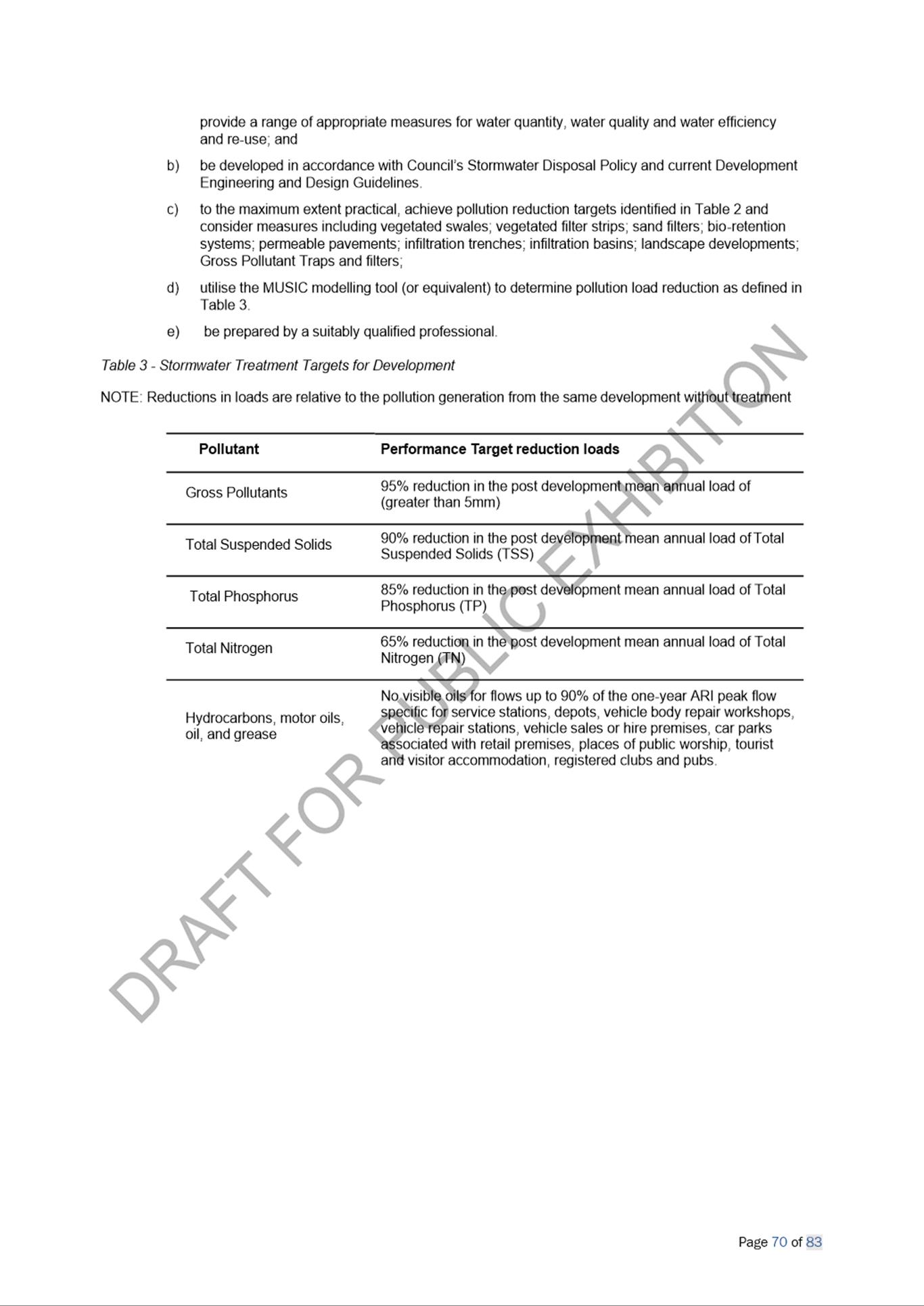
20. Table 1 below summarises the existing controls under the PLEP 2011 that apply to the subject properties and the proposed provisions contained within the Melrose Park North Planning Proposal.
Table 1. Melrose Park North Planning Proposal – Summary of current planning controls and proposed amendments
|
Subject Sites |
PLEP 2011 – Current Controls |
Planning Proposal – Proposed Controls |
|
38-42, 44 & 44A Wharf Road and 27-29 Hughes Avenue |
· IN1 General Industrial and R2 Low Density Residential
· 12m
· 1:1 and 0.5:1 |
· R4 High Density Residential B2 Local Centre RE1 Public Recreation SP2 Infrastructure (Educational Establishment) · Height controls across the site vary from 36m to 95m (approx. 6-8 storeys to approx. 24-26 storeys) · 1.85:1 (gross) · Additional permitted use to permit ‘Residential flat buildings’ in the B2 Local Centre zone · Insert a local provision relating to Design Excellence for development lots E, EA and G (refer to Figure 8). |
|
8 Wharf Road |
· IN1 General Industrial
· 12m · 1:1 |
· Part R4 High Density Residential & part RE1 Public Recreation · 36m (approx. 6-8 storeys · 1.85:1 (gross) |
|
15-19 Hughes Avenue & 655 Victoria Road |
· Part IN1 General Industrial, part R2 Low Density Residential, part SP1 Place of Public Worship · Part 12m & part 9m · Part 1:1, part 0.5:1
|
· Part R4 High Density Residential & part RE1 Public Recreation
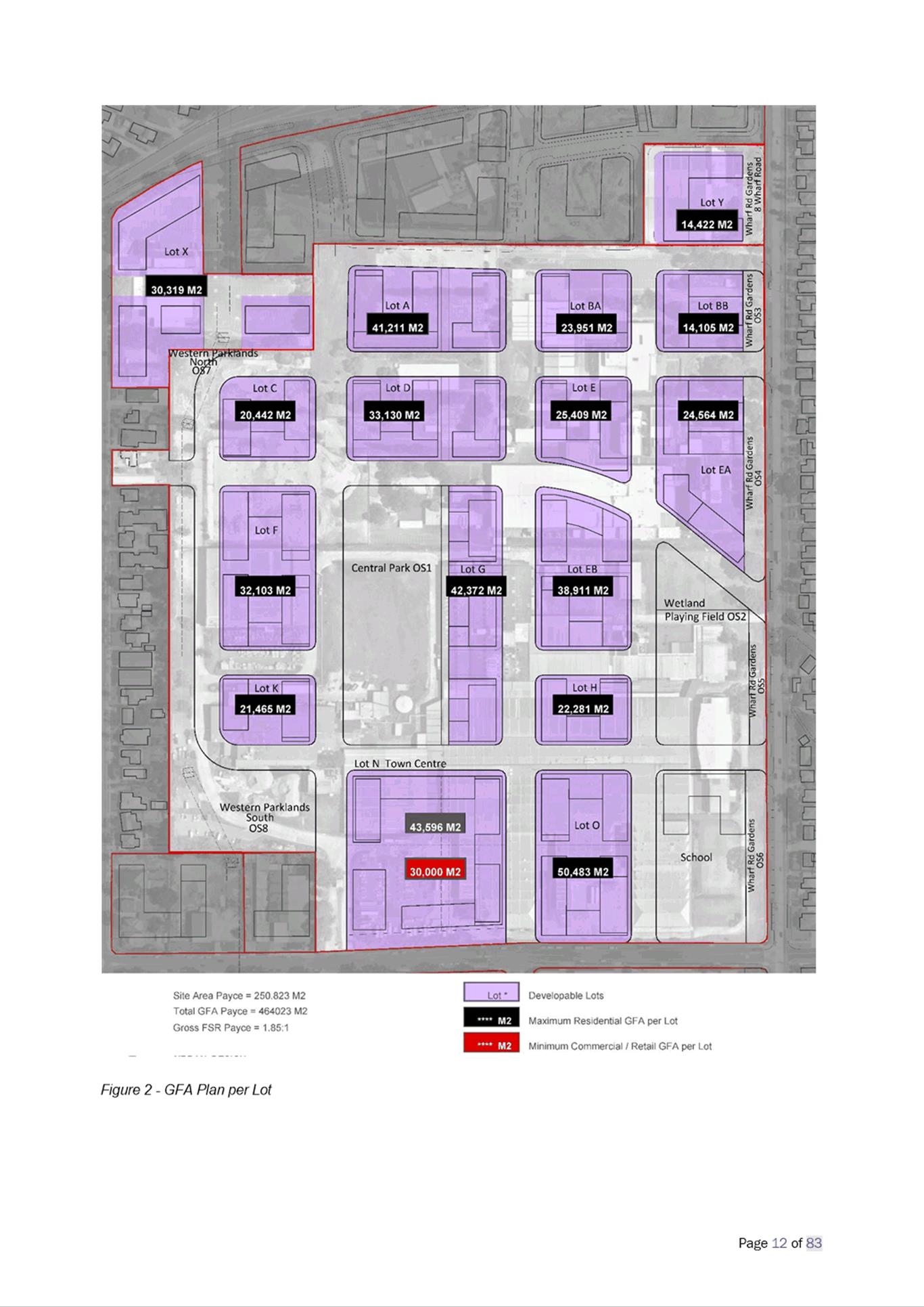
· 36m (approx. 6-8 storeys) · 1.85:1 (gross) |
21. A Design Excellence Panel will be appointed to provide design advice for all development applications within the northern precinct. Floor space and height bonuses are not to be awarded on any development lot. There will be design competition processes required for the three key sites identified by a blue outline in Figure 8.
22. The maximum residential GFA on the site is not to exceed 508,768m2. Each development lot has been assigned a maximum GFA which is represented in the GFA map within the draft DCP.
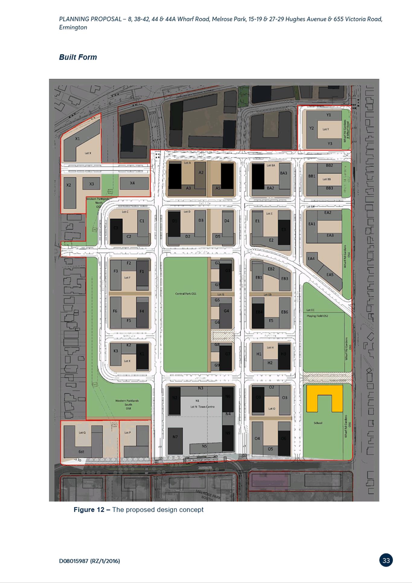
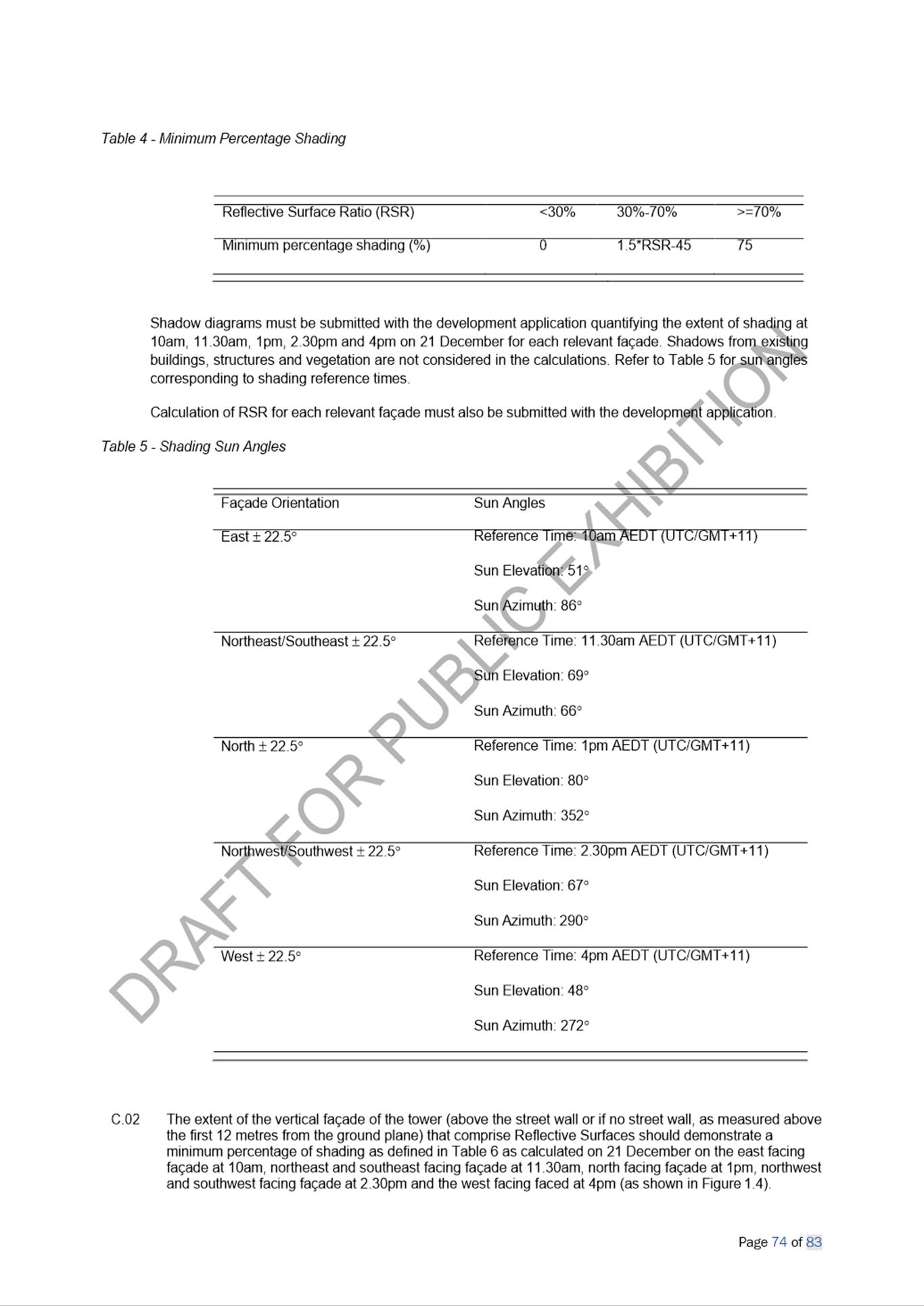
23. Figures 1 to 7 below illustrate the proposed amendments to the zoning, height of buildings, floor space ratio and additional local provisions as part of the Melrose Park North Planning Proposal.
|
|
|
Figure 1. Current land use zoning |
|
|
|
Figure 2. Proposed land use zoning |
|
|
|
Figure 3. Current height of buildings |
|
|
|
Figure 4. Proposed height of buildings |
|
|
|
|
|
Figure 5. Current height of buildings |
|
Figure 6. Proposed height of buildings |
|
|
|
|
|
Figure 7. Proposed additional local provisions |
|
Figure 8. Lots subject to Design Excellence Competition outlined in blue |
DRAFT AMENDMENTS TO PARRAMATTA DEVELOPMENT CONTROL PLAN 2011
24. A draft site-specific Development Control Plan (DCP) for Melrose Park North (Attachment 3) has been prepared to accompany the Planning Proposal. The draft DCP intends to support the provisions in the Planning Proposal and includes controls specifically written for the high-density context proposed for Melrose Park and includes section on:
· Built Form
· Public Domain
· Vehicular Access, Parking and Servicing
· Sustainability
25. A number of changes have been made to the draft DCP as a result of the public exhibition and a further review to ensure it can be applied in a manner that achieves the intended outcomes. These changes are detailed later in this report.
CONSULTATION
26. The amended Planning Proposal, draft DCP and Planning Agreement and supporting documents were publicly exhibited from 25 April to 26 May 2021. During this time, the community was invited to comment on the draft documents. Notification methods used in the exhibition included:
· Letters to landowners within a 1km radius of the site, including those within the Ryde LGA (approximately 5,000 letters in total)
· Dedicated exhibition page on Council’s Participate Parramatta website
· Advertisement on Council’s website
· Hard copies of the draft documents and supporting information available at Council’s Customer Contact Centre, Parramatta Library and Ermington Branch Library
· Geo-targeted social media campaigns on Council’s Facebook and Instagram platforms
· Advertisement in Council’s ePULSE newsletter
· Signage on perimeter fencing of the site
27. Public agencies were also notified in writing of the public exhibition, with the following agencies consulted:
· Department of Planning, Industry and Environment (DPIE)
· School Infrastructure NSW
· Fire and Rescue NSW
· Western Sydney Local Health District
· NSW Ministry of Health
· Office of Environment and Heritage/Environment, Energy and Science Group
· Sydney Water
· Transport for NSW
· Viva Energy
· City of Ryde Council
In addition, the State members of Parliament, Dr Geoff Lee, Member for Parramatta and Victor Dominello, Member for Ryde were notified of the exhibition in writing.
28. A total of seventy-five (75) submissions were received comprising sixty-five (65) from the community, with the remaining ten (10) from public agencies and other organisations (breakdown provided in Table 2). Overall, 11% of submissions supported the proposal in full, 68% objected to the proposal in full. A total of 8% stated partial support or objected and 13% remained neither stated objection nor support.
29. This total does not include multiple submissions made by the same person, which occurred in three instances through the use of the online submission form accessible through the Participate Parramatta website. Although no contact or other personal identification details were provided, the IP address of each submission was identical indicating they were made from the same computer and therefore only included as one submission. The content of these submissions was not considered to be providing constructive feedback on the proposal and inappropriate for listing in the report as they were defamatory in nature.
Table 2. Breakdown of submissions received
|
|
Number |
Breakdown |
|
Community/landowners |
65 |
Various landowners and other stakeholders |
|
Public Agencies |
6 |
· School Infrastructure NSW (2 submissions) · Western Sydney Local Health District · Environment, Energy and Science Group (part of DPIE) · Sydney Water · Transport for NSW |
|
Other Organisation |
4 |
· City of Ryde Council (2 submissions) - Council officer submission - Jerome Laxale, Mayor · Viva Energy · Northern Sydney District Council of Parents and Citizens Association
|
|
Total |
75 |
|
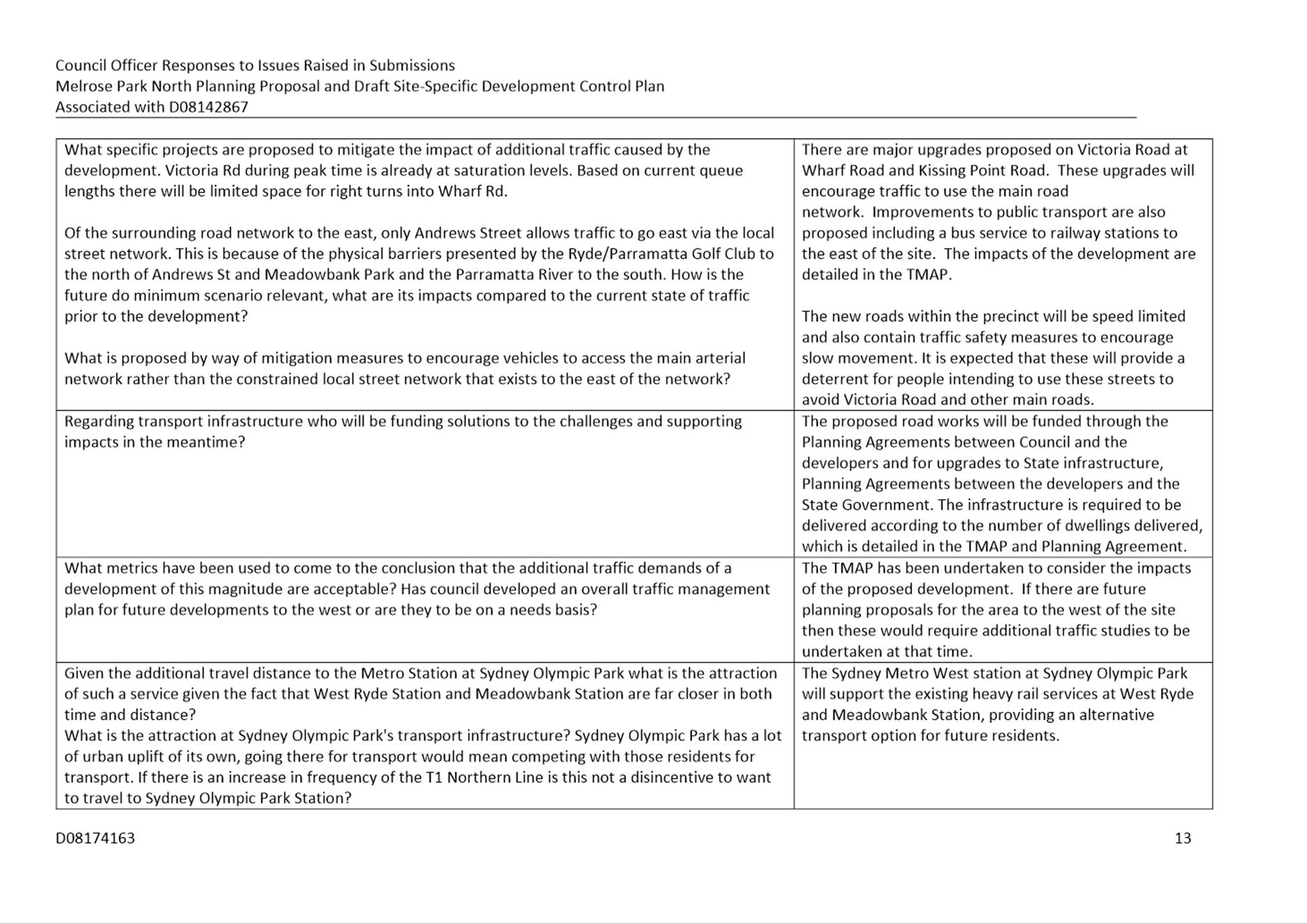
COUNCIL OFFICER RESPONSE TO KEY ISSUES RAISED IN SUBMISSIONS
30. Below are the key issues raised in the majority of the submissions. A response and recommendation is provided for each. Details of all the issues raised in submissions, and Officer responses are provided in Attachment 1 to this report.
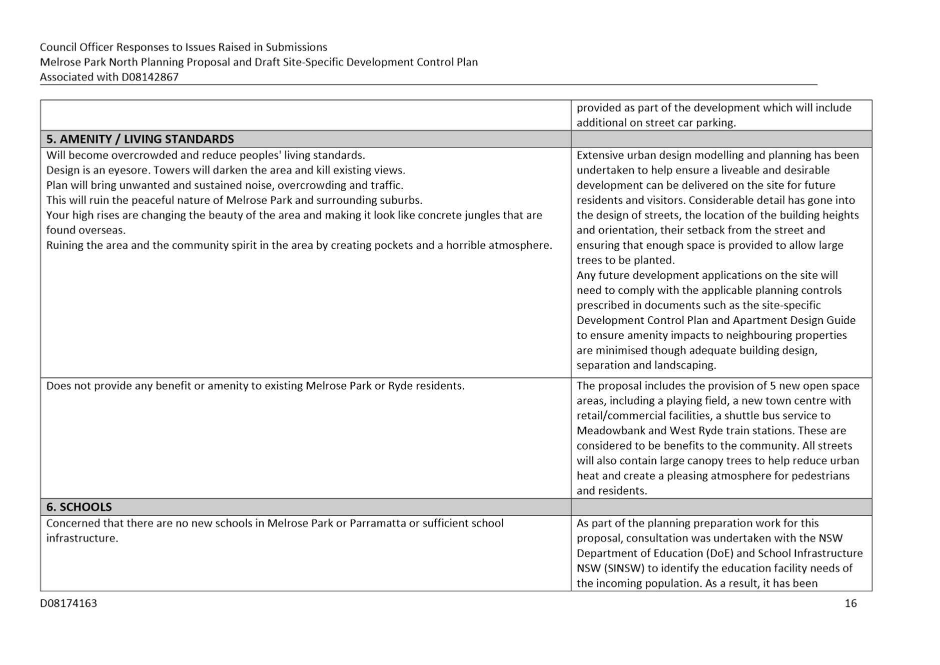
Density, Building Heights and Amenity
31. A number of submissions raised concern over the proposed density of the development, the proposed building heights and the resulting amenity impacts on the area generally should this proposal be finalised.
Council Officer Response
Density
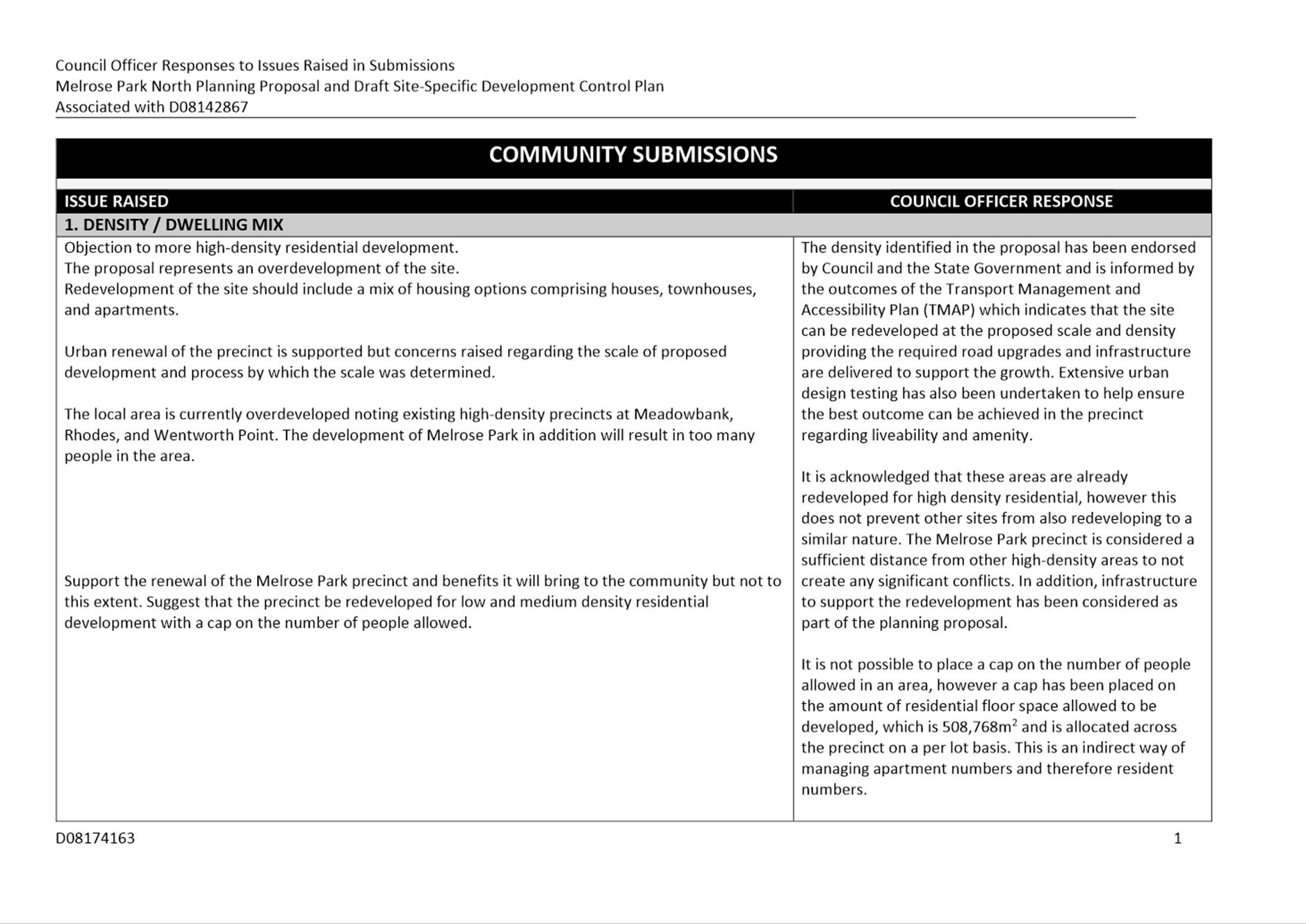
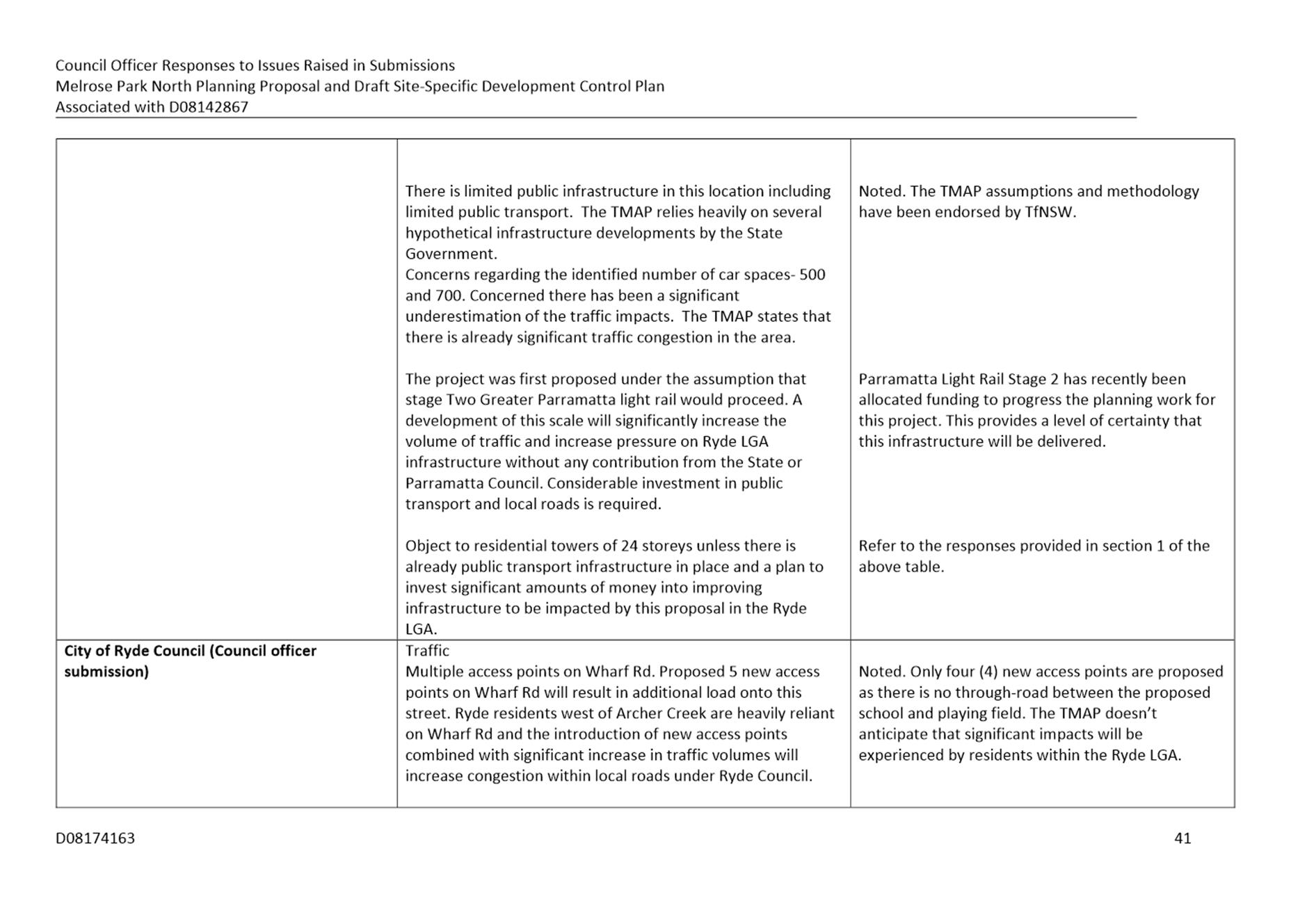
32. The Proposal identifies a range of land uses on the site including high density residential, public open space, retail and commercial uses and education facilities. The proposed density was endorsed by Council at its meeting of 12 August 2019 and has also been acknowledged as having planning merit by the Department of Planning, Industry and Environment through the Gateway determination. The densities proposed have been informed by both the Transport Management and Accessibility Plan (TMAP) and extensive urban design testing to ensure that an appropriate outcome could be achieved on the site which was an endorsed approach by Council and the State Government. Council officers acknowledge that concern has been raised by the community regarding the proposed density and that it is a significant change to the scale of development that is currently on the site. However, it is not considered that sufficient justification has been provided in the submissions to warrant a reduction in the proposed density on the site, especially as extensive urban design testing has been undertaken to demonstrate that the proposed density can be achieved without extensive and unmanageable impacts being experienced by future or surrounding residents.
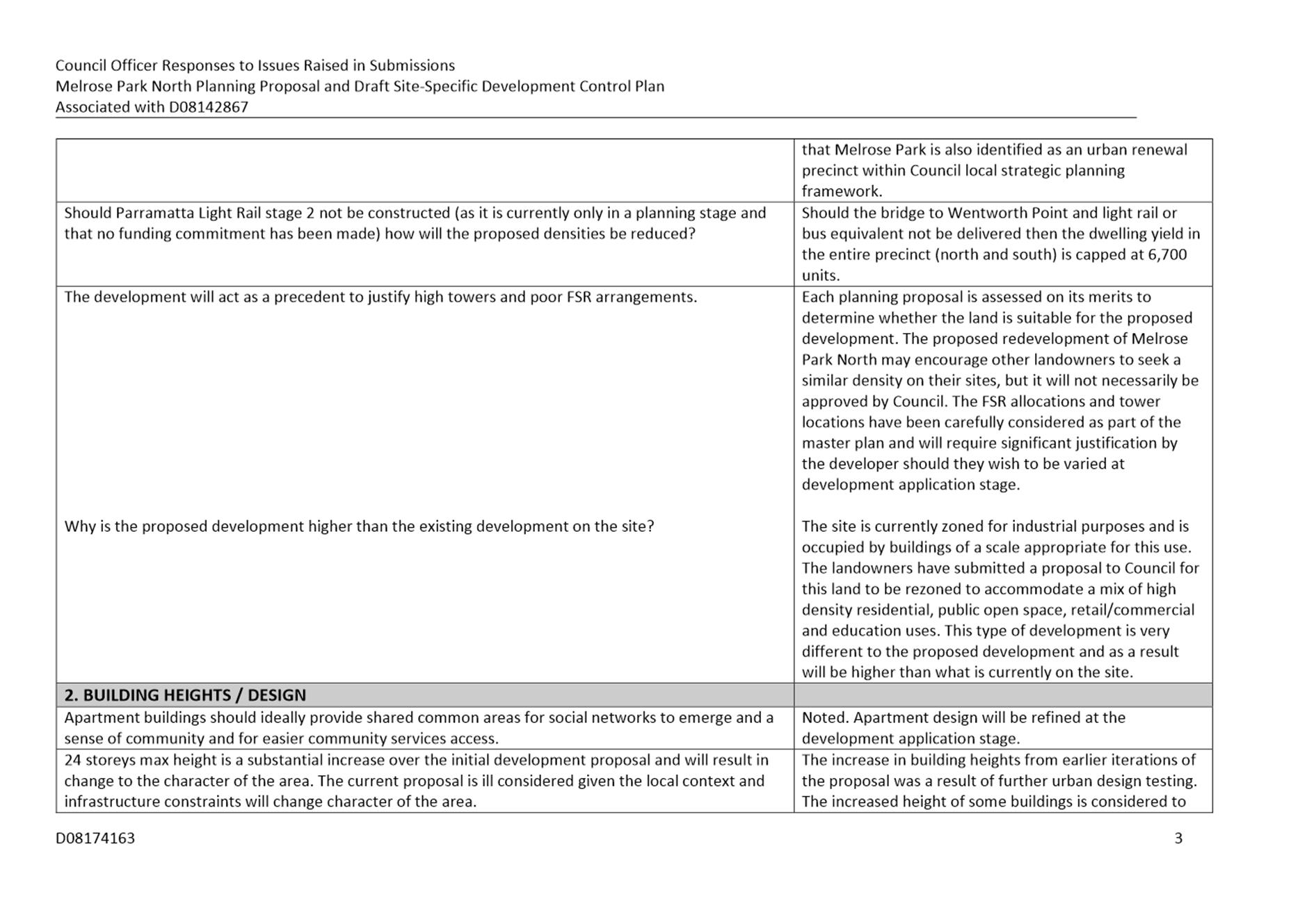
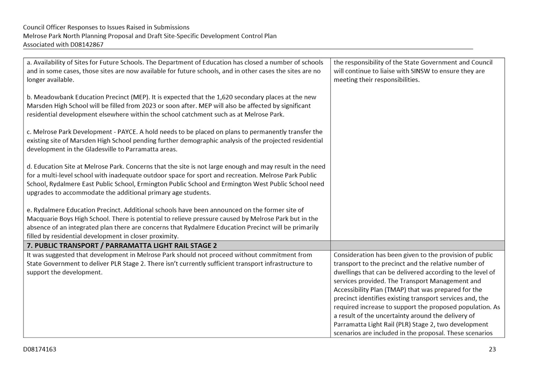
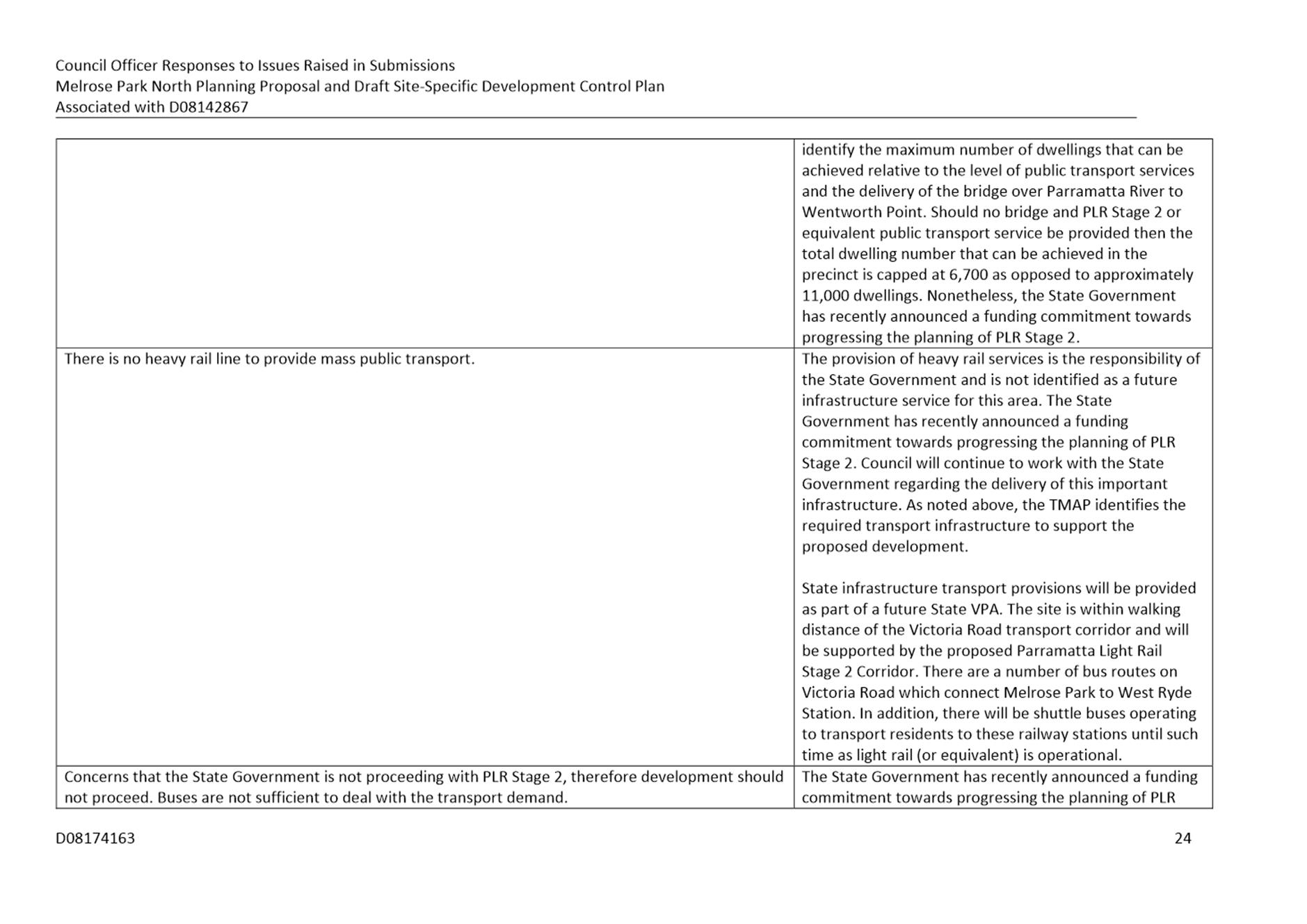
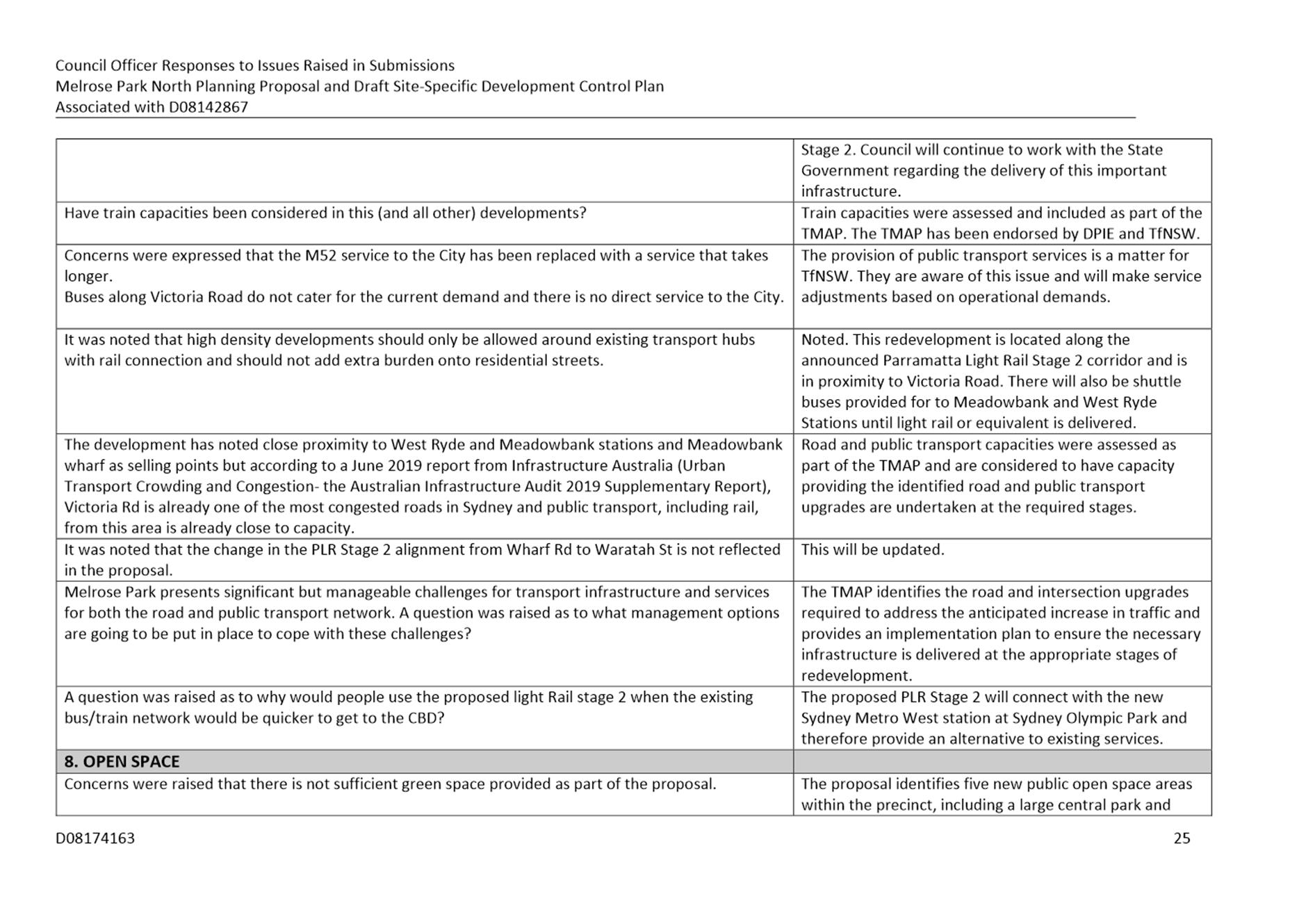
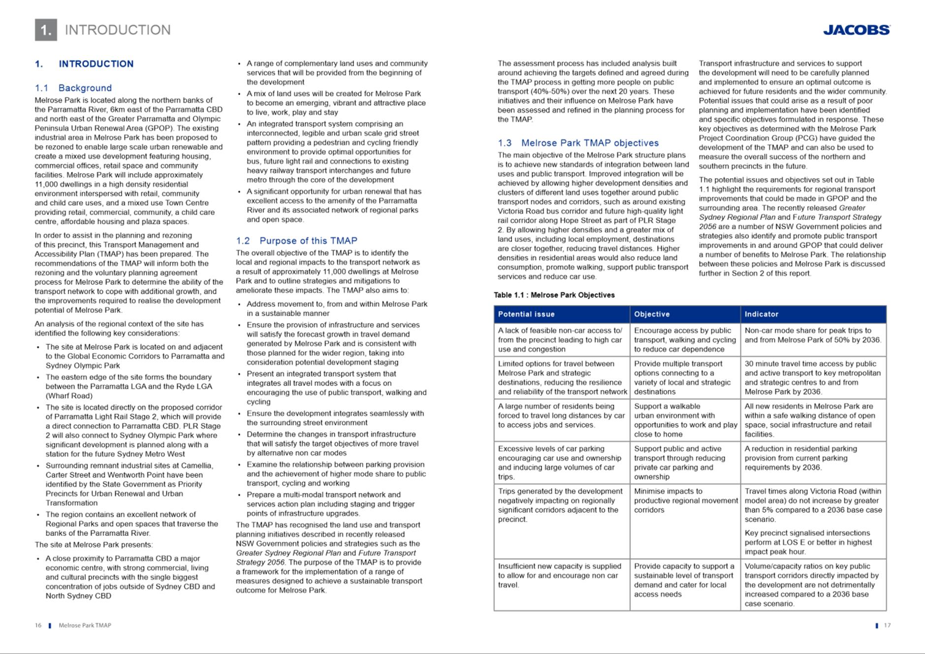
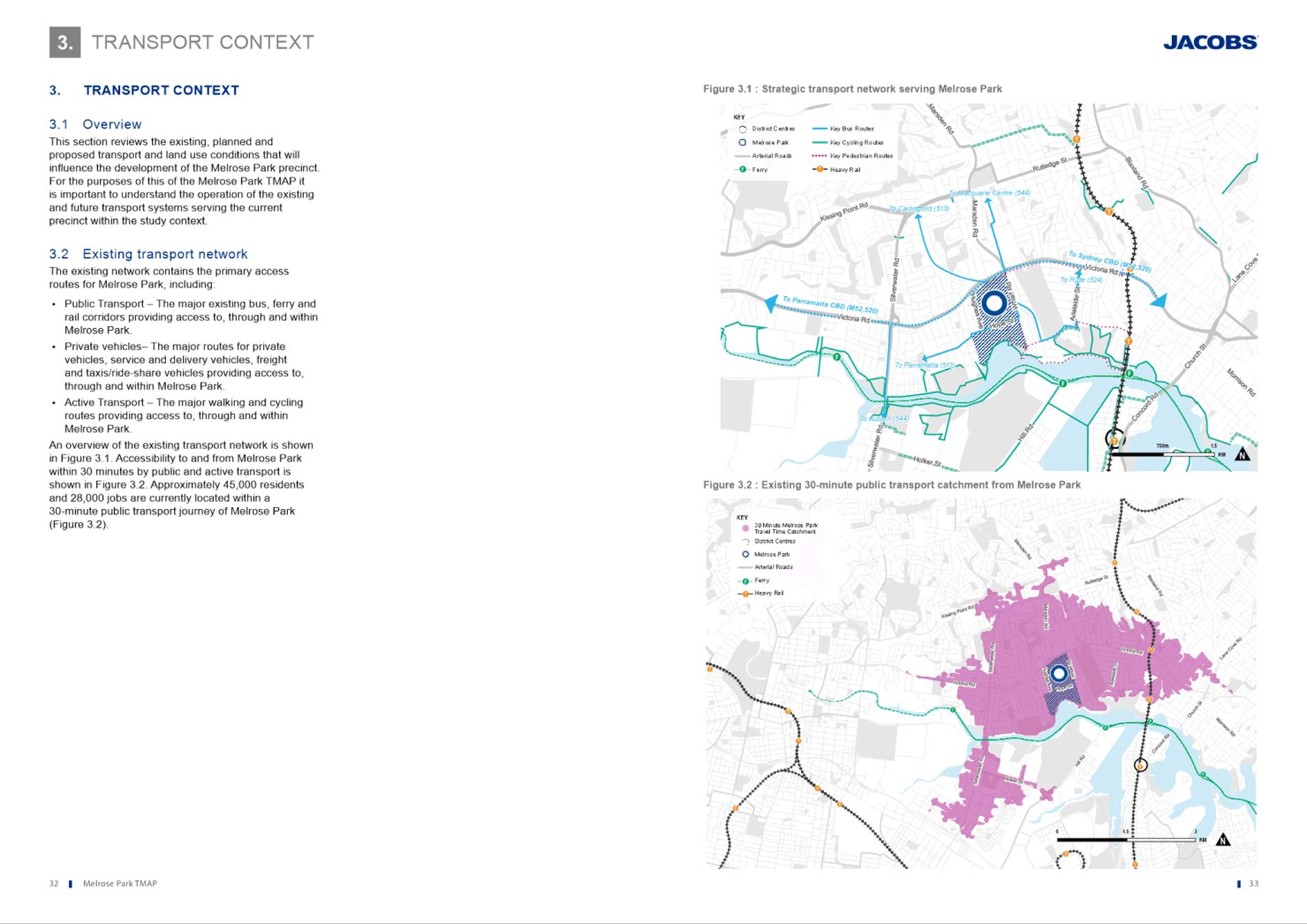
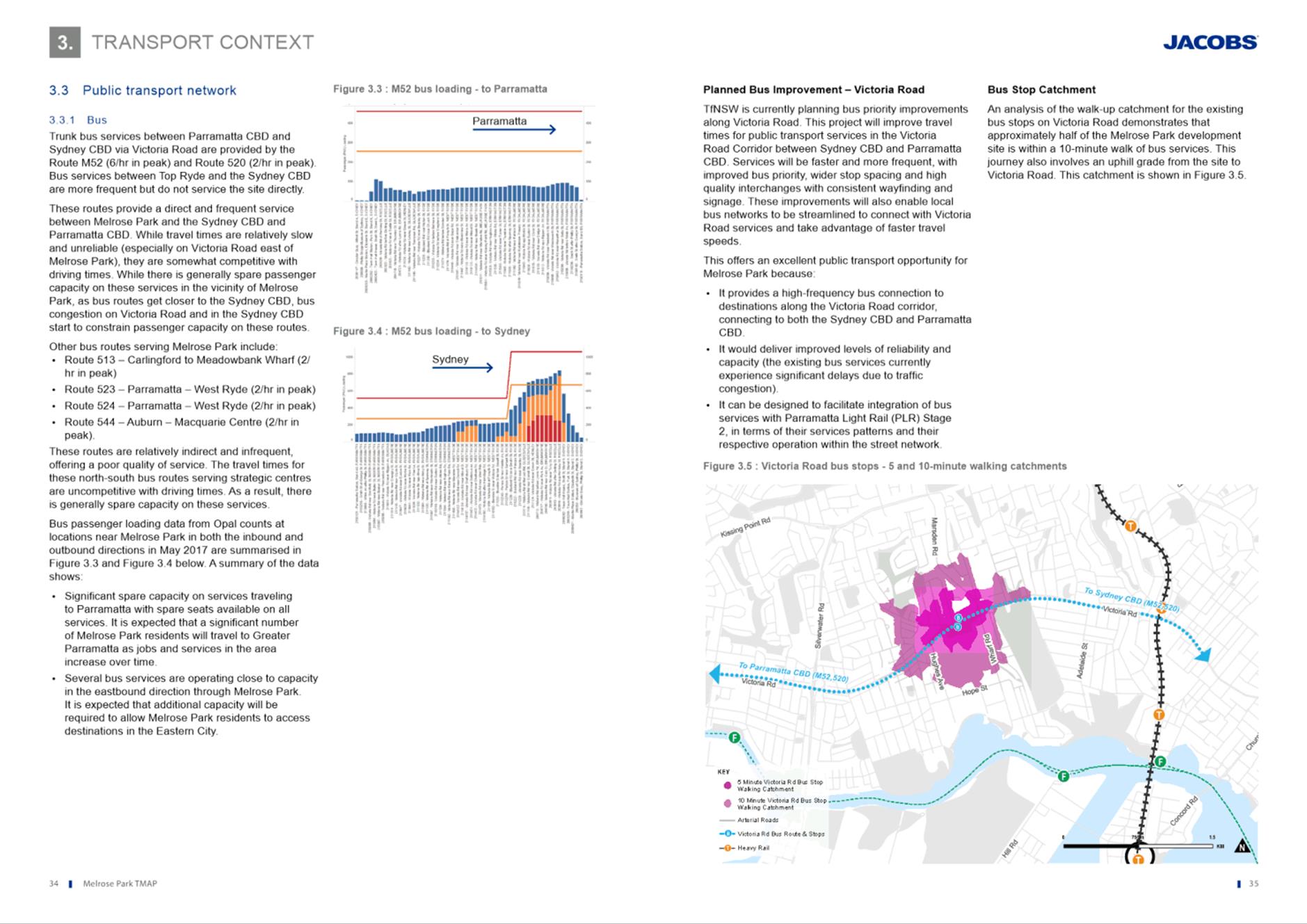
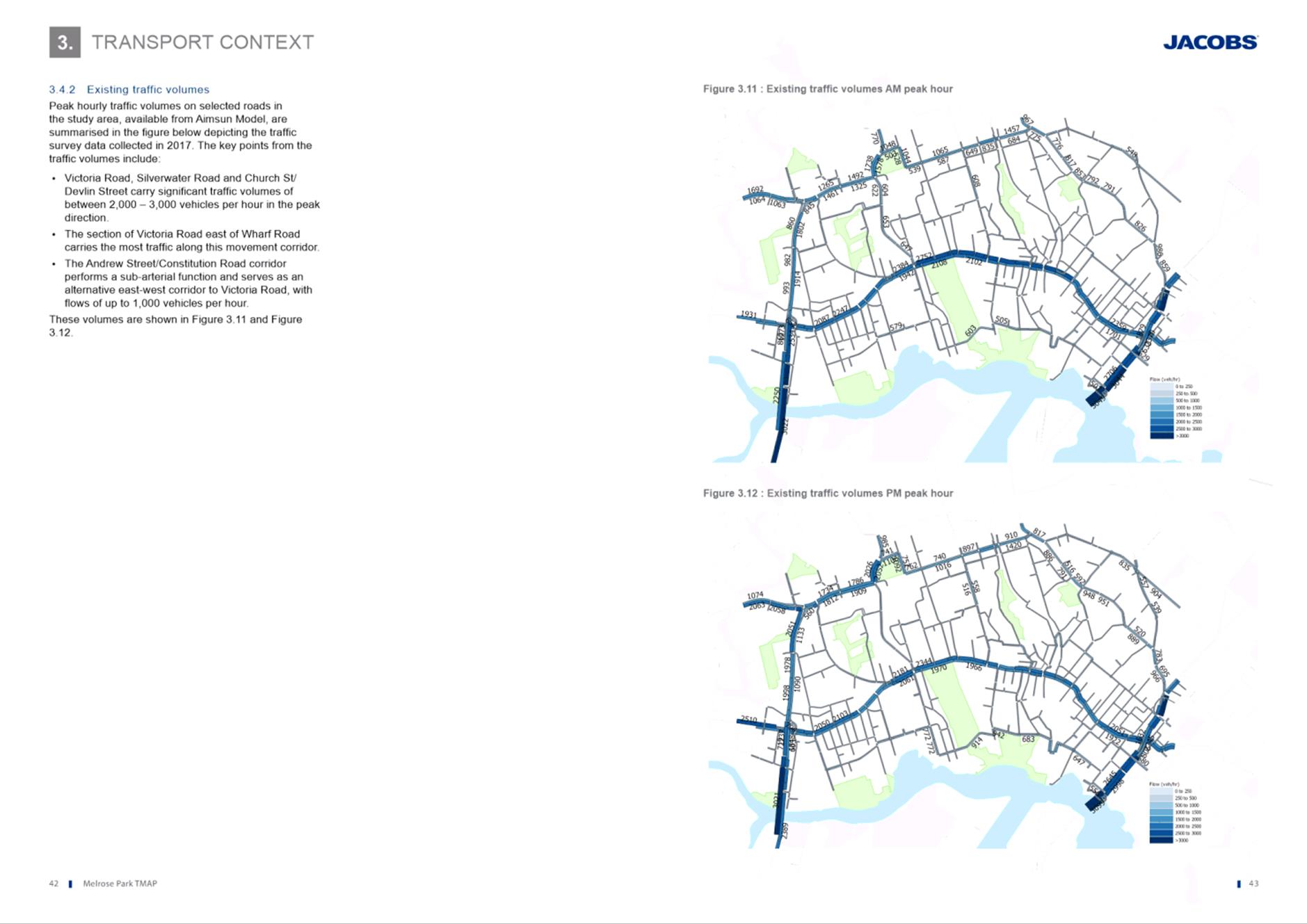
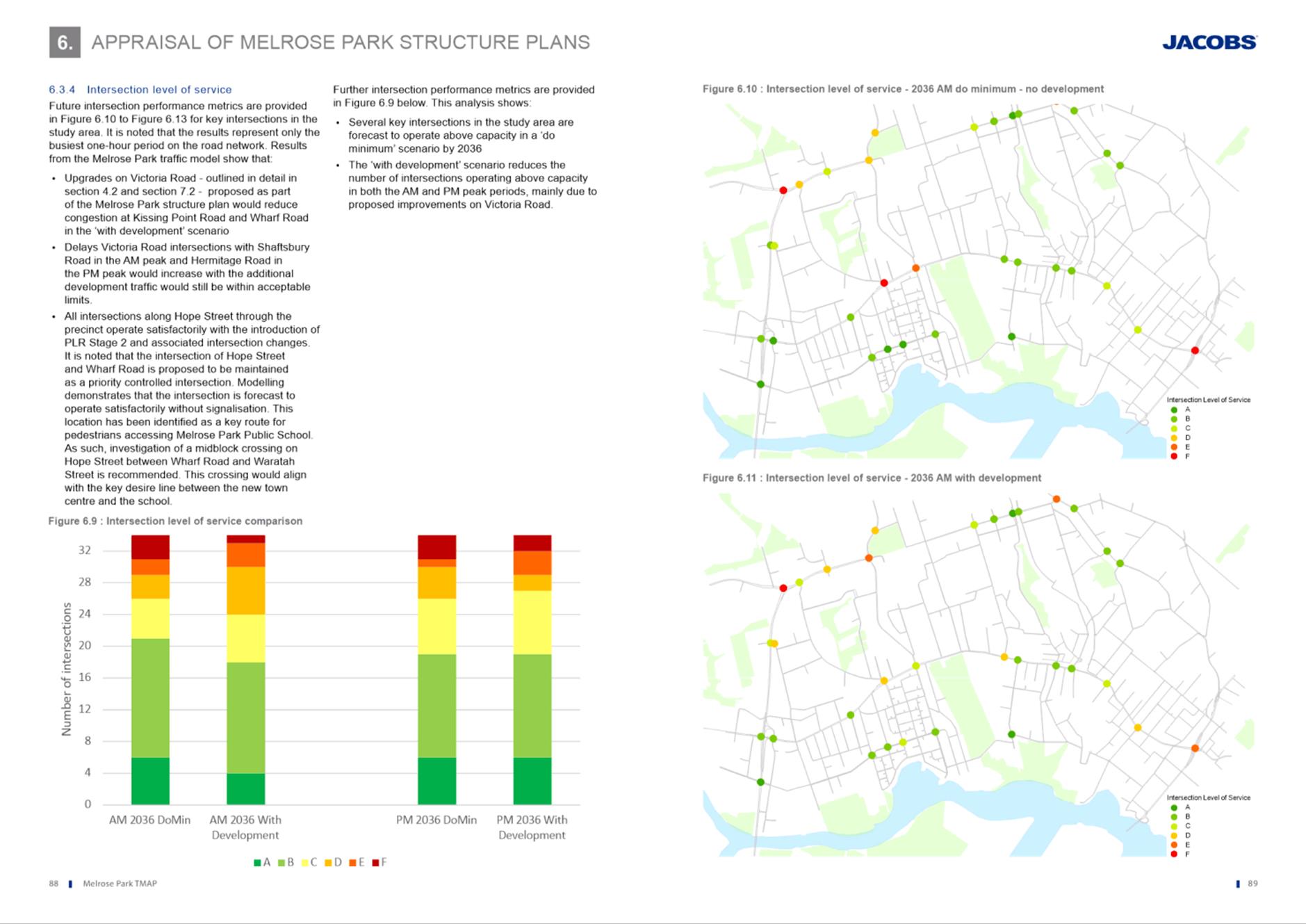
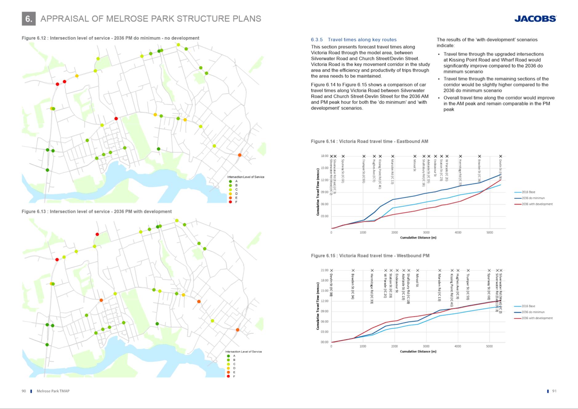
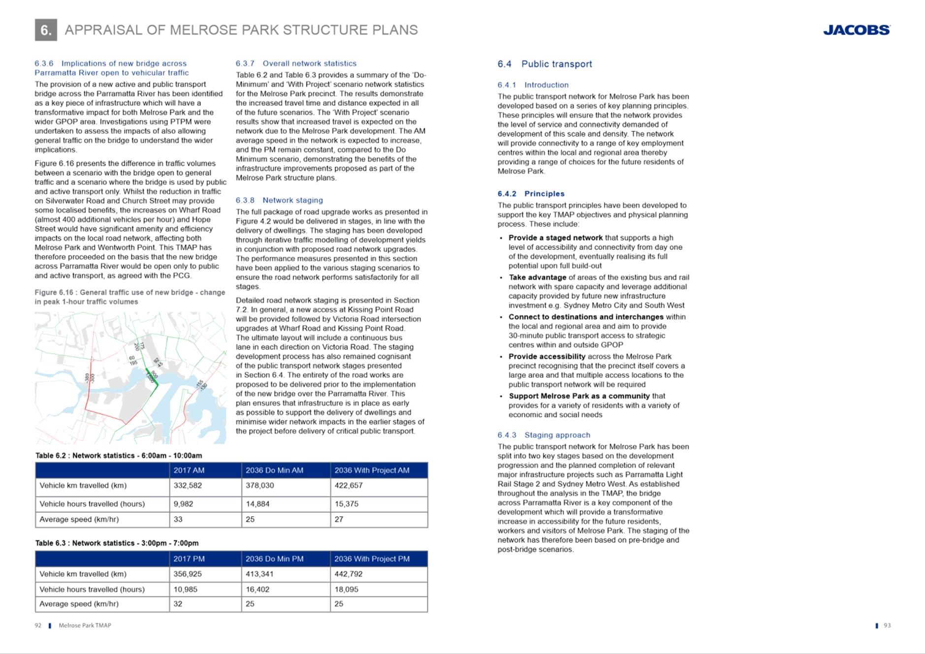
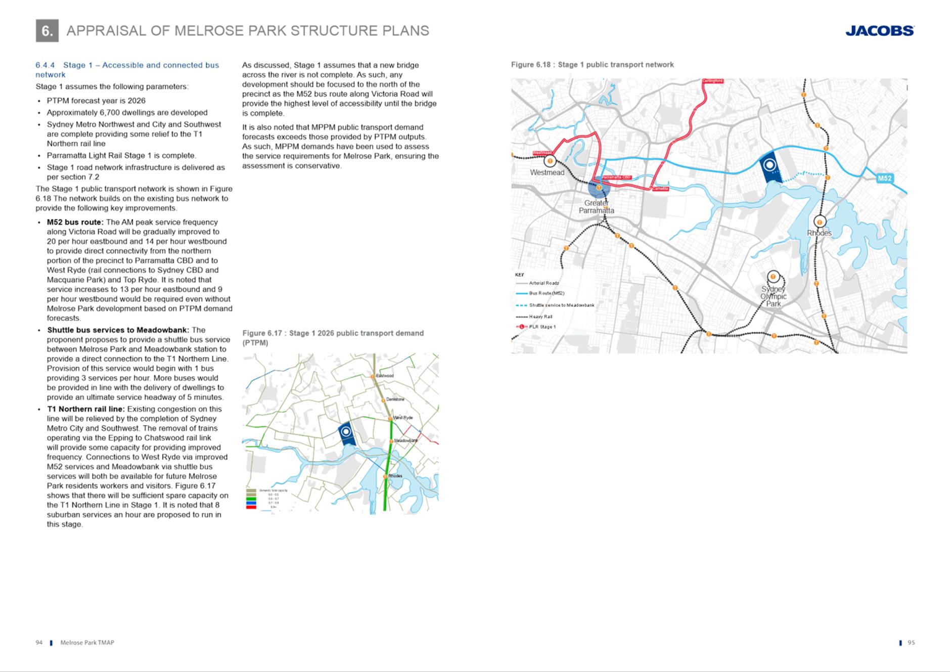
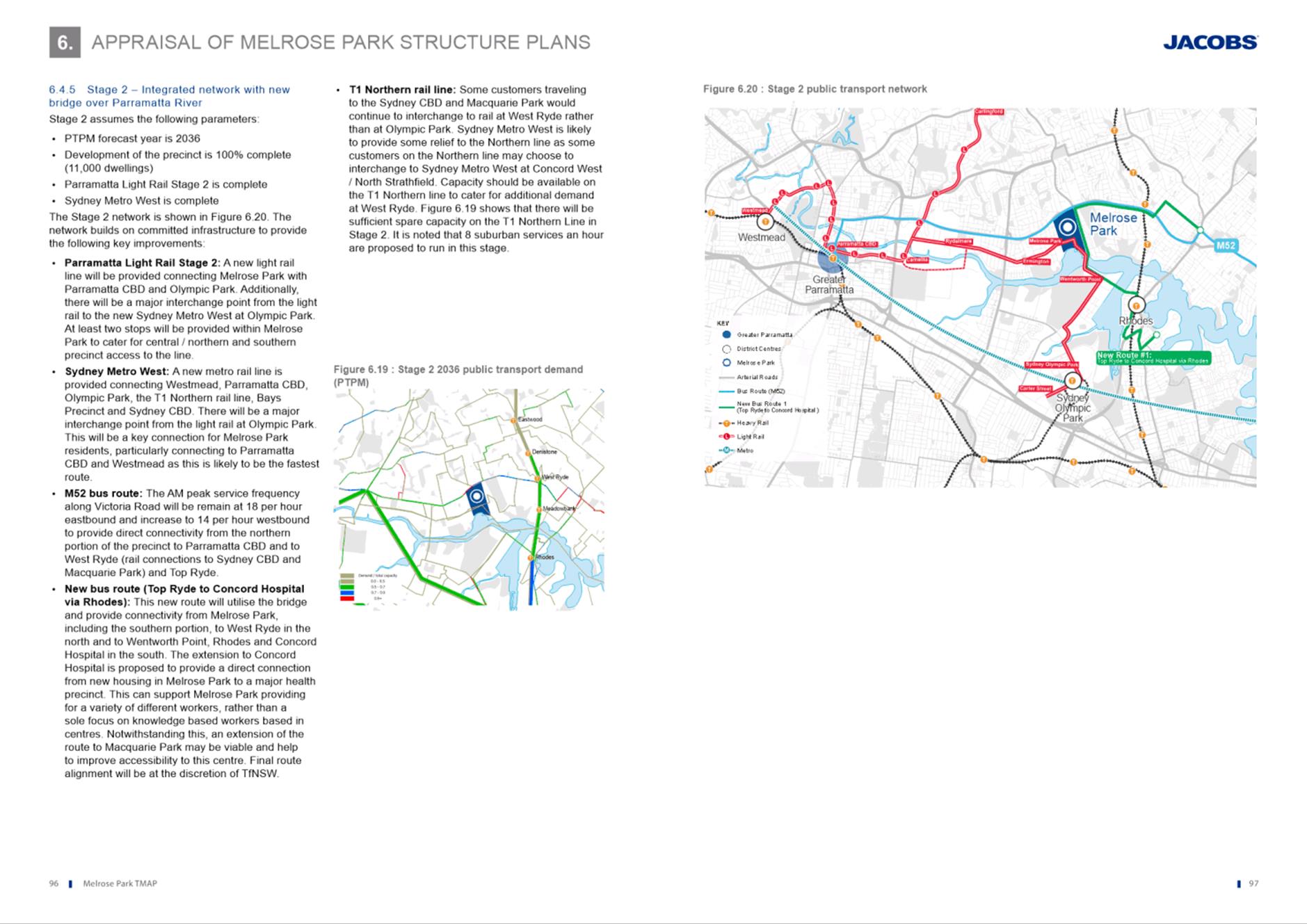
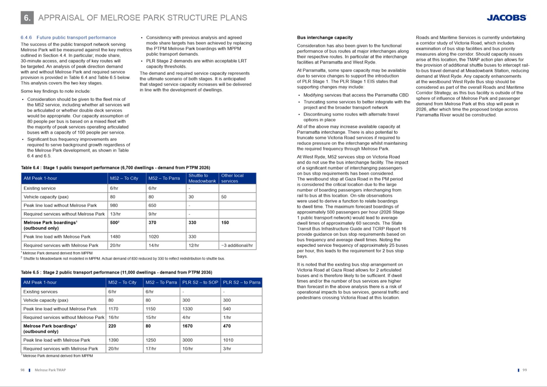
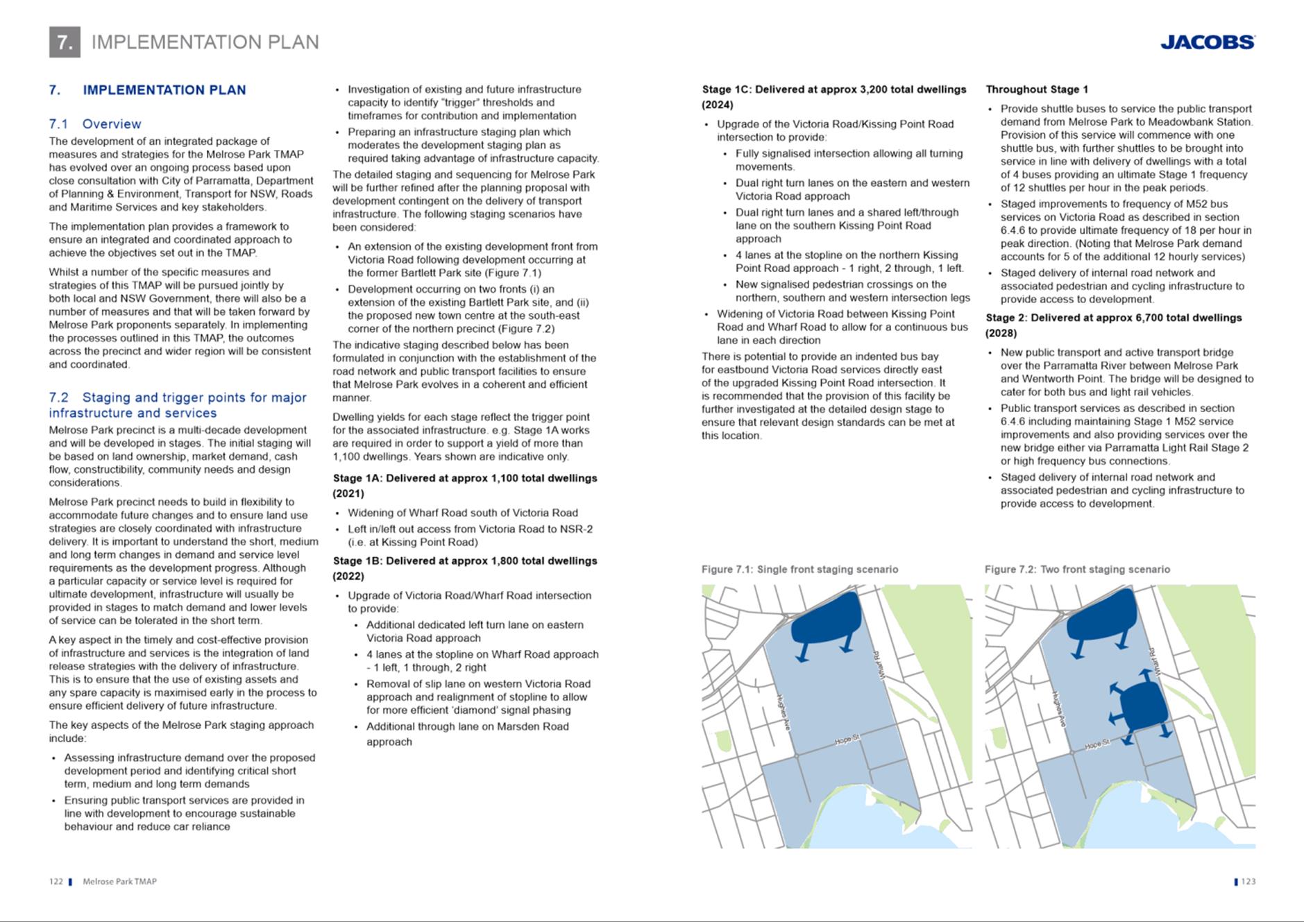
33. The TMAP identifies that up to 11,000 dwellings can be accommodated across the precinct (both north and south) from a traffic and transport perspective on condition that Sydney Metro West, light rail (or bus equivalent) and a bridge to Wentworth Point be provided. Without these three infrastructure items, the TMAP concludes that the overall dwelling number across the precinct will need to be capped at 6,700 units which equates to a 40% reduction in the overall dwelling yield. Further analysis on the TMAP is included below.
34. Similarly, a number of other infrastructure upgrades are required by the TMAP to achieve the 6,700 dwelling yield including:
· Widening of Wharf Road south of Victoria Road
· Upgrade of the existing intersection with Victoria Road/Kissing Point Road with a new north-south road from within the precinct required to support the redevelopment,
· Victoria Road/Wharf Road intersection upgrades- new lanes and realignment
· Additional through-lane on Marsden Road
· Additional turning lanes onto Kissing Point Road
· Signalised pedestrian crossing on norther, western and southern intersection legs
· Widening of Victoria Road between Kissing Point Road and Wharf Road
· New shuttle bus service between Melrose Park and Meadowbank Station until PLR Stage2 or bus equivalent is operational
· Staged improvements to bus services along Victoria Road
· Staged delivery of new internal roads
35. It is noted that the State Government has made a commitment to deliver Sydney Metro West and recently announced the commitment of funding towards further planning and investigation work for Parramatta Light Rail (PLR) Stage 2. With this comes greater certainty that a bridge will be delivered connecting Melrose Park to Sydney Metro West at Sydney Olympic Park. Notwithstanding, funding for the bridge will be subject to the State Planning Agreements noted above and will require similar agreements with other property owners/applicants for the remaining development areas within Melrose Park.
36. From an urban design perspective, a master plan has been developed to ensure that the density can be accommodated on the site in an appropriate manner and responds to a number of principles that achieves the following outcomes:
· Locating tower buildings in the centre of the site along the major north-south spine roads and locating them so that the tunneling effect of tall buildings is minimised.
· Orientating buildings to achieve maximum solar access and views over open space
· Limiting buildings to a maximum of 6-8 storeys around the perimeter of the site where it interfaces existing low-density residential development.
· Consolidation of open space to ensure maximum use and access.
· Maintaining key view lines, especially along roads to outside the precinct to minimise the perception of density.
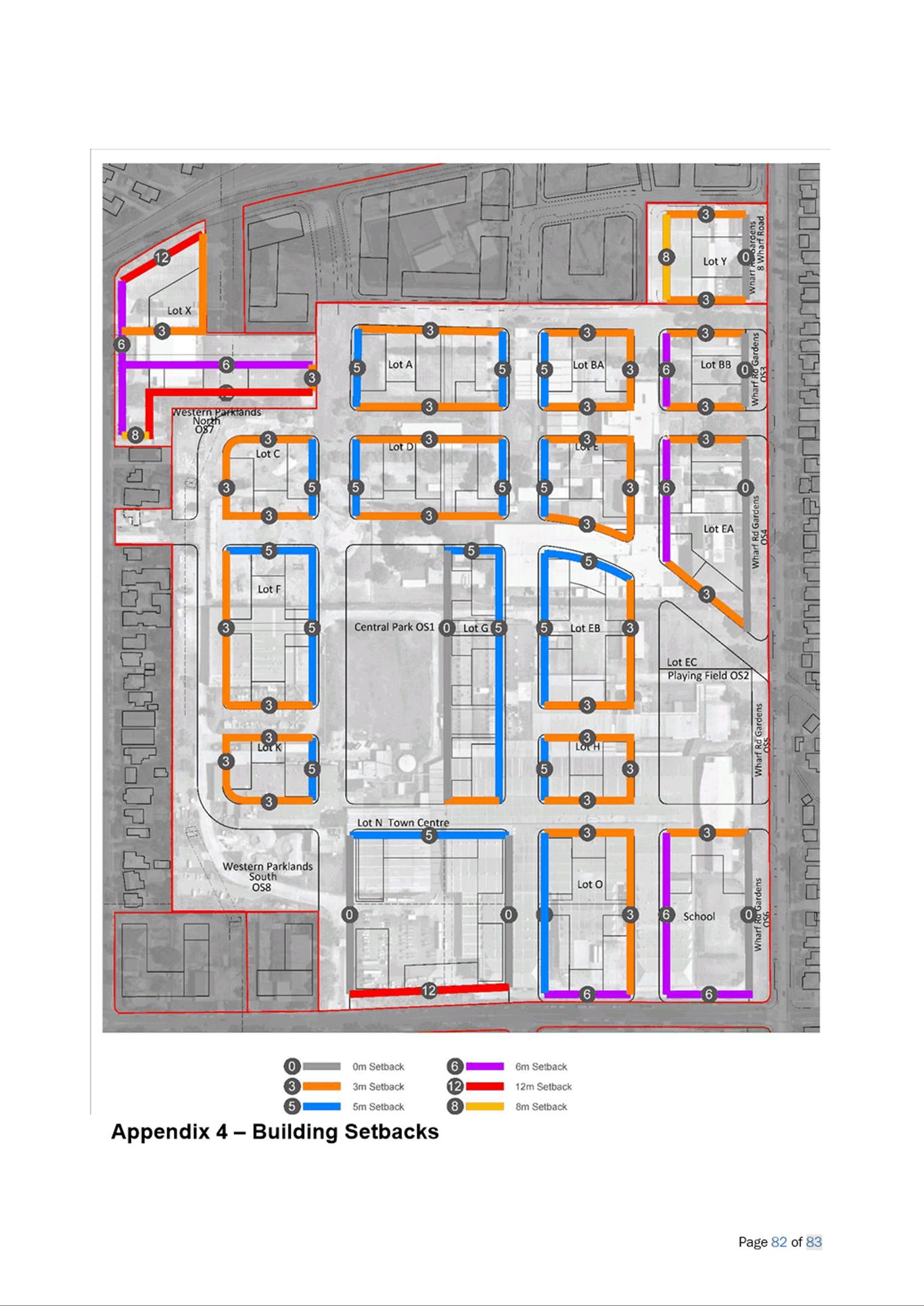
37. To support the intentions of the master plan, a site-specific development control plan (DCP) has been created that is proposed to be incorporated into Parramatta DCP 2011. The draft DCP includes objectives and controls relating to built form, which specifies requirements such as building setbacks, building separation, the distribution and allocation of floor space on a block-by-block basis, and tower design and slenderness. These controls are intended to ensure that the perception of density within the precinct is minimised by pedestrian at street level and from residents within the buildings.
Recommended Action
38. Retain provisions as exhibited
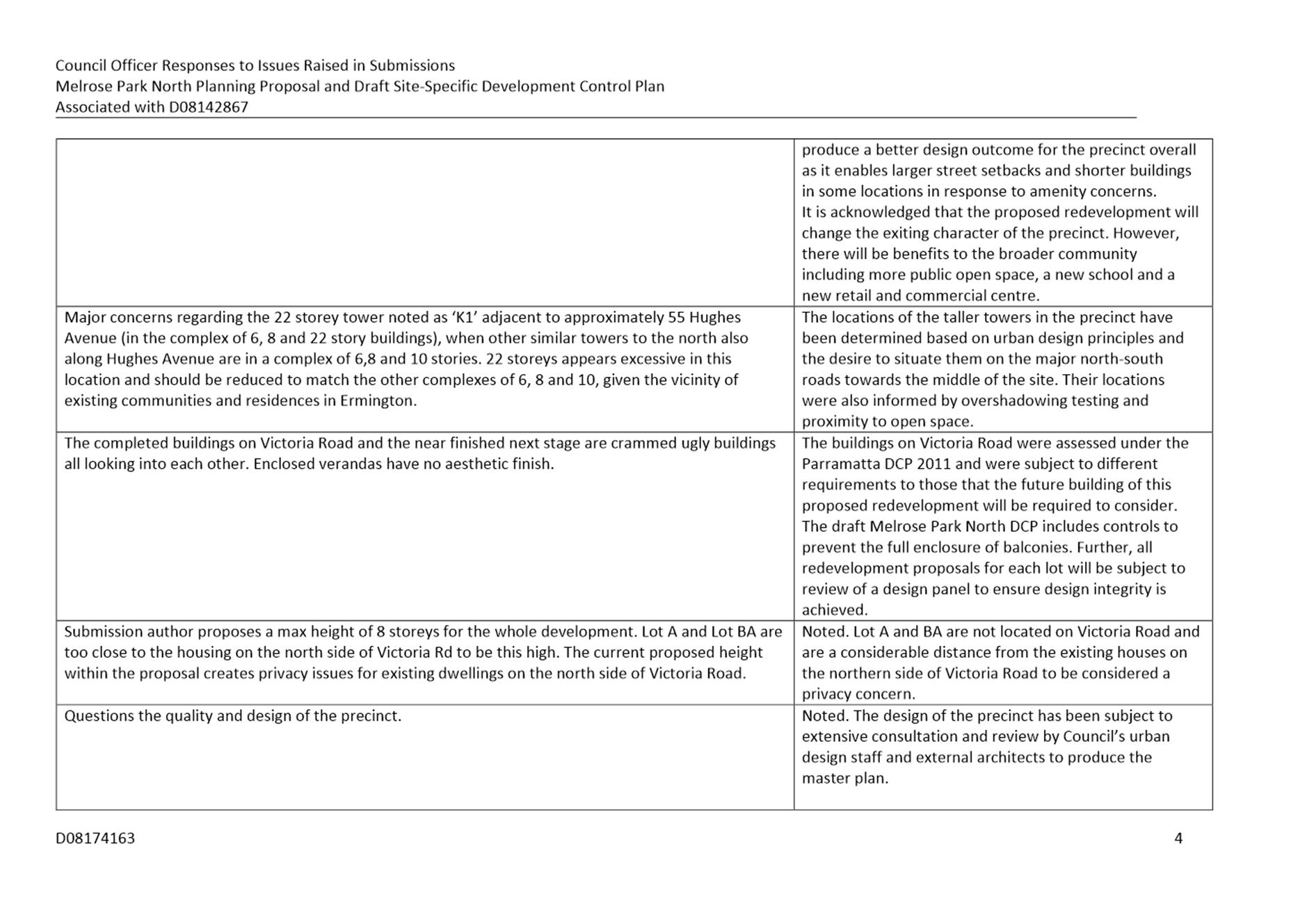
Building Heights and Amenity
39. Multiple submissions raised concern over the proposed building heights on the site, stating they are excessive and inappropriate given the existing character of the area, and that it would result in poor amenity of residents within and surrounding the development.
40. It is acknowledged that the proposed heights are not consistent with existing surrounding development, however the heights identified in the Planning Proposal and refined in the master plan and in the draft DCP are required in order to accommodate the residential gross floor area that has been endorsed by Council and the State Government. To minimise impacts on residents, extensive design testing has been undertaken in a collaborative approach between Council’s urban design officers and the applicant’s architects to achieve the best possible outcome. The master plan locates the tallest buildings away from the perimeter of the precinct to help reduce the perception of density and visual impact on surrounding residents.
41. Council officers acknowledge that concern has been raised by the community regarding the proposed buildings heights and potential impacts on amenity. However, it is not considered that sufficient justification has been provided in the submissions to warrant a reduction in the proposed building heights on the site, especially as extensive urban design testing has been undertaken to demonstrate that the proposed heights can be achieved without extensive and unmanageable impacts being experienced by future or surrounding residents.
42. The proposed buildings heights have been formulated based on the topography of the site, public open space locations, proximity to existing low density residential development and the desire to concentrate the tallest buildings on the main north-south road corridors within the middle of the site and lower heights on the perimeter to provide a transition from the existing low density residential development adjacent to the site. In addition, a landscape strip has been located along the length of Wharf Road between 17m and 20m wide to increase the separation and proximity between residents on the eastern side of Wharf Road and the proposed development.
43. Concerns were raised that these heights would create a poor amenity and that it will potentially create privacy issues for residents adjacent to the site on the western boundary along Hughes Avenue. The issue of overlooking and privacy impacts on these residents was taken into consideration during the creation of the master plan, however, is not anticipated to be a significant issue due to the maximum height of buildings being 8 storeys along the majority of this boundary, with a buffer provided of approximately 40m between the development lots (lots C, F and K) and the existing houses. Refer to Figure 9. This buffer comprises the Western Edge Parklands which has a width of approximately 20m and NRS1 (refer to Figure 9 for location), which has a proposed width of 20m. In addition, the buildings on these lots are required to have a setback of 3m from the property boundary. As a result, it is not anticipated that overlooking will be a significant impact.
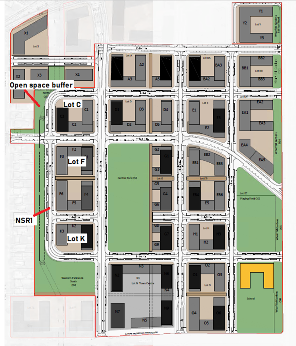
Figure 9. Lots C, F & K and NSR1 and open space buffer
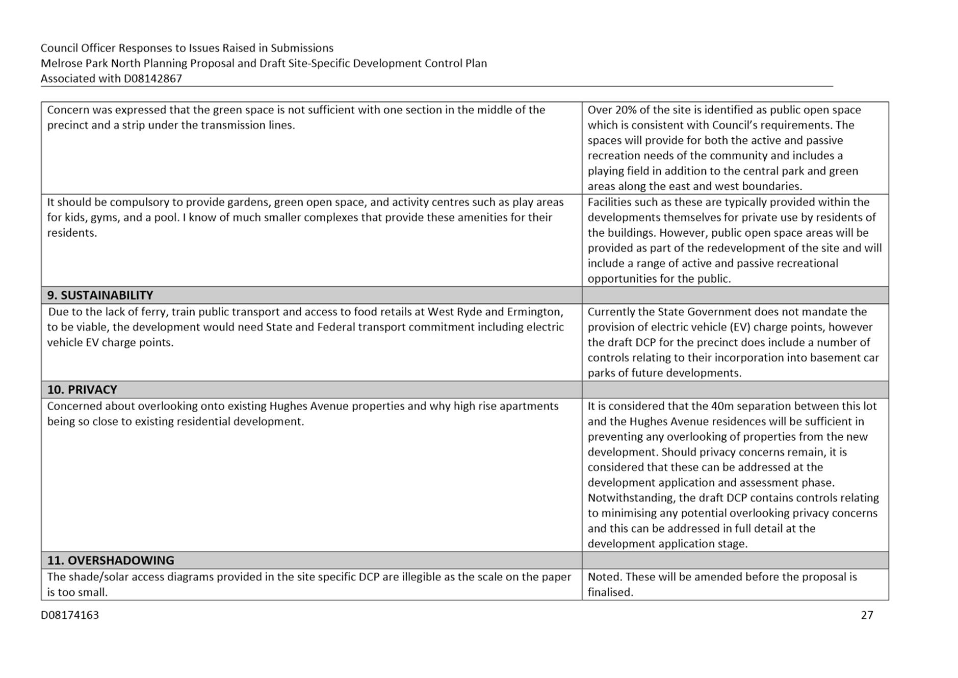
44. It is acknowledged that Lot C at the northern end of the parklands has a proposed maximum building height of 16 storeys, however it is considered that the 40m separation between this lot and the Hughes Avenue residences will be sufficient in preventing any overlooking of properties from the new development. Controls within Part 1. Built Form of the draft DCP also address privacy and overlooking, which are in addition to the requirements of the State Government’s Apartment Design Guide (ADG). These matters can be addressed in full detail at the development application stage.
Recommended Action
45. Retain provisions as exhibited.
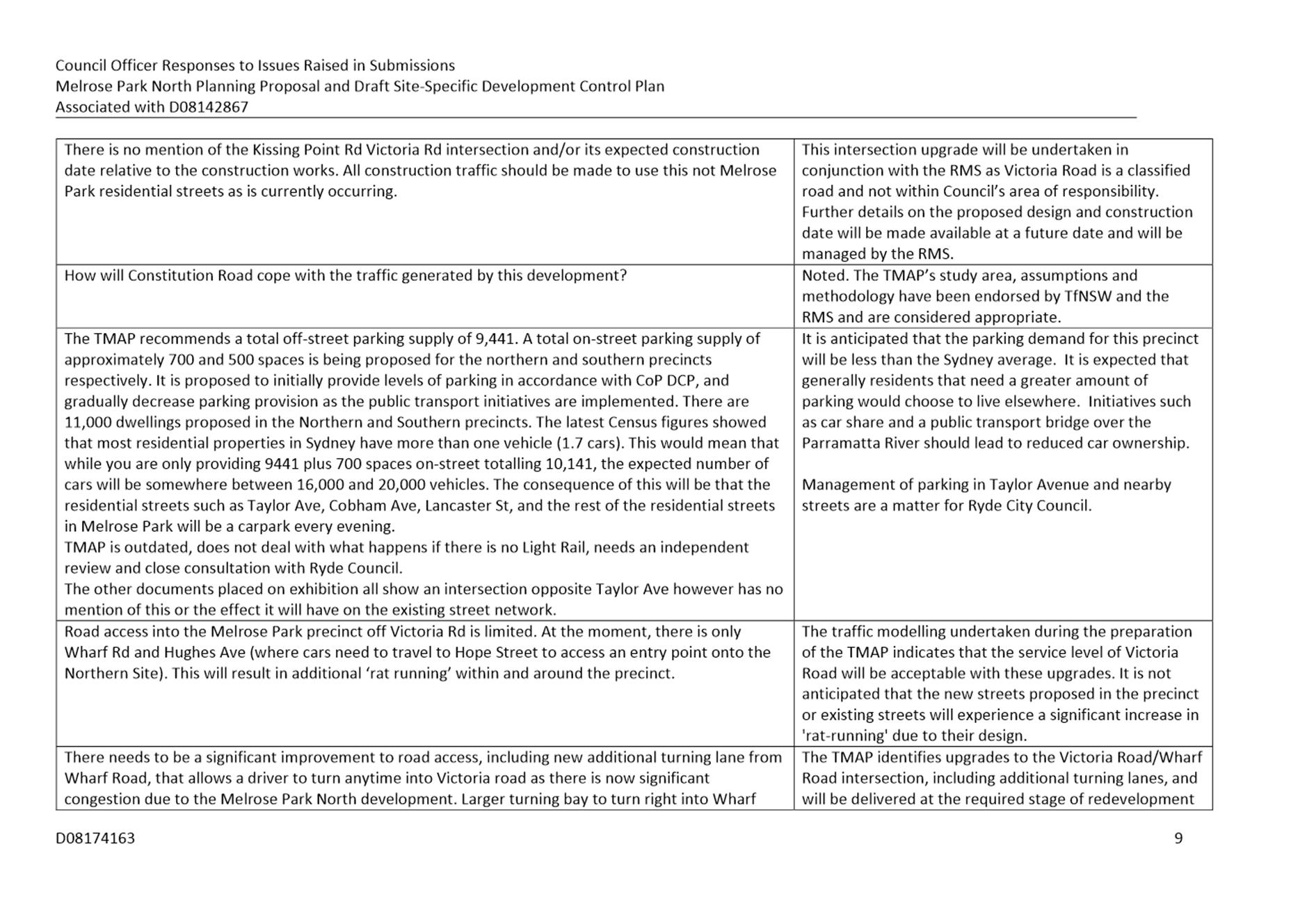
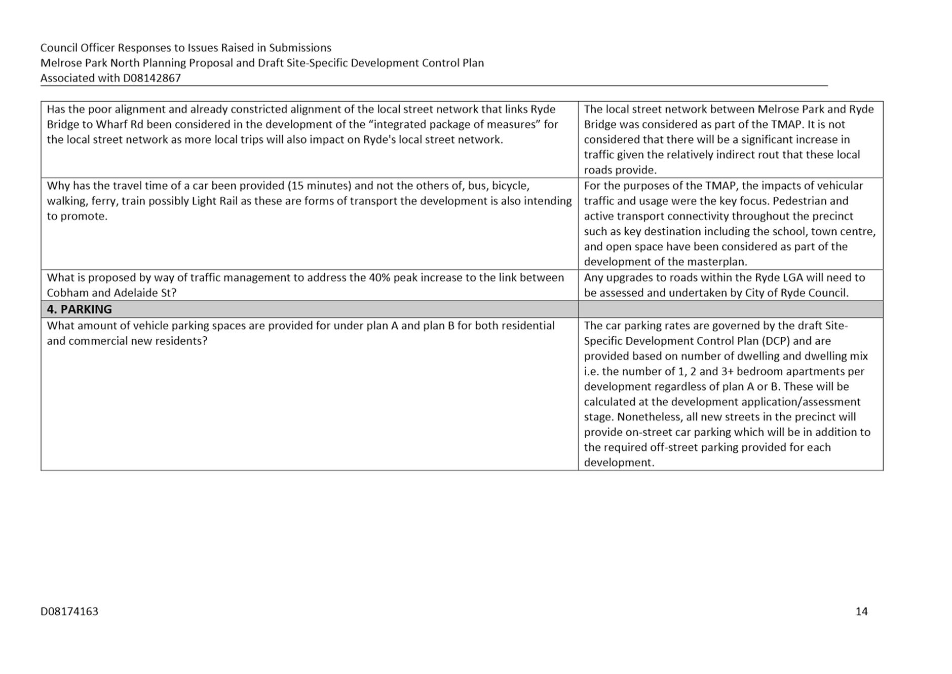
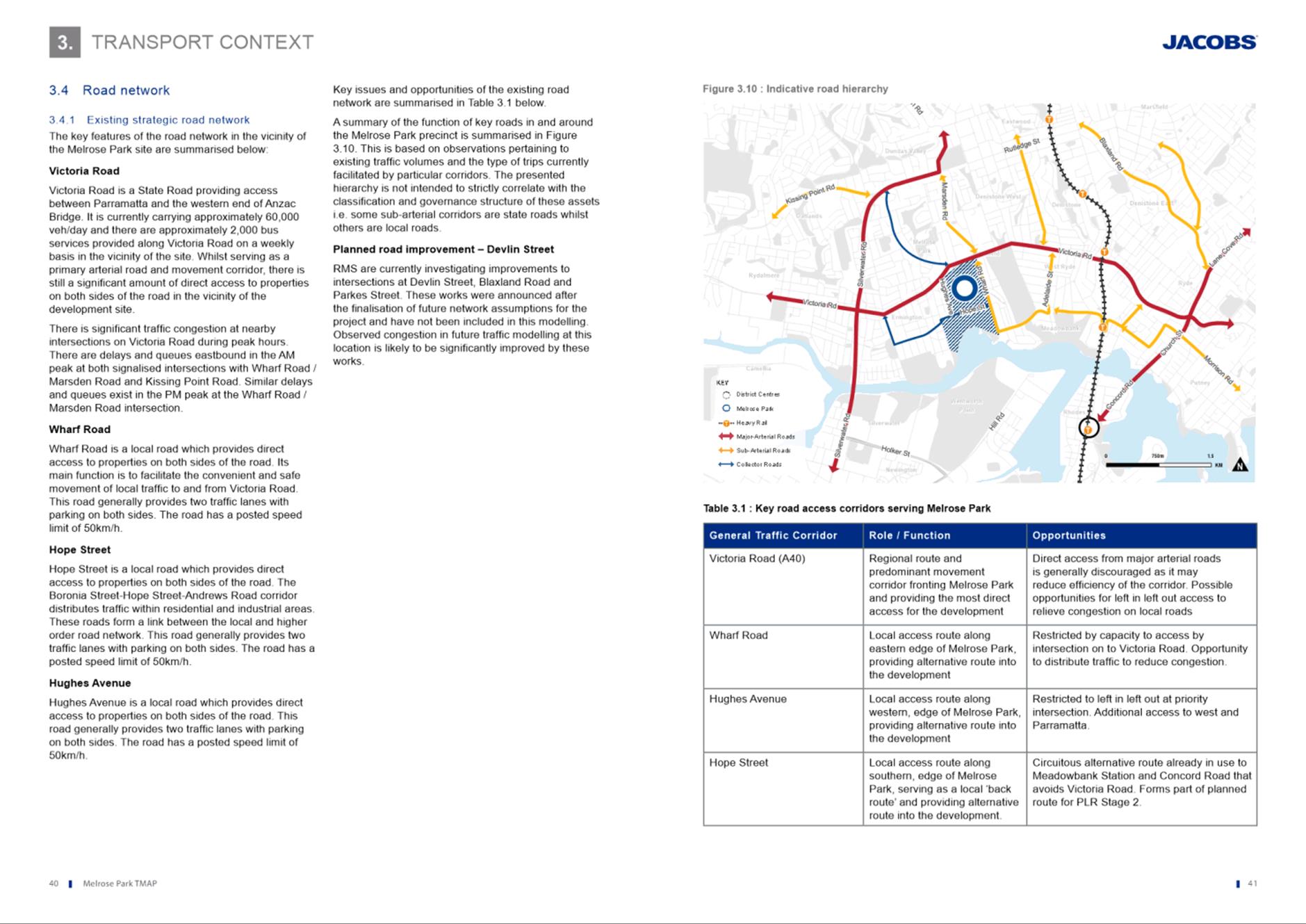
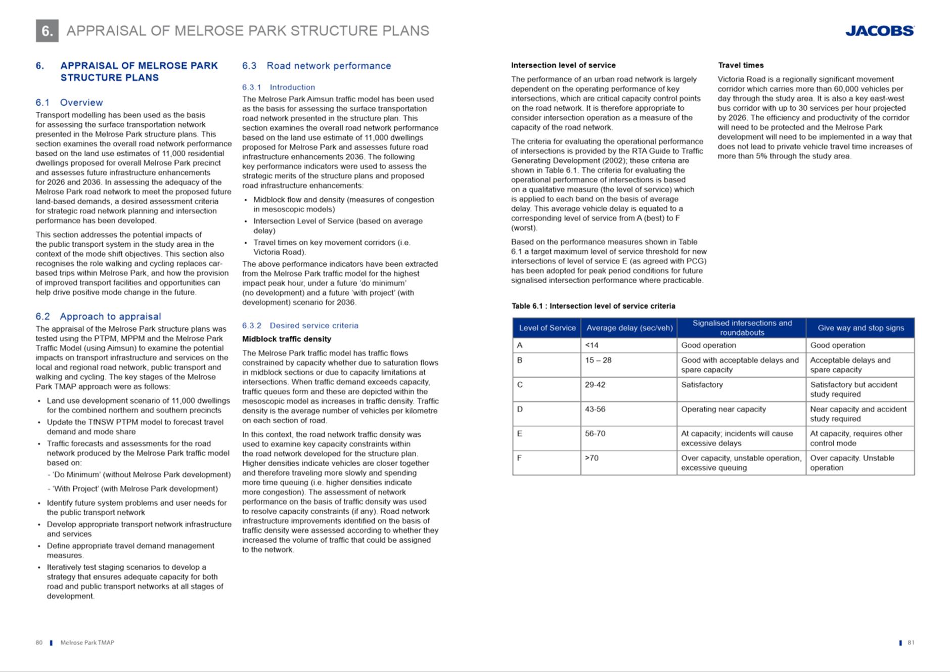
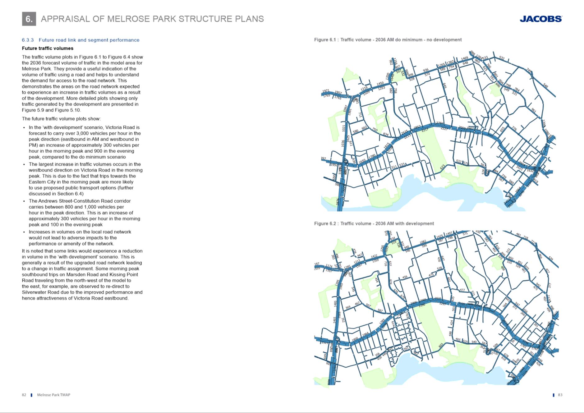
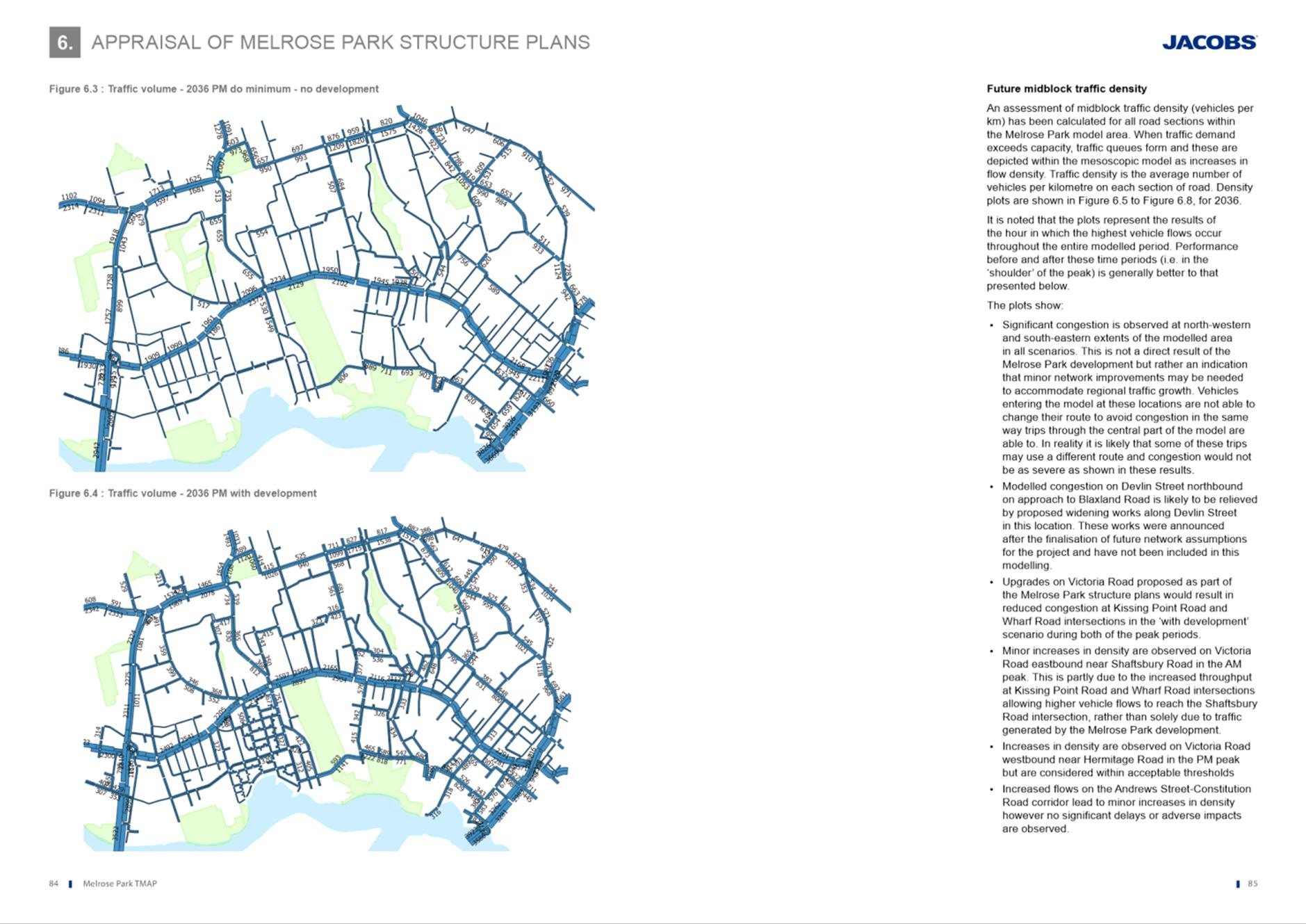
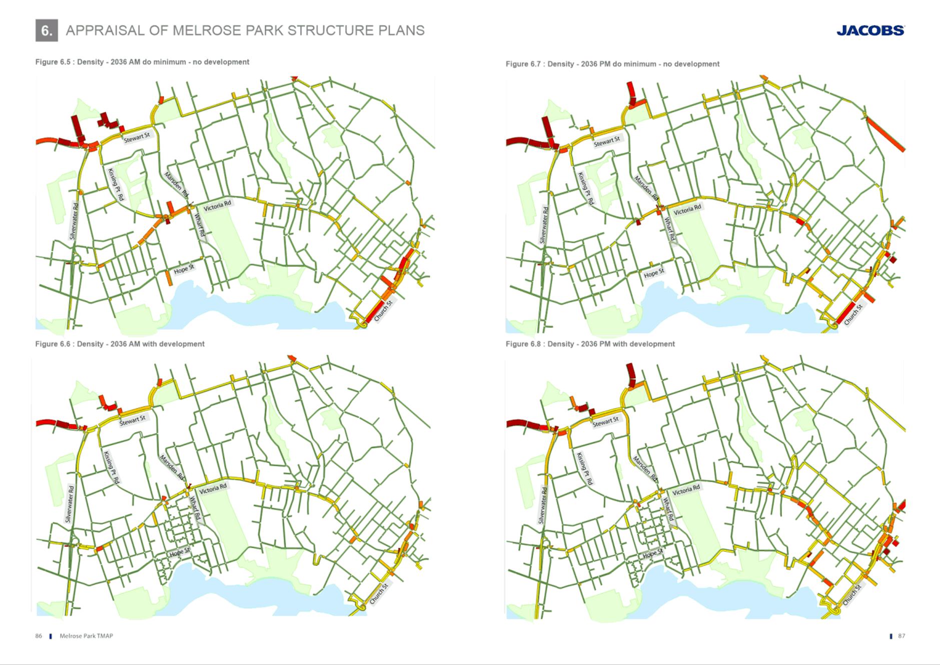
Traffic Impacts and Transport Management and Accessibility Plan (TMAP)
46. Multiple submissions raised concern regarding the potential traffic impacts on the existing road network and questioned the TMAP’s (Attachment 4) assumptions, methodology and its relevancy to current conditions.
Council Officer Response
47. It is acknowledged that any redevelopment within the Melrose Park precinct will have some impact on the local road network and to a lesser extent, the wider regional network. The TMAP was prepared in response to a Gateway Determination condition for this Planning Proposal and was subject to extensive review and consultation by the TMAP reference group which comprised stakeholders from Council and State Agencies, including Transport for NSW (TfNSW), DPIE, and applicants from the northern and southern precincts of Melrose Park. The TMAP was signed off and endorsed for exhibition by TfNSW.
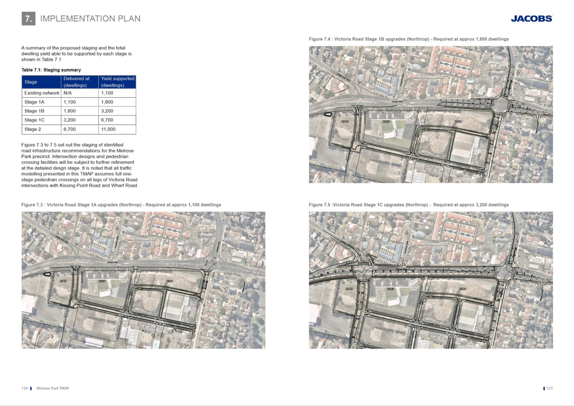
48. The TMAP is an informing document to the Proposal and provides a comprehensive analysis of the potential traffic and parking impacts and includes required mitigation measures for future redevelopment to deliver to ensure the traffic and transport network can accommodate the proposed increase in density on the site. It also provides a Staging Plan for the delivery of required road upgrades and public transport infrastructure to service the precinct as well as recommended parking rates. Refer to Table 3 for a summary of the staging plan and dwelling thresholds. As development progresses, the applicant will need to demonstrate that the required infrastructure will also be delivered as identifies in the TMAP’s staging plan.
Table 3. TMAP infrastructure staging plan
|
Stage |
Infrastructure Trigger Point (dwellings) |
Yield supported (dwellings) |
Key Infrastructure required |
|
Existing network |
NA |
1,100 |
Nil |
|
Stage 1A |
1,100 |
1,800 |
Wharf Road widening south of Victoria Road Left in/left out access from Victoria Road to NSR2 |
|
Stage 1B |
1,800 |
3,200 |
Upgrades of Victoria Road/Wharf Road intersection including additional turning lanes Additional through-lane on Marsden Road |
|
Stage 1C |
3,200 |
6,700 |
Further upgrades of Victoria Road/Wharf Road intersection - Full signalisation - Additional R turn lanes on Victoria Rd - 3 new lanes on southern Kissing Point Road approach - 4 new lanes on northern approach KP Road approach - New signalized pedestrian crossings - Widening of Victoria Rd between KP Road and Wharf Road - - Shuttle bus service to Meadowbank Station and increased frequency of public services throughout Stage 1 |
|
Stage 2 |
6,700 |
11,000 |
New bridge to Wentworth Point and PLR Stage 2 or bus equivalent Staged delivery of internal road network Increased public transport services |
49. The methodology and the assumptions and inputs used in the TMAP were presented to and endorsed by the project reference group in the early stages of the project and were considered appropriate to ensure the results would be an accurate reflection of the potential changes to the use and density of the Precinct. The outcomes of the TMAP testing were also supported by the project reference group prior to finalisation of the TMAP report.
50. With regard to the relevancy and accuracy of the TMAP given it was prepared in 2017, advice from TfNSW considered that the relatively recent completion date of the TMAP is not likely to be an influencing factor to its relevancy and ability to provide direction for the precinct. Technical studies relating to large projects such as Melrose Park North are prepared at varying stages throughout the project’s life and it is not uncommon for the studies to precede the project’s exhibition date given that they are used to inform the content that is ultimately placed on exhibition. In this instance, any change in inputs used for the modelling and assumptions is likely to not be significant and would have a negligible impact in the TMAP’s results.
51. In response to the concern that the TMAP’s study areas was not sufficient, the study area was endorsed by the project working group, which comprised of representatives from Council, northern and southern landowners and Stage Agencies including TfNSW. The study area is identified in Figure 10 below and is considered to be of a scale that is appropriate for a redevelopment of this extent.
52. Notwithstanding, TfNSW advised in their submission that should any changes to the proposed development be proposed from what was exhibited as a result of the exhibition of changes at development application stage, then the TMAP may need to be reviewed to ensure the outcomes and recommendations remain appropriate.
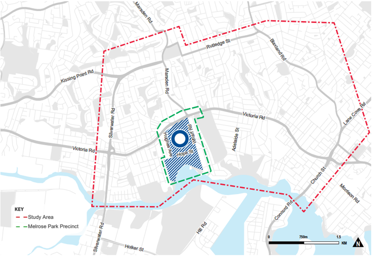
Figure 10. TMAP study area
Recommended Action
53. The assumptions and modelling used in the TMAP are considered to still be relevant and accurate. Therefore, the infrastructure upgrades required to meet the density thresholds in the TMAP are considered to be sufficient and therefore no change is required.
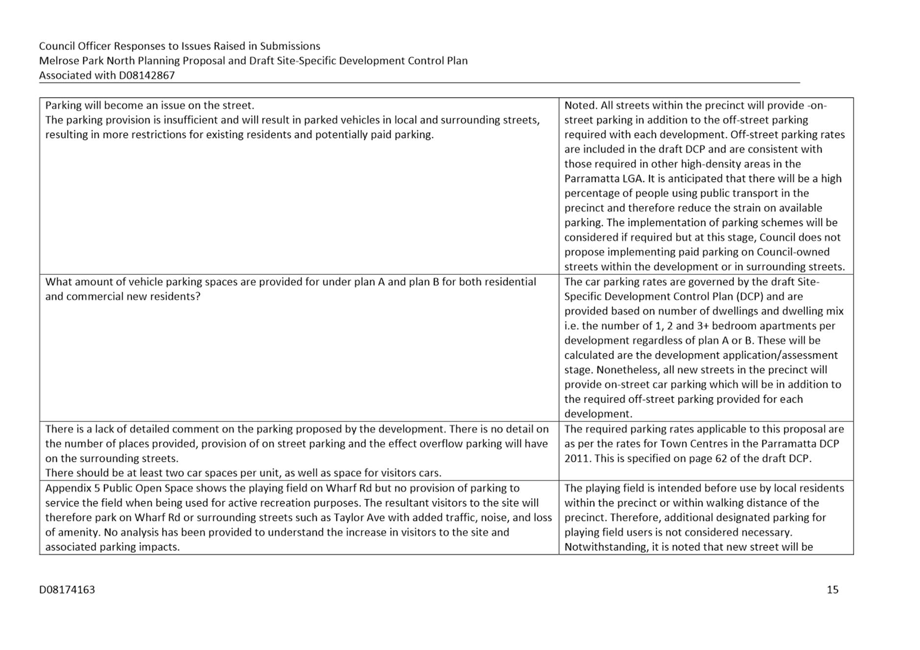
Open Space
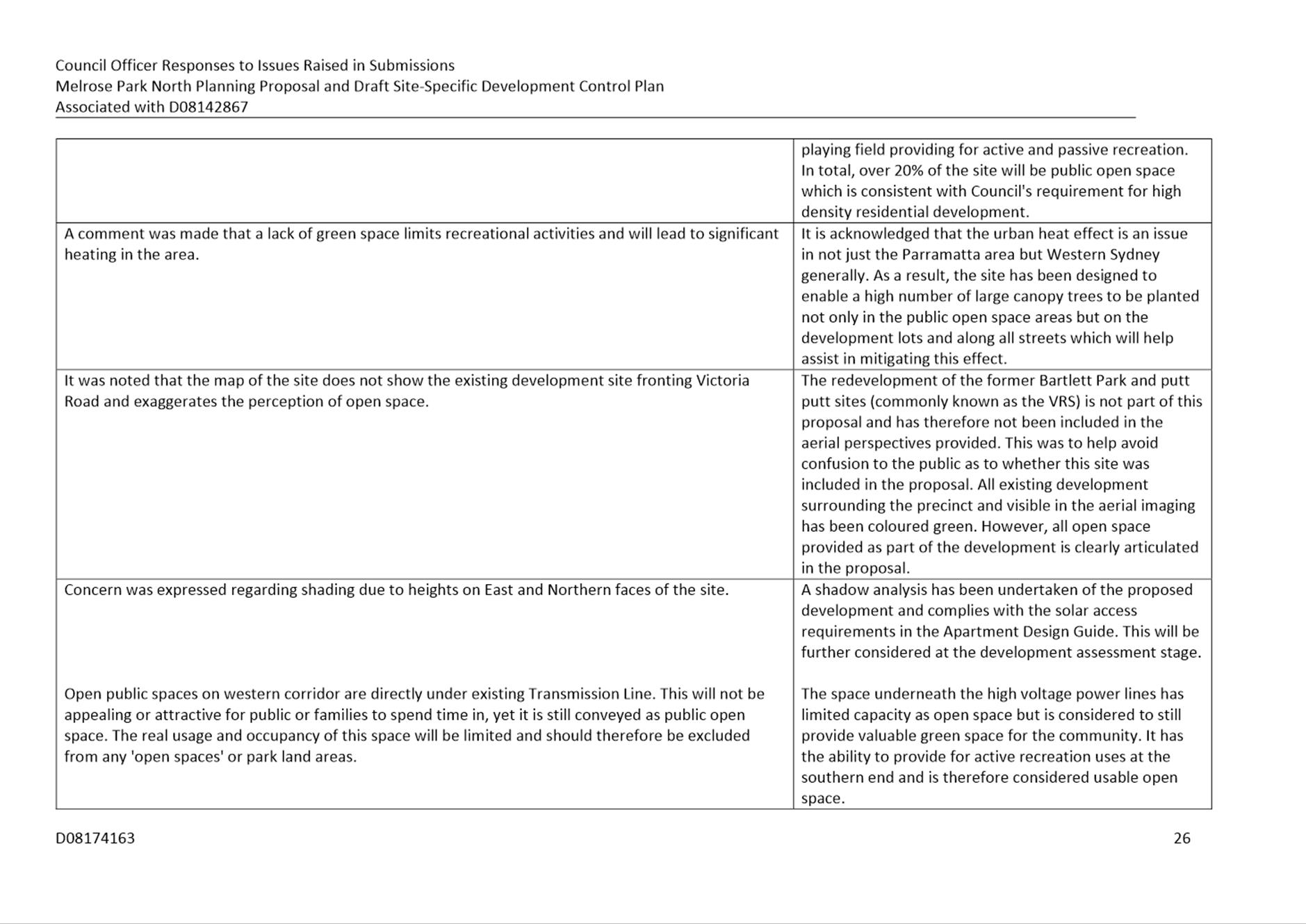
54. A number of submissions commented on the provision of open space, stating the amount proposed to be provided is insufficient for the projected population as a result of the potential development in Melrose Park.
Council Officer Response
55. The total area identified as public open space within the subject site is just over 20% of the total site area which meets the minimum requirements of Council for high density residential redevelopment. This requirement is specified in Council’s Community Infrastructure Strategy (CIS) adopted by Council in July 2020. This rate is also consistent with the United Nations’ recommendation of 15%-20%. These spaces include a large central park, a playing field, a parkland area along the length of the western boundary of the site and a landscaped area along the Wharf Road frontage. These spaces are envisaged to meet the active and passive recreation needs of the incoming population. In addition, the existing George Kendall Riverside Park is within close proximity to the precinct which will support the active recreation needs of the community. These open space areas are in addition to the required private open space areas that must be provided as part of each development on each lot.
Recommended Action
56. The proposed provision of public open space is considered sufficient, and no changes are proposed.
Additional Permitted Use
57. A submission was received from the landowner of 15-17 Hughes Avenue and 655 Victoria Road, Ermington which is part of the Planning Proposal area. The submissions requested that consideration be given to amending Schedule 1 – Additional permitted uses of PLEP 2011 to permit Place of Public Worship on the site. The site is currently occupied by the Ermington Gospel Church.
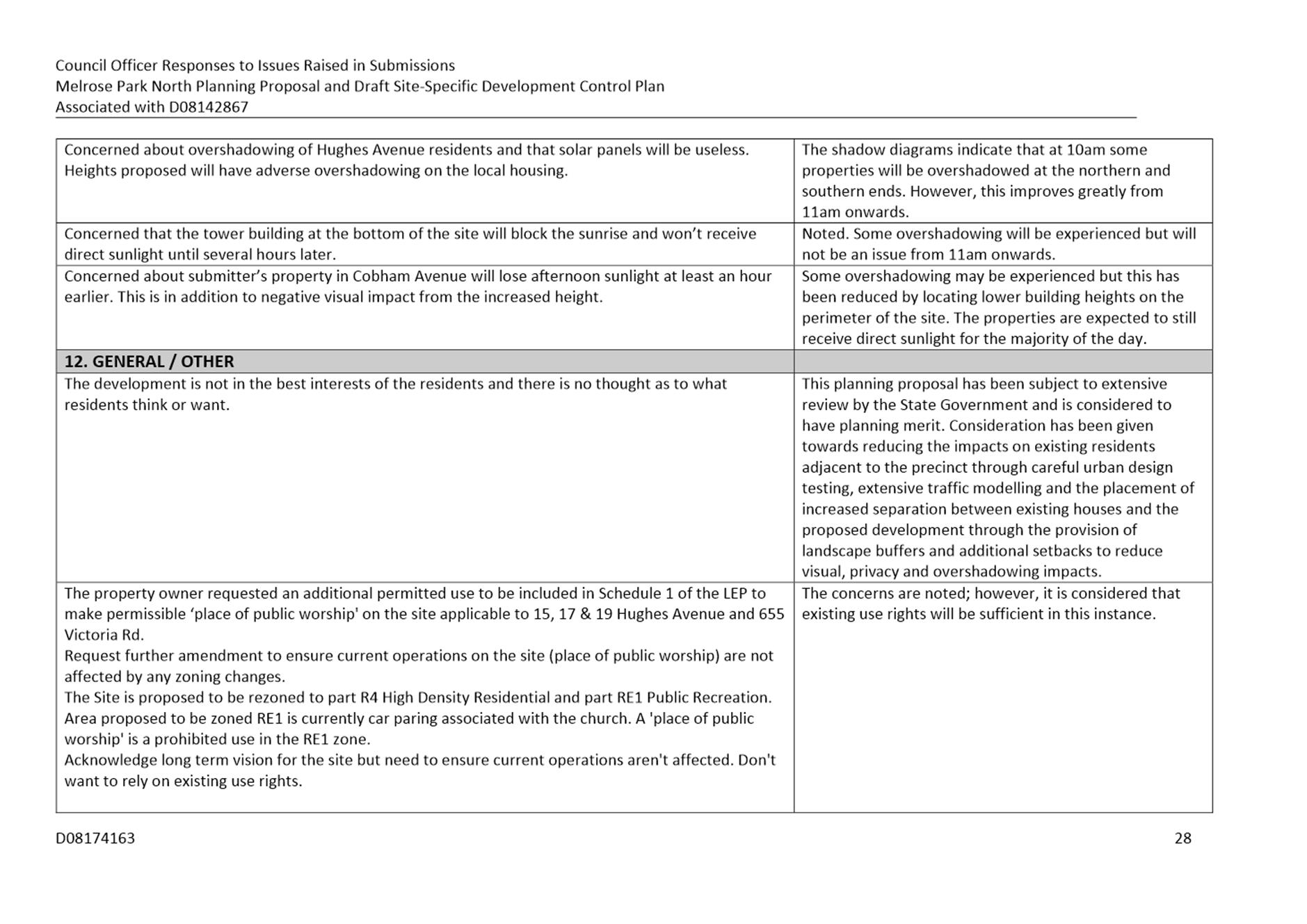
58. This site is proposed to be rezoned to part R4 High Density Residential and part RE1 Public Recreation. Although a place of public worship is a permitted land use in the R4 High Density Residential zone, it is a prohibited land use in the RE1 Public Recreation zone. Currently a car park ancillary to the church is located on the land proposed to be rezoned RE1 Public Recreation with the high voltage power lines running overhead. Should the site be rezoned, the current church operations will be able to utilise existing use rights, however the Ermington Gospel Trust is reluctant to rely solely on this provision in the short-medium term given the complications in land use permissibility.
Council Officer Response
59. This request has been considered by Council officers and acknowledge the concerns raised by the landowner. However, this site is included in the Planning Proposal area and therefore the long-term use of the site is not envisaged to remain as a Place of Public Worship, with the proposed zones of the site to R4 High Density Residential and RE1 Public Recreation intended to be the long-term land use. It is not considered necessary to permit a Place of Public Worship across the site for the following reasons:
· Given the current operations on the site, it would be able to utilise existing use rights provisions, which would permit the current use to continue operating after the rezoning has occurred, providing it does not cease for a period of 12 months of more.
· Permitting an additional permitted use on the site compromises the intended long-term use of the land. The proposed R4 High Density Zone permits Place of Public Worship and therefore it is not possible to place an additional permitted use on this portion of the site. The land proposed to be zoned RE1 Public Recreation is the location of the high voltage power lines and it would be unlikely that any built structures would be permitted in this area, even if it were subject to an additional permitted use.
· By applying an additional permitted use on the site, or part of the site, it would require an amendment to Schedule 1 – Additional permitted uses within PLEP 2011. Such an amendment to the Planning Proposal would require a re-exhibition and therefore compromise the ability of the Planning Proposal to meet the State Government’s deadline of 31 December 2021 for finalisation of this proposal.
60. As a result, it is not considered necessary to apply an additional permitted use on this site.
Recommended Action
61. No amendment to Schedule 1 – Additional permitted uses to permit a Place of Public Worship on the site.
AGENCY SUBMISSIONS
62. A total of eight (8) Government or Public Agencies were notified on the public exhibition with submissions received from seven (7). A summary of the issues raised is provided below, with further detail provided in Attachment 1.
School Infrastructure NSW
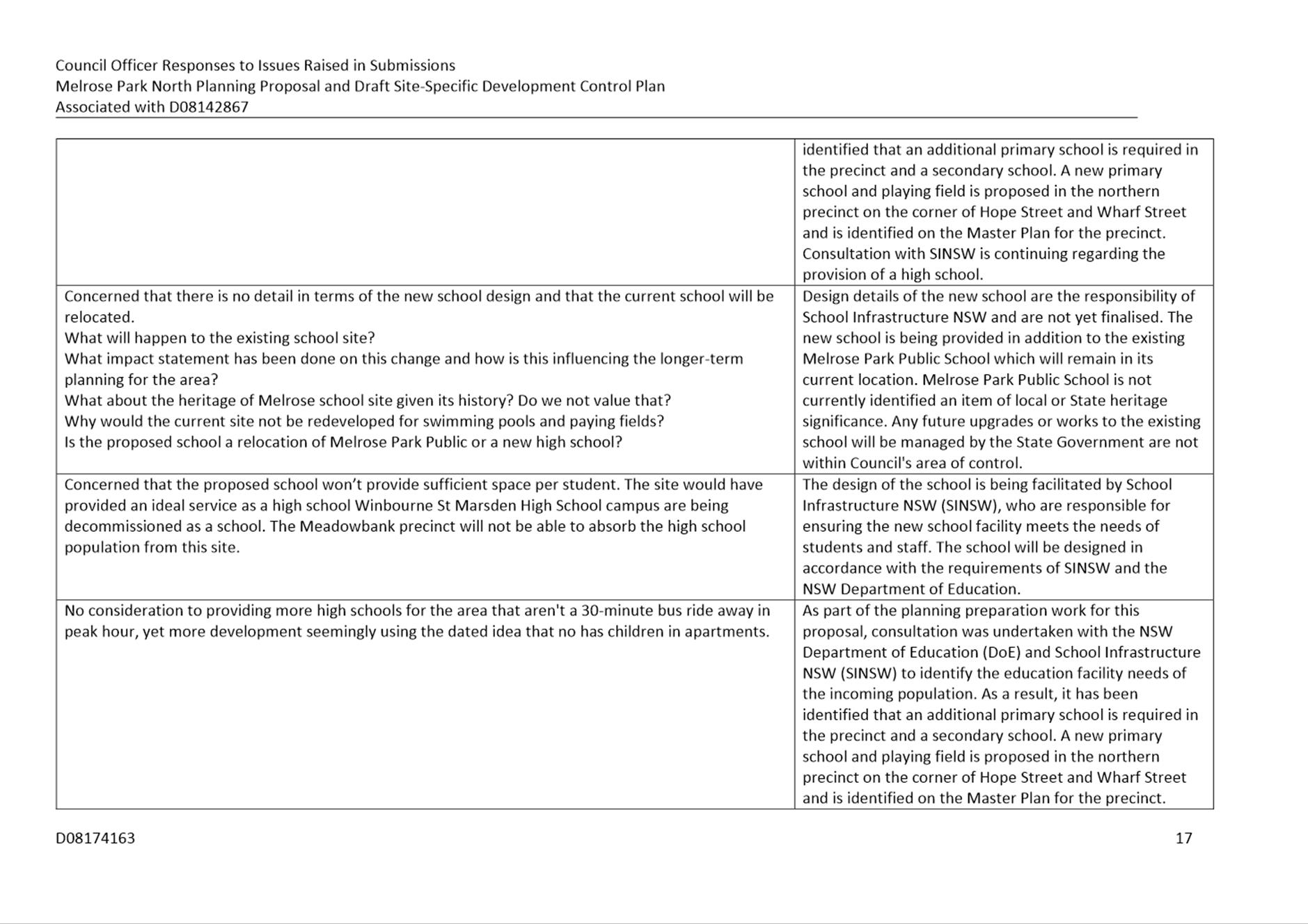
63. Council has been liaising with School Infrastructure NSW (SINSW) throughout the planning process in relation to the projected education needs of the incoming population and the required supporting infrastructure. SINSW made two submissions on the draft proposal, first of which outlined four (4) matters relating to the Planning Proposal and one (1) to the draft Planning Agreement. The initial submissions by SINSW stated an objection to the Planning Proposal. They are as follows:
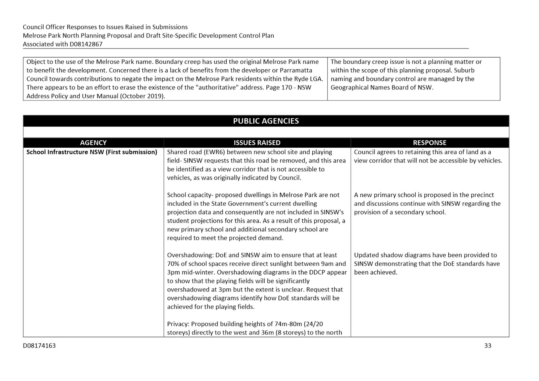
a) Issue: Clarification was sought regarding the use of the road between the new school site located on the corner of Hope Street and Wharf Road and the playing field to the north of the site (refer to Figure 9).
Response: This section of road referred to as EWR6 (east-west road number 6) is identified as a road on the masterplan, however during previous discussions between Council and SINSW, Council indicated that this land could instead be used as an extension of the school grounds providing no built structures were located on this land to ensure view lines were maintained, and that public pedestrian and cyclist connection is maintained outside school hours. Council confirmed that this portion of land was not required to be a road as its removal would have minimal impact on the operation of the overall road network and that it can be used as a pedestrianised link between the school and playing field. This matter is considered resolved.
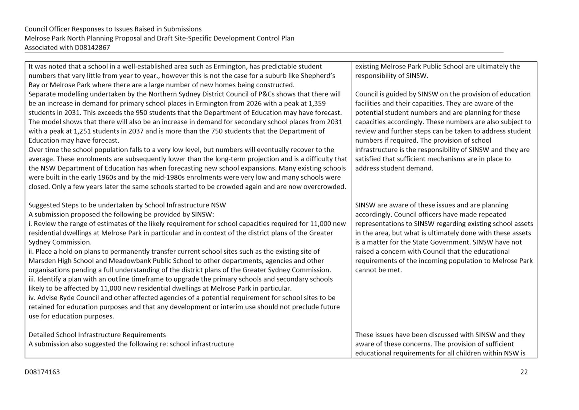
b) Issue: The matter of school capacity was raised, and that relevancy of population data used by SINSW to forecast future school demands. It was noted that the proposed dwellings in Melrose Park were not included in the Government’s current dwelling projection data. SINSW advised that the demand generated by the proposed development in the precinct required the equivalent of a new primary school and a new high school. As a result of ongoing communication with SINSW, both Council and SINSW are aware of the projected demand on school facilities in the precinct, despite the dwelling numbers not being formally included in the State Government’s projections.
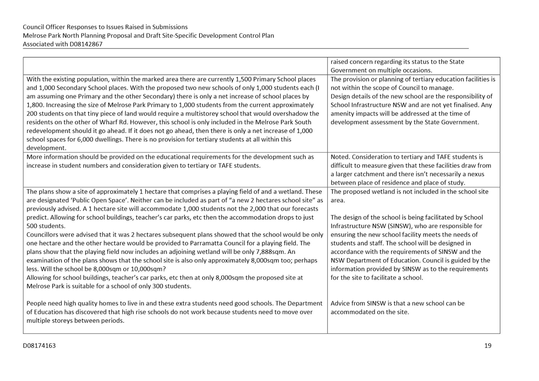
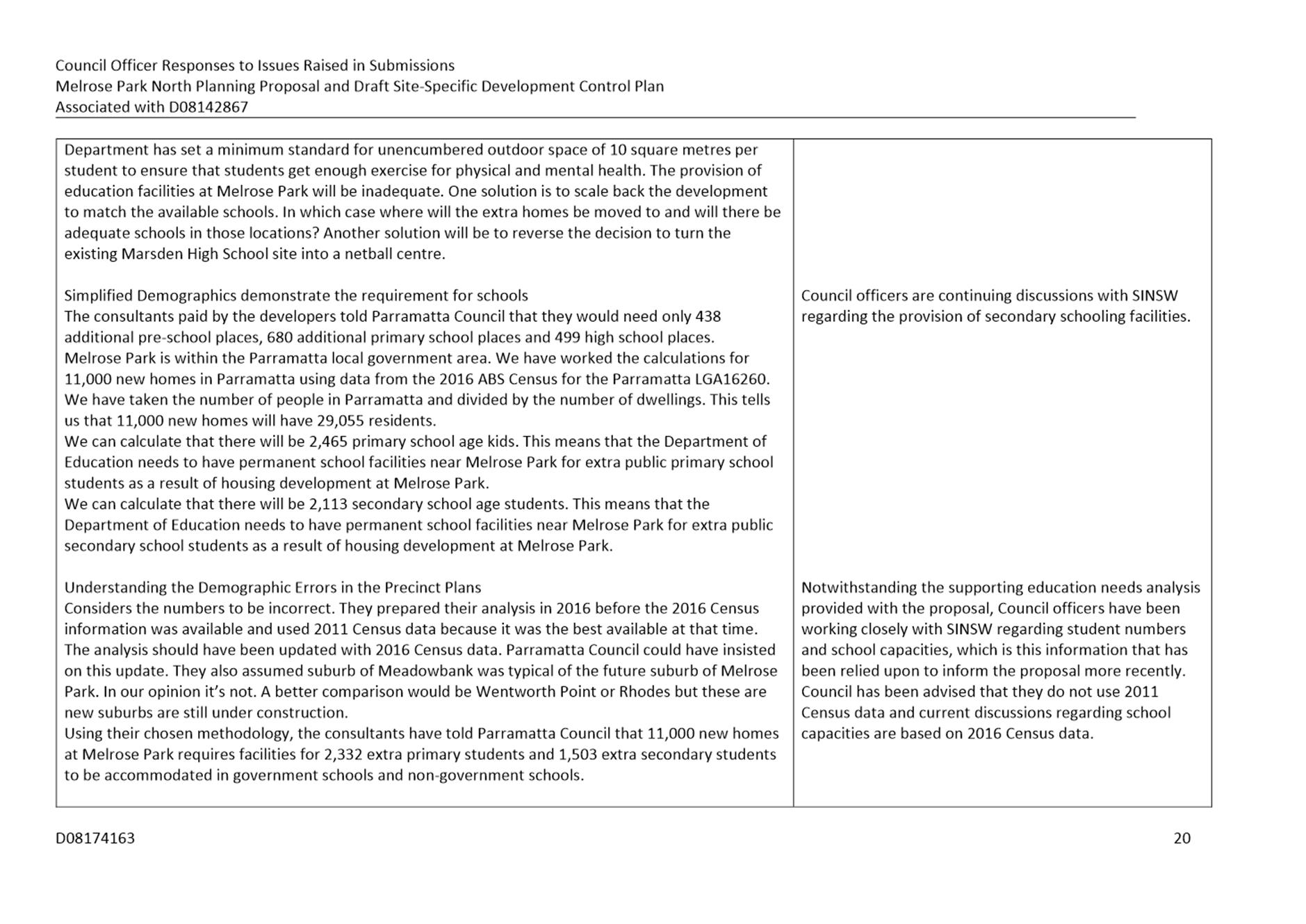
Response: Working with SINSW, a new primary school will be provided in the precinct and conversations are continuing regarding the provision of secondary school facilities within the precinct. Potential site options are being discussed, however SINSW and Council are not in the position to release further details to the public at this stage. The status of this matter is not considered by SINSW to be justification for preventing the planning proposal from progressing and is therefore considered to be resolved for the purposes of this report.
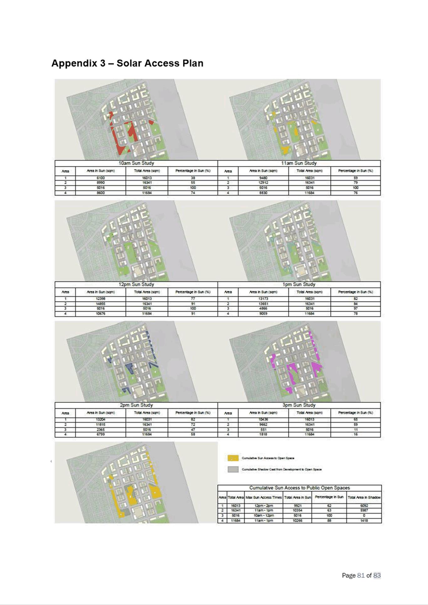
c) Issue: Overshadowing of the school and playing fields from adjacent buildings was raised as a concern. The Department of Education (DoE) and SINSW guidelines aim to ensure that at least 70% of school spaces receive direct sunlight between 9am and 3pm in mid-winter.
Response: The shadow diagrams placed on exhibition were not based on the varying topography of the site and therefore did not depict an accurate reflection of the extent of overshadowing on the school site. As a result, the shadow diagrams have been revised to take into account the site’s topography and it can be demonstrated that the site will receive the required amount of direct sunlight. This matter is considered to be resolved.
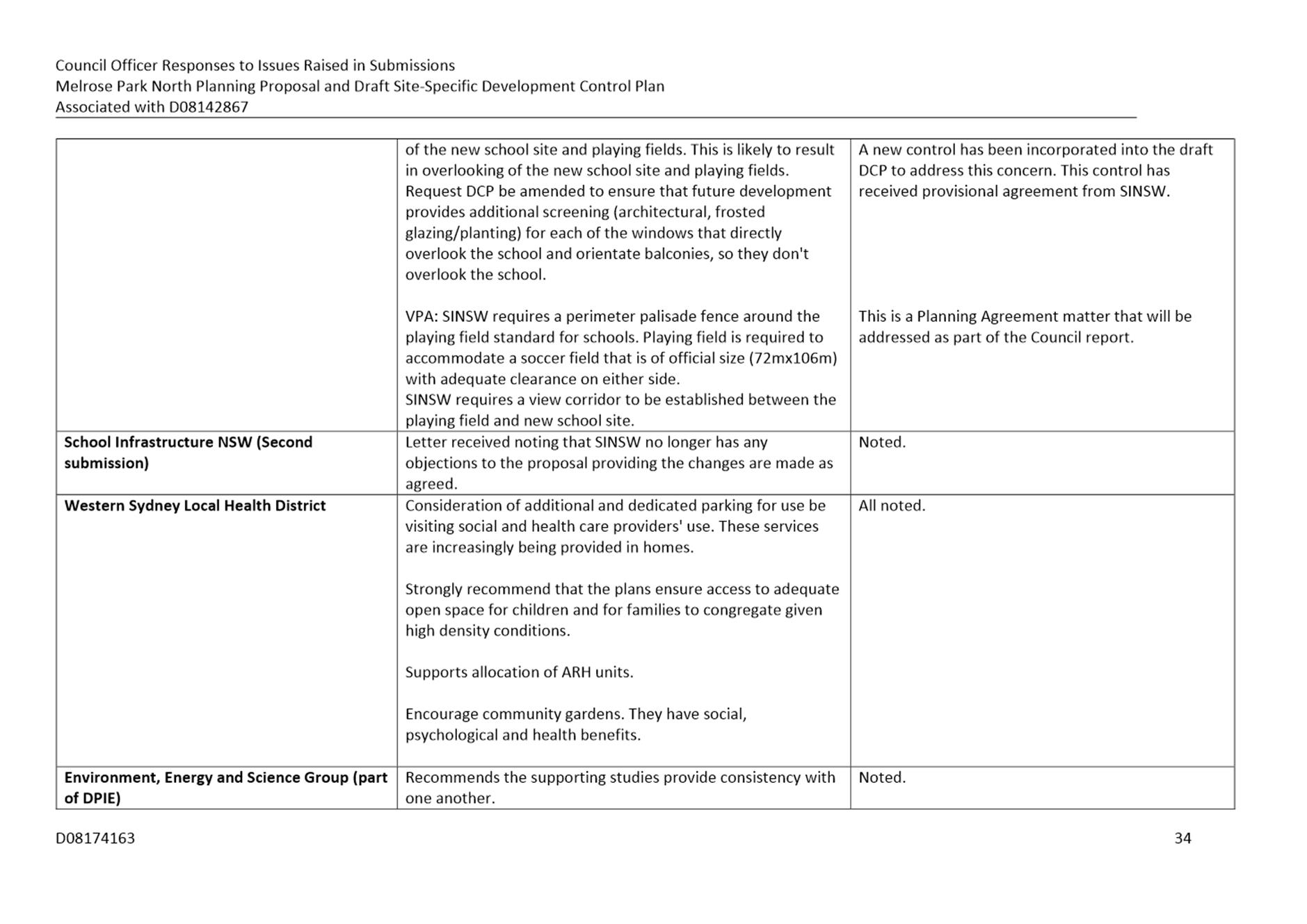
d) Issue: The master plan identifies building heights of up to 80m directly to the west of the site and 36m directly to the north which raised concern relating to privacy from overlooking from balconies onto the school.
Response: To ameliorate these concerns, a control has been added to section 1.15 Residential Apartment Design Quality of the draft DCP which requires consideration of privacy onto other apartment and to special uses such as the school. It is considered that this can be addressed at the development application stage.
e) Issue: A further matter relating to the draft Planning Agreement and the provision of the playing field and associated fencing has been raised by. SINSW, who would like to have the open space fenced by their standard 2.1m palisade fence to secure the site during school hours. Council officers do not support this style of fencing as although it serves a purpose during school hours, this playing field is proposed to be a shared space and be available for the public to use outside of school hours. The palisade fence style is associated with schools and may convey the perception to the public that the grounds can’t be used out of school hours. Council officers and SINSW are currently considering alternate fencing styles that will serve its purpose both for the school and Council.
Response: -At the time this report was being prepared this matter was in the process of being resolved and the outcome will be addressed in further detail in the report to Council.
64. Council officers and SINSW discussed the matters raised in the submission and were able to form an agreed position on all planning matters. As the matter of the fence is not a planning matter, it was agreed by SINSW and Council officers that this should not be considered an objection to the planning proposal and delay its progression to the LPP. As a result, SINSW provided a further letter stating that it no longer raised objection to the Planning Proposal and draft DCP.
Western Sydney Local Health District
65. The submission received from the Western Sydney Local Health District raised no objection to the proposal. It made mention of a number of matters for Council’s consideration relating to the design of apartment buildings, provision of open space and parking, but raised no objections to the overall proposal. It is considered that these suggestions can be considered at development application stage.
Environment, Energy and Science (part of DPIE)
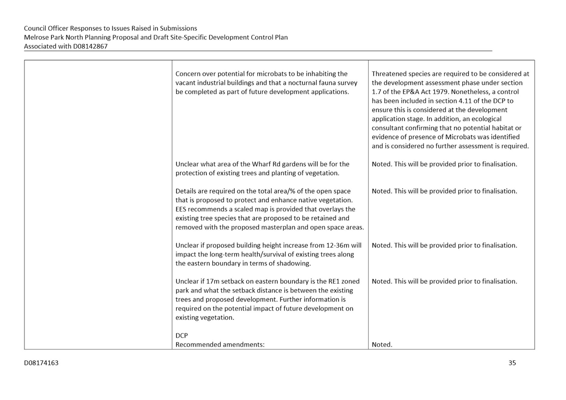
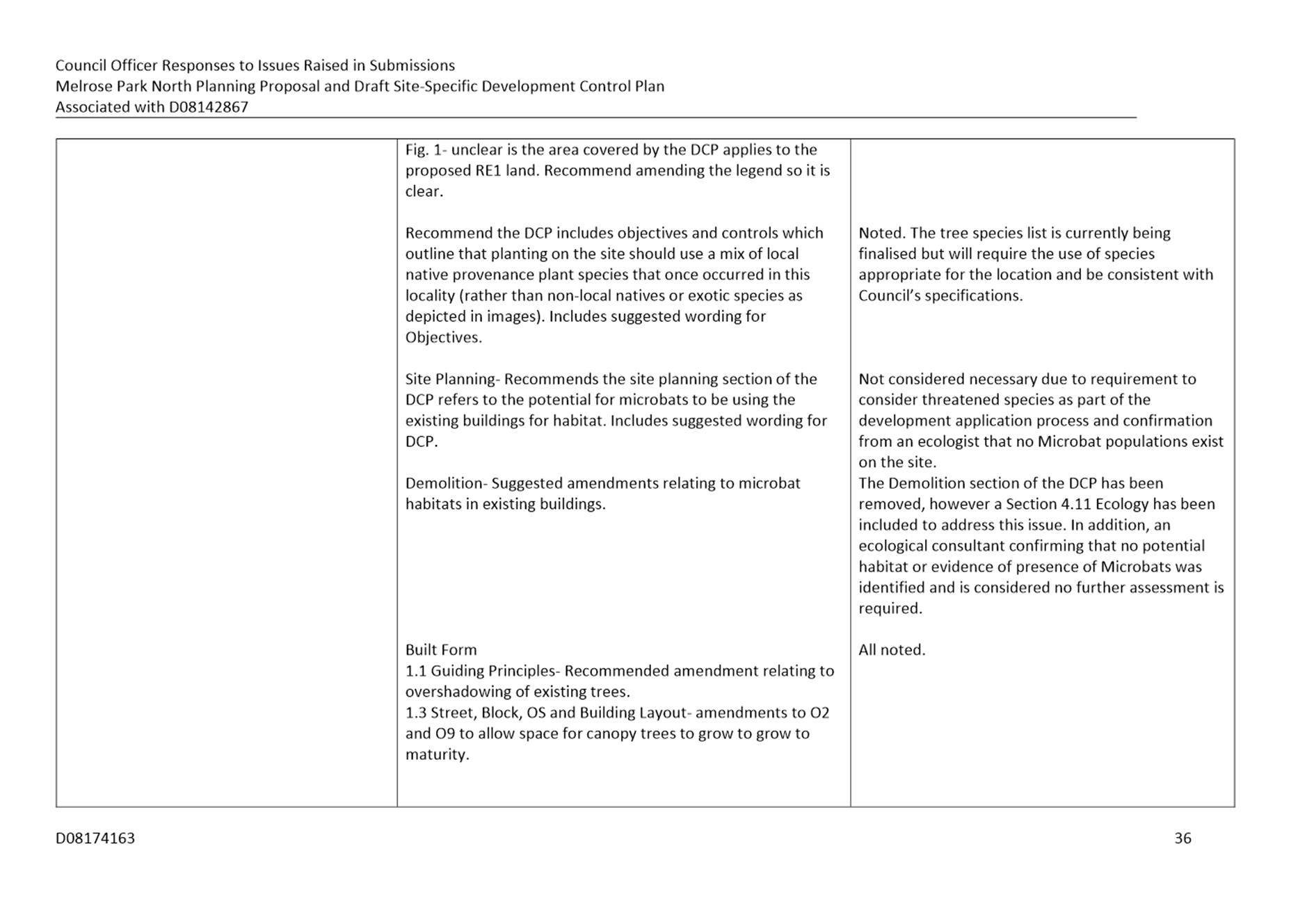
66. This submission from Environment, Energy and Science (EES) raised no objection to the proposal, with concerns mostly relating the consideration of planted tree species on the site and potential overshadowing which may inhibit their longevity, and the identification and protection of any possible Microbat colonies. It is considered that all these considerations can be addressed at the development application stage, including street tree species, overshadowing of existing trees and the presence of Microbats.
Sydney Water
67. This submission raised no objection to the proposal. The submission mentions a number of requests regarding the provision of water related services for the site. These related to water-related infrastructure requirements and integrated water cycle management. The majority of these matters are addressed at the development application stage, however, the draft DCP does include controls relating to dual piping and other sustainability measures such as water sensitive urban design (WSUD).
Transport for NSW
68. The submission from Transport for NSW (TfNSW) acknowledges the preparation of the TMAP and that it is based on a number of key assumptions including development yield and future travel behaviour. The submission states that should there be any changes to these assumptions then the suitability of the infrastructure and services proposed in the TMAP may need to be reassessed. This is noted by Council officers who will action this if required. The submission also sought clarification on whether the needs of active transport within the precinct have been adequately considered. Input from Council’s Transport Planning section throughout the process has ensured that cyclist and pedestrian facilities have been incorporated into the design of the precinct. This includes multiple dedicated bike paths on identified streets and connections to existing cycleways in accordance with Council’s Bike Plan.
69. Some concern was raised regarding the angles of two proposed intersections in the master plan and the safety outcomes. TfNSW recommends that a safety assessment be done of these intersections prior to adoption of the proposal. This is noted and will be addressed by the applicant through further analysis and testing prior to reporting to Council.
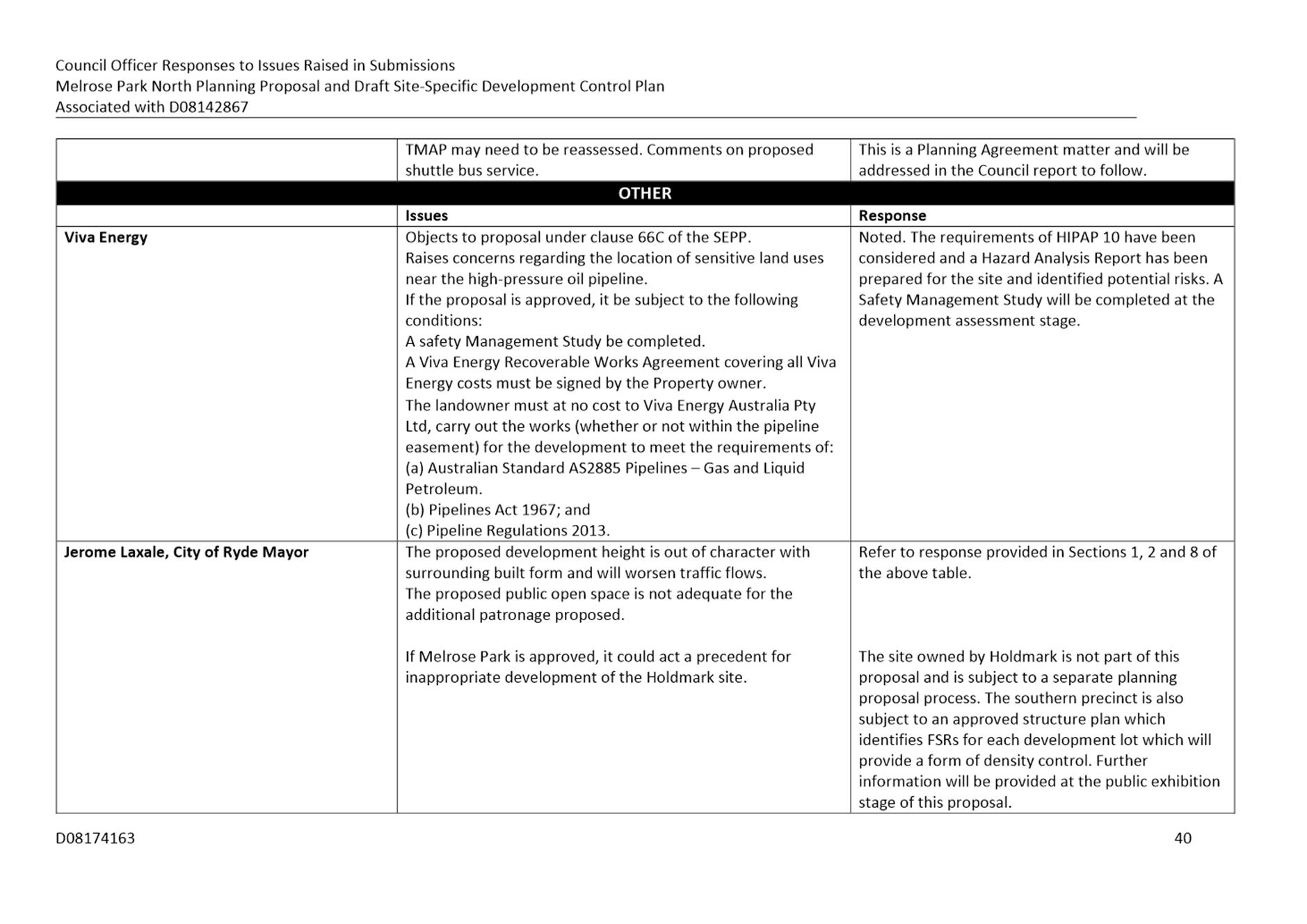
Mayor Jerome Laxale, City of Ryde
70. This submission raised objection to the proposal based on the proposed building heights and floor space ratios (FSR), increased traffic and increased burden on infrastructure within the City of Ryde LGA. Concerns relating to height and FSRs are noted and have been addressed in this report. In relation to the impact on infrastructure, including open space, in the Ryde LGA, this is not considered to be a significant issue. The draft Planning Agreement proposes to provide over $96 million worth of new infrastructure to meet the needs of the incoming population. This includes five (5) new areas of public open space design to meet the active and passive recreation needs new retail/commercial floor space, new roads, and a shuttle bus service to Meadowbank Station. It is acknowledged that there may be some increase in usage of facilities within Ryde LGA that are close to Melrose Park, but this is not expected to be so large that it will have impacts on the usability of the facilities by residents within the Ryde LGA. It is considered that the draft Planning Agreement will provide sufficient infrastructure for the incoming population and that new residents will not be reliant on infrastructure within the City of Ryde LGA
City of Ryde Council – Council Officer Submission
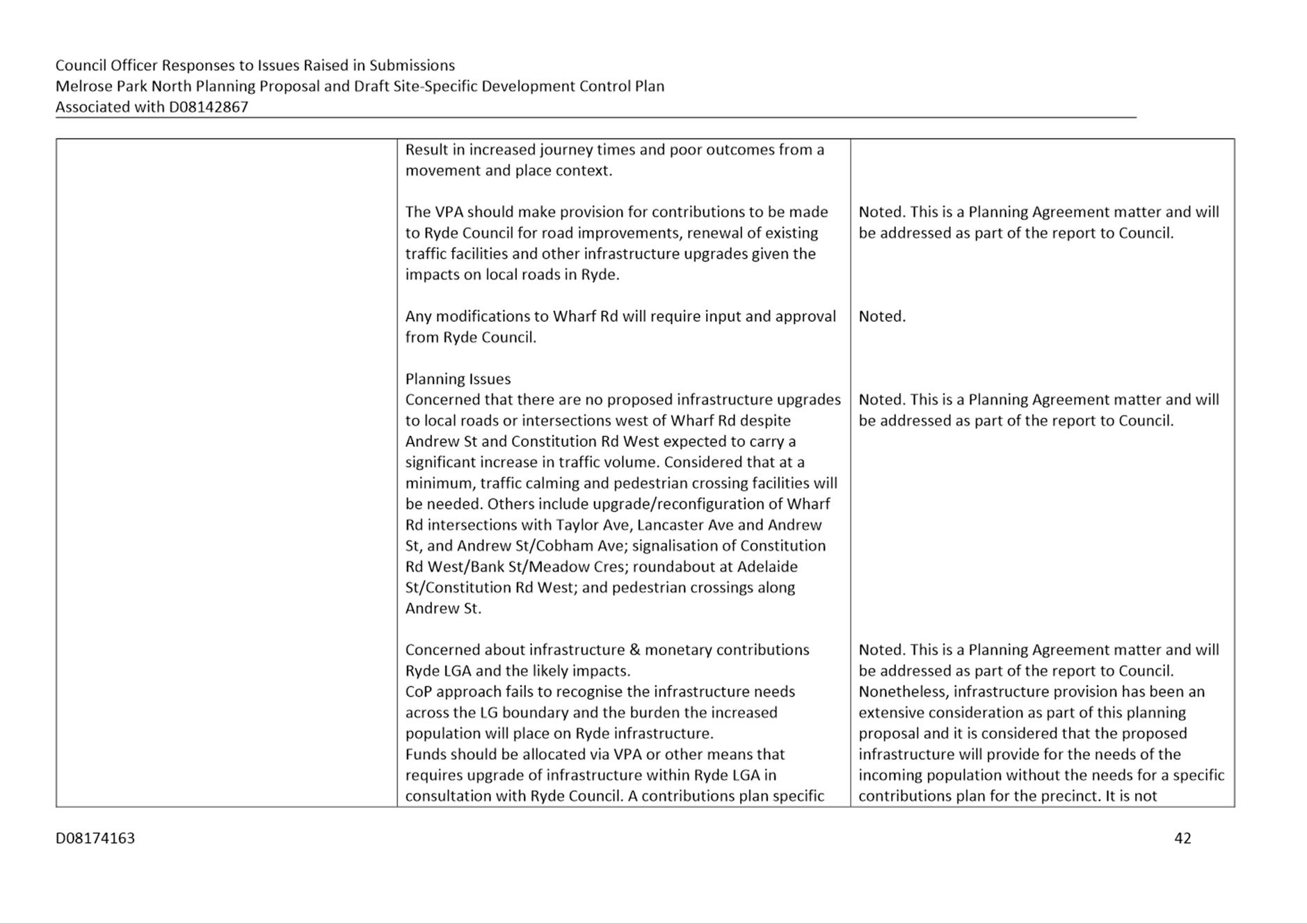
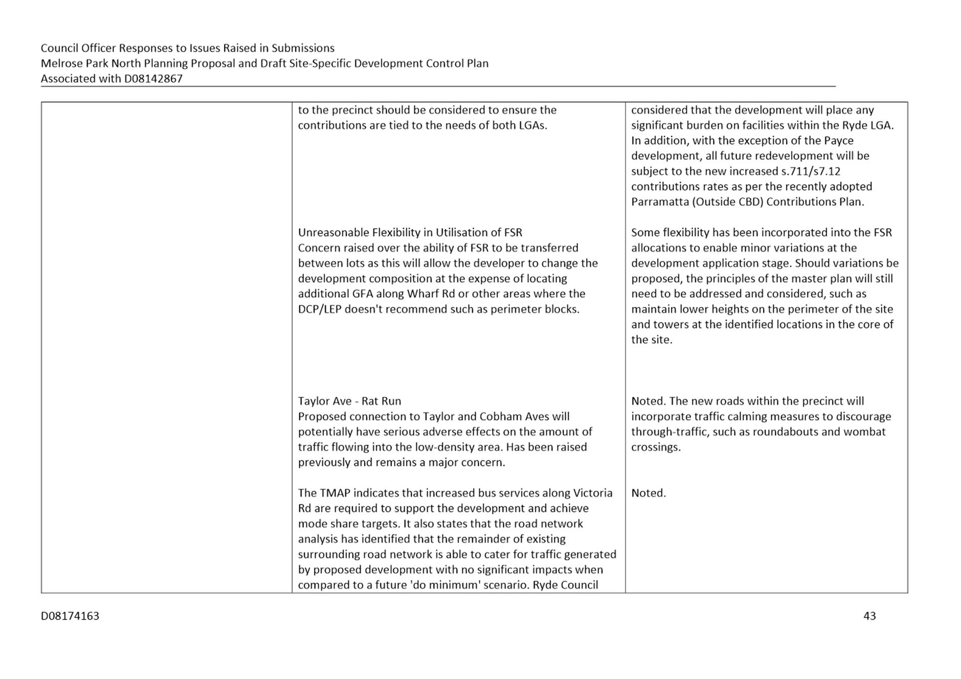
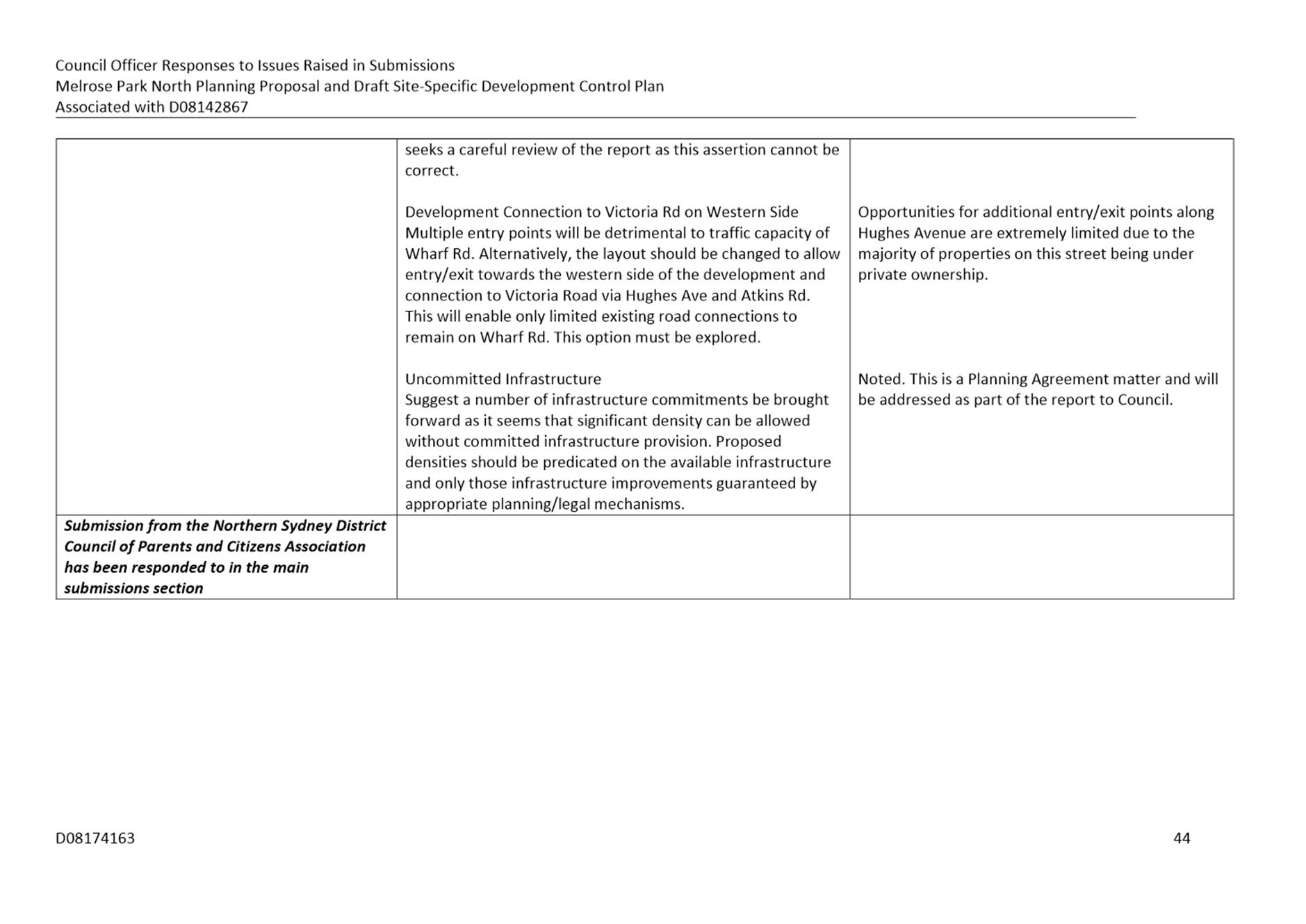
71. This submission raised concern relating to the number of new intersections proposed on Wharf Road and potential impact on traffic, flexibility and utilization of FSR across development lots, general traffic impacts and ‘rat-running’ and issues with the TMAP. It also raised concerns regarding infrastructure provision and the ability of the proposal to proceed without commitment to Parramatta Light Rail Stage 2.
These matters have been addressed in full in Attachment 1 and those related to infrastructure will be addressed as part of the future Council report. Nonetheless, the draft Planning Agreement has a value of over $96 million and will provide numerous community benefits to new residents and those living nearby. This includes items such five (5) new open space areas, new and improved roads and intersections, and a shuttle bus service to Meadowbank Station. In addition, as other sites within the precinct redevelopment, appropriate infrastructure contributions will also be made. Therefore, for it is considered that the identified infrastructure can support the proposed density.
PROPOSED CHANGES TO THE DRAFT DCP
72. In response to the exhibition process and further review of the draft DCP, several changes are proposed to be made to ensure the intended development outcomes can achieved on the site. The changes range from rewording of some controls to reflect their initial intent and to provide clarification, minor typographical corrections, removal of two sections to avoid repetition and inconsistency with the Parramatta DCP 2011 and insertion of a new section relating to ecology. Refer to Table 4 for a comprehensive list of all proposed changes. These changes are not considered to be of nature that would require the draft DCP to be re-exhibited.
73. A version of the DCP is included at Attachment 3 with the changes detailed in Table 4. However, it will be subject to further refinement prior to reporting it to Council. These changes relate to the management of development applications following finalisation of the Planning Proposal and requirements for the lodgement of a concept or infrastructure development application. Again, these changes are not anticipated to require a re-exhibition of the DCP.
Table 4. List of Proposed DCP Changes
|
Section |
Proposed Change |
|
General Objectives |
Corrected wording to clarify explanation and location of Wharf Road precinct. Reference to property owner removed. |
|
Design Quality |
Changed heading to Design Excellence and corrected the number of Design Competitions and the sites to which the competitions apply |
|
Site Planning |
Removed section as it is covered by Parramatta DCP 2011. |
|
Demolition |
Removed section as it is covered by Parramatta DCP 2011. |
|
Built Form |
Rewording of Guiding Principles section to improve clarity and interpretation. |
|
1.2 Allocation of Gross Floor Space |
Minor rewording of controls C.01 and C.02 to improve clarification of the ability to redistribute ‘left over’ GFA from one block to another. Any transfer of GFA between development lots must to still ensure that the overall development objectives are achieved. |
|
2.3 Street, Block, Open Space and Building Layout |
Minor rewording of all Objectives for this section. |
|
Minor rewording of control C.06 to make requirements clear. |
|
|
1.4 Building Envelope |
Addition of objectives and controls. |
|
1.5 Street Setbacks |
Removal of duplicate controls. |
|
1.6 Building Separation |
Minor rewording to improve clarity of controls |
|
1.7 Tower Design and Slenderness |
Incorporation of View Corridors controls. |
|
Deletion of duplicate controls |
|
|
1.9 Floor to Floor Heights |
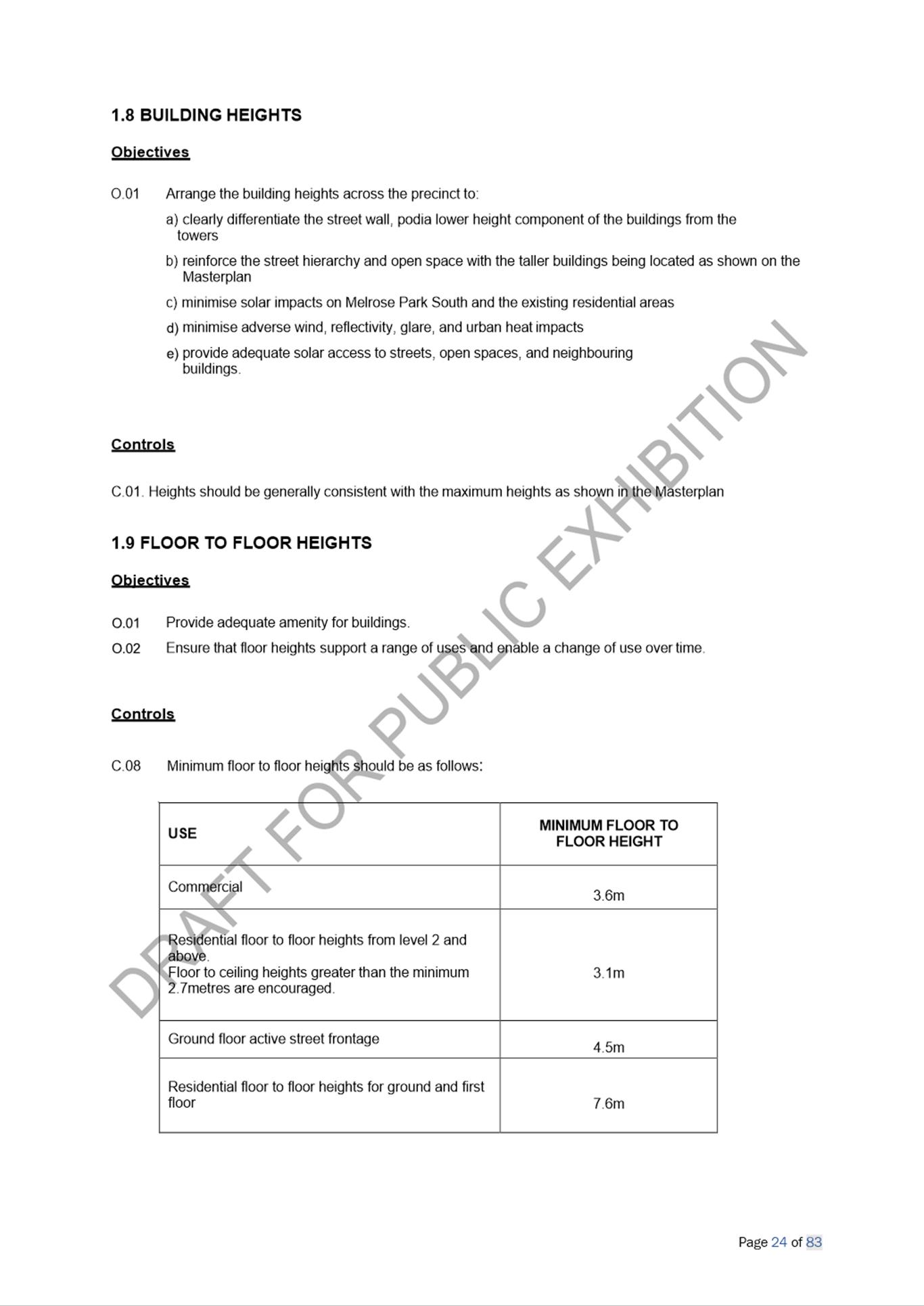
Adjustment of ground floor, floor to floor height requirement from 3.6m to 3.3m. |
|
1.10 Street Wall Podia and Perimeter Block Buildings |
Minor rewording of controls to improve clarity |
|
1.11 The Ground Floor |
Revised overland flow management controls for ground floor dwellings |
|
1.12 Active Ground Floor Frontage |
Deletion of obsolete controls and clarification of required wall depth. |
|
1.13 Town Centre Mall |
Deletion of duplicate controls |
|
1.14 Residential Ground Floor Frontage |
Reworded Objectives and removal of redundant section on Fences. |
|
1.19 Dwelling Mix and Flexible Housing |
Reworded control on dual key apartments to improve functionality and flexibility by not restricting these to 3-bedroom apartments. This will help ensure that the number of required 3-bedroom apartments is still provided. |
|
1.21 Retaining Walls |
Deletion of references to fencing. These are now in a separate section. |
|
2.6 Pedestrian Access and Mobility |
Deletion of controls that don’t reference an Australian Standard to avoid inconsistency. |
|
2.8 Public Open Space |
Dimensions of Central Park, Western Parkland and Wharf Road Gardens corrected. |
|
3.4 Bicycle Parking |
Controls updated/inserted to ensure consistency with Council’s Bike Plan. |
|
Public Domain Figures |
Minor label adjustments on all figures for clarification purposes |
74. All proposed changes were undertaken in consultation with the applicant and involved detailed input from Council technical officers. Some further refinements to the DCP provisions are still being considered and these will be addressed in detail in the report to Council seeking to progress this matter to finalisation. These further refinements if required will not have a material impact on the content of the Planning Proposal and recommendation of this report.
PLANNING AGREEMENT
75. A draft Planning Agreement between Payce and Council was exhibited concurrently with the Planning Proposal and Draft DCP. This planning Agreement was not subject to Council’s Planning Agreements Policy adopted in November 2018 which required the value of a Planning Agreement offer to be benchmarked against the value up lift of the land. This was due to the extent of negotiations that had already been undertaken at the time the Policy was adopted by Council in November 2018, so this Agreement was therefore exempt from this requirement.
76. However, to assist with determining an appropriate offer, an external valuer was jointly appointed by Council and Payce to determine the value uplift of the land owned by Payce that was part of the planning proposal. As a result, a draft Planning Agreement with Payce was successfully negotiated and was concurrently exhibited with the Planning Proposal and draft DCP. The Planning Agreement has a total value of $96,745,226 and includes contributed items relating to open space, social and community benefits and road infrastructure. This amount is in addition to any application section 7.11/7.12 contributions payable at development application stage. Planning Agreements with the remaining two landowners have not yet been finalised.
77. However, during this time, the City of Parramatta (Outside CBD) Development Contributions Plan was also exhibited. Under this draft Plan, the applicable contributions rates are significantly higher than those prescribed under the now superseded contributions plan. As a result, Payce made a submission during the exhibition of the draft City of Parramatta (Outside CBD) Development Contributions Plan seeking an exemption from the increased rates in the draft Plan being applied to their proposed development in Melrose Park North. This request was considered by Council at its meeting of 12 July 2021 and endorsed, as was the new City of Parramatta (Outside CBD) Development Contributions Plan.
78. As a result, Payce will, if the amended Planning Agreement is ultimately endorsed by Council, only be required to pay the 1% levy as prescribed under the former Parramatta section 94A Development Contributions Plan 2017 which was in place at the time the draft Planning Agreement was negotiated instead of the higher rates prescribed in the recently adopted Outside CBD Development Contributions Plan. This exemption, however, has impacts on the recently exhibited Planning Agreement and requires an amendment to the clauses relating to which development contributions are required to be paid by the developer at the development application stage. As a result of this change a re-exhibition of the amended Planning Agreement is required.
79. The majority of submissions raised concerns relating to infrastructure provisions generally, in addition to concerns about the Planning Proposal and draft DCP, however two (2) submissions were received during the exhibition of the relating only to the draft Planning Agreement. The concerns raised relate to the staging of infrastructure delivery, the inclusion of roads required to support development and queries relating to the certainty of the delivery of the school. These matters are not addressed in this report and will be detailed in the report to Council following the re-exhibition of the Planning Agreement. However, it is still considered that the Planning Agreement is providing infrastructure to meet the needs of the prosed increase in density. In addition, there will be further planning agreements relating to the remaining sites within the northern and southern parts of the precinct as these begin to be redeveloped, further supporting the infrastructure requirements of the precinct.
80. Planning Agreements with the remaining two landowners at 8 Wharf Road and 15-19 Hughes Avenue & 655 Victoria Road within the Planning Proposal area are in the process of being negotiated and have not been exhibited. The landowners of these two sites did not seek an exemption from the new City of Parramatta (Outside CBD) Development Contributions Plan. The outcomes of the re-exhibition of the Planning Agreement with Payce and the exhibition of the two remaining Planning Agreements will be considered by Council at a later date.
81. A separate Planning Agreement is currently being negotiated between Payce and other landowners and the State Government for the funding and delivery of State infrastructure and any agreement arising from those processes will be exhibited by the State Government at a later date.
FINANCIAL IMPLICATIONS FOR COUNCIL
82. Any work to progress the finalisation of the Planning Proposal would be prepared by Council Officers and therefore within the existing City Planning budget. Should this matter progress, a Planning Agreement delivering open space, social and community infrastructure and road infrastructure and improvements to the value of $96,745,226 will be entered into between and the applicant. Further, at development application stage, development contributions in keeping with the current rates contained in the Parramatta Section 94A Development Contributions Plan (Amendment No. 5) 2017 will be applied to the development.
CONCLUSION AND NEXT STEPS
83. It is recommended that the Local Planning Panel support the Council Officer recommendation that the Melrose Park North Planning Proposal (as exhibited) be referred to the Department of Planning, Industry and Environment for finalisation.
84. Council Officers recommend that the Local Planning Panel support the Council Officer recommendation to finalise the proposed DCP amendments which provide detailed design controls in support of the Planning Proposal and are intended to improve interpretation of controls and better reflect the intended outcomes detailed in the objectives.
85. Following Local Planning Panel consideration of the recommendations of this report, the outcomes of the exhibition period for the Planning Proposals and Draft DCP amendments as well as the re-exhibited Planning Agreement will be reported to an upcoming Council meeting along with the Panel’s advice.
Amberley Moore
Senior Project Officer Land Use Planning
Michael Rogers
Land Use Planning Manager
David Birds
Group Manager, City Planning
Jennifer Concato
Executive Director City Planning and Design
|
1⇩ |
Table of Issues and Responses |
|
|
|
2⇩ |
Exhibited Melrose Park North Planning Proposal |
80 Pages |
|
|
3⇩ |
Draft Melrose Park North Site-Specific DCP |
90 Pages |
|
|
4⇩ |
Transport Management and Accessibility Plan (TMAP) |
117 Pages |
|