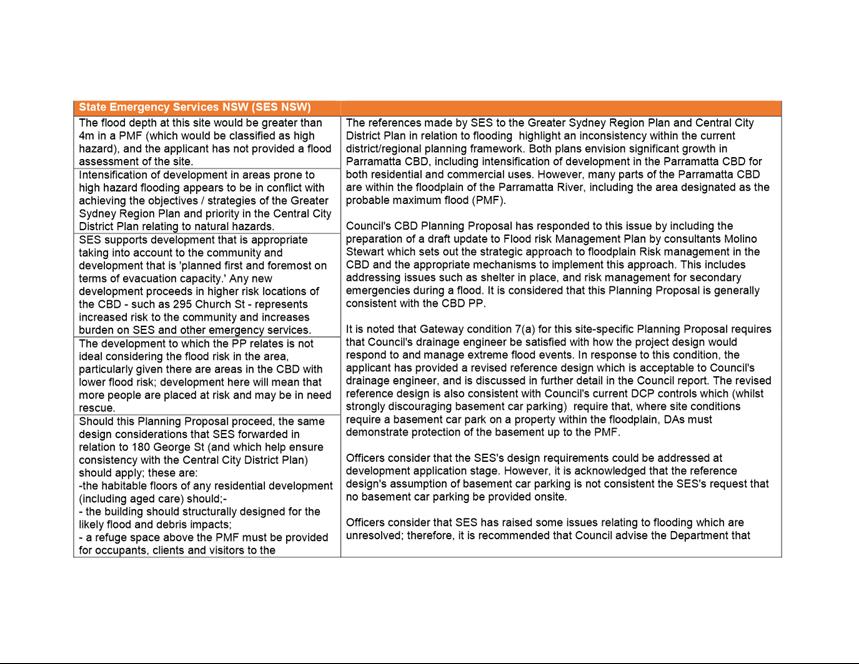
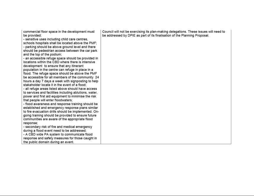
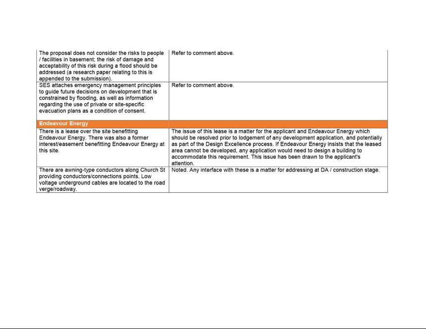
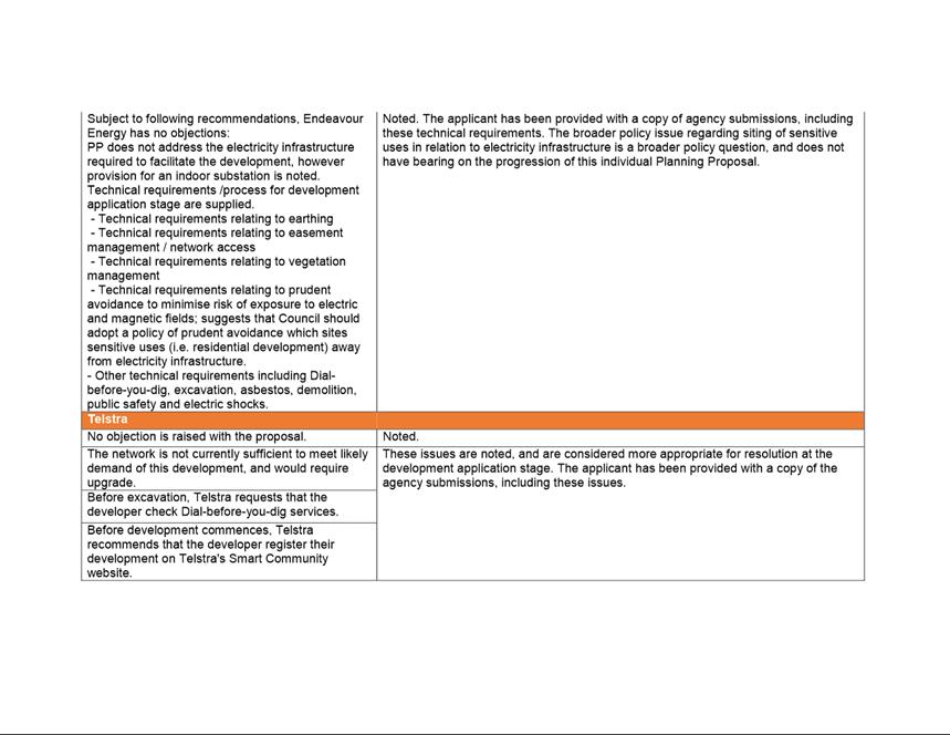
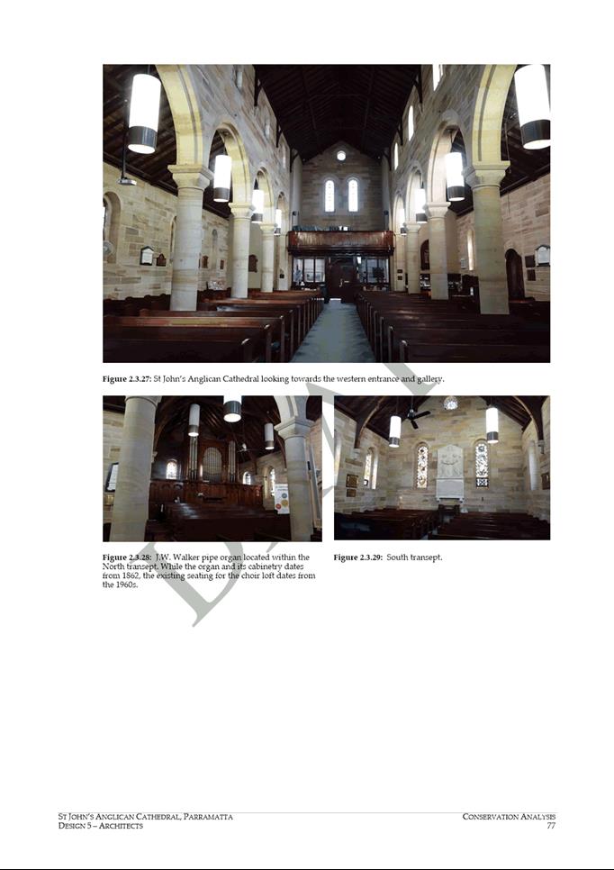
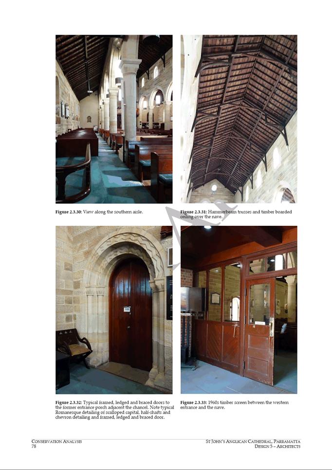
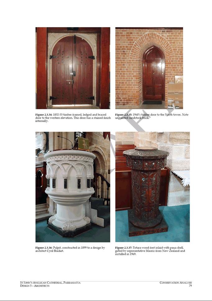
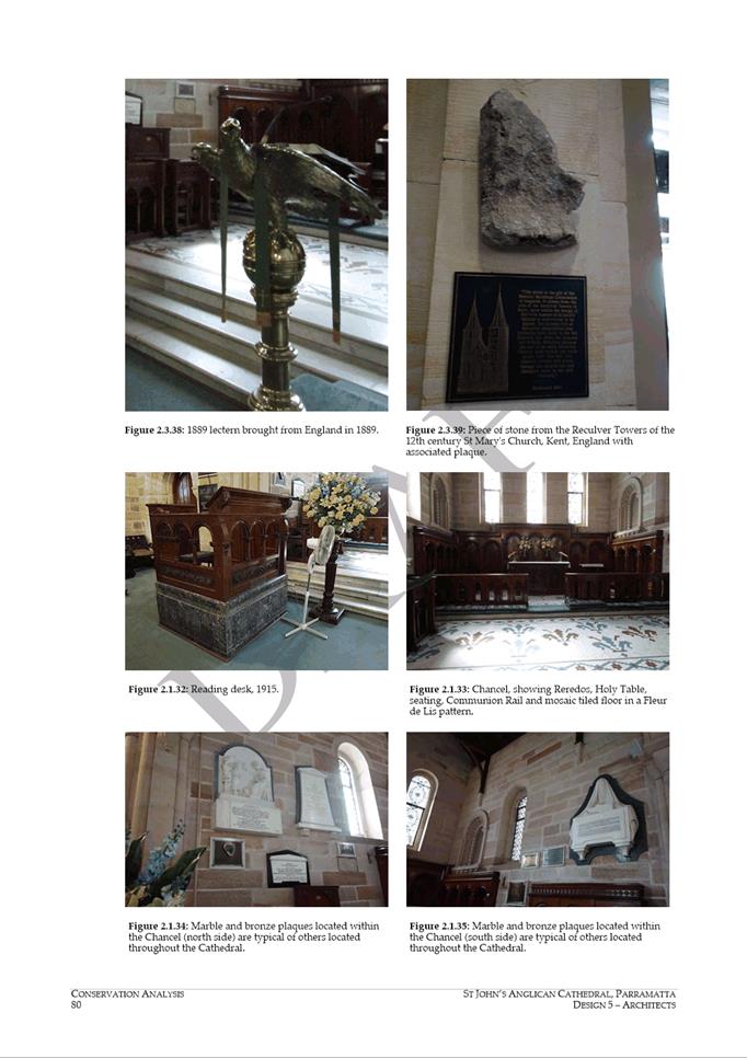
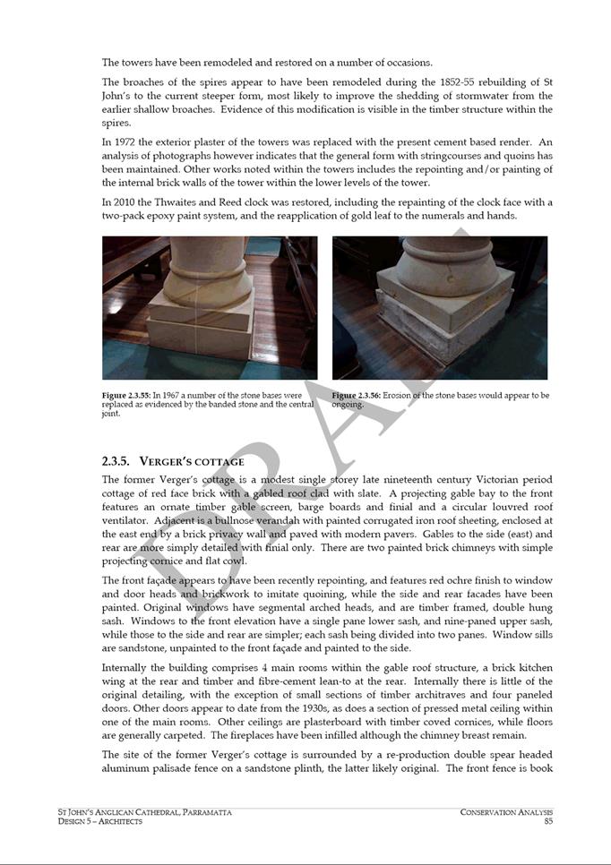
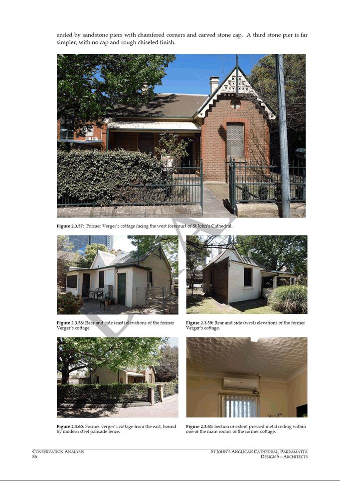
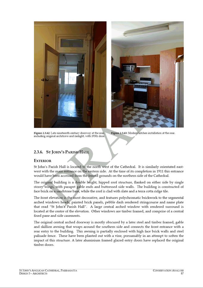
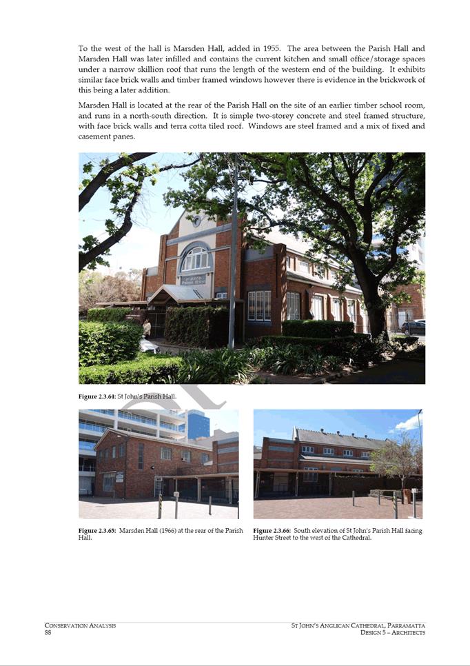
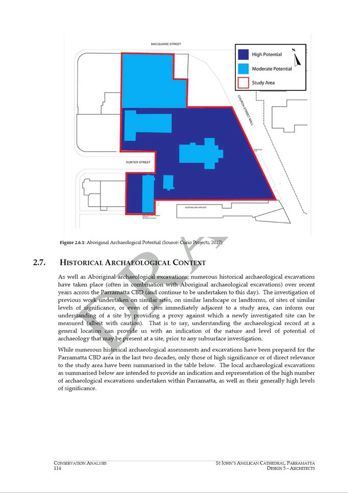
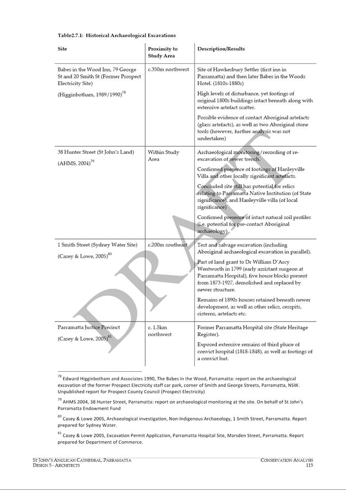
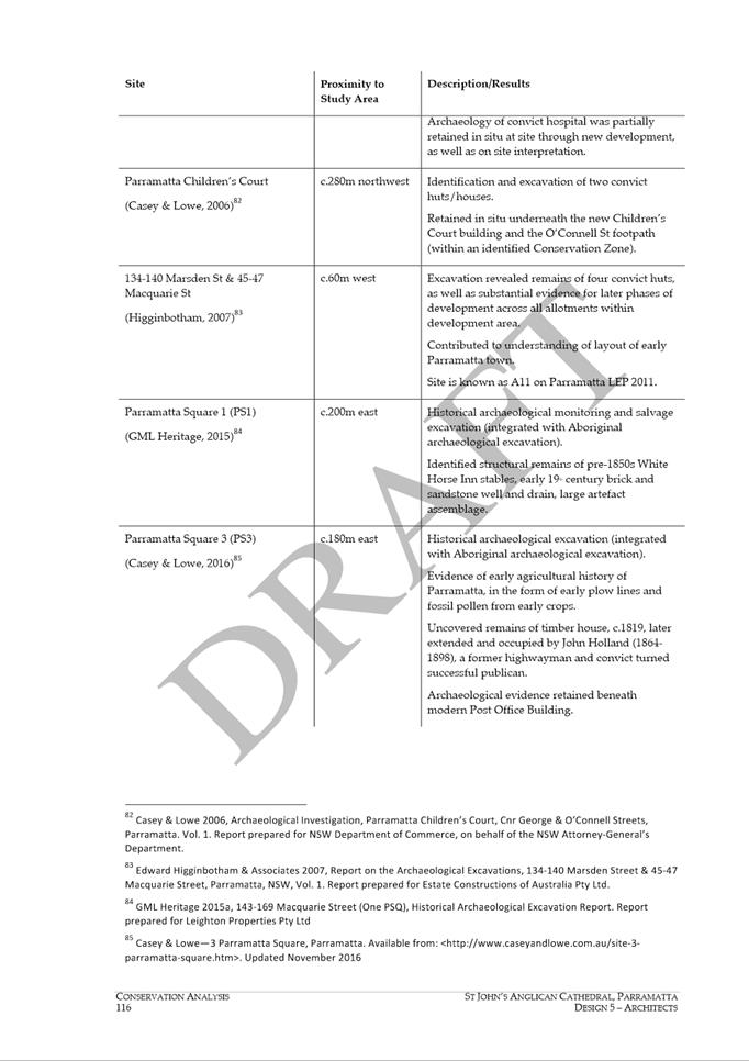
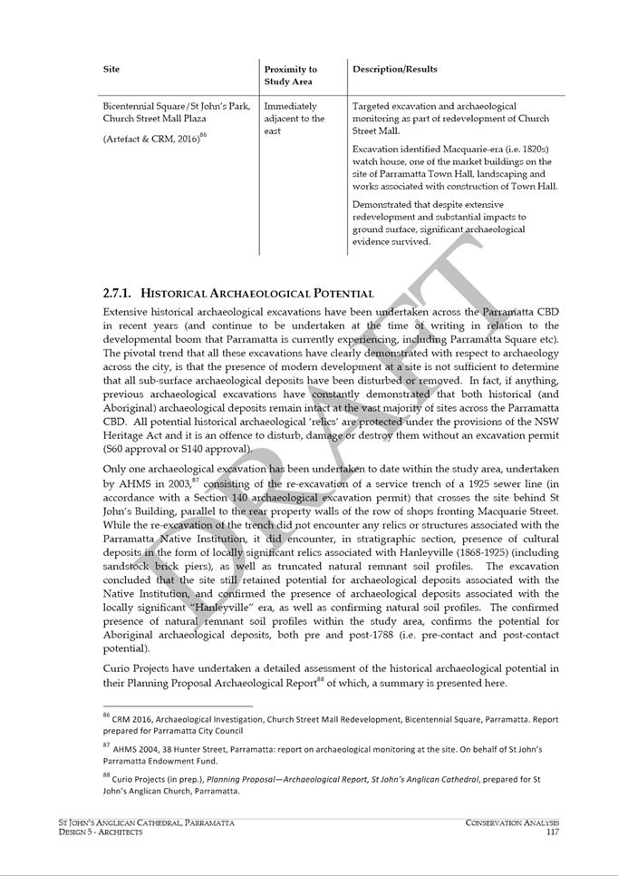
NOTICE OF Council
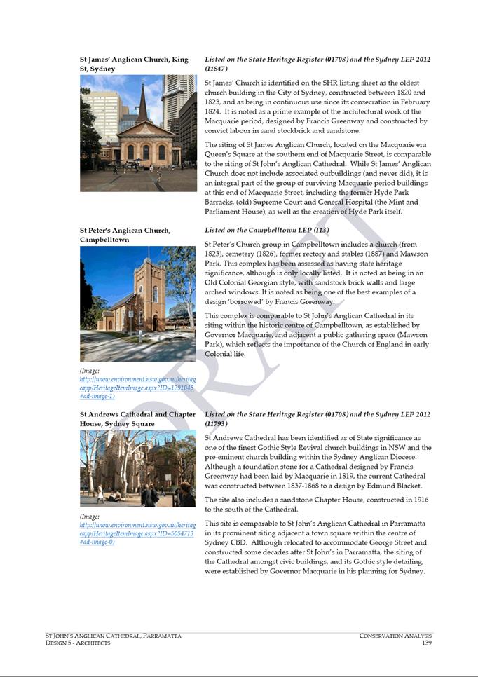
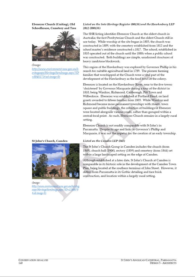
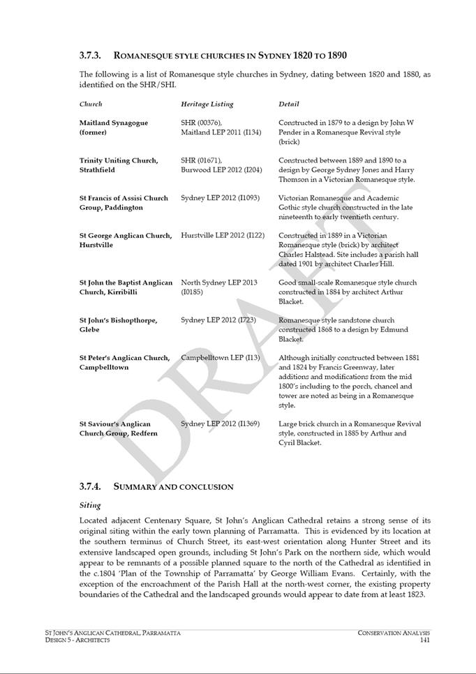
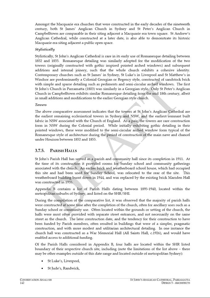
MEETING
PUBLIC AGENDA
An Ordinary Meeting of City of Parramatta Council will be
held in the Cloister Function Rooms, St Patricks Cathedral 1 Marist Place,
Parramatta on Monday, 16 December 2019 at 6.30pm.
Brett Newman
CHIEF EXECUTIVE OFFICER
THIS PAGE LEFT BLANK INTENTIONALLY

COUNCIL CHAMBERS
|
|
|
|
Group Manager Governance
& Risk
|
Lord Mayor
Clr Bob Dwyer
|
Chief Executive Officer
|
|
|
|
|
|
Minute Clerk
|
Minute Clerk
|
|
|
Clr Phil Bradley
|
|
Clr Lorraine Wearne
|
|
Sound
|
|
Clr Sameer Pandey
|
|
Clr Andrew Wilson
|
|
|
Clr Paul Han
|
|
Clr Bill Tyrrell
|
|
|
|
Clr Dr
Patricia
Prociv
|
|
Clr Andrew Jefferies
|
|
IT
|
|
Clr Pierre Esber
|
|
Clr Benjamin Barrak
|
|
|
Clr Donna Davis
|
|
Clr Martin Zaiter
|
|
|
|
Clr Michelle Garrard, Deputy
Lord Mayor
|
|
Clr Steven Issa
|
|
|
|
Executive Director City
Engagement & Experience
|
Executive Director Community
Services
|
Executive Director City
Strategy & Development
|
Executive Director City Assets
& Operations
|
Executive Director Corporate
Services
|
Director Property Development
Group
|
|
|
|
Press
Press
|
|
|
|
|
Public Gallery
|
TABLE OF CONTENTS
1 OPENING
MEETING
2 ACKNOWLEDGMENT
OF THE TRADITIONAL LAND OWNERS
3 WEBCASTING
ANNOUNCEMENT
4 OTHER
RECORDING OF MEETING ANOUNCEMENT
5 CONFIRMATION
OF MINUTES Council - 9 December 2019
6 APOLOGIES
AND APPLICATIONS FOR LEAVE OF ABSENCE
7 DECLARATIONS
OF INTEREST
8 MATTERS
OF URGENCY (if any)
9 Minutes of the Lord Mayor
10 Public Forum
11 Petitions
12 Rescission Motions
13 Fair
13.1 FOR
NOTATION: Aboriginal and Torres Strait Islander Advisory Committee Meeting - 24
September 2019 and 10 October 2019 (Special Meeting) 9
13.2 FOR
APPROVAL: Provision of Joint Delegated Authority to the Lord Mayor and Chief
Executive Officer over the Christmas / New Year Period 23
13.3 FOR
APPROVAL: Alternate Locations for Council Meetings during 2020 26
13.4 FOR
APPROVAL: Homelessness Policy............................................ 30
14 Accessible
14.1 FOR
APPROVAL: Submission to Sydney Metro on Strategic Station Options for Sydney
Metro West – Rydalmere.................................... 43
15 Green
15.1 FOR
APPROVAL: Submission to the Parramatta Park Trust on "Your Parramatta Park
2030" Conservation Management Plan and Plan of Management............................................................................................ 57
15.2 FOR
APPROVAL: North Granville Community Facilities Masterplan 68
16 Welcoming
16.1 FOR
NOTATION: Minutes of the Riverside Advisory Board Meeting held on 10 October
2019................................................................................... 240
17 Thriving
18 Innovative
18.1 FOR
APPROVAL: Amendment of 2019/2020 Fees & Charges... 262
18.2 FOR
APPROVAL: Submission to the Greater Sydney Commission on the Place-based
Infrastructure Compact Pilot for the Greater Parramatta and Olympic Peninsula
area....................................................................... 311
18.3 FOR
APPROVAL: Draft Melrose Park Southern Structure Plan.. 365
18.4 FOR
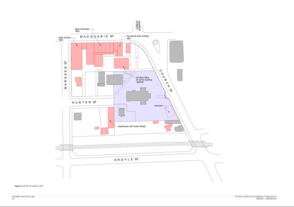
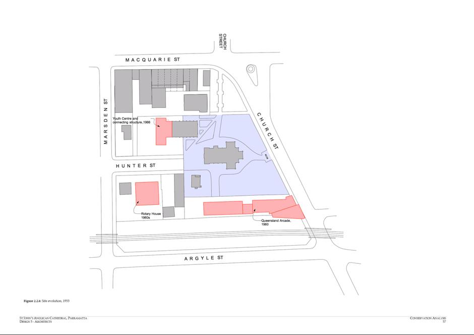
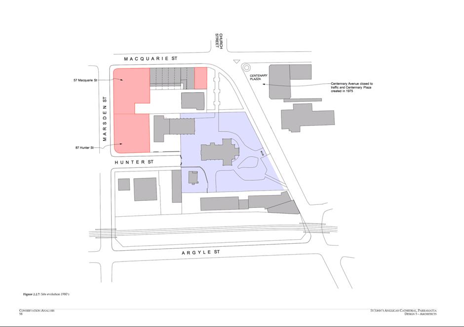
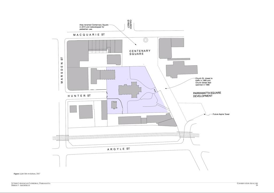
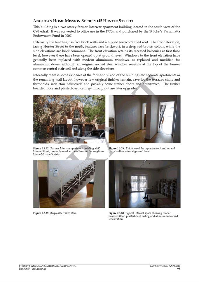
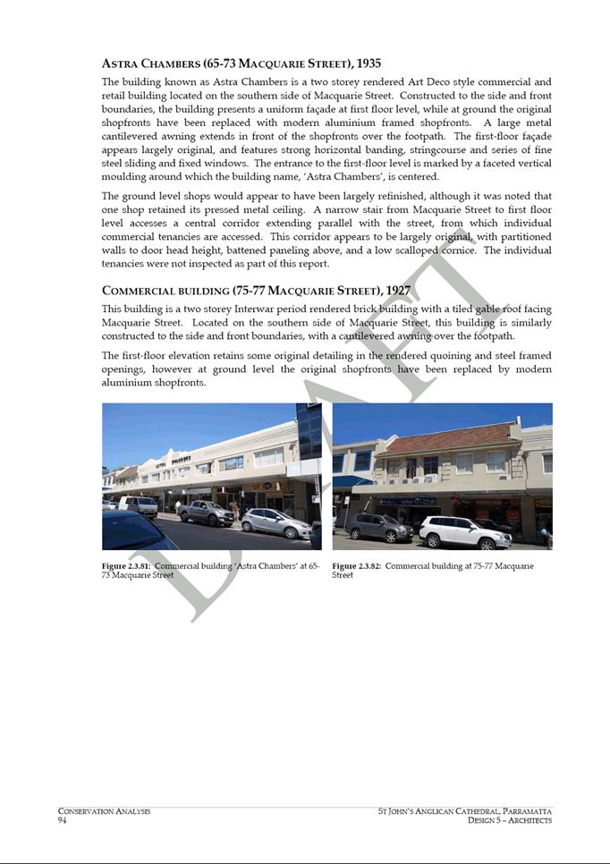
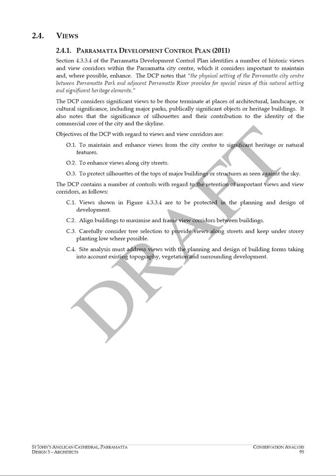
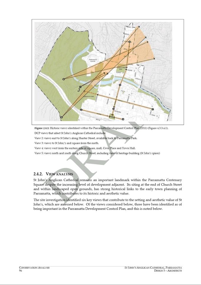
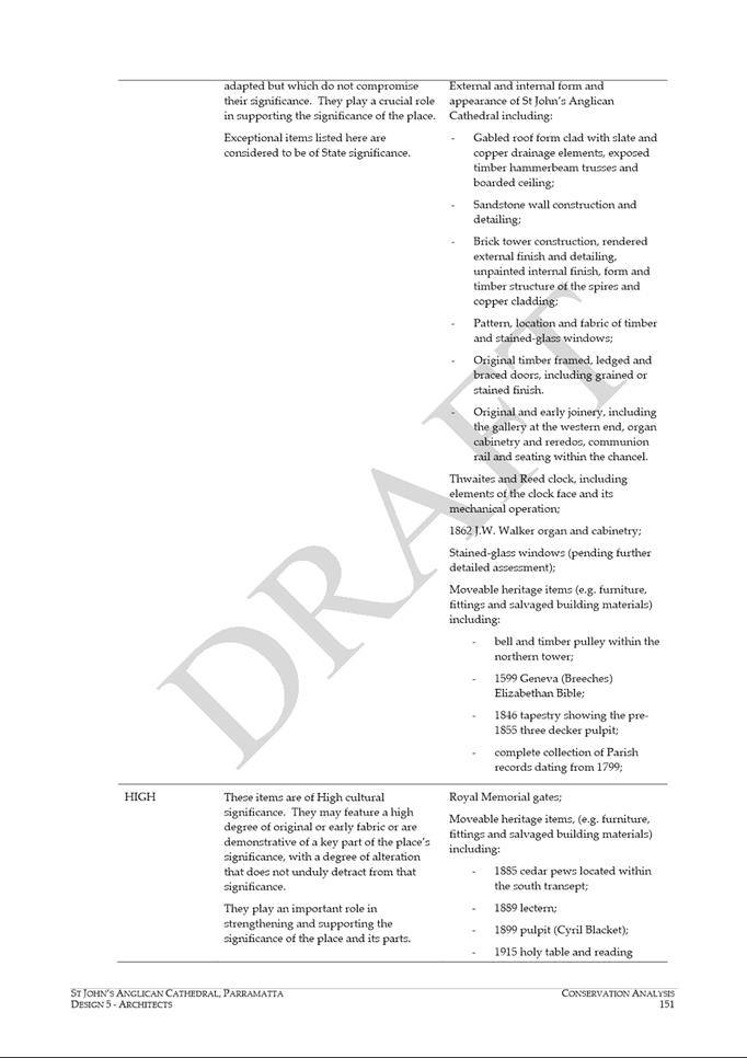
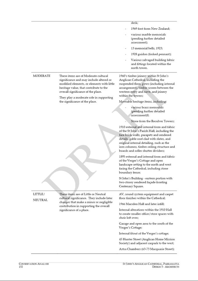
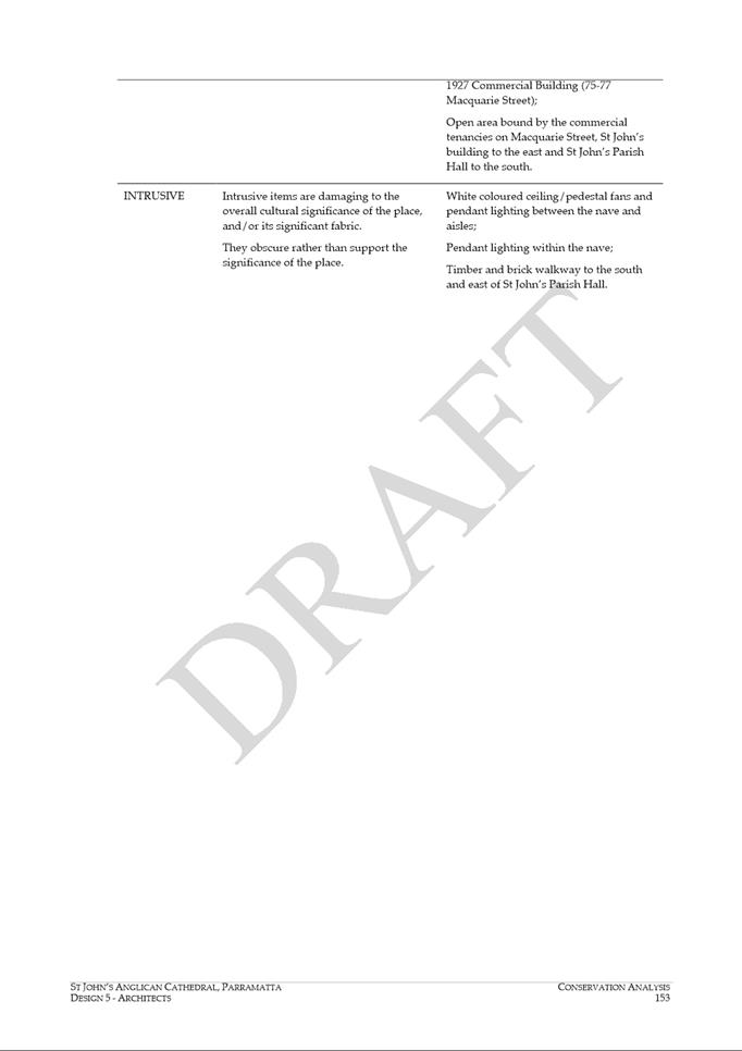
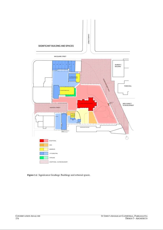
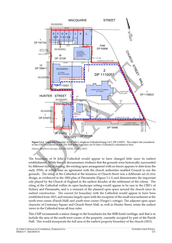
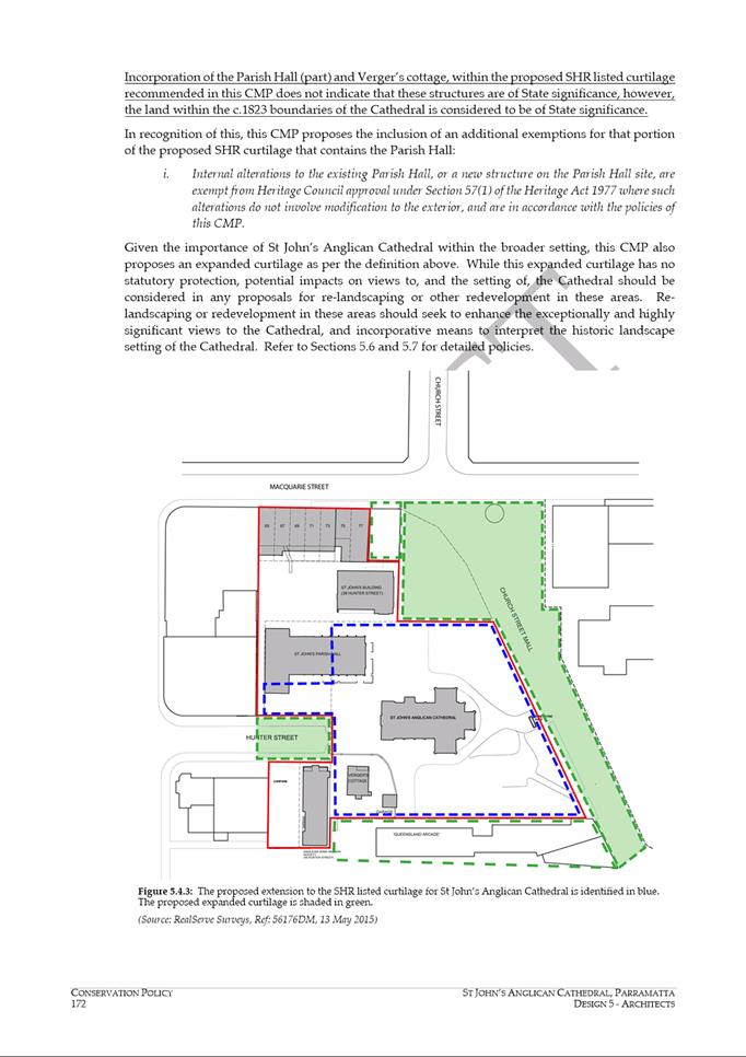
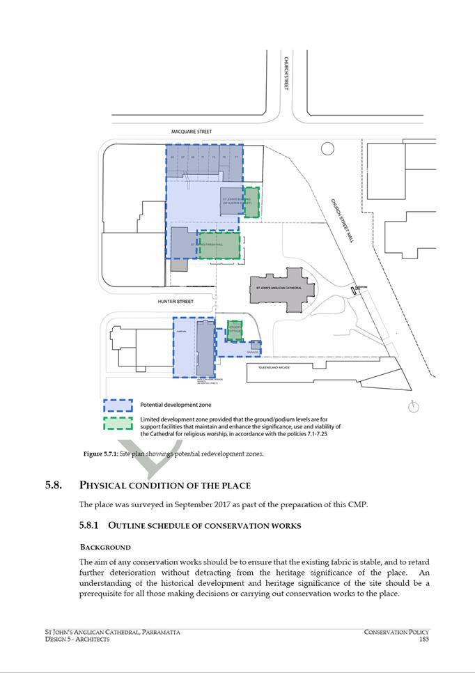
APPROVAL: Pre-Gateway - Planning Proposal for land at 195 Church Street, 65-79
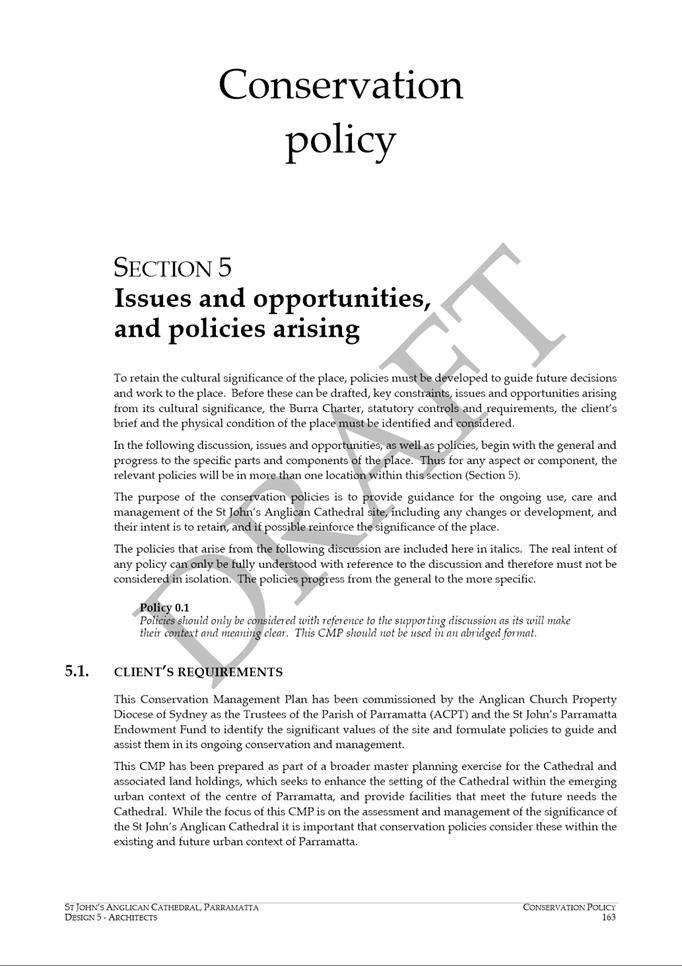
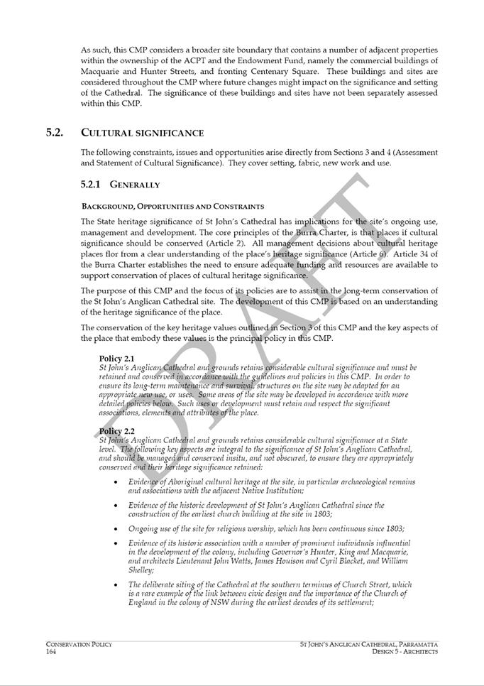
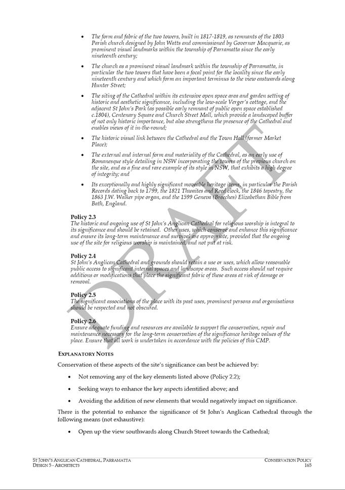
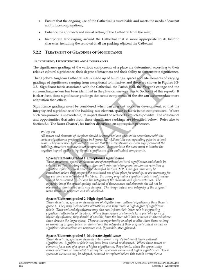
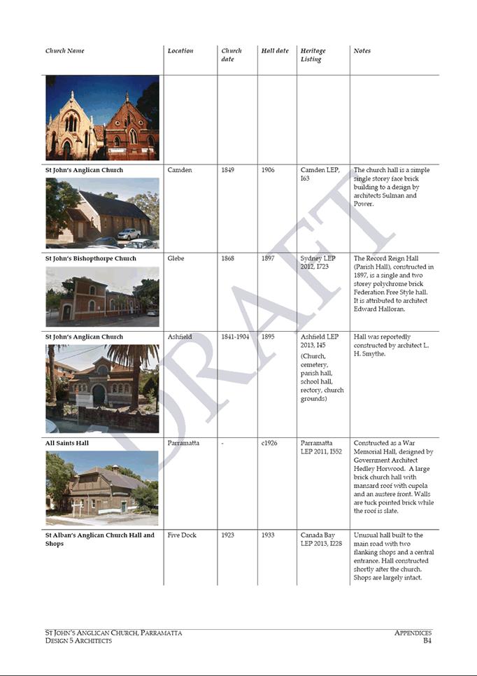
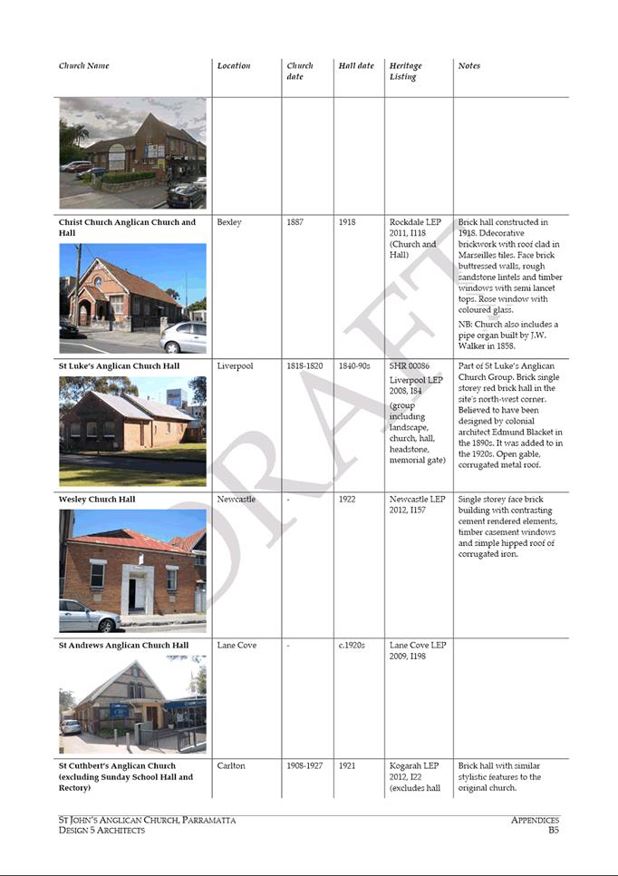
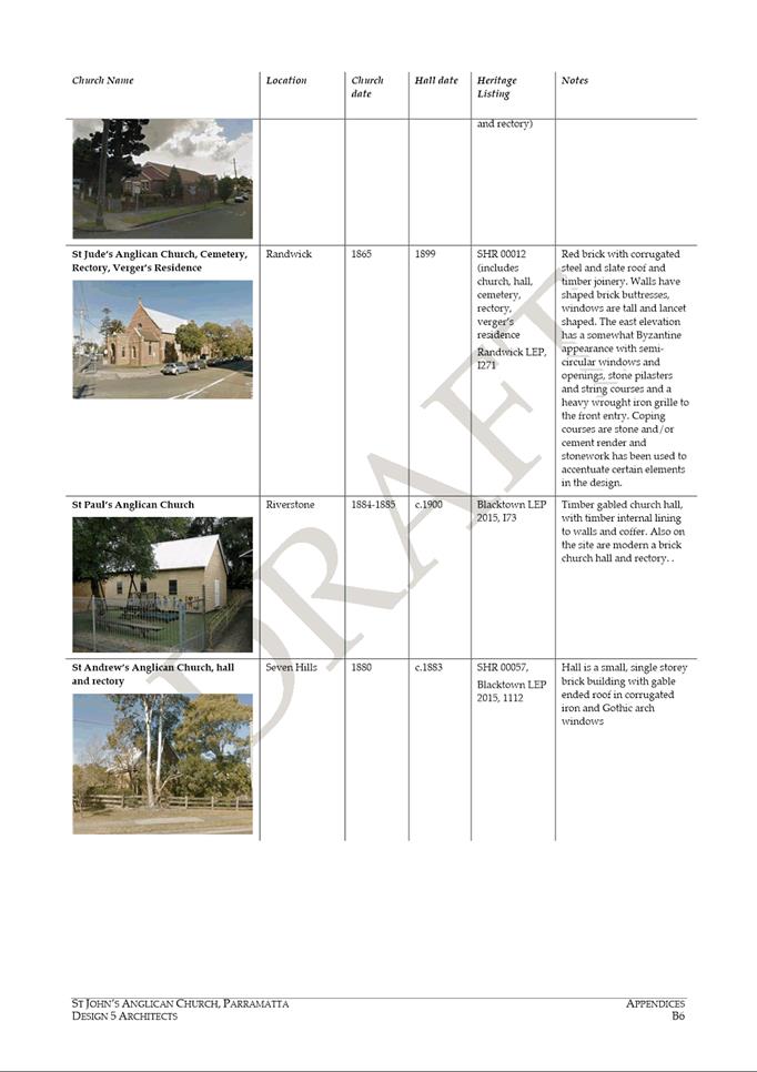
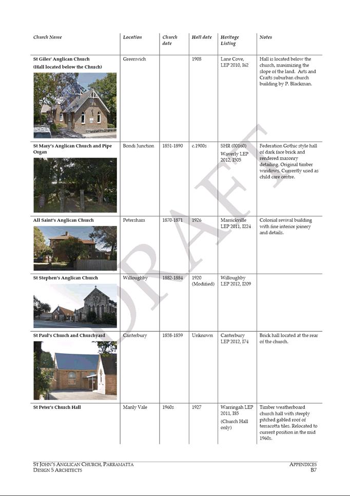
Macquarie Street, 38 and 45 Hunter Street, Parramatta (St John's Anglican
Church)...................................................................... 452
18.5 FOR
APPROVAL: Post Exhibition - Planning Proposal and Draft Planning Agreement for
land at 14 – 20 Parkes Street, Harris Park.......... 1162
18.6 FOR
APPROVAL: Post Exhibition - Planning Proposal, draft Site Specific Development
control Plan and Planning Agreement for 295 Church Street, Parramatta........................................................................................... 1249
19 Notices of Motion
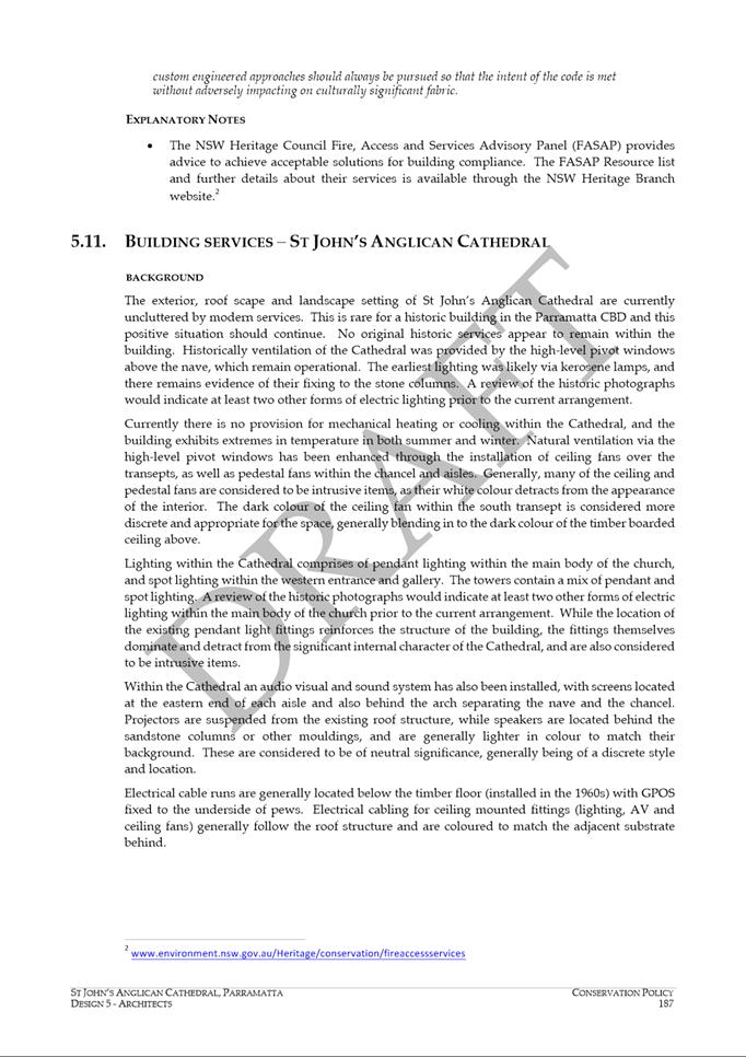
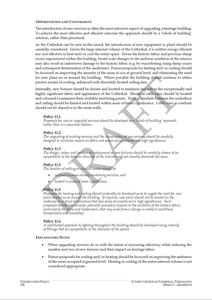
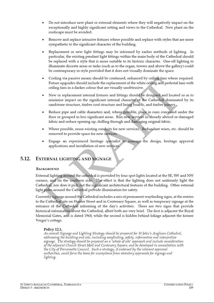
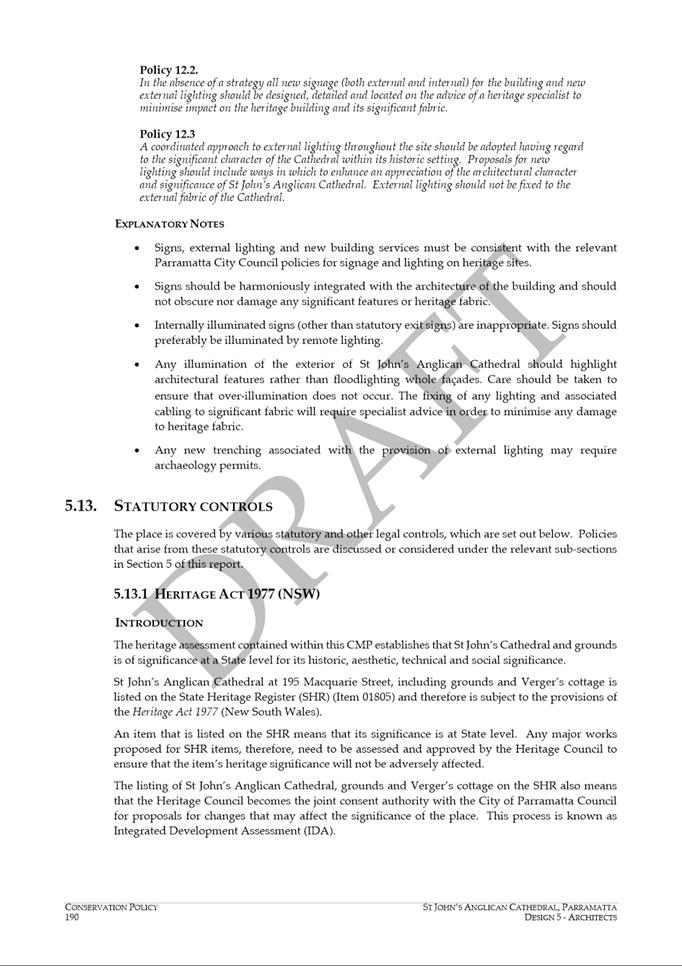
20 QUESTIONS
ON NOTICE
21 Closed Session
21.1 FOR
APPROVAL: Tender 27/2019 Escarpment Boardwalk & Stewart Street Link -
Construction of a River Level Link along the Northern Bank of the Parramatta
Weir between Charles Street Weir and Rangihou Reserve, Parramatta
This report is confidential in
accordance with section 10A (2) (d) of the Local Government Act 1993 as the
report contains commercial information of a confidential nature that would, if
disclosed (i) prejudice the commercial position of the person who supplied it;
or (ii) confer a commercial advantage on a competitor of the Council; or (iii)
reveal a trade secret.
21.2 FOR
APPROVAL: Tender 02/2019 Service Desk: Managed Service for Procurement of ICT
Hardware
This report is confidential in
accordance with section 10A (2) (d) of the Local Government Act 1993 as the
report contains commercial information of a confidential nature that would, if
disclosed (i) prejudice the commercial position of the person who supplied it;
or (ii) confer a commercial advantage on a competitor of the Council; or (iii)
reveal a trade secret (Tender pricing).
21.3 FOR
APPROVAL: Tender 28/2019 Park Road at Calder Road Rydalmere - Traffic Control
Signal Upgrade and Associated Civil Work
This report is confidential in
accordance with section 10A (2) (d) of the Local Government Act 1993 as the
report contains commercial information of a confidential nature that would, if
disclosed (i) prejudice the commercial position of the person who supplied it;
or (ii) confer a commercial advantage on a competitor of the Council; or (iii)
reveal a trade secret.
21.4 FOR
APPROVAL: Tender 11/2019 Research and Insights Software - Evaluation Report and
Recommended Supplier
This report is confidential in
accordance with section 10A (2) (d) of the Local Government Act 1993 as the
report contains commercial information of a confidential nature that would, if
disclosed (i) prejudice the commercial position of the person who supplied it;
or (ii) confer a commercial advantage on a competitor of the Council; or (iii)
reveal a trade secret (Commerical in confidence submissions from vendors).
21.5 FOR
APPROVAL: 10 Footbridge Boulevard, Wentworth Point - EOI Submission Review
This report is confidential in
accordance with section 10A (2) (d) of the Local Government Act 1993 as the
report contains commercial information of a confidential nature that would, if
disclosed (i) prejudice the commercial position of the person who supplied it;
or (ii) confer a commercial advantage on a competitor of the Council; or (iii)
reveal a trade secret.
21.6 PLACEHOLDER
REPORT: Receipt and Temporary Reserve of Museum of Applied Arts and Sciences
(MAAS) Site Fixed Price Component of Proceeds of Sale
This report is confidential in
accordance with section 10A (2) (d) (e) of the Local Government Act 1993 as the
report contains commercial information of a confidential nature that would, if
disclosed (i) prejudice the commercial position of the person who supplied it;
or (ii) confer a commercial advantage on a competitor of the Council; or (iii)
reveal a trade secret; AND the report contains information that would, if
disclosed, prejudice the maintenance of law.
22 PUBLIC
ANNOUNCEMENT OF RESOLUTIONS PASSED IN CLOSED SESSION
23 CONCLUSION
OF MEETING
Fair
16 December 2019
13.1 FOR
NOTATION: Aboriginal and Torres Strait Islander Advisory Committee Meeting - 24
September 2019 and 10 October 2019 (Special Meeting).. 9
13.2 FOR
APPROVAL: Provision of Joint Delegated Authority to the Lord Mayor and Chief
Executive Officer over the Christmas / New Year Period............... 23
13.3 FOR
APPROVAL: Alternate Locations for Council Meetings during 2020 26
13.4 FOR
APPROVAL: Homelessness Policy..................................................... 30
Council 16
December 2019 Item
13.1
ITEM NUMBER 13.1
SUBJECT FOR
NOTATION: Aboriginal and Torres Strait Islander Advisory Committee Meeting - 24
September 2019 and 10 October 2019 (Special Meeting)
REFERENCE F2017/00358 - D07106702
REPORT OF Community Capacity Building Officer
|
PURPOSE:
To provide a precis of the Aboriginal and
Torres Strait Islander Advisory Committee meetings held on 24 September 2019
and 10 October 2019 (special meeting).
|
|
RECOMMENDATION
(a) That
the minutes of the Aboriginal and Torres Strait Islander Advisory Committee
meetings of 24 September 2019 and 10 October 2019 (special meeting) be
received and noted.
(b) That
Council note the Committee’s endorsement of the ‘Aboriginal and
Torres Strait Islander Cultural Infrastructure in Parramatta –
Community Needs and Aspirations’ report and recommendations.
(c) Further,
that the ‘Aboriginal and Torres Strait Islander Cultural
Infrastructure in Parramatta – Community Needs and Aspirations’
report be presented to Councillors at a Councillor Workshop in February 2020.
|
BACKGROUND
1. Council’s Aboriginal and Torres Strait Islander
Advisory Committee meets monthly (except December and January) and comprises 12
members.
2. The Committee
met on 24 September 2019 and 10 October 2019 (special meeting). The minutes of
these meetings can be found at Attachments 1 and 2.
ISSUES/OPTIONS/CONSEQUENCES
3. The below
section summarises some of the main issues discussed at these meetings.
Department of Communities and Justice – Aboriginal Services
Unit
4. The
Director for the Aboriginal Services Unit addressed the meeting on 24 September
2019, outlining the Department’s role and current initiatives. The
Department now incorporates two components, Corrective Services and Youth
Justice. It was stated that the Departments’ aims were to reduce the
disproportionate rate of incarceration of Aboriginal and Torres Strait Islander
peoples and improve community safety under the Better Pathways to Justice
Program.
Recommended
Replacement Member to fill Vacancy on Committee
5. Community
Capacity Building Officer advised that Judith Joyce previously submitted an
Expression of Interest to join the Committee, and was endorsed as an eligible
candidate by Council at the time. It is confirmed that Judith remains
interested in joining the Committee and had been invited to attend induction.
Local
Government Aboriginal Network (LGAN) Conference
6. The
Local Government Aboriginal Network (LGAN) will hold its annual conference in
Sydney on the 9 -11 October 2019. It was agreed that two members attend on
behalf of the Committee.
Aboriginal
and Torres Strait Islander Cultural Infrastructure in Parramatta Report –
Community Needs and Aspirations (Background, Methodology and Recommendations)
10 October 2019 (Special meeting)
7. Council’s
Community Capacity Building Officer (First Peoples Engagement and Strategy)
presented the ‘Aboriginal and Torres Strait Islander Cultural
Infrastructure in Parramatta’ Report for feedback and discussion of its
recommendations.
8. The
Committee unanimously resolved:
a. That
the Committee supports the process, the report on ‘Aboriginal and Torres
Strait Islander Cultural Infrastructure in Parramatta – Community Needs
and Aspirations’, the eight Recommendations contained within the Report
(on pages 33 & 34) and the two proposed models in Recommendation 2.
b. That
moving forward, the Committee seeks Council’s endorsement in proceeding
with the next step in exploring through a feasibility study and business case
process, the two main First Peoples Cultural Infrastructure models.
c. The Committee thank Council for
its ongoing support.
9. This
report will be presented to Councillors at a forthcoming Councillor Workshop to
be scheduled in February 2020, prior to a Council report seeking endorsement of
the next steps.
FINANCIAL IMPLICATION FOR
COUNCIL
10. There are no financial implications from this
report
Ellen Ross
Community Capacity Building
Officer
Phillip Scott
Community Capacity Building
Manager
David Moutou
Group Manager Social &
Community Services
Jon Greig
Executive Director Community
Services
Attachments:
|
1⇩
|
Aboriginal & Torres Strait Islander
Advisory Committee Meeting Minutes 24 September 2019
|
6 Pages
|
|
|
2⇩
|
Aboriginal & Torres Strait Islander
Advisory Committee (special) Meeting Minutes 10 October 2019
|
5 Pages
|
|
REFERENCE MATERIAL
|
Item 13.1 -
Attachment 1
|
Aboriginal & Torres Strait Islander Advisory
Committee Meeting Minutes 24 September 2019
|


|
Item 13.1 - Attachment 2
|
Aboriginal & Torres Strait Islander Advisory
Committee (special) Meeting Minutes 10 October 2019
|


Council 16 December 2019 Item
13.2
ITEM NUMBER 13.2
SUBJECT FOR
APPROVAL: Provision of Joint Delegated Authority to the Lord Mayor and Chief
Executive Officer over the Christmas / New Year Period
REFERENCE F2004/07400 - D07114826
REPORT OF Governance Manager
|
PURPOSE:
To provide joint delegated authority to the Lord Mayor and the Chief Executive Officer to exercise the
powers, duties and functions of the governing body of the Council between the
Christmas and New Year period.
|
|
RECOMMENDATION
(a) That, in
accordance with Section 226(d) and Section 377(1) of the Local Government Act
1993, Council delegate joint
authority to the Lord Mayor and the Chief Executive Officer to exercise the
powers, duties and functions of the Council during the Recess Period, being
Tuesday, 17 December 2019 to Monday, 10 February 2020.
(b) Further,
that in the event that the Lord Mayor and Chief Executive Officer are
required to deal with important or urgent business of the Council during the
Recess Period:
(1) notice
of the important or urgent business of the Council be provided to all
Councillors at least three (3) days prior to a Delegated Authority Meeting;
(2) any
referral, signed or emailed by two (2) Councillors, be permitted to refer
such item to a full Council Meeting for consideration;
(3) the
minutes for all important or urgent business dealt with under this delegation
during the Recess Period be submitted to the first available Council Meeting
of the New Year.
|
BACKGROUND
1. Clause
3.1 of Council’s Code of Meeting Practice states that ordinary meetings
of the Council will be held on the second and fourth Monday of each month
(except for January where no meetings are held).
2. Council
will hold its final Council Meeting of 2019 on 16 December 2019 and the first
Council Meeting of 2020 is proposed to be held on Monday, 10 February
2020. The period between the last 2019 Council Meeting and the first 2020
Council Meeting is known as the Recess Period.
3. Section
226(d) of the Local Government Act 1993 (the Act) states the role of the Lord
Mayor as:
“(d) to
exercise, in cases of necessity, the policy-making functions of the governing
body of the council between meetings of the council,”
4. In
addition, Section 377 of the Act provides Council with the general power of the
Council to delegate … to the general manager [Chief Executive Officer]
or any other body (not including another employee of the council) any of the
functions of the council under this or any other Act….
5. To
ensure the smooth operation of the governing body during the Recess Period, it
is proposed that Council delegate joint authority to the Lord Mayor and Chief
Executive Officer all powers, duties and functions of the Council which cannot
reasonably be deferred to the first ordinary Council Meeting following the
Recess Period.
6. As
a matter of process, it is proposed that all matters to be dealt with under
joint delegation will be itemised on an agenda for consideration at a Delegated
Authority Meeting to be held between the Lord Mayor and Chief Executive
Officer.
7. Notice
of any Delegated Authority Meeting will be provided to all Councillors at least
three (3) days prior to a meeting being held. Councillors will also have
the opportunity to refer any item listed for a Delegated Authority Meeting to
Council for consideration. Referral of any item must be referred by two
(2) or more Councillors.
8. Items
of business determined at a Delegated Authority Meeting by the Lord Mayor and
the Chief Executive Officer, will be minuted and included in the agenda for the
first Council Meeting of 2020. Decisions made by the Lord Mayor and the
Chief Executive Officer under joint delegated authority are provided to the
Council and the public for transparency and accountability.
9. The
above provisions do not preclude the calling of an Extraordinary Council
Meeting in accordance with Council’s adopted Code of Meeting Practice and
the Act.
CONSULTATION &
TIMING
10. Council’s
internal legal team has been consulted and support the process to provide joint
delegated authority to the Lord Mayor and Chief Executive Officer during the
Recess Period.
11. All
Councillors will be provided notice of items to be considered at any Delegated
Authority Meeting during the Recess Period, at least three (3) days period to
any meeting being held.
12. The
joint delegation will take effect on 17 December 2019 and conclude prior to the
Council Meeting of 10 February 2020.
Patricia Krzeminski
Governance Manager, Corporate
Strategy & Governance
Lisa Oldridge
Group Manager, Corporate
Strategy & Governance
Michael Tzimoulas
Executive Director, Corporate
Services
Brett Newman
Chief Executive Officer
Attachments:
There are no attachments for this report.
REFERENCE MATERIAL
Council 16
December 2019 Item
13.3
ITEM NUMBER 13.3
SUBJECT FOR
APPROVAL: Alternate Locations for Council Meetings during 2020
REFERENCE F2019/00279 - D07147926
REPORT OF Governance Manager
|
PURPOSE:
The purpose of this report is to provide Council with
options to hold Council Meetings in alternate venues during May to August
2020.
|
|
RECOMMENDATION
(a) That
the Ordinary Council Meetings between May and August 2020 be held in the
following community locations:
|
11-May
|
Dundas Community Centre
|
Dundas Ward
|
|
25-May
|
Dundas Community Centre
|
|
9-Jun
|
Wentworth Point Library
|
Rosehill Ward
|
|
22-Jun
|
Wentworth Point Library
|
|
13-Jul
|
Don Moore Community Centre
|
North Rocks Ward
|
|
27-Jul
|
Don Moore Community Centre
|
|
10-Aug
|
Epping Community Centre
|
Epping Ward
|
|
24-Aug
|
Epping Community Centre
|
(b) That
Council confirm the location of the Ordinary Council Meetings between October
and December 2020 to be held in the Cloister Function Rooms at St
Patrick’s Cathedral, 1 Marist Place, Parramatta.
(c) That
any Extraordinary Council Meeting, unless otherwise resolved, be held in the
Council Administration building, Level 12 Boardroom, 126 Church Street,
Parramatta.
(d) Further,
that notice be provided to the public of all Council Meetings, including
Extraordinary Meetings, in accordance with Part B, Section 3.5 of
Council’s Code of Meeting Practice.
|
BACKGROUND
1. Council, at its meeting of 25 November 2019, confirmed its
Council meeting dates for 2020. Additionally, Council resolved:
“(c) That a report come back to
Council on the suitability to hold the Ordinary Council Meetings from 11 May
2020 to 24 August 2020 inclusive, in community locations within each Ward in
the Parramatta Local Government Area.”
2. This report provides options to hold Council Meetings
during May to August 2020 at alternate community locations within the
Parramatta Local Government Area.
ISSUES/OPTIONS/CONSEQUENCES
3. A review of the various community facilities within the
Parramatta Local Government Area was undertaken to determine the suitability to
hold Council Meetings. Venue requirements were identified in order to
accommodate Council Meetings, including:
a. Size suitable for a Council Meeting, and public gallery
area;
b. Separate area available for dining;
c. Heating / cooling facilities;
d. Hearing loop facilities
e. Off-street parking;
f. Public transport opportunities;
g. Disability access.
4. A
tour was undertaken of suitable locations which had initially met the above
criteria and availability for the venue was investigated. A table outlining
venue suitability and availability is included as an attachment to this report.
5. Having
regard to the above factors, Council may wish to consider the following venues
for Council Meetings during May and August 2020:

CONSULTATION & TIMING
6. Council’s Governance and Community Services
Directorate have consulted to find suitable community venues to hold Council
Meetings in 2020.
FINANCIAL IMPLICATION FOR
COUNCIL
7. There will be no costs to hire the community
facility. All other costs associated with holding Council Meetings,
including the provision of catering (excluding serving ware), security,
audio/visual will be consistent with holding Council Meetings at St
Patrick’s Cathedral.
8. Should Council resolve to proceed with Council Meetings
held in community facilities, additional costs associated with parking (at
Wentworth Point Library and Epping Community Centre), catering costs of hiring
crockery, glassware, etc and privacy partitions for use at the Dundas Community
Centre will need to be funded from within the existing Council Meeting budget.
Patricia Krzeminski
Governance Manager
Lisa Oldridge
Group Manager, Corporate
Services & Governance
Michael Tzimoulas
Executive Director, Corporate
Services
Attachments:
|
1⇩
|
Alternate Council Meeting: Venue
Availability and Suitability
|
1 Page
|
|
REFERENCE MATERIAL
|
Item 13.3 -
Attachment 1
|
Alternate Council Meeting: Venue Availability and
Suitability
|

Council 16
December 2019 Item
13.4
ITEM NUMBER 13.4
SUBJECT FOR
APPROVAL: Homelessness Policy
REFERENCE F2018/02701 - D07124211
REPORT OF Community Capacity Building Officer
|
PURPOSE:
To present to Council the Homelessness
Policy for endorsement.
|
|
RECOMMENDATION
(a) That Council endorse the Homelessness Policy as provided at
Attachment 1.
(b) Further,
that Council delegate authority to the Chief Executive Officer to review
and approve a submission to the NSW Parliamentary Inquiry into the Protocol
for Homeless People in Public Places, with the concurrence of the Lord Mayor.
|
BACKGROUND
1. Council’s
Delivery Plan and Operational plan 2018-2021 commits to building the capacity
of Council and local services to reduce the incidence and impact of
homelessness (Principal Activity 1.2.3).
2. Council’s
Homelessness Policy was developed in 2011, reviewed, and re-endorsed in 2017.
The aim of the Homelessness Policy is to minimise homelessness in the
Parramatta LGA, and in doing so:
a. Improve
the wellbeing of those at risk and those who are homeless, and;
b. Support
the continued prosperity of the City for the benefit of the wider business and
residential community.
3. The
Homelessness Policy was due to be reviewed in 2019 as part of its regular
review timetable.
ISSUES/OPTIONS/CONSEQUENCES
4. Commonwealth
and State governments hold the statutory responsibility, funding and policy
levers for the provision of services to people experiencing homelessness. As
custodian of the local area, there exists a community expectation that Council
actively responds to the issue of homelessness with the dual goals of reducing
impact/harm and maintaining public amenity.
5. Council’s
Homelessness Policy underpins Council’s ability to respond and assist
people experiencing homelessness and associated issues within the general
community across the LGA. Through this policy, Council commits to working in
partnership with the sector of government, non-government and voluntary
organisations seeking to address homelessness.
6. The
Policy has been reviewed and, with some updates to the associated documents
section and a change of timeframe for review from 2 years to 4 years, the
reviewed policy is recommended for endorsement (Attachment 1).
7. One
of the nine principles on which the policy stands is the shared use of public
space and, specifically, Council’s recognition and adherence to the NSW
State Government Protocol for Homeless People in Public Spaces. The Protocol
was created to help ensure that homeless people are treated respectfully and
appropriately and are not discriminated against on the basis of their homeless
status. All State departments with an operational presence in public places or
who provide a service to assist homeless people have endorsed the Protocol.
8. In
recognising and adhering to the Protocol, Council is making a commitment that
homeless persons in the public domain will not be approached unless certain
criteria is met as detailed in Attachment 2. The protocol does not prevent
Council from taking appropriate action where health or safety is at risk or a
breach of the peace or unlawful behaviour has occurred.
9. Currently
the Legislative Assembly Committee on Community Services of the NSW Parliament
is conducting an inquiry into the Protocol for Homeless People in Public Places.
The Terms of Reference for this inquiry can be found at Attachment 3. The
closing date for submissions is Friday 28 February 2020. Given Council’s
experience in the operational implementation of the Protocol, it is proposed
that Council make a submission to this inquiry.
CONSULTATION & TIMING
10. Council
officers conducted a stakeholder engagement process in 2018-2019. This
engagement process sought to provide input into Council’s Homelessness
Policy review and the creation of a Homelessness Action Plan to guide
operational implementation of the Policy. This process began with a Councillor
workshop on 26 July 2018 and proceeded onto interviews and workshops with key
internal and external stakeholders.
11. Key
feedback from the consultation related to the provision of outreach services
and support services for those experiencing homelessness. The NSW Department of
Communities and Justice have recently announced increased outreach services in Parramatta.
Council’s Homelessness Action Plan also contains actions for improved
outreach and coordination of operation responses to people sleeping in the
public domain, including the piloting of a Public Space Liaison Officer
position modelled on the position employed by City of Sydney and Byron Shire
Councils.
12. City
of Parramatta Council’s Leadership Team endorsed the Homelessness Policy review
and Homelessness Action Plan 2018-2023 on 27 September 2019.
13. A
Council submission to the inquiry into the Protocol for Homeless People in
Public Places will contain a summary of the consultation process undertaken in
2018-2019 and detail Council’s experience of applying the Protocol. The
submission will cover the importance of accessible, assertive and available
support services to the success of the Protocol’s aims.
14. Given
that submissions close on 28 February 2020, it is proposed that Council Chief
Executive Officer be delegated to approve Council’s submission to the
inquiry, with the concurrence of the Lord Mayor.
FINANCIAL IMPLICATION FOR
COUNCIL
15. There are no further financial implications to
implement the policy beyond Council’s current Delivery Program and
Operation Plan.
Ellen Ross
Community Capacity Building
Officer
Phillip Scott
Community Capacity Building
Manager
David Moutou
Group Manager Social and
Community Services
Jon Greig
Executive Director Community
Services
Attachments:
|
1⇩
|
Homelessness Policy - Reviewed 2019
|
5 Pages
|
|
|
2⇩
|
Protocol for Homeless People in Public
Places - NSW Government
|
3 Pages
|
|
|
3⇩
|
Terms of Reference - Inquiry into the
Protocol for Homeless People in Public Places
|
1 Page
|
|
REFERENCE MATERIAL
|
Item 13.4 -
Attachment 1
|
Homelessness Policy - Reviewed 2019
|


|
Item 13.4 - Attachment 2
|
Protocol for Homeless People in Public Places - NSW
Government
|


|
Item 13.4 - Attachment 3
|
Terms of Reference - Inquiry into the Protocol for
Homeless People in Public Places
|

Accessible
16 December 2019
14.1 FOR
APPROVAL: Submission to Sydney Metro on Strategic Station Options for Sydney
Metro West – Rydalmere.................................................................. 43
Council 16
December 2019 Item
14.1
ITEM NUMBER 14.1
SUBJECT FOR
APPROVAL: Submission to Sydney Metro on Strategic Station Options for Sydney
Metro West – Rydalmere
REFERENCE F2018/00684 - D07138426
REPORT OF Transport Planning Manager
|
PURPOSE:
The purpose of this report is to allow Council to consider
a draft Submission to Sydney Metro in response to the public consultation of
a strategic station option at Rydalmere for Sydney Metro West.
|
|
RECOMMENDATION
That
Council endorse and forward the submission at Attachment 1 to Sydney
Metro on the Strategic Station Options for Sydney Metro West.
|
BACKGROUND
1. The State Government announced Sydney Metro West
on 21 October 2019. The approximately 24 kilometre long underground metro
rail line will connect Westmead and Parramatta to Sydney Olympic Park and
Sydney CBD (refer to Figure 1).

Figure 1: Metro West alignment Source:
Sydney Metro
2. The State Government has announced that Sydney
Metro West will more than double rail capacity between Parramatta and Sydney
CBD and will cut travel times to approximately 20 minutes.
3. Sydney Metro has announced 8 confirmed station
locations including:
· Westmead, which is located just outside City of
Parramatta’s boundary but will serve the Westmead Health Innovation
Precinct
· Parramatta CBD, at Horwood Place
· Sydney Olympic Park, off Olympic Boulevard between Herb Elliot
Avenue and Figtree Drive
4. Strategic station options
are being investigated at Rydalmere and Pyrmont, and the exact location of the
Sydney CBD station is still being considered by Sydney Metro. Sydney Metro is
the NSW Government agency tasked with delivering the Metro network across
Greater Sydney and is placed within the Transport Cluster.
5. Sydney Metro has also
announced ancillary facilities to support operation of Metro West, including a
stabling and maintenance facility at Clyde, and service facilities, for
emergency access and ventilation, are proposed at the Clyde stabling yard and
at Silverwater. More information about Sydney Metro West can be found in
the Sydney Metro West Project Overview Booklet available at: https://www.sydneymetro.info/sites/default/files/document-library/Sydney_Metro_West_Project_Overview_Booklet_October_2019.pdf.
6. Sydney Metro submitted an
application with the Department of Planning Industry and Environment for
approval of Concept and Stage 1 of Sydney Metro West as State Significant
Infrastructure under the Environmental Planning and Assessment Act (1979).
The State Government expects an Environmental Impact Statement will be placed
on exhibition in 2020.
7. Sydney Metro West is
expected to be operational by 2030.
8. On 6 November 2019, Sydney Metro opened public
consultation to inform strategic investigations of station options at Rydalmere
and Pyrmont. The public information used to announce the consultation can
be found in the Sydney Metro Rydalmere: Have your say document,
available online at: https://www.sydneymetro.info/sites/default/files/Rydalmere_Have_your_say_November_2019__4.pdf.
ISSUES/OPTIONS/CONSEQUENCES
9. In its submission to the Project Overview for Sydney Metro West in
May 2018, Council advocated for an intermediate station at Camellia (in
preference to Rydalmere) to facilitate the expected growth associated with the
draft Camellia Town Centre Master Plan.
10. In the submission provided at Attachment 1, Council continues
to advocate for an intermediate station on Sydney Metro West to serve growth in
employment and dwellings between Parramatta and Olympic Park. The
submission restates a preference that this station be located in Camellia
rather than Rydalmere, and requests Council be invited to participate in an
evaluation of these, and any other Metro or Council identified station
locations.
CONSULTATION &
TIMING
11. The
Transport Planning Team undertook an internal consultation process as part of
preparation of the submission provided at Attachment 1.
12. Public
consultation of a strategic station option at Rydalmere commenced on 6 November
2019 and closes on 16 December 2019.
13. Sydney
Metro has granted Council an extension of this deadline until 31 December 2019.
FINANCIAL
IMPLICATION FOR COUNCIL
14. There
are no direct financial implications for Council as a result of making this
submission.
Michael Jollon
Transport Planning Manager
Geoff King
Group Manager City Strategy
Jennifer
Concato
Executive Director City Strategy and Development
Attachments:
|
1⇩
|
Submission - Strategic Station Options
for Sydney Metro - Rydalmere
|
10 Pages
|
|
|
Item 14.1 -
Attachment 1
|
Submission - Strategic Station Options for Sydney
Metro - Rydalmere
|
Submission
To Transport for New South Wales
In response to Strategic station
options
for Sydney Metro - Rydalmere
Resolved by
Council
XX
XX XXXX
Contents
Contents
1. INTRODUCTION.. 1
2. NEED FOR AN
INTERMEDIATE STATION.. 2
2.1. City-Shaping
Benefits. 2
2.2. Transport
Benefits. 2
2.3. Travel Time. 3
3. CAMELLIA.. 4
4. RYDALMERE. 6
5. OTHER LOCATIONS. 7
6. NEXT STEPS. 8
1. INTRODUCTION
Council wishes to
thank Transport for NSW for the opportunity to provide a submission to this
public consultation on strategic station options for Sydney Metro West, and
looks forward to continuing to work closely and proactively with Sydney Metro
as the project is further refined and considered by the NSW Government.
In its submission
to the Project Overview for Sydney Metro West in May 2018, Council considered
that there is significant value in providing an intermediate Sydney Metro West
stop at either Rydalmere or Camellia. Council noted that both precincts are
important employment precincts, with part of Camellia being considered for
residential growth. While acknowledging that future Metro stops within
either of these precincts would have the effect of significantly improving
access to and from these precincts and facilitate redevelopment
opportunities. Council advocated for an intermediate station at Camellia
(in preference to Rydalmere) to facilitate the expected growth associated with
the draft Camellia Town Centre Master Plan. Council urged attention to
the following considerations:
• effects
of Sydney Metro West as a catalyst for urban renewal and to support future
growth;
• relationship
with strategic planning for these centres (i.e. draft Camellia Town Centre
Master Plan, Parramatta Employment Lands Strategy);
• integration
with Parramatta Light Rail (Stages 1 and 2) and the broader public and active
transport network;
• Supporting
existing and future employment opportunities and educational facilities.
In this
submission to the current consultation regarding strategic station options for
Sydney Metro West, Council’s position is consistent with the previous
submission. Council continues to advocate for an intermediate station on Sydney
Metro West to serve additional employment and dwellings between Parramatta and
Olympic Park. Council prefers that this station be located in Camellia
rather than Rydalmere. Council acknowledges that benefits may accrue from
the alternate locations identified by Sydney Metro West such as Rydalmere,
Rosehill, Silverwater East and Silverwater West, or identified by Council at
Newington, and requests to work with Sydney Metro to re-evaluate these
alternatives and to ensure preservation and increased utilisation of employment
lands.
2. NEED FOR AN INTERMEDIATE
STATION
There are
significant local and metropolitan benefits in city-shaping and transport
accessibility which will accrue from locating an intermediate station between
Parramatta and Sydney Olympic Park as part of Sydney Metro West, and these are
outlined below. Specific impacts of each location are detailed separately
in the sections following.
2.1. City-Shaping
Benefits
The vision of the
State Government is outlined in the Greater Sydney Regional Plan and Future
Transport through the Three Cities is shared, and strongly supported by
Council. This significant investment in Sydney Metro West is welcomed as
critical to enabling this vision, however establishing a “Parramatta
Intermediate” station between the CBD and Olympic Park would deliver
greater benefits of this investment to the wider Greater Parramatta and Olympic
Peninsula (GPOP) area and Central River City.
Sydney Metro West
is a metropolitan scale investment that will establish the spatial framework
for GPOP and the Central City District for future generations. While the
impacts to any precinct can be clearly quantified, Council holds that there is
a benefit to the Parramatta CBD and GPOP in more intensive land use within a
short distance from the Parramatta CBD, while Parramatta itself is rapidly
growing. Council sees the location of an intermediate station as an
opportunity to establish a supporting suburb of Parramatta CBD of a scale to
complement the Parramatta CBD and Westmead Innovation District, and catalyse
significant employment opportunities that build on the opportunities and
established character of existing employment lands.
Council considers
that a Metro Station could catalyse opportunities for diverse businesses such
as technology, smart manufacturing, back office services, events and
recreation, which are not able to be located in the Parramatta CBD, but are
enabled and activated through high quality connectivity. Attracting these
business to a revitalised precinct in proximity and well-connected to
Parramatta CBD would deliver agglomeration benefits that would benefit not just
the new precinct, but also GPOP and on a District scale.
In short, Council
considers that this is an opportunity to move toward the reality of a Metropolitan
scale Central City as per the shared vision of Council and the State
Government.
2.2. Transport Benefits
Locating an
intermediate station will result in tangible transport benefits for residents,
workers and visitors in the chosen precinct and regionally within GPOP and the
District. A station will generate network benefits which will affect
users of adjacent services, reduce the number of customers transferring in
Parramatta, and improve the operation and resilience of the broader transport
network. The current Metro West proposal identifies new Metro Stations
only is close proximity to existing heavy rail stations, and merely amplifies
existing public transport catchments. An intermediate station would be
transformative in establishing new accessible areas within the Central City.
A station in
Rydalmere or Camellia would clearly magnify the benefits of Parramatta Light
Rail Stage 1 and the proposed Stage 2. Workers, visitors, students and
residents along the current Carlingford line heading east toward Sydney Olympic
Park or the Eastern Harbour City would benefit greatly from being able to
transfer directly to Metro West.
This proposal
would also provide distributed interchange benefits. Rather than
requiring all customers to transfer at one large interchange that is already
under pressure, multiple nodes are established to encourage efficient use of
the network. The Eastern Harbour City, with multiple train lines and
stations benefits from distributed interchange. Parramatta CBD will
benefit similarly to its west, as the Westmead Metro Station will provide easy
transfer to the adjacent to the Westmead Train Station and the Northwest
T-way. Providing an interchange point with Parramatta Light Rail (PLR) or
future bus services at a Parramatta Intermediate station will improve access to
Metro for all suburbs in GPOP’s eastern precincts, and reduce congestion
at Parramatta train and Metro stations, and help facilitate the vision outlined
in Future Transport.
2.3. Travel Time
Council supports
the objective of Sydney Metro West to provide a fast connection between
Parramatta and Sydney CBDs, and it is understood that additional stations may
compromise the travel time between the two. However, the benefits of an
intermediate station for the Central City and GPOP need to be carefully weighed
in relation to slightly increased travel times, if any.
Council notes
that the Sydney Metro West Scoping Report reports that an alignment including
“about 9 to ten stations from Greater Parramatta to the Sydney CBD”
was the preferred strategic alignment due to its ability to deliver a balance
between travel times and servicing precincts along the line. Given that
eight short listed stations have been announced for Sydney Metro West, and two,
Rydalmere and Pyrmont are subject to further analysis; Council considers that
travel time should not be a disqualifying consideration to an intermediate
station between Parramatta and Sydney Olympic Park. If an optional
station is pursued, Council contends a Parramatta Intermediate station would
better address the regional jobs imbalance over one at Pyrmont.
Council has
reviewed the shortlisted stations for Sydney Metro West announced by the State
Government, and notes station spacing is very wide in the western section of
the line, very close in the middle, and fairly close in the east. Given
the close station spacing between Sydney Olympic Park and Five Dock (four
stations in less than 7 km,) Council queries whether trains can be expected to
travel at top speed in the 7km section between Parramatta and Sydney Olympic
Park. This in turn may affect whether trains travelling along the line
will need to adjust their speed to maintain consistent headways and not
“catch-up” to the preceding train. Council would welcome the
opportunity to work with the Sydney Metro West to understand how a Parramatta
Intermediate station would impact overall travel time objectives.
3. CAMELLIA
In its submission
to the Project Overview for Sydney Metro West in May 2018, Council advocated
for a station at Camellia, in preference to Rydalmere, to facilitate expected
growth associated with the draft Camellia Town Centre Master Plan (draft Master
Plan).
Council noted
that the draft Master Plan sought to provide for up to 10,000 dwellings across
the Town Centre with 25,000m2 of retail/commercial space located in proximity
to one light rail stop. Council referred to its previous submission to the
draft Master Plan, in which it also called for a Metro station, and reiterated
that a Metro station will be needed to meet the transport needs of future
population and land uses.
Council now
reiterates its position that an intermediate stop should be located in
Camellia.
Council considers
that without a Metro station, Camellia has little to no chance of developing into
a town centre with good connectivity. Should the DPIE proceed with Camellia as
a Town Centre of 10,000 dwellings plus supporting commercial and retail uses,
PLR will be inadequate to meet the public transport demand generated in the
precinct. Furthermore, the introduction of a Metro station at Camellia may be
the catalyst to significantly impact mode shift towards public transport within
the new Camellia Town Centre. Depending on the thresholds, a commitment to a
metro station at Camellia would not only address the key transport constraints
relating to the development of the Camellia Town Centre but may also reduce the
need for other significant road upgrades previously required under the draft
Masterplan to facilitate redevelopment and remove some of the precinct’s
dependence on James Ruse Drive.
Both the City of
Parramatta’s Economic Development Plan (2017) and Destination Management
Plan (2018) identify the Camellia/Rosehill area as an important precinct for
the economic, social and recreational social services they currently provide
and their future potential to provide expanded opportunities. Both plans
identify the Rydalmere-Rosehill-Silverwater area as priority economic
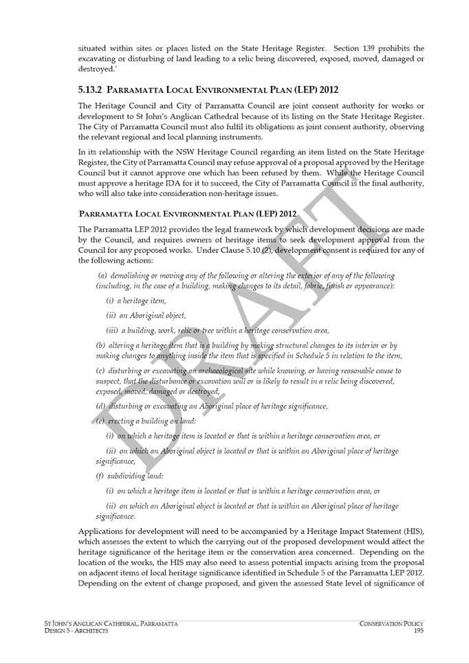
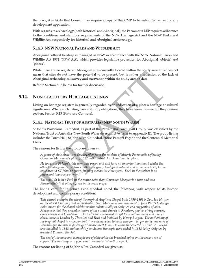
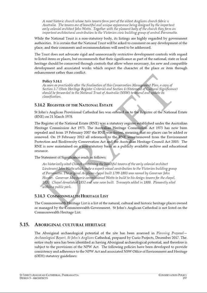
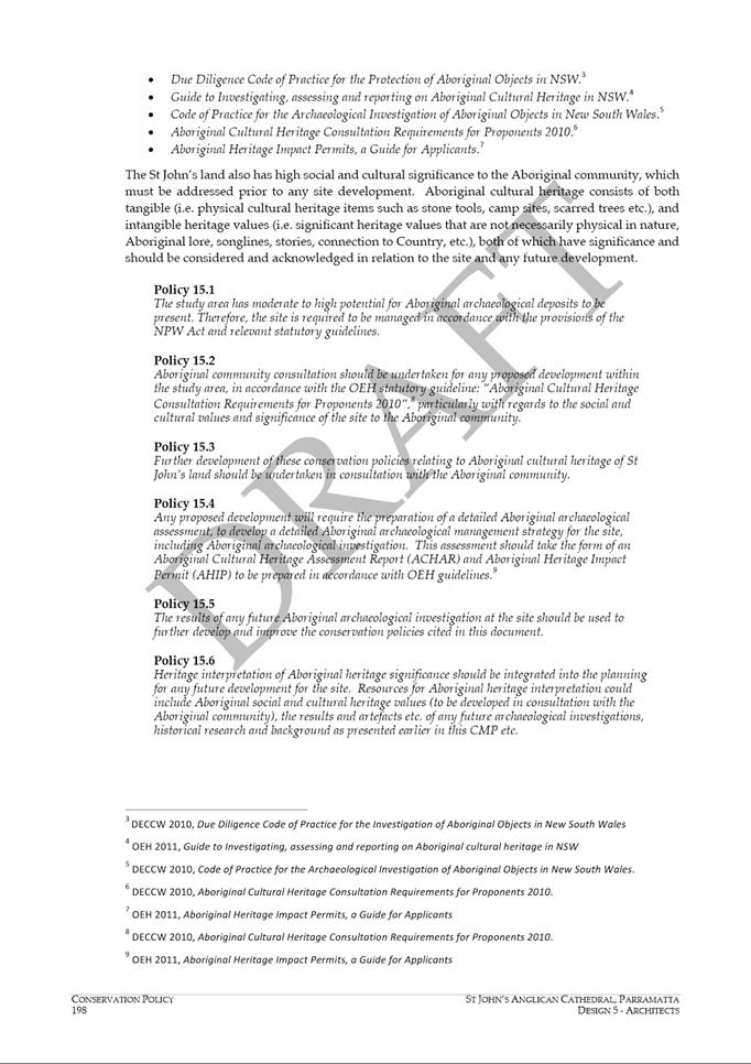
precincts. They note that the Rosehill Gardens Racecourse and Events Centre
and the Valvoline Speedway should be “promoted and leveraged as national
and international leisure and business events destinations”.
Council sees Rosehill Gardens and the raceway as key visitor assets and
destination partners in helping to realise the overall vision and objectives
for the City’s visitor economy.
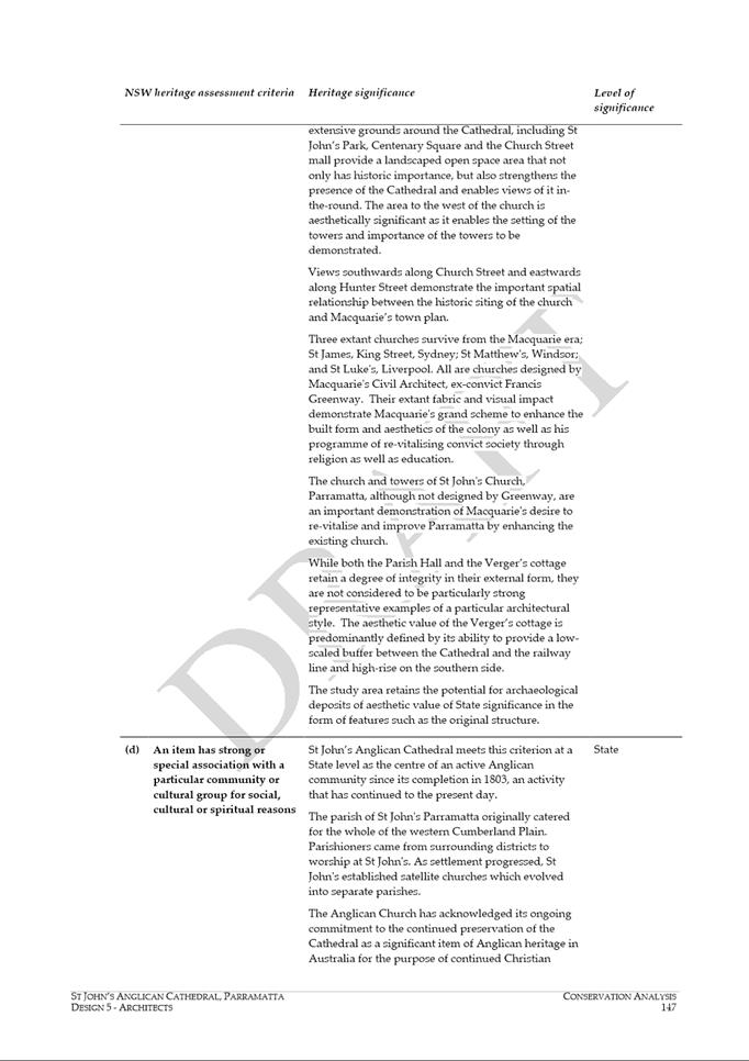
Additionally,
Council resolved on 28 October 2019, to write to the Premier and her Ministers
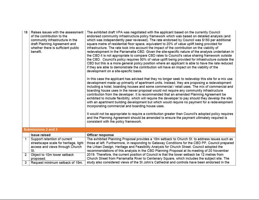
to advise Council’s complete support for Valvoline Raceway, Parramatta to
remain in its historic and present location due to the land being recreational
land.
Council considers
that location of a Metro station in Camellia is vital for the continued success
and future redevelopment of the precinct as employment lands, and looks forward
to the precinct realising its potential to contribute new employment, events
and recreational opportunities for the Central River City.
Council is aware
of the constraints on the Camellia Precinct, including transport access,
flooding and contaminated land. It is also acknowledged that the recently
released draft Place-based Infrastructure Compact by the Greater Sydney
Commission emphasises these constraints in its recommendation that Camellia not
proceed as a development precinct at this time. Nevertheless, Council notes
that location of a Metro stop within easy access of re-development sites would
be a stimulus to address the constraints in the precinct.
The Scoping
Report for Sydney Metro, exhibited by the Department of Planning, Industry and
Environment (DPIE) to support the State Significant Infrastructure application
for the project discusses the evaluation of potential intermediate
stations. A summary of the assessment was provided (see Figure 1).
Other than the scores and outcomes, very little detail is provided. There
are no definitions of criteria, nor indication of how they were scored, nor
explanation of how the various criteria were weighted against each other.

Figure 1: Excerpt
Table 3-7 from Sydney Metro West Scoping Report (Nov. 2019) Source: Sydney
Metro
Council is
interested in better understanding this analysis. It is not clear, for
example, why Camellia scored poorly in ‘Strategic alignment’
compared to Rydalmere, as Camellia is the subject of a State-led master
planning process. Likewise, it is not clear why Rydalmere scores higher
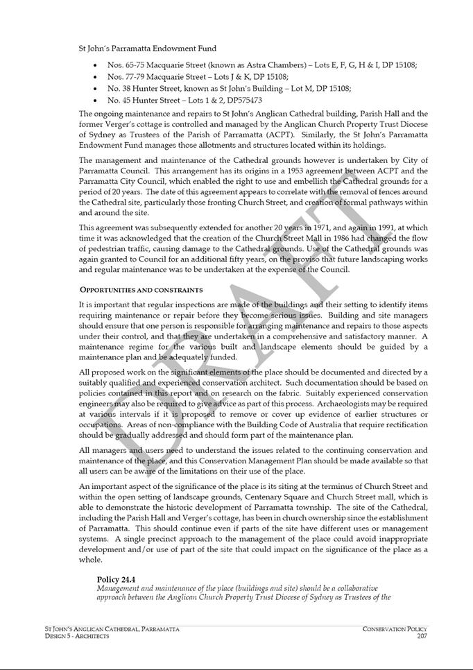
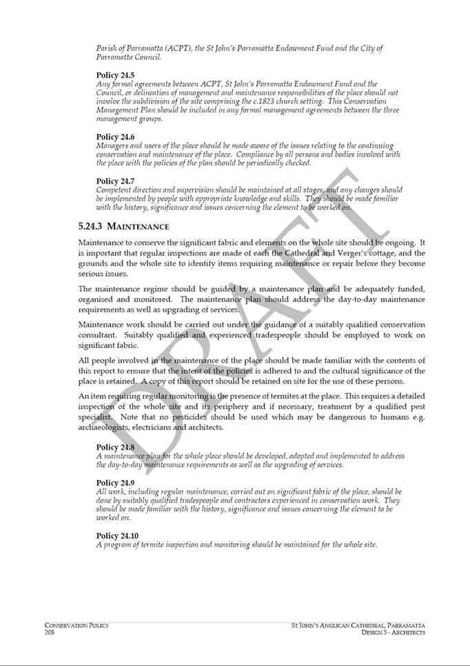
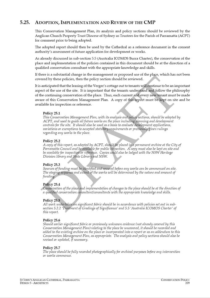
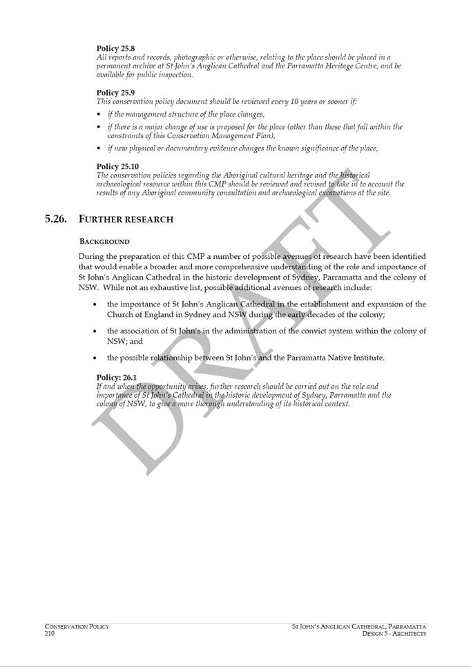
for ‘Productivity & jobs,’ ‘Housing supply’ and
‘Urban renewal and placemaking’ than Camellia, as Table 1 outlines
below.
|
Location
|
Additional dwellings
|
Additional commercial and retail employment space
|
|
Camellia
|
10,000
|
200,000m2
|
|
Planning Proposal at 266 Victoria Road, Rydalmere
|
2,544
|
18,807m2
|
|
Planning Proposal at WSU North Campus, Rydalmere
|
1,110
|
6,160m2
|
Table 1:
Additional dwelling and employment numbers, Camellia and Rydalmere
Camellia
currently has proposals for residential intensification, and greater
opportunity for commercial redevelopment and urban renewal than
Rydalmere. Regarding the scoring for ‘Transport integration’
Council notes that options in Rydalmere, Camellia and Rosehill that would connect
to Parramatta Light Rail Stage 1, should have higher scores than locations in
Silverwater that would connect only to buses. Council would welcome the
opportunity to work with State agencies to understand and provide local
knowledge into this assessment.
A station in Camellia
would have similar benefits for residents along the current T-6 Carlingford
train line as detailed in the previous sections; additionally it would improve
transport access for residents of Rosehill, and if properly connected with
active travel facilities, could provide additional public transport options for
residents of North Granville and Clyde. A Metro station in Camellia would also
greatly improve accessibility for visitors and racegoers attending Rosehill
Gardens.
Council also
notes that a station at Camellia rather than Rydalmere reduces the amount of
diversion for Metro West, thereby reducing track and tunnel length, eliminating
introduced curves, and reduces assumed risks associated with tunnelling under
the Parramatta River.
4. RYDALMERE
In its submission
to the Project Overview for Sydney Metro West in May 2018, Council recommended
that planning for a station in Rydalmere should include consideration of the
context of the existing land use form and the capacity for the precinct to
remain a Key Employment Precinct supporting primarily light industrial
development uses.
The Rydalmere
precinct is vitally important to the City of Parramatta, contributing
significantly to the local, regional and the state economies, supporting a
large and diverse workforce of over 10,000 in the education and manufacturing
sectors. As detailed in Parramatta Employment Lands Strategy (2016), Council is
committed to the retention of the area’s industrial lands, and the
expansion of key industries to support local jobs growth. Transformative
transport infrastructure, such as Sydney Metro West would enable Rydalmere to
further develop its capacity to accommodate an expanded and transformed
workforce, and better connect Western Sydney University’s campus to the
broader region. It would also support the identified role of the WSU
North Campus and site at 266 Victoria Road, Rydalmere in providing growth in
dwellings and employment.
However, a Metro
station in Rydalmere may increase residential development pressure in the areas
of the precinct that are currently zoned industrial, which would compete with
the goals of the Employment Lands Strategy.
A station in
Rydalmere would magnify the benefits of Parramatta Light Rail Stage 1 for
residents along the current T-6 Carlingford train line as detailed in the
previous section. A Metro stop in Rydalmere would be beneficial for the
T6 corridor, could help drive high quality development and urban design
outcomes in the corridor.
Rydalmere is
about 1.5 km north of a straight alignment between Parramatta and Sydney
Olympic Park, a station in Rydalmere would represent a significant diversion
for travellers moving between Parramatta and the Eastern Harbour City. In
addition to a time penalty, diverting the route to Rydalmere would add curves
to the track, decreasing passenger comfort for all trips. Council also notes
that locating a station in Rydalmere may increase costs and risks for the
project associated with additional tunnelling and excavation near the
Parramatta River.
Council notes
that known constraints in the precinct include protection and encouragement of
employment lands, detailed above, existing constraints on surface roads and
potential flooding in the precinct.
In response to
Parramatta Light Rail Stage 1, Council is currently preparing a corridor
Structure Plan from Harris Park to Carlingford that will be released in the new
year. Should a station be confirmed in Rydalmere, a Structure Plan for
the entire precinct should be prepared that aligns with current Council planning,
and with a focus on the issues outlined below:
• guide development
to support a range of employment uses with a focus on increasing employment
densities as detailed in the Employment Lands Strategy,
• manage
residential development,
• consider the
interface of the station and any new development with the Western Sydney
University campus,
• mitigate existing
deficiencies and constraints, and
• constraints on
the road network.
5. OTHER LOCATIONS
Council notes
that in the event that both Camellia and Rydalmere are not selected for
stations, there are other precincts between Parramatta and Sydney Olympic Park
where inclusion of a Metro station would yield obvious benefits. Council
considers that alternative station locations may be preferential to no station
at all in the long distance between Parramatta and Sydney Olympic Park.
In its submission
to the Project Overview for Sydney Metro West in May 2018, Council advocated
for a station and/or comprehensive and significant increases to public transport
to be considered within the Newington/Silverwater/North Lidcombe Precinct in
order to provide a direct connection of these precincts with Westmead,
Parramatta CBD and Sydney CBD.
Locations such as
Rosehill and Silverwater present real opportunities to catalyse redevelopment
of employment lands and to increase public transport connectivity for new and
existing land uses.
6. NEXT STEPS
Council invites
Sydney Metro to work with Council and relevant State agencies to reconsider the
location of an intermediate station between Parramatta CBD and Sydney Olympic
Park. Council asks to participate in a transparent and rigorous
evaluation of both the constraints and opportunities in Rydalmere, Camellia and
any other precincts.
To summarise and
suggest next steps,
• Council continues
to advocate for a Parramatta Intermediate as part of Sydney Metro West to serve
growth in employment and dwellings between Parramatta and Olympic Park.
• Council prefers
that this station be located in Camellia rather than Rydalmere and notes that a
conclusive rationale for not locating in Camellia has not been established by
Sydney Metro.
• In the event that
neither Camellia nor Rydalmere are selected for a station, Council acknowledges
that benefits may accrue from alternate locations such as Rosehill, Silverwater
and Newington, and requests to work with Sydney Metro to evaluate these
alternatives
Council calls on
Sydney Metro and relevant agencies of the State Government to work with Council
and the community in an open and transparent process to evaluate the need for a
possible location of a Parramatta Intermediate station as part of Sydney Metro
West.
Council looks
forward to continuing to work closely and proactively with Sydney Metro as the
project is further refined and considered by the NSW Government.
Green
16 December 2019
15.1 FOR
APPROVAL: Submission to the Parramatta Park Trust on "Your Parramatta Park
2030" Conservation Management Plan and Plan of Management 57
15.2 FOR
APPROVAL: North Granville Community Facilities Masterplan..... 68
Council 16
December 2019 Item
15.1
ITEM NUMBER 15.1
SUBJECT FOR
APPROVAL: Submission to the Parramatta Park Trust on "Your Parramatta Park
2030" Conservation Management Plan and Plan of Management
REFERENCE F2004/10255 - D07149390
REPORT OF Senior Project Officer – Parramatta Ways Program Manager
|
PURPOSE:
To seek Council’s endorsement of a submission to the
Parramatta Park Trust on the draft Your Parramatta Park 2030 Conservation
Management Plan and Plan of Management.
|
|
RECOMMENDATION
That
Council endorse and forward the submission at Attachment 1 to the
Parramatta Park Trust on the draft Your Parramatta Park 2030
Conservation Management Plan and Plan of Management.
|
BACKGROUND
1. The
Parramatta Park Trust (The Trust) has prepared a draft Conservation Management
Plan (CM) and Plan of Management (POM) for Parramatta Park to 2030 - Your
Parramatta Park 2030, https://www.parrapark.com.au/assets/Park-Projects/POM-2030/PP-2030-Management-Plan-Draft-.pdf
, in accordance with the Parramatta Park Trust Act 2011, and the Environmental
Protection and Biodiversity Conservation (EPBC) Act 1999.
2. The
objective of the draft Your Parramatta Park 2030 (draft Plan) is
to set the vision, objectives, heritage policies and management priorities for
the Park over the next 10 years.
3. The
Trust’s aim is to make sure the draft Plan ensures all aspects of the
Park’s heritage and environmental values are considered in the
Park’s on-going management, operations and activation.
4. The
draft Plan was publicly released by the Trust on 6 November with a 3-week
public consultation period. Submissions were requested by 27 November.
5. Due
to the short timeframe a draft Council officer submission was prepared and
submitted to the Trust, noting the submission would be subject to Council
review and endorsement at its meeting on 16 December. The submission is
provided at Attachment 1.
STRATEGIC VALUE
6. The City of Parramatta has had a strong and valuable partnership
with the Trust through a Memorandum of Understanding (MOU) since 2016. The park
plays a pivotal role in the strategic planning of the city and through our
partnership continues to foster cultural, heritage and leisure opportunities
that encourage visitors to Parramatta.
SUBMISSION SUMMARY
7. The submission (at Attachment 1)
recognises the value of having a framework in place to help guide Parramatta
Park in reaching its full potential. The vision and structure of the draft Plan
clearly demonstrates the Trust’s intent to manage cultural heritage in
the context of significant use and change.
8. The submission
recommends the following key areas for consideration:
a. Partnership
Principles - the principles for maintaining and building a strong
partnership between City of Parramatta and the Trust are further embedded in
the Plan. This should acknowledge the contribution of events and partnership
projects to the public nature of the park.
Key points include:
i. The
need to go further in the Plan to discuss frameworks or principles for future
partnership, including groups such as the Parramatta River Catchment Group, or
Darug and other Aboriginal organisations, communities and groups; and
ii. Council
looks forward to working with the Trust to resolve current event cost issues
associated with the newly introduced heritage framework to the satisfaction of
all and the benefit of the City.
b. Recognising
the past the present and the future - better encompass present day heritage
values through the inclusion of “Intangible Cultural Heritage”
values, for example; living traditions, practices and knowledge that are not
represented through monuments and objects;
Key points include:
i. Some
sections of the document when reference Darug and Aboriginal communities is
written in the past tense. The document should refer to these communities as
contemporary and having an ongoing connection to Country.
c. Promoting
Accessibility - universal accessibility and inclusion be more explicitly
integrated as part of the objectives of the park;
Key points include:
i. A
key strategy of the POM should be to support the principles of universal
accessibility; and
ii. There is
significant opportunity to increase accessibility by making the Park safe and
inviting at night-time.
d. Interface
and partnership opportunities - important interface and partnership project
opportunities be explicitly identified to better guide future partnership
priorities.
Important priority
project areas include:
i. Wisteria
Gardens and the Cumberland hospital sites;
ii. Parramatta
Pool as a partnership project;
iii. The
connection between the City River Strategy and the Parramatta Park River precinct;
and
iv. Small scale
activation and events for the night-time economy.
CONSULTATION &
TIMING
9. A series of workshops have been held with
Council staff and other stakeholders on the Plan vision and principles since 11
June 2019.
10. On
the 5 November 2019, the Trust contacted the Lord Mayor with a notification
regarding the 3 week public exhibition period ending 27 November 2019.
FINANCIAL
IMPLICATIONS
11. There
are no direct financial implications for Council as a result of making this
submission.
Luke Wolstencroft
Senior Project
Officer
Helen Papathanasiou
Environmental
Outcomes Manager
Jennifer Concato
Executive Director
City Strategy & Development
Attachments:
|
1⇩
|
Council Submission on Your Parramatta
Park 2030
|
8 Pages
|
|
|
Item 15.1 -
Attachment 1
|
Council Submission on Your Parramatta Park 2030
|


Council 16 December 2019 Item
15.2
ITEM NUMBER 15.2
SUBJECT FOR
APPROVAL: North Granville Community Facilities Masterplan
REFERENCE F2019/03719 - D07108104
REPORT OF Place Manager
|
PURPOSE:
To seek Council’s endorsement to adopt Stage 1 of
the North Granville Community Facilities Master Plan following public
exhibition.
|
|
RECOMMENDATION
(a) That
Council note the feedback provided by the community during public exhibition
and adopt the amended Stage 1 of the North Granville Community Facilities
Masterplan as provided in Attachment 1.
(b) That
all those who made submissions be advised of Council’s decision and
thanked for their contribution to the development of the Master Plan.
(c) That
Council conduct further analysis and community consultation to inform Stage
2 of the Master Plan, including review of alternative locations for the
community building and its use.
(d) Further,
that a report be submitted to Council upon completion of the Stage 2
analysis and community consultation.
|
BACKGROUND
1. A Master Plan
that identifies future community facilities has been prepared for the North
Granville Precinct (Attachment 1).
2. The Master Plan
includes improvements to F.S. Garside Park and the Alfred Street streetscape at
Granville, as specified by the Parramatta Road Corridor Urban Amenity
Improvement Program (PRUAIP) (Reference 1, pg. 14-17).
3. FS Garside Park,
at 1.5Ha, is the only open space in North Granville able to accommodate a
variety of recreational and community amenities.
4. Alfred
Street, Granville provides an alternative route to the Parramatta CBD. The
Consultation Outcomes Report - Draft Parramatta Urban Transformation Strategy
May 2016 identified an active transport link from the end of Albert Street
(corner of Parramatta Road) to the regional cycleway M4 (Reference 2, pg. 22).
5. The
scope and key deliverables of these projects are identified by the Parramatta
Road Corridor Urban Amenity Improvement Plan - implementation tool kit November
2016 (Reference 1, pg. 14-17).
6. The
funding and timeframe requirements that accompany the PRUAIP are non-negotiable
and carry the statutory weight of the Section 117 Ministerial Direction Environmental
Planning and Assessment Act 1979 (Attachment 2).
7. Reference 2, pg. 18-27, identifies
the key issues and opportunities for the Granville Precinct collected during
the 2015 consultation. This consultation was considered sufficient to commence
the works associated with the PRUAIP at F.S. Garside Park and Alfred Street.
8. The
development of a Master Plan to inform recreational and community amenity
planning for North Granville was considered necessary to plan and identify
funding requirements beyond the scope of the PRUAIP.
9. The
North Granville Community Facilities Master Plan aligns with City of Parramatta’s
Community Infrastructure Strategy, Parramatta Ways Walking Strategy, and
Parramatta Bike Plan.
CONSULTATION & TIMING
10. The majority of the community feedback was
supportive of the Master Plan. Attachment
1, pg. 88-93 provides overview of engagement results.
11. Attachment 3 summarises Council’s
amendments to the Master Plan in response to key issues raised during public
exhibition.
MASTER PLAN OBJECTIVES AND SITE IMPROVEMENTS
12. North
Granville’s predicted population growth for 2041 is 24,799, a 346%
increase from 2019 figures of 5,555 (Reference: https://profile.id.com.au/parramatta/about?WebID=190).
13. The
Master Plan aligns with Council’s draft Community Infrastructure Strategy
(CIS) which identifies future requirements for high growth areas including
Granville. (Reference 3 pg. 51-62).
14. Stage
1 of the Master Plan provides an additional 2220m2 of consolidated
open space as a result of removing the car parking on the southern end of Onslow
Street.
15. The
Master Plan will also enable public access to the playing field area (outside
of formal game times), effectively providing a further 14,600m2 of
public open space for daily use that is not currently available.
16. The
revised Stage 1 implementation of the Master Plan recommended for adoption
includes:
a. Provision
of play spaces and facilities for different ages and abilities.
b. Southern
half of Onslow Street converted to open space.
c. Improving
access and functionality to the playing field via retractable gates
d. New
synthetic turf for playing field to provide year round usage and withstand high
endurance activities.
e. Provision
of a range of outdoor gathering spaces including picnic shelters BBQs, tables and
seating.
f. Reduction
in concrete play surfaces and planting of mature trees to reduce urban heat and
provide nature-based play.
g. Reduction
of car spaces with new 90o parking arrangement for Gray Street and
northern section of Onslow Street.
h. Creating a separated cycle way along Alfred St to connect
to the regional cycle way beneath the M4 viaduct.
17. The
three issues of most concern raised by residents regarding the draft Master
Plan during public exhibition were:
a. The
scale and location of the new community building
b. The
additional parking configuration
c. The
request to extend community consultation
These issues
are addressed in Attachment 3, specifically, these elements will form
part of an extended Stage 2 Master Plan site analysis and consultation.
18. The
PRUAIP funding and Section 117 Ministerial Direction EP&A Act 1979 does
not apply to the new community building and extending the timeframe for Stage
2 to enable additional analysis and community consultation will not
affect PRUAIP project obligations and timeframes.
ISSUES/OPTIONS/CONSEQUENCES
Remediation
requirements
19. F.S. Garside was officially deemed James Hardie
legacy site number 49 by the EPA following soil investigative works in May 2019.
As a precautionary safety measure, the dog park, reserve at Duck Creek and
sections of the soccer field were fenced and closed to public access. These
areas will remain closed until the Stage 1-Master Plan is adopted and
construction begins in 2020, or until a feasible interim treatment measure is
identified and implemented
20. Council has an obligation to remediate F.S.
Garside Park regardless of Master Plan adoption. Developing a Remediation
Action Plan (RAP) that complements the Master Plan will ensure that the
remediation is based on the future needs of the park.
21. Further site investigations, flood modelling and
community consultation for each component of the Master Plan is required to
inform detailed design and development of a relevant RAP to limit public
exposure to potential contaminants before construction can progress.
1-3 Onslow Street Building
22. Council
resolved to demolish the 1-3 Onslow Street Building at its meeting of 13 August
2018, prior to commencement of the Master Plan. Demolition of this vacant
building is congruent with the Master Plan objectives to increase the open
space footprint of FS Garside Park and reduce anti-social behavior. (Reference 4)
FINANCIAL IMPLICATION FOR COUNCIL
23. The PRUAIP has allocated ($13
million) funding for infrastructure works relating to:
a. the upgrade of FS
Garside Park and surrounding reserve at Duck Creek
b. design and
construction of the Alfred Street cycleway
c. upgrade to Good and
Bridge Street, Granville Town Centre
24. At the Ordinary Council
Meeting of 23 July 2018, Council resolved to commit to the PRUAIP
infrastructure projects (Reference 5).
25. In
February 2019, City of Parramatta entered a deed of arrangement with DPIE to
implement the PRUAIP projects in Granville. This funding arrangement stipulates
that all projects must be completed by 30 June 2021.
26. Existing PRUAIP funding did
not include site remediation. James Hardie legacy site designation by the NSW
EPA was a result of investigations after the PRUIAP was initiated.
27. City of Parramatta will
submit a variation to DPIE to seek additional funds for remediation of FS
Garside Park and adjoining reserve following endorsement of the Master Plan.
28. Additionally, a remediation
fund has been set aside for works relating to rehabilitation of James Hardie
legacy sites in the Parramatta LGA.
29. The site constraints, flood
modelling, remediation requirements, community consultation and resulting
capital works may lengthen construction timeframes. City of Parramatta will
also seek a variation from DPIE to extend the grant funding timeframe.
NEXT STEPS
30. Subject
to Council endorsement of the Stage 1 Master Plan (Attachment 1), the
following actions are proposed as next steps:
a. Preparation of a delivery plan for Master Plan
items based on requirements relating to Section 117
Ministerial Direction EP&A Act 1979 and PRUAIP funding commitment including:
i. Scoping the cost and recommended delivery timeframes of
any additional project/upgrade requirements identified under the Master Plan
during the detailed design process
ii. Preparation of a REF, RAP and
management plan.
b. Council to continue to work with the local community,
DPIE, EPA and Sydney Water on the detailed design development of the North
Granville Community Facilities Master Plan.
c. Council to negotiate a variation with DPIE to seek
additional funds for remediation and extension in project delivery timeframes
to provide the best outcome for the community.
31. A
further report will be provided to Council for consideration relating to Stage
2 of Master Plan following completion of the additional investigative and
community consultation. This will include:
a. Identifying an alternative location
for the new 1500m2 community building, future parking requirements,
and building design that provides the best outcome for the community.
b. Incorporating crime prevention through environmental
design (CPTED) to mitigate anti-social behaviour and sustainable design
elements to reduce its environmental footprint
c. Amendments to address urban heat concerns include the
reduction of hard surfaces.
Myly Truong
Place
Manager
Bruce Mills
Group
Manager Place Services
Wayne Carter
Executive
Director City Assets and Operations
Attachments:
|
1⇩
|
North Granville Masterplan Report
|
123 Pages
|
|
|
2⇩
|
Parramatta Road - Section 117 Directions
|
38 Pages
|
|
|
3⇩
|
Masterplan Public Exhibition and
Community Consultation Overview
|
4 Pages
|
|
REFERENCE MATERIAL
The
below documents are publicly available at the provided links:
1. Reference 1 - Parramatta Road
Corridor Urban Transformation Urban Amenity Improvement Plan (https://www.landcom.com.au/assets/Uploads/5ae1d8536a/parramatta-road-implementation-tool-kit-planning-and-design-guidelines-november-2016.pdf.).
2. Reference 2 - Consultation
Outcome Report- Draft Parramatta Road Urban Transformation Strategy (https://www.landcom.com.au/assets/Uploads/9d3d989b93/parramatta-road-outcomes-report-050516.pdf
)
3. Reference 3 - Draft Community
Infrastructure Strategy-section three-high growth areas
https://oursay-files.s3-ap-southeast-2.amazonaws.com/production/fm/osp-ug-73/cis/14._draft_cis_-_section_three_-_high_growth_areas.pdf
4. Reference 4 -Resolution 1537
Minutes of Council-13 August 2018 pg. 27 https://businesspapers.parracity.nsw.gov.au/Open/2018/OC_13082018_MIN_468.PDF
5. Reference 5 - Resolution 1498 Minutes of Council 23
July 2018 pg. 17
https://businesspapers.parracity.nsw.gov.au/Open/2018/OC_23072018_MIN_467.PDF
6. Reference 6 - Draft
Community Infrastructure Strategy- community space network pg.134
https://oursay-files.s3-ap-southeast-2.amazonaws.com/production/fm/osp-ug-73/cis/3._draft_cis_-_community_space_network.pdf
|
Item 15.2 -
Attachment 1
|
North Granville Masterplan Report
|


|
Item 15.2 - Attachment 2
|
Parramatta Road - Section 117 Directions
|


|
Item 15.2 - Attachment 3
|
Masterplan Public Exhibition and Community
Consultation Overview
|


Welcoming
16 December 2019
16.1 FOR
NOTATION: Minutes of the Riverside Advisory Board Meeting held on 10 October
2019.................................................................................................. 240
Council 16
December 2019 Item
16.1
ITEM NUMBER 16.1
SUBJECT FOR
NOTATION: Minutes of the Riverside Advisory Board Meeting held on 10 October
2019
REFERENCE F2007/00388 - D07142731
REPORT OF Director Riverside Theatres
|
pPURPOSE:
This report provides information on the meeting of the
Riverside Theatres Advisory Board held on 10 October 2019.
|
|
RECOMMENDATION
That
Council receives and notes the minutes of the Riverside Theatres Advisory Board
held on 10 October 2019. (Attachment 1)
|
BACKGROUND
1. At its meeting of 9 July 2018 Council adopted a new Terms
of Reference for the Riverside Theatres Advisory Board.
2. At its meeting of 24 September 2018 Council amended the Terms
of Reference to increase the number of community members from eight to ten.
3. At its meeting
of 24 September 2018 Council appointed the following ten persons as members of
the Seventh Riverside Advisory Board commencing 1 October 2018 for a term
concurrent with that of the current elected Council concluding September 2020.
Ms Genevieve Blanchett (Appointment)
Ms Imogen Corlette (Appointment)
Ms Arani Duggan (Appointment)
Ms Rhonda Hawkins (Reappointment)
Mr Luke Mackey (Reappointment)
Mr Alan Manly (Appointment)
Ms Keiasha Naidoo (Reappointment)
Mr Vaughan Roles (Appointment)
Mr Carl Sciberras (Appointment)
Dr Jim Taggart
OAM (Appointment)
4. Councillors Davis, Dwyer, Garrard and Jefferies continued
as members of the Advisory Board for a term concurrent
with that of the current elected Council concluding September 2020.
5. Councillor Garrard stood down from the Advisory Board in
February 2019.
6. Ms Rebecca Grasso (Director City Identity, Experience and
Engagement) continued as a member of the Advisory Board representing the CEO to
28 February 2019 when she vacated her position as Director. The Acting
CEO, Mr Rik Hart, nominated Mr Jon Greig (Executive Director Community
Services) as her replacement from 1 April 2019.
7. Imogen
Corlette resigned from the Board effective the Advisory Board meeting of 11
April 2019.
8. The
Riverside Theatres Advisory Board met on 8 August 2019 and endorsed Councillors
Davis, Dwyer and Jefferies forming a committee to select a person to fill a
casual vacancy resulting from the resignation of Ms Imogen Corlette and to make
a recommendation to Council to appoint a suitable candidate.
9. At its meeting
of 9 September Council adopted the recommendation of the committee and
appointed Ms Vyvienne Abla a member of the Seventh Riverside Advisory Board
commencing 1 October 2019 for a term concurrent with that of the current elected
Council concluding September 2020.
ISSUES/OPTIONS/CONSEQUENCES
10. The Riverside Theatres Advisory Board met on 10
October 2019. This report provides a summary of the meeting and any subsequent
outcomes. A copy of the minutes of this meeting is included as Attachment 1.
Council
Matters and Riverside Redevelopment
11. The
Executive Director Community Services informed the Board that Council had
elected Councillor Dwyer as Lord Mayor. The Advisory Board extended its
congratulations to Councillor Dwyer. The recent appointment of
Council’s Chief Executive Officer, Brett Newman, brings the leadership
team to its full complement.
12. Cultural
Strategy, headed by Group Manager Mark Crees, continues to work on developing a
cultural infrastructure plan as well as formulating a framework to implement
the current Cultural Plan 2017-2022. Along with others in the community,
the Advisory Board will be consulted as these plans and strategies are further
developed before being formally considered by Council.
13. The
current round of Community Grants Program launched in October closes on 9
December and includes cultural and sporting grants. . Also a new round of
application for residencies for the Parramatta Artists Studio is current.
14. Parramatta
Night City Framework: Council’s City Economy Unit sought responses
to a draft Parramatta Night City Framework. Riverside is an important
contributor to Parramatta’s night time economy and its economic impact
and benefits extend beyond Riverside itself. The Advisory Board noted Riverside
was not mentioned in the Summary Framework document and had limited mentions in
the Full Framework document. The Board agreed that it should make a submission
through the consultation process. A draft was developed by the Director and
Marketing and Communications Manager along with an Advisory Board working
group. A submission was made on 18th November.
15. Riverside
Redevelopment: The Executive Director Community Services reported that Create
NSW has moved to the Department of Premier and Cabinet. The NSW
Government’s commitment to continue developing the Riverside Final
Business Case has been restated.
Director’s
Report (Attachment 2)
16. The
Director’s Report included information on:
Program activity in August, September
and early October
Accessibility – AIRA technology, new projects, end of year Beyond the
Square performance
Rehearsal studios replacement
Staffing changes
National Theatre of Parramatta - activity including White Pearl opening
Operations - fire rectification
17. General Discussion - Sydney Festival,
Parramatta Lanes, student discounted access, the Lysicrates Prize, Sydney
Coliseum at Rooty Hill
Finance and
KPI Report (Attachment 2)
18. The
five key KPI’s to August YTD were distributed prior to the meeting.
19. Advisory
Board member Alan Manly commented that Riverside is largely a retail business.
As such further interrogation of Riverside ticket sales and patron data would provide
greater understanding of the Riverside business with a view to increasing revenue
and reducing reliance on Council.
20. The
ENTA ticketing system can provide more detailed marketing data analytics for a
better understanding as to what drives sales, when and how.
21. Other research resources within Council may be able
to provide more insight and future Riverside staff dedicated to research and
data analysis will also provide for improved analytics.
Relationship
with Sporting and Community Clubs
22. Deputy Chair Jim Taggart further outlined a
potential membership marketing initiative to build relationships with local
community and sporting clubs to grow Riverside’s patron base. It was
agreed to investigate further the benefits with a pilot program to be
introduced for a six months’ trial in 2020.
CONSULTATION & TIMING
23. The Riverside Advisory Board continues to be
consulted and kept informed of all matters contained within this report.
FINANCIAL IMPLICATION FOR COUNCIL
24. There are no immediate financial implications directly
resulting from this report.
Robert Love
Riverside Theatre Director
Jon Greig
Executive Director Community
Services
Attachments:
|
1⇩
|
Minutes of the Riverside Advisory Board
10 October 2019
|
5 Pages
|
|
|
2⇩
|
Director's Report 10 October 2019 and
Financial and KPI Report
|
13 Pages
|
|
REFERENCE MATERIAL
|
Item 16.1 -
Attachment 1
|
Minutes of the Riverside Advisory Board 10 October
2019
|


|
Item 16.1 - Attachment 2
|
Director's Report 10 October 2019 and Financial and
KPI Report
|


Innovative
16 December 2019
18.1 FOR
APPROVAL: Amendment of 2019/2020 Fees & Charges............ 262
18.2 FOR
APPROVAL: Submission to the Greater Sydney Commission on the Place-based
Infrastructure Compact Pilot for the Greater Parramatta and Olympic Peninsula
area............................................................................................... 311
18.3 FOR
APPROVAL: Draft Melrose Park Southern Structure Plan........... 365
18.4 FOR
APPROVAL: Pre-Gateway - Planning Proposal for land at 195 Church Street, 65-79
Macquarie Street, 38 and 45 Hunter Street, Parramatta (St John's Anglican
Church)............................................................................................................ 452
18.5 FOR
APPROVAL: Post Exhibition - Planning Proposal and Draft Planning Agreement for
land at 14 – 20 Parkes Street, Harris Park................... 1162
18.6 FOR
APPROVAL: Post Exhibition - Planning Proposal, draft Site Specific Development
control Plan and Planning Agreement for 295 Church Street, Parramatta.................................................................................................... 1249
Council 16
December 2019 Item
18.1
ITEM NUMBER 18.1
SUBJECT FOR
APPROVAL: Amendment of 2019/2020 Fees & Charges
REFERENCE F2018/02069 - D07146477
REPORT OF Commercial Manager
|
PURPOSE:
To adopt the amended version of the 2019/20 Fees and
Charges.
|
|
RECOMMENDATION
(a) That
Council adopt the amended version of the 2019/20 Fees and Charges.
(b) That
Council adopt the four (4) new fees that were not publically exhibited as
detailed below:
· Under
heading 4.8
Council Property – Rock Anchor Placement
Rock Anchor Administration Fee ($808.00 including GST)
· Under
heading 4.8
Council Property – Rock Anchor Placement
Disbursements (As incurred)
· Under
heading 4.85
Road Naming
Administrative Fee (per road) – Precinct and Non Precinct ($808.00
including GST)
· Under
heading 4.9
Divestment of Property Interests – Council Land
Disbursements (As incurred)
(c) Further,
that Council note the three (3) fees that have been reclassified as
detailed below:
• Under
heading 4.8
Council
Property – Rock Anchor Placement
Placement
Fee – per anchor ($731.20 including GST)
• Under
heading 4.85
Road
Naming, Precinct – Public consultation/exhibition, advertising and
gazettal ($8,755.00 including GST)
• Under
heading 4.85
Road
Naming, Non-precinct – Public consultation/exhibition, advertising and
gazettal ($1,030.00 including GST).
|
BACKGROUND
1. On 24
June 2019, Council adopted the Delivery Program, Operational Plan and Budget
for 2019/20.
2. Part of adopting the Delivery Program and Operational Plan
included adopting 2019/20 Fees and Charges.
3. It is noted that four (4) fees were not originally
exhibited and not included in the adopted 2019/20 Fees and Charges. These fees
were:
· Under
heading 4.8
Council Property – Rock Anchor Placement, Rock Anchor Administration
Fee ($808.00 including GST)
· Under
heading 4.8
Council Property – Rock Anchor Placement, Disbursements (As incurred)
· Under
heading 4.85
Road Naming, Administrative Fee (per road) – Precinct and Non
Precinct ($808.00 including GST)
· Under
heading 4.9
Divestment of Property Interests – Council Land, Disbursements (As
incurred)
4. In addition, three (3) fees were included in the adopted
2019/20 Fees and Charges but not aligned to the correct heading. These fees
were:
· Under
heading 4.8
Council Property – Rock Anchor Placement, Placement Fee – per
anchor ($731.20 including GST)
· Under
heading 4.85
Road Naming, Precinct – Public consultation/exhibition, advertising
and gazettal ($8,755.00 including GST)
· Under
heading 4.85
Road Naming, Non-precinct – Public consultation/exhibition,
advertising and gazettal ($1,030.00 including GST).
5. Council
needs to realign these fees under the correct headings and include the missing
fees.
6. Council
is also required to adopt an amended version of the 2019/20 Fees and Charges.
7. Attachment
1 provides an explanation of the seven (7) fees that are being amended.
These fees include road naming, rock anchor placement
and divestment of property interests on Council land.
8. Attachment 2 is the amended Fees and
Charges for 2019/20 which will be uploaded to the City of Parramatta website.
ISSUES/OPTIONS/CONSEQUENCES
9. The headings of the Fees and Charges have been corrected to
reduce community confusion to find the correct fees under wrong headings
associated with for example road naming, rock anchor placement and divestment
of property interests on Council land.
FINANCIAL IMPLICATION FOR
COUNCIL
10. Should Council not adopt
the fees and charges outlined above, it will be unable to charge these fees for
services to the community.
Chris Sleiman
Commercial Manager
Alistair Cochrane
Acting Chief Financial
Officer
Michael Tzimoulas
Executive Director Corporate Services
Attachments:
|
1⇩
|
Amended Fees and Charges
|
1 Page
|
|
|
2⇩
|
2019/2020 Fees and Charges
|
45 Pages
|
|
REFERENCE MATERIAL
|
Item 18.1 -
Attachment 1
|
Amended Fees and Charges
|

|
Item 18.1 -
Attachment 2
|
2019/2020 Fees and Charges
|


Council 16 December 2019 Item
18.2
ITEM NUMBER 18.2
SUBJECT FOR
APPROVAL: Submission to the Greater Sydney Commission on the Place-based
Infrastructure Compact Pilot for the Greater Parramatta and Olympic Peninsula
area
REFERENCE F2019/04083 - D07124390
REPORT OF Project Officer Land Use
|
PURPOSE:
The purpose of this report is to allow Council to consider
a submission on the draft Place-based Infrastructure Compact Pilot for
the Greater Parramatta and Olympic Peninsula area produced by the Greater
Sydney Commission.
|
|
RECOMMENDATION
That Council endorse
and forward the submission at Attachment 1 to the Greater Sydney
Commission (GSC) on the draft Place-based Infrastructure Compact
Pilot (PIC) for the Greater Parramatta and Olympic Peninsula area
which raises the following key matters:
· Support
for the integration of land use and infrastructure planning to manage growth
in a coordinated way.
· The
assumptions, data, and evidence base used to inform the draft PIC were not
provided. Therefore, the detail needed for Council to
provide a thorough assessment of the accuracy, practicality and
application of the draft PIC on a local scale was not available.
· The
draft PIC was prepared with no ongoing collaboration with Council. Equal
partnership is needed to ensure place-based outcomes are delivered for GPOP.
· The
draft PIC needs to demonstrate alignment with Council’s existing evidence-based infrastructure strategies and priorities
to demonstrate holistic planning across State and Local government.
· The
extent of the precinct boundaries need to be realigned to reflect the
location of growth for each precinct (in particular, in Carlingford, Telopea,
Wentworth Point and Carter Street) as identified in Council’s draft
Local Strategic Planning Statement and draft Local Housing Strategy.
· The
GPOP boundary be amended to include Epping to ensure its status as a
Strategic Centre with a focus on job creation is supported by the necessary
infrastructure needed to address the current infrastructure deficit
(including light rail between Carlingford and Epping) and to ‘future
proof’ the precinct for residents and
workers.
· The
draft PIC’s recommendation to retain the existing land uses in Camellia
is not supported. Council cannot adequately assess its exclusion from Phase 1
or Phase 2 of the draft sequencing plan because the details of the model and
evidence-base has not been provided. In addition, further consideration of
the future land use is needed to:
o support
the investment in light rail;
o the
precinct’s strategic positioning close to the Parramatta CBD;
o recognise
the extensive strategic and master planning done in collaboration with
Council and State government; and
o address
the precinct’s current underutilisation.
|
BACKGROUND
1. In
March 2018, the GSC issued the Greater Sydney Region Plan (Region Plan)
– A Metropolis of Three Cities and the Central City District
Plan (District Plan). Feedback from the community during the preparation of
these plans was the need to coordinate housing and employment growth with the
delivery of the necessary infrastructure to support communities and achieve the
key themes of liveability, productivity and
sustainability embedded in the Region Plan.
2. Objective
2 of the Region Plan responded to this feedback and the need to deliver infrastructure that aligns with forecasted growth.
3. On
7 November 2019, the GSC released
the draft Place-based Infrastructure Compact (PIC) for the Greater Parramatta
and Olympic Peninsula (GPOP) area. The draft PIC can be viewed on the
GSC’s website here: https://gsc-public-1.s3.amazonaws.com/s3fs-public/gpop_pic_-_a_city_supported_by_infrastructure_web.pdf.
4. The draft PIC, originally called the Growth Infrastructure Compact (GIC), is an integrative planning
model being piloted by the GSC to assist the public and private sector to
better align the growth of housing and employment with the provision of
infrastructure and services.
5. The community consultation and feedback period on the draft PIC is
from Thursday 7 November 2019 to Wednesday 18 December 2019. Council officers have prepared a submission on
the draft PIC (see Attachment 1). The purpose of this report is to allow
Council to consider this submission.
GREATER
PARRAMATTA AND OLYMPIC PENINSULA (GPOP)
6. GPOP
is located at the centre of the Central River City;
itself being the geographic centre of Greater Sydney. The
Region Plan and District Plan provide the overarching strategic direction for
GPOP. The plans emphasise the importance of the transformation of GPOP in
rebalancing housing, employment and recreation opportunities across the Greater
Sydney region. Figure 1
shows the central location of GPOP in the context of Greater Sydney’s
metropolis of three cities.

Figure 1 – GPOP’s location in Greater Sydney
7. The GSC is piloting the draft PIC in the GPOP area as it is one of
the fastest growing areas in Greater Sydney. The 6,000
hectare urban renewal area is experiencing high levels
of growth in housing and employment and investment in city-shaping
infrastructure. This growth and investment, coupled with the fact it is a
‘stand-alone’ precinct in Greater Sydney, presents the unique
opportunity to deliver best-practice in integrating land use and infrastructure
planning.
8. GPOP accommodated around 24,000 new dwellings between 2008 and 2018.
More than half of this growth occurred in the past
three years, accommodating more than 50,000 new residents and bringing
GPOP’s population to over 190,000 residents. In terms of employment, more
than 28,000 new jobs were created in GPOP between 2006 and 2016. This
represents almost six per cent of Greater Sydney’s jobs growth in the
same period, although it represents only three per cent of Greater
Sydney’s urban footprint.
9. The GSC anticipates further growth within GPOP to deliver its share
of the Central City District’s housing target of 207,500 dwellings and
its share of Greater Sydney’s job target of 817,000 jobs by 2036. This is
due to its location in the geographic centre of Greater Sydney, accessibility
to the metropolitan centres, and city-shaping transport corridors, including
Parramatta Light Rail and Sydney Metro West (see Figure 1).
10. The existing
and anticipated growth for GPOP emphasises the importance of integrating land
use planning and infrastructure delivery. The draft PIC aims to ensure growth
is supported by the appropriate local, regional and state infrastructure to
enable orderly and coordinated development that creates great places for the
community to live and work.
PREPARATION OF THE PIC
11. As explained above in the ‘Background’ section, the
preparation of the draft PIC originated from Objective 2 of the Region Plan to
focus on the coordination of infrastructure delivery and forecasted growth.
What is the PIC?
12. The
PIC is a model that looks holistically at an area to identify at a high level
the most cost-effective sequencing for growth aligned with the provision of
primarily state (with some local) infrastructure over a 10, 20 and 40 year
timeframe.
13. The aims of the PIC are to:
a. Model the growth potential of an area and explore scenarios for its
long-term future.
b. Encourage openness about the range of infrastructure and services
needed to grow an area, the costs involved and how this could be feasibly
funded.
c. Stage growth by being selective about where, when and what to invest
in to deliver successful areas.
d. Make the roll-out of new areas more certain, cost-effective and
easier to understand for investors, developers and the local community.
14. The
PIC model developed in the Pilot has three interrelated components, as shown in
Figure 2.

Figure 2 – PIC Model
15. Council
officers’ feedback on the model (and its key components shown in Figure
2) is included in Attachment 1.
How was it prepared?
16. Table
1 below outlines the key milestones contributing to the preparation of the
PIC.
|
Date
|
Milestone
|
Description
|
|
2016
|
· Release of vision:
GPOP – Our true centre: the connected, unifying heart
|
Issued by the Greater
Parramatta Technical Coordination Group, this strategic framework identifies
the city-shaping potential of land use and infrastructure decisions in
GPOP.
|
|
2017
|
· Selection of the Growth Infrastructure
Compact (GIC) ‘game changer’.
|
GSC’s Infrastructure
Delivery Committee investigates infrastructure and land use planning
‘game changers’ in response to the Minister’s Priorities
2016–2018 and drafting of the Region Plan. GSC recommends the GIC and
for it to be piloted in GPOP.
|
|
2018
|
· Preparation of the GIC Pilot for GPOP.
· The GIC evolves into the Place-based
Infrastructure Compact (PIC).
|
The Greater Sydney Region
Plan, State Infrastructure Strategy and Future Transport 2056
were released by the GSC and NSW State Government.
In response, the GSC leads
the preparation of the GIC Pilot for GPOP with over 20 state agencies and
utility providers, looking at various growth scenarios over a 10, 20 and 40
year forecast.
The GIC evolved into the
Place-based Infrastructure Compact (PIC) to better reflect the need to focus
on quality place-based outcome, with growth.
|
|
2019
|
· Draft Strategic Business Case prepared
for GPOP.
· Draft PIC launched for public
consultation.
|
Infrastructure NSW uses the
findings of the PIC and prepared a draft Strategic Business Case for GPOP on
behalf of eight service and infrastructure delivery agencies. This
focused on the 10-year service and infrastructure priorities for potential
funding.
The findings and proposed
actions from the PIC Pilot and draft Strategic Business Case are released for
feedback.
|
|
Next steps
|
|
2020
|
· Recommendation made by GSC to NSW
Government.
|
Feedback considered and GSC
will make a recommendation to the NSW Government.
|
Table 1 – Milestones in the preparation of the PIC
APPLYING THE PIC
17. In the GPOP pilot, the PIC model was used to explore the cost of
growth in GPOP across four scenarios using a 10, 20 and 40 year forecast for
population, dwellings and jobs. Table 2 outlines the scenarios and the
forecasted dwelling and job numbers used to investigate the feasibility of
their realisation in terms of delivering the necessary infrastructure to
support the growth.
|
Scenario
|
Description
|
New dwellings
|
New jobs
|
|
Scenario 1 - Existing
|
GPOP continues to evolve on a more
suburban trajectory beyond Parramatta CBD and Sydney Olympic Park
|
41,000
|
66,000
|
|
Scenario 2 –
‘Incremental’
|
GPOP transitions to better
connectivity and places.
|
64,000
|
86,000
|
|
Scenario 3
–‘Transformative’
|
GPOP undergoes a step change in
connectivity and becomes a 30-minute city.
|
84,000
|
105,000
|
|
Scenario 4 –
‘Visionary’
|
The Central City experiences a step
change in great places and becomes a 30-minute city.
|
95,000
|
122,000
|
Note: These forecasts are additional to the 70,000
dwellings and 150,000 jobs in GPOP in 2016.
Table
2 – Modelled scenarios in GPOP for 20 year forecast
18. More
detail on each scenario tested can be found in the draft PIC.
Progressed scenario in the draft PIC pilot - ‘Transformative’
19. The
PIC model showed that the ‘Transformative’
Scenario 3 and ‘Visionary’ Scenario 4 delivered the greatest
liveability, productivity and sustainability benefits, and these outweighed the
costs of delivering the infrastructure needed to support their achievement.
These scenarios delivered around double the net benefits of the
‘Incremental’ Scenario 2.
20. The ‘Transformative’ Scenario 3 is in line with the NSW
Government’s already-committed infrastructure schedule for GPOP over the
next decade, including Sydney Metro West and Parramatta Light Rail Stage 1.
21. As a result, the ‘Transformative’ Scenario 3 was used in
the draft PIC model, and the findings and actions of the pilot are based on
this scenario.
22. It is noted that the NSW Government has yet to decide on the
affordability of the total capital cost of infrastructure estimated to be
around $40 to $50 billion over 20 years to deliver on the ‘Transformative’
growth Scenario 3.
PROPOSED ACTIONS OF THE PIC
23. Five proposed actions came from applying the
‘Transformative’ Scenario 3 through the PIC model and from the
draft Strategic Business Case. These are summarised in Table 3.
24. Proposed Actions 1, 2 and 3 relate to when growth and development
should happen through a draft sequencing plan for the 26 precincts that make up
GPOP (see Figure 3). Proposed Actions 4 and 5 relate to proposed
infrastructure priorities to support GPOP and growth in these precincts. These
priorities are intended to inform the capital investment plans and budget
processes of NSW Government agencies.
|
Action
|
Description
|
|
1
|
Sequencing Plan – Phase 1: Focus on
precincts where growth can be aligned with already committed infrastructure
to support job creation and new development.
The suggested priority areas in Phase 1
are:
· Parramatta (CBD, North and South)
· Westmead (Health and South) and Wentworthville Precincts
· Rydalmere to Carlingford Precincts
· Wentworth Point and Carter Street Precincts.
|
|
2
|
Sequencing Plan – Phase 2: Focus on
aligning growth with future city-shaping infrastructure.
The suggested priority areas in Phase 2
are:
· Sydney Olympic Park Precinct
· Homebush-North Strathfield Precinct
· Melrose Park and Ermington Precincts
· Granville, Auburn, Lidcombe and Flemington Precincts.
|
|
3
|
Support existing uses in the remaining
precincts across GPOP and review their potential over time.
These precincts include:
· Harris Park, Dundas Valley and the Shorts Corner Precincts
· Rydalmere, Camellia Industrial, Auburn, Lidcombe and Silverwater
Precincts
· Camellia-Rosehill Precinct.
|
|
4
|
Deliver short-term infrastructure
priorities for GPOP to support demand across all 26 precincts over the
next five years plus.
|
|
5
|
Deliver short-to-medium-term
infrastructure priorities for the precincts included in Phase 1 of the
Sequencing Plan (see Action 1) over the next five to ten years
plus.
|
Table 3 – Summary
of five proposed actions.
SUMMARY OF SUBMISSION
25. The
objective of the consultation, as outlined in the exhibition material, is for
the GSC to collect feedback to improve the PIC pilot and identify other areas
in Greater Sydney where the model could help the NSW Government in its
decision-making processes.
26. The
submission responds to the key questions asked by the GSC on Page 19 of the PIC
under the heading ‘Tell us what you think’; and is structured the
following way:
a. Introduction:
This section provides a brief high-level overview responding to the intention
of the PIC.
b. Part
1: This section provides a response to the key questions asked by the GSC
on the PIC.
c. Part
2: This section provides other matters for the GSC’s consideration.
27. Council
officers are supportive of the overall intention of the draft PIC which seeks
to integrate land use and infrastructure planning to manage growth in a
coordinated way. This will help achieve orderly development, manage developer
expectations, and importantly help deliver places that achieve the key themes
of the Region Plan of liveability, productivity, and sustainability.
28. The
submission on the draft PIC is included in Attachment 1, with the key
matters for the GSC’s consideration summarised below.
ASSUMPTIONS AND EVIDENCE BASE
29. The information included in the draft PIC consists of the overall
findings and conclusions generated from the PIC model. It also at a high-level
covers the process undertaken to quantify and test various growth scenarios and
the associated infrastructure needs. However, Council officers consider the
material placed on public exhibition to exclude the detail needed to provide a
thorough assessment of the accuracy, practicality and application of the
PIC in GPOP on a local scale.
30. Council
officers note that the draft PIC explains that some inputs to the method and
modelling are commercially sensitive and need to remain confidential to the
partners involved, and the NSW Government. Council understands that not all
information can be made available to the wider public, however, Council considers itself to be an important stakeholder in this PIC pilot
and should be provided with this detail to provide a comprehensive assessment
of the PIC.
31. Council
welcomes the opportunity to provide further comment on the draft PIC if
presented with the following additional detail:
a. assumptions used to
calculate the forecasted dwelling and job targets for the four growth scenarios
for the 10, 20 and 40 year time periods in the model (see Table 2 for 20
year forecast);
b. quantitative data used
in the model to calculate the cost of growth per precinct;
c. method and data
used to calculate the net benefits of each growth scenario in relation to the
cost of infrastructure vs place-based benefits of liveability, productivity,
and sustainability;
d. the
estimated cost of the infrastructure priorities listed in Actions 4 and 5;
e. process
undertaken to calculate the total infrastructure costs;
f. more
detail around the apportionment of infrastructure costs; and
g. detail
around how funding sources were determined and allocated to different
infrastructure priorities.
COLLABORATION WITH COUNCIL
32. Council
officers have concern that no ongoing collaboration occurred with Council
during the preparation of the model. The model could be improved by ensuring
its preparation is done in equal partnership and ongoing collaboration between
the NSW Government and local councils. Given the intention of the model is to
deliver place-based outcomes, it is imperative that councils are closely involved
in identifying the priorities and needs of their local communities.
33. Council
strongly believes that local councils need to be collaborated early in the
preparation of the models to contribute to the assumptions around spatial
planning, land use changes, precinct sequencing, and growth targets.
34. The
approach to not have ongoing collaboration with Council is at odds with the
Department of Planning, Industry and Environment’s (DPIE) recent
announcement to ‘supercharge’ Sydney’s priority precincts which
acknowledges the need to work collaboratively with councils and get on with the
job of delivering good growth for the future of our city and State.
35. Furthermore,
councils need to be empowered through this model to advocate for the state,
regional and local infrastructure priorities identified through council-driven
investigations and planning strategies. This will ensure the model is genuinely
collaborative, place-based, and originates from the needs of the local
communities. The success of any tool pivots around the ownership of
stakeholders directly impacted by its application.
ALIGNMENT WITH COUNCIL INFRASTRUCTURE PRIORITIES
36. Early
partnership with Council will also ensure the model aligns with the priorities
of Council’s existing infrastructure strategies and is reflective of the
‘grass roots’ needs of local communities. Councils have dedicated
teams who focus on place-making, community and social infrastructure planning,
and asset delivery. The close collaboration of the NSW Government and these
teams across councils will help in the preparation and successful application
of these models in the future.
37. Council’s
archive of infrastructure research papers, strategies, plans and priorities is
constantly evolving and needs to be considered as part of the PIC process. This
will enable informed and evidence-based decision-making on housing growth,
local cultural and social infrastructure provision in GPOP.
38. The
validity of the model would be strengthened by reference to local planning and
infrastructure strategies prepared by Council. This would demonstrate to all
stakeholders and the community that a holistic and cohesive planning process
has been undertaken. It would also provide confidence that the model, which has
been prepared at a state government level (which primarily only considers state
infrastructure), has adequately considered, incorporated and adopted local
planning initiatives and infrastructure needs.
39. Commentary on the priorities
listed within the draft PIC are provided in Attachment 1. It also
includes recommendations from Council to ensure we deliver placed-based
outcomes for GPOP in line with growth, for example, the prioritisation of
regional open space as part of Phase 1 of the sequencing
plan.
PROPOSED SEQUENCING PLAN
40. Figure
3 shows the draft PIC’s proposed high-level sequencing plan for the
26 precincts within GPOP.

Figure 3 -
High-level sequencing plan for the delivery of growth and infrastructure.
41. Council
officers broadly support the sequencing of growth in line with already
committed infrastructure (i.e. through Phase 1 precincts) followed by the
coordinated and timely growth in Phase 2 precincts, which focus around future
city-shaping infrastructure. However, Council officers note that the inclusion
of Camellia in ‘Remaining Precincts’ is not supported and
inconsistent with the strategic planning framework for this area (this is
discussed below under the heading ‘Future of Camellia’).
42. There
is concern around the extent of the precinct boundaries shown in the draft PIC
and the expectations this will set for landowners and developers. A number of
the precincts in Phase 1 (such as Carlingford and Telopea) have been, or are
currently, subject to master planning processes being led either by the State
government or Council. This was / is to review the planning controls around the
Parramatta Light Rail Stage 1 corridor and to assess the scale of growth each
precinct can accommodate.
43. This
is reflective of transit orientated development; and will help connect future
communities to the Parramatta CBD, and through to other parts of Greater Sydney
via a connection with heavy rail and the future Sydney Metro West.
44. Similarly,
the Wentworth Point and Carter Street precincts have undergone master planning
and rezoning processes to accommodate for
growth.
45. The
specific location of the anticipated growth and land use change within these
precincts is reflected in Council’s draft Local Strategic Planning
Statement (LSPS) as shown below in Figure 4.


Figure 4 – Structure Plan towards
2036 in Council’s draft LSPS
46. The
areas planned for land use change and additional housing in each precinct is
shown in orange. This is to indicate that the growth in dwellings is not to be
spread across the entire precinct; but rather to be concentrated in specific
localities around city-shaping infrastructure. This has been done intentionally
by Council to manage the expectations of landowners and developers, and provide
a strategic rationale to not support the lodgement of planning proposals
seeking growth in other areas outside of the precinct. The extent of the orange
areas was determined using an evidence-based approach as part of the
preparation of the draft LSPS.
47. Council
officers recommend the precincts within the draft PIC (in particular Wentworth
Point, Carter Street, Carlingford and Telopea) be updated to only show the
areas to receive additional housing to align with the draft LSPS. This will
ensure a coordinated approach to planning is delivered, and to provide the
justification for refusing planning proposals seeking an uplift in areas
outside of the precincts not flagged for additional housing.
INCLUSION OF EPPING IN GPOP
48. Council
recommends that the GPOP boundary be amended to include Epping. Council’s
draft LSPS identifies Epping as a Strategic Centre and forecasts an additional
4,300 jobs by 2036 (bringing the total from 5,100 in 2016 to 9,400 in 2036).
Council is committed to supporting jobs in Epping with a key action from the
draft LSPS requiring the preparation a planning proposal to mandate a minimum
amount of commercial floor space on certain larger sites in Epping. The
delivery of jobs aligns with the District Plan, and Council wants to ensure the
right infrastructure is in place to support its growth.
49. Council
strongly recommends that Epping be included in GPOP (and subsequently in the
draft PIC) to ensure its status as a Strategic Centre with a focus on job
creation is supported by the necessary infrastructure needed to align with the
Region Plan’s key themes of liveability, productivity, and
sustainability. The draft PIC should be updated to allocate both state and
local infrastructure priorities to address the current deficit in
infrastructure and to ‘future proof’ the precinct for the growing
community of both residents and workers.
50. In
addition, Council strongly recommends that the GSC work with the PIC partners
to progress the investigation of light rail from Carlingford to Epping. The
delivery of light rail from Carlingford to Epping would improve access to
Epping for the residents of GPOP, and subsequently increase the catchment of
workers to support the uptake of jobs in Epping. This also aligns with the
’30 minute city’ policy position of the Region Plan.
FUTURE OF CAMELLIA
51. A
key concern flagged by Council Officers in their review of the draft PIC is in
relation to the future of Camellia.
52. Camellia
in the draft PIC is split into two precincts: Camellia-Rosehill and Camellia
Industrial. Both precincts have been excluded from land use change due to the
relatively high costs of accommodating a new resident or job in the precinct
and local environmental constraints. Specifically the draft PIC recommends that
the zoning remain unchanged to support the employment and industry cluster
consisting of Rydalmere, Auburn, Lidcombe and Silverwater; and to avoid any
land use conflicts from the introduction of residential uses.
53. This
position is contrary to the draft Camellia Town Centre Master Plan 2018 prepared
by DPIE, the broader strategic planning framework of the District Plan,
Council’s draft Local Strategic Planning Statement, draft Local Housing
Strategy, and the Planning Proposal for 181 James Ruse Drive (which is
currently with the DPIE for finalisation). This strategic planning framework
recommends a significant change of use within Camellia to accommodate
residential and commercial uses in the precinct along the Parramatta River.
54. Furthermore,
on 2 November 2019, just prior to the launch of the draft PIC on 7 November
2019, the Minister for Planning and Public Spaces announced a new approach to
‘supercharge’ Sydney’s precinct planning process. Camellia
was listed as a precinct where collaborative planning is supported between
councils, state agencies and the community together to resolve complex issues
and drive quality place outcomes. This further supports the evolution of the
Camellia precinct, and questions the position of the draft PIC which was
released only days later.
55. Parramatta
Light Rail Stage 1 is committed to delivering a station in Camellia-Rosehill,
which will provide direct public transport to the Parramatta CBD. Parramatta
Light Rail Stage 2 is also considering an alternative alignment through
Camellia which would further increase the precinct’s accessibility.
Retaining the existing land uses in light of the investment of transport
infrastructure within this area is contrary to the strategic rationale of the
sequencing plan which recommends land use changes around significant infrastructure
and city-shaping projects.
56. Whilst
Council officers understand the high-cost of delivering infrastructure within
this area to support residential uses, further consideration needs to be made
on the future of this area to:
a. support the investment in light rail,
b. the precinct’s strategic
positioning close to the Parramatta CBD,
c. recognise the extensive strategic and
master planning work which has occurred to date in collaboration between the
State Government and Council.
d. address the precincts current
underutilisation.
57. It is recommended that the GSC
carry out further analysis of the infrastructure costs associated with growth
under various land use scenarios that is required to determine the most
suitable uses and density for the precinct.
Residential
uses
58. Under
a residential or mixed use scenario, the draft PIC model could involve testing
different dwelling numbers and the extent of the Camellia Town Centre footprint
to determine what density is viable from an infrastructure cost perspective. A
potential option may be to reduce the proposed dwelling numbers to a point at
which the infrastructure spend may be more viable whilst still providing an
incentive to facilitate remediation, urban renewal close to the Parramatta CBD,
and transit oriented development due to the location of the new light rail
stop.
Non-residential uses
59. Whilst
contrary to the masterplan for the precinct (and Council’s adopted
position on the masterplan from April 2018), if the cost of redeveloping Camellia
with residential uses is not viable as per the findings of the draft PIC model,
non-residential scenarios of land use change could be explored in the testing
by the GSC. Camellia as an employment precinct could be further tested which
would look at amending the controls to facilitate higher value industries with
a focus on increasing employment densities particularly around the new light
rail stop.
60. Council
officers note that under either renewal scenario (residential or
non-residential) infrastructure investment is required to improve the
connectivity and accessibility of the precinct; remediate the land; and deliver
public domain and amenity improvements. However, the land use will determine
the quality and extent of the infrastructure required, and therefore the
overall cost of renewal in the precinct.
61. Part
of any further testing looking at potential land use change (whether
residential or non-residential) should include the role of the private sector.
Further investigation into the delivery of infrastructure in partnership with
the private sector needs to be explored to support land use change (regardless
of the intensity of the change) as the landowner will be the beneficiary of any
land use change and renewal at Camellia. This could also look at the option of
requiring developers to make the full contribution to all relevant threshold
infrastructure to make renewal of the precinct achievable.
Planning
Proposals
62. The
Planning Proposal for the land at 181 James Ruse Drive, Camellia was endorsed
by Council for finalisation in February 2018. The Planning Proposal seeks a B4
Mixed Use and RE1 Public Recreation zone; height of building control of 126m
(40 storeys); and an FSR of 5.3:1. The revised planning controls are to deliver
3,250 dwellings and 15,000 sqm of retail and commercial floorspace.
63. The
Planning Proposal is currently awaiting finalisation by the DPIE. Should the
State Government adopt the draft PIC in its current form, the Planning Proposal
would be contrary to the PIC. A decision on the future land use of the site at
181 James Ruse Drive will sit with DPIE.
64. A
Planning Proposal was lodged in December 2016 for the land at 1-9 Grand Avenue,
Camellia to enable mixed use development (including residential uses). The
Planning Proposal was amended in 2019 to respond to the
DPIE’s draft Camellia Town Centre Masterplan 2018.
65. As part of this Planning Proposal, the landowner is proposing to
contribute towards enabling infrastructure (including the bridges over
Parramatta River/Duck Creek) to facilitate renewal of the precinct as part of a
future VPA. This further supports the need to explore and test the role of the
private sector in contributing to infrastructure in Camellia, as discussed in
paragraph 61 of this report.
66. This
Planning Proposal has not yet progressed through the Gateway determination
process. This is because Council’s position is that the rezoning of this
site is best managed as part of the broader Camellia master planning process,
which is now in question by the recommendations of the draft PIC. Whilst
Council in its submission (Attachment 1) requests clarity on where the
PIC sits in the hierarchy of strategic planning documents, the future of the
land at 1-9 Grand Avenue, Camellia will be influenced by the recommendations of
the draft PIC.
CONSULTATION & TIMING
67. The
Land Use Planning Team undertook an internal consultation process as part of
preparation of the submission.
68. Public
consultation on the draft PIC commenced on 7 November 2019 and closes on 18
December 2019.
NEXT STEPS
69. Should
Council endorse the submission provided at Attachment 1, it will be
forwarded to the GSC for their consideration.
70. The
draft PIC outlines that feedback received will be incorporated into the
GSC’s recommendations to the NSW Government for its consideration and
adoption. The GSC plans on presenting their final recommendations to the NSW
Government in mid-2020.
71. Subject
to the draft PIC’s adoption by the NSW Government, the GSC envisages that
the PIC Pilot and draft Strategic Business Case for GPOP would be implemented
through:
a. amendments to the relevant strategic and
statutory plans, with further community consultation.
b. finalisation of business cases for State
agencies capital investment plans and NSW Budget processes.
c. ongoing monitoring of development, land
use and infrastructure decisions to ensure the effectiveness of the PIC as a
decision-making support tool.
FINANCIAL IMPLICATION FOR COUNCIL
72. There
are no direct financial implications for Council as a result of making this
submission.
73. Where
appropriate, the attached submission discusses issues with potential broader
financial implications, such as infrastructure provision and other policy
matters.
Sonia Jacenko
Project
Officer Land Use Planning
Roy Laria
Land Use
Planning Manager
Jennifer
Concato
Executive
Director City Strategy and Development
Attachments:
|
1⇩
|
Submission to draft Placed-based
Infrastructure Compact for GPOP
|
39 Pages
|
|
REFERENCE MATERIAL
|
Item 18.2 -
Attachment 1
|
Submission to draft Placed-based Infrastructure
Compact for GPOP
|


Council 16 December 2019 Item
18.3
ITEM NUMBER 18.3
SUBJECT FOR
APPROVAL: Draft Melrose Park Southern Structure Plan
REFERENCE RZ/9/2016 - D07113059
REPORT OF Senior Project Officer Land Use Planning
PREVIOUS ITEMS 14.1 - Draft Melrose Park Southern Structure Plan - Council - 24 Jun
2019 6.30pm
|
APPLICANT: Holdmark Property Group and Goodman Limited
LANDOWNER: Multiple
dEVELOPMENT
aPPLICATIONS CONSIDERED BY SYDNEY CENTRAL CITY DISTRICT PLANNING PANEL: NIL
PURPOSE:
The purpose of this report is to detail submissions
received during the public exhibition of the draft Southern Structure Plan
for Melrose Park, respond to issues raised and provide a recommended process
for managing planning proposals in the precinct. The report recommends that
the draft Southern Structure Plan be adopted subject to the changes as
detailed in this report.
|
|
RECOMMENDATION
(a) That
Council adopt the draft Southern Structure Plan for Melrose Park provided at Attachment
3 subject to the following changes detailed in (i) to (vii), below and as
illustrated in Figure 3 and Figure 4:
i. Amend
the Floor Space Distribution Table to retain the current building height
limit of 12m and floor space ratio of 1:1 on the properties within the
Investigation Area as per Parramatta Local Environmental Plan (PLEP) 2011
until further certainty on the implications of the proposed Parramatta Light
Rail Stage 2 alignment are known.
ii. Amend the
Floor Space Ratio (FSR) on the Holdmark East site (blocks S12, S13 and S14)
in the Floor Space Distribution table to 1.66:1.
iii. Insert a 20m
landscape buffer along the Wharf Road frontage.
iv. Show the extent of
the Andrew Street view corridor through the site.
v. Apply a 6 storey
height limit to buildings on the outer edge of perimeter sites and an 8
storey height limit to the buildings on the inner part of perimeter sites
along Wharf Road and Atkins Road (with the exception of the tower on the
inner part of block S3 and S16).
vi. General
amendments to block form and building footprints to relate to the revised
street layout and facilitate an improved built form outcome while maintaining
the proposed FSRs.
vii. Further
minor inconsequential amendments as detailed in the report.
(b) That Council endorse the approach of considering individual
site-specific planning proposals within the southern precinct providing they
adhere to the structure plan and are in accordance with the parameters
detailed in this report and Attachment 1.
(c) That Council advise all submission authors of Council’s
decision regarding the draft Southern Structure Plan.
(d) Further, that Council
delegate authority to the Chief Executive Officer to correct any minor policy
inconsistencies and any anomalies of an administrative nature relating to the
structure plan that may arise during the finalisation process.
|
BACKGROUND
1. Council adopted the Parramatta
Employment Lands Strategy (ELS) at its meeting of 11 July 2016, which
identified the Melrose Park precinct as being a Structure Plan precinct
suitable for redevelopment for non-industrial uses due to the decline in the
pharmaceutical manufacturing industry within the precinct (refer to Figure 1).
2. In late 2016, the two major
landowners within the precinct, Holdmark and Goodman, collaborated to prepare a
draft Structure Plan for the southern part of the precinct on behalf of all
landowners within the precinct.
3. A structure plan for the northern
part of the Melrose Park precinct was adopted by Council at its meeting of 12
December 2016.
4. At its meeting of 24 June 2019, Council considered a report on the
draft Melrose Park Southern Structure Plan and resolved to adopt a revised
scheme prepared by Council officers with a recommended FSR of 1.7:1 across the
southern precinct and publicly exhibit the amended draft Structure Plan for a
period of 28 Days.
5. The draft Southern Structure Plan (as amended) was publicly
exhibited from 14 August to 10 September 2019 (refer to Attachment 3).
The results of the public exhibition are summarised in this report with more
detailed analysis to the key issues provided at Attachment 1 to this
report.

Figure 1. Melrose
Park Structure Plan Precinct
OVERVIEW
6. The draft Southern Structure Plan development scheme, as exhibited
(refer to Figure 2), is a high-level document that is intended to act as
a guide for future development and inform the preparation of a future rezoning
proposal for the precinct. It is not intended to provide detailed planning
controls and incorporates some flexibility to enable changes to be made at the
planning proposal stage should this be required as a result of thorough urban
design testing and technical analysis, including, but not limited to,
flooding/stormwater and contamination, ecology, heritage and traffic.

Figure 2. Draft
indicative development scheme, as exhibited
7. The draft Southern Structure Plan (Attachment 3) provides an
indicative development scheme for the precinct that achieves a floor space
ratio (FSR) of approximately 1.7:1 across the southern precinct, which could
potentially yield in the order of 3,700 dwellings. It seeks to identify
indicative densities, locations of open space and new roads, which will be
further refined through the planning proposal stage.
CONSULTATION
8. The draft Southern Structure Plan (as amended) was publicly
exhibited from 14 August to 10 September 2019. During this time, the community
was invited to comment on the draft Plan including owners and occupiers from
within both the City of Parramatta and City of Ryde Council areas within a
radius of 1km from the southern precinct. A comprehensive notification process
was undertaken and the exhibition material was available on Council’s
website and at Council libraries.
9. Government Agencies (including City of Ryde Council) were also
notified in writing of the public exhibition in addition to relevant local
State Members of Parliament.
10. A total of 23 submissions were received during the exhibition
period. Refer to Table 1 below for a breakdown of the submissions
received.
|
|
Number
|
Breakdown
|
|
Government Agencies
|
3
|
City of Ryde Council (Council officer
submission)
Transport for NSW/RMS (joint submission)
NSW Office of Sport
|
|
Owners / Occupiers / Others
|
20
|
City of Parramatta LGA – 7
City of Ryde LGA – 8
Not stated / other - 5
|
|
Total
|
23
|
|
Table 1. Breakdown
of submissions received
KEY ISSUES
11. The key issues raised by the community and public agencies are
summarised below. Detailed responses to these issues are provided in Attachment
1 and a summary of the submissions received is provided at Attachment 2.
Density, Building Height and Amenity
12. A number of submissions raised concern over
the indicative building heights in the draft Plan, the number of dwellings
proposed to be accommodated in the southern precinct and amenity impacts on
existing low density residential development adjacent to the precinct,
particularly to the east of Wharf Road.
13. Council also received a submissions from land
owners within the Precinct (Holdmark Property Group and multiple landowners
subject to the Investigation Area). These submission raised concerns over the
exhibited FSRs for their sites identified as Holdmark East (Lots S12, S13 and
S14) and the Mixed Precinct. The submission relating to Holdmark East proposes that
an increased FSR could be accommodated within the site whilst still maintaining
consistency with the key objectives of the Southern Structure Plan. The
submission relating to the Mixed Precinct, wished for the FSR to be
reconsidered given the potential implications of PLR Stage 2. These matters are
discussed1 din further detail within Attachment 1.
Traffic, Parking and Transport
Management and Accessibility Plan (TMAP)
14. Multiple submissions raised concerns regarding
the potential impacts on traffic, and the ability of the road network to
tolerate the increased demand for on-street car parking. Comment was also made
on the accuracy of the assumptions and conclusions of the TMAP. Note that the
TMAP was not subject to public exhibition.
Open Space
15. Submissions commented on the provision of open space, stating that
it is insufficient and lacks connectivity to existing areas of public open
space outside the precinct.
Infrastructure
16. Submissions raised concern relating to the
inadequacy of funding for the required infrastructure to support the increased
population and dependency on existing facilities within the Ryde LGA which are
funded by City of Ryde Council.
Investigation Area / Parramatta Light
Rail
17. Landowners affected by the Investigation Area
which applies to properties in the north-west corner of the southern precinct
due to the future Parramatta Light Rail (PLR) Stage 2, raised concern regarding
the impact that this would have on the development potential and value of these
properties. Comment was made regarding the perceived inequities and why the
Investigation Area was not applied to properties along the entire proposed PLR
Stage 2 alignment within Melrose Park.
RECOMMENDED CHANGES
18. Following consideration of all issues raised in submissions received
during the public exhibition period and further design refinement, the changes
detailed below are proposed to be made to the draft Southern Structure Plan
(refer to Figure 3 and Figure 4). Both the Revised Structure Plan
shown in Figure 3 and the Floor Space Distribution table in Figure 4
must be read in conjunction in order to understand the extent of amendments
made post exhibition. It is not considered that the following proposed changes
will require a re-exhibition of the draft Southern Structure Plan.
· Insert
the label ‘S16’ to the block below ‘S3’ on the
development scheme.
· Amend
the Floor Space Distribution Table to retain the current building height limit
of 12m and floor space ratio of 1:1 on the properties within the Investigation
Area as per Parramatta Local Environmental Plan (PLEP) 2011 until further
certainty on the implications of the proposed Parramatta Light Rail Stage 2
alignment are known.
· Include
the proposed width of predominantly 20m for streets on the design scheme,
except those subject to potential Parramatta Light Rail Stage 2 implications.
· Label
existing streets.
· Mark
the proposed playing field as open space (coloured in green).
· Mark
the land underneath the high voltage power lines as open space (coloured
green).
· Amend
the FSR on the Holdmark East site (blocks S12, S13 and S14) in the Floor Space
Distribution table to 1.66:1.
· Insert
a 20m landscape buffer along the Wharf Road frontage.
· Show
the extent of the Andrew Street view corridor through the site
· Apply a 6 storey height limit to buildings on the outer edge of
perimeter sites and an 8 storey height limit to the buildings on the inner part
of perimeter sites along Wharf Road and Atkins Road (with the exception of the
tower on the inner part of blocks S3 and S16).
· General
amendments to block form and building footprints to relate to the revised
street layout and facilitate an improved built form outcome while maintaining
the proposed FSRs.
19. It
is considered that further changes to the Structure Plan based upon matters
raised in submissions are not sufficiently justified or are not necessary at
this stage of the planning process for the precinct.
20. Detailed justification
of this position is provided at Attachment 1.

Figure 3. Revised Structure Plan

Figure 4. Revised Floor Space Distribution Table
NEXT STEPS / WAY FORWARD
21. Should
the draft Southern Structure Plan be adopted by Council, planning proposals can
then technically progress in the southern precinct.
22. Council
officers’ preferred approach is for one precinct-wide planning proposal
to be prepared for the southern precinct, which will be coordinated and funded
by landowners. This approach will prevent multiple planning proposals being
lodged and will ensure that a coordinated approach continues to be taken in the
precinct.
23. Nonetheless,
Council officers are aware of the practicalities in preparing one planning
proposal for the precinct given the lengthy process involved in preparing the
structure plan and the varying levels of redevelopment interests within the
precinct. Therefore, the lodgement of individual planning proposals could be
acceptable subject to the following requirements:
· Site-specific
planning proposals must adhere to the Southern Structure Plan as endorsed by
Council. Variation can only be considered if there is a demonstrated improved
public benefit such as the increased provision of infrastructure and will
result in a better planning outcome.
· Site-specific
planning proposals must take into consideration the cumulative impacts of
development proceeding across the entire precinct and not only on the site
subject to the planning proposal. This includes the preparation of technical
studies that will be required to encompass the whole precinct, such as
infrastructure needs, flooding, traffic, social impact and open space.
· Site-specific
planning proposals must not rely on development proceeding on an
adjoining/nearby site to achieve the applicant’s desired outcome. For
example, the planning proposal must not include ‘half roads’ or non
through-roads as an interim measure.
24. Landowners
within the ‘Mixed Precinct’ will be required to lodge one planning
proposal applicable to all affected properties, smaller lot size of these
properties, which will be difficult to redevelop on their own and still achieve
the desired outcome. Further, there are also implications of PLR Stage 2 on
these properties as the corridor has not yet been confirmed.
25. All
landowners will be required to contribute towards infrastructure provision in
the southern precinct and Council officers will continue to refine the
infrastructure needs list and associated funding mechanism that will apportion
infrastructure costs in an equitable manner for all southern landowners. This
may include the development of a new section 7.11 Development Contributions Plan
for the precinct in addition to a planning agreement associated with each
planning proposal.
26. A
site-specific Development Control Plan (DCP) will also need to be prepared for
the southern precinct to support any planning proposal in the southern precinct.
CONCLUSION
27. The
draft Southern Structure Plan was publicly exhibited from 14 August to 10
September 2019.Twenty-three (23) submissions were received including twenty
(20) from community members / others and three (3) from Government Agencies.
28. The
submissions raise a number of concerns relating to the redevelopment of the
southern precinct in general and the proposed scale of redevelopment. In
response, the precinct was endorsed by Council for redevelopment for
non-industrial uses upon adoption of the ELS in 2016 and therefore it is
considered that there is planning merit in adopting the draft Southern
Structure Plan to facilitate this redevelopment. It is considered that the
majority of issues raised in submissions can be addressed during the planning
proposal and development application stages, and in the site specific DCP that
will be prepared to cover the southern precinct.
29. Some
amendments are recommended to be made to the draft Southern Structure Plan as a
result of submissions received and are detailed in this report. Subject to
those amendments being made, it is recommended that the draft Southern
Structure Plan be adopted by Council.
FINANCIAL
IMPLICATION FOR COUNCIL
30. The financial implication for Council associated
with amending and implementing the Southern Structure Plan and progressing
site-specific planning proposals within the precinct will not exceed normal
resourcing operational costs within the Land Use Planning budget.
Amberley Moore
Senior
Project Officer Land Use Planning
Michael Rogers
Land Use
Planning Manager
Jennifer
Concato
Executive
Director City Strategy and Development
Attachments:
|
1⇩
|
Council Officer Responses to Key Issues
Raised in Submissions
|
16 Pages
|
|
|
2⇩
|
Summary of Council Officer Responses to
Issues Raised in Submissions
|
13 Pages
|
|
|
3⇩
|
Exhibited Draft Melrose Park Southern
Structure Plan
|
56 Pages
|
|
REFERENCE MATERIAL
|
Item 18.3 -
Attachment 1
|
Council Officer Responses to Key Issues Raised in
Submissions
|
1. SITE CONTEXT
The
site subject to the draft Southern Structure Plan (draft Plan) (refer to Attachment
3) is bound by Hope Street, Wharf Road, Parramatta River and Atkins Road
(refer to Figure 1 below) and is zoned IN1 General Industrial and SP2
Educational Establishment under Parramatta Local Environmental Plan (PLEP)
2011. Current land uses include a variety of general industrial operations,
open space and Melrose Park Public School. The primary school is not subject to
change under the draft Plan.

Figure
1. Land
subject to the draft Melrose Park Southern Structure Plan outlined in yellow
The
southern precinct is surrounded by predominantly low density residential
development to the east and west, industrial uses to the north, which are
subject to the draft Melrose Park North Planning Proposal to redevelop the site
also for non-industrial uses and Parramatta River to the south.
2.
ROLE OF THE STRUCTURE PLAN AND KEY ELEMENTS
A
Structure Plan is intended to act as a guiding document for future
redevelopment of an area and provide high-level strategic principles to
identify indicative locations for new infrastructure such as open space, roads
and commercial areas. It also provides indicative locations of proposed
density, however it does not directly amend any planning controls currently
applicable to the site and final outcomes are subject to further urban design
testing.
Key
elements of the draft Plan include:
· Creation of a
connected and legible precinct with new 20m wide roads (except those subject to
the proposed PLR Stage 2 alignment) to provide consistency with existing roads,
accommodate on-street parking and provide for active transport.
· Provide connected
active and passive open space area including a playing field.
· Provide
non-residential floor space for retail/commercial uses and community
facilities.
3.
CONSULTATION
The draft Plan (as
amended by Council resolution (a) on 24 June 2019) and supporting Council
report and Minutes from 24 June 2019 were publicly exhibited from 14 August to
10 September 2019. During this time, the community was invited to comment on
the draft Plan. Notification
methods used in the exhibition included:
· Letters
to all owners and occupiers within a 1km radius of the southern precinct,
including those within the Ryde LGA (approximately 5,000 letters).
· Advertisements
in the Parramatta Advertiser and Northern District Times.
· Placement
of the draft Plan on Council’s website.
· Hard
copies of the draft Plan made available at Council’s Customer Contact
Centre, Parramatta Library and Ermington Branch Library.
Public Agencies were
also notified in writing of the public exhibition, with the following agencies
consulted:
· City
of Ryde Council
· Transport
for NSW
· Sydney
Water
· Roads
and Maritime Services
· Parramatta
Light Rail
· Department
of Planning, Industry and Environment
· Endeavour
Energy
· Ausgrid
· NSW
Health
· Western
Sydney Local Health District
· Department
of Education
In addition, the
State members of Parliament, Dr Geoff Lee, Member for Parramatta and Victor
Dominello, Member for Ryde were notified of the exhibition in writing.
A total of
twenty-three (23) submissions were received during the exhibition period, as
detailed in Table 1 below.
|
|
Number
|
Breakdown
|
|
Government Agencies
|
3
|
City of Ryde Council
(Council officer submission)
Transport for NSW/RMS
(joint submission)
NSW Office of Sport
|
|
Owners / Occupiers /
Others
|
20
|
City of Parramatta LGA
– 7
City of Ryde LGA – 8
Not stated / other - 5
|
|
Total
|
23
|
|
Table
1. Breakdown
of submissions received
A
number of key issues were raised in the submissions and these are addressed
below. Responses to other matters such as amenity, heritage, education needs
and housing mix raised in submissions are provided at Attachment 2.
4.
COUNCIL OFFICER RESPONSES TO KEY ISSUES RAISED IN SUBMISSIONS
4.1.
Density, Building Height and Amenity
A
number of submissions raised concern over the indicative building heights in
the draft Plan, the number of dwellings proposed to be accommodated in the
southern precinct and amenity impacts on existing low density residential
development adjacent to the precinct, particularly to the east of Wharf Road.
Council
Officer Response
Density
A
Structure Plan is a high-level planning document that does not seek to finalise
planning controls on the site. Instead, it provides indicative built forms that
have only been tested at a high level to demonstrate that the proposed density
can be achieved on the site. The densities proposed in the draft Plan have been
informed by the Transport Management and Accessibility Plan (TMAP) that was
prepared for the entire Melrose Park precinct and high-level urban design
testing. The TMAP identifies that up to 11,000 can be accommodated across the
precinct (north and south) from a traffic and transport perspective on
condition that Sydney Metro West, light rail (or bus equivalent) and a bridge
to Wentworth Point and are provided. Without Sydney Metro West, a bridge
to Wentworth Point and light rail (or equivalent bus service), the TMAP
concludes that the overall dwelling yield for the precinct will need to be
reduced to 6,700 dwellings across the northern and southern parts, providing
the identified road infrastructure works are undertaken. Should no commitment
be made by the State Government for the delivery of the required infrastructure
then the overall dwelling yield will be restricted to 6,700 dwellings across
the precinct and result in a 40% reduction in the overall density being applied
to both the northern and southern precincts until such time that the transport
commitment of Sydney Metro West, the bridge to Wentworth Point and light rail
(or bus equivalent) is made. It is noted that the State Government has announced
a commitment to the Sydney Metro West, however in order for the full dwelling
yield to be realised in Melrose Park, the bridge and light rail (or bus
equivalent) are also required. An FSR of 1.7:1 cross the southern precinct
could potentially accommodate up to 3,700 dwellings. Should a 40% reduction in
the dwelling yield need to be applied to the southern precinct, a lower yield
of approximately 2,200 dwellings could potentially be delivered.
The
final density for the southern precinct is subject to further urban design
testing that will be undertaken as part of the planning proposal process, which
could result in variation to the structure plan being undertaken, depending on
individual site contexts and commitment by the State Government to transport
infrastructure provision.
Building
Height
The
draft Plan locates the tallest buildings away from the perimeter of the
precinct to help reduce the perception of density and visual impact on
surrounding residents. The proposed maximum building height in the precinct is
68m (approximately 20 storeys), which is located on the central block
‘S10’ adjacent to the proposed playing field (refer to Figure 2).
The building heights on the perimeter of the precinct which have an interface
with existing low density residential development within the Parramatta and
Ryde LGAs are proposed to range from 6-8 storeys. Additional landscape areas on
the development sites will also be required for these interfaces to increase
the separation, and the existing road separation of 20m will also assist in
reducing the impacts of the development. The site specific Development Control
Plan (DCP) is proposed to be prepared for the precinct and will contain
development controls relating to setbacks and built form.
Comment
was made in relation to lots ‘S13’ and ‘S14’ (refer to Figure
2) as they appeared to have no identified building heights in the Floor
Space Distribution Table on page 22 of the draft Plan and concern was raised
that these lots had no upper height limit. This omission was rectified early in
the exhibition period, with an amended Floor Space Distribution Table made
available to the public labelling each lot (refer to Figure 3). It was
also noted in some submissions that no lot identification number was applied to
the block below ‘S3’ on the draft Plan and concern was raised over
the building heights proposed on this lot. This lot is included in the Floor
Space Distribution Table and identified as ‘S16’, with a proposed
FSR of 3.9:1 and maximum building height limit of 58m (approximately 18
storeys) for the tower building located in the inner part of the lot with 6-8
storeys for the buildings that interface with the existing low density
development on the western side of Atkins Road.
Concern
was raised regarding the proposed height limit on block S15 (refer to Figure
2) on the corner of Hope Street and Wharf Road north of the existing
Melrose Park Public School and the potential overshadowing impacts on the
school and existing playing field that may result from having tall buildings on
the northern side of the school. The height limit that has been applied to this
lot is a maximum of 26m (approximately 8 storeys), which his slightly higher
than the height for buildings along Wharf Road and Atkins Road. This is due to
the location of this block being primarily along Hope Street and therefore it
does not have a direct interface with existing low density residential
development to the east. Nonetheless, it is acknowledged that some
overshadowing impacts may occur on the school and the full extent of this will
be addressed in detail as part of any future planning proposal for this site.
Building
configuration and heights are subject to refinement as a result of further
urban design testing that will be undertaken as part of the planning proposal
process.

Figure
2. Draft
indicative development scheme, as exhibited
|
|
Site Area
|
GFA
|
FSR
|
Max Height (m)
|

Figure
3. Amended
Floor Space Distribution Table, as exhibited
Amenity
As
part of any redevelopment of a precinct of this nature, there will likely be
some impact on adjoining residential areas given the proposed land use changes.
Potential impacts on the amenity of existing residents adjacent to the precinct
will be addressed in further detail during the planning proposal and
development assessment stages, and as part of the site-specific DCP that will
be prepared for the southern precinct, with particular attention paid to the
interface between the proposed high density and existing low density
development. The site-specific DCP will be subject to further community
consultation. All development will be required to meet relevant Australian
Standards and the Apartment Design Guide (ADG) provisions to ensure any
potential negative impacts are minimised.
Recommended
Action
Update
the draft Plan to include a label on lot ‘S16’. Continue to refine
building heights, built form and building setbacks, to be addressed as part of
the future planning proposal and site-specific DCP for the precinct.
4.2
Traffic, Parking and Transport Management and Accessibility Plan (TMAP)
Multiple
submissions raised concerns regarding the increase in traffic and potential
impacts on the road network, the ability of the road network to tolerate the
increased demand for on-street car parking, and the accuracy of the assumptions
and conclusions of the TMAP.
Council
Officer Response
It
is acknowledged that any redevelopment within the Melrose Park precinct will
have some impact on the local road network. Therefore, it is important that any
such impacts are managed to ensure these road networks can still function as
intended. The TMAP was prepared in response to a Gateway Determination
condition in relation to the Melrose Park North Planning Proposal and was the
subject of extensive review and consultation by the TMAP reference group which
included stakeholders from Council, State Agencies and applicants from the
northern and southern precincts. The TMAP has been provisionally endorsed by
Transport for NSW (TfNSW) and Roads and Maritime Services (RMS).
The
TMAP is an informing document to the draft Plan and provides a comprehensive
analysis of the potential traffic and parking impacts and mitigation
requirements as a result of future redevelopment of the Melrose Park precinct.
It also provides a Staging Plan for the delivery of required road upgrades and
public transport infrastructure to service the precinct as well as recommended
parking rates to minimise the impacts on nearby local roads, which are considered
appropriate to Council officers in these circumstances. However, the TMAP
document was not subject to public exhibition as part of the draft Plan. An
opportunity to provide further comment on the validity of the TMAP will be
provided as part of the future exhibition of the draft Melrose Park North
Planning Proposal and a detailed response to all issues will be provided at
this time. As a result, detailed responses are not provided in this report.
Nonetheless, from a traffic perspective, although the TMAP identifies that
there will be impacts on the road network as a result of the proposed
redevelopment, it concludes that these are manageable and that the density
proposed in the southern precinct can be supported providing the identified
infrastructure upgrades are undertaken at the relevant stages of redevelopment.
In
addition, any redevelopment will be required to provide adequate off-street
parking for residents and visitors in accordance with the recommended rates in
the TMAP which will be complemented by on-street parking within the precinct.
Recommended
Action
No
action from a traffic and transport perspective is required at this stage. An
opportunity to comment on the TMAP will be provided when the document is
formally publicly exhibited in conjunction with the revised Melrose Park North
Planning Proposal, at which time detailed responses will be provided.
4.3
Open Space Provision
Submissions
commented on the provision of open space, stating it is insufficient for the
projected population and lacks connectivity to existing areas of public open
space outside the precinct. It was suggested that the land to the north
of Melrose Park Primary School (S15) be provided as open space.
Council
Officer Response
The
proposed provision of public open space in the southern precinct is identified
as 20% of the developable area of the site which is consistent with the
requirements of Council’s draft Community Infrastructure Strategy. The
developable site excludes existing areas of public open space, such as the land
along the river foreshore, and existing roads or any land that is otherwise
constrained and not considered to be developable, such as land underneath the
high voltage power lines unless it can be demonstrated that it is usable. The
proposed public open space intends to provide for new active and passive
recreation uses adjacent to the river foreshore, a new park in the western part
of the precinct and a new playing field in the centre of the precinct. This
public open space will be provided in addition to communal/private open space
that will be delivered on individual developments sites for the use of
residents as per the requirements of the Apartment Design Guide. The precinct
is also located within relatively close proximity to George Kendall Riverside Park
to the west which will provide for a variety of recreation uses.
It
is proposed that connections to existing active transport facilities such as
the Parramatta Valley Cycleway will be provided throughout the precinct to
encourage its usage. Connections to existing active transport links outside the
Parramatta LGA such as the Ryde River Walk will require consultation with and
agreement from City of Ryde Council, which can be undertaken as part of the
planning proposal process.
Should
the land north of Melrose Park Public School be provided as open space, this
would eliminate any potential amenity impacts on the school site as a result of
high density redevelopment such as overshadowing. This land is under multiple
ownership and in order for it to be provided as open space, it would need to be
acquired by Council. At this stage, Council is not in a position to acquire
this land, however there is the possibility for it to be explored in greater
detail as part of the preparation of a future Section 7.11 Contributions Plan
or Voluntary Planning Agreement (VPA) between the landowners and Council as
part of a future planning proposal seeking a contribution for the provision of
open space in the precinct. This will need to be assessed against the provision
of other required infrastructure as part of this process. Alternatively, this
land could provide for an expansion of the school grounds should the Department
of Education determine this necessary. This would require a separate agreement
between the landowners and the State Government.
Recommended
Action
No
further action is required in relation to open space provision as part of the
finalisation of the draft structure plan.
4.4
Infrastructure
A
number of submissions raised concern regarding the funding of the required
infrastructure to support the increased population as a result of the
redevelopment of Melrose Park and dependency on existing facilities within the
Ryde LGA which are funded by City of Ryde Council ratepayers. Some submissions
also noted the importance of ensuring that appropriate consideration had been
given to the provision of school facilities to service the needs of the
incoming population.
Council
Officer Response
Council
officers acknowledge that significant infrastructure is required to support the
anticipated population and in developing the draft Plan, a strong emphasis was
placed on the requirement for this part of the precinct to be as
self-sufficient as practicable in regards to providing facilities for new
residents. As a result, landowners/developers will be required to contribute
towards the cost of this infrastructure, with the amount dependent on the level
of density they are seeking on their respective sites. The overall
infrastructure needs of the precinct will be determined as part of the
Infrastructure Needs List that is being prepared by Council to help inform
future VPAs associated with planning proposals or new development contributions
plan in the Melrose Park precinct to ensure the necessary facilities are
provided to new residents.
In
relation to addressing the potential impacts on facilities within the Ryde LGA,
it is difficult to measure the extent of anticipated use. The nearest
recreation facilities to the Melrose Park precinct that are located within the
Ryde LGA include the privately operated Ryde-Parramatta Golf Club on Victoria
Road, Melrose Park Playground off Lancaster Avenue and Meadowbank Park at the
end of Adelaide Street which is one of Ryde’s major sporting and
recreation areas, containing a netball and tennis courts as well as a number of
playing fields, a skate park and passive recreation areas. The nature of this
facility would mean that users would originate from a larger regional catchment
in addition to casual use by local Ryde residents. Although the redevelopment
of Melrose Park precinct may result in an increase in casual usage, it is not
anticipated that a significant impact would be experienced in relation to use
from organised sports as participants in the activities utilising these
facilities also reside in areas outside the Parramatta and Ryde LGA and usage
cannot necessarily be attributed to the new residents of the Melrose Park
precinct.
Melrose
Park Playground may experience an increase in use by new residents living on
the eastern side of the precinct, however it is not expected to be significant
given the new open spaces areas within the Melrose Park redevelopment itself
will provide similar facilities.
In
relation to education facilities, Council has consulted with the Department of
Education regarding the future education needs of the precinct throughout this
process and it is acknowledged that the increase in population will result in
additional demand being placed on existing education facilities. Any upgrades
to existing school facilities and/or new school infrastructure will be
undertaken and delivered in accordance with the State Government's requirements
and delivered at the agreed stages using the forecasting information provided
by the Department of Education to inform the size and type of schools that are
required. A new 2ha school site has been identified in the northern precinct to
help address the additional demand that will incorporate a new playing field
and other facilities that could potentially benefit from a shared-use arrangement
with the community. Any proposed upgrades to the existing primary school will
be addressed as part of the planning proposal process in the southern precinct.
Ensuring
that the educational needs of the incoming population are met through the
provision of appropriate school infrastructure is a key planning consideration
and Council officers will work closely with the Department of Education to help
ensure this infrastructure is provided.
Recommended
Action
No
action is required at this stage; however, the provision of infrastructure in
the precinct is a key consideration for future development and will be linked
to the density potential in the precinct as part of the future planning
proposal. This will ensure that the proposed development can be supported in
this area.
4.5
Investigation Area / Parramatta Light Rail
Landowners
within the Investigation Area located in the north-west corner of the southern
precinct raised concerns regarding the impact that this would have on the
development potential and value of these properties especially when the draft
Plan nominates an FSR of 1.2:1 and maximum building height of 20m
(approximately 6 storeys) which the landowners consider too low. Comment was
also made regarding the Investigation Area and why it was not applied to all
properties along the proposed PLR Stage 2 alignment within Melrose Park and why
these specific landowners were not consulted prior to the draft Plan being
reported to Council.
Council
Officer Response
The Investigation Area
identified within the draft Plan applies to 61-65 Atkins Road, 2B and 2C Hope
Street and 64 and 78 Hughes Avenue (refer to Figure 2). The
Investigation Area was applied to respond to current uncertainty regarding the
proposed PLR Stage 2 alignment, which is still under investigation by Transport
for NSW (TfNSW). As a result, it is difficult to determine the impacts, if any,
that the proposed light rail will have on the future developability of these
properties. On this basis Council officers made an assumption that developability
of these properties could be restricted for these properties, and for the
purposes of the draft Plan applied lower FSR and building height controls.
The
application of the Investigation Area to these properties only along the
proposed PLR Stage 2 corridor within Melrose Park was restricted to the
north-west due to the fragmented ownership pattern in this part of the precinct
and the relatively small size of the land parcels. These factors restrict the
ability of the FSR that is “lost” from these properties as a result
of PLR Stage 2 purposes to be easily redistributed upon land under the same
ownership compared to other larger sites along the proposed alignment which can
absorb the FSR within the same site.
Discussions
with affected landowners were conducted post-exhibition, where they suggested
the retention of the existing building height and FSR controls on these
properties as per the Parramatta LEP 2011, which prescribes a 12m height limit
and FSR of 1:1 so as to not make an assumption about the future developability
of these properties until there is more certainty regarding the impacts of PLR
Stage 2. The future development of the site would be reviewed to determine
future density following the State Government’s decision on PLR Stage 2.
Recommended
Action
Amend
the Floor Space Distribution Table from a 20m maximum building height to 12m
and FSR from 1.2:1 to 1:1 for these properties as per the current building
height and FSR controls contained within Parramatta LEP 2011 and note that the
final building height and FSR controls will be determined once there is
certainty regarding PLR Stage 2.
4.6
Lots S12, S13 and S14 and Adjoining ‘Green’ Lot
A
submission was received from the landowner (Holdmark) of properties identified
as lots S12, S13 and S14 on the draft Plan on the eastern side of the precinct.
Holdmark also own a site to the immediate west of Waratah Street opposite lot
S12 which is identified as ‘Green’ on the exhibited map. It is
considered by the landowner that the FSR that has been applied to this group of
lots of 1.54:1 is inequitable compared to other sites within the precinct and
will not enable the site to achieve its development potential. The
landowner’s justification for this position is that the site is
surrounded by existing public roads and is therefore able to redevelop without
the need for adjacent properties to contribute towards the delivery of new
roads, that it is a relatively large landholding under one ownership and that
the landowner is one of the key facilitators in the preparation of the draft
Plan. The landowner is seeking an increase to the indicative FSR across all of
these lots to 1.8:1 and considers that an appropriate built form outcome can be
achieved with the increased FSR.
Council
Officer Response
Supplementary
to this submission, the landowner provided an indicative design scheme to
demonstrate that the additional density could be achieved on these lots. The
applicant submitted a revised scheme that included an overall FSR of 1.8:1 on
the site. It is noted that the scheme is consistent with Council’s
structure plan objectives relating to the 20m setback to Wharf Road and the 6-8
storey built form within the transitional perimeter zone whilst also
maintaining a single tower element (20 storeys). However, the built form
outcome at this density is not supported for the following reasons:
· The
length of the buildings. The scheme includes a building in excess of 130m in
length on the western edge of the developable site which will result in a built
form outcome that will impact on the perceived density within the site.
Building lengths of no more than 100m are considered optimal from a design
perspective.
· The
building separations will further exacerbate the perception of density within
the site. Although it is acknowledged that the applicant’s revised scheme
provides for the minimum Apartment Design Guide (ADG) requirements for building
separation, these do not provide for high amenity courtyard spaces. The width
of the courtyard should be not less than the height of the surrounding
buildings for perimeter block built forms. This is consistent with the approach
that has been applied within the northern structure plan area. Having all
buildings just meeting the minimum ADG building separation requirements would
impact on the ability of the scheme to meet the other ADG requirements such as
solar access.
· The
built form along Wharf Road consists of a building edge with no courtyard
opening. Having the ends of buildings facing Wharf Road as articulated in Figure
4 reduces the perception of density to the lower density areas on the
eastern side of Wharf Road. This principle is also applied to the built form
fronting Wharf Road to the north.
· Obstruction
of the view line from Andrew Street. This density would compromise the view
corridor from Andrew Street in the east.
A
key consideration of the redevelopment of the precinct (including the northern
precinct) is to ensure that an appropriate interface with the existing low
density residential development on the eastern side of Wharf Road and western
side of Atkins Road is provided. This is achieved by locating 6-8 storey
buildings on the lots along perimeter of the precinct, with 6 storeys on the
outer edge and 8 storeys buildings behind. An increase in density that results
in these perimeter buildings increasing in height is not considered to be an
acceptable outcome. Additional density that will overshadow the ecologically
sensitive mangrove vegetation along the river foreshore and affect views is
also not considered to be an acceptable outcome.
Subsequent
urban design testing for this site has revealed that a small increase in the
FSR can be achieved on this site above that identified in the draft Plan. It is
considered that an increase from the 1.54:1 FSR as identified in the draft Plan
to 1.66:1 can still achieve an appropriate built form outcome and provide
consistency with the design principles that have been applied to the Melrose
Park precinct (refer to Figure 4). This scheme provides the following
benefits:
· maintains
the desired 6-8 storey perimeter building heights
· provides
a single 20 storey tower located in the inner part of the site
· maintains
the desired view corridor from Andrew Street (on the eastern side of Wharf
Road) through to the foreshore area
· provides
more appropriate building lengths consistent with Council’s requirements
· includes
a greater built form separation along the southern edge of the developable site
that increases views to the foreshore
Based
on the above, it is recommended that the structure plan be amended to reflect
the revised density for the Holdmark East site.
An
exception to the perimeter site building heights is being applied to block S16
on the western side of the precinct (also owned by Holdmark) which shows a
tower on the inner part of the site. This is due to the requirement of this
site to provide for open space which impacts on the ability to redistribute the
allocated GFA on this site. This results in the need for a tower building
to be located in the 8 storey height zone that is being applied to other
perimeter sites.
In
relation to the matter of the equal distribution of density across the
precinct, it is considered by Council officers that the density distribution as
indicated in the draft Plan is proportional. Holdmark’s combined
landholding is approximately 49% of the precinct and the density able to be
achieved with the exhibited FSRs across the combined landholdings facilitates a
GFA and dwelling yield that equates to approximately 49% of the overall density
within the precinct on Holdmark-owned land. Notwithstanding the above, the
increase in density on the Holdmark East site is still proportional to the
density distribution across the precinct. It may appear that some other
landowners within the precinct have been allocated a higher FSR despite not
dedicating land for public benefit, however these landowners will still be
required to contribute towards the delivery of infrastructure to service the
needs of the precinct as identified in the new contributions plan that will be
prepared for the precinct, or if appropriate, a planning agreement.

Figure
4. Indicative
scheme demonstrating consistency with the structure plan principles and broader
Melrose Park precinct (Holdmark site outlined in dashed red).
Recommended
Action
Amend
the FSR on the Holdmark East site (blocks S12, S13 and S14) in the Floor Space
Distribution table to 1.66:1 (refer to Figure 6).
5.
ADDITIONAL CHANGES TO THE STRUCTURE PLAN POST-EXHIBITION
Following
the exhibition, further urban design refinements have been undertaken by
Council officers to respond to the continuing work on the Melrose Park North
Planning Proposal to ensure that both precincts maintain a cohesive street
network. Further, additional built form amendments have been made to better
facilitate the densities proposed in the southern precinct. These refinements
do not impact on the FSRs applied to individual sites. The extent of these
changes are detailed below:
· Adjustments
to the new north south roads within the southern precinct to align with those
proposed in the northern precinct
· Additional
tower located within block S3 to facilitate a new east west street continuing
from Massie Street and ensure proposed development has a street frontage
· Reduction
to the size of open space provided at S10 due to the amended road alignment of
north south road to the west.
· The
east west street between Hughes Avenue and the northern road to the west of S10
has become a minor access street.
· The
north south street between S2, and S4; S3 and S5 has been amended to become a
minor access street.
· The
east west street between Hughes Avenue and Atkins Road has been amended to
become a minor access street.
· Block
forms and building footprints have been amended to relate to the revised street
layout.
· Building
footprint in S16 has been amended to accommodate the existing creek line
through the south west corner of the site.
SUMMARY
OF PROPOSED CHANGES
In
summary, the following changes are proposed to the draft Plan for Council
endorsement which are illustrated in Figure 5. Both the Revised
Structure Plan shown in Figure 5 and the Floor Space Distribution table
in Figure 6 must be read in conjunction in order to understand the
extent of amendments made post exhibition. They include:
i. Insert
the label ‘S16’ to the block below ‘S3’ on the
development scheme.
ii. Amend
the Floor Space Distribution Table to retain the current building height limit
of 12m and floor space ratio of 1:1 on the properties within the Investigation
Area as per Parramatta Local Environmental Plan (PLEP) 2011 until further
certainty on the implications of the proposed Parramatta Light Rail Stage 2
alignment are known.
iii. Include
the proposed width of predominantly 20m for streets on the design scheme,
except those subject to potential Parramatta Light Rail Stage 2 implications.
iv. Label
existing streets.
v. Mark
the proposed playing field as open space (coloured in green).
vi. Mark
the land underneath the high voltage power lines as open space (coloured
green).
vii. Amend
the FSR on the Holdmark East site (blocks S12, S13 and S14) in the Floor Space
Distribution table to 1.66:1.
viii. Insert
a 20m landscape buffer along the Wharf Road frontage.
ix. Show
the extent of the Andrew Street view corridor through the site
x. Apply
a 6 storey height limit to buildings on the outer edge of perimeter sites and
an 8 storey height limit to the buildings on the inner part of perimeter sites
along Wharf Road and Atkins Road (with the exception of the tower on the inner
part of block S3 and S16).
xi. General
amendments to block form and building footprints to relate
to the revised street layout and facilitate an improved built form outcome
while maintaining the proposed FSRs.
The
recommended changes are intended to improve legibility and provide
clarification for users of the structure plan.

Figure
5.
Revised Structure Plan

Figure
6.
Revised Floor Space Distribution Table
6.
PLANNING PROPOSAL APPROACH
The southern precinct
of Melrose Park comprises 21 properties and over 22 landowners including
strata-owned properties. The major landowner in the precinct is Holdmark,
owning approximately 49% of the land area in two separate sites. Refer to Figure
7 for a map showing land ownership in the southern precinct. In order to
ensure that the precinct redevelops in a coordinated and efficient manner,
consideration has been given to the management of the planning proposal process
upon finalisation of the structure plan. The ‘Hope Street’ and
‘Mixed Precinct’ areas are strata properties under multiple
ownership.
There are currently
two planning proposals that have been formally lodged with Council, being for
112 Wharf Road, 1 Mary Street and 30 Waratah Street, owned by Holdmark, and 6
Hope Street, owned by Goodman, which were both submitted in 2016 (refer to Figure
7). These planning proposals have not been progressed due to
Council’s position that planning proposals would not be progressed in
Melrose Park until the structure plans for the respective parts of the precinct
i.e. north and south had been finalised. The structure plan for the northern
precinct was finalised in December 2016 and therefore the Melrose Park North
Planning Proposal has been able to progress.

Figure 7. Land ownership in the
southern precinct, with sites subject to lodged planning proposals outlined in
red.
Council officers have
considered two approaches that can be utilised to progress the planning
proposal process in the southern precinct, both of which require the proposal/s
to be prepared in accordance with the guiding principles of the structure plan.
The options include:
Option 1 – One
Precinct-Wide Planning Proposal
The Council report of
24 June 2019 outlined an approach for the management of planning proposals in
the southern precinct which includes the preparation of one precinct-wide
planning proposal based on the guiding principles of the structure plan. In
this approach, landowners in the southern precinct would be responsible for
coordinating and preparing the necessary technical studies to accompany the
planning proposal, which will enable a holistic approach in the assessment and
include of a single assessment, reporting and exhibition phase.
Option 2 –
Individual Site-Specific Planning Proposals
This option involves
individual land owners preparing and submitting a site-specific planning
proposal for their respective properties, consistent with the structure
plan’s guiding principles. Each applicant would need to undertake the
relevant technical assessments to support their planning proposal. This
approach would involve separate assessment, reporting and exhibition phases for
each planning proposal and require individual site-specific DCP amendments.
Based on the indicative scheme included in the draft Plan, this could result in
approximately 7 separate planning proposals and site-specific DCPs being
submitted to Council.
Both options present
challenges for both Council and landowners and the preparation of one
precinct-wide planning proposal is the preferred approach of Council officers.
Nonetheless, Council
officers are aware of the practicalities in preparing one planning proposal for
the precinct given the lengthy process involved in preparing the structure plan
and the varying levels of redevelopment interests within the precinct.
Therefore, the lodgement of individual planning proposals could be acceptable
subject to the following requirements:
· Site-specific
planning proposals must adhere to the Southern Structure Plan as endorsed by
Council. Variation can only be considered if there is a demonstrated improved
public benefit such as the increased provision of infrastructure and will
result in a better planning outcome.
· Site-specific
planning proposals must take into consideration the cumulative impacts of
development proceeding across the entire precinct and not only on the site
subject to the planning proposal. This includes the preparation of technical
studies that will be required to encompass the whole precinct, such as
infrastructure needs, flooding, traffic, social impact and open space.
· Site-specific
planning proposals must not rely on development proceeding on an
adjoining/nearby site to achieve the applicant’s desired outcome. For
example, the planning proposal must not include ‘half roads’ or non
through-roads as an interim measure.
An exception to this
is applies to properties within the ‘Mixed Precinct’ (refer to Figure
7), which will be required to take a collaborative approach and lodge one
planning proposal applicable to these properties. This is due to the smaller
lot size of these properties, which will be difficult to redevelop on their own
and still achieve the desired outcome. Further, there are also implications of
PLR Stage 2 on these properties as the corridor has not yet been
confirmed.
All landowners will
be required to contribute towards infrastructure provision in the southern
precinct and Council officers will continue to refine the infrastructure needs
list and associated funding mechanism that will apportion infrastructure costs
in an equitable manner for all southern landowners. This may include the
development of a new section 7.11 Development Contributions Plan for the
precinct in addition to a planning agreement associated with each planning
proposal.
Each planning
proposal will need to be accompanied by a set of site-specific development
controls which will form a new site specific DCP for the Melrose Park South
Precinct. It is at this stage that further refinement can be undertaken with
regard to the built form for each site in order to achieve the best outcome.
|
Item 18.3 - Attachment 2
|
Summary of Council Officer Responses to Issues
Raised in Submissions
|
|
Responses
to Issues Raised in Submissions on the Draft Melrose Park Southern Structure
Plan
|
|
Issue
|
Council
Officer Response
|
|
Building
Heights
|
|
|
A
number of submissions raised concern over the proposed building heights
identified in the draft Plan and how the interface with existing low density
development and the school is addressed, missing building height detail for
lots S13 and S14 in the Floor Space Distribution Table, and the distribution
of height across the precinct.
The
building heights identified in the draft Plan are indicative and are based on
high level urban design modelling that will be subject to further refinement
as part of the planning proposal process. Generally, building heights on each
block will be lower on the perimeter of the site (6-8 storeys) with the
tallest buildings (18-20 storeys) located on the inner part of each block. This
is to help ensure a reasonable transition to the existing surrounding low
density residential development can achieved and the bulkiness of the
development is away from existing low density areas. In addition to building
setbacks from the boundary of the properties, a 20m wide landscape strip
along Wharf Road will also be provided as an additional buffer between the
new and existing development.
Some
overshadowing of the school grounds may result from the proposed development
as indicated in the draft Plan. The true extent of this will be refined as
part of any future planning proposal for this site, however will be minimised
as much as practicable to ensure appropriate solar access is provided to the
school grounds.
The
omission of a building height limit for lots S13 and S14 was rectified during
the public exhibition. The Floor Space Distribution Table was amended to show
an indicative 26m height limit (approx. 8 storeys) on these lots and made
publicly available for the majority of the exhibition period. The FSR shown
on the original table is correct and has been retained.
The
distribution of height within the precinct has been applied based on the need
to achieve a built form outcome that responds to the constraints of the
precinct, regardless of whether the properties interface with the low density
residential area within the Ryde LGA or Parramatta LGA.
|
|
Density
/ Context
|
|
|
Submissions
commented on and raised concerns relating to the scale of development,
distribution of density, impacts on character and the proposed dwelling
yield.
The
dwelling yield for this precinct is subject to further refinement of the
built form that will be undertaken as part of the future planning proposal
process. The indicative dwelling yield for the southern precinct based on a
floor space ratio (FSR) of 1.7:1 is approximately 3,770 units. This figure,
although referenced in the Council report of 24 June 2019 is not detailed in
the draft Plan due to subsequent changes made to the document prior to
exhibition.
Multiple
submissions raised concerns regarding the proposed density and that is
considered to be an overdevelopment of the precinct and will affect the
character if the area. It is acknowledged that the density proposed under the
draft Plan will result in a significant increase in dwellings in this area
and should it be realised, will create a change in the character of the
precinct. However, it is considered that it can be supported provided the
necessary infrastructure is provided for new residents. This includes upgrades
to the road network, improved public transport services and new open space.
Council officers will continue to consult with landowners throughout the
planning proposal process to ensure the best outcome possible is achieved for
the precinct and further opportunities to comment on the proposed
redevelopment will be provided as part of any upcoming formal community
consultation period. Should development proceed as indicated in the draft
Plan then the character of the precinct will change. Nonetheless, there will
be benefits to the redevelopment for new and existing residents, such as
increased open space and community facilities in addition to the new town
centre proposed in the northern precinct.
The
density within the precinct has been informed by the TMAP, which identifies
that up to 11,000 dwellings can be accommodated across the north and south
precinct on condition that Sydney Metro West, light rail (or bus equivalent)
and a bridge to Wentworth Point and are provided. Without Sydney Metro West,
a bridge to Wentworth Point and light rail (or equivalent bus service), the
TMAP concludes that the overall dwelling yield for the precinct will be
reduced to 6,700 dwellings across the north and south parts, providing the
identified road infrastructure works are undertaken. Should no commitment be
made by the State Government for the delivery of the required infrastructure
then the overall dwelling yield will be restricted to 6,700 dwellings across
the precinct and result in approximately a 40% reduction in the overall
density being applied to both the north and south precincts until such time
that the transport commitment of Sydney Metro West, the bridge to Wentworth
Point and light rail (or bus equivalent) is made. It is noted that the State
Government recently announced a commitment to Sydney Metro West, however, the
commitment to all three transport infrastructure items must be made in order
for the full dwelling yield to be realised.
The
distribution of height within the precinct has been undertaken based on the
need to achieve a built form outcome that responds to the constraints of the
precinct regardless of whether the properties interface with development
within the Ryde LGA or Parramatta LGA.
Concern
was raised regarding the impact that the proposed redevelopment will have on
the existing character of the area. It is acknowledged that the character of
the Melrose Park area will change as a result of redevelopment given the
recommendation of the Employment Lands Strategy (ELS) (2016) identifies this precinct
as a structure plan precinct where non-industrial land uses can potentially
be accommodated. Council's ELS identifies this precinct as being suitable for
redevelopment for non-industrial uses due to the changing nature of the
pharmaceutical manufacturing industry, which formerly had a strong presence
in this precinct. Council officers acknowledge that there are many long-term
residents within the vicinity of the precinct and are continuing to work with
the applicants to ensure the best possible outcome is achieved within this
context.
|
|
Overshadowing
|
|
|
Concern
was raised regarding potential overshadowing of the mangroves and the
existing school site.
The
mangrove vegetation along the river foreshore has high ecological
significance and therefore the built form of future redevelopment will need
to respond to this environmental consideration in an appropriate manner. The
foreshore area is subject to a riparian buffer zone that reflects best
practice under the Office of Water guidelines The potential impacts of
development, including overshadowing, near this sensitive vegetation have
been considered as part of the draft structure plan and will be refined as
part of the planning proposal process and site specific Development Control
Plan (DCP) for the precinct.
It
is acknowledged that some overshadowing of the school grounds may result from
the proposed development as identified in the draft Plan. The true extent of
this will be refined as part of the future planning proposal, however will be
minimised as much as practicable to ensure appropriate solar access is
provided to the school grounds.
|
|
Traffic
/ Transport / TMAP
|
|
|
A
number of submissions raised concerns in relation to traffic management and
adverse impacts on the road network within the precinct and Ryde LGA.
Questions were also raised regarding the integrity and accuracy of the
Transport Management and Accessibility Plan (TMAP) that was prepared for the
Melrose Park precinct.
A
TMAP was prepared to test the traffic and transport capacity of the entire
Melrose Park precinct, which was overseen by a reference group that included
stakeholders from Council, State Agencies (RMS, TfNSW and Department of
Planning, Infrastructure and Environment) and applicants from the northern
and southern precincts. The TMAP has been provisionally approved by the RMS
and TfNSW. The TMAP identifies the necessary infrastructure upgrades,
including active transport links that will be required to help manage the
increased traffic and at which stage in the redevelopment these works need to
occur. The TMAP concludes that there will be impacts on the surrounding
network, however these were considered manageable. In addition to the
requirements of the TMAP, further traffic and transport investigations will
need to be undertaken as part of the planning proposal process when more
detail is known regarding the density proposed on each site. This will also
give consideration to and be in accordance with the necessary traffic safety
measures that will need to be implemented near the existing primary school.
The TMAP recommends parking rates which will be further refined as part of
the planning proposal and site specific DCP processes. The TMAP was not part
of the exhibition material for the draft Plan and therefore detailed responses
have not been provided. The opportunity to comment on the TMAP will be
available during the exhibition of the revised Melrose Park North Planning
Proposal.
It
is proposed that connections to existing active transport facilities such as
the Parramatta Valley Cycleway will be provided throughout the precinct to
encourage active transport usage. Connections to existing active transport
links outside the Parramatta LGA such as the Ryde River Walk will require
consultation with and agreement from City of Ryde Council, which can be
undertaken as part of the planning proposal process.
|
|
Open
Space
|
|
|
A
number of submissions raised concerns regarding the provision of open space
within the precinct, suggesting that there is an undersupply of open space
provided in the draft Plan. A question was also asked regarding the provision
of open space within the precinct for use as a regional sporting facility.
The
draft Plan provides 20% of the developable area for use as public open space,
which excludes existing areas of open space, existing roads and land that is
constrained and not considered to be developable, such as land underneath the
high voltage power lines unless it can be demonstrated that it is usable
space. The new areas of open space are intended to provide for active and
passive uses to serve the needs of the local residents and includes a playing
field in the central part of the precinct. These areas are not intended to
provide for formal organised sports or be considered as a regional sporting
facility as these needs cannot be completely addressed within the precinct
due to space constraints and the requirement for ancillary facilities in
association with these spaces, including amenities buildings and parking. It
is considered that these needs can be addressed in part by the nearby George
Kendall Riverside Park to the west which will provide for a variety of
recreational uses.
This
public open space will be in addition to communal/private open space that
will be provided on individual developments sites for the use of residents as
per the requirements of the Apartment Design Guide. Opportunities for
additional public open space will also be investigated as part of the
planning proposal process for the precinct as well as on individual sites. In
addition, a 20m landscape zone has been introduced along the Wharf Road
frontage which is a continuation from the northern precinct. This area will
provide a buffer between the proposed high density development and existing
low density residential development on the eastern side of Wharf Road. A
similar landscape zone could potentially be introduced on the western side of
the precinct and will be explored further as part of the planning proposal
process.
|
|
Education
Needs
|
|
|
Concern
was raised regarding the ability of existing school facilities to meet the
future education needs of the residents and how this is being addressed in
planning for the area. The statistical data that was used to inform the
projected student places required to meet the demand of the anticipated growth
was also questioned. It was suggested that Lot S15 be incorporated into the
existing Melrose Park Public School site. A submission also expressed an
objection to the announcement by the State Government regarding the closure
of Marsden High School.
The
figures included in the draft Plan are a result of independent analysis
undertaken by HillPDA by the applicant for the purposes of the structure
plan. Throughout the course of developing the structure plan, Council
officers have consulted with the NSW Department of Education regarding the
future education needs of the precinct as a result of the proposed
redevelopment. The increase in population will result in additional demand
being placed on existing education facilities and as a result, improvements
to the current level of education facilities within the precinct have been
identified as being required. However, any identified upgrades to existing
school facilities and/or new school infrastructure will be undertaken and
delivered in accordance with the State Government's requirements and
delivered at the agreed stages using the forecasting information provided by
the Department of Education to inform the size and type of schools that are
required.
A
new 2ha school site has been identified in the northern precinct to help
address the additional demand that will incorporate a new playing field and
other facilities that could potentially benefit from a shared-use arrangement
with the community. Any proposed upgrades to the existing primary school will
be addressed as part of the planning proposal process in the southern
precinct.
In
relation to Lot S15 to the immediate north of the Melrose Park Public School
site, while it would likely be beneficial for this site to be incorporated
into the existing school site, this would require acquisition by the State
Government and is beyond the scope of the structure plan. Council officers
have raised the matter of the closure of nearby Marsden High School with the
State Government on multiple occasions, however this is beyond the control of
Council and the scope of the structure plan. Council officers will continue
to liaise with the Department of Education to ensure the educational needs of
the incoming population will be catered for into the future.
|
|
Heritage
|
|
|
There are three items of local heritage
significance within the Melrose Park south precinct as identified in Schedule
5 of the Parramatta Local Environmental Plan (LEP) 2011. These are item I1 -
Ermington Bay Wetlands, I64 - an inter-war bungalow at 64 Hughes Avenue and
I82 - Ermington Bay Wharf (refer to Image 1). Concern was raised
regarding a Well that is located near one of the high voltage power line
stanchions at the southern end of Wharf Road and that there appeared to be a
lack of consideration given to its significance as part of the draft Plan.
Council is aware of the Well, however at present there is little information
available regarding its history and has not been identified as an item of
heritage significance. Due to its location near the stanchion, protection
from vegetation and location within a proposed open space area, it is
considered to be at relatively low risk of disturbance by any future
redevelopment. However, further investigations may be undertaken regarding
its potential heritage significance as part of a future heritage study as
part of the planning proposal process.
Concern
was raised by the owners of the heritage item at 64 Hughes Avenue in relation
to the application of the Investigation Area on this site and resultant
reduced redevelopment potential. Refer to Attachment 1 for a detailed
response on this matter.
|
|
Strategic
Context
|
|
|
Comment
was made on the strategic merit of the proposed redevelopment suggesting that
there is inconsistency with the Actions and Objectives of the State
Government's Central City District Plan which adopts a 'retain and manage'
approach for industrial/employment lands. Concern was raised regarding the
loss of employment lands and subsequent pressure this will place on remaining
industrial areas and that insufficient regard has been given to the job
targets set in Council's Employment Lands Strategy (ELS).
The
Melrose Park Precinct is identified in Council's ELS (adopted 2016) as an
area that is suitable for redevelopment for non-industrial uses. This is due
to the precinct as a whole at this time being predominantly occupied by a
number of large pharmaceutical manufacturers which operate in purpose built
facilities that are not easily able to be adaptively re-used for other
industrial uses. Due to the size of the precinct and current land use
practice of not locating residential land uses adjacent to industrial land
uses, the suitability of the Melrose Park precinct for redevelopment was
assessed as a whole, rather than in parts or individual sites. It is
acknowledged that subsequent to the ELS being adopted by Council the State
Government released the Central City District Plan which adopts a 'retain and
manage' approach for industrial/employment lands. However, the District Plan
is a high-level strategic planning document that applies a broad approach for
the management of employment lands within the district.
Conversely,
the preparation of the ELS involved individual detailed analysis of the
performance of each employment lands precinct within the Parramatta LGA which
has enabled individual recommendations and actions to be provided for each
precinct as a result of this analysis. In the case of Melrose Park, it is
considered to be a declining industrial area due to multiple influencing
factors and was therefore identified as being suitable for redevelopment for
non-industrial uses. In addition, the planning process for the redevelopment
of this precinct commenced prior to the District Plan's release and to the
point where a Gateway determination has been issued for the Melrose Park
North Planning Proposal. It is therefore is considered that the precinct
retains sufficient strategic merit for the purposes of developing a structure
plan. Further, Council has not received formal advice from the State Government
recommending that further strategic planning work relating to the
redevelopment of the southern precinct not proceed. Should the State
Government consider any future planning proposals in the precinct to be
inconsistent with the District Plan, this will be addressed at the Gateway
determination stage. Nonetheless, should the structure plan be adopted,
full consideration to this matter will be addressed during the planning
proposal process. At this stage it is not considered necessary to amend the ELS
to reflect the Actions and Objectives of the District Plan, however it could
be investigated as part of any future review of the ELS.
|
|
Housing
Mix
|
|
|
The
matter of providing an appropriate housing mix in the precinct was raised
during the public exhibition, with comment made that there is no genuine mix
of housing types and residential zones and that there is an oversupply of
apartment within a 5 km radius of the precinct.
The
draft Plan indicates that only residential flat buildings are proposed within
the precinct and that there are existing areas of high density residential
development in nearby suburbs. The proposed density of the precinct has been
informed by the TMAP and urban design testing, however to achieve this
Council officers have emphasised the need for appropriate infrastructure to
support the increased population and for the precinct to be
‘self-sufficient’. As a result, it is considered that in order
for additional open space, transport services and other community benefits to
be delivered in the precinct, residential flat buildings are required to
achieve the proposed densities. Housing mix is addressed in Council’s
draft Local Strategic Planning Statement (LSPS) and Local Housing Strategy
(LHS), both of which will need to be considered as part of the assessment of
future planning proposals within the Parramatta LGA.
|
|
Parramatta
Light Rail Stage 2
|
|
|
A
number of submissions raised the matter of the proposed Parramatta Light Rail
(PLR) Stage 2, including concerns regarding its integration with the existing
road network, uncertainties about the impacts it may have developable land
requirements and concerns over using this service as a justification for the
increased density.
The
alignment of PLR Stage 2 corridor through Melrose Park is still under
investigation and any potential impacts on private properties are not
confirmed at this time. As a result, the draft Plan incorporates a level of
flexibility to enable the light rail corridor to be accommodated should it
proceed. The TMAP identifies that up to 11,000 dwellings in total can be
supported across the entire precinct providing light rail (or an equivalent
bus service), a bridge to Wentworth Point and Sydney Metro West are
delivered. However, the TMAP also concludes that redevelopment of this
precinct is not entirely predicated on the delivery of PLR Stage 2 (or an
equivalent bus service) a bridge to Wentworth Point and Sydney Metro West. It
considers that increased density can be supported within Melrose Park up to
6,700 dwellings without this infrastructure providing the identified
improvement/upgrades to the local road network are undertaken at the required
stages.
|
|
Investigation
Area
|
|
|
Objection
was raised by landowners within the proposed Investigation Area in the
north-west corner of the precinct in relation to the impact that this would
have on the development potential and value of these properties due the
relatively low FSR of 1.2:1 and building height (20m) that had been applied
to these properties, and perceived inequality. Please Refer to Attachment 1
for a detailed response on this matter.
|
|
Economic
Benefits
|
|
|
The
matter of economic impacts / benefits from the proposed redevelopment was
raised in relation to the provision of jobs within the precinct.
The
ELS states that the entire precinct (north and south) has the capacity to
provide for 2,546 under the existing IN1 General Industrial zone at the time
it was prepared and requires an equivalent number to be provided across the
precinct as part of any future redevelopment. The revised Melrose Park North
Planning Proposal proposes to provide 30,000m2 of non-residential floor space
(15,000m2 of retail space and 15,000m2 of commercial space) which equates to
approximately 2,500 jobs in the northern precinct. The southern precinct also
identifies a component of non-residential floor space of 3,000m2 which
equates to approximately 250 jobs. In total, there is the potential ability
for the precinct to provide approximately 2,750 jobs as part of the proposed
redevelopment which is an additional 204 jobs than what is currently able to
be provided in the precinct. As the proposed overall job number is in excess
of the identified job target in the ELS it is therefore considered to satisfy
the employment number requirement for the precinct. The final non-residential
floor space provision in the southern precinct will be determined as part of
the planning proposal process. Nonetheless, regardless of job numbers, a key
criteria for the precinct is for its ability to provide for the needs of the precinct
through the provision of retail and commercial facilities and it is
considered that this is being appropriately addressed.
|
|
Social
Impacts
|
|
|
Concern
was raised regarding the potential impacts on existing residents and
facilities within the Ryde LGA as a result of the increased number of new
residents, and who will be responsible for funding the maintenance of
facilities within Ryde that are being used by residents from the Parramatta
LGA.
As
previously noted, a key criteria for the redevelopment for Melrose Park is
for the precinct to be self-sufficient in addressing the infrastructure needs
of the community. This includes open space and retail / commercial uses.
Given the precinct is on the boundary with the Ryde LGA, new Melrose Park
residents may utilise certain facilities within Ryde, however, it is not
anticipated that this will be a significant as similar facilities and
services are proposed to be provided within the City of Parramatta LGA.
Notwithstanding, it is also considered possible that residents within the
Ryde LGA will utilise the new facilities within the Parramatta LGA. Further,
the redevelopment of Melrose Park incorporates significant upgrades to road
infrastructure along Victoria Road and many users who live outside the Parramatta
LGA will benefit from these improvements. In this regard, it is not
considered reasonable for the City of Parramatta to contribute towards the
cost of maintenance and upgrades of facilities within the Ryde LGA.
|
|
Notification
/ Consultation
|
|
|
The
future of the notification for the public exhibition was raised in some
submissions, stating that not all landowners were advised of the exhibition.
An
extensive notification of the public exhibition was undertaken, with
approximately 5,000 letters sent to owners and occupiers within a 1km radius
of the southern precinct including those within the Ryde LGA. In addition,
notices were placed in the Parramatta Advertiser and Northern District Times,
content was placed on Council's website and hard copies were made available
at Council's Customer Contact Centre, Parramatta Library and Ermington Branch
Library during the exhibition period. Council's property database was used as
the source of address details within the City of Parramatta LGA and address
details for owners and occupiers within the Ryde LGA were provided by City of
Ryde Council. Council continually updates its property database to reflect
changes in ownership and will continue to do so into the future. The level of
notification undertaken as part of this public exhibition is consistent with,
and in many instances more extensive, than what would normally be undertaken
for a planning proposal and is considered to be appropriate in this instance.
|
|
Environmental
Impacts / Contamination / Environmentally Sensitive Design
|
|
|
Concern
was raised regarding the suitability of the precinct for residential
development given the existing industrial uses on the site, impacts on the
nearby mangrove system and incorporation of environmentally sensitive design
into the new development.
There
is a potential risk for some sites to be contaminated within the precinct as
a result of the industrial/commercial uses currently and previously located
on properties. An initial assessment of the precinct undertaken by
consultants Senversa recommends that further site investigations be
undertaken to determine the full extent of any contamination in accordance
with and to satisfy the requirements of State Environmental Planning Policy
(SEPP) 55 - Remediation of Land. It is anticipated that some remediation
works will be required prior to redevelopment of the precinct, however these
can be addressed during the planning proposal and subsequent development
application stages. It is not considered that this matter should prevent the
structure plan from being finalised.
With
regard to Environmentally Sustainable Design, this is required to be
incorporated into the redevelopment of the precinct and will be addressed as
part of the planning proposal and site specific DCP processes.
|
|
Flexibility
in the Plan
|
|
|
Comment
was made regarding the ability for changes to be made to the structure plan
once finalised.
The
draft Structure Plan is intended to act as a guide for future development in
the precinct and by nature has incorporated an element of flexibility to
enable some changes to be made during the planning proposal process. This
includes refinements to the density, open space allocations, road alignments
and the interface with the proposed light rail, for example. These matters
will be addressed as part of more detailed urban design testing that is
undertaken as part of any planning proposal within the southern precinct, at
which time more certainty can be provided as to the type and extent of
development likely to be achieved on each site.
|
|
Land
Ownership / Use in Surrounding Areas
|
|
|
Comment
was made regarding the accuracy of the stated land uses in the surrounding
area, including the presence of public housing in Ermington, and reference to
the number of industrial sites that have been converted to churches in the
suburb.
The
adjacent suburb of Ermington has a notable proportion of social housing
scattered throughout, which is primarily older, low density mid-20th century
housing stock and accounts for approximately 15% of all housing in the suburb.
This proportion of social housing is above the 5% average for the City of
Parramatta LGA so it is reasonable to state that there is a significant
presence of this type of housing in Ermington.
With
regards to the conversion of industrial sites into churches in Melrose Park,
a survey of existing uses has not been undertaken since the finalisation of
the Employment Lands Strategy in 2016 and therefore the specific number of
churches currently operating in the precinct cannot be confirmed. It is known,
though, that there is significant redevelopment interest in the southern
precinct and therefore it is reasonable to assume that a number of premises
may be changing use in the short term, including for use as places of public
worship.
The
redevelopment of Melrose Park needs to be considered at a precinct-wide-level
and as it not considered appropriate to enable redevelopment of part of the
precinct for residential uses while retaining industrial uses in another part
as this could create amenity impacts particularly at the interface of
conflicting land uses in relation to operational and access requirements. As
a result, for the purposes of enabling redevelopment of the precinct to
occur, it is considered appropriate for a precinct-wide approach to be utilised.
|
|
Suburb
Boundary
|
|
|
Comment
was made regarding the suburb boundary of Melrose Park.
The
suburb of Melrose Park is located within both the Ryde and City of Parramatta
LGAs with the western boundary being Hughes Avenue within the City of
Parramatta. A portion of the southern precinct is also located within the
suburb of Ermington, however for the purposes of easy reference, this
redevelopment precinct is being referred to as Melrose Park. It is not
proposed that an alteration to the current suburb boundary of Melrose Park be
undertaken in association with the redevelopment. In addition, adjusting a
suburb boundary is not a planning consideration and is subject to a separate
process unrelated to the structure plan.
|
|
Infrastructure
Funding
|
|
|
A
number of submissions raised concern about the funding of required
infrastructure to support the increased population, both within and outside
the precinct, particularly within the Ryde LGA. Concern was also made
regarding the commitment to enabling density without certainty that the
required infrastructure can be provided.
Council
officers are in the process of finalising an infrastructure needs list for
the precinct which will form the basis of any future Voluntary Planning
Agreements (VPAs) and development contributions associated with the
redevelopment of the precinct. A requirement for this precinct it is to be as
self-sufficient as possible in the provision of infrastructure and this will
ensure the necessary infrastructure is provided within the precinct or a contribution
is made towards the provision of identified infrastructure outside the
precinct. During the planning proposal process, a new section 7.11
Contributions Plan will be developed to ensure the infrastructure need is
provided for and funded by development.
|
|
Construction
Disturbance
|
|
|
Comment
was made regarding the disruption to residents during the construction phase
of the redevelopment.
Matters
relating to the impacts of construction are beyond the scope of the structure
plan and will be addressed as part of the development application process.
Nevertheless, for any development of this nature, a construction management
plan will be required to minimise any disruptions to surrounding residents
during this phase.
|
|
High
Voltage Power Lines / Services
|
|
|
Comment
was made regarding the presence and undergrounding of the high voltage power
lines within the precinct. A submission also made providing recommendations
and comments on the provision of electrical services in the precinct.
The
high voltage power lines are owned by Ausgrid and traverse both the north and
south parts of the precinct in a north-south direction. They have a visual
and physical impact and are considered a constraint to redevelopment, however
do not supply electricity to the precinct. In the southern precinct, Lots S7
and S9 are affected, with the lines and associated easement running along the
eastern boundary of these properties. Development within this easement is
considerably restricted and consideration to the proximity of development
near the power lines is required. It is Council officers' preference for
these power lines to be undergrounded however this is a significant cost that
cannot be easily attributed to landowners. Council officers will continue to
consult with relevant stakeholders regarding the relocation of these lines,
however at this stage, no agreed outcome has been reached. Nevertheless, the
structure plan has been developed on the assumption that the high voltage
power lines will remain aboveground and the proposed development does not
encroach on an easement. In relation to general electricity supply, Endeavour
Energy has advised that network upgrades will be required to support the
proposed development as are a number of other standard considerations, which
can be addressed at the development application stage to determine the full
extent of works that will be required.
|
|
Affordable
Rental Housing
|
|
|
Concern
was raised in relation to the provision of affordable rental housing, with
reference made to the number of units proposed to be provided by Payce in the
northern precinct.
The
provision of affordable rental housing in Melrose Park and the broader
Parramatta area is a key consideration for Council. As part of the revised
Melrose Park North Planning Proposal, 145 units are proposed to be provided
by Payce with 20 of these units dedicated to Council in perpetuity, however
this rate has not yet been finalised and will be subject to a further report
on the proposed VPA within the northern precinct of Melrose Park. Given the
nature of the structure plan, the proportion of affordable housing to be
provided as part of redevelopment of the southern precinct has not been
specified at this stage and will be refined as part of the planning proposal
process, consistent with Council's Affordable Housing Policy (2019), which
nominates that 10% of land value uplift in all areas outside the Parramatta
CBD will be shared with Council for the purposes of providing affordable
rental housing. This 10% land value will form part of the overall 50% value
capture sought by Council under the Planning Agreements Policy. As noted,
this will be addressed in more detail following the progression of any
planning proposal in the precinct.
|
|
High
Pressure Fuel Pipeline
|
|
|
Comment
was made regarding the need for consideration and management of the high
pressure fuel pipeline that runs through the precinct.
Council
is aware of the pipeline, owned by Viva Energy Australia, which runs in an
east-west direction through the city and distributes fuel to facilities to
eastern Sydney. Consultation has been undertaken with Viva, the State
Government and landowners regarding the potential implications on development
occurring within proximity to this pipeline and the necessary management
approaches. Consultation will continue throughout the planning process a
detailed Hazard Assessment will be required as part of the planning proposal
process.
|

Figure
1. Heritage items within the southern precinct
|
Item 18.3 - Attachment 3
|
Exhibited Draft Melrose Park Southern Structure Plan
|


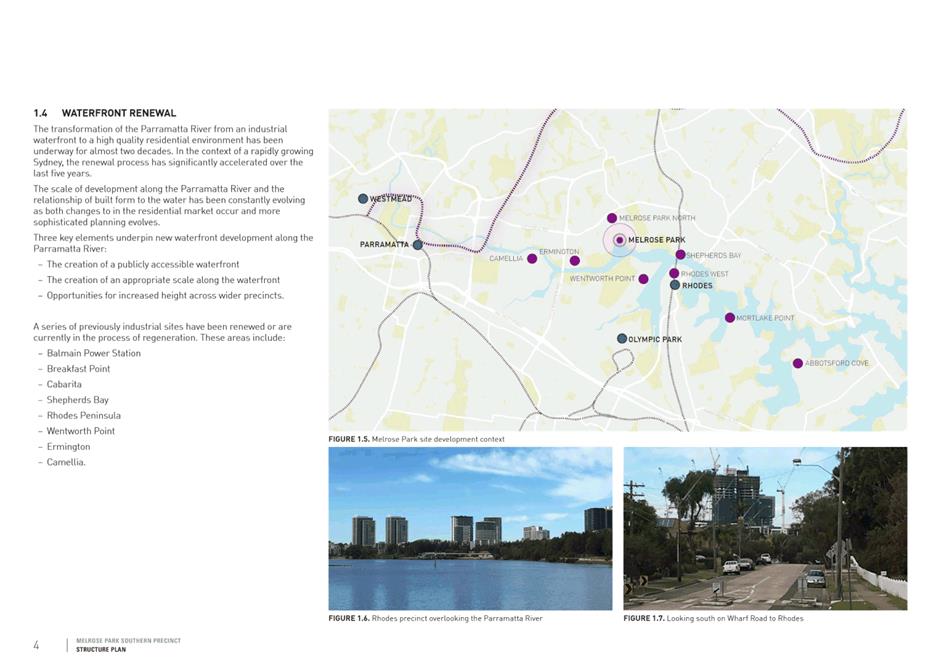

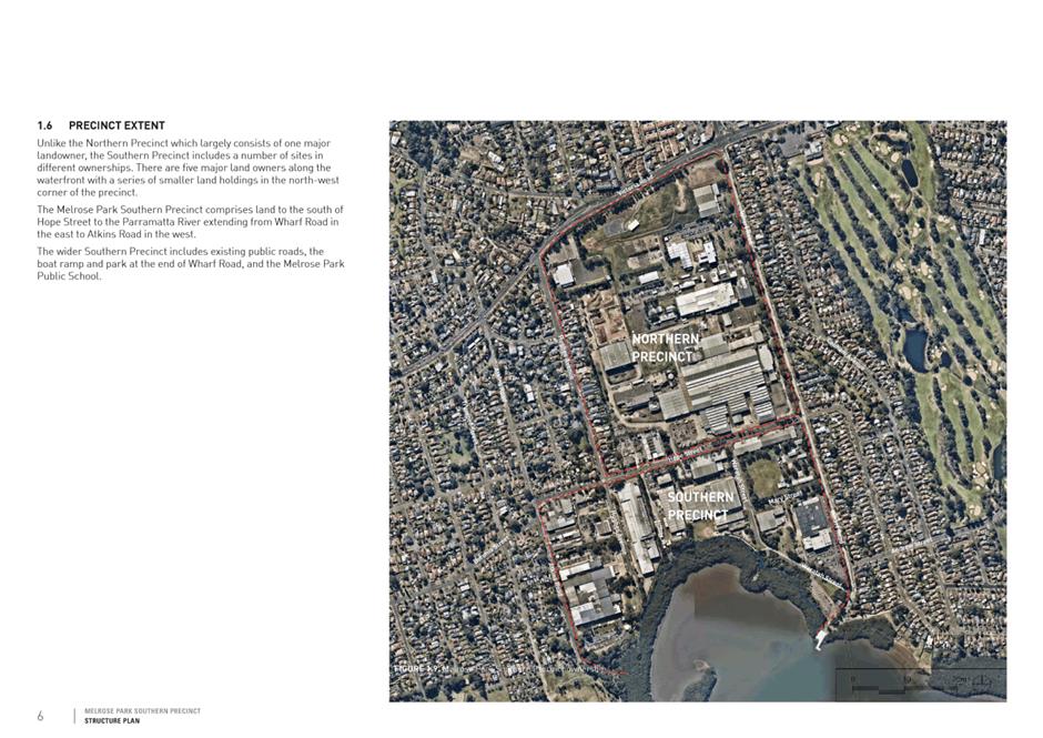


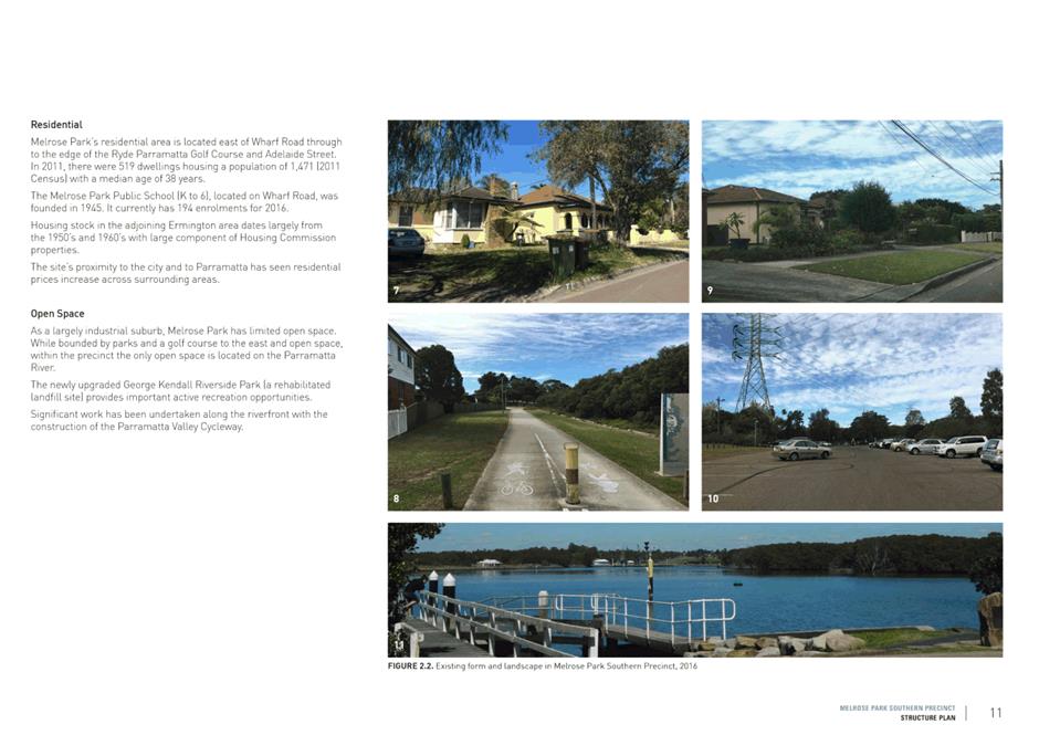
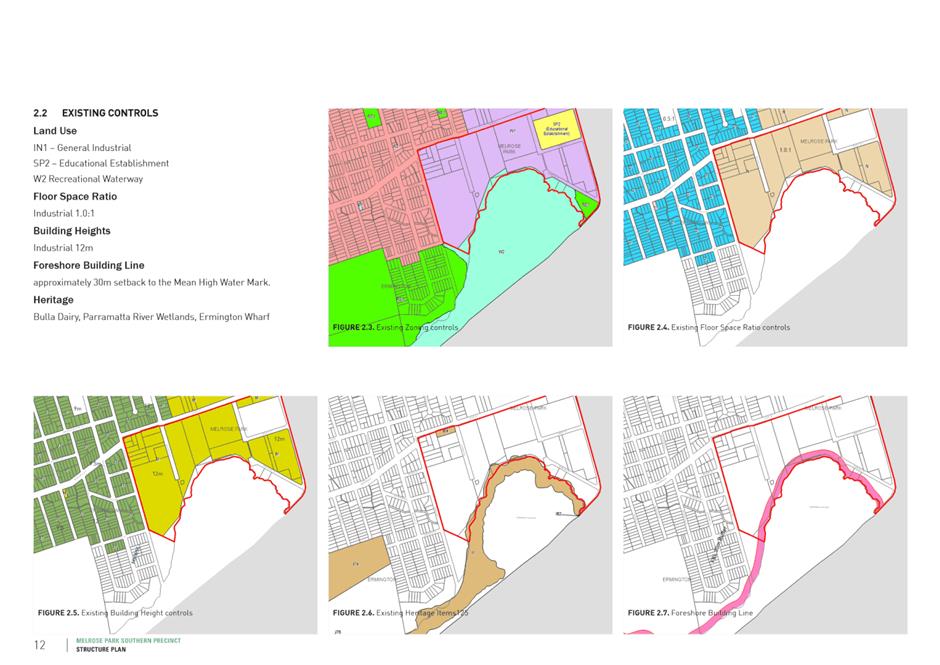
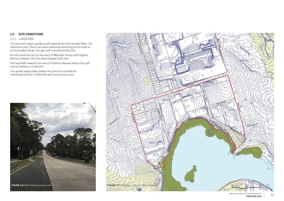
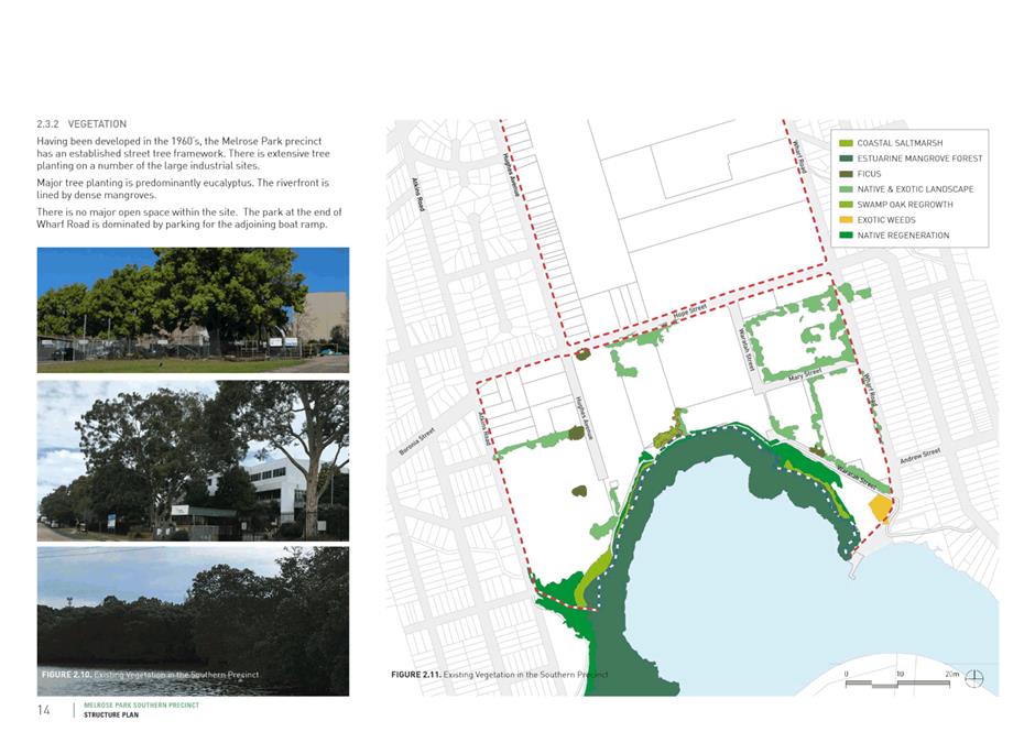
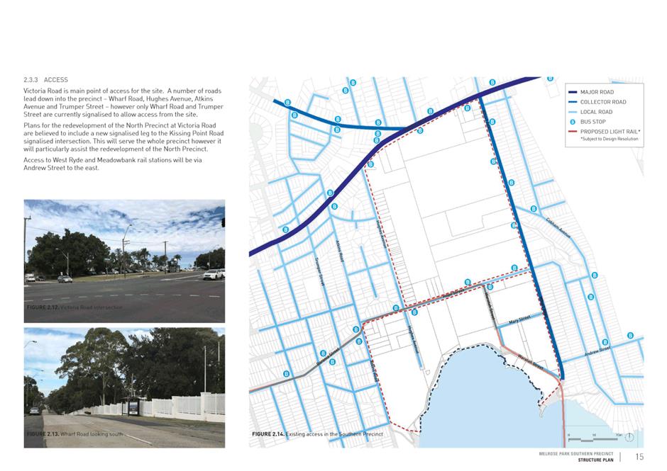


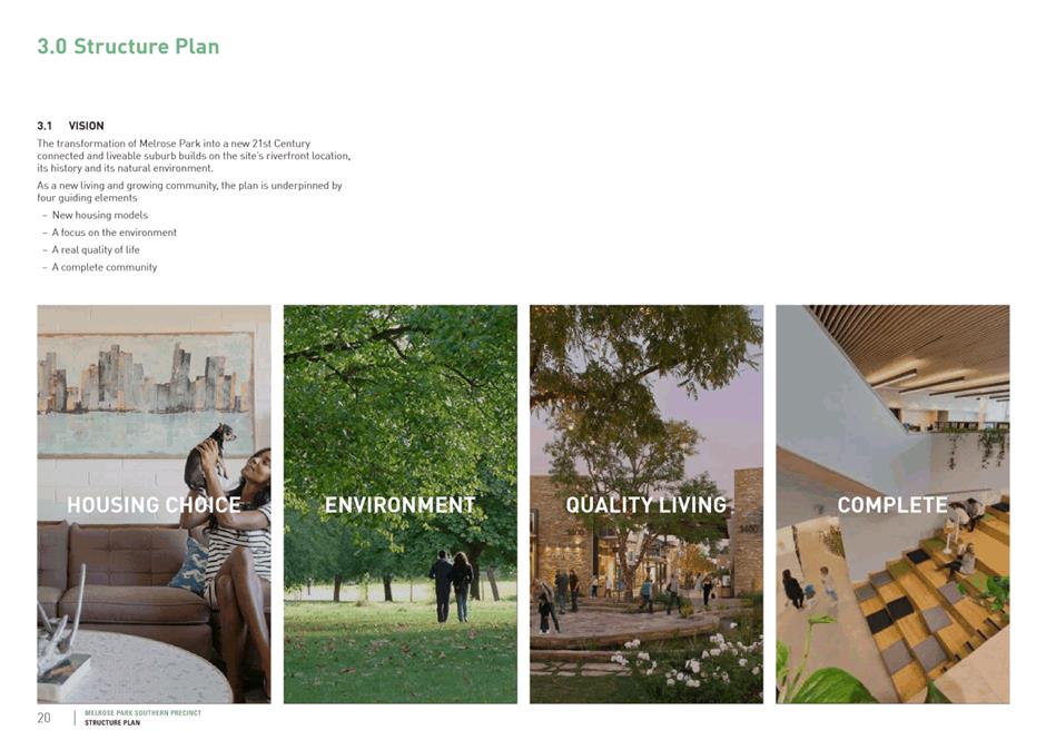

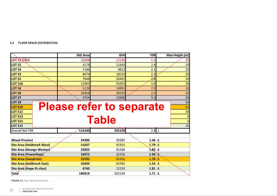


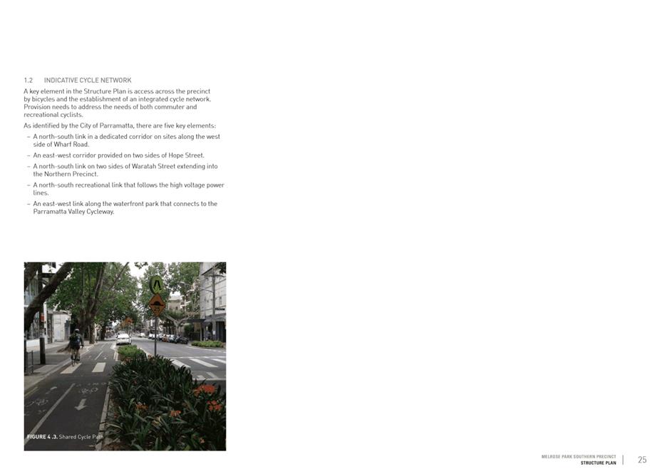
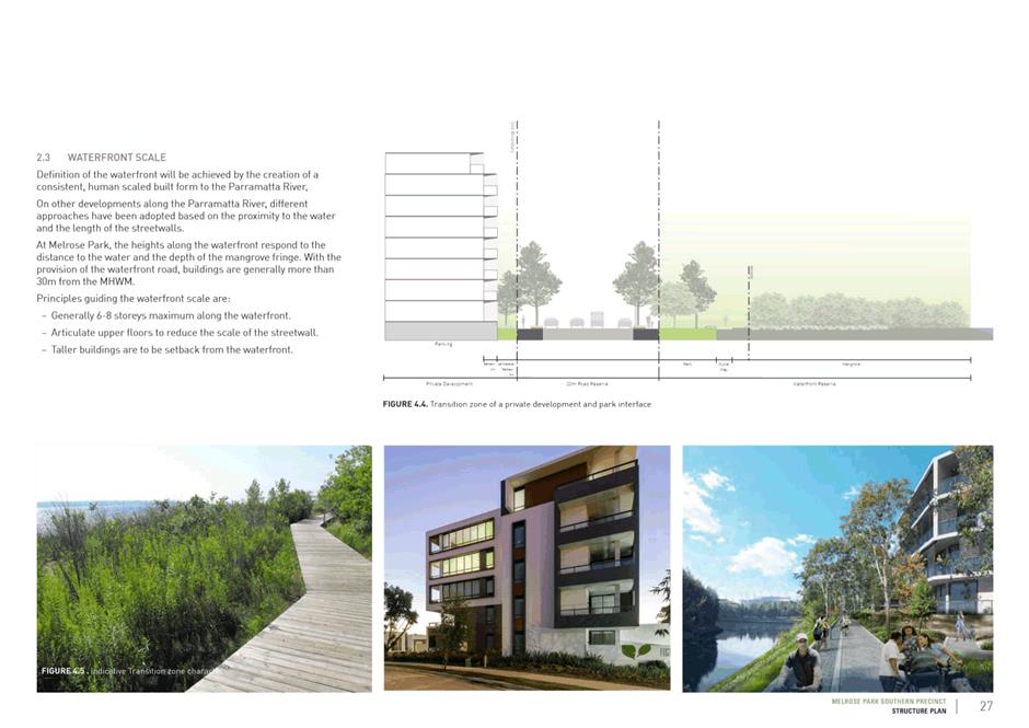
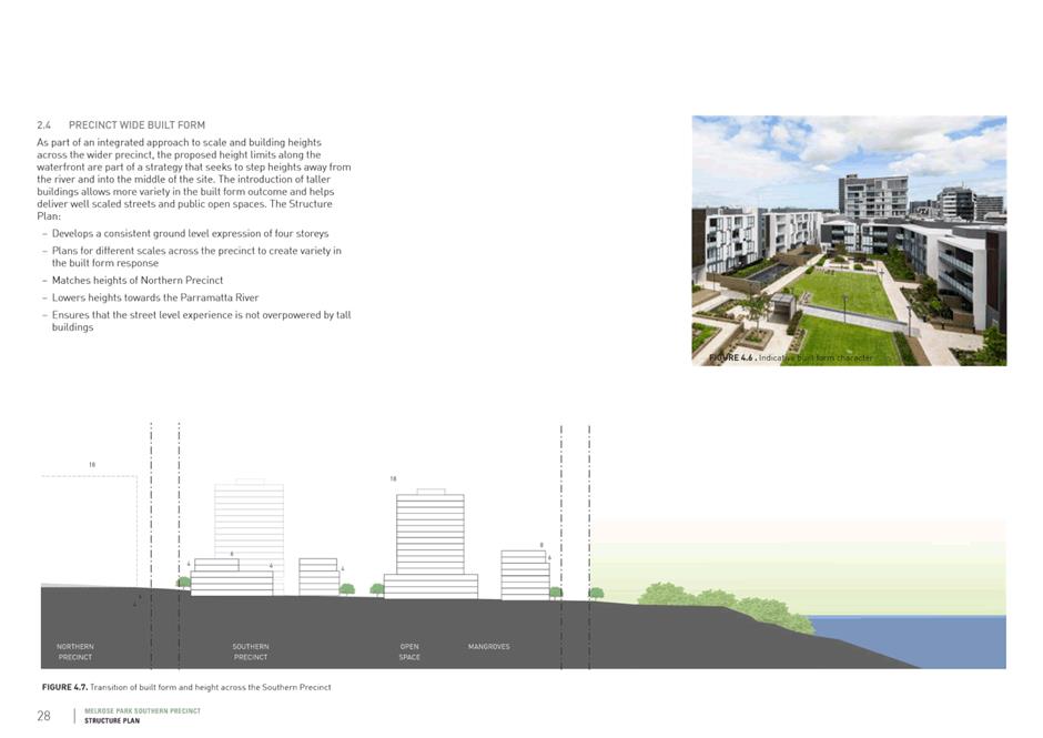
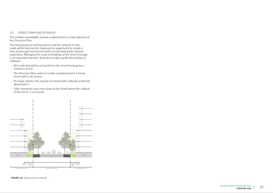
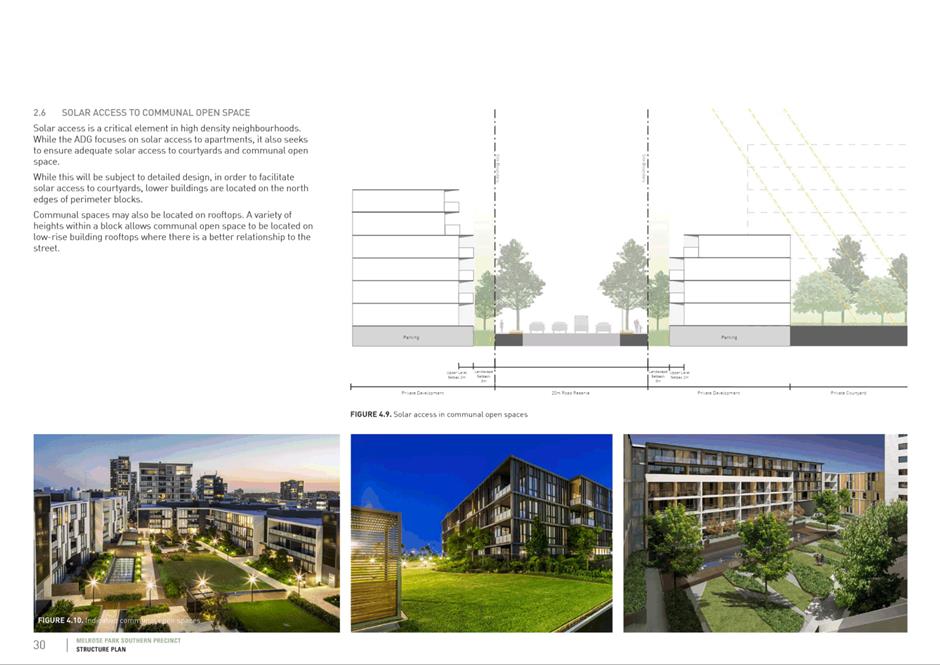
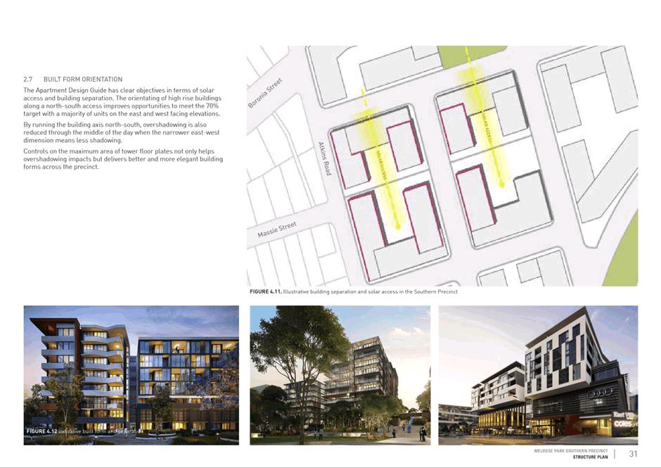
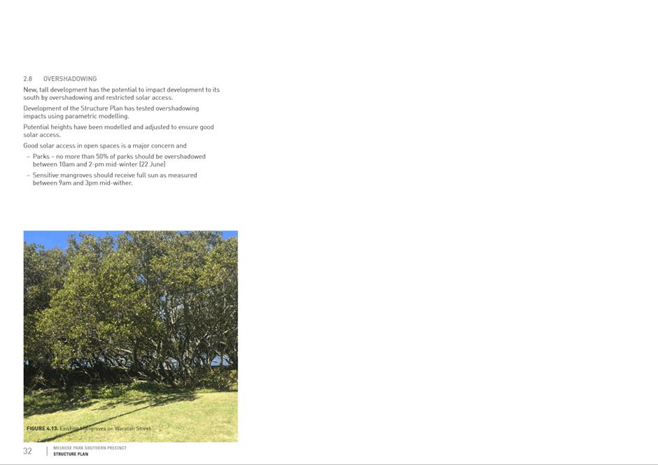
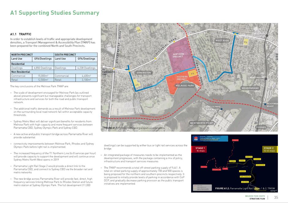
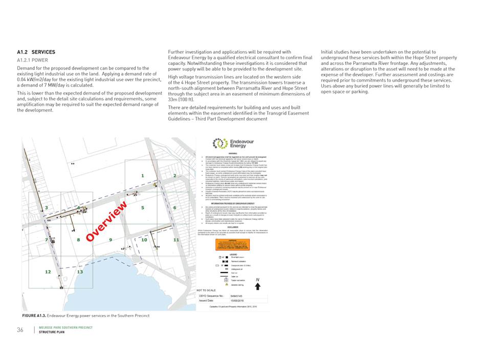
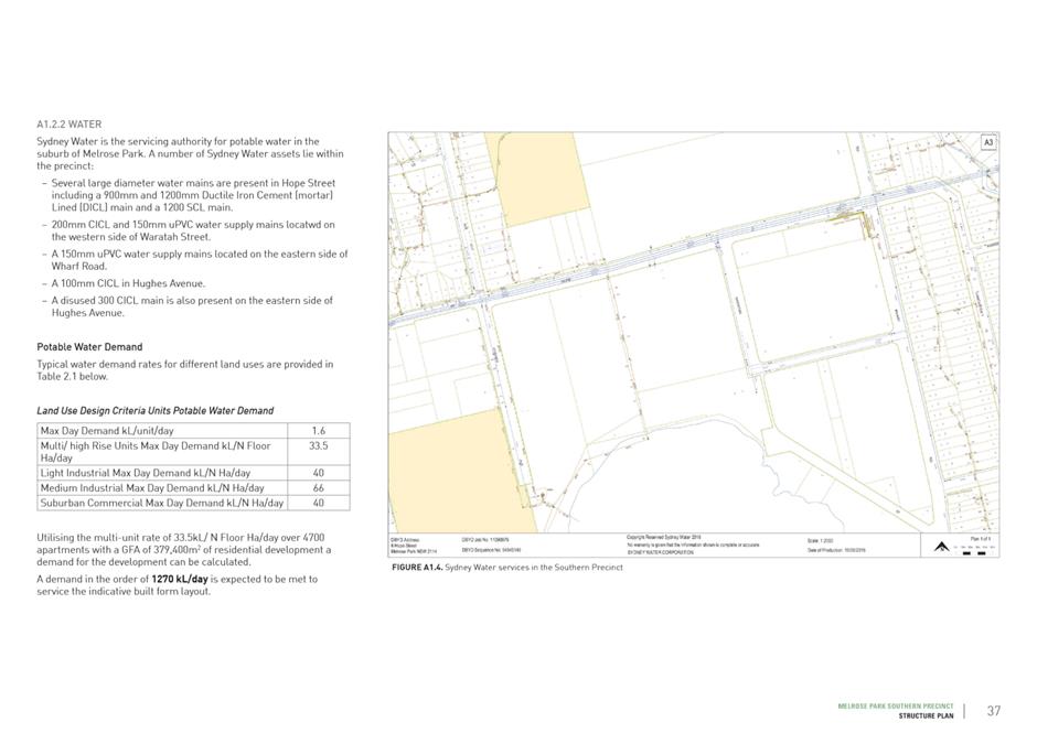
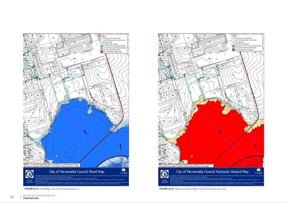
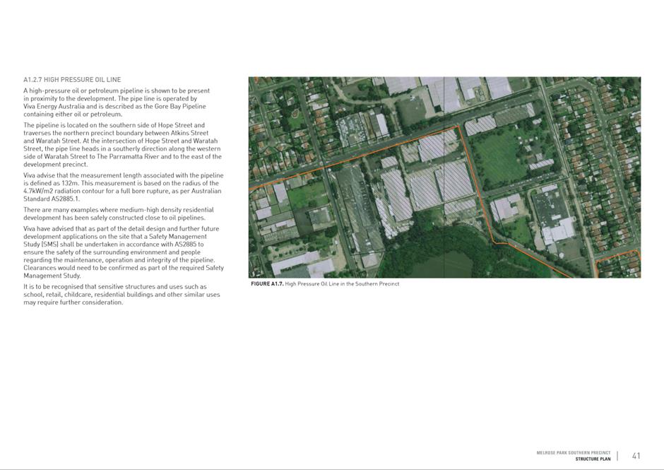
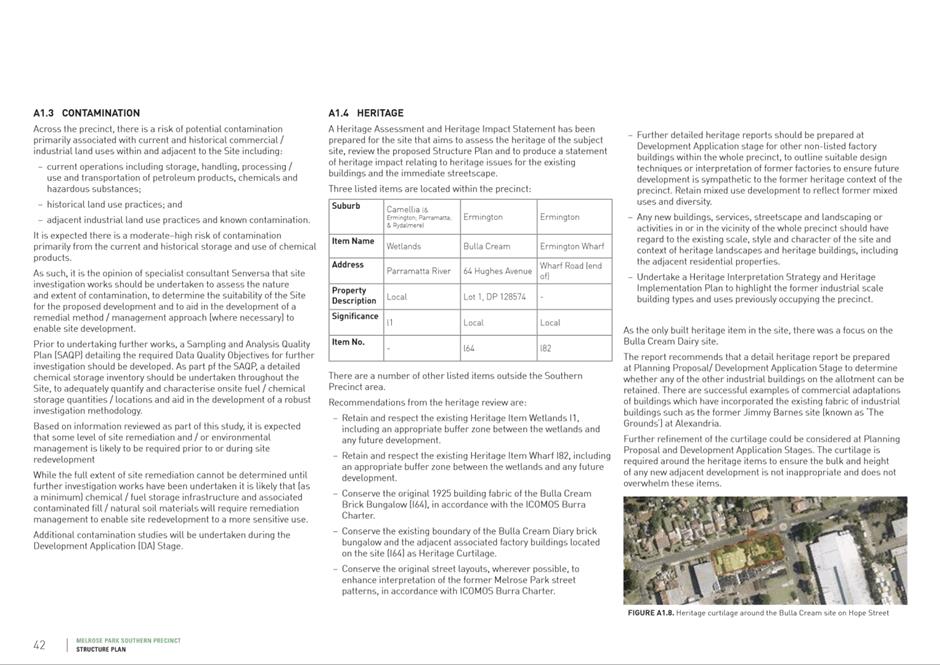
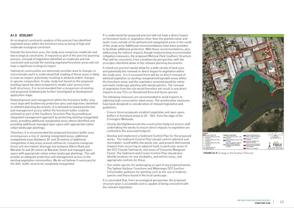
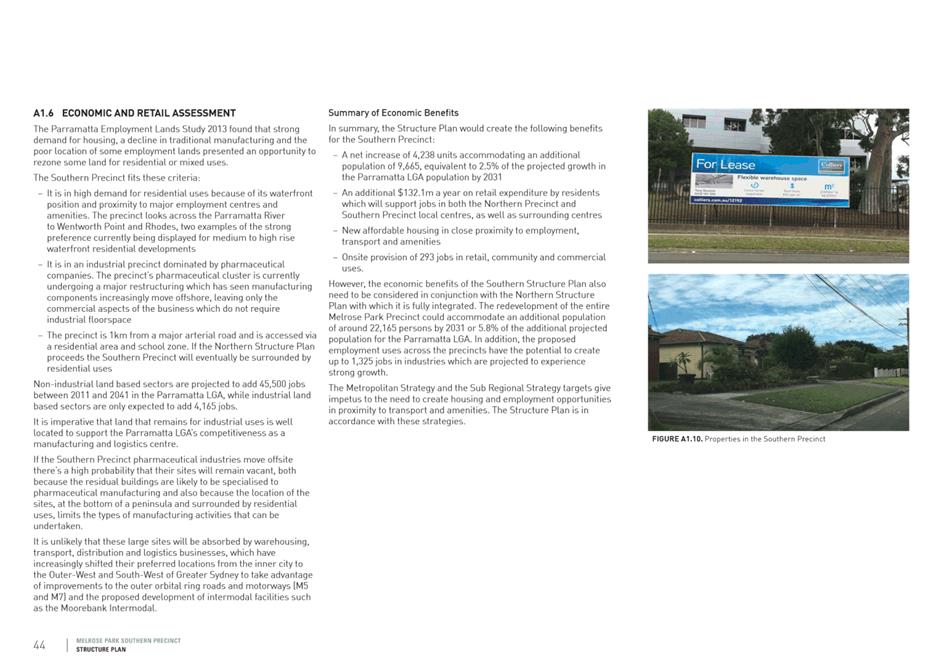
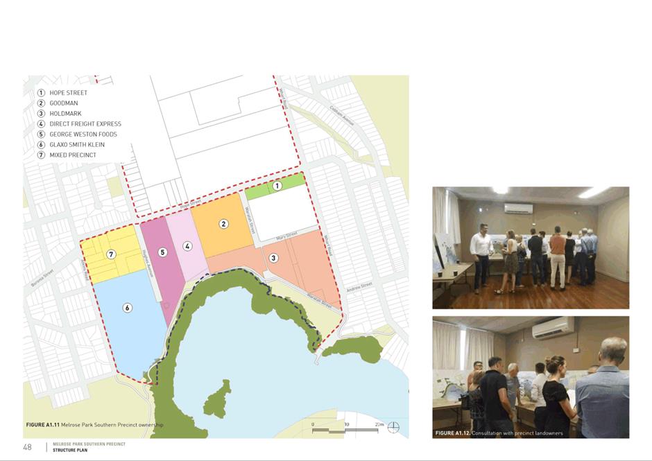
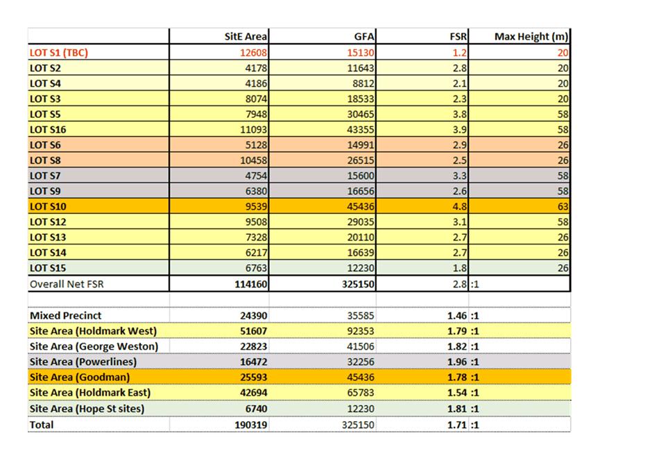
Council 16 December 2019 Item
18.4
ITEM NUMBER 18.4
SUBJECT FOR
APPROVAL: Pre-Gateway - Planning Proposal for land at 195 Church Street, 65-79
Macquarie Street, 38 and 45 Hunter Street, Parramatta (St John's Anglican
Church)
REFERENCE RZ/5/2018 - D07149307
REPORT OF Land Use Planning Manager
|
APPLICANT Jattca
Pty Ltd
OWNER St
Johns Parramatta Endowment Fund
DEVELOPMENT APPLICATIONS
CONSIDERED BY SYDNEY CENTRAL CITY
PLANNING PANEL - Nil
PURPOSE:
This report seeks Council’s endorsement of a
Planning Proposal for the land at 195 Church Street, 65-79 Macquarie Street,
38 and 41-45 Hunter Street, Parramatta for the purposes of forwarding it to
the Department of Planning, Industry and Environment (DPIE) for a Gateway
determination. The report also seeks:
· endorsement to proceed with the preparation of a
site-specific Development Control Plan;
· authorisation for the Chief Executive Officer to
progress negotiations on a Planning Agreement;
· authorisation for further investigations and
consultation with the applicant and adjoining owners on potential road
closures and changes to the way sites are accessed by vehicles in the
precinct.
|
|
RECOMMENDATION
(a) That Council endorse
the Planning Proposal at Attachment 2
for the purpose of public exhibition to amend Parramatta LEP 2011 for land at 195 Church Street, 65-79 Macquarie
Street, 38 and 41, 43 and 45 Hunter Street, Parramatta, to pursue the
following amendments to Parramatta Local Environmental Plan 2011:
i. The land
be rezoned from part B4 - Mixed Use and SP1 – Special Activities (Place
of Public Worship) to part B3 - Commercial Core, part B4 Mixed Use and part
SP1 Special Activities (Place of Public Worship) as shown in Figure 7
(Recommended - Zoning) of this report.
ii. The Floor Space
Ratio (FSR) map be amended to apply a maximum incentive FSR of 10:1 in the
location shown in Figure 7 (Recommended - FSR) of this report with no FSR
being applied to the portion containing the Cathedral, also mapped in Figure
7 (Recommended - FSR) of this report.
iii. An additional
site-specific local provision be included, which allows unlimited FSR for
office development on the portion of the site labelled 10:1* in Figure 7 of
this report (Recommended - FSR) of this report.
iv. The sliding-scale
provisions contained within Parramatta LEP 2011 remain applied to the subject
site.
v. The Height of
Building Map be amended to apply a maximum building height control of 211
metres Reduced Level (approximately 60 storeys) and 12 metres (approximately
3 storeys) in the locations shown in Figure 7 (Recommended - Building
Height) of this report with no building height being applied to the portion
containing the Cathedral, also mapped in Figure 7 (Recommended - Building
Height) of this report.
vi. The site is
identified on the Special Provisions map to permit the application of Clause
7.6 Airspace operations.
vii. The existing heritage item
identified as St. John’s Parish Church Hall (Item 1713) be de-listed
from Schedule 5 of the LEP.
viii. The portion of land at 41, 43
and 45 Hunter Street, as shown in Figure 10 in Attachment 1, is identified on
the Land Reservation Acquisition Map to facilitate the creation of a 6 metre
wide laneway to provide future vehicle access to these three sites and 181
Church Street, Parramatta. Noting that 41 and 43 Hunter Street have only been
included in the Planning Proposal for the purposes of identifying the 6 metre
wide laneway land on the Land Reservation Acquisition Map and that no other
changes will be made to the planning controls that apply to these two sites.
ix. An additional site-specific provision to
allow car-parking as a permissible use on a small portion of the land zoned
SP1 – Special Activities (Place of Public Worship), shown in Figure 9
in Attachment 1, in conjunction with any redevelopment of the St John’s
Church Site.
x. Is consistent with Council’s
policy position, endorsed 25 November 2019, in relation to Sun Access Plane
– Parramatta Square where any new development
on affected land must not result in any additional overshadowing between 12pm
and 2pm of the nominated area on Parramatta Square during midwinter on 21
June.
xi. Maximum parking rates be adopted as an
additional local provision, consistent with the Parramatta CBD Planning
Proposal Strategic Transport Study rates endorsed by Council on 10 April
2017.
(b) That
the revised Planning Proposal be forwarded to the DPIE with a request for a
Gateway Determination;
(c) That
a site-specific Development Control Plan (DCP) be prepared and reported to
Council prior to exhibition, in accordance with the following principles:
i. Significant
heritage interpretation of the Church Hall recommended above for delisting
and potential future demolition;
ii. A minimum 5
metre width for the new pedestrian through link (laneway) with no building
overhangs and activation of the laneway;
iii. Requirements for the
new civic square including scale, treatment, tree planting and deep soil;
iv. Controls consistent
with the Parramatta CBD Planning Proposal flood requirements, basement design
(flood-proofing), requirement for an overland flow study, water sensitive
urban design requirements, no habitable floor space to be provided below the
ground level;
v. Vehicular access
and servicing arrangements for the site; and
vi. Built form controls
relating to the tower forms on the site including but not limited to tower
setbacks from adjoining properties, and setbacks from retained heritage
items.
(d) That the
CEO be authorised to negotiate a Planning Agreement with the landowner that
takes into consideration:
i. the
public benefits offered by the landowner in submissions to Council to date;
ii. Council’s
Planning Agreements Policy and Parramatta CBD Planning Proposal Community
Infrastructure Framework acknowledging that the public benefits offered by
the landowner are proposed to offset the demolition of the Church Hall. The
works proposed to offset the loss of the Church Hall should not be taken into
consideration when determining whether any offer from the landowner is
consistent with the abovementioned Council Policy and Framework.
iii. that
any planning agreement contribution is in addition to the development
contributions required under Council’s CBD Development Contributions
Plan.
(e) That
an assessment of whether the eastern portion of Hunter Street adjoining the
subject site’s western boundary should be closed and sold to the Church
for inclusion in the new civic space, be considered concurrently with
Planning Agreement negotiations with the Applicant/ landowner.
(f) That
the outcome of negotiations on the Planning Agreement and the assessment of
the closure of the eastern portion of Hunter Street be reported back to
Council for endorsement prior to public exhibition of any Planning Agreement,
at the same time the draft site-specific DCP is reported to Council for
exhibition purposes.
(g) That prior
to any exhibition the Applicant be requested to provide urban design analysis
and other supporting documents for the Planning Proposal that are consistent
with the Council’s resolved position and any conditions of the Gateway
Determination to ensure the exhibition material is consistent.
(h) That upon
the issue of a Gateway Determination the Planning Proposal, draft DCP, and
Planning Agreement be exhibited concurrently and that the exhibition outcomes
be reported back to Council.
(i) That
Council officers commence negotiations with the owners of 181 Church Street,
Parramatta to seek agreement to the implementation of alternate vehicle
access arrangements to this site from Hunter and/or Marsden Street.
(j) That
Council authorise the CEO to amend the Planning Proposal to correct any minor
anomalies of a non-policy and administrative nature that may arise during the
plan-making process.
(k) Further,
that Council note the advice of the Local Planning Panel of 3 December
2019 is inconsistent with the Council officer’s recommendation in this
report. The Panel’s advice is to:
i. Retain
the listing of the Church Hall on the heritage schedule; and
ii. Consult
with landowners of 41 and 43 Hunter Street, prior to requesting a Gateway
determination.
|
PLANNING
PROPOSAL TIMELINE
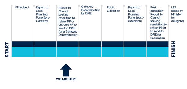
BACKGROUND
1. On
29 May 2018, Jattca Property Solutions (the Applicant) lodged a Planning
Proposal to Council on behalf of the landowner (Anglican Church Property Trust
Diocese of Sydney, as Trustee for the Parish of Parramatta and the St
John’s Parramatta Endowment Fund) in relation to land at 195 Church
Street and 68-79 Macquarie Street and 45 Hunter Street, Parramatta. The subject
site is commonly referred to as the St John’s Church site.
2. The
applicant’s Planning Proposal is based on a 100-year master plan
envisaged for the subject site prepared by the Applicant and includes the
following (Attachment 3 contains images of the proposed development
preferred by the Applicant):
· A
new setting for the state heritage listed St John’s Anglican Cathedral
through an enhanced public domain comprised of the provision of a new public
square (proposed to remain under the ownership of the Church but accessible by
the public), and a new pedestrian laneway accessed from Macquarie Street;
· A
new northern tower comprised of 45-storeys (approximately 192 metres) including
a minimum of 4,000 square metres of Church uses ancillary to the Cathedral,
ground floor active uses within a three-storey podium, and 44,000 square
metres of A-Grade leasable office space within the tower element (providing
approximately 4,000 jobs) which would require the demolition of the existing
locally heritage listed Church Hall located immediately north west of the State
listed Cathedral;
· A
new southern tower comprised of 43-storeys (approximately 152 metres)
containing ground floor active uses and 15,000 square metres of residential
accommodation; and
· Shared
basement car parking extending from the north of the site, to the south of the
site with proposed vehicular access off Macquarie Street.
3. The Applicant’s preferred redevelopment
option involves the demolition of the Church Hall, which is a listed Heritage
Item. The Applicant was asked to prepare three design options regarding the
treatment of the Church Hall to allow a proper assessment of the proposal and
the potential alternatives. The options put forward by the Applicant and
assessed by Council officers were:
i. The Church Hall is retained with any new building
constructed beside the Hall;
ii. The Church Hall is retained and the new A-grade office
building cantilevers over the Hall; and
iii. The Church Hall is demolished to allow for a larger civic
space and better activation from a new A-grade office building.
4. The Applicant’s original Planning Proposal
did not propose to de-list the Church Hall from Schedule 5 of Parramatta LEP
2011, but instead to show its removal in the site-specific DCP and manage its
removal as part of a future development application. Council officers advised
the Applicant that if officers were to support the removal of the Church Hall,
it would be on the basis that the Church Hall was formally de-listed. As such,
the Applicant subsequently amended their proposal to now seek the de-listing of
the Church Hall from Schedule 5 of Parramatta LEP 2011.
5. Further detail on the application and the
applicant’s justification is included in the Urban Design report lodged
with the application (Refer to Attachment 3).
THE SUBJECT SITE AND
SURROUNDING CONTEXT
6. The
subject site contains 195 Church Street, 65-79 Macquarie Street, 38 and 45
Hunter Street, Parramatta. These properties comprise of twelve (12) allotments
currently owned by the Anglican Church Property Trust, Diocese of Sydney, as
Trustee for the Parish of Parramatta and the St John’s Parramatta
Endowment Fund (See Figure 1). The subject site is irregular in shape and has a
total site area of 10,857 square metres.
7. The
combined site has frontages to Macquarie Street (north), Centenary Square
(east), Hunter Street (west) and the railway corridor (south). The site is
about 100 metres from Parramatta Railway Station and Parramatta Light Rail
Stage 1 stop on Macquarie Street, and is adjacent to Parramatta Square.
8. There are currently site-specific
Planning Proposals being processed for three adjoining sites at 57 Macquarie
Street, 20 Macquarie Street and one site with two frontages at 197- 207 Church
Street and 89 Marsden Street. Details of what is proposed on these sites are
provided in Attachment 1 but each of these sites have Planning Proposals
before Council where buildings with heights between 90 metres (25-storeys) and
180 metres (50-storeys) are proposed.
Figure
1 – Subject site and listed heritage items in the locality (site shown in
outlined in red)
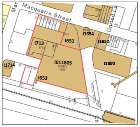
9. In the location shown in Figure
1, the subject site contains a State heritage item known as St John’s
Anglican Cathedral (I011805) and several local listed items including:
· St
John’s Parish Church Hall (Local Listing I713);
· Warden’s
(Verger’s) Cottage (Local Listing I653); and
· St
John’s Building (façade included in local listing I651 for
Centenary Square and adjoining buildings).
10. These
items as they relate to their respective allotments, contribute to the setting
and curtilage of the St John’s Anglican Cathedral. There are also a
number of heritage items on sites surrounding the subject site and the details
of these are provided in the Local Planning Panel report included as Attachment
1. The subject site and its surrounds is a critical heritage precinct in
the Parramatta CBD with a group of listed buildings on the site and surrounding
it that represent an important part of the history of Parramatta. Heritage
impacts are an important part of the assessment of this proposal.
COMPARISON OF EXISTING, PARRAMATTA CBD PLANNING PROPOSAL,
APPLICANT’S AND RECOMMENDED CONTROLS
11. A comparison of existing, Parramatta
CBD Planning Proposal, the Applicant’s and recommended controls is shown
in Table 1 below.
Table
1 – Comparison of controls
|
|
Parramatta LEP 2011
|
Parramatta CBD Planning Proposal, endorsed by Council on 25
November 2019
|
Applicant’s Planning Proposal
|
Council officer’s recommended controls
|
|
Zoning
|
Part B4 Mixed Use, part SP1 Special Activities
|
Part B4 Mixed Use, part SP1 Special Activities
|
Part B4 Mixed Use, part B3 Commercial Core, Part SP1 Special
Activities
|
Part B4 Mixed Use, part B3 Commercial Core, part SP1 Special
Activities
|
|
Maximum height of
building
|
Part 24m, part 18m, part
36m and part no height control
|
Part 24m, part 18m, part
12m, part 36m, part 211RL and part no height control
|
Part 28m and part no height
control
|
Part 12m part 211 RL and
part no height control
|
|
Maximum FSR
|
Part 3:1, part 10:1 and
part no FSR shown
|
Part 3:1, part 10:1 and
part no FSR shown
|
Part 13.5:1 and part 9.4:1
and part no FSR shown
|
Part 10:1 and part no FSR
shown (refer to special clauses)
|
|
Parramatta CBD Planning
Proposal special clauses
|
Sliding-scale applies
|
Sliding-scale applies
|
Seeking exemption from
sliding-scale
|
Sliding-scale applies
|
|
|
|
Aeronautical investigation
clause
|
Aeronautical investigation
clause
|
Aeronautical investigation
clause
Unlimited FSR on Proposed
B3 Commercial Core fronting Macquarie Street
|
|
Site-specific clauses
|
Nil
|
Nil
|
Nil
|
Additional permitted use to
allow basement parking on part of SP1 Special Activities zoned land.
|
|
Heritage status Church
Hall
|
Listed
|
Listed
|
De-list
|
De-list
|
|
Maximum gross floor area
(GFA)
|
6,870 m2
fronting Macquarie Street
2,592 m2
fronting Hunter Street
|
6,870 m2
fronting Macquarie Street
5,184 m2
fronting Hunter Street (applying sliding-scale)
|
57,900 m2 office
GFA fronting Macquarie Street
14,500 m2
fronting Hunter Street
|
Unlimited office GFA
fronting Macquarie Street
5,184 m2 in B4
Mixed Use Zone (applying sliding-scale)
|
|
Maximum dwelling yield
= maximum GFA / 85 m2
for high density dwellings
|
Approximately 111
apartments (both Macquarie and Hunter Street sites)
|
Approximately
142 apartments (both Macqaurie and Hunter Street sites)
|
171 apartments (Hunter
Street building)
|
61 apartments (Hunter
Street building)
|
ASSESSMENT
OF KEY ISSUES
Office building proposed at
the northern side of the site (fronting Macquarie Street)
12. Figure 2 shows the
Applicant’s proposed development for the northern part of the site. There
are three critical issues in the assessment of the office tower proposed at the
northern end of the site:
a. inconsistency with the
Parramatta CBD Planning Proposal;
b. de-listing and removal of
the existing Church Hall; and
c. potential for the
new office tower to overshadow the portion of Parramatta Square where solar
access is protected under Parramatta LEP 2011.
Figure
2 – Applicant’s preferred development option

Inconsistency with
Parramatta CBD Planning Proposal
13. As
indicated in Table 2, the Applicant is proposing significant changes
from the existing controls but the more relevant basis of assessment is to
compare the proposal to the draft Parramatta CBD Planning Proposal controls.
These controls represent Council’s current policy framework for sites in
the CBD. The differences between the Applicant’s proposal and the
Parramatta CBD Planning Proposal controls are summarised in Table 2.
Table 2 -
Comparison Parramatta CBD Planning Proposal controls and applicants proposed
controls as originally submitted for northern side of site.
|
|
Parramatta CBD
Planning Proposal
|
Application as
originally submitted
|
|
Zoning
|
B4 Mixed-Use
|
B3 Commercial Core
|
|
Height of Building
|
Part 24m (6-7
Storeys), part 28m (7-8 storeys) part 12m (3-4 storeys)
|
Removal of all height
controls
|
|
FSR
|
3:1
|
13.5:1
|
14. The
Parramatta CBD Planning Proposal controls are informed by a heritage study
undertaken by Urbis. The Applicant has put forward a suite of studies to argue
that additional density and height is appropriate for this site (Attachments 3,
4, 5, 6, 7, 9, 10, 12 and 13). Council obtained an independent heritage
review undertaken by Hector Abrahams and Associates (Attachment 8) that
recommended the Church Hall be retained but that they had no objection to a
taller building and more density in the area of the subject site north of the
Hall.
De-listing and
removal of the Church Hall
15. The
Applicant has provided a number of heritage and other studies to justify the
proposed de-listing and future removal of the Church Hall. The
Applicant’s justification for the removal of the Church Hall is
summarised as follows:
a. The
Church Hall has continuously evolved over time to support the needs of the
Church congregation and now needs to evolve again to meet modern day
requirements. The design and configuration of the Church Hall does not meet the
need of modern congregations;
b. The
Church wishes to expand its ancillary facilities in the podium of the new
proposed office tower on the northern side of the site and retaining the Church
Hall means the new facilities would be fragmented across two buildings rather
than incorporated and integrated in one new building;
c. It
is not viable for an A-grade office tower to be provided on site if the Church
Hall is retained. In addition, the cost of constructing an A-grade office tower
that is designed to accommodate the Church Hall and cantilever over the top of
the Church Hall will add to the design complexity and cost of the redevelopment
impacting on its viability;
d. The
Church wishes to provide a new civic space and new pedestrian laneway linking
the new civic space to Macquarie Street along the western edge of the site, to
provide an improved public domain outcome in front of the Cathedral. Removing
the Church Hall will allow for the new civic space to be larger, better
connected to other civic space around the Church and to Centenary Square and be
better activated as the existing Church Hall has limited opportunities for
openings and interactions along its southern edge fronting the new civic space.
The area of civic space that the Church is able to contribute to the new civic
square can be increased by 640 square metres from 1,210 square metres to 1,850
square metres, if the Church Hall is removed;
e. For
the Church to make their 100-year masterplan financially viable, they need to
be able to develop a viable A-grade office building. This would also be a
valuable contribution to the CBD where employment uses should be encouraged;
f. Retaining
the Church Hall would limit the ability to achieve a continuous functional
basement; and
g. The
public benefit from the new public domain and the additional A-grade jobs will
outweigh the public loss associated with the future demolition of the locally
listed Church Hall.
16. As
part of the assessment, Council asked the Applicant to provide details of the
different development outcomes on the site if the Hall is demolished or
retained including an option with an office tower cantilevering over the Church
Hall.
17. As
indicated above, the independent heritage assessment recommended the Church
Hall be retained and that any tower adjoining it should not cantilever over the
Hall. This position is supported by Council’s Heritage Advisor and the
Heritage Advisory Committee.
18. An
independent assessment was undertaken by JPW Architects to test the viability
of providing an A-grade office building if the Church Hall is retained. The key
conclusions were that it is possible to achieve an A-grade office tower if the
Church Hall is removed or if it cantilevers above the Hall but not if the
Church Hall is retained.
19. Copies
of the heritage and A-grade office viability studies Council engaged are
provided in Attachments 8 and 11.
20. An
assessment of the economic benefits of the proposal was obtained from
Council’s Economic Development team who acknowledged the benefits and
demand for additional A-grade office space in this location in the Parramatta
CBD.
21. The recommendation on whether the Church Hall should be
demolished rests on the net public benefit from the project. The operational
issues associated with the operation of the Church are secondary issues. The
key issue is whether the public benefits accruing from the larger new civic
space, the improved level of design and activation of this space and the
economic benefits of an A-grade office space outweighs loss the community will
experience by having a locally listed heritage item demolished. After
considering the issues, Council officers consider that on balance the public
benefits accruing to the community by the proposal are greater than the loss
associated with potential demolition of the Church Hall, consequently, it is
recommended Council support the Applicant’s proposal to de-list the
Church Hall. De-listing the Church Hall from the heritage schedule in the
Parramatta LEP 2011 will simplify the assessment of any future development
application for demolition and increase the likelihood that any future proposed
demolition will be approved.
Overshadowing of Parramatta
Square
22. Figure
3 shows the portion of Parramatta Square that the Parramatta LEP 2011 seeks
to protect from overshadowing between 12pm and 2pm year round. Under the
Parramatta CBD Planning Proposal, it is proposed that this area be protected
between 12pm and 2pm on 21 June. This would allow some overshadowing during
other times of the year providing there is no shadow impact on 21 June.
23. The
northern office tower proposed by the Applicant complies with the proposed
Parramatta CBD Planning Proposal control which would protect the site on 21
June from 12 pm to 2pm. The proposed office tower would overshadow the key
portion of Parramatta Square between 12pm and 2pm during two periods of the
year from March to May and August to October, but complies with the Parramatta
CBD Planning Proposal controls.
Figure 3 –
Subject site in relation to Parramatta Square Sun Access Plane
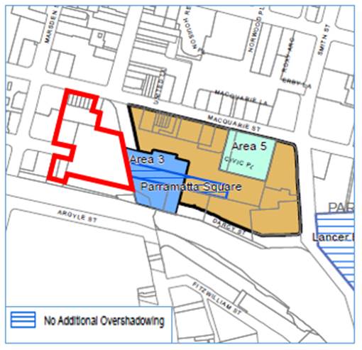
24. The
conclusion of the assessment is that taller buildings can be supported on the
northern portion of the site from a heritage viewpoint and that there is a net
public benefit in promoting an A-grade office building on this site by allowing
for the demolition of the existing Church Hall. Also, the shadow impact is
consistent with Council’s overshadowing policy. Given these conclusions,
the Applicant’s proposed de-listing and demolition of the Church Hall and
an increase in FSR and heights are supported on the northern part of the site.
The specific FSR and height recommended are discussed later in the report.
Residential building proposed at the southern end of site
(fronting Hunter Street)
25. The
residential tower development is shown in Figure 2. The Applicant is
proposing a 43-storey (154 metre high) residential tower building with up to
15,000 square metres of floor area. Development on the southern end of the site
would be limited to the 45 Hunter Street site because the remainder of the
southern part of the site is within the state listed curtilage of the Cathedral
where development would not be supported.
26. The
applicant is also seeking to expand the existing B4 Mixed Use zoned area
immediately west of the Cathedral, as shown in to Figure 4. This would
allow an FSR to be applied to this land. This proposal if accepted would allow
the Applicant to avoid application of the sliding-scale provision (by having
sufficient land area to maximise the FSR) and allow a much bigger building on
45 Hunter Street than would be permitted under the Parramatta CBD Planning
Proposal. A comparison of the development permitted under the Applicant’s
proposal and the Parramatta CBD Planning Proposal is shown in Table 3.
Figure 4 –
Applicant’s proposed zoning
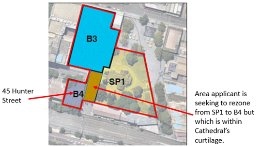
Table
3 – Comparison of Applicant’s proposed and Parramatta CBD Planning
Proposal controls
|
Scenario
|
Site Area (approx.)
|
FSR with Sliding-scale FSR
|
Floor Space Achievable
|
Height of building
|
|
Applicant’s proposal
|
1,600 m2*
|
9.4:1
|
14,500 m2
|
45-storeys
|
|
CBD Planning Proposal and recommendation for this
site-specific Planning Proposal
|
864 m2^
|
6:1
|
5,184 m2
|
8-storeys
|
*Area Applicant is proposing to zone B4 Mixed use
^Site area of 45 Hunter Street.
27. A
detailed assessment of the urban design impacts indicates that permitting the
Applicant’s proposed controls would produce an unacceptable urban design
outcome with large towers with minimal setbacks and large blank walls on 45
Hunter Street and the adjoining site at 43 Hunter Street. The design outcome is
inconsistent with the objectives of the Apartment Design Guide and
Council’s policy framework. This detailed assessment is provided in Attachment
1. A better urban design outcome is achieved by encouraging amalgamation of
43 and 45 Hunter Street to obtain one tower with setbacks that comply with the
objectives for the Apartment Design Guide and Council’s policy framework.
28. Given
the findings of the urban design assessment, a planning policy that encourages
amalgamation of these sites is recommended. The existing Parramatta LEP 2011
and the Parramatta CBD Planning Proposal both contain sliding-scale controls
that seek to encourage amalgamation by allowing the landowners to achieve a
higher FSR if they amalgamate their sites and achieve the greater site area and
urban design outcomes. It is recommended that the FSR and height controls be
permitted to increase in accordance with the Parramatta CBD Planning Proposal
and that the current sliding-scale controls be applied to encourage
amalgamation and achievement of better urban design outcomes.
ASSESSMENT OF OTHER PLANNING
MATTERS
29. An
assessment of traffic, vehicle access, flooding and other statutory matters are
provided at Attachment 1.
30. This
assessment includes an analysis of the impact of this Proposal on two sites at
83 Macquarie Street and 181 Church Street that will become isolated unless they
can be amalgamated with the Church site and developed in an integrated manner.
The two sites are shown in Figure 5.
Figure 5 – Isolated sites
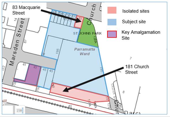
31. The
isolated site assessment concludes that, if the two sites are developed
separately, the development potential they will be able to achieve will not be
greater than what is permitted under current controls in Parramatta LEP 2011
due to constraints related to protecting the view corridor to St John’s
Cathedral.
32. If
they are amalgamated with the Church site, the net development potential will
not increase and the urban design outcomes will not be significantly different.
33. Given
this, there is no benefit to any landowner or additional incentive to
amalgamate these sites with the Church site if these sites are included in the
subject site-specific Planning Proposal. These isolated sites are not
considered an issue that warrants Council making a decision not to progress the
current site-specific Planning Proposal.
34. The
assessment of these additional issues has identified a range of further
amendments to the planning controls that are recommended for inclusion in the
Planning Proposal. These are summarised in Table 4.
Table 4: Additional recommended controls
|
Recommended control
|
Justification
|
|
Allow basement parking as an additional permitted
use in part of SP1 Special Activities (Place
of Public Worship) zoned land to allow
a single connected basement to be achieved
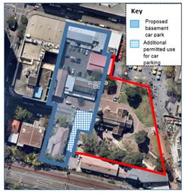
Figure 6 : Applicant proposed basement parking Plan
|
The basement parking is unlikely to have a
significant impact on the heritage significance of the Cathedral.
The potential benefits of achieving a large basement
that links both the proposed building on the site is acknowledged.
Allowing this additional permitted use will allow
the impact of a basement to be considered in more detailed at Development
Application stage where otherwise it would not be permitted and not able to
be considered.
|
|
Include
car parking rates for the Parramatta CBD Planning Proposal endorsed by
Council on 10 April 2017
|
Ensure
consistency with Council’s resolved position on parking in the
Parramatta CBD. The planning proposal would be unlikely to be supported by
State Government planning or transport agencies unless this is included.
|
|
Include
a 6m strip of land parallel to the rail line impacting on 41, 43 and 45
Hunter Street on the Land Reservation Acquisition Map to ensure that a new
laneway can be delivered. While technically this will make Council the
acquisition authority for this land it is envisaged that the laneway will be
delivered as an infrastructure contribution that would be negotiated when
these sites are redeveloped in the future rather than acquired by Council.
Given the boundaries of the lots the impact on 43 and 45 is to take a 6m
strip along the southern boundary of these site. However, 43 Hunter Street
has a battle-axe handle driveway linking the site to Marsden Street that is
approximately 4.5 metres wide so an additional 1.5m will be required. The
proposed access way would cover this battle-axe driveway and so the land take
from 41 Hunter Street will be in the order of 1.5m. (see Figure 10 in Attachment
1 for location of vehicle access laneway)
|
This
laneway provides pedestrian safety benefits in Hunter Street and will ensure
the new proposed civic space is more pedestrian friendly, by taking vehicles
accessing these properties off Hunter Street. This also would provide an
opportunity to resolve an access issue associated with 181 Church Street (ie
Queensland Arcade). Current vehicle access to the Queensland Arcade site
involves vehicles driving across a pedestrian zone immediately north of the
Church Street railway underpass which represents an on-going pedestrian
safety issue. This laneway could provide alternate access to this site to
assist in resolving this pedestrian safety issue.
|
|
Solar
Access provision to protect Parramatta Square from overshadowing,
|
To
apply controls consistent with Parramatta CBD Planning Proposal that propose
to protect solar access in Parramatta Square. Details of these controls have
been provided previously in this report.
|
|
Apply
clause 7.6 Aeronautical Operations to this site
|
Given
the height of the proposed buildings an assessment of their impact on
aeronautical operations will be required to be undertaken at development
application stage.
|
RECOMMENDED ZONING, FSR AND HEIGHT CONTROLS
35. As
a result of the assessment undertaken the zoning, FSR and height of buildings
controls recommended for the site are shown in the Figure 7
36. The
controls recommended are consistent with the Parramatta CBD Planning Proposal
except for the zoning change to enable a new A-grade commercial building on the
northern part of the site. The benefits associated with the new civic space and
A-grade office building are considered on balance to provide adequate justification
for the recommended de-listing of the Church Hall and the increase in FSR and
height on the site.
Figure
7: Recommended Zoning, Height of Building and FSR Controls
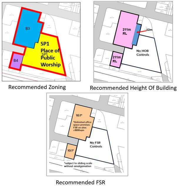
SALE OF PART OF HUNTER STREET
37. The proposed delivery of the
new civic square is supported in principle as it will contribute to the supply
of new open space in a strategically important area within the CBD, will
enhance the setting of the western part of the site, which currently presents
as a cul-de-sac at the end of Hunter Street, and complements existing adjoining
civic spaces.
38. The Applicant’s proposal includes the closure
of part of Hunter Street to create a new rectangular civic space and to
accommodate a new basement car park as shown in Figure 8. Council
officers consider there is merit in pursuing the new civic space if the subject
site is to be redeveloped in accordance with the Planning Proposal lodged.
Figure 8 – Portion of Hunter Street Applicant wishes to acquire
to allow for basement car park
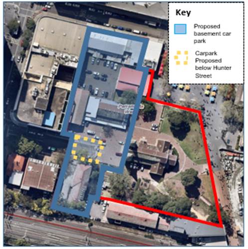
39. It is recommended that Council in
parallel with ongoing discussions with the Applicant on the Planning Agreement,
undertake a more detailed assessment of the merits of closing the relevant
portion of road and selling it to the Church. The assessment would be provided
at the same time the report to progress the Planning Agreement for the site is
reported to Council.
DEVELOPMENT CONTROL PLAN
40. Council officers will work with
the Applicant to prepare a draft site-specific DCP for the site, based on
issues raised during the assessment of the proposal including but not limited
to built form, flooding, heritage interpretation, access and service
arrangements and requirements for the pedestrian laneway and civic square. The
draft site-specific DCP will be reported to Council prior to its exhibition.
PLANNING AGREEMENT
41. The
Applicant submitted potential public benefits as part of their original
Planning Proposal with further detail provided in a letter to Council on 12
September 2019. The Applicant has agreed to include the following in a Planning
Agreement should Council be supportive of their proposal and in particular the
de-listing and demolition of the Church Hall:
· New
civic space and laneway;
· Immediate
temporary vehicle access to 181 Church Street; and
· Future
permanent vehicle access along the rear of 45 Hunter Street.
42. Negotiations
on the Planning Agreement should take into consideration the following issues:
a. Council’s
Planning Agreements Policy;
b. Council’s
Parramatta CBD Planning Proposal Value Sharing Framework;
c. The
delivery of the proposed civic space, new pedestrian lane and embellishment of
these spaces is proposed to offset the removal of the Church Hall. When
assessing the Applicant’s offer against the CBD Planning Proposal, the
value of these works should not be taken into account when determining whether
the Applicant’s offer is consistent with Council’s policy
framework.
d. The
recommended negotiating position is that any planning agreement contribution be
in addition to development contributions required at the development
application stage under Council’s CBD development contributions plan.
43. A
Draft Planning Agreement will be reported to Council for endorsement before it
is placed on public exhibition.
LOCAL
PLANNING PANEL ADVICE
44. The
Local Planning Panel considered a detailed assessment report on the Planning
Proposal at its meeting on 3 December 2019. An extract of the Minutes from the
Panel’s meeting is provided at Attachment 12.
45. The
Panel’s advice to Council relates to two key matters:
a. de-listing
the Church Hall from the heritage schedule; and
b. consulting
with landowners of 41 and 43 Hunter Street.
De-listing
the Church Hall
46. The
Panel endorsed the Planning Proposal with all Council officer recommended
amendments except Council officer’s recommended amendment to de-list the
Church Hall from the heritage schedule. The Panel does not consider de-listing
the Hall is appropriate. The Panel would instead prefer the merits of
demolishing a listed heritage item to be tested further as part of a future
development application by the Applicant.
47. Council
has commissioned a number of heritage reports, which include consideration of
the subject site and Church Hall, in connection with the current site-specific
Planning Proposal as well as the Parramatta CBD Planning Proposal. Council officers
have also sought advice from Council’s Heritage Adviser and Heritage
Advisory Committee. The Applicant has also commissioned multiple heritage
reports. Given the comprehensive advice sought to date, it is unlikely that a
further heritage report commissioned as part of a development application will
reveal any significant new information.
48. As
noted in this report, Council officers acknowledge that de-listing and
demolishing the Church Hall will impact on heritage, however, consider that on
balance the public benefits that will be derived from de-listing and
demolishing the Church Hall are of sufficient strategic importance to justify
de-listing the Church Hall. The three key public benefits to be accrued from
de-listing and demolishing the Church Hall are a larger new civic space, better
activation of the civic space, and the provision of A-grade office space. These
benefits will be particularly important owing to the site’s central and
strategically important location.
49. If
Council seeks to retain the Church Hall and does not allow a cantilever the
merit of zoning this portion of the site B3 Commercial Core is in question as
an A-grade office tower cannot be achieved. This recommendation is critical to
the corresponding Council officer recommendation on the zoning of the site. In
the report to the Local Planning Panel it has been noted that if demolition of
the Church Hall is supported then it should be conditional upon the zoning of
the relevant portion of the site being amended from B4 Mixed Use (which permits
residential development) to B3 Commercial Core (which prohibits residential
development). This will effectively “lock in” the public benefit by
requiring the site to provide a commercial/office use and prevent the site from
being developed for a residential purpose after the Church Hall is demolished.
If an A-grade commercial tower is not possible Council could consider retaining
the existing B4 Mixed Use zoning to provide more flexibility in the future use
of the site to the owner.
50. However,
it should be noted that the Applicant originally proposed the B3 Commercial
Core zoning and have written to Council following the Local Planning Panel
meeting of 3 December 2019 confirming that they support the B3 Commercial Core
zoning being applied to this portion of the site regardless of the decision
that is made by Council on the listing of the Church Hall.
51. The
Panel’s advice is that the preparation of a draft DCP for the site should
address a number of principles including the following principle that relates
to the Church Hall:
“Significant heritage
interpretation of the Church Hall for potential future demolition”
52. If
Council resolves to retain the listing of the Church Hall, as per the
Panel’s advice, Council officers advise that the draft DCP to be prepared
for the site should incorporate controls that promote the retention and
interpretation of the Church Hall. Section 3.42 of the Environmental
Planning and Assessment Act 1979 states that the purpose of a DCP is to
give effect to the aims and objectives of the relevant planning instrument. If
the Church Hall remains listed the aim and objective of Council’s Parramatta
LEP 2011 will be that the Church Hall be retained, enhanced and interpreted as
a heritage item. Therefore, any DCP controls that are drafted should facilitate
the retention, enhancement and interpretation of the Church Hall not foreshadow
its demolition. As noted, retention of the Church Hall will mean that the three
key benefits from removing the Church Hall cannot be realised.
53. The
Applicant when they first submitted the Planning Proposal were not seeking to
have the Church Hall de-listed. They amended their Planning Proposal after a
request from Council officers once Council officers advised the Applicant that
de-listing was the officers’ preferred position to ensure planning
controls will be consistent.
54. The
Applicant in their original Planning Proposal were proposing that the listing
be retained but that the Church Hall be demolished. The process they envisaged
to achieve this outcome was that a Development Application would be lodged to
seek approval to demolish the Church Hall. The Applicant as part of this
process was requesting that Council consider DCP controls that allowed
for/envisaged the Church Hall potentially being demolished.
55. If
the Church Hall is not delisted and DCP controls that specifically contemplate
removal of the Church Hall are not prepared, the absence of specific DCP
controls relevant to the demolition will mean Council cannot determine the
planning framework to positively influence the design of a proposed development
proposing to remove the Church Hall at the development application stage. As
Council will not be able to impose controls, if the relevant planning panel
supports removing the Church Hall, the panel rather than Council will
determine issues such as:
a. how
far back the new commercial podium should be setback;
b. what
the minimum expanded area of the new civic square must be if the Church Hall is
removed;
c. design
of the new podium to ensure appropriate activation of the new civic square;
d. what
the tower setback from the new podium should be to minimise visual amenity
impacts of the new tower on the new civic square ensure; and
e. interpretation
of the Church Hall in the new development if the Church Hall is removed.
56. Instead,
in the absence of specific DCP controls on how to address these matters, the
applicant will propose their own approach on how to do this. It will also mean
Council cannot negotiate to secure the expansion of the new civic square in the
Planning Agreement. Instead, it would rely on the applicant volunteering to
offer to enter into a Planning Agreement at the development application. As
noted, expansion of the new civic square is one of three key public benefits
underpinning the Planning Proposal.
57. The
decision that Council makes on the draft DCP will be critical. The advice of
Council officers is that if the listing of the Church Hall is to be retained
the draft DCP should include controls that are consistent with the aim and
objectives of the Parramatta LEP 2011 and that seek to retain, enhance and
interpret the Church Hall as a heritage item.
58. Including
DCP controls that envisage that the Church Hall may be demolished (despite it
being heritage listed) would result in an inconsistent policy framework. It
would leave the community having to interpret controls where it is unclear
whether Council supports demolition or not, and would set a precedent for other
sites/applicants who may seek two possible development scenarios in the DCP controls
for their site if they contain a heritage item: one with the heritage item
retained and one with it demolished. Council officers do not consider that this
would be an appropriate precedent.
59. Council
officers’ recommendations is that the Church Hall be de-listed to provide
a clear policy framework for the future redevelopment of the subject site.
Consulting
with landowners of 41 and 43 Hunter Street
60. The
Panel also consider that the revised Planning Proposal should be forwarded to
the DPIE with a request for a Gateway determination only after consultation
with landowners of 41 and 43 Hunter Street.
61. It
is understood the landowners are concerned about Council officers’
recommendation that the Planning Proposal be amended so that a portion of land
at 41, 43 Hunter Street is identified on the Land Reservation Acquisition Map.
As noted, this is to facilitate the creation of a 6-metre wide vehicle laneway
to provide future vehicle access to these three sites and the Queensland Arcade
site at 181 Church Street (refer to Figure 10 in Attachment 1 for the location
of the proposed lane).
62. It
is understood landowners’ concerns include the level of notification
provided before the Panel meeting, potential financial impacts and a perception
Council officers recommended the amendment to favour the Applicant.
63. Council
officers recommended the amendment for public interest reasons, namely, to
assist with addressing public safety, amenity and accessibility issues
associated with current vehicle access arrangements to Queensland Arcade.
Council officers did not recommend the amendment to favour the Applicant.
64. As
outlined in this report, the preferred approach is for affected landowners to
dedicate the land when they redevelop their sites, so they can still
‘harvest’ the floor space from the dedicated land and it does not
impact on their sites’ development potential. Compulsory acquisition is
not the preferred approach.
65. In
the unlikely event the land is acquired compulsorily, it would be governed by
the Land Acquisition (Just Terms Compensation) Act 1991. A key objective
of this Act is to guarantee that, when land affected by a proposal for
acquisition by an authority of the State is eventually acquired, the amount of
compensation will be not less than the market value of the land (unaffected by
the proposal) at the date of acquisition.
66. When
Council proposes a change to planning controls it typically consults with
affected landowners during the statutory public exhibition phase of the
planning proposal. There is also a risk the DPIE may determine that the
Planning Proposal cannot progress or it may impose conditions that substantially
change the Planning Proposal.
67. If
Council accepts the Panel’s advice to consult before requesting a Gateway
Determination, it will require the submission of a further report to Council in
2020 so that Council can consider the outcome of this consultation with the
owners of 41 and 43 Hunter Street prior to the Planning Proposal being referred
to the DPIE. If following this consultation Council decides to proceed and a
Gateway Determination is issued, a further statutory consultation period will
be required where these landowners will be consulted a second time. The
duplication of the consultation will extend the timeframe for the processing of
this Planning Proposal.
68. Council
officers do not consider that the consultation process should be duplicated and
recommend that the Planning Proposal be forwarded to the DPIE immediately and
the owners of 41 and 43 Hunter Street be consulted as part of the statutory
consultation process required after the DPIE provides a Gateway determination.
FINANCIAL IMPLICATIONS
69. The
report has flagged that Council may need to acquire a narrow strip of land
along the rear of 41 and 43 Hunter Street to enable a future vehicle laneway.
Council will only need to acquire the land if Council is unable to facilitate the
dedication of land for this laneway through the redevelopment of these sites.
70. A preliminary assessment of the financial impact
of any future acquisition has been provided to Council under separate cover.
The new vehicle laneway will be considered for inclusion in the new Parramatta
CBD Contributions Plan being prepared in parallel with the CBD Planning
Proposal. Options will be pursued to minimise the likelihood that Council will
need to formally acquire the land. The option of having the land dedicated to
Council at no or minimal cost as part of redevelopment of the relevant sites
will be the first option pursued.
71. A
contribution to Council for community infrastructure should be sought as part
of ongoing negotiations on the Planning Agreement. This might take the form of
a monetary contribution to fund Council works but the details of this are
subject to negotiation with the Applicant. The Applicant as part of the
discussions to date has flagged the potential dedication of a portion of 45 Hunter
Street to create the new vehicle lane as a potential inclusion in a future
Planning Agreement.
72. The
potential closure and sale of part of Hunter Street to allow the Church to
create a new rectangular civic space with car parking below should also be
investigated. The sale of this land would also generate revenue for Council,
which could also be allocated to community infrastructure provision in the CBD.
CONCLUSION
AND NEXT STEPS
73. It is recommended that Council
endorse a Planning Proposal for the purposes of public exhibition that proposes
to amend Parramatta LEP 2011 to apply the following controls on the subject
site:
· Rezone
a portion of the site from part B4 Mixed Use and part SP1 Special Activities (Place
of Public Worship) to B3 Commercial Core;
· Apply
an FSR of 10:1 on the northern portion to be zoned B3 Commercial Core and
include a special provision that allows unlimited office floor space on this
part of the site;
· Apply
FSR controls to the remainder of the site consistent with the Parramatta CBD
Planning Proposal and apply the sliding-scale contained in Parramatta LEP 2011
to the B4 Mixed Use portions of the site;
· Apply
a maximum height of building control of 211 metres RL for the majority of the
portion of the site proposed to be zoned B3 Commercial Core with a height limit
of 12 metres to be applied to a strip adjoining Centenary Square;
· Apply
height of building controls to the remainder of the site in accordance with the
Parramatta CBD Planning Proposal, which proposes 211 metres RL for the B4 Mixed
Use zone with no height controls for the portion recommended to retain the
existing SP1 Special Activities (Place of Public Worship) zone;
· Apply
the solar access provisions to protect the public domain of Parramatta Square
and aeronautical operations clause consistent with the Parramatta CBD Planning
Proposal;
· Remove
the Church Hall from the heritage schedule;
· Allow
basement parking as an additional permitted use in a portion of the SP1 Special
Activities (Place of Public Worship) zoned land;
· Identify
on the Land Reservations Acquisition Map the parts of 41, 43 and 45 Hunter
Street required for potential acquisition to enable creation of a new vehicle
laneway; and
· Apply
the Parramatta CBD Planning Proposal car parking rates.
74. Should
Council endorse the attached Planning Proposal subject to the recommendations
of this report, the Council will prepare the Planning Proposal for forwarding
to the DPIE to seek a Gateway Determination.
75. While
waiting for the Gateway Determination, Council officers will work with the
Applicant to prepare a draft site-specific DCP for the site, based on the
issues raised within this report. In addition, the Applicant will be invited to
negotiate a Planning Agreement. A separate report will be provided to Council
on these matters to seek Council’s endorsement for exhibition purposes,
concurrent with the Planning Proposal.
Jonathon
Carle
Land
Use Planning Manager
Geoff
King
Group
Manager City Strategy
Jennifer Concato
Executive
Director City Strategy and Development
Attachments:
|
1⇩
|
Attachment 1 - Report to Local Planning
Panel (including extract of minute from panel meeting)
|
40 Pages
|
|
|
2⇩
|
Attachment 2 - Planning Proposal -St
John's Cathedral Site, 195 Church Street, 65-79 Macquarie Street, 38 and
41-45 Hunter Street1
|
54 Pages
|
|
|
3⇩
|
Attachment 3 - Applicant Urban Design
Report
|
104 Pages
|
|
|
4⇩
|
Attachment 4 - Applicant Traffic
Assessment
|
74 Pages
|
|
|
5⇩
|
Attachment 5 - Applicant Heritage Impact
Statement
|
56 Pages
|
|
|
6⇩
|
Attachment 6 - Applicant Draft
Conservation Management Plan
|
236 Pages
|
|
|
7⇩
|
Attachment 7 - Applicant Submission
Solar Access to Parramatta Square
|
25 Pages
|
|
|
8⇩
|
Attachment 8 - City Commissioned Heritage
Advice
|
16 Pages
|
|
|
9⇩
|
Attachment 9 - Applicant Heritage Report
Responding to Independent Heritage Review
|
19 Pages
|
|
|
10⇩
|
Attachment 10 - Applicant Landscape
Report Responding to Independent Heritage Review
|
8 Pages
|
|
|
11⇩
|
Attachment 11 - City commissioned
independent office building concept assessment
|
41 Pages
|
|
|
12⇩
|
Attachment 12 - Applicant ground plane
study responding to independent office building assessment
|
10 Pages
|
|
|
13⇩
|
Attachment 13 - Applicant further
heritage assessment responding to independent office building assessment
|
2 Pages
|
|
REFERENCE MATERIAL
|
Item 18.4 -
Attachment 1
|
Attachment 1 - Report to Local Planning Panel
(including extract of minute from panel meeting)
|
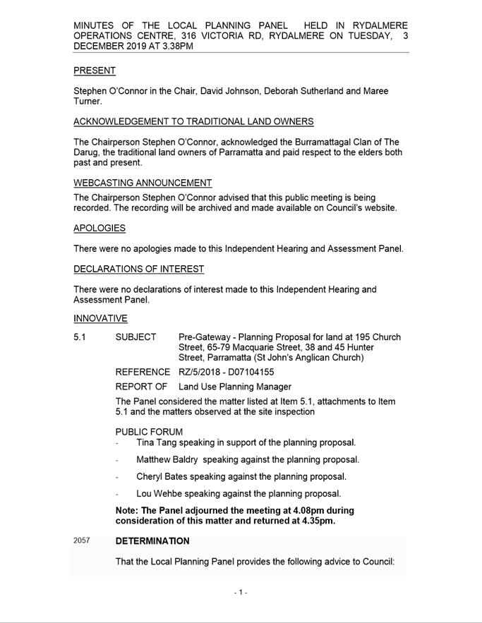
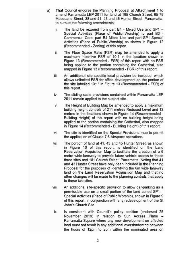
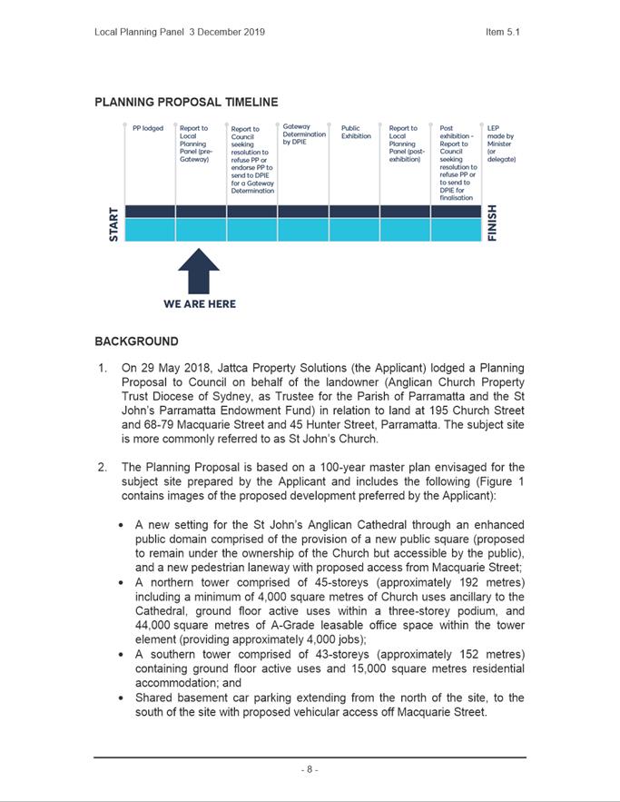
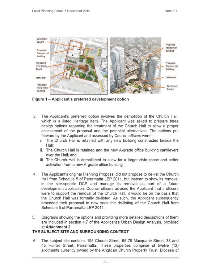
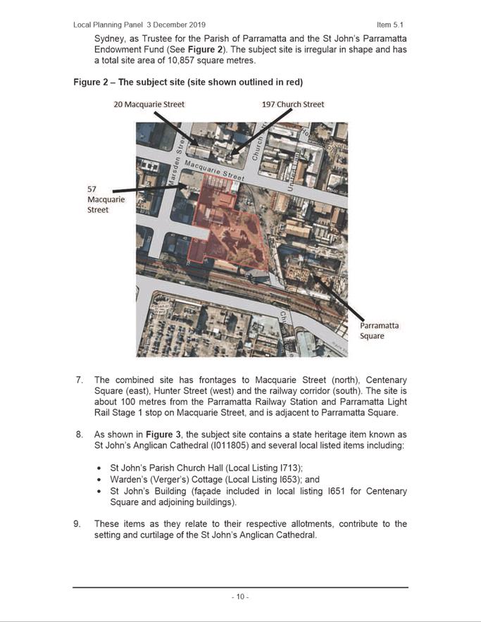
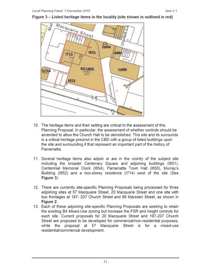
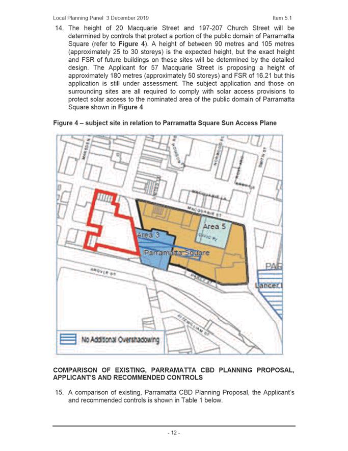
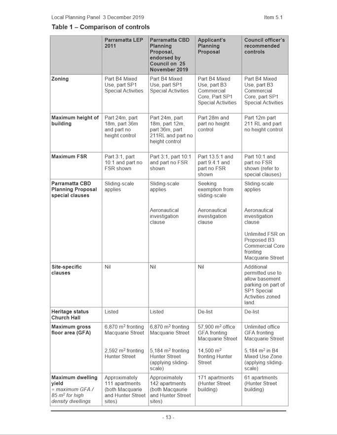
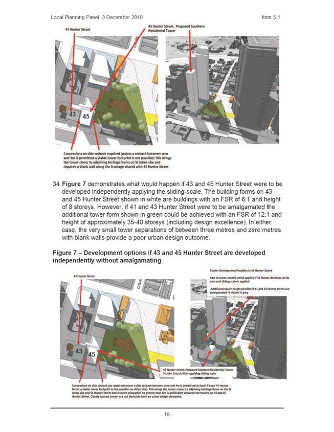
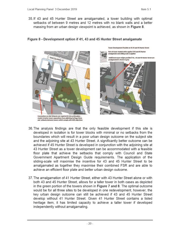
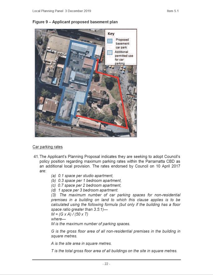
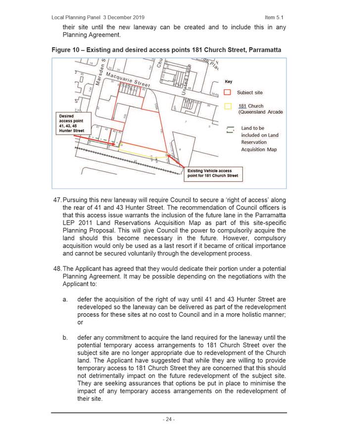
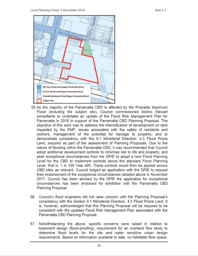
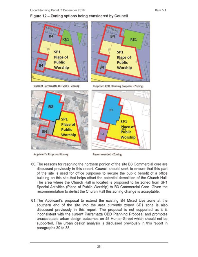
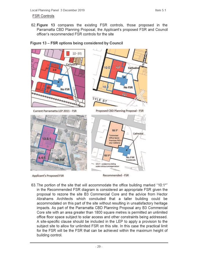
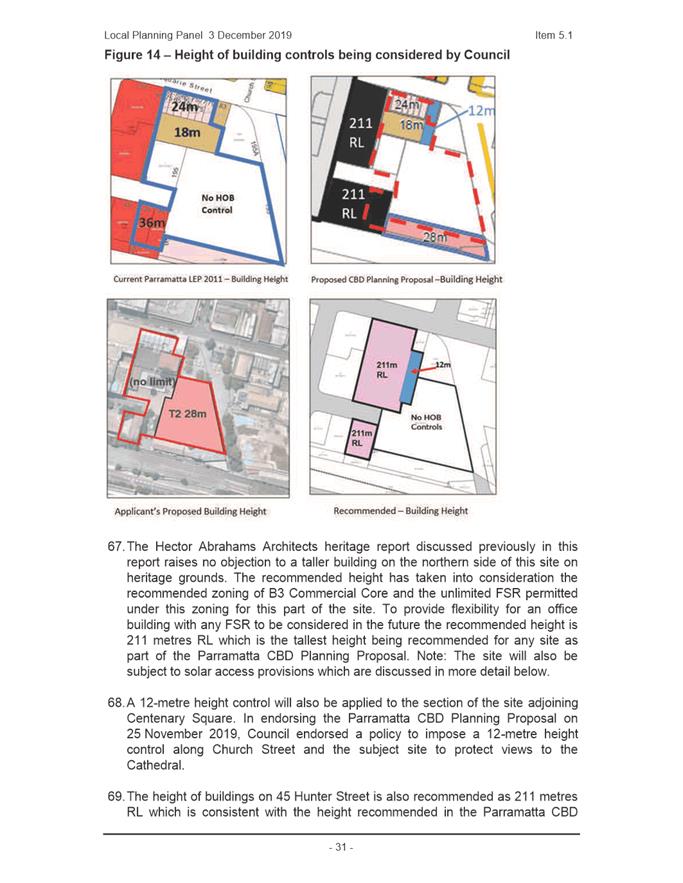
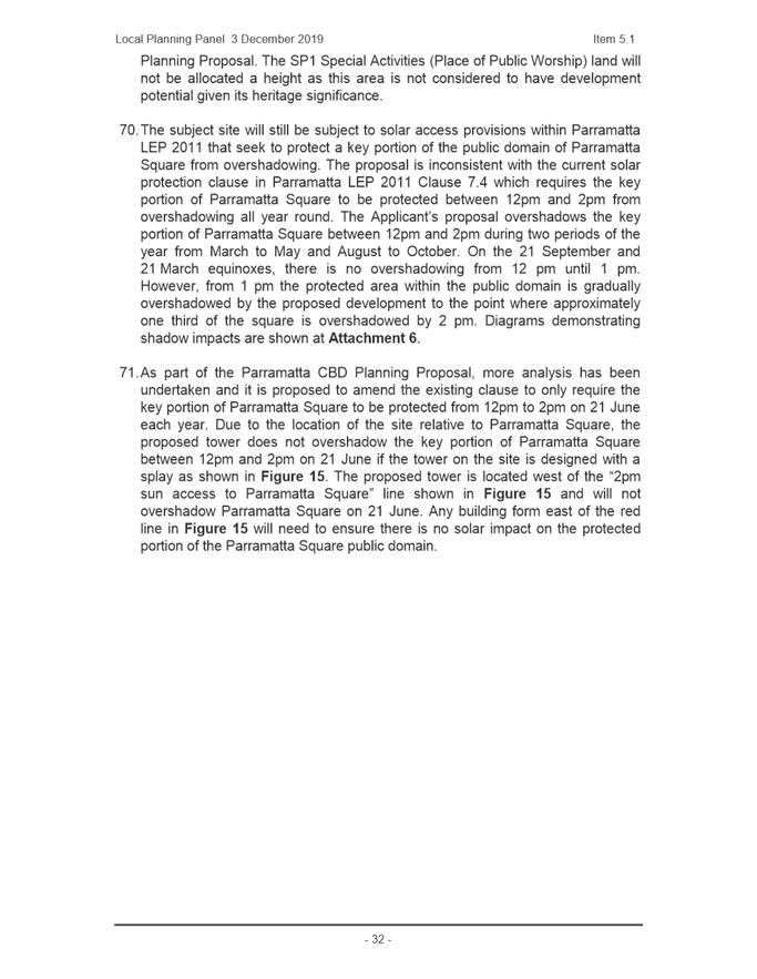
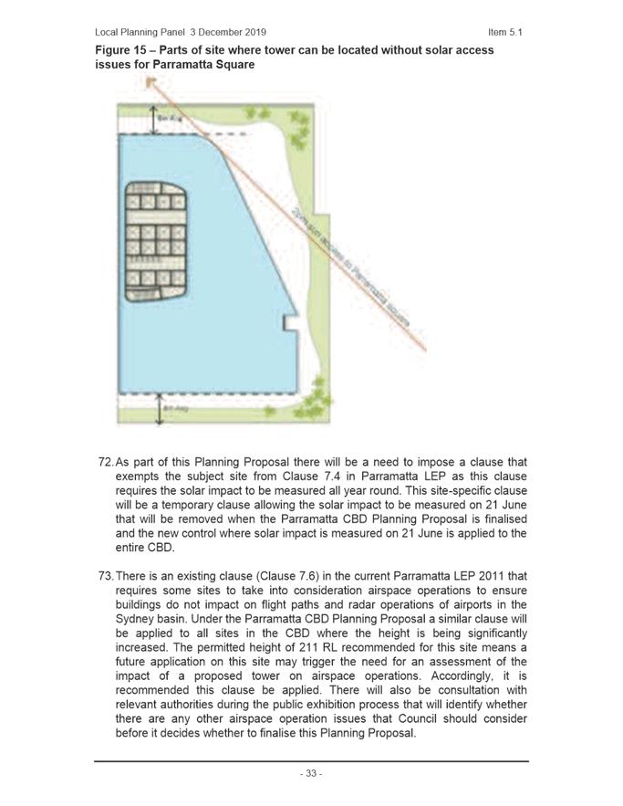
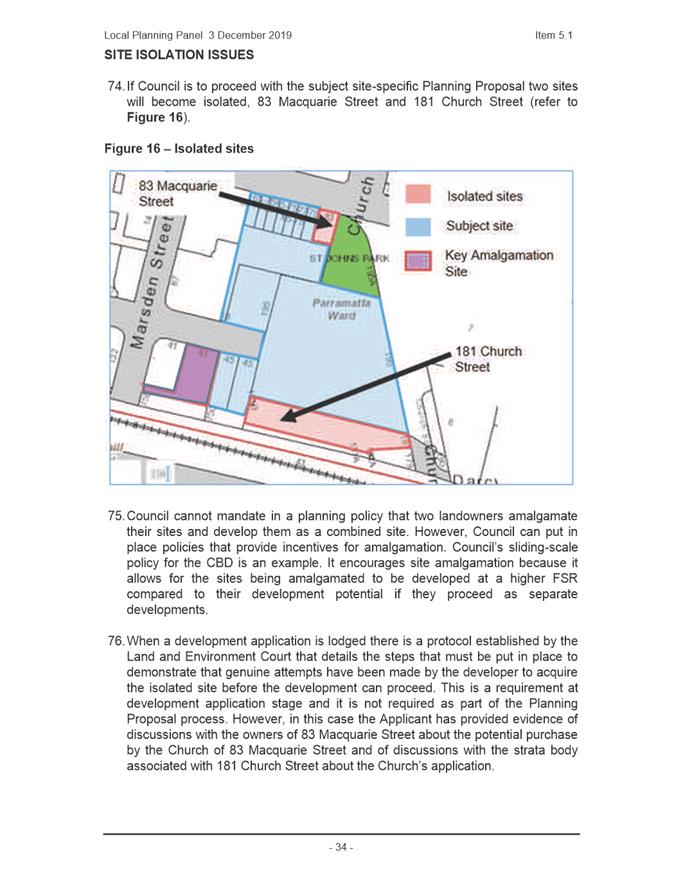
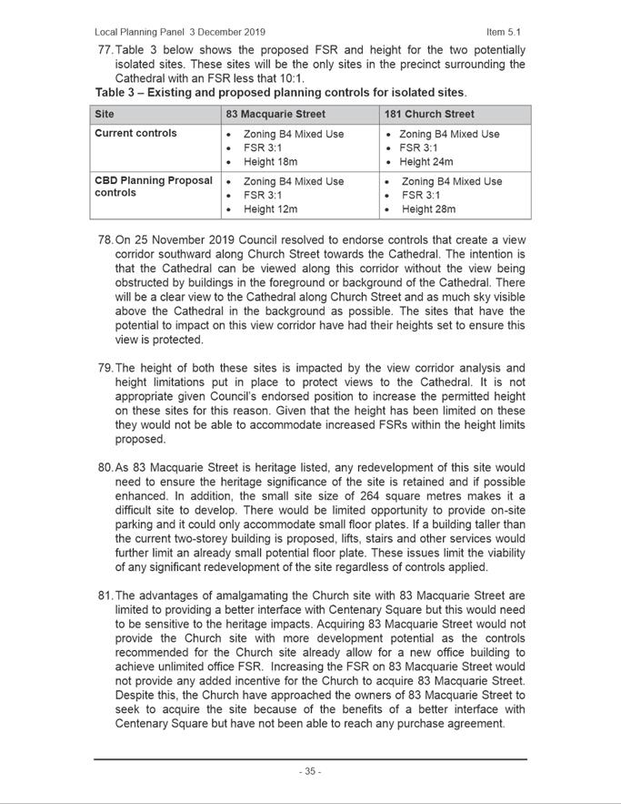
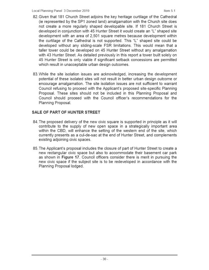
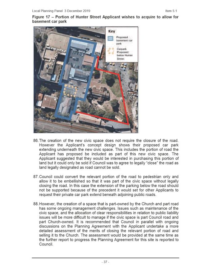
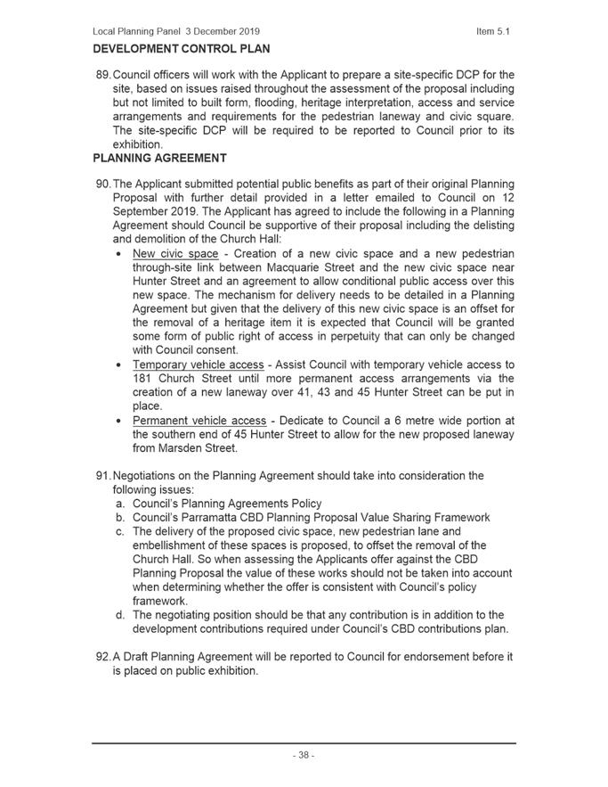
|
Item 18.4 - Attachment 2
|
Attachment 2 - Planning Proposal -St John's
Cathedral Site, 195 Church Street, 65-79 Macquarie Street, 38 and 41-45
Hunter Street1
|
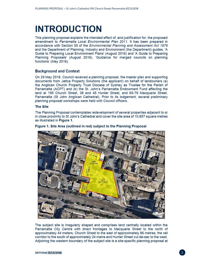
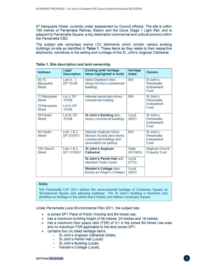
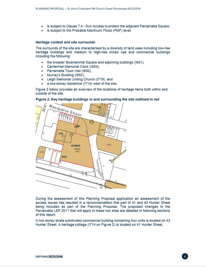
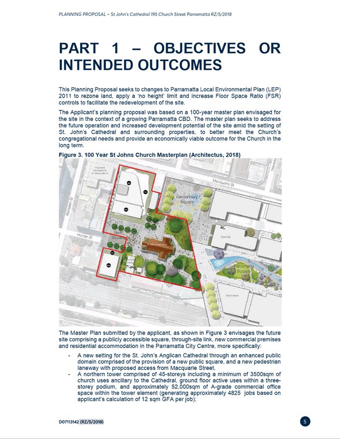
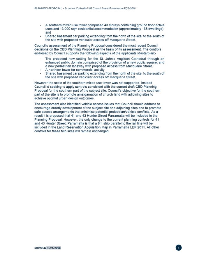
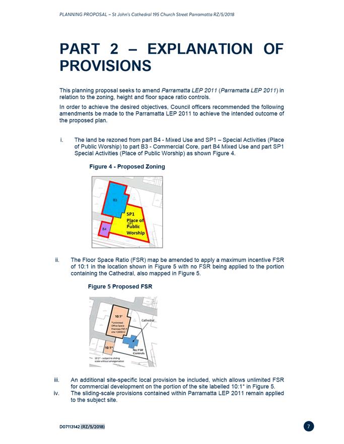
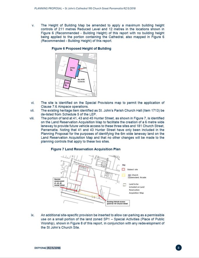
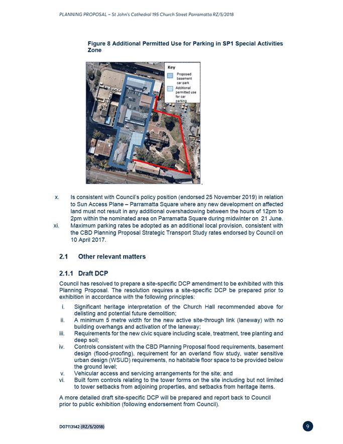
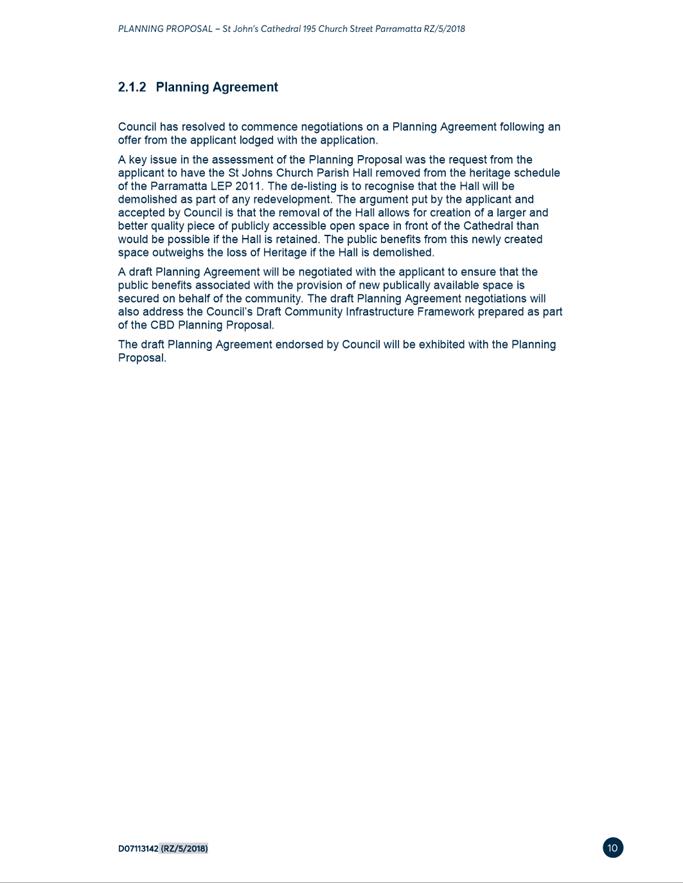
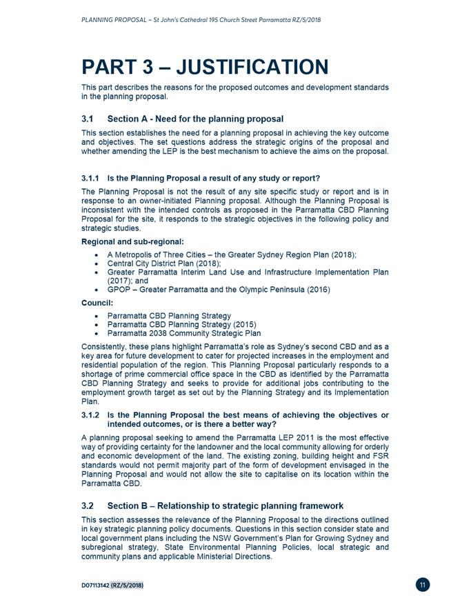
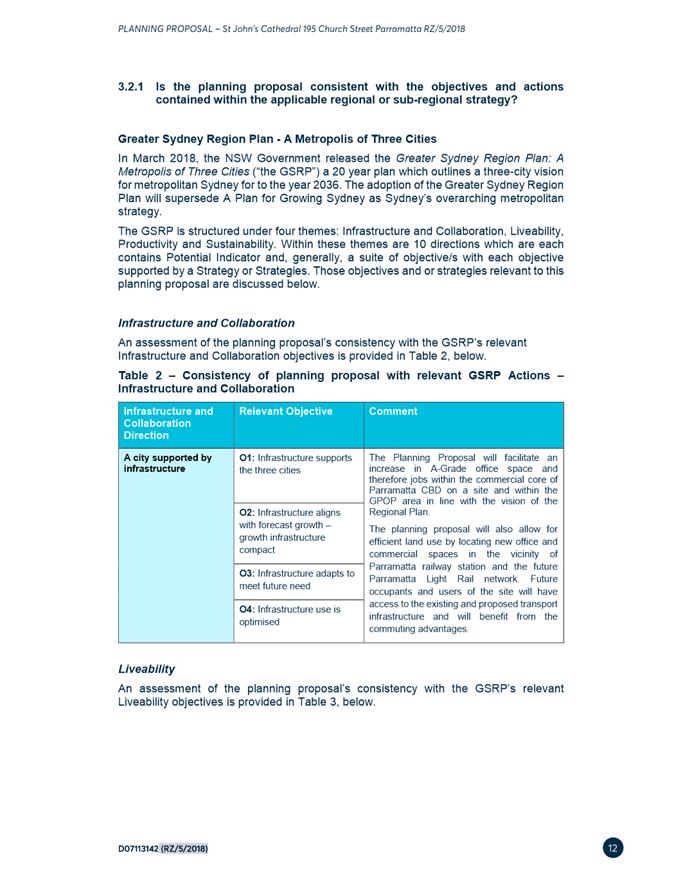
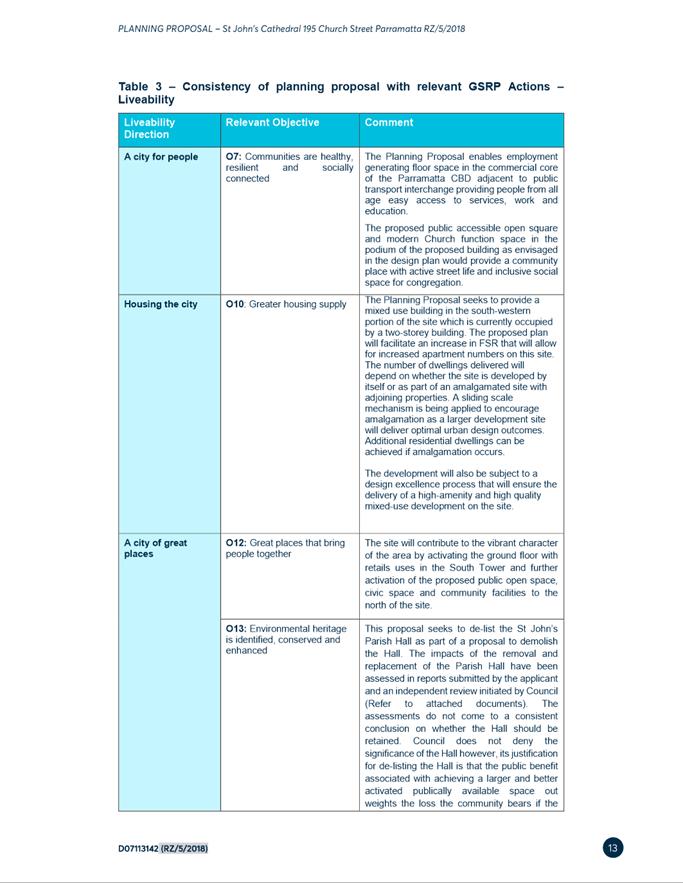
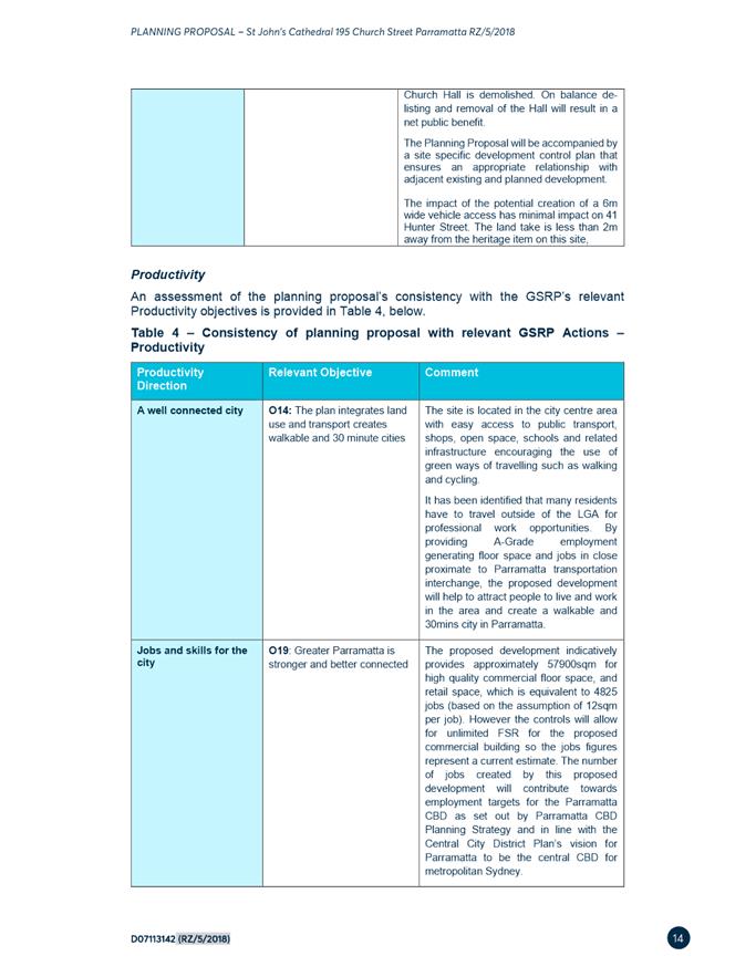
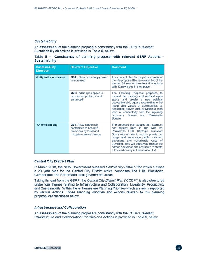
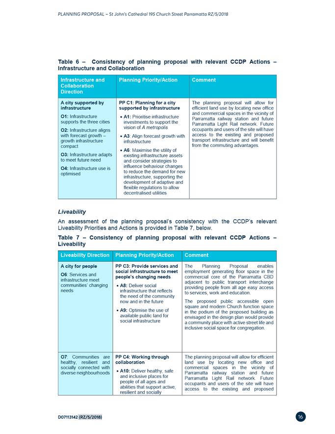
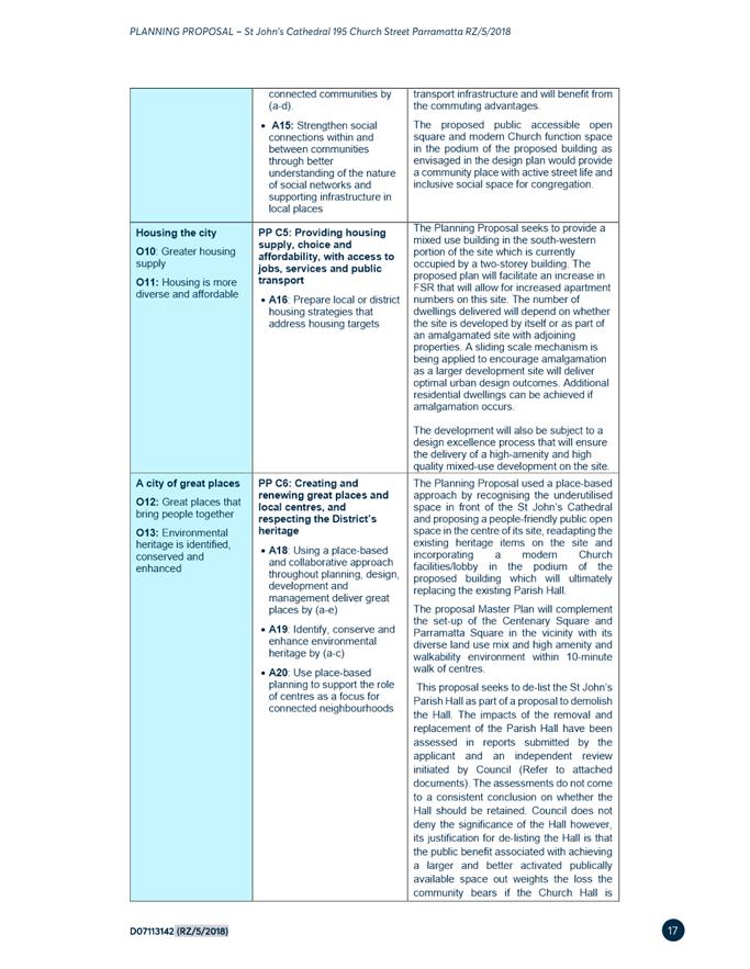
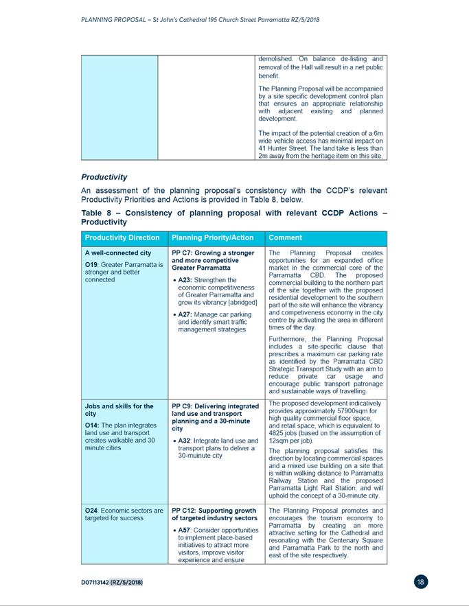
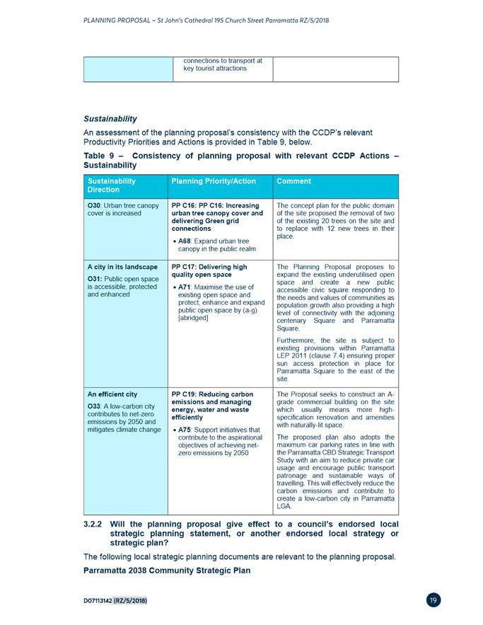
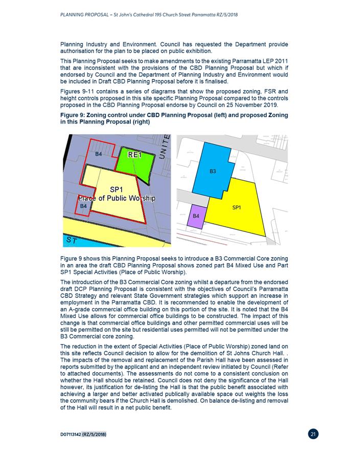
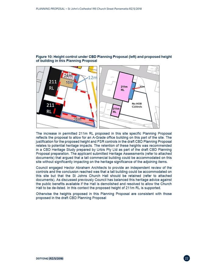
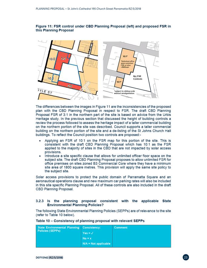
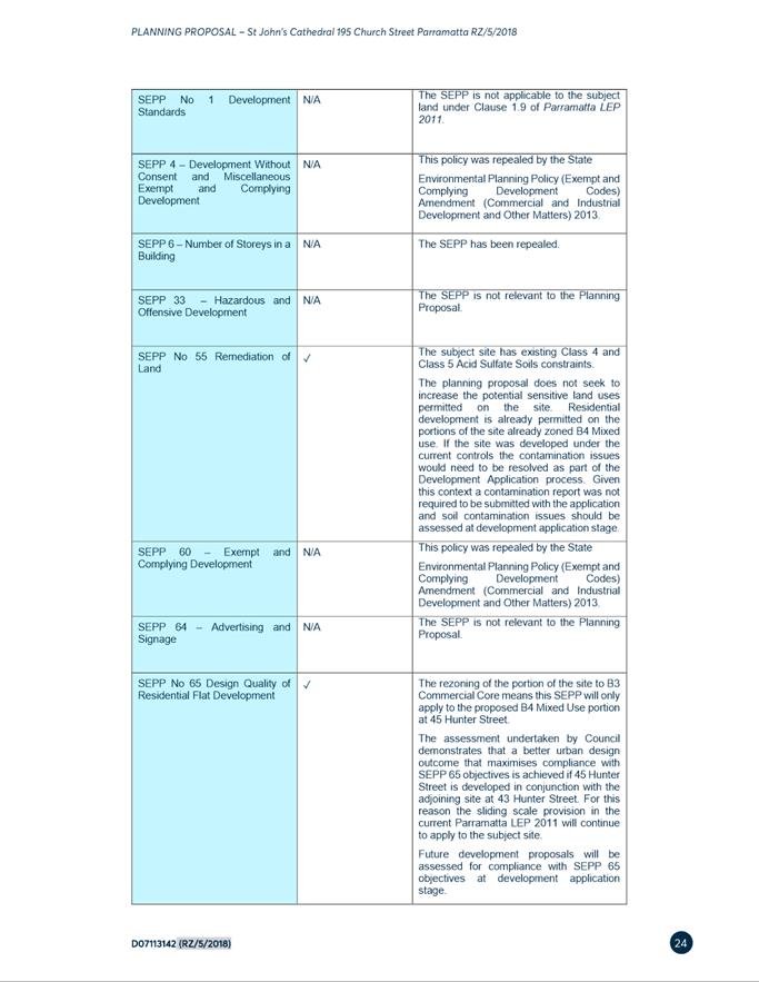
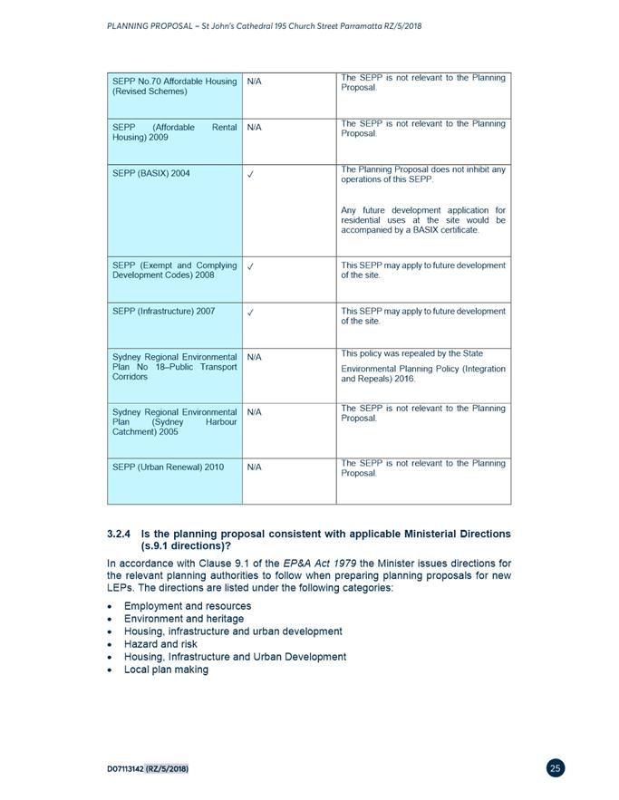
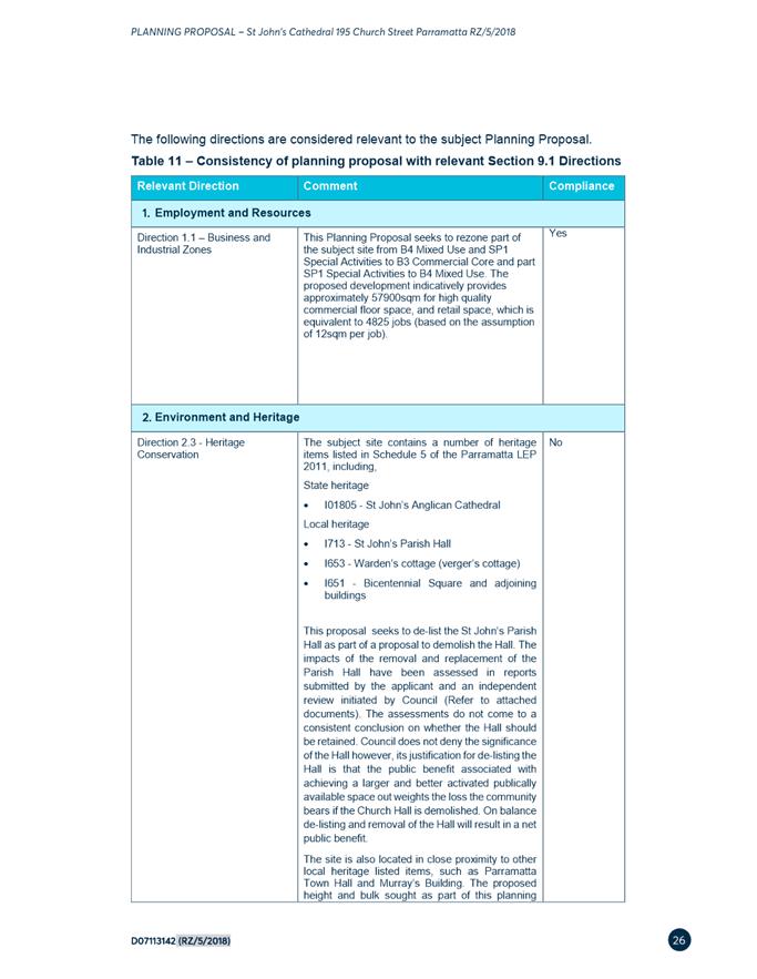
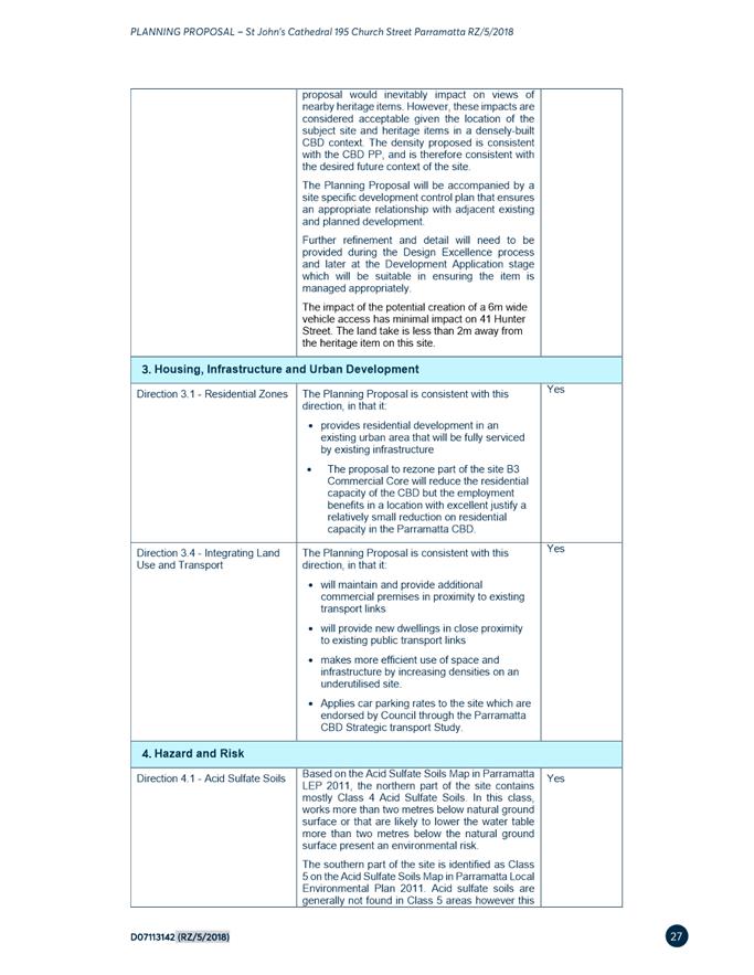

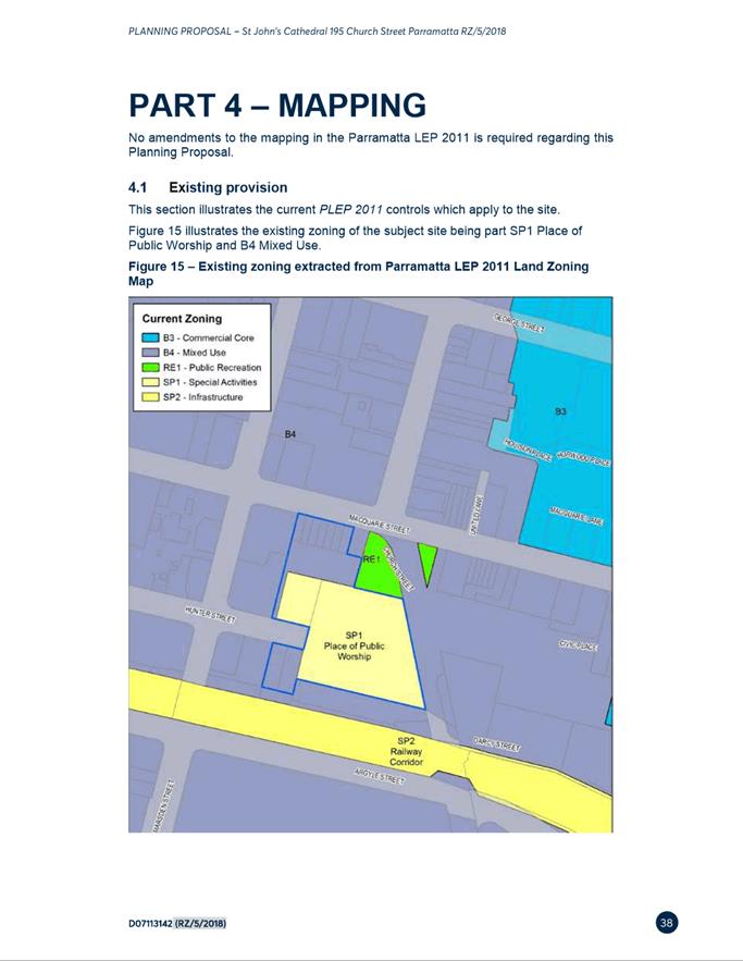
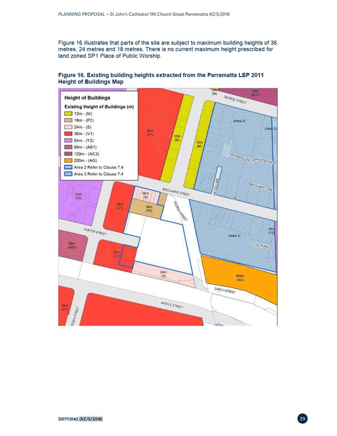
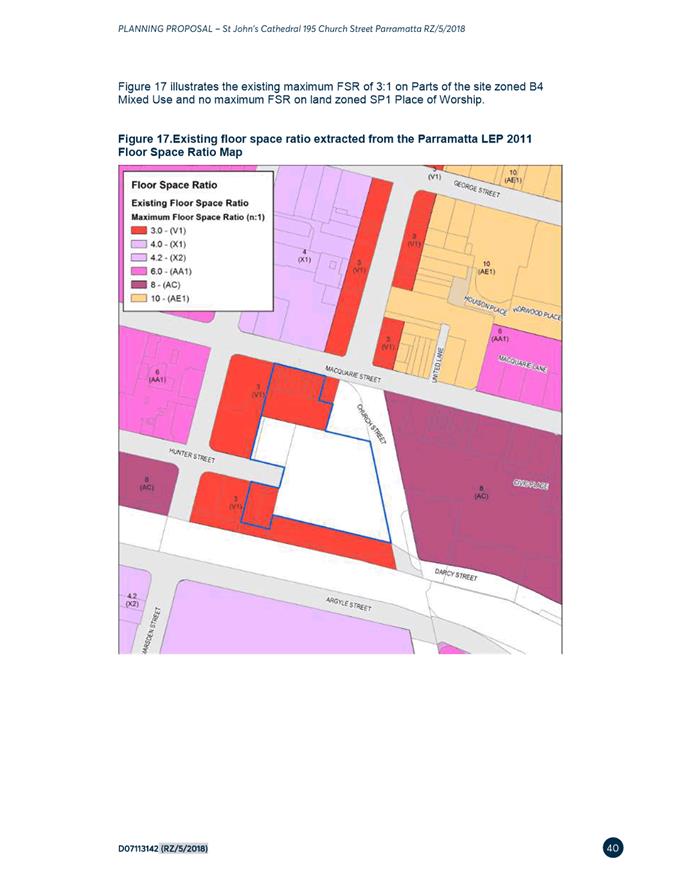
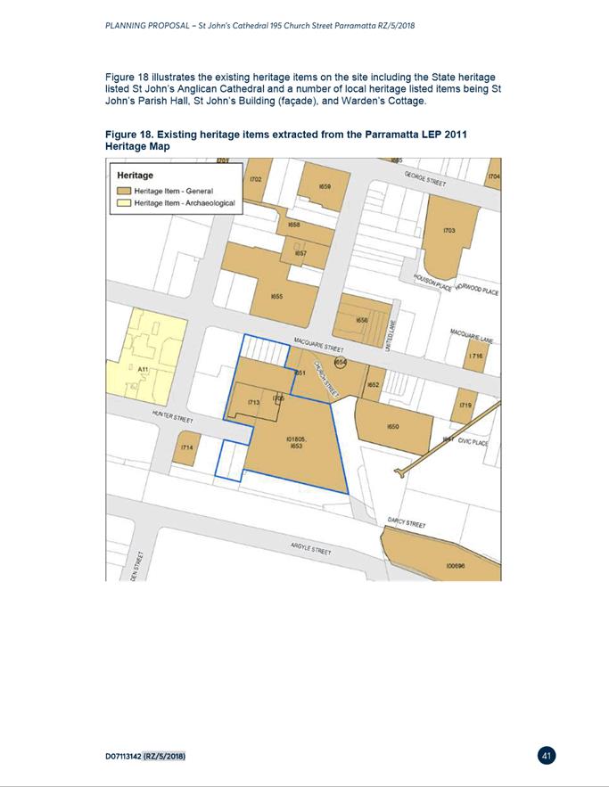
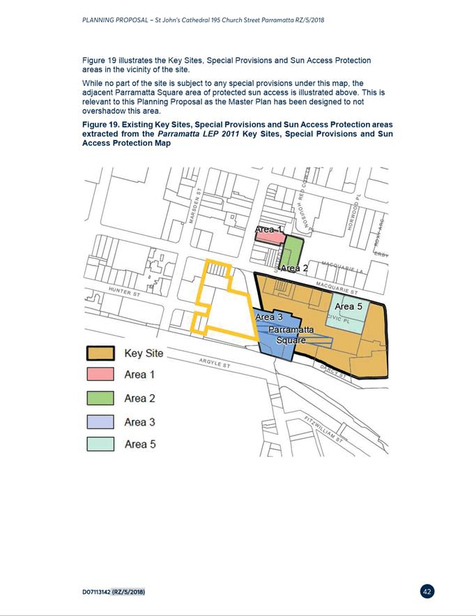
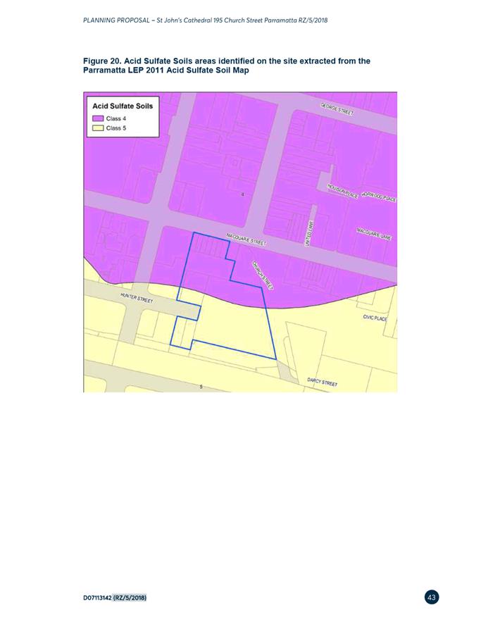
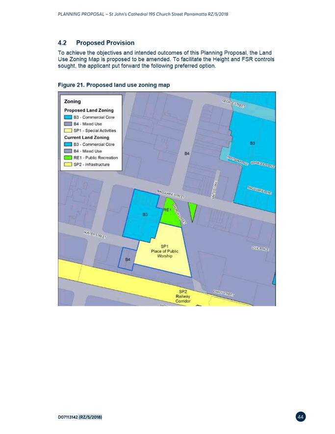
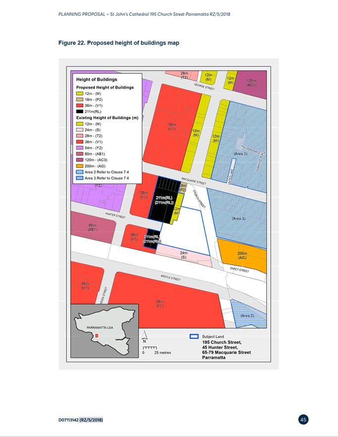
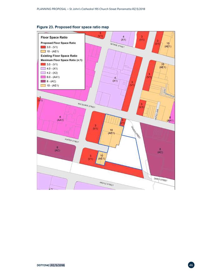
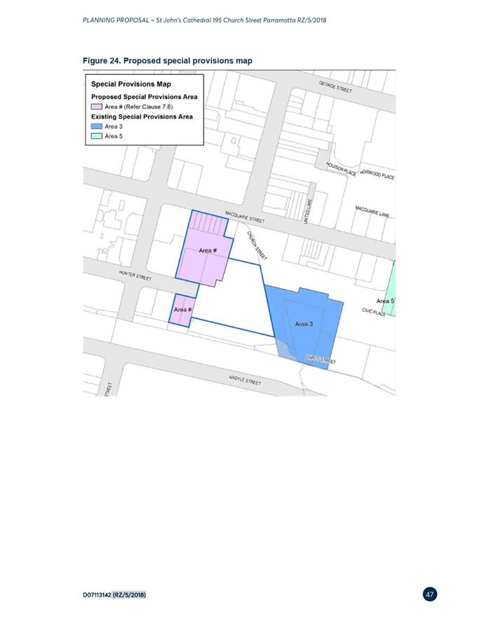
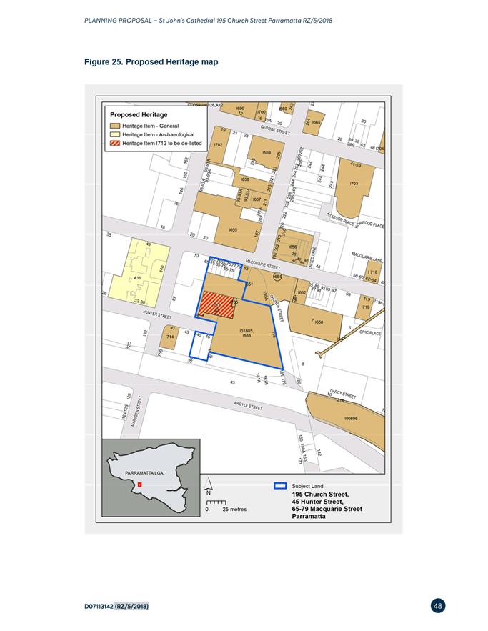
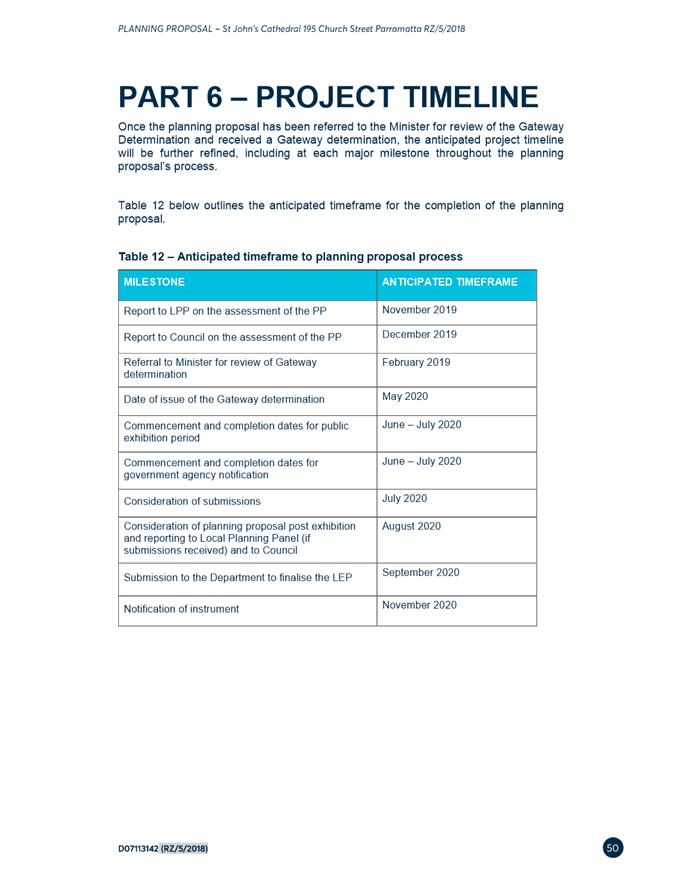
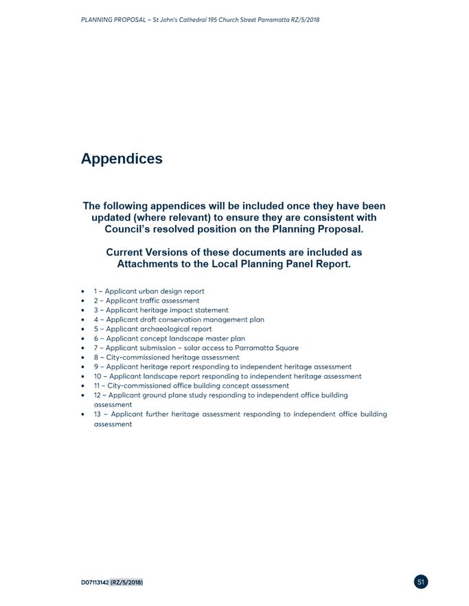
|
Item 18.4 - Attachment 3
|
Attachment 3 - Applicant Urban Design Report
|
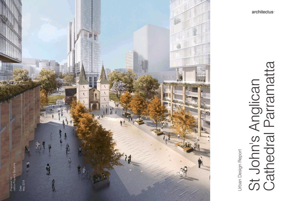
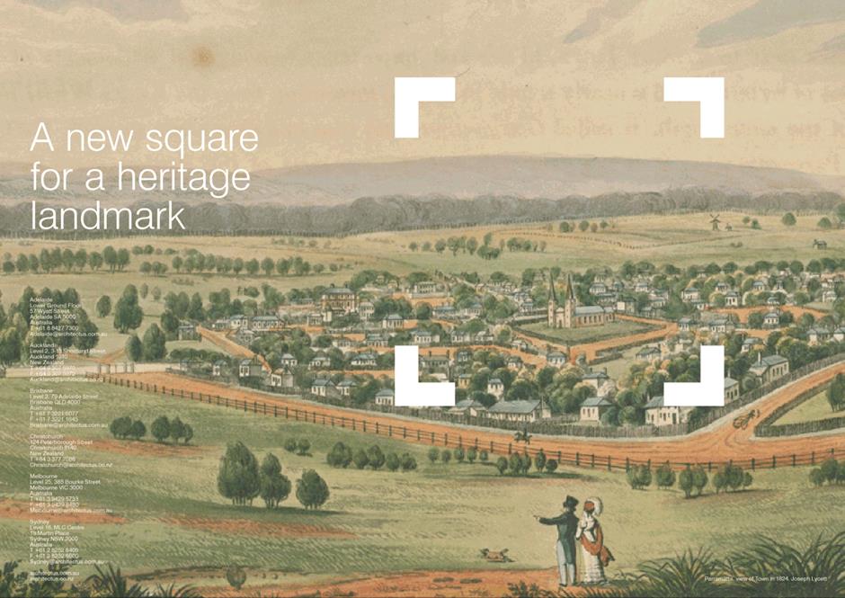
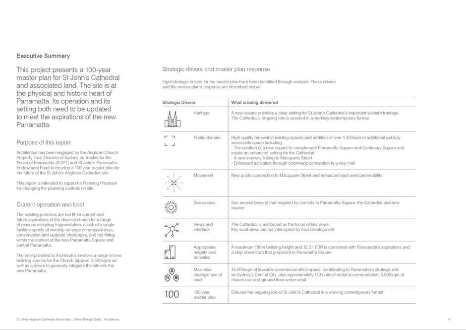
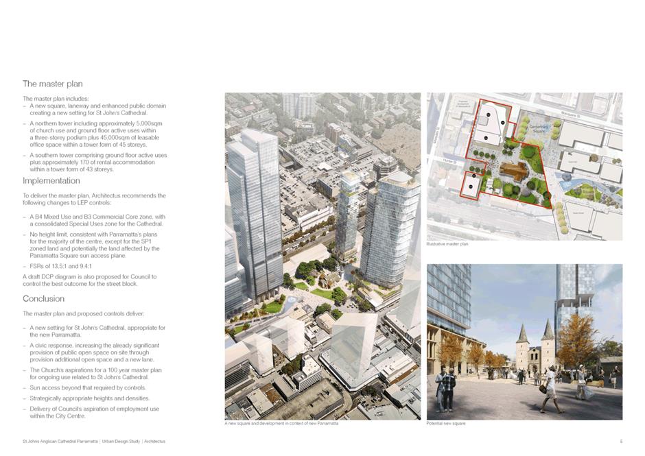
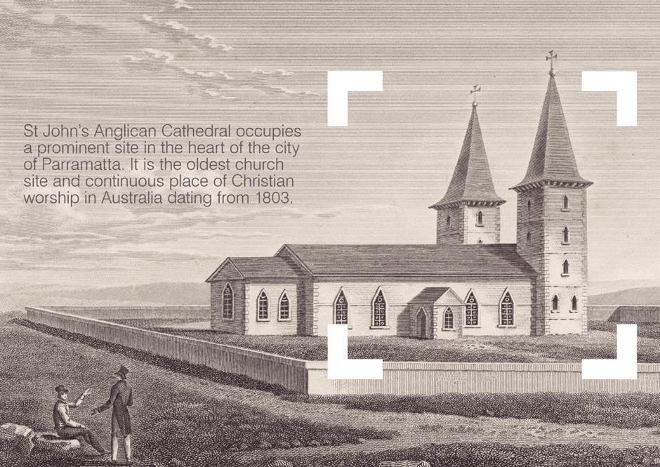
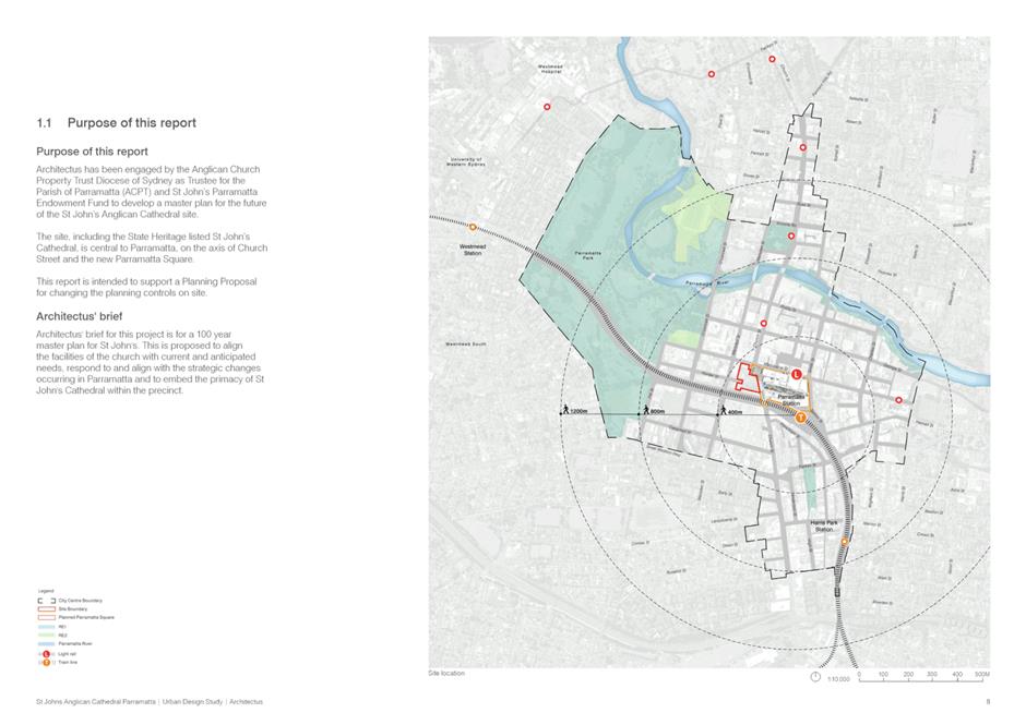
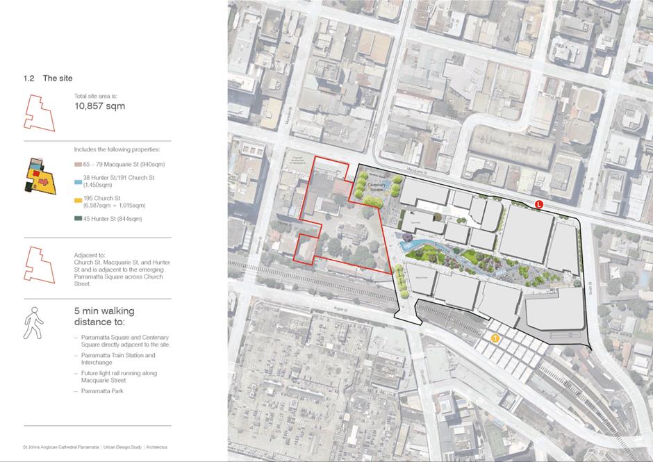
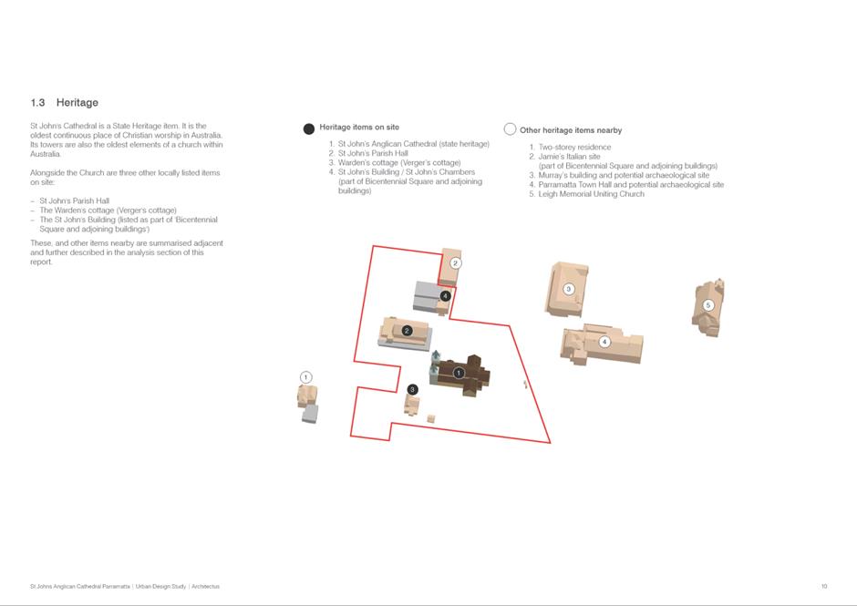
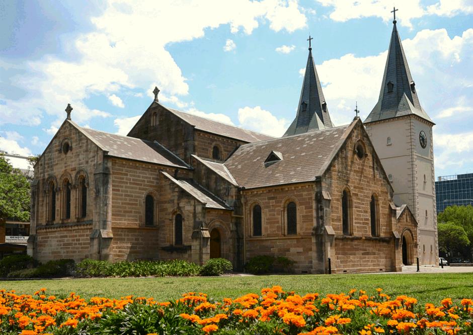
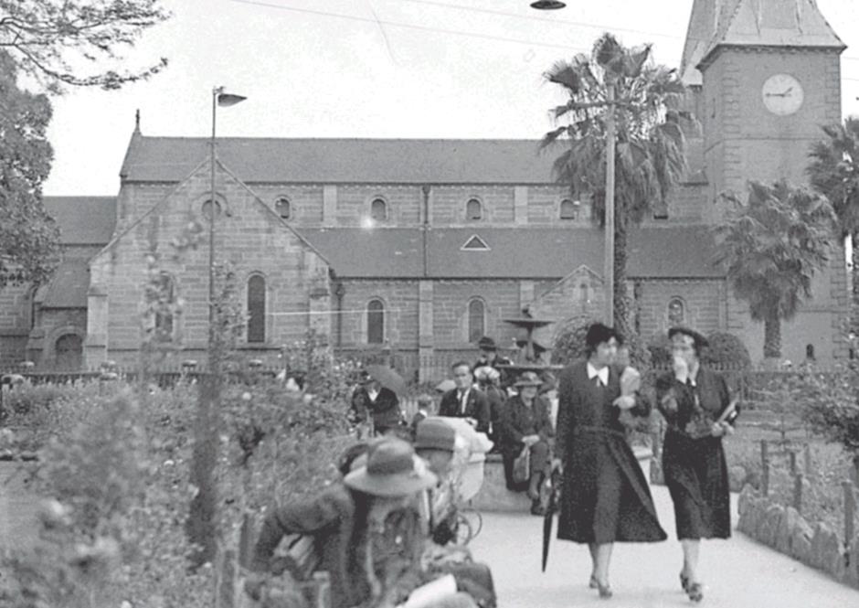
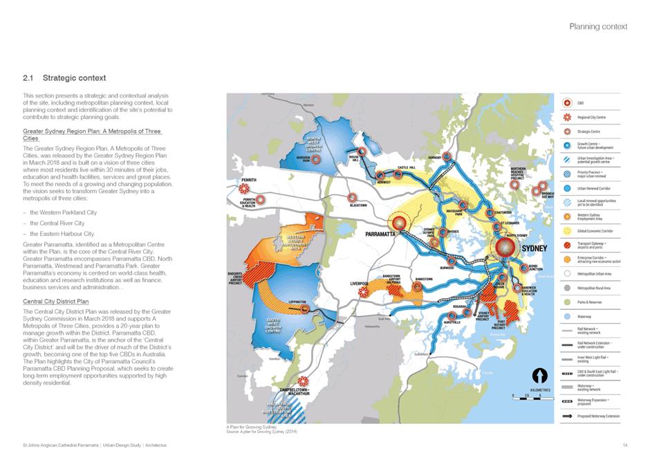
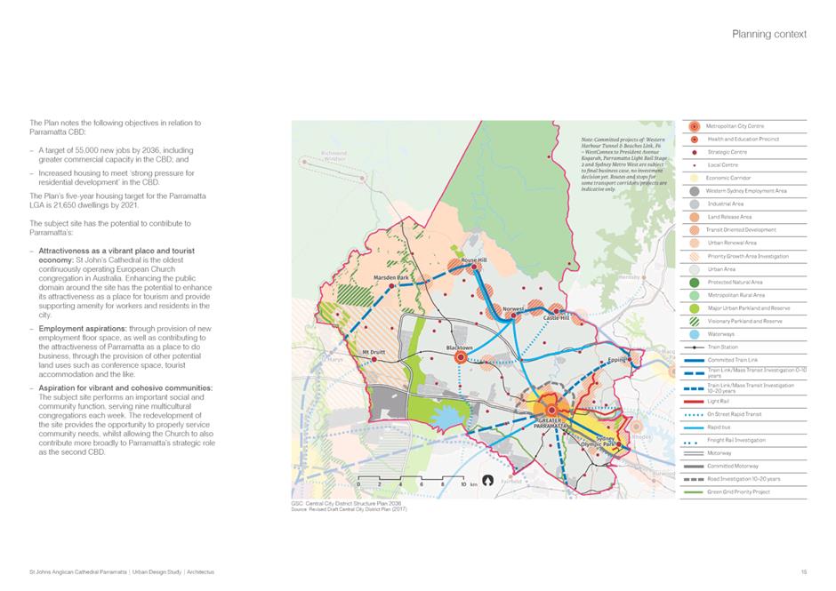
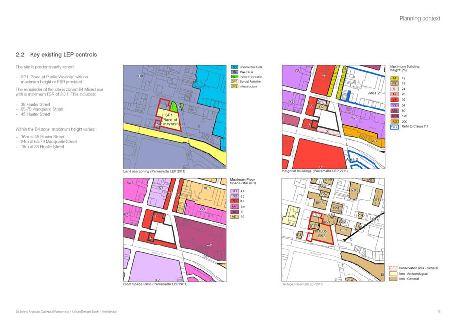
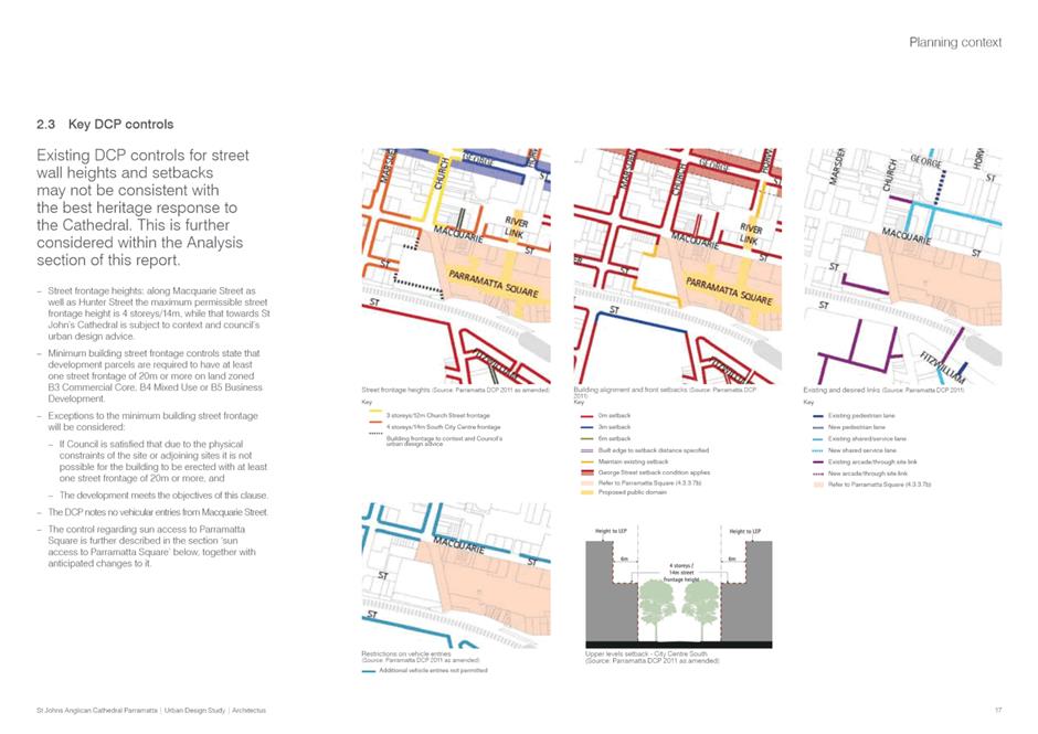
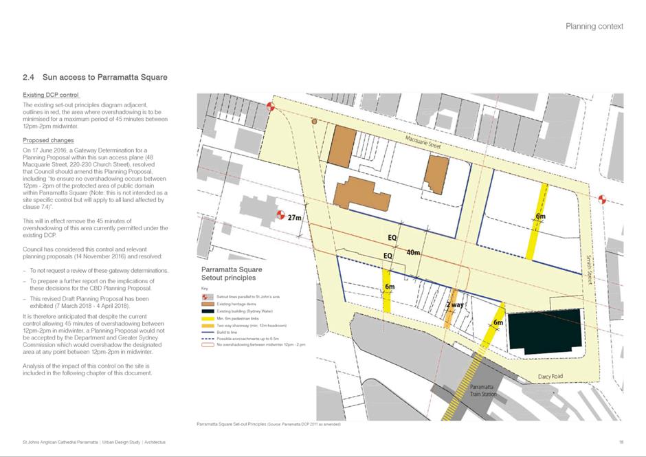
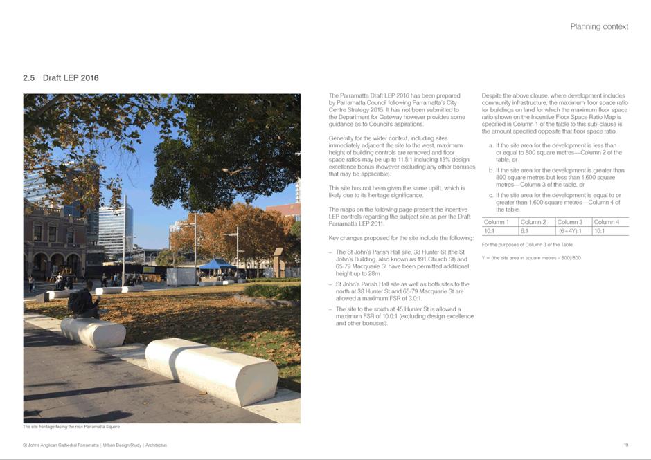
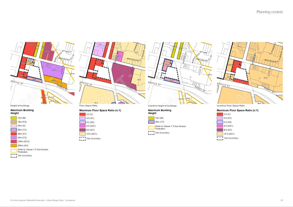
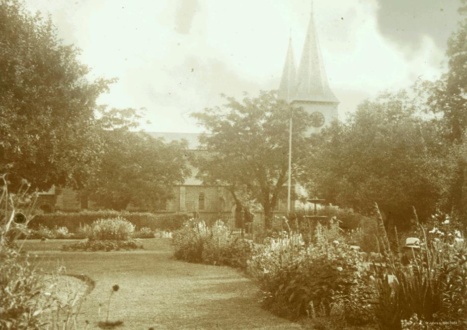
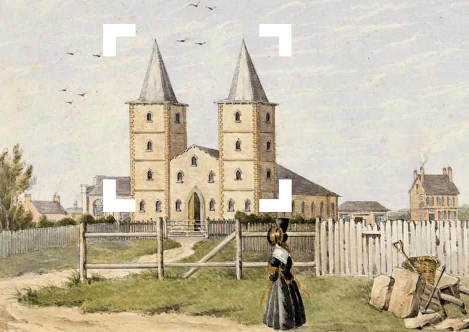
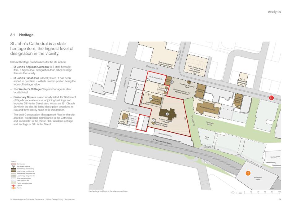
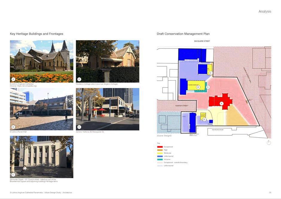
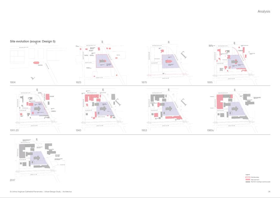
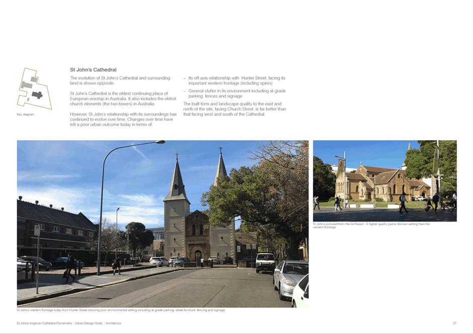
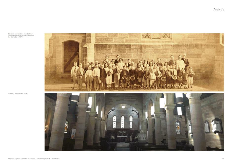
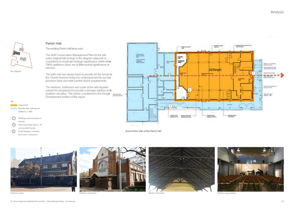
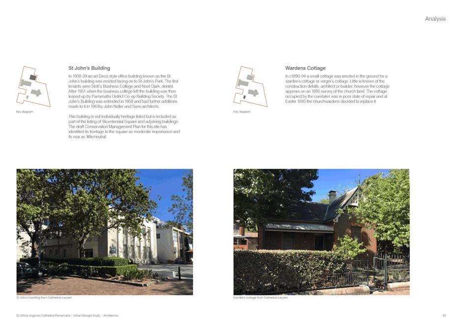
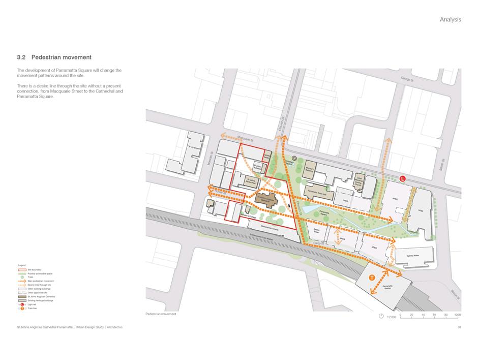
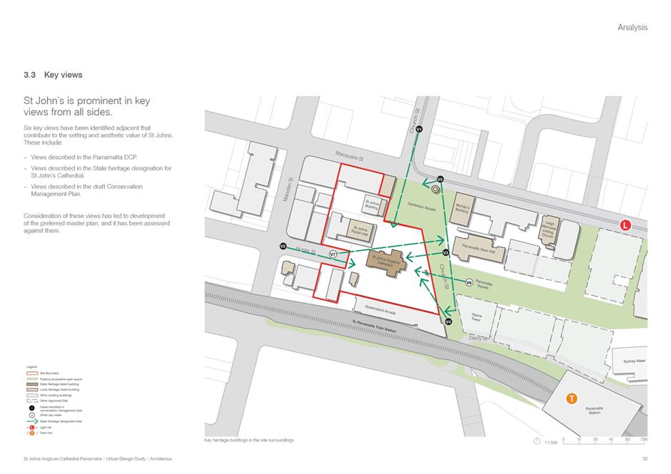
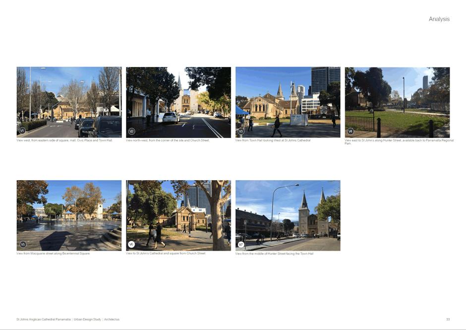
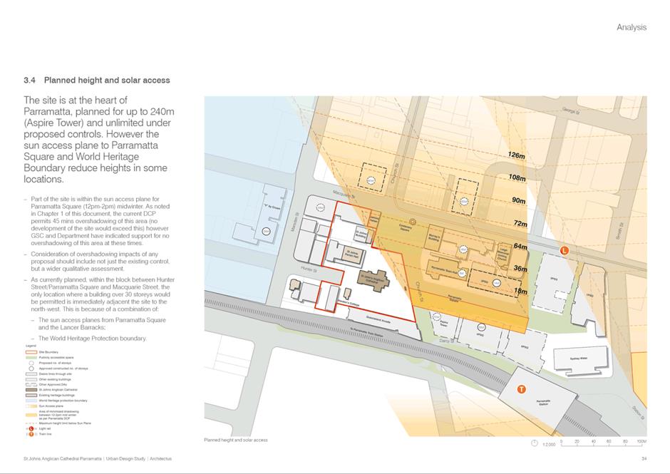
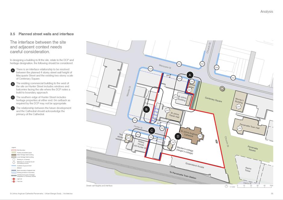
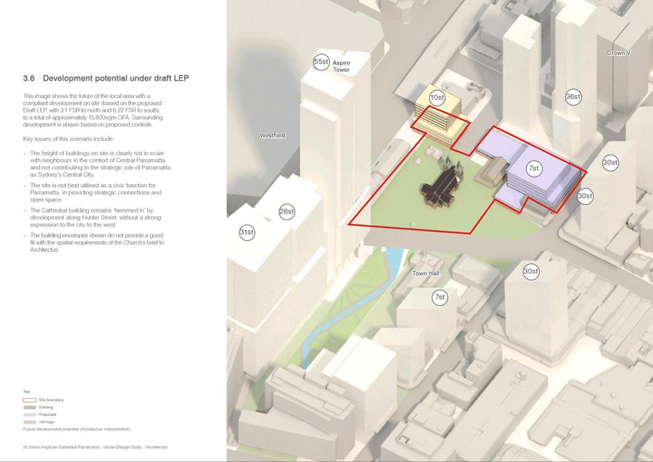
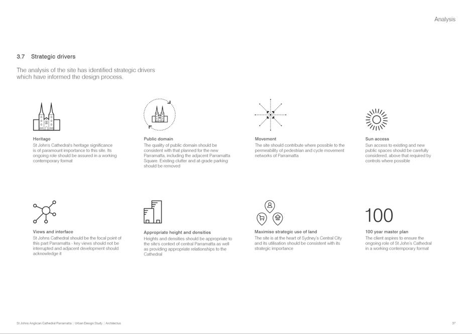
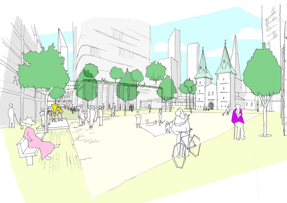
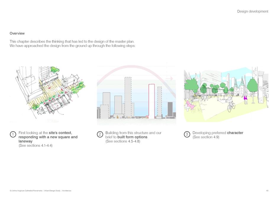
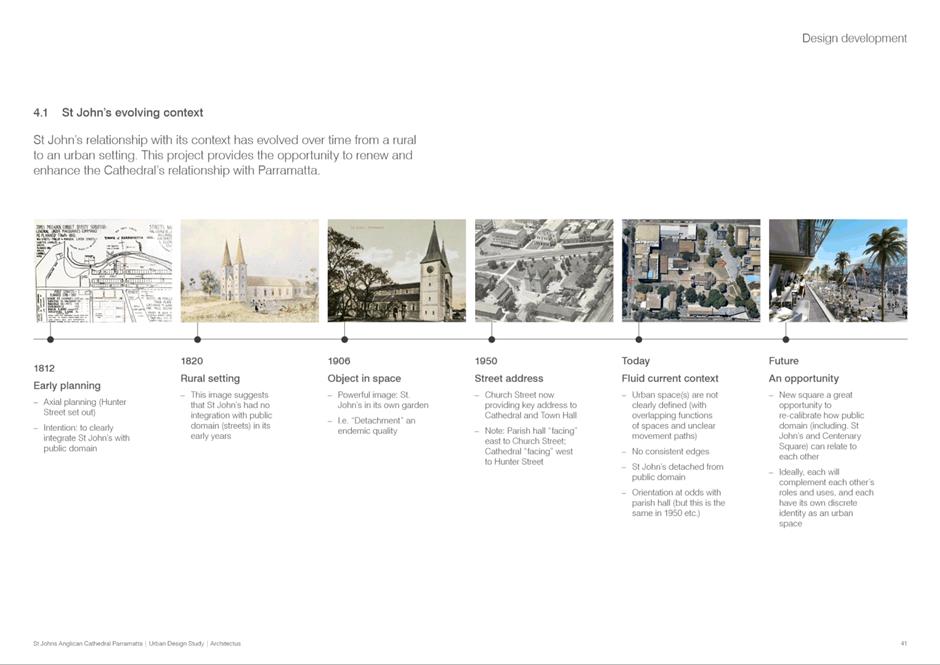
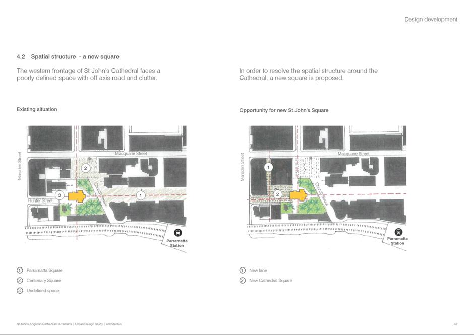
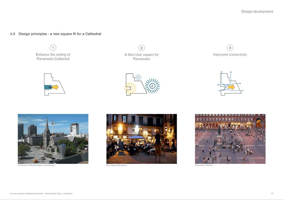
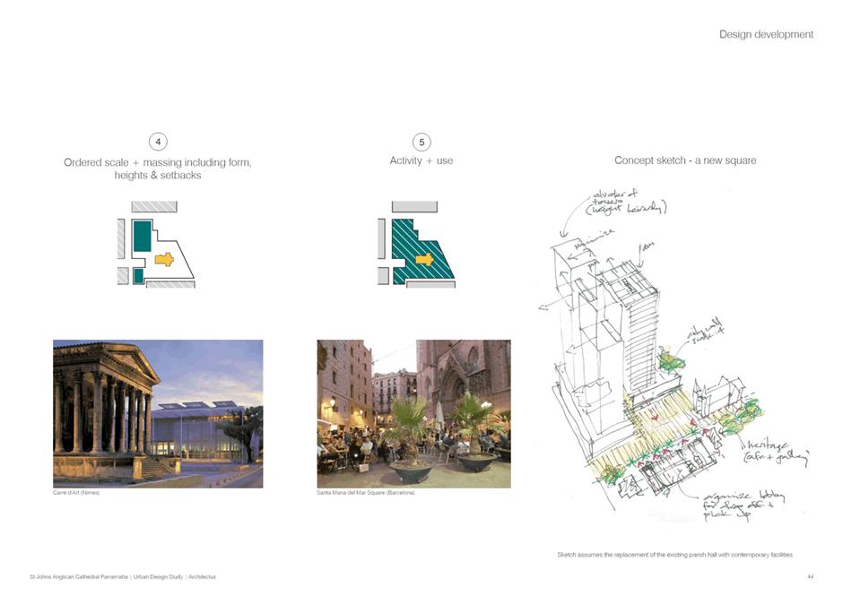
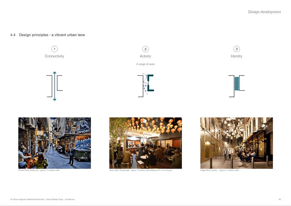
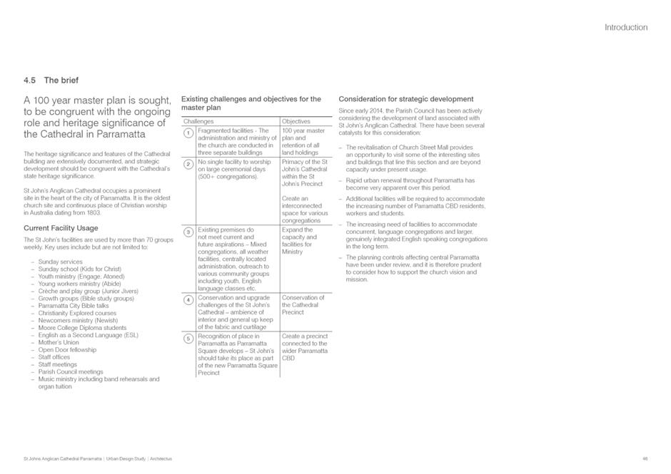
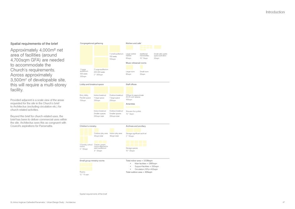
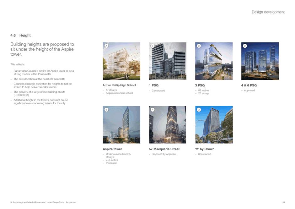
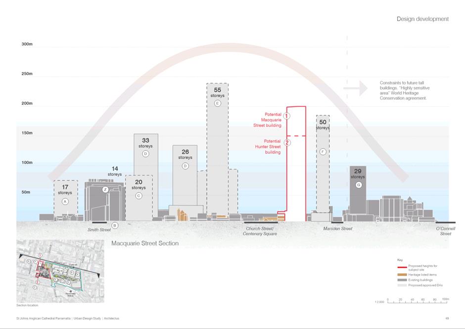
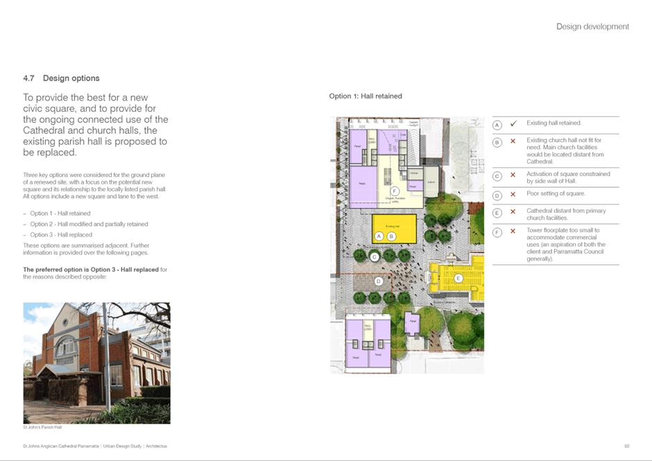
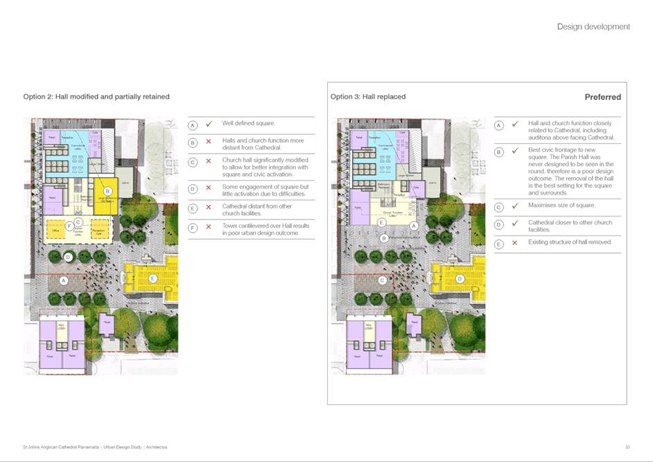
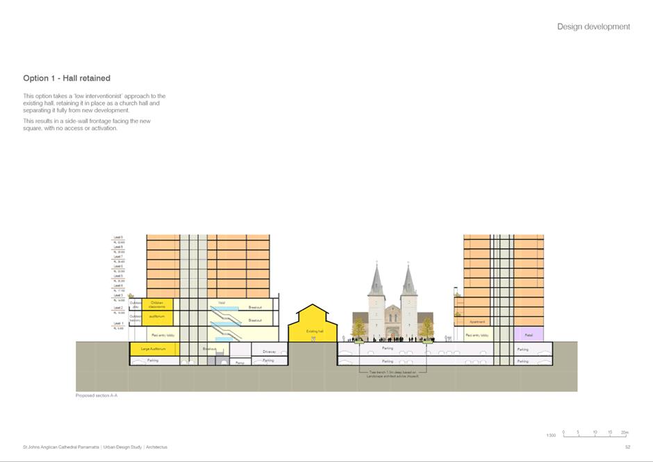
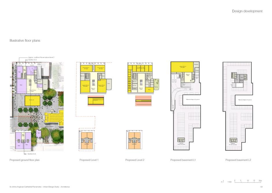
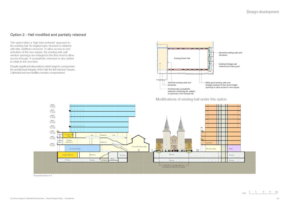
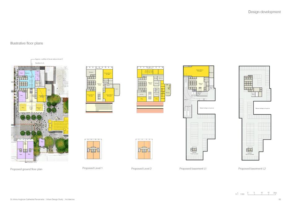
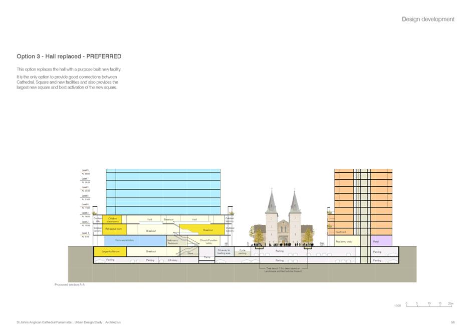
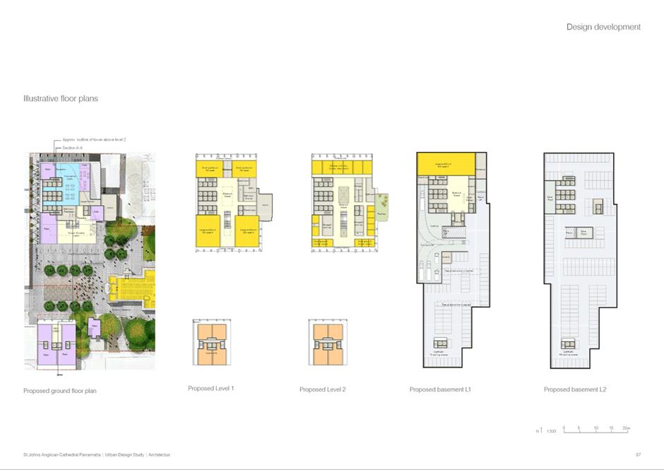
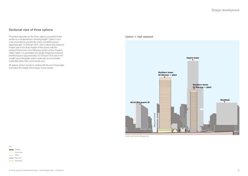
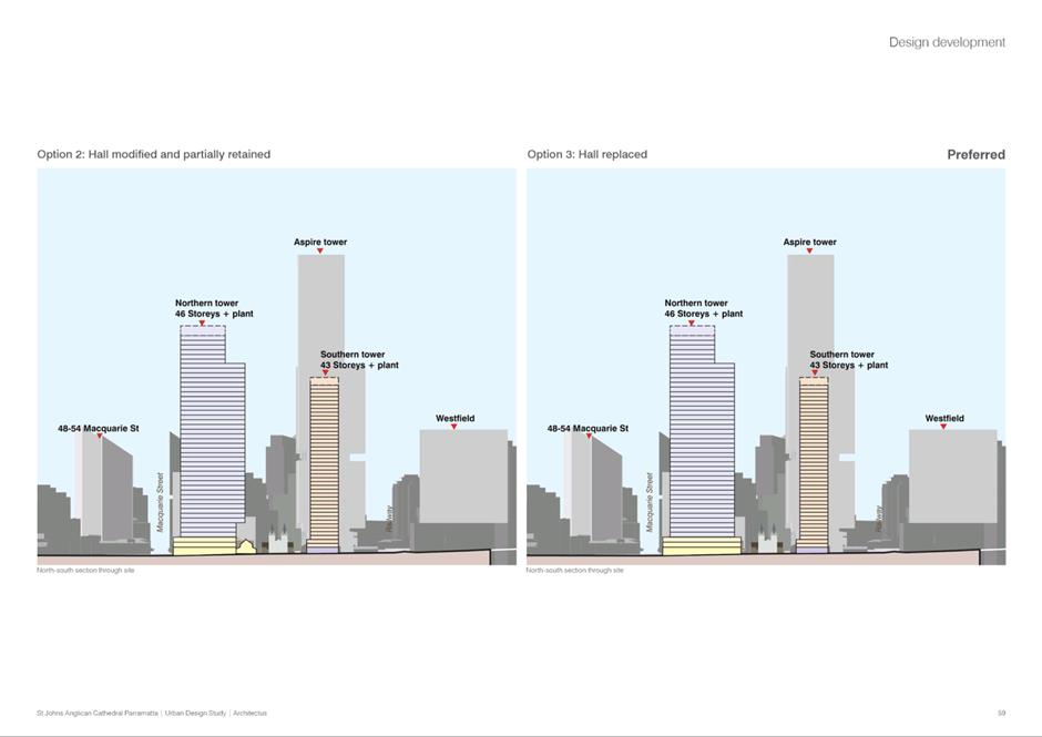
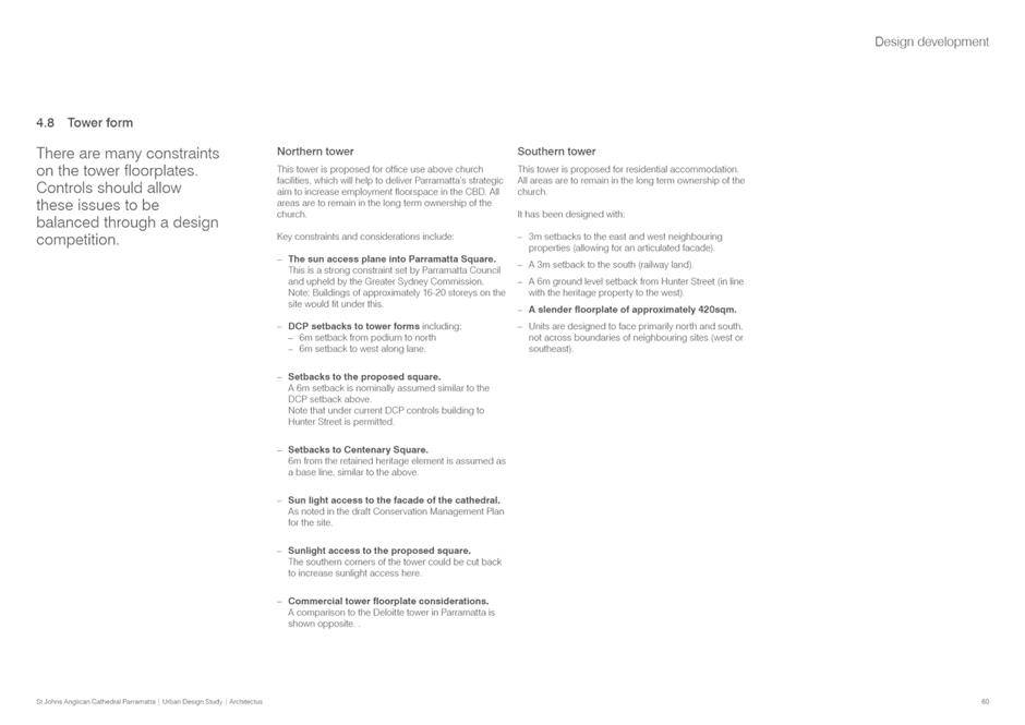
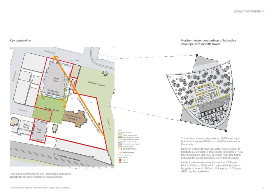
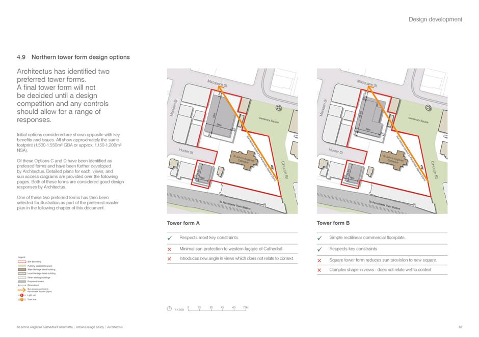
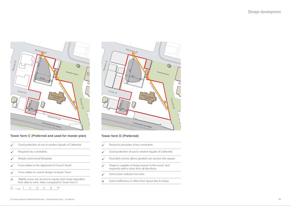
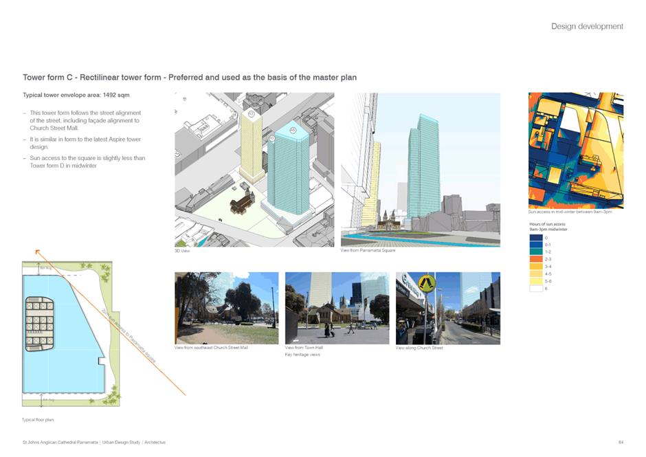
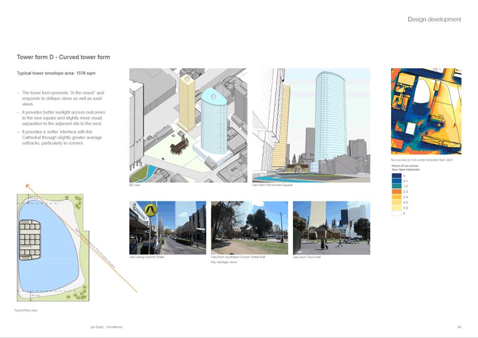
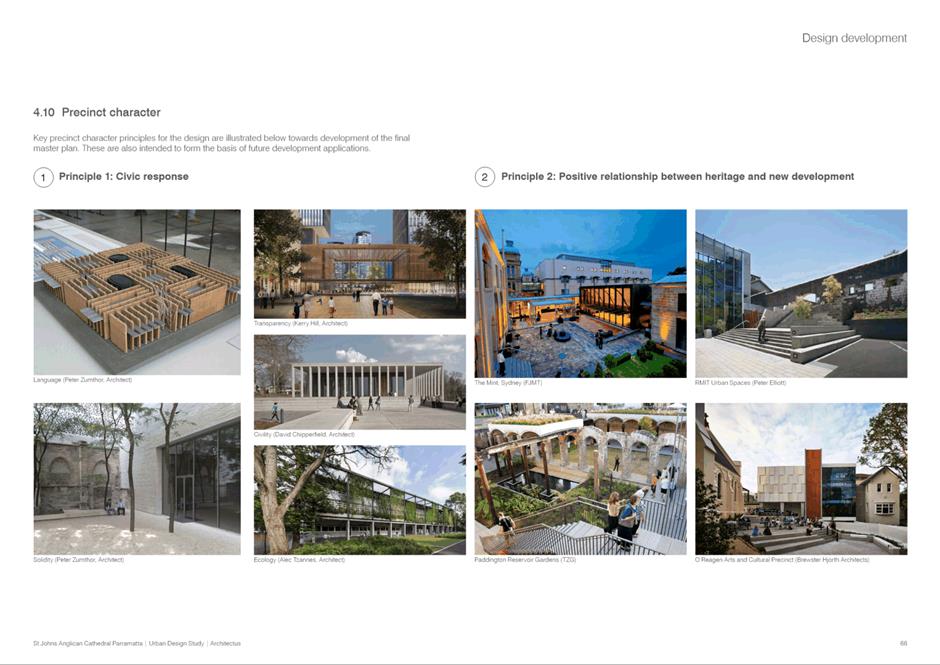
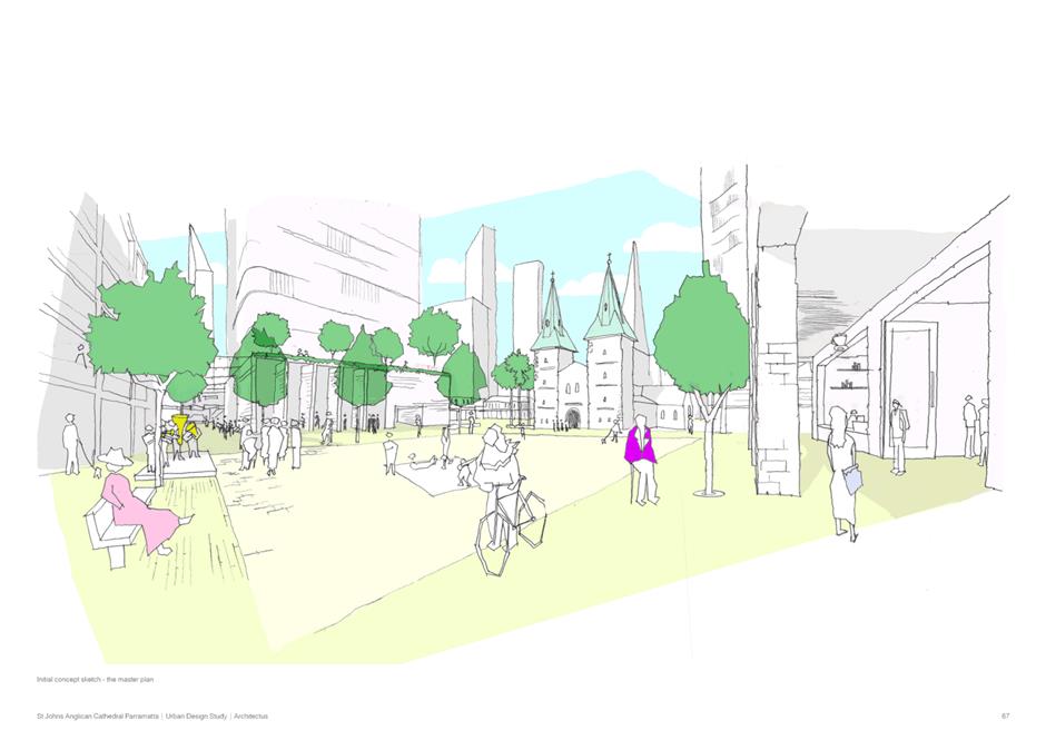
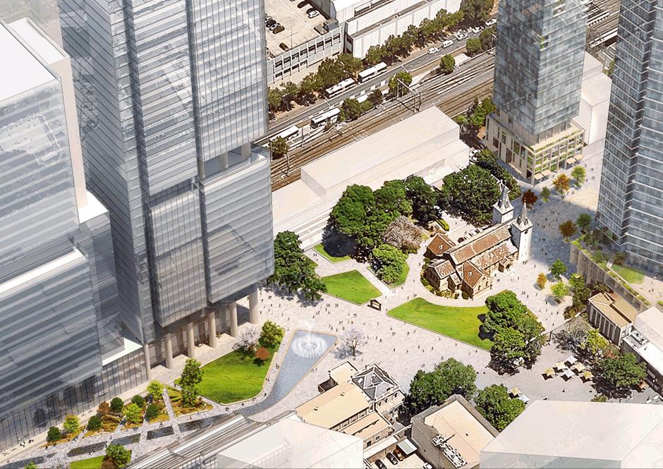
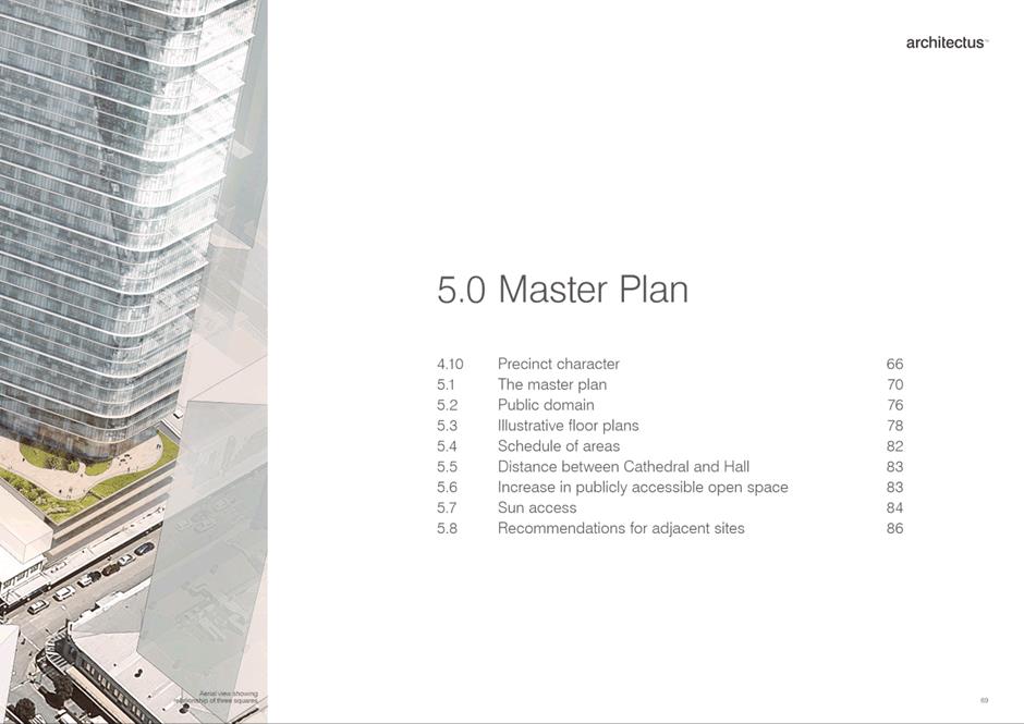
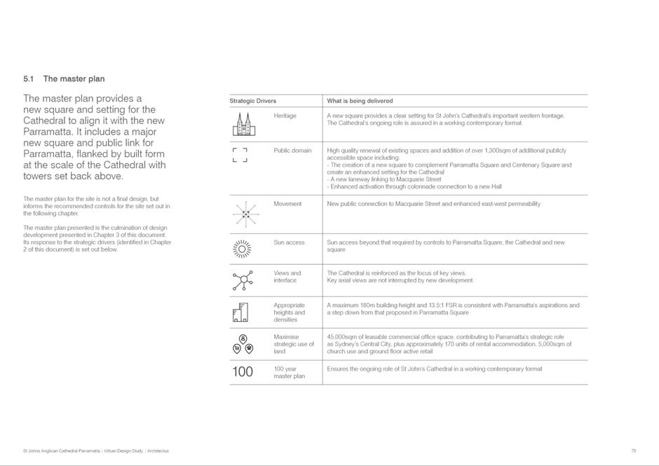
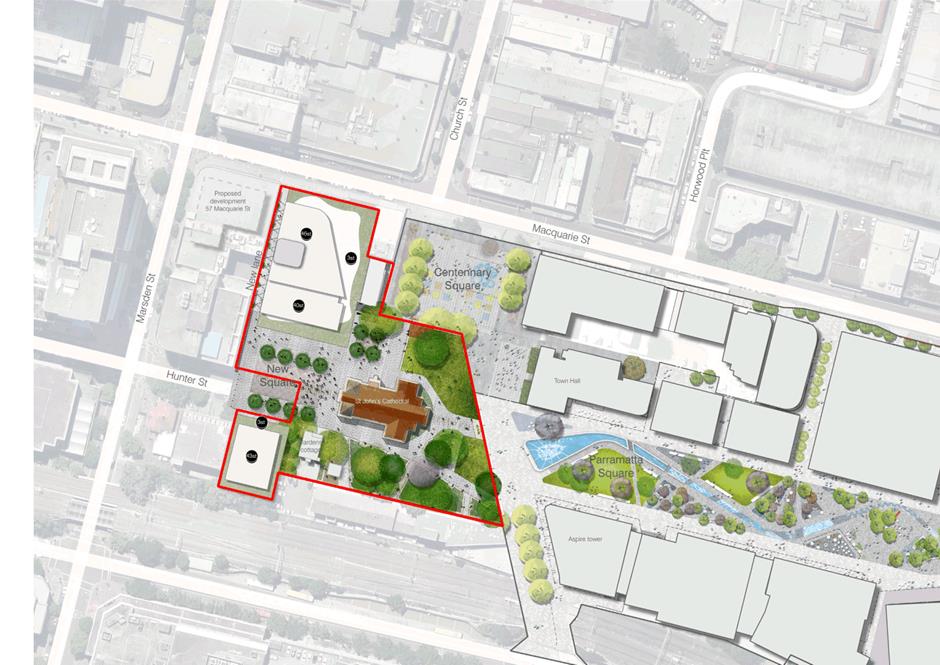
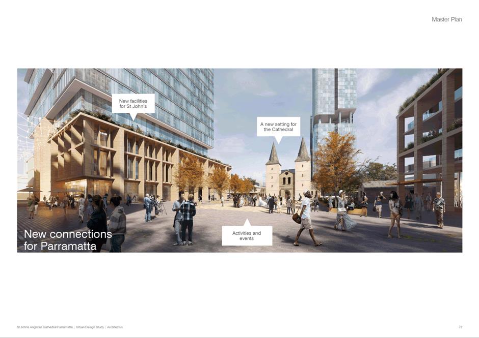
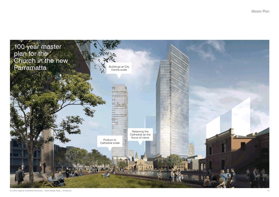
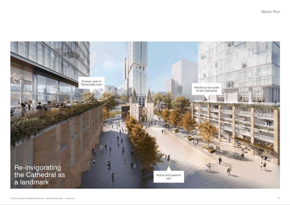
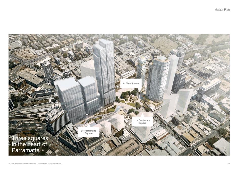
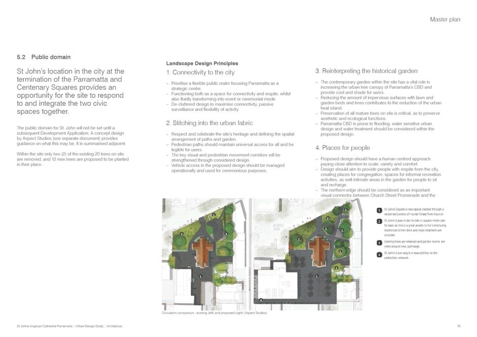
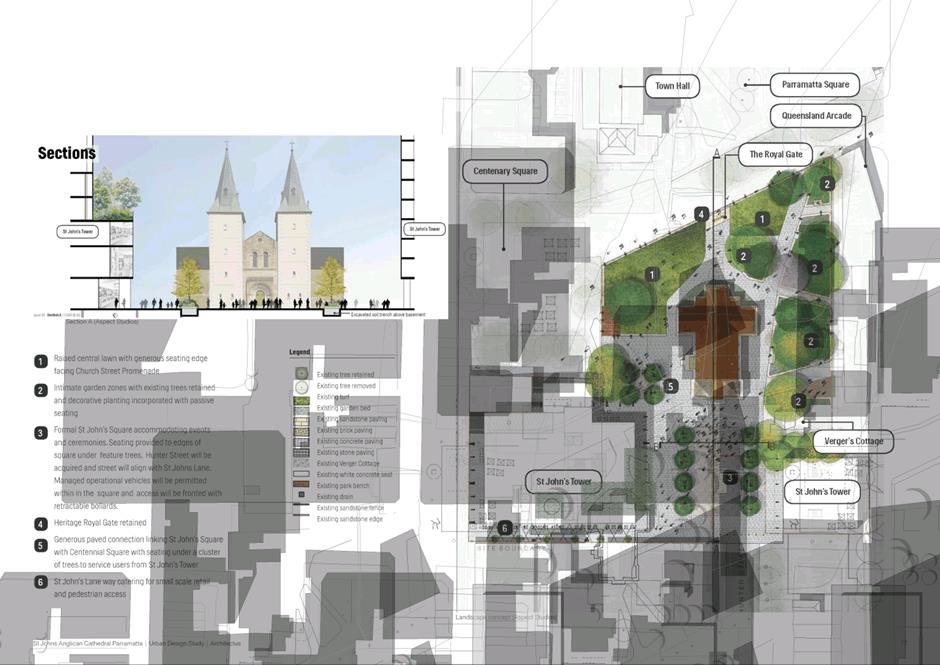
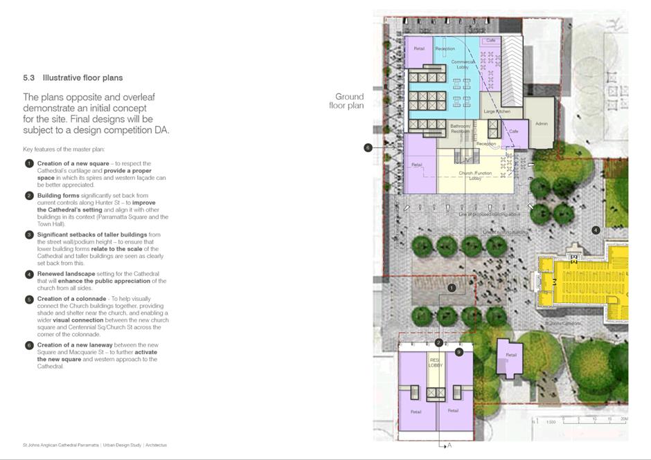
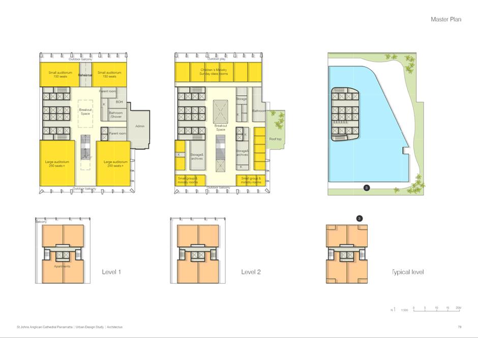
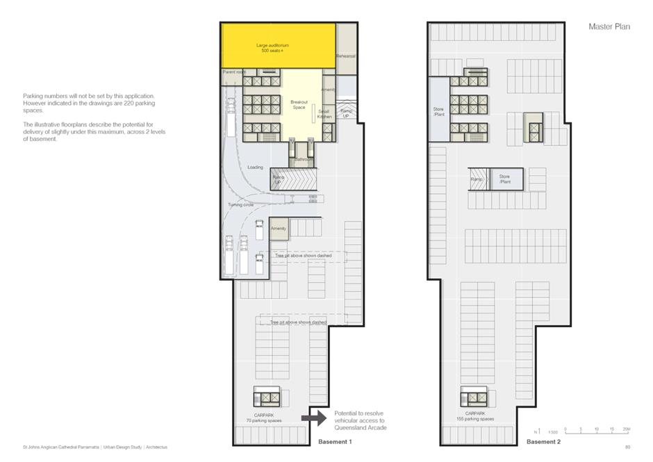
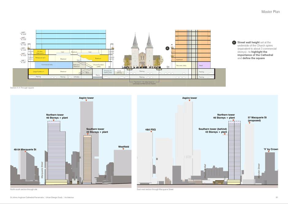
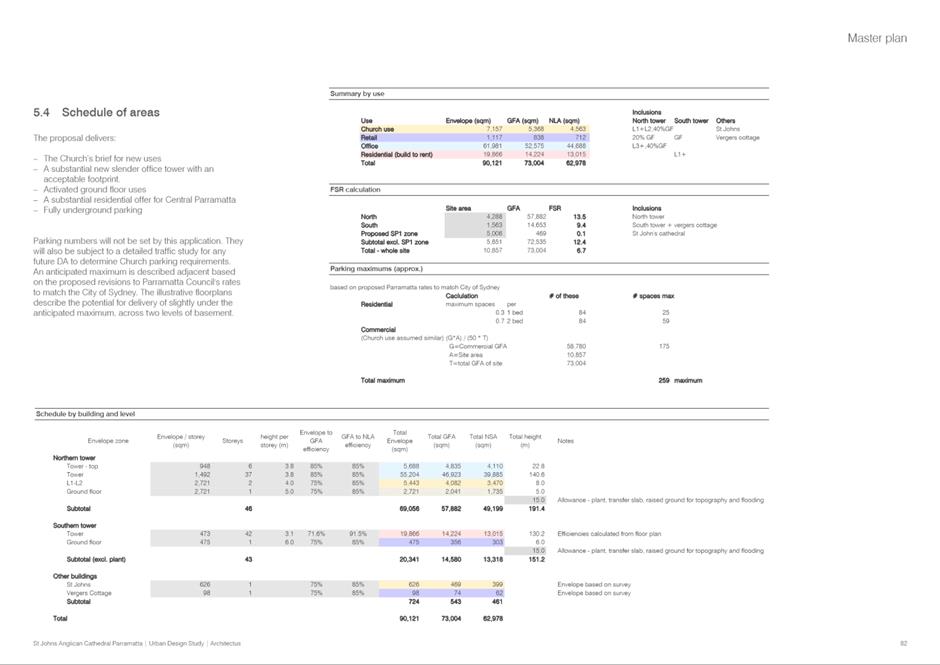
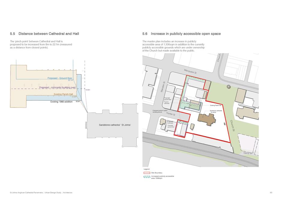
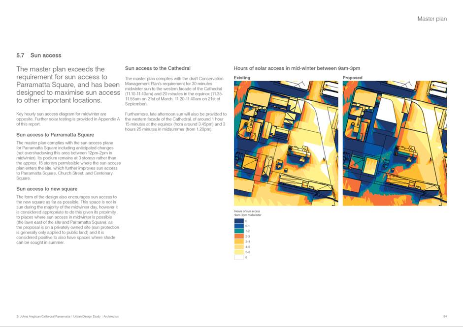
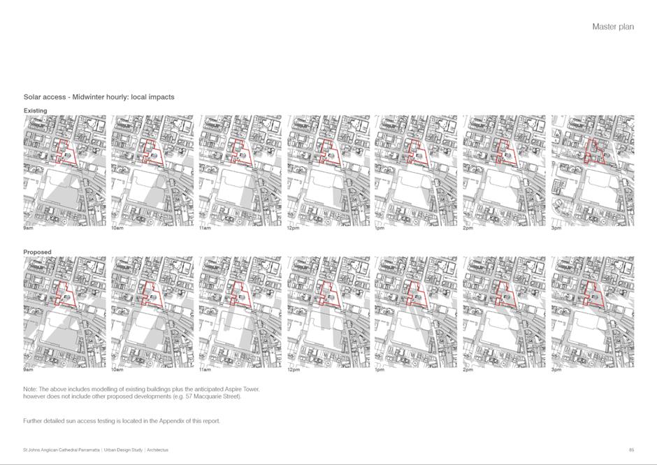
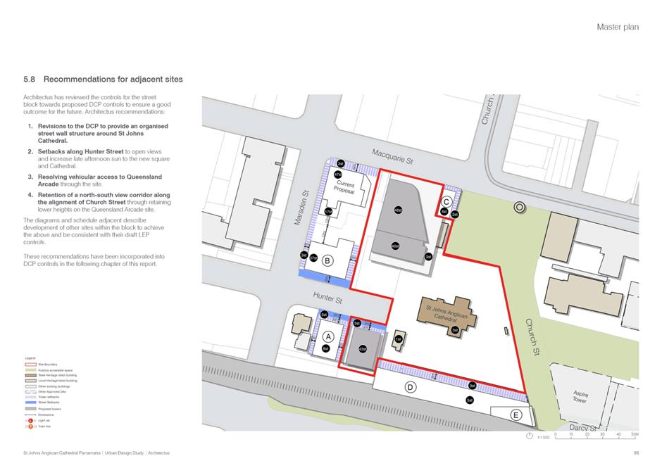
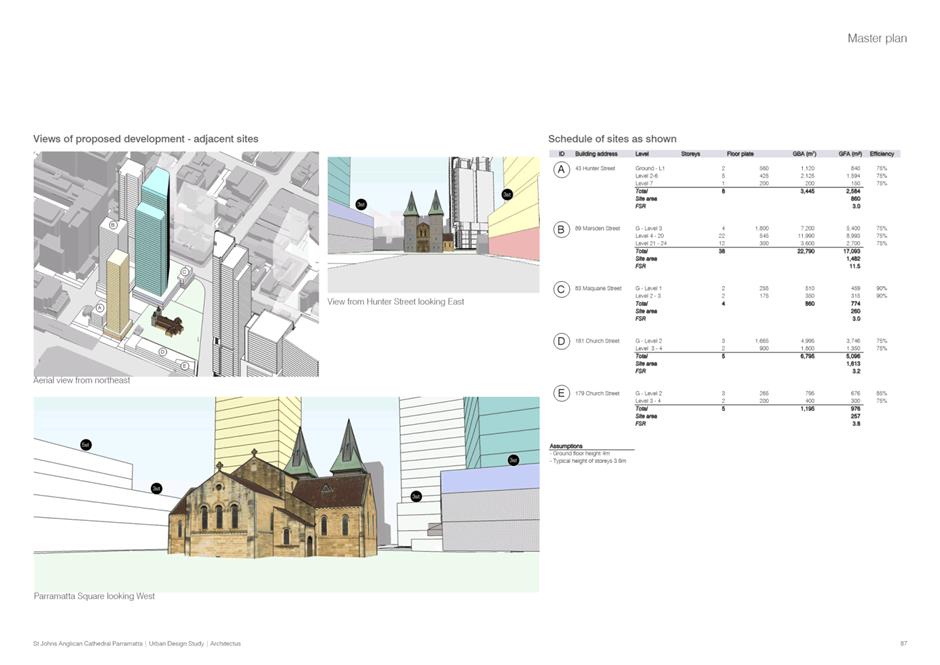
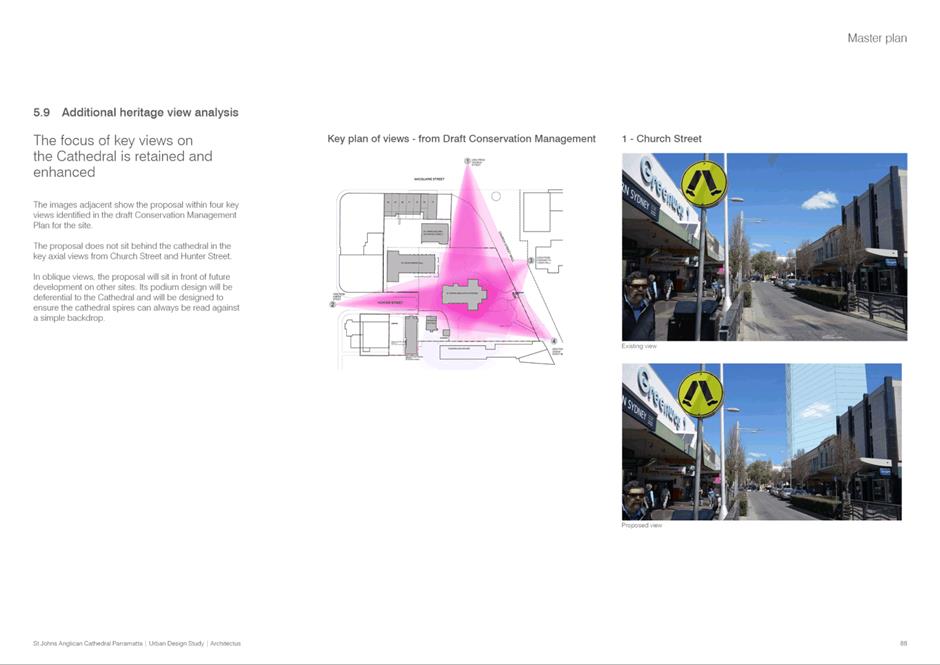
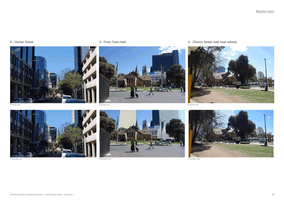
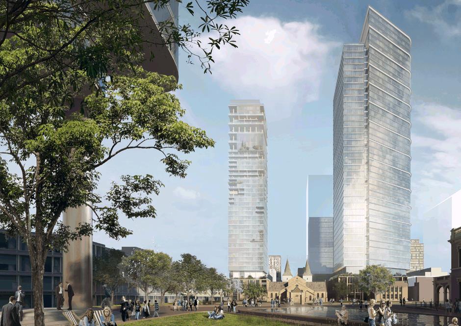
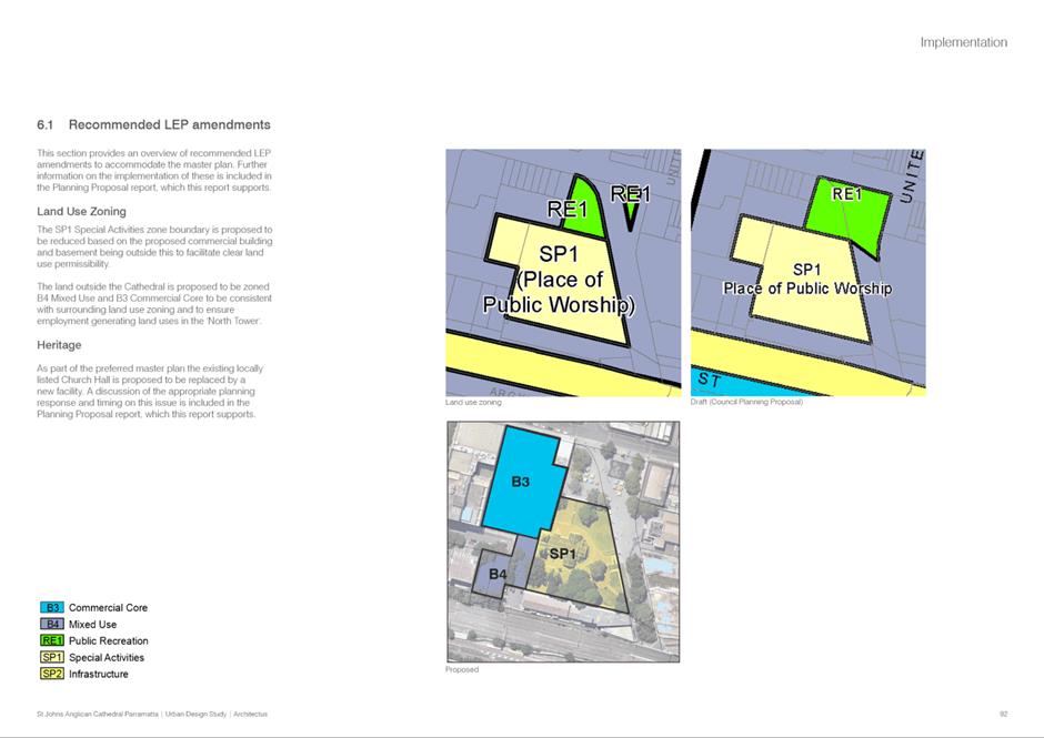
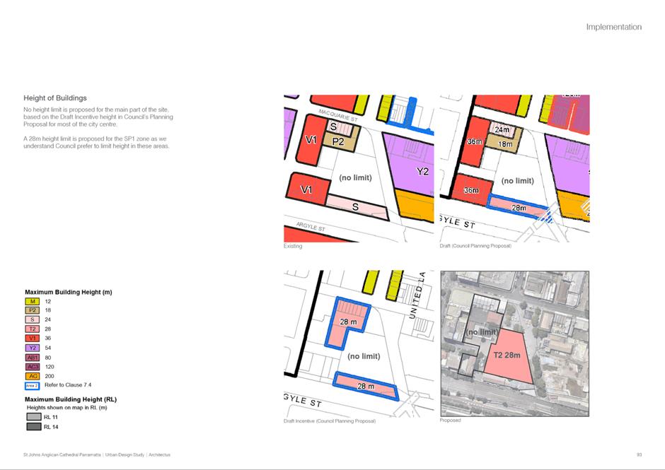
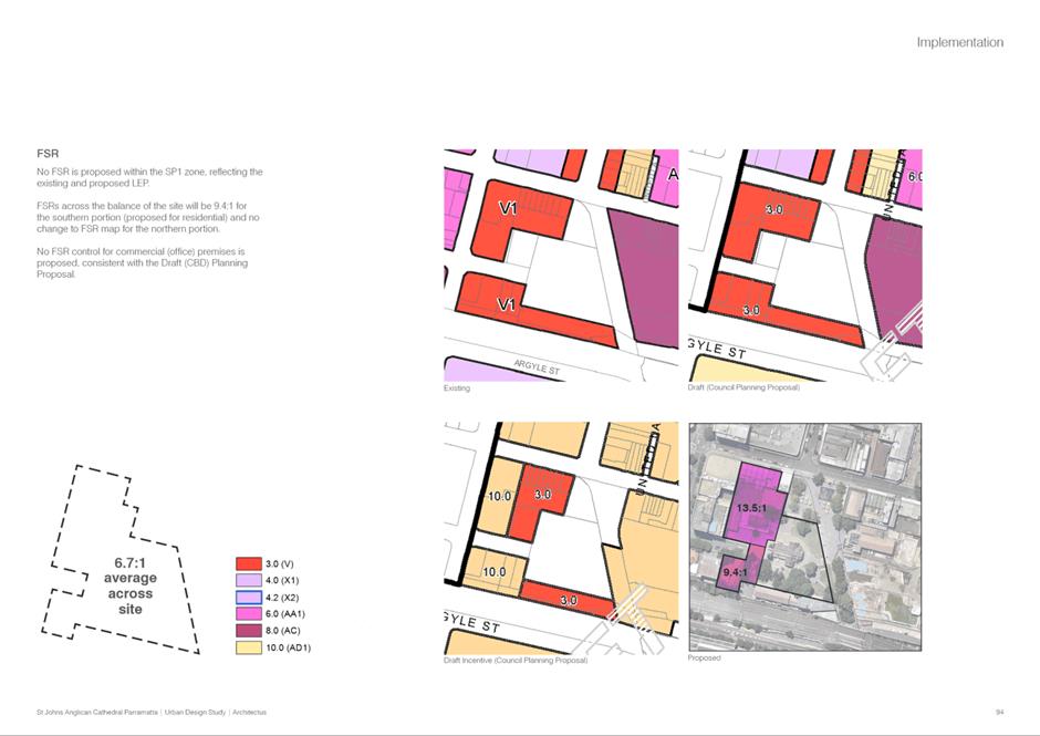
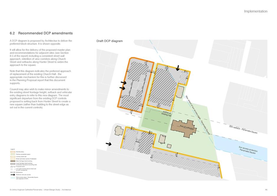
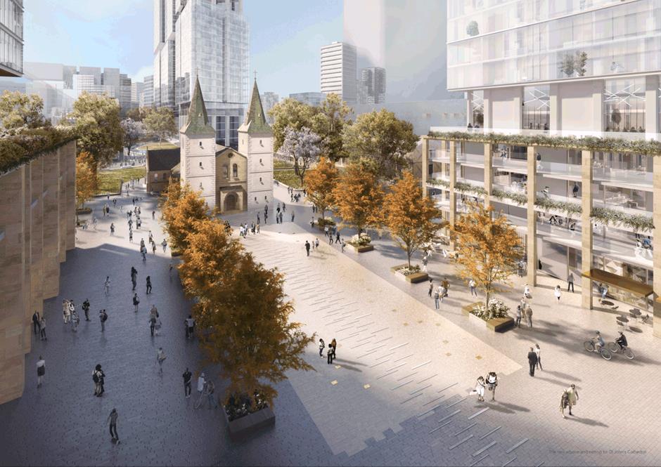
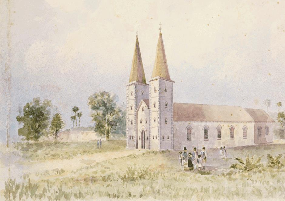
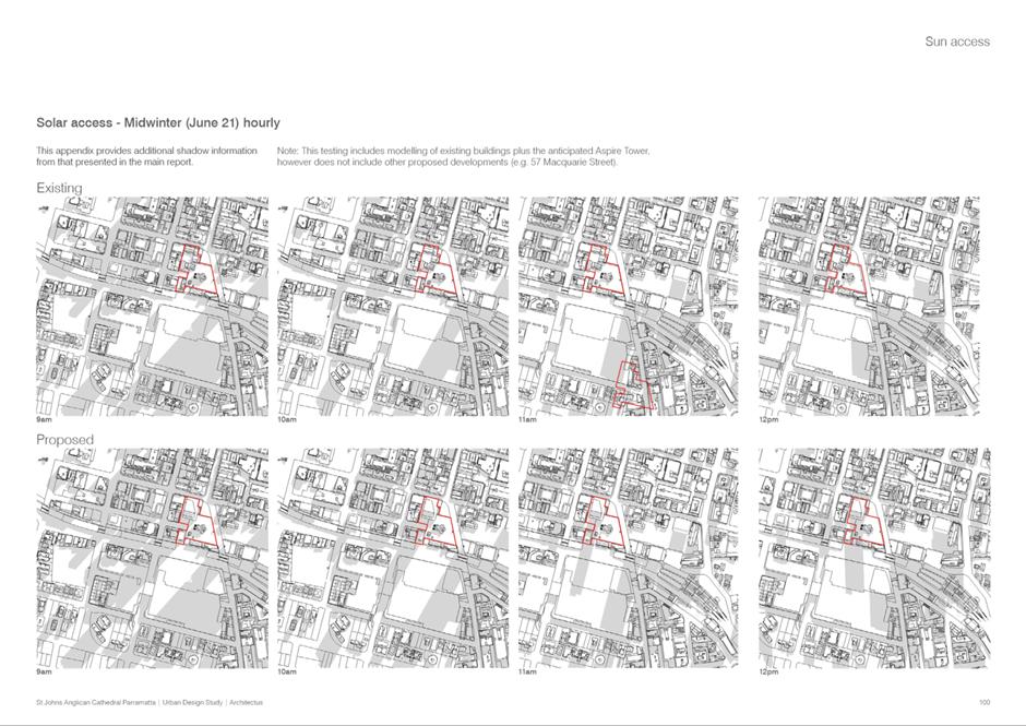
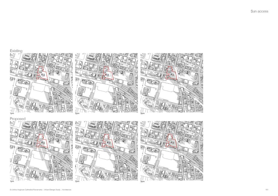
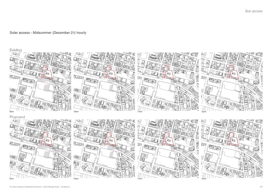
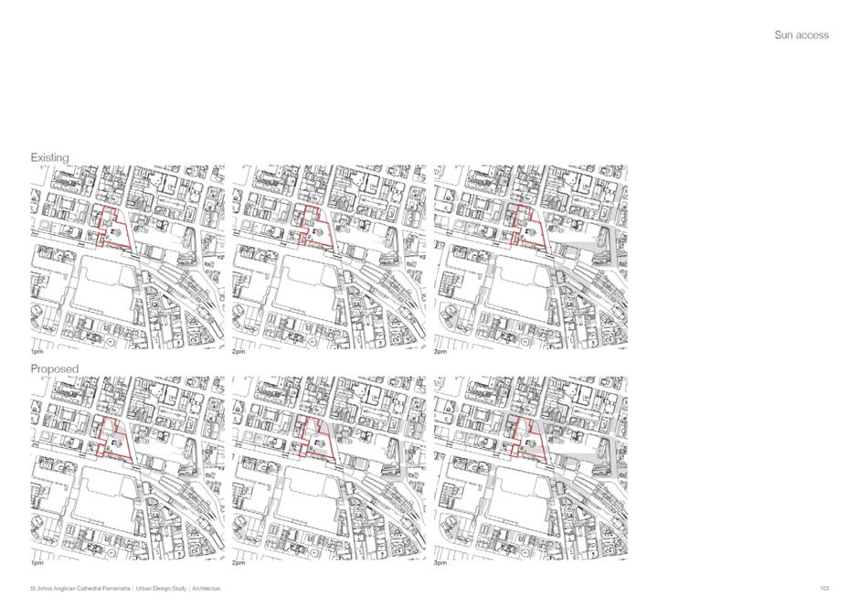

|
Item 18.4 - Attachment 4
|
Attachment 4 - Applicant Traffic Assessment
|
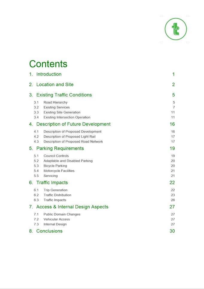
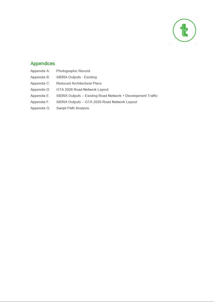
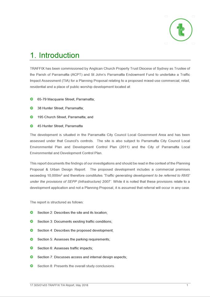
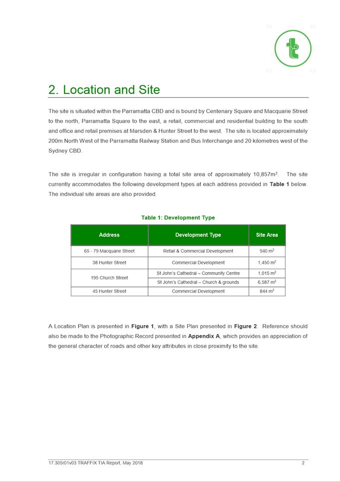
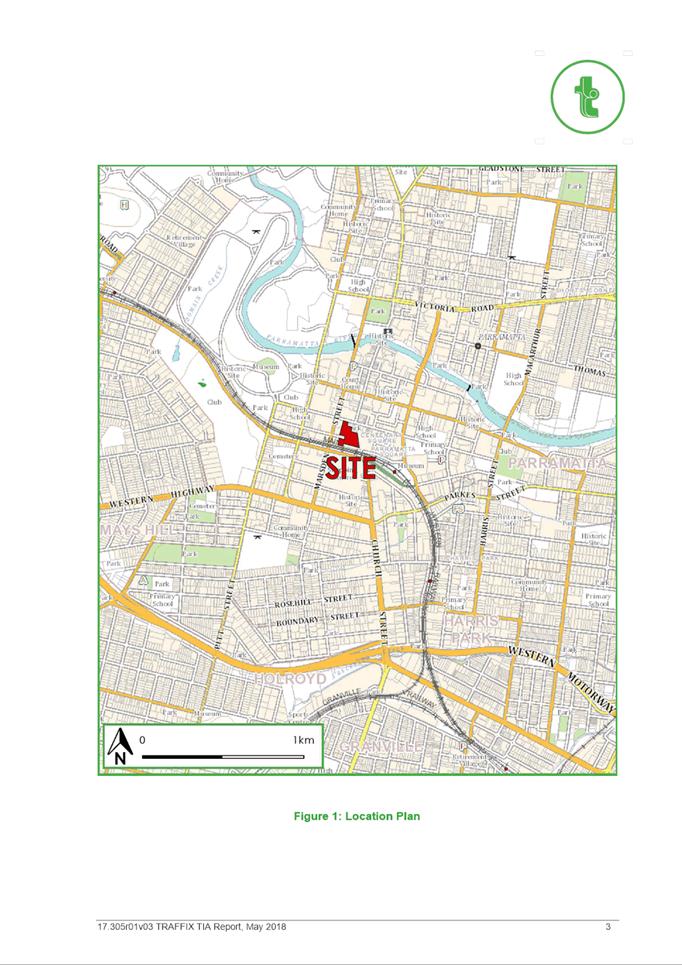
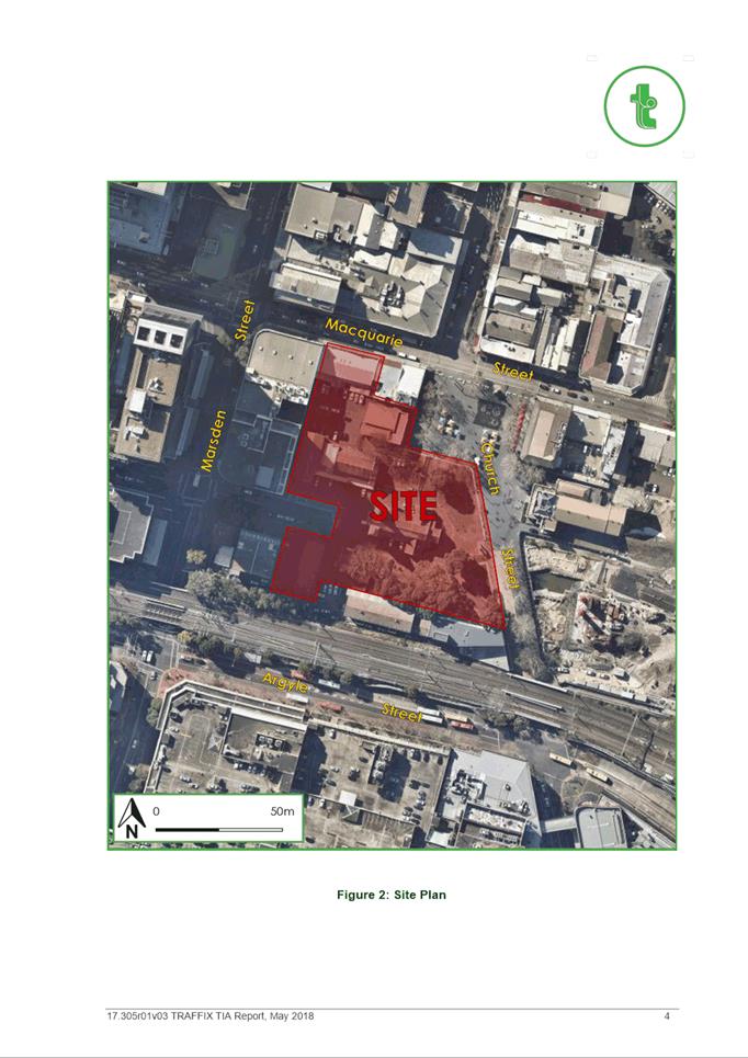
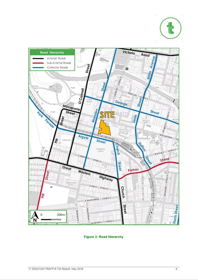
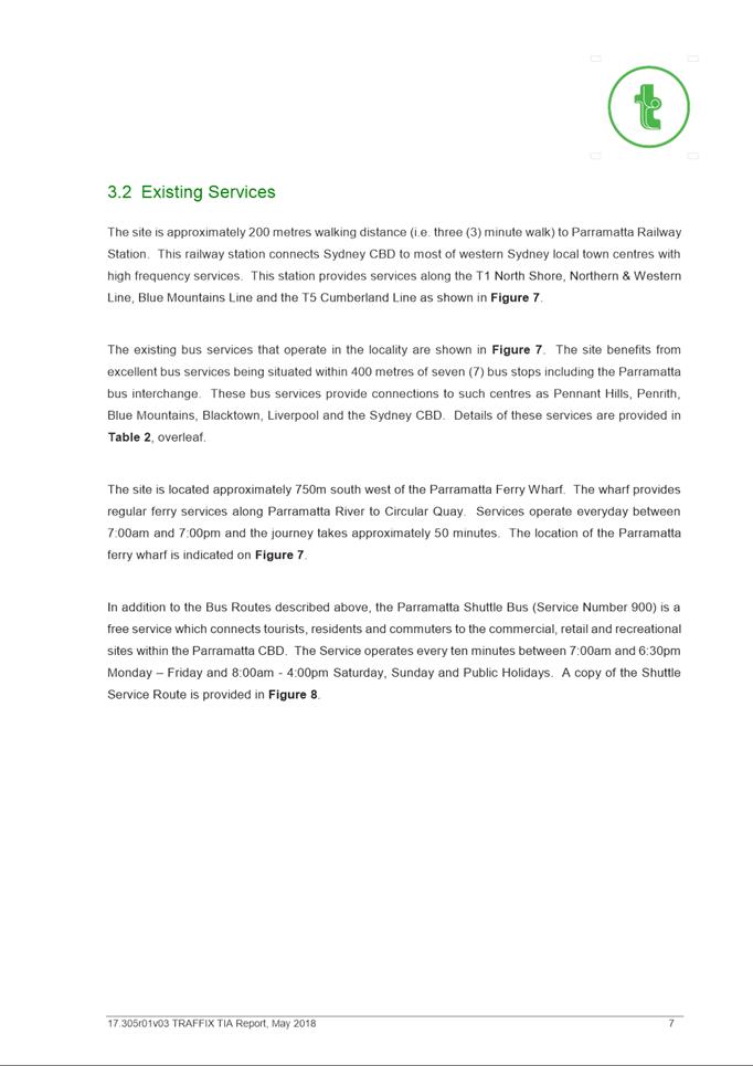
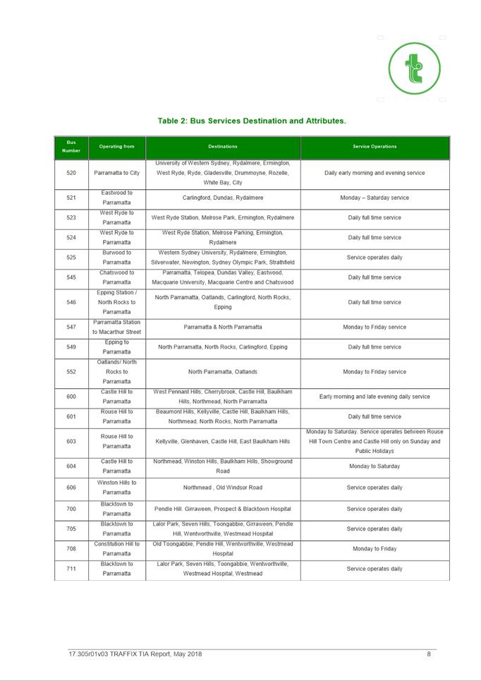
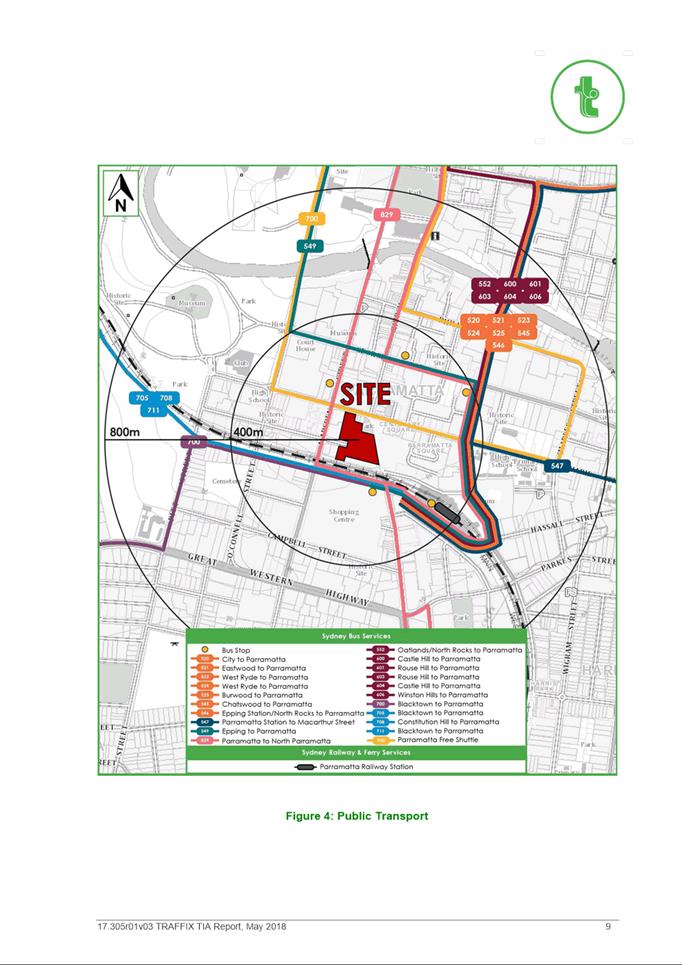
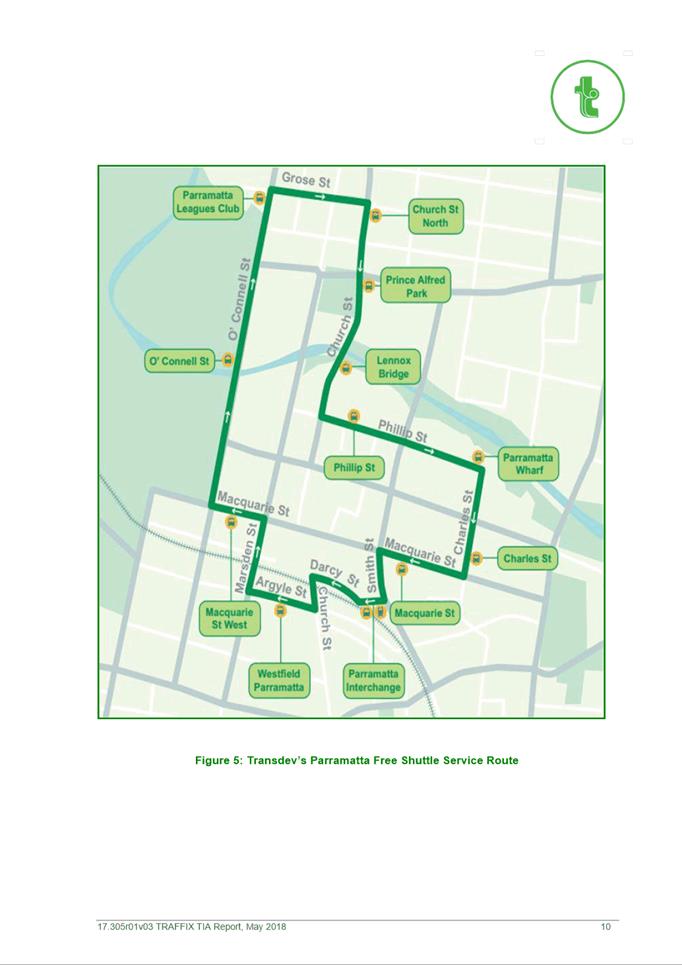
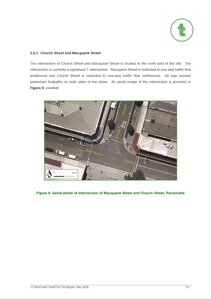
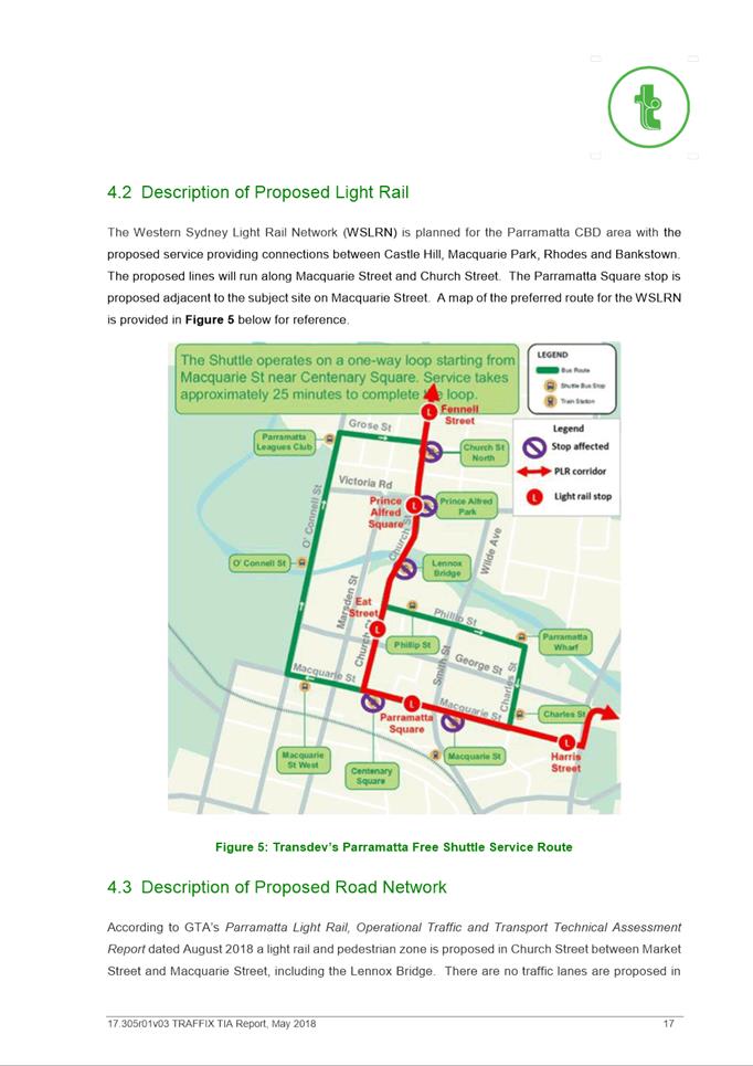
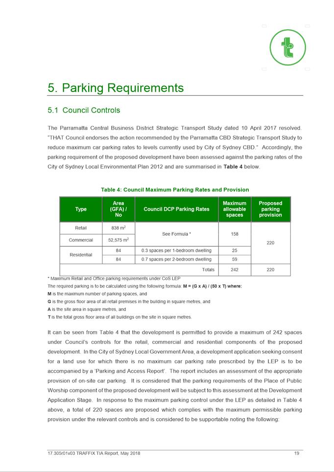
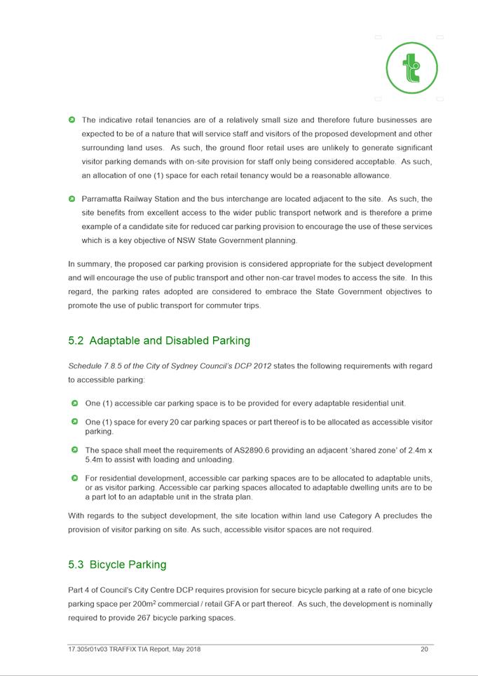
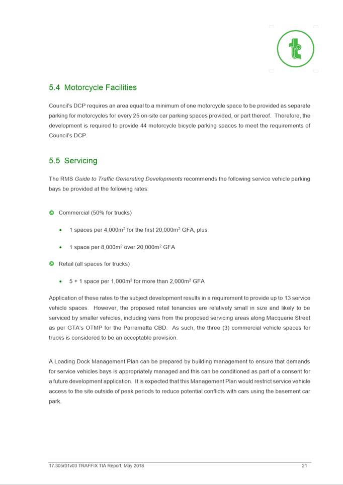
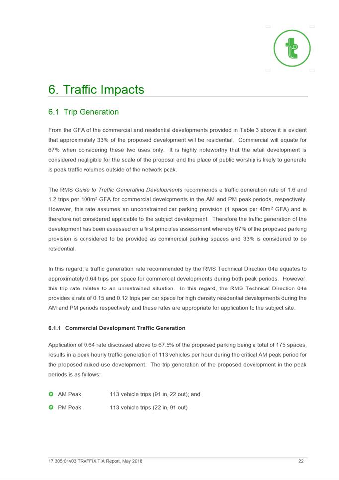
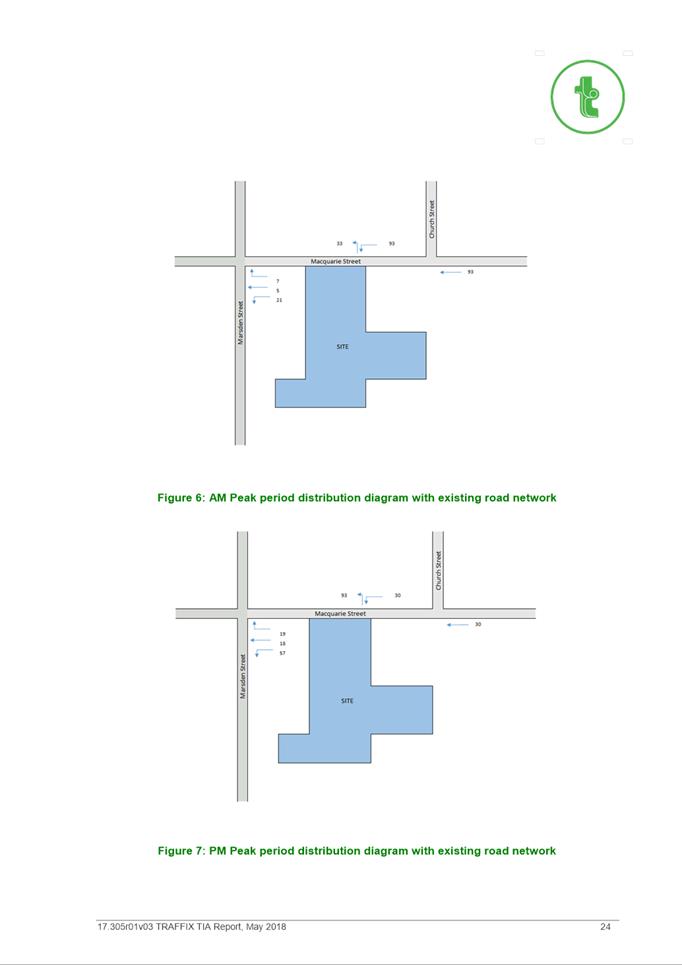
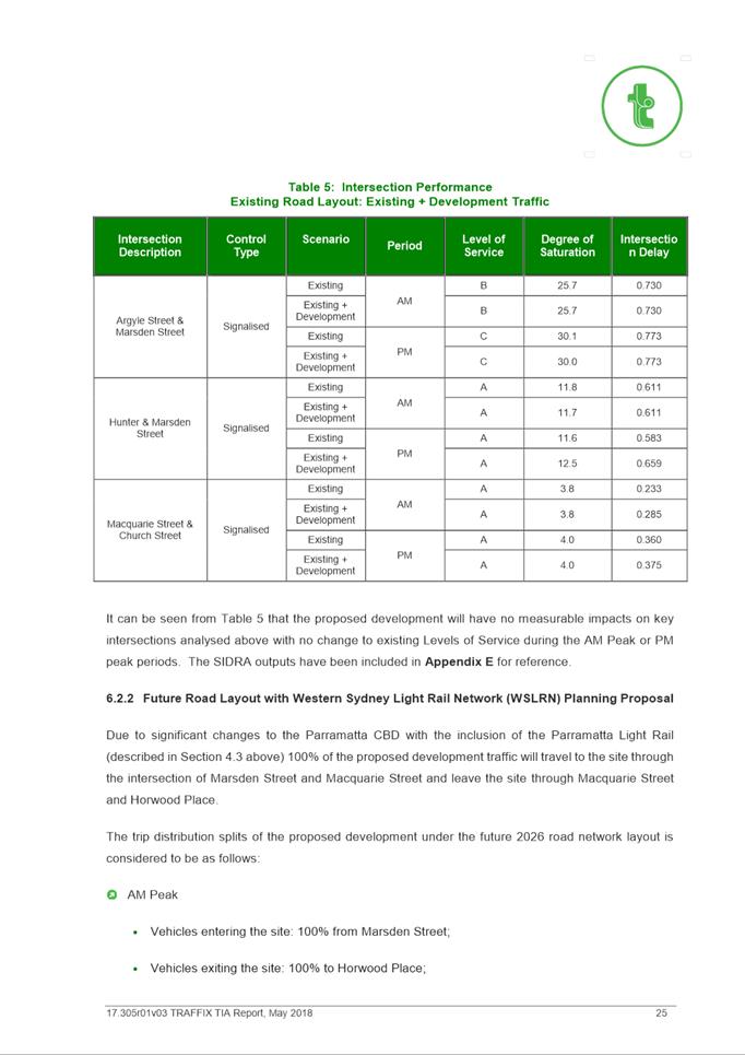
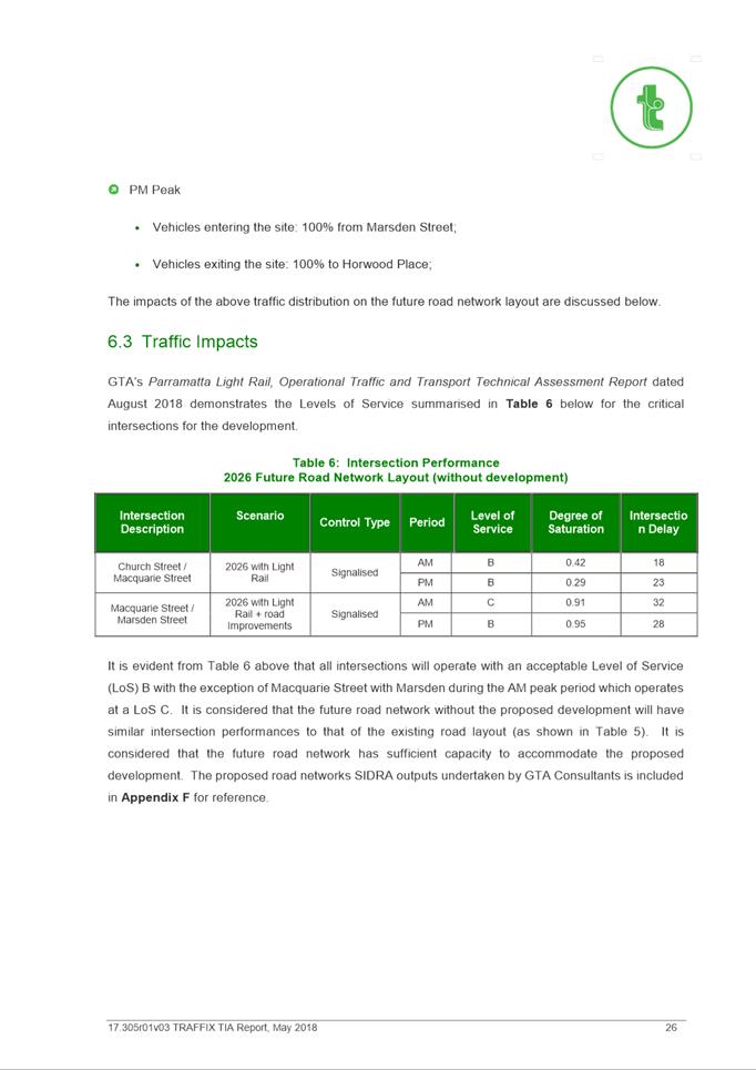

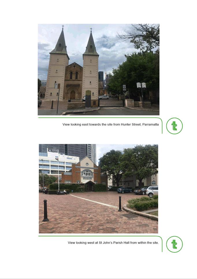
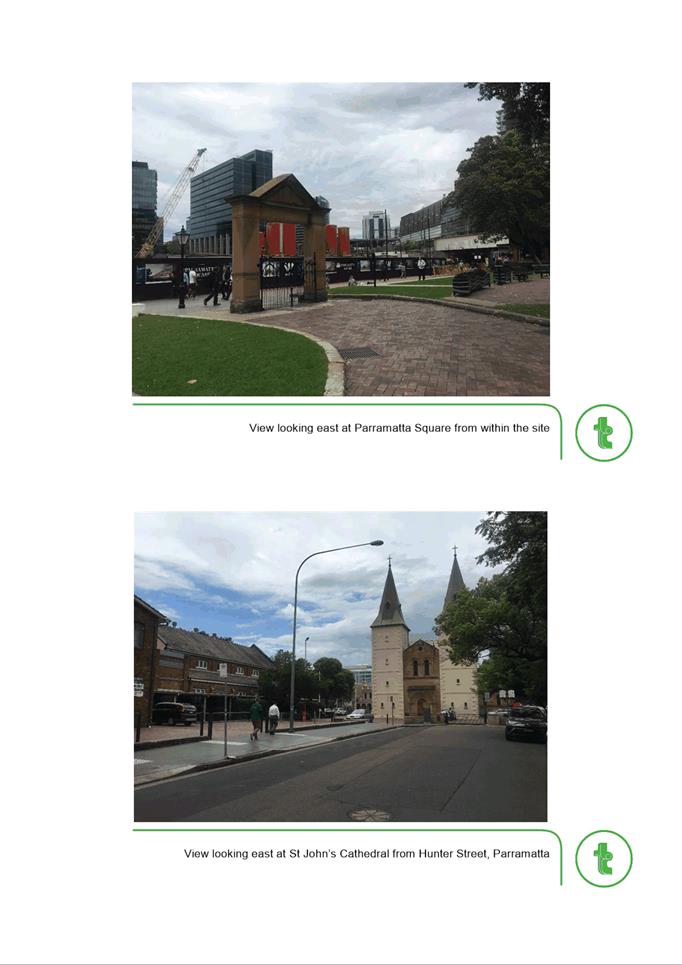
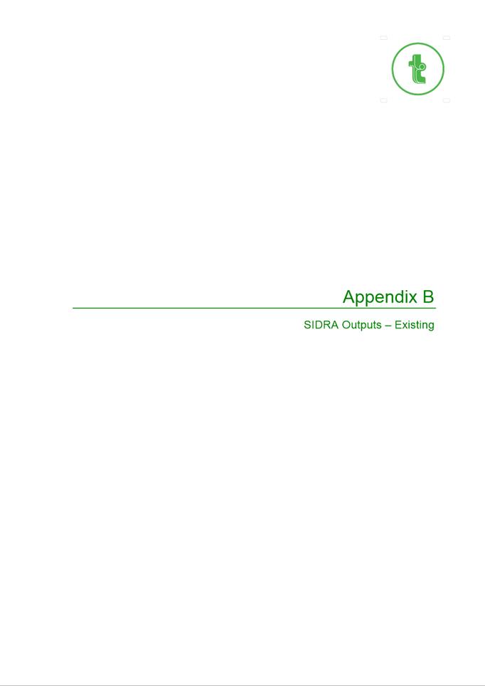
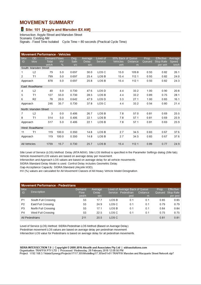
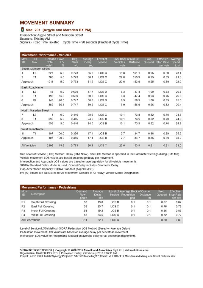
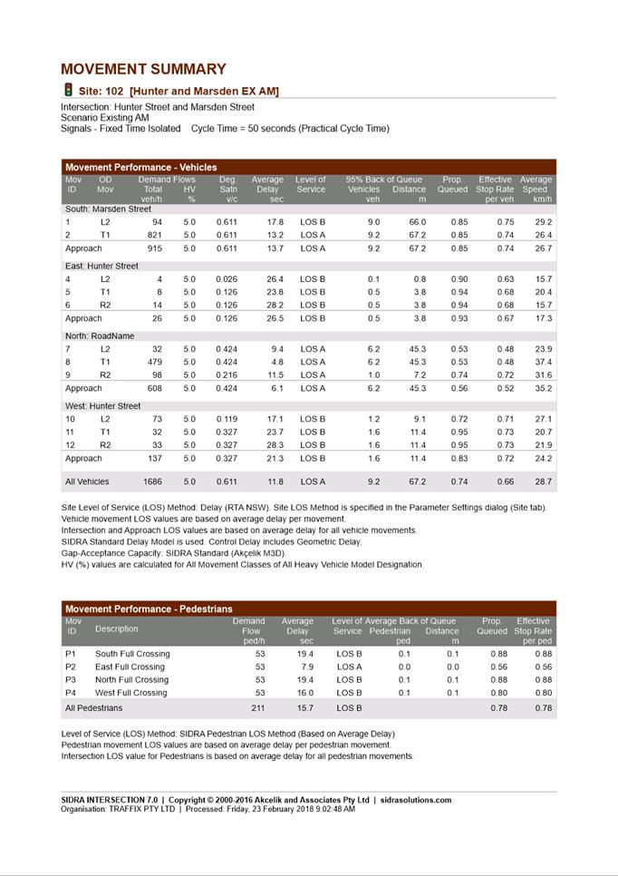

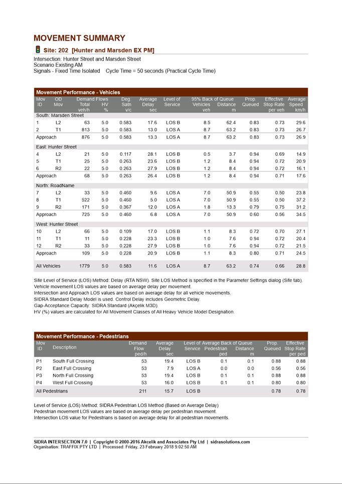

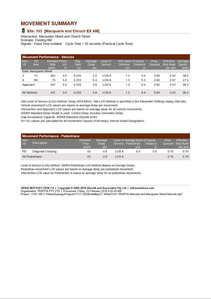
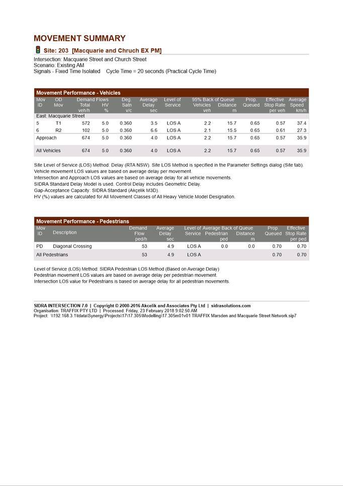
|
Item 18.4 -
Attachment 5
|
Attachment 5 - Applicant Heritage Impact Statement
|
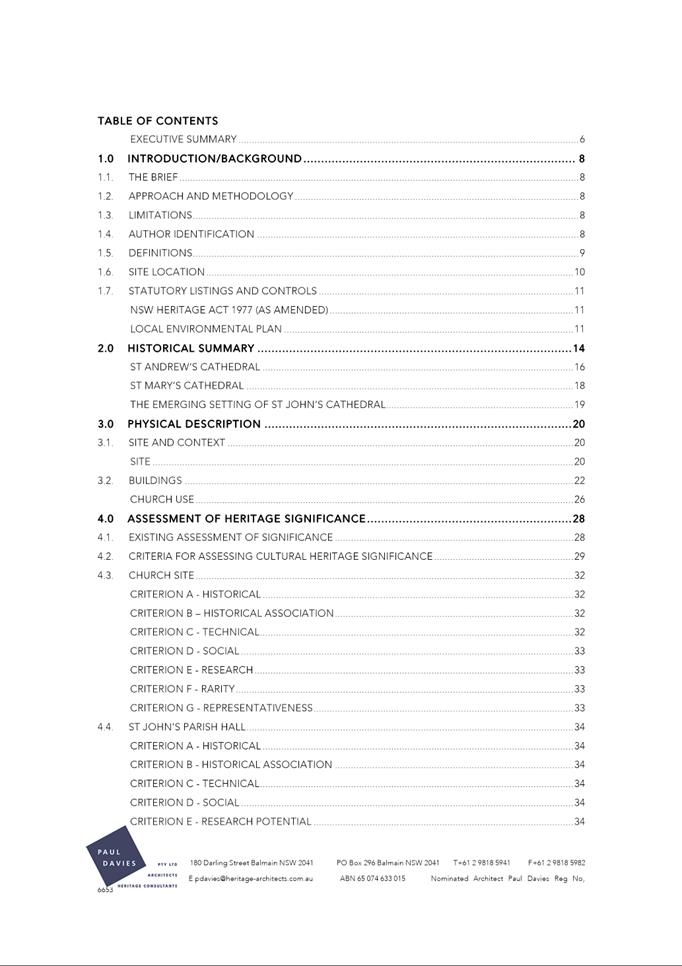
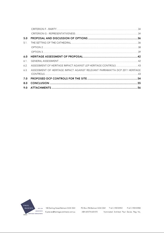
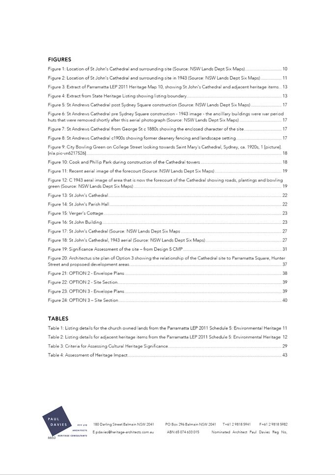
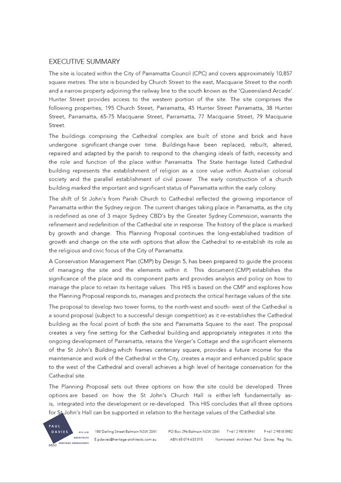
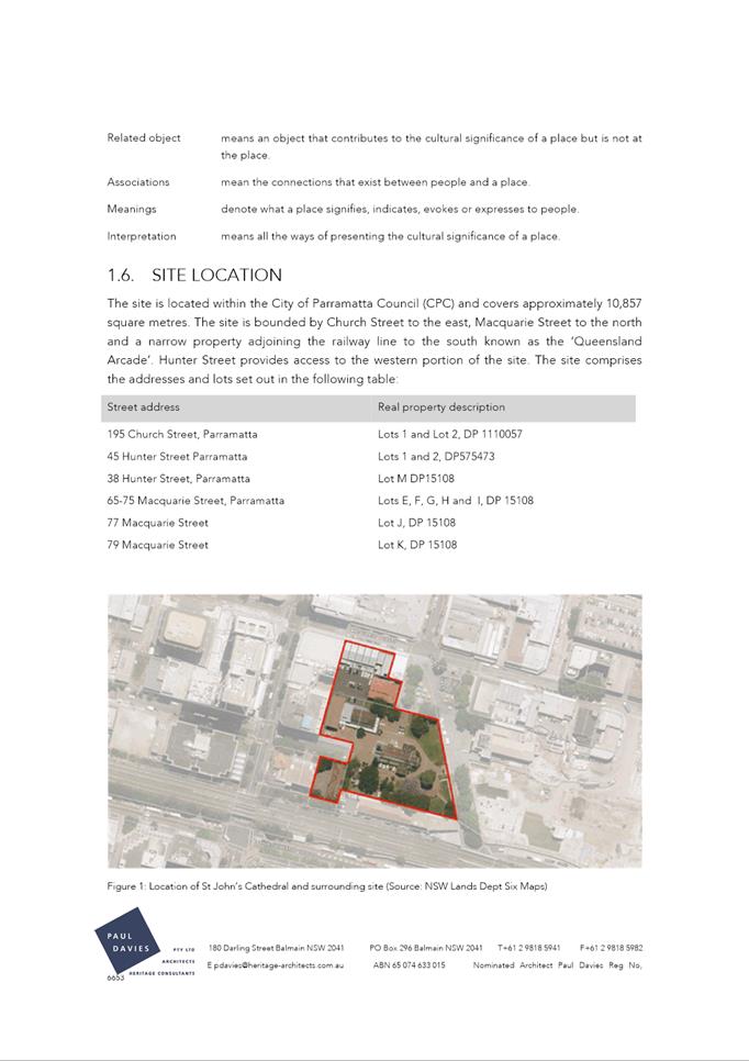
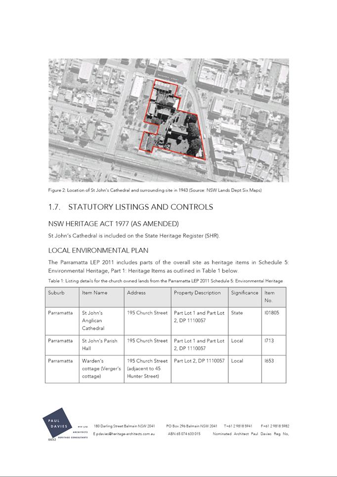
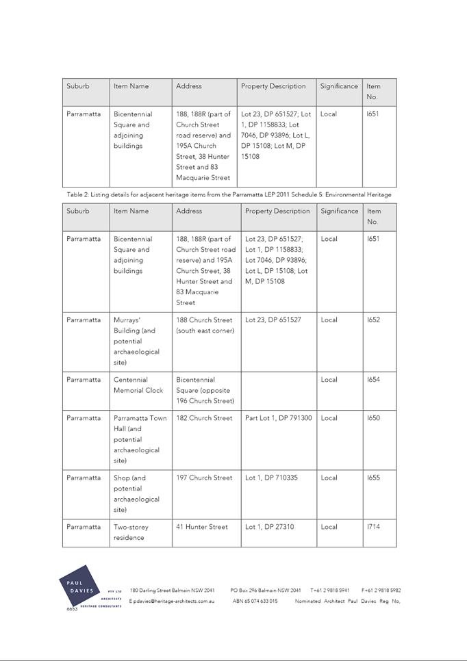
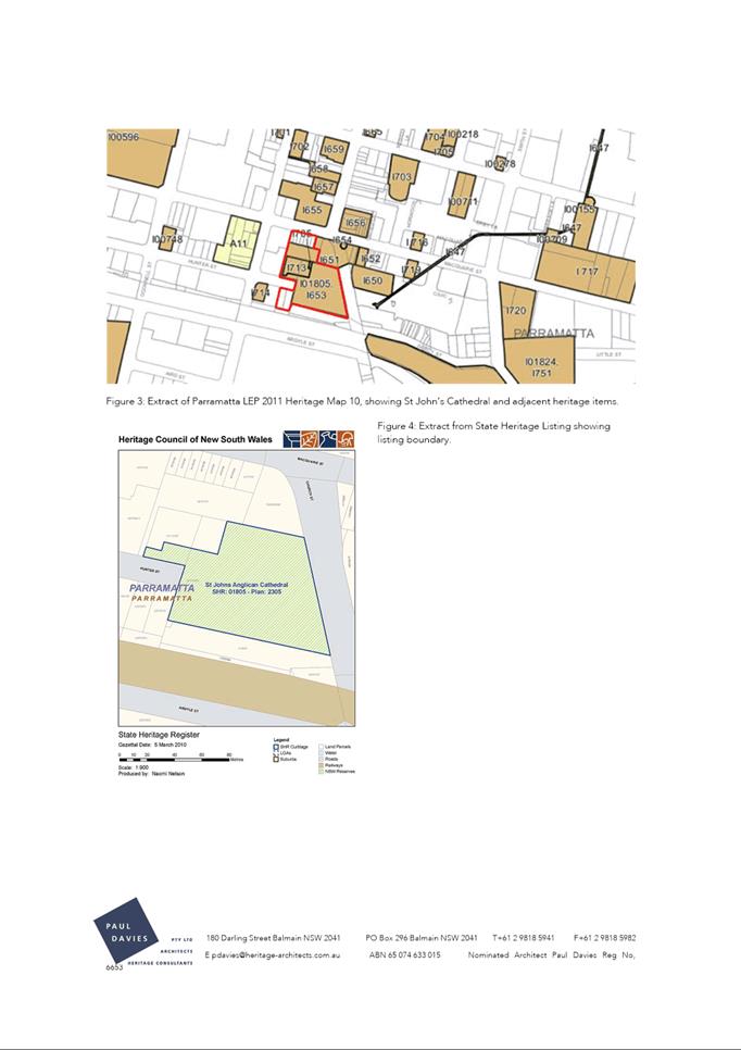
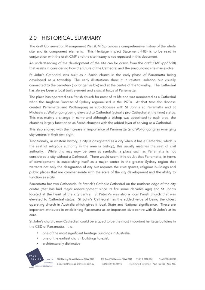
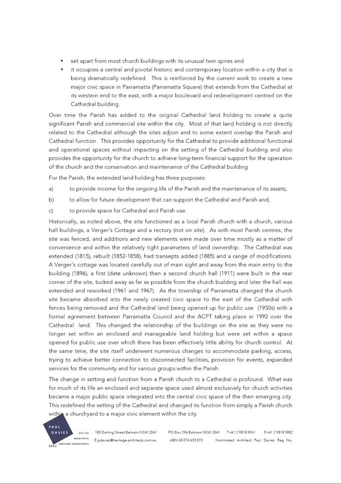
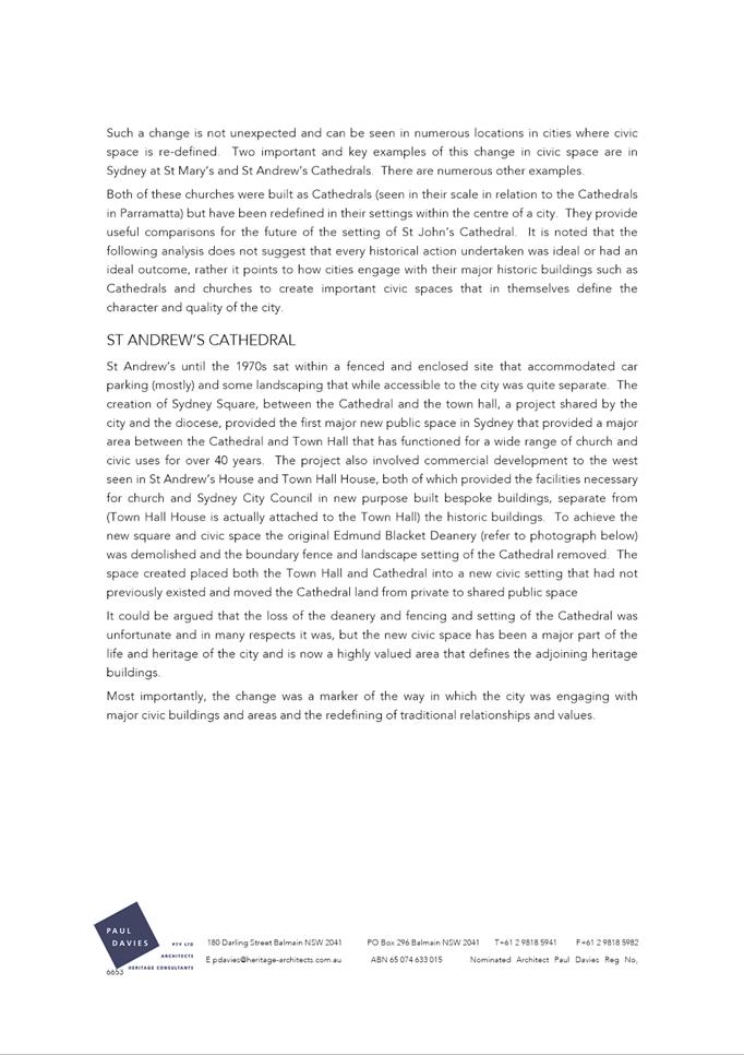
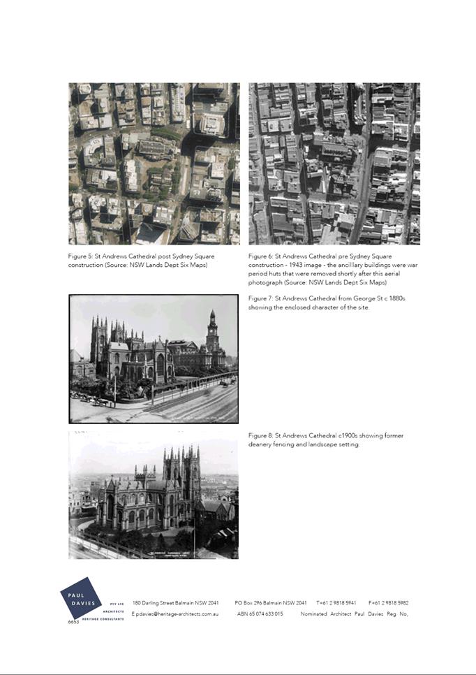
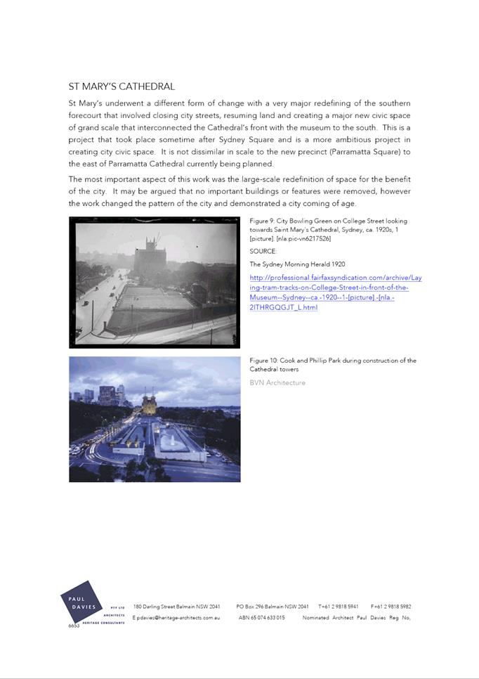
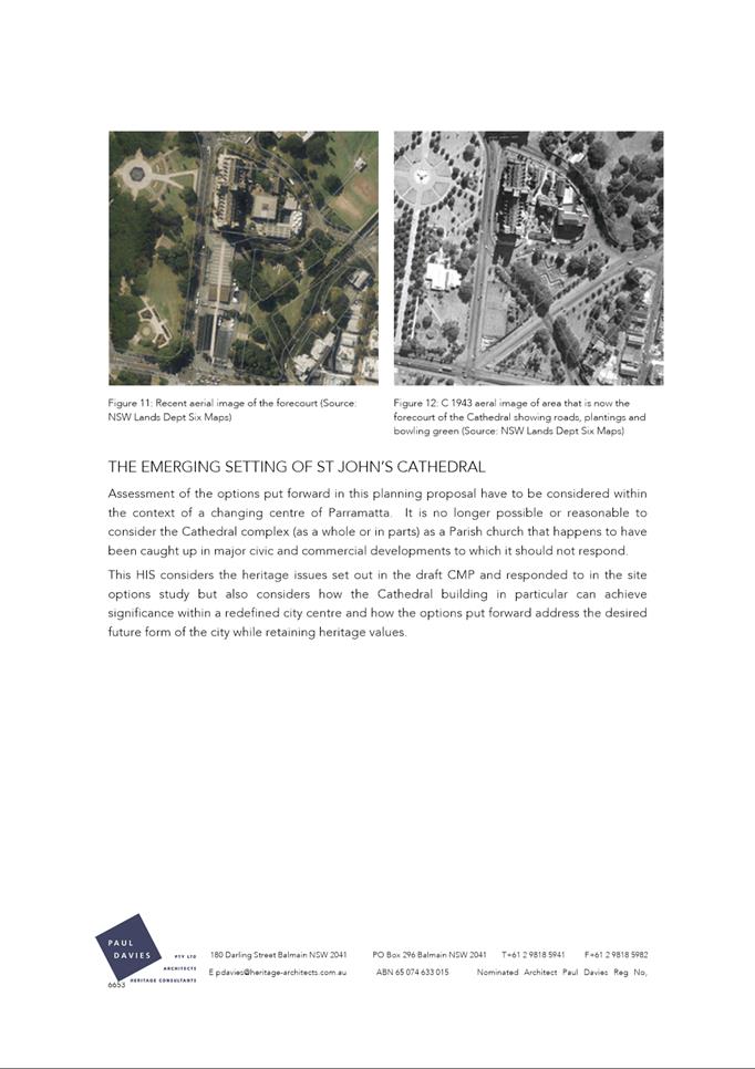
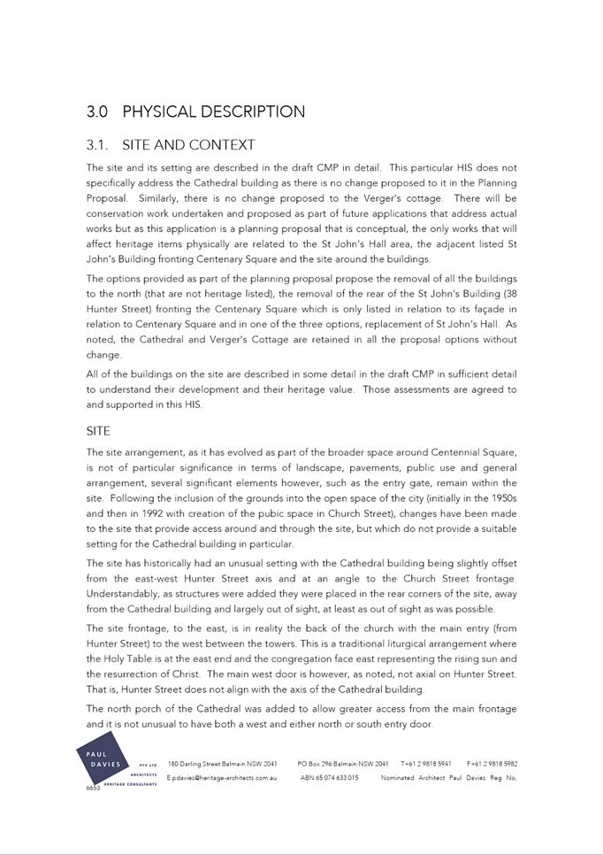
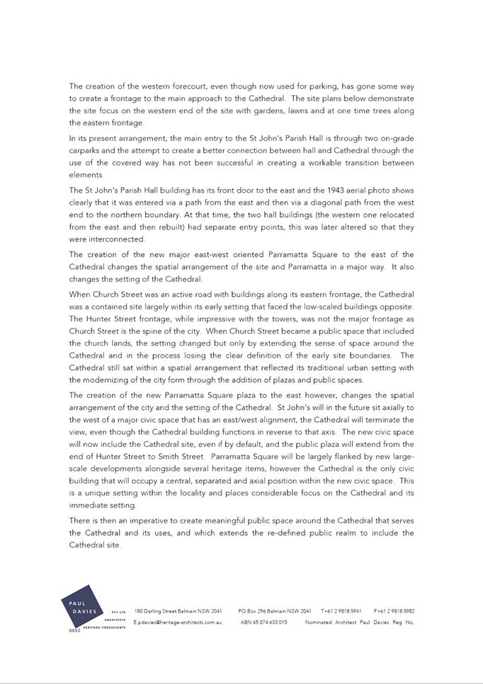
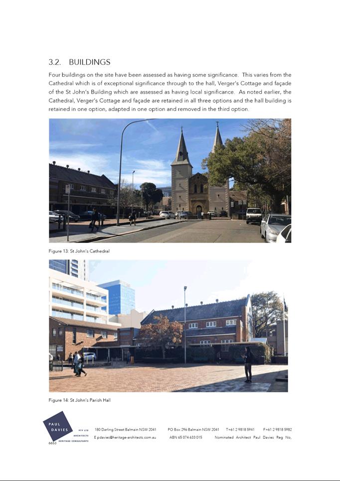
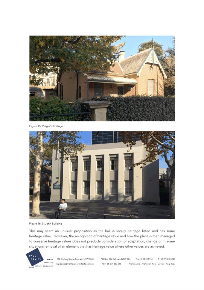
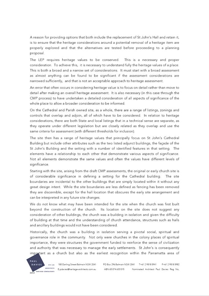
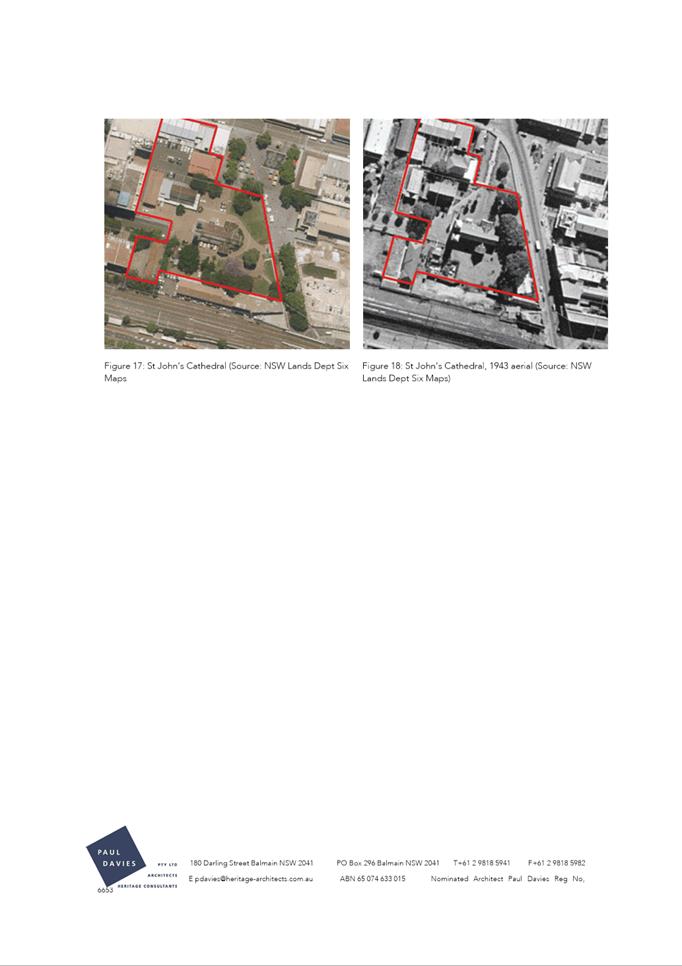
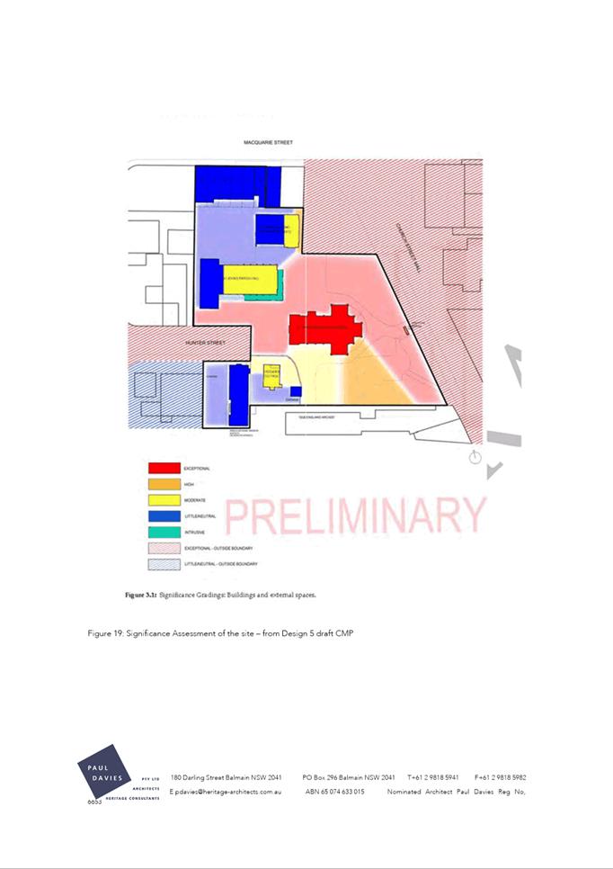

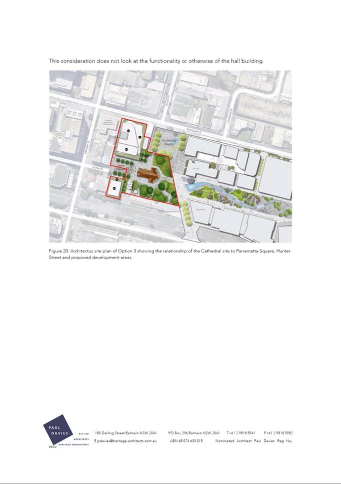
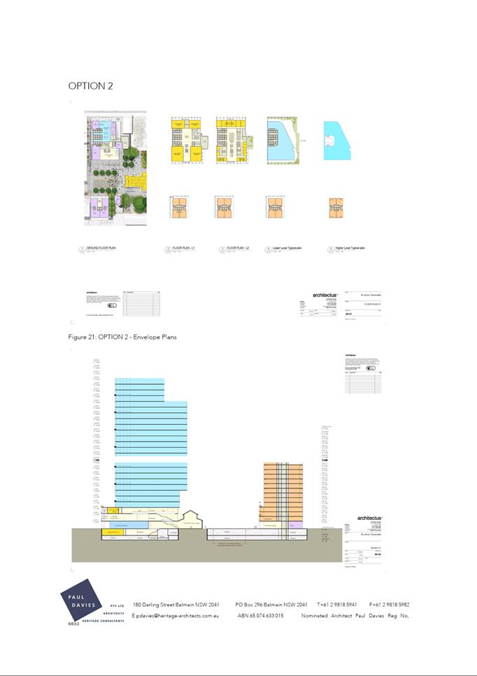
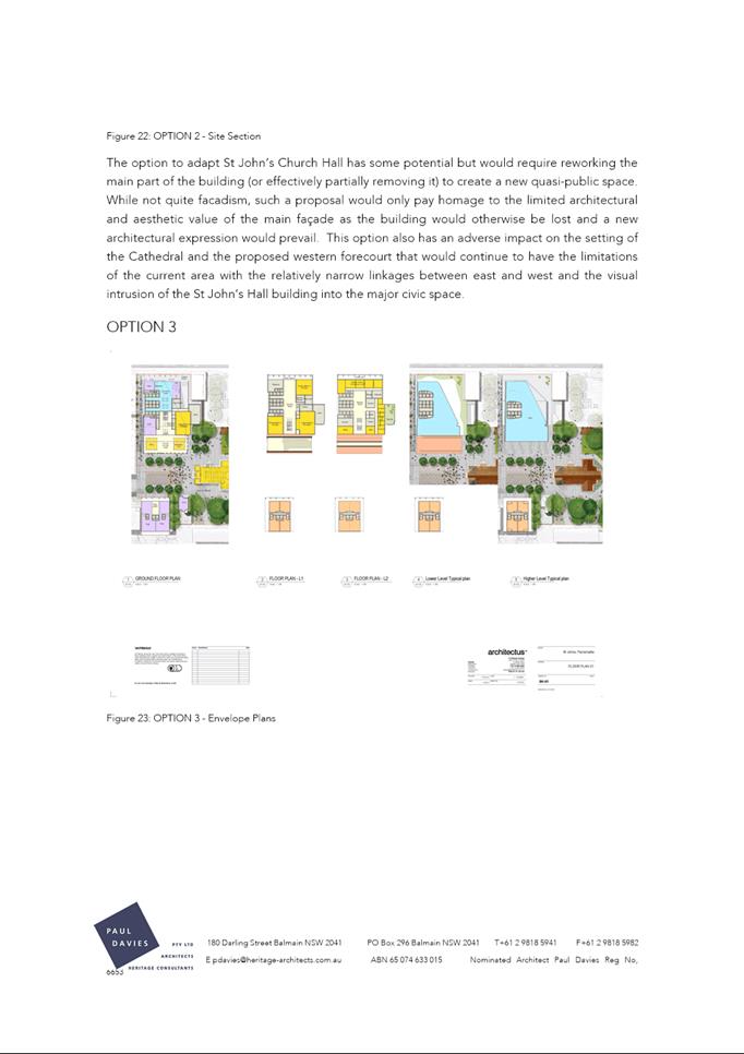
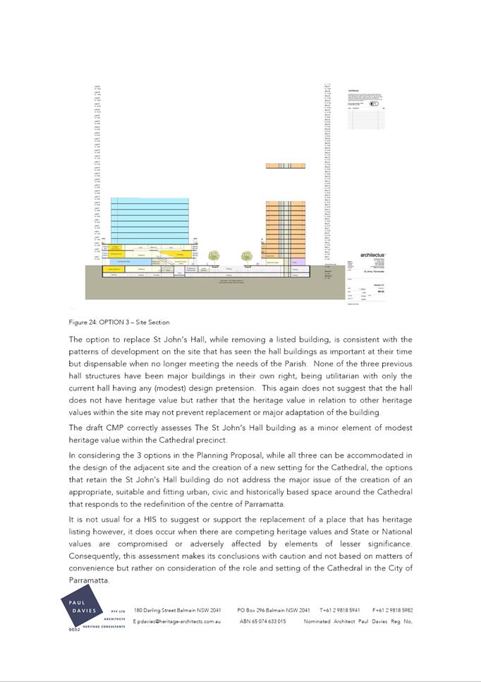
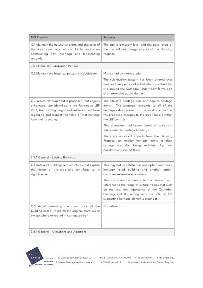
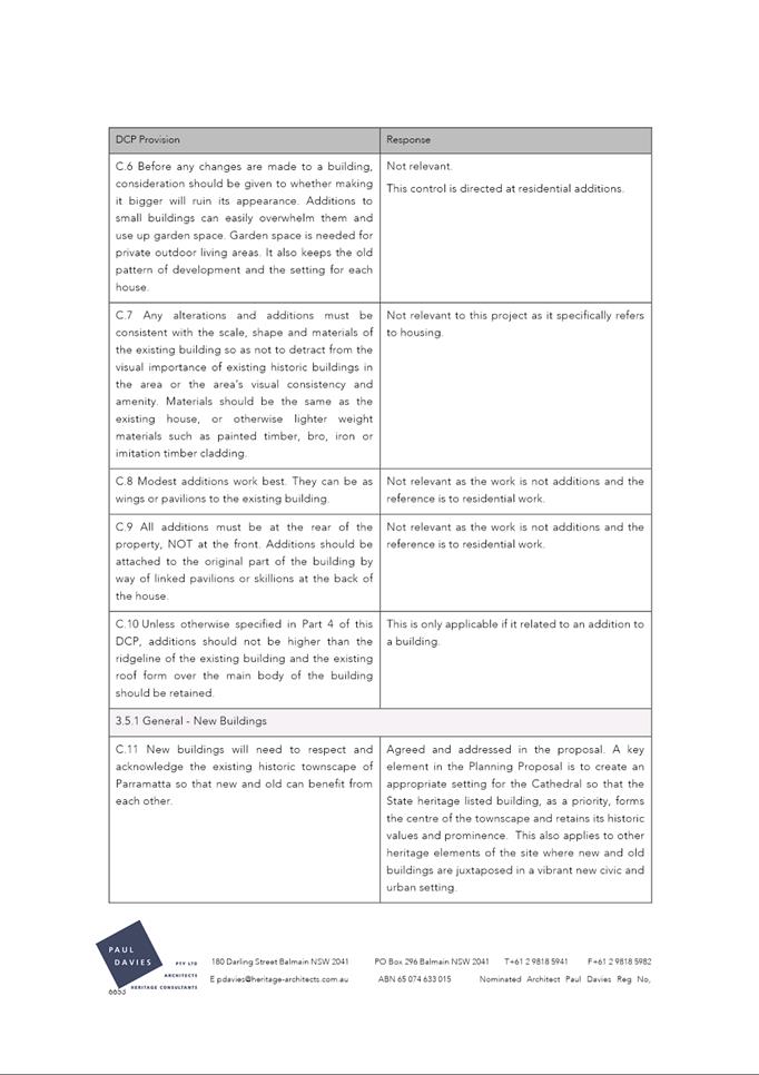
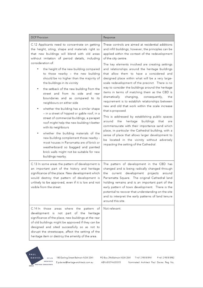
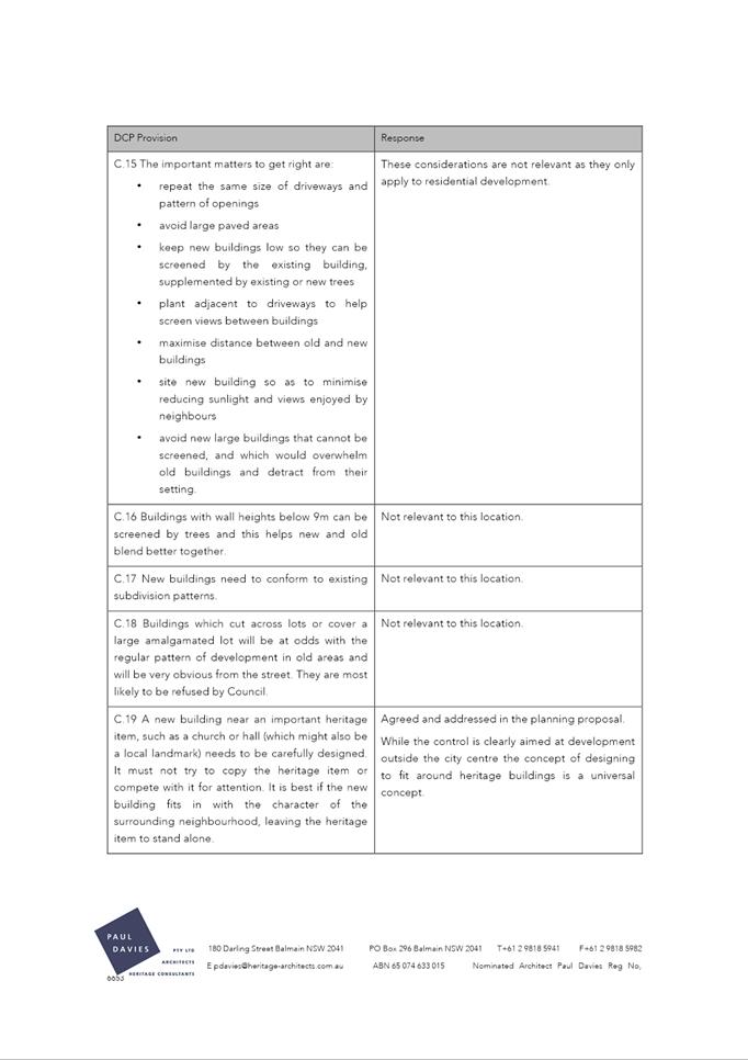
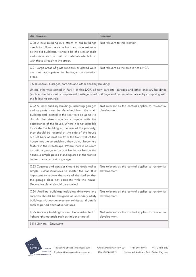
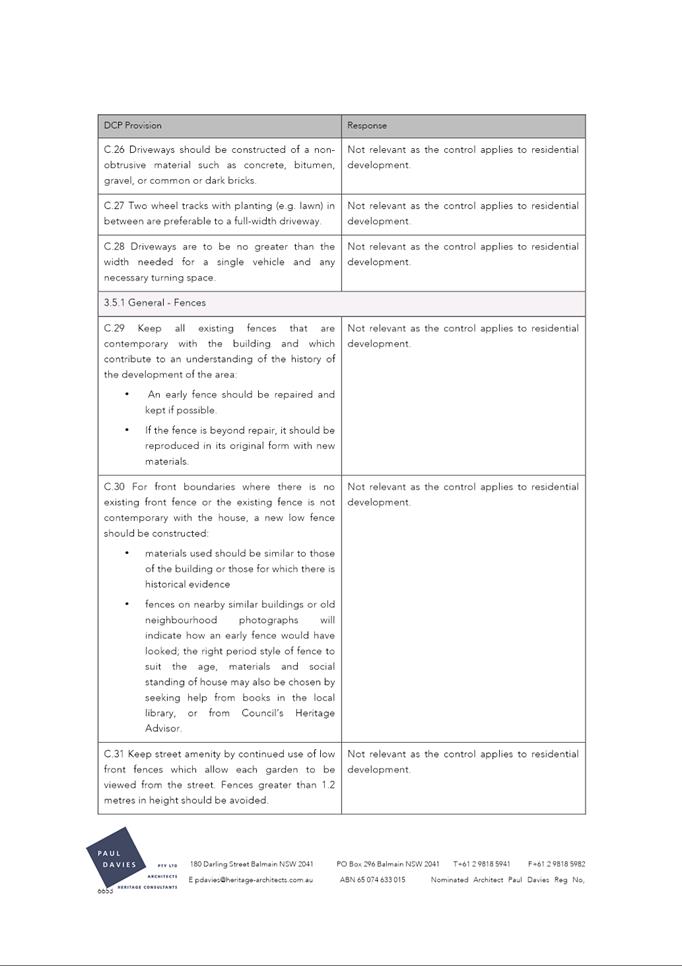
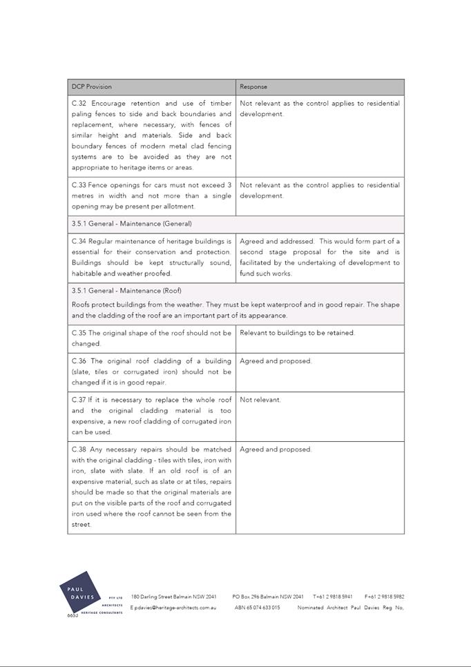
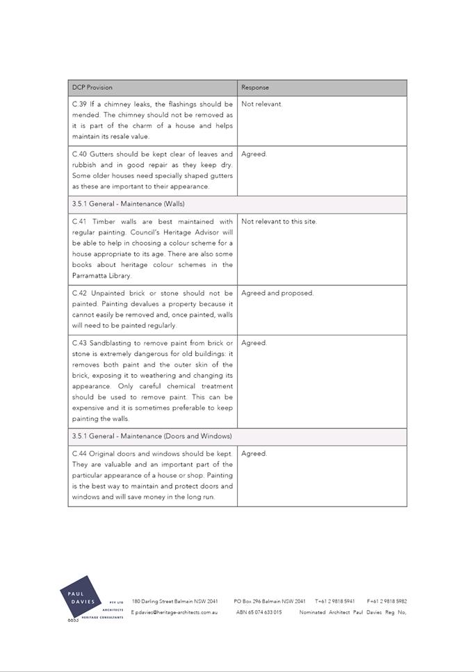
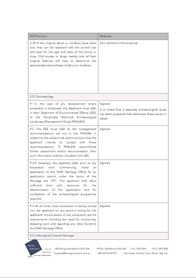
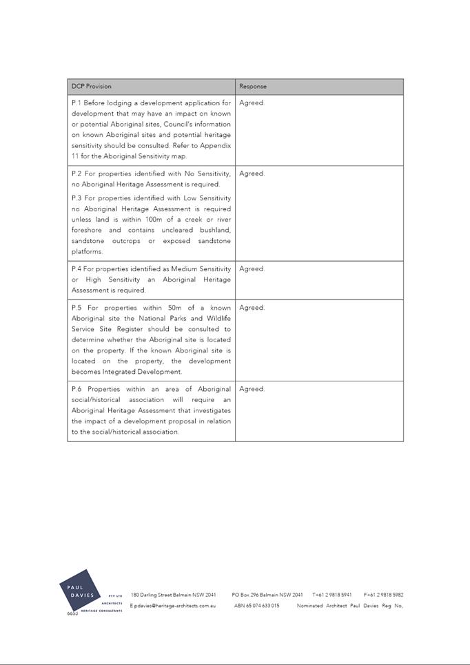

|
Item 18.4 - Attachment 6
|
Attachment 6 - Applicant Draft Conservation
Management Plan
|
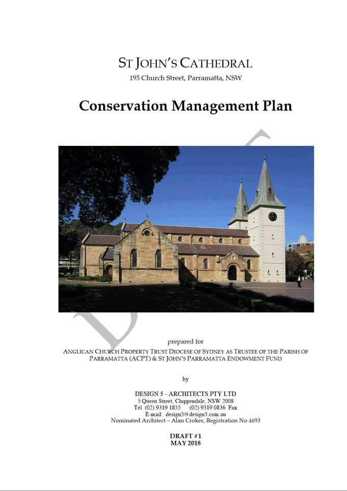
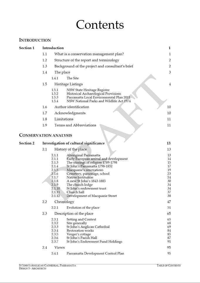
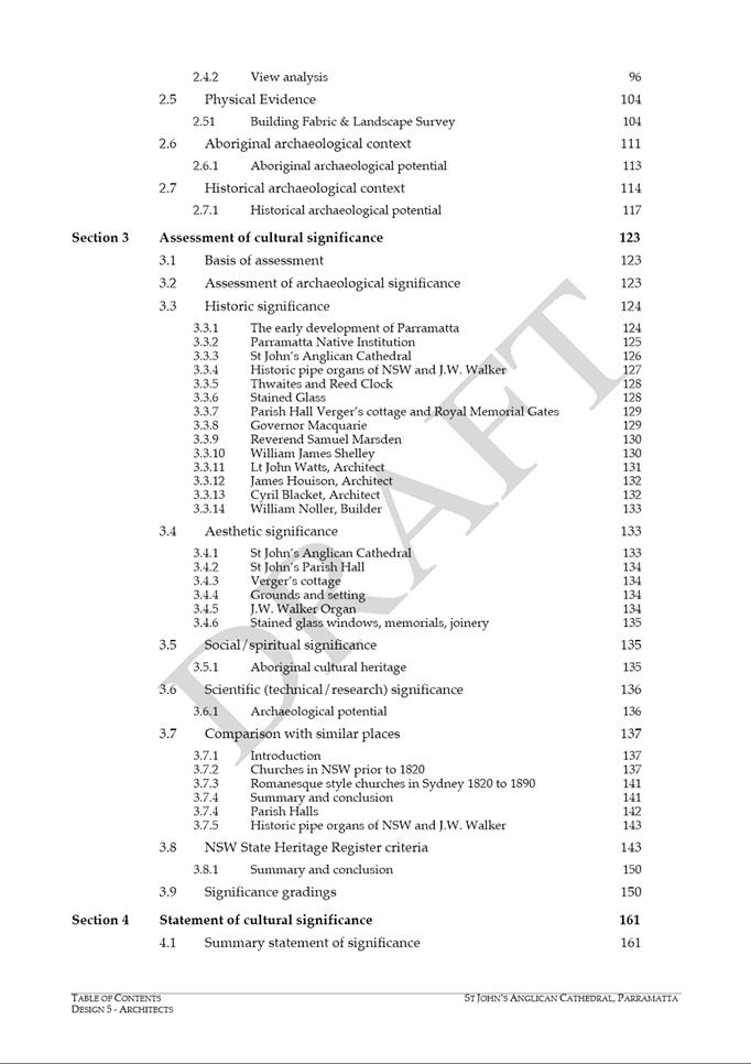
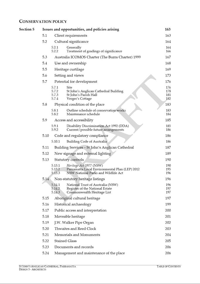
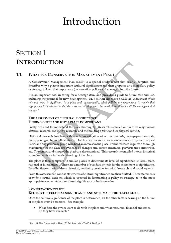
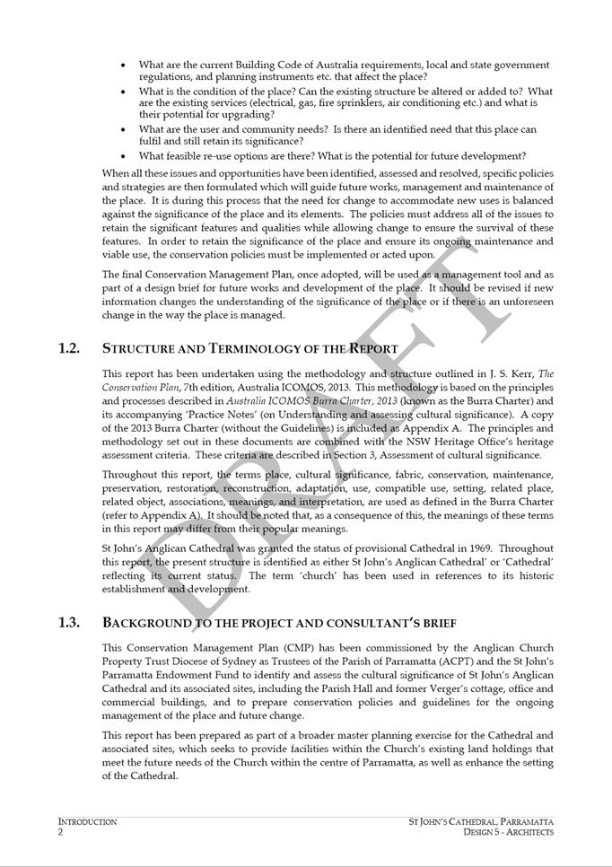
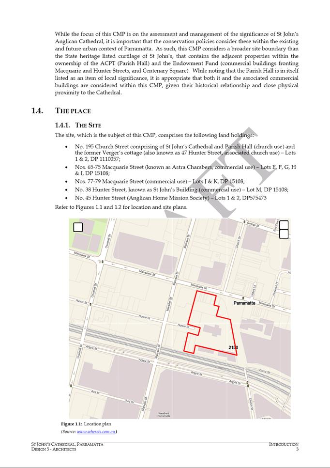
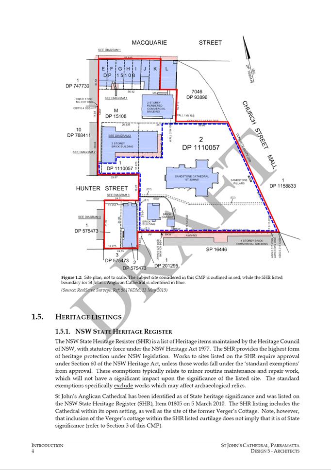
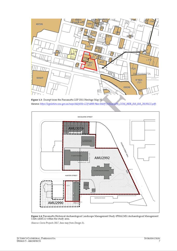
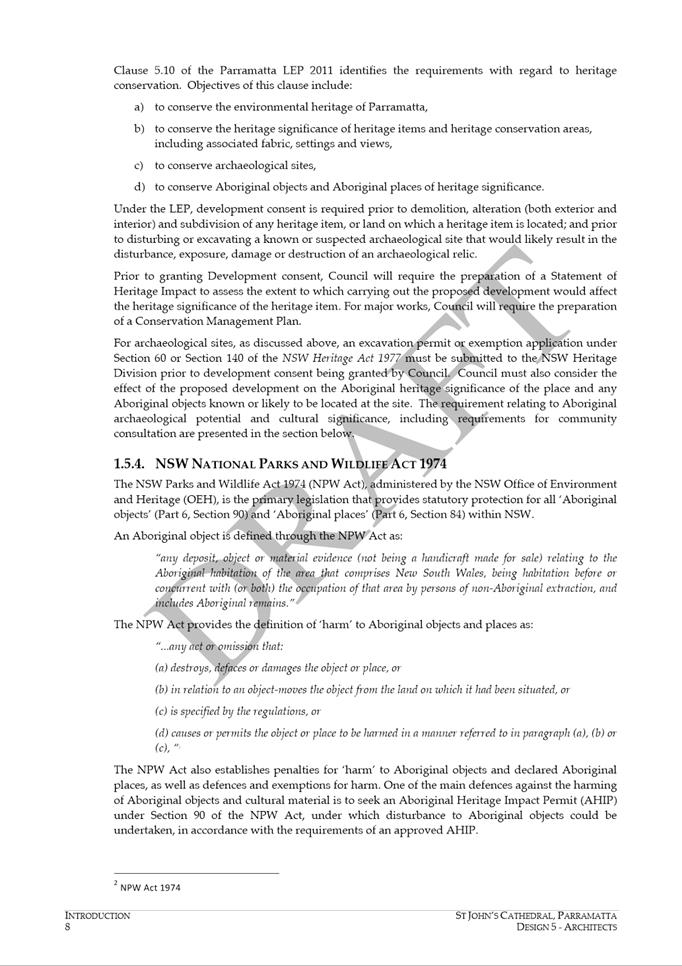
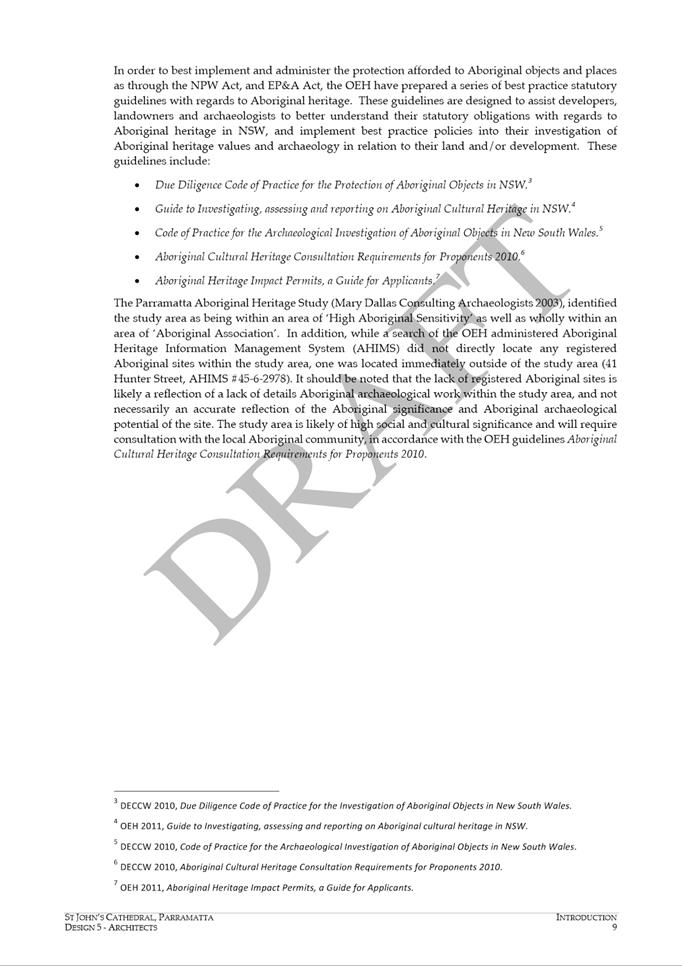
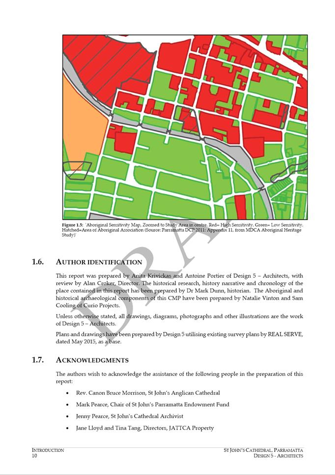
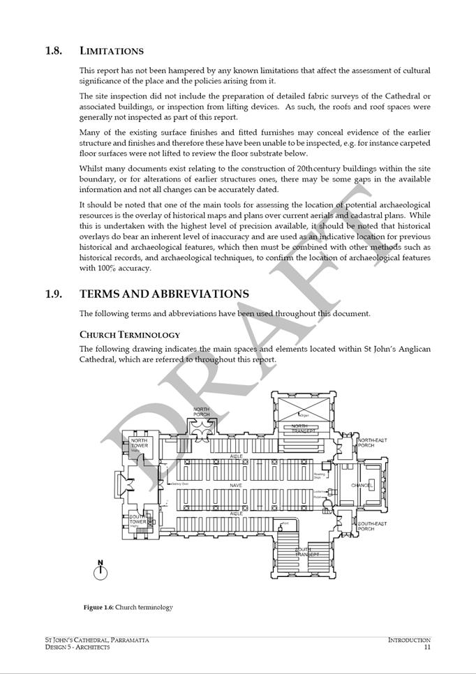
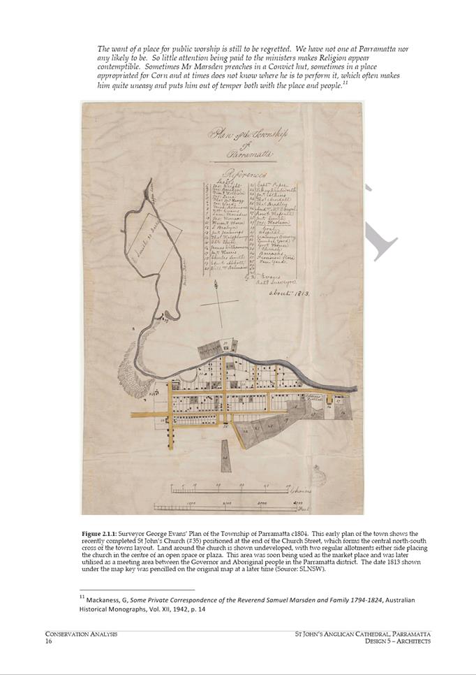
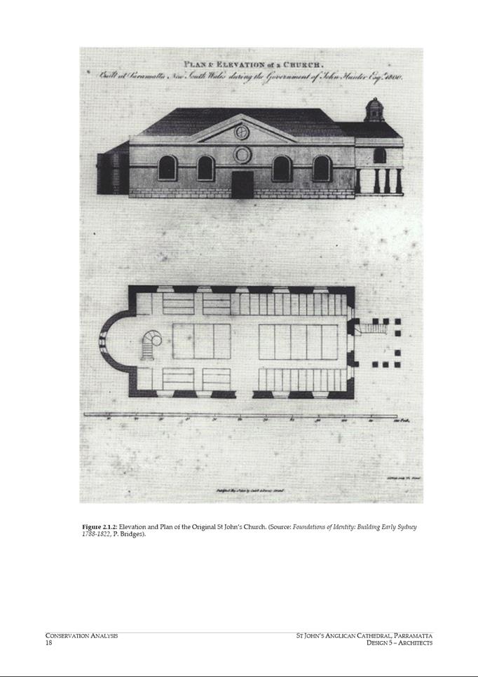
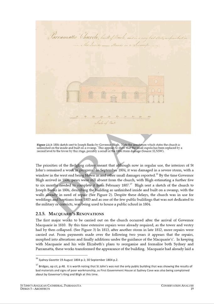
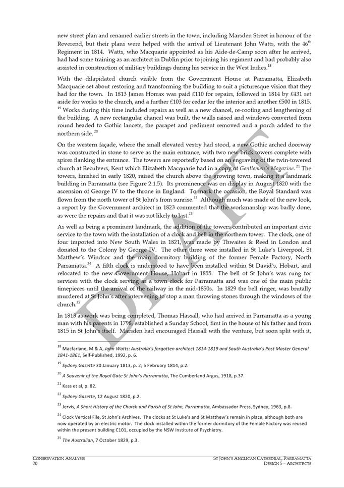
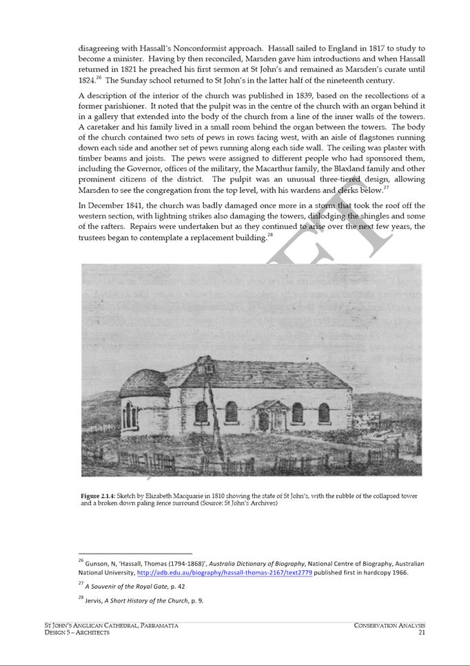
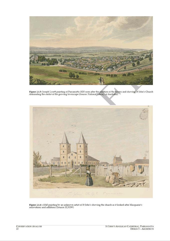
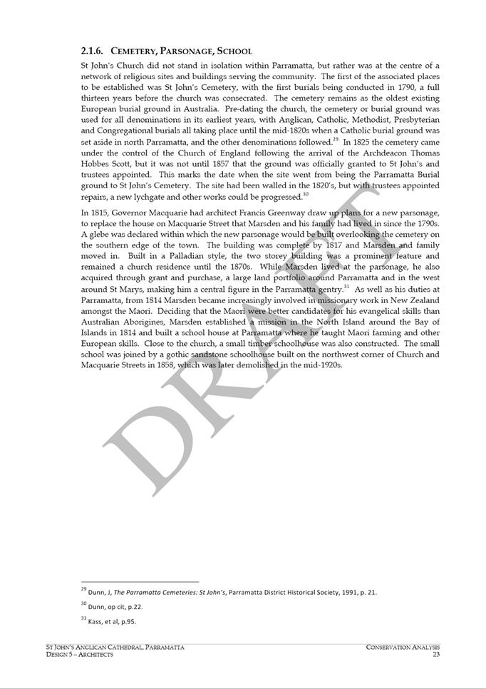
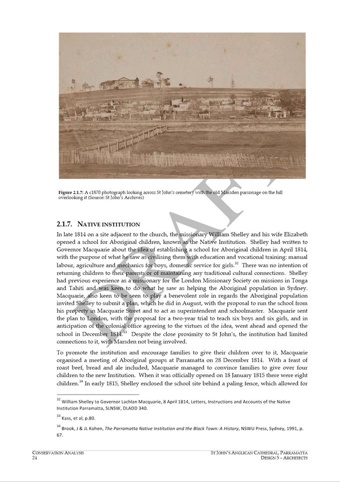
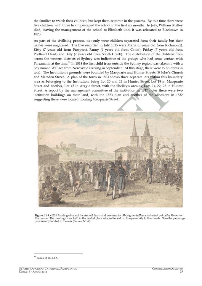
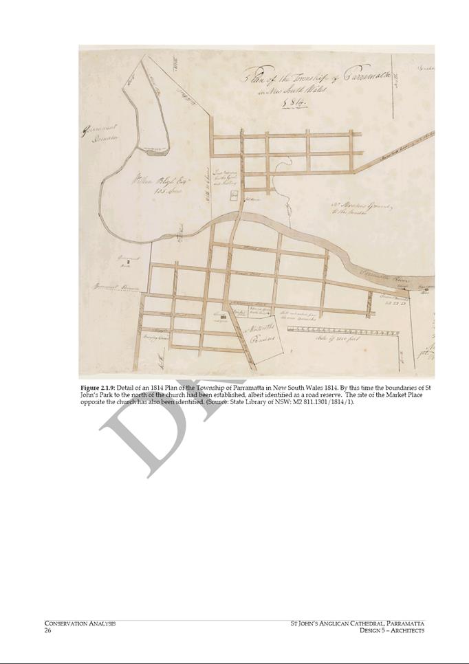
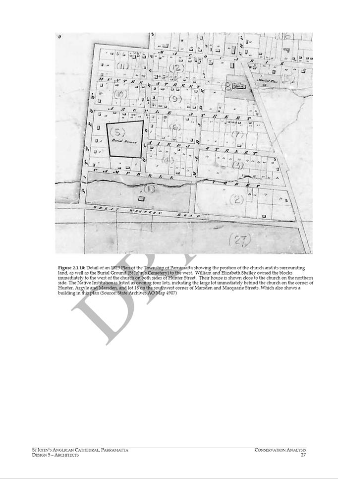
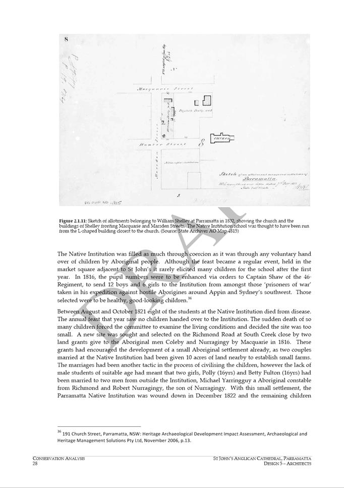
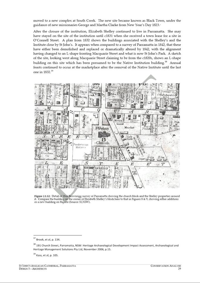
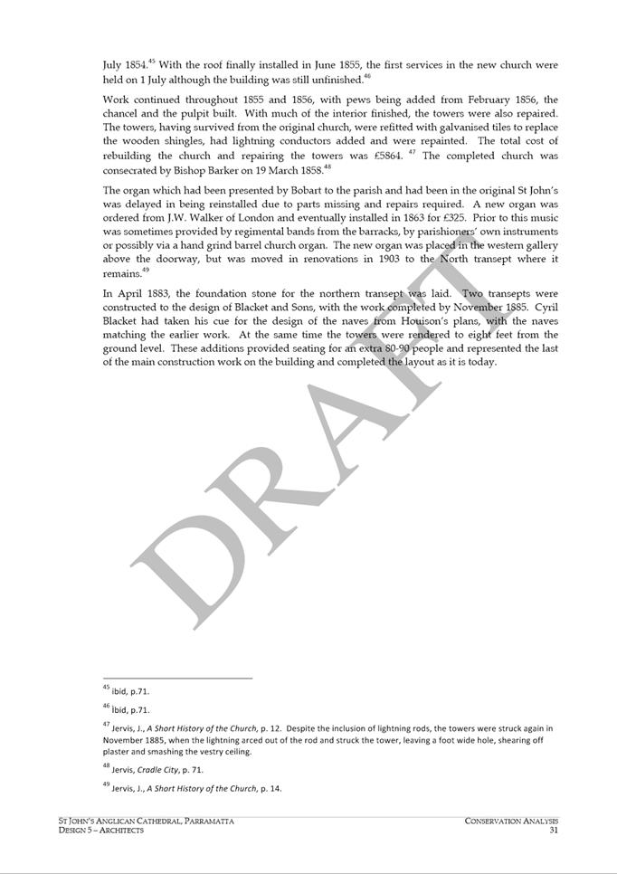
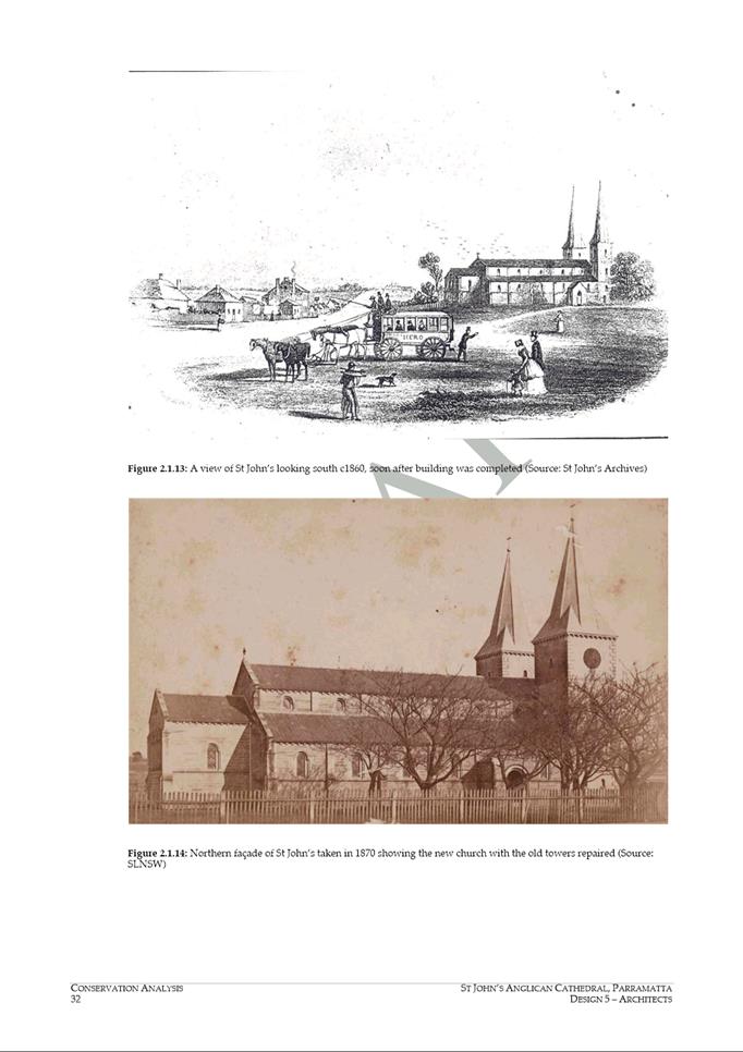
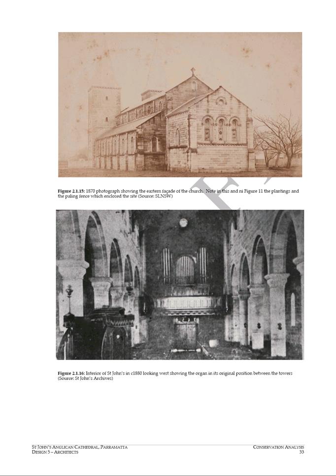
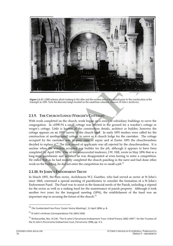
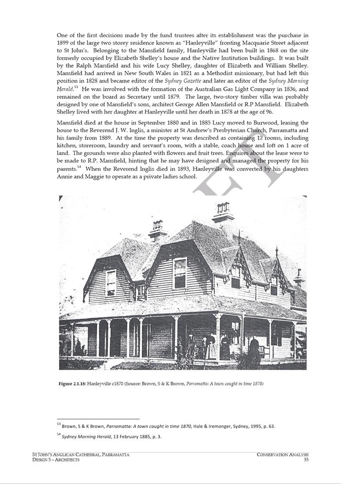
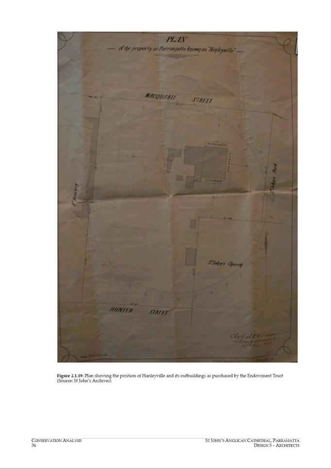
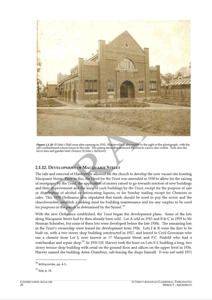
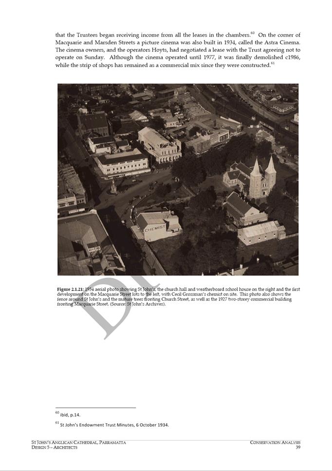
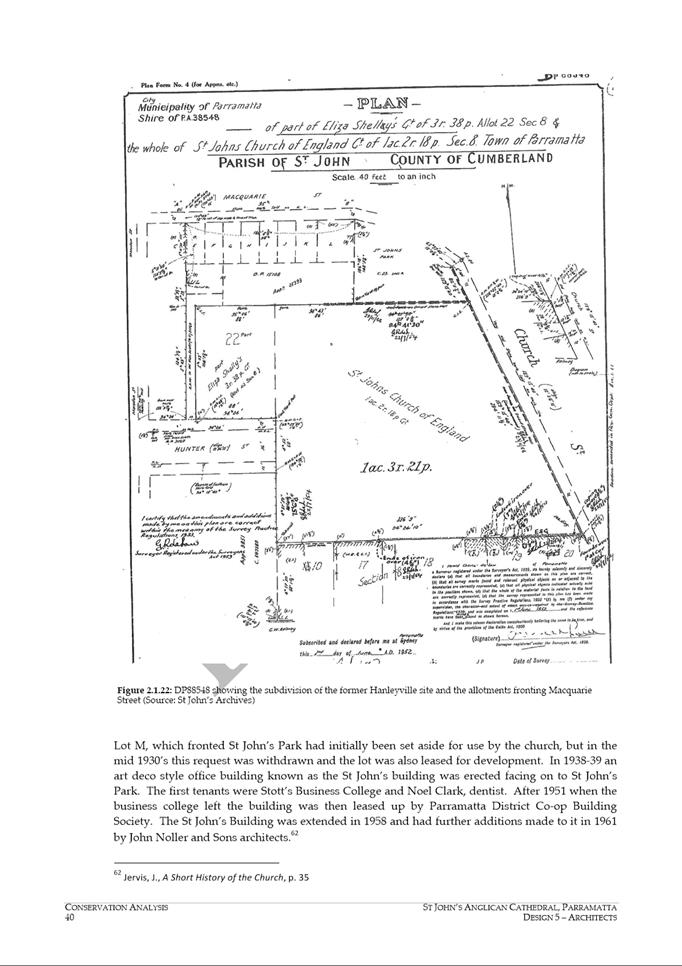
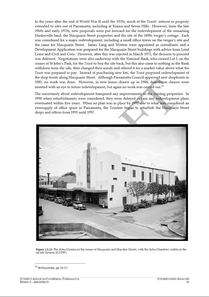
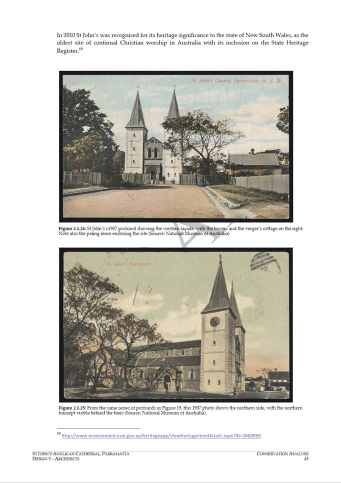
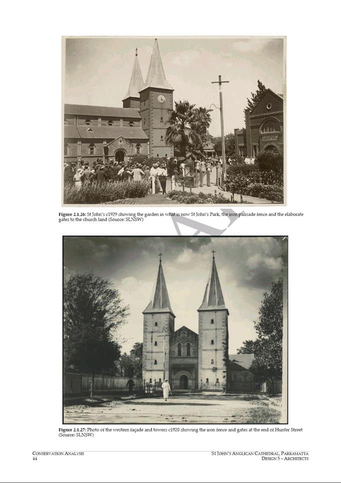
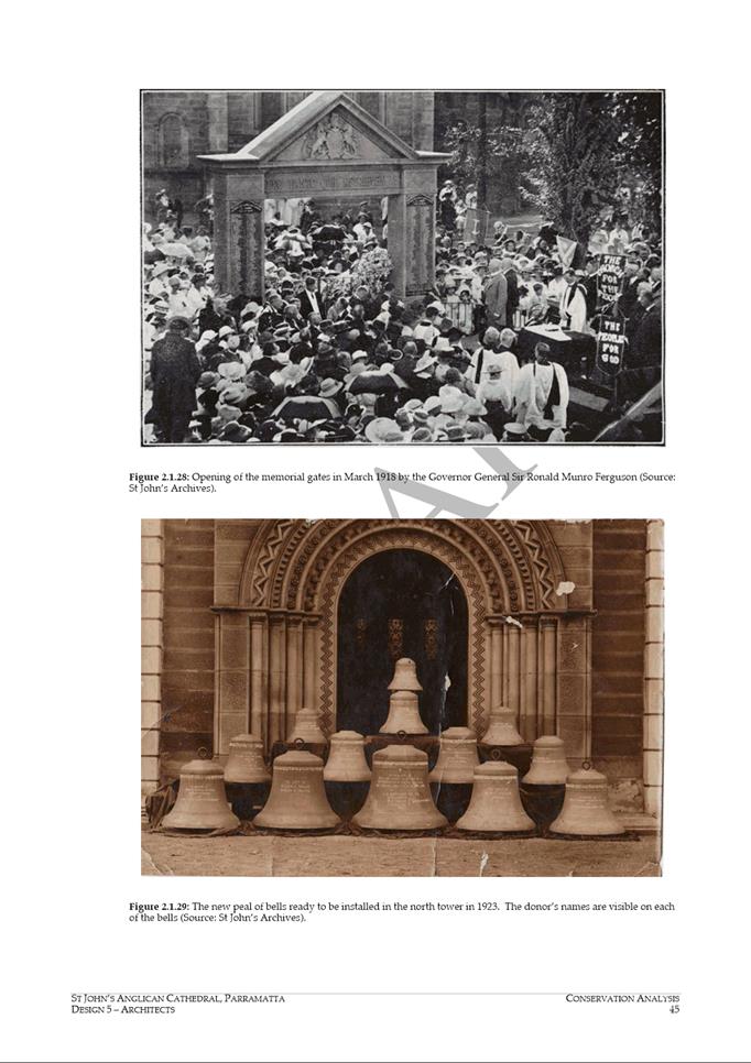
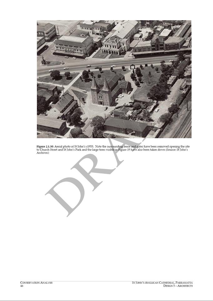
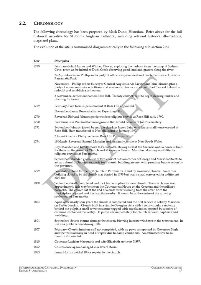
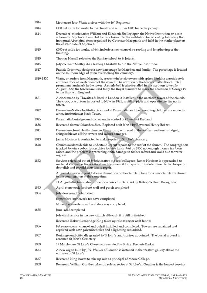
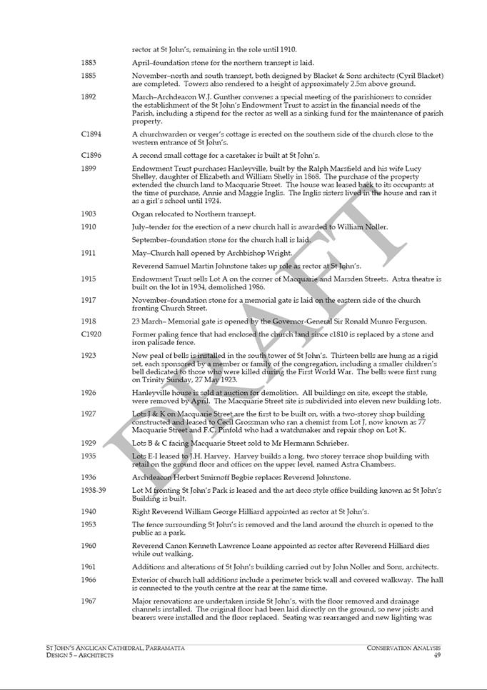
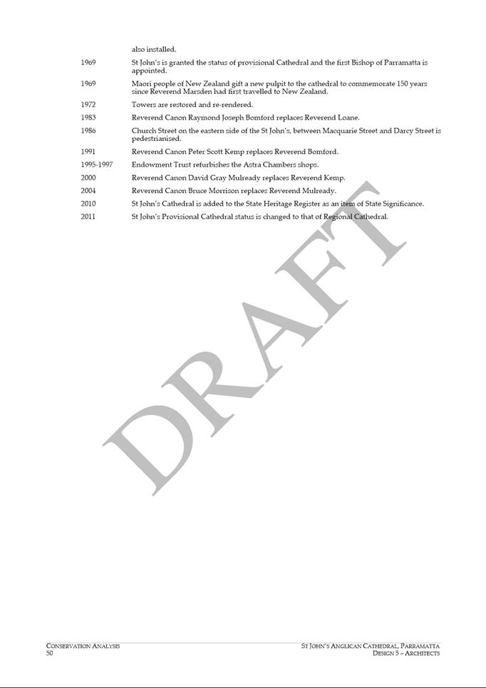
|
Item 18.4 - Attachment 7
|
Attachment 7 - Applicant Submission Solar
Access to Parramatta Square
|
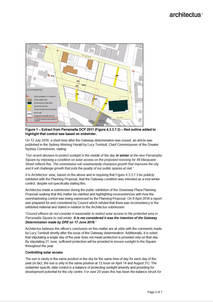
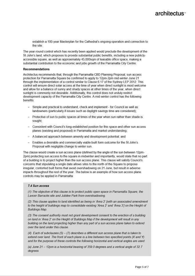
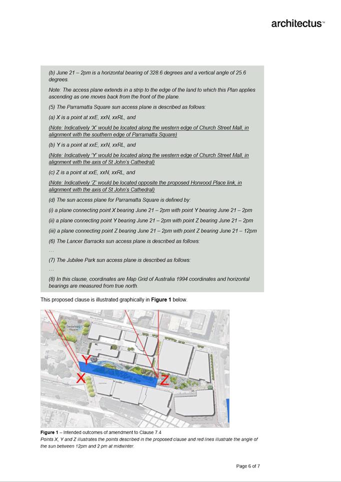
|
Item 18.4 - Attachment 8
|
Attachment 8 - City Commissioned Heritage Advice
|
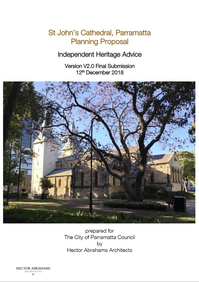
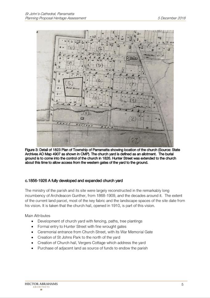
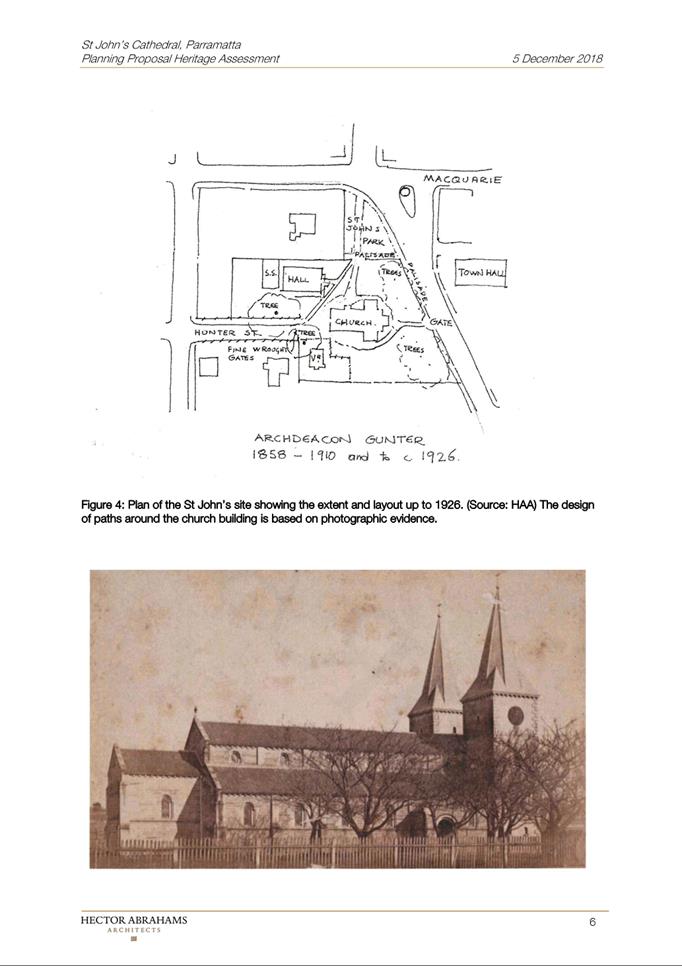
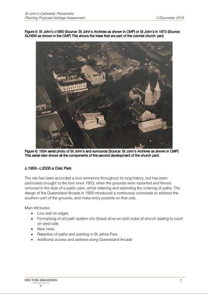
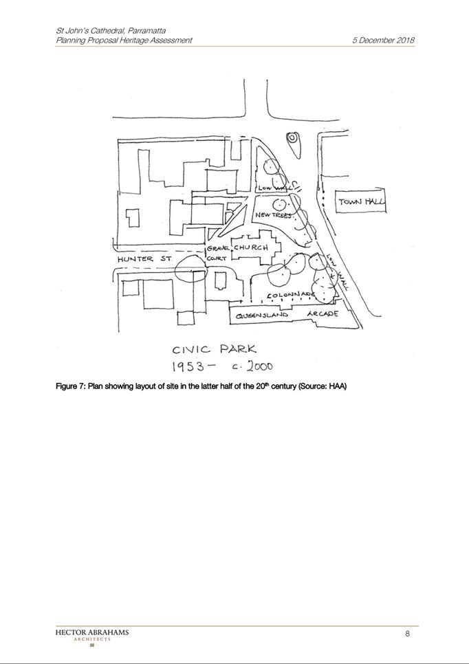
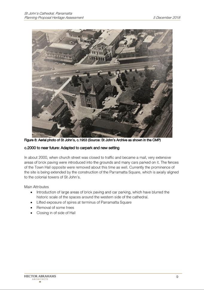
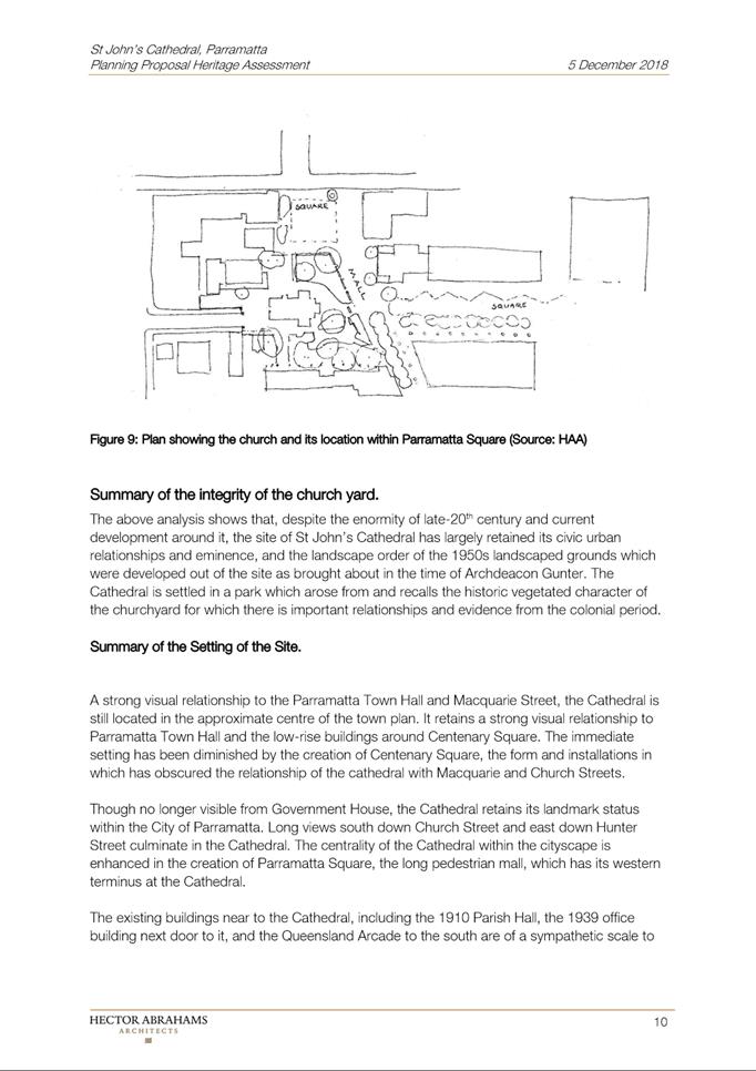
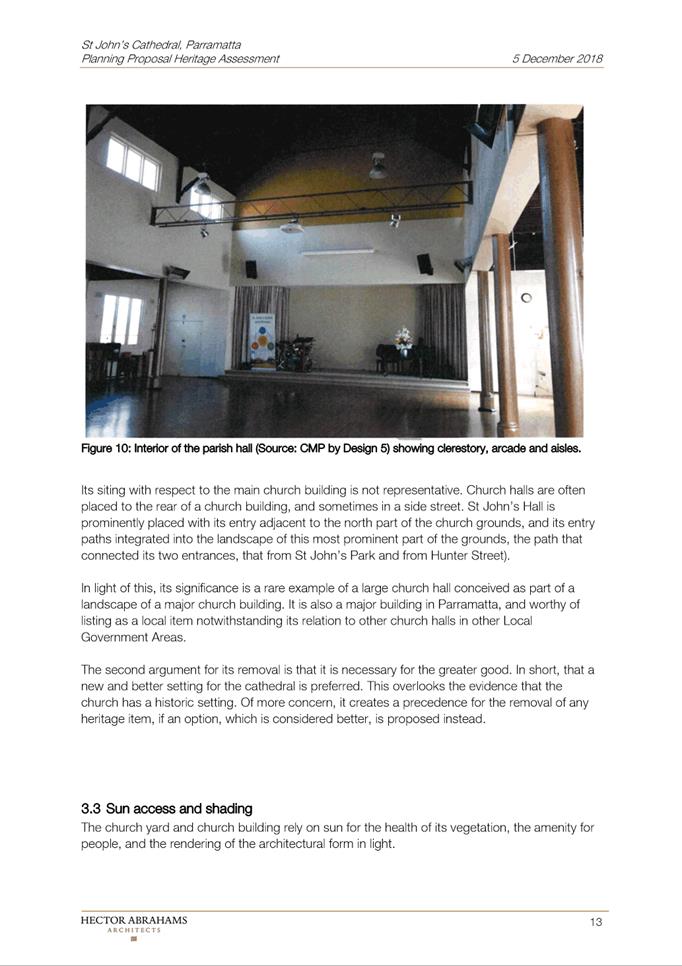
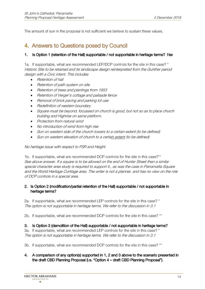
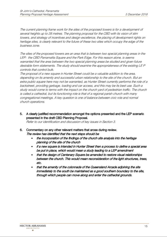
|
Item 18.4 - Attachment 9
|
Attachment 9 - Applicant Heritage Report Responding
to Independent Heritage Review
|
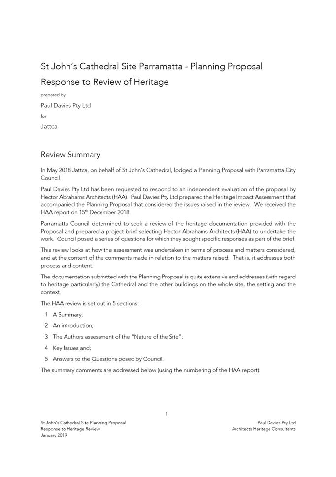
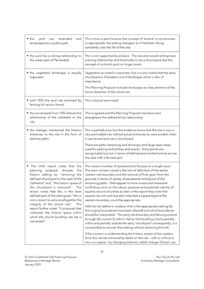
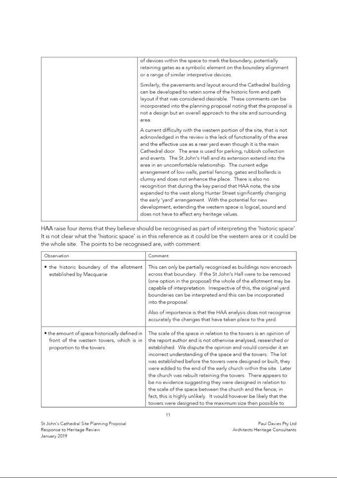
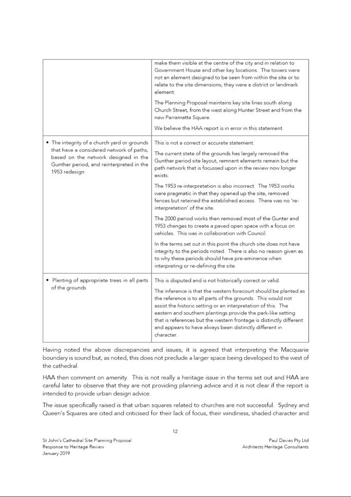
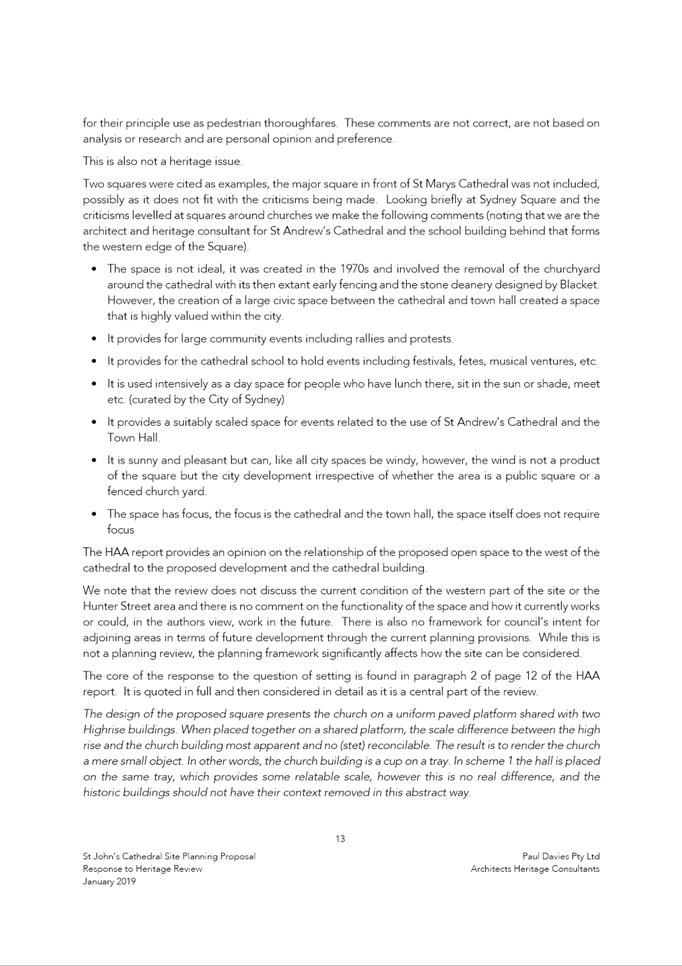
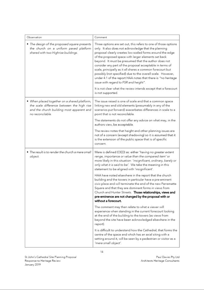
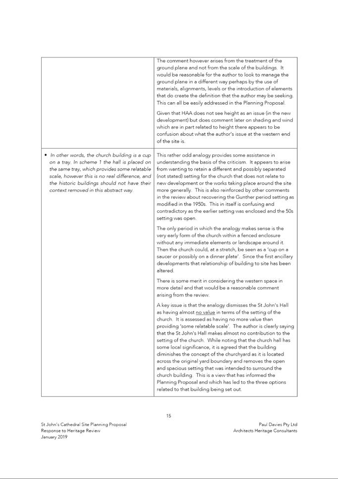
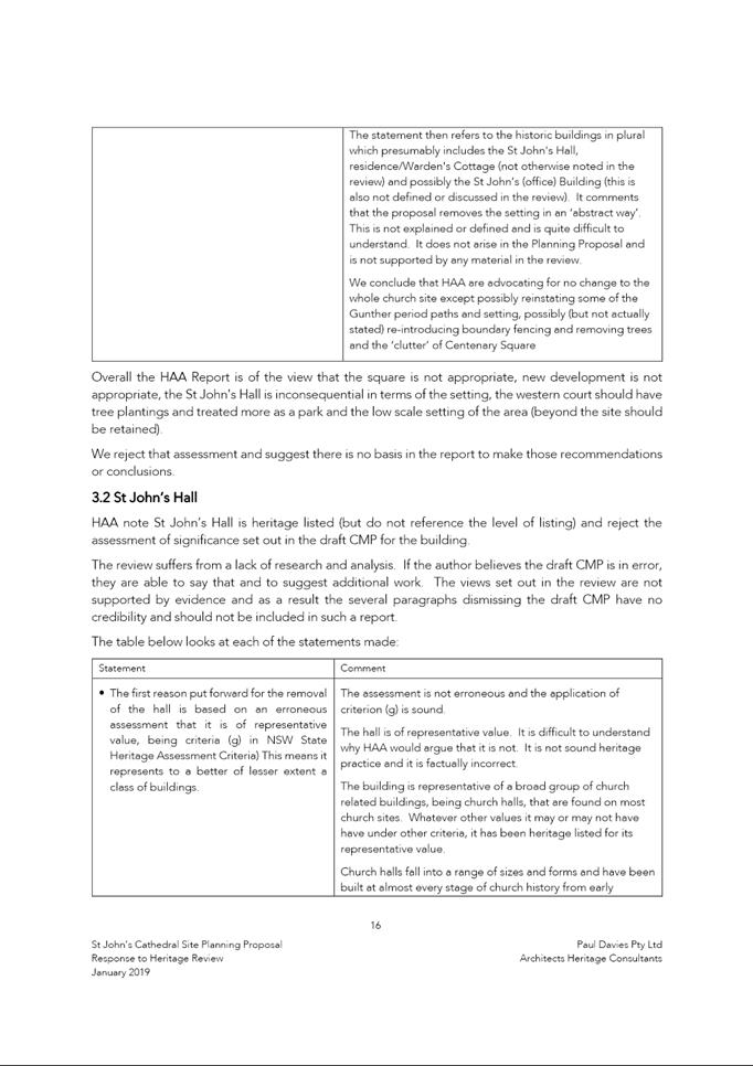
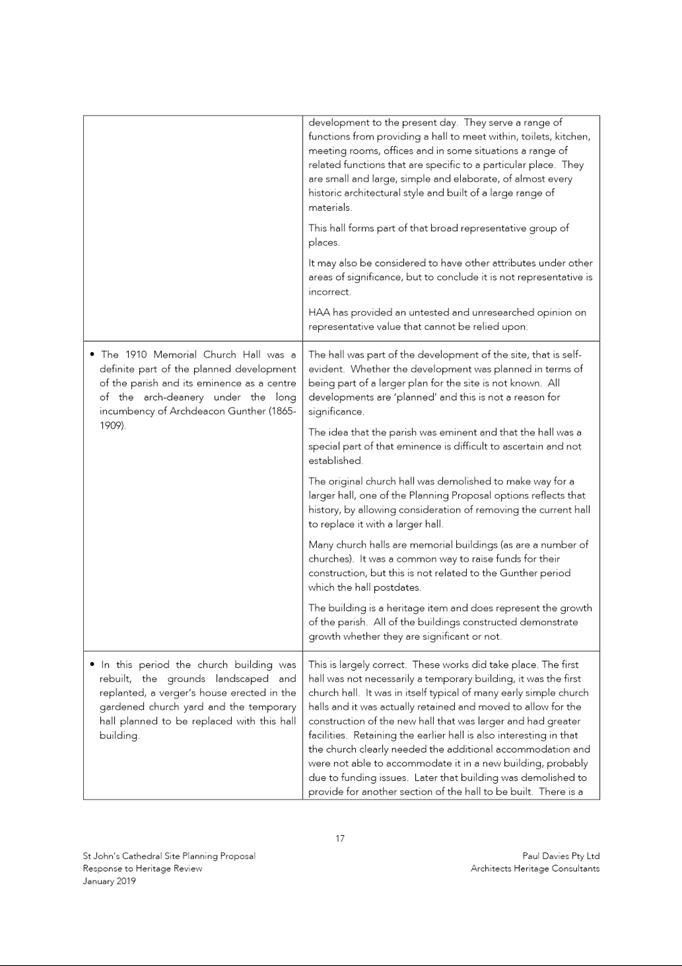
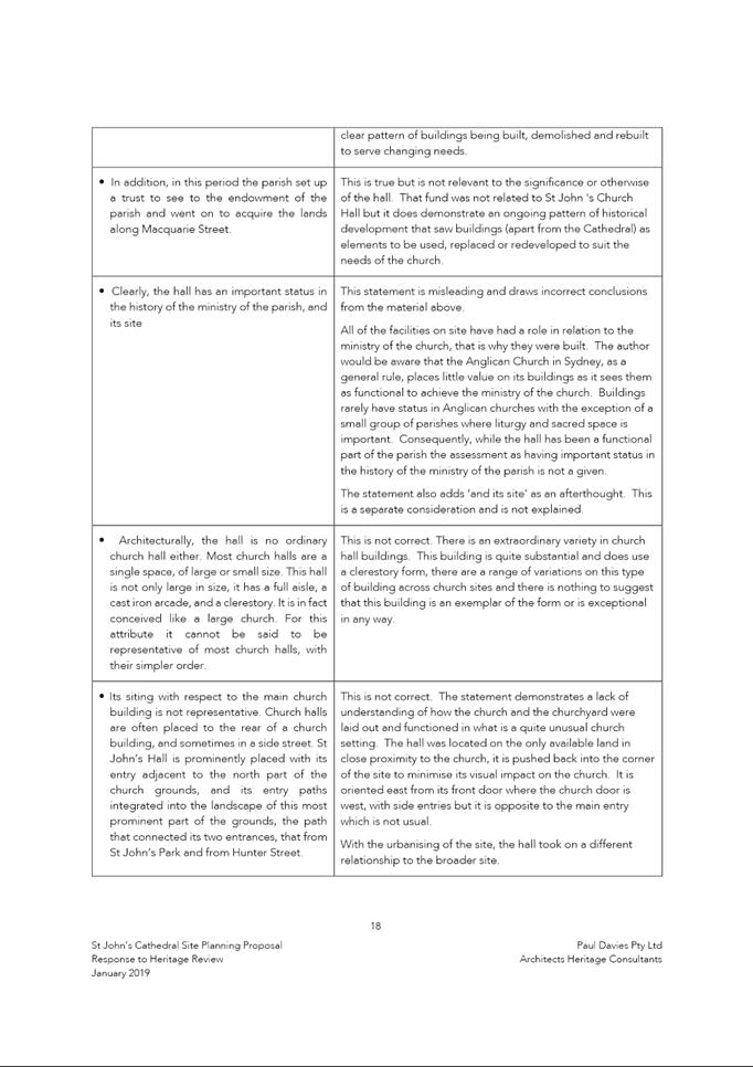
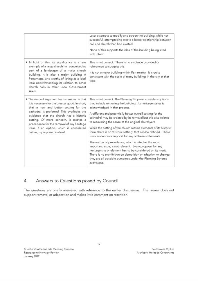
|
Item 18.4 - Attachment 10
|
Attachment 10 - Applicant Landscape Report
Responding to Independent Heritage Review
|
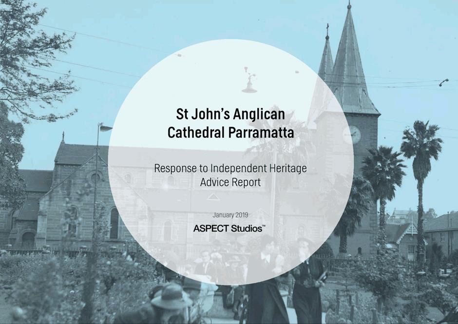
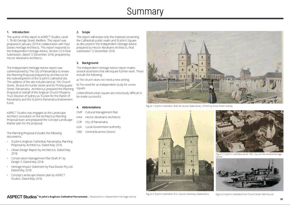
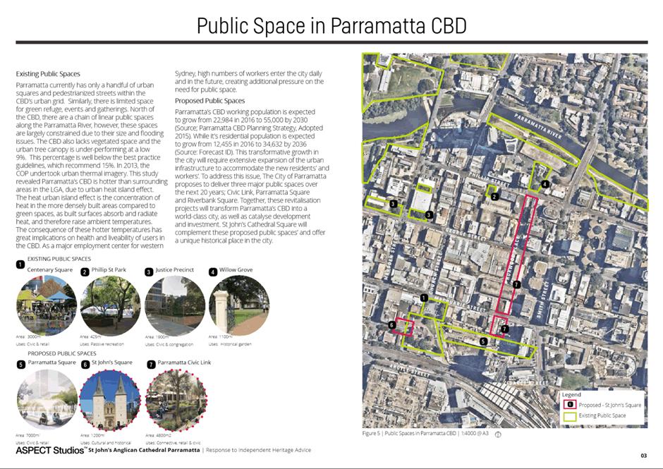
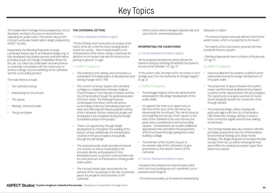
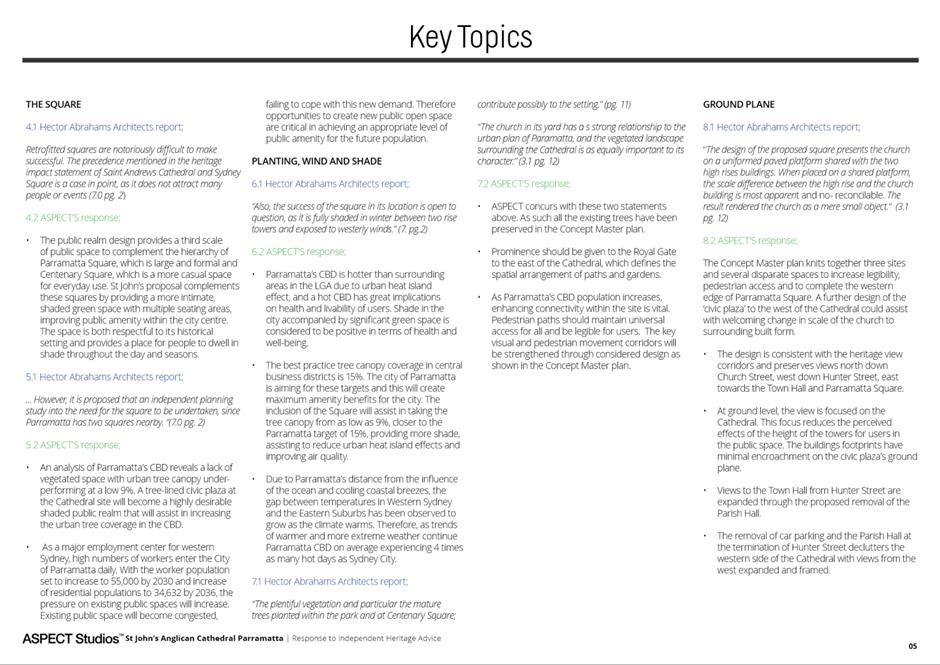
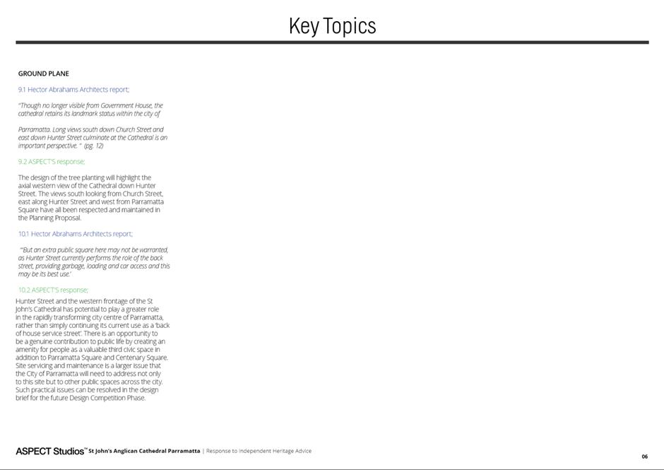
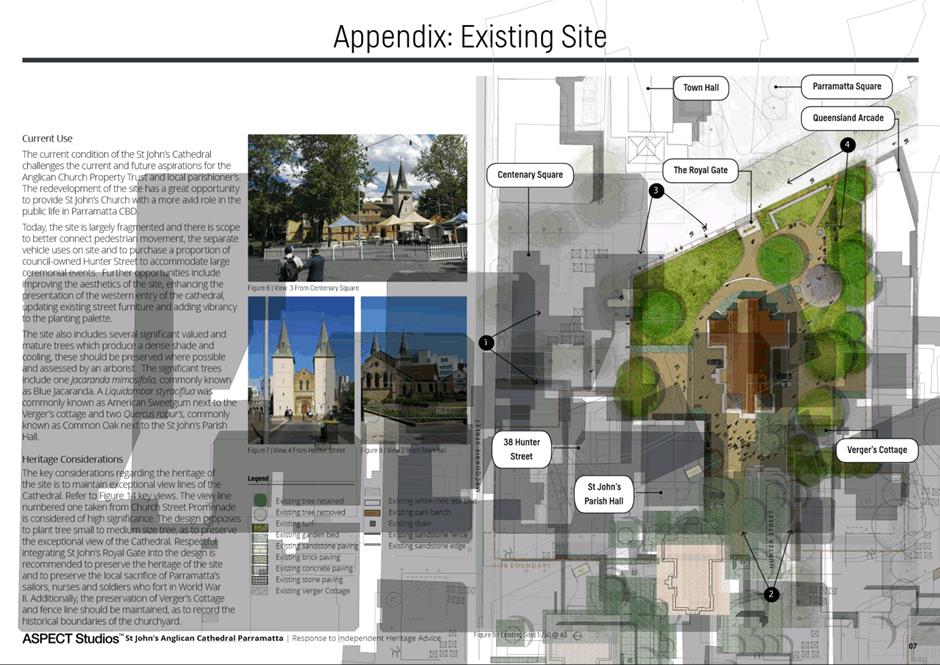
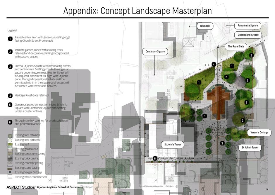
|
Item 18.4 - Attachment 11
|
Attachment 11 - City commissioned independent
office building concept assessment
|
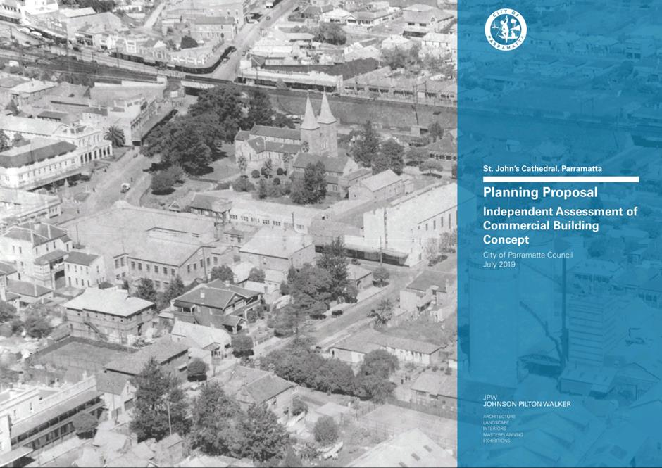
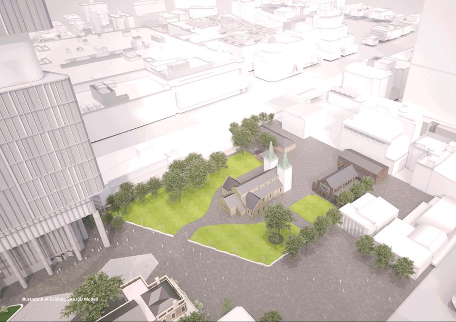
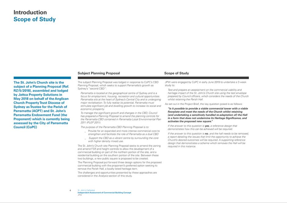
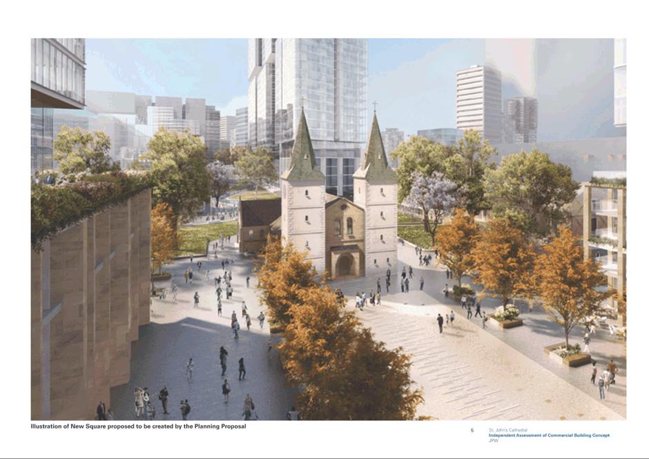
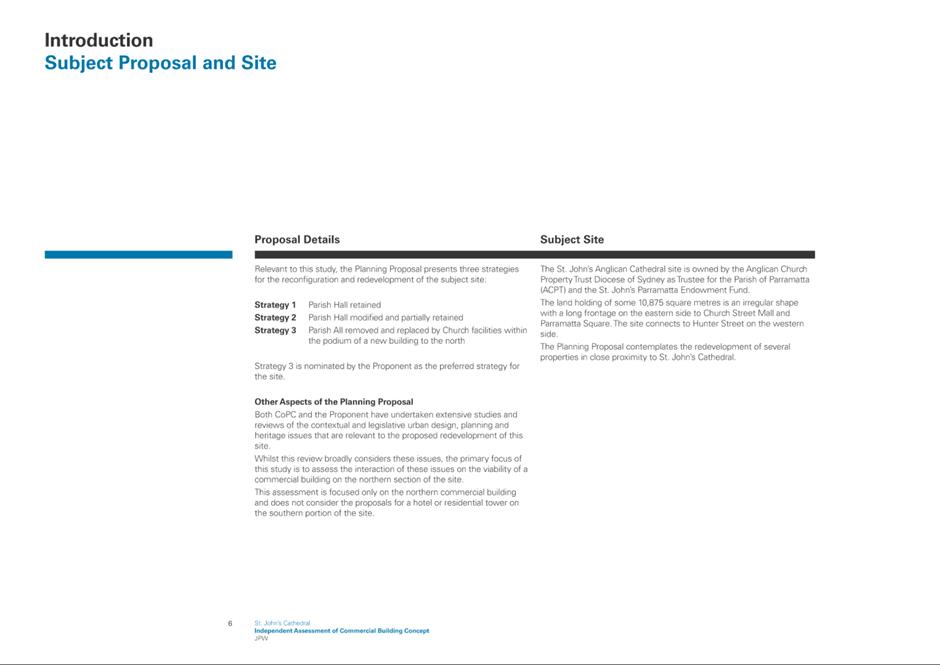
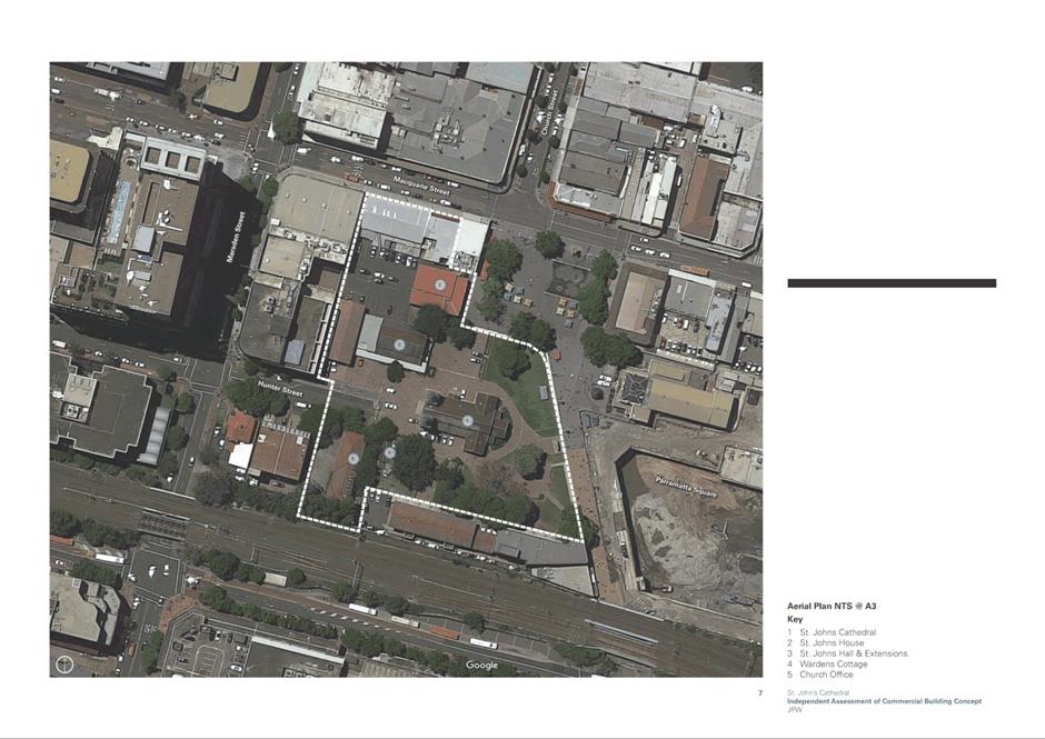
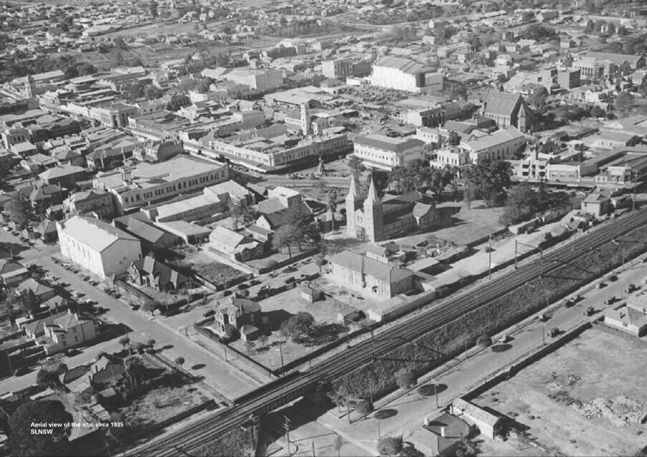
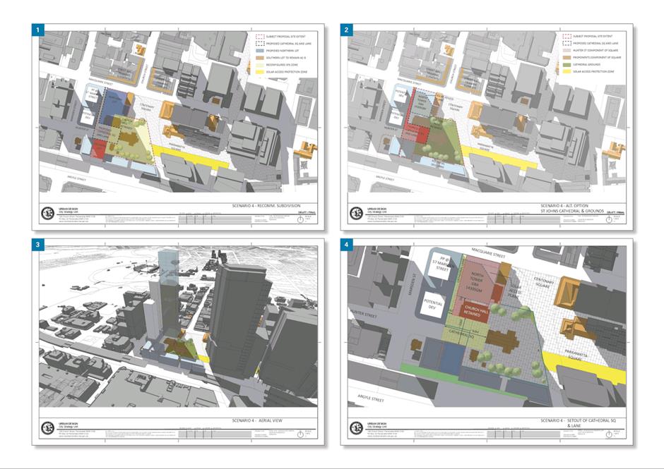
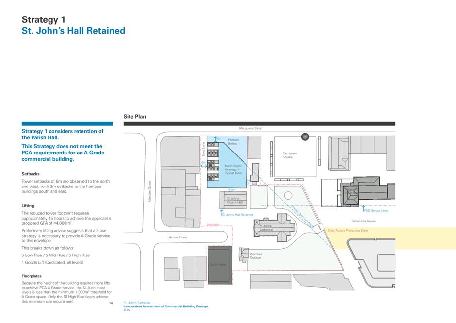
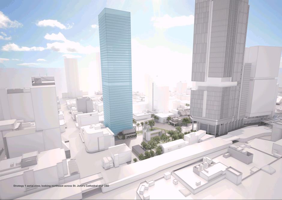
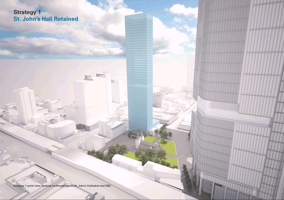
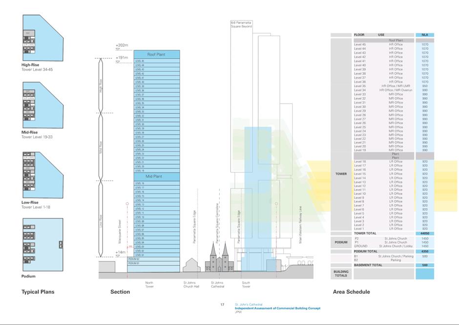
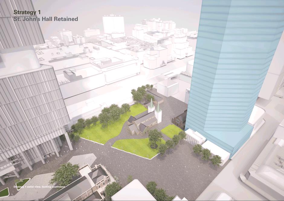
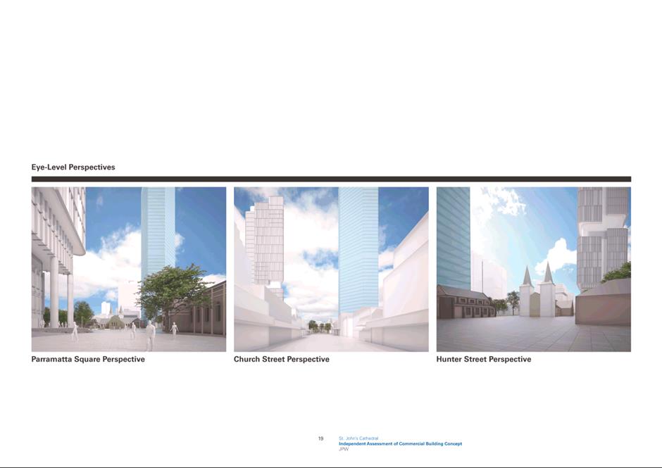
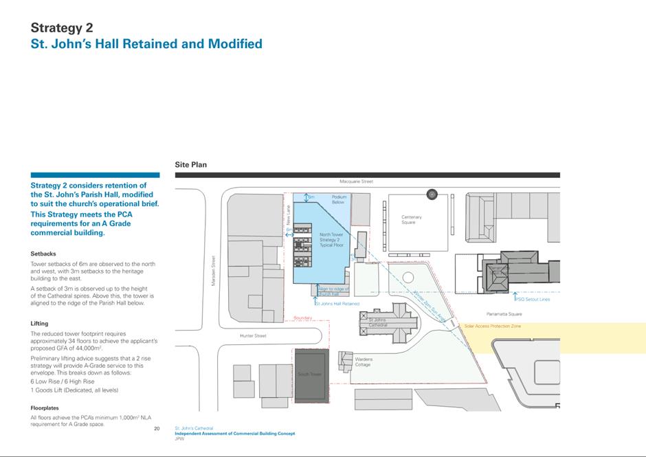
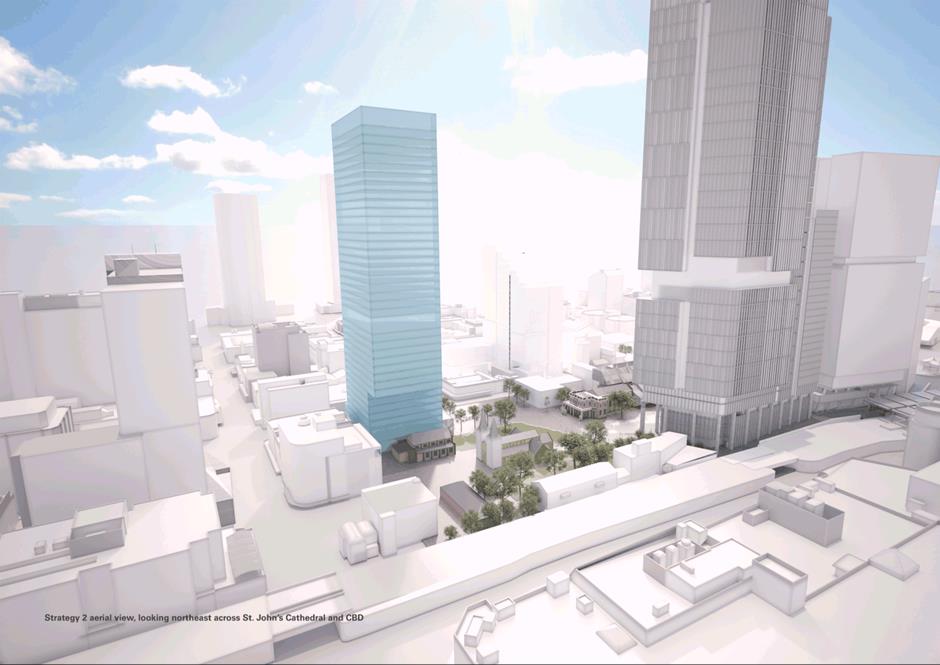
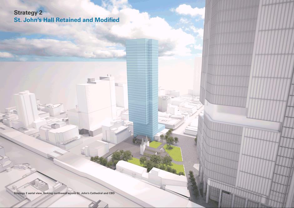
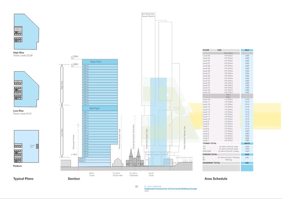
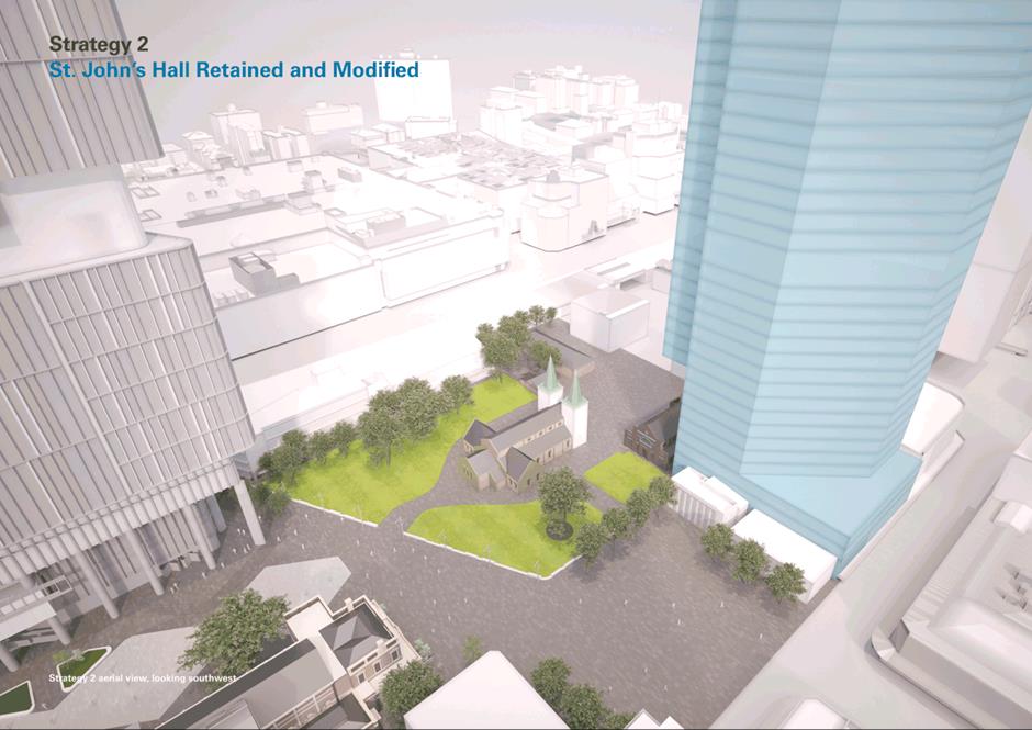
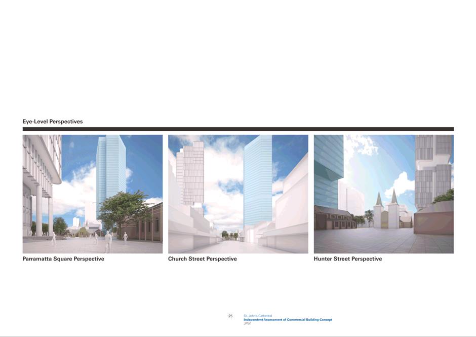
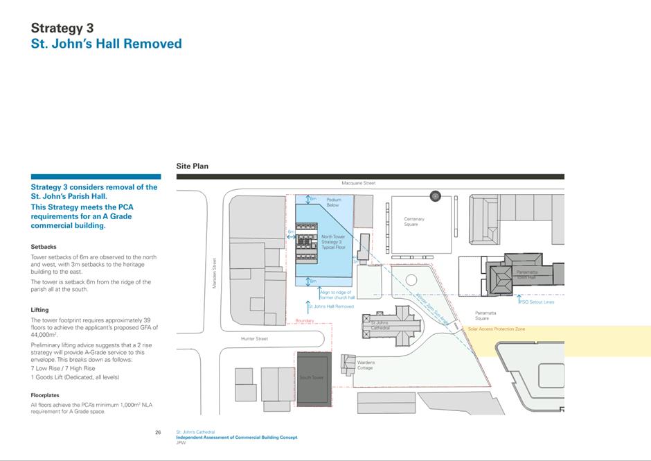
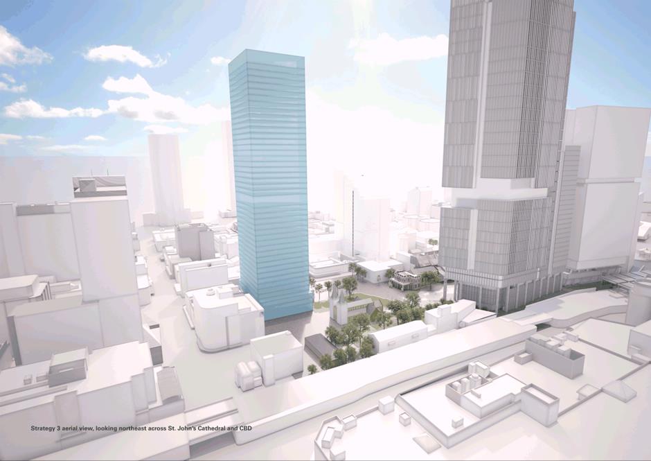
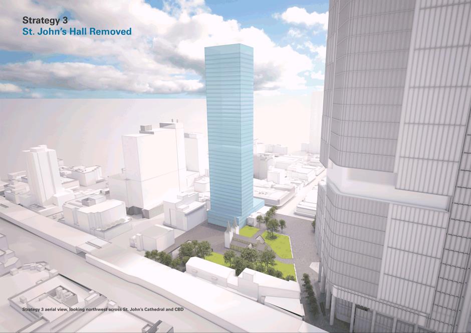
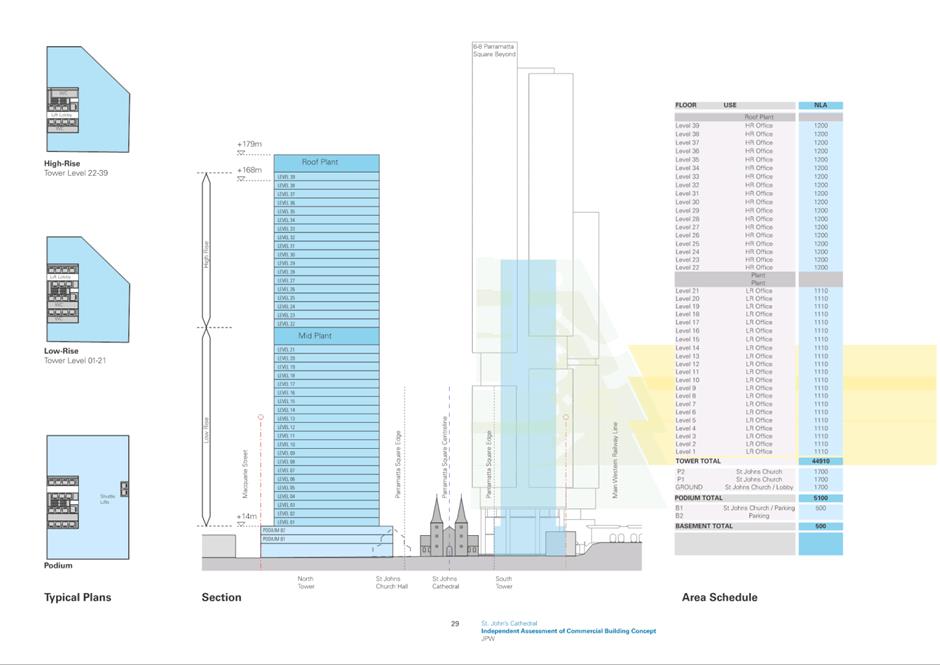
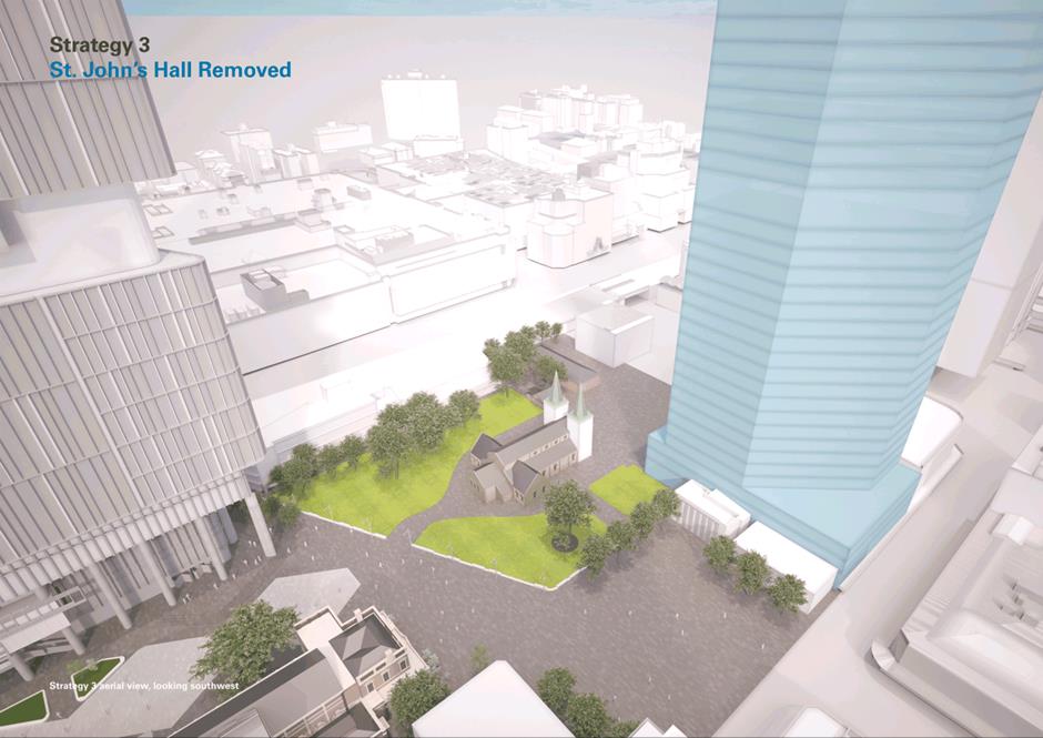
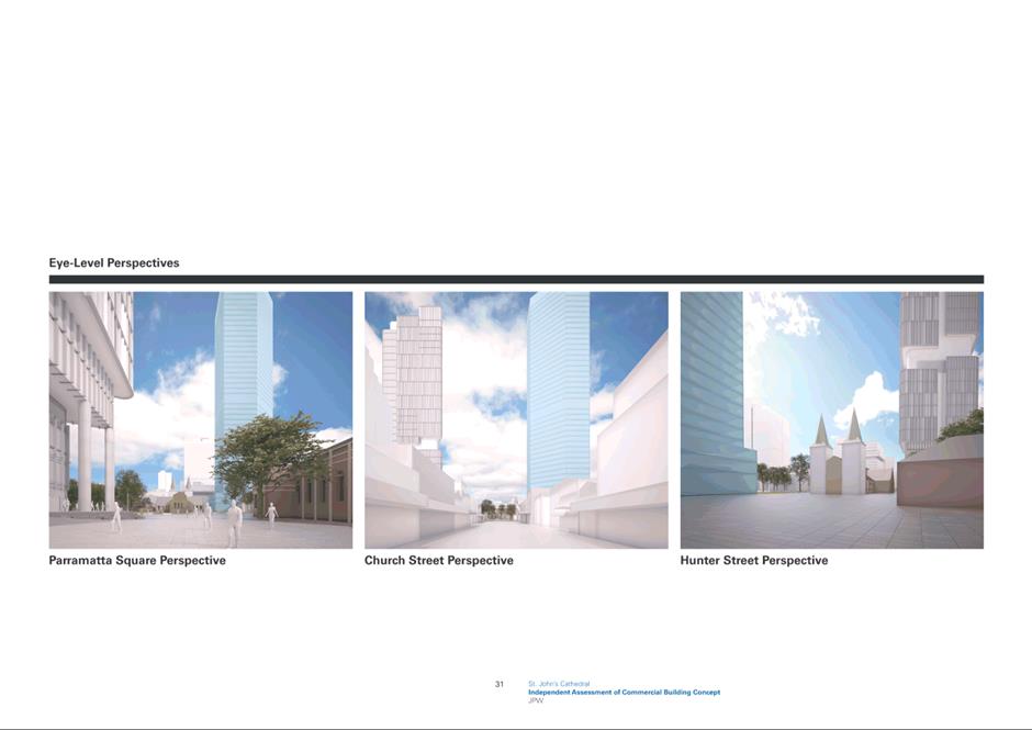
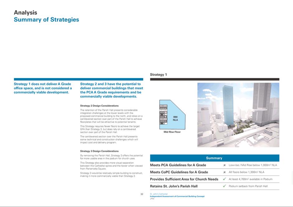
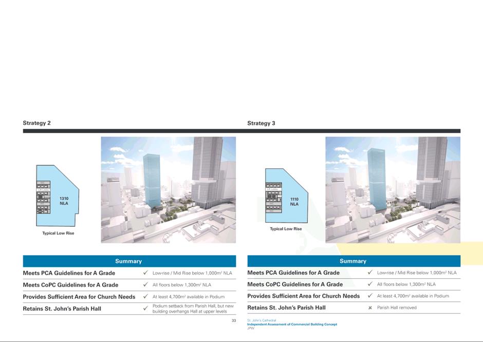
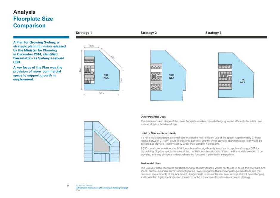
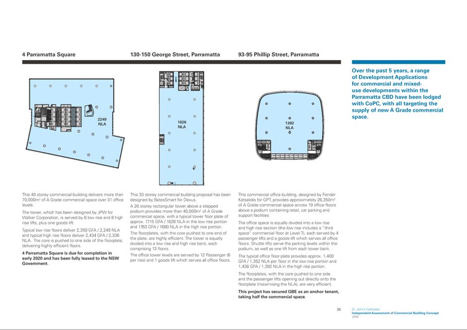
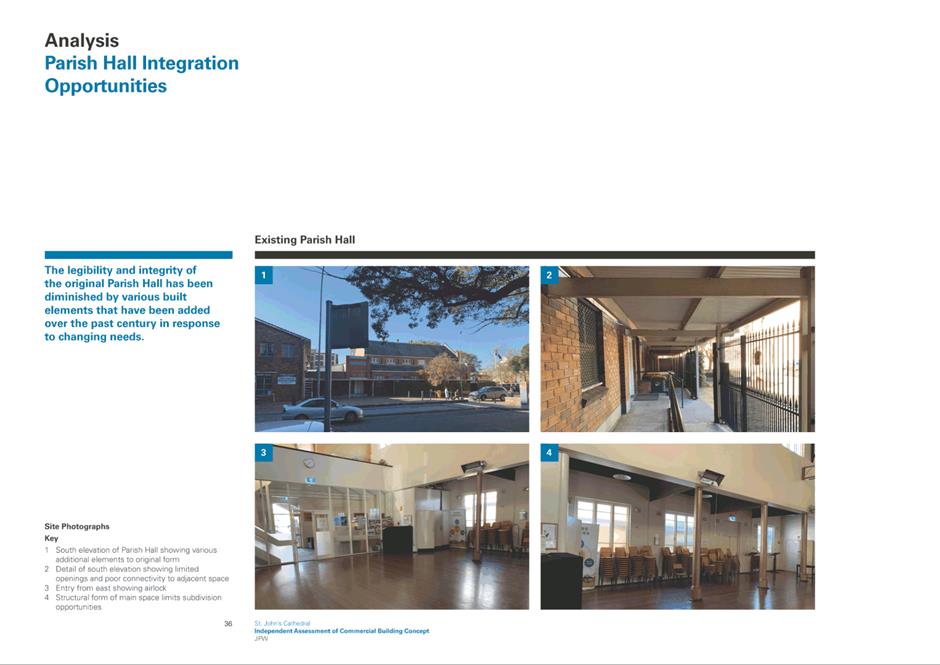
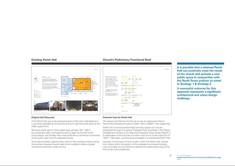
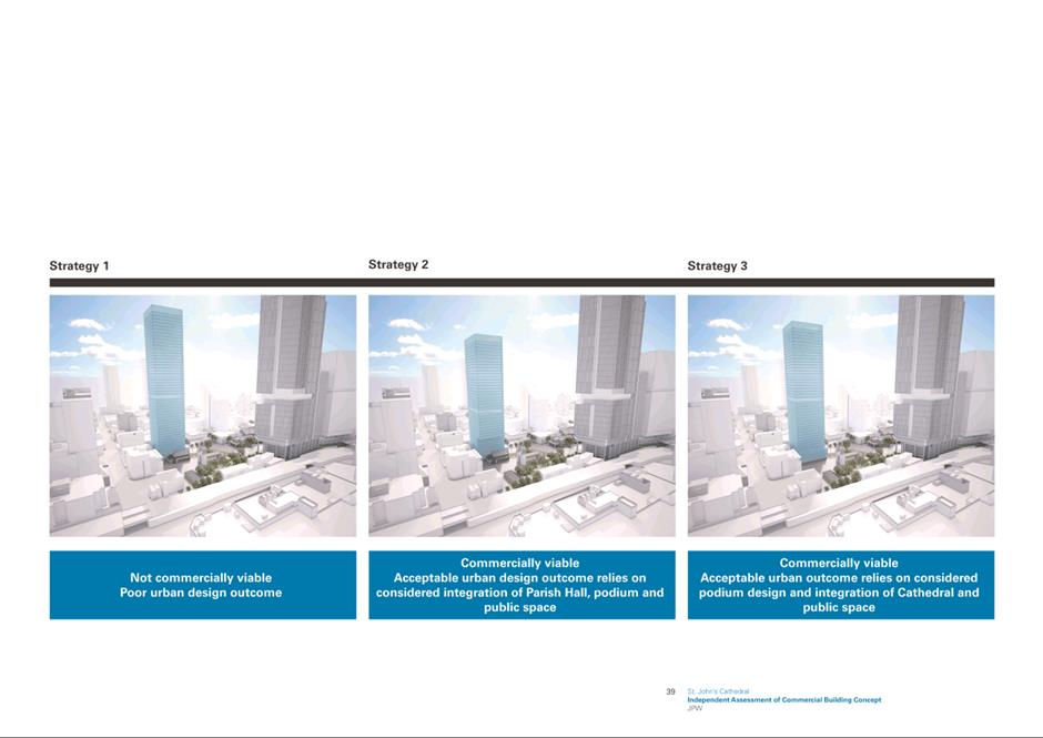

|
Item 18.4 - Attachment 12
|
Attachment 12 - Applicant ground plane study
responding to independent office building assessment
|
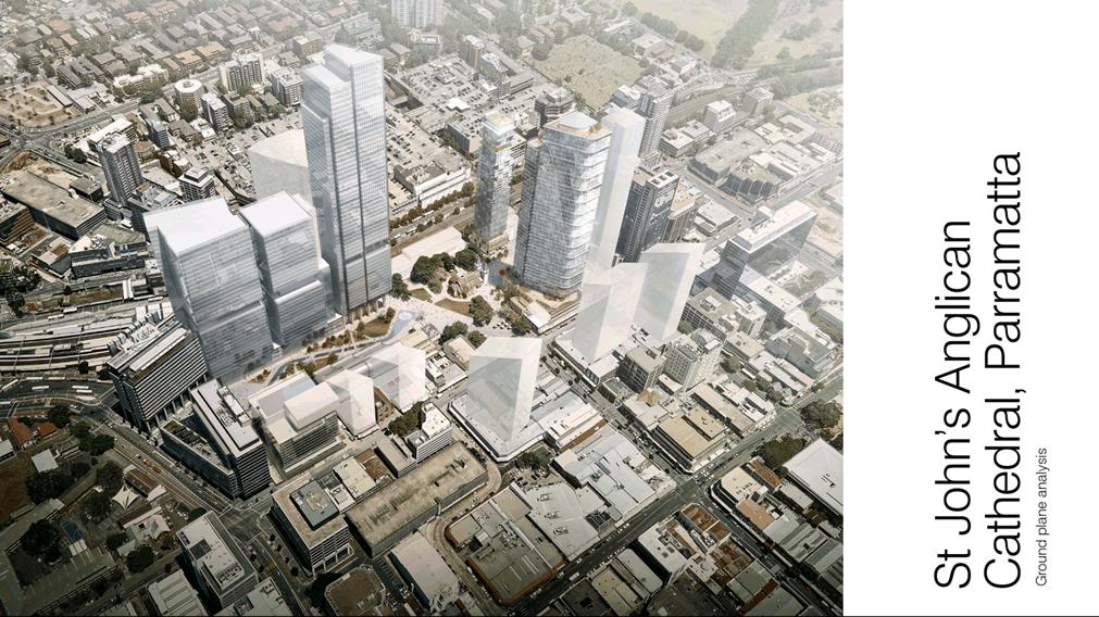
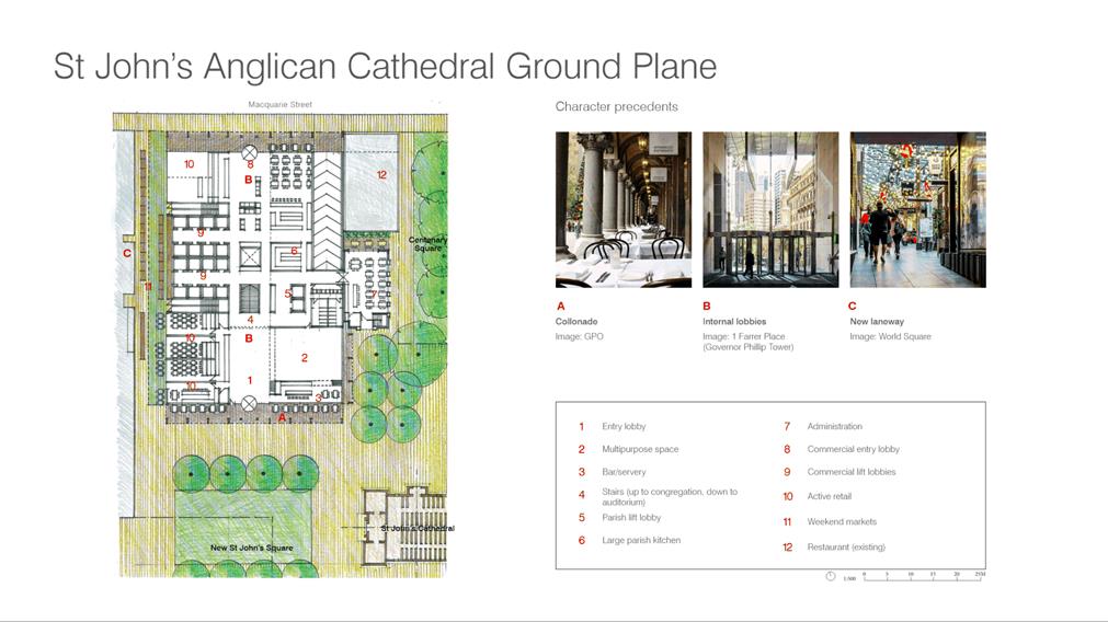
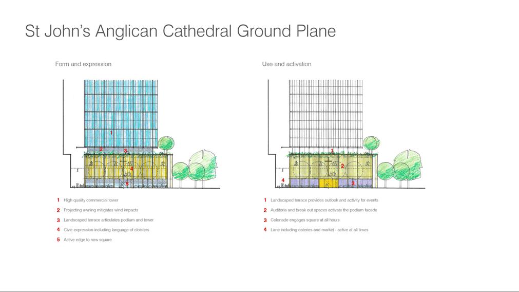
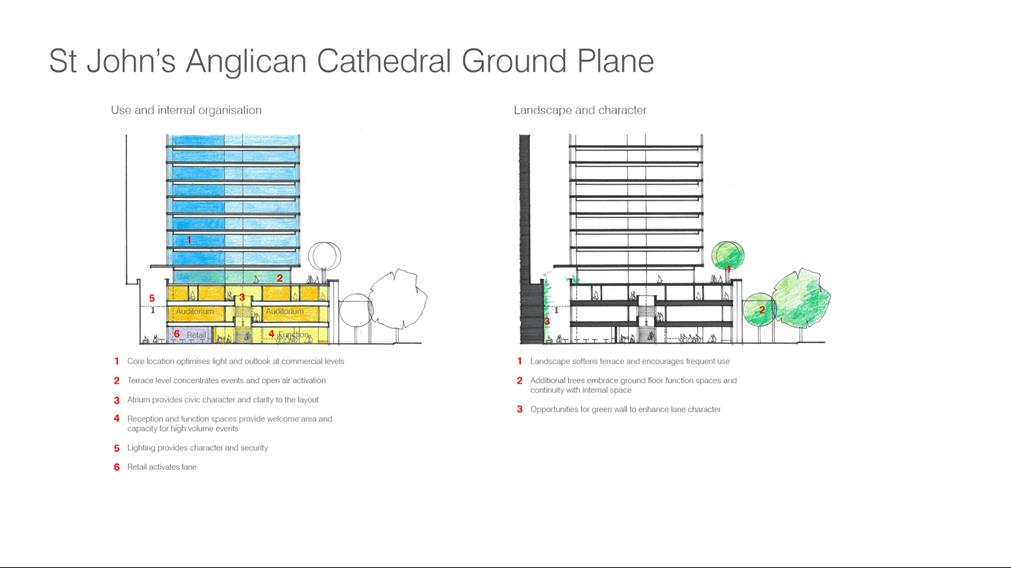
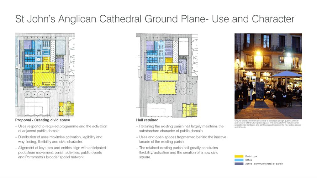
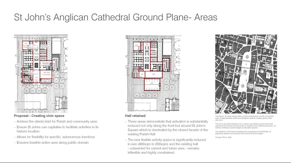
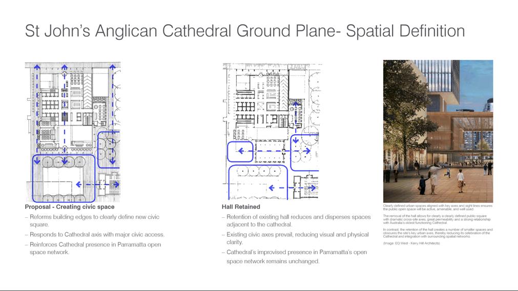
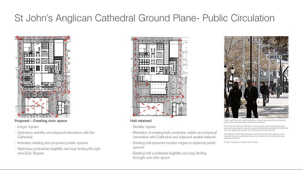
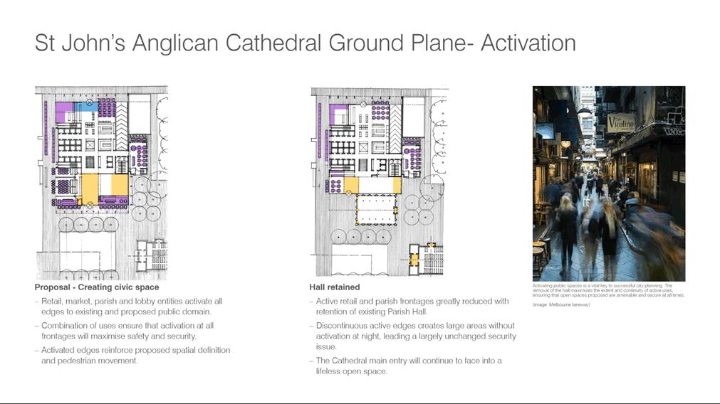
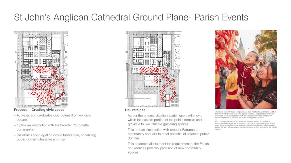
|
Item 18.4 - Attachment 13
|
Attachment 13 - Applicant further heritage
assessment responding to independent office building assessment
|
Council 16 December 2019 Item
18.5
ITEM NUMBER 18.5
SUBJECT FOR
APPROVAL: Post Exhibition - Planning Proposal and Draft Planning Agreement for
land at 14 – 20 Parkes Street, Harris Park
REFERENCE RZ/9/2015 - D07146142
REPORT OF Project Officer Land Use
|
LAND
OWNERS: Aland Group
APPLICANT: Pacific
Planning Pty Ltd
Development
applications considered by sydney central city planning panel: Nil
PURPOSE:
To report to Council the outcome
of the public exhibition for the Planning Proposal and draft Planning
Agreement for land at 14 – 20 Parkes Street, Harris Park and to seek
Council's endorsement for the following:
· approve
a site-specific Development Control Plan (DCP) relating to the management of
flood risk for the purposes of public exhibition;
· send
the Planning Proposal to the Department of Planning, Industry and
Environment for finalisation; and
· enter
into the Planning Agreement.
|
|
RECOMMENDATION
(a) That
Council receives and notes the submissions made in response to the public
exhibition of the Planning Proposal and draft Planning Agreement, as summarised
in Attachment 2.
(b) That
Council endorse the draft site-specific DCP provided at Attachment 4
and that it be placed on public exhibition for a period of not less than 28
days.
(c) That
Council having considered the issues arising as a result of the submissions
made during the public exhibition, endorse the Planning Proposal for land at
14 – 20 Parkes Street, Harris Park (provided at Attachment 3)
which seeks an FSR of 8:1 and maximum building height of 110 metres (plus
design excellence for both FSR and height) and forward it to the Department
of Planning, Industry & Environment (DPIE) for finalisation, subject to:
1. the
final notification in the Government Gazette only be undertaken once Council
confirms that the Planning Agreement has been signed and entered into; and
2. the
site-specific DCP dealing with the management of flood risk being publicly
exhibited and endorsed by Council for finalisation.
(d) That
Council enter into the Planning Agreement at Attachment 5 subject to it
being amended to:
1.
add a standard review clause that allows a review if Council seeks to
increase Section 7.11 and 7.12 contributions and decreases the community
infrastructure contribution payable under Council’s Parramatta CBD
Community Infrastructure policy framework; and
2. include
a revised monetary contribution amount of $1,680,000.
(e) That the Chief
Executive Officer be given delegated authority to execute the Planning
Agreement.
(f) That upon signing the Planning
Agreement, the agreement be forwarded to the DPIE in accordance with Section
25G of Environmental Planning and Assessment Regulation 2000.
(g) That
Council delegate authority to the Chief Executive Officer to make any minor
amendments and corrections of an administrative and non-policy nature
relating to the Planning Proposal, Planning Agreement and draft site-specific
DCP that may arise during the plan-making and finalisation process.
(h) Further,
that Council note the advice of the Local Planning Panel dated 3 December
2019 in relation to this matter as detailed in this report, noting that the
Panel's advice to Council is consistent with the Council officer's
recommendation to support the proposal.
|
PLANNING PROPOSAL TIMELINE
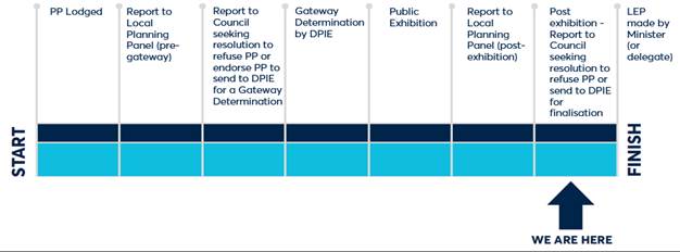
THE
SITE
1. The subject site is
located at 14-20 Parkes Street, Harris Park, and comprises four allotments being
Lot 10 in DP12882, Lot 13 in DP1077402, Lot 14 in DP1077402 and Lot 2 in DP128524.
The site is approximately 2,800 square metres in area. An aerial photo of the
site is shown in Figure 1.
Figure 1
– Subject Site (site shown outlined in red)
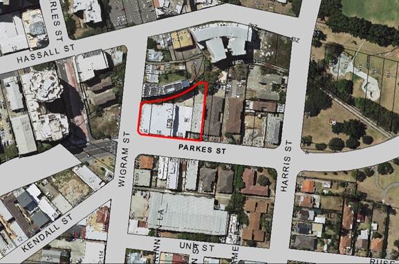
PLANNING PROPOSAL SUMMARY
Table 1: Summary of existing, Parramatta CBD
Planning Proposal and proposed site-specific Planning Proposal controls
|
Control
|
Existing controls - Parramatta LEP 2011
|
Parramatta CBD Planning Proposal
|
Site-specific Planning Proposal
|
|
Zone
|
B4
Mixed Use
|
B4
Mixed Use
|
B4
Mixed Use
|
|
FSR
|
4:1
|
10:1 (11.5 including design
excellence)
|
8:1 (9.2:1 including design
excellence)
|
|
Height
|
54m (16-storeys)
|
130m (149.5m with design
excellence)
|
110m (126.5m with design
excellence)
|
|
Potential floor space
|
11,200 m2
|
27,400 m2
residential 600 m2 commercial
(Total
31,510 m2 with design excellence)
|
21,800 m2 residential
600 m2 commercial
(Total
25,700 m2 with design excellence)
|
|
Indicative development potential
|
150 dwellings (including
design excellence). Based on 75 m2 per dwelling
|
321 dwellings (including
design excellence)
|
257 dwellings (including
design excellence)
|
Note: The subject site-specific Planning Proposal
commenced before Council endorsed the Parramatta CBD Planning Proposal. Given
this, the Parramatta CBD Planning Proposal requirement for development to
include at least 1:1 FSR of commercial floor space has not been included in the
subject site-specific Planning Proposal. The same applies to the High
Performing Buildings bonus in the Parramatta CBD Planning Proposal.
BACKGROUND
2. The proposed
planning controls for this site have been subject to some change since the
application was first lodged. This history is provided in detail in Attachment
1 but the key actions to date are:-
(a) Council resolved to
proceed with a site-specific Planning Proposal for this site with an FSR of
10:1;
(b) The DPIE issued a
Gateway determination that allowed for an FSR of 8:1;
(c) Following the
completion of the Hector Abrahams Heritage Interface study, which informed the
Parramatta CBD Planning Proposal, Council resolved to seek an amended Gateway
determination for this site-specific Planning Proposal seeking an FSR of 10:1;
(d) The DPIE advised
that they would not support an amended Gateway determination until a cumulative
impact assessment of the Parramatta CBD Planning Proposal on Heritage
Conservation Areas to the south of the site was undertaken.
3. Following the
advice from the DPIE the applicant requested that Council proceed with the
Planning proposal based on the Gateway determination that had been issued
allowing 8:1 on the subject site. On 17 December 2018, Council considered a
report on the applicant’s request and letter of offer for a Planning
Agreement and resolved in part:
(a) That Council endorse the exhibition of the Planning
Proposal enabling an FSR of 8:1 and maximum building height of 110 metres (plus
design excellence for both FSR and height) for
the site at 14 – 20 Parkes Street, Harris Park in
accordance with the Gateway determination issued on 29 November 2016.
(c) That
Council endorse the matters in the letter of offer for inclusion in a draft
Planning Agreement, in relation to the Planning Proposal to increase the
maximum building height and Floor Space Ratio (FSR) at 14 – 20 Parkes
Street, Harris Park
4. The Planning Proposal and draft
Planning Agreement were publicly exhibited from 12 March to 12 April
2019. During this time, two submissions were received from community
members and five submissions were received from State agencies. This summary
report is supported by a detailed assessment report provided at Attachment 2,
which details the submissions received and the Council officer’s response
to each of the submissions.
5. Key issues raised in the
submissions are briefly outlined as follows:
· Two community members sought the retention of the existing
54 metre height control. The proposed height of 110 metres and FSR of 8:1 is
considered appropriate in the context of the controls proposed for Parramatta
CBD. On 25 November 2019, Council endorsed a draft maximum building height
control of 130 metres for the site as part of the Parramatta CBD Planning
Proposal. The proposed floor space ratio control for land north of Parkes
Street is generally 10:1.
· One agency seeks the establishment of a vegetated riparian
corridor along Clay Cliff Creek to improve biodiversity. Proposed
building setbacks in the site-specific DCP will enable this area to be
appropriately vegetated.
· Two State agencies identified issues of flood risk relating
to the site. To ensure these issues are addressed a draft site-specific DCP
(included at Attachment 4) has been prepared for Council’s
endorsement for public exhibition.
LOCAL PLANNING PANEL ADVICE
6. The Local Planning Panel
considered a detailed assessment report (Attachment 1) on 3
December 2019 and supported the Council officer’s recommendation as
outlined in this report. Refer to Attachment 1 for the Panel's advice.
FINANCIAL IMPLICATION
FOR COUNCIL
7. Under a Planning Agreement
prepared with the Planning Proposal, the applicant will be required to pay a
monetary contribution that Council will use to fund local community
infrastructure. The basis of the amount for payment is set out in the table
below.
Table 2: Calculations for
payment of monetary contribution
|
Development
parameters
|
|
Site
Area
|
2,800 m2
|
|
Base
FSR
|
4:1
|
|
Base
Gross Floor Area
|
11,200 m2
|
|
Incentive
FSR (Phase 1)
|
8:1
|
|
Incentive
Gross Floor Area
|
22,400 m2
|
|
Uplift
in gross floor area
|
11,200 m2
|
|
Residential apartment
floor space included in development (apply $150/ m2)
|
$1,680,000 (mixed use development with
commercial and residential use)
|
8. The above calculations results
in a requirement for payment of $1,680,000.
In the course of preparing this report, it was noted that this amount is
greater than the figure of $1,657,800 included in the exhibited Planning
Agreement. However, the applicant has advised that they are prepared to pay the
difference of $22,200 and agree to the Planning Agreement being amended
accordingly to reflect this.
Accordingly, it is recommended Council endorse the Planning
Agreement subject to it being amended to require $1,680,000. This
amendment is consistent with the Parramatta CBD Community Infrastructure policy
framework and does not require a re-exhibition.
CONCLUSION
9. It is
recommended Council endorse the Planning Proposal and Planning Agreement for
the site, as exhibited, for finalisation, but subject to variation of the
monetary contribution amount. It is also recommended Council endorse the draft site-specific
DCP for public exhibition.
Paul Kennedy
Project Officer Land Use
Planning
Jonathon Carle
Land Use Planning Manager
Jennifer Concato
Executive Director City
Strategy and Development
Attachments:
|
1⇩
|
Report to Local Planning Panel (including
extract of minute from panel meeting)
|
17 Pages
|
|
|
2⇩
|
Submission summary table
|
9 Pages
|
|
|
3⇩
|
Planning Proposal
|
28 Pages
|
|
|
4⇩
|
Site-specific Development Control Plan
|
4 Pages
|
|
|
5⇩
|
Draft Planning Agreement
|
24 Pages
|
|
REFERENCE MATERIAL
|
Item 18.5 -
Attachment 1
|
Report to Local Planning Panel (including extract of
minute from panel meeting)
|
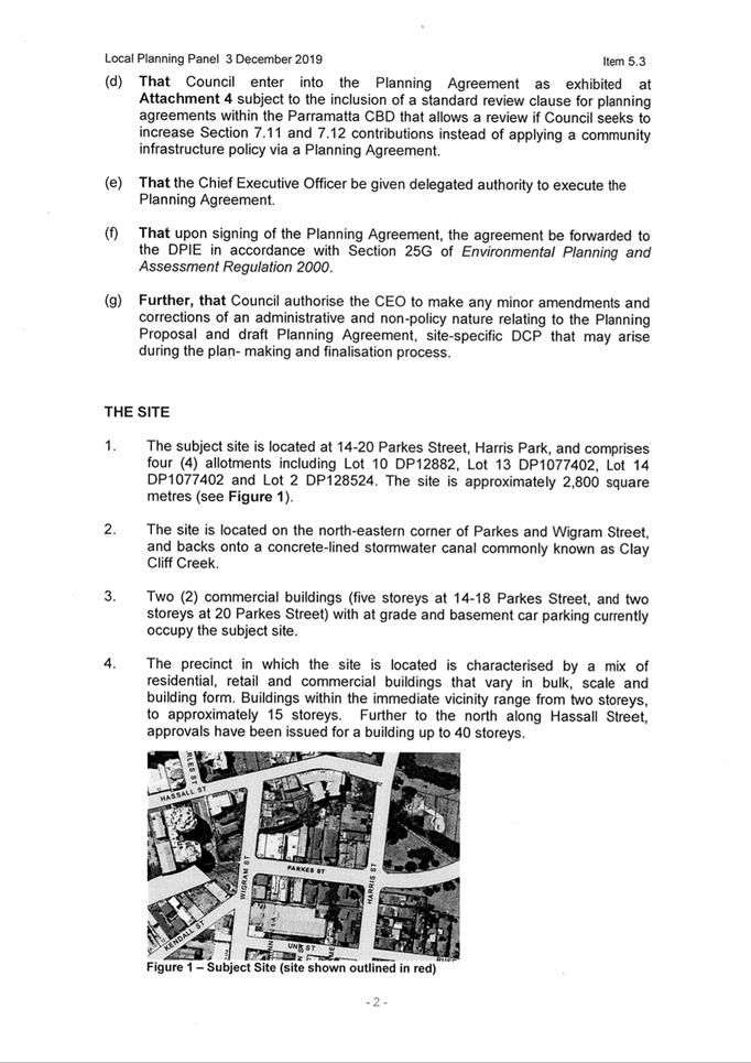
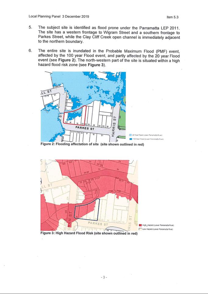
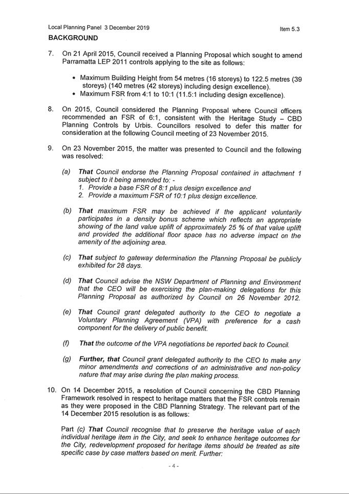
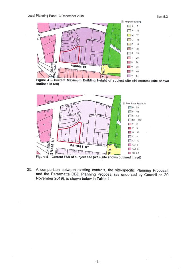
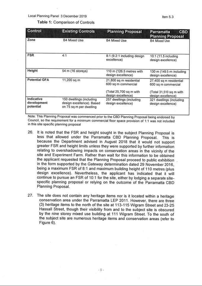
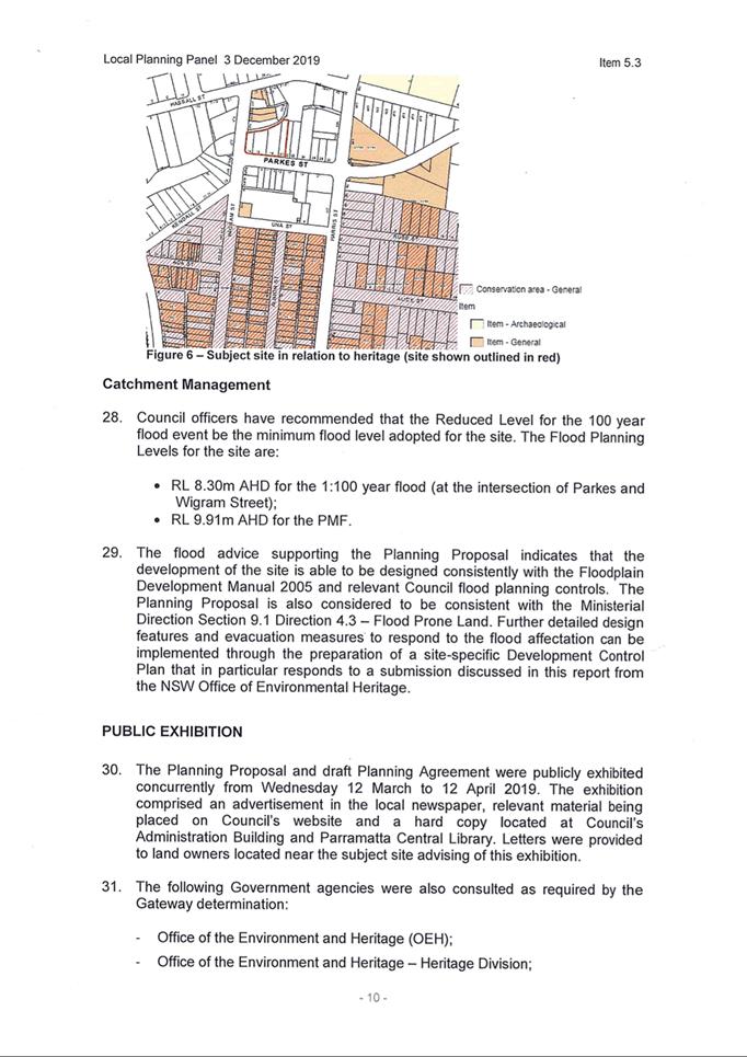
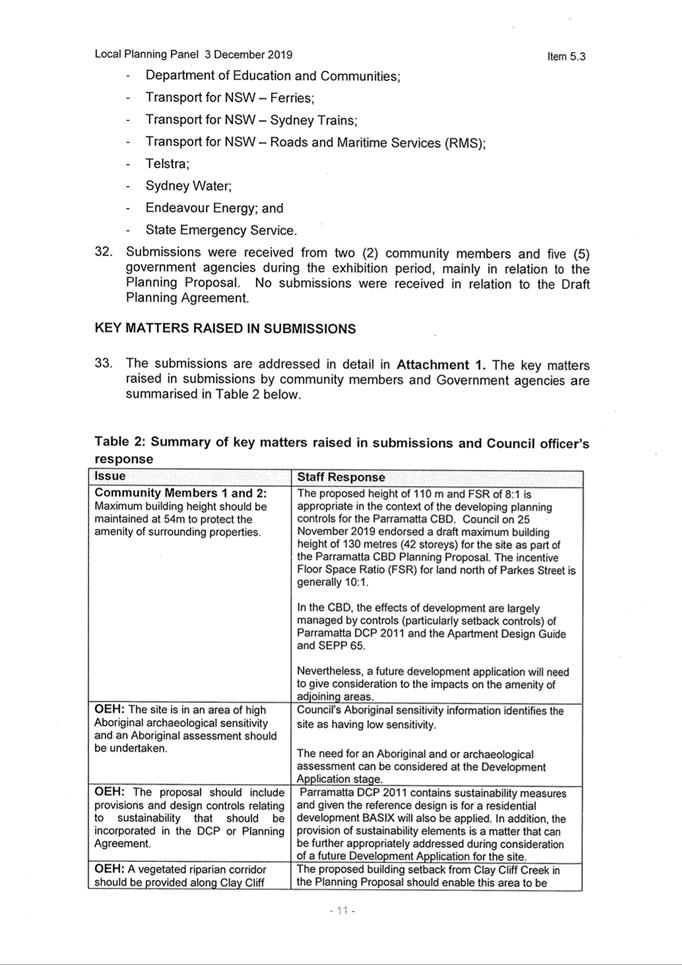
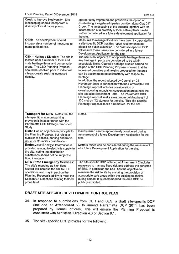
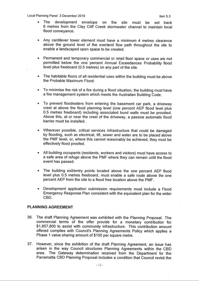
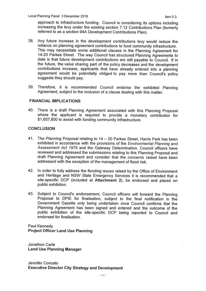
|
Item 18.5 - Attachment 2
|
Submission summary table
|
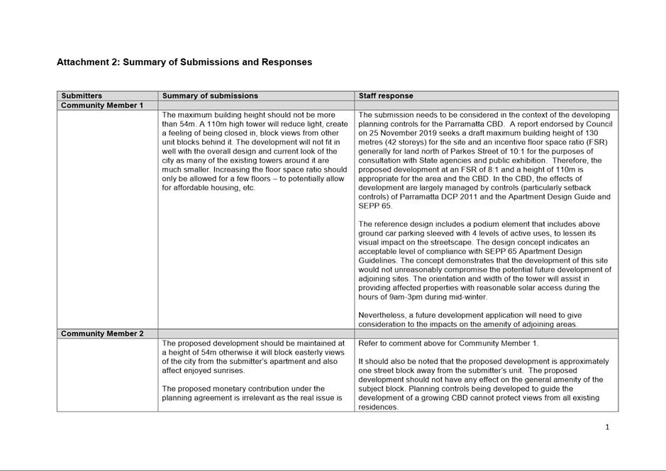
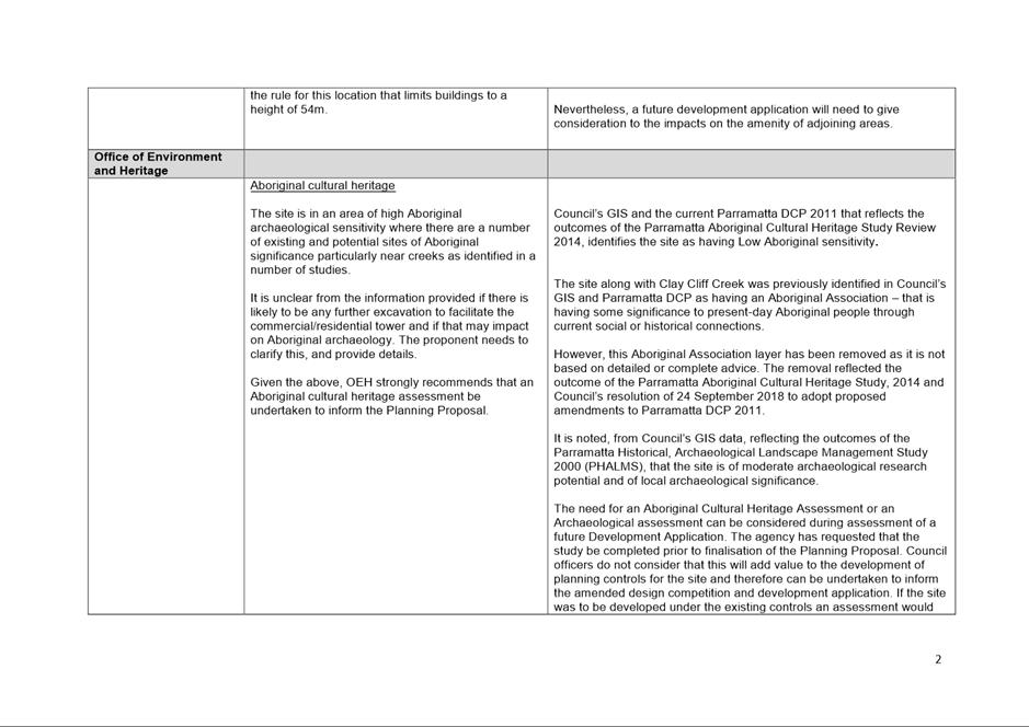
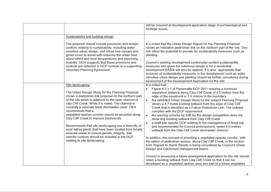
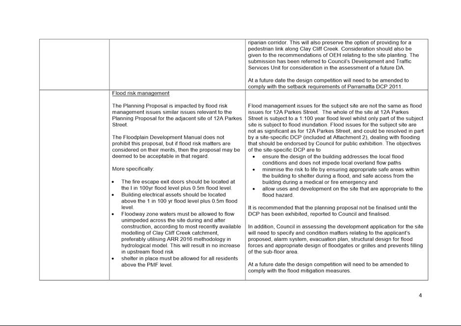
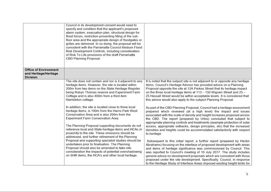
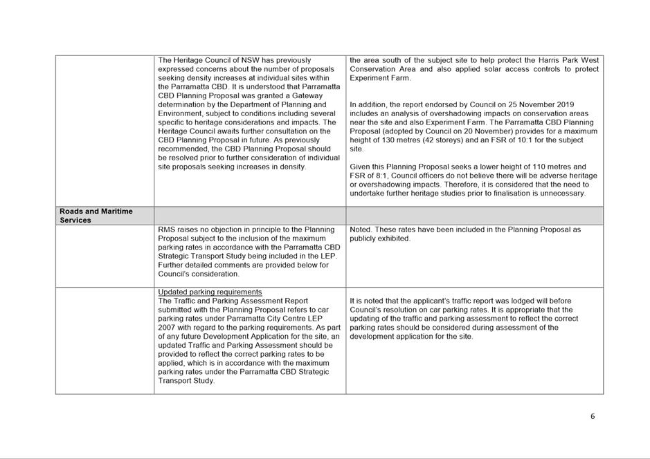
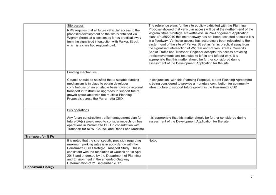
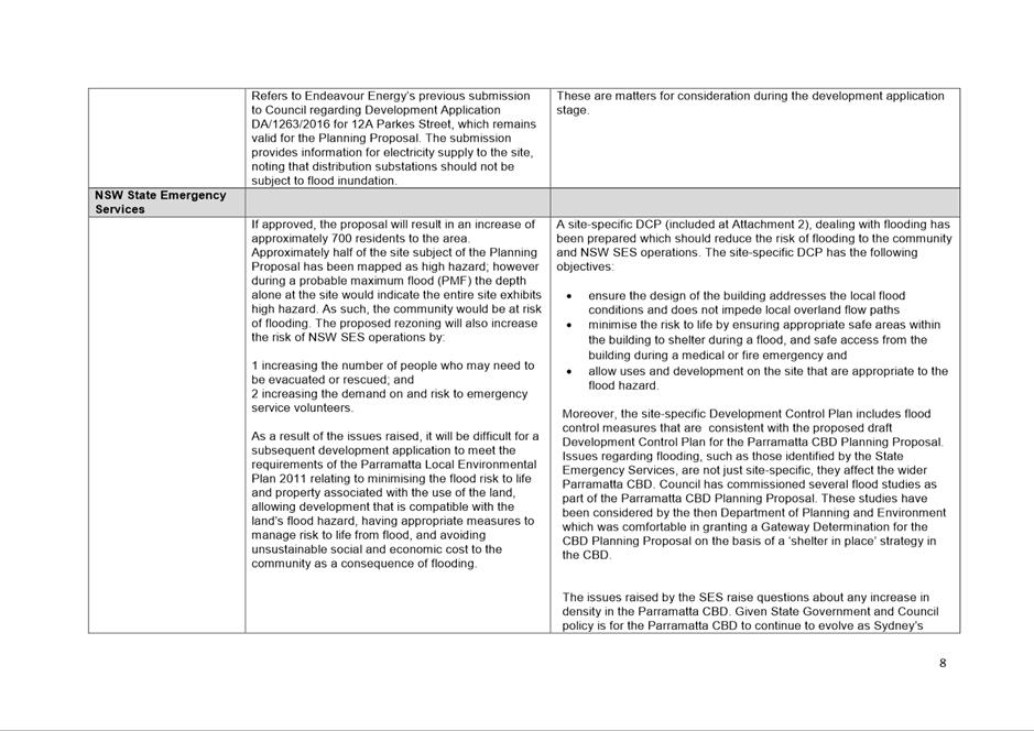
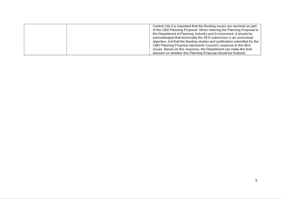
|
Item 18.5 - Attachment 3
|
Planning Proposal
|
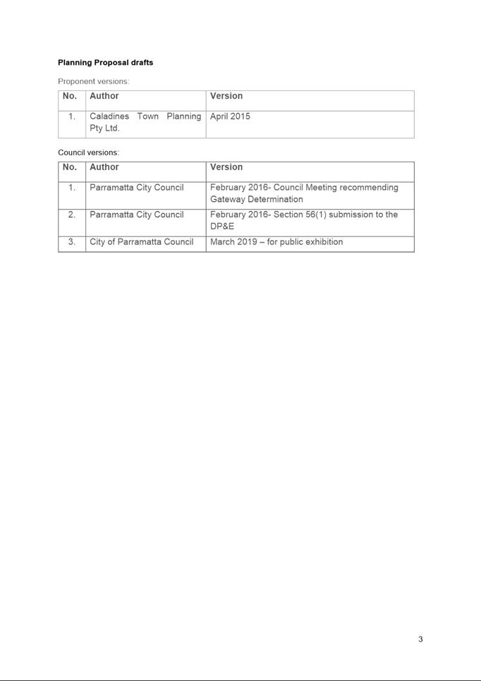
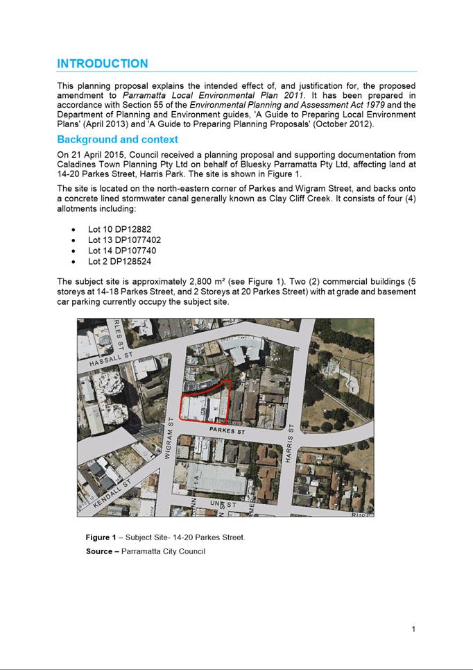
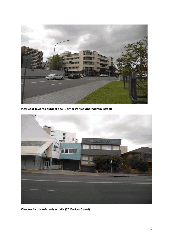
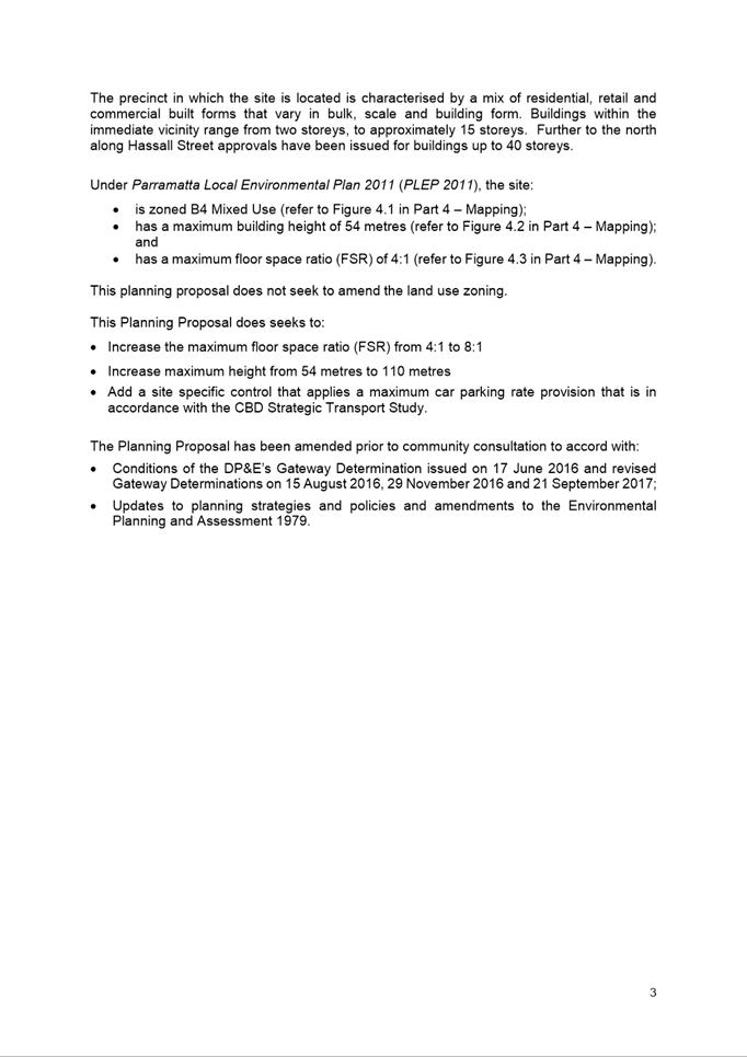
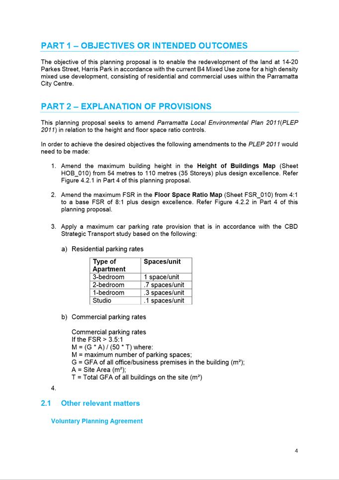
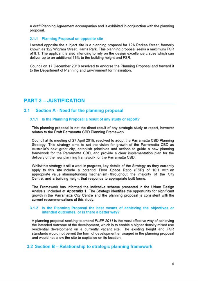
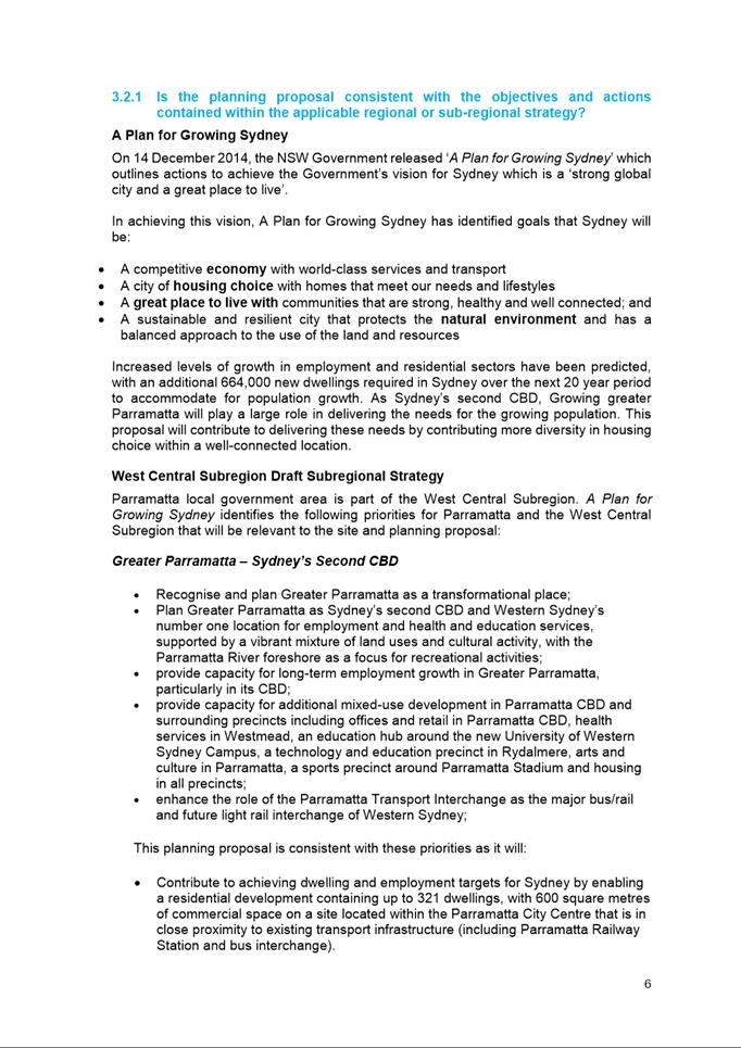
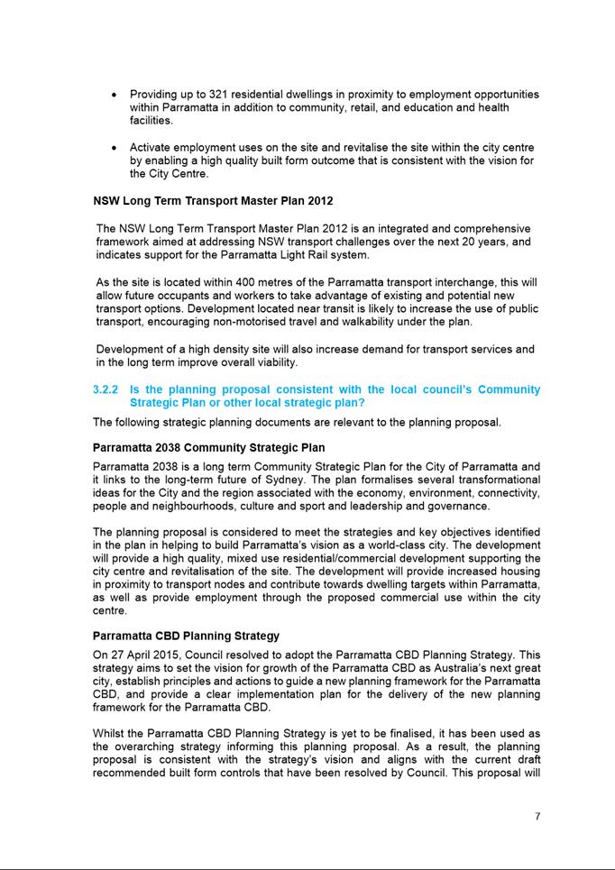
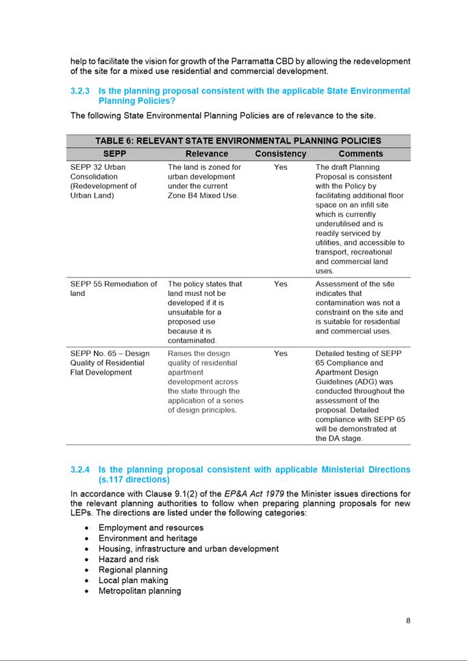
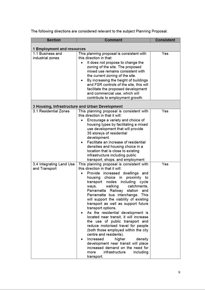
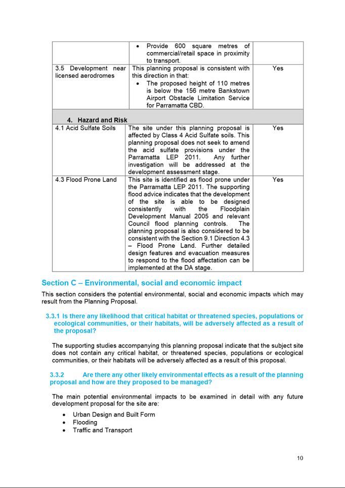
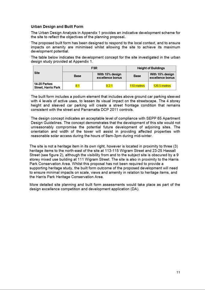
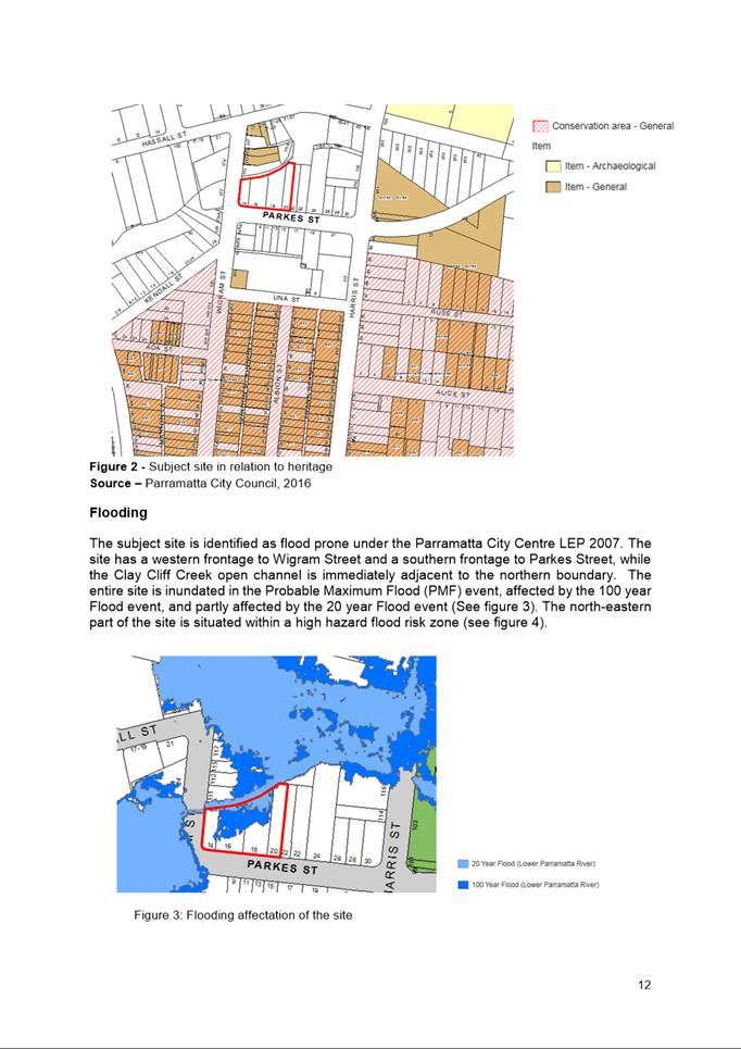
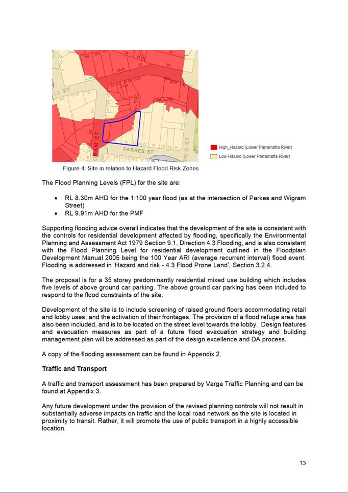
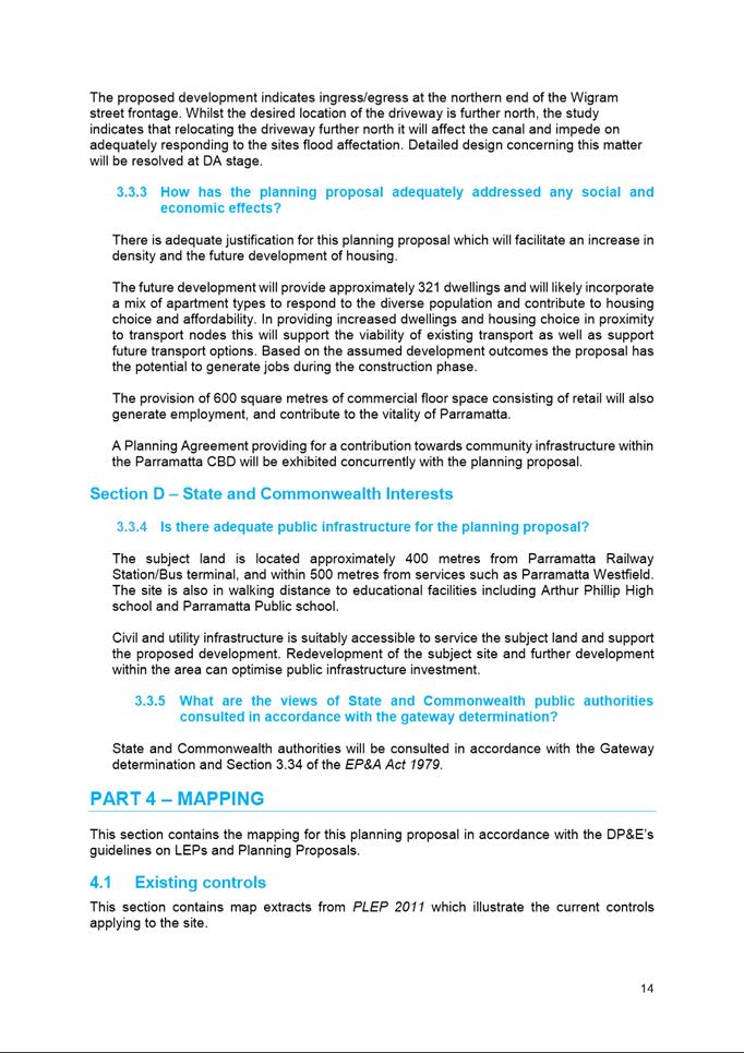
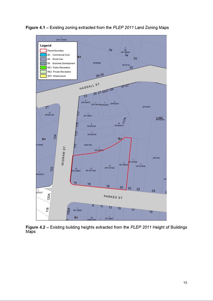
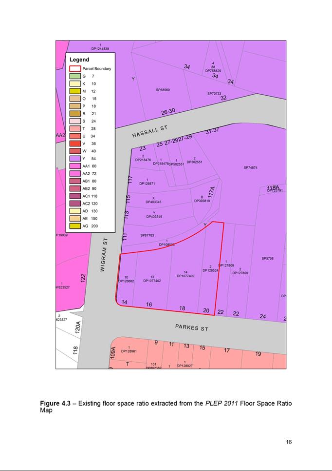
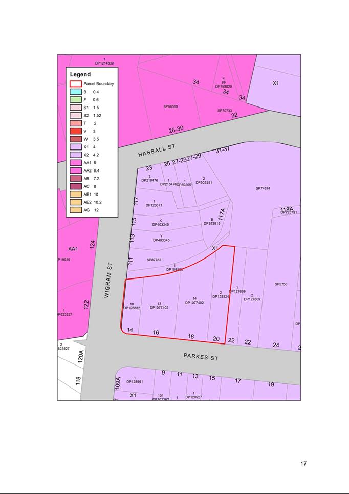
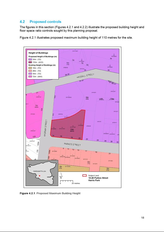
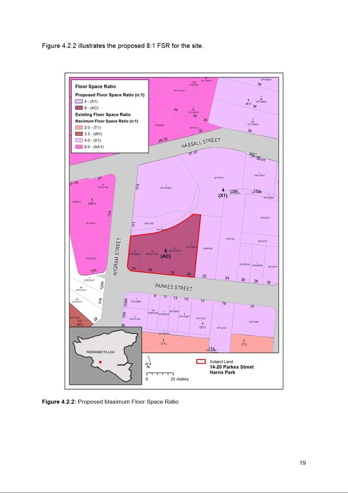


|
Item 18.5 - Attachment 4
|
Site-specific Development Control Plan
|
|
Item 18.5 - Attachment 5
|
Draft Planning Agreement
|
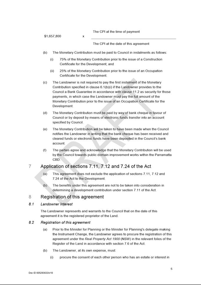
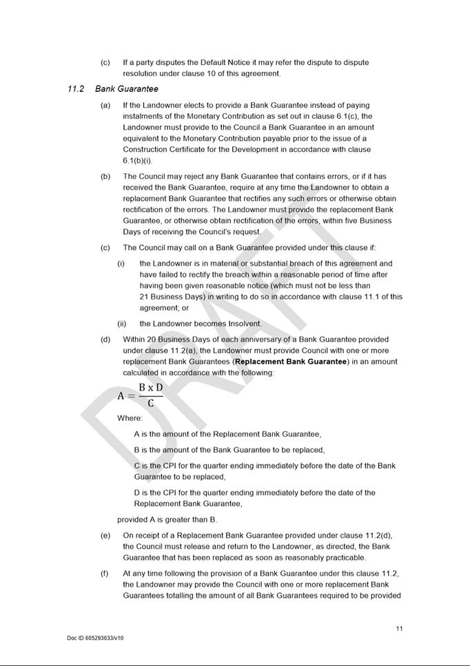
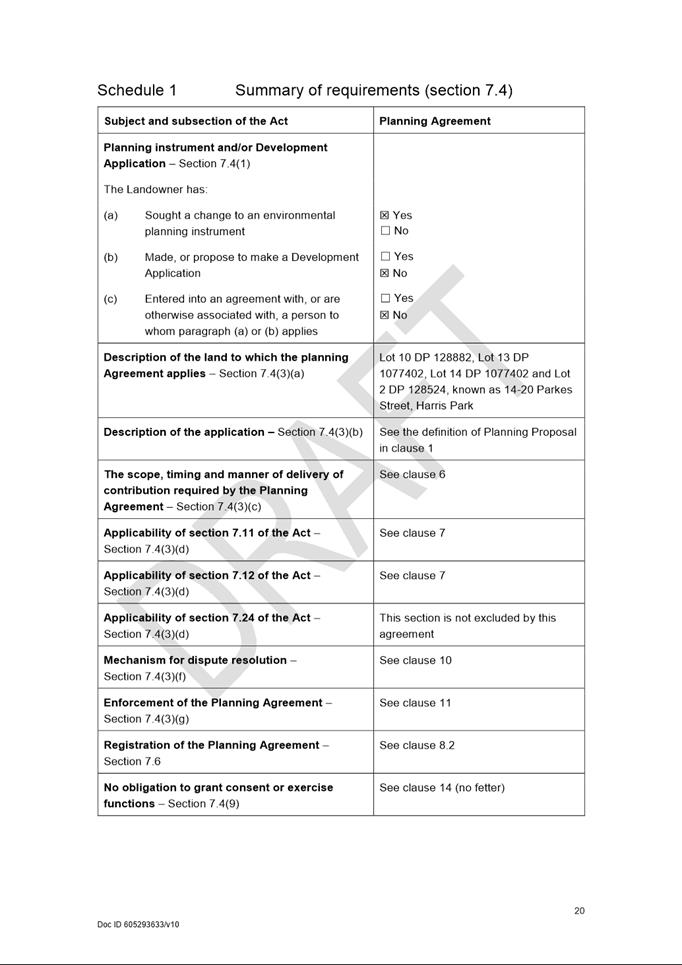
Council 16 December 2019 Item
18.6
ITEM NUMBER 18.6
SUBJECT FOR
APPROVAL: Post Exhibition - Planning Proposal, draft Site Specific Development
control Plan and Planning Agreement for 295 Church Street, Parramatta
REFERENCE RZ/14/2014 - D07150068
REPORT OF Team Leader Land Use Planning
|
Landowner 295 Church Street Property Pty Ltd
Applicant Mecone Pty Ltd
Development Applications considered by
Sydney Central City Planning Panel - Nil
PURPOSE:
The purpose of this report is for Council to consider the progression
of a Planning Proposal, draft Development Control Plan and draft Planning
Agreement for land at 295 Church St, Parramatta following public exhibition
of these documents.
|
|
RECOMMENDATION
(a) That Council receives
and notes the submissions made, summarised at Attachment 5, during the
public exhibition of the Planning Proposal, draft Development Control Plan (DCP)
and draft Planning Agreement for land at 295 Church Street, Parramatta.
(b) That Council endorse
the Planning Proposal provided at Attachment 2 for land at 295 Church
Street, Parramatta, which seeks to:
(i) Increase the height of
buildings from 12 metres to part 12 metres for the front (Church Street) 12m
of the site and part 150 metres for the remainder of the site (plus design
excellence bonus); and
(ii) Increase the maximum floor
space ratio from 3:1 to 10:1 (plus design excellence bonus).
(c) That an amended draft
DCP, included at Attachment 3, be re-exhibited to address the
following matters that arose during the previous consultation phase:
(i) 12 metre tower setback to Church
Street;
(ii) Traffic, access, loading and servicing;
and
(iii) Flooding.
(d) That the draft
Planning Agreement included at Attachment 4 be re-exhibited with
amendments including:
(i) a standard
review clause that allows a review if Council seeks to increase Section 7.11
and 7.12 contributions and decrease the community infrastructure contribution
payable under Council’s Parramatta CBD Community Infrastructure policy
framework, and
(ii) making it clear that
no contribution will be required unless the development includes residential
apartments.
(e) That the exhibition
outcome of the revised Planning Agreement and draft DCP be reported to
Council.
(f) That Council defer
forwarding the amended Planning Proposal to the Department of Planning,
Industry and Environment (DPIE) until the outcome of the exhibition of the
draft DCP and draft Planning Agreement has been considered by Council and the
documents are endorsed for finalisation.
(g) That
Council authorise the Chief Executive Officer (CEO) to make any minor
amendments and corrections of an administrative and non-policy nature
relating to the Planning Proposal, draft DCP and draft Planning Agreement
that may arise during the plan-making and finalisation process.
(h) Further, that
Council note the advice of the Local Planning Panel of 3 December 2019 is
consistent with the Council Officer’s recommendation in this report.
|
PLANNING PROPOSAL TIMELINE
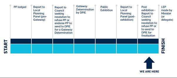
BACKGROUND
1. A Planning
Proposal for land at 295 Church St, Parramatta (comprising Lot 1 DP 25055 and
Lots 10, 11 and 12 DP 234508) was lodged with Council in September 2014. The
site has a total site area of 1082 m2. The site currently operates
as a restaurant/bar commonly known as One World Sports Bar, and has two
frontages including Church St along the eastern boundary and Freemasons Arms
Lane along the western (rear) boundary.
2. On 12 October 2015
Council resolved to proceed with a site-specific Planning Proposal which
proposed to amend Parramatta LEP 2011 as follows:-
a. Increase the FSR from 3:1 to 10:1
(11.5:1 with design excellence); and
b. Increase the height from 12m to
part 12m for the part of the building located within 10m of the Church Street
boundary and 150m or 47 storeys (172.5m or 54 storeys with Design Excellence
bonus) for the remainder of the site.
3. Between 17 June
2016 and 4 August 2017 the DPIE issued a Gateway determination and a number of
amendments to the Gateway determination which resulted in a determination that
contained the following key conditions at the time of public exhibition:-
a. Council’s
drainage engineers to be satisfied that the development could respond to and
manage extreme flood events;
b. The Planning
Proposal would need to be exhibited with a summary of all site-specific
Planning Proposals being considered by Council at the time the Gateway
determination was issued to allow the cumulative impact to be better understood
by Government agencies;
c. That the
maximum car parking rates endorsed by Council when it endorsed the Parramatta
CBD Planning Proposal be included; and
d. Prior to
finalisation of the subject Planning Proposal the FSR and sliding scale applied
to this site should be consistent with that in the Parramatta CBD Planning
Proposal.
4. On 13 March 2017 Council
authorised the content of a draft DCP for the purpose of public exhibition with
the Planning Proposal and authorised the CEO to finalise a draft Planning
Agreement which would also be exhibited with the Planning Proposal.
5. The exhibition of
the Planning Proposal, draft Planning Agreement and draft DCP commenced on 1
August 2018 and concluded on 11 September 2018. The Planning Proposal was
amended prior to its exhibition to include the parking rates and details of
other Planning Proposals in the Parramatta CBD to ensure the conditions of the
Gateway Determination were satisfied.
COMPARISON
OF EXISTING AND PROPOSED PLANNING CONTROLS
6. While
the subject Planning Proposal was being progressed the Parramatta CBD Planning
Proposal was also progressing. Table 1 compares planning provisions for
the subject site in the Parramatta Local Environmental Plan 2011 (Parramatta
LEP 2011), Parramatta CBD Planning Proposal, exhibited site-specific Planning
Proposal and the amended site-specific Planning Proposal at Attachment 2.
7. The
current development proposal being considered by the applicant is different to
that provided in the reference design when the application was first lodged.
Initially the proposal was a mixed-use development with retail/commercial/ office
uses in the podium and a tower containing residential apartments. The amended
proposal put forward by the applicant when they lodged their design competition
brief with Council was for a mixed used development incorporating
retail/commercial uses with a hotel and a boarding house component.
8. The
boarding house component is enabled by State
Environmental Planning Policy Affordable Rental Housing 2009 (Affordable Rental
Housing SEPP). It does not rely on the subject Planning Proposal to become a
permissible use. However, the Affordable Rental Housing SEPP does allow a bonus
FSR. If the subject Planning Proposal is permitted then an additional 2:1 FSR
will be achievable on this site as detailed in column five of Table 1
below.
Table 1. Comparison of planning
provisions for the subject site between the Parramatta LEP 2011, Parramatta CBD
Planning Proposal, exhibited planning proposal and amended planning proposal
post exhibition
|
Parramatta LEP 2011
|
Existing controls
|
Proposed control in CBD Planning Proposal
|
Exhibited Planning Proposal
|
Amended Planning Proposal (post-exhibition and the subject of design
competition process)
|
|
Zoning
|
B4 Mixed Use
|
B4 Mixed Use
|
B4 Mixed Use
|
B4 Mixed Use
|
|
Maximum HOB
|
12m
|
Part 12m and Part 211RL (64 storeys)
|
Part 12m (front 10m Church Street)
Part 150m (47 storeys)
|
Part 12m (front 12m Church Street)
Part 150m (47 storeys)
|
|
Maximum FSR
|
3:1
|
10:1 plus (15% design excellence bonus) but with sliding scale
FSR permitted is 6.41:1
|
11.5:1 FSR:
· Incentive FSR - 10:1
· Design Excellence Bonus - 1.5:1
|
13.5:1 FSR:
· Incentive FSR - 10:1
· Design Excellence Bonus - 1.5:1
· Boarding House (ARH SEPP) - 2:1
|
|
Maximum GFA
|
3,246m2
|
10,820 m2
|
12,443 m2 (100%)
· 11,198.7 m2 for
residential
· 1,082 m2 for commercial
|
14,607 m2 (100%)
· 11,010 m2 for Hotel
(75.4%)
· 2,515 m2 for Boarding house (17.2%)
· 1,082m2 for Commercial (7.4%)
|
|
Maximum yield
(assuming 75 square metres for apartments)
|
1082m2 commercial
28 dwellings
|
1082 m2 commercial
130 dwellings
|
166 Dwellings
(Applicant’s calculation = Maximum GFA/75m2)
|
259 rooms
· Boarding house: 56 rooms
(Applicant’s calculation = Boarding House
GFA/45m2)
· Hotel: 203 rooms
(Applicant’s calculation = Hotel GFA/54m2)
|
CONSISTENCY WITH PARRAMATTA
CBD PLANNING PROPOSAL AND GATEWAY DETERMINATION ISSUED FOR SUBJECT PLANNING
PROPOSAL
9. The
exhibited Planning Proposal was exhibited with a height control where the first
10 metres of any building closest to Church Street would be restricted to a
height of 12 metres. Another way to describe this is the tower on this site
should be setback 10 metres from Church Street and the 10m setback area can
only contain a building with a height of 12m or less. In response to a
condition of the Parramatta CBD Planning Proposal Gateway Determination Council
has undertaken a further study which was considered by Council and resulted in
Council adopting a tower setback of 12 metres. The subject Planning Proposal
has been amended so it is consistent with the Parramatta CBD Planning Proposal
endorsed by Council on 25 November 2019.
10. The
Gateway determination issued for the subject Planning Proposal contains a
condition requiring the subject Planning Proposal to be consistent with the
sliding scale provisions in the Parramatta CBD Planning Proposal. If the
sliding scale provisions endorsed by Council on 25 November 2019 is applied the
FSR shown in Table 2 would be permitted on this site.
Table 2: Application
of CBD Planning Proposal
sliding-scale on 295 Church Street
|
FSR
Shown on Map
|
CBD
Planning Proposal sliding-scale formula (sites greater than
1,000m² but less than 1,800m²)
|
Permitted
FSR -– 295 Church Street, Parramatta (Site Area 1082 square metres)
under CBD Planning Proposal sliding-scale
|
|
10:1
|
(6+4X):1
6+4
((1082-1000/800)
|
6.41:1
|
|
Where X = (the site area in square
metres – 1000)/800
|
11. A
more detailed assessment on the merit of applying the sliding scale on this
site is provided in Attachment 1. It is recommended that the sliding
scale not be applied in this case. The key issues relevant to whether the
sliding-scale should be applied to the subject site are:
a. The
site amalgamation is not desirable for the subject land. Although the site does
not contain a heritage item, the site is near numerous local heritage items.
Amalgamation with the adjoining site will lead to a bigger tower footprint and
subsequently more disruption and impact to the fabric of heritage items on
Church Street.
b. Furthermore,
from an urban design standpoint, a bigger tower footprint that would result
from any amalgamation also decreases building separation from the two towers
already being built to the north and west of the site, resulting in an
undesirable urban design outcomes.
c. Amalgamation
with other sites is not supported for the heritage and urban design reasons
described above. The maximum tower footprint that is able to be developed is
fixed by setback controls. Therefore any decrease in FSR required by applying
the sliding scale will not impact on any design element of the building except
for the height. The Parramatta CBD Planning Proposal raises no objection to
taller buildings on this site and the application of the sliding-scale would
not meet the objectives it is seeking to achieve on the subject site.
12. It
should also be noted that these issues were also separately assessed as part of
the Urban Design and Feasibility Study for the Church Street precinct
undertaken as part of the review of the Parramatta CBD Planning Proposal. This
review did not raise any objection to the taller tower on the subject site or an
FSR of 10:1 plus design excellence being applied to this site.
13. An
amended reference design and a supporting statement were submitted by the
applicant to address the condition relating to the ability of any development
to cope with extreme flood conditions. The information has been reviewed by
Council’s Senior Catchment and Development Engineer who advises that the
information prepared by the applicant is satisfactory for the purposes of
progressing the Planning Proposal, provided that the information in the letter
is implemented. Flooding design requirements as relevant will be addressed as
part of the revision to the site-specific DCP.
PUBLIC EXHIBITION OUTCOMES
14. Three
(3) submissions from the community were received in response to the exhibition.
A number of issues were raised as part of these submissions. The matters as
summarised in Table 3 were consistent across all submissions:
Table 3. Issues raised in the community
submissions and Council officers responses
|
Issue
|
Response
|
|
Support for a
greater setback than the 10 metres proposed in the exhibited Planning
Proposal;
|
As detailed
previously in this report, more detailed analysis on the tower setback and
heritage impacts has been undertaken. The analysis concludes that a 12-metre
setback is appropriate to protect views and that the proposed development of
this site will not result in an unacceptable heritage impact on Church
Street.
|
|
Concerns relating
to impacts on heritage and historic views;
|
|
Impacts on
transport in the Parramatta CBD; and
|
This proposed
density is consistent with that proposed in the Parramatta CBD Planning
Proposal. A traffic study which will look at infrastructure needed to support
the density is being pursued as part of the Parramatta CBD Planning Proposal.
|
|
Impacts on solar /
sun light access
|
The built form
analysis underpinning the Parramatta CBD Planning Proposal promotes tall
slender towers to allow space between building for air and light. The
proposed tower on this site will have a small floor plate minimizing the
shadow impact.
|
15. A more detailed summary of
all the issues raised in the community submissions, and Council officer
responses are contained in Attachments 1 and 5.
16. Submissions
were received from eleven Government agencies as a result of the exhibition.
The key issues raised in these agency submissions were:
a. Request from
the Office of Environment and Heritage that Council consider aboriginal
cultural heritage issues, impacts on Old Government House, sustainability,
flooding and water quality issues;
b. Concerns from
the NSW State Emergency Service (SES NSW) about increasing density in the flood
plain of Parramatta River in particular the probable maximum flood area and
design issues such opposition to basement car parking on the subject site;
c. Roads and
Maritime Service raised no objection subject to the Council’s endorsed
car parking rates applicable under the Parramatta CBD Planning Proposal being
applied to this site and Council considering implementation of a mechanism to
collect contributions from developers to fund state provided transport
infrastructure;
d. A request that
the applicant consult with Parramatta Light Rail and Sydney Coordination Office
at development application stage and a list of technical requirements were
provided by Transport for NSW;
e. A list of
technical requirements that would need to be addressed at Development
Application or construction certificate stages were provided by Endeavour Energy
and Telstra; and
f. The
Department of Infrastructure and Transport, Cities and Regional Development and
other agencies and airports that play a role in ensuring the safe and efficient
operation of airports and the airspace around them (Civil Aviation Safety
Authority, Airservices Australia, Bankstown Airport, Sydney Airport and the
Western Sydney Airport Corporation) made submissions which noted the need for
further consultation at Development Application stage.
17. Further
detail on the agency submissions and a detailed response to each are provided
in Attachments 1 and 5. The submissions do not raise issues that warrant
Council amending the Planning Proposal or delaying the progress of the planning
proposal. The issues raised are:-
a. addressed
in greater detail in the Parramatta CBD Planning Proposal on a precinct basis;
b. are
already addressed in the Planning Proposal;
c. are
addressed in the draft DCP this report recommends to be placed on public
exhibition; or
d. are
more appropriately addressed at the Development Application stage.
HERITAGE ADVISORY COMMITTEE
18. A
briefing of this Planning Proposal was provided to Council’s Heritage
Advisory Committee on 15 August 2018. An extract from the Committee’s
minutes regarding this item is as follows:
“The Committee considered that this
proposal was inappropriate and not in keeping with the local heritage items and
will have a significant impact on the surrounding heritage buildings and
precinct.”
19. This
Planning Proposal is consistent with Council’s policy position for
development at this site established through the Parramatta CBD Planning
Proposal and related subsequent resolutions.
RE-EXHIBITION OF DRAFT DCP
20. In response to issues raised in government
agency submissions; and the additional information provided by the applicant
which addresses detailed flooding and design issues it is recommended that the
amended site-specific DCP included at Attachment 3 be exhibited. It will
replace the draft site-specific DCP amendment exhibited with this Planning
Proposal which only addressed the proposed 10 metre tower setback to Church St,
which is no longer relevant.
21. The
matters which officers consider should be addressed in the draft site-specific
DCP are as follows:
a. Church Street setback – the proposed 12-metre tower setback to Church St;
b. Traffic and transport Issues – restrict
the vehicle access only to Freemasons Arms Lane; residential maximum parking
rates are to be used in accordance with the Parramatta CBD Planning Proposal;
and all parking to be located in basement parking levels.
c. Flooding issues – all permanent and
temporary non-residential floor spaces must be above the one per cent Annual
Exceedance Probability (AEP) flood level plus 0.5-metre freeboard; all
habitable floor space within the building must be above the PMF level.
22. It
is recommended that this draft site-specific DCP, provided at Attachment 3,
is exhibited, and that the results of that exhibition are reported back to
Council.
DRAFT PLANNING AGREEMENT
23. The draft Planning Agreement exhibited requires a payment
of $1,136,100 in three installments to Council linked to the issue of a
development consent, construction certificate and occupation certificate. The
contribution is consistent with the Parramatta CBD Planning Proposal Community
Infrastructure framework. The calculation of the contribution is outlined in Table
4 below.
Table 4: Monetary contribution calculations for draft Planning
Agreement
|
Development
parameters
|
|
Site Area
|
1,082 m2
|
|
Base FSR
|
3:1
|
|
Base Gross Floor
Area
|
3,246 m2
|
|
Incentive FSR
(Phase 1)
|
10:1
|
|
Incentive Gross
Floor Area
|
10,820 m2
|
|
Uplift in gross
floor area
|
7,574 m2
|
|
Scenario 1. No
residential apartment floor space included in redevelopment (no contribution
required)
|
$0 (mixed use development
with commercial, hotel and boarding house)
|
|
Scenario 2. Residential apartment
floor space included in redevelopment (apply $150/ m2)
|
$1,136,100 (mixed use development with commercial
and residential use)
|
24. The
draft Planning Agreement was negotiated when the intended development was for a
mixed use development with a tower containing residential apartments. The
applicant’s proposal has been amended and the development now proposed
involves the construction of a hotel and boarding house. The Parramatta CBD
Planning Proposal Community Infrastructure framework does not require a
contribution for commercial uses such as a hotel. The framework does not
specify whether community infrastructure contributions should be required for
boarding house development. Council officers do not consider requiring a
community infrastructure contribution for the boarding house component is
appropriate for this development primarily because the boarding house is being
proposed under the Affordable Rental Housing
SEPP rather than directly as a result of the Parramatta CBD Planning Proposal.
25. The
applicant has put forward a request that the draft Planning Agreement be
amended to make it clear that a contribution is only payable if the development
contains residential apartment development.
26. It
is recommended that the draft Planning Agreement be amended as follows:
(a) a standard review
clause for Planning Agreements within the Parramatta CBD that allows a review if
Council seeks to increase Section 7.11 and 7.12 contributions and decreases the
community infrastructure contribution payable under Council’s Parramatta
CBD Community Infrastructure policy framework. This matter was considered by
Council at its meeting of 11 June 2019 resulting in Council resolving that
existing and future Planning Agreements for sites in the CBD include a clause
that addresses this issue; and
(b) making it clear that no
contribution will be required unless the development includes residential
apartments.
LOCAL PLANNING PANEL
27. The Local Planning Panel
considered the assessment report on this matter (Attachment 1) and
resolved to support the Council Officer recommendation on this matter. An
extract of the panel meeting minutes is also included at Attachment 1.
CONSULTATION & TIMING
28. It is recommended that the
draft Development Control Plan included as Attachment 3 and the amended
draft Planning Agreement be publicly exhibited and the outcome of the public
exhibition reported to Council before the Planning Proposal is forwarded to the
DPIE for finalisation.
FINANCIAL IMPLICATIONS FOR
COUNCIL
29. The
exhibited draft Planning Agreement includes a $1,136,100 monetary contribution
towards community infrastructure in the Parramatta CBD on the basis the site would be developed as a mixed-use
development containing a mix of commercial and residential. However a revised draft Planning Agreement is proposed to
be exhibited which will mean that a community infrastructure contribution is
only received if the ultimate development includes residential apartment
development. The applicant’s current position is that they will develop
the site for a hotel and boarding house and if this development did proceed no
contribution would be payable and the draft Planning Agreement proposed to be exhibited.
CONCLUSION
30. Council
officers’ recommendation for progressing the Planning Proposal, draft DCP
process and draft Planning Agreement for 295 Church Street is detailed at the
start of this report. In summary, officers recommend:
a. Not progressing with the exhibited
DCP amendment, and instead Council exhibit a revised site-specific DCP
amendment that addresses the key issues discussed in this report.
b. The draft Planning Agreement as
exhibited not be endorsed for finalisation. Instead a new version of the draft
Planning Agreement be prepared and exhibited which includes;
i. the standard review clause for planning
agreements within the Parramatta CBD;
ii. amendments to make it clear that no
contribution will be required unless the development includes residential
apartments.
c. The amended draft site-specific DCP
and draft Planning Agreement be exhibited concurrently and the outcome of the
exhibition reported to Council.
d. Council defer forwarding the
Planning Proposal to the DPIE until the outcome of the exhibition of the draft
DCP and draft Planning Agreement has been considered and endorsed by Council.
Robert
Cologna
Team
Leader Land Use Planning
Jonathon
Carle
Land Use
Planning Manager
Jennifer
Concato
Executive
Director City Strategy & Development
Attachments:
|
1⇩
|
Attachment 1 - Report to Local Planning
Panel (including extract of minute from panel meeting)
|
23 Pages
|
|
|
2⇩
|
Attachment 2 - Updated Planning Proposal
(Nov 2019)
|
46 Pages
|
|
|
3⇩
|
Attachment 3 – Draft DCP for 295
Church Street, Parramatta
|
6 Pages
|
|
|
4⇩
|
Attachment 4 - Draft Planning Agreement
(exhibited version)
|
23 Pages
|
|
|
5⇩
|
Attachment 5 - Submissions Table - 295
Church Street, Parramatta
|
19 Pages
|
|
REFERENCE MATERIAL
|
Item 18.6 -
Attachment 1
|
Attachment 1 - Report to Local Planning Panel
(including extract of minute from panel meeting)
|
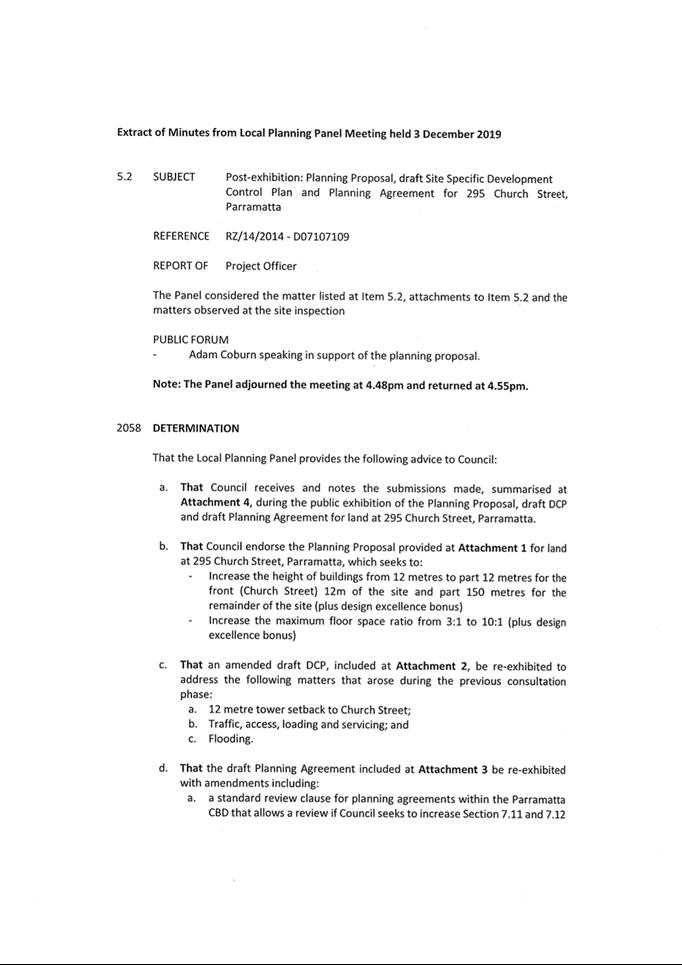
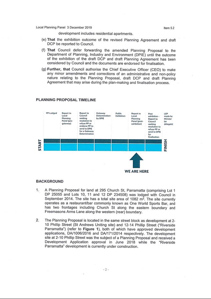
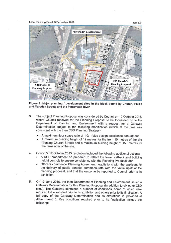
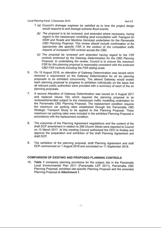
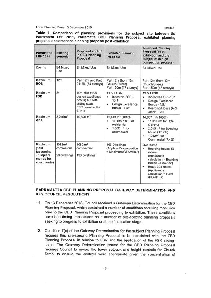
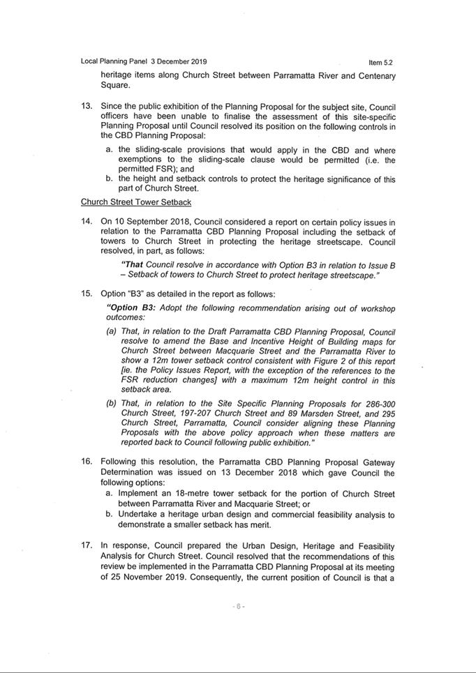
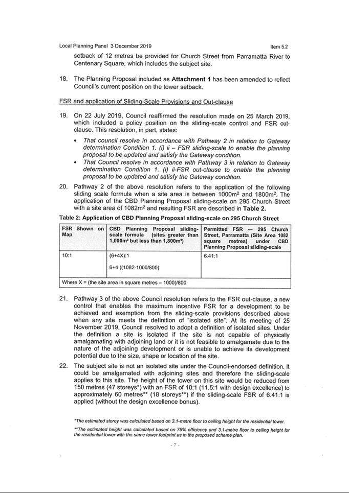
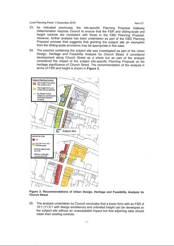
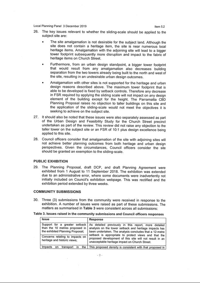
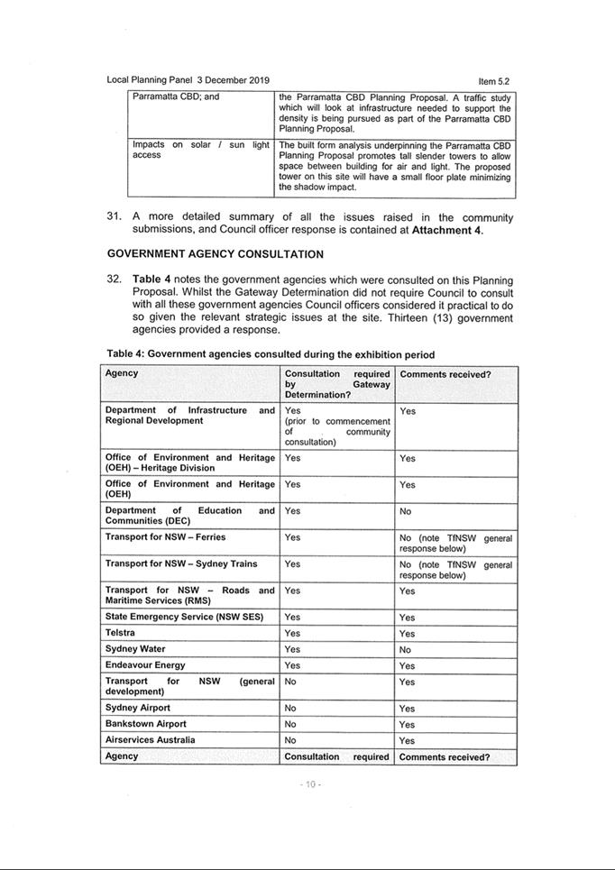
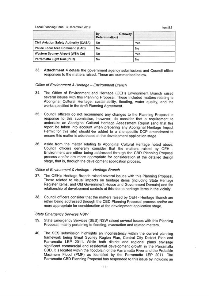
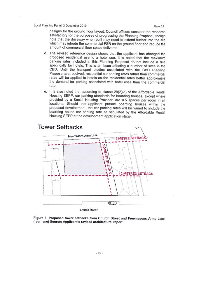
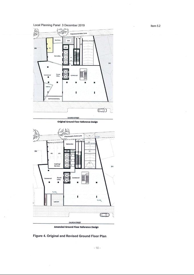
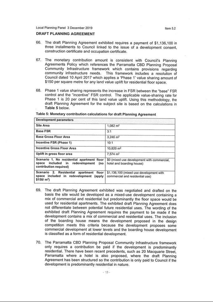
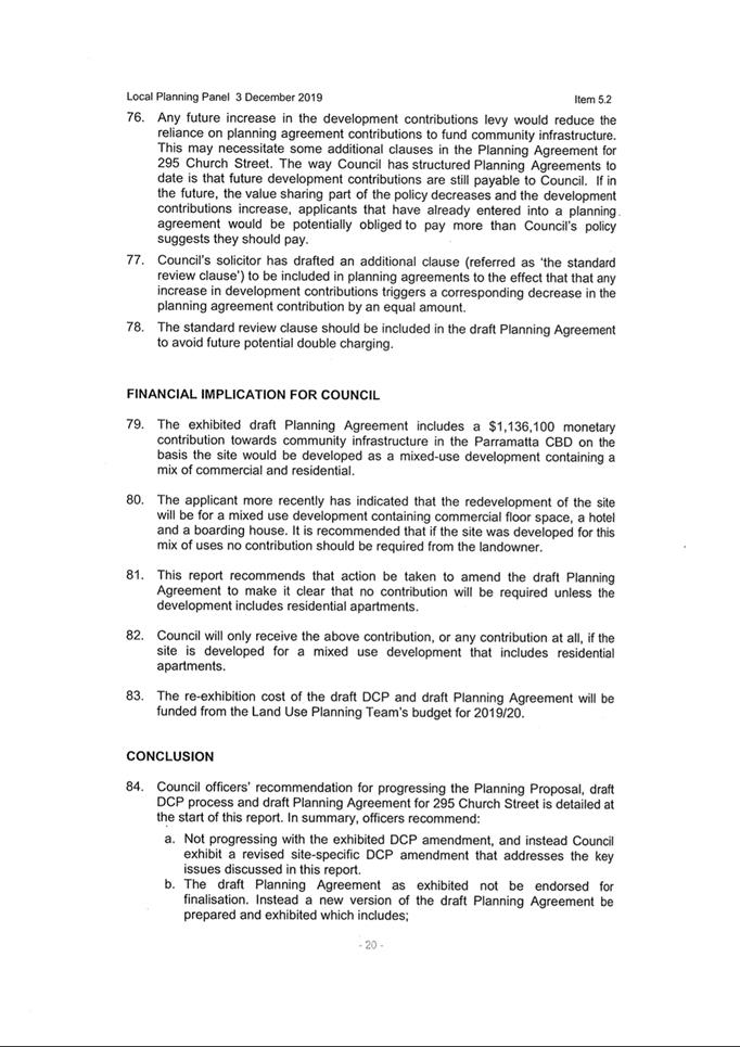
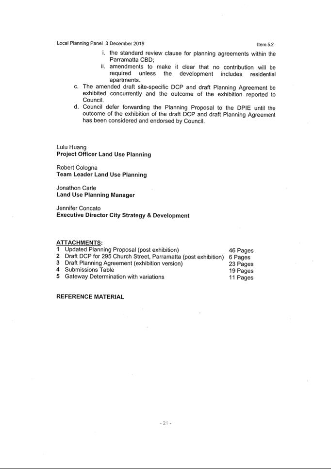
|
Item 18.6 - Attachment 2
|
Attachment 2 - Updated Planning Proposal (Nov 2019)
|
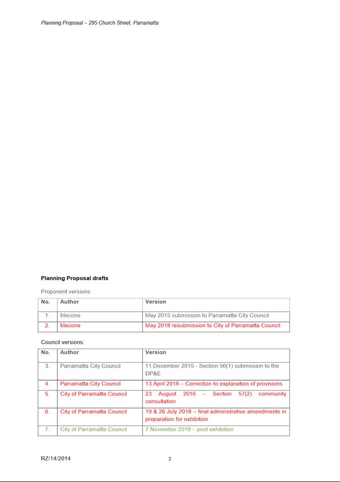
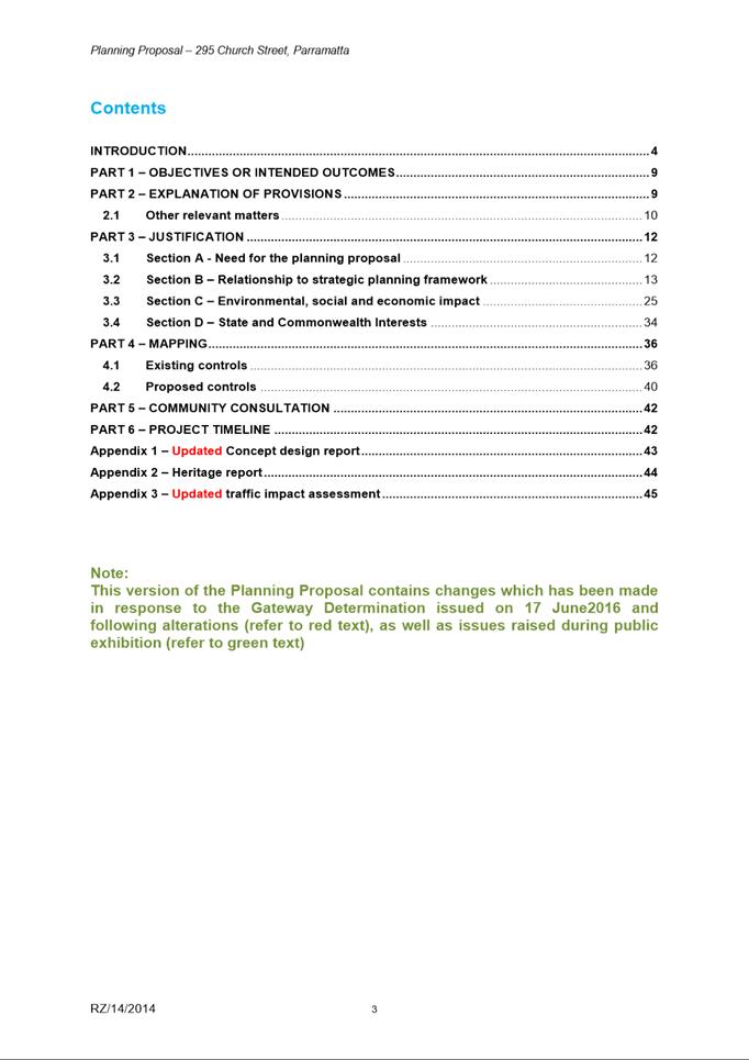
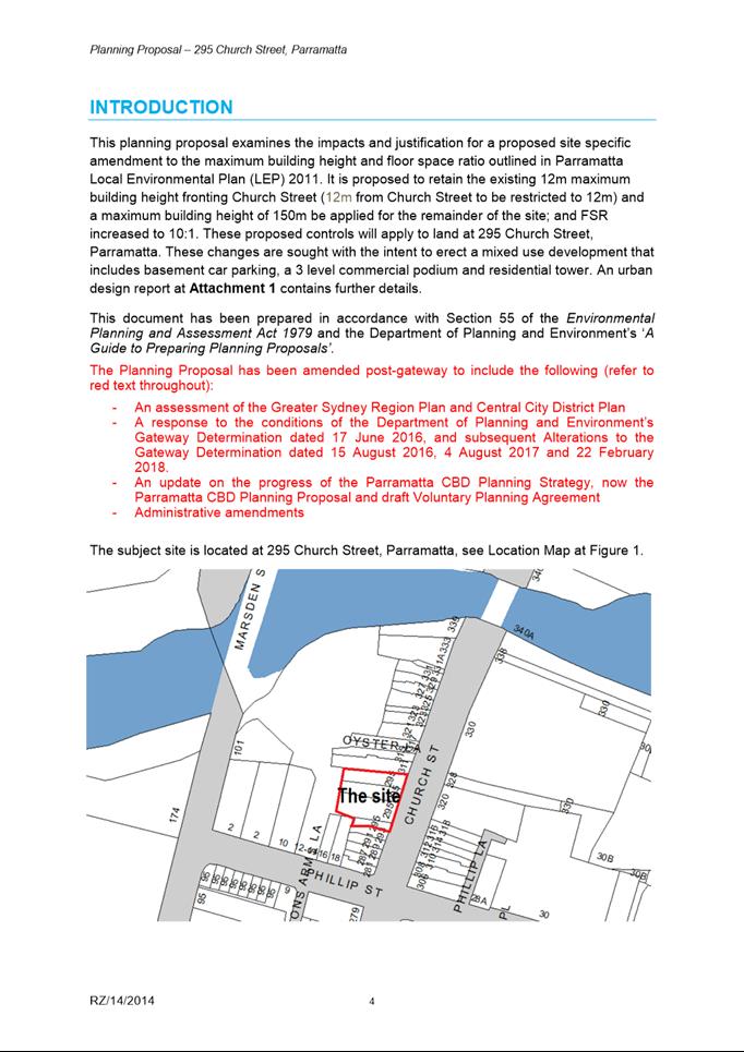
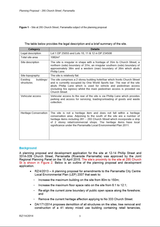
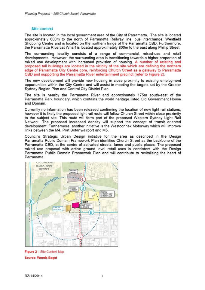
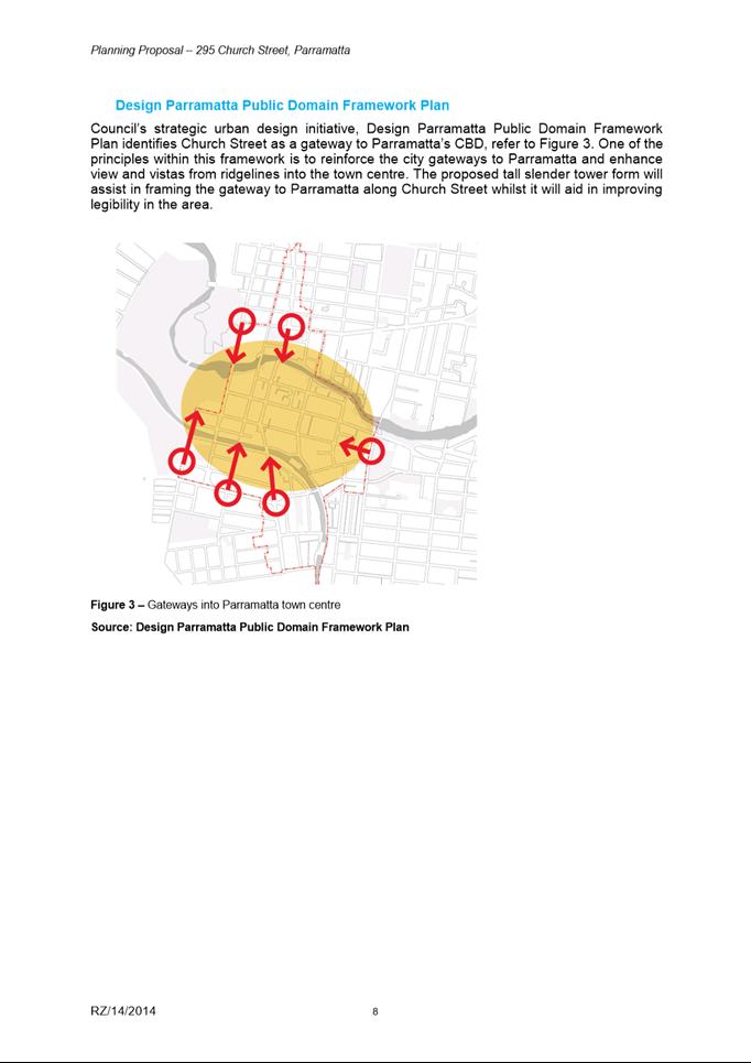
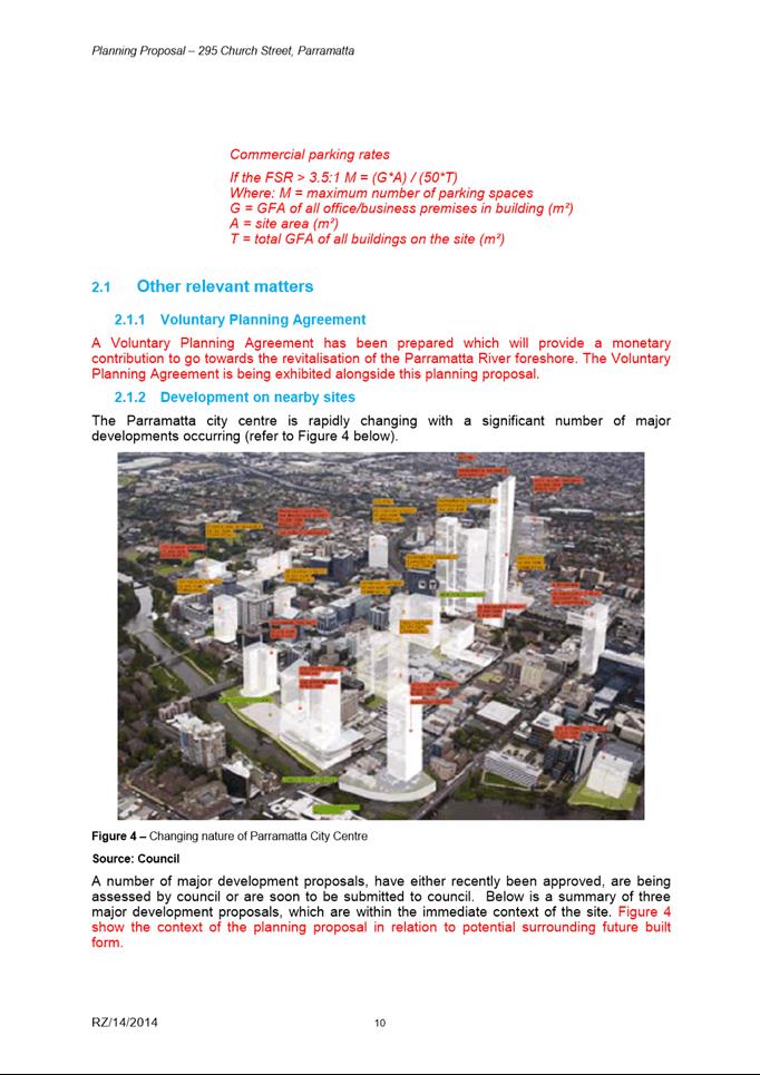
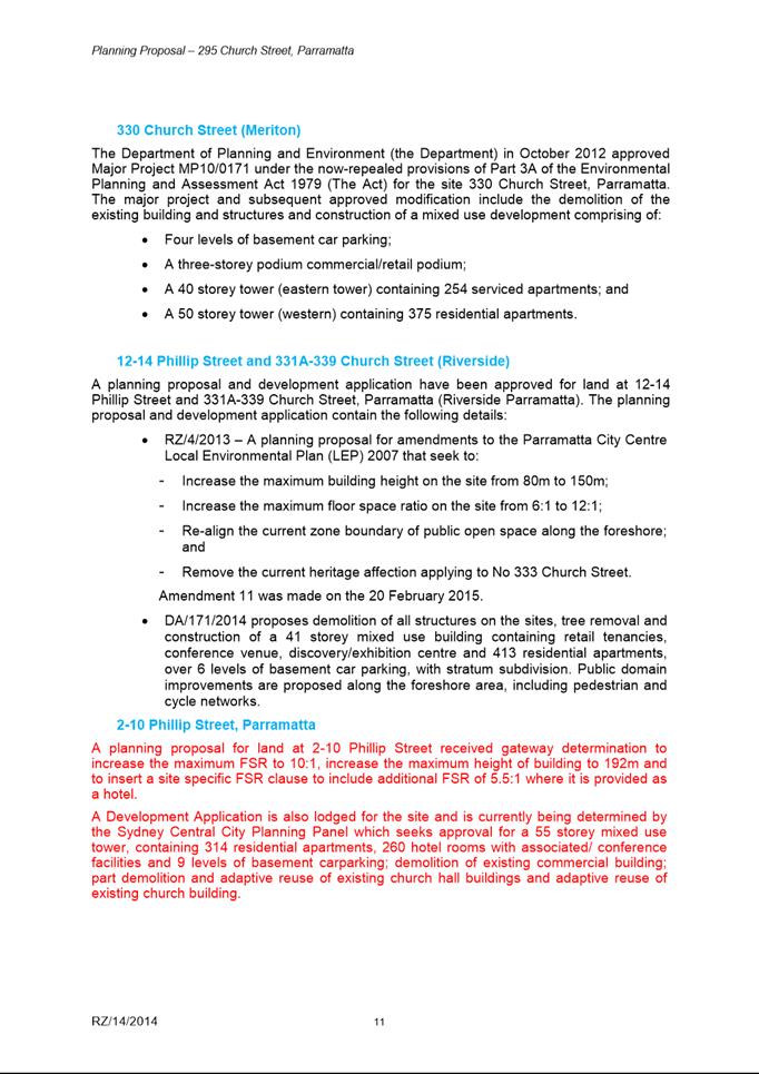
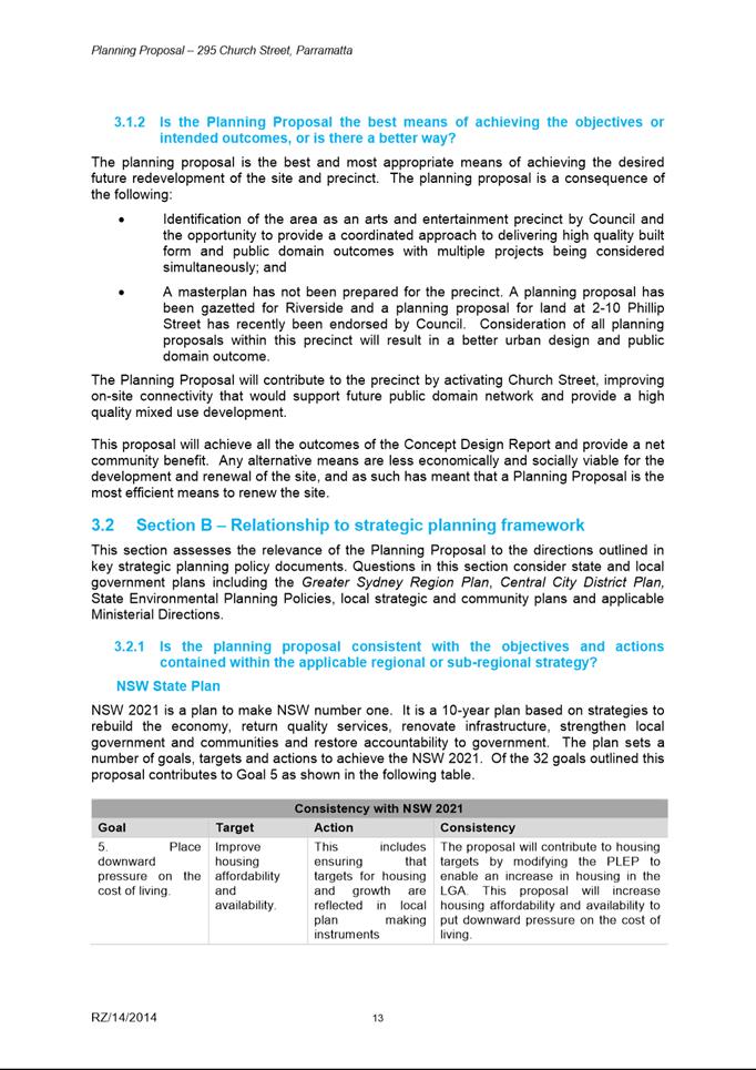
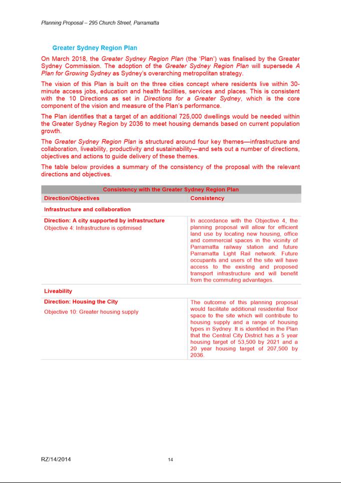
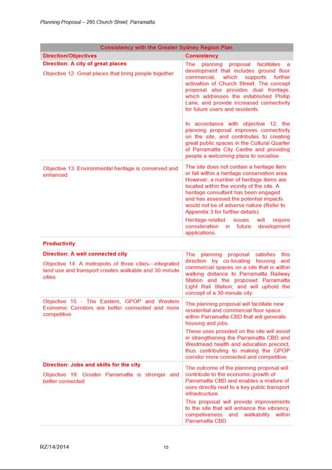
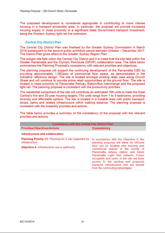
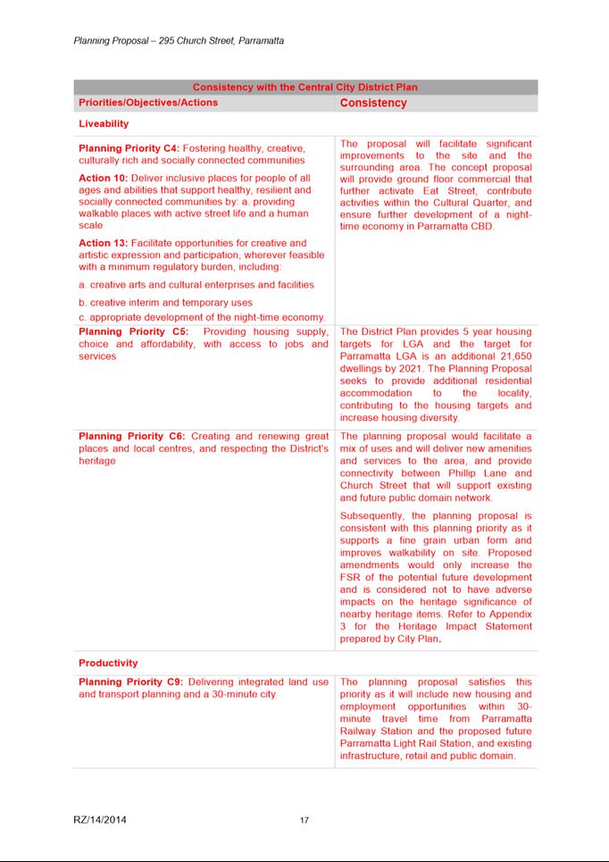
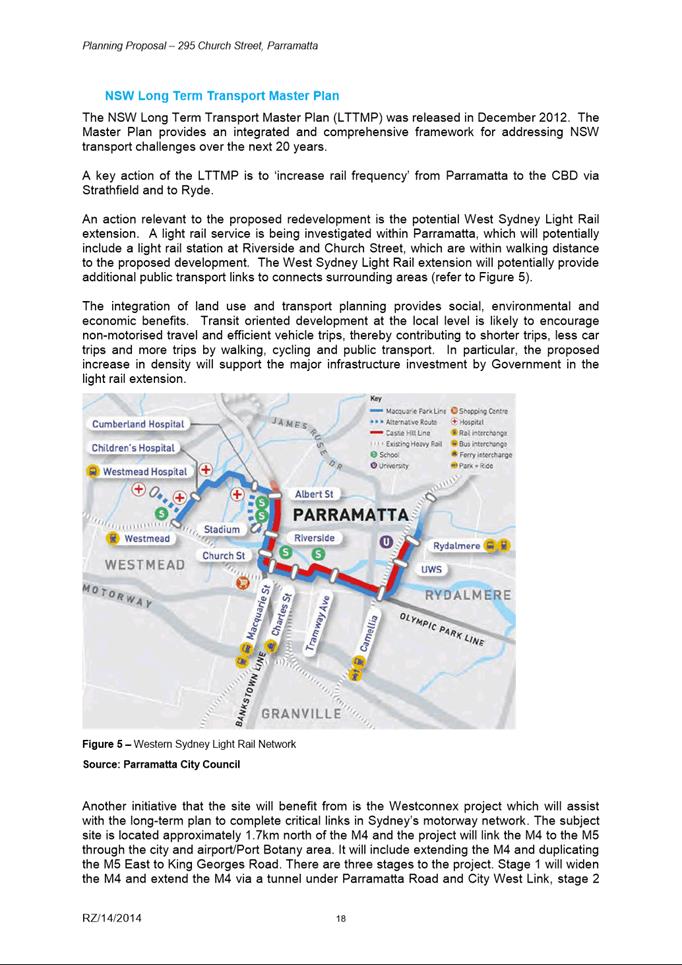
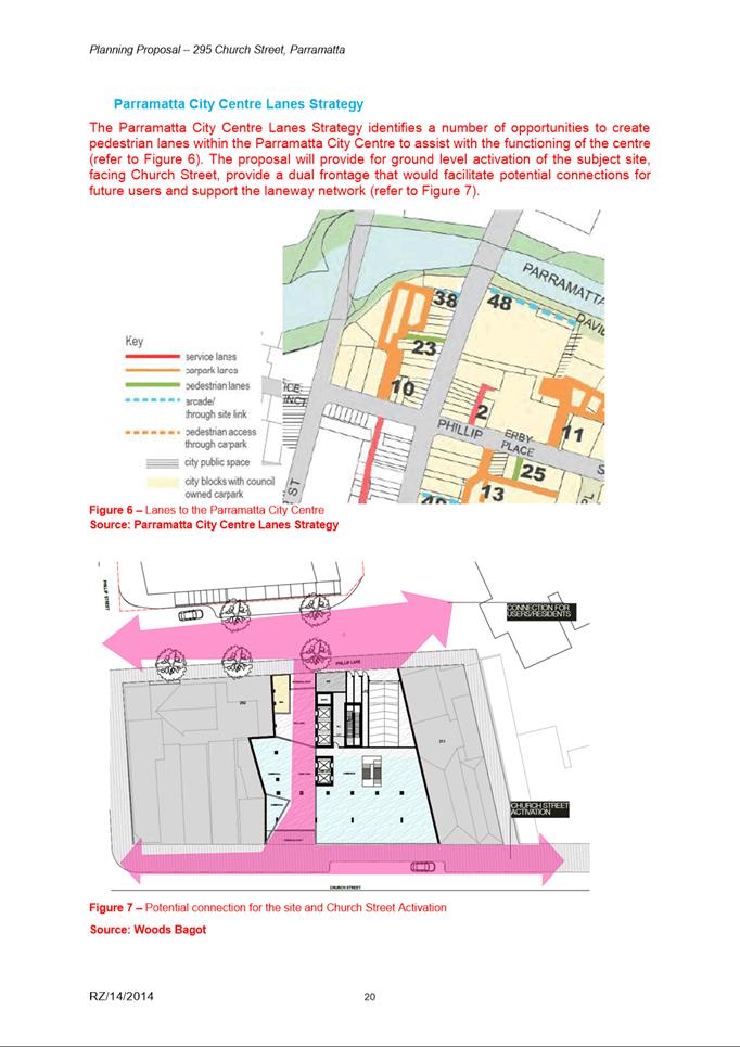
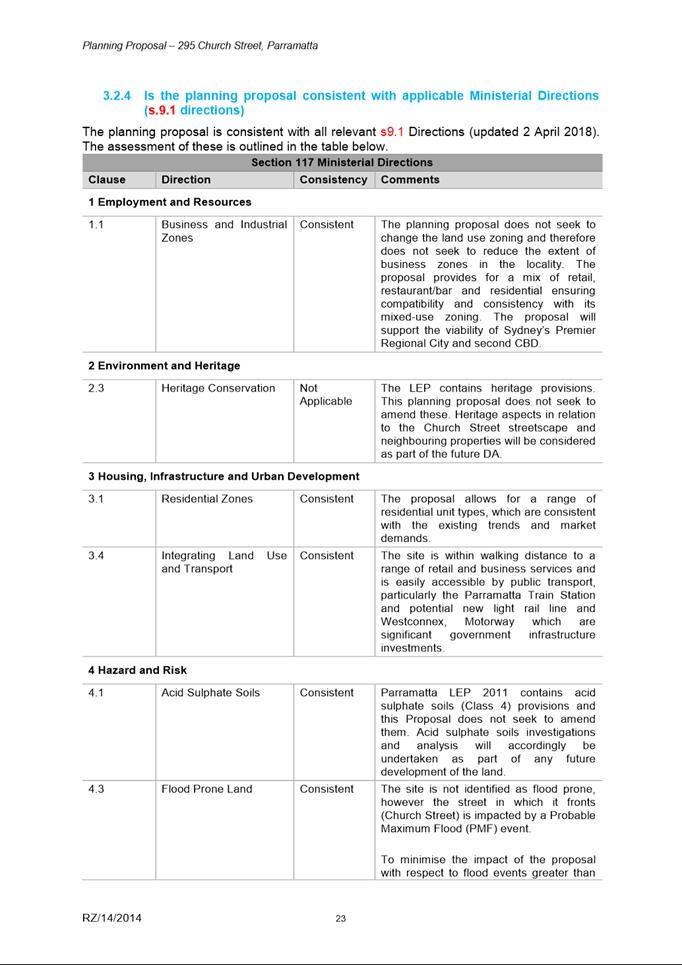
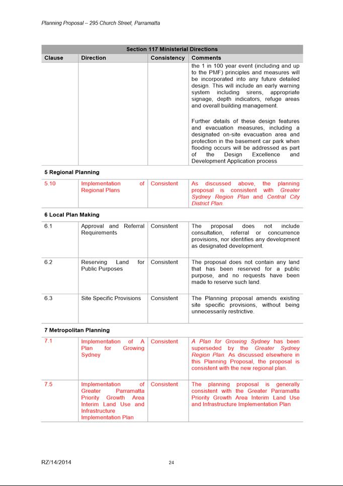
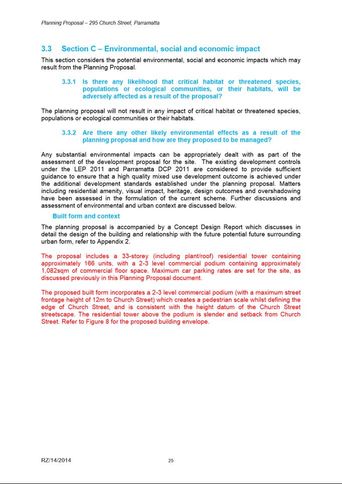
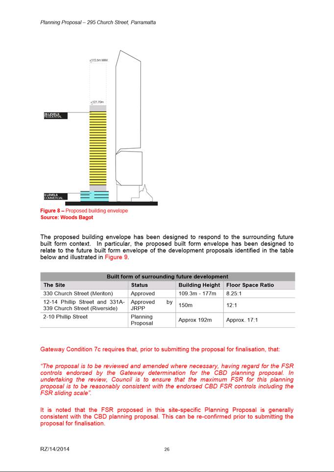
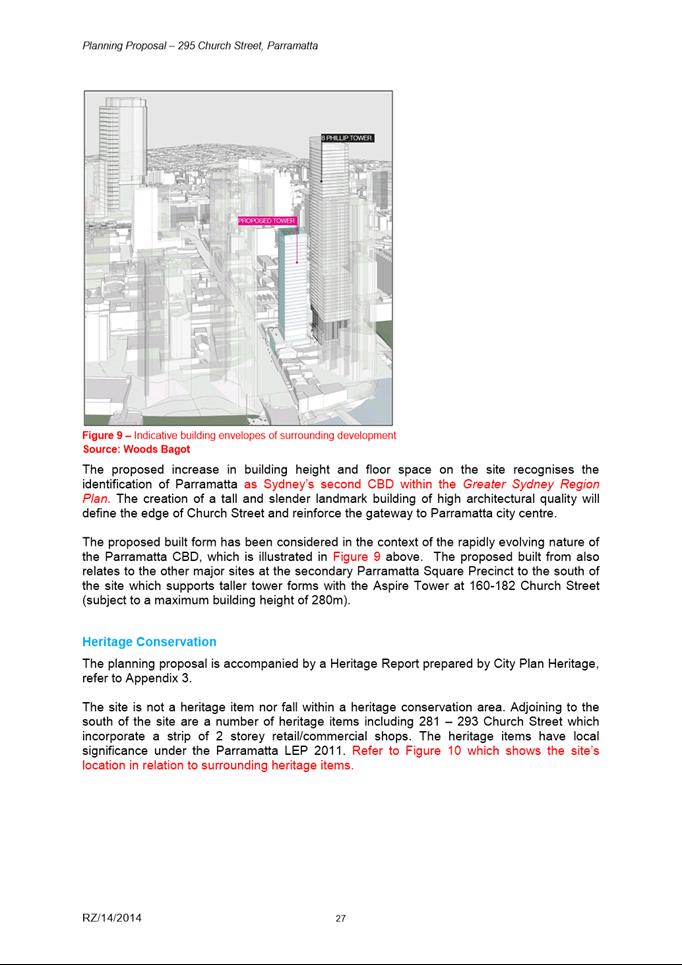
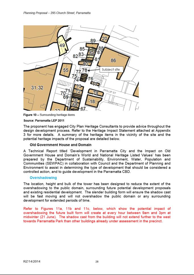
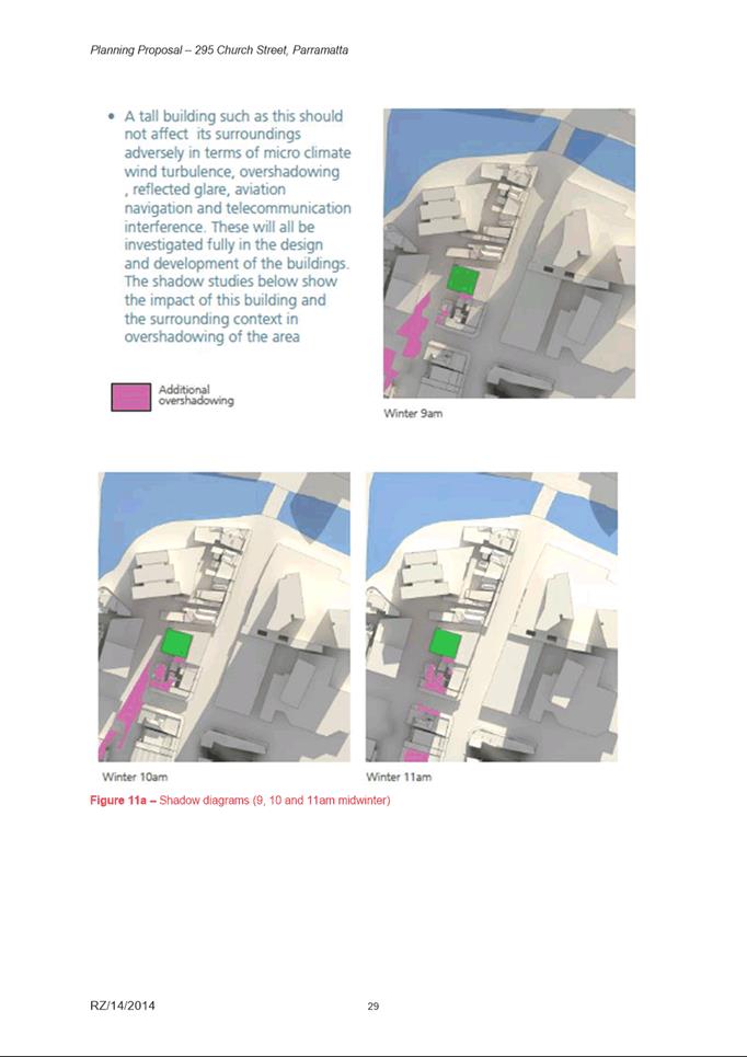
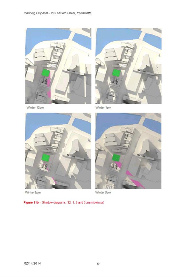
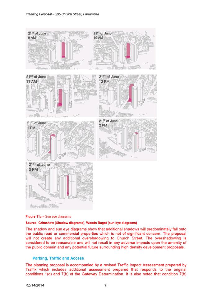
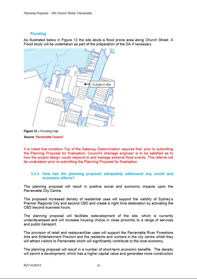
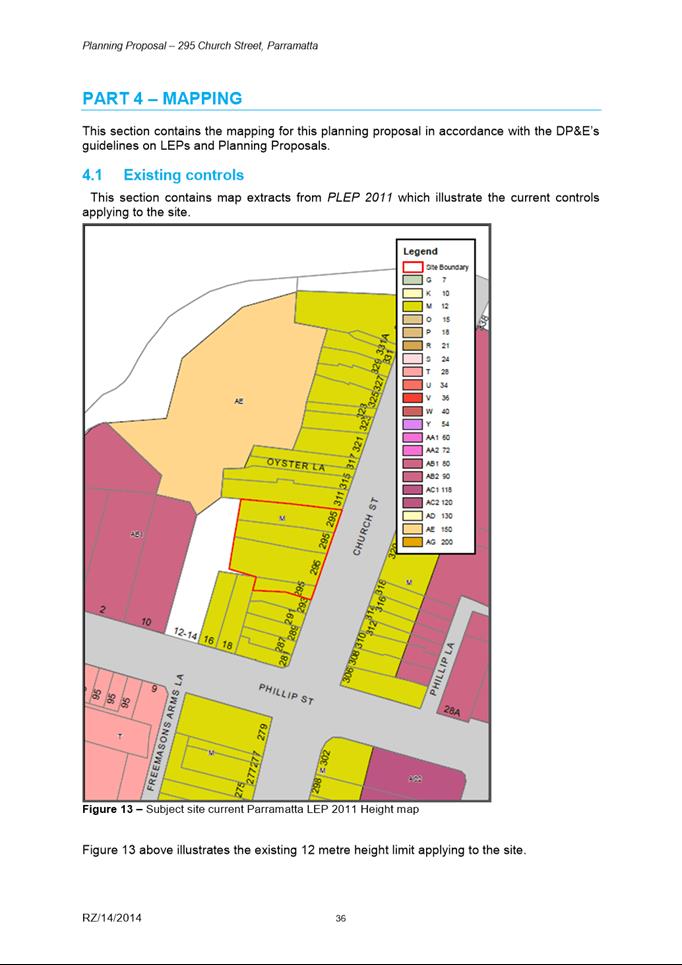
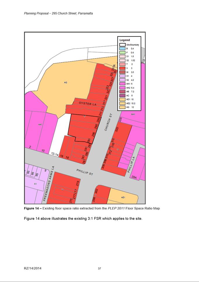
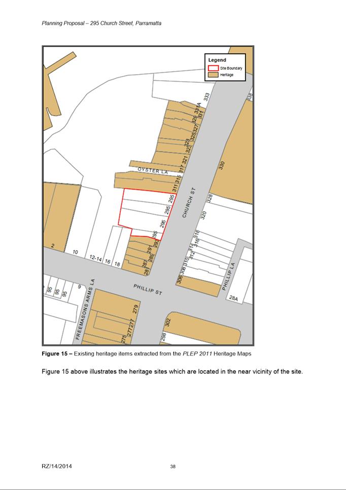
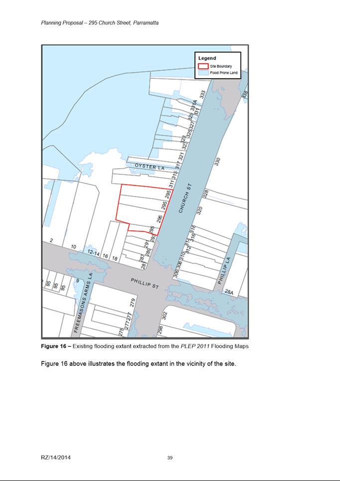
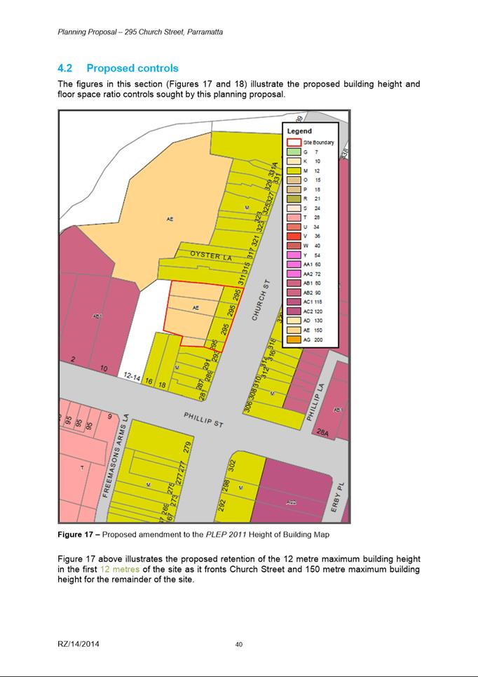
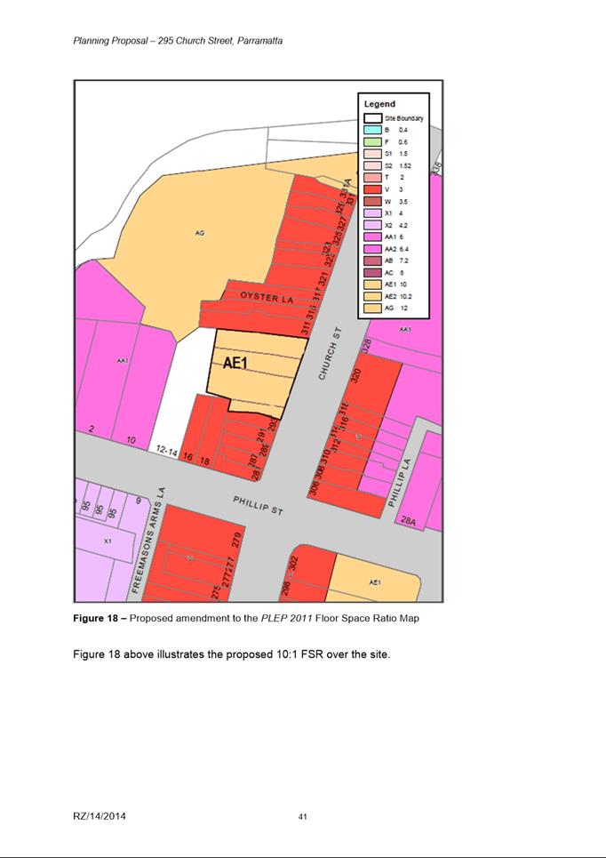
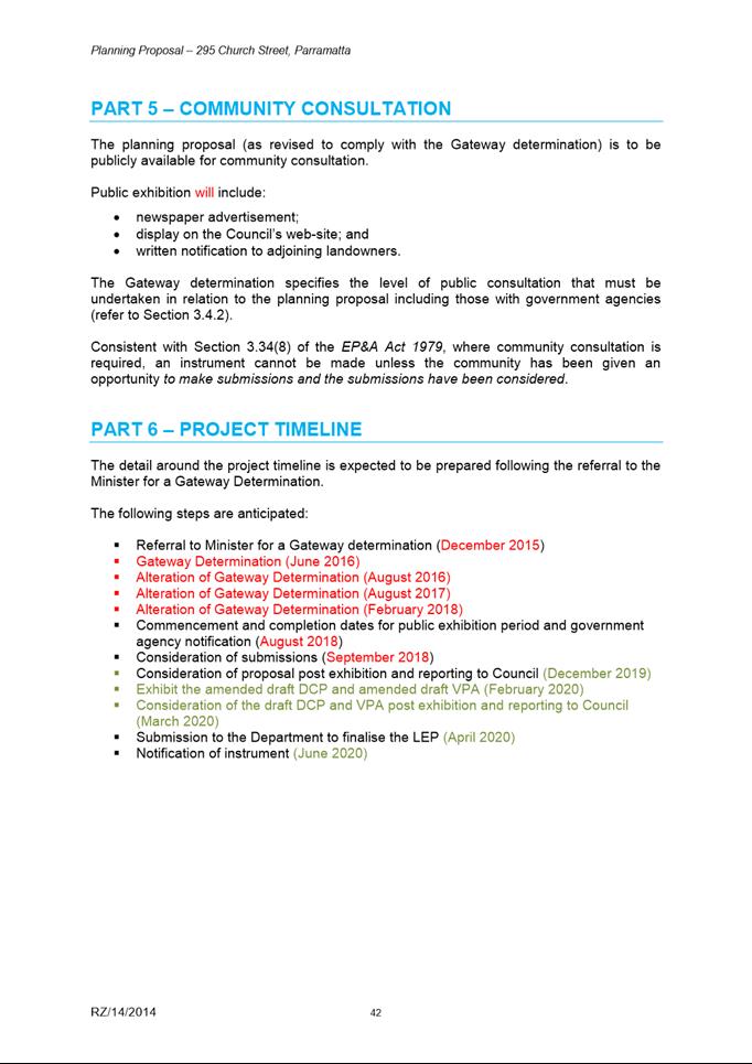


|
Item 18.6 - Attachment 3
|
Attachment 3 – Draft DCP for 295 Church
Street, Parramatta
|
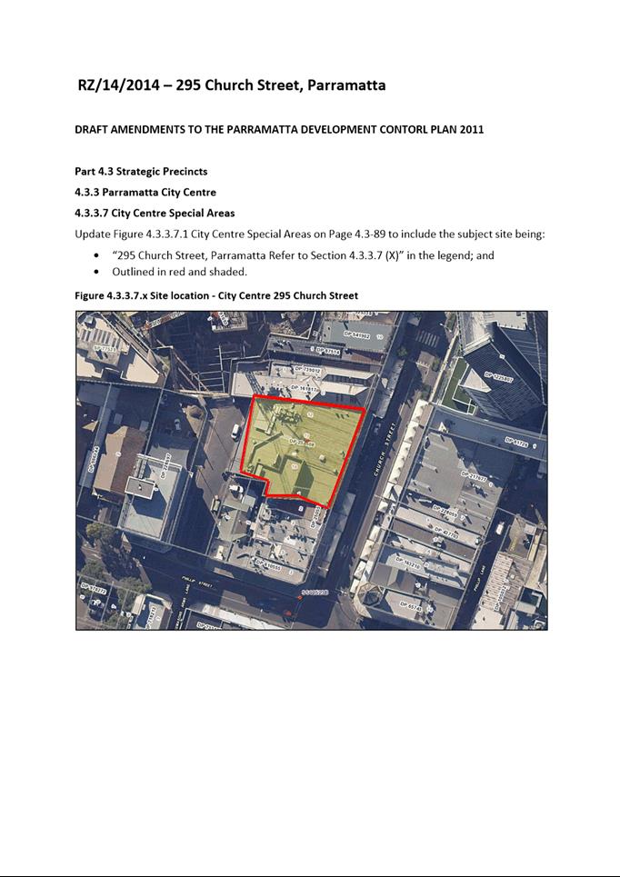
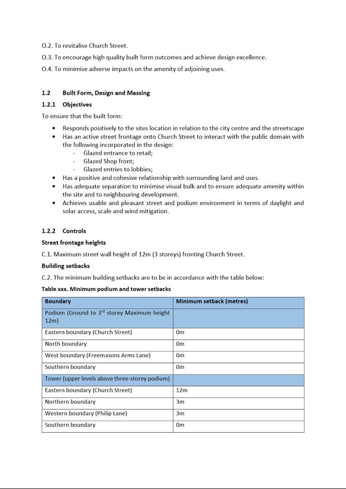
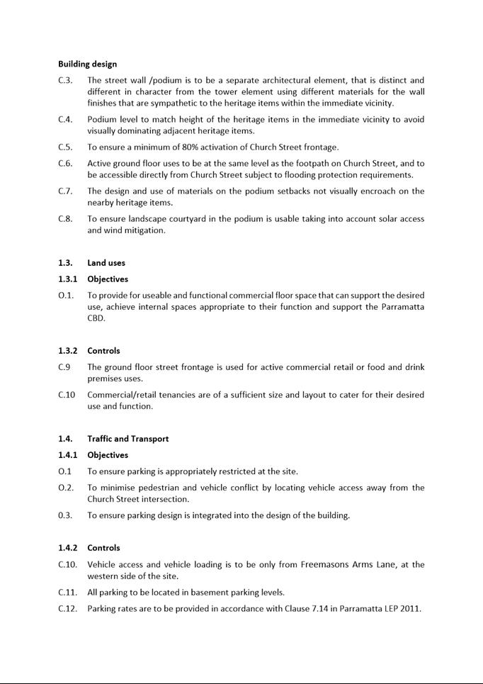
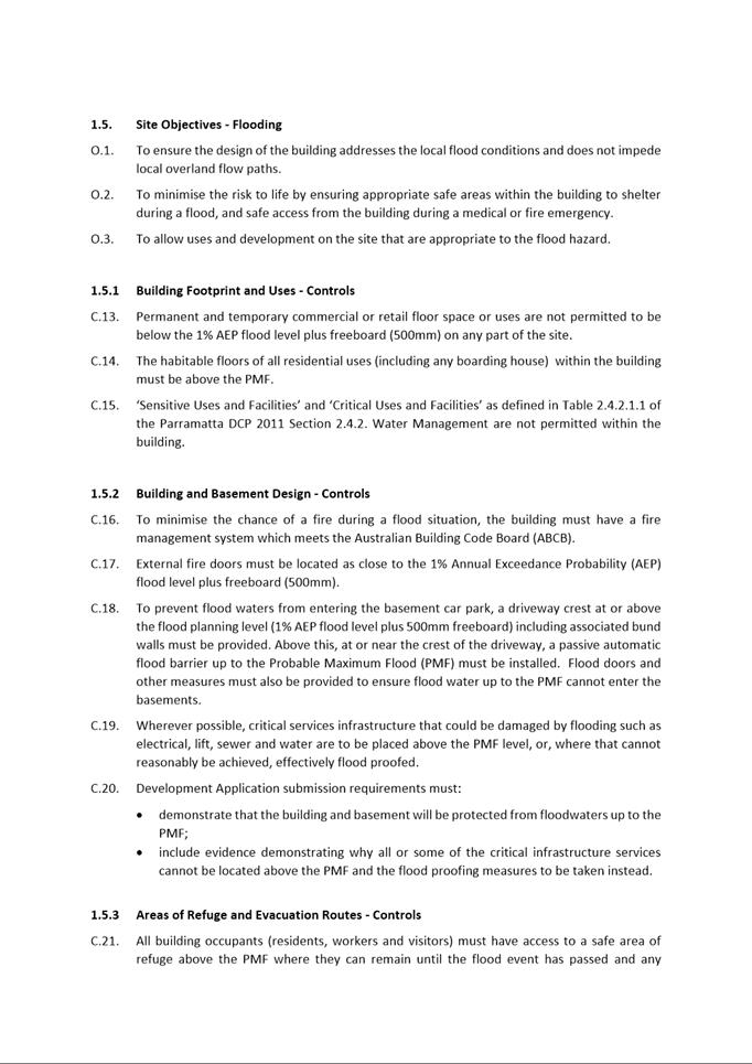
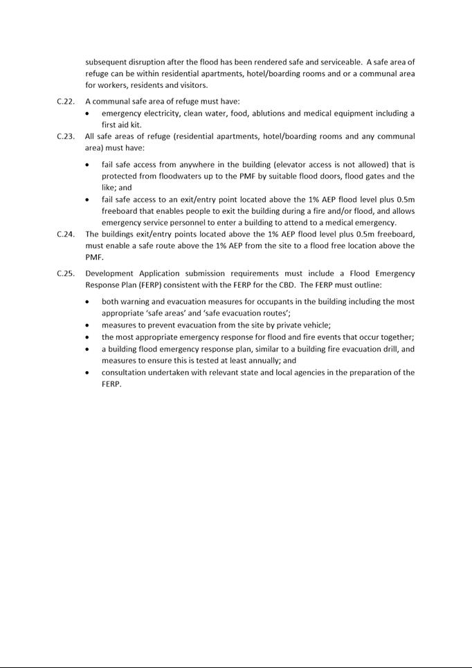
|
Item 18.6 - Attachment 4
|
Attachment 4 - Draft Planning Agreement (exhibited
version)
|
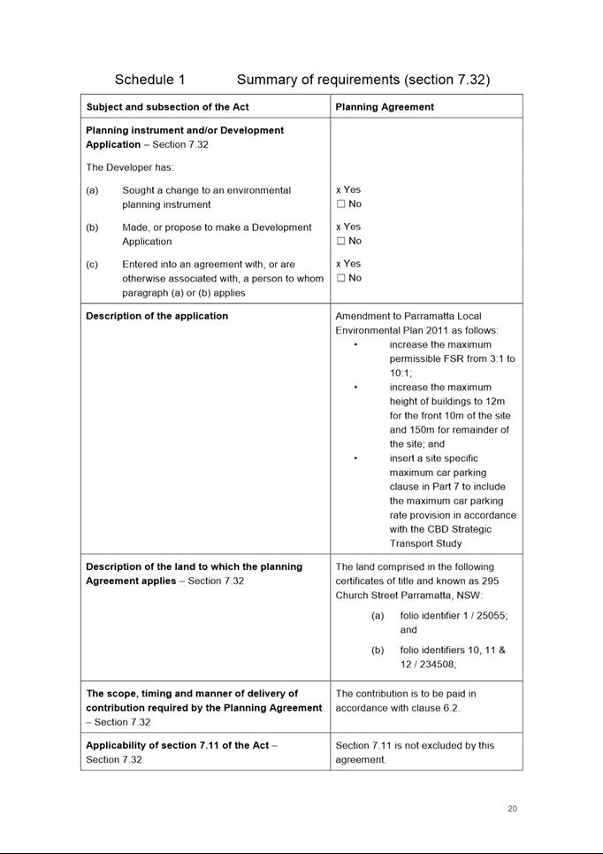
|
Item 18.6 - Attachment 5
|
Attachment 5 - Submissions Table - 295 Church
Street, Parramatta
|
